Bar Harbor
15–30 min to Sand Beach before queues
Convenient for the east-side highlights and seasonal bus connections.
Tradeoff: Busy streets and comparatively expensive peak-season lodging.
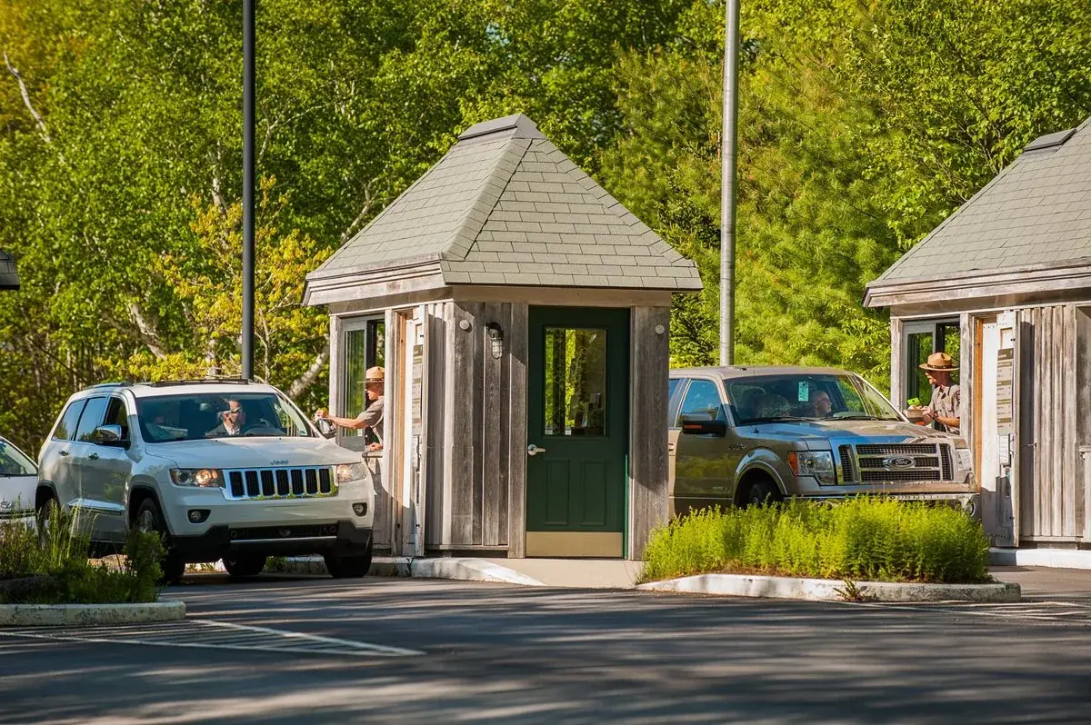
Acadia National Park protects the natural beauty of the highest rocky headlands along the Atlantic coastline of the United States, an abundance of habitats, and a rich cultural heritage. At 4 million visits a year, it's one of the top 10 most-visited national parks in the United States. Visitors enjoy 27 miles of historic motor roads, 158 miles of hiking trails, and 45 miles of carriage roads.
A separate vehicle reservation is required May 20–October 25, 2026. Release windows are 90 days and two days ahead at 10 am Eastern; check the official schedule.
Before you go: Confirm Cadillac reservation date, entry window and release time.
Official guidance ↗ Reviewed 2026-10-19Cadillac vehicle reservations and park admission are separate. Published 2026 dates do not establish the policy for another year.
Official guidance ↗ Reviewed 2026-10-19Selected guidance only; separate from climate comfort and current conditions.
The conditions feed has not been connected for this park.
Check current conditions at NPS ↗A one-day coast-and-pond sampler; longer visits separate the busy districts and leave room for a reservation-dependent summit.
Use the seasonal bus where practical and check Cadillac reservation rules. Keep beach / shore plans flexible for fog and surf.
Day 1Sand Beach to Thunder Hole → Jordan Pond south-shore view and lunch
Day 2Jordan Pond selected shoreline → Carriage-road out-and-back
Day 3Cadillac summit, if reserved → Southwest Harbor and Seawall
Editorial planning ranges, not live routing or official trail measurements. Driving excludes lodging commutes unless stated; queues, closures and weather can add substantial time. Walking ranges describe the selected outing, not necessarily the full trail. Arrival and departure travel are additional. Select the season for your dates; this is not a live conditions check.
Walk a bounded section of Ocean Path and return. Watch waves from safe established viewpoints.
Start: Sand Beach parking or the seasonal Island Explorer bus.
Getting there: Start here early; check bus dates and the one-way road routing.
Footing: Coastal path with roots, granite and steps in places; uneven and slippery when wet.
Choose a shorter Sand Beach-area viewpoint; avoid exposed rocks in high surf.
Bring a picnic or separately reserve a restaurant meal. Enjoy the pond without assuming a flat full circuit.
Start: Jordan Pond parking / seasonal bus stop.
Getting there: From the coast: allow 25–40 minutes driving, accounting for the one-way loop.
Footing: Developed paths with uneven sections; full pond circuit is excluded.
If parking is full, use the bus when operating or skip the pond and keep a coastal picnic.
A one-day highlights plan combines two districts without assuming a Cadillac reservation. Allow 45–60 minutes of parking / bus contingency; lodging commute is additional.
Choose an out-and-back section rather than committing everyone to the complete shoreline circuit.
Start: Jordan Pond area.
Getting there: Start here; take the bus if it fits the dated schedule.
Footing: Roots, rocks and narrow boardwalk sections; not a uniformly easy paved loop.
Use the south-shore viewpoint and shorten the walk.
Follow a short signed out-and-back and turn around to match the group’s energy.
Start: Signed carriage-road junction near Jordan Pond.
Getting there: Allow 10–20 minutes walking / repositioning within the district.
Footing: Gravel with grades; bicycles and horses may be present.
Skip the optional extension and enjoy a longer lunch.
This slower district day replaces the pond stop from the one-day highlights plan with a longer outing. It is not a promise of level, step-free access.
Book the appropriate vehicle reservation when required; a sunrise trip is optional.
Start: Cadillac Summit Road at your reserved vehicle entry time.
Getting there: From Bar Harbor: allow 30–45 minutes to the summit before queues.
Footing: Exposed granite and developed paths with slopes; wind and fog can be strong.
Without a reservation or in unsuitable weather, replace this with the west-side outing below.
Make this the main outing if Cadillac is unavailable. Pack a picnic and use established shoreline viewpoints.
Start: Seawall developed day-use area.
Getting there: Allow 35–55 minutes from the Cadillac / Bar Harbor side.
Footing: Coastal picnic / viewpoint areas; rough shore beyond maintained paths.
Skip the optional second district if time is short; never use this as a rushed sunset dash.
If you skip Cadillac, drive directly to the west side and reduce the driving total. Do not combine the whole Park Loop Road with this day.
Compare access to Sand Beach / Park Loop Road access. Drive ranges are editorial estimates before major queues or weather delays.
15–30 min to Sand Beach before queues
Convenient for the east-side highlights and seasonal bus connections.
Tradeoff: Busy streets and comparatively expensive peak-season lodging.
35–50 min to Sand Beach each way
Quieter west-side base, useful for Seawall.
Tradeoff: More cross-island driving for east-side days.
40–65 min to Sand Beach each way
More lodging and grocery choices.
Tradeoff: Island traffic adds a return commute; count it before choosing a cheaper room.
Use your own quotes to compare room savings with extra time on the road.
Room totals only. Taxes, fuel, parking, vehicle wear and the value of your time are additional. These inputs are examples until you enter your quotes.
Mark your own preparation below. A check means you have handled it; it does not confirm a reservation or availability. Stored on this device.
Entrance · Before arrival
The entrance pass and Cadillac vehicle reservation are separate purchases.
If unavailable: Confirm the current fee and pass coverage on NPS.
Check official rules & booking linksActivity · Check the 90-day and two-day release windows for your visit date
The current NPS schedule releases 30% of vehicle reservations 90 days ahead and 70% two days ahead at 10 am Eastern. Reservations apply during the published seasonal period. Verify the travel year, entry type and release details before setting reminders.
If unavailable: Use Seawall / Southwest Harbor instead. The one-day plan does not need Cadillac.
Check official rules & booking linksLodging · As soon as dates are firm
Check individual booking windows and seasonal opening dates.
If unavailable: Compare mainland savings with the daily return commute.
Check official rules & booking linksTransport · Before selecting the transport mode
The bus is seasonal; most of Park Loop Road is closed to vehicles in winter.
If unavailable: Use the winter coast variant and the official winter road map.
Check official rules & booking linksThe PDF and HTML contain the selected days, transport notes, lodging comparisons and booking guidance. Linked maps and websites require a connection.
Official source review: 2026-10-18. Durations, district grouping, gateway drive ranges and recommended pacing are National Parkwise editorial estimates. They are not live routing, current-condition guarantees or accessibility certification.
Official NPS activity guide.
Official NPS activity guide.
Explore the practical guides below for park access, safety, and trip planning.
Check the NPS activity sourceOfficial NPS activity guide.
Photo courtesy of Chris Bennett. Used with permission.
Hiking opportunities at Acadia are seemingly endless on more than 150 miles of trails. Immerse yourself in forests, walk along rocky coastlines, or stand on exposed mountain tops — sometimes all in one hike. Don't be fooled by the height of the park's mountains; challenging hikes climb from sea level to summits. If a leisurely stroll along the coast or around a lake is more your pace, there are plenty of easier, more level options. Many trails can also be combined with walks on the carriage roads and dirt fire roads. Consult a topographic map before hiking. Do not rely on the park handout map. To buy trail maps, visit the bookstore . .
Check out these alphabetical listings of hiking options based on what parts of the park you decide to visit.
Check out all the hikes at Acadia on Mount Desert Island.
Check out the hiking trails and bike paths on Schoodic Peninsula.
Hiking trails at Acadia pass through a variety of environments. Some stay in forested areas or along the coastline, while others outline lakes, rise through the trees, and walk along cliffs to mountain tops. You will even find some hikes fall into all three categories.
Learn about coastal hiking opportunities around the park.
Looking for more tree coverage and views of lakes and ponds? See hikes that pass by freshwater or weave through the forest.
Enjoy seeing a trail twice? Check out a few out-and-back options. Do you want different views the whole way? Luckily, most hikes are loops or can be turned into them by linking together various trails. Some are even recommended as loops for safety based on steepness, iron rungs and ladders, or cliffs.
Many hikes at Acadia are loops or can be linked together to create one. Others form a "lollipop" shape.
Return the same way you came on these out and back trails.
Some routes in the park are part of a impressive historic trail network that stretches across Mount Desert Island.
Leave your car behind and ride the fare-free Island Explorer to a number of trailheads. This helps reduce congestion on park roads and in parking areas. Familiar with the park already? Create longer hikes using different drop off and pick up locations. Always check bus routes and schedules before trip-planning.
Trail Closures are posted online and at park visitor centers.
Federal law requires that all pets must be kept on a leash no longer than 6 feet (1.8 m). Pets are not permitted on ladder trails.
Do not feed or disturb wildlife. If your presence changes the behavior of any wild animal, you are too close.
Bicycles and horses are not allowed on hiking trails.
There is no backcountry camping. Fires are permitted only in designated areas.
Swimming, wading, and pets are prohibited in public water supplies. Please respect posted regulations at lakes and ponds.
Be careful when hiking near cliff edges.
Carry water, at least 1 L (over 32 oz), and more on warmer days.
Wear sturdy hiking shoes.
Follow blue trail blazes and use a topographic map.
Do not modify or build new cairns.
Know the difficulty level of the trail and your physical abilities and limitations.
To buy trail maps, please visit the bookstore .
Acadia National Park is committed to promoting Leave No Trace and encouraging visitors to minimize their impact during their visit.
Details of your visit start to come together here including camping, fees, reservations, operating hours, transportation info and more.
Are visitors allowed to harvest mushrooms, or fly a drone in Acadia? Check out highlights of the park's important Rules and Regulations.
Loading results...
NPS information imported 2026-10-17. Confirm current details at NPS
Official NPS activity guide.
To encourage safe, car-free experiences for cyclists on Acadia's historic carriage roads, the fare-free Island Explorer provides a van and bike trailer with regularly-scheduled routes on a seasonal basis between downtown Bar Harbor and the Eagle Lake Carriage Road Entrance on Route 233. Limitations apply. While tag-along bikes are allowed, tandem bikes, fat tire bikes, e-Bikes, and dogs are prohibited. Find current information and schedules posted online at Bicycle Express .
NPS Photo/Christie Anastasia
Acadia provides different opportunities for bicycling on carriage roads, bike paths, gravel roads, and paved roads. There are various options based on experience, elevation change, type of bicycle, and destination.
Winding through the heart of the park, the carriage roads have crushed rock surfaces perfect for bicycling. Use a carriage road map for orientation and distances between intersections. Before venturing out, review the expectations for carriage road etiquette:
Cyclists share the carriage roads with horses and pedestrians. Everyone yields to horses and bicyclists yield to everyone.
Class 1 E-bikes are permitted on carriage roads. Class 2 and 3 are not allowed.
No bicycle may exceed 20 mph on the carriage roads.
Bicycling is not permitted on hiking trails or on privately owned carriage roads.
In the spring, carriage roads often close to all traffic during mud season, typically March and April. Please respect all posted signs and notices. To stay updated on temporary closures, visit http://go.nps.gov/AcadiaAlerts .
NPS photo by Brady Richards
The Park Loop Road offers scenic views, but it is winding and narrow and may be congested with vehicles. There is no shoulder on the road. Biking the Park Loop Road is not advised during the busy part of the day (generally 10 am to 4 pm). You must bike with the traffic flow on the one-way section of the Park Loop Road. The road up Cadillac Mountain is very steep and can be dangerous.
Yes, bicyclists must have a park entrance pass to ride in the park. This includes the Park Loop Road, gravel roads within the park, and carriage roads. If a park entrance pass is not on you, please be able to provide proof of your pass on a parked car.
When approaching Sand Beach Entrance Station, queue in line with vehicles and do not bypass the fee booth.
Before biking the Park Loop Road, familiarize yourself with one-way and two-way traffic sections and safety information. Bicyclists should use caution when riding on any park road. See the Park Loop Road biking map for details.
Western Mountain Roads (Seal Cove Road, Western Mountain Road, and Lurvey Spring Road) are also open to biking. Bicyclists should exercise caution, as some ruts are very deep and traverse the entire width of the roads. Some unpaved roads also have downed wood across all or part of the road. Always check road closures and alerts before biking.
Before heading out, cyclists should familiarize themselves with carriage road courtesy and safety:
Bicyclists yield to all users on the carriage roads. Everyone yields to horses, which can be startled by sudden movements.
Slow down. Speeding can be hazardous.
Be prepared to stop. Sudden stops are dangerous on loose gravel.
Stay to the right. Give a clear warning before passing on the left.
Move to the side when stopped.
Wear a helmet and carry water, at least 20 ounces (.6 L) and more on warm days.
Leave no trace. Carry out what you carry in.
Bike single file, not abreast.
Loading results...
NPS information imported 2026-10-17. Confirm current details at NPS
Official NPS activity guide.
Will Greene, Friends of Acadia, NPS
Roger Tory Peterson once referred to Mount Desert Island, home of Acadia National Park, as “the warbler capital of the world.” Acadia National Park, with over 20 species of warblers breeding on the island and 308 birds encountered in and around the park, offers a premier birdwatching experience.
Birdwatching is rooted inside the history of Acadia National Park and has played a crucial role in the history of natural exploration on Mount Desert Island. James Bond, an early twentieth-century ornithologist, famous for his explorations in the Caribbean and namesake for Ian Fleming’s secret agent, as a child summered with his uncle on Mount Desert Island. In his biographies, Bond credited Mount Desert Island as the place that inspired him to be an ornithologist.
Bond was not the only significant ornithologist to spend time in Acadia National Park. Robert MacArthur, a visionary in ecology continued Acadia’s legacy in ornithological research. He is most well-known for developing statistical support of the environmental niche theory, gaining a better understanding of how a wide diversity of similar acting birds can all share the same area. His research was conducted around the Bass Harbor Head Lighthouse. McArthur concluded with the following, “ a large number of hours watching resulted in disappointingly few seconds of worthwhile observation,” something most birdwatchers can often relate to.
Acadia National Park offers excellent opportunities to see and listen to a variety of birds throughout the year. Birdwatching is an excellent way to connect with nature, participate in a long and storied activity of natural exploration on Mount Desert Island and hopefully experience the thrills that inspired famous ornithologists and naturalists throughout the years.
On this page you will find detailed information, tips, and articles about birdwatching in Acadia National Park, including locations, programs, information on Leave No Trace, and safety information.
Loading results...
Please refer to the parks general safety page for safety information on visiting Acadia National Park.
If birding at night, please make someone aware of your itinerary and bring a flashlight.
Stay on the trails
Leave What You Find. If you come across injured wildlife, please call park information at (207) 288- 3338.
Respect Wildlife. Please maintain a safe distance while viewing wildlife in the park. Playback is often used by birdwatchers to make it easier to find birds. Playback is illegal inside Acadia National Park
Be Considerate of Other Visitors. While birdwatching, please make room for other visitors to pass.
Check out Acadia National Park's bird list
NPS information imported 2026-10-17. Confirm current details at NPS
Official NPS activity guide.
Photo by Joseph Philipson, Friends of Acadia, NPS
Acadia National Park has two beaches popular for swimming in the summer: Sand Beach and Echo Lake Beach . There is also a small beach for swimming at Lake Wood .
Lifeguards are not present at Sand Beach . Be aware: Swimming in natural areas poses risks. Your safety depends on your own good judgement.
Sand Beach, Echo Lake Beach, and Lake Wood are monitored weekly for bacteria from June through August. Read more information on the bacteria monitoring program . Check out the Current Beach Status ( Fresh Water Sites ) Check out the Current Beach Status ( Sand Beach )
Check out the Current Beach Status ( Fresh Water Sites )
Check out the Current Beach Status ( Sand Beach )
Many other lakes and ponds are public water supplies where swimming, wading, and pets are prohibited. Please respect posted regulations.
Swimming is not permitted at these lakes and ponds because they provide drinking water to local communities. Please respect posted regulations.
Upper Hadlock Pond
Lower Hadlock Pond
Long Pond (within 1000 feet of the intake on the southern end of the pond)
Loading results...
NPS information imported 2026-10-17. Confirm current details at NPS
Official NPS activity guide.
Courtesy of Imma Barrera, Acadia Artist-in-Residence, 2021. Used with permission.
The night sky is one aspect of our environment that everyone across the world can experience. It is a resource that humans throughout time have looked to as both a mode of navigation and a realm for the spiritual. Though the night sky at Acadia looks a little different than the night sky in the Southern Hemisphere, everyone has access to gaze up into what lies beyond our planet. Stargazing is a great way to experience nature, explore science, and ponder history.
Vehicle access for Stargazing at Cadillac Summit is managed by a Vehicle Reservation System from May to October, and the road closes each night at 9:00 pm. Overnight parking is prohibited. You may, however, hike or bike to the summit. Always bring flashlights or bike lights for night excursions.
From December 1 to April 14, the majority of the Park Loop Road is closed to vehicles for the winter.
Explore the night sky from the west side of Mount Desert Island while enjoying the ocean soundscape.
Capture the night sky from different viewpoints around Acadia’s clearest lake.
Ocean Path offers many locations and opportunities for viewing and photographing the night sky.
Enjoy gazing up into the cosmos nestled comfortably on a blanket on Acadia’s only and very popular sandy beach.
Astronomy can be daunting for beginners, but stargazing does not have to be hard. The two keys to enjoying a gaze up into the cosmos are going out in the proper conditions and arriving prepared.
New moon, before moonrise, or after moonset – Though a very fantastic and powerful celestial body, the moon and its brightness can impede your ability to see the stars in their multitude. Check the phases of the moon and the moonrise and moonset times.
Clear skies and good weather – Stargazing is best on a cloudless or minimally clouded night. Check the forecast for inclement weather and cloud coverage before you venture out.
An hour or two after sunset – Even after the sun sets, there remains some residual light. Stargazing will be best an hour or two after sunset, when this residual light has dissipated.
Photo by Ashley L. Conti, Friends of Acadia, NPS
Flashlight/headlight (ideally with a red-light function): It is important to stay safe while navigating in the dark, but the bright white lights of a flashlight can impact your night vision and your ability to see all of the stars. Using a flashlight with a red light preserves your night vision, so your eyes do not need as much time to adjust to seeing the night sky.
Blanket, towel, chair, or something comfortable to sit or lie on: These items are recommended to most comfortably enjoy viewing the night sky and to prevent any upward gazing-induced vertigo.
Star map or stargazing app: If you are interested in identifying constellations, asterisms, planets, or other celestial bodies, star maps printed from the internet specific for the time of year or stargazing smartphone apps are useful tools.
Junior Ranger Night Explorer Book : For National Park Service Junior Rangers out enjoying the night sky, there is an astronomy and stargazing specific junior ranger program to work through.
Careful when navigating in the dark, especially when traveling over uneven or rocky surfaces.
Careful when stargazing on beaches or coastlines and avoid going in the water at night.
Nighttime in Acadia can get colder than you might expect, so bring layers to stay warm.
Mosquitos are common during summer months near water sources. Come prepared with proper clothing or insect repellant for the most comfortable experience.
Astrophotograhy is a type of photography involving the night skies. Although these images are different than what our human eyes can see, photographers use long exposure shots to capture the beauty of stars, constellations, and the Milky Way in a dramatic and inspiring way. Check out the images from various stargazing locations at Acadia and be inspired to create your own.
Acadia National Park possesses remarkably dark skies for its proximity to Portland, Boston, and New York.
Learn more about ways the National Park Service protects night skies across the country.
Loading results...
NPS information imported 2026-10-17. Confirm current details at NPS
Official NPS activity guide.
Photo by Ashley L. Conti, Friends of Acadia, NPS
The natural phenomenon knows as ' tides ' happens twice-a-day, every day. A variety of plants and animals become exposed on the rocky shores of Acadia in tidepools, which are depressions in the rocks that trap seawater when the tide recedes.
Exploring these protected resources of Acadia provides an opportunity to peek through a window to the sea. To ensure the health of our resources and the safety of visitors, please show respect and follow the guidelines laid out below to minimize impact. We need your help to keep our coastal wildlife protected.
Remember these marine animals and the tidal ecosystem are very fragile. Our careless handling and footsteps can do damage that the changing tides cannot. Keep in mind these tips for your safety and for the protection of marine life.
Before exploring wash any sunscreen, hand sanitizer, and bug spray off to minimize exposure of harmful chemicals to marine life.
Do not wade into the tidepools. Stay on the rocks.
Be mindful of where you place your feet. We are guests in these animals’ homes. Use a light step!
Leave the park as you found it – collection is prohibited.
Never use force to remove anything. Replace animals where you find them.
As always, practice Leave No Trace principles.
NPS Photo/Crystal Lewis
Tidepooling can be a safe and fun activity if you keep certain things in mind. You are standing at the edge of the ocean, so always be conscious of ocean waves and surf and know when it's time to return to the safety of dry land.
The opportunity to tidepool occurs between the window of time 1.5 hours before to 1.5 hours after low tide . It is best to start tidepooling before low tide and to leave as the tide is rising. Before you head out to the intertidal zone on your own, check the tide chart for your location :
Wonderland or Ship Harbor
Schoodic Peninsula
Step carefully and slowly. Wear closed-toed sturdy outdoor shoes.
Black rocks and seaweed are especially slippery, and shells are hard and jagged.
Use caution as rocks can be wet, loose, and/or sharp.
Keep a safe distance from the sea, and watch those waves. They’re still coming in.
Follow surf advisories.
The average summer ocean temperature is 55°-60° F (12.8°-15.6° C).Bring layers of clothing and a change of socks in case they get wet.
Small children should stay within arm’s reach of adults.
Get down low, look closely and carefully, and have patience. These fascinating and hidden creatures can take time to find!
Loading results...
NPS information imported 2026-10-17. Confirm current details at NPS
Official NPS activity guide.
Photo by Will Newton, Friends of Acadia, NPS
Leave No Trace is about attitude and ethics. It's about taking personal responsibility to respect and care for our limited wildland resources and the experiences of other outdoor enthusiasts. Low-impact skills and knowledge are also an important part of Leave No Trace, but without the right attitude and ethic, they are useless. You must commit yourself to apply them, to practice good stewardship.
Leave No Trace extends the National Park Service mission to you and challenges you to "…conserve the scenery and the natural and historic objects and the wild life therein and to provide for the enjoyment of the same in such manner and by such means as will leave them unimpaired for the enjoyment of future generations."
Leave No Trace is also a universal education message and a national program led by the Leave No Trace Center for Outdoor Ethics and adopted by the four federal land management agencies and many state and municipal agencies and private nonprofit organizations.
Photo by Friends of Acadia
At 3.5 million visits a year, Acadia is one of the top 10 most-visited national parks in the United States. More than 750,000 people visit Cadillac Mountain every year, resulting in significant resource damage over time. Without visitors practicing Leave No Trace and being mindful of what they do on their visits, areas of the park will continue to experience adverse effects. Acadia National Park is committed to promoting Leave No Trace and encouraging visitors to minimize their impact during their visit. The park has received recognition as a Gold Standard Site for its work in visitor education and resource monitoring from the Leave No Trace Center for Outdoor Ethics. The Summit Stewards , a program funded through Friends of Acadia, educate visitors on Leave No Trace and park information at summits, along trails, and in frequently visited areas.
The Seven Principles of Leave No Trace provide a framework of minimum impact practices for anyone to understand and implement when visiting the outdoors. Learn about each one and how to apply them during your visit to Acadia - and beyond.
Be prepared! Remember food and water, and clothes to protect you from cold, heat and rain.
Use maps to plan where you’re going. Check them along the way so you’ll stay on course and won’t get lost.
Remember to bring a leash for your pet and plastic bags to pick up your pet’s waste.
Learn about the areas you plan to visit. Know where you need a reservation, check the park website, and talk to people before you go. The more you know, the more fun you’ll have.
Hike on designated trails to protect trailside plants.
Keep bikes off the hiking trails. Choose carriage roads or designated bike paths.
Do not step on flowers and plants. Once damaged, they may not grow back.
Respect private property by staying on designated trails.
Camp only in designated campgrounds. No backcountry, "out-of-bounds" camping, or overnight parking is allowed.
Pack it in, Pack it out. Put litter, even crumbs, peels and cores, in garbage bags and carry it home. Do not rely on park trash cans as some trailheads and parking lots don’t have any.
Check maps to know where restrooms or vault toilets are before hiking. If not available, bury human waste in a small hole 6-8 inches deep and 200 feet or 70 big steps from water. Those conditions can be difficult to find in the park due to thin soils and public water supply.
Use a plastic bag to pack out your pet’s poop to a garbage can.
Keep water clean, as many lakes and ponds are public water supply for local communities. Do not swim in these areas and respect posted signage.
Leave plants, rocks, cairns, and historical items as you find them so others can enjoy them. Do not alter the landscape.
Treat living plants with respect. Carving, hacking, peeling, parking, or stepping on plants may kill them.
Campfires are only allowed in certain designated campgrounds. Check regulations and amenities at individual sites. Use only existing fire rings to protect the ground from heat. Keep your fire small.
Remember, a campfire isn’t a garbage can. Pack out all trash and food.
Firewood should be bought from a local vendor. Don’t bring firewood from farther than 50 miles away – it can harbor tree killing insects and diseases. Many states regulate the movement of untreated firewood.
Burn all wood to ash and be sure the fire is completely out and cold before you leave.
When in doubt, use a camp stove for cooking. Stoves are easier to cook on and create less impact than a fire.
Observe wildlife from a distance and never approach, feed, or follow them.
Human food is unhealthy for all wildlife and feeding them starts bad habits.
Protect wildlife and your food by securely storing your meals and trash in hard sided containers or locked in your car. Not all campgrounds have food storage.
Be considerate when passing others on the hiking trails and carriage roads. Respect speed limits for bicycles.
Federal law requires that all pets must be kept on a leash no longer than 6 feet.. This helps protect your pet, other visitors, and wildlife.
Listen to nature. Avoid making loud noises, yelling, or playing amplified music – including bird calls. You will see more wildlife if you are quiet.
Remember to have fun but be respectful of other visitors. Everyone enjoys the outdoors differently.
Photo by Ashley L. Conti, Friends of Acadia, NPS
Loading results...
NPS information imported 2026-10-17. Confirm current details at NPS
Open an activity to read its details here. Source links open in a new tab; check current conditions and permit requirements before travel.
Official NPS features and USGS park boundaries, imported 2026-10-17. An inventory snapshot, not live trail or parking availability.
Map coverage varies. Trail names may represent segments, connectors, or shared park units; mapped lines are not a hiking recommendation. Use official conditions and navigation resources before heading out.
220 matching named trail records
| Trail / mapped route | Surface | Recorded uses |
|---|---|---|
| Inventory record · 82 source segments; not a route distance. | Unknown | Unknown |
| A Murray Young Path Inventory record · 1 source segments; not a route distance. | Earth | Unknown |
| Acadia Mountain Trail Inventory record · 5 source segments; not a route distance. | Earth | Unknown |
| Access Trail Inventory record · 1 source segments; not a route distance. | Earth | Unknown |
| Alder Trail Inventory record · 1 source segments; not a route distance. | Earth | Unknown |
| Amphitheatre Carriage Road Inventory record · 2 source segments; not a route distance. | Gravel | Unknown |
| Amphitheatre East Inventory record · 2 source segments; not a route distance. | Gravel | Unknown |
| Amphitheatre East Carriage Road Inventory record · 3 source segments; not a route distance. | Gravel | Unknown |
| Amphitheatre Trail Inventory record · 4 source segments; not a route distance. | Earth | Unknown |
| Amphitheatre West Inventory record · 2 source segments; not a route distance. | Gravel | Unknown |
| Amphitheatre West Carriage Road Inventory record · 2 source segments; not a route distance. | Gravel | Unknown |
| Anvil Trail Inventory record · 3 source segments; not a route distance. | Earth | Unknown |
| Asticou & Jordan Pond Path Inventory record · 7 source segments; not a route distance. | Earth | Unknown |
| Asticou Ridge Trail Inventory record · 1 source segments; not a route distance. | Earth | Unknown |
| Aunt Betty Pond Inventory record · 4 source segments; not a route distance. | Gravel | Unknown |
NPS public GIS inventory, imported 2026-10-17. “Existing” is an inventory classification, not confirmation that a trail is open. Segment counts are not route distances. Parking records do not indicate space availability, fees, or accessibility certification. View government source ↗
Climate for Bar Harbor, 4 km from the park reference point. 1991–2020 normals. Source elevation: 0 m.
Mountain, rim, valley, and coastal conditions can differ sharply from the source town. Check park forecasts and current conditions before travel.
| Month | High | Low | Rain / snow water | Wet days | Daylight |
|---|---|---|---|---|---|
| 30° | 16° | 100 mm | 10.2 | 9.0 h | |
| 31° | 17° | 85 mm | 9.3 | 10.1 h | |
| 38° | 25° | 99 mm | 10.6 | 11.6 h | |
| 48° | 37° | 96 mm | 11.4 | 13.2 h | |
| 57° | 46° | 84 mm | 11.0 | 14.6 h | |
| 66° | 54° | 92 mm | 10.1 | 15.3 h | |
| 72° | 60° | 72 mm | 10.0 | 15.0 h | |
| 72° | 60° | 72 mm | 8.3 | 13.8 h | |
| 66° | 54° | 95 mm | 7.9 | 12.3 h | |
| 56° | 45° | 118 mm | 9.9 | 10.8 h | |
| 45° | 35° | 109 mm | 10.0 | 9.4 h | |
| 35° | 24° | 122 mm | 11.6 | 8.7 h |
Official NPS excerpts imported 2026-10-17. Fees, permits, road access, and operations can change; use the source link to confirm the latest information.
Photo courtesy of Brandi Brooks @brandibrooksphoto. Used with permission.
Acadia National Park Hulls Cove Visitor Center 25 Visitor Center Road Bar Harbor, ME 04609
Mount Desert Island: From Boston take I-95 north to Augusta, Maine, then Route 3 east to Ellsworth, and on to Mount Desert Island. For an alternate route, continue on I-95 north to Bangor, Maine, then take Route 1A east to Ellsworth. In Ellsworth, take Route 3 to Mount Desert Island.
Schoodic Peninsula: Take I-95 north to Bangor, Maine, then take Route 1A east to Ellsworth. In Ellsworth, head north on U.S. Route 1 for approximately 17.3 miles to Hwy 186. Turn right on Hwy 186 and drive 6.5 miles. Turn left at yield sign, continue .5 miles and turn right on Schoodic Loop Road.
Direct flights from Boston's Logan Airport land at the Hancock County Airport, 10 miles from Acadia National Park. National airlines serve the Bangor International Airport, about one hour from the park. Car rentals are available at both airports.
For more information about Acadia National Park visitor centers and campgrounds, please visit our Operating Hours & Seasons page.
All Acadia National Park visitors are required to have and display a park entrance pass. For more information about entrance fees and where to buy your park pass, visit our Fees & Passes page.
For more information about Acadia National Park visitor centers, visit our Operating Hours & Seasons page.
Internet & Cellular Access Details
General Information • Camping • History • Weather • Wildlife
Get the latest updates on weather, facility, and trail closures, and construction projects.
Are visitors allowed to harvest mushrooms, or fly a drone in Acadia? Check out highlights of the park's important Rules and Regulations
Visitor Centers • Campgrounds • Winter Operations
Yes, you can get there from here.
Mount Desert Island • Islesford • Schoodic Peninsula
Bring your furry family member along.
Leef Peeping • Seasons • Current Conditions
There is no potable water source at Duck Harbor Campground. Plan ahead to treat the water or bring enough potable water for the duration of your stay.
Camping is a great way to experience Acadia National Park. Acadia offers two campgrounds on Mount Desert Island, one campground on the Schoodic Peninsula, and five lean-to shelters on Isle au Haut. All campsite reservations must be made in advance at Recreation.gov . Reservations cannot be made through the campground office or in-person.
For Blackwoods, Seawall and Schoodic Woods campgrounds, starting on Dec 1, 90 percent of campsites are released six months in advance on the first of each month at 10 am EST. The remaining 10 percent are released at 10 am 14 days ahead of a desired arrival date on a rolling basis.
For example, if you plan to arrive on May 20, you can make an online reservation starting at 10 am Dec 1 from the first release, or starting at 10 am May 6 from the second release.
For Duck Harbor Campground on Isle au Haut, all reservations will be released at 10 am April 1 for the entire season. Visitors are able to make same day reservations online at Recreation.gov if campsites are available. Reservations cannot be made through the campground office or in-person.
Online Reservation Tips:
You will need to make an account before you can reserve your campsite.
There is no backcountry camping, "out-of-bounds" camping, overnight parking, or winter camping allowed anywhere in Acadia. There are many types of accommodations in nearby towns .
Firewood brought in from other areas may contain non-native insect species that pose a serious threat to park resources. Quarantines have been issued for some areas. Please leave your firewood at home. Firewood is available locally.
Before you visit, make sure your phone or tablet is fully equipped with two official apps designed by and for Acadia. Swipe through location details, check real-time availability, and reserve a campsite right from your phone or tablet. Buy a Cadillac Summit Vehicle Reservation , then download or screen capture your confirmation code to display at the check station.
Each campground at Acadia has sites designated accessible for visitors with limited mobility. Site features vary and availabilty vary; check campground pages or recreation.gov for more information. Campsite conditions may be impacted by weather.
This campground is on the east side of Mount Desert Island in proximity to popular locations along the Park Loop Road.
This campground is located on the west side of Mount Desert Island near the coastline.
This campground is located on the Schoodic Peninsula, the only mainland section of the park.
Duck Harbor Campground is located on Isle au Haut and only accessible by mailboat from the mainland.
Photo courtesy of William Overbeeke. Used with permission.
Open only to visitors with stock animals.
See also Wildwood Stables
For information about the tours offered at Wildwood Stables, visit the website , email info@acadiabycarriage.com or call 207-600-7204.
Photo courtesy of visitor Harold Johnson. Used with permission.
Physical / Mobility Needs
Deafness or Hearing Loss
Blindness or Low Vision
Service Animals
According to the Centers for Disease Control and Prevention, about one in four adults in the United States lives with some form of disability. That means there may be about a million people coming to Acadia each year who need some form of accommodation related to mobility, cognition, hearing, or vision impairments. Reducing and removing barriers for physical access to buildings and spaces is a big part of accessibility. But it's also about addressing a person's functional capacity to participate in the experiences that Acadia offers. The National Park Service is legislatively mandated to provide accessible facilities and programs for their visitors with disabilities. Thanks in large part to a comprehensive accessibility assessment funded by Friends of Acadia and conducted in 2021 by the National Center on Accessibility and the Eppley Institute for Parks and Public Lands at Indiana University, Acadia National Park is committed to making its landscapes, programs, and information accessible to people of all abilities.
If you have an accomodation request for any scheduled event or activity, please email us at least two weeks in advance.
U.S. citizens or permanent residents who are permanently disabled may be eligible for the Interagency Access Pass . This free, lifetime admission pass is valid at National Park Service, Bureau of Land Management, US Fish and Wildlife Service, US Forest Service, US Army Corps of Engineers, and Bureau of Reclamation sites.
Must be obtained with valid identification
Does not cover or reduce special recreation permit fees or fees charged by concessioners
For an accessible entrance behind the visitor center, there are four designated accessible parking spaces, one with a striped aisle beside it for a van.
In a large, main parking lot below the visitor center, there are four angled parking spaces designated for accessible parking to the immediate left of a covered information pavilion. One of these spaces has a striped aisle beside it for a van. These spaces are intended for people who want to make use of Island Explorer bus stops in the parking lot. They are not well-suited for people with mobility impairments to reach the visitor center because climbing a series of 52 steps is required.
A parking lot behind the visitor center connects to the building by two asphalt-paved routes – one with short steps and another curved path that slopes to rejoin the first at a short wooden bridge. This entrance has an automatic door.
The main entrance to the visitor center requires visitors to pass through a covered information pavilion at the edge of the parking lot and to climb a series of tiered concrete sidewalk pathways with a total of 52 steps. This entrance to the building also has an automatic door.
Just inside the rear entrance there is a small lobby area with an elevator that opens one flight up into a hallway alcove for large open space lobby on the main floor. This route leads first to the left side of a customer service desk and queuing area for Fees and Passes .
There are two accessible, single-stall unisex restrooms located off a small lobby just inside the downstairs rear entrance to the visitor center.
On the main level upstairs, next a bank of front entry doors, a hallway leads first to a large, single-stall accessible family restoom on the left.
Just beyond, at the end of this short hallway, are entrances to separate women's and men's restrooms.
There is one drinking fountain and bottle filling station at wheelchair height located upstairs along a hallway from the main visitor center lobby to the restrooms.
There are no public water sources available outside the visitor center.
There is no outdoor seating available at the rear entrance to the visitor center. Just inside the rear entrance, in a small lobby leading to two restrooms and an elevator, there are two upholstered chairs available.
A few park benches are located along the route of a tiered concete sidewalk with 52 steps leading up to the main visitor center entrance. Several more benches line a stonewall courtyard outside the main entry doors. Just inside, in an alcove between first and second entry doors, there is a single long bench without a back along one wall. In the main lobby, there are two short benches without backs between the main lobby area and a gallery space for artworks and several large trip-planning maps. Several more benches without backs are located along a long glass wall of floor-to-ceiling windows next to large queuing areas for an information desk and a customer service desk for Fees & Passes.
There are three giant TV screens on walls around the main lobby that display visitor information in 15-second time increments: park alerts, such as road and trail closures; ranger program schedules; sunrise and sunset; low and high tides; and a local weather forecast. This digital content is available and accessible via screen reader technology.
On a short wall beside floor-to-ceiling windows along a queuing area for Fees & Passes there is a single acrylic case that features rotating seasonal displays of handcrafted Wabanaki baskets and indigenous artifacts courtesy of the Abbe Museum in downtown Bar Harbor.
In three other locations along walls in the main lobby, including an adjoining gallery space, are rotating seasonal displays of artworks from Acadia's artist-in-residence program. Many of the pieces on display have accompanying audio description recordings in the program's online catalog .
Binders with braille and foreign language translations of “ Essential Acadia ” messages and a braille translation of the park souvenir park brochure are available at the information desk. Audio description transcripts and recordings for the souvenir park brochure are also available on the park website.
There are two designated van-accessible spaces next to striped aisles in the Sieur de Monts parking lot. One is on the left side near the restrooms. A second is on the right side near the path to the Nature Center and Wild Gardens of Acadia
One is on the left side near the restrooms.
A second is on the right side near the path to the Nature Center and Wild Gardens of Acadia
There is a concrete path connecting the parking lot to a separate building for public restrooms.
An asphalt path leads from the parking lot through a stand of trees before reaching a stone paver courtyard that surrounds three sides of the Nature Center.
Beyond, wooden bridges on either side of the Nature Center connect to trails of varying surface material, including asphalt, compacted gravel, and wood boardwalks.
A separate building across the parking lot from the Nature Center houses men's and women's restrooms. Each side has small stalls and one larger stall intended for visitors using wheelchairs.
There is one outdoor drinking fountain along the asphalt path from the parking lot to the Nature Center courtyard.
There is no indoor public seating available inside the Nature Center.
Outside, a long, low stone wall surrounding the courtyard offers visitors a sturdy spot to rest.
There is a TV screen suspended from the ceiling in the center of the room that displays visitor information in 15-second time increments: park alerts, such as road and trail closures; ranger program schedules; sunrise and sunset; low and high tides; and a local weather forecast. This digital content is available and accessible via screen reader technology.
Seven accessible parking spots designated by pavement paint and signs on posts are located in the main parking lot at the end nearest the building. Four of these spaces are van accessible with a striped aisle painted on the pavement next to them.
From the accessible parking area, visitors will travel a distance of about 150 paces through a painted crosswalk and across large courtyard to reach the main entrance. Automated entry doors are available.
Not applicable.
Restrooms are located on the right in a large entry alcove before the second set of doors.
Sinks are wheelchair accessible and pipes are covered underneath.
In the men's restroom, there are five standard sized stalls and two accessible stalls.
In the women's restroom, there are 13 standard sized stalls and two accessible stalls. In a nursing station, a sink and seating are provided.
In a nursing station, a sink and seating are provided.
In a designated family or companion restroom, there is one accessible toilet, a changing table, and an accessible sink.
Each restroom has hand driers and paper towel dispensers.
There is a drinking fountain and bottle filling station at wheelchair height located in the entry alcove next to the entrance hallway to the restrooms.
Outside, there is a drinking fountain and water bottle filling station at wheelchair height located between an automated fee machine and trash recepticles near the main entrance.
There are about 50 chairs with backs and arm rests, including several that are designated for wheelchair access, in a waiting area for the Island Explorer bus system.
Outside, there are two benches without backs under a covered pavilion at the main bus stop. There also is a stone bench located to the left of the outdoor drinking fountain near the main entraince.
The two main information desks are between 39-42.5 inches tall, and have an accessible section at 34 inches tall.
Outside there are three tri-sided displays that share information about Downeast Maine and Acadia National Park.
There are two spaces for accessible parking designated by markings painted onto the pavement directly in front of the main entrance. While additional striped aisle space isn't painted on the pavement next to them, they could be used by van accessible vehicles depending on the orientation of the vehicles.
There are long asphalt paths for wheelchair access available on either side of steps leading to the main entrance. An automated entry door is available. Just inside, a wheelchair is available for visitors to borrow for use inside the building.
Two single occupant restrooms in the museum.
Upholstered easy chairs are available for visitors in the main lobby and information desk area.
There are benches with cushions in exhibit rooms.
In a courtyard behind the building, there are multiple sets of patio tables and chairs available for visitor use.
Schoodic Woods Campground is located 3 miles (5 km) southeast of Winter Harbor on the Schoodic Peninsula. It is the only campground on the mainland section of the park.
All campsite reservations must be made in advance at Recreation.gov . Reservations cannot be made through the campground office or in-person.
Except for group sites and hike-in sites, all sites in the campground have electric. B-Loop sites have electric and water. All sites have fire rings and ADA picnic tables. A dump station is available.
All campground roads are paved.
All campsites in the A and B Loops are generally flat, with a ground surface of packed gravel and may be able to accommodate visitors with mobility challenges.
There are two group sites that share a restroom and a parking lot with no designated accessible parking spaces. Group site pathways are not paved.
There are six buildings for restrooms across the campground. All restrooms have flush toilets with larger stalls designated for wheelchair users and open areas under sinks with padding to cover plumbing.
All restrooms have paved walkways around the buildings to access dish washing sinks and dumpsters.
There are no showers available in the campground.
A gravel parking lot for the amphitheater has four accessible parking spaces marked with signs on posts.
A short walk to the amphitheater is mostly paved. The ground surface at the amphitheater itself is compacted gravel. A sign indicates an accessible entrance to the seating area.
There are four rows of seating facing a large outdoor screen and open space for scheduled ranger programs and education activities. There are stairs on the left and a ramp for wheelchair users on the right.
Hiking Information Carriage Road Information Acadia National Park has more than 145 miles of maintained trails. Trail surfaces range from level, compacted soil to uneven, broken rocks and roots. Hiking in this park can be a challenging experience due to the rugged nature of the landscape, steep, uneven trails, and sudden weather changes, especially at higher elevations.
In addition to these suggestions, Acadia has 45 miles of historic carriage roads that may be appropriate for people with limited mobility. All visitors are welcome to make use of human-powered mobility devices that do not exceed 20 mph on the carriage roads. Special use permits for Other Power-Driven Mobility Devices (OPDMD) may be requested in-person at Dispatch offices at park headquarters, located at 20 McFarland Hill Drive, Bar Harbor, ME 04609.
Note: If you want to drive up the Cadillac Summit Road between late-May and mid-October, you will also need to buy a vehicle reservation. These are only sold online in advance and are not available for purchase in person in the park. Learn more at Recreation.gov
One is located in front of a gift shop and restroom facility.
Four more are located along the right side of the parking loop near the entrance to the trail.
The Compass Harbor Trail provides an easy walk through the woods to the shore just outside the village of Bar Harbor. It is the former estate of George B. Dorr, who was instrumental in the creation of Acadia National Park and served as its first superintendent. Explore the historic site and enjoy a dramatic shoreline with views of Frenchman Bay and Ironbound Island.
Distance: 0.8 miles round trip
Terrain: Forested path, rocky coastline
The Compass Harbor Trail is mostly accessible. It starts relatively flat and wide with few hazards. Eventually, there is increased slope along with roots and rocks growing prevalent across the trail surface. Near the historic site, there are about 20 large stone steps. Go straight rather than left at the first junction to utilize a fairly level trail to the historic site. Near the shoreline, the trail is rocky and uneven.
There is no restroom at the trailhead.
Get an entrance pass You may enter the park with a Standard , Annual , or America the Beautiful Pass . The fee for a Standard entrance pass is $20.00–$35.00. Non-US residents (16 and over) must pay an additional $100 per person fee unless admitted with an Annual or America the Beautiful Pass. Help me choose an entrance pass
You may enter the park with a Standard , Annual , or America the Beautiful Pass .
The fee for a Standard entrance pass is $20.00–$35.00.
Non-US residents (16 and over) must pay an additional $100 per person fee unless admitted with an Annual or America the Beautiful Pass.
Cadillac Summit Road Vehicle Reservations Reservation Vehicle reservations are not required for any other areas of the park, or for visitors who enter the area by foot, bike, or taxi. Vehicle reservations provide a timed entry, but do not require a departure time until 9 pm, when the road closes to vehicles. Reservations do not permit re-entry. Reservations are per vehicle, not per person. Reservations do not assign a specific parking space. Parking is prohibited outside of designated spaces. Cadillac is not served by the Island Explorer bus system. Reservations and timed entry
Plan to go cashless This park does not accept cash.
Required to drive Cadillac Summit Road
Vehicle reservations are not required for any other areas of the park, or for visitors who enter the area by foot, bike, or taxi. Vehicle reservations provide a timed entry, but do not require a departure time until 9 pm, when the road closes to vehicles. Reservations do not permit re-entry. Reservations are per vehicle, not per person. Reservations do not assign a specific parking space. Parking is prohibited outside of designated spaces. Cadillac is not served by the Island Explorer bus system.
If you already have an America the Beautiful—the National Parks and Federal Recreational Lands Pass, that's the only entrance pass you need. Seniors, military, visitors with a permanent disability, and families with a 4th grader are eligible for a free or discounted America the Beautiful pass.
America the Beautiful Pass
If you don't qualify for a discounted America the Beautiful pass, we recommend choosing an entrance pass based on your trip plans.
A park entrance pass is required year-round. All vehicles must display a pass clearly visible through the windshield. Display federal lands passes, such as annual and military passes, on your dashboard with the signature and expiration date facing up. Passes are non-transferable and passholder must be present.
Nonresident Fees
Non-US residents must pay a $100 per person fee in addition to the standard entrance pass fee. More about nonresident fees
If you enter the park in a motorized vehicle, your entrance pass covers both you and your passengers. Your passengers do not need a separate pass.
Costs for vehicles with more than 15 passengers are listed below under Organizations and Businesses .
Hulls Cove Visitor Center Credit/Debit Only
Schoodic Institute Welcome Center at Rockefeller Hall Credit/Debit Only
Winter Information: Bar Harbor Chamber of Commerce Credit/Debit Only
Blackwoods Campground Credit/Debit Only
Schoodic Woods Campground Credit/Debit Only
Seawall Campground Credit/Debit Only
Entrance Station on Acadia's Park Loop Road Credit/Debit Only
Schoodic Institute Welcome Center at Rockefeller Hall Cash or Credit/Debit
Winter Information: Bar Harbor Chamber of Commerce Cash or Credit/Debit
Hulls Cove Visitor Center Cash or Credit/Debit
Entrance Station on Acadia's Park Loop Road Cash or Credit/Debit
If you enter the park on a bicycle or on foot and are at least 16 years old, you need your own entrance pass. Children under the age of 16 don't need an entrance pass.
School groups and other academic institutions may qualify for an Educational Fee Waiver. If not qualified, please check fees for large or commercial groups. More information
Groups entering Acadia by bus, van, or other high-capacity vehicles (16 people or more) must pay an organized group entrance fee. Adults (16 years old and over): $20/per person Youth (15 years old and under): Free More information
Are you operating a business that provides leisure or recreational services while in the park? If so, it is considered a commercial group and you are required to have a Commercial Use Authorization. A commercial group is defined as consisting of one or more persons traveling on an itinerary that has been packaged, priced, or sold for leisure or recreational purposes by an organization that realizes financial gain through the provisions of the service. Learn more on our "Do Business With Us" page. More information
The Acadia Annual Pass is valid only at Acadia and may be purchased online or in person. You do not need an additional entrance pass if you already have a federal lands pass. It is valid for 12 months from purchase month. This pass admits the pass holder and passengers in a non-commercial vehicle. In addition to park visitor centers and campgrounds, the Acadia Annual Pass is available at the Acadia Regional Chamber at Thompson Island, and at Bar Harbor, Ellsworth and Southwest Harbor chambers of commerce.
US citizens and residents
Item no longer exists Cash or Credit/Debit
Covers entrance fees and standard amenity (day-use) fees at lands managed by
National Park Service
US Fish & Wildlife Service
US Forest Service
Bureau of Land Management
Bureau of Reclamation
US Army of Corps of Engineers
Depending on the type of entrance fee charged at a site, covers One private vehicle fee or Four per person fees
America the Beautiful Passes are non-refundable, non-transferable and cannot be replaced if lost or stolen . Passholders must show valid photo identification (ID) with each pass.
Physical passes can be purchased or picked up at over 1,000 federal recreation sites.
Purchase and pickup locations
To receive your pass by mail, order online at the USGS Online Store . Online orders are for physical passes, not digital passes, and may take up to three weeks to be processed and delivered. Order receipts may not be used in place of a physical pass. We recommend ordering at least three weeks in advance of your visit, or picking up a pass in person instead.
Skip the wait! Get a Digital America the Beautiful Pass through recreation.gov. Your digital pass can be saved to a mobile device and used immediately.
Get a Digital America the Beautiful Pass
Each non-US resident aged 16 and older visiting Acadia National Park must pay a $100 nonresident fee (in addition to the standard entrance fee), unless they are admitted with an Annual or America the Beautiful Pass. This includes nonresidents entering as part of a commercial tour group, commercial use authorization (CUA) group, or concessioner tour group.
More about nonresident fees
Come experience the national parks! All National Park Service sites that charge an entrance fee will offer free admission to US citizens and residents (other fees, including timed entry or reservation fees, may apply). Mark your calendar for these entrance fee-free dates:
February 16 : Presidents Day (Washington's Birthday)
May 25 : Memorial Day
June 14: Flag Day/President Trump's birthday
July 3–5: Independence Day weekend
August 25: 110th Birthday of the National Park Service
September 17: Constitution Day
October 27 : Theodore Roosevelt's birthday
November 11: Veterans Day
Do you already have a park pass? You can drive directly to a trailhead or parking area then display it on your dashboard.
We encourage all visitors to bring one of the valid passes shown below or buy and print one of the four passes available online before you arrive at the park. Please review all pass purchase options and eligibilities described below.
A park entrance pass is required year-round. All vehicles must display a pass clearly visible through the windshield. Display federal lands passes, such as annual and military passes, on your dashboard with the signature and expiration date facing up. Passes are non-transferable and passholder must be present .
Beginning April 15, Acadia National Park will transition to a fully cashless fee system and only accept mobile payments, credit cards, or debit cards at park sales outlets for entrance fees. Visitors who are only able to pay with cash may purchase a park pass from the following third-party vendors:
Bar Harbor Chamber of Commerce , 2 Cottage Street, Bar Harbor
Gouldsboro Town Office , 59 Main St, Prospect Harbor
Jordan Pond Gift Shop , 2928 Park Loop Road, Seal Harbor (open seasonally)
Mount Desert Town Office , 21 Sea Street, Northeast Harbor
Mount Desert Chamber of Commerce , 42 Harbor Drive, Northeast Harbor (open seasonally)
Schoodic Institute Welcome Center , 1 Atterbury Circle, Winter Harbor (open seasonally)
Southwest Harbor & Tremont Chamber of Commerce , 329 Main Street, Southwest Harbor (open seasonally)
Tremont Town Office , 20 Harbor Drive, Bass Harbor
Winter Harbor Town Office , 20 School St, Winter Harbor
Learn more about Acadia’s decision to go cashless in the park’s news release .
Three types of weekly passes (Vehicle, Motorcycle, Individual) may be purchased by credit card from automated fee machines available year round 24 hours a day.
One is located at a pavilion in the parking lot the Hulls Cove Visitor Center.
| I'm visiting... | We recommend | |
|---|---|---|
| This park, once | Standard Pass | |
| This park, multiple times | Annual Pass | |
| More than one national park or federal recreation site | America the Beautiful Pass | |
| Type | Available to | Price |
| Resident Annual Pass | US citizens and residents | $80.00 |
| Non-Resident Annual Pass | Non-US residents | $250.00 |
| Senior Annual Pass | US citizens and residents 62+ years old | $20.00 |
| Senior Lifetime Pass | US citizens and residents 62+ years old | $80.00 |
| Military Annual Pass | Current US military and dependents | Free |
| Military Lifetime Pass | Gold Star Family members and veterans | Free |
| Access Pass | US citizens and residents with permanent disability | Free |
| 4th Grade Pass | US 4th graders | Free |
| Volunteer Pass | Federal recreation site volunteers with 250 service hours | Free |
| I'm visiting... | We recommend |
|---|---|
| This park, once | Standard Pass |
| This park, multiple times | Annual Pass |
| More than one national park or federal recreation site | America the Beautiful Pass |
| Type | Available to | Price |
|---|---|---|
| Resident Annual Pass | US citizens and residents | $80.00 |
| Non-Resident Annual Pass | Non-US residents | $250.00 |
| Senior Annual Pass | US citizens and residents 62+ years old | $20.00 |
| Senior Lifetime Pass | US citizens and residents 62+ years old | $80.00 |
| Military Annual Pass | Current US military and dependents | Free |
| Military Lifetime Pass | Gold Star Family members and veterans | Free |
| Access Pass | US citizens and residents with permanent disability | Free |
| 4th Grade Pass | US 4th graders | Free |
| Volunteer Pass | Federal recreation site volunteers with 250 service hours | Free |
Mount Desert Island: From Boston take I-95 north to Augusta, Maine, then Route 3 east to Ellsworth, and on to Mount Desert Island. For an alternate route, continue on I-95 north to Bangor, Maine, then take Route 1A east to Ellsworth. In Ellsworth, take Route 3 to Mount Desert Island.
Schoodic Peninsula: Take I-95 north to Bangor, Maine, then take Route 1A east to Ellsworth. In Ellsworth, head north on U.S. Route 1 for approximately 17.3 miles to Hwy 186. Turn right on Hwy 186 and drive 6.5 miles. Turn left at yield sign, continue .5 miles and turn right on Schoodic Loop Road.
Direct flights from Boston's Logan Airport land at the Hancock County Airport, 10 miles from Acadia National Park. National airlines serve the Bangor International Airport, about one hour from the park. Car rentals are available at both airports.
The scenic 27-mile (43 km) scenic loop begins at Hulls Cove Visitor Center and offers access to Sand Beach, Thunder Hole, Otter Cliffs, Jordan Pond, and Cadillac Mountain. An entrance station is one mile (1.6 km) north of Sand Beach on Park Loop Road. Entrance fees are required to enter any portion of the park. Most of Park Loop Road closes for the winter
Stanley Brook Entrance: 10 feet 4 inches (3.1 m)
Sieur de Monts: 12 feet 2 inches (3.7 m)
Fabbri Picnic Area: 11 feet 6 inches (3.5 m)
Blackwoods Campground: 11 feet 8 inches (3.5 m)
Wildwood Stables: 13 feet (3.9 m)
RVs & Oversized Vehicles
Bus & Motor Coach Rules
The Park Loop Road closes annually, from Dec 1 through April 14, with spring road opening being weather-dependent. Most of the Park Loop Road, including the road to Cadillac Mountain, is closed to motor vehicle traffic in winter.
A scenic one-mile (1.6 km) section along the ocean: Access via Schooner Head Road, two miles (3.2 km) south of downtown Bar Harbor
Access to Jordan Pond: Access via Route 3 and Jordan Pond Road in Seal Harbor.
Beech Hill Road Parking Area
Duck Brook Road from Duck Brook Bridge to West Street Extension
Great Meadow Drive
Kebo Street (park-owned section only)
Schooner Head Road (southern end)
Stanley Brook Road
West Street Extension (park-owned section only)
Long Pond Fire Road
Lurvey Spring Road
Seal Cove Road (park-owned section only)
Western Mountain Road
Seal Cove Pond Road (Tremont)
Heath Brook Road
Reservoir Road & Mill Field Road (Southwest Harbor)
GPS users will find coordinates for many popular park locations in the chart below. All coordinates are given in decimal degrees from WGS84 datum. When using your GPS to navigate about the park, please keep these suggestions in mind.
Obey all posted signs and park regulations.
Don't blindly follow your GPS. It may know where to go but not necessarily the best way to get there (for example, some roads here are one way). An electronic device is no substitute for common sense.
Be wary of accidentally travelling on private lands in order to access public areas. This area is a patchwork of public and private lands.
| Location | Type | Latitude | Longitude |
| Bar Harbor Town Pier | Boat Landing | 44.392087 | -68.204052 |
| Bass Harbor Head Lighthouse | Parking Area | 44.222568 | -68.337273 |
| Bear Brook Picnic Area | Picnic Area | 44.360353 | -68.198953 |
| Blackwoods Campground Entrance Station | Info/Fees | 44.310204 | -68.204045 |
| Cadillac Mountain | Parking Area | 44.352643 | -68.224610 |
| COA Pier (private) | Boat Landing | 44.395945 | -68.219885 |
| Eagle Lake Boat Ramp | Boat Landing | 44.376513 | -68.250634 |
| Echo Lake Beach | Parking Area | 44.314308 | -68.336482 |
| Fabbri Picnic Area | Picnic Area | 44.314381 | -68.195138 |
| Frazer Point Picnic Area | Picnic Area | 44.374892 | -68.074710 |
| Headquarters | Parking Area | 44.374423 | -68.260078 |
| Ikes Point Boat Ramp | Boat Ramp | 44.325744 | -68.334241 |
| Jordan Pond Boat Ramp | Boat Ramp | 44.322836 | -68.253771 |
| Jordan Pond House | Building | 44.320484 | -68.253658 |
| Jordan Pond House - North Lot | Parking Area | 44.321547 | -68.251892 |
| Jordan Pond House - South Lot | Parking Area | 44.319896 | -68.253908 |
| Moore Auditorium | Parking Area | 44.335228 | -68.061067 |
| Otter Cliff | Parking Area | 44.310803 | -68.189828 |
| Park Loop Road Entrance on Rt. 233 | Park Entrance | 44.381263 | -68.230050 |
| Ponds End Boat Ramp (municipal) | Boat Ramp | 44.354826 | -68.363204 |
| Precipice Parking Area | Parking Area | 44.349485 | -68.187919 |
| Pretty Marsh Picnic Area | Picnic Area | 44.333169 | -68.406846 |
| Sand Beach | Parking Area | 44.330198 | -68.183998 |
| Sand Beach Entrance Station | Info/Fees | 44.338797 | -68.183168 |
| Schoodic Education and Research Center (SERC) | Park Entrance | 44.336629 | -68.057280 |
| Seal Cove Pond Boat Ramp | Boat Ramp | 44.292104 | -68.392393 |
| Seawall Campground Entrance Station | Info/Fees | 44.240444 | -68.304272 |
| Seawall Picnic Area | Picnic Area | 44.237646 | -68.302139 |
| Ship Harbor Trailhead | Parking Area | 44.231745 | -68.325446 |
| Sieur de Monts Nature Center | Building | 44.362097 | -68.207830 |
| Thompson Island Information Center | Parking Area | 44.426989 | -68.366619 |
| Thompson Island Picnic Area | Parking Area | 44.426906 | -68.364621 |
| Thunder Hole | Parking Area | 44.321011 | -68.189330 |
| Visitor Center | Parking Area | 44.409286 | -68.247501 |
| Wildwood Stables | Building | 44.314663 | -68.236661 |
| Wonderland Trailhead | Parking Area | 44.233636 | -68.320198 |
Will Newton/Friends of Acadia
Tell someone your plans. Let them know where you're going, and when you plan to return.
Be careful while walking near cliff ledges
Remain in one place if you become separated from your group.
Check for ticks. Wear long pants and use insect repellent.
Poison ivy is found throughout Acadia. Learn to identify and avoid it.
Drive safely and wear your seatbelt at all times
Do not drink and drive
When in doubt, ask a ranger first
Water; at least 20 oz (.6 L)
Map. Do not rely on your phone— cell service is spotty in Acadia. Driving and carriage road maps are available free at Hulls Cove Visitor Center. Trail and other maps are also available for purchase.
Adequate clothing (rain jacket and warm layers). Weather can be unpredictable and change quickly.
First aid kit for outdoor excursions
Ticks are prevalent in Acadia and are mostly active late spring to early fall. Tick-borne diseases are an increasing public health concern across the region. To limit your exposure:
Walk in the middle of trails away from tall vegetation
Wear light-colored clothing so ticks are easier to spot
Wear pants tucked into socks
Spray your shoes and clothing with repellent
Check yourself carefully after walks
Learn more from the Centers for Disease Control and Prevention .
Poison ivy is found throughout the park. It is not an invasive exotic plant, but rather a native component of the plant community of coastal Maine. It thrives in areas of disturbance, such as along the shore and is tolerant of salt spray and other harsh conditions. Berries from the plant are a highly nutritious food for birds and animals. The vine provides cover and protects the soil from erosion.
As a native plant, poison ivy is protected in most places in the park. We do manage poison ivy along Ocean Path. We will never get rid of it or be able to treat all areas where people might come in contact with it, but we do try to reduce the greatest risk. Please use caution while in the park and keep an eye on your children and pets.
Remember, leaves of three, let it be! If you do come in contact with poison ivy, use soap and water within 30 minutes to gently wash off the resin from your skin or pet's fur. If you think you've come into contact with poison ivy on your clothes, promptly wash them with detergent. If a rash develops, consult your doctor.
For more information, visit our Poison Ivy article. Other plants and mushrooms in Acadia may be poisonous or cause allergic reactions. Identifying hazardous species can be difficult for even the most experienced botonists. Gathering mushrooms is not allowed in Acadia.
Park with all four wheels on asphalt along one-way roadways
Pass pedestrians and bicyclists with at least three feet of separation
Use established pull outs and parking areas: Resist "selfie madness."
Watch out for wildlife
Carry water; at least 20 oz (.6 L) and more on warm days
Wear sturdy hiking shoes and dress for variable weather
Follow blue trail blazes and use a map
Do not rely on your phone for maps or flashlights. Limited cell service, GPS, and flashlight use drain batteries quickly.
Do not modify or build new cairns. Changes to trail markers may endanger other hikers
Know the difficulty level of the trail before you go. Plan to the physical abilities and limitations of everyone in your group.
Keep Wildlife Wild: Do not feed or disturb wildlife, including birds. If your presence changes the behavior of wild animals, you are too close.
Stay aware when hiking in intertidal zones and beaches. Rising tides may cut off your return route. Do not turn your back on the ocean in case of stormy weather and rogue waves.
Practice Leave No Trace
Rain can change terrain and make trails dangerously slick
Stay on established trails and durable surfaces
Check for ticks after your hike
Climbers assume responsibility for personal safety.
On some routes local climbers maintain fixed protection or rappel stations. As always, evaluate them before using.
At Otter Cliff, the park maintains fixed anchors on top that must be used instead of trees to belay several climbs. Evaluate these anchors as well, and notify the park immediately of safety concerns.
Climbers at Great Head and Otter Cliff should know tides and weather forecasts; climbing at these areas is more difficult and dangerous at high tide or in heavy seas.
Climb within your limits.
Avoid Wildlife Encounters
Bites: Please don't allow yourself to be surprised by your own dog's behavior toward others, and please don't assume predictable behavior of dogs that are new to you.
Fights with Other Dogs
Leash at all Times
Pick up Poop and Dispose Appropriately
Stay Out of Water Supply Areas
No dogs on trails with iron rungs
You may encounter heavy machinery and trucks used for carriage road maintenance. Please be careful.
Bicyclists yield to all users. Everyone yields to horses, which can be startled by sudden movements.
Slow down! Speeding can be hazardous.
Be prepared to stop. Sudden stops are dangerous on loose gravel.
Stay to the right. Give a clear warning before passing on the left.
Move to the side when stopped.
Wear a helmet and carry water; at least 20 oz (.6 L) and more on warm days.
Leave no trace. Carry out what you carry in.
Snowmobiles may travel on the carriage road on the east side of Eagle Lake. Please use caution
Helmets, lights, reflectors required
Ride defensively
Share the (carriage) roads
Single file in traffic
Step carefully and slowly. Wear closed-toed sturdy outdoor shoes.
Black rocks and seaweed are especially slippery, and shells are hard and jagged.
Use caution as rocks can be wet, loose, and/or sharp.
Keep a safe distance from the sea, and watch those waves. They’re still coming in.
Follow surf advisories.
The average summer ocean temperature is 55°-60° F (12.8°-15.6° C).
Small children should stay within arm’s reach of adults.
Reflective stickers and whistle recommended
Safe boat handling
Fog, keep track of the shore
Reversing currents
Bigger boats may not see you
Freshwater ponds and lakes are often sources for public drinking water
Keep your distance from aquatic birds and wildlife
Swimming in natural waters (e.g. streams, rivers, lakes, oceans) is very different from swimming in a swimming pool. Lifeguards may not be present, even in summer.
Water currents can tire you out and sweep you away. If caught in a rip tide, swim parallel to shore.
Distance across water is greater than it looks
Cold water can shock your body and make it difficult to swim
Water depth can suddenly change to above chin level
Underwater hazard like trees and rocks can trap you and keep you from swimming back to shore
Watch children and inexperienced swimmers. Drowning can be silent.
Do not drink or use drugs before entering the water.
Loading results...
Photo courtesy of Chris Bennett. Used with permission.
Hiking opportunities at Acadia are seemingly endless on more than 150 miles of trails. Immerse yourself in forests, walk along rocky coastlines, or stand on exposed mountain tops — sometimes all in one hike. Don't be fooled by the height of the park's mountains; challenging hikes climb from sea level to summits. If a leisurely stroll along the coast or around a lake is more your pace, there are plenty of easier, more level options. Many trails can also be combined with walks on the carriage roads and dirt fire roads. Consult a topographic map before hiking. Do not rely on the park handout map. To buy trail maps, visit the bookstore . .
Check out these alphabetical listings of hiking options based on what parts of the park you decide to visit.
Check out all the hikes at Acadia on Mount Desert Island.
Check out the hiking trails and bike paths on Schoodic Peninsula.
Hiking trails at Acadia pass through a variety of environments. Some stay in forested areas or along the coastline, while others outline lakes, rise through the trees, and walk along cliffs to mountain tops. You will even find some hikes fall into all three categories.
Learn about coastal hiking opportunities around the park.
Looking for more tree coverage and views of lakes and ponds? See hikes that pass by freshwater or weave through the forest.
Enjoy seeing a trail twice? Check out a few out-and-back options. Do you want different views the whole way? Luckily, most hikes are loops or can be turned into them by linking together various trails. Some are even recommended as loops for safety based on steepness, iron rungs and ladders, or cliffs.
Many hikes at Acadia are loops or can be linked together to create one. Others form a "lollipop" shape.
Return the same way you came on these out and back trails.
Some routes in the park are part of a impressive historic trail network that stretches across Mount Desert Island.
Leave your car behind and ride the fare-free Island Explorer to a number of trailheads. This helps reduce congestion on park roads and in parking areas. Familiar with the park already? Create longer hikes using different drop off and pick up locations. Always check bus routes and schedules before trip-planning.
Trail Closures are posted online and at park visitor centers.
Federal law requires that all pets must be kept on a leash no longer than 6 feet (1.8 m). Pets are not permitted on ladder trails.
Do not feed or disturb wildlife. If your presence changes the behavior of any wild animal, you are too close.
Bicycles and horses are not allowed on hiking trails.
There is no backcountry camping. Fires are permitted only in designated areas.
Swimming, wading, and pets are prohibited in public water supplies. Please respect posted regulations at lakes and ponds.
Be careful when hiking near cliff edges.
Carry water, at least 1 L (over 32 oz), and more on warmer days.
Wear sturdy hiking shoes.
Follow blue trail blazes and use a topographic map.
Do not modify or build new cairns.
Know the difficulty level of the trail and your physical abilities and limitations.
To buy trail maps, please visit the bookstore .
Acadia National Park is committed to promoting Leave No Trace and encouraging visitors to minimize their impact during their visit.
Details of your visit start to come together here including camping, fees, reservations, operating hours, transportation info and more.
Are visitors allowed to harvest mushrooms, or fly a drone in Acadia? Check out highlights of the park's important Rules and Regulations.
Loading results...
Exploring Acadia with your pet can be an exciting and rewarding experience. Natural areas pose unique challenges and risks. Please take a moment to review these guidelines to keep your pet, other visitors, and wildlife safe.
Become an Acadia Bark Ranger .
Federal law requires that all pets must be kept on a leash no longer than 6 feet (2 m) at all times. Wildlife, including porcupines and those with infectious diseases, can harm even well-trained pets. The presence of unleashed pets running loose also can be highly disturbing to unseen wildlife. Please protect your pet, other visitors, and the park by keeping your pet on a leash.
Collect and dispose properly of animal waste in designated trash receptacles. Pet waste can leech into groundwater and pass diseases to wildlife.
Do not leave your pet unattended, including at campsites or in cars. Summer sunshine poses a threat to pets in vehicles.
Remember to check yourself and your pet for ticks .
Planning a hike? Be sure to avoid ladder and rung trails, and bring plenty of water.
Service animals may accompany their owners to all park locations and programs.
National Park Service policy defines a service animal as a dog that has been individually trained to do work or perform tasks for the benefit of an individual with a disability, including a physical, sensory, psychiatric, intellectual, or other mental disability.
The tasks performed by the animal must be directly related to the person’s disability. Emotional support, therapy, comfort or companion animals are not considered service animals.
Learn much more about service animals in national parks.
There are 100 miles (161 km) of hiking trails and 45 miles (72 km) of carriage roads in the park where pets are permitted. Some places, though, are not safe for dogs to go.
There are 100 miles (161 km) of hiking trails and 45 miles (72 km) of carriage roads in the park where pets are permitted.
Blackwoods, Seawall, and Schoodic Woods campgrounds permit pets.
On Isle au Haut, pets are permitted for day hiking only.
Most lakes in the park are public water supplies. Pets and people may not swim in them.
Sand Beach (June 15-Sept 8) and Echo Lake (May 15-Sept 15) are off-limits to pets.
Public buildings
Ranger-led programs
Wild Gardens of Acadia (Sieur de Monts)
Duck Harbor Campground
Ladder Trail to Dorr Mountain
Beech Cliffs Trail
Perpendicular Trail (Mansell Mountain)
Jordan Cliffs Trail between Penobscot East Trail and the carriage road
Acadia Mountain
Flying Mountain
Cadillac Mountain- west face
Bubble and Jordan Ponds Path, between the carriage road and The Featherbed pond
Norembega Goat Trail
Bubbles-Pemetic Trail
Penobscot Mountain (Spring) Trail
Upper Beachcroft Trail
Upper Gorge Trail
Help keep Acadia clean by collecting and disposing of all pet waste properly. Be sure to carry the poop bag off the trail. Public garbage cans are located throughout the park.
Do not throw them into the woods or hang from trees.
Do not leave bags next to full or wrapped garbage cans.
Do not rely on park staff to pick up bags after your visit.
Acadia National Park is one of the few national parks across America that allows dogs. Learn why it's so very important for your furry friend to stay on leash, whether this is your first visit, or you come here together every day for years and years.
Learn more about our Bark Ranger Program
Loading results...
Loading weather forecast...
Humidity Wind Speed Barometer Dewpoint Visibility Wind Chill
Foggy; 30-70 F (-1-21 C) Wear light-colored clothing, long sleeve shirts, and long pants for protection.
Daytime: 45-90 F (7-32 C) Ocean temperature: 50-60 F (10-16 C) Lake temperatures: 55-70 F (13-21 C) Summer temperatures can vary from 45 degrees to 90. Be prepared for quick weather changes from warm and sunny to cold and rainy. Weather on Cadillac Mountain and Acadia's other mountain peaks can be drastically different from temperatures in Bar Harbor or elsewhere on the island.
Variable weather; 30-70 F (-1-21 C)
Variable; 14-35 F (-10-2 C) For the latest weather information, call 207-667-8910 or 207-288-3338.
McFarland Hill Site (National Park Service)
Schoodic Peninsula site (Northeast States for Coordinated Air Use Management)
Maine Department of Environment Protection
Air Quality Hotline: 800-223-1196
NPS Photo by Ginny Reams
Each fall, thousands of people come to Acadia National Park to see the explosion of color in the park's forests. The biggest question we hear in the fall is "When is the best time to see fall colors?" The peak generally comes in mid-October. To see the status of fall colors throughout Maine, visit the state's fall foliage website . The site is updated every Wednesday during the foliage season. See our Trip Suggestions for ranger recommendations on where to go to see fall foliage in the park.
Mount Desert Island is a very popular place for hikers, particularly on the east side of the island. Plan to arrive early, have a back up plan (or two), or take the fare-free Island Explorer to various trailheads.
Loading results...
Trail Closures are posted online and at park visitor centers.
Pets must be restrained on a leash no longer than 6 feet (1.8 m) and are not permitted on ladder trails.
Do not feed or disturb wildlife. If your presence changes the behavior of any wild animal, you are too close.
Bicycles and horses are not allowed on hiking trails.
There is no backcountry camping. Fires are permitted only in designated areas.
Swimming, wading, and pets are prohibited in public water supplies. Please respect posted regulations at lakes and ponds.
Check trail elevation profile or a topographic map before hiking.
Bring a map, water, snacks, compass, and extra layers for unpredictable changes in weather.
Reduce the chance of picking up ticks by staying in the center of the trail, and not stepping on soils and away from brush.
Always do a tick check after visiting the park.
Closed-toe, good traction shoes are recommended. Most trail surfaces are very unlevel or slippery when wet.
Numerous choices and challenges await you on hiking trails across Acadia.
Are visitors allowed to harvest mushrooms, or fly a drone in Acadia? Check out highlights of the park's important Rules and Regulations.
0.6 miles (1 km) Traveling amongst premier birding habitat, this trail leads from Blueberry Hill parking area to the start of Schoodic Head Trail. This short, easy walk traverses inland from the rocky shore along a grassy path among fruit trees and alder bushes. Butterflies are common here, as are pitch pine, cedar, birch, and ash trees. This pleasant trail highlights the contrast between ocean and old farmland.
1.1 miles (1.8 km) Rocky and steep sections mark this trail up the southeastern side of Schoodic Head. This trail provides access to incredible views from both the rocky knob known as the Anvil and the 440-foot Schoodic Head. The trail starts by climbing through woods of ash, birch, and spruce and ends atop rocky summits.
3.2 miles (5.1 km) Beginning near the group sites in Schoodic Woods, this trail passes through forests and highbush blueberries to summit Buck Cove Mountain and continue up the north face of Schoodic Head. This is the network's longest trail at just over 3 miles. The trail skirts the edge of Birch Harbor Mountain and leads to Schoodic Head summit. While it is longer and has more climbing than some of the network's other trails, the elevation gains allow for incredible views of the surrounding area and make this a very worth-while hike.
0.5 miles (0.8 km) Ascending the east face of Schoodic Head, this trail has steep sections that will require some scrambling. This short but steep trail goes up the eastern side of Schoodic Head, with views along the way of Schoodic Point to the southwest and Spruce Point to the northeast. The trail begins with a steady ascent, then rises quickly via switchbacks. In the spring, Canada dogwood and tiny white starflowers bloom along the trail. Gnarled pitch pines, cedars, and sea-green lichen are plentiful here.
1.5 miles (2.4 km) Following the coastline this trail wanders through pine forests, offering the possibility of viewing sea birds. This trail offers waterfront views for the majority of its 1.2 mile stretch. The flat terrain and coastal views make this a trail perfect for everyone to enjoy
0.6 miles (1 km) This rocky trail summits Schoodic Head from the end of Alder Trail. This trail provides a fresh perspective on Acadia National Park and expansive views of the area. The trail winds along Schoodic Head, the distinctive knob many visitor only see from atop Cadillac Mountain.
0.7 miles (1.1 km) This nature trail travels through dense forests near the coastline on the Schoodic Education and Research Center campus.
The 8.3 miles of wide, packed, gravel bike trails at Schoodic are also great for walking and hiking. Ranging from easy trails near the campground section to steep grades near Frasier Point and on the northeastern trails. These trails are easily accessible from the campground and provide moderate amounts of tree cover. Limited water views from between the trees and at the terminus of the hills.
Loading results...
Photo by Nathaniel X. Boechat, Friends of Acadia, NPS
Many summit hikes in Acadia National Park are part of the park's historic trails system . Masterful stonework and epic vistas make Acadia's summit hikes some of the best in the world. These trail features and steep climbs can also make for dangerous situations if unprepared. Be cautious and careful on challenging hikes especially in poor weather and as seasons change. During summer and peak visitation:
Some hikes are extremely popular and pose a safety risk when crowded.
Follow hike descriptions and recommended routes below to avoid descending dangerous, steep cliffs or iron ladders.
Always bring plenty of water and layers of clothing.
In spring, fall, and winter:
Be prepared for early darkness.
Ice grippers, cleats, and traction footwear can have little effect on slick, underlying granite surfaces. Trekking poles are highly encouraged.
Consider exploring more level options and carriage roads (if open).
Loading results...
Trail Closures are posted online and at park visitor centers.
Pets must be restrained on a leash no longer than 6 feet (1.8 m) and are not permitted on ladder trails.
Do not feed or disturb wildlife. If your presence changes the behavior of any wild animal, you are too close.
Bicycles and horses are not allowed on hiking trails.
There is no backcountry camping. Fires are permitted only in designated areas.
Swimming, wading, and pets are prohibited in public water supplies. Please respect posted regulations at lakes and ponds.
Check trail elevation profile or a topographic map before hiking.
Bring a map, water, snacks, compass, and extra layers for unpredictable changes in weather.
Reduce the chance of picking up ticks by staying in the center of the trail, and not stepping on soils and away from brush.
Always do a tick check after visiting the park.
Closed-toe, good traction shoes are recommended. Most trail surfaces are very unlevel or slippery when wet.
Photo by Friends of Acadia, NPS
Loading results...
Trail Closures are posted online and at park visitor centers.
Pets must be restrained on a leash no longer than 6 feet (1.8 m) and are not permitted on ladder trails.
Do not feed or disturb wildlife. If your presence changes the behavior of any wild animal, you are too close.
Bicycles and horses are not allowed on hiking trails.
There is no backcountry camping. Fires are permitted only in designated areas.
Swimming, wading, and pets are prohibited in public water supplies. Please respect posted regulations at lakes and ponds.
Check trail elevation profile or a topographic map before hiking.
Bring a map, water, snacks, compass, and extra layers for unpredictable changes in weather.
Reduce the chance of picking up ticks by staying in the center of the trail, and not stepping on soils and away from brush.
Always do a tick check after visiting the park.
Closed-toe, good traction shoes are recommended. Most trail surfaces are very unlevel or slippery when wet.
There is no potable water source at Duck Harbor Campground. Plan ahead to treat the water or bring enough potable water for the duration of your stay.
Duck Harbor Campground is located on Isle au Haut, a rugged island off the coast of Stonington, Maine. Remote and inaccessible to automobiles, Isle au Haut is linked to the mainland by mailboat.
You must have a reservation to camp. Camping is permitted in designated sites only, and party size is limited to six persons per site.
Five lean-to shelters, three-sided with roof and floor. Dimensions are 8' tall, 8' deep, and 12.5' wide. Use of tents is limited to what can fit inside the shelters.
Firewood: Dead and downed wood may be collected near the campground. Please do not bring your own firewood to reduce the spread of non-native insects.
Composting toilet
Hand pump for water located 1,600 feet from shelters.
No pets allowed in the campground
All trash must be carried out
Checkout: 11 am.
Quiet hours are from 10 pm to 8 am. Generator use is prohibited.
Maximum length of stay: 3 nights/4 days.
Campers are limited to one stay per calendar year.
Prepare for camping in the backcountry and pack relevant camping gear. This is not car camping.
Isle au Haut is linked to the mainland by a ferry from Stonington. No auto ferry exists. The ferry runs year-round to the town landing. From mid-June through late September it also travels to Duck Harbor. The mailboat operates on a first-come, first-served basis. Be there at least one half hour before departure.
Check with Isle au Haut Boat Services company for schedule. Remember: If you choose to reserve a campsite when the ferry is not travelling to Duck Harbor, you must hike over 4 miles to the campground from the Isle au Haut Town Landing.
Advance reservations are required. The season starts in mid-June lasts through mid-October. Duck Harbor Campground is very popular. Please plan your trip in advance.
For more information on the island, visit our Isle au Haut page .
Fire/Stove Policy
Phone number (Voice)
Mailing Address
Physical Address
Additional Information
Cell Phone Additional Information
Internet Additional Information
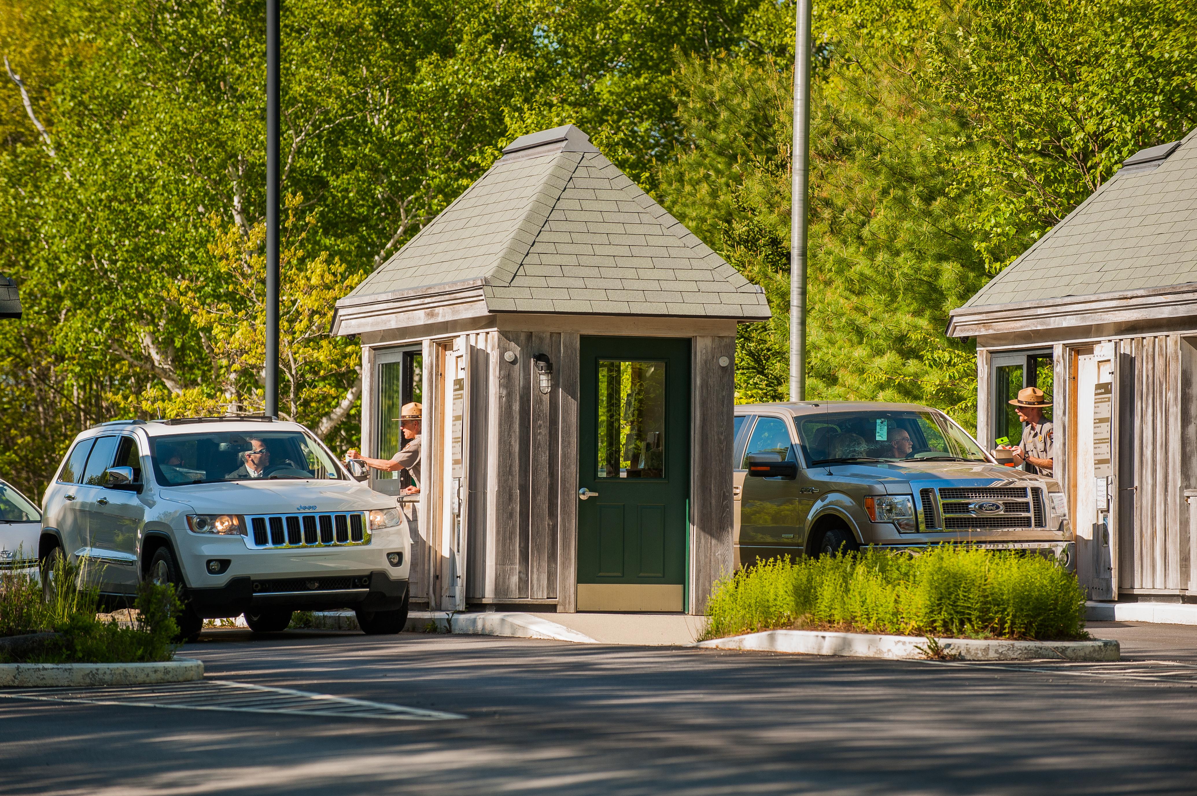
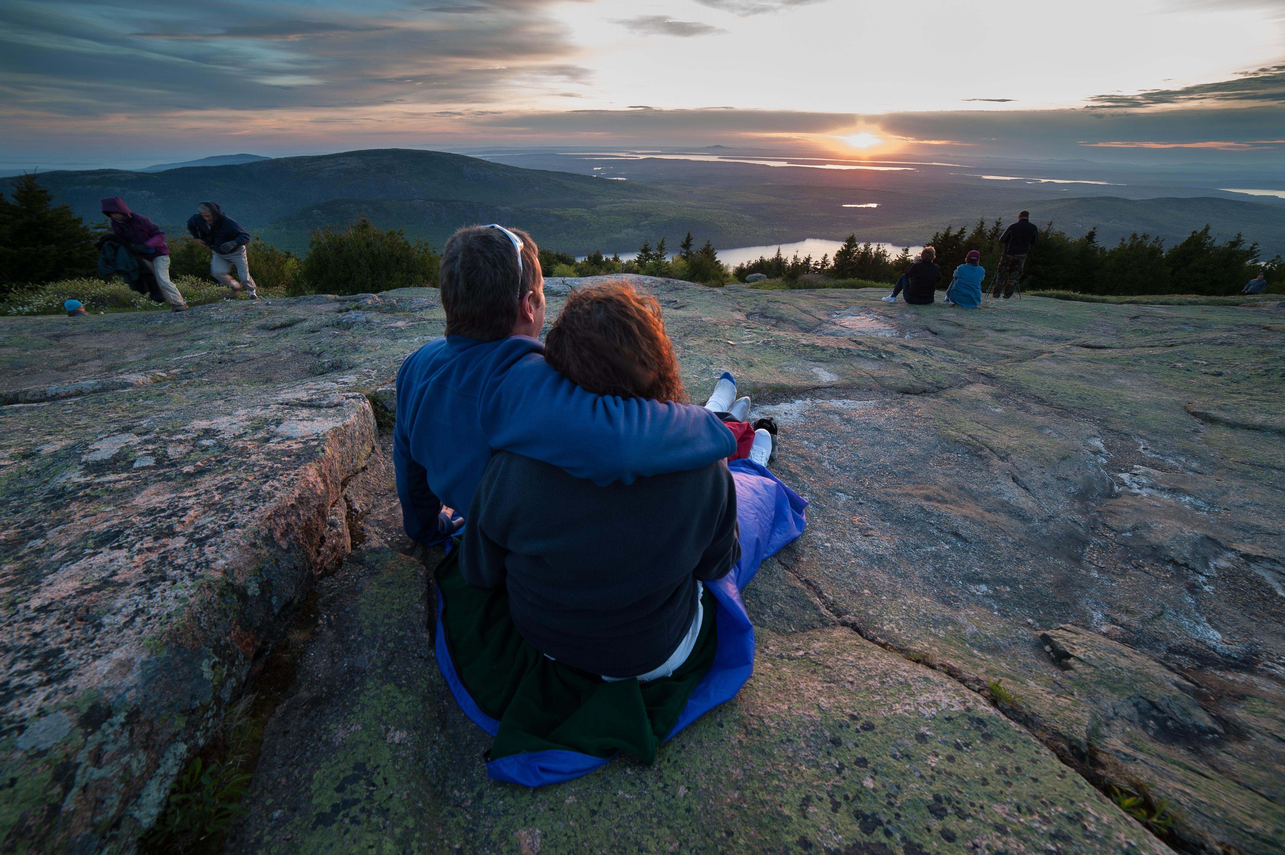

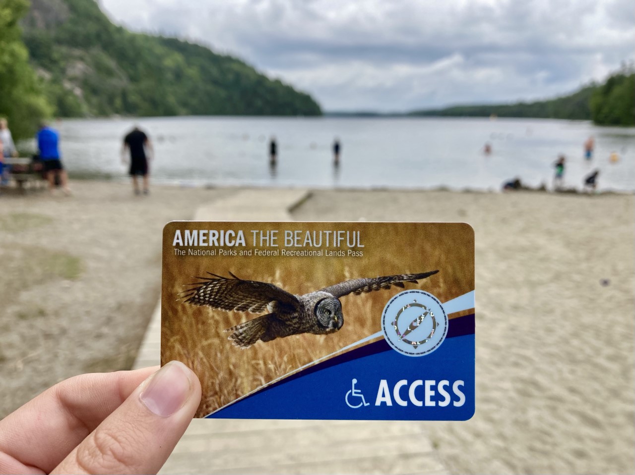

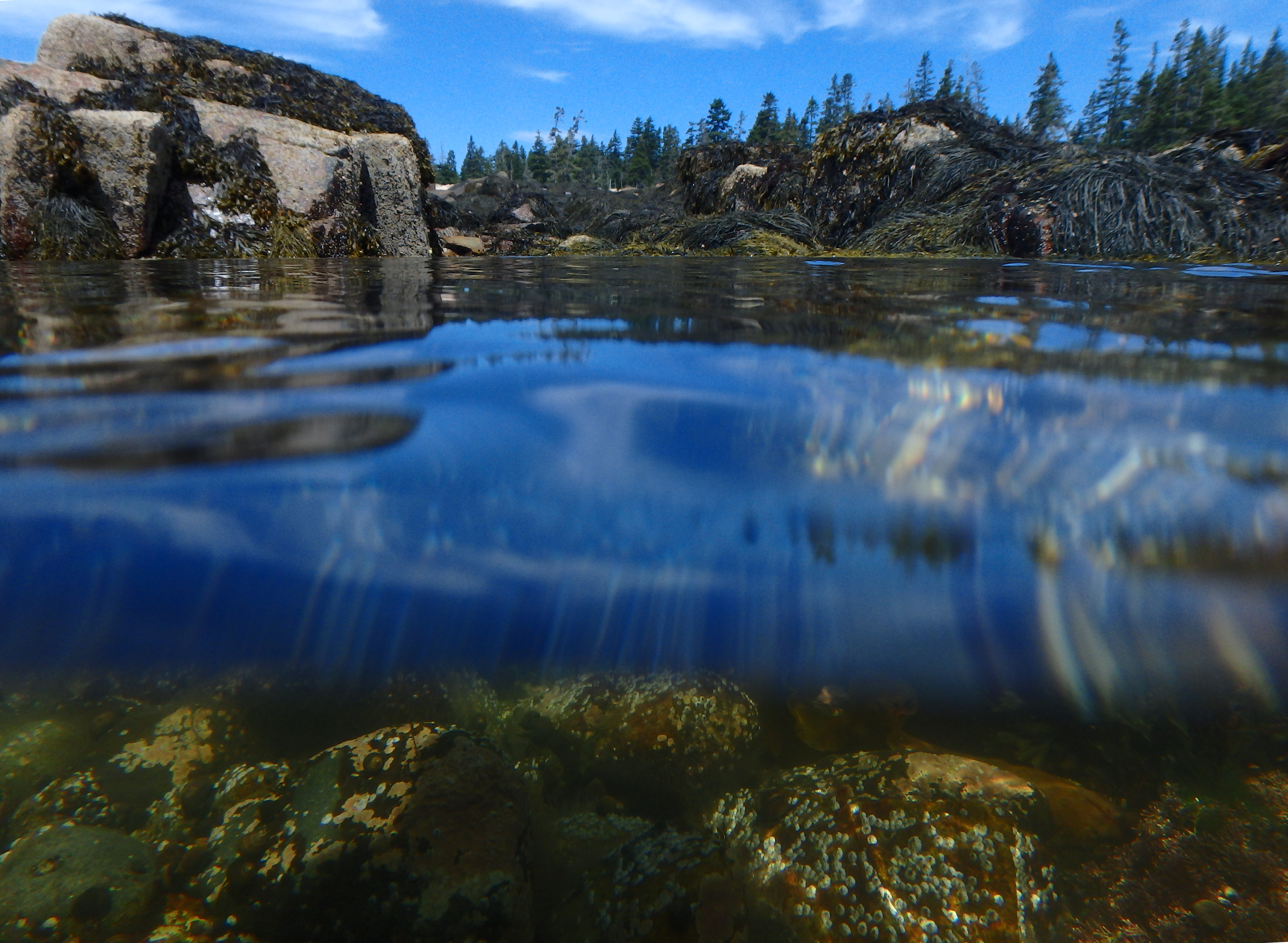
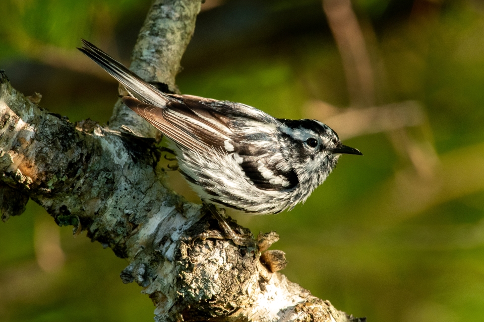


No structured outing assessments have been reviewed for this park yet. Check the official accessibility guide for your requirements.
Compare accessibility details →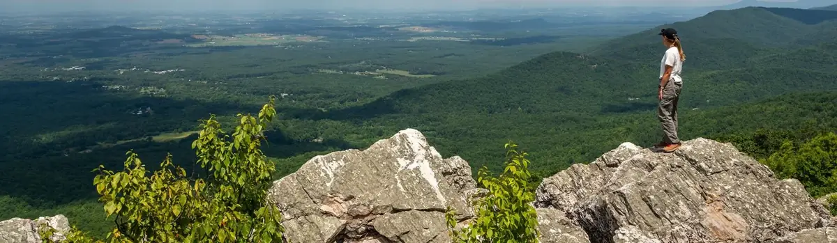 Forests
Virginia
Just 75 miles from the bustle of Washington, DC, Shenandoah National Park is a land bursting with cascading waterfalls, spectacular vistas, fields of wildflowers, and quiet wooded hollows. With over 200,000 acres of protected lands that are haven to deer, songbirds, and black bear, there's so much to explore...and your journey begins right here!
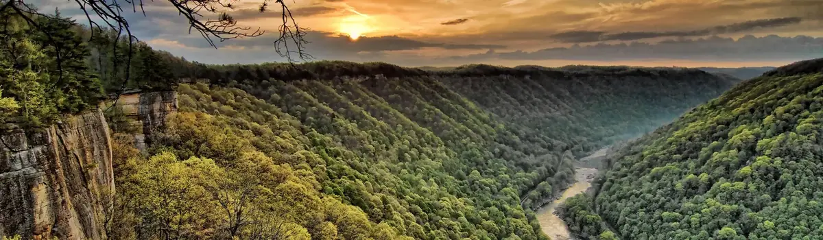 Canyons
West Virginia
A rugged, whitewater river flowing northward through deep canyons, the New River is among the oldest rivers on the continent. The park encompasses over 70,000 acres of land along the New River, is rich in cultural and natural history, and offers an abundance of scenic and recreational opportunities.
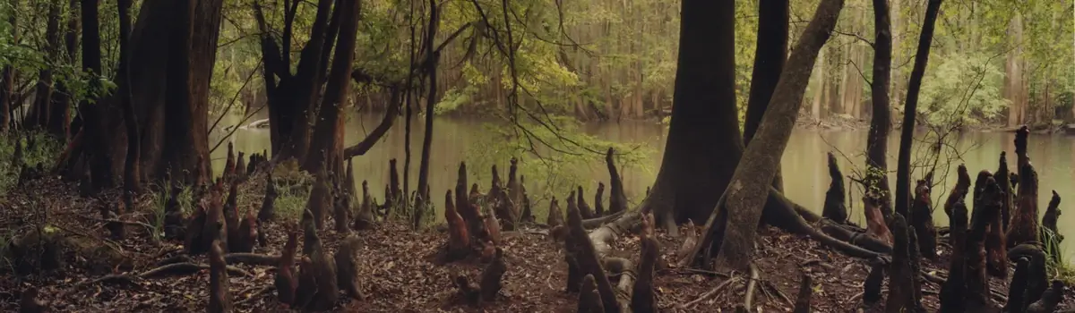 Forests
South Carolina
Astonishing biodiversity exists in Congaree National Park, the largest intact expanse of old growth bottomland hardwood forest remaining in the southeastern United States. Waters from the Congaree and Wateree Rivers sweep through the floodplain, carrying nutrients and sediments that nourish and rejuvenate this ecosystem and support the growth of national and state champion trees.