Moab
10–25 min to the visitor center, plus entry queues
Convenient services for all days.
Tradeoff: Trailhead drives remain substantial.
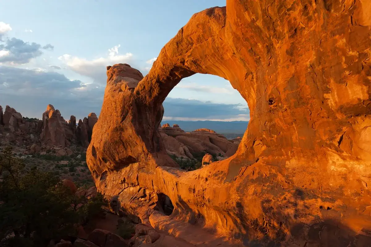
Discover a landscape of contrasting colors, land forms, and textures unlike any other. The park has over 2,000 natural stone arches, hundreds of soaring pinnacles, massive rock fins, and giant balanced rocks. This red-rock wonderland will amaze you with its formations, refresh you with its trails, and inspire you with its sunsets.
Advance timed-entry reservations are not required for park entry in 2026. Other activity permits and camping arrangements are separate. This announcement does not establish the policy for later years.
Before you go: Review entry policy and activity-specific permits for your travel year.
Official guidance ↗ Reviewed 2026-10-18Selected guidance only; separate from climate comfort and current conditions.
The conditions feed has not been connected for this park.
Check current conditions at NPS ↗A Windows day, bounded Devils Garden outing and separate Delicate Arch viewpoint day. No scramble, Fiery Furnace route or exposed arch ascent is assumed.
Use early short outings and a long midday break; omit walking in unsafe heat.
Day 1Windows Section → Balanced Rock
Day 2Landscape Arch approach → Devils Garden picnic break
Day 3Lower Delicate Arch Viewpoint → Upper Delicate Arch Viewpoint
Editorial planning ranges, not live routing or official trail measurements. Driving excludes lodging commutes unless stated; queues, closures and weather can add substantial time. Walking ranges describe the selected outing, not necessarily the full trail. Arrival and departure travel are additional. Select the season for your dates; this is not a live conditions check.
Choose maintained main paths; no primitive loop extension.
Start: Use signed Windows parking.
Getting there: Allow 30–45 minutes from the visitor center.
Footing: Rock steps, uneven slickrock and little shade.
Use the nearest view and omit walking in unsafe heat.
Finish with a short view before a long midday break away from the heat.
Start: Use signed Balanced Rock parking.
Getting there: Allow 15–25 minutes back toward the main road.
Footing: Exposed developed trail with uneven sections.
Skip the loop and use the nearby view.
Driving includes the visitor-center return. Start early and shorten the day in heat.
Follow the maintained route toward Landscape Arch and return without the primitive loop.
Start: Devils Garden trailhead; arrive before parking fills.
Getting there: Allow 45–65 minutes from the visitor center.
Footing: Sand and uneven footing; extensions add difficulty.
Take a short trailhead out-and-back if heat or conditions require.
Retain a substantial meal and water break before the return drive.
Start: Use an open designated picnic area.
Getting there: Allow 5–15 minutes from the trailhead.
Footing: Developed picnic area with limited shade.
Leave for a cooler gateway break if too hot.
No scrambling beyond Landscape Arch or Fiery Furnace route. Shorten walking before cutting water or rest breaks.
See the distant arch without taking the exposed arch trail.
Start: Use the viewpoints parking area beyond Wolfe Ranch.
Getting there: Allow 30–45 minutes from the visitor center.
Footing: Developed approach; this does not reach the arch.
Omit if access or heat makes it unsuitable.
Use the higher viewpoint only if conditions and energy allow; no trail connects it to the arch.
Start: Start at the same viewpoints parking area.
Getting there: Keep a rest break before the optional second outing.
Footing: Steeper uneven path, rock steps and exposed sun.
Remain at the lower viewpoint.
A distant viewpoint is an intentional alternative to the three-mile Delicate Arch trail.
Compare access to Arches Visitor Center. Drive ranges are editorial estimates before major queues or weather delays.
10–25 min to the visitor center, plus entry queues
Convenient services for all days.
Tradeoff: Trailhead drives remain substantial.
5–15 min to Devils Garden; 40–65 min to entrance
Close to the northern outing.
Tradeoff: Limited services; a campsite is separate from activity permits.
Use your own quotes to compare room savings with extra time on the road.
Room totals only. Taxes, fuel, parking, vehicle wear and the value of your time are additional. These inputs are examples until you enter your quotes.
Mark your own preparation below. A check means you have handled it; it does not confirm a reservation or availability. Stored on this device.
Entry · Before departure
Confirm current entry rules instead of reusing a prior-year policy.
If unavailable: Choose another date if required access is unavailable.
Check official rules & booking linksCamping · Once dates are known
Check Devils Garden operating dates, release details and cancellation terms.
If unavailable: Use a Moab base.
Check official rules & booking linksActivity · Before adding activities
Fiery Furnace and specialist activities have separate rules and are not included.
If unavailable: Keep the maintained-trail itinerary.
Check official rules & booking linksThe PDF and HTML contain the selected days, transport notes, lodging comparisons and booking guidance. Linked maps and websites require a connection.
Official source review: 2026-10-18. Durations, district grouping, gateway drive ranges and recommended pacing are National Parkwise editorial estimates. They are not live routing, current-condition guarantees or accessibility certification.
Official NPS activity guide.
NPS/Neal Herbert
The scenic drive in Arches passes many outstanding natural features. Parking is limited at all destinations, and popular trailheads like Delicate Arch and Devils Garden may fill for hours at a time, especially on weekends and holidays. View the Traffic & Travel Tips page for advice on making the most of your time (and avoiding the crowds).
If you have 1.5 hours
Drive to The Windows Section and see some of the park's largest arches. (Add a half hour to stroll beneath either North Window or Double Arch.).
Or drive to Delicate Arch Viewpoint and see the world's most famous arch , a mile distant. Stop at Wolfe Ranch on your way back and imagine what it would have been like to homestead this relatively barren area in the late 1800s.
If you have 3 hours Do both of the above.
If you have 4.5 hours Drive all of the paved park roads, spending 10 minutes at each viewpoint, and be sure to visit The Windows Section, Wolfe Ranch and Delicate Arch Viewpoint.
NPS/Kat Connelly
Rain and snow can quickly change unpaved roads to four-wheel-drive condition or make them impassable. Check at the visitor center for up-to-date road conditions
Salt Valley Road travels from the main park road to Klondike Bluffs and the Tower Arch trailhead. This road is two-wheel-drive in normal conditions.
Other roads require vehicles with high clearance, low-range four-wheel drive and technical driving skills. Vehicles with two-wheel drive or all-wheel drive do not have the ground clearance or low gearing to negotiate the steep grades, loose rocks, and soft sand found on these roads. To see what's available, view the park map or the interactive map below. Off-highway vehicle use (ATVs, UTVs, etc.) is prohibited in the park. Camping is not allowed off any unpaved road within Arches National Park.
NPS information imported 2026-10-17. Confirm current details at NPS
Official NPS activity guide.
NPS/Kat Connelly
The park’s backcountry is mostly rough terrain, inaccessible by established trails with very limited water sources. While Arches National Park is known for its outstanding geologic features, it also contains irreplaceable cultural resources and sensitive high desert ecosystems.
Water is rarely available in the backcountry; plan to carry all you need. Primary safety considerations include steep terrain, loose rock, lightning, flash floods, and dehydration. You must know and comply with all regulations.
The park allows overnight backcountry camping only in the four designated backpacking campsites. Designated sites result in minimal impact to park resources, make site selection easier, and allow you to enjoy higher quality backcountry experiences.
A permit is required to camp at any of the four designated backpacking campsites in Arches. Backpacking permits are only available in person at the Backcountry Permit Office two miles south of Moab. Visitors can reserve a permit up to seven days before the trip start date. Each permit is limited to seven people, three nights per campsite, for a total of seven nights. Permits cost $7 per person.
Backcountry Permit Office Open Weekdays (Monday-Friday) 8 am-12 pm and 1-4 pm MT except federal holidays NPS Backcountry Permit Office 2282 SW Resource Blvd. Moab, UT, 84532 Note : The Backcountry Permit Office may close when rangers are needed to respond to emergency search and rescue efforts in the park.
All backcountry use and vehicle access is at your own risk. Plan ahead and prepare for backcountry conditions. Some routes are not trails and are unmarked.
You must have a landfill safe commercial toilet bag system, such as Wag Bag or Restop II. All solid human waste must be packed out of the backcountry. Do not dispose of these bags in park toilets; use specific disposal locations in Moab.
Courthouse Wash is an active flowing drainage with unpredictable flow. Take caution when travelling in a wash during flood conditions.
You are responsible for knowing and abiding by all park rules and regulations including those outlined on your backcountry permit: Wood campfires are not allowed. You must store food securely to prevent animals from gaining access to it. You must pack out all trash. Swimming, bathing, or immersing human bodies is only allowed in water sources with a continuous supply of water. You must keep all camping activities within campsite boundaries at designated campsites and within the boundaries of at-large zones. You must vacate campsites by 10 am. All natural plants, objects, and cultural artifacts are protected and must be left where they are found. Touching rock art and drawing graffiti is not allowed. Pets, discharging firearms, hunting, and feeding wildlife are prohibited.
Wood campfires are not allowed.
You must store food securely to prevent animals from gaining access to it. You must pack out all trash.
Swimming, bathing, or immersing human bodies is only allowed in water sources with a continuous supply of water.
You must keep all camping activities within campsite boundaries at designated campsites and within the boundaries of at-large zones. You must vacate campsites by 10 am.
All natural plants, objects, and cultural artifacts are protected and must be left where they are found. Touching rock art and drawing graffiti is not allowed.
Pets, discharging firearms, hunting, and feeding wildlife are prohibited.
We cannot guarantee your safety. Safety remains your responsibility.
Check the weather. Get forecast information before beginning your trip, and observe changing weather conditions. Desert temperatures can soar above 100°F (37°C) in the summer, making strenuous exercise difficult. We recommend drinking at least one gallon (4 L) of water per day during the summer. Late summer monsoons bring violent storm cells which bring lightning, hail, rain, slippery rock surfaces, hypothermia, and often cause flash floods. Flash floods can also occur during blue skies when heavy rains hit the Book Cliffs. Winter temperatures often drop below 32°F (0°C), and significant ice can persist on north-facing slopes. Temperatures may range 50 degrees in a 24-hour period.
Lightning is a serious concern during a thunderstorm . Rock overhangs and shallow caves are not safe places to hide. Consider returning to your vehicle as soon as a storm approaches. If your hair begins to stand on end, remove large metal objects (such as internal frame backpacks) and squat down low, covering your ears with your hands.
It is often easier to climb up slickrock than to get back down. Sandstone crumbles easily and is slippery when wet or icy. Numerous accidents and rescues as well as several deaths have occurred due to careless climbing. Consider your routes carefully and use common sense.
Do not feed wildlife ; your food does not meet their nutritional needs and might encourage animals to linger near roads where they might be injured or killed. Hand-fed animals can bite and may carry diseases such as rabies. Help keep wild animals wild—don't feed them.
Scorpions, rattlesnakes, black widow spiders, cone-nosed kissing bugs and other desert creatures make their homes here. Watch out for them and give them the right-of way. Place your hands and feet carefully, particularly in dark or damp places. Check clothing, tents, and shoes for unwanted visitors. Leave everything you find undisturbed.
Do your homework and know your route(s). Ask rangers at the backcountry permit office for information on campsite and zone access, or contact us by email .
Be prepared to self-rescue. Know what to do in emergency situations—including injury treatment, evacuations, unplanned overnights, or responding to rapid changes in weather. Ask yourself, "If my leader gets hurt, does my group have the ability to continue and get help?" Cell phone service is limited in the park. If a phone is available, call 911. Be prepared to tell the dispatcher where you are so you can direct assistance to your location. Park staff, if available, will provide assistance to the limit of their abilities; however, help may not arrive on scene for several hours.
Only by following a low-impact camping ethic can you protect the park's outstanding natural features and biological diversity for future generations. To accomplish this goal, renew your commitment to leaving no trace and adopt this code of ethics:
Tread lightly. Practice "Leave No Trace" ethics. Plan ahead and properly prepare. Pack out what you pack in. Don't mark on rocks; scratches and carvings are considered graffiti which is against the law. Use a bag system for solid human waste; supplies are available for a minimal charge at the visitor center. Follow the regulations on your permit.
Your steps matter! Help protect the park's sensitive desert soils . Travel in sandy washes (where water flows when it rains) on rock, or on delineated trails. Don't create new or multiple paths (known as "social trails"), even if looks like the shortest distance on a GPS. Short-cutting damages vegetation, increases soil erosion, destroys animal burrows, and promotes the spread of exotic plants.
Be considerate of other visitors. Some of Arches' backpacking is in busy visitor areas or intersect with large visitor groups. Be respectful of other visitors.
The Hayduke Trail is a challenging, 800-mile backcountry route crossing Utah and Arizona. There is no established or maintained trail; hikers must use various forms of navigation to find their way along the route. Sections of the Hayduke pass through many national parks, including Arches, Bryce Canyon, Canyonlands, Capitol Reef, Grand Canyon, and Zion, and other public lands managed by the National Park Service, U.S. Forest Service, and Bureau of Land Management.
Approximately 40 miles of the main Hayduke Trail are within Arches and Canyonlands. Many alternate routes in these two parks have been created:
Klondike Bluffs (alternate eastern terminus)
Devils Garden (alternate eastern terminus)
through The Needles via established trails in Big Spring Canyon, Elephant Canyon, Lost Canyon, Chesler Park, and Salt Creek
through The Maze from Spanish Bottom to Hans Flat
Packrafting on the Colorado River from Moab to Spanish Bottom
You can backpack on much of the public land adjacent to Arches National Park, such as areas administered by the Bureau of Land Management and the US Forest Service , and at Canyonlands National Park . Check each agency's website for further information about regulations and permits.
For information about vehicle camping at Arches, visit the camping page .
For information about campgrounds around Moab, visit www.discovermoab.com .
NPS Trip Planning Guide Know before you go! Use this National Park Service guide to be prepared and avoid common mistakes. Make your fun adventure a safe one too!
Safety You should be aware of these safety concerns to make sure you have an enjoyable visit.
| Backpacking Area | Number of Campsites / Permits | How to Reach Area |
|---|---|---|
| Courthouse Wash | 3 designated campsites Upper Courthouse Wash: 2 Lower Courthouse Wash: 1 | navigation skills required, wash bottom with dense brush and water crossings |
| Devils Garden | 1 designated campsite | off of Devils Garden Primitive Trail |
NPS information imported 2026-10-17. Confirm current details at NPS
Official NPS activity guide.
NPS/Neal Herbert
You can ride your bike or e-bike on all paved and unpaved roads in the park. You may not ride your bike on trails or anywhere off a road.
The Salt Valley and Willow Springs dirt roads are less traveled than the paved roads, but they are more suited to mountain bikes due to washboards, deep sand, and other obstacles.
You can pay your entrance fee at the entrance station or at the fee station on the visitor center patio. Read more about fees and passes.
You may experience long lines at the entrance station during busy seasons. Read more about traffic and travel tips.
There are many options for riding bikes outside the park. Moab is surrounded by mountain biking trails of every difficulty level. Popular road rides abound, as well. A paved bike path connects Moab with the entrance to Arches, and continues along US 191 to UT 313 (which leads to Canyonlands National Park and Dead Horse Point State Park ).
The Moab Area Travel Council website has additional information about mountain biking or road biking outside the park.
Consider coming early in the morning when there isn't as much traffic.
There are no bike lanes or paved shoulders.
Some of the narrowest road sections are along the switchbacks above the visitor center. You can skip this section by driving with your bikes to La Sal Mountains Viewpoint, where there is usually adequate parking.
You must ride single file with the flow of traffic.
You should expect large buses and RVs on the road.
Signs warn drivers to keep a minimum of three feet from all cyclists, but you should remain alert to passing vehicles.
NPS information imported 2026-10-17. Confirm current details at NPS
Official NPS activity guide.
NPS/Chris Wonderly
Devils Garden Campground is the only campground at Arches National Park. You can reserve campsites for nights between March 1 and October 31. During this busy season, the campground is usually full every night. If you're arriving at Arches without a reservation, you'll probably have to look for a campsite outside the park . Between November and February, campsites are first-come, first-served. Winter campers are encouraged to download the Recreation.gov app before arriving at the park and use its Scan & Pay function to pay for their site.
Fire/Stove Policy
Phone number (Voice)
Mailing Address
Physical Address
Additional Information
Cell Phone Additional Information
Internet Additional Information
Ranger Programs
Rangers may present evening programs in the campground amphitheater spring through fall. Check at the visitor center for topics and schedules.
If Devils Garden Campground is full, you can try the many other campgrounds in the Moab area. It helps to plan ahead. First-come, first-served campgrounds near Moab can fill by mid-morning during the busy season and all holiday weekends. If you're arriving in the evening, you may have to make other arrangements.
There are some campgrounds in the area that take reservations. For a complete list of area campgrounds, visit www.discovermoab.com .
You can backpack at Arches in a small number of designated sites. Backpacking at Arches is more challenging than other places. It requires off-trail travel and route finding. Learn more about backpacking at Arches.
NPS information imported 2026-10-17. Confirm current details at NPS
Official NPS activity guide.
After a dry winter, water levels in the Dragonfly potholes are very low. Conditions are more difficult than listed in route beta. You may encounter water levels where swimming and 5th class climbing are required to negotiate the potholes. Do not attempt Dragonfly unless you are skilled at pothole escapes and partner-assist techniques.
Follow rangers as they descend deep into sandstone canyons on an epic adventure. Along the way, they'll show you how to plan ahead, canyoneer safely, and demonstrate minimum impact practices for Leave No Trace.
Canyoneers must obtain a permit for each route and carry it with them throughout the route.
Groups canyoneering in the Fiery Furnace or Lost Spring Canyon are limited to 6 persons . All other canyoneering groups are limited to 10 persons .
Larger groups must split and use different routes or use the same route at different times of the day to avoid queuing at rappel sites and to minimize impact on resources and on other visitors.
It is prohibited to climb, scramble or walk upon, wrap webbing or rope around, or rappel off any named or unnamed arch with an opening greater than three feet.
The physical altering of rock from its natural positions, such as chiseling, breaking rocks to reinforce crevices and pockets as anchors, glue reinforcement of existing holds, and gluing of new holds is prohibited. The intentional removal or "gardening" of lichen or plants from rock is prohibited.
Bathing and immersing human bodies is prohibited in water sources that do not have water flowing both in and out at the time of the activity. Swimming and wading also are prohibited in water sources that do not currently have water flowing both in and out, except in cases where it will be necessary to enter the water source in order to traverse a route.
Use of deadman anchors is prohibited.
Any new installation of fixed gear requires a permit. If an existing item or fixed anchor is judged unsafe, it may be replaced, in kind, without a permit.
Software left in place is required to match the rock surface in color. Bolts, hangers and chains must be painted the color of the rock surface before installation ( see photo ).
The installation of pitons is prohibited.
Use of motorized drills within proposed wilderness areas is prohibited. Drilling outside of proposed wilderness areas requires a special use permit.
Slacklining or "highlining" is prohibited.
Guided canyoneering services are prohibited.
If you are planning to canyoneer in Arches National Park, you must obtain a permit. There are no daily limits on routes (except the Fiery Furnace - see below), so you can get a permit on the day of your trip. Permits increase your safety, and help us maintain the desired conditions of the backcountry. You can obtain a permit in one of the following ways:
Obtain your permit at the self-register kiosk outside the visitor center. In person permits are free OR
Obtain your permit through Recreation.gov starting at 8:00 am MST the day before your trip. Permits reserved online cost $6 per permit
Planning to canyoneer in the Fiery Furnace? Your entire party must also obtain a reservation for a Fiery Furnace Self-Guided Exploration permit ($10 per person) through www.Recreation.gov . Reservation for Fiery Furnace permits are limited and are made available at 8 am MT seven days in advance. They often sell out quickly. Once you have obtained a Fiery Furnace permit, you do not need to obtain an additional Timed Entry Ticket to enter the park.
NPS/Neal Herbert
We cannot guarantee your safety. Safety remains your responsibility. Canyoneering has inherent risks and you assume complete responsibility for your own safety. You canyoneer at your own risk! Honestly assess your own skill level and your limitations. You should not attempt routes that are not within you abilities or those within your group.
Check the weather. Obtain forecast information before beginning your canyoneering route and observe changing weather conditions. Desert temperatures can soar above 100°F (37°C) in the summer, making strenuous exercise difficult. We recommend drinking at least one gallon (4 L) of water per day during the summer. Late summer monsoons bring violent storm cells which quickly bring lightning, hail, rain, slippery rock surfaces, and hypothermia and often cause flash floods. Flash floods can also occur during blue skies when heavy rains hit the Book Cliffs. Winter temperatures often drop below 32ºF (0°C), and significant ice can persist on north-facing slopes. Temperatures may range 50 degrees in a 24-hour period. Read more about weather.
Do your homework and know your route(s). Many websites, guide books, and local gear shops have specific route information. Canyoneering in the Fiery Furnace is best with the guidance of someone who already knows the route.
Inspect all fixed gear, especially knots in webbing. The harsh desert weather deteriorates webbing quickly. The National Park Service explicitly disclaims all responsibility for the safety of equipment, bolts, or anchor systems in the park. We do not maintain anchors.
If an existing item or fixed anchor is judged unsafe, you may replace it in kind, without a permit, to enable a safe rappel when no other means of descent is possible, to enable emergency retreat, and during self-rescue situations. When existing anchors are deemed to be unsafe, make a reasonable effort to remove the existing hardware and use the existing drill holes for the installation of replacement fixed anchors whenever possible. Before placing fixed anchors on a route, think seriously about whether the route warrants them. Only place fixed anchors as a last resort. Please notify park staff when replacing fixed hardware to help keep an up-to-date inventory of the park's fixed gear.
Be prepared to self-rescue. Be prepared to know what to do in emergency situations – including injury treatment, evacuations, unplanned overnights, or responding to rapid changes in weather. Ask yourself, "If my leader gets hurt, does my group have the ability to continue and get help?" Cell phone service is limited in the park. If a phone is available, call 911. Be prepared to tell the dispatcher the canyoneering route name, nearest landmark and meeting place so you can direct rescuers to the accident site. Park staff, if available, will provide assistance to the limit of their abilities; however, help may not arrive on scene for several hours.
Report significant hazards and any injuries to a ranger, even those that do not require assistance, so that future canyoneers can be warned of the situation. The closest medical facility is Moab Regional Hospital. Watch for snakes, spiny plants, poison ivy, biting insects, and falling rocks. Always wear a helmet!
Here is a list of established routes the park has approved. To establish any other canyoneering routes with fixed gear, you must obtain a special use permit. We reserve the right to remove all fixed gear that is not associated with the following routes:
You may establish new routes, but you must obtain a special use permit before establishing any new routes requiring the installation of new fixed gear. You must travel to and from routes only within sandy wash systems, on rock, or on delineated trails.
To request an application to establish a new route, email us.
Only by following a low-impact canyoneering ethic can you protect the park's outstanding natural features and biological diversity for future generations. To accomplish this goal, renew your commitment to leaving no trace and adopt this code of ethics for low impact canyoneering: Tread lightly. Practice "Leave No Trace" ethics. Pack out what you pack in. Don't mark on rocks; scratches and carvings are considered graffiti which is against the law. We recommend using a bag system for human waste; supplies are available for a minimal charge at the visitor center. Your steps matter! Help protect the park's sensitive desert soils . Travel to and from routes in sandy washes (where water flows when it rains) on rock, or on delineated trails . Approach trails to some canyoneering routes have been established with labeled brown posts. Don't create multiple paths to the same route (known as "social trails"), even if looks like the shortest distance on a GPS. Short-cutting damages vegetation, increases soil erosion, destroys animal burrows, and promotes the spread of exotic plants. Be considerate of other visitors. Some of Arches' canyoneering routes begin in busy visitor areas or intersect with large visitor groups, especially in the Fiery Furnace. Do your part to maintain a low profile. Be respectful of visitors and wait to rappel. During peak visitation, spring and fall, we recommend you park in established pullouts and parking lots. Consider leaving your pet at home. While you may have pets in the park, you must have them on a leash at all times, and you may only have them in developed areas like campgrounds and paved areas. You may not take them on or off trails. Desert heat can be deadly to your pet. Temperatures over 65°F (18°C) can turn the inside of your car into an oven.
We recommend using retrievable anchor systems (also known as "ghosting").
Brightly colored software can be a visual impact to other people. Software left in place must match the rock surface in color.
We recommend hardware for new and replacement anchors be modern climbing-specific hardware and of a length adequate for rock conditions at the installation site. We strongly discourage quarter-inch bolts.
We recommend climbing-specific hangers.
Homemade hardware is prohibited.
It is always preferable to use the old bolt hole rather than adding a new scar. Only in a worst-case scenario should you add a new hole.
Fill old holes with epoxy and top them with sand to best camouflage the unused hole.
Bolts, hangers and chains must be painted the color of the rock surface or primered brown before installation ( see photo ).
Some routes or features inside Arches National Park are closed to canyoneering, temporarily or permanently. Access and egress trails may be rerouted to avoid disturbance to wildlife and other resources. Check this webpage or the canyoneering kiosks for updated route closures when you register. We strictly enforce closures.
No established canyoneering routes are closed at this time.
Access Route is the route from an existing parking area, trail or road in which a canyoneer walks to the base of a climb or beginning of a canyoneering route. The park does not formally maintain routes.
Anchors can be any way of attaching the canyoneer, the rope, or a load to rock or tree, by either permanent or temporary means for belaying or rappelling. The goal of an anchor depends on the type of climbing under consideration but usually consists of stopping a fall, or holding a static load. Anchors can be either retrievable or permanent.
Bolts are permanent, man-made articles that require a hole to be drilled or hammered into the rock for their placement, usually consisting of a glued-in or expansion bolt. Bolts are small anchoring devices (usually 3/8 inch diameter by about 3 inches length) used to protect climbers where there are no cracks or openings for other types of protection.
Canyoneering (also known as Canyoning ) is traveling across land and into canyons using a variety of techniques that are associated with technical descents: requiring rappels (abseils) and ropework, technical climbing or down-climbing, technical jumps, and/or technical swims.
Deadman anchor is a buried object such as a large rock or log that functions as an anchor for an attached rope. Use of deadman anchors is prohibited.
Egress or Exit Route is the route from the completed climbing or canyoneering route back to the parking area. The park does not formally maintain routes.
Ephemeral Pool is a naturally occurring sandstone basin that collects rain water and wind-blown sediment that can range from a few millimeters to a few meters in depth and may or may not be located in drainages. Read more about ephemeral pools.
Fixed belay/rappel station or "anchor systems" shall be deemed any configuration of fixed anchor hardware (requiring rock alteration for installation) or software placed at the top of a pitch or rappel for the purpose of belaying or placed for the sole intent of rappelling. The hardware or software is left behind.
Fixed gear is any manufactured article, either hardware or software (webbing, rope, cordelette, etc.), that is used to aid ascent or descent, or as protection, and is left on the route by a canyoneering party after the completion of the route.
Hardware is climbing equipment placed in cracks or on faces to protect climbers and canyoneers from falling. This specialized equipment includes wired nuts, camming devices, hexes, pitons and bolts.
Pothole is a depression in the rock that is large enough to accommodate one or more persons.
Rap rings are made of a single ring of aluminum or steel. Soft aluminum rings are prone to destruction as you pull your sand-impregnated rope across the metal. You may often find rap rings on anchors in canyons.
Rock alteration is the intentional removal of rock from its natural position, drilling, chipping, or gluing of hold.
Vegetation alteration is any intentional removal of vegetation from its natural position, destruction, or damage of vegetation.
Webbing is a synthetic flat rope that is used to tie around anchors.
| Dragonfly Conditions After a dry winter, water levels in the Dragonfly potholes are very low. Conditions are more difficult than listed in route beta. You may encounter water levels where swimming and 5th class climbing are required to negotiate the potholes. Do not attempt Dragonfly unless you are skilled at pothole escapes and partner-assist techniques. Embed Embed Video <iframe title="Video Embed" src="https://www.nps.gov/media/video/embed.htm?id=669838FD-13C5-4DB2-AB99-F490E69CA1FB" width="480" height="306" frameborder="0" scrolling="auto" allowfullscreen></iframe> Close Copy Visit our keyboard shortcuts docs for details Duration: 14 minutes, 57 seconds Follow rangers as they descend deep into sandstone canyons on an epic adventure. Along the way, they'll show you how to plan ahead, canyoneer safely, and demonstrate minimum impact practices for Leave No Trace. On This Page Navigation | |
| Area | Route Name |
| Fiery Furnace | Krill Lomatium |
| Great Wall | Bighorn |
| Lost Spring Canyon | Lost and Found / Undercover MMI |
| Park Avenue | Tierdrop Not Tierdrop U-Turn |
| Petrified Dunes | Dragonfly |
| The Windows | Elephant Butte |
| Area | Route Name |
| Fiery Furnace | Krill Lomatium |
| Great Wall | Bighorn |
| Lost Spring Canyon | Lost and Found / Undercover MMI |
| Park Avenue | Tierdrop Not Tierdrop U-Turn |
| Petrified Dunes | Dragonfly |
| The Windows | Elephant Butte |
NPS information imported 2026-10-17. Confirm current details at NPS
Official NPS activity guide.
Let someone else do the driving and share their knowledge of the park!
These companies are authorized concessioners of the National Park Service to conduct guided four-wheel driving tours in Arches National Park.
Adrift Adventures call 800-874-4483 or 435-259-8594
NAVTEC Expeditions call 800-833-1278 or 435-259-7983
Moab Scenic Adventures call 435-260-8913
Other local authorized commercial use activities include guided van tours and hikes inside Arches, while many more companies offer shuttle service to the visitor center or trailheads within the park. A list of companies is available on the Moab Travel Council website. Are you interested in leading commercial tours in the park? Visit Do Business With Us .
NPS information imported 2026-10-17. Confirm current details at NPS
Official NPS activity guide.
NPS/D. Dunajski
Arches contains a variety of hiking trails, many of which are considered easy to moderate. Trails provide access to outstanding viewpoints and arches not visible from the road. Many trails use cairns (stacks of rocks) for markers and cross broad rock surfaces, requiring attention to follow. For details like grade, tread width, and cross slope for each trail, see the Physical Accessibility page of this website.
Each year, park rangers respond to hundreds of search and rescue incidents in the park. Many involve heat and sun exposure, twisted knees or ankles, or getting lost. Before hiking, review our safety page for tips on having a safe and enjoyable visit.
Watch Your Step. Help us protect biological soil crusts during your visit. Please walk only on trails, rock or in sandy washes (where water flows when it rains), and keep all vehicles and bikes on designated roads.
Protect Ephemeral Pools. Sandstone basins called ephemeral pools or potholes are home to a variety of life. Tiny organisms depend on the water in these shallow pools. To protect these life forms, please do not swim, bathe, or drink the water in desert potholes, and do not walk through dry ones.
Keep off the Arches. To promote visitor safety and the opportunity to view natural features undisturbed, climbing, scrambling, walking or standing upon, or rappelling off any arch is prohibited in the park.
Leave the Rocks as You See Them. Graffiti —carving, scratching, chalking, or any type of marking—is illegal and unsightly. If you see someone marking on the rocks, please report it to a ranger. Learn how to be a good visitor to archeological sites .
Loading results...
NPS information imported 2026-10-17. Confirm current details at NPS
Official NPS activity guide.
If your preferred mode of transport for exploring new country is on the back of a horse, you're in luck. Horses are permitted in Arches, though there are restrictions on their use and where they can go. Please read through the following regulations before you arrive in the park.
Effective September 6, 2016, horseback riding and pack animal use is restricted to day-use only. The park is revisiting the Backcountry Management Plan to examine impacts caused by increased use in the backcountry.
Horses, mules and burros are designated as pack animals. No other animals, including llamas and goats, are designated as pack animals.
The use of saddle and pack animals is permitted in the following roadless areas: Salt Wash upstream from the Delicate Arch road, Courthouse Wash and Seven Mile Canyon.
All travel in roadless areas is confined to the wash bottoms. Leaving wash bottoms to avoid quicksand when it is present is an exception to this regulation.
Use is permitted on all designated four-wheel roads within the park, which include: The Willow Springs road, the "four-wheel-drive road" (from Salt Valley to Willow Flats including the Tower Arch loop road) and the Cache Valley road.
Use is permitted on the following two-wheel drive, non-paved roads: Salt Valley road from the main park road to the park's west boundary and the Klondike Bluffs road.
Maximum group size for trips is 10 people and 10 pack animals.
Where possible, horses will be watered downstream from the source. All manure dropped in or near any spring or non-flowing water source must be immediately removed to avoid contamination.
At trailheads and other loading areas, any manure spilled from the trailering unit, fresh excrement, or feed must be picked up prior to departing.
Horses must be picketed in locations which least damage the vegetation. Animals may not be directly tied to trees and other vegetation except tamarisk (salt cedar). Animals may be tied directly to this exotic species.
Grazing, or loose herding of pack and saddle stock is not allowed in the park and horse and pack stock users are required to carry feed for overnight trips. In the backcountry, the use of loose hay or grain containing viable seeds is prohibited. Stock users are required to carry supplemental weed free feed on all trips.
NPS information imported 2026-10-17. Confirm current details at NPS
Official NPS activity guide.
NPS/Chris Wonderly
Delicate Arch at sunset might be the most famous image to photograph in the park, but it certainly isn't the only one, nor is it necessarily "the best." In this land of wonderous rock shapes, timeless vistas, and piercing contrasts, visitors are literally surrounded by compelling subjects for photographs. When choosing where to focus, pay attention to composition and lighting.
NPS/Andrew Kuhn
Look at a really good photograph and you'll find the subject is placed off-center, and probably falls along an imaginary line that connects the opposite corners of the frame. Or, the "Rule of Thirds" draws an imaginary 3 x 3 grid (top to bottom and right to left) and places subjects at the intersection of a horizontal and a vertical line in that grid. However you arrange subjects, fill the frame! If your subject fills only 10 percent of the picture, the other 90 percent probably is wasted. You might need to move in closer, use a zoom or a longer focal length lens. Then, look closely at what the lens sees. Is there a yucca plant sticking out of the top of someone's head? Is the red car in the background more obvious than the kids in front of the arch? Focus on what really tells the story, and eliminate the rest. A photograph is not about an object, it is about light on an object. The best photographic light occurs early in the morning and late in the afternoon, as the lower angle of light gives your subject depth and a greater sense of reality. The warmth of the light deepens the redness of the rock into amazing hues, the very reason this land is often called "color country." Check this table of sunrise & sunset times to know when the magic hours might begin during your visit.
The features listed in the table below will serve as fine starting points for your photographic odyssey. Those places should keep your eyes - and shutter fingers - busy, but remember, they are just the starting points. Countless other opportunities will present themselves if you keep an open mind and simply respond to that place within you that says, "Wow, look at that!"
Courthouse Towers
Petrified Dunes
This land is every bit as fragile as it is beautiful. If you step off the trail or away from the pullout, you may injure its living surface. When biological soil crust is damaged, it can take centuries (literally) to recover. Allow others who will be inspired by your photos to come and see this land as Nature intended: organic and alive.
NPS/Jacob W. Frank
Photographing the park after dark is a spectacular way to enjoy the unique landscape of Arches National Park. Here are some quick tips to improve your next astrophotography session:
Make sure your camera is set to manual- this will give you more control over your settings and resulting photographs.
Let the Light in
When photographing in low light, you'll want to let as much light into your camera as possible. A long exposure lets you do just that. Experiment by lowering your shutter speed, keeping the shudder open up to 30 seconds. The longer it is open, the more light will fill your camera, and photo. Don't forget to play with your Aperture and ISO settings, which also control how much light enters your camera.
When attempting a long exposure, blurriness is common, caused by any small bump or movement while holding the camera. To avoid blurriness, you'll want to hold your camera still using a tripod. Forgot your tripod at home? Setting your camera on the hood of a car, a backpack, or the ground works just as well.
Experiment, Experiment, Experiment!
Now you're ready to get out there and try night photography. The best way to hone your skills is to practice, and of course, have fun.
Please note that using artificial light sources to light up landscapes, rock formations, or other park features is prohibited. Artificial light sources may be used for personal route-finding or minimum impact camping only. Learn more about rules and regulations regarding artificial light sources .
NPS/ Will Pedro
Places to Go Learn about the major sites inside the park.
Things to Do Driving, hiking, cycling, camping, stargazing, and ranger programs: there's something for everyone.
Safety You should be aware of these safety concerns to make sure you have an enjoyable visit.
| Early Morning | Late Afternoon |
|---|---|
| Moab Fault | Park Avenue |
| The Three Gossips | Courthouse Towers |
| Sheep Rock | Petrified Dunes |
| The Great Wall | Balanced Rock |
| Turret Arch | The Garden of Eden |
| The Spectacles | North and South Windows |
| Double Arch | Delicate Arch |
| Cache Valley | Fiery Furnace |
| Wolfe Ranch | Skyline Arch |
| Landscape Arch | Fins in Devils Garden |
| Double O Arch | Tower Arch |
NPS information imported 2026-10-17. Confirm current details at NPS
Official NPS activity guide.
NPS/Andrew Kuhn
Ranger Programs
Rangers and volunteers normally offer a variety of programs every day, spring through fall. Program types, times, and locations vary throughout the year and may change due to weather or other factors.
We offer ranger-guided hikes into the Fiery Furnace spring through fall. Reservations are required.
You can enter the Fiery Furnace on your own with a permit. We offer limited numbers of permits each day.
| Patio Talk 10 minutes; Arches Visitor Center Free; all ages welcome. No advance reservation. | check at Visitor Center |
| Evening Program 30–45 minutes; Devils Garden Campground Amphitheater Free; all ages welcome. No advance reservation. We will not offer campground evening programs during stargazing events. | nightly starting May 31 (check calendar for time) |
| Fiery Furnace Guided Hikes Physically demanding hikes, for ages 5 and up only. You must purchase tickets in advance. There are no walk up or first-come, first served tickets. See more information. | offered April 12 through early Fall; buy tickets on Recreation.gov |
| Special Events Look for other events like stargazing , arts , and other activites on our events calendar. | Calendar |
NPS information imported 2026-10-17. Confirm current details at NPS
Official NPS activity guide.
The rock at Arches offers excellent climbing opportunities, despite its sandy nature. Most climbing routes in the park require advanced techniques.
Arches National Park developed a Climbing and Canyoneering Management Plan (CCMP) in December 2013 in order to protect the natural environment and the park's resources and visitor experience. Primary actions of the CCMP are the implementation of group size limits, climber registration, improved climber education program, safety standards, and climbing access routes. We ask all climbers to act responsibly and observe park regulations.
Rock climbing groups are limited to five persons per group.
White chalk is prohibited. Chalk must be similar in color to the rock being climbed.
The physical altering of rock faces by chiseling, glue reinforcement of existing holds, gluing of new holds, and the intentional removal of lichen or plants from rock are prohibited.
Rock climbing should be mostly free climbing or clean aid climbing.
Any new installation of fixed gear requires a permit. If an existing item or fixed anchor is judged unsafe, it may be replaced, in kind, without a permit. Bolts, hangers and chains must be painted the color of the rock surface ( see photo ).
Protection may not be placed with the use of a hammer except to replace existing belay and rappel anchors and bolts on existing routes, or for emergency self-rescue. The use of motorized power drills is prohibited.
If an existing software item (sling, etc.) is unsafe, it may be replaced. Software left in place must match the rock surface in color.
Leaving fixed ropes in place for more than 24 hours is prohibited, unless the park has been notified.
Slacklining (or “highlining”) and BASE jumping are prohibited.
Guided rock climbing services are prohibited.
Use of motorized drills within wilderness boundaries is prohibited. Use of motorized drills outside of wilderness boundaries requires a special use permit.
Overnight camping in Arches is only allowed in the Devils Garden Campground and in designated backcountry camping sites. Permits for the designated backcountry campsites can be acquired at the visitor center up to seven days in advance.
Establishment of new climbing routes is allowed. However, climbers must obtain a special use permit before establishing any new routes requiring the installation of new fixed gear. Travel to and from new routes must be on rock, within drainages or sandy washes, or on designated trails.
To apply for a new route, email us to request a new fixed gear application.
All persons planning to climb in Arches National Park are encouraged to register by obtaining a free permit. There are no daily limits on routes, so climbers can get their permits on the day of the climb. Registration is free, it increases climbers' safety, and helps the park maintain desired conditions in the backcountry zone. It is in your best interest to register.
Climbers can self-register at the kiosk outside the visitor center.
The National Park Service cannot guarantee the safety of park visitors. Safety remains the sole responsibility of the climber. Climbers should understand the inherent danger of the activity, have basic knowledge of self-rescue methods and plan accordingly. Climbers should not attempt routes that are not within their abilities or those within their group.
Check the weather first. Obtain forecast information before beginning your climb and observe changing weather conditions. Thunderstorms can develop quickly bringing lightning, hail, rain, slippery rock surfaces, and hypothermia. Summer days can reach a scorching 100°F.
Do your homework and know your route. Most climbing in Arches is technical and requires advanced skills. Arches National Park offers sustained multi-pitch towers, easier one pitch towers, and hard cracks on amazing buttresses. Routes are typically sandy or in soft Entrada Sandstone. Many websites, guide books, and local gear shops are available for specific route information.
Inspect all fixed gear. The NPS explicitly disclaims all responsibility for the safety of equipment, bolts, or anchor systems in the park. The NPS does not maintain anchors. If an existing item or fixed anchor is judged unsafe, it may be replaced to enable a safe rappel when no other means of descent is possible, to enable emergency retreat, and during self-rescue situations, in kind, without a permit. When existing anchors are deemed to be unsafe, a reasonable effort to remove the existing hardware will be made and existing drill holes will be used in the installation of replacement fixed anchors whenever possible.
Before placing fixed anchors on a route, think seriously about whether the route warrants them. Only place fixed anchors as a last resort. Please notify the NPS when replacing fixed gear to help keep an up to date inventory of the park's fixed gear.
Be prepared to self-rescue. Cell phone service is limited in the park. Make plans for self-rescue or get assistance from other climbers should an unexpected incident arise. Clearly and loudly call out for help. If a phone is available, call 911. Be prepared to tell the dispatcher the rock formation, climbing route name, nearest landmark and meeting place so that you can direct rescuers to the accident site. Park staff, if available, will provide assistance to the limit of their abilities;however, help may not arrive on-scene for several hours.
Report significant hazards and any injuries to a ranger, even those that do not require assistance, so that future climbers can be warned of the situation. The closest medical facility is Moab Regional Hospital. Watch for snakes, spiny plants, poison ivy, biting insects, and falling rocks. Always wear a helmet!
Only by following a low-impact climbing ethic can climbers protect the park's outstanding natural features and biological diversity for future generations. To accomplish this goal, renew your commitment to leaving no trace and adopt this code of ethics for low impact climbing:
Tread Lightly. Practice "Leave No Trace" ethics. Pack out what you pack in. Don't mark on rocks; scratches and carvings are considered graffiti which is against the law. Use of a bag system for human waste is recommended. Supplies are available for a minimal charge at the visitor center.
Your steps matter! Help protect the park's sensitive desert soils. Travel to and from routes in sandy washes (where water flows when it rains), on rock, or on designated trails. Approach trails to some climbing routes will be established with labeled brown carsonite posts. Don't create multiple paths to the same cliff (known as "social trails"), even if it is the shortest distance to your climb. Short-cutting damages vegetation, increases soil erosion, destroys animal burrows, and promotes the spread of exotic plants.
Be considerate of other visitors. The majority of Arches' rock climbs are very close to the road or located in busy areas of the park. Do your part to maintain a low profile. During peak visitation, spring through fall, climbers are recommended to park in established pullouts and parking lots.
Consider leaving your pet at home. While pets are allowed in the park, they must be on a leash at all times and are only allowed in developed areas like campgrounds and paved areas. They are not allowed on or off trails. Desert heat can be deadly to your pet. Temperatures over 65°F can turn the inside of your car into an oven, and animals tied outside to your car can suffer just as much.
Experts use gear expertly. It is essential that fixed gear be of high quality and the installers be experienced and skilled in setting bolts to ensure not only the first ascent party's safety but ensure the safety of future climbers. Please keep the following best practices in mind regarding fixed gear:
We recommend hardware for new and replacement anchors be modern climbing-specific hardware and of a length adequate for rock conditions at the installation site. Quarter-inch bolts are highly discouraged.
Climbing-specific hangers are recommended.
Homemade hardware is prohibited.
It is always preferable to use the old bolt hole rather than adding a new scar. Only in a worst-case scenario should a new hole be added.
All old holes will be filled with epoxy and topped with sand to best camouflage the unused hole.
Software left in place is required to match the rock surface in color.
Bolts, hangers and chains must be painted the color of the rock surface or primered brown before installation.
It is your responsibility to know all route closures. Some routes or features inside Arches National Park are closed to rock climbing, temporarily or permanently, and access and/or egress trails may be rerouted to avoid harm to wildlife and other resources. Check this list or the visitor center's climber kiosk for updated route closures every time you register to climb. Closures are strictly enforced.
It is prohibited to climb, scramble or walk upon, wrap webbing or rope around, or rappel off any named or unnamed arch with an opening greater than three feet.
Balanced Rock is closed to climbing.
Bouldering, rock climbing, rock scrambling and other similar activities are prohibited in the area known as "Arches Boulders" or "Highway 191 Boulders" ( see photo ).
The craggy rock outcroppings of Arches National Park are excellent habitat for birds of prey. Raptors are sensitive to human disturbance, so climbing routes are frequently closed between January and August -- the period of many raptors' breeding seasons. Even when climbers do not have direct contact with eggs, young, or adults, behavior such as shouting and other noises are disturbing enough to cause a parent bird to abandon its nest. Intentionally disturbing wildlife nesting, breeding, and other activities is a violation of Title 36 of the Code of Federal Regulations (Section 2.2 (a) (2)). Thank you for your assistance in protecting these magnificent birds. By coming to Arches and following these recommendations, you are a vital component to the success of maintaining a healthy raptor population. The following list of closures will remain in effect through the time specified below, or until surveys determine habitats to be unoccupied by sensitive wildlife.
Access route is the route from an existing parking area, trail or road in which a climber or canyoneer walks to the base of a climb or beginning of a canyoneering route. Routes are not formally maintained.
Anchors can be any way of attaching the climber/canyoneer, the rope, or a load to rock or tree, by either permanent or temporary means for belaying or rappelling. The goal of an anchor depends on the type of climbing under consideration but usually consists of stopping a fall, or holding a static load. Anchors can be either retrievable or permanent.
Bivying (also known as bivouacking ) is the act of camping overnight while on a climbing route above the ground. This may involve nothing more than lying down or sitting on a rock ledge overnight, or use of a cot or 'portaledge' suspended from anchors to serve as a bivouac.
Bolt is a permanent, man-made article that requires a hole to be drilled or hammered into the rock for its placement, usually consisting of a glued-in or expansion bolt. Bolts are small anchoring devices (usually 3/8" diameter by about 3" length) used to protect climbers where there are no cracks or openings for other types of protection.
Bouldering is a style of rock climbing undertaken without a rope that requires the use of specialized equipment (rock climbing shoes, crash pads, etc.) and normally limited to very short climbs over a crash pad so that a fall will not result in serious injury. It is typically practiced on large natural boulders or at the base of larger rock faces. Chalk is typically used.
Chalk is the common name for magnesium carbonate powder, which climbers carry in a pouch (chalk bag) at the waist. It dries the hands and is used in rock climbing in the same way it is used in gymnastics, to improve grip.
Clean aid climbing is aid climbing without the use of bolting gear, pitons or other gear that scars the rock or becomes fixed after ascent.
Egress or Exit route is the route from the completed climbing or canyoneering route back to the parking area. Routes are not formally maintained.
Fixed belay/rappel station or " anchor systems " shall be deemed any configuration of fixed anchor hardware (requiring rock alteration for installation) or software placed at the top of a pitch or rappel for the purpose of belaying or placed for the sole intent of rappelling. The hardware or software is left behind.
Fixed gear is any man-made article, either hardware or software (webbing, rope, cordelette, etc.), that is used to aid ascent or descent, or as protection, and is left on the route by a climbing party after the completion of the climb.
Free climbing (also known as Traditional climbing ) is a minimum-impact approach that employs chocks, stoppers, nuts and camming devices, rather than pitons or bolts, for protection or direct support. These are climbing aids that are removable and do not damage the rock. Traditional climbing is how the sport of rock climbing has been practiced since its inception, and has strong historic associations.
Hardware is climbing equipment placed in cracks or on faces to protect climbers from falling. This specialized equipment includes wired nuts, camming devices, hexes, pitons and bolts.
Nut (or chock ) is a metal wedge threaded on a wire, used for protection by wedging it into a crack in the rock.
Piton (also called a pin or peg ) is a metal spike (usually steel) that is driven into a crack or seam in the rock with a hammer, and which acts as an anchor to protect the climber against the consequences of a fall, or to assist progress in aid climbing. Pitons are equipped with an eye hole or a ring to which a carabiner is attached; the carabiner can then be directly or indirectly attached (through more equipment) to a climbing rope.
Rap rings are made of a single ring of aluminum or steel. Soft aluminum rings are prone to destruction as you pull your sand-impregnated rope across the metal. Rap rings are often found on anchors in canyons.
Rock alteration is the intentional removal of rock from its natural position, drilling, chipping, or gluing of hold.
Rock climb is any independent line of ascent of a rock face. A climb may follow a crack system or other natural features, or it may strike out across a "blank" face. A climb is considered to be created when it is first ascended, and is usually given a name by the first ascensionist. The climb is typically recorded and described in a guidebook or internet site so that other climbers can identify and climb the route.
Slacklining/highlining is defined as walking on a rope, webbing, or other line that is tensioned horizontally between two points such as rock formations, trees, or any other natural features. Height of the rope above the ground is immaterial.
Spring-loaded camming device (also SLCD , cam ) is used for protecting a climber's fall. It consists of three or four cams mounted on a common axle or two adjacent axles, so that pulling on the axle forces the cams to spread farther apart. The SLCD is used by pulling on the "trigger" (a small handle) so the cams move together, then inserting it into a crack or pocket in the rock and releasing the trigger to allow the cams to expand. Camming devices can be manually removed and should leave no trace of use on the rock.
Stopper is a wedge-shaped nut or a knot used as passive protection while rock climbing.
Technical rock climbing is defined as ascending or descending a rock formation utilizing specialized rock climbing equipment.
Vegetation alteration is any intentional removal of vegetation from its natural position, destruction, or damage of vegetation.
Webbing is synthetic flat rope that is used to tie around anchors.
| Area | Feature Name | Route Name(s) | Closure Starts | Closure Ends | Current Status |
|---|---|---|---|---|---|
| Arches Entrance | The Pickle | The Pickle | Apr 1 | June 1 | OPEN |
| Arches Switchbacks | The Three Penguins | All routes on this feature | Mar 1 | Aug 15 | CLOSED |
| Devils Garden | Devil Dog Spire | Industrial Disease | Dec 1 | Sep 30 | CLOSED |
| Garden of Eden | Ham Rock | Harkonnen Castle (Dune) | Mar 1 | Aug 15 | CLOSED |
| Highway 191 | N/A | Canyonlands by Night El Secondo The Coup | Mar 1 | Aug 31 | CLOSED |
| Highway 191 | Crohn's Wall | Left Route Crohn's Odyssey Project One Project Two | Mar 1 | Aug 31 | CLOSED |
| Klondike Bluffs | N/A | Klondike Bluffs Crack | Mar 1 | Aug 31 | CLOSED |
| Klondike Bluffs | The Bouquet | Route One Route Two | Mar 1 | Aug 31 | CLOSED |
| Klondike Bluffs | Marching Men | Cuddle Bunny Tower False Start North Marcher Sand Hearse Unknown Marching Men | Mar 1 | Aug 31 | CLOSED |
| Highway 128 | Goose Island | Fun Ramp The Hyena Trail of the Navajo | Mar 1 | Aug 31 | CLOSED |
| Highway 128 | Milano Tower | Pop Tarts | Mar 1 | Aug 31 | CLOSED |
| Highway 128 | N/A | Escape Route | Mar 1 | Aug 31 | CLOSED |
| Windows | Tonka Tower | Tonka Tower | Mar 1 | April 8 | CLOSED |
NPS information imported 2026-10-17. Confirm current details at NPS
Official NPS activity guide.
The national parks and monuments of the Colorado Plateau have long been popular destinations for travelers. In addition to their stunning landscapes and rich cultural history, these areas share another resource: some of the darkest skies remaining in the contiguous 48 United States.
The darkness of a moonless night at Arches surprises many visitors. As few as one in ten Americans lives in an area where they can see the estimated 2,500 stars that should be visible under normal conditions. In many cities, the night sky is completely obscured by the glow of urban settlement . At Arches, the naked eye is sufficient to witness a wealth of stars. Under the right conditions, common binoculars may even reveal the rings of Saturn. Arches' relative isolation from the artificial light of urban areas makes it an ideal place for viewing the night sky. In 2019 Arches National Park became certified as an official International Dark Sky Park .
NPS/Kat Connelly
Plan ahead & check conditions. No two nights are alike at Arches so it's helpful to check conditions and moon phases before you head out to stargaze. You'll see the darkest skies during a new moon or when the moon is below the horizon. Even the light from a thin crescent moon can make it more difficult to see fainter stars or even the Milky Way. Keep track of sunrise and sunset times and moon phases at discovermoab.com . Choose an ideal location. A good stargazing location is key. Look for a high viewpoint or a wide open area with limited light interference (away from roads & buildings) to see the most stars. Give yourself time. It can take 20-30 minutes for your eyes to adjust to the dark. Spend enough time outside away from bright lights to allow your eyes to adjust. Use a red light. White lights from flashlights, cell phones, or vehicle headlights can harm your night vision. A red light won't impact your night vision as much. Many flashlights and headlamps have a red-light feature, or you can simply cover your white light with red cellophane. Bring a star chart. A star chart or planisphere can help you find the constellations and Milky Way. Check for star charts and other stargazing tips at park visitor centers.
On a clear night, you can see great stars just about anywhere in the park. Areas off the main park road with few obstructions of the sky are best. The farther north you drive, away from the lights of Moab, the darker the sky will be.
Try stargazing at these areas :
Balanced Rock Picnic Area
The Windows Section
Garden of Eden Viewpoint
Spring Equinox March 20
Summer Solstice June 21
Autumnal Equinox September 23
Winter Solstice December 21
Quadrantids January 3-4
Lyrids April 22-23
Eta Aquarids May 5-6
Perseids August 12-13
Draconids October 8-9
Orionids October 20-21
Leonids November 17-18
Geminids December 13-14
Ursids December 22-23
Visit the page listed below for a calendar of stargazing events in southeast Utah.
Loading results...
| Full Moon | New Moon | |
| January | 3 | 18 |
| February | 1 | 17 |
| March | 3 | 18 |
| April | 2 | 17 |
| May | 1 & 31 | 16 |
| June | 29 | 14 |
| July | 29 | 14 |
| August | 28 | 12 |
| September | 26 | 10 |
| October | 26 | 10 |
| November | 24 | 9 |
| December | 24 | 8 |
| Full Moon | New Moon | |
| January | 3 | 18 |
| February | 1 | 17 |
| March | 3 | 18 |
| April | 2 | 17 |
| May | 1 & 31 | 16 |
| June | 29 | 14 |
| July | 29 | 14 |
| August | 28 | 12 |
| September | 26 | 10 |
| October | 26 | 10 |
| November | 24 | 9 |
| December | 24 | 8 |
NPS information imported 2026-10-17. Confirm current details at NPS
Open an activity to read its details here. Source links open in a new tab; check current conditions and permit requirements before travel.
Official NPS features and USGS park boundaries, imported 2026-10-17. An inventory snapshot, not live trail or parking availability.
Map coverage varies. Trail names may represent segments, connectors, or shared park units; mapped lines are not a hiking recommendation. Use official conditions and navigation resources before heading out.
27 matching named trail records
| Trail / mapped route | Surface | Recorded uses |
|---|---|---|
| Amphitheater Inventory record · 6 source segments; not a route distance. | Gravel | Hiker/Pedestrian |
| Balanced Rock Inventory record · 3 source segments; not a route distance. Matched official trail-table values; may describe a larger route than this inventory feature.
Official trail detailsLocation: to Balanced Rock Distance: 9.2 miles (14.8 km) Drive Time: 15-20 minutes Read trail source | Concrete | Hiker/Pedestrian |
| Broken Arch Connector Inventory record · 1 source segments; not a route distance. | Soil | Hiker/Pedestrian |
| Courthouse Wash Panel Inventory record · 1 source segments; not a route distance. | Native | Hiker/Pedestrian |
| Dark Angel Trail Inventory record · 1 source segments; not a route distance. | Native | Hiker/Pedestrian |
| Delicate Arch Lower Viewpoint Inventory record · 1 source segments; not a route distance. | Gravel | Hiker/Pedestrian |
| Delicate Arch Trail Inventory record · 3 source segments; not a route distance. Matched official trail-table values; may describe a larger route than this inventory feature.
Official trail detailsLocation: to Wolfe Ranch / Delicate Arch Trailhead Distance: 13.2 miles (21.2 km) Drive Time: 30-35 minutes Read trail source | Gravel | Hiker/Pedestrian |
| Delicate Arch Viewpoint Inventory record · 2 source segments; not a route distance. Matched official trail-table values; may describe a larger route than this inventory feature.
Official trail detailsLocation: to Delicate Arch Viewpoint Distance: 14.2 miles (22.8 km) Drive Time: 30-35 minutes Read trail source | Native | Hiker/Pedestrian |
| Delicate Arch Viewpointl Inventory record · 1 source segments; not a route distance. | Gravel | Hiker/Pedestrian |
| Devils Garden Inventory record · 1 source segments; not a route distance. Matched official trail-table values; may describe a larger route than this inventory feature.
Official trail detailsLocation: to Devils Garden Distance: 18 miles (28.9 km) Drive Time: 40-45 minutes Read trail source | Native | Hiker/Pedestrian |
| Double Arch Inventory record · 1 source segments; not a route distance. | Native | Hiker/Pedestrian |
| Fiery Furnace Viewpoint Inventory record · 1 source segments; not a route distance. | Native | Hiker/Pedestrian |
| Landscape Arch Inventory record · 2 source segments; not a route distance. | Native | Hiker/Pedestrian |
| Moab Canyon Pathway Inventory record · 1 source segments; not a route distance. | Asphalt | Hiker/Pedestrian | Bicycle |
| Navajo Arch Inventory record · 2 source segments; not a route distance. | Native | Hiker/Pedestrian |
NPS public GIS inventory, imported 2026-10-17. “Existing” is an inventory classification, not confirmation that a trail is open. Segment counts are not route distances. Parking records do not indicate space availability, fees, or accessibility certification. View government source ↗
Climate for Moab, 12 km from the park reference point. 1991–2020 normals. Source elevation: 0 m.
Mountain, rim, valley, and coastal conditions can differ sharply from the source town. Check park forecasts and current conditions before travel.
| Month | High | Low | Rain / snow water | Wet days | Daylight |
|---|---|---|---|---|---|
| 39° | 20° | 23 mm | 5.5 | 9.6 h | |
| 46° | 26° | 24 mm | 6.2 | 10.5 h | |
| 57° | 34° | 25 mm | 5.5 | 11.7 h | |
| 64° | 40° | 23 mm | 5.7 | 13.0 h | |
| 75° | 50° | 16 mm | 3.9 | 14.1 h | |
| 87° | 60° | 9 mm | 1.9 | 14.6 h | |
| 92° | 67° | 12 mm | 3.0 | 14.4 h | |
| 89° | 64° | 21 mm | 4.8 | 13.5 h | |
| 80° | 55° | 31 mm | 5.3 | 12.3 h | |
| 66° | 42° | 25 mm | 4.9 | 11.0 h | |
| 52° | 31° | 22 mm | 4.8 | 9.9 h | |
| 40° | 20° | 23 mm | 5.0 | 9.4 h |
Official NPS excerpts imported 2026-10-17. Fees, permits, road access, and operations can change; use the source link to confirm the latest information.
Everything you need to know about your visit to Arches
More about Weather at Arches
Internet & Cellular Access Details
NPS/Jacob W. Frank
NPS/Chris Wonderly
Devils Garden Campground is the only campground at Arches National Park. You can reserve campsites for nights between March 1 and October 31. During this busy season, the campground is usually full every night. If you're arriving at Arches without a reservation, you'll probably have to look for a campsite outside the park . Between November and February, campsites are first-come, first-served. Winter campers are encouraged to download the Recreation.gov app before arriving at the park and use its Scan & Pay function to pay for their site.
Fire/Stove Policy
Phone number (Voice)
Mailing Address
Physical Address
Additional Information
Cell Phone Additional Information
Internet Additional Information
Ranger Programs
Rangers may present evening programs in the campground amphitheater spring through fall. Check at the visitor center for topics and schedules.
If Devils Garden Campground is full, you can try the many other campgrounds in the Moab area. It helps to plan ahead. First-come, first-served campgrounds near Moab can fill by mid-morning during the busy season and all holiday weekends. If you're arriving in the evening, you may have to make other arrangements.
There are some campgrounds in the area that take reservations. For a complete list of area campgrounds, visit www.discovermoab.com .
You can backpack at Arches in a small number of designated sites. Backpacking at Arches is more challenging than other places. It requires off-trail travel and route finding. Learn more about backpacking at Arches.
NPS/Neal Herbert
If you have accessibility concerns related to changes in operation due to COVID-19 , please contact the park in advance.
Physical / Mobility Needs
Deafness / Hearing Loss
Arches National Park is a red-rock wonderland. You can explore much of the park and see many famous arches and rock formations via the paved scenic road. Some short accessible trails and viewpoints provide a closer view of the park. Longer trails lead to more arches and notable rock formations.
US citizens or permanent residents with permanent disabilities qualify for the Interagency Access Pass , which provides free or discounted admission to over 2,000 federal recreation sites.
The information about specific facilities and services provided below may help you better plan your visit. If a particular service or issue is not mentioned below please contact the park .
Visitor center exhibits include audio recordings and tactile models and maps, and rock samples. At the bookstore, you can purchase or rent an audio tour of the park's scenic road. There are no recorded descriptions of exhibits or waysides. We have audio versions of our park brochure on CD at the visitor center, or you can listen to it below. You may also request large-print and braille publications at the visitor center. You can also download screenreader-compatible brochures and guides on our publications page .
Large print and braille versions of the official Arches Unigrid are available at visitor centers, by contacting the park, or downloading a copy in a Braille Ready Format (BRF).
Download or listen to an audio version of the park brochure .
Service animals are allowed in national parks. What is a service animal?
Service animals are welcome everywhere at Arches National Park. Owners are encouraged to identify their working service animal, such as with a vest. Identification is not required, but helps prevent unwarranted "dog on trail" complaints from other visitors. There are no plastic bags provided at trailheads for waste products, so please bring your own.
Caution! The desert can be deadly for pets and service animals. Car temperatures rise quickly in the sun, even on cool days. Your animal can easily die of heat exhaustion. If you are leaving a service animal in a car, crack the windows as much as possible and leave water to drink. You can only get water at the visitor center or Devils Garden. We recommend you not leave service animals in the car at all when the outside temperature exceeds 68 degrees, even with the windows cracked.
Get an entrance pass All visitors must have one of these entrance passes: Pass Price Standard Pass $15.00–$30.00 Annual Pass $55.00 America the Beautiful Pass (includes Senior Passes) FREE–$250.00 Help me choose an entrance pass
If you already have an America the Beautiful—the National Parks and Federal Recreational Lands Pass, that's the only entrance pass you need. Seniors, military, visitors with a permanent disability, and families with a 4th grader are eligible for a free or discounted America the Beautiful pass.
America the Beautiful Pass
If you don't qualify for a discounted America the Beautiful pass, we recommend choosing an entrance pass based on your trip plans.
If you enter the park in a motorized vehicle, your entrance pass covers both you and your passengers. Your passengers do not need a separate pass.
Arches Entrance Station Credit/Debit Only
If you enter the park on a bicycle or on foot and are at least 16 years old, you need your own entrance pass. Children under the age of 16 don't need an entrance pass.
Valid for one year through the month of purchase. Admits one (1) private, non-commercial vehicle or its pass holder to Arches and Canyonlands national parks, and Natural Bridges and Hovenweep national monuments. U.S. residents only.
US citizens and residents
Hovenweep Visitor Center Credit/Debit Only
Natural Bridges Visitor Center Credit/Debit Only
Island in the Sky Entrance Station Credit/Debit Only
The Needles Entrance Station Credit/Debit Only
Covers entrance fees and standard amenity (day-use) fees at lands managed by
National Park Service
US Fish & Wildlife Service
US Forest Service
Bureau of Land Management
Bureau of Reclamation
US Army of Corps of Engineers
Depending on the type of entrance fee charged at a site, covers One private vehicle fee or Four per person fees
America the Beautiful Passes are non-refundable, non-transferable and cannot be replaced if lost or stolen . Passholders must show valid photo identification (ID) with each pass.
Physical passes can be purchased or picked up at over 1,000 federal recreation sites.
Purchase and pickup locations
To receive your pass by mail, order online at the USGS Online Store . Online orders are for physical passes, not digital passes, and may take up to three weeks to be processed and delivered. Order receipts may not be used in place of a physical pass. We recommend ordering at least three weeks in advance of your visit, or picking up a pass in person instead.
Skip the wait! Get a Digital America the Beautiful Pass through recreation.gov. Your digital pass can be saved to a mobile device and used immediately.
Get a Digital America the Beautiful Pass
Come experience the national parks! All National Park Service sites that charge an entrance fee will offer free admission to US citizens and residents (other fees, including timed entry or reservation fees, may apply). Mark your calendar for these entrance fee-free dates:
February 16 : Presidents Day (Washington's Birthday)
May 25 : Memorial Day
June 14: Flag Day/President Trump's birthday
July 3–5: Independence Day weekend
August 25: 110th Birthday of the National Park Service
September 17: Constitution Day
October 27 : Theodore Roosevelt's birthday
November 11: Veterans Day
Commercial Tours
If you are providing these services, you must have a current, signed commercial use authorization to enter the park.
Road-based commercial tours
Guided day hikes
Photography instruction
For more information on commercial use authorizations, permit fees, and commercial entrance fees, visit Do Business with Us .
If you will be driving a bus in Arches, please view our Bus Information page.
Non-commercial Groups
A non-commercial organized group is a group traveling together such as scouts, a club, a church, or other organization that has organized its own itinerary. Group members may arrive in vehicles owned by the organization or in privately owned vehicles. Groups may also have hired a commercial driver or commercial vehicle for transportation services only.
Non-commercial group fees (per vehicle):
Vehicle capacity of 15 or less: $30
Vehicle capacity of 16-25: $15 per person age 16 and older, not to exceed $40.
Vehicle capacity of 25+: $15 per person age 16 and older, not to exceed $100.
You may use Annual and Lifetime passes. A pass may cover immediate family members or up to four people traveling with the group, depending on the pass.
Educational Fee Waivers
Accredited academic institutions may apply for an Entrance Fee Waiver .
Read more about Devils Garden Campground .
Devils Garden Campground Individual Site
1-10 campers - $25 per night
Canyon Wren Group Site
11-16 campers - $75 per night
17-22 campers - $100 per night
23-28 campers - $125 per night
29-35 campers - $160 per night
Juniper Group Site
11-22 campers - $100 per night
23-33 campers - $150 per night
33-44 campers - $200 per night
45-55 campers - $250 per night
NPS/Andrew Kuhn
Ranger-led Hike
Children under 5 years of age are not permitted.
Read more about the ranger-led Fiery Furnace Hike.
Read more about hiking permits for the Fiery Furnace.
| Pass | Price | |
|---|---|---|
| Standard Pass | $15.00–$30.00 | |
| Annual Pass | $55.00 | |
| America the Beautiful Pass (includes Senior Passes) | FREE–$250.00 | |
| I'm visiting... | We recommend | |
| This park, once | Standard Pass | |
| This park, multiple times | Annual Pass | |
| More than one national park or federal recreation site | America the Beautiful Pass | |
| Type | Available to | Price |
| Resident Annual Pass | US citizens and residents | $80.00 |
| Non-Resident Annual Pass | Non-US residents | $250.00 |
| Senior Annual Pass | US citizens and residents 62+ years old | $20.00 |
| Senior Lifetime Pass | US citizens and residents 62+ years old | $80.00 |
| Military Annual Pass | Current US military and dependents | Free |
| Military Lifetime Pass | Gold Star Family members and veterans | Free |
| Access Pass | US citizens and residents with permanent disability | Free |
| 4th Grade Pass | US 4th graders | Free |
| Volunteer Pass | Federal recreation site volunteers with 250 service hours | Free |
| Pass | Price |
|---|---|
| Standard Pass | $15.00–$30.00 |
| Annual Pass | $55.00 |
| America the Beautiful Pass (includes Senior Passes) | FREE–$250.00 |
| I'm visiting... | We recommend |
|---|---|
| This park, once | Standard Pass |
| This park, multiple times | Annual Pass |
| More than one national park or federal recreation site | America the Beautiful Pass |
| Type | Available to | Price |
|---|---|---|
| Resident Annual Pass | US citizens and residents | $80.00 |
| Non-Resident Annual Pass | Non-US residents | $250.00 |
| Senior Annual Pass | US citizens and residents 62+ years old | $20.00 |
| Senior Lifetime Pass | US citizens and residents 62+ years old | $80.00 |
| Military Annual Pass | Current US military and dependents | Free |
| Military Lifetime Pass | Gold Star Family members and veterans | Free |
| Access Pass | US citizens and residents with permanent disability | Free |
| 4th Grade Pass | US 4th graders | Free |
| Volunteer Pass | Federal recreation site volunteers with 250 service hours | Free |
Most people arrive at Arches by car. There is no public transportation inside Arches National Park. You may need to rent a car, ride a bicycle , or take a commercial tour to get around inside the park. The nearest community is Moab, Utah. Arches National Park is located in southeast Utah:
5 miles north of Moab, Utah
110 miles southwest of Grand Junction, Colorado
236 miles southeast of Salt Lake City, Utah
360 miles southwest of Denver, Colorado
The entrance to Arches National Park is north of the town of Moab, Utah.
From Moab, drive north on US 191 for five miles, or
From Interstate 70 (Crescent Junction), drive south on US 191 for 22 miles.
Most people coming to Arches fly into these airports:
Canyonlands Field (CNY) (11 miles from the park entrance)
Grand Junction Regional Airport (GJT) (109 miles from the park entrance)
Salt Lake City International Airport (SLC) (230 miles from the park entrance)
Amtrak's California Zephyr serves Green River, Utah, (45 miles from the park entrance) and Grand Junction, Colorado (109 miles from the park entrance).
Greyhound serves Green River, Utah, and Grand Junction, Colorado.
Commercial bus drivers: Please read Tour Bus Information before coming to Arches.
Commercial van services and taxis operate between Grand Junction, Green River, Moab and other destinations. For a listing of area shuttle and taxi services, visit discovermoab.com .
For additional information on transportation options in and around Moab, visit discovermoab.com .
Most visits to Arches involve traveling by vehicle along the scenic drive, which provides access to many viewpoints and trailheads. Some times of year—or even times of day—are far busier than others. Check the Traffic & Travel Trips page for information on busy times of year. Parking lots can be full for much of the day during busy seasons. Road construction may cause delays or closures during your visit.
Traffic and Webcams You may experience heavy visitation and traffic spring through fall. Check webcams, and read more about traffic conditions in the park.
Parking Lot Status Check when parking lots are busiest.
| Location | Distance | Drive Time |
|---|---|---|
| to Balanced Rock | 9.2 miles (14.8 km) | 15-20 minutes |
| to The Windows Section | 12 miles (19.3 km) | 25-30 minutes |
| to Wolfe Ranch / Delicate Arch Trailhead | 13.2 miles (21.2 km) | 30-35 minutes |
| to Delicate Arch Viewpoint | 14.2 miles (22.8 km) | 30-35 minutes |
| to Devils Garden | 18 miles (28.9 km) | 40-45 minutes |
Are you prepared for your next visit to Arches and Canyonlands National Parks? Each year, park rangers respond to hundreds of search and rescue incidents (SARs) in Arches and Canyonlands. It can take hours to locate and extract injured individuals. Luckily, SARs can be prevented. In this video, rangers Collin and Kat talk about Preventative Search and Rescue (PSAR) and show you how to plan ahead, pack the 10 essentials, and hike safely in the park.
Temperatures in the desert can exceed 85°F (38°C) between April and September, with the hottest temperatures occurring in July and August, often exceeding 100°F (38°C). These temperatures, combined with a lack of shade and elevation, lead to an increased risk of dehydration and heat illness. To mitigate these risks:
Pick a “Cool” Activity in the Park : Pick an activity that reduces your time in high temps. Consider doing a shorter hike, visiting the visitor center, or attending a ranger program to keep you and your travel companions cooler.
Stay Hydrated: Carrying at least 2-3 liters per person for front country hikes, and 4 liters or more for backcountry, can help you avoid dehydration. Drink when thirsty, and remember that when you’re halfway through your water, you are halfway through your hike. Water is available at the visitor center and the Devil’s Garden Campground.
Eat Salty Snacks : You need to take in calories to fuel your body. Eat foods that have the fats, carbohydrates, and salt that you need to replace electrolytes that are lost through sweating.
Be Summer Smart and Get an Early Start: Plan your activities during the cooler parts of the day (early morning or late evening) avoiding the period between 10 am and 5 pm when the sun is strongest.
Watch For Heat Illness Symptoms : Be aware of signs of heat exhaustion, such as dizziness, weakness, or excessive sweating. Take breaks in shaded areas, drink water, and rest frequently. If your symptoms get worse, seek immediate medical attention.
Check Park Alerts and Weather Forecasts : You can find current weather and other safety information on the NPS app and on the park’s Alerts and Conditions page. Check weather conditions before beginning your adventure and keep a weather eye on the sky as you hike.
Be Prepared For the Unexpected : Bring or dress in layers to adapt to changing conditions, especially if camping in fall, winter, or spring, and have rain gear just in case. Understand that sudden storms can occur with little to no warning.
Learn About Flash Floods : Flash floods can suddenly occur in the park, even when it’s sunny. If you see the signs of a flood, such as a surge in water, a change in water color, increased debris in water, or hear the sound of rushing water, move to higher ground. Do not try to cross flooded washes, as even 6 inches of water can knock you off your feet. To check the flood forecast for our area, check the National Weather Service Flash Flood Information page.
Watch For Lightning: If you hear thunder, seek shelter immediately and wait until you haven’t heard thunder for a least 30 minutes before proceeding. Ideally, shelter will take the form of your vehicle or a nearby building, but those options are not always available in the park. Avoid trees or tall rocky outcroppings, as those are more at risk for lightning strikes. If you are caught outside during a thunderstorm, assume the lightning safety position of being crouched down with your hands over your ears and wait for the storm to pass.
“Turn Around, Don’t Drown”: If you come to a section of road that is covered in water, it’s best to turn around instead of pressing onward.
Maintain Your Sense of Direction: Ensure you can retrace your steps.
Be Cautious of Conditions : Sandstone can be slippery when wet or sandy. Make sure you have good footing before you move and avoid climbing on arches or balanced rock features.
Check the Weather : If you are coming from another climate or lower elevation, you might need to take extra precautions. Look at weather conditions to help you dress and pack appropriately.
Do Your Homework and Know Your Route : Checking the map and having a sense of how far you plan to be out and how far you plan to hike sets your expectations and helps you know what to prepare for.
Inspect Your Gear : Gear should include footwear with good tread that can keep traction on uneven terrain, a sturdy backpack to carry water and supplies, sun protection, etc. Avoid breaking in new hiking boots on backcountry trails. Be aware that the temperature of the rocks can exceed the temperature of the air and effect gear and provisions.
Be Prepared to Self-Rescue : Your safety is your responsibility. Although the National Park Service responds to many search and rescues each year, it is possible immediate help may be unavailable.
Store Food in Appropriate Containers : Leaving food out where wildlife can get it increases the risk of habituation. Keep food in bear-proof containers or vehicles to prevent access.
Give Wildlife Their Space : Viewing wildlife can be exciting, but make sure it is from a safe distance. For large animals like black bears, 150 feet or 46 meters is the recommended distance. This is equivalent to 4 school buses. Visit our Bear Safety page to learn more about them and how to reduce your risk of an encounter. For smaller animals like snakes, give them at least 75 feet or 24 meters of space.
Watch Your Hands : While climbing or scrambling, look before putting your hands in nooks and crannies, as black widow spiders, lizards, and other animals can make their homes in these spaces.
Keep Wildlife Wild: Do not attempt to handle or feed wildlife, even if they look distressed. Many wildlife at the park carry life-threatening diseases that can spread to humans, such as rabies, hantavirus, and plague.
Use Maps and GPS : Before you leave cell service, download park maps for offline use using the NPS App . In addition, bring a physical park map and compass as a backup in case your cellphone battery dies.
Stay on Marked Trails : Remain on designated paths to protect the ecosystem and prevent injury.
Share Your Trip Plan : Always share your intended route and itinerary with someone you trust at home before you head out. They can contact emergency services if you don’t return on time.
Follow the Speed Limit : Always obey posted speed limits to safely navigate the narrow lanes and winding roads.
Carry Extra Water : Keep additional water in your vehicle in case of emergencies or car troubles. If your vehicle becomes disabled, stay with it until help arrives.
Stay Alert For Wildlife : Scan the road and shoulders to spot wildlife, particularly around dawn and dusk when animals are more active.
Use Designated Pullouts : Always pull into designated areas or parking lots to avoid blocking the travel lane when stopping to view wildlife or take photographs.
Drive on Established Roads: Always drive on established parked roads. Off-Roading is illegal and strictly prohibited to protect the delicate desert environment.
Check Road Conditions : Park roads may close for plowing after snowfall. Check the park website for updates and check the Utah Department of Transportation page for road conditions leading into the park before starting your trip.
Use Traction Devices: Wear traction aids such as crampons and carry trekking poles for stability.
Get Up-to-date Trail Information: Drifting snow can cover trail markers, making even “easy” trails harder to follow. You can get updated information and photographs of trail conditions at the visitor center.
Stay Hydrated: Continue to drink water even in colder temperatures.
NPS/Neal Herbert
Loading results...
NPS/D. Dunajski
Arches contains a variety of hiking trails, many of which are considered easy to moderate. Trails provide access to outstanding viewpoints and arches not visible from the road. Many trails use cairns (stacks of rocks) for markers and cross broad rock surfaces, requiring attention to follow. For details like grade, tread width, and cross slope for each trail, see the Physical Accessibility page of this website.
Each year, park rangers respond to hundreds of search and rescue incidents in the park. Many involve heat and sun exposure, twisted knees or ankles, or getting lost. Before hiking, review our safety page for tips on having a safe and enjoyable visit.
Watch Your Step. Help us protect biological soil crusts during your visit. Please walk only on trails, rock or in sandy washes (where water flows when it rains), and keep all vehicles and bikes on designated roads.
Protect Ephemeral Pools. Sandstone basins called ephemeral pools or potholes are home to a variety of life. Tiny organisms depend on the water in these shallow pools. To protect these life forms, please do not swim, bathe, or drink the water in desert potholes, and do not walk through dry ones.
Keep off the Arches. To promote visitor safety and the opportunity to view natural features undisturbed, climbing, scrambling, walking or standing upon, or rappelling off any arch is prohibited in the park.
Leave the Rocks as You See Them. Graffiti —carving, scratching, chalking, or any type of marking—is illegal and unsightly. If you see someone marking on the rocks, please report it to a ranger. Learn how to be a good visitor to archeological sites .
Loading results...
Choose "Brochure Map" in the drop-down menu in the upper left of this map viewer.
You can find a printable map, trail guide, and other trip planning information in our Park Newspaper .
Click the links in the table below for more detailed area maps.
To download printable maps in JPG, PDF, or Illustrator file formats, visit the National Park Service cartography site.
The official Park Map and Guide is available in a large print version and a braille version at the visitor center. You can also contact us to have one mailed to you.
An audio description of the Official Park Map and Guide is available to listen or download. Learn more about accessibility at Arches.
| Location | Distance | Drive Time |
|---|---|---|
| to Balanced Rock | 9.2 miles (14.8 km) | 15-20 minutes |
| to The Windows Section | 12 miles (19.3 km) | 25-30 minutes |
| to Wolfe Ranch / Delicate Arch Trailhead | 13.2 miles (21.2 km) | 30-35 minutes |
| to Delicate Arch Viewpoint | 14.2 miles (22.8 km) | 30-35 minutes |
| to Devils Garden | 18 miles (28.9 km) | 40-45 minutes |
NPS/Veronica Verdin
Pets and owners have a special bond, but a national park is not always the best place for pets. Arches National Park is a designated natural area, and its purpose is to preserve and protect the park's natural environment, cultural resources, wildlife, and scenic beauty.
on any hiking trails, or anywhere off-trail, even while in a carrier
at any overlooks
in the visitor center or any building
Leashed pets may accompany you in the following areas:
Along established roads or in parking areas
In established campgrounds and picnic areas
Pets must be leashed at all times.
Leashes must be 6 feet (1.8 meters) long or less.
Pets may not make excessive noise that impacts visitors or wildlife.
Pet excrement must be immediately collected by the pet handler and disposed of in the nearest trash receptacle.
Leaving a pet unattended and tied to an object (other than your own parked vehicle) is prohibited.
Pets may not be led by a leash from a bicycle or vehicle.
Pets may not be left unattended in vehicles if it creates a danger to the animal or if the animal becomes a public nuisance. Cars heat up quickly . When air temperatures exceed 65°F/18°C, a pet in a vehicle may die—even with the windows cracked.
Temperatures in Arches regularly exceed 100°F. Extreme temperatures mean pets are susceptible to heat related illness or injury. Look for signs of upset stomach, vomiting, diarrhea, heavy panting, or disorientation and confusion. Rest in the shade, give pets cool water or ice cubes, cool them with a wet towel or with water, and seek medical attention if necessary. Avoid walking pets during the hottest parts of the day.
When walking leashed pets in designated frontcountry areas, keep in mind that pavement can get dangerously hot. Try this test. Place your hand on the pavement for 7-10 seconds. If it is too hot for you, it is too hot for your dog's paws.
Pavement and Paw Safety
When the air is:
The asphalt is:
125°F / 52°C surfaces will burn skin in 60 seconds
The mere presence of pets alters the natural behavior of wildlife, which can have devastating consequences. Dogs are predators that can chase, scare and transmit diseases to local wildlife. Even their lingering scent can disrupt an animals’ natural movement and behavior. In such a harsh desert environment, expending energy in this way threatens the survival of species that the park aims to protect.
Pets can disturb or destroy natural resources, such as native plants and fragile desert soils. Sensitive cultural and archeological sites may be inadvertently damaged by inquisitive pets.
The safety of your pet should be a top priority. Arches is a harsh desert environment with many hazards, including sharp rocks, cliff edges, rattlesnakes and scorpions that can harm your pet. Dogs can easily become the hunted. Your pet may become prey for wildlife like coyotes and mountain lions.
Not all visitors are comfortable around pets. Dogs can bite humans. Even if your pet follows instructions and is well behaved, others do not know this and may feel uneasy when encountering you. Park visitors should be able to enjoy the park without the disruptions caused by others’ pets.
Service animals that have been individually trained to perform specific task(s) for the benefit of an individual with a disability are allowed in the park. The tasks performed by the animal must be directly related to the person’s disability.
Therapy, companion, or comfort animals are not service animals under the Americans with Disabilities Act and may not access visitor centers, trails or other non-motorized areas. Owners of service dogs must comply with pet waste and restraint regulations, unless restraint specifically interferes with the task the dog is trained to perform.
Pet owners violating park regulations may be cited, fined, and/or issued a mandatory appearance before the United States Magistrate Court.
If you'd like to hike on trails with your pets, there are many options outside Arches National Park, including:
Dead Horse Point State Park
Bureau of Land Management
La Sal National Forest
Other options for pet-friendly hikes outside Arches National Park.
Visit discovermoab.com for a listing of nearby kennels, veterinarians, and other pet services.
| When the air is: | 77°F | 86°F | 87°F | 102°F |
| 25°C | 30°C | 31°C | 39°C | |
| The asphalt is: | 125°F | 135°F | 143°F | 167°F |
| 52°C | 57°C | 62°C | 75°C |
| When the air is: | 77°F | 86°F | 87°F | 102°F |
| 25°C | 30°C | 31°C | 39°C | |
| The asphalt is: | 125°F | 135°F | 143°F | 167°F |
| 52°C | 57°C | 62°C | 75°C |
Southeast Utah is part of the Colorado Plateau, a "high desert" region that experiences wide temperature fluctuations, sometimes over 40 degrees in a single day. The temperate (and most popular) seasons are spring (April through May) and fall (mid-September through October), when daytime highs average 60º to 80º F and lows average 30º to 50º F.
Summer temperatures often exceed 100ºF, making strenuous exercise difficult. Late summer monsoon season brings violent storm cells which often cause flash floods. Roads can close following rain or snow.
Winters are cold, with highs averaging 30º to 50º F, and lows averaging 0º to 20º F. Though large snowfalls are uncommon (except in nearby mountains), even small amounts of snow or ice can make local trails and roads impassable.
Look up sunrise and sunset times.
Loading weather forecast...
Humidity Wind Speed Barometer Dewpoint Visibility Wind Chill
Temperatures measured in degrees Fahrenheit. Precipitation measured in inches.
Average Precipitation
| Month | Average High | Average Low | Extreme High | Extreme Low | Days Above 100 | Days Below 32 | Average Precipitation |
|---|---|---|---|---|---|---|---|
| January | 44 | 22 | 63 | -1 | 0 | 28 | 0.56 |
| February | 52 | 28 | 73 | 9 | 0 | 22 | 0.47 |
| March | 64 | 35 | 87 | 13 | 0 | 10 | 0.68 |
| April | 71 | 42 | 93 | 25 | 0 | 3 | 0.75 |
| May | 82 | 51 | 105 | 33 | 1 | 0 | 0.72 |
| June | 93 | 60 | 110 | 43 | 6 | 0 | 0.39 |
| July | 100 | 67 | 116 | 51 | 16 | 0 | 0.91 |
| August | 97 | 66 | 109 | 44 | 12 | 0 | 0.99 |
| September | 88 | 55 | 105 | 36 | 1 | 0 | 0.89 |
| October | 74 | 42 | 106 | 23 | 0 | 2 | 1.18 |
| November | 56 | 30 | 79 | 12 | 0 | 18 | 0.60 |
| December | 45 | 23 | 69 | 5 | 0 | 26 | 0.53 |
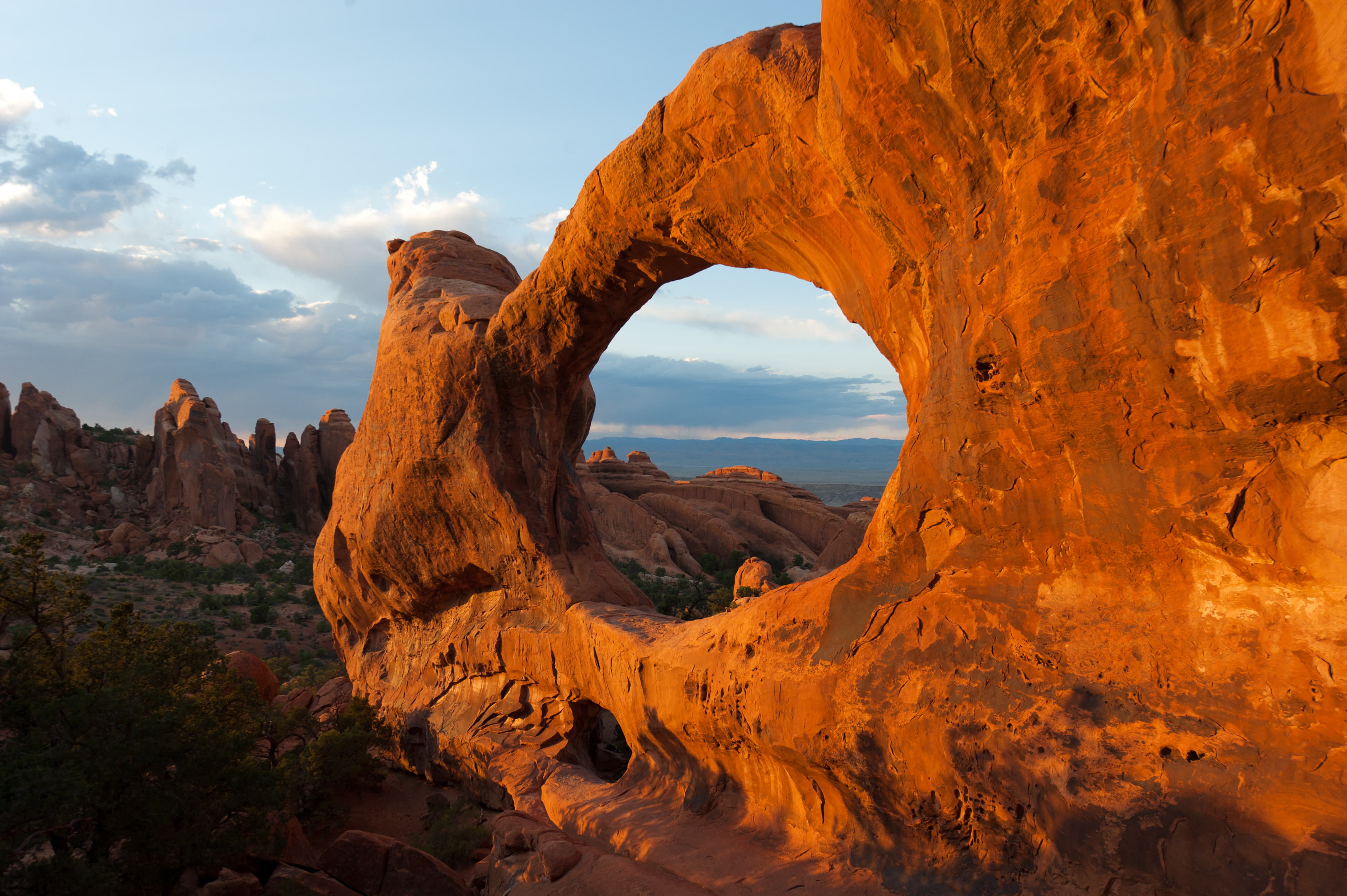
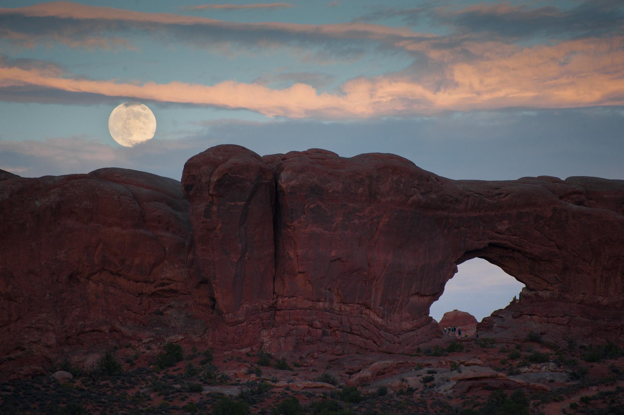
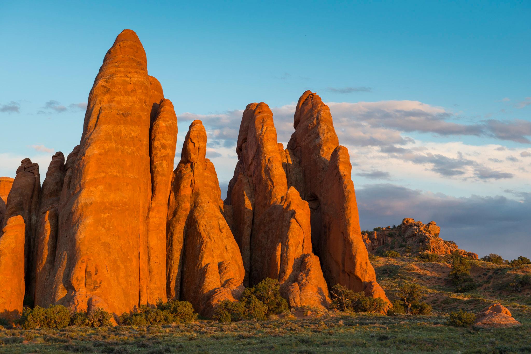
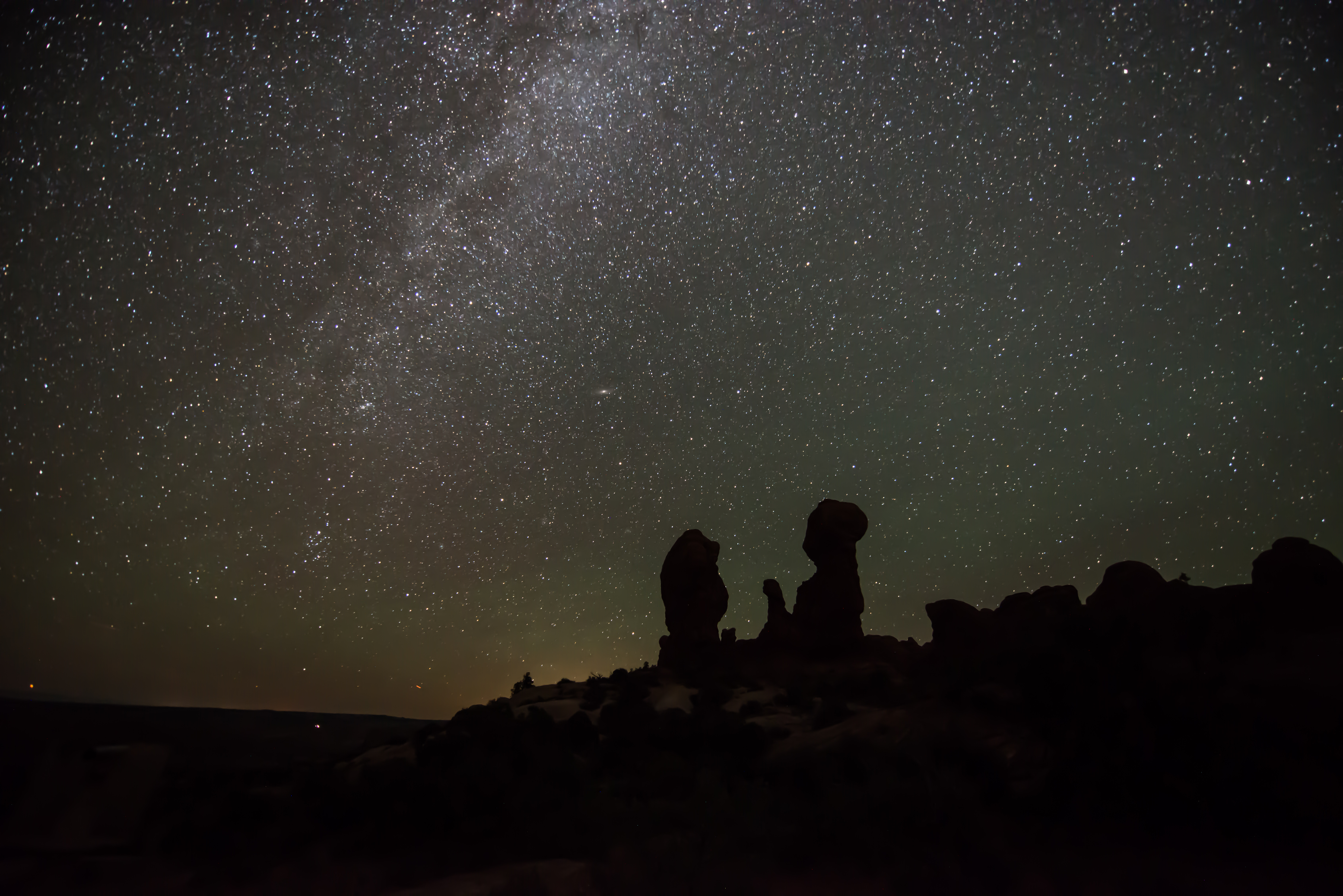
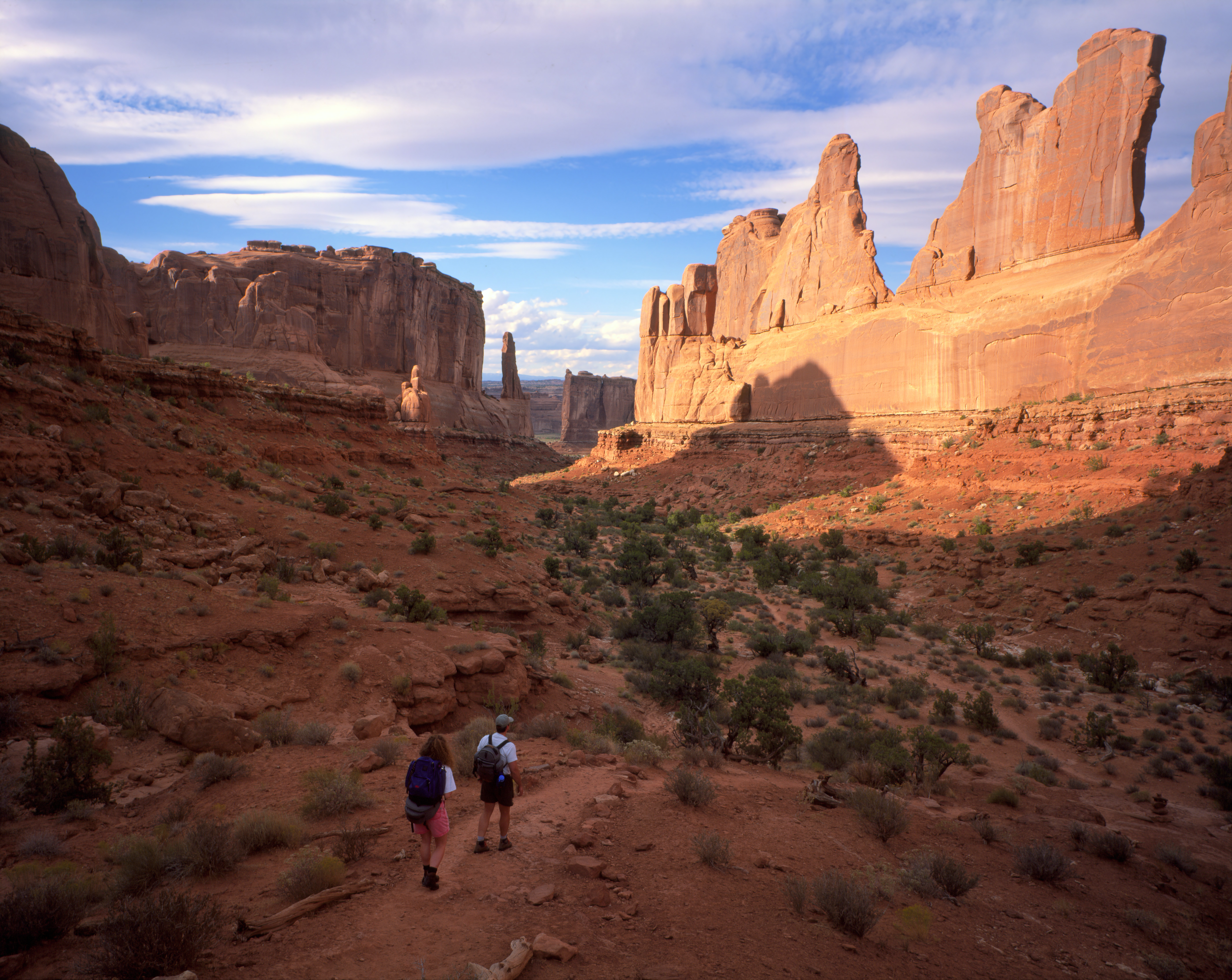
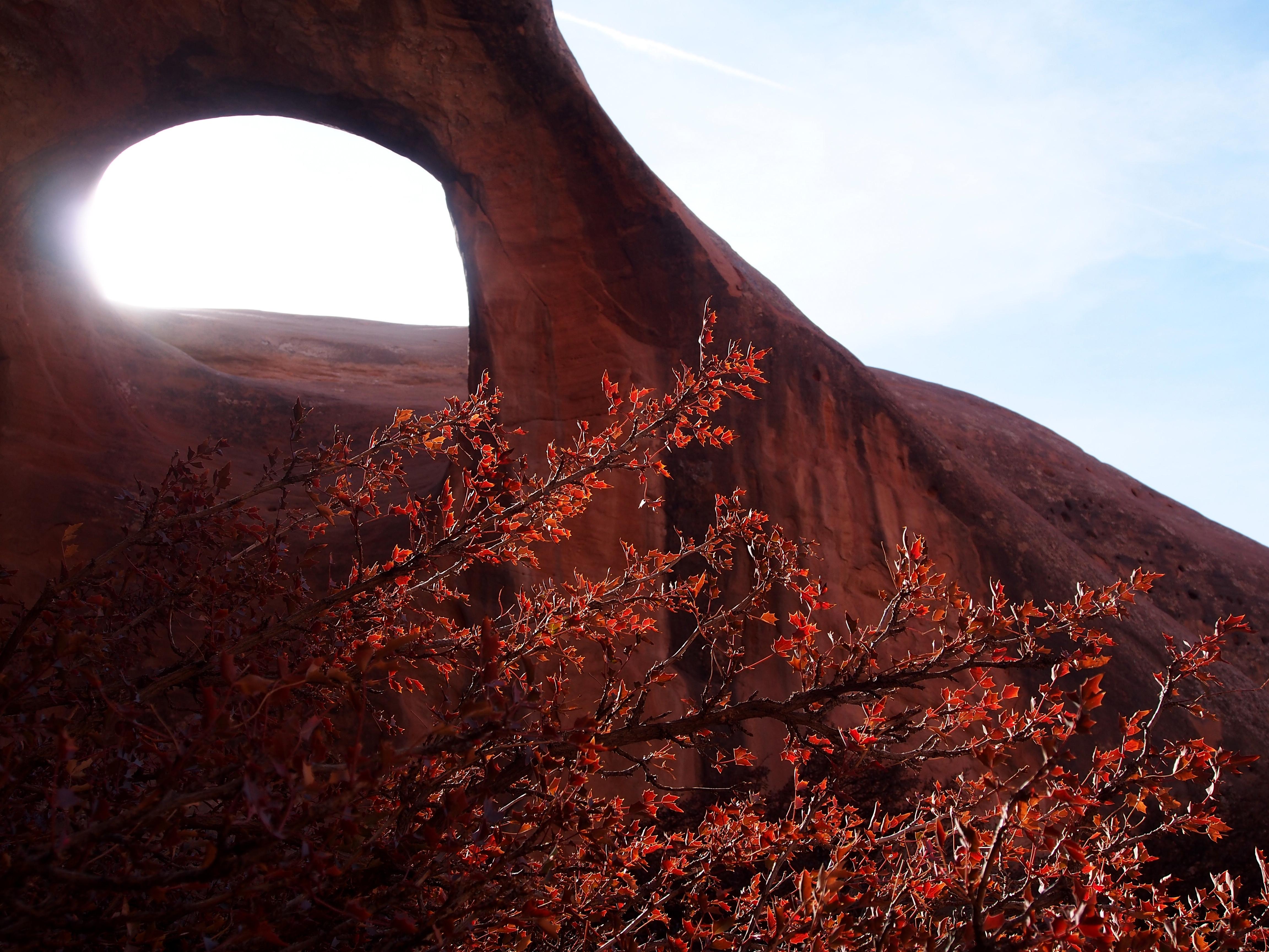


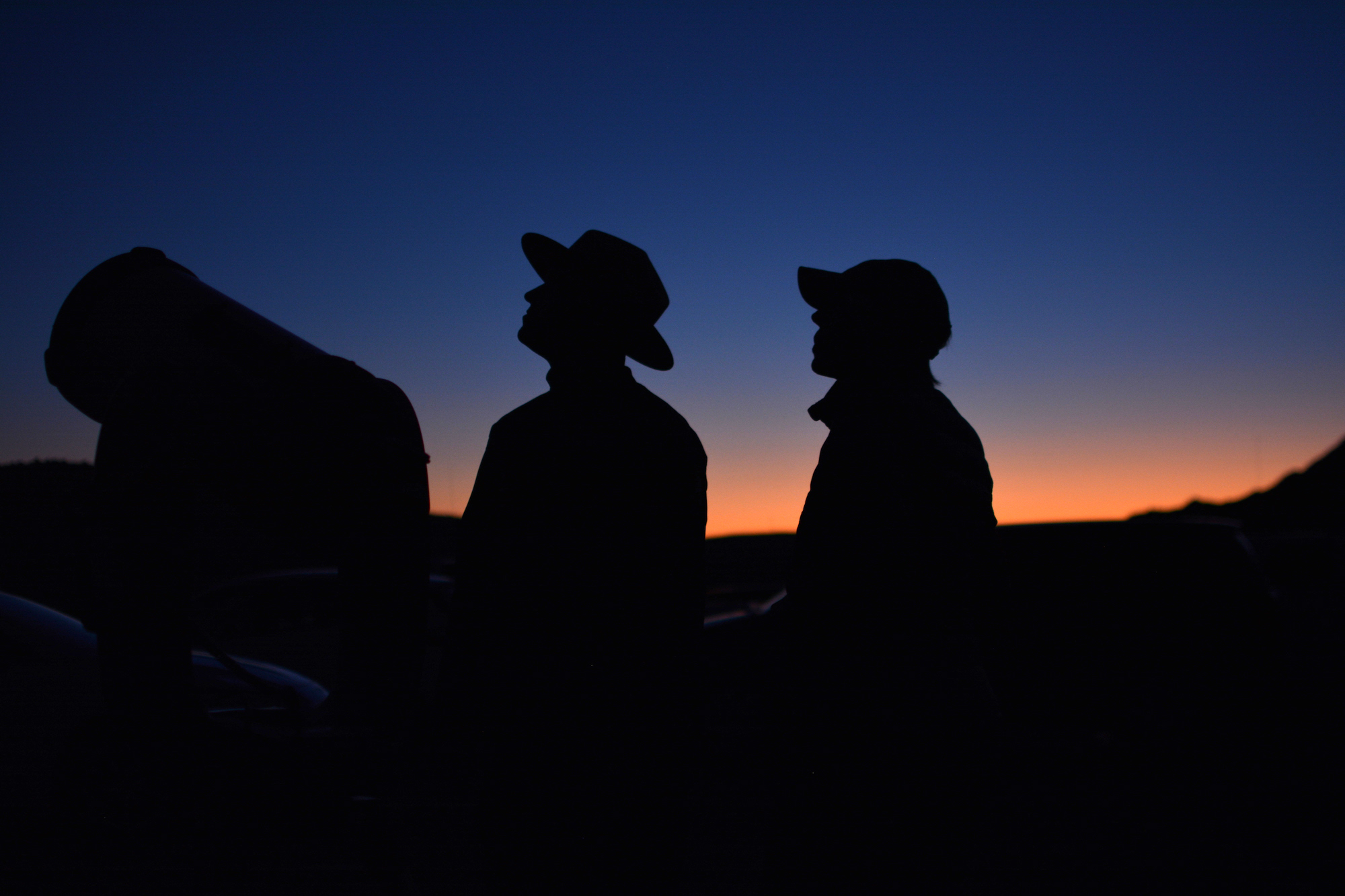

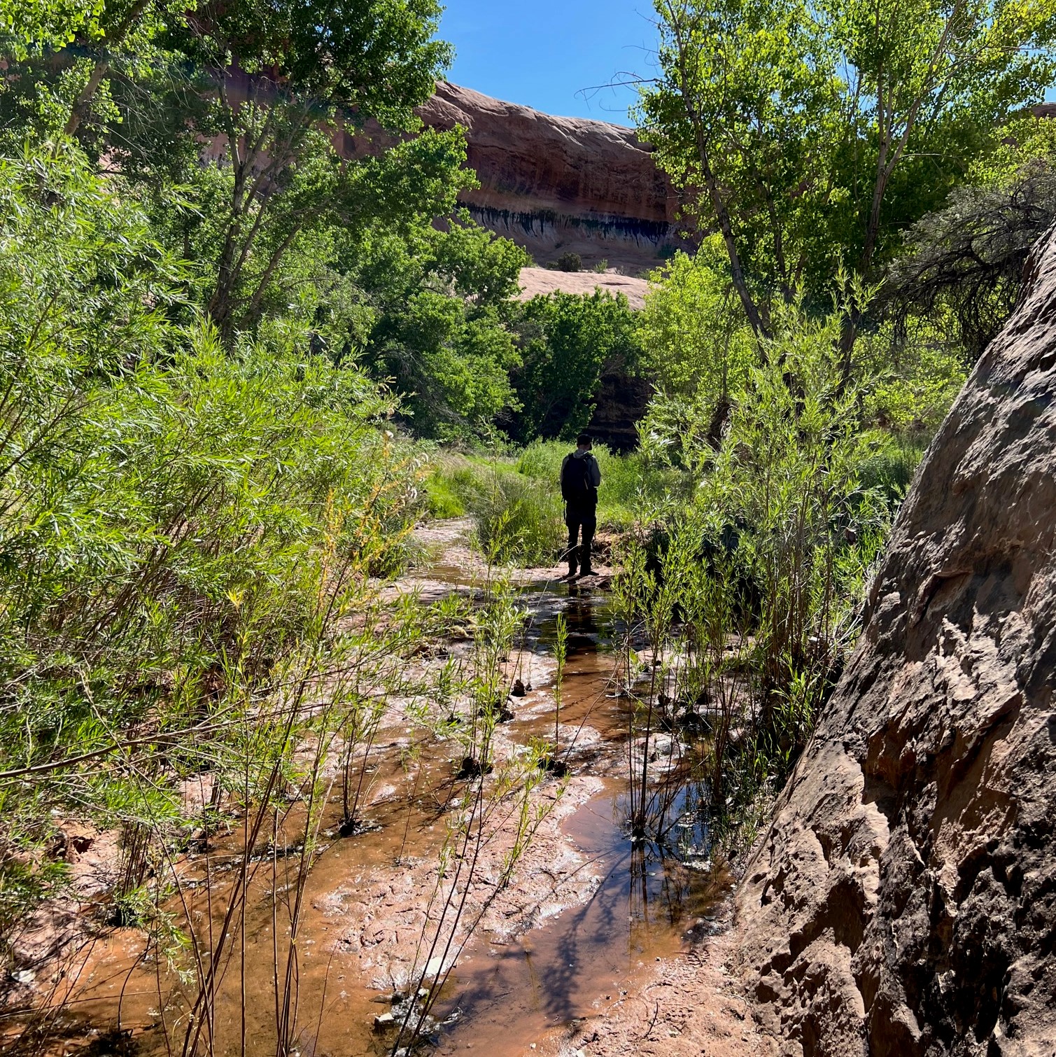
Selected official assessments, with the exact section each describes. Conditions may have changed since assessment.
Lower viewpoint only; excludes the upper trail.
Minimum tread width: 12 ft. Check for temporary washouts.
Official guidance Reviewed 2026-10-19
First paved section only; the full loop includes rock steps.
Minimum paved-section width: 6 ft. Full-loop measurements do not describe this approach.
Official guidance Reviewed 2026-10-19
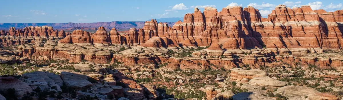 Canyons
Utah
Canyonlands is a wilderness of canyons, buttes, and spires carved by the Colorado River and Green River. The park is divided into four distinct districts; no roads join them together. The districts share similar desert ecosystems, but each one provides unique opportunities for adventure and discovery.
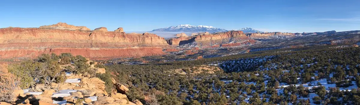 Desert
Utah
Located in south-central Utah in the heart of red rock country, Capitol Reef National Park is a hidden treasure filled with cliffs, canyons, domes, and bridges in the Waterpocket Fold, a geologic monocline (a wrinkle on the earth) extending almost 100 miles.
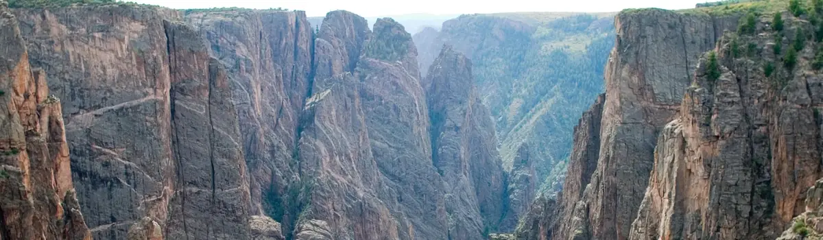 Mountains
Colorado
Big enough to be overwhelming, yet still intimate enough to feel the pulse of time. Come see some of the steepest cliffs, oldest rock, and craggiest spires in North America. Forces of nature and the Gunnison River sculpted this canyon over two million years. The result is a vertical wilderness of rock, water, and sky.