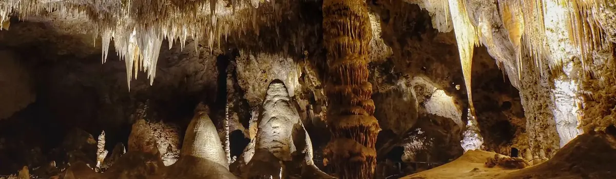
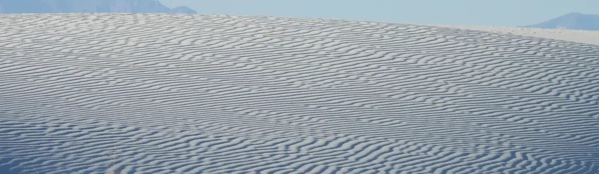
There is a place in Far West Texas where night skies are dark as coal and rivers carve temple-like canyons in ancient limestone. Here, at the end of the road, hundreds of bird species take refuge in a solitary mountain range surrounded by weather-beaten desert. Tenacious cactus bloom in sublime southwestern sun, and species diversity is the best in the country. This magical place is Big Bend...
801.2Kacres of parkland
568.1Krecreation visits, 2025
Feb · Mar · Novnearby climate picks
Seasonal access & reservations
No reviewed guidance for this selection. Check the park's official planning pages; missing coverage does not establish access.
Selected guidance only; separate from climate comfort and current conditions.
Official conditions Not checked
The conditions feed has not been connected for this park.
Editorial recommendations, reviewed 2026-10-17. Full park days, excluding travel to and from the region. A first-visit outline for a general traveler; adapt to mobility, fitness, season, reservations, and current conditions. These are suggested days, not reserved activities or guaranteed routes.
Big Bend is a hiker's paradise containing the largest expanse of roadless public lands in Texas. More than 150 miles of trails offer opportunities for day hikes or backpacking trips. Elevations range from 1,800 feet along the Rio Grande to 7,832 feet on Emory Peak in the Chisos Mountains. Elevation changes produce an exceptional variety of plants, animals, and scenic vistas. To protect the solitude and serenity of Big Bend's trails, groups larger than 30 persons must split up and hike different trails. Pets are NOT ALLOWED on trails in Big Bend National Park. Big Bend Hiking - Hike Smart! Every year rangers respond to numerous Big Bend hikers that are unprepared for the challenges of desert hiking. BEAT THE HEAT! Learn how to plan, pack, and recreate during the heat of Big Bend summers. Don't let the heat ruin your Big Bend trip!
Leave No Trace Video All Big Bend hikers and backpackers are asked to follow Leave No Trace principles. The goal is to have minimum human impact on the park as a result of your trip. This video will introduce you to Leave No Trace principles. Check out the BBNHA Bookstore for Helpful Trip Planning Materials The Big Bend Natural History Association offers a wide array of excellent trail guides, maps, and Big Bend titles.
Silence and Solitude Hike the Desert! Explore the heart of the Chihuahuan Desert. Scenery, silence, rugged landscapes, cactus, and diverse birdlife. What will YOU discover?
Explore a Sky Island Hike the Mountains The Chisos Mountains contain some of the most rewarding day hikes in Big Bend. You can enjoy over 20 miles of mountain trails.
Along the Rio! Hike the River! Some great trails provide access into spectacular river canyons or along the banks of the Rio.
More than 100 miles of paved roads throughout Big Bend National Park showcase not only gorgeous vistas, but also invite you to marvel at the geological splendor, contemplate the lives of early settlers, and observe the incredible diversity of plants and animals that call this home.Taking a scenic drive can be an ideal way to explore the park if you have limited time or if weather is not conducive for other activities.
Improved Dirt Roads
Enjoy the shift from khaki-colored desert to a forest of giant yuccas on the Dagger Flat Auto Trail, or contemplate the harsh lifestyle representative in the primitive, long-since-abandoned structure of Luna's Jacal on the Old Maverick Road. Big Bend's improved dirt roads are accessible for most vehicles, but some are rougher than others and road conditions deteriorate quickly with a passing storm. Please inquire about current conditions before venturing out along one of these roads.
Primitive Dirt Roads
Miles of primitive dirt roads lead across washboards and boulders, through canyons and creek beds, past old settlements and cemeteries. In addition to marvelous panoramic vistas, many of these roads access hiking trails, primitive roadside campsites, and the river. Primitive dirt roads are maintained for high-clearance vehicles only, and may require a 4WD. They may be rocky with areas of soft sand that are unsafe for sedans or RVs. Rain can make roads difficult to drive or impassable. Always inquire about current road conditions.
The two-mile gravel road descends down a rough, narrow wash to the Hot Springs Historic District and trailhead area. Note: Motor homes and oversize vehicles are prohibited on the one-way sections of the Hot Springs road.
Hiking to the Hot Spring
Hot spring water is considered old water, fossil water, ancient and irreplaceable. Heated by geothermal processes and emerging at 105° F., the water carries dissolved mineral salts reputed to have healing powers. The therapeutic value of heat has long been touted as a remedy of both body and soul. Be aware that some hot springs can burn you either with the scalding effects of heat or the caustic nature of the water chemistry. Use caution when bathing and limit the exposure of children to the warm waters.
Be respectful of others; soak only, and use no soaps or oils.
Swimming is not recommended; be aware that adjacent river currents and depths can be unpredictable.
Please help to keep the area clean by picking up trash.
Alcoholic beverages and glass containers are prohibited.
Overnight camping in the area of the Hot Springs is prohibited.
It is illegal to purchase items from vendors operating on the Mexican side of the Rio Grande.
Big Bend interpretive rangers provide a variety of fun, informative, and free ranger-guided activities. Join us for a guided hike, patio talk, activity, or engaging evening program and discover the many "stories behind the scenery" of YOUR national park.
Check the Big Bend National Park Calendar for this week's schedule.
Virtual Ranger Activities
Big Bend interpretive rangers also offer a variety of virtual opportunities. We look forward to sharing the stories of Big Bend with you! Join the discussion on Facebook, test your Big Bend IQ on our Big Bend Instagram Challenge, or arrange a Distance Learning program for your group or class. And for more online fun, all ages are welcome to try the virtual Junior Ranger activities here: Become a Junior Ranger
Big Bend Park Rangers
Join park rangers for guided walks, talks, and evening programs throughout the park.
Big Bend 50-Species Challenge!
How well do you know the plants and animals of Big Bend National Park? Each week we will post new quizzes.
Distance Learning
Is Big Bend too far to bring your classroom or group? Let us bring a Big Bend ranger to you through the wonders of technology.
Big Bend Fact Sheet
How big? How many species? Statistics, Significance, and Purpose.
Park Rangers and volunteers offer a variety of regularly scheduled night sky interpretive programs. Programs are fun, informative, and FREE. From star parties, to moonlight walks, our programs encourage discussions about the importance of dark night skies. Check our latest weekly Ranger Program Schedule
Night Sky Quality Map
Photo courtesy of NPS and International Dark-Sky Association
International Dark Sky Park
NPS/D. Lombardi
Further Dark Sky Reading
Of Solitude and Darkness
The Darkness That Refreshes
Of Night Skies and Kerosene Lamps
To become involved in dark sky initiatives, check out the International Dark Skies Association , or local grassroots efforts such as the Big Bend Conservation Alliance and West Texas Friends of the Night Sky.
Ranger Programs
Discover the many stories of Big Bend. Join a park ranger for fun, informative, and free guided programs.
Current conditions and weather
Current weather, river levels, webcam view, visibility, and air quality readings.
Exploring the Backcountry
Big Bend's vast areas provide excellent opportunities for solitude, wilderness, and adventure.
If you have the time and a spirit of adventure, you may want to consider a river trip. Seeing the park's canyons from the middle of the Rio Grande can be an incredible experience. Depending upon the current river levels, there are many possibilities including half-day floats or multi-day excursions.
Floating the Rio Grande can take you through miles of canyons up to 1,500 feet deep, where the sunlight may reach the bottom only briefly on winter days. As in other parts of the park, your ears may tell you more than your eyes. Listen for beavers crawling through the brush;you might catch a glimpse as one slides down the riverbank into the water. Turtles, especially red-eared sliders, often sun themselves on rocks and logs just above the waterline. Great Blue Herons, Black Phoebes, waterfowl, and Green Kingfishers are just some of the many birds you may see along the river.
Along the more open areas of the Rio Grande, you may see local people fishing, farming, and engaging in other traditional activities. These quiet stretches of the river offer expansive views of the colorful buttes, mesas, and mountains in both the U.S. and in Mexico. Far fewer people float the open water between the canyons, so it is possible to go for days without seeing another boater. A backcountry permit and specific equipment is required for day-use and overnight river trips.
There is often concern about being close to an international border, but incidents between Big Bend visitors and Mexican nationals are exceptionally rare.
The middle of the deepest channel of the Rio Grande is the international boundary. Over the course of your trip, you may cross this boundary several times. Currently, passports are not required. Landing on the Mexican bank of the river is considered an illegal crossing and could result in fines and jail time. However, limited exceptions are made when safety is a consideration: to bail/repack a boat, scout rapids, or seek shade when overheating.
Floating Santa Elena Canyon
Floating the Rio Grande Wild & Scenic River (Mariscal Canyon, Hot Springs Canyon, Boquillas Canyon, Lower Canyons)
Choose A Canyon
Boquillas Canyon
The 33-mile Boquillas Canyon stretch is a great float trip for visitors with less river experience.
Mariscal Canyon
The shortest canyon at 10 miles, Mariscal Canyon provides river runners with lots of stunning scenery and a little excitement.
The Lower Canyons
A varied landscape of open desert and deep canyons awaits those who choose this five to ten day float trip.
Santa Elena Canyon
A popular trip for day or overnight adventure. Easy access, and strikingly beautiful.
Hot Springs & San Vicente Canyons
A relaxing day or overnight float through this seldom visited stretch of river is a fun adventure for all skill levels.
River Use Regulations
Obey all river use regulations for your safety and the protection of park resources. For more information visit the river use regulations page.
By giving forethought to your actions, you can have a safe, exciting, and rewarding experience while floating the Rio Grande Wild & Scenic River. For more information visit the river safety page.
Current Conditions
Three options are available if you desire to make a river trip: you can bring your own equipment, rent equipment, or hire a guide service that will provide all permits, food, equipment, and shuttles.
Local Outfitters
Equipment checklist
Information on guided trips, equipment rental, and shuttle services. For more information visit the outfitters page.
Water Quality & River Users
The quality of water in the Rio Grande through the Big Bend region is highly variable. Big Bend National Park staff sample the water for bacterial levels on a monthly basis at several locations within the park. For more information visit the river water quality page.
Big Bend is too big to see in a single day, but a great one-day trip to the park might include a trip down the Ross Maxwell Scenic Drive and a visit to the Chisos Basin .
The Ross Maxwell Scenic Drive will give you fantastic views of the Chihuahuan Desert landscape and will lead you to the banks of the Rio Grande. There are scenic overlooks and exhibits along the way, and the short walks to Sam Nail Ranch and Homer Wilson Ranch and a visit to the Castolon Historic District will give you a glimpse into Big Bend’s past. At the end of the road is a highlight of the trip; a short walk into Santa Elena Canyon —one of Big Bend’s most scenic spots and an easy 1.4 mile round-trip hike. Visit the forested Chisos Mountains and walk the 0.3-mile Window View Trail to get a feel for the mountain scenery. If time allows you might consider hiking the Window Trail or Lost Mine Trail for a closer look at Big Bend's mountain landscapes, or enjoy lunch at the only restaurant in the park The award-winning Fossil Discovery Exhibit located 8 miles north of Panther Junction is another park highlight that could easily fit into a one-day visit.
Join A Park Ranger: Guided Programs
Big Bend National Park is a wonderland of outdoor scenery and adventure. If you only have one day, this video will help you decide on the perfect itinerary.
Three-Day Itinerary:
With three days to spend in the park, you can explore the major roads more thoroughly and still have time for hiking. Check the latest schedule and join a park ranger for a guided walk, talk, or evening program to learn more about your park. Consider spending a day in each of the three major areas of the park:
In the Chisos Basin area, consider hiking the Window Trail (6 miles round trip) or the Lost Mine Trail (5 miles round trip). Visit the day hikes page for more information about other trails you might enjoy hiking during a three-day visit. Try to experience Big Bend's wilderness as much as possible. See the Ross Maxwell Scenic Drive including a short hike into Santa Elena Canyon (see suggestions for "one day"). Drive to Rio Grande Village , perhaps stopping at Dugout Wells along the way to walk the Chihuahuan Desert Nature Trail. Look for birds or walk the short Chihuahuan Desert Nature Trail. The Rio Grande Village Visitor Center offers exhibits about the river. Nearby you can also walk the Rio Grande Village Nature Trail , which begins in the campground near site #18. The bluff overlooking the Rio Grande at the end of the nature trail is a particularly beautiful spot at sunset. At the end of the road is the Boquillas Canyon Trail, which takes you to the entrance of this spectacular canyon. If you have a valid passport, a short visit to the nearby small Mexican village of Boquillas del Carmen is always a memorable experience.
Week-long Itinerary:
With a week or more to spend in Big Bend, endless possibilities are open to you. You'll have plenty of time to explore the roads mentioned in the previous sections, and also have time to hike or drive some of the "unimproved" dirt roads . For these roads, you'll need a high-clearance vehicle (and possibly four-wheel drive). Check at a visitor center for current road conditions. The River Road, Glenn Springs Road, Old Ore Road, and Old Maverick Road are some of the more popular backcountry routes. A visit to Ernst Tinaja near the southern end of Old Ore Road is a Big Bend highlight. If you don't have high clearance or four-wheel drive, improved dirt roads such as Dagger Flat and Grapevine Hills will get you "off the beaten path." Hike the Chimneys Trail, Mule Ears Trail, or Grapevine Hills Trail for a closer look at the desert environment. If you'd like to explore the Chisos Mountains, trails to Boot Canyon , Emory Peak and the South Rim offer fantastic views of the park and take you into a forested mountain environment which seems far removed from the desert. There are also plenty of opportunities for overnight backpacking along these trails (a backcountry use permit is required).
Planning a trip to Big Bend? Learn how to be prepared for a safe, enjoyable, and meaningful adventure!
Read all about it! Get the latest issue of the official visitor's guide to Big Bend National Park.
Be prepared for summer in the desert. Remote, beautiful, and HOT.
One app, every park at your fingertips. The NPS App is the new official app for the National Park Service with tools to explore more than 400 national parks nationwide. Find interactive maps, tours of park places, on-the-ground accessibility information, and much more to plan your national park adventures before and during your trip.
The free app is currently available for iOS and Android devices.
Download the NPS App
The first step to begin your national park app adventure is to download the NPS App onto your mobile devices, such as phones or tablets. The NPS App is currently available for iOS- and Android-powered devices. It can be downloaded for free through the App Store and Google Play
The NPS App was created by National Park Service staff—people who know national parks—to help you make the most of your visit. The NPS App takes authoritative information from park rangers and combines it with a great suite of features. Here’s a quick look at some of those features.
Interactive Maps: Each park has a detailed map that includes points of interest, along with roads, trails, and other information to plan your trip.
Park Tours: What is there to see? Self-guided tours take you to interesting places in the park. Discover popular destinations as well as places off the beaten track. It’s like having a ranger by your side to guide your trip, giving you suggestions for places to go, directions to get there, and things to do once you arrive.
Amenities: It's the little—and sometimes not so little—things that can make or break a park visit. Learn where you can find and access transportation, food, restrooms, shopping, and more.
Accessibility: The app offers a fully accessible experience with tools to benefit visitors with accessibility needs, such as audio descriptions of exhibits along trails and roads and in visitor centers.
Offline Use: No internet access? No problem! You can download content from entire parks for offline use. It’s especially handy if you’re exploring remote areas in parks or concerned about data limits.
Share Your Visit: Tell your friends and family about the fun things you did by creating and sharing virtual postcards with scenes from the park.
Things to Do: What do you want to do in a park—hike? Take a bus tour or scenic drive? Visit a museum? Join a ranger program? Become a junior ranger? Discover all the fun, entertaining, and educational activities parks have to offer.
News, Alerts & Events: What’s happening? Get news and events for all parks—or selected parks of your choosing.
We’re just getting started. If you don’t find what you are looking for now, check back regularly as our rangers continue to add more ways for you to experience each of our parks through the NPS app. The National Park Service is also planning to expand features, so stay tuned for more!
Big Bend's vast undeveloped areas provide excellent opportunities for backcountry experiences if you seek solitude, wilderness, and adventure! Use the information on the pages below to learn more about the types of backcountry use and planning and preparation for your next trip.
Coming to Big Bend with a large group?
Visitors planning on backpacking with large groups should be aware of the backpacking group size limit. An organized group or individual party may not exceed a 15 person limit.
In the Chisos Mountains: There is only one Chisos backpacking campsite that can accommodate a group this size: it may be necessary to split the group to other campsites. Groups may split into separate campsites - however the 15 person size limit per group cannot be exceeded.
In the desert: Groups over 15 people will also need to split up and backpack into separate, non-adjacent zones
Choose Your Backcountry Adventure
Hit The Trail! Day Hikes Big Bend is a hiker's paradise. More than 150 miles of desert and mountains trails to explore!
Spirit of Adventure! Big Bend River Trips Enjoy a day trip, or plan an extended float through spectacular limestone canyons.
Into the Wild! Backpacking For those who come prepared, there are hundreds of miles of trails, the Chisos Mountains, and desert expanses to explore with a pack.
Back of Beyond Explore Primitive Dirt Roads Explore the Big Bend backcountry with your rugged vehicle.
Off the Beaten Path! Primitive Roadside Campsites If you have a rugged vehicle, primitive camping in designated roadside campsites might be for you.
Big Bend from the Saddle! Horeseback Riding For visitors with horses, Big Bend offers many opportunities to for mountain and desert explorations.
Prepare for your Adventure
Your Ticket to Adventure Backcountry Permits A backcountry permit is required for all backcountry camping. Pick one up at Chisos Basin or Panther Junction Visitor Centers.
Protect YOUR Park Backcountry Regulations YOU are responsible for protecting the resources of YOUR park; these regulations are strictly enforced.
Stay Alive! Backcountry Preparation and Safety Knowledge and preparation is the key to your successful Big Bend adventure.
Be Prepared! Backcountry Water Sources But the map shows a spring here??
Keep Wildlife Wild Backcountry Food Storage Black bear, birds, javelina, skunks, and other animals can and WILL explore your campsite looking for scraps of food.
Be a Big Bend Steward Leave No Trace During your visit to Big Bend, do everything you can to minimize your impact on the desert landscape..
Great Sunset Spot! Sunsets and Sunrises in Big Bend
Official NPS activity guide.
Cruise through alluring scenery...
Immerse yourself in the history...
Encounter the dark of night...
Spot birds on the wing...
Glide down the river...
Big Bend has lots to explore! Use these suggested itineraries to help get the most out of your visit.
Be prepared for summer in the desert. Remote, beautiful, and HOT.
One app, every park at your fingertips. The NPS App offers tools to explore more than 400 national parks nationwide.
Join A Park Ranger: Guided Programs
Road Trippin' Scenic Drives Hit the road and explore the park's gorgeous vistas. Paved highways and dirt roads provide access to an incredible array of experiences.
Hit The Trail! Day Hikes Big Bend is a hiker's paradise. More than 150 miles of desert and mountains trails to explore!
Spirit of Adventure! Big Bend River Trips Enjoy a day trip, or plan an extended float through spectacular limestone canyons.
Into the Wild Exploring the Backcountry Big Bend's vast areas provide excellent opportunities for solitude, wilderness, and adventure. Backpacking, river trips, primitive camping.
Thousands of Stars! Night Skies and Stargazing Big Bend is one of the best places in North America to enjoy a truly dark sky.
Great Sunset Spot! Sunsets and Sunrises in Big Bend What better place to enjoy the most magical time of day?
Pedal Power Bicycling Over 120 miles of paved roads and 180 miles of backcountry dirt roads provide challenges for riders of all types and abilities.
More than any other national park Big Bend Birds Big Bend is a world-famous location for birds and birdwatching. Learn more about the feathered wonders of Big Bend.
Kids Love Big Bend! For Kids See what there is for kids to do online and during your visit to Big Bend National Park.
Bicyclists must share the roads with vehicles and obey all traffic laws. Paved roads within the park are narrow and often have no shoulders. Bicyclists should take proper measures to stay safe, such as riding single-file, wearing bright and/or reflective clothing, and being away of their surroundings.
Traffic is sparse in summer and highest during March and early April and on holiday weekends throughout the year. Use extreme caution. A good map is essential. Maps and road guides are available at the Big Bend Natural History Association Book Store.
Weather is often pleasant year-round and rewarding trips are possible most days of the year. Cycling from May to September is more of a challenge due to high temperatures.
Many of the rides in Big Bend National Park are easier with a shuttle. A few suggestions follow. Check with a ranger for more information.
If you have a shuttle available:
Panther Junction to Rio Grande Village
Difficulty: Easy; Distance: 20 miles, paved; Time 1.5-2.5 hours
Although there are some hills the ride is mostly downhill as the elevation drops 1,900ft. over the course of the ride. Be wary of large motorhomes and trailers travelling this road, especially during fall, winter and spring. For a variation, ride to the Hot Springs Historic District on the 2-mile unpaved spur road 16 miles from Panther Junction. Your shuttle can meet you at either Rio Grande Village or the Hot Springs. The ride has outstanding views of the Sierras del Carmen and the Rio Grande in the distance.
NPS Photo/Cookie Ballou
Panther Junction to Rio Grande Village via the Glenn Springs Road
Difficulty: Moderate; Distance 10 miles paved, 25 miles unpaved; Time: 4-6 hours Ride six miles toward Rio Grande Village on the paved road, then turn onto Glenn Springs Road. Follow it for 15 miles as it skirts the Chisos Mountains and leads to a desert spring before joining the River Road. Turn left and follow the River Road for 9.6 miles to its junction with the paved road. Turn right and ride on the paved road for 4 miles to Rio Grande Village.
Panther Junction to Castolon via the Ross Maxwell Scenic Drive
Difficulty: Strenuous; Distance: 26 miles, unpaved; Time: 4-6 hours This ride is best taken from north to south for an easier ride and great views of the Chisos Mountains. The road is rough and rocky and the terrain is challenging. Park on the edge of the Dagger Flat Auto Trail at the north end of the Old Ore Road.
Old M averick Road
Difficulty: Easy; Distance: 13 miles, unpaved: Time: 1.5-2 hours one-way Start from the parking lot near the Maverick Entrance Station. This route is easiest north to south. There are many good views along the route, which ends at Santa Elena Canyon. Seasoned riders can return to Maverick for a strenuous 26-mile trip.
If you do not have a shuttle available:
Panther Junction to the Chisos Basin
Grapevine Hills Road
Difficulty: Moderate; Distance: 15 miles, unpaved; Time: 2-3 hours round-trip Park at the junction of the paved road and the Grapevine Hills Road for this ride past interesting rock formations. For variety, hike the 2-mile round-trip Grapevine Hills Trail near the end of the road. Return the same way.
Difficulty: Moderate; Distance: 15 miles, unpaved; Time: 2-3 hours round-trip Park at the junction of the paved road and the Paint Gap Road. The road has a variety of surfaces including sand and rocks, and is especially rough near the end. Return the same way.
Dagger Flat Auto Trail
Difficulty: Easy; Distance: 18 miles, unpaved; Time: 2-3 hours round-trip Park near the junction of the paved road and the Dagger Flat Auto Trail. This route is fairly flat with a gentle uphill on the way out. Watch for sand along the way--you can get bogged down. There are many interesting plants along the route. Return the same way.
Big Bend's diverse habitats—the Rio Grande river corridor, the Chihuahuan Desert and the Chisos Mountains—are all rich with plants, animals, and stories of human history that offer a variety of learning opportunities for children of all ages.
There are several easy hikes in the park that kids of all ages enjoy, including the Window View and the Basin Loop trails in the Chisos Basin. For older children, the Lost Mine Trail provides a good challenge and is an excellent day hike. Other hikes children may enjoy include the Chihuahuan Desert Nature Trail at Dugout Wells, the Rio Grande Village Nature Trail (with a boardwalk across a beaver pond), and the Boquillas Canyon Trail.
Kids may also enjoy viewing fossils and exhibits about dinosaurs at the Fossil Discovery Exhibit and Panther Junction Visitor Center. The Chisos Basin Visitor Center has an excellent mountain lion exhibit and neat information about bears.
The park offers a variety of ranger-led programs . These include guided hikes, evening slide programs, bird walks, and guided explorations of various park features. Stop by one of the park's visitor centers to meet a park ranger and learn more.
If you are writing a school report, or just want to learn more about Big Bend National Park, visit the History & Culture , Nature , Plan Your Visit , and Web Ranger sections of our website.
Become a Big Bend Junior Ranger!
To make the most of your visit, stop by any park visitor center and pick up Junior Ranger Activity Book. By visiting various places in the park and completing activities in the book, you may become a Big Bend Junior Ranger and earn a badge! For those who can't make it to Big Bend right now, you can become a Big Bend Web Ranger from home. Become a virtual expert on Big Bend fossils, geology, plants, animals, and history and receive cool certificates.
Junior Ranger Critter Count Coloring Sheet
The desert of Big Bend is home to many creatures. Can YOU find them all?
Distance Learning
Our distance learning program is currently not active. Please check back in 2026.
National parks are great places to explore . Go on an outdoor adventure. Walk in the footsteps of famous people. Take in unique scenery. Explore new interests. Experience real places you may have only heard about. But most of all, national parks are places where you can have fun and create memories that last a lifetime.
Every Kid Outdoors
Junior Ranger Park Explorer
What do volcanoes, forts, and rivers have in common? They can all be found in national parks! With over 420 national park units to explore, where will your adventure take you this time? Plan Your Park Adventure!
Big Bend Creature Quiz
How well do you know the wildlife of Big Bend? Take the quiz below to find out!
Try to match each clue on the left with an animal on the right. Drag the arrow in the middle to either side to see the answer.
Official NPS features and USGS park boundaries, imported 2026-10-17. An inventory snapshot, not live trail or parking availability.
Loading official park features…
TrailsPoints of interestParkingZoom with buttons or pinch. Toggle layers on the map.
Map coverage varies. Trail names may represent segments, connectors, or shared park units; mapped lines are not a hiking recommendation. Use official conditions and navigation resources before heading out.
Boquillas Canyon Inventory record · 1 source segments; not a route distance.
Native
Hiker/Pedestrian
Page 1 of 8
NPS public GIS inventory, imported 2026-10-17. “Existing” is an inventory classification, not confirmation that a trail is open. Segment counts are not route distances. Parking records do not indicate space availability, fees, or accessibility certification. View government source ↗
Climate for Manuel Ojinaga, 118 km from the park reference point. 1991–2020 normals. Source elevation: 799 m.
Daytime highNighttime lowOctober: 84° / 59°
Daytime high84°
Precipitation17 mm
Daylight11.3 hrs
Wind7.2 km/h
Mountain, rim, valley, and coastal conditions can differ sharply from the source town. Check park forecasts and current conditions before travel.
Monthly climate data 12 months · °F
Month
High
Low
Rain / snow water
Wet days
Daylight
65°
39°
11 mm
2.1
10.3 h
71°
44°
9 mm
1.6
10.9 h
79°
51°
7 mm
1.1
11.8 h
87°
58°
8 mm
1.5
12.7 h
94°
66°
13 mm
2.5
13.5 h
98°
73°
14 mm
3.2
13.9 h
96°
75°
34 mm
5.5
13.7 h
95°
74°
27 mm
5.1
13.1 h
90°
68°
31 mm
4.4
12.2 h
84°
59°
17 mm
3.0
11.3 h
73°
47°
12 mm
2.0
10.5 h
65°
40°
11 mm
1.9
10.1 h
RESEARCH WITH THE SOURCE IN VIEW
The practical field guide.
Official NPS excerpts imported 2026-10-17. Fees, permits, road access, and operations can change; use the source link to confirm the latest information.
The National Park Service Mobile App is a great tool for planning your trip, then it can be used as a guide during your visit. You can download the maps and content from Big Bend National Park for offline use. It’s especially handy if you’re exploring remote areas or concerned about data limits. Free and available now. Visit this webpage (updated daily) for the current list of what is open and closed, and the hours of operation.
Physical Address
Operating Hours & Seasons
Weather Details
Visitor Centers
Internet & Cellular Access
Internet & Cellular Access Details
Peak Visitation
Big Bend's busy season is generally November through April, and the park camping and lodging is often full to capacity during 3-day holiday weekends, Thanksgiving week, the Christmas holiday season, and mid-January through mid-April . Advance reservations for camping and lodging are required. To maximize your visit, plan ahead and have a flexible itinerary during the park's busiest times .
Pets in the Park
Having a pet with you will limit some of your activities and explorations in the park. In addition, desert temperatures and predators are a serious threat to your pet's well being. For more information visit the pets page .
Visiting a Border Area
The Rio Grande serves as the international boundary between the United States and Mexico. A passport is required for entry into Mexico. For more information visit the border travel page .
Big Bend has mild winters and hot summers. The weather is generally sunny but come prepared for changing conditions. For more information visit the weather page .
Big Bend Fact Sheet
Just the Facts! How big is the big bend? How many animals live here? When was it established? How many employees? etc..
Local Outfitters
From guided trips, equipment rental, shuttle services, tours, horseback riding, and more, there are a variety of services available in the local area.
Internet and Cellular Access
Free, public WiFi is available at all park visitor centers , the Chisos Mountains Lodge, and the Rio Grande Village Store. Cell service is very spotty throughout the entire Big Bend area. Areas with fairly reliable service include the Chisos Basin area (only Verizon), and near Panther Junction.
Visiting Sustainably
Big Bend is a fragile environment that relies on protection from all of us. Check out our Sustainability page to learn how you can be the best steward of this amazing place while you visit. Big Bend also has a large recycling program. Learn what and where you can recyle and how we're working to reduce the impact of our landfill on the Recycling page.
There are four campgrounds in Big Bend National Park. The National Park Service (NPS) operates three developed frontcountry campgrounds that provide drinking water and restroom facilities. In addition, a full hookup RV camping area is operated by the park concessioner, Aramark. Wood fires and ground fires are NOT allowed anywhere in the park. A charcoal fire in an above-ground grill is allowed; ashes must be packed out. Liquid-fuel stoves are allowed. For any questions regarding developed campgrounds, please contact us at 432-477-1121.
NPS Campgrounds
Chisos Basin Campground (Located in the center of the park in the Chisos Mountains) Open. Reservations REQUIRED.
Rio Grande Village Campground (Located near the Rio Grande on the east side of the park) OPEN. Reservations REQUIRED.
Cottonwood Campground (Located near the Rio Grande on the west side of the park) Closed for summer
Rio Grande Village RV Park (Operated by Aramark. 25 sites with full hook-ups). Maximum length 38 feet.
Located adjacent to the Rio Grande Village Store. For reservations call 855-765-1324
Campgrounds Outside of Big Bend National Park
There are now many options for camping outside the park when Big Bend is full.
Backcountry Camping
For visitors with rugged vehicles, or the willingness to leave the road behind and backpack into the wild, Big Bend provides options for backcountry camping. No dispersed camping or "boondocking" is allowed in Big Bend National Park. All campers must be in designated campsites with a permit. A backcountry permit is required for all backcountry camping and river trips.
Permits for most designated backcountry campsites ( Chisos Backpacking Campsites & Primitive Roadside Campsites ) are usually available online through www.recreation.gov . Due to large amounts of rain and the resulting road closures, until further notice all backcountry campsites can only be obtained in person at Panther Junction Visitor Center.
Permits for desert backpacking and primitive roadside sites along the Maverick Road and remote River Road and Old Ore Road are available in person only at Panther Junction Visitor Center.
Off the Beaten Path! Primitive Roadside Campsites If you have a rugged vehicle, primitive camping in designated roadside campsites might be for you.
Into the Wild! Backpacking For those who come prepared, there are hundreds of miles of trails, the Chisos Mountains, and desert expanses to explore with a pack.
Spirit of Adventure! Big Bend River Trips Enjoy a day trip, or plan an extended float through spectacular limestone canyons.
Backpacking Group Size Limit
An organized group or individual party may not exceed a 15 person limit . Organized Groups over 15 will require a Special Use Permit
In the Chisos Mountains: There is currently only one Chisos backpacking campsite that can accommodate a group of 15. Groups may split into separate campsites - however the 15 person size limit cannot be exceeded. (A group is limited to a total of 15 people in the High Chisos at one time.)
In the desert: Groups over 15 people will also need to split up and backpack into separate, non-adjacent zones.
Camping Stay Limits
Visitors are welcome to stay in the park up to 14 consecutive nights in either a front or backcountry site, with a limit of 28 total nights in the park in a calendar year.
Campers can occupy a specific site up to 14 total nights in a year .
EXCEPTION: During the busy season from January 1–April 15, visitors are limited to a total of 14 nights in the park .
If you have comments or suggestions about facilities, services, or programs, please let us know. For more information, call Big Bend National Park at 432-477-2251 (voice) or 432-477-2370 (TDD) or write to: Superintendent, Big Bend National Park P.O. Box 129, Big Bend National Park, Texas 79834.
Visitor Centers and Exhibits
Panther Junction Visitor Center Has reserved parking and is accessible by ramp. The restrooms, exhibit area, bookstore, information desk, and drinking fountain are wheelchair-accessible. A large relief map of the park is available and can be touched. A TDD is available on request. Rangers are on duty to answer questions and assist visitors.
Chisos Basin Visitor Center Has reserved parking and is accessible by ramp. The exhibits, restrooms, and drinking fountain are wheelchair-accessible. Information is available in a variety of formats including audio and visual. Exhibits are available in English and Spanish.
Persimmon Gap Visitor Center Has reserved parking and is accessible by ramp. Exhibits, bookstore, restrooms, and drinking fountain are wheelchair-accessible. Also features a touch exhibit with animal furs, fossils, and plants.
Rio Grande Village Visitor Center Has reserved parking and is accessible by ramp. A large relief map of the area is touchable. The exhibit area, bookstore, and restrooms are designed for wheelchair-accessibility.
Fossil Discovery Exhibit Has reserved parking and is accessible by ramp. The exhibits and vault toilet are wheelchair-accessible.
Cottonwood Campground at Castolon has wheelchair-accessible vault toilets. Two campsites are accessible with a flat paved surfaces, and paved pathway to the nearby accessible vault toilet. Most other campsites are very level and useable by people in wheelchairs.
Chisos Basin Campground site #37 is fully accessible for wheelchair users. The adjoining restroom is also accessible. Other sites near the accessible restroom are flat and smooth and may be suitable for wheelchairs or individuals with mobility challenges.
Rio Grande Village Campground site #14 is fully accessible. The adjoining restroom is also accessible. Other sites near the accessible restroom are flat and smooth and may be suitable for wheelchairs or individuals with mobility challenges..
Dugout Wells Picnic Area has accessible tables and an accessible vault toilet.
The Chisos Basin has a accessible picnic area opposite from the Basin Visitor Center.
The Fossil Discovery Exhibit has a shaded, accessible picnic area.
the Daniels Ranch picnic area near the Rio Grande Village campground is a flat, grassy picnic spot that may be accessible to wheelchairs or individuals with mobility challenges.
The picnic area at Cottonwood Campground has accessible tables and an accessible vault toilet nearby.
Panther Path , a short, self-guiding nature trail at Panther Junction, is accessible to wheelchairs. Chihuahuan Desert plants are labeled with trail signs.
Window View Trail , a 0.3 mile self-guiding trail in the Chisos Basin is fully accessible to wheelchairs, and provides outstanding views of the window formation and the Chisos Mountains.
Rio Grande Village Nature Trail Boardwalk (the first 0.25 mile of the trail), is wheelchair accessible. It is a short, wide dirt trail that leads to a boardwalk. This area is an excellent place for observing birds and aquatic plants and animals.
There are accessible vault toilets at Daniels Ranch near Rio Grande Village campground, at the Persimmon Gap Visitor Center , and at the Sotol Vista overlook on the Ross Maxwell Scenic Drive. Vault toilets at the Boquillas Canyon, Santa Elena Canyon, and Hot Springs trailhead areas are accessible, although rugged terrain precludes wheelchairs on the nearby trails.
Rio Grande Village Amphitheater is wheelchair-accessible. Rangers frequently present evening programs in winter and spring.
Chisos Basin Amphitheater is accessible by a dirt ramp, although some grades are steep due to rugged terrain. The amphitheater itself is designed for wheelchair use. Rangers present evening programs there on a periodic basis year-round.
Panther Junction Theater is fully accessible.
Panther Junction Community Room is fully accessible for scheduled events.
Nature Walks presented on the Window View Trail are accessible. Most other guided walks are not wheelchair-accessible due to rough terrain.
Check weekly activity schedules for information regarding the accessibility of other ranger-led activities.
Scenic Overlooks
Most scenic overlooks and wayside exhibits are accessible to wheelchair users. Where possible, reserved parking is provided.
Concession Facilities
Chisos Mountains Lodge , gift shop, and restaurant are wheelchair-accessible. Wheelchair accessible restrooms are available adjacent to the main lodge building. Some guest rooms are wheelchair-accessible, and some are equipped with visual fire alarms for hearing-impaired guests.
Rio Grande Village Store is fully accessible, as are shower facilities and laundry. The restrooms are equipped with grab bars, but are not fully accessible.
Chisos Basin Store and the Camp Store at Castolon are wheelchair-accessible.
Contact Aramark at 432-477-2291 for more information about concession facilities.
The following rafting companies offer float trips for disabled visitors. Please contact them in advance.
Big Bend River Tours 1-800-545-4240
Desert Sports (432) 371-2727
Far Flung Outdoor Center 1-800-839-7238
Entrance Fees and Passes
The Access Pass is a free lifetime entrance permit to all federal parks, monuments, and recreation areas. It also provides a 50% reduction of camping fees. The Access Pass is issued to United States residents who are permanently disabled. Access passes may be obtained at park service visitor centers or online. For more information see the passes page.
All vehicles entering Big Bend National Park are subject to an entrance fee.
No cash is accepted; credit/debit card only .
No refunds are given due to inclement weather
There are no reservations required for entering Big Bend National Park. There are no day passes issued, and there is no limit to the number of visitors entering the park each day.
Key Information
Get an entrance pass All visitors must have one of these entrance passes: Pass Price Standard Pass $15.00–$30.00 Annual Pass $55.00 America the Beautiful Pass (includes Senior Passes) FREE–$250.00 Help me choose an entrance pass
Plan to go cashless This park does not accept cash.
Choosing an Entrance Pass
Do you have or qualify for a discounted America the Beautiful Pass?
If you already have an America the Beautiful—the National Parks and Federal Recreational Lands Pass, that's the only entrance pass you need. Seniors, military, visitors with a permanent disability, and families with a 4th grader are eligible for a free or discounted America the Beautiful pass.
America the Beautiful Pass
How often do you plan to visit national parks in the next 12 months?
If you don't qualify for a discounted America the Beautiful pass, we recommend choosing an entrance pass based on your trip plans.
Entrance Passes
Big Bend National Park Annual Pass: $55 Covers entrance fees to Big Bend National Park. Pass is available at Big Bend National Park entrance stations or any visitor center. Good for one year from purchase date. Pass is non-transferable.
Standard Entrance Pass
If you enter the park in a motorized vehicle, your entrance pass covers both you and your passengers. Your passengers do not need a separate pass.
Costs for vehicles with more than 15 passengers are listed below under Organizations and Businesses .
Private Vehicle $30.00
In-person Purchase Locations
Panther Junction Visitor Center Credit/Debit Only
Chisos Basin Visitor Center Credit/Debit Only
Maverick Entrance Station Credit/Debit Only
Persimmon Gap Entrance Station Credit/Debit Only
Motorcycle $25.00
Valid for 7 days. Admits up to 1 private, non-commercial motorcycle with up to 2 total passengers. More information
For Individuals without a Vehicle
If you enter the park on a bicycle or on foot and are at least 16 years old, you need your own entrance pass. Children under the age of 16 don't need an entrance pass.
Per Person $15.00
Admits one individual. Typically used for bicyclists and pedestrians; valid for 7 days. More information
For Organizations & Businesses
Commercial Motor Coach (26+ seats) $200.00
Non-commercial Group (16+ persons) $30.00
Commercial Mini-bus (16-25 seats) $100.00
Commercial Sedan (1-6 seats) $25.00
Annual Entrance - Park
Big Bend National Park Annual Pass Covers entrance fees to Big Bend National Park. Pass is available at Big Bend National Park entrance stations or any visitor center. Good for one year from purchase date. Pass is non-transferable.
US citizens and residents
Rio Grande Village Visitor Center Credit/Debit Only
Persimmon Gap Visitor Center Credit/Debit Only
Castolon Visitor Center Credit/Debit Only
America the Beautiful—the National Parks and Federal Recreational Lands Pass
Covers entrance fees and standard amenity (day-use) fees at lands managed by
National Park Service
US Fish & Wildlife Service
US Forest Service
Bureau of Land Management
Bureau of Reclamation
US Army of Corps of Engineers
Depending on the type of entrance fee charged at a site, covers One private vehicle fee or Four per person fees
America the Beautiful Passes are non-refundable, non-transferable and cannot be replaced if lost or stolen . Passholders must show valid photo identification (ID) with each pass.
How to Get an America the Beautiful Pass
Physical passes can be purchased or picked up at over 1,000 federal recreation sites.
Purchase and pickup locations
To receive your pass by mail, order online at the USGS Online Store . Online orders are for physical passes, not digital passes, and may take up to three weeks to be processed and delivered. Order receipts may not be used in place of a physical pass. We recommend ordering at least three weeks in advance of your visit, or picking up a pass in person instead.
Skip the wait! Get a Digital America the Beautiful Pass through recreation.gov. Your digital pass can be saved to a mobile device and used immediately.
Get a Digital America the Beautiful Pass
2026 Free Entrance Days in the National Parks
Come experience the national parks! All National Park Service sites that charge an entrance fee will offer free admission to US citizens and residents (other fees, including timed entry or reservation fees, may apply). Mark your calendar for these entrance fee-free dates:
February 16 : Presidents Day (Washington's Birthday)
May 25 : Memorial Day
June 14: Flag Day/President Trump's birthday
July 3–5: Independence Day weekend
August 25: 110th Birthday of the National Park Service
September 17: Constitution Day
October 27 : Theodore Roosevelt's birthday
November 11: Veterans Day
Big Bend National Park Entrance Fees
Vehicle: $30 Admits one private, non-commercial vehicle (15 passenger capacity or less); valid for 7 days.
Motorcycle: $25 Admits one non-commercial motorcycle; valid for 7 days.
Individuals: $15 Admits one individual. Typically used for bicyclists and pedestrians; valid for 7 days.
Big Bend Annual Pass: $55 (good for one year from purchase date) Covers entrance fees to Big Bend National Park. Pass is available at Big Bend National Park entrance stations or any visitor center. Pass is non-transferable.
Organized Non-commercial groups: Organized groups such as Scouts, youth groups, churches, reunions, clubs, etc. that do not qualify for an academic fee waiver are charged as follows: --$30 per non-commercial vehicle with a capacity of 15 or less. --$15 per person traveling in a non-commercial vehicle with a capacity of 16 or more. Fees will not exceed the commercial rate for the same sized vehicle. Youth 15 and younger are free. Individuals or families with a valid annual or lifetime pass may use their pass for themselves and up to 3 others.
Organized groups such as Scouts, youth groups, churches, reunions, clubs, etc. that do not qualify for an academic fee waiver are charged as follows:
--$30 per non-commercial vehicle with a capacity of 15 or less.
--$15 per person traveling in a non-commercial vehicle with a capacity of 16 or more. Fees will not exceed the commercial rate for the same sized vehicle.
Youth 15 and younger are free. Individuals or families with a valid annual or lifetime pass may use their pass for themselves and up to 3 others.
Commercial Groups : Companies conducting business in the park are required to obtain a commercial use authorization. The only exception is companies travelling in a 26 person capacity or greater vehicle; such vehicles are charged a flat fee of $200 (commercial use authorization not required).
Educational Groups: Groups entering the park for education purposes are encouraged to check the academic fee waiver for application and qualification information.
Hiking groups over 30 and backpacking groups over 15 require a Special Use Permit
Coming With A Large Group? The maximum group size is limited to 50 participants in the park on one (specified) day, with a maximum of one bus per day. If you plan on visiting Big Bend with a motorcoach or large bus, there are limitations on access and parking that you must plan for “ Summary of Rules for Motorcoaches and Buses .”
Developed Campgrounds The National Park Service operates three developed frontcountry campgrounds ; Rio Grande Village Campground, Chisos Basin Campground, and Cottonwood Campground. The cost is $16 per night per site ($8 per night with Senior or Access pass).
Campground Reservations Reservations required. Approximately 2/3 of the campsites at Rio Grande Village and Chisos Basin campgrounds are reservable up to 6 months in advance, and 1/3 up to 14 days in advance. Cottonwood Campground campsites are reservable up to 14 days in advance. Reservations may be made at www.recreation.gov or by calling 1-877-444-6777. Big Bend National Park cannot make reservations.
Backcountry Campsites Backcountry campsites require a $10 per night backcountry use permit ($5 with a Senior or Access pass), which must be acquired either online at www.recreation.gov , or in person at either the Panther Junction or Chisos Basin visitor centers during normal business hours. Learn more about Backcountry Camping .
Pass
Price
Standard Pass
$15.00–$30.00
Annual Pass
$55.00
America the Beautiful Pass (includes Senior Passes)
FREE–$250.00
I'm visiting...
We recommend
This park, once
Standard Pass
This park, multiple times
Annual Pass
More than one national park or federal recreation site
America the Beautiful Pass
Type
Available to
Price
Resident Annual Pass
US citizens and residents
$80.00
Non-Resident Annual Pass
Non-US residents
$250.00
Senior Annual Pass
US citizens and residents 62+ years old
$20.00
Senior Lifetime Pass
US citizens and residents 62+ years old
$80.00
Military Annual Pass
Current US military and dependents
Free
Military Lifetime Pass
Gold Star Family members and veterans
Free
Access Pass
US citizens and residents with permanent disability
Free
4th Grade Pass
US 4th graders
Free
Volunteer Pass
Federal recreation site volunteers with 250 service hours
Free
Pass
Price
Standard Pass
$15.00–$30.00
Annual Pass
$55.00
America the Beautiful Pass (includes Senior Passes)
FREE–$250.00
I'm visiting...
We recommend
This park, once
Standard Pass
This park, multiple times
Annual Pass
More than one national park or federal recreation site
America the Beautiful Pass
Type
Available to
Price
Resident Annual Pass
US citizens and residents
$80.00
Non-Resident Annual Pass
Non-US residents
$250.00
Senior Annual Pass
US citizens and residents 62+ years old
$20.00
Senior Lifetime Pass
US citizens and residents 62+ years old
$80.00
Military Annual Pass
Current US military and dependents
Free
Military Lifetime Pass
Gold Star Family members and veterans
Free
Access Pass
US citizens and residents with permanent disability
Free
4th Grade Pass
US 4th graders
Free
Volunteer Pass
Federal recreation site volunteers with 250 service hours
Several highways lead to Big Bend National Park: TX 118 from Alpine to Study Butte or FM 170 from Presidio to Study Butte (then 26 miles east to park headquarters), or US 90 or US 385 to Marathon (then 70 miles south to park headquarters).
Distances between towns and services are considerable. Be sure you have plenty of gas, oil, food, and water for your trip. There are no electric vehicle charging stations in Big Bend National Park. The closest EV charging station is 130 miles away in Fort Stockton, TX. The park has four camp stores, but supply and selection can be limited. There are also small stores in the communities outside the park. The last major shopping areas (grocery and hardware stores) are Alpine, Fort Stockton, and Del Rio.
Visit our maps page for more help with directions in and around this remote area.
Caution: GPS is Not Always Reliable Here. Be aware that many GPS and app mapping services do not work well within this remote area. Some services may recommend incorrect/dangerous roads and itineraries. Be prepared to use paper maps to navigate.
Located in the heart of the Chihuahuan Desert, Big Bend is a desert park with epic views, rugged mountains and breathtaking skylines. With over 800,000 acres of National Park, it could take a lifetime to see it all. So pace yourself, especially while driving on the more than 120 miles of paved roads.Slow down.Enjoy the view and protect the wildlife and yourself.
High clearance, street-legal, true four-wheel drive vehicles with off-road rugged tires are required for any backcountry driving. Always be prepared to change a flat tire.
With over 200 miles of desert, mountain, and riverside trails, Big Bend is a hiker's ideal destination.
Never overestimate your abilities or underestimate the Big Bend terrain. Park Rangers can help you plan an appropriate itinerary.
Carrying a GPS device along with trail guidebooks and the National Park Services app already downloaded to your phone would be a great idea.
You should always tell someone else your hiking plans and expected return time so they can check in if you're late.
Carry a whistle to alert emergency responders of your location in case you are lost or injured.
Because Big Bend is a desert park, the temperature fluctuates 30 degrees or more daily and even more at higher elevation. Even in winter, the park can get very hot. Dress in lightweight layers with plenty of sun protection, like long sleeves and a wide-brimmed hat.
Dehydration is a serious and deadly reality in the park. While hiking, always carry more water than you think you'll need, along with salty snacks to aid your hydration. We recommend one gallon per person on longer hikes.
Know your physical limits and study the signs of both heat exhaustion and heat stroke before you leave. If you have a headache, feel dizzy and nauseous, immediately lay down in the shade, remove extra clothing and hydrate. Remember, heat stroke is a serious condition that strikes fast and requires immediate medical attention. Plan hikes for early in the day so you can be off the trails before the afternoon heat.
In addition to extreme weather, Big Bend is also home to an amazingly wide array of animal life. Pay attention to your surroundings and keep small children close just in case you cross paths with a snake or something larger.
If you see a bear or mountain lion, keep your distance and enjoy the sighting. Do not run away. If the animal approaches you, stand tall and be loud, shouting and waving your arms, throwing sticks and stones, if possible, to scare them away. Report all bear and lion sightings to a ranger.
Wildlife and the wild nature of Big Bend are all a part of its enduring beauty. Something to be revered and respected.
By practicing safety and being flexible with your plans, you can slow down, relax, and enjoy the real Big Bend Adventure.
Be safe and be amazed by Big Bend National Park.
Preparing for a trip to Big Bend National Park? Learn how to experience the park safely, pack accordingly, and prepare for your awesome adventure!
Carry plenty of water (at least one gallon per person, per day); springs are unreliable despite what maps indicate.
Wear a hat, long pants, long-sleeved shirt, and sun screen when hiking.
A packable shade umbrella can provide welcome shade during the day.
Avoid hiking during mid-day heat in summer.
Exploring desert and mountain country on foot requires both mental and physical preparation. Trails vary from well maintained in the Chisos Mountains to primitive and barely visible in the desert. Plan hikes within your ability. Big Bend Hiking - Hike Smart! Every year rangers respond to numerous Big Bend hikers that are unprepared for the challenges of desert hiking.
Let someone know where you're going and when you expect to return.
Take along a map and compass and know how to use them.
Carry a flashlight, first aid kit, and signaling device (mirror and whistle).
Avoid narrow canyons or dry washes; flash floods may occur during thunderstorms.
Stay low and avoid ridges during lightning.
If you get hurt or lost, stay in one place to conserve water and energy. Signal for help (using whistle or mirror). In remote areas, mark a large "X" on the ground that could be visible from the air.
Drive within the speed limit, 45 mph maximum in the park , and watch carefully for javelina, deer, and rabbits grazing along road shoulders, especially at night. Vehicle accidents are a major cause of injury for park visitors.
Park roadways were designed for relaxed and scenic exploration, NOT to provide the fastest route between two places. Slow down and enjoy your park.
Always pull completely off the road to take pictures and/or enjoy the view — do NOT stop or pause on roadways.
Park roads have limited shoulders and some are steep and winding and require extra caution.
The road to the Chisos Basin is not recommended for RVs over 24 feet or trailers over 20 feet.
Share the road with bicyclists and pedestrians.
Select a designated driver before drinking alcoholic beverages.
Driving Backcountry Roads requires an extra level of preparedness . Backcountry roads require vehicles with good tires, including a spare at a minimum and a working jack; some roads require a high clearance or 4-wheel drive vehicle. Take extra water, food, and sleeping bags just in case. If your vehicle breaks down or gets stuck, stay with it. It is much easier for rangers to find a car on a road than a person walking through the desert.
Wood or ground fires are not permitted in the park.
No Smoking on park trails.
Exercise caution when using gas stoves, charcoal grills, or smoking cigarettes; restrictions may apply to the use of these heat sources during drought conditions.
Backcountry Preparation and Safety
The river can be hazardous, even in calm-looking water. Strong undercurrents, deep holes, and shallow areas with sharp rocks and large tree limbs are common.
Water-borne micro-organisms and other waste materials can occur in the river and cause serious illness.
Balmorhea State Park , 3 hours north of Big Bend provides crystal clear water in the world's largest spring fed swimming pool!
Wildlife Encounters
Black bears , javelinas , coyotes and skunks frequent campgrounds and may be encountered on trails. Although they sometimes appear tame, all of the animals in the park are wild, and could pose a threat to your health and safety if you attempt to approach or feed them.
Never feed wildlife.
Store all food, coolers, cooking utensils, and toiletries in a hard-sided vehicle, preferably in the trunk of your car. Use available food storage lockers in campsites.
Dispose of garbage properly. Throw garbage in the bear-proof dumpsters and trash cans provided.
Watch children closely; never let them run ahead or lag behind.
If you encounter a bear or mountain lion , do not run, but back away to get out of range. If you feel threatened by a bear or lion, hold your ground, wave your arms, throw stones, and shout; never run. Keep groups together, look large.
Venomous snakes, scorpions, spiders, and centipedes are active during warmer months. Inspect shoes, sleeping bags and bedding before use. Carry a flashlight at night. Pay attention to where you walk and place your hands. Consider wearing high boots or protective leggings while hiking.
Safety Along the Border
Big Bend has a low incidence of crime reported. However, in any remote or seldom-traveled location, it is important to consider personal safety and to secure valuables while away from your vehicle.
Know where you are at all times and use common sense. Cell phone service is limited or non-existent in many areas of the park.
Keep valuables, including spare change, out of sight and locked in your vehicle.
Do not pick up hitchhikers.
People in distress may ask for food, water, or other assistance. Report the location of the individuals to park or Border Patrol staff as soon as possible. Lack of water is a life-threatening emergency in the desert.
Smuggling and illegal border crossing does occasionally occur in remote areas of Big Bend National Park. If you observe suspicious activity, do not intervene. Note the location, time, direction of travel, and call 911 when you can.
Visiting a Border Area - Big Bend National Park
As you enjoy the magnificent open spaces of Big Bend, always keep safety a priority. This video explores the imagined versus the real dangers of Big Bend National Park.
Big Bend Park Brochure Map This is it! Official park map from the NPS brochure Big Bend Area Map Depicts primary highways near Big Bend Chisos Basin and Rio Grande Village Developed Area Map Detail maps of the Chisos Basin and Rio Grande Village developed areas, showing the location of visitor centers, trailheads, campgrounds, and other facilities. Chisos Mountains Trails and Campsite Map Map of the Chisos Mountains trail system with campsites and trail mileages.
National Park Service Maps
National Park System Brochure Map Deluxe map with shaded relief from the "NPS Map and Guide" brochure. National Park System Wall Map Deluxe map with shaded relief of the National Park System suitable for large wall map displays. National Wild and Scenic Rivers System Map Discover America's system of protected wild rivers.
Topographic Maps, Trail Guides, River Guides, Road Guides
Detailed topographic maps and many other maps and books are available through our park partner, the Big Bend Natural History Association
Topographic maps Index for 7.5 minute USGS quad maps. Highly useful for backcountry exploration
Chisos Mountains Trails Map New and Improved
Trails Illustrated Topographic Map Recently Updated Hiker's Guide to Big Bend NP Trails Revised in 2021 Backcountry Road Guide Your mile by mile guide to the park's dirt roads
River Guides Santa Elena, Boquillas, Mariscal Canyon, Lower Canyons
Become A Big Bend Expert Bookstore Plan your visit, and learn about the park with books, maps, and guides from the Big Bend Natural History Association.
Decipher the Landscape USGS Geologic Map of Big Bend NP Download the latest digital geologic map of Big Bend. Complete with descriptive pamphlet, historical highlights, and supporting notes.
Escape to the Chisos Mountains Chisos Backpacking and Camping Guide Trip planning, safety information, and detailed descriptions of the designated backcountry campsites in the Chisos Mountains.
Visitor Guide The Big Bend Paisano Visitor Guide Read all about it! Get the latest issue of the official visitor's guide to Big Bend National Park.
Having a pet with you may limit some of your activities and explorations in the park. For the safety of your pet, other people, and park wildlife, please observe the following regulations.
Pets are not allowed on trails, off roads, or on the river. Your pet can only go where your car can go.
Pets are not allowed to go into Mexico at the Boquillas Port of Entry.
Pets need to be on a leash no longer than six feet in length (or in a cage) at all times.
You may not leave your pet unattended in vehicles if it creates a danger to the animal, or if the animal becomes a public nuisance.
If you plan to hike or take a river trip, someone must stay behind with the pet, or you will need to make arrangements with a kennel service. There is no kennel service in the park.
Pet etiquette and park regulations require that you always clean up after your pet and dispose of waste in trash receptacles.
"Why aren't pets allowed on trails?"
For many visitors, seeing wildlife is a highlight of a national park visit. Unfortunately, the mere presence of pets in the park alters the natural behavior of native wildlife. In national parks, the native species have priority.
Odors left behind by dogs may prevent wildlife from returning to important habitats such as fan palm oases.
Sensitive archeological sites are often difficult to see and may inadvertently be disturbed by inquisitive four-legged visitors.
The safety of your pet is important as well. Abundant cactus spines, rattlesnakes, and thorns are good reasons not to let your pet roam free. Dogs are natural hunters, but can easily become the hunted. Predators such as coyotes and mountain lions can kill pets, even during daylight hours.
Even though your pet follows instructions and is very well-behaved, others do not know your pet and may feel uneasy when encountering an unleashed animal.
By following the park’s simple regulations and respecting fellow visitors, you and your pet can have a happy and healthy park outing.
Service Animals
Qualified service animals assisting people with disabilities are allowed throughout the park and in all park facilities. However, they must be leashed.
NOAA Recreational Report - Locate the listing for "Big Bend National Park" near the top of the report. Always current.
NOAA Big Bend Area Zone Forecast - Brewster County, TX.
National Weather Service Forecast - West Texas
Are there any park facilities or areas closed today?
Park Weather Station Data
Big Bend National Park Daily Report Weather readings, river levels, park conditions/closures Updated every morning.
Panther Junction
Rio Grande Village
Learn how to plan, pack, and recreate during the heat of Big Bend summers. Don't let the heat ruin your Big Bend trip!
River Level Observations
West Texas River Gauging Stations overview gauge heights and NWS predictions for individual stations
Presidio for Colorado Canyon & BBRSP flows
Castolon for Santa Elena Canyon flows
Johnsons Ranch for the "great unknown" & Mariscal Cyn. flows
Rio Grande Village for Hot Springs Cyn & Boquillas Cyn. flows
Dryden for Lower Canyons flows
Live Weather and Air Quality Data
Ozone, Solar Radiation, Visibility, Temperature, and more
Live View From Panther Junction
Big Bend is famous for wide expansive panoramas. The view from Park Headquarters is always changing, and always spectacular. The view is to the Northwest, and updated every 15 minutes. On a clear day, distant peaks over 80 miles away are clearly visible.
Additional Information: NPS Air Quality Camera Webcam for Big Bend
Average Temperatures & Precipitation
The tables below reflect average readings at the three primary park areas recorded over the last 5 years.
Chisos Basin (mountain areas),
Panther Junction (mid-elevation),
Rio Grande Village (typical park desert and river corridor).
Elevation 1,850'
Avg Precip (inches)
Avg Cumulative Precip (inches)
Elevation 3,750'
Elevation 5,401'
Conditions Through the Year
Big Bend is in the Chihuahuan Desert. Sunshine is abundant most of the year. Spring is typically warm and pleasant and is the park's busiest season.
Summer heat begins in May. It is extremely hot . Temperatures vary greatly between the desert floor, which is usually well above 100 degrees Fahrenheit by late morning, and the Chisos Mountains, which can be 10-15 degrees cooler. May through August are the hottest months. Visitors should be familiar with heat safety . The rainy season runs from July through September, with locally heavy thunderstorms and some flash flooding possible. The rainy season can be a delightful time to visit since afternoon and evening rains often cool the desert.
Fall quickly melds into winter which is pleasantly mild and usually sunny, although periods of cloudy weather and freezing cold do occur. Snow is rare and generally light. Winter visitors must prepare for a variety of conditions.
Elevation is Everything
Important: Major weather forecasts for Big Bend National Park only list conditions at Park Headquarters/Panther Junction (elevation 3,750'). That is NOT typical for the majority of the park's area. Temperatures over the majority of the park desert and along the Rio Grande will always be 10 degrees hotter . Temps in the higher elevation Chisos Mountains average approximately 10 degrees cooler. Be prepared for this kind of variation during your trip.
Dress for the Weather
No matter the time of year, a wide-brimmed hat, comfortable clothing and sturdy walking shoes or boots are necessary for anyone planning to explore outdoors. Sunscreen is a must and hikers should always carry plenty of water; one gallon per person per day is recommended. Summer visitors should be aware of heat safety, such as wearing clothing that protects from the sun and avoiding activity during midday. Winter visitors should be prepared for any weather; temperatures vary from below freezing to above 80 degrees Fahrenheit .
Work on two large construction projects in the Chisos Basin will begin in Spring 2026 and continue for approximately two years. Disruptions in visitor access to the Chisos Basin area of the park are expected.
The Chisos Basin Campground is nestled in an open woodland within a scenic mountain basin. Campers enjoy the views of Casa Grande and Emory Peak. The sunset through the nearby "Window" is a Big Bend highlight. Some of the park's most popular trails begin nearby. Elevation: 5,400 feet.
Open year-round.
Trailers over 20 feet and RV's over 24 feet are NOT recommended due to the narrow, winding road to the Basin and small, unlevel campsites at this campground. NOTE: There is also a separate Chisos Basin Group Tent Campground with seven tent campsites for parties of 9-20 people. Tent camping only. No RVs. You must have at least 9 to reserve a group campsite.
NOTE: There is also a separate Chisos Basin Group Tent Campground with seven tent campsites for parties of 9-20 people. Tent camping only. No RVs. You must have at least 9 to reserve a group campsite.
RESERVATIONS ARE REQUIRED No First-Come First-Served Camping Chisos Basin Campground Reservations
Wood fires and ground fires are NOT allowed anywhere in the park. A charcoal fire in an above-ground grill is allowed; ashes must be packed out. Liquid-fuel stoves are allowed.
Campground Features
Fire/Stove Policy
Operating Hours & Seasons
Contact Information & Directions
Phone number (Voice)
Mailing Address
Physical Address
Additional Information & Regulations
Additional Information
Cell Phone Additional Information
Internet Additional Information
Chisos Basin Group Tent Campsites
The Chisos Basin Group Tent Campground is one of the most sought-after campgrounds in Big Bend National Park. It is located 1/4 mile away from the main Chisos Basin Campground. It has seven group camping sites available for groups of nine to 20 people (size is site-dependent). At an altitude of 5,400 ft. Nightly rates are $40-$60 depending upon site capacity.
The group campsites are tent-only; RVs, truck campers, and trailers are not allowed. Group Site O allows for ONE smaller recreational vehicle (camper van, pickup camper, or small RV up to 20') to camp adjacent to the tent area as part of the larger group. All other sites are exclusively tent camping only. There are no hook-ups available in the group sites and generators are prohibited. Each site is provided with a picnic table, charcoal grill and bear-proof food storage locker. All seven sites are within easy walking distance to water spigots and a restrooms. No RVs, trailers, or generators are allowed. Wood fires and ground fires are NOT allowed anywhere in the park. A charcoal fire in an above-ground grill is allowed; ashes must be packed out. Liquid-fuel stoves are allowed. To check on Chisos Basin group campsite availability and learn more about reserving a group campsite, please visit: https://www.recreation.gov/camping/campgrounds/234013 or call 1-877-444-6777.
Chisos Basin Campground Map
Download the Chisos Basin Campground Map Click the image to download the campground map. Print it out at home or save it to your phone to take with you on your trip.
No First-Come First-Served Camping NOTE: There is also a separate Rio Grande Village Group Tent Campground with four tent campsites for parties of 9-40 people. Tents only, no RVs. You must have at least 9 to reserve a group campsite.
NOTE: There is also a separate Rio Grande Village Group Tent Campground with four tent campsites for parties of 9-40 people. Tents only, no RVs. You must have at least 9 to reserve a group campsite.
Rio Grande Village Campground Reservations
Wood fires and ground fires are NOT allowed anywhere in Big Bend National Park. A charcoal fire in an above-ground grill is allowed; ashes must be packed out. Liquid-fuel stoves are allowed.
Campground Features
Fire/Stove Policy
Operating Hours & Seasons
Contact Information & Directions
Phone number (Voice)
Mailing Address
Physical Address
Additional Information & Regulations
Additional Information
Cell Phone Additional Information
Internet Additional Information
Rio Grande Village Group Tent Campground
The Rio Grande Village Group Campground sits near the banks of the Rio Grande, the International Boundary between the United States and Mexico. The four group campsites are great options for groups of nine people or more and is one of the most popular campgrounds in Big Bend National Park.
The group campsites are tent-only; RVs, truck campers, and trailers are not allowed. Vehicle parking is restricted to an adjacent parking area. Group Site C allows for ONE smaller recreational vehicle (camper van, pickup camper, or small RV up to 20') to camp adjacent to the tenter area as part of the larger group. Parking spots for this are marked with the letter "C." All other sites are exclusively walk-in, tents only. There are no hook-ups available in the group sites and generators are prohibited anywhere in the group campground or adjacent parking area. Nightly rates are $60-$100 depending upon site capacity. Each site is provided with a picnic table, charcoal grill and bear-proof food storage locker. All four group sites are within easy walking distance to water spigots and restrooms. Showers and laundry facilities can also be found close by at the Rio Grande Village Store. Wood fires and ground fires are NOT allowed anywhere in the park. A charcoal fire in an above-ground grill is allowed; ashes must be packed out. Liquid-fuel stoves are allowed. Tent camping only. To check on Rio Grande Village group campsite availability and learn more about reserving a group campsite, please visit: https://www.recreation.gov/camping/campgrounds/234014 or call 1-877-444-6777.
Download the Rio Grande Village Campground Map Click the image to download the campground map. Print it out at home or save it to your phone to take with you on your trip.
RESERVATIONS ARE REQUIRED to stay at Cottonwood Sites can be reserved up to 14 days in advance
No First-Come First-Served Camping Cottonwood Campground Reservations
The use of generators is not allowed at Cottonwood Campground.
Wood fires and ground fires are NOT allowed anywhere in the park. A charcoal fire in an above-ground grill is allowed; ashes must be packed out. Liquid-fuel stoves are allowed.
Campground Features
Fire/Stove Policy
Operating Hours & Seasons
Contact Information & Directions
Phone number (Voice)
Mailing Address
Physical Address
Additional Information & Regulations
Additional Information
Cell Phone Additional Information
Internet Additional Information
Cottonwood Campground has one group camp site available by advance reservation only . Maximum occupancy is 25 persons. Minimum occupancy is 9 persons. Group campground is walk-in tent camping only. Vehicle parking is restricted to an adjacent parking area.
To reserve the Cottonwood group campsite, contact recreation.gov . Big Bend National Park cannot make reservations for you.
Cottonwood Campground Map
Click the image to download the campground map. Print it out at home or save it to your phone to take with you on your trip.
A FEW REASONS TO GO
A closer look.
34 official park photos
Cenizo, or Big Bend Silverleaf blossoms after summer rains.NPS Images link to the original government source.Century Plants bloom only once in their long lives.NPS / C. Negele Big Bend is home to over 450 species of birds!NPS Volcanic features abound near CastolonNPS / B. Trester Big Bend is a prime example of Chihuahuan DesertNPS Santa Elena CanyonNPS / B. Trester Big Bend is a place of expansive viewsNPS The Rio Grande serves as the park's southern boundaryNPS When ocotillo bloom, they transform the desertNPS / B. Trester The balanced rock is a popular day hiking destination.NPS Hiking the Lost Mine Trail affords many amazing views.NPS / B. Trester The Chisos Mountains rise above the desertNPS / B. Trester
Look closer at accessibility.
No structured outing assessments have been reviewed for this park yet. Check the official accessibility guide for your requirements.
Come experience mountains and canyons, desert and dunes, night skies and spectacular vistas within a place unlike any other. Guadalupe Mountains National Park protects the world's most extensive Permian fossil reef, the four highest peaks in Texas, an environmentally diverse collection of flora and fauna, and the stories of lives shaped through conflict, cooperation and survival.
High ancient sea ledges, deep rocky canyons, flowering cactus, and desert wildlife—treasures above the ground in the Chihuahuan Desert. Hidden beneath the surface are more than 119 caves—formed when sulfuric acid dissolved limestone leaving behind caverns of all sizes.
Rising from the heart of the Tularosa Basin is one of the world's great natural wonders - the glistening white sands of New Mexico. Great wave-like dunes of gypsum sand have engulfed 275 square miles of desert, creating the world's largest gypsum dunefield. White Sands National Park preserves a major portion of this unique dunefield, along with the plants and animals that live here.
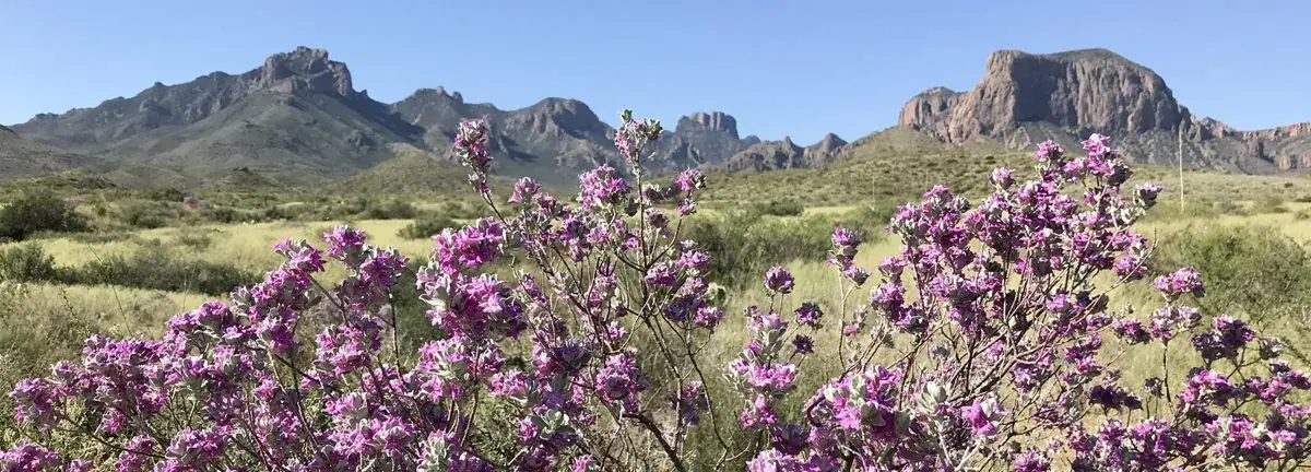
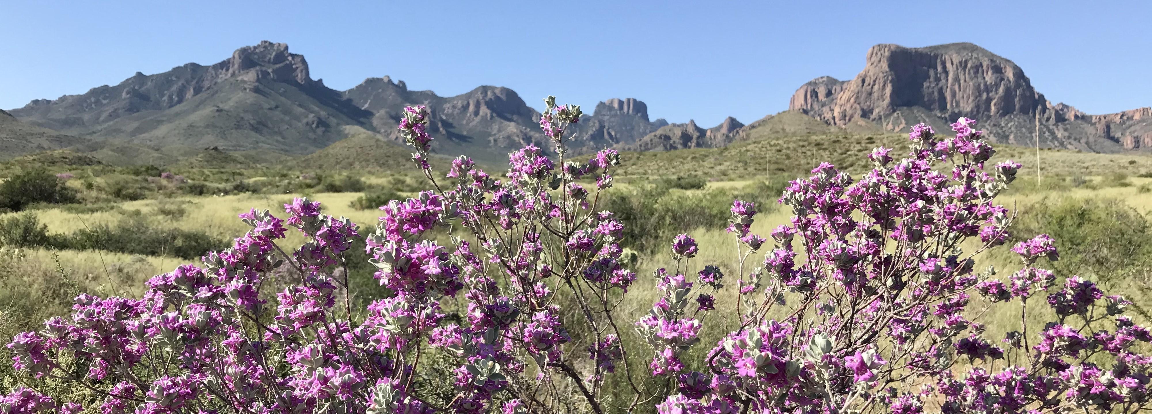
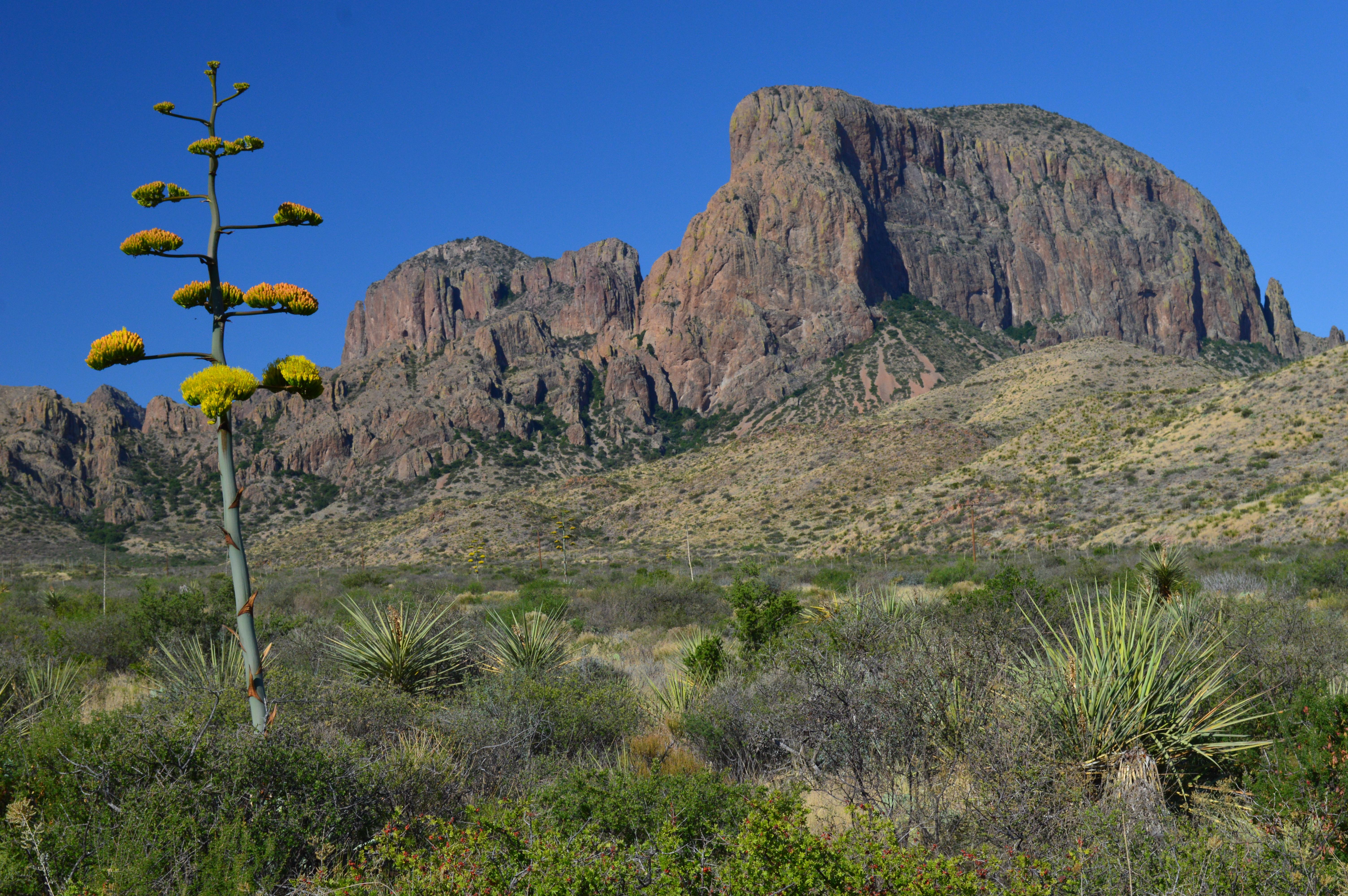
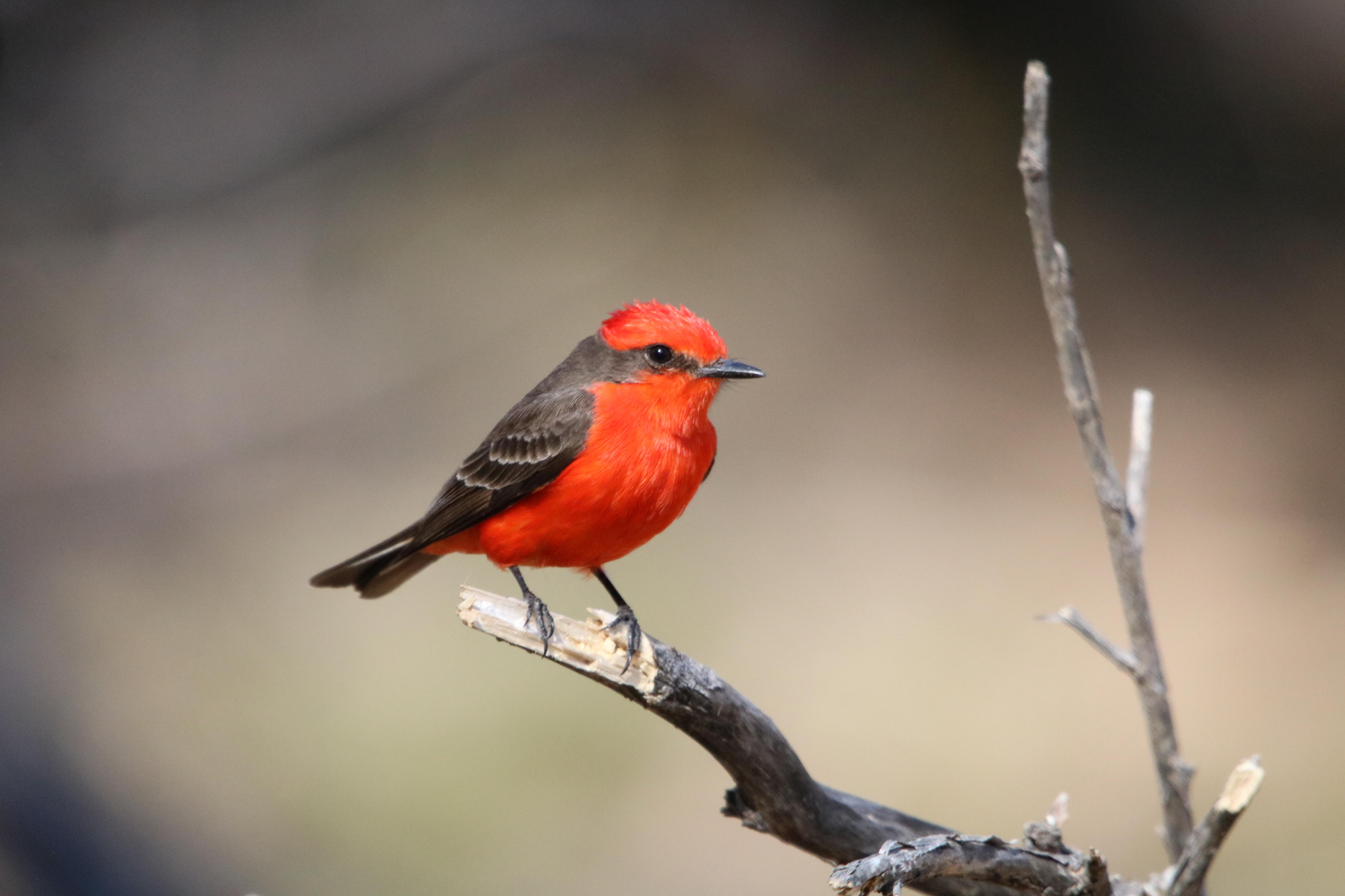
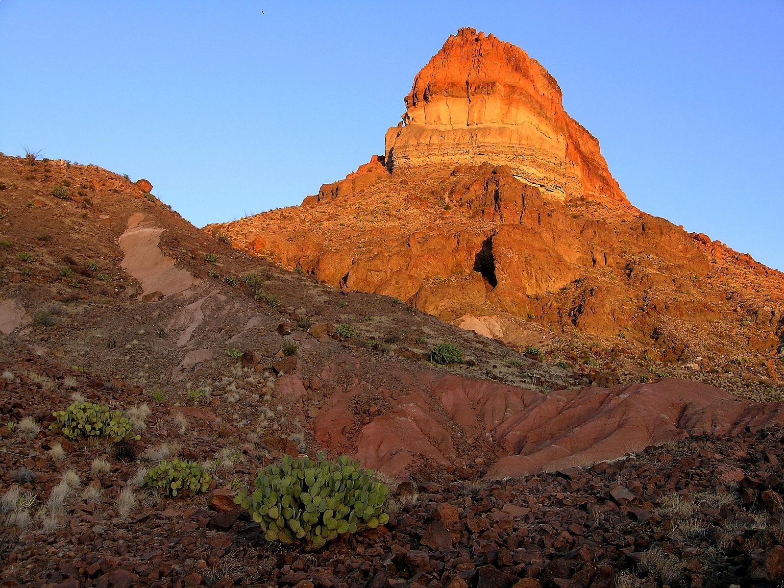
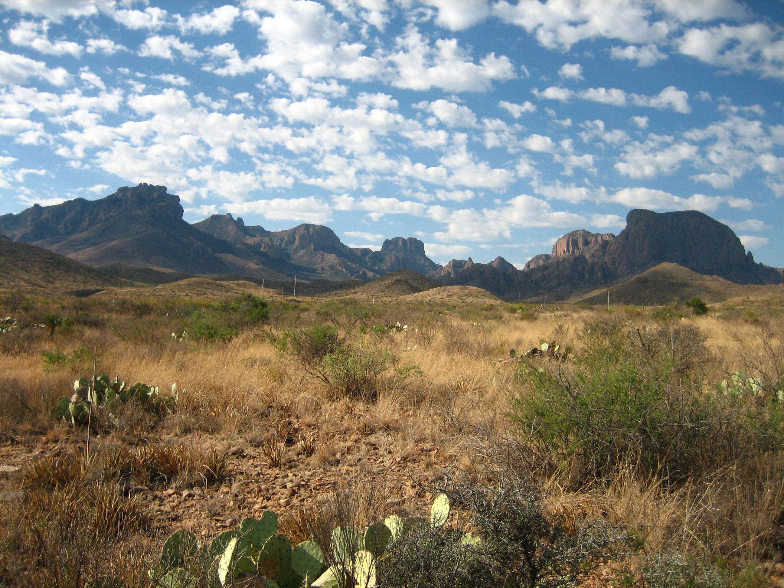
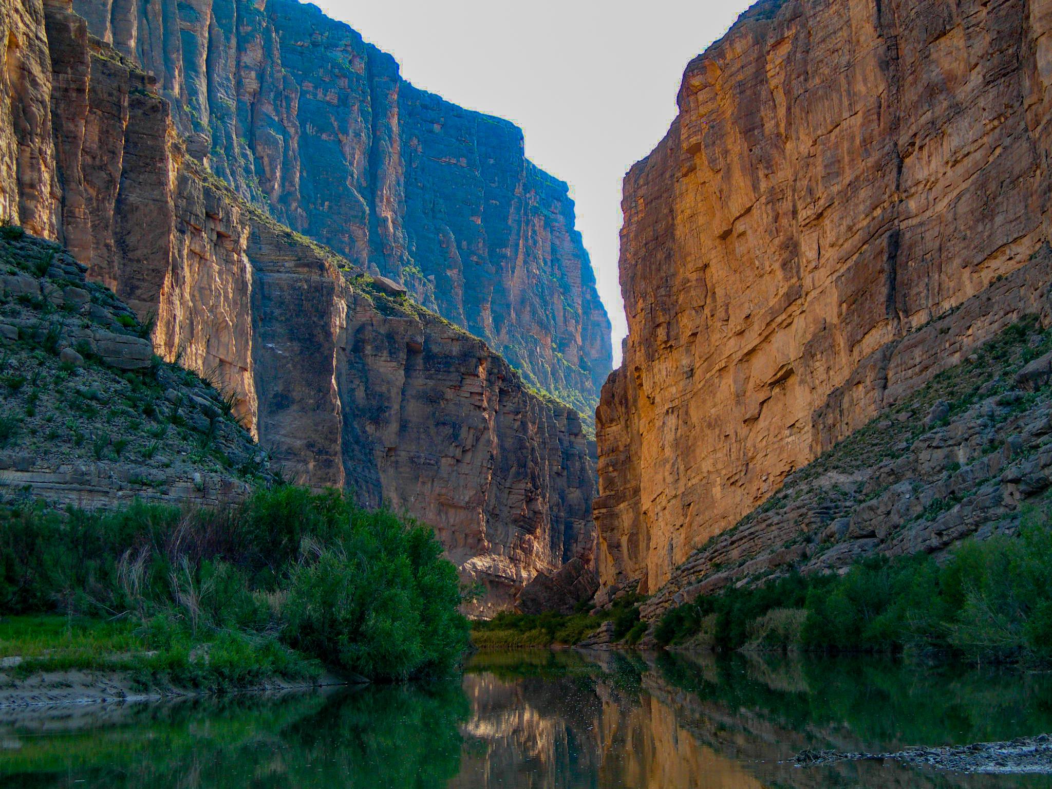


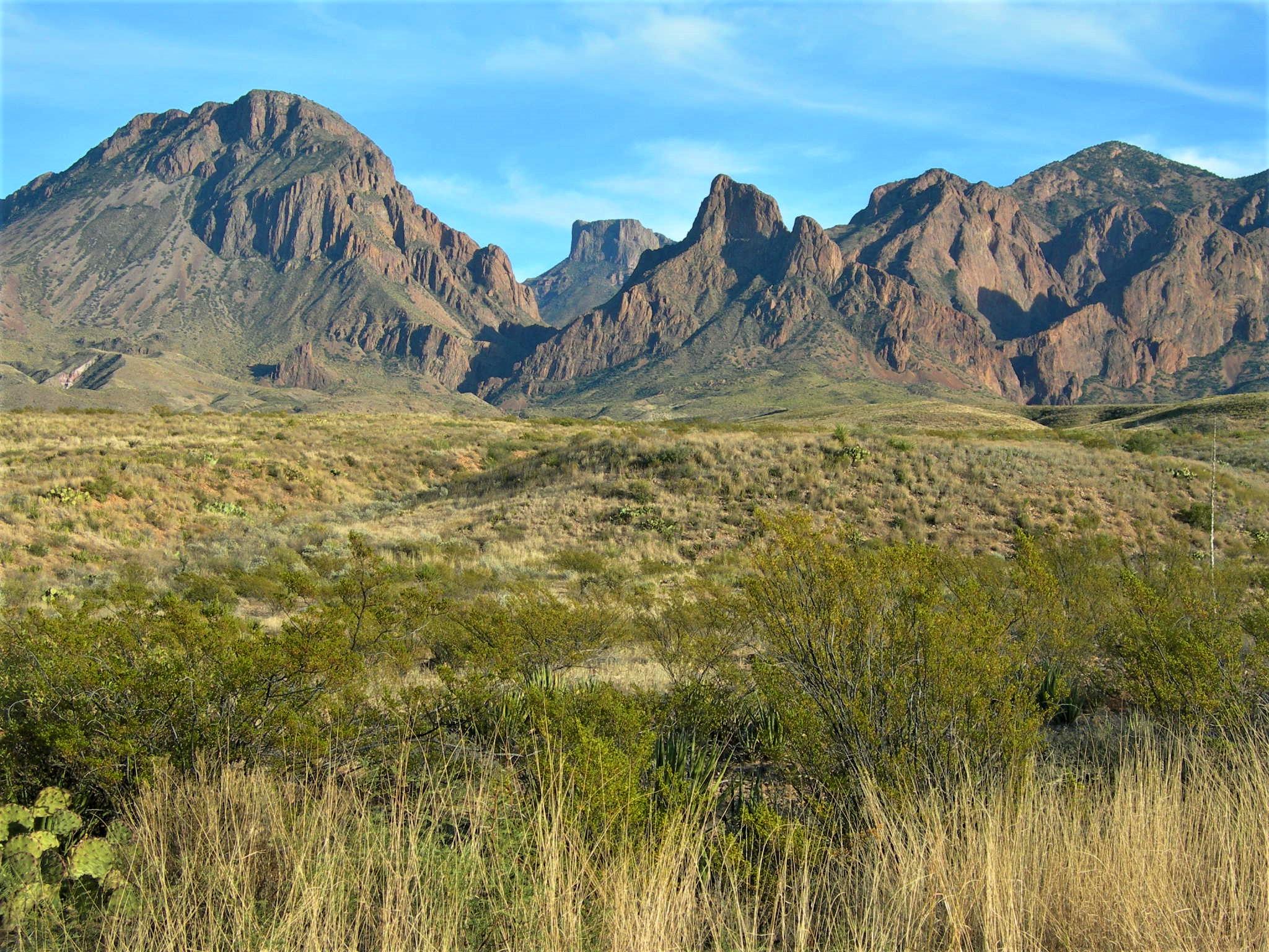
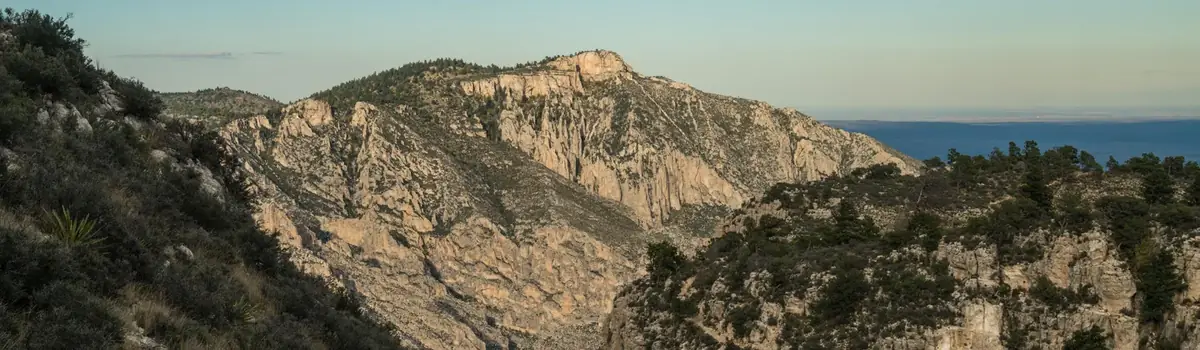 Mountains