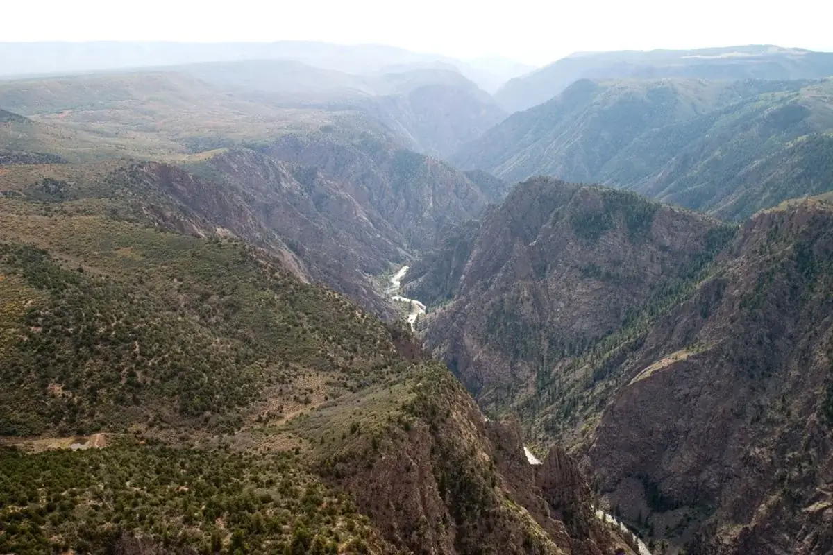
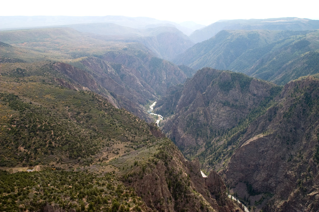
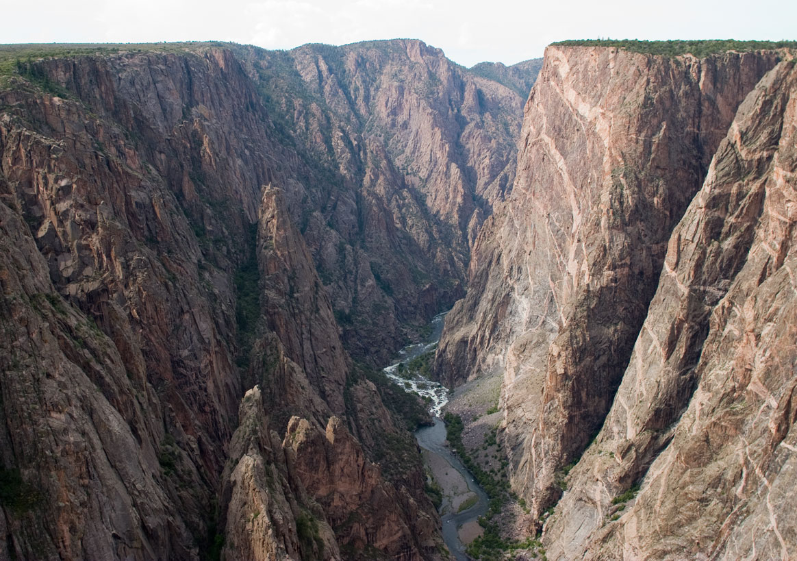
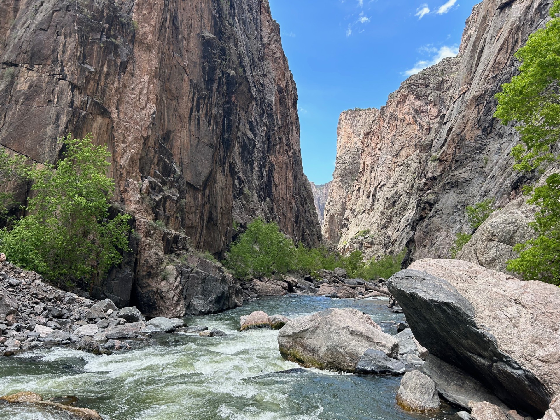
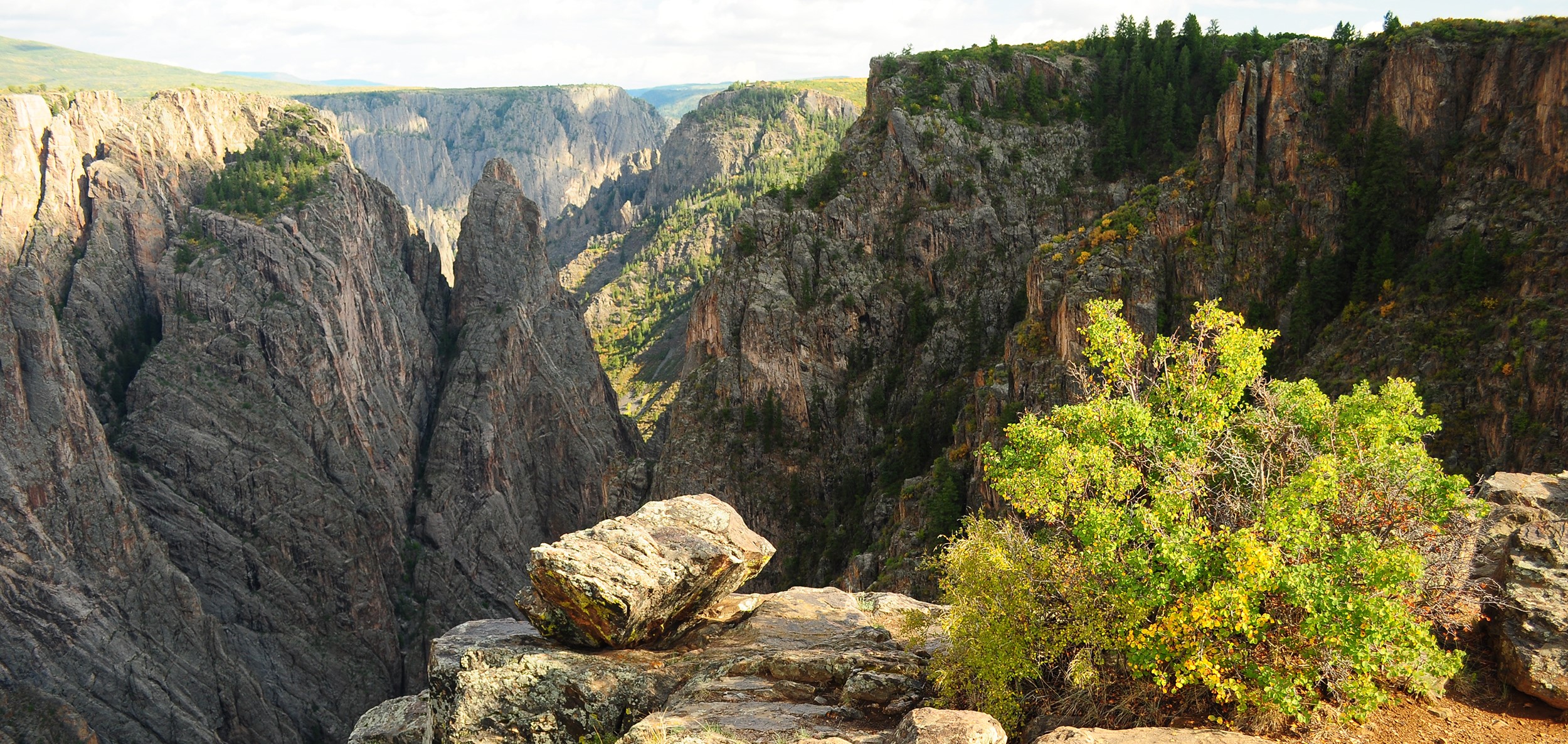
Big enough to be overwhelming, yet still intimate enough to feel the pulse of time. Come see some of the steepest cliffs, oldest rock, and craggiest spires in North America. Forces of nature and the Gunnison River sculpted this canyon over two million years. The result is a vertical wilderness of rock, water, and sky.
30.8Kacres of parkland
250.1Krecreation visits, 2025
May · Jun · Sepnearby climate picks
Seasonal access & reservations
No reviewed guidance for this selection. Check the park's official planning pages; missing coverage does not establish access.
Selected guidance only; separate from climate comfort and current conditions.
Official conditions Not checked
The conditions feed has not been connected for this park.
Editorial recommendations, reviewed 2026-10-17. Full park days, excluding travel to and from the region. A first-visit outline for a general traveler; adapt to mobility, fitness, season, reservations, and current conditions. These are suggested days, not reserved activities or guaranteed routes.
Ranger programs are a long-standing tradition in the National Park Service that continues today. Park rangers share knowledge of park resources through guided walks, talks, and campground illustrated programs for visitors of all ages.
Black Canyon of the Gunnison National Park offers a variety of free programs at the South Rim, ranging from informal talks at viewpoints to formal programs on topics such as geology, park history, ecology, and night skies. Most summer programs are available from mid-May through September. Program details and times are found on the park calendar or at the visitor center.
Programs are subject to change/cancellation due to inclement weather, emergencies, and park staffing. Check locally at the South Rim Visitor Center or campground bulletin boards for current offerings.
Summer Programs
Summer programs typically run from mid-May through September.
Ranger's Choice
Evening Programs
Astronomy Programs
Geology Talk (20-30 minutes) How did the Black Canyon form? What kind of rock is it? Why is it so steep and deep? Stop by Pulpit Rock Overlook to discover answers to these and other geology questions. Ranger's Choice Talk (20-30 minutes) Explore one of the fascinating stories of Black Canyon, from human history to plants to wildlife. Stop by the South Rim Visitor Center for daily topics and locations. Programs are not at the visitor center.
Twilight Talk (times vary) Twilight Talks are not being offered in 2026. Explore questions about Black Canyon's human and natural history. Program locations vary. Twilight talks occur before sunset. Evening Program (45 minutes) Evening programs are not being offered in 2026. Explore questions about Black Canyon's human and natural history. Program takes place at the South Rim Campground amphitheater. Parking at the campground is limited. If you attend the program but are not camping, please park in the overflow parking across from loop A. Evening programs start around sunset, but end after dark (bring a light for departing).
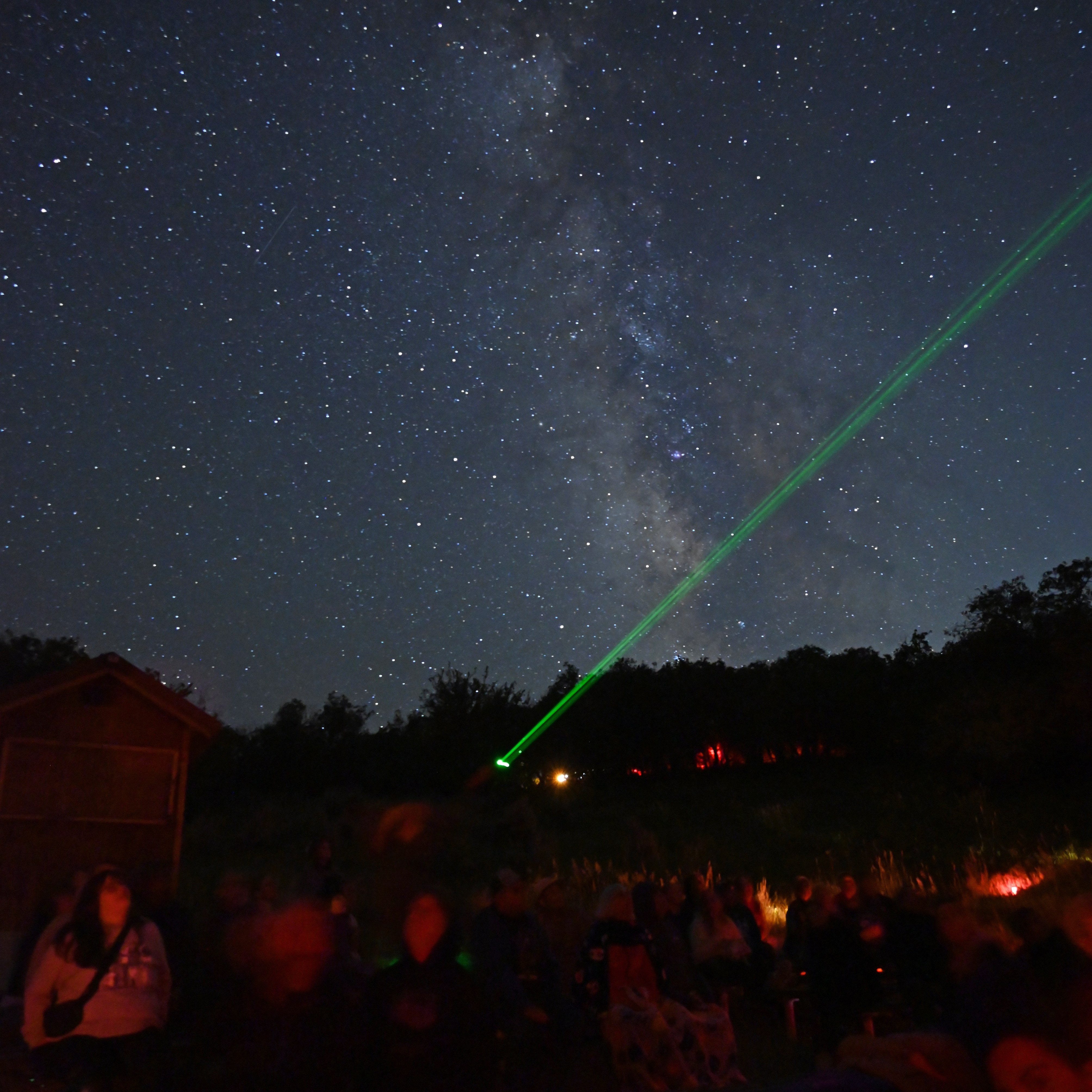
Astronomy Programs (30-45 minutes) Come explore the stars and the universe with a park ranger. Program topics will discuss preserving the night skies and stories of various constellations. Other nights, visitors can look deeper into the universe with the aid of telescopes and ponder the question: Are we truly alone in the universe? Be prepared for cooler temperatures. Please use red light only; white lights/flashlights can hinder night vision and be a safety hazard.
Winter Programs
Saturday and Sundays only
South Rim Visitor Center
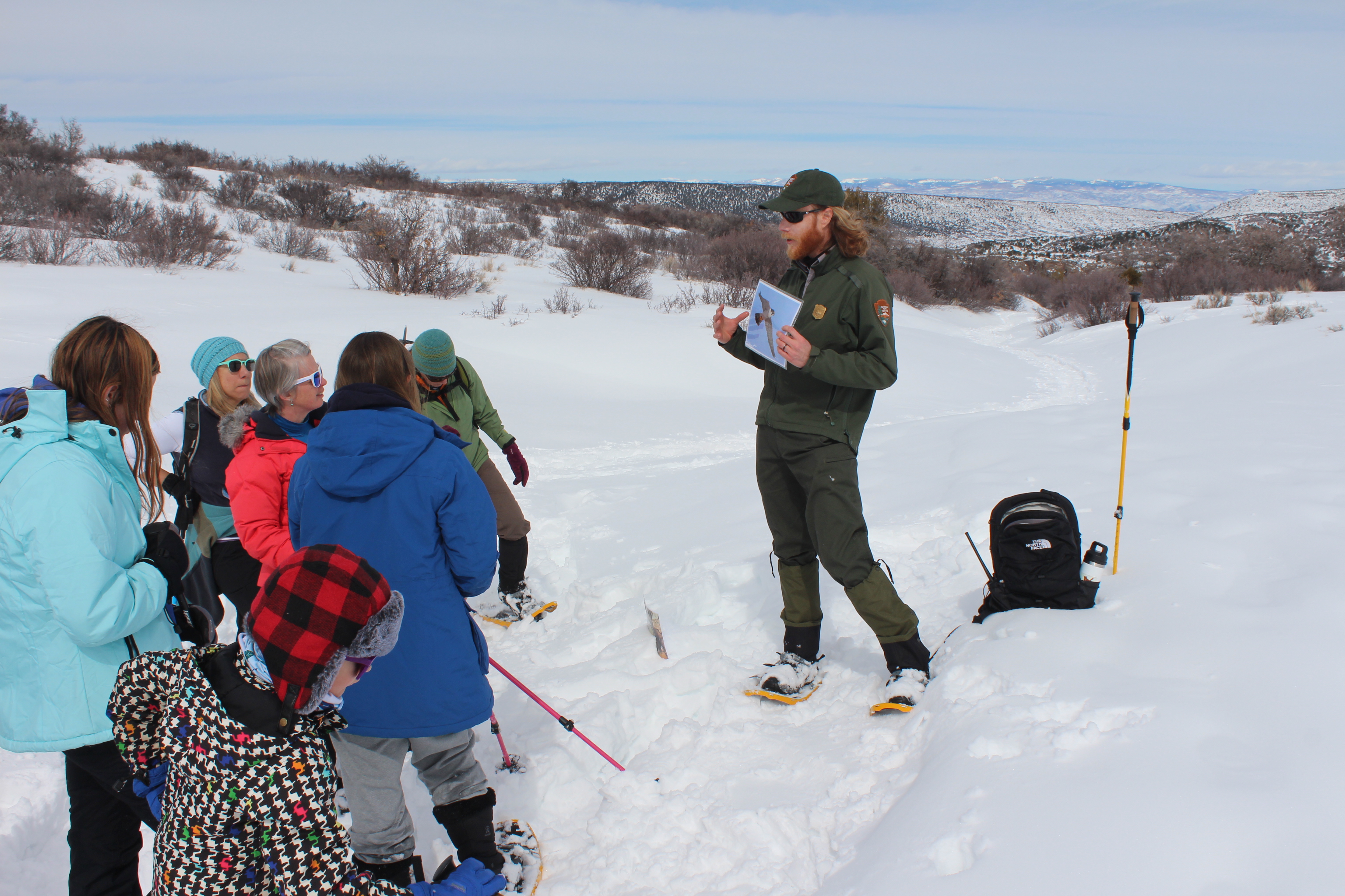
Snowshoe Walk (90 minutes) Snowshoe walks are typically from mid-January to late February or early March. Walks are dependent on snow levels.
Snowshoe with a ranger among the oaks, open meadows and along the canyon rim of the Black Canyon. For more information and gear requirements, visit Ranger Guided Snowshoe Walks .
Check the calendar for program offerings and special events.
Become a Black Canyon of the Gunnison Junior Ranger and learn how to protect the park.
Program
Time
Date
Location
Geology Talk
10:00 a.m.
Daily
Pulpit Rock Viewpoint
Ranger's Choice
2:00 p.m.
Daily
Pulpit Rock Viewpoint
Twilight Talks
Not offered in 2026.
Evening Programs
Not offered in 2026.
Astronomy Programs
Days and time vary. Check at the South Rim Visitor Center.
South Rim Visitor Center
Program
Time and Day
Day
Location
Snowshoe Walks
11:00 am
Saturday and Sundays only
South Rim Visitor Center
Program
Time
Date
Location
Geology Talk
10:00 a.m.
Daily
Pulpit Rock Viewpoint
Ranger's Choice
2:00 p.m.
Daily
Pulpit Rock Viewpoint
Twilight Talks
Not offered in 2026.
Evening Programs
Not offered in 2026.
Astronomy Programs
Days and time vary. Check at the South Rim Visitor Center.
Black Canyon offers two campgrounds - one on each rim. There is also a campground at the bottom of the canyon called East Portal. Although accessed through the park, East Portal is within the boundary of Curecanti National Recreation Area. Hikers and kayakers may also camp in the Black Canyon of the Gunnison Wilderness after obtaining a Wilderness Use Permit (restrictions apply).
Camping is allowed only in designated campgrounds. No overnight use is allowed along any park roads or trails, at overlooks, or in other developed areas.
Cashless Operations and Reservations
As of April 2025, Black Canyon's operations are cashless. Please make campground reservations in advance at Recreation.gov . First come, first served camping is limited.
South Rim Campground: Sites available by reservation only, year-round. Reserve sites online at Recreation.gov.
North Rim and East Portal campgrounds: All sites are first-come first-served, but payment MUST be submitted online using the Scan & Pay feature on Recreation.gov's mobile app.
There is limited cell service or connectivity on site. Download the Recreation.gov app before entering the park to arrive prepared.
More and more, black bears visit the campgrounds in search of food. While black bear sightings are an exciting part of your trip, please remember that black bears are wild animals that should not be fed or approached. Black bears that become habituated to humans and human food will ultimately need to be removed or, in some cases, killed.
Follow These Policies To Keep You and Black Bears Safe:
Use the bear-proof storage lockers to secure food (including coolers!) and any scented products like beverages, toothpaste, deodorant, sunscreen, and cooking utensils. Do NOT keep these items in your tent or pop-up trailer.
If lockers are full or unavailable, store these items in your locked vehicle with windows rolled up.
Clean your table and campsite immediately after eating. Don’t leave any food unattended.
Lock the dumpsters at South Rim after depositing your trash.
Developed Campgrounds
Campgrounds with designated campsites, restrooms, and potable water (in season).
Camping in the Wilderness
Well-prepared and experienced individuals may choose to camp at the base of the inner canyon wilderness routes.
South Rim Routes
Scramble to the river on a wilderness route from the South Rim.
North Rim Routes
Scramble into the canyon on a wilderness route from the North Rim.
Campground
Status / Availability
Reservations?
Scan & Pay?
Daily Fee
Sites
Water
South Rim Campground
OPEN. Many sites and facilities were impacted by the 2025 South Rim Fire. A limited number of sites (25, all non-electric) have reopened for camping. These limited sites are now reservable on Recreation.gov . All South Rim water systems have been shut off for winter. Water is unavailable anywhere on the South Rim, including the campground. Please plan accordingly. NOTE: Due to effects of the 2025 South Rim Fire, some areas of the campground are closed to all access for safety and rehabilitation purposes. Be aware that windblown ash, soot, and other fire debris may be present in the campground at any time.
Yes
No
$34 (electric) $20 (non-electric)
88
Seasonally
North Rim Campground
OPEN. All North Rim water systems have been shut off for winter. Water is unavailable anywhere on the North Rim, including the campground. Please plan accordingly.
No
Yes
$20
13
Seasonally
East Portal Campground
OPEN (upper sites only). The East Portal water system has been shut off for winter. Drinking water is unavailable anywhere at East Portal, including the campground. Please plan accordingly.
No
Yes
$20
15
Seasonally
Campground
Status / Availability
Reservations?
Scan & Pay?
Daily Fee
Sites
Water
South Rim Campground
OPEN. Many sites and facilities were impacted by the 2025 South Rim Fire. A limited number of sites (25, all non-electric) have reopened for camping. These limited sites are now reservable on Recreation.gov . All South Rim water systems have been shut off for winter. Water is unavailable anywhere on the South Rim, including the campground. Please plan accordingly. NOTE: Due to effects of the 2025 South Rim Fire, some areas of the campground are closed to all access for safety and rehabilitation purposes. Be aware that windblown ash, soot, and other fire debris may be present in the campground at any time.
Yes
No
$34 (electric) $20 (non-electric)
88
Seasonally
North Rim Campground
OPEN. All North Rim water systems have been shut off for winter. Water is unavailable anywhere on the North Rim, including the campground. Please plan accordingly.
No
Yes
$20
13
Seasonally
East Portal Campground
OPEN (upper sites only). The East Portal water system has been shut off for winter. Drinking water is unavailable anywhere at East Portal, including the campground. Please plan accordingly.
Access to the inner canyon and wilderness routes is limited to the Warner and Gunnison routes ( by reserved permit ), Red Rock Canyon ( by reserved permit ), and other routes not burned in the 2025 South Rim Fire. The Tomichi Route remains closed until further notice. All North Rim routes remain open. Do not enter closed or burned areas until further notice.
HAZARDOUS CONDITIONS: Due to effects from the 2025 South Rim Fire, hikers on the Gunnison Route will experience hazardous burned-area conditions including steep, unstable slopes; loose rocks; burned vegetation; and potentially hazardous, unstable trees.
Exploring the inner canyon requires skill, experience, and preparation to be successful. Routes are not recommended for visitors with health conditions, such as heart or lung issues. Wilderness routes are not trails; they are unmarked, physically demanding, very steep scrambles with loose rock. The inner canyon is a designated wilderness area and requires a permit to enter . Inner canyon travel in winter is not recommended. The information collection notices for wilderness permits, under OMB Control No. 1024-0022, can be viewed here .
Inner canyon activities are located in remote portions of the Black Canyon of the Gunnison Wilderness. Any rescue operation within the park is difficult and requires extended periods of time. Park visitors should be aware of the challenging nature of the terrain and carry the equipment necessary to endure an unexpected night in the wilderness. Each activity will require different essentials, but a good list to keep in mind in any wilderness area is:
Valid Wilderness Use Permit
4 quarts of water per person per day, or a water filter if filling up at the river (From fall through mid-spring, drinking water is NOT available in the park.)
High-energy food, enough for the planned trip plus an extra day
"WAG Bag" or commercial landfill safe human waste bag
Layers and rain gear
Sturdy hiking boots or shoes
Map, compass (GPS devices often don’t work in the canyon)
First aid kit; you must be prepared for self-rescue for at least 24 hours
Flashlight or headlamp with extra batteries
How to Get a Wilderness Use Permit
Permits are required for all inner canyon wilderness use - both day and overnight trips. How to obtain a permit varies by season and location. See information below. Warning: inner canyon users without a permit may be cited and/or fined.
North Rim Permits
Free: distributed on a first-come, first-served basis
Limited number of permits per day
Limited number of people allowed on each route Pinyon Draw (SOB Route): 23 people Long Draw: 8 people Slide Draw: 11 people
Pinyon Draw (SOB Route): 23 people
Long Draw: 8 people
Slide Draw: 11 people
Must be obtained on the day of your activity (no reservations)
There is a permit self-registration kiosk with instructions when the ranger station is closed. Be sure to thoroughly complete the permit with accurate and legible information.
When you have finished your trip, check out with a ranger or, if the building is closed, place your permit in the self-registration box to “check out” of the inner canyon.
South Rim Permits
Starting in 2025: All day and overnight use of Black Canyon’s South Rim wilderness routes (Warner, Gunnison, and Tomichi) must be reserved on Recreation.gov for trips between May 1 and October 31. Read the news release for more information.
Limited number of people allowed on each route Gunnison Route: 15 Tomichi Route: 9 Warner Route: 23
Gunnison Route: 15
Tomichi Route: 9
Warner Route: 23
Peak season reservations/permits (May 1 – October 31) Permits will open in two reservation windows on Recreation.gov (dates are subject to change in future years).
On April 1, 2026 at 8:00am MT , reservations will open for May 1 – July 31, 2026.
On July 1, 2026 at 8:00am MT , reservations will open for the remainder of the season: August 1 – October 31, 2026.
Off-Season Permit Process (November 1 - April 30) Permits are available during the off-season for hikers on Tomichi, Gunnison, and Warner routes at the South Rim Visitor Center the day of the trip, either from a ranger during visitor center hours , or by self-registration at the permit box in front of the building. Permits are first-come, first-served.
Climbers and Kayakers
Climbers and kayakers must obtain their permit on the day of their adventure. There are self-registration kiosks with instructions when the visitor center is closed. Be sure to thoroughly complete the permit with accurate and legible information.
Red Rock Canyon
Peak-season permits (May through October) are available only through Recreation.gov. Off-season permits (November - April) are available at the South Rim Visitor Center without a reservation. For questions about permits, please email us . Refer back to this website if planning a future trip -- the permit process may change in future years. When you have finished your trip, check out is no longer required.
Wilderness Regulations
Safety and preparation are key when entering the inner canyon.
Route Information
South Rim Routes Scramble to the river on a wilderness route from the South Rim.
North Rim Routes Scramble to the river on a wilderness route from the North Rim.
Red Rock Canyon Permits Information on how to obtain a required permit.
Other Access to the Inner Canyon
Kayaking & Rafting Expert paddlers can whitewater kayak through the canyon.
Rock Climbing Experienced climbers can explore the canyon up close and personal. Learn how to do it safely.
East Portal Discover the history and recreation of East Portal. This is the only road access to the river level.
Many trails pass by steep dropoffs, so be cautious and keep a close watch on children. From late fall through mid-spring, drinking water is NOT available in the park. Hikers should be aware that limited cattle grazing is permitted on the North Rim. Please keep cattle gates closed should you encounter them.
BE BEAR AWARE. Bears have made amazing efforts to obtain hikers' snacks. A bear that becomes habituated to humans and their food will ultimately need to be destroyed. Keep your backpack within arms reach at all times. Check our Current Conditions page for trail conditions.
Trails Overview
Download This Dataset
South Rim Trails
North Rim Trails
Learn about safely viewing wildlife in the park.
Know before you go! Check current conditions and park alerts.
Make the most of your visit by planning your activities and experiences in advance.
Black Canyon provides many opportunities to observe wildlife in their native habitat. Wildlife are an important and vital part of our natural ecosystem. Humans can learn a great deal by carefully observing animals.
Know Before You Go
Familiarize yourself with the birds and mammals of the area
Know what time of day animals are active
Learn about their habitat
Learn wildlife signs such as tracks and scat
Bring binoculars or a camera lens with zoom capabilities
Wear clothing that blends in with environment
Take a hike or walk and tread quietly
Sit still and watch from behind cover
Leave dogs at home, they often scare wildlife away
Never disrupt, approach or attempt to feed wild animals
Never approach nesting or denning sites; this could be detrimental to the survival of the young
Back off immediately if the animal seems stressed, agitated or angry
Respect the space and territory of wildlife
Wildlife watching is much more enjoyable and successful when animals are left to perform natural activites like nursing young, playing, fighting, foraging or hunting without their knowledge of our presence.
Wildlife Safety
For larger wildlife, be prepared for an unlikely encounter and know what behaviors are better than others.
Back away slowly.
Break eye contact.
Make yourself look bigger.
If attack seems imminent, act aggressively throwing rocks or a large stick.
What to Look For
Yellow-bellied Marmot
Golden-mantled Ground Squirrels
Least and Colorado Chipmunks
Mountain Cottontails
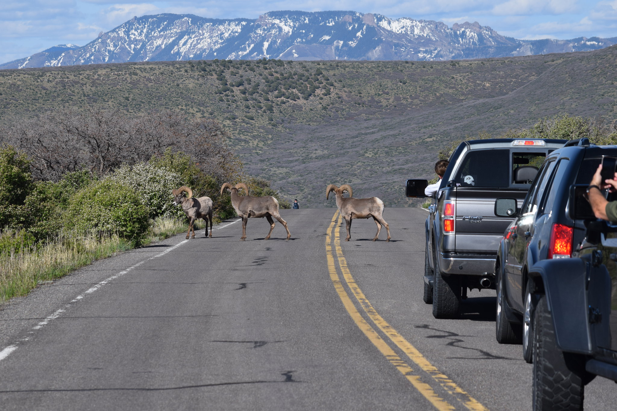
Rocky Mountain Bighorn Sheep
Long-tail Weasels
Ask a park ranger for ways to identify these non-venomous snakes.
Smooth Green Snake
Great Basin Gopher Snake
Striped Whipsnakes
Bird watching in the area is excellent, especially in spring and early summer.
Peregrine Falcon
Red Tailed Hawks
Turkey Vultures
Come in to the visitor center and share your wildlife encounters and experiences. Please report any unusual or rare sightings.
Keep yourself, others, and the wildlife safe by following good practices.
Animals live in different habitats from canyon rim to river and require specific lifestyles to be successful.
All wilderness regulations, including a valid wilderness use permit, apply towards rock climbing. Know before you go!
Black Canyon of the Gunnison National Park offers vast opportunities to expert rock climbers. The canyon is extremely deep and narrow. At its deepest, the canyon is 2,722 ft (830 m) deep at Warner Point. The Painted Wall is the tallest vertical wall in Colorado, with a height of 2,250 ft (686 m) The majority of the climbing activity takes place around North and South Chasm Walls, where the canyon is 1,820 ft (555 m) deep.
Black Canyon is a full-on adventure climbing area. Detailed climbing information for Black Canyon climbs is often difficult to obtain or non-existent. A few guidebooks are available and the National Park Service retains copies of topos and route information turned in by first ascent parties. Visit the South Rim Visitor Center or North Rim Ranger Station for information.
Of the 145 climbing routes that are found in Black Canyon:
8 are rated at 5.8; only 4 of these have good information available and see regular ascents
21 are rated 5.9, 5 of which are aid routes, and only 6 of which see any significant climbing activity
The other 117 climbs have ratings between 5.10 and 5.13 and many require aid.
Many climbers have said that the ratings here can be deceiving.
Annual Climbing Route Closures
For the protection of nesting raptors, certain routes are closed from March 15 to July 15.
Climbing Safely
All of the climbs within Black Canyon are multi-pitch, traditional routes located in remote areas within the canyon. Climbing routes in the park are very deceiving. There can be clean cracks and excellent lines, followed by choss and places where it is easy to get off route. Loose rock is extreme. Be sure of your holds before you commit. Climbing under other parties brings the danger of being in the firing line of falling rock and gear. Always wear a helmet.
Carrying enough gear to stay out overnight if needed
Carrying the necessary equipment to endure an unexpected bivy
Climbing within your ability level, especially if you are new to climbing in the Black Canyon
Be willing to back off or bail if necessary.
Know your own abilities and that of your partners.
Rescues in Black Canyon are very involved. Lowering off to an awaiting ambulance is not an option. The park has rangers trained in high angle rescue, but rescues take time and are extremely technical in nature. Be prepared for self-rescue. Underestimating a route is not cause for rescue at the Black Canyon. The National Park Service does not guarantee rescue.
Photo by Julia Gavilondo
Climbing Regulations
Obtain a wilderness permit and follow wilderness regulations . Climbers must practice Leave No Trace climbing with these climbing-specific regulations:
Use “clean climbing” techniques and gear that can be removed (e.g., slings, cams, nuts, chocks, and stoppers).
Do not mark approach trails with cairns or anything else.
If fixed equipment is unsafe, replacement (anchor for anchor) is allowed without further authorization. Bolts, hangers and chains must be painted the color of the rock surface. If replacing worn webbing, use a natural color.
Placing of new permanent fixed equipment requires preapproval.
The physical altering of rock faces by chiseling, glue reinforcement of existing holds, gluing of new holds, and the intentional removal of lichen or plants from rock are prohibited.
A fixed rope may be left in place for no more than 14 days, while the climbing party is in the park.
Climbing gear may be cached for less than 24 hours (do not leave food!).
Use a personal human waste pack out system, such as Rest Stop.
BASE jumping is prohibited.
Highlines / slacklines: shall not be used in designated campgrounds; shall not be attached to vegetation or park property; shall not be left unattended; and shall be entirely removable. Highlines / slacklines that span any portion of the canyon or would reasonably be expected to affect the normal operations of the park require a special use permit.
New Fixed Equipment and Route Development
Please review the authorization process for new route development with fixed anchors and replacement of fixed anchors in Chapter 4 of the Black Canyon of the Gunnison National Park/Curecanti National Recreation Area Wilderness and Backcountry Management Plan . To inquire about placing new permanent fixed equipment or obtaining a special use permit, email (link below) the following information to us:
Contact phone number
Location of the proposed new fixed equipment
Brief description of why the applicant feels fixed equipment is warranted at the proposed site.
Seasonal Information
Peak climbing season at the Black Canyon begins in mid-April and runs through the early part of June, and from mid-September through early November. Environmental hazards found at the park during these time periods include frequent afternoon thunder showers, fully leafed out poison ivy, and approach gullies inhabited by ticks. North Rim Climbing Routes: In addition to a permit, the North Rim Ranger Station has a whiteboard that is used as an informal way of letting other climbers know who is on what route. It prevents multiple parties from piling up on routes and is a quick way to judge climber activity in the canyon.
Many of the darkest skies in the country are found at national parks. Some visitors may come from places where light pollution hinders views of the night skies. Others may never have experienced an unobstructed view of a starry night sky or the Milky Way.
Black Canyon of the Gunnison National Park was certified as an International Dark Sky Park in September 2015 . The park has exceptional opportunities to view night skies, as well as stargazing programs scheduled throughout the summer months.
Stargazing at Black Canyon
The park does not close and allows for night sky viewing at all hours. Overlooks that are far from the road are better shielded from the light of passing cars. These locations are great for stargazing, using a personal telescope, or for astrophotography:
Chasm View Overlook (South Rim)
Dragon Point Overlook (South Rim)
Sunset View Overlook (South Rim)
Chasm View Nature Trail (North Rim)
Kneeling Camel Overlook (North Rim)
Areas at the bottom of the canyon, like East Portal, are suitable for viewing, but the amount of visible sky will be reduced.
Visiting in the winter? Enjoy the unique experience of cross-country skiing by moonlight or headlamp. Red light-equipped headlamps or flashlights are best to help preserve night vision and reduce light pollution.
Viewing times and seasons
Experiencing moonlight in such a dark place can be extraordinary. However, bright light from the moon means faint stars and the Milky Way are not visible. The best time to view our galaxy is during the new moon phase, or at times when the moon rises late in the night. Check the moon phase, moonrise, sunrise, and sunset times for Black Canyon.
The Milky Way shines brighter in the summer than the winter. This is because we face the center of our galaxy on summer nights, while we face the edge of our galaxy on winter nights. As we look to the center, we look at the combined light of more stars than when we look toward the edge. In the summer, the Milky Way rises higher and higher throughout the night, resting directly overhead late in the evening. During the fall, the Milky Way appears directly overhead very early in the evening.
NPS Photo/C. Roundtree
Program Offerings
Park rangers, volunteers, and members of the Black Canyon Astronomical Society (BCAS) work together to provide astronomy programs. These events occur frequently at the park during the summer. Programs are free to visitors who have paid the park entrance fee. Programs may include:
Daytime solar telescope viewing
Astronomy talks
Evening constellation tours
Night sky viewing with telescopes.
Check out the Junior Ranger Night Explorer program, which encourages young park visitors to explore the starry side of their national parks. Activities include learning about stars and galaxies, writing creative mythology about constellations, and using all senses to explore the night environment at a national park. Pick up a free booklet from the visitor center or download online .
Poster by Tyler Nordgren
2025 Moon Phases
2025 Major Meteor Showers
Dates listed are for predicted maximum viewing. Most of these showers are also active for a few nights before and after the predicted peak.
Lyrids April 21-22
Eta Aquarids May 3-4
Delta Aquariids July 29-30
Perseids August 12-13
Orionids October 22-23
Leonids November 16-17
Geminids December 13-14
Ursids December 21-22
Quadrantids January 2-3
Astro Fest 2024, from September 5-7, celebrates the starry skies at three separate sites along the Gunnison River.
Learn about the night skies at Black Canyon and park efforts to protect them.
Although services and access is limited during winter, the park provides recreation opportunities for winter enthusiasts.
Tomichi Point and Gunnison Point Overlooks
South Rim Visitor Center
South Rim Campground (closed until further notice)
Hiking trails (may be icy or snow-covered)
Winter Closures
East Portal Road
South Rim Drive (beyond the visitor center)
Winter Ranger Programs
Depending on snow conditions, January to mid-March may be a great time to join a ranger for guided snowshoeing. Park rangers may offer guided snowshoe programs among the oaks, open meadows, and along the canyon rim of the Black Canyon. Check the calendar for program times.
Cross-country Skiing
In winter, South Rim Drive is closed to vehicles beyond Gunnison Point at the visitor center. The road will be in either "winter road status" or "ski trail status", depending on snow conditions. Winter Road Status: When the road is in winter road status, there will be no groomed ski trail established by the park. Leashed pets, walking, and bicycles are allowed on the road. Ski Trail Status: Rangers may groom the road for cross-country skiing (skate and classic) and snowshoeing, as staffing and conditions allow. The road becomes the South Rim Ski Trail. It is 6 miles (4 km) one-way to the end, and allows access to more overlooks. Parking is available at the South Rim Visitor Center. Equipment rentals are not available in the park. Check the current conditions page for snow and grooming updates. When the road is in ski trail status, pets and bicycles are not allowed. Please dispose of pet waste at all times.
Visitors can snowshoe in various locations depending on snow conditions and experience level:
South Rim Ski and Snowshoe Trail (beginner level)
the upper part of the Oak Flat Loop Trail (intermediate level)
Rim Rock Trail (best with more snow; exposed rocks can damage snowshoes; currently closed between Tomichi Point and South Rim Campground)
Please be courteous to other trail users by not snowshoeing or walking in the ski tracks or the flat area groomed for skate skiing along the South Rim Drive. Dogs are not permitted along the South Rim Drive when the road is groomed as a ski trail. Snowshoes are only available for loan while attending guided ranger tours. Visitors should bring their own or rent from local communities.
Winter Survival
Irregular weather, lack of experience, or unpreparedness can turn a park visit into a hazardous or risky situation. Stay warm, prepared, and ready to enjoy winter on the canyon rim:
Wear adequate clothing. Wool and synthetics will keep you warmer than cotton. Hats, mittens, and extra layers are a must.
Bring traction devices during shoulder seasons for potentially icy conditions.
Be prepared. When possible, travel with a companion. Tell someone where you are going and when to expect you back.
Check the weather forecast and the snow and ice conditions where you plan to go.
Together with the bare essentials like water and food, bring sunglasses and sunscreen, first aid kit, map and compass.
Hypothermia is a constant threat to people in the outdoors. Knowing the symptoms and what to do can save someone's life. Symptoms can range from uncontrolled shivering to drowsiness and loss of consciousness. When someone shows one or more symptoms you should:
Get the patient to a dry, sheltered place.
Remove wet clothing and replace with dry, warm clothing and/or blankets.
If the patient is awake, slowly give warm non-alcoholic drinks.
Transport to a medical facility as soon as possible.
Curious what the park looks like during winter? Check out images of snow-covered canyon walls, trails, and a slightly buried visitor center.
Official NPS features and USGS park boundaries, imported 2026-10-17. An inventory snapshot, not live trail or parking availability.
Loading official park features…
TrailsPoints of interestParkingZoom with buttons or pinch. Toggle layers on the map.
Map coverage varies. Trail names may represent segments, connectors, or shared park units; mapped lines are not a hiking recommendation. Use official conditions and navigation resources before heading out.
NPS public GIS inventory, imported 2026-10-17. “Existing” is an inventory classification, not confirmation that a trail is open. Segment counts are not route distances. Parking records do not indicate space availability, fees, or accessibility certification. View government source ↗
Climate for Montrose, 17 km from the park reference point. 1991–2020 normals. Source elevation: 1,770 m.
Daytime highNighttime lowOctober: 63° / 34°
Daytime high63°
Precipitation34 mm
Daylight11.0 hrs
Wind6.5 km/h
Mountain, rim, valley, and coastal conditions can differ sharply from the source town. Check park forecasts and current conditions before travel.
Monthly climate data 12 months · °F
Month
High
Low
Rain / snow water
Wet days
Daylight
37°
11°
32 mm
7.0
9.6 h
41°
17°
33 mm
8.0
10.5 h
50°
25°
39 mm
9.1
11.7 h
58°
31°
42 mm
8.8
13.0 h
70°
40°
33 mm
7.7
14.1 h
82°
49°
13 mm
3.5
14.6 h
86°
56°
21 mm
6.0
14.4 h
83°
54°
25 mm
6.6
13.5 h
75°
46°
28 mm
5.9
12.3 h
63°
34°
34 mm
6.6
11.0 h
48°
23°
32 mm
6.5
9.9 h
38°
12°
31 mm
7.1
9.4 h
RESEARCH WITH THE SOURCE IN VIEW
The practical field guide.
Official NPS excerpts imported 2026-10-17. Fees, permits, road access, and operations can change; use the source link to confirm the latest information.
Black Canyon of the Gunnison National Park is located on the western slope of the Rocky Mountains in west-central Colorado. It exposes some of the steepest cliffs, oldest rock, and craggiest spires in North America. It was established as a national monument on March 2, 1933 and redesignated as a national park on October 21, 1999.
The park is open 24 hours a day, 365 days of the year . Some roads into the park are limited access or closed entirely in winter. The park is divided by the canyon into a North Rim and South Rim. There is no bridge or road through the park or connecting the rims. Both rim drives have one access point from the highway, and dead-end within the park. Driving from one rim to the other involves driving along non-park roads and can take 2+ hours. No reservations are required to enter Black Canyon of the Gunnison National Park.
NPS/Zach Schierl
Physical Address
Operating Hours & Seasons
Visitor Centers
Internet & Cellular Access
Internet & Cellular Access Details
Find out seasonal openings and visitor center hours.
Current conditions vary as fall turns to winter. Check park alerts for updates.
Learn about the fees and passes that are available.
See the weather forecast and typical climate for the park throughout the seasons.
Know where you and your pet are allowed to go in the park.
Visit one of the canyon rims, drive down to the river level, or challenge yourself to experience the inner canyon.
Make the most of your visit by planning your activities and experiences in advance.
Black Canyon offers two campgrounds - one on each rim. There is also a campground at the bottom of the canyon called East Portal. Although accessed through the park, East Portal is within the boundary of Curecanti National Recreation Area. Hikers and kayakers may also camp in the Black Canyon of the Gunnison Wilderness after obtaining a Wilderness Use Permit (restrictions apply).
Camping is allowed only in designated campgrounds. No overnight use is allowed along any park roads or trails, at overlooks, or in other developed areas.
Cashless Operations and Reservations
As of April 2025, Black Canyon's operations are cashless. Please make campground reservations in advance at Recreation.gov . First come, first served camping is limited.
South Rim Campground: Sites available by reservation only, year-round. Reserve sites online at Recreation.gov.
North Rim and East Portal campgrounds: All sites are first-come first-served, but payment MUST be submitted online using the Scan & Pay feature on Recreation.gov's mobile app.
There is limited cell service or connectivity on site. Download the Recreation.gov app before entering the park to arrive prepared.
More and more, black bears visit the campgrounds in search of food. While black bear sightings are an exciting part of your trip, please remember that black bears are wild animals that should not be fed or approached. Black bears that become habituated to humans and human food will ultimately need to be removed or, in some cases, killed.
Follow These Policies To Keep You and Black Bears Safe:
Use the bear-proof storage lockers to secure food (including coolers!) and any scented products like beverages, toothpaste, deodorant, sunscreen, and cooking utensils. Do NOT keep these items in your tent or pop-up trailer.
If lockers are full or unavailable, store these items in your locked vehicle with windows rolled up.
Clean your table and campsite immediately after eating. Don’t leave any food unattended.
Lock the dumpsters at South Rim after depositing your trash.
Developed Campgrounds
Campgrounds with designated campsites, restrooms, and potable water (in season).
Camping in the Wilderness
Well-prepared and experienced individuals may choose to camp at the base of the inner canyon wilderness routes.
South Rim Routes
Scramble to the river on a wilderness route from the South Rim.
North Rim Routes
Scramble into the canyon on a wilderness route from the North Rim.
Campground
Status / Availability
Reservations?
Scan & Pay?
Daily Fee
Sites
Water
South Rim Campground
OPEN. Many sites and facilities were impacted by the 2025 South Rim Fire. A limited number of sites (25, all non-electric) have reopened for camping. These limited sites are now reservable on Recreation.gov . All South Rim water systems have been shut off for winter. Water is unavailable anywhere on the South Rim, including the campground. Please plan accordingly. NOTE: Due to effects of the 2025 South Rim Fire, some areas of the campground are closed to all access for safety and rehabilitation purposes. Be aware that windblown ash, soot, and other fire debris may be present in the campground at any time.
Yes
No
$34 (electric) $20 (non-electric)
88
Seasonally
North Rim Campground
OPEN. All North Rim water systems have been shut off for winter. Water is unavailable anywhere on the North Rim, including the campground. Please plan accordingly.
No
Yes
$20
13
Seasonally
East Portal Campground
OPEN (upper sites only). The East Portal water system has been shut off for winter. Drinking water is unavailable anywhere at East Portal, including the campground. Please plan accordingly.
No
Yes
$20
15
Seasonally
Campground
Status / Availability
Reservations?
Scan & Pay?
Daily Fee
Sites
Water
South Rim Campground
OPEN. Many sites and facilities were impacted by the 2025 South Rim Fire. A limited number of sites (25, all non-electric) have reopened for camping. These limited sites are now reservable on Recreation.gov . All South Rim water systems have been shut off for winter. Water is unavailable anywhere on the South Rim, including the campground. Please plan accordingly. NOTE: Due to effects of the 2025 South Rim Fire, some areas of the campground are closed to all access for safety and rehabilitation purposes. Be aware that windblown ash, soot, and other fire debris may be present in the campground at any time.
Yes
No
$34 (electric) $20 (non-electric)
88
Seasonally
North Rim Campground
OPEN. All North Rim water systems have been shut off for winter. Water is unavailable anywhere on the North Rim, including the campground. Please plan accordingly.
No
Yes
$20
13
Seasonally
East Portal Campground
OPEN (upper sites only). The East Portal water system has been shut off for winter. Drinking water is unavailable anywhere at East Portal, including the campground. Please plan accordingly.
Black Canyon of the Gunnison National Park is continuously working to improve accessibility for all people. South Rim is the most accessible area of the park. North Rim and East Portal are more remote and have limited accessible facilities.
Physical/Mobility Accessibility
Black Canyon has several areas that are accessible for people with physical or mobility disabilities.
Sites A21 and B1 are wheelchair accessible with level concrete campsite pads and ramps. Nearby vault toilets are accessible.
Paths to the toilets and campsite pay station are paved.
Entrance: No doors have a push button entrance. The porch is accessible around the building.
Parking: Accessible parking is available. The parking lot and sidewalks are paved.
Restrooms: All vault toilets are wheelchair accessible. There is no plumbed water or flush toilets at the south rim.
Seating: Benches are located along the outside of the visitor center.
Overlooks These overlooks are accessible for people using a wheelchair.
Tomichi Point Overlook (paved with platform adjacent to the parking lot)
Chasm View Overlook (packed gravel trail to the overlook)
Restrooms These restrooms along the South Rim Drive are accessible for people using a wheelchair.
Trails on the South Rim have rocky, uneven surfaces, and some drop-offs. All routes are very steep, rocky, and require navigating loose scree and short vertical drops.
The campground road is gravel, and all sites are unpaved and unimproved.
Access to the vault toilet is on a compacted dirt path.
Entrance: The front door does not have a push button opener. The approach to the ranger station is loose gravel and has steps; there is no ramp.
Parking: The parking area is unpaved.
Restrooms: Vault toilet interior is accessible. Exterior is not accessible due to an incline and small concrete lip in front. No plumbed water.
Trails on the North Rim have rocky, uneven surfaces. All routes are very steep, rocky, and require navigating loose scree and short vertical drops.
The campground road and parking areas are gravel.
All campsites are unimproved, and some require walking down steps from the parking area to access. Campground vault toilet access is on compacted dirt paths. No plumbed water.
Parking: The parking areas are gravel.
Restrooms: There is an accessible vault toilet.
River access and unmaintained trails along the Gunnison River have rocky, uneven surfaces.
Deaf/Hearing Loss Accessibility
Wayside exhibits with illustrations and text are situated throughout the park at overlooks and trailheads.
Videos on the park website have closed captioning.
Visitors who are Deaf or have hearing loss may request an American Sign Language (ASL) interpreter for in-person ranger programs. We recommend you submit a request at least 14 days or more in advance to improve your chances of securing these services.
Blind/Low Vision Accessibility
South Rim Visitor Center has rock samples and a 3D tactile map.
Visit the Park Brochure page for complete information about how you can access Braille and text-only versions of official park brochure.
Service Animals
U.S. citizens or permanent residents who are permanently disabled may be eligible for the Interagency Access Pass. This free, lifetime admission pass provides admittance to thousands of recreation sites managed by National Park Service, Bureau of Land Management, US Fish and Wildlife Service, US Forest Service, US Army Corps of Engineers, and Bureau of Reclamation.
Passes must be obtained with valid identification
Does not cover or reduce special recreation permit fees or fees charged by concessioners
Learn more about all types of America the Beautiful passes under Fees & Passes .
Although an entrance pass is required to enter Black Canyon of the Gunnison National Park, vehicle reservations are not needed. You are encouraged to purchase an entrance pass before arriving to save time, but you may also purchase passes at the entrance station upon arrival.
Key Information
Get an entrance pass All visitors must have one of these entrance passes: Pass Price Standard Pass $15.00–$30.00 Annual Pass $55.00 America the Beautiful Pass (includes Senior Passes) FREE–$250.00 Help me choose an entrance pass
Choosing an Entrance Pass
Do you have or qualify for a discounted America the Beautiful Pass?
If you already have an America the Beautiful—the National Parks and Federal Recreational Lands Pass, that's the only entrance pass you need. Seniors, military, visitors with a permanent disability, and families with a 4th grader are eligible for a free or discounted America the Beautiful pass.
America the Beautiful Pass
How often do you plan to visit national parks in the next 12 months?
If you don't qualify for a discounted America the Beautiful pass, we recommend choosing an entrance pass based on your trip plans.
Entrance Passes
Standard Entrance Pass
If you enter the park in a motorized vehicle, your entrance pass covers both you and your passengers. Your passengers do not need a separate pass.
Costs for vehicles with more than 15 passengers are listed below under Organizations and Businesses .
Private Vehicle $30.00
7-Day Vehicle Pass. Entrance fees cover all persons in a single, private, non-commercial vehicle.
Motorcycle $25.00
Valid for 7 days. Admits up to 2 private, non-commercial motorcycles with up to 4 total passengers.
For Individuals without a Vehicle
If you enter the park on a bicycle or on foot and are at least 16 years old, you need your own entrance pass. Children under the age of 16 don't need an entrance pass.
Per Person $15.00
7-Day Individual Pass (pedestrian or bicycle)
For Organizations & Businesses
Commercial Sedan (1-6 seats) $25.00
Commercial tour fee for vehicle/bus with seating capacity of 1-6 persons. Fee is $25.00 per vehicle plus $7.00 per passenger.
Commercial Van (7-15 seats) $40.00
Commercial tour fee for vehicle/bus with seating capacity of 7-25. Fee is $40.00 per vehicle.
Commercial Mini-bus (16-25 seats) $40.00
Commercial Motor Coach (26+ seats) $100.00
Commercial tour fee for vehicle/bus with seating capacity of 26 or more. Fee is $100.00 per vehicle.
Non-commercial Group (16+ persons) $30.00
Non-commercial vehicles with a vehicle capacity of 15 or fewer: $30.00 per vehicle, regardless of the number of passengers.
Non-commercial Group (16+ persons) $15.00
Non-commercial vehicles with a vehicle capacity of 16 or greater: $15.00 per passenger (including driver). Fees will not exceed the commercial fee for the same-sized vehicle. Youth 15 and under are free. Individuals or families with any valid Annual or Lifetime pass may use their pass for entry at the per-person rate. Pass and photo ID must be presented upon entry.
Annual Entrance - Park
An annual pass to Black Canyon of the Gunnison National Park is available for $55.00 at the South Rim entrance station from early April to late October, and at Recreation.gov. This pass admits the permit holder and all accompanying passengers in a single, private, noncommercial vehicle to the park. It is valid for 12 months from date of purchase and covers entrance fees only.
US citizens and residents
America the Beautiful—the National Parks and Federal Recreational Lands Pass
Covers entrance fees and standard amenity (day-use) fees at lands managed by
National Park Service
US Fish & Wildlife Service
US Forest Service
Bureau of Land Management
Bureau of Reclamation
US Army of Corps of Engineers
Depending on the type of entrance fee charged at a site, covers One private vehicle fee or Four per person fees
America the Beautiful Passes are non-refundable, non-transferable and cannot be replaced if lost or stolen . Passholders must show valid photo identification (ID) with each pass.
How to Get an America the Beautiful Pass
Physical passes can be purchased or picked up at over 1,000 federal recreation sites.
Purchase and pickup locations
To receive your pass by mail, order online at the USGS Online Store . Online orders are for physical passes, not digital passes, and may take up to three weeks to be processed and delivered. Order receipts may not be used in place of a physical pass. We recommend ordering at least three weeks in advance of your visit, or picking up a pass in person instead.
Skip the wait! Get a Digital America the Beautiful Pass through recreation.gov. Your digital pass can be saved to a mobile device and used immediately.
Get a Digital America the Beautiful Pass
2026 Free Entrance Days in the National Parks
Come experience the national parks! All National Park Service sites that charge an entrance fee will offer free admission to US citizens and residents (other fees, including timed entry or reservation fees, may apply). Mark your calendar for these entrance fee-free dates:
February 16 : Presidents Day (Washington's Birthday)
May 25 : Memorial Day
June 14: Flag Day/President Trump's birthday
July 3–5: Independence Day weekend
August 25: 110th Birthday of the National Park Service
September 17: Constitution Day
October 27 : Theodore Roosevelt's birthday
November 11: Veterans Day
Cashless payments
Black Canyon of the Gunnison National Park has moved to cashless payments at the entrance station and campgrounds for all fees. Read more in the news release . For more information, see the Cashless Fee Collection FAQs .
Park Entrance Fee Information
Entrance fees cover all persons in a single, private, non-commercial vehicle. There is no fee charged for persons under 16 years of age.
Annual and lifetime passes are available at Black Canyon's South Rim entrance station from early April to late October, and online at Recreation.gov . The South Rim Visitor Center sells only the Interagency Annual Pass and the Black Canyon Annual Pass.
PLEASE NOTE: Pass upgrades are available only at the park entrance station.
Digital passes are highly encouraged. They protect you and our staff and help the entrance line move more quickly. Just print your digital pass from the Recreation.gov website and present it at the entrance station. You must have the copy with you, or you will be required to pay again at the entrance station. Passes are non-transferable, non-refundable, and not replaced if lost or stolen and are void if altered or reproduced. The digital passes are valid only for entrance fees at Black Canyon of the Gunnison National Park.
If you plan to visit the North Rim of the Black Canyon, we strongly advise purchase of the digital pass as there are limited pay options at the North Rim. Please leave your copy of the pass on the dashboard of your vehicle while at the North Rim.
Non-commercial Organized Groups
Organized groups such as Scouts, Rotary, clubs, youth groups, churches, reunions, etc. are charged entrance fees as follows:
Non-commercial vehicles with a vehicle capacity of 15 or fewer: $30.00
Non-commercial vehicles with a vehicle capacity of 16 or greater: $15.00 per passenger (including driver) . Fees will not exceed the commercial fee for the same-sized vehicle. Youth 15 and under are free. Individuals or families with any valid Annual or Lifetime pass may use their pass for entry at the per person rate. Pass and photo ID must be presented upon entry.
Academic Entrance Fee Waivers
Groups from bona fide educational institutions are eligible for an entrance fee waiver if they are coming to study park resources. Requests should be sent at least 2 weeks in advance of a visit. Click here for instructions and links to download the fee waiver form.
Pass
Price
Standard Pass
$15.00–$30.00
Annual Pass
$55.00
America the Beautiful Pass (includes Senior Passes)
FREE–$250.00
I'm visiting...
We recommend
This park, once
Standard Pass
This park, multiple times
Annual Pass
More than one national park or federal recreation site
America the Beautiful Pass
Type
Available to
Price
Resident Annual Pass
US citizens and residents
$80.00
Non-Resident Annual Pass
Non-US residents
$250.00
Senior Annual Pass
US citizens and residents 62+ years old
$20.00
Senior Lifetime Pass
US citizens and residents 62+ years old
$80.00
Military Annual Pass
Current US military and dependents
Free
Military Lifetime Pass
Gold Star Family members and veterans
Free
Access Pass
US citizens and residents with permanent disability
Free
4th Grade Pass
US 4th graders
Free
Volunteer Pass
Federal recreation site volunteers with 250 service hours
Free
Pass
Price
Standard Pass
$15.00–$30.00
Annual Pass
$55.00
America the Beautiful Pass (includes Senior Passes)
FREE–$250.00
I'm visiting...
We recommend
This park, once
Standard Pass
This park, multiple times
Annual Pass
More than one national park or federal recreation site
America the Beautiful Pass
Type
Available to
Price
Resident Annual Pass
US citizens and residents
$80.00
Non-Resident Annual Pass
Non-US residents
$250.00
Senior Annual Pass
US citizens and residents 62+ years old
$20.00
Senior Lifetime Pass
US citizens and residents 62+ years old
$80.00
Military Annual Pass
Current US military and dependents
Free
Military Lifetime Pass
Gold Star Family members and veterans
Free
Access Pass
US citizens and residents with permanent disability
Free
4th Grade Pass
US 4th graders
Free
Volunteer Pass
Federal recreation site volunteers with 250 service hours
Due to seasonal closures of the South Rim road (roughly November to April), mapping software such as Google Maps does not allow routes to the South Rim Visitor Center. The South Rim Visitor Center remains open and accessible all times of year, minus Christmas Day and New Years Day. The park itself remains open 24/7. When putting directions into mapping software, please choose either the South Rim Entrance Station or the South Rim Entrance Sign as a point to navigate to.
Most visitors arrive by private vehicle. Public transportation is not available within the park. Bus and airplane service are available in Montrose, Gunnison or Grand Junction. The nearest communities are Montrose, CO (to the South Rim) and Crawford, CO (to the North Rim).
Black Canyon of the Gunnison National Park is located in southwest Colorado. Nearby distances are measured from the South Rim Visitor Center:
14 miles (22.5 km) northeast of Montrose, Colorado
63 miles (101 km) northwest of Gunnison, Colorado
75 miles (121 km) southeast of Grand Junction, Colorado
264 miles (425 km) southwest of Denver, Colorado
Getting to the South Rim
The South Rim is 7 miles north on CO Highway 347 from the intersection with U.S. Highway 50 east of Montrose. The physical/GPS address is - 9800 Hwy 347, Montrose . There is no bridge across the canyon. Allow 2 to 3 hours to drive from one rim to the other.
Getting to the North Rim
The North Rim is 11 miles southwest of Crawford. From CO Highway 92, turn west on Black Canyon Road approximately 3 miles south of Crawford. The physical/GPS address is 7295 Black Canyon Road, Crawford . Follow the road signs to the park. The last 7 miles are unpaved. The North Rim is closed to vehicles in the winter.
There is no bridge across the canyon. Allow 2 to 3 hours to drive from one rim to the other. The North Rim is closed to vehicles in the winter.
Distances (from South Rim)
Current Conditions
Know before you go! Check current conditions, as well as any closures, construction, or alerts.
View an interactive park map or download the printable brochure.
Location/Nearby Park
Distance (miles)
Distance (kilometers)
Montrose, CO
14 miles
22.5 km
Gunnison, CO
63 miles
101 km
Grand Junction, CO
75 miles
121 km
Denver, CO
264 miles
425 km
Curecanti National Recreation Area - Blue Mesa Reservoir (CO)
36 miles
58 km
Rocky Mountain National Park (CO)
312 miles
502 km
Mesa Verde National Park (CO)
156 miles
251 km
Great Sand Dunes National Park & Preserve (CO)
199 miles
320 km
Colorado National Monument (CO)
90 miles
145 km
Dinosaur National Monument (CO/UT)
207 miles
333 km
Florissant Fossil Beds National Monument (CO)
200 miles
322 km
Bent's Old Fort National Historic Site (CO)
294 miles
473 km
Sand Creek Massacre National Historic Site (CO)
352 miles
566 km
Location/Nearby Park
Distance (miles)
Distance (kilometers)
Montrose, CO
14 miles
22.5 km
Gunnison, CO
63 miles
101 km
Grand Junction, CO
75 miles
121 km
Denver, CO
264 miles
425 km
Curecanti National Recreation Area - Blue Mesa Reservoir (CO)
There may be hikers or rock climbers below any overlook. Never throw anything from the rim into the canyon! Even a small stone can be fatal.
Supervise children closely. Weathered rock makes rim edges hazardous, and many places have no guardrails. Keep dogs on leash.
Take It Easy at Altitude
The canyon rim is 8,000 feet above sea level. Take precautions, drink plenty of water, and slow down. Symptoms of Acute Mountain Sickness (altitude sickness) include mild headaches, increased breathing, rapid pulse, nausea, loss of appetite, lack of energy, and general malaise. These are warning signs not to go any higher than you already are.
If symptoms advance to a lack of balance or coordination, slurring of words, altered mental state, extreme shortness of breath, a wet or rasping cough, or blue skin, the person may be experiencing severe AMS and their life may be in jeopardy. Go down immediately and seek medical attention.
The easiest way to treat AMS is to prevent it. Remember these simple rules when travelling to altitude:
Spend at least one night at a moderate elevation before ascending
Climb as high as you like during the day, but never spend the night more than 1,000 feet higher than the night before
Remember that if you’re thirsty, you’re already dehydrated. Drink water often.
Never take a headache with you when ascending. Treat the headache before going any higher. If you can’t treat it, you’re already too high.
Encounters With Wildlife
Please view all wildlife from a distance. Never disrupt, approach, or attempt to feed any wildlife. Make noise (talking or clapping) while hiking to avoid surprising wildlife. Keep your backpack within arm's reach at all times.
It is unlikely that you will see a black bear and even less likely a mountain lion. But it's a good idea to know how you should behave if you do:
Give bears or mountain lions a way to escape. Most animals will try to avoid confrontation.
Give wildlife with young extra space.
If you have a child with you, either pick them up or hold onto them.
Make eye contact with a mountain lion, but don't with a bear.
Stay calm and speak firmly to the animal.
If the bear or mountain lion doesn't run away, back away slowly and leave the area. Don't turn your back or run.
Wildlife Safety
Lightning Safety
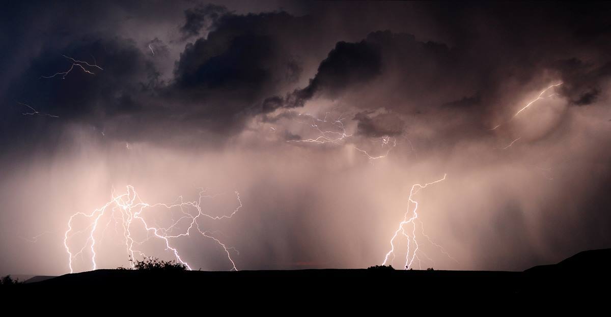
Thunderstorms are common during summer months at Black Canyon. Check the radar and weather forecast before you stop at an overlook or start hiking. There is no safe place outdoors during a thunderstorm.
If you hear thunder, it's time to leave.
If you see lightning, quickly get inside in your vehicle or a building. Avoid open shelters.
Stay away from conductive materials (fences, railings, water, etc.)
Spread your group out and stay in visual contact
While hiking at Black Canyon, visitors should be tick aware. Ticks can transmit various diseases to humans.
Strategies for Preventing Tick Bites
Avoid wooded and bushy areas with high grass and leaf litter.
Stay on sidewalks or paved surfaces when possible.
Walk in the center of trails.
Be aware when hiking in humid, moist environments - especially down the inner canyon and along the river.
Use Environmental Protection Agency (EPA) approved insect repellents on exposed skin and clothing for protection that lasts up to several hours. Follow product instructions.
Use products that contain permethrin to treat clothing and gear, such as boots, pants, socks and tents. Do not use this on your skin. Follow product instructions for application.
Conduct a tick check
After coming inside or completing your outdoor activity, check your clothing, gear, and pets for ticks. If you find a tick, remove it. You can also dry your clothing on high heat to kill any hidden ticks.
Use a hand-held mirror (or ask someone to help you) to check your skin, especially the following places:
In and around the ears
Inside belly button
Back of the knees
In and around the hair
Between the legs
Around the waist
How to safely remove a tick
Use fine-tipped tweezers to grasp the tick as close to the skin's surface as possible.
Pull upward with steady, even pressure. Don't twist or jerk the tick; this can cause the mouthparts to break off and remain in the skin. If this happens, remove the mouthparts with tweezers. If you are unable to remove the mouth easily with clean tweezers, leave it alone and let the skin heal. You can smother it in petroleum jelly if the head is in your skin.
After removing the tick, thoroughly clean the bite area and your hands with rubbing alcohol, an iodine scrub, or soap and water.
Never crush a tick with your fingers. Dispose of a live tick by putting it in alcohol, placing it in a sealed bag/container, wrapping it tightly in tape, or flushing it down the toilet.
Visit the CDC's tick safety tips for more information.
Learn about safely viewing wildlife in the park.
Know before you go! Check current conditions, as well as any closures, construction, or alerts.
Many trails pass by steep dropoffs, so be cautious and keep a close watch on children. From late fall through mid-spring, drinking water is NOT available in the park. Hikers should be aware that limited cattle grazing is permitted on the North Rim. Please keep cattle gates closed should you encounter them.
BE BEAR AWARE. Bears have made amazing efforts to obtain hikers' snacks. A bear that becomes habituated to humans and their food will ultimately need to be destroyed. Keep your backpack within arms reach at all times. Check our Current Conditions page for trail conditions.
Trails Overview
Download This Dataset
South Rim Trails
North Rim Trails
Learn about safely viewing wildlife in the park.
Know before you go! Check current conditions and park alerts.
Make the most of your visit by planning your activities and experiences in advance.
The drop down in the top left corner allows the map to be shown with different features, Standard Map or Brochure Map . The Standard Map displays an interactive map where you can click on points of interest. The Brochure Map displays the map distributed to visitors on the park brochure. Download the digital brochure map . [PDF] Text-only and Braille versions of the park brochure are also available.
Due to its steepness and elevation change, conditions can vary greatly between the canyon rim (approximately 8,000 feet) and canyon floor (approximately 6,000 feet). The canyon floor temperatures are similar to nearby Montrose, CO. Layered clothing appropriate for each season is recommended.
Spring and Fall
Daytime temperatures are mild from 40°F to 70°F (4°C to 34°C) with overnight lows from the teens to about freezing (-9°C to 2°C). Snow is common in early spring and late fall.
Summer daytime temperatures range between 60°F to 100°F (15°C to 38°C) and nights range from 30°F to 50°F (-1°C to 10°C). Brief afternoon thunderstorms can occur during the summer.
Winter daytime temperatures range between 20°F to 40°F (-6°C to 4°C) and overnight temperatures range from -10° to 20°F (-23°C to -6°C). Snow is common in the winter months. Visit www.COtrip.org for information about road conditions in Colorado.
Loading weather forecast...
South Rim Forecast
Be prepared for all conditions by dressing in layers, bringing rain or snow gear, and proper footwear.
Vehicles exceeding 22 feet (6.7 m) in length--including trailer--are not permitted on the East Portal Road because of the steep 16% grade and sharp, narrow curves.
Campground Features
Fire/Stove Policy
Operating Hours & Seasons
Contact Information & Directions
Phone number (Voice)
Mailing Address
Physical Address
Additional Information & Regulations
Additional Information
Cell Phone Additional Information
Internet Additional Information
A FEW REASONS TO GO
A closer look.
12 official park photos
Black Canyon near Tomichi PointNPS Photo/Lynch Images link to the original government source.Black Canyon near Painted WallNPS Photo/Lynch Ranger programs are offered at various locations throughout the parkNPS/D. Goodman Snowshoe walk with a rangerNPS Photo Snowshoeing in winter at Black CanyonNPS Photo Visitors should drive cautiously and view wildlife from a safe distance.NPS/Dani Goodman Rock climbing at Black Canyon is not recommended for beginners.NPS/Lisa Lynch A view downstream from the bottom of Long Draw.NPS/Ethan Crump In the summer, attend one of our night sky programs held on the South Rim.NPS Photo/C. Roundtree A view into Black Canyon from Cross Fissures OverlookNPS/Zach Schierl Rim Rock Trail is a popular trail connecting the South Rim Campground and South Rim Visitor Center. It is rocky, contains stairs, and passes by steep drop-offs with views into Black Canyon.NPS Photo/Kat Connelly Know how to be safe during thunderstorms with lightning. Get inside or know how to protect yourself if you cannot take cover.NPS Photo
Look closer at accessibility.
No structured outing assessments have been reviewed for this park yet. Check the official accessibility guide for your requirements.
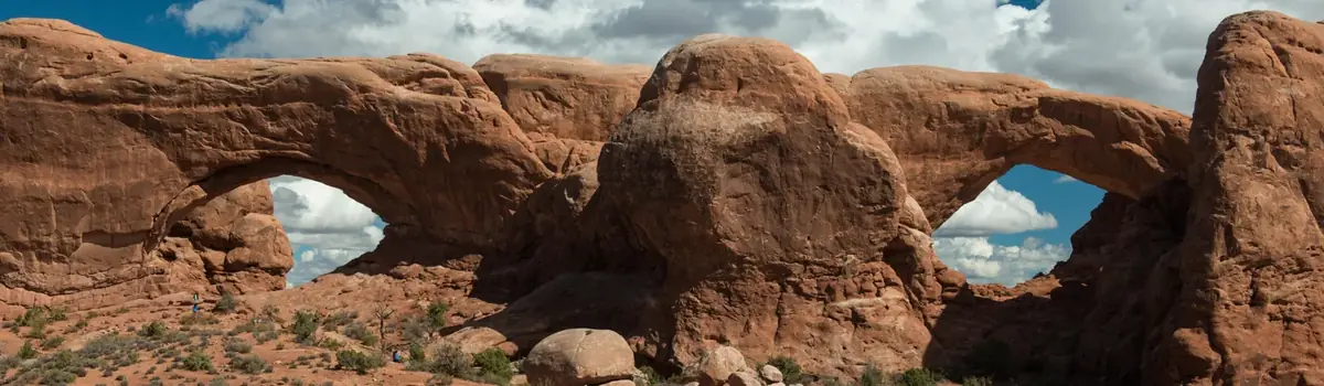
Discover a landscape of contrasting colors, land forms, and textures unlike any other. The park has over 2,000 natural stone arches, hundreds of soaring pinnacles, massive rock fins, and giant balanced rocks. This red-rock wonderland will amaze you with its formations, refresh you with its trails, and inspire you with its sunsets.
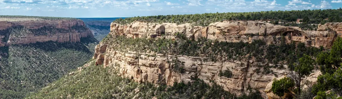
For over 700 years, the Ancestral Pueblo people built thriving communities on the mesas and in the cliffs of Mesa Verde. Today, the park protects the rich cultural heritage of 27 Pueblos and Tribes and offers visitors a spectacular window into the past. This World Heritage Site and International Dark Sky Park is home to over a thousand species, including several that live nowhere else on earth.
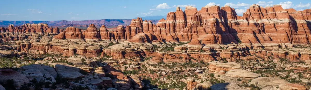
Canyonlands is a wilderness of canyons, buttes, and spires carved by the Colorado River and Green River. The park is divided into four distinct districts; no roads join them together. The districts share similar desert ecosystems, but each one provides unique opportunities for adventure and discovery.




 Desert