Astonishing biodiversity exists in Congaree National Park, the largest intact expanse of old growth bottomland hardwood forest remaining in the southeastern United States. Waters from the Congaree and Wateree Rivers sweep through the floodplain, carrying nutrients and sediments that nourish and rejuvenate this ecosystem and support the growth of national and state champion trees.
26.7Kacres of parkland
287.8Krecreation visits, 2025
Apr · Oct · Novnearby climate picks
Seasonal access & reservations
No reviewed guidance for this selection. Check the park's official planning pages; missing coverage does not establish access.
Selected guidance only; separate from climate comfort and current conditions.
Official conditions Not checked
The conditions feed has not been connected for this park.
Editorial recommendations, reviewed 2026-10-17. Full park days, excluding travel to and from the region. A first-visit outline for a general traveler; adapt to mobility, fitness, season, reservations, and current conditions. These are suggested days, not reserved activities or guaranteed routes.
Hiking the park's many trails lets you get up close and personal with Congaree National Park. Whether you are looking for a short hike on the Boardwalk Trail, or desire to make a longer trek into the backcountry, there are options available for visitors of all skills and abilities. Depending on what you want to see, trails can lead you to oxbow lakes, the Congaree River, or stands of magnificent old-growth trees that help make up the tallest deciduous forest in the United States. To find the right trail for you, visit our trail information page to see what each trail has to offer.
Whether you have hiked Congaree before, or this is your first time, it is always best to come prepared and know what to expect. To find out what equipment you should have and what you need to know before heading out on the trail, visit the hiking safety page for more information.
Are you planning on staying overnight in the backcountry? Remember that backcountry camping is a very different experience and has different rules than the park campgrounds. Make sure to look at the backcountry camping page before you start.
For more information, or to find out more about trail conditions before you visit, you can contact us by email or call the Visitor Center at (803) 776-4396.
Whether you are planning a short day trip or an overnight trip into the backcountry, travelling on Cedar Creek by canoe or kayak is a great way to experience Congaree National Park. This waterway passes through a primeval old-growth forest which contains some of the tallest trees in eastern North America. Opportunities are plentiful for viewing various types of wildlife such as river otter, deer, turtles, wading birds, and even the occasional alligator!
The marked Cedar Creek Canoe Trail winds approximately 15 miles through the Congaree Wilderness, starting at Bannister's Bridge and going all the way to the Congaree River. Potential trip ideas are available to help you decide which is the best way for you to experience the park from the water. Paddling Cedar Creek requires visitors to bring their own canoes or kayaks with them. If you do not have your own equipment, there are a number of professional outfitters in the city of Columbia that rent canoes, kayaks and other paddling equipment (the park does not rent out kayaks or canoes). Also, there are several outfitters that hold commercial use authorizations which allow them the ability to offer guided paddling tours in the park and to drop off equipment in the park. Please contact these outfitters directly for exact schedules, prices and other information:
River Runner Outdoor Center Mon-Sat 10am-6pm Canoe and kayak rentals , pickup at store
Mon-Sat 10am-6pm
Canoe and kayak rentals , pickup at store
Palmetto Outdoor Guided ~3-hour canoe tours 11 am offerings most days Meet at South Cedar Creek Landing
Guided ~3-hour canoe tours
11 am offerings most days
Meet at South Cedar Creek Landing
J.K. Adventure Guides Guided ~3-hour canoe and kayak tours 9 am and 1 pm offerings most days Meet at South Cedar Creek Landing
Guided ~3-hour canoe and kayak tours
9 am and 1 pm offerings most days
Carolina Outdoor Adventures Guided ~3-hour kayak tours Offered daily at 9:30 am with some full moon tours Meet at South Cedar Creek Landing
Guided ~3-hour kayak tours
Offered daily at 9:30 am with some full moon tours
View Fishing Regulations from South Carolina Department of Natural Resources
Fishing is allowed within Congaree National Park with a valid South Carolina fishing license. All South Carolina laws pertaining to licensing, size, and creel limits apply.
Violation of the below fishing regulations could result in fines and/or seizure of fishing equipment.
Fishing is permitted in all areas of Congaree National Park. Fishing is not allowed from or within 25 feet of any man-made structure, including bridges, boardwalk, and overlooks.
Boats propelled by inboard/outboard motors are prohibited.
To avoid introducing new, nonnative and/or potentially diseased, species to the ecosystem, please do not use minnows, amphibians or fish eggs as bait.
To preserve this natural environment for future generations, drugs, poisons, explosives, electrical devices or similar means in order to take or attract game and/or non-game fish are NOT allowed.
To ensure the natural condition of the park, do not dig for bait or chum for fish.
Game fish may be used to catch game fish but must be included in South Carolina regulated daily bag limit.
Fish only with closely attended hook and line, fly rod, casting rod, pole and line or hand line.
To preserve the quantity and biodiversity of the fish population, only recreational fishing is allowed. Catch and release sportsmanship is encouraged.
Please return illegal or unwanted fish carefully and immediately to the water.
Help maintain the natural beauty and health of the park by refraining from littering.
Congaree National Park Fish Consumption Information & Advisories
While anglers are permitted to eat the fish that they catch, those who are planning to consume fish caught in the park should be aware of the possible presence of possible toxins and contaminants that may be present in game fish. Fishing advisories are issued as recommendations on the consumption of, or avoidance of eating entirely, certain species of fish due to chemical or biological contamination.
The South Carolina Department Environmental Services maintains information on fish species with consumption advisories in place within the Congaree River and its tributaries , as well as a map that shows what advisories are in place for the area in and around the park. The National Park Service also maintains information on Fish Consumption Advisories for NPS managed lands.
Do I need a reservation or permit to camp at Congaree? Yes. All campers are required to have a reservation to camp in either of the two frontcountry campgrounds (Longleaf Campground and Bluff Campground) or have a valid permit to camp in the backcountry. Reservations for either of the frontcountry campgrounds must be made through Recreation.gov or by calling 1-877-444-6777. Information on frontcountry campground, including fees and links to reservation pages can be found below. When requesting a backcountry camping permit, applications should be be made at least 72 hours in advance. To obtain a permit, please email cong_information@nps.gov.
Can I pay in person at the park? No. Reservations for the frontcountry campgrounds must be made through Recreation.gov or by calling 1-877-444-6777 prior to setting up camp. Free Wi-Fi is available inside and immediately outside of the Harry Hampton Visitor Center.
Can I just setup camp in any campsite? No. You must camp in the campsite that you reserved. Any changes to your reservation must be handled through Recreation.gov or by calling 1-877-444-6777.
Can I drive up to my campsite? No. Visitors camping in the Longleaf Campground must park in the gravel parking lot and then walk to their site. The furthest sites are approximately 100 yards from the parking lot. Campers at the Bluff Campground may either park at the Longleaf Campground or Harry Hampton Visitor Center, and then must hike approximately 1 mile to the campground.
Does Congaree National Park offer RV/trailer sites? No. Only tents and hammocks are allowed in the campgrounds. However, the South Carolina State Park Service has a number of state parks in the region that can accommodate RVs and trailers. To see what is available or to make reservations, please visit the South Carolina State Parks website for more information. The Experience Columbia website also offers listings of private campgrounds in the area that can accommodate RVs and Camper Vans
Can I stay overnight in my vehicle? No. Those camping overnight at the park must stay in a campsite in a campground (with a reservation) or in the backcountry (with a permit).
Is there a limit for how long I can camp in the park? Yes. A person may camp no more than 14 consecutive days, or for more than 28 days in a six-month period.
Are campfires allowed in the park? Yes in the Campgrounds; No in the Backcountry. Fires are permitted in the fire rings at the Longleaf and Bluff Campgrounds only . Open fires are not permitted in the backcountry. Campers in the backcountry are permitted the use of a backpacking stove for cooking. In the campgrounds, dead wood can be collected from the surrounding area. At no time should live trees be cut for use as firewood. Firewood may not be brought into the park unless it has been either a) purchased from a local supplier and has proof of purchase along with the packaging material, or b) certified by the USDA as pest free and the user has the packaging material.
How much does it cost to camp at the park? Longleaf Campground : $15 per night for a regular tent site; $25 per night for a group site. Bluff Campground : $10 per night for a regular tent site (Senior and Access Pass holders receive a 50% discount on the above fees) Backcountry Camping: FREE
Details About Park Campgrounds and Backcountry Camping
Longleaf Campground - Located adjacent to the park entrance road, this campground has 10 individual and 4 group camping sites. Individual sites can have a maximum of 8 individuals and 3 tents. Group sites must have a minimum of 9 individuals and no more than 24, with a maximum of 10 tents per site. Each site has a fire ring and a picnic table. Two vault toilets are located at the front of the campground. This campground does not have running water. Water is available 24 hours a day at the Harry Hampton Visitor Center, at water fountains and a spigot convenient for filling large containers. In below freezing temperatures the spigot access point is cut off, but the water fountains remain available. Sites are walk-up only. No cars are permitted past the gravel parking lot
Bluff Campground - This campground is located on the Bluff Trail approximately one mile from the Longleaf Campground. There is no vehicle access to this campground; all visitors who wish to use this site must carry their equipment to the site. This campground has 6 individual campsites that have hold a maximum of 8 individuals and 3 tents. Each site has a fire ring and picnic table. There are no restroom facilities at this site, nor any running water at this campground.
Backcountry Camping Information
Camping in the backcountry is a great way to experience the wilderness at Congaree. The park's backcountry can be reached either by foot or by canoe or kayak. But before you head out on your backcountry wilderness adventure, here are a few things that you should know before beginning:
All land on the left bank of Cedar Creek between Bannister Bridge Canoe Access and Cedar Creek Canoe Access that is within the park boundary is designated as frontcountry. Camping in the frontcountry is limited to the Longleaf and Bluff Campgrounds only. All other sections of the park are designated as backcountry.
Camping in the backcountry requires a free permit. Those wishing to request a permit or to get more information on backcountry camping at Congaree may do so by sending an email . To allow park staff time to properly process backcountry camping permit applications, r equests must be submitted at least 72 hours in advance of a trip. Requests made within 72 hours will not be considered.
There are no designated campsites in the backcountry. Campers may select any suitable place, as long as they remain 100 feet away from Cedar Creek, Tom's Creek, Bates Old River, and Wise Lake. It is advisable to check the river forecast prior to your visit to ensure that a rise in water levels is not forecast.
Selected campsites are limited to 6 campers and 3 structures per site and must be no closer than 300 feet from the next closest site. Hammocks are not considered as structures, but the 6-person limit per site remains.
Open fires are not permitted in the backcountry. Campers are permitted the use of a backpacking stove for cooking.
Please follow the principles of Leave No Trace and make sure to pack all trash, equipment, and personal belongings out with you at the end of your stay.
Official NPS features and USGS park boundaries, imported 2026-10-17. An inventory snapshot, not live trail or parking availability.
Loading official park features…
TrailsPoints of interestParkingZoom with buttons or pinch. Toggle layers on the map.
Map coverage varies. Trail names may represent segments, connectors, or shared park units; mapped lines are not a hiking recommendation. Use official conditions and navigation resources before heading out.
Banister Bridge Inventory record · 1 source segments; not a route distance.
Unknown
Non-Motorized
Bates Ferry Trail Inventory record · 1 source segments; not a route distance.
Earth
Non-Motorized
Bluff Inventory record · 2 source segments; not a route distance.
Earth
Non-Motorized
Bluff Extension Inventory record · 1 source segments; not a route distance.
Earth
Non-Motorized
Bluff Spur Trail Inventory record · 1 source segments; not a route distance.
Earth
Non-Motorized
Dog Trail Inventory record · 1 source segments; not a route distance.
Earth
Non-Motorized
Elevated Boardwalk Inventory record · 1 source segments; not a route distance.
Wood
Non-Motorized
Fork Swamp Trail Inventory record · 1 source segments; not a route distance.
Earth
Unknown
Kingsnake Inventory record · 1 source segments; not a route distance.
Earth
Non-Motorized
Longleaf Trail Inventory record · 1 source segments; not a route distance.
Earth
Non-Motorized
Lower Boardwalk Inventory record · 5 source segments; not a route distance.
Wood
Non-Motorized
Oakridge Inventory record · 8 source segments; not a route distance.
Earth
Non-Motorized
Picnic Trail Inventory record · 1 source segments; not a route distance.
Unknown
Non-Motorized
River Inventory record · 14 source segments; not a route distance.
Earth
Non-Motorized
Sims Trail Inventory record · 1 source segments; not a route distance.
Unknown
Non-Motorized
Page 1 of 2
NPS public GIS inventory, imported 2026-10-17. “Existing” is an inventory classification, not confirmation that a trail is open. Segment counts are not route distances. Parking records do not indicate space availability, fees, or accessibility certification. View government source ↗
Climate for Columbia, 34 km from the park reference point. 1991–2020 normals. Source elevation: 89 m.
Daytime highNighttime lowOctober: 75° / 55°
Daytime high75°
Precipitation84 mm
Daylight11.1 hrs
Wind9.6 km/h
Mountain, rim, valley, and coastal conditions can differ sharply from the source town. Check park forecasts and current conditions before travel.
Monthly climate data 12 months · °F
Month
High
Low
Rain / snow water
Wet days
Daylight
56°
37°
89 mm
9.1
10.0 h
59°
40°
87 mm
8.3
10.7 h
67°
46°
89 mm
9.3
11.7 h
75°
54°
85 mm
8.1
12.8 h
82°
62°
76 mm
9.4
13.7 h
88°
70°
108 mm
13.5
14.2 h
90°
73°
112 mm
15.3
14.0 h
89°
72°
107 mm
13.4
13.3 h
84°
66°
94 mm
8.8
12.2 h
75°
55°
84 mm
7.1
11.1 h
65°
45°
72 mm
7.2
10.2 h
58°
39°
93 mm
8.8
9.8 h
RESEARCH WITH THE SOURCE IN VIEW
The practical field guide.
Official NPS excerpts imported 2026-10-17. Fees, permits, road access, and operations can change; use the source link to confirm the latest information.
Cell phone reception within the park is unreliable and may not be available where you are hiking or paddling.
If hiking or paddling into the backcountry, leave an itinerary behind or let someone know what your intended route is in case of an emergency
Be prepared for your wilderness adventure with the proper clothing and footwear, and carry essentials such as water, snacks, a first aid kit, a map and a compass.
Check the forecast before getting on the road. Conditions can change rapidly within the park.
Flooding can happen with little or no warning, so make sure to check water levels for Cedar Creek and the Congaree River.
During the summer, insects such as mosquitoes can be quite bothersome. Remember to bring insect repellent to avoid being bit.
Do I need a reservation or permit to camp at Congaree? Yes. All campers are required to have a reservation to camp in either of the two frontcountry campgrounds (Longleaf Campground and Bluff Campground) or have a valid permit to camp in the backcountry. Reservations for either of the frontcountry campgrounds must be made through Recreation.gov or by calling 1-877-444-6777. Information on frontcountry campground, including fees and links to reservation pages can be found below. When requesting a backcountry camping permit, applications should be be made at least 72 hours in advance. To obtain a permit, please email cong_information@nps.gov.
Can I pay in person at the park? No. Reservations for the frontcountry campgrounds must be made through Recreation.gov or by calling 1-877-444-6777 prior to setting up camp. Free Wi-Fi is available inside and immediately outside of the Harry Hampton Visitor Center.
Can I just setup camp in any campsite? No. You must camp in the campsite that you reserved. Any changes to your reservation must be handled through Recreation.gov or by calling 1-877-444-6777.
Can I drive up to my campsite? No. Visitors camping in the Longleaf Campground must park in the gravel parking lot and then walk to their site. The furthest sites are approximately 100 yards from the parking lot. Campers at the Bluff Campground may either park at the Longleaf Campground or Harry Hampton Visitor Center, and then must hike approximately 1 mile to the campground.
Does Congaree National Park offer RV/trailer sites? No. Only tents and hammocks are allowed in the campgrounds. However, the South Carolina State Park Service has a number of state parks in the region that can accommodate RVs and trailers. To see what is available or to make reservations, please visit the South Carolina State Parks website for more information. The Experience Columbia website also offers listings of private campgrounds in the area that can accommodate RVs and Camper Vans
Can I stay overnight in my vehicle? No. Those camping overnight at the park must stay in a campsite in a campground (with a reservation) or in the backcountry (with a permit).
Is there a limit for how long I can camp in the park? Yes. A person may camp no more than 14 consecutive days, or for more than 28 days in a six-month period.
Are campfires allowed in the park? Yes in the Campgrounds; No in the Backcountry. Fires are permitted in the fire rings at the Longleaf and Bluff Campgrounds only . Open fires are not permitted in the backcountry. Campers in the backcountry are permitted the use of a backpacking stove for cooking. In the campgrounds, dead wood can be collected from the surrounding area. At no time should live trees be cut for use as firewood. Firewood may not be brought into the park unless it has been either a) purchased from a local supplier and has proof of purchase along with the packaging material, or b) certified by the USDA as pest free and the user has the packaging material.
How much does it cost to camp at the park? Longleaf Campground : $15 per night for a regular tent site; $25 per night for a group site. Bluff Campground : $10 per night for a regular tent site (Senior and Access Pass holders receive a 50% discount on the above fees) Backcountry Camping: FREE
Details About Park Campgrounds and Backcountry Camping
Longleaf Campground - Located adjacent to the park entrance road, this campground has 10 individual and 4 group camping sites. Individual sites can have a maximum of 8 individuals and 3 tents. Group sites must have a minimum of 9 individuals and no more than 24, with a maximum of 10 tents per site. Each site has a fire ring and a picnic table. Two vault toilets are located at the front of the campground. This campground does not have running water. Water is available 24 hours a day at the Harry Hampton Visitor Center, at water fountains and a spigot convenient for filling large containers. In below freezing temperatures the spigot access point is cut off, but the water fountains remain available. Sites are walk-up only. No cars are permitted past the gravel parking lot
Bluff Campground - This campground is located on the Bluff Trail approximately one mile from the Longleaf Campground. There is no vehicle access to this campground; all visitors who wish to use this site must carry their equipment to the site. This campground has 6 individual campsites that have hold a maximum of 8 individuals and 3 tents. Each site has a fire ring and picnic table. There are no restroom facilities at this site, nor any running water at this campground.
Backcountry Camping Information
Camping in the backcountry is a great way to experience the wilderness at Congaree. The park's backcountry can be reached either by foot or by canoe or kayak. But before you head out on your backcountry wilderness adventure, here are a few things that you should know before beginning:
All land on the left bank of Cedar Creek between Bannister Bridge Canoe Access and Cedar Creek Canoe Access that is within the park boundary is designated as frontcountry. Camping in the frontcountry is limited to the Longleaf and Bluff Campgrounds only. All other sections of the park are designated as backcountry.
Camping in the backcountry requires a free permit. Those wishing to request a permit or to get more information on backcountry camping at Congaree may do so by sending an email . To allow park staff time to properly process backcountry camping permit applications, r equests must be submitted at least 72 hours in advance of a trip. Requests made within 72 hours will not be considered.
There are no designated campsites in the backcountry. Campers may select any suitable place, as long as they remain 100 feet away from Cedar Creek, Tom's Creek, Bates Old River, and Wise Lake. It is advisable to check the river forecast prior to your visit to ensure that a rise in water levels is not forecast.
Selected campsites are limited to 6 campers and 3 structures per site and must be no closer than 300 feet from the next closest site. Hammocks are not considered as structures, but the 6-person limit per site remains.
Open fires are not permitted in the backcountry. Campers are permitted the use of a backpacking stove for cooking.
Please follow the principles of Leave No Trace and make sure to pack all trash, equipment, and personal belongings out with you at the end of your stay.
Congaree National Park is dedicated to providing meaningful, engaging opportunities to all individuals. Congaree is over 80% federally designated wilderness and may be experienced using our ten trails , including the most popular and accessible Boardwalk , paddling on Cedar Creek , and camping .
Park Visitor Center and Resources
Harry Hampton Visitor Center
There are three parking lots located outside the visitor center. The first two lots each have two accessible parking spaces. The third lot, which is for oversized vehicles, has one accessible parking space. The visitor center has accessible restrooms, including a 24-hour family restroom, as well as an accessible water fountain located outside. During normal operating hours, the visitor center may be accessed using automatic doors. The park information desk, exhibits, and store are all located on one level. The following resources are available at the Harry Hampton Visitor Center during normal operating hours. Please ask a ranger, volunteer, or park store employee for assistance if any of these resources are required.
Standard wheelchair
Wheelchair Information and Specifications Congaree has wheelchairs available to loan free of charge from the Harry Hampton Visitor Center during standard operating hours . Wheelchairs are loaned on a first come, first serve basis. Visitors may call ahead to inquire about availability, or to request use of a wheelchair during a specific time.
The Access Pass is a free, lifetime pass - available to U.S. citizens or permanent residents of the United States that have been medically determined to have a permanent disability (does not have to be a 100% disability) - that provides admittance to more than 2,000 recreation sites managed by five Federal agencies.
At many sites the Access Pass provides the pass owner a discount on Expanded Amenity Fees (such as camping, swimming, boat launching, and guided tours).
Access passes may be obtained at any national park that charges an entrance fee, or online. For more information, please visit: America the Beautiful - National Parks & Federal Recreational Lands Access Pass | USGS Store .
Other Park Locations
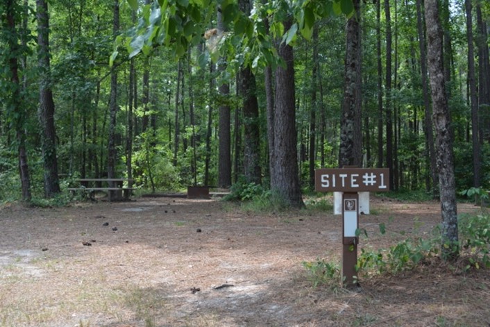
There is one accessible campsite at Longleaf Campground, Site 1. Routes to campsites at Longleaf are packed dirt and fine gravel. The parking lot at Longleaf Campground is gravel. There are accessible vault toilets directly off the parking lot. Campsites may be reserved online or over the phone through Recreation.gov.
Cedar Creek: What to Expect at Launches
Paddling on Cedar Creek is a wonderful way to experience the park. Visitors may bring their own boats and launch from either of our two boat launches. Always check current conditions before your trip! Details about our two boat launches may be found below:
South Cedar Creek Canoe Landing
Has a large gravel parking lot, with two accessible parking spaces beside vault toilets.
Creek access is downhill from parking, terrain uneven in places.
A set of stairs (8 steps total) leads down to the usual launch point for paddlers.
Bannister Bridge Canoe Landing
Has a small gravel parking lot and no accessible parking or restrooms.
Paddlers must use a long, at times narrow trail to access the launch point. This trail has a soil surface type, with some root obstructions.
Kayak Adaptations
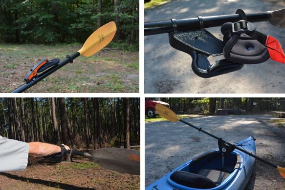
Congaree National Park offers the following kayak adaptations for people with disabilities. These tools can be loaned out free of charge to those providing their own kayak or provided one our ranger guided canoe tours. We currently have two sets of each adaptation and they are first come, first serve. Please let the park know at least 24 hours in advance if you require an adaptation.
Back of Hand Adaptation these allow users with weak grip to keep a kayak paddle in their hands.
these allow users with weak grip to keep a kayak paddle in their hands.
Wrist Slide Adaptation these allow users with no grip to use a kayak paddle
these allow users with no grip to use a kayak paddle
Paddle Pivot This allows users with use of only one arm to paddle a kayak
This allows users with use of only one arm to paddle a kayak
An entrance pass is not required to access Congaree National Park.
Other National Park Service sites may require an entrance pass or fee. Depending on your trip plans, an interagency pass may save you money.
2026 Free Entrance Days in the National Parks
Come experience the national parks! All National Park Service sites that charge an entrance fee will offer free admission to US citizens and residents (other fees, including timed entry or reservation fees, may apply). Mark your calendar for these entrance fee-free dates:
February 16 : Presidents Day (Washington's Birthday)
May 25 : Memorial Day
June 14: Flag Day/President Trump's birthday
July 3–5: Independence Day weekend
August 25: 110th Birthday of the National Park Service
September 17: Constitution Day
October 27 : Theodore Roosevelt's birthday
November 11: Veterans Day
Entrance to Congaree National Park is free. There is no fee to enter the park. America the Beautiful - National Park & Federal Recreational Lands Passes
Congaree does not currently sell or issue any America the Beautiful passes. The below options are available:
Annual, Military, Senior, or Access passes are available at any national park site that charges an entrance fee.
visit Recreation.gov - Digital America the Beautiful Passes to purchase a pass anytime.
Note: If you are planning a trip to a national park that charges a fee, you can always purchase the America the Beautiful pass upon arrival, instead of paying a standard entrance fee.
For those using a GPS device or app: Some GPS devices and services do not direct visitors to the proper location if using "Congaree National Park" when entering your desination. Please use the following address to ensure your are directed to the correct location: 100 National Park Road, Hopkins, SC 29061 From Spartanburg - Follow Interstate 26 East towards Charleston for 92 miles and then take Exit 116 for Interstate 77 North towards Charlotte (on the left). Follow Interstate 77 for approximately five miles to Exit 5, Bluff Road. Follow directions below from I 77, Exit 5 . (Approximate travel time: 2 hours)
From Charleston - Take Interstate 26, Exit 145B. Take U.S. Highway 601 North to SC 48 (Bluff Road). Follow SC 48 (Bluff Road) West. Turn left on South Cedar Creek Road then right on Old Bluff Road to the park entrance.
From Charlotte - Take Interstate 77 South towards Columbia for approximately 95 miles to Exit 5, Bluff Road. Follow directions below from Interstate 77, Exit 5 . (Approximate travel time: 2 hours)
From Augusta, GA - Follow Interstate 20 East towards Columbia for 65 miles to Exit 64A. Merge onto Interstate 26 and follow for 8 miles to Exit 116, Interstate 77 North towards Charlotte (on the left). Follow Interstate 77 for 5 miles to Exit 5, Bluff Road. Follow directions below from Interstate 77, Exit 5 . (Approximate travel time: 1 hour 45 minutes)
From Interstate 77, Exit 5 At Exit 5 turn onto SC Hwy 48 East/Bluff Road . Drive approximately 8 miles and then take a slight right onto Old Bluff Road. Follow Old Bluff Road for 4.5 miles to the park entrance sign, which will be on the right. Proceed one mile to the Harry Hampton Visitor Center. Parking lots will be on the right.
Public Transportation
The COMET offers regularly scheduled bus service to and from the park via Bus Route 47. The bus stop is located outside of the Harry Hampton Visitor Center near the middle parking lot. Visitors to Congaree National Park can utilize this service to connect to other bus routes that can take them to many locations and points of interests throughout the metropolitan Columbia area and the Midlands region. For fares, schedules and service information, please visit: http://catchthecometsc.gov
The nearest major airport to Congaree National Park is Columbia Metropolitan Airport which is located approximately 30 minutes from the park.
Charlotte Douglass International Airport, located in Charlotte, North Carolina, has flights from most major national and international carriers. This airport is approximately 2 hours from the park.
Charleston International Airport in Charleston, South Carolina also has flights from most major carriers and is approximately 2 hours from the park.
"The Unprepared" is a short film made by Congaree National Park staff, with help from park volunteers and Eastern National staff. This short film includes messaging to educate visitors about Preventive Search and Rescue (PSAR). Inspired by campy B-horror films, “The Unprepared” was created to educate folks on how to come prepared to the wilderness while also being entertaining. Voice over for Audio Description by Amanda Hardin. Music by David Fesliyan at Fesliyanstudios.com
NPS/K. Sinclair
Remember The Ten Essentials
The Ten Essentials are a collection of first aid and emergency items that can help you in the event of minor injuries, sudden weather changes, or unexpected delays. The Ten Essentials are only the basic items you should have with you. You may need additional items depending on current conditions and the activity in which you participate (e.g. life jacket/PFD, bug spray, personal locator beacon). Always check alerts and conditions before you head out. Also check out trail information and hiking safety information .
In Case of Emergency, Dial 9-1-1
We want everyone to have a safe and enjoyable visit to Congaree National Park. You can make sure that your visit is a safe and pleasant one by following a few safety guidelines:
Know before you arrive what you need to have a safe hiking trip or outing on the water.
If something seems dangerous, don't do it! People are injured every year in national parks by doing things such as crossing a stream improperly or straying off of marked trails. If you have a bad feeling about a situation, it is best to always play it safe.
Do not be afraid to say something if you see somebody else being unsafe. If you feel uncomfortable, find a park ranger and let them know so that they can notify the proper people to handle a situation.
If you see something that could be a potential safety hazard, let park staff know so that they can take care of it as soon as possible. This helps park staff keep other visitors safe from harm.
If you get lost, stay in one place! This will prevent you from getting lost even further, and helps rescuers reach you quicker.
If there is an emergency, call 9-1-1. Cell service can be unreliable in the park, so you may have to find a place where there is reception, or send someone with a cell phone to make the call. Calling 9-1-1 helps emergency responders know your exact location and arrive sooner.
Hiking the park's many trails lets you get up close and personal with Congaree National Park. Whether you are looking for a short hike on the Boardwalk Trail, or desire to make a longer trek into the backcountry, there are options available for visitors of all skills and abilities. Depending on what you want to see, trails can lead you to oxbow lakes, the Congaree River, or stands of magnificent old-growth trees that help make up the tallest deciduous forest in the United States. To find the right trail for you, visit our trail information page to see what each trail has to offer.
Whether you have hiked Congaree before, or this is your first time, it is always best to come prepared and know what to expect. To find out what equipment you should have and what you need to know before heading out on the trail, visit the hiking safety page for more information.
Are you planning on staying overnight in the backcountry? Remember that backcountry camping is a very different experience and has different rules than the park campgrounds. Make sure to look at the backcountry camping page before you start.
For more information, or to find out more about trail conditions before you visit, you can contact us by email or call the Visitor Center at (803) 776-4396.
All park maps and brochures are available for visitors to pick up at the Harry Hampton Visitor Center during our normal hours of operation: 9:00 a.m. to 5:00 p.m. Sunday through Saturday, except when otherwise noted on the park's Operating Hours and Seasons page . Park brochures, trail maps, and self-guided boardwalk brochures are available outside of the Harry Hampton Visitor Center 24 hours a day.
Your pet needs water, too! In the summer months, it can be very hot and humid in the park. When you set out for your hike or paddle, be sure to bring enough water for everyone in your group.
All pets must be on a leash (6 feet long maximum) and under your control at all times. This is to protect you, your pet, other pets and their owners, and wildlife here in the park. In the spring especially, you may see snakes along the trails. Most of these are harmless, but it is important to keep yourself and your pet at a distance. The easiest way to do this is to keep your pet close to you!
Be aware of ticks ! When you leave, be sure to check yourself and your pet for ticks.
Pets may not be left unattended for any period of time.
Please be a responsible pet owner and clean up after your pet! Pet waste bags are available outside of the visitor center for your use if you need them. Please do not leave used pet waste bags along the trails.
Large sections of the Boardwalk Trail are elevated, somewhat confined spaces where there is no way to make a quick exit. If your dog is uncomfortable with other people or pets, consider taking other trails, instead.
Summer months in Congaree can be very hot and humid. Never leave your dog in a hot vehicle, bring enough water for them as well, and know the signs of heat stroke and dehydration.
Camping and Canoeing
If you will be in the park for more than a few hours, such as on a camping or canoeing trip, make sure to bring along food, water, a first aid kit, and any safety gear they might need (ex. PFD/life jacket).
B.A.R.K. Ranger Service Dogs
Daisy (pictured left) is a B.A.R.K. Ranger and a retired service dog. You may see Daisy on the trails with her human companion, Congaree volunteer Jory. Service animals are much more than just pets, receiving special training that allows them to perform specific tasks to keep their human companion healthy and safe from harm. Some service animals may wear a vest to identify them, but not all do. Just because a dog is not wearing a vest does not mean it is not a service animal. Keeping your four-legged friend on a leash and being courteous to other visitors and their dogs helps make sure service animals can do their jobs while also having a great time at Congaree with their companion.
Learn more about service animals in national parks
Congaree National Park is located in the Midlands region of South Carolina. With a humid subtropical climate, the park experiences mild winters and very warm, wet summers. The park is accessible in all seasons, but is best experienced in the spring and fall when temperatures are at their most comfortable and insects are generally not a problem. Current weather information is provided above and can also be accessed through the National Weather Service .
Seasonal Conditions at Congaree
Spring - From March through May can be one of the best times to visit the park. Temperatures are generally warm, with average daily highs reaching the mid to upper 70's. Rain can be a common occurrence, and thunderstorms are not out of the question. Rainfall at this time of year averages around 3 inches per month. Insects are generally not a problem during this time.
Summer - From June to August is normally the hottest time of the year. Daily temperatures regularly reach into the upper 90's and often go over 100 degrees (the record high temperature for nearby Columbia is 113 degrees set in 2012). High humidity often makes it feel much hotter than the actual temperature and heat index readings in excess of 110 degrees are possible. Thunderstorms are common and can pop up with little or no warning. Precipitation is highest at this time of year with monthly average rainfall of approximately 4.5 inches.
Autumn - September through November is also a wonderful time to visit Congaree. At this time of the year average daily temperatures are in the 70's with low humidity. Fall colors peak between the end of October and early November. Average monthly precipitation is around 3 inches. Water levels are ideal at this time of year for taking a paddling trip on Cedar Creek.
Winter - November through February remains mild, with average daytime temperatures reaching the mid 50's. Nighttime temperatures can dip below freezing. Snow is not typical, though it can occur. Flooding is most frequent at this time of the year, and can happen with little or no warning. It does not have to rain at Congaree for flooding to take place. Lying in watershed the size of the state of Maryland, any significant rain in the upstate of South Carolina can cause a rise in water levels. While visiting the park, it is best to be prepared with proper clothing and footwear, especially if you are planning an overnight stay in the park's backcountry.
All trails except the elevated portion of the Boardwalk , Bluff, Firefly, and Longleaf are subject to periodic flooding. This page may not be updated each time a flood occurs. There will always be an Alert posted, however, in the event of a flood. Please check Alerts before every visit, and feel free to call the visitor center if you have questions about conditions.
Park Trail Guide There are a number of trails at Congaree which are available for foot travel only. Because the majority of the park lies within a floodplain, the terrain is generally very flat with only slight elevation changes. The majority of trails begin from the Harry Hampton Visitor Center and vary in length. Trails are marked with brown blazes along with the trail number; however, many trails are in the park's wilderness area and can be impacted by downed trees and flood damage. We encourage backcountry hikers to utilize navigational aids such as compass and map as well as offline GPS navigation tools. Trails are rated EASY , MODERATE or DIFFICULT based on length, conditions and difficulty of navigation. Mileages are approximate and are based on all trails being passable.
Boardwalk Trail - EASY CURRENT CONDITIONS: OPEN Round Trip Distance: 2.6 miles
The boardwalk begins on a bluff at the Harry Hampton Visitor Center with an elevated section that leads down into the old-growth bottomland hardwood forest. A variety of different tree species can be observed including bald cypress and tupelo trees in the lowest elevations. Loblolly pines, oaks, maples and holly can also be observed. The boardwalk has benches along the way and is wheelchair and stroller accessible. Pick up the Self-guided Boardwalk Tour brochure at the Visitor Center before beginning your walk to learn more about the the natural and cultural history of Congaree.
Bluff Trail (#1) EASY CURRENT CONDITIONS: OPEN Round Trip Distance: 1.8 miles This upland trail loops north of the Visitor Center and connects to the elevated boardwalk for a short distance. The Bluff Trail passes through a young forest of loblolly and longleaf pines. Evidence of prescribed burns can be found along this trail.
S ims Trail (#2) EASY CURRENT CONDITIONS: OPEN Round Trip Distance: 3.2 miles
The Sims Trail follows an old gravel road and runs from the Bluff Trail on its northern end to Cedar Creek at its southern end, crossing the boardwalk twice. The clearing at the intersection with the Weston Lake Trail was the site of a hunt club where Harry Hampton was once a member.
Weston Lake Trail (#3) - MODERATE CURRENT CONDITIONS: OPEN Round Trip Distance: 4.5 miles
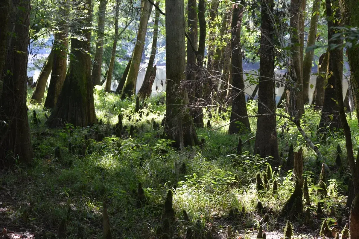
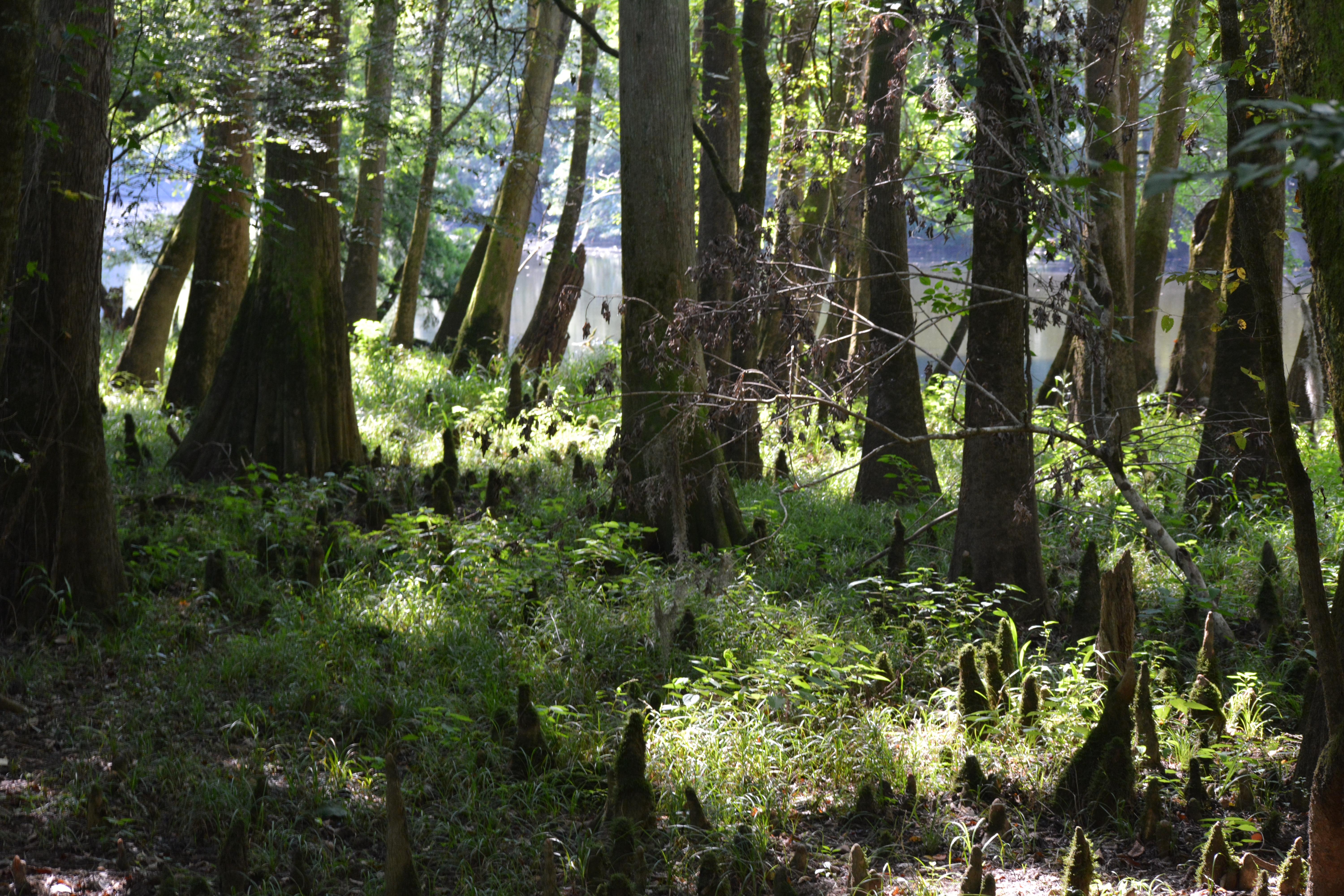
This trail provides great views of Cedar Creek where otters and wading birds are regularly observed. The eastern portion of this trail follows a cypress -tupelo slough (dried up river bed) where many cypress knees can be seen sticking up out of the water.
Oakridge Trail (#4) DIFFICULT CURRENT CONDITIONS: OPEN, MAY BE DIFFICULT TO FOLLOW IN SOME AREAS; USE CAUTION Round Trip Distance: 7.1 miles
Passing through a rich stretch of old-growth forest, this trail traverses a subtle ridge where a variety of large oak trees grow. The number of low-lying sloughs makes this trail great for viewing wildlife like deer and wild turkey.
Boggy Gut Trail (#5) DIFFICULT CURRENT CONDITIONS: OPEN , MAY BE DIFFICULT TO FOLLOW IN SOME AREAS, NUMEROUS TREES DOWN DUE TO RECENT STORMS; USE CAUTION Round Trip Distance: 11.1 miles
This trail leads to the Congaree River, the lifeblood of the park's great natural diversity. Approximately ten times a year the river overflows its banks and pulses water through the bottomland forest. When the river is low, a large sandbar may be visible. Much of the forest along the river was logged prior to the park's establishment and vegetation here is noticeably denser than that of other trails.
Kingsnake Trail (#6) DIFFICULT CURRENT CONDITION: OPEN, MAY BE DIFFICULT TO FOLLOW IN SOME AREAS; USE CAUTION Distance: 12 miles
The Kingsnake Trail is a favorite trail for birders because of the diverse vegetation and proximity to Cedar Creek. When sloughs are full of water, beautiful views are possible around every bend.
Bates Ferry Trail (#7) EASY CURRENT CONDITION: OPEN Round Trip Distance: 2.2 miles
Starting from Route 601 in the eastern section of the park, this trail follows a 1920's ferry road south to the Congaree and is a remnant of the areas rich history, which includes colonial era ferries which once crossed near here. While at the river, please be aware that the bank is steep and could potentially be slippery. It is best to stay on the marked path, as old side trails are neither cleared nor marked.
Longleaf Trail (#8) EASY CURRENT CONDITIONS: OPEN Distance: 1.3 miles (one-way distance)
This trail connects Longleaf Campground to the Harry Hampton Visitor Center, the Boardwalk, and other trails. Fork Swamp Trail (#9) MODERATE CURRENT CONDITIONS: OPEN , MAY BE DIFFICULT TO FOLLOW IN SOME AREAS; USE CAUTION Distance: 0.6 miles
This trail runs alongside the southern channel of Bates Old River, an oxbow lake created by a hurricane in 1852. Firefly Trail (#10) EASY CURRENT CONDITIONS: OPEN Round Trip Distance: 1.8 miles Visitors are treated to a magical light show produced by synchronous fireflies along this trail in late spring.
Camping in the backcountry requires a permit. Backcountry camping permits are FREE, and those wishing to request a permit should do so by emailing the park at the link below.
Backcountry Camping at Congaree
Camping in the backcountry is a great way to experience the wilderness at Congaree. The park's backcountry can be reached either by foot or by canoe or kayak. But before you head out on your backcountry wilderness adventure, here are a few things that you should know before beginning:
All land on the left bank of Cedar Creek between Bannister Bridge Canoe Access and Cedar Creek Canoe Access that is within the park boundary is designated as frontcountry. Camping in the frontcountry is limited to the Longleaf and Bluff Campgrounds only. All other sections of the park are designated as backcountry.
Camping in the b ackcountry requires a free permit. Please call (803) 776-4396 or email cong_information@nps.gov for more information on obtaining a backcountry camping permit.
There are no designated campsites in the backcountry. Campers may select any suitable place, as long as they remain 100 feet away from Cedar Creek, Tom's Creek, Bates Old River, and Wise Lake. It is advisable to check the river forecast prior to your visit to ensure that a rise in water levels is not forecast.
Selected campsites are limited to 6 campers and 3 structures per site and must be no closer than 300 feet from the next closest site. Hammocks are not considered as structures, but the 6 person limit per site remains.
Open fires are not permitted in the backcountry. Campers are permitted the use of a backpacking stove for cooking.
Please follow the principles of Leave No Trace and make sure to pack all trash, equipment, and personal belongings out with you at the end of your stay.
The Ten Essentials
A FEW REASONS TO GO
A closer look.
14 official park photos
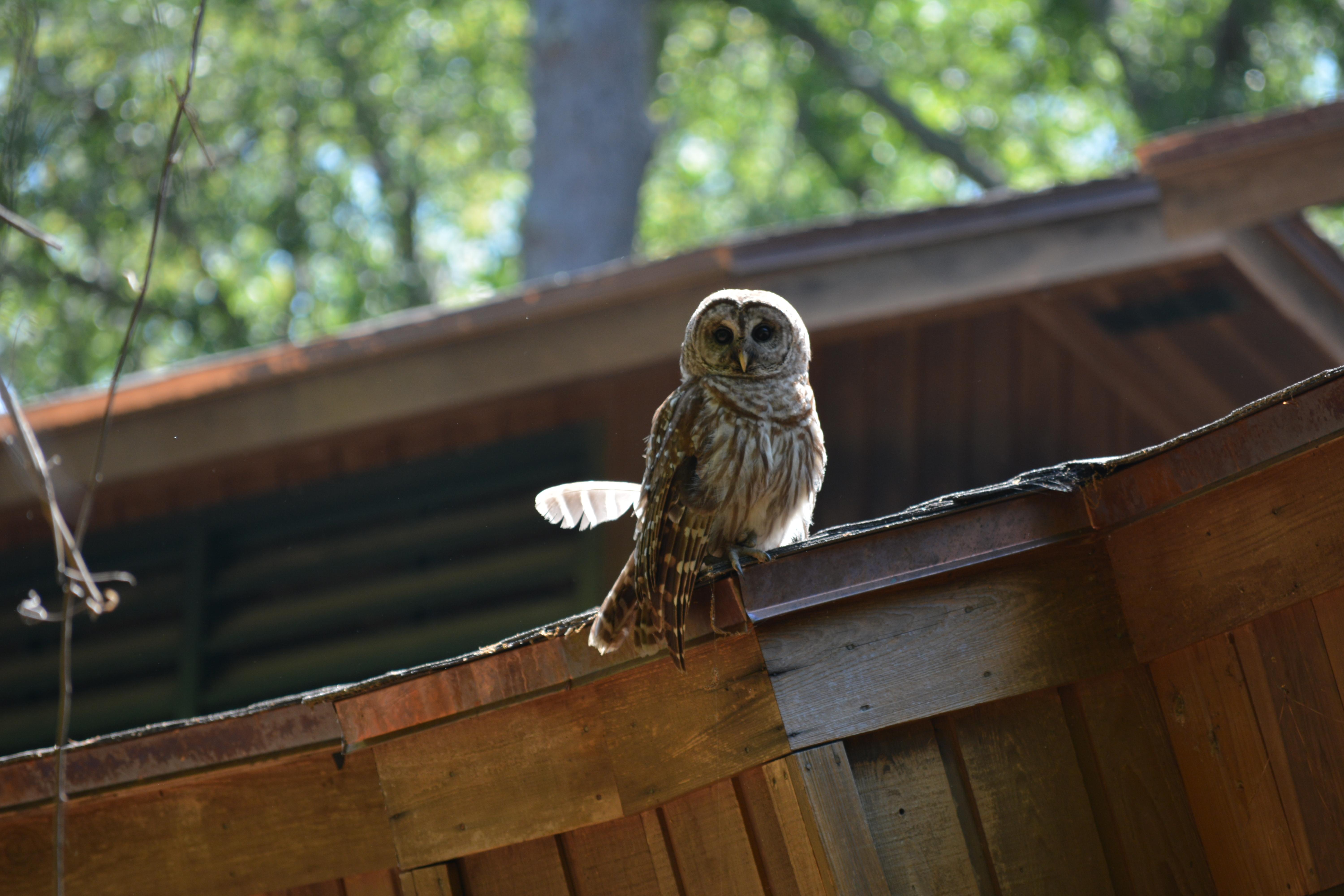
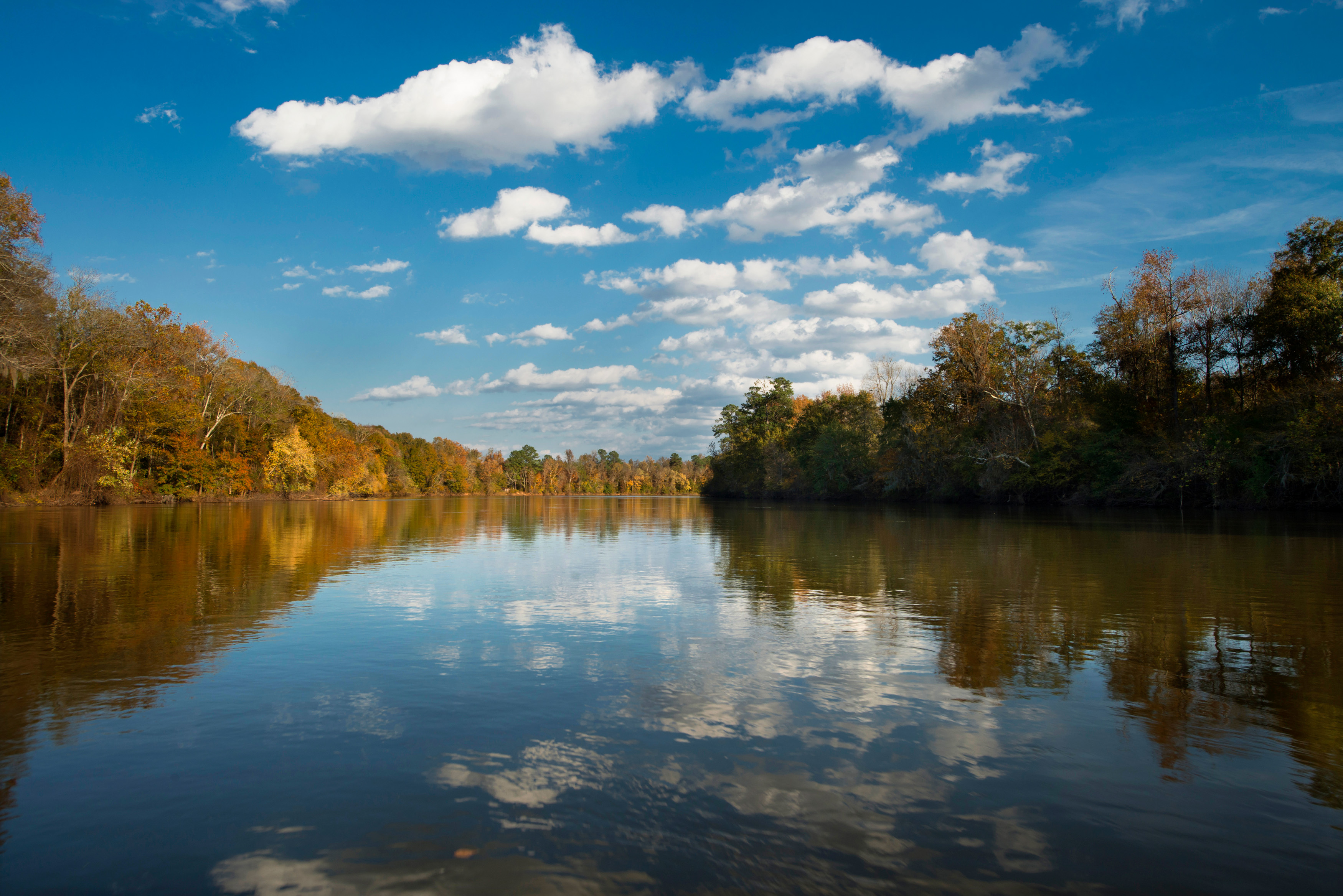
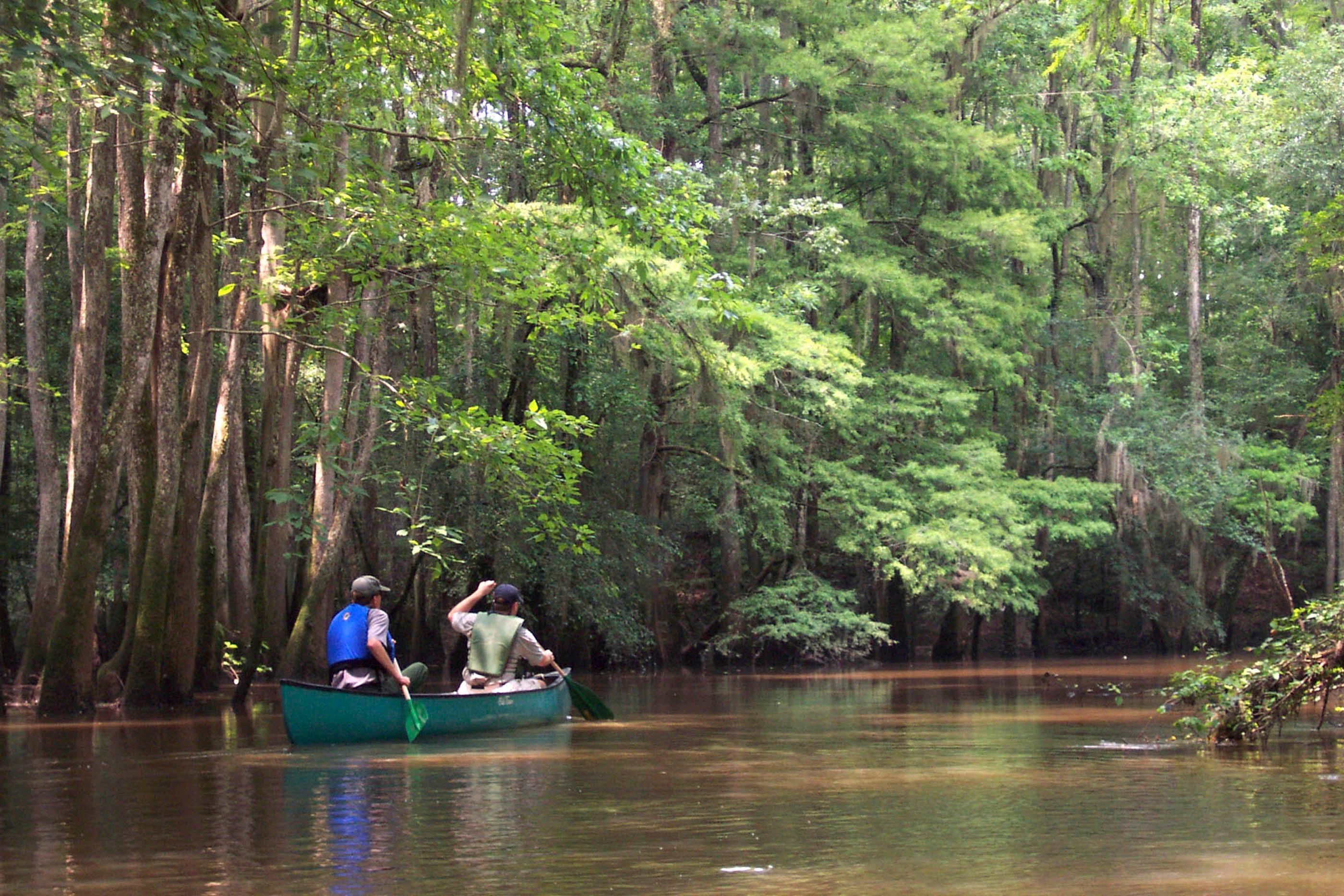
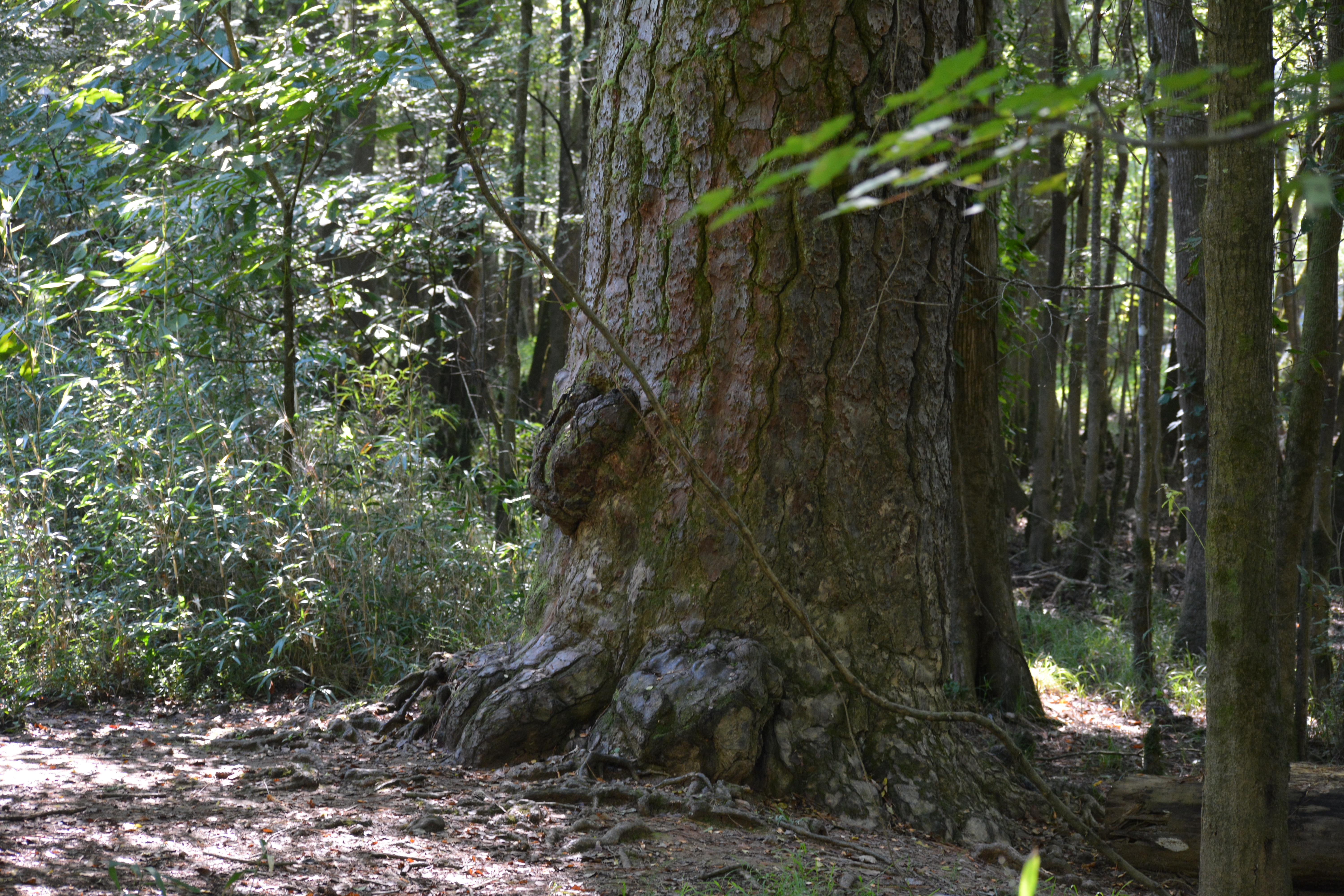
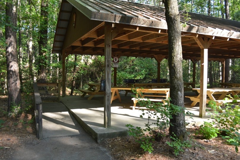
Cypress trees and knees by Weston LakeNPS Photo Images link to the original government source.A barred owl perched on the Harry Hampton Visitor Center roof at Congaree National ParkNPS Photo View of the Congaree River during the FallNPS Two people canoeing on Cedar Creek within Congaree National ParkNPS Photo A former Champion loblolly pine, more than 250 years old, just off the Boardwalk TrailNPS Photo Picnic shelter at Congaree National ParkNPS/Hardin Campsite at CongareeNPS/Hardin From top left to bottom right: back of hand adaptation, wrist slide adaptation, wrist slide adaptation demonstrated, and paddle pivot adaptation.NPS/Hardin Canoeing Cedar CreekNPS Photo Ranger guided walks provide visitors an in-depth look at the largest remaining section of old-growth bottomland forest in the United StatesNPS Photo/jt-fineart Immense trees like the Bald Cypress tree above are a common sight in Congaree's backcountry.NPS Photo/jt-fineart.com A number of hiking trails allow visitors to explore the Congaree WildernessNPS Photo/jt-fineart
Ridge upon ridge of forest straddles the border between North Carolina and Tennessee in Great Smoky Mountains National Park. World renowned for its diversity of plant and animal life, the beauty of its ancient mountains, and the quality of its remnants of Southern Appalachian mountain culture, this is America's most visited national park. Plan your visit today!
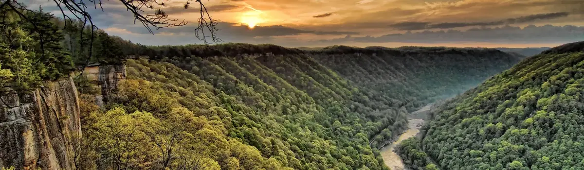
A rugged, whitewater river flowing northward through deep canyons, the New River is among the oldest rivers on the continent. The park encompasses over 70,000 acres of land along the New River, is rich in cultural and natural history, and offers an abundance of scenic and recreational opportunities.
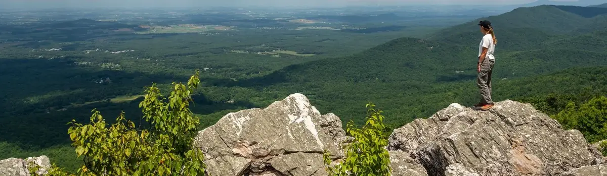
Just 75 miles from the bustle of Washington, DC, Shenandoah National Park is a land bursting with cascading waterfalls, spectacular vistas, fields of wildflowers, and quiet wooded hollows. With over 200,000 acres of protected lands that are haven to deer, songbirds, and black bear, there's so much to explore...and your journey begins right here!


 Mountains