Though a short distance from the urban areas of Cleveland and Akron, Cuyahoga Valley National Park seems worlds away. The park is a refuge for native plants and wildlife, and provides routes of discovery for visitors. The winding Cuyahoga River gives way to deep forests, rolling hills, and open farmlands. Walk or ride the Towpath Trail to follow the historic route of the Ohio & Erie Canal.
32.6Kacres of parkland
3Mrecreation visits, 2025
Jun · Aug · Sepnearby climate picks
Seasonal access & reservations
No reviewed guidance for this selection. Check the park's official planning pages; missing coverage does not establish access.
Selected guidance only; separate from climate comfort and current conditions.
Official conditions Loading saved check
Loading the latest saved conditions. You can also check the official report below.
Editorial recommendations, reviewed 2026-10-17. Full park days, excluding travel to and from the region. A first-visit outline for a general traveler; adapt to mobility, fitness, season, reservations, and current conditions. These are suggested days, not reserved activities or guaranteed routes.
The National Park Service and our partners offer many events and activities throughout the year. The calendar below provides a list of scheduled events. Programs and activities are subject to change. Visit Cuyahoga Valley Scenic Railroad's website to find the full train schedule and to buy tickets.
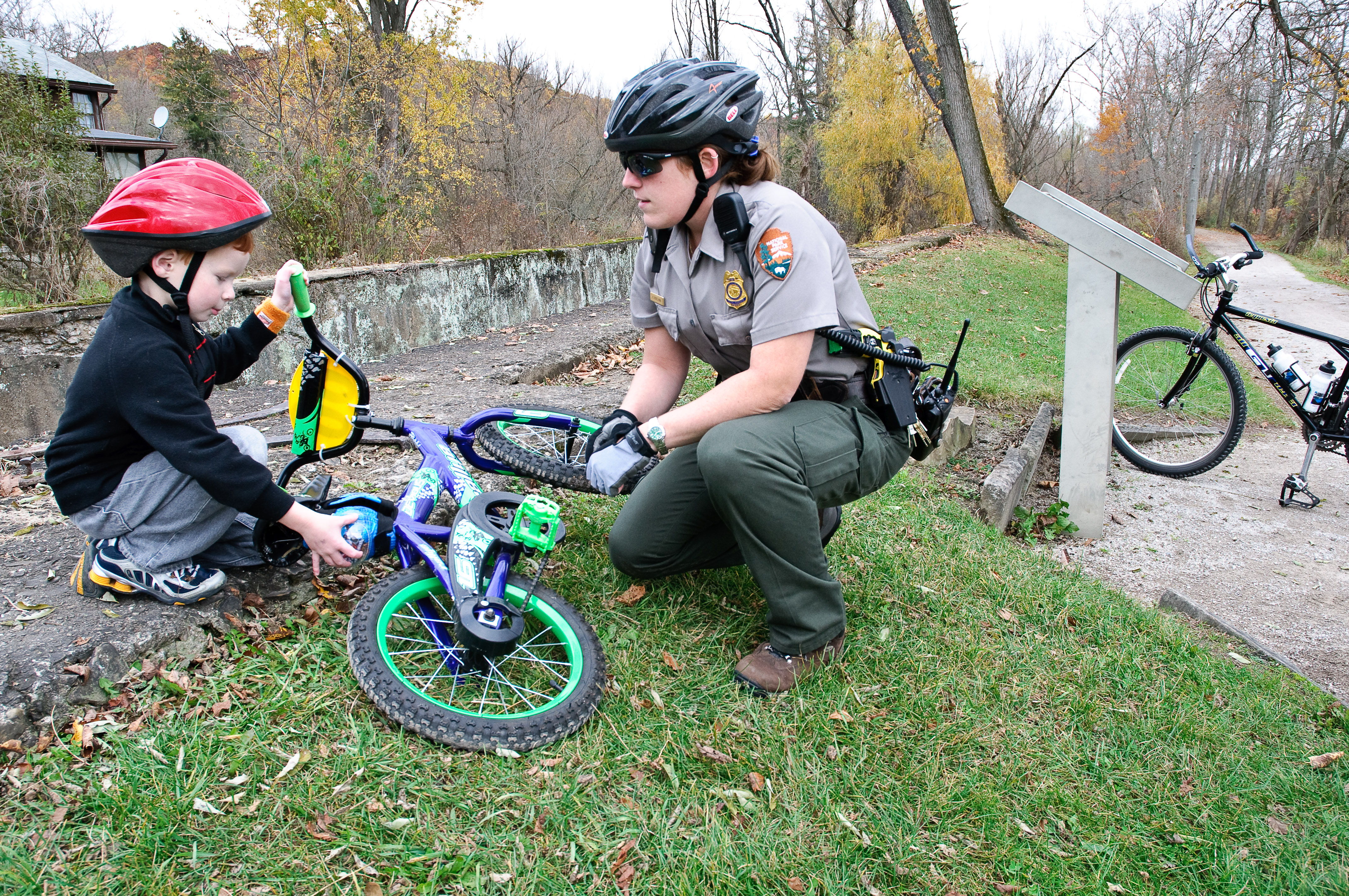
Are you looking for fun, kid-friendly activities? Cuyahoga Valley National Park offers rich history, scenic views, and wildlife watching experiences. Enjoy the following opportunities to dive deeper into nature and history together.
From June - August, stop in to do a Junior Ranger Challenge .
Complete the Junior Ranger Handbook or Junior Jr. Ranger Activities .
Join us for Junior Ranger Day Camp .
Go Canalway Questing .
Enjoy hands-on activities in the Everett area .
Go to a program .
Help the park through a Service Learning Opportunity .
Visit Hale Farm & Village .
Explore family-friendly exhibits at Canal Exploration Center , Brecksville Nature Center , and F.A. Seiberling Nature Realm .
Picnic at a summer Blossom Music Festival concert with free tickets for youth under 18.
If you have any questions talk to a ranger at Boston Mill Visitor Center, e-mail us , or call us .
Tips for Hiking with Children
If you're new to hiking with children, consider the following tips:
Dress children in layers and bring clothing for changing weather conditions.
Bring along a liter of water per person and a snack.
Bring sunscreen and insect repellent. Avoid fragrant lotions that may attract insects.
Choose a hike that is appropriate for your child, and isn't too long. Keep your trip fun.
Take frequent breaks when hiking with young children. It gives them time to rest and explore.
Bring along a camera. Pictures will help them remember the experience.
Take time to talk with children and encourage them to explore things along the trail.
Take a Virtual Visit
Can you only visit the park virtually today? We have the following activities available on our website and on our non-profit friends group, the Conservancy for Cuyahoga Valley National Park's website.
Become a virtual Junior Ranger .
Explore our educational resources .
Talk to your teacher about school programs at Cuyahoga Valley National Park.
See below to research the park.
Every Kid Outdoors
Every Kid Outdoors connects fourth graders and their families to public lands. Complete a fun activity and get your voucher for free admission today.
Research the Park
Nature Learn about how the Cuyahoga River and other park habitats provide opportunities for plants and animals to flourish.
History & Culture History runs deep in the valley, with over 12,000 years of human occupation. Learn more about the interplay of natural and cultural history.
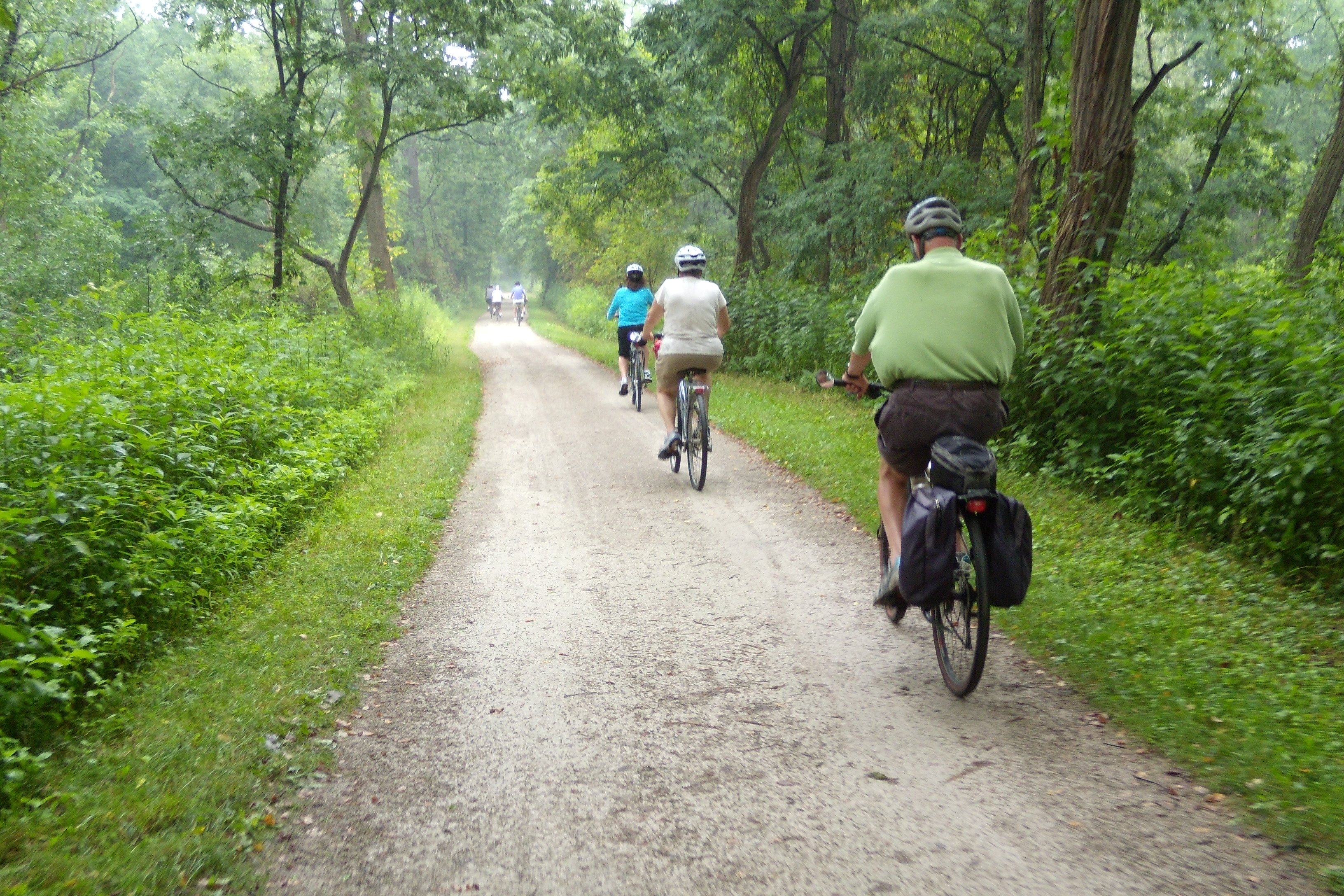
Discover the heart of Cuyahoga Valley National Park by bicycling , running, or strolling on the Towpath Trail. Here you can travel the historic route of the Ohio & Erie Canal on the same path that mules walked to tow canal boats loaded with goods and passengers. From the trail, you can make connections to many natural and historic sites, as well as to Cuyahoga Valley Scenic Railroad . Beyond the park, you can continue your journey on the Towpath Trail further along the Ohio & Erie Canalway .
Map of the Towpath Trail Open 24 hours Multiple access points (see below) Wheelchair, bike, and stroller accessible Flat surface of compacted, crushed limestone with some paving 20 miles within the national park Find information about where to find drinking water and restrooms along the trail Please note: If you planning a multi-day Towpath Trail ride, contact our Communications Center at 440-546-5945 to inform staff where you parked your vehicle. This will ensure our law enforcement rangers do not tag your vehicle as "abandoned." Visit our Alerts page to check for potential Towpath Trail closures.
Map of the Towpath Trail
Multiple access points (see below)
Wheelchair, bike, and stroller accessible
Flat surface of compacted, crushed limestone with some paving
20 miles within the national park
Find information about where to find drinking water and restrooms along the trail
Please note: If you planning a multi-day Towpath Trail ride, contact our Communications Center at 440-546-5945 to inform staff where you parked your vehicle. This will ensure our law enforcement rangers do not tag your vehicle as "abandoned."
Visit our Alerts page to check for potential Towpath Trail closures.
Towpath Safety and Etiquette
The Towpath Trail is a shared recreational trail. It is open to walkers, joggers, bicyclists, and (in some sections) horse riders. To ensure an enjoyable trail experience for all users, please observe some basic trail courtesy.
Travel at a safe speed and keep to the right except to pass others. The speed limit for bicycles is 15 mph.
Bicyclists yield to ALL users.
Don't risk a head injury. Always wear a helmet when cycling.
EVERYONE yields to horses. Horses can be startled by sudden movements, so use caution. Make sure the rider knows in advance that you are passing.
Give a clear warning before passing on the left.
Travel single file when passing and being passed.
Pets must be kept on a leash which is six feet or less. We recommend a shorter leash to prevent bike accidents. Keep you and your pet on the right side of the trail.
Avoid walking in cross-country ski tracks.
Move off the trail when stopped.
Class 1 and 2 e-bikes are allowed on the Towpath Trail within the national park. Other motorized vehicles are not permitted as stated in the Superintendent's Compendium .
History of the Towpath
The Towpath Trail follows the historic route of the Ohio & Erie Canal . Before the canal was built (1825-1832), Ohio was part of America's frontier. Travel was difficult and getting crops to market was nearly impossible. The canal provided a successful transportation route across the state, connecting the Ohio River at Portsmouth and Lake Erie at Cleveland. The canal opened up Ohio to the rest of the eastern United States. Learn more about the Towpath Trail at Ohio & Erie Canalway .
Shuttle by Train
Cuyahoga Valley Scenic Railroad offers one-way shuttle service for Towpath bikers, hikers, and runners. Purchase single Explorer tickets at the baggage car. For frequent users, we recommend buying a seasonal Explorer pass. Arrive 10 minutes before departure and flag down the train by waving both arms over your head. Cash is preferred; exact change is appreciated. Make sure to have trailers detached and all items removed from bikes before boarding. Cuyahoga Valley Scenic Railroad has a 40-pound weight limit for bicycles. Check the train's Explorer page for the current days of operations, prices, and schedule. The page also has a map and answers to frequently asked questions.
Distance Between Points
The following table lists the distances in miles between national park trailheads and other points of interest along the Towpath Trail. For distances outside the national park, visit Ohio & Erie Canalway .
Several local businesses offer bicycle rentals along this section of the Towpath Trail, including:
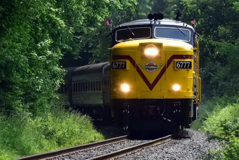
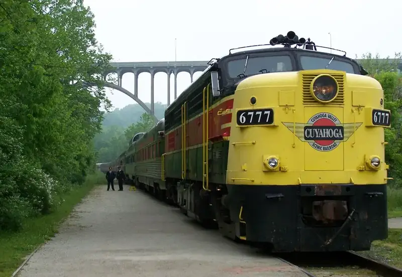
All Aboard the Cuyahoga Valley Scenic Railroad! The National Park Scenic excursion is a unique way to experience all the natural wonder Cuyahoga Valley National Park has to offer. Sit back and relax as the train weaves through the Cuyahoga Valley and races along with the rushing Cuyahoga River. The route provides passengers the opportunity to possibly spot eagles, deer, beavers, and herons in their natural habitat. Visit Cuyahoga Valley Scenic Railroad's website for tickets and detailed trip planning information. Rockside and Akron Northside are the primary stations. Schedules vary seasonally. Passengers can choose from a variety of seating options including coach, table top, and executive class. Cuyahoga Valley Scenic Railroad also offers group rates, private charters, and special events.
Shuttle Using CVSR Explorer
During certain seasons, you can bike or hike the Towpath Trail or paddle the river in one direction, and ride the train back to where you started. Visit the CVSR website for more information about this program.
The Explorer program 2026 season was June 1 to September 7. Check back here for the 2027 schedule. The train can be flagged down at boarding stations by waving both arms over your head. Get to the station 10 minutes before departure time. You can catch the train at the following stations:
*Stations with an asterisk are near river access sites. Know your destination before you get on the train; bikes are arranged by stops. Use the CVSR's Train Tracker App to keep track of the train. Be sure to check our Current Conditions page for any Towpath Trail closure alerts.
Over a Century of Train Service
The history of trains in the Cuyahoga Valley stretches back more than 100 years. In 1880, the Valley Railway began operations, transporting coal to Cleveland, Akron, and Canton from the Tuscarawas River Valley. It also provided passenger service. For people living in the industrial cities, leisure excursions into the countryside provided relief from the pressures, pollution, and crowding of urban life. After a decade of operation, the Valley Railway became part of the Baltimore & Ohio Railroad. In the 1900s, competition from automobiles, trucks, and buses caused the decline of both freight and passenger service. Interest in the line was renewed in 1972 as a scenic excursion route. The Cuyahoga Valley Preservation and Scenic Railway Association was born. Originally known as the Cuyahoga Valley Line, the scenic railroad now operates as Cuyahoga Valley Scenic Railroad.
Loading results...
Station
Address
Distance
*Rockside
7900 Old Rockside Rd, Independence 44131
1.75 miles to Canal Exploration Center
Canal Exploration Center
7104 Canal Road, Valley View 44125
4.5 miles to Brecksville
*Brecksville
9141 Riverview Road, Brecksville 44141
4.25 miles to Boston Mill
*Boston Mill
6947 Riverview Road, Peninsula, the intersection of Boston Mills and Riverview Roads, 44264
2.5 miles to Peninsula
*Peninsula Depot
1630 Mill Street, Peninsula 44264
4 miles to Indigo Lake
Indigo Lake
4300 Riverview Road, Peninsula 44264
3 miles to Botzum
Botzum
2928 Riverview Road, Akron 44067
6.5 miles to Akron Northside
Akron Northside
27 Ridge Street, Akron 44236
Akron Northside is the last station on the southbound route
Conservancy for Cuyahoga Valley National Park / Aaron Self
Listen to Live Music
Conservancy Concerts
Conservancy for Cuyahoga Valley National Park hosts a variety of concerts throughout the year. Enjoy a family-friendly outdoor concert series, Rhythm on the River in the summer. Or Concerts at Happy Days Lodge in the winter.
Voices in the Valley
The Peninsula Foundation supports the arts community by presenting Voices in the Valley , a showcase of traditional roots music. Join them for a relaxing evening in the historic G.A.R. Hall.
Blossom Music Center
The summer home of the Cleveland Orchestra is nestled within Cuyahoga Valley. Catch their annual Blossom Festival. The iconic pavilion seats 5,700 people, with space for about 13,500 more on the lawn.
NPS / Kris Brown
Photography and Visual Arts
Cuyahoga Valley Photographic Society
Part of the Conservancy, the Photo Society sponsors monthly presentations by locally and nationally recognized photographers as well as workshops, photo walks, and an annual contest.
Nature Includes You
The Nature Includes You traveling exhibit explores the rich relationships that people of color have with nature in Northeast Ohio. It opened in March 2025 and runs through 2026. Some venues offer gallery talks and other related programs.
Bees, Bugs, and Butterflies: Pollinating Along the Cuyahoga
Bees, Bugs, and Butterflies: Pollinating Along the Cuyahoga is a traveling exhibit presented by Community Life Collaborative and the National Park Service. It opened in May 2023 and continues into 2026. Some venues offer gallery talks and other related programs.
Find information about the current exhibit at the Conservancy's gallery space in the village of Boston.
Online Photo Galleries
View a collection of photographs taken in Cuyahoga Valley National Park.
Lectures and Theater
Porthouse Theatre
Since its founding in 1968, Porthouse Theatre has entertained scores of Northeast Ohio audiences and provided training opportunities for countless developing theatre artists. Every summer, more than 20,000 guests enjoy the Porthouse experience, picnicking with friends and family on the surrounding grounds or in one of their pavilions before enjoying a professional production in their comfortable 500-seat covered outdoor theatre.
Creative Writing
CVNP Poetic Toolkit
The National Park Service and the Conservancy for Cuyahoga Valley National Park have a long standing partnership with the Wick Poetry Center at Kent State University. Our current collaboration is a Poetic Inventory of the insects, birds, mammals, fish, fungi, flowering plants, and other forms of life that make the park their home. Watch this collection grow over time. Contact Wick if you want to participate. Online Emerge and Thread tools let you make a poem about park geology, prehistoric people, and the Ohio & Erie Canal.
Official NPS features and USGS park boundaries, imported 2026-10-17. An inventory snapshot, not live trail or parking availability.
Loading official park features…
TrailsPoints of interestParkingZoom with buttons or pinch. Toggle layers on the map.
Map coverage varies. Trail names may represent segments, connectors, or shared park units; mapped lines are not a hiking recommendation. Use official conditions and navigation resources before heading out.
Trailhead Location(s): Boston Run Trailhead is located in the overflow parking lot of Happy Days Lodge on State Route 303, 2 miles east of Peninsula and 1/2 mile west of State Route 8 in Boston Heights, OH.
NPS public GIS inventory, imported 2026-10-17. “Existing” is an inventory classification, not confirmation that a trail is open. Segment counts are not route distances. Parking records do not indicate space availability, fees, or accessibility certification. View government source ↗
Climate for Hudson, 9 km from the park reference point. 1991–2020 normals. Source elevation: 325 m.
Daytime highNighttime lowOctober: 61° / 45°
Daytime high61°
Precipitation84 mm
Daylight10.9 hrs
Wind12.6 km/h
Mountain, rim, valley, and coastal conditions can differ sharply from the source town. Check park forecasts and current conditions before travel.
Monthly climate data 12 months · °F
Month
High
Low
Rain / snow water
Wet days
Daylight
34°
21°
81 mm
12.2
9.4 h
37°
22°
66 mm
10.4
10.3 h
46°
30°
90 mm
12.2
11.7 h
59°
41°
109 mm
14.2
13.1 h
69°
51°
103 mm
13.5
14.3 h
78°
60°
112 mm
13.4
14.9 h
81°
65°
97 mm
12.3
14.7 h
79°
63°
88 mm
11.1
13.7 h
73°
56°
89 mm
10.2
12.3 h
61°
45°
84 mm
11.1
10.9 h
49°
35°
82 mm
11.2
9.7 h
38°
27°
81 mm
11.6
9.1 h
RESEARCH WITH THE SOURCE IN VIEW
The practical field guide.
Official NPS excerpts imported 2026-10-17. Fees, permits, road access, and operations can change; use the source link to confirm the latest information.
Cuyahoga Valley National Park is open every day of the year. Use the menu below to help plan a safe and enjoyable trip to the park. Contact us to talk directly to a ranger or submit a lost and found form. You can also check our answers to Frequently Asked Questions .
Cuyahoga Valley does not offer camping within the national park. Backcountry camping or staying overnight in parking lots is prohibited. Cleveland Metroparks and Summit Metro Parks offer limited camping opportunities. See the lists below for state parks and private campgrounds within various driving distances.
We strive to remove barriers and create fun experiences for everyone.
Cuyahoga Valley offers things to do that suit a wide variety of interests. There are accessible ways to enjoy almost every popular activity. We hope you Find Your Park here. It helps to understand our basic geography. The national park is a skinny green space between two cities—with Cleveland, Ohio to the north and Akron to the south. Four routes run through the valley’s flat bottomland, connecting us to these cities. People can paddle the Cuyahoga River, hike or bike the Towpath Trail, ride Cuyahoga Valley Scenic Railroad, and drive America’s Byway. A network of other roads and trails branch up the valley walls to the highlands on either side. If you have limited mobility, the trails through the steep ravines are the least accessible. Fortunately, we have lots of other options.
Plan Your Visit
We understand that everyone experiences their disability differently. Explore the links on the right that describe your needs.
The park's official brochure is available in two alternative formats : audio-only and Braille.
If you did not find answers to your questions in the section links, reach out to us at our general contact link here . We also welcome your suggestions for removing barriers and creating more enjoyable experiences. The park’s accessibility coordinator, Ranger Arrye Rosser, can provide trip-planning advice tailored toyour individual needs. Email her or call us and leave a message.
Courtesy / Joan Greenberg
Want to get more involved? Consider becoming a Park for All Volunteer. Provide input on planning projects and find volunteer activities that match your interests and schedule. To learn more, contact the volunteer office at 330-657-2299 or volunteer@forcvnp.org .
An entrance pass is not required to access Cuyahoga Valley National Park.
Other National Park Service sites may require an entrance pass or fee. Depending on your trip plans, an interagency pass may save you money.
2026 Free Entrance Days in the National Parks
Come experience the national parks! All National Park Service sites that charge an entrance fee will offer free admission to US citizens and residents (other fees, including timed entry or reservation fees, may apply). Mark your calendar for these entrance fee-free dates:
February 16 : Presidents Day (Washington's Birthday)
May 25 : Memorial Day
June 14: Flag Day/President Trump's birthday
July 3–5: Independence Day weekend
August 25: 110th Birthday of the National Park Service
September 17: Constitution Day
October 27 : Theodore Roosevelt's birthday
November 11: Veterans Day
Reservable Picnic Shelters
The Ledges and Octagon Shelters in the Virginia Kendall area are reservable by visiting the online national reservation system, www.recreation.gov and paying with a credit card.
Other Reservable Facilities
Cuyahoga Valley National Park has several other facilities available for public rentals. Visit the Conservancy for Cuyahoga Valley National Park's facilities page for more information.
Purchase a Pass for Other Federal Lands
Cuyahoga Valley does not charge an entrance fee or require any passes for entry. However, some America the Beautiful Federal Lands Recreation Passes are available at our visitor center and online.
Where to Get a Pass
Annual Passes are available for purchase at Boston Mill Visitor Center during normal business hours. The following passes are available at the visitor center when a ranger is on duty. December through April, please call ahead to confirm ranger availability to issue these passes:
Annual Military Pass
Lifetime Military Pass
Annual Every Kid Outdoors Pass: free and available for US fourth graders. For more information, visit the Every Kid Outdoors website .
Lifetime Access Pass
The following passes are not available at Cuyahoga Valley. Both are available to US citizens and permanent residents who are at least 62 years old. They can be purchased or obtained from USGS by phone or through their online store :
Just a short distance from the urban areas of Cleveland and Akron, Cuyahoga Valley National Park can be easily reached by car. To find street addresses for specific park locations, visit our addresses page . Visit our maps page for a map of the park.
Getting here by:
Directions below are to Boston Mill Visitor Center located at 6947 Riverview Road, Peninsula, Ohio 44264 (41° 15'45.3" N) (81° 33'37.3" W). For more detailed information, contact us .
Directions from Akron, OH and points south:
Take I-77 North.
Keep left to take OH-8 North via Exit 125A toward Cuyahoga Falls for 12.6 miles.
Take the Boston Mills Road/Hines Hill Road exit 14A.
Turn right at the light, at the end of the exit, onto Boston Mills Road heading west for 4 miles. You will cross the Cuyahoga River.
The visitor center is the green and white building just across the river on your left. The entrance to the parking lot is to the left on Riverview Road.
Directions from Cleveland, OH and points due north:
Take I-77 South for 15.5 miles.
Take exit 147, Miller Road, and turn left at the end of the exit onto Miller Road for .6 miles.
Turn right onto OH-21/Brecksville Road for .4 miles.
Turn left onto Snowville Road for 2.8 miles.
Turn right onto Riverview Road and proceed for 1.7 miles. The parking lot will be to your left just past the Boston Mills Road intersection.
The visitor center is the white and green building, closest to Boston Mills Road, just across the train tracks.
Directions from Columbus, OH and points southwest:
Take I-71 North.
Merge onto I-271 North via exit 220 toward Erie, PA.
Take the OH-303 exit, exit 12, toward Richfield/Peninsula.
Turn right onto West Streetsboro Road/OH-303 and proceed for 1.8 miles.
Turn left at the first light onto Riverview Road and proceed for 1.6 miles.
The visitor center parking lot will be on your right after the second overpass (I-271), just before the Boston Mills Road intersection.
Directions from Toledo, OH and points west:
Take the I-80/I-90/Ohio Turnpike East.
Merge onto I-80 E via the exit on the left toward Cleveland (Portions toll) and travel 108.4 miles.
Take the I-77 exit, exit 173, toward Cleveland/Akron for .5 miles.
Take the OH-21 exit toward Richfield/Brecksville for .2 miles.
Turn left onto OH-21/Breckville Road for .8 miles.
Turn right onto Snowville Road for 2.8 miles.
Directions from Youngstown, OH and points east:
Take I-80 West for 42.7 miles.
Merge onto OH-8 South via exit 180.
Take the Boston Mills Road, Hines Hill Ramp to the right.
Turn left at the light, at the end of the exit, onto Boston Mills Road heading west for 3.5 miles. You will cross the Cuyahoga River.
The visitor center is the green and white building just across the river on your left.
To enter the parking lot, drive past the visitor center to the intersection of Boston Mills and Riverview roads. Take a left on Riverview Road and the entrance to the parking lot is directly on your left.
Directions from Mentor, OH and points northeast:
Take I-90 West for 6.7 miles.
Keep left to take I-271 S via exit 188 for 21.4 miles.
Merge onto OH-8 South via exit 18A on the left toward Boston Hts/Akron.
Take the Boston Mills Road/Hines Hill Road exit 15. Turn right at the second light onto Boston Mills Road heading West for 3.3 miles. You will cross the Cuyahoga River.
Before you visit the national park, take some time to think about safety. This page includes our rangers’ top safety tips and links to more information on safe practices. Remember to be aware of your surroundings whether on a trail, paddling the river, or walking in a parking lot.
Top Safety Tips
Check Conditions Before Visiting
Check the weather before going for a hike, bike ride, or paddle to be prepared for any storms or extreme weather.
Check the river conditions before kayaking to make sure it’s safe and you bring the proper gear.
Visit the Current Conditions page on our website to check for any closures.
Learn more about trip planning for your next national park visit.
Add Park Dispatch to Your Contacts
Save the CVNP Communications Center number, 440-546-5945, in your mobile phone. Call in case of an emergency or to report a hazard or suspicious activity.
Recreate Responsibly
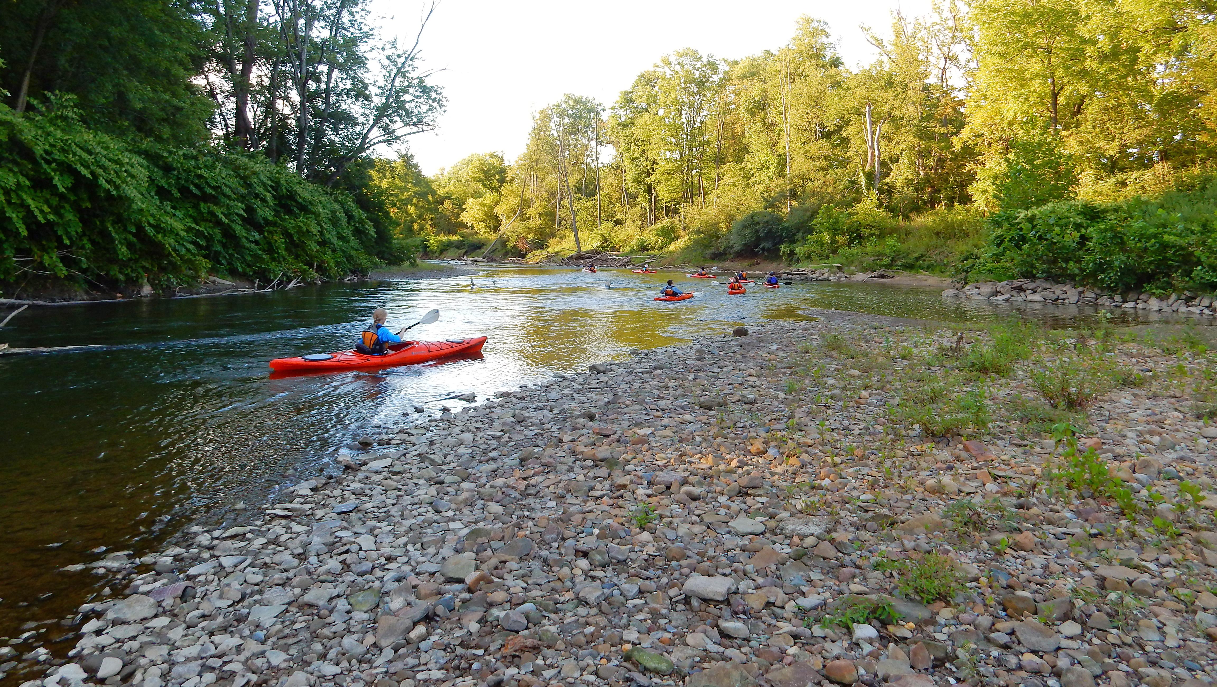
Paddling : Always wear your lifejacket. Ensure it is properly fitted and secured. Never paddle alone and leave a float plan with a friend. Paddle within your ability. Dress for the water temperature. Spring paddling means cold water and risk of hypothermia.
Hiking : Tell someone where you are going. Use a trail map . During wet conditions, wear waterproof boots with a heavy tread and step carefully. Don't become distracted. Keep pets on a six-foot leash and hold them closer when others are near. If hiking late in the day, use extra caution and bring a flashlight.
Biking : Stay to the right and give a timely, audible signal before passing on the left. People, pets, and wildlife can move unexpectedly. Allow enough room and time to respond. Don't risk a head injury. Always wear a helmet when cycling.
Share the Trail : Respect other trail users. Use extra caution in congested areas. When on horse trails, yield to horses and keep small children and dogs calm as horses pass.
Leave No Trace : Collect memories, not park resources. Enjoy wildlife from a distance. Do not feed the animals. Eating human food threatens the health and survival of wildlife. It can cause wild animals to lose their fear of humans, increasing the likelihood of bites or attacks. Pick up and dispose of pet waste properly. Keep your trash until you can properly dispose of it.
Pack with Safety in Mind
Not all trailheads have drinking water , so remember to bring water with you.
Bring bug spray and sunscreen to protect your skin.
Have a first aid kit in your bag.
Leave valuables at home when possible.
Wear or bring sturdy hiking shoes when going on a trail.
Be Aware in Parking Lots
Do not park in unmarked parking spaces. This will help avoid crashes.
Leave your valuables at home whenever possible. If you must bring them, it's best to take them with you while enjoying the park. As a last resort, lock them in your trunk or other lockable compartment before arriving at the parking lot. Thieves watch what people do as they exit their vehicles.
Thieves target items such as credit and bank cards, driver licenses, Social Security cards, checkbooks, and cash.
Report Suspicious Activity
If you notice a suspicious object or person, trust your instincts and get help.
Immediately contact the Communications Center at 440-546-5945. Report the facts: location; your name; the time; and a description of the person, vehicle, or package.
Move away from the area and don't get involved. Your job is done.
Additional Safety Topics
Insects and Ticks
Always take insect stings seriously and monitor the victim's reaction. Call 911 or 440-546-5945 if the person experiences severe symptoms or has a history of them. Don't hang up the phone until instructed by the dispatcher . Prevent insect and tick bites by taking the following precautions:
Avoid wooded or weedy areas on trails. Ticks can be found in tall grasses, on ground cover, and near structures and woodpiles. They cannot jump, fly, or fall from trees but will attach to pets and people as they walk by.
Ticks are most active from early spring until late fall.
Consider purchasing tick prevention products for your pets such as tick collars, sprays, and gels. Talk to your veterinarian for more guidance.
Tuck pants into socks or boots.
Wear light-colored clothing to easily find ticks.
Use repellents and follow label instructions.
Check children and pets for ticks after hiking or playing outside.
If you are bitten by a tick, do not panic. Carefully remove the tick, including its mouth parts, from your skin using tweezers. Monitor your health the following days.
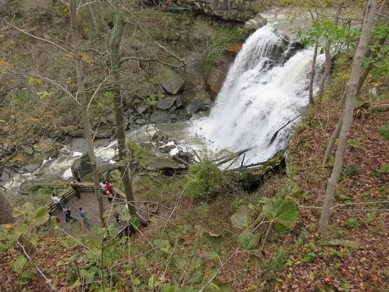
Hiking Brandywine Falls
Do not climb the waterfall or the nearby fences and rocks. Accidents at this location have led to serious injury and death.
Stay back 50 feet from the edge and base of the falls.
Use extra caution if it has rained or snowed recently. Walkways, boardwalks, and stairs can be especially slippery.
For your safety, park staff will close access to the lower platform during severe weather.
Stay back from the edge. Footing is hazardous.
Use extra caution if it has rained or snowed recently.
Sledding Safety
Be aware of your surroundings.
Avoid snow-covered bumps, ruts, branches, icy patches, and other hazards.
If someone has built a ramp, report it to a park ranger or volunteer. Ramps can cause serious accidents.
When returning up the hill, stay away from downhill riders.
If you become too cold, warm up at the campfire or return to your vehicle.
There are over 125 miles of hiking trails in Cuyahoga Valley National Park. These trails range from nearly-level to more challenging, and pass through various habitats including woodlands, wetlands, and old fields. Some trails require you to cross streams with stepping stones or log bridges, while others, including the Ohio & Erie Canal Towpath Trail , are nearly level and are accessible to all visitors. A portion of the state-wide Buckeye Trail also passes through the park. Visit our Maps page for maps of the park and of certain trail areas. Several books and leaflets, including Trail Guide: Cuyahoga Valley National Park, 3rd Edition , contain helpful information about hiking in the park. This book is published by the Cuyahoga Valley Trails Council and is available for purchase at Boston Mill Visitor Center. Ask a ranger at Boston Mill Visitor Center about borrowing hiking poles to use in the park. Hiking poles are available first-come, first-served. No matter where you choose to hike, please be mindful of your impact on plants, animals, and other people. We recommend trying to " Leave No Trace ."
Hiking Recommendations
Find detailed information about each trail, including trail length, surface type, elevation change, and more.
Expand each trail below for more information:
Ohio & Erie Canal Towpath Trail
Elevation Change (feet)
Wheelchair Accessible
Trailhead Location(s)
Hiking: up to 10 Biking: 2.75
firm, flat, crushed limestone
There are 10 trailheads which provide parking and access to the Towpath Trail.
Learn more about the Towpath Trail .
Buckeye Trail: Northern Section
Hiking Time (hours)
Egbert Picnic Area to Alexander Road
hilly and rocky
On Gorge Parkway 0.4 miles northwest of Egbert Road in Bedford Reservation (Cleveland Metroparks).
Alexander Road to Frazee House
On Alexander Road 0.2 miles west of Dunham Road in Walton Hills, OH.
Frazee House to Station Road Bridge
On Canal Road 3.5 miles south of Rockside Road in Valley View, OH.
Station Road Bridge to Jaite
Station Road Bridge Trailhead is located off of Riverview Road 0.2 miles south of Chippewa Road (S.R. 82) in Brecksville, OH.
Jaite to Boston
Red Lock Trailhead is located on Highland Road 1/2 mile east of Riverview Road. (Vaughn Road becomes Highland Road)
View a map of the trail on our Trail Maps page.
Buckeye Trail: Southern Section
Boston to Pine Lane
Boston Trailhead is located on Boston Mills Road 0.2 miles east of Riverview Road in Boston, OH.
Pine Lane to Everett Covered Bridge
hilly and rocky near Pine Lane, firm flat the rest of the trail
Pine Lane Trailhead is on State Route 303, 1/2 mile east of Akron-Peninsula Road in Peninsula, OH.
Everett Covered Bridge to Botzum Trailhead/Train Station (via Towpath and Buckeye Trails)
hilly and rocky on northern part of trail, firm flat the rest of the trail
Everett Covered Bridge Trailhead is located on Everett Road 1/2 mile west of Riverview Road near Everett, OH.
Valley Trail: Northern Section
Trailhead location
Hiking: 1.25 Riding: 1
firm flat, crushed limestone
Valley Trail: Southern Section
Trailhead Location
Brecksville Reservation to Boston
On Cleveland Metro Parkway 1/2 mile southeast of Valley Parkway in Brecksville, OH.
Boston Trailhead to Wetmore Trailhead
Wetmore Trailhead to Everett Covered Bridge
Hiking: 1.5 Riding: 1
rolling hills, dirt
On Wetmore Road 0.6 miles east of Akron Peninsula Road in Cuyahoga Falls, OH. Wetmore Trailhead parking lot is primarily for horse trailers. More parking for hikers is available at Pine Hollow, 5465 Quick Road.
Old Carriage Trail
Hiking: 2.5 Skiing: 1.5
Red Lock Trailhead is located on Highland Road 1/2 mile east of Riverview Road. (Vaughn Road becomes Highland Road.)
Brandywine Falls Area Trails
Stanford Trailhead is located on Stanford Road 1/2 mile north of Boston Mills Road in Boston, OH.
Brandywine Gorge Loop
Wheelchair accessible to the first boardwalk overlook. A spur off the main boardwalk has numerous steps.
Brandywine Falls Trailhead is located on Brandywine Road 1.7 miles north of Hines Hill Road.
View a map of these trails on our Trail Maps page. Learn more about Brandywine Falls .
Ledges Area Trails
Distance (miles)
rocky, some steps
Ledges Trailhead is located on Kendall Park Road 1 mile west of Akron Cleveland Road or 2.2 miles east of Akron Peninsula Road (Truxell Road turns into Kendall Park Road.) in Boston Heights, OH.
Pine Grove Trail
Pine Grove Trailhead is located on Kendall Park Road 1.3 miles west of Akron Cleveland Road or 2 miles east of Akron Peninsula Road (Truxell Road turns into Kendall Park Road.) in Boston Heights, OH.
Forest Point Trail
Forest Point Trailhead begins at Octagon Shelter on Kendall Park Road 1.3 miles west of Akron Cleveland Road or 2 miles east of Akron Peninsula Road (Truxell Road turns into Kendall Park Road.) in Boston Heights, OH.
Haskell Run Trail
a big hill, rocky
Haskell Run Trailhead is located behind Happy Days Lodge on State Route 303, 2 miles east of Peninsula and 1/2 mile west of State Route 8 in Boston Heights, OH.
Boston Run Trail
Hiking: 2 Skiing: 1.5
Boston Run Trailhead is located in the overflow parking lot of Happy Days Lodge on State Route 303, 2 miles east of Peninsula and 1/2 mile west of State Route 8 in Boston Heights, OH.
View a map of these trails on our Trail Maps page. Learn more about the Ledges .
Kendall Lake Area Trails
Cross Country Trail
Hiking: 1.5 Skiing: 1
Kendall Lake Trailhead is located on Kendall Park Road 1.6 miles west of Akron Cleveland Road and 1.5 miles east of Akron Peninsula Road (Truxell Road turns into Kendall Park Road.) In Boston Heights, OH.
flat, dirt (some stairs)
View a map of these trails on our Trail Maps page. Learn more about the Kendall Lake area .
Tree Farm Trail
Horesehoe Pond Trailhead is on Major Road 0.7 miles west of Riverview Road in Peninsula, OH.
Oak Hill and Plateau Trails
Hiking: 0.75 Skiing: 0.50
Oak Hill Trailhead is on Oak Hill Road 0.9 miles south of Major Road in Peninsula, OH.
dirt, flat (one big hill)
View a map of these trails on our Trail Maps page.
Wetmore Area Trails
Hiking: 2.5 Riding: 1.5 hours
Wetmore Trailhead is on Wetmore Road 0.6 miles east of Akron Peninsula Road in Cuyahoga Falls, OH. Wetmore Trailhead parking lot is primarily for horse trailers. More parking for hikers is available at Pine Hollow , 5465 Quick Road.
Langes Run Trail
Hiking: 2.5 Riding: 1.5
Hiking: 0.3 Riding: 0.3
Hiking: 0.5 Riding: 0.3
Everett Area Trails
Riding Run Loop
Hiking: 3 Riding: 2
Furnace Run Loop
View a map of these trails on our Trail Maps page. Learn more about the Everett Covered Bridge .
Trailhead Information
More Hiking Nearby
There are even more trails within the boundary of Cuyahoga Valley National Park. The following areas are managed by local park districts:
Length (miles)
Time (hours)
Elevation Change (feet)
Trail Surface
Wheelchair Accessible
Trailhead Location(s)
Towpath Trail
19.5
Hiking: up to 10 Biking: 2.75
135
firm, flat, crushed limestone
Yes
There are 10 trailheads which provide parking and access to the Towpath Trail.
Length (miles)
Hiking Time (hours)
Elevation Change (feet)
Trail Surface
Wheelchair Accessible
Trailhead Location(s)
Egbert Picnic Area to Alexander Road
6.1
3.5
90
hilly and rocky
No
On Gorge Parkway 0.4 miles northwest of Egbert Road in Bedford Reservation (Cleveland Metroparks).
Alexander Road to Frazee House
1.5
.75
200
hilly and rocky
No
On Alexander Road 0.2 miles west of Dunham Road in Walton Hills, OH.
Frazee House to Station Road Bridge
2.5
1.25
8
firm, flat, crushed limestone
Yes
On Canal Road 3.5 miles south of Rockside Road in Valley View, OH.
Station Road Bridge to Jaite
7
3.5
200
hilly and rocky
No
Station Road Bridge Trailhead is located off of Riverview Road 0.2 miles south of Chippewa Road (S.R. 82) in Brecksville, OH.
Jaite to Boston
5.6
3
250
hilly and rocky
No
Red Lock Trailhead is located on Highland Road 1/2 mile east of Riverview Road. (Vaughn Road becomes Highland Road)
Length (miles)
Hiking Time (hours)
Elevation Change (feet)
Trail Surface
Wheelchair Accessible
Trailhead Location(s)
Boston to Pine Lane
4
2
240
hilly and rocky
No
Boston Trailhead is located on Boston Mills Road 0.2 miles east of Riverview Road in Boston, OH.
Pine Lane to Everett Covered Bridge
4.1
2
150
hilly and rocky near Pine Lane, firm flat the rest of the trail
No
Pine Lane Trailhead is on State Route 303, 1/2 mile east of Akron-Peninsula Road in Peninsula, OH.
Everett Covered Bridge to Botzum Trailhead/Train Station (via Towpath and Buckeye Trails)
3
2
160
hilly and rocky on northern part of trail, firm flat the rest of the trail
No
Everett Covered Bridge Trailhead is located on Everett Road 1/2 mile west of Riverview Road near Everett, OH.
Length (miles)
Time (hours)
Elevation Change (feet)
Trail Surface
Wheelchair Accessible
Trailhead location
Frazee House to Station Road Bridge
3
Hiking: 1.25 Riding: 1
8
firm flat, crushed limestone
Yes
On Canal Road 3.5 miles south of Rockside Road in Valley View, OH.
Length (miles)
Time (hours)
Elevation Change (feet)
Trail Surface
Wheelchair Accessible
Trailhead Location
Brecksville Reservation to Boston
6.9
Riding: 2.5
400
hilly, dirt
No
On Cleveland Metro Parkway 1/2 mile southeast of Valley Parkway in Brecksville, OH.
Boston Trailhead to Wetmore Trailhead
9.25
Riding: 3.5
400
hilly, dirt
No
Boston Trailhead is located on Boston Mills Road 0.2 miles east of Riverview Road in Boston, OH.
Wetmore Trailhead to Everett Covered Bridge
2.75
Hiking: 1.5 Riding: 1
40
rolling hills, dirt
No
On Wetmore Road 0.6 miles east of Akron Peninsula Road in Cuyahoga Falls, OH. Wetmore Trailhead parking lot is primarily for horse trailers. More parking for hikers is available at Pine Hollow, 5465 Quick Road.
Length (miles)
Time (hours)
Elevation Change (feet)
Trail Surface
Wheelchair Accessible
Trailhead Location
Old Carriage Trail
5.25
Hiking: 2.5 Skiing: 1.5
180
hilly, rocky
No
Red Lock Trailhead is located on Highland Road 1/2 mile east of Riverview Road. (Vaughn Road becomes Highland Road.)
Length (miles)
Hiking Time (hours)
Elevation Change (feet)
Trail Surface
Wheelchair Accessible
Trailhead Location(s)
Stanford Trail
1.5
1.25
190
hilly, rocky
No
Stanford Trailhead is located on Stanford Road 1/2 mile north of Boston Mills Road in Boston, OH.
Brandywine Gorge Loop
1.4
1
160
hilly, rocky
Wheelchair accessible to the first boardwalk overlook. A spur off the main boardwalk has numerous steps.
Brandywine Falls Trailhead is located on Brandywine Road 1.7 miles north of Hines Hill Road.
Distance (miles)
Hiking Time (hours)
Elevation Change (feet)
Trail Surface
Wheelchair Accessible
Trailhead Location(s)
Ledges Trail
2.2
1.5
80
rocky, some steps
No
Ledges Trailhead is located on Kendall Park Road 1 mile west of Akron Cleveland Road or 2.2 miles east of Akron Peninsula Road (Truxell Road turns into Kendall Park Road.) in Boston Heights, OH.
Pine Grove Trail
2.2
1.25
105
flat, dirt
No
Pine Grove Trailhead is located on Kendall Park Road 1.3 miles west of Akron Cleveland Road or 2 miles east of Akron Peninsula Road (Truxell Road turns into Kendall Park Road.) in Boston Heights, OH.
Forest Point Trail
0.5
0.5
Minimal
flat, dirt
No
Forest Point Trailhead begins at Octagon Shelter on Kendall Park Road 1.3 miles west of Akron Cleveland Road or 2 miles east of Akron Peninsula Road (Truxell Road turns into Kendall Park Road.) in Boston Heights, OH.
Haskell Run Trail
0.5
0.5
70
a big hill, rocky
No
Haskell Run Trailhead is located behind Happy Days Lodge on State Route 303, 2 miles east of Peninsula and 1/2 mile west of State Route 8 in Boston Heights, OH.
Boston Run Trail
3.4
Hiking: 2 Skiing: 1.5
80
hilly, rocky
No
Boston Run Trailhead is located in the overflow parking lot of Happy Days Lodge on State Route 303, 2 miles east of Peninsula and 1/2 mile west of State Route 8 in Boston Heights, OH.
Length (miles)
Hiking Time (hours)
Elevation Change (feet)
Trail Surface
Wheelchair Accessible
Trailhead Location(s)
Cross Country Trail
2.5
Hiking: 1.5 Skiing: 1
160
rolling hills, dirt
No
Kendall Lake Trailhead is located on Kendall Park Road 1.6 miles west of Akron Cleveland Road and 1.5 miles east of Akron Peninsula Road (Truxell Road turns into Kendall Park Road.) In Boston Heights, OH.
Lake Trail
1
0.75
Minimal
flat, dirt (some stairs)
No
(see above)
Salt Run Trail
3.25
2
160
rocky, hilly
No
(see above)
Length (miles)
Time (hours)
Elevation Change (feet)
Trail Surface
Wheelchair Accessible
Trailhead Location
Tree Farm Trail
2.75
Hiking: 1.5 Skiing: 1
80
flat, dirt
No
Horesehoe Pond Trailhead is on Major Road 0.7 miles west of Riverview Road in Peninsula, OH.
Length (miles)
Time (hours)
Elevation Change (feet)
Trail Surface
Wheelchair Accessible
Trailhead Location(s)
Oak Hill Trail
1.4
Hiking: 0.75 Skiing: 0.50
50
dirt, flat
No
Oak Hill Trailhead is on Oak Hill Road 0.9 miles south of Major Road in Peninsula, OH.
Plateau Trail
4.6
Hiking: 2.5 Skiing: 1.5
200
dirt, flat (one big hill)
No
(see above)
Distance (miles)
Time (hours)
Elevation Change (feet)
Trail Surface
Wheelchair Accessible
Trailhead Location(s)
Wetmore Trail
4.6
Hiking: 2.5 Riding: 1.5 hours
250 feet
rolling hills, dirt
No
Wetmore Trailhead is on Wetmore Road 0.6 miles east of Akron Peninsula Road in Cuyahoga Falls, OH. Wetmore Trailhead parking lot is primarily for horse trailers. More parking for hikers is available at Pine Hollow , 5465 Quick Road.
Langes Run Trail
3.3
Hiking: 2.5 Riding: 1.5
190
rolling hills, dirt
No
(see above)
Butlers Trail
0.7
Hiking: 0.3 Riding: 0.3
150
rolling hills, dirt
No
(see above)
Tabletop Trail
0.7
Hiking: 0.5 Riding: 0.3
100
rolling hills, dirt
No
(see above)
Distance (miles)
Time (hours)
Elevation Change (feet)
Trail Surface
Wheelchair Accessible
Trailhead Location
Riding Run Loop
5.6
Hiking: 3 Riding: 2
260
hilly, dirt
no
Everett Covered Bridge Trailhead is located on Everett Road 1/2 mile west of Riverview Road near Everett, OH.
Furnace Run Loop
1.9
Hiking: 1
240
hilly, dirt
no
(see above)
Length (miles)
Time (hours)
Elevation Change (feet)
Trail Surface
Wheelchair Accessible
Trailhead Location(s)
Towpath Trail
19.5
Hiking: up to 10 Biking: 2.75
135
firm, flat, crushed limestone
Yes
There are 10 trailheads which provide parking and access to the Towpath Trail.
Length (miles)
Hiking Time (hours)
Elevation Change (feet)
Trail Surface
Wheelchair Accessible
Trailhead Location(s)
Egbert Picnic Area to Alexander Road
6.1
3.5
90
hilly and rocky
No
On Gorge Parkway 0.4 miles northwest of Egbert Road in Bedford Reservation (Cleveland Metroparks).
Alexander Road to Frazee House
1.5
.75
200
hilly and rocky
No
On Alexander Road 0.2 miles west of Dunham Road in Walton Hills, OH.
Frazee House to Station Road Bridge
2.5
1.25
8
firm, flat, crushed limestone
Yes
On Canal Road 3.5 miles south of Rockside Road in Valley View, OH.
Station Road Bridge to Jaite
7
3.5
200
hilly and rocky
No
Station Road Bridge Trailhead is located off of Riverview Road 0.2 miles south of Chippewa Road (S.R. 82) in Brecksville, OH.
Jaite to Boston
5.6
3
250
hilly and rocky
No
Red Lock Trailhead is located on Highland Road 1/2 mile east of Riverview Road. (Vaughn Road becomes Highland Road)
Length (miles)
Hiking Time (hours)
Elevation Change (feet)
Trail Surface
Wheelchair Accessible
Trailhead Location(s)
Boston to Pine Lane
4
2
240
hilly and rocky
No
Boston Trailhead is located on Boston Mills Road 0.2 miles east of Riverview Road in Boston, OH.
Pine Lane to Everett Covered Bridge
4.1
2
150
hilly and rocky near Pine Lane, firm flat the rest of the trail
No
Pine Lane Trailhead is on State Route 303, 1/2 mile east of Akron-Peninsula Road in Peninsula, OH.
Everett Covered Bridge to Botzum Trailhead/Train Station (via Towpath and Buckeye Trails)
3
2
160
hilly and rocky on northern part of trail, firm flat the rest of the trail
No
Everett Covered Bridge Trailhead is located on Everett Road 1/2 mile west of Riverview Road near Everett, OH.
Length (miles)
Time (hours)
Elevation Change (feet)
Trail Surface
Wheelchair Accessible
Trailhead location
Frazee House to Station Road Bridge
3
Hiking: 1.25 Riding: 1
8
firm flat, crushed limestone
Yes
On Canal Road 3.5 miles south of Rockside Road in Valley View, OH.
Length (miles)
Time (hours)
Elevation Change (feet)
Trail Surface
Wheelchair Accessible
Trailhead Location
Brecksville Reservation to Boston
6.9
Riding: 2.5
400
hilly, dirt
No
On Cleveland Metro Parkway 1/2 mile southeast of Valley Parkway in Brecksville, OH.
Boston Trailhead to Wetmore Trailhead
9.25
Riding: 3.5
400
hilly, dirt
No
Boston Trailhead is located on Boston Mills Road 0.2 miles east of Riverview Road in Boston, OH.
Wetmore Trailhead to Everett Covered Bridge
2.75
Hiking: 1.5 Riding: 1
40
rolling hills, dirt
No
On Wetmore Road 0.6 miles east of Akron Peninsula Road in Cuyahoga Falls, OH. Wetmore Trailhead parking lot is primarily for horse trailers. More parking for hikers is available at Pine Hollow, 5465 Quick Road.
Length (miles)
Time (hours)
Elevation Change (feet)
Trail Surface
Wheelchair Accessible
Trailhead Location
Old Carriage Trail
5.25
Hiking: 2.5 Skiing: 1.5
180
hilly, rocky
No
Red Lock Trailhead is located on Highland Road 1/2 mile east of Riverview Road. (Vaughn Road becomes Highland Road.)
Length (miles)
Hiking Time (hours)
Elevation Change (feet)
Trail Surface
Wheelchair Accessible
Trailhead Location(s)
Stanford Trail
1.5
1.25
190
hilly, rocky
No
Stanford Trailhead is located on Stanford Road 1/2 mile north of Boston Mills Road in Boston, OH.
Brandywine Gorge Loop
1.4
1
160
hilly, rocky
Wheelchair accessible to the first boardwalk overlook. A spur off the main boardwalk has numerous steps.
Brandywine Falls Trailhead is located on Brandywine Road 1.7 miles north of Hines Hill Road.
Distance (miles)
Hiking Time (hours)
Elevation Change (feet)
Trail Surface
Wheelchair Accessible
Trailhead Location(s)
Ledges Trail
2.2
1.5
80
rocky, some steps
No
Ledges Trailhead is located on Kendall Park Road 1 mile west of Akron Cleveland Road or 2.2 miles east of Akron Peninsula Road (Truxell Road turns into Kendall Park Road.) in Boston Heights, OH.
Pine Grove Trail
2.2
1.25
105
flat, dirt
No
Pine Grove Trailhead is located on Kendall Park Road 1.3 miles west of Akron Cleveland Road or 2 miles east of Akron Peninsula Road (Truxell Road turns into Kendall Park Road.) in Boston Heights, OH.
Forest Point Trail
0.5
0.5
Minimal
flat, dirt
No
Forest Point Trailhead begins at Octagon Shelter on Kendall Park Road 1.3 miles west of Akron Cleveland Road or 2 miles east of Akron Peninsula Road (Truxell Road turns into Kendall Park Road.) in Boston Heights, OH.
Haskell Run Trail
0.5
0.5
70
a big hill, rocky
No
Haskell Run Trailhead is located behind Happy Days Lodge on State Route 303, 2 miles east of Peninsula and 1/2 mile west of State Route 8 in Boston Heights, OH.
Boston Run Trail
3.4
Hiking: 2 Skiing: 1.5
80
hilly, rocky
No
Boston Run Trailhead is located in the overflow parking lot of Happy Days Lodge on State Route 303, 2 miles east of Peninsula and 1/2 mile west of State Route 8 in Boston Heights, OH.
Length (miles)
Hiking Time (hours)
Elevation Change (feet)
Trail Surface
Wheelchair Accessible
Trailhead Location(s)
Cross Country Trail
2.5
Hiking: 1.5 Skiing: 1
160
rolling hills, dirt
No
Kendall Lake Trailhead is located on Kendall Park Road 1.6 miles west of Akron Cleveland Road and 1.5 miles east of Akron Peninsula Road (Truxell Road turns into Kendall Park Road.) In Boston Heights, OH.
Lake Trail
1
0.75
Minimal
flat, dirt (some stairs)
No
(see above)
Salt Run Trail
3.25
2
160
rocky, hilly
No
(see above)
Length (miles)
Time (hours)
Elevation Change (feet)
Trail Surface
Wheelchair Accessible
Trailhead Location
Tree Farm Trail
2.75
Hiking: 1.5 Skiing: 1
80
flat, dirt
No
Horesehoe Pond Trailhead is on Major Road 0.7 miles west of Riverview Road in Peninsula, OH.
Length (miles)
Time (hours)
Elevation Change (feet)
Trail Surface
Wheelchair Accessible
Trailhead Location(s)
Oak Hill Trail
1.4
Hiking: 0.75 Skiing: 0.50
50
dirt, flat
No
Oak Hill Trailhead is on Oak Hill Road 0.9 miles south of Major Road in Peninsula, OH.
Plateau Trail
4.6
Hiking: 2.5 Skiing: 1.5
200
dirt, flat (one big hill)
No
(see above)
Distance (miles)
Time (hours)
Elevation Change (feet)
Trail Surface
Wheelchair Accessible
Trailhead Location(s)
Wetmore Trail
4.6
Hiking: 2.5 Riding: 1.5 hours
250 feet
rolling hills, dirt
No
Wetmore Trailhead is on Wetmore Road 0.6 miles east of Akron Peninsula Road in Cuyahoga Falls, OH. Wetmore Trailhead parking lot is primarily for horse trailers. More parking for hikers is available at Pine Hollow , 5465 Quick Road.
Langes Run Trail
3.3
Hiking: 2.5 Riding: 1.5
190
rolling hills, dirt
No
(see above)
Butlers Trail
0.7
Hiking: 0.3 Riding: 0.3
150
rolling hills, dirt
No
(see above)
Tabletop Trail
0.7
Hiking: 0.5 Riding: 0.3
100
rolling hills, dirt
No
(see above)
Distance (miles)
Time (hours)
Elevation Change (feet)
Trail Surface
Wheelchair Accessible
Trailhead Location
Riding Run Loop
5.6
Hiking: 3 Riding: 2
260
hilly, dirt
no
Everett Covered Bridge Trailhead is located on Everett Road 1/2 mile west of Riverview Road near Everett, OH.
Use these maps to locate our visitor center, trailheads, trail routes, and other points of interest. Printed versions of most maps are available at Boston Mill Visitor Center or you can contact us to request a mailed copy. Additional formats of some maps are available on a separate cartography website . We recommend downloading the NPS App for access to the interactive map and other park information on the go. Use the drop down menu for quick access to specific maps. Find more information about trails on our hiking page .
Note: To save a map from this page, right-click the image and select "Save image as..." to download it to your device.
Find maps of individual trails and specific areas of the park.
Find a map of common park destinations listed with their addresses.
Cuyahoga Valley Interactive Map
The map shows our visitor center and other attractions, including:
Boston Mill Visitor Center (middle of the park)
Canal Exploration Center (north end of the park) (formerly the Canal Visitor Center)
Peninsula Depot (middle of the park)
Hunt House (south end of the park)
Cuyahoga Valley National Park Map
This park map appears on one side of our park brochure. For the full audio description of the map visit our Park Brochure Formats page .
Cuyahoga Valley National Park Area Map
Shown in dark green on this map, Cuyahoga Valley National Park is around 22 miles south of Cleveland and Lake Erie. The Boston Mill Visitor Center is around 18 miles north of Akron. The park can be accessed from several nearby highways, visit our Directions page for more information. The two closest National Park Sites to Cuyahoga Valley National Park are the James A. Garfield National Historic Site in Mentor, Ohio and the First Ladies National Historic Site in Canton, Ohio. Check out our Nearby Attractions page to learn more about the area surrounding Cuyahoga Valley National Park.
Fresh air and exercise are good for our health—and many of us enjoy walking in the park with a furry friend. With a few exceptions, leashed pets are welcome at Cuyahoga Valley National Park. Protect your pet, other visitors, and park resources by following these rules and guidelines:
Pets must be restrained on a leash that is six feet or shorter in length on all park lands at all times. Failure to do so is in violation of 36 CFR 2.15(A)(2) and subject to fine.
Pets should not be left unattended at any time.
Owners must clean up pet waste and throw it in a trash can.
What types of pets are allowed?
Within the national park, pets are defined as dogs, cats, or “any animal that has been domesticated."
Where are pets allowed?
Pets are allowed on over 100 miles of hiking trails as well as on the multi-use Towpath Trail .
Where are pets not allowed?
Only service animals are allowed in park buildings and on the Cuyahoga Valley Scenic Railroad.
Pets and service animals are not allowed on the East Rim mountain bike trails.
Pets are prohibited at Virginia Kendall Hills during sledding activities.
Looking for short hikes?
Towpath Trail, from Ira Trailhead to the Indigo Lake connector: This is a 2-mile, back-and-forth walk on part of the Ohio & Erie Canal Towpath Trail. It has a flat, crushed limestone surface. This hike passes through the popular Beaver Marsh area.
Oak Hill Trail : This 1.5-mile loop trail is mostly flat with gravel and tree rooted sections. It skirts past Sylvan Pond.
Towpath Trail, from Canal Exploration Center to Tinkers Creek Aqueduct : This is a 2-mile, back-and-forth walk on part of the Ohio & Erie Canal Towpath Trail. It has a flat, crushed limestone surface. Turn around at the Tinkers Creek Aqueduct.
Lake Trail: This is a 1-mile loop walk around Kendall Lake in the Virginia Kendall unit of the national park. The trail has a flat dirt surface with two sets of stairs and minimal elevation changes. There are several longer hikes that connect to this trail. These are the Pine Grove, Cross Country, Kendall Hills and Salt Run trails.
Looking for longer hikes?
Pine Grove Trail : This is a 2.2-mile loop trail with slight elevation changes. It has a dirt and gravel surface. This hike passes above several ravines and connects to the Ledges Trail and trails in the Kendall Lake area.
Cross Country Trail: This is a 2.5-mile loop trail that takes you along forest and meadow ecosystems. It has several hills and is a dirt and gravel surface that may get muddy in wet weather. This hike connects to several trails in the Kendall Lake area including the Lake Trail.
Tree Farm Trail: This 2.75-mile loop trail is mostly flat with dirt, gravel and tree-rooted sections. This hike passes through a former tree farm. It skirts past Horseshoe Pond, a popular place for fishing in the national park. This trail will be muddy in wet weather.
Salt Run Trail: This is a 3.3-mile loop trail that takes you through a wooded area. It is a hilly trail with dirt and gravel surfaces as well as stairs. This hike has a shorter loop that is 1.8 miles on the same terrain and connects to other trails in the Kendall Lake area.
Buckeye Trail: This 7.1-mile loop takes you from the town of Boston to Peninsula and back using the Buckeye and Towpath Trails. The Buckeye Trail is a steep, hilly path with dirt and gravel surfaces while the Towpath Trail has a flat, crushed limestone surface. Following the blue blazes or paint marks on the trees, this hike crosses Boston Mills Road and passes scenic vistas along the Buckeye Trail. Once in the town of Peninsula, the Towpath Trail skirts along the Cuyahoga River and Ohio & Erie Canal on your way back to the town of Boston. Using a map is recommended for this hike.
Keeping your pets on the trail and on a leash will reduce their exposure to poison ivy, ticks , and wildlife.
Carry extra water, especially during warm months and on long trips. Note which trailhead restrooms have water.
Bring pet treats to reinforce good behavior.
Do not leave pets in cars. On a 75°F day, inside car temperatures can reach 100 degrees in a matter of minutes, even with partially opened windows!
Use extra caution when walkways and trails are icy, snowy, or muddy.
Make your pet's visit enjoyable too! Remember that you are taking your pet into a different environment and you are responsible for your pet. Do you have enough water for you and your pet? Does your pet have the ability to hike the trail you have chosen? Are you able to carry your pet if it gets tired? Many wild animals call this national park home. How will your pet react if you encounter a deer, a skunk, a chipmunk, a coyote, or a snake? With a little preparation, you and your pet can have a fun park visit together. If you enjoy traveling to other national parks, find out where your dog can become a B.A.R.K. Ranger .
Spring's rain and warming temperatures bring new leaves on trees, blooming wildflowers, and visitors anxious to get out on the trail. Summer temperatures range from 49 to 95 degrees F and can be humid. Dressing in layers is advisable. Fall temperatures can range from low 70s during the day to freezing during the night. Fall foliage often peaks in mid-October. Winter weather conditions can rapidly change due to the lake effect snow from Lake Erie. Temperatures vary from mid-30s to below zero.
Link for National Weather Service Current Conditions
The weather in Cuyahoga Valley National Park is typical of Northeast Ohio: four distinct seasons offering something for everyone. Dress in layers as there are variations between daily high and low temperatures.
Average Temperatures and Precipitation
Average annual rainfall: 39 inches
Average annual snowfall: 61 inches
Spring's rain and warming temperatures bring new leaves on trees, blooming wildflowers, and visitors anxious get out on the trail after a long winter.
Summer temperatures range from 49 to 95 degrees F and can be humid. Dressing in layers is advisable for any biking or hiking activities.
Fall temperatures can range from low 70s during the day to freezing during the night. Come prepared for all types of weather, from sun to fog, from downpours to flurries. Fall foliage often peaks during the first few weeks in October; the peak time is generally mid-October. Weather conditions over the summer, such as drought, may alter the time that the leaves peak.
Winter weather conditions can rapidly change, due to the lake effect snow from Lake Erie. Temperatures vary from mid-30s to below zero. The park averages 61 inches of snow annually. For the latest in weather information, contact us .
Discover the heart of Cuyahoga Valley National Park by bicycling , running, or strolling on the Towpath Trail. Here you can travel the historic route of the Ohio & Erie Canal on the same path that mules walked to tow canal boats loaded with goods and passengers. From the trail, you can make connections to many natural and historic sites, as well as to Cuyahoga Valley Scenic Railroad . Beyond the park, you can continue your journey on the Towpath Trail further along the Ohio & Erie Canalway .
Map of the Towpath Trail Open 24 hours Multiple access points (see below) Wheelchair, bike, and stroller accessible Flat surface of compacted, crushed limestone with some paving 20 miles within the national park Find information about where to find drinking water and restrooms along the trail Please note: If you planning a multi-day Towpath Trail ride, contact our Communications Center at 440-546-5945 to inform staff where you parked your vehicle. This will ensure our law enforcement rangers do not tag your vehicle as "abandoned." Visit our Alerts page to check for potential Towpath Trail closures.
Map of the Towpath Trail
Multiple access points (see below)
Wheelchair, bike, and stroller accessible
Flat surface of compacted, crushed limestone with some paving
20 miles within the national park
Find information about where to find drinking water and restrooms along the trail
Please note: If you planning a multi-day Towpath Trail ride, contact our Communications Center at 440-546-5945 to inform staff where you parked your vehicle. This will ensure our law enforcement rangers do not tag your vehicle as "abandoned."
Visit our Alerts page to check for potential Towpath Trail closures.
Towpath Safety and Etiquette
The Towpath Trail is a shared recreational trail. It is open to walkers, joggers, bicyclists, and (in some sections) horse riders. To ensure an enjoyable trail experience for all users, please observe some basic trail courtesy.
Travel at a safe speed and keep to the right except to pass others. The speed limit for bicycles is 15 mph.
Bicyclists yield to ALL users.
Don't risk a head injury. Always wear a helmet when cycling.
EVERYONE yields to horses. Horses can be startled by sudden movements, so use caution. Make sure the rider knows in advance that you are passing.
Give a clear warning before passing on the left.
Travel single file when passing and being passed.
Pets must be kept on a leash which is six feet or less. We recommend a shorter leash to prevent bike accidents. Keep you and your pet on the right side of the trail.
Avoid walking in cross-country ski tracks.
Move off the trail when stopped.
Class 1 and 2 e-bikes are allowed on the Towpath Trail within the national park. Other motorized vehicles are not permitted as stated in the Superintendent's Compendium .
History of the Towpath
The Towpath Trail follows the historic route of the Ohio & Erie Canal . Before the canal was built (1825-1832), Ohio was part of America's frontier. Travel was difficult and getting crops to market was nearly impossible. The canal provided a successful transportation route across the state, connecting the Ohio River at Portsmouth and Lake Erie at Cleveland. The canal opened up Ohio to the rest of the eastern United States. Learn more about the Towpath Trail at Ohio & Erie Canalway .
Shuttle by Train
Cuyahoga Valley Scenic Railroad offers one-way shuttle service for Towpath bikers, hikers, and runners. Purchase single Explorer tickets at the baggage car. For frequent users, we recommend buying a seasonal Explorer pass. Arrive 10 minutes before departure and flag down the train by waving both arms over your head. Cash is preferred; exact change is appreciated. Make sure to have trailers detached and all items removed from bikes before boarding. Cuyahoga Valley Scenic Railroad has a 40-pound weight limit for bicycles. Check the train's Explorer page for the current days of operations, prices, and schedule. The page also has a map and answers to frequently asked questions.
Distance Between Points
The following table lists the distances in miles between national park trailheads and other points of interest along the Towpath Trail. For distances outside the national park, visit Ohio & Erie Canalway .
Several local businesses offer bicycle rentals along this section of the Towpath Trail, including:
Blimp City Bike & Hike in Merriman Valley
Pedego Electric Bikes in Peninsula
Outspoken E-Bike Rentals in Merriman Valley
Trailheads Along the Towpath
Loading results...
Lock 39
Canal Expl. Ctr.
Frazee
Station Rd.
Red Lock
Boston
Peninsula
Hunt House
Beaver Marsh
Ira
Botzum
Lock 39 Trailhead
-
1.8
3.6
6.3
8.8
10.7
13.1
16.4
17.5
17.8
19.8
Canal Exploration Center
1.8
-
1.8
4.5
7.0
8.9
11.3
14.6
15.7
16.0
18.0
Frazee House
3.6
1.8
-
2.7
5.2
7.1
9.5
12.8
13.9
14.2
16.2
Station Road Bridge Trailhead
6.3
4.5
2.7
-
2.5
4.4
6.8
10.1
11.2
11.5
13.5
Red Lock Trailhead
8.8
7.0
5.2
2.5
-
1.9
4.3
7.6
8.7
9.0
11.0
Boston Trailhead
10.7
8.9
7.1
4.4
1.9
-
2.4
5.7
6.8
7.1
9.1
Peninsula: Lock 29 Trailhead
13.1
11.3
9.5
6.8
4.3
2.4
-
3.3
4.4
4.7
6.7
Hunt House
16.4
14.6
12.8
10.1
7.6
5.7
3.3
-
1.1
1.4
3.4
Beaver Marsh Viewing Area
17.5
15.7
13.9
11.2
8.7
6.8
4.4
1.1
-
0.3
2.3
Ira Trailhead
17.8
16.0
14.2
11.5
9.0
7.1
4.7
1.4
0.3
-
2.0
Botzum Trailhead
19.8
18.0
16.2
13.5
11.0
9.1
6.7
3.4
2.3
2.0
-
A FEW REASONS TO GO
A closer look.
12 official park photos
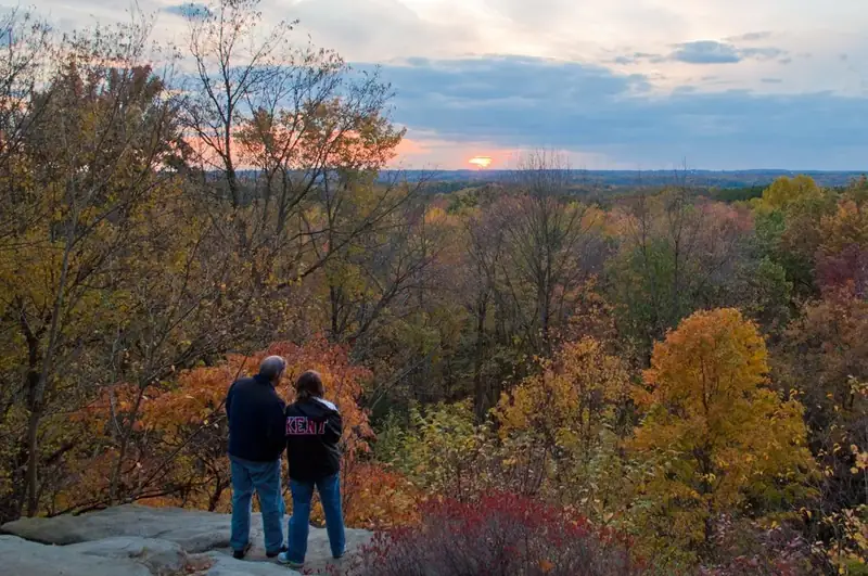
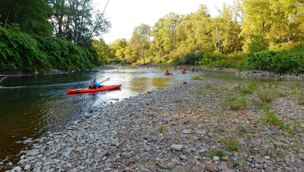
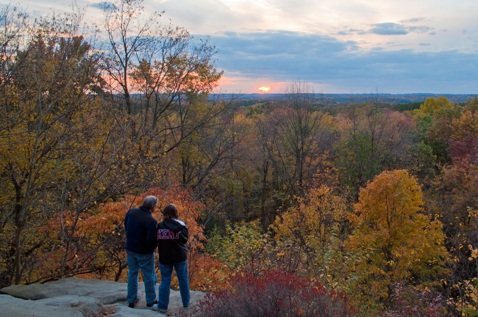
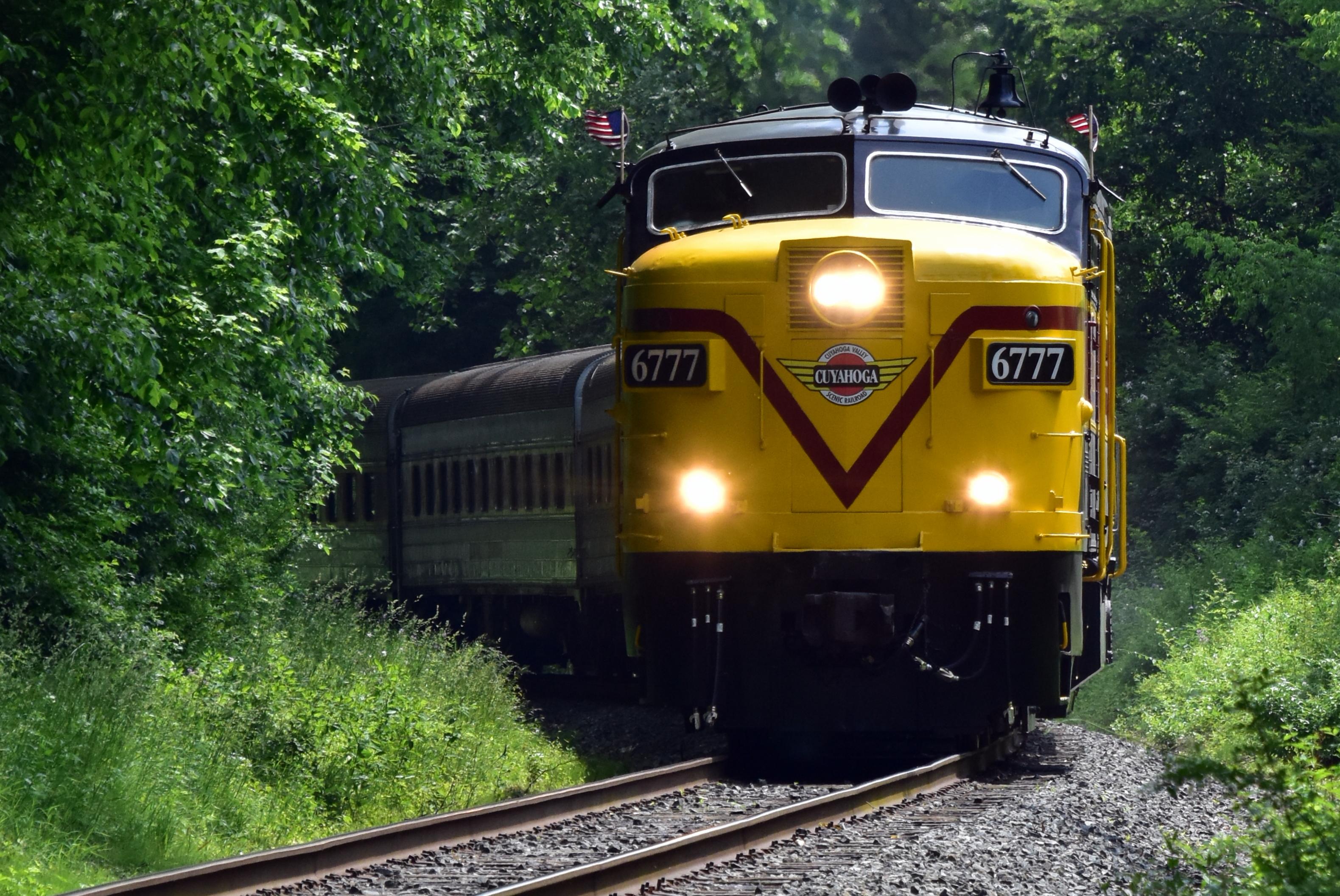
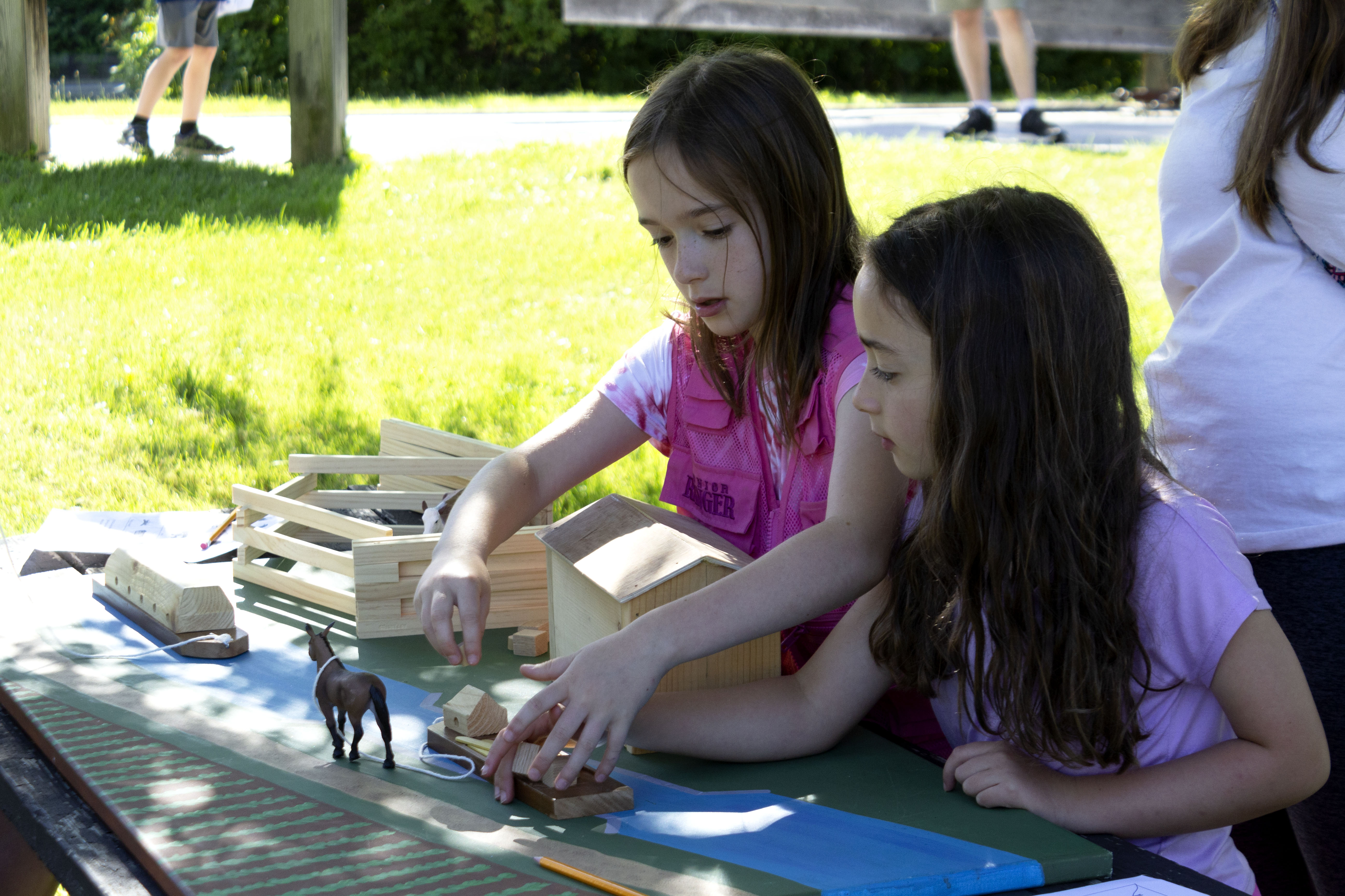
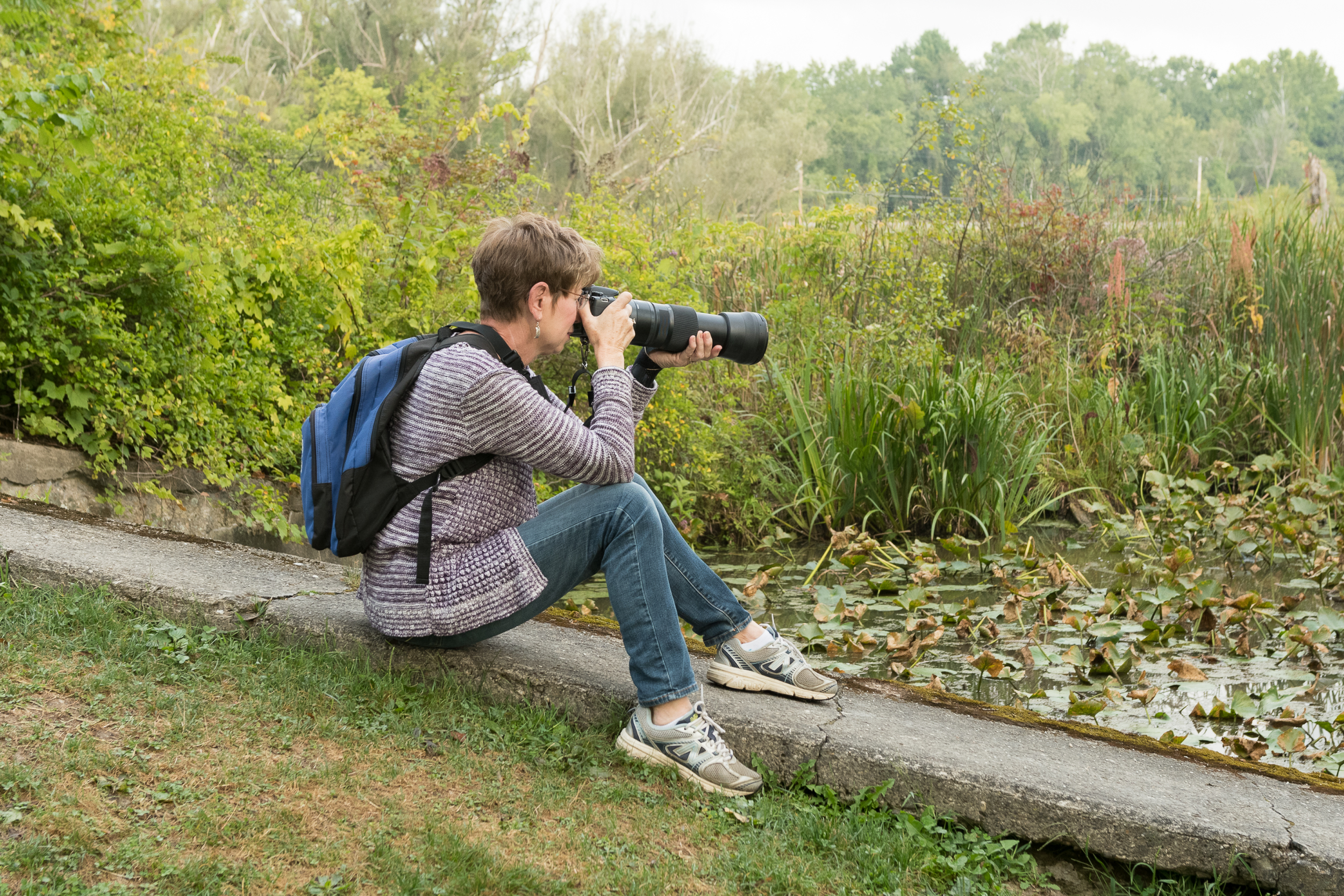
A group of kayaks passing a rocky beach on the Cuyahoga River in summer.NPS Photo / D.J. Reiser Images link to the original government source.Visitors taking in the view at the Ledges Overlook in fall.NPS Photo / Tim Fenner CVSR Engine 6777 motors down the tracks.NPS Photo / Robert George Brandywine Falls viewed from the upper boardwalk.NPS Photo / D.J. Reiser Visitors watch a lock demonstration at Canal Exploration Center.NPS Photo / Ted Toth Junior Ranger Challenges and programs are offered regularly in summer.NPS/Elena De Marco CVSR train stopped at station.NPS/Lynette Sprague-Falk Photographer at Beaver Marsh.NPS / Kris Brown Paw Patrol Volunteer Ruth and dog Roxy stand in front of the Boston Store.NPS / Ted Toth Rangers patrol by car, bike, and boat to help keep you safe.NPS / Ted Toth Car break-ins do occur. Follow the tips to help prevent an incident and report suspicious activity.NPS Riding the Towpath Trail.NPS / DJR
Look closer at accessibility.
No structured outing assessments have been reviewed for this park yet. Check the official accessibility guide for your requirements.
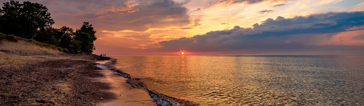
Lake Michigan's might has influenced Indiana Dunes for millennia. Wind and waves have shaped the land, leaving a rich mosaic of habitats along these 15 miles of Indiana coast. Over 50 miles of trails lead through shifting sand dunes, quiet woodlands, sunny prairies and lush wetlands. Known for its striking plant and bird diversity, it's easy to find inspiration throughout the park’s 16,000 acres.
Gateway Arch National Park commemorates President Jefferson’s vision of a continental nation, the individuals and cultural groups who helped shape its history, St. Louis’ role in westward expansion, and Dred and Harriet Scott, who sued for their freedom in the Old Courthouse.
Explore a rugged, isolated island far from our connected communities. Isle Royale offers adventures for backpackers, hikers, boaters, paddlers, and divers. Cross Lake Superior and make a commitment: Become a part of this island, and let it become a part of you. Find peace and refuge in island wilderness – because Isle Royale, in turn, finds refuge in us. Help Isle Royale stay wild.





 Coast & islands