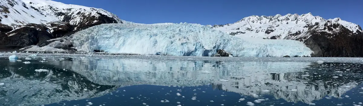
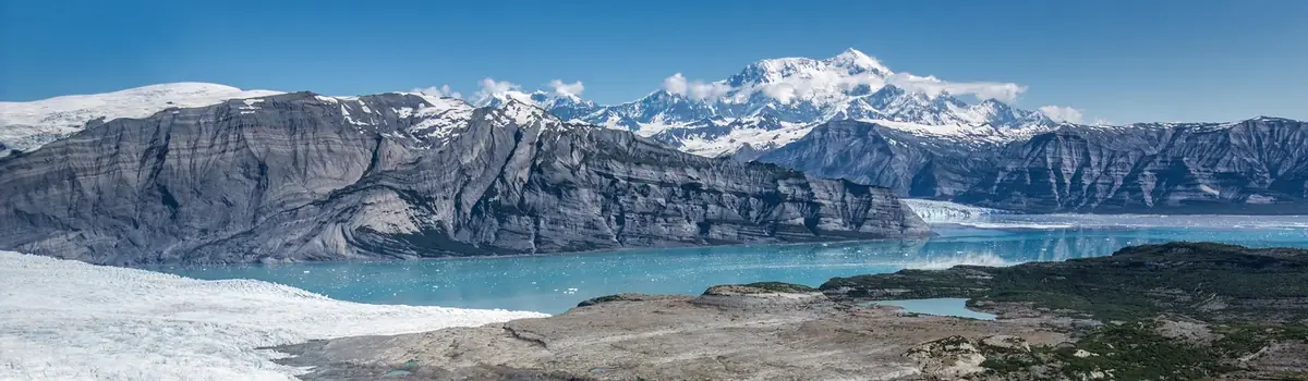
Denali is six million acres of wild land, bisected by one ribbon of road. Travelers along it see the relatively low-elevation taiga forest give way to high alpine tundra and snowy mountains, culminating in North America's tallest peak, 20,310' Mount McKinley. Wild animals large and small roam un-fenced lands, living as they have for ages. Solitude, tranquility and wilderness await.
4.7Macres of parkland
543.3Krecreation visits, 2025
Regional datanearby climate picks
Seasonal access & reservations
No reviewed guidance for this selection. Check the park's official planning pages; missing coverage does not establish access.
Selected guidance only; separate from climate comfort and current conditions.
Official conditions Not checked
The conditions feed has not been connected for this park.
Editorial recommendations, reviewed 2026-10-17. Full park days, excluding travel to and from the region. A first-visit outline for a general traveler; adapt to mobility, fitness, season, reservations, and current conditions. These are suggested days, not reserved activities or guaranteed routes.
Do you already know what bus trip you want? Head over to our concessionaire's website. They manage most of the buses in the park (both narrated and non-narrated types), and you'll reserve your tickets through them. Otherwise, read the rest of this page to decide which bus is for you.
Know Before You Come
Due to the Pretty Rocks landslide , the road is currently closed to all traffic at Mile 43. There is only one road in Denali. Private vehicles can drive a small part of it, but most of the road is open only to bus traffic. Bus trips are available only in summer (mid-May through mid-September). All bus trips are operated by a private company with a contract to do so—not by the National Park Service. Advance reservations for bus trips aren't always necessary, but are strongly encouraged if you are only visiting for a short time (less than 2 full days).
Due to the Pretty Rocks landslide , the road is currently closed to all traffic at Mile 43.
There is only one road in Denali. Private vehicles can drive a small part of it, but most of the road is open only to bus traffic.
Bus trips are available only in summer (mid-May through mid-September). All bus trips are operated by a private company with a contract to do so—not by the National Park Service.
Advance reservations for bus trips aren't always necessary, but are strongly encouraged if you are only visiting for a short time (less than 2 full days).
An Introduction to Denali
The Denali Park Road parallels the Alaska Range and travels through low valleys and high mountain passes. It is the only road in the park. Along its route, beautiful landscapes can be seen at every turn, and there are many opportunities to view Mount McKinley—if the normally cloudy skies permit. Wildlife can often be seen, too, though sightings are not guaranteed—they are, after all, wild animals roaming an unfenced land.
During summer, roughly late May through early September, private vehicles may drive the first fifteen miles of this road, to a place called Savage River. The road to Savage River is paved, and features numerous pull-outs for folks to stop and snap some scenic photos. "The Mountain" can be seen as early as Mile 9, if the day isn't too overcast, and animals of all sorts can sometimes be seen on this stretch of road—although chances to see wildlife increase greatly with a bus trip farther down the Park Road.
Types of Bus Trips: Tour vs. Transit
You should understand the nature of bus trips in Denali before booking anything.
There are two main types of buses in Denali—narrated trips ( tour buses) and non-narrated trips ( transit buses). In addition, a few free buses travel routes around the park entrance, connecting visitor centers and points of interest in the same area where visitors may drive their own vehicles.
Non-narrated transit buses Cheaper than tour buses, and more flexible in that you may disembark and re-board anywhere along the restricted portion of the road, these are called transit buses. Transit bus drivers aim to help you experience the park on your own terms. These buses stop for wildlife viewing, restroom stops and beautiful scenery, just like tour buses. Read more about non-narrated transit bus options
Narrated tour buses Your driver is your narrator on the tour buses, and they will provide a detailed and captivating program to accompany your journey along the Denali Park Road. Tour buses make the same restroom stops as the non-narrated buses, and of course will pause for views of wildlife and scenery. All tours offer either a snack or full lunch. Read more about narrated tour bus options
Free buses Three types of free buses operate on the publicly-driveable portion of the Denali Park Road. These enable visitors without vehicles, or those who wish to leave their vehicle behind, to travel between various facilities, trails, campgrounds and day-use areas. All of these are free, and none require reservations. Learn more about free buses
Which Bus Do I Choose?
Child Restraint Information
Alaska State Law requires children to be in a car or booster seat as follows:
Children younger than 12 months of age or less than 20 pounds (9 kilograms) must be in a rear facing infant seat.
Children older than 12 months and younger than 4 years, and at least 20 pounds (9 kilograms), must be in a child restraint.
Children aged 4 through 7 years who are less than 57 inches (1.4 meters) tall or less than 65 pounds (30 kilograms) must be in a booster seat. Booster seats are no longer required for children of this age once they reach 57 inches (1.4 meters) tall or weigh 65+ pounds (30 kilograms).
Parents are responsible for providing the appropriate car seat.
Day hiking or backpacking may require extra logistical planning if your children require a car seat.
Beyond the Savage River Check Station at mile 15 of the Park Road, you'll need to be on a bus, bicycle, or on foot. Prior to the 1972 completion of the George Parks Highway (Alaska Route 3), which is the main travel artery into interior Alaska, visitation to Denali National Park and Preserve was fairly low. Anticipation of major increases in traffic resulting from a direct route to the park prompted park officials to implement a mass transit system beyond Mile 15 on the Denali Park Road. To provide for visitor access and enjoyment of the world class resources, our concessioner, Doyon/ARAMARK Joint Venture , offers several types of bus services along the park road.
Extending 92 miles from the park entrance to its terminus in the old mining community of Kantishna, this mostly-gravel road traverses boreal forests and sub-arctic tundra. The eastern half of the road (from Mile 0–43) crosses rolling mountainsides and scenic river valleys as it meanders through spectacular vistas and prime wildlife viewing areas. By riding a bus, you help to reduce traffic congestion and to protect the natural resources of the park. Even more information on how the park road is managed, as it relates to vehicle traffic, can be found in the Denali Park Road Vehicle Management Plan .
Beyond Buses: Recommended Itineraries
Planning a trip to Denali can be a big undertaking! Just getting to the park can take quite a while, and it is distinctly different from many national parks, so even seasoned park travelers can be unsure how to plan their trip.
Use the table below to start thinking about what might work well for you, given the amount of time you'll be here. There are plenty of other things to do than what is listed below - this is just a starting point.
Other Trip Planning Info
Bus Type
Good for Hiking or Camping?
Good for Learning About the Park?
Good for Seeing Wildlife?
Round Trip Duration
Natural History Tour
No
Yes
No; wildlife viewing may occur, but chances are slimmer than with other trips
4.5–5 hours
Tundra Wilderness Tour
No
Yes
Yes
5–5.5 hours
Transit Bus
Yes; passengers may disembark to day hike
No; drivers are not required to narrate
Yes
4.5 hours
Camper Bus
Yes; only passengers camping or backpacking in the park can use this bus
No
Varies depending on how long you spend on the bus before disembarking to camp.
Variable
Duration of Visit
Recommended for Everyone
High-energy Activities
Low-energy Activities
Notes, Other Thoughts
Half a day or less
Stop in the Denali Visitor Center to watch the park film and chat with a ranger
Go hiking on one or more trails from the visitor center or Mountain Vista area (note: Triple Lakes and the Savage Alpine Trail are potentially too long for a short visit)
Attend a ranger program at the visitor center or sled dog kennels | Walk some of the short trails around the visitor center
More time is highly recommended. A visit this short isn't likely to see a ton of wildlife, but you'll have a chance to experience the frontcountry of the park and hopefully be inspired for a longer visit in the future!
One full day or part of two days (i.e., one night in the area)
Ride a transit or tour bus on the full day | explore the Denali Visitor Center
Hike , especially Triple Lakes Trail, around the Mountain Vista area, or off-trail while taking a transit bus trip
Attend a ranger program at the visitor center or sled dog kennels | Walk some of the short trails around the visitor center | On a clear day, ride the free Savage River Shuttle to Mountain Vista to look for scenic views of Mount McKinley
This is the real minimum for a visit. If you can stay another night, it is recommended.
One full day and part of two others (i.e., two nights)
Ride a transit or tour bus on the full day | explore the Denali Visitor Center | visit Mountain Vista
Hike , especially Triple Lakes Trail, around the Mountain Vista area, or off-trail | join a ranger-led discovery hike
Attend a ranger program at the visitor center or sled dog kennels | Walk some of the short trails around the visitor center | Ride a shuttle to look for scenic views of Mount McKinley
This is a common length of visit. More time is recommended, but this gives you a full day for one of the bus rides, and partial days for other activities, like hiking or joining ranger talks or hikes.
Two full days (i.e., three nights)
Ride a transit or tour bus on the full day | explore the Denali Visitor Center | visit Mountain Vista
Hike , especially Triple Lakes Trail, around the Mountain Vista area, or off-trail | join a ranger-led discovery hike | go backpacking
Attend a ranger program at the visitor center or sled dog kennels | Walk some of the short trails around the visitor center | Ride a shuttle to look for scenic views of Mount McKinley
This is a nice amount of time in the area. You have at least one full day for a bus trip. Consider a second bus trip if you want to maximize your chances to see wildlife.
Three or more full days
Ride a transit or tour bus on the full day | explore the Denali Visitor Center | visit Mountain Vista
Hike , especially Triple Lakes Trail, around the Mountain Vista area, or off-trail | join one or more ranger-led discovery hikes | go backpacking
Attend a ranger program at the visitor center or sled dog kennels | Walk some of the short trails around the visitor center | Ride a shuttle to look for scenic views of Mount McKinley
You have chosen wisely! Denali is a big place with unpredictable weather. Having three or more days lets you make the most of your good-weather days (bus rides, hiking) and bad-weather days (ranger talks, time at the visitor centers, etc)
Denali is not closed in winter! This far north, winter is the predominant season. During this time, snow blankets the park, daylight disappears, and temperatures can plunge to a frigid -40 F (-40 C).
Even with the short days and chilly temperatures, there is still a lot to do here. Though the Denali Park Road typically closes at mile 3 for several months, there is plenty to do for those prepared for the cold and outdoor recreation or sightseeing.
Winter Visitor Center
At mile 1.3 on the park road is the Murie Science and Learning Center (MSLC), which acts as Denali's winter visitor center. The winter season runs from late September until early May annually.
The Winter Visitor Center is the place to begin your winter visit to Denali. Learn about the park by watching park films and browsing a small display area. Borrow snowshoes to take on the trails or pick up a Junior Ranger Activity Book. Get brochures and trail maps and access several trails fom here. Rangers are available to answer questions and collect park entrance fees (credit card only, no cash).
Indoor Picnic Area
Next door to the MSLC is the Murie Hall, which is open daily in winter as an indoor picnic area. This facility is open to the public from late September through mid-April annually and serves as a warm place to relax, plan your next adventure, or watch park films. The indoor picnic area has restrooms and a water bottle filling station. No food is available within the park. Bring food for your trip as the closest services are in Healy, 11 miles north of the park entrance. For more information on local lodges and restaurants that are open in the winter, refer to the Denali Chamber of Commerce .
Common Winter Activities: Skiing, Biking, Snowshoeing
Cross-country skiing, winter biking and snowshoeing are peaceful and rewarding ways to explore Denali, whether for an afternoon or a multi-day trip following sled dog trails or along the Denali Park Road.
Some of Denali's summer hiking trails are also good for skiing. Please note that winter biking is only possible on the Roadside Bike Trail and the park road; other summer hiking trails cannot be biked, in summer or winter.
Telemark skiing and snowboarding involve long climbs on foot, but are possible in good snow years. If you plan to travel in areas that present avalanche hazards, please have proper training and equipment. We encourage you to travel with a partner or a group.
If you wish to take an overnight trip in the park, you'll need a backcountry permit .
You can visit the park's Sled Dog Kennels in winter, although the dogs are sometimes out on the trail. Open hours are hosted by a ranger on Saturdays and Sundays from 1 pm to 4 pm, except for major holidays.
Snow Conditions
Please be prepared for all conditions and contact the park with any questions you may have about trail conditions and winter recreation in Denali. Snow cover in Denali can range from excellent to nonexistent and temperatures can range from 40°F to -40°F in the winter.
Snowshoes and ice grippers are available to borrow from the Winter Visitor Center. For all other gear, bring your own equipment or rent it in Fairbanks or Anchorage before traveling to Denali. There are no local rental options in the Denali area in the winter.
The Leave No Trace organization published great guidelines in 2015 for enjoying untrammeled areas in winter while minimizing impacts on the underlying landscape. Learn more about Leave No Trace principles and backcountry snowsports .
Winter Highlights
Whether you're skiing, biking, snowshoeing, or just looking for a winter hike, check out a map of winter trails to plan your trip!
Winter Ranger Programs
Use our calendar to discover if any ranger-led activities will occur when you visit.
Driving into the Park in Winter
Most of the park road is closed in mid-winter. However, in fall and from February onward, visitors may drive 13 or more miles into the park.
Other Winter Activities
Winter Visit to the Sled Dog Kennels
Find out when the kennels are open and learn about the tradition of mushing in Denali.
The aurora, or northern lights, can be seen periodically in the Denali area.
Mushing and Skijoring
Visitors who own their own dogs are welcome to mush or skijor in the park.
Hardy souls will find great winter camping opportunities, with the wilderness all to themselves.
Winterfest Celebration
Every February, Denali and the surrounding community host a winter festival, celebrating Alaska's longest season.
Certain areas of the park are closed to off-road vehicles, including snowmobiles, but other areas open when snow cover is sufficient.
Due to the Pretty Rocks Landslide , the road is currently closed at Mile 43. Any destinations listed below that are past that point cannot be accessed by vehicle or bus.
NPS Photo / Emily Mesner
Where to See and Photograph Mount McKinley
Viewpoints to Which You Can Drive or Take a Free Shuttle
Viewpoints Accessed by Bus
Reflection Pond
NPS Photo / Tyler Devine
Wildlife Photography
While wildlife can be theoretically seen just about anywhere in the park, the most common wildlife viewing opportunities occur during a bus ride along the park road.
A few very general thoughts and tips for those looking for wildlife during their visit:
The longer a bus trip you choose to take, the better your odds will be of seeing wildlife. If you have the time to spend several days in Denali, taking bus trips on multiple days is a great way to maximize your chances of seeing wildlife.
The park entrance-area is thickly forested. While many species are present in this area, you may be more likely to spot animals where tree cover diminishes. Tree-line in Denali is roughly 3,000 above sea level, and the park road travels through a number of transition areas and alpine passes where lines of sight are extensive. Compare the bus options with the park map , looking for which landmark alpine passes (e.g., Sable Pass) you'll pass through.
The Wonder Lake area is fairly boggy, with many small kettle ponds and other bodies of water near the road - making it one of the better sections of the park road to look for water-loving birds.
The thrill of seeing wild animals in their natural environment provokes varying reactions from us all. Often, the excitement and happiness at this special kind of experience can make us forget our responsibility to keep ourselves, and the animals, safe.
When photographing wildlife from outside a vehicle, please follow the distance regulations listed below:
Grizzly bears Pedestrians and bicyclists: do not approach to 300 yards (meters) or less. If you are adjacent to a vehicle (i.e., within 2 yards of entering it): do not stay outside of the vehicle if the bear is 25 yards or closer to you.
Raptor nests and occupied dens (lynx, fox, wolverine, coyote, wolf, etc) Pedestrians and bicyclists: do not approach closer than 100 yards. The park will institute and post temporary closures of at least one quarter mile around known wolf dens; and appropriately-sized closures around other sensitive den/nest sites.
Other animals and active bird (non-raptor) nests Pedestrians and cyclists: Maintain a minimum distance of 25 yards.
There are two ways to hike in Denali—on a marked trail, or off-trail in nearly any direction you choose.
Trail hiking There are not very many marked trails in Denali, and most of the trails here are short and near the park entrance. But visitors are not limited to hiking only on the trail system. Unlike most parks that require visitors to stay on trails, Denali also provides the opportunity to explore a trail-less wilderness.
Off-trail hiking Hiking off-trail can seem intimidating at first, but it is a memorable and unique experience. The information on this page will provide you with some knowledge of where and how to begin such an adventure, but you may want to talk to a ranger upon arriving to clarify any questions or concerns you have before starting a hike.
NPS Photo / Emily Mesner
Check out information for self-guided trail hikes . These trails are all within a few miles of the Denali Visitor Center. You may wish to download or print these materials in advance, though cell / data service is available while on many of these trails, if you decide to access them while hiking.
Trails Around the Entrance of Denali
Trails in Denali are largely centered around the Denali Visitor Center. Some of these trails are utilitarian—they travel alongside the Denali Park Road and connect the visitor center with other important facilities in the entrance area of the park, such as the park sled dog kennels , Riley Creek Campground and the Denali Bus Depot . Other trails offer a departure from the immediate surroundings of the park's only road, allowing you to seek a bit of solace and quiet, while still having an obvious, established path to follow. Below is a map featuring trails in the park. Zoom in and click on the various trails to get descriptions, difficulties, and lengths. A few trails exist farther west in the park, and can be seen by scrolling in that direction. The menu in the upper-right of the map lets you change what type of base map you are using, make it full-screen, and print if you wish. A simplified, print-friendly trail map is also available.
Trails Not Near the Park Entrance
Tsenesdghaas Na' Trailhead
Located around 6 miles south of the Denali Park Road entrance. Limited day parking is available for personal vehicles.
The 1.5-mile Oxbow Loop Trail is a short loop that contours along the west bank of the Nenana River, offering views from high above the river. The trail wanders in and out of spruce forest and eventually drops down to the edge of the river. This trail provides walk-in access to a gravel bar on the Nenana River, which might be useful for rafters.
The southern portion of the Triple Lakes Trail can be accessed from this trailhead. This 9.5-mile trail is the longest trail in the park, connecting the Tsenesdghaas Na’ Trailhead near mile 231 of the George Parks Highway (Hwy 3) with the Denali Visitor Center Campus. At the southern end, the trail will pass under the highway bridge, eventually crossing some railroad tracks on the way to reach three scenic lakes. Continue north along a ridge to cross a suspension bridge and hike along Riley Creek. Plan ahead to arrange your own transportation back to your starting location.
The Nenana River Hiking Trail can be accessed from this location, but is currently being constructed, so the length and trail condition will vary.
Mountain Vista and Savage River Areas
Located at miles 13–15 on the Denali Park Road. Limited parking is available for personal vehicles; riding the free Savage River Shuttle is recommended.
The 0.6-mile Mountain Vista Trail is a short, fairly flat loop where you can view Mount McKinley on clear days. Look for the fully snow-covered mountain in the distance to the southwest.
The 2-mile Savage River Loop is a mellow walk along the river. The surface is uneven and rugged in areas, but there is no significant elevation change.
The more steep and strenuous Savage Alpine Trail is four miles long, and connects the Savage River area with the Mountain Vista area. Use the Savage River Shuttle to travel back to your starting point if you need to pick up a car, or use it to return to the park entrance if you have no vehicle; or, you can walk about two miles along the park road.
Both the Savage River Loop and the The Savage Alpine Trail are located almost entirely within designated Wilderness. Trail users must adhere to the group size limit of 12 in accordance with park regulations.
This area is not accessible in winter. Winter begins when snow falls, typically late September or early October. Learn more about the Savage River area
Eielson Visitor Center
Located at mile 66. Not currently accessible via bus.
The Tundra Loop is around a third of a mile through alpine country, very close to the visitor center. A spur trail leads an additional quarter of a mile, one-way, off the Tundra Loop.
The Thorofare Ridge Trail is a very steep hike of around 1,000 feet. The trail is a bit less than one mile one-way, up Thorofare Ridge. The views are particularly impressive on clear days!
The Gorge Creek Trail descends 600 feet to the Gorge Creek and Thorofare River bars, with access to numerous dayhiking opportunities and backcountry camping units. A creek crossing may be required if you want to hike past the end of the trail.
Located at mile 85. Not currently accessible via bus.
There is one trail in this area, called the McKinley River Bar Trail , leading from Wonder Lake Campground to the McKinley River. It is 2.5 miles one-way, with negligible elevation gain. The trail travels through spruce forest and past several small ponds, offering chance to see water fowl and terrain which is different from much of the park. It is plagued most of the summer by mosquitoes, so bring a head net. return to top of page
Note that some trails are loops, and so a round-trip time and distance is offered. Other trails are not loops by themselves, and so the time and distance numbers are for a one-way hike. Add multiple one-way trails together to estimate a larger loop (e.g., a loop combining the Rock Creek and Roadside Trails).
An additional wrinkle is that not every trailhead is at a visitor center or road. In those cases, you might need to add a bit more time (e.g., the Meadow View Trail is only a third of a mile long, but to get to either trailhead you must hike along one of a couple different trails from the visitor center). Some of the longer trails are explained in greater detail on separate pages, linked below.
You can download a print-friendly map and chart of trail info , with additional details like connecting trails, max grade and trail surface.
Note: Due to the Pretty Rocks Landslide , buses are currently traveling no further than Mile 43 of the Denali Park Road. The trails below are located past this point, and will not be accessible until 2027.
Hiking Off Trail
Denali is nearly the size of Massachusetts (or just over half as large as Switzerland), and most of the park is devoid of human-made trails. The idea of hiking in the wilderness, with no trail to follow, excites some hikers and confuses or intimidates others. However, the nature of Denali's Park Road and bus system , and the terrain itself, can make trail-less hiking more approachable than it may seem at first blush.
This is a question that only you can answer. Every person will want something slightly different out of their day hike, and the sheer size of Denali prevents any one spot from being "the best." Some people will want to hike up into steep terrain to gain big views, while others will prefer a stroll along a river. Some people don't mind pushing through thick brush for part of a hike, while others will want to avoid anything more than shrubs and small bushes.
Starting an Off-Trail Hike
A good strategy is to take an early transit bus into the park and scout the terrain from the road on your drive west. On your return back east towards the park entrance, you can ask your driver to let you off at whatever area looked most appealing.
Ending an Off-Trail Hike
After your hike, you need only return to the road and wave down any passing transit bus. You can get a copy of the latest bus schedule upon arriving in the park, or you can download a schedule to bring with you. While uncommon, the first bus or two that you try to re-board may be full, so be prepared for the possibility of waiting an hour for a ride.
In a trail-less wilderness like Denali, you will choose your own route. By avoiding terrain traps like pockets of spruce forest and alder, you can make navigation easier. Tree-line in Denali is generally around 3,000' above sea level, and much of the Park Road travels near or above that level.
Above tree-line, you will find either brushy tundra, with plants that may slow your travel but allow you to see over them, or alpine tundra, with extremely short vegetation that offers no impediment to your speed or your visibility. In many parts of the park, you will find that the Park Road stays in your view, even after several miles and several hours of hiking.
Learn more about terrain types in Denali
Equipment & Travel Tips
The list below is not exhaustive, but should help in planning your off-trail adventure.
Carry adequate food and water. There are no restaurants or amenities west of mile 3 on the Park Road.
Bring a means to treat water, such as purification tablets or a water filter.
Wear appropriate clothing. Avoid cotton and choose either quick-drying synthetic materials or wool, which insulates even when wet.
Plan for bad weather. Rain is likely (and snow is possible) in summer. A hat, gloves, rain jacket and rain pants may be necessary.
In the case of a storm, avoid high ridges and exposed areas.
Other gear, such as trekking poles, calf-high gaiters, and ankle-high boots will make your hike more comfortable.
Be prepared to self-rescue and carry a first aid kit. Travel immediately to the Park Road and flag down a ranger or bus driver if you need assistance.
Bring a plastic bag to pack out your trash, which includes toilet paper and menstrual products.
Be aware of wildlife closures and avoid hiking within them.
If your children require a child seat on the bus, keep in mind that you'll need to either carry them or safely store them before setting off on a hike. Child seats can be left in the food storage sheds at any campground . Car seats may not be left by the roadside —they often have food smells that attract animals large and small.
It is safest to hike with at least one other person and to stay in areas where visibility allows you to see animals at a great distance and avoid them when necessary. In areas of brushy or alpine tundra, you can sometimes see for miles.
However, you will likely face areas of reduced or limited visibility while day hiking. When your visibility is reduced, you should make noise, either by talking with your partner, singing, or simply shouting "Hey there!" every few minutes. The human voice is distinctive and tells wildlife that you are in the area, which helps minimize surprise encounters. Bear bells, whistles, etc., are no substitute for your voice. The first few shouts may feel silly, but with enough repetition, they will seem a natural part of hiking in Denali.
Read more about wildlife safety
Trail
Brief Description
Time (Leisurely Pace)
Distance
Roadside Bike Trail
Travels alongside the Denali Park Road, from the visitor center to the park entrance. Little elevation change. The surface is well-compacted gravel. 5% maximum grade, 10' width. Continues as a paved path alongside Highway 3 (see Parks Highway Bike Trail below).
45 minutes one-way from the Denali Visitor Center
1.7 miles, one-way
Horseshoe Lake Trail
A popular trail that descends to, and travels entirely around, a lake. The surface is five feet wide, with uneven soil with rocks and roots. It begins with a short, steep uphill to a bench overlooking the lake. The trail then descends 250' steeply to the shore of the lake. The trail grade averages 5% with sections up to 20%.
2 hours round-trip from its trailhead ( add about 30 minutes if starting/ending at the Denali Visitor Center )
2 miles, round-trip ( add about 1 mile round-trip if starting/ending at the Denali Visitor Center )
Jonesville Trail
A steep shortcut from Riley Creek Campground to the Canyon, the business district outside the park. It has a surface of compacted gravel. From west to east, it drops about 150 feet.
10 minutes one-way from either trailhead
0.3 mile, one-way
McKinley Station Trail
Descend from the visitor center to Hines and Riley Creeks, and pass under the Alaska Railroad trestle. The trail is compacted gravel. It has an 8.5% grade maximum, dropping ~100 feet in the process via one long, gently sloping hill. The trail is 5' wide.
1 hour one-way from the Denali Visitor Center
1.6 miles, one-way
Meadow View Trail
A very narrow trail (about 30" wide) overlooking a meadow, forming a short connection between Rock Creek and Roadside Trails. The trail is relatively level, but has a steep drop to one side.
15 minutes from either trailhead
0.3 mile, one-way
Morino Trail
A short trail through spruce forest. Good for a quick walk while waiting on a bus or train.
15 minutes one-way from its trailhead
0.2 mile, one-way
Mount Healy Overlook Trail
An increasingly steep hike out of the forest and into the alpine country, with potential views of Denali, if skies are clear. The trail surface is rough soil with rocks and roots. Eventually becomes very steep, maxing at a 25% grade. Generally 24" wide.
2 hours one-way from the Denali Visitor Center
2.7 miles, one-way
Oxbow Loop Trail
This rustic trail contours along the west bank of the Nenana River, offering views from high above the river. The trail wanders in and out of spruce forest and eventually drops down to the edge of the river. This trail provides walk-in access to a gravel bar on the Nenana River, which might be useful for rafters. Note : Access to the trail starts at the Tsenesdghaas Na' Trailhead, located 6 miles south of the park entrance, near a bridge over the Nenana River.
1 hour round-trip from its trailhead
1.5 miles, round-trip
Parks Highway Bike Trail
Paved path alongside Highway 3 (George Parks Highway), from the park entrance north to the Nenana River Canyon area.
30 minutes one-way
1.0 mile, one-way
Roadside Hiking Trail
Travels uphill from the visitor center to the sled dog kennels and park headquarters. Runs generally uphill from east to west, up to a 15% grade; generally 36" wide.
1 hour one-way from the Denali Visitor Center
1.8 miles, one-way
Rock Creek Trail
Occasionally steep trail through forest. Similar route to Roadside, but a bit longer and much quieter, as it's farther from the road. Runs generally uphill from east to west, up to 15% grade; generally 30" wide.
1.5 hours one-way from the Denali Visitor Center
2.4 miles, one-way
Spruce Forest Trail
A short trail through spruce forest. Good for a quick walk while waiting on a bus or train. 0% grade change, with a width of about 5 feet.
15-minute loop
0.1 mile, one-way
Triple Lakes Trail
Denali's longest trail, with bridges over two creeks and great views of three lakes. The surface is a mix of compacted gravel, soils, rocks, roots, and sections of planks over marshy ground. The trail is up to 20% grade at times, generally 24" wide. Note : The southern portion of the trail is accessed via the Tsenesdghaas Na' Trailhead, located 6 miles south of the park entrance, near a bridge over the Nenana River. Triple Lakes Trail lies within designated Wilderness, so groups are limited to 12 individuals.
5 hours one-way from the Denali Visitor Center
9.5 miles, one-way
Mountain Vista Trail
Located at Mountain Vista Rest Area, at Mile 13 of the Denali Park Road. Can be accessed by the free Savage River Shuttle and private vehicle, with ample parking available. The trail has a 5% maximum grade and is 6 feet wide.
30-minutes, loop
0.6 mile, round-trip
Savage Alpine
Connects Savage River and the Mountain Vista day use areas. Parking available at either end. Use free Savage River Shuttle to return to your vehicle. Considered strenuous, the trail has steep sections up to 25% grade and is generally 24" wide.
Three hours, one way
4 miles, one-way
Savage River Loop
Located at the Savage River at Mile 15. Very limited parking available. Can be accessed by free Savage River Shuttle. On the western half of this loop, the first quarter-mile of the trail is around 2 feet wide and very flat; gradually the trail narrows and has more impediments like rocks and uneven surfaces.
90 minute loop
2 miles, round-trip
Tundra Loop
From the Eielson Visitor Center, at Mile 66 of the Denali Park Road, this short loop explores alpine tundra. Negligible grade change and generally two feet or wider at all times.
15 minute loop
0.3 mile, round-trip
Thorofare Ridge Trail
From the Eielson Visitor Center, this switchback trail climbs to a ridge for high, scenic views of Mount McKinley and a vast expanse of tundra beyond.
One hour, one way from Eielson Visitor Center
0.8 mile, one-way
Gorge Creek Trail
The Gorge Creek Trail descends 600 feet to the Gorge Creek and Thorofare River bars, with access to numerous off-trail dayhiking opportunities and backcountry camping units. A creek crossing may be required if you want to hike past the end of the trail.
~ 90 minutes round trip
~ 2 miles, round-trip
McKinley River Bar Trail
From a road junction approaching Wonder Lake Campground, this trail passes through wet meadows and enters spruce forest, and ends at the McKinley River
90 minutes, one way from its trailhead
2.4 miles, one-way
Trail
Brief Description
Time (Leisurely Pace)
Distance
Roadside Bike Trail
Travels alongside the Denali Park Road, from the visitor center to the park entrance. Little elevation change. The surface is well-compacted gravel. 5% maximum grade, 10' width. Continues as a paved path alongside Highway 3 (see Parks Highway Bike Trail below).
45 minutes one-way from the Denali Visitor Center
1.7 miles, one-way
Horseshoe Lake Trail
A popular trail that descends to, and travels entirely around, a lake. The surface is five feet wide, with uneven soil with rocks and roots. It begins with a short, steep uphill to a bench overlooking the lake. The trail then descends 250' steeply to the shore of the lake. The trail grade averages 5% with sections up to 20%.
2 hours round-trip from its trailhead ( add about 30 minutes if starting/ending at the Denali Visitor Center )
2 miles, round-trip ( add about 1 mile round-trip if starting/ending at the Denali Visitor Center )
Jonesville Trail
A steep shortcut from Riley Creek Campground to the Canyon, the business district outside the park. It has a surface of compacted gravel. From west to east, it drops about 150 feet.
10 minutes one-way from either trailhead
0.3 mile, one-way
McKinley Station Trail
Descend from the visitor center to Hines and Riley Creeks, and pass under the Alaska Railroad trestle. The trail is compacted gravel. It has an 8.5% grade maximum, dropping ~100 feet in the process via one long, gently sloping hill. The trail is 5' wide.
1 hour one-way from the Denali Visitor Center
1.6 miles, one-way
Meadow View Trail
A very narrow trail (about 30" wide) overlooking a meadow, forming a short connection between Rock Creek and Roadside Trails. The trail is relatively level, but has a steep drop to one side.
15 minutes from either trailhead
0.3 mile, one-way
Morino Trail
A short trail through spruce forest. Good for a quick walk while waiting on a bus or train.
15 minutes one-way from its trailhead
0.2 mile, one-way
Mount Healy Overlook Trail
An increasingly steep hike out of the forest and into the alpine country, with potential views of Denali, if skies are clear. The trail surface is rough soil with rocks and roots. Eventually becomes very steep, maxing at a 25% grade. Generally 24" wide.
2 hours one-way from the Denali Visitor Center
2.7 miles, one-way
Oxbow Loop Trail
This rustic trail contours along the west bank of the Nenana River, offering views from high above the river. The trail wanders in and out of spruce forest and eventually drops down to the edge of the river. This trail provides walk-in access to a gravel bar on the Nenana River, which might be useful for rafters. Note : Access to the trail starts at the Tsenesdghaas Na' Trailhead, located 6 miles south of the park entrance, near a bridge over the Nenana River.
1 hour round-trip from its trailhead
1.5 miles, round-trip
Parks Highway Bike Trail
Paved path alongside Highway 3 (George Parks Highway), from the park entrance north to the Nenana River Canyon area.
30 minutes one-way
1.0 mile, one-way
Roadside Hiking Trail
Travels uphill from the visitor center to the sled dog kennels and park headquarters. Runs generally uphill from east to west, up to a 15% grade; generally 36" wide.
1 hour one-way from the Denali Visitor Center
1.8 miles, one-way
Rock Creek Trail
Occasionally steep trail through forest. Similar route to Roadside, but a bit longer and much quieter, as it's farther from the road. Runs generally uphill from east to west, up to 15% grade; generally 30" wide.
1.5 hours one-way from the Denali Visitor Center
2.4 miles, one-way
Spruce Forest Trail
A short trail through spruce forest. Good for a quick walk while waiting on a bus or train. 0% grade change, with a width of about 5 feet.
15-minute loop
0.1 mile, one-way
Triple Lakes Trail
Denali's longest trail, with bridges over two creeks and great views of three lakes. The surface is a mix of compacted gravel, soils, rocks, roots, and sections of planks over marshy ground. The trail is up to 20% grade at times, generally 24" wide. Note : The southern portion of the trail is accessed via the Tsenesdghaas Na' Trailhead, located 6 miles south of the park entrance, near a bridge over the Nenana River. Triple Lakes Trail lies within designated Wilderness, so groups are limited to 12 individuals.
5 hours one-way from the Denali Visitor Center
9.5 miles, one-way
Mountain Vista Trail
Located at Mountain Vista Rest Area, at Mile 13 of the Denali Park Road. Can be accessed by the free Savage River Shuttle and private vehicle, with ample parking available. The trail has a 5% maximum grade and is 6 feet wide.
30-minutes, loop
0.6 mile, round-trip
Savage Alpine
Connects Savage River and the Mountain Vista day use areas. Parking available at either end. Use free Savage River Shuttle to return to your vehicle. Considered strenuous, the trail has steep sections up to 25% grade and is generally 24" wide.
Three hours, one way
4 miles, one-way
Savage River Loop
Located at the Savage River at Mile 15. Very limited parking available. Can be accessed by free Savage River Shuttle. On the western half of this loop, the first quarter-mile of the trail is around 2 feet wide and very flat; gradually the trail narrows and has more impediments like rocks and uneven surfaces.
90 minute loop
2 miles, round-trip
Tundra Loop
From the Eielson Visitor Center, at Mile 66 of the Denali Park Road, this short loop explores alpine tundra. Negligible grade change and generally two feet or wider at all times.
15 minute loop
0.3 mile, round-trip
Thorofare Ridge Trail
From the Eielson Visitor Center, this switchback trail climbs to a ridge for high, scenic views of Mount McKinley and a vast expanse of tundra beyond.
One hour, one way from Eielson Visitor Center
0.8 mile, one-way
Gorge Creek Trail
The Gorge Creek Trail descends 600 feet to the Gorge Creek and Thorofare River bars, with access to numerous off-trail dayhiking opportunities and backcountry camping units. A creek crossing may be required if you want to hike past the end of the trail.
~ 90 minutes round trip
~ 2 miles, round-trip
McKinley River Bar Trail
From a road junction approaching Wonder Lake Campground, this trail passes through wet meadows and enters spruce forest, and ends at the McKinley River
Note: Ranger programs in Denali are mainly offered in the summer, from mid-May through mid-September. Check our event calendar for scheduled programs and check at the visitor center upon arrival for other talks and guided walks that may be offered during your visit.
Whether you have time for a short talk or plan to fill multiple days attending these programs, park rangers are here to help you understand, appreciate, and take care of your park.
With the exception of Discovery Hikes, all ranger hikes, sled dog demonstrations, campground programs and other talks in Denali are free and do not require you to sign up in advance. Discovery Hikes are technically free, but will likely require you to purchase a bus ticket and you must register for the hike in advance.
Ranger Programs
Sled Dog Demonstrations
Learn about the historic and modern uses of Alaskan huskies in Denali.
Join a ranger to explore the boreal forest on a walk from the Denali Visitor Center.
Join a ranger at a campground for short, informative talks on all kinds of Denali-related topics.
Off-Trail Discovery Hikes
If you will be here for several days, consider signing up at the visitor center for an off-trail ranger hike.
Please contact us if you have questions about accommodations for ranger programs that are not answered by this accessibility information.
American Sign Language
Other Naturalist and Education Programs
Our partner non-profit association, Alaska Geographic, also offers a variety of programs for visitors. There is a fee and registration is required for Field Courses. The Speaker Series is free and no registration is required. In addition to the programs highlighted below, Alaska Geographic offers other day programs including morning bird walks and Nature Labs.
Multi-Day Field Courses
These active learning vacations immerse participants in intensive wilderness experiences led by experts in a variety of different fields.
Summer Speaker Series
Approximately once a week throughout the summer, speakers will lecture and answer questions on their scientific research in Denali.
Ranger Program Schedules
As you look through the calendar below, keep the following notes in mind:
Getting to the kennels for a sled dog demonstration involves arriving at the Denali Visitor Center bus stop 40 minutes before the demo begins . There is no parking available at the kennels, so park at the visitor center (if you have a car) and ride a free bus to the demonstration. Alternatively, you can walk on the Roadside Hiking Trail (2 miles, ~1 hour) from the visitor center to the kennels.
Most ranger-led programs occur daily from mid-May through September. Some weekend ranger programs are available in fall, winter, and spring, and special programs or events may occur at any time.
Additional programs may be offered each day. Look for fliers or inquire at the Denali Visitor Center for ranger chats, additional guided walks, and special activities.
Download the free iNaturalist app through the App Store or Google Play.
Make sure your location services are enabled for iNaturalist, so that it can identify photo locations. For iPhones, go to: Settings > Privacy > Location Services For Androids, go to: Settings > Location > App permission
For iPhones, go to: Settings > Privacy > Location Services
For Androids, go to: Settings > Location > App permission
Set your phone to airplane mode to increase battery life while you're in remote parts of the park.
While traveling in the park – on the bus, day hikes, or overnight backpacking trips, look for: Collared pikas Dall sheep Hoary marmots Arctic ground squirrels
Arctic ground squirrels
If you see any of these species:
Open the iNaturalist app and click Observe.
Press the green circle at the bottom to take a photo.
Once you have the photo, click Next.
Add the species name under What did you see? Then click Share. It will save but will not upload yet.
Once you are in an area with internet, open iNaturalist and click Upload.
Backcountry permits are free and required for overnight trips in the Denali backcountry. From mid-May to late September, they are issued in person at the Backcountry Information Center on the Denali Bus Depot campus, no more than one day prior to the start of the trip. You will need a backcountry permit prior to acquiring Camper Bus tickets at the Denali Bus Depot. Plan for your group to spend at least an hour at the Backcountry Information Center to complete the permit process.
In the fall, winter, and spring, backcountry permits are available at the visitor center.
All members of the backpacking party must attend a backcountry orientation before the permit is issued. The backcountry video series may be viewed ahead of time, otherwise Chapters 3–5 will be included in your backcountry orientation when your party arrives to obtain the backcountry permit. Bear Resistant Food Containers are required from April 15 – September 30. You may bring your own approved BRFC or check one out from the NPS. Your permit will specify the backcountry unit in which you must camp for each night of your trip. A map of Denali’s backcountry units and their current availability may be found in the Backcountry Unit Guide .
Courtesy Alaska Geographic
Wilderness—A Land Without Trails
Begin Planning Your Backpacking Adventure
A backpacking trip in Denali is unlike backpacking in most other national parks. Denali is about the size of Vermont, with only a handful of trails—most of which are near the entrance of the park for day-hiking , rather than overnight backpacking. Backpacking permits are issued only in person, no more than a day before you begin your backcountry adventure—so use the information on this site as a guide, to familiarize yourself with the permit process and the landscape of Denali, but be ready to hash out the details of your itinerary only once you're in the park, speaking to one of our backcountry rangers.
Trip Planning Part 1: Research Before You Travel
Below is a detailed look at what you should think about before traveling to the park for a backpacking adventure.
Answering these questions will make it much faster and easier to get your permit once you're here. Some of these are simple to answer, while others will take some time for you to fully understand and/or answer.
What time of year are you coming?
Denali has three seasons:
Main season (May 20 – mid-September) This is the busiest time of year for backpackers. Backpackers must understand the Denali backcountry unit system (see below). Almost all backpacking trips begin with a bus ride along the Denali Park Road.
Winter (October 1 – April 15) The least busy time of the year, but this season is not for novice campers. Winter camping in Denali requires you to be prepared for extreme weather conditions.
Shoulder (a few weeks each spring and fall) This season is more complicated, and refers to the time before bus service begins on May 20 each year, and after buses stop running in mid-September. Conditions can vary hugely, so expect snow and rain (though you might only see sunshine!) In ideal conditions, backpackers can drive up to 30 miles into the park before starting their trip; however, conditions are often not ideal, so be flexible on where you backpack if you come in spring or fall. Summer rules are still in effect from April 15 to September 30, such as the requirement that you store food in a bear resistant food container. Please note, the visitor center is open for shorter hours in fall, winter, and spring.
Do you understand Denali's backcountry unit system?
(Note: Winter and shoulder-season visitors do not need to worry about the unit system)
In summer, there are many people wishing to backpack in the park. To prevent any single area from becoming over-crowded, the entire park is divided into 87 sections, or units, and only a certain number of people can camp in a given unit each night.
Our backcountry unit guide provides a map, current backcountry unit availability, and terrain details to help you play your trip. You won't select your unit(s) until you arrive and speak with a ranger, but the more you learn about the units before you come, the faster you can get your permit. Some of the guiding questions lower on this page make unit suggestions based on your experiences, skill, and what kind of trip you want to do.
How long is your trip?
The duration of your trip influences where you can (and where you should) camp in Denali. Keep in mind how long it takes to get to the park from Anchorage (5 hours by car, 8 hours by train) or Fairbanks (2 hours by car, 4 hours by train), too.
It is often smart to plan on at least one day in the entrance-area of Denali before and after your backpacking trip, particularly if you are traveling to / from Anchorage. Riley Creek Campground is a convenient place to camp your first and last night in the Denali area.
Most visitors plan on one, two or three nights backpacking. Long trips are possible (up to 30 nights!), either as one epic adventure or as a series of short routes, broken up by bus trips or stays in other campgrounds in the park.
Plan your bus ride into the park
(Note: Winter and shoulder season visitors won't have access to buses; buses only operate from May 20 to mid-September each year)
Nearly every summer backpacking trip begins with a bus ride on the only road in the park. Give thought to how long a bus ride you wish to experience—that will influence which backcountry units you should think about visiting.
If you are short on time, or do not wish to spend long on the bus, focus on areas within the first 15 miles of the park road (units 1, 2, 3, 4, 5, 24, 25, 26, and 27). These units are accessible by the Savage River Shuttle , which is a free bus ride.
Learn more about buses in Denali:
Bus prices vary from year to year, but you just need to buy one ticket for your trip in and out of the park. You cannot buy your ticket in advance—only when you arrive and have acquired your backpacking permit.
Bus schedules vary a little throughout the summer. When you download the schedule, you'll see that camper buses are lumped in with the broader non-narrated transit bus schedule; look for rows with a little tent icon to determine which buses are official campers rather than day-tripping transit buses. (Note: During the early and late parts of the summer, where no buses have a tent icon, any shuttle bus may be used by backpackers).
Read an overview of the Denali bus system if you're having trouble understanding how it all works.
What type of trip do you want?
Consider the type of backpacking trip you want. For example:
Base-camping This involves setting up camp in one backcountry unit for multiple nights. You can then day-hike in any backcountry unit, so long as you return back to your base each night to sleep. This is a great way to thoroughly explore a specific area of the park (and to get some time hiking without all of your camping gear on your back!).
Unit loop This type of trip involves hiking from unit to unit, usually spending just one night in each area. Most backcountry units south of the Denali Park Road have a river or creek in the middle of the unit, and mountains or hills forming their boundaries; thus, most loop trips involve river crossings and hiking in some steep terrain as you pass from one unit to another. Some loop trips might involve hiking across the park road, from a unit south of the road to a unit north of it.
Busing between units The bus ticket you buy to start your trip allows you to make free use of the bus system during your stay in the park. This means you can camp one night in a unit, hike to the park road in the morning, and ride the bus to any other unit. The advantage here is that you can see far more of the park during your trip. This type of trip is the most flexible, too, meaning you have the highest likelihood of getting the backpacking permit you desire.
Caching food and supplies Anyone camping more than two or three nights will likely want to cache food and/or supplies in the park, to avoid carrying it all at once. Items may only be cached in the food lockers at any campground, as well as Eielson Visitor Center and the Toklat Rest stop. These are the only places you can store food or personal belongings. Please label your items with your name and the date you intend to retrieve them. You can also leave items unneeded for your trip in lockers at the Denali Bus Depot .
Bear Resistant Food Container (BRFC) Summer backpackers must use a bear resistant food container . We loan them for free, though you can check out the list of approved BRFCs to see if your personal canister may be used here.
The bus system As mentioned above, your bus ticket lets you make free use of the bus system in the park during your backpacking trip, regardless of whether you are here for two nights or twenty nights. However , you may not return to the park entrance area (defined as the first 15 miles of the Denali Park Road, i.e. east of Savage River) until you are finished with your backpacking trip. If you return to the park entrance and wish to go back into the wilderness of the park, you will have to buy a new bus ticket.
Consider your skill level
Very few trails exist in the Denali backcountry. To have a comfortable experience, honestly assess the following questions.
Can you read a topographic map?
Can you orient yourself to a map with a compass? (Heavy clouds often make terrain difficult to see at any kind of distance, necessitating compass use)
Have you hiked off-trail before?
Have you successfully camped in difficult weather? (Snow can fall any month of the year in Denali, particularly at high elevations. Wind is a common problem, and gusts of 60 mph or more can occur on occasion.)
Given your experience, consider some general unit recommendations:
Beginner Unit 1 (which features the Triple Lakes Trail), Units 6-13, 18 and 31-34 (which feature open gravel areas along rivers, making navigation easier). In any unit, use rivers or creeks as your guide, hiking into and out of the backcountry along the same route. Expect to get wet feet, however, as water crossings will be likely.
Intermediate Consider almost any unit for a two or three night trip, except the far western areas and the units around Mount McKinley and Mount Foraker. Be prepared for brush and river crossings, as well as difficult navigation in wide open areas, if clouds prevent you from seeing your surroundings.
Expert Consider the remote, little-seen western parts of the park. Rivers are much bigger west of Eielson Visitor Center, so prepare for significant water crossings. Any unit except the Mount McKinley/Mount Foraker area could be possible.
Mountaineering The part of the Alaska Range in Denali features numerous glaciated peaks. Common trips run from 4 to 10 days, and some mountaineers fly into the park to begin their expeditions. Climbing permits are required for Mount McKinley and Mount Foraker. Learn more about backcountry mountaineering .
Think about the types of landscapes and terrain you want to encounter (or avoid!)
As a park largely devoid of trails, give careful thought to what kinds of landscapes or terrain you wish to experience. Focus your pre-trip research on units that sound appealing. (Note: These suggestions refer to the various backcountry unit numbers; check out the backcountry unit map to locate these areas).
Best-bets for beginners If this is your first off-trail backpacking trip, consider areas like Unit 1 (features a trail), Units 9–13, 18, 34 and 42.
Easy-to-navigate valleys and graveled river bars Generally units south of the park road meet this criteria, especially Units 6–13 (except 11, which is mostly rolling tundra hills). By heading south from the road, you're hiking toward the Alaska Range. These units may have river crossings, but navigation is comparatively simple and travel can be very fast.
Ridges with potential for amazing views Usually north of the park road, such as Units 25–30, 33–34, and the Kantishna region. Often there is brush at lower elevations, making navigation more difficult and travel much slower, but persevere through the brush, gain elevation, and look south for great views of the Alaska Range.
Super remote areas Units 21, 38–40, 44, and 87. These are not areas beginners should visit.
Valley glaciers Units 23, 44 and 87.
Accessible but little-used areas Units 2–3 are a short bus ride (or walk!) from the visitor center. Despite their proximity to the busy park entrance, very few people use these units. Expect some brush. These are a great choice for adventurers who want to minimize their time on the bus, and/or see places seldom visited.
Generalizations about wildlife Any animal can be found almost anywhere, but some generalizations can be made. Moose are most often seen near the park entrance / Headquarters area (eastern end of the park road), as well as near Wonder Lake (far western end of the park road). Grizzly bears and caribou are more common along the middle-third of the park road (e.g., Teklanika River to Eielson Visitor Center). Dall sheep spend time in high, rocky areas, particularly north of the park road.
Tie it all together
Before you visit the park, take time again to review the backcountry unit map , focusing on units that are of interest to you.
Come up with three or four possible routes. Remember that there is a quota system, with permits only issued in-person. Your first choice might be full when you arrive, but if you have a plan of what you generally want out of your trip, we can help you plan a great itinerary based on (a) your desires and (b) which backcountry units are available.
Consider writing down your answers to all of the above questions. This can help our rangers work with you to build a great trip itinerary, without taking up too much of your limited time in the ranger office!
Trip Planning Part 2: Pack for Your Trip (Gear and Supplies)
This section explains not just what you should bring backpacking, but how you can get it here (e.g., transporting stove fuel can be tricky).
Denali weather can change quickly. The most important food and supplies to consider:
High calorie food—Not only are you hiking, but it's often cold and rainy. That means your body will need more calories than usual.
Bug spray—Mosquitoes are typically a nuisance from May to September.
Tent—We strongly discourage bivy sacks. It's often raining, and bears are more likely to investigate bivvies than tents.
Gaiters—Stream crossings are common. Even if your gaiters aren't water-proof, they'll still help keep debris and rocks out of your boots. Many rivers in Denali are glacially-fed, and they carry a surprising amount of grit and rocks in their murky, fast water.
Proper layers—Plan on temps ranging from as warm as 75 F to as cold as 20 F, possibly in the same day!
Bear spray—Note that this cannot be carried on planes or trains, nor can you drive through Canada with it. Plan on buying it in Alaska.
Check out a more detailed gear list
Buying supplies in Alaska
Just outside of the park, several general stores and camping stores can be found. Note, however, that they sometimes sell out of certain supplies during the summer. Consider buying your most important items, such as stove fuel, in Anchorage or Fairbanks, before traveling to Denali.
Within the park, Riley Creek Mercantile is the only general store. You can buy backpacking food, but not fuel for a backcountry stove (though they do sell fuel for larger stoves, such as Coleman two-burners). They also sell bear spray here, though they occasionally sell out.
Bring a Bear Resistant Food Container (BRFC)
These hard plastic cylinders are mandatory for summer backpackers. You may bring your own approved BRFC or check one out from the NPS while getting your backcountry permit.
Read more about approved bear resistant food containers.
Trip Planning Part 3: What to Do Once You're in the Park
Get your permit at the Backcountry Information Center
As mentioned above, all backpackers need a free permit from the Backcountry Information Center. Plan for the permitting process to take at least an hour. If you're visiting in fall, winter, or spring (mid-September to mid-May), you'll get your permit at the Winter Visitor Center.
You may acquire your permit one day before or the day of your trip into the park.
Getting your backpacking permit requires a few steps:
Watch the summer backcountry safety videos Once per summer, prior to receiving a permit. As the trip leader, please coordinate with your party to be sure everyone has watched these videos online prior to arriving at the park: Chapter 3: Hiking Chapter 4: Camping Chapter 5: Animal Safety Otherwise, they are available to watch at the Backcountry Information Center.
Chapter 3: Hiking
Chapter 4: Camping
Chapter 5: Animal Safety
Talk with a ranger, plan your backpacking itinerary At any point while we're open, check which units are available by looking at a whiteboard at the Backcountry Desk. This lets you check if any trip ideas you formulated ahead of time will be possible. If your first-choice units aren't available, think about what other options may work for you, given your timing, the type of trip you seek and what terrain you do or do not want to encounter. Rangers are available to talk through possibilities with you. Finish filling out your worksheet by writing in which unit(s) you’ll camp in and give the worksheet to a ranger. We’ll then talk about a few of the most important safety considerations and print your backpacking permit. The safety talk will last about 10 minutes.
If needed, buy maps and bus tickets Once you have your permit and know where you're going, you can buy the relevant topographical (topo) maps. You are not required to buy a map, but we strongly recommend you do so. We also recommend marking wildlife closures and backcountry unit boundaries on your maps—it will be your responsibility to avoid closures and camp in the proper unit. Most backpacking trips involve a bus trip into the park with a certain type of bus, called a camper bus . Only backpackers and campground-users can buy tickets for camper buses.
Begin adventuring
At this point, you have your backpacking permit and (if needed) your bus ticket.
If you came to Denali with a car, make sure you ask a ranger where you may park it (overnight parking may change year to year). There is no parking fee. Arrive at the Denali Bus Depot at least 15 minutes before your scheduled departure, to ensure plenty of time to load your backpack and any other gear.
After your backpacking trip, no matter how many days it lasted, you may use any shuttle bus to exit the park. Simply wait anywhere along the Denali Park Road and wave down a shuttle bus as it approaches. The driver will let you know whether or not there is room for you. Remember to carry a copy of the transit bus schedule , available at the backcountry desk.
Detailed Planning Resources
After reading through the material above, browse these resources to learn more about specific backpacking topics.
Food safety Details on how to keep your food away from wildlife.
Wildlife safety More general information on how to behave properly around wildlife, particularly bears, moose and wolves.
Drinking water & backcountry sanitation Tips on avoiding bacteria from wilderness water sources (creeks, rivers, etc).
Steps to Planning a Climb on Mount McKinley or Mount Foraker
1. Read the Expedition Planning Tools
Part 1 : Planning Considerations
Part 2 : Mountaineering Medical Issues
Part 3 : Equipment and Clothing
Part 4 : Clean Climbing
2. Apply for a Special Use Permit
Mountaineers that have physically climbed on Mount McKinley or Mount Foraker since 1995 can request a "seven-day exception" to the 60-day rule and instead register 7 days in advance of the climb.
An expedition leader is permitted to add one new member to their team at least 30 days prior to the start date of the expedition.
PAYMENT: Each climber must pay the permit fee using the Pay.Gov Denali NP&P Climbing Registration Form . Climbers will immediately receive an emailed receipt from Pay.Gov at the time of payment. The mountaineering special use fee is $475 U.S. currency for the 2027 season. A reduced fee of $375 will be charged for climbers aged 24 or younger as of the start date of the climb. The fee is payable via the Pay.Gov form. These funds directly offset costs such as maintaining the high altitude ranger camps, supporting ranger/volunteer patrols, providing mountaineering information, and keeping the mountain environment clean.
APPLY FOR SPECIAL USE PERMIT: After submitting payment through Pay.gov, each climber must complete the Denali National Park and Preserve Application for Special Use Permit . ( Climbers are strongly advised to read the accompanying Instructions for completing the standardized form as several of the fields will be confusing!) The Application form must be signed, dated and emailed to DENA_Talkeetna_ Office (at) nps.gov at least 60 days before requested departure date.
3. Climber Orientation
The Team Leader has paid their registration fee at Pay.gov, submitted a signed Application for Special Use Permit , and received their assigned orientation date and time, and
All other Team Members have paid their registration fee on Pay.gov, and submitted a signed Application for Special Use Permit .
4. Permit Terms and Conditions
Frequently Asked Questions (FAQ's) About Mountaineering
Backcountry Climbing and Mountaineering
Mountain Weather Links
The National Weather Service publishes their mountain-specific forecast here: Mount McKinley Climbing Forecast (forecast available May to July)
MountainWeather.com compiles a Denali Area Weather page with links to the MesoWest data, the NWS Climbing Forecasts, as well as links to FAA webcams.
Historical Mountaineering Information
Climbing statistics - Yearly summit attempts from 1903 to present, as well as annual statistics by route for both Mount McKinley and Mount Foraker from 1979 to present.
Annual Mountaineering Summaries - Seasonal compilations of mountaineering statistics (including demographics, busiest summit days, etc), search and rescue summaries, medical overview, and a discussion of new routes and significant ascents.
Historical timeline of important climbing 'firsts' and interesting ascents
Mislow-Swanson Denali Pro Award Program
Other Helpful Reading
Denali Dispatches - Mountaineering Blog
Survival is Your Own Responsibility: Thoughts from a Retired Ranger, by Daryl Miller
Recommended Reading List
Registration and mountaineering ranger staff are available year-round at the Walter Harper Talkeetna Ranger Station to answer your questions. Contact ranger staff by e-mail , or:
Official NPS features and USGS park boundaries, imported 2026-10-17. An inventory snapshot, not live trail or parking availability.
Loading official park features…
TrailsPoints of interestParkingZoom with buttons or pinch. Toggle layers on the map.
Map coverage varies. Trail names may represent segments, connectors, or shared park units; mapped lines are not a hiking recommendation. Use official conditions and navigation resources before heading out.
NPS public GIS inventory, imported 2026-10-17. “Existing” is an inventory classification, not confirmation that a trail is open. Segment counts are not route distances. Parking records do not indicate space availability, fees, or accessibility certification. View government source ↗
Climate for Fairbanks, 215 km from the park reference point. 1991–2020 normals. Source elevation: 136 m.
This climate location is distant from the park. Use these values as regional context only. Do not use its climate ranking to choose park travel dates.
Daytime highNighttime lowOctober: 33° / 22°
Daytime high33°
Precipitation20 mm
Daylight9.2 hrs
Wind7.9 km/h
Mountain, rim, valley, and coastal conditions can differ sharply from the source town. Check park forecasts and current conditions before travel.
Monthly climate data 12 months · °F
Month
High
Low
Rain / snow water
Wet days
Daylight
3°
-9°
11 mm
3.5
4.6 h
12°
-3°
10 mm
3.1
7.8 h
25°
5°
8 mm
2.4
11.2 h
44°
24°
10 mm
2.8
14.7 h
60°
41°
19 mm
5.3
18.1 h
70°
53°
52 mm
10.2
20.6 h
71°
55°
61 mm
11.0
19.6 h
65°
50°
61 mm
10.9
16.2 h
54°
39°
40 mm
7.9
12.7 h
33°
22°
20 mm
5.4
9.2 h
14°
3°
16 mm
4.4
5.8 h
6°
-6°
11 mm
3.7
3.3 h
RESEARCH WITH THE SOURCE IN VIEW
The practical field guide.
Official NPS excerpts imported 2026-10-17. Fees, permits, road access, and operations can change; use the source link to confirm the latest information.
In 1917, Congress created this park for one main reason: to protect Dall sheep. Over time, Congress expanded the park boundaries and added other reasons for its existence, including protection of North America's tallest mountain (Mount McKinley) and to provide a place for wilderness recreation. Today, most people arrive in Denali hoping to see the mountain, view wildlife (such as bears, moose, caribou, sheep, and wolves), and experience the vast wilderness.
Denali National Park and Preserve has just one road, the Denali Park Road, and it is the main avenue for visitors to see and experience Denali. As you begin planning a trip to Denali, it's important to understand how the road operates.
The road is 92 miles long, and only the first 15 miles are paved. The paved section, leading from the park entrance to Savage River, is the only section that personal vehicles may drive. In the summer, the first 15 miles are open for public (non-commercial) vehicles to drive and buses provide transportation along the rest of the road. In winter, only the first 3 miles of the road are open for public vehicles, and the rest of the road is closed due to snow. Buses do not operate in fall, winter, or spring.
Physical Address
Many rural locations in Alaska use a mile marker on a road to denote their physical address (as opposed to a traditional street number).
For people who wish to use a GPS device to navigate their way here, you may need to input the latitude and longitude of the park entrance: 63.728443, -148.886572 .
Operating Hours & Seasons
The main season for visitors is May 20 through the second or third week in September, though there is plenty to see and do outside of the summer. There is just one road in Denali and it is closed for most of the winter, though the park remains open for winter recreation.
There is no gate at the park entrance, so you are technically able to visit any time of the day or night (which, in summer, is quite bright thanks to how long the sun is up!). You can day hike, bike, etc. any time, but camping overnight is only allowed in designated campgrounds or with a backpacking permit. To plan a trip effectively, however, you may need to learn more about:
Visitor centers and campgrounds
Bus trips in the park
Backpacking and other things to do
Spring or fall info (for visits before or after the summer season of mid-May to mid-September)
Winter activities (for visits between mid-October to mid-April)
Learn more about Denali's weather
Denali charges an entrance fee year-round for all visitors ages 16 years and up. Visitors 15 years and under are free . No refunds are given due to inclement weather.
Please note that some activities, such as summer bus trips or staying in park campgrounds , have additional costs.
Holders of a valid Denali National Park Annual Pass or an America the Beautiful National Parks and Federal Recreational Lands pass, such as an America the Beautiful Annual Pass , Senior Pass or Access Pass , do not need to pay the park entrance fee. These passes cover entry for the passholder and up to three other adults in their party. Costs for these passes vary. The Senior Pass and Access Pass also provide a 50% nightly discount on camping in Denali. None of these passes influence bus ticket prices, however. Learn more about the America the Beautiful nationwide pass program .
Find more specific information on our fees and passes page .
Visitor Centers
Most visitor centers in Denali are open in summer only (roughly mid-May through mid-September). The Murie Science and Learning Center is open to the public in winter only as the Winter Visitor Center.
Internet & Cellular Access
Internet & Cellular Access Details
Plan Your Visit
How to Explore Denali in Summer
Look for wildlife and wilderness during a bus trip in Denali. Most of the sole road is open only to buses during summer (May 20–mid-Sept.).
Plan a Winter Visit
Closed in winter? Not Denali! Winter is a great time to explore the park, whether by foot, ski, snowshoe, bike, or more!
Plan a Fall or Spring Visit
Expect limited services if you're visiting during the quieter seasons of fall (mid-September to October) or spring (mid-April to mid-May).
Explore the many activities Denali offers to visitors of all ages and experience levels.
Learn where you can drive, where you can ride a bus, and where to hike with road maps and trail maps.
Current Conditions
Check here for the latest updates on closures, current road status, and changes to park operations due to the Pretty Rocks landslide.
Park Statistics and Facts
Browse statistics like budget and visitation, find detailed policies and regulations and learn more in general about park management.
Browse our calendar for regularly scheduled summer ranger programs and special events.
Discover trails in Denali, or learn about hiking off-trail in the wilderness.
Eating & Sleeping
Learn about options for lodging, campgrounds, restaurants, and picnic areas.
Goods and Services
Learn where to find services such as restrooms, food and water, fuel, camping supplies, post office services, and more.
Pets are welcome in Denali but are not allowed on most trails. Read more about pet regulations here.
Denali is largely wilderness without trails, designated by Congress to remain a "primitive" area in many respects. The National Park Service strives to make the park as universally accessible as possible. However, extra obstacles will be encountered because of the remote, wilderness nature of this special place.
If your questions concerning accessibility are unanswered after reading information in this section of our website, please contact us .
Also, learn about the The America the Beautiful National Parks and Federal Recreational Lands Access Pass —also known as the Access Pass —which provides a wide range of discounts on activities and services when you visit federal lands. The Access Pass is available for free for US citizens or permanent residents with permanent disabilities.
Road Travel in Denali
Unlike many other national parks, Denali has only one road. Access along the first 15 miles of the road is possible by any private vehicle; travel past Mile 15 is largely restricted to bus trips , run by a concessioner.
While wheelchair-accessible buses are available and the National Park Service and our concessioner make every effort to accommodate visitors with disabilities, in rare circumstances an individual's needs may not be met by the accommodations that are available on our transit and tour buses. Those individuals may apply for a road travel permit, which would allow them to drive part or all of the Denali Park Road in their own vehicle.
Please contact us several weeks before your visit to receive the application for a road travel permit , or with any questions you have about this process.
Applicants must be able to explain to park managers why accommodations on the bus system do not meet your personal needs.
Get an entrance pass All visitors must have one of these entrance passes: Pass Price Standard Pass $15.00 Annual Pass $45.00 America the Beautiful Pass (includes Senior Passes) FREE–$250.00 Help me choose an entrance pass
Plan to go cashless This park does not accept cash.
Choosing an Entrance Pass
Do you have or qualify for a discounted America the Beautiful Pass?
If you already have an America the Beautiful—the National Parks and Federal Recreational Lands Pass, that's the only entrance pass you need. Seniors, military, visitors with a permanent disability, and families with a 4th grader are eligible for a free or discounted America the Beautiful pass.
America the Beautiful Pass
How often do you plan to visit national parks in the next 12 months?
If you don't qualify for a discounted America the Beautiful pass, we recommend choosing an entrance pass based on your trip plans.
Entrance Passes
An annual pass covers the park entrance fee for the pass holder and up to three other adults. The pass holder must be present and must show the physical pass and a valid photo ID to park staff. Annual passes are valid for 12 months from the date of purchase. For example, a pass purchased at any point in July 2025 will be valid through July 31, 2026.
Standard Entrance Pass
For Individuals
All visitors over the age of 16 need an entrance pass, including vehicle passengers. Children under the age of 16 don't need an entrance pass.
Per Person $15.00
In-person Purchase Locations
Denali Visitor Center Credit/Debit Only
Murie Science and Learning Center Credit/Debit Only
Denali Bus Depot Credit/Debit Only
Walter Harper Talkeetna Ranger Station Credit/Debit Only
Annual Entrance - Park
The Denali Annual Pass covers up to four adults. You may purchase it online or in person at the park.
US citizens and residents
America the Beautiful—the National Parks and Federal Recreational Lands Pass
Covers entrance fees and standard amenity (day-use) fees at lands managed by
National Park Service
US Fish & Wildlife Service
US Forest Service
Bureau of Land Management
Bureau of Reclamation
US Army of Corps of Engineers
Depending on the type of entrance fee charged at a site, covers One private vehicle fee or Four per person fees
America the Beautiful Passes are non-refundable, non-transferable and cannot be replaced if lost or stolen . Passholders must show valid photo identification (ID) with each pass.
How to Get an America the Beautiful Pass
Physical passes can be purchased or picked up at over 1,000 federal recreation sites.
Purchase and pickup locations
To receive your pass by mail, order online at the USGS Online Store . Online orders are for physical passes, not digital passes, and may take up to three weeks to be processed and delivered. Order receipts may not be used in place of a physical pass. We recommend ordering at least three weeks in advance of your visit, or picking up a pass in person instead.
Skip the wait! Get a Digital America the Beautiful Pass through recreation.gov. Your digital pass can be saved to a mobile device and used immediately.
Get a Digital America the Beautiful Pass
2026 Free Entrance Days in the National Parks
Come experience the national parks! All National Park Service sites that charge an entrance fee will offer free admission to US citizens and residents (other fees, including timed entry or reservation fees, may apply). Mark your calendar for these entrance fee-free dates:
February 16 : Presidents Day (Washington's Birthday)
May 25 : Memorial Day
June 14: Flag Day/President Trump's birthday
July 3–5: Independence Day weekend
August 25: 110th Birthday of the National Park Service
September 17: Constitution Day
October 27 : Theodore Roosevelt's birthday
November 11: Veterans Day
Sightseeing by bus is the primary way to experience Denali in the summer. There are two types of buses:
Non-narrated transit buses : The entrance fee is not included in the price of a transit bus ticket. In addition to purchasing a bus ticket, you will need to pay the individual entrance fee, purchase a pass, or bring your current annual or lifetime pass with you. Transit bus tickets are free for those age 15 and under.
Narrated tour buses : The $15 individual entrance fee is included in the price of a tour bus ticket. If you have an annual or lifetime pass (i.e., an Interagency Pass or the Denali Annual Pass), you are entitled to a refund of the fee. Go to the Denali Bus Depot or Riley Creek Mercantile with your pass, photo ID, and bus reservation information to receive the refund.
Where to Buy Bus Tickets
Reservations for bus trips and campground stays are available beginning December 1 of the year before your trip.
Make bus and campground reservations online. This is the fastest way to make reservations.
Call 1-800 622-7275 (U.S. and Canada) or 907 272-7275 (international and Anchorage local)
In person at the Denali Bus Depot
Campground Fees
Campground fees apply for camping in developed campgrounds. Backcountry camping requires a free permit.
There are six developed campgrounds in Denali. Some are open to tents only and others can accommodate RVs up to 40' in length.
Summer (mid-May through mid-September) reservations can be made at www.reservedenali.com . Senior Pass and Access Pass holders receive 50% off nightly camping fees.
Mountaineering Fees
Climbing Mount McKinley or Mount Foraker requires advance registration and a pre-paid mountaineering fee.
Learn about other activities that may require a permit - such as concession contracts, commercial use authorizations, filming and still photography permits, and special-use permits.
Pass
Price
Standard Pass
$15.00
Annual Pass
$45.00
America the Beautiful Pass (includes Senior Passes)
FREE–$250.00
I'm visiting...
We recommend
This park, once
Standard Pass
This park, multiple times
Annual Pass
More than one national park or federal recreation site
America the Beautiful Pass
Type
Available to
Price
Resident Annual Pass
US citizens and residents
$80.00
Non-Resident Annual Pass
Non-US residents
$250.00
Senior Annual Pass
US citizens and residents 62+ years old
$20.00
Senior Lifetime Pass
US citizens and residents 62+ years old
$80.00
Military Annual Pass
Current US military and dependents
Free
Military Lifetime Pass
Gold Star Family members and veterans
Free
Access Pass
US citizens and residents with permanent disability
Free
4th Grade Pass
US 4th graders
Free
Volunteer Pass
Federal recreation site volunteers with 250 service hours
Free
Pass
Price
Standard Pass
$15.00
Annual Pass
$45.00
America the Beautiful Pass (includes Senior Passes)
FREE–$250.00
I'm visiting...
We recommend
This park, once
Standard Pass
This park, multiple times
Annual Pass
More than one national park or federal recreation site
America the Beautiful Pass
Type
Available to
Price
Resident Annual Pass
US citizens and residents
$80.00
Non-Resident Annual Pass
Non-US residents
$250.00
Senior Annual Pass
US citizens and residents 62+ years old
$20.00
Senior Lifetime Pass
US citizens and residents 62+ years old
$80.00
Military Annual Pass
Current US military and dependents
Free
Military Lifetime Pass
Gold Star Family members and veterans
Free
Access Pass
US citizens and residents with permanent disability
Free
4th Grade Pass
US 4th graders
Free
Volunteer Pass
Federal recreation site volunteers with 250 service hours
By Car : Rural destinations in Alaska are often located by road mile marker rather than mailing address. Denali’s one and only road entrance is located at Mile 237 on Alaska Highway 3 (also called the George Parks Highway). Our mailing address is PO Box 9, Denali Park, AK 99755, though mapping to this location may drop a location pin somewhere inside the park instead of exactly at the park entrance. You can find us 240 miles north of Anchorage, 120 miles south of Fairbanks, and 12 miles south of the nearest year-round community of Healy. If navigating your route by GPS, we recommend inputting the latitude and longitude of the park entrance: 63.728443, -148.886572.
By Train : The state-owned Alaska Railroad connects Anchorage to Fairbanks and runs directly through Denali’s entrance. The train depot is five-minute walk from the Denali Visitor Center. Please visit Alaska Railroad for more information.
By Plane : Air travel to either Anchorage (ANC) or Fairbanks (FAI) is the easiest entry to Alaska. You can continue your trip to Denali by train, bus, or car. If you plan to fly your own aircraft to Denali, please see pilot information .
On Foot : Denali’s mountaineering headquarters are located in Talkeetna , about 100 miles north of Anchorage and 140 miles south of the park entrance.
Other Transportation: In summer months, a variety of private bus and van services operate daily from Anchorage and Fairbanks. Contact a travel agent or search the web for available companies operating along Highway 3.
Explore park maps to help orient yourself to the layout of Denali. Though only one road leads into the park, several side roads around the park entrance reach the visitor center, train depot, and dirt airstrip. Locations on the park road are generally referred by mile marker as measured from the park entrance (e.g., the Denali Visitor Center is at mile 1.5 on the park road, meaning it is 1.5 miles from the park entrance).
Summer visitors will find the Denali Park Road restricted to private vehicles beyond the Savage River crossing at mile 15. We recommend that visitors traveling with or without private vehicles use Denali's transit and tour buses to venture farther into the park. Free shuttles service the entrance area, sled dog kennels, and other stops along the park road up to mile 15.
Visitors in spring or fall may find anywhere from 3 to 30 miles of the road open to drive in private vehicles, depending on conditions.
Cyclists and pedestrians are permitted to travel on any part of the park road (though there are occasional, temporary closures due to wildlife activity).
Sightsee in Denali
School groups often arrive at the park via train, school or commercial buses, or personal vehicles. See above for more details on getting to Denali.
If your group qualifies for an academic fee waiver , you may use school or commercial buses to transport students around Denali anywhere that personal vehicles are allowed on the park road. The park road is generally open to personal vehicles as far as Savage River Campground (mile 15) in summer, Teklanika Campground (mile 30) in spring and fall, NPS Headquarters (mile 3) in mid-winter, and Mountain Vista (mile 12) in late winter. Without an academic fee waiver, school and commercial buses are not permitted to travel beyond the Denali Visitor Center (mile 1.5).
Before your trip, consider the size and number of vehicles you plan to use. We strongly encourage school groups to consolidate students into fewer vehicles for in-park exploration. Group parking in Denali can be limited, especially in May when many schools plan end-of-year excursions. Travel and parking along the park road may also be influenced by season, weather, and park road conditions. Check Current Conditions for the most up-to-date weather and road information.
Parking Availability
Some popular destinations along the Denali Park Road have limited parking available or have restrictions on group parking. Parking availability varies depending on the sesaon.
Denali Visitor Center (mile 1.5): Group visitation and parking at the Denali Visitor Center is available in spring, summer, and fall. School buses should park in lots 4 and 5. Personal vehicles should park in lots 1, 2, 3, and 6.
Winter Visitor Center (mile 1.5): Group visitation and parking at the Winter Visitor Center is available in—you guessed it—winter. School buses should park in lots 4 and 5. Personal vehicles should park in lots 1, 2, 3, and 6.
Sled Dog Kennels (mile 3): While the kennels are open to visitors year-round, group parking is not available in any season. If your group qualifies for an academic fee waiver, drivers may drop off students at Park Headquarters, park at the Denali Visitor Center, and return to pick students up at a designated time. Cell service reaches just beyond mile 3 on the park road for communication with drivers. When park shuttles are in service, you may alternatively park at the Denali Visitor Center and catch the free Savage River Shuttle to NPS Headquarters. You may also park at the Denali Visitor Center and hike the Roadside Trail or Rock Creek Trail to the kennels.
Mountain Vista Rest Area (mile 12): Group visitation and parking at Mountain Vista is available in spring, summer, and fall as space allows. When park shuttles are in service, you may alternatively park at the Denali Visitor Center and catch the free Savage River Shuttle to Mountain Vista. Be advised that cell service does not reach far beyond mile 3.
Savage River Campground (mile 15): Savage River Campground is open to visitors in spring, summer, and fall, but group parking is not available in any season. Plan to drop off students in the west parking lot at Savage River Campground, park at the Denali Visitor Center or Mountain Vista, and return at a designated time. When park shuttles are in service, you may alternatively park at the Denali Visitor Center or Mountain Vista and catch the free Savage River Shuttle to its final destination. Be advised that cell service does not reach far beyond mile 3 and plan accordingly.
Teklanika Campground (mile 30): Teklanika Campground is open to visitors in spring, summer, and fall, but private vehicles (including school and commercial buses) are only permitted to travel beyond mile 15 for a few weeks in shoulder seasons as weather and road conditions allow. If your group plans to visit during this time and qualifies for an academic fee waiver, you may park at mile 30 as space allows.
Alaska is a vast landscape, with many popular national parks and other public lands. Check with the Alaska Public Lands Information Center for help planning your trip to other parts of the state.
Denali National Park is a wild, wonderful place to visit, but it is important to know the hazards before you head out into the park. Explore the sections below to prepare yourself for your Denali visit.
Dial 9-1-1 in Emergencies - Be prepared to give your location as Denali National Park. Call to report accidents, fires, or life-threatening emergencies. Cell phone coverage exists only within three miles of the park entrance. Emergencies in areas without cell service should be reported to a park ranger, campground host, bus driver, or other employee.
Wildlife Safety
Keep wildlife wild and never feed or harass wildlife. Stay 300 yards from bears and 25 yards from other animals at all times.
Understanding Bear Behavior
The best preparation is education. Learn how to prevent bear encounters, how to read bear behavior, and what to do if you encounter a bear.
Using Bear Spray
Bear spray is strongly encouraged for all hikers in Denali. Learn how, when, and where to use bear spray.
Biking in Denali requires being prepared to share the road with bears and other traffic.
Snow can fall nearly any month of the year in Denali. Dress for the weather to stay warm and safe.
Alaska Wilderness Safety
Alaska is wild! Explore safety topics specific to the state such as river crossings, aviation safety, and selecting appropriate gear.
Wilderness Safety in Denali
Even experienced wilderness travelers can have an accident that results in an injury or even death. Accidents are possible anywhere—so the information below is important to all visitors.
Wildlife Wildlife can behave unpredictably. Do not intentionally approach wildlife. Read the Wildlife Safety section for more details.
Plants Do not eat berries unless you know what they are and are sure you have no allergy to them. There are no poison oak, sumac or ivy species in the park, but some other plants can cause allergic reactions, such as cow parsnip.
Hypothermia Hypothermia is always a factor in the subarctic. Rainy, chilly days are normal in summer. Dress in layers, preferably made of wool or synthetic material that is able to insulate you even when wet. Bring rain gear or an umbrella.
Injuries Be wary of falls. Most of Denali is trail-less, and long hikes are often on a route of your own choosing. If you are hiking up a rocky hill or mountain, be careful of your footing. More people die from falls than any other cause in the park.
Don't go alone You should always hike with at least one other person. Even then, make sure someone else knows where you're going. Have that person contact us if you are overdue from your trip.
Know thyself Even if you plan to stay on trails or the park road the entire time you are here, keep in mind that even the entrance of Denali is several hours from the nearest hospital . Locations on the park road (i.e., during a bus trip) are even more remote. If you know you have a medical condition, such as a heart problem, talk to your doctor about your travel plans to see if there is anything you should do to ensure a safe trip.
Note: Ranger programs in Denali are mainly offered in the summer, from mid-May through mid-September. Check our event calendar for scheduled programs and check at the visitor center upon arrival for other talks and guided walks that may be offered during your visit.
Whether you have time for a short talk or plan to fill multiple days attending these programs, park rangers are here to help you understand, appreciate, and take care of your park.
With the exception of Discovery Hikes, all ranger hikes, sled dog demonstrations, campground programs and other talks in Denali are free and do not require you to sign up in advance. Discovery Hikes are technically free, but will likely require you to purchase a bus ticket and you must register for the hike in advance.
Ranger Programs
Sled Dog Demonstrations
Learn about the historic and modern uses of Alaskan huskies in Denali.
Join a ranger to explore the boreal forest on a walk from the Denali Visitor Center.
Join a ranger at a campground for short, informative talks on all kinds of Denali-related topics.
Off-Trail Discovery Hikes
If you will be here for several days, consider signing up at the visitor center for an off-trail ranger hike.
Please contact us if you have questions about accommodations for ranger programs that are not answered by this accessibility information.
American Sign Language
Other Naturalist and Education Programs
Our partner non-profit association, Alaska Geographic, also offers a variety of programs for visitors. There is a fee and registration is required for Field Courses. The Speaker Series is free and no registration is required. In addition to the programs highlighted below, Alaska Geographic offers other day programs including morning bird walks and Nature Labs.
Multi-Day Field Courses
These active learning vacations immerse participants in intensive wilderness experiences led by experts in a variety of different fields.
Summer Speaker Series
Approximately once a week throughout the summer, speakers will lecture and answer questions on their scientific research in Denali.
Ranger Program Schedules
As you look through the calendar below, keep the following notes in mind:
Getting to the kennels for a sled dog demonstration involves arriving at the Denali Visitor Center bus stop 40 minutes before the demo begins . There is no parking available at the kennels, so park at the visitor center (if you have a car) and ride a free bus to the demonstration. Alternatively, you can walk on the Roadside Hiking Trail (2 miles, ~1 hour) from the visitor center to the kennels.
Most ranger-led programs occur daily from mid-May through September. Some weekend ranger programs are available in fall, winter, and spring, and special programs or events may occur at any time.
Additional programs may be offered each day. Look for fliers or inquire at the Denali Visitor Center for ranger chats, additional guided walks, and special activities.
Free topographic maps from the USGS (1:63K scale recommended)
Elevation profile of the park road
Directions to the park
Above : An overview map to help you locate Denali within Alaska, and some of the major landmarks (campgrounds, visitor facilities) within the park. You can zoom in or out as needed. There is only one road entrance into the park . From this entrance, where the Denali Park Road meets Alaska Highway 3, it is about 120 miles north to Fairbanks and 237 miles south to Anchorage. Below : A closeup static map of the Denali Park Road, with major landmarks highlighted.
Tour and Transit Bus Routes
Each bus route in Denali travels the park's sole road, turning around at a specific location. The routes are detailed below. Buses are operated by our concessioner and you can make reservations online .
Narrated Tour Buses
Tour buses are narrated. Trips vary in duration and how far they go into the park before turning around.
The Denali Natural History Tour turns around at Primrose Ridge (Mile 17).
The Tundra Wilderness Tour turns around near the East Fork River (Mile 42).
Non-Narrated Transit Buses
Transit buses are not narrated. They make all the same bathroom and wildlife-viewing stops as a tour bus. You can get on and off transit buses to hike and explore the park at your own pace.
All transit buses travel to the East Fork River (Mile 43).
Pets must be leashed (6' or shorter leash) at all times.
You must clean up your pet's poop.
You may not leave a tethered pet unattended.
Pets may be walked on the park road, in parking lots, or on campground roads.
In general, pets are not permitted on park trails , nor off-trail in the wilderness. The exceptions to this rule are the Roadside Hiking Trail and the Roadside Bike Trail, where they may be walked on leash. Check out a map of hiking trails to orient yourself.
Pets are not permitted on any buses in Denali.
Please note, there is a temporary closure prohibiting pet goats in the park. There is a chance that they can pass diseases to park wildlife, particularly Dall sheep. Contact the park superintendent for more details .
We suggest you contact the local Chamber of Commerce for information on kennel services in the area.
Service Animals
Qualified service animals assisting people with disabilities are allowed throughout the park. If you wish to visit the Sled Dog Kennels with a qualified service animal, please contact a park ranger in advance for more information.
The following is a generalization of Denali's weather. For detailed info like historic temperatures at certain seasons, precipitation, etc., please see our detailed weather & climate data . Weather in Denali is extremely variable. Changes in weather often occur without warning. Many of our rangers tell visitors to expect sun, wind, rain, and clouds, and expect them all on the same day. Snow can fall any month of the year, particularly in the mountains.
When talking about weather, "summer" generally means late May through early September. Average summer temperatures range from 33 to 75 degrees Fahrenheit. While rare, it has been known to snow in any summer month, so be prepared for cold weather. Wearing layers of clothing makes it easy to regulate your body temperature. Also, you'll find that a good waterproof, hooded raincoat is invaluable. June through August are the rainiest months in Denali, although yearly variances sometimes lead to bone dry summers—Denali always keeps you guessing.
Winters can be extremely cold with temperatures ranging from -40 degrees Fahrenheit and colder, to high 20s on warm days. This kind of extreme cold typically begins by late October or early November, and runs through March. As mentioned above, snow is possible any month of the year - although snow that falls before mid-September tends to melt quickly. Winter snow levels are not usually sufficient for skiing or other recreation until mid-October or later. Specialized cold weather gear is necessary for mountaineering and winter visits .
The Other Two Weeks of the Year
Both spring and fall seasons are quite short. Spring weather, which might occur in late April and early May, sees highs into the 40s or 50s F, and lows near or below freezing. In extreme years, however, winter temperatures (below freezing) linger until nearly the start of summer. Fall weather, generally occurring in September, is similar—highs well above freezing, and lows at or below freezing.
Weather Stations
Nenana River, in Healy
Sanctuary River
East Fork of the Toklat River
Temperature and Precipitation
Alpine Tundra Webcam
Have you ever wanted to check conditions for hiking, skiing, and other outdoor activities along the Denali Park Road corridor west of Park Headquarters? A new Alpine Tundra webcam, perched high atop a shoulder of Mount Healy along the park’s Outer Range, offers a westward perspective for several miles beyond the entrance area. Snow and extreme conditions may obscure the view at times. The image is set to refresh several times each minute.
Science Behind Weather and Climate
Interested in learning more about the weather or climate of the subarctic? Consider reading through the following scientific research papers.
Source: NPS DataStore Saved Search 2505 . To search for additional information, visit the NPS DataStore .
Discovery Hikes are a great way for the adventurous and well-prepared to explore the heart of Denali.
These ranger-led hikes travel everywhere, so expect uneven terrain, small stream crossings, close encounters with dense vegetation and unpredictable weather. Along the way, you can engage the park with all your senses and build memories of this special kind of "walk in the park."
Hikes begin in mid-June each year. One hike occurs each day through late summer, although the exact ending date varies.
How to Sign Up for a Hike
You may sign up for a hike one or two days in advance, and you can only sign up in person at the Denali Visitor Center . (For example, if you wish to join a hike on a Friday, you must sign up on Wednesday or Thursday of that week.) All members of your party must be present during the sign-up process in order to claim a spot. There are no exceptions to this rule .
At the visitor center, rangers will share details about upcoming hikes, including the approximate duration, distance, difficulty, etc. Hiking in the wilderness is a challenging experience, and signing up in person means you have a chance to talk with a ranger and ensure that you are prepared for this experience. For safety concerns, rangers may turn away unprepared hikers.
Children age 8 to 17 may participate in the program while accompanied by an adult guardian (age 18 or over). Unaccompanied minors (children under the age of 18) and children under age 8 may not sign up for the hike. Find out about exploring Denali with children independently or by talking with a ranger at the Denali Visitor Center about ranger-led programs for all ages.
There are no waiting lists for full hikes and you cannot sign up the morning of a hike as the bus leaves early, before the visitor center opens. However, rangers at the Denali Visitor Center will be happy to discuss alternative options for exploring Denali's trail-less wilderness areas without a ranger.
If you're planning to sign up for a hike, please read our preparation guide and gear list, below, for more details on how to ready yourself for this special experience.
Where You'll Go
All Discovery Hikes begin with a bus ride from the entrance area into the park. While the exact location and meeting time will depend on the hike location, most hikes require the purchase of a transit bus ticket . Once you sign up for a Discovery Hike, you'll receive a voucher for a reserved seat on the 8:00 am transit bus. You will need to purchase a ticket, but there are always enough seats for Discovery Hikers, so don't worry about reserving bus tickets before you sign up for a hike. If you have already reserved a transit bus ticket in advance but afterward decide to sign up for a Discovery Hike, you can exchange your pre-paid transit ticket for an 8:00 am bus ticket.
Plan on a bus ride lasting anywhere from thirty minutes to two hours, to hike for three to five hours, and then a similar-length bus ride back to the park entrance. You should be prepared for a day lasting up to 10 hours.
These ranger-led adventures vary from moderate (elevation gain less than 1,000 feet) to strenuous (elevation gain more than 1,000 feet, or will involve large river crossings). They may start from just about anywhere on the Park Road, which is why the bus ride has such a wide range of duration (i.e., the closer to the park entrance your hike begins, the shorter your bus ride will be).
How to Prepare for a Discovery Hike
Bring layers for changing conditions
Any day of the summer could be sunny, rainy, sleeting, or snowy. As you travel farther west, the elevation increases. While it might be beautiful at the park entrance, it might be much cooler and windier farther out the Denali Park Road. Bring layers to respond to changing conditions. A waterproof jacket is required, and rain pants are always a good idea because you may be walking through wet vegetation that will soak your clothes even when it is not raining. Wear fleece, polypropylene, synthetic or wool under-layers to wick away moisture from your skin, and continue to insulate even when wet. Avoid wearing jeans, or other cotton layers, since cotton tends to stay wet and has little insulating value.
Wear appropriate footwear
Supportive hiking boots with rugged tread and ankle support are strongly recommended for hiking off-trail because the uneven terrain places more strain on your feet and ankles than hiking on a trail. Low top hikers or running shoes with good tread are acceptable, but not ideal. No sandals or open-toed shoes allowed. Keep in mind that even if the hike is not planning on crossing a river, you are likely to have wet feet by the end of the hike—consider bringing an extra pair of socks or lightweight shoes for the bus ride home.
Start hydrated, stay hydrated
Being properly hydrated will help your body adjust to changes in altitude, temperature, and exertion. Although it may be raining, Denali’s climate is quite dry. As you sweat, you will need to replenish the fluid in your body. Start your day well-hydrated and bring at least two liters of water per person. Bring all the water you may need with you. There are few or no sources of potable water available beyond the park entrance area. Surface water from streams and lakes should be both filtered and disinfected prior to human consumption.
Difficulty ratings
We describe discovery hikes as being 'moderate' or 'strenuous' in difficulty. These are a little subjective, but here are some general measurements for each:
Moderate Elevation gain of less than 1,000 feet (305 meters); may include some areas of thick brush, muddy or boggy ground, large and uneven tussocks, rocks and generally uneven terrain.
Strenuous Elevation gain of 1,000 to 2,000 feet (305 to 609 meters); in addition to conditions mentioned previously, may include river crossings, extremely steep slopes and areas of loose rock.
Essential items:
Water (two liters minimum)
Sturdy waterproof hiking boots
Long pants (no shorts)
Warm layers (fleece or wool)
Warm hat and gloves
Lunch and snacks
Discovery Hike bus ticket (voucher required)
Recommended items, if you have them:
Insect repellant/head net
Extra socks or shoes for the bus ride home
When you speak with a ranger about signing up for a Discovery Hike, expect to hear some of these terms:
Stream crossing Less than calf deep, usually a single or few channels of clear, cold water.
River crossing Up to knee deep, usually several swift, silty streams comprise each braided river.
Gravel bar A wide area of uneven rocks following the course of a glacially-carved river valley. May include stream or river crossings.
Stream- or river-crossing shoes It is strongly recommended to cross water in your hiking boots, and save spare footwear for after the hike. Hiking boots provide the best foot protection and insulation, which is important when silty water obscures the uneven rocky river bottom and water temps are near-freezing.
Brush Thick vegetation, often knee- to thigh-high. Wet brush will soak you if it has rained recently.
Willow or alder thickets Up to 15 feet high. Pushing through thickets is exhausting. If the vegetation is wet you will get fully soaked.
Bog Wet, spongy ground with shallow standing water mixed with grasses, sedges and rushes. Bog hiking is like walking on a leaky water bed.
Tussocks Dense, wobbly clumps of grasses rising out of bogs. Tussock hiking is a bit like walking on basket balls.
Scree Loose rocks usually found on steep slopes above tree line. Scree varies in size from peas to potatoes to pumpkins. Most of the mountains in Denali are covered with scree toward the top. Can be pleasant walking once you adopt a proper technique. First time scree walkers may feel uncomfortable as the rocks slide or roll underfoot.
Alpine tundra Vegetated areas above tree line where plants grow in a thin, delicate carpet.
Discovery Hikes occur from mid-June to late summer, so prepare for spring, summer or fall weather, depending on when you will be visiting.
Summer is typically cool and wet, with highs typically in the upper 50s to low 60s, and lows in the 40s. On occasion, summer highs reach the low 80s, though this is rare. Snow can fall any month of the year, so be prepared for chilly weather even in summer. Fall colors emerge on the alpine tundra in August and in the low valleys in early September. Winter generally starts in mid-September, with temps often getting down to -40 by January. Spring is a short season in April / May, with highs above freezing.
Congress originally created Denali National Park (called Mount McKinley National Park, at the time) to protect wildlife, particularly Dall sheepNPS Photo / Nathan Kostegian Images link to the original government source.Mount McKinley is the highest mountain in North AmericaNPS Photo / Nathan Kostegian The view of Mt. McKinley from the south, in Talkeetna, AlaskaNPS Photo / Emily Mesner Many bus trips into Denali pause at Stony Overlook, which features a great view of Mt. McKinley when skies are clearNPS Photo / Nathan Kostegian Grizzlies walking on the park's sole roadNPS Photo / Emily Mesner A tour bus pauses to view a caribou as it walks on the Denali Park RoadNPS Photo / Emily Mesner A sled dog team mushes through Thorofare Pass on a winter patrol.NPS Photo / Lida Wise Alpenglow on North America's tallest peakNPS Photo / Emily Mesner A tour bus travels along the Denali Park Road.NPS Photo / Emily Mesner Visitors following a ranger on a Discovery Hike, an off-trail adventureNPS Photo / Emily Mesner A trip along the Denali Park Road offers stunning views around every corner.NPS Photo / Kent Miller Most of Denali is devoid of trails and bridges, although there are several trails in the entrance area of the park. Unless you can leap like a lynx, be prepared to get your feet wet when hiking in the wilderness!NPS Photo / Emily Mesner
Look closer at accessibility.
No structured outing assessments have been reviewed for this park yet. Check the official accessibility guide for your requirements.
Lake Clark National Park and Preserve is a land of stunning beauty. Volcanoes steam, salmon run, bears forage, and craggy mountains reflect in shimmering turquoise lakes. Here, too, local people and culture still depend on the land and water. Venture into the park to become part of the wilderness.
At the edge of the Kenai Peninsula lies a land where the ice age lingers. Nearly 40 glaciers flow from the Harding Icefield, Kenai Fjords' crowning feature. Wildlife thrives in icy waters and lush forests along the fjords once carved by the vast expanse of ice. Today, shrinking glaciers bear witness to the effects of our changing climate.
Wrangell-St. Elias is a vast national park that rises from the ocean all the way up to 18,008 ft. At 13.2 million acres, the park is the same size as Yellowstone National Park, Yosemite National Park, and Switzerland combined! Within this wild landscape, people continue to live off the land as they have done for centuries. This rugged, beautiful land is filled with opportunities for adventure.
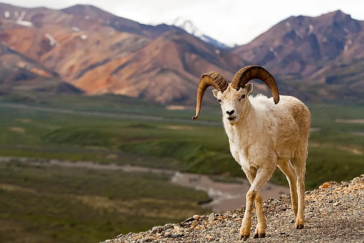
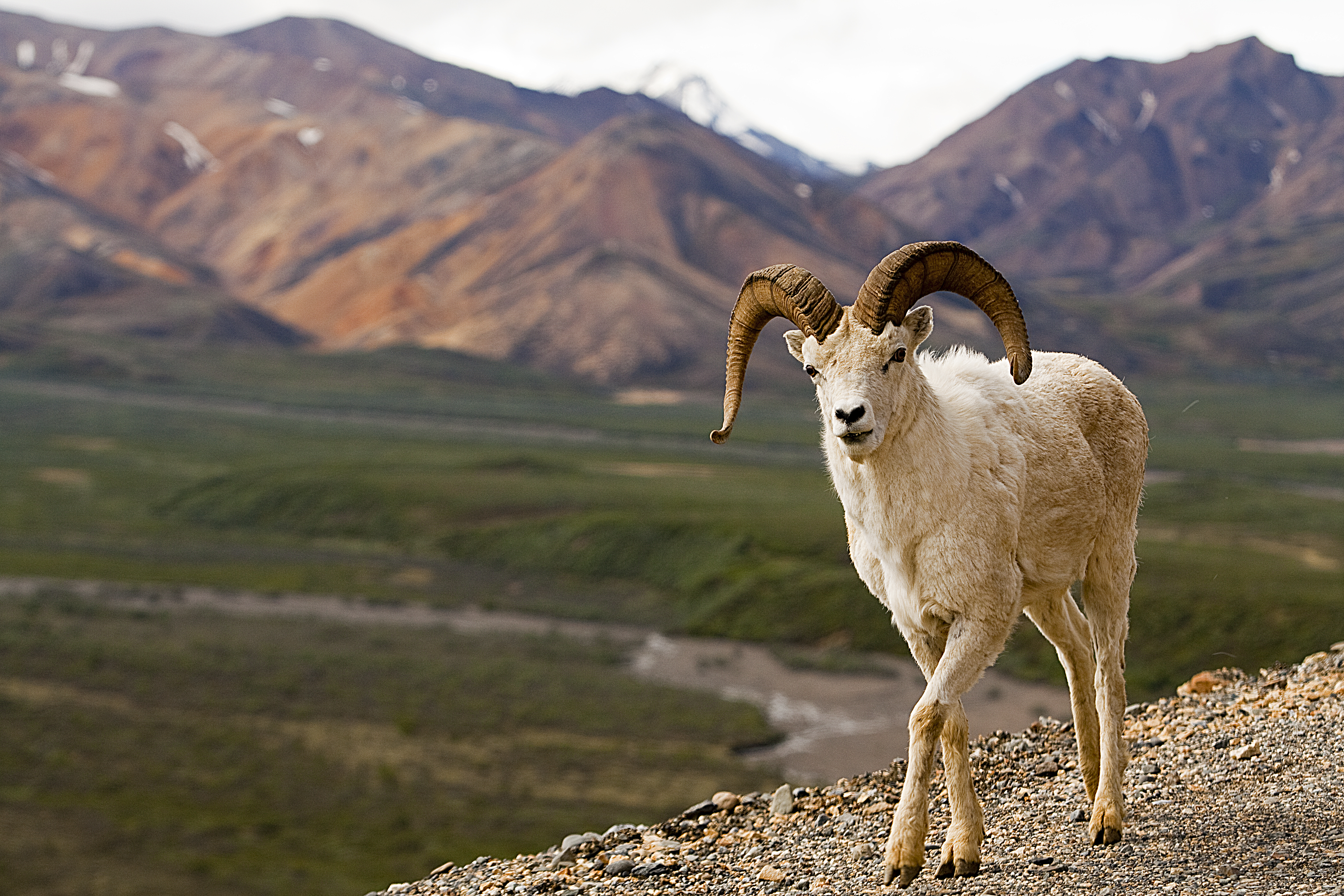


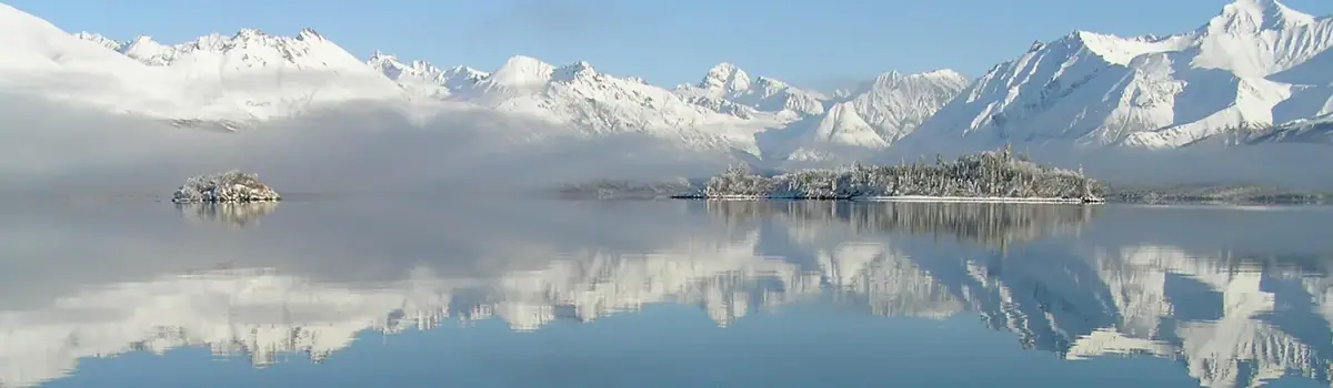 Lakes & rivers