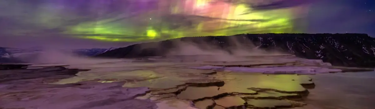
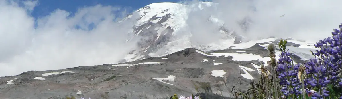
A showcase of melting glaciers, alpine meadows, carved valleys, and spectacular lakes. With over 700 miles of trails, Glacier is a paradise for adventurous visitors seeking a landscape steeped in human culture. Relive the days of old through historic chalets, lodges, and the famous Going-to-the-Sun Road.
1Macres of parkland
3.1Mrecreation visits, 2025
Jul · Aug · Sepnearby climate picks
Seasonal access & reservations
Going-to-the-Sun Road access Dates vary
Check the road’s current open sections and construction separately from vehicle reservation policy. A reservation announcement does not establish that the alpine crossing is open.
Before you go: Check the complete crossing and your vehicle restrictions.
Official guidance ↗ Reviewed 2026-10-192026 vehicle reservations Announced · 2026
NPS states vehicle reservations are not required in 2026. Check later-year policy separately; road restrictions and activity permits still apply.
Use an accessible, open east-side district for another appropriate trail or lake outing. Keep an alternative if parking, weather, or closures intervene.
Editorial recommendations, reviewed 2026-10-17. Full park days, excluding travel to and from the region. A first-visit outline for a general traveler; adapt to mobility, fitness, season, reservations, and current conditions. These are suggested days, not reserved activities or guaranteed routes.
With over 700 miles of trails in Glacier providing outstanding opportunities for both short hikes and extended backpacking trips, there’s something for everyone.
Area Trail Maps
The links below provide individual area maps that include lists of recommended day hikes, including distances and elevation gain. There is no cell phone coverage outside of Apgar and St. Mary, so take screen shots and plan ahead.
North Fork & Goat Haunt
St. Mary including Logan Pass
Trails, wilderness campgrounds, and other areas of the park that have closures, or are posted for safety reasons, are listed on our Trail and Area Closure page. The reports are updated each morning.
Trail conditions and statuses change frequently. To be the first to know, sign up for Glacier National Park Notifications. Text GNPTRAILS to 333111 . You'll receive live updates and be the first to know trail closures and postings!
Early in the summer, lower elevation trails and trails near the boundary of the park are usually snow free. Trails in the higher elevations – over mountain passes and on the Continental Divide – are typically snow free by late July.
In the wilderness, little mistakes can quickly become big emergencies. Follow our advice to stay safe and be prepared:
Hike as a group to reduce the likelihood of negative wildlife encounters.
Stay together. Separated parties make up more than 75% of our search and rescue incidents.
Expect not to have cell phone coverage.
Help may be hours or days away. Prepare to care for yourself.
Tell someone precisely where you're going, when you'll be back, what route you're taking, where your car is parked, what the license plate number is, and what you'll be wearing. This information reduces response time exponentially in the event of an emergency.
Stop at a visitor center or ranger station or check the website for trail and weather conditions.
Familiarize yourself with hazards so you will stay safe and have fun.
Sturdy footwear is a must.
Bring plenty of water, as surface water in the park may be unsafe to drink.
Carry bear spray and know how to use it.
Insect repellent is advisable.
Sunscreen and a hat help prevent sunburn. A day of hiking can expose you to much more sun than usual.
Pack rain gear and layers for warmth, as weather can change quickly.
Bring snacks or a lunch to eat on the trail. Remember, if you pack it in, pack it out.
Check out the NPS Ten Essentials page to learn more.
Hiking alone is not recommended and there are opportunities to join groups if you would like.
Check the Ranger-led Activities page for information on joining a hike with a park ranger.
Glacier Guides offers guided half-day, full-day, overnight, and chalet hikes. Equipment rentals and porter services to deliver your gear to wilderness campsites are available. See the Guided Hiking page for contact information.
Some boat tours in Many Glacier and Two Medicine offer optional guided hikes conducted by either park rangers or Glacier Park Boat Co . employees.
Overnight Trips
Additional Planning Resources
Heading out to a national park? Make sure you pack the 10 Essentials!
This is not a black and white list of rules or regulations. Rather, it is a way of thinking, an attitude, and an ethic.
Wilderness Camping
Glacier's backcountry camping program is designed to minimize resource impacts while providing positive visitor experiences.
Glacier's goal is to be a leader in understanding, communicating, and responding to the consequences of climate change.
Overview of the Park's Glaciers
Here are the most frequently asked questions about how the park's glaciers are responding to climate change.
Glacier National Park is warming at nearly two times the global average and the impacts are already being felt by park visitors.
Boat Tours Boat tours with commentary are available at Many Glacier, Two Medicine, Rising Sun, and Lake McDonald.
Bus Tours Sun Tours offers interpretive tours highlighting Blackfeet culture. Xanterra offers tours on Glacier's fleet of historic red buses.
Guided Hiking Guided Hiking Guided day hikes, backpacking trips, and drop-camp service are available in Glacier's backcountry.
Raft Tours Several raft companies operate commercially guided raft trips on the Middle Fork and North Fork of the Flathead River.
Horseback Rides Guided horseback rides are available inside the park at Many Glacier, Lake McDonald, and Apgar.
Glacier Institute Field Courses Our non-profit partner, the Glacier Institute, offers a variety of hands-on, field-based educational courses for all ages.
Camping in Glacier National Park is a great way to experience this spectacular place. There are 13 front country campgrounds, and each campground varies in size and amenities. Whether you wish to tent-camp or camp with an RV or other vehicle, one or more of the park campgrounds should suit your interests. Follow the links below to plan and enjoy a fun adventure in Glacier.
Eight of Glacier National Park's 13 campgrounds are available by reservation only.
Learn how to secure a same day, first-come, first-served campsite.
Discover campground options outside of the park boundary.
The how-to's and need-to-knows of spending the night safely in Glacier National Park.
Take a peek at all 13 of Glacier's drive-up campgrounds.
Glacier is a photographer's paradise, but proper etiquette and protocol should be followed while you’re out capturing the beauty preserved here. Before you plan where to take photographs, make sure to read through our tips and guidance for responsible practices in the park. Follow us on Instagram, Facebook , Steller , and Flickr for more photos of Glacier.
NPS / TIM RAINS
COURTESY JACOB W. FRANK
Sunset From the West Side As the sun beams say goodnight to the mountains, the alpenglow smolders on the landscape in warm oranges, pinks, and lavenders. If you want to capture silhouetted peaks as the sun disappears on the horizon, park in a pull-out on the high-elevation parts of Going-to-the-Sun Road and face west.
Whether it's near the road, on a trail, or in the backcountry, Glacier has a plethora of beautiful, clean, and clear waters. Popular water features include waterfalls, which are best from spring through early summer, turquoise waters, which can be found in many glacier-fed lakes like Avalanche Lake, and the famous colorful pebble shorelines, which are all over the park. Popular spots to capture these multicolored rocks are along the southeastern edges of Lake McDonald.
Photography Guidance
Trails are Best Stay on trails while taking photographs to help maintain the pristine setting you came to enjoy. If stepping off the trail, snow and rocks are durable surfaces that can withstand human impact over time. Choosing a durable surface helps to keep our trails from widening and helps protect vegetation. Never Duck the Rope Certain areas specifically prohibit off-trail travel, such as the beautiful alpine meadows at Logan Pass. Help protect and preserve the sensitive, rare, and endangered vegetation that grows here. While your freedom to photograph the scenery is important to us, no photo is worth jeopardizing vegetation, wildlife, or visitor safety. Zoom with the Lens, Not the Feet Never approach or pursue animals to take their picture. All wildlife can become aggressive without warning if startled, threatened, or confused. Animals may carry infectious diseases, and they could be euthanized if they have harmed a person. Stay safe and take part in conservation by maintaining 100 yards (91 m) distance from bears and wolves, and 25 yards (23 m) from everything else. Consider Not Taking the Photo As most visitors use their phone as their camera (instead of a powerful telephoto lens), it’s very challenging to snap a detailed photo of wildlife while exercising the legal viewing-distance protocols. Putting your phone away will allow you to focus on maintaining proper distance, keep you and the wildlife safe, and help you observe the animal without distraction. Park in Pullouts Don’t stop and block driving lanes while trying to view or photograph wildlife or scenery. There are many paved pullouts to use along our scenic roads where you can stop and enjoy the views for as long as you like. Do your part in conservation and refrain from driving or parking on vegetation.
Bicycles are allowed only on paved roads, unpaved roads, and multi-use paths (bike paths), unless otherwise posted.
A fee is charged when entering the park via bicycle.
During Spring Hiker/Biker Season, road crew closures are in place Monday through Thursday during plowing. Visitors may advance to the Avalanche Hazard Closure when road crews are not working. Avalanche Hazard Closures are in place at all times. Progressive closure locations are determined weekly on Thursdays. Visitors are prohibited from going past the hiker/biker closures. Violators are putting their safety and the safety of our park rangers at risk and could face up to a $5,000 fine and up to 6 months in jail. You can find closure information on our Road Status Page .
Bicycles are not allowed on any of Glacier's hiking trails or in any backcountry areas.
Bicyclists in the park must obey the same rules and regulations that apply to motorized vehicles.
Electric bicycles (e-bikes) are allowed if the motor is less than 750 watts (1 hp) and engaged only while pedaling.
When roadways are open to vehicles, riding a bicycle abreast of another bicycle is prohibited. Keep well to the right in single file.
Bicyclists must use pull-outs to allow traffic to pass when they are available and must pull off the road, coming to a complete stop, when four or more cars have stacked up behind them.
During low visibility and between sunset and sunrise, bicyclists must display a white light or reflector on the front and a red light or reflector on the rear.
Peak Season Restrictions
Going-to-the-Sun Road becomes extremely busy in the late afternoon. To protect public safety and limit congestion, peak season restrictions have been established. Due to limited sight distance, exposed ledges, and sections of narrow, steep, and winding road, the Apgar to Logan Pass section of Going-to-the-Sun Road is closed to bicycle use from when Going-to-the-Sun Road opens fully to vehicles through September 27 during the following times:
From when Going-to-the-Sun Road is fully open to vehicles though September 27, bicycles are prohibited from Apgar to Logan Pass going eastbound between 12 pm and 6 pm.
From when Going-to-the-Sun Road is fully open to vehicles through September 27, bicycles are prohibited from Logan Pass to Apgar going westbound between 3 pm and 6 pm.
Drivers are often distracted by scenery in the park, so ride defensively.
Always wear a helmet.
Maintain control of your speed.
Bring a headlamp if biking in the early morning, late afternoon, or evening.
Use hand signals to communicate with drivers and other bicyclists.
Never leave food unattended, including in bicycle panniers and backpacks.
None of Glacier’s roads have bicycle lanes or shoulders. Wear high visibility clothing and protective equipment.
When riding an e-bike, mount and dismount carefully. The added weight of the battery and motor assist technology can add twenty or more pounds to the typical weight.
Make sure to carry and understand how to use bear spray and understand the dos and don’ts of a wildlife encounter . Maintain 25 yards (23 m) distance from all large animals, and 100 yards (91 m) from bears and wolves.
Always let an outside party know where you are going and check in when you get back safely. There are many hazards on bicycling routes, such as vehicle collisions, wildlife, rockfall, and avalanches.
Check tire pressure before you set out and make sure you have the necessary tools to change a tire. Check that your pump matches the valve on your tire.
Hiker/Biker Campsites
A limited number of sites at Apgar, Fish Creek, Sprague Creek, Avalanche, Rising Sun, St. Mary, Many Glacier, and Two Medicine Campgrounds are set aside for those arriving by bicycle or on foot (hiker/biker sites). Sites may be shared, with a total capacity of up to 8 people per physical site; larger groups must split up or use group sites where available. If hiker/biker sites are full or campers do not want to share a site, hikers/bicyclists must use regular, unoccupied campsites which require a reservation through Recreation.gov . Prices for all hiker/biker sites are $8 per person. Most front country campgrounds require registration for hiker/biker sites via Scan & Pay. Scan & Pay is available on the free, Recreation.gov mobile app. Visit our Camping Information page for more information. Hiker/biker sites are for non-motorized campers only. Motorcyclists must use regular, unoccupied campsites . Read more about campgrounds on our Camping page.
Are There Bike Trails?
Bicycles are permitted on all paved and unpaved roads in the park.
The Fish Creek Bike Path from Grist Road to Fish Creek
The paved bike path from Park Headquarters to Apgar Village, Visitor Center, and Campground
The old Flathead Ranger Station trail accessed from Quarter Circle Bridge Road
The section of Inside North Fork Road, which is currently restricted to vehicles, between Camas Creek and Logging Creek
Spring Bicycling on Going-to-the-Sun Road
In Spring, portions of Going-to-the-Sun Road are open for hiking and biking, beyond the vehicle closure.
Road Crew Closures are in place Monday through Thursday during plowing. Visitors may advance to the Avalanche Hazard Closure when road crews are not working. Avalanche Hazard Closures are in place at all times. Progressive closure locations are determined weekly on Thursdays. Visitors are prohibited from going past the hiker/biker closures. Violators are putting their safety and the safety of our park rangers at risk and could face up to a $5,000 fine and up to 6 months in jail. You can find closure information on our Road Status Page .
During hiker-biker season, shuttles are typically available to transport bicyclists and their bicycles from the Apgar Visitor Center to the point where the road is restricted to vehicles. Parking lots fill early at this time of the year, and it may be wise to plan on using a shuttle. Note: In 2026, shuttles will not be available for the hiker/biker season.
Bring extra warm layers for when you’re finished riding. Most bicyclists get wet from precipitation and snowmelt along the upper elevations of Going-to-the-Sun Road.
Bring enough food and water for the full day, as there are typically no services at this time of the year beyond Apgar Village and West Glacier.
Rangers often must respond to bicyclists with cases of hypothermia from riding downhill in the spring and early summer. Riders often wear t-shirts and shorts heading uphill, as the 6% grade on a bike is heavy aerobic exercise. Downhill bicyclists often wear winter hats, gloves, and coats. While the exercise keeps you warm, zooming down the mountainside at high speeds can rapidly cool you.
The upper stretches of the road can be extremely wet from snow melt, and the tire spray will get you wet.
Temperatures at various elevations can differ significantly. It may feel like summer down below and winter up high.
Glacier’s weather is rapidly variable at high elevations. There can be sudden graupel, hail, rain, and snow events. Keep your eyes peeled for incoming weather and check the weather reports for both low elevations on the road and Logan Pass to know what to expect.
Windbreakers or rain shells over thin insulated jackets are good layers to bring for possible inclement weather conditions.
A thin, neoprene hat will help keep your head warm, and it will fit under a helmet.
Gloves and neck gaiters assist greatly with retaining warmth.
Bring additional dry and warm layers for after your ride.
Avalanche Danger
Generally, avalanches do not pose a significant threat to areas below The Loop. While the park does monitor avalanche danger and will subsequently restrict access to portions of the road as necessary, bicyclists have been caught between avalanches on the road in years past. You should always keep your eyes and ears peeled for signs and areas of avalanche danger . Check Flathead Avalanche for more information on avalanches and avalanche forecasts.
Rocks and Rockfall
Rocks of all sizes can always be found on the road. While smaller ones pop tires, larger rocks can throw you entirely off course as you’re speeding down the mountainside, leading to potential high-speed crashes and severe injury. Make sure to stay alert, watch where you’re riding, avoid running over rocks, and always wear a helmet.While it’s uncommon, rocks can fall from higher elevations and tumble with force and high velocity down to the road. Know that you are biking at your own risk in a natural, hazardous landscape.
Rangers often must respond to uphill-downhill bicyclist collisions. Do your best to stay in the right lane, with slower traffic keeping to the far right. Skilled riders travel downhill at extremely high speeds. Stay alert and look far ahead whenever you have visibility, so that you know when others may be coming around blind corners.Slow down and exercise extreme caution while bicycling through The Loop. It’s a congested area and a popular place for families to rest with younger children.
Pay attention to the “Safety” list above, as animal sightings are common on the road during the hiker-biker season. During a wildlife encounter, you may be in an area with steep cliffs both above and below. Be sure to stop at a distance that allows the animal a clear route to move away from you. Moose and deer are common at lower elevations. Goats, sheep, and marmots are seen at higher elevations, and bears are common at all elevations.
Ride Distances and Elevation Gain
From the road closure on the west side at the Lake McDonald Lodge:
Avalanche Creek – 5.5 mi; 219 ft
the West Tunnel – 12.7 mi; 1,030 ft
the Loop – 13.3 mi; 1,100 ft
Big Bend – 18 mi; 2,545 ft
Logan Pass – 21 mi; 3,427 ft
From the road closure on the west side at Avalanche Creek:
the West Tunnel – 7.2 mi; 811 ft
the Loop – 7.8 mi; 881 ft
Big Bend – 12.5 mi; 2,326 ft
Logan Pass – 15.5 mi; 3,208 ft
From the road closure on the east side at Rising Sun:
Sun Point – 3.5 mi; 181 ft
Sunrift Gorge – 4.2 mi; 223 ft
St. Mary Falls Trailhead – 4.7 mi; 295 ft
Jackson Glacier Overlook – 6.9 mi; 846 ft
Siyeh Bend – 8.9 mi; 1,421 ft
Lunch Creek – 10.9 mi; 2,110 ft
Logan Pass – 11.5 mi; 2,313 ft
Know Before You Go
Planning on biking the Going-to-the-Sun Road this Spring? Here's a downloadable postcard with some information you need to know before hitting the road. It contains a map with distances, shuttle information, and closure information. Hiker/Biker Season Postcard
Closed Waters / Season and Limits / Stocking and Native Fish / Fish ID / Bait and Equipment / Boating Permits / Cleaning Fish / Ice Fishing
A primary purpose of Glacier National Park is to preserve natural ecosystems for their aesthetic, educational, cultural, and scientific values. Through the management of fish and aquatic environments, we hope to encourage an appreciation for preserving native fish species in mostly undisturbed habitats. Fishing is permitted when consistent with preservation or restoration of natural aquatic environments.
The following areas are closed to fishing:
Kintla Creek between Kintla Lake and Upper Kintla Lake
Upper Kintla Lake
Bowman Creek above Bowman Lake
Logging Creek between Logging Lake and Grace Lake
Slide Lake and the impounded pond below the lake
The following creeks are closed for their entire length: Ole, Park, Muir, Coal, Nyack, Fish, Lee, Otatso, Boulder, and Kennedy Creeks.
North Fork of the Belly River
North Fork of the Flathead River within 200 yards (183 m) of the mouth of Big Creek.
Seasons and Regulations
No fishing license is required to fish inside park boundaries. No bull trout may be retained. Any caught incidentally must be handled carefully and immediately released. Wet hands with lake/river/stream water before handling fish. Fish Consumption Advisory: If you plan on keeping fish to eat, please check the fish consumption guidelines. The standard fishing season for most waters in the park is from the third Saturday in May through November 30, with the following exceptions:
Lake fishing is open all year in the park.
Waterton Lake season and catch and possession limits are the same as set by Parks Canada. Check Canadian regulations before fishing these waters.
Lower Two Medicine Lake season and catch and possession limits are set by the Blackfeet Nation. Check Blackfeet Tribal regulations .
North Fork of the Flathead River catch and possession limits, seasons, and methods of take, are the same as those set by the State of Montana. However, no state fishing license is required when fishing the North Fork from park lands. Check Montana Fish, Wildlife, and Parks regulations before fishing.
When fishing the Middle Fork of the Flathead River from park lands or bridges, a Montana fishing license is required, and state regulations are applicable.
Hidden Lake outlet creek and an area extending into Hidden Lake for a radius of 300 feet (92 m) are closed to fishing during the cutthroat spawning season (usually the majority of July). This is due to the concentrated presence of bears feeding on spawning cutthroat trout.
From May 1 through June 15, an area extending 400 yards from shore between the Bowman Lake Ranger Station and the outlet of Bowman Lake is closed to fishing to protect spawning westslope cutthroat trout.
Catch and Possession Limits
All native fish caught must be released. There is no daily catch or possession limit on non-native fish species in the park.
St. Mary/Belly/Waterton River drainages native fish: bull trout, lake trout, burbot (ling), westslope cutthroat trout, northern pike, lake whitefish, mountain whitefish, suckers. Exception: St. Mary Lake: No more than 5 fish may be harvested and possessed in combination with the following limits on individual species: 2 burbot (ling), 5 lake trout, 1 northern pike, 2 cutthroat trout, 2 mountain whitefish, and 5 lake whitefish (all are native species to the St. Mary River Drainage). All bull trout must be immediately released.
Exception: St. Mary Lake: No more than 5 fish may be harvested and possessed in combination with the following limits on individual species: 2 burbot (ling), 5 lake trout, 1 northern pike, 2 cutthroat trout, 2 mountain whitefish, and 5 lake whitefish (all are native species to the St. Mary River Drainage). All bull trout must be immediately released.
Missouri River Drainage (i.e. Two Medicine and Cutbank creek drainages) native fish: westslope cutthroat trout in Midvale and Railroad creeks only
Flathead River Drainage non-native species: Yellowstone cutthroat trout (Fish, Hidden, and Grace lakes only), lake trout, lake whitefish, kokanee, rainbow trout, and brook trout
St. Mary River/Belly/Waterton River drainages non-native species: Yellowstone cutthroat trout (in all lakes except St. Mary Lake: see above), rainbow trout, brook trout, and grayling
Missouri River Drainage (i.e. Two Medicine and Cutbank creek drainages) non-native species: lake trout, brook trout, Yellowstone cutthroat trout, and rainbow trout
Fish Consumption Advisory If you plan on keeping fish to eat, please check the fish consumption guidelines .
Stocking and Native Fish
Many people wonder why the National Park Service no longer stocks fish in park waters after this was done for many decades to enhance sport fishing. The reason is simple. The introduction of non-native fish has resulted in competition for food and space, as well as predation on, and hybridization with, Glacier's native fish species. In addition, stocking fish into fishless waters impacts plankton communities and may impact amphibians as well. The National Park Service is currently engaged in fisheries research to assess the status of native fish in the park and to develop programs to protect and enhance their populations. Ensuring the future survival of Glacier National Park's unique native species for the benefit and enjoyment of future generations is a key mandate of the National Park Service.
Fish Identification
Native fish such as bull trout and westslope cutthroat trout can be distinguished from other species in a number of ways:
Cutthroat trout have a characteristic red “slash” under their lower jaw.
Bull trout have pink or orange spots on their sides with pale yellow spots on their backs.
Lake trout have a deeply forked tail and numerous white (light) markings on their body. They do not have pink or orange spots on their sides.
Brook trout have black markings on their back and dorsal fin, along with red or orange spots surrounded by blue halos on their sides.
Don't assume that because a fish is small, it can't be a bull trout. Juvenile bull trout rear in small streams and can be confused with brook trout. If you don't know, LET IT GO. For help, pick up a free Fish in Glacier identification brochure at visitor centers or ranger stations. Further information on fishing in Glacier National Park is available at park bookstores or by calling the Glacier National Park Conservancy at 406-888-5756. Request the publication Fishing Glacier National Park ($18.95).
Equipment and Bait
Fishing is allowed by hook and line only; use of only one rod per person is permitted.
The rod or line must be closely attended at all times.
Only artificial flies and lures are permitted in order to reduce harm/mortality to native fish. Exception: Bait is permitted when fishing in the Two Medicine drainage upstream of the Two Medicine bridge at the Running Eagle Falls parking lot, as well as in the Many Glacier Valley upstream of the falls at the outlet of Swiftcurrent Lake.
Exception: Bait is permitted when fishing in the Two Medicine drainage upstream of the Two Medicine bridge at the Running Eagle Falls parking lot, as well as in the Many Glacier Valley upstream of the falls at the outlet of Swiftcurrent Lake.
Fishing with nets, seines, traps, drugs, or explosives is prohibited.
Do not deposit fish eggs, roe, food, or other substances in waters to attract fish.
Snagging fish in park waters or from park lands is prohibited.
The use of felt-soled wading boots is prohibited to prevent the introduction of Aquatic Invasive Species to park waters.
Treble hooks are prohibited on the North and Middle Forks of the Flathead River.
The use of all lead associated with fishing is prohibited within the park. This includes weights, lures, jigs, line, etc.
Exception: an angler who is using a "down-rigger" may use “cannon ball” lead weights of 2 pounds or larger on the down-rigger cable.
Boating Permits
If you’re planning on fishing by boat, please visit our Boating Information & Permits page for regulations and permit requirements. All boats require an Aquatic Invasive Species (AIS) inspection prior to launching on any park waters. Visit our Boating Information & Permits page to find out inspection locations and hours. Aquatic Invasive Species are non-native species that can harm native ecosystems as well as negatively impact visitor use and enjoyment of park waterways. AIS come in many forms, including animals such as zebra and quagga mussels, plants such as Eurasian watermilfoil, or pathogens such as whirling disease. These species can hitch a ride on boats, trailers, and float tubes, as well as on waders and wading boots. AIS have devastating impacts on native aquatic ecosystems. Please thoroughly clean, drain, and dry all your boating, wading, and fishing equipment before coming to the park.
When cleaning fish, use garbage cans where available for disposal of entrails (guts). When cleaning fish away from developed areas, fish entrails (guts) must be disposed of by puncturing the air bladder and dropping them into deep water at least 200 feet (61 m) from the nearest campsite or trail. Do not bury or burn entrails, as they will attract bears. The skin must remain attached to any fish harvested while in the park for staff identification purposes.
Remember that the park is home to both black and grizzly bear populations; please be respectful when visiting their habitat. Bears are usually shy, but make no attempt to approach or startle them, as they have been known to attack without warning. Never leave food unattended. When hiking, make noise to alert bears of your presence. Never offer food to bears and never get between a sow (mother) and cub. For more information on bears and associated regulations, please visit the park’s Bear Safety page. Report all bear sightings to a ranger.
No motorized vehicles (snowmobiles, ATVs, autos) are allowed on any lake, river, or stream.
Power augers are prohibited on all lakes within the park.
Shelters and all fishing equipment may not be left unattended.
No open fires are allowed. Self-contained stoves with fuel may be used.
Undesignated camping is not allowed on lakes or lakeshores.
Toilets should be used if available. Otherwise, human waste should not be disposed within 100 yards of any water source, and all toilet paper must be packed out.
Learn more about fish, fishing, and the work the National Park Service does to conserve aquatic habitats nationwide.
All watercraft launched within Glacier National Park MUST be inspected for aquatic invasive species (AIS) prior to launching.
Glacier National Park sits at the headwaters of three major watersheds. Following the detection of invasive mussel populations in central Montana, the park implemented its Aquatic Invasive Species Action Plan. We need your help in safeguarding our water—help us stop the spread of harmful aquatic invasive species (AIS). These are non-native species that have devastating impacts on native aquatic ecosystems and negatively impact visitor use and enjoyment of park waterways. Lake trout, an aquatic invasive species, has been extremely detrimental to native bull trout populations, replacing them as the top aquatic predator in many of the large lakes on the west side of Glacier. AIS can come in many other forms, including other animals such as zebra and quagga mussels, plants such as Eurasian watermilfoil, or pathogens such as whirling disease. These species can hitch a ride on boats, trailers, and float tubes, as well as on waders and wading boots. Thoroughly clean, drain, and dry all of your boating, wading, and fishing equipment before coming to the park. Private, gas-powered, motorized vessels are prohibited on all park waters, except Lake McDonald, St. Mary Lake, Two Medicine Lake, and Bowman Lake. A free launch permit is required to launch all watercraft in Glacier National Park. In order to qualify for the permit, all boats must be inspected for AIS at Glacier and found to be clean, drained, and dry. The signed permit should be kept on the boaters person or in the vessel. Inspections are available during normal business hours at various locations throughout the park.
Boating Permits and Season Dates
Vessels are permitted on park waters on the west side of the Continental Divide between the second Sunday in May and October 31. In 2026, vessels are permitted on park waters on the east side of the Continental Divide between the last Saturday in May and Saturday, September 26.
Inspection stations for motorized boating and hand-propelled watercraft are located on the west side of the park in Apgar Village and Polebridge, and on the east side of the park at St. Mary Entrance Station, and along the Two Medicine entrance road. Though launch hours for hand-propelled watercraft are not restricted, inspection hours are limited. Boat trailers are not permitted to enter park waters except when they have been quarantined (30 days) along with a motorboat. Ballast tank boats with compartments that can’t be inspected to ensure they are clean, drained, and dry are not permitted on park waters. All trailered, non-motorized watercraft must be hand carried to launch points. Boaters who exit the park after receiving a launch permit are still required to stop at an inspection station upon returning. Glacier National Park honors motorized watercraft inspections and seals from Montana State, Whitefish Lake, Confederated Salish and Kootenai Tribes, Blackfeet Tribe, and Waterton Lakes National Park, following a 30-day quarantine . Dated sealing documentation must be presented prior to launching. Personal Flotation Devices (PFD) are required for all watercraft users. Launch permits will not be issued without proof of a PFD for each boater.
Apgar (Lake McDonald)
Inspection station across the road from the Apgar boat dock.
Both motorized and non-motorized.
For motorized boaters wishing to launch on opening day, we suggest you have your boat inspected and sealed at one of our partner AIS inspection stations 30 days prior to opening day.
<75dB noise restriction when underway and <88dB when stationary. No HP restrictions.
Season Dates: May 10 to September 30: 7:30 am–5 pm October 1 to October 31: 8 am–4 pm Hours will be adjusted for waning daylight
May 10 to September 30: 7:30 am–5 pm
October 1 to October 31: 8 am–4 pm
Hours will be adjusted for waning daylight
Inspection station at the Polebridge Ranger Station.
Non-motorized boating on Kintla and Bowman Lakes.
<10 hp motorized boating allowed on Bowman only.
Inspections may be available at Kintla and Bowman Lakes outside of normal business hours, subject to NPS staff availability, and not guaranteed. All vessels entering North Fork lakes must be inspected prior to launch.*
Season Dates: May 10 to September 30 (dependent on seasonal road opening/closures): 7:30 am–5 pm
May 10 to September 30 (dependent on seasonal road opening/closures): 7:30 am–5 pm
*Inspections at Apgar, issued for use in the North Fork, will be honored.
Inspection station is located at the Many Glacier Ranger Station.
Non-motorized boating on Swiftcurrent Lake and Sherburne Reservoir.
<10 hp non-trailered, electric motorized boating allowed on Sherburne Reservoir only.
Season Dates: May 30 to September 26: 7:30 am–5 pm
May 30 to September 26: 7:30 am–5 pm
Inspection station is located in front of the St. Mary Visitor Center.
Both motorized and non-motorized. (Motorized craft are permitted on St. Mary Lake after a 30-day quarantine.)
Inspection station is located in a turnout on the north side of Two Medicine Road, two miles east of the entrance station.
Both motorized and non-motorized. (Motorized craft are permitted on Two Medicine Lake after a 30-day quarantine.)
Season Dates: May 30 to September 7: 7:30 am–5 pm
May 30 to September 7: 7:30 am–5 pm
Federal and State Regulations
National Park Service boating regulations are found in Title 36, Part 3 of the Code of Federal Regulations and are available at park headquarters and staffed ranger stations. It’s your responsibility to know and obey the US Coast Guard and State of Montana regulations for boat operation and safety. Rangers may board any boat for the purpose of examining documents, licenses, and other permits relating to the operation of the boat and to inspect the boat to determine compliance with regulations.
All sailboats 12 feet (3.7 m) in length and longer must be registered and numbered according to State of Montana regulations. Hand-propelled boats are exempt.
Required Equipment
One US Coast Guard-approved, wearable, personal floatation device (PFD), of the appropriate size for the intended user, readily accessible, and in good condition, must be carried on board.
All children 12 years and under must wear a PFD when the vessel is underway.
Navigation lights for motorboats and sailboats must be used between sunset and sunrise.
Non-motorized boaters should have a light if out after dark.
Rules of the Waterways
Keep to the right in channels and when approaching another boat head-on or nearly so.
Yield right-of-way to vessels on your right in crossing situations and to vessels you overtake or pass.
Boats propelled by oars, paddles, or sails have the right-of-way over boats propelled by motors.
Prohibited Actions
Reckless/negligent boat handling that endangers or is likely to endanger the lives of others.
Boat handling by any person under the influence of alcohol or drugs.
Riding the gunwales, transom, or foredeck while the boat is moving faster than 5 mph.
Swimming from a boat while it’s underway.
Interference with other boats or with free and proper navigation of waterways.
Leaving a boat unattended for more than 24 hours without specific authority from the park superintendent or his/her duly authorized representative.
Using trailers to launch or recover vessels.
Overloading of boats.
Installation of any obstruction in the water.
Operating airboats.
Operating personal watercraft vehicles (Jet Ski, Wave Runner, etc.).
Operating a vessel over 5 mph within 100 feet (30.5 m) of a diver’s marker or swimmer.
Discharging toilet waste into the water.
Depositing trash, refuse, or debris of any kind in the water.
Accidents and Reports
Boaters should render assistance to all persons needing help.
Report any accident resulting in death, personal injury, or property damage to a park ranger no later than 24 hours after the incident.
The operator of each vessel involved must complete a written report. This report needs to include the name and address of the boat operator and identification of the boat to any injured person or to the owner of any property damaged.
Use of Watercraft in Glacier
Trailered watercraft with gas-powered motors are permitted on Lake McDonald, Bowman Lake (10 hp limit), Two Medicine Lake (10 hp limit), and St. Mary Lake after an inspection and after being quarantined for 30 days prior to launch. Boats will be sealed to the trailer after inspection and seals will be removed by park personnel following the 30-day drying time. Non-motorized watercraft and non-trailered, electric motorized watercraft will also be permitted, and do not require the quarantine period. The road to Bowman and Kintla lakes has length restrictions. The total length of a vehicle and trailer may not exceed twenty-one feet. Non-motorized watercraft and non-trailered, electric motorized watercraft are permitted same-day launch on Lake McDonald, Bowman Lake, St. Mary Lake, Two Medicine Lake, and Sherburne Reservoir, after inspection and permit issuance by NPS staff. They do not require a 30-day dry time because the motors are not water-cooled and therefore are classified as lower risk, similar to hand-propelled watercraft. Kintla Lake is open to hand-propelled watercraft, after inspection. Inspections for the North Fork area of the park (Bowman and Kintla lakes) are performed just across the bridge from the Polebridge Ranger Station. Hand-propelled boats and sailboats are permitted on park waters with the following exception: the section of Upper McDonald Creek between Mineral Creek and Lake McDonald is only open to boating and floating (of any type) from October 1 to October 31 in order to protect nesting Harlequin ducks. Boating may be restricted in certain areas for safety, or to protect sensitive wildlife habitat throughout the park. Marker buoys and/or signing will be placed to designate the closures. Shoreline Restrictions In order to provide for the safety of
Boat Docks and Launching Ramps
Public boat docks are located at Lake McDonald (Apgar), St. Mary, and Upper Waterton (Goat Haunt) lakes. Trailers may not be used to launch or recover watercraft. Boat launching ramps are available on Bowman and McDonald lakes on the west side of Glacier, as well as Swiftcurrent and St. Mary lakes on the east side of the park. Whitewater canoeing, kayaking, or rafting can be enjoyed on the Flathead River, which forms the south and west boundary of Glacier. Boaters operating on Waterton Lake, who land in the United States, must report their intention to cross the international border to Customs and Border Protection (CBP) through the CBP Roam app. This can be done on a personal device or by using a tablet at the Waterton Townsite.
Camping and Overnight Use
A Wilderness Camping Permit is required for all overnight backcountry camping. Between May 1 and October 31, a $7 per-person, per-night fee will be charged at the time of permit issuance, as well as a $10 permit fee. Please check Glacier's Wilderness Camping page for details. Undesignated camping is not allowed on lakes or lakeshores. Overnight camping on a vessel/boat within the park is prohibited.
Pets are allowed in developed areas, frontcountry campsites and picnic areas, along roads, and in vessels on lakes where motorized watercraft are permitted (Bowman, McDonald, Sherburne, St. Mary, Two Medicine, and Upper Waterton Lakes). Pets must be on a leash no longer than six feet, under physical restraint or caged at all times, including while in open-bed pickup trucks. Pets are not to be left tied to an object when unattended. Pet owners must pick up after their pets and dispose of waste in a trash receptacle. Owners must not allow a pet to make noise that is unreasonable.
Glacier’s rivers and lakes are very cold year-round. All users (boaters and swimmers) should be aware of the dangers of hypothermia, even at temperatures above freezing. People in poor physical condition or who are exhausted are particularly at risk. Avoid hypothermia by wearing water-resistant or moisture-wicking clothing and dressing in layers. Minimize wind exposure and, if your clothes become wet, shed and replace them with dry layers.
White water canoeing, kayaking, and rafting can be enjoyed on the North and Middle Forks of the Flathead River, which form the south and west boundaries of Glacier. Boaters operating on Waterton Lake who land in the United States are subject to US Customs regulations and are required to check-in prior to traveling to Goat Haunt USA using the cbp roam application. The app is available on both Apple and Google platforms. For more information, visit https://www.nps.gov/glac/planyourvisit/goathaunt.htm Packrafts, SUPs, and other non-motorized watercraft are permitted for use in the backcountry with a launch permit, obtainable at an inspection station inside the park. Note: inspection stations may not be available at all park entry points. Boaters must still visit an inspection station as required. Location details are provided above. After securing a permit, it may be necessary to exit the park and re-enter in a different location to access certain trailheads. In this instance, when no other inspection station is encountered, users may re-enter without needing another inspection.
Waterton Lakes National Park Permits
Motorized and trailer-launched watercraft require a 90-day quarantine after inspection before launching on Upper and Middle Waterton lakes. All non-motorized watercraft coming from outside of Waterton Lakes National Park boundaries are not permitted to enter waterbodies within Waterton Lakes National Park. Non-motorized watercraft include canoes, kayaks, rafts, stand-up paddle (SUP) boards (inflatable and hard), sailboats, paddle boats, belly boats, drift boats, windsurfers, kite boards, inflatable watercraft, inflatable toys, pedal assist kayaks, catamarans, hydrofoils, catarafts, and other amphibious watercraft. Water equipment and gear, such as fishing equipment, scuba gear, and PFDs (lifejackets) require a self-certification permit. Permit stations are located throughout the park. More information is available on the Waterton Lakes National Park Water Activities page.
Loop parking area to the junction of the Granite Park Trail
Sperry Chalet to Sperry Glacier
Trail of the Cedars
Hidden Lake Trail
Highline Trail from Logan Pass to Granite Park Chalet
Many Glacier Valley
Apikuni Falls Trail
Grinnell Glacier Trail
Hidden Falls Trail
Iceberg Lake hitch rail to Iceberg Lake
Josephine Walkway
Swiftcurrent Lake Nature Trail
Swiftcurrent Pass Trail from head of Bullhead Lake to Swiftcurrent Pass
St. Mary Valley
Baring Falls Trail from Sunrift Gorge
Two Medicine Valley
Dawson Pass to the Cutbank Pass Trail junction
Running Eagle Falls Nature Trail
Spur to Cobalt Lake from the Two Medicine Pass Trail
Hole-in-the-Wall spur from the Boulder Pass Trail
Forest and Fire Nature Trail
Spur to Lake Francis
Day Use Head Limits
Apgar Flats Trail
Apgar Lookout Trail
Apgar Mountain Loops off the Lower McDonald Creek Trail
Avalanche Trail #56 from the Lake McDonald Lodge to the junction of the Avalanche Lake Trail and Trail of the Cedars
Lake McDonald Lodge Trailhead to Sperry Chalet
Packers Roost to Granite Park Chalet
Upper McDonald Creek Trail
Cracker Lake Trail
Grinnell Lake Horse Trail
Josephine Lake Horse Trail
Red Gap Pass Trail from Many Glacier Road to Poia Lake
Old Flathead Ranger Station Road from the concession barn
When closed to vehicles, Bowman Lake Road and Inside North Fork Road
Low Impact Stock Use
Due to problems with noxious weeds, feeding hay at trailheads or wilderness campgrounds is prohibited.
Grazing of stock is not permitted. Stock users need to pack supplementary feed grain or pellets free of noxious weed seeds.
Transporting hay into or through Glacier is prohibited, except on the portion of US Highway 2 which passes through the park.
Feed must be hung out of reach of bears using an established food hanging device or an NPS-approved, bear-resistant feed container.
Stock are not permitted in front country campgrounds.
Scatter manure after camping or stopping for long periods and smooth out any ruts or holes.
Stock are not permitted in the camping areas of wilderness campgrounds. Load and unload at the hitching rails provided.
Cross-country riding, loose herding, and trailing are prohibited. Stay on designated trails and roadways approved for stock use.
Hikers are required to stand quietly on the lower side of the trail and yield right-of-way to stock. Most hikers don’t know and understand the need for this procedure, so stock users are encouraged to courteously coach them on proper meeting protocol.
When not being used, pack and saddle stock must be tethered. Horses or mules that are nervous "diggers" or "pawers" should be hobbled when tied to prevent unnecessary damage.
Always use hitching rails where provided. Where there are none, tie a rope between two trees away from the trail and hitch the stock to the rope. This avoids damage to the tree and trampling around the root system.
Tie at least 200 feet (61 m) from streams or lakes.
Glacier Meadow RV Park, 16 miles west of East Glacier Park (406) 226-4479
Johnson’s Campground, St. Mary (406) 732-4207
Flathead and Lewis and Clark National Forests. Contact the Hungry Horse Ranger Station for information (406) 387-3800.
Wilderness campgrounds have designated capacities for numbers of people and stock that cannot be exceeded. Overnight limits for specific cam pgrounds may not be exceeded for day use stopovers.
Up to eight head may be taken into areas that do not allow overnight use.
Parties which exceed limits may pass through an area but may not remain.
Glacier’s winter recreation opportunities are diverse, with trails and routes available for all skill levels. Weather conditions, as well as minimal park operations and services, can present challenges for many visitors. There are not many services available adjacent to the park, let alone within the park boundary. Ski and snowshoe rentals can be found at various private businesses in surrounding communities, but there are no rental opportunities in the park. If you are interested in a guided tour, see a list of operators on our Guided Winter Activites page . While recreating, make sure to adhere to winter-adapted Leave No Trace principles.
Guidelines for Safety
Most winter routes are not marked, so bring a good map with you.
Travelling on frozen lakes is very dangerous and is strongly discouraged.
Snowmobiles are not permitted anywhere in Glacier National Park.
Pets are not allowed on front-country trails, wilderness trails, or unplowed roads. Pets must always be leashed.
If hiking on trails in forested areas, be aware that snow conditions may vary, and tree wells are a concern.
Ice is common on roads and on heavily skied trails. Observe weather forecasts as your trip approaches to know what to expect.
Check for area and trail closures and current avalanche conditions , especially if you plan to go downhill skiing.
Survival during the long winter is difficult for wildlife, and human contact is a stressor. Apply wildlife safety protocols during all encounters.
Avoid hypothermia by drinking liquids, staying dry, carrying survival gear, wearing layers of clothing, and snacking frequently. Be alert to symptoms of drowsiness and confusion.
Weather is variable and differs between the several areas of the park. Check weather for regional differences between the west side , the east side , and the Continental Divide .
Cross-park trips involve extreme avalanche and terrain hazards and should be attempted only by experienced and well-equipped parties. Winter camping is limited, and permits are required for wilderness camping .
Be aware of current avalanche conditions . Avalanches are a major danger and can be deadly.
Never stop in or beneath an avalanche path.
If caught in an avalanche, make swimming motions and fight to stay toward the surface.
Stay on low angle ridges and in thick stands of trees if travelling off the recommended routes listed below.
If you must travel on a steep slope, minimize your time in that location. Fasten all layers of clothing, put on a hat and gloves, loosen pack straps, remove ski pole straps, and cross one at a time.
Watch for signs of slope instability, including recent avalanche activity, shooting cracks in the snowpack, and "whumpfing" sounds. Stay off cornices and steep, open slopes, and stay out of gullies
Avalanche activity increases with a foot or more of new snow, snowfall of one inch or more per hour, sustained winds over 15 mph, and sudden changes in temperature.
Winter Recreation Hazards
Wildlife viewing can be rewarding in winter. However, survival during the long winter is difficult for wildlife. Human contact adds unnecessary stress. Avoid approaching or startling any animals or birds. All park animals are wild and should never be fed. Bears, asleep for most of the winter, sometimes awaken for short periods of time. As always in bear country, exercise extreme caution, especially with food and garbage. If approached by a mountain lion, act aggressively. Do not run! Lions may be scared away by being struck with rocks or sticks, or by being kicked or hit.
Winter backcountry travel increases the risk of hypothermia and frostbite. Hypothermia, the “progressive physical collapse and reduced mental capacity resulting from the chilling of the inner core of the body,” is the primary killer of outdoor enthusiasts. Drink liquids, stay dry, carry survival gear, wear layers of clothing, and snack frequently. Be alert to symptoms of drowsiness and confusion. Once hypothermia sets in, external sources of warmth are necessary to revive the victim. Frostbite can occur on the ears, fingers, toes, face, or any exposed skin.
Enjoy Glacier’s Winter Landscape - Popular Routes
Apgar - West Glacier
The routes described in this area begin at two parking locations: the concession horse barn, reached by taking the first left off Going-to-the-Sun Road, past the West Entrance Station, and the road closure gate just beyond the McDonald Creek Bridge on the Camas Road.
Lower McDonald Creek
2 to 3 miles (3-5 km) round trip The trail begins just south of the McDonald Creek Bridge. The best access is the summer bike/foot path. This entire area is a good place to explore on your own. The gentle terrain along lower McDonald Creek provides easy skiing through the forest with side trips along the creek.
6 miles (9.6 km) round trip Follow the same route as McGee Meadow Loop (described at right) until 0.2 miles north of the Fish Creek Campground. Take the McDonald Lake Trail on the right, just before the gate on the road. The trail winds down a short hill but the route is fairly level for the most part. Ski left at the first trail junction then right at the next one shortly thereafter. The forest opens as you approach Rocky Point, where there are beautiful views up and down Lake McDonald.
10.5 miles (16.9 km) round trip Park at the plowed area in front of the barn and follow the left fork of the unplowed road across the Quarter Circle Bridge. Take the right fork and follow the road ½ mile until the actual Apgar Lookout trailhead is reached. After an easy start, the trail steepens and climbing skins may be necessary for the trip if conditions are icy. The views are great from the lookout but this trail may be very difficult for beginning skiers.
Site of Old Flathead Ranger Station
10 miles (16 km) round trip Park in front of the barn and follow the left fork of the unplowed road to the Quarter Circle Bridge (½ mile). The trail provides good views of the McDonald Valley, and the Middle Fork of the Flathead River, before entering the forest. Take the left fork at the road junction 1 mile from the bridge. An exceptional view of the river is located 2.5 miles from the junction, 100 feet south of the road, across from an open hillside. One building of the old station still stands on the bluff above the confluence of the North and Middle Forks of the Flathead River.
McGee Meadow Loop
11.5 miles (18.5 km) round trip Take the right fork of the road at the closure and ski past the houses until the road turns to a trail. The trail soon joins the road to Fish Creek Campground and the Inside North Fork Road. Bear left past the campground. The improved road soon turns to a narrow climbing gravel road. From this point it is 3 miles to the first meadow. Continue over the crest of the hill to an orange marker identifing the trail to McGee Meadow. Ski along the northern edge of the meadow until you see the opening for the car pullout to the west, on the Camas Road. After a couple of short uphill sections, the route descends to the road closure. This trip can be done in either direction, but going up the Camas Road is more strenuous.
McDonald and Avalanche Creeks
Gentle terrain, generally ample snow, and easy access to wonderful winter scenery make this the most popular skiing area in the park. From West Glacier, follow Going-to-the-Sun Road for eight miles (12.9 km) along Lake McDonald, to Lake McDonald Lodge, where the winter road closure and parking area are located.
4 miles (6.4 km) round trip Ski up the unplowed road 1.8 miles (2.9 km). Turn left and ski a short distance to the bridge over McDonald Creek for a view upstream to McDonald Falls.
Sacred Dancing Cascade
5.3 miles (8.5 km) round trip Follow the route to McDonald Falls. Just across the bridge, turn right. Ski upstream one mile along the west bank of McDonald Creek. Cross the foot bridge over the creek. Turn right and follow the unplowed road back to Lake McDonald Lodge.
Avalanche Picnic Area
11.6 miles (18.6 km) round trip The route up Going-to-the-Sun Road offers easy skiing and good views of McDonald Creek and the mountains surrounding the McDonald Valley. Avalanche Picnic Area is a good destination. Longer trips up the road are possible. The forested valley trails, especially along Sacred Dancing Cascade, are also popular. Snow conditions may be variable under the trees. Avalanche Lake is a popular destination with some steep narrow sections that can be difficult to ski up or down, especially when icy. The Trail of the Cedars is generally not good skiing.
The routes described follow the unplowed gravel roads originating at the Polebridge Ranger Station. Access to the area is via county road 486, running north from Columbia Falls. This road is infrequently plowed and skiers should check on local road conditions. Park on the east side of the North Fork Bridge at Polebridge Ranger Station.
4 miles (6.4 km) round trip Ski this mostly level route from the ranger station through the 1988 burn to a large natural meadow and return. Keep left at both road junctions. Highlights include views of the North Fork of the Flathead River, the Whitefish Range to the west, and the Livingston Range to the east.
12 miles (19.3 km) round trip After leaving the ranger station go left at the first junction, then right at the second. Several hills on this route may be difficult when icy. The reduced forest canopy left by the 1988 burn provides excellent views of the mountains. The route continues through the forest to a spectacular view at the foot of Bowman Lake.
3 mile (4.8 km) loop trail After leaving the Polebridge Ranger Station go right at the gate for approximately 100 yards, then turn left into the natural meadow. The route circles around to intersect with the Lone Pine Prairie trail at a high bank overlooking the North Fork of the Flathead. This trip offers an excellent outing for families with small children.
Lone Pine Prairie
6 miles (9.6 km) round trip Ski right, at the first road junction north of the ranger station, over low hills to a natural meadow. This route affords views of the river, the mountains, and the 1988 burn. An easy trail leaves from the eastern edge of Lone Pine Prairie to Hidden Meadow (2.4 miles round trip).
The area surrounding the summit of Marias Pass, locally called “Summit”, is a popular winter recreation spot for skiers and snowmobilers alike. The conditions may occasionally be very windy, but the snow can still be good here when other areas are not. Parking at the main lot by the monument is usually best although other areas may be blown or plowed free of snow.
Autumn Creek Trail
6 miles (9.6 km) Autumn Creek is the most popular ski route in this area. The trail starts right at the summit of Marias Pass and crosses the railroad tracks before entering the park. Use caution when crossing this main line; removing skis is a good idea. Look for the orange markers as you enter the trees as they will mark the trail’s location. Turn left at the first trail junction. The first section of the route follows the gradual grade of the trail until you reach the open section below Elk Mountain. The views of the mountains from this opening are spectacular but several avalanche paths cross this area and openings to the south. If you get off trail, or have to detour past areas blown free of snow, ski to the obvious drainage of Autumn Creek to the west. Here the route follows the right side of the creek. From the start of the creek drainage there are some steep hills and creek crossings which merit caution, especially in icy conditions. The route follows the trail to the railroad tracks again and then follows the steep access road to a pulloff at mile marker 193.8 on U.S. Highway 2. Beginners may want to just ski the first part of this trail and explore the open areas along the beginning of the trail, especially the Three Bears Lake area.
Two Medicine Valley
The Two Medicine Road provides easy access to scenic skiing when snow conditions are good. On the east side of Glacier National Park snow deposition is strongly influenced by wind. Open areas may be blown free of snow any time of the winter.
Two Medicine Road
Mileage varies Start skiing at the end of the plowed road (usually 4 miles/6.4 km north of the town of East Glacier) near the junction of U.S. Highway 49 and Two Medicine Road.
Popular destinations include: the park boundary, 6 miles/9.6 km round trip; Running Eagle Falls, 10 miles/16 km round trip; and Two Medicine Lake, a strenuous and hilly 16 mile/25.7 km round trip.
The main trailhead for these trails is the parking area near the 1913 Ranger Station. Take U.S. Highway 89 to the town of St. Mary. After entering the park, follow the signs to the 1913 Ranger Station. Winter backcountry camping permits may be obtained at the Hudson Bay District Office. Call ahead to ensure staff will be available to issue permits.
Beaver Pond Loop
~ 3 miles (4.8 km) This route offers fine skiing through aspen, meadows, and mixed conifer stands in the rolling hills east of St. Mary Lake. The trailhead is near the historic 1913 Ranger Station.
Red Eagle Lake Trail
8 miles (12.8 km) round trip Follow the old fire road, now called the Red Eagle Lake Trail, and ski through rolling terrain to the scenic bluff overlooking Red Eagle Creek. There are great views of the mountains along St. Mary Lake and the Red Eagle Valley.
The Flathead National Forest, administered by the US Forest Service, provides primitive camping locations at Ford Creek, Big Creek and Glacier Rim. Glacier National Park has one designated river campground at Round Prairie available for overnight boater use. Glacier also allows limited, undesignated camping along the North Fork. For more information on undesignated camping, please speak with a wilderness ranger at one of our Wilderness Permit centers.
Camping Sections
Spruce Creek to Round Prairie: 1 party/night
Bowman Creek to Anaconda Creek: 1 party/night
Anaconda Creek to Blankenship Bridge: 2 parties/night
Middle Fork Flathead River
Middle Fork river camping is administered by the US Forest Service and is subject to Flathead National Forest camping regulations. Glacier National Park does not issue camping permits for the Middle Fork.
Undesignated River Camping Regulations
Party size is limited to 12 people.
Camping is limited to designated river sections (see map above).
Camping is limited to one night in any campsite. Parties must move at least one mile each day before establishing a new camp.
Campsites MUST be located on durable surfaces. Gravel and sand bars below the high-water mark are preferred.
Wood fires are allowed if contained in a fire pan with an air space between the fire and the ground to protect dormant insect larvae in gravel river sediment. Use of fire blankets (old USFS fire shelters) is prohibited.
All food, cooking gear and refuse must be secured from bears at all times, except mealtime. This requires either suspending these items a minimum of 10 feet (3 m) above the ground and 4 feet (1.2 m) from any tree trunk or utilizing an Interagency Grizzly Bear Committee (IGBC) approved bear-resistant food container (BRFC) . All cooking gear that cannot be stored in a bear-resistant container MUST be cleaned and kept 100 feet (30 m) from your sleeping area.
Distance between the sleeping area and the food prep/storage area should be a minimum of 100 feet (30 m).
River users (day and overnight use) are REQUIRED to use some type of self-contained waste disposal system (Groover, Rocket box, WAG bags, etc.).
No pets allowed.
Trip Preparation
Boaters should familiarize themselves with current river conditions and levels .
Boaters should have appropriate maps; Three Forks of the Flathead Wild and Scenic River Float Guide is recommended.
Boaters must have their non-motorized watercraft inspected for aquatic invasive species by an NPS inspector prior to river camping on the Glacier side, even if they are launching from the Flathead National Forest. Clean, drain, and dry your boat to be ready for inspection.
These overnight camping regulations apply to river use within Glacier National Park. For complete Flathead National Forest rules and regulations, visitors should consult the Flathead National Forest Supervisor's Office in Kalispell, MT at (406) 758-5208.
For camping in the park, an overnight Wilderness Camping permit is required.
An Aquatic Invasive Species inspection tag issued by the NPS is necessary for all watercraft, even if launching from the Flathead National Forest side.
Personal flotation devices (PFD) for each person must be carried on board. All children 12 years and under must wear a PFD when the vessel is underway.
An IGBC approved bear-resistant food container (BRFC) is required for all food, food waste, and food preparation items.
A self-contained human waste disposal system (Groover, Rocket box, WAG bags, etc.) must be used for all human waste.
Additional Resources
How to Get a Wilderness Permit Learn how to get a Wilderness Camping Permit.
Leave No Trace Learn how practicing Leave No Trace ethics protects Glacier's beauty for all.
Safety Learn how to keep yourself safe while exploring the park.
Listed below are many of the special events Glacier National Park offers. These include ranger-led activities offered throughout the park. Check back frequently for new additions!
Official NPS features and USGS park boundaries, imported 2026-10-17. An inventory snapshot, not live trail or parking availability.
Loading official park features…
TrailsPoints of interestParkingZoom with buttons or pinch. Toggle layers on the map.
Map coverage varies. Trail names may represent segments, connectors, or shared park units; mapped lines are not a hiking recommendation. Use official conditions and navigation resources before heading out.
NPS public GIS inventory, imported 2026-10-17. “Existing” is an inventory classification, not confirmation that a trail is open. Segment counts are not route distances. Parking records do not indicate space availability, fees, or accessibility certification. View government source ↗
Climate for Whitefish, 50 km from the park reference point. 1991–2020 normals. Source elevation: 0 m.
Daytime highNighttime lowOctober: 49° / 32°
Daytime high49°
Precipitation74 mm
Daylight10.6 hrs
Wind5.8 km/h
Mountain, rim, valley, and coastal conditions can differ sharply from the source town. Check park forecasts and current conditions before travel.
Monthly climate data 12 months · °F
Month
High
Low
Rain / snow water
Wet days
Daylight
28°
15°
80 mm
14.9
8.6 h
31°
15°
62 mm
12.4
9.9 h
38°
21°
79 mm
14.9
11.6 h
48°
28°
72 mm
13.7
13.4 h
58°
36°
83 mm
14.0
15.0 h
66°
43°
97 mm
13.0
15.8 h
76°
49°
27 mm
5.6
15.5 h
76°
48°
28 mm
5.4
14.1 h
65°
41°
47 mm
7.3
12.4 h
49°
32°
74 mm
12.4
10.6 h
36°
23°
89 mm
14.9
9.0 h
27°
15°
80 mm
14.0
8.2 h
RESEARCH WITH THE SOURCE IN VIEW
The practical field guide.
Official NPS excerpts imported 2026-10-17. Fees, permits, road access, and operations can change; use the source link to confirm the latest information.
Buy Your Digital Pass on Recreation.gov Whether you're planning a single visit or coming back multiple times a year, enjoy the convenience of purchasing a Glacier National Park site-specific digital pass on Recreation.gov before you arrive. You have immediate access to your digital pass and can easily download it on your phone or tablet. Your pass will also be emailed as a PDF and can be printed out for display when you arrive. Learn more about your pass options, find the right pass for you, and buy your pass online. Fee-free Days, Commercial Tours, Academic Fee Waivers, and Federal Pass Information
Glacier National Park requires a vehicle reservation for the Going-to-the-Sun Road corridor, the North Fork, and Many Glacier to reduce congestion, improve the visitor experience, and protect park resources during peak season. Learn more: Glacier National Park Vehicle Reservation System
Visitor Centers
Internet & Cellular Access
Internet & Cellular Access Details
Use the links here to help plan a safe and enjoyable trip to the park:
Most people who visit Glacier can experience its diverse landscape by driving Going-to-the-Sun Road as it climbs thousands of feet and passes through dense forest, alpine meadows, and rocky cliffs. However, beyond this roadway, the park’s spectacular mountain landscape can present challenges for visitors with accessibility needs. Improvements in accessibility are being made each year, and with a bit of pre-planning, all visitors can find Glacier to be a rewarding experience. The America the Beautiful National Parks and Federal Lands Access Pass provides a wide range of discounts on activities and services when you visit federal lands. The links below provide more detail concerning available accessible facilities and services.
Physical / Mobility
Get information about accessibility in specific locations throughout the park.
Deaf / Hearing Loss
Find videos and other resources designed for visitors with hearing disabilities.
Blind / Low Vision
Large print brochures, audio-described videos, and braille handouts are available
Service Animals
Learn about what qualifies as a service animal and relevant wildlife safety warnings..
Glacier Shuttle System
All park shuttles are ADA accessible. Visitors with a disability can use the shuttle bus system to travel along the Going-to-the-Sun Road.
Ranger-led Activities
Check bulletin cases and visitor centers for schedules in which physical/mobility accessible programs are marked with a symbol. All ranger programs strive to engage multiple senses and learning styles. If you require audio assistance, please let the ranger know in advance, as audio equipment may be available at certain venues. Drop by Apgar Nature Center for family-friendly, hands-on activities and displays. Groups may request a special program by contacting the park at least two weeks in advance. Evening Program venues accessible to those with a mobility disability:
Apgar Campground Amphitheater
Fish Creek Campground Amphitheater
Lake McDonald Lodge Auditorium
Many Glacier Campground Amphitheater
Many Glacier Hotel Auditorium (Enter lower level to access)
Get an entrance pass You may enter the park with a Standard , Annual , or America the Beautiful Pass . The fee for a Standard entrance pass is $20.00–$35.00. Non-US residents (16 and over) must pay an additional $100 per person fee unless admitted with an Annual or America the Beautiful Pass. Help me choose an entrance pass
You may enter the park with a Standard , Annual , or America the Beautiful Pass .
The fee for a Standard entrance pass is $20.00–$35.00.
Non-US residents (16 and over) must pay an additional $100 per person fee unless admitted with an Annual or America the Beautiful Pass.
Plan to go cashless This park does not accept cash.
Choosing an Entrance Pass
Do you have or qualify for a discounted America the Beautiful Pass?
If you already have an America the Beautiful—the National Parks and Federal Recreational Lands Pass, that's the only entrance pass you need. Seniors, military, visitors with a permanent disability, and families with a 4th grader are eligible for a free or discounted America the Beautiful pass.
America the Beautiful Pass
How often do you plan to visit national parks in the next 12 months?
If you don't qualify for a discounted America the Beautiful pass, we recommend choosing an entrance pass based on your trip plans.
Entrance Passes
Nonresident Fees
Standard Entrance Pass
Non-US residents must pay a $100 per person fee in addition to the standard entrance pass fee. More about nonresident fees
If you enter the park in a motorized vehicle, your entrance pass covers both you and your passengers. Your passengers do not need a separate pass.
Costs for vehicles with more than 15 passengers are listed below under Organizations and Businesses .
Private Vehicle $35.00
(Winter Rate - $25.00, November 1 to April 30) This is an entrance fee for all persons traveling in a single, private, non-commercial vehicle (car/truck/van). The pass is good for seven days and is non-transferable. Visitors can enter the park at any time, if the entrance station is not staffed, a self-registration area is available for purchasing a 7-day park pass.
Motorcycle $30.00
(Winter Rate - $20.00, November 1 to April 30) Valid for 7 days. Admits up to 2 private, non-commercial motorcycles with up to 4 total passengers.
For Individuals without a Vehicle
If you enter the park on a bicycle or on foot and are at least 16 years old, you need your own entrance pass. Children under the age of 16 don't need an entrance pass.
Per Person $20.00
(Winter Rate - $15.00, November 1 to April 30) This is a per person entrance fee for a visitor traveling on foot, bicycle, or for individuals traveling together in a vehicle as a non-commercial, organized group. The pass is good for seven days and is non-transferable.
For Organizations & Businesses
Commercial Sedan (1-6 seats) $25.00
Entrance fees are based on the seating capacity of the vehicle (driver not included). Commercial Sedan entrance fee is $25, plus $20 per person, 16 years of age or older. The pass is good for seven days and is non-transferable.
Commercial Van (7-15 seats) $75.00
Entrance fees are based on the seating capacity of the vehicle (driver not included). Commercial Van entrance fee is $75 regardless of occupancy. The pass is good for seven days and is non-transferable.
Commercial Mini-bus (16-25 seats) $100.00
Entrance fees are based on the seating capacity of the vehicle (driver not included). Commercial Mini-bus entrance fee is $100 regardless of occupancy. The pass is good for seven days and is non-transferable.
Commercial Motor Coach (26+ seats) $200.00
Entrance fees are based on the seating capacity of the vehicle (driver not included). Commercial Motor Coach fee is $200 regardless of occupancy. The pass is good for seven days and is non-transferable.
Annual Entrance - Park
New in 2024, all passes will have one signature line for a single passholder. This pass is valid for one year from the month of entry and admits the purchaser and passengers in a single, private, non-commercial vehicle, or the pass holder and his/her immediate family (spouse, children, parents) when entry is by other means (foot, bicycle) into the park. It is nontransferable, nonrefundable, and does not cover camping fees.
US citizens and residents
America the Beautiful—the National Parks and Federal Recreational Lands Pass
Covers entrance fees and standard amenity (day-use) fees at lands managed by
National Park Service
US Fish & Wildlife Service
US Forest Service
Bureau of Land Management
Bureau of Reclamation
US Army of Corps of Engineers
Depending on the type of entrance fee charged at a site, covers One private vehicle fee or Four per person fees
America the Beautiful Passes are non-refundable, non-transferable and cannot be replaced if lost or stolen . Passholders must show valid photo identification (ID) with each pass.
How to Get an America the Beautiful Pass
Physical passes can be purchased or picked up at over 1,000 federal recreation sites.
Purchase and pickup locations
To receive your pass by mail, order online at the USGS Online Store . Online orders are for physical passes, not digital passes, and may take up to three weeks to be processed and delivered. Order receipts may not be used in place of a physical pass. We recommend ordering at least three weeks in advance of your visit, or picking up a pass in person instead.
Skip the wait! Get a Digital America the Beautiful Pass through recreation.gov. Your digital pass can be saved to a mobile device and used immediately.
Get a Digital America the Beautiful Pass
Each non-US resident aged 16 and older visiting Glacier National Park must pay a $100 nonresident fee (in addition to the standard entrance fee), unless admitted with an Annual or America the Beautiful Pass. This includes nonresidents entering as part of a commercial tour group, commercial use authorization (CUA) group, or concessioner tour group.
More about nonresident fees
2026 Free Entrance Days in the National Parks
Come experience the national parks! All National Park Service sites that charge an entrance fee will offer free admission to US citizens and residents (other fees, including timed entry or reservation fees, may apply). Mark your calendar for these entrance fee-free dates:
February 16 : Presidents Day (Washington's Birthday)
May 25 : Memorial Day
June 14: Flag Day/President Trump's birthday
July 3–5: Independence Day weekend
August 25: 110th Birthday of the National Park Service
Eligibility: Proof of school or academic institution standing–submit one of the following types of documentation:
A statement confirming educational or scientific tax exemption from the IRS or the applicant’s national, state, or local tax authority; or
A statement, from a bona fide academic institution meeting one of these eligibility standards, confirming that the group is visiting for the purpose of providing transferable academic credit based on a curriculum; or
A statement of accreditation or recognition as an educational institution from a legitimate international, national, regional, state, or local authority for the applicant’s location.
Educational Purpose of the Visit:
Applicants must provide a written statement (documentation) verifying that the visit supports a specific curriculum for which academic credit is offered. Documentation such as the course syllabus or a copy of the school’s course catalog or handbook will satisfy this requirement.
Relevance of Park Resources or Facilities:
To simply state the trip objectives are for “educational purposes” is insufficient. There must be a direct relationship between the purpose of the visit and the use of the park. Applicants must provide a written statement identifying the park resources and/or facilities that will be used to support the educational purpose of the visit, and how they are relevant to that purpose. A course outline, lesson plan, or copy of the course curriculum meets this requirement.
Entrance Fee Waiver Qualification Standards
Groups of children under 16 years of age with a reasonable number of chaperones, drivers, and teachers will be admitted free.
Hospital in-patients involved in medical treatment or therapy will be admitted free.
Submission of Applications:
All applications for fee waivers must be received by the Fee Management, Special Park Uses Office at least three weeks in advance of the anticipated visit.
Applicants that are incomplete (no documents provided) or do not meet required criteria may be denied.
Please email applications and all required documentation to: Email: e-mail us Additional Information:
Entrance station personnel are not authorized to grant fee waivers at time of arrival. Documented non-profit groups without an approved fee waiver will be charged as non-commercial groups rate based upon the National Park Service Non-Commercial Group Fee Schedule.
Service, civic, and fraternal organizations e.g. Scouting, Rotary, Elks, etc. do NOT qualify for an Academic/Entrance Fee Waiver, unless they meet the qualification standards listed above.
Pursuant to the FLREA, academic fee waivers are granted only for entrance fees and do not apply to Expanded Amenity or camping fees. Group camping reservations may be made for St. Mary and Apgar Campgrounds at www.recreation.gov, all other campgrounds that provide group camping operate on a first come first served basis.
Vehicles, and vehicle combinations, longer than 21 feet (including bumpers) or wider than 8 feet (including mirrors), are prohibited between Avalanche Campground on the west side of the park and the Sun Point parking area on the east side. Vehicles over 10 feet in height may have difficulty driving west from Logan Pass, due to rock over-hangs.
Camping fees vary with the seasons and the campground. There are special rates for Hiker/Biker campsites .
Ranger-guided activities are FREE of charge, with the exception of ranger-guided hikes that include a boat trip and some of the Native America Speaks programs.
Explore the Guided Trips section to find rates associated with activities offered by park concessions.
Glacier has a free Going-to-the-Sun Road shuttle, but there are other fee-based ways to travel the park. Check out the Shuttles & Tours section on the Getting Around page.
Your Fees Help Glacier
Check out the Your Dollars at Work page to see examples of projects your fee money has helped fund.
I'm visiting...
We recommend
This park, once
Standard Pass
This park, multiple times
Annual Pass
More than one national park or federal recreation site
America the Beautiful Pass
Type
Available to
Price
Resident Annual Pass
US citizens and residents
$80.00
Non-Resident Annual Pass
Non-US residents
$250.00
Senior Annual Pass
US citizens and residents 62+ years old
$20.00
Senior Lifetime Pass
US citizens and residents 62+ years old
$80.00
Military Annual Pass
Current US military and dependents
Free
Military Lifetime Pass
Gold Star Family members and veterans
Free
Access Pass
US citizens and residents with permanent disability
Free
4th Grade Pass
US 4th graders
Free
Volunteer Pass
Federal recreation site volunteers with 250 service hours
Free
I'm visiting...
We recommend
This park, once
Standard Pass
This park, multiple times
Annual Pass
More than one national park or federal recreation site
America the Beautiful Pass
Type
Available to
Price
Resident Annual Pass
US citizens and residents
$80.00
Non-Resident Annual Pass
Non-US residents
$250.00
Senior Annual Pass
US citizens and residents 62+ years old
$20.00
Senior Lifetime Pass
US citizens and residents 62+ years old
$80.00
Military Annual Pass
Current US military and dependents
Free
Military Lifetime Pass
Gold Star Family members and veterans
Free
Access Pass
US citizens and residents with permanent disability
Free
4th Grade Pass
US 4th graders
Free
Volunteer Pass
Federal recreation site volunteers with 250 service hours
Click road or icon on the map for more information.
There are no fueling stations within Glacier's boundaries.
Parking is limited. During summer, parking lots often fill by early morning.
During extreme congestion, access to whole areas may be temporarily restricted to allow for emergency vehicles.
Glacier's entries and roads all have specific restrictions and season lengths. Please plan accordingly.
The Chief Mountain Border Crossing is open during the summer season only.
How do I get to Glacier National Park?
From the west, access to the Lake McDonald area, Park Headquarters, the Apgar Visitor Center, and Going-to-the-Sun-Road is via Highway 2 east to the town of West Glacier (approximately 33 miles from Kalispell).
From the east, all three east-side entrances can be reached by taking Highway 89 north from Great Falls through the town of Browning (approximately 125 miles) and following signs from there. The St. Mary Entrance is the eastern entry point of Going-to-the-Sun-Road and provides access to the St. Mary Visitor Center.
Glacier Park International Airport is located near Kalispell and is approximately 30 miles west of the West Entrance.
Missoula International Airport is located approximately 150 miles south of the West Entrance.
Great Falls International Airport is located between 130 miles and 165 miles east of the St Mary, Two Medicine, and Many Glacier Entrances.
Amtrak's historic Empire Builder train line stops year-round at West Glacier (Belton), and the Izaak Walton Inn at Essex, and seasonally at East Glacier Park. In the summer, Glacier National Park Lodges provides a shuttle (for a fee) that transports West Glacier Amtrak passengers between the train depot, Apgar Village, and the Lake McDonald Lodge. Reservations are required.
How do I know what roads are open?
Most roads within Glacier National Park are only open seasonally. See the map above for current statuses.
Stay up to date on road openings and closures. Sign up for Glacier National Park Notifications to receive live updates. Text GNPROADS to 333111 and the first to know road openings and closures!
Some roads outside the park are seasonal as well. Check the Montana Department of Transportation map for information.
When does Going-to-the-Sun Road open and close?
The road is open year-round near the West Entrance. The entire road does not usually open until late June at the earliest. Please see the map above for the most up-to-date information. The alpine sections of Going-to-the-Sun Road typically close for the winter around the third Monday of October, but this can happen earlier due to wintery weather. You can find historical open and close dates on our Press Kit Page.
Are there restrictions on Going-to-the-Sun Road?
From June 13 though September 28, bicycles are prohibited going eastbound between 12 pm and 6 pm from Apgar to Logan Pass.
From June 13 through September 28, bicycles are prohibited going westbound between 3 pm and 6 pm from Logan Pass to Apgar.
This ONLY applies to whatever portion of Going-to-the-Sun Road that is designated as "open to motor vehicles."
How can I use Glacier's shuttles?
How long does it take to drive across the park?
Times listed below are estimates and will vary based on road construction, traffic, and time of day.
St. Mary to Many Glacier Valley: 20 miles, 40 minutes
St. Mary to Two Medicine Valley: 34 miles, 1 hour
St. Mary to Waterton Lakes National Park: 50 miles, 1 hour (plus Customs delays)
West Glacier to East Glacier Park: 56 miles, 1 hour
West Glacier to St. Mary (Going-to-the-Sun Road): 50 miles, 2 hours
West Glacier to St. Mary (US Hwy 2 to Hwy 89): 90 miles, 2 hours
West Glacier to Many Glacier: 70 miles, 2½ hours
West Glacier to Polebridge: 28 miles, 1 hour
How can I cross the border into Canada?
To find up-to-date information about crossing the border, please visit https://travel.gc.ca/ .
A passport is required for all international border crossings.
Piegan/Carway Port of Entry is located on U.S. Hwy 89 north of Babb, MT.
The Chief Mountain Border Crossing is open May 15 through September 30, times vary. See the U.S. Customs and Border Protection website for more details.
Roosville Port of Entry is located on U.S. Hwy 93 north of Eureka, MT.
Are there guided tours on Going-to-the-Sun Road?
Three companies provide guided tours through the park: The Blackfeet Perspective Learn about the Blackfeet Indian culture while traveling in comfortable, 25-seat passenger buses equipped with large windows, air conditioning, and accessibility ramps and lockdowns. For information and reservations, please visit Sun Tours. Historic Red Bus Tours Glacier National Park Lodges (Xanterra) offers tours throughout the park during the summer. Sit back and enjoy the park’s spectacular scenery in a historic Red Bus. On clear days, the canvas roofs are rolled back for open-air touring. Glacier Institute Tours Glacier Institute offers tours throughout the park during the summer. Learn about the geology, wildlife and history of the park while traveling the Going-to-the-Sun Road by van and hiking short distances.
Shuttle Information
Glacier's shuttles run during the summer months. Click here for more information.
Learn the rules for biker access on Going-to-the-Sun Road and other opportunities available to cyclists.
Construction Projects
Learn about current road construction projects in and around the park.
Given the park's name, it’s not surprising that its lakes and streams are extremely cold even in the summer. Swift, cold streams and rivers, moss-covered rocks, and slippery logs all present dangers. Children, photographers, boaters, rafters, swimmers, and fishermen have fallen victim to these rapidly flowing, frigid streams and glacial lakes. Hypothermia, the "progressive physical collapse and reduced mental capacity resulting from the chilling of the inner core of the human body," can occur even at temperatures above freezing. Exposure to frigid bodies of water and sudden mountain storms can turn a pleasant day into a bitterly cold and life-threatening experience. People in poor physical condition or who are exhausted are particularly at risk. To prevent hypothermia, avoid getting wet. Reconsider wading in or fording swift streams. Never walk, play, or climb on slippery rocks or logs, especially near waterfalls. When boating, don't stand up or lean over the side, and always wear a lifejacket. Try to avoid wearing sweat-soaked clothing and dress in layers, rather than in a single bulky garment. Avoid wearing cotton layers such as t-shirts and blue jeans. Pack a rainproof layer and warm wool hat for every hike. Consider bringing along a backup pair of wool socks. Warning signs of hypothermia include uncontrolled shivering, slow or slurred speech, memory lapses and incoherence, lack of coordination such as immobile or fumbling hands, stumbling, a lurching gait, drowsiness, and exhaustion. If you or someone around you is experiencing symptoms, seek shelter from the weather and get the subject into dry clothes. Ensure they have a barrier between the ground and themselves. Build a fire, keep the subject awake, and give them warm, non-alcoholic drinks. If severe, strip the s
What other unique dangers does water pose?
Sudden immersion in cold water (below 80 °F, 27 °C) may trigger the "mammalian diving reflex." This reflex restricts blood from outer extremities of the body and routes it to vital organs like the heart, lungs, and brain. Keep your own safety in mind when trying to help someone drowning. Think “reach, throw, go.” Can you reach the person with a stick? Can you throw a rope or throw-bag toward them? Finally, is it safe to retrieve this person by getting in the water yourself? Always wear a personal floatation device (PFD).
Giardiasis is caused by a parasite ( Giardia lamblia ) found in lakes and streams. If you experience any symptoms, such as persistent, severe diarrhea, abdominal cramps, or nausea, contact a physician. When hiking, carry water from one of the park's treated water systems. If you plan to camp in the wilderness, follow the recommendations received with your permit. Bring water to a boil for one minute minimum or use an approved filter.
What are the next leading causes of death in Glacier?
Falling Many accidents occur when people fall after stepping off trails or roadsides or venturing onto very steep slopes. Stay on designated trails and don't go beyond protective fencing or guardrails. Supervise children closely in such areas. At upper elevations, trails should be followed carefully, noting directions given by trail signs and markers. Avoid hiking in locations with a high level of danger involved if you were to fall.
Snow and Ice Snowfields and glaciers can present serious hazards. Snow bridges may conceal deep crevasses on glaciers or hidden cavities under snowfields. These bridges may collapse under the weight of an unsuspecting hiker. Use extreme caution when crossing steep snowfields on trails and in the backcountry.
Along the Roads There are many great places to pull off to view wildlife and take pictures. Stay alert when driving around blind corners, as wildlife and careless pedestrians often cross and/or walk along the edges of roads. Don’t walk on roadsides, as many do not have adequate space available for both vehicles and pedestrians.
What about avalanches?
What if I encounter a bear?
Bear Safety Researchers have estimated that Glacier provides habitat for nearly one thousand bears. This page presents basic information needed to ensure a safe visit for both you and bears living in the park. For more detailed information, stop by any visitor center or attend a ranger program. Bear Identification Waterton-Glacier International Peace Park is home to both black bears and grizzly bears. Size and/or color are not reliable indicators of species. Other physical characteristics are more helpful:
Black bears have a prominent rump, a straight, dog-like muzzle, pointed ears, and dark claws.
Grizzly bears have a shoulder hump, dished face, rounded ears, and long, light-colored claws.
Report any bear or unusual animal sightings to the nearest ranger or warden immediately. Read more about each species on the Bears informational page.
Keeping a Safe Distance Intentionally approaching, viewing, or engaging in any activity within 100 yards (91 m) of bears or wolves is prohibited. Maintain 25 yards (23 m) from any other wildlife. If you’re causing the behavior of the animal to change, you’re too close. Use binoculars or a telephoto lens to improve your view. Keep the wildlife’s line of travel or escape route clear and move away if an animal approaches you. Never intentionally get close to a bear. Individual bears have their own personal space requirements, which vary depending on their mood. Each will react differently, and their behavior cannot be predicted. All bears are dangerous and should be respected.
Make Noise Bears usually move out of the way if they hear people approaching. Bear bells are not adequate or effective. Calling out and clapping at regular intervals are better ways to make your presence known. Do your best never to surprise a bear. Hike in Groups Hiking in groups significantly decreases your chances of having a negative bear encounter. There have not been any reported attacks on groups of four or more in Glacier. If you’re a solo hiker looking for company, check the Ranger-led Activity page for guided hikes. Don’t Run on Trails Joggers and runners risk surprising a bear on the trail. Trail running is strongly discouraged. Carry Bear Spray Bear spray is an inexpensive way to deter bear attacks and has been shown to be the most effective deterrent. Be sure you know how to use it and that you are carrying it in an accessible place. Check the Ranger-led Activity page for summer demonstrations. Be Aware of Surroundings Some environmental conditions make it hard for bears to see, hear, or smell approaching hikers. Be particularly careful by streams, against the wind, or in dense vegetation. A blind corner or a rise in the trail also requires special attention. Look for scat and tracks. Bears spend a lot of time eating, so be extra alert when hiking in obvious feeding areas like berry patches, cow parsnip thickets, or fields of glacier lilies. Always keep children close. Avoid hiking very early in the morning, very late in the day, or after dark. Secure Food and Garbage Never leave food, garbage, or anything used to prepare, consume, store, or transport food unattended. This includes your backpack or day pack. Secure all food and odorous items safely and pack out all garbage. Other scented items include toiletries, feminine products, sunscreen, etc.
While in Camp Glacier’s campgrounds and developed areas can remain unattractive to bears if each visitor manages food and trash properly. Following park regulations will help keep the “wild” in wildlife and ensure your safety as well.
Keep a clean camp! Never improperly store or leave food unattended.
All edible items, food containers (empty or not), cookware (clean or not), and trash (including feminine hygiene products) must be stored in a vehicle or designated food locker or hung when not in use, both day and night.
Do not throw any food or garbage into pit toilets.
Monitor your campsite for signs of bears and for careless campers nearby. Notify park staff of any potential problems.
If a bear or other animal is moving in your direction on a trail, get out of its way and let it pass.
If you can move away, do so. If moving away appears to agitate the bear, stop. In general, bears show agitation by swaying their heads, huffing, and clacking their teeth. Lowered head and laid-back ears also indicate aggression. Bears may stand on their hind legs or approach to get a better view, but these actions are not necessarily signs of aggression. The bear may not have identified you as a person and may be unable to smell or hear you from a distance. Help the bear recognize you as a friendly human. Talk quietly. Do not run! Back away slowly. Stop if it seems to agitate the bear. Use your peripheral vision. Bears may interpret direct eye contact as threatening. Continue to move away as the situation allows.
Do not run! Back away slowly. Stop if it seems to agitate the bear.
Use your peripheral vision. Bears may interpret direct eye contact as threatening.
Continue to move away as the situation allows.
If a bear appears intent on approaching you, your group, or your campsite in a non-defensive manner (not showing signs of agitation), gather your group together, make noise, and try to discourage the bear from further approaching. Prepare to deploy your bear spray. If you are preparing or consuming food, secure it. DO NOT LET THE BEAR GET YOUR FOOD!
If a bear approaches in a defensive manner (appears agitated and/or charges), stop. Do not run. Talk quietly to the bear. Prepare to deploy your bear spray. If contact appears imminent and you do not have bear spray, protect your chest and abdomen by falling to the ground on your stomach, clasp your hands around the back of your neck, and leave your pack on for protection. If the bear attempts to roll you over, try to stay on your stomach. If the attack is defensive, the bear will leave once it recognizes you are not a threat. If the attack is prolonged, FIGHT BACK!
Bear Spray This aerosol pepper spray temporarily incapacitates bears. It is an effective, non-toxic, and non-lethal means of deterring aggressive bears. Under no circumstances should bear spray create a false sense of security or serve as a substitute for practicing standard safety precautions. Bear spray is intended to be sprayed into the face of an oncoming bear. Factors influencing effectiveness include distance, wind, rainy weather, temperature extremes, and product shelf life. It is not intended to act as a repellent. Do not spray gear or your camp with bear spray. Pre-sprayed objects may instead attract bears. Be aware that you may not be able to cross the US/Canada border with some brands of bear spray. Canadian Customs will allow USEPA-approved bear spray to cross. The bear spray cannister must have USEPA printed on the label.
Can other wild animals be dangerous?
Wildlife Safety All of Glacier's wildlife can be dangerous. For most species, like moose, elk, bighorn sheep, mountain goats, and deer, visitors must maintain at least 25 yards (23 m) of distance. For wolves, grizzly bears, black bears, and mountain lions, a distance of at least 100 yards (91 m) should be observed. The park provides a wonderful opportunity to view animals in their natural habitat. Along with this opportunity comes a special obligation for park visitors. Always enjoy wildlife from the safety of your car or from a safe distance. Do not approach wildlife to take photographs. Visitors who have gotten too close to animals while trying to get a picture have been severely injured in the past. Use a telephoto lens instead. This will not only ensure your own safety, but also the safety of the wildlife. Feeding or harassing wildlife is strictly prohibited and subject to a fine. All wildlife can present a real and painful threat, especially females with young and males during mating season
Ticks are most active in spring and early summer. Several serious diseases, like Rocky Mountain Spotted Fever, can be transmitted. Completely remove attached ticks and disinfect the site. If rashes or lesions form around the bite, or if unexplained symptoms occur, consult a physician.
Deer mice are possible carriers of Hantavirus. The most likely source of infection is from rodent urine and droppings inhaled as aerosols or dust. Initial symptoms are almost identical to the onset of the flu. If you have potentially been exposed and exhibit flu-like symptoms, seek medical care immediately. Avoid rodent-infested areas with a lack of ventilation. Camp away from possible rodent burrows or shelters (garbage dumps and woodpiles) and keep food in rodent-proof containers. To prevent the spread of dust in the air, spray the affected areas with a water and bleach solution (1½ cups bleach to one gallon of water).
Tips for Dealing with Crowds
May through September is the busiest time of the year in Glacier National Park. Within that, July and August are the busiest of all.
We all have a responsibility to reduce our impact on the places we love.
Current Conditions
Conditions are constantly changing. Check here for updates on which roads are open for driving, hiking, and biking.
With over 700 miles of trails in Glacier providing outstanding opportunities for both short hikes and extended backpacking trips, there’s something for everyone.
Area Trail Maps
The links below provide individual area maps that include lists of recommended day hikes, including distances and elevation gain. There is no cell phone coverage outside of Apgar and St. Mary, so take screen shots and plan ahead.
North Fork & Goat Haunt
St. Mary including Logan Pass
Trails, wilderness campgrounds, and other areas of the park that have closures, or are posted for safety reasons, are listed on our Trail and Area Closure page. The reports are updated each morning.
Trail conditions and statuses change frequently. To be the first to know, sign up for Glacier National Park Notifications. Text GNPTRAILS to 333111 . You'll receive live updates and be the first to know trail closures and postings!
Early in the summer, lower elevation trails and trails near the boundary of the park are usually snow free. Trails in the higher elevations – over mountain passes and on the Continental Divide – are typically snow free by late July.
In the wilderness, little mistakes can quickly become big emergencies. Follow our advice to stay safe and be prepared:
Hike as a group to reduce the likelihood of negative wildlife encounters.
Stay together. Separated parties make up more than 75% of our search and rescue incidents.
Expect not to have cell phone coverage.
Help may be hours or days away. Prepare to care for yourself.
Tell someone precisely where you're going, when you'll be back, what route you're taking, where your car is parked, what the license plate number is, and what you'll be wearing. This information reduces response time exponentially in the event of an emergency.
Stop at a visitor center or ranger station or check the website for trail and weather conditions.
Familiarize yourself with hazards so you will stay safe and have fun.
Sturdy footwear is a must.
Bring plenty of water, as surface water in the park may be unsafe to drink.
Carry bear spray and know how to use it.
Insect repellent is advisable.
Sunscreen and a hat help prevent sunburn. A day of hiking can expose you to much more sun than usual.
Pack rain gear and layers for warmth, as weather can change quickly.
Bring snacks or a lunch to eat on the trail. Remember, if you pack it in, pack it out.
Check out the NPS Ten Essentials page to learn more.
Hiking alone is not recommended and there are opportunities to join groups if you would like.
Check the Ranger-led Activities page for information on joining a hike with a park ranger.
Glacier Guides offers guided half-day, full-day, overnight, and chalet hikes. Equipment rentals and porter services to deliver your gear to wilderness campsites are available. See the Guided Hiking page for contact information.
Some boat tours in Many Glacier and Two Medicine offer optional guided hikes conducted by either park rangers or Glacier Park Boat Co . employees.
Overnight Trips
Additional Planning Resources
Heading out to a national park? Make sure you pack the 10 Essentials!
This is not a black and white list of rules or regulations. Rather, it is a way of thinking, an attitude, and an ethic.
Wilderness Camping
Glacier's backcountry camping program is designed to minimize resource impacts while providing positive visitor experiences.
Glacier's goal is to be a leader in understanding, communicating, and responding to the consequences of climate change.
Overview of the Park's Glaciers
Here are the most frequently asked questions about how the park's glaciers are responding to climate change.
Glacier National Park is warming at nearly two times the global average and the impacts are already being felt by park visitors.
Click on the arrow in the map's top left corner to toggle between the Brochure Map and the interactive Park Tiles map. You can find other versions and downloads of park maps at nps.gov/carto
Glacier's roads all have various restrictions and season lengths.
How do I get to Glacier National Park?
From the west, the communities of Kalispell, Whitefish, and Columbia Falls, provide access to the Lake McDonald area, Park Headquarters, the Apgar Visitor Center and Going-to-the-Sun-Road. From Kalispell, take Highway 2 north to West Glacier (approximately 33 miles). From the east, all three east entrances can be reached by taking Highway 89 north from Great Falls to the town of Browning (approximately 125 miles) and then following signage to the respective entrance. The St. Mary Entrance is the east entry point of Going-to-the-Sun-Road and provides access to the St. Mary Visitor Center.
Several commercial service airports are located within driving distance of Glacier National Park. Glacier Park International Airport is located near Kalispell and is approximately 30 miles west of the West Entrance. Missoula International Airport is located approximately 150 south of the West Entrance. Great Falls International Airport is located between 130 miles to 165 miles east of East Glacier Park, St Mary, Two Medicine, and Many Glacier Entrances. Car rentals are available at airports. Shuttles are available at the Kalispell airport.
Amtrak's historic Empire Builder train line stops year-round at West Glacier (Belton), The Izaak Walton Inn at Essex, and seasonally at East Glacier. Glacier National Park Lodges provides a shuttle (for a fee) that transports West Glacier Amtrak passengers between the train depot and Apgar and the Lake McDonald Lodge. Reservations are required.
How do I know what roads are open?
Many roads within Glacier National Park are seasonal. Check Road Status to see what's open.
Some roads outside the park are seasonal as well. Check the Montana Department of Transportation map for information.
When does Going-to-the-Sun Road open and close?
Portions of Going-to-the-Sun Road are open year round, however the entire road will not usually open until late June at the earliest. Please visit our Plowing and Road Status pages for the most up to date information. The alpine sections of Going-to-the-Sun Road typically closes for the winter around the third Monday of October, but that can change due to weather. Plowing Going-to-the-Sun Road is a monumental challenge each year. Unpredictable spring snow storms or other weather related events can slow down plowing progress. It is not uncommon for plowing crews to need to re-plow sections of park roads when weather events happen. Our plowing status page provides information on where plows are working.
Are there restrictions on Going-to-the-Sun Road?
Vehicles, and vehicle combinations, longer than 21 feet (including bumpers) or wider than 8 feet (including mirrors), are prohibited between Avalanche Campground and the Rising Sun picnic area parking. Vehicle and vehicle combinations over 10 feet in height may have difficulty driving west from Logan Pass to the Loop, due to rock overhangs. Stock trucks and trailers are able to access Packers Roost on the west, and Siyeh Bend on the east.
From June 15 through Labor Day, the following sections of the Going-to-the-Sun Road are closed to bicycle use between 11:00 am and 4:00 pm:
From Apgar turnoff (at the south end of Lake McDonald) to Sprague Creek Campground
Eastbound from Logan Creek to Logan Pass
For safety reasons, 45 miles per hour is the speed limit in the lower elevations of the road and 25 miles per hour in the alpine section. Please be careful around blind curves as animals and pedestrians do cross the road.
How can I use Glacier's shuttle system?
Glacier National Park's shuttle service is a transportation service only . But all shuttle stops feature interpretive and educational information regarding the history and features of the park, plus family-fun activities to help pass the time. The Going-to-the-Sun Road audio tour has information about each shuttle stop.
Interpretive motorized tours on Going-to-the-Sun Road are available with park concessionaires, Sun Tours and Xanterra Parks and Resorts.
How long does it take to drive across the park?
Times within and around the park are estimates and will vary with construction and time of day.
St. Mary to Many Glacier Valley: 20 miles, 30-40 minutes St. Mary to Two Medicine Valley: 34 miles, 1 hour St. Mary to Waterton Lakes National Park: 50 miles, 1 hour plus customs West Glacier to East Glacier: 56 miles, 1 hour West Glacier to St. Mary (Going-to-the-Sun Road): 50 miles, 2 to 2 1/2 hours West Glacier to St. Mary (US Hwy 2 to Hwy 89): 90 miles, 2 to 2 1/2 hours West Glacier to Many Glacier: 70 miles, 2 1/2 to 3 hours West Glacier to Polebridge: 28 miles, 1 hour
How can I cross the border into Canada?
A passport is required for all international border crossings.
Piegan/Carway Port of Entry is located on U.S. Hwy 89 north of Babb, MT and is open 7:00 am to 11:00 pm year round.
Chief Mountain Port of Entry is only open in summer and operating hours vary. See the U.S. Customs and Border Protection website for more details.
Roosville Port of Entry is located on U.S. Hwy 93 north of Eureka, MT and is open 24/7.
See the Trail Status page for Goat Haunt entry information.
Are there guided tours on Going-to-the-Sun Road?
Two companies provide guided tours through the park.
The Blackfeet Perspective
Learn about the Blackfeet Indian culture while traveling in comfortable 25-seat passenger buses equipped with large windows and air conditioning, also accessible with ramps and lock downs. For information and reservations, please visit Sun Tours.
Take a Ride on a Red Bus
Glacier National Park Lodges (Xanterra) offers tours throughout the park. Sit back and enjoy the park’s spectacular scenery in a historic Red Bus. On clear days, the canvas roofs are rolled back and transformed into convertible buses.
Shuttle Information
Glacier's shuttles run during the summer months. Click here for more information.
Vehicle Reservations
Vehicle reservations are required not required in 2026.
Learn the rules for biker access on Going-to-the-Sun Road and other opportunities available to cyclists.
Where should I eat and sleep?
A trip to Glacier is always better if you plan your lodging and dining options in advance.
Wilderness Camping
With its towering mountains, pristine alpine lakes, abundant wildlife, and over 700 miles of trails, Glacier is a backpacking paradise.
There's a park podcast?
Headwaters shares exciting, insightful, and surprising stories of Glacier National Park.
Pets are members of our families, but there are some things you should be aware of before bringing your pet to the park.
Pets are allowed in developed areas such as: in your cars while driving park roads, frontcountry campgrounds, picnic areas, along roads when you are stopped, in parking areas, and in boats on lakes where motorized watercraft are permitted.
Pets are not permitted on trails, along lake shores outside of developed locations, in the backcountry, or in any building.
Pets must be on a leash no longer than 6 feet (1.8 m), under physical restraint, or caged at all times, including while in open-bed pickup trucks.
Pets are not to be left tied to an object when unattended.
Pet owners must pick up after their pets and dispose of waste in a trash receptacle. Owners must not allow a pet to make noise that is unreasonable. When the bike path between Apgar and West Glacier is free of snow dogs are allowed on leash.
When roads are closed to vehicle traffic, they are considered a backcountry trail and dogs are not allowed.
What can you do with your pet when you are hiking?
Do not leave your pet in a closed vehicle. If the air temperature outside is 80 degrees F, it will only take two minutes for the temperature inside your vehicle to reach over 94 degrees. Within an hour it can reach over 120 degrees F. Glacier National Park frequently sees days well in excess of 90 degrees, increasing those internal car temperatures dramatically. Think about boarding your dog in a kennel for a day or two. A Google search turns up several options for boarding your pet, when you search on Flathead Valley Kennels .
Glacier's weather is highly variable and can be extreme. In winter, most of the park is covered in several feet of snow, and there are many cloudy, snowy days. In spring, rainy days and cooler temperatures are common, even throughout the month of June. Hot days and cool nights are normal throughout July and August. Hikers setting out on a warm summer day should expect changing conditions and bring rain gear and extra layers of clothing. In fall, temperatures begin cooling down, and snow may occur even at lower elevations as early as mid-September. Packing extra layers is the key to a comfortable visit regardless of season.
Different areas of the park can have surprisingly different weather, particularly the east versus west sides. Check location-specific forecasts for West Glacier , St. Mary , and Logan Pass .
For information on air quality in the park and surrounding region, please visit the Montana Department of Environmental Quality website.
Temperature & Precipitation Averages
Below are average temperatures and precipitation numbers for West Glacier, Montana, which sits at around 3,200 feet (975 m) in elevation. The east side of the park is higher in elevation and often experiences cooler temperatures and stronger winds.
It is generally 10 to 15 ºF cooler at higher elevations, such as at Logan Pass. Overnight lows throughout the park can drop to freezing, and snow might occur at any time of the year.
The Continental Divide
The park straddles the Continental Divide, separating two very different climate zones on each side. Warm, wet Pacific air moves in from the west, with cold, dry Arctic air from the northeast, and the two meet at the Divide. Weather conditions on the west side of the park can thus be drastically different from conditions on the east side on a daily basis. Western valleys generally receive the most rainfall, but daytime temperatures can easily exceed 90 ºF. Strong winds, sunny days, and cooler temperatures are common on the east side.
In the driest corners of the park, along the northeast and northwest edges, rainfall averages 23 inches (58.4 cm) a year, while the lowlands of the west side receive about 30 inches (76.2 cm) of precipitation on average. Since moisture-laden air is forced up to high elevations at the Continental Divide and cools, the annual precipitation average jumps to 100 inches (2.5 m) or more in isolated mountain cirques. Snowfall settles to around a 16-foot (4.9 m) average snowpack. Early summer snow removal on Going-to-the-Sun Road takes months to complete (see the park’s Flickr album of the process).
The east side gets less overall precipitation and is prone to high winds. Downslope gusts are often 50 mph or more, sometimes reaching 100 mph. Winter chinook ("snow-eater") winds regularly create a temporary spring, raising temperatures over 30 ºF in just minutes. If cold Arctic air pools deep enough on the east side to spill over the Divide and collide with Pacific moisture, raging blizzards can result. One dumped 44 inches (1.1 m) of snow in a single day.
Landmark scientific research on the effects of global climate change is currently ongoing in this mountain ecosystem. The park’s receding glaciers provide a revealing glimpse into how the warming climate is impacting our ecosystems and the world overall. While precipitation changes are more difficult to predict than shifts in temperature, scientists expect to see increasingly more precipitation fall here as rain (rather than as snow). This means alpine snowpack will continue to decrease in the future. With lower precipitation rates and less winter accumulation, the park’s remaining glaciers will continue to melt away.
The map above contains all trails with immediate hazards. We are slowly incorporating individual trail information and it will be visible when it becomes available on our new system. They may be outdated and inaccurate regarding downed trees, brush, or other dynamic natural conditions or events. Please read the trail status summaries and glossary of terms below and carry appropriate gear.
Walton, Coal Creek, and Nyack Area Trail Update
Following the winter of 2025, trails in the Walton, Coal Creek, and Nyack area have significantly above average downed trees. These trail conditions have dramatically reduced travel speeds and pose a potentially hazardous condition. The following areas have not been cleared by trail crew as of 8/19/26: Lower Nyack to Upper Nyack, Upper Nyack to Martha's Basin Jct. Ole Creek Camp to Soldier Mountain Pass. Ole Cr Campground to Ole Lake. Upper Nyack to Cut Bank Pass.
During the winter, summer trails are not always the best routes for skiing and snowshoeing due to avalanche terrain and accessibility. The skiing and snowshoeing page provides trail status for popular routes in the winter. Please visit our skiing and snowshoeing page for more information and updates.
Trail Status Summary
The following generalizations are provided for your convenience to better understand what you may encounter when backpacking or day hiking in Glacier. Be aware that mountain weather is unpredictable; always be prepared for a variety of conditions.
May 1 – June 30 (Early Season) Trails are often muddy and covered in puddles or flowing water at lower elevations. Water crossings are deep, swift, and cold. Seasonal suspension and plank bridges start to be installed in late May. Expect snow cover at higher elevations and be prepared with map and compass skills for route finding, and ice axe and crampons for crossing steep slopes. Snow conditions can change daily: icy in the morning, soft in the afternoon. Backcountry Campgrounds earliest scheduled openings begin June 15th, but the Belly River region in the northeast and the North Fork region in the northwest are often accessible in May.
July 1 – July 31 (Transition into Summer) Trails dry out and firm up at lower elevations. Melting snow presents dynamic hazards at higher elevations, ice axe often recommended. Seasonal suspension and plank bridges are all installed by mid-July. Generally, Ptarmigan Tunnel doors open in mid-July. Snow drift blasting and treading is usually completed by Trail Crew by the end of July. The majority of the backcountry campgrounds are open by mid-July although the routes connecting the campgrounds may still be impassible.
August 1 – Aug 31 (Accessible High Country) Generally, snow and water hazards are gone although water hazards may suddenly re-appear after thunderstorms. Backcountry Campgrounds are open but may close at any time due to bear activity or forest fire for days or weeks.
September 1 – October 31 (Autumn) Some Septembers are as nice as August, but there is a now a greater chance of significant snow fall. Snow storms may deposit lingering snow, requiring map and compass skills for route finding. Snow hazards may begin to develop. Bears are most active at this time of year, foraging for up to 20 hours a day. Most seasonal suspension and plank bridges are all removed by late September. Ptarmigan Tunnel doors usually close by late September.
November 20 – April 30 (Winter) Trail and campgrounds go into winter status. Minimal maintenance is performed through the winter months.
Glossary of Terms
Throughout the sub-district trail segment lists, the following terms are used:
Initial Clearing Initial maintenance work done by park crews to clear downed trees or any other obstacles that may hinder travel. Other maintenance activities such as brushing, erosion control and special project work may take place at any time of year and should not greatly hinder travel. If a trail has not been cleared, it may not mean that it is impassable but only that no maintenance has been done and the actual condition may be unknown.
Snow Hazard Sections of trail traverse steep, sometimes icy snowfields. Dangerous snow bridges may also exist. An ice axe, and the skill to safely execute a self arrest are strongly advised. Crampons may be helpful. Sturdy hiking boots suitable for over-snow travel, a map and compass, and route finding skills are also necessary.
Water Hazard Swift, cold water and treacherous footing exist at unbridged stream and/or river crossings. Footwear with good traction, and stream/river crossing skill and experience are strongly advised.
Map and Compass Sections of trail vanish under deep snow for more than one mile. There are no obvious landmarks to assist the backcountry user with trail direction. A 7.5 minute quadrangle map and compass, and associated route finding skills are necessary.
Stock Use Not Recommended Sections of trail may exhibit one or more of the following conditions that impede and/or make stock use particularly difficult or hazardous: heavy or extremely large downfall or other obstacles, damaged trail corduroy or bridge planks, extremely muddy or boggy trail sections, heavy snowpack on trail.
Hazards from fires and weather events Where the trail crosses an area burned by fire there is a chance of falling snags, falling / rolling rocks on hillsides and unstable tread where roots have been burned out. Avalanches and wind storms also can bring down trees, sometimes creating a "jackpot" of trees across the trail. Wind storms can bring trees down in the summer and fall after the trail crew has cleared the trail of downed trees.
Date and Radio Number Each trail information bullet is followed by a date and a number. 6/14/2014 per 601. This indicates the date of the trail status update and the radio number of the individual responsible for the trail report.
Entry and Exit Information for Goat Haunt
Information on entering the United States from Waterton Lake National Park is available on the Visiting Goat Haunt page of the website. Entering Canada at Waterton Townsite
Waterton Townsite is NOT a Canadian Port of Entry therefore all arrivals to Waterton Townsite must phone Canadian Customs without delay at (403) 653-3535 or (403) 653-3009 for acceptance/rejection by Canadian authorities. More Information on contacting Canadian Customs is available at the Waterton Lakes Visitor Centre or the Waterton Station of the Royal Canadian Mounted.
Glacier Guides offers guided half day, full day, and multi day day hikes and backpacking trips in Glacier National Park. Options include both regularly scheduled and private, custom departures. Multi day tours of Granite Park and Sperry Chalets are also available. Glacier Guides supplies a backcountry Sherpa/porter service by carrying gear into backcountry campgrounds or chalets for visitors. Camping equipment is available for rent at Glacier Guides’ West Glacier office.
Swan Mountain Outfitters offers drop-camp service, packing visitors gear into certain backcountry campgrounds, using stock. A backcountry permit is required.
March 1, 2026 from 12:00 am (MT) to 11:59 pm (MT) –Lottery applications will be accepted through Recreation.gov at any time within this 24-hour period for a chance to secure one (1) of five (5) large group (9-12 campers) advance reservations.
All applications received within this 24-hour period will have an equal chance of being selected.
There is a $10 non-refundable lottery application fee.
March 3, 2026 –Successful lottery applicants will receive an email from Wilderness Permit staff, along with instructions for securing their desired advance reservation itinerary.
Glacier issues five (5) large group (9-12 campers) advance reservations per year. After the large group lottery, wilderness permits will only be available to large groups on a walk-up basis (day before or day of trip start date).
Successful large group lottery applicants are limited to a single reservation during the Early Access Period.
Approximately 70% of wilderness campsites parkwide are available for advance reservations.
Limit of 16 miles per day for advance reservations.
Large Group Lottery Winners
Due to Glacier National Park large group advance reservation policies, large group itineraries will be manually entered into Recreation.gov by wilderness permit staff.
Along with instructions, lottery winners will receive a fillable reservation application in an email attachment from glac_backcountry_permits@nps.gov.
Winners must complete the reservation application and return it to glac_backcountry_permits@nps.gov.
March 10, 2026 –Last day to return completed reservation application.
After wilderness permit rangers enter itineraries into Recreation.gov, winners will receive email confirmation and payment instructions from Recreation.gov.
Standard Group Lottery (1-8 campers)
March 15, 2026 from 12:00 am (MT) to 11:59 pm (MT) –Lottery applications will be accepted through Recreation.gov at any time within this 24-hour period for a chance to secure one (1) of 3,000 standard group (1-8 campers) advance reservations.
March 17, 2026 –Successful lottery applicants will be notified via email from Recreation.gov with a date and time to book their proposed reservation online.
Your assigned lottery access date and time is the earliest you can access the Recreation.gov site. You may access the site any time after that as often as you like until you create an advance reservation.
March 21, 2026 –First day for lottery winners to make reservations on Recreation.gov.
April 30, 2026 –Last day for lottery winners to make reservations on Recreation.gov.
Successful lottery applicants are limited to a single reservation during the Early Access Period but may create additional reservations during the general on-sale period beginning May 1.
A list of Early Access Lottery frequently asked questions (FAQs) is available at Early Access Lottery FAQs .
General On-Sale Period (First-come, First-served Advance Reservations)
When and How to Make a General Advance Reservation
May 1, 2026 at 8:00 MT and continuing until September 30, 2026 , all wilderness campgrounds not reserved during the early access lottery period will become available to the general public on Recreation.gov Wilderness Camping Permits .
A Recreation.gov account is necessary to make reservations. Please visit Recreation.gov to create an account or to login to an already existing account.
Don't have access to a computer? You can also call the Recreation.gov call center at 877-444-6777.
Limit of 16 miles per day on advance reservation applications.
Large Groups (9-11 campers) – Glacier National Park only issues five (5) large group advance reservations each year. If you have a large group, you may be able to secure an itinerary on a walk-up basis (day before or day of a trip start date).
Step by Step Guide to Making a General Advance Reservation
A Recreation.gov account is necessary to make reservations. Please visit the Recreation.gov website to create an account or to login to an already existing account.
Once you reach the Recreation.gov website, type in Glacier National Park Wilderness Permits in the search bar and click on the blue, “Check availability” bar.
Select a starting area (Goat Haunt, Lake McDonald, etc.). Each starting area has a group of campgrounds associated with it. To see what starting area your first campground is associated with, go to the Wilderness Campground Map on Glacier’s website. Find the campground and note the area it is listed within. Areas are color coded on the map for your convenience.
Select your desired dates, enter the number of people in your group, and build your trip itinerary. After building your trip itinerary, select the “Book Now” button. Your trip is not secured until the “Book Now” button is selected. Remember, others will be competing for these same campsites and dates. Users are asked to be ready with multiple itineraries and back-up dates in the event your desired campsites are already booked.
If you receive an error once the “Book Now” button is selected, this indicates that the inventory is no longer available, which means that one or more of your desired wilderness campsites are already reserved. At this point, you will have to adjust your campsite selections and/or desired camping dates and try again.
Once “Book Now” has been selected, and you do not receive any error messages, the itinerary is held and you have 15 minutes to complete the remaining “Order Details.”
After completing the order details, select “Proceed to Payment” to pay for the reservation.
After entering payment details, select “Confirm” and the system will generate an order number and display your itinerary below it.
Your reservation confirmation is NOT your permit. You must pick up the permit either the day before or day of your itinerary start date at any wilderness permit issuing station in Glacier National Park. Permits not picked up by 4:30pm on their start date will be cancelled.
If you experience errors while booking your wilderness trip, refresh your screen in Recreation.gov and try again.
The Recreation.gov website includes important links to detailed information about Glacier National Park's wilderness camping, including camping regulations, trail descriptions, and maps.
To make sure you are ready to book your wilderness backpacking camping trip, take time to review the Wilderness Campground Map to determine what campsites you would like to book. Make sure to read through all of the available information about wilderness regulations and trail descriptions prior to booking your trip.
Cancellations, Refunds, and Technical Issues
Cancellation and Refund Policy
You will be issued a full refund of $7/person/night camping fees if your reservation is cancelled on Recreation.gov more than seven (7) days prior to trip start date. The $10 administrative fee is non-refundable.
Glacier National Park is a dynamic resource where natural events and conditions are unpredictable. There is a possibility that trail and campground closures, campground environmental conditions, natural events (such as fires, aggressive animals, etc.), or other NPS management actions may render a particular itinerary impossible. In the event that this occurs, every effort will be made to provide you with an alternate itinerary when you pick up your permit, however THERE IS NO GUARANTEE THAT YOUR ROUTE WILL BE PASSABLE OR ITINERARY AVAILABLE WHEN YOU ARRIVE. Refunds are not available for campground closures.
We recommend viewing the following before submitting an application:
Wilderness Trip Planning
Wilderness Campground Map and Area Information
Recreation.gov Technical Difficulties
What if I Cannot Secure an Advance Reservation?
If you are unable to secure a wilderness camping advance reservation through Recreation.gov, wilderness permits may be available the day before or day of a desired trip start date by walk-up.
Approximately 30% of all sites parkwide are set aside for walk-up campers.
Arrive early the day before your intended trip start date for the best campsite availability.
Follow the links at the bottom of this page for more information on securing a walk-up permit, planning a working itinerary, and more.
Additional Resources
How to Get a Wilderness Permit Learn how to get a wilderness camping permit.
Wilderness Trip Planning Gear lists, maps, and more to help you prepare for Glacier's wild landscape.
Wilderness Camping Safety Videos Watch the required wilderness safety videos before you arrive to speed up your permit issuing process.
Email glac_backcountry_permits@nps.gov requesting a winter wilderness permit. Please include the following information: Name, Phone #, email, mailing address, your email address Name(s) of other campers Emergency contact information - Name and phone # Vehicle license plate including state Itinerary start and end dates Camping locations for each night of the itinerary A ranger will call you at the number provided, enter the permit itinerary, and issue the permit via email. Watch the winter wilderness camping video at the bottom of this page. You can either print out a hard copy of the permit or store it electronically on a phone or other device. No signature is necessary on electronic permits.
Email glac_backcountry_permits@nps.gov requesting a winter wilderness permit. Please include the following information:
Name, Phone #, email, mailing address, your email address
Name(s) of other campers
Emergency contact information - Name and phone #
Vehicle license plate including state
Itinerary start and end dates
Camping locations for each night of the itinerary
A ranger will call you at the number provided, enter the permit itinerary, and issue the permit via email.
Watch the winter wilderness camping video at the bottom of this page.
You can either print out a hard copy of the permit or store it electronically on a phone or other device.
No signature is necessary on electronic permits.
Winter Wilderness Camping Regulations
Violation of these regulations may result in the issuance of a violation notice and/or revocation of your wilderness use permit.
All food, garbage, and equipment used to cook or store food in winter undesignated campsites must be suspended at least 10 feet above the ground and four feet horizontally from a tree trunk or other object, or secured in such a manner as to be completely out of reach of bears (suspended over a cliff, etc.), or secured in a bear resistant food container at all times except during preparation or consumption.
Storage sites and food preparation areas must be at least 100 feet from camping and sleeping areas.
Food storage regulations listed above are recommended but not required, unless specifically mandated by your permitting official due to known bear activity.
Camping is not allowed (unless in a designated campground) within 100 feet of roadways, trail corridors, creeks, or lakes. Camping is prohibited on vegetation and saturated soil freshly emerging from snow cover.
Good campsites are found, not made. Site alterations are not necessary. Damaging live trees and plants or otherwise disturbing protected natural features and cultural artifactsis prohibited. Keep campsites small.
Dig out and use pit toilets whenever possible. Wag bags are available with most winter permits, and provide a convenient way to remove human waste from the backcountry. When they are not available, human waste should be disposed of at least 100 yards from water sources, trails, roads, campgrounds, and developed areas. All toilet paper, uneaten food scraps, and other garbage should be packed out.
Wood fires, other than personal wood fuel camp stoves, are prohibited. Gathering dead and down firewood for personal camp stoves is allowed, but be aware that dead and down wood is usually under snow during the winter.
Standard Leave No Trace principles are just as important to follow in the winter as in the summer. Please review the seven Leave No Trace principles by following the link at the bottom of this page before you begin your trip.
Pets, Equipment, and Other Regulations
All winter wilderness travel must be human-powered. Oversnow machines are not permitted in the park.
Fishing regulations for Glacier National Park are available at visitor contact stations.
Pets are not permitted on trails or anywhere in the backcountry. All unplowed roadways are “trails” in the winter.
Winter Safety Gear & Concerns
Recommended Gear for All Winter Backpacking
Winter camping in Glacier National Park requires clothing for a wide range of weather conditions. Conditions can rapidly change during an eight-hour period. Temperatures can fall from 50° F to well below zero, and sunny days can turn to rain or snow with white-out conditions. Always travel with a compass or GPS device and adequate maps to cover your route. Backcountry campers will typically need cross country skis or snowshoes for safe and efficient travel over the deep snowpack. Be sure to have emergency repair parts for such equipment so that a broken ski or binding doesn’t create an emergency. On steeper routes, ski skins provide a real advantage for uphill travel. If you are traveling in higher elevations and steeper terrain, avalanche transceivers, probe poles, shovels, and the knowledge of their use are a must for each party member. A self-contained campstove is highly recommended because dead and down wood will mostly likely be covered by snow. A four-season sleeping bag and insulated pad are a must. The most common options for winter campsite shelter include a four season tent or snow caves, trenches, or igloos when snowpack permits.
Considerations for Winter Mountaineering
Stay Prepared for Avalanches
Watch the Winter Wilderness Camping Safety Video
Winter Wilderness Camping This video will aid in planning a successful winter overnight experience in the park. It is required viewing to obtain a wilderness permit in winter. Park visitors not planning on this level of extreme winter recreation will appreciate the challenges highlighted in this short vignette into Glacier's winter. Duration: 10 minutes, 19 seconds
Additional Resources
Wilderness Camping Safety Videos Watch the required wilderness safety videos before you arrive to speed up your permit issuing process.
Leave No Trace Learn how practicing Leave No Trace ethics protects Glacier's beauty for all.
Safety Learn how to keep yourself safe while exploring the park.
The Flathead National Forest, administered by the US Forest Service, provides primitive camping locations at Ford Creek, Big Creek and Glacier Rim. Glacier National Park has one designated river campground at Round Prairie available for overnight boater use. Glacier also allows limited, undesignated camping along the North Fork. For more information on undesignated camping, please speak with a wilderness ranger at one of our Wilderness Permit centers.
Camping Sections
Spruce Creek to Round Prairie: 1 party/night
Bowman Creek to Anaconda Creek: 1 party/night
Anaconda Creek to Blankenship Bridge: 2 parties/night
Middle Fork Flathead River
Middle Fork river camping is administered by the US Forest Service and is subject to Flathead National Forest camping regulations. Glacier National Park does not issue camping permits for the Middle Fork.
Undesignated River Camping Regulations
Party size is limited to 12 people.
Camping is limited to designated river sections (see map above).
Camping is limited to one night in any campsite. Parties must move at least one mile each day before establishing a new camp.
Campsites MUST be located on durable surfaces. Gravel and sand bars below the high-water mark are preferred.
Wood fires are allowed if contained in a fire pan with an air space between the fire and the ground to protect dormant insect larvae in gravel river sediment. Use of fire blankets (old USFS fire shelters) is prohibited.
All food, cooking gear and refuse must be secured from bears at all times, except mealtime. This requires either suspending these items a minimum of 10 feet (3 m) above the ground and 4 feet (1.2 m) from any tree trunk or utilizing an Interagency Grizzly Bear Committee (IGBC) approved bear-resistant food container (BRFC) . All cooking gear that cannot be stored in a bear-resistant container MUST be cleaned and kept 100 feet (30 m) from your sleeping area.
Distance between the sleeping area and the food prep/storage area should be a minimum of 100 feet (30 m).
River users (day and overnight use) are REQUIRED to use some type of self-contained waste disposal system (Groover, Rocket box, WAG bags, etc.).
No pets allowed.
Trip Preparation
Boaters should familiarize themselves with current river conditions and levels .
Boaters should have appropriate maps; Three Forks of the Flathead Wild and Scenic River Float Guide is recommended.
Boaters must have their non-motorized watercraft inspected for aquatic invasive species by an NPS inspector prior to river camping on the Glacier side, even if they are launching from the Flathead National Forest. Clean, drain, and dry your boat to be ready for inspection.
These overnight camping regulations apply to river use within Glacier National Park. For complete Flathead National Forest rules and regulations, visitors should consult the Flathead National Forest Supervisor's Office in Kalispell, MT at (406) 758-5208.
For camping in the park, an overnight Wilderness Camping permit is required.
An Aquatic Invasive Species inspection tag issued by the NPS is necessary for all watercraft, even if launching from the Flathead National Forest side.
Personal flotation devices (PFD) for each person must be carried on board. All children 12 years and under must wear a PFD when the vessel is underway.
An IGBC approved bear-resistant food container (BRFC) is required for all food, food waste, and food preparation items.
A self-contained human waste disposal system (Groover, Rocket box, WAG bags, etc.) must be used for all human waste.
Additional Resources
How to Get a Wilderness Permit Learn how to get a Wilderness Camping Permit.
Leave No Trace Learn how practicing Leave No Trace ethics protects Glacier's beauty for all.
Safety Learn how to keep yourself safe while exploring the park.
Grinnell Glacier from lower Grinnell Ridge on September 27, 2016.NPS Images link to the original government source.Grinnell Glacier from Lower Grinnell Ridge on September 16, 2023.NPS Grinnell Glacier from Lower Grinnell Ridge on September 6, 2025.NPS Swiftcurrent Glacier as seen from right outside the Swiftcurrent Firelookout on August 5, 2015.NPS Swiftcurrent Glacier as seen from right outside the Swiftcurrent Firelookout on August 30, 2025.NPS Grinnell Glacier from Upper Grinnell Ridge on August 29, 2021.NPS Grinnell Glacier from Upper Grinnell Ridge on September 6, 2025.NPS Avalanche Lake hike with off-road wheelchairNPS/Jacob W. Frank Bikers on Going-to-the-Sun Road near Weeping Wall.NPS/Jacob W. Frank Dotted red lines are bike trailsNPS Graphic A lone skier heads up an unplowed road on cross-country skisNPS Ski trails in the Apgar/West Glacier areaNPS
Look closer at accessibility.
No structured outing assessments have been reviewed for this park yet. Check the official accessibility guide for your requirements.
Less than three hours from Seattle, an alpine landscape beckons. Discover communities of life adapted to moisture in the west and recurring fire in the east. Explore jagged peaks crowned by more than 300 glaciers. Listen to cascading waters in forested valleys. Witness a landscape sensitive to the Earth's changing climate. Help steward the ecological heart of the Cascades.
On March 1, 1872, Yellowstone became the first national park for all to enjoy the unique hydrothermal wonders. Today, millions of people come here each year to camp, hike, and enjoy the majesty of the park.
Ascending to 14,410 feet above sea level, Mount Rainier stands as an icon in the Washington landscape. An active volcano, Mount Rainier is the most glaciated peak in the contiguous U.S.A., spawning five major rivers. Subalpine wildflower meadows ring the icy volcano while ancient forest cloaks Mount Rainier’s lower slopes. Wildlife abounds in the park’s ecosystems. A lifetime of discovery awaits.
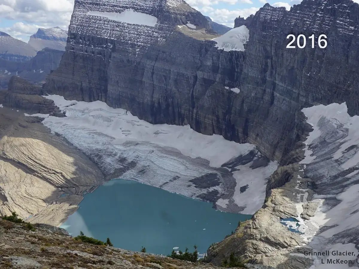
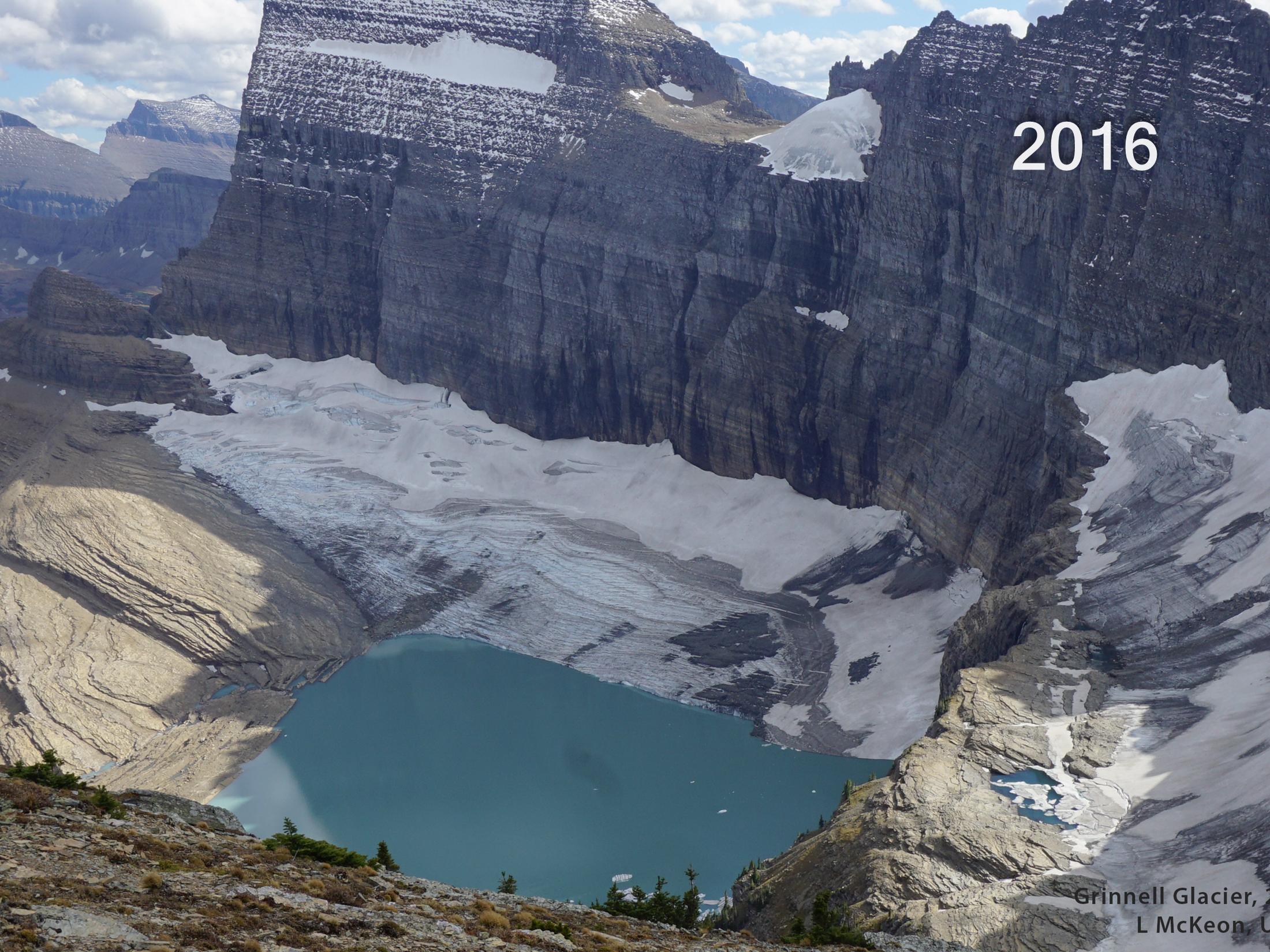
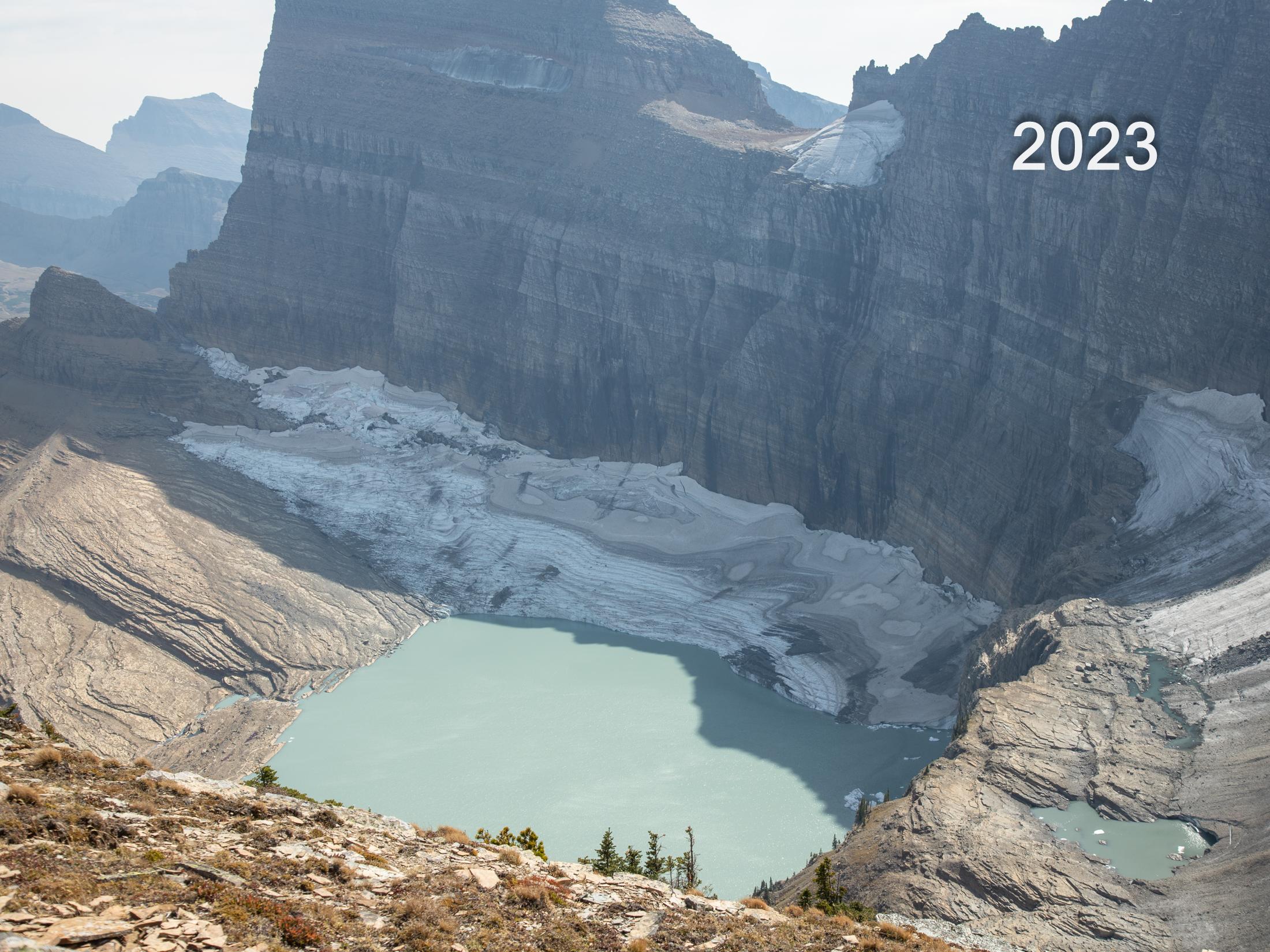
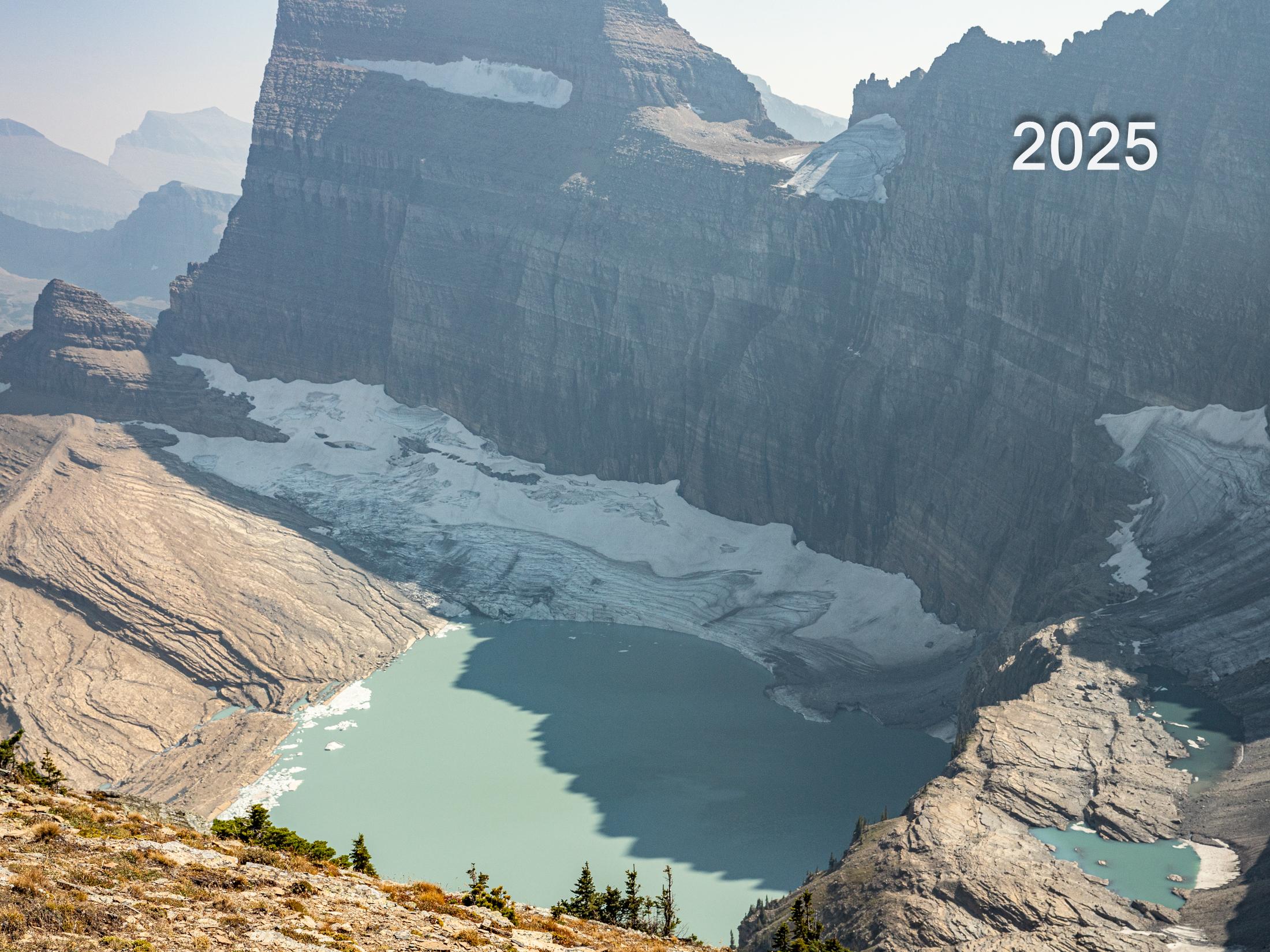
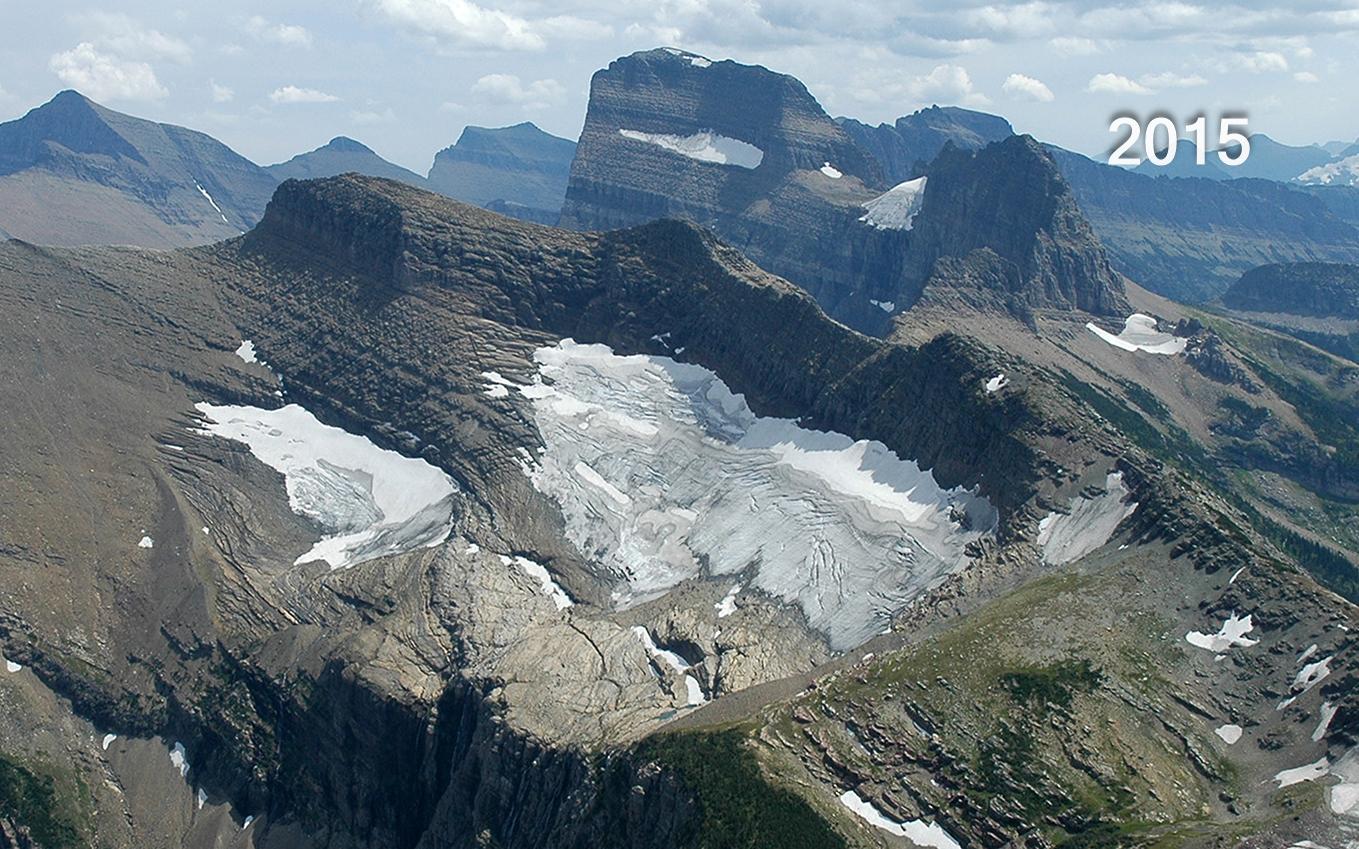
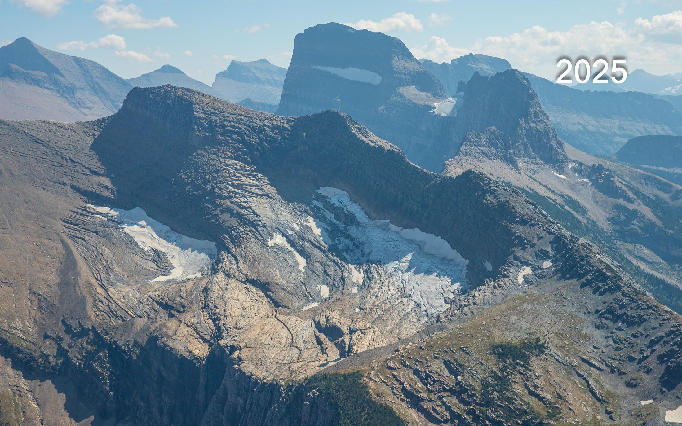
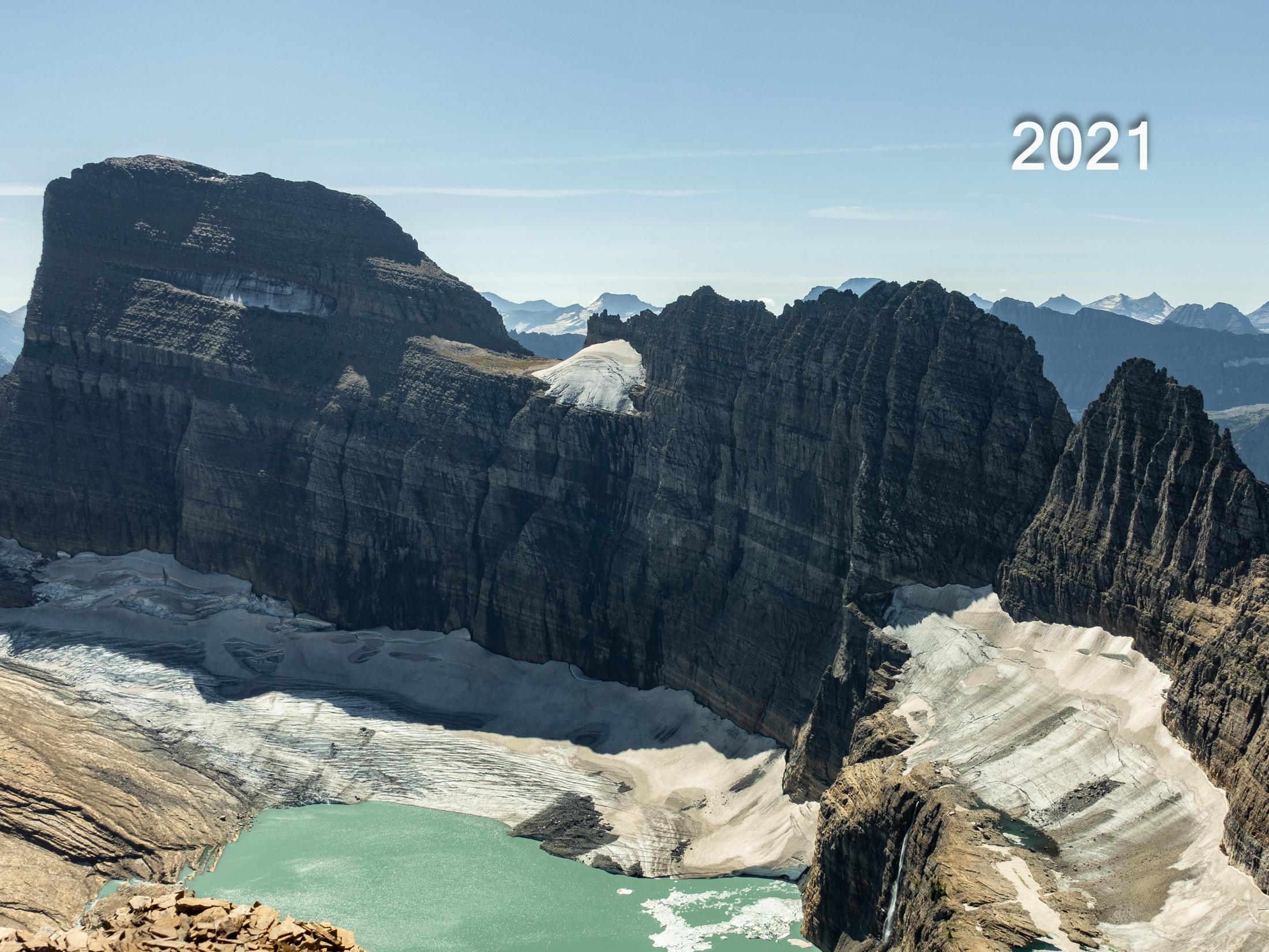
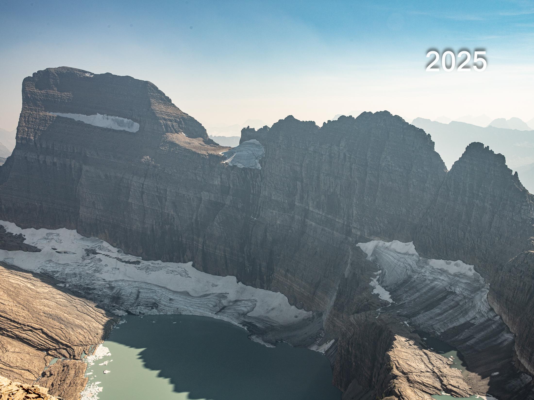


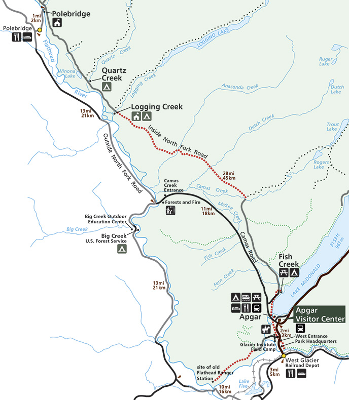

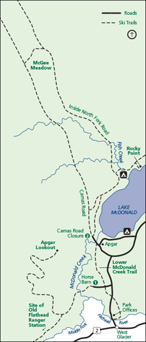
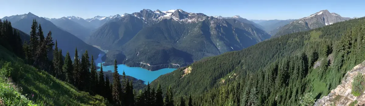 Mountains