The tallest dunes in North America are the centerpiece in a diverse landscape of grasslands, wetlands, forests, alpine lakes, and tundra. Stay on a moonless night to experience countless stars in this International Dark Sky Park!
Open 24 hours a day, 7 days a week year-round.
There are no timed entries or reservations to visit.
107.3Kacres of parkland
432.5Krecreation visits, 2025
Jun · Aug · Sepnearby climate picks
Seasonal access & reservations
No reviewed guidance for this selection. Check the park's official planning pages; missing coverage does not establish access.
Selected guidance only; separate from climate comfort and current conditions.
Official conditions Loading saved check
Loading the latest saved conditions. You can also check the official report below.
Editorial recommendations, reviewed 2026-10-17. Full park days, excluding travel to and from the region. A first-visit outline for a general traveler; adapt to mobility, fitness, season, reservations, and current conditions. These are suggested days, not reserved activities or guaranteed routes.
The Great Sand Dunes, and most of the forests, lakes and peaks of Great Sand Dunes National Preserve, are designated wilderness. These areas can be explored by day hikes or overnight backpacking trips .
NPS/Patrick Myers
Dunes Exploration
No Trails Explore any part of the 30 square mile dunefield you wish; there are no trails in the sand. Many visitors enjoy sand sledding or sandboarding on the dunes. Footwear High-top boots with long pants work best to keep sand out of your shoes. Do not wear sandals, which will just chafe your feet. If you must hike on a summer afternoon, bring closed-toe boots or shoes to prevent burning your feet. Summer Safety Summer air temperatures are pleasant at this high elevation, but during afternoon hours the sand surface can reach 150 degrees F, and dangerous thunderstorms can develop. Plan to hike the dunes in early morning or evening to avoid heat exhaustion, burned feet, or fatal lightning strikes. Wheelchair Access A dunes-accessible wheelchair is available for free loan at the Visitor Center.
Colorado's Natural Beach When there's water in Medano Creek at the base of the dunes, adults and kids alike love to splash in the stream. Watch for waves in the water, a phenomenon called "surge flow." As mounds of sand form and fall in the creek bed, water surges, similar to the action of waves at a beach. Watch a video, get detailed tips for enjoying the creek, and find current conditions and forecast flow on the Medano Creek page.
NPS/Scott Hansen
High Dune on First Ridge
The high dune on the first ridge is neither the highest in elevation nor the tallest in the park, but it looks that way from the main parking lot. This is the most common destination in the dunefield, providing a great view of the entire dunefield. It is about 688 feet (209 m) from base to top. Cross a half-mile (1km) of the Medano Creek bed, then zigzag up along ridgelines to reach it. There are no trails in the dunefield. GPS coordinates for High Dune on First Ridge: 37.74908, -105.532775 Average round trip hiking time for High Dune is 2 hours over 2.5 miles (4 km). Popular third party hiking applications are often inaccurate or misleading. Plan to take as much as 4 hours to hike roundtrip, if not acclimated to the higher elevation and lower oxygen level.
Hidden Dune (tallest dune in North America)
Hidden Dune is the tallest dune in North America at 741 feet (225 m). Hidden Dune is named for its remote location in the dunefield, where it is not visible from most of the main visitor day use areas. It is even hidden from much of the high first ridge of dunes. A false summit (at left in photo) hides the actual summit for much of the hike to Hidden Dune. GPS coordinates for Hidden Dune summit: 37.775916, -105.531912 Plan on 7 miles (11 km) round trip over 6 hours, starting from the main Dunes Parking Lot. Hike north/northwest to reach it. In summer months, plan your hike to begin in early morning to avoid extreme sand heat or thunderstorms with lightning. With high-clearance 4WD, you may also begin your hike at Sand Pit or Castle Creek Picnic Areas on the eastern side of the dunefield. While shorter in miles, this route has more up and down to reach Hidden Dune.
Star Dune is currently the second tallest dune in North America. It is a majestic dune now measuring 736 feet (224 m) from base to summit. While it can be hiked from the summit of High Dune on First Ridge, it's more direct, and less up and down, to access it via its base along the Medano Creek bed. From the Dunes Parking Lot, hike about 2 miles (3.2 km) south down the Medano Creek bed until the massive pyramid-shaped Star Dune comes into view. Follow a ridge to its summit. GPS coordinates for Star Dune: 37.7517639, -105.5580583 Average round trip hiking time for High Dune is 6 hours over 6 miles (9.6 km). There is no trail. Popular third party hiking applications are often inaccurate. Plan to take as much as 9 hours to hike roundtrip if not acclimated to the high elevation and lower oxygen level. In warmer months, plan to start in early morning to avoid extreme surface heat or thunderstorms.
Eastern Dune Ridge
By high clearance 4WD vehicle, drive to Sand Pit or Castle Creek Picnic Areas. Or, with 2WD vehicle, drive to Point of No Return, then hike 3/4 mile (1.3km) to Sand Pit or 1.5 miles (2km) to Castle Creek. Castle Creek Picnic Area offers an impressively tall, steep dune face. Both areas have access to Medano Creek , which usually flows gently through the months of fall in this area. Plan to hike the dunes in morning or evening to avoid a sand surface over 150 degrees F or thunderstorms with lightning. Note: This area is not safe for sand sledding. Unlike the main day use area from the Dunes Parking Lot, these steep slopes end abruptly in the firm, wet sand along Medano Creek below. Injuries may occur.
Forested Trails
Montville Nature Trail
In summer, keep this hike as an option for afternoon as an escape from the heat of the dunes. Walk along a shady forested trail named for a late 1800s settlement, comprising 20 houses in its heydey. Rest near the trail's highpoint, where you'll find outstanding views of Mt. Herard, the dunes and the valley.
(Please be aware that hunting is permitted during legal seasons in Great Sand Dunes National Preserve, the higher mountainous areas above the dunes. Primary rifle seasons are in fall months. Check with a park ranger for details.) Mosca Pass Trail
This trail follows a small creek to the summit of a low pass in the Sangre de Cristo mountains, winding through aspen and evergreen forests. Allow 2-3 hours to reach the pass; the trail is 3 1/2 miles (5.7 km) one way. Native Americans and early settlers used this route for travel into the valley.
Sand Ramp Trail
This 11-mile trail is most commonly used as an access to various backpacking sites along the foothills, rather than as a destination trail for scenery, since it stays at the same elevation along the base of the mountains. Begin hiking the Sand Ramp Trail in Loop 2 of the campground or at Point of No Return Parking area. After the first two miles, much of this trail is sandy soil or pure sand, up and down along the foothills, so this hike can be grueling. Allow for more time than the mileage indicates.
Medano Pass Primitive Road
Driving this road requires high-clearance 4-wheel drive (not recommended for small sport utility vehicles). A scenic drive any time of the year, it is especially spectacular in late September and early October when fall colors are at peak. Creek crossings can be hazardous in spring, and the road is closed when winter conditions create hazards. Check current road conditions and detailed information before travel. For those without a 4WD vehicle, check the Commercial Tours and Jeep Rentals page for options.
NPS/Kris Illenberger
Medano Lake and Mount Herard Please note: trails to alpine lakes may have significant tree downfall over them. Hikers can still make it to the lakes with effort, but livestock are not recommended.
Medano Lake Trailhead is accessed from the Medano Pass 4WD road. Beginning at 10,000' elevation, the trail climbs 2000' through lush meadows and forests, ending at an alpine lake at timberline. For advanced hikers, continue on to the summit of 13,297' Mount Herard for a spectacular aerial view of the dunes.
Music Pass, Sand Creek Lakes, and Other Alpine Peaks A 2 1/2 hour drive from the Great Sand Dunes Visitor Center with a 4WD vehicle (see map below), and an 8 mile (13 km) round trip hike are required to reach Sand Creek Lakes. However, the alpine scenery is worth the effort, especially in mid-summer when patches of snow are still present on the peaks and flowers dot meadows and tundra. Check with a ranger for conditions before travel. Snow may block these trails from November into June.
Round Trip Hiking Mileages from Music Pass Trailhead
Lower Sand Creek Lake or Upper Sand Creek Lake: 8 miles (13 km) Little Sand Creek Lakes: 16 miles (26 km) Climbing the Peaks of Great Sand Dunes National Preserve The Essential Guide to Great Sand Dunes National Park and Preserve, available in the visitor center store, has detailed climbing information for the peaks. Colorado climbing websites also contain trip reports from climbers with mileages, route options, and conditions updates. Marble Mountain is a gentle tundra hike to the north from Music Pass, but the other peaks require significant route-finding with potentially dangerous exposure to steep cliffs.
Driving Route from Great Sand Dunes Visitor Center to Music Pass Trailhead
Drive south on CO 150 to US 160. Turn left (east), and continue toward La Veta Pass. About 2 miles before La Veta Pass, look for the sign for Pass Creek Pass on the left (north). This all-season dirt road goes uphill for one mile, then down into the Wet Mountain Valley. When you arrive at a T intersection at a paved road, turn right toward Gardner. At Gardner, turn left (north) on CO 69. At 4.5 miles south of Westcliffe, turn off Highway 69 to the west at the sign for Music Pass and South Colony Lakes Trailhead. At the "T" junction, turn left onto South Colony Road. At the end of the ranch fence on the right, you'll see another sign for Music Pass.
2WD drivers should park where the Rainbow Trail crosses Music Pass Road. From here, walk 2.5 miles to Music Pass Trailhead.
4WD drivers may drive another 2.5 miles to the end of the road at Music Pass Trailhead.
Accessing Sand Creek Drainage from the West
Sand Creek and Sand Creek Lakes are also accessible from the west side of the Sangre de Cristo Mountains, but require long hikes. From Liberty Gate Trailhead , south of the town of Crestone on the north side of the national park, it is a 7 mile hike just to reach the lower part of Sand Creek where it flows around the dunefield. From there, it is an additional 10 miles hiking up the Sand Creek drainage to reach either of the Sand Creek Lakes, with 3,500 ft. elevation gain. The Sand Creek Trail crosses Sand Creek a few times as it ascends the drainage; in years of average to high streamflow, Sand Creek makes the trail uncrossable in early summer, generally the entire month of June. From the main use area of the national park, Point of No Return Trailhead provides standard 2WD access to the Sand Ramp Trail. This grueling 11-mile trail, up and down through foothills woodlands and dunes, accesses Sand Creek on the north side of the dunefield. From there, it is an additional 10 miles hiking up the Sand Creek drainage to reach either of the Sand Creek Lakes, with 3,500 ft. elevation gain. The Sand Creek Trail crosses Sand Creek a few times as it ascends the drainage; in years of average to high streamflow, Sand Creek makes the trail uncrossable in early summer, generally the entire month of June. With high-clearance 4WD, you can reach the Sand Ramp Trailhead along the Medano Pass Primitive Road . From this trailhead, it is a grueling 7 mile hike, mostly up and down through sand, to Sand Creek on the north side of the dunefield. From there, it is an additional 10 miles hiking up the Sand Creek drainage to reach either of the Sand Creek Lakes, with 3,500 ft. elevation gain. The Sand Creek Trail crosses Sand Creek a few times as it ascends the drainage; in years of average to hig
Grasslands and Shrublands
The spacious grasslands and shrublands of the national park are the least visited area, yet they contain spectacular wildlife, migrating dunes, panoramic mountain views, and intricate beauty. See details on accessing grasslands in and around the national park.
Wetlands abound in the San Luis Valley, providing refreshing oases for wildlife and people in this high mountain desert. See details on accessing the wetlands in and around Great Sand Dunes National Park.
This short video takes you from wetlands to alpine tundra, showing the tremendous natural diversity of the park and preserve.
Learn the right gear and techniques to sand sled or sandboard at Great Sand Dunes! Set to fun music with captions.
What Equipment Slides on Sand?
Sandboards and sand sleds are specifically made for sand, featuring a special design with extra slick base material and special wax; these work best for sliding in most conditions. See below for rental locations.
Snow sleds, snowboards and skis only slide on very wet sand after rain or snow. The sand surface is usually dry.
Cardboard, saucers, and soft plastic items don't slide on sand; they will dig into or drag on the sand.
Where Can I Rent Sand Sleds and Sandboards?
The National Park Service does not rent sand sleds or sandboards. Plan to rent gear before arriving at the park. Specially designed sandboards and sand sleds may be rented or purchased at retailers in the San Luis Valley. Some retailers are a 30-45 minute drive away from the dunes. 4 miles away - Near Park Entrance Great Dunes Oasis Store is located 4 miles from the Great Sand Dunes Visitor Center near the park entrance. Open spring through early fall . Call 719-378-2222 . To protect the special slick material on the bottom of each board, Oasis will not rent sleds when the sand is wet. 23 miles away - Mosca, CO - Dune Valley Distillery is open year round. From November through March, open Thursdays, Fridays, and Saturdays 11-6; on other days, call ahead to check for rental availability, 719-206-3356 26 miles away - Blanca, CO - Spin Drift Sandboards, located in downtown Blanca, 25 miles southeast of the Great Sand Dunes Visitor Center, rents sandsleds and sandboards spring through early fall. Follow link above to website or call (719) 379-4410. 32 miles away - Hooper, CO Sand Dunes Recreation, located near Hooper, 32 miles west of the Great Sand Dunes Visitor Center, rents sandsleds and sandboards year round . Follow the link or call 719-378-2807. 36 miles away - Alamosa, CO Kristi Mountain Sports rents sandsleds and sandboards year round. Call ( 719) 589-9759 the day before to reserve a board. To protect the special slick material on the bottom of each board, Kristi will not rent them when the sand is frozen or covered in snow. Closed Tuesdays and Wednesdays.
NPS/Patrick Myers
Where Can I Sled and Sandboard?
Sandboarding, sledding, and skiing are permitted anywhere on the dunefield away from vegetated areas. From the main Dunes Parking Area, it's a minimum 0.7 mile (1km) hike to get to the small or medium-sized slopes; the top of the first high ridge is 1.25 miles. Smaller slopes at the base are fine for young children, while teens and adults may prefer longer slopes near the top of the first high ridge of dunes.
How Can I Sled or Board Safely?
Plan your dunes time for early morning or evening during summer to avoid a 150 degree F sand surface or thunderstorms. In spring and fall, sand temperatures are usually moderate throughout the day, but spring afternoons can be very windy.
While Castle Creek Picnic Area (4WD only) provides close access to high slopes, sledders who can't stop may crash into the firm creekbed sand at the base. Instead, it is recommended to sled on the first high ridge of dunes, accessible from the main Dunes Parking Area. At the base of most dunes in this area is softer sand and a gentler runout to slow you down.
Injuries occur more commonly when sand is firm after rain or melting snow, while dry sand is soft, making for easier landings if you fall down. Sledding beyond the first high ridge of dunes will make it more difficult to receive timely assistance if injuries occur.
Medano Creek bed is dry at the parking lot. The creek is currently dry next to the main Dunes Parking Area. The creek currently stops flowing 1.5 miles Northeast up the creekbed from the parking lot.
Medano Creek is barely flowing at Sand Pit and Castle Creek Picnic areas (4WD Only) . Access to these areas is limited to 4x4 high clearance vehicles. All-Wheel-Drive and Two-Wheel-Drive vehicles are prohibited on the Medano Pass Primitive Road .
Check up-to-the-minute flow . This is shown as a flow graph of Medano Creek in cubic feet per second (cfs), measured where it first reaches the sand 5 miles upstream from the Dunes Parking Area. This is not the flow to expect in the main visitor area, but it gives a relative indication of flow and whether it is increasing or decreasing. Peak flow in an average year occurs in late May or early June at 40 cfs.
Check park weather forecasts for environmental conditions.
Where Can I Experience Medano Creek in 2026?
Medano Creek Flow Forecast 2026
This short National Park Service video reveals Medano Creek's attraction for people of all ages, and explains mysterious 'surge flow'!
NPS/Patrick Myers
Medano Creek Conditions to Expect Each Month in an Average Year
See also overall conditions to expect at Great Sand Dunes each month of the year .
Below are typical creek conditions for each month of an average season. Less or more snowpack will affect the depth and duration of the creek.
While April is the second snowiest month of the year on average, there can also be warmer, sunny days that begin to melt the snowpack.
Medano Creek usually arrives at the Dunes Parking Area sometime in April, at first just a trickle. By the end of April, it may be a few inches/cm deep with minimal surge flow.
Flow increases through May, and late May is near the peak of Medano Creek's annual flow.
While it is still springtime and winds may arise, especially in the afternoon, May temperatures are generally moderate, with highs in the 60s-70s F. However, snow is still possible at this elevation in May!
Trees and bushes along the creek leaf out. There are some "no-see-ums" (tiny biting gnats), but mosquitoes are rarely out in May.
Late May and early June are the best opportunity to experience ‘surge flow’, where waves flow down across the sand. In average or wetter years, surge flow waves are high enough for children to float down limited distances on flat inflatable toys.
Water comes out of the mountains cold, but warms up significantly when the sun shines on it for a few hours as it spreads across the sand.
Late May and early June weekends can be crowded with overflowing parking lots, a crowded beach, and some delays at the entrance station. If possible, plan your visit on a weekday this time of year.
There are warmer water temperatures for water play and generally pleasant temperatures in June.
Late May and early June are the best opportunity to experience "surge flow", where waves flow down across the sand. In average or wetter years, surge flow waves are high enough for children to float down limited distances on flat inflatable toys.
Because of the creek's popularity, late May and early June weekends are extremely crowded, with long lines of traffic, overflowing parking lots, a crowded beach, and full campgrounds. If possible, plan your visit on a weekday this time of year.
As the creek becomes much lower and slower around the second week of June, mosquitoes will emerge in large numbers. Move away from vegetation, to the far side of the creek to avoid the worst of the mosquitoes: they don't like open sand, but prefer to be near shady bushes and trees.
By late June, the water level will be fairly low, only 1 or 2 inches (1-5cm) or may even be drying up.
Unless there are significant ongoing rains, the creek will be retreating back toward the mountains and will be dried up at the main visitor area near the Dunes Parking Lot.
It usually continues to gently flow at 1/2" - 1" (1-2 cm) deep along the eastern edge of the dunefield, near Castle Creek Picnic Area. Castle Creek is accessible by high clearance 4WD vehicle on the Medano Pass Primitive Road . Visitors without 4WD may also access the creek in late summer by hiking approximately 3 miles (5 km) up the creekbed from the Dunes Parking Lot, or approximately 0.7 miles (1km) from the Point of No Return parking area.
Mosquitoes are typically still present in large numbers after breeding in the low remaining water, but begin to disappear by mid-to-late July.
July is the warmest month at the park, with average highs in the low 80s F.
August and September
The creek usually continues to gently flow at 1/2" - 1" (1-2 cm) deep along the eastern edge of the dunefield, near Castle Creek Picnic Area. Castle Creek is accessible by high clearance 4WD vehicle on the Medano Pass Primitive Road . Visitors without 4WD may also access the creek in late summer by hiking approximately 3 miles (5 km) up the creekbed from the Dunes Parking Lot, or approximately 0.7 miles (1km) from the Point of No Return parking area.
Mosquitoes are gone in late summer and fall.
Weather forecasts and information for Great Sand Dunes are available on the park's weather page . Also learn what Conditions to Expect Each Month at the park.
How do you pronounce 'Medano'?
Médano is a Spanish word that means "sand dune". It is pronounced "MED-ah-no". In the original Spanish there is an accent on the é.
Medano Creek Activities
Depending on water level, visitors may do any non-motorized and non-mechanized activities in the creek, including splashing, wading, skimboarding, floating (works only in small inflatable device with a child at peak runoff), sand castle building, and sand sculpting.
To protect this riparian habitat, please do not disturb living plants or animals, and keep water resources clean.
One of the best ways to connect with the park is through ranger led programming. These programs offer insight into the many aspects that make Great Sand Dunes unique and vary in topic. Ranger programs are offered primarily in summer and fall. Programs take place in the visitor center, amphitheater, and occassionally at trailheads. Ranger program schedules and locations are posted below.
Special Events and Ranger Program Calendar
Courtesy Kaiyote Tours
Commercial Tours
For commercially-guided birding, hiking, backpacking, and four-wheel-drive tours, visit the Commercial Tours page.
NPS/Patrick Myers
Programs for Schools
Free educational programs at Great Sand Dunes National Park and Preserve provide hands-on field experiences that can support and enhance your learning objectives. Visit our Education Page to learn more and request a program !
August and September provide some of the best night skies of the year for summer constellations and the Milky Way, but for those who don’t frequently have access to truly dark night skies, stargazing can be a little overwhelming. This beginner’s guide to stargazing will provide you with some tips and tricks to fully experience the International Dark Sky Park gold-tier skies here at Great Sand Dunes National Park and Preserve
Learn More About Great Sand Dunes Night Skies
Half the park is after dark! With a combination of dry air, little light pollution, and high elevation, Great Sand Dunes National Park and Preserve is certified as an International Dark Sky Park by Dark Sky International , meeting strict standards for sky darkness, limiting outdoor lighting, and working with neighboring communities to reduce light pollution.
NPS/Patrick Myers
Viewing a Starry Sky and The Milky Way
Many visitors hope to see a sky filled with stars, including the Milky Way Galaxy, but it requires the right timing, and knowing what you're looking for.
Planning Around the Weather Watch the weather forecast to time your visit for nights with the clearest skies. Planning Around the Sun and Moon
It's essential to avoid sunlight and moonlight to be able to see the the most stars, and especially to view the Milky Way. To avoid the sun lightening the sky, plan to view the night sky at least 1 1/2 hours after sunset, or 1 1/2 hours before sunrise. During times when the moon is up, especially a brighter, fuller moon, the moonlight will also wash out the sky, preventing most stars and the Milky Way from being visible. Plan to visit on moonless nights, or an hour before the moonrise time or an hour after the moonset time. You can create a sun and moon calendar for Great Sand Dunes on sunrisesunset.com . Select the month you plan to visit, then select Great Sand Dunes from the menu of national parks. Check the 'Moon phases' and 'Moonrise and moonset' boxes. A calendar will be created for you with the information you need to plan around the sun and moon. If there is a bright moon when you visit, you can still explore the dunes in otherworldly light, almost like being on the moon itself. The moon is bright in the park, and most feel comfortable exploring without a flashlight. Plan for the Right Season The Milky Way is up in early morning hours during spring, or in evening hours from mid summer to early fall. During the rest of the year, its brightest part is below the horizon. While there are beautiful night skies in winter, there are more familiar constellations up at the same times as the Milky Way. Plan for Expectations vs Reality Some visitors expect the Milky Way to be a dramatic, colorful display like fireworks, as seen in many highly altered photos. To the naked eye, the Milky Way only appears as a dull whitish cloud. Cameras must use longer exposure times, picking up colors that are actually present in our galaxy. Some photographers push the color and contrast of
In this three-minute video, discover the beauty and importance of dark skies in this International Dark Sky Park!
Experiencing More Than the Sky
Keep an eye out for the night-life of the dunes, including camel crickets, kangaroo rats, toads, salamanders, coyotes, bobcats, and owls. Never touch wildlife, and remember that their nocturnal eyes are highly sensitive to light. Use only a red light if needed.
Don't just depend on your eyes to experience the night. Feel the soft night breezes. Listen for the call of owls, the howling of distant coyotes, the calls of frogs and toads, the rustle of creatures in the forest, and the drum of kangaroo rats thumping warnings to each others. Smell the fresh scents of piñon pine, juniper, and seasonal flowers. You may notice that your senses grow sharper as you spend more time in dark and quiet locations.
Safety and Protecting Dark Skies
To protect our dark skies, there are no outdoor lights illuminating the parking areas or dunes. Carry a flashlight at all times for safety if needed, but keep flashlight use to a minimum to protect your own night vision as well as that of other visitors and wildlife. Don’t use your phone flashlight; preserve its battery in case of emergency. If possible, use a red light , which does not affect night vision.
Be sure to note the location of the Dunes Parking Area in relation to the line of cottonwood trees so you can find your vehicle when you return. As you return from the dunes, the parking area is near the left end of the trees.
Even in summer months, temperatures drop at night. Bring warm, layered clothing, snacks, and water.
Black bears and mountain lions are active at night, primarily in forested areas. Always stay aware of your surroundings and hike with others if possible. If you encounter a bear or lion, stop, stay calm, speak firmly but quietly, and slowly leave. If attacked, fight back with rocks, sticks, flashlight, or bare hands. Report any wildlife sightings to park staff when possible by calling the visitor center, or talking with a ranger at the visitor center during operating hours.
Check park forecasts on our weather page , and watch and listen for approaching storms. Lightning tracking apps can also help to alert you of lightning in the area.
Summer night programs are a good way to experience and understand the night sky and nocturnal ecology. Check the program schedule during summer months to see what evening programs are scheduled during your visit.
Whether you seek to capture abstract sand/shadow patterns, people splashing on a beach, or majestic views of dunes with snowcapped peaks, the Great Sand Dunes landscape provides opportunities for all styles of photography. For many more photos of the park, visit the Great Sand Dunes Flickr page .
CAUTION: Water at Crossing Four Exceeds 3 Feet in Depth
Current Road Conditions
Refresh this page for the latest update
CONDITIONS as of Friday, October 16th, 2026 Medano Pass Primitive Road - OPEN
Recent rainfall, and beaver activity have created difficult and deep water conditions at the 3rd, 4th, and 5th Creek Crossings. The fourth creek crossing is approximately three feet deep. Motorists are advised to avoid using the road in this area. A muddy area next to camp 4.5 and between the 8th and 9th creek crossing has been recently repaired by the NPS. Conditions may worsen again with heavy rains .
Tire Filling Station at Amphitheater Parking Area
General Information
Vehicle damage may occur as law enforcement has recovered several vehicle parts from the roadway.
Very high clearance vehicles with 4X4, low transfer case is required by law.
Expect significant delays in law enforcement or emergency response due to the current conditions and patrol vehicle availability.
Visitors needing assistance should contact Colorado State Patrol Dispatch at (719) 589-5807. Emergencies dial 9-1-1.
Callers must be prepared to provide their exact location to ensure a timely response and deployment of necessary resources.
All vehicles must be four-wheel drive with low range transfer case capabilities to travel beyond the Point of No Return Parking Lot. Drivers are encourage to travel on lower tire pressure for deep sandy sections.
Planning Ahead for Sand, Water, and Rocks
Besides current conditions, there are many other considerations when planning to drive Medano Pass Primitive Road. Your type of vehicle, its clearance, its weight, the width of your tires, and your skill and confidence driving in sand, are all variables in driving this road.
4-Wheel Drive (4WD) high-clearance vehicles with a 4L transfer case setting ARE REQUIRED on this road. All-Wheel-Drive (AWD) vehicles, mini-SUVs, wagons, and similar vehicles with lower clearance are not permitted, as they will get stuck in the deep sand or creek crossings. True 4WD vehicles have a transfer case with a 4 Low (4L) setting in the drivetrain that puts full engine power to both the front and rear axles. All-Wheel-Drive (AWD), common on vehicles such as crossover SUVs, relies on a differential to send variable power to each wheel. AWD is good on level roadbeds in low traction conditions such as snow. It is not designed to fully power the front tires in off-pavement rugged situations such as the soft sand, creek crossings, and steep sections of loose rocks of Medano Pass Primitive Road. Full size 4WD pickups or SUVs are also designed with sufficient clearance. Additions such as running boards or step bars may bog down in sand or get broken off by rocks. Heavy vehicles, or vehicles loaded with excessive gear, may also have difficulty. In the rocky sections of the road, heavy duty off road or all terrain tires are highly recommended (10 ply or greater sidewall rating) to help avoid tire failure on sharp rocky steep sections and creek crossings.
To avoid becoming stuck, do not stop in unstable areas.
To minimize damage to the road and your vehicle, do not spin your tires.
Seek self-recovery as your first option if you have proper equipment.
Always know your location to assist Law Enforcement Rangers when contacting Dispatch for assistance. Take note of signs posted along the roadway such as creek crossings and campsites.
ATVs and UTVs are not permitted anywhere in Great Sand Dunes National Park and Preserve. All vehicles must be highway-legal in Colorado. Colorado does not recognize ATVs and most UTVs as highway-legal.
Check the park's weather page for the most accurate park forecasts.
For up-to-the-minute conditions, please contact the Visitor Center at 719-378-6395.
Current Level of Medano Creek
From Great Sand Dunes, the Medano Pass Road crosses Medano Creek nine times on its way to Medano Pass. See the current cubic feet per second (cfs) flow of Medano Creek (available spring through fall) . Creek flow is typically highest at dawn, and lowest in late afternoon. Peak flow for an average season is about 40 cfs (cubic feet per second), typically occuring in late May and early June. The current cfs flow indicates the level of the creek relative to average peak flow of 40 cfs.
Medano Creek Information and Current Conditions
Medano Pass Driving Season
The road fully opens when weather and road conditions allow, typically in mid-to-late May. It remains fully open through the end of the fourth rifle hunting season (near the end of November), as weather conditions allow.
NPS Infographic
4WD Required to Drive The Road
True 4WD vehicles have a transfer case with a 4 Low (4L) setting in the drivetrain that puts full engine power to both the front and rear axles. All-Wheel-Drive (AWD) and Two-Wheel Drive (2WD) vehicles are PROHIBITED on Medano Pass Primitive Road between Medano Pass and the Point of No Return. AWD is common on vehicles such as wagons and crossover SUVs. AWD relies on a center differential to send variable power to each wheel and is not designed to fully power the front tires in situations such as the soft sand, creek crossings, and steep sections of loose rocks of Medano Pass Primitive Road. Full size 4WD pickups or SUVs are also designed with sufficient clearance. Additions such as running boards or step bars may bog down in sand or get broken off by rocks. Heavy vehicles, or vehicles loaded with excessive gear, may also have difficulty. In the rocky sections of the road, heavy duty off road or all terrain tires are highly recommended (10 ply or greater sidewall rating) to help avoid tire failure on sharp rocky steep sections and creek crossings.
How do I tell if my vehicle is 4WD, AWD, or 2WD?
Please consult the vehicle owners manual. Decals, model names and other labels are not relible indicators of your vehicle's drive train design. If your owners manual advises you to not drive in a four wheel drive setting on dry pavement, then that is an indicator the front and rear axles are mechanically connected without a center differential. If your Vehicle has a shifter level or dash mounted setting that includes 4H, 4L, 2H/2WD, that is an indicator that your vehicle has a transfer case and is a 4WD and not an AWD vehicle.
Why Does Great Sand Dunes Prohibit AWD Vehicles on the Road?
The Medano Pass Primitive Road is narrow and experiences heavy use during most of the season that it is open. There have been many instances of AWD and 2WD vehicles becoming stuck in deep sand and blocking the road for other visitors. Vegetation and other resources in the park can be come damaged removing stuck vehicles and or other vehicles driving outside of the designated roadway to get around blocked areas.
NPS/Patrick Myers
Map of Medano Pass Primitive Road (.jpg file, 1MB) This is a rough 22 mile road connecting Great Sand Dunes with the Wet Mountain Valley and Colorado State Highway 69. Passable only in the warmer months and only with high- clearance 4-wheel drive vehicles, it gives access to Medano Pass (elevation 10,040’) and Great Sand Dunes National Preserve. This road crosses areas of deep sand, traverses Medano Creek nine times, and passes through excellent habitat for bighorn sheep. Average driving time for the entire primitive road is about 2.5 - 3 hours. Reduce tire pressure to about 20 psi if the sand is dry and soft. A free air station is available near the south entrance to the road in warmer months between the hours of 7AM and 9PM. If you reduce pressure, you will need to reinflate using your own air compressor before driving over rocks in Medano Canyon. Drive through creek crossings slowly to avoid drowning your engine.
ATVs and UTVs Prohibited
Side-by-sides, ATVs, UTVs are not permitted anywhere in Great Sand Dunes National Park and Preserve. All vehicles must be highway-legal in Colorado. Colorado does not recognize ATVs and most UTVs as highway-legal.
Set your odometer to zero at the southern entrance of the primitive road to follow along with this guide.
Medano Road Camping Information
R oadside camping is permitted only at 21 numbered campsites in Great Sand Dunes National Preserve beginning 5.2 miles from where the road begins near Piñon Flats Campground. These sites are indicated with a brown post and camping symbol, and are numbered by approximate road mileage from the Park/Preserve boundary to Medano Pass. Numbers in parentheses are approximate road mileage from Medano Pass down to the Preserve/Park boundary. Roadside car camping is only permitted in designated sites in the national preserve. Vehicle access to these sites is only available late spring through fall, depending on snow, creek, and road conditions .
These designated sites are free of charge and first-come, first-served. All 21 sites fill on summer holiday weekends, and often on other summer weekends.
Camping Regulations for Medano Road Campsites
Camping is permitted in designated, marked sites only in the national preserve. No permits are necessary.
Tents must be located within 40 feet of the front of the bear box at each site.
Pets must be leashed or restrained at all times.
Fires only in existing fire rings; put out completely with water. Gather dead and down firewood 4” or less diameter.
No off-road driving. Vehicles must be highway-legal in Colorado. Park only in designated campsites or parking areas.
Secure food, coolers, toiletries, and trash from black bears. Lock them in the bear boxes provided at most sites.
All trash, including orange peels, egg shells and toilet paper, must be removed. Bury human waste 6” deep.
Fat bikes (mountain bikes with extra wide tires for sand) are permitted on the Medano Pass Primitive Road, both for day use and for overnight camping in Medano Canyon. Check current sand conditions (above on this page) before riding; if sand gets too soft and dry, travel may not be possible. Bikes are not permitted off-road.
You will be sharing the road with vehicles, some traveling at higher speeds in order to make it through sandy sections. For your safety, listen and watch carefully for vehicles as you ride.
2010 Medano Fire
The road passes through some sections of forest that were burned in a 6,249 acre wildfire in 2010. Burned, standing trees may fall at any time, especially during wind. Upper sections of Medano Pass were not burned.
4WD Tours and Rentals
For visitors that do not have a 4WD vehicle but would like to experience the Medano Road, there are 4WD tour and vehicle rentals available
Rangers are present to assist you with trip planning, Junior Ranger books and badges, directions, and other questions.
Restrooms with flush toilets and a water fill station are available in the visitor center building lobby during open hours.
Exhibits include highlights of the region's historically diverse cultures, a large diorama depicting park and preserve ecosystems, a night sky video and night life of the dunes exhibit, a 3D model of the valley and geology animation, and a sand-wind interactive.
Exploring Great Sand Dunes National Park and Preserve on horseback or with pack animals can be fun and rewarding, but requires some preparation on your part. We want you, your animals, and other visitors to have a great experience!
Here are answers to frequently asked questions about bringing horses to Great Sand Dunes:
NPS/Patrick Myers
Where can we ride our own horses?
Most of the national park and the entire national preserve are open to horse use. For closed areas, please refer to the Map of Areas Closed to Horse Use (.jpg file, 130 KB).
The following areas are closed to horseback riding:
- Piñon Flats campground
- Visitor Center parking area, area, or Sand Sheet Loop Trail
- Mosca Creek picnic area, near Dunes Parking Lot (Note: riders may access the southern and western portions of the dunefield through a permitted corridor than runs between the Visitor Center and picnic area. Please see map for location of this corridor.)
- Dunes Parking Lot and the area directly west of the Dunes Parking Lot, as far as the High Dune. This area is for pedestrians only.
- Wellington Ditch Trail
- Montville Nature Trail, except for the southern section required to access the Mosca Pass Trail. Please lead your horses on this section of the nature trail.
- any paved roads, except when crossing
- the Sand Ramp Trail between the campground and Point of No Return. Use Medano Primitive Road instead.
Where can we leave our trailer?
Use the horse trailer parking area at the beginning of the Medano Pass Primitive Road. If full, use the amphitheater parking lot nearby. Please clean up all manure before and after your trip.
Horse trailers may not be parked elsewhere within national park boundaries. For national preserve access from the east side of the Sangre de Cristos, you may leave your trailers at trailhead parking areas in the San Isabel National Forest, including Mosca Pass, Rainbow Trail, and Grape Creek Campground parking areas.
Northern park access: Hikers, horses and pack animals may use the Liberty Gate trailhead to access the national park and national forest lands in this area. Wagons or other horse drawn equipment are not permitted to enter the park. The park map has directions to Liberty Gate.
Where can we camp with our horses?
All national park horse camping areas are in the wilderness, away from roads. Camping with your horses is not permitted along roadsides, parking lots, or the Piñon Flats Campground in the national park. When accessing the backcountry through the main national park entrance on Highway 150, a backcountry camping permit is required.
Camping in the National Preserve
The national preserve includes higher forested areas above the dunefield; see a park map for boundaries . Obtain a free parking and camping permit from the Visitor Center during business hours the first day of your trip. Follow the minimum impact guidelines below. In designated sites along the Medano Pass Primitive Road, horses must be picketed or highlined at least 100 feet from tent areas.
Camping in the National Park
The national park includes the dunefield and some of the foothills around it; see a park map for boundaries . To camp in the dunefield or designated foothills campsites, you will need to reserve a permit in advance online. Get information and link to make a reservation on our Backpacking page .
In the national park, you may camp with horses at:
- Little Medano, Aspen, Cold Creek, and Sand Creek backcountry campsites.
- The Great Sand Dunes Wilderness, beyond the first high ridge of dunes. As you reserve a permit online through recreation.gov, you will need to request a parking change from Dunes Parking Lot to Horse Parking. Request this change in the comment section.
What animals are considered pack animals?
Horses, mules, burros, donkeys or asses, alpacas and llamas may be used in the national park and preserve as pack animals.
Where can we find guided horseback trips in the park?
There are currently no approved horseback trip concessioners in the national park and preserve. Visitors may bring their own horses to ride.
What are the minimum impact guidelines for horse day use and overnight pack trips?
Always try to minimize the impact you and your animals have on the landscape, vegetation, and water.
-To limit the spread of non-native weeds, horses must be fed weed-free hay for 24 hours before entering the national park or national preserve. All feed and hay you take with you must be certified weed-free. A list of Colorado weed-free hay providers is available online .
- Dogs are not permitted in the national park backcountry or wilderness, and must be on a leash at all times in the national preserve.
- Free-trailing horses is not permitted.
- Hikers should yield the trail to horseback riders. Please slow your horses to a walk when passing hikers.
- If you ride cross–country, please spread out to minimize impact on vegetation and soils.
- No camping within 300 feet of lakes and 100 feet of streams.
- In the national park, groups may include no more than 6 people and up to 6 horses. In the national preserve, groups may include up to 15 people and additional horses to equal a total of 25 (people and horses counted together).
- When picketing or highlining your horses, select a dry spot at least 100’ from the camping area. If camping for more than one night, move your picketing or highlining area every night to disperse the impacts on vegetation and soils. Picket or highline at least 100 feet from the brown post in Little Medano, Aspen, Cold Creek and Sand Creek designated sites, at least 100’ from water, and in a way that prevents them from damaging trees or pawing around tree trunks. In Medano Pass roadside campsites, picket or highline at least 140 feet from campsites.
- Scatter manure away from campsites to prevent flies from gathering and speed decay.
- Please shovel accumulated manure from parking areas into your trailer before your ride, and after you load your horses back into your trailer.
- Wood fires are not permitted in the national park backcountry, except for Sand Creek backpacking camp site. Use stoves instead. Wood fires may be built in the national preserve, but gas stoves are preferred to prevent fire scars. If you build a fire, try to find an existing fire ring. Burn dead and down wood less than 4" in diameter only.
- Bury human waste at least 6" deep, and at least 100’ from water. Pack out all trash and toilet paper.
- Steep dune faces are loose and potentially dangerous for horses.
As a hunter with livestock, how do I reserve the Cold Creek drainage?
Due to overgrazing, there is a limit on pack animals permitted in the Cold Creek drainage. No more than two hunting parties with a combined maximum of six (6) head of livestock may establish campsites and maintain their livestock within the watershed drainage of Cold Creek at any one time during hunting season. Any one hunting party is limited to four (4) head of livestock. Each hunting party with livestock must have a permit to camp and/or hunt in the Cold Creek drainage. P lease visit the Great Sand Dunes Hunting Page for details including a map of Cold Creek and how to reserve dates for livestock use in the drainage.
I have other specific horse and pack animal use questions. What number should I call or who should I email?
Please call the Chief Ranger at 719-378-6321 or send an email .
Great Sand Dunes is continually working to improve access so that everyone can experience this unique landscape. If you have special needs or particular questions, please contact a staff member at 719-378-6395, or e-mail us .
Access to the Dunes
The closest parking to the dunefield is the Dunes Parking Area, located 1 mile north of the Visitor Center. There is an accessible mat from the dunes parking area to the edge of the Medano Creek and the sand. However, beyond the edge of the dunes, loose sand and the creek make access into the dunefield itself nearly impossible for those with traditional thin-wheeled chairs.
Visitors can reserve the free use of special balloon-tire wheelchairs to access the dunes. You'll need a strong helper to push the chair through sand. When you make a reservation, you can choose a traditional 4-wheel chair, or 3-wheel chair, both pictured. Most find that the 4-wheel chair is easier to push. The 3-wheel chair may work for a small child.
Please keep these guidelines in mind when using sand wheelchairs:
The chairs are not suitable for very large adults, or for an adult holding a child. The balloon tires can only support standard adult weight limits.
Chairs should be borrowed only by those who need a chair for access.
You'll need to leave an ID at the visitor center to ensure that the closet key is returned. Return the chairs at least 1/2 hour before the visitor center closes.
Sand wheelchairs should only go on sand or smooth pavement, never on rocks or cactus which may pop the balloon tires.
While the chairs are fairly easy to push in the wet, firm sand along Medano Creek, pushing the chairs through dry, soft sand takes some strength and perseverance , even with balloon tires. During dry times of the year, the sand may become especially soft.
Reserve a wheelchair in advance by calling the visitor center at 719-378-6395.
Open daily, the building and rest rooms are fully accessible. A 20-minute captioned introductory film is shown daily during the summer months and on request during the winter months. Learn more about the Visitor Center .
Picnicking at the Dunes Picnic Area
There is one accessible site with a hardened trail to a nearby accessible restroom. The site is shaded and close to a small seasonal creek. Learn more about picnicking at Great Sand Dunes .
Free Ranger Programs
Most programs are accessible. Daily programs take place at the Visitor Center . Evening programs are offered many nights in the amphitheater from late May through early September. Paved trails lead from the campground or amphitheater parking area to the amphitheater. For programs in the sand, you may check out a dunes wheelchair. Check with park staff for other offerings that may be accessible.
The Junior Ranger Program is a great way for kids to learn about their park! Most National Park Service and other public land areas have a Junior Ranger program; kids can collect badges from over 400 National Park Service sites. Stop by the Visitor Center for picking up a Junior Ranger activity Book Check the Park Calendar for any ranger-led Junior Ranger activities or events.
Completing the Booklet in the Park
The Junior Ranger activity booklet is designed for completing during your visit to the park. At Great Sand Dunes, plan on a total visit of at least 2 hours to complete the Junior Ranger Booklet, available at the visitor center. There are three different age groups in the booklet: 3-6, 7-9, 10-12, and 13 and up.You are invited to complete all sections for your age group and earn a Great Sand Dunes Junior Ranger Badge You can download the Great Sand Dunes Junior Ranger booklet (accessible pdf, 4 mb) to begin work on it before your visit. Find answers for the Habitat Match activity on our Natural Features and Ecoystems page and Animals pages .
Completing the Junior Ranger Booklet without Visiting the Park
The Junior Ranger booklet is designed to complete while visiting Great Sand Dunes. Y ou can complete the booklet at home and mail or email it to the park, but only stickers are available by mail due to the high cost of mailing badges . You can download the Great Sand Dunes Junior Ranger booklet (accessible pdf, 4 mb). Find answers for the Habitat Match activity on our Natural Features and Ecoystems page and Animals pages . Email your completed booklet to: grsa_interpretation@nps.gov or mail it to: Visitor Center Great Sand Dunes National Park and Preserve 11999 State Highway 150 Mosca, CO 81146 Note, due to high volume of mail and email requests, please allow up to 4-6 weeks for responses.
Sandhill cranes are an icon of the San Luis Valley - majestic, large, and wild. One of 250 bird species found in Great Sand Dunes National Park and Preserve, they are a delightful part of the area’s natural diversity. Over 20,000 cranes spend part of their spring and fall each year in this valley. These are primarily greater sandhill cranes, a larger species than the lesser sandhill cranes that migrate through the Midwest. After wintering in southern New Mexico, they begin to arrive in the San Luis Valley in early February, while winter temperatures may still drop below zero degrees F at night. While here, they build up energy by feasting on grains in agricultural fields and natural grasslands, as well as aquatic invertebrates and amphibians in wetlands. Cranes mate for life, and each spring they renew their bond through a courtship ritual that includes dancing, bowing, chortling, and throwing tufts of grass in the air. They leave again by late March for the northern US and Canada, where they raise their young. In fall, they begin to arrive back in the San Luis Valley in late September, and some stay through mid-to-late November. A few flocks may overwinter. In general, cranes are in fields during daylight hours, and in wetlands from sunset to sunrise, though they sometimes return to wetlands mid-day for water and rest.
Sandill Crane Locations
Monte Vista National Wildlife Refuge is most often the hotspot for crane viewing and activity in the valley, because the refuge features both barley fields and wetlands. Take Highway 15 south from Monte Vista 6 miles; drive on roads in and around the refuge to look for cranes. There are pullouts on Highway 15 and Road 8S. Farm Fields To drive to Monte Vista NWR from Great Sand Dunes, take Lane 6N west, go one mile south through Mosca, then take Lane 5N to Highway 285 south to the refuge. Cranes are often seen in fields along this route. Please respect private property; only view from the roadside. San Luis Lakes State Wildlife Area is located 15 miles west of the Great Sand Dunes Visitor Center on County Lane 6. The large lake, open year round, is a potential location to view cranes flying to nearby wetlands at dawn and dusk. Some cranes may land on the north shore of the large lake, but most prefer the wetlands to the north. These wetlands are closed February 15 - July 15 for nesting season, so plan to enter the wetland area only in early February or during the fall migration. Park at the north end of the large lake and walk into the wetland area. In drier years, the lakes may not have water. Rio Grande State Wildlife Area is located northeast of Monte Vista. Watch for cranes in fields and wetlands in and near the wildlife area. In the drier fall season, when many wetlands are dried up, cranes may especially seek out areas closer to the Rio Grande that have available water. Great Sand Dunes National Park A few hundred cranes feed and roost in wetlands within the boundaries of the national park, but this remote area is not accessible to the general public. The Nature Conservancy privately owns this land and manages a large herd of bison here.
This popular short hike is located on BLM (US Bureau of Land Management) land south of the national park, off of Highway 150. It is a good option for summer afternoons when sand surface temperatures are high. Simply driving to the trailhead provides an excellent view of the entire dunefield and San Luis Valley. However, the hike to the falls requires wading over slippery rocks into a rock crevasse.
From the Visitor Center, drive south 8 miles, then turn left (east) onto a rough dirt road marked by a large sign. Drive 3.5 miles to the trailhead. To view the falls, hike 1/2 mile, and wade into a crevasse where the 30 ft. high falls cascade onto a ledge.
Caution: Rocks are slippery. Water may be deep and swift in early summer during snowmelt, or during heavy thunderstorms. Rarely, rocks may fall from above into the crevasse. In winter, the falls freeze, creating an icy sculpture. Ice and snow may make the hike very slippery. Falling ice may be a hazard in spring.
Near the trailhead is Zapata Falls Campground , a primitive campground open year-round.
Contact: Bureau of Land Management, 1803 West Highway 160, Monte Vista, CO 81144, 719-852-7074.
Fort Garland Museum and Cultural Center
Adobe buildings have been restored to their original 19th century appearance at this nationally significant historic site in the town of Fort Garland, Colorado, on US Highway 160. Dioramas, exhibits, and scheduled living history events make this a good place for all ages to learn about this era. Browse Fort Garland's website for details, and view photos of Fort Garland and its living history events on Flickr.
US Forest Service Lands, Sangre de Cristo Mountains
Great Sand Dunes National Park and Preserve are surrounded on the north, south, and east by lands managed by the US Forest Service, including the Rio Grande National Forest (west side of the Sangre de Cristos) and the San Isabel National Forest (east side of the Sangre de Cristos). Eight 14,000' peaks and many other peaks, valleys, alpine lakes and streams are found within these two national forests.
San Luis Lakes State Wildlife Area
San Luis Lakes State Wildlife Area protects a wetland complex adjacent to Great Sand Dunes National Park. Birdwatching and photography are primary activities here, although hunting is permitted in season. As with most protected wetlands, this wildlife area is closed to the public for shore bird nesting from February 15 - July 15 each year.
NPS/Scott Hansen
National Wildlife Refuges
Because of its many wetlands and strategic location for many unusual migratory birds, the San Luis Valley is home to three national wildlife refuges.
Baca NWR was created in 2004 as part of the expansion of Great Sand Dunes National Monument into a national park and preserve, protecting the entire natural hydrological system of the Great Sand Dunes. It is adjacent to the national park on the western boundary.
Alamosa NWR is located a few miles southeast of Alamosa, Colorado. It features wetlands along the Rio Grande River.
Monte Vista NWR is south of Monte Vista, Colorado. This refuge contains many restored or enhanced wetlands associated with agricultural lands. It is one of the hotspots in the valley to view thousands of sandhill cranes each spring and fall.
Other Wetland Areas in the San Luis Valley
Blanca Wetlands, Alamosa Open Space Wetlands, Russell Lakes SWA, and others are are described on the Grasslands, Shrublands, and Wetlands page on this site.
Alamosa County and Saguache County
Great Sand Dunes National Park and Preserve is situated in Saguache County and Alamosa County . The closest town to the park and its mailing address is Mosca, Colorado . From western pioneer festivals and parades to American Indian dances and Hispanic heritage events, the San Luis Valley has a diverse heritage and an eclectic ambiance that is reflected in its architecture, art, and cuisine. Follow the links above to official tourist information pages for details on cultural and other attractions in these counties.
Sangre de Cristo National Heritage Area
Photo collage courtesy of Los Caminos Antiguos Scenic and Historic Byway
Los Caminos Antiguos Scenic and Historic Byway
Part of the national system of scenic and historic byways, Los Caminos Antiguos gives the traveler a taste of the diverse cultural and natural resources of the San Luis Valley. From historic adobe churches in the southern part of the valley, to a US military fort, to an organic quinoa farm near Mosca, the valley's rich heritage comes to life.
The route goes from Cumbres Pass in the San Juan Mountains, through the southern part of the valley, past the Great Sand Dunes, west past San Luis Lakes to Highway 17, and finally south to Alamosa. Travel either direction on the byway and any part of it. Distinctive signs along the route interpret many natural and cultural points of interest. Restaurants, shops, museums, and historic sites on the byway also provide resources for travelers.
Other National Park Service Sites in Colorado
A prison on the plains Amache National Historic Site
Explore the Borderlands Bent's Old Fort National Historic Site
Deep, Steep, and Narrow Black Canyon of the Gunnison NP
Explore history on the Trail California National Historic Trail
Colorado National Monument
Recreate from Reservoir to Canyon Curecanti National Recreation Area
Masonry that has stood for centuries Hovenweep National Monument
Living Link Between Past and Present Explore Mesa Verde National Park
Explore history on the Trail Old Spanish National Historic Trail
Explore history on the Trail Pony Express National Historic Trail
Enjoy Winter Adventures! Winter Adventures
Betrayal on the Plains Sand Creek Massacre
Explore history on the Trail Santa Fe National Historic Trail
The entire dunefield and most of the park and preserve's mountain trails are within federally designated wilderness, where mechanized equipment is not permitted.
While regular bicycling and mountain biking options are very limited, fat bikes (mountain bikes with extra wide tires for sand) are permitted on the Medano Pass Primitive Road , a challenging road with extended sections of sand, creek crossings, and rocks. The road is open to fat biking both for day use and for overnight camping in Medano Canyon . However, these bikes are not permited on State Highway 150, so plan to transport the bikes into the park inorder to access the primitive road where they are allowed.
Check current road conditions before riding; if sand gets soft during dry times, travel may not be possible.
You will be sharing the single lane road with 4WD vehicles, some traveling at higher speeds in order to make it through sandy sections. For your safety, listen and watch carefully for vehicles as you ride.
Rio Grande cutthroat trout (Oncorhynchus clarki virginalis) historically occupied the upper portion of the Rio Grande Basin and associated drainages in Southern Colorado and Northern New Mexico. At present, Rio Grande Cutthroat only occupy about 15% of that range, mostly in the headwater streams in the upper Rio Grande watershed. Medano Creek, Medano Lake, Upper Sand Creek, and Sand Creek Lakes within Great Sand Dunes National Park and Preserve serve as important biological refugia for this trout, because it is a closed system where exotic species cannot enter. The creeks are bounded by alpine basins at their source, and the desert valley floor at their terminus. Rio Grande cutthroat trout are catch and release only ; they are on the candidate list for threatened/endangered species status at the federal level. The US Fish and Wildlife Service determined in 2009 that while there is sufficient evidence to support federal listing under The Endangered Species Act, the listing is currently precluded due to higher priorities. These trout are currently on the Colorado state threatened and endangered list as a Species of Special Concern. Park resource managers coordinate closely with Colorado Parks and Wildlife on management of Rio Grande Cutthroat Trout at Great Sand Dunes to conserve current populations and look for reintroduction opportunities.
Fishing in Great Sand Dunes National Park and Preserve
Great Sand Dunes National Park and Preserve offers fishing in accordance with State of Colorado regulations In the Medano and Sand Creek Drainages. For more information on how fishing regulations work in national parks, go to the NPS Fish and Fishing website.
Visitors fishing within Great Sand Dunes National Park and Preserve must follow the fishing license requirements in accordance with the laws and regulations of the State of Colorado.
Fishing Regulations
Except as provided below, fishing shall be in accordance with the laws and regulations of the State of Colorado ( 36CFR2.3 ). For state fishing regulations go to the Colorado Parks and Wildlife website. The fishing regulations apply to all “finfish” found in the park. Other taxa, including amphibians, mollusks and crustaceans (e.g. waterdogs, crayfish) are not considered “fish” for the purpose of NPS fishing regulations and addressed by NPS regulations governing wildlife ( 36CFR2.2 ). These fishing regulations apply, regardless of land ownership, on all lands and waters within the park that are under the legislative jurisdiction of the United States. The following are prohibited:
Fishing in fresh waters in any manner other than by hook and line, with the rod or line being closely attended.
Possessing or using as bait for fishing in freshwaters, live or dead minnows or other bait fish, amphibians, non-preserved fish eggs or fish roe, except in designated waters.
Chumming or placing preserved or fresh fish eggs, fish roe, food, fish parts, chemicals, or other foreign substances in fresh waters for the purpose of feeding or attracting fish in order that they may be taken.
Commercial fishing, except where specifically authorized by Federal statutory law.
Fishing by the use of drugs, poisons, explosives, or electricity.
Digging for bait, except in privately owned lands.
Failing to return carefully and immediately to the water from which it was taken a fish that does not meet size or species restrictions or that the person chooses not to keep. Fish so released shall not be included in the catch or possession limit: Provided, that at the time of catching the person did not possess the legal limit of fish.
Fishing from motor road bridges, from or within 200 feet of a public raft or float designated for water sports, or within the limits of locations designated as swimming beaches, surfing areas, or public boat docks, except in designated areas.
Introducing wildlife, fish or plants, including their reproductive bodies, into a park area ecosystem. This includes the discarding and/or dumping of bait and bait buckets.
The use or possession of fish, wildlife or plants for ceremonial or religious purposes, except where specifically authorized by Federal statutory law, or treaty rights.
Great Sand Dunes Fish Consumption Advisories
There are no fish consumption advisories for Great Sand Dunes National Park and Preserve. To learn more about this topic, the National Park Service maintains information about Fish Consumption Advisories and Mercury and Toxins in Nature .
Aquatic Invasive Species
Imagine your favorite fishing spot and the wonderful memories. Things may look fine but underneath the surface there is a serious threat. Everything you remembered is now cemented together in a sharp, smelly mess. Invaders have wiped out the fish species you used to catch. Aquatic invasive species are not native to an ecosystem. Their introduction causes, or is likely to cause, harm to the economy, the environment, or to human health. Aquatic invasive species are a growing risk to parks and their values. In the United States alone, there are more than 250 non-native aquatic species. For many centuries, humans have contributed to spreading non-native species around the globe. You can make a difference. To learn more about Aquatic Invasive Species in the National Park Service, visit the Fish & Fishing website.
How You Can Help – Stop Aquatic Hitchhikers
Great Sand Dunes National Park and Preserve resource managers suggest that waders and other equipment used in other waters be cleaned and decontaminated prior to use at Great Sand Dunes to protect our waters from aquatic invasive species.
Fishing Throughout the National Park Service
We invite you to visit the Fish and Fishing website for more information about fish and fishing in the National Park Service. You will learn about conservation, different fish species, and parks that offer fishing.
Sketching dunes can be a freeing experience for artists of every ability level. Unlike a portrait, where the features have to line up in proportion to look right, you can let your hand be like the wind when drawing a dune. It's a unique way to connect with the dunes and their formation. If we just take a quick photo of the dunes, we sometimes miss noticing the subtle things that reveal more about them. By slowing down, allowing our eyes to look closer and our hand to form the dunes' beautiful curving shapes, we can experience the way they have been sculpted by wind. Below is the photo we'll work from, and step-by-step photos to help you make your own simple sketch. For materials, you'll just need paper and some colored chalks or pastels. Feel free to use charcoal instead for a black and white sketch. Remember, we're not trying to make super-realistic images - we have photography for that. Sketching is a way to creatively express and connect with the essence of something you care about. Let's begin!
For visitors that do not have a 4WD vehicle but would like to experience the Medano Pass Primitive Road , there are companies that rent Jeeps and/or provide Jeep tours. Dunes 4x4 Ltd. provides 4WD tours at Great Sand Dunes. 303-564-7705 Mountain Master Off-Road Tours provides 4WD tours at Great Sand Dunes. 719-588-9022 Pathfinders 4x4 provides 4WD tours or 4WD vehicle rentals. 719-496-6288 Custer County Jeep Rentals provides 4WD vehicle rentals from the east side of the Sangre de Cristo Range. 719-659-8743 or 719-783-9494
Backcountry Experiences
- Kaiyote Tours This company offers guided birding, hiking, or overnight backpacking tours of Great Sand Dunes National Park and Preserve. 970-556-6103.
While hunting is not permitted in Great Sand Dunes National Park, licensed hunters may hunt in Great Sand Dunes National Preserve during designated legal seasons. Please be familiar with hunting regulations and guidelines before beginning your hunt. Learn more about firearms regulations before visiting the park and preserve.
Hunters may access Great Sand Dunes National Preserve via:
Medano Pass Primitive Road (from the west or east)
Music Pass Trailhead (from the east on CR119)
Liberty Trailhead (northern backcountry access to Rio Grande National Forest and Great Sand Dunes National Preserve)
Sand Ramp Trail (About 1/2 mile North of Point of No Return)
Contact the Permit Office at 719-378-6321 or via email for a list of guides that are authorized to lead hunts in Great Sand Dunes National Preserve.
Please email or call the Permit Office at 719-378-6321.
Stock Reservations for Cold Creek Drainage Backcountry Camping
Reservations for use of the designated backcountry Cold Creek campsite can be made on Recreation.gov
A separate reservation for stock use can only be made three (3) months or less in advance
No more than two parties with a combined maximum of six (6) head of livestock may establish campsites.
Any one party is limited to four (4) head of livestock
Each party with livestock must have permit to camp in the Cold Creek drainage
Reservations for stock use can be made with the Park Permit Office at (719) 378-6321 or via email.
Official NPS features and USGS park boundaries, imported 2026-10-17. An inventory snapshot, not live trail or parking availability.
Loading official park features…
TrailsPoints of interestParkingZoom with buttons or pinch. Toggle layers on the map.
Map coverage varies. Trail names may represent segments, connectors, or shared park units; mapped lines are not a hiking recommendation. Use official conditions and navigation resources before heading out.
Music Pass Trail Inventory record · 1 source segments; not a route distance.
Unknown
Hiker/Pedestrian
Sand Pit Trail Inventory record · 1 source segments; not a route distance.
Unknown
Hiker/Pedestrian
Sand Ramp Trail Inventory record · 1 source segments; not a route distance.
Unknown
Hiker/Pedestrian
Page 1 of 2
NPS public GIS inventory, imported 2026-10-17. “Existing” is an inventory classification, not confirmation that a trail is open. Segment counts are not route distances. Parking records do not indicate space availability, fees, or accessibility certification. View government source ↗
Climate for Cañon City, 82 km from the park reference point. 1991–2020 normals. Source elevation: 1,631 m.
Daytime highNighttime lowOctober: 60° / 33°
Daytime high60°
Precipitation30 mm
Daylight11.0 hrs
Wind7.5 km/h
Mountain, rim, valley, and coastal conditions can differ sharply from the source town. Check park forecasts and current conditions before travel.
Monthly climate data 12 months · °F
Month
High
Low
Rain / snow water
Wet days
Daylight
37°
13°
17 mm
4.5
9.6 h
40°
15°
18 mm
5.0
10.5 h
48°
22°
37 mm
7.1
11.7 h
54°
28°
56 mm
9.4
13.0 h
64°
38°
62 mm
12.7
14.1 h
75°
47°
50 mm
11.2
14.6 h
80°
52°
72 mm
13.8
14.4 h
77°
51°
66 mm
14.5
13.5 h
71°
44°
34 mm
7.2
12.3 h
60°
33°
30 mm
5.2
11.0 h
46°
22°
20 mm
4.6
9.9 h
37°
13°
16 mm
4.2
9.4 h
RESEARCH WITH THE SOURCE IN VIEW
The practical field guide.
Official NPS excerpts imported 2026-10-17. Fees, permits, road access, and operations can change; use the source link to confirm the latest information.
Exploring Dunes, Grasslands, Forests, Lakes, and Alpine Peaks
Many visitors are surprised at the huge size and diversity of this park, and wish they had planned more time. Plan your visit to experience at least two or three ecosystems during your stay to have the most fulfilling visit. Discover Things to Do and how to experience them. View a Map of Permitted Pet Areas .
Spending the Night
Find detailed information on camping and lodging options in and near the park, or link to make reservations at Piñon Flats Campground in the national park. Plan ahead to experience the night at Great Sand Dunes.
Camping and Overnight Parking by Permit Only In Great Sand Dunes National Park.
Sleeping in vehicles, or camping outside of designated areas, is prohibited in Great Sand Dunes National Park. Please visit recreation.gov for backcountry backpacking permits , for Pinon Flats Campground Reservations , and for other camping options outside of the park. High clearance 4WD vehicle based camping is available in up to 21 sites (first come, first served) in the Great Sand Dunes National Preserve when the Medano Pass Primitive Road is open. Check here for road status .
NPS/Patrick Myers
Piñon Flats Campground
Paved Road Access
NPS/Scott Hansen
21 Campsites on Medano Pass Primitive Road High Clearance 4WD vehicle REQUIRED for access!
When the Medano Pass Primitive Road is open, and if you have a high-clearance, 4WD vehicle, camping may be available in one of 21 sites that are available on a first-come, first-served basis in the Great Sand Dunes National Preserve
Zapata Falls Campground, Bureau of Land Management
Great Sand Dunes is continually working to improve access so that everyone can experience this unique landscape. If you have special needs or particular questions, please contact a staff member at 719-378-6395, or e-mail us .
Access to the Dunes
The closest parking to the dunefield is the Dunes Parking Area, located 1 mile north of the Visitor Center. There is an accessible mat from the dunes parking area to the edge of the Medano Creek and the sand. However, beyond the edge of the dunes, loose sand and the creek make access into the dunefield itself nearly impossible for those with traditional thin-wheeled chairs.
Visitors can reserve the free use of special balloon-tire wheelchairs to access the dunes. You'll need a strong helper to push the chair through sand. When you make a reservation, you can choose a traditional 4-wheel chair, or 3-wheel chair, both pictured. Most find that the 4-wheel chair is easier to push. The 3-wheel chair may work for a small child.
Please keep these guidelines in mind when using sand wheelchairs:
The chairs are not suitable for very large adults, or for an adult holding a child. The balloon tires can only support standard adult weight limits.
Chairs should be borrowed only by those who need a chair for access.
You'll need to leave an ID at the visitor center to ensure that the closet key is returned. Return the chairs at least 1/2 hour before the visitor center closes.
Sand wheelchairs should only go on sand or smooth pavement, never on rocks or cactus which may pop the balloon tires.
While the chairs are fairly easy to push in the wet, firm sand along Medano Creek, pushing the chairs through dry, soft sand takes some strength and perseverance , even with balloon tires. During dry times of the year, the sand may become especially soft.
Reserve a wheelchair in advance by calling the visitor center at 719-378-6395.
Open daily, the building and rest rooms are fully accessible. A 20-minute captioned introductory film is shown daily during the summer months and on request during the winter months. Learn more about the Visitor Center .
Picnicking at the Dunes Picnic Area
There is one accessible site with a hardened trail to a nearby accessible restroom. The site is shaded and close to a small seasonal creek. Learn more about picnicking at Great Sand Dunes .
Free Ranger Programs
Most programs are accessible. Daily programs take place at the Visitor Center . Evening programs are offered many nights in the amphitheater from late May through early September. Paved trails lead from the campground or amphitheater parking area to the amphitheater. For programs in the sand, you may check out a dunes wheelchair. Check with park staff for other offerings that may be accessible.
Get an entrance pass All visitors must have one of these entrance passes: Pass Price Standard Pass $15.00–$25.00 Annual Pass $45.00 America the Beautiful Pass (includes Senior Passes) FREE–$250.00 Help me choose an entrance pass
Choosing an Entrance Pass
Do you have or qualify for a discounted America the Beautiful Pass?
If you already have an America the Beautiful—the National Parks and Federal Recreational Lands Pass, that's the only entrance pass you need. Seniors, military, visitors with a permanent disability, and families with a 4th grader are eligible for a free or discounted America the Beautiful pass.
America the Beautiful Pass
How often do you plan to visit national parks in the next 12 months?
If you don't qualify for a discounted America the Beautiful pass, we recommend choosing an entrance pass based on your trip plans.
Entrance Passes
Great Sand Dunes Annual Pass If you visit Great Sand Dunes more than once in a year, consider purchasing an annual pass to save money. The Great Sand Dunes Annual Pass admits the pass holder(s) and all family members in the vehicle into the park for one year from date of purchase. Interagency national passes are also available at the Entrance Station.
Standard Entrance Pass
If you enter the park in a motorized vehicle, your entrance pass covers both you and your passengers. Your passengers do not need a separate pass.
Costs for vehicles with more than 15 passengers are listed below under Organizations and Businesses .
Private Vehicle $25.00
In-person Purchase Locations
Entrance Station Credit/Debit Only
Motorcycle $20.00
For Individuals without a Vehicle
If you enter the park on a bicycle or on foot and are at least 16 years old, you need your own entrance pass. Children under the age of 16 don't need an entrance pass.
Per Person $15.00
Entrance Station Cash or Credit/Debit
For Organizations & Businesses
Non-commercial Group (16+ persons) $15.00
Commercial Sedan (1-6 seats) $25.00
Commercial Van (7-15 seats) $40.00
Commercial Mini-bus (16-25 seats) $40.00
Commercial Motor Coach (26+ seats) $100.00
Annual Entrance - Park
If you visit Great Sand Dunes more than once in a year, consider purchasing an annual pass to save money. The Great Sand Dunes Annual Pass admits the pass holder(s) and all family members in the vehicle into the park for one year from date of purchase.
US citizens and residents
America the Beautiful—the National Parks and Federal Recreational Lands Pass
Covers entrance fees and standard amenity (day-use) fees at lands managed by
National Park Service
US Fish & Wildlife Service
US Forest Service
Bureau of Land Management
Bureau of Reclamation
US Army of Corps of Engineers
Depending on the type of entrance fee charged at a site, covers One private vehicle fee or Four per person fees
America the Beautiful Passes are non-refundable, non-transferable and cannot be replaced if lost or stolen . Passholders must show valid photo identification (ID) with each pass.
How to Get an America the Beautiful Pass
Physical passes can be purchased or picked up at over 1,000 federal recreation sites.
Purchase and pickup locations
To receive your pass by mail, order online at the USGS Online Store . Online orders are for physical passes, not digital passes, and may take up to three weeks to be processed and delivered. Order receipts may not be used in place of a physical pass. We recommend ordering at least three weeks in advance of your visit, or picking up a pass in person instead.
Skip the wait! Get a Digital America the Beautiful Pass through recreation.gov. Your digital pass can be saved to a mobile device and used immediately.
Get a Digital America the Beautiful Pass
2026 Free Entrance Days in the National Parks
Come experience the national parks! All National Park Service sites that charge an entrance fee will offer free admission to US citizens and residents (other fees, including timed entry or reservation fees, may apply). Mark your calendar for these entrance fee-free dates:
February 16 : Presidents Day (Washington's Birthday)
May 25 : Memorial Day
June 14: Flag Day/President Trump's birthday
July 3–5: Independence Day weekend
August 25: 110th Birthday of the National Park Service
September 17: Constitution Day
October 27 : Theodore Roosevelt's birthday
November 11: Veterans Day
Colorado Residents: The 'Keep Colorado Wild Pass' connected with your Colorado vehicle registration is valid only for Colorado State Parks and does not grant admission to Great Sand Dunes National Park or other federal lands with entrance fees.
NPS/Micaela Hoag
Do I need to buy a pass in advance or make a reservation to visit?
There are no advance reservations, timed entries, or visitor limits at Great Sand Dunes. It is optional to purchase your entrance pass in advance.
How can I purchase entrance fees?
Fees can be paid by cash, credit card, debit card, Google Pay, or Apple Pay. Entrance passes may be purchased in advance online.
How are my fee dollars used?
Learn about current projects at Great Sand Dunes that are funded by Your Fee Dollars at Work .
Do schools need to pay an entrance fee?
School groups, and educational organizations whose primary purpose for visiting is education, may qualify for an Educational Entrance Fee Waiver . Please click on the link below to obtain the waiver request form. This waiver is for park entrance fees; Great Sand Dunes does not charge for programs. To learn about free education programs, visit our Education pages . Send your completed form to the physical address or email listed at the top of the form. For questions, please email the Park Fee Office Educational Entrance Fee Waiver Request Form
Questions or Comments?
Questions about entrance fees at Great Sand Dunes may be directed to the Park Fee Office via email
Pass
Price
Standard Pass
$15.00–$25.00
Annual Pass
$45.00
America the Beautiful Pass (includes Senior Passes)
FREE–$250.00
I'm visiting...
We recommend
This park, once
Standard Pass
This park, multiple times
Annual Pass
More than one national park or federal recreation site
America the Beautiful Pass
Type
Available to
Price
Resident Annual Pass
US citizens and residents
$80.00
Non-Resident Annual Pass
Non-US residents
$250.00
Senior Annual Pass
US citizens and residents 62+ years old
$20.00
Senior Lifetime Pass
US citizens and residents 62+ years old
$80.00
Military Annual Pass
Current US military and dependents
Free
Military Lifetime Pass
Gold Star Family members and veterans
Free
Access Pass
US citizens and residents with permanent disability
Free
4th Grade Pass
US 4th graders
Free
Volunteer Pass
Federal recreation site volunteers with 250 service hours
Free
Pass
Price
Standard Pass
$15.00–$25.00
Annual Pass
$45.00
America the Beautiful Pass (includes Senior Passes)
FREE–$250.00
I'm visiting...
We recommend
This park, once
Standard Pass
This park, multiple times
Annual Pass
More than one national park or federal recreation site
America the Beautiful Pass
Type
Available to
Price
Resident Annual Pass
US citizens and residents
$80.00
Non-Resident Annual Pass
Non-US residents
$250.00
Senior Annual Pass
US citizens and residents 62+ years old
$20.00
Senior Lifetime Pass
US citizens and residents 62+ years old
$80.00
Military Annual Pass
Current US military and dependents
Free
Military Lifetime Pass
Gold Star Family members and veterans
Free
Access Pass
US citizens and residents with permanent disability
Free
4th Grade Pass
US 4th graders
Free
Volunteer Pass
Federal recreation site volunteers with 250 service hours
To access the main park area, including the Dunes Parking Lot, Visitor Center, and Pinon Flats Campground, take Highway 150 from the south or County Road 6 from the west. Both are paved highways. View area map larger .
DO NOT USE COMPUTER MAPPING PROGRAMS IN THE ROCKY MOUNTAINS FOR HIGHWAY TRAVEL. The most commonly used mapping programs have directed visitors to drive over hiking trails or primitive 4WD roads to reach the park. Numerous visitors have become stranded in snow or stuck at a remote trailhead trying to use GPS to reach the main park area. Use the area map shown, or any Colorado highway map.
From Denver, Colorado Springs, or Pueblo , the most common route is south on I-25 to Walsenburg, west on US 160, north on State Highway 150. For a more mountainous drive from Denver (same mileage as the I-25 route), you may also take US 285 south, then State Highway 17 south, then County Lane 6 east from Mosca.
From Albuquerque , drive north on I-25 to Santa Fe, then north on US 285 to Alamosa. From Alamosa, take either U.S. Highway 160 east and State Highway 150 north, or State Highway 17 north and County Lane 6 east from Mosca.
Driving mileages to Great Sand Dunes Visitor Center from:
Alamosa: 37 Albuquerque: 246 Black Canyon National Park: 200 Blanca (town): 25 Boulder: 270 Canon City: 147 Colorado Gators: 25 Colorado Springs via Salida: 204 Colorado Springs via I-25 and Walsenburg: 167 Cortez: 234 Creede: 93 Crestone: 57 Del Norte: 66 Denver via US 285: 234 Denver via I-25 Walsenburg: 242 Durango: 189 Fort Garland: 29 Grand Junction: 252 Gunnison: 135 La Veta: 63 Medano Pass: 13 Mesa Verde National Park: 227 Monte Vista: 54 Montrose: 200 Mosca (closest town to the national park): 23 Pagosa Springs: 125 Pueblo via Salida: 183 Pueblo via I-25 Walsenburg: 127 Saguache via Center: 65 Salida: 91 San Luis: 45 Santa Fe: 184 South Fork: 72 Taos: 113 Trinidad: 115 Walsenburg: 78 Westcliffe via Pass Creek Pass (high-clearance 4WD): 45 Wolf Creek Pass Summit: 92
By car from Westcliffe/Wet Mountain Valley to Great Sand Dunes Visitor Center (shortcut over Pass Creek Pass, dirt road open year round for passenger cars):
- Travel Southeast from Westcliffe on Highway 69 toward Gardner, approximately 30 miles
- Turn West (right) on 550 RD, just before Gardner; drive approximately 6 miles
- Turn South (left) onto 570 RD (turns into 572, then 29 RD), look for small sign to "PassCreekPass"; drive approx 12 miles
- Turn West (right) on US Highway 160
- Turn North (right) on State Highway 150
By car from Great Sand Dunes Visitor Center to Westcliffe/Wet Mountain Valley (shortcut over Pass Creek Pass, dirt road open year round for passenger cars):
- South on State Highway 150
- East on US Highway 160
- North (left) onto Pass Creek Pass Road (look for sign two miles west of La Veta Pass (starts as 29 RD, turns into 572 RD). The Pass Creek road goes uphill for one mile, then downhill for 11 miles.
- When you arrive at a T intersection with a paved road, turn East (right) onto 550 RD toward Gardner; drive approx 6 miles
- Turn West (left) onto Highway 69 toward Westcliffe, approximately 30 miles
Commercial air service is available to a small airport at Alamosa, Colorado, 38 miles from Great Sand Dunes. Colorado Springs, Denver, and Albuquerque are served by many commercial airlines. Rental cars are available at all these airports.
Official Great Sand Dunes National Park and Preserve Maps
We want your visit to be safe and worry-free. Here are the basics you need to know as you plan your visit:
Surface temperatures on the dunes may reach 150 degrees F on summer afternoons. To avoid heat exhaustion and burned feet, plan to hike the dunes in early morning or evening in summer months. Hot sand can blister or even cause second-degree burns on bare feet, the tops of feet (when wearing sandals), and any exposed skin that comes in contact with the hot sand. Wear closed-toe shoes when hiking on the sand. Take sunscreen, as skin burns easily at this high elevation (8,200 feet/2,499m at the visitor center). Remember your pet's feet are sensitive to burns, too.
Do not allow children to dig deep holes at the base of dunes. Rarely, dune slipfaces may collapse the hole, partially trapping a child.
While it's actually often calm here, winds can arise during storm fronts at any time of year. Spring is the main windy season, especially spring afternoons. Check weather forecasts in advance. While light breezes won't blow sand into the air, strong winds can create wind-blown sand that can be painful and or get into your eyes.
To avoid heat exhaustion and burned feet, plan to take your pet on the dunes only in early morning or evening in summer months. Surface temperatures often soar over 150 degrees F on summer afternoons, so shady mountain trails, including Montville/Mosca Pass Trails and Zapata Falls are better options. Pets must be on a leash and attended at all times to prevent encounters with wildlife. Never leave a pet in a car on a summer day; temperatures can reach 100+ degrees within minutes.
The visitor center and campground areas are about 8,200 feet (2,499m) above sea level. The highest elevation in the park and preserve is 13,604 feet (4,146m). Some people experience headaches, dehydration, fatigue, sleeplessness, rapid heartbeat, and shortness of breath at higher altitudes. Drink plenty of liquids, avoid alcohol and caffeine, and move slowly until your body acclimates over a day or two.
The dunes, mountains, and grasslands are subject to lightning strikes, especially on summer afternoons. When you see storm clouds forming or hear thunder, seek shelter in a building or in your vehicle. Use a lightning app to track the proximity of each strike. Wait at least 30 minutes after the last strike in the area before returning outdoors.
The water in the park is clean mountain snowmelt, but surface water may contain bacteria such as giardia. Backcountry hikers in the Rocky Mountains should treat any surface water by filtering or boiling.
While mountain lions are very secretive and only rarely observed, their presence here is obvious from their tracks that are commonly seen in the foothills and edges of the dunes along Medano Creek. They are primarily nocturnal in the warmer months.
There have been no reported mountain lion attacks at Great Sand Dunes, but it's wise to stay alert when walking in their habitat. Always hike together as a group; children should not run ahead. A hiking stick is a useful tool for lion defense.
If you see a lion close to you: 1) Make noise 2) Stay calm and face the lion 3) Pick up/protect children 4) Stop and back away slowly. Running or quick movements can cause a lion to chase or attack. 5) Appear larger in any way; raise your arms or spread out a jacket. 6) Talk firmly and quietly. 7) Fight back if attacked. Throw stones, branches, or whatever you can grab.
Black bears live in the foothills and mountains just above the dunes, but rarely visit the dunes. Despite their name, black bears can be black, brown, cinnamon, or even blonde in coloration. They are generally secretive and avoid humans. The most common safety problem is when campers or picnickers leave food out, inviting a bear into their site. Never leave scented items or coolers unattended. This may result in your cooler being confiscated and a ticket resulting in a monetary fine. It could also endanger you and other campers by having a hungry bear in your site when you return. Use the bear lockers provided in Piñon Flats Campground , and/or store scented items in a vehicle with the windows rolled up. Below is a checklist of how to respond if threatened by a black bear; keep in mind this is for black bears; and safety measures for grizzly bears (not in Colorado) may be quite different. Female bears protecting their cubs are the most unpredictable. If you find yourself near a black bear: 1) Stay calm; if you get excited, the bear may get excited! 2) Stop. Avoid direct eye contact. 3) Slowly leave. Running or sudden movement may threaten a bear. 4) Speak softly to the bear to alert it to your presence. Do not yell. 5) Fight back, if attacked (use rocks, sticks, flashlight, bare hands).
The park has a relatively short 4-to-6-week mosquito season. In dry years, there may be few mosquitos, but in wet years, there can be very high numbers. As Medano Creek gets low and warm in the second week of June, mosquitos emerge in large numbers. Move away from vegetation, upstream, and on the far side of the creek to avoid the worst of the mosquitoes: they don't like open sand but prefer to be near shady bushes and trees. Tiny biting gnats ("no-see-ums") are out in late spring and early summer. Their bites can cause itchy, red welts, but they are not known to carry disease. Ticks are out in April through July in the forests surrounding the dunes. There are no ticks in the dunes. When hiking in forested or grassy areas during tick season, wear tick repellant on your clothing, and long pants with cuffs tucked into your socks to help prevent tick bites. If a tick attaches to you, use the CDC's Tick Removal Guidelines , and check for signs of tick-related illness . Black widow spiders do exist throughout North America's woodlands and grasslands, but they are secretive and uncommon in the park. Do not reach under logs, rocks, or hidden crevices.
Venomous snakes have never been seen in this high-elevation park. Only harmless, non-venomous snakes and lizards live in the park and preserve. Rattlesnakes are occasionally seen in lower elevations of the San Luis Valley, primarily in rocky areas.
Deer, Elk, Pronghorn, and Small Mammals
Deer, pronghorn, and elk are often seen in the park and on park roads. Be alert and drive slowly, especially at night, to avoid hitting one of these animals. Never feed or approach wild animals, including deer, birds, chipmunks, and ground squirrels. Deer may kick, and small rodents may bite. Nature provides plentiful food for wild animals, and they need the nutrients provided by wild food to remain healthy. Some wild animals carry diseases which can be transmitted to humans. Deer mice are common rodents in the western U.S. whose droppings and urine may carry hantavirus , a potentially fatal illness. While there is virtually no risk of hantavirus from being in the open outdoors, entering enclosed spaces or digging in holes where deer mice are active can be potentially hazardous.
The Great Sand Dunes, and most of the forests, lakes and peaks of Great Sand Dunes National Preserve, are designated wilderness. These areas can be explored by day hikes or overnight backpacking trips .
NPS/Patrick Myers
Dunes Exploration
No Trails Explore any part of the 30 square mile dunefield you wish; there are no trails in the sand. Many visitors enjoy sand sledding or sandboarding on the dunes. Footwear High-top boots with long pants work best to keep sand out of your shoes. Do not wear sandals, which will just chafe your feet. If you must hike on a summer afternoon, bring closed-toe boots or shoes to prevent burning your feet. Summer Safety Summer air temperatures are pleasant at this high elevation, but during afternoon hours the sand surface can reach 150 degrees F, and dangerous thunderstorms can develop. Plan to hike the dunes in early morning or evening to avoid heat exhaustion, burned feet, or fatal lightning strikes. Wheelchair Access A dunes-accessible wheelchair is available for free loan at the Visitor Center.
Colorado's Natural Beach When there's water in Medano Creek at the base of the dunes, adults and kids alike love to splash in the stream. Watch for waves in the water, a phenomenon called "surge flow." As mounds of sand form and fall in the creek bed, water surges, similar to the action of waves at a beach. Watch a video, get detailed tips for enjoying the creek, and find current conditions and forecast flow on the Medano Creek page.
NPS/Scott Hansen
High Dune on First Ridge
The high dune on the first ridge is neither the highest in elevation nor the tallest in the park, but it looks that way from the main parking lot. This is the most common destination in the dunefield, providing a great view of the entire dunefield. It is about 688 feet (209 m) from base to top. Cross a half-mile (1km) of the Medano Creek bed, then zigzag up along ridgelines to reach it. There are no trails in the dunefield. GPS coordinates for High Dune on First Ridge: 37.74908, -105.532775 Average round trip hiking time for High Dune is 2 hours over 2.5 miles (4 km). Popular third party hiking applications are often inaccurate or misleading. Plan to take as much as 4 hours to hike roundtrip, if not acclimated to the higher elevation and lower oxygen level.
Hidden Dune (tallest dune in North America)
Hidden Dune is the tallest dune in North America at 741 feet (225 m). Hidden Dune is named for its remote location in the dunefield, where it is not visible from most of the main visitor day use areas. It is even hidden from much of the high first ridge of dunes. A false summit (at left in photo) hides the actual summit for much of the hike to Hidden Dune. GPS coordinates for Hidden Dune summit: 37.775916, -105.531912 Plan on 7 miles (11 km) round trip over 6 hours, starting from the main Dunes Parking Lot. Hike north/northwest to reach it. In summer months, plan your hike to begin in early morning to avoid extreme sand heat or thunderstorms with lightning. With high-clearance 4WD, you may also begin your hike at Sand Pit or Castle Creek Picnic Areas on the eastern side of the dunefield. While shorter in miles, this route has more up and down to reach Hidden Dune.
Star Dune is currently the second tallest dune in North America. It is a majestic dune now measuring 736 feet (224 m) from base to summit. While it can be hiked from the summit of High Dune on First Ridge, it's more direct, and less up and down, to access it via its base along the Medano Creek bed. From the Dunes Parking Lot, hike about 2 miles (3.2 km) south down the Medano Creek bed until the massive pyramid-shaped Star Dune comes into view. Follow a ridge to its summit. GPS coordinates for Star Dune: 37.7517639, -105.5580583 Average round trip hiking time for High Dune is 6 hours over 6 miles (9.6 km). There is no trail. Popular third party hiking applications are often inaccurate. Plan to take as much as 9 hours to hike roundtrip if not acclimated to the high elevation and lower oxygen level. In warmer months, plan to start in early morning to avoid extreme surface heat or thunderstorms.
Eastern Dune Ridge
By high clearance 4WD vehicle, drive to Sand Pit or Castle Creek Picnic Areas. Or, with 2WD vehicle, drive to Point of No Return, then hike 3/4 mile (1.3km) to Sand Pit or 1.5 miles (2km) to Castle Creek. Castle Creek Picnic Area offers an impressively tall, steep dune face. Both areas have access to Medano Creek , which usually flows gently through the months of fall in this area. Plan to hike the dunes in morning or evening to avoid a sand surface over 150 degrees F or thunderstorms with lightning. Note: This area is not safe for sand sledding. Unlike the main day use area from the Dunes Parking Lot, these steep slopes end abruptly in the firm, wet sand along Medano Creek below. Injuries may occur.
Forested Trails
Montville Nature Trail
In summer, keep this hike as an option for afternoon as an escape from the heat of the dunes. Walk along a shady forested trail named for a late 1800s settlement, comprising 20 houses in its heydey. Rest near the trail's highpoint, where you'll find outstanding views of Mt. Herard, the dunes and the valley.
(Please be aware that hunting is permitted during legal seasons in Great Sand Dunes National Preserve, the higher mountainous areas above the dunes. Primary rifle seasons are in fall months. Check with a park ranger for details.) Mosca Pass Trail
This trail follows a small creek to the summit of a low pass in the Sangre de Cristo mountains, winding through aspen and evergreen forests. Allow 2-3 hours to reach the pass; the trail is 3 1/2 miles (5.7 km) one way. Native Americans and early settlers used this route for travel into the valley.
Sand Ramp Trail
This 11-mile trail is most commonly used as an access to various backpacking sites along the foothills, rather than as a destination trail for scenery, since it stays at the same elevation along the base of the mountains. Begin hiking the Sand Ramp Trail in Loop 2 of the campground or at Point of No Return Parking area. After the first two miles, much of this trail is sandy soil or pure sand, up and down along the foothills, so this hike can be grueling. Allow for more time than the mileage indicates.
Medano Pass Primitive Road
Driving this road requires high-clearance 4-wheel drive (not recommended for small sport utility vehicles). A scenic drive any time of the year, it is especially spectacular in late September and early October when fall colors are at peak. Creek crossings can be hazardous in spring, and the road is closed when winter conditions create hazards. Check current road conditions and detailed information before travel. For those without a 4WD vehicle, check the Commercial Tours and Jeep Rentals page for options.
NPS/Kris Illenberger
Medano Lake and Mount Herard Please note: trails to alpine lakes may have significant tree downfall over them. Hikers can still make it to the lakes with effort, but livestock are not recommended.
Medano Lake Trailhead is accessed from the Medano Pass 4WD road. Beginning at 10,000' elevation, the trail climbs 2000' through lush meadows and forests, ending at an alpine lake at timberline. For advanced hikers, continue on to the summit of 13,297' Mount Herard for a spectacular aerial view of the dunes.
Music Pass, Sand Creek Lakes, and Other Alpine Peaks A 2 1/2 hour drive from the Great Sand Dunes Visitor Center with a 4WD vehicle (see map below), and an 8 mile (13 km) round trip hike are required to reach Sand Creek Lakes. However, the alpine scenery is worth the effort, especially in mid-summer when patches of snow are still present on the peaks and flowers dot meadows and tundra. Check with a ranger for conditions before travel. Snow may block these trails from November into June.
Round Trip Hiking Mileages from Music Pass Trailhead
Lower Sand Creek Lake or Upper Sand Creek Lake: 8 miles (13 km) Little Sand Creek Lakes: 16 miles (26 km) Climbing the Peaks of Great Sand Dunes National Preserve The Essential Guide to Great Sand Dunes National Park and Preserve, available in the visitor center store, has detailed climbing information for the peaks. Colorado climbing websites also contain trip reports from climbers with mileages, route options, and conditions updates. Marble Mountain is a gentle tundra hike to the north from Music Pass, but the other peaks require significant route-finding with potentially dangerous exposure to steep cliffs.
Driving Route from Great Sand Dunes Visitor Center to Music Pass Trailhead
Drive south on CO 150 to US 160. Turn left (east), and continue toward La Veta Pass. About 2 miles before La Veta Pass, look for the sign for Pass Creek Pass on the left (north). This all-season dirt road goes uphill for one mile, then down into the Wet Mountain Valley. When you arrive at a T intersection at a paved road, turn right toward Gardner. At Gardner, turn left (north) on CO 69. At 4.5 miles south of Westcliffe, turn off Highway 69 to the west at the sign for Music Pass and South Colony Lakes Trailhead. At the "T" junction, turn left onto South Colony Road. At the end of the ranch fence on the right, you'll see another sign for Music Pass.
2WD drivers should park where the Rainbow Trail crosses Music Pass Road. From here, walk 2.5 miles to Music Pass Trailhead.
4WD drivers may drive another 2.5 miles to the end of the road at Music Pass Trailhead.
Accessing Sand Creek Drainage from the West
Sand Creek and Sand Creek Lakes are also accessible from the west side of the Sangre de Cristo Mountains, but require long hikes. From Liberty Gate Trailhead , south of the town of Crestone on the north side of the national park, it is a 7 mile hike just to reach the lower part of Sand Creek where it flows around the dunefield. From there, it is an additional 10 miles hiking up the Sand Creek drainage to reach either of the Sand Creek Lakes, with 3,500 ft. elevation gain. The Sand Creek Trail crosses Sand Creek a few times as it ascends the drainage; in years of average to high streamflow, Sand Creek makes the trail uncrossable in early summer, generally the entire month of June. From the main use area of the national park, Point of No Return Trailhead provides standard 2WD access to the Sand Ramp Trail. This grueling 11-mile trail, up and down through foothills woodlands and dunes, accesses Sand Creek on the north side of the dunefield. From there, it is an additional 10 miles hiking up the Sand Creek drainage to reach either of the Sand Creek Lakes, with 3,500 ft. elevation gain. The Sand Creek Trail crosses Sand Creek a few times as it ascends the drainage; in years of average to high streamflow, Sand Creek makes the trail uncrossable in early summer, generally the entire month of June. With high-clearance 4WD, you can reach the Sand Ramp Trailhead along the Medano Pass Primitive Road . From this trailhead, it is a grueling 7 mile hike, mostly up and down through sand, to Sand Creek on the north side of the dunefield. From there, it is an additional 10 miles hiking up the Sand Creek drainage to reach either of the Sand Creek Lakes, with 3,500 ft. elevation gain. The Sand Creek Trail crosses Sand Creek a few times as it ascends the drainage; in years of average to hig
Grasslands and Shrublands
The spacious grasslands and shrublands of the national park are the least visited area, yet they contain spectacular wildlife, migrating dunes, panoramic mountain views, and intricate beauty. See details on accessing grasslands in and around the national park.
Wetlands abound in the San Luis Valley, providing refreshing oases for wildlife and people in this high mountain desert. See details on accessing the wetlands in and around Great Sand Dunes National Park.
This short video takes you from wetlands to alpine tundra, showing the tremendous natural diversity of the park and preserve.
For official Great Sand Dunes maps in a variety of formats, including very high resolution for printing, please visit the NPS cartography page for Great Sand Dunes National Park and Preserve. The park store- managed by Western National Parks Association- is located inside the visitor center and carries topographic trail maps of the area.
Great Sand Dunes National Park and Preserve Map with Zoom-In Capability
Make your visit to Great Sand Dunes a positive, safe experience for you and your pet. Following these guidelines will protect you, your pet, wildlife, natural resources, and other visitors.
Is My Dog A Service Animal or Pet?
Main Use Area Pet Map
Where are pets permitted?
Where are pets NOT permitted?
Pets are not permitted:
Inside the visitor center and bathrooms
In the backcountry of the dunefield, beyond the first high ridge of dunes
Off of the Dunes Overlook Trail
North of Castle Creek Picnic Area, except along Medano Pass Primitive Road
North of Point of No Return, including Sand Ramp Trail
In any backpacking campsites located inside the national park
Overview Pet Map of the Park and Preserve
On this map, green indicates areas where pets are permitted on leash, while yellow indicates pets are not permitted. Green areas include Great Sand Dunes National Preserve, Medano Pass Primitive Road, the Liberty Road, and the northwest corner of the national park. Pets are also permitted in the main day use area of the dunefield - please see the other map on this page for detailed locations. Yellow areas include the dunefield beyond the first high ridge of dunes, most of the grasslands, and Sand Ramp Trail.
Your Pet's Safety
Protecting the Park and Other Visitors
Laws and Policies
Fines are up to $5000 and /or 6 months in jail for violation of these laws. From the Great Sand Dunes Compendium of Regulations: (a)(5) Pet excrement must be disposed in accordance with the following conditions: Persons possessing pets in areas that are open to pets must remove pet excrement and deposit it in toilet facilities or dumpsters only. 36§2.15 Pets: (a) The following are prohibited: (1) Possessing a pet in a public building, public transportation vehicle, or location designated as a swimming beach, or any structure or area closed to the possession of pets by the superintendent. This subparagraph shall not apply to guide dogs accompanying visually impaired persons or hearing ear dogs accompanying hearing-impaired persons. (2) Failing to crate, cage, restrain on a leash which shall not exceed six feet in length, or otherwise physically confine a pet at all times. (3) Leaving a pet unattended and tied to an object, except in designated areas or under conditions which may be established by the superintendent. (4) Allowing a pet to make noise that is unreasonable considering location, time of day or night, impact on park users, and other relevant factors, or that frightens wildlife by barking, howling, or making other noise. (5) Failing to comply with pet excrement disposal conditions which may be established by the superintendent. (b) In preserve areas where hunting is allowed, dogs may be used in support of these activities in accordance with applicable Federal and State laws and in accordance with conditions which may be established by the superintendent. (c) Pets or feral animals that are running-at-large and observed by an authorized person in the act of killing, injuring or molesting humans, livestock, or wildlife may be destroyed if necessary for public safe
The National Weather Service Weather Page for Great Sand Dunes National Park and Preserve has an interactive forecast map, radar, and more. Or go directly to pinpoint forecasts for:
See the average temperatures and precipitation for each month of the year. This chart is based on data collected from 1951 to present in the main day use area.
Other Weather Data
The Great Sand Dunes Weather Station displays current weather data for a station located near the Visitor Center.
NPS/Patrick Myers
Weather in Each Season
see also Conditions to Expect Each Month of the Year
Spring can sometimes bring high winds, mainly in the afternoon. Temperatures may vary widely: highs may reach into the 60s F, or only into the 30s F with snow and an even colder windchill. Lows can also vary from the 40s F to the 20s F. March and April are the snowiest months of the year, but that is typically interspersed with warmer days in the 50s F to 60s F. In later spring when Medano Creek is flowing, snow or high winds are still possible...or there may be calm, sunny, swimsuit weather. Be prepared for any conditions in spring! Check Medano Creek conditions and forecast flow.
In summer , daytime high temperatures average 75-80 degrees F. However, sand surface temperatures can soar to 150 degrees F on sunny summer afternoons. Plan to explore mountain areas of the park and preserve during summer afternoons. Summer nights are surprisingly cool, thanks to our elevation of 8200' above sea level. Even in summer, warm layered clothing is recommended, as lows may drop into the 40s. After dark, a jacket or a blanket may be needed. Afternoon thundershowers are common in July and August with associated cool winds, heavy rain and lightning. Be prepared to leave the dunes promptly if thunderstorms threaten: lightning strikes are common and can be fatal.
Piñon Flats is a National Park Service campground located one mile north of the Visitor Center, open April through October. All sites are by reservation on recreation.gov or call 1-877-444-6777. Individual and group sites can be reserved up to 3 months in advance.
Campsites book up quickly for the summer season. If all sites are reserved for your dates, consider alternative camping options .
Campground Amenities and Regulations
Restrooms with sinks, flush toilets, dishwashing sink, and potable water spigots are available in all three loops. There are no showers in the campground, but there are outdoor rinse showers at the Dunes Parking Lot in summer months. Shower facilities are available at some Area Campgrounds .
Individual campsites have a maximum capacity of 8 people, 2 tents, and 2 vehicles (including towed vehicles/trailers).
There are no hookups; view Area Campgrounds for options with hookups .
There is a fire grate and picnic table at each individual site, with multiple grates and tables at group sites.
Some sites have trees with moderate shade, while others are more out in the open with small trees.
Each site has a bear locker 42"x29"x26".
All tents must fit on the tent pad, and all vehicles must fit in the site's driveway. Please be aware that each site is unique and may not accommodate 2 tents of any size or 2 vehicles. As you make your reservation on recreation.gov, dimensions and photos are listed on each site.
Hammocks are prohibited due to the potential for tree damage.
Arrive anytime after 2pm. Checkout time is 1:00pm
Quiet hours are from 10 pm to 6 am, and generator hours are 8am to10am, 12pm to 2pm, and 5pm to 7pm.
During the peak flow of Medano Creek in early summer, expect all campsites to be reserved well in advance. On weekends during peak flow, expect long lines of traffic, overflowing parking lots, and most campgrounds within 20 miles to be full. For a better experience in early summer, plan your visit on weekdays.
There are trash receptacles throughout the campground.
A few sites have driveways that can fit RVs up to 35 feet in length. Check the driveway length and width when making your reservation. Any longer vehicle will not be able to turn corners; please check with Area Campgrounds for options.
Individual Campsites (up to 8 people)
88 sites, tents and/or RVs up to 25 feet (no hook-ups available)
8 people, 2 tents, 2 vehicles maximum per site. Not all sites fit 2 tents or 2 vehicles.
Group Campsites (15-40 people)
Three group sites - click on each group site for a photo: Group Site A (20-40 people, $80 per night) Group Site B (20-40 people, $80 per night) Group Site C (15-30 people, $65 per night)
Group Site A (20-40 people, $80 per night) Group Site B (20-40 people, $80 per night) Group Site C (15-30 people, $65 per night)
Tents only - RVs, pop-ups, and trailers do not fit and are not permitted in group tent camping sites.
Must be reserved at least four days in advance.
Sites A and B fit 10 vehicles each; Site C fits 7 vehicles.
Check in anytime after 2pm. Check-out time is 1:00pm.
Groups of 40 - 110 people can reserve more than one group site (if available). The group must follow the occupancy restrictions of each site they reserve, and must pay for each individual site. For example, a group of 80 people may reserve both sites A and B, while a group of 110 will need to reserve sites A, B, and C.
All group sites share the same restroom facilities located near group site C.
There are trash receptacles in the campground.
View an Interactive Map of the campground on recreation.gov
Area Campgrounds
Other area campgrounds may be available.
RVs and Trailers
Some sites in Loop 1 and Loop 2 can accommodate RVs or camping trailers up to 35 feet in length. However, there are no electrical, sewer, or water hookups. A dump station and water hoses are available in warmer months near the campground. Sites with the longest driveway lengths (35 feet total length) are: 8, 39, 47, 60, 76, 77, 80, and 86. Link to find driveway lengths and other details for each site, and make a reservation on recreation.gov . Drivers with RVs longer than 35 feet will find it difficult to turn corners or clear tree branches, and should consider other area campgrounds.
Some campsites have a few small trees and open views; most have medium sized pinon trees with some shade. A photo of each site is available when making reservations on recreation.gov. The use of hammocks is prohibited in Piñon Flats Campground. Hammocks can damage trees, leaving them vulnerable to disease.
Food, Firewood and Supplies
Drinks, snacks, limted camping foods, firewood and ice are available at a Campground Store located between Loop 1 and 2. These supplies are also available at the Oasis Store , located just outside the park entrance. Regional grocery stores have a full selection of groceries and fresh foods. Local restaurants are also available.
New to camping and unsure what to bring?
Visit this site to learn what to bring along.
NPS/Scott Hansen
Firewood Guidelines
Wildlife depends on dead and down wood for their survival in this high elevation desert. Insects and rodents feed on the wood, and birds and larger animals feed on them. Firewood collection is prohibited in Great Sand Dunes National Park.
Please do not bring firewood from outside the San Luis Valley. Help protect our public lands by buying local firewood in or near your destination campground. Firewood can spread insect pests and diseases that kill native trees. See more information on forest damage caused by firewood transport (poster, 1MB).
Regionally harvested firewood may be available at the Campground Store in Piñon Flats Campground during the busy warmer months; and at the Oasis Store just outside the main park entrance.
Pets are welcome in the campground, but must not be left unattended. Please keep pets leashed and under control at all times, and clean up after them.
Black bears are potential visitors in the campground area. Safeguard yourselves and the bears by storing all food and aromatic items in the bearproof lockers provided at each site. Try to minimize food odors in your site and vehicle. Do not leave food, coolers, or trash in unattended sites.
Please do not feed wildlife. All animals within the park, including birds, are protected by law. Feeding wildlife is dangerous for you and unhealthy for them. Visit the park's safety page to see what animals and insects frequent the area.
Protecting Your Campsite and Other Campers
All camping equipment must fit within established tent pad and campsite to minimize ground disturbance and impacts to vegetation and wildlife habitat. Vehicles must be parked on pavement with a limit of two per site. Please contact the campground hosts for alternate parking if you have more than two vehicles.
Trash should be taken to the dumpster located near the amphitheater. To protect yourself, your property, and the park's bears, do not leave it in your site. Quiet hours are from 10 pm to 6 am, and generator hours are 8-10am, 12-2pm, and 5-7pm. Please be courteous.
Questions or need changes to your reservation?
Please contact recreation.gov at 1-877-444-6777 or visit their page on Piñon Flats Campground .
Questions about the campground?
Please call the Great Sand Dunes Visitor Center at 719-378-6395 or email a ranger .
Campgrounds within 40 miles of Great Sand Dunes Visitor Center
Oasis Campground - located just outside the national park entrance. 90 sites total: RV sites with full hookups, tent sites, and camping cabins. Showers, laundry, restaurant, and store on site. Open April through October. Follow the link or call 719-378-2222.
Zapata Falls Campground - primitive campground on Bureau of Land Management (BLM) land, located 11 miles south of the park Visitor Center, at 9000 feet in elevation. Spectacular views of the entire dunefield and valley. No water; pit toilets; fire rings at each site. $11 per night. Open year round; bumpy dirt access road is not snowplowed in winter, but many vehicles drive on it, packing down the snow. No phone at campground; BLM office number is 719-852-7074. Zapata Falls Campground is now by reservation on recreation.gov .
San Luis Lakes State Wildlife Area - 15 miles west of Great Sand Dunes Visitor Center. First-come, first-served. No potable water; bring in all your own water. Electric hookups available. Requires a $43 Colorado wildlife annual access pass, or hunting or fishing license- cannot be purchased on-site. Must be purchased in advance. No trees in campground. Lake is absent in dry years. Wetland area north of the large lake is closed to the public for nesting season February 15-July 15. Call 719-378-2020 in summer. Rustic Rook Resort - 19 miles west of Great Sand Dunes Visitor Center. Rustic Rook offers 'glamping' in fully furnished large tents on wooden decks as well as BYO Tent sites, Camping Cabins and Grain Bin Glampers (up-cycled farm bins made into studio apartments). Amenities include: Wifi, dog park, onsite dining, disk golf, volleyball, sand sled rentals and more. Season varies depending on the type of lodging - (719) 270-1356. Lake Como Road Free Dispersed Camping - 20 miles south of the Great Sand Dunes Visitor Center. The lower section of the road is managed by Bureau of Land Management (BLM), and is accessible to RVs and passenger vehicles. The upper part of the road is on the Rio Grande National Forest, and is accessible only by very high-clearance 4WD vehicles. Ramble at Great Sand Dunes - privately-owned camping facility for tents or RVs located 25 miles southwest of Great Sand Dunes Visitor Center. Solar-powered, Leave No Trace camping area with sustainable practices. Private bathrooms, private open-air hot water shower stalls, dog rinse area, general store, bike rentals, 3-mile biking trail, disc golf course, horseshoe pits, access to BLM trails. 720-504-4495. Blanca RV Park , located 27 miles southeast of Great Sand Dunes Visitor Center in town of Blanca. 7
Short-Term Camping on Private Land
www.hipcamp.com
A FEW REASONS TO GO
A closer look.
107 official park photos
The view at the park entrance contrasts giant dunes and snow-capped mountains.NPS/Patrick Myers Images link to the original government source.Rent specially designed sand sleds to slide on the dry sand. Note: cardboard, snow sleds, saucers, and other items don't slide on dry sand.NPS/Patrick Myers Spectacular alpine lakes are part of the backcountry of Great Sand Dunes National PreserveNPS/Kris Illenberger Sand Creek Basin, part of Great Sand Dunes National Preserve, contains lush forests and alpine lakes.NPS/Patrick Myers Fall is a pretty time to visit the park, with great colors and generally nice weather.NPS/Patrick Myers Experiencing Great Sand Dunes in the quieter seasons of fall and winter can be a rewarding experience.NPS/Patrick Myers Visitors can float Medano Creek's waves during late spring peak flow, in years of good snowpackNPS/Patrick Myers The seat dimensions for this 3-wheel chair are 13 inches x 15 inches (33 cm x 38 cm). It may be harder to push than the 4-wheel chair, especially when pushing an adult.NPS photo The other dunes wheelchair has larger balloon tires in front that many find easier to push. This chair has been provided by Friends of the Dunes.NPS Teen beginning her trip down on a sandboardNPS A teen sandboards from the top of the first high ridge of dunes.NPS/Patrick Myers When using a good quality sand sled with intact slick material on its base and a coat of the proper wax, sleds can travel quickly down a dune!NPS
Look closer at accessibility.
No structured outing assessments have been reviewed for this park yet. Check the official accessibility guide for your requirements.
Big enough to be overwhelming, yet still intimate enough to feel the pulse of time. Come see some of the steepest cliffs, oldest rock, and craggiest spires in North America. Forces of nature and the Gunnison River sculpted this canyon over two million years. The result is a vertical wilderness of rock, water, and sky.
For over 700 years, the Ancestral Pueblo people built thriving communities on the mesas and in the cliffs of Mesa Verde. Today, the park protects the rich cultural heritage of 27 Pueblos and Tribes and offers visitors a spectacular window into the past. This World Heritage Site and International Dark Sky Park is home to over a thousand species, including several that live nowhere else on earth.
Located in northern Colorado, visitors to Rocky Mountain National Park can explore over 415 square miles (265,807 acres) within the Southern Rocky Mountains. From montane meadows to subalpine forests and mountain peaks in the alpine tundra, there is something for everyone to discover.
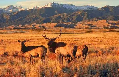
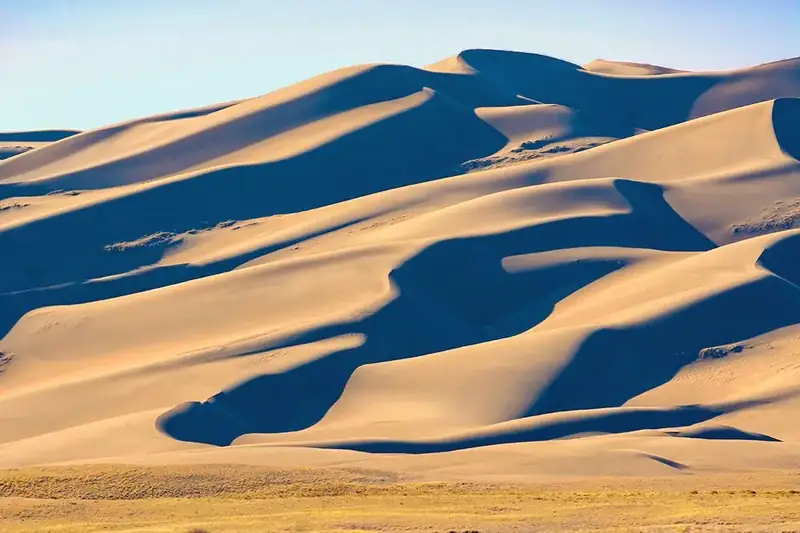
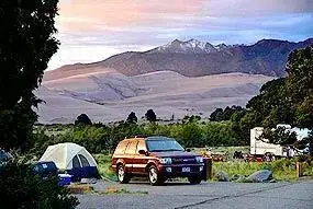
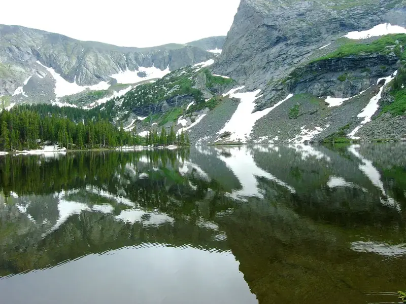
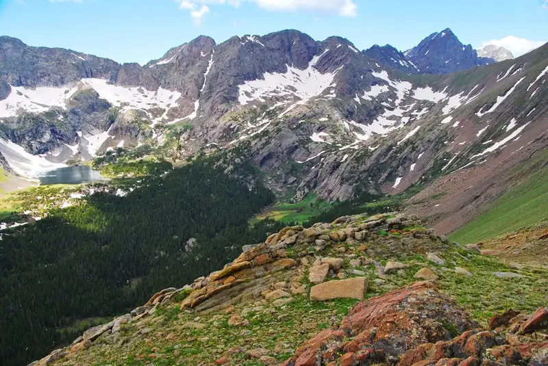
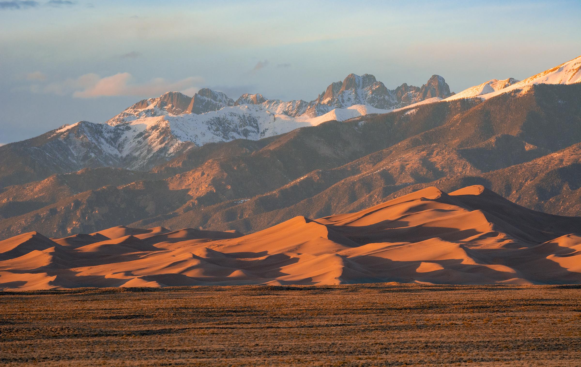


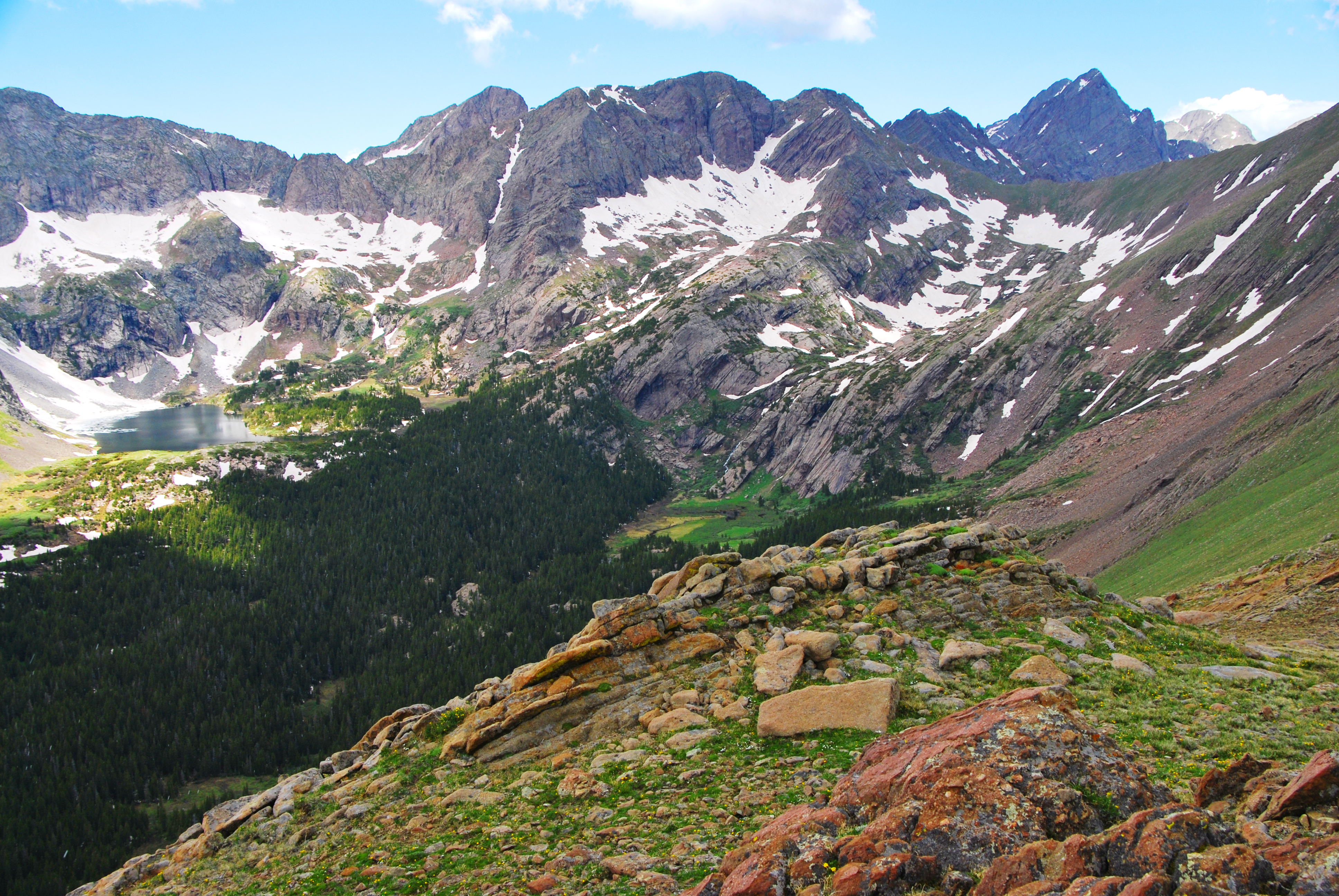


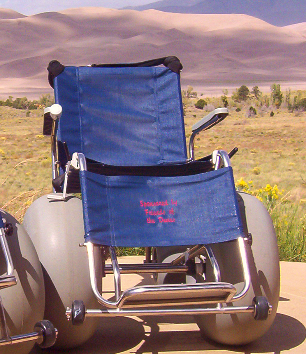


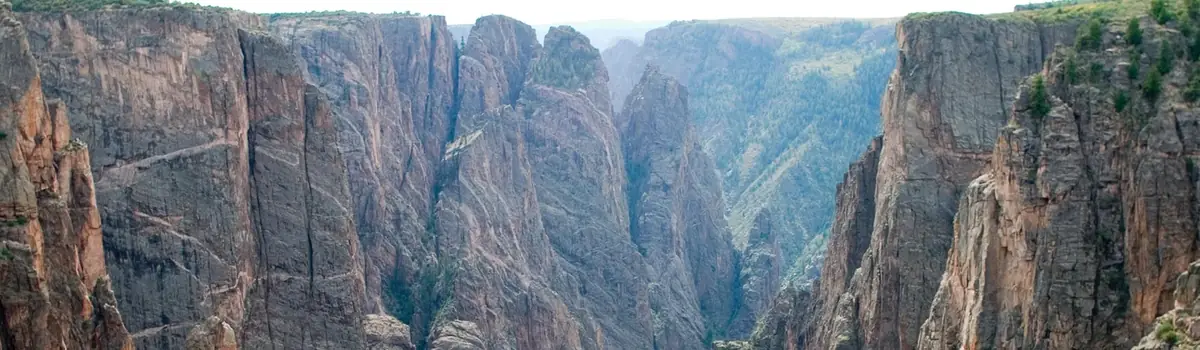 Mountains