Gatlinburg
5–15 min to Sugarlands; 40–60 min more to Newfound Gap
Convenient for the Tennessee-side sampler.
Tradeoff: Town traffic and Cades Cove drives add up.
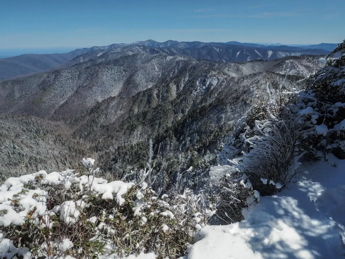
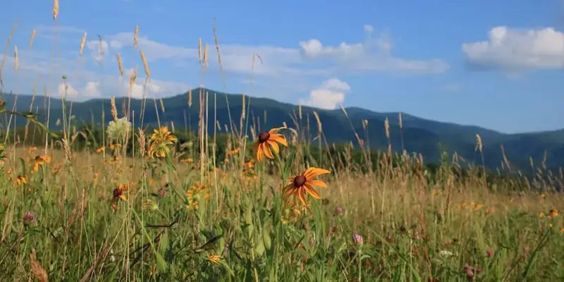
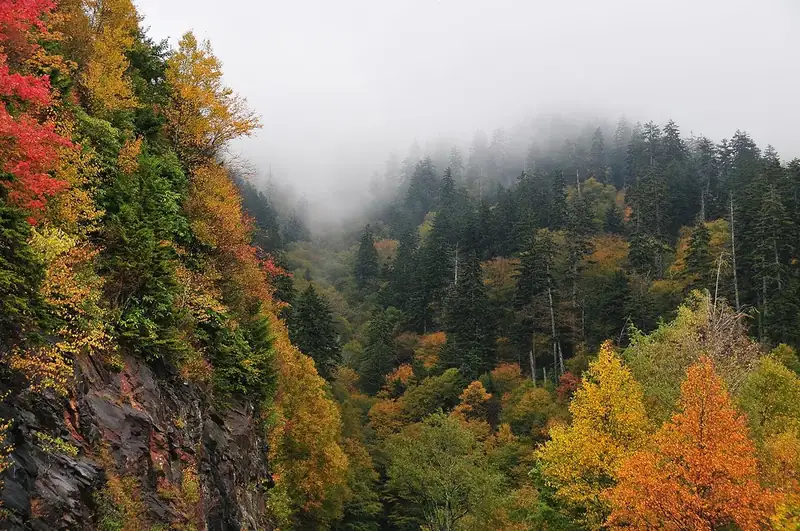
Ridge upon ridge of forest straddles the border between North Carolina and Tennessee in Great Smoky Mountains National Park. World renowned for its diversity of plant and animal life, the beauty of its ancient mountains, and the quality of its remnants of Southern Appalachian mountain culture, this is America's most visited national park. Plan your visit today!
Entrance is free, but parking requirements are separate. Check the official tag rules, duration and exceptions; an interagency pass does not replace a parking tag.
Before you go: Check whether your parking needs a tag.
Official guidance ↗ Reviewed 2026-10-19Selected guidance only; separate from climate comfort and current conditions.
Loading the latest saved conditions. You can also check the official report below.
Check current conditions at NPS ↗A mountain-overlook sampler, a dedicated Cades Cove day and an optional North Carolina-side day. Avoid crossing the park repeatedly.
Fall-color traffic can greatly exceed the estimates. Stay in one district per day and allow extra parking time.
Day 1Sugarlands visitor area and short nature walk → Newfound Gap overlooks
Day 2Cades Cove loop and historic stops
Day 3Oconaluftee visitor area and Mountain Farm Museum → Oconaluftee River Trail, selected section
Editorial planning ranges, not live routing or official trail measurements. Driving excludes lodging commutes unless stated; queues, closures and weather can add substantial time. Walking ranges describe the selected outing, not necessarily the full trail. Arrival and departure travel are additional. Select the season for your dates; this is not a live conditions check.
Check the road report and choose a short open nature path with ranger advice.
Start: Sugarlands Visitor Center, with a valid parking tag when required.
Getting there: Start here from the Tennessee side; other bases change the approach.
Footing: Developed visitor area and uneven natural paths; ask about current surfaces.
Use the exhibits if the paths are muddy, icy or closed.
Drive only when US 441 is open and weather suitable. Stop at legal overlooks; a mountain summit hike is not included.
Start: Newfound Gap parking on US 441.
Getting there: From Sugarlands: allow 40–60 minutes driving each way before stops.
Footing: High-elevation paved viewing area with slopes, steps nearby and possible ice.
Remain in the Sugarlands / Gatlinburg district when the road is closed or visibility poor.
Allow 45–75 minutes of traffic and parking contingency. Skip the mountain drive in unsafe conditions; there is plenty to do at lower elevation.
Choose two historic stops and a picnic. Wildlife traffic may make this the whole day.
Start: Cades Cove loop entrance; check vehicle-free dates before driving.
Getting there: From Gatlinburg: allow 60–90 minutes each way; the loop itself can take 90–150 minutes or longer.
Footing: One-way scenic road with short uneven historic-site paths.
If vehicle access is unavailable or congestion excessive, use a Townsend-area picnic and a suitable open lower-elevation walk.
Driving total includes the loop and assumes a Gatlinburg base. Townsend substantially reduces the approach. Do not add Newfound Gap or a distant waterfall to this day.
Explore the farm area and leave wildlife room to move. Elk sightings are not guaranteed.
Start: Oconaluftee Visitor Center near Cherokee.
Getting there: Start from Cherokee; from Gatlinburg add 60–90 minutes each way over US 441 when open.
Footing: Developed area and gravel / natural paths.
Use visitor exhibits if outdoor paths are unsuitable.
Use an out-and-back and turn around early enough for the group. The full trail is not required.
Start: Signed trail near the visitor center.
Getting there: Walk from the visitor area; no extra cross-park drive.
Footing: Mostly gentle natural-surface riverside path; roots and mud can occur.
Skip the optional walk in poor footing and take a longer picnic.
For a three-day trip, consider a Cherokee night before this day. It avoids repeating the mountain crossing just to return to Tennessee.
Compare access to the district listed for each day. Drive ranges are editorial estimates before major queues or weather delays.
5–15 min to Sugarlands; 40–60 min more to Newfound Gap
Convenient for the Tennessee-side sampler.
Tradeoff: Town traffic and Cades Cove drives add up.
20–35 min to Cades Cove loop entrance
Best for the dedicated Cove day and a quieter gateway.
Tradeoff: Farther from Sugarlands and the North Carolina side.
5–15 min to Oconaluftee
Best for river / farm outings and the North Carolina side.
Tradeoff: US 441 closures can separate you from a Tennessee-side plan.
Use your own quotes to compare room savings with extra time on the road.
Room totals only. Taxes, fuel, parking, vehicle wear and the value of your time are additional. These inputs are examples until you enter your quotes.
Mark your own preparation below. A check means you have handled it; it does not confirm a reservation or availability. Stored on this device.
Parking · Before stopping for more than 15 minutes
A parking tag is required for parking longer than 15 minutes unless an official exemption applies. It does not reserve a space; an entrance pass does not replace it.
If unavailable: Buy through official channels and display as directed.
Check official rules & booking linksLodging · As soon as dates are firm
Choose the gateway that matches your daily district. Check campground-specific release windows and facilities.
If unavailable: Consider a split Tennessee / Cherokee stay rather than repeated mountain crossings.
Check official rules & booking linksActivity · Before adding overnight hiking or a special event
This plan uses day-use areas. Backcountry camping and certain special activities have separate permit / reservation systems.
If unavailable: Keep to the day-use itinerary.
Check official rules & booking linksTransport · Before each travel day
Check US 441, seasonal roads and any Cades Cove vehicle-free periods. Laurel Falls is not assumed open in this plan.
If unavailable: Use the lower-elevation day if the mountain road is closed.
Check official rules & booking linksThe PDF and HTML contain the selected days, transport notes, lodging comparisons and booking guidance. Linked maps and websites require a connection.
Official source review: 2026-10-18. Durations, district grouping, gateway drive ranges and recommended pacing are National Parkwise editorial estimates. They are not live routing, current-condition guarantees or accessibility certification.
Official NPS activity guide.
Great Smoky Mountains National Park is a world-renowned preserve of wildflower diversity—over 1,500 kinds of flowering plants are found in the park, more than in any other North American national park. You can see where to find many of these flowers on the Species Mapper . I n fact, the park is sometimes referred to as the “ Wildflower National Park .” From the earliest hepaticas and spring-beauties in the late winter to the last asters in the late fall, blooming flowers can be found year-round in the park.
A group of flowers known as spring ephemerals begins the yearly show. Ephemerals are so named because they appear above ground only in late winter and early spring, then flower, fruit, and die back within a short two month period. They emerge from February through April, and are gone (dormant) by May or June.
This remarkable group of plants is adapted to the rhythm of the overstory trees. Ephemerals appear before deciduous trees leaf out, when full sunlight is streaming to the forest floor. This is also a time when soil moisture is high and soil nutrients are plentiful due to the decomposition of tree leaves that fell the previous autumn. The ephemerals exploit these conditions—they flower, fruit, and their above-ground parts decay before summer gets into full swing. The peak of spring wildflower blooming usually occurs in mid- to late-April at lower elevations in the park, and a few weeks later on the highest peaks.
Spring ephemerals include flowers such as trillium (the park has 10 different species), lady slipper orchids, showy orchis, crested dwarf iris, fire pink, columbine, bleeding heart, phacelia, jack-in-the-pulpit, little brown jugs, and violets, to name just a few. Suggested wildflower hikes.
Each spring, the park hosts the Spring Wildflower Pilgrimage , a week-long festival of programs and guided walks and hikes that explore the wondrous diversity of life in the park. In summer the display continues with brilliant red cardinal flowers, pink turtleheads, Turk’s cap lily, small purple-fringed orchids, bee-balm, butterfly-weed, black-eyed susans, jewel weed, and many others.
By late summer and through the fall, goldenrod, wide-leaved sunflowers, tall ironweed, mountain gentian, monk’s hood, coneflowers, and numerous varieties of asters begin to bloom. Purple umbels of sweet Joe-Pye-weed stretch towards the sky and can reach heights of ten feet.
Trees and shrubs bloom throughout the year too. From February through April the flowers of red maples paint the mountains with a wash of brilliant red. Showy trees such as serviceberry, silverbell, flowering dogwood, redbud, Fraser magnolia, and tuliptree soon follow. Later in summer sourwood, a tree prized for the honey that bees produce from its small bell-shaped, white flowers, begins to bloom. The year ends with the yellow flowers of witch-hazel, which blooms from October through January. Closer to the ground on shrubs, the small, bight yellow blossoms of spicebush begin to bloom in February and are soon joined by sweetshrub, dog-hobble, and flame azalea. The park is famous for its displays mountain laurel, rhododendron and flame azaleas . The lovely pink and white flowers of mountain laurel bloom in early May through June. Catawba rhododendron, which lives primarily at elevations above 3,500’, reaches it peak of bloom in June. Rosebay rhododendron is in bloom at the lower elevations in June and at mid-elevations during July. Flame azaleas bloom at the low and mid-elevations in April and May. On Gregory Bald the colorful display peaks in late June or early July. On Andrews Bald the peak is usually in early July.
Learn about the threats facing wildflowers and how you can do your part to protect them.
Wildflowers of the Smokies Photos of wildflowers grouped by color will aid in identifying species found in the park. Includes information on suggested walks, hikes, and drives in the park, as well as wildflower conservation.
NPS information imported 2026-10-17. Confirm current details at NPS
Official NPS activity guide.
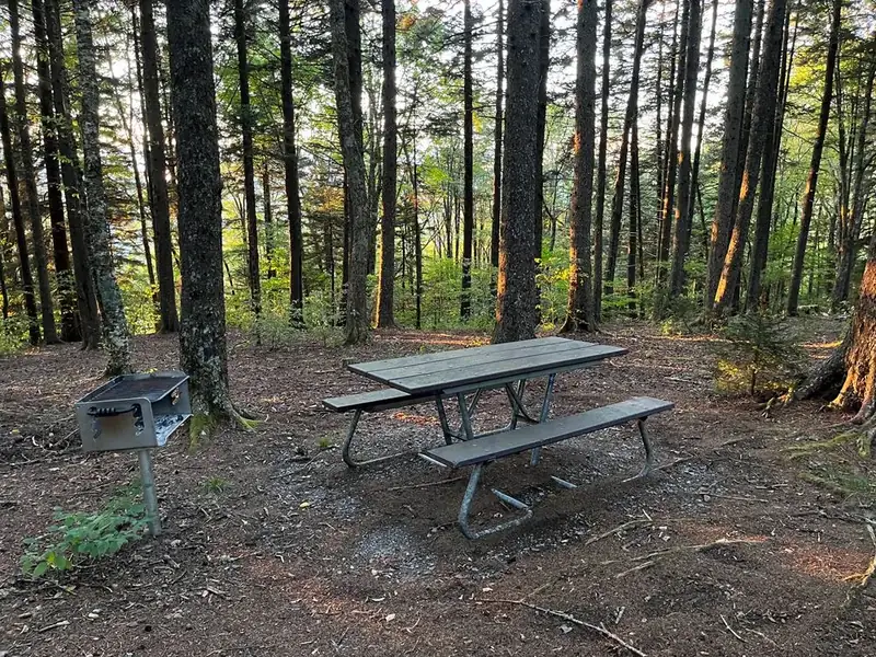
Collins Creek and Twin Creeks picnic areas are currently closed. Several other picnic areas are open. Read below to learn more about picnicking in Great Smoky Mountains National Park.
Obtaining a picnic pavilion reservation does not exempt you from the parking tag requirement.
Picnic areas are located at Big Creek, Chimneys, Cades Cove, Collins Creek, Cosby, Deep Creek, Greenbrier, Heintooga, Look Rock, and Metcalf Bottoms. Use the map above or download a park map to view the location of picnic areas in the park. The picnic areas at Cades Cove, Deep Creek, Greenbrier, and Metcalf Bottoms are open year-round. The remaining picnic areas are closed during the winter. See schedule below. Picnic pavilions are available at Collins Creek, Cosby, Deep Creek, Greenbrier, Metcalf Bottoms, and Twin Creeks. Pavilions can be reserved for groups one year in advance online or by calling 877-444-6777. Impromptu use of pavilions is allowed only when the pavilion has not been reserved. Please remember that feeding bears and other wildlife is illegal. The black bear symbolizes the invaluable wilderness qualities of Great Smoky Mountains National Park, but bears are dying unnecessarily from improper disposal of garbage or illegal feeding by visitors. A bear's remarkable sense of smell may lead it to human foods, such as a picnicker's cooler, garbage left in the open, or food scraps thrown on the ground or left in the grill. A bear that has discovered human food or garbage will eventually become day-active and leave the safety of the backcountry. It may panhandle along roadsides and be killed by a car or it may injure a visitor. Please do your part to help protect black bears and other wildlife in the Great Smokies. Clean your picnic area, including the grill and the ground around the table, thoroughly after your meal.
2025/2026 Schedule
Number of Sites
2025: closed 10/31 2026: 5/15-10/25
One ADA-accessible site.
Closes at 8 p.m. from 4/25-9/1; sunset on other dates. Three ADA-accessible sites.
2025: 4/1 - 12/1 2026: 4/3-11/30
Closes at 8 p.m.; sunset on other dates. Weather permitting. Partial closure 9/1 & 10/31.
Closes at 8 p.m.; sunset on other dates. Pavilion can be reserved up to a year in advance. Flush toilets open, weather permitting. Two ADA-accessible sites.
2025: closed 10/26 2026: 5/15-10/25
Pavilion can be reserved up to a year in advance. Hiker parking area open year-round.
Pavilion can be reserved up to a year in advance from. Restrooms only open during the reservation period.
Pavilion at separate site can be reserved up to a year in advance from. Vault toilets available.
2025: closed 10/13 2026: 5/15-10/12
2025: closed 10/26 2026: 5/8-10/25
Metcalf Bottoms
Pavilion can be reserved up to a year in advance from. North loop, pavilion, and south gated loop only open from 4/18–10/26; remaining sites open year-round. Only "pack it out" picnicking each fall/winter (until 4/17/2025, then 10/27/2025–4/2/2026). All dumpsters are removed during the winter. 10-ton wgt. limit on Metcalf bridge—no buses, motorhomes, trailers, etc. Two ADA-accessible sites.
2025: closed 2026: 4/4-10/31 (weekends only)
The pavilion is available by reservation only on weekends.
| Picnic Area | 2025/2026 Schedule | Number of Sites | Pavilion | Notes |
| Big Creek | 2025: closed 10/31 2026: 5/15-10/25 | 10 | No | One ADA-accessible site. |
| Cades Cove | Year-round | 81 | No | Closes at 8 p.m. from 4/25-9/1; sunset on other dates. Three ADA-accessible sites. |
| Chimneys | 2025: 4/1 - 12/1 2026: 4/3-11/30 | 68 | No | Closes at 8 p.m.; sunset on other dates. Weather permitting. Partial closure 9/1 & 10/31. |
| Collins Creek | Closed | 182 | Seats 70 | Closes at 8 p.m.; sunset on other dates. Pavilion can be reserved up to a year in advance. Flush toilets open, weather permitting. Two ADA-accessible sites. |
| Cosby | 2025: closed 10/26 2026: 5/15-10/25 | 35 | Seats 55 | Pavilion can be reserved up to a year in advance. Hiker parking area open year-round. |
| Deep Creek | Year-round | 58 | Seats 70 | Pavilion can be reserved up to a year in advance from. Restrooms only open during the reservation period. |
| Greenbrier | Year-round | 12 | Seats 70 | Pavilion at separate site can be reserved up to a year in advance from. Vault toilets available. |
| Heintooga | 2025: closed 10/13 2026: 5/15-10/12 | 41 | No | |
| Look Rock | 2025: closed 10/26 2026: 5/8-10/25 | 51 | No | |
| Metcalf Bottoms | Year-round | 122 | Seats 70 | Pavilion can be reserved up to a year in advance from. North loop, pavilion, and south gated loop only open from 4/18–10/26; remaining sites open year-round. Only "pack it out" picnicking each fall/winter (until 4/17/2025, then 10/27/2025–4/2/2026). All dumpsters are removed during the winter. 10-ton wgt. limit on Metcalf bridge—no buses, motorhomes, trailers, etc. Two ADA-accessible sites. |
| Twin Creeks | 2025: closed 2026: 4/4-10/31 (weekends only) | Pavilion only | Seats 150 | The pavilion is available by reservation only on weekends. |
NPS information imported 2026-10-17. Confirm current details at NPS
Official NPS activity guide.
While you’re in the park, protect yourself, wildlife, and others.
Wild animals can be unpredictable and dangerous. To protect yourself and the wildlife you come to watch, always remain at least 50 yards (150 feet) from bears and 25 yards (75 feet) from elk, or any distance that changes an animal's natural behavior due to your presence. It is illegal to feed, touch, tease, frighten, or intentionally disturb wildlife. Violations can result in fines or arrest.
Feeding wildlife—even squirrels and birds—can seem harmless, but it often leads to serious consequences. Animals that associate people with food may lose their natural fear, becoming aggressive, dependent, or more likely to be hit by cars. Sadly, some animals may have to be euthanized because of their learned behavior.
Getting too close for a photo is just as risky. Approaching wildlife teaches them that humans aren’t a threat, which puts both animals and people in danger. If an animal comes near, back away slowly and return to your vehicle if possible.
If your presence changes an animal’s behavior, you’re too close. Give all wildlife the space they need to stay wild.
If you are planning on hiking, know what to do if you see a bear .
Never approach an animal.
If an animal approaches you, back away to maintain a safe distance.
Park in roadside pullouts with all four ties off the roadway when watching/photographing animals. Do not block traffic or drive/park on roadside vegetation.
Do not feed wildlife or leave food out. Allowing wildlife, such as bears, to obtain human food even once can lead to them becoming dependent. Throw all garbage in bear-proof containers.
Report conflicts. If you’re involved in a conflict with an animal, regardless of how minor, report it to a park ranger as soon as possible.
The dense forests of the Smokies can make wildlife viewing a challenge. Be patient—wildlife can appear anywhere in the park at any time.
Cataloochee – A remote, quieter area of the park where elk are commonly seen.
Cades Cove – A one-way loop road known for sightings of white-tailed deer, turkeys, and various birds. Visitors may also spot coyotes, woodchucks, and black bears.
Roaring Fork Motor Nature Trail – A narrow, winding, one-way road where black bears, white-tailed deer, and turkeys are often seen.
Winter – With fewer leaves and less vegetation, animals are easier to spot.
Early mornings or late evenings – These are peak times for animal activity.
Bring binoculars or a spotting scope .
Be patient —wildlife viewing takes time.
Look up —many animals spend time in the treetops.
NPS information imported 2026-10-17. Confirm current details at NPS
Official NPS activity guide.
Jim Bennett Photo
Bicycles can travel on most roads within the park. However, due to steep terrain, narrow road surfaces, and heavy automobile traffic, many park roads are not well suited for safe and enjoyable bicycle riding. Cades Cove Loop Road is an exception. The 11-mile one-way road is a popular bicycling area. It provides bicyclists with excellent opportunities for wildlife viewing and touring 19th-century homesites. Cades Cove access is motor vehicle-free all day on Wednesdays for part of the year (dates TBA) to provide opportunities for pedestrians and cyclists to experience Cades Cove without motor vehicles. During summer and fall, bicycles may be rented at the campground store (located near Cades Cove Campground). There are no mountain biking trails in Great Smoky Mountains National Park. The Gatlinburg Trail , the Oconaluftee River Trail , and the lower Deep Creek Trail are the only park trails on which bicycles are allowed. Bicycles are prohibited on all other park trails. Other areas suitable for bicyclists include the roads in the Greenbrier and Tremont areas in Tennessee, and the Cataloochee Valley and Lakeview Drive in North Carolina. Download a park map to locate these areas.
Safety is always a major concern where cars and bicycles must share the road. The states of North Carolina and Tennessee require that children age 16 and under wear helmets . We strongly recommend that all riders wear helmets, use rear view mirrors, and ride properly-fitted and well-maintained bicycles. Please obey all traffic regulations Only Class 1 and Class 2 electric bikes (e-bikes) are permitted in the park. All bikes must follow the posted speed limit of 20 miles per hour.
Mountain biking trails are open on national forest and recreation lands outside Great Smoky Mountains National Park. For information on mountain biking near the park, please visit the following pages:
Chattahoochee National Forest Cherokee National Forest Nantahala National Forest Pisgah National Forest Big South Fork National River & Recreation Area Mount Rogers National Recreation Area Tsali Recreation Area
Visit Great Smoky Mountains National Park's official online store for books, maps, and guides to the park. Operated by the nonprofit Smokies Life, proceeds generated by purchases at the store are donated to educational, scientific, and historical projects in the park.
NPS information imported 2026-10-17. Confirm current details at NPS
Official NPS activity guide.
Each year, roughly 800,000 visitors fish for brook, brown or rainbow trout in Great Smoky Mountains National Park. The park boasts approximately 2,900 miles of streams, safeguarding one of the last remaining wild trout habitats in the eastern United States. While only about 20% of the park's streams are large enough to support trout populations, they provide an array of fishing experiences. Anglers can choose from remote headwater trout streams to larger, cool-water smallmouth bass streams. Most of these streams maintain their fish populations at or near carrying capacity, ensuring excellent opportunities for catching various species throughout the year. Precautionary fish consumption advisory: The Tennessee Department of Environment and Conservation announced a precautionary fish consumption advisory for smallmouth bass from Abrams Creek and the Little River. Learn more about bacteriological and fishing advisories in Tennessee.
Residents and nonresidents 16 years of age and older must possess a valid fishing license or permit from either Tennessee or North Carolina.
No trout stamp is required.
Fishing licenses and permits are not sold in the park. (Licenses can be purchased in surrounding towns outside the park or online.)
Special permits are required for fishing in Gatlinburg and Cherokee.
Outside of the park, you must abide by state regulations
Residents and nonresidents 13 years of age and older must have a valid license.
Residents 65 years of age and older may obtain a special license from the state. (Note: You can buy a license from the state government of Tennessee.)
Persons under 13 years of age in Tennessee are entitled to the adult daily bag and possession limits, in addition to being subject to all other regulations.
Learn more about Tennessee license requirements.
Residents and nonresidents 16 years of age and older need a license.
Residents aged 70 and older may obtain a special license from the state. (Note: You can buy a license from the state government of North Carolina.)
Persons under 16 years of age in North Carolina are entitled to the adult daily bag and possession limits, in addition to being subject to all other regulations.
Learn more about North Carolina License requirements.
Fishing is permitted year-round in open waters from 30 minutes before official sunrise to 30 minutes after official sunset.
The park allows fishing in all streams.
Fishing is permitted only by the use of one hand-held rod.
Only artificial flies or lures with a single hook may be used. Dropper flies may be used. Up to two flies on a leader. (Use or possession of any form of fish bait or liquid scent other than artificial flies or lures on or along any park stream while in possession of fishing tackle is prohibited. Prohibited baits include [but are not limited to]: live or preserved minnows, worms, corn, cheese, bread, salmon eggs, pork rinds, liquid scents and natural baits found along streams.)
Use or possession of double, treble, or gang hooks is prohibited.
Fishing tackle and equipment, including creels and fish in possession, are subject to inspection by authorized personnel.
Brook, rainbow and brown trout: 7 inch minimum
Smallmouth bass: 7 inch minimum
Rock bass: No minimum
(Trout or smallmouth bass caught less than the legal length shall be immediately returned to the water from which it was taken.)
Five (5) brook, rainbow or brown trout, smallmouth bass, or a combination of these, each day or in possession, regardless of whether they are fresh, stored in an ice chest, or otherwise preserved. The combined total must not exceed 5 fish.
Twenty (20) rock bass may be kept in addition to the above limit.
A person must stop fishing “immediately” after obtaining the limit.
Please report violators to nearest ranger or call Great Smoky Mountains Dispatch: (865) 436-1294.
Brook Trout Has a dark, olive-green or blue-green body with distinctive red spots. There is a worm-like pattern, called a "vermiculated" pattern, across its back. The fins are tri-colored, typically displaying orange and black with a trailing white edge. You might notice red spots in the top dorsal fin. Rainbow Trout Has a light body, which can be silver or pale blue, with dark spots scattered across it. A striking large pink stripe runs along its side, sometimes accompanied by a pink or red patch on the cheek. Some fins may have a white edge. Brown Trout Has a light to golden-brown body with dark or red spots that have white halos around them. Their fins may also have white edges.
Rainbow Trout vs Brown Trout
Left image Rainbow trout (invasive) Credit: © Joeseph Tomelleri
Right image Brown trout (non-native) Credit: © Joeseph Tomelleri
Brook Trout vs Brown Trout
Left image Brook trout (native) Credit: © Joeseph Tomelleri
Warren Bielenberg
Do your part in protecting the park.
Help prevent the spread of invasive species by cleaning your fishing gear before use in a new waterway.
If there is a tangle of line or an empty can at your feet, clean up after your fellow angler.
It is unlawful to dispose of fish remains on land or water within 200 feet of a campsite. The National Park Service recommends disposing of fish entrails in a deep pool downstream from any campsite.
Disturbing and moving rocks to create channels and construct rock dams is illegal in Great Smoky Mountains National Park. Such actions can lead to serious and detrimental consequences for the aquatic ecosystem and its delicate balance.
Many fish species that live in the park spawn between April and August. Some of these fish build their nests in small cavities under rocks and even guard the nests. When people move rocks, the nests are destroyed and the eggs and/or young fish die.
Aquatic insects rely on rocks for cover and many species will attach themselves to the sides of rocks and cannot move. When a rock is moved, aquatic insects fall, are crushed by the movement, or will dry out and die when the rock is placed out of water.
One of the fundamental policies of the National Park Service is to preserve natural resources in an unaltered state. Abide by these rules so that future generations may enjoy the park as well.
Use extreme caution while fishing in streams throughout the Smokies. Drowning is the second cause of death in the park.
Water currents are swifter than they appear, and footing is treacherous on wet and moss-covered rocks.
Rising water levels resulting from sudden mountain storms occur frequently, so monitor water level.
Standing and wading in streams can drain body heat and lead to hypothermia.
Learn more about water safety .
Angler Creel Survey
Bait fishing is prohibited in the national park to prevent the accidental introduction of non-native species, which can harm native ecosystems. Anglers may unknowingly release non-native organisms when discarding unused bait, posing a significant threat to the local environment. Furthermore, collecting natural bait can disrupt local ecological balances, leading to unintended consequences for native wildlife. Additionally, the use of corn or bread for fishing is illegal because these baits are associated with higher hooking mortality rates, which can adversely affect fish populations. By enforcing these regulations, the park aims to protect its delicate ecosystems and ensure the sustainability of its aquatic life.
Treble hooks are not allowed because they result in higher hooking mortality rates for fish that must be released.
The best fishing spots depend on individual preferences, but areas near roads tend to have higher fishing pressure.
Fishing success can vary based on season, time of day, skill level, lure type, and weather conditions. Sometimes, fish simply may not be biting.
Lay the fish on a flat surface with its nose against a block and measure to the tail's furthest point.
Play the fish quickly, avoiding total exhaustion.
Keep the fish in water as much as possible.
Handle with wet hands, even when using a mesh net.
Remove hook gently; do not squeeze fish or put fingers in gills. Use long-nosed pliers to back the hook out gently. Use of barbless hooks is encouraged.
If the hook is deeply embedded, cut the line instead of pulling it out.
Hold the fish upright in the water and move it gently.
Release the fish in calm water.
Key Locations for Smallmouth Bass:
West Prong of the Little Pigeon River in the first few miles.
Streams flowing into Fontana Lake like Eagle, Hazel, and Noland Creek.
Best Streams for Smallmouth Fishing:
East Prong of Little River from Townsend to the Sinks. This stream offers easier road access but lower densities of smallmouth.
Abrams Creek from its embayment with Chilhowee Reservoir to Abrams Falls. This stream has a high population of smallmouth bass, but is rarely fished because it’s challenging to access.
Fish of the Smokies Fish Learn more about fish in the park.
Safety Water Safety Learn more about being safe in water.
NPS information imported 2026-10-17. Confirm current details at NPS
Official NPS activity guide.
Of all the paths you take in life, make sure a few of them are dirt.
Caution is always advised when exploring the backcountry. The park's backcountry is managed as a natural area, where the forces of nature determine trail conditions. Please be prepared for swollen streams, bridge washouts, downed trees, and trail erosion.
Throughout the year, hikers come from across the globe to explore the remote wilderness of Great Smoky Mountains National Park. Each season offers a new experience. In winter, the absence of deciduous leaves opens up new vistas and reveals hidden wonders. Spring brings a colorful display of wildflowers and flowering trees that paint the landscape. In summer, hikers find themselves fully immersed in the dense greenery of the forest. Autumn offers crisp, dry air, a variety of spectacular fungi, and a rich palette of fall colors to enjoy.
Trails throughout the park vary in difficulty based on mileage, elevation gain, terrain, and weather. Most trails in the Smokies are out-and-back, with very few loop hikes available.
Know your limits and consider these questions before hiking:
What is my experience level? Do I hike often, or is this my first time on the trails?
How much weight and for how long can I comfortably carry in my backpack?
Am I physically fit for the hike I want to do? Have I ever hiked this many miles or climbed this much elevation? Should I try an easier trail first to test my abilities?
Have I ever hiked in this type of environment before? Is it too hot, cold, or humid to attempt this hike?
Am I hiking alone or with a friend? Am I prepared to hike solo? Is this hike suitable for my group's abilities?
If you ever feel uncertain or a hike is more difficult than you or your group anticipated, turn back. Learn more about hiking safely in the Smokies.
Let the slowest hiker set the pace. Always stay together. Put the slowest hiker near the front.
Keep track of your time and distance. Remember that your total hike time includes the time it took you to hike to your destination and back. Set a turn around time if your trip is taking longer than planned.
Take breaks often. Pay attention to how you are feeling when on the trail. A good rule of thumb is that if you can talk while you are hiking, you are traveling at the perfect speed.
Be aware of wildlife. You might see some wildlife, such as black bears, while you are out exploring. Learn more about hiking in bear country .
Leave no trace. Minimize impace and always follow the seven leave no trace principles .
What to bring on a hike depends on many factors, but there are ten essentials that you must have for any outing. Keep in mind that these are the minimum items everyone should carry while recreating outdoors. More supplies may be necessary depending on the duration of your hike and your specific needs.
Navigation (map, compass, & GPS) Sun Protection (sunglasses, sunscreen, & hat) Insulation (jacket, hat, gloves, layers, & rain gear) Illumination (flashlight or headlamp; your phone does not count) First-Aid Supplies (first-aid kit; ensure supplies are not expired) Fire (matches, lighter, & fire starter) Repair Kit and Tools (duct tape, knife, screwdriver, & scissors) Food (nutritious snacks that do not require cooking) Hydration (water & water treatment supplies; at least 1 liter per 2 hours of hiking) Emergency Shelter (tent, tarp, bivy sack, or space blanket)
Navigation (map, compass, & GPS)
Sun Protection (sunglasses, sunscreen, & hat)
Insulation (jacket, hat, gloves, layers, & rain gear)
Illumination (flashlight or headlamp; your phone does not count)
First-Aid Supplies (first-aid kit; ensure supplies are not expired)
Fire (matches, lighter, & fire starter)
Repair Kit and Tools (duct tape, knife, screwdriver, & scissors)
Food (nutritious snacks that do not require cooking)
Hydration (water & water treatment supplies; at least 1 liter per 2 hours of hiking)
Emergency Shelter (tent, tarp, bivy sack, or space blanket)
Check out what trails the Smokies has to offer.
Learn how to be safe while hiking in the Smokies.
Current conditions of park trails.
Learn more about the numerous waterfalls in the Smokies.
Do you know how to be safe in bear country?
Where are pets allowed?
NPS information imported 2026-10-17. Confirm current details at NPS
Official NPS activity guide.
Cades Cove is a scenic valley surrounded on all sides by mountains south of Townsend, Tennessee. A popular 11-mile one-way loop road encircling the valley provides access to hiking trails, opportunities for wildlife viewing, and chances to explore the many historic homesites, cemeteries, and churches. The area also holds a visitor center, campground, picnic area, and riding stable.
Smokies Life Graphic/Emma Oxford
Cades Cove Loop Road is open sunrise to sunset each day, but closed to vehicles each Wednesday typically from May through September . The 11-mile, one-way loop road circles the cove, offering motorists the opportunity to sightsee at a leisurely pace. Allow at least two to four hours to tour Cades Cove, longer if you hike some of the area's trails. Traffic is heavy during the tourist season in summer and fall and on weekends year-round. While driving the loop road, please be courteous to other visitors and use paved pullouts when stopping to enjoy the scenery or view wildlife. Download the NPS mobile app and check out the self-guided Cades Cove driving tour for an interactive experience.
Foothills Parkway (Cosby to I-40) : 5.6 miles (9.01 km) one-way
Foothills Parkway (Walland to Wears Valley) : 14.75 miles (23.74 km) one-way
Foothills Parkway (Chilhowee to Walland) : 16.6 miles (26.7 km) one-way
The valley has a rich history . For hundreds of years, Cherokee Indians hunted in Cades Cove but archeologists have found no evidence of major settlements. The first Europeans settled in the cove sometime between 1818 and 1821. By 1830, the population of the area had already swelled to 271. Cades Cove offers the widest variety of historic buildings of any area in the national park. Scattered along the loop road are three churches, a working gristmill, barns, log houses, and many other faithfully restored eighteenth- and nineteenth-century structures. Pick up the self-guiding tour booklet available at the entrance to the loop road for information about the buildings you'll see in the cove and the people who lived here.
Cades Cove Story Learn about farming, home life, religion, and recreation in the fascinating history of this beautiful, lively mountain community. Contains historic photos.
Self-Guiding Auto Tour Booklet Cades Cove Keyed to numbered posts or landmarks along the Cades Cove Loop Road, this tour booklet describes the history of the Cove and describes the homes, barns, churches, Cable Mill, and other historic buildings you'll see in the area. It features historic photographs and illustrations that show what life was like a century ago.
Day Hikes In and Around Cades Cove Map and guide with descriptions of the nine best day hikes in the Cades Cove area. Full color topo map and elevation charts.
Visit Great Smoky Mountains National Park's official online store for books, maps, and guides to the park. Operated by the nonprofit Smokies Life, proceeds generated by purchases at the store are donated to educational, scientific, and historical projects in the park.
NPS information imported 2026-10-17. Confirm current details at NPS
Official NPS activity guide.
Warren Bielenberg Photo
Guided horseback rides are available at three concession riding stables in the park from mid-March through late-November. Rides on scenic park trails last from 45 minutes to several hours. Weight limits and age restrictions may apply.
Cades Cove, near Townsend, TN (also offers hayrides and carriage rides). Visit the Cades Cove Riding Stables website for additional information.
Smokemont, near Cherokee, NC (also offers wagon rides). Visit the Smokemont Riding Stables website for additional information.
Sugarlands, near Gatlinburg, TN. Visit the Sugarlands Riding Stables website for additional information.
Cades Cove Riding Stables offers a 1.5-2 hour hayride around the Cades Cove Loop Road. Passengers sit on a bed of hay in a trailer pulled by a truck and enjoy an open air view of the scenery of Cades Cove. Reservations are generally required.
Carriage or wagon rides are offered at two of the concession horseback riding stables in the park. These rides provide an opportunity to experience a 20-30 minute horse-drawn carriage or wagon ride on a park trail. Please visit the website of the stable you are interested in for additional information.
Carriage Rides at Cades Cove Riding Stables
Wagon Rides at Smokemont Riding Stables
Caution is advised in the backcountry. The park's backcountry is managed as a natural area where the forces of nature determine trail conditions. Please be prepared for swollen streams, bridge washouts, downed trees, and trail erosion-riding is not recommended from early December until May due to the seasonal nature of the trail maintenance program.
About 550 miles of the park's hiking trails are open to horses. Horses are restricted to trails specifically designated for horse use. If you wish to ride your own horse in the park, please obtain a copy of the park's trail map. This map indicates the trails on which you may ride horses and explains the park's rules and regulations concerning horse riding in the backcountry. It also provides information about backcountry camping, and permit requirements. To obtain an official trail map, stop at any park visitor center. The cost of the map is $1. You may also download a trail map . Horses are allowed only on trails specifically designated for horse use. Off-trail or cross-country riding is prohibited. Horse riders may use designated campsites located on trails open to their use, however some backcountry campsites must be reserved in advance. These sites are indicated on the park's trail map. Five drive-in horse camps provide ready access to backcountry horse trails in the park. Camps are located at Cades Cove (Anthony Creek), Big Creek, Cataloochee, Round Bottom, and Towstring. Horse camps are open from April through October.
Visit Great Smoky Mountains National Park's official online store for books, maps, and guides to the park. Operated by the nonprofit Smokies Life, proceeds generated by purchases at the store are donated to educational, scientific, and historical projects in the park.
NPS information imported 2026-10-17. Confirm current details at NPS
Official NPS activity guide.
Drawing by Emma Dufort
The park offers several different types of campsites: Backcountry - for backpackers. Requires hiking several miles to a site located in the park's backcountry. Frontcountry - camping near your car in a developed campground that has restrooms with cold running water and flush toilets. Each individual campsite has a fire grate and picnic table. Group Campgrounds - large campsites suitable for groups of eight people or more. Located in frontcountry campgrounds. Horse Camps - small campgrounds, accessible by vehicle, that offer hitch racks for horses and primitive camping facilities. Campground facilities and the procedures for obtaining a site in each type are different. Click on the titles above for additional information about facilities, reservations, and operating seasons.
Firewood Regulations: Only heat-treated firewood that is bundled and certified by the United States Department of Agriculture (USDA) or a state department of agriculture may be brought into the park. Campers may also collect dead and down wood found in the park for campfires.
Certified heat-treated firewood is packaged and clearly marked with a state or federal seal. Heat-treated wood is available from a growing list of private businesses in communities around the park. Concessioners at Cades Cove, Smokemont, and Elkmont will provide heat-treated wood for sale during their operating season March-October.
Many local stores and businesses sell certified firewood. Select the campground above you'll be camping in to find nearby businesses. Additional information about this regulation.
NPS information imported 2026-10-17. Confirm current details at NPS
Open an activity to read its details here. Source links open in a new tab; check current conditions and permit requirements before travel.
Official NPS features and USGS park boundaries, imported 2026-10-17. An inventory snapshot, not live trail or parking availability.
Map coverage varies. Trail names may represent segments, connectors, or shared park units; mapped lines are not a hiking recommendation. Use official conditions and navigation resources before heading out.
244 matching named trail records
| Trail / mapped route | Surface | Recorded uses |
|---|---|---|
| #67 Goldmine Branch Access Inventory record · 1 source segments; not a route distance. | Native | Unknown |
| Abrams Falls Trail Inventory record · 2 source segments; not a route distance. | Native | Unknown |
| Ace Gap Trail Inventory record · 1 source segments; not a route distance. | Native | Unknown |
| Albright Grove NatureTrail Inventory record · 1 source segments; not a route distance. | Native | Unknown |
| Alum Cave Trail Inventory record · 2 source segments; not a route distance. | Native | Unknown |
| Alum Cave trailhead Inventory record · 1 source segments; not a route distance. | Native | Unknown |
| Anthony Creek Trail Inventory record · 3 source segments; not a route distance. | Native | Unknown |
| Appalachian Trail Inventory record · 30 source segments; not a route distance. | Native | Unknown |
| Avent Cabin access Inventory record · 1 source segments; not a route distance. | Native | Unknown |
| Backcountry Camp 32, Injun Creek Access Inventory record · 1 source segments; not a route distance. | Native | Unknown |
| Balsam Mountain Nature Trail Inventory record · 1 source segments; not a route distance. | Native | Unknown |
| Balsam Mountain Trail Inventory record · 5 source segments; not a route distance. | Native | Unknown |
| Balsam Point Quiet Walkway Inventory record · 3 source segments; not a route distance. | Native | Interpretive |
| Baskins Creek Cemetery Access Trail Inventory record · 1 source segments; not a route distance. | Native | Unknown |
| Baskins Creek Trail Inventory record · 3 source segments; not a route distance. | Native | Unknown |
NPS public GIS inventory, imported 2026-10-17. “Existing” is an inventory classification, not confirmation that a trail is open. Segment counts are not route distances. Parking records do not indicate space availability, fees, or accessibility certification. View government source ↗
Climate for Gatlinburg, 4 km from the park reference point. 1991–2020 normals. Source elevation: 0 m.
Mountain, rim, valley, and coastal conditions can differ sharply from the source town. Check park forecasts and current conditions before travel.
| Month | High | Low | Rain / snow water | Wet days | Daylight |
|---|---|---|---|---|---|
| 46° | 28° | 113 mm | 12.4 | 9.9 h | |
| 50° | 32° | 103 mm | 12.1 | 10.6 h | |
| 58° | 38° | 122 mm | 13.1 | 11.7 h | |
| 67° | 46° | 116 mm | 12.1 | 12.9 h | |
| 73° | 54° | 112 mm | 14.3 | 13.9 h | |
| 80° | 62° | 103 mm | 15.2 | 14.4 h | |
| 82° | 65° | 116 mm | 16.0 | 14.2 h | |
| 82° | 64° | 91 mm | 13.8 | 13.4 h | |
| 77° | 58° | 96 mm | 10.0 | 12.2 h | |
| 67° | 47° | 80 mm | 9.1 | 11.1 h | |
| 57° | 37° | 96 mm | 9.9 | 10.1 h | |
| 49° | 32° | 107 mm | 11.5 | 9.6 h |
Official NPS excerpts imported 2026-10-17. Fees, permits, road access, and operations can change; use the source link to confirm the latest information.
Additional information on the visitor centers webpage.
Additional Weather Information
Parking tags are required for all vehicles parking for longer than 15 minutes.
Three tag durations are available for purchase for all vehicle sizes and types:
Great Smoky Mountains National Park does not charge an entrance fee .
Internet & Cellular Access Details
Know the status of the park's roads, facilities, and trails before you go.
Review pet-friendly park activities for a great visit.
Learn about the many areas of the park and plan ahead for an enjoyable trip.
Scenic vistas, historic buildings, rushing waterfalls, and expansive forests await.
Download maps to navigate the park's roads, trails, campgrounds, and more.
You can choose from 10 developed campgrounds or head into the backcountry. Your adventure awaits!
Find books, maps, and guides to the park online and in park stores from our nonprofit park partner, Smokies Life . Proceeds from purchases support educational, scientific, and historical projects in the park.
Visit our ' Frequently Asked Questions ' page.
Drawing by Emma Dufort
The park offers several different types of campsites: Backcountry - for backpackers. Requires hiking several miles to a site located in the park's backcountry. Frontcountry - camping near your car in a developed campground that has restrooms with cold running water and flush toilets. Each individual campsite has a fire grate and picnic table. Group Campgrounds - large campsites suitable for groups of eight people or more. Located in frontcountry campgrounds. Horse Camps - small campgrounds, accessible by vehicle, that offer hitch racks for horses and primitive camping facilities. Campground facilities and the procedures for obtaining a site in each type are different. Click on the titles above for additional information about facilities, reservations, and operating seasons.
Firewood Regulations: Only heat-treated firewood that is bundled and certified by the United States Department of Agriculture (USDA) or a state department of agriculture may be brought into the park. Campers may also collect dead and down wood found in the park for campfires.
Certified heat-treated firewood is packaged and clearly marked with a state or federal seal. Heat-treated wood is available from a growing list of private businesses in communities around the park. Concessioners at Cades Cove, Smokemont, and Elkmont will provide heat-treated wood for sale during their operating season March-October.
Many local stores and businesses sell certified firewood. Select the campground above you'll be camping in to find nearby businesses. Additional information about this regulation.
Vehicles with valid, state-issued disability placards or license plates are exempt from the parking tag requirement.
Great Smoky Mountains National Park can be enjoyed in a variety of ways—whether from the comfort of your vehicle, along scenic trails, at accessible facilities, or through ranger-led programs. From breathtaking mountain views to the stories of the resilient people who once called this wilderness home, there are countless opportunities to connect with the park.
During the summer season, visitors can participate in accessible ranger-led programs and reserve specialized off-road wheelchairs. These wheelchairs are available to reserve May – October and on a first come first serve basis year-round. They may only be used on select trails. Explore the sections below to learn more about these opportunities.
The official NPS mobile app offers accessibility details for facilities and select trails. Download the free app before your visit to enhance your experience.
Images on our website and social media include descriptions that can be read by screen readers. Videos are made accessible with English captions and an audio-described version available for users.
Trained service animals assisting individuals with disabilities are welcome in Great Smoky Mountains and must be leashed at all times. A service animal is defined as a dog trained to perform tasks the individual cannot do themselves—such as providing balance support, carrying gear, or alerting to medical conditions like seizures. Emotional support, therapy, or companion animals are not considered service animals and are not allowed in buildings or on most trails in the park. Learn more about pets in the park.
Individual mobility device checkout is available for many trails in the park. Check out a mobility device at the Sugarlands or Ocanaluftee Visitor Center on a first come, first served basis or reserve your chair by emailing us June through September.
Individual mobility device checkout is available for many trails in the park.
Check out a mobility device at the Sugarlands or Ocanaluftee Visitor Center on a first come, first served basis or reserve your chair by emailing us June through September.
Designated accessible parking spaces are available at Sugarlands Visitor Center and the restrooms outside of the visitor center are ADA accessible. The visitor center is open year-round, except on Christmas Day, and is ADA accessible. The information desk, book sales area, and exhibits are all located on one level.
Along Fighting Creek Gap Road and Newfound Gap Road, a few of the larger mountain overlooks offer accessible ADA parking spaces. Some smaller pull-offs may not have accessible parking spaces.
The Sugarlands Valley Nature Trail , located on Newfound Gap Road, just south of Sugarlands Visitor Center, is the only ADA accessible trail in the park and was made possible through a public-private partnership. This loop trail winds through second growth forest along the West Prong of the Little Pigeon River and offers a quiet woodland experience.
Sugarlands Riding Stable offers ADA accessible restrooms.
ADA accessible parking spaces are available at the Oconaluftee Visitor Center and the restrooms outside of the visitor center are ADA accessible. The visitor center is open year-round, except on Christmas Day, and is ADA accessible. Exhibits, information desk, and book the bookstore are all located on one level.
The paths through the nearby Mountain Farm Museum , located behind the Oconaluftee Visitor Center, are hard-packed gravel. They can be navigated with wheelchair assistance but are not considered ADA accessible . Most buildings can be viewed from the outside through doorways, and a ramp provides access to the historic house. Talks and demonstrations typically take place along the pathway, making them more accessible to visitors. A guide booklet about the historic structures is available for a small fee at the visitor center.
Mingus Mill is located just half a mile north of the Oconaluftee Visitor Center on Newfound Gap Road. ADA accessible restrooms are available next to the parking area. A paved and packed-gravel trail, about 100 yards long, leads to the mill and can be navigated with assistance, though it is not ADA accessible . Inside, the ground floor can be reached by a single step.
Smokemont Campground is located a few miles from the Oconaluftee Visitor Center on Newfound Gap Road. The campground has ADA accessible restrooms and a few ADA accessible campsites which can be reserved on Recreation.gov year-round. ADA accessible sites are generally level and located adjacent to ADA accessible restrooms. The campsites have been modified with paving, specialized tables, and fire grills. The amphitheater at Smokemont Campground has a paved path, however access is steep and not ADA accessible .
Smokemont Riding Stable offers ADA accessible restrooms.
ADA accessible parking spaces are available in the campground and picnic area parking lot across from the ranger station. The Cades Cove Campground Store and adjacent restrooms are ADA accessible.
The Cades Cove Visitor Center is located half-way through the Cades Cove Loop Road and is open year-round, except on Christmas Day. Accessible parking spaces are available at the visitor center near the sidewalk that leads to the ADA accessible restrooms. A ramp provides access to the visitor center where information and a small bookstore is available.
None of the historic buildings along the Cades Cove Loop Road are ADA accessible. However, many of the exteriors of historic structures in Cades Cove can be viewed from your vehicle. The John Oliver Cabin has two approach trails, one paved path and one dirt path. The paved, asphalt path is 0.3 miles (0.4 km) long, well-graded, and barrier-free, but is not ADA accessible . You must ascend a step to access the interior of the cabin.
The Cable Mill Historic Area has hard-packed gravel paths which are not ADA accessible but may be traversable in a wheelchair with assistance. While neither are ADA accessible , the Becky Cable House has an access ramp, and the Cable Mill is on one level.
Along park roadways, a few large overlooks offer accessible ADA parking spaces, most smaller pull-offs will not have these parking spaces.
The park’s roads offer a chance to explore remote areas. Self-guided auto tour booklets are available for several popular, and a few quieter destinations in the park including Cades Cove, Newfound Gap Road, Roaring Fork, Tremont, and Cataloochee. All booklets may be purchased at visitor centers. A few auto-tours are also available on the free National Park Service mobile app.
Reservations for a wheelchair accessible site can be made for campsites in three campgrounds: Cades Cove , Elkmont , and Smokemont . Cades Cove and Smokemont have accessible sites open year-round, while Elkmont is open seasonally. Accessible sites are generally level and located adjacent to accessible restrooms. The campsites have been modified with paving, specialized tables, and fire grills. For reservations, call 1-877-444-6777 or visit Recreaion.gov .
Big Creek Horse Camp has an accessible campsite and restrooms that are open seasonally. Reservations are required by calling 1-877-444-6777 or visit Recreaion.gov .
Most park restrooms are ADA accessible, including restrooms at visitor centers, campgrounds, and picnic areas. The restrooms at Newfound Gap Overlook can be accessed by a paved walkway, however the walkway is steep and may require assistance.
All visitor centers are ADA accessible.
The Sugarlands Valley Nature Trail is the only ADA-accessible trail in Great Smoky Mountains National Park.
While there are no additional ADA-accessible trails, visitors who are comfortable walking short distances may enjoy several brief, non-paved trails.
Quiet Walkways: Marked with brown signs along Fighting Creek Gap and Newfound Gap Road.
Short trails near visitor centers: Located behind the Sugarlands and Oconaluftee Visitor Centers.
Visit our Trail Accessibility Information page or speak with a staff member at a visitor center for more recommendations.
Before you head out, make sure you’ve got your parking tag! Tags are available throughout the park, but most trailheads don’t have parking tag machines . Purchase your parking tag in advance to avoid delays on your next adventure.
Are you a frequent visitor to the Smokies? Purchase your annual parking tag online.
Learn where you can pick up a daily or weekly parking tag when you arrive to the Smokies.
Like to plan ahead? Purchase a daily or weekly parking tag online and print it before you visit the Smokies.
Every dollar stays in the Smokies to support visitor services.
Parking tags are not replaceable, refundable, transferable, or upgradable.
Each tag is valid for a single vehicle and must include a license plate number matching the vehicle in which it is displayed.
Parking tags are available for purchase both online and onsite.
Display of physical parking tags in each vehicle is required. Digital representations are not accepted.
A parking tag is required to park anywhere within the boundaries of the Smokies. Parking tags are not location-specific.
Parking tags are required for all vehicles parking for longer than 15 minutes.
America the Beautiful entrances passes (e.g., Senior Pass, Access Pass, Military Pass) are not accepted in place of a parking tag.
Purchasing a parking tag does not guarantee you a parking spot.
Daily, weekly, and annual parking tags are available for purchase at the locations listed below. Please note that store hours may vary seasonally.
Daily and weekly tags purchased in person must be used starting on the date of purchase, unless you specifically request a next-day pass at the time of purchase.
Daily tags expire at 11:59 PM ET on the date shown.
Weekly tags expire at 11:59 PM ET, seven days from the date of purchase.
Gatlinburg Welcome Center - 1011 Banner Road, Gatlinburg, TN 37738
Sugarlands Visitor Center - 1420 Fighting Creek Gap Road, Gatlinburg, TN 37738
Greenbrier Grocery - 2406 E. Parkway, Gatlinburg, TN 37738
The Great Smokies Welcome Center - 7929 E. Lamar Alexander Parkway, Townsend, TN 37882
Cades Cove Visitor Center - 686 Cades Cove Loop Road, Townsend, TN 37882
Great Smoky Mountains Institute at Tremont Store - 9275 Tremont Road, Townsend, TN 37882
Kuwohi Visitor Center - 7078 Clingmans Dome Road, Cherokee, NC 28719
Oconaluftee Visitor Center - 1194 Newfound Gap Highway, Cherokee, NC 28719
Graham County Travel and Tourism & Welcome Center - 474 Rodney Orr Bypass, Robbinsville, NC 28711
Swain County Visitor Center - 2 Everett Street, Bryson City, NC 28713
Visit Haywood Welcome Center - 91 North Lakeshore Drive, Lake Junaluska, NC 28745
REI - 2655 Teaster Ln Suite 310, Pigeon Forge, TN 37863
REI - 6700 Papermill Dr NW, Knoxville, TN 37919 (annual parking tags only)
REI - 31 Schenck Pkwy, Chattanooga, TN 37421 (annual parking tags only)
REI - 1140 Woodruff Rd Ste 400, Greenville, SC 29607 (annual parking tags only)
REI - 31 Schenck Parkway, Asheville, NC 28803 (annual parking tags only)
Daily and weekly parking tags are available for purchase by credit card (tap-to-pay is not available) from parking tag machines, available year-round, 24 hours a day. Daily and weekly parking tags purchased at parking tag machines must be used starting on the date of purchase. Daily parking tags expire at 11:59pm EST on the date of purchase. Weekly parking tags expire at 11:59pm EST 7 days from the date of purchase.
Sugarlands Visitor Center
Greenbrier Ranger Station
Cosby Picnic Area
Metcalf Bottoms Picnic Area
Cades Cove Orientation Shelter
Look Rock Campground
Newfound Gap Overlook
Kuwohi parking area
Oconaluftee Visitor Center
Deep Creek Picnic Area
Cataloochee Valley Overlook
Enjoy the convenience of purchasing your annual parking tag before you arrive and have it shipped straight to your door. Annual Parking Tags are available for purchase online through Smokies Life.
Enjoy the convenience of purchasing your parking tag before you arrive.
Daily and weekly parking tags are available for purchase online through recreation.gov . Visitors MUST print and display their parking tag . Park staff will not print the tag for you.
Visitors are required to enter the date of their visit and their license plate number at the time of purchase. Tags may be purchased up to six months in advance of your visit.
Daily and weekly parking tags expire at 11:59pm ET on the date printed on the tag.
Must be displayed in the front, lower passenger side windshield.
Must be placed face-up on the front, lower passenger side dashboard.
Daily and weekly parking tags expire at 11:59 p.m. EST on the date printed on the tag. Annual tags are valid for 12 months from the month of purchase. To determine when your annual tag expires, look for the small hole punch on the side of the tag. Each side of the tag has letters representing the months of the year, and the hole punch marks the month your tag is valid through. For example, if you purchased an annual parking tag on January 5, 2025, it will be valid until January 31, 2026.
Some groups are exempt from displaying a parking tag but may still need a parking placard in their vehicle. Explore the drop-downs below for specific details on exemption processes.
National Park Service regulations allow school groups and other bona fide national and international educational institutions to obtain a waiver of the Great Smoky Mountains National Park parking tag fee, provided that the visit is for educational or scientific purposes, and the resources or facilities the group proposes to use support those purposes. Educational fee waivers are not granted automatically. Educational groups must apply and meet the criteria to receive the waiver. Submission Information:
Fill out sections 1, 2, and 5 of this form: NPS Form 10-1750
Submit form 2 weeks in advance of the visit to grsm_fee_program@nps.gov
If the application is approved, a parking placard will be emailed to you to be displayed during your visit. Each vehicle must display the parking tag placard while parked in Great Smoky Mountains National Park. Park staff will not print parking tag placards onsite. Visitor center staff are not authorized to approve fee waivers. Fee waivers must be processed in advance of your academic visit. Note: Parking tag exemptions for chaperones are covered at a ratio of 1 adult per 5 students K-8th grade, and 1 adult per 10 students in 9th grade and above.
National Park Service regulations allow permitted researchers to be exempt from paying for a parking tag while they are engaged in their permitted research activities . Perspective researchers will receive parking tag placards with their permit when it is issued. Researchers must inform the research coordinator of the minimum number of vehicles that will be needed for their work at any one time and will be issued that many placards. Placards must be printed in color and be visible through the front windshield while the vehicle is parked. Placards will be renewed annually for the duration of the issued research permit. As with any other parking tag, the placards issued to permitted researchers do not authorize parking outside of designated parking areas nor guarantee a parking space at any specific location within the Park; researchers must plan their schedules to arrive at popular locations outside of the peak visitation times. Learn more and contact the park's research coordinator from the park's research page .
Burials , individual cemetery visits, Decoration Days, and First Amendment activities are exempt from purchasing a parking tag. However, participants in these activities must display an exemption placard in their vehicle and obtain a permit if required.
Activities that require an exemption placard but do not require a permit:
First Amendment activities with fewer than 25 people
Individual cemetery visits with fewer than 25 people
For activities that do require a permit, visit the appropriate permit page linked in the text above for details on submitting your permit request and obtaining the parking tag exemption placard.
If your activity only requires a parking tag exemption placard and does not require a permit (as described above), please email us with the details of your request to obtain the placard.
Parking Tag Required Parking tags are required for all vehicles parking for longer than 15 minutes. More about parking/transportation fees
Come experience the national parks! All National Park Service sites that charge an entrance fee will offer free admission to US citizens and residents (other fees, including timed entry or reservation fees, may apply). Mark your calendar for these entrance fee-free dates:
February 16 : Presidents Day (Washington's Birthday)
May 25 : Memorial Day
June 14: Flag Day/President Trump's birthday
July 3–5: Independence Day weekend
August 25: 110th Birthday of the National Park Service
September 17: Constitution Day
October 27 : Theodore Roosevelt's birthday
November 11: Veterans Day
Learn all you need to know about the Great Smoky Mountains National Park parking tag program.
Townsend, TN entrance From the north: From interstate highway I-40 in Knoxville take Exit 386B to US-129 South to Alcoa/Maryville. At Maryville proceed on US-321 North/TN -73 East through Townsend. Continue straight on TN-73 into the park.
From the south: From interstate highway I-75 take Exit 376 to I-140 E towards Oak Ridge/Maryville. Merge onto I-140 E via Exit 376B towards Maryville. Turn onto US-129 South (Alcoa Highway) at Exit 11A and travel towards Alcoa. Turn onto TN-35 and follow it to US-321 North. Follow US-321 North/TN -73 East through Townsend. Continue straight on TN-73 into the park. Cherokee, NC entrance From the north: From interstate highway I-40, take Exit 27 to US-74 West towards Waynesville. Turn onto US-19 and proceed through Maggie Valley to Cherokee. Turn onto US-441 North at Cherokee and follow the road into the park. From the south: Follow US-441/US-23 North. At Dillsboro merge on US-74 West/US-441 North. At Exit 74 merge onto US-441. Follow US-441 through Cherokee and into the park.
Don't Trust Your Vehicle Navigation System/GPS Vehicle Navigation Systems and GPS units may provide inaccurate information in the mountains—sending drivers the wrong way on one-way roads or leading them to dead ends in remote areas. Free park road maps are available in park visitor centers . Mobile device users can download a free application and detailed 2017 topographic maps for accurate navigation in areas without cellular service.
Fatal injuries occur every year in Great Smoky Mountains National Park. Motor vehicle accidents and drownings are the leading causes of death.
Black Bear Safety Learn more about how to be safe in bear country.
Hiking Safety Learn how to have a fun and safe hiking experience.
Water Safety Water is dangerous. Learn how to be safe in unpredictable water.
Motorcycle Safety Learn more about riding safely in the Smokies.
Stay safe by planning ahead, using good judgement, and being cautious when visiting the Smokies. Cell service is extremely limited and help may be hours away.
Great Smoky Mountains contains many winding narrow mountain roads with heavy traffic, blind curves, steep drop-offs, frequent wildlife crossings, and vehicles who frequently cross over center lines. Always drive cautiously and defensively. Mountainous roads are unforgiving to careless driving, never drive imparired. Every year, several alcohol-related fatalities occur within the park.
There are no life-guarded swimming areas in the park. Swimming and tubing are not recommended. Additionally, never try to climb to the top of a waterfall. The rocks are coated with slippery algae, and several hikers have fallen and been seriosuly injured or killed.
Yellowjackets, a type of wasp, are common on trails within the park. Allergic persons should carry "epi" pens or other medications. If stung on the hand, remove rings immediately.
Always plan ahead and pack the 10 essentials to bring with you on any hike.
Of all the paths you take in life, make sure a few of them are dirt.
Caution is always advised when exploring the backcountry. The park's backcountry is managed as a natural area, where the forces of nature determine trail conditions. Please be prepared for swollen streams, bridge washouts, downed trees, and trail erosion.
Throughout the year, hikers come from across the globe to explore the remote wilderness of Great Smoky Mountains National Park. Each season offers a new experience. In winter, the absence of deciduous leaves opens up new vistas and reveals hidden wonders. Spring brings a colorful display of wildflowers and flowering trees that paint the landscape. In summer, hikers find themselves fully immersed in the dense greenery of the forest. Autumn offers crisp, dry air, a variety of spectacular fungi, and a rich palette of fall colors to enjoy.
Trails throughout the park vary in difficulty based on mileage, elevation gain, terrain, and weather. Most trails in the Smokies are out-and-back, with very few loop hikes available.
Know your limits and consider these questions before hiking:
What is my experience level? Do I hike often, or is this my first time on the trails?
How much weight and for how long can I comfortably carry in my backpack?
Am I physically fit for the hike I want to do? Have I ever hiked this many miles or climbed this much elevation? Should I try an easier trail first to test my abilities?
Have I ever hiked in this type of environment before? Is it too hot, cold, or humid to attempt this hike?
Am I hiking alone or with a friend? Am I prepared to hike solo? Is this hike suitable for my group's abilities?
If you ever feel uncertain or a hike is more difficult than you or your group anticipated, turn back. Learn more about hiking safely in the Smokies.
Let the slowest hiker set the pace. Always stay together. Put the slowest hiker near the front.
Keep track of your time and distance. Remember that your total hike time includes the time it took you to hike to your destination and back. Set a turn around time if your trip is taking longer than planned.
Take breaks often. Pay attention to how you are feeling when on the trail. A good rule of thumb is that if you can talk while you are hiking, you are traveling at the perfect speed.
Be aware of wildlife. You might see some wildlife, such as black bears, while you are out exploring. Learn more about hiking in bear country .
Leave no trace. Minimize impace and always follow the seven leave no trace principles .
What to bring on a hike depends on many factors, but there are ten essentials that you must have for any outing. Keep in mind that these are the minimum items everyone should carry while recreating outdoors. More supplies may be necessary depending on the duration of your hike and your specific needs.
Navigation (map, compass, & GPS) Sun Protection (sunglasses, sunscreen, & hat) Insulation (jacket, hat, gloves, layers, & rain gear) Illumination (flashlight or headlamp; your phone does not count) First-Aid Supplies (first-aid kit; ensure supplies are not expired) Fire (matches, lighter, & fire starter) Repair Kit and Tools (duct tape, knife, screwdriver, & scissors) Food (nutritious snacks that do not require cooking) Hydration (water & water treatment supplies; at least 1 liter per 2 hours of hiking) Emergency Shelter (tent, tarp, bivy sack, or space blanket)
Navigation (map, compass, & GPS)
Sun Protection (sunglasses, sunscreen, & hat)
Insulation (jacket, hat, gloves, layers, & rain gear)
Illumination (flashlight or headlamp; your phone does not count)
First-Aid Supplies (first-aid kit; ensure supplies are not expired)
Fire (matches, lighter, & fire starter)
Repair Kit and Tools (duct tape, knife, screwdriver, & scissors)
Food (nutritious snacks that do not require cooking)
Hydration (water & water treatment supplies; at least 1 liter per 2 hours of hiking)
Emergency Shelter (tent, tarp, bivy sack, or space blanket)
Check out what trails the Smokies has to offer.
Learn how to be safe while hiking in the Smokies.
Current conditions of park trails.
Learn more about the numerous waterfalls in the Smokies.
Do you know how to be safe in bear country?
Where are pets allowed?
Many popular online maps and GPS apps may provide inaccurate information in the mountains , sending visitors the wrong way down one-way roads or to dead ends in remote areas of the park. Cellular coverage within the park is very limited so visitors are encouraged to pick up a free park brochure map at any of our visitor centers or download them below before exploring the park. These maps are GPS-enabled and can be used in many commercial mobile mapping applications.
Park Map Navigational map depicting major roads, visitor centers, and campgrounds.
Trail Map Hiking map illustrating primary roads, trails and distances, campsites and shelters, and ranger stations.
Area Map Overview map showing Great Smoky Mountains National Park in relation to neighboring communities, states and and major area highways.
Hiking in the Park? Detailed hiking maps are also available online and at any of our visitor centers from our non-profit partner, Smokies Life. Your purchase goes towards protecting and enhancing Great Smoky Mountains National Park for present and future generations. They’re quite detailed, waterproof, and don't run out of battery. Looking for a great map for your phone? The free National Park Service Mobile App is a great planning tool for use before and during your trip. Just download Great Smoky Mountains National Park before leaving town to use throughout the park where cellular service is unavailable.
Paper park maps available for purchase from our park store!
Download the free National Park Service app that includes interactive maps, self-guided tours, events and more.
Visitors can also download free GPS-enabled topographic maps for use in popular mobile mapping applications for accurate navigation in areas without cellular service. Use the interactive map below to find and download the maps you'll need on your next park adventure.
Abrams Creek Campground
Balsam Mountain Campground
Big Creek Campground
Cades Cove Campground
Cataloochee Campground
Cosby Campground
Deep Creek Campground
Elkmont Campground
Look Rock Campground
Smokemont Campground
Parking Tag Kiosks
Backcountry Camping
Historic Buildings
Historic Places
First Amendment Areas
Accessing and Using GIS Data
Offline Maps for Mobile Devices
When visiting Great Smoky Mountains National Park, it’s important to follow pet guidelines to ensure the safety of your pet, yourself, and the park’s wildlife. Pets are welcome in campgrounds, picnic areas, and along roads , but must be kept on a leash no longer than 6 feet at all times. Only two trails permit leashed pets: the Gatlinburg Trail and the Oconaluftee River Trail. Please remember to clean up after your pet, never leave them unattended in vehicles or RVs, and respect all park rules to help protect the Smokies. Consider leaving your pet at home , as bringing them to the park will limit the activities you can enjoy—most trails and many areas are off-limits to pets.
Many large national parks that have extensive backcountry areas do not allow dogs on trails. Great Smoky Mountains National Park has prohibited dogs in the backcountry since the park was first established in the 1930s for several reasons. Bringing your dog into the park may seem harmless, but it can have serious consequences for wildlife, your pet, and other visitors.
Disease transmission: Dogs can carry diseases that may spread to native wildlife and vice versa.
Stress and disruption: The scent of a dog can signal predators, causing wildlife to flee or alter their natural behavior. Birds and small animals may abandon important nesting, feeding, or resting areas due to the presence or scent of dogs. Some animals may remain hidden in burrows all day after detecting a dog, missing critical feeding opportunities.
Noise and behavior concerns: Dogs may bark or react unpredictably to unfamiliar sights, sounds, and smells. Even well-trained dogs can become agitated in a wild setting, disturbing the peace and quiet of the wilderness.
Predators: Dogs can attract and provoke wildlife such as bears, coyotes, and other predators. If a dog provokes a bear, it may lead the bear back to you.
Environmental hazards: Dogs may encounter biting insects, poisonous plants, or painful thorns and burrs.
Respect for other visitors: Many people, especially children, are afraid of dogs—even small ones. Dogs can pose a threat to other visitors and diminish their park experience.
In frontcountry campgrounds
In picnic areas
On two dog-friendly trails—the Gatlinburg Trail and the Oconaluftee River Trail .
When hiking or camping with your dog in bear country, consider carrying bear spray and know how to use it. Stay alert and avoid distractions like music or phones. If you see a bear, turn around and leave immediately. Never let your dog bark at, chase, or corner a bear. If your dog confronts a bear, do not try to intervene. Dogs are involved in most bear-related incidents with people. If your dog runs after a bear, it may lead the bear back to you. In these situations, there’s a 50% chance your dog will be injured or killed—and an even higher chance you’ll be hurt if you try to help. Keeping your dog leashed and under control protects you, your pet, and the park’s wildlife.
Big South Fork National River and Recreation
Chattahoochee National Forest
Cherokee National Forest
Nantahala National Forest
Pisgah National Forest
George Washington and Jefferson National Fore
NPS Photo by Look Rock Webcam
Temperatures can vary 10-20 degrees Fahrenheit from mountain base to top. Clear skies lower down do not guarantee equally pleasant weather at higher elevations. Rainfall averages 55 inches (140 centimeters) per year in the lowlands to 85 inches (216 centimeters) per year at Kuwohi (formerly Clingmans Dome), the highest point in the park. Trip planning and weather-wise clothing will help ensure an enjoyable visit during any season.
Temperatures can vary 10-20 degrees Fahrenheit from mountain base to top.
Clear skies lower down do not guarantee equally pleasant weather at higher elevations.
Rainfall averages 55 inches (140 centimeters) per year in the lowlands to 85 inches (216 centimeters) per year at Kuwohi (formerly Clingmans Dome), the highest point in the park.
Trip planning and weather-wise clothing will help ensure an enjoyable visit during any season.
Loading weather forecast...
Humidity Wind Speed Barometer Dewpoint Visibility Wind Chill
Temperature and precipitation data for the past 24 hours is made available by the National Weather Service.
March through May brings unpredictable weather. Changes occur rapidly—sunny skies can yield to snow flurries in a few hours.
Snow can fall at any time during March, particularly in the higher elevations. Temperatures in the lower elevations have a mean high of 61ºF. Low temperatures, which are often below freezing, have a mean of 42ºF.
By mid-April, the weather is usually milder with daytime temperatures in the 70s and occasionally the 80s. Below freezing temperatures at night are uncommon in the lower elevations but still occur higher up.
April averages over 4 inches (10.2 centimeters) of rain, usually in the form of afternoon showers.
May is warmer, with daytime highs in the 70s and 80s and lows in the 40s and 50s. May rainfall averages about 4.5 inches (11.4 centimeters).
June through August means heat, haze, and humidity. Afternoon showers and thunderstorms are common.
Temperatures increase through the period with July and August afternoon highs in the 90s in the lower elevations. Evening lows are usually comfortable with readings in the 60s and 70s. In the higher elevations, the weather is much more pleasant.
On Mount Le Conte (6,593 feet/2,010 meters high), temperatures above 80 degrees Fahrenheit are extremely rare.
September through mid-November welcomes cooler weather that signals the onset of the fall color season. Warm days alternate with cool nights.
Daytime highs are usually in the 70s and 80s during September, falling to the 50s and 60s in early November.
The first frosts often occur in late September. By November, the lows are usually near freezing. This is the driest period of the year with only occasional rain showers. In the higher elevations, snow is a possibility by November.
Mid-November through February is generally moderate, but weather extremes do occur, especially with an increase in elevation. It is not unusual to have warm temperatures in the low elevations and snow in the higher areas.
About half the days in the winter have high temperatures of 50 degrees or more. Highs occasionally even reach the 70s.
Most nights have lows at or below freezing, but lows of -20°F are possible at high elevations. In the low elevations, snows of 1" or more occur 1-5 times a year. Snow falls more frequently in the higher mountains and up to two feet can fall during a storm.
One is most likely to find snow in the mountains in January and February.
The following tables give monthly averages for weather in the park. Temperatures are in degrees Fahrenheit. Precipitation and snow are listed in inches. T = trace.
Monthly Precipitation
Monthly Snowfall
Days of Precipitation
Keetch and Byram (1968) designed a drought index specifically for fire potential assessment. It is a number representing the net effect of evapotranspiration and precipitation in producing cumulative moisture deficiency in deep duff and upper soil layers. It is a continuous index, relating to the flammability of organic material in the ground. The KBDI attempts to measure the amount of precipitation necessary to return the soil to full field capacity. It is a closed system ranging from 0 to 800 units and represents a moisture regime from 0 to 8 inches of water through the soil layer. At 8 inches of water, the KBDI assumes saturation. Zero is the point of no moisture deficiency and 800 is the maximum drought that is possible. At any point along the scale, the index number indicates the amount of net rainfall that is required to reduce the index to zero, or saturation. The inputs for KBDI are weather station latitude, mean annual precipitation, maximum dry bulb temperature, and the last 24 hours of rainfall. Reduction in drought occurs only when rainfall exceeds 0.20 inch (called net rainfall). The computational steps involve reducing the drought index by the net rain amount and increasing the drought index by a drought factor.
KBDI = 0 - 200: Soil moisture and large class fuel moistures are high and do not contribute much to fire intensity. Typical of spring dormant season following winter precipitation.
KBDI = 200 - 400: Typical of late spring, early growing season. Lower litter and duff layers are drying and beginning to contribute to fire intensity.
KBDI = 400 - 600: Typical of late summer, early fall. Lower litter and duff layers actively contribute to fire intensity and will burn actively.
KBDI = 600 - 800: Often associated with more severe drought with increased wildfire occurrence. Intense, deep burning fires with significant downwind spotting can be expected. Live fuels can also be expected to burn actively at these levels.
| Month | High | Low | Monthly Precipitation | Monthly Snowfall | Days of Precipitation |
| Jan | 51 | 28 | 4.8" | 2.3" | 9 |
| Feb | 54 | 29 | 4.8" | 2.9" | 9 |
| March | 61 | 34 | 5.3" | T | 8 |
| April | 71 | 42 | 4.5" | 0 | 8 |
| May | 79 | 50 | 4.5" | 0 | 9 |
| June | 86 | 58 | 5.2" | 0 | 9 |
| July | 88 | 59 | 5.7" | 0 | 10 |
| Aug | 87 | 60 | 5.3" | 0 | 10 |
| Sept | 83 | 55 | 3.0" | 0 | 5 |
| Oct | 73 | 43 | 3.1" | T | 6 |
| Nov | 61 | 33 | 3.4" | 0.7" | 7 |
| Dec | 52 | 28 | 4.5" | 1.0" | 8 |
| Month | High | Low | Monthly Precipitation | Monthly Snowfall | Days of Precipitation |
| Jan | 35 | 19 | 7.0" | 18" | 12 |
| Feb | 35 | 18 | 8.2" | 20" | 12 |
| March | 39 | 24 | 8.2" | 26" | 12 |
| April | 49 | 34 | 6.5" | 5" | 10 |
| May | 57 | 43 | 6.0" | T | 10 |
| June | 63 | 49 | 6.9" | 0 | 11 |
| July | 65 | 53 | 8.3" | 0 | 13 |
| Aug | 64 | 52 | 6.8" | 0 | 12 |
| Sept | 60 | 47 | 5.1" | T | 8 |
| Oct | 53 | 38 | 5.4" | 2" | 8 |
| Nov | 42 | 28 | 6.4" | 5" | 9 |
| Dec | 37 | 21 | 7.3" | 8" | 10 |
| Month | High | Low | Monthly Precipitation | Monthly Snowfall | Days of Precipitation |
| Jan | 51 | 28 | 4.8" | 2.3" | 9 |
| Feb | 54 | 29 | 4.8" | 2.9" | 9 |
| March | 61 | 34 | 5.3" | T | 8 |
| April | 71 | 42 | 4.5" | 0 | 8 |
| May | 79 | 50 | 4.5" | 0 | 9 |
| June | 86 | 58 | 5.2" | 0 | 9 |
| July | 88 | 59 | 5.7" | 0 | 10 |
| Aug | 87 | 60 | 5.3" | 0 | 10 |
| Sept | 83 | 55 | 3.0" | 0 | 5 |
| Oct | 73 | 43 | 3.1" | T | 6 |
| Nov | 61 | 33 | 3.4" | 0.7" | 7 |
| Dec | 52 | 28 | 4.5" | 1.0" | 8 |
| Month | High | Low | Monthly Precipitation | Monthly Snowfall | Days of Precipitation |
| Jan | 35 | 19 | 7.0" | 18" | 12 |
| Feb | 35 | 18 | 8.2" | 20" | 12 |
| March | 39 | 24 | 8.2" | 26" | 12 |
| April | 49 | 34 | 6.5" | 5" | 10 |
| May | 57 | 43 | 6.0" | T | 10 |
| June | 63 | 49 | 6.9" | 0 | 11 |
| July | 65 | 53 | 8.3" | 0 | 13 |
| Aug | 64 | 52 | 6.8" | 0 | 12 |
| Sept | 60 | 47 | 5.1" | T | 8 |
| Oct | 53 | 38 | 5.4" | 2" | 8 |
| Nov | 42 | 28 | 6.4" | 5" | 9 |
| Dec | 37 | 21 | 7.3" | 8" | 10 |
Before you hike any trail in the park, make sure to download a park trail map or pick one up at a visitor center .
Warren Bielenberg
When choosing a hike, consider factors such as trail mileage, elevation gain, terrain, and weather conditions . Some trails have limited parking and may attract large numbers of hikers. To enhance your experience, consider starting your hike early in the morning or later in the afternoon to avoid crowds or consider a shuttle for popular trails.
Day hiking is a popular activity in Great Smoky Mountains National Park, which offers over 800 miles of hiking trails across more than half a million acres. Before heading out, familiarize yourself with hiking safety in the Smokies.
Below is a selection of various hikes in the park. To make trip planning easier, visit our " Plan Your Visit " webpage, which organizes the park into sections and lists hikes in specific areas.
Loading results...
Learn how to be safe while hiking in the Smokies.
Current conditions of park trails.
Do you know how to be safe in bear country?
Where are pets allowed?
Learn more about the numerous waterfalls in the Smokies.
Visit the ‘ Current Conditions ’ page for updated road closures and other important information.
For current backcountry trail and campsite information, please call (865) 436-1297.
Learn more about hiking in bear country.
Twin Creeks Trail
Cherokee Orchard Road is closed to pedestrians. Motorists driving on park roadways must remain in their vehicles while traveling on Cherokee Orchard Road between the park boundary and the Ogle Homesite. Designated pullouts may be used by motorists to observe wildlife as long as the pullout is greater than 50 yards from the closest bear, and occupants remain inside the vehicle.
Cosby Knob Shelter
#19 (closed due to down bear cable system)
#91 (closed due to down bear cable system)
Trillum Gap Trail
No warnings due to bears.
Hikers should use extra caution. No significant storm damage was found from Heintooga to Gunter Fork Trail junction. The trail has not been assessed from Gunter Fork to the Appalachian Trail. Gunter Fork Trail is closed.
Foot logs are out at Caldwell and Cataloochee Valley Road junction. No other significant damage.
Hiking on this trail is not advised due to a deep water crossing. The first foot log on this trail, which was 55 feet in length, was washed away. This water crossing is typically more than two feet deep even when water levels are low.
Trail closed to all users due to significant damage. Large sections of trail surface washed away; numerous rockslides and debris are obstructing the path; and multiple water crossings have become unsafe due to the loss of bridges.
Hikers should use extra caution. From Double Gap to Polls Gap there is no significant damage. From Double Gap to Caldwell junction there are two sections of trail impacted by landslides; one root ball has torn up the trail tread. Closed to equestrians.
Second foot log is gone. No other significant damage.
Hikers should use extra caution. Trail/road is washed out from Little Cataloochee trail junction to campsite #39. Closed to equestrians.
Hikers should use extra caution. From the Cataloochee Valley trailhead to the junction with the Woody house, there is extensive trail erosion and the first and third foot logs are out. No significant damage from Woody house to junction with Caldwell Fork. From Polls Gap to Caldwell junction there are two sections of trail impacted by landslides. Closed to equestrians.
Trail only open for first two miles to hikers and equestrians. Trail is closed beyond the first two miles at Mouse Creek Falls due to significant trail damage. There is no access to campsites #36 and #37 from the Big Creek Trail.
This trail is closed to all users due to significant damage. A footlog is out as well as the large bridge between Swallow Fork and campsite 37. Fording this crossing may be high risk during rain events.
Backcountry campsites #41 and #42 are closed. Backcountry campsites #39 and #40 are open, but closed to stock.
Closed for rehabilitation work . Due to unforeseen site conditions, the park anticipates reopening the trail sometime in 2027. During construction of the lower viewing platform, crews encountered differing geotechnical conditions than anticipated, which have required design modifications. While work continues, we hope you’ll check out other incredible waterfalls across the Smokies. Laurel Falls Trail is closed from the trailhead on Fighting Creek Gap Road up to the junction with Little Greenbrier and Cove Mountain trails. For Sugarlands Mountain Trail, the trail is closed from the trailhead on Fighting Creek Gap Road up to the junction with Huskey Gap Trail.
Closed as of May 4, 2026 , from Monday through Thursday each week, excluding federal holidays, through November 19. During this time, the park will continue the rehabilitation of the Bullhead Trail in partnership with Friends of the Smokies.
Closed to equestrians, but open to hikers.
The trail is closed from campsite #6 to Schoolhouse Gap. Campsite #6 is still open.
Please note that the park's backcountry is managed as a wilderness area where the forces of nature determine trail conditions. The following list includes some conditions that the park is currently aware of, however, hikers may encounter trail conditions not listed below that still require caution. Always be prepared for swollen streams, bridge washouts, downed trees, and trail erosion when hiking in the park's backcountry and if trail conditions are not safe, turn back.
Park staff continue to assess trail conditions following Hurricane Helene, particularly on the eastern end of the park in both TN and NC. Most park trails are open; however, visitors are encouraged to check trail conditions on this page and/or talk to staff in the visitor centers or backcountry office.
Open but travel is not recommended due to trail tread damage.
The bridge where the trail crosses Abrams Creek is out. This is a wide water crossing that may be deep during high water events.
At certain times of the year Fontana Lake levels are lowered; during these times boat shuttles will need to drop/pickup occupants off at Ollie Cove instead of Hazel Creek. This will add 0.5 miles to the hike. When making reservations, ask the shuttle service for more information.
Some park roads may be closed. View a road closure map .
This overlook on Newfound Gap Road is temporarily closed while maintenance crews assess cracks in the pavement and sidewalk. The overlook will reopen as soon as National Park Service and Federal Highway Administration crews make assessments and any needed repairs.
Temporarily closed for preservation and rehabilitation work.
For information about parkway closures, please call 828-298-0398 or visit the parkway's website .
For information about seasonal closures please see these pages: Seasonal Road Closures and Seasonal Facility Closures.
Entry into all caves and mine shafts is prohibited due to concerns about the spread of white nose syndrome among bats.
Group campers parked in their designated parking area will not be required to have a parking tag . If parked elsewhere in the park, a parking tag is required.
Firewood Regulations : Only heat-treated firewood that is bundled and certified by the United States Department of Agriculture (USDA) or a state Department of Agriculture may be brought into the park . Campers may also collect dead and down wood found in the park for campfires. Certified heat-treated firewood is packaged and clearly marked with a state or federal seal. Heat-treated wood is available from a growing list of private businesses in communities around the park. Concessioners at Cades Cove, Smokemont, and Elkmont will provide heat-treated wood for sale during their operating season (typically March through October at Smokemont and Elkmont and through December at Cades Cove). Additional information about firewood regulations.
The park has seven areas where groups may camp. These areas are listed in the table below, along with the operation dates and contact numbers for site information. Group campsites are open only during the months listed. Group campsites will accommodate tents only . Generator use is not allowed in group campsite areas. Trailers, campers, or other wheeled units are not permitted. Showers and electric hookups are not available in park group campgrounds, but shower facilities are available in the communities surrounding the national park. Please inquire about the nearest facilities when you check-in at the campground. The minimum party size is seven, and the maximum length of stay is fourteen nights in these areas. Check out time is noon. You are welcome to call the ranger station to obtain site-specific information, but be aware that the ranger stations are field offices and are not staffed during all hours. You must have reservations to camp at a group site. You can make reservations online or by calling the National Park Reservation Service toll-free at (877) 444-6777. Payment is required at the time the reservation is made.
Group Campground
Number of Sites
Maximum Number of People
Big Creek Reserve Now
Cades Cove Reserve Now
2 1 1 with pavilion
Cataloochee Reserve Now
Cosby Reserve Now
Deep Creek Reserve Now
Elkmont Reserve Now
Smokemont Reserve Now
| Group Campground | 2026 Dates | Number of Sites | Maximum Number of People | Fee |
|---|---|---|---|---|
| Big Creek Reserve Now | 5/15-10/25 | 1 | 25 | $62 |
| Cades Cove Reserve Now | 5/1–10/25 | 2 1 1 with pavilion | 20 30 30 | $60 $75 $94 |
| Cataloochee Reserve Now | 5/1–10/25 | 3 | 25 | $50 |
| Cosby Reserve Now | 5/15–10/25 | 3 | 20 | $50 |
| Deep Creek Reserve Now | 5/1–10/25 | 3 | 20 | $50 |
| Elkmont Reserve Now | 5/8–10/31 | 1 2 1 | 15 20 30 | $38 $50 $75 |
| Smokemont Reserve Now | 5/8–10/31 | 3 | 20 | $50 |
Frontcountry campers parked at their designated campsite will not be required to have a parking tag . If parked elsewhere in the park, a parking tag is required.
Firewood Regulations: Only heat-treated firewood that is bundled and certified by the United States Department of Agriculture (USDA) or a state agency may be brought into the park. Campers may also collect dead and down wood found in the park for campfires. Certified heat-treated firewood is packaged and clearly marked with a state or federal seal. Heat-treated wood is available from a growing list of private businesses in communities around the park. View an online map to find stores and businesses that sell certified firewood. Concessioners at Cades Cove, Smokemont, and Elkmont will provide heat-treated wood for sale during their operating season (typically March through November at Smokemont and Elkmont, and through December at Cades Cove). Additional information about this regulation .
Great Smoky Mountains National Park is home to black bears . All food and equipment used to prepare and store food (stoves, pots, coolers, etc.) must be kept sealed in a vehicle (preferably the trunk) or in a camping unit constructed of solid, non-pliable material AT ALL TIMES when not in use. All scented items (candles, soap, etc.) and all water containers must also be stored. If your vehicle does not have a trunk for storing food and equipment, the following campgrounds have a limited number of food storage lockers: Abrams Creek, Big Creek, Cades Cove, Cataloochee, Cosby, Deep Creek, Elkmont, and Smokemont. Dispose of garbage promptly in dumpsters provided. Unattended or improperly stored coolers, food, and scented items may be impounded by campground staff. This regulation will be strictly enforced and violators are subject to fines.
Advance reservations are required year-round at all campgrounds in Great Smoky Mountains National Park. First come, first served sites are no longer available. Group sites also require a reservation. Reservations can be made via phone at 1-877-444-6777 or online with recreation.gov .
Your stay is limited to 14 consecutive days at a time. Longer stays require that you move to a different campground.
You may have up to six people per campsite.
No more than two motor vehicles or one vehicle with a trailer are allowed per campsite. Please keep wheels, including trailer wheels and guest cars, on the pavement. Park only in designated spaces.
All tents must be pitched on the pad, where provided.
Hammocks are allowed over the footprint of the campsite but limited to trees 10 inches in diameter with adequate padding around the tree. Only two hammocks may be suspended from one tree.
Campfires are permitted only in fire rings. You may collect wood in the park only if it is on the ground and dead. Only heat-treated firewood that is bundled and certified by the United States Department of Agriculture (USDA) or a state agency may be brought into the park. Certified heat-treated firewood is packaged and clearly marked with a state or federal seal. Heat-treated wood is available from a growing list of private businesses in communities around the park. Concessioners at Cades Cove, Smokemont, and Elkmont will provide heat-treated wood for sale during their operating season (typically March through October at Smokemont and Elkmont and through November at Cades Cove). Visit an online map to see local stores and businesses that sell certified firewood. Additional information about this regulation.
Pets are allowed in the campground but must be confined or on a leash (6 feet maximum). Pets are not allowed on trails and should not be left unattended in the campground or your car. Please prevent excessive barking and properly dispose of pet waste.
Dish water and bath water must be drained at utility sinks or dump stations, not on the ground. Do not wash or bathe in streams or at water fountains. RV sewage should be drained only at a dump station. Showers and utility hookups are not available in the park. Showers may be available in nearby towns.
Quiet hours are in effect from 10 pm to 6 am. Generator use is prohibited from 8 pm to 8 am. Generator use and battery charging by engine idling is prohibited in generator free areas. During quiet hours, noise-producing equipment should be turned off and entry to the campground is limited to registered campers.
Alcohol is permitted in campgrounds and picnic areas, provided the person in possession is at least 21 years old.
Bicycle riders must comply with all traffic regulations and are restricted to public roads, parking areas, and designated routes . Helmets are required for anyone under the age of 16 and are recommended for bicycle riders of all ages. The use of inline skates, skateboards or scooters is prohibited.
Fireworks, traps, and the use of chainsaws are prohibited.
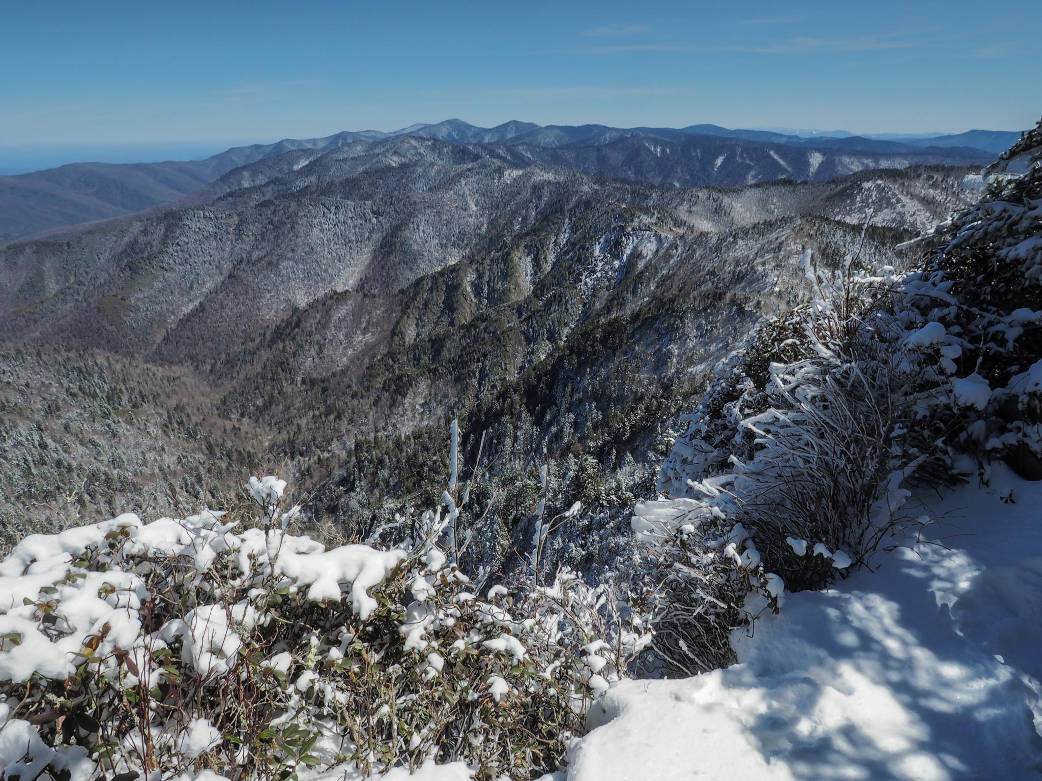
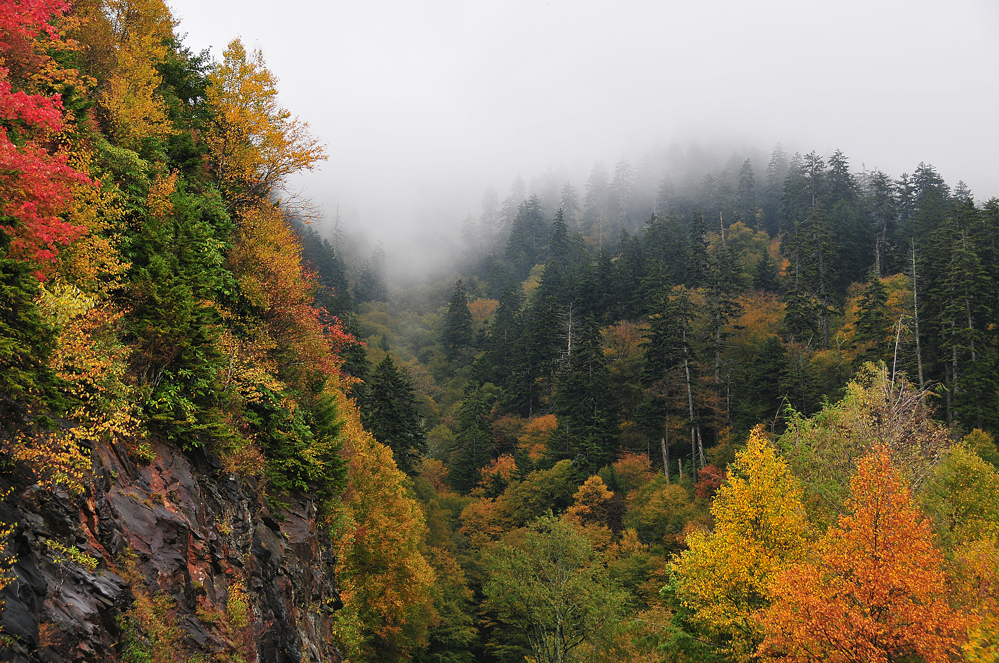
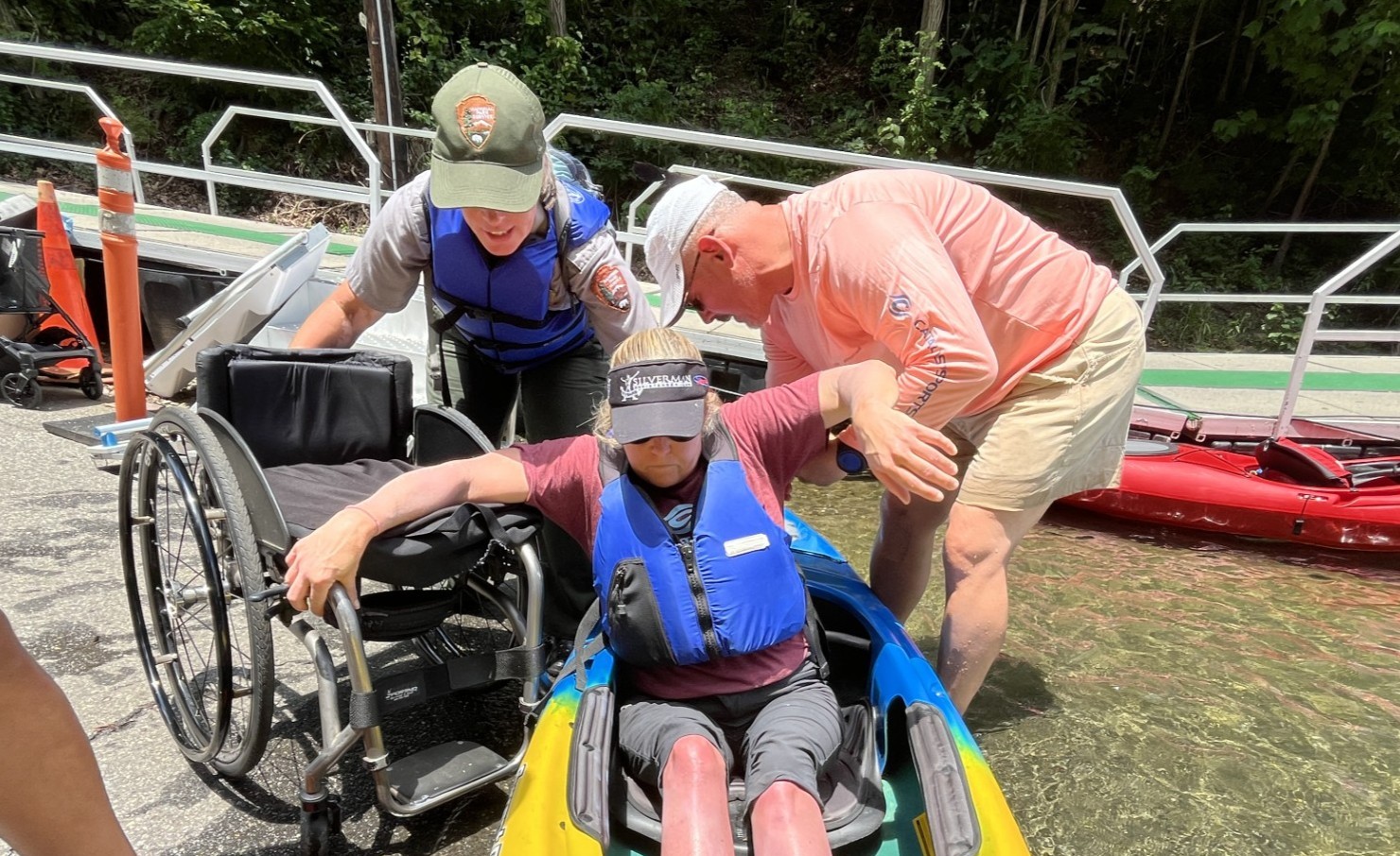





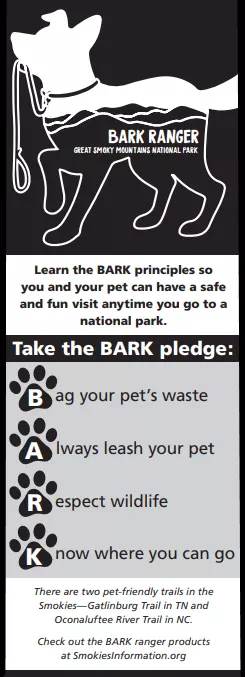
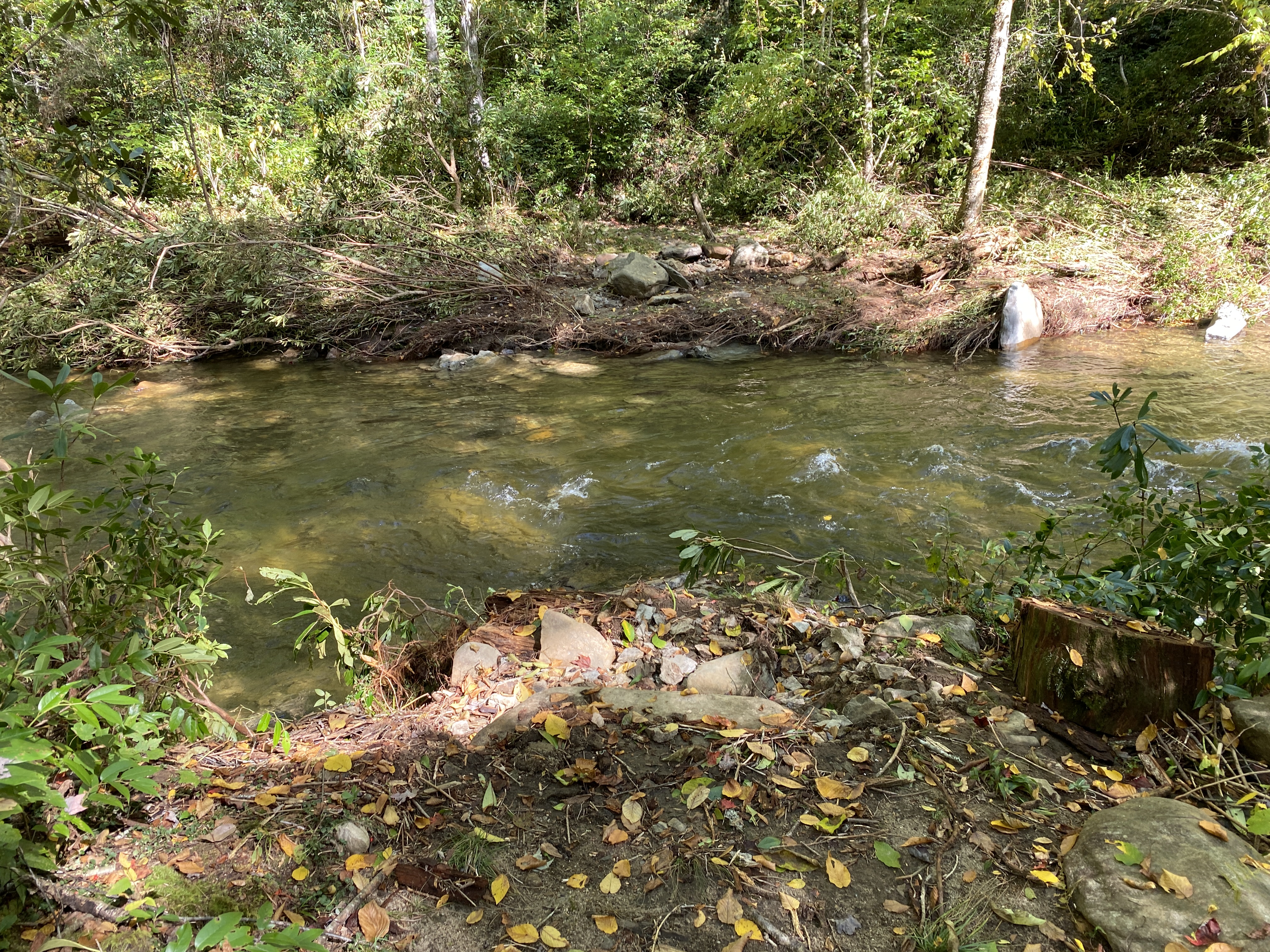
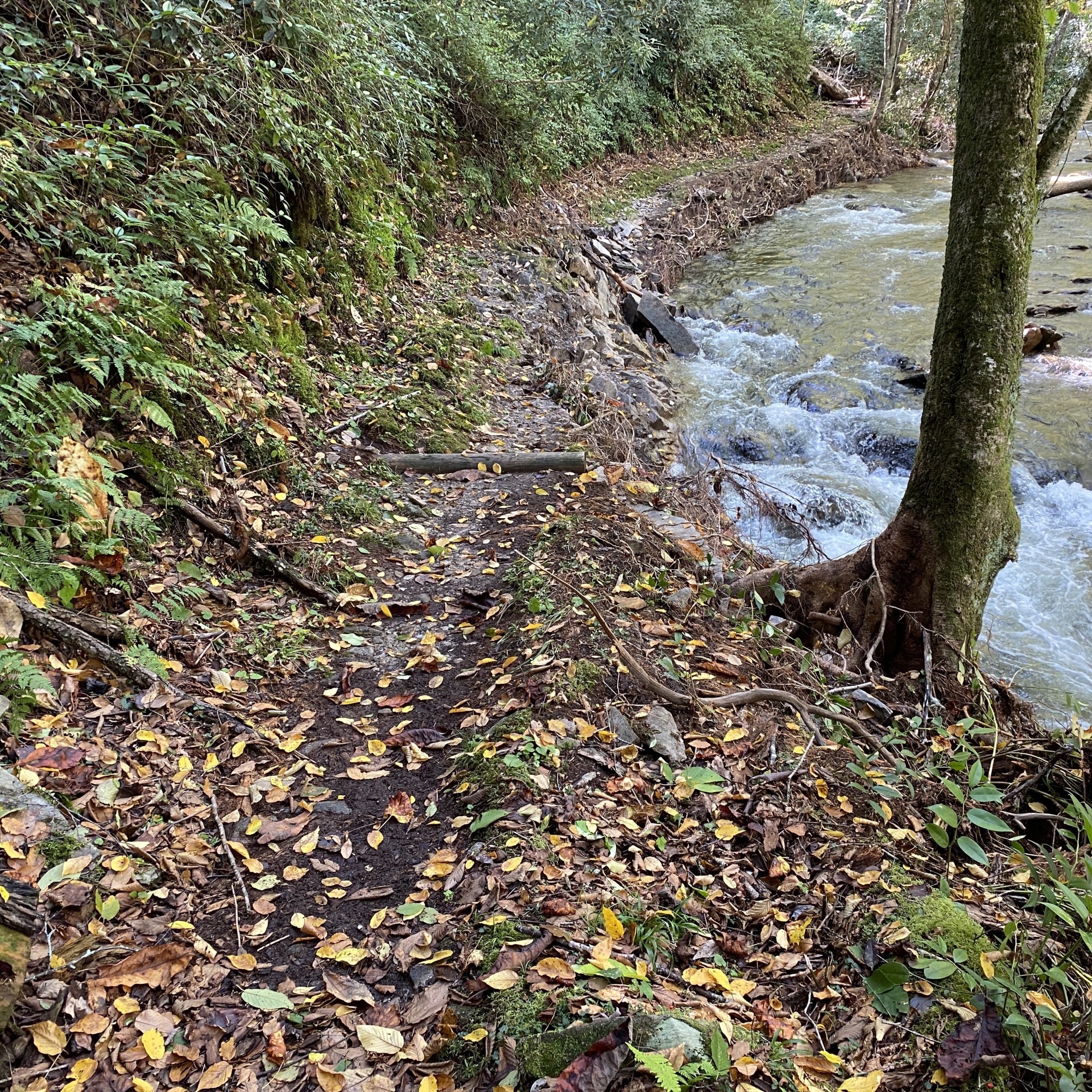
No structured outing assessments have been reviewed for this park yet. Check the official accessibility guide for your requirements.
Compare accessibility details →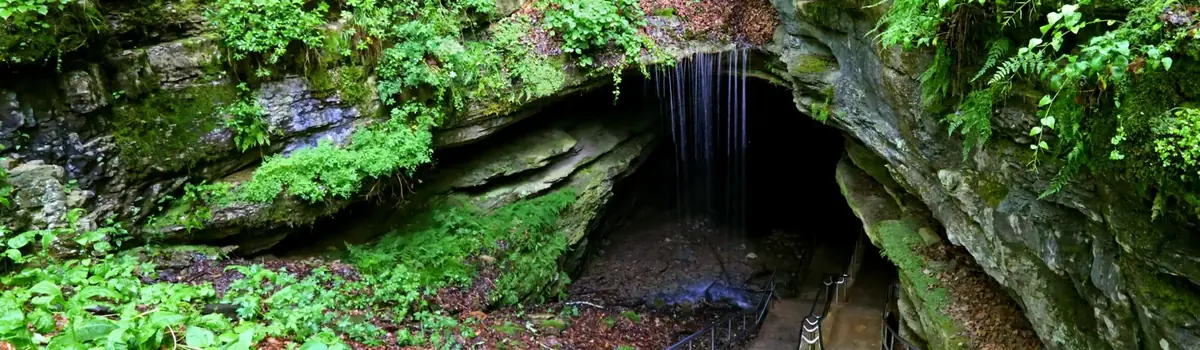 Caves
Kentucky
Rolling hills, deep river valleys, and the world's longest known cave system. Mammoth Cave National Park is home to thousands of years of human history and a rich diversity of plant and animal life, earning it the title of UNESCO World Heritage Site and International Biosphere Region.
 Forests
South Carolina
Astonishing biodiversity exists in Congaree National Park, the largest intact expanse of old growth bottomland hardwood forest remaining in the southeastern United States. Waters from the Congaree and Wateree Rivers sweep through the floodplain, carrying nutrients and sediments that nourish and rejuvenate this ecosystem and support the growth of national and state champion trees.
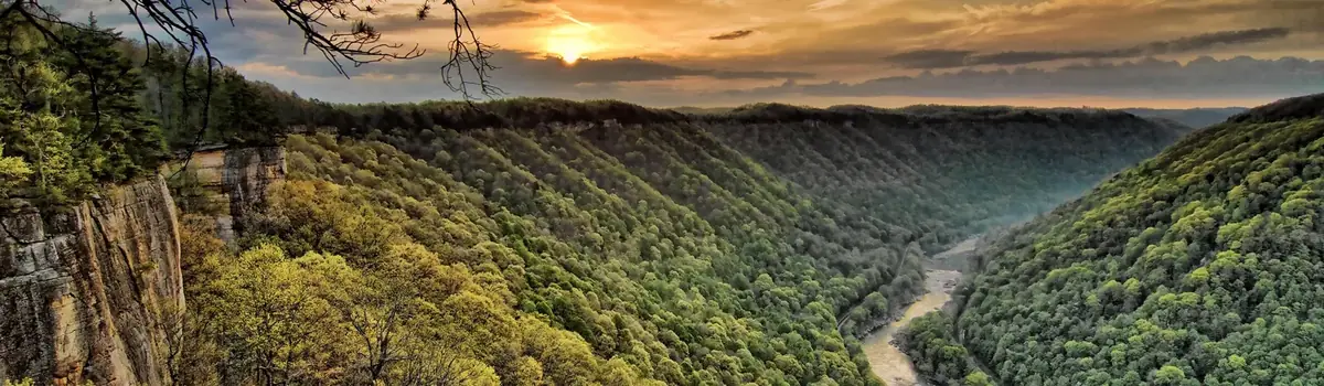 Canyons
West Virginia
A rugged, whitewater river flowing northward through deep canyons, the New River is among the oldest rivers on the continent. The park encompasses over 70,000 acres of land along the New River, is rich in cultural and natural history, and offers an abundance of scenic and recreational opportunities.