Come experience mountains and canyons, desert and dunes, night skies and spectacular vistas within a place unlike any other. Guadalupe Mountains National Park protects the world's most extensive Permian fossil reef, the four highest peaks in Texas, an environmentally diverse collection of flora and fauna, and the stories of lives shaped through conflict, cooperation and survival.
86.4Kacres of parkland
206.4Krecreation visits, 2025
Mar · Apr · Octnearby climate picks
Seasonal access & reservations
No reviewed guidance for this selection. Check the park's official planning pages; missing coverage does not establish access.
Selected guidance only; separate from climate comfort and current conditions.
Official conditions Loading saved check
Loading the latest saved conditions. You can also check the official report below.
Editorial recommendations, reviewed 2026-10-17. Full park days, excluding travel to and from the region. A first-visit outline for a general traveler; adapt to mobility, fitness, season, reservations, and current conditions. These are suggested days, not reserved activities or guaranteed routes.
Over 80 miles of hiking trails offer easy nature walks through desert flora; more moderate hikes follow canyons and reach riparian oases, and strenuous all day hikes can take you into high country forest or to the "Top of Texas". Each is unique—the magic of Guadalupe Mountains National Park awaits you.
Carrying the Ten Essentials (plus one) with you can help you be prepared for minor injuries, sudden weather changes, or unexpected delays.
Nothing can spoil a hike as quickly as the discovery of toilet paper. Always use the restroom before hiking. Pack out your toilet paper.
As with most activities, the more you know before you start your hike, the more likely you will have a good experience
A network of trails throughout the park provides many opportunities to explore and find your challenge.
To limit impacts on the landscape and other visitors, a special use permit is required for day hiking groups with more than twenty persons.
Any person or persons planning to hike off trail in the park must obtain an off-trail hiking permit before they attempt the hike.
McKittrick Canyon is the heart of the park and offers trails to dramatic landscapes, foliage, and the high-country.
Pine Springs is the starting point for the Guadalupe Peak Trail and other beginning hikes into the high-country of the park.
The trail to the summit of Guadalupe Peak is a rewarding, and very strenuous, 8.5 mile round trip hike with a 3,000 foot elevation gain.
The west side of the mountains offers remote hiking and access to the Salt Basin Sand Dunes.
A number of short trails and access to the high-country all begin near the historic Frijole Ranch.
Trails from Dog Canyon offer excellent access, with relatively easy grades, to the Guadalupe Mountains Wilderness.
A backpacking trip in Guadalupe Mountains National Park can be an exciting and rewarding experience if you are prepared. Prior planning and decision making will ensure that you are prepared for the trip.
Preparing for your Backpacking Trip in the Guadalupe Mountains:
Plan your itinerary: Read about our wilderness campsites and pick your destination. Bringing a group to backpack in the wilderness requires special considerations.
Be realistic about elevation gains and water weight. The first mistake many hikers make is overestimating their ability and underestimating the challenges found in the Guadalupe Mountains. Every campsite in the wilderness requires a hike of at least three miles and a climb of at least 2,000 feet on rocky surfaces. All water must be carried.
Planning: While the park map can be a useful reference in planning your trip, backpackers should carry a detailed topographic map. Always have a backup itinerary as you plan. It's your responsibility to know and follow all wilderness camping regulations .
Prepare and Pack: Check out our page with suggestions on how to prepare for your trip. Don't forget to check the weather to make sure that you pack appropriately.
Obtain your Wilderness Use Permit: A Wilderness Use Permit must be obtained before backpacking overnight . Wilderness Permits have a $6.00 non refundable reservation fee that is required for each overnight permit reserved and an Overnight Recreation Fee of $6 per person per night fee for each hiker on the permit. Permit Reservations Advanced reservations for overnight Wilderness trips may be made up to three months in advance. Reservations must be made at least two days in advance of the trip start. Reservations must be converted into a permit up to two days in advance of the start of your trip at the Pine Springs Visitor Center from 8:00 a.m. to 3:30 p.m., daily. Walk Up Permits Walk-up permits for unreserved sites in the Wilderness may be issued on-site on a first-come, first-served basis at the Pine Springs Visitor Center from 8:00 a.m. to 12:00 p.m. Noon, daily. Walk up permits may be obtained up to 24 hours in advance of the trip.
Wilderness Use Permits are required for backpacking overnight and may be obtained in-person or by advanced reservation.
Nothing can spoil a hike as quickly as the discovery of toilet paper. Always use the restroom before hiking. Pack out your toilet paper.
Knowledge and preparation can increase your comfort level and reduce your chances of injury while in the Wilderness
To protect park resources, special restrictions apply when bringing groups to camp overnight in the Wilderness.
Still not sure about what route to take? Check out these ranger favorites!
Any person or persons planning to hike off trail in the park must obtain an off-trail hiking permit before they attempt the hike.
A network of trails throughout the park provides many opportunities to explore and find your challenge.
Backpackers can choose from 10 designated campgrounds when planning a trip in the Guadalupe Mountains Wilderness.
This strenuous route traverses 100 miles through Carlsbad Caverns National Park, Lincoln National Forest, ending at Guadalupe Peak.
Guadalupe Mountains has three developed campgrounds open year round which are open to tent or vehicle camping (RVs, etc.) one of which can only be used by groups with horses. All campsites in the Pine Springs and Dog Canyon Campgrounds are reservable up to six months in advance through recreation.gov. The Pine Springs Campground is located just off U.S. Highway 62/180 near the Pine Springs Visitor Center, and is a simple, desert camping area situated in Pine Springs Canyon near the base of Guadalupe Peak. Campground conveniences include: potable water (for water bottles and hydration packs only), accessible flush-toilet restrooms, and utility sink. There are no showers available in the campground. Tent campers have a choice of 20 leveled, gravel walk-in sites. Small junipers and oaks partially shade most of the sites and each site has a picnic table. Occupancy of individual campsites is limited to 6 people and 2 tents per site. The RV camping area is a paved parking lot with 13 sites to choose from. RVs and trailers 55 feet in length or longer are prohibited. RV sites are defined by painted lines and numbers on the pavement. There are no hook-ups and there is no dump station. No hose connection for fresh water tanks. RV campsite #21 is wheelchair accessible. The Dog Canyon Campground is in a secluded, forested canyon on the remote north side of the park, a two hour drive from Pine Springs. Due to a slightly higher elevation and protected location beneath steep cliff walls, it remains cooler than Pine Springs campground in the summer and sheltered from strong gusty winds in winter and spring. The campground has 9 tent sites and 4 RV sites (maximum length 23 feet, no hookups, no dump station). Restrooms have sinks and flush toilets, but no showers. The Frijole Horse Corra
Direct Reservation Links
Pine Springs Campground Dog Canyon Campground Small campground in remote north district (two hour drive from Pine Springs)
General Regulations
Camping is permitted in designated campsites only.
Camping is limited to 14 consecutive nights within a 30-day period and not more than 60 total nights per calendar year anywhere within the park. These limits apply to all camping activities within the park.
At all park campgrounds, where tent pads are provided, all tents and/or camping shelters must be erected on the tent pads.
The use of hammocks, slacklines, tarps or similar devices tied to natural and/or manmade features is prohibited.
Skunks and other small mammals roam the campground at night. These animals are attracted to food odors. Prevent encounters by keeping campsites free of food scraps.
Dispose of scraps and other garbage in trash receptacles.
Store food, including pet food, in vehicles, not in tents.
Please refrain from using faucets in the campground for dish washing or bathing. Wash dishes in the utility sink beside the restrooms.
Discharge of dishwater or gray water on the ground is prohibited. Use the utility sinks for their disposal.
The closest free RV dump station is off Canyon Street in Carlsbad, NM (behind the TNM&O bus terminal).
Pets on leash are permitted in the campground, but please abide by the following with regard to your pet's welfare, the protection of park wildlife, and consideration of other park visitors:
Leashed pets may be exercised on the trail between the campground and Pine Springs Visitor Center + the Pinery Trail at the Visitor Center. Pets are not allowed on other park trails because they may disturb park wildlife or be harmed themselves by wild animals. There are many rattlesnakes in the park, and park wildlife may carry plague or rabies. Do not allow your pet near animals or their dens or burrows.
Please clean up after your pet.
Pets may not be left unattended. The nearest kennel service (with limited hours) is at Carlsbad Caverns National Park.
Wood and charcoal fires are strictly prohibited due to generally dry weather conditions and intermittent high winds. Fires are permitted only in stoves using containerized fuels.
Quiet hours are from 8:00 PM to 8:00 AM. Generators may not be run during these hours.
Hike into the Wilderness for Primitive Camping Experiences
Backpackers can choose from 10 designated campgrounds with a total of 60 campsites in the wilderness and obtain a permit at the Pine Springs Visitor Center. All use of Wilderness Campsites requires a Wilderness Use Permit. Each of these campgrounds requires a minimum of three miles and two thousand feet elevation gains to reach. All water will need to be carried in—water weight is the primary factor limiting most backpacking trips to one or two nights.
Official NPS features and USGS park boundaries, imported 2026-10-17. An inventory snapshot, not live trail or parking availability.
Loading official park features…
TrailsPoints of interestParkingZoom with buttons or pinch. Toggle layers on the map.
Map coverage varies. Trail names may represent segments, connectors, or shared park units; mapped lines are not a hiking recommendation. Use official conditions and navigation resources before heading out.
NPS public GIS inventory, imported 2026-10-17. “Existing” is an inventory classification, not confirmation that a trail is open. Segment counts are not route distances. Parking records do not indicate space availability, fees, or accessibility certification. View government source ↗
Climate for Carlsbad, 82 km from the park reference point. 1991–2020 normals. Source elevation: 945 m.
Daytime highNighttime lowOctober: 77° / 53°
Daytime high77°
Precipitation30 mm
Daylight11.2 hrs
Wind12.6 km/h
Mountain, rim, valley, and coastal conditions can differ sharply from the source town. Check park forecasts and current conditions before travel.
Monthly climate data 12 months · °F
Month
High
Low
Rain / snow water
Wet days
Daylight
58°
33°
15 mm
2.6
10.1 h
63°
38°
15 mm
2.8
10.8 h
71°
44°
19 mm
3.0
11.8 h
79°
51°
17 mm
2.0
12.8 h
88°
61°
27 mm
4.1
13.6 h
95°
69°
19 mm
4.1
14.1 h
95°
72°
30 mm
5.3
13.9 h
93°
71°
31 mm
6.2
13.2 h
87°
64°
42 mm
5.2
12.2 h
77°
53°
30 mm
4.3
11.2 h
66°
42°
18 mm
2.8
10.3 h
58°
34°
17 mm
2.7
9.9 h
RESEARCH WITH THE SOURCE IN VIEW
The practical field guide.
Official NPS excerpts imported 2026-10-17. Fees, permits, road access, and operations can change; use the source link to confirm the latest information.
Visiting Guadalupe Mountains requires some planning to ensure that your experience is a pleasant one. Below is a list of things to remember when visiting the park.
There is no gasoline available in the park. In Texas, the nearest communities with full services are Van Horn (60 miles south), and El Paso (120 miles west). When traveling from New Mexico, Whites City is the last place that offers gas, diesel, food and ice.
We're not kidding. No gas is available for 35 miles in either direction from the visitor center. Plan accordingly.
Campgrounds offer primitive dry camping for both tents and RVs. Other than restrooms and potable water, there are no other amenities. There are no lodges in the park.
Bring the food you need. There is no restaraunt or grocery in the park.
A Note About Time Zones
The Park is in Mountain Time. Your smart devices will probably be wrong.
Current Conditions
Alerts, operations updates, and other information.
Pets Prohibited on Most Trails
Opportunities for dogs are severely limited. We encourage visitors to think twice before bringing their dog to the park.
What time is it?
Guadalupe Mountains is in the Mountain Time Zone; it is likely that your smart phone will display the time incorrectly during your visit.
Plan Your Visit
Planning a visit? Discover the hiking, birding, backpacking, picnicking and many more opportunities that await you.
Guadalupe Mountains has three developed campgrounds open year round which are open to tent or vehicle camping (RVs, etc.) one of which can only be used by groups with horses. All campsites in the Pine Springs and Dog Canyon Campgrounds are reservable up to six months in advance through recreation.gov. The Pine Springs Campground is located just off U.S. Highway 62/180 near the Pine Springs Visitor Center, and is a simple, desert camping area situated in Pine Springs Canyon near the base of Guadalupe Peak. Campground conveniences include: potable water (for water bottles and hydration packs only), accessible flush-toilet restrooms, and utility sink. There are no showers available in the campground. Tent campers have a choice of 20 leveled, gravel walk-in sites. Small junipers and oaks partially shade most of the sites and each site has a picnic table. Occupancy of individual campsites is limited to 6 people and 2 tents per site. The RV camping area is a paved parking lot with 13 sites to choose from. RVs and trailers 55 feet in length or longer are prohibited. RV sites are defined by painted lines and numbers on the pavement. There are no hook-ups and there is no dump station. No hose connection for fresh water tanks. RV campsite #21 is wheelchair accessible. The Dog Canyon Campground is in a secluded, forested canyon on the remote north side of the park, a two hour drive from Pine Springs. Due to a slightly higher elevation and protected location beneath steep cliff walls, it remains cooler than Pine Springs campground in the summer and sheltered from strong gusty winds in winter and spring. The campground has 9 tent sites and 4 RV sites (maximum length 23 feet, no hookups, no dump station). Restrooms have sinks and flush toilets, but no showers. The Frijole Horse Corra
Direct Reservation Links
Pine Springs Campground Dog Canyon Campground Small campground in remote north district (two hour drive from Pine Springs)
General Regulations
Camping is permitted in designated campsites only.
Camping is limited to 14 consecutive nights within a 30-day period and not more than 60 total nights per calendar year anywhere within the park. These limits apply to all camping activities within the park.
At all park campgrounds, where tent pads are provided, all tents and/or camping shelters must be erected on the tent pads.
The use of hammocks, slacklines, tarps or similar devices tied to natural and/or manmade features is prohibited.
Skunks and other small mammals roam the campground at night. These animals are attracted to food odors. Prevent encounters by keeping campsites free of food scraps.
Dispose of scraps and other garbage in trash receptacles.
Store food, including pet food, in vehicles, not in tents.
Please refrain from using faucets in the campground for dish washing or bathing. Wash dishes in the utility sink beside the restrooms.
Discharge of dishwater or gray water on the ground is prohibited. Use the utility sinks for their disposal.
The closest free RV dump station is off Canyon Street in Carlsbad, NM (behind the TNM&O bus terminal).
Pets on leash are permitted in the campground, but please abide by the following with regard to your pet's welfare, the protection of park wildlife, and consideration of other park visitors:
Leashed pets may be exercised on the trail between the campground and Pine Springs Visitor Center + the Pinery Trail at the Visitor Center. Pets are not allowed on other park trails because they may disturb park wildlife or be harmed themselves by wild animals. There are many rattlesnakes in the park, and park wildlife may carry plague or rabies. Do not allow your pet near animals or their dens or burrows.
Please clean up after your pet.
Pets may not be left unattended. The nearest kennel service (with limited hours) is at Carlsbad Caverns National Park.
Wood and charcoal fires are strictly prohibited due to generally dry weather conditions and intermittent high winds. Fires are permitted only in stoves using containerized fuels.
Quiet hours are from 8:00 PM to 8:00 AM. Generators may not be run during these hours.
The Pine Springs, Dog Canyon, and McKittrick Canyon Visitor Centers are all accessible. Accessible features found at the centers include designated parking spaces, accessible restrooms, drinking fountains, paved nature trail, and a captioned park slide show.
Accessible Trails
The Pinery Trail departs from the Pine Springs Visitor Center. This 0.75 mile (1.2 km) round-trip paved trail leads to the ruins of a mid-1800s Butterfield Stagecoach Station. The ruins can also be reached off US 62/180 a quarter-mile from the Pine Springs Visitor Center.
The Manzanita Spring Trail is a paved 0.5 mile (0.8 km) round-trip trail that departs from the Frijole Ranch parking lot. This paved trail leads to Manzanita Spring and through the orchard once belonging to the Smith family.
The Frijole Ranch Parking has three large shade structures with picnic tables, water fountains, and vault toilets.
Service Animals
Service Animals as defined by titles II and III of the Americans with Disabilities Act are excepted and are permitted in park buildings, restrooms, at public programs, and in the backcountry; service animals that have been individually trained to perform specific tasks for the benefit of persons with disabilities are allowed in the park.
Emotional support (“therapy animals”) are not service animals under the Americans with Disabilities Act and may not access buildings, trails or other non-motorized areas.
Get an entrance pass All visitors must have one of these entrance passes: Pass Price Standard Pass $10.00 Annual Pass $35.00 America the Beautiful Pass (includes Senior Passes) FREE–$250.00 Help me choose an entrance pass
Choosing an Entrance Pass
Do you have or qualify for a discounted America the Beautiful Pass?
If you already have an America the Beautiful—the National Parks and Federal Recreational Lands Pass, that's the only entrance pass you need. Seniors, military, visitors with a permanent disability, and families with a 4th grader are eligible for a free or discounted America the Beautiful pass.
America the Beautiful Pass
How often do you plan to visit national parks in the next 12 months?
If you don't qualify for a discounted America the Beautiful pass, we recommend choosing an entrance pass based on your trip plans.
Entrance Passes
Standard Entrance Pass
For Individuals
All visitors over the age of 16 need an entrance pass, including vehicle passengers. Children under the age of 16 don't need an entrance pass.
Per Person $10.00
In-person Purchase Locations
Pine Springs Visitor Center Cash or Credit/Debit
McKittrick Canyon Contact Station Cash or Credit/Debit
Pine Springs Trailhead Cash or Credit/Debit
Frijole Ranch Trailhead Cash or Credit/Debit
The Dog Canyon Trailhead Cash or Credit/Debit
McKittrick Canyon Trailhead Cash or Credit/Debit
For Organizations & Businesses
Education/Academic Group $0.00
Entrance fee waivers are available to groups when the purpose of their visit is educational rather than recreational. Completed applications along with required documentation must be submitted via email. Fee waiver requests must be submitted at least six weeks before a scheduled visit to allow for consideration. More information
Annual Entrance - Park
This pass is valid for entrance into Guadalupe Mountains National Park for one year from the month of purchase. The pass admits up to four adults in a private vehicle and is non-transferable; visitors under 16 years of age are free. You can purchase this pass at the Pine Springs Visitor Center.
US citizens and residents
Pine Springs Visitor Center Credit/Debit Only
McKittrick Canyon Contact Station Credit/Debit Only
America the Beautiful—the National Parks and Federal Recreational Lands Pass
Covers entrance fees and standard amenity (day-use) fees at lands managed by
National Park Service
US Fish & Wildlife Service
US Forest Service
Bureau of Land Management
Bureau of Reclamation
US Army of Corps of Engineers
Depending on the type of entrance fee charged at a site, covers One private vehicle fee or Four per person fees
America the Beautiful Passes are non-refundable, non-transferable and cannot be replaced if lost or stolen . Passholders must show valid photo identification (ID) with each pass.
How to Get an America the Beautiful Pass
Physical passes can be purchased or picked up at over 1,000 federal recreation sites.
Purchase and pickup locations
To receive your pass by mail, order online at the USGS Online Store . Online orders are for physical passes, not digital passes, and may take up to three weeks to be processed and delivered. Order receipts may not be used in place of a physical pass. We recommend ordering at least three weeks in advance of your visit, or picking up a pass in person instead.
Skip the wait! Get a Digital America the Beautiful Pass through recreation.gov. Your digital pass can be saved to a mobile device and used immediately.
Get a Digital America the Beautiful Pass
2026 Free Entrance Days in the National Parks
Come experience the national parks! All National Park Service sites that charge an entrance fee will offer free admission to US citizens and residents (other fees, including timed entry or reservation fees, may apply). Mark your calendar for these entrance fee-free dates:
February 16 : Presidents Day (Washington's Birthday)
May 25 : Memorial Day
June 14: Flag Day/President Trump's birthday
July 3–5: Independence Day weekend
August 25: 110th Birthday of the National Park Service
September 17: Constitution Day
October 27 : Theodore Roosevelt's birthday
November 11: Veterans Day
The fees you pay when visiting Guadalupe Mountains National Park are important! Under the Federal Recreation Lands Enhancement Act, national parks use the fees collected to fund critical projects that improve visitor services and protect natural and cultural resources.
Pass
Price
Standard Pass
$10.00
Annual Pass
$35.00
America the Beautiful Pass (includes Senior Passes)
FREE–$250.00
I'm visiting...
We recommend
This park, once
Standard Pass
This park, multiple times
Annual Pass
More than one national park or federal recreation site
America the Beautiful Pass
Type
Available to
Price
Resident Annual Pass
US citizens and residents
$80.00
Non-Resident Annual Pass
Non-US residents
$250.00
Senior Annual Pass
US citizens and residents 62+ years old
$20.00
Senior Lifetime Pass
US citizens and residents 62+ years old
$80.00
Military Annual Pass
Current US military and dependents
Free
Military Lifetime Pass
Gold Star Family members and veterans
Free
Access Pass
US citizens and residents with permanent disability
Free
4th Grade Pass
US 4th graders
Free
Volunteer Pass
Federal recreation site volunteers with 250 service hours
Free
Pass
Price
Standard Pass
$10.00
Annual Pass
$35.00
America the Beautiful Pass (includes Senior Passes)
FREE–$250.00
I'm visiting...
We recommend
This park, once
Standard Pass
This park, multiple times
Annual Pass
More than one national park or federal recreation site
America the Beautiful Pass
Type
Available to
Price
Resident Annual Pass
US citizens and residents
$80.00
Non-Resident Annual Pass
Non-US residents
$250.00
Senior Annual Pass
US citizens and residents 62+ years old
$20.00
Senior Lifetime Pass
US citizens and residents 62+ years old
$80.00
Military Annual Pass
Current US military and dependents
Free
Military Lifetime Pass
Gold Star Family members and veterans
Free
Access Pass
US citizens and residents with permanent disability
Free
4th Grade Pass
US 4th graders
Free
Volunteer Pass
Federal recreation site volunteers with 250 service hours
Guadalupe Mountains National Park is located on the north side of US Hwy 62/180. If you are traveling east from El Paso, TX, we are 110 miles East of the city. Follow US Hwy 62/180 North to the Pine Springs Visitor Center. If you are traveling from Van Horn, TX, you will travel north on US 54 and make a right-hand turn at the junction of US 62/180 to arrive at the park. If you are traveling west from Carlsbad, NM, you will travel on US Hwy 62/180 South and cross into Texas. Follow signs to the park.
Guadalupe Mountains National Park is located in far West Texas on U.S. Highway 62/180. The driving distance is 110 miles east of El Paso, Texas, 56 miles southwest of Carlsbad, New Mexico or 62 miles north of Van Horn on Hwy 54. Visitors traveling to Dog Canyon, on the park's north side, can access the area via New Mexico State Road 137. The Dog Canyon District is a two-hour drive from park headquarters at Pine Springs.
The closest large commercial airline service is El Paso, Texas. Other airlines serve Albuquerque, New Mexico, Lubbock and Midland, Texas and Mesa Airlines offers passenger service between Albuquerque and Carlsbad, New Mexico.
Public Transportation
There is no public transportation or shuttle service available in the park.
A Note About Goods & Services
Visiting Guadalupe Mountains requires some planning to ensure that your experience is a pleasant one. Below is a list of things to remember when visiting the park.
There is no gasoline available in the park. In Texas, the nearest communities with full services are Van Horn (60 miles south), and El Paso (120 miles west). When traveling from New Mexico, Whites City is the last place that offers gas, diesel, food and ice.
We're not kidding. No gas is available for 35 miles in either direction from the visitor center. Plan accordingly.
Campgrounds offer primitive dry camping for both tents and RVs. Other than restrooms and potable water, there are no other amenities. There are no lodges in the park.
Bring the food you need. There is no restaurant or grocery in the park.
As you enjoy the splendor of this great wilderness area, make safety a priority. By giving forethought to your actions you can have a safe, exciting, and rewarding experience in Guadalupe Mountains National Park.
Goods & Services
Visiting Guadalupe Mountains requires some planning to ensure that your experience is a pleasant one. Below is a list of things to remember when visiting the park.
There is no gasoline available in the park. In Texas, the nearest communities with full services are Van Horn (60 miles south), and El Paso (120 miles west). When traveling from New Mexico, Whites City is the last place that offers gas, diesel, food and ice.
We're not kidding. No gas is available for 35 miles in either direction from the visitor center. Plan accordingly.
Campgrounds offer primitive dry camping for both tents and RVs. Other than restrooms and potable water, there are no other amenities. There are no lodges in the park.
Bring the food you need. There is no restaraunt or grocery in the park.
Hiking in the desert requires some planning ahead of time to ensure a safe and successful hike. Make sure to always:
Carry plenty of water. There is no water available along trails or in the wilderness. Make sure to carry at least one gallon per person, per day.
Dress appropriately. Wear sunscreen, hats, long sleeve shirts and long pants.
Hike during appropriate times. Make sure to start early in the day to avoid the mid-day summer heat.
Know the signs of heat-related illnesses: dehydration, heat exhaustion, and heat stroke.
Trails in the Guadalupe Mountains vary in difficulty and require some form of preparation.
Carry a map and compass/gps. Make sure that you know how to use them.
Always let someone know your plans. Make sure they know where you are going and when you will return.
Carry a pack with appropriate gear: water, flashlight, map, etc.
Weather in the mountains can be unpredictable.
Make sure to check the weather before leaving for your hike.
Summer days can bring high temperatures and beware of quickly oncoming thunderstorms. If you see lightning, move quickly to a safe place. Avoid hilltops, ridges, and flat open areas.
Elevation plays a role in weather. Pine Springs is at 5,600 feet in elevation. The Sand Dunes on the west side of the park are 2,000 feet lower; plan on it being ten degrees warmer. Guadalupe Peak and the high wilderness are 2,000 feet higher; plan on ten degrees cooler, and wind speeds ten miles per hour faster.
Pine Springs is at 5,600 feet in elevation.
The Sand Dunes on the west side of the park are 2,000 feet lower; plan on it being ten degrees warmer.
Guadalupe Peak and the high wilderness are 2,000 feet higher; plan on ten degrees cooler, and wind speeds ten miles per hour faster.
November through March is the windy season in the Guadalupe Mountains, with winds above 30MPH often, and gusts ranging from 50-80MPH. Hiking on open trail will be challenging if the wind speed is at 40mph. If the wind speeds are up to 50mph, it’s dangerous to continue for even experienced hikers. If the wind speeds exceed 55mph, then you should turn back immediately if you don’t want to risk an accident. 70MPH wind gusts are the equivelent of a F1 tornado.
Hiking on open trail will be challenging if the wind speed is at 40mph.
If the wind speeds are up to 50mph, it’s dangerous to continue for even experienced hikers. If the wind speeds exceed 55mph, then you should turn back immediately if you don’t want to risk an accident. 70MPH wind gusts are the equivelent of a F1 tornado.
In strong winds, your balance may become compromised, increasing the risk of slips and falls. When hiking during high winds, you should always be prepared to turn around. You should prioritize your own safety above all else in windy conditions.
Climbing is Prohibited
Wildlife Encounters
Black bears , mountain lions , javelinas, coyotes may be encountered on trails, and skunks frequent campgrounds. Although they sometimes appear tame, all of the animals in the park are wild, and could pose a threat to your health and safety if you attempt to approach or feed them.
Never feed wildlife.
Store all food, coolers, cooking utensils, and toiletries in a hard-sided vehicle, preferably in the trunk of your car. Use available food storage lockers in campsites.
Dispose of garbage properly. Throw garbage in the trash cans provided.
Watch children closely; never let them run ahead or lag behind.
If you encounter a bear or mountain lion, do not run, but back away to get out of range. If you feel threatened by a bear or lion, hold your ground, wave your arms, throw stones, and shout; never run. Keep groups together, look large.
Venomous snakes, scorpions, spiders, and centipedes are active during warmer months. Inspect shoes, sleeping bags and bedding before use. Carry a flashlight at night. Pay attention to where you walk and place your hands. Consider wearing high boots or protective leggings while hiking.
In the fall, winter, and spring high winds are often a part of the Guadalupe Mountains experience.
Visitors are responsible for their own safety. Search and rescue actions are conducted on a discretionary basis.
While they are rarely seen by visitors, the entirety of Guadalupe Mountains National Park is mountain lion habitat.
While rarely seen, black bears live throughout the high country of the Guadalupe Mountains Wilderness.
Carrying the Ten Essentials (plus one) with you can help you be prepared for minor injuries, sudden weather changes, or unexpected delays.
Over 80 miles of hiking trails offer easy nature walks through desert flora; more moderate hikes follow canyons and reach riparian oases, and strenuous all day hikes can take you into high country forest or to the "Top of Texas". Each is unique—the magic of Guadalupe Mountains National Park awaits you.
Carrying the Ten Essentials (plus one) with you can help you be prepared for minor injuries, sudden weather changes, or unexpected delays.
Nothing can spoil a hike as quickly as the discovery of toilet paper. Always use the restroom before hiking. Pack out your toilet paper.
As with most activities, the more you know before you start your hike, the more likely you will have a good experience
A network of trails throughout the park provides many opportunities to explore and find your challenge.
To limit impacts on the landscape and other visitors, a special use permit is required for day hiking groups with more than twenty persons.
Any person or persons planning to hike off trail in the park must obtain an off-trail hiking permit before they attempt the hike.
McKittrick Canyon is the heart of the park and offers trails to dramatic landscapes, foliage, and the high-country.
Pine Springs is the starting point for the Guadalupe Peak Trail and other beginning hikes into the high-country of the park.
The trail to the summit of Guadalupe Peak is a rewarding, and very strenuous, 8.5 mile round trip hike with a 3,000 foot elevation gain.
The west side of the mountains offers remote hiking and access to the Salt Basin Sand Dunes.
A number of short trails and access to the high-country all begin near the historic Frijole Ranch.
Trails from Dog Canyon offer excellent access, with relatively easy grades, to the Guadalupe Mountains Wilderness.
Click on the arrow in the map's top left corner to toggle between the Brochure Map and the interactive Park Tiles map. These maps are meant for general orientation and are not meant for detailed wilderness trip planning or hiking. For safe wilderness travel get a detailed topographic map at the visitor center.
At Guadalupe Mountains, opportunities for pets are limited:
Leashed pets are permitted in Guadalupe Mountains National Park only in areas accessed by vehicles, including established roadsides, parking areas, developed picnic areas and campgrounds. Leashed pets may walk on the short Pine Springs Campground connector trail or along the Pinery Trail from the visitor center to the Butterfield Stage Station. Pets must be kept on a leash no longer than six feet and attended at all times. Federal regulations require all pet excrement to be picked up and disposed of in a marked trash receptacle.
Leashed pets are permitted in Guadalupe Mountains National Park only in areas accessed by vehicles, including established roadsides, parking areas, developed picnic areas and campgrounds.
Leashed pets may walk on the short Pine Springs Campground connector trail or along the Pinery Trail from the visitor center to the Butterfield Stage Station.
Pets must be kept on a leash no longer than six feet and attended at all times.
Federal regulations require all pet excrement to be picked up and disposed of in a marked trash receptacle.
At Guadalupe Mountains, pets are prohibited:
in park buildings in restrooms at public programs in the backcountry on ALL park trails except the Pinery Trail and the Pine Springs Campground connector trail.
in park buildings
at public programs
in the backcountry
on ALL park trails except the Pinery Trail and the Pine Springs Campground connector trail.
Why Can't I Hike With My Dog or Cat?
Dogs and cats are considered to be unnatural predators in a natural environment
Pets may harass and even kill wildlife, carry disease and disrupt the habitats of native species in the park
Pets could become prey for larger carnivores like mountain lions, black bears, bobcats, coyote packs or many other desert animals which could pose a threat to your pet
Many Chihuahuan desert plants are spiny or poisonous and can easily injure a pet
Pets can bite visitors or intrude on the visitor experience anticipated in Guadalupe Mountains National Park
Other Park Pet Rules
Pet owners are required to immediately remove and properly dispose of fecal matter deposited by pets in an appropriate refuse container.
Do not leave pets unattended at campsites, tied to an object in the park, or in vehicles for prolonged periods of time. Interior vehicle temperatures can rise within minutes and pets can quickly overheat and die, even with the windows cracked. The nearest kennel service (with limited hours) is at Carlsbad Caverns National Park .
Some adjacent US Forest Service lands do allow leashed pets on trails and in dispersed areas. Contact them directly for details and specific locations.
Service Animals
Service Animals as defined by titles II and III of the Americans with Disabilities Act are excepted and are permitted in park buildings, restrooms, at public programs, and in the backcountry; service animals that have been individually trained to perform specific tasks for the benefit of persons with disabilities are allowed in the park.
Emotional support (“therapy animals”) are not service animals under the Americans with Disabilities Act and may not access trails or other non-motorized areas.
The Guadalupe Mountains weather can vary drastically in elevations ranging from 3,000 feet to 8,000+ feet. Spring and summer seasons bring warm and mild temperatures with ocasional showers, while fall and winter can bring cooler temperatures with high winds that can reach over 70+ mph on occasions. Snow and freezing fog is also common during the cooler months of December and January. When planning your trip, make sure to check the latest weather to ensure that you pack the appropriate equipment for the terrain you will be hiking in and check our park webcams to see live conditions. The park's remote north district at Dog Canyon is at 6,000 ft in elevation and tends to be slightly cooler than the Pine Springs area. When preparing to hike, make sure to note that the temperature at the higher elevations will up to 10 degrees cooler with the possibility of stronger winds and higher windspeeds.
The Guadalupe Mountains weather can vary drastically in elevations ranging from 3,000 feet to 8,000+ feet. Spring and summer seasons bring warm and mild temperatures with ocasional showers, while fall and winter can bring cooler temperatures with high winds that can reach over 70+ mph on occasions. Snow and freezing fog is also common during the cooler months of December and January. When planning your trip, make sure to check the latest weather to ensure that you pack the appropriate equipment for the terrain you will be hiking in and check our park webcams to see live conditions. The park's remote north district at Dog Canyon is at 6,000 ft in elevation and tends to be slightly cooler than the Pine Springs area.
When preparing to hike, make sure to note that the temperature at the higher elevations will up to 10 degrees cooler with the possibility of stronger winds and higher windspeeds.
The table below is based on average temperatures and precipitation at Pine Springs area at an elevation of nearly 5,700 feet above sea level. At the higher mountain elevations temperatures average 5–10 degrees cooler during the day and 0-5 degrees cooler at night. The mountains also receive more precipitation and higher winds. The lower desert of the Salt Basin Dunes and Williams Ranch average 5–10 degrees warmer during the day and is 0-5 degrees warmer at night (except winter when its 0-7 degrees cooler) and receives less precipitation.
Conditions Through the Year
Sunshine is abundant most of the year. Spring and Fall are typically warm and pleasant and are the parks busiest seasons. November through March is the windy season in the Guadalupe Mountains, with winds above 30MPH often, and gusts ranging from 50-80MPH. June-August are the hottest months. Visitors should be familiar with heat safety. The rainy season runs from May through September, with locally heavy thunderstorms and some flash flooding. The rainy season can be a delightful time to visit since afternoon and evening rains often cool temperatures.
Fall quickly melds into winter which is pleasantly mild and usually sunny, although periods of cloudy weather and freezing cold do occur. Snow and ice are common at high elevations throughout the season. Winter visitors must prepare for a variety of conditions.
Elevation is Everything
Most weather forecasts highlight the temperature at Park Headquarters which lies at nearly 5,700 feet. Temperatures in lower elevations such as the Williams Ranch Road and the Salt Basin Dunes will be approximately 10 degrees hotter. Temps in the higher elevations average approximately 10 degrees cooler. Be prepared for this kind of variation during your trip.
Dress for the Weather
No matter the time of year, a wide-brimmed hat, comfortable clothing and sturdy walking shoes or boots are necessary for anyone planning to explore outdoors. Sunscreen is a must and hikers should always carry plenty of water; one gallon per person per day is recommended. Summer visitors should be aware of heat safety, such as wearing clothing that protects from the sun and avoiding activity during midday. Winter visitors should be prepared for any weather; temperatures vary from below freezing to above 80 degrees Fahrenheit .
The Guadalupe Mountains Wilderness has over 80 miles of trail to explore with a great range of elevation, ecological zones, and solitude. Whether you are day hiking or backpacking, your trip is a uniquely protected opportunity to provide maximum freedom to roam in Wilderness. So, in planning a trip, it is important to find the right experience for your interests, timeframe, and abilities. A good planning process will enhance your understanding of the park and your safety. Therefore, as part of the wilderness experience, park rangers can provide general guidance but will not plan a wilderness trip for you; you must plan your own trip.
When you have thought about or decided what you want from your trip, you can start planning and researching your hike. A detailed topographic map is a must for any hike. In addition, a good guidebook can help you choose a trip that is right for you. Remember that visiting the wilderness is an adventure: do not be afraid to explore a new area and discover what wonders it has to offer!
Trail Descriptions
Bear Canyon Trail
Blue Ridge Trail
Bush Mountain Trail
El Capitan Trail
Trailhead(s): Pine Springs, Williams Ranch Duration: Total distance from Pine Springs to Williams Ranch is 9.4 miles (15.2 km). From the Pine Springs Trailhead to Guadalupe Canyon and the east junction of the Salt Basin Loop is 3.4 miles (5.5 km); From Gudalupe Canyon to the west junction of the Salt Basin Loop is 0.9 miles (1.5 km); From the west junction of the Salt Basin Loop to the Shumard Canyon Wilderness Campground is 4.7 miles (7.6 km); From the Shumard Canyon Wilderness Campground to Williams Ranch is 0.4 miles (0.6 km).
The El Capitan Trail begins at the Pine Springs Trailhead. The trail leads around the base of El Capitan and along the west side of the Guadalupe escarpment, ending at the historic Williams Ranch House. It is the only trail to provide access to the west side of the Guadalupes. As such, the trail provides excellent opportunities for solitude and sweeping views. This trail connects to the Salt Basin Overlook Trail.
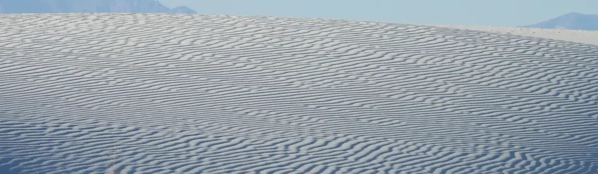
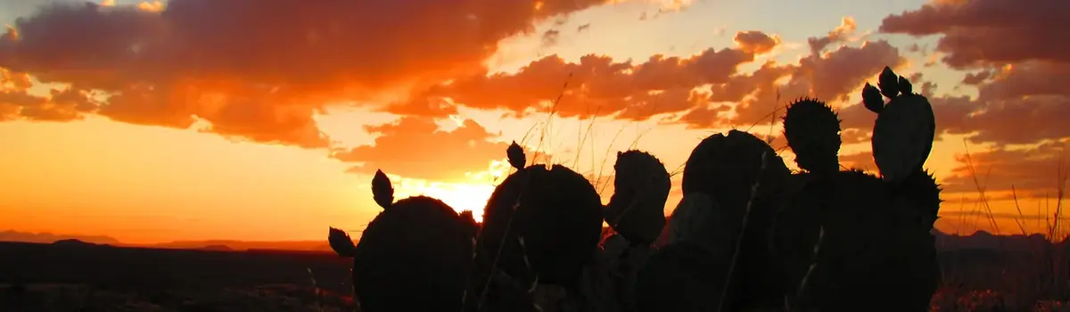
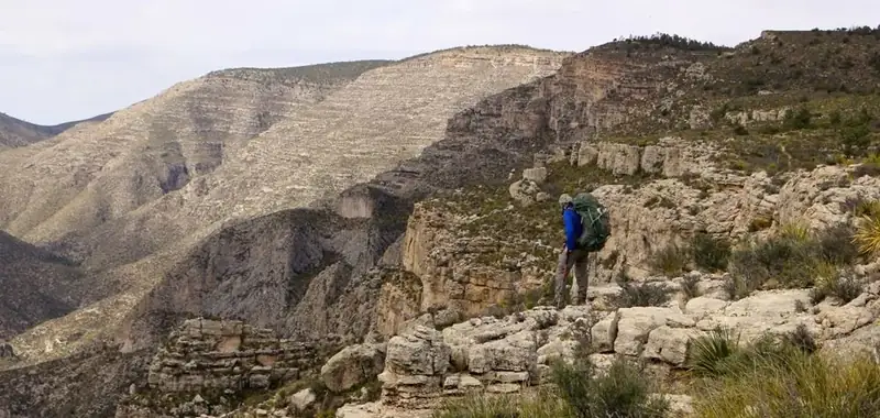
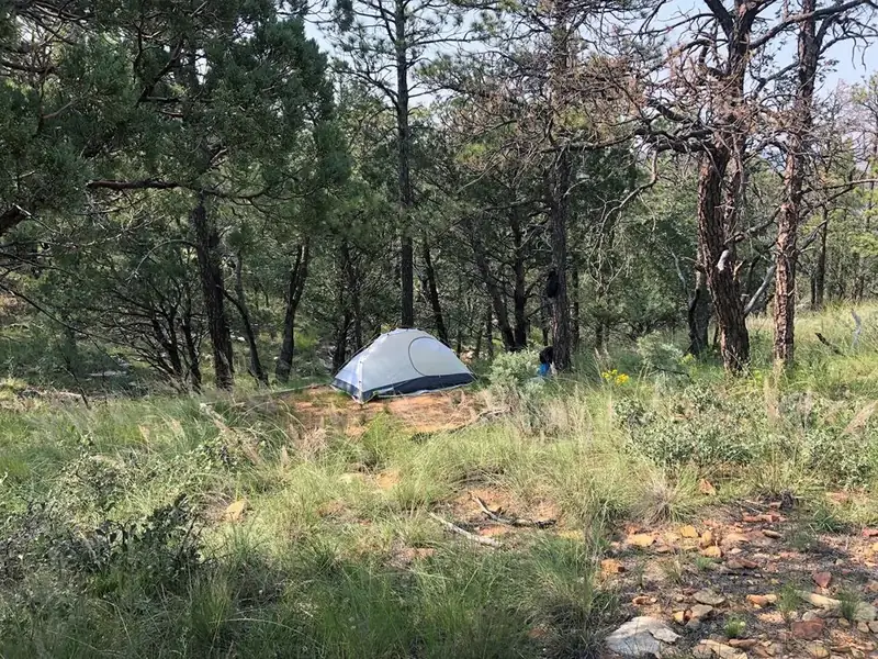
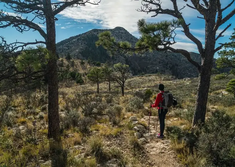
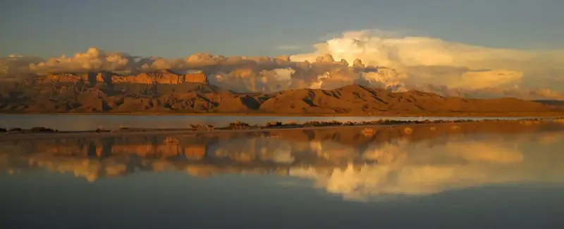
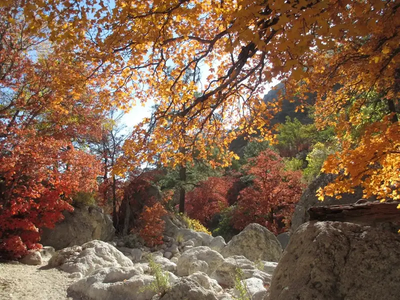
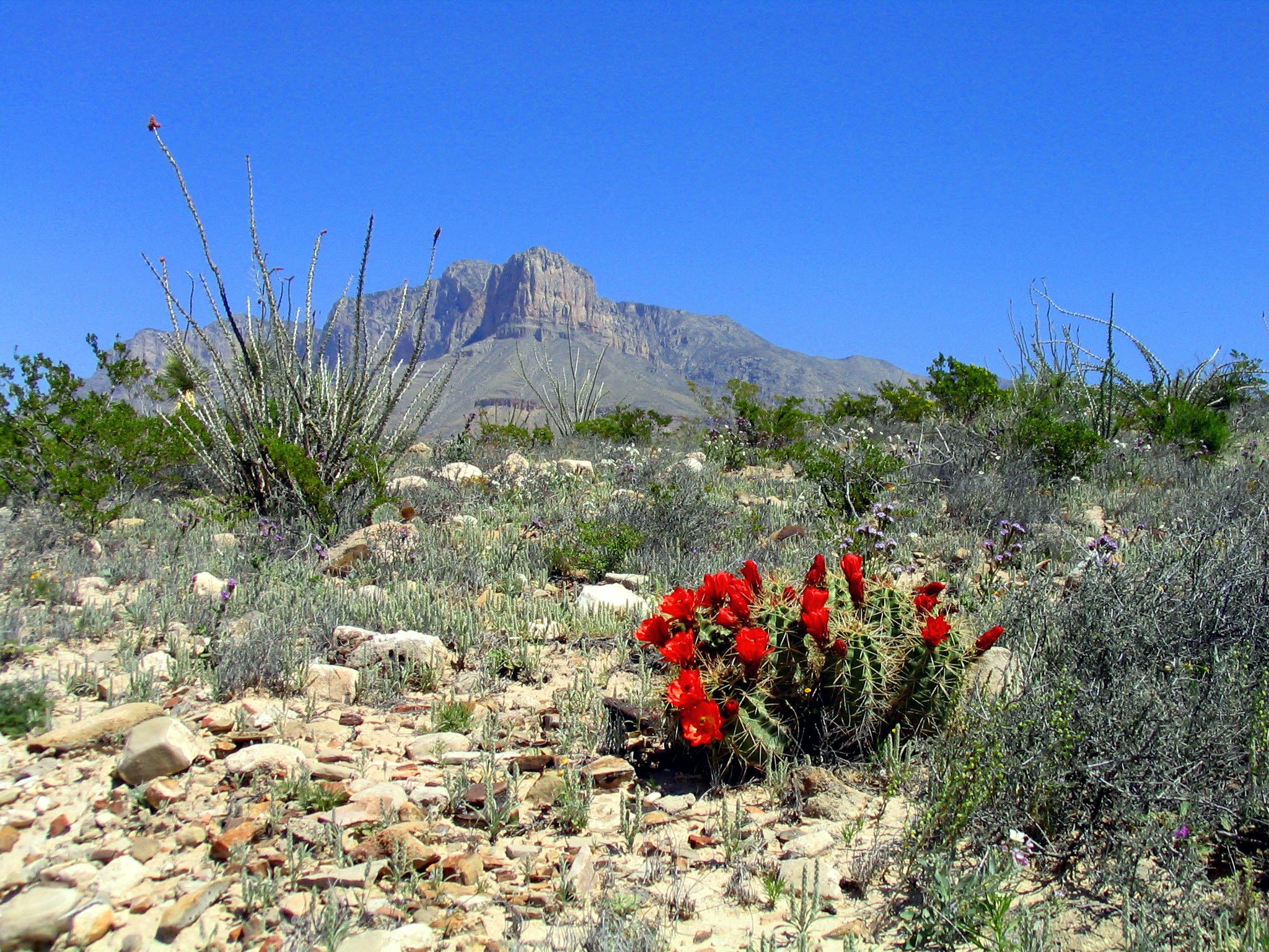
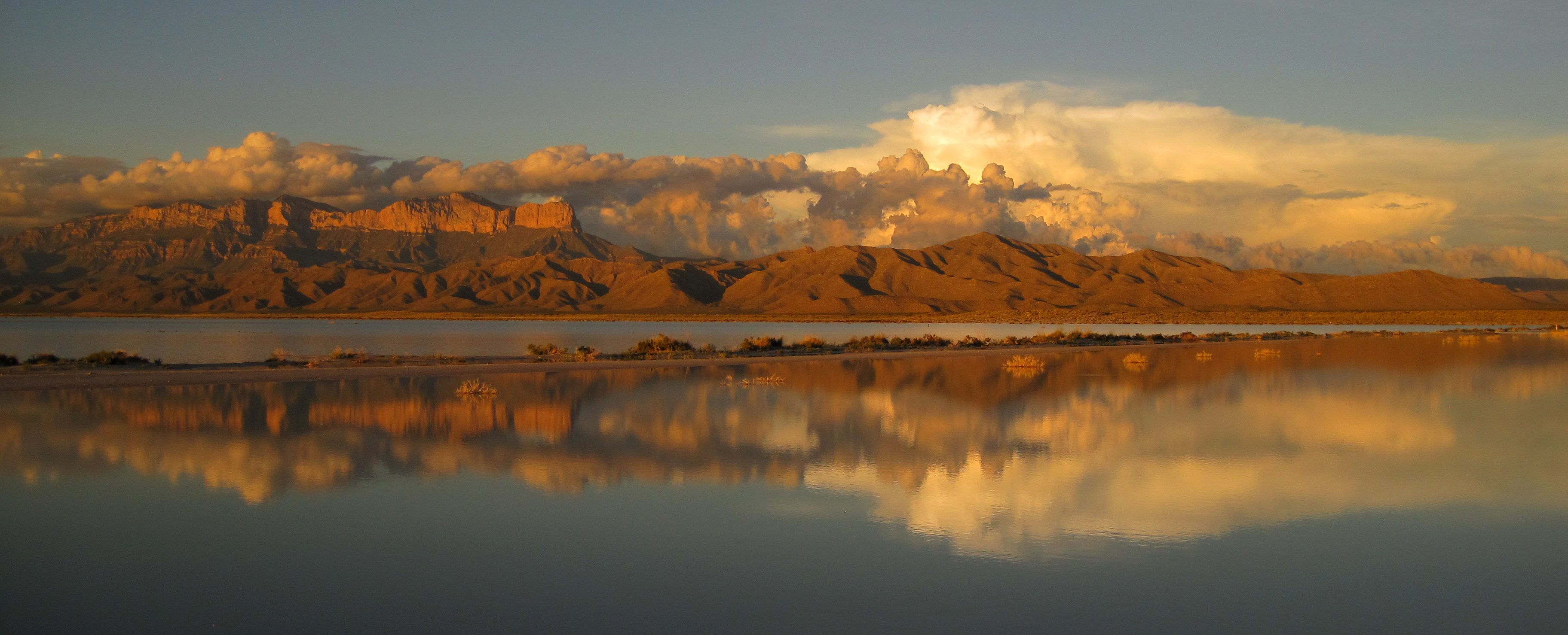
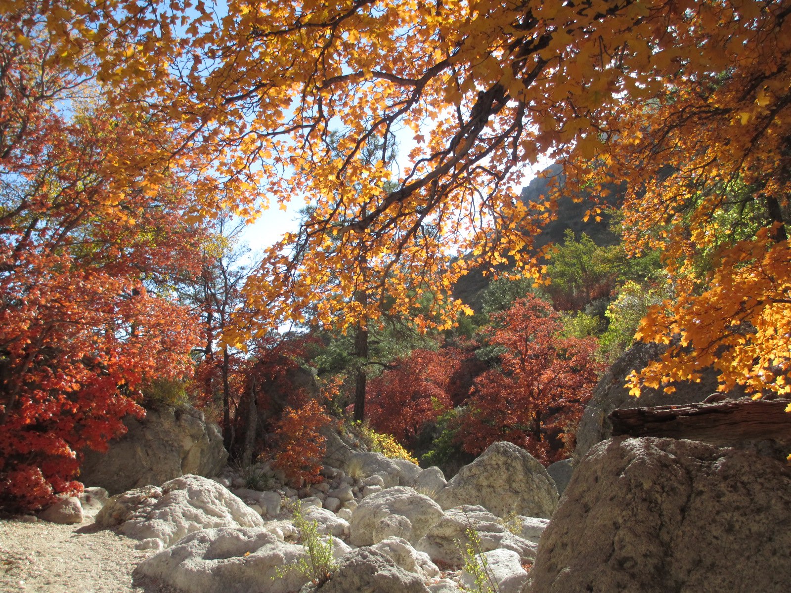
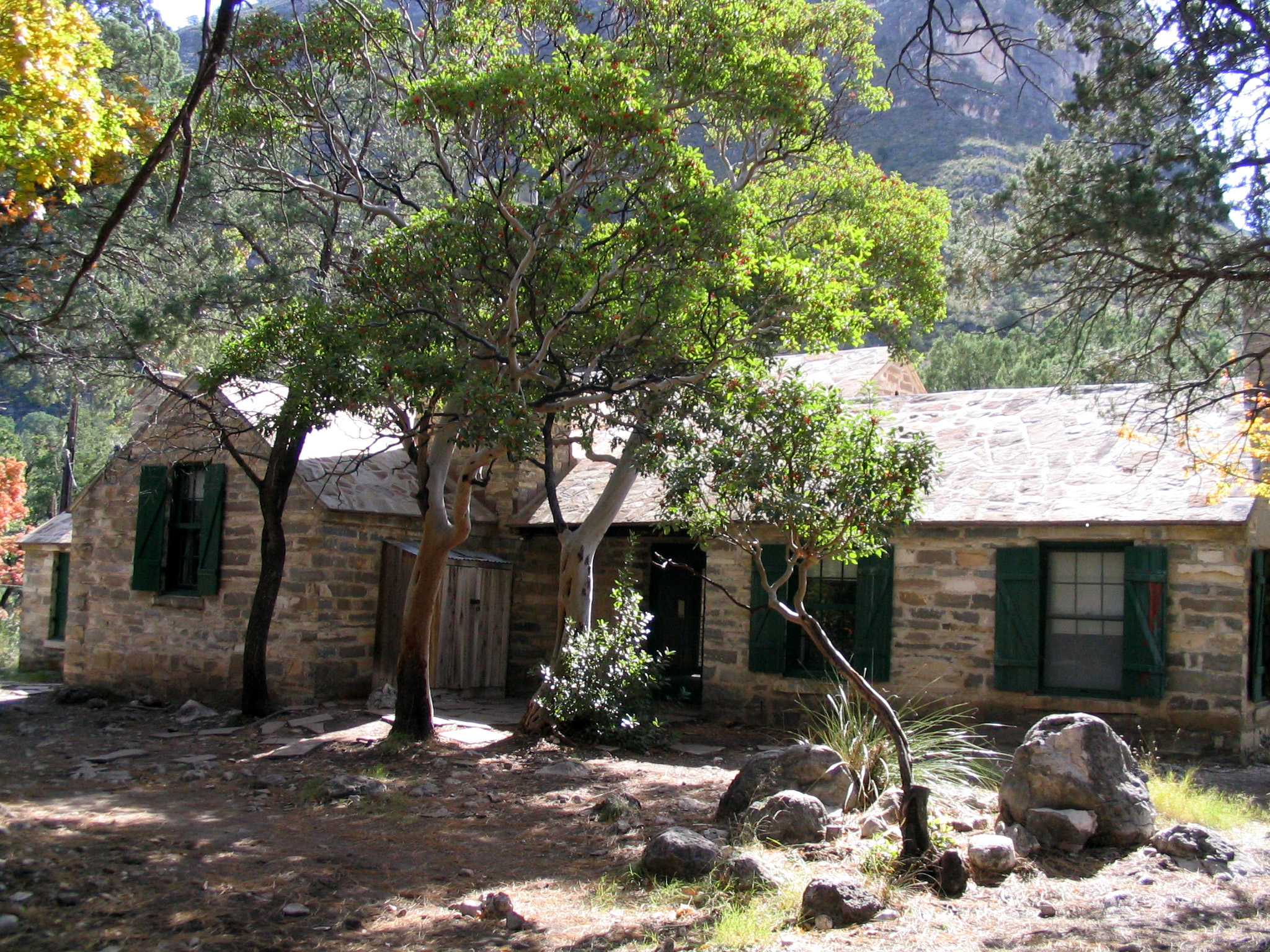
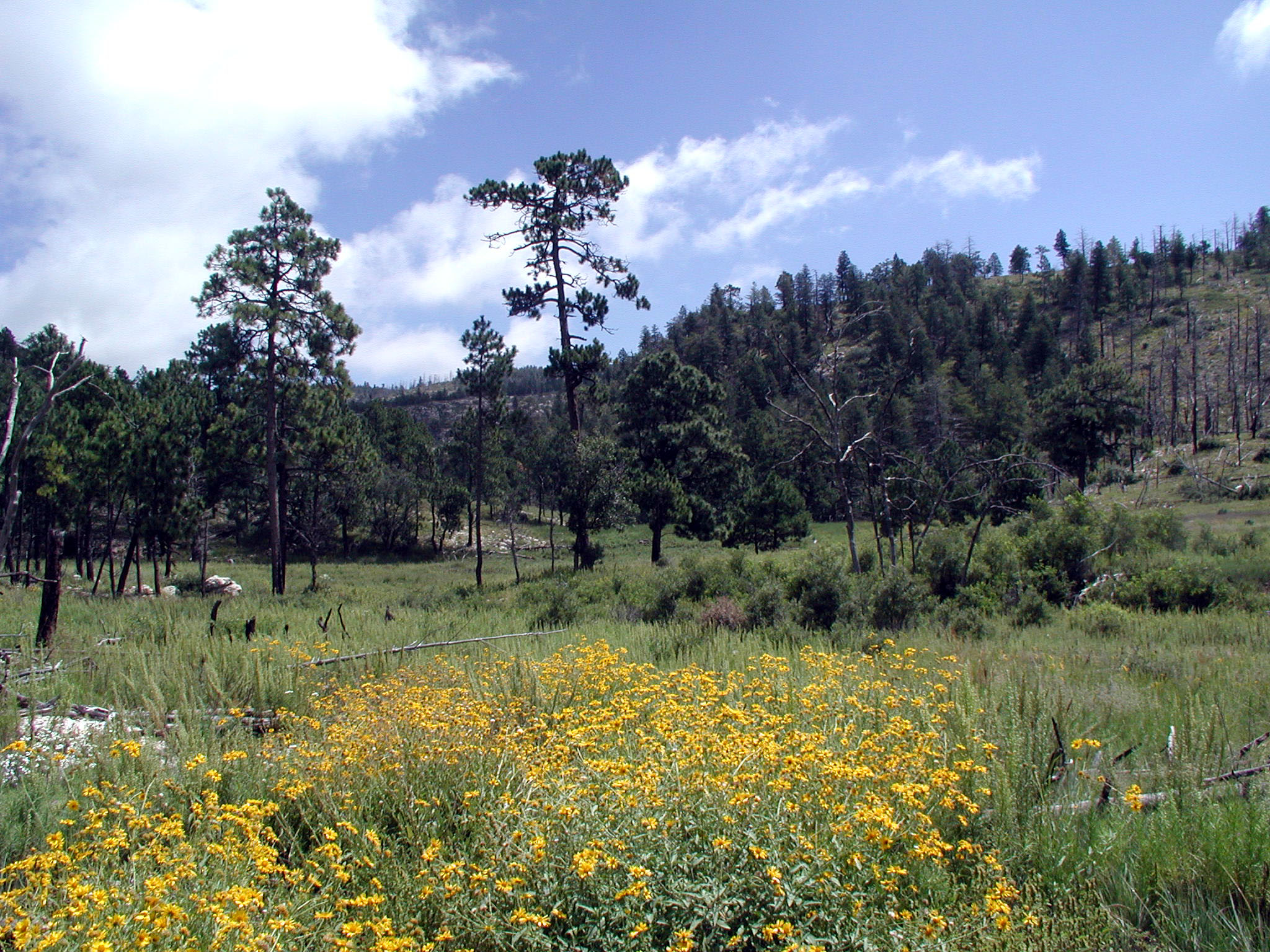
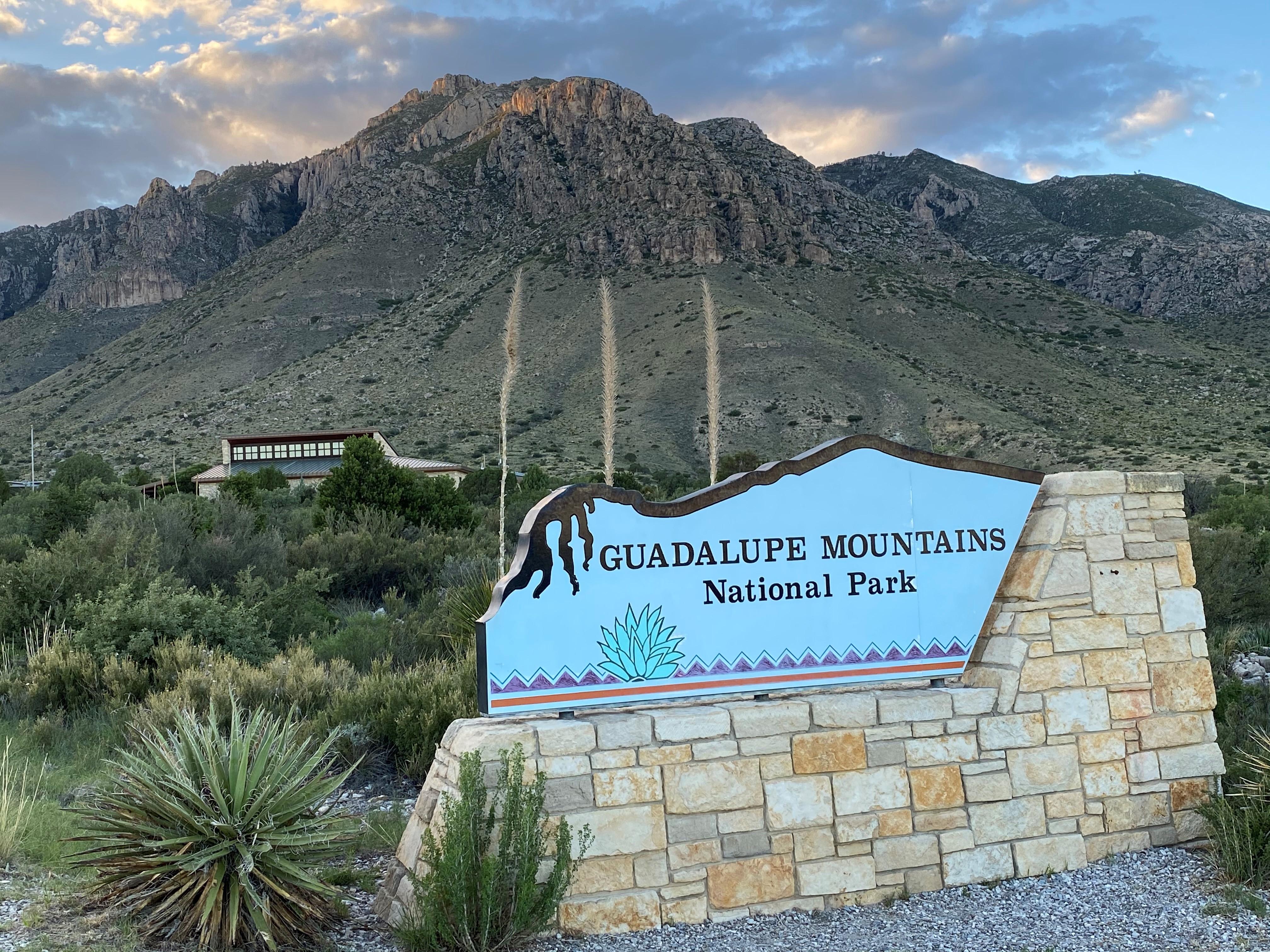
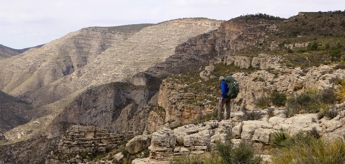
Blossoming claret cup cacti add a splash of color to the Chihuahuan desert.NPS/Bieri Images link to the original government source.After the monsoon storms, the salt flats will often become flooded creating a seasonal lake.NPS/Yates Changing maple trees line the Devil's Hall trail during the fall months.NPS/Flores Pratt Cabin is nestled in McKittrick Canyon with abundant trees andNPS/Buehler During the spring months, wildflowers are a common sight along The Bowl trail.NPS Photo/Bieri Entrance sign at Pine SpringsNPS/K/ Poteet A lone hiker with a loaded backpack stands on the edge of McKittrick Ridge.NPS Photo A tent set up at one of the Wilderness Ridge Wilderness campsites.NPS Photo U.S. Highway 62/180 runs through the park near the Pine Springs Visitor CenterNPS photo Pets are allowed on less than a mile of trails park-wide.NPS Photo Hiking trails at Guadalupe Mountains provide access to a landscape that will challenge and inspire you.NPS/Laurence Parent
Look closer at accessibility.
No structured outing assessments have been reviewed for this park yet. Check the official accessibility guide for your requirements.
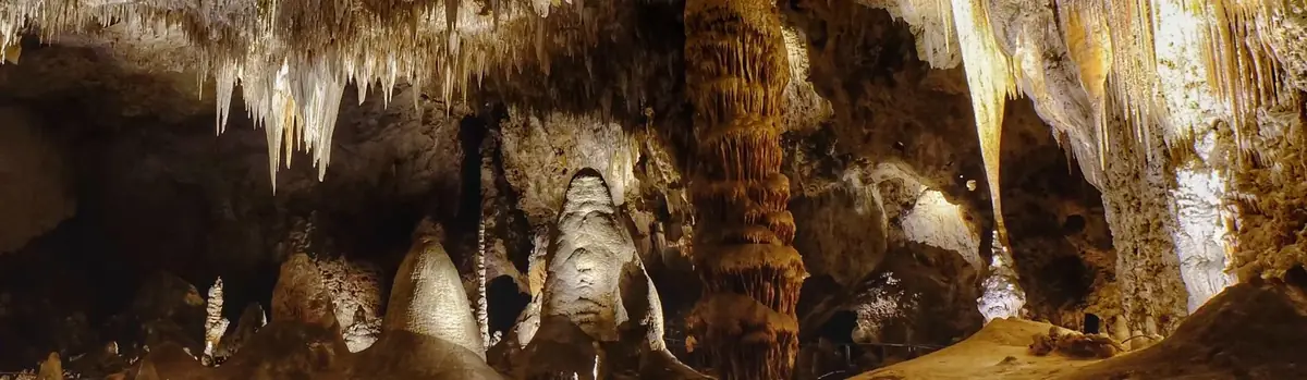
High ancient sea ledges, deep rocky canyons, flowering cactus, and desert wildlife—treasures above the ground in the Chihuahuan Desert. Hidden beneath the surface are more than 119 caves—formed when sulfuric acid dissolved limestone leaving behind caverns of all sizes.
Rising from the heart of the Tularosa Basin is one of the world's great natural wonders - the glistening white sands of New Mexico. Great wave-like dunes of gypsum sand have engulfed 275 square miles of desert, creating the world's largest gypsum dunefield. White Sands National Park preserves a major portion of this unique dunefield, along with the plants and animals that live here.
There is a place in Far West Texas where night skies are dark as coal and rivers carve temple-like canyons in ancient limestone. Here, at the end of the road, hundreds of bird species take refuge in a solitary mountain range surrounded by weather-beaten desert. Tenacious cactus bloom in sublime southwestern sun, and species diversity is the best in the country. This magical place is Big Bend...


 Caves