A landscape is alive underneath our feet, filled with creatures that remind us what it is to be wild.
Katmai was established in 1918 to protect the volcanically devastated region surrounding Novarupta and the Valley of Ten Thousand Smokes. Today, Katmai National Park and Preserve also protects 9,000 years of human history and important habitat for salmon and thousands of brown bears.
3.7Macres of parkland
34.5Krecreation visits, 2025
Regional datanearby climate picks
Seasonal access & reservations
No reviewed guidance for this selection. Check the park's official planning pages; missing coverage does not establish access.
Selected guidance only; separate from climate comfort and current conditions.
Official conditions Not checked
The conditions feed has not been connected for this park.
Editorial recommendations, reviewed 2026-10-17. Full park days, excluding travel to and from the region. A first-visit outline for a general traveler; adapt to mobility, fitness, season, reservations, and current conditions. These are suggested days, not reserved activities or guaranteed routes.
When most people envision Katmai, they think of bears. Katmai is one of the premier brown bear viewing areas in the world. About 2,200 brown bears are estimated to inhabit the park, and more bears than people are estimated to live on Alaska Peninsula. As many bear populations around the world decline, Katmai provides some of the few remaining unaltered habitats for these amazing creatures. At Katmai, scientists are able to study bears in their natural habitat, visitors are able to enjoy unparalleled viewing opportunities, and the bears are able to continue their life cycle largely undisturbed. Nurturing this relationship between people and bears is the key to Katmai's success as a bear-viewing destination. Rangers, scientists, and the public work together to maintaining this fragile balance. It is important that all who visit Katmai respect bears and are armed with the knowledge to stay safe in bear country . The urge to take the perfect photograph or maintain the best fishing hole with your fly rod can be strong, but bears need space to sleep, eat, rest, travel, and play. By recognizing the needs of the bears and giving them space, each of us plays a role in keeping bears wild.
Where Can I See Bears?
A bear's waking hours are often dominated by their search for food. Outside of their denning season, bears predictably congregate in food rich areas throughout Katmai. Some areas of Katmai National Park, like the food rich Pacific coast, support some of the highest densities of bears ever documented. Other areas of the park with little food, such as the Valley of Ten Thousand Smokes, support only a few bears in any season. If you know what foods bears prefer to eat and when that food is most abundant, accessible, and nutritious, then you will be able to find many areas in Katmai to observe these fascinating animals.
Bear Watching at Brooks Camp
At Brooks Camp, brown bears congregate to feed on sockeye salmon in the Brooks River. Four wildlife viewing platforms along the river offer safe and spectacular wildlife viewing opportunities while minimizing our potential impact on the bears. For more information about bear watching at Brooks Camp, see Katmai's park guide, The Novarupta , or download the brochure, Bear Viewing at Brooks Camp .
Other Bear Watching Destinations in Katmai
There are many, many backcountry locations that offer bear watching opportunities in season. In fact, the Pacific Coast of the park harbors some of the highest densities of bears anywhere on the planet. However, thick vegetation and rugged terrain can make seeing those bears difficult. For many people the most rewarding backcountry bear watching locations are where bears feed on sedges, clams, and salmon. In spring and early summer, bears migrate to open meadows to feed on sedges and dig for clams on the nearby mudflats. Later in the summer and fall, bears are more easily and consistently seen along salmon streams. The table provided below shows the best typical times for bear viewing at a few specific and popular areas in Katmai National Park and Preserve. For guides and/or transportation to bear viewing areas, see the list of commercial operators authorized to provide bear viewing trips in Katmai National Park and Preserve.
Watch the Bears of Brooks Camp Online!
Don't miss a moment of the action on the Brooks River. Now you can follow the lives of the brown bears of Brooks River anywhere with an internet connection. Katmai National Park and explore.org have partnered to bring the bears to you. Watch the bears live!
Popular destinations on Naknek Lake include Bay of Islands, Brooks Camp , Fure’s Cabin , Iliuk Arm, and access to the Savonoski Loop. Download the Naknek Lake Boating Guide for information on water depths, hazards, and suggested routes. Specific regulations for Naknek Lake and Brooks Camp can be found on page 15 of the Summary of Regulations found on Katmai's Laws and Policies page .
Whether you are looking for a long paddle on an isolated lake or the excitement of running whitewater, Katmai has a destination for you. The Savonoski Loop is a popular canoeing and kayaking route. American Creek , Moraine Creek, and Funnel Creek are popular with rafters.
Situated at the mouth of the Brooks River and the shore of Naknek Lake, Brooks Camp attracts people from all over the world to view brown bears , enjoy world-class fishing , and learn about the long human history of the area. It is also a starting point for many backcountry adventures . Daily bus tours from Brooks Camp provide easy access to the geologic splendor of the Valley of Ten Thousand Smokes, site of the largest volcanic eruption of the 20th century. Hiking opportunities also exist.
From June 1 to September 17, the National Park Service operates a visitor center, ranger station, campground , and auditorium with daily ranger-led programs . Additional services and amenities including meals and lodging are available at Brooks Lodge through September 17 . Only very limited visitor services may continue through September 30.
Visiting Brooks Camp
While Brooks Camp offers many public services and accessible options unavailable elsewhere in the park, visitors must arrive prepared to experience backcountry Alaska. Whether staying for just a few hours or for several days, you should expect to encounter windy, rainy, and cold conditions. Be sure to dress and pack in anticipation of diverse and changing weather conditions .
Most people arrive at Brooks Camp via small, float-equipped aircraft. Please visit Katmai’s directions and transportation page for more information.
All visitors to Brooks Camp are required to begin their stay by attending a brief bear safety talk outlining park regulations. Please visit the Brooks Camp Bear Safety page and Katmai bear safety page for more information.
A permit is needed for any activities within in the Brooks River Corridor, with the exception of redfish fishery subsistence activities. This corridor includes the river itself and 50 yards from the water's edge on either side along the banks of the river from the Lake Brooks inlet downstream to the elevated bridge and boardwalk. This does not include graveled roads trails, boardwalks, or wildlife viewing platforms. A permit is also not needed for any travel to or from villages or homesites. Permits are needed from June 15 until October 31 when the salmon are spawning. Each permit is valid for 7 days with a maximum group size of 6 individuals. Permits are available on www.recreation.gov for a $6 booking fee.
Most facilities around Brooks Camp are wheelchair accessible, but assistance may be neccessary. Trails are unpaved and frequently muddy. Visitors should be prepared to leave the trail in order to avoid a bear.
Download The Novarupta , the official Katmai newspaper and a comprehensive, up-to-date guide to planning your visit. Trip planning advice can also be found in the Brooks Camp Trip Planning Hangout . Many blog posts about Brooks Camp also provide helpful trip planning information.
The Brooks Camp area has very few established hiking trails. However, the trails still cover a wide range of experiences including bear viewing, cultural history, quiet forests, alpine tundra, and rugged mountain scenery. All distances listed are one-way. A little preparation before any hike in Katmai will make your experience much more comfortable and safe. Bring a rain jacket and rain pants on every hike. Conditions change rapidly and could spoil the day for the unprepared. Cold and wet conditions can be experienced throughout the summer. Protect yourself from hypothermia. Bears and moose can be encountered anywhere around Brooks Camp. Make noise appropriately to avoid surprising these animals. Refer to Bear Encounters in Katmai for more bear safety information. Be sure to follow proper food and gear storage regulations wherever you go. Contact a ranger for specific information. A PDF list of hiking trails is also available to download .
Brooks Falls Trail
Distance: 1.2 mi (2 km) Difficulty: Easy, wheelchair accessible
This is the most popular trail in Katmai. It contrasts a quiet walk through the boreal forest with the intimidating and exciting presence of brown bears. The Brooks Falls Trail begins across from the vault toilets .3 mi (.5 km) from the South Platform. During July, the Brooks Falls Trail rewards visitors with superb bear viewing opportunities. At the end of the trail, two raised platforms offer a bird’s eye view of bears fishing in the Brooks River. Bear viewing at the Falls is best during the July salmon run. Brooks Falls creates a temporary barrier to migrating salmon, making them more accessible to predators. This hike can be intimidating with frequent bear encounters along its entire length. Bears are commonly encountered walking and sleeping along the Falls Trail especially in July and September. Hikers must exercise caution and be prepared to move off of the trail in order to let bears pass.
Cultural Site Trail
Distance: .1 mi (.2 km) Difficulty: Easy This easy, self guided trail starts from the Brooks Camp Visitor Center and winds through several prehistoric camps to a reconstructed native dwelling, a traditional semi-subterranean home sometimes referred to by its Russian name, barabara. Brooks Camp is part of the Brooks River National Historic Landmark, which has one of the highest concentrations of prehistoric human dwellings in North America. Over 900 depressions, indicating the remains of semi-subterranean homes and campsites, line both sides of Brooks River. Occasionally, beginning at the visitor center at 2 PM, a park ranger will lead a short .25 mile (0.4 km) walk providing information about the human history of Brooks River Archeological District and National Historic Landmark. The walk lasts about an hour and ends at the reconstructed native dwelling. Check at the visitor center to see if this program is offered.
Lake Brooks Road
Distance: 1 mi (1.6 km) Difficulty: Easy This road leads to a large, glacially carved lake and the head of the Brooks River. The road begins at the South Platform and passes the Brooks Falls Trail junction. The Valley of Ten Thousand Smokes Road begins .7 mi (1.1 km) from the platform. At this junction, keep going straight and continue to Lake Brooks. There is a covered picnic area, food cache, and vault toilet at Lake Brooks. The outlet of Lake Brooks is a good salmon viewing area during spawning season in August and September and bears will occasionally fish for salmon at this spot. Anglers may use this area for access to the upper Brooks River.
Valley of Ten Thousand Smokes Road
Distance: 23 mi (37 km) Difficulty: Moderate For those who like to walk, this is the primary access for exploring the Valley of Ten Thousand Smokes. This road begins .7 mi (1.1 km) from the South Platform along the Lake Brooks Road. Three stream crossings are necessary to hike its entire length. The majority of the road cuts its way through dense boreal forest. Particularly scenic views can be found at mile 7.5 (12 km) and frequently beyond the first stream crossing at mile 12 (19 km). Along its entire length, the road provides opportunities for short walks, long hikes, and access to a number of rewarding side trips for those who wish to get off of the beaten path. The Valley of Ten Thousand Smokes at road’s end is a must see
Dumpling Mountain Trail
Distance: 1.5 mi (2.4 km) with longer options Difficulty: Moderate to Strenuous This moderately strenuous hike climbs 800 feet (244 m) over 1.5 miles (2.4 km) to an overlook above Brooks Camp with expansive views of Naknek Lake, Brooks River, and Lake Brooks. The trailhead is located in the Brooks Camp Campground. Hikers have the option to continue beyond the overlook to reach the summit of Dumpling Mountain (2440 ft/744 m), another 2.5 mi (4 km) beyond the overlook. Once the overlook is reached, the trail offers spectacular views of the park and points beyond. The trail climbs through several habitat communities on its way to the Dumpling Mountain summit including boreal forest, subalpine meadows, and alpine tundra.
Sport fishing is intricately woven in the history of tourism in the Katmai region. Most facilities for tourists were first developed because of the area's remarkable sport fishing opportunities. The chance to catch Katmai's abundant rainbow trout, arctic char, dolly varden, arctic grayling, lake trout (char) as well as five species of Pacific Salmon attract anglers from all over the world. Although the fishing is exceptional, these prized sport fish are still vulnerable to overfishing. Katmai National Park and Preserve and the Alaska Department of Fish and Game (ADF&G) carefully manage fish populations through regulations that maintain the long-term stability of Katmai's sport fishery. If you intend to fish in Katmai, you must be familiar with these regulations. State regulations for sport fishing are covered under ADF&G's Bristol Bay, Kodiak/Aleutian, and Lower Cook Inlet management areas. Anglers are often in areas where bears want to fish. Therefore, anglers need to be especially careful to reduce the number of and risk associated with bear-human conflicts. An Alaska sport fishing license is required of all nonresidents 16 and over and most residents 16 to 59. You may also need a harvest record card and/or king salmon stamp before you fish. Special federal regulations, in addition to state regulations, exist for the Brooks River . For more information and to buy your licenses, stamps, and tags online, visit ADF&G's License and Permits web site .
Catch and Release Ethics
Many places in Katmai experience heavy fishing pressure each year and many fish are caught multiple times in a season. Therefore, release fish as quickly and gently as possible to ensure their continued survival. In general, avoid playing a fish to exhaustion. As a fish is landed, keep it in the water when removing the hook. Fish can quickly suffocate when removed from the water. Use barbless hooks as much as possible. They are easier to remove and less injurious to fish. The slime on fish helps to protect it from disease and parasites. Handling a fish roughly, with dry hands, or dragging it onto the shore removes this slime and reduces its chances for survival. For more information about catch and release ethics please watch Letting Go: The Art of Catch and Release . This video, written and produced by experienced local fishing guides, succinctly highlights proper catch and release techniques.
Fish Consumption Advisories in National Park Waters
The Environmental Protection Agency, states, territories, and tribes provide advice on fish and shellfish caught in the waters in their jurisdiction to help people make informed decisions about eating fish. Advisories are recommendations to limit your consumption of, or avoid eating entirely, certain species of fish or shellfish from specific bodies of water due to chemical or biological contamination. Fish is part of a healthy balanced diet, but eating wild fish and shellfish caught in park waters is not risk free. Parks are “islands”, but the much larger “ocean” that surrounds them affects the natural resources inside a park. Other aquatic toxins are the result of natural biological processes. Also, chemical contaminants that originate outside of park boundaries can come into parks. Mercury is an example of a toxin originating outside a park that can find its way into a park. Mercury exists naturally in some rocks, including coal. When power plants burn coal, mercury can travel in the air long distances before falling to the ground, usually in low concentrations. Once on the ground, microorganisms can change this elemental mercury to methyl mercury. This type of mercury can build up in animal tissues, and it can increase in concentration to harmful levels. This high concentration can occur in large predatory fish - those often pursued and eaten by anglers. Studies have shown that fish in some National Park System waters have mercury levels that may be a concern to people who regularly eat a lot of fish. To learn more about this topic, the National Park Service maintains information about Fish Consumption Advisories and Mercury and Toxins in Nature .
Fishing Throughout the National Park Service
We invite you to visit the Fish and Fishing website for more information about fish and fishing in the National Park Service. You will learn about conservation, different fish species, and parks that offer fishing.
Fishing Around Bears
The park’s annual salmon runs support some of the highest densities of brown bears on earth. No matter when you visit, fishing in Katmai requires extra care and responsibility to protect people, wildlife, and the experience.
A splashing fish sounds like food to a bear. Bears will often move in your direction to investigate a fish on a line. Always be prepared to cut or break your line, so that you can free the fish and move out of the water until the bear passes. Never let a bear acquire a fish from you.
It is easy to become so engaged in fishing, that you forget to be alert for bears. They are surprisingly quiet and difficult to see in dense grass or tall brush, so always have someone spot bears for you.
At minimum, keep 50 yards between yourself and all bears. All fishing must cease when a bear is within 50 yards of you. No lures or flies can remain in the water. Stop fishing and move away well before a bear approaches within 50 yards. If bear is close and you hook a fish, you must lose your tackle to break your line or find yourself in a situation with a bear pursuing your fish.
Guided Fishing Opportunities
Visitors traveling on their own with the proper equipment and licenses are welcome to fish in Katmai. Many commercial operators offer guided sport fishing in the park and a list of those operators are found in the commercial services directory .
The following six companies are exclusively authorized by concessions contract to provide jet-boat accessed fishing on American Creek: Alaska's Enchanted Lake Lodge Branch River Air Service Crystal Creek Lodge Katmailand's Kulik Lodge and Brooks Lodge No See Um Lodge Royal Wolf Lodge
King Salmon Visitor Center Located just next door to the King Salmon Airport, the King Salmon Visitor Center is where you can find detailed information about the many federal public lands on the Alaska Peninsula as well as the Bristol Bay region. Hours of operation change seasonally .
Exhibits focus on the spectacular natural resources and rich history of the Alaska Peninsula. A large collection of films is available for viewing and the Alaska Geographic bookstore offers maps, navigation charts, videos, posters and more.
Links for other regional information can be found at:
National Park Service Aniakchak National Monument and Preserve Alagnak Wild River Aleutian World War II National Historic Area Lake Clark National Park & Preserve
U.S. Fish & Wildlife Service Alaska Peninsula National Wildlife Refuge Becharof National Wildlife Refuge Kodiak Island National Wildlife Refuge
Alaska Department of Fish & Game McNeil River State Game Sanctuary
Alaska State Boroughs Bristol Bay Borough Lake & Peninsula Borough
Since the early days of the National Park Service, rangers have shared their knowledge through programs and presentations like guided walks, talks, and campfire programs. Today, that long-standing tradition continues. Ranger-led programs are a great way to learn about and experience Katmai. Programs are offered at Brooks Camp from June 7 to September 17.
Live Chats Join park rangers live on the bear cams. Follow us on Katmai's social media sites or check out the park’s events calendar for dates, times, and topics for live events hosted during the summer. Replays and recorded live chats can be found on explore.org's YouTube channel .
Explore the human side of Brooks River. Katmai’s landscape has been home to people for thousands of years. The Brooks River area is both a National Historic Landmark and a National Register of Historic Places Archeological District. With over 900 house depressions near the river, this is one of the most densely concentrated archeological areas in North America. This walk follows an easy 1/4 mile trail to a reconstructed traditional Alutiiq/Sugpiaq home and explores the human history hidden along the river and in the forest.
Where: Brooks Camp Visitor Center When: 2 p.m. daily from June 7 to September 17 Distance: .5 mile (.8 km) round trip Difficultly: Easy Time: 45 minutes to 1 hour
Join a park ranger for an illustrated talk in the Brooks Camp Auditorium. Each night, this program offers unique perspectives, stories, and information on Katmai National Park.
Where: Brooks Camp Auditorium When: 8 p.m. daily from June 7 to September 17 Time: 45 minutes to 1 hour
Valley of Ten Thousand Smokes Tour Not far from Brooks River, the largest volcanic eruption of the 20th century began on June 6, 1912. The eruption was so violent that the summit of Mount Katmai collapsed, villages were abandoned, and explosions were heard as far away as Juneau. In the wake of this violence, hardy adventurers and scientists discovered the Valley of Ten Thousand Smokes, a spectacular ash covered landscape. You can explore Katmai’s volcanic landscape on this day-long tour. The road to the Valley crosses three streams before arriving at the Robert F. Griggs Visitor Center. After a break for lunch, a ranger leads an optional hike down to the Valley floor. The hike covers 3.4 miles (5.4 km) round trip with 1000 feet (305 m) of elevation change.
A fee is charged for this tour and reservations are required. Advanced reservations can be made at Brooks Lodge or by contacting Katmailand, Inc . Be sure to bring water, hiking boots, rain gear, and warm clothing. If you are arriving or departing Brooks Camp the day of your Valley tour, please arrive at Brooks Camp before 9 am and depart after 4:30 pm to allow plenty of time to get to and from the bus.
Where: South Platform When: 9 a.m. daily from June 7 to September 17 Distance: 46 mile (73.6 km) bus trip and 3.4 mile (5.4 km) hike Difficulty: Easy bus trip and moderate hike Time: 7 hours
Official NPS features and USGS park boundaries, imported 2026-10-17. An inventory snapshot, not live trail or parking availability.
Loading official park features…
TrailsPoints of interestParkingZoom with buttons or pinch. Toggle layers on the map.
Map coverage varies. Trail names may represent segments, connectors, or shared park units; mapped lines are not a hiking recommendation. Use official conditions and navigation resources before heading out.
Margo Creek Falls Trail Inventory record · 1 source segments; not a route distance.Winter seasonal closure
Native
Hiker/Pedestrian
Page 1 of 2
NPS public GIS inventory, imported 2026-10-17. “Existing” is an inventory classification, not confirmation that a trail is open. Segment counts are not route distances. Parking records do not indicate space availability, fees, or accessibility certification. View government source ↗
Climate for Anchorage, 415 km from the park reference point. 1991–2020 normals. Source elevation: 31 m.
This climate location is distant from the park. Use these values as regional context only. Do not use its climate ranking to choose park travel dates.
Daytime highNighttime lowOctober: 41° / 33°
Daytime high41°
Precipitation90 mm
Daylight9.6 hrs
Wind7.8 km/h
Mountain, rim, valley, and coastal conditions can differ sharply from the source town. Check park forecasts and current conditions before travel.
Monthly climate data 12 months · °F
Month
High
Low
Rain / snow water
Wet days
Daylight
21°
14°
50 mm
10.4
6.0 h
26°
18°
49 mm
9.6
8.5 h
32°
21°
38 mm
8.5
11.3 h
42°
30°
29 mm
7.3
14.3 h
51°
39°
31 mm
7.1
17.0 h
59°
49°
40 mm
9.0
18.8 h
62°
54°
73 mm
12.5
18.1 h
61°
53°
107 mm
14.8
15.5 h
54°
46°
117 mm
15.3
12.6 h
41°
33°
90 mm
13.2
9.6 h
29°
22°
66 mm
11.7
6.9 h
23°
16°
73 mm
12.8
5.2 h
RESEARCH WITH THE SOURCE IN VIEW
The practical field guide.
Official NPS excerpts imported 2026-10-17. Fees, permits, road access, and operations can change; use the source link to confirm the latest information.
The purpose of Katmai National Park and Preserve is to protect, study, and interpret active volcanism surrounding the Valley of Ten Thousand Smokes, extensive coastal resources, habitats supporting a high concentration of salmon and brown bears, and an ongoing story of humans integrated with a dynamic subarctic ecosystem. The park and preserve offer unique opportunities to explore vast wilderness and immense volcanoes, watch brown bears, fish for salmon and trout, and many other activities.
Katmai is, in many ways, a wilderness park. Accessible facilities are concentrated at Brooks Camp . Elsewhere, accessible facilities and trails do not exist. Most of the public buildings in Brooks Camp, including the restroom facilities, are ADA accessible, but assistance may be necessary to navigate the trails and access the wildlife viewing platforms. Entering and existing float planes can be challenging for people with limited mobility. The bear viewing platforms are accessed along elevated walkways with ramps. All bear viewing platforms are accessible. These platforms are located .25 mile (.4 km) to 1.2 miles (1.9 km) from the Brooks Camp Visitor Center. The trails to the Brooks Falls and Riffles platforms are accessible. However, the narrow paths at Brooks Camp are rough and can become very muddy. Limited all-terrain wheelchairs are available to borrow from the Brooks Camp Visitor Center but personal services are not available for assisting visitors around the Brooks Camp area. Close encounters with brown bears are possible anywhere in Katmai, especially at Brooks Camp. Bears frequently use the same trails and roads as people. Please be aware that you may need to move off of the trail and enter the woods to allow bears to pass. Photos from Brooks Camp on Katmai's Flickr page may help you visualize the facilities and trails.
Text-Only Version
Introduction to the Park
Introductory Text
The 15 active volcanoes lining Shelikof Strait make the park and preserve one of the world’s most active volcanic centers. These Aleutian Range volcanoes are like pipelines into the fiery cauldron beneath Alaska’s southern coast, a cauldron that extends down both Pacific Ocean shores. This Pacific Ring of Fire boasts over four times more volcano eruptions above sea level than elsewhere in historic times. Nearly 10 percent of the 400-plus eruptions took place in Alaska; less than two percent in the rest of North America. Plate tectonics theory attributes this to collisions of the plates making up the Earth’s crust. The ring of fire marks edges where crustal plates bump against each other. A map of earthquake activity superimposed on a map of active volcanoes will show violent earth changes ringing the Pacific Ocean from South America around to and down the Indonesian archipelago. Major eruptions deposited ash across the Katmai area at least 10 times in the past 7,000 years. Under the now quiet floor of the Valley of Ten Thousand Smokes, and deep beneath mountains around it, molten rock is still present. The most visible clues to this are the steam plumes rising occasionally from Mounts Mageik and Martin and Trident Volcano. The plumes show the potential for new eruptions to occur. Trident erupted in 1968, and Fourpeaked Mountain awoke from 10,000 years of dormancy in fall 2006. A volcanic eruption capable of bringing major change could occur at any time in this dynamic landscape. Since the great 1912 eruption, the resulting massive deposits of volcanic ash and sand have consolidated into tuff, a type of rock. In the valley, streams rapidly cut through these ash deposits to form steep-walled gorges. The thousands of fantastic smoking fumaroles that greeted the scientists
Eruption! And the Valley of Ten Thousand Smokes
Planning Your Visit
Access and Information
Be prepared for storms and some sunshine. Summer days range from the mid-50s to mid-60s°F; average low is 44. Strong winds often sweep the area. Skies are clear 20 percent of the summer. Light rain can last for days.
Accommodations and Services
Exploring Katmai
A 23-mile dirt road leads from Brooks Camp to the Valley of Ten Thousand Smokes. A foot trail descends to the valley from road’s end. A concessioner’s bus makes daily round-trip excursions to the valley from Brooks Camp. Float planes provide access to main visitor use areas, like Brooks Camp. Although most visitors to the park and preserve don’t experience the glaciated volcanic peaks of the Aleutian Range, like Mounts Denison and Steller that form the spine of Katmai’s dramatic coast, charter aircraft at King Salmon, Homer, Kodiak, and Brooks Camp offer an opportunity to see some of the most remote parts of Katmai. Weather dependent scenic flights fly over bays, fjords, and waterfalls on the coast, glacier-clad mountains’ steaming volcanic peaks, and island-studded lakes. You may also fly over the Valley of Ten Thousand Smokes and site of the 1912 eruption.
Backcountry Travel
Katmai’s rugged wilderness requires reasonable precautions. Be well prepared and equipped. There are several good short routes and unlimited opportunities for long trips. Katmai has few trails, but passable routes are found along river bars, lakeshores, and gravel ridges. Open uplands are easiest for backpackers. For overnight Valley hikes, arrange a bus drop-off and pick-up.
Backcountry users must store food properly. Bear-resistant containers are available in limited supply at Brooks Camp Visitor Center or King Salmon. There are no improved campsites or food caches in the backcountry. Brooks Camp Campground (fee charged; reservations required in advance of arrival) has water, vault toilets, a food storage cache with limited space, and picnic tables. Cooking is allowed on camp stoves only. The concessioner sells white gas for stoves. Meals are available at Brooks Lodge; otherwise bring all your food with you.
Regulations and Safety
Camping and Food Storage
An Alaska fishing license is required; all state rules apply. Sport fishing is allowed in the park using only artificial lures; fly fishing only from Lake Brooks to the Brooks River foot bridge. Catch-and-release fishing is encouraged parkwide and required for rainbow trout in many backcountry streams. Anglers should always be alert for bears. If a bear approaches, release a fish or cut your line and move out of the river. For current information and special regulations, please refer to the official State of Alaska fishing regulations or ask at the visitor center.
Bears and Other Large Mammals
More Information
Katmai National Park and PreserveP.O. Box 7King Salmon, AK 99613 907-246-3305www.nps.gov/katmThere are over 400 parks in the National Park System. The National Park Service cares for these special places saved by the American people so that all may experience our heritage. For more information about parks and National Park Service programs in America’s communities visit www.nps.gov.
An entrance pass is not required to access Katmai National Park & Preserve.
Other National Park Service sites may require an entrance pass or fee. Depending on your trip plans, an interagency pass may save you money.
2026 Free Entrance Days in the National Parks
Come experience the national parks! All National Park Service sites that charge an entrance fee will offer free admission to US citizens and residents (other fees, including timed entry or reservation fees, may apply). Mark your calendar for these entrance fee-free dates:
February 16 : Presidents Day (Washington's Birthday)
May 25 : Memorial Day
June 14: Flag Day/President Trump's birthday
July 3–5: Independence Day weekend
August 25: 110th Birthday of the National Park Service
Katmai National Park & Preserve is located on the northern Alaska Peninsula, northwest of Kodiak Island and southwest of Homer, Alaska. The park’s headquarters is in King Salmon, about 290 air miles southwest of Anchorage. Like many areas in Alaska, Katmai is almost exclusively accessed by plane or boat. Some common ways to get to Katmai include commercial flights from Anchorage to the small town of King Salmon, where a visitor will then board a small aircraft or water taxi from King Salmon into the Park. Other options include taking a small aircraft from Anchorage, Kenai, Kodiak or Homer directly to Katmai. Fixed-wing aircraft are allowed to land on all suitable lakes, rivers, beaches, gravel bars, and open ground in both the Park and Preserve, unless the area is closed or otherwise restricted. Depending on where you want to visit in the Park, the aircraft may need to be outfitted to land on water with floats, or on the ground with wheels. When visiting the Katmai Coast, it is important to check the tide tables to ensure a float plane can land close enough to shore, or if a wheeled aircraft is better suited. Katmai National Park and Preserve boasts 4.2 million acres of land and much of this area is rarely visited and opportunities for incredible wilderness experiences abound. Other areas, such as Brooks Camp, are more easily accessed and have amenities like lodging and hot meals. Many companies provide a variety of commercial visitor services including transportation, guided day trips, guided multi-day trips, overnight accommodations, and food services. Commercial partners are authorized by permit to operate in the parks.
Katmai is rugged and remote. Planning ahead for flexibility and inclement weather is vital to a successful trip. Give yourself a few extra days on each side of your trip itinerary in the likely event of weather delays. In Alaska, we talk about the "circle of safety" where the passenger is a partner in ensuring a safe flight. Passengers should take an active role in ensuring everyone's safety by getting familiar with the details of their trip. As a passenger, you should be willing to ask questions in a polite way if you feel uncomfortable about something or have additional questions. This idea can be intimidating, but if you are uncomfortable about something there is probably a reason. It is important to act on those feelings and voice any concerns. The pilot may have a simple answer that restores your comfort level. Asking a question may be all it takes to refocus on safety and avoid a mishap with the flight.
A passengers role in aviation
Getting to Katmai
From Dillingham
From King Salmon
Travel Throughout Alaska
Alaska is a vast landscape, with many popular national parks and other public lands. Check with the Alaska Public Lands Information Center for help planning your journey to other parts of the state.
Traveling Green
Learn more about traveling green during your trip to Katmai.
A visit to Katmai National Park and Preserve carries some inherent risk. Preparation can make the difference between the adventure of a lifetime and tragedy.
Have a trip plan. Always let a responsible person know where you are going and when you expect to return. Let them know how long overdue you can be before they should start to worry. Trip planners can be filled out in person at the King Salmon and Brooks Camp visitor centers or email your itinerary to Katmai's dispatch office. Park staff do not track individual trips, however a detailed itinerary may provide rangers with extremely valuable information in an emergency.
Prepare for the unexpected. Strong storms sweep through the area any time of year. Carry waterproof rain gear and extra food since weather may delay pick-up from a chartered aircraft for days. A properly prepared party can usually wait through bad weather and thus may be a few days overdue with no cause for alarm. Backcountry travelers should consider carrying a satellite phone and/or a satellite-based text messaging device. Don't make your schedule too tight. Allow extra time for delays and always have a backup plan.
Bear Safety : All of Katmai is bear country. Ten Essentials for Backcountry Travel
Located between the stormy north Pacific Ocean and the even stormier Bering Sea, the Katmai region is often a battleground between weather systems. When you visit, be prepared to encounter all types of weather. On average, wet and cool conditions predominate in spring, summer, and fall. Summer temperatures range from 30˚ to 80˚ Fahrenheit (-1˚ to 27˚ Celsius). Winters are drier and colder. Winter temperatures are even more variable than summer and can range anywhere from -35˚F to 50˚F (-37˚ to 10˚ Celsius). Most ponds and lakes are frozen by mid to late fall and snow covers the higher elevations of the park until late May and early June. The Pacific coast of Katmai experiences cooler, wetter, and stormier conditions than the interior of the park. Strong winds are common all year. Follow these tips to brave Katmai's tempestuous weather:
Bring high quality waterproof clothing: A reliably waterproof outer layer can keep you dry and make what would otherwise be a cold and miserable day into an enjoyable one.
Dress in layers: Start with a base layer to manage moisture. Lightweight, wicking, and quick drying clothing works well for this. Wear an insulating layer such as a fleece jacket next to trap warm air next to your body. Lastly, add a waterproof shell such as a rain jacket to shield you from the elements.
Keep your head and hands covered: Even during the relatively mild temperatures of summer, a warm hat and lightweight gloves can add significantly to your comfort level.
If you are looking for current weather conditions and forecasts, please explore these links:
National Weather Service Forecast for King Salmon National Oceanic and Atmospheric Administration Aviation Forecast Model for Alaska
Federal Aviation Administration Webcams for Southwest Alaska : Cams for King Salmon, Igiugig, Kokhanok, and Larsen Bay are most relevant to the Katmai region. Alaska Volcano Observatory webcams especially those for Fourpeaked, Katmai, and Peulik. Dumpling Mountain Cam from explore.org.
Alaska Ocean Observing System Alaska Regional Weather Overview Brooks Camp Weather Station Contact Creek Remote Automated Weather Station Fourpeaked Remote Automated Weather Station Lake Coville Remote Automated Weather Station Pfaff Mine Remote Automated Weather Station Three Forks Remote Automated Weather Station
A FEW REASONS TO GO
A closer look.
15 official park photos
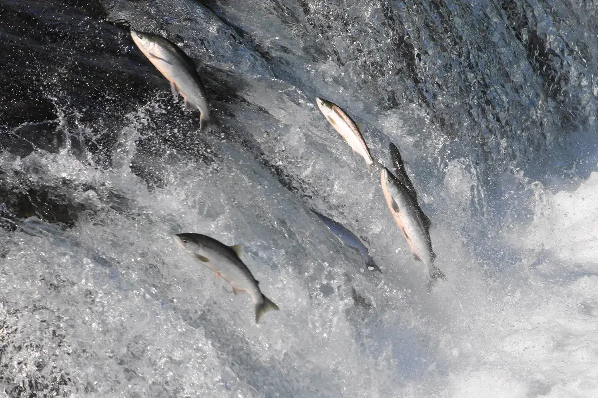
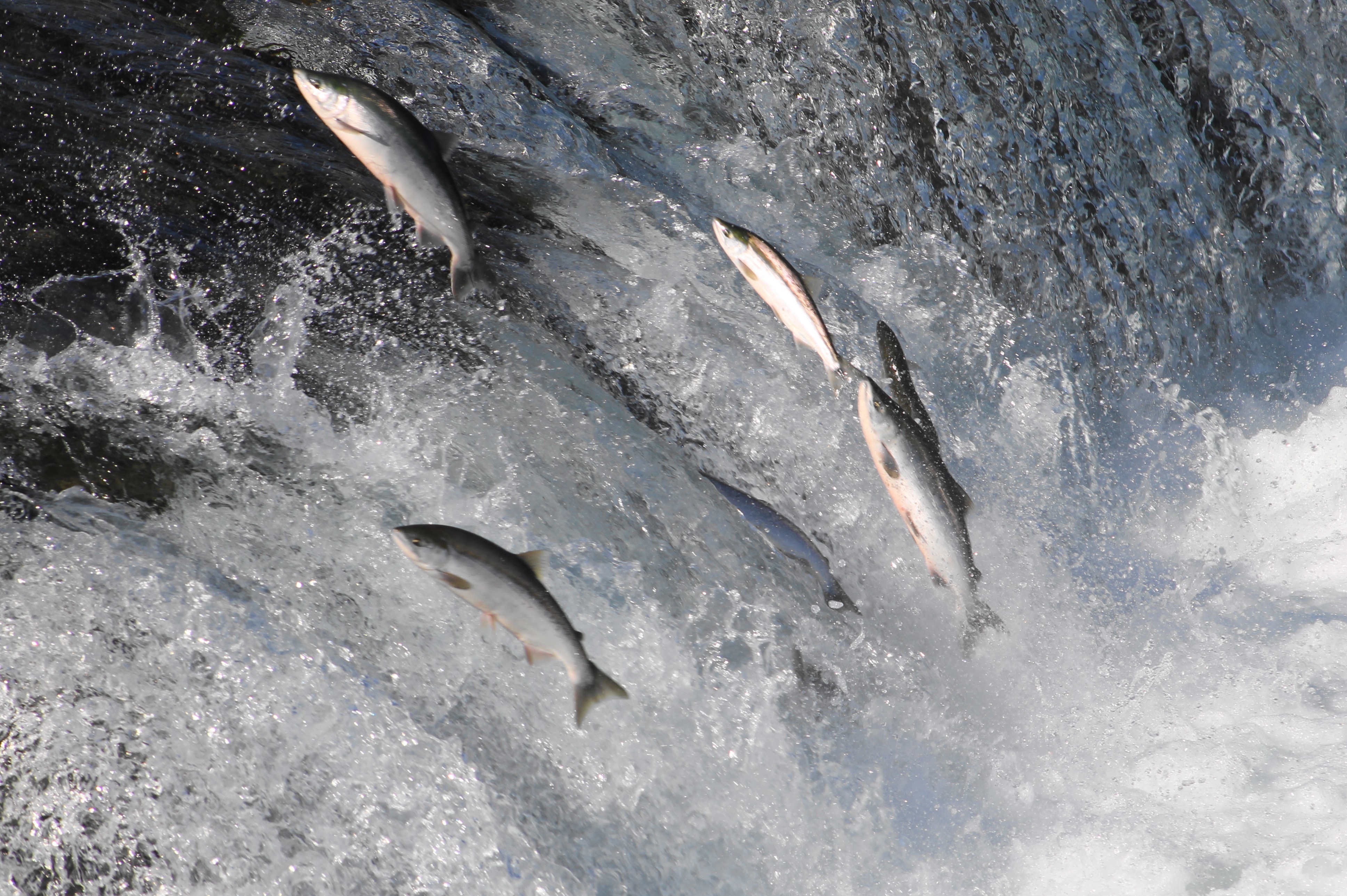
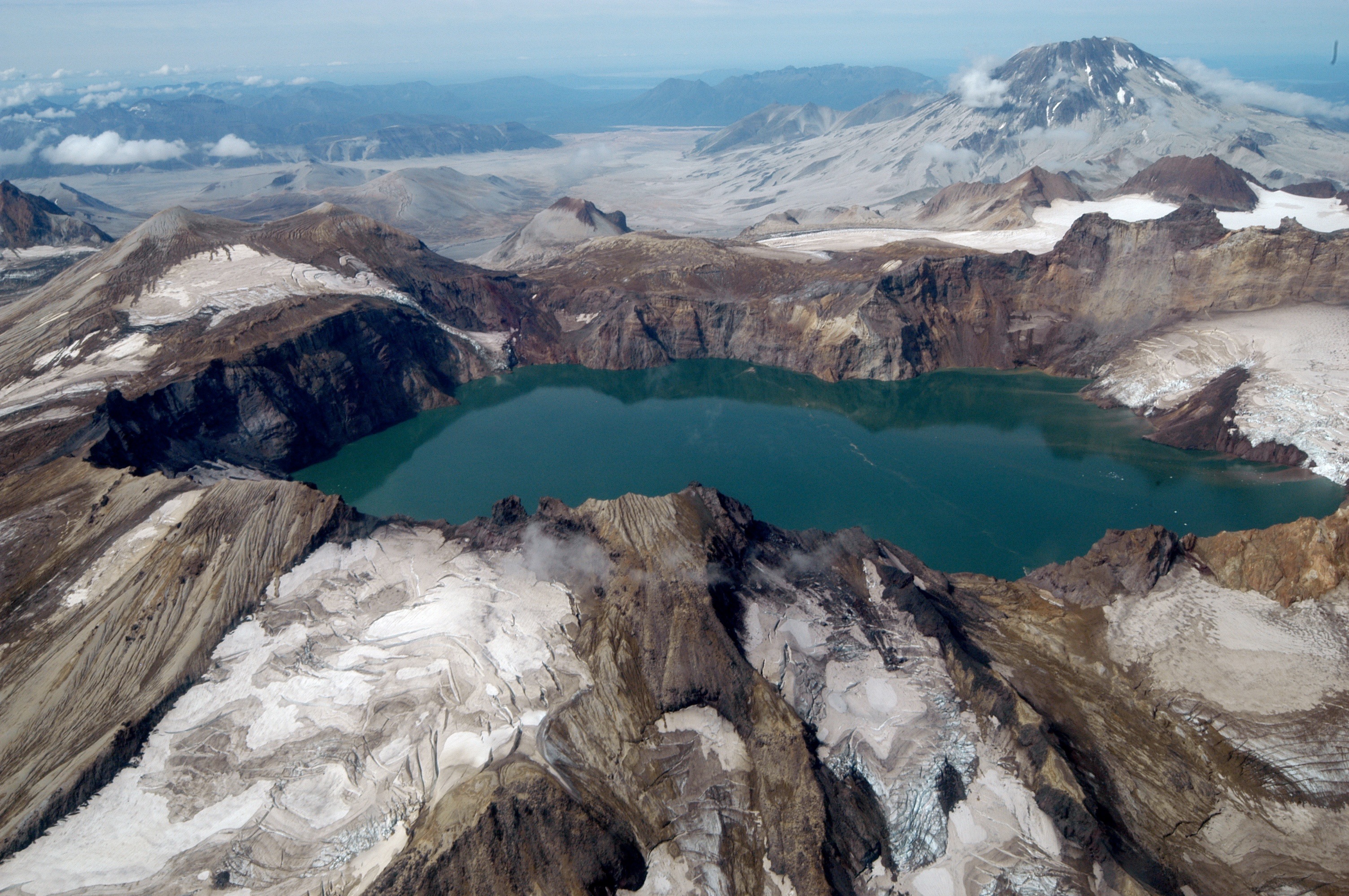
Each year, 200,000 to 400,000 sockeye salmon jump Brooks Falls.NPS/David Jacob Images link to the original government source.In July, brown bears often stand on the lip of Brooks Falls to try to catch leaping salmon.NPS/David Jacob Salmon streams in Katmai attract high numbers of brown bears.NPS/Bryanna Plog Mount Katmai's summit collapsed during the 1912 Novarupta-Katmai eruption. Today, the caldera is filled with a deep lake.NPS/Roy Wood Glacially clad volcanoes loom over the sedge meadows of Hallo BayNPS/Michael Fitz Wildlife viewing platforms at Brooks Camp are accessible, but assistance may be necessary for anyone with limited mobility.NPS Photo Hundreds of miles of waterways are open to boating in Katmai.NPS Brooks Camp is a popular destination for people and bears.NPS Photo / R. Wood Explore a unique, stark, and beautiful landscape on the Valley of Ten Thousand Smokes Tour.NPS/M. Fitz Katmai National Park and Preserve offers spectacular bear viewing opportunities.NPS/R. Wood The interagency King Salmon Visitor Center—just next door to the King Salmon Airport.NPS/A. Glore Anglers can test their skill and luck against the large and numerous trout in Katmai's waters.NPS/M. Fitz
Lake Clark National Park and Preserve is a land of stunning beauty. Volcanoes steam, salmon run, bears forage, and craggy mountains reflect in shimmering turquoise lakes. Here, too, local people and culture still depend on the land and water. Venture into the park to become part of the wilderness.
At the edge of the Kenai Peninsula lies a land where the ice age lingers. Nearly 40 glaciers flow from the Harding Icefield, Kenai Fjords' crowning feature. Wildlife thrives in icy waters and lush forests along the fjords once carved by the vast expanse of ice. Today, shrinking glaciers bear witness to the effects of our changing climate.
Denali is six million acres of wild land, bisected by one ribbon of road. Travelers along it see the relatively low-elevation taiga forest give way to high alpine tundra and snowy mountains, culminating in North America's tallest peak, 20,310' Mount McKinley. Wild animals large and small roam un-fenced lands, living as they have for ages. Solitude, tranquility and wilderness await.




 Lakes & rivers