Caribou, sand dunes, the Kobuk River, Onion Portage - just some of the facets of Kobuk Valley National Park. Thousands of caribou migrate through, their tracks crisscrossing sculpted dunes. The Kobuk River is an ancient and current corridor for people and wildlife. For 9000 years, people came to Onion Portage to harvest caribou as they swam the river. Even today, that rich tradition continues.
1.8Macres of parkland
7.8Krecreation visits, 2025
Regional datanearby climate picks
Seasonal access & reservations
No reviewed guidance for this selection. Check the park's official planning pages; missing coverage does not establish access.
Selected guidance only; separate from climate comfort and current conditions.
Official conditions Not checked
The conditions feed has not been connected for this park.
Editorial recommendations, reviewed 2026-10-17. Full park days, excluding travel to and from the region. A first-visit outline for a general traveler; adapt to mobility, fitness, season, reservations, and current conditions. These are suggested days, not reserved activities or guaranteed routes.
Camping in Kobuk Valley National Park is a once-in-a-lifetime experience. Far from any roads, trails or signs of civilization, a camping trip in the park is a unique wilderness experience that is hard to find anywhere else in the world. Before you go, make sure to stop by the Northwest Arctic Heritage Center in Kotzebue to visit the museum and chat with a ranger!
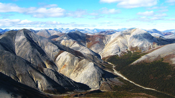
Camping in the backcountry allows visitors to experience the best of Kobuk Valley National Park. Campers can hike through the tundra, climb the peaks of the Baird Mountains or walk across the sand at the Great Kobuk Sand Dunes .
Hiking is easier in the mountains, where the ground is drier and less spongy. Planes cannot land high up in the mountains, so talk with your pilot about landing at lower elevations or on the river and then hiking up to the ridgelines. The mountains are quite a distance from the valley and accessing the mountains from the river is a trek over tundra and through patches of forest. Blazing your own trail across is possible, but it takes much longer than hiking on firm ground and can be rough going, so plan your time and resources accordingly.
A backcountry camping trip is also one of the best ways to see some of the park’s spectacular wildlife. Grizzly bears, caribou, moose and bald eagles can all be seen in the park.
NPS Photo/Emily Mesner
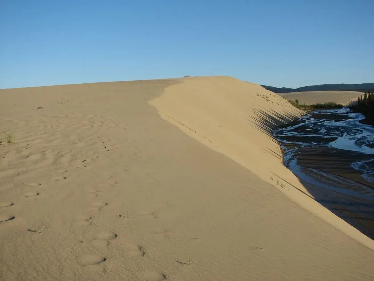
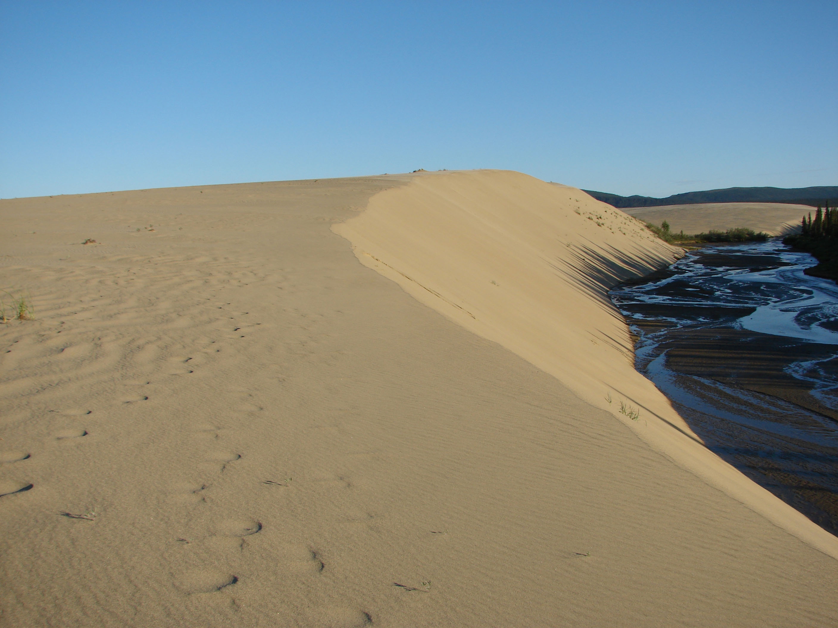
The most popular campsite is the Great Kobuk Sand Dunes, and this Ice Age relic – the largest active sand dunes in the Arctic – makes a great place to spend a couple day. Visitors can either land directly on the sand dunes, or hike from the Kobuk River. Contact the Northwest Arctic Heritage Center or watch our introductory film to learn more about visiting the Great Kobuk Sand Dunes.
Onion Portage on the north bank of the Kobuk River is another popular destination. Around Labor Day, caribou can typically be seen swimming across the river here on their migration south, and hikers can climb the bluff for drier ground and spectacular views of the Jade Mountains. Giddings Cabin, located on the bluff overlooking the cabin, isn’t open to the public, but is a nice example of traditional log building methods. Build in 1964 for an archeological excavation, builders from the nearby town of Ambler used moss the fill in the chinks.
Kobuk Valley National Park is a wilderness area, and there are no roads, trails, calculated mileages or specialized maps of the area. There are also no designated campsites, and visitors must choose their own place to camp. Contact the Northwest Arctic Heritage Center for tips on the best places to make your camp. Large tracks of unspoiled and undeveloped land is increasingly rare in the United States, and backcountry visitors are encouraged to practice Leave No Trace principles to help preserve this pristine wilderness.
Camping in the Arctic backcountry is an unforgettable trip, but the scenery is as spectacular as the terrain is challenging. Be prepared to do a lot of orienteering. We recommend all visitors being prepared with map, compass, and GPS as well as the knowledge to use all three. Even in the summer, it can be cold in the Arctic and the weather can change on a dime, so be prepared for any and all conditions.
Kobuk Valley National Park is bear country , and campers are responsible for storing their food out of reach of wildlife. Animal-resistant food containers are available to borrow from the Northwest Arctic Heritage Center in Kotzeube. Permits are not required for independent travelers, but organized recreational groups do need to get a permit from the Chief Ranger. Contact the Northwest Arctic Heritage Center to get one.
For many local residents, Kobuk Valley National Park is more than a national park; it’s their back yard. There are many parcels of private land through the park. If you see any sign of personal property, buildings or habitation, respect their property and steer clear.
Unlike in many national parks, local residents are allowed to hunt and gather resources from the land. Please respect these subsistence activities and give people a wide berth so they may finish their work without interruption.
Nestled within the Western Arctic National Parklands, the Kobuk Rivers offers a pristine wilderness in the heart of Alaska's Northwest Arctic region. If you are thinking of floating the Kobuk, this guide will help you navigate the river, stay safe, and make the most of your journey. Planning Your Trip to the Kobuk River Access to the Kobuk River is primarily by air taxi from Bettles or Kotzebue. Plan your trip in advance as there are no facilities or services once you depart. Ensure to coordinate with local air taxi services for drop-off and pickup. Boaters should plan to fly in all of their own gear with one of the commercial transporters. Collapsible canoes and kayaks work especially well in the slow water, and small rafts are also an option. If you prefer to have someone organize a trip for you, guided boat trips may be available.
River Characteristics
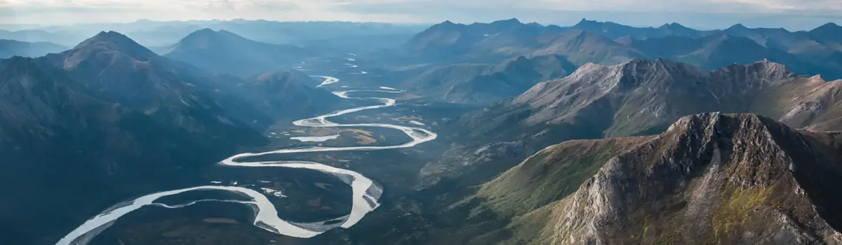
Floating the Kobuk River offers an immersive experience of Kobuk Valley National Park. Originating in the Endicott Mountains of the Brooks Range within Gates of the Arctic, the 380-mile-long river flows west to Kotzebue Sound, with 61 miles traversing Kobuk Valley National Park. As it meanders, the river cuts deep channels into glacial and alluvial deposits. Its flow varies seasonally, with spring and summer meltwater increasing levels, while sediment transport shapes unique features such as the Kobuk Sand Dunes. A key landmark along the river is Onion Portage—Paatitaaq, an important site for caribou migration and a traditional hunting ground for local Indigenous communities. The villageof Ambler is located close by, located along the upper Kobuk. Near both Ambler and Onion Portage the river becomes a bit tricky to navigate, so proceed cautiously.
Fall Foliage on the Great Kobuk Sand Dunes NPS Photo
Highlights of the Kobuk River
Great Kobuk Sand Dunes: Kobuk Valley’s stunning sand dunes are a remarkable relic of the last Ice Age. Approximately 28,000 years ago, the Earth experienced a significant cooling period, leading to the formation of glaciers high in the mountains surrounding the valley. As these massive glaciers slowly advanced and retreated, they ground the rocks beneath them into a fine sand. This sand was then carried by the wind into the sheltered, ice-free expanse of Kobuk Valley, creating the expansive dunes we see today. These dunes are accessible from the river via a 2-3 mile hike across the tundra, offering a unique opportunity to experience the breathtaking landscape. However, no established or maintained trail exists, so hikers should possess strong navigational skills and experience in cross-country hiking to safely explore this beautiful terrain. Cultural History: Float the Kobuk River knowing the Iñupiat people have thrived along its shores for at least 9,000 years! Three Iñupiat nations were spread-out along the length of the River; the Kuuŋmiut utilized the Kobuk River Delta, the Alkuniġmiut the central Kobuk River, and the Kuuvaŋmiut the upper reaches of the River to the headwaters. Most of what is now Kobuk Valley National Park would fall within the territory of the Alkuniġmiut Iñupiaq nation. The river itself is used for fishing, hunting, travel, and trade routes.
Arctic Grayling / Hiking the Sand Dunes / Caribou Calf NPS Archives / Rachel Heckerman / Tina Greenawalt
Activities to Do
Canoeing/Kayaking: Enjoy the serene waters and majestic landscapes. Be prepared for variable conditions and possible rapids. Canoeing and kayaking offer a close-up view of the river’s natural beauty.
Fishing: The Kobuk River spans the lifecycles of two types of fish; both salmon and whitefish species spend most of their adult life in saltwater, before returning to spawn in the freshwater rivers of Kobuk Valley. Salmon species that spawn in Kobuk Valley die – a one way trip bringing ocean nutrients back to terrestrial landscapes. Conversely, whitefish can breed repeatedly, returning to same sites to spawn over many years. Whitefish are an important staple for the subsistence of local communities as whitefish are abundant in the Kobuk River all year long.
Wildlife Viewing: Humans are not the only ones using the river cooridor. Bring binoculars and a camera to capture potential sightings of caribou, moose, bears, wolves, birds, and other Arctic animals.
Hiking: The landscape around the Kobuk River offers stunning vistas and opportunities for hiking and exploration. Hiking across tundra landscapes can be challenging as vegetation and the lack of trails makes for slow going.
Camping: Gravel bars and sandbars make for excelltent camping locations. Help preserve this unique landscape by practicing Leave No Trace principles. Remember, Kobuk Valley National Park is bear country , and campers are responsible for storing their food out of reach of wildlife. Animal-resistant food containers are available to borrow from the Northwest Arctic Heritage Center in Kotzeube. Permits are not required for independent travelers, but organized recreational groups do need to get a permit from the Chief Ranger. Contact the Northwest Arctic Heritage Center to get one.
NPS Photo by Amy Martin
Safety and Obstacles
Weather Conditions: The Arctic weather can be unpredictable. Be prepared for sudden changes, including rain, strong winds, and cold temperatures. Always check the weather forecast before your trip, and pack the proper gear to ensure your safety on your journey.
Water Levels: Water levels can vary significantly depending on the Season and/or recent rain. Low water levels in late summer may expose rocks and shallow areas, while high water can increase flow rates and submerge gravel bars used for camping. At certain high water levels it can be difficult to find suitable locations to camp downstream of the Portage Shelter Cabin.
Obstacles : Watch out for rocks, rapids, and fallen trees, especially in areas with lower water levels. Some sections of the river may have fast-moving water and challenging navigation.
Wildlife Encounters: One of the things that makes Kobuk Valley National Park special is that both brown bears (also known as grizzly bears) and black bears call it home. If you’re lucky, you might even get to see one. Even if you don't, you’ll never be far from one, because this is bear country! Stay alert and consider carrying bear deterrant like Bear Spray Learn more about staying safe in bear country
Navigation: The river is relatively remote, and GPS or traditional maps may not always be accurate. Familiarize yourself with the river’s course and potential hazards before setting out.
Hypothermia Risk : Water temperatures are cold year-round. Consider wearing a dry-suit, wet-suit, or other fowl weather gear. Pack extra dry layers for camp or for emergencies. Know the symptoms of hypothermia.
Be Respectful There are numerous parcels of private land throughout Kobuk Valley National Park. If you see any signs of personal property, buildings, or habitation, please respect their property and steer clear. It is recommended that visitors download a map of land ownership before your trip or familiarize yourself with land ownership. Unlike in many national parks, local residents are allowed to hunt and gather resources from the land. Please respect these subsistence activities and give people a wide berth so they can complete their work without interruption. Be sure to wave and say hello if you pass subsistence users! More Information For more detailed information, contact the park office directly at (907) 318-2230. Plan your trip well in advance, considering weather conditions and seasonal variations in river flow. For access to comprehensive maps to plan your trip, visit the USGS website (www.usgs.gov/products/maps) for detailed topographic, and satellite maps.
Hiking - There is an 8-mile loop road that leads out of town and crosses the tundra, offering excellent walking opportunities along both the beach and the shoreline of Kotzebue Sound.
Birding - Take a hike out of town on the loop road and you could find birds from any of the seven continents. Don't forget your binoculars.
Fishing - located at the end of a peninsula on the Kotzebue Sound, town is surround by water with opportunities to catch sheefish, tomcod, herring, and even salmon. Anglers should consult with the Alaska Department of Fish and Game for fishing permit requirments.
This is the headquarters and primary visitor center for Western Arctic National Parklands, which manages Kobuk Valley National Park, Cape Krusenstern National Monument, and Noatak National Preserve.
Museum and exhibits about Arctic ecology and Iñupiaq subsistence practices
Various films about the parks, the region, and other Alaska points of interest are available on demand.
Ranger lead programs and activities. Check locally for planned activites
The Northwest Arctic Borough is the second largest borough in the state of Alaska and is headquartered in Kotzebue.
Sulianjich Art Center is a nonprofit organization that markets the work of Northwest Alaskan artists.
Community events.
Contact the Northwest Arctic Heritage Center at (907) 318-2230 for more information about opportunities and activies around Kotzebue. Or reach out to the other organizations or government bodies in the region.
An ever present danger in cold climates is hypothermia, a condition created when you lose body heat faster than you create it. Early symptoms of hypothermia include slurred speech, trembling, exhaustion, stumbling, and impaired judgment. Unchecked, symptoms may progress to mental confusion, unconsciousness, and eventually death. Hypothermia can result from cold ambient temperatures between 30 and 60 degrees F, especially when accompanied by wind or rain. Should you get wet, you must be aware that hypothermia will likely follow.
Take Preventative Action
Put on rainwear or warm clothes before you become soaked or cold. Ventilate or remove clothing layers before you sweat. Wrap sleeping bags and clothing in plastic bags. Eat high calorie food throughout the day before you become exhausted. Keep hydrated. Make sure all members of your party are aware of the symptoms of hypothermia and look out for each other.
The objective of hypothermia treatment is to rewarm as fast as possible. Begin by finding a spot out of the wind, removing wet clothing, and adding dry layers. Then, feed and heat . First provide the body with quick calories that will enable it to produce heat (FEED) . Simple foods such as candy bars and hot chocolate will be absorbed the fastest. Follow up with food containing more complex carbohydrates such as bread and fruit.
HEAT means rewarm quickly by exercising and moving. Walk about or practice isometric exercises inside the tent or shelter. Body movement and exercise will usually affect rewarming considerably more than remaining still under piles of sleeping bags. Avoid alcohol as it increases heat loss. If a hypothermic patient ceases shivering, exhibits a dramatic decrease in mental status such as hallucinations and unconsciousness, and their core body temperature is below 90 degrees, the patient has severe hypothermia. Field rewarming of severely hypothermic patients can be dangerous, and is usually not effective. Transport the patient to the nearest medical facility.
Kobuk Valley National Park is a remote and rugged landscape lacking "traditional" NPS infrastructure and visitor facilities. Instead, the park headquarters and visitor center are located 80 miles west of the park at the Northwest Arctic Heritage Center in Kotzebue, AK. The Northwest Arctic Heritage Center is the main visitor center for the Western Arctic National Parklands consisting of Kobuk Valley National Park , Cape Krusenstern National Monument , and Noatak National Preserve . The building houses information about the parklands, special programs, souvenirs, and a free museum about arctic wildlife, geology, and Iñupiaq culture and subsistence practices. There is also a large lobby, free wifi, and a collection of films, puzzles, and books to occupy time during long layovers or poor weather. For travelers looking to camp or float in the parklands, the visitor center can assist with trip planning and has bear-resistant food containers for loan upon request. Come take a virtual tour of the heritage center!
The Northwest Arctic Heritage Center is a five minute walk from the airport at: 171 Third Ave, Kotzebue, AK 99752
Summer Hours : (April 1 - September 30) Monday - Friday 9:00 AM - 5:00 PM *Closed Saturday & Sunday *May be opened Saturdays - Check locally. Winter Hours: (October 1 - March 31): Monday - Friday 10:00 AM - 4:30 PM Closed Saturday & Sunday Closed on all federal holidays.
Passport Stamps
The Northwest Arctic Heritage Center has National Park Passport cancellation stamps for Kobuk Valley National Park, Cape Krusenstern National Monument , Noatak National Preserve , Bering Land Bridge National Preserve , and Gates of the Arctic National Park and Preserve .
If you have any questions about Kobuk Valley National Park, Western Arctic National Parklands, or the Northwest Arctic Heritage Center's programs, please call (907) 318-2230 or email us. Thanks!
For the people of Northwest Alaska, Kobuk Valley National Park is more than a national park – it’s the grocery store. For thousands of years, people have relied on the Kobuk River and the surrounding woods and tundra to provide the means for survival, and while even the most remote villages have a grocery store now, many people still turn to the land when deciding what’s for dinner.
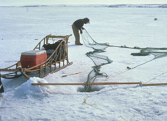
Fishing is one of the most common and important subsistence practices along the Kobuk River. During the long winters, when the rivers and streams are frozen, nets are set under the ice for whitefish, sheefish and arctic char, but the warm summer months provide the best fishing. The chum salmon run starts in mid-July and lasts until early September, and gill nets are set for salmon, sheefish, pike and whitefish.
Fish is an important source of food for both humans and dogs, and is dried, smoked, frozen or fermented to last through the leaner months. Many families spend their summers at fish camps, maintaining their nets and cutting and drying fish. Wood frames hung with drying salmon and sheefish are a common sight along the river banks.
Caribou hunting is second only to fishing along the Kobuk River. Twice a year, the mighty Western Arctic Caribou Herd – a quarter of a million animals strong – crosses the Kobuk River on their way to and from the summer breading grounds north of the Brooks Range. Caribou are traditionally shot from boats as they ford rivers. At Onion Portage , near the eastern border of the park, archaeological evidence shows that people have been hunting caribou there for the past 10,000 years. Moose and bear are also popular sources of meat and hides. Wolves, wolverines, foxes and muskrats are hunted or trapped for their fur, which is used to make hats and ruffs on parkas.
The vast arctic tundra is home to dozens of species of migratory waterfowl that come to Kobuk Valley every spring to breed. People gather eggs from nests on the tundra and hunt ducks and geese for meat.
NPS Photo/Cait Johnson
During the short summer, the tundra is abloom with wild plants and berries. Eskimo potato ( masru ), sourdock greens (a rhubarb-like plant), wild celery and onions are picked during late spring and early fall. In July, fireweed turns the tundra pink before giving way to a profusion of berries in August and Septembers. Salmonberries ( aqpik ), blueberries, crowberries and cranberries all grow wild, and in late summer, the tundra is dotted with families picking gallons of berries.
Many tundra plants are still used for medicinal purposes. Stinkweed, willow bark, fireweed, angelica, coltsfoot, horsetail and blueberry leaves are made into salves, poultices and oils that disinfect cuts, treat colds and cure headaches.
In Northwest Alaska, subsistence in more than tradition – it’s the cultural identity of the people who live there. Subsistence requires an intimate knowledge of the land, rivers, animals and weather that can’t be fully captured in words. Knowledge of the land and its bounty has been passed down for generations and continues to live on in the modern Inupiat people of Kobuk Valley.
Official NPS features and USGS park boundaries, imported 2026-10-17. An inventory snapshot, not live trail or parking availability.
Loading official park features…
TrailsPoints of interestParkingZoom with buttons or pinch. Toggle layers on the map.
Map coverage varies. Trail names may represent segments, connectors, or shared park units; mapped lines are not a hiking recommendation. Use official conditions and navigation resources before heading out.
Chilkoot Trail Inventory record · 1 source segments; not a route distance.Winter seasonal closure
Native
Hiker/Pedestrian
NPS public GIS inventory, imported 2026-10-17. “Existing” is an inventory classification, not confirmation that a trail is open. Segment counts are not route distances. Parking records do not indicate space availability, fees, or accessibility certification. View government source ↗
Climate for Fairbanks, 599 km from the park reference point. 1991–2020 normals. Source elevation: 136 m.
This climate location is distant from the park. Use these values as regional context only. Do not use its climate ranking to choose park travel dates.
Daytime highNighttime lowOctober: 33° / 22°
Daytime high33°
Precipitation20 mm
Daylight9.2 hrs
Wind7.9 km/h
Mountain, rim, valley, and coastal conditions can differ sharply from the source town. Check park forecasts and current conditions before travel.
Monthly climate data 12 months · °F
Month
High
Low
Rain / snow water
Wet days
Daylight
3°
-9°
11 mm
3.5
4.6 h
12°
-3°
10 mm
3.1
7.8 h
25°
5°
8 mm
2.4
11.2 h
44°
24°
10 mm
2.8
14.7 h
60°
41°
19 mm
5.3
18.1 h
70°
53°
52 mm
10.2
20.6 h
71°
55°
61 mm
11.0
19.6 h
65°
50°
61 mm
10.9
16.2 h
54°
39°
40 mm
7.9
12.7 h
33°
22°
20 mm
5.4
9.2 h
14°
3°
16 mm
4.4
5.8 h
6°
-6°
11 mm
3.7
3.3 h
RESEARCH WITH THE SOURCE IN VIEW
The practical field guide.
Official NPS excerpts imported 2026-10-17. Fees, permits, road access, and operations can change; use the source link to confirm the latest information.
Camping in Kobuk Valley National Park is a once-in-a-lifetime experience. Far from any roads, trails or signs of civilization, a camping trip in the park is a unique wilderness experience that is hard to find anywhere else in the world. Before you go, make sure to stop by the Northwest Arctic Heritage Center in Kotzebue to visit the museum and chat with a ranger!
Camping in the backcountry allows visitors to experience the best of Kobuk Valley National Park. Campers can hike through the tundra, climb the peaks of the Baird Mountains or walk across the sand at the Great Kobuk Sand Dunes .
Hiking is easier in the mountains, where the ground is drier and less spongy. Planes cannot land high up in the mountains, so talk with your pilot about landing at lower elevations or on the river and then hiking up to the ridgelines. The mountains are quite a distance from the valley and accessing the mountains from the river is a trek over tundra and through patches of forest. Blazing your own trail across is possible, but it takes much longer than hiking on firm ground and can be rough going, so plan your time and resources accordingly.
A backcountry camping trip is also one of the best ways to see some of the park’s spectacular wildlife. Grizzly bears, caribou, moose and bald eagles can all be seen in the park.
NPS Photo/Emily Mesner
The most popular campsite is the Great Kobuk Sand Dunes, and this Ice Age relic – the largest active sand dunes in the Arctic – makes a great place to spend a couple day. Visitors can either land directly on the sand dunes, or hike from the Kobuk River. Contact the Northwest Arctic Heritage Center or watch our introductory film to learn more about visiting the Great Kobuk Sand Dunes.
Onion Portage on the north bank of the Kobuk River is another popular destination. Around Labor Day, caribou can typically be seen swimming across the river here on their migration south, and hikers can climb the bluff for drier ground and spectacular views of the Jade Mountains. Giddings Cabin, located on the bluff overlooking the cabin, isn’t open to the public, but is a nice example of traditional log building methods. Build in 1964 for an archeological excavation, builders from the nearby town of Ambler used moss the fill in the chinks.
Kobuk Valley National Park is a wilderness area, and there are no roads, trails, calculated mileages or specialized maps of the area. There are also no designated campsites, and visitors must choose their own place to camp. Contact the Northwest Arctic Heritage Center for tips on the best places to make your camp. Large tracks of unspoiled and undeveloped land is increasingly rare in the United States, and backcountry visitors are encouraged to practice Leave No Trace principles to help preserve this pristine wilderness.
Camping in the Arctic backcountry is an unforgettable trip, but the scenery is as spectacular as the terrain is challenging. Be prepared to do a lot of orienteering. We recommend all visitors being prepared with map, compass, and GPS as well as the knowledge to use all three. Even in the summer, it can be cold in the Arctic and the weather can change on a dime, so be prepared for any and all conditions.
Kobuk Valley National Park is bear country , and campers are responsible for storing their food out of reach of wildlife. Animal-resistant food containers are available to borrow from the Northwest Arctic Heritage Center in Kotzeube. Permits are not required for independent travelers, but organized recreational groups do need to get a permit from the Chief Ranger. Contact the Northwest Arctic Heritage Center to get one.
For many local residents, Kobuk Valley National Park is more than a national park; it’s their back yard. There are many parcels of private land through the park. If you see any sign of personal property, buildings or habitation, respect their property and steer clear.
Unlike in many national parks, local residents are allowed to hunt and gather resources from the land. Please respect these subsistence activities and give people a wide berth so they may finish their work without interruption.
Kobuk Valley National Park is one of the most remote national parks in the United States. There are no roads or maintained trails leading into the park, and no facilities once you're there. Most visitors arrive by small plane or boat. To plan your visit, contact a licensed commercial service providers for transportation options and availability.
Northwest Arctic Heritage Center in Kotzebue
The Northwest Arctic Heritage Center in Kotzebue is wheelchair accessible, and a wheelchair is available upon request. For all events or ranger-led programs hosted in the multipurpose room, assistive listening devices are available for visitors who are Deaf or hard of hearing. Visitors who need an American Sign Language (ASL) interpreter should request this service at least 10 days in advance to allow time for scheduling.
Safety is paramount when visiting Kobuk Valley National Park. The conditions are extreme, even in the summer, and can change on a dime, the park is home to potentially dangerous animals like bears and moose, and most importantly, if you do get in trouble, you're miles away from the nearest help.
Your safety is your responsibility.
Plenty of people can and do safely visit Kobuk Valley National Park each year, but it's crucial that you plan your trip according to your level of backcountry experience and that you take all the necessary precautions both before and during your trip.
If you have any questions about the conditions in Kobuk Valley, please give us a call at (907) 318-2230 and a ranger can advise you.
Snow, rain, and freezing temperatures can occur any time of the year. Always travel with good quality rain gear and warm layers. Be especially careful to stay dry. Hypothermia can set in on a windy, wet day, even when it doesn't feel that cold.
Alaska is famous for mosquitoes, and for good reason, so carry bug protection when traveling in the park. Bug jackets and head nets work well, as does insect repellent. While mosquitoes taper off in August, there are still White Sox (black flies) around throughout the fall.
Finding Your Way
Since there are no roads, trails or signs in the park, travelers need to be good at orienteering. Bring topo maps, compass, and GPS unit and know how to use them. Don't forget extra batteries if you rely on GPS. Discuss your trip with rangers and your pilot. They can give general guidance on routes.
Many of us depend on our cell phones, but they will not work in the park. Satellite phones will work for short emergency calls. Take along several phone numbers to report emergencies. Call friends/family who have your itinerary, your pilot, or park rangers (907) 318-2230. Rescue could be delayed by days. The best plan is to be self-sufficient in this remote, wild landscape.
Don't skimp. High quality outdoor clothing and camping equipment will make your trip much safer and more fun. Breathable raingear is a must, as are warm layers made of something other than cotton. Bring an extra warm hat. A couple sources of fire starter could be a lifesaver. For a day trip, a tarp or thermal emergency blanket can serve as temporary shelter if needed. For a long trip, a sturdy 4-season tent is important.
Airplane Emergencies
Typically, visitors get to and from the park in a bush plane. These small planes can't fly in thick fog or strong winds. If you are waiting for a pick up in these conditions, you need food and camping gear in order to safely wait extra hours or days for the weather to clear. Carry emergency survival gear in your coat pocket when you fly.
Weather is a central concern to those planning to visit Kobuk Valley National Park at any time of year. Summer temperatures are usually in the mid 60°s F, with 70s to 80° for highs. Some days in July may reach 85° F. Average January lows are -8°F with possible lows of -50°F. Annual averages are not always good guidelines, however. In summer, visitors can see snow, near-freezing temperatures, and long periods of clouds, wind, and rain. Winds average 5 to 10 mph, but 20 to 30 mph winds may accompany storms and produce lower wind chill factors. Any time of year, exposure and hypothermia are real threats to travelers. Be prepared -- everyone should plan on meeting all of their own survival needs while traveling in the park. For backcountry hiking and camping, wear plenty of warm clothing, dress in layers, and use high-quality rain gear. Wear sturdy hiking boots and bring knee-high rubber/neoprene boots for wet terrain. Daylight Summer days are long and energized with sunlight. The sun does not set between June 3rd and July 9th . Some people may find it hard to sleep with all the sunshine in the summer, especially in a brightly colored tent. It may help to bring a dark-colored eye mask to make sleeping easier when it is noontime bright at 2 am. Winter days are short. Although beautiful twilight lasts hours each day, the sun is above the horizon only 1 ½ hours on December 21st. Northern lights are active year-round, but are best seen during high solar activity on the darkest nights of winter. Clothing Tips To stay warm, layers of polypropylene, fleece, wool, or fur are good options. Outerwear insulated with synthetic materials can be helpful. Down works well as long as it doesn't get soaking wet. To stay dry, a breathable rain jacket and rain pants are important, especially i
A FEW REASONS TO GO
A closer look.
26 official park photos
The setting sun casts shadows of black spruce on the dunes and colors the water of Ahnewetut Creek a deep blue.NPS Photo Images link to the original government source.A quick pause on a canoe trip down the Kobuk River.NPS Photo / Justine Schmidt The peaks of the Baird Mountains stretch far into the distance and are so remote that many of them have not been named.NPS Photo The Jade Mountains reflected in the Kobuk River as seen near Onion Portage.NPS Photo / Annie Carlson Caribou migrate across the Great Kobuk Sand Dunes, heading north in the summer and south in the fall. Some survive and some don't, which is a reality of lifeNPS Photo Dark skies shadow the horizon. A rainbow is illuminated above Niaktovik Creek.NPS Photo / Amy Martin (2022 Artist in Residence) Caribou crossing the Kobuk River in fall.NPS Photo / Kyle Joly Oxytropis kobukensis (Kobuk Locoweed) is a member of the pea family and adds a splash of pink to the sand dunes. The blossoms have that typical pea/ bean flower shape that many gardeners know.NPS Photo The Northwest Arctic Heritage Center is wheelchair accessibleNPS Photo/Linda Jeschke After the fish are caught and gutted, eggs are hung on wooden racks to dry.NPS Photo/Linda Jeschke During the winter, people set nets under the ice to catch sheefish and arctic char.NPS Photo Fireweed is used to make poultices, tea and jam.NPS Photo/Cait Johnson
This vast landscape does not contain any roads or trails. Visitors discover intact ecosystems where people have lived with the land for over ten thousand years. Wild rivers meander through glacier-carved valleys, caribou migrate along age-old trails, endless summer light fades into aurora-lit night skies of winter. Virtually unchanged, except by the forces of nature.
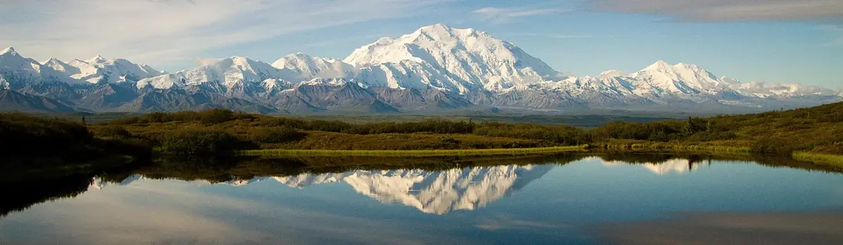
Denali is six million acres of wild land, bisected by one ribbon of road. Travelers along it see the relatively low-elevation taiga forest give way to high alpine tundra and snowy mountains, culminating in North America's tallest peak, 20,310' Mount McKinley. Wild animals large and small roam un-fenced lands, living as they have for ages. Solitude, tranquility and wilderness await.
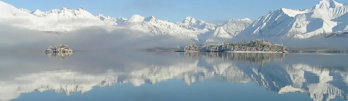
Lake Clark National Park and Preserve is a land of stunning beauty. Volcanoes steam, salmon run, bears forage, and craggy mountains reflect in shimmering turquoise lakes. Here, too, local people and culture still depend on the land and water. Venture into the park to become part of the wilderness.




 Mountains