Lassen Volcanic National Park is home to steaming fumaroles, meadows freckled with wildflowers, clear mountain lakes, and numerous volcanoes. Jagged peaks tell the story of its eruptive past while hot water continues to shape the land.
106.6Kacres of parkland
504.8Krecreation visits, 2025
Jun · Aug · Sepnearby climate picks
Seasonal access & reservations
No reviewed guidance for this selection. Check the park's official planning pages; missing coverage does not establish access.
Selected guidance only; separate from climate comfort and current conditions.
Official conditions Not checked
The conditions feed has not been connected for this park.
Editorial recommendations, reviewed 2026-10-17. Full park days, excluding travel to and from the region. A first-visit outline for a general traveler; adapt to mobility, fitness, season, reservations, and current conditions. These are suggested days, not reserved activities or guaranteed routes.
Download the app for your iOS device from the App Store or for your Android device at Google Play .
Use Find a Park to open Lassen Volcanic National Park.
Toggle the button next to Save this park for offline use to download the park’s app content before you visit.
WiFi is available only at the Kohm Yah-mah-nee Visitor Center. Internet speeds are slow and even slower during periods of high use. Cell phone service is available at a very limited number of locations in the park. Data service is limited to 2G or 3G, if available at all.
How to Use the NPS App to Enjoy Lassen Volcanic
Download the app on your iOS or Android device prior to your visit.
Download the Lassen Volcanic content before your visit to use the app while offline in the park. Toggle the button next to Save this park for offline use.
Enjoy an audio tour featuring 16 stops along the park highway.
View current hours for the park visitor centers.
Find passport stamp locations.
Browse the park’s seven campgrounds and follow a link to Recreation.gov to reserve a site at least four days before your visit.
View amenities by location, such as gas, good, restrooms, souvenirs and supplies, and accessible facilities.
Find out what to see within the five park areas: Manzanita Lake, Southwest, Butte Lake, Warner Valley, and Juniper Lake.
Mark items as favorites to revisit later when conditions allow, such as Hike to Bumpass Hell or visit Loomis Museum in summer or fall.
About the NPS App
The NPS App is the new official app for the National Park Service with tools to explore more than 400 national parks nationwide. Find interactive maps, tours of park places, on-the-ground accessibility information, and much more to plan your national park adventures before and during your trip. Learn more on the NPS App webpage .
Rangers are Continually Adding Lassen Volcanic Content
Park content currently focuses on park highlights and popular activities. This includes:
Up-to-date information on park Where to Stay including campgrounds and lodging.
Hours and information for park Visitor Centers .
Locations of Passport Stamps .
General information about What to See in each are of the park.
Information on popular Things to Do including Snow play, snowshoeing, fishing, hiking, scenic driving, and self-guided walking tours.
Park news releases.
Calendar events (there are no events scheduled at this time due to COVID-19 mitigations).
App Includes Activities for Distinct Winter/Spring and Summer/Fall Seasons
Lassen Volcanic is currently snow-covered. Vehicle access is limited and activities are limited to oversnow recreation (snowshoeing, skiing, snow play) and hiking or biking cleared sections of the park highway.
The app includes many Things to Do that are not currently possible due to snow depth. This includes most fishing, hiking, scenic driving, and self-guided walking tours.
You can mark items as a Favorite to find them easily again later. For example, the Bumpass Hell Trail is closed to snow/ice hazards. However, you can mark Hike to Bumpass Hell as a favorite and use it in the summer/fall season when the trail is open.
The snowy winter and spring seasons offers numerous opportunities for oversnow recreation. Vehicle access is limited to one mile from the Southwest and Northwest Entrances approximately November through May. Beyond the plowed roads to the Kohm Yah-mah-nee Visitor Center and Loomis Plaza, the entire park is snow-covered.
Choose Your Destination:
The Southwest Area (6,700 - 10,457 ft elevation) offers steep slopes and sweeping vistas just beyond the Kohm Yah-mah-nee Visitor Center, which offers the only services between November and early May.
The Manzanita Lake Area (5,800 - 7,200 ft elevation) consists of gentle slopes and scenic lakes. It offers the easiest routes for snowshoeing and cross-country skiing in the park.
Explore snowshoeing / cross-country skiing routes in the southwest area.
Explore snowshoeing / cross-country skiing routes in the Manzanita Lake Area.
Winter Activities
Loading results...
Winter Etiquette
Improve everyone's safety and enjoyment by adhering to the following winter etiquette recommendations: Do not walk on ski tracks. Footprints and snowshoe tracks create hazards that make skiing more difficult. Snowshoe parallel to the ski track. Using a separate track ensures snowshoers remain clear of downhill skiers. Yield to faster skiers or downhill traffic. Step to the side to allow skiers traveling downhill to safely pass. In all other cases, yield to those traveling uphill, as they are working harder and have the right of way.
Improve everyone's safety and enjoyment by adhering to the following winter etiquette recommendations:
Do not walk on ski tracks. Footprints and snowshoe tracks create hazards that make skiing more difficult.
Snowshoe parallel to the ski track. Using a separate track ensures snowshoers remain clear of downhill skiers.
Yield to faster skiers or downhill traffic. Step to the side to allow skiers traveling downhill to safely pass. In all other cases, yield to those traveling uphill, as they are working harder and have the right of way.
Know Before You Go!
Know Before You Go! Park Alerts & Conditions View current park conditions, including closures, alerts, and hazards.
We See Planning in the Forecast Weather Find specific forecast information for different parts of the park and related links.
November to May, Snow's in Play! Oversnow Route Conditions November to May, learn about conditions on oversnow routes in the park.
Know Before You Go (in the Snow!) Winter Safety Driving, exploring, weather and more - safety is paramount in enjoying a visit to Lassen in winter.
Be Avalanche Aware! Avalanche Safety An avalanche is an unpredictable phenomenon, but there are several warning signs you can look for or feel before one occurs.
More than 150 miles of hiking trails provide access to a wide-variety of park features including hydrothermal areas , volcanic peaks, alpine lakes, and mountain meadows. Hiking is the best way to explore Lassen Volcanic Wilderness , a designation afforded to just five percent of America’s public lands. You can enjoy and preserve these wild areas by practicing Leave No Trace (LNT) principles and not contributing to recreation-related impacts in the park including litter, erosion, social trail creation, and food-conditioned wildlife.
Numerous Trails Impacted by the 2021 Dixie Fire
All trails west of the park highway were not affected by the Dixie Fire. Be prepared for burned area hazards on all trails within the Dixie Fire footprint. The park is prioritizing efforts to repair high-use trails within the burn footprint as soon as possible. Learn more about visiting after the Dixie Fire .
All trails west of the park highway were not affected by the Dixie Fire.
Be prepared for burned area hazards on all trails within the Dixie Fire footprint.
The park is prioritizing efforts to repair high-use trails within the burn footprint as soon as possible.
Learn more about visiting after the Dixie Fire .
No Pets on Trails
Leashed pets are permitted only in developed areas: roadways, parking lots, campgrounds and picnic areas. Pets are not permitted elsewhere, including in a carrier. We encourage you to leave your pet at home if you are planning to hike. You can help protect native animals like rare Sierra Nevada red fox by keeping your pet in paved areas. Learn more about visiting the park with your pet .
Hiking season generally occurs May through October . The park receives up to 30 feet of snow each winter. Hiking trails can remain snow-covered into June and sometimes July. Trails are not plowed or shoveled during the winter, and most likely will require snowshoes or skis. Learn more about hiking and over-snow travel in the winter or early spring .
1. Choose a Trail
View descriptions and conditions of popular day hikes (May-October).
View descriptions and conditions of over-snow routes (November-May).
View the park map with distances for all trails.
If you plan to backpack, learn more about obtaining a permit .
2. Prepare for Your Hike
Learn more about reducing risk when hiking at high-elevation in a remote area.
Find out how you can reduce your risk while visiting the park .
Learn more about visiting in summer , fall , winter , or spring .
Purchase hiking books or trail maps from the Lassen Association store.
Featured Trails
Manzanita Lake Loop
Enjoy scenic views and wildlife watching on this 1.7-mile loop.
Devastated Area Interpretive Trail
Discover the history of the Devastated Area on this short walk with trailside signs.
Cinder Cone Trail
The steep trail climbs 200 feet from the base to summit of Cinder Cone.
Lily Pond Trail
This half-mile, self-led interpretive walk explores the rich diversity of plant and animal life in this unique volcanic landscape.
Lassen Peak Trail
The 5-mile round-trip trail climbs to the summit of one of the largest dome volcanoes in the world.
Bumpass Hell Trail
Visit Bumpass Hell via a 3-mile, round-trip trail.
The most popular boating lakes include Manzanita , Butte, Juniper, and Summit.
Boating is prohibited on four lakes : Helen, Emerald, Reflection, and Boiling Springs lakes.
Watercraft rentals are available at Manzanita Lake.
Vessels are to be put in and taken out of Manzanita and Butte Lake at the designated boat launches only.
Fishing is popular in many park lakes, but most notably in Manzanita and Butte Lakes.
Life Vests are Required Under California law
A Coast Guard-approved life jacket must be carried for each person on board. If stored, these life jackets must be readily available (easy to get to), and you must show passengers the location of life jackets and other safety equipment.
Every child under 13 years of age on a moving recreational vessel of any length must wear a Coast Guard-approved life jacket in serviceable condition and of a type and size appropriate for the conditions and the activity.
Watercraft Rental
Single and double kayaks available for rent approximately late May through September. Life vests (PFDs) must be worn on a rental vessel. Life vests are provided with kayak rentals, or can be rented separately. View rental pricing at lassenlodging.com .
To Rent a Watercraft at Manzanita Lake:
Purchase a rental inside the Manzanita Lake Camper Store between 10 am and 4 pm (view Camper Store hours ).
Follow a short trail to Manzanita Lake boat launch.
Present your receipt to receive your watercraft and life vest.
Boating is Prohibited on:
Reflection Lake
Boiling Springs Lake
Boating includes use by all vessels , which the United States Code ( 1 USC Sec. 4 ) describes as "every description on of watercraft or other artificial contrivance used, or capable of being used, as a means of transportation on water." The closure serves to protect scenic views at these small and popular lakes and to protect Boiling Springs Lake hydrothermal features.
Engines Prohibited on All Lakes
Only non-power watercraft may be used on park lakes. Engines or motors of any type are not permitted upon vessels on park waters, regardless of whether they are currently in use for propulsion. The closure serves to preserve of wildlife, limit air and water pollution, and the protect the visitor experience. The hazards of carrying an engine or motor on a vessel, regardless of current use, include hazardous spill situations, and temptation for usage.
Whether rod and reel fishing from shore or fly-fishing from a float-tube, Lassen Volcanic National Park has plenty of opportunities to land the big one. Trout have not been stocked in the park since the 1980s, but a healthy population of these feisty fish still remain in many lakes and streams. Manzanita Lake is the most popular fishing destination in the park and is limited to catch and release with a single, barbless hook and artificial lure.
Manzanita and Butte Lake offer the easiest access to fishing in the park. Most lakes and creeks in the park are host to brush including willow and alder. Fishing by non-motorized boat is a good way to avoid snagging a bush; although most lakes also have at least small sections of open areas that offer space for casting.
Lakes with Trout Species
Butte Lake, Snag Lake, and Horseshoe Lake are all popular fishing destinations in the park with populations of rainbow, brown, and brook trout. Trout populations are also confirmed at Ridge, Terrace, Summit, Snag, and Crystal Lakes. Manzanita Lake holds a fair number of rainbow and brown trout and is rated as a blue ribbon fly fishery by the state of California Department of Fish and Game. Juniper Lake is not a great lake to fish, as it does not contain any game species.
Creeks with Fish
Kings Creek and Grassy Swale Creek both have populations of brook trout. Trout populations are also confirmed in North Fork Bailey, North Arm Rice, Hat, Hot Springs, and Summit Creeks.
Hat Creek originates from a spring in Lassen Volcanic National Park and flows north to its terminus in Lake Britton. Fishing in the creek within the park is not ideal due to heavy brush and limited road access. Outside of the park, planting occurs at several locations along the creek throughout the season. This includes sites directly north of the park on Highway 89, between Hat Creek and Old Station. View fishing and planting locations on the California Department of Fish and Wildlife's Fishing Guide interactive map .
Please review all fishing regulations prior to fishing in the park. A few key regulations to know:
A valid California fishing license is required to fish in the park.
Fishing in Manzanita Lake is limited to catch and release with a single, barbless hook. Only lures and flies are permitted; no living or non-living bait may be used.
Fishing is not permitted in park boat launch areas (Manzanita, Butte, and Juniper Lake).
Tips and Best Practices:
When releasing any fish, wet your hands first. Dry hands can scrape off a fish's protective slippery coating and make the fish vulnerable to deadly bacterial or fungal infections.
While catch and release fishing, consider crimping the barb on your hook with a pair of pliers for a quicker release and less injury to the fish. This is required at Manzanita Lake.
Release unwanted fish immediately. Never put a fish on a stringer and release it later. This fish will probably not survive.
Consider using a rubber net for landing fish as these nets greatly reduce harm to fish. Nylon nets have knots that can remove scales and the protective slime coating on fish.
Always dispose of discarded fishing line properly as it may injure or kill birds and animals.
Clean. Drain. Dry.
Aquatic invasive species, such as zebra or quagga mussels, are a serious ecological threat to the Lassen ecosystem. Any activities that come in contact with any body of water have the potential to spread non-native plants, pathogens, and other invasive species among water bodies. Follow these steps every time you come in contact with any body of water:
Remove all visible mud, plants, fish, or other tiny animals from your boats, trailers, and other equipment, including waders, boots, clothing, and nets.
Eliminate water from all equipment before transporting anywhere. Much of the recreational equipment used in water contains spots where water can collect and potentially harbor these aquatic hitchhikers. Drain your boat hull in a safe location (a flat paved, dirt, or gravel area) away from all park surface waters.
Clean and dry everything that comes in contact with water before entering a new body of water. It is best to use high-pressure, hot water (available at car washes outside the park) to clean your boat, trailer, and gear.
Dry Equipment. If possible, allow 5 days of drying time before entering new waters.
Fish Consumption Advisories in National Park Waters
The Environmental Protection Agency, states, territories, and tribes provide advice on fish and shellfish caught in the waters in their jurisdiction to help people make informed decisions about eating fish. Advisories are recommendations to limit your consumption of, or avoid eating entirely, certain species of fish or shellfish from specific bodies of water due to chemical or biological contamination. Fish is part of a healthy balanced diet, but eating wild fish and shellfish caught in park waters is not risk free. Parks are “islands”, but the much larger “ocean” that surrounds them affects the natural resources inside a park. Other aquatic toxins are the result of natural biological processes. Also, chemical contaminants that originate outside of park boundaries can come into parks. Mercury is an example of a toxin originating outside a park that can find its way into a park. Mercury exists naturally in some rocks, including coal. When power plants burn coal, mercury can travel in the air long distances before falling to the ground, usually in low concentrations. Once on the ground, microorganisms can change this elemental mercury to methyl mercury. This type of mercury can build up in animal tissues, and it can increase in concentration to harmful levels. This high concentration can occur in large predatory fish - those often pursued and eaten by anglers. Studies have shown that fish in some National Park System waters have mercury levels that may be a concern to people who regularly eat a lot of fish. To learn more about this topic, the National Park Service maintains information about Fish Consumption Advisories and Mercury and Toxins in Nature .
Fishing Throughout the National Park Service
We invite you to visit the Fish and Fishing website for more information about fish and fishing in the National Park Service. You will learn about conservation, different fish species, and parks that offer fishing.
Stream Water Quality and Aquatic Communities
Streams are significant and productive resources that are influenced by activities both inside and outside parks boundaries. Because healthy streams are vital to park landscapes and ecosystems, the National Park Service samples physical, biological, and chemical parameters. These varied parameters allow us to measure change over time and across the landscape and ultimately detect trends and assess impacts. Lassen Volcanic National Park and Klamath Network Inventory & Monitoring have been monitoring streams in the park since 2011. The protocol combines monitoring water quality characteristics of streams, such as the chemical and physical conditions, with monitoring the aquatic communities that the stream supports, such as the fish, plants, and macroinvertebrates. The combined protocol is extremely effective as it can provide both snapshots in time of water quality and habitat properties, as well as long term indications of health from the living assemblages. Learn more about monitoring findings and protocols .
All dates are subject to change due to weather, road status, or public safety. The dates listed for each campground are the earliest date the campground may open and the latest day the campground may close. Lassen receives up to 30 feet of snowfall each year, sometimes as early as September. Check current park conditions and learn more about Lassen’s spring snow clearing operations .
The operating hours page and recreation.gov will be updated as much as possible to reflect current projected dates.
Reservations Required
Reservations are required for all campgrounds except Juniper Lake and Southwest Walk-in. Visit recreation.gov or call (877) 444-6777 to make a reservation. Park staff cannot assist with reservations and on-sight payments are not accepted. Please keep in mind that phone and internet service is spotty at best and often unavailable in the park. We highly recommend making a reservation prior to your visit.
Campground List
Highway 89 Corridor (listed north to south)
Outlying Areas (listed north to south)
Dry Camping (Autumn)
In dry camping conditions, drinking water and flush restrooms are not available. A discounted camping fee will be charged to reflect limited services. The water is turned off in these campgrounds to protect infrastructure when temperatures typically dip below freezing at night.
Accessible Campsites
Three campgrounds offer wheelchair-accessible campsites located near wheelchair-accessible restrooms. Learn more about accessibility at Lassen.
Manzanita Lake: sites A32 & B9
Summit Lake North: site A1
Butte Lake: site A6
Manzanita Lake, Butte Lake, and Juniper Lake campgrounds offer larger sites to accommodate groups; Lost Creek Group campground is exclusively group sites. Group sites have a minimum occupancy requirement of 10 people. Group campsites have three picnic tables, three fire rings, and three bear lockers. Groups may also reserve adjacent individual campsites but must adhere to single campsite capacities (3 tents 6 people, 2 vehicles).
Group site Capacities: (minimum 10 people)
Manzanita Lake: max 15 people /4 vehicles; rvs 40’
Lost Creek: max 25 people / 6 vehicles; rvs 40’
Butte lake: max 25 people / 6 vehicles; rvs 40’
Juniper Lake: max 15 people /4 vehicles; tent only
Butte Lake, Juniper Lake, and Summit Lake North campgrounds also have reservable stock corrals for overnight use. Learn more about stock use in Lassen .
First-Come, First-Served Campsites (FCFS)
Juniper Lake and Southwest Walk-in campgrounds are available first-come, first-served and cannot be reserved.
Scan & Pay – Download the Recreation.Gov App
Southwest Walk-In Campground payments are made through the Scan and Pay system. You must first download the recreation.gov mobile app to your phone. It is highly recommended that you download the app prior to coming to the park as connectivity can be limited at times. Instructions for the Scan and Pay system are located on the bulletin board at the campground.
How to Claim & Pay for a FCFS Campsite
FCFS sites require self-registration and payment. Self-register and pay at the kiosk located at the campground entrance. Instructions are also posted at the kiosk for easy reference.
Find an open/available campsite. A camp host, if present, may help you confirm a campsite’s availability.
You may leave an item such as a camp chair while you self-register. You may not hold a campsite for someone else who has not yet arrived.
At the kiosk, fill out a green envelope to register for the site. Pay by credit card by filling out the slip inside the envelope. Remove the receipt tag on the envelope to post at your campsite. Secure the envelope and deposit it into the iron ranger.
Post your self-registration receipt tag at your campsite. If a campsite is still occupied up to the noon check-out time, you must wait to hang your receipt until the current occupants are completely vacated.
The only FCFS campsites at Lassen are Juniper Lake, Warner Valley, and Southwest Walk-in campgrounds. You may not self-register at any other campground.
FCFS campgrounds have more available sites before noon and on weekdays.
You may wait for an occupied campsite that will become available after the noon checkout time. Be courteous to campers who are in the process of packing up and checking out of a site. You may not put a tag on the site until the current occupants are completely vacated.
Have an alternative ready for camping outside of the park in case all park campsites are full. The surrounding Lassen National Forest has multiple campgrounds with some FCFS.
Camping in Self-Contained Vehicles
Camping in self-contained vehicles is allowed in the Southwest parking area (part of Kohm Yah-mah-nee Visitor Center parking) year-round; camping fee required.
Car camping or overnight vehicle parking is not allowed in any other parking area, pullouts, or picnic grounds.
Amenities & Services
All campsites are equipped with:
One picnic table
One bear-resistant storage locker (size: 4' x 3' x 2.5' or 30 cubic feet) to properly store food and scented items.
Most campgrounds offer spigots and/or sinks with potable water in season (except Juniper Lake), restrooms, and receptacles for trash/recycling. Some campgrounds have vault toilets and other have flush restrooms – see individual campground pages for full list of amenities.
Manzanita Lake Campground offers a dump station ($8). Manzanita Lake Campground has a camper store with pay showers and laundry. No other park campgrounds have dump stations or camper stores.
No park campground has RV hookups.
Plan your backpacking trip, get a wilderness permit, and know where to go when exploring Lassen's wilderness.
External concessioner's website. Lassen Lodging manages Drakesbad Guest Ranch and Manzanita Lake Camping Cabins.
Campground Questions
Please read through our website before reaching out with questions.
Questions about Reservations: contact recreation.gov
Other campground camping questions: email us at e-mail us
Rangers typically present a variety programs during the park's busiest season, typically Memorial Day weekend through September. Program topics may vary based on ranger, location, and program type. Program locations center around Kohm-Yah-mah-nee Visitor Center near the southwest entrance and Loomis Museum near the northwest entrance.
This page lists typical program offerings by visitor center. Current program schedules are posted at each visitor center.
Loomis Museum (northwest area)
Typical Program Offerings:
Programs are posted weekly at the Loomis Musuem, Manzanita Lake Campground, and the Loomis Plaza. Programs are anticipated to run Thursday through Monday, June through August. Topics vary and inlcude a focus on historical, botanical, and wildlife. Programs are subject to change or cancel.
Kohm Yah-mah-nee Visitor Center (southwest area)
Program schedules are posted weekly at the Kohm Yah-mah-nee Visitor Center. Possible topics include: -Guided walk at Sulphur Works geothermal area (45 min) -Solar scope demonstration (20 min) -Wildlife Table (Drop-in) -Volcano Talk (20 min)
Dark Skies at Lassen
Friday, 8/7: Star Party
Saturday, 8/8: Star Party
Plan Your Visit
Calendar View ranger-led programs and special events by date.
Directions & Getting Around Find your way to the park, explore around the park, and view park maps.
Half the park is after dark! From animals to plants and water to volcanoes, Lassen Volcanic National Park protects many different natural phenomena. One of the most spectacular is frequently overlooked -- our incredible, dark, night sky. Lassen Volcanic is one of the best places to learn about and enjoy the splendor of the night sky. Far from the light pollution of civilization, Lassen is one of the last sanctuaries of natural darkness. Whether you have yet to experience the grandeur of the Milky Way or you are a dedicated amateur astronomer, Lassen's dark skies offer unparalleled view of the celestial wonders. Experience Lassen after dark:
Explore the night skies anywhere you have a view of the sky.
Scheduled night sky viewing offerings can take place year-round, but more often in the summer months. See the Ranger-led Programs page for scheduled night sky viewing programs.
Watch Lassen's Dark Sky video .
Stargaze in the Park
Tips for Getting Started:
Plan Ahead : Faint light from a crescent moon can make viewing fainter stars and the Milky Way more difficult. It is best to view dark skies when the moon is new or below the horizon. Check sunrise and sunset times and moon phases to ensure optimal viewing.
What to Bring : Clothes to keep warm on chilly nights; a red light to move around safely; a stargazing app , planisphere , or star chart to find your way across a starry sky; and a desire to be amazed. If you have a pair of binoculars, bring them with you as they are the second best tool to enjoy features in the night sky (after your eyeballs).
Make Yourself Comfortable : Craning your neck up at the sky gets tiresome fast. Consider packing a blanket, reclining chair, or anything that will support a reclined view of the sky.
See More Stars : It can take 15 to 30 minutes for your eyes to adjust to darkness and see more stars. Avoid using bright lights or white lights, as these can disrupt your night vision and the timer for your eyes to adjust will start over. Using a red light will be much better for preserving night vision. If you don’t have a red flashlight, you can cover a white light with red cellophane to make it a dark sky friendly light.
Learn What to Look For : Websites like Sky & Telescope provide information on what to look for in the sky and how. Check ahead to see what might be visible when you plan to stargaze or take a quick tour of the road map to the stars to help you find your way around the night sky.
You can enjoy the dark night sky in Lassen Volcanic anywhere you can see the sky. Many campsites in the park are forested, so you may want to head to a lakeshore, a meadow, or even a parking area to get a wider view of the sky. There are very few lights in the park at night, however getting away from buildings, headlights, or even camp lights can also improve your view of the sky. Be sure to avoid areas that are wet or with uneven terrain that may pose a tripping hazard. Roadside parking areas and lakeshores provide easy access*:
Trailhead parking areas: Bumpass Hell, Lassen Peak Trail, and Devastated Area
Visitor center parking areas: Kohm Yah-mah-nee Visitor Center and Loomis Museum
Roadside lakeshores: Lake Helen, Emerald Lake, Manzanita Lake, Summit Lake
Other roadside pullouts: Kings Creek Meadow, Chaos Jumbles, Little Hot Springs Valley overlook
*Please note that overnight camping is only allowed in campgrounds and is not permitted in pullouts or parking areas (except Kohm Yah-mah-nee Visitor Center with camping fee).
Take a Full Moon Hike A full moon provides enough light for most visitors to hike some trails in the park at night while also enjoying Lassen's dark night skies. Be sure to bring a headlamp (ideally with a red light option) for when you do need light. Lassen Peak and Cinder Cone trails are popular moonlight hikes for experienced hikers. Become a Junior Ranger - Night Explorer
Kids age 5 and older can complete the Junior Ranger Night Explorer booklet in the park and earn a Junior Ranger Night Explorer patch. Here's how:
Pick up a booklet at a park visitor center.
Complete the booklet. Make sure you have set aside time to complete the booklet in the park. We are not able to mail out patches.
Share your completed booklet with a ranger at a park visitor center to receive your free patch.
Can't complete Junior Ranger - Night Explorer while at the park? That's okay! Download the booklet to complete it virtually. Virtual learneers will receive a digital high-five. An award patch cannot be mailed. Or, print the activites booklet before your arrival to Lassen and bring it to a visitor center for a patch in person.
Stargaze Where You Live
Look up at Home
Sit back or lay down in your backyard on a clear night. Check the weather forecast to be sure you're not clouded out and simply watch the stars and planets move across the night sky.
Avoid using your flashlight or looking at your cell phone to allow your eyes to adjust to the darkness and to see the most stars.
Turn off your house lights to help you see the stars better. You may even want to learn more about night sky friendly lightning and how you can help contribute to preserving our dark, night sky.
Contact your local astronomy club or astronomical society for public events such as a "star party" where amateur astronomers share views through their telescopes.
Visit your nearest planetarium to learn more about the sky and what you can look for when stargazing.
Learn More About the Night Sky in the Lassen Area
Shasta Astronomy Club is composed of amateur astronomers and night sky enthusiasts in the Redding and the North State community. The club's emphasis is observing with telescopes and binoculars, and offering public outreach. SAC offers special events at nearby Whiskeytown National Recreation Area and collaborates with Lassen National Park for trainings and special events.
The Astronomical Society of Nevada is a non-profit service organization introducing the pubic to astronomy. The ASN contributes to Lassen's night sky programming and special events, offers public telescope viewing in the Reno area, conducts public star parties at Washoe County schools and parks, and more. Learn more about ASN programs and activities . Schreder Planetarium is located in Redding, CA and serves students and citizens of northern California. You can enjoy a variety of programs in the domed theater, from scientific documentaries to science fiction stories.
Stories in the Stars
When we look up at a dark night sky, we are essentially seeing the same sky that humans have looked upon for thousands of years. The same dark and starry sky has evoked countless myths, art, literature and music from cultures around the world. Throughout history the night sky has shaped the beliefs and traditions of societies, from the the myths of ancient Greece and the celestially-aligned architecture of ancestral Puebloan civilizations to agricultural harvest festivals and nautical navigation records of sea voyages to new and distant lands. The tradition of cultural astronomy continues today. When we point out the North Star to our children or sleep beneath the stars, we are keeping alive this natural affinity humans have for looking beyond our planet.
North Star to Freedom
As slave lore tells it, the North Star played a key role in helping slaves to find their way—a beacon to true north and freedom. Escaping slaves could find it by locating the Big Dipper , a well-recognized asterism most visible in the night sky in late winter and spring. As the name implies, its shape resembles a dipping ladle, or drinking gourd. From the gourd’s outline, the North Star could be found by extending a straight line five times the distance from the outermost star of the bowl.
Night Skies Activities Partners
Many Dark Sky viewing events are made possible by the support of numerous partners who contribute their time, expertise, and passion for our dark night sky. Partners volunteer their time each summer, to share their knowledge with our park visitors.
The Astronomical Society of Nevada
The Astronomical Society of Nevada (ASN) is a non-profit service organization introducing the pubic to astronomy. Several members of the ASN participate by providing access to telescopes pointed at planets, star clusters, and distant galaxies, as well as daytime solar scope viewing.The ASN also offers public telescope viewing in the Reno area, conduct public star parties at Washoe County schools and parks, and more. Learn more about ASN programs and activities .
International Dark Sky Association
The International Dark Sky Assocationa (IDA) works to protect the night skies for present and future generations. The IDA works to preserve and protect dark sites through responsible lighting policies and public education and is the organization responsible for designating places as an International Dark Sky Park, Reserve, Sanctuary, or Community. Lassen Volcanic National Park is currently working through the process of obtaining its Dark Sky Park designation. The IDA staffs a tent and provides information about how we can preserve dark night skies. The International Dark Sky Assocation has produced several videos about reducing light pollution, preserving night skies, astronomy, and more, which can be found on the IDA YouTube Channel . Two videos that we recommend are Protecting and Celebrating the Natural Night Sky in the National Park Service and Losing the Dark film.
NASA Ames Research Center
NASA's Ames Research Center, one of ten NASA field centers, is located in the heart of California's Silicon Valley. There is a close connection between the park and Ames Research Center. Astrobiology research by scientists from the Ames Research Center and astrobiology student interns contribute to an ever-growing collection of documentation on the diverse thermal features and microbial populations in the park. Research Scientists including Niki Parenteau, Dave Des Marais, and several others from Ames Research Center participate by giving presentations about discoveries on Mars and staffing a tent with astrobiology specimens and demonstrations.
National Radio Astronomy Observatory
Founded in 1956, the National Radio Astronomy Observatory (NRAO) provides state-of-the-art radio telescope facilities for use by the international scientific community. NRAO telescopes are open to all astronomers regardless of institutional or national affiliation. Observing time on NRAO telescopes is available on a competitive basis to qualified scientists after evaluation of research proposals on the basis of scientific merit, the capability of the instruments to do the work, and the availability of the telescope during the requested time. NRAO also provides both formal and informal programs in education and public outreach for teachers, students, the general public, and the media. See what the Very Large Array and Atacama Large Millimeter Array are observing at any given moment at NRAO Mission Control. You can also discover how to Explore the Radio Universe From Home ! Suzanne Gurton, the Assistant Director for Education and Public Outreach for NRAO, and her adult family members, volunteer each summer for Lassen's dark sky events.
Placerville Community Observatory
Placerville Community Observatory is located in Placerville, CA and hosts free public viewings. The observatory is open summer months and winter months when the humidity is not too high and it is not cloudy.
Sacramento Valley Astronomical Society
The Sacramento Valley Astronomical Society is a nonprofit educational society focused on fostering interest in astronomy. The SVAS serves the community of Nothern California through programs such as telescope workshops, loaner telescopes program, and member star parties.
Schreder Planetarium
Schreder Planetarium is located in Redding, CA and serves students and citizens of northern California. You can enjoy a variety of programs in the domed theater, from scientific documentaries to science fiction stories.
Shasta Astronomy Club
Shasta Astronomy Club (SAC) is composed of amateur astronomers and night sky enthusiasts in the Redding and the North State community. The club's emphasis is observing with telescopes and binoculars, and offering public outreach. SAC offers special events at nearby Whiskeytown National Recreation Area and participates in Lassen's dark sky events.
SOFIA Science Center
The Stratospheric Observatory for Infrared Astronomy (SOFIA) is an extensively modified Boeing 747SP aircraft carrying a reflecting telescope with an effective diameter of 2.5 meters (100 inches). SOFIA studies many different kinds of astronomical objects and phenomena, including the lifecycle of stars, the formation of new solar systems, black holes at the center of galaxies, and complex molecules in space. The observatory's instruments — cameras, spectrometers, and photometers — operate in the near-, mid- and far-infrared wavelengths, enabling scientists onboard to study the solar system and beyond while flying at 38,000- 45,000 feet. The SOFIA Program Office is at NASA Ames Research Center in Moffett Field, CA, which helps manage SOFIA's science and mission operations. Learn more on the SOFIA YouTube Channel .
Space Telescope Science Institute
The Space Telescope Science Institute is located in Baltimore, Maryland, operated by the Association of Universities for Research in Astronomy. They help humanity explore the universe with advanced space telescopes and ever-growing data archives. Established in 1981, they helped guide the most famous observatory in history, the Hubble Space Telescope. Since its launch in 1990, they have performed the science operations for Hubble. Virtual space exploration and science-learning sites - James Webb Space Telescope , Hubble Space Telescope , August 2020 Night Sky Viewing , and NASA's Universe of Learning .
Independent Partners
We'd like to acknowledge and thank our independent partners and volunteers including Dave Schlom, Dave Samuels, Dave White, Adam Back, Bruce Agee, Bob Shoulders, Chad Moore, David McMullen, Norm Nasise, Mike Ryan, Kevin McLin, Valerie Kircher, Shreeni Manievannan, Anna Roedocker-Mann, Vic Maris, and many others who have contributed their time over the years.We truly value and appreciate any time and contributions that you've given to us each and every year, and we look forward to working with you for many more years in the future!
The majority of Lassen Volcanic National Park is designated Wilderness , a status afforded to just five percent of America’s public lands. You can enjoy and preserve these wild places by not contributing to recreation-related impacts including: litter, erosion, social trail creation, food-conditioned wildlife, and backcountry campsite widening. Please adhere to regulations and practice Leave No Trace (LNT) principles to help preserve natural conditions and minimize human influence.
Numerous Trails Impacted by the 2021 Dixie Fire
Backpacking is permitted within the Dixie Footprint with the exclusion of any area marked by CLOSED signs. Normal backcountry camping closures apply. Be prepared for burned area hazards on all trails within the Dixie Fire footprint. All trails west of the park highway were not affected by the Dixie Fire. The park is prioritizing efforts to repair high-use trails within the burn footprint as soon as possible. Learn more about visiting after the Dixie Fire .
Backpacking is permitted within the Dixie Footprint with the exclusion of any area marked by CLOSED signs. Normal backcountry camping closures apply.
Be prepared for burned area hazards on all trails within the Dixie Fire footprint.
All trails west of the park highway were not affected by the Dixie Fire.
The park is prioritizing efforts to repair high-use trails within the burn footprint as soon as possible.
Learn more about visiting after the Dixie Fire .
Plan Your Backpacking Trip
A backpacking trip in Lassen Volcanic National Park can be an exciting and rewarding experience if you are prepared.
1. Choose Your Route and Research Your Trip
Rangers are not able to assist with planning a backcountry trip. We recommend the following steps to help you to select a route that is suitable to your group's interest and abilities.
Read the backcountry camping regulation s . There are no designated backcountry campsites or trail quotas in the park. Wilderness permits are required for backcountry camping and are only obtained online through Recreation.gov . Wilderness permits are no longer available from the park directly. New! View the 2021 Dixie Fire vegetation burn severity map to inform your route and camp locations. Learn more about burned area safety . Check current conditions to find out about weather forecasts, closures, advisories, snow levels, etc. Check trail conditions for day hikes. The park does not provide conditions for all park trails. Trails are generally snow-free in June/July. View backpacking trailheads in the park. The list includes short descriptions of starting points. View maps or guidebooks . View park maps that include distances and some topography. Geo-referenced PDFs are available for use with free map reader such as Avenza . Hiking books and maps are offered at the park store online and in park visitor centers.
2. Bring or rent a NPS-approved bear-resistant container .
Containers are required from April 16 - November 30. Hanging food is not permitted.
3. Obtain a Wilderness Permit Online.
Wilderness permits are only available online through Recreation.gov. Permits are no longer available in person and the park does not mail permits. Permits can be reserved up to a maximum of 90 days prior to the start date.
Wilderness Permit Required
A wilderness permit is required to camp in park's backcountry (outside of park campgrounds). A permit is not required for day hiking and is not required if you are staying in an established park campground. There are no designated backcountry campsites or quotas in the park. Permit fees required are listed as follows:
$6 per permit non-refundable Recreation.gov administration fee
$5 per-trip, per-person fee (16 years and older)
Park entrance fees are separate. Learn more about park entrance fees .
How to Obtain a Wilderness Permit
Wilderness permits for backcountry camping must be obtained prior to your visit to the park. We do not accept or process permits in person or by email/mail, all permits must be obtained through Recreation.gov . Permits can be reserved a maximum of 90 days prior to the start date. There are no quota restrictions.
Review the park backcountry camping regulations .
Gather information about your trip and party including entry and exit trailheads, approximate campsite location for each night, emergency contact information, and vehicle make, model, and license number. See posted instructions on how to fill out the permit.
Fill out a wilderness permit through Recreation.gov .
Fill out a parking slip and put that slip on the dashboard of your vehicle.
Attach a copy of the permit to a backpack and display throughout the duration of your trip.
The largest network of trails is located in the eastern half of the park. These trails are accessed via four primary backpacking trailheads: Warner Valley, Butte Lake, Juniper Lake, and Summit Lake.
Short Route Trailheads Ridge Lakes, Hat Lake, Brokeoff Mountain, and Manzanita Creek trailheads provide access to shorter routes that may be good for quick trips or first-time backpackers.
Kings Creek Picnic Area TH Located one mile from the Kings Creek Trailhead, this trailhead provides access to limited destinations including Twin, Spencer, and Conard Meadows.
Warner Valley TH Backpacking routes are fairly limited from Warner Valley due to the numerous hydrothermal areas where camping is prohibited. You can travel north or south on the Pacific Crest Trail from here or climb Flatiron Ridge to access trails near Kings Creek. Black bears are sighted frequently in the Warner Valley Area.
Butte Lake TH The parking area is open to day use and overnight users. The trail past Cinder Cone to Snag Lake is composed of sand-like cinders. The shore of Snag Lake offers numerous places to camp. The area also provides a good base camp for day trips to Juniper Lake or Rainbow Lake. Bears have obtained improperly stored food in this area.
Juniper Lake TH The parking area is open to day use and overnight users and is located at the end of the Juniper Lake Road. There is no drinking water at Juniper Lake, you can treat lake/stream water or bring your own.
Summit Lake TH The is the most popular and congested trailhead for backcountry camping. We highly recommend beginning your trip at another trailhead to help reduce impact and to make the most of your Wilderness experience.
Kings Creek TH Parking at this trailhead is extremely limited. Please consider parking at a pullout near the meadow and hiking a short distance to the trailhead. Smaller loops from this trailhead provide good options for short trips or first-time backpackers. Black bears are frequently sighted in the Kings Creek area.
Backcountry Camping and Zones
Pick the nearest zone to where you are winter camping: Zone #1: Brokeoff Mountain Zone #2: Conard Mountain Zone #3: Ridge Lakes Zone #4: Blue Lake Canyon Zone #5: Paradise Meadow Zone #6: Manzanita Creek Zone #7: Chaos Crags Zone #8: Hat Creek Zone #9: Badger Flat Zone #10: Silver and Feather Lakes Zone #11: Bear Lakes Zone #12: Lower Twin Lake Zone #13: Upper Twin Lake Zone #14 : Rainbow Lake Zone#15: Grassy Swale Zone #16: Corral Meadow Zone #17: Kings Creek Zone #18: Sifford Lakes Zone #19: Twin Meadows Zone #20: Drake Lake Zone #21: Horseshoe Lake Zone #22: Snag Lake Zone #23: Jakey Lake Zone #24: Crystal Lake Zone #25: Widow Lake Zone #26: Prospect Peak
Zone #1: Brokeoff Mountain
Zone #2: Conard Mountain
Zone #3: Ridge Lakes
Zone #4: Blue Lake Canyon
Zone #5: Paradise Meadow
Zone #6: Manzanita Creek
Zone #7: Chaos Crags
Zone #8: Hat Creek
Zone #9: Badger Flat
Zone #10: Silver and Feather Lakes
Zone #11: Bear Lakes
Zone #12: Lower Twin Lake
Zone #13: Upper Twin Lake
Zone #14 : Rainbow Lake
Zone#15: Grassy Swale
Zone #16: Corral Meadow
Zone #17: Kings Creek
Zone #18: Sifford Lakes
Zone #19: Twin Meadows
Zone #20: Drake Lake
Zone #21: Horseshoe Lake
Zone #22: Snag Lake
Zone #23: Jakey Lake
Zone #24: Crystal Lake
Zone #25: Widow Lake
Zone #26: Prospect Peak
Bear-Resistant Container Required
Backcountry campers must use an approved bear-resistant container to store food and scented items . This regulation is in response to increased negative bear and human interactions in the park. Bear canisters are not required December 1 through April 15.
Stay with or Store Your Food
Bears obtaining improperly stored food has and may again result in park closures. At least one bear obtained food and/or scented items that hikers had not stored in bear-resistant containers in 2020. After multiple incidents, the bear learned to associate humans and their equipment with a food reward. The area east of the park highway was temporarily closed to backcountry camping to protect visitors and bears. The closure has since been lifted, however there is still a potential for negative human-bear interactions. Learn about bear safety .
Bear Canister Rental
Bear-resistant food canisters may be available for rent in limited quantities at park bookstores , located in Kohm Yah-mah-nee Visitor Center and Loomis Plaza. Rental is $10 for 7 days with a $95 deposit for either size canister. Canisters must be returned to the location rented. There will be a $15 charge for canisters returned dirty (not including wear/dirt from normal use).
Top: Grizzly & Wolf Discovery Center. Bottom: Leave No Trace Center for Outdoor Ethics.
How to Use a Bear-Resistant Container
What to Put Inside
The most important part of using a bear-resistant container is what goes inside it. Make sure all food, trash, toiletries, and other scented items are inside the container. This includes but is not limited to all sealed or packaged food, sunscreen, soap, mosquito repellent, lip balm, deodorant, medications, and feminine products. As a general rule, if you put it in your mouth or on your skin, it should probably be stored in a bear-resistant container. Learn how to get the most out of and into your bear canister from sierrawild.gov.
Where to Place It
Place the container on the ground 100 feet (or 70 big steps) from both your tent and cooking area, in a place where a bear can't easily roll it away. Take care not to place it near a cliff or any water source, as a bear may knock the container around or roll it down a hill. Do not hang or attach anything to the container (ropes attached to the container enable a bear to carry it away). Watch How to Use a Bear Canister from Leave No Trace Center for Outdoor Ethics .
Keep Canisters Closed and Locked
Bear-resistant canisters work, but only when they are locked. Be sure to keep it closed and locked any time it's not in use. The Bear Vault canisters available in the park have a special latch that requires human dexterity to open. Your fingernail, a credit card, or other thin, hard tool can be helpful when opening the canister. When closing the canister, make sure to turn the lid until you hear the latch click. We recommend trying to open it by turning it counterclockwise to verify it's locked. Keep in mind that a bear may easily get to your canister, but it cannot get what is inside if it's locked.
During spring road clearing , Lassen Volcanic Park Highway (Hwy 89) opens to pedestrian travel before it opens to vehicles. During this time, visitors can travel the road by walking, running, or biking. Leashed pets are also welcome on the park road when it is clear of snow.
Road access status updates will appear in Alerts (section above). A map denoting open/unopened sections of road is also available on the Current Conditions page.
Spring road clearing typically begins in March or April and occurs in sections. These sections will open to pedestrian (Hike & Bike) traffic once the road crew completely clears it of snow. Section opening dates vary by year and depend on weather and plowing abilities. We cannot predict when sections of the park road will open. Previously opened sections may close again with severe inclement weather. Check historic opening dates for the Highway to vehicle traffic.
Once sections of the road are cleared of snow, this provides an opportunity for bicyclists to travel without vehicles. There is no determined date when the entire road will be cleared and there is no date set aside for a hike and bike event. Instead, expect a short period of time for this opportunity once the entire road (30 miles) is cleared and before it opens to vehicles for the season. Note that sections within the 30 miles will be open to vehicles prior to complete opening. Use the chart below for the cleared sections and the status of the road. Pedestrian and bicycle use is still allowed after the road opens, but extreme caution is advised. There are numerous sharp turns, no bike lane, and little to no shoulder.
The table indicates the road sections in the order that they are cleared. During road opening, clearing is actively taking place. Expect cleared roads within or beyond the indicated section if active clearing is indicated on the chart. Clearing distance will not be indicated beyond the section.
2026 Road Clearing
1. Loomis Plaza to Devastated Area (10 miles)
Yes (with vehicle traffic)
2. Southwest Entrance to Sulphur Works (1 mile)
3. Sulphur Works to Bumpass Hell or Lassen Peak parking area (6-7 miles)
4. Lassen Peak to Devastated Area (12 miles)
Common Waypoints (South to North)
Elevation (feet)
Distance from Last Waypoint (miles)
Kohm Yah-mah-nee Visitor Center
Bumpass Hell parking area
Lassen Peak parking area / road summit
Kings Creek Picnic Area
Devastated Area
Loomis Museum / Manzanita Lake parking area
Explore the digital park map, including facilities, trails, and features.
View current park conditions, including closures, alerts, and hazards.
Find specific forecast information for different parts of the park and related links.
Visitors enjoying the Lassen Volcanic Park Highway should consider:
Share the road and maintain a safe distance between walkers and cyclists. Bicycle helmets are strongly encouraged. The park highway is narrow and winding; sharp turns may prevent unobstructed views of what lies ahead.
Stay alert for rockfall, travel in the lane farthest from a downward slope, and maintain an appropriate speed. Residual ice may be present on cleared sections of the road.
Stay alert for active road clearing operations and equipment on closed sections of the road. Don't assume the driver sees you.
Cell phone service is spotty at best. Do not rely on cell phone coverage for emergencies.
Come prepared for cool weather especially in the early morning and late evening. Lassen is a high elevation park ranging from 5,650 to 10,457 feet and weather can change quickly. Check the weather forecast before your visit and come prepared for the conditions.
Wear layers and bring sunscreen, sunglasses, and a hat. Even on overcast days, sun exposure is greater at higher elevations.
Dogs must be leashed (5 feet or less) and are only permitted on the road. Dogs are not permitted on any park trails.ness
Is your bike ready to ride? Check that your tires have sufficient air, brakes are working, chain runs smoothly, and carry tools and supplies that are appropriate for your ride.
Restrooms are available at the Kohm Yah-mah-nee Visitor Center, Sulphur Works parking area, Devastated Area, and Loomis Plaza.
Parking is available at the Kohm Yah-mah-nee Visitor Center and Loomis Museum.
Water is available at the Kohm Yah-mah-nee Visitor Center.
Visitor centers may have limited operating hours. Check visitor center hours before you go.
Section
Waypoint
Elevation (feet)
Distance from Last Waypoint (miles)
Road Section
Cleared and Open to Hike and Bicycle (status)
Cleared and Open to Vehicles (status)
Active Road Clearing (status)
1. Loomis Plaza to Devastated Area (10 miles)
Yes (with vehicle traffic)
Yes
No
2. Southwest Entrance to Sulphur Works (1 mile)
Yes (with vehicle traffic)
Yes
No
3. Sulphur Works to Bumpass Hell or Lassen Peak parking area (6-7 miles)
Yes (with vehicle traffic)
Yes
No
4. Lassen Peak to Devastated Area (12 miles)
Yes (with vehicle traffic)
Yes
No
2
Kohm Yah-mah-nee Visitor Center
6740
0
2
Sulphur Works
7000
1
3
Bumpass Hell parking area
8200
5.2
3
Lassen Peak parking area / road summit
8511
1
4
Kings Creek Picnic Area
7445
3.3
4
Summit Lake
6700
6.1
4 / 1
Devastated Area
6460
2.5
1
Hot Rock
6415
2.8
1
Loomis Museum / Manzanita Lake parking area
5905
3
Road Section
Cleared and Open to Hike and Bicycle (status)
Cleared and Open to Vehicles (status)
Active Road Clearing (status)
1. Loomis Plaza to Devastated Area (10 miles)
Yes (with vehicle traffic)
Yes
No
2. Southwest Entrance to Sulphur Works (1 mile)
Yes (with vehicle traffic)
Yes
No
3. Sulphur Works to Bumpass Hell or Lassen Peak parking area (6-7 miles)
Learn, explore, and discover through Lassen Association's Field Seminar Program. Course registration is highly recommended, however walk-ons are welcome if course is not full (cash or personal check only for walk-ons). All workshops are subject to last minute cancellation due to extreme conditions. Course dates and times may also change. Pre-registration is available on-line at www.lassenassociation.org . Field seminar proceeds directly benefit the park. For more information, please contact the Lassen Association at (530) 595-4464. Lassen Association is an educational non-profit organization contracted with the National Park Service since 1939 to provide quality and professional education and interpretation about Lassen Volcanic National Park.
Nature Photography
In this two-day photography workshop, we will use Lassen Volcanic National Park’s stunning landscape and diversity of ecosystems to improve our skills making photographs. By combining in-class and hands-on photography experiences in the park, we will learn about compositional principles that will enable us to make more compelling photographs of wildflowers, geologic features, and grand mountain views. The workshop will consist of a two-hour in class presentation on the principles of lighting and composition, a five-hour hands-on field excursion, a one-hour optional session, and a post phot-shoot critique session. Session topics include:
The camera, a tool for the heart and mind.
Basic aperture, depth of field, etc.
Learning to see like an artist: documentation and interpretation.
Basic principles of composition: visual weight, proportion, perspective, etc.
Seeing the light: quality and direction of light, color.
From concept to portfolio: telling a story.
Experience Level: Beginner to Experienced Ages: 18 and older Cost: $150 per person; $130 for Lassen Association Members Instructor: Terry Nathan Dates/Location: August 5-6, 2022 | Manzanita Lake Area
Manzanita Lake Guided Hike with Tracy Salcedo
Join Tracy Salcedo, author of Hiking Lassen Volcanic National Park , this summer at Manzanita Lake for a walk-and-talk hike. Salcedo will share her insights into best hikes and best hiking practices in the park. The hike is limited to 20 participants. Ages: All Cost: $10 per person Instructor: Tracy Salcedo Date & Time: August 10, 2022 | 4 - 6 pm Location: Manzanita Lake Trail Experience Level: All What to Bring: Comfortable walking shoes, sunscreen, water, a snack, and a camera, if you would like. Considerations: Weather extremes and rapidly changing conditions may exist; exercise caution with exposure to the elements. Unfavorable or dangerous weather conditions may cancel the course. Light rain will not cancel. The course itinerary is tentative and may change due to weather conditions, participants’ experience levels, and accessibility to resources, etc.
See More Stars : It can take 15 to 30 minutes for your eyes to adjust to darkness and see more stars. Avoid using bright lights or white lights, these can disrupt your night vision and the timer for your eyes to adjust will start over. Using a red light will be much better for preserving night vision. If you don’t have a red flashlight, you can cover a white light with red cellophane to make it a dark sky friendly light.
Special Evening Presentations
Putting the Frogs Back
Join Ph.D. student Ryan Wagner to learn about how he and his team are working to save the Cascades frog in Lassen Volcanic National Park.
Attention Families and Young Tadpoles!
Join Dr. Ryan and park rangers for games and hands-on activities to solve the mystery of what happened to the Cascades frogs and how scientists are bringing them back. While activities are ideal for elementary and middle school aged youth, all are welcome to attend. Please be sure that all youth attending are accompanied by an adult.
When and Where: Saturday, July 18 | 7:00 pm – 8:00 pm |at Kohm Yah-mah-nee Amphitheater
Bird Banding Demonstrations
Hike and Bike the Highway
Spring (April - July) | Park-wide Each spring, visitors are encouraged to hike and bike sections of the park highway once they are cleared of snow and before they open to vehicles. The last section to open to vehicles usually consists of 12 miles between Devastated Area and Lassen Peak parking area. Hike and Bike the Highway (HBH) is an ongoing opportunity for visitors to enjoy cleared sections of highway before they open to vehicles. Check on spring road clearing operations . *Note that HBH is promoted as a recreational opportunity, and is not a designated special event. There will be no opportunities to hike or bike the highway without vehicles after the road opens to vehicle use. Bicycling is not prohibited after the road opens to vehicles.
June through September Learn, explore, and discover through field seminars offered by park partner, Lassen Association.
National Public Lands Day
Every September Participate in the nation's largest, single-day volunteer effort on National Public Lands Day . More information on specific volunteer opportunities will be available in the near future. By volunteering on this day, you will receive a fee-free day coupon to be used at a future date. Entrance to all National Park sites is also free on this date.
[pahrk-kash-ing] is an outdoor game of searching for objects or information using Global Positioning System (GPS) coordinates within national parks. Parkcaches can be physical or virtual (earthcaches).
Highway Parkcaching Challenge
Explore geology in the park with a summer/fall parkcaching challenge.
To participate:
Make sure you have a GPS device or a GPS-enabled mobile device* with a geocaching app . Please note WiFi is only available in the Kohm Yah-mah-nee Visitor Center near the Southwest Entrance.
Use the GPS coordinates in the challenge brochure to locate parkcaches along the park highway.
Look for laminated answer keys attached to park structures or signs. Fill in the blanks in the brochure for each cache with the answer provided. Be sure to leave the answer key where you found it for future participants to use.
*Google Maps can function within the park without a data connection. Enter GPS coordinates in the following format: " N 40 25.446 W 121 32.053"
The parkcaches are removed at the end of October or when necessary due to snowfall. Please note that these temporary caches are not listed on geocaching.com and do not have a GC waypoint number. For registered earthcaches in the park, visit geocaching.com .
Earthcaches in Lassen Volcanic Earthcaching enthusaists have created a number of virtual caches within the park. These caches require seekers to answer questions using information available at each cache. Although these caches are not maintained by the park, rangers are happy to assist you if possible. You can view a map of virtual caches within the park on geocaching.com or learn more about earthcaching at earthcache.org .
Find Your Park GeoTour To celebrate the National Park Service centennial, the NPS and Geocaching.com have created a curated list of parkcaches within national parks across the country. Although the tour does not currently include any parkcaches within Lassen Volcanic National Park, we encourage you check out the parkcaches in nearby Lava Beds National Monument or head further south to uncover caches at Santa Monica National Recreation Area.
Emergency Closures to Stock Use within Dixie Fire Burn Area
The May 25th, 2022 closure prohibiting stock use in the areas affected by the Dixie fire within the boundary of Lassen Volcanic National Park has been rescinded. Temporary closures and use limits may still occur in specific areas to facilitate the completion of post fire recovery efforts. Temporary closures will be signed as required under 36 CFR 1.7.
Some Areas of Dixie Fire Burn Footprint Remain Closed to Stock Use.
Temporary visitor use limits specific to the use of livestock are in place at the following locations.
Pacific Crest Trail from Corral Meadows North to the Junction with the Horsehoe Lake Trail (Grassy Swale).
Pacific Crest Trail South from Warner ValleyTrailhead to Boiling Springs Lake.
Trails originating from the Warner Valley Trailhead leading to Devil's Kitchen, Drake Lake, and Dream Lake.
Drakesbad Guest Ranch developed area.
Warner Valley Road as marked by barricades and signage at a point just North of Warner Valley Campground.
Plan Your Stock-Supported Trip
More than 100 miles of trails in Lassen Volcanic are open to stock users. The following information is provided to assist you with planning a stock-supported trip in the park. Please note that it is your responsibility to familiarize yourself with the specific regulations and restrictions which apply to the use of these animals in the park.
Review the guidelines and regulations for stock use in the park .
Camping with stock is not permitted in the backcountry. Camping with stock is permitted only in park stock corrals. Make a reservation for a stock corral at Recreation.gov if you plan to stay overnight in the park. Overnight stays with stock are not permitted in the backcountry.
Overnight stays with stock are permitted only in corrals; stock are not permitted overnight in the backcountry. Reservations are required. Click on the name of a stock corral below to view rates and make a reservation. For additional stock corral information, please call the campground office at (530) 595-6121.
Butte Lake Corral
The corral is located uphill from the Butte Lake Campground. The stock corral area has two adjacent metal corrals with water troughs and spigots. A vault toilet is located next to the facility for the corral users. There is a limit of 8 animals, 10 people, and 6 licensed vehicles. Water is available at the facility when the Butte Lake Campground has water.
Juniper Lake Corral
The corral is located between the Juniper Lake Ranger Station and the entrance to the Juniper Lake Campground at the south end of Juniper Lake. The stock corral area has two adjacent metal corrals with water troughs. A vault toilet is provided for corral users. There is a limit of 8 animal, 10 people, and 4 licensed vehicles. Water for stock animals may be obtained from the nearby lake; campers must bring water for human consumption.
Summit Lake Corral
The corral is located across the park highway from the North Summit Lake Campground. The facility has two metal stock corrals with water troughs and water is furnished for the horses. There is no potable water so campers must bring their own water or go into the Summit Lake Campground to obtain drinking water. There are two campsites with tables, fire rings and bear lockers available. There is a vault toilet available near the site for the corral users. There is a limit of 8 animals, 10 people, and 6 licensed vehicles.
Stock Corral Information and Regulations
Portable corrals are not allowed except within designated corral enclosure areas listed above.
Hitch rails are not provided. Be prepared to use your trailer as a hitch rail.
Place manure in a plastic bag no more than ¼ full then place next to the refuse container or remove from the park upon departure.
All feed must be removed from stock corrals before departure.
Official NPS features and USGS park boundaries, imported 2026-10-17. An inventory snapshot, not live trail or parking availability.
Loading official park features…
TrailsPoints of interestParkingZoom with buttons or pinch. Toggle layers on the map.
Map coverage varies. Trail names may represent segments, connectors, or shared park units; mapped lines are not a hiking recommendation. Use official conditions and navigation resources before heading out.
NPS public GIS inventory, imported 2026-10-17. “Existing” is an inventory classification, not confirmation that a trail is open. Segment counts are not route distances. Parking records do not indicate space availability, fees, or accessibility certification. View government source ↗
Climate for Susanville, 73 km from the park reference point. 1991–2020 normals. Source elevation: 1,276 m.
Daytime highNighttime lowOctober: 62° / 39°
Daytime high62°
Precipitation28 mm
Daylight10.9 hrs
Wind7.6 km/h
Mountain, rim, valley, and coastal conditions can differ sharply from the source town. Check park forecasts and current conditions before travel.
Monthly climate data 12 months · °F
Month
High
Low
Rain / snow water
Wet days
Daylight
38°
22°
90 mm
9.6
9.4 h
41°
24°
85 mm
9.6
10.4 h
46°
28°
82 mm
10.5
11.7 h
53°
32°
50 mm
9.4
13.0 h
64°
40°
49 mm
8.5
14.2 h
75°
48°
24 mm
4.8
14.8 h
85°
55°
10 mm
2.7
14.6 h
84°
54°
9 mm
2.6
13.6 h
75°
48°
14 mm
3.0
12.3 h
62°
39°
28 mm
4.5
10.9 h
47°
29°
56 mm
7.5
9.8 h
37°
22°
97 mm
10.5
9.2 h
RESEARCH WITH THE SOURCE IN VIEW
The practical field guide.
Official NPS excerpts imported 2026-10-17. Fees, permits, road access, and operations can change; use the source link to confirm the latest information.
Lassen Volcanic National Park is a scenic and wondrous place to visit, with bubbling mudpots, wildflower-carpeted meadows, and jagged volcanic peaks. By using principals of universal design, Lassen is committed to providing an ever-increasing level of accessibility. From designing and building new facilities to rehabilitating older buildings, accessibility has become a key component of all projects.
Interagency Access Pass
US citizens or permanent residents with permanent disabilities qualify for the Interagency Access Pass , which provides free or discounted admission to over 2,000 federal recreation sites. Access passholders receive free admission to Lassen Volcanic National Park and a 50% discount on campsites.
Service Animals
Service animals are allowed in national parks. What is a service animal?
At Lassen, service animals are allowed in all facilities and on all trails, with the exception of areas closed by the superintendent to protect park resources. Service animals must always be leashed and pet waste must be disposed of in a trash bin. The park does not provide waste bags, so please bring your own.
Caution! National parks can be deadly for pets and service animals. At Lassen, conditions may change quickly and become severe. Lassen Volcanic National Park is also home to a variety of wildlife that may be harmful to you and your service animal. Plan ahead and use caution to have a safe and enjoyable experience at the park.
Visitor Centers
Kohm Yah-mah-nee Visitor Center
Kohm Yah-mah-nee Visitor center is near the southwest entrance to the park. The visitor center has an exhibit hall, information desk, auditorium, amphitheater, café, gift shop, and bookstore. The visitor center is fully accessible with tactile exhibits including a relief map of the park and models of the four types of volcanoes. Audio description of the exhibits is available; inquire at the information desk. Accessible parking spaces are located near the entrance of the visitor center, and near the Southwest Walk-in campground.
The Loomis Museum is an ranger contact/information station located near the northwest entrance to the park. The museum has an information desk, bookstore, and history exhibits. An auditorium inside the visitor center shows the 20-minute park film. A wheelchair accessible entrance is located on the west side of the building. Accessible restrooms are located outside of the museum in the Loomis Plaza.
Lassen has several picnic areas in which to enjoy an afternoon in the park. Manzanita Lake, Lake Helen, Devastated Area, and Kings Creek picnic areas offer level sites, accessible restrooms, and accessible parking.
Three campgrounds in Lassen offer accessible campsites suitable for wheelchairs. These sites are also located near accessible restrooms. All campsites must be reserved online at recreation.gov . Visitors with access passes receive a 50% discount on camping in the park. Accessible campsites:
Manzanita Lake Campground , sites A32 and B9
Summit Lake North Campground , site A1
Butte Lake Campground , site A6
Manzanita Camping Cabins
These camping cabins are adjacent to Manzanita Lake Campground and Manzanita Lake, Cabins 1, 8, 14, and 18 are wheelchair accessible. Each cabin includes a bed, propane heater, lantern, bear box, fire ring, access ramp, stairs with handrails and an extended picnic table.
Popular Park Features
Many of Lassen's fantastic sights can be seen from the main park road (Highway 89). Learn more about driving the scenic park highway .
Near the center of the ancient Brokeoff Volcano lies Sulphur Works, the most accessible hydrothermal area in the park. Plopping mudpots and smoking steam vents can be seen roadside. A paved sidewalk connects the parking area to the features; this path requires assisted mobility. Interpretive exhibits tell the story of this constantly changing area. Accessible parking and vault toilets are available in the parking area.
Devastated Area
A half-mile (.08 km) hard surface loop trail offers spectacular views of Lassen Peak and its 1915 mudflow. Interpretive exhibits with motion activated audio description highlight the eruption of Lassen Peak. Accessible parking spaces and vault toilets are available at the trailhead.
This popular summer destination offers excellent bird watching, swimming, boating, and picnicking opportunities. Paths at Manzanita Lake have a dirt surface. None are designated as accessible; however many visitors find it possible to access a portion of the south side of the 1.8 mile (2.9 km) lake loop trail via the boat launch area.
Ranger-Led Programs
Rangers offer a variety of programs in the busy season (Memorial Day - Labor Day). Park rangers will gladly accommodate for accessibility when possible. The Kohm Yah-mah-nee and Manzanita Lake amphitheaters (often used for evening programs and night sky viewing) are wheelchair accessible.
Publications and Media
Download and listen to audio description or view the text-only audio description for the park brochure.
The 20-minute park film The Story Behind the Landscape is captioned and audio described. The film is viewable at the Kohm Yah-mah-nee Visitor Center and Loomis Museum (summer only). Please ask the information desk for listening devices.
Cashless operations at Lassen Volcanic began April 8, 2023.
Why did the park change to cashless operations?
Reducing cash collected in fee operations allows a park unit to be a better steward of our visitors’ dollars. It allows Lassen Volcanic National Park to:
Reduce the amount of time park staff spend managing cash (i.e. reduce our administrative burden)
Improve accountability, reduces the chance of errors, and allows the park to maximize funding available for visitor services and critical projects
Reduce transaction times
Cashless fee collection helps us stay safe, secure, and effective and allows our rangers to spend more time with visitors.
What entrance stations are cashless?
All park entrance stations are cashless.
What if I only have cash?
The Lassen Association, a park partner, is now an approved third-party vendor for Lassen Volcanic National Park. Visitors are able to purchase Lassen's $30, 7-day Vehicle Passes at either of their locations via cash or credit card. Locations include the bookstore inside the Kohm Yah-mah-nee Visitor Center (Southwest Entrance) or inside the Loomis Residence at the Loomis Plaza (Northwest Entrance).
Can I use contactless payments (e.g., Apple Pay or my pre-paid Wallet phone app)?
Yes, you can use Apple Pay and other contactless payments systems at entrance stations.
Can I use a personal check or cashier’s check?
No. Only credit, debit, and other forms of electronic payment will be accepted at entrance stations and campgrounds.
Can I purchase a pass before I get to the park?
Yes. Visitors can purchase 7-day and annual park passes through recreation.gov .
Can I show a digital copy of my pre-paid entrance pass at park entrance stations?
Can I still use cash inside Lassen Volcanic National Park?
No, cash is not accepted at entrance stations. However, gift shops, bookstores, and restaurants may accept cash, cards, and other forms of payment.
What advantages does this have to the park visitor?
Uniform cashless policies should decrease wait times and reduce errors around making change.
What are entrances fees used for?
Entrance fees are an important source of revenue used to improve the visitor experience in national parks, including road and facility repairs and maintenance, trail improvements, accessibility improvements, visitor and resource protection services, and more.
How are commercial tours affected?
Commercial tour operators should pay for fees with a credit card.
Can visitors pay cash at park campgrounds?
No. Sites are reservable in advance at recreation.gov . For first-come, first-serve campsites (Southwest Walk-in and Juniper Lake), camping fees must be paid by credit card via self-serve envelopes or recreation.gov’s Scan and Pay function.
Can visitors pay cash at Warner Valley Campground?
Warner Valley campground is managed by park concessionaire Snow Mountain, LLC. Learn more about how to reserve or pay for a campsite at lassenlodging.com .
How can visitors pay for a wilderness permit to camp in the park’s backcountry?
Visitors must purchase a wilderness permit through recreation.gov prior to their trip. Wilderness permit requests and/or fees are not accepted in person, over the phone, through the mail, or via email.
Can I still use cash in the park to pay for food?
Yes. You will be able to use cash at all park partner-managed business such as gift shops, restaurants, and bookstores.
Can I still use cash to pay for items at the bookstores/gift shops?
Yes. This cashless transition includes only park entrance fees, campground fees, and backcountry camping fees.
How can I provide comments about this change?
You may contact us by mail, email, or phone (intermittent). The superintendent’s office receives all submitted comments.
Key Information
Get an entrance pass All visitors must have one of these entrance passes: Pass Price Standard Pass $10.00–$30.00 Annual Pass $55.00 America the Beautiful Pass (includes Senior Passes) FREE–$250.00 Help me choose an entrance pass
Plan to go cashless This park does not accept cash.
Choosing an Entrance Pass
Do you have or qualify for a discounted America the Beautiful Pass?
If you already have an America the Beautiful—the National Parks and Federal Recreational Lands Pass, that's the only entrance pass you need. Seniors, military, visitors with a permanent disability, and families with a 4th grader are eligible for a free or discounted America the Beautiful pass.
America the Beautiful Pass
How often do you plan to visit national parks in the next 12 months?
If you don't qualify for a discounted America the Beautiful pass, we recommend choosing an entrance pass based on your trip plans.
Entrance Passes
Standard Entrance Pass
If you enter the park in a motorized vehicle, your entrance pass covers both you and your passengers. Your passengers do not need a separate pass.
Costs for vehicles with more than 15 passengers are listed below under Organizations and Businesses .
Private Vehicle (Apr 16-Nov 30) $30.00
In-person Purchase Locations
Southwest Entrance Station Credit/Debit Only
Manzanita Lake Entrance Station Credit/Debit Only
Private Vehicle (Dec 1-Apr 15) $10.00
Motorcycle (Apr 16-Nov 30) $25.00
Motorcycle (Dec 1-Apr 15) $10.00
For Individuals without a Vehicle
If you enter the park on a bicycle or on foot and are at least 16 years old, you need your own entrance pass. Children under the age of 16 don't need an entrance pass.
Per Person (Apr 16-Nov 30) $15.00
Per Person (Dec 1-Apr 15) $10.00
For Organizations & Businesses
Education/Academic Group $0.00
Park entrance fees are waived for eligible academic groups with approved fee waiver application. Applications must be submitted at least two weeks prior to park visit. More information
Commercial Sedan (1-6 seats) $25.00
Valid for up to 7 consecutive days for a vehicle carrying the same group of passengers. A commercial tour is defined as consisting of one or more persons traveling on an itinerary that has been packaged, priced, or sold for leisure or recreational purposes by an organization that realizes financial gain through the provision of the service. The entry fees are based upon the total seating capacity of vehicles regardless of the actual number of passengers. Annual or lifetime passes are not accepted.
This multi-park annual pass is valid for one year from month of purchase at four NPS units: Lassen Volcanic and Crater Lake national parks, Whiskeytown National Recreation Area, and Lava Beds National Monument. This pass admits one vehicle and all occupants or one motorcycle and riders or the pass holder and 3 others on bicycle and foot.
US citizens and residents
Whiskeytown Visitor Center Cash or Credit/Debit
Lava Beds Visitor Center Cash or Credit/Debit
America the Beautiful—the National Parks and Federal Recreational Lands Pass
Covers entrance fees and standard amenity (day-use) fees at lands managed by
National Park Service
US Fish & Wildlife Service
US Forest Service
Bureau of Land Management
Bureau of Reclamation
US Army of Corps of Engineers
Depending on the type of entrance fee charged at a site, covers One private vehicle fee or Four per person fees
America the Beautiful Passes are non-refundable, non-transferable and cannot be replaced if lost or stolen . Passholders must show valid photo identification (ID) with each pass.
How to Get an America the Beautiful Pass
Physical passes can be purchased or picked up at over 1,000 federal recreation sites.
Purchase and pickup locations
To receive your pass by mail, order online at the USGS Online Store . Online orders are for physical passes, not digital passes, and may take up to three weeks to be processed and delivered. Order receipts may not be used in place of a physical pass. We recommend ordering at least three weeks in advance of your visit, or picking up a pass in person instead.
Skip the wait! Get a Digital America the Beautiful Pass through recreation.gov. Your digital pass can be saved to a mobile device and used immediately.
Get a Digital America the Beautiful Pass
2026 Free Entrance Days in the National Parks
Come experience the national parks! All National Park Service sites that charge an entrance fee will offer free admission to US citizens and residents (other fees, including timed entry or reservation fees, may apply). Mark your calendar for these entrance fee-free dates:
February 16 : Presidents Day (Washington's Birthday)
May 25 : Memorial Day
June 14: Flag Day/President Trump's birthday
July 3–5: Independence Day weekend
Pass
Price
Standard Pass
$10.00–$30.00
Annual Pass
$55.00
America the Beautiful Pass (includes Senior Passes)
FREE–$250.00
I'm visiting...
We recommend
This park, once
Standard Pass
This park, multiple times
Annual Pass
More than one national park or federal recreation site
America the Beautiful Pass
Type
Available to
Price
Resident Annual Pass
US citizens and residents
$80.00
Non-Resident Annual Pass
Non-US residents
$250.00
Senior Annual Pass
US citizens and residents 62+ years old
$20.00
Senior Lifetime Pass
US citizens and residents 62+ years old
$80.00
Military Annual Pass
Current US military and dependents
Free
Military Lifetime Pass
Gold Star Family members and veterans
Free
Access Pass
US citizens and residents with permanent disability
Free
4th Grade Pass
US 4th graders
Free
Volunteer Pass
Federal recreation site volunteers with 250 service hours
Free
Pass
Price
Standard Pass
$10.00–$30.00
Annual Pass
$55.00
America the Beautiful Pass (includes Senior Passes)
FREE–$250.00
I'm visiting...
We recommend
This park, once
Standard Pass
This park, multiple times
Annual Pass
More than one national park or federal recreation site
America the Beautiful Pass
Type
Available to
Price
Resident Annual Pass
US citizens and residents
$80.00
Non-Resident Annual Pass
Non-US residents
$250.00
Senior Annual Pass
US citizens and residents 62+ years old
$20.00
Senior Lifetime Pass
US citizens and residents 62+ years old
$80.00
Military Annual Pass
Current US military and dependents
Free
Military Lifetime Pass
Gold Star Family members and veterans
Free
Access Pass
US citizens and residents with permanent disability
Free
4th Grade Pass
US 4th graders
Free
Volunteer Pass
Federal recreation site volunteers with 250 service hours
Lassen Volcanic National Park is located in northern California, approximately three hours northeast of Sacramento. The closest communities to the park are Shingletown (north) and Mineral (south), California.The park has two main entrances on either end of Lassen Park Highway (part of Hwy 89). Three additional unpaved roads provide access to remote areas on the eastern side of the park. Learn more about getting around the park.
Limited Road Access, November to June
During the snowy season (approximately November – June), park roads are closed and/or impassible due to heavy snowfall. Lassen Park Highway (Hwy 89) is closed at Kohm Yah-mah-nee Visitor Center (southwest entrance) and Loomis Plaza (northwest entrance). Roads to remote areas (Butte Lake, Juniper Lake, and Warner Valley) are not plowed or maintained in winter and become impassible. These roads may be gate-closed for public safety. Check current road status .
Travel to Lassen Volcanic
State Route (SR) 44/89 provides access to the Northwest Entrance / Manzanita Lake Area State Route (SR) 36/89 provides access to the Southwest Entrance / Southwest Area
For navigation purposes, you can use the visitor center addresses:
Loomis Museum (Northwest Entrance): 29489 Lassen National Park Hwy, Shingletown, CA 96088
Kohm Yah-mah-nee Visitor Center (Southwest Entrance): 21820 Lassen National Park Hwy, Mineral, CA 96063
See Getting Around for navigating in the park, accessing remote areas, and traveling around the park in winter.
By Public Transportation
There is no public transportation to or within Lassen Volcanic National Park.
By Commercial Vehicle
Anyone traveling through the park for business or commercial purposes needs a commercial travel permit .
Nearest Airports
Redding, California
Sacramento, California
Fuel / EV Charging
Fill Up Your Gas Tank Before Visiting
Fuel stations are limited in this remote area; we strongly advise filling up your gas tank before entering the park. The closest fuel stations are located in Shingletown and Old Station (northwest entrance) and Chester and Red Bluff (southwest entrance).
Gas may be available in the park at the Manzanita Lake Camper Store (typically open mid-May to early October) in Manzanita Lake Campground .
Rangers cannot supply fuel for vehicles low or out of fuel.
Electric Vehicle Charging
Two level 2 charging stations are available year-round in the Kohm Yah-mah-nee Visitor Center parking lot. View additional locations on the Alternative Fueling Station Locator from the Department of Energy (search on zip code 96063 or 96088).
Winter Conditions
The park and surrounding area are typically snow-covered between November and May. Lassen Park Highway is closed to through traffic and roads to remote park areas become impassible.
Roads outside the park may be snowy, icy, require chains, or close in severe weather. To check for chain requirements, road closures, or other highway advisories before your trip, call the CalTrans Highway Information Network at 1-800-427-7623 or visit the CalTrans Highway Status webpage .
Know Before You Go
Explore the digital park map, including facilities, trails, and features.
Learn more about Lassen's roads, how to access remote park areas, and alternate routes when the Park Highway is closed in winter.
View current park conditions, including closures, alerts, and hazards.
Visiting Lassen Volcanic National Park involves risk. Your safety is your responsibility. You can improve your safety when visiting this remote and high-elevation area by being prepared and knowing and following park regulations. Park regulations are in place to protect both you and park resources.
See Something? Say Something!
Visitors may intentionally or unintentionally harm park resources or endanger themselves or others. If you think it's unintentional, feel free to speak up! A courteous reminder about why a regulation is important is usually enough. If not, please report destructive behavior to a park ranger. It's helpful to note descriptions of the individuals or license plate number. If someone's life is in danger, call 911.
View the Superintendent's Compendium for a complete list of park-specific regulations. Additionally, the Code of Federal Regulations applies to all National Park Service sites.
Commonly Cited Prohibited Activities:
Taking pets on trails/routes, including over the snow or in a carrier
Speeding (kills bears and other wildlife)
Feeding wildlife (includes littering)
Traveling or camping too close to hydrothermal areas
Launching, landing, or operating an unmanned aircraft (drone)
Camping outside of designated campgrounds or overnight parking areas (not in the backcountry)
Collecting plants (including pine cones and wildflowers)
Snowmobiling within park boundaries
Dial 9-1-1 in Case of Emergency
Be prepared to give your location as Lassen Volcanic National Park. Call to report accidents, fires, or life threatening incidents. Cell phone coverage is very limited within the park. If no phone service is available, emergencies should be reported to park rangers, campground hosts, or staff at the Kohm Yah-mah-nee Visitor Center or Loomis Museum.
Dixie Fire Areas
Eastern sections of the park affected by the Dixie Fire including Summit Lake, Butte Lake, Warner Valley, and Juniper Lake areas all have potential safety hazards due to after effects from wildland fire.
Protect Your Park
Park resource need time to recover.
Protect Yourself
Areas burned by wildfire are dangerous.
Adhering to safety measures helps to:
Limit further erosion
Protect plants of concern
Allow sensitive areas and species to recover
Limit the introduction of invasive species
Hazards include:
Falling trees and limbs
Hidden stump holes
Loose or falling rock
Unsafe water crossings
Wildlife Safety
Black Bear Safety
Learn more about what you should do if you see a black bear that seems interested in you and/or is close to you and how you can protect bears by staying with or storing your scented stuff. Be aware that Bear Spray is not allowed in the park.
Never Feed Wildlife
Your choices improve your safety and theirs.
Bad for Wildlife:
Wildlife that has been fed can become dependent on people and forget how to forage for food on their own.
Wild animals can become unhealthy or die from eating human food instead of their natural food.
Fed animals hang around parking lots and roads and could be hit and killed by cars.
Animals that are fed can become nuisances or aggressive and may have to be relocated or euthanized.
Small rodents and birds can and will bite the hand that feeds them, transmitting a variety of diseases .
Animals may carry rabies and you will have to get shots if bitten.
Larger animals, such as deer, have been known to buck or kick suddenly and cause serious injuries.
Wildlife may carry diseases that your pets are not protected from.
Maintain a Safe Viewing Distance
Any animal can be dangerous if it feels threatened, surprised, or concerned by your presence. When on foot:
Black Bears: Stay 100 yards or more away
Other wildlife (e.g. Mule deer, foxes, raptor nests): Stay 25 yards or more away
Learn more about black bear or mountain lion safety.
Protect Wildlife by Keeping Pets in Developed Areas
Why Are Dogs Limited to Paved Areas?
All dogs leave behind a territorial scent that disrupts the behavior of native animals like the Sierra Nevada red fox .
Dogs are predators that could chase, scare, kill, and transmit diseases to wild animals.
Wild animals can transmit diseases including plague to pets (and then to humans).
Learn more about visiting the park with pets .
Practice Fire Safety & Reduce the Risk of Wildfire
Fire is a natural part of the ecosystem, but wildfire in the wrong conditions, place, or time can and has been catastrophic. Learn more about fire management in the park , current fire activity , and air quality . You can help reduce the risk of wildfire in the high-risk summer and fall seasons at Lassen Volcanic by:
Practicing campfire safety (permitted only in campground fire rings)
Practicing vehicle safety (check for dragging chains, do not pull-out/park on dry vegetation)
Disposing of cigarettes safely
Using gas or liquid campstoves when backpacking (campfires are not permitted in the backcountry)
Protect Your Park Park resource need time to recover.
Protect Yourself Areas burned by wildfire are dangerous.
Adhering to safety measures helps to: Limit further erosion Protect plants of concern Allow sensitive areas and species to recover Limit the introduction of invasive species
Hazards include: Falling trees and limbs Hidden stump holes Loose or falling rock Unsafe water crossings
Bad for Wildlife: Wildlife that has been fed can become dependent on people and forget how to forage for food on their own. Wild animals can become unhealthy or die from eating human food instead of their natural food. Fed animals hang around parking lots and roads and could be hit and killed by cars. Animals that are fed can become nuisances or aggressive and may have to be relocated or euthanized.
Bad for You: Small rodents and birds can and will bite the hand that feeds them, transmitting a variety of diseases . Animals may carry rabies and you will have to get shots if bitten. Larger animals, such as deer, have been known to buck or kick suddenly and cause serious injuries. Wildlife may carry diseases that your pets are not protected from.
Brochure Map: Choose “Brochure Map” from the drop-down menu in the upper left of this map viewer.
Brochure Text: Check out our park brochure page .
USGS Topographic Maps
The following US quadrangle (Quad) topographic maps are free to download from USGS. The 1:24,000-scale maps are also known as 7.5-minute quadrangles. These quads are provided for download in geospatial PDF format and can be used in mobile offline map reader apps such as Avenza Maps .
Where may I go with my pet? A good rule of thumb is that a pet may go anywhere a car may go: roads and road shoulders (not snow-covered), campgrounds, picnic areas, and parking lots.
Where are pets not allowed? Pets are not permitted on any hiking trail, in the park backcountry (including snow-covered roads or trails), in any body of water, or inside visitor centers or other park facilities.
Are there regulations regarding pets in the park*?
Pets must be on a leash less than six feet long at all times.
Pets under physical restraint are permitted overnight in developed campgrounds.
Pets can be left unattended in vehicles. However, if hazardous conditions exist, such as hot weather, owners can be cited for endangering an animal.
Pets can not be left unattended AND tied to an object, except in designated areas or under conditions which may be established by the superintendent.
Please clean up after your pet and take responsibility for its behavior.
*The regulations do not apply to Seeing Eye dogs accompanying visually impaired persons or other guide (service) animals for disabled individuals. Emotional support animals do not fall under the definition of a service animal as defined by the ADA . They are considered pets.
Why are activities with pets in the park limited? As a national park, Lassen afford special protection to wildlife and habitat. Pets can create conditions that may disturb these protected resources.
The territorial scent dogs leave behind disrupts the behavior of native animals that this park has been set aside to protect.
Dogs are predators that could chase, scare, kill, and transmit diseases to wild animals.
Wild animals can transmit diseases including bubonic plague to pets (and then to humans).
Bears and other predators are curious about dogs and have been known to attack them in wilderness areas.
Volcanic soils and hydrothermal areas can severely wound a dog's feet; terrain that may be appealing to hikers may be difficult or even deadly for pets.
Are there areas outside of the park where I may take my pet? Lassen Volcanic National Park is surrounded by Lassen National Forest, Bureau of Land Management (BLM) lands, and numerous wilderness areas. These areas allow pets with limited regulations.
Day Hikes Within the Lassen National Forest | surrounding the park (includes wilderness lands) Sacramento River Bend Area | Red Bluff Sacramento River Trail | Redding Whiskeytown National Recreation Area | Redding Lake Almanor Recreation Trail | Chester Bizz Johnson Trail Westwood/Susanville
Weather at Lassen generally falls under winter or summer conditions. Winter weather and conditions exists approximately November to May and summer conditions exist June through October. Spring and fall tend to be shoulder seasons. Winter conditions usually persist well into June in the higher elevations of the park (Lassen Peak area). Spring snow storms can occur as late as June. Cooler temperatures in the fall season make for excellent hiking weather with occasional snow showers occurring in higher elevations in October.
Weather Forecasts
Current weather forecasts for the park are available online from the National Weather Service:
Kohm Yah-mah-nee Visitor Center (southwest area)
Park Road's Highest Point (8512 feet)
Manzanita Lake (northwest area)
Butte Lake (northeast area)
Juniper Lake (southeast area)
Warner Valley (south central)
Views from Right Now Webcams See what the park currently looks like though continuously updating webcams.
Impacts from Wildfire Smoke Air Quality Smoke impacts in the park vary from day to day. View current conditions and learn about how to protect yourself from wildfire smoke.
Know Before You Go! Current Park Conditions View current park conditions, including closures, alerts, and hazards.
Trail Conditions, May to October Trails snow over in winter and melt out in spring. Check for updated trail conditions.
November to May, Snow's in Play! Oversnow Route Conditions November to May, learn about conditions on oversnow routes in the park.
Directions & Getting Around Find your way to the park, explore around the park, and view park maps.
Spring Road Clearing Operations Every spring and summer, Lassen must clear its main park road of 30-40 feet of snow. Learn more about this process and current operations.
With over 30 feet of snowfall annually, Lassen provides numerous opportunities for winter recreation.NPS Photo / Scott Arnaz Images link to the original government source.Lassen Volcanic's rugged volcanic landscape is softened by numerous meadows, lakes, and creeks.NPS Photo / Amanda Sweeney A 3-mile round-trip trail leads to Bumpass Hell, the largest of the park's hydrothermal areas.NPS Photo Over 150 miles of trails let you choose your adventure.NPS Photo Lassen Peak stands out boldly between the bright blue sky and the sapphire hue of Lake Helen.NPS Photo Manzanita Lake offers spectacular catch-and-release fishing in the shadow of volcanoes.NPS Photo A large, explosive eruption of Lassen Peak brought national attention and set the stage for the establishment of Lassen Peak.NPS Photo / B.F. Loomis Lassen Volcanic National Park strives to be accessible.NPS Photo / Alison Taggart-Barone A park biologist holds a bird in preparation for banding.NPS image Program offerings vary by year, but may include birding walks like this one at Manzanita Lake!NPS photo Bicyclists take advantage of spring clearing operations to explore the park highway without vehicles.NPS photo Summer sun and winter snow, weather conditions vary heavily in Lassen. Sometimes even hour to hour!NPS photo
Renowned for the world’s tallest trees, Redwood’s landscapes span from open prairies and oak woodlands to pristine rivers and untamed coastline. This ancient home has supported people for thousands of years. The National Park Service and California State Parks now work to safeguard and rejuvenate these lands for everyone’s enjoyment, learning, and inspiration.
Crater Lake inspires awe. Native Americans witnessed its formation 7,700 years ago, when a violent eruption triggered the collapse of a tall peak. Scientists marvel at its purity—fed by rain and snow, it’s the deepest lake in the USA and one of the most pristine on Earth. Artists, photographers, and sightseers gaze in wonder at its blue water and stunning setting atop the Cascade Mountain Range.
Not just a great valley, but a shrine to human foresight, the strength of granite, the power of glaciers, the persistence of life, and the tranquility of the High Sierra.
First protected in 1864, Yosemite National Park is best known for its waterfalls, but within its nearly 1,200 square miles, you can find deep valleys, grand meadows, ancient giant sequoias, a vast wilderness area, and much more.
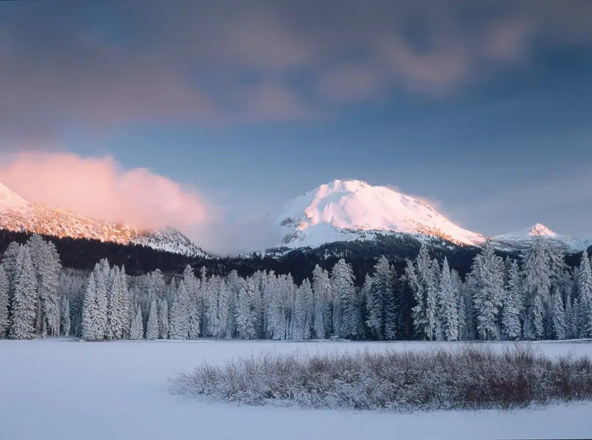
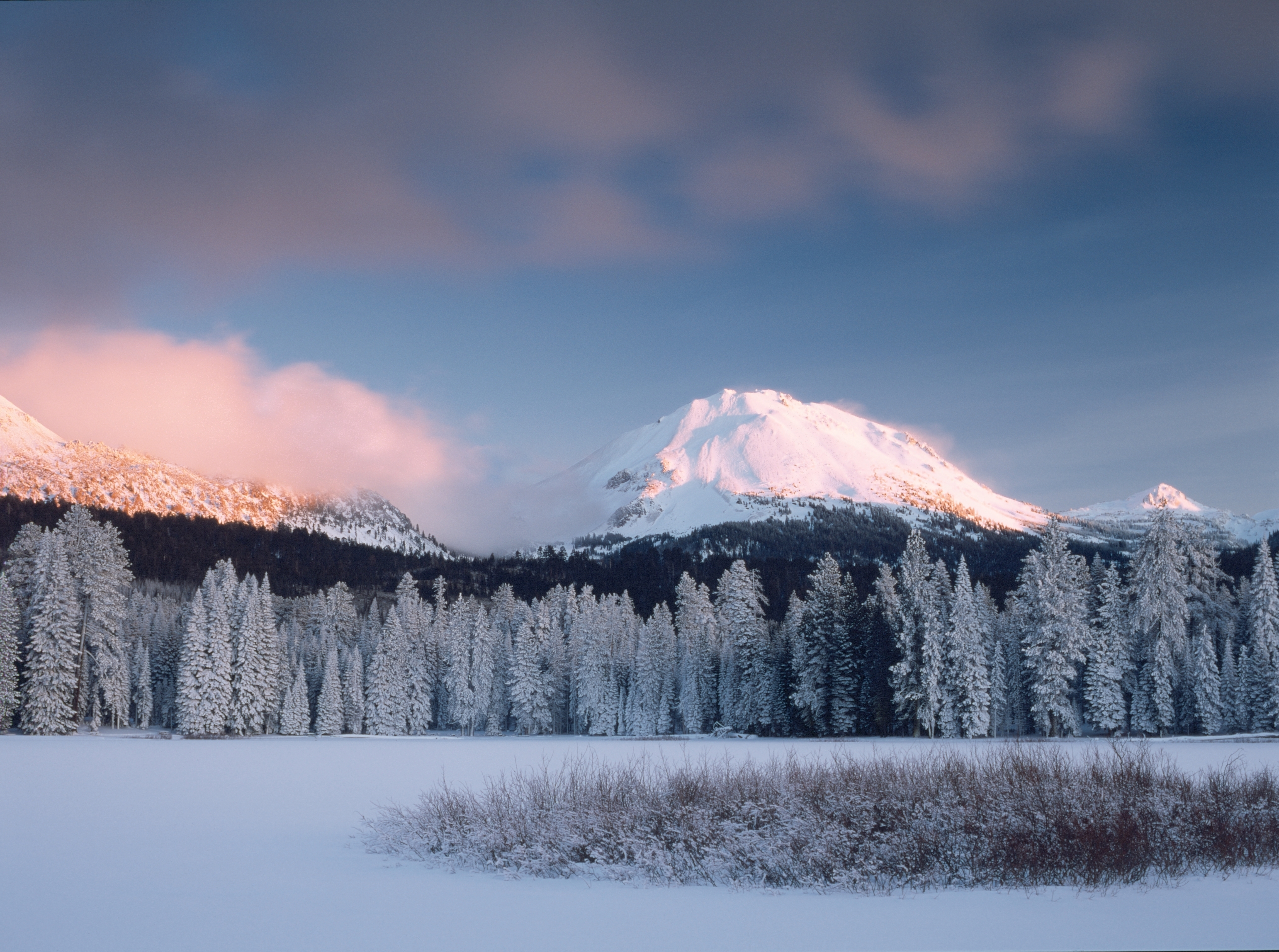
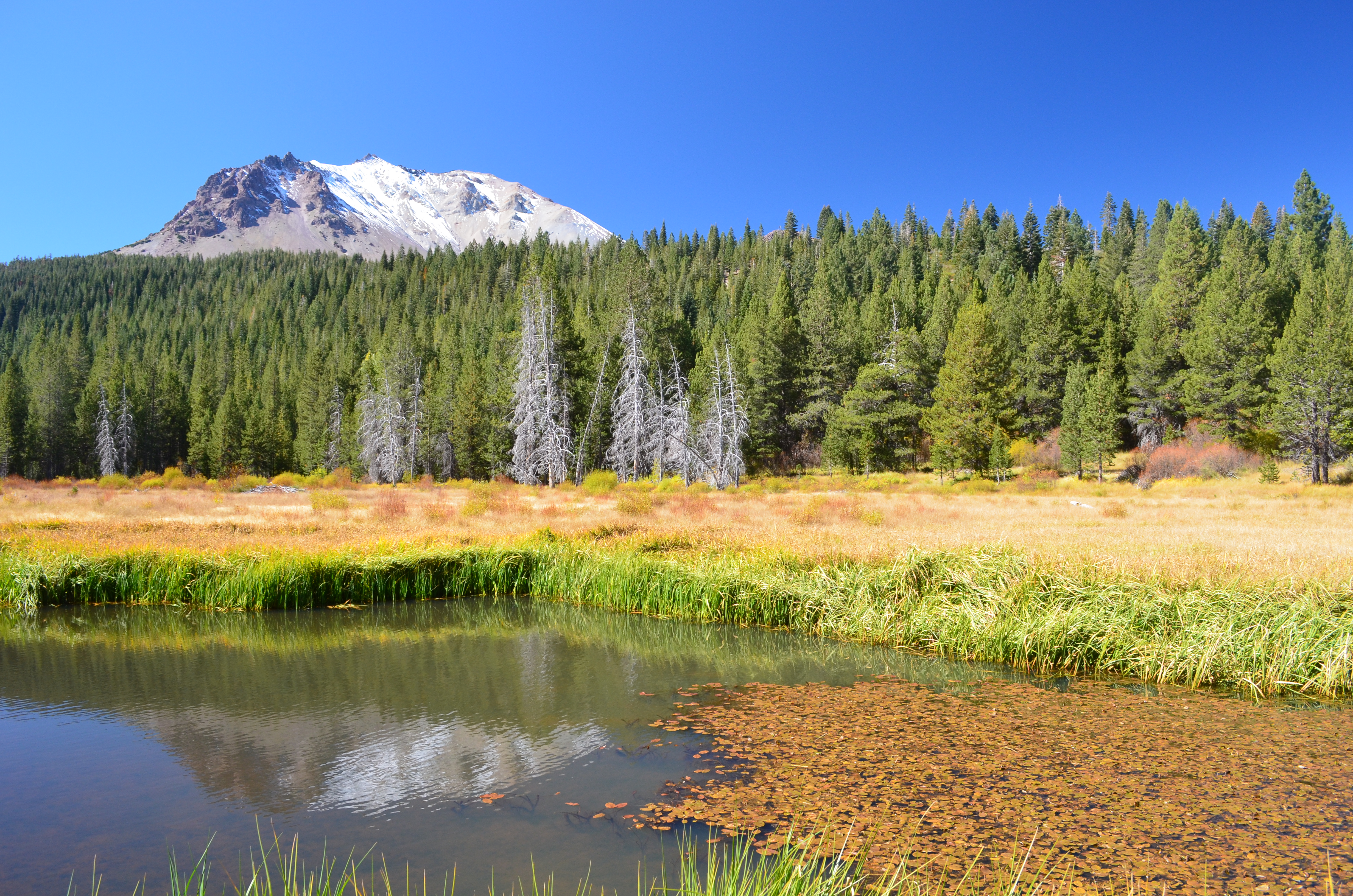


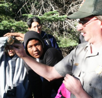

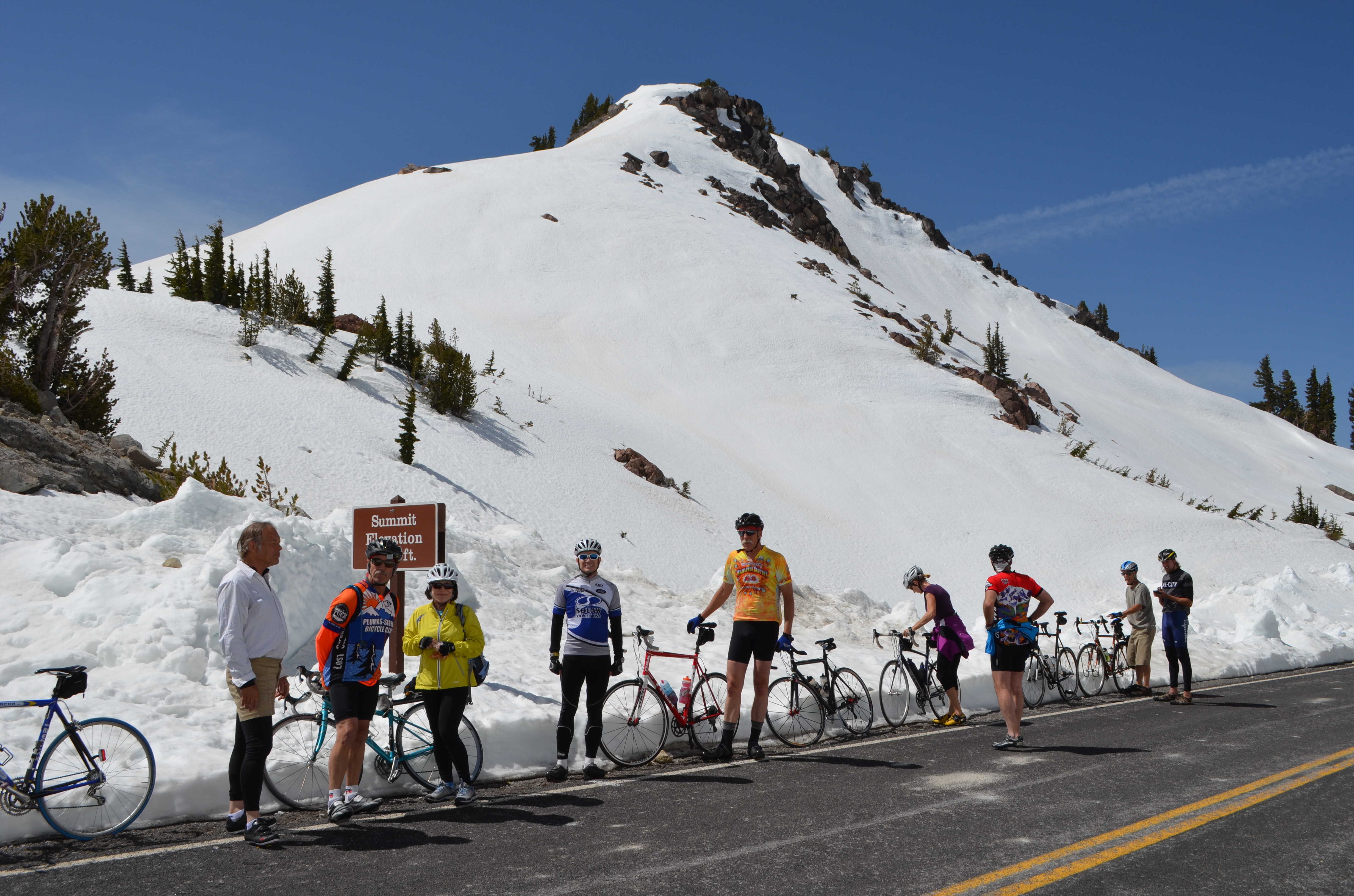
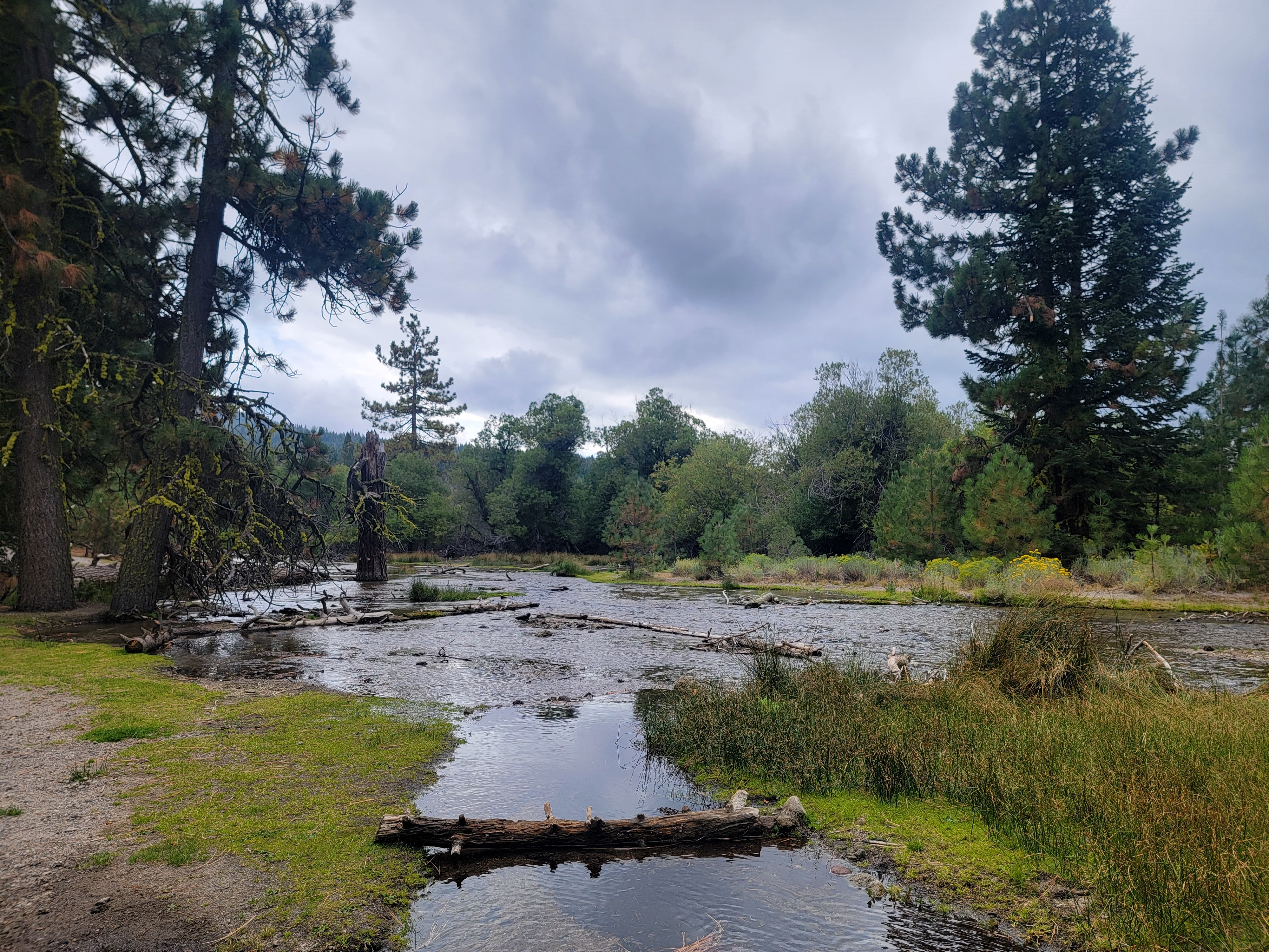
 Forests