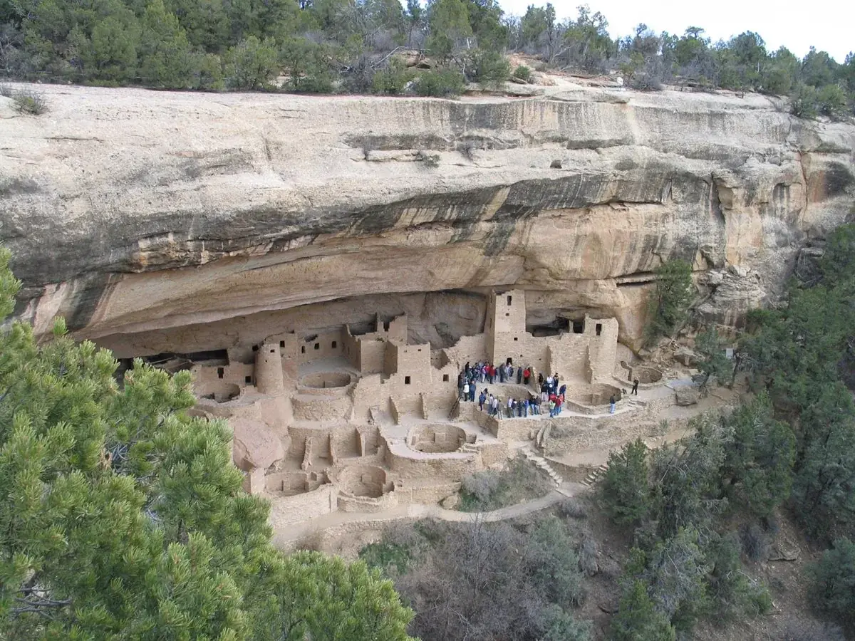
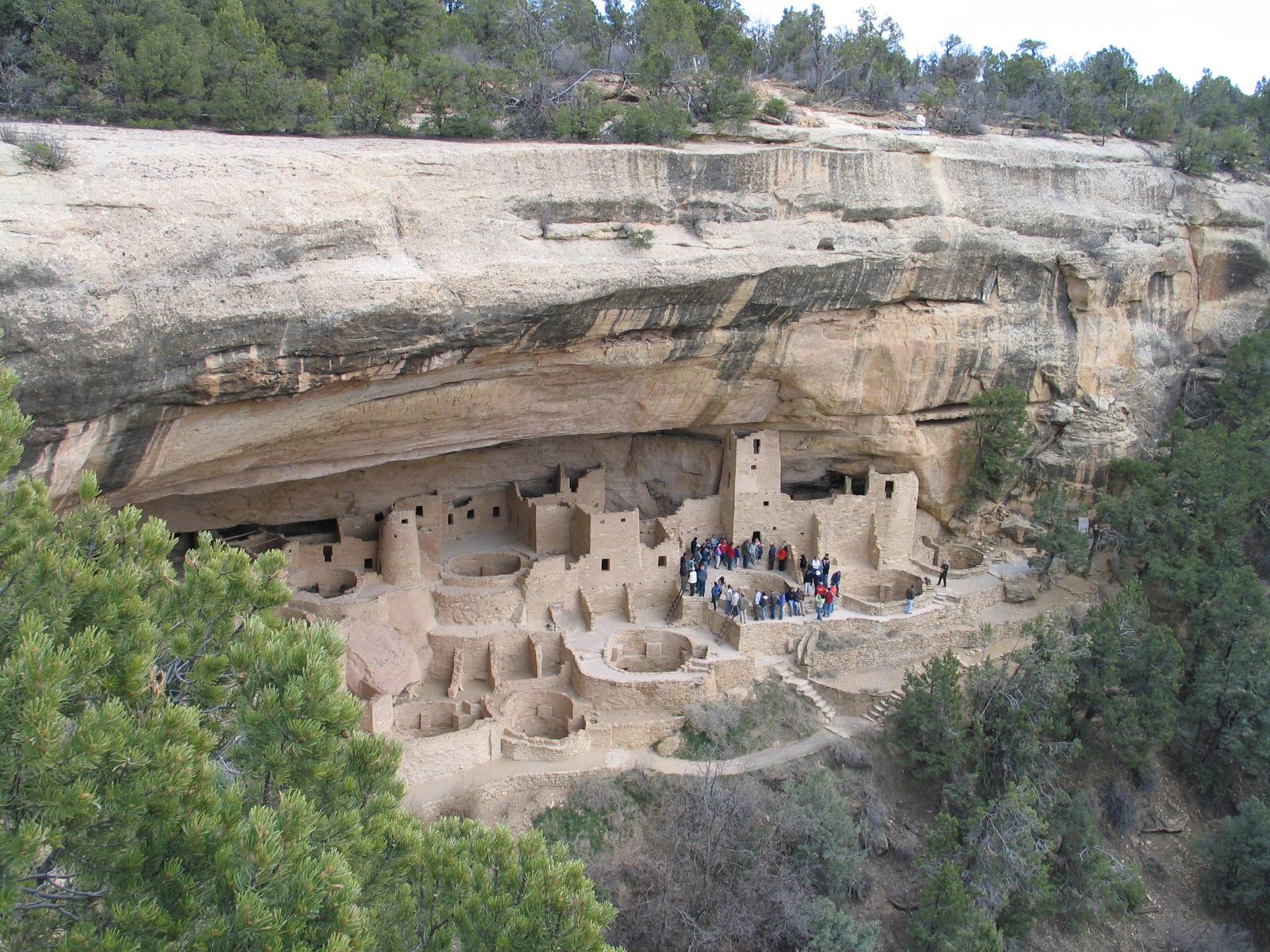
For over 700 years, the Ancestral Pueblo people built thriving communities on the mesas and in the cliffs of Mesa Verde. Today, the park protects the rich cultural heritage of 27 Pueblos and Tribes and offers visitors a spectacular window into the past. This World Heritage Site and International Dark Sky Park is home to over a thousand species, including several that live nowhere else on earth.
52.5Kacres of parkland
463.1Krecreation visits, 2025
Jun · Aug · Sepnearby climate picks
Seasonal access & reservations
No reviewed guidance for this selection. Check the park's official planning pages; missing coverage does not establish access.
Selected guidance only; separate from climate comfort and current conditions.
Official conditions Not checked
The conditions feed has not been connected for this park.
Editorial recommendations, reviewed 2026-10-17. Full park days, excluding travel to and from the region. A first-visit outline for a general traveler; adapt to mobility, fitness, season, reservations, and current conditions. These are suggested days, not reserved activities or guaranteed routes.
Learn more about hiking in Mesa Verde National Park.
NPS/Spencer Burke
Trail Regulations
It is illegal to hike off trail in Mesa Verde. Hiking is allowed only on designated trails.
Pets are not allowed on trails, except for Nordenskiöld Site #16, Badger House Community, and Long House Loop.
Please do not smoke on trails. Mesa Verde is subject to devastating wildfires.
For winter hiking opportunities, go to our Winter Activities page.
Health and Fitness
Prevent dehydration by drinking plenty of fluids.
Prevent altitude sickness, by acclimating to the area before engaging in any activity.
Be Safe & Visit with Respect
All of Mesa Verde is an ancestral home that is sacred to 27 tribes. Please visit with respect by staying on trails and leaving cultural and natural resources where you find them.
Morefield Canyon
Knife Edge Trail Difficulty: Easy Distance: 2 miles (3.2 km) roundtrip Elevation Change: 60 feet (18 m) Trailhead: Morefield Campground The trail follows a section of the historic park road, built in 1914 along Mesa Verde’s north escarpment. Views to the northwest make this trail a great place to enjoy sunset and the ecosytems are birding hotspot. A serious rockfall occurred along the last quarter of Knife Edge Trail. Please do not enter the rockfall area. Trail map and profile (jpg, 2 mb)
Point Lookout Trail Difficulty: Moderate Distance: 2.2 miles (3.5 km) roundtrip Elevation Change: 400 feet (122 m) Trailhead: Morefield Campground Steep switchbacks climb from Morefield Canyon to the top of Point Lookout, the iconic geological formation towering above the park entrance. Hikers are rewarded with views of the San Juan and La Plata Mountains and the Mancos and Montezuma Valleys. Trail map and profile (jpg, 2 mb)
Prater Ridge Trail Difficulty: Strenuous Distance: 7.8 miles (12.6 km) roundtrip North Loop: 5.7 miles (9.2 km) roundtrip; South Loop: 4.6 miles (7.4 km) roundtrip Elevation Change: 675 feet (205 m) Trailhead: Morefield Campground After climbing 1.1 miles (1.8 km) to the top of Prater Ridge, hikers may choose to hike either or both loops. Turn right for the longer north loop (3.6 miles/5.7 km), to follow the mesa’s edge high above Montezuma Valley, or left for the south loop (2.4 miles/3.9 km), which looks over Prater and Morefield Canyons. Trail map and profile (jpg, 2 mb)
Petroglyph Point Trail It is highly recommended the trail be hiked counterclockwise. Difficulty: Very Challenging—unmaintained with a narrow passage, stone stairs, steep edges, loose rock, scrambling required. Distance: 2.4 miles (3.9 km) roundtrip Elevation Change: 227 feet (69 m) Trailhead: Spruce Tree House Overlook, by the Mesa Verde Museum A rugged and adventurous trail with steep drop offs. Hikers traverse the side of Spruce Canyon, squeezing between boulders and descending narrow stone staircases to reach a large petroglyph panel at 1.4 miles (2.3 km). From here, hikers must climb a 100-foot (30 m) cliff, scrambling up rocks and uneven sandstone steps to the mesa top, before returning through pinyon-juniper forest on the mesa top to complete the loop. Trail map and profile (jpg, 2 mb)
Spruce Canyon Trail Difficulty: Strenuous Distance: 2.4 miles (3.9 km) roundtrip Elevation Change: 558 feet (170 m) Trailhead: Spruce Tree House Overlook, by the Chapin Mesa Museum This scenic trail leads hikers down swithchbacks and through shady Spruce Canyon, showcasing Mesa Verde’s diverse ecosystems. A steep climb leads out of the canyon and then passes through the picnic area to return to the museum. Trail map and profile (jpg, 2 mb)
Soda Canyon Overlook Trail Difficulty: Easy Distance: 1.2 miles (1.9 km) roundtrip Elevation Change: 70 feet (21 m) Trailhead: on the Cliff Palace Loop, 0.5 miles (0.8 km) past Balcony House A level out-and-back trail that winds through pinyon-juniper forest to three overlooks, where hikers are rewarded with views of Balcony House and other cliff dwellings across Soda Canyon. Trail map and profile (jpg, 2 mb)
Farming Terrace Trail Difficulty: Easy Distance: 0.5 miles (0.8 km) roundtrip Elevation Change: 150 feet (45 m) Trailhead: on the Cedar Tree Tower road This short trail drops into a side drainage of Soda Canyon past a series of well-preserved check dams built by Ancestral Pueblo farmers.
Far View Sites Difficulty: Easy Distance: 0.75 miles (1.2 km) roundtrip Trailhead: Far View Sites parking area, along main park road, four miles north of museum. Parking is limited to vehicles under 25 feet. This mesa-top community includes Far View House, four other villages, and a dry reservoir. In ancient times, the community was a place of modest homes interspersed with small farm fields. It was a place filled with people, vibrant life, and constant change. As you follow the woodland trail among the six sites, read the trailside signs to learn about Ancestral Pueblo life in the surrounding landscape between 900 to 1300 CE.
All Wetherill Mesa trails pass through areas burned in the 2000 Pony Fire. There is no shade.
Bicycles are not permitted on the 12-mile road the pavillion. From the parking lot, bicycles, including e-bikes are permitted to overlooks and trailheads.
Pets are permitted on all trails except for the trails leading into Step House and Long House.
Nordenskiold Site No. 16 Trail Difficulty: Moderate Distance: 2 miles (3.2 km) roundtrip Elevation Change: 95 feet (29 m) Trailhead: Wetherill Mesa Kiosk Pets allowed Follow the gravel trail south from the Wetherill Mesa kiosk, then turn right at the sign to follow the Nordenskiöld Site #16 Trail to an overlook of a cliff dwelling in Rock Canyon. This village of about 50 rooms is named for the Swedish scholar Gustaf Nordenskiöld, who excavated the site in 1891. Trail map and profile (jpg, 1.5 mb)
Badger House Community Trail Difficulty: Moderate Distance: 2.25 miles (3.6 km) roundtrip Elevation Change: 111 feet (34 m) Trailhead: Wetherill Mesa Kiosk Pets allowed Take the gravel trail south from the Wetherill Mesa Kiosk, pass the junction to Nordenskiöld Site #16 Trail and cross the paved Long House Loop to explore the 1-mile (1.6 km) loop through the Badger House Community—four excavated mesa top villages representing 600 years of Pueblo history.
Native birds, migrators, and those common to the desert are found in the diverse landscape of the park. Get to know where and when to look.
Join the Mesa Verde Flock!
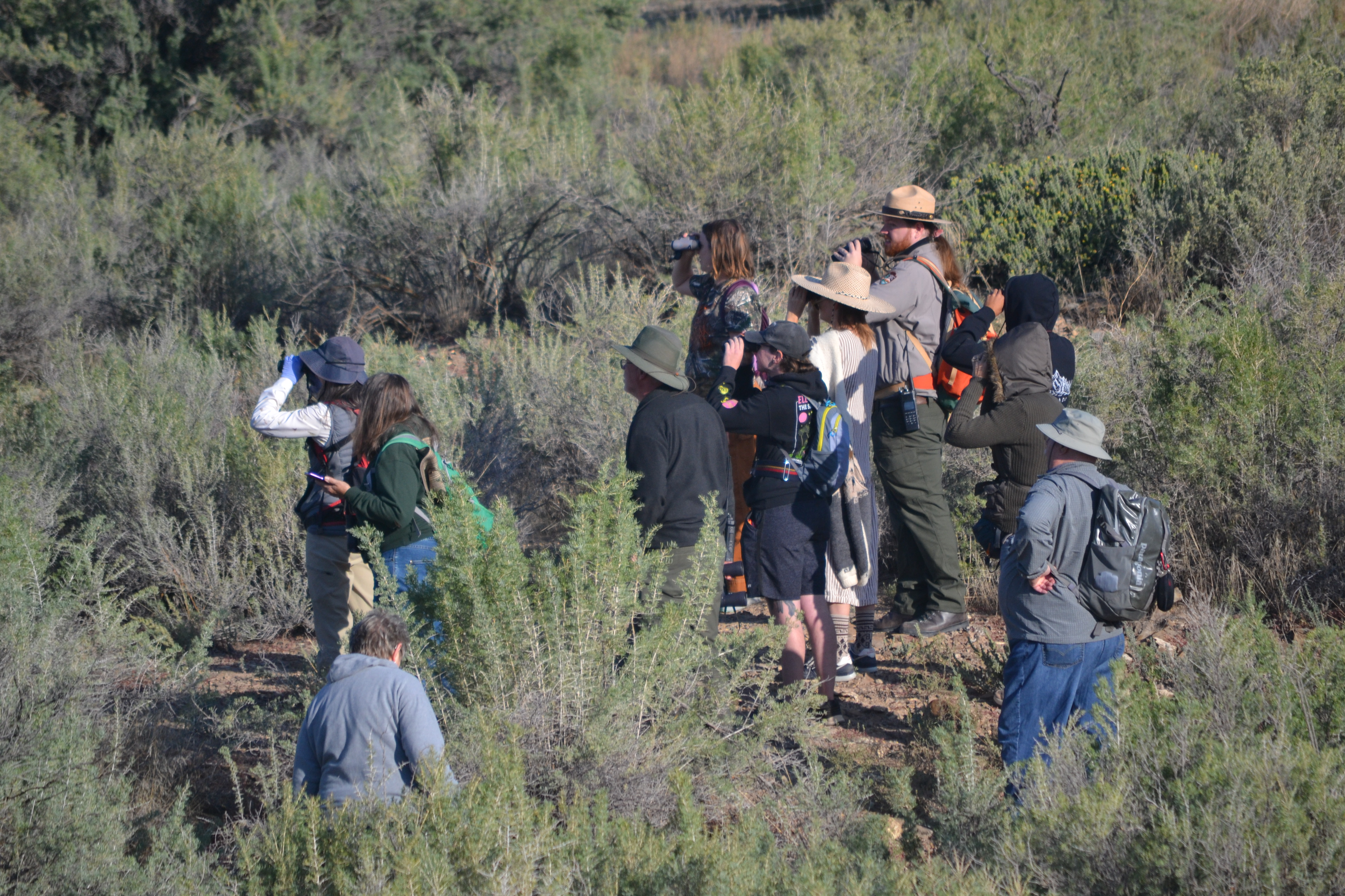
Third Sunday Bird Walk Free monthly birding programs. April - October, the morning of the third sunday of every month. All levels of birding experience are welcome, spare binoculars available! Registration is required: call or leave a message at (970) 529-4629 for details!
NPS/Mimi Gorman
Diverse Habitats, Diverse Species
Migration, Migration, Migration
NPS/Jack Davidson
NPS/Samantha Bomkamp
Spots for Spotting!
Here are a few places in Mesa Verde where birding is at it's best:
Knife Edge Trail
North Rim Overlooks
Cedar Tree Tower
Species Attribute Definitions
Occurrence values are defined below. One or more Occurrence Tags may be associated with each Occurrence value.
Present: Species occurs in park; current, reliable evidence available.
Probably Present: High confidence species occurs in park but current, verified evidence needed.
Unconfirmed: Species is attributed to park but evidence is weak or absent.
Not In Park: Species is not known to occur in park.
Occurrence Tags
Adjacent: Species is known to occur in areas near to or contiguous with park boundaries.
False Report: Species was reported to occur within the park, but current evidence indicates the report was based on misidentification, a taxonomic concept no longer accepted, or other similar problem of error or interpretation.
Historical: Species' historical occurrence in park is documented. Assigned based on judgment as opposed to determination based on age of the most recent evidence.
Animals: May be seen daily, in suitable habitat and season, and counted in relatively large numbers.
Plants: Large number of individuals; wide ecological amplitude or occurring in habitats covering a large portion of the park.
Animals: May be seen daily, in suitable habitat and season, but not in large numbers.
Plants: Large numbers of individuals predictably occurring in commonly encountered habitats but not those covering a large portion of the park.
Animals: Likely to be seen monthly in appropriate habitat and season. May be locally common.
Plants: Few to moderate numbers of individuals; occurring either sporadically in commonly encountered habitats or in uncommon habitats.
Animals: Present, but usually seen only a few times each year.
Plants: Few individuals, usually restricted to small areas of rare habitat.
Animals: Occurs in the park at least once every few years, varying in numbers, but not necessarily every year.
Plants: Abundance variable from year to year (e.g., desert plants).
Unknown: Abundance unknown
Native: Species naturally occurs in park or region.
Non-native: Species occurs on park lands as a result of deliberate or accidental human activities.
Unknown: Nativeness status is unknown or ambiguous.
List Differences
The Checklist contains only those species that are designated as "present" or "probably present" in the park.
The Full List includes all the checklist species in addition to species that are unconfirmed, historically detected, or incorrectly reported as being found in the park. The full list also contains species that are "in review" because their status in the park hasn't been fully determined. Additional details about the status of each species is included in the full list.
The checklist will almost always contain fewer species than the full list.
Select a Species Category (optional):
Species attribute definitions
Visit NPSpecies for more comprehensive information and advanced search capability. Have a suggestion or comment on this list? Let us know .
Mesa Verde is certified as the 100th International Dark Sky Park. Join a ranger program, or stargaze on your own.
NPS / Jacob W. Frank
2026 Night Sky Events
Wednesday evening Night Sky programs
Join Mesa Verde rangers every Wednesday for a Night Sky program. Program will consist of a 30 minute ranger talk followed by night sky laser tours and telescope viewing (weather permitting).
Weather permitting Be Prepared! Bring warm layers & a flashlight (red light preferred) Cloudy skies? A ranger talk & presentation will happen even on cloudy nights!
July 14, 15, and 16: Beginner Astrophotography Workshops
Mesa Verde National Park is hosting three free Beginner Astrophotography Workshops with nationally known astrophotographer Don Riddle, on July 14, 15, and 16. Each of the three nights is a stand-alone workshop on how to successfully take photos of the Milky Way. The workshops begin at 7:15 pm (time may change) allowing time to get you familiar with your camera settings while there is still sunlight. The evening finishes around midnight. Locations and maps are provided on the resgistration page. An optional drop-in session will be held the following day, indoors, to learn how to edit your photos.
Required Equipment for All Participants:
• Camera with ISO up to 6400 available (DSLR or mirrorless, please) • Wide angle lens 50mm or less (stock lenses are ok, f stop lower than 3.2 is preferred) • Sturdy tripod • Red light headlamp • Manual for your camera, either printed or downloaded to your phone – in case we need to look up camera settings • Warm clothes • Camp chair - there is no seating available at workshop locations • Extra Memory card • Thumb drive
Recommended Equipment for All Participants:
• Remote shutter • Extra batteries • Water and snacks • Bring warm clothing – it gets cool in Colorado at night!
Registration is Required
The workshops are free but registration is required and each night's workshop is limited to 15 participants. If the workshop you register for is full, you'll automatically be placed on a waitlist. Register here: Beginner Astrophotography Workshops Registration Mesa Verde National Park July 14, 15, 16
Image courtesy of Jacob W Frank
Some of the Country's Darkest Skies
Park visitors might experience a night sky very similar to what the the Ancestral Pueblo people saw a millennium ago. The night skies above Mesa Verde are an important cultural resource, and a draw for visitors seeking a dark sky experience.
Where to Stargaze
Tips for Stargazing
The darkest skies appear during a new moon or when the moon is below the horizon. Check sunrise and sunset times and moon phases before you head out. NASA's Night Sky Planner page offers useful links and tips.
Allow for Plenty of Time
It can take 20-30 minutes for your eyes to adjust to the dark. Spend enough time outside away from bright lights to allow your eyes to adjust.
Use a red light
Night vision is impacted by the white light from flashlights, cell phones, and vehicle headlights. Many flashlights and headlamps have a red-light feature, or you can simply cover your white light with red cellophane.
Bring a star chart
A star chart or planisphere helps locate constellations. These are available for purchase from Mesa Verde Association park stores, or from their online location .
Formerly home to families, farms, villages and cliff dwellings. Today, it offers opportunities for hiking, biking, and exploring the sites.
Wetherill Mesa will be open daily from May 22 to October 21, 2026. • Entry gate opens at 8:30 am and the last entry of the day is 2:00 pm • All visitors must exit by 4:00 pm when the gate closes for the night
The West Side of Mesa Verde National Park
What to Consider Before Visiting Wetherill Mesa
None of the ancient mesa top sites or alcove dwellings are visible from a vehicle.
Visiting any site, dwelling, or overlook requires hiking or biking 1 to 6 miles.
Due to a fire in 2000, the landscape has no shade.
Thunderstorms are common. Beyond your car, the pavilion, and Badger House shelters, there are no places to escape lightning and thunderstorms.
Water is limited along the trails.
A concessions snack bar sells pre-packaged food and drinks daily, 11:00 am until 2:00 pm.
Visit Wetherill Mesa With Your Dog
Weather at Wetherill
This video explores the landscape and what to do at Wetherill Mesa. It explains the challenges of visiting and what you need to prepare for a day at Wetherill Mesa.
Best Sites to Visit on Foot
Step House Hike to a cliff dwelling featuring two distincts periods of time. This is a free, self-guided tour open 9:00 am to 3:00 pm. The last entry to the site is at 2:45 pm. Plan accordingly because the trail to and from the site is 1 mile (1.6 km) round trip. It can be challenging for some as there are many steps and 165 ft (50 m) elevation change.
Once the snow builds up, so does the winter excitement for skiing and snowshoeing. Click for information and current trail conditions.
What to Expect in Winter
With elevations from 7,000 to 8,500 feet (2134 to 2590 m), snow is possible anytime from October thru May. Temperatures may be in the teens even when it is a sunny day. Visitor services are limited in the winter months, so be prepared with water, snacks, and layers of warm clothing. Check the weather forecast for the Mesa Verde area. Prepare your vehicle for winter travel and find more ways to visit the park during winter.
Cross-Country Skiing and Snowshoeing
Cross-country skiing and snowshoeing at Mesa Verde can be a very peaceful experience. Because most of the trees are bare, wildlife is more visible in the winter. You may even be able to find their tracks in the snow. Many times you are the only person around. Groomed cross-country ski and snowshoe trails will be available once there is an appreciable amount of snow and the park has begun to groom the trails. See the trails section below for details on where to ski, snowshoe, and hike.
Pets are not allowed on the trails.
Bring adequate gear, food and water.
Do not walk on ski trails.
Park rules and regulations apply to winter activities.
Adult and child sizes are available.
Snowshoes must be returned to the visitor center by 3:30 pm.
Snowshoers must travel on designated snowshoe trails, or fresh snow (ungroomed surface).
If a groomed trail is designated as mixed use (snowshoe and ski), snowshoers must travel at the edge of the trail opposite the classic ski tracks.
Winter Trail Conditions Update
When snow accumulates, trails are groomed for skate skiing, classic skiing, and snowshoeing as snow and ranger schedules permit.
March 28, 2026 - There is no snow accumulation.
Winter Trails – Chapin Mesa (map coming soon)
Petroglyph Point Trail
Uses : Open to hikers. Snowshoes may be used on the upper portion of the trail but are not recommended on the lower portion due to steep terrain. Winter Conditions : Trail can be snowy, muddy, and/or icy. Traction devices are recommended. Trail access description : This trail is located near the Museum. The 2.4-mile (3.9 km) trail leads to a panel of petroglyphs. This trail starts just behind the museum on the paved path to Spruce Tree House. The summer Petroglyph Point Trail page has more information about this trail.
Spruce Canyon Trail
Uses : Open to hikers and snowshoers. Winter Conditions : Trail can be snowy, muddy, and/or icy. Traction devices are recommended. Trail access description : This trail is located near the Museum. This trail starts just behind the museum on the paved path to Spruce Tree House. The 2.4-mile (3.9 km) trail leads hikers down switchbacks and deep into Spruce Canyon. The summer Spruce Canyon Trail page has more information about this trail.
Chapin Mesa Rim Trail
Uses : Open to hikers and snowshoers. Winter Conditions : Trail can be snowy, muddy, and/or icy. Traction devices are recommended. Trail access description : This trail is located near the Museum. The path leaves from the museum and goes along the canyon rim with views of Spruce Canyon. The trail includes a stop at the historic Chapin Mesa amphitheater before it exits at the Spruce Canyon Trail and returns to the museum. Total distance is 1.5 miles if only walking from the museum to the exit of Spruce Canyon Trail and back.
Cliff Palace Loop Trail
Closure: The road closes to all pedestrian and vehicle traffic with accumulation of snow and opens for winter use. Uses : Open to cross country skiers and snowshoers. Sign in at the Trail Register. Winter Conditions : This trail will be available once there is an appreciable amount of snow and the park has begun to groom for snowshoeing and cross-country skiing. Trail access and description : Park at the north end of the Chapin Mesa Museum parking lot. Follow the connector trail to the Mesa Top Road and Cliff Palace Road intersection. Cross the Mesa Top Road and follow the Cliff Palace Loop road which will eventually loop back to the Mesa Top Road and Cliff Palace Road intersection. Lastly follow the connector trail back to the museum parking lot. Due to its distance this trail is rated as moderate but the terrain is relatively flat. Numerous cliff dwelling viewpoints are available along the way. Total roundtrip distance is 6.5 miles.
Soda Canyon Overlook Trail
Closed: closed to all pedestrian with accumulation of snow. Uses : Open to cross country skiers and snowshoers. Sign in at the Trail Register. Winter Conditions : This ungroomed trail is accessible via the groomed Cliff Palace Loop and will be available once there is an appreciable amount of snow and the park has begun to groom for snowshoeing and cross-country skiing. Trail access and description : Park at the north end of the Chapin Mesa Archeological Museum parking lot. Follow the connector trail to the Mesa Top Road and Cliff Palace Road intersection. Cross the Mesa Top Road and follow the groomed Cliff Palace Loop trail to a Y-intersection. Take the left (east) fork 0.3 miles south to the Soda Canyon Overlook Trailhead and follow the ungroomed Soda Canyon Overlook trail 0.75 miles to the overlook. Groomed trail from parking lot to trailhead is 1.75 miles. Ungroomed trail is 0.75 mile round trip. Total distance, round trip is about 5 miles. Due to the distance this trail is rated as moderate.
Uses : Open to cross country skiers and snowshoers. No walkers. Sign in at the Trail Register. Winter Conditions : This trail will be available once there is an appreciable amount of snow and the park has begun to groom for snowshoeing and cross-country skiing. Trail access and description : This trail follows the established campground road loops for a total distance of 2.5 miles. Due to length and a number of short hills this trail is rated as moderate.
Prater Ridge Trail
Uses : Open to snowshoers or hikers. Snowshoes required when Morefield loops are groomed. Sign in at the Trail Register. Winter Conditions : Trail can be snowy, muddy, and/or icy. Snowshoes or traction devices are recommended. Trail access and description : Follow the snowshoe trail to the Prater Ridge Trailhead. This trail ascends steeply for the first mile until the top of the mesa is reached. On top follow a large loop and return to the mile long decent. Due to distance and elevation gain this trail is rated as difficult. Total roundtrip distance from winter parking is 8.3 miles.
Knife Edge Trail
Uses : Open to snowshoers or hikers. Snowshoes required when Morefield loops are groomed. Sign in at the Trail Register. Winter Conditions : Trail can be snowy, muddy, and/or icy. Snowshoes or traction devices are recommended. Trail access and description : Follow the snowshoe trail to the Knife Edge Trailhead. This trail is rated as easy and offers great views of the valley below. Total roundtrip distance from winter parking area is 3.8 miles.
Point Lookout Trail
Uses : Open to snowshoers or hikers. Snowshoes required when Morefield loops are groomed. Sign in at the Trail Register. Winter Conditions : Trail can be snowy, muddy, and/or icy. Snowshoes or traction devices are recommended. Trail access and description : From the campground store parking lot, follow the snowshoe trail north to the Lookout Point Trailhead. From there the trail ascends steeply to the top of the mesa. The trail continues along the mesa top until it reaches an excellent view of the La Plata Mountains. Due to the elevation gain this trail is rated as difficult. Total roundtrip distance from winter parking area is 3.7 miles.
Pick up a booklet at the Visitor & Research Center or entrance station and complete the activities to earn a Junior Ranger badge.
Want to become a Mesa Verde Junior Ranger? Stop by the Mesa Verde Visitor & Research Center on your way into the park to pick up a booklet. You can also become a Junior Ranger from home or school. Simply, download the PDF here , complete the activities, and email us photos of your compeleted work. Email photos to: MEVE_General_Information@nps.gov Or print it out and mail to: Junior Ranger Program, PO Box 8, Mesa Verde, CO 81330-0008
Official NPS features and USGS park boundaries, imported 2026-10-17. An inventory snapshot, not live trail or parking availability.
Loading official park features…
TrailsPoints of interestParkingZoom with buttons or pinch. Toggle layers on the map.
Map coverage varies. Trail names may represent segments, connectors, or shared park units; mapped lines are not a hiking recommendation. Use official conditions and navigation resources before heading out.
NPS public GIS inventory, imported 2026-10-17. “Existing” is an inventory classification, not confirmation that a trail is open. Segment counts are not route distances. Parking records do not indicate space availability, fees, or accessibility certification. View government source ↗
Climate for Durango, 55 km from the park reference point. 1991–2020 normals. Source elevation: 1,991 m.
Daytime highNighttime lowOctober: 59° / 33°
Daytime high59°
Precipitation56 mm
Daylight11.0 hrs
Wind8.4 km/h
Mountain, rim, valley, and coastal conditions can differ sharply from the source town. Check park forecasts and current conditions before travel.
Monthly climate data 12 months · °F
Month
High
Low
Rain / snow water
Wet days
Daylight
35°
12°
60 mm
7.1
9.7 h
38°
16°
58 mm
8.3
10.6 h
46°
22°
49 mm
7.8
11.7 h
54°
29°
43 mm
7.3
12.9 h
65°
37°
38 mm
6.4
14.0 h
77°
46°
17 mm
3.3
14.5 h
81°
53°
38 mm
7.7
14.3 h
78°
52°
45 mm
8.8
13.4 h
71°
44°
63 mm
7.1
12.3 h
59°
33°
56 mm
7.3
11.0 h
46°
20°
50 mm
6.2
10.0 h
35°
11°
51 mm
6.6
9.5 h
RESEARCH WITH THE SOURCE IN VIEW
The practical field guide.
Official NPS excerpts imported 2026-10-17. Fees, permits, road access, and operations can change; use the source link to confirm the latest information.
For current weather forecasts please visit the National Weather Service .
A printable park map along with area maps are found on the Maps page. Go to winter activities for winter trail maps.
Learn the best ways to visit with your pets .
Physical Address
This address is for the Visitor and Research Center which is the first visitor contact location after exiting Hwy 160. Mesa top ancestral sites, Cliff dwellings, tours, the Mesa Verde Museum and park headquarters are 20 to 21 miles (approximately 45 minutes) south along the park road.
Operating Hours & Seasons
Current forecast and average temperatures
If you already have an America the Beautiful—the National Parks and Federal Recreational Lands Pass, that's the only entrance pass you need. Seniors, military, visitors with a permanent disability, and families with a 4th grader are eligible for a free or discounted America the Beautiful pass. If you do not possess any valid pass, click the link for information about entrance fees and passes.
When you enter the park request an accessibility brochure from the entrance station, Visitor and Research Center, or the museum. Download the National Park Service App for accessible information.
Service Animals
Service animals are allowed anywhere that you are allowed to go in Mesa Verde National Park including cliff dwelling tours. However, on tours with ladders, service animals must be carried in a pack or able to climb ladders on their own. Visitors must have both hands free for climbing ladders. A service animal is any dog that is individually trained to do work or perform tasks for an individual with a disability, including a physical, sensory, psychiatric, intellectual, or other mental disability. The work or tasks performed by a service animal must be directly related to the individual’s disability. Emotional support animals, comfort animals, and therapy dogs are not service animals under Title II and Title III of the Americans with Disabilities Act (ADA). A doctor’s letter does not turn an animal into a service animal.
Places in the Park
Mesa Verde Visitor and Research Center
The Visitor and Research Center is open year-round with accessible parking and road crossings, and a paved walkway. There are audio described, wheelchair accessible, and tactile exhibits. A braille park brochure is free at the ranger desk. Additional features include push button entry, ADA restrooms and drinking fountain, WiFi, and ask about wheelchair availability.
Mesa Verde Museum
The Mesa Verde Museum is 20 miles from the park entrance. Visitors can watch the 17-minute, captioned park film and request an assisted listening device. Wheelchairs are available to borrow. There are ramps throughout the museum where a selection of ancestral and modern-day cultural items are on display. With 24-hour advance request, pottery samples can be made available to touch. WiFi is provided by the Mesa Verde Association Park Store.
Spruce Tree House
Spruce Tree House is the best preserved and third-largest cliff dwelling in Mesa Verde National Park. It is best viewed from the covered back porch (see top photo) of a historic building to the right of the Museum. A closer vantage point is from an overlook down a paved steep path.
Morefield Campground
Some camp sites are accessed by steps or are located on uneven terrain. There are several designated, accessible camp sites and comfort stations (with flush toilets) available along the Apache Loop. See Camping for more information.
The Lodge has seven ADA rooms. There are no stairs in any of the Lodge Room buildings, a ramp from the parking lot to the Lodge entrance, and an elevator in the Lodge lobby for access to the upstairs lodge and the downstairs recreation room.
All of the restaurants in the park—the Far View Terrace, Spruce Tree Terrace, the Metate Room, and Far View Lounge—are fully accessible.
Overlooks Along the Way
Mancos Overlook: On the left four miles from entrance, paved walk to exhibit and covered picnic table.
Montezuma Overlook: Near milepost 6, no designated parking but curbless access to vault toilets, two exhibits, and a covered picnic table.
Park Point: Near milepost ten on the right, accessible parking, restrooms, and picnic tables. From the parking area, the highest point in the park at 8572 feet (2613 m) elevation is reached via a very steep hike on pavement. Once on top, there are two viewpoints and a historic fire lookout.
Geologic Overlook: Between mileposts 12 and 13, vault toilet, no designated parking, curbless area, paved walkway, exhibits. A steep incline to the second viewpoint
Cliff Dwelling Tours
Driving Tours and Self Guided Sites
Mesa Top Loop Road
Mesa Top Loop is 6-miles (10 km) with 12 ancestral sites and viewpoints, and two stops with toilets. A printed guide is found at the first and last sites, and exhibits are at all stops. Excavated sites are protected with a roof. The accessibility brochure which is available from the entrance station, Visitor and Research Center, or the Museum offers brief descriptions of the access to each ancestral site. Download an audio tour on the National Park Service app and save Mesa Verde off line. Then go to "Self-guided Tours" and listen to the Mesa Top Loop Audio Tour as your explore the sites. Or, download the audio tour as a podcast on your smart phone and listen in your car as you drive. Download the audio tour on Apple Podcasts , Google Podcasts , or Spotify . Make sure to download before entering the park, because service is limited within the park.
Cliff Palace Loop
Cliff Palace Loop Road is 6-miles (10 km) with viewpoints. Binoculars are helpful to see cliff dwellings across the canyons.
Far View is an ancient farming community where people lived from the CE 700s into the early 1200s. A ¾-mile (1.2 km) dirt trail, sometimes rutted, muddy, and uneven, passes by five villages and a reservoir. A supplemental, archeolgical, trail guide is found near the trailhead. Two sites may be seen from your vehicle.
Cedar Tree Tower
Cedar Tree Tower is located less than 5 yards (4.6 m) from the parking area and can be viewed from your vehicle. In the same area is the 0.5 mile (0.8km) Farming Terrace Loop Trail. This is an opportunity to view an example of check dams built by Ancestal Pueblo farmers.
Cliff Palace Overlook
The Cliff Palace Overlook is accessed by a paved trail and one flight of stairs. Cliff Palace can also be viewed from an accessible paved overlook at Sun Temple on the Mesa Top Loop.
Wetherill Mesa is open seasonally for day use only. Many sites are accessible with assistance by paved and/or graveled trails. All Wetherill Mesa trails pass through areas that burned in the 2000 Pony Fire, where there is no shade. Be prepared for sun and weather exposure.
A steep, paved and graveled, 1-mile (1.6 km) round-trip trail to a cliff dwelling. Open seasonally and only when staffed with a ranger. Access for wheelchairs is via the exit trail only. Wide rim wheels are highly recommended. The steep trail does not meet legal grade requirements. Accessible with assistance.
Badger House Community
Relatively level area with a partially paved and graveled trail to a series of mesa-top ancestral homes. Round-trip distance is 2.25 miles (3.6 km). Accessible with assistance.
Long House Loop
This paved road is available for hiking and biking and is accessible. The road loops around the top of Wetherill Mesa to the Badger House Community (2.5 miles/4 km roundtrip), Long House Overlook (3 miles/4.8 km roundtrip), and Kodak House Overlook (4.5 miles/7.2 km roundtrip). Accessible with assistance.
Please contact us if you need additional information, have questions, or if you experience difficulty accessing the information on this webpage.
Email us to assist with planning your visit.
Interpretive Rangers PO Box 8 Mesa Verde, CO 81330
Get an entrance pass All visitors must have one of these entrance passes: Pass Price Standard Pass $15.00–$30.00 Annual Pass $55.00 America the Beautiful Pass (includes Senior Passes) FREE–$250.00 Help me choose an entrance pass
Plan to go cashless This park does not accept cash.
Choosing an Entrance Pass
Do you have or qualify for a discounted America the Beautiful Pass?
If you already have an America the Beautiful—the National Parks and Federal Recreational Lands Pass, that's the only entrance pass you need. Seniors, military, visitors with a permanent disability, and families with a 4th grader are eligible for a free or discounted America the Beautiful pass.
America the Beautiful Pass
How often do you plan to visit national parks in the next 12 months?
If you don't qualify for a discounted America the Beautiful pass, we recommend choosing an entrance pass based on your trip plans.
Entrance Passes
Standard Entrance Pass
If you enter the park in a motorized vehicle, your entrance pass covers both you and your passengers. Your passengers do not need a separate pass.
Private Vehicle (May 1-Oct 22) $30.00
In-person Purchase Locations
Item no longer exists Credit/Debit Only
Motorcycle (May 1-Oct 22) $25.00
Private Vehicle (Oct 23-Apr 30) $20.00
Motorcycle (Oct 23-Apr 30) $15.00
For Individuals without a Vehicle
If you enter the park on a bicycle or on foot and are at least 16 years old, you need your own entrance pass. Children under the age of 16 don't need an entrance pass.
Per Person (May 1-Oct 22) $15.00
Per Person (Oct 23-Dec 31) $15.00
Annual Entrance - Park
Details: Fee good for a year, beginning from the date of sale.
US citizens and residents
America the Beautiful—the National Parks and Federal Recreational Lands Pass
Covers entrance fees and standard amenity (day-use) fees at lands managed by
National Park Service
US Fish & Wildlife Service
US Forest Service
Bureau of Land Management
Bureau of Reclamation
US Army of Corps of Engineers
Depending on the type of entrance fee charged at a site, covers One private vehicle fee or Four per person fees
America the Beautiful Passes are non-refundable, non-transferable and cannot be replaced if lost or stolen . Passholders must show valid photo identification (ID) with each pass.
How to Get an America the Beautiful Pass
Physical passes can be purchased or picked up at over 1,000 federal recreation sites.
Purchase and pickup locations
To receive your pass by mail, order online at the USGS Online Store . Online orders are for physical passes, not digital passes, and may take up to three weeks to be processed and delivered. Order receipts may not be used in place of a physical pass. We recommend ordering at least three weeks in advance of your visit, or picking up a pass in person instead.
Skip the wait! Get a Digital America the Beautiful Pass through recreation.gov. Your digital pass can be saved to a mobile device and used immediately.
Get a Digital America the Beautiful Pass
2026 Free Entrance Days in the National Parks
Come experience the national parks! All National Park Service sites that charge an entrance fee will offer free admission to US citizens and residents (other fees, including timed entry or reservation fees, may apply). Mark your calendar for these entrance fee-free dates:
February 16 : Presidents Day (Washington's Birthday)
May 25 : Memorial Day
June 14: Flag Day/President Trump's birthday
July 3–5: Independence Day weekend
August 25: 110th Birthday of the National Park Service
September 17: Constitution Day
October 27 : Theodore Roosevelt's birthday
November 11: Veterans Day
Entrance fees are credit/debit only.
Can I use contactless payments such as Apple Pay or my pre-paid Wallet phone App?
Yes, you can use Apple Pay and other contactless payments systems at the entrance stantion.
Can I use cash inside the park for food and gifts?
Yes, cash and cards are accepted inside the park for purchases.
How are my fee dollars used?
Entrance Fees: Commercial Tours
Commercial Tour Fees good for 7 days only if tour maintains the same group of people for each re-entry.
Entrance Fees - Non-Commercial Tours
A per-person fee is charged for organized non-commercial groups in vehicles with a capacity of more than 16 persons. Organized non-commercial groups include church groups, college/school groups, scouts, service organizations, etc. All holders of America The Beautiful Interagency Passes, Golden Passports, Annual Mesa Verde passes, and those under 16 years of age will be exempt from payment of fees. ( The above-named passes allow free entrance to individual pass holders under the conditions stated on the pass .)
The total fee charged for an Organized Non-Commercial Group will not exceed the charge for a commercial tour fee.
Non-Commercial Group Fee (based on vehicle capacity) Non-Commercial Group Fee good for 7 days only for the same group of people for each re-entry.
Less than 16 Person Capacity
16-25 Person Capacity
26+ Person Capacity
Pass
Price
Standard Pass
$15.00–$30.00
Annual Pass
$55.00
America the Beautiful Pass (includes Senior Passes)
FREE–$250.00
I'm visiting...
We recommend
This park, once
Standard Pass
This park, multiple times
Annual Pass
More than one national park or federal recreation site
America the Beautiful Pass
Type
Available to
Price
Resident Annual Pass
US citizens and residents
$80.00
Non-Resident Annual Pass
Non-US residents
$250.00
Senior Annual Pass
US citizens and residents 62+ years old
$20.00
Senior Lifetime Pass
US citizens and residents 62+ years old
$80.00
Military Annual Pass
Current US military and dependents
Free
Military Lifetime Pass
Gold Star Family members and veterans
Free
Access Pass
US citizens and residents with permanent disability
Free
4th Grade Pass
US 4th graders
Free
Volunteer Pass
Federal recreation site volunteers with 250 service hours
Free
Winter (January 2 to April 30 and November 1 to December 31)
Fee: $25.00 plus $10.00 for each person, 16 years of age or older.
Summer (May 1 to October 31)
Fee: $25.00, plus $15.00 fee for each person, 16 years of age or older
Winter (January 2 to April 30 and November 1 to December 31)
Fee: $75.00
Summer (May 1 to October 31)
Fee: $75.00
Winter (January 2 to April 30 and November 1 to December 31)
Fee: $100.00
Summer (May 1 to October 31)
Fee: $100.00
Winter (January 2 to April 30 and November 1 to December 31)
Fee: $200.00
Summer (May 1 to October 31)
Fee: $200.00
Less than 16 Person Capacity
16-25 Person Capacity
26+ Person Capacity
Winter (January 2 to April 30 and November 1 to December 31)
$20.00 per vehicle
$10.00 per person, 16 years of age or older. Not to exceed $100.00
$10.00 per person, 16 years of age or older. Not to exceed $200.00
Summer (May 1 to October 31)
$30.00 per vehicle
$15.00 per person, 16 years of age or older. Not to exceed $100.00
$15.00 per person, 16 years of age or older. Not to exceed $200.00
Mesa Verde National Park is in Southwestern Colorado. The park entrance is along Highway 160 between the towns of Mancos and Cortez, Colorado and about 35 miles west of Durango, Colorado. Once you enter the park, the first view of a cliff dwelling is 21 miles (approximately 45 minutes) along a steep, narrow, and winding road.
Getting Here by Car The Mesa Verde Headquarters and Chapin Mesa area (which includes the cliff dwellings and the Chapin Mesa Archeological Museum) is a one-hour drive from Cortez, Colorado, heading east on Highway 160 to the park turnoff. It is a 1.5 hour drive from Durango, Colorado, heading west on Highway 160 to the park turnoff.
Alternative Fuel Vehicles - Do you plan to travel to the park in an alternative fuel vehicle? If so, good for you! Your actions help us reduce greenhouse gas emissions and reduce petroleum use. Plan your trip with the Alternative Fueling Station Locator from the Department of Energy (search using zip code 81330).
Getting Here by Plane The nearest airports are Cortez, Colorado; Durango, Colorado; and Farmington, New Mexico.
Getting Here by Bus The closest bus terminal is located in Durango, Colorado. Car rental is needed to get from the bus terminal to the park. The entrance to Mesa Verde is 35 miles from Durango.
Getting Around in the Park A vehicle is needed to explore Mesa Verde National Park. Please see our Getting Around page for information on driving and bicycling in the park.
You can help preserve the park's unique resources by knowing and following these basic regulations. More policies, such as the Superintendent's Compendium, can be found on the Laws & Policies page.
Park Rules • Mesa Verde’s backcountry is closed. It is illegal to hike off trail. • Camping is allowed only in designated campground. • Marijuana is illegal on federal land, including national parks. • Drones are illegal in national parks. • Archeological resources are fragile and protected. Please do not touch, climb, sit, or lean on ancient walls. Plan Ahead You will drive at least 50 miles (80 km) to visit Mesa Verde's cliff dwellings. Don't run out of gas. Morefield Campground is the only place in the park to fill up. Most of the park is remote and without reliable cell service. Share the Road
Park roads are steep, narrow, and winding. Do not stop on the roadway; use pullouts or overlooks. Watch for wildlife, pay close attention to your speed around curves, and obey all traffic signs.
Bicyclists use caution! The road is steep and paved shoulders are rare. Ride in single file and stay as far to the right as possible. Bicyclists, like motor vehicle drivers, must comply with traffic regulations. From sunset to sunrise, your bicycle must exhibit a white light on the front visible from 500 feet and a red light or reflector on the rear visible for 300 feet. You must also use your lights in the tunnel.
Please note that bicycles are not allowed on pedestrian trails or on the Wetherill Mesa Road. Once out on Wetherill Mesa, the 5-mile Long House Loop is open for bicycles. Some additional trails on Wetherill Mesa are open for bicycles, while others are for pedestrians only. Please check signs at trailheads before taking your bicycle on any trail. Bicycles are not permitted on any trail except those marked as open to bicycles.
Can You Hear Me?
Once you drive through the park entrance, cell phone service is limited. You can find telephones at park facilities. Wi-Fi service is available at the Morefield Campground Store, Far View Lodge, Far View Terrace, and Spruce Tree Terrace.
Keep wildlife wild! Feeding wild animals is dangerous to you and unhealthy for them. Wild animals can carry deadly diseases, including hantavirus, plague and rabies. Repeated human contact with wildlife may cause animals to lose their natural fear of humans and become aggressive. Always view wildlife from the safety of your car or from a distance. Do not approach animals to feed or take photographs, and teach children not to chase, tease, or pick up animals. Please report any animal that may appear sick or injured.
Keep your food, cooking equipment, and garbage in your vehicle with the windows closed, hard-sided trailer, or food locker, especially in the campground.
Carry and drink plenty of water. Dehydration and altitude sickness are common causes of illness at Mesa Verde. Elevations range between 7,000 and 8,400 feet (2134 m and 2560 m), and the climate is dry. Carry water with you everywhere, and drink it. You can fill your reusable water bottle at all park facilities. Water is also available at Cliff Palace and the Wetherill Mesa Information Kiosk during the summer months.
Pets Need to Be Protected Too
Leashed pets are allowed on roads, parking lots, and some paved areas (Mesa Top Loop, Park Point, Long House Loop, and the Nordenskiöld Site #16 Trail). Pets are not allowed on trails, in archeological sites, or in buildings. Do not leave pets unattended. Please remember that your pet is as susceptible to the heat as you are. Keep your pet hydrated and cool. Pets should be left unattended within motor vehicles only with proper ventilation and water, and only in weather that is not hazardous to the animal. With daytime temperatures at Mesa Verde ranging from 80° to over 90° from late-spring to early-fall, the temperature in a car can rise to 120° in a matter of minutes, even with the windows cracked opened. Shady parking places are rare and even on cooler days, temperatures within the car can quickly rise to dangerous levels.
Plan your route carefully, and always inform a friend or family member of your planned route and expected return time. Check the weather forecast before departing for your hike. Be especially prepared if you are hiking alone. Depending on the distance of the hike and time of year, we recommend that individuals carry and drink at least a gallon of water each day.
Afternoon thunderstorms are common in the summer months and can approach quickly. The safest place to be in a thunderstorm is a building, and the next safest is your vehicle. If you are in your car during an active thunderstorm, the best position is to sit with hands on your lap, not touching the door or the dash. If you’re caught outside in an active thunderstorm, do not take cover under trees, avoid being the tallest object, and don’t stand near other tall objects (i.e. lone trees). Keep moving towards a safe place. If you are in a group, try to leave about 15 feet of space between each person. These storms pass quickly but should NOT be taken lightly.
Visiting Cliff Dwellings
Visiting a cliff dwelling can be strenuous. The cliff dwellings are at 7,000 foot (2134 m) elevation. Please consider your physical health before hiking or going on tours. Trails are steep and uneven, with steps and ladders. Visiting cliff dwellings or hiking is not recommended for those with heart or respiratory problems.
Children on Tours Parents, please watch your children at all times - especially on trails, in the cliff dwellings, and near canyon rims. Although there are no height or age restrictions for tours, children must be capable of walking the extent of the trails, climbing ladders, and negotiating steps independently. All infants must be carried in backpacks while on tours and adults carrying children in backpacks must be able to maintain mobility and balance.
Judgment Your safety depends on your own good judgment, adequate preparation, and constant attention. Learn about the physical nature of the tours BEFORE you go. This information is on the website, in the visitor guide handout, at the visitor center, and described by rangers before selling tour tickets and leading the tours. Don't ruin your vacation by having an accident. Your safety is your responsibility.
Winter Visitors
Be prepared and plan for the seasonal conditions of your trip. Temperatures can be in the teens and low 20s from December to March. Visitor services are limited in the winter months, so be prepared with water, snacks, and layers of warm clothing.
Icy roads are common during the winter. The main park road is steep and winding, with shady curves that may be icy any time of day. Drive slowly. Snow tires, all-wheel drive, or chains may be required; if so, signs will be posted near the entrance station. Be sure to watch for and yield to snowplows that may be operating on park roads. Always drive with caution. There are many pull-outs along the road where you can stop for photos or to let other drivers pass.
It is illegal to hike off trail in Mesa Verde. Hiking is allowed only on designated trails.
Pets are not allowed on trails, except for Nordenskiöld Site #16, Badger House Community, and Long House Loop.
Please do not smoke on trails. Mesa Verde is subject to devastating wildfires.
For winter hiking opportunities, go to our Winter Activities page.
Health and Fitness
Prevent dehydration by drinking plenty of fluids.
Prevent altitude sickness, by acclimating to the area before engaging in any activity.
Be Safe & Visit with Respect
All of Mesa Verde is an ancestral home that is sacred to 27 tribes. Please visit with respect by staying on trails and leaving cultural and natural resources where you find them.
Morefield Canyon
Knife Edge Trail Difficulty: Easy Distance: 2 miles (3.2 km) roundtrip Elevation Change: 60 feet (18 m) Trailhead: Morefield Campground The trail follows a section of the historic park road, built in 1914 along Mesa Verde’s north escarpment. Views to the northwest make this trail a great place to enjoy sunset and the ecosytems are birding hotspot. A serious rockfall occurred along the last quarter of Knife Edge Trail. Please do not enter the rockfall area. Trail map and profile (jpg, 2 mb)
Point Lookout Trail Difficulty: Moderate Distance: 2.2 miles (3.5 km) roundtrip Elevation Change: 400 feet (122 m) Trailhead: Morefield Campground Steep switchbacks climb from Morefield Canyon to the top of Point Lookout, the iconic geological formation towering above the park entrance. Hikers are rewarded with views of the San Juan and La Plata Mountains and the Mancos and Montezuma Valleys. Trail map and profile (jpg, 2 mb)
Prater Ridge Trail Difficulty: Strenuous Distance: 7.8 miles (12.6 km) roundtrip North Loop: 5.7 miles (9.2 km) roundtrip; South Loop: 4.6 miles (7.4 km) roundtrip Elevation Change: 675 feet (205 m) Trailhead: Morefield Campground After climbing 1.1 miles (1.8 km) to the top of Prater Ridge, hikers may choose to hike either or both loops. Turn right for the longer north loop (3.6 miles/5.7 km), to follow the mesa’s edge high above Montezuma Valley, or left for the south loop (2.4 miles/3.9 km), which looks over Prater and Morefield Canyons. Trail map and profile (jpg, 2 mb)
Petroglyph Point Trail It is highly recommended the trail be hiked counterclockwise. Difficulty: Very Challenging—unmaintained with a narrow passage, stone stairs, steep edges, loose rock, scrambling required. Distance: 2.4 miles (3.9 km) roundtrip Elevation Change: 227 feet (69 m) Trailhead: Spruce Tree House Overlook, by the Mesa Verde Museum A rugged and adventurous trail with steep drop offs. Hikers traverse the side of Spruce Canyon, squeezing between boulders and descending narrow stone staircases to reach a large petroglyph panel at 1.4 miles (2.3 km). From here, hikers must climb a 100-foot (30 m) cliff, scrambling up rocks and uneven sandstone steps to the mesa top, before returning through pinyon-juniper forest on the mesa top to complete the loop. Trail map and profile (jpg, 2 mb)
Spruce Canyon Trail Difficulty: Strenuous Distance: 2.4 miles (3.9 km) roundtrip Elevation Change: 558 feet (170 m) Trailhead: Spruce Tree House Overlook, by the Chapin Mesa Museum This scenic trail leads hikers down swithchbacks and through shady Spruce Canyon, showcasing Mesa Verde’s diverse ecosystems. A steep climb leads out of the canyon and then passes through the picnic area to return to the museum. Trail map and profile (jpg, 2 mb)
Soda Canyon Overlook Trail Difficulty: Easy Distance: 1.2 miles (1.9 km) roundtrip Elevation Change: 70 feet (21 m) Trailhead: on the Cliff Palace Loop, 0.5 miles (0.8 km) past Balcony House A level out-and-back trail that winds through pinyon-juniper forest to three overlooks, where hikers are rewarded with views of Balcony House and other cliff dwellings across Soda Canyon. Trail map and profile (jpg, 2 mb)
Farming Terrace Trail Difficulty: Easy Distance: 0.5 miles (0.8 km) roundtrip Elevation Change: 150 feet (45 m) Trailhead: on the Cedar Tree Tower road This short trail drops into a side drainage of Soda Canyon past a series of well-preserved check dams built by Ancestral Pueblo farmers.
Far View Sites Difficulty: Easy Distance: 0.75 miles (1.2 km) roundtrip Trailhead: Far View Sites parking area, along main park road, four miles north of museum. Parking is limited to vehicles under 25 feet. This mesa-top community includes Far View House, four other villages, and a dry reservoir. In ancient times, the community was a place of modest homes interspersed with small farm fields. It was a place filled with people, vibrant life, and constant change. As you follow the woodland trail among the six sites, read the trailside signs to learn about Ancestral Pueblo life in the surrounding landscape between 900 to 1300 CE.
All Wetherill Mesa trails pass through areas burned in the 2000 Pony Fire. There is no shade.
Bicycles are not permitted on the 12-mile road the pavillion. From the parking lot, bicycles, including e-bikes are permitted to overlooks and trailheads.
Pets are permitted on all trails except for the trails leading into Step House and Long House.
Nordenskiold Site No. 16 Trail Difficulty: Moderate Distance: 2 miles (3.2 km) roundtrip Elevation Change: 95 feet (29 m) Trailhead: Wetherill Mesa Kiosk Pets allowed Follow the gravel trail south from the Wetherill Mesa kiosk, then turn right at the sign to follow the Nordenskiöld Site #16 Trail to an overlook of a cliff dwelling in Rock Canyon. This village of about 50 rooms is named for the Swedish scholar Gustaf Nordenskiöld, who excavated the site in 1891. Trail map and profile (jpg, 1.5 mb)
Badger House Community Trail Difficulty: Moderate Distance: 2.25 miles (3.6 km) roundtrip Elevation Change: 111 feet (34 m) Trailhead: Wetherill Mesa Kiosk Pets allowed Take the gravel trail south from the Wetherill Mesa Kiosk, pass the junction to Nordenskiöld Site #16 Trail and cross the paved Long House Loop to explore the 1-mile (1.6 km) loop through the Badger House Community—four excavated mesa top villages representing 600 years of Pueblo history.
Pets must be leashed (6 feet/1.8 m or shorter leash) and under controll at all times. Leashed pets are allowed on roads, parking lots, and paved areas on Mesa Top Loop and Park Point but not on trails, in ancestral sites or buildings. At Wetherill Mesa, pets are permitted on all trails except for the trails leading into Step House and Long House.
Leashed pets are allowed on roads, parking lots, and paved areas on Mesa Top Loop and Park Point but not on trails, in ancestral sites or buildings.
At Wetherill Mesa, pets are permitted on all trails except for the trails leading into Step House and Long House.
Do not leave pets tethered or unattended.
You must clean up after your pet.
Service Animals
Service animals are allowed anywhere that you are allowed to go in Mesa Verde. For more information, visit the service animals page.
Keep Your Pets Safe
Keep your pets well hydrated and cool. Water is available at the restrooms in the Park Headquarters area and at the Visitor & Research Center, and seasonally at the Morefield Campground, Wetherill Mesa, and Cliff Palace parking lot. Temperatures at Mesa Verde are often too high to safely leave pets inside vehicles. Leaving a window open is not enough: temperatures inside cars can rise nearly 20 degrees Fahrenheit within ten minutes, with with windows cracked. If hiking with your pet at Wetherill, consider not only the air temperature but also the temperature of the paved trails. Hot pavement can injure paws that are not protected.
Sometimes your pets are happier, and safer, staying at home.
A kennel is available in the Morefield Campground. See the kennel section of Aramark's Morefield Campground webpage , or call the kennel at 970-565-2133, for current information on kennel hours and pricing. The following organizations can provide additional information on boarding pets in neighboring communities:
Mesa Verde Country
Colorado Welcome Center Cortez, CO
Mancos Visitor Center Mancos, CO 970-533-7434 Open spring, summer, and fall
Dolores Visitor Center Dolores, CO 970-882-4018
Durango Area Tourism Office Durango, CO 970-247-3500 or 800-463-8726
The closest weather station to Mesa Verde National Park is at the Cortez-Montezuma County Airport at 5,902 feet (1799 m). While in the park, you will be traveling between 7000 feet (2134 m) and 8400 feet (2560 m) in elevation, so expect varying conditions.
During the winter, the weather is usually mild, however, snowstorms can occur as late as May and as early as October. June through September are warm to hot, with cool evenings. Daytime summer temperatures can reach into the 90s, so be sure to drink plenty of water. Afternoon thunderstorms are common in July and August and pose a hazard. In case of lightning, the safest place to be is inside your car.
Mean Maximum Temperature
Mean Minimum Temperature
Average Precipitation
Average Number of Clear Days
NOTE: All temperatures are measured in Fahrenheit and all precipitation is measured in inches.
2019-6-30
112.7
2020-6-30
38.3
2021-6-30
76.6
2022-6-30
55.7
2023-6-30
100
2024
53
Month
Mean Maximum Temperature
Mean Minimum Temperature
Average Precipitation
Average Number of Clear Days
January
40.3
18.4
1.67
16
February
44.3
19.2
1.75
13
March
50.4
26.4
1.69
15
April
51.6
33.9
1.35
14
May
71.2
43.6
0.99
15
June
82.6
51.8
0.71
19
July
87.5
57.5
1.86
12
August
84.8
55.6
2.13
13
September
75.7
48.2
1.58
17
October
65.7
39.2
1.59
19
November
51.4
27.9
1.09
18
December
41.7
20.8
1.80
17
A FEW REASONS TO GO
A closer look.
16 official park photos
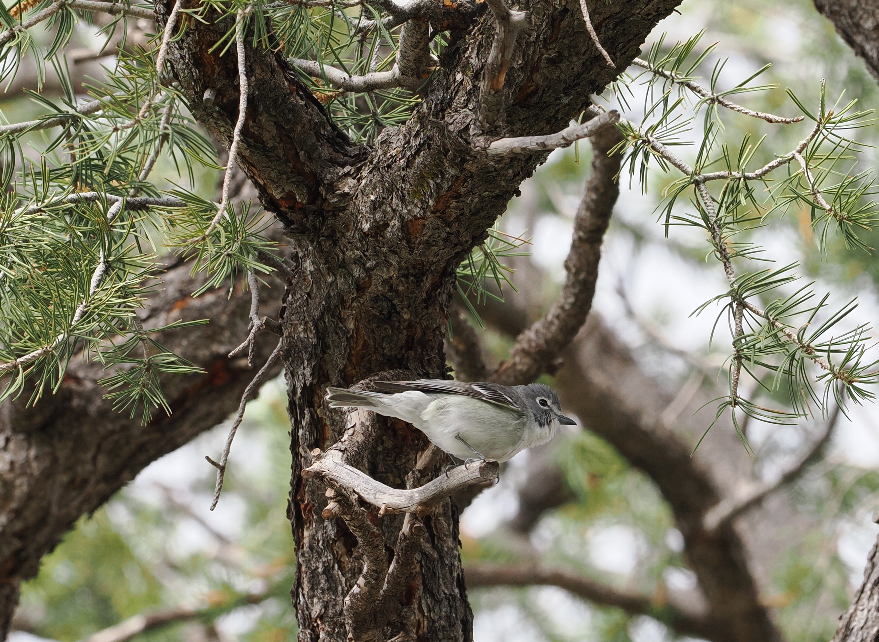
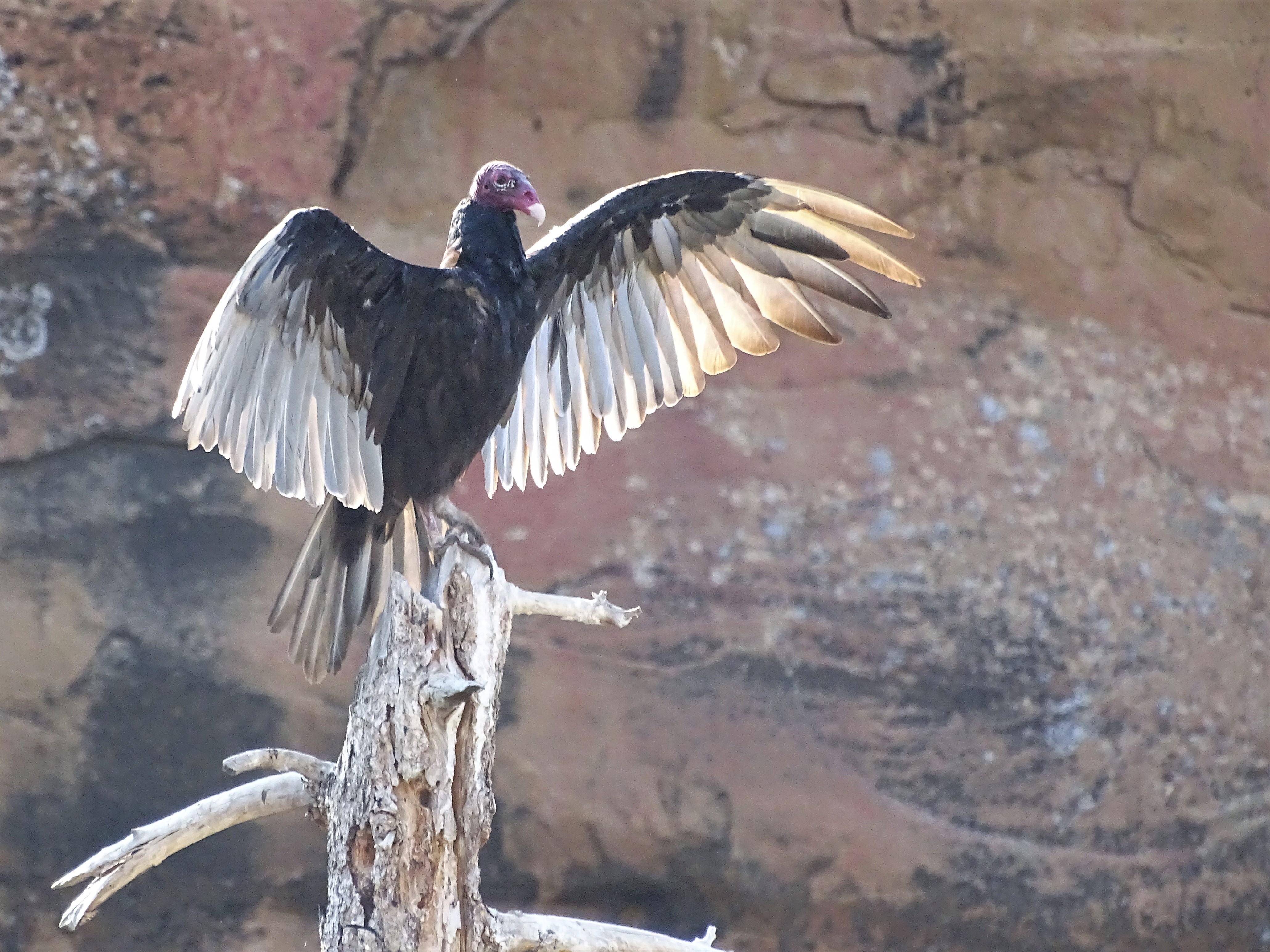
Cliff Palace, Mesa Verde's Largest Cliff DwellingNPS Photo Images link to the original government source.Visitors enjoying Step House, on Wetherill MesaNPS Photo View of Balcony House from the Soda Canyon OverlookNPS Photo Square Tower House from overlook along the Mesa Top LoopNPS Photo Spruce Tree HouseNPS Photo Spruce Tree House, Mesa Verde's third largest and best preserved cliff dwellingNPS Photo Stop by the Mesa Verde Visitor & Research Center at the park entrance where park staff will help you plan your visit.NPS Photo View of Spruce Tree House from the accessible overlook on the back porch of the Chief Ranger's OfficeNPS/Spencer Burke Milky Way Over Point LookoutNPS / Jacob W. Frank A plumbeous vireo sits in a pinyon pine tree, its grey feathers ruffled mid-song, emphasizing its distinctive white eye-ring.NPS/Mimi Gorman Turkey vultures are often seen sunning themselves outside of Spruce Tree House on warm mornings.NPS/Jack Davidson A birding program with a ranger from Mesa Verde is a great way to find birds in the park.NPS/Samantha Bomkamp
Look closer at accessibility.
No structured outing assessments have been reviewed for this park yet. Check the official accessibility guide for your requirements.
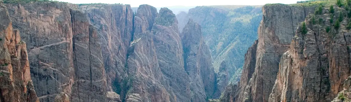
Big enough to be overwhelming, yet still intimate enough to feel the pulse of time. Come see some of the steepest cliffs, oldest rock, and craggiest spires in North America. Forces of nature and the Gunnison River sculpted this canyon over two million years. The result is a vertical wilderness of rock, water, and sky.
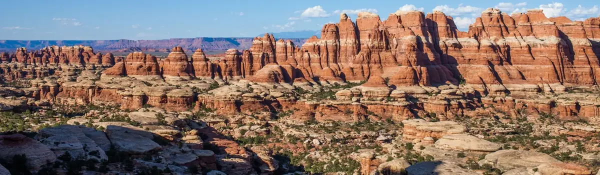
Canyonlands is a wilderness of canyons, buttes, and spires carved by the Colorado River and Green River. The park is divided into four distinct districts; no roads join them together. The districts share similar desert ecosystems, but each one provides unique opportunities for adventure and discovery.
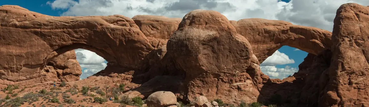
Discover a landscape of contrasting colors, land forms, and textures unlike any other. The park has over 2,000 natural stone arches, hundreds of soaring pinnacles, massive rock fins, and giant balanced rocks. This red-rock wonderland will amaze you with its formations, refresh you with its trails, and inspire you with its sunsets.




 Mountains