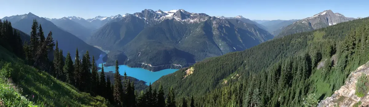
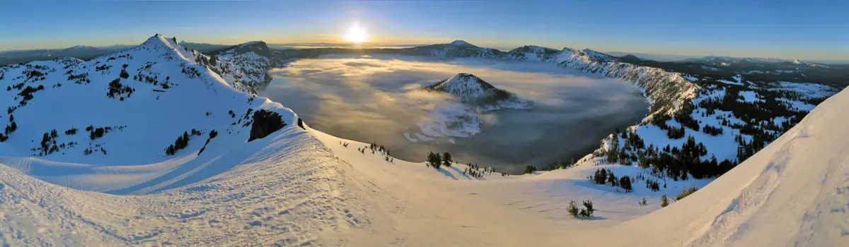
Ascending to 14,410 feet above sea level, Mount Rainier stands as an icon in the Washington landscape. An active volcano, Mount Rainier is the most glaciated peak in the contiguous U.S.A., spawning five major rivers. Subalpine wildflower meadows ring the icy volcano while ancient forest cloaks Mount Rainier’s lower slopes. Wildlife abounds in the park’s ecosystems. A lifetime of discovery awaits.
236.4Kacres of parkland
1.6Mrecreation visits, 2025
Jul · Aug · Sepnearby climate picks
Seasonal access & reservations
No reviewed guidance for this selection. Check the park's official planning pages; missing coverage does not establish access.
Selected guidance only; separate from climate comfort and current conditions.
Official conditions Not checked
The conditions feed has not been connected for this park.
Editorial recommendations, reviewed 2026-10-17. Full park days, excluding travel to and from the region. A first-visit outline for a general traveler; adapt to mobility, fitness, season, reservations, and current conditions. These are suggested days, not reserved activities or guaranteed routes.
Information and permits for exploring Mount Rainier's backcountry.
Trails closed in the Sunrise area until further notice.
The Grand Park 2 & Wonderland Complex Fires are currently active in the northeast area of the park. Sunrise Road is CLOSED to vehicles until further notice; open for pedestrians/bicyclists only. White River Road and campground reopened September 5, 2026. All trails in the Grand Park area are closed until further notice. The Northern Loop Trail and the Wonderland Trail from Carbon River Suspension Bridge to Frozen Lake near Sunrise are closed along with all associated backcountry campgrounds. Check trail conditions for the status of specific trails and backcountry camps.
The Grand Park 2 & Wonderland Complex Fires are currently active in the northeast area of the park. Sunrise Road is CLOSED to vehicles until further notice; open for pedestrians/bicyclists only. White River Road and campground reopened September 5, 2026.
All trails in the Grand Park area are closed until further notice. The Northern Loop Trail and the Wonderland Trail from Carbon River Suspension Bridge to Frozen Lake near Sunrise are closed along with all associated backcountry campgrounds. Check trail conditions for the status of specific trails and backcountry camps.
Permits are not required for day hiking. However, camping overnight in the wilderness at Mount Rainier requires a permit .
Permits may be reserved in advance by visiting Recreation.gov , or be obtained in person at park Wilderness Information Centers. Visit the Wilderness Permits page for more information.
In the winter, permits are still required and available through self-registration outside of Wilderness Information Centers, or at the SR410 entrance arch at the park's north boundary once the road closes for the season. Check the Wilderness Permit page for details. Learn more about winter recreation , including winter camping . Winter camping ends by May 15 each spring. Hiking for Beginners New to hiking or interested in hiking with kids ? Check out Hiking 101 to get started! Mount Rainier National Park has trails ranging from easy to extremely challenging. Learn more about day hiking , including options for shorter trails, or explore other trails of Mount Rainier .
Wilderness Permits
A wilderness permit is required for all overnight camping. Learn how to reserve a permit or acquire a first-come, first-served permit.
Trail & Backcountry Camp Conditions
Trail and wilderness camp conditions are updated during the summer months.
Caching Food and Fuel
Hikers on the Wonderland Trail can cache food and fuel at several locations along the 93-mile route during the summer.
Wilderness Guidelines & Regulations
Help protect Mount Rainier's wilderness while having a safe trip by following these guidelines and regulations.
Scaling the heights of Mount Rainier can be exciting as well as technically and physically demanding. Prepare for a safe climb.
From short family-friendly nature trails to mid-length trails, the park has a variety of options for day hiking.
Trails of Mount Rainier
The park has over 275 miles of maintained trails to take you from forest paths to subalpine ridges. Find the trail for you!
Maps of Mount Rainier National Park, including the Wilderness Trip Planner Map and area trail maps.
Camp in one of the park's three drive-in campgrounds.
Find out current road conditions, including access to Paradise during the winter season.
Be prepared for Mount Rainier's changeable weather.
No matter the length of your hike, being aware of risks can help make your hiking experience safe and enjoyable!
Spring Hiking Safety (April-June)
It's easy to underestimate the hazards of hiking at higher elevations still covered in snow. Follow these tips for safely hiking on snow.
Camp in one of the park's three drive-in campgrounds.
Campground Regulations Campground Services
Group Campsites Información en español
Campground Status
( Last updated 10/13/2026 )
Cougar Rock Campground - CLOSED for the season. Typical season is late May-early October. Reserve a campsite at Recreation.gov . First-come, first-served campsites also available.
Typical season is late May-early October.
Reserve a campsite at Recreation.gov . First-come, first-served campsites also available.
White River Campground - CLOSED for the season. Day use parking is open. Restrooms are available only in Loop B (vault toilet). NOTE: The Sunrise Road remains closed to vehicles, open to pedestrians/bicyclists, due to the Grand Park 2 & Wonderland Complex Fires . Typical season is late June-September. First-come, first-served only.
Day use parking is open. Restrooms are available only in Loop B (vault toilet).
NOTE: The Sunrise Road remains closed to vehicles, open to pedestrians/bicyclists, due to the Grand Park 2 & Wonderland Complex Fires .
Typical season is late June-September.
First-come, first-served only.
Ohanapecosh Campground - CLOSED for 2026. The Ohanapecosh Campground rehabilitation project will continue through November 2026. Typical season is late May-early October.
Mowich Lake walk-in sites are not accessible by vehicle, pedistrian, or bicycle traffic from SR165 due to the closure of the Fairfax Bridge: WSDOT News Release, 4/22/25 . The sites remain accessible from the Wonderland Trail. Wilderness permit required.
Campgrounds at Mount Rainier
Click on the campground name for a map of the campground. It is especially important to view the Operating Hours of the campgrounds in between seasons to confirm open status.
Cougar Rock (SW section of park)
Ohanapecosh (SE section of park)
White River (NE section of park)
Mowich Lake (NW section of park)
# of Individual Sites
13 tent pads* for primitive walk-in sites (tents only)
Individual Site Fee
Requires a Wilderness Permit.
# of group sites
Season (may vary due to weather and/or road conditions)
Late May to late Sept.
Late June to late Sept.
Early July to early Oct.
Yes; RV water fill station closed.
No potable water.
fires prohibited
Max RV Length/Max Trailer Length
RV: 35 ft. Trailer: 27 ft.
RV: 32 ft. Trailer: 27 ft.
RV: 27 ft. Trailer: 18 ft.
primitive campground, tents only
Check season dates to make a reservation.
CLOSED for 2026.
First-come, first-served permits only.
There are no electrical, water, or grey water hookups in any of the campgrounds. *Tent pads vary in size and some larger tents may not fit.
Reserving a campsite
Reserve sites at the Cougar Rock Campground by visiting Recreation.gov . For first-come, first-served sites at Cougar Rock, pay at the campground office window.
White River Campground is first-come, first-served ONLY. To secure a campsite, use the Recreation.gov Mobile App Scan and Pay. Find and set up up camp at an unoccupied site then go to the campground kiosk where you will find a QR code. Use the app to scan the QR code and then pay when you regain connectivity. If you cannot download the app, cashless (debit or credit card) payments are accepted in White River Campground “iron ranger” kiosks. Going cashless helps eliminate theft and fraud, while decreasing administrative costs. NOTE: White River Campground does not have cellular service. Please download the Recreation.gov app before coming to the park.
If you plan to use the group sites at Cougar Rock Campground, you must make reservations .
The America the Beautiful Senior and Access Passes may provide some discounts on camping fees for pass holders.
NOTE: Marijuana on Federal lands : Mount Rainier National Park would like to provide clarification regarding the use and possession of marijuana on Federal lands. Washington State law, which allows for limited recreational marijuana use under certain conditions, has no bearing on Federal laws which continue to identify marijuana as a Schedule I illegal drug, and prohibit its use. More information posted on current conditions page.
Campground Regulations
Campsite Limits
Camp in designated campsites only. Sleeping in vehicles outside of campgrounds is not permitted.
Campsites are limited to a maximum of 6 persons (or immediate family) and two tents.
All vehicles must be parked within the designated campsite parking area and not beyond the barriers or on vegetation.
There are special sites designated for group tent camping.
Camping is limited to 14 consecutive days in any developed campground within the park and no more than 28 days total in any designated campground within the calendar year.
A 14-day camping limitation applies to all camping.
Check out time is noon.
Keep fires small and within the closed grating provided.
Do not burn trash or leave trash in the grate.
Do not leave fires unattended.
Buy It Where You Burn It! Firewood brought in from other areas may contain invasive insect species that pose a serious threat to Mount Rainier National Park's resources... Please leave your firewood at home.
Firewood may be purchased from private wood concessionaires at the Longmire General Store, Cougar Rock, Ohanapecosh, and White River Campgrounds. See campground bulletin boards for more information.
Do not collect firewood, branches, twigs or cones. As these materials decompose they nourish the trees and preserve the quality of the forest.
Dogs, cats and other pets must be caged, on a leash (no longer than 6 feet) or otherwise under physical restraint at all times.
Pets may not be left unattended or tied to trees.
Pets are not permitted in amphitheaters or buildings, or on vegetated areas or trails.
Pets are permitted only in parking lots and roads open to vehicles.
Learn more about pets in the park .
All vehicles (cars, trucks, RVs, tent-trailers and utility trailers) must be parked on the gravel or paved area of your site and not beyond the barriers.
If you plan to leave your vehicle for more than 24 hours but will be staying in the park, inform the campground ranger of your plans so that your vehicle will not be considered abandoned property.
No utilities or connections of any kind are available.
Bicycles, Motorbikes, Roller Skates, Skateboards
Bicycles and motorbikes may be operated in the campground on roadways only, in the same direction of travel as other vehicles.
Motorcycles must be licensed for street use and drivers must have an operators license.
Travel on trails with bicycles or motorbikes is not permitted.
The use of wheeled vehicles (such as skateboards, roller skates, roller blades, scooters, etc.) is not permitted in the park.
Learn more about bicycling in the park .
Natural Features
To preserve the natural features of the park, driving nails into trees and creating ditches around tents are not permitted.
Do not feed any wildlife (including birds) in the park. Human food can cause digestive problems and can result in an animal's death or in injury to you. Keep Wildlife Wild!
Picking or cutting flowers, gathering or digging plants and trees are not permitted. Collecting rocks or other materials is prohibited.
RV sink drains must empty into containers which may be emptied into service sinks or toilets only.
Do not use water fountains or spigots for cleaning purposes. Wash dishes in a container at your campsite. Dump used water in camp sink located at the restrooms.
RV dump station located at the Cougar Rock campground is CLOSED until further notice.
Quiet hours are between 9 pm and 7 am. Keep noise to a minimum at all times and show respect for others.
Generator Hours
Generators may only be used between the following hours: 8 am to 10 am, noon to 2 pm, and 5 pm to 7 pm.
Loop E of both Cougar Rock and Ohanapecosh campgrounds are closed to generator use at all times.
Prevent thefts and protect your valuables. Do not leave valuables in your vehicle. Report suspicious persons or vehicles to a ranger.
Service Station
Gasoline and automobile repairs are available in local communities outside the park.
Laundry and Showers
Laundry facilities are located outside the park in Ashford and Packwood. There are no public shower facilities in the park.
Limited supplies are available at the National Park Inn at Longmire, Sunrise Lodge, and in the communities of Ashford, Packwood, Eatonville and Enumclaw. Ice is available at Longmire and in Ashford and Packwood.
Interpretive Programs
Ranger-led walks, talks, and campfire programs are scheduled daily from mid-June to early September. See park bulletin boards at visitor centers, ranger stations, and campgrounds for details.
Church Services
Services are available in surrounding communities. Inquire locally for schedules.
Group Campsites
Groups of 12 or more are permitted only in specific group sites.
Group sites are designed for tent camping only. RVs are not permitted in group sites.
Campground Regulations Campground Services
Group Campsites Información en español
Campground
Cougar Rock (SW section of park)
Ohanapecosh (SE section of park)
White River (NE section of park)
Mowich Lake (NW section of park)
Elevation
3,180 ft.
1,914 ft.
4,400 ft.
4,929 ft.
# of Individual Sites
178
179
88
13 tent pads* for primitive walk-in sites (tents only)
Individual Site Fee
$20
$20
$20
Requires a Wilderness Permit.
# of group sites
5
2
None
None
Group Site Fee
$60
$60
N/A
N/A
Season (may vary due to weather and/or road conditions)
Late May to late Sept.
Late May to late Sept.
Late June to late Sept.
Early July to early Oct.
Water
Yes; RV water fill station closed.
Yes
Yes
No potable water.
Vault Toilet
No
No
No
Yes
Flush Toilet
Yes
Yes
Yes
No
Dump Station
No
No
No
No
Fire Grates
Yes
Yes
Yes
fires prohibited
Max RV Length/Max Trailer Length
RV: 35 ft. Trailer: 27 ft.
RV: 32 ft. Trailer: 27 ft.
RV: 27 ft. Trailer: 18 ft.
primitive campground, tents only
Reservations
Check season dates to make a reservation.
CLOSED for 2026.
First-come, first-served permits only.
Requires a Wilderness Permit.
Campground Regulations Campground Services
Group Campsites Información en español
Campground
Cougar Rock (SW section of park)
Ohanapecosh (SE section of park)
White River (NE section of park)
Mowich Lake (NW section of park)
Elevation
3,180 ft.
1,914 ft.
4,400 ft.
4,929 ft.
# of Individual Sites
178
179
88
13 tent pads* for primitive walk-in sites (tents only)
Individual Site Fee
$20
$20
$20
Requires a Wilderness Permit.
# of group sites
5
2
None
None
Group Site Fee
$60
$60
N/A
N/A
Season (may vary due to weather and/or road conditions)
Scaling the heights of Mount Rainier can be exciting as well as technically and physically demanding. Prepare for a safe climb.
Mount Rainier, the most heavily glaciated peak in the contiguous United States, offers an exciting challenge to the mountaineer. Each year thousands of people successfully climb this 14,410 foot active volcano. There is access to over twenty different climbing routes and ski descents via four main trailheads to approach the mountain: Paradise, Westside Road, White River, and Mowich Lake.
Reaching the summit via any route requires a vertical elevation gain of more than 9,000 feet and traveling over ten miles in distance. Climbers must be in excellent physical condition and well prepared. Technical glacier-travel rope skills are also required to ascend and descend the mountain safely. Either independently or with a guide, climbing and skiing on Mount Rainier offers an unparalleled experience within the Pacific Northwest's Cascade Mountain Range.
Climbing Regulations at Mount Rainier
Climbing regulations are established in the Code of Federal Regulations, Title 36, 7.5 (b) and describe three rules.
You must have a permit to be on a glacier or above normal climbing high camps (~10,000 feet).
You must be at least 18 years old or have permission from a guardian to apply for your permit.
You cannot solo without being specifically authorized to do so.
Depending on your climb and when you want to do it, there are four types of permits that you may be required to obtain before your trip begins:
Climbing Registration
Wilderness Permit
Wilderness Reservation
1. Climbing Registration
Register depending on the season:
Winter Self-Registration
Summer Walk-Up Registration
Summer Reservation Activation
Winter Self Registration (September 15 – May 21)
Very few people try to climb Mount Rainier in the winter. During this period, there are no occupancy issues at any of our high camps or Wilderness zones. We allow “self-registration”.
There are two steps to take:
Each person in your party must pay $82 . The registration fee may be paid per party member online at Pay.gov (pay through the Mount Rainier NP Special Use Permit Application Fees form). You must pay before you come to the park .
After you have paid your per person registration fees, you must fill out a registration card when you arrive to the park . These are obtained at a self-issuing kiosk inside the awning of the Paradise Old Station, which is the small A-framed building at the edge of the parking lot across from the large Jackson Visitor Center. In the winter, your self-registration also suffices as your Wilderness Permit.
Summer Walk-Up Registration (May 22 – September 30)
During the summer season, there is NO self-registration . You must come to a wilderness information station to register for your climb.
The park holds roughly 50% of capacity at each camp and in each Wilderness zone for walk-up registration. You may register for a walk-up permit 24-hours before your climb begins.
Each person in your party must pay $82 . The fee must be paid online at Pay.gov (pay through the Mount Rainier NP Special Use Permit Application Fees form).
You will be asked for your proof of purchase when you register at a wilderness information station in the park .
You may also complete your registration when you activate your climbing reservation at a ranger station with a ranger. Read more below about Wilderness Permits and Reservations.
2. Wilderness Permit
During the high-use, summer period (May 1 – September 15), a wilderness permit will also be issued at the time of your climbing registration. The wilderness permit system works like a hotel reservation system and ensures that our camps and zones don’t overfill and there are no crowding issues on our climbing routes. A wilderness permit is $12 per person per night . Visit the Wilderness Permit page for detailed information.
Because we are managing not only our camp sites, but climbing use along the whole climbing route, even if you are not camping, or “single pushing”, you are still required to obtain a Wilderness Permit.
Once again, if occupancy on the climbing route is full when you’re online trying to obtain a reservation, you may still obtain both a Climbing Registration and a Wilderness Permit by walking up to a ranger station within 24-hours of your climb. These permits are issued “first come, first served.”
3. Wilderness Reservation
The “peak” climbing season is from May 1st to September 15th. Camps and zones fill up quickly especially on Friday nights and on weekends. Our advice is to not rely on getting a ‘walk-up’ Wilderness Permit. Obtain a reservation. They are worth the time and effort in providing you some assurance that you will be able to go on the dates you want.
Visit the Wilderness Permit page for details on how to apply for your reservation. Reservations will be held until noon of the day your permit begins. After noon, your reservation will be cancelled, unless you email morawildernessreservations@nps.gov, or talk to a ranger at: 360-569-6650. If your reservation is held for a late pickup, it will be held until closing time at 5:00pm.
4. Solo Climbing
36 CFR 7.5 (b) (3) states that “a party must consist at least of two people” unless specific authorization is obtained by an application that considers a variety of factors such as your experience, anticipated weather and conditions, the route you’re climbing, and other factors. Roughly 200 people apply to solo climb Mount Rainier each year, but fewer than half of those receive permits to do so. Before you apply, we recommend building your resume with ample ascents of Mount Rainier participating as a team member or climbing other mountains that are heavily glaciated such as Mount Baker, Denali, or Mont Blanc.
You can apply for a solo permit via the Solo Application Form . A climbing ranger will review your application and get back to you within a week or two. We deny wilderness permits and climbing registrations in only the rarest of occasions, but solo permits receive a lot more scrutiny.
Weather and Conditions
Weather, snow, and route conditions can change rapidly, making the difference between a pleasant and rewarding experience or a tragedy. Before beginning a climb, obtain a current weather forecast. Rangers at both Camp Muir and Camp Schurman can give out updated forecasts before your summit attempt, but look for a general trend in the weather before arriving at the park. During your climb, turn back if weather conditions deteriorate. Severe winter-like storms on the mountain are not uncommon during the summer. Poor weather often contributes to accidents and near-misses on the mountain. Here are some links to weather and avalanche resources for Mount Rainier National Park. For recent route conditions updates check out the Mount Rainier Climbing Blog .
Climbing instruction, multi-day summit climbs, multi-day climbing seminars, and private climbs are available through:
Alpine Ascents International
International Mountain Guides, LLC
Rainier Mountaineering, Inc.
There are also 15 single-trip guide services authorized to perform only one guided trip per year. Check the list of current Commercial Use Authorizations for approved guide service companies. Some guided climbs qualify as charities. This type of climb is allowed, but requires a Commercial Use Authorization . Paying the climbing fee is still required. Engaging in any business in park areas except in accordance with the provisions of a permit, contract, or other written agreement is prohibited. Leading or participating in an unauthorized guided climb of Mount Rainier is illegal (Title 36, Code of Federal Regulations). Learn more about regulations for guiding on Mount Rainier .
Route briefs are official in-depth descriptions of climbing routes on Mount Rainier. Use the Route Briefs to familiarize yourself with these four popular routes. Produced by the climbing rangers, they contain the information needed for planning your climb, including route statistics, common pit-falls, and some of the climbing history of the route.
Disappointment Cleaver-Ingraham Direct
Emmons-Winthrop
Annual Mountaineering Reports and Statistics
Annual Mountaineering Reports summarize highlights of the climbing program, including search-and-rescues, statistics, and climbing staff. Climbing Statistics are available from 1852 to 1897 and from 1950 to the present. Data available include the total number of climbers and the number of climbers who successfully reached the summit.
Climbing Resources
Avalanche Information (pdf)
Climbing Site Bulletin (pdf)
Summit Registers - Summit registers are stored at the National Archives and Records Administration in Seattle . NOTE: Registers come down from the summit when they are full, so it may take a year or two before a register makes it into the national archives. Not all summit registers make it to the archives due to the weather conditions at the summit. In addition, many of those that do make it have missing pages.
Be prepared for Mount Rainier's changeable weather.
No matter the length of your hike, being aware of risks can help make your hiking experience safe and enjoyable!
A wilderness permit is required for all overnight camping. Learn how to reserve a permit or acquire a first-come, first-served permit.
From short family-friendly nature trails to mid-length trails, the park has a variety of options for day hiking.
Mount Rainier National Park offers over 260 miles of maintained trails for your enjoyment. Trails lead through the peacefulness of the old-growth forest of the river valleys and the high subalpine meadows on the flanks of Mount Rainier. From these trails explore and experience the forests, lakes, and streams and view the fields of wildflowers and network of glaciers. Pets and bicycles are NOT permitted on any park trails.
The park recommends that day hikers limit their party size to no more than 12 people per group. Day hikers are advised to keep hiking plans flexible because some trailhead parking lots may be full. Overflow parking is not permitted in order to avoid impeding traffic and to provide a less crowded, higher quality experience for hikers. Alternative trailheads may have space available.
For more information on trail conditions, see Trails and Backcountry Camp Conditions . For descriptions of longer day hikes, overnight or multi-day hikes, visit the Trails page.
If you're looking for easy and enjoyable trails that the whole family can experience together, see the trails listed below.
Preserve Meadows
In the heavily used Paradise, Sunrise, and Tipsoo Lake meadows, hikers are required by law to stay on trails. All hikers are asked to avoid fragile wildflower meadows, lake shores, and stream banks throughout the park. Please choose a spot for a lunch stop carefully.
Keeping Wildlife Wild
Do not feed wildlife to help Keep Wildlife Wild. Feeding wildlife invites aggressive animal behavior and increases vehicle collisions which may injure people and commonly results in wildlife death. Feeding birds artificially concentrates nest predators, harming young songbirds.
Suggested Day Hikes
Looking for easy and enjoyable trails that the whole family can experience together? Consider the following trails in the Longmire, Paradise, Ohanapecosh, Sunrise, and Carbon/Mowich areas of Mount Rainier National Park. The hikes described below range from short strolls to longer trails through the wilderness. For your safety, never hike alone, carry (and know how to use) the Ten Essentials , and tell someone your plans.
Longmire Area Paradise Area Ohanapecosh Area
Sunrise Area Carbon River & Mowich Area
Longmire Area Trails Map
Description of Hike
Trailhead Location
Est. Hiking Time (roundtrip)
Trail of the Shadows
Human and natural history come together in the forest and meadows of Longmire. View bubbling mineral springs and explore a replica of an early homestead cabin. Discover the plants and animals that call this area their home, including deer, birds, and beavers. See photo album below
Across the road from the National Park Inn at Longmire.
0.7 mi/1.1 km loop trail
Twin Firs Loop Trail
This short loop trail weaves through old-growth forest. See photo album below
Trailhead on road between Nisqually Entrance and Longmire; 2 miles west of Longmire.
0.4 mi/0.6 km loop trail
Rampart Ridge Trail
This steep trail climbs up forested slopes to Rampart Ridge, then follows the top of the ridge to connect to the Wonderland Trail. Make it a loop by following the Wonderland Trail back to Longmire. Viewpoints along the trail look over the Longmire area and provide glimpses of Mount Rainier and the surrounding valleys.
Follow the Trail of the Shadows, located across the road from the National Park Inn at Longmire, to the trail junction.
4.6 mi/7.4 km loop trail
Paradise Area Trails Map
Nisqually Vista Trail
Walk amidst the clouds and see how weather shapes the landscape, plants, and animals of these high country meadows. Enjoy excellent views of Mount Rainier and the Nisqually Glacier. Suitable for families with strollers. See photo album below
West end of the lower Paradise parking lot
1.2 mi/1.9 km loop trail
Bench & Snow Lakes Trail
Enjoy two lakes along this one trail. In summer, this area is an excellent place to see bear grass and meadow flowers. The trail is a succession of gradual ups and downs crossing low ridges, reaching Bench Lake after 0.75 mile, then continuing another 0.5 mile to Snow Lake.
Stevens Canyon Road, 1.5 miles east of Reflection Lakes
2.5 mi/4 km roundtrip
Skyline Trail to Myrtle Falls
Follow a portion of the Skyline Trail through subalpine meadows to the Myrtle Falls viewpoint. View Mount Rainier and Tatoosh Range along the trail. Trail is wheelchair accessible with assistance.
North side of the upper Paradise parking lot
1 mi/1.6 km roundtrip
Ohanapecosh Area
Ohanapecosh Area Trails Map
Hot Springs Nature Trail
The quiet green forests of Ohanapecosh offer a shady contrast to the windswept high country of the park. Walk under towering Douglas-firs and hemlocks to the bubbling waters of the Ohanapecosh Hot Springs. In 2026, the Hot Springs Nature Trailhead in the Ohanapecosh Campground is CLOSED due to the Ohanapecosh Construction Project . Please note:
The Hot Springs Trail can only be accessed via the Eastside Trail/Silver Falls Trail starting from the Grove of the Patriarchs parking lot.
CLOSED : Ohanapecosh Campground, behind visitor center
0.5 mi/0.8 km loop trail
Silver Falls Trail
The Ohanapecosh River falls majestically 75 feet in a silver spray. Stay on the trail and behind safety barriers. Rocks are wet and slippery. Walk the trail as a loop by crossing the river on the bridge below the falls and return to the campground on the other side of the river. In 2026, the Silver Falls Trailhead in the Ohanapecosh Campground is CLOSED due to the Ohanapecosh Construction Project . Please note:
Silver Falls can be accessed from the Grove of the Patriarchs parking lot via the Eastside Trail.
The portion of the trail connecting to the Ohanapecosh Campground is closed and the Silver Falls Trail cannot be hiked as a loop . The two sides of the trail on either bank of the Ohanapecosh River can be hiked as out-and-back routes only.
CLOSED : Loop B of the Ohanapecosh Campground
3 mi/4.8 km roundtrip
Grove of the Patriarchs Trail
The Ohanapecosh River surrounds an island of towering, thousand-year-old Douglas-fir and western red cedar trees. Walk the trail to discover the grandeur and peace of this island. See photo album below NOTE: The Grove of the Patriarchs is CLOSED to all public entry due to flooding in November 2021 which caused significant damage to the suspension bridge that provides the only safe access to the area ( News Release, 11/17/21 ). The Grove of the Patriarchs Trail will remain closed until the bridge can be replaced. During the closure, the Grove of the Patriarchs parking lot and restrooms have normal seasonal access, along with the Eastside and Silver Falls Trails. Construction to replace the bridge is scheduled to begin summer 2027. In addition to site clearing, the project will require supplies transport, bridge construction, trail reconstruction to meet the new bridge. This process is expected to take several years and construction work is limited to the summer season. Summers represent the only viable construction season in the park due to the heavy snow that blankets the park from roughly November through May.
Just west of the Stevens Canyon Entrance Station
1.3 mi/2.1 km loop trail
Box Canyon Loop Trail
A short loop trail connected on either end by the road bridge and a wood foot bridge. From either bridge, gaze 180 feet (55 meters) below at water rushing through a narrow slot canyon carved by the Muddy Fork of the Cowlitz River.
12 miles west of Ohanapecosh along Stevens Canyon Road
Sunrise Area Trails Map
Shadow Lakes Trail
This trail offers views of the White River Valley and Mount Rainier on route to Shadow Lake. Return to Sunrise via the steeper trail to Frozen Lake and Sourdough Ridge or follow the old roadway back to Sunrise.
Sunrise parking area
Dege Peak via Sourdough Ridge Trail
Enjoy the beautiful subalpine meadows of the Sunrise area. A gentle climb to the ridge top offers breathtaking views of Mount Rainier, with Mount Baker, Glacier Peak, and Mount Adams in the distance. Stay on trail to protect fragile plants. See photo album below.
North side of Sunrise parking area
3.4 mi/5.5 km roundtrip
Naches Peak Loop Trail
Explore the subalpine flower fields and breathtaking views of Mount Rainier. Late summer and fall brings an abundant supply of huckleberries. Half of the hike is on the Pacific Crest National Scenic Trail. Pets are not permitted on the west half of the loop trail which is inside Mount Rainier National Park.
Chinook Pass/Tipsoo Lake
3.5 mi/5.6 km roundtrip
Glacier Basin Trail
In summer, the meadows of the basin are a rainbow of wild flowers. Watch for mountain goats on the surrounding slopes and mountain climbers ascending the Inter Glacier to Camp Schurman. After the first mile, a 0.5 mile spur trail leads along the Emmons Moraine to a view of the Emmons Glacier, the largest glacier in the lower 48 states. Stay on designated trails to protect fragile plants.
White River Campground
Carbon River & Mowich Area
There is NO public access to Carbon River & Mowich Lake from SR 165. The bridge is closed to pedestrians, bicycles, and vehicles and there is no alternate route: WSDOT News Release, 4/22/25 .
Carbon River Rain Forest Nature Trail
Rain forests seldom occur far from coastal areas, making the forest that grows in this valley unique. Use this trail to explore the only true inland rain forest at Mount Rainier. See 360 photo below .
Carbon River entrance of Mount Rainier National Park
0.3 mi/0.5 km roundtrip
This short spur trail off of the Carbon River Trail climbs through temperate rainforest up to the gated entrance of an old mine. This trail also has a self-guided tour in the NPS App. See photo album below.
Hike the Carbon River Trail (1.2 miles), then take a steeper spur trail (0.25 mile) to the gated mine entrance.
2.9 mi/4.6 km roundtrip
Chenuis Falls Trail
Hike this trail to view Chenius Falls. Trail requires crossing the Carbon River on foot logs. Use caution crossing the river. Check to make sure the footlog is not washed out before attempting this hike. See photo album below.
Hike the Carbon River Trail (3.5 miles) to the short Chenuis Falls Trail (0.2 mile).
7.4 mi/11.9 km roundtrip
Green Lake Trail
Trail passes through old-growth forest to reach Green Lake. Along the trail, view Ranger Falls.
Hike the Carbon River Trail (3.6 miles) to Green Lake Trail (1.8 miles).
10.8 mi/17.4 km roundtrip
Tolmie Peak Trail
Trail climbs through the forest to Eunice Lake, then ascends to the Tolmie Peak fire lookout for views of Mount Rainier and the surrounding areas. Please stay on the trail to avoid damaging the meadows surrounding the lake.
6.5 mi/10.5 km roundtrip
Longmire Area Paradise Area Ohanapecosh Area
Sunrise Area Carbon River & Mowich Area
Trail
Description of Hike
Trailhead Location
Distance
Est. Hiking Time (roundtrip)
Trail of the Shadows
Human and natural history come together in the forest and meadows of Longmire. View bubbling mineral springs and explore a replica of an early homestead cabin. Discover the plants and animals that call this area their home, including deer, birds, and beavers. See photo album below
Across the road from the National Park Inn at Longmire.
0.7 mi/1.1 km loop trail
20 min
Twin Firs Loop Trail
This short loop trail weaves through old-growth forest. See photo album below
Trailhead on road between Nisqually Entrance and Longmire; 2 miles west of Longmire.
0.4 mi/0.6 km loop trail
20 min
Rampart Ridge Trail
This steep trail climbs up forested slopes to Rampart Ridge, then follows the top of the ridge to connect to the Wonderland Trail. Make it a loop by following the Wonderland Trail back to Longmire. Viewpoints along the trail look over the Longmire area and provide glimpses of Mount Rainier and the surrounding valleys.
Follow the Trail of the Shadows, located across the road from the National Park Inn at Longmire, to the trail junction.
4.6 mi/7.4 km loop trail
2.5 hrs
Carter Falls Trail
This section of the Wonderland Trail referred to as "Carter Falls Trail" is a short hike from Cougar Rock Campground to Carter Falls. Continue past Carter Falls about 100 yards to view Madcap Falls. NOTE: The log footbridge over the Nisqually River can wash out in fall/winter. Check conditions before proceeding.
Across the road from the Cougar Rock Campground; 2 miles north of Longmire.
2.2 mi/3.5 km roundtrip
2 hrs
Trail
Description of Hike
Trailhead Location
Distance
Est. Hiking Time (roundtrip)
Nisqually Vista Trail
Walk amidst the clouds and see how weather shapes the landscape, plants, and animals of these high country meadows. Enjoy excellent views of Mount Rainier and the Nisqually Glacier. Suitable for families with strollers. See photo album below
West end of the lower Paradise parking lot
1.2 mi/1.9 km loop trail
45 min
Bench & Snow Lakes Trail
Enjoy two lakes along this one trail. In summer, this area is an excellent place to see bear grass and meadow flowers. The trail is a succession of gradual ups and downs crossing low ridges, reaching Bench Lake after 0.75 mile, then continuing another 0.5 mile to Snow Lake.
Stevens Canyon Road, 1.5 miles east of Reflection Lakes
2.5 mi/4 km roundtrip
2 hrs
Skyline Trail to Myrtle Falls
Follow a portion of the Skyline Trail through subalpine meadows to the Myrtle Falls viewpoint. View Mount Rainier and Tatoosh Range along the trail. Trail is wheelchair accessible with assistance.
North side of the upper Paradise parking lot
1 mi/1.6 km roundtrip
35 min
Trail
Description of Hike
Trailhead Location
Distance
Est. Hiking Time (roundtrip)
Hot Springs Nature Trail
The quiet green forests of Ohanapecosh offer a shady contrast to the windswept high country of the park. Walk under towering Douglas-firs and hemlocks to the bubbling waters of the Ohanapecosh Hot Springs. In 2026, the Hot Springs Nature Trailhead in the Ohanapecosh Campground is CLOSED due to the Ohanapecosh Construction Project . Please note: The Hot Springs Trail can only be accessed via the Eastside Trail/Silver Falls Trail starting from the Grove of the Patriarchs parking lot.
CLOSED : Ohanapecosh Campground, behind visitor center
0.5 mi/0.8 km loop trail
30 min
Alternate trailhead in 2026 : Grove of the Patriarchs parking lot via the Eastside Trail
Distance from Grove of the Partriarchs parking to Silver Falls : 5.9 mi/9.5 km roundtrip
Est. Hikng Time from Grove of the Partriarchs parking to Silver Falls : 3 hrs
Silver Falls Trail
The Ohanapecosh River falls majestically 75 feet in a silver spray. Stay on the trail and behind safety barriers. Rocks are wet and slippery. Walk the trail as a loop by crossing the river on the bridge below the falls and return to the campground on the other side of the river. In 2026, the Silver Falls Trailhead in the Ohanapecosh Campground is CLOSED due to the Ohanapecosh Construction Project . Please note: Silver Falls can be accessed from the Grove of the Patriarchs parking lot via the Eastside Trail. The portion of the trail connecting to the Ohanapecosh Campground is closed and the Silver Falls Trail cannot be hiked as a loop . The two sides of the trail on either bank of the Ohanapecosh River can be hiked as out-and-back routes only.
CLOSED : Loop B of the Ohanapecosh Campground
3 mi/4.8 km roundtrip
2 hrs
Alternate trailhead in 2026 : Grove of the Patriarchs parking lot via the Eastside Trail
Distance from Grove of the Partriarchs parking to Silver Falls : 1 mi/1.6 km roundtrip
Est. Hikng Time from Grove of the Partriarchs parking to Silver Falls : 45 min
Grove of the Patriarchs Trail
The Ohanapecosh River surrounds an island of towering, thousand-year-old Douglas-fir and western red cedar trees. Walk the trail to discover the grandeur and peace of this island. See photo album below NOTE: The Grove of the Patriarchs is CLOSED to all public entry due to flooding in November 2021 which caused significant damage to the suspension bridge that provides the only safe access to the area ( News Release, 11/17/21 ). The Grove of the Patriarchs Trail will remain closed until the bridge can be replaced. During the closure, the Grove of the Patriarchs parking lot and restrooms have normal seasonal access, along with the Eastside and Silver Falls Trails. Construction to replace the bridge is scheduled to begin summer 2027. In addition to site clearing, the project will require supplies transport, bridge construction, trail reconstruction to meet the new bridge. This process is expected to take several years and construction work is limited to the summer season. Summers represent the only viable construction season in the park due to the heavy snow that blankets the park from roughly November through May.
Just west of the Stevens Canyon Entrance Station
1.3 mi/2.1 km loop trail
1 hr
Box Canyon Loop Trail
A short loop trail connected on either end by the road bridge and a wood foot bridge. From either bridge, gaze 180 feet (55 meters) below at water rushing through a narrow slot canyon carved by the Muddy Fork of the Cowlitz River.
12 miles west of Ohanapecosh along Stevens Canyon Road
0.5 mi/0.8 km loop trail
30 min
Trail
Description of Hike
Trailhead Location
Distance
Est. Hiking Time (roundtrip)
Emmons Vista & Silver Forest Trail
Take a short walk from Sunrise to the two Emmons Vista Overlooks, which have excellent views of the White River Valley, the Emmons Glacier, and Mount Rainier. Continue along the Silver Forest Trail through the subalpine meadows for additional views. See photo album below.
South side of Sunrise parking area
0.4 mi to Emmons Vista Overlooks; 1.6 mi/2.5 km roundtrip
1 hr
Shadow Lakes Trail
This trail offers views of the White River Valley and Mount Rainier on route to Shadow Lake. Return to Sunrise via the steeper trail to Frozen Lake and Sourdough Ridge or follow the old roadway back to Sunrise.
Sunrise parking area
3 mi/4.8 km roundtrip
1.5 hrs
Dege Peak via Sourdough Ridge Trail
Enjoy the beautiful subalpine meadows of the Sunrise area. A gentle climb to the ridge top offers breathtaking views of Mount Rainier, with Mount Baker, Glacier Peak, and Mount Adams in the distance. Stay on trail to protect fragile plants. See photo album below.
North side of Sunrise parking area
3.4 mi/5.5 km roundtrip
2 hrs
Sunrise Nature Trail
The main trail departing from Sunrise splits halfway up the slope, with both forks climbing up to Sourdough Ridge Trail . The two forks combined with the ridge trail form a triangle-shaped loop trail known as the the Sunrise Nature Trail. This route is a self-guided tour in the NPS app!
North side of Sunrise parking area
1.5 mi/2.4 km
45 min
Naches Peak Loop Trail
Explore the subalpine flower fields and breathtaking views of Mount Rainier. Late summer and fall brings an abundant supply of huckleberries. Half of the hike is on the Pacific Crest National Scenic Trail. Pets are not permitted on the west half of the loop trail which is inside Mount Rainier National Park.
Chinook Pass/Tipsoo Lake
3.5 mi/5.6 km roundtrip
2 hrs
Glacier Basin Trail
In summer, the meadows of the basin are a rainbow of wild flowers. Watch for mountain goats on the surrounding slopes and mountain climbers ascending the Inter Glacier to Camp Schurman. After the first mile, a 0.5 mile spur trail leads along the Emmons Moraine to a view of the Emmons Glacier, the largest glacier in the lower 48 states. Stay on designated trails to protect fragile plants.
White River Campground
7 mi/11.3 km
4 hrs
Trail
Description of Hike
Trailhead Location
Distance
Est. Hiking Time (roundtrip)
Carbon River Rain Forest Nature Trail
Rain forests seldom occur far from coastal areas, making the forest that grows in this valley unique. Use this trail to explore the only true inland rain forest at Mount Rainier. See 360 photo below .
Carbon River entrance of Mount Rainier National Park
0.3 mi/0.5 km roundtrip
20 min
Old Mine Trail
This short spur trail off of the Carbon River Trail climbs through temperate rainforest up to the gated entrance of an old mine. This trail also has a self-guided tour in the NPS App. See photo album below.
Hike the Carbon River Trail (1.2 miles), then take a steeper spur trail (0.25 mile) to the gated mine entrance.
2.9 mi/4.6 km roundtrip
2 hrs
Chenuis Falls Trail
Hike this trail to view Chenius Falls. Trail requires crossing the Carbon River on foot logs. Use caution crossing the river. Check to make sure the footlog is not washed out before attempting this hike. See photo album below.
Hike the Carbon River Trail (3.5 miles) to the short Chenuis Falls Trail (0.2 mile).
7.4 mi/11.9 km roundtrip
2.5 hrs
Green Lake Trail
Trail passes through old-growth forest to reach Green Lake. Along the trail, view Ranger Falls.
Hike the Carbon River Trail (3.6 miles) to Green Lake Trail (1.8 miles).
10.8 mi/17.4 km roundtrip
4 hrs
Tolmie Peak Trail
Trail climbs through the forest to Eunice Lake, then ascends to the Tolmie Peak fire lookout for views of Mount Rainier and the surrounding areas. Please stay on the trail to avoid damaging the meadows surrounding the lake.
Mowich Lake
6.5 mi/10.5 km roundtrip
4 hrs
Longmire Area Paradise Area Ohanapecosh Area
Sunrise Area Carbon River & Mowich Area
Trail
Description of Hike
Trailhead Location
Distance
Est. Hiking Time (roundtrip)
Trail of the Shadows
Human and natural history come together in the forest and meadows of Longmire. View bubbling mineral springs and explore a replica of an early homestead cabin. Discover the plants and animals that call this area their home, including deer, birds, and beavers. See photo album below
Across the road from the National Park Inn at Longmire.
0.7 mi/1.1 km loop trail
20 min
Twin Firs Loop Trail
This short loop trail weaves through old-growth forest. See photo album below
Trailhead on road between Nisqually Entrance and Longmire; 2 miles west of Longmire.
0.4 mi/0.6 km loop trail
20 min
Rampart Ridge Trail
This steep trail climbs up forested slopes to Rampart Ridge, then follows the top of the ridge to connect to the Wonderland Trail. Make it a loop by following the Wonderland Trail back to Longmire. Viewpoints along the trail look over the Longmire area and provide glimpses of Mount Rainier and the surrounding valleys.
Follow the Trail of the Shadows, located across the road from the National Park Inn at Longmire, to the trail junction.
4.6 mi/7.4 km loop trail
2.5 hrs
Carter Falls Trail
This section of the Wonderland Trail referred to as "Carter Falls Trail" is a short hike from Cougar Rock Campground to Carter Falls. Continue past Carter Falls about 100 yards to view Madcap Falls. NOTE: The log footbridge over the Nisqually River can wash out in fall/winter. Check conditions before proceeding.
Across the road from the Cougar Rock Campground; 2 miles north of Longmire.
2.2 mi/3.5 km roundtrip
2 hrs
Trail
Description of Hike
Trailhead Location
Distance
Est. Hiking Time (roundtrip)
Nisqually Vista Trail
Walk amidst the clouds and see how weather shapes the landscape, plants, and animals of these high country meadows. Enjoy excellent views of Mount Rainier and the Nisqually Glacier. Suitable for families with strollers. See photo album below
West end of the lower Paradise parking lot
1.2 mi/1.9 km loop trail
45 min
Bench & Snow Lakes Trail
Enjoy two lakes along this one trail. In summer, this area is an excellent place to see bear grass and meadow flowers. The trail is a succession of gradual ups and downs crossing low ridges, reaching Bench Lake after 0.75 mile, then continuing another 0.5 mile to Snow Lake.
Stevens Canyon Road, 1.5 miles east of Reflection Lakes
2.5 mi/4 km roundtrip
2 hrs
Skyline Trail to Myrtle Falls
Follow a portion of the Skyline Trail through subalpine meadows to the Myrtle Falls viewpoint. View Mount Rainier and Tatoosh Range along the trail. Trail is wheelchair accessible with assistance.
North side of the upper Paradise parking lot
1 mi/1.6 km roundtrip
35 min
Trail
Description of Hike
Trailhead Location
Distance
Est. Hiking Time (roundtrip)
Hot Springs Nature Trail
The quiet green forests of Ohanapecosh offer a shady contrast to the windswept high country of the park. Walk under towering Douglas-firs and hemlocks to the bubbling waters of the Ohanapecosh Hot Springs. In 2026, the Hot Springs Nature Trailhead in the Ohanapecosh Campground is CLOSED due to the Ohanapecosh Construction Project . Please note: The Hot Springs Trail can only be accessed via the Eastside Trail/Silver Falls Trail starting from the Grove of the Patriarchs parking lot.
CLOSED : Ohanapecosh Campground, behind visitor center
0.5 mi/0.8 km loop trail
30 min
Alternate trailhead in 2026 : Grove of the Patriarchs parking lot via the Eastside Trail
Distance from Grove of the Partriarchs parking to Silver Falls : 5.9 mi/9.5 km roundtrip
Est. Hikng Time from Grove of the Partriarchs parking to Silver Falls : 3 hrs
Silver Falls Trail
The Ohanapecosh River falls majestically 75 feet in a silver spray. Stay on the trail and behind safety barriers. Rocks are wet and slippery. Walk the trail as a loop by crossing the river on the bridge below the falls and return to the campground on the other side of the river. In 2026, the Silver Falls Trailhead in the Ohanapecosh Campground is CLOSED due to the Ohanapecosh Construction Project . Please note: Silver Falls can be accessed from the Grove of the Patriarchs parking lot via the Eastside Trail. The portion of the trail connecting to the Ohanapecosh Campground is closed and the Silver Falls Trail cannot be hiked as a loop . The two sides of the trail on either bank of the Ohanapecosh River can be hiked as out-and-back routes only.
CLOSED : Loop B of the Ohanapecosh Campground
3 mi/4.8 km roundtrip
2 hrs
Alternate trailhead in 2026 : Grove of the Patriarchs parking lot via the Eastside Trail
Distance from Grove of the Partriarchs parking to Silver Falls : 1 mi/1.6 km roundtrip
Est. Hikng Time from Grove of the Partriarchs parking to Silver Falls : 45 min
Grove of the Patriarchs Trail
The Ohanapecosh River surrounds an island of towering, thousand-year-old Douglas-fir and western red cedar trees. Walk the trail to discover the grandeur and peace of this island. See photo album below NOTE: The Grove of the Patriarchs is CLOSED to all public entry due to flooding in November 2021 which caused significant damage to the suspension bridge that provides the only safe access to the area ( News Release, 11/17/21 ). The Grove of the Patriarchs Trail will remain closed until the bridge can be replaced. During the closure, the Grove of the Patriarchs parking lot and restrooms have normal seasonal access, along with the Eastside and Silver Falls Trails. Construction to replace the bridge is scheduled to begin summer 2027. In addition to site clearing, the project will require supplies transport, bridge construction, trail reconstruction to meet the new bridge. This process is expected to take several years and construction work is limited to the summer season. Summers represent the only viable construction season in the park due to the heavy snow that blankets the park from roughly November through May.
Just west of the Stevens Canyon Entrance Station
1.3 mi/2.1 km loop trail
1 hr
Box Canyon Loop Trail
A short loop trail connected on either end by the road bridge and a wood foot bridge. From either bridge, gaze 180 feet (55 meters) below at water rushing through a narrow slot canyon carved by the Muddy Fork of the Cowlitz River.
12 miles west of Ohanapecosh along Stevens Canyon Road
0.5 mi/0.8 km loop trail
30 min
Trail
Description of Hike
Trailhead Location
Distance
Est. Hiking Time (roundtrip)
Emmons Vista & Silver Forest Trail
Take a short walk from Sunrise to the two Emmons Vista Overlooks, which have excellent views of the White River Valley, the Emmons Glacier, and Mount Rainier. Continue along the Silver Forest Trail through the subalpine meadows for additional views. See photo album below.
South side of Sunrise parking area
0.4 mi to Emmons Vista Overlooks; 1.6 mi/2.5 km roundtrip
1 hr
Shadow Lakes Trail
This trail offers views of the White River Valley and Mount Rainier on route to Shadow Lake. Return to Sunrise via the steeper trail to Frozen Lake and Sourdough Ridge or follow the old roadway back to Sunrise.
Sunrise parking area
3 mi/4.8 km roundtrip
1.5 hrs
Dege Peak via Sourdough Ridge Trail
Enjoy the beautiful subalpine meadows of the Sunrise area. A gentle climb to the ridge top offers breathtaking views of Mount Rainier, with Mount Baker, Glacier Peak, and Mount Adams in the distance. Stay on trail to protect fragile plants. See photo album below.
North side of Sunrise parking area
3.4 mi/5.5 km roundtrip
2 hrs
Sunrise Nature Trail
The main trail departing from Sunrise splits halfway up the slope, with both forks climbing up to Sourdough Ridge Trail . The two forks combined with the ridge trail form a triangle-shaped loop trail known as the the Sunrise Nature Trail. This route is a self-guided tour in the NPS app!
North side of Sunrise parking area
1.5 mi/2.4 km
45 min
Naches Peak Loop Trail
Explore the subalpine flower fields and breathtaking views of Mount Rainier. Late summer and fall brings an abundant supply of huckleberries. Half of the hike is on the Pacific Crest National Scenic Trail. Pets are not permitted on the west half of the loop trail which is inside Mount Rainier National Park.
Chinook Pass/Tipsoo Lake
3.5 mi/5.6 km roundtrip
2 hrs
Glacier Basin Trail
In summer, the meadows of the basin are a rainbow of wild flowers. Watch for mountain goats on the surrounding slopes and mountain climbers ascending the Inter Glacier to Camp Schurman. After the first mile, a 0.5 mile spur trail leads along the Emmons Moraine to a view of the Emmons Glacier, the largest glacier in the lower 48 states. Stay on designated trails to protect fragile plants.
White River Campground
7 mi/11.3 km
4 hrs
Trail
Description of Hike
Trailhead Location
Distance
Est. Hiking Time (roundtrip)
Carbon River Rain Forest Nature Trail
Rain forests seldom occur far from coastal areas, making the forest that grows in this valley unique. Use this trail to explore the only true inland rain forest at Mount Rainier. See 360 photo below .
Carbon River entrance of Mount Rainier National Park
0.3 mi/0.5 km roundtrip
20 min
Old Mine Trail
This short spur trail off of the Carbon River Trail climbs through temperate rainforest up to the gated entrance of an old mine. This trail also has a self-guided tour in the NPS App. See photo album below.
Hike the Carbon River Trail (1.2 miles), then take a steeper spur trail (0.25 mile) to the gated mine entrance.
2.9 mi/4.6 km roundtrip
2 hrs
Chenuis Falls Trail
Hike this trail to view Chenius Falls. Trail requires crossing the Carbon River on foot logs. Use caution crossing the river. Check to make sure the footlog is not washed out before attempting this hike. See photo album below.
Hike the Carbon River Trail (3.5 miles) to the short Chenuis Falls Trail (0.2 mile).
7.4 mi/11.9 km roundtrip
2.5 hrs
Green Lake Trail
Trail passes through old-growth forest to reach Green Lake. Along the trail, view Ranger Falls.
Hike the Carbon River Trail (3.6 miles) to Green Lake Trail (1.8 miles).
10.8 mi/17.4 km roundtrip
4 hrs
Tolmie Peak Trail
Trail climbs through the forest to Eunice Lake, then ascends to the Tolmie Peak fire lookout for views of Mount Rainier and the surrounding areas. Please stay on the trail to avoid damaging the meadows surrounding the lake.
The park has over 275 miles of maintained trails to take you from forest paths to subalpine ridges. Find the trail for you!
Trail Conditions
Always check current conditions with a ranger before heading out on a hike. Updated conditions are reported on the website during the summer season.
From short family-friendly nature trails to mid-length trails, the park has a variety of options for day hiking.
Wilderness Camping
Only a small part of the park can be reached by vehicles. Explore the rest through hiking and wilderness camping.
Wilderness Permits
A wilderness permit is required for all overnight camping. Learn how to reserve a permit or acquire a first-come, first-served permit.
Find a Mount Rainier Trail
Select one of the trails below for more details. ***All hiking distances are round-trip .***
Southwest Area Trails:
Longmire & Paradise Areas
Bench & Snow Lake Trail (2.5 miles)
Comet Falls & Van Trump Park Trail (3.8-5.8 miles)
Eagle Peak Trail (7.2 miles)
Emerald Ridge Trail (17.2 miles)
Lake George & Gobblers Knob Trail (11.2 miles)
Indian Henry's Hunting Ground (11.5-13 miles)
Klapatche Park Trail (21 miles)
Pinnacle Peak Trail (2.5 miles)
Rampart Ridge Trail (4.6 miles)
Skyline Trail (5 miles)
Northeast Area Trails:
Sunrise, White River, & Tipsoo Lake Areas
Burroughs Mountain Trail (7 miles)
Crystal Lakes Trail (6 miles)
Glacier Basin Trail (7 miles)
Mt Fremont Lookout Trail (5.5 miles)
Naches Peak Loop Trail (3.5 miles)
Owyhigh Lakes Trail (7 miles)
Palisades Lakes Trail (7 miles
Summerland Trail (8.5 miles)
Mystic Lake Trail (21.8 miles from Sunrise)
Northwest Area Trails:
Carbon River & Mowich Lake Areas NOTE: Due to the closure of the SR165/Fairfax Bridge outside of the park, there is no public access to Carbon River & Mowich Lake from SR165 . Trails in this area can still be reached with long-distance hiking via the Wonderland Trail inside the park.
Carbon Glacier & Moraine Park Trail (21 miles)
Green Lake Trail (10.8 miles)
Golden Lakes Trail (20.4 miles)
Lake James Trail (27 miles)
Spray Park Trail (6 miles)
Tolmie Peak Trail (6.5 miles)
Mystic Lake Trail (20.8 miles from Carbon River)
Southeast Area Trails:
Ohanapecosh Area
Eastside Trail (26.2 miles)
Indian Bar Trail (14.5 miles)
Shriner Peak Trail (8 miles)
Silver Falls Trail (3 miles)
Laughingwater Creek Trail (12 miles)
The Wonderland Trail (93 miles)
Northern Loop Trail (45 miles)
Day Hiking & Family Nature Trails
Area Trail Maps
Printable maps of area trails. Longmire Area Trails Paradise Area Trails Ohanapecosh Area Trails Sunrise Area Trails Carbon River & Mowich Area Trails
Pacific Crest Trail
A portion of the Pacific Crest Trail weaves in and out of Mount Rainier National Park along the park's eastern boundary, from Chinook Pass in the north down to Laughingwater Creek in the south (near Three Lakes). Please note that there are no established backcountry camp sites within the park along the Pacific Crest Trail. Camping is permitted on adjacent United States Forest Service lands. For information regarding public lands that require permits, consult the Pacific Crest Trail Association permits page . For more infomation about hiking the portions of the Pacific Crest Trail in the park see the Naches Peak Loop Trail . Learn more about the Pacific Crest Trail at pcta.org .
Learn more about pets in the park
Pets are not allowed on trails
At Mount Rainier, pets are NOT allowed in the following areas ( service animals excepted) :
In wilderness and/or off-trail areas
Inside buildings
In amphitheaters
On roads closed for winter **The Pacific Crest Trail is the one exception to this rule. Dogs on a leash no longer than 6 feet are permitted on the Pacific Crest Trail.
Southwest Area Trails: Longmire & Paradise Areas Bench & Snow Lake Trail (2.5 miles) Comet Falls & Van Trump Park Trail (3.8-5.8 miles) Eagle Peak Trail (7.2 miles) Emerald Ridge Trail (17.2 miles) Lake George & Gobblers Knob Trail (11.2 miles) Indian Henry's Hunting Ground (11.5-13 miles) Klapatche Park Trail (21 miles) Pinnacle Peak Trail (2.5 miles) Rampart Ridge Trail (4.6 miles) Skyline Trail (5 miles)
Northeast Area Trails: Sunrise, White River, & Tipsoo Lake Areas Burroughs Mountain Trail (7 miles) Crystal Lakes Trail (6 miles) Glacier Basin Trail (7 miles) Mt Fremont Lookout Trail (5.5 miles) Naches Peak Loop Trail (3.5 miles) Owyhigh Lakes Trail (7 miles) Palisades Lakes Trail (7 miles Summerland Trail (8.5 miles) Mystic Lake Trail (21.8 miles from Sunrise)
Northwest Area Trails: Carbon River & Mowich Lake Areas NOTE: Due to the closure of the SR165/Fairfax Bridge outside of the park, there is no public access to Carbon River & Mowich Lake from SR165 . Trails in this area can still be reached with long-distance hiking via the Wonderland Trail inside the park. Carbon Glacier & Moraine Park Trail (21 miles) Green Lake Trail (10.8 miles) Golden Lakes Trail (20.4 miles) Lake James Trail (27 miles) Spray Park Trail (6 miles) Tolmie Peak Trail (6.5 miles) Mystic Lake Trail (20.8 miles from Carbon River)
Southeast Area Trails: Ohanapecosh Area Eastside Trail (26.2 miles) Indian Bar Trail (14.5 miles) Shriner Peak Trail (8 miles) Silver Falls Trail (3 miles) Laughingwater Creek Trail (12 miles) Other Trails The Wonderland Trail (93 miles) Northern Loop Trail (45 miles) Day Hiking & Family Nature Trails
Come play in the snow! Mount Rainier offers a variety of winter recreation options, from snowshoeing to winter camping.
Mount Rainier National Park is a popular place to enjoy winter activities. The mountain receives abundant snowfall and the scenery is spectacular. In winter, recreational opportunities are numerous. A winter visit to Mount Rainier can include:
Ranger-guided snowshoe walks
Paradise sledding
Snowboarding and skiing
Alternative Winter Destinations & Activities
With the arrival of snow in late October, Mount Rainier's beauty changes and so do its challenges. Visitors planning to travel to the park in winter should familiarize themselves with winter travel tips , road status , weather forecast , and be prepared for potential winter hazards . Check Alerts for park winter road status , Longmire gate opening/closing status, and other announcements. For any questions on winter activities and snow conditions, contact the Longmire Information Center at 360-569-6575.
Pets are not allowed on trails or on snow.
At Mount Rainier, pets are NOT allowed on trails , in wilderness and/or off trail areas, inside buildings, in amphitheaters, or on snow or roads closed for winter ( service animals excepted). Learn more about pets .
Winter Publications
More information on winter recreation is available in the winter issue of the park's Tahoma News . The Paradise Winter Recreation brochure includes a winter recreation map of Paradise with marked trails and other useful winter recreation information. Learn about winter hiking opportunities at Longmire in the Longmire Winter Trails brochure. Winter is also a great time to look for animal tracks in the snow! Download the Carnivore Tracking Guide to take with you into the park for easy reference.
Update 5/7/26 : Winter Camping is CLOSED at Paradise for the season.
Learn about winter camping , including regulations and requirements.
The Paradise area requires at least five feet of snow before camping is allowed . Mazama Ridge, Reflection Lakes, and other areas require at least two feet of snow. All overnight camping requires a wilderness permit , which can be obtained in person at the Longmire Wilderness Information Center or Longmire Museum. No vehicle camping is available anywhere in the park during the winter season. The season typically ends May 15 every year.
Winter Food Storage
Habituated Cascade foxes and other wildlife have been obtaining winter campers' food throughout the Paradise/Reflection Lakes/Tatoosh area. This has resulted in damage to camping equipment and increasingly persistent and aggressive wildlife behavior. Proper food storage is required at all times when camping. All campers must hang food, garbage and scented items to keep them out of reach of wildlife, or secure them in an approved hard-sided container (5-gallon plastic buckets with tight-fitting lids, or manufactured wildlife resistant food containers). Hung food should also be stored inside a container to prevent habituated jays and ravens from obtaining food out of stuff sacks. Please do not feed wildlife . Report any habituated wildlife encounters to a ranger.
Ranger-Guided Snowshoe Walks
Join a park ranger to learn the art of snowshoeing and discover how plants, animals, and people adapt to the challenging winter conditions at Mount Rainier. On this guided snowshoe experience, you will be led by park staff through lush evergreen forests and sweeping vistas in a winter wonderland.
Update 5/7/26 : Ranger-guided snowshoe walks have ended for the 2025-2026 season. Check back next winter! First-come, first-served guided snowshoe walks at Paradise are usually on Saturdays and Sundays . Walks are typically offered from late December through March. As staffing allows, walks start at 11:00 am and meet inside the Jackson Visitor Center (near the information desk) in Paradise. Sign-ups begin 1 hour in advance of scheduled time. NOTE: Walks may be canceled at any time due to safety concerns or operational procedures.
Distance & Time
Snowshoe walks cover approximately 1.5 miles in 2 hours.
Snowshoe walks are limited to 25 people, eight years old or older, on a first-come, first-served basis. A sign-up sheet is available at the Jackson Visitor Center information desk one hour before each walk. All snowshoe walk participants must be present at sign-up.
For an enjoyable snowshoe walk, you will need:
Snowshoes - Snowshoes are provided by the park only for those attending the ranger-guided snowshoe walks, and only for the duration of the walk. Additionally, the park concessioner rents snowshoes to anyone wishing to snowshoe in the park; check at the Longmire General Store for availability and rental rates. Or you may use your own snowshoes.
Suitable boots (you will sink into the snow even wearing snowshoes)
Paradise Sledding and Sliding
Sledding Status ( updated 11/21/25 ): CLOSED. The Paradise Sledding Area will not open for the 2025-2026 season . While beautiful, the greater Paradise area contains avalanche zones, unstable snow bridges, trees, and deceptively steep drop offs where sledding activities are unsafe. The official Paradise Sledding Area is the safest and only location that sledding is permitted in Mount Rainier National Park. Sledding is not permitted in Longmire or other park areas. For sledding areas outside of the park and other winter recreation options, check the Alternative Winter Destinations and Activities webpage .
Skiing and Snowboarding
To avoid damaging exposed vegetation, a minimum of 5 feet of snow is strongly advised for skiing and snowboarding. Obtain further information at the Jackson Visitor Center at Paradise (weekends and holidays) and the Longmire Museum (daily).
In the southwest corner of the park, snowmobiles are permitted for 6.5 miles along the Westside Road from its junction with the main park road as far as Round Pass. Beyond Round Pass, the Westside Road is closed to snowmobile use. Snowmobiles are also permitted on all the road loops of Cougar Rock Campground . The campground is closed to overnight use during winter and the roadway is left unplowed. Contact a park ranger at the Longmire Museum or the Carbon River Ranger Station for maps and additional snowmobile information in the park.
The US Forest Service District Office in Enumclaw provides information and maps for White River, Carbon River, and Mowich Lake areas. For more information, call the USFS District Office in Enumclaw at (360) 825-6585. State Route 410 is closed near its junction with Crystal Mountain Ski Area road, at the north park boundary. Visitors must park in the Silver Springs Campground SNO-park located off of SR410 on the road going to Crystal Mountain. All vehicles must have the State SNO-park pass or be subject to a fine. No vehicles are allowed to park at the park entrance or block the entrance gate.
Snowmobiles are permitted on the 12-mile section of unplowed road from the north park boundary on SR410 to the White River Campground . Snowmobiles may not continue on SR410 south of the White River Road turnoff. They are also prohibited from proceeding beyond the closure at the White River Campground road junction towards Sunrise. Snowmobiles must stay on the road corridor; they are not allowed to proceed beyond the campground towards Glacier Basin. Be aware of avalanche danger and the weather forecast .
Wilderness permits , required for all backcountry camping, and climbing registration cards are available at the north boundary arch on SR410 or by self registration at the Ohanapecosh Ranger Station.
Longmire, Carbon River, and nearby communities offer many options for winter recreation.
Winter can show you a different side of the park, but it also involves extra safety considerations such as the risk of avalanches.
Find out what's blooming where, from tiny forest flowers to Mount Rainier's lush subalpine meadows!
Mount Rainer's renowned wildflowers bloom for a limited amount of time every year. The "peak" bloom for wildflowers is heavily dependent on weather and precipitation patterns, so accurate predictions are difficult. In most years, many flowers will be blooming by mid-July, and by the first of August the meadows should be very impressive. Frost can occur by late August, but even after light frosts the meadows continue to be very beautiful, thanks to changing leaf colors and seed pod development that take the place of colorful blossoms.
For a better idea of what the wildflowers are doing this year, please see the Currently Blooming section below, which summarizes what's blooming where.
Explore further:
Wildflower Guide - Unfamiliar with Mount Rainier's wildflowers? Photos and brief descriptions of some of the common wildflower species can be found in the park's online wildflower guide.
Wildflower photo galleries - Collections of subalpine and forest wildflowers.
Wildflower video gallery - Preview Mount Rainier's blooming wildflower meadows by watching these short videos.
The Seasons of Mount Rainier - View short videos of different plants found in various parts of the park.
Ecological Restoration - Watch short videos about the Ecological Restoration program's work in the park.
Currently Blooming
Last Updated: September 3, 2026 Wildflower reports have ended for the 2026 season. Check back next year! Please stay on the trails . In spring and eary summer as snow melts away, it may be tempting to skirt remaining patches of snow or mud that are covering trails. However, by going off trail you are walking on and damaging the wildflowers that you may be coming to see! It is better to stay on the trail even if that means crossing snow, particularly in the high-visitation meadows around Paradise and Sunrise. Also, there are plenty of opportunities for the perfect mountain + wildflower photo from the trails! No need to step off trail and crush other flowers in your quest for the perfect shot.
Wildflower Reports
Check back in summer 2027.
Around the park
Wildflower Photos
The photos featured here are usually taken by park staff and volunteers from all over the park. Share your own wildflower photos in the Mount Rainier Flickr group ! Higher resolution versions of wildflower photos are available on Mount Rainier's Flickr page.
Plan Your Visit
Paradise and Sunrise are two of the main visitor center areas at Mount Rainier National Park. Both areas are well known for their impressive wildflower meadows. The park also maintains dozens of trails perfect for wildflower viewing.
Longmire Area
Paradise Area
Check back in summer 2027.
Check back in summer 2027.
Around the park
Sunrise Area
Check back in summer 2027.
Check back in summer 2027.
Subalpine wildflower meadows bursting in full bloom, July 2026. NPS Photo Wildflower Photos The photos featured here are usually taken by park staff and volunteers from all over the park. Share your own wildflower photos in the Mount Rainier Flickr group ! Higher resolution versions of wildflower photos are available on Mount Rainier's Flickr page. Plan Your Visit Paradise and Sunrise are two of the main visitor center areas at Mount Rainier National Park. Both areas are well known for their impressive wildflower meadows. The park also maintains dozens of trails perfect for wildflower viewing. Meadow Preservation Enjoy wildflowers? Stay on trails
Bicycling park roads is both challenging and scenic.
At Mount Rainier, bicyclists can enjoy bicycling that is both challenging and scenic. Bicycles are allowed on park roads but they are not permitted on any hiking trails and the park does not have any designated bike trails.
September and early October are generally excellent times for bicyclists to visit Mount Rainier. During these months, there are usually fewer vehicles on the roads and fall colors enhance the scenery. However, many facilities and services are reduced or discontinued after Labor Day due to the probability of snowfall.
Be aware that the park may temporarily close any road to bicycle use. Signs will mark closed roads and bicyclists can check current road status when planning a trip. Availability of bicycling equipment in or near the park is very limited and bicyclists should be prepared to make repairs on their own. For your safety, wear a helmet. Safety & Regulations Riding the Roads Using E-bikes Mount Rainier Experience: Biking Westside Road (video)
Bicycling Safety & Regulations
Park roads are steep, narrow, winding and have unpaved shoulders. There are several significant elevation gains and losses. Bicyclists are advised to maintain safe speeds on downhill sections. While in the park, bicyclists are required to ride single file . Bicyclists may ride two abreast only on Westside Road and Carbon River Trail (former road), where vehicles are not allowed. However, please be aware of hikers also using those routes and yield to hikers.
Most of the park does NOT have cell coverage.
Please review additional bicycling safety guidelines and regulations for Mount Rainier National Park. NOTE: In spring 2026, snow plowing operations and maintenance work is expected to be underway 7 days a week, with very limited opportunities to recreate on closed roads . Please check signs on gates before proceeding and respect road closures.
Riding the Roads
Check the Road Status page for current conditions. Many roads are closed and snow-covered during the winter.
Nisqually Entrance - Paradise From the Nisqually Entrance, in the southwest corner of the park, it is 19 miles one-way with an elevation gain of 3,400 feet to Paradise. Note that this road can have heavy summer traffic, including RVs. Bicyclists must ride single file.
NE Entrance - Sunrise From the northeast park boundary on SR410, it is 20 miles with an elevation gain of 3,650 feet to Sunrise. Note that this road can have heavy summer traffic, including RVs. Bicyclists must ride single file.
Carbon River Trail (former road) and Mowich Lake Road There is NO public access to Carbon River & Mowich Lake from SR 165 due to the closure of the SR165/Fairfax Bridge outside of the park. The bridge is closed to pedestrians, bicycles and vehicles and there is no alternate route.
Westside Road** The Westside Road is one mile from the Nisqually Entrance, in the southwest corner of the park. The first three miles of the road are open to motor vehicles as well as bicycles. There is a small parking area at Dry Creek at the end of this three-mile section and many mountain bikers choose to leave their cars at this point. From Dry Creek, the road climbs to Round Pass, descends into the South Puyallup River Valley, then climbs to Klapatche Point, where the road terminates. From Dry Creek to Klapatche Pass, the road is 9.25 miles long with an elevation change of approximately 2,100 feet. Please note that due to danger from rock fall, vehicles must park south of the barricade at Dry Creek. Hikers and bicyclists should travel through the area with caution and avoid lingering in the hazard zone. **Only E-bikes possessing a motor of less than 750 watts (1 h.p) on which the motor only assists with pedal propulsion are permitted.
Using E-bikes at Mount Rainier National Park
E-bikes are now allowed everywhere traditional bicycles are allowed in Mount Rainier National Park. This includes all park roads currently open to motor vehicles. E-bikes possessing a motor of less than 750 watts (1 h.p) on which the motor only assists with pedal propulsion are permitted on roads and trails that are currently open only to bicycles, including the Westside Road to Klapache Point and the Carbon River Road from the Carbon River Entrance to Ipsut Creek Campground. E-bikes in excess of 750 watts (1 h.p.) are considered motor vehicles under this policy and are only permitted on park roads open to vehicles. Similar to traditional bicycles, e-bikes are not allowed in designated wilderness or areas managed as wilderness. Public land managers retain the right to limit, restrict, or impose conditions of bicycle use and e-bike use in the future in order to ensure visitor safety and resource protection. Safety information and frequently asked questions can be found on the Electric Bicycles in National Parks website. Learn more about laws and policies at Mount Rainier National Park.
There are many ways to experience Mount Rainier National Park. Most visitors explore the park in vehicles or on foot, but why not by bike? Most of Westside Road is closed to vehicles, but is open to bicycling and hiking. Ride through old-growth forest, visit a historic ranger cabin and stonework bridges, and pause to remember the long history of the mountain.
Find out current road conditions, including access to Paradise during the winter season.
Safety guidelines and regulations when bicycling in Mount Rainier National Park.
No matter the length of your hike, being aware of risks can help make your hiking experience safe and enjoyable!
The park is not known for fishing and boating, but there are options to enjoy both on certain rivers and lakes.
Mount Rainier National Park is dedicated to the conservation of native fish species and healthy aquatic ecosystems while providing recreational opportunities for the public’s enjoyment. Fishing regulations are put in place to protect and conserve the native fish populations. Take some time to explore, learn what the park has to offer, and learn your responsibilities before casting a line or flicking a fly into the water. Please see the Mount Rainier National Park Fish Regulations pamphlet for detailed fishing information (updated April 2020). Learn about fish species present in the park. Fishing Regulations Parkwide Regulations Stream Regulations Lake Regulations Fishing Regulations Map Fish Consumption Advisories Fish Observation Aquatic Invasive Species Overnight Fishing Trips Boating at Mount Rainier Fishing Laws & Policies
Regulations Pamphlet
Know your options! The Mount Rainier National Park Fish Regulations Pamphlet has detailed fishing information.
A state fishing license is not required; however, a Washington State catch record card is REQUIRED to fish for salmon and steelhead.
Fishing Regulations
Fishing is defined as any activity using a rod or line for the purpose of attracting, catching, or possessing fish. There are three levels of regulations to be familiar with: Parkwide , Stream and Lake fishing regulations.
Parkwide Regulations
The following are parkwide regulations that need to be kept in mind throughout the park while fishing.
Fishing is allowed from 1 hour before sunrise to 1 hour after sunset.
Fishing from a motor road bridge is prohibited.
When retaining fish, the skin needs to remain intact for species identification. See stream regulations and lake regulations for area specific retention regulations.
There is no minimum size limit on fish that may be retained.
Catch and release of all native fish species (see fish species ).
Retention permitted for kokanee and brook trout.
Legal gear can vary depending on the body of water, but it is important to keep the following regulations in mind throughout the park.
Lead fishing tackle is prohibited because lead is highly poisonous to aquatic biota and humans with long lasting environmental consequences.
Fishing by any method other than hook or line (i.e. chemicals, explosives, electricity) is prohibited.
Bait is defined as any substance which attracts fish by scent or flavor and can be defined as either artificial or natural. Use of bait often results in a deeply ingested hook and can increase mortality upon removal.
Possession or use of live or dead bait fish, amphibians, non-preserved fish eggs, or roe is prohibited.
Chumming is prohibited.
Digging for bait is prohibited.
Stream Regulations
A stream is defined as any body of moving water (such as a river or creek) and the following regulations apply to streams.
There are two fishing seasons within Mount Rainier National Park. The fishing season closes earlier in the year in watersheds with Endangered Species Act (ESA) listed species to protect them while they are spawning. Please refer to the Fishing Regulations Map below for further guidance.
White, Huckleberry, West Fork, Carbon, and Mowich are open from the first Saturday in June until Labor Day.
The Puyallup, Nisqually, Cowlitz, and Ohanapecosh watersheds are open from the first Saturday in June until October 31.
Waters Closed to Fishing
The following streams are closed to fishing to protect water supplies:
Klickitat Creek above Sunrise Road
Ipsut Creek above the Ipsut Creek Campground water supply intake
Laughingwater Creek above the Ohanapecosh water supply intake
Edith Creek above the Paradise water supply
This stream is closed to fishing to protect ESA threatened bull trout:
Fryingpan Creek above the confluence with the White River
The following retention regulations are to be followed for all park streams:
Artificial lures and flies only.
Single-point barbless hooks only. Single hooks are typically removed easier than treble hooks and result in less handling time and reduced injury time for both anglers and fish.
All bait is prohibited.
Fishing for any spawning fish is prohibited.
Snagging or attempting to snag any fish is prohibited.
Lake Regulations
A lake is defined as a standing body of water surrounded by land and distinct from its inlet or outlet streams.
All lakes are open year-round except listed below. The following lakes are closed to protect sensitive riparian vegetation:
Reflection Lake
The following lakes are closed to protect water supplies:
There are no daily or annual catch limits for fish caught in lakes.
Use of multiple point hooks or treble hooks, and the addition of single point hooks with barbs are allowed.
Refer to Parkwide Fishing Regulations above for information on the use of bait.
Fishing for any spawning fish is permitted.
Fish Consumption Advisory in National Park Waters
The Environmental Protection Agency, states, territories, and tribes provide advice on fish and shellfish caught in the waters in their jurisdiction to help people make informed decisions about eating fish. Advisories are recommendations to limit your consumption of, or avoid eating entirely, certain species of fish or shellfish from specific bodies of water due to chemical or biological contamination. Fish is part of a healthy balanced diet, but eating wild fish and shellfish caught in park waters is not risk free. Parks are “islands”, but the much larger “ocean” that surrounds them affects the natural resources inside a park. Other aquatic toxins are the result of natural biological processes. Also, chemical contaminants that originate outside of park boundaries can come into parks. Mercury is an example of a toxin originating outside a park that can find its way into a park. Mercury exists naturally in some rocks, including coal. When power plants burn coal, mercury can travel in the air long distances before falling to the ground, usually in low concentrations. Once on the ground, microorganisms can change this elemental mercury to methyl mercury. This type of mercury can build up in animal tissues, and it can increase in concentration to harmful levels. This high concentration can occur in large predatory fish - those often pursued and eaten by anglers. Studies have shown that fish in some National Park System waters have mercury levels that may be a concern to people who regularly eat a lot of fish.
Mount Rainier National Park Fish Consumption Advisory
Past studies have found elevated levels of mercury exceeding health thresholds for fish, birds, and humans in some fish sampled from select lakes in Mount Rainier National Park. However, the majority of fish sampled in the park had concentrations below established human health thresholds. As of 2019, the Washington State Department of Health has not recommended a fish consumption advisory for Mount Rainier National Park. The possibility of catching highly contaminated fish in the park is likely low, but each person should make their own decision about eating fish that were caught in Mount Rainier National Park. To learn more about this topic, the National Park Service maintains information about Fish Consumption Advisories and Mercury and Toxins in Nature .
Help Conserve Native Fish! Catch and release all native fish and keep all non-native fish. Non-native fish include any fish caught in a lake and any eastern brook trout or kokanee salmon caught within the park.
Fish Observation
You can help us monitor and manage our fish populations within the park. Harvest of fish populations and effects of non-native species on native species are also a concern for park managers. If you think you've spotted a fish or caught one while in the park, please fill out this observation form . This video provides more detailed instructions on how to submit your observation.
Aquatic Invasive Species
Aquatic invasive species (AIS) are waterborne, non-native organisms that out-compete native organisms, introduce diseases or parasites, or adversely change the aquatic ecosystem. Humans unwittingly assist the spread of these organisms by transferring them from one body of water to another on footwear, waders, nets, watercraft, and other equipment. Some AIS concerns within the park include the following:
Chytrid fungus (Chytridiomycosis) – Present in some locations within the park, is a fungus implicated in rapid declines of amphibian populations worldwide.
Whirling disease – Not currently present in the park, is a parasitic infection that threatens native salmonid populations and park fisheries.
Eurasian watermilfoil – Not currently present in the park but present throughout Washington state, forms thick submerged vegetative mats that choke out native aquatic fish and amphibians.
You can help prevent the spread of AIS by following these guidelines before fishing at Mount Rainier National Park:
Remove ALL visible mud, plants, invertebrates, and fish from your watercraft, trailers, waders, boots, and gear.
DO NOT dump any water from other sources into Mount Rainier National Park waters.
NEVER empty bait or release fish into a body of water unless they were caught in that body of water.
Wash, disinfect, and dry EVERYTHING that comes into contact with water before entering any new water body.
To learn more on helping prevent the spread of Aquatic Invasive Species .
Overnight Fishing Trips
Anglers making overnight trips into the backcountry must have a wilderness camping permit . These permits can be obtained at any ranger station or wilderness information center, though it is recommended to make a wilderness permit reservation to secure a campsite.
Motorized boating is prohibited in the park. Non-motorized boating is allowed , except for on:
Reflection Lakes
Mowich Lake , pictured, is one of the park lakes that allows non-motorized boating and is accessible by road.
Fishing Laws & Policies
Except as provided above, fishing shall be in accordance with the laws and regulations of the State of Washington ( 36 CFR 2.3 ). For state fishing regulations go to the Washington Department of Fish and Wildlife website .
The fishing regulations apply to all “finfish” found in the park. Other taxa, including amphibians, mollusks and crustaceans (e.g. waterdogs, crayfish) are not considered “fish” for the purpose of NPS fishing regulations and addressed by NPS regulations governing “wild life” ( 36 CFR 2.2 ).
These fishing regulations apply on all lands and waters within Mount Rainier National Park.
Fishing Throughout the National Park Service
We invite you to visit the Fish and Fishing website for more information about fish and fishing in the National Park Service. You will learn about conservation, different fish species, and parks that offer fishing.
Learn more about the fish species of Mount Rainier National Park.
From short family-friendly nature trails to mid-length trails, the park has a variety of options for day hiking.
The park's limited water supply primarily depends on streams and lakes fed by snowmelt and perennial snowfields. Please help conserve water!
Can’t make it to Mount Rainier National Park for your Passport Book stamp? You can still visit the park virtually!
Can’t make it to Mount Rainier National Park for your Passport Book stamp? You can still visit the park virtually! Here’s how:
Explore the park through one of the virtual visit options listed below : Mount Rainier Experiences - Experience the park through this video series, featuring all four corners of the park. Mount Rainier Virtual Tour - Explore the park from home through videos, publications, waysides, and more in this virtual tour! Mount Rainier 360 - Immerse yourself in the park through this collection of 360 photos.
Mount Rainier Experiences - Experience the park through this video series, featuring all four corners of the park.
Mount Rainier Virtual Tour - Explore the park from home through videos, publications, waysides, and more in this virtual tour!
Mount Rainier 360 - Immerse yourself in the park through this collection of 360 photos.
Visit one of Mount Rainier’s social media pages: Facebook , Instagram , Tumblr , YouTube , and Flickr .
Print out the virtual visitor passport stamp for your book. To make it fit your passport page, print it as a 1.25 inch by 1.25 inch image.
Mount Rainier Virtual Passport Stamp 2026
Right-click on the passport image and select "save image as..." to save the image and print it at home.
Junior Ranger Stamp
Want to earn that Junior Ranger virtual stamp? Try out one of these activities for kids (or the young at heart)! Mount Rainier Virtual Junior Ranger Stamp 2026 Right-click on the passport image and select "save image as..." to save the image and print it at home.
Looking for more?
Are you interested in science? Explore the soundscapes of Mount Rainier . Take a virtual geology road trip by listening to the Sunrise Geology Audio Tour or watch the Geology of Mount Rainier video. Or learn about some of Mount Rainier’s plant and animal species or geographic features through one of the park’s nature guides . Are you interested in history and culture? Read one of the Mount Rainier history articles , dive deep into the architecture of the Mount Rainier National Historic Landmark District , or watch a video featuring members of one of Mount Rainier’s associated tribes .
Start a Virtual Visit:
Experience Your Park Mount Rainier Experiences Experience Mount Rainier National Park through this video series, featuring all four corners of the park.
Mount Rainier Virtual Tour Explore the park from home through videos, publications, waysides and more in this virtual tour!
Mount Rainier 360 Immerse yourself in the park through this collection of 360 photos.
Has your inner Junior Ranger never really gone away? Try out a Quest! Designed for older children (12 and up) and adults.
There is a new way to explore the park! Have your own adventure by completing Citizen Ranger Quest activities. Has your inner Junior Ranger never really gone away? Try out a Quest! They are designed for older children (12 and up) and adults. However, these learning adventures can also be enjoyed by younger children with help from adults or older children. Groups, families, or individuals completing four of the do-it-yourself activities become "Mount Rainier Citizen Rangers", and receive a certificate and patch.
Quest topics are diverse and vary from history to science to stewardship. Some in-park Quests take place indoors while others help you explore the outdoors. Completion times for the different Quests vary from about thirty minutes to two hours. There are also Quests that can be completed using web-based information before you arrive or after you leave the park.
Start Your Mount Rainier Learning Adventure!
The Citizen Ranger program can be completed by individuals or groups/families.
At least two of the required Quests must be completed in-park.
Receive your certificate after completing your first Quest.
Receive your patch after completing your fourth Quest.
Rangers at the visitor centers can verify your Quest completion(s) and issue Citizen Ranger certificates and patches.
Longmire Area Quests
A Valley in a Wonderland (Longmire Quest 1) - Discover the Longmire area including the historic buildings and other aspects of this "Valley in a Wonderland". Available year-round. 30-60 minutes. Requires the Longmire Historic District Walking Tour Map .
Amazing Longmire Adventure (Longmire Quest 2) - Mount Rainier became a park due to its unique significance. Explore some of the main reasons that the park is a National Park! This Quest is patterned after the TV show The Amazing Race. Available year-round. 30-60 minutes.
Dude, Where's My Horse? (Longmire Quest 3) - Learn about the mineral springs in Longmire during this Citizen Science Quest. Collect data that will be shared with park scientists! Available year-round. 45-90 minutes.
Match the Tracks (Longmire Quest 4) - Discover which park mammals make which tracks. Complete this Quest in the Longmire Museum. Available year-round. 15-30 minutes.
Ancient Wonder (Longmire Quest 5) - Discover the old growth forest near Longmire on the Twin Firs Trail. Hike an old growth forest trail and take pictures of old growth ecosystem characteristics. Ponder some questions about old growth forest. Available in the summer only. 60-90 minutes.
Paradise Area Quests
Journaling Paradise (Paradise Quest 1) - Make some observations and log them in your "journal". Discover some park geology and ecology. Create names for some of your discoveries! Available year-round. 45-90 minutes.
Paradise Amazing Adventures Race (Paradise Quest 2) - Discover Paradise inside the Jackson Visitor Center. Patterned after The Amazing Race TV show. Available year-round. 45-90 minutes.
Flower Power! (Paradise Quest 3) - Explore how the flowers survive the extreme environment at Paradise. Can we do something to "help" them? Available in summer only. 45-90 minutes. Reference the park's Wildflower page or the wildflower guides available at the Jackson Visitor Center.
Caring for a Mountain (Paradise Quest 4) - How and why is the park cared for? Discover how people care for this unique place. Available year-round. 30-60 minutes.
Sunrise Area Quests
Journaling Sunrise (Sunrise Quest 1)- Make some observations and log them in your "journal". Discover some park geology and ecology. Create names for some of your discoveries! Available summer and early fall. 45-90 minutes.
Flower Power! (Sunrise Quest 2) - Explore how the flowers survive the extreme environment at Sunrise. Can we do something to "help" them? Available in summer only. 45-90 minutes.
Ohanapecosh Area Quests
Ancient Wonder (Ohanapecosh Quest 1) - Discover the old growth forest around Ohanapecosh. Hike an Ohanapecosh trail and take pictures of old growth ecosystem characteristics. Ponder some questions about old growth forest. Available in summer only. 60-90 minutes.
Other Citizen Ranger Quests
No individual Quest work sheets are needed for the following Quests. Email us if you have questions.
MeadoWatch - Participate in the Mount Rainier MeadoWatch scientific project. Go to meadowatch.org and sign up for the Data or Photo Collection projects. Collect data or photos as described for a minimum of 10 wildflowers. Email us with a summary of your participation, including links to your uploaded photos if applicable, to verify your participation and to complete the Quest. Available summer only. Up to several hours.
Junior Ranger Booklet - Completion of the Mount Rainier National Park Junior Ranger booklet counts as one Citizen Ranger Quest of the four required to become a Citizen Ranger. Get your book at any park visitor center. Available year-round. 30-90 minutes.
Outside-the-Park Citizen Ranger Quests
A maximum of two of the four required Quests can be "Outside the Park" Quests. Certificates and patches will be mailed upon verification of four total Quests. No individual Quest sheets are needed for the following Quests.
Online Park Training Classes - Those completing a course should email us with the course completion certificate to verify your completion of the Quest. Accepted courses: Foundations of Interpretation Interpretation Through Time
Foundations of Interpretation
Interpretation Through Time
Shadowing the Past - Read over the script for the Living History Program play titled " Shadows of the Past ". The play is presented in the park at Longmire once a year to celebrate the birthday of the National Park Service. Characters include the first woman to the summit, the first park superintendent, John Muir, and more. Choose a character from the script and learn the part. Video record yourself presenting the script and portraying the character you choose (cue cards ok). For the culminating activity, upload your recording to YouTube and email us with the video link to verify completion of the Quest.
Virtual Passport Stamp
Can’t make it to Mount Rainier National Park for your Passport Book stamp? You can still visit the park virtually!
Learn about the park's animals, plants, volcanic geology, historic buildings, current events, management, and more!
From maintaining trails, protecting meadows, or researching owls, find the volunteer project that fits you!
Are your kids learning from home? Bring Mount Rainier into your “classroom” with these fun, educational activities.
From maintaining trails, protecting meadows, or researching owls, find the volunteer project that fits you!
Mount Rainier’s Volunteer Program would not be able to accomplish all that we do if it weren’t for our partners who contribute funding and supplies, lead projects, and recruit volunteers. They help further the park’s mission of promoting stewardship through education, advocacy, and the pursuit of their mission. We are grateful for their ongoing support and encourage you to learn more about our partner organizations.
Connect With Us
We have many ways for both current and prospective volunteers to stay up to date with the current happenings of our Volunteer Programs:
Official NPS features and USGS park boundaries, imported 2026-10-17. An inventory snapshot, not live trail or parking availability.
Loading official park features…
TrailsPoints of interestParkingZoom with buttons or pinch. Toggle layers on the map.
Map coverage varies. Trail names may represent segments, connectors, or shared park units; mapped lines are not a hiking recommendation. Use official conditions and navigation resources before heading out.
Carbon River Trail Inventory record · 1 source segments; not a route distance.
Asphalt
Bike | Hike
Chenuis Falls Trail Inventory record · 1 source segments; not a route distance.Official trail details
Field 1: Chenuis Falls Trail
Field 2: Hike this trail to view Chenius Falls. Trail requires crossing the Carbon River on foot logs. Use caution crossing the river. Check to make sure the footlog is not washed out before attempting this hike. See photo album below.
Field 3: Hike the Carbon River Trail (3.5 miles) to the short Chenuis Falls Trail (0.2 mile).
NPS public GIS inventory, imported 2026-10-17. “Existing” is an inventory classification, not confirmation that a trail is open. Segment counts are not route distances. Parking records do not indicate space availability, fees, or accessibility certification. View government source ↗
Climate for Graham, 47 km from the park reference point. 1991–2020 normals. Source elevation: 186 m.
Daytime highNighttime lowOctober: 57° / 42°
Daytime high57°
Precipitation147 mm
Daylight10.6 hrs
Wind8.1 km/h
Mountain, rim, valley, and coastal conditions can differ sharply from the source town. Check park forecasts and current conditions before travel.
Monthly climate data 12 months · °F
Month
High
Low
Rain / snow water
Wet days
Daylight
44°
34°
212 mm
18.5
8.7 h
46°
34°
154 mm
15.7
10.0 h
50°
35°
175 mm
19.0
11.6 h
55°
39°
138 mm
16.9
13.3 h
61°
44°
96 mm
13.0
14.8 h
65°
48°
73 mm
10.1
15.6 h
72°
52°
25 mm
4.8
15.3 h
73°
52°
30 mm
4.6
14.0 h
67°
48°
72 mm
7.7
12.4 h
57°
42°
147 mm
13.9
10.6 h
48°
37°
228 mm
18.7
9.1 h
43°
33°
215 mm
18.0
8.4 h
RESEARCH WITH THE SOURCE IN VIEW
The practical field guide.
Official NPS excerpts imported 2026-10-17. Fees, permits, road access, and operations can change; use the source link to confirm the latest information.
Please note that the address listed below is the physical address for the park administration building and should not be used for GPS systems. Instead use the address 39000 State Route 706 E, Ashford, WA 98304. This will take you on SR 706 east past the Administration Building to the Nisqually Entrance. It is recommended that visitors refer to road maps in addition to using GPS units when driving to the park.
Operating Hours & Seasons
Many facilities and roads in the park are only open seasonally and close in the winter. In addition to checking the hours of operation, make sure to check road status before coming to the park. Updates about road and other seasonal conditions are also posted as Alerts .
Current Weather
In addition to entrance fees, there is a fee for camping in one of Mount Rainier's three car campgrounds. Wilderness permits are required for camping overnight in the backcountry of the park. A climbing permit is required for travel above 10,000 feet or on glaciers. A variety of activities, from getting married in the park to spreading ashes, is allowed with a special use permit .
Visitor Centers
Internet & Cellular Access
Internet & Cellular Access Details
Mount Rainier National Park offers excellent opportunities for adventure, exploration, learning, and just plain having fun! Start planning your visit by using the links below to learn about Mount Rainier. Also, remember the key to a great visit is staying safe .
Avoid Summer Congestion
Plan ahead to avoid summer traffic! On busy summer weekends expect long waits at entrances and full parking lots.
Many of the facilities in the park are only open in the summer, while others stay open year-round.
Open/closed status and current conditions of park roads. Most roads close during the winter months.
Information about entrance fees to the park and options for annual passes.
Current Conditions
Information and updates about park notices, temporary closures, and other advisories.
Permits & Reservations
Information about Special Use Permits and other reservations available in the park.
Weather conditions can change rapidly around the mountain. Check the weather forecast to ensure your visit is safe and enjoyable.
Connect to MountRainierNPS
Join the conversation! Mount Rainier is on Facebook, Instagram, X, Youtube, Flickr, and Tumblr.
Mount Rainier Pledge
You can help safeguard this place and its resources and intrinsic values by taking the Mount Rainier Pledge.
Pets are NOT allowed on trails, but can be in limited areas of the park while on leashes. Learn about the regulations regarding pets.
Water Conservation
Mount Rainier National Park’s limited water supply primarily depends on streams and lakes fed by snowmelt and perennial snowfields. Please do your part to help conserve water when visiting!
Saddle and pack animals are welcome on the Pacific Crest Trail and Laughingwater Creek Trail only. Learn about the regulations regarding stock animals.
Meadow Preservation
Enjoy wildflowers? Help protect delicate subalpine meadows by staying on trails.
Keep Wildlife Wild
Please do not feed wildlife. Learn why it is better for you and for Mount Rainier's wildlife to Keep Wildlife Wild.
Frequently-Asked-Questions about the park.
Download a variety of brochures about the park, including the Wilderness Trip Planner and the current park newspaper.
Operated by Discover Your Northwest (formerly Northwest Interpretive Association), the bookstore offers publications, maps, posters, videos, children's literature, and other informational materials on Mount Rainier National Park and other parks and forests throughout the Pacific Northwest.
Laws & Policies
Visitors should be familiar with the laws and policies that may affect their visit to Mount Rainier National Park. Topics include the use of bicycles, drones, firearms, fires, fishing and boating, marijuana, pets, and wildlife . The full details of rules and regulations specific to Mount Rainier National Park can be found in the park compendium .
Trails closed in the Sunrise area until further notice.
The Grand Park 2 & Wonderland Complex Fires are currently active in the northeast area of the park. Sunrise Road is CLOSED to vehicles until further notice; open for pedestrians/bicyclists only. White River Road and campground reopened September 5, 2026. All trails in the Grand Park area are closed until further notice. The Northern Loop Trail and the Wonderland Trail from Carbon River Suspension Bridge to Frozen Lake near Sunrise are closed along with all associated backcountry campgrounds. Check trail conditions for the status of specific trails and backcountry camps.
The Grand Park 2 & Wonderland Complex Fires are currently active in the northeast area of the park. Sunrise Road is CLOSED to vehicles until further notice; open for pedestrians/bicyclists only. White River Road and campground reopened September 5, 2026.
All trails in the Grand Park area are closed until further notice. The Northern Loop Trail and the Wonderland Trail from Carbon River Suspension Bridge to Frozen Lake near Sunrise are closed along with all associated backcountry campgrounds. Check trail conditions for the status of specific trails and backcountry camps.
Permits are not required for day hiking. However, camping overnight in the wilderness at Mount Rainier requires a permit .
Permits may be reserved in advance by visiting Recreation.gov , or be obtained in person at park Wilderness Information Centers. Visit the Wilderness Permits page for more information.
In the winter, permits are still required and available through self-registration outside of Wilderness Information Centers, or at the SR410 entrance arch at the park's north boundary once the road closes for the season. Check the Wilderness Permit page for details. Learn more about winter recreation , including winter camping . Winter camping ends by May 15 each spring. Hiking for Beginners New to hiking or interested in hiking with kids ? Check out Hiking 101 to get started! Mount Rainier National Park has trails ranging from easy to extremely challenging. Learn more about day hiking , including options for shorter trails, or explore other trails of Mount Rainier .
Wilderness Permits
A wilderness permit is required for all overnight camping. Learn how to reserve a permit or acquire a first-come, first-served permit.
Trail & Backcountry Camp Conditions
Trail and wilderness camp conditions are updated during the summer months.
Caching Food and Fuel
Hikers on the Wonderland Trail can cache food and fuel at several locations along the 93-mile route during the summer.
Wilderness Guidelines & Regulations
Help protect Mount Rainier's wilderness while having a safe trip by following these guidelines and regulations.
Scaling the heights of Mount Rainier can be exciting as well as technically and physically demanding. Prepare for a safe climb.
From short family-friendly nature trails to mid-length trails, the park has a variety of options for day hiking.
Trails of Mount Rainier
The park has over 275 miles of maintained trails to take you from forest paths to subalpine ridges. Find the trail for you!
Maps of Mount Rainier National Park, including the Wilderness Trip Planner Map and area trail maps.
Camp in one of the park's three drive-in campgrounds.
Find out current road conditions, including access to Paradise during the winter season.
Be prepared for Mount Rainier's changeable weather.
No matter the length of your hike, being aware of risks can help make your hiking experience safe and enjoyable!
Spring Hiking Safety (April-June)
It's easy to underestimate the hazards of hiking at higher elevations still covered in snow. Follow these tips for safely hiking on snow.
The National Park Service is committed to making Mount Rainier National Park more accessible. Many facilities are over 100 years old and accessibility is not always ideal. Through an on-going self-assessment and transition plan, Mount Rainier National Park has identified and is working toward eliminating barriers to accessibility. Extra obstacles may be encountered because of the remote, wilderness nature of the park. Facilities described as accessible do not necessarily comply fully with federal standards and some accessible facilities are not marked with the international symbol.
Visiting the Park
At Mount Rainier National Park, the elevation of the road ranges from 1,880 feet (573m) to 6,400 feet (1950m). The roads are winding and steep, and weather can change rapidly. Check the conditions before visiting.
There is very little cell service throughout the park; GPS is not reliable. Paradise is the only area with consistent coverage. Prepare by downloading offline maps or using paper maps . Check the road and trail conditions and review any alerts before you come.
The Access Pass is a free, lifetime, non-transferable pass for US citizens or permanent residents with permanent disabilities.
Admits pass holder and others in the same vehicle to federal recreation sites that charge entrance fees
Provides discounts on camping
To order an Access Pass online , upload documentation of permanent disability and residency or citizenship. To get an Access Pass in person, find a location with available passes .
Printable Mount Rainier Accessibility Guide
Two versions (one in large print) of the Mount Rainier Accessibility Guide are available for download and printing:
Mount Rainier Accessibility Guide (59 pages)
Mount Rainier Accessibility Guide (large print) (76 pages)
The NPS App is accessible and includes alt text for images. Mount Rainier National Park does not have cell service in many areas; download the NPS App prior to coming to the park. Features available include:
Self-guided tours of the Longmire Historic District, Nisqually Vista, Ohanapecosh Hot Springs, Sunrise Geology and Nature Trail, Trail of the Shadows, and more
Exhibit panel descriptions
Things to do in the park
Details about amenities
News, calendar, and passport stamp locations
Audio description tours of the visitor centers
The park brochure is available to download in a variety of formats, including audio description and braille.
Service Animals
Under the Americans with Disabilities Act , service animals are allowed on trails and in park facilities if the animal has been trained to do work or perform tasks for the benefit of an individual with a disability. Therapy animals providing emotional support do not qualify as service animals. Pets are not allowed inside buildings, on trails, or in the backcountry. Learn more about service animals in national parks .
For Your Health
The air resources management program at Mount Rainier includes monitoring, research, and regulatory interaction with local, state and federal agencies. Long-term monitoring programs include monitoring for gaseous pollutants such as ozone, visibility impairment, and atmospheric depositions. For current air quality status visit the air quality webpage .
Medical Information
Call 911 for emergency medical or law enforcement assistance or to report accidents or injuries.
Get an entrance pass All visitors must have one of these entrance passes: Pass Price Standard Pass $15.00–$30.00 Annual Pass $55.00 America the Beautiful Pass (includes Senior Passes) FREE–$250.00 Help me choose an entrance pass
Plan to go cashless This park does not accept cash.
Choosing an Entrance Pass
Do you have or qualify for a discounted America the Beautiful Pass?
If you already have an America the Beautiful—the National Parks and Federal Recreational Lands Pass, that's the only entrance pass you need. Seniors, military, visitors with a permanent disability, and families with a 4th grader are eligible for a free or discounted America the Beautiful pass.
America the Beautiful Pass
How often do you plan to visit national parks in the next 12 months?
If you don't qualify for a discounted America the Beautiful pass, we recommend choosing an entrance pass based on your trip plans.
Entrance Passes
The annual park pass covers entrance fees for the pass holder and accompanying passengers in a single, private, non-commercial vehicle at Mount Rainier National Park. This pass does not cover camping fees and is non-transferable and non-refundable. If you already own a valid annual or lifetime pass (Interagency Senior, Annual, Military, etc) you do not need to purchase this pass. NOTE: The Discover Pass is for Washington State Parks only and does not cover Mount Rainier National Park.
Standard Entrance Pass
If you enter the park in a motorized vehicle, your entrance pass covers both you and your passengers. Your passengers do not need a separate pass.
Costs for vehicles with more than 15 passengers are listed below under Organizations and Businesses .
Private Vehicle $30.00
In-person Purchase Locations
Nisqually Entrance Credit/Debit Only
Stevens Canyon Entrance Credit/Debit Only
White River Credit/Debit Only
Carbon River Ranger Station Credit/Debit Only
Mowich Lake Entrance & Paul Peak Trailhead Credit/Debit Only
Motorcycle $25.00
For Individuals without a Vehicle
If you enter the park on a bicycle or on foot and are at least 16 years old, you need your own entrance pass. Children under the age of 16 don't need an entrance pass.
Per Person $15.00
For Organizations & Businesses
Commercial Mini-bus (16-25 seats) $100.00
Commercial Motor Coach (26+ seats) $200.00
Annual Entrance - Park
Grants unlimited entry for one year to pass owner and passengers in a single, private, non-commercial vehicle. This pass does not cover camping fees and is non-transferable and non-refundable. If you already own a valid annual or lifetime pass (Interagency Senior, Annual, Military, etc) you do not need to purchase this pass. NOTE: The Discover Pass is for Washington State Parks only and does not cover Mount Rainier National Park.
US citizens and residents
America the Beautiful—the National Parks and Federal Recreational Lands Pass
Covers entrance fees and standard amenity (day-use) fees at lands managed by
National Park Service
US Fish & Wildlife Service
US Forest Service
Bureau of Land Management
Bureau of Reclamation
US Army of Corps of Engineers
Depending on the type of entrance fee charged at a site, covers One private vehicle fee or Four per person fees
America the Beautiful Passes are non-refundable, non-transferable and cannot be replaced if lost or stolen . Passholders must show valid photo identification (ID) with each pass.
How to Get an America the Beautiful Pass
Physical passes can be purchased or picked up at over 1,000 federal recreation sites.
Purchase and pickup locations
To receive your pass by mail, order online at the USGS Online Store . Online orders are for physical passes, not digital passes, and may take up to three weeks to be processed and delivered. Order receipts may not be used in place of a physical pass. We recommend ordering at least three weeks in advance of your visit, or picking up a pass in person instead.
Skip the wait! Get a Digital America the Beautiful Pass through recreation.gov. Your digital pass can be saved to a mobile device and used immediately.
Get a Digital America the Beautiful Pass
2026 Free Entrance Days in the National Parks
Come experience the national parks! All National Park Service sites that charge an entrance fee will offer free admission to US citizens and residents (other fees, including timed entry or reservation fees, may apply). Mark your calendar for these entrance fee-free dates:
February 16 : Presidents Day (Washington's Birthday)
May 25 : Memorial Day
June 14: Flag Day/President Trump's birthday
July 3–5: Independence Day weekend
August 25: 110th Birthday of the National Park Service
September 17: Constitution Day
October 27 : Theodore Roosevelt's birthday
November 11: Veterans Day
Cashless payments
Mount Rainier National Park has moved to cashless payments at entrances and campgrounds for all fees and payments. Cashless operations saves a significant amount of money, helps us be safe, secure, and effective, and allows us to spend more time with you. Most credit cards and digital forms of payment are accepted including Discover, Mastercard, Visa, American Express, Diner's Club, JCB, Union Pay, Apple Pay, Samsung Pay, and Google Pay. The park is working with external partners who are interested in selling park passes for cash and credit cards. Visitors who prefer to use cash can purchase a $30 single-vehicle entrance pass, good for 7 days, at the following locations prior to entering the park. Locations accepting cash en route to the Nisqually Entrance, in the southwest corner of the park: Ashford Creek Pottery, Ashford Valley Grocery, Ashford General Store, Whittaker Mountaineering. Locations accepting cash en route to the SR123/South Entrance, in the southeast corner of the park: Packwood Visitor Center. Locations accepting cash en route to the Carbon River/Mowich Lake Entrance, in the northwest corner of the park: Wilkeson Historical District. For more information, see the Cashless Fee Collection FAQs .
Mount Rainier National Park has moved to cashless payments at entrances and campgrounds for all fees and payments. Cashless operations saves a significant amount of money, helps us be safe, secure, and effective, and allows us to spend more time with you. Most credit cards and digital forms of payment are accepted including Discover, Mastercard, Visa, American Express, Diner's Club, JCB, Union Pay, Apple Pay, Samsung Pay, and Google Pay. The park is working with external partners who are interested in selling park passes for cash and credit cards. Visitors who prefer to use cash can purchase a $30 single-vehicle entrance pass, good for 7 days, at the following locations prior to entering the park.
Locations accepting cash en route to the Nisqually Entrance, in the southwest corner of the park: Ashford Creek Pottery, Ashford Valley Grocery, Ashford General Store, Whittaker Mountaineering.
Locations accepting cash en route to the SR123/South Entrance, in the southeast corner of the park: Packwood Visitor Center.
Locations accepting cash en route to the Carbon River/Mowich Lake Entrance, in the northwest corner of the park: Wilkeson Historical District.
For more information, see the Cashless Fee Collection FAQs .
Note regarding Military Pass : Available for current US military members and their dependents in the Army, Navy, Air Force, Marines, and Coast Guard, as well as most members of the US Reserves and National Guard. Proper military ID required (CAC Card or DoD Form 1173). Note regarding Fourth Grade Pass : Available for US students in the fourth grade. Before coming to the park, please get a voucher from the Every Kid Outdoors website and bring the printed voucher to the park to get the pass.
Timed Entry Reservations
Timed entry reservations are currently NOT required anywhere in Mount Rainier National Park.
Mount Rainier National Park will not implement a timed entry reservation for any portion of the park in 2026 (News Release, 2/25/26) . The park will use parking management strategies to maximize available capacity and remains committed to ensuring visitor access while protecting park resources and maintaining safe, enjoyable experiences.
Other Fees & Permits
Education Fee Waiver - Groups from qualified education institutions are eligible for a fee waiver if they are coming to study park resources. Fee waivers must be applied for at least one month prior to your planned visit. Complete an Education Fee Waiver application and email to mora_fee_waiver@nps.gov . Appli cations accepted by email ONLY ; no fax or mail-in applications
Campgrounds - Learn more about camping reservations, regulations, and fees.
Permits & Reservations - Information about Special Use Permits, Wilderness Reservation Permit, Climbing Pass, and Scientific Research & Collecting Permit.
Special Use Permits
Want to film in the park? Get married? Spread ashes? You will need a Special Use Permit for these and other special activities.
Wilderness Permits
A wilderness permit is required for all overnight camping. Learn how to reserve a permit or acquire a first-come, first-served permit.
Avoid Summer Congestion
Plan ahead to avoid summer traffic! On busy weekends expect long waits at entrances and full parking lots.
Pass
Price
Standard Pass
$15.00–$30.00
Annual Pass
$55.00
America the Beautiful Pass (includes Senior Passes)
FREE–$250.00
I'm visiting...
We recommend
This park, once
Standard Pass
This park, multiple times
Annual Pass
More than one national park or federal recreation site
America the Beautiful Pass
Type
Available to
Price
Resident Annual Pass
US citizens and residents
$80.00
Non-Resident Annual Pass
Non-US residents
$250.00
Senior Annual Pass
US citizens and residents 62+ years old
$20.00
Senior Lifetime Pass
US citizens and residents 62+ years old
$80.00
Military Annual Pass
Current US military and dependents
Free
Military Lifetime Pass
Gold Star Family members and veterans
Free
Access Pass
US citizens and residents with permanent disability
Free
4th Grade Pass
US 4th graders
Free
Volunteer Pass
Federal recreation site volunteers with 250 service hours
Free
Pass
Price
Standard Pass
$15.00–$30.00
Annual Pass
$55.00
America the Beautiful Pass (includes Senior Passes)
FREE–$250.00
I'm visiting...
We recommend
This park, once
Standard Pass
This park, multiple times
Annual Pass
More than one national park or federal recreation site
America the Beautiful Pass
Type
Available to
Price
Resident Annual Pass
US citizens and residents
$80.00
Non-Resident Annual Pass
Non-US residents
$250.00
Senior Annual Pass
US citizens and residents 62+ years old
$20.00
Senior Lifetime Pass
US citizens and residents 62+ years old
$80.00
Military Annual Pass
Current US military and dependents
Free
Military Lifetime Pass
Gold Star Family members and veterans
Free
Access Pass
US citizens and residents with permanent disability
Free
4th Grade Pass
US 4th graders
Free
Volunteer Pass
Federal recreation site volunteers with 250 service hours
Mount Rainier National Park is located in west-central Washington state. Several major cities in Washington, including Seattle, Tacoma, and Yakima, as well as Portland, Oregon, are within 200 miles of the park.
Always check the road status page before planning a trip to the park. Unexpected road closures may occur at any time due to the dynamic nature of Mount Rainier. Also check Alerts to get the most up-to-date notices of road status and gate closures.
Avoid Summer Congestion
On busy summer weekends expect long waits at entrances and full parking lots. Plan ahead and follow these tips to avoid summer traffic .
Maps of Mount Rainier
View and download maps of Mount Rainier National Park, area trail maps, and more!
Traffic & Travel Tips
Park roads are winding with narrow shoulders and the maximum speed limit is 35 mph in most areas. Allow plenty of travel time during your visit.
Traveling in Summer
On a sunny summer weekend, it can be difficult or impossible to find parking at Paradise, Sunrise, Grove of the Patriarchs, and at the trailheads between Longmire and Paradise. To help avoid this congestion , it is recommended to visit these areas on weekdays , arrive early in the day , and carpool to the park if possible. Parking is not permitted along the road edges.
Traveling in Winter
Many of the park roads close in winter. The road to Paradise closes nightly during winter months, and road conditions are often snowy and icy. All vehicles are required to carry tire chains. Learn more about Winter Travel , including information on gate closures, and Tire Chain Frequently-Asked-Questions
Your GPS May Be Wrong
There are five entrances to the park. GPS may take you to the wrong entrance or attempt to follow the most direct route, which could lead to closed gates. It can take hours to reroute to the correct entrance. Check directions and maps , not just your GPS.
Directions to the Park
Southwest Entrance by Car Northwest Entrance by Car
East Entrances by Car By Plane
One way driving times and distances to areas within the park. Many roads close for the winter; always check road status . View and download park maps . Please note that park construction may affect driving times.
Longmire to Paradise
Paradise to Ohanapecosh via Stevens Canyon Road
Ohanapecosh to White River Entrance
White River Entrance to Sunrise
Southwest Entrance - By Car
Year-round access to the park is via SR 706 to the Nisqually Entrance in the southwest corner of the park. The road from the entrance to Longmire remains open throughout winter except during extreme weather. The road from Longmire to Paradise closes nightly from November 1 through winter. It reopens the following morning dependent upon snow removal and current conditions. Even though roads will be open, some facilities may not be available.
A note on using GPS : Many visitors now use GPS (Global Positioning System) units to help them navigate while driving. However, the street address for Mount Rainier National Park (55210 238th Avenue East) leads to the Mount Rainier headquarters in Ashford, Washington, NOT to the Nisqually entrance of the park. To reach the Nisqually entrance using GPS use the address 39000 State Route 706 E, Ashford, WA 98304. This will take you on SR 706 east past the park headquarters to the Nisqually Entrance. It is recommended that visitors refer to road maps in addition to using GPS units when driving to the park.
Directions to the Southwest Entrance of the park (Nisqually, Longmire and Paradise) from Seattle, Tacoma, Yakima, or Portland:
From Seattle South on I-5 to SR 512 (exit 127). East on SR 512 to SR 7. South on SR 7 to SR 706 in Elbe. East on SR 706 through Ashford to the Nisqually Entrance.
From Tacoma East on SR 512 to SR 7. South on SR 7 to SR 706 in Elbe. East on SR 706 through Ashford to the Nisqually Entrance.
From Yakima In Summer: West on US 12 to SR 123. North on SR 123 to the Stevens Canyon Entrance. Follow Stevens Canyon Road west to Paradise and Longmire. NOTE: Tunnel height limit 12' 6". In Winter: West on US 12 to SR 7 in Morton. North on SR 7 to Elbe. East on SR 706 through Ashford to the Nisqually Entrance and Longmire/Paradise .
From Portland North on I-5 to Hwy 12 (exit 68). East on Hwy 12 to SR 7 in Morton. North on SR 7 to SR 706 in Elbe. East on SR 706 to the Nisqually Entrance.
Northwest Entrance - By Car
Carbon River and Mowich Lake in the northwest are not accessible via SR165 due to the closure of the Fairfax Bridge. The bridge is closed to pedestrians, bicycles, and vehicles and there is no alternate route . WSDOT News Release, 4/22/25 .
East Entrances - By Car
Southeast - Spring through fall road closures depend on snowfall and its removal from the roadways. Ohanapecosh on SR 123 is generally open via Hwy 12 from Yakima or Packwood from late May to early November. Access to other areas of the park from Ohanapecosh may be closed during the early and later seasons so please check the road status while making your plans.
Northeast - Sunrise, White River and southbound SR 123 are accessed via SR 410 from Enumclaw. The road to Sunrise is usually open by July 1st through early September, as is the visitor center and other facilities. The road to Sunrise closes at the junction with White River Campground every night beginning in late September. It reopens each morning as conditions permit. The entire road from the junction with SR 410 to Sunrise and White River is closed for winter in mid-October or earlier with the first heavy snowfall.
East/Chinook Pass - In the summer, travelers coming from east of the Cascades can enter the park using Chinook Pass (SR 410) and Cayuse Pass (SRs 123 & 410) or via I-90 and US 12. In winter, however, SR 123 and SR 410 are closed. For winter access to the east side of the park, visitors must use I-90 and US 12.
Directions to the East Side of the park (Ohanapecosh, Sunrise and White River) from Seattle, Tacoma, Yakima, or Portland:
From Seattle To White River/Sunrise/Ohanapecosh: South on I-5 to I-405 (exit 154a). East on I-405 to SR 167. South on SR 167 to SR 410. East on SR 410 to the White River Entrance. Continue south on SR 410 to SR 123 past Stevens Canyon Road. Follow signs to Ohanapecosh. This route is open summer only. NOTE: SR 123 tunnel height limit 13' 1".
From Tacoma To White River/Sunrise: East on SR 512 to SR 167. North on SR 167 to SR 410. East on SR 410 to the White River Entrance and Sunrise. To Ohanapecosh: South on I-5 to Hwy12 (exit 68). East on Hwy 12 through Morton, Randle, and Packwood to SR 123 north. Follow SR 123 north into Mount Rainier National Park and the Ohanapecosh area. NOTE: SR 123 tunnel height limit 13' 1".
From Yakima To White River/Sunrise: West on Hwy 12 to SR 410. West on SR 410 over Chinook and Cayuse Passes to the White River Entrance. To Ohanapecosh: West on US 12 to SR 123. Turn right on SR 123 and travel north into Mount Rainier National Park. Follow the signs to Ohanapecosh.
From Portland To White River/Sunrise: North on I-5 to SR 512 east to SR 167 (exit 135) in Tacoma. Travel east on SR 167 to SR 410. Travel east on SR 410 to Mount Rainier National Park and White River/Sunrise area. To Ohanapecosh: North on I-5 to US 12 (exit 68). East on US 12 to SR 123. North on SR 123 to Mount Rainier National Park and the Ohanapecosh area.
NPS Historic Photo
Three airports, served by major airlines are located near Mount Rainier:
Seattle-Tacoma International Airport is located in Seattle, Washington. The one-way distance from the Seattle to the town of Ashford, located just outside the Nisqually entrance in the southwest corner of the park, is 85 miles. Portland International Airport is located in Portland, Oregon. The one-way distance from the Portland to town of Ashford, located just outside the Nisqually entrance in the southwest corner of the park, is 131 miles.
Yakima Air Terminal is located in Yakima, Washington. The one-way distance from the Yakima to town of Ashford, located just outside the Nisqually entrance in the southwest corner of the park, is 134 miles.
Maps of Mount Rainier National Park, including the Wilderness Trip Planner Map and area trail maps.
Find out current road conditions, including access to Paradise during the winter season.
Park Construction
Park construction includes work to improve roads and visitor areas. Learn how this will impact your travel plans through the park.
On This Page Navigation
Map of major roads and highways around Mount Rainier National Park. NPS Graphic Mount Rainier National Park is located in west-central Washington state. Several major cities in Washington, including Seattle, Tacoma, and Yakima, as well as Portland, Oregon, are within 200 miles of the park. Always check the road status page before planning a trip to the park. Unexpected road closures may occur at any time due to the dynamic nature of Mount Rainier. Also check Alerts to get the most up-to-date notices of road status and gate closures. Avoid Summer Congestion On busy summer weekends expect long waits at entrances and full parking lots. Plan ahead and follow these tips to avoid summer traffic . Maps of Mount Rainier View and download maps of Mount Rainier National Park, area trail maps, and more! View a map of Mount Rainier
Southwest Entrance by Car Northwest Entrance by Car
East Entrances by Car By Plane
Road
Distance
Time
Longmire to Paradise
12 miles
25 min
Paradise to Ohanapecosh via Stevens Canyon Road
23 miles
45 min
Ohanapecosh to White River Entrance
18 miles
30 min
White River Entrance to Sunrise
13 miles
45 min
Southwest Entrance - By Car Year-round access to the park is via SR 706 to the Nisqually Entrance in the southwest corner of the park. The road from the entrance to Longmire remains open throughout winter except during extreme weather. The road from Longmire to Paradise closes nightly from November 1 through winter. It reopens the following morning dependent upon snow removal and current conditions. Even though roads will be open, some facilities may not be available. A note on using GPS : Many visitors now use GPS (Global Positioning System) units to help them navigate while driving. However, the street address for Mount Rainier National Park (55210 238th Avenue East) leads to the Mount Rainier headquarters in Ashford, Washington, NOT to the Nisqually entrance of the park. To reach the Nisqually entrance using GPS use the address 39000 State Route 706 E, Ashford, WA 98304. This will take you on SR 706 east past the park headquarters to the Nisqually Entrance. It is recommended that visitors refer to road maps in addition to using GPS units when driving to the park.
Directions to the Southwest Entrance of the park (Nisqually, Longmire and Paradise) from Seattle, Tacoma, Yakima, or Portland: From Seattle South on I-5 to SR 512 (exit 127). East on SR 512 to SR 7. South on SR 7 to SR 706 in Elbe. East on SR 706 through Ashford to the Nisqually Entrance. From Tacoma East on SR 512 to SR 7. South on SR 7 to SR 706 in Elbe. East on SR 706 through Ashford to the Nisqually Entrance. From Yakima In Summer: West on US 12 to SR 123. North on SR 123 to the Stevens Canyon Entrance. Follow Stevens Canyon Road west to Paradise and Longmire. NOTE: Tunnel height limit 12' 6". In Winter: West on US 12 to SR 7 in Morton. North on SR 7 to Elbe. East on SR 706 through Ashford to the Nisqually Entrance and Longmire/Paradise . From Portland North on I-5 to Hwy 12 (exit 68). East on Hwy 12 to SR 7 in Morton. North on SR 7 to SR 706 in Elbe. East on SR 706 to the Nisqually Entrance.
Northwest Entrance - By Car Carbon River and Mowich Lake in the northwest are not accessible via SR165 due to the closure of the Fairfax Bridge. The bridge is closed to pedestrians, bicycles, and vehicles and there is no alternate route . WSDOT News Release, 4/22/25 .
Some of the first visitors traveling to Mount Rainier by car. NPS Historic Photo By Plane Three airports, served by major airlines are located near Mount Rainier: Seattle-Tacoma International Airport is located in Seattle, Washington. The one-way distance from the Seattle to the town of Ashford, located just outside the Nisqually entrance in the southwest corner of the park, is 85 miles. Portland International Airport is located in Portland, Oregon. The one-way distance from the Portland to town of Ashford, located just outside the Nisqually entrance in the southwest corner of the park, is 131 miles. Yakima Air Terminal is located in Yakima, Washington. The one-way distance from the Yakima to town of Ashford, located just outside the Nisqually entrance in the southwest corner of the park, is 134 miles. Park Maps Maps of Mount Rainier National Park, including the Wilderness Trip Planner Map and area trail maps. Road Status Find out current road conditions, including access to Paradise during the winter season. Park Construction Park construction includes work to improve roads and visitor areas. Learn how this will impact your travel plans through the park.
Southwest Entrance by Car Northwest Entrance by Car
No matter the length of your hike, being aware of risks can help make your hiking experience safe and enjoyable!
The park is home to a diversity of animals, including potentially dangerous large mammals like black bears and mountain lions.
Winter can show you a different side of the park, but it also involves extra safety considerations such as the risk of avalanches.
The weather can change quickly at Mount Rainier, from calm to stormy and back again. Check the weather to prepare for a safe visit.
Mount Rainier is an active volcano. Learn more about debris flows and other geologic hazards of this unusual environment.
Scaling the heights of Mount Rainier can be exciting as well as technically and physically demanding. Prepare for a safe climb.
It's easy to underestimate the hazards of hiking at higher elevations still covered in snow. Follow these tips for safely hiking on snow.
Safety guidelines and regulations when bicycling in Mount Rainier National Park.
Be prepared for winter travel, when roads can be closed or have quickly changing conditions.
Do not feed park animals to keep yourself safe and the wildlife wild.
NPS Trip Planner
Know Before You Go! Use the NPS Trip Planner to help plan for your trip and avoid common mistakes. Make your fun adventure a safe one too!
Alerts & Conditions
Information about current conditions, temporary closures, and other advisories.
Don't Be a Victim!
Each year, auto burglaries occur in this region at trailheads and parking areas both inside and outside the park. Many items are stolen from visitor's vehicles, including credit cards and personal identification, which often lead to cases of identity theft and other hardships for the victims. Park Rangers investigate and follow up these cases to the full extent of the law, however not all stolen property is recovered, and repairs to vehicles that have been burglarized may cost hundreds of dollars. The individuals responsible for these crimes have been successfully caught and convicted in the park, however, this type of crime can and will continue to occur.
To avoid becoming a victim of future car break-ins, visitors to Mount Rainier and surrounding areas should continue to take precautions by not leaving any valuables in their cars while in the park. Follow these simple guidelines:
Do not leave any valuables in your vehicle, even for a short time.
Do not leave bags, packs, or purses which look like they could contain valuables visible in your vehicle.
If you must store any personal items in the trunk of your car, do so before you arrive at your destination. You may be watched at the trailheads and parking lots.
Immediately report all suspicious activity you observe at or around parking lots or along roads to a park ranger.
Trails closed in the Sunrise area until further notice.
The Grand Park 2 & Wonderland Complex Fires are currently active in the northeast area of the park. Sunrise Road is CLOSED to vehicles until further notice; open for pedestrians/bicyclists only. White River Road and campground reopened September 5, 2026. All trails in the Grand Park area are closed until further notice. The Northern Loop Trail and the Wonderland Trail from Carbon River Suspension Bridge to Frozen Lake near Sunrise are closed along with all associated backcountry campgrounds. Check trail conditions for the status of specific trails and backcountry camps.
The Grand Park 2 & Wonderland Complex Fires are currently active in the northeast area of the park. Sunrise Road is CLOSED to vehicles until further notice; open for pedestrians/bicyclists only. White River Road and campground reopened September 5, 2026.
All trails in the Grand Park area are closed until further notice. The Northern Loop Trail and the Wonderland Trail from Carbon River Suspension Bridge to Frozen Lake near Sunrise are closed along with all associated backcountry campgrounds. Check trail conditions for the status of specific trails and backcountry camps.
Permits are not required for day hiking. However, camping overnight in the wilderness at Mount Rainier requires a permit .
Permits may be reserved in advance by visiting Recreation.gov , or be obtained in person at park Wilderness Information Centers. Visit the Wilderness Permits page for more information.
In the winter, permits are still required and available through self-registration outside of Wilderness Information Centers, or at the SR410 entrance arch at the park's north boundary once the road closes for the season. Check the Wilderness Permit page for details. Learn more about winter recreation , including winter camping . Winter camping ends by May 15 each spring. Hiking for Beginners New to hiking or interested in hiking with kids ? Check out Hiking 101 to get started! Mount Rainier National Park has trails ranging from easy to extremely challenging. Learn more about day hiking , including options for shorter trails, or explore other trails of Mount Rainier .
Wilderness Permits
A wilderness permit is required for all overnight camping. Learn how to reserve a permit or acquire a first-come, first-served permit.
Trail & Backcountry Camp Conditions
Trail and wilderness camp conditions are updated during the summer months.
Caching Food and Fuel
Hikers on the Wonderland Trail can cache food and fuel at several locations along the 93-mile route during the summer.
Wilderness Guidelines & Regulations
Help protect Mount Rainier's wilderness while having a safe trip by following these guidelines and regulations.
Scaling the heights of Mount Rainier can be exciting as well as technically and physically demanding. Prepare for a safe climb.
From short family-friendly nature trails to mid-length trails, the park has a variety of options for day hiking.
Trails of Mount Rainier
The park has over 275 miles of maintained trails to take you from forest paths to subalpine ridges. Find the trail for you!
Maps of Mount Rainier National Park, including the Wilderness Trip Planner Map and area trail maps.
Camp in one of the park's three drive-in campgrounds.
Find out current road conditions, including access to Paradise during the winter season.
Be prepared for Mount Rainier's changeable weather.
No matter the length of your hike, being aware of risks can help make your hiking experience safe and enjoyable!
Spring Hiking Safety (April-June)
It's easy to underestimate the hazards of hiking at higher elevations still covered in snow. Follow these tips for safely hiking on snow.
The map of Mount Rainier National Park above can be toggled between "Standard Map" or "Brochure Map" using the drop down menu in the upper left corner. Maps of Park and Vicinity Maps of Mount Rainier Campgrounds Maps of Mount Rainier Wilderness and Trails
Maps of Park and Vicinity
Park Brochure Map - Downloadable map of Mount Rainier National Park from the park brochure in several formats. Go to the park brochure page for copies of the full brochure. Other Park Maps - Map of Mount Rainier National Park from the park brochure along with some trail maps from wayside exhibits. The Vicinity - Downloadable map of Mount Rainier vicinity showing highways and communities near the park.
Maps of Mount Rainier Campgrounds
To learn more about campground facilities and regulations go to Camping at Mount Rainier.
Cougar Rock Campground Ohanapecosh Campground White River Campground
Mount Rainier Wilderness and Trail Maps
Before hiking any trail, check with a ranger at a visitor center, wilderness information center, or at the Longmire Museum for current trail status and road status .
Park trail maps and descriptions of trails Longmire Trails Paradise Trails Ohanapecosh Trails Sunrise Trails Carbon & Mowich Trails Get Your Bearings (Muir Snowfield) Climbing (including routes, maps, suggested equipment, and fees) Wilderness Trip Planner & Map (includes trail mileages) Mount Rainier Wilderness and Backcountry Zones Map Other Maps Mount Rainier Aviation Hazards Map (Reference Only)
Find out current road conditions, including access to Paradise during the winter season.
View the Mount Rainier National Park brochure in a variety of formats.
Mount Rainier Virtual Tour
Explore the park from home through videos, publications, waysides and more in this virtual tour!
Pets are prohibited on ALL Mount Rainier National Park trails and wilderness areas.
Why can't I have my pet on trails?
Mount Rainier is wild. Your pet could become prey for wildlife. Bears, mountain lions, bobcats, and birds of prey all call Mount Rainier home.
Pets have injured and killed park wildlife.
Dogs are predators and their odors, especially urine and feces, can impact wildlife. This ‘predator’ scent can linger, disrupting the native animals this park protects.
Pets may dig or trample fragile vegetation or sensitive archaeological sites.
Slippery slopes, icy snow, and unexpected cliffs can lead to extreme falls that can be fatal for your pet. Pets can easily be swept away in rivers.
Even if your pet follows instructions and is well behaved, others do not know your pet and may feel uneasy when encountering your pet. Some people may have allergies or other concerns. Park visitors should be able to enjoy the native wildlife in their natural environment without disruption from other visitors’ pets.
Pets can also be anxious in unfamiliar environments which could lead them to react unexpectedly or attempt to run away. If a pet were to get lost, the odds of locating your pet again in Mount Rainier’s wilderness are low.
Regulations for pet owners
At Mount Rainier, pets are NOT allowed on trails**, in wilderness and/or off trail areas, inside buildings, in amphitheaters, on roads closed for winter, or on snow ( service animals excepted).
At all times, pets must be on a leash, not more than six feet (1.8 meters) in length or in a crate/cage.
At all times, pets must be with and under control of their owners.
Owners must pick-up and dispose of all fecal matter.
** The Pacific Crest Trail (PCT) on the eastern border of the park is the only exception. Dogs on a leash no longer than 6 feet are permitted on the Pacific Crest Trail. A portion of the Pacific Crest Trail is used to form the Naches Peak Loop Trail near Tipsoo Lake. Dogs are allowed on the Pacific Crest Trail portion of the loop but are NOT allowed on the non-PCT sections of the Naches Peak Loop Trail within the park.
Where is it okay to take your pet?
On paved roads open to public vehicles, and no more than six feet from paved roads. Note: Carbon River Road and Westside Road are closed to vehicles and pets. In winter, it is unsafe to walk on any park road due to snowplows being in operation.
NPS/C. Meleedy Photo
Should I bring my pet?
Ultimately, bringing your pet to the park is your choice. But in many cases, there are more risks than rewards to both your pet and to wildlife. Wildlife have been known to injure dogs. Deer, bears, and mountain lions can be protective of young or defensive of territories and may attack pets. An additional consideration is whether you intend to wildlife watch. Typically, people without pets are more likely to see park wildlife such as deer, bears, squirrels, marmots, grouse, and even foxes. If you do decide to bring a furry co-pilot, please be sure to follow the regulations and pick up all pet waste. Pet waste is the primary way parasites and disease can spread between pets and wildlife. For your pet’s safety, do not allow your dog to eat anything they might find in the park. Be sure to keep your pet on a leash at all times.
Pet Preparedness
Mount Rainier National Park does not have kennel facilities.
Bring a roll of dog waste bags. Federal regulations require all pet excrement to be picked up and disposed of in a trash receptacle.
Make sure you have extra food and water along for your pet.
Don’t forget a leash and collar for each pet, a water bowl, ID tags, and food, stuffed toys, and/or long-lasting chew toys to keep your pet occupied.
Below are a few pet-friendly options for enjoying the park.
Pet-friendly Mount Rainier National Park Activities
Service Animals
How is “service animal” defined
This definition does not affect or limit the broader definition of "assistance animal" under the Fair Housing Act or the broader definition of "service animal" under the Air Carrier Access Act.
Some State and local laws also define service animal more broadly than the ADA does. Information about such laws can be obtained from the State attorney general's office.
Where Service Animals Are Allowed
Under the ADA, State and local governments, businesses, and nonprofit organizations that serve the public generally must allow service animals to accompany people with disabilities in all areas of the facility where the public is normally allowed to go.
Service Animals Must Be Under Control
Under the ADA, service animals must be harnessed, leashed, or tethered, unless these devices interfere with the service animal's work or the individual's disability prevents using these devices. In that case, the individual must maintain control of the animal through voice, signal, or other effective controls. Learn more about service animals in national parks . Learn more about accessibility at Mount Rainier National Park.
Laws & Policies
Visitors should be familiar with the laws and policies that may affect their visit to Mount Rainier National Park. Topics include the use of bicycles, drones, firearms, fires, fishing and boating, marijuana, pets, and wildlife . The full details of rules and regulations specific to Mount Rainier National Park can be found in the park compendium .
Weather patterns at Mount Rainier are strongly influenced by the Pacific Ocean, elevation, and latitude. The climate is generally cool and rainy, with summer highs in the 60s and 70s. While July and August are the sunniest months of the year, rain is possible any day, and very likely in spring, fall, and winter.
Visitors should be aware that mountain weather is very changeable. Wet, cold weather can occur anytime of the year. Although late-July and August are generally the driest and warmest time of the year, summer can also be wet and cool. Snow will remain at the 5,000 to 8,000 feet elevation well into mid-July.
Hikers and mountain climbers should be prepared for changing weather. Pay attention to weather forecasts, both one day and long range, avalanche warnings, and special weather alerts. Have extra clothing, rain gear, and a tent for protection against storms anytime of the year. Know the weather forecast and plan your trip accordingly.
Loading weather forecast...
Current Weather Forecast
Current weather forecast for the park provided by the National Weather Service. NOTE: Weather conditions can vary between different areas of the park.
Use the following links to learn about current weather conditions at Mount Rainier.
Mount Rainier Recreational Forecast Daily update of park weather with forecast for next several days from National Weather Service. Northwest Avalanche Center Current conditions and snow level at Paradise. Western Washington Weather Forecast National Weather Service forecast for the various western Washington regions, including the Cascades and Mount Rainier. Chinook & Cayuse Mountain Pass Report Washington State Department of Transportation (WSDOT) information on Chinook (SR410) and Cayuse (SR123) mountain passes on the east side of Mount Rainier National Park.
Longmire Weather Current weather data at Longmire from NOAA.
Ohanapecosh Weather Current weather conditions and snow depth at Ohanapecosh from the University of Utah.
Sunrise Weather Current weather conditions and snow depth at Sunrise from NOAA.
Camp Muir Weather Station Current weather conditions at Camp Muir from the Northwest Avalanche Center. National Weather Service Seattle Office Access National Weather Service information for all of western Washington.
Mount Rainier Webcams Want to see the current weather for yourself? Check our webcams!
Snowpack Information
Use the following links to learn about snowpack conditions at Mount Rainier. Paradise SNOTEL Data Report Information on snow depth, current temperature, year-to-date precipitation and more at Paradise. Updated hourly. Snow Water Equivalent (SWE) Plot for Paradise Plot of SWE in inches compared with average (1981 to present), created by USDA Natural Resources Conservation Service. Modeled Snow Water Equivalent Forecast Map Forecast model map of SWE in inches for Mount Rainier and the surrounding area, created by NOAA National Operational Hydrologic Remote Sensing Center. Cayuse Pass SnoTel Station Weather and snow depth information at Cayuse Pass from the USDA Natural Resources Conservation Service. Annual Snowfall Totals at Paradise, 1920 to Present
Weather Time lapse This short time lapse video provides a snapshot of weather at Mount Rainier over the course of a year. The video uses still shots from the Air Quality webcam, located in Paradise overlooking the Nisqually valley. (no sound). Duration: 30 seconds
Average Monthly Temperatures at Mount Rainier
Paradise (5400 ft/1647 m)
Longmire (2762 ft/825 m)
Ohanapecosh (1950ft/560 m)
Mount Rainier Webcams
Is the mountain out? What's the weather like at Paradise or Sunrise? Take a look at our live webcams to find out!
Air quality, which can be affected by wildfire smoke and other pollutants, is one of the environmental factors monitored in the park.
Mount Rainier National Park offers over 260 miles of maintained trails for your enjoyment. Trails lead through the peacefulness of the old-growth forest of the river valleys and the high subalpine meadows on the flanks of Mount Rainier. From these trails explore and experience the forests, lakes, and streams and view the fields of wildflowers and network of glaciers. Pets and bicycles are NOT permitted on any park trails.
The park recommends that day hikers limit their party size to no more than 12 people per group. Day hikers are advised to keep hiking plans flexible because some trailhead parking lots may be full. Overflow parking is not permitted in order to avoid impeding traffic and to provide a less crowded, higher quality experience for hikers. Alternative trailheads may have space available.
For more information on trail conditions, see Trails and Backcountry Camp Conditions . For descriptions of longer day hikes, overnight or multi-day hikes, visit the Trails page.
If you're looking for easy and enjoyable trails that the whole family can experience together, see the trails listed below.
Preserve Meadows
In the heavily used Paradise, Sunrise, and Tipsoo Lake meadows, hikers are required by law to stay on trails. All hikers are asked to avoid fragile wildflower meadows, lake shores, and stream banks throughout the park. Please choose a spot for a lunch stop carefully.
Keeping Wildlife Wild
Do not feed wildlife to help Keep Wildlife Wild. Feeding wildlife invites aggressive animal behavior and increases vehicle collisions which may injure people and commonly results in wildlife death. Feeding birds artificially concentrates nest predators, harming young songbirds.
Suggested Day Hikes
Looking for easy and enjoyable trails that the whole family can experience together? Consider the following trails in the Longmire, Paradise, Ohanapecosh, Sunrise, and Carbon/Mowich areas of Mount Rainier National Park. The hikes described below range from short strolls to longer trails through the wilderness. For your safety, never hike alone, carry (and know how to use) the Ten Essentials , and tell someone your plans.
Longmire Area Paradise Area Ohanapecosh Area
Sunrise Area Carbon River & Mowich Area
Longmire Area Trails Map
Description of Hike
Trailhead Location
Est. Hiking Time (roundtrip)
Trail of the Shadows
Human and natural history come together in the forest and meadows of Longmire. View bubbling mineral springs and explore a replica of an early homestead cabin. Discover the plants and animals that call this area their home, including deer, birds, and beavers. See photo album below
Across the road from the National Park Inn at Longmire.
0.7 mi/1.1 km loop trail
Twin Firs Loop Trail
This short loop trail weaves through old-growth forest. See photo album below
Trailhead on road between Nisqually Entrance and Longmire; 2 miles west of Longmire.
0.4 mi/0.6 km loop trail
Rampart Ridge Trail
This steep trail climbs up forested slopes to Rampart Ridge, then follows the top of the ridge to connect to the Wonderland Trail. Make it a loop by following the Wonderland Trail back to Longmire. Viewpoints along the trail look over the Longmire area and provide glimpses of Mount Rainier and the surrounding valleys.
Follow the Trail of the Shadows, located across the road from the National Park Inn at Longmire, to the trail junction.
4.6 mi/7.4 km loop trail
Paradise Area Trails Map
Nisqually Vista Trail
Walk amidst the clouds and see how weather shapes the landscape, plants, and animals of these high country meadows. Enjoy excellent views of Mount Rainier and the Nisqually Glacier. Suitable for families with strollers. See photo album below
West end of the lower Paradise parking lot
1.2 mi/1.9 km loop trail
Bench & Snow Lakes Trail
Enjoy two lakes along this one trail. In summer, this area is an excellent place to see bear grass and meadow flowers. The trail is a succession of gradual ups and downs crossing low ridges, reaching Bench Lake after 0.75 mile, then continuing another 0.5 mile to Snow Lake.
Stevens Canyon Road, 1.5 miles east of Reflection Lakes
2.5 mi/4 km roundtrip
Skyline Trail to Myrtle Falls
Follow a portion of the Skyline Trail through subalpine meadows to the Myrtle Falls viewpoint. View Mount Rainier and Tatoosh Range along the trail. Trail is wheelchair accessible with assistance.
North side of the upper Paradise parking lot
1 mi/1.6 km roundtrip
Ohanapecosh Area
Ohanapecosh Area Trails Map
Hot Springs Nature Trail
The quiet green forests of Ohanapecosh offer a shady contrast to the windswept high country of the park. Walk under towering Douglas-firs and hemlocks to the bubbling waters of the Ohanapecosh Hot Springs. In 2026, the Hot Springs Nature Trailhead in the Ohanapecosh Campground is CLOSED due to the Ohanapecosh Construction Project . Please note:
The Hot Springs Trail can only be accessed via the Eastside Trail/Silver Falls Trail starting from the Grove of the Patriarchs parking lot.
CLOSED : Ohanapecosh Campground, behind visitor center
0.5 mi/0.8 km loop trail
Silver Falls Trail
The Ohanapecosh River falls majestically 75 feet in a silver spray. Stay on the trail and behind safety barriers. Rocks are wet and slippery. Walk the trail as a loop by crossing the river on the bridge below the falls and return to the campground on the other side of the river. In 2026, the Silver Falls Trailhead in the Ohanapecosh Campground is CLOSED due to the Ohanapecosh Construction Project . Please note:
Silver Falls can be accessed from the Grove of the Patriarchs parking lot via the Eastside Trail.
The portion of the trail connecting to the Ohanapecosh Campground is closed and the Silver Falls Trail cannot be hiked as a loop . The two sides of the trail on either bank of the Ohanapecosh River can be hiked as out-and-back routes only.
CLOSED : Loop B of the Ohanapecosh Campground
3 mi/4.8 km roundtrip
Grove of the Patriarchs Trail
The Ohanapecosh River surrounds an island of towering, thousand-year-old Douglas-fir and western red cedar trees. Walk the trail to discover the grandeur and peace of this island. See photo album below NOTE: The Grove of the Patriarchs is CLOSED to all public entry due to flooding in November 2021 which caused significant damage to the suspension bridge that provides the only safe access to the area ( News Release, 11/17/21 ). The Grove of the Patriarchs Trail will remain closed until the bridge can be replaced. During the closure, the Grove of the Patriarchs parking lot and restrooms have normal seasonal access, along with the Eastside and Silver Falls Trails. Construction to replace the bridge is scheduled to begin summer 2027. In addition to site clearing, the project will require supplies transport, bridge construction, trail reconstruction to meet the new bridge. This process is expected to take several years and construction work is limited to the summer season. Summers represent the only viable construction season in the park due to the heavy snow that blankets the park from roughly November through May.
Just west of the Stevens Canyon Entrance Station
1.3 mi/2.1 km loop trail
Box Canyon Loop Trail
A short loop trail connected on either end by the road bridge and a wood foot bridge. From either bridge, gaze 180 feet (55 meters) below at water rushing through a narrow slot canyon carved by the Muddy Fork of the Cowlitz River.
12 miles west of Ohanapecosh along Stevens Canyon Road
Sunrise Area Trails Map
Shadow Lakes Trail
This trail offers views of the White River Valley and Mount Rainier on route to Shadow Lake. Return to Sunrise via the steeper trail to Frozen Lake and Sourdough Ridge or follow the old roadway back to Sunrise.
Sunrise parking area
Dege Peak via Sourdough Ridge Trail
Enjoy the beautiful subalpine meadows of the Sunrise area. A gentle climb to the ridge top offers breathtaking views of Mount Rainier, with Mount Baker, Glacier Peak, and Mount Adams in the distance. Stay on trail to protect fragile plants. See photo album below.
North side of Sunrise parking area
3.4 mi/5.5 km roundtrip
Naches Peak Loop Trail
Explore the subalpine flower fields and breathtaking views of Mount Rainier. Late summer and fall brings an abundant supply of huckleberries. Half of the hike is on the Pacific Crest National Scenic Trail. Pets are not permitted on the west half of the loop trail which is inside Mount Rainier National Park.
Chinook Pass/Tipsoo Lake
3.5 mi/5.6 km roundtrip
Glacier Basin Trail
In summer, the meadows of the basin are a rainbow of wild flowers. Watch for mountain goats on the surrounding slopes and mountain climbers ascending the Inter Glacier to Camp Schurman. After the first mile, a 0.5 mile spur trail leads along the Emmons Moraine to a view of the Emmons Glacier, the largest glacier in the lower 48 states. Stay on designated trails to protect fragile plants.
White River Campground
Carbon River & Mowich Area
There is NO public access to Carbon River & Mowich Lake from SR 165. The bridge is closed to pedestrians, bicycles, and vehicles and there is no alternate route: WSDOT News Release, 4/22/25 .
Carbon River Rain Forest Nature Trail
Rain forests seldom occur far from coastal areas, making the forest that grows in this valley unique. Use this trail to explore the only true inland rain forest at Mount Rainier. See 360 photo below .
Carbon River entrance of Mount Rainier National Park
0.3 mi/0.5 km roundtrip
This short spur trail off of the Carbon River Trail climbs through temperate rainforest up to the gated entrance of an old mine. This trail also has a self-guided tour in the NPS App. See photo album below.
Hike the Carbon River Trail (1.2 miles), then take a steeper spur trail (0.25 mile) to the gated mine entrance.
2.9 mi/4.6 km roundtrip
Chenuis Falls Trail
Hike this trail to view Chenius Falls. Trail requires crossing the Carbon River on foot logs. Use caution crossing the river. Check to make sure the footlog is not washed out before attempting this hike. See photo album below.
Hike the Carbon River Trail (3.5 miles) to the short Chenuis Falls Trail (0.2 mile).
7.4 mi/11.9 km roundtrip
Green Lake Trail
Trail passes through old-growth forest to reach Green Lake. Along the trail, view Ranger Falls.
Hike the Carbon River Trail (3.6 miles) to Green Lake Trail (1.8 miles).
10.8 mi/17.4 km roundtrip
Tolmie Peak Trail
Trail climbs through the forest to Eunice Lake, then ascends to the Tolmie Peak fire lookout for views of Mount Rainier and the surrounding areas. Please stay on the trail to avoid damaging the meadows surrounding the lake.
6.5 mi/10.5 km roundtrip
Longmire Area Paradise Area Ohanapecosh Area
Sunrise Area Carbon River & Mowich Area
Trail
Description of Hike
Trailhead Location
Distance
Est. Hiking Time (roundtrip)
Trail of the Shadows
Human and natural history come together in the forest and meadows of Longmire. View bubbling mineral springs and explore a replica of an early homestead cabin. Discover the plants and animals that call this area their home, including deer, birds, and beavers. See photo album below
Across the road from the National Park Inn at Longmire.
0.7 mi/1.1 km loop trail
20 min
Twin Firs Loop Trail
This short loop trail weaves through old-growth forest. See photo album below
Trailhead on road between Nisqually Entrance and Longmire; 2 miles west of Longmire.
0.4 mi/0.6 km loop trail
20 min
Rampart Ridge Trail
This steep trail climbs up forested slopes to Rampart Ridge, then follows the top of the ridge to connect to the Wonderland Trail. Make it a loop by following the Wonderland Trail back to Longmire. Viewpoints along the trail look over the Longmire area and provide glimpses of Mount Rainier and the surrounding valleys.
Follow the Trail of the Shadows, located across the road from the National Park Inn at Longmire, to the trail junction.
4.6 mi/7.4 km loop trail
2.5 hrs
Carter Falls Trail
This section of the Wonderland Trail referred to as "Carter Falls Trail" is a short hike from Cougar Rock Campground to Carter Falls. Continue past Carter Falls about 100 yards to view Madcap Falls. NOTE: The log footbridge over the Nisqually River can wash out in fall/winter. Check conditions before proceeding.
Across the road from the Cougar Rock Campground; 2 miles north of Longmire.
2.2 mi/3.5 km roundtrip
2 hrs
Trail
Description of Hike
Trailhead Location
Distance
Est. Hiking Time (roundtrip)
Nisqually Vista Trail
Walk amidst the clouds and see how weather shapes the landscape, plants, and animals of these high country meadows. Enjoy excellent views of Mount Rainier and the Nisqually Glacier. Suitable for families with strollers. See photo album below
West end of the lower Paradise parking lot
1.2 mi/1.9 km loop trail
45 min
Bench & Snow Lakes Trail
Enjoy two lakes along this one trail. In summer, this area is an excellent place to see bear grass and meadow flowers. The trail is a succession of gradual ups and downs crossing low ridges, reaching Bench Lake after 0.75 mile, then continuing another 0.5 mile to Snow Lake.
Stevens Canyon Road, 1.5 miles east of Reflection Lakes
2.5 mi/4 km roundtrip
2 hrs
Skyline Trail to Myrtle Falls
Follow a portion of the Skyline Trail through subalpine meadows to the Myrtle Falls viewpoint. View Mount Rainier and Tatoosh Range along the trail. Trail is wheelchair accessible with assistance.
North side of the upper Paradise parking lot
1 mi/1.6 km roundtrip
35 min
Trail
Description of Hike
Trailhead Location
Distance
Est. Hiking Time (roundtrip)
Hot Springs Nature Trail
The quiet green forests of Ohanapecosh offer a shady contrast to the windswept high country of the park. Walk under towering Douglas-firs and hemlocks to the bubbling waters of the Ohanapecosh Hot Springs. In 2026, the Hot Springs Nature Trailhead in the Ohanapecosh Campground is CLOSED due to the Ohanapecosh Construction Project . Please note: The Hot Springs Trail can only be accessed via the Eastside Trail/Silver Falls Trail starting from the Grove of the Patriarchs parking lot.
CLOSED : Ohanapecosh Campground, behind visitor center
0.5 mi/0.8 km loop trail
30 min
Alternate trailhead in 2026 : Grove of the Patriarchs parking lot via the Eastside Trail
Distance from Grove of the Partriarchs parking to Silver Falls : 5.9 mi/9.5 km roundtrip
Est. Hikng Time from Grove of the Partriarchs parking to Silver Falls : 3 hrs
Silver Falls Trail
The Ohanapecosh River falls majestically 75 feet in a silver spray. Stay on the trail and behind safety barriers. Rocks are wet and slippery. Walk the trail as a loop by crossing the river on the bridge below the falls and return to the campground on the other side of the river. In 2026, the Silver Falls Trailhead in the Ohanapecosh Campground is CLOSED due to the Ohanapecosh Construction Project . Please note: Silver Falls can be accessed from the Grove of the Patriarchs parking lot via the Eastside Trail. The portion of the trail connecting to the Ohanapecosh Campground is closed and the Silver Falls Trail cannot be hiked as a loop . The two sides of the trail on either bank of the Ohanapecosh River can be hiked as out-and-back routes only.
CLOSED : Loop B of the Ohanapecosh Campground
3 mi/4.8 km roundtrip
2 hrs
Alternate trailhead in 2026 : Grove of the Patriarchs parking lot via the Eastside Trail
Distance from Grove of the Partriarchs parking to Silver Falls : 1 mi/1.6 km roundtrip
Est. Hikng Time from Grove of the Partriarchs parking to Silver Falls : 45 min
Grove of the Patriarchs Trail
The Ohanapecosh River surrounds an island of towering, thousand-year-old Douglas-fir and western red cedar trees. Walk the trail to discover the grandeur and peace of this island. See photo album below NOTE: The Grove of the Patriarchs is CLOSED to all public entry due to flooding in November 2021 which caused significant damage to the suspension bridge that provides the only safe access to the area ( News Release, 11/17/21 ). The Grove of the Patriarchs Trail will remain closed until the bridge can be replaced. During the closure, the Grove of the Patriarchs parking lot and restrooms have normal seasonal access, along with the Eastside and Silver Falls Trails. Construction to replace the bridge is scheduled to begin summer 2027. In addition to site clearing, the project will require supplies transport, bridge construction, trail reconstruction to meet the new bridge. This process is expected to take several years and construction work is limited to the summer season. Summers represent the only viable construction season in the park due to the heavy snow that blankets the park from roughly November through May.
Just west of the Stevens Canyon Entrance Station
1.3 mi/2.1 km loop trail
1 hr
Box Canyon Loop Trail
A short loop trail connected on either end by the road bridge and a wood foot bridge. From either bridge, gaze 180 feet (55 meters) below at water rushing through a narrow slot canyon carved by the Muddy Fork of the Cowlitz River.
12 miles west of Ohanapecosh along Stevens Canyon Road
0.5 mi/0.8 km loop trail
30 min
Trail
Description of Hike
Trailhead Location
Distance
Est. Hiking Time (roundtrip)
Emmons Vista & Silver Forest Trail
Take a short walk from Sunrise to the two Emmons Vista Overlooks, which have excellent views of the White River Valley, the Emmons Glacier, and Mount Rainier. Continue along the Silver Forest Trail through the subalpine meadows for additional views. See photo album below.
South side of Sunrise parking area
0.4 mi to Emmons Vista Overlooks; 1.6 mi/2.5 km roundtrip
1 hr
Shadow Lakes Trail
This trail offers views of the White River Valley and Mount Rainier on route to Shadow Lake. Return to Sunrise via the steeper trail to Frozen Lake and Sourdough Ridge or follow the old roadway back to Sunrise.
Sunrise parking area
3 mi/4.8 km roundtrip
1.5 hrs
Dege Peak via Sourdough Ridge Trail
Enjoy the beautiful subalpine meadows of the Sunrise area. A gentle climb to the ridge top offers breathtaking views of Mount Rainier, with Mount Baker, Glacier Peak, and Mount Adams in the distance. Stay on trail to protect fragile plants. See photo album below.
North side of Sunrise parking area
3.4 mi/5.5 km roundtrip
2 hrs
Sunrise Nature Trail
The main trail departing from Sunrise splits halfway up the slope, with both forks climbing up to Sourdough Ridge Trail . The two forks combined with the ridge trail form a triangle-shaped loop trail known as the the Sunrise Nature Trail. This route is a self-guided tour in the NPS app!
North side of Sunrise parking area
1.5 mi/2.4 km
45 min
Naches Peak Loop Trail
Explore the subalpine flower fields and breathtaking views of Mount Rainier. Late summer and fall brings an abundant supply of huckleberries. Half of the hike is on the Pacific Crest National Scenic Trail. Pets are not permitted on the west half of the loop trail which is inside Mount Rainier National Park.
Chinook Pass/Tipsoo Lake
3.5 mi/5.6 km roundtrip
2 hrs
Glacier Basin Trail
In summer, the meadows of the basin are a rainbow of wild flowers. Watch for mountain goats on the surrounding slopes and mountain climbers ascending the Inter Glacier to Camp Schurman. After the first mile, a 0.5 mile spur trail leads along the Emmons Moraine to a view of the Emmons Glacier, the largest glacier in the lower 48 states. Stay on designated trails to protect fragile plants.
White River Campground
7 mi/11.3 km
4 hrs
Trail
Description of Hike
Trailhead Location
Distance
Est. Hiking Time (roundtrip)
Carbon River Rain Forest Nature Trail
Rain forests seldom occur far from coastal areas, making the forest that grows in this valley unique. Use this trail to explore the only true inland rain forest at Mount Rainier. See 360 photo below .
Carbon River entrance of Mount Rainier National Park
0.3 mi/0.5 km roundtrip
20 min
Old Mine Trail
This short spur trail off of the Carbon River Trail climbs through temperate rainforest up to the gated entrance of an old mine. This trail also has a self-guided tour in the NPS App. See photo album below.
Hike the Carbon River Trail (1.2 miles), then take a steeper spur trail (0.25 mile) to the gated mine entrance.
2.9 mi/4.6 km roundtrip
2 hrs
Chenuis Falls Trail
Hike this trail to view Chenius Falls. Trail requires crossing the Carbon River on foot logs. Use caution crossing the river. Check to make sure the footlog is not washed out before attempting this hike. See photo album below.
Hike the Carbon River Trail (3.5 miles) to the short Chenuis Falls Trail (0.2 mile).
7.4 mi/11.9 km roundtrip
2.5 hrs
Green Lake Trail
Trail passes through old-growth forest to reach Green Lake. Along the trail, view Ranger Falls.
Hike the Carbon River Trail (3.6 miles) to Green Lake Trail (1.8 miles).
10.8 mi/17.4 km roundtrip
4 hrs
Tolmie Peak Trail
Trail climbs through the forest to Eunice Lake, then ascends to the Tolmie Peak fire lookout for views of Mount Rainier and the surrounding areas. Please stay on the trail to avoid damaging the meadows surrounding the lake.
Mowich Lake
6.5 mi/10.5 km roundtrip
4 hrs
Longmire Area Paradise Area Ohanapecosh Area
Sunrise Area Carbon River & Mowich Area
Trail
Description of Hike
Trailhead Location
Distance
Est. Hiking Time (roundtrip)
Trail of the Shadows
Human and natural history come together in the forest and meadows of Longmire. View bubbling mineral springs and explore a replica of an early homestead cabin. Discover the plants and animals that call this area their home, including deer, birds, and beavers. See photo album below
Across the road from the National Park Inn at Longmire.
0.7 mi/1.1 km loop trail
20 min
Twin Firs Loop Trail
This short loop trail weaves through old-growth forest. See photo album below
Trailhead on road between Nisqually Entrance and Longmire; 2 miles west of Longmire.
0.4 mi/0.6 km loop trail
20 min
Rampart Ridge Trail
This steep trail climbs up forested slopes to Rampart Ridge, then follows the top of the ridge to connect to the Wonderland Trail. Make it a loop by following the Wonderland Trail back to Longmire. Viewpoints along the trail look over the Longmire area and provide glimpses of Mount Rainier and the surrounding valleys.
Follow the Trail of the Shadows, located across the road from the National Park Inn at Longmire, to the trail junction.
4.6 mi/7.4 km loop trail
2.5 hrs
Carter Falls Trail
This section of the Wonderland Trail referred to as "Carter Falls Trail" is a short hike from Cougar Rock Campground to Carter Falls. Continue past Carter Falls about 100 yards to view Madcap Falls. NOTE: The log footbridge over the Nisqually River can wash out in fall/winter. Check conditions before proceeding.
Across the road from the Cougar Rock Campground; 2 miles north of Longmire.
2.2 mi/3.5 km roundtrip
2 hrs
Trail
Description of Hike
Trailhead Location
Distance
Est. Hiking Time (roundtrip)
Nisqually Vista Trail
Walk amidst the clouds and see how weather shapes the landscape, plants, and animals of these high country meadows. Enjoy excellent views of Mount Rainier and the Nisqually Glacier. Suitable for families with strollers. See photo album below
West end of the lower Paradise parking lot
1.2 mi/1.9 km loop trail
45 min
Bench & Snow Lakes Trail
Enjoy two lakes along this one trail. In summer, this area is an excellent place to see bear grass and meadow flowers. The trail is a succession of gradual ups and downs crossing low ridges, reaching Bench Lake after 0.75 mile, then continuing another 0.5 mile to Snow Lake.
Stevens Canyon Road, 1.5 miles east of Reflection Lakes
2.5 mi/4 km roundtrip
2 hrs
Skyline Trail to Myrtle Falls
Follow a portion of the Skyline Trail through subalpine meadows to the Myrtle Falls viewpoint. View Mount Rainier and Tatoosh Range along the trail. Trail is wheelchair accessible with assistance.
North side of the upper Paradise parking lot
1 mi/1.6 km roundtrip
35 min
Trail
Description of Hike
Trailhead Location
Distance
Est. Hiking Time (roundtrip)
Hot Springs Nature Trail
The quiet green forests of Ohanapecosh offer a shady contrast to the windswept high country of the park. Walk under towering Douglas-firs and hemlocks to the bubbling waters of the Ohanapecosh Hot Springs. In 2026, the Hot Springs Nature Trailhead in the Ohanapecosh Campground is CLOSED due to the Ohanapecosh Construction Project . Please note: The Hot Springs Trail can only be accessed via the Eastside Trail/Silver Falls Trail starting from the Grove of the Patriarchs parking lot.
CLOSED : Ohanapecosh Campground, behind visitor center
0.5 mi/0.8 km loop trail
30 min
Alternate trailhead in 2026 : Grove of the Patriarchs parking lot via the Eastside Trail
Distance from Grove of the Partriarchs parking to Silver Falls : 5.9 mi/9.5 km roundtrip
Est. Hikng Time from Grove of the Partriarchs parking to Silver Falls : 3 hrs
Silver Falls Trail
The Ohanapecosh River falls majestically 75 feet in a silver spray. Stay on the trail and behind safety barriers. Rocks are wet and slippery. Walk the trail as a loop by crossing the river on the bridge below the falls and return to the campground on the other side of the river. In 2026, the Silver Falls Trailhead in the Ohanapecosh Campground is CLOSED due to the Ohanapecosh Construction Project . Please note: Silver Falls can be accessed from the Grove of the Patriarchs parking lot via the Eastside Trail. The portion of the trail connecting to the Ohanapecosh Campground is closed and the Silver Falls Trail cannot be hiked as a loop . The two sides of the trail on either bank of the Ohanapecosh River can be hiked as out-and-back routes only.
CLOSED : Loop B of the Ohanapecosh Campground
3 mi/4.8 km roundtrip
2 hrs
Alternate trailhead in 2026 : Grove of the Patriarchs parking lot via the Eastside Trail
Distance from Grove of the Partriarchs parking to Silver Falls : 1 mi/1.6 km roundtrip
Est. Hikng Time from Grove of the Partriarchs parking to Silver Falls : 45 min
Grove of the Patriarchs Trail
The Ohanapecosh River surrounds an island of towering, thousand-year-old Douglas-fir and western red cedar trees. Walk the trail to discover the grandeur and peace of this island. See photo album below NOTE: The Grove of the Patriarchs is CLOSED to all public entry due to flooding in November 2021 which caused significant damage to the suspension bridge that provides the only safe access to the area ( News Release, 11/17/21 ). The Grove of the Patriarchs Trail will remain closed until the bridge can be replaced. During the closure, the Grove of the Patriarchs parking lot and restrooms have normal seasonal access, along with the Eastside and Silver Falls Trails. Construction to replace the bridge is scheduled to begin summer 2027. In addition to site clearing, the project will require supplies transport, bridge construction, trail reconstruction to meet the new bridge. This process is expected to take several years and construction work is limited to the summer season. Summers represent the only viable construction season in the park due to the heavy snow that blankets the park from roughly November through May.
Just west of the Stevens Canyon Entrance Station
1.3 mi/2.1 km loop trail
1 hr
Box Canyon Loop Trail
A short loop trail connected on either end by the road bridge and a wood foot bridge. From either bridge, gaze 180 feet (55 meters) below at water rushing through a narrow slot canyon carved by the Muddy Fork of the Cowlitz River.
12 miles west of Ohanapecosh along Stevens Canyon Road
0.5 mi/0.8 km loop trail
30 min
Trail
Description of Hike
Trailhead Location
Distance
Est. Hiking Time (roundtrip)
Emmons Vista & Silver Forest Trail
Take a short walk from Sunrise to the two Emmons Vista Overlooks, which have excellent views of the White River Valley, the Emmons Glacier, and Mount Rainier. Continue along the Silver Forest Trail through the subalpine meadows for additional views. See photo album below.
South side of Sunrise parking area
0.4 mi to Emmons Vista Overlooks; 1.6 mi/2.5 km roundtrip
1 hr
Shadow Lakes Trail
This trail offers views of the White River Valley and Mount Rainier on route to Shadow Lake. Return to Sunrise via the steeper trail to Frozen Lake and Sourdough Ridge or follow the old roadway back to Sunrise.
Sunrise parking area
3 mi/4.8 km roundtrip
1.5 hrs
Dege Peak via Sourdough Ridge Trail
Enjoy the beautiful subalpine meadows of the Sunrise area. A gentle climb to the ridge top offers breathtaking views of Mount Rainier, with Mount Baker, Glacier Peak, and Mount Adams in the distance. Stay on trail to protect fragile plants. See photo album below.
North side of Sunrise parking area
3.4 mi/5.5 km roundtrip
2 hrs
Sunrise Nature Trail
The main trail departing from Sunrise splits halfway up the slope, with both forks climbing up to Sourdough Ridge Trail . The two forks combined with the ridge trail form a triangle-shaped loop trail known as the the Sunrise Nature Trail. This route is a self-guided tour in the NPS app!
North side of Sunrise parking area
1.5 mi/2.4 km
45 min
Naches Peak Loop Trail
Explore the subalpine flower fields and breathtaking views of Mount Rainier. Late summer and fall brings an abundant supply of huckleberries. Half of the hike is on the Pacific Crest National Scenic Trail. Pets are not permitted on the west half of the loop trail which is inside Mount Rainier National Park.
Chinook Pass/Tipsoo Lake
3.5 mi/5.6 km roundtrip
2 hrs
Glacier Basin Trail
In summer, the meadows of the basin are a rainbow of wild flowers. Watch for mountain goats on the surrounding slopes and mountain climbers ascending the Inter Glacier to Camp Schurman. After the first mile, a 0.5 mile spur trail leads along the Emmons Moraine to a view of the Emmons Glacier, the largest glacier in the lower 48 states. Stay on designated trails to protect fragile plants.
White River Campground
7 mi/11.3 km
4 hrs
Trail
Description of Hike
Trailhead Location
Distance
Est. Hiking Time (roundtrip)
Carbon River Rain Forest Nature Trail
Rain forests seldom occur far from coastal areas, making the forest that grows in this valley unique. Use this trail to explore the only true inland rain forest at Mount Rainier. See 360 photo below .
Carbon River entrance of Mount Rainier National Park
0.3 mi/0.5 km roundtrip
20 min
Old Mine Trail
This short spur trail off of the Carbon River Trail climbs through temperate rainforest up to the gated entrance of an old mine. This trail also has a self-guided tour in the NPS App. See photo album below.
Hike the Carbon River Trail (1.2 miles), then take a steeper spur trail (0.25 mile) to the gated mine entrance.
2.9 mi/4.6 km roundtrip
2 hrs
Chenuis Falls Trail
Hike this trail to view Chenius Falls. Trail requires crossing the Carbon River on foot logs. Use caution crossing the river. Check to make sure the footlog is not washed out before attempting this hike. See photo album below.
Hike the Carbon River Trail (3.5 miles) to the short Chenuis Falls Trail (0.2 mile).
7.4 mi/11.9 km roundtrip
2.5 hrs
Green Lake Trail
Trail passes through old-growth forest to reach Green Lake. Along the trail, view Ranger Falls.
Hike the Carbon River Trail (3.6 miles) to Green Lake Trail (1.8 miles).
10.8 mi/17.4 km roundtrip
4 hrs
Tolmie Peak Trail
Trail climbs through the forest to Eunice Lake, then ascends to the Tolmie Peak fire lookout for views of Mount Rainier and the surrounding areas. Please stay on the trail to avoid damaging the meadows surrounding the lake.
Always check current conditions with a ranger before heading out on a hike. Updated conditions are reported on the website during the summer season.
From short family-friendly nature trails to mid-length trails, the park has a variety of options for day hiking.
Wilderness Camping
Only a small part of the park can be reached by vehicles. Explore the rest through hiking and wilderness camping.
Wilderness Permits
A wilderness permit is required for all overnight camping. Learn how to reserve a permit or acquire a first-come, first-served permit.
Find a Mount Rainier Trail
Select one of the trails below for more details. ***All hiking distances are round-trip .***
Southwest Area Trails:
Longmire & Paradise Areas
Bench & Snow Lake Trail (2.5 miles)
Comet Falls & Van Trump Park Trail (3.8-5.8 miles)
Eagle Peak Trail (7.2 miles)
Emerald Ridge Trail (17.2 miles)
Lake George & Gobblers Knob Trail (11.2 miles)
Indian Henry's Hunting Ground (11.5-13 miles)
Klapatche Park Trail (21 miles)
Pinnacle Peak Trail (2.5 miles)
Rampart Ridge Trail (4.6 miles)
Skyline Trail (5 miles)
Northeast Area Trails:
Sunrise, White River, & Tipsoo Lake Areas
Burroughs Mountain Trail (7 miles)
Crystal Lakes Trail (6 miles)
Glacier Basin Trail (7 miles)
Mt Fremont Lookout Trail (5.5 miles)
Naches Peak Loop Trail (3.5 miles)
Owyhigh Lakes Trail (7 miles)
Palisades Lakes Trail (7 miles
Summerland Trail (8.5 miles)
Mystic Lake Trail (21.8 miles from Sunrise)
Northwest Area Trails:
Carbon River & Mowich Lake Areas NOTE: Due to the closure of the SR165/Fairfax Bridge outside of the park, there is no public access to Carbon River & Mowich Lake from SR165 . Trails in this area can still be reached with long-distance hiking via the Wonderland Trail inside the park.
Carbon Glacier & Moraine Park Trail (21 miles)
Green Lake Trail (10.8 miles)
Golden Lakes Trail (20.4 miles)
Lake James Trail (27 miles)
Spray Park Trail (6 miles)
Tolmie Peak Trail (6.5 miles)
Mystic Lake Trail (20.8 miles from Carbon River)
Southeast Area Trails:
Ohanapecosh Area
Eastside Trail (26.2 miles)
Indian Bar Trail (14.5 miles)
Shriner Peak Trail (8 miles)
Silver Falls Trail (3 miles)
Laughingwater Creek Trail (12 miles)
The Wonderland Trail (93 miles)
Northern Loop Trail (45 miles)
Day Hiking & Family Nature Trails
Area Trail Maps
Printable maps of area trails. Longmire Area Trails Paradise Area Trails Ohanapecosh Area Trails Sunrise Area Trails Carbon River & Mowich Area Trails
Pacific Crest Trail
A portion of the Pacific Crest Trail weaves in and out of Mount Rainier National Park along the park's eastern boundary, from Chinook Pass in the north down to Laughingwater Creek in the south (near Three Lakes). Please note that there are no established backcountry camp sites within the park along the Pacific Crest Trail. Camping is permitted on adjacent United States Forest Service lands. For information regarding public lands that require permits, consult the Pacific Crest Trail Association permits page . For more infomation about hiking the portions of the Pacific Crest Trail in the park see the Naches Peak Loop Trail . Learn more about the Pacific Crest Trail at pcta.org .
Learn more about pets in the park
Pets are not allowed on trails
At Mount Rainier, pets are NOT allowed in the following areas ( service animals excepted) :
In wilderness and/or off-trail areas
Inside buildings
In amphitheaters
On roads closed for winter **The Pacific Crest Trail is the one exception to this rule. Dogs on a leash no longer than 6 feet are permitted on the Pacific Crest Trail.
Southwest Area Trails: Longmire & Paradise Areas Bench & Snow Lake Trail (2.5 miles) Comet Falls & Van Trump Park Trail (3.8-5.8 miles) Eagle Peak Trail (7.2 miles) Emerald Ridge Trail (17.2 miles) Lake George & Gobblers Knob Trail (11.2 miles) Indian Henry's Hunting Ground (11.5-13 miles) Klapatche Park Trail (21 miles) Pinnacle Peak Trail (2.5 miles) Rampart Ridge Trail (4.6 miles) Skyline Trail (5 miles)
Northeast Area Trails: Sunrise, White River, & Tipsoo Lake Areas Burroughs Mountain Trail (7 miles) Crystal Lakes Trail (6 miles) Glacier Basin Trail (7 miles) Mt Fremont Lookout Trail (5.5 miles) Naches Peak Loop Trail (3.5 miles) Owyhigh Lakes Trail (7 miles) Palisades Lakes Trail (7 miles Summerland Trail (8.5 miles) Mystic Lake Trail (21.8 miles from Sunrise)
Northwest Area Trails: Carbon River & Mowich Lake Areas NOTE: Due to the closure of the SR165/Fairfax Bridge outside of the park, there is no public access to Carbon River & Mowich Lake from SR165 . Trails in this area can still be reached with long-distance hiking via the Wonderland Trail inside the park. Carbon Glacier & Moraine Park Trail (21 miles) Green Lake Trail (10.8 miles) Golden Lakes Trail (20.4 miles) Lake James Trail (27 miles) Spray Park Trail (6 miles) Tolmie Peak Trail (6.5 miles) Mystic Lake Trail (20.8 miles from Carbon River)
Southeast Area Trails: Ohanapecosh Area Eastside Trail (26.2 miles) Indian Bar Trail (14.5 miles) Shriner Peak Trail (8 miles) Silver Falls Trail (3 miles) Laughingwater Creek Trail (12 miles) Other Trails The Wonderland Trail (93 miles) Northern Loop Trail (45 miles) Day Hiking & Family Nature Trails
Southwest Area Trails: Longmire & Paradise Areas Bench & Snow Lake Trail (2.5 miles) Comet Falls & Van Trump Park Trail (3.8-5.8 miles) Eagle Peak Trail (7.2 miles) Emerald Ridge Trail (17.2 miles) Lake George & Gobblers Knob Trail (11.2 miles) Indian Henry's Hunting Ground (11.5-13 miles) Klapatche Park Trail (21 miles) Pinnacle Peak Trail (2.5 miles) Rampart Ridge Trail (4.6 miles) Skyline Trail (5 miles)
Northeast Area Trails: Sunrise, White River, & Tipsoo Lake Areas Burroughs Mountain Trail (7 miles) Crystal Lakes Trail (6 miles) Glacier Basin Trail (7 miles) Mt Fremont Lookout Trail (5.5 miles) Naches Peak Loop Trail (3.5 miles) Owyhigh Lakes Trail (7 miles) Palisades Lakes Trail (7 miles Summerland Trail (8.5 miles) Mystic Lake Trail (21.8 miles from Sunrise)
Northwest Area Trails: Carbon River & Mowich Lake Areas NOTE: Due to the closure of the SR165/Fairfax Bridge outside of the park, there is no public access to Carbon River & Mowich Lake from SR165 . Trails in this area can still be reached with long-distance hiking via the Wonderland Trail inside the park. Carbon Glacier & Moraine Park Trail (21 miles) Green Lake Trail (10.8 miles) Golden Lakes Trail (20.4 miles) Lake James Trail (27 miles) Spray Park Trail (6 miles) Tolmie Peak Trail (6.5 miles) Mystic Lake Trail (20.8 miles from Carbon River)
Southeast Area Trails: Ohanapecosh Area Eastside Trail (26.2 miles) Indian Bar Trail (14.5 miles) Shriner Peak Trail (8 miles) Silver Falls Trail (3 miles) Laughingwater Creek Trail (12 miles) Other Trails The Wonderland Trail (93 miles) Northern Loop Trail (45 miles) Day Hiking & Family Nature Trails
Update 5/7/2026 : Winter Camping is CLOSED at Paradise for the season. Check back next winter! Camping on snow is allowed almost anywhere in the park with a permit once snow depth is sufficient (typically starting in January). The Paradise area requires at least five feet of snow before camping is allowed. Mazama Ridge, Reflection Lakes, and other areas require at least two feet of snow. Winter camping typically ends for the season on May 15 every year.
During the winter, the gate at Longmire closes nightly so that the Paradise Road can be assessed for public safety each day . The gate may open late, close early, or remain closed the entire day due to factors like weather and road conditions. Check Alerts daily for gate updates. More about winter travel in the park.
Paradise Area Camping When snow-cover is adequate, winter camping is permitted along the Nisqually to Paradise corridor. Due to the unpredictability of private vehicle access to Paradise, potential winter campers should be experienced, self-sufficient, and have enough supplies to withstand additional nights in the backcountry if the gate in Longmire to Paradise remains closed. We strongly encourage visitors interested in winter camping to assess weather, current conditions, and be prepared for the possibility of spending an unpredictable and possibly multiple number of nights camping. Do not attempt winter camping if you are not prepared. When camping, do NOT travel on the Paradise Road when the gate is closed . Check Alerts before leaving the Paradise parking lot to make sure the gate has opened to travel. The Winter Camping brochure provides information for those wishing to camp at Paradise. The brochure includes a map of the Paradise area marking out avalanche hazards zones and the Paradise Water Supply No Camping Zone. Winter group permits (13 or more people) can be obtained in advance as soon as there is the required five feet of snow in the Paradise area. To make a winter group camping reservation, call the Longmire Wilderness Information Center, Friday-Monday, 9 am-4 pm, at 360-569-6656. Permits for parties of 12 or fewer can be obtained in person on the day your trip starts or one day prior. The Winter Group Camping brochure provides additional information, including a map of the Paradise area. A snow depth of eight feet is recommended before constructing snow caves at Paradise.
When snow-cover is adequate, winter camping is permitted along the Nisqually to Paradise corridor. Due to the unpredictability of private vehicle access to Paradise, potential winter campers should be experienced, self-sufficient, and have enough supplies to withstand additional nights in the backcountry if the gate in Longmire to Paradise remains closed. We strongly encourage visitors interested in winter camping to assess weather, current conditions, and be prepared for the possibility of spending an unpredictable and possibly multiple number of nights camping. Do not attempt winter camping if you are not prepared.
When camping, do NOT travel on the Paradise Road when the gate is closed . Check Alerts before leaving the Paradise parking lot to make sure the gate has opened to travel.
The Winter Camping brochure provides information for those wishing to camp at Paradise. The brochure includes a map of the Paradise area marking out avalanche hazards zones and the Paradise Water Supply No Camping Zone.
Winter group permits (13 or more people) can be obtained in advance as soon as there is the required five feet of snow in the Paradise area. To make a winter group camping reservation, call the Longmire Wilderness Information Center, Friday-Monday, 9 am-4 pm, at 360-569-6656. Permits for parties of 12 or fewer can be obtained in person on the day your trip starts or one day prior. The Winter Group Camping brochure provides additional information, including a map of the Paradise area.
A snow depth of eight feet is recommended before constructing snow caves at Paradise.
Longmire Area Camping No winter camping. Not zoned for camping.
No winter camping. Not zoned for camping.
In selecting your campsite, choose a location that is a minimum of 300 feet from plowed roads and parking areas (to avoid being buried by snowplows), marked routes, trails, and buildings and at least 100 feet from water.
Permits are required for all overnight camping. Register for a wilderness permit .
Route finding and hazard assessment skills are needed when trails are snow-covered. Most trails are unmarked and many cross through areas of avalanche risk. Learn more about winter safety , including safety tips for snow caves.
Camping in the Backcountry
Backcountry wilderness permits are required year-round. If you plan to winter camp in the backcountry, permits are available the day of arrival at:
Longmire Wilderness Information Center - 9:00 am - 4:00 pm, Friday-Sunday in the winter.
Longmire Museum - 9:00 am - 4:30 pm daily in the winter.
Carbon River Ranger Station - CLOSED until further notice due to the closure of the Fairfax Bridge outside of the park.
Self-register at the closed entrances on the east side of the park.
In selecting your campsite, choose a location that is a minimum of 300 feet from plowed roads and parking areas, marked routes, trails and buildings, and at least 100 feet from water.
Blue bags, for human waste, can be obtained from the ranger station or visitor center. Using blue bags keeps water clean, protects fragile vegetation from digging, and allows more people to use the area without leaving impacts. A blue bag barrel is available in the tunnel to the restrooms in the Paradise upper parking lot for disposal of used blue bags. Please dispose of bags properly.
Pets are not allowed on trails or snow. Service dogs allowed. Pets are permitted in parking lots only.
Remember to pack out all trash. Trash left behind melts out in early summer.
To protect the park’s resources and visitor facilities, the following are prohibited:
Cutting vegetation (tree boughs, etc.).
Collecting or gathering of wood, rocks, plants or other park resources.
Campfires of any type. Stoves are permitted.
Drying clothing and gear in restrooms or the visitor center.
Camping or cooking in any building or in the restroom tunnel.
Learn more about laws and policies .
Habituated Cascade foxes and other wildlife have been obtaining winter campers' food throughout the Paradise/Reflection Lakes/Tatoosh area. This has resulted in damage to camping equipment and increasingly persistent and aggressive wildlife behavior. Proper food storage is required at all times when camping . All campers must hang food, garbage and scented items to keep them out of reach of wildlife, or secure them in an approved hard-sided container (5-gallon plastic buckets with tight-fitting lids, or manufactured wildlife resistant food containers). Hung food should also be stored inside a container to prevent habituated jays and ravens from obtaining food out of stuff sacks. Hard-sided containers are REQUIRED in all Paradise area winter camping zones (Paradise, Mazama Ridge, Reflection Lakes, Tatoosh). Wildlife - resistant food containers are available for loan; ask a ranger when obtaining your camping permit. Campers in the immediate Paradise area are requested to place food items inside their vehicles at night and when unattended during the day. Hard-sided, lockable containers may also be utilized on site. Please do not feed wildlife . Report any habituated wildlife encounters to a ranger.
Parking for Winter Camping
Vehicles must be parked in the overnight parking areas at Paradise, Narada Falls, or Longmire. If designated areas are full, contact a park ranger. Parking outside these areas impedes snow removal operations. If possible, avoid setting your parking brake––it may freeze and become unable to release. During the winter, the Longmire gate closes nightly so that the Paradise Road can be assessed for public safety. The gate can open late, close early, or remain closed for the day due to factors like weather, avalanche conditions, and road conditions. It is unsafe to drive on roads and parking lots until morning snowplow operations are complete. Plows routinely operate on the wrong side of the road when it is closed. Check Alerts to find out when the gate is open for travel and for information on road and weather conditions. Learn more about winter travel in the park.
Learn more about snowshoeing, sledding, and other winter recreation
Cougar Rock Campground - CLOSED for the season. Typical season is late May-early October. Reserve a campsite at Recreation.gov . First-come, first-served campsites also available.
Typical season is late May-early October.
Reserve a campsite at Recreation.gov . First-come, first-served campsites also available.
White River Campground - CLOSED for the season. Day use parking is open. Restrooms are available only in Loop B (vault toilet). NOTE: The Sunrise Road remains closed to vehicles, open to pedestrians/bicyclists, due to the Grand Park 2 & Wonderland Complex Fires . Typical season is late June-September. First-come, first-served only.
Day use parking is open. Restrooms are available only in Loop B (vault toilet).
NOTE: The Sunrise Road remains closed to vehicles, open to pedestrians/bicyclists, due to the Grand Park 2 & Wonderland Complex Fires .
Typical season is late June-September.
First-come, first-served only.
Ohanapecosh Campground - CLOSED for 2026. The Ohanapecosh Campground rehabilitation project will continue through November 2026. Typical season is late May-early October.
Mowich Lake walk-in sites are not accessible by vehicle, pedistrian, or bicycle traffic from SR165 due to the closure of the Fairfax Bridge: WSDOT News Release, 4/22/25 . The sites remain accessible from the Wonderland Trail. Wilderness permit required.
Campgrounds at Mount Rainier
Click on the campground name for a map of the campground. It is especially important to view the Operating Hours of the campgrounds in between seasons to confirm open status.
Cougar Rock (SW section of park)
Ohanapecosh (SE section of park)
White River (NE section of park)
Mowich Lake (NW section of park)
# of Individual Sites
13 tent pads* for primitive walk-in sites (tents only)
Individual Site Fee
Requires a Wilderness Permit.
# of group sites
Season (may vary due to weather and/or road conditions)
Late May to late Sept.
Late June to late Sept.
Early July to early Oct.
Yes; RV water fill station closed.
No potable water.
fires prohibited
Max RV Length/Max Trailer Length
RV: 35 ft. Trailer: 27 ft.
RV: 32 ft. Trailer: 27 ft.
RV: 27 ft. Trailer: 18 ft.
primitive campground, tents only
Check season dates to make a reservation.
CLOSED for 2026.
First-come, first-served permits only.
There are no electrical, water, or grey water hookups in any of the campgrounds. *Tent pads vary in size and some larger tents may not fit.
Reserving a campsite
Reserve sites at the Cougar Rock Campground by visiting Recreation.gov . For first-come, first-served sites at Cougar Rock, pay at the campground office window.
White River Campground is first-come, first-served ONLY. To secure a campsite, use the Recreation.gov Mobile App Scan and Pay. Find and set up up camp at an unoccupied site then go to the campground kiosk where you will find a QR code. Use the app to scan the QR code and then pay when you regain connectivity. If you cannot download the app, cashless (debit or credit card) payments are accepted in White River Campground “iron ranger” kiosks. Going cashless helps eliminate theft and fraud, while decreasing administrative costs. NOTE: White River Campground does not have cellular service. Please download the Recreation.gov app before coming to the park.
If you plan to use the group sites at Cougar Rock Campground, you must make reservations .
The America the Beautiful Senior and Access Passes may provide some discounts on camping fees for pass holders.
NOTE: Marijuana on Federal lands : Mount Rainier National Park would like to provide clarification regarding the use and possession of marijuana on Federal lands. Washington State law, which allows for limited recreational marijuana use under certain conditions, has no bearing on Federal laws which continue to identify marijuana as a Schedule I illegal drug, and prohibit its use. More information posted on current conditions page.
Campground Regulations
Campsite Limits
Camp in designated campsites only. Sleeping in vehicles outside of campgrounds is not permitted.
Campsites are limited to a maximum of 6 persons (or immediate family) and two tents.
All vehicles must be parked within the designated campsite parking area and not beyond the barriers or on vegetation.
There are special sites designated for group tent camping.
Camping is limited to 14 consecutive days in any developed campground within the park and no more than 28 days total in any designated campground within the calendar year.
A 14-day camping limitation applies to all camping.
Check out time is noon.
Keep fires small and within the closed grating provided.
Do not burn trash or leave trash in the grate.
Do not leave fires unattended.
Buy It Where You Burn It! Firewood brought in from other areas may contain invasive insect species that pose a serious threat to Mount Rainier National Park's resources... Please leave your firewood at home.
Firewood may be purchased from private wood concessionaires at the Longmire General Store, Cougar Rock, Ohanapecosh, and White River Campgrounds. See campground bulletin boards for more information.
Do not collect firewood, branches, twigs or cones. As these materials decompose they nourish the trees and preserve the quality of the forest.
Dogs, cats and other pets must be caged, on a leash (no longer than 6 feet) or otherwise under physical restraint at all times.
Pets may not be left unattended or tied to trees.
Pets are not permitted in amphitheaters or buildings, or on vegetated areas or trails.
Pets are permitted only in parking lots and roads open to vehicles.
Learn more about pets in the park .
All vehicles (cars, trucks, RVs, tent-trailers and utility trailers) must be parked on the gravel or paved area of your site and not beyond the barriers.
If you plan to leave your vehicle for more than 24 hours but will be staying in the park, inform the campground ranger of your plans so that your vehicle will not be considered abandoned property.
No utilities or connections of any kind are available.
Bicycles, Motorbikes, Roller Skates, Skateboards
Bicycles and motorbikes may be operated in the campground on roadways only, in the same direction of travel as other vehicles.
Motorcycles must be licensed for street use and drivers must have an operators license.
Travel on trails with bicycles or motorbikes is not permitted.
The use of wheeled vehicles (such as skateboards, roller skates, roller blades, scooters, etc.) is not permitted in the park.
Learn more about bicycling in the park .
Natural Features
To preserve the natural features of the park, driving nails into trees and creating ditches around tents are not permitted.
Do not feed any wildlife (including birds) in the park. Human food can cause digestive problems and can result in an animal's death or in injury to you. Keep Wildlife Wild!
Picking or cutting flowers, gathering or digging plants and trees are not permitted. Collecting rocks or other materials is prohibited.
RV sink drains must empty into containers which may be emptied into service sinks or toilets only.
Do not use water fountains or spigots for cleaning purposes. Wash dishes in a container at your campsite. Dump used water in camp sink located at the restrooms.
RV dump station located at the Cougar Rock campground is CLOSED until further notice.
Quiet hours are between 9 pm and 7 am. Keep noise to a minimum at all times and show respect for others.
Generator Hours
Generators may only be used between the following hours: 8 am to 10 am, noon to 2 pm, and 5 pm to 7 pm.
Loop E of both Cougar Rock and Ohanapecosh campgrounds are closed to generator use at all times.
Prevent thefts and protect your valuables. Do not leave valuables in your vehicle. Report suspicious persons or vehicles to a ranger.
Service Station
Gasoline and automobile repairs are available in local communities outside the park.
Laundry and Showers
Laundry facilities are located outside the park in Ashford and Packwood. There are no public shower facilities in the park.
Limited supplies are available at the National Park Inn at Longmire, Sunrise Lodge, and in the communities of Ashford, Packwood, Eatonville and Enumclaw. Ice is available at Longmire and in Ashford and Packwood.
Interpretive Programs
Ranger-led walks, talks, and campfire programs are scheduled daily from mid-June to early September. See park bulletin boards at visitor centers, ranger stations, and campgrounds for details.
Church Services
Services are available in surrounding communities. Inquire locally for schedules.
Group Campsites
Groups of 12 or more are permitted only in specific group sites.
Group sites are designed for tent camping only. RVs are not permitted in group sites.
Campground Regulations Campground Services
Group Campsites Información en español
Campground
Cougar Rock (SW section of park)
Ohanapecosh (SE section of park)
White River (NE section of park)
Mowich Lake (NW section of park)
Elevation
3,180 ft.
1,914 ft.
4,400 ft.
4,929 ft.
# of Individual Sites
178
179
88
13 tent pads* for primitive walk-in sites (tents only)
Individual Site Fee
$20
$20
$20
Requires a Wilderness Permit.
# of group sites
5
2
None
None
Group Site Fee
$60
$60
N/A
N/A
Season (may vary due to weather and/or road conditions)
Late May to late Sept.
Late May to late Sept.
Late June to late Sept.
Early July to early Oct.
Water
Yes; RV water fill station closed.
Yes
Yes
No potable water.
Vault Toilet
No
No
No
Yes
Flush Toilet
Yes
Yes
Yes
No
Dump Station
No
No
No
No
Fire Grates
Yes
Yes
Yes
fires prohibited
Max RV Length/Max Trailer Length
RV: 35 ft. Trailer: 27 ft.
RV: 32 ft. Trailer: 27 ft.
RV: 27 ft. Trailer: 18 ft.
primitive campground, tents only
Reservations
Check season dates to make a reservation.
CLOSED for 2026.
First-come, first-served permits only.
Requires a Wilderness Permit.
Campground Regulations Campground Services
Group Campsites Información en español
Campground
Cougar Rock (SW section of park)
Ohanapecosh (SE section of park)
White River (NE section of park)
Mowich Lake (NW section of park)
Elevation
3,180 ft.
1,914 ft.
4,400 ft.
4,929 ft.
# of Individual Sites
178
179
88
13 tent pads* for primitive walk-in sites (tents only)
Individual Site Fee
$20
$20
$20
Requires a Wilderness Permit.
# of group sites
5
2
None
None
Group Site Fee
$60
$60
N/A
N/A
Season (may vary due to weather and/or road conditions)
Narada Falls is one of dozens of waterfalls created by the glacier and snow-fed creeks and rivers of Mount Rainier.NPS Photo / E. Brouwer Images link to the original government source.From small amphibians and hoary marmots to the black bears and elk, many animals call the wild places of Mount Rainier home.NPS Photo Enjoying the outdoors through recreation is a big part of many visitors' experiences.NPS Photo / Steve Redman Both the Wonderland Trail and subalpine meadows encircle Mount Rainier. Summertime blooms splatter the hillsides with color.NPS Photo/ K. Loving Every scenic overlook shows a different side of Mount Rainier. Viewed from Gobblers Knob Lookout at sunset, the glaciers covering the mountain turn pink and gold.NPS Photo / Emily Brouwer The historic National Park Inn in Longmire provides lodging for year-round explorations of Mount Rainier National Park.NPS Photo Aurora Lake in Klapatche Park on the west side of Mount Rainier.NPS Photo A group of handcyclists enjoy Westside Road.NPS Photo Climbers crossing a glacier on Mount Rainier.NPS Photo Historic photo of a Mount Rainier climber.NPS Photo Bicycling through temperate rain forest along the Carbon River Trail (former road).NPS Photo A snowshoer reaches the Mather Memorial Parkway road sign on SR 410, near the start of the White River Road.NPS Photo
With its incredible range of precipitation and elevation, diversity is the hallmark of Olympic National Park. Encompassing nearly a million acres, the park protects a vast wilderness, thousands of years of human history, and several distinctly different ecosystems, including glacier-capped mountains, old-growth temperate rain forests, and over 70 miles of wild coastline. Come explore!
Less than three hours from Seattle, an alpine landscape beckons. Discover communities of life adapted to moisture in the west and recurring fire in the east. Explore jagged peaks crowned by more than 300 glaciers. Listen to cascading waters in forested valleys. Witness a landscape sensitive to the Earth's changing climate. Help steward the ecological heart of the Cascades.
Crater Lake inspires awe. Native Americans witnessed its formation 7,700 years ago, when a violent eruption triggered the collapse of a tall peak. Scientists marvel at its purity—fed by rain and snow, it’s the deepest lake in the USA and one of the most pristine on Earth. Artists, photographers, and sightseers gaze in wonder at its blue water and stunning setting atop the Cascade Mountain Range.
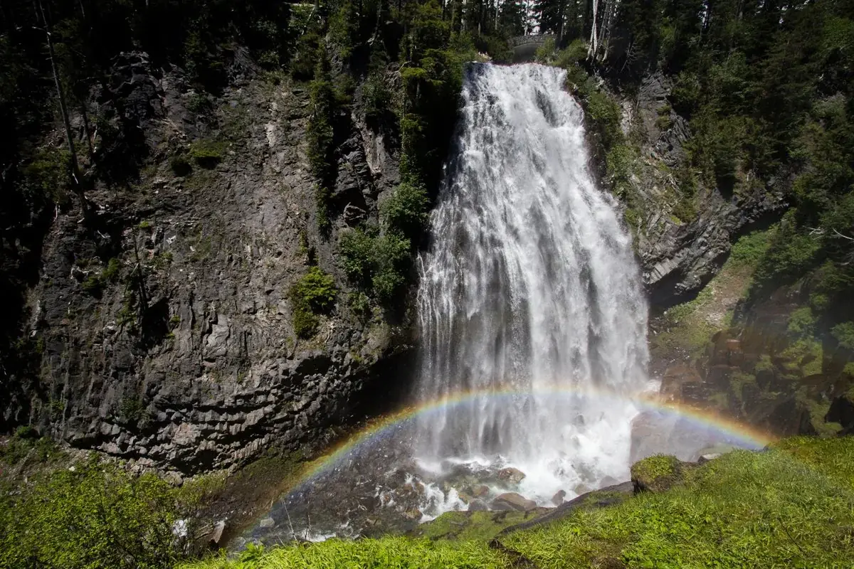


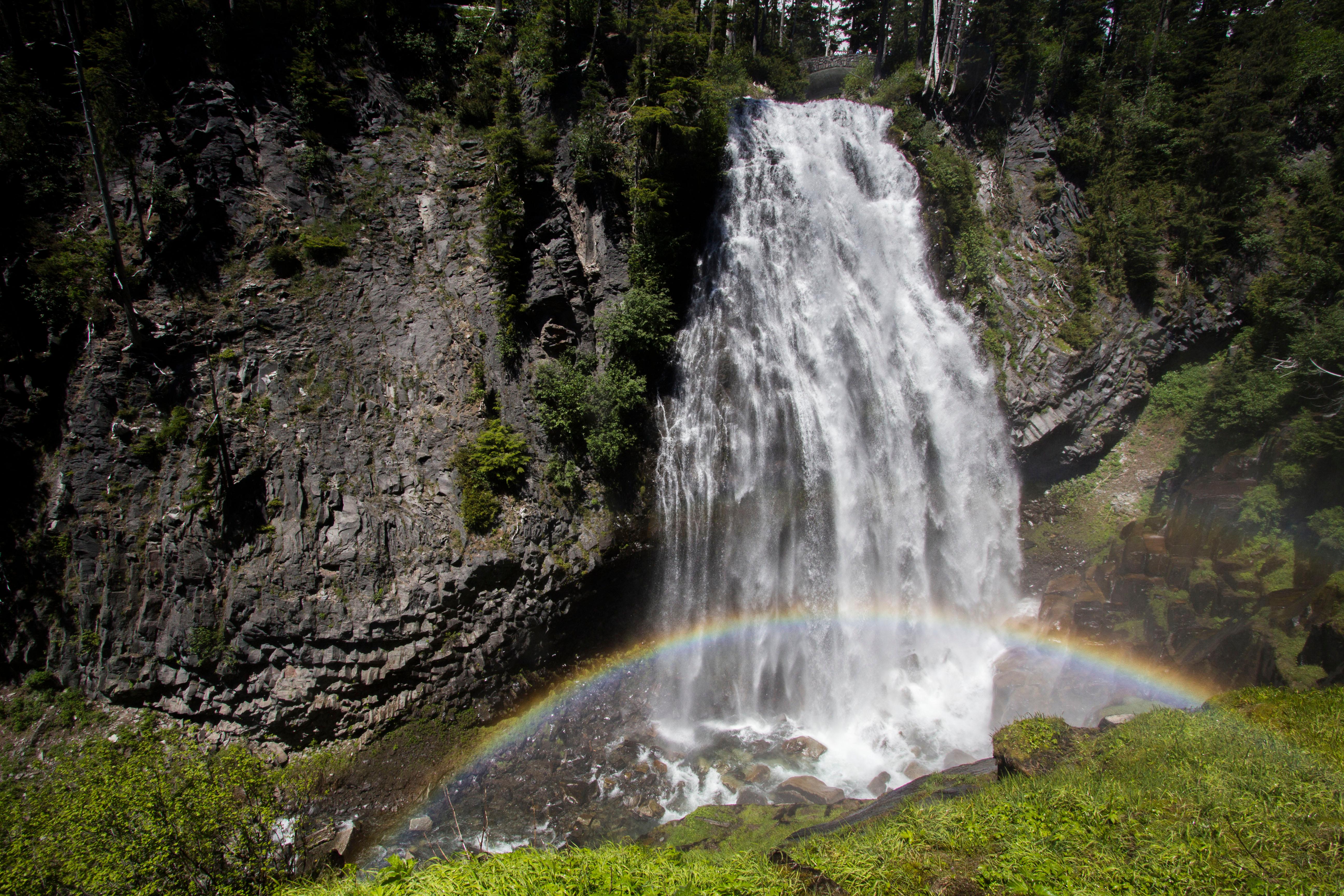
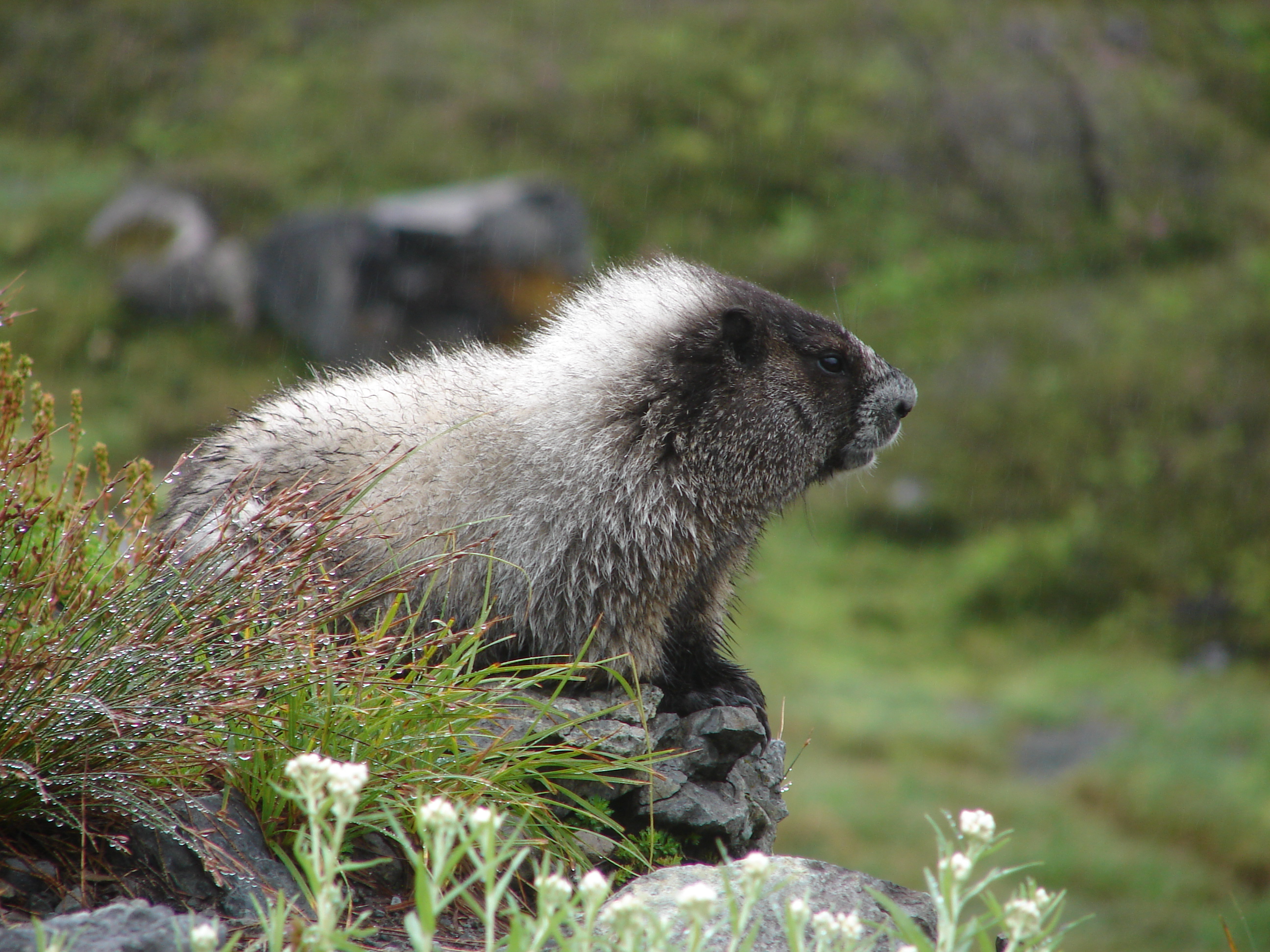
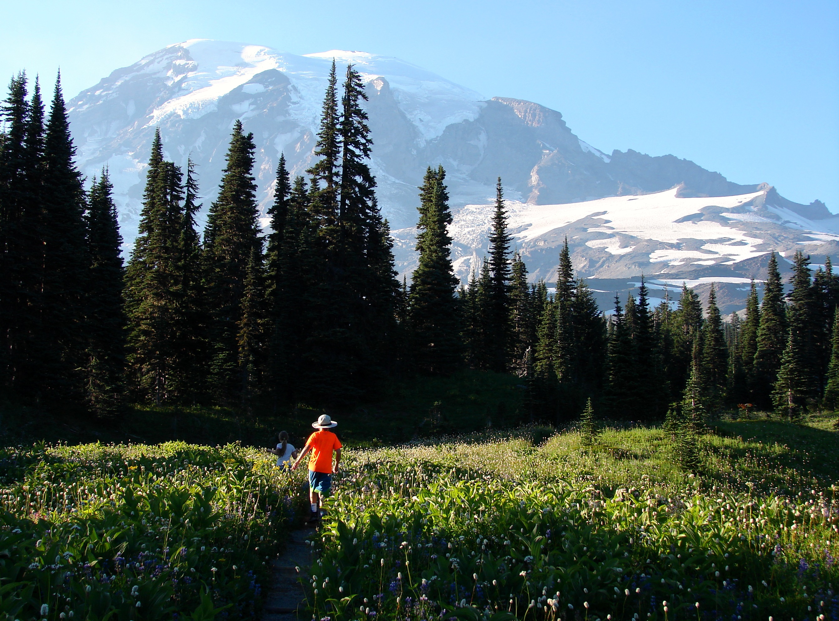
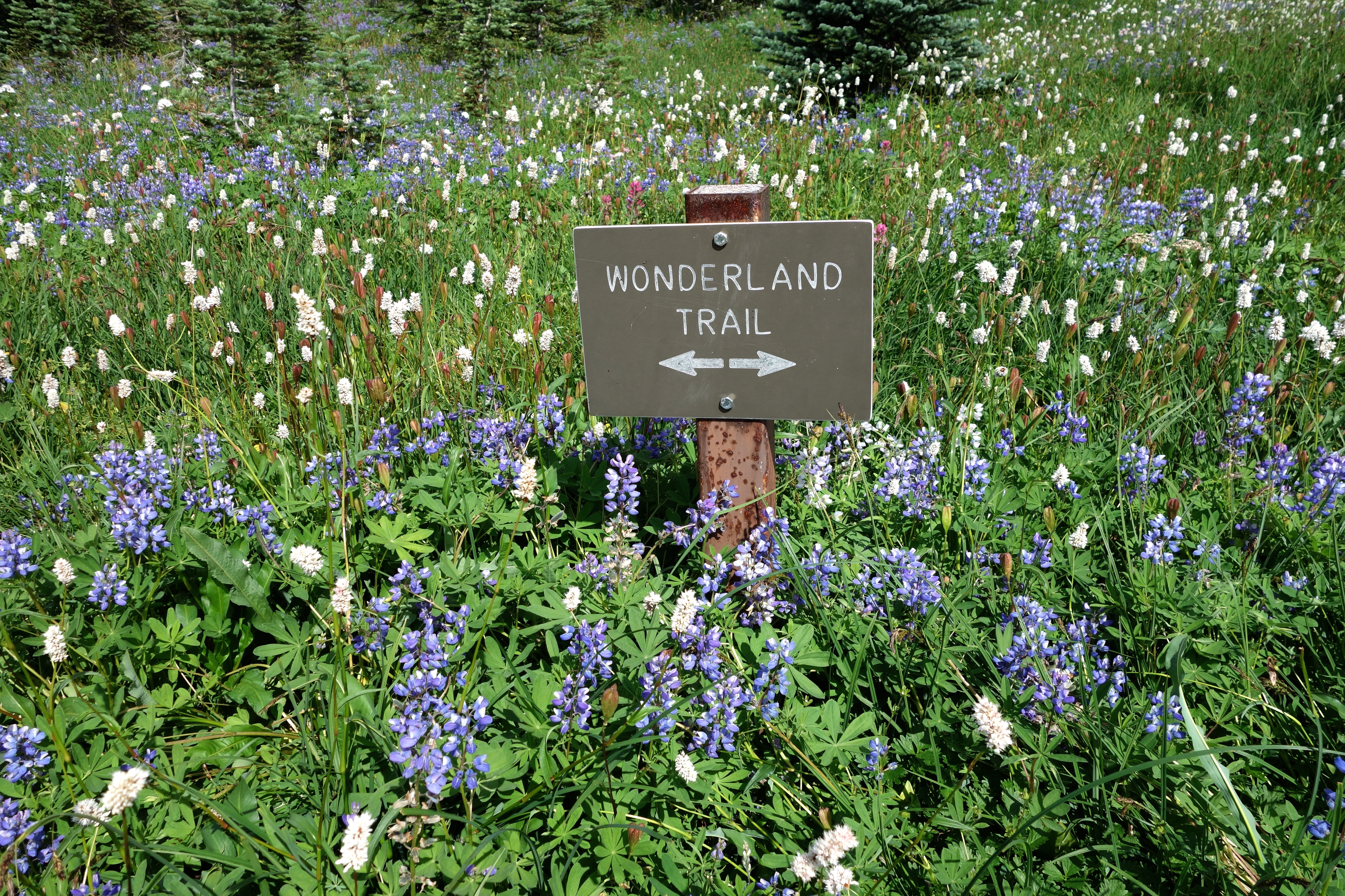
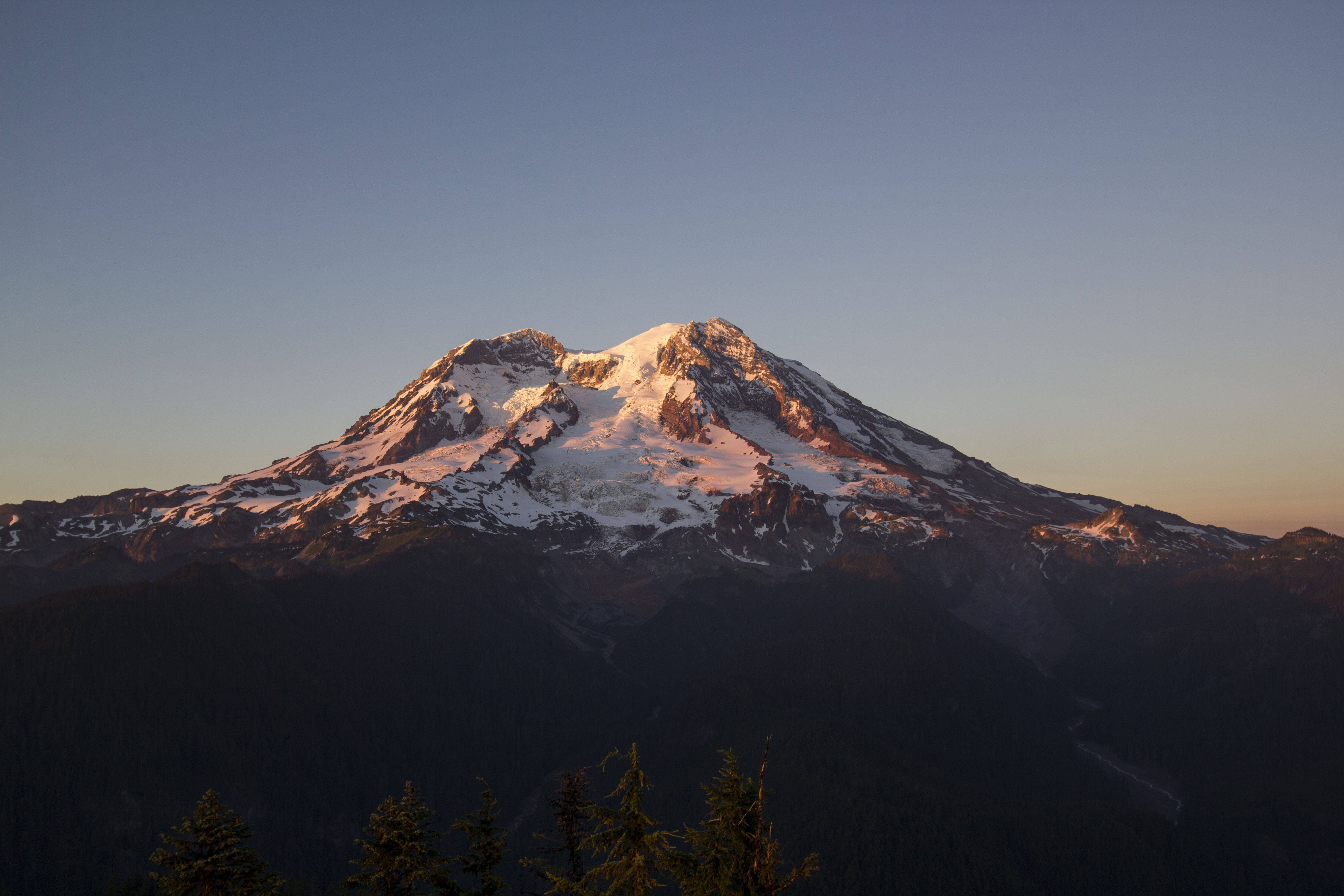
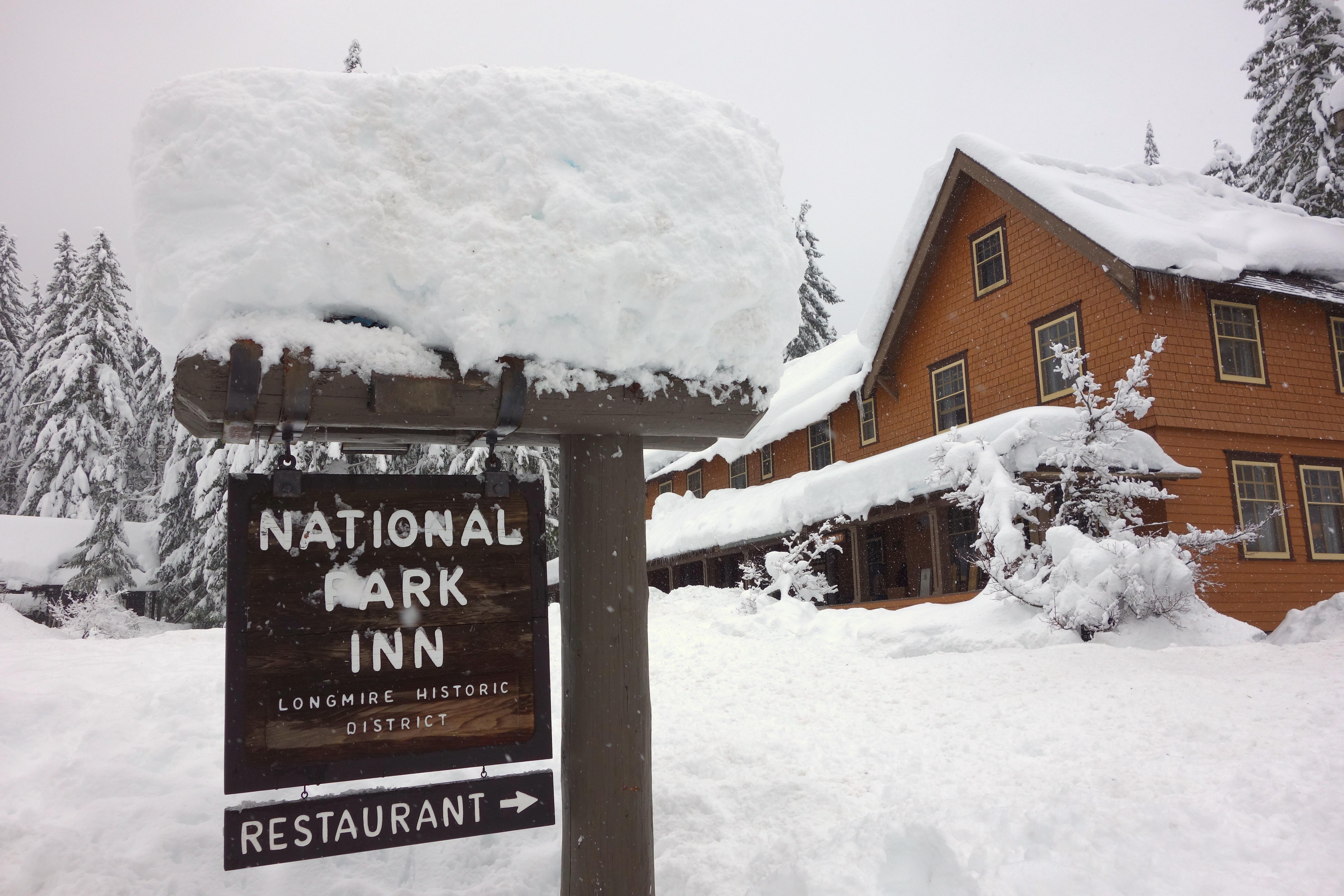
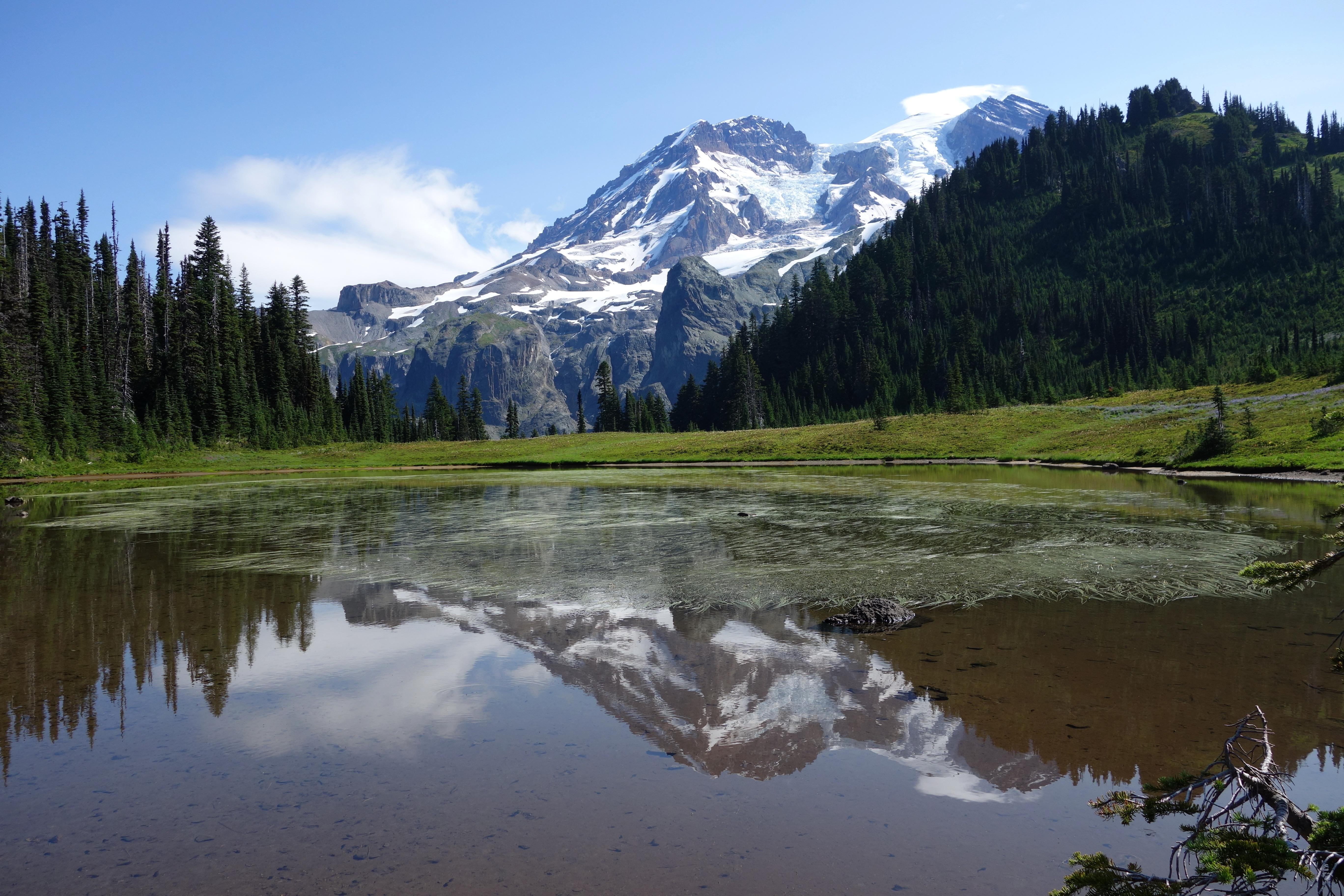


 Forests