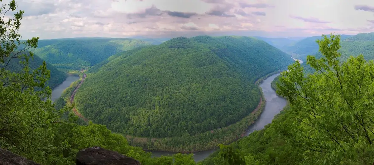
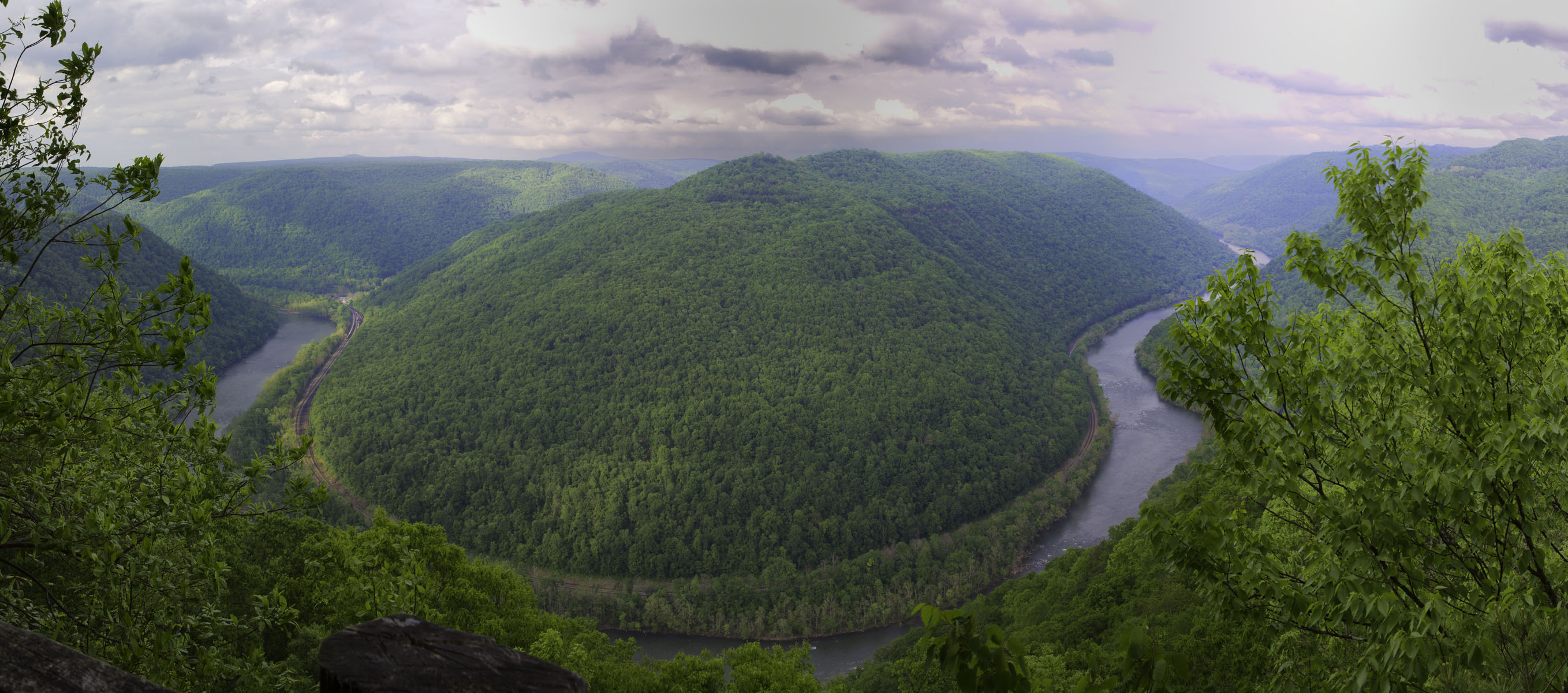
A rugged, whitewater river flowing northward through deep canyons, the New River is among the oldest rivers on the continent. The park encompasses over 70,000 acres of land along the New River, is rich in cultural and natural history, and offers an abundance of scenic and recreational opportunities.
7Kacres of parkland
2Mrecreation visits, 2025
Jun · Aug · Sepnearby climate picks
Seasonal access & reservations
No reviewed guidance for this selection. Check the park's official planning pages; missing coverage does not establish access.
Selected guidance only; separate from climate comfort and current conditions.
Official conditions Not checked
The conditions feed has not been connected for this park.
Editorial recommendations, reviewed 2026-10-17. Full park days, excluding travel to and from the region. A first-visit outline for a general traveler; adapt to mobility, fitness, season, reservations, and current conditions. These are suggested days, not reserved activities or guaranteed routes.
Camping is a favorite pasttime at national parks across the United States. Visitors to New River Gorge National Park and Preserve can enjoy primitive camping at one of our 8 primitive campgrounds. Primitive camping areas have no drinking water, no hookups, no electricity, and limited restroom facilities. There are no camping fees at park campgrounds. Reservations are not available; all sites are first-come, first-serve . In busy months, campgrounds fill quickly and it is recommended to have a back-up plan. There are no developed campgrounds in the park. Visitors that need or prefer a developed campgrounds can find options throughout the surrounding area at state parks and private campgrounds.
New River Gorge National Park and Preserve offers 8 primitive campgrounds. The nearby Gauley River National Recreation Area also offers one primitive campground, Gauley Tailwaters. Campgrounds have different types of campsites including walk-in campsites for tents only and drive-in campsites for RVs, campers, car camping, and tents. Walk-in campsites require walking a short distance from the parking area to the tent-only campsite. Drive-in campsites have their own parking spot next to a camping pad that can accomodate varying sizes of RVs and campers. Picnic tables, fire rings, and grills are available at campsites. Camping in a non-designated site or using a walk-in parking lot for RV, camper, or car camping is prohibited.
All campgrounds are located on maintained gravel or dirt roads in somewhat remote locations within New River Gorge National Park and Preserve. Campgrounds will be several miles from gas stations, grocery stores, or other markets. Campers are recommended to bring plenty of drinking water, food, and any other necessities with them.
All campgrounds except War Ridge are located on the New River. Easy access to the river for fishing and boating is available. Swimming is strongly discouraged as the New River has powerful currents, rocky banks and shoals, and sudden dropoffs. Anyone near the banks of the New River is recommended to wear an approved personal flotation device such as a life jacket.
Stone Cliff Beach
Grandview Sandbar
War Ridge/Backus Mountain
Gauley Tailwaters
Campground Regulations
All designated sites are managed on a first-come, first-served basis . Reservations are not accepted.
No more than 2 vehicles permitted per campsite. RVs do not count towards vehicle limits
No more than 2 tents or 1 tent and 1 RV/Camper per campsite. RV, camper, and car camping only permitted at drive-in campsites. Tent camping permitted at all campsites.
Camp only in designated campsites. Camping in any day use, river access, trailhead, or walk-in campsite parking lot is prohibited.
No more than 8 people and 4 pets per campsite
Camping limit of no more than a total of 14 days within a 28-day period within any park campground and camping area.
Quiet hours are from 10:00 PM to 6:00 AM.
Check-out time is 12:00 PM noon on the day the permit expires
Pets must be kept on a leash.
Use existing fire rings for campfires. Burn only dead wood found on the ground. Damaging or cutting live trees or branches for firewood is prohibited.
Use the provided toilet facilities.
Do not drive nails into trees or hang lanterns against trees.
Public intoxication, disorderly conduct, and possession of alcohol by minors is prohibited. Alcohol is prohibited at Thayer campground.
Littering is prohibited. Dispose of trash in a bear-proof trash can or dumpster. Pack out all trash if there is no available bear-proof trash can or dumpster.
Broken glass is a hazard. Use plastic and aluminum containers when possible.
Respect all other park visitors including hikers, river users, and other campers.
Burnwood Group Campsite
Backcountry Camping
Backcountry Regulations
Reservations or permits are not required for backcountry camping
Camping is prohibited at Grandview, Brookside Island, day-use areas, and within Bluestone National Scenic River
Camping is prohibited within 100 feet of state roads, parking lots, trailheads, boat launch areas, visitor centers, park structures, top or bottom of cliffs, and historic areas.
Camp above the high water line of any river, creek, or stream if possible.
Use existing campsites and fire rings where provided.
Dead, down wood may be used for campfires. Damaging or cutting live trees or branches for firewood is prohibited. Only use hand tools on collected firewood.
Trespassing is prohibited on all CSX or RJ Corman property including railroad tracks and roads.
Any person within 0.25 miles from a restroom or other toilet facility must dispose of human waste within that facility.
Properly dispose of human waste in non-developed areas more than a 0.25 miles from restroom facilities. Human waste may be containerized in an appropriate receptical and carried out or it may be buried. All buried waste must be buried 6 inches deep in organic soil in a location that is not within 200 feet or in sight of any trail, road, parking lot, developed area, campsite, cliff or rock formation, climbing route, climbing area, water source, or high water mark, intermittent or otherwise, of any stream.
Littering is prohibited. Pack out all trash and properly dispose of it in a bear-proof trash can or dumpster.
More Information
General camping information (weekdays only) - 304-465-0508
Group camping permit application (weekdays only) - 304-465-6531
Camping Regulations - Superintendent's Compedium
Nearby Developed Campgrounds - Visit Southern West Virginia , New River Gorge Convention and Visitors Bureau.
Camping and Wildlife
Learn how to camp safely in bear habitat.
Check here for information and regulations concerning backpacking in the park.
Permits and Reservations
Information about reserving shelters and group campgrounds and about permits and commercial use authorizations for activities and events
The New River begins high in the mountains of western North Carolina, crosses Virginia, and enters West Virginia near its southernmost tip. It then heads north to join the Gauley River, and form the Kanawha River. In so doing, it manages to transect every ridge of the Alleghenies. Its name is actually a misnomer in that it may be one of the oldest rivers in the world.
New River Gorge National Park and Preserve includes 53 miles of free-flowing New River, beginning at Bluestone Dam and ending at Hawks Nest Lake. The New River typifies big West Virginia style whitewater. Within the park it has two very different characters. The upper (southern) part of the river consists primarily of long pools, and relatively easy rapids up to Class III. It is a big powerful river, but very beautiful, always runnable, and providing excellent fishing and camping. There are a number of different river access points, and trips can run from several hours to several days.
The lower (northern) section of river is often referred to as "the Lower Gorge." In a state that is justifiably renowned for colossal rapids, the Lower Gorge has some of the biggest of the big with rapids ranging in difficulty from Class III to Class V. The rapids are imposing and forceful, many of them obstructed by large boulders which necessitate maneuvering in very powerful currents, crosscurrents, and hydraulics. Some rapids contain hazardous undercut rocks.
In addition to running the river on your own, a number of licensed outfitters offer guided trips on the New River. Trained guides, equipment, instruction, transportation to and from the river, and meals are provided. Trips vary in length from several hours to several days, and offer different degrees of difficulty, from peaceful float and fishing trips to crashing whitewater excitement. Visit any one of the commercial outfitters to schedule an adventure on the New River.
Ranging from mild riffles on the upper parts to big whitewater rapids in the lower section, the New River offers something for everyone. The New has trips available year-round, with the season running from April through October.
Paddling On Your Own
The section of the New River from Hinton to Thurmond offers challenging Class I, II, and III rapids suitable for intermediate whitewater paddlers, and consists primarily of long pools and moderate rapids.
Downstream from Thurmond the river narrows and includes technical Class III - IV rapids. The New River below Thurmond is suitable only for advanced and expert paddlers. The New River is a powerful and beautiful river that usually has enough water to run. There are a number of different access points on the New River, and trips can run from several hours to several days.
Running whitewater rivers is inherently risky. Prior to putting on a river, individual trip participants must recognize and assume responsibility for the attendant dangers, which include -- but are not limited to -- possible loss of life. Before attempting any river, paddlers should satisfy themselves that every person in their group understands the inherent risks of river running, freely assumes responsibility for their own safety, and possesses the necessary skill and prior experience to reasonably ensure a safe trip.
Current River Levels (USGS)
Find a list of local whitewater outfitters that can take you down the river.
Before planning a trip on your own, check out the Private Boater Information page.
Information on how to have a safe day on the river.
New River Gorge National Park and Preserve provides a variety of different trails throughout the park. Peaceful forest trails, superb overlooks, and historic scenery are all found here. The trails available consist of park service trails that are marked and maintained, trails within lands administered by state parks, and undeveloped trails and abandoned roads.
Trails range from 0.25 mile to 7 miles in length one-way. Several can be easily connected to make for longer excursions. Difficulty varies from flat, smooth walking to steep challenging terrain. Trail recommendations and maps are offered at Canyon Rim, Grandview, Sandstone, and Thurmond visitor centers. Much of the land within the national park and preserve authorized boundaries remains private property: please respect the owners' rights. Use the map or links below to find out more details about the trails available in each hiking area.
Hike with a Ranger
When you plan your hike at New River Gorge National Park and Preserve, consider joining a ranger for a guided hike. The park offers ranger led hikes between Memorial Day and Labor Day. These hikes are available on a variety of trails from the most popular to the hidden gems. Join a ranger to visit old growth forest, rail trails, abandoned mines, or other unique locations. Learn about natural resources, history of the area, how to identify plants and animals, park resource management, and more. For more information, check out the park's calendar of events or ask at a park visitor center.
Trail Etiquette
At New River Gorge National Park and Preserve, we protect our park by practicing Leave No Trace . When hiking, please follow our trail etiquette to make the experience enjoyable for yourself and others and to protect your national park.
Pack it in, Pack it out. Pocket all your trash, including cigarette butts and candy wrappers, and dispose of it properly.
Wildflowers, wildlife, and historic objects all contribute to the beauty we came to see. Leave them undisturbed.
Keep pets on a leash at all times.
Bicycles are only permitted on designated bike trails.
Within a distance of one-quarter of a mile from a restroom or pit toilet facility, human body waste must be appropriately disposed of in such facilities. In non-developed areas more than a quarter of a mile from restroom facilities, human body waste must either be containerized and carried out or it must be buried at a depth of 6 inches in organic soil and at a location not frequented by the public. Human waste may not be buried within 200 feet or in sight of any trail, road, parking lot, developed area, campsite, cliff or rock formation, climbing route or climbing area, water source or the high water mark of any stream, whether intermittent or not.
Courtesy and common sense on the trail can help provide an enjoyable experience for all. Respect the rights of others.
Hikes to Overlooks and Views
Endless Wall Trail (2.2 - 2.6 miles)
Grandview Rim Trail (3.2 miles)
Long Point Trail (3.2 miles)
Hikes with Waterfalls
Big Branch Trail (2.0 miles)
Butcher Branch Trail (1.6 miles)
Glade Creek Trail (2 miles to waterfall)
Kates Falls Trail (0.4 miles, accessed via Glade Creek Trail )
Kaymoor Trail (0.2 miles to waterfall from Wolf Creek Trailhead)
Hikes to Historic Sites and Ruins
Brooklyn Mine Trail (5.4 miles)
Headhouse Trail (1.4 miles)
Kaymoor Trail (4.0 miles to mine site)
Kaymoor Miner's Trail (2.0 miles)
Rend Trail (6.8 miles) - access to Church Loop Trail (0.1 miles)
Southside Trail (14 miles)
Old Growth Forest Hikes
Burnwood Trail (1.2 miles)
Stone Cliff Trail (5.4 miles)
Short Easy Hikes (1 - 2 Miles Roundtrip)
Big Buck Trail (0.9 miles)
Island Loop Trail (0.5 miles)
Park Loop Trail (1.1 miles)
Timber Ridge Trail (1.0 miles)
Woodland Loop Trail (0.6 miles)
Long Day Hikes (6+ Miles Roundtrip)
Fayetteville Trail (8 miles)
Glade Creek Trail (11.2 miles)
Kaymoor Trail (17.2 miles)
Hiking Trail Information:
Grandview Area Trails
Grandview area trails offer spectacular views, rock formations, and woodlands.
Glade Creek Area Trails
Glade Creek offers a scenic walk along cascading waterfalls and pools.
Sandstone Brooks Area Trails
There are several excellent trails in the south end of the park, just a short drive from Sandstone Visitor Center.
Fayetteville Area Trails
Trails in the Fayetteville area provide access to some of the most spectacular overlooks in the park.
Thurmond-Stone Cliff-Cunard Area Trails
There are several easy to moderate hiking trails, many utilizing old roads and railroad grades, in the Thurmond area.
Nuttallburg Trails
Trails at Nuttallburg allow visitors to explore the remains of an old coal mining town.
Check here for information and regulations concerning backpacking in the park.
Visit the Hiking Safety page for information about how to have a safe hike.
100 Mile Challenge
Celebrate parks and health by hiking 100 miles on trails in New River Gorge National River and Bluestone National Scenic River.
The beautiful landscapes and the variety of difficult to less challenging bike routes make the New River Gorge among the most popular destinations for mountain biking trips in the eastern U.S. Bike shops, mountain biking trails, outfitters and companies offering guided biking tours of the New River Gorge and nearby areas may be found throughout the region. The park currently allows traditional bicycles on the following trails within New River Gorge National Park and Preserve. E-bikes are ONLY permitted on the Stonecliff Trail. Bicycles are also permitted on the Bluestone Turnpike Trail at Bluestone National Scenic River. More bicycle trails may be added to the park trail system in the future. Mountain biking trails are also found at nearby Summersville Lake and Little Beaver State Park.
Cycling Rules & Guidelines
Only ride on trails open to bicycles.
Leave no trace - pack it in, pack it out.
Control your bicycle!
Do not disturb or scare birds or animals.
Be considerate of other trail users. All bicyclists must yield to other trail users in the following manner:
A bicyclist must yield to an equestrian
A bicyclist must yield to a pedestrian
A bicyclist travelling downhill must yield to a bicyclist travelling uphill.
Yielding the right of way requires slowing down to a safe speed, being prepared to stop, establishing communication and passing safely.
Failure to yield is prohibited.
Arrowhead Trails
Total Length: 12.8 miles Trail Difficulty Rating: Easy to intermediate More than 1,000 members of the Order of the Arrow (OA), Boy Scouts of America's national honor society, created this stacked loop trail system in the Craig's Branch area. Four mountain bike loops, rated from moderate to difficult, await adventuresome riders. In one of the largest youth service projects in National Park Service history, the scouts provided 78,544 volunteer hours, valued at $1.6 million, to build the trails in 2011. The Arrowhead Trails Map below shows the Clovis Trail, Adena Trail, Dalton Trail, and LeCroy Trail. The numbers on the map correspond to the trail listed below the map.
Loading results...
Other Area Trails for Biking
Here are other trails throughout the park that offer biking. Keep in mind, these trails are also available for hiking, so please be cautious for other visitors when using these trails. Kaymoor Trail (8.6 Miles) Craig Branch Trail (2.4 Miles) Fayetteville Trail (3.9 Miles) Park Loop Trail (1.1 Miles) Timber Ridge Trail (1.0 Miles) Long Point Trail (1.6 Miles) Keeney’s Creek Rail Trail (3.0 Miles) Headhouse Trail (0.7 Miles) Tipple Trail (0.6 Miles) Seldom Seen Trail (0.3 Miles) Town Loop Connector Trail (0.3 Miles) Rend Trail (3.2 Miles) Brooklyn Mine Trail (2.7 Miles) Southside Trail (7.0 Miles) Stone Cliff Trail (2.7 Miles) Little Laurel Trail (2.6 Miles) Glade Creek Trail (5.6 Miles)
The use of e-bikes, in compliance with applicable adopted state law, will be allowed on park roads opened to motor vehicle use (classes 1, 2, and 3). E-bikes will now be allowed the Stone Cliff Trail (classes 1 and 2 only). Due to public safety concerns, e-bikes will not be allowed on other trails where traditional bikes are currently allowed. The bikes shall be labeled showing the class of e-bike, or the operator shall carry documentation of the class of e-bike while operating within park boundaries. Class 1 e-bikes have a motor that provides assistance only when the rider is pedaling, and that ceases to provide assistance when the e-bike reaches 20 mph. Class 2 e-bikes have a motor that may be used exclusively to propel the bicycle, and that is not capable of providing assistance when the e-bike reaches 20 mph. Class 3 e-bikes have a motor that provides assistance only when the rider is pedaling, and that ceases to provide assistance when the e-bike reaches 28 mph.
Ride the Bluestone Turnpike Trail at Bluestone National Scenic River.
Find out what you need to know to have a safe ride in the park.
Glade Creek Area Trail Map Trail map for Glade Creek area trails.
Fayetteville Area Trails Map Fayetteville Area trail map
Thurmond Area Trails Map Thurmond, Stone Cliff, and Cunard area trails map
Grandview Area Trails Map Grandview Area Trails Map
Nuttallburg Trails Trails at Nuttallburg allow visitors to explore the remains of an old coal mining town.
Within New River Gorge National Park and Preserve are over 1,400 established rock climbs. "The New" has become one of the most popular climbing areas in the country. The cliffs at New River Gorge are made up of a very hard sandstone, and range from 30 to 120 feet in height. The rock is very featured, and an abundance of crack and face routes are available. Most of the routes in the gorge favor the advanced and expert climber. The majority of routes are 5.9 and harder, and most sport routes fall in the 5.10 - 5.12 range. A guidebook is an essential tool for locating climbs, and local climbing shops can offer information and specific recommendations.
Helpful Information for Climbers
Climbing Season While climbing can take place any time of year, the best months are usually late April to mid-June, and mid-September to late October.
Food and Water Water is available at Canyon Rim Visitor Center. There are numerous markets and eating establishments in nearby towns.establishments in nearby towns.
Showers Showers can be purchased at many of the private campgrounds in the area. Please do not bathe in the restrooms at park visitor centers.
Camping There are many private campgrounds located within easy driving distance from the climbing areas. Primitive camping is allowed on park property. Camping is prohibited within 100 feet of parking areas, water sources, historic sites, or the top rim of the cliffs. See the camping page for more information.
Private Property There are many areas of private property within the New River Gorge, including some within the park boundary. Do not trespass on private property.
Parking and Security Park in designated parking locations -- do not block roads or driveways. Always change clothes out of view. For security reasons, do not leave vehicles unattended overnight at parking areas or trailheads. Hide or remove all valuables while climbing, and lock vehicles.
Climbing Regulations
Over one million people visit New River Gorge each year, thousands of whom are climbers. With this large number of visitors, park issues develop that can only be solved through everyone's cooperation.
Briefly, the National Park Service mission is to protect park resources for future generations, while providing opportunities to enjoy these resources at present. This task is obviously a difficult one, balancing resource protection and visitor use. Park managers are concerned about the impacts of visitors and climbers in the areas of soil erosion and compaction, vegetation damage, human waste disposal, cultural resources, and overcrowding. Please do what you can, as a climber, to limit your impact on New River Gorge and preserve it for future generations.
There are many areas of private property within the New River Gorge. Always acknowledge the landowners' rights. Respect all gate, fences, and no trespassing signs. Do not trespass on private land!
Guidelines and Regulations
Leave historical and natural objects undisturbed for the next visitor.
The use of motorized drills is by permit only.
Do not trespass on private property.
Park only in designated parking areas.
Use existing trails whenever possible.
Pets must be on a leash.
Pack it in, pack it out.
Within a distance of one-quarter of a mile from a restroom or pit toilet facility, human body waste must be appropriately disposed of in such facilities. In non-developed areas more than a quarter of a mile from restroom facilities, human body waste must either be containerized and carried out or it must be buried at a depth of 6 inches in organic soil and at a location not frequented by the public. Human waste may not be buried within 200 feet or in sight of any trail, road, parking lot, developed area, campsite, cliff or rock formation, climbing route or climbing area, water source or the high water mark of any stream, whether intermittent or not.
Climbing has inherent risks and hazards, and is a potentially dangerous activity. A variety of skills and techniques are required to ensure a safe climbing experience. Please seek qualified instruction before venturing onto the cliffs. Many of the climbing locations are located miles from roads, and rescue is difficult. Please, climb smart! In case of emergency, call 911.
Planning and Civic Engagement Check here to review park planning documents and participate in the park planning process.
October 2018 Climbing Community Meeting Read the summary of the Climbing Community Meeting held on October 27, 2018
Rock Climbing Safety Be safe when climbing in the park. Check here for more information.
Fishing is one of the most popular activities on the New River. The diversity of fish in its waters makes the New River an excellent warm water fishery. With proper respect for the river and its resources and a few safety precautions, anglers can enjoy a quality fishing experience. Public river access points within New River Gorge National Park and Preserve are available at the Tug Creek Beach, Brooks Falls, Hellems Beach, and Sandstone Falls via River Road at Hinton; Meadow Creek; McCreery, Grandview Sandbar, Mill Creek, and Glade Creek off Hwy. 41 near Prince; Dunglen and Stone Cliff near Thurmond; Cunard; and Fayette Station.
To access the New River across private property, one must receive permission from the land owner.
Other places to fish include Bluestone National Scenic River, Gauley River National Recreation Area, Meadow River, Greenbrier River, Bluestone Lake, and Summersville Lake.
Stocked Trout Streams
Other Closeby River Fishing Not On This Map
Spring and fall are the best times of the year to fish the New River. During these seasons, water temperatures are in transition between cold winter temperatures and warm summer temperatures. Most fish species are more active in cooler water and are more aggressively feeding during the spring and fall.
The best times of the day to fish are early morning and late evening. Most fish prey is much more active at these times; therefore, more fish are out feeding. Some species of fish feed at night, providing anglers an opportunity for night fishing.
Catching Your Fish
The New River offers anglers the opportunity to catch bass (smallmouth, largemouth, striped, and rock), walleye, muskellunge, crappie, bluegill, carp, or flathead and channel catfish.
Nightcrawlers and hellgrammites are common bait used for fishing. Popular artificial lures are top-water crank-baits, spinner baits, minnows, or crawfish. Dark-colored lures work better in murky water conditions and bright-colored lures in clear water.
The smallmouth bass is one of the more abundant species found in the New River. A variety of artificial lures may be used. Top-water lures used late in the evening are an excellent choice. Live bait, such as nightcrawlers or hellgrammites, can increase the odds of catching bass.
The rock bass is not an aggressive fighter; however, it is an aggressive biter. This species of sunfish will hit anything from crank-baits to nightcrawlers. A preferred lure to use is the twister-tail grub.
The walleye is commonly fished for in the fall when water temperatures cool down. It may be caught using crank-baits, jigs, jig and minnow combinations, and nightcrawlers. You should fish deeper water for walleye.
Flathead and channel catfish can be caught on similar bait. Although channel catfish may occasionally strike a crank-bait, live bait is a wiser choice. Types of live bait to use include nightcrawlers, hellgrammites (both black and yellow phases), and crayfish. Minnows may also be used when fishing for catfish.
The muskellunge or musky can be caught on a variety of crank and spinner-baits. Top-water crank-baits appear to be a successful choice for catching muskies. The musky can also be caught using live bait.
Trout are present in several tributaries of the New River. West Virginia's Division of Natural Resources stocks these tributaries each spring with golden, rainbow, brook, and brown trout. Trout fishing can be enjoyed on these streams within the park: Meadow, Glade, Dunloup, Glade at Babcock State Park, or Mill creeks and Gauley, Meadow, or Little Bluestone rivers. A trout stamp is required when fishing for trout.
Catch and Release
Catch and release ensures fishing opportunities for future generations. Glade Creek from the pedestrian bridge 3 miles down to the New River is designated a catch and release for trout. The New River from the I-64 bridge at Sandstone 12 miles downstream to the Grandview Sandbar is designated catch and release for black bass. This includes smallmouth, spotted, and largemouth bass.
Survival of the fish being released depends upon how well the angler handles the fish while catching and unhooking it. Several basic guidelines to follow are:
return the fish to the water as soon as possible
unhook the fish in the water
handle the fish as little as possible
use needle-nose pliers to remove the hook
remove the hook quickly and carefully
move fish back and forth in the water to move
water through its gills until it can swim away
Safety on the river will always make your fishing trip an enjoyable experience and possibly could save a life. Some safety tips are:
always wear a life jacket around the river
never drink alcohol while fishing
remain seated while in a boat
never fish alone; take a friend along
do not wade in water above your knees
fish at least 100 feet away from a boat launch
Visitors fishing within New River Gorge National Park and Preserve must follow the fishing license requirements in accordance with the laws and regulations of the State of West Virginia. All persons fishing in the park are required to have a West Virginia fishing license. Year long and 3-day tourist licenses are available at area sporting goods stores and bait shops.
Except as provided below, fishing shall be in accordance with the laws and regulations of the State of West Virginia ( 36CFR2.3 ).
For the West Virginia State fishing regulations go to the West Virginia Department of Natural Resources website.
The fishing regulations apply to all “finfish” found in the park. Other taxa, including amphibians, mollusks and crustaceans (e.g. waterdogs, crayfish) are not considered “fish” for the purpose of NPS fishing regulations and addressed by NPS regulations governing wildlife ( 36CFR2.2 ).
These fishing regulations apply, regardless of land ownership, on all lands and waters within the park that are under the legislative jurisdiction of the United States.
The following are prohibited:
Fishing in fresh waters in any manner other than by hook and line, with the rod or line being closely attended.
Possessing or using as bait for fishing in freshwaters, live or dead minnows or other bait fish, amphibians, non-preserved fish eggs or fish roe, except in designated waters.
Chumming or placing preserved or fresh fish eggs, fish roe, food, fish parts, chemicals, or other foreign substances in fresh waters for the purpose of feeding or attracting fish in order that they may be taken.
Commercial fishing, except where specifically authorized by Federal statutory law.
Fishing by the use of drugs, poisons, explosives, or electricity.
Digging for bait, except in privately owned lands.
Failing to return carefully and immediately to the water from which it was taken a fish that does not meet size or species restrictions or that the person chooses not to keep. Fish so released shall not be included in the catch or possession limit: Provided, that at the time of catching the person did not possess the legal limit of fish.
Fishing from motor road bridges, from or within 200 feet of a public raft or float designated for water sports, or within the limits of locations designated as swimming beaches, surfing areas, or public boat docks, except in designated areas.
Introducing wildlife, fish or plants, including their reproductive bodies, into a park area ecosystem. This includes the discarding and/or dumping of bait and bait buckets.
The use or possession of fish, wildlife or plants for ceremonial or religious purposes, except where specifically authorized by Federal statutory law, or treaty rights.
The following regulations apply only within New River Gorge National Park and Preserve
Fishing is not allowed within 100 feet of boat launch/take-out areas while watercraft are using the launch/take-out area.
Fish Consumption Advisories in National Park Waters
The Environmental Protection Agency, states, territories, and tribes provide advice on fish and shellfish caught in the waters in their jurisdiction to help people make informed decisions about eating fish. Advisories are recommendations to limit your consumption of, or avoid eating entirely, certain species of fish or shellfish from specific bodies of water due to chemical or biological contamination. Fish is part of a healthy balanced diet, but eating wild fish and shellfish caught in park waters is not risk free. Parks are “islands”, but the much larger “ocean” that surrounds them affects the natural resources inside a park. Other aquatic toxins are the result of natural biological processes. Also, chemical contaminants that originate outside of park boundaries can come into parks. Mercury is an example of a toxin originating outside a park that can find its way into a park. Mercury exists naturally in some rocks, including coal. When power plants burn coal, mercury can travel in the air long distances before falling to the ground, usually in low concentrations. Once on the ground, microorganisms can change this elemental mercury to methyl mercury. This type of mercury can build up in animal tissues, and it can increase in concentration to harmful levels. This high concentration can occur in large predatory fish - those often pursued and eaten by anglers. Studies have shown that fish in some National Park System waters have mercury levels that may be a concern to people who regularly eat a lot of fish.
Fish Consumption Advisories in New River Gorge National Park and Preserve
For health and safety, anglers are advised to adhere to published West Virginia advisories for fish consumption. These are published annually in the fishing regulations ( http://www.wvdnr.gov/Fishing/Fishing_regs.shtm ) and can also be accessed separately from the entire regulation booklet ( http://www.wvdnr.gov/Fishing/Regs14/Consumption_Advisory.pdf ). The West Virginia Department of Health and Human Resources has the same information available ( http://www.wvdhhr.org/fish/Current_Advisories.asp ), along with a little more background information ( http://www.wvdhhr.org/fish/default.asp ).
Accessible Fishing Areas:
There is a wheel chair accessible fishing area at the Glade Creek Campground. The accessible area is on a wooden bridge over Glade Creek, an excellent fishing location (catch and release in this area). It can be reached at the end of Glade Creek Road from the parking area next to the campground entrance.
For more information about accessible fishing locations in West Virginia, visit the WV Department of Natural Resources webpage .
Hunting is much more than just a sport to a majority of the people in Southern Appalachia. It is a tradition and has been shared from generation to generation. More and more hunting has become a sport enjoyed by the entire family. Good hunters teach, not only the basics of hunting and shooting, but a love and appreciation of the land, the wildlife, and the experience. New hunters also need to know the rules and regulations and always be aware of safety concerns.
The West Virginia Department of Natural Resources Hunting webpage provides information on hunter safety training, rules and regulations , and many other useful topics concerning hunting in the state. New River Gorge National Park and Preserve's hunting regulations follow the WVDNR's regulations with the following exceptions or additions:
*Baiting game is never allowed in the park, this is considered feeding the wildlife.
*Trapping is NOT permitted in the park.
*No permanent tree stands may be placed on park land. If a stand remains for over 24 hours it is considered abandoned and will be removed. No nails or screws can be placed into trees.
*ATVs are not permitted in the park
There are areas where hunting is prohibited in New River Gorge National Park and Preserve, including safety zones near public areas and the 800 acre section of the park at Grandview (these are all the areas designated as New River Gorge National Park. Hunting is permitted in any areas designated as National Preserve. Knowing your location and rules for that area are the hunter's responsibility.
Areas where hunting is currently prohibited in the park include Grandview, Camp Brookside, Sandstone Falls, and Lower Gorge (the areas designated as National Park). Hunting is also prohibited within 500 feet of heavy visitor use areas, including established campgrounds, day-use areas, and visitor centers. Under West Virginia state hunting regulations, it is illegal to shoot a firearm within 500 feet of a school, church, dwelling, or other places where people socially gather. Regulations also prohibit ATV and ORV use on trails and off-road in the park. Maps for no hunting areas can be found here: No Hunting Zones as of January 2022. Questions concerning hunting in the park can be emailed to this website or contact park law enforcement division. Questions concerning general hunting regulations should go to the West Virginia Department of Natural Resources.
Though there are nearly 100 miles of trails in this park, most trails are short and best suited for day hikes. Historic site considerations, very steep terrain, and private property within park boundaries can make planning a backpacking trip challenging. Trails best suited for overnight backpacking trips at New River Gorge National Park and Preserve include:
Glade Creek Trail
Kates Plateau Trail
Polls Plateau Trail
Here are additional regulations related to backpacking.Camping is allowed on the riverbanks of the New and Gauley Rivers on NPS-owned lands so long as there is no resource damage.Camping is prohibited within 100 feet of any trail, trailhead, park structures, historic ruins, developed day use area, water source, river access areas, and rivers or streams. (Leave No Trace guidelines recommend 200 feet.) Camping is prohibited in the following areas:
within 300 feet of any clifftop or cliff bottom
helispot near Burnwood
within the Kaymoor area (Arrowhead Trail parking north to Butcher Branch)
Nuttallburg historic areas
Fern Creek and Beauty Mountain (from Workman Road to the North, through Short Creek and ending at the Beauty Mountain Electrical Substation)
Keeney’s Creek area
Camp Brookside Island (unless approved by the Superintendent through a special use permit)
The Pines at Gauley Tailwater (Gauley River National Recreation Area)
Anywhere within Bluestone National Scenic River.
In undeveloped backcountry areas group size is limited to eight people and two tents. Stay limit is 14 days.Campfires are allowed at backcountry campsites and must be contained within a fire pan or fire ring.Before leaving a campsite, all fires will be doused with enough water to extinguish all flames, embers or otherwise lighted material. Sand, dirt or other materials should not be used to bury the fire to remove the oxygen supply.
Additional Leave No Trace tips for backpackers.
Check current campfire regulations.
Use a light-weight stove for cooking and enjoy a lantern for light.
Repackage food to minimize waste.
Store food and trash securely.
To wash yourself or your dishes, carry water 200 feet away from waterways.
Good campsites are found, not made. Altering a site is not necessary. Use the durable surfaces.
Become a New River Gorge National Park and Preserve Junior Ranger!
Do you like to have fun? Would you like to learn more about your national park? Would you like to help park rangers protect our park? Participating in the Junior Ranger program is a great way to have fun and learn what makes this park so special.
It is easy to get started, just stop by any visitor center and ask a park ranger for a Junior Ranger book. Once you have your book there are a few requirements you must meet in order to complete the program and earn a cool New River Gorge Junior Ranger badge! The next step is to complete the required number of activities in the Junior Ranger book. Ask a ranger to check your book when you are done.
When you have finished all of the requirements you will receive an official New River Gorge Junior Ranger badge and certificate. Now you can go and share what you have learned about New River Gorge National Park and Preserve and the National Park System with all of your family and friends!
Didn't Finish Your Book in Time?
If you didn't have a chance to finish all the activities in your book when you were visiting the park, or you want to participate online, you can still earn your Junior Ranger sticker. You can mail your completed booklet to the national park by filling out the address form on the back. Or you can place your booklet into an envelope and mail it to:
New River Gorge National Park and Preserve P.O. Box 246 Glen Jean, WV 25846
A ranger will review your booklet, sign your certificate, and mail you your sticker. Please allow several weeks processing time.
There is plenty of New River Gorge National Park and Preserve to explore on your own, but if you're looking for a guided experience, ranger-led programs are for you! Whether you're here for an afternoon or multiple days of programming, park rangers are here to help you understand, appreciate, and take care of your newest national park. There are variety of ranger programs offered throughout each week of the summer, stop in at any of New River Gorge’s four visitor centers to inquire about any daily activities taking place. Things to know:
All programs are beginner level and low impact.
All programs are FREE unless otherwise noted.
Wear comfortable walking or hiking shoes for all hikes.
Water, snacks, sunscreen, insect repellent, and a camera are useful tools to bring along.
All activities follow Leave No Trace Outdoor Ethics.
Terrain may be uneven.
Minors must be accompanied by an adult.
Pets must be leashed at all times while on federal land. Leash lengh may not exceed 6ft. You must clean up after your pet.
2026 Interpretive Programs:
Park and Partner Programs
Calendar Check the park calendar to search what activities may be going on when you plan to visit.
100 Mile Challenge Celebrate parks and health by hiking 100 miles on trails in New River Gorge National Park and Preserve and Bluestone National Scenic River.
Get Active in the Park Join our Active Southern West Virginia Community Captains for a beginner level activity in the park.
April 11-13, 2025 Wildflower Weekend Celebrate the glories of Appalachian spring through programs at New River Gorge as well as at state parks and other locations in the gorge.
September, 2025 Hidden History Happenings Celebrate the wonders of Appalachian heritage, the rich sites and stories of our area's diverse history!
Wildflower Art Contest Learn how you can enter the 2025 Youth Arts in the Parks Wildflower Art Contest.
When the conditions are just right, as the sun peaks beneath the horizon, the river can appear to glow red reflecting the colors of the sky above. Recommended Locations Depending on what you want to see during the sunrise/sunset, there are many locations that can give you a glimpse. For sunrise you want an east facing overlook on the west side of the river.
Endless Wall Trail - Diamond Point
Grandview Main Overlook
For sunsets, you want a west facing overlook on east side of the river.
New River Gorge Bridge Overlook at Canyon Rim Visitor Center
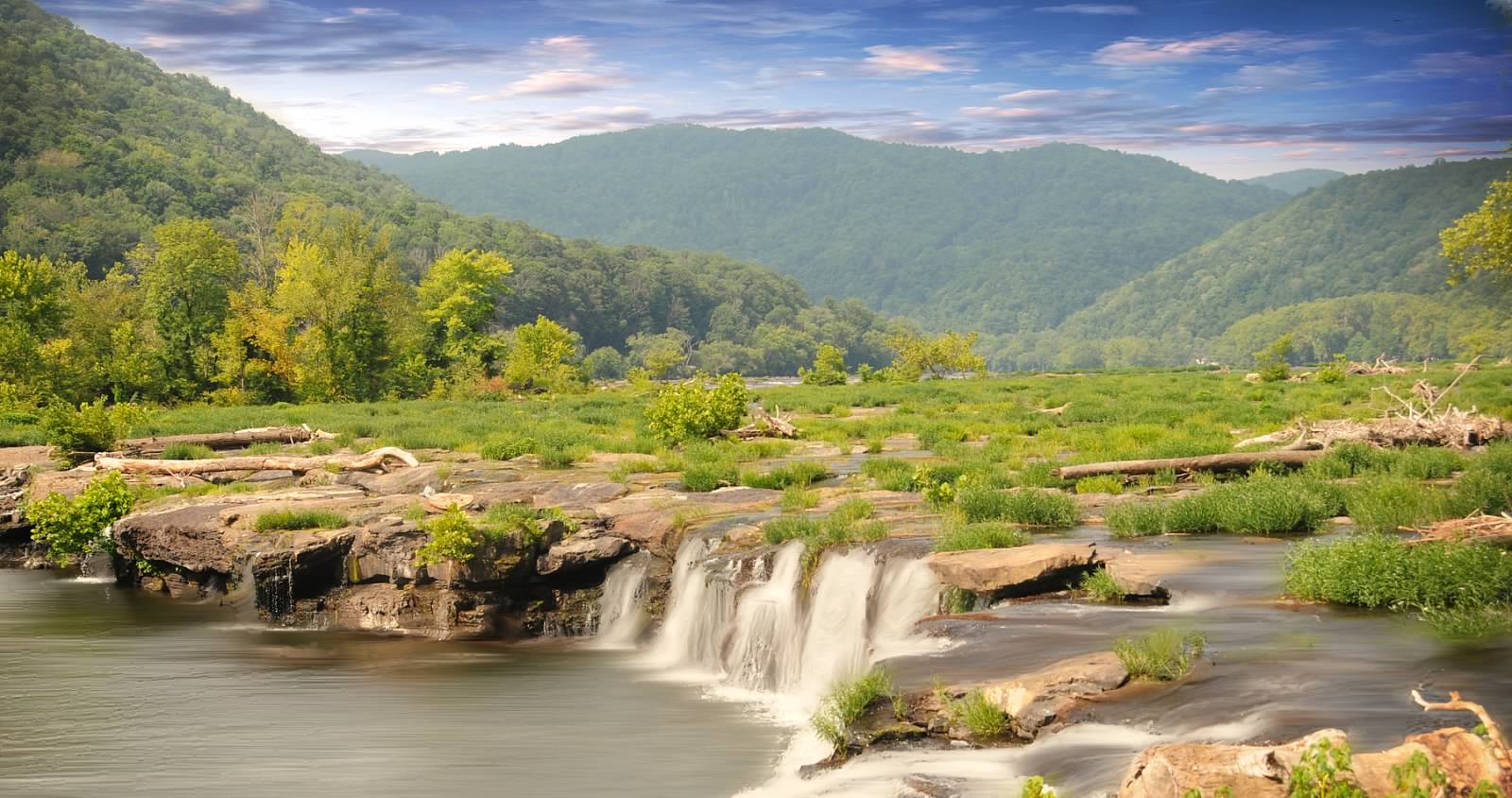
Sandstone Falls Overlook
Night Skies – Exploring After Dark
People for millennia have looked up at the night sky and admired the countless number of stars that can be observed. Since the invention of constant light sources, we were able to explore the night in ways never dreamed. Imagine trying to drive a car using only a candle! Despite all the benefits it gave us, the light bulb did affect our ability to see the night sky. In 2017, it was estimated that 80% of people in the U.S. could not see the Milky Way at night. National parks and other green spaces have now become refuges for nightscapes. While proximity to Beckley and Fayetteville prevent our night skies from being the darkest, this is still a great place to explore the night sky and see the Milky Way!
Recommended Locations
The best locations for stargazing and astrophotography are going to be dark locations with wide fields of view. Many of our locations have dense tree canopies that can obstruct your views or have safety lights that impact night vision. The following are a few locations that offer some better opportunities:
New River Gorge Bridge Overlook at Canyon Rim Vistor Center
Fayette Station Rd lower parking lot
Meadow Creek Campground
Sandstone Falls Boardwalk
NPS photo/Shannon Welch
Tips and Recommendations
The park is open 24 hours a day. Visitors may stargaze anytime of night in the park. Sandstone Visitor Center parking lot and the Glen Jean Headquarters are closed overnight
Stargazing is best at least 1.5 hours after sunset and 1.5 hours before sunrise.
Plan your visit around the Moon phase. The brighter the Moon, the less stars you see!
Temperatures swing wildly from day to night. Plan ahead and bring layers.
Use RED instead! Bring a light source to help you navigate safely in the dark. To get the most of out of your stargazing experience, try to use a red light to preserve your night vision. To make your own, use red paper or cellophanes to cover the white light of the flashlight.
Let your eyes adjust to the darkness, it takes about 15-30 minutes.
Enjoying the night skies is for everyone, you don’t need expensive equipment! If you don’t have a telescope, grab your binoculars to get a better look the fuzzy spots in the sky overhead.
Official NPS features and USGS park boundaries, imported 2026-10-17. An inventory snapshot, not live trail or parking availability.
Loading official park features…
TrailsPoints of interestParkingZoom with buttons or pinch. Toggle layers on the map.
Map coverage varies. Trail names may represent segments, connectors, or shared park units; mapped lines are not a hiking recommendation. Use official conditions and navigation resources before heading out.
Castle Rock Trail Inventory record · 1 source segments; not a route distance.
Native
Hiker/Pedestrian
Church Loop Trail Inventory record · 1 source segments; not a route distance.
Native
Hiker/Pedestrian
Climbers Access Inventory record · 1 source segments; not a route distance.
Native
Hiker/Pedestrian
Clovis Inventory record · 4 source segments; not a route distance.
Native
Hiker/Pedestrian | Bicycle
Page 1 of 4
NPS public GIS inventory, imported 2026-10-17. “Existing” is an inventory classification, not confirmation that a trail is open. Segment counts are not route distances. Parking records do not indicate space availability, fees, or accessibility certification. View government source ↗
Climate for Beckley, 34 km from the park reference point. 1991–2020 normals. Source elevation: 738 m.
Daytime highNighttime lowOctober: 63° / 45°
Daytime high63°
Precipitation87 mm
Daylight11.0 hrs
Wind10.3 km/h
Mountain, rim, valley, and coastal conditions can differ sharply from the source town. Check park forecasts and current conditions before travel.
Monthly climate data 12 months · °F
Month
High
Low
Rain / snow water
Wet days
Daylight
40°
25°
101 mm
12.8
9.7 h
44°
27°
102 mm
13.0
10.5 h
52°
34°
124 mm
14.8
11.7 h
63°
44°
114 mm
13.3
12.9 h
69°
52°
135 mm
16.2
14.0 h
76°
60°
127 mm
15.8
14.6 h
79°
63°
139 mm
16.6
14.3 h
78°
62°
100 mm
14.0
13.5 h
73°
56°
98 mm
10.2
12.3 h
63°
45°
87 mm
9.8
11.0 h
53°
35°
86 mm
10.2
10.0 h
44°
29°
105 mm
12.2
9.4 h
RESEARCH WITH THE SOURCE IN VIEW
The practical field guide.
Official NPS excerpts imported 2026-10-17. Fees, permits, road access, and operations can change; use the source link to confirm the latest information.
New River Gorge National Park and Preserve protects and preserves 53 miles of the New River as well as over 70,000 acres of the magnificent gorge that this river created. The park is 53 miles long. Having a good map is essential. A park map can be obtained at any park visitor center. Many roads are narrow and winding. Allow extra time when exploring. Stop at Canyon Rim or Sandstone Visitor Centers any time of year. Visitor centers at Grandview and Thurmond are seasonal, generally open from Memorial Day through Labor Day. Check the Visitor Centers page for current hours. There are plenty of things to do in the gorge, from rafting to rock climbing to hiking. The possibilities are endless! Food, lodging, and full service campgrounds are plentiful in the gateway communities surrounding the park, including Hinton, Fayetteville, and Beckley. Primitive camping, on a first come - first serve basis, is available without charge at a number of locations within the park.
Check here for operating hours of park visitor centers.
Information about fees and park passes
Information about reserving shelters at Grandview and about permits and commercial use authorizations for activities and events in the park
Leave something behind? Fill out a lost and found report.
Be prepared and check the local forecast before hitting the trail or heading down the river.
Camping is a favorite pasttime at national parks across the United States. Visitors to New River Gorge National Park and Preserve can enjoy primitive camping at one of our 8 primitive campgrounds. Primitive camping areas have no drinking water, no hookups, no electricity, and limited restroom facilities. There are no camping fees at park campgrounds. Reservations are not available; all sites are first-come, first-serve . In busy months, campgrounds fill quickly and it is recommended to have a back-up plan. There are no developed campgrounds in the park. Visitors that need or prefer a developed campgrounds can find options throughout the surrounding area at state parks and private campgrounds.
New River Gorge National Park and Preserve offers 8 primitive campgrounds. The nearby Gauley River National Recreation Area also offers one primitive campground, Gauley Tailwaters. Campgrounds have different types of campsites including walk-in campsites for tents only and drive-in campsites for RVs, campers, car camping, and tents. Walk-in campsites require walking a short distance from the parking area to the tent-only campsite. Drive-in campsites have their own parking spot next to a camping pad that can accomodate varying sizes of RVs and campers. Picnic tables, fire rings, and grills are available at campsites. Camping in a non-designated site or using a walk-in parking lot for RV, camper, or car camping is prohibited.
All campgrounds are located on maintained gravel or dirt roads in somewhat remote locations within New River Gorge National Park and Preserve. Campgrounds will be several miles from gas stations, grocery stores, or other markets. Campers are recommended to bring plenty of drinking water, food, and any other necessities with them.
All campgrounds except War Ridge are located on the New River. Easy access to the river for fishing and boating is available. Swimming is strongly discouraged as the New River has powerful currents, rocky banks and shoals, and sudden dropoffs. Anyone near the banks of the New River is recommended to wear an approved personal flotation device such as a life jacket.
Stone Cliff Beach
Grandview Sandbar
War Ridge/Backus Mountain
Gauley Tailwaters
Campground Regulations
All designated sites are managed on a first-come, first-served basis . Reservations are not accepted.
No more than 2 vehicles permitted per campsite. RVs do not count towards vehicle limits
No more than 2 tents or 1 tent and 1 RV/Camper per campsite. RV, camper, and car camping only permitted at drive-in campsites. Tent camping permitted at all campsites.
Camp only in designated campsites. Camping in any day use, river access, trailhead, or walk-in campsite parking lot is prohibited.
No more than 8 people and 4 pets per campsite
Camping limit of no more than a total of 14 days within a 28-day period within any park campground and camping area.
Quiet hours are from 10:00 PM to 6:00 AM.
Check-out time is 12:00 PM noon on the day the permit expires
Pets must be kept on a leash.
Use existing fire rings for campfires. Burn only dead wood found on the ground. Damaging or cutting live trees or branches for firewood is prohibited.
Use the provided toilet facilities.
Do not drive nails into trees or hang lanterns against trees.
Public intoxication, disorderly conduct, and possession of alcohol by minors is prohibited. Alcohol is prohibited at Thayer campground.
Littering is prohibited. Dispose of trash in a bear-proof trash can or dumpster. Pack out all trash if there is no available bear-proof trash can or dumpster.
Broken glass is a hazard. Use plastic and aluminum containers when possible.
Respect all other park visitors including hikers, river users, and other campers.
Burnwood Group Campsite
Backcountry Camping
Backcountry Regulations
Reservations or permits are not required for backcountry camping
Camping is prohibited at Grandview, Brookside Island, day-use areas, and within Bluestone National Scenic River
Camping is prohibited within 100 feet of state roads, parking lots, trailheads, boat launch areas, visitor centers, park structures, top or bottom of cliffs, and historic areas.
Camp above the high water line of any river, creek, or stream if possible.
Use existing campsites and fire rings where provided.
Dead, down wood may be used for campfires. Damaging or cutting live trees or branches for firewood is prohibited. Only use hand tools on collected firewood.
Trespassing is prohibited on all CSX or RJ Corman property including railroad tracks and roads.
Any person within 0.25 miles from a restroom or other toilet facility must dispose of human waste within that facility.
Properly dispose of human waste in non-developed areas more than a 0.25 miles from restroom facilities. Human waste may be containerized in an appropriate receptical and carried out or it may be buried. All buried waste must be buried 6 inches deep in organic soil in a location that is not within 200 feet or in sight of any trail, road, parking lot, developed area, campsite, cliff or rock formation, climbing route, climbing area, water source, or high water mark, intermittent or otherwise, of any stream.
Littering is prohibited. Pack out all trash and properly dispose of it in a bear-proof trash can or dumpster.
More Information
General camping information (weekdays only) - 304-465-0508
Group camping permit application (weekdays only) - 304-465-6531
Camping Regulations - Superintendent's Compedium
Nearby Developed Campgrounds - Visit Southern West Virginia , New River Gorge Convention and Visitors Bureau.
Camping and Wildlife
Learn how to camp safely in bear habitat.
Check here for information and regulations concerning backpacking in the park.
Permits and Reservations
Information about reserving shelters and group campgrounds and about permits and commercial use authorizations for activities and events
Canyon Rim Visitor Center and the Sandstone Falls Boardwalk have boardwalks to scenic overviews consisting of flat panels compatible with most mobility aids, including wheelchairs.All park films and video exhibits are presented with open captions at all times. At Sandstone Visitor Center handheld assistive listening and audio description devices for park films are on request at the front desk.
The park brochure is available as an audio described version along with a transcript of the audio description.
There are accessible campsites at Glade Creek and Grandview Sandbar Campgrounds. Glade Creek Campground also includes an accessible picnic area, fishing area, and a small portion of the Glade Creek Trail.
Visitor Centers:
Accessible Trails and Overlooks
Canyon Rim Visitor Center
The 1/10th of a mile boardwalk, compatible with certain mobility aids, offers scenic views of the gorge and New River Gorge Bridge. An easy walk on an accessible ramp leads to the first viewing point. Note: the boardwalk to the lower overlook is not accessible as it descends 178 steps. For more information visit the Fayetteville Area Trails page.
Sandstone Falls Boardwalk
A ¼ mile, boardwalk, compatible with certain mobility aids, crosses two bridges leading to islands and observation decks offering fantastic views of the falls and access to fishing areas. The boardwalk passes through the Appalachian riverside flatrock community, which contains a rare assemblage of plants found in only a few places along several high-energy Appalachian rivers. For more information visit the Sandstone-Brooks Area Trails page.
Long Point Trail
The first 1/4 mile of the Long Point Trail is accessible from the parking lot to an accessible boardwalk viewing area of forest regrowth, providing wildlife viewing. The Long Point overlook of the New River Gorge Bridge is not accessible. For more information check the Fayetteville Area Trails page.
Glade Creek Trail
The first 1/4 mile of the Glade Creek Trail is accessible. This portion of the trail follows the cascading waters of the lower part of Glade Creek. For more information check the Glade Creek Trails page.
An accessible viewing deck overlooks the main section of Brooks Falls on River Road.
The main overlook has a designated viewing platform for wheelchair users, however the 500 yard path from the parking lot to the overlook consists of large, uneven stones.
Accessible Fishing Areas
There is a wheel chair accessible fishing area at the Glade Creek Campground. The accessible area is on a wooden bridge over Glade Creek, an excellent fishing location (catch and release in this area). It can be reached at the end of Glade Creek Road from the parking area next to the campground entrance. For more information visit the fishing page.
For more information about accessible fishing locations in West Virginia, visit the WV Department of Natural Resources webpage.
An entrance pass is not required to access New River Gorge National Park & Preserve.
Other National Park Service sites may require an entrance pass or fee. Depending on your trip plans, an interagency pass may save you money.
2026 Free Entrance Days in the National Parks
Come experience the national parks! All National Park Service sites that charge an entrance fee will offer free admission to US citizens and residents (other fees, including timed entry or reservation fees, may apply). Mark your calendar for these entrance fee-free dates:
February 16 : Presidents Day (Washington's Birthday)
May 25 : Memorial Day
June 14: Flag Day/President Trump's birthday
July 3–5: Independence Day weekend
August 25: 110th Birthday of the National Park Service
September 17: Constitution Day
October 27 : Theodore Roosevelt's birthday
November 11: Veterans Day
NPS photo/Louise McLaughlin
There is NO FEE to enter New River Gorge National Park and Preserve. Enjoy your visit! Since this is a free park, park passes, senior passes, and access passes are not available for purchase here.
If you plan to visit other national parks with an entrance fee, learn more about the America the Beautiful - The National Parks and Federal Recreational Lands Pass series and fee free days in national parks.
Highway access is from Route 19, between Beckley and Hico, and from I-64, between Mossy and Sandstone.
Third party mobile applications like Apple Maps and Google Maps may direct you to areas of the park that are rough in terrain and inaccessible and NOT a visitor center. Please use the Visitor Center coordinates or addresses that are found below.
Charleston WV, approximately 70 miles northwest of the park, is the closest major airport. Some flights are also available nearby at Beckley WV.
GPS Coordinates and Physical Addresses
Sandstone Visitor Center
GPS: 37.78320 N, 80.89778 W Address: 330 Meadow Creek Rd. Meadow Bridge, WV 25976
Canyon Rim Visitor Center
GPS: 38.07003 N, 81.07583 W Address: 162 Visitor Center Rd. Lansing, WV 25862
Grandview Visitor Center
GPS: 37.83017 N, 81.06312 W Address: 4700 Grandview Rd, Beaver, WV 25813
GPS: 37.95712 N, 81.07879 W Address: 254 River Crest Road Thurmond, WV 25936
Sandstone Falls
GPS: 37.71797 N, 80.89297 W
GPS: 38.05019 N, 81.03976 W
Park Headquarters in Glen Jean
GPS: 37.92775 N, 81.15587 W Address: 104 Co Rte 25/9, Glen Jean, WV 25846
Public Transportation
Amtrak service is available to three locations in the park, three days a week. The Cardinal, traveling between Chicago and New York, NY, makes scheduled stops at Hinton and Prince, with Thurmond as a flag stop for passengers with reservations. Greyhound has a bus terminal in Beckley. Taxi services are based in Oak Hill and Beckley.
Canyon Rim Visitor Center is located on U.S. Route 19, just north of Fayetteville, WV. U.S. Route 19 is easily reached from Interstates I-64 and I-79, as well as U.S. Route 60.
Sandstone Visitor Center is located just north of the I-64 and State Route 20 interchange (Exit 139).
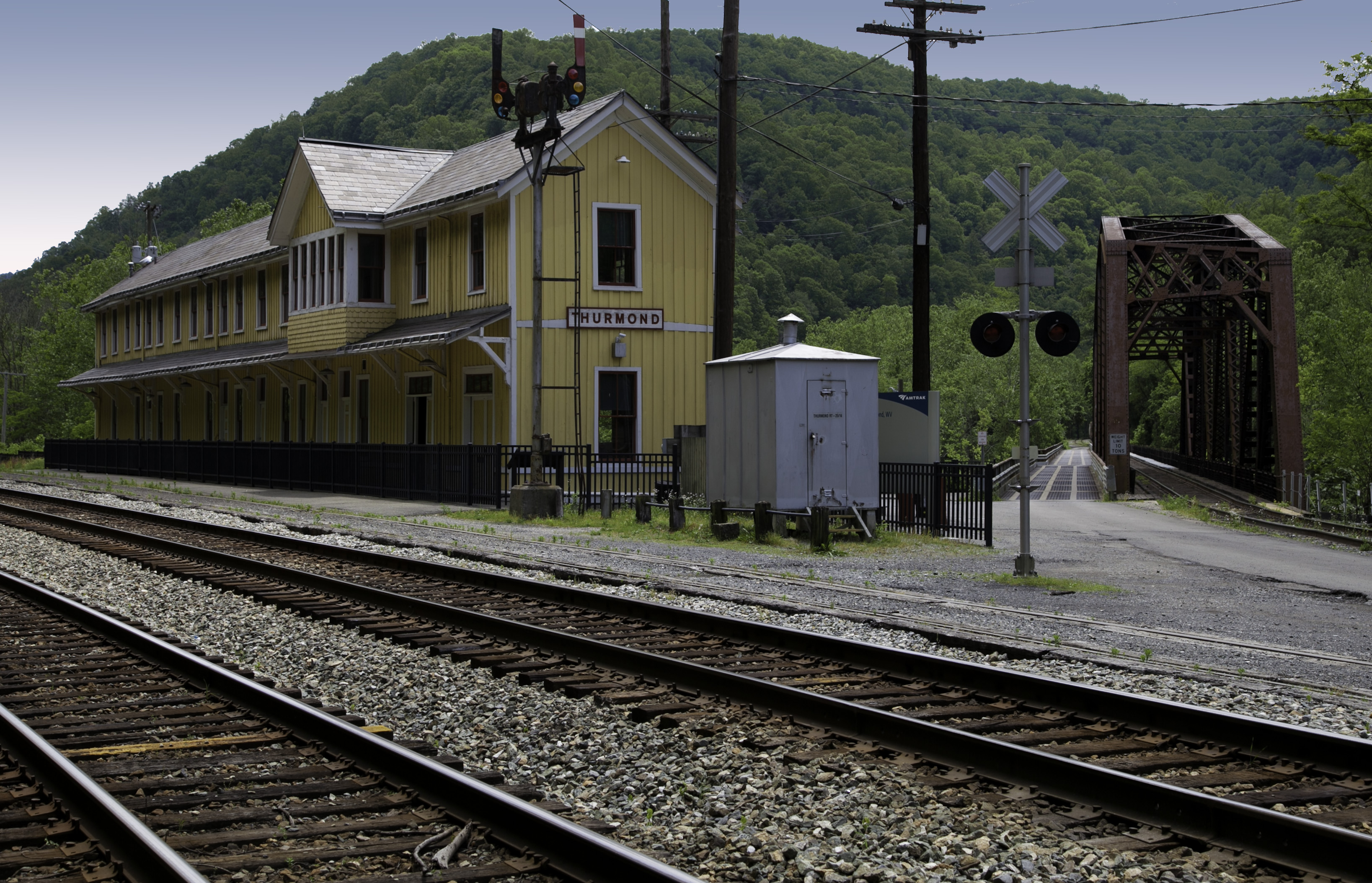
The Thurmond Depot Visitor Center is located seven miles down State Route 25. Take the Glen Jean exit off U.S. Route 19 north of Beckley, and follow the signs to Thurmond.
To reach Grandview from Beckley follow I-64 East five miles to Exit 129 B. From Lewisburg follow I-64 West forty miles to Exit 129. From either exit, turn right and follow Route 9 North six miles to Grandview.
Camp Brookside Environmental Education Center
Camp Brookside Environmental Education Center is located at 309 North Mullens Road, Hinton, WV. Get off I-64 at the Hinton/Sandstone Exit (exit 139) and head south towards Hinton on Route 20 South. Follow Route 20 south for 5 miles. When you come to the small town of Brooks, turn right on North Mullens Road. Make a quick left just after crossing the railroad tracks and follow the dirt road to Camp Brookside.
There are multiple campgrounds throughout New River Gorge National Park and Preserve. Please visit our camping page for directions to a specific campground.
Check out routes around the park to popular destinations.
Canyon Rim Visitor Center sits on the edge of the gorge by the New River Gorge Bridge.
Visit our green design visitor center in the south end of the park.
Visit the seasonal visitor center at Thurmond located in the old railroad depot.
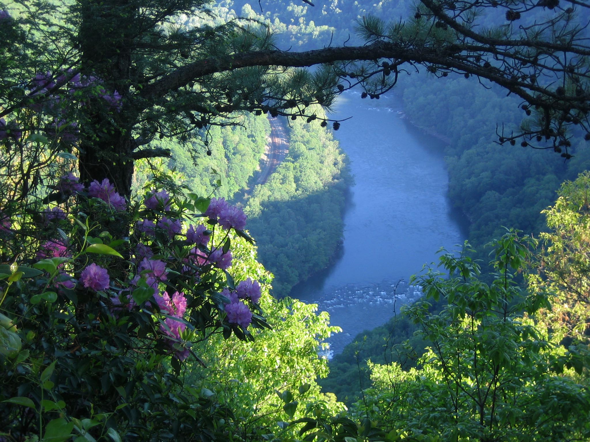
The Grandview Visitor Center overlooks the deepest part of the gorge.
With this much to explore, you'll want to stay overnight. Find out more about camping in the park on our camping page.
Check for any road and trail closures that might affect your visit.
We hope that your trip to New River Gorge National Park and Preserve will be a fun and memorable experience. Taking time to plan and prepare for your visit will better ensure that you have a safe and enjoyable time. Look over the following items to better understand some of the possible hazards and safety issues you may encounter at New River Gorge.
If you are in the park and in need of urgent assistance, please call 911.
If you are in the park and have a non-emergency issue, please call one of our Visitor Centers:
Canyon Rim Visitor Center (North District) - Open Daily (except Thanksgiving, Christmas, and New Years Day)
Sandsone Visitor Center (South District) - Open Daily (except Thanksgiving, Christmas, and New Years Day)
Thurmond Depot, Open Seasonally (generally Memorial Day to Labor Day)
Grandview Visitor Center, Open Seasonally (generally Memorial Day to Labor Day)
Find out how to be safe in and around the water
Visit the Hiking Safety page for information about how to have a safe hike.
Find out what you need to know to have a safe ride in the park.
Be safe when climbing in the park. Check here for more information.
Learn about safely navigating the winding and narrow roads found throughout the park.
Learn about what to do in a heat or cold related emergency.
Learn how to camp safely in bear habitat.
Learn about the two venomous snakes found at New River Gorge.
Learn how to be safe in a lightning storm.
Learn how to stay safe from spider and tick bites.
New River Gorge National Park and Preserve provides a variety of different trails throughout the park. Peaceful forest trails, superb overlooks, and historic scenery are all found here. The trails available consist of park service trails that are marked and maintained, trails within lands administered by state parks, and undeveloped trails and abandoned roads.
Trails range from 0.25 mile to 7 miles in length one-way. Several can be easily connected to make for longer excursions. Difficulty varies from flat, smooth walking to steep challenging terrain. Trail recommendations and maps are offered at Canyon Rim, Grandview, Sandstone, and Thurmond visitor centers. Much of the land within the national park and preserve authorized boundaries remains private property: please respect the owners' rights. Use the map or links below to find out more details about the trails available in each hiking area.
Hike with a Ranger
When you plan your hike at New River Gorge National Park and Preserve, consider joining a ranger for a guided hike. The park offers ranger led hikes between Memorial Day and Labor Day. These hikes are available on a variety of trails from the most popular to the hidden gems. Join a ranger to visit old growth forest, rail trails, abandoned mines, or other unique locations. Learn about natural resources, history of the area, how to identify plants and animals, park resource management, and more. For more information, check out the park's calendar of events or ask at a park visitor center.
Trail Etiquette
At New River Gorge National Park and Preserve, we protect our park by practicing Leave No Trace . When hiking, please follow our trail etiquette to make the experience enjoyable for yourself and others and to protect your national park.
Pack it in, Pack it out. Pocket all your trash, including cigarette butts and candy wrappers, and dispose of it properly.
Wildflowers, wildlife, and historic objects all contribute to the beauty we came to see. Leave them undisturbed.
Keep pets on a leash at all times.
Bicycles are only permitted on designated bike trails.
Within a distance of one-quarter of a mile from a restroom or pit toilet facility, human body waste must be appropriately disposed of in such facilities. In non-developed areas more than a quarter of a mile from restroom facilities, human body waste must either be containerized and carried out or it must be buried at a depth of 6 inches in organic soil and at a location not frequented by the public. Human waste may not be buried within 200 feet or in sight of any trail, road, parking lot, developed area, campsite, cliff or rock formation, climbing route or climbing area, water source or the high water mark of any stream, whether intermittent or not.
Courtesy and common sense on the trail can help provide an enjoyable experience for all. Respect the rights of others.
Hikes to Overlooks and Views
Endless Wall Trail (2.2 - 2.6 miles)
Grandview Rim Trail (3.2 miles)
Long Point Trail (3.2 miles)
Hikes with Waterfalls
Big Branch Trail (2.0 miles)
Butcher Branch Trail (1.6 miles)
Glade Creek Trail (2 miles to waterfall)
Kates Falls Trail (0.4 miles, accessed via Glade Creek Trail )
Kaymoor Trail (0.2 miles to waterfall from Wolf Creek Trailhead)
Hikes to Historic Sites and Ruins
Brooklyn Mine Trail (5.4 miles)
Headhouse Trail (1.4 miles)
Kaymoor Trail (4.0 miles to mine site)
Kaymoor Miner's Trail (2.0 miles)
Rend Trail (6.8 miles) - access to Church Loop Trail (0.1 miles)
Southside Trail (14 miles)
Old Growth Forest Hikes
Burnwood Trail (1.2 miles)
Stone Cliff Trail (5.4 miles)
Short Easy Hikes (1 - 2 Miles Roundtrip)
Big Buck Trail (0.9 miles)
Island Loop Trail (0.5 miles)
Park Loop Trail (1.1 miles)
Timber Ridge Trail (1.0 miles)
Woodland Loop Trail (0.6 miles)
Long Day Hikes (6+ Miles Roundtrip)
Fayetteville Trail (8 miles)
Glade Creek Trail (11.2 miles)
Kaymoor Trail (17.2 miles)
Hiking Trail Information:
Grandview Area Trails
Grandview area trails offer spectacular views, rock formations, and woodlands.
Glade Creek Area Trails
Glade Creek offers a scenic walk along cascading waterfalls and pools.
Sandstone Brooks Area Trails
There are several excellent trails in the south end of the park, just a short drive from Sandstone Visitor Center.
Fayetteville Area Trails
Trails in the Fayetteville area provide access to some of the most spectacular overlooks in the park.
Thurmond-Stone Cliff-Cunard Area Trails
There are several easy to moderate hiking trails, many utilizing old roads and railroad grades, in the Thurmond area.
Nuttallburg Trails
Trails at Nuttallburg allow visitors to explore the remains of an old coal mining town.
Check here for information and regulations concerning backpacking in the park.
Visit the Hiking Safety page for information about how to have a safe hike.
100 Mile Challenge
Celebrate parks and health by hiking 100 miles on trails in New River Gorge National River and Bluestone National Scenic River.
To download official maps in PDF, Illustrator, or Photoshop file formats, visit the National Park Service cartography site.
The free, official NPS app includes an interactive park map. The map is easy to use while outdoors and features large font sizes, illustrated trails and services, scenic highlights, and multiple zoom levels. By tapping the “Locate me” icon you will always know where you are. The NPS Park App is also a great place to find ideas, recommendations and directions to many of the activities found in the park!
For commercial rafting trips, visit one of the local commercial whitewater outfitters for availability. Visit our hiking page for maps and details about the trails within the park. Camping information and a map of the campgrounds in the park.
For commercial rafting trips, visit one of the local commercial whitewater outfitters for availability.
Visit our hiking page for maps and details about the trails within the park.
Camping information and a map of the campgrounds in the park.
Pets are allowed on all trails at New River Gorge National Park and Preserve. We created our park rules for pets in a way to maximize safety and enjoyment for everyone. These rules allow visitors to enjoy the park with their pets while protecting park wildlife, ecosystems, and visitors. If you choose to bring your pet to New River Gorge please be sure to follow our park pet policies.
Park Pet Policies:
Pets are not allowed in any park buildings or visitor centers in compliance with federal regulations.
Pets must always be on a physical leash no longer than 6 feet. Leashes protect pets from becoming lost, encountering dangerous animals, or scaring wildlife. Leashes also protect other visitors who may be afraid or allergic to pets or do not want a pet approaching them.
Pick up your pet's waste and throw it away in the trash to keep the park's ecosystem healthy and enjoyable.
Bring extra water for your pet to drink when hiking. Streams in the park may contain harmful bacteria or parasites such as Giardia. Water fountains or bottle filling stations are available at every visitor center. There is no drinking water available at the trailheads.
Pets are not allowed at ranger led programs. This avoid conflicts with other animals such as wildlife and respects other visitors.
Weather in the Appalachian Mountains can be unpredictable and can change quickly. Always be prepared for the possibility of sudden storms. Weather in the mountains is often cooler and wetter than the surrounding area. On average, the warmest month is July. The maximum average precipitation also occurs in July.
Loading weather forecast...
Current Weather for New River Gorge National Park and Preserve
If you had to choose just one area to hike and view the park, Grandview would be a great choice for your destination. Grandview has six miles of hiking trails, offering unsurpassed views of the deepest section of New River Gorge. The trails of Grandview range from easy to strenuous and can be hiked in their entirety or in various shorter segments.
The trails of Grandview also provide excellent opportunities to view wildlife; deer, fox, bats, skinks, box turtles, and a great variety of birds including wild turkey, several species of raptors, song birds and ravens.
Local volunteers from schools, scout groups, and bicycling and hiking clubs donated hundreds of hours of work to make these trails possible.
The trails in the Fayetteville area can be accessed from a number of different trailheads, and allow connections to trails in the Kaymoor area (and beyond). The most popular trailhead is probably located at the Fayetteville Town Park, where visitors also have access to the town playground, a .5 mile paved walking trail, and might be able to take in a baseball or softball game.
Never dump food scraps or other smelly stuff near your camping area.
Never bring food in your tent.
Lock food, trash, and scented items in a vehicle when not in use.
If you are backpacking or boating and do not have a vehicle, food should be hung in a tree out of reach of animals and away from your tent.
Use designated camping areas.
Keep your sleeping area, tent and sleeping bag free of food and odors.
Dispose of trash in bear resistant trash cans.
Keep a safe distance from all wildlife.
Never feed wild animals! It is dangerous to both you and the animal.
Always keep pets on a leash.
If you see a bear:
Remain watchful.
Do not approach it
Do not allow the bear to approach you.
If your presence causes the bear to change its behavior (stops feeding, changes its travel direction, watches you, etc.) you are too close.
Being too close may promote aggressive behavior from the bear such as running toward you, making loud noises, or swatting the ground. The bear is demanding more space. Don't run, but slowly back away, watching the bear. Increase the distance between you and the bear. The bear will probably do the same.
Change your direction.
If the bear continues to follow you, stand your ground.
If the bear gets closer, talk loudly or shout at it.
Act aggressively to intimidate the bear.
Act together as a group if you have companions. Make yourselves look as large as possible (for example, move to higher ground).
Throw non-food objects such as rocks at the bear.
Use a deterrent such as a stout stick.
Don't run and don't turn away from the bear.
Don't leave food for the bear; this encourages further problems.
Just 75 miles from the bustle of Washington, DC, Shenandoah National Park is a land bursting with cascading waterfalls, spectacular vistas, fields of wildflowers, and quiet wooded hollows. With over 200,000 acres of protected lands that are haven to deer, songbirds, and black bear, there's so much to explore...and your journey begins right here!
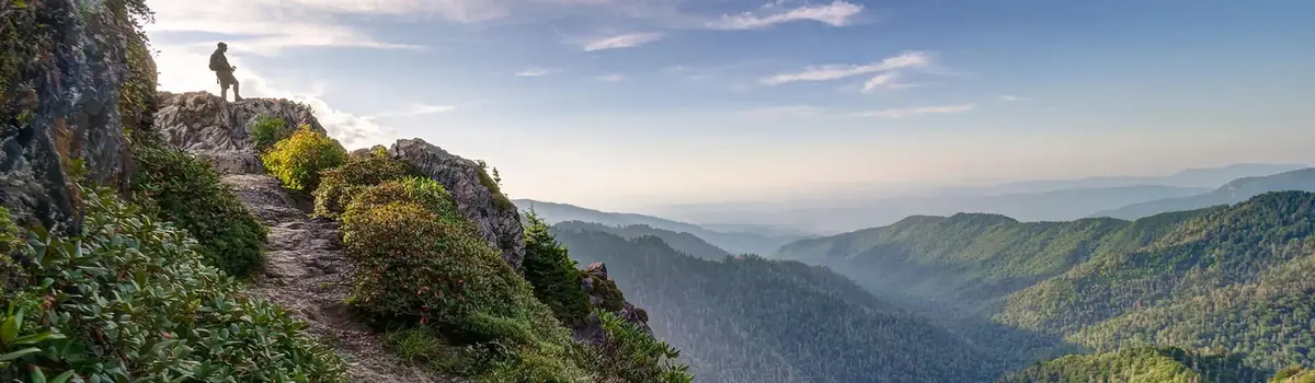
Ridge upon ridge of forest straddles the border between North Carolina and Tennessee in Great Smoky Mountains National Park. World renowned for its diversity of plant and animal life, the beauty of its ancient mountains, and the quality of its remnants of Southern Appalachian mountain culture, this is America's most visited national park. Plan your visit today!
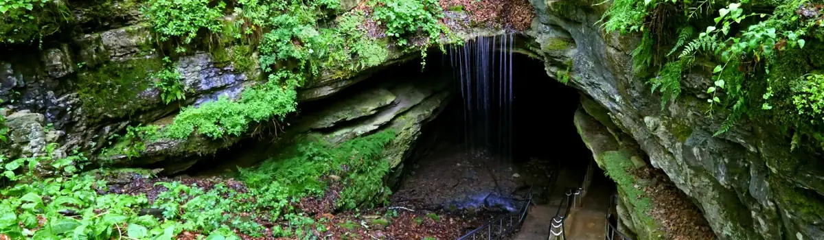
Rolling hills, deep river valleys, and the world's longest known cave system. Mammoth Cave National Park is home to thousands of years of human history and a rich diversity of plant and animal life, earning it the title of UNESCO World Heritage Site and International Biosphere Region.





 Forests