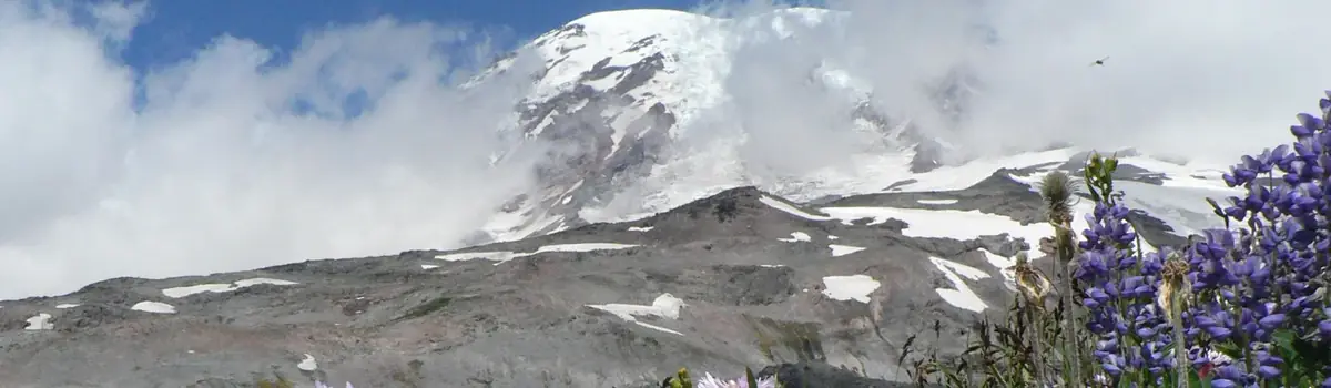
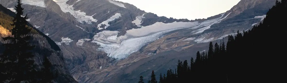
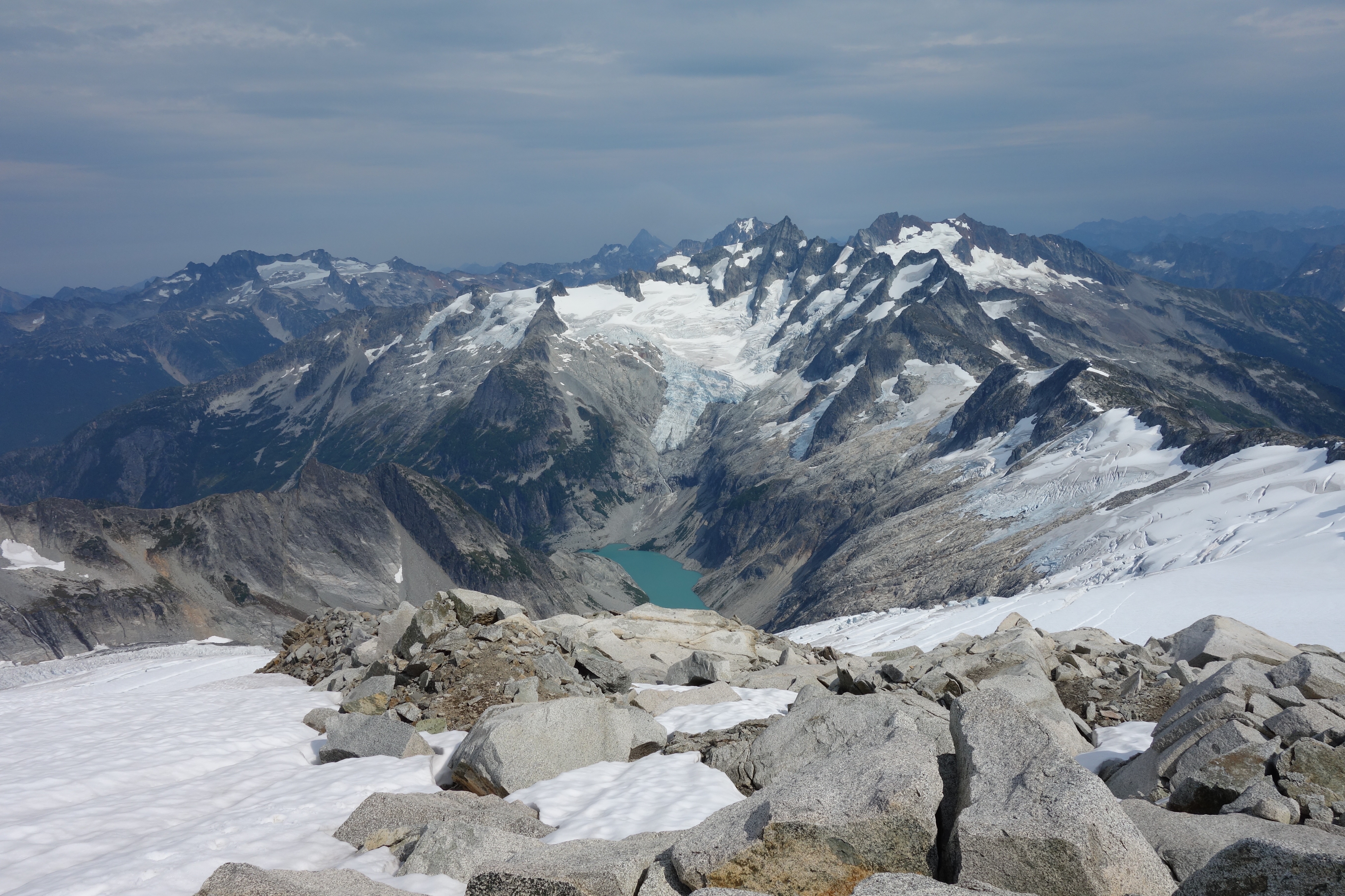
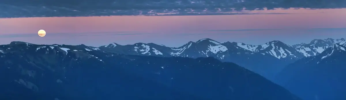
Less than three hours from Seattle, an alpine landscape beckons. Discover communities of life adapted to moisture in the west and recurring fire in the east. Explore jagged peaks crowned by more than 300 glaciers. Listen to cascading waters in forested valleys. Witness a landscape sensitive to the Earth's changing climate. Help steward the ecological heart of the Cascades.
504.8Kacres of parkland
46.9Krecreation visits, 2025
Jul · Aug · Sepnearby climate picks
Seasonal access & reservations
No reviewed guidance for this selection. Check the park's official planning pages; missing coverage does not establish access.
Selected guidance only; separate from climate comfort and current conditions.
Official conditions Not checked
The conditions feed has not been connected for this park.
Editorial recommendations, reviewed 2026-10-17. Full park days, excluding travel to and from the region. A first-visit outline for a general traveler; adapt to mobility, fitness, season, reservations, and current conditions. These are suggested days, not reserved activities or guaranteed routes.
Hike the North Cascades to experience some of the finest mountain country in North America!
The North Cascades National Park Service Complex preserves some of the finest mountain country in North America. From accessible trails and short, scenic strolls to steep mountain hikes, there is a trail here for everyone. Enjoy the solitude, peace, and challenge that hiking in this beautiful park offers. Remember to walk lightly, so that many generations more may continue to discover this place. Hikers, backpackers, and climbers travel the trails of the park complex year round; however, the more common hiking season stretches from April through October. The driest and most popular time to visit is during the summer months of mid-June through September. Higher elevation trails often remain snow-covered well into July and sometimes August. Precipitation and snowfall are greatest from November through March. The park's winters are wet, and snowfall is heavy. Access is often limited during these winter months by impassable or closed roads, so be sure to check current conditions . The key to a successful trip is to plan ahead and be prepared. Check out the trip planning tools below to choose a trail, learn about backcountry permits, get updated trail conditions, and more.
Explore the different trail options for a day in the park.
Learn about the many overnight backcountry options in the North Cascades.
North Cascades has over 400 miles of trails to explore. Learn about which one is right for you.
Wilderness Trip Planner
Plan a trip into the backcountry of the North Cascades.
Trail Conditions
General conditions and a trail-by-trail list of the most recent conditions reports.
Hiking in Stehekin
Explore the many trails in the Stehekin area.
Plan on hitting the trail? Be prepared!
Hiking with pets
Bringing your dog? Pets are only allowed on certain trails under certain conditions.
Plan a trip into the backcountry of the North Cascades.
The Stephen Mather Wilderness is at the heart of over two million acres of some of the wildest lands remaining. Use the resources below to plan your trip and learn how to help preserve and protect the fragile ecosystem.
Backcountry permits are required year-round in North Cascades National Park for all overnight trips
Research where you want to hike, climb, or boat. Check area regulations and what amenities are provided with the resources below.
Wilderness Trip Planner Map
Locate the backcountry trails and campsites with this map. Use in conjunction with the camp info table below for more information.
Use this map to help plan your overnight boating trip on Ross Lake.
Backcounty Camp Information
See the table below for information on group size limitation for each backcountry camp, food storage requirements, and campfire rules. Group size is limited to protect wilderness values. The size limit is 12 within all trail corridors and camps, and in cross-country zones around Mount Shuksan, Eldorado Peak, and Forbidden Peak. Group size limit is 6 for the remainder of the cross-country zones . Group size limits include people and stock. Due to natural terrain constraints in some places, not all camps can accommodate 12 people.
Big and Little Beaver Trails
Thunder/Fourth of July/Fisher/Park Creek Trails
Ross Lake/Diablo Lake/East Bank Trails
Bridge Creek/North Fork/Twisp Pass/McAlester/Rainbow Lake and Creek/McGregor
Copper Ridge/Chilliwack/Brush Creek Trails
Cascade Pass/Sahale Arm Trails
Upper Stehekin Valley Trail/Stehekin Road
Boulder/War Creek/Chelan Summit Trails
High Use Cross-country Zones
Planning a Climb
Use this page to plan for your mountaineering trip in the North Cascades.
Boating on Ross Lake
Find information on boating and camping on Ross Lake.
Plan on hitting the trail? Be prepared!
Check the current road and trail conditions. Consider the seasons, weather forecasts, and snow conditions. Be aware of closures related to current or past wildfires.
Trail Conditions
General conditions and a trail-by-trail list of the most recent conditions reports.
Find out about current road status in the park complex.
Climbing Conditions
Find recent conditions for popular climbing zones in the park.
Lake and River Conditions
Check out current conditions before heading out on the water.
Learn more about area, trail, and camp closures that are in effect due to current or past fire activity
Check out the webcam stationed at the North Cascades Visitor Center for a live look at park conditions.
Backcountry Permits
Backcountry permits are required year-round. Find out where they are required, why they are required, and how to obtain a permit.
Backcountry Reservations
Reservations for backcountry permits begin in March 2025.
Make reservations and view real-time availability of backcountry campsites
Hiking with pets
Bringing your dog? Pets are only allowed on certain trails under certain conditions.
Pacific Crest Trail
Information for traveling along the Pacific Crest Trail through North Cascades National Park.
Pacific Northwest Trail
Information for traveling along the Pacific Northwest Trail through North Cascades National Park
Learn about the different camping options within the park complex.
NPS / Paisley Dandenault
Tips and Regulations
During the operational season (mid-May to early September), a ll sites in campgrounds along State Route 20 and in Stehekin can be reserved in advance. When possible, make reservations as early as you can.
Reservations are not required starting September 7, 2026 and all sites are first-come, first-served as long as they remain open.
Colonial Creek North, Colonial Creek South and loop C of Newhalem Creek Campgrounds will close for the season on September 14, 2026. Loops A & B of Newhalem Creek Campground will close for the season on September 27, 2026.
Campgrounds open for the season each year on the Monday before Memorial Day weekend (May 17, 2027).
The following campgrounds remain open year-round for first-come, first-served camping outside the operational season with no fee, no water, and no trash services: Goodell Creek (19 sites), Gorge Lake (8 sites), Colonial Creek South (10 walk-in, tent-only sites, #64-#73).
Overnight camping is only allowed in designated campsites. There is no dispersed camping in the park complex.
Campsite occupancy is limited to eight people, three tents, and two vehicles per site.
Camping is limited to 14 days from July 1 through Labor Day (first Monday in September) and to 30 days the rest of the year.
Firewood, ice, gas, and other services are not available in the park complex. The nearest services are in the town of Marblemount, WA.
Don't move firewood ! Destructive insects and diseases can be transported in firewood. Always buy firewood near where you will burn it.
Drive-in Campgrounds
All drive-in campgrounds along State Route 20 are on a reservation system through recreation.gov . Campground reservations are accepted during the specified season dates on the recreation.gov website. Campgrounds may be open before or after the reservation season on a first-come, first-served basis. See campground details below for more information, reservations, and current status.
Frequently Asked Questions
Camping Options
Newhalem Creek Campground
Newhalem Campground is a comfortable facility close to town, the Visitor Center, and the Skagit River.
Gorge Lake Campground
The campground is located on Gorge Lake, next to the cascading Stetattle Creek.
Goodell Creek Campground
Goodell Creek Campground is situated in lush, old growth forest on the banks of the Skagit River.
Lower Goodell Creek Group Campground
Lower Goodell Creek Group campsite is a convenient campground on the banks of Goodell Creek that accommodates large groups.
Colonial Creek North Campground
Colonial Creek Campground is a remote, yet bustling campground nestled in old growth forest with trail and lake access.
Colonial Creek South Campground
Visit remote Hozomeen at the north end of Ross Lake.
Camping in Stehekin
Stehekin offers camping in a range of settings, from lakeside sites to quiet roadside camps to backpacking sites.
Kayaking, canoeing, and motor boating are popular activities on Gorge, Diablo, and Ross lakes and Lake Chelan. Ramps and launches are located at Gorge Lake, Diablo Lake, the north end of Ross Lake at Hozomeen, and Lake Chelan. There is not a boat launch on the south end of Ross Lake. Ross Lake is not accessible by car from State Route 20.
There are no boat rental options for either Diablo or Gorge lakes. The Ross Lake Resort rents motorboats, kayaks, canoes, and other equipment for Ross Lake, as well as offering a water taxi service. Limited paddle craft rentals are available in Stehekin on Lake Chelan.
Boat-in camping is available on Ross and Diablo lakes and Lake Chelan. See also the guide to boating on Ross Lake . Boat-in camping on Ross and Diablo lakes requires a backcountry permit . Boat-in camping on Lake Chelan requires a federal dock permit.
Personal watercraft (jet skis, etc.) are not allowed in any part of the North Cascades National Park Service Complex.
Four stroke engines, direct injection two-stroke engines, or equivalent technology are required for motorboats on Ross, Diablo, and Gorge lakes. All engines must meet 2006 EPA clean engine requirements.
Water sports that involve towing behind a boat, such as waterskiing or tubing, are prohibited in all parts of the park complex.
Boating under the influence is illegal and not permitted. Operating a vessel while intoxicated is dangerous, and alcohol use is the leading contributing factor in fatal boating accidents. Always have a designated operator.
Portage Notice for Ross and Diablo Lake Boaters
There is no boat launch on the south end of Ross Lake. Boats must be portaged between Diablo and Ross lakes. For boaters approaching from Diablo Lake: Use the portage dock for all canoe and kayak portage activities. Do not use the ferry dock. The portage is 1.2 miles over a gravel road, with an elevation gain of 525 feet, elevation loss of 100 feet. Ross Lake Resort offers a portage service. It is not possible to portage larger power boats, or any other boat that cannot be carried between Diablo and Ross lakes. A portage phone is installed near the dock for visitors to call and request portage service from Ross Lake Resort. For portage questions or updates regarding portage service call Ross Lake Resort at 206-386-4437.
The Ross Dam Trail (milepost 134 off State Route 20) could also be used as a portage route to Ross Lake if needed. This is a rocky, switchbacking trail that descends one mile and 900 feet to reach the lake.
The Skagit and Stehekin rivers attract many whitewater enthusiasts for rafting and kayaking, especially during the summer months. The Skagit River is accessible via a boat launch near Goodell Creek Campground at mile post 119 on State Route 20 and the Copper Creek Take-Out near mile post 112. The approximately 9 miles of river between the two access points features class II to class III rapids with few options for taking out and portaging around the whitewater. The Stehekin River is accessible via a boat launch at the Harlequin Campground. Find local outfitters on the Guided Services page to help you plan your trip.
Water temperatures in the park complex seldom reach above 50°F (10°C). Accidental cold-water immersion can be fatal within minutes. Hand powered watercraft overturn frequently and it can be extremely difficult to get to shore or out of the water. Take precaution when recreating on water:
Wear a properly fitting life jacket - it can save your life!
Know the weather forecast. Sudden gusty winds and swells are common in the afternoon but can occur at any time.
Wear synthetic clothing appropriate for the conditions. Consider air AND water temperature.
Have a plan for self-rescue if you fall in the water.
Lake and River Conditions
Check out current conditions before heading out on the water.
Boat-in Camping
Boat-in camping is available on Ross Lake, Diablo Lake, and Lake Chelan.
Ross Lake provides opportunities for visitors to experience a scenic reservoir surrounded by mountain wilderness.
Find resources for planning a climbing trip, including recent conditions for many peaks.
Planning a Climb
Sport Climbing in Skagit Gorge
Fixed Anchor Moratorium (Updated July 19, 2013)
North Cascades National Park is renowned for its varied and rugged climbing terrain. Here you will find climbing routes of high quality and aesthetic appeal, guarded by remote, rugged access and weather volatility, resulting in mountaineering experiences of mental and physical challenge, solitude, and fulfillment.
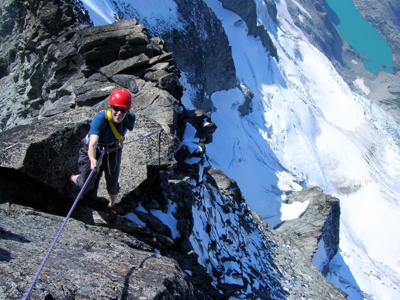
The numerous peaks and over 300 glaciers present a variety of challenges and rewards: classic mixed mountaineering routes, intricate glacier travel, technical rock climbing and scrambling, all within a premier wilderness setting. Approach routes are often arduous, requiring strenuous crosscountry travel, sometimes for days or through thick slide alder, rocky avalanche shoots and scree slopes, icy creeks or rivers, steep snow, or traversing slopes in steep, slippery terrain. The physical and mental challenge can push climbers to their limits, and changes in the weather can foil a summit bid. But when you finally stand on the top of a summit in the North Cascades, looking out over a jagged, glaciated mountain range that finds its finest and highest expression here in the park, as you tower over the alpine meadows and deep valleys, you will understand why these peaks draw climbers and wilderness travelers again and again, and you will begin to plot your next climb in these mountains.
How do I get a backcountry permit? What are the latest conditions for my route? I’d love to go climbing but I’m not certain of my skills—are there guides who can teach me? Learn about these plus how to be a good steward of climbing areas and routes on the planning a climb page .
The most important element of any climb is planning for your safe return. Check the Climb Safely page for weather and avalanche forecasts, to learn about search and rescue procedures in the park, and to get local climbing safety tips.
There are opportunities for both sport climbing and bouldering in the Skagit Gorge along SR 20 between Newhalem and Diablo. For more information on crag locations, restrictions and requirements regarding new route development, access, and more, please visit the park planning page or the Washington Climbers Coalition . For additional information on sport climbing planning and regulations can be found on page 88 of the Ross Lake General Management Plan (2012) .
Michael Kirshenbaum
Fixed Anchor Moratorium
A note about traditional mountaineering in North Cascades National Park Service Complex:
Almost all of the mountaineering objectives lie in the Stephen Mather Wilderness which was designated in 1988. This Wilderness includes 99% of the national park, and the majority of both Lake Chelan Recreation Area and Ross Lake Recreation Area. In order to preserve a wilderness experience that reflects a raw style of mountaineering in a range that has changed little since Fred Beckey made first ascents of now-popular peaks, the use of fixed anchors is not permitted [ 36CFR 2.1(a)(1)(iv) Preservation of natural, cultural and archeological resources, except as otherwise provided in this chapter, the following is prohibited: (1) possessing, destroying, injuring, defacing, removing, digging, or disturbing, from its natural state: (iv) a mineral resource or cave formation or parts thereof ]. North Cascades National Park Complex defines the "prohibited" fixed anchors as those devices that require the drilling of a hole into rock to installa bolt and/or a hanger.
The issue of fixed anchor use in wilderness has recently come into question. Park staff is in dialogue with several commercial and private climbing organizations, as well as the Access Fund about this issue.
On May 13, 2013 the National Park Service released a policy directive entitled Director's Orders #41 (Wilderness) which contains the latest direction for managers to use within all national parks with designated wilderness. The policy allows parks to authorize fixed anchors through development of a Climbing Management or similar Plan only if the activity is deemed appropriate in that park. Directors Order #41 emphasizes that clean climbing techniques should be the norm in wilderness. This involves the use of temporary equipment and anchors that can be placed and removed without altering the environment (e.g. slings, cams, nuts,chocks, stoppers)
After careful consideration the NPS has established a mandatory moratorium on installing new fixed anchors in an effort to maintain mountaineering routes in the park as historically natural as possible. In keeping with the long history of traditional mountaineering in the North Cascades (largely absent of fixed anchors) this moratorium exercises the authority provided by 36 CFR, Part II, Sec 1.5(c) which will be strictly enforced. However, the NPS intends to engage the public in a planning process to address climbing related issues as time and resources allow. Until that time, this moratorium on the installation of new fixed anchor bolts in all areas within designated wilderness will take effect through the Superintendent's Compendium .
Bicycling in the park can be both challenging and scenic.
Bicycling in North Cascades is exciting and challenging. Riding conditions vary from leisurely and quiet in the lower Stehekin Valley to the steep and sometimes heavily trafficked climbs out of the Skagit River gorge along State Route 20.
Bicycles are permitted on all roads open to public automobiles. They are not permitted on trails. Cyclists should be prepared to experience variable weather and carry the tools necessary to make roadside repairs.
North Cascades Highway (State Route 20)
Stehekin Valley Road
Other bicycling opportunities can be found in the Skagit River Valley to the west of the park and the Methow River Valley to the east.
Before you begin your ride, ensure your bike is in good working condition and you have enough food and water for the ride. Services inside the park are very limited. The North Cascades Highway (State Route 20), in particular, is very remote. Cyclists on this highway should be self-sufficient.
In Washington, bicyclists have the same rights and responsibilities on the road as automobiles ( Washington State Bicycle Laws ). For night bicycle riding, a white front light (not a reflector) visible for 500 feet and a red rear reflector are required. A red rear light may be used in addition to the required reflector. Clothing should be reflective and/or brightly colored to increase your visibility to motorists. State Route 20 through Ross Lake National Recreation Area has significant sections with little shoulder and limited sight lines.
Be prepared for cold and hot weather conditions at any time of the year. Rain gear and warm layers, including water-resistant gloves and socks, will keep your body temperature stable in case of damp conditions. Long sleeved shirts, sunscreen, and sunglasses will help protect you from intense mountain sun. Remember to carry extra bike tubes, a patch kit, and a tire pump for on-road repairs.
Bicycle Campsites
There are two bicycle campground sites, one at Newhalem Creek Campground site A3 and one at Colonial Creek Campground south site 115. The sites are non-reservable, walk-up (first-come, first-served) sites until 8 pm. If the site is unoccupied after 8 pm, campers with vehicles may occupy this site for one (1) night only. Cyclists can also find many camping options in Stehekin. For more information visit the camping page .
The Stehekin Valley has long served as a passageway for travelers, linking Washington's interior wilderness to the rugged Cascade Mountains.
The name "Stehekin" is based on a Salishan word meaning "the way through" or "turning around place" in Lushootseed (Coast Salish) and "mountain tops" in nxa'amxcin (Interior Salish). The Stehekin valley has long served as a passageway for travelers, linking Washington’s interior wilderness to the rugged North Cascades Mountains. Today Stehekin offers vistors an escape from the hustle of the modern day world. Nestled at the headwaters of Lake Chelan, the third deepest lake in the United States, the Stehekin community lives life a little slower. There are no roads that lead into Stehekin. Connected to the outside world only by foot, boat, or plane, the voyage to Stehekin is part of the experience and once you’ve arrived, a variety of historical, cultural, and outdoor activities will connect you with the majestic surroundings. Stehekin serves as a hub to explore the 61,949-acre Lake Chelan National Recreation Area and a gateway to the rest of the North Cascades National Park Service Complex, Stephen Mather Wilderness, and adjacent National Forest Wilderness Areas.
Things to Know Before you Come
Visitor and recreational opportunities continue to be available in the Stehekin Valley. Some services are limited at the Stehekin Landing.
Visit the Stehekin Flood Response Updates page for up-to-date information on operations and available services.
The Stehekin area is prone to flooding, which increases in a post-fire environment. Know before you go – visit the Post Fire Safety page for information on what to do in a flash flood and debris flow area.
Make reservations before arriving in Stehekin. The North Cascades Lodge at Stehekin is closed for the 2026 summer season.
Stehekin campgrounds, backcountry camps, and most private lodgings require advance reservations, especially from May to September. Campground reservations can be made online here .
There is no cell phone reception. Public wifi may be available near the Stehekin Landing.
There are limited grocery and food services available in the summer and none in the off-season. With limited trash services, consider pack it in, pack it out.
There are no ATM services available in the valley. Many businesses accept credit cards, but some do not.
Information and interpretive materials are available on bulletin boards located throughout the area, and on outdoor panels along trails throughout the valley. Concession staff will also provide general information to visitors.
The park is open year-round with recreation opportunities—hiking, fishing, boating (fall and spring), skiing or snowshoeing (winter), and wildlife viewing (year-round). There are limited services in this area.
Explore the many trails from Stehekin, from easy, moderate to strenuous, there is an adventure waiting.
Stehekin offers camping in a range of settings, from lakeside sites to quiet roadside camps to backpacking sites.
Travel to Stehekin by foot, boat or plane. No roads connect Stehekin to the rest of Washington.
The North Cascades Lodge at Stehekin provides services to visitors. Private accommodations are available in the community.
Get around Stehekin by foot, bike or shuttle to different areas in the Stehekin valley.
Be sure to check the weather before your visit.
Enjoy the historic orchard and structures on a visit to the orchard.
June 8, 2023 There are plentiful opportunities for day and overnight riding and stock packing in the park. The most popular riding trails are located in the southeast of the park, along Bridge Creek (Pacific Crest Trail) and most of the trails throughout the Lake Chelan National Recreation Area. There are some major west side stock trails that are popular as well, including the East Bank Trail , the west side of Ross Lake and Big Beaver Trail , and the Thunder Creek Trail . Trail conditions change from year to year, including stock river-crossings becoming unaccessible or large downed trees blocking trails before trail crews have a chance to clear them. Be sure that you are up to date on the current conditions.
All Wilderness party size limits apply: the maximum party size is 12, including all people and stock combined. Note that some trails are closed to stock, and that stock parties spending the night must stay in the designated stock camps.
Be well informed about the regulations and trail conditions in the area in which you plan to travel. For detailed trip planning information, visit the Wilderness Trip Planner page, which also includes a map of backcountry camps.
A safer more enjoyable trip can be had when you and your stock possess a high level of fitness.
For their well-being, condition your stock to the equipment and feed you plan to use, and the sight of 'unusual creatures' such as humans wearing large backpacks, dogs, llamas and other stock animals.
For more information on current conditions, permits, food storage and more, call the Wilderness Information Center in Marblemount: 360-854-7245.
In the Park Complex, 'stock' are defined as horses, mules, donkeys, and llamas.
Goats are prohibited throughout the Park Complex.
Not all trails in the Park Complex are maintained to standards safe for stock use. See backcountry camp chart for trails and camps open to stock.
Hitch rails are provided as a convenience at selected trailheads and backcountry sites. Where they are not provided use a highline. Picketing is prohibited.
For sanitation reasons, stock are not permitted in tenting areas of campsites.
Be a role model for other trail users and stay on trails, regardless of mud, snow, or ruts.
Not all people know how to act when encountering stock. Greet other trail users and instruct them on how to allow your party to pass.
For overnight trips, backcountry camping permits are required.
Permits are issued at Ranger Station locations on a first-come, first-served basis, and no sooner than the day before the start of a trip. Review your trip with a ranger for campsite availability and trail conditions.
Campfires are prohibited in some areas, so plan to use a lightweight stove for cooking.
Keep camps and trails sanitary and tidy: carry a rake to scatter dung piles and fill in pawed areas.
Note that the maximum group size for day use or camping, including animals, is 12 pairs of eyes.
MINIMIZING IMPACTS
Water animals at established fords where low gravel or rocky areas exist. Carry lightweight containers to water stock where clear access to water is hard to find.
Clean water is crucial to life; prevent stock from defecating directly into water or near a water source.
Sterile weed-free pellets (loose hay prohibited) are light weight and an excellent source of nutrition on the trail, especially where grazing is limited or prohibited (see below). Pellets also decrease introduction of non-native plant seeds into the backcountry. Non-native plants can wreak havoc on the health and diversity of native plant communities. For a list of weed-free feed suppliers in WA, visit this page .
Proper food storage is required at all times in the backcountry. This includes food, garbage, and any scented items, as well as stock feed. Keep wildlife healthy and self-reliant by not feeding them. Secure your food, garbage, and toiletries from resident rodents, deer, and bear to avoid potentially unpleasant or dangerous encounters. A list of food storage devices, including panniers, that have been tested and proved resistant to bears and other wildlife can be found at the Interagency Grizzly Bear Committee web page . If food and other attractants are not stored in an approved food storage device, they must be suspended from a tree limb, at least 15 feet from the ground and 5 feet from the trunk of a tree.
Use a nose bag, ground cloth, or container when feeding stock, so that the leftovers are easy to clean up and do not attract wildlife.
Grazing is prohibited in North Cascades National Park. See "Feed" section above for alternatives.
Grazing is allowed in the Ross Lake National Recreation Area. However, grass and other forage is quite limited, so consider supplementing your animal's food with the weed-free alternatives listed above.
Grazing is allowed in certain areas of the Lake Chelan Recreation Area: Rainbow Meadows, Hidden Meadows, and 1/4 mile or more away from Juanita Lake in the Juanita Lake basin.
All grazing requires a permit, which can be obtained when you pick up your backcountry permit. Grazing permits can be suspended if conditions are too wet.
Grazing is prohibited within 200 feet of any water source, including lakes, streams, and boggy wetlands.
Stock must be attended while grazing; picketing is prohibited. Portable corrals, hand-holding stock, and loose herding are encouraged.
Thank you for taking the time and effort to do your part to help protect and preserve the Wilderness for today and for future generations. Enjoy your ride!
National Park passport stamps for North Cascades National Park Service Complex
Heading to North Cascades National Park Service Complex for your Passport Book stamp? North Cascades Park Service Complex includes a stamp for four park units: North Cascades National Park, Ross Lake National Recreation Area, Lake Chelan National Recreation Area, and the Pacific Crest Trail. Here’s how:
Visit one of the complex's visitor and information centers . Visitor centers are open from late spring to early fall. Check opening hours before you go.
Print out the virtual visitor passport stamp for your book. To make it fit your passport page, each stamp will be a 1.25 inch by 1.25 inch image.
Fishing is a popular pastime in the North Cascades National Park Service Complex.
NPS / Deby Dixon
North Cascades National Park Service Complex has many options for the aspiring angler. The Skagit River, one of Washington's major watersheds, is home to seven species of anadromous fish (five salmon species, steelhead, and cutthroat trout) and freshwater trout and char. North Cascades National Park, Ross Lake National Recreation Area, and Lake Chelan National Recreation Area allow fishing as a means of providing for public enjoyment, and customary and traditional use, and regulate fishing to ensure that it is managed in a manner that avoids unacceptable impacts to park resources. For more information on how fishing regulations work in national parks, go to the NPS Fish and Fishing website.
Visitors fishing within North Cascades National Park Service Complex must follow the fishing license requirements in accordance with the laws and regulations of the State of Washington. Fishing licenses are not sold at any visitor or information station in the park complex, and you must obtain a license before visiting . Visit Washington State Department of Fish and Wildlife for information on Washington state fishing licenses .
Fishing Regulations
Except as provided below, fishing shall be in accordance with the laws and regulations of the State of Washington. For state fishing regulations go to the Washington Department of Fish and Wildlife website. The fishing regulations apply to all “finfish” found in the park. Other taxa, including amphibians, mollusks and crustaceans (e.g. waterdogs, crayfish) are not considered “fish” for the purpose of NPS fishing regulations and are addressed by NPS regulations governing “wild life” ( 36CFR2.2 ). These fishing regulations apply, regardless of land ownership, on all lands and waters within the park that are under the legislative jurisdiction of the United States.
The following are prohibited:
Fishing in fresh waters in any manner other than by hook and line, with the rod or line being closely attended.
Possessing or using as bait for fishing in freshwaters, live or dead minnows or other bait fish, amphibians, non-preserved fish eggs or fish roe, except in designated waters.
Chumming or placing preserved or fresh fish eggs, fish roe, food, fish parts, chemicals, or other foreign substances in fresh waters for the purpose of feeding or attracting fish in order that they may be taken.
Commercial fishing, except where specifically authorized by Federal statutory law.
Fishing by the use of drugs, poisons, explosives, or electricity.
Digging for bait, except in privately owned lands.
Failing to return carefully and immediately to the water from which it was taken a fish that does not meet size or species restrictions or that the person chooses not to keep. Fish so released shall not be included in the catch or possession limit: Provided, that at the time of catching the person did not possess the legal limit of fish.
Fishing from motor road bridges, from or within 200 feet of a public raft or float designated for water sports, or within the limits of locations designated as swimming beaches, surfing areas, or public boat docks, except in designated areas.
Introducing wildlife, fish or plants, including their reproductive bodies, into a park area ecosystem. This includes the discarding and/or dumping of bait and bait buckets.
The use or possession of fish, wildlife or plants for ceremonial or religious purposes, except where specifically authorized by Federal statutory law, or treaty rights.
The following regulations apply only within North Cascades National Park Service Complex:
The use of nonpreserved fish eggs is permitted, as per 36 CFR 7.66.
Ruby Creek is closed to fishing from “No Fishing” markers on Ross Lake upstream to the headwaters.
Big Beaver is closed to fishing from “No Fishing” markers on Ross Lake upstream 1/4 mile.
Fishing is allowed in or from the following otherwise prohibited areas: Motor road bridges Stehekin Valley motor road bridges unless posted signs prohibit such activity. Public boat dock Fishing is permitted unless posted signs prohibit such activity
Motor road bridges Stehekin Valley motor road bridges unless posted signs prohibit such activity.
Stehekin Valley motor road bridges unless posted signs prohibit such activity.
Public boat dock Fishing is permitted unless posted signs prohibit such activity
Fishing is permitted unless posted signs prohibit such activity
Common fish species in the park complex:
Gorge, Diablo, and Ross Lakes: Rainbow trout, eastern brook trout, cutthroat trout
Lake Chelan: Burbot (fresh-water cod), golden trout, lake trout, west slope cutthroat trout, kokanee (land-locked salmon), largemouth bass, smallmouth bass
Stehekin River: Cutthroat trout, rainbow trout
Fish Consumption Advisories in National Park Waters
The Environmental Protection Agency, states, territories, and tribes provide advice on fish and shellfish caught in the waters in their jurisdiction to help people make informed decisions about eating fish. Advisories are recommendations to limit your consumption of, or avoid eating entirely, certain species of fish or shellfish from specific bodies of water due to chemical or biological contamination. Fish is part of a healthy balanced diet, but eating wild fish and shellfish caught in park waters is not risk free. Parks are “islands”, but the much larger “ocean” that surrounds them affects the natural resources inside a park. Other aquatic toxins are the result of natural biological processes. Also, chemical contaminants that originate outside of park boundaries can come into parks. Mercury is an example of a toxin originating outside a park that can find its way into a park. Mercury exists naturally in some rocks, including coal. When power plants burn coal, mercury can travel in the air long distances before falling to the ground, usually in low concentrations. Once on the ground, microorganisms can change this elemental mercury to methyl mercury. This type of mercury can build up in animal tissues, and it can increase in concentration to harmful levels. This high concentration can occur in large predatory fish - those often pursued and eaten by anglers. Studies have shown that fish in some National Park System waters have mercury levels that may be a concern to people who regularly eat a lot of fish. To learn more about this topic, the National Park Service maintains information about Fish Consumption Advisories and Mercury and Toxins in Nature .
NPS / Michael Liang
Aquatic Invasive Species
Imagine your favorite fishing spot and the wonderful memories. Things may look fine but underneath the surface there is a serious threat. Everything you remembered is now cemented together in a sharp, smelly mess. Invaders have wiped out the fish species you used to catch. Aquatic invasive species are not native to an ecosystem. Their introduction causes, or is likely to cause, harm to the economy, the environment, or to human health. Aquatic invasive species are a growing risk to parks and their values. In the United States alone, there are more than 250 non-native aquatic species. For many centuries, humans have contributed to spreading non-native species around the globe. You can make a difference. To learn more about Aquatic Invasive Species in the National Park Service, visit the Fish & Fishing website.
How You Can Help – Stop Aquatic Hitchhikers
Currently North Cascades National Park Service Complex is free of aquatic invasive species . We currently do not have quagga or zebra mussels or New Zealand mudsnails and need your help to keep it that way! You can help keep the park’s waters clean by following the steps below every time you leave a water body, even if accessing more remote locations and ‘creeking’ with kayaks or other hand-powered vessels. Clean boat, trailer and equipment. Remove plants, mud and debris. Drain water from bilge, ballast, livewell, motor and bait bucket. Dry all equipment for 5 days before entering new water. Never move plants or live animals away from a water body. If your boat has been in waters with confirmed or suspected AIS (such as Lake Mead, Mohave or Powell) within the last 30 days contact the Washington Department of Fish and Wildlife AIS hotline at 1-888-WDFW-AIS.
Fishing Throughout the National Park Service
We invite you to visit the Fish and Fishing website for more information about fish and fishing in the National Park Service. You will learn about conservation, different fish species, and parks that offer fishing.
Official NPS features and USGS park boundaries, imported 2026-10-17. An inventory snapshot, not live trail or parking availability.
Loading official park features…
TrailsPoints of interestParkingZoom with buttons or pinch. Toggle layers on the map.
Map coverage varies. Trail names may represent segments, connectors, or shared park units; mapped lines are not a hiking recommendation. Use official conditions and navigation resources before heading out.
NPS public GIS inventory, imported 2026-10-17. “Existing” is an inventory classification, not confirmation that a trail is open. Segment counts are not route distances. Parking records do not indicate space availability, fees, or accessibility certification. View government source ↗
Climate for Vedder Crossing, 72 km from the park reference point. 1991–2020 normals. Source elevation: 39 m.
Daytime highNighttime lowOctober: 53° / 38°
Daytime high53°
Precipitation217 mm
Daylight10.5 hrs
Wind5.5 km/h
Mountain, rim, valley, and coastal conditions can differ sharply from the source town. Check park forecasts and current conditions before travel.
Monthly climate data 12 months · °F
Month
High
Low
Rain / snow water
Wet days
Daylight
37°
28°
297 mm
19.2
8.5 h
40°
29°
189 mm
15.8
9.8 h
45°
31°
243 mm
19.9
11.6 h
51°
35°
175 mm
17.4
13.4 h
58°
41°
135 mm
14.6
15.0 h
62°
46°
113 mm
13.8
15.9 h
69°
50°
63 mm
7.8
15.6 h
69°
50°
71 mm
8.2
14.2 h
64°
45°
114 mm
10.2
12.4 h
53°
38°
217 mm
16.0
10.5 h
42°
32°
318 mm
19.3
8.9 h
36°
28°
281 mm
18.9
8.1 h
RESEARCH WITH THE SOURCE IN VIEW
The practical field guide.
Official NPS excerpts imported 2026-10-17. Fees, permits, road access, and operations can change; use the source link to confirm the latest information.
During the operational season (mid-May to early September), a ll sites in campgrounds along State Route 20 and in Stehekin can be reserved in advance. When possible, make reservations as early as you can.
Reservations are not required starting September 7, 2026 and all sites are first-come, first-served as long as they remain open.
Colonial Creek North, Colonial Creek South and loop C of Newhalem Creek Campgrounds will close for the season on September 14, 2026. Loops A & B of Newhalem Creek Campground will close for the season on September 27, 2026.
Campgrounds open for the season each year on the Monday before Memorial Day weekend (May 17, 2027).
The following campgrounds remain open year-round for first-come, first-served camping outside the operational season with no fee, no water, and no trash services: Goodell Creek (19 sites), Gorge Lake (8 sites), Colonial Creek South (10 walk-in, tent-only sites, #64-#73).
Overnight camping is only allowed in designated campsites. There is no dispersed camping in the park complex.
Campsite occupancy is limited to eight people, three tents, and two vehicles per site.
Camping is limited to 14 days from July 1 through Labor Day (first Monday in September) and to 30 days the rest of the year.
Firewood, ice, gas, and other services are not available in the park complex. The nearest services are in the town of Marblemount, WA.
Don't move firewood ! Destructive insects and diseases can be transported in firewood. Always buy firewood near where you will burn it.
Drive-in Campgrounds
All drive-in campgrounds along State Route 20 are on a reservation system through recreation.gov . Campground reservations are accepted during the specified season dates on the recreation.gov website. Campgrounds may be open before or after the reservation season on a first-come, first-served basis. See campground details below for more information, reservations, and current status.
Frequently Asked Questions
Camping Options
Newhalem Creek Campground
Newhalem Campground is a comfortable facility close to town, the Visitor Center, and the Skagit River.
Gorge Lake Campground
The campground is located on Gorge Lake, next to the cascading Stetattle Creek.
Goodell Creek Campground
Goodell Creek Campground is situated in lush, old growth forest on the banks of the Skagit River.
Lower Goodell Creek Group Campground
Lower Goodell Creek Group campsite is a convenient campground on the banks of Goodell Creek that accommodates large groups.
Colonial Creek North Campground
Colonial Creek Campground is a remote, yet bustling campground nestled in old growth forest with trail and lake access.
Colonial Creek South Campground
Visit remote Hozomeen at the north end of Ross Lake.
Camping in Stehekin
Stehekin offers camping in a range of settings, from lakeside sites to quiet roadside camps to backpacking sites.
North Cascades National Park Service Complex has been working hard to make recreational facilities available for everyone. Please see the Accessibility Index for specifics about each park facility. Accessible restrooms are available at all visitor information stations and most campgrounds. The North Cascades Visitor Center, Sedro-Woolley information station, and Wilderness Information Center are fully accessible. The approach to the Golden West Visitor Center is an unpaved, sloping path which can be negotiated with assistance. There is a ramp into the center and an elevator inside. The Sterling Munro Trail at the North Cascades Visitor Center and the Happy Creek Forest Walk at milepost 135 on State Route 20 are fully accessible boardwalk paths. Happy Creek is a 1/3 mile (1/2 kilometer) loop through ancient forest. The River Loop Trail (the section at the campground is lower grade than near the visitor center), Linking Trail and Newhalem Creek Rockshelter Trail, all in the vicinity of the North Cascades Visitor Center, are accessible trails with good surfaces and less than 10% grade throughout. Rockshelter Trail ends in a boardwalk providing a view and interpretation of an archeological site. East of Newhalem along State Route 20, the Gorge Overlook Trail is partially paved. There are accessible campsites and restrooms in the park's campgrounds and accessible picnic shelters at Newhalem and Goodell Creek Campgrounds.
Parking/transportation fees are possible You may need to pay for parking, or for a shuttle, ferry, or other transportation while visiting the park. More about parking/transportation fees
2026 Free Entrance Days in the National Parks
Come experience the national parks! All National Park Service sites that charge an entrance fee will offer free admission to US citizens and residents (other fees, including timed entry or reservation fees, may apply). Mark your calendar for these entrance fee-free dates:
February 16 : Presidents Day (Washington's Birthday)
May 25 : Memorial Day
June 14: Flag Day/President Trump's birthday
July 3–5: Independence Day weekend
August 25: 110th Birthday of the National Park Service
There is no fee to enter North Cascades National Park Service Complex. Enjoy your visit! If you plan to visit other parks with an entrance fee, learn more about the America the Beautiful - the National Parks and Federal Recreation Lands Pass series and fee free days in the national parks .
Colonial Creek - $24 per night Goodell Creek - $20 per night Newhalen Creek - $24 per night Gorge Lake - $20 per night Stehekin campgrounds - $20 per night Hozomeen campground - Free More Information on Camping
Camping Reservations
Camping reservations are available online at Recreation.gov or by calling 1-877-444-6777. Please visit our Camping page for more information.
Backcountry Permit Camping Fees and Reservations
Backcountry camping requires a permit . Fees - $10 per person (youth 15 and under are free) plus a $6 non-refundable fee Reservations - Limited reservations are available for backcountry campsites .
Northwest Forest Pass (required at USFS trailheads only)
Fees $5 - Day $30 - Annual Details There are no trailhead or parking fees for trails that begin on National Park Service lands. The Northwest Forest Pass or Recreation Day Passes are required at many trailheads on adjacent U.S. Forest Service land with trails leading into the national park. You may also use the Annual, Senior or Access passes for U.S. Forest Service recreation sites. The Discovery Pass is a state pass and is neither required nor valid on any federal lands. Passes are available at most ranger stations, many local business, by calling the USGS Store at 1-888-275-8747 or online .
Lake Chelan Dock Permit
Fees $10 - Day $75 - Annual Details Between May 1 and October 31 each year, boaters must have a Dock Fee Permit in order to use the docks in Lake Chelan National Recreation Area. This is the same permit needed for using the docks provided by the U.S. Forest Service along other parts of the Lake Chelan shoreline. The dock pass can be obtained online at recreation.gov .
Most visitors arrive at North Cascades National Park by car. Public transportation options to and from the park are extremely limited but bicycling is a popular and green alternative to driving. Do you plan to travel to the park in an alternative fuel vehicle? If so, good for you! Your actions help us reduce greenhouse gas emissions and reduce petroleum use. Plan your trip with the Alternative Fueling Station Locator from the Department of Energy.
North Cascades National Park and Ross Lake National Recreation Area
Primary access to both North Cascades National Park and Ross Lake National Recreation Area is from the State Route 20 (SR 20) corridor. The Silver-Skagit Road and State Route 542 (SR 542) are jumping off points for many northern regions of the park including Hozomeen, Mount Shuksan, and Copper Ridge.
North Cascades Highway
From the west, SR 20 (North Cascades Highway) connects with Interstate 5 (Exit 230) at Burlington. From the east, the highway intersects with U.S. Route 97 at Okanogan and with State Route 153 at Twisp. Due to avalanche danger, the Washington State Department of Transportation typically closes the roadway between Ross Dam Trailhead and Lone Fir Campground from November to April.
The Silver-Skagit Road to Hozomeen provides the only road access to the Ross Lake shoreline. This 37 mile (60 km) gravel road connects with B.C. Highway 1 (Exit 168) near Hope, British Columbia. Water taxi and portage services on Ross Lake are available through Ross Lake Resort .
Mount Shuksan, Northern Pickets, and Copper Ridge
Hiker and climber access to Copper Ridge, the northern Picket Range and Mount Shuksan is available from State Route 542 (SR 542) east of Bellingham. The Sulphide Glacier route on Mount Shuksan is reached from the Baker Lake Road at milepost 82 on the North Cascades Highway.
Lake Chelan National Recreation Area
There is no car access to Stehekin and Lake Chelan National Recreation Area. Passenger shuttle service is provided in the Stehekin Valley.
Passenger ferry service is available from Chelan on U.S. Route 97. Additional information on float plane and private boat access is available at the Getting to Stehekin page.
Hiker access to Stehekin begins at the Cascade Pass trailhead on the gravel Cascade River Road, the southbound Pacific Crest Trail from State Route 20 near the Rainy Pass picnic area, and from Eagle Creek, War Creek, South Creek and Gilbert trailheads on the Twisp River Road. Some of these trails are suitable for stock. For more information, please refer to our Trail Guide .
Many people come to the North Cascades to enjoy its rugged beauty and remote wildness. Recreating in natural areas, however, has inherent dangers and responsibilities. Conditions in mountainous areas can change very rapidly, even during a day trip. These travel tips can help you have a safe and responsible journey so that you, and future travelers, can enjoy the landscape to its fullest.
Use caution on access roads: watch for obstructions such as rocks, sudden bends, and parked vehicles/pedestrians.
Break-ins are not uncommon at trailheads along State Route 20. Remove your valuables and electronics and take associated electronic cords.
Carry the ten essentials .
Stay on trails. Wear adequate footwear and use a topographic map/compass.
Report down trees or washouts to the nearest ranger station.
Do not depend on cell phones as there are many 'dead spots'.
Always tell a friend your travel plans including destination and expected return time.
NPS Trip Planner
Know Before You Go! Use the NPS Trip Planner to help plan for your trip and avoid common mistakes. Make your fun adventure a safe one too!
Winter can show you a different side of the park, but it also involves extra safety considerations.
Take precautions to protect yourself and the wildlife of North Cascades.
Plan on hitting the trail? Be prepared!
Recreating in areas after a wildfire, even multiple years later, can have safety hazards. Be informed before you visit these areas!
Stay safe while riding along State Route 20 through the North Cascades.
The North Cascades National Park Service Complex preserves some of the finest mountain country in North America. From accessible trails and short, scenic strolls to steep mountain hikes, there is a trail here for everyone. Enjoy the solitude, peace, and challenge that hiking in this beautiful park offers. Remember to walk lightly, so that many generations more may continue to discover this place. Hikers, backpackers, and climbers travel the trails of the park complex year round; however, the more common hiking season stretches from April through October. The driest and most popular time to visit is during the summer months of mid-June through September. Higher elevation trails often remain snow-covered well into July and sometimes August. Precipitation and snowfall are greatest from November through March. The park's winters are wet, and snowfall is heavy. Access is often limited during these winter months by impassable or closed roads, so be sure to check current conditions . The key to a successful trip is to plan ahead and be prepared. Check out the trip planning tools below to choose a trail, learn about backcountry permits, get updated trail conditions, and more.
Explore the different trail options for a day in the park.
Learn about the many overnight backcountry options in the North Cascades.
North Cascades has over 400 miles of trails to explore. Learn about which one is right for you.
Wilderness Trip Planner
Plan a trip into the backcountry of the North Cascades.
Trail Conditions
General conditions and a trail-by-trail list of the most recent conditions reports.
Hiking in Stehekin
Explore the many trails in the Stehekin area.
Plan on hitting the trail? Be prepared!
Hiking with pets
Bringing your dog? Pets are only allowed on certain trails under certain conditions.
Explore the park complex below with the interactive map. Zoom in and out to identify specific locations. Want to save a copy of this map for offline use? Download the NPS App , search for North Cascades National Park Service Complex, and toggle "Save this park for offline use" to download the map to a mobile device. Want to view the brochure map instead of the interactive map? In the upper left hand corner of the interactive map, click on "Standard Map" and switch to "Brochure Map."
Our Park Store Has You Covered
Download NPS brochure maps for this park and others!
Interactive Maps to Use Offline
Download the free NPS app for access to maps of every national park—that work both online and off!
Activity and Area Specific Info
Wilderness Trip Planner —Use the maps and other info in here to plan your wilderness trip in the park
Ross Lake Trip Planner —Use this map to help plan your boating trip on Ross Lake.
Trail Guides —Read up on trails in the park.
North Cascades Highway —See where this scenic highway goes in the park.
Pets are not allowed within the national park except leashed on the Pacific Crest Trail. Leashed pets are allowed along Cascade River Road and Stehekin Valley Road to its terminus at mile 12.9, not on trails. Service animals are allowed for those with disabilities. If you are not sure where you can hike with your pet, please contact the Wilderness Information Center . Guidelines for pet owners visiting North Cascades National Park Service Complex. Please follow the rules of B.A.R.K.
B ag your pet's poop
Pet owners are responsible for removing pet waste from all areas in the park including campgrounds, picnic areas, parking lots, roads, pet-friendly trails, and other developed areas.
A lways wear a leash
Pets must be restrained on a leash no longer than 6 feet.
R espect wildlife
Pets can harass or harm wildlife by making noise or scaring wildlife away.
K now where you can go
Pets are allowed on a leash within the Ross Lake and Lake Chelan National Recreation Areas. Pets are also allowed on most surrounding national forest lands. Pets are not allowed within the national park except leashed on the Pacific Crest Trail and along roads. Additionally pets are welcome in drive in campgrounds and picnic areas as well as paved or dirt roads, but no digging or rolling on plants as that will damage vegetation .
Pets should not be left unattended. Summer heat poses a threat to pets left in vehicles.
Service animals
Service animals are an exception to these rules and may accompany their owner to all park locations. Under the Americans with Disabilities Act (ADA), service animals are defined as dogs that are individually trained to do work or perform tasks for people with disabilities. Dogs whose sole function is to provide comfort or emotional support do not qualify as service animals under the ADA.
Become a Bark Ranger
Well-behaved pets are invited to bring their human companions and become official North Cascades National Park Service Complex Bark Rangers! Learn the rules of B.A.R.K., where and how to enjoy the park with your pet, and become a B.A.R.K. Ranger! To participate in the B.A.R.K. Ranger Program, visit the North Cascades Visitor Center.
What sort of hike do you want to take today? Fancy a peaceful stroll down to the river, looking for birds and wildlife, or a glimpse of migrating salmon? Or are you in the mood to push your limits, climb to the heights and watch the world unfold below you? Short or long, low elevation or high, there are hundreds of miles of trails awaiting your discovery throughout the season. The trail guide below is organized by lengths of hikes. Or, if you already know the name of the trail you are interested in, check the alphabetical listing of all the trails in the park complex. For hikes in the Stehekin area, please visit the Stehekin page.
NPS / David Hursey
Newhalem Area Trails
330 ft (91 m) to 1.8 miles (2.9 km) Choose from a variety of short, forested trails. More details .
Happy Creek Forest Walk
Mile Post 134 .03 mile (.05 km) loop / 42 ft (13 m) elevation gain Stroll through the forest along a cascading creek. Optional 2.6 mile (4.2 km) roundtrip / 712 ft (217 m) elevation gain spur trail to a waterfall.
One to Two Hour Hikes
NPS / Lin Skavdahl
Thunder Knob Trail
Mile Post 130 3.7 miles (6 km) roundtrip / 680 ft (207 m) elevation gain A popular trail to a view of Diablo Lake. More details .
NPS / Rosemary Seifried
Thunder Creek Trail
Mile Post 130 4 miles (6.4 km) roundtrip / 105 ft (32 m) elevation gain Hike along Thunder Creek through old-growth forest to a wooden bridge. More details .
NPS / Astudillo
Mile Post 134 2.5 miles (3.9 km) roundtrip / 532 ft (162 m) elevation gain Hike this moderate trail to walk across the historic Ross Dam. Option for a longer hike or backpack along Ross Lake. More details .
Pyramid Lake Trail
Mile Post 127 4.2 miles (6.8 km) roundtrip / 1,500 ft (457 m) elevation gain Hike through the forest to a small mountain lake. More details .
Diablo Lake Trail
Mile Post 128 7.6 miles (12.2 km) roundtrip / 1,312 ft (400 m) elevation gain Hike through the forest for peek-a-boo views of Diablo Lake.
NPS / Mack Kolarich
East Bank Trail
Mile Post 138 Variable distance and elevation gain A moderate trail though lowland forests with lakeside views. More details .
Stetattle Creek Trail
Mile Post 126 6 miles (9.7 km) roundtrip / 1,100 ft (335 m) elevation gain A forest hike with some rock scrambling along the rivers edge. More details .
NPS / C. Gudgeon
Thornton Lakes Trail
Mile Post 117 10.4 miles (16.7 km) roundtrip / 2,984 ft (910 m) elevation gain Views of high mountain lakes and nearby peaks. More details .
NPS / Michael Silverman
Sourdough Mountain Trail
Mile Post 126 10.4 miles roundtrip (16.7 km) / 4,870 ft (1,484 m) elevation gain A difficult trail with spectacular views of peaks and lakes. More details .
Fourth of July Pass Trail
Mile Post 130 10.4 miles (16.7 km) roundtrip / 2,629 ft (801 m) elevation gain Travel through an old-growth forest for mountain and glacier views. More details .
NPS / Pat Milliren
Easy Pass Trail
Mile Post 151 7.4 miles (11.9 km) roundtrip / 3,000 ft (914 m) elevation gain A steep trail to a mountain pass with panoramic vistas. More details .
NPS / Deby Dixon
Cascade Pass Trail
Located at the end of the Cascade River Road 7.4 miles (12 km) roundtrip / 1,700 ft (518 m) elevation gain A popular day hike with spectacular views of peaks and glaciers. More details .
NPS / Kristen Doering
Monogram Lake Trail
Off the Cascade River Road 10 miles (16 km) roundtrip / 4,040 ft (1,231 m) gain to ridge A strenuous hike to a small cirque lake. More details .
NPS / Bonnie Seifried
Hidden Lake Trail
Off the Cascade River Road 9 miles (14.5 km) roundtrip / 2,900 ft (884 m) elevation gain A steep hike to a small mountain lake and historic fire lookout. More details .
Hiking in Stehekin
Explore the many trails in the Stehekin area.
Plan on hitting the trail? Be prepared!
Trail Conditions
General conditions and a trail-by-trail list of the most recent conditions reports.
The following is an alphabetical list of all trails in North Cascades National Park Service Complex. You can also search trails via the following methods:
Day hikes (by area)
Backpacks (by area)
Loop backpack trips
Long distance backcountry trip sampler
Two National Scenic Trails pass through the park. Information specific to those coming to North Cascades National Park to travel on the National Scenic Trails:
Pacific Crest Trail
Pacific Northwest Trail
The park complex is bordered by two national forests ( Mount Baker-Snoqualmie and the Okanogan-Wenatchee , which contain five Wilderness areas), as well as three provincial parks to the north in Canada ( Chilliwack Lake , Skagit Valley , and E.C. Manning ). Together these protected public lands offer a wealth of additional trails and other recreational opportunities.
To learn more about the Stehekin area, including information on access and the Stehekin Valley Shuttle to trailheads, please visit the Stehekin page.
Alphabetical List of All Park Complex Trails
Agnes Creek (Pacific Crest Trail near Stehekin) Agnes Gorge (Stehekin) Baker River Big Beaver Boulder Creek (Stehekin) Bridge Creek (Pacific Crest Trail) Brush Creek Buckner Orchard Walk (Stehekin) Bullion Loop (Stehekin) Cascade Pass Chilliwack River Company Creek (Stehekin) Copper Ridge Desolation Peak Devore Creek (Stehekin) Diablo Lake East Bank Easy Pass / Fisher Creek Flat Creek (Stehekin) Fourth of July Goode Ridge (Stehekin) Gorge Overlook Happy Panther Happy Creek Forest Walk Hidden Lake Horseshoe Basin Howard Lake (Stehekin) Hozomeen Lake Imus Creek Loop (Stehekin) Jack Mountain Ladder Creek Falls (Newhalem) Lakeshore Trail (Stehekin) Lightning Creek Linking Trail (Newhalem) Little Beaver McAlester Lake / South Pass McGregor Mountain (Stehekin) Monogram Lake / Lookout Mt. Newhalem Creek (Newhalem) North Fork Bridge Creek Old Wagon (Pacific Crest) Trail (Stehekin) Panther Creek Park Creek Pass Purple Creek / Juanita Lake (Stehekin) Pyramid Lake Rainbow Creek (Stehekin) Rainbow Lake Rainbow Loop (Stehekin) Rainbow Mist and Falls (Stehekin) River Loop (Newhalem) Rock Shelter (Newhalem) Ross Dam Sahale Arm Sourdough / Pierce Mountain Stehekin River (Stehekin) Sterling Munro Viewpoint (Newhalem) Stetattle Creek Stiletto Spur Summit Trail (Stehekin) Thornton Lake Thunder Creek Thunder Knob Thunder Woods Nature Trail “To Know a Tree” Nature Trail (Newhalem) “Trail of the Cedars” Nature Walk (Newhalem) Twisp Pass (Dagger Lake) Upper Stehekin Valley
Hikes listed are considered day hikes that origniate from Stehekin. Mileage listed are one-way. For more information on overnight stays in the backcountry visit the Backpacking page.
Lakeshore 17.2 miles (27.7 km) / Elevation Gain/Loss: 500 ft (150 m) within park boundaries, up to 1,100 ft (330 m) gain/loss on southern portion of trail Trail follows the scenic northeast shore of Lake Chelan and is ideal for early morning and evening walks. Hazard Creek at 1 mile (0.6 km), Flick Creek at 3.5 miles (5.6 km), and Moore Point at 7 miles (11.3 km) are good day hike destinations. Trail ends at mile 17.2 at Prince Creek. Respect private private property along trail.
Imus Creek Loop 0.8 miles (1.3 km) / Elevation Gain: 200 ft (60 m) Gradually climb through a forest for views of the surrounding hills, peaks, and Lake Chelan. The trail ends at Purple Point Campground. Continue 0.2 miles (0.3 km) along the road to complete the loop and return to Stehekin Landing. Buckner Lane to Buckner Orchard 0.3 miles (0.5 km) / Elevation Gain: Minimal Stroll through a lush forest along the historic irrigation ditches that bring water to the orchard from Rainbow Creek. At the orchard, find self-guided walk booklets at two points to learn about the historically registered Buckner Orchard and the family that homsteaded the area. Seasonal public apple picking available. Bicycles can access the orchard from a side road after Rainbow Falls. The Historic Buckner Orchard is on the National Register of Historic Places. A commercial orchard from the 1920’s until it was sold to the National Park Service in 1970, it is tangible history of one family’s life in partnership with the land. It is the only orchard producing “common delicious” apples in the United States today and is recognized as one of the best maintained historic orchards in the nation.
Rainbow Loop 4.4 miles (7.1 km) / Elevation Gain: 1,000 ft (300 m) Hike a horseshoe-shaped trail to open bluffs overlooking the Stehekin River Valley and historic Buckner Orchard. From the southern trailhead, a scenic view is visible at 1.3 miles (2 km). Northern half of trail leads through a shaded ponderosa pine forest. A full loop includes an additional 2.4 miles (3.8 km) between trailheads on the road. Company Creek to Glacier Peak Wilderness 1.8 mi (2.9 km) / Elevation Gain: 1,500 ft (460 m) The trail climbs steeply through a forest for views of Stehekin Valley. Continue further into Glacier Peak Wilderness for views of Bonanza Peak. The trail begins 0.8 miles (1.3 km) down Company Creek Road after the turnoff at Harlequin Bridge. Howard Lake 1.2 mi (1.9 km) / Elevation Gain: 600 ft (180 m) An uphill hike with good mountain views leads to a small forest lake where waterfowl and other animals frequent. The trail continues to McGregor Mountain. Old Wagon Trail 5.3 mi (8.5 km) to Bridge Creek Camp / Elevation Gain: 700 ft (210 m) After passing Howard Lake, the trail follows an old wagon road through dense forests and several large stands of western red cedar. After one mile, a short spur trail leads to the Stehekin Valley Road to make a 4 mile loop back to High Bridge or continue north on the Old Wagon Trail for 3 miles to reach Bridge Creek. This trail is part of the Pacific Crest Trail heading north to State Route 20 and then to Manning Provincial Park in Canada. Agnes Creek 5.5 miles (8.8 km) to Five-mile camp (2,642 miles to Mexico). As the southbound Pacific Crest Trail, this trail continues for 2,642 miles to the border of Mexico, but also can be done as a day hike along Agnes Creek. Enjoy a forested walk with large western red cedars along the way. Stehekin Riv
Strenuous Hikes
Purple Creek 7.5 miles (12 km) / Elevation Gain: 5,800 ft (1,770 m) A steep climb rewards you with views of the mountain peaks to the west. Climb an additional 0.5 miles (0.8 km) and 450 feet (140 m) to Boulder Butte for a spectacular 360-degree view of the entire area. Lake Juanita is 0.5 miles (0.8 km) from Purple Pass. No water available after the first two miles until reaching Lake Juanita. McGregor Mountain 7.5 miles (12 km) / Elevation Gain 5,700 ft (1,740 m) A steep, rugged climb to sweeping views of surrounding valleys and mountain peaks. Once the trail ends, an additional 0.25 miles (0.3 km) and an 1,000 feet (300 m) scramble is required to reach the summit. The top 2 miles (3 km) may be under snow well into summer. There is little water late in the season. Check at the Golden West Visitor Center for route information and snow conditions.
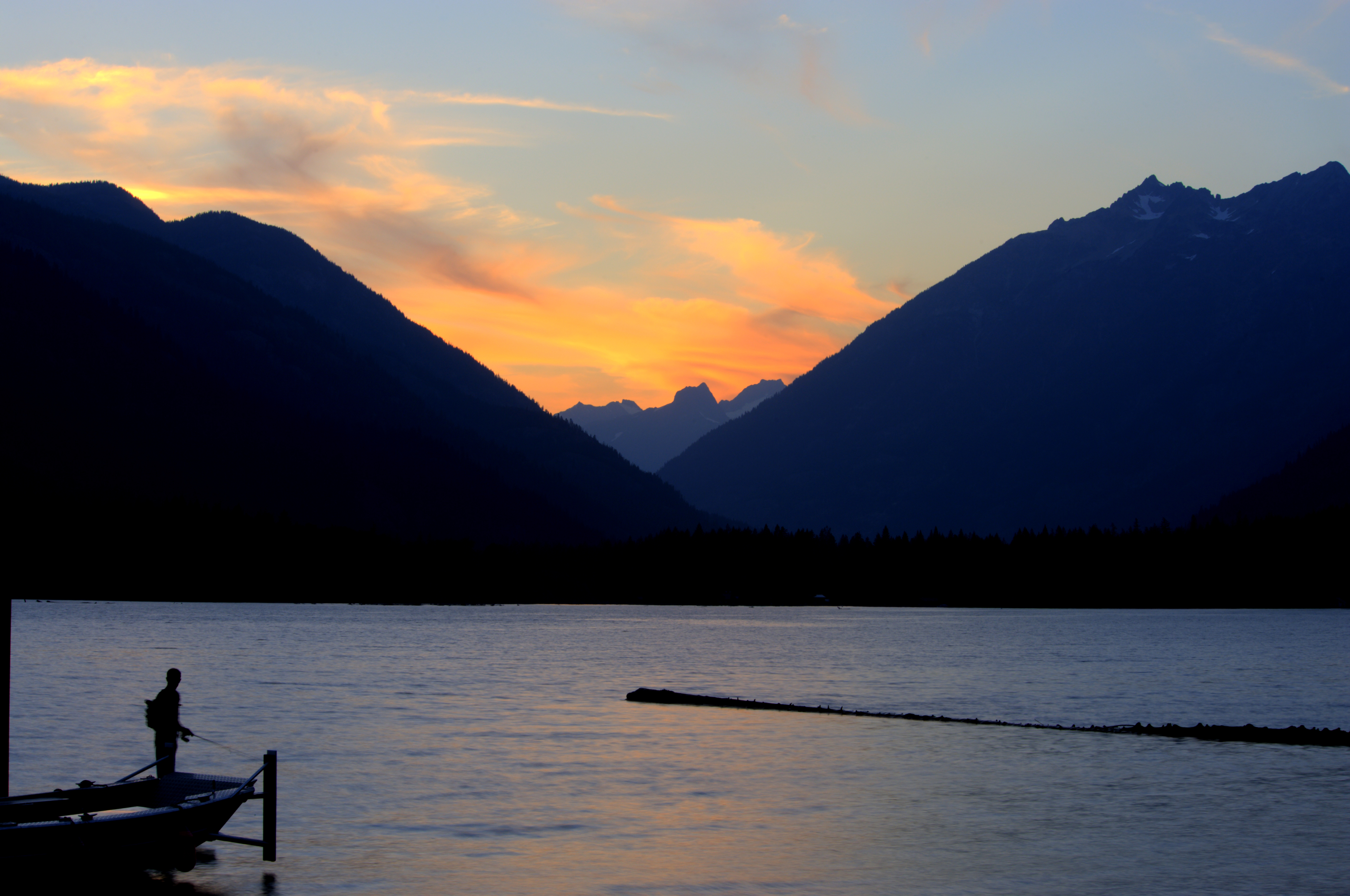
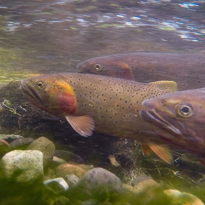
Stehekin sits at the top of Lake Chelan, welcoming visitors to take a life at a slower pace.NPS Photo/D.Dixon Images link to the original government source.Grab your tent, your sleeping bag, and adventurous soul and camp along Ross Lake.NPS Photo/D. Dixon Let the wow factor exceed your expectations while hiking Cascade Pass.NPS Photo/D. Dixon Explore the trails and backcountry camping and climbing in a landscape over 9,000 feet of vertical relief.NPS Photo/D. Dixon Explore jagged peaks crowned by more than 300 glaciers as you traverse the landscape.NPS Photo/T. Baldwin A climber on the West Ridge of Forbidden Peak.NPS/A. Brun Climbing Mt. Challenger, Picket RangeNPS/Erin McKay kayak on still mountain lake with distant peaks obscured by smokeNPS Photo A bike is parked outside the Hozomeen staff housing complex.NPS/NOCA An angler silhouetted against a lake at sunset.NPS / Deby Dixon Three trout swimming under water.NPS Photo An angler fishing from a canoe.NPS / Michael Liang
With its incredible range of precipitation and elevation, diversity is the hallmark of Olympic National Park. Encompassing nearly a million acres, the park protects a vast wilderness, thousands of years of human history, and several distinctly different ecosystems, including glacier-capped mountains, old-growth temperate rain forests, and over 70 miles of wild coastline. Come explore!
Ascending to 14,410 feet above sea level, Mount Rainier stands as an icon in the Washington landscape. An active volcano, Mount Rainier is the most glaciated peak in the contiguous U.S.A., spawning five major rivers. Subalpine wildflower meadows ring the icy volcano while ancient forest cloaks Mount Rainier’s lower slopes. Wildlife abounds in the park’s ecosystems. A lifetime of discovery awaits.
A showcase of melting glaciers, alpine meadows, carved valleys, and spectacular lakes. With over 700 miles of trails, Glacier is a paradise for adventurous visitors seeking a landscape steeped in human culture. Relive the days of old through historic chalets, lodges, and the famous Going-to-the-Sun Road.







 Forests