Port Angeles
30–60 min to Lake Crescent or Hurricane Ridge
Best for the first two north-side days.
Tradeoff: Hoh is roughly two hours away each way.
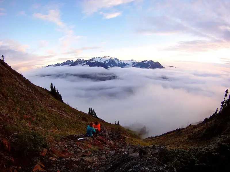
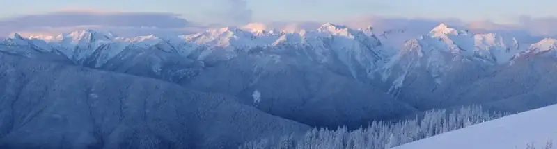
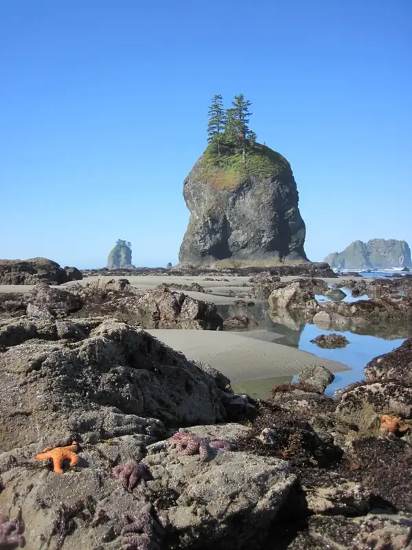
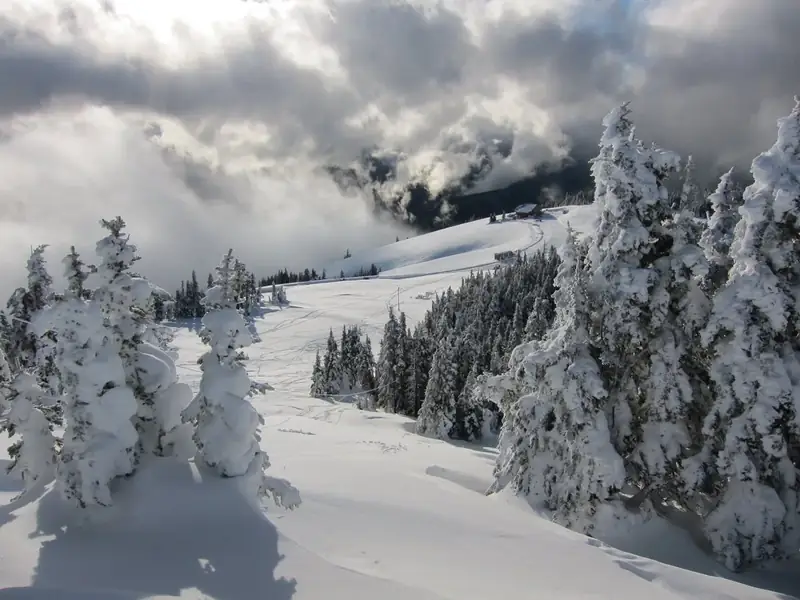
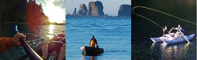
With its incredible range of precipitation and elevation, diversity is the hallmark of Olympic National Park. Encompassing nearly a million acres, the park protects a vast wilderness, thousands of years of human history, and several distinctly different ecosystems, including glacier-capped mountains, old-growth temperate rain forests, and over 70 miles of wild coastline. Come explore!
Hurricane Ridge, the Hoh and Lake Crescent have separate road and facility conditions. A north-side opening does not establish access to the rainforest or mountain district.
Before you go: Check each district road before committing to the drive.
Official guidance ↗ Reviewed 2026-10-18Selected guidance only; separate from climate comfort and current conditions.
Loading the latest saved conditions. You can also check the official report below.
Check current conditions at NPS ↗Group north-side lake and mountain visits, then use Forks for the Hoh. No road cuts directly across the mountains.
Keep the ridge day conditional on roads and weather.
Day 1Lake Crescent developed shore → Madison Falls
Day 2Hurricane Ridge developed viewpoints → Hurricane Ridge picnic break
Day 3Hall of Mosses → Spruce Nature Trail
Editorial planning ranges, not live routing or official trail measurements. Driving excludes lodging commutes unless stated; queues, closures and weather can add substantial time. Walking ranges describe the selected outing, not necessarily the full trail. Arrival and departure travel are additional. Select the season for your dates; this is not a live conditions check.
Choose a bounded shore outing and picnic; no long waterfall hike is assumed.
Start: Use signed Barnes Point-area parking.
Getting there: Allow 30–45 minutes west from Port Angeles.
Footing: Developed shore paths; roots and wet surfaces vary.
Make a brief shore visit if rain limits walking.
Walk to the waterfall and return; no driving beyond the road gate.
Start: Use Madison Falls parking on Olympic Hot Springs Road.
Getting there: Allow 30–45 minutes toward the Elwha area.
Footing: Paved approach can be slick or storm-damaged.
Skip if flooding or road restrictions affect the approach.
A north-side day from Port Angeles. Recheck both road approaches after storms.
Stay near developed viewpoints and bring food and water.
Start: Check road status before climbing from Port Angeles.
Getting there: Allow 40–60 minutes uphill plus queues.
Footing: Exposed mountain paths with snow and steep nearby slopes.
Choose an open lowland shore stop if the road closes.
Keep lunch and descent ahead of worsening weather.
Start: Use an open designated picnic area.
Getting there: Allow 5–15 minutes within the developed area.
Footing: Limited services; no indoor lodge is assumed.
Eat at lower elevation if wind or cold prevents a mountain break.
Driving includes the Port Angeles return. Do not assume potable water or indoor shelter at the ridge.
Walk the forest loop slowly with room for photo stops.
Start: Hoh trailhead; allow entrance queues.
Getting there: Allow 45–65 minutes from Forks; roughly two hours each way from Port Angeles.
Footing: Roots, large steps and steep short grades; wet surfaces.
Choose the Mini Rain Forest Trail.
Treat this as an optional second loop, not an extension up the Hoh River Trail.
Start: Same Hoh visitor area.
Getting there: Allow 5–10 minutes between trail starts; keep the picnic break.
Footing: Natural forest path with wet roots.
Omit if weather or energy calls for a shorter day.
Drive estimate assumes a Forks base and return. Move west the preceding evening or add the longer Port Angeles commute; that transfer is extra.
Compare access to Port Angeles. Drive ranges are editorial estimates before major queues or weather delays.
30–60 min to Lake Crescent or Hurricane Ridge
Best for the first two north-side days.
Tradeoff: Hoh is roughly two hours away each way.
45–65 min to the Hoh visitor area
A useful west-side base.
Tradeoff: Changing bases adds an evening transfer; distant from Hurricane Ridge.
Use your own quotes to compare room savings with extra time on the road.
Room totals only. Taxes, fuel, parking, vehicle wear and the value of your time are additional. These inputs are examples until you enter your quotes.
Mark your own preparation below. A check means you have handled it; it does not confirm a reservation or availability. Stored on this device.
Lodging · Before fixing the district order
Compare a split stay with repeated long drives; check campground seasons.
If unavailable: Choose fewer districts rather than compressing transfers.
Check official rules & booking linksRoads · Before departure and after storms
Ridge, lake and forest roads have different operations.
If unavailable: Use an open lowland alternative or postpone.
Check official rules & booking linksPreparation · Before losing service
Download district maps and confirm facilities; do not rely on ridge services.
If unavailable: Get supplies in the gateway before ascending.
Check official rules & booking linksThe PDF and HTML contain the selected days, transport notes, lodging comparisons and booking guidance. Linked maps and websites require a connection.
Official source review: 2026-10-18. Durations, district grouping, gateway drive ranges and recommended pacing are National Parkwise editorial estimates. They are not live routing, current-condition guarantees or accessibility certification.
Official NPS activity guide.
Drop by one of our free boat-cleaining stations to clean, drain, and dry your boat before and after going out on the lake! This keeps the lakes healthy and keeps invasive species like zebra mussels OUT. These stations are ready for you and your boat, kayak, or paddleboard! Lake Crescent: Fairholme Lake Crescent: Storm King Lake Crescent: Log Cabin Resort
Lake Crescent: Fairholme
Lake Crescent: Storm King
Lake Crescent: Log Cabin Resort
NPS Photo/Zaidel/J.Preston
Boating Safety While a great way to experience Olympic, boating recreation comes with inherent risks. Review the U.S. Coast Guard's Federal Boating Requirements , Washington State's Boating Safety and Boating Regulations , and the guidelines below for a safe trip.
Mandatory Education: Washington state requires that motorized boat operators complete a boating education course and obtain a boating education card .
Conditions: Weather and temperature change drastically in Olympic, even during summer. Always research wind, weather and tide conditions and come prepared. Wet suits or dry suits are recommended when kayaking and canoeing. Water temperatures are consistently below 50 degrees and hypothermia is a risk.
Plan: Map your route and plan for emergencies. Strong currents exist in many areas and vary by season. Know where obstacles, high wave areas, or rapids exist along your route. Always tell a responsible party where you are going and your expected return time.
Equipment: A personal flotation device and proper safety equipment is required by law. Review the Regulations to ensure your vessel meets specifications. Always inspect your boat before departure and pack extra food and clothing in waterproof containers.
Kayak and Canoe There are many kayak and canoe options in Olympic. The options listed below are the most popular and accessible areas in the park.
If you are paddling in the backcountry and plan on camping, a wilderness use permit is required. Visit our wilderness trip planning page for more information. Only non-motorized boats are allowed in wilderness areas and boats must be carried on trails by foot or stock (in stock-use areas).
The Rivers: Before your trip, always check river flows and conditions. Visit the USGS website for specific river conditions. Always stop by a ranger station to inquire about closures.
Elwha River (Class II-IV) :This river can be paddled most of the year, but the best season is in the spring or early summer. The most common put-in sites are in the lower portions of Glines Canyon (Class III-IV) and Altair Campground (Class II-III). Due to the Elwha River Restoration, boating is closed from the Smokey Hill Trail (formally Upper Lake Mills Trail) downstream to the former Altair Campground (permanently closed due to river erosion).
ALERT- VERY DANGEROUS CONDITIONS AT FORMER ELWHA DAM SITE: Boaters are urged to stay away from the section of river that flows through the former Elwha dam site. This site is located between U.S Highway 101 and State Highway 112, outside of the Olympic National Park boundary. View a map of the area for reference and portage location. Remnants of the dam’s foundation remain in that area of the river and include long pieces of rebar and other metal shards that extend close to the water’s surface. Boulders and swift currents in the area compound the risks and boaters are urged to avoid this section of river.
The Elwha area of Olympic National Park is currently closed to vehicle traffic beyond the Madison Falls parking lot at the park boundary due to extensive flood damage/road washout. Parking and turnaround space are limited.The Olympic Hot Springs Road is open to bicycle/pedestrian traffic beyond Madison Falls parking lot. There are no visitor facilites beyond the gate at the parking lot. A bypass trail provides access around the flood damage. Be sure to check road status before your visit. View the Elwha area brochure and map .
Hoh River (Class II-III): This river offers scenic views of old-growth rain forest, but is frequented with log jams. Always scout ahead before paddling to avoid hazards. The most popular put-in locations are at the Hoh Campground (Class II) and near the park entrance station (Class II-III) on the Hoh River Road. View the Hoh area brochure and map .
Queets River (Class II-III): Queets Rvier is a great place to experience secluded rain forests during higher water levels. In late summer, the river is often blocked by large debris and water that is too low for paddling. Log jam hazards may exist throughout the year. Popular put-in sites are the Queets Campground (Class II-III) above Sam's Rapid and the Hartzell Boat Launch (Class II-III). View the Queets area brochure and map .
Quinault River (Class II-V): For expert kayakers willing to hike into the backcountry, the Quinault offers challenging water. From the Graves Creek trailhead, hike 2.5 miles to Pony Bridge (Class IV-V). This 3 mile route is through a gorge and has a mandatory portage at Dolly Falls. For calmer waters, a popular launch site is near end of the North Shore Road at the bridge (Class II-III). View the Quinault area brochure and map .
Sol Duc River (Class III-V): For experienced kayakers, a 1.2 mile hike up the North Fork Trail in the Sol Duc Valley to the launch site (Class II-IV) offers fun water above Salmon Cascades. For experts interested in rapids, put-in at Salmon Cascades Overlook (Class V). View the Sol Duc area brochure and map .
The Lakes: For those interested in boating in the backcountry, visit the wilderness trip planner for campsite locations and reservations. Most wilderness lakes are open to non-motorized boats, but these must be transported up trail by foot or stock (in stock use areas).
Lake Crescent: Big, deep, and blue, Lake Crescent offers a scenic paddling experience, particularly in the early morning when winds are most likely to be calm. Winds often come up in the afternoon and can quickly create waves of a foot or more. Boat launches include Storm King Ranger Station and Fairholme. Kayaks and canoes can be rented at concession operated Log Cabin Resort and Lake Crescent Lodge . For a fee, boaters can also launch boats from the dock at Log Cabin Resort. View Lake Crescent area brochure and map .
Lake Ozette: Near the coast and filled with summer water lilies, Lake Ozette offers a secluded paddle journey. Two boat launches exist at the Ozette Ranger Station and Ozette Campground. Kayak and Canoes can also access a few backcountry campsites . Sudden weather changes are common in the Ozette area -- always check the forecast and plan for the possibility of sudden, strong winds and waves. View the Lake Ozette area brochure and map .
Lake Quinault: In a rain forest valley, Lake Quinault boasts mountain views and old-growth forests. Afternoon winds are common here; always be prepared. Two boat launches are found on the U.S. Forest Service operated Falls Creek and Willaby Campgrounds. Boat rentals are available at the concession operated Lake Quinault Lodge . View the Lake Quinault area brochure and map .
The Outer Coast:
The Pacific Coast of Olympic can be challenging to even expert sea kayakers. Beginners should consider trips with an expert guide. If planning an overnight trip along the wilderness coast, visit the wilderness trip planner page for information about camping and permits.
Often ravaged by extreme winds, weather, and tides, it is important that sea kayakers research their routes, weather and tide conditions, bring proper equipment, and be experienced in self-rescue. Tide tables are available at most Olympic visitor centers and ranger stations in the summer. Always review the U.S. Coast Guard's safety and boating regulations .
Motorized Boats
Review the Washington State Boating Regulations for detailed information about motor boat operation. The use of personal water craft, such as Jet Skis, are not allowed in Olympic National Park.
Motorized vessels are not permitted to land on Olympic shorelines from the north bank of the Hoh River to the park's boundary at the Makah Indian Reservation.
Water skiing and towing by motorized boats is permitted on Lake Crescent and Lake Ozette only.
Motorized boat operation is permitted in the following locations:
Lake Crescent - View Lake Crescent area brochure and map .
Lake Ozette - View Ozette area brochure and map .
Quinault River below the North Shore River Bridge - View Quinault area brochure and map .
Coastal portions of the Hoh, Quillayute, and Dickey Rivers - View park map .
Lake Crescent: Motorized boats may not exceed 5 mph or create a wake within 300 feet of all shorelines.
Lake Ozette: Motorized boats may not exceed 5 mph or create a wake within 300 feet of the shore near the Lake Ozette Ranger Station or campground beach. In all other instances, boats may not exceed 5 mph or create a wake within 150 feet of the shoreline.
Fishing Boats and Rafts For information about fishing regulations, seasons, and licenses, visit our fishing page .
Fishing from a boat or raft is permitted on the following rivers:
Ozette River - View Ozette area brochure and map .
Queets River below Tshletshy Creek - View Queets area brochure and map .
Hoh River downstream from the launch site located 1/2 mile from the park boundary near the South Fork confluence. Fishing from a boat is also permitted along the coastal section of the Hoh River. View Hoh area brochure and map .
Quinault River below North Shore Quinault River Bridge - View Quinault area brochure and map .
Quillayute and Dickey Rivers - View Mora area brochure and map .
NPS information imported 2026-10-17. Confirm current details at NPS
Official NPS activity guide.
NPS photo by Josh Geffre.
Before you go fishing in Olympic National Park review the current fishing and shellfish regulations and check bulletin boards for locally posted regulation changes.
The Olympic National Park Fish & Shellfish Regulations booklet is effective from May 1 through April 30 of the following year.
All waters in Olympic National Park are closed to the removal of fish and shellfish (including freshwater crayfish and freshwater mussels) except as described in the Olympic National Park Fish & Shellfish Regulations booklet.
All waters listed in the Olympic National Park Fish & Shellfish Regulations booklet are open to fishing from one hour before official sunrise to one hour after official sunset.
Fishing for bull trout and Dolly Varden is prohibited in all park waters and these species must be released if incidentally captured.
All wild fish species must be released unless specifically allowed in the Freshwater Seasons and Limits of the Olympic National Park Fish & Shellfish Regulations booklet.
Can retain 2 adipose clipped hatchery coho salmon
Can retain 2 adipose clipped hatchery steelhead
Coho limit of 6 adipose clipped hatchery coho (>12 inches), of which only 2 can be adults (>20 inches)
A Washington State Recreational Fishing License is NOT REQUIRED to fish in Olympic National Park EXCEPT when fishing in the Pacific Ocean from shore, although children under 15 years of age do not require a license. No license is required to harvest surf smelt.
A free Washington State catch record card is REQUIRED for adults and children if fishing for salmon or steelhead. A catch record card specific to waters in Olympic National Park is available from Washington State Department of Fish & Wildlife license dealers at no cost. Salmon or steelhead that are caught and released do not need to be recorded. The catch record card requires a location code for each retained fish.
A Washington State Shellfish/Seaweed license is REQUIRED for harvest of shellfish from the Pacific Coastal Area. Harvest of seaweed, kelp, and unclassified species is prohibited (see Marine Fish and Shellfish Seasons and Limits in the Olympic National Park Fish & Shellfish Regulations booklet).
The Environmental Protection Agency, states, territories, and tribes provide advice on fish and shellfish caught in the waters in their jurisdiction to help people make informed decisions about eating fish. Advisories are recommendations to limit your consumption of, or avoid eating entirely, certain species of fish or shellfish from specific bodies of water due to chemical or biological contamination. Fish is part of a healthy balanced diet, but eating wild fish and shellfish caught in park waters is not risk free. Parks are “islands”, but the much larger “ocean” that surrounds them affects the natural resources inside a park. Other aquatic toxins are the result of natural biological processes. Also, chemical contaminants that originate outside of park boundaries can come into parks. Mercury is an example of a toxin originating outside a park that can find its way into a park. Mercury exists naturally in some rocks, including coal. When power plants burn coal, mercury can travel in the air long distances before falling to the ground, usually in low concentrations. Once on the ground, microorganisms can change this elemental mercury to methyl mercury. This type of mercury can build up in animal tissues, and it can increase in concentration to harmful levels. This high concentration can occur in large predatory fish - those often pursued and eaten by anglers. Studies have shown that fish in some National Park System waters have mercury levels that may be a concern to people who regularly eat a lot of fish.
To learn more about this topic, the National Park Service maintains information about Fish Consumption Advisories and Mercury and Toxins in Nature .
Aquatic invasive species are not native to an ecosystem. Their introduction causes, or is likely to cause, harm to the economy, the environment, or to human health. Aquatic invasive species are a growing risk to parks and their values. In the United States alone, there are more than 250 non-native aquatic species. For many centuries, humans have contributed to spreading non-native species around the globe. You can make a difference. To learn more about Aquatic Invasive Species in the National Park Service, visit the Fish & Fishing website.
Before you enter Olympic National Park and any time you move to another body of water within the park:
CLEAN YOUR BOAT
Mud, plants, and animals on watercraft, trailers or vehicles can cause the spread of invasive species such as milfoil, zebra mussels, and Quagga mussels. Invasive mussels cause millions of dollars of damage to boat and water systems by clogging pipes and engines. They also impact the native ecosystem and sport fisheries.
CLEAN YOUR GEAR
Remove ALL visible mud, plants, and fish from your boat, trailers, waders, boots,and nets.
DO NOT dump any water from other sources into Olympic National Park waters. Drain your boat hull and live well in a safe location away from all park surfacewaters.
NEVER empty bait or release fish into a body of water unless they came out of it.
CLEAN AND DRY EVERYTHING that comes in contact with water before enteringa new body of water.
Catch and release fishing improves native fish populations by allowing more fish to remain and reproduce in the ecosystem. Learn more here!
Find more information about fish and fishing in national parks nationwide.
| Zone | Drainages (Areas) | Season | Gear | Daily Limit | |
|---|---|---|---|---|---|
| 1 | All beaver ponds, streams, and rivers not listed on this chart. Includes: Dosewallips, Duckabush, Graywolf, North Fork Sol Duc, Sol Duc, South Fork Calawah, Quinault (East Fork, North Fork, and mainstem above upper bridge). | June 1 – October 31, 2026 | Artificial lure with barbless single point hook | Catch-and-release except 2 adipose clipped hatchery steelhead may be retained | |
| Elwha River | CLOSED | ||||
| 2 | Skokomish River, North Fork | June 1 – September 15, 2026 | Artificial lure with barbless single point hook | Catch-and-release for all species | |
| 3 | Quinault River, upper bridge downstream to park boundary | June 1 – November 15, 2026 | Artificial lure with barbless single point hook | Catch-and-release for all species except 2 adipose clipped hatchery steelhead may be retained Regulations for winter steelhead will be issued in November in coordination with WDFW and tribal fisheries regulations. | |
| 4 | Queets River below and above Hartzell boat launch. Catch Record Card Code 394 | June 1 – August 31, 2026 | Artificial lure with barbless single point hook | ||
| September 1 – September 30, 2026 | Artificial lure with barbless single point hook | Catch-and-release except: Can retain 2 adipose clipped hatchery coho salmon Can retain 2 adipose clipped hatchery steelhead | |||
| October 1 – November 30, 2026 | CLOSED | Regulations for winter steelhead will be issued in November in coordination with WDFW and tribal fisheries regulations. | |||
| Salmon River Catch Record Card Code 396 | June 1 – August 31, 2026 | Artificial lure with barbless single point hook | |||
| September 1 – November 30, 2026 | Artificial lure with barbless single point hook | Catch-and-release except: Coho limit of 6 adipose clipped hatchery coho (>12 inches), of which only 2 can be adults (>20 inches) Can retain 2 adipose clipped hatchery steelhead Regulations for winter steelhead will be issued in November in coordination with WDFW and tribal fisheries regulations. | |||
| 5 | Hoh River and South Fork Hoh River | June 1, 2026 – November 15, 2026 | Artificial lure with barbless single point hook. Fly fishing ONLY from ¼ mile below Hoh Campground to park boundary (located downstream of South Fork confluence) | Catch-and-release for all species except 2 adipose clipped hatchery steelhead may be retained Regulations for the winter steelhead season will be issued in November, in coordination with WDFW and Tribal fisheries regulations. | |
| 6 | Bogachiel River | June 1, 2026 – November 15, 2026 | Artificial lure with barbless single point hook | Catch-and-release for all species except 2 adipose clipped hatchery steelhead may be retained Regulations for winter steelhead will be issued in November, in coordination with WDFW and Tribal fisheries regulations. | |
| 7 | Ozette River | August 1, 2026 – November 15, 2026 | Artificial lure with barbless single point hook | Catch-and-release for all species except 2 adipose clipped hatchery steelhead may be retained. There are no limits on largemouth bass or yellow perch. Regulations for winter steelhead will be issued in November, in coordination with WDFW and Tribal fisheries. | |
| 8 | Dickey River Mouth | Identical to State regulations from the park boundary upstream to the confluence of the East and West Forks. | Identical to State regulations. See State gear regulations for this river from the park boundary upstream to the confluence of the East and West Forks. | Release all wild steelhead, salmon, and trout regardless of size. See State regulations for daily limits of hatchery salmon and steelhead from the park boundary upstream to the confluence of the East and West Forks. | |
| Hoh River Mouth | Identical to State regulations from park boundary upstream to Dept. of Natural Resources Oxbow Campground boat launch | Identical to State regulations. See State gear regulations for this river from the park boundary upstream to Dept. of Natural Resources Oxbow Campground boat launch. | Release all wild steelhead, salmon, and trout regardless of size. See State regulations for daily limits of hatchery salmon and steelhead from the park boundary upstream to Dept. of Natural Resources Oxbow Campground boat launch. | ||
| Quillayute River | Identical to State regulations from the park boundary upstream to the confluences of the Sol Duc and Bogachiel Rivers. | Identical to State regulations. See State gear regulations for this river from the park boundary upstream to the confluences of the Sol Duc and Bogachiel Rivers. | Release all wild steelhead, salmon, and trout regardless of size. See State regulations for daily limits of hatchery salmon and steelhead from the park boundary upstream to the confluences of the Sol Duc and Bogachiel Rivers. | ||
| 9 | Cedar, Goodman, Kalaloch, and Mosquito creeks (Pacific Coastal Area) | June 1, 2026 — November 15, 2026 | Artificial lure with barbless single point hook | Catch-and-release except 2 adipose clipped hatchery steelhead may be retained Regulations for winter steelhead will be released in November, in coordination with WDFW and Tribal fisheries regulations. | |
| A | Lake Ozette | Last Saturday in April — October 31, 2026 | Artificial lure with barbless single point hook | Catch-and-release except no daily, size, or possession limits for yellow perch, largemouth bass, pikeminnow, and bullhead. See Fish Consumption Advisory, page 6, item 4 | |
| B | Lake Crescent | June 1 — October 31, 2026 | Artificial lure with barbless single point hook; 2 ounce weight restriction | Catch-and-release | |
| High elevation lakes (above 1,300 ft) | Last Saturday in April — October 31, 2026 | Bait, treble, and barbed hooks allowed | No daily, size, or possession limits for brook trout, rainbow trout, and cutthroat trout. See Fish Consumption Advisory, page 6, item 4. | ||
| Irely Lake | Last Saturday in April—October 31, 2026 | Artificial lure with barbless single point hook | Catch-and-release | ||
| Fish Species | Minimum Size | Daily Limit | Season | ||
| Herring/sardine/sandlance/ anchovy/surf smelt | None | 10 pounds all species combined | Year-round | ||
| Lingcod | 22˝ | 2 but no more than 9 bottomfish total, regardless of species | 2nd Saturday in March—3rd Saturday in October | ||
| Rockfish | None | 7 BUT release all yelloweye & canary rockfish No more than 9 bottomfish total, regardless of species | 2nd Saturday in March—3rd Saturday in October | ||
| Greenling | None | 9 BUT no more than 9 bottomfish total, regardless of species | 2nd Saturday in March—3rd Saturday in October | ||
| Cabezon | 18” | 1 BUT no more than 9 bottomfish total, regardless of species | 2nd Saturday in March—3rd Saturday in October | ||
| Surfperch | None | 12 | Year-round | ||
| All other intertidal fish (unclassified) | CLOSED | ||||
| Shellfish Species | Minimum Size | Daily Limit | Season | ||
| Goose neck barnacles | None | 10 pounds whole or 5 pounds stalks | November 1—March 31 | ||
| Horse clams | None | 7 (must keep first 7) | November 1—March 31 | ||
| Littleneck/butter/manila clams/cockles | 1½˝ | 10 pounds in shell or 40 TOTAL clams | November 1—March 31 | ||
| Mussels | None | 10 pounds in shell | November 1—March 31 | ||
| Razor clams | None | 15 (must keep first 15) | To Be Announced | ||
| Dungeness crab | 6˝ | 6 males only BUT NO soft-shell crabs | Pots: December 1— September 15 Other gear: year–round | ||
| Red rock crab | 5˝ | 6 of either sex BUT NO soft-shell crabs | Pots: December 1— September 15 Other gear: year–round | ||
| Abalone, geoducks, octopus, oysters, sand shrimp, scallops (all species), sea cucumbers, sea urchins (all species), shrimp (all species), all other intertidal invertebrates (unclassified) | CLOSED |
| Zone | Drainages (Areas) | Season | Gear | Daily Limit | |
|---|---|---|---|---|---|
| 1 | All beaver ponds, streams, and rivers not listed on this chart. Includes: Dosewallips, Duckabush, Graywolf, North Fork Sol Duc, Sol Duc, South Fork Calawah, Quinault (East Fork, North Fork, and mainstem above upper bridge). | June 1 – October 31, 2026 | Artificial lure with barbless single point hook | Catch-and-release except 2 adipose clipped hatchery steelhead may be retained | |
| Elwha River | CLOSED | ||||
| 2 | Skokomish River, North Fork | June 1 – September 15, 2026 | Artificial lure with barbless single point hook | Catch-and-release for all species | |
| 3 | Quinault River, upper bridge downstream to park boundary | June 1 – November 15, 2026 | Artificial lure with barbless single point hook | Catch-and-release for all species except 2 adipose clipped hatchery steelhead may be retained Regulations for winter steelhead will be issued in November in coordination with WDFW and tribal fisheries regulations. | |
| 4 | Queets River below and above Hartzell boat launch. Catch Record Card Code 394 | June 1 – August 31, 2026 | Artificial lure with barbless single point hook | ||
| September 1 – September 30, 2026 | Artificial lure with barbless single point hook | Catch-and-release except: Can retain 2 adipose clipped hatchery coho salmon Can retain 2 adipose clipped hatchery steelhead | |||
| October 1 – November 30, 2026 | CLOSED | Regulations for winter steelhead will be issued in November in coordination with WDFW and tribal fisheries regulations. | |||
| Salmon River Catch Record Card Code 396 | June 1 – August 31, 2026 | Artificial lure with barbless single point hook | |||
| September 1 – November 30, 2026 | Artificial lure with barbless single point hook | Catch-and-release except: Coho limit of 6 adipose clipped hatchery coho (>12 inches), of which only 2 can be adults (>20 inches) Can retain 2 adipose clipped hatchery steelhead Regulations for winter steelhead will be issued in November in coordination with WDFW and tribal fisheries regulations. | |||
| 5 | Hoh River and South Fork Hoh River | June 1, 2026 – November 15, 2026 | Artificial lure with barbless single point hook. Fly fishing ONLY from ¼ mile below Hoh Campground to park boundary (located downstream of South Fork confluence) | Catch-and-release for all species except 2 adipose clipped hatchery steelhead may be retained Regulations for the winter steelhead season will be issued in November, in coordination with WDFW and Tribal fisheries regulations. | |
| 6 | Bogachiel River | June 1, 2026 – November 15, 2026 | Artificial lure with barbless single point hook | Catch-and-release for all species except 2 adipose clipped hatchery steelhead may be retained Regulations for winter steelhead will be issued in November, in coordination with WDFW and Tribal fisheries regulations. | |
| 7 | Ozette River | August 1, 2026 – November 15, 2026 | Artificial lure with barbless single point hook | Catch-and-release for all species except 2 adipose clipped hatchery steelhead may be retained. There are no limits on largemouth bass or yellow perch. Regulations for winter steelhead will be issued in November, in coordination with WDFW and Tribal fisheries. | |
| 8 | Dickey River Mouth | Identical to State regulations from the park boundary upstream to the confluence of the East and West Forks. | Identical to State regulations. See State gear regulations for this river from the park boundary upstream to the confluence of the East and West Forks. | Release all wild steelhead, salmon, and trout regardless of size. See State regulations for daily limits of hatchery salmon and steelhead from the park boundary upstream to the confluence of the East and West Forks. | |
| Hoh River Mouth | Identical to State regulations from park boundary upstream to Dept. of Natural Resources Oxbow Campground boat launch | Identical to State regulations. See State gear regulations for this river from the park boundary upstream to Dept. of Natural Resources Oxbow Campground boat launch. | Release all wild steelhead, salmon, and trout regardless of size. See State regulations for daily limits of hatchery salmon and steelhead from the park boundary upstream to Dept. of Natural Resources Oxbow Campground boat launch. | ||
| Quillayute River | Identical to State regulations from the park boundary upstream to the confluences of the Sol Duc and Bogachiel Rivers. | Identical to State regulations. See State gear regulations for this river from the park boundary upstream to the confluences of the Sol Duc and Bogachiel Rivers. | Release all wild steelhead, salmon, and trout regardless of size. See State regulations for daily limits of hatchery salmon and steelhead from the park boundary upstream to the confluences of the Sol Duc and Bogachiel Rivers. | ||
| 9 | Cedar, Goodman, Kalaloch, and Mosquito creeks (Pacific Coastal Area) | June 1, 2026 — November 15, 2026 | Artificial lure with barbless single point hook | Catch-and-release except 2 adipose clipped hatchery steelhead may be retained Regulations for winter steelhead will be released in November, in coordination with WDFW and Tribal fisheries regulations. | |
| A | Lake Ozette | Last Saturday in April — October 31, 2026 | Artificial lure with barbless single point hook | Catch-and-release except no daily, size, or possession limits for yellow perch, largemouth bass, pikeminnow, and bullhead. See Fish Consumption Advisory, page 6, item 4 | |
| B | Lake Crescent | June 1 — October 31, 2026 | Artificial lure with barbless single point hook; 2 ounce weight restriction | Catch-and-release | |
| High elevation lakes (above 1,300 ft) | Last Saturday in April — October 31, 2026 | Bait, treble, and barbed hooks allowed | No daily, size, or possession limits for brook trout, rainbow trout, and cutthroat trout. See Fish Consumption Advisory, page 6, item 4. | ||
| Irely Lake | Last Saturday in April—October 31, 2026 | Artificial lure with barbless single point hook | Catch-and-release |
| Fish Species | Minimum Size | Daily Limit | Season |
|---|---|---|---|
| Herring/sardine/sandlance/ anchovy/surf smelt | None | 10 pounds all species combined | Year-round |
| Lingcod | 22˝ | 2 but no more than 9 bottomfish total, regardless of species | 2nd Saturday in March—3rd Saturday in October |
| Rockfish | None | 7 BUT release all yelloweye & canary rockfish No more than 9 bottomfish total, regardless of species | 2nd Saturday in March—3rd Saturday in October |
| Greenling | None | 9 BUT no more than 9 bottomfish total, regardless of species | 2nd Saturday in March—3rd Saturday in October |
| Cabezon | 18” | 1 BUT no more than 9 bottomfish total, regardless of species | 2nd Saturday in March—3rd Saturday in October |
| Surfperch | None | 12 | Year-round |
| All other intertidal fish (unclassified) | CLOSED |
| Shellfish Species | Minimum Size | Daily Limit | Season |
|---|---|---|---|
| Goose neck barnacles | None | 10 pounds whole or 5 pounds stalks | November 1—March 31 |
| Horse clams | None | 7 (must keep first 7) | November 1—March 31 |
| Littleneck/butter/manila clams/cockles | 1½˝ | 10 pounds in shell or 40 TOTAL clams | November 1—March 31 |
| Mussels | None | 10 pounds in shell | November 1—March 31 |
| Razor clams | None | 15 (must keep first 15) | To Be Announced |
| Dungeness crab | 6˝ | 6 males only BUT NO soft-shell crabs | Pots: December 1— September 15 Other gear: year–round |
| Red rock crab | 5˝ | 6 of either sex BUT NO soft-shell crabs | Pots: December 1— September 15 Other gear: year–round |
| Abalone, geoducks, octopus, oysters, sand shrimp, scallops (all species), sea cucumbers, sea urchins (all species), shrimp (all species), all other intertidal invertebrates (unclassified) | CLOSED |
NPS information imported 2026-10-17. Confirm current details at NPS
Official NPS activity guide.
Shawn Sheltren, NPS Photo
The most popular tidepools are at Kalaloch's Beach 4 and Mora's Hole in the Wall.
Second Beach, Third Beach, and Ruby Beach are also excellent places to view intertidal life in the park. The most important aspect of tidepooling is choosing the right time. Tides at Olympic National Park change every day. Tidepools get exposed when the water is at low tide, but not all low tides are created equally. The best tidepooling is when there is a "minus tide", or a tide that is lower than normal. Some low tides may be 3 feet, which is not great for tidepooling. Aim for tides lower than 1 foot for the best tidepooling. Tide charts for the entire Pacific Coast: Destruction Island Tides. What Lives in Tidepools? Learn more here. Tidepool Etiquette: Please review tidepool etiquette and safety tips if you are planning on visiting the tidepools whether participating in a a ranger-led program or on your own. Learn a few tips about Tidepool Etiquette from the Olympic Coast National Marine Sanctuary. More...
Safety in the Tidepools:
Watch closely for the returning tide and "sneaker waves."
Algae and seaweed make the surface rocks extremely slippery. Use caution and test rocks before committing to stepping on new surfaces.
Wear sturdy shoes that you don't mind getting wet.
Keep children close as rocks and waves can be unpredictable, and falling hazards may lead to severe injury.
Do not bring dogs onto tidal rocks as the sharp stone, along with barnacles and mussels, can cut their paws and lead to infection.
Do not leap from rock to rock. Always keep at least one foot on the ground.
Download a Mora and Rialto Site Guide.
Special Safety Tips for Hole in the Wall:
Do not cross through Hole in the Wall when the tide begins to cover the floor of the arch.
Hole in the Wall is constantly battered by waves. Falling rocks can be a significant hazard, so avoid lengthy visits right next to and under the arch. If you hear rock falling, cover your head and move away from the arch.
Exploring Tidepools at Hole in the Wall on Your Own: Plan to arrive at Hole in the Wall at least 30 minutes before the lowest tide. Remember to include the 1.5 mile (1 hour) hike to the Hole in the Wall from the parking area at Rialto Beach.
Shawn Sheltren, NPSPhoto
Download a Kalaloch Site Guide.
As the climate changes, many early signs will appear along our ocean shorelines. This twelve minute film takes you to Olympic National Park’s wild Pacific Coast and follows marine ecologist Dr. Steve Fradkin as he studies its rocky intertidal zone.
NPS information imported 2026-10-17. Confirm current details at NPS
Official NPS activity guide.
Campgrounds may close on short notice due to weather or unsafe conditions. Call (360) 565-3131 for the most current information.
NPS Photo/Zaidel.
At 5,400 feet in elevation, Deer Park boasts mountain views and starry skies. With a steep and winding gravel access road, Deer Park is not RV accessible.
Open : June - mid October, dependent on road conditions and snow melt.
Reservations : First-come, first-served. Self register at the campground.
Sites and Fees : 14 total sites, $15 per night
RVs : Tents only
Facilities : Pit toilets available, no potable water, no trash cans
Accessible : Yes
View Deer Park area information
NPS photo/D. Archuleta.
Neighboring Lake Crescent, Fairholme includes lakeside campsites and a nearby boat launch.
Open : April 25 - September 29, 2026
Reservations: Reservations required May 15 - September 29, 2026 Check recreation.gov for campsite reservation options. Sites may be reserved up to 6 months, 2 weeks, or 4 days in advance. Any unreserved sites may be registered in person for one night only at the B Loop registration board.
Check recreation.gov for campsite reservation options.
Sites may be reserved up to 6 months, 2 weeks, or 4 days in advance.
Any unreserved sites may be registered in person for one night only at the B Loop registration board.
Sites and Fees : 88 total sites, $24 per night, $10 dump station fee
RVs : Sites for 21 feet, some sites up to 35 feet
Facilities : Flush toilets, potable water, and dump station
View Lake Crescent area brochure
NPS Photo/K. Campbell.
Located in the Quinault Rain Forest, relax near a serene stream at Graves Creek Campground.
Open : Year round. May close temporarily during severe weather events.
Sites and Fees : 30 total sites, $20 per night.
RVs : Due to road conditions, RVs and trailers not allowed.
Facilities : Pit toilets and no running water.
View Quinault area information
NPS Photo/J. Burger.
Surrounded by old growth forest, Heart O' the Hills offers summer ranger programs and great family fun.
Open : Year round. Walk-in only during heavy snowfall.
Sites and Fees : 97 total sites, $24 per night.
RVs : Sites for 21 feet, a few for 35 feet. No dump station.
Facilities : Flush toilets and potable water.
View Heart O' the Hills area information
NPS Photo/C. Bubar.
Surround yourself with moss and ancient trees in this temperate rain forest. Hoh Rain Forest Campground offers summer ranger programs and some riverside campsites along the Hoh River.
Open : Year round. May close temporarily during severe weather conditions.
Reservations : Reservations required June 12 - September 6, 2026 First come, first serve outside of the reservation period. Self register at the campground. Check recreation.gov for campsite reservation options. Sites may be reserved up to 6 months, 2 weeks, or 4 days in advance. Any unreserved sites may be registered in person for one night only at the B Loop registration board on a first-come, first-served basis.
First come, first serve outside of the reservation period. Self register at the campground.
Self register at the campground.
Any unreserved sites may be registered in person for one night only at the B Loop registration board on a first-come, first-served basis.
Sites and Fees : 78 total sites, $24 per night.
RVs : Sites for 21 feet, a few up to 35 feet. No dump station.
View Hoh Rain Forest area information
Oceanside camp at Kalaloch with some sites overlooking the Pacific Ocean.
Reservations : Reservations required May 15 - September 20, 2026 First come, first serve outside of the reservation period. Self register at the campground. Check recreation.gov for campsite reservation options. Sites may be reserved up to 6 months, 2 weeks, or 4 days in advance.
Sites and Fees : 170 total sites, $24 per night, dump station is $10 per use.
RVs : Sites for 21 feet, a few for 35 feet.
Facilities : Flush toilets, potable water, and dump station.
Accessible : Yes for facilities. No accessible beach access trails.
View Kalaloch area brochure
Log Cabin Resort offers a variety of campsites next to Lake Crescent including full hook-up RV sites, group tent camping (4 tent pads), bike-in tent sites, and ADA tent sites.
Open : May - October, 2026
Reservations : Please call 866-405-2950 to reserve a tent or RV site.
Sites and Fees : 38 total sites, $25-$44 per night depending on campsite and amenities
RVs : Sites for up to 35 feet. RV sites offer full hookups with electricity and sewer.
Facilities : Restrooms with flush toilets and showers; potable water; laundry.
View Log Cabin Resort website .
NPS Photo/D. Archuleta
Situated in a coastal forest, some sites offer views of the Quillayute River. Mora is located two miles from Rialto Beach.
Reservations : Reservations required May 15 - September 20, 2026 Check recreation.gov for campsite reservation options. Sites may be reserved up to 6 months, 2 weeks, or 4 days in advance. Any unreserved sites may be registered in person for one night only at the B Loop registration board on a first-come, first-served basis. First come, first serve outside of the reservation period. Self register at the campground.
Sites and Fees : 94 total sites, $24 per night, dump station is $10 per use.
View Mora area information
NPS Photo/R. McKenna.
Surrounded by temperate rain forest, this small and remote campground is a great spot for campers seeking solitude.
Sites and Fees : 9 total sites, $20 per night.
RVs : Not recommended for RVs and trailers.
Accessible : Accessible vault toilet at trailhead, campground not accessible.
Adjacent to Lake Ozette, this small campground is great for those that enjoy lakeside camping and water activities.
Open : Year round. May close temporarily during severe weather conditions. Some sites flood in winter.
Sites and Fees : 15 total sites, $20 per night.
RVs : Sites for 21 feet.
Facilities : Pit toilets, potable water. Primitive in winter months.
View Ozette area information
Relax in this secluded campground near the Queets River. This campground is only accessible from the Upper Queets Road due to a past mudslide.
Sites and Fees : 20 total sites, $15 per night.
RVs : RVs and trailers not recommended.
Accessible : Accessible vault toilet only, campground not accessible
View Queets area brochure
Enjoy riverside camping in old-growth forest at Sol Duc. Sol Duc Hot Springs RV Park & Campground are both operated by Sol Duc Hot Springs Resort .
Open : Primitive camping is allowed until the road closes for the winter season. The campground may close temporarily due to severe weather conditions.
Reservations : Reservations required March 20, 2026 – Sunday November 1, 2026 Check recreation.gov for campsite reservation options. Sites may be reserved up to 6 months in advance. Any unreserved or cancelled sites will be sold at the Sol Duc Hot Springs Resort on a first-come, first-served basis.
Sites may be reserved up to 6 months in advance.
Any unreserved or cancelled sites will be sold at the Sol Duc Hot Springs Resort on a first-come, first-served basis.
Sites and Fees : Campground : 82 total sites, $33/night; dump station is $10 per use. RV Park : Hook ups available. Gravel parking lot with 17 RV sites. Limited privacy. Back-in spaces only . $58/night. RVs : Campground sites can accommodate 21 feet, a few for 35 feet. The RV Park can accommodate vehicles from 26 feet to 36 feet.
Campground : 82 total sites, $33/night; dump station is $10 per use.
NPS information imported 2026-10-17. Confirm current details at NPS
Official NPS activity guide.
Even on short hikes, be prepared for changeable weather. Carry food, water, raingear and extra layers of clothing.
Please use Leave No Trace techniques to help preserve the wilderness: Use pit toilets where available. In other areas, bury waste 6-8" deep and 200 feet from water sources and campsites. Please pack out toilet paper. Pack out everything you pack in including food waste and garbage. Stay on trails to avoid trampling vegetation
Use pit toilets where available. In other areas, bury waste 6-8" deep and 200 feet from water sources and campsites. Please pack out toilet paper.
Pack out everything you pack in including food waste and garbage.
Stay on trails to avoid trampling vegetation
Do not drink water directly from streams. We recommend boiling water or using a water filter or other treatment that kills or filters giardia and cryptosporidium. Iodine tablets do not kill cryptosporidium.
Pets are not allowed on park trails or beaches except on leash (up to 6-ft) at the following locations: Rialto Beach to Ellen Creek (0.5 mile north) Kalaloch beaches Spruce Railroad Trail Madison Falls Trail Peabody Creek Trail (begins at the Park Visitor Center) July Creek Loop Trail (North shore of Lake Quinault) Campgrounds , parking areas and on roads
Rialto Beach to Ellen Creek (0.5 mile north)
Kalaloch beaches
Spruce Railroad Trail
Madison Falls Trail
Peabody Creek Trail (begins at the Park Visitor Center)
July Creek Loop Trail (North shore of Lake Quinault)
Campgrounds , parking areas and on roads
This helps protect you, your pet and wildlife. Pet rules differ on neighboring national forest and state land.
Wheelchair accessible trails are noted with *. Accessible with assistance trails are noted with **. Other trails are not recommended for wheelchairs. The term accessible with assistance means trails do not meet ADA standards, but may be passable by individuals with sufficient upper body strength and balance, or a friend to help.
**Mini Trail: paved 0.1 mile loop trail near the Visitor Center
Hall of Mosses Trail: 0.8 mile loop trail beginning near the Visitor Center
Spruce Nature Trail: 1.2 mile loop trail beginning near the Visitor Center
Sam's River Loop: flat 2.8 mile trail through different ages of temperate rain forest. Watch for damage from severe winter storms.
**Maple Glade Trail: 0.5 mile loop beginning at the Quinault River Ranger Station on the north shore of Lake Quinault.
Cascading Terraces Trail: is a flat 0.5 mile trail beginning at Graves Creek campground. Note: 2016 flooding swept away the riverside part of this former loop and blew down trees.
Irely Lake Trail: 1.2 mile trail beginning 0.7 miles before the North Fork campground entrance.
**Kestner Homestead Trail: 1.3 mile loop trail starting at the Quinault River Ranger Station on the north shore of Lake Quinault
**Meadow Loop Trails: several 0.25 to 0.5 mile trails that begin from the parking lot.
**Hurricane Hill: 1.6 miles one way that begins at the end of the Hurricane Ridge Road. The rough paved trail gains about 700 ft. in elevation, giving panoramic views. (Wheelchair accessible for the first 0.5 miles)
Klahhane Ridge: begins near the Visitor Center. The first 2.8 miles leads to a junction with the Klahhane Switchback Trail. You may continue or return to the Visitor Center.
Rainshadow Loop: self-guided 0.5 mile loop to summit of Blue Mountain. Starts at the end of Deer Park Road, a steep, one-lane gravel road not suitable for RVs or trailers.
Ancient Groves Nature Trail: a 0.6 mile loop starts 9 miles up Sol Duc Road.
Sol Duc Falls: 0.8 miles one way from the end of the Sol Duc Road.
Lover’s Lane Loop: a 5.8 mile loop connecting Sol Duc campground, Sol Duc Falls and the Resort.
Mink Lake Trail: 2.6 miles one way from Sol Duc Hot Springs Resort.
**Moments in Time Nature Trail: a flat 0.6 mile loop trail beginning at Lake Crescent Lodge.
**Marymere Falls: 0.9 miles one way from Storm King Ranger Station. (The first 0.5 mile is accessible.)
Mount Storm King Trail: 2.1 miles one way from turnoff on Marymere Falls Trail. It climbs 2,100 feet!
Pyramid Peak Trail: a 3.5 miles one way from near the North Shore Picnic Area. It climbs 2,350 feet and crosses a steep landslide area!
*Spruce Railroad Trail: 4 miles one way along the lake. Pets and bikes allowed. A 6.5-mile paved, wheelchair accessible extension leads west. One tunnel is restored and ongoing work will make the trail wheelchair accessible.
Heart O'the Forest Trail: 2.3 miles one way and starts at Loop E in Heart O’ the Hills campground.
Peabody CreekTrail: a 0.5 mile loop from the Visitor Center parking area.
**Living Forest Trail: a 0.4 mile loop trail behind the Visitor Center.
*Madison Falls Trail: a paved 0.1 mile one way trail to a waterfall; starts near the Elwha Entrance Station.
Cascade Rock Trail: a steep 2.1 mile one way forest hike begins near the picnic shelter in the former Elwha campground or on the bypass trail.
Smokey Hill Trail: a steep 0.4 mile one way trail to the Elwha River from 4 miles up the Whiskey Bend Road.
Smokey Bottom Trail: 1.9 miles one way; views of Elwha River restoration. Starts at a parking lot just past Glines Canyon Spillway Overlook.
West Elwha Trail: 3.0 miles one way through forest near the river; starts at Altair picnic area.
Geyser Valley Loop: a 6.0 mile loop trail beginning at the end of the Whiskey Bend Road. The trail can be broken down into shorter loops.
Shady Lane Nature Trail: 0.9 miles one way and begins across the bridge from the ranger station.
Staircase Rapids Loop Trail: 2 miles with a bridge over the Skokomish River, and nice forest and river views. Starts near ranger station.
Cape Alava Trail: 3.3 miles one way partly on boardwalk from near the ranger station to the coast.
Sand Point Trail: 2.8 miles one way partly on boardwalk from near the ranger station to the coast.
A 2.9 mile beach walk connects the Cape Alava Trail and Sand Point Trail making a 9 mile loop.
Rialto Beach: 1.5 mile hike to arch and tidepools at Hole-in-the-Wall. Use caution if continuing north.
Second Beach: 0.7 mile hike to tidepools and seastacks from La Push Road, 14 miles west of Highway 101.
Third Beach Trail: 1.4 mile hike to a sandy beach from La Push Road, 12 miles west of Highway 101.
James Pond: a 0.3 mile loop to a small beaver pond near ranger station.
**Beach 4: 0.2 mile one way walk from Highway 101 to a beach and tidepools (only viewpoint accessible).
**Ruby Beach: 0.2 mile one way hike from Highway 101 to the coast and seastacks (only viewpoint accessible).
NPS information imported 2026-10-17. Confirm current details at NPS
Official NPS activity guide.
The Daniel J. Evans Wilderness remains one of the wildest regions in the contiguous United States. Nearly 50,000 campers enjoy Olympics' wilderness annually, with additional thousands exploring local day hikes . Listed below are various resources to help preserve this fragile ecosystem.
An interactive map that includes campsite amenities, season dates, trail distance measuring tools, and other useful information.
A map of wilderness backpacking campsite locations and amenities available at each site.
A map and informational webpage of how to book your PNT thru hike.
Updates on trail conditions
Backpacking route descriptions along the North Coast
Backpacking route descriptions along the South Coast
Backpacking trail descriptions for the northern region of Olympic National Park
Backpacking trail descriptions for the southern region of Olympic National Park
Backpacking FAQ Page
How to Make Permit Reservations
Wilderness Regulations
Storing Food Properly in Wilderness
Protect Olympic - Leave No Trace Principles
Pets in the Park
Wilderness Travel Basics
Backpacking with a Large Group (7-12 people)
Traveling with Stock Animals
Mountaineering in the Park
Climbing Mount Olympus
Winter Wilderness Conditions & Travel
Guiding in the Park
Pets are not allowed in designated Wilderness or on overnight trips. See our Pets in the Park page for pet friendly day use areas.
Still have questions? Drop by or call a Wilderness Center - Information Center Hours & Locations
The weather is extremely variable from season to season and place to place in Olympic National Park, visit our weather page to learn more.
Is your beach route currently under water? Timing and planning are key for coastal trips. Check out our Tides & Safety page to learn more.
A wildlife sighting can be the highlight of your trip, but do you know the best ways to stay safe?
Import our Camp Area and Trailhead locations into your mapping program (Google Earth, CalTopo, etc.) and GPS
Camp area coordinates: GPX Format | KMZ Format | KML Format
Trail head coordinates: GPX Format | KMZ Format
Trail layer: KMZ Format
In 1988, Congress designated 95% of Olympic National Park as Wilderness. In December 2016, Congress re-designated the "Olympic Wilderness" as the "Daniel J. Evans Wilderness" to honor Senator Evans' dedication to preserving our wildest places. The Wilderness Act of 1964 directs federal agencies to manage wilderness so as to preserve its wilderness character. Find out more about National Park Service Wilderness areas, wilderness designation , the Wilderness Act and other nearby wilderness areas .
NPS information imported 2026-10-17. Confirm current details at NPS
Official NPS activity guide.
NPS Photo/J. Preston.
Many wild animals dwell within Olympic National Park. Despite their abundance, viewing wildlife is often a matter of luck and diligence. Review the information below for tips to increase your chances of seeing wildlife during your visit!
Watch at dawn and dusk: Most wildlife activity occurs around dawn and dusk, when animals feed. Plan excursions during these parts of the day to increase your chances of seeing wildlife.
Bring the right tools : Field guides, binoculars, a zoom lens, and comfy shoes can improve you wildlife viewing experience.
Know their habits and habitats: Habitat preferences and seasonal cycles can determine where and when you're most likely to observe an animal. You probably won't see a marmot on the coast or a river otter at Hurricane Ridge. Migratory animals, such as gray whales, are most commonly seen in the spring and fall and animals that hibernate, such as marmots, are usually only seen in the summer. Learning about wildlife habits and habitats before you visit will increase your chances of an encounter.
Ask a ranger: Stop by the nearest Visitor Center for current information on the best wildlife viewing areas.
Be a Safe and Responsible Wildlife Observer:
Never feed wildlife : It is illegal to feed, approach or harass wildlife, including birds and small mammals, such as chipmunks.
Keep a safe distance : Stay at least 150 ft (50 meters) from wildlife. If you cause an animal to move, you are too close. Use binoculars or a telephoto lenses to stay safe and avoid disturbing them.
Don't view and drive : View wildlife from roadside pullouts to avoid vehicle accidents and congestion.
Visit our wildlife safety page for more safety rules and regulations.
Watchable Wildlife:
Photo by Campbell (c)
Birds Where : Many bird species share Olympic's skies. Bald eagles, northern pygmy owls, black oystercatchers and sooty grouse are among the 300 species of birds found in the diverse habitats of the park. Visit our birdwatching page for more details and information on specific species. Safety: Help us protect our birds by not feeding them and watching them from a distance. Feeding birds can result in unnatural behavior, dependence on humans for food, and poor nutrition.
Deer Where : A common sight, black-tailed deer can be encountered in nearly all areas of the park. Deer often roam in the mountainous and forested locations within the park and tend to be more active during the morning and evening. Safety : Help the park keep our deer population "wild" and do not feed or approach deer. Always view these animals of a distance of 150 ft or more. Use extra caution while driving, as deer commonly cross the roadways.
NPS Photo/Zaidel.
Olympic Marmots Where: Spot these charismatic animals at Olympic's higher elevations. Trails near Hurricane Ridge and alpine trails make prime destinations for marmot sightings during the summer. Safety: Help us protect the marmots by viewing them from a distance and not feeding them.
Roosevelt Elk Where: Most elk sighting occur in Olympic's lower valleys and rainforests. Elk encounters occur throughout the day, but are most common during dusk or dawn. Safety: With their sharp antlers and hooves, an elk encounter can be potentially dangerous. Use caution when viewing elk, especially during the spring calving season and fall rut or breeding season. Do not approach elk and maintain a distance of at least 150 ft. If you encounter an elk on a trail, make noise, avoid eye contact, and move away slowly.
Salmon Where : Olympic's rivers are home to all five species of Pacific salmon, as well as anadromous steelhead and bull trout. Although there are salmon migrations throughout the year, fall is the best time to view the salmon's dramatic upstream journey. Most rivers in the park host a fall salmon run, but the Salmon Cascades Overlook in the Sol Duc Valley provides one of the best views from late September to Early October. Visit our anadromous fish page for more details about salmon. Safety : Check the fishing regulations and river conditions before you go if you plan to fish or boat.
NPS Photo/B. Baccus.
Whales Where: Part of the whale trail , the Olympic coast offers many opportunities to view whales during their migration seasons of April - May and October - November. Prime whale watching sights include Kalaloch, Rialto, and Shi Shi Beaches. Safety: Always check a tide chart before heading out to view whales, especially if you plan to hike along the beach. Plan ahead to ensure that you are not caught unaware by high tides. Tide charts can be acquired at open ranger stations during the summer season. Report stranded whales and other marine mammals to the nearest ranger station.
Black Bears Where: Black Bears are seldom sighted in areas with high human presence, such as roads and Visitor Centers. Most sightings, while rare, occur along backcountry trails. Safety : Never approach a bear. Maintain a distance of at least 150 ft. Backcountry campers are required to carry and store all food and scented items in a bear canister . These can be acquired at our Wilderness Information Centers. For further details, visit our wilderness safety and wilderness trip planner pages.
| Birds | Marmots | Salmon | Goats |
| Deer | Elk | Whales | Bears |
| Birds | Marmots | Salmon | Goats |
| Deer | Elk | Whales | Bears |
NPS information imported 2026-10-17. Confirm current details at NPS
Official NPS activity guide.
Ranger-led programs are available throughout the summer at popular destinations and campgrounds throughout Olympic National Park. This is a great way for visitors of all ages to learn more through ranger-guided interpretive walks, campfire programs, astronomy programs, and more.
During the winter, ranger-guided snowshoe walks are offered at Hurricane Ridge.
Please see below for program times and locations.
Photo (c)John Chao.
In the Pacific Northwest, it can seem that the rain never stops. But the warm summer months bring drier weather to the Olympic Peninsula, along with spectacular night skies. The night sky can be one of the most awe-inspiring views you will ever experience. With 95% of the park designated as wilderness and an absence of human-caused light, Olympic is a perfect place to experience natural darkness and the splendor of our natural lightscape. Spend an evening on a mountain peak, along the coast, or at your campsite leisurely viewing the night sky or join in one of our night sky programs offered during the summer.
Join a Master Observer at Hurricane Ridge for an evening of star-gazing. On a clear night, visitors will be able to gaze on thousands of stars, as well as galaxies, constellations, nebulae, and planets. Telescopes will be available for close-up views of these celestial wonders. Dress warmly for comfortable viewing. This free program is offered, weather permitting, during prime viewing times in summer. Additional program information .
NPS information imported 2026-10-17. Confirm current details at NPS
Official NPS activity guide.
Photo (c)John Chao.
NPS information imported 2026-10-17. Confirm current details at NPS
Official NPS activity guide.
The National Parks Passport program is a great way to track your adventures as you explore the over 400 units of the National Park Service. Purchase your passport book at the Olympic National Park Visitor Center year-round, or seasonally at the Hoh Visitor Center or the Kalaloch Ranger Station. Passport books also may be purchased online or at other NPS locations. Obtain free cancellation stamps at each national park unit you visit. Ask a ranger where you can have your passport book stamped. Some parks have multiple stamps distributed around their park.
Olympic National Park Visitor Center (Port Angeles)
Hurricane Ridge Visitor Center (seasonally)
Hoh Rain Forest Visitor Center (seasonally)
Kalaloch Ranger Station (summer only)
Staircase Ranger Station (limited hours, summer only)
Mora Ranger Station (limited hours, summer only)
Quinault Rain Forest Ranger Station (North Shore Road)
NPS information imported 2026-10-17. Confirm current details at NPS
Official NPS activity guide.
Courtesy of Bill Baccus NPS Photo
From snow-blanketed mountains to evergreen forests dripping with rain and ocean beaches pounded by winter storms waves, t here are many ways to experience winter in Olympic. Although most of the areas of the park remain accessible, there are few ranger-led programs and many facilities are closed. Before your visit, check the weather forecast and current road conditions and be prepared for rain and snow. Conditions can change quickly and what starts as a sunny day can end with hurricane force winds and blizzard conditions!
Hurricane Ridge is the focal point for snow and winter recreation, with opportunities for snowshoeing, cross-country and downhill skiing, snowboarding, and tubing. Weather permitting, Hurricane Ridge Road opens Friday through Sunday during the winter season, but storms or avalanche hazards can lead to road closures at any time.
Courtesty of Sheltren NPS Photo
The Hoh and Quinault rain forests are excellent destinations once a bit of the snow melts. Winter is the wet season and the rain forest radiates in deep, healthy greens. Be prepared to get wet though, the rain forests get an average of 12 feet of rain per year.
Find information on operating hours, fees and passes, places to go and things to do at Olympic National Park.
Don't be caught unaware! Check our Alerts & Conditions page before your visit.
Learn more about visiting Hurricane Ridge in winter.
Find up to date information on winter road conditions on our Hurricane Ridge Winter Access Twitter page.
If you're planning to visit the Olympic Wilderness during the fall, winter, or spring, be prepared for inclement weather! Learn more here.
The latest edition of the park newspaper, the Bugler.
NPS information imported 2026-10-17. Confirm current details at NPS
Open an activity to read its details here. Source links open in a new tab; check current conditions and permit requirements before travel.
Official NPS features and USGS park boundaries, imported 2026-10-17. An inventory snapshot, not live trail or parking availability.
Map coverage varies. Trail names may represent segments, connectors, or shared park units; mapped lines are not a hiking recommendation. Use official conditions and navigation resources before heading out.
201 matching named trail records
| Trail / mapped route | Surface | Recorded uses |
|---|---|---|
| ALDWELL NATURE TRAIL Inventory record · 5 source segments; not a route distance. | Unknown | Hike |
| ANCIENT FOREST NATURE TRAIL Inventory record · 4 source segments; not a route distance. | Unknown | Hike |
| ANDERSON MORAINE PRIMITIVE TRAIL Inventory record · 1 source segments; not a route distance. | Unknown | Hike |
| APPLETON PASS TRAIL Inventory record · 13 source segments; not a route distance. | Unknown | Hike |
| AURORA CREEK PRIMITIVE TRAIL Inventory record · 1 source segments; not a route distance. | Unknown | Hike |
| AURORA RIDGE PRIMITIVE TRAIL Inventory record · 3 source segments; not a route distance. | Native | Hike | PackOrSaddle |
| AURORA RIDGE TRAIL Inventory record · 9 source segments; not a route distance. | Unknown | Hike |
| B LOOP TRAIL Inventory record · 1 source segments; not a route distance. | Unknown | Hike |
| BADGER VALLEY TRAIL Inventory record · 4 source segments; not a route distance. | Unknown | Hike |
| BAILEY RANGE WAY TRAIL Inventory record · 1 source segments; not a route distance. | Unknown | Hike |
| BARNES CREEK PRIMITIVE TRAIL Inventory record · 1 source segments; not a route distance. | Unknown | Hike |
| BARNES CREEK TRAIL Inventory record · 2 source segments; not a route distance. | Unknown | Hike |
| BARNES POINT TRAILS Inventory record · 6 source segments; not a route distance. | Unknown | Hike |
| BEACH 2 NATURE TRAIL Inventory record · 1 source segments; not a route distance. | Unknown | Hike |
| BEACH 4 NATURE TRAIL Inventory record · 3 source segments; not a route distance. | Unknown | Hike |
NPS public GIS inventory, imported 2026-10-17. “Existing” is an inventory classification, not confirmation that a trail is open. Segment counts are not route distances. Parking records do not indicate space availability, fees, or accessibility certification. View government source ↗
Climate for Port Angeles, 17 km from the park reference point. 1991–2020 normals. Source elevation: 22 m.
Mountain, rim, valley, and coastal conditions can differ sharply from the source town. Check park forecasts and current conditions before travel.
| Month | High | Low | Rain / snow water | Wet days | Daylight |
|---|---|---|---|---|---|
| 39° | 32° | 231 mm | 19.0 | 8.6 h | |
| 40° | 31° | 157 mm | 15.3 | 9.9 h | |
| 42° | 33° | 184 mm | 19.3 | 11.6 h | |
| 46° | 36° | 125 mm | 17.1 | 13.4 h | |
| 53° | 41° | 97 mm | 14.6 | 14.9 h | |
| 58° | 46° | 83 mm | 13.4 | 15.8 h | |
| 64° | 50° | 41 mm | 7.2 | 15.4 h | |
| 64° | 51° | 50 mm | 7.4 | 14.1 h | |
| 60° | 47° | 66 mm | 9.2 | 12.4 h | |
| 51° | 41° | 152 mm | 15.0 | 10.6 h | |
| 43° | 34° | 240 mm | 19.1 | 9.0 h | |
| 38° | 31° | 239 mm | 19.0 | 8.2 h |
Official NPS excerpts imported 2026-10-17. Fees, permits, road access, and operations can change; use the source link to confirm the latest information.
Weather in Olympic is variable and unpredictable, no matter the time of year. It is common for different weather conditions to exist within the park at the same time. Even in the summer, temperatures may vary from 10-20 degrees, especially along the coast and higher elevations. Always check the current weather forecast or call the park's weather hotline at 360-565-3131 before your visit.
Internet & Cellular Access Details
When to visit Hours and Seasons Find out when the park is open and how the seasons might affect your visit.
How much will a visit cost? Fees and Passes Learn more about entrance fees, America the Beautiful passes, and how you can buy a pass online.
What to know before you go Current Conditions Check out the current conditions throughout Olympic.
Permits and Reservations Permits and Reservations Learn about permits for filming, photography, events, research, and more!
Will it rain? Weather Find links to current weather forecasts and learn more about what to expect during your visit.
Furry friends Bringing Pets to Olympic National Park Before you bring your pet, read through our BARK rules and learn how to become a BARK ranger!
Where can stock animals go? Stock Use Learn more about bringing stock animals to Olympic National Park.
Help Preserve Olympic Leave No Trace Read through the Leave No Trace principles so you can help protect our wildnerness.
Find answers Frequently Asked Questions Find answers to frequently asked questions about visiting Olympic National Park here!
| Contact Information | |
| Visitor Information (360) 565-3130 | Road & Weather Hotline (360) 565-3131 |
| Olympic National Park Visitor Center 3002 Mount Angeles Road Port Angeles, WA 98362 | Mailing Address 600 East Park Avenue Port Angeles, WA 98362 |
| Contact Information | |
| Visitor Information (360) 565-3130 | Road & Weather Hotline (360) 565-3131 |
| Olympic National Park Visitor Center 3002 Mount Angeles Road Port Angeles, WA 98362 | Mailing Address 600 East Park Avenue Port Angeles, WA 98362 |
Campgrounds may close on short notice due to weather or unsafe conditions. Call (360) 565-3131 for the most current information.
NPS Photo/Zaidel.
At 5,400 feet in elevation, Deer Park boasts mountain views and starry skies. With a steep and winding gravel access road, Deer Park is not RV accessible.
Open : June - mid October, dependent on road conditions and snow melt.
Reservations : First-come, first-served. Self register at the campground.
Sites and Fees : 14 total sites, $15 per night
RVs : Tents only
Facilities : Pit toilets available, no potable water, no trash cans
Accessible : Yes
View Deer Park area information
NPS photo/D. Archuleta.
Neighboring Lake Crescent, Fairholme includes lakeside campsites and a nearby boat launch.
Open : April 25 - September 29, 2026
Reservations: Reservations required May 15 - September 29, 2026 Check recreation.gov for campsite reservation options. Sites may be reserved up to 6 months, 2 weeks, or 4 days in advance. Any unreserved sites may be registered in person for one night only at the B Loop registration board.
Check recreation.gov for campsite reservation options.
Sites may be reserved up to 6 months, 2 weeks, or 4 days in advance.
Any unreserved sites may be registered in person for one night only at the B Loop registration board.
Sites and Fees : 88 total sites, $24 per night, $10 dump station fee
RVs : Sites for 21 feet, some sites up to 35 feet
Facilities : Flush toilets, potable water, and dump station
View Lake Crescent area brochure
NPS Photo/K. Campbell.
Located in the Quinault Rain Forest, relax near a serene stream at Graves Creek Campground.
Open : Year round. May close temporarily during severe weather events.
Sites and Fees : 30 total sites, $20 per night.
RVs : Due to road conditions, RVs and trailers not allowed.
Facilities : Pit toilets and no running water.
View Quinault area information
NPS Photo/J. Burger.
Surrounded by old growth forest, Heart O' the Hills offers summer ranger programs and great family fun.
Open : Year round. Walk-in only during heavy snowfall.
Sites and Fees : 97 total sites, $24 per night.
RVs : Sites for 21 feet, a few for 35 feet. No dump station.
Facilities : Flush toilets and potable water.
View Heart O' the Hills area information
NPS Photo/C. Bubar.
Surround yourself with moss and ancient trees in this temperate rain forest. Hoh Rain Forest Campground offers summer ranger programs and some riverside campsites along the Hoh River.
Open : Year round. May close temporarily during severe weather conditions.
Reservations : Reservations required June 12 - September 6, 2026 First come, first serve outside of the reservation period. Self register at the campground. Check recreation.gov for campsite reservation options. Sites may be reserved up to 6 months, 2 weeks, or 4 days in advance. Any unreserved sites may be registered in person for one night only at the B Loop registration board on a first-come, first-served basis.
First come, first serve outside of the reservation period. Self register at the campground.
Self register at the campground.
Any unreserved sites may be registered in person for one night only at the B Loop registration board on a first-come, first-served basis.
Sites and Fees : 78 total sites, $24 per night.
RVs : Sites for 21 feet, a few up to 35 feet. No dump station.
View Hoh Rain Forest area information
Oceanside camp at Kalaloch with some sites overlooking the Pacific Ocean.
Reservations : Reservations required May 15 - September 20, 2026 First come, first serve outside of the reservation period. Self register at the campground. Check recreation.gov for campsite reservation options. Sites may be reserved up to 6 months, 2 weeks, or 4 days in advance.
Sites and Fees : 170 total sites, $24 per night, dump station is $10 per use.
RVs : Sites for 21 feet, a few for 35 feet.
Facilities : Flush toilets, potable water, and dump station.
Accessible : Yes for facilities. No accessible beach access trails.
View Kalaloch area brochure
Log Cabin Resort offers a variety of campsites next to Lake Crescent including full hook-up RV sites, group tent camping (4 tent pads), bike-in tent sites, and ADA tent sites.
Open : May - October, 2026
Reservations : Please call 866-405-2950 to reserve a tent or RV site.
Sites and Fees : 38 total sites, $25-$44 per night depending on campsite and amenities
RVs : Sites for up to 35 feet. RV sites offer full hookups with electricity and sewer.
Facilities : Restrooms with flush toilets and showers; potable water; laundry.
View Log Cabin Resort website .
NPS Photo/D. Archuleta
Situated in a coastal forest, some sites offer views of the Quillayute River. Mora is located two miles from Rialto Beach.
Reservations : Reservations required May 15 - September 20, 2026 Check recreation.gov for campsite reservation options. Sites may be reserved up to 6 months, 2 weeks, or 4 days in advance. Any unreserved sites may be registered in person for one night only at the B Loop registration board on a first-come, first-served basis. First come, first serve outside of the reservation period. Self register at the campground.
Sites and Fees : 94 total sites, $24 per night, dump station is $10 per use.
View Mora area information
NPS Photo/R. McKenna.
Surrounded by temperate rain forest, this small and remote campground is a great spot for campers seeking solitude.
Sites and Fees : 9 total sites, $20 per night.
RVs : Not recommended for RVs and trailers.
Accessible : Accessible vault toilet at trailhead, campground not accessible.
Adjacent to Lake Ozette, this small campground is great for those that enjoy lakeside camping and water activities.
Open : Year round. May close temporarily during severe weather conditions. Some sites flood in winter.
Sites and Fees : 15 total sites, $20 per night.
RVs : Sites for 21 feet.
Facilities : Pit toilets, potable water. Primitive in winter months.
View Ozette area information
Relax in this secluded campground near the Queets River. This campground is only accessible from the Upper Queets Road due to a past mudslide.
Sites and Fees : 20 total sites, $15 per night.
RVs : RVs and trailers not recommended.
Accessible : Accessible vault toilet only, campground not accessible
View Queets area brochure
Enjoy riverside camping in old-growth forest at Sol Duc. Sol Duc Hot Springs RV Park & Campground are both operated by Sol Duc Hot Springs Resort .
Open : Primitive camping is allowed until the road closes for the winter season. The campground may close temporarily due to severe weather conditions.
Reservations : Reservations required March 20, 2026 – Sunday November 1, 2026 Check recreation.gov for campsite reservation options. Sites may be reserved up to 6 months in advance. Any unreserved or cancelled sites will be sold at the Sol Duc Hot Springs Resort on a first-come, first-served basis.
Sites may be reserved up to 6 months in advance.
Any unreserved or cancelled sites will be sold at the Sol Duc Hot Springs Resort on a first-come, first-served basis.
Sites and Fees : Campground : 82 total sites, $33/night; dump station is $10 per use. RV Park : Hook ups available. Gravel parking lot with 17 RV sites. Limited privacy. Back-in spaces only . $58/night. RVs : Campground sites can accommodate 21 feet, a few for 35 feet. The RV Park can accommodate vehicles from 26 feet to 36 feet.
Campground : 82 total sites, $33/night; dump station is $10 per use.
Physical / Mobility
Deaf / Hearing Loss
Blind / Low Vision
Service Animals
Physical / Mobility Visitor centers, campgrounds, beaches, and trails!
Deaf / Hearing Loss ASL interpreters, captions, and assistive listening.
Blind / Low Vision Audio description, braille, and tactile models
Service Animals Learn more about visiting with your service animal.
Park Brochure Audio description, braille, and tactiles!
Get an entrance pass All visitors must have one of these entrance passes: Pass Price Standard Pass $15.00–$30.00 Annual Pass $55.00 America the Beautiful Pass (includes Senior Passes) FREE–$250.00 Help me choose an entrance pass
Plan to go cashless This park does not accept cash.
If you already have an America the Beautiful—the National Parks and Federal Recreational Lands Pass, that's the only entrance pass you need. Seniors, military, visitors with a permanent disability, and families with a 4th grader are eligible for a free or discounted America the Beautiful pass.
America the Beautiful Pass
If you don't qualify for a discounted America the Beautiful pass, we recommend choosing an entrance pass based on your trip plans.
You can buy Olympic-specific or nationwide park passes.
If you enter the park in a motorized vehicle, your entrance pass covers both you and your passengers. Your passengers do not need a separate pass.
Costs for vehicles with more than 15 passengers are listed below under Organizations and Businesses .
Valid for seven consecutive days. Applies to private, non-commercial vehicles (15 passenger capacity or less). The pass covers all vehicle occupants.
Valid for 7 days. Admits up to 2 private, non-commercial motorcycles with up to 4 total passengers.
If you enter the park on a bicycle or on foot and are at least 16 years old, you need your own entrance pass. Children under the age of 16 don't need an entrance pass.
Valid for seven consecutive days. This fee admits one person without a vehicle, including hikers, bicyclists, and pedestrians. Individuals fifteen years or younger are admitted free of charge.
A commercial tour is defined as persons traveling on an itinerary that has been packaged, priced or sold for leisure recreational purposes by an organization that realizes financial gain through the provisions of the service.
The Olympic National Park Annual Pass costs $55 and is good for entry into the park for one year from the month of purchase. Passes can be purchased at Olympic National Park visitor centers and entrance stations.
US citizens and residents
Covers entrance fees and standard amenity (day-use) fees at lands managed by
National Park Service
US Fish & Wildlife Service
US Forest Service
Bureau of Land Management
Bureau of Reclamation
US Army of Corps of Engineers
Depending on the type of entrance fee charged at a site, covers One private vehicle fee or Four per person fees
America the Beautiful Passes are non-refundable, non-transferable and cannot be replaced if lost or stolen . Passholders must show valid photo identification (ID) with each pass.
Physical passes can be purchased or picked up at over 1,000 federal recreation sites.
Purchase and pickup locations
To receive your pass by mail, order online at the USGS Online Store . Online orders are for physical passes, not digital passes, and may take up to three weeks to be processed and delivered. Order receipts may not be used in place of a physical pass. We recommend ordering at least three weeks in advance of your visit, or picking up a pass in person instead.
Skip the wait! Get a Digital America the Beautiful Pass through recreation.gov. Your digital pass can be saved to a mobile device and used immediately.
Get a Digital America the Beautiful Pass
Come experience the national parks! All National Park Service sites that charge an entrance fee will offer free admission to US citizens and residents (other fees, including timed entry or reservation fees, may apply). Mark your calendar for these entrance fee-free dates:
February 16 : Presidents Day (Washington's Birthday)
May 25 : Memorial Day
June 14: Flag Day/President Trump's birthday
July 3–5: Independence Day weekend
August 25: 110th Birthday of the National Park Service
September 17: Constitution Day
October 27 : Theodore Roosevelt's birthday
November 11: Veterans Day
To reduce the amount of time spent in line , pay your entrance fee online at Recreation.gov before you get here.
Schools and other educational groups may qualify for an academic fee waiver . If you'd like to apply, submit your information at least two weeks before your trip.
The nightly fee for camping in one of Olympics established campgrounds ranges from $15 - $24 depending on location and season. For a complete list of campground fees and information visit the camping page .
Wilderness Camping Permits are required for all overnight trips into the Olympic National Park backcountry. The fee for each Wilderness Camping Permit is $8 per person per night plus a $6 per permit fee. Maximum group size is 12 people in most places. There is no charge for youth 15 years and under, but they still count towards group size. For more information on camping in wilderness see the Wilderness Trip Planner .
$10 per use. Dump stations can be found at Fairholme, Kalaloch, Mora and Sol Duc campgrounds.
Visit our Permits & Reservations page for more information on Wilderness Camping Reservations; Filming Permits; Special Use Permits; Commercial Use Authorizations; Research Permits; and Lodging and Camping Reservations.
The fees you pay when visiting Olympic make a difference . Under the Federal Lands Recreation Enhancement Act, Olympic keeps 80 percent of all fees collected and uses that money to improve visitor services and fund critical deferred maintenance projects in the park such as:
Maintain and rehabilitate hiking trails
Maintain and repair campgrounds, buildings, and picnic areas
Maintain and repair park roads and parking areas
Improve park accessibility for people with disabilities
Provide unique interpretive programs
Support and maintain museum exhibits
| Pass | Price | |
|---|---|---|
| Standard Pass | $15.00–$30.00 | |
| Annual Pass | $55.00 | |
| America the Beautiful Pass (includes Senior Passes) | FREE–$250.00 | |
| I'm visiting... | We recommend | |
| This park, once | Standard Pass | |
| This park, multiple times | Annual Pass | |
| More than one national park or federal recreation site | America the Beautiful Pass | |
| Type | Available to | Price |
| Resident Annual Pass | US citizens and residents | $80.00 |
| Non-Resident Annual Pass | Non-US residents | $250.00 |
| Senior Annual Pass | US citizens and residents 62+ years old | $20.00 |
| Senior Lifetime Pass | US citizens and residents 62+ years old | $80.00 |
| Military Annual Pass | Current US military and dependents | Free |
| Military Lifetime Pass | Gold Star Family members and veterans | Free |
| Access Pass | US citizens and residents with permanent disability | Free |
| 4th Grade Pass | US 4th graders | Free |
| Volunteer Pass | Federal recreation site volunteers with 250 service hours | Free |
| Pass | Price |
|---|---|
| Standard Pass | $15.00–$30.00 |
| Annual Pass | $55.00 |
| America the Beautiful Pass (includes Senior Passes) | FREE–$250.00 |
| I'm visiting... | We recommend |
|---|---|
| This park, once | Standard Pass |
| This park, multiple times | Annual Pass |
| More than one national park or federal recreation site | America the Beautiful Pass |
| Type | Available to | Price |
|---|---|---|
| Resident Annual Pass | US citizens and residents | $80.00 |
| Non-Resident Annual Pass | Non-US residents | $250.00 |
| Senior Annual Pass | US citizens and residents 62+ years old | $20.00 |
| Senior Lifetime Pass | US citizens and residents 62+ years old | $80.00 |
| Military Annual Pass | Current US military and dependents | Free |
| Military Lifetime Pass | Gold Star Family members and veterans | Free |
| Access Pass | US citizens and residents with permanent disability | Free |
| 4th Grade Pass | US 4th graders | Free |
| Volunteer Pass | Federal recreation site volunteers with 250 service hours | Free |
Maps to help you find your way and plan your trip to Olympic.
Find information about distances between locations in the park and how to travel around Olympic National Park.
Find information about current road conditions.
Directions Click on a link below to open the location in Google Maps and get directions to the site.
Traveling by Car You can reach Olympic National Park via the I-5 corridor or by any one of the quieter state roadways. Once you arrive on the Olympic Peninsula connect to Hwy 101 to reach any destinations in and around Olympic National Park.
From Olympia Take I-5 to Hwy 101
From Tacoma Take State Route 16 to Bremerton; take State Route 3 north from Bremerton to State Route 104; be aware that State Route 104 crosses the Hood Canal Bridge Which Closes periodically for boat traffic.
From Washington/Oregon Coast connect to Hwy 101 in Aberdeen.
Arriving Port Townsend access Hwy 101 from State Route 20.
Arriving Kingston access Hwy 101 from State Route 104.
Arriving Bainbridge Island access Hwy 101 from State Routes 305, 7 and 104. Be aware that State Route 104 crosses the Hood Canal Bridge which closes periodically for boat traffic. Victoria, BC can be reached via the Coho Ferry , operated by Black Ball Ferry Line. This ferry provides a scenic voyage daily between Port Angeles and Victoria, BC with wonderful views of the Olympic Mountains.
Traveling by Bus Clallam Transit System runs a bus line from the Bainbridge Island Ferry Terminal to Port Angeles. It also has several routes servicing Port Angeles, Sequim and Forks as well as popular Olympic National Park destinations along the northern section of Hwy 101. Dungeness Bus Line, operated by Olympic Bus Lines is a commercial bus line serving the Greater Puget Sound area. The Dungeness Bus line provides service from Seattle-Tacoma International Airport to Kingston, Edmonds, Discovery Bay, Sequim and Port Angeles. Hurricane Ridge Shuttle From May until September 1, Clallam Transit shuttles run from downtown Port Angeles to Hurricane Ridge. The first shuttle leaves Port Angeles at 8 AM and the last shuttle leaves Hurricane Ridge at 5:30 PM. Full schedules are posted on the Clallam Transit website: www.clallamtransit.com/hurricaneridge These seasonal shuttles are made possible through a cooperative agreement with Olympic National Park and Clallam Transit.
Traveling by Air The Greater Puget Sound area is served by Sea-Tac International Airport and Victoria International Airport
| Visitor Center | Hurricane Ridge | Hoh Rain Forest | Kalaloch |
| Shi Shi Beach | Ozette | Mora & Rialto Beach | Quinault |
| Sol Duc Hot Springs | Lake Crescent | Elwha | Staircase |
| Dosewallips | Queets | Log Cabin Resort | NatureBridge Campus |
| Visitor Center | Hurricane Ridge | Hoh Rain Forest | Kalaloch |
| Shi Shi Beach | Ozette | Mora & Rialto Beach | Quinault |
| Sol Duc Hot Springs | Lake Crescent | Elwha | Staircase |
| Dosewallips | Queets | Log Cabin Resort | NatureBridge Campus |
The official page did not return a usable snapshot. Use the source link or the park website to find the current guide.
The official page did not return a usable snapshot. Use the source link or the park website to find the current guide.
Whether you need a detailed map for hiking or just want the challenge of folding a printed map after use, our park store has you covered. Purchase maps !
Download the free NPS app for access to maps of every national park—that work both online and off!
Heart O'the Hills
Hurricane Ridge
Park Headquarters Area
Quinault Valley
Wilderness Map (JPG) —This map is similar to the overall park map, but also includes wilderness campsite information. Permits are required to camp overnight in Olympic's wilderness areas. Find more information on hiking and camping in the Olympic Wilderness on the Wilderness Trip Planner page. Interactive Wilderness Map — This map is the same as above but interactive. Great for planning a backcountry adventure!
Washington State Highway Map —This map will help you plan your trip to and from the Olympic Peninsula.
Guidelines for dog owners visiting Olympic National Park. Please follow the rules of BARK!
B ag your pet's poop Pet owners are responsible for removing pet waste from all areas in the park including campgrounds, picnic areas, parking lots, roads, pet-friendly trails, and other developed areas. A lways wear a leash Pets must be restrained on a leash no longer than 6 feet. R espect wildlife Pets can harass or harm wildlife by making noise or scaring wildlife away. K now where you can go Pets are allowed on the following trails:
Peabody Creek Trail (Olympic National Park Visitor Center in Port Angeles)
Rialto Beach parking lot to Ellen Creek (1/2 mile)
The beaches between the Hoh and Quinault Reservations (Kalaloch area)
Madison Falls Trail (Elwha)
Spruce Railroad Trail (North shore of Lake Crescent)
July Creek Loop Trail (North shore of Lake Quinault)
Pets are not permitted - on any trails not listed above, in public buildings, on interpretive walks, or in the wilderness.
Additionally pets are welcome in drive in campgrounds and picnic areas as well as paved or dirt roads, but no digging or rolling on plants as that will damage vegetation .
Do not bring dogs onto tidal rocks as the sharp stone, along with barnacles and mussels, can cut their paws and lead to infection.
Pets should not be left unattended. Summer heat poses a threat to pets left in vehicles.
Service animals are an exception to these rules and may accompany their owner to all park locations. Under the Americans with Disabilities Act (ADA), Service animals are defined as dogs that are individually trained to do work or perform tasks for people with disabilities. Dogs whose sole function is to provide comfort or emotional support do not qualify as service animals under the ADA.
Become a Bark Ranger Well-behaved dogs are invited to bring their human companions and become official Olympic National Park Bark Rangers! Learn the rules of B.A.R.K., where and how to enjoy Olympic National Park with your pet, and earn your Bark Ranger Badge! To participate in the Bark Ranger Program, please visit the Kalaloch Ranger Station .
B Bell NPS Photo
Weather in Olympic is variable and unpredictable, no matter the time of year. It is common for different weather conditions to exist within the park at the same time. Even in the summer, temperatures may vary from 10-20 degrees, especially along the coast and higher elevations. Always check the current weather forecast or call the park's weather hotline at 360-565-3131 before your visit.
Precipitation Map
NPS Image/R. Hoffman
The Rain Shadow Effect As storms from the Pacific Ocean move across the peninsula, they encounter a very large obstacle: the Olympic Mountains. In order to reach the other side of these towering peaks, moisture must be released. As a result, the western portion of the park experiences much higher levels of precipitation than eastern locations, creating a rain shadow effect. Annual precipitation ranges from 100-170 inches of rain along the coast and western-facing valleys. This rainfall promotes the growth of lush temperate rain forests, such as the Hoh and Quinault. Massive amounts of precipitation are also discarded atop the Olympic Mountains in the form of snow. Hurricane Ridge traditionally records 30-35 feet of snow a year.
By the time any storm cells pass the Olympic Mountains, most of the moisture has been released. While precipitation still occurs, the amounts are considerably lower. Located in Port Angeles, the Olympic National Park Headquarters only averages 25-30 inches a year. This decrease in rainfall impacts the type of ecosystems present on the east side of the park. While the western sections are dominated by temperate rain forests, the eastern slope possesses dryer lowland forests.
Seasonal Weather
© Ken & Mary Campbell
Visiting in Spring While weather begins to mellow and the temperatures increase during this time of year, unpredictable weather conditions continue to dominate spring in Olympic. It is not uncommon for snowfall and heavy rain to occur into the month of June in the higher elevations. Springtime temperatures tend to be cool to mild. Hikers should always check trail conditions as many high elevation trails may be impassable due to snow. This season is the second most popular season for visitation and seasonal campgrounds begin to open in the spring. Campers should always refer to the campground status page for opening dates of campgrounds.
NPS Photo/B. Baccus
Visiting in Summer The months of July and August are the most popular times of year for visitors to Olympic. Depending on elevations and location, temperatures tend to be mild to warm, but can still vary drastically by at least 10 degrees. Rain is always a possibility and hikers need to always be prepared for thunderstorms, especially in the higher elevations. Despite sunny conditions, fog can persist along the coastal strip and inhibit visibility. Always check the current weather forecast, trail conditions and campground status before visiting.
NPS Photo/C. Bubar
Visiting in Fall The autumn sees a temperature decrease and rise in precipitation. Snow can appear in the high country as early as late September. Rain and wind occurs along the lower elevations, including the rain forest valleys and beaches by late October. The mountain elevations begin to experience freezing temperatures. In other portions of the peninsula, temperatures rarely drop below freezing, except during the night. If visiting during the autumn, always check the current road, campground, and trail conditions. Some campgrounds and roads begin to close for the winter months during this time.
Visiting in Winter Olympic experiences high levels of precipitation during winter. Annually, the rain forests and coast average 140-100 inches of rain respectively. Most of this precipitation falls between the months of November- April. In these low elevations, temperatures are cool to mild, but can occasionally drop below freezing. Large amounts of snow blankets high elevations in the park. Hurricane Ridge averages 30-35 feet of snow and is open to weekend skiing when weather permits. Flooding and severe storms can close roads and limit access to park areas. If visiting during winter, check the campground , road , and trail status pages for any weather-related closures, as well as avalanche conditions before any ski or showshoe trip. Avalanche conditions can change daily or even hourly during snow season. Information about current conditions is available on the Northwest Avalanche Center website.
| Weather Brochure | Seasonal Weather | Webcams | |
| Precipitation Map | Avalanche Forecast | OLYMPEX Daily Precipitation | |
| Road Status | Trail Conditions | Campground Status | |
| Port Angeles | Hurricane Ridge | Elwha Valley | Lake Crescent |
| Olympic Mountains | Kalaloch | Shi Shi Beach | Ozette |
| Hoh Rain Forest | Quinault | Staircase | Dosewallips |
| Weather Brochure | Seasonal Weather | Webcams |
| Precipitation Map | Avalanche Forecast | OLYMPEX Daily Precipitation |
| Road Status | Trail Conditions | Campground Status |
| Port Angeles | Hurricane Ridge | Elwha Valley | Lake Crescent |
| Olympic Mountains | Kalaloch | Shi Shi Beach | Ozette |
| Hoh Rain Forest | Quinault | Staircase | Dosewallips |
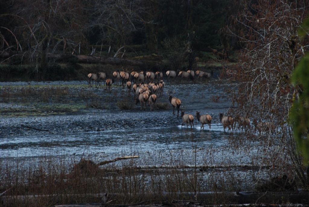
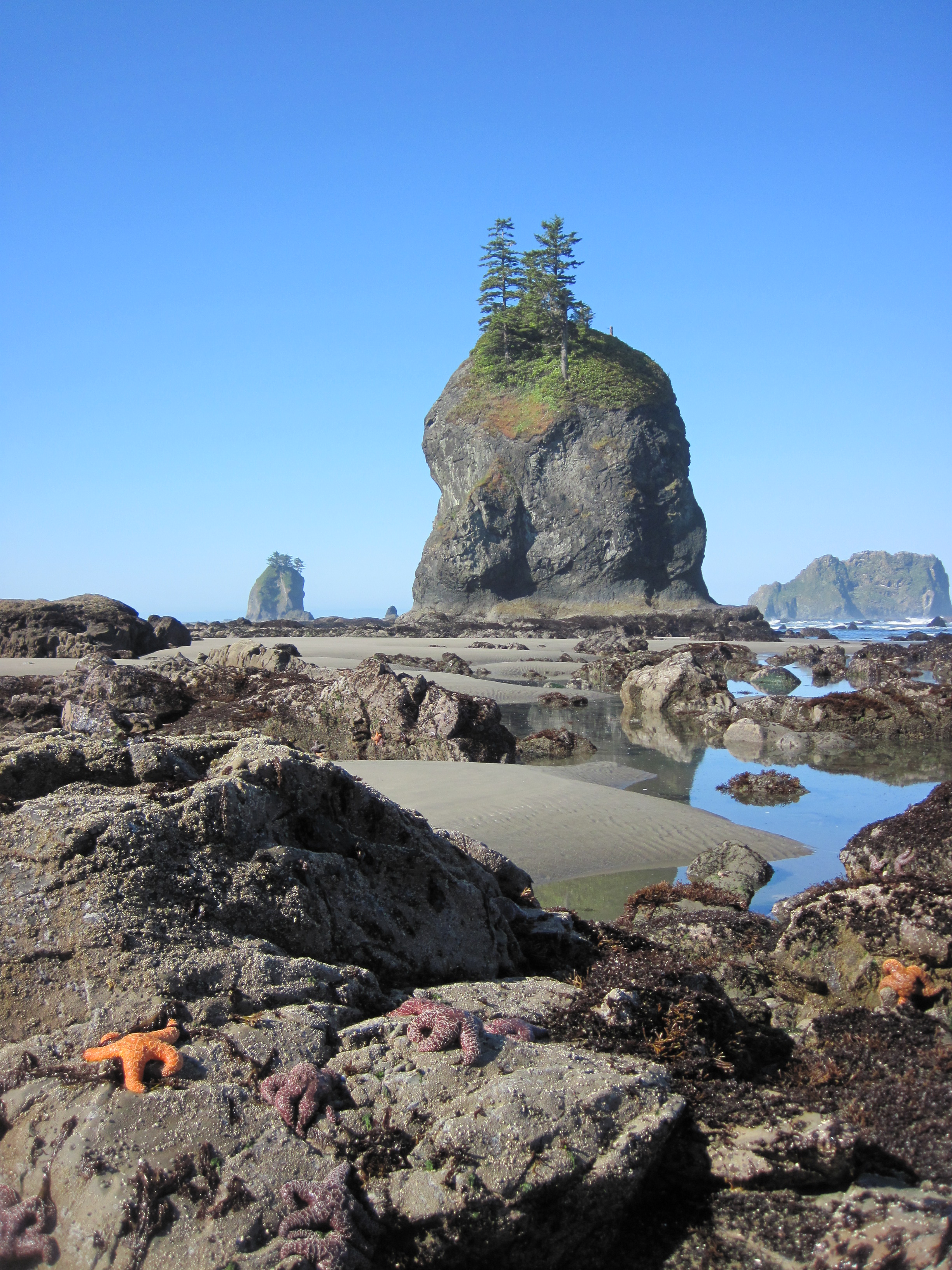
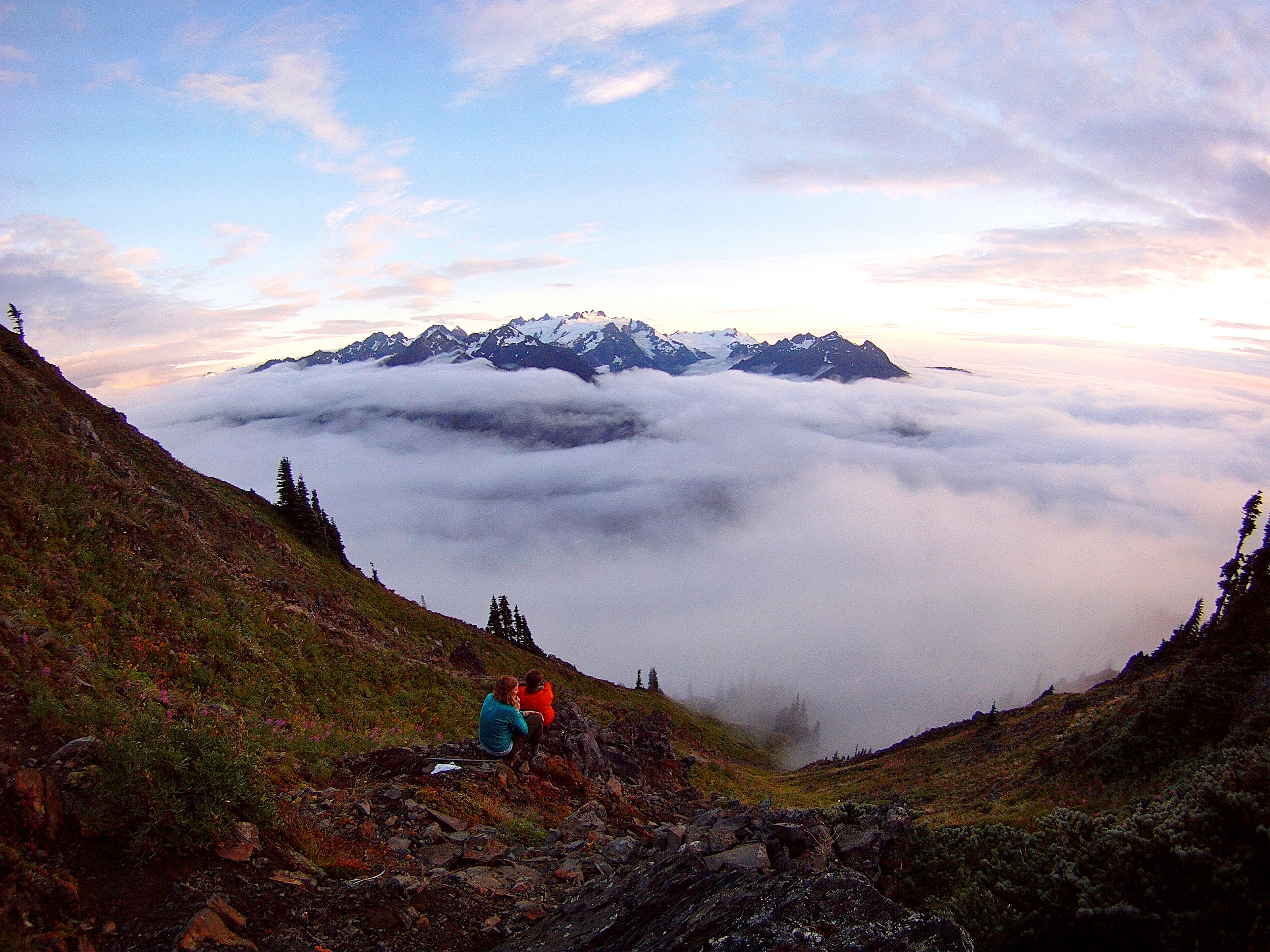
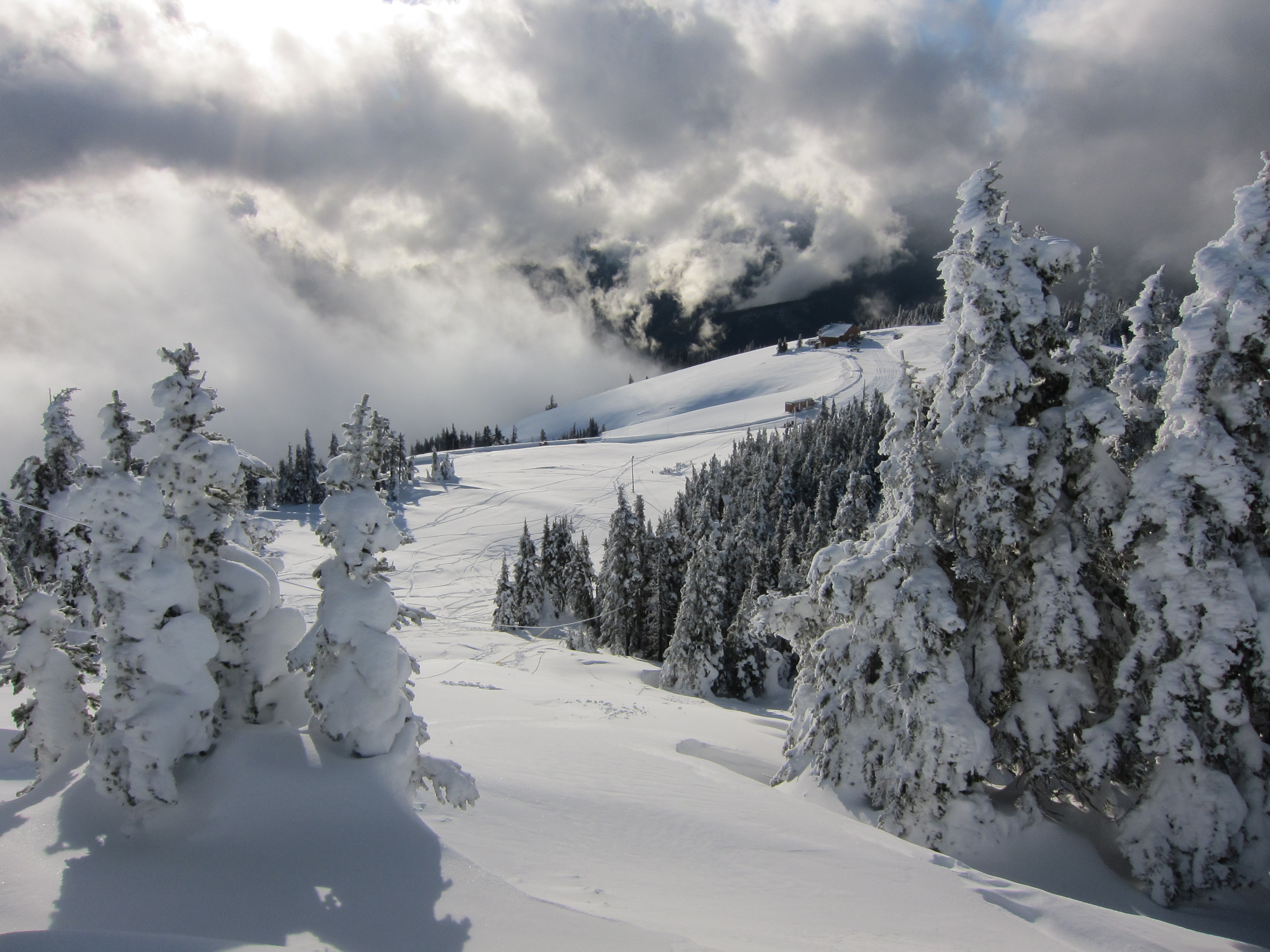
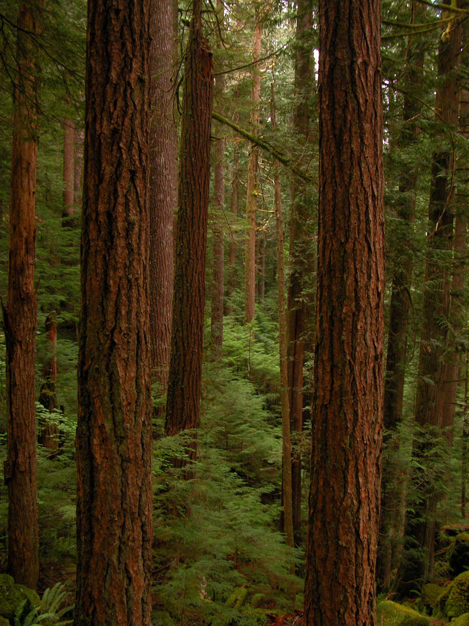




No structured outing assessments have been reviewed for this park yet. Check the official accessibility guide for your requirements.
Compare accessibility details →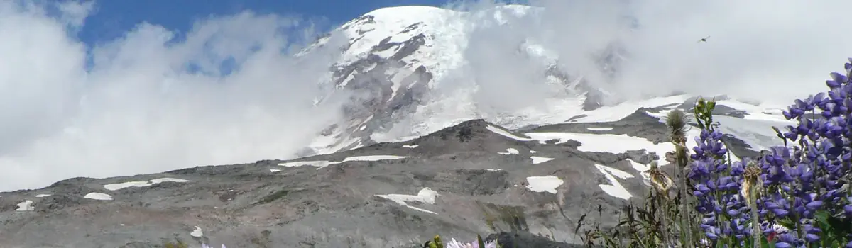 Mountains
Washington
Ascending to 14,410 feet above sea level, Mount Rainier stands as an icon in the Washington landscape. An active volcano, Mount Rainier is the most glaciated peak in the contiguous U.S.A., spawning five major rivers. Subalpine wildflower meadows ring the icy volcano while ancient forest cloaks Mount Rainier’s lower slopes. Wildlife abounds in the park’s ecosystems. A lifetime of discovery awaits.
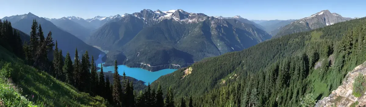 Mountains
Washington
Less than three hours from Seattle, an alpine landscape beckons. Discover communities of life adapted to moisture in the west and recurring fire in the east. Explore jagged peaks crowned by more than 300 glaciers. Listen to cascading waters in forested valleys. Witness a landscape sensitive to the Earth's changing climate. Help steward the ecological heart of the Cascades.
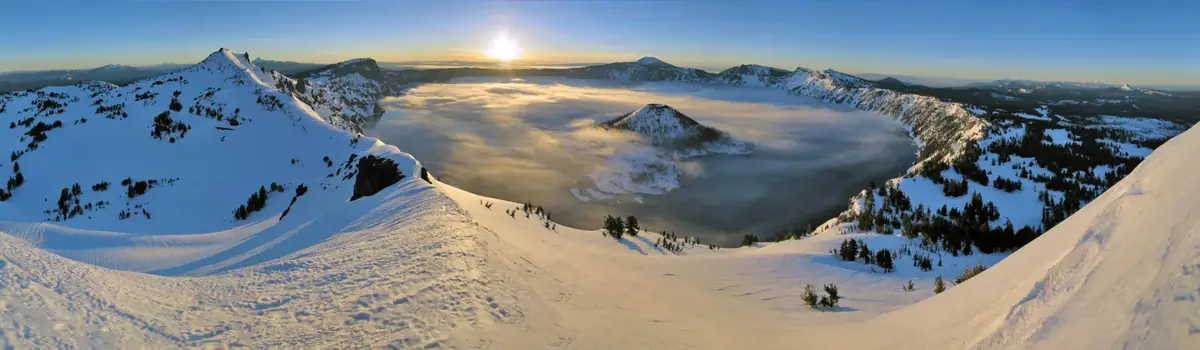 Volcanic
Oregon
Crater Lake inspires awe. Native Americans witnessed its formation 7,700 years ago, when a violent eruption triggered the collapse of a tall peak. Scientists marvel at its purity—fed by rain and snow, it’s the deepest lake in the USA and one of the most pristine on Earth. Artists, photographers, and sightseers gaze in wonder at its blue water and stunning setting atop the Cascade Mountain Range.