Renowned for the world’s tallest trees, Redwood’s landscapes span from open prairies and oak woodlands to pristine rivers and untamed coastline. This ancient home has supported people for thousands of years. The National Park Service and California State Parks now work to safeguard and rejuvenate these lands for everyone’s enjoyment, learning, and inspiration.
139Kacres of parkland
1.2Mrecreation visits, 2025
Jul · Aug · Sepnearby climate picks
Seasonal access & reservations
No reviewed guidance for this selection. Check the park's official planning pages; missing coverage does not establish access.
Selected guidance only; separate from climate comfort and current conditions.
Official conditions Loading saved check
Loading the latest saved conditions. You can also check the official report below.
Editorial recommendations, reviewed 2026-10-17. Full park days, excluding travel to and from the region. A first-visit outline for a general traveler; adapt to mobility, fitness, season, reservations, and current conditions. These are suggested days, not reserved activities or guaranteed routes.
Pets are wonderful companions that bring joy, comfort, and love to our lives. At Redwood National and State Parks, we understand how much you value your furry friends and want to ensure both their safety and yours during your visit.
Important Safety Reminder: Redwood parks are home to wildlife such as bears, coyotes, mountain lions, and herds of protective Roosevelt elk. Wildlife encounters can be dangerous for both pets and people. The scent or sound of a pet, even just one bark, can provoke wild animals and lead to harmful situations.
Park Rules for Pets:
No Pets on Park Trails : For the safety of your pet and the preservation of park wildlife, pets are not permitted on trails.
Ranger-Led Programs : To ensure an optimal experience for visitors and wildlife, pets are not allowed during ranger-led activities.
Rangers' Tip: Pet-Friendly Redwood Walks
For a walk through old-growth redwoods with your leashed pet, visit Cal Barrel Road in Prairie Creek Redwoods State Park or Walker Road in Jedediah Smith Redwoods State Park.
Become a BARK! Ranger
Are you ready to make your pet a proud BARK! Ranger? Visit one of our visitor centers to learn about the rules of the BARK! Ranger program. You and your dog can enjoy a walk through the majestic redwoods, take the BARK! Ranger pledge, and receive a special certificate stamped to commemorate the occasion. For an extra special keepsake, BARK! Rangers can purchase an exclusive dog collar tag from our Redwood Parks Conservancy bookstores! For details on the BARK! Ranger program, be sure to check out our brochure.
Guidelines for pet owners visiting the redwoods:
B ag your pet’s poop – Be responsible by picking up and properly disposing of pet waste in all areas of the park.
A lways use a leash – Your pet must be kept on a leash no longer than 6 feet (1.8 meters).
R espect wildlife – Help protect park wildlife by not allowing pets to make noises or approach animals.
K now where you can go – Pets are permitted in developed campgrounds, on beaches, in picnic areas, and on roads.
Becoming a BARK! Ranger helps ensure that you and your pet have a safe and enjoyable visit while preserving the natural beauty and wildlife of the redwoods.
Places to Go With a Leashed Pet
Parking Areas : Fern Canyon, Lady Bird Johnson, Tall Trees Trail, and Stout Grove parking lots only. Elk Meadow Day Use Area parking lot.
Scenic Viewpoints : Klamath River Overlook, Redwood Creek Overlook.
Developed Campgrounds : Elk Prairie Campground, Gold Bluffs Beach, Mill Creek Campground, and Jedediah Smith Campground.
Beaches : Freshwater Beach, Gold Bluffs Beach, and Crescent Beach.
Gravel Roads : Cal Barrel Road and Walker Road.
These areas provide great opportunities for you and your leashed pet to safely enjoy the beauty of Redwood National and State Pa
What's the Harm With Pets in Wild Places?
Predator Risks : Predators such as bears, mountain lions, and coyotes may perceive pets as prey, endangering both the pet and its owner.
Territorial Marking and Disease : Pets can mark territory with their scent or spread domestic diseases, disrupting natural patterns and potentially harming wildlife.
Stress and Safety : Even well-behaved pets can become stressed in unfamiliar environments, which may lead to threatening interactions with visitors or wildlife, especially on park trails.
Toxic Hazards : Dead salmon, which can be found along riverbanks in the parks, can be highly toxic to dogs.
Where Are Close-by Alternatives?
For those seeking pet-friendly areas, here are nearby locations where pets under your control are allowed (check locally for regulations):
Smith River National Recreation Area : Pets are permitted on all campgrounds and trails (must be leashed). Located east of Crescent City, Calif. via U.S. 199.
Public Beaches in Crescent City, Calif.
Moonstone Beach : Accessible via the Westhaven Drive exit off U.S. 101, just south of Trinidad, Calif.
Clam Beach County Park : Accessible via the Clam Beach exit off U.S. 101, near McKinleyville, Calif.
Arcata Community Forest : Located in Arcata, Calif.
These alternatives provide opportunities to enjoy outdoor time with your pet in a safe and responsible manner.
Service Animals
Service animals are allowed in all facilities and on all trails unless an area has been closed by the superintendent to protect park resources. The 2010 revision to Title II of the Americans with Disabilities Act (ADA), defines a "service animal" as a dog that has been individually trained to do work, or perform tasks for the benefit of an individual with a disability, including a physical, sensory, psychiatric, intellectual, or other mental disability. Dogs that are not trained to perform tasks that mitigate the effects of a disability, including dogs that are used purely to provide comfort or emotional support ("therapy animals"), are considered pets. Falsely portraying a pet as a service animal is considered fraud and is subject to federal prosecution.
Find Your Perfect Campsite: Developed or Backcountry?
Camping is the only way to stay overnight in Redwood National and State Parks. Whether you prefer the convenience of a developed campground with essential amenities or the solitude of backcountry camping along miles of scenic trails, there’s an option for every type of camper. With the right preparation, your overnight stay can be a rewarding and unforgettable experience.
Overnight Camping in the Park
Choose between developed campgrounds with easy access to amenities or backcountry campsites for a more remote experience.
Developed Campgrounds
The park has four developed campgrounds managed by California State Parks. These campgrounds offer essential amenities for tent and RV campers. Reservations are strongly recommended, especially in summer.
Backcountry Camping
Lodging & Camping Outside the Park
There are no hotels or lodges within the park, but lodging and additional camping options are available in nearby communities. Lodging and Camping Options Outside of the Park
To protect the park’s trees, hammocks, ropes, and similar equipment are not allowed, as they can strip bark and cause long-term damage.
Backcountry Camping Regulations
Campsite Regulations
Camping is limited to the designated campsites and to eight (8) persons per site. Camping outside designated campsites or more than eight (8) persons per site is prohibited.
Group sites are limited to twenty (20) persons.
All backcountry camping requires a permit and is done so by online reservation only. Backcountry camping without a permit is prohibited.
Backcountry horse camping requires a permit and is only allowed at Little Bald Hills Camp and Elam Camp. Backcountry horse camping without a permit is prohibited.
Saving a campsite for another party is prohibited.
Campsite overnight stay limits are 5 consecutive nights and 15 nights in a calendar year. Camping in the same site over 5 consecutive nights and 15 nights in a calendar year is prohibited.
Campers and all tents and other camping equipment must vacate at least 14 days between each multi-day (2-5 days) stay.
Food Storage Regulations
In all areas within the park, all food, lawfully taken fish, garbage and equipment used to store food (e.g., ice chests) must be stored in one of the following ways: Inside a vehicle with all doors, windows and trunk lids closed, OR Inside a camping unit that is constructed of solid non-pliable material, OR Suspended at least 10 feet above the ground and 4 feet horizontally from a post, tree trunk or other object (Note: Climbing of trees is prohibited), OR Inside a building, OR Inside a commercially available portable bear-resistant food storage container that is specifically designed and constructed to prevent access by bears and other wildlife, OR
Inside a vehicle with all doors, windows and trunk lids closed, OR
Inside a camping unit that is constructed of solid non-pliable material, OR
Suspended at least 10 feet above the ground and 4 feet horizontally from a post, tree trunk or other object (Note: Climbing of trees is prohibited), OR
Inside a building, OR
Inside a commercially available portable bear-resistant food storage container that is specifically designed and constructed to prevent access by bears and other wildlife, OR
In developed campgrounds, inside a food storage locker where provided.
For purposes of this section, food is defined as items to be consumed, drinks, pet food, toiletries and soaps. Garbage is defined as food wastes, empty food containers, trash and recyclables.
This restriction does not apply to food that is being transported, consumed or prepared for consumption
Fire Regulations
All fires are prohibited during periods of very high or extreme fire danger as posted according to the park’s Fire Management Plan.
Campfires are permitted in park-provided grills or designated sites in all campgrounds, picnic areas and backcountry campsites. Holders of a valid backcountry camping permit for Redwood Creek may build a fire only on the gravel bars, per conditions of the permit.
Moving a grill or fire ring from its original location is prohibited.
Where grills are provided, all burning material must be fully contained within the grill.
The burning of trash or food waste is prohibited within the park.
Fires may be built on beach wave slopes, but not on vegetation
Horse & Pack Animal Regulations
Horses, ponies, mules, burros, goats, yaks, and llamas
The Mill Creek and Rellim Ridge Horse Trails and the Little Bald Hills trail in Del Norte County.
The established and marked Orick Horse trails on the west side of Redwood Creek and within the streambed of Redwood Creek up to the first footbridge/trail crossing of Redwood Creek.
Crescent, Gold Bluff, Hidden (Humboldt County) and Freshwater Beaches.
A horse or pack animal may not graze or otherwise eat park vegetation.
A horse or pack animal must be picketed, properly tied to a hitching post or within a corral when unattended overnight.
From forest trails to coastal adventures, find out how to experience Redwood National and State Parks.
Finding a Roof Over Your Head Means Staying Outside the Parks
Choose from the Parks' four developed campgrounds or seven backcountry campsites.
Guided Experiences for Visitors
Join a national and state park tradition! Park rangers and guides offer free, engaging, and educational seasonal programs throughout Redwood National and State Parks . These experiences are designed to inspire visitors of all ages and backgrounds.
General Program Information
Seasonal Availability: Most programs run from mid-May to mid-September .
Event details and dates are posted at: Redwood event calendar Our visitor centers Campground bulletin boards
Redwood event calendar
Our visitor centers
Campground bulletin boards
Ranger-Led Program Schedules and Locations
The programs listed below may be available during your visit from mid-May through late September . However, availability varies, and not all programs are offered daily.
Check our ranger-led program calendar to see what’s happening during your visit.
Programs & Activities
Forest Walks (45 minutes to 1 hour)
Experience the beauty of the forest, shoreline, or prairielands with a park ranger. These walks provide a closer look at the diverse natural communities that make up one of the world’s most complex ecosystems.
Dress for the weather.
Bring drinking water and a snack.
Wear sturdy hiking shoes or boots.
Campfire Programs (1 hour)
As summer evening falls, gather around for an informative and inspiring program at Jedediah Smith, Mill Creek, and Elk Prairie Campgrounds . Programs may include narrated slide shows, storytelling, and interactive activities. Campfire circles and outdoor amphitheaters are wheelchair accessible.
What to Expect:
Cool summer evenings—dress warmly.
Guided Kayak Tours
(Only offered for a limited time in summer season due to river conditions.)
Learn About Kayak Tours : closed for summer 2025. During the summer, park rangers lead kayak tours along the Smith River , the largest free-flowing river system in California and a designated National Wild & Scenic River . Paddle through pristine waters while learning about the unique geology of the Smith River watershed and its role in supporting the world's tallest trees.
Snorkeling (2.5-3 hours)
A unique aquatic adventure designed to connect you with the incredible biodiversity thriving beneath the surface of Northern California's wild and scenic Smith River. This free, ranger-guided program offers a rare opportunity to experience the river from a new perspective. Registration opens 10 days before event. Registration is currently open for summer 2025.
Activity Level: Moderate (includes hiking, paddling, and swimming)
Duration: Approximately 2.5 - 3 hours (including hike, paddle, and snorkel time).
Tidepool Walks (1–2 hours, as tides permit)
Explore the fascinating world beneath the waves. A park ranger will guide you through tidepools, where you can observe delicate marine creatures up close.
Wear sturdy, non-slip hiking shoes or boots (no sandals)—they will get wet.
Junior Ranger Programs (1 hour)
Children ages 7–12 can take part in fun, hands-on activities that explore the people, plants, animals, and ecosystems of the redwood region. Programs are offered at:
Jedediah Smith Campground
Mill Creek Campground
Prairie Creek Visitor Center
Self-paced Junior Ranger activities are also available at all visitor centers.
The five visitor centers in Redwood National and State Parks— Hiouchi Visitor Center , Jedediah Smith Visitor Center , Crescent City Information Center , Prairie Creek Visitor Center , and Thomas H. Kuchel Visitor Center —are the perfect locations to start exploring these incredible parks. Each center provides essential orientation, trip-planning advice, park information, and retail opportunities to enhance your visit. Whether you're looking for maps, hiking tips, or just the best spot for viewing the towering redwoods, the staff at these centers are ready to help.
The Redwood Parks Conservancy , the parks’ official nonprofit partner, operates the park stores located at each center. These stores offer a wide selection of mementos, books, maps, and gifts, with proceeds supporting the conservation and care of parks and public lands along California's northern coast.
Hours & Seasons
Contact Information
From forest trails to coastal adventures, find out how to experience Redwood National and State Parks.
Find A Place To Sleep
Choose from the Parks' four developed campgrounds or seven backcountry campsites.
Stay Updated: Changing Conditions at Redwood National and State Parks
The conditions at Redwood National and State Parks can change quickly due to weather, road maintenance, wildfires, and other factors. Before your visit, check for any updates that might affect your plans, including trail closures, fire restrictions, road conditions, and park alerts .
Staying informed will help you have a safer and more enjoyable experience. Be sure to check for updates regularly as your trip approaches!
Roads & Day Use Areas
Listed in south to north order. Other park roads and day use areas not listed below are open.
Road or Day Use Area
Location Description
Additional Info
California State Highway information can be found at the Caltrans Road Information Website .
Listed north to south order, park trails not listed below are open. Maps - Redwood National and State Parks (U.S. National Park Service) (nps.gov)
Redwood Creek Trail : Removed
Stout Grove to Jedediah Smith Campground : Removed
Stout Grove to Hiouchi Trail: Removed
Fern Canyon : Removed
Prairie Creek Nature Trail: Removed
Visitor Centers
Hours, status, and more information about Redwood National and State Parks Visitor and Information Centers.
Developed Campgrounds
Hours, status, reservations, and more information about Redwood National and State Parks campgrounds.
Backcountry Camps
Get detailed backcountry camping information and also download the Redwood National and State Parks Backcountry Trip Planner. Please understand and use Leave No Trace ethics and practices when in the backcountry. Backcountry permits are being issued online only, they are not available at any of the park visitor centers. Click here for more information on issuing backcountry permits .
Little Bald Hills : Open
DeMartin : Open As part of CalTrans work to develop a new highway route that is more stable and safer, they will be undertaking geotechnical drilling this fall and winter. Hikers and campers in the area will likely see and hear heavy equipment at work and hear noise associated with the drilling, which may be 24 hours/day at times. Redwood National and State Parks has worked with CalTrans to minimize the impacts to users of this area while keeping the trail and campground open and accessible.
As part of CalTrans work to develop a new highway route that is more stable and safer, they will be undertaking geotechnical drilling this fall and winter. Hikers and campers in the area will likely see and hear heavy equipment at work and hear noise associated with the drilling, which may be 24 hours/day at times. Redwood National and State Parks has worked with CalTrans to minimize the impacts to users of this area while keeping the trail and campground open and accessible.
Flint Ridge : Open
Gold Bluffs : Open
Elam Camp: Open
44 Camp : Open Composting toilet no longer available: Pack out solid human waste or bury in “cat-hole” at least 6” deep in soil (not leaf litter), and at least 200 ft from any water source, campsite, or trail; pack out toilet paper.
Composting toilet no longer available: Pack out solid human waste or bury in “cat-hole” at least 6” deep in soil (not leaf litter), and at least 200 ft from any water source, campsite, or trail; pack out toilet paper.
Redwood Creek (dispersed camping): Open Closed October 15 through April 1 due to high water levels on Redwood Creek. Closure period subject to change depending on water levels.
Closed October 15 through April 1 due to high water levels on Redwood Creek. Closure period subject to change depending on water levels.
Mill Creek Horse Trail: Open For general information on horseback riding in the parks.
For general information on horseback riding in the parks.
Orick Horse Trails: Open Backcountry camping is at Elam Camp only. Camping with horses is not allowed on the Redwood Creek gravel bar and 44 Camp. Partial Closure: As of September 9, there is a temporary partial closure of the 44 Creek Loop Trail from trail maker 11 to 13.
Backcountry camping is at Elam Camp only. Camping with horses is not allowed on the Redwood Creek gravel bar and 44 Camp.
Partial Closure: As of September 9, there is a temporary partial closure of the 44 Creek Loop Trail from trail maker 11 to 13.
Weather Conditions, Wildfire, and Smoke Impacts at the Park
National Weather Service forecasts for Crescent City, Calif .
National Weather Service forecasts for Orick, Calif.
For general climate and weather information for Redwood National and State Parks.
Current wildfire and prescribed fire impacts in the parks.
Check the Air Quality Index to see if our air is "good".
The California Water Resources Control Board have an interactive map reflecting the most up to date harmful algal bloom reports.
Wildflowers and Blooms
For information and updates on what popular plants are flowering .
Laws & Policies
Read about the laws and policies at Redwood National and State Parks.
Road or Day Use Area
Status
Timeframe
Location Description
Reason
Additional Info
Bald Hills Road
Open/ Hazard Conditions
Road Damage
Drive slowly and be alert for road damage. Watch for cars crossing lanes to avoid hazards.
Davison Road (access to Gold Bluffs Beach and Fern Canyon)
Open
There are two stream crossing on the road to Fern Canyon which can be challenging especially after rain storms. High clearance vehicles are recommended.
Newton B. Drury Scenic Parkway
Open
The first Saturday of each month from October through May, is a "Hike and Bike" event. The scenic parkway is open to hikers and bikers, but closed to vehicle traffic. Prairie Creek Visitor Center is accessible from Highway Exit 753.
Cal-Barrel Road
Open
A good spot for walking with your leashed pets . Not recommended for trailers and large vehicles.
Howland Hill Road
Open
Mill Creek Day Use Area
Partial Closure
Weekdays
Open to public on the weekends for day use. Gate will be locked each evening. A section of the multi-use trail along West Branch Road, west of Rock Creek Road, is closed temporarily due to a failed bridge crossing.
Trail
Status
Timeframe
Location Description
Reason
Additional Info
Boy Scout Tree Trail
Partially Open
August 4 until further notice
Boy Scout Tree Trail 1.75 miles from trailhead
A fallen tree has blocked the trail 1.75 miles from the trailhead. Climbing over the fallen tree to continue on the trail is possible, but challenging.
Simpson-Reed Trail
Open
Alder Basin Trail
Closed
Closed for Redwoods Rising restoration work.
Lyon's Ranch Trail
Intermittent Closures
October 22 to October 26
Lyon's Ranch Trail and Connected Historic Trails
Prescribed Burns
Lyon's Ranch Trail and connected trails/historic roads will have intermittent closures for prescribed burns 10/22 to 10/26.
Tall Trees Trail
Open
A reservation required year-round for this trail.
James Irvine Trail
Partially Open
Stairs under construction: Work is currently being done on the stairs connecting Fern Canyon to the James Irvine Trail. The easternmost set of stairs is closed. The western set of stairs are still open to access Fern Canyon Loop. Tree down: A smaller, passable tree is down on the trail at approximately (41.39293, -124.05182) or about 1.25 miles before Fern Canyon.
Miners Ridge Trail
Partially Open
April 12, 2026 until further notice.
Miners Ridge Trail is open to just past the Clintonia Trail and then is blocked by a large downed tree.
Downed tree
Visitors hiking to Gold Bluffs Beach will not be able to get past this downed tree. The James Irvine Trail is the best alternative.
Dolason Prairie Trail
Partially Open
Until further notice
The first 4.5 miles of this trail are open.
Bridge failure
This trail is now closed at the Emerald Creek Bridge due to bridge failure. The Emerald Ridge Trail can only be accessed from Redwood Creek Trail or Tall Trees Trail.
Fern Canyon
Open
Between May 15-September 15: A reservation is required for each vehicle driving to trailhead. Expect to hike through water (ankle to knee deep).
Navigating the Parks: Maps and Reliable Directions
Important GPS Note:
Many popular online maps and GPS apps do not provide accurate coverage of Redwood National and State Parks. Visitors attempting to reach specific locations are often misdirected to isolated towns, remote logging roads, or private property .
To avoid navigation issues, we strongly recommend using a printed park map and planning your route in advance.
Important Travel Tips
Do not use Bald Hills Road as a route to Redwood National Park.
Highway 101 runs north and south through the center of the parks and is the most reliable route.
Highway 199 provides access from the northeast.
Highway 299 is the best route from the southeast.
Once inside the parks, Newton B. Drury Scenic Parkway offers a scenic drive through the heart of the redwoods.
For detailed maps and reliable navigation, visit our National Park Service Map Collection.
ADA Accessible Park Map
Printable Maps for Redwood National and State Parks
Having a reliable map is essential for exploring Redwood National and State Parks, where GPS navigation can be unreliable. Below, you’ll find printable maps to help you plan your visit, from park-wide overviews to detailed regional maps and campground layouts.
Park Map (JPEG)
Park Map - Northern Half (JPEG)
Prints at 8.5" x 11" (Letter size). From the official brochure for Redwood National and State Parks. Also see pages 6-7 of the Visitor Guide for a similar map but with recommended scenic drives and short walks. This map highlights the parts of the Parks north of the Klamath River.
Park Map - Southern Half (JPEG)
Prints at 8.5" x 11" (Letter size). From the official brochure for Redwood National and State Parks. Also see pages 6-7 of the Visitor Guide for a similar map but with recommended scenic drives and short walks. This map highlights the part of the Parks south of the Klamath River.
Campground Maps
You will be redirected to official California State Parks webpages.
Jedediah Smith Campground (in Jedediah Smith Redwoods State Park) Mill Creek Campground (in Del Norte Coast Redwoods State Park) Elk Prairie Campground (In Prairie Creek Redwoods State Park) Gold Bluffs Beach Campground (In Prairie Creek Redwoods State Park)
Pack Animal and Overnight Camps . (PDF 4.6 MB)
Brochure and maps about horse trails in the parks.
Photo: Humboldt County Convention and Visitors Bureau.
Staying Near Redwood National and State Parks
Aside from eight basic campground cabins , Redwood National and State Parks do not have lodging facilities.
Prairie Creek Redwoods State Park (Elk Prairie Campground) – 4 cabins
J edediah Smith Redwoods State Park – 4 cabins
These cabins are typically reserved months in advance , so early booking is recommended.
However, a variety of accommodations are available in the surrounding area to suit different budgets and travel needs. For information on private lodging, RV parks, and campgrounds , contact local chambers of commerce (listed below, north to south along U.S. 101) or visit www.visitredwoods.com .
Learn more about cabins and camping options inside the parks.
From forest trails to coastal adventures, find out how to experience Redwood National and State Parks.
Download and print maps to help guide your trip.
Learn about today's closures, delays, trail information, and fire information.
Routes to Remember
Not every adventure requires a hiking trail—sometimes, the best way to experience Redwood National and State Parks is from the driver’s seat. Whether you’re just passing through or looking for a leisurely way to soak in the scenery, these winding roads take you beneath towering redwoods, past windswept coastlines, and through golden prairies dotted with ancient oaks. Roll down the windows, take your time, and let the journey be just as memorable as the destination.
Traveling with a motorhome, RV, or trailer?
Be sure to read the Vehicle Advisory and Road Type information before setting out. Some routes are steep, narrow, or include one-way sections that may not accommodate larger vehicles.
Before hitting the road
Visit the Current Conditions page for up-to-date information on road closures, detours, and potential hazards . Enjoy the journey!
Howland Hill Road
Click for Additional Details and Map Vehicle Advisory and Road Type Mostly unpaved; motorhomes, RVs, and trailers will not fit on this road.
Distance & Duration: 10 miles, one way (Crescent City, CA, to U.S. 199 near Hiouchi, CA); approximately 45 minutes .
From Crescent City, CA , drive 1 mile south on U.S. 101.
Turn left (east-northeast) onto Elk Valley Road and continue 1 mile .
Turn right (east) onto Howland Hill Road.
After 1½ miles , the road becomes unpaved as it enters Jedediah Smith Redwoods State Park .
Continue 5½ miles on Howland Hill Road until it transitions to Douglas Park Road (paved) .
After 1½ miles , turn left onto South Fork Road.
In ½ mile , South Fork Road meets U.S. 199 , just east of Hiouchi, CA.
Description: Just a few miles from Crescent City, Howland Hill Road immerses travelers in the heart of Jedediah Smith Redwoods State Park. This narrow, winding road—mostly unpaved—offers an up-close experience with towering old-growth redwoods. Along the way, you'll find scenic pull-outs and access to notable trailheads, including the Boy Scout Tree Trail and Stout Grove.
Enderts Beach Road
Vehicle Advisory and Road Type Paved; motorhomes, RVs, and trailers are not advised beyond the Crescent Beach picnic area.
Distance & Duration: Approximately 2¼ miles, one way ; about 5 minutes .
From Crescent City, CA , drive 2½ miles southeast on U.S. 101.
Turn right (south) onto Enderts Beach Road.
Description: Just minutes from Crescent City, this short yet scenic drive offers excellent opportunities for elk viewing, whale watching, and breathtaking coastal vistas. Along the route, you'll find access to:
Crescent Beach picnic area
Crescent Beach Overlook
Trailheads for the Coastal Trail (Last Chance Section) and Enderts Beach
Vehicle Advisory and Road Type This paved road is steep and narrow—motorhomes, RVs, and trailers are not recommended.
Distance & Duration: Approximately 2¼ miles, one way (to Klamath River Overlook); about 15 minutes .
Take the signed exit off U.S. 101, located ~2¼ miles north of Klamath, CA , or ~18½ miles south of Crescent City, CA .
Description: This short but dramatic drive passes through historic Requa, CA, leading to the Klamath River Overlook , which sits 650 feet above the Pacific Ocean. From this breathtaking vantage point, visitors can enjoy whale watching, bird viewing, and stunning coastal panoramas. The overlook marks the meeting point of the Klamath River and the Pacific Ocean, where freshwater completes its 250-mile journey from the snow-capped Cascade Mountains of Southern Oregon to the sea.
Coastal Drive (Loop)
Vehicle Advisory and Road Type 1. The former Coastal Drive route south of Alder Camp toward Carruthers Cove is closed to motor vehicles .
2. The Coastal Drive Loop north of Alder Camp remains open. This scenic route is mostly paved, with a one-way, northbound section between High Bluff Overlook and Klamath Beach Road. Important Note : The northern section beyond High Bluff Overlook is not suitable for RVs or vehicles towing trailers. Distance & Duration: Approximately 9 miles, round trip ; about 45 minutes .
From Klamath, CA , drive 1 mile south on U.S. 101 (crossing the Klamath River).
Take the Klamath Beach Road exit and follow signs for Coastal Drive.
Turn left onto Alder Camp Road and continue 2 miles to the junction.
Turn right (north) and follow the one-way, unpaved section (~1.5 miles) toward the Klamath River mouth .
Turn right (east) onto paved Klamath Beach Road and travel ~4 miles back to U.S. 101.
Description: This narrow, winding road features steep grades and sharp curves, rewarding drivers with panoramic ocean and estuary views. From overlooks high above the crashing surf, you might spot whales, sea lions, and pelicans. Enjoy a picnic at the High Bluff Overlook , a scenic stop with breathtaking coastal vistas. Along the route, don’t miss the World War II radar station , cleverly disguised in the 1940s to resemble a simple farmhouse and barn.
For those looking to explore on foot, hiking and backcountry camping are accessible via the Flint Ridge section of the Coastal Trail.
California State Parks
Newton B. Drury Scenic Parkway
More details about Newton B. Drury Scenic Parkway Vehicle Advisory and Road Type The road is paved and commercial vehicles are not permitted .
Distance & Duration: 10 miles, one way; approximately 20–30 minutes .
Access via signed exits off U.S. 101, located 6 miles north of Orick, CA , or 4 miles south of Klamath, CA .
Description: A must-see alternative to U.S. 101, this scenic parkway winds through the heart of Prairie Creek Redwoods State Park, offering a stunning drive beneath towering old-growth redwoods. Traveling north to south, highlights include:
Numerous trailheads for hiking
Big Tree Wayside , home to one of the park’s most impressive redwoods
Prairie Creek Visitor Center , a great stop for information and exhibits
Elk Prairie Campground , a popular site for camping and picnicking
A resident herd of Roosevelt elk , often seen grazing in the meadows
This leisurely drive offers an immersive redwood experience , making it a perfect detour for nature lovers.
Cal-Barrel Road
More details about Cal-Barrel Road Vehicle Advisory and Road Type This road is unpaved; motorhomes, RVs, and trailers are prohibited. Seasonal Closure: Closed to vehicles during the winter season .
Distance & Duration: Approximately 1½ miles, one way ; about 30 minutes .
From Orick, CA: Drive 6 miles north on U.S. 101 and take the exit for Newton B. Drury Scenic Parkway . Continue 1½ miles , passing the Prairie Creek Visitor Center turnoff, to the signed Cal-Barrel Road on the east side of the parkway.
From Klamath, CA: Drive 4 miles south on U.S. 101 and exit onto Newton B. Drury Scenic Parkway . Continue ~8 miles to the signed Cal-Barrel Road on the east side of the parkway.
Description: This narrow, winding road provides an up-close experience with colossal old-growth coast redwoods, making it a spectacular drive—or walk—for those wanting to immerse themselves in the towering forest. Leashed dogs are allowed , making it a great pet-friendly option for exploring on foot. Cal-Barrel Road also provides access to the Rhododendron Trail and the extensive trail network of Prairie Creek Redwoods State Park.
Vehicle Advisory and Road Type Mostly unpaved and narrow; motorhomes/RVs must be 24 feet or shorter; trailers are prohibited.
Distance & Duration: Approximately 7 miles, one way ; about 30 minutes .
Exit Davison Road (Elk Meadow Day Use Area) , located 2½ miles north of Orick, CA , on U.S. 101.
After ⅓ mile (paved) , pass the Elk Meadow Day Use Area parking .
Continue nearly 7 miles on an unpaved road to its end at the Fern Canyon Trailhead .
Description: This scenic route winds through meadows grazed by Roosevelt elk and second-growth redwood forest, eventually leading to Gold Bluffs Beach and the towering 30-foot walls of Fern Canyon. Visitors can explore this remote and stunning area while staying at Gold Bluffs Beach Campground , with nearby access to the Coastal Trail (Gold Bluffs Beach section) and the Fern Canyon Trail .
Important: From May 1 to September 30 , a Fern Canyon parking permit is required . Reservations must be made in advance.
Bald Hills Road
More details about Bald Hills Road Vehicle Advisory and Road Type Mostly unpaved; motorhomes, RVs, and trailers are not advised due to winding, narrow, and rough conditions.
Distance & Duration: Approximately 17 miles, one way (from U.S. 101 junction to Lyons Ranch Trailhead ); about 45 minutes .
Take the signed exit for Bald Hills Road , located ~1 mile north of Orick, CA , on U.S. 101.
Travel ~13 miles , where the road transitions from paved to unpaved .
Description: This scenic and rugged drive climbs a steep 15% grade, passing through old-growth and second-growth redwoodswith trail access to Lady Bird Johnson Grove and Tall Trees Grove . As the road ascends, it opens into rolling prairiesbursting with spring wildflowers, and it is common to spot Roosevelt elk and black bears.
Along the way, stop at the Redwood Creek Overlook , which offers sweeping views of the Redwood Creek watershedand the Pacific Ocean in the distance. Further along, trailheads lead to the historic Dolason Prairie and Lyons Ranch sites, two picturesque locations rich in cultural and natural history.
No matter your comfort level or experience, Redwood National and State Parks offer a variety of walking and hiking options. To help plan your visit, the Klamath River serves as a boundary between the park's northern and southern areas. Crescent City and Hiouchi are located in the north, Klamath is central, and Orick is in the south.
Before You Go: Always check weather and park conditions prior to your trip. Storms and other hazards can lead to temporary road and trail closures.
Questions to Consider:
Do you have less than an hour, or a full day for your hike?
Are you visiting during winter or summer? (Some trails with footbridges are only open in summer.)
What is the fitness level of your group?
Which area of the parks are you planning to visit?
Do you need parking for an RV? Are you ready to navigate dirt roads?
What are your accessibility needs?
Are you traveling with a pet?
For more detailed information on walks, hikes, and trails, refer to our visitor centers, visitor guide, newspaper , and backcountry trip planner.
Do I Need a Permit?
Permits are required for Gold Bluffs Beach/Fern Canyon ((summer) and Tall Trees Trails (year-round) due to limited parking.
Whether you have an hour or a full day, there’s a trail that fits your schedule. Short walks lead to towering trees and quiet groves, while longer hikes reveal sweeping vistas, hidden waterfalls, and the full beauty of the redwood forest. With hundreds of miles of trails, you can choose the experience that’s right for you—whether it’s a quick stop or a full day of exploration. Click on one of the feature images, below, to learn more about the hike.
A Short Stop in the Forest
Ideas for visits lasting less than an hour.
A Few Hours in the Redwoods
Walks, hikes and experiences that take two hours or less.
Suggestions For Half Day Activities
Half a day will immerse you in some amazing places.
The parks are full of day-long hikes.
Hundreds of miles of trails to choose from.
Hikes by Region
The trails of Redwood National and State Parks span towering forests, rugged coastlines, and winding rivers. Whether you're exploring the northern or southern reaches of the park or following the Coastal Trail for miles of breathtaking scenery, each region offers a unique way to experience this landscape. Choose your path and discover what makes each area special. Click on one of the features images, below, to learn more about the region and it's hiking options.
North Area Trails
Explore the park north of Klamath River on these trails
South Area Trails
Explore the park south of Klamath River on these trails.
70 miles (142 km) of Coastal Trail offers hikers options for short walks, day-long trips, and even multi-day adventures.
Accessible Trails
Explore the forests and coasts on these more accessible trails. Some are fully wheelchair accessible, while others feature wide, level paths and/or paved walking surfaces. Many include benches along the route. Please note that not all trailheads have reserved accessible parking. An all-terrain track chair, beach wheelchairs, and standard wheelchairs are also available for loan at certain park visitor centers, free of charge.
North: Jedediah Smith Redwoods State Park
Simpson-Reed Grove
South: Prairie Creek Redwoods State Park
Big-Tree Wayside
Elk Prairie Trail
Foothills - Prairie Creek Loop
Revelation Trail .
Note: The Lady Bird Johnson Trail in Redwood National Park is partially paved, but it has some steeper slopes and is not considered accessible for hikers using mobility aids.
Pets on Trails?
Pets are not allowed on national and state park trails, as even well-behaved animals can disturb wildlife and impact the fragile ecosystem.
However, there are pet-friendly options within the parks. Leashed dogs are welcome on Cal Barrel Road , where you can enjoy a walk beneath towering old-growth redwoods. Your dog can also become a BARK! Ranger —learn more about this program and other pet guidelines in the park.
What To Expect?
Seasonal Bridges
In summer, seasonal foot-bridges are constructed across some waterways to allow for easier access to some of the parks' frontcountry, and backcountry highlights. Check our current conditions page for day-today updates on the bridges. Depending of the water-levels, these footbridges can installed by June and may be removed by October. These trails are not wheelchair accessible.
Redwood Creek's bridges are in the backcountry of Redwood National Park and allow for easier access to several backcountry campsites.
Fern Canyon's bridges are in the front-country of Prairie Creek State Park. Fern Canyon is a popular summer destination, and it will be very busy.
Smith River's bridges in Jedediah Smith Redwoods State Park allow for walking access to Stout Grove.
Bicycling in Redwood National and State Parks can be both challenging and awe-inspiring. The parks feature several hike/bike trails, with the main biking hub located in the southern part of the parks. Ride through ancient redwood groves, pedal under second-growth forests, or follow coastal cliffs with sweeping ocean views.
Although most national and state parks prohibit biking on backcountry hiking trails, Redwood National and State Parks offer several bike trails—primarily on rehabilitated logging roads. These old roads are sturdy enough to minimize erosion and wide enough to safely accommodate multiple users. Please help protect other trails by respecting areas where bicycles are not permitted.
Biking in the Parks Brochure
Print or pick up a biking in the parks brochure (Oct 2020) at any visitor center for more information.
Suggested Bike Routes (North to South)
Whether you're looking for a challenging ride through rugged terrain or a leisurely pedal through towering redwoods, these suggested bike routes offer something for every adventurer. From the high ridges of Little Bald Hills to the coastal views of Gold Bluffs Beach, each trail tells a story of the landscape’s rich history and ongoing restoration.
Little Bald Hills Trail: On Howland Hill Road, 4.8 miles on parks' side. Continue on the USFS Paradise Trail for 5 more miles. Steep. (No e-bikes).
Coastal Trail, Last Chance section : Located at the southern end of Enderts Beach Road or at milepost 15.6 on Highway 101: 6 miles. Some steep areas. (No e-bikes).
Ossagon Trail Loop: Starts at milepost 132.9 on Newton B. Drury Scenic Parkway: 19-mile loop when combined with Coastal Trail, Gold Beach section, Davison Road and back to the Scenic Parkway.
Coastal Trail, Gold Bluffs Beach section: Accessed via Ossagon Trail or Davison Road: 3 miles. Easy. (No e-bikes).
Streelow Creek Trail: 1.8 miles on mostly single-track that connects Davison Road in the west with Davison Trail in the east. Easy.
Davison Trail : Start at Elk Meadow Day Use Area or at the south end of Elk Prairie campground: 3 miles. Easy. Combine with Streelow Creek Trail and Davison Road for a 7½ loop. Easy to moderate. Carry on to Lost Man Creek trailhead for another 2½ miles. Moderate.
Lost Man Creek Trail : Located 3 miles north of Orick or 6½ miles up Bald Hills Road off Hwy 101: 11 miles. Combine with Bald Hills Road and Highway 101 for a 20½-mile loop. Add on four miles by going to Elk Meadow Day Use Area. Moderate with some steep grades.
Elk Meadow Day Use Area
Elk Meadow Day Use Area is the hub for connecting different bike trails in the Greater Prairie Creek watershed. Most of these bike trails are on old logging roads that go through second-growth forests. However, a mile of ancient redwoods can be explored by bike at the western end of the Lost Man Creek Trail. In late 2019, an ecosystem restoration project called Redwoods Rising began in the park. One of the goals is to repair degraded second-growth forests and rivers in the Greater Prairie Creek Watershed. There may be temporary bike / trail closures in place during this years-long process. Be sure to c heck our website or ask at a visitor center before your trip.
Newton B. Drury Scenic Parkway: Hike and Bike Days
The Newton B. Drury Scenic Parkway in Prairie Creek Redwoods State Park offers a breathtaking 10-mile ride through towering redwoods on a paved road open to cyclists year-round.
From October to May , on the first Saturday of each month , the Parkway is closed to motorized vehicles, creating a peaceful and safe experience for cyclists and walkers alike. This special event allows visitors to enjoy the redwoods without traffic, making it a favorite for families and outdoor enthusiasts.
The Parkway is mostly flat, except for the northern one-mile section , where the road climbs and descends over 400 feet . Plan accordingly for this elevation change.
E-bikes are permitted on hike/bike trails that lie entirely within the boundaries of Redwood National Park .
However, some trails in Redwood National and State Parks cross into state park land, where different regulations apply. Due to variations between state and federal laws, e-bikes are not allowed on the following four hike/bike trails: No E-Bikes Allowed On:
Little Bald Hills Trail
Coastal Trail – Last Chance Grade Section
Coastal Trail – Gold Bluffs Beach Section
For more information on how national parks are integrating electric bikes into their trail systems, visit NPS e-bike policy .
Other Local Biking Opportunities
There are local businesses that offer rental bikes and other services that might be of interest to you. Check with the Brookings OR, Crescent City, Klamath, Orick, Trinidad, McKinleyville, Arcata or Eureka Chambers of Commerce for more information. To our north and east there are lots of biking opportunities in the Smith River National Recreation Area which is managed by the Six Rivers National Forest. About an hour's drive to our south is the Arcata Community Forest - this is a popular location where locals ride single-track routes through 100-year old redwood forests.
From forest trails to coastal adventures, find out how to experience Redwood National and State Parks.
Download and print maps to help guide your trip.
Learn about today's closures, delays, trail information, and fire information.
Routes to Remember
Not every adventure requires a hiking trail—sometimes, the best way to experience Redwood National and State Parks is from the driver’s seat. Whether you’re just passing through or looking for a leisurely way to soak in the scenery, these winding roads take you beneath towering redwoods, past windswept coastlines, and through golden prairies dotted with ancient oaks. Roll down the windows, take your time, and let the journey be just as memorable as the destination.
Traveling with a motorhome, RV, or trailer?
Be sure to read the Vehicle Advisory and Road Type information before setting out. Some routes are steep, narrow, or include one-way sections that may not accommodate larger vehicles.
Before hitting the road
Visit the Current Conditions page for up-to-date information on road closures, detours, and potential hazards . Enjoy the journey!
Howland Hill Road
Click for Additional Details and Map Vehicle Advisory and Road Type Mostly unpaved; motorhomes, RVs, and trailers will not fit on this road.
Distance & Duration: 10 miles, one way (Crescent City, CA, to U.S. 199 near Hiouchi, CA); approximately 45 minutes .
From Crescent City, CA , drive 1 mile south on U.S. 101.
Turn left (east-northeast) onto Elk Valley Road and continue 1 mile .
Turn right (east) onto Howland Hill Road.
After 1½ miles , the road becomes unpaved as it enters Jedediah Smith Redwoods State Park .
Continue 5½ miles on Howland Hill Road until it transitions to Douglas Park Road (paved) .
After 1½ miles , turn left onto South Fork Road.
In ½ mile , South Fork Road meets U.S. 199 , just east of Hiouchi, CA.
Description: Just a few miles from Crescent City, Howland Hill Road immerses travelers in the heart of Jedediah Smith Redwoods State Park. This narrow, winding road—mostly unpaved—offers an up-close experience with towering old-growth redwoods. Along the way, you'll find scenic pull-outs and access to notable trailheads, including the Boy Scout Tree Trail and Stout Grove.
Enderts Beach Road
Vehicle Advisory and Road Type Paved; motorhomes, RVs, and trailers are not advised beyond the Crescent Beach picnic area.
Distance & Duration: Approximately 2¼ miles, one way ; about 5 minutes .
From Crescent City, CA , drive 2½ miles southeast on U.S. 101.
Turn right (south) onto Enderts Beach Road.
Description: Just minutes from Crescent City, this short yet scenic drive offers excellent opportunities for elk viewing, whale watching, and breathtaking coastal vistas. Along the route, you'll find access to:
Crescent Beach picnic area
Crescent Beach Overlook
Trailheads for the Coastal Trail (Last Chance Section) and Enderts Beach
Vehicle Advisory and Road Type This paved road is steep and narrow—motorhomes, RVs, and trailers are not recommended.
Distance & Duration: Approximately 2¼ miles, one way (to Klamath River Overlook); about 15 minutes .
Take the signed exit off U.S. 101, located ~2¼ miles north of Klamath, CA , or ~18½ miles south of Crescent City, CA .
Description: This short but dramatic drive passes through historic Requa, CA, leading to the Klamath River Overlook , which sits 650 feet above the Pacific Ocean. From this breathtaking vantage point, visitors can enjoy whale watching, bird viewing, and stunning coastal panoramas. The overlook marks the meeting point of the Klamath River and the Pacific Ocean, where freshwater completes its 250-mile journey from the snow-capped Cascade Mountains of Southern Oregon to the sea.
Coastal Drive (Loop)
Vehicle Advisory and Road Type 1. The former Coastal Drive route south of Alder Camp toward Carruthers Cove is closed to motor vehicles .
2. The Coastal Drive Loop north of Alder Camp remains open. This scenic route is mostly paved, with a one-way, northbound section between High Bluff Overlook and Klamath Beach Road. Important Note : The northern section beyond High Bluff Overlook is not suitable for RVs or vehicles towing trailers. Distance & Duration: Approximately 9 miles, round trip ; about 45 minutes .
From Klamath, CA , drive 1 mile south on U.S. 101 (crossing the Klamath River).
Take the Klamath Beach Road exit and follow signs for Coastal Drive.
Turn left onto Alder Camp Road and continue 2 miles to the junction.
Turn right (north) and follow the one-way, unpaved section (~1.5 miles) toward the Klamath River mouth .
Turn right (east) onto paved Klamath Beach Road and travel ~4 miles back to U.S. 101.
Description: This narrow, winding road features steep grades and sharp curves, rewarding drivers with panoramic ocean and estuary views. From overlooks high above the crashing surf, you might spot whales, sea lions, and pelicans. Enjoy a picnic at the High Bluff Overlook , a scenic stop with breathtaking coastal vistas. Along the route, don’t miss the World War II radar station , cleverly disguised in the 1940s to resemble a simple farmhouse and barn.
For those looking to explore on foot, hiking and backcountry camping are accessible via the Flint Ridge section of the Coastal Trail.
California State Parks
Newton B. Drury Scenic Parkway
More details about Newton B. Drury Scenic Parkway Vehicle Advisory and Road Type The road is paved and commercial vehicles are not permitted .
Distance & Duration: 10 miles, one way; approximately 20–30 minutes .
Access via signed exits off U.S. 101, located 6 miles north of Orick, CA , or 4 miles south of Klamath, CA .
Description: A must-see alternative to U.S. 101, this scenic parkway winds through the heart of Prairie Creek Redwoods State Park, offering a stunning drive beneath towering old-growth redwoods. Traveling north to south, highlights include:
Numerous trailheads for hiking
Big Tree Wayside , home to one of the park’s most impressive redwoods
Prairie Creek Visitor Center , a great stop for information and exhibits
Elk Prairie Campground , a popular site for camping and picnicking
A resident herd of Roosevelt elk , often seen grazing in the meadows
This leisurely drive offers an immersive redwood experience , making it a perfect detour for nature lovers.
Cal-Barrel Road
More details about Cal-Barrel Road Vehicle Advisory and Road Type This road is unpaved; motorhomes, RVs, and trailers are prohibited. Seasonal Closure: Closed to vehicles during the winter season .
Distance & Duration: Approximately 1½ miles, one way ; about 30 minutes .
From Orick, CA: Drive 6 miles north on U.S. 101 and take the exit for Newton B. Drury Scenic Parkway . Continue 1½ miles , passing the Prairie Creek Visitor Center turnoff, to the signed Cal-Barrel Road on the east side of the parkway.
From Klamath, CA: Drive 4 miles south on U.S. 101 and exit onto Newton B. Drury Scenic Parkway . Continue ~8 miles to the signed Cal-Barrel Road on the east side of the parkway.
Description: This narrow, winding road provides an up-close experience with colossal old-growth coast redwoods, making it a spectacular drive—or walk—for those wanting to immerse themselves in the towering forest. Leashed dogs are allowed , making it a great pet-friendly option for exploring on foot. Cal-Barrel Road also provides access to the Rhododendron Trail and the extensive trail network of Prairie Creek Redwoods State Park.
Vehicle Advisory and Road Type Mostly unpaved and narrow; motorhomes/RVs must be 24 feet or shorter; trailers are prohibited.
Distance & Duration: Approximately 7 miles, one way ; about 30 minutes .
Exit Davison Road (Elk Meadow Day Use Area) , located 2½ miles north of Orick, CA , on U.S. 101.
After ⅓ mile (paved) , pass the Elk Meadow Day Use Area parking .
Continue nearly 7 miles on an unpaved road to its end at the Fern Canyon Trailhead .
Description: This scenic route winds through meadows grazed by Roosevelt elk and second-growth redwood forest, eventually leading to Gold Bluffs Beach and the towering 30-foot walls of Fern Canyon. Visitors can explore this remote and stunning area while staying at Gold Bluffs Beach Campground , with nearby access to the Coastal Trail (Gold Bluffs Beach section) and the Fern Canyon Trail .
Important: From May 1 to September 30 , a Fern Canyon parking permit is required . Reservations must be made in advance.
Bald Hills Road
More details about Bald Hills Road Vehicle Advisory and Road Type Mostly unpaved; motorhomes, RVs, and trailers are not advised due to winding, narrow, and rough conditions.
Distance & Duration: Approximately 17 miles, one way (from U.S. 101 junction to Lyons Ranch Trailhead ); about 45 minutes .
Take the signed exit for Bald Hills Road , located ~1 mile north of Orick, CA , on U.S. 101.
Travel ~13 miles , where the road transitions from paved to unpaved .
Description: This scenic and rugged drive climbs a steep 15% grade, passing through old-growth and second-growth redwoodswith trail access to Lady Bird Johnson Grove and Tall Trees Grove . As the road ascends, it opens into rolling prairiesbursting with spring wildflowers, and it is common to spot Roosevelt elk and black bears.
Along the way, stop at the Redwood Creek Overlook , which offers sweeping views of the Redwood Creek watershedand the Pacific Ocean in the distance. Further along, trailheads lead to the historic Dolason Prairie and Lyons Ranch sites, two picturesque locations rich in cultural and natural history.
We recommend you purchase and use a good map and trail guide for your adventures in Redwood National and State Parks. Don’t rely on online maps when you are here.
To protect the habitats, leave no trace also means staying on the developed trail. Please don’t go off-trail and make any new trails. These forests grow by the inch, and will die by your foot.
To protect the wildlife (and you and other visitors), pets are not allowed on park trails.
Cell coverage is very limited and cannot be relied on in an emergency. Have a plan for checking in and checking out with a friend when you are here.
The Gold Bluffs Beach Area offers many recreational activities such as walking the Fern Canyon Trail Loop , picnicking on the beach, fishing in the ocean, and so much more.
Vehicle Access: Off of Highway 101 Davison Road is an 8-mile long single-lane gravel road that takes you out to the Gold Bluffs Beach Area. RVs over 24 feet in length and trailers are not permitted on Davison Road. Be prepared to drive through two (2) stream crossings and get your feet wet (pretty much year-round).
Gold Bluffs Beach is a fee area: $12.00 day-use fee can be paid with cash/check (no cards accepted), America the Beautiful Passes, California State Parks Annual or Poppy Pass, or a current Gold Bluffs Beach or Elk Prairie Campground reservation. Please note: Visitors with a current Gold Bluffs Beach or Elk Prairie Campground reservation do not need to apply for a Fern Canyon/Gold Bluffs Beach Reservation.
Please note: Visitors with a current Gold Bluffs Beach or Elk Prairie Campground reservation do not need to apply for a Fern Canyon/Gold Bluffs Beach Reservation.
Pets: can be walked on a 6-foot leash on Gold Bluffs Beach. Pets are not permitted in Fern Canyon, service animals exempt. Learn more about where you can take your pet.
Step 2: Make a Reservation
Reservations are only issued online.
Day of reservations are not available, they are day-before or in-advance only. Plan ahead in order to have the best chance to secure a reservation.
The Gold Bluffs Beach entrance station (kiosk) will be checking reservations and taking fee payments. The government-issued photo ID associated with your permit must be shown to gain access.
Your reservation is for the entire day (9:00 am to 5:00 pm). You do not have to arrive right at 9:00 am for your reservation to be valid, anytime during the day is fine.
Reservations are being issued by our non-profit partner, Redwood Parks Conservancy.
Reservations open on December 15 and can be made 6 months prior up to 11:59 pm the night before.
Step 3: Take your Reservation to the Park
Check your junk / spam folders for an email from Redwood National and State Parks. The Gold Bluffs Beach entrace station will be checking reservations and taking fee payments. The government-issued photo ID associated with your permit must be shown to gain access.
Gold Bluffs Beach Day-Use Area & Fern Canyon Reservation FAQs
Why are reservations being required for Gold Bluffs Beach and Fern Canyon?
The implementation of a reservation system will allow Redwood National and State Parks to:
Provide a high-quality visitor experience in which overcrowding of parking lots and trail systems will not deter visitors from having the ability to seek out recreational experiences that allow for a connection to the natural environment.
Reservation system during peak summer months will allow for the protection of natural resources
Provide adequate ability for law enforcement and emergency services to provide responses during emergencies which was impeded by un-restricted parking and overcrowding of roadways.
When will reservations be required?
Who will need to obtain a reservation?
How do I make a reservation for Gold Bluffs Beach Day-use area?
How many reservations will be available each day?
There are two types of reservations available to visitors.
75 In-Advance Fern Canyon and Gold Bluffs Beach Reservations
100 Day-Before Fern Canyon and Gold Bluffs Beach Reservations
How far in advance can I make reservations?
How do the reservations work?
Can I cancel/change my reservation?
Can I still visit Fern Canyon without a reservation?
Are these reservations transferable?
Where does the reservation allow me to go?
What if I have a Gold Bluffs Beach or Elk Prairie Campground reservation?
Location
Fern Canyon and Gold Bluffs Beach
Reservation Name
In-Advance Reservation
Day-Before Reservation
Availability
Reservations open on December 15 and can be made 6 months prior up to 11:59 pm the night before.
Reservations are open at 9 am PST the day before your intended visit. Ranger tip: Fern Canyon reservation spots often fill up quickly after being released.
Official NPS features and USGS park boundaries, imported 2026-10-17. An inventory snapshot, not live trail or parking availability.
Loading official park features…
TrailsPoints of interestParkingZoom with buttons or pinch. Toggle layers on the map.
Map coverage varies. Trail names may represent segments, connectors, or shared park units; mapped lines are not a hiking recommendation. Use official conditions and navigation resources before heading out.
Braille Link Trail Inventory record · 1 source segments; not a route distance.
Native
Hike
Brown Creek Trail Inventory record · 5 source segments; not a route distance.
Native
Hike
Page 1 of 12
NPS public GIS inventory, imported 2026-10-17. “Existing” is an inventory classification, not confirmation that a trail is open. Segment counts are not route distances. Parking records do not indicate space availability, fees, or accessibility certification. View government source ↗
Climate for McKinleyville, 40 km from the park reference point. 1991–2020 normals. Source elevation: 44 m.
Daytime highNighttime lowOctober: 61° / 48°
Daytime high61°
Precipitation90 mm
Daylight10.9 hrs
Wind8.6 km/h
Mountain, rim, valley, and coastal conditions can differ sharply from the source town. Check park forecasts and current conditions before travel.
Monthly climate data 12 months · °F
Month
High
Low
Rain / snow water
Wet days
Daylight
51°
41°
236 mm
15.3
9.4 h
52°
41°
188 mm
13.5
10.4 h
53°
42°
198 mm
15.1
11.7 h
55°
44°
121 mm
12.1
13.1 h
58°
47°
67 mm
7.4
14.3 h
62°
50°
27 mm
3.7
14.9 h
66°
53°
4 mm
0.7
14.6 h
67°
53°
5 mm
0.9
13.6 h
65°
51°
20 mm
2.6
12.3 h
61°
48°
90 mm
6.5
10.9 h
54°
44°
176 mm
12.6
9.7 h
51°
41°
284 mm
15.5
9.1 h
RESEARCH WITH THE SOURCE IN VIEW
The practical field guide.
Official NPS excerpts imported 2026-10-17. Fees, permits, road access, and operations can change; use the source link to confirm the latest information.
Redwood National and State Parks are fee free with the exception of day use areas within the Prairie Creek Redwoods, Del Norte Coast Redwoods, and Jedediah Smith Redwoods State Parks. State park day use passes and Interagency Federal Passes (Senior, Annual, Access, etc.) are accepted within these three state parks. Fern Canyon is within a day use area and requires paying a day use fee of $8 per car, or showing a federal or state pass.
Visitor Centers
Internet & Cellular Access
Internet & Cellular Access Details
The Amazing Diversity of Redwood National and State Parks
Redwood National and State Parks are home to an incredible diversity of life. The ancient coast redwood ecosystem preserved within the parks shelters some of the world’s most awe-inspiring forests. Here, banana slugs, gray whales, Douglas-firs, black bears, and sea anemones coexist with towering redwoods in a uniquely rich environment.
To protect and restore this biodiversity, park staff engage in a wide range of resource management and educational initiatives. By preserving natural processes and the region’s species and genetic diversity, future generations will continue to experience the beauty and complexity of old-growth redwood forests.
Preserve and Protect
The expansion of western settlement in the 1800s brought logging to the redwood forests. These massive trees, valued for their size and durability, were felled at an astonishing rate, providing what seemed like an endless supply of lumber. Yet, within a century, vast stretches of the old-growth forests had been reduced to a fraction of their original range. By the early 1900s, the future of the coast redwoods was in jeopardy.
Recognizing the urgent need for preservation, the Save-the-Redwoods League took action. In the 1920s, the State of California established Jedediah Smith Redwoods, Del Norte Coast Redwoods, and Prairie Creek Redwoods State Parks to safeguard some of the finest remaining groves of coast redwoods.
The importance of Redwood National Park was later recognized on a global scale when the United Nations designated it a World Heritage Site in 1980.
Working Together
In 1968, Congress expanded protections for the redwoods by establishing Redwood National Park adjacent to the three state parks. Then, in 1994, a landmark agreement between the California Department of Parks and Recreation and the National Park Service brought all four parks under joint management to maximize resource protection.
Today, visitors to RNSP will find not only ancient redwood groves, but also open prairies, two major rivers, and 37 miles (60 km) of pristine California coastline. The parks also serve as a testing ground for large-scale forest and stream restoration, helping heal lands impacted by past human activities.
For Native American tribes, the North Coast has been home since time immemorial. Their cultural presence remains strong in and around RNSP, where they continue traditional practices. Park managers work in consultation with tribal nations to ensure that these practices endure.
Major ecosystem restoration efforts, like Redwoods Rising , would not be possible without partnerships between federal and state agencies, tribal governments, and conservation organizations.
The North Coast Connection
Redwood National and State Parks are part of California’s North Coast , a region stretching from Ukiah and Fort Bragg, California, to Josephine County, Oregon . As you travel north on Highway 101 , you’ll notice a striking transition—from California oak woodlands to the misty Douglas-fir and coast redwood forests that define this lush, temperate landscape. These parks are more than just forests; they are living laboratories, cultural touchstones, and protected landscapes for generations to come.
Find Your Perfect Campsite: Developed or Backcountry?
Camping is the only way to stay overnight in Redwood National and State Parks. Whether you prefer the convenience of a developed campground with essential amenities or the solitude of backcountry camping along miles of scenic trails, there’s an option for every type of camper. With the right preparation, your overnight stay can be a rewarding and unforgettable experience.
Overnight Camping in the Park
Choose between developed campgrounds with easy access to amenities or backcountry campsites for a more remote experience.
Developed Campgrounds
The park has four developed campgrounds managed by California State Parks. These campgrounds offer essential amenities for tent and RV campers. Reservations are strongly recommended, especially in summer.
Backcountry Camping
Lodging & Camping Outside the Park
There are no hotels or lodges within the park, but lodging and additional camping options are available in nearby communities. Lodging and Camping Options Outside of the Park
To protect the park’s trees, hammocks, ropes, and similar equipment are not allowed, as they can strip bark and cause long-term damage.
Backcountry Camping Regulations
Campsite Regulations
Camping is limited to the designated campsites and to eight (8) persons per site. Camping outside designated campsites or more than eight (8) persons per site is prohibited.
Group sites are limited to twenty (20) persons.
All backcountry camping requires a permit and is done so by online reservation only. Backcountry camping without a permit is prohibited.
Backcountry horse camping requires a permit and is only allowed at Little Bald Hills Camp and Elam Camp. Backcountry horse camping without a permit is prohibited.
Saving a campsite for another party is prohibited.
Campsite overnight stay limits are 5 consecutive nights and 15 nights in a calendar year. Camping in the same site over 5 consecutive nights and 15 nights in a calendar year is prohibited.
Campers and all tents and other camping equipment must vacate at least 14 days between each multi-day (2-5 days) stay.
Food Storage Regulations
In all areas within the park, all food, lawfully taken fish, garbage and equipment used to store food (e.g., ice chests) must be stored in one of the following ways: Inside a vehicle with all doors, windows and trunk lids closed, OR Inside a camping unit that is constructed of solid non-pliable material, OR Suspended at least 10 feet above the ground and 4 feet horizontally from a post, tree trunk or other object (Note: Climbing of trees is prohibited), OR Inside a building, OR Inside a commercially available portable bear-resistant food storage container that is specifically designed and constructed to prevent access by bears and other wildlife, OR
Inside a vehicle with all doors, windows and trunk lids closed, OR
Inside a camping unit that is constructed of solid non-pliable material, OR
Suspended at least 10 feet above the ground and 4 feet horizontally from a post, tree trunk or other object (Note: Climbing of trees is prohibited), OR
Inside a building, OR
Inside a commercially available portable bear-resistant food storage container that is specifically designed and constructed to prevent access by bears and other wildlife, OR
In developed campgrounds, inside a food storage locker where provided.
For purposes of this section, food is defined as items to be consumed, drinks, pet food, toiletries and soaps. Garbage is defined as food wastes, empty food containers, trash and recyclables.
This restriction does not apply to food that is being transported, consumed or prepared for consumption
Fire Regulations
All fires are prohibited during periods of very high or extreme fire danger as posted according to the park’s Fire Management Plan.
Campfires are permitted in park-provided grills or designated sites in all campgrounds, picnic areas and backcountry campsites. Holders of a valid backcountry camping permit for Redwood Creek may build a fire only on the gravel bars, per conditions of the permit.
Moving a grill or fire ring from its original location is prohibited.
Where grills are provided, all burning material must be fully contained within the grill.
The burning of trash or food waste is prohibited within the park.
Fires may be built on beach wave slopes, but not on vegetation
Horse & Pack Animal Regulations
Horses, ponies, mules, burros, goats, yaks, and llamas
The Mill Creek and Rellim Ridge Horse Trails and the Little Bald Hills trail in Del Norte County.
The established and marked Orick Horse trails on the west side of Redwood Creek and within the streambed of Redwood Creek up to the first footbridge/trail crossing of Redwood Creek.
Crescent, Gold Bluff, Hidden (Humboldt County) and Freshwater Beaches.
A horse or pack animal may not graze or otherwise eat park vegetation.
A horse or pack animal must be picketed, properly tied to a hitching post or within a corral when unattended overnight.
Getting Around the Parks: Trails, Facilities, and Services
Redwood National and State Parks consist of four distinct parks, each offering a variety of landscapes, including beaches, forests, hills, trails, open prairies, and wild rivers . The National Park Service and California State Parks are committed to making these parks as accessible as possible, but some natural obstacles may be present due to the rugged and wild nature of the area.
Our visitor centers and ranger-led programs incorporate a range of learning styles, encouraging visitors to engage their senses through tactile objects, listening activities, and interactive experiences . Evening programs held at amphitheaters typically include microphones and sound systems to enhance accessibility.
Accessibility Features:
ADA-accessible campsites and parking are available.
Two campgrounds offer ADA-accessible cabins .
Ranger-led walks generally take place on trails t hat are well-compacted gravel or paved paths. However, some hikes may include uneven terrain, rocky areas, stream crossings, or sandy sections near beaches and dunes.
Communication & Connectivity:
TDD phones are not available in the park.
Cell service is limited throughout much of the park.
Visitors are encouraged to plan ahead and reach out to park staff for any specific accessibility needs.
An entrance pass is not required to access Redwood National and State Parks.
Other National Park Service sites may require an entrance pass or fee. Depending on your trip plans, an interagency pass may save you money.
2026 Free Entrance Days in the National Parks
Come experience the national parks! All National Park Service sites that charge an entrance fee will offer free admission to US citizens and residents (other fees, including timed entry or reservation fees, may apply). Mark your calendar for these entrance fee-free dates:
February 16 : Presidents Day (Washington's Birthday)
May 25 : Memorial Day
June 14: Flag Day/President Trump's birthday
July 3–5: Independence Day weekend
August 25: 110th Birthday of the National Park Service
September 17: Constitution Day
October 27 : Theodore Roosevelt's birthday
November 11: Veterans Day
Entrance Fees / America the Beautiful Passes / Day-Use Fees
National Park: Redwood National Park is free to visit! We have no entrance stations, and thus we do not sell the "Senior Pass" or the "Annual Pass" of the federal America the Beautiful Passes .
California State Parks: Jedediah Smith, Del Norte Coast, and Prairie Creek Redwoods state parks collect day-use fees at developed campground entrance stations. These three California State Parks will honor the federal "America the Beautiful" series of passes and provide discounted pricing to pass holders. Holders of California State Parks passes will be able to use their state pass.
In Prairie Creek Redwoods State Park there is an entrance fee to drive to Gold Bluffs Beach / Fern Canyon. This state park entrance fee will be waived to holders of any federal "America the Beautiful" pass.
Fee-Free Days All entrance/day-use fees within Redwood National and State Parks and at all national park sites across the country will be waived on the following days:
Martin Luther King Jr. Day
National Park Week’s
Anniversary of the Great American Outdoors Act
National Public Lands Day
Campgrounds: Fees ($35) are required for camping at the four developed campgrounds in the parks. Reservations must be made at least 48 hours in advance by calling 1-800-444-7275 or online at ReserveCalifornia.
Backcountry: Free online permits are required for overnight use of all designated backcountry camps (exception: Gold Bluffs Beach/$5 per person, per night).
Explore the five visitor centers to find essential information for your visit.
From forest trails to coastal adventures, find out how to experience Redwood National and State Parks.
Finding Your Way to Redwood National and State Parks
Redwood National and State Parks span approximately 50 miles along the northern California coast, from Crescent City near the Oregon border to the Redwood Creek watershed south of Orick. The parks are about 325 miles (a six-hour drive) north of San Francisco.
Where to Begin Your Visit
The best way to start your journey is at one of the park’s visitor centers , where you can find maps, get up-to-date conditions , and talk to park staff. There are five visitor centers located throughout the parks, each offering unique insights and resources.
Visitor Centers and What They Offer
Depending on where you're starting, these visitor centers can help you plan your experience. Before choosing a location , we recommend that you visit the Visitor Centers page in order to get seasonal hours and information for each center.
Thomas H. Kuchel Visitor Center Highway 101, south of Orick, CA 95555 The largest and most comprehensive visitor center, featuring exhibits, a bookstore, and direct beach access. This is the best starting point for first-time visitors.
Prairie Creek Visitor Center Newton B. Drury Scenic Parkway, Orick, CA 95555 Located in Prairie Creek Redwoods State Park, this center is a great stop for those exploring trails, elk viewing areas, and coastal redwood groves.
Hiouchi Visitor Center Highway 199, 9 miles east of Crescent City, CA 95531 Near Jedediah Smith Redwoods State Park, this center provides information on scenic drives, hiking trails, and camping options in the northern section of the parks.
Crescent City Information Center 1111 Second Street, Crescent City, CA 95531 A convenient stop for visitors entering from the north, offering maps, trip-planning assistance, and general park information.
Jedediah Smith Visitor Center (Seasonal) Located within Jedediah Smith Redwoods State Park, near the Smith River Open during the summer months, this small center provides trail information and camping resources in the northernmost part of the parks.
Each visitor center offers valuable guidance, but if you’re unsure where to begin, the Thomas H. Kuchel Visitor Center is the most comprehensive and accessible option.
Park Headquarters: What You Need to Know
The park headquarters is located in Crescent City at:
1111 Second Street Crescent City, CA 95531
This is the administrative office for the parks and does not function as a visitor center. It does not provide trip-planning services, exhibits, or general visitor information. However, certain permits and official park business may require a visit to headquarters.
Important GPS Navigation Tips
Many GPS and digital mapping services provide incorrect directions within the park, sometimes leading visitors onto unpaved or restricted roads. To ensure you stay on the right path:
Use a printed park map.
Follow official road signs rather than GPS directions.
Plan your route in advance, especially when traveling to remote areas.
For the most up-to-date visitor center hours and information, see our Visitor Center page and Current Conditions page.
Arriving by Automobile
Redwood National and State Parks follow the north-south U.S. Highway 101 corridor, spanning approximately 50 miles between Crescent City and Orick, California. Various scenic roads and highways provide access to different areas of the parks.
Unlike many national parks, there are no formal entrance stations along these routes. It’s entirely possible to drive through the parks without realizing you’ve been surrounded by some of the world’s most magnificent forests and tallest trees! To make the most of your visit, we recommend stopping at one of the visitor centers for maps and trip-planning information.
From the Oregon Coast (Highway 101)
Park headquarters and the Crescent City Information Center are located 26 miles south of Brookings, Ore., off of U.S. 101. To directly access Jedediah Smith Redwoods State Park (including the Jedediah Smith Campground , Jedediah Smith Visitor Center , and Hiouchi Visitor Center ), travel 16 miles south of Brookings, Ore. on U.S. 101 then exit North Bank Road/Calif. 197 and continue southeast ~7 miles to the junction with U.S. 199 in the heart of Jedediah Smith Redwoods State Park.
From Central Oregon (Grants Pass, Ore./Interstate 5 corridor)
From Grants Pass, Ore., take U.S. 199/Redwood Highway and travel ~70 miles southwest to the northeast boundary of the parks near Hiouchi, Calif.; continue west an additional 5 miles on U.S. 199, then south ~4.5 miles on U.S. 101 to Crescent City, Calif. (home to the Crescent City Information Center ).
From the California Coast (Highway 101)
The Kuchel Visitor Center near the parks' southern boundary is located ~40 miles north of Eureka, Calif. (or 312 miles north of San Francisco, Calif.) just off of U.S. 101. It is 1-mile south of Orick, located on Freshwater Beach. Look for the brown highway signs for Kuchel Visitor Center / Park Information. Do not rely on online maps to give accurate directions: this visitor center is NOT in the town of Orick. Continue north on U.S. 101 ~3 miles to access Bald Hills Road or ~7 miles to access the Newton B. Drury Scenic Parkway.
From Central California (Redding, Calif./Interstate 5 corridor)
From Redding, Calif., exit Eureka Way/Calif. 299 and continue west ~140 miles to U.S. 101 near Arcata, Calif. Travel north on U.S. 101 ~30 miles to the Kuchel Visitor Center near the parks' southern boundary. Continue north on U.S. 101 ~3 miles to access Bald Hills Road or ~7 miles to access the Newton B. Drury Scenic Parkway. Do not rely on online maps to give accurate directions: this visitor center is NOT in the town of Orick.
Arriving by Air
Several nearby airports offer commercial flights, making it easier to reach Redwood National and State Parks. Below are the closest airports, their airlines, and their proximity to visitor centers for trip-planning convenience.
Crescent City, Calif. ( map ) Airport: Del Norte County Airport/Jack McNamara Field (CEC) Carrier: Contour Airlines . Daily direct flights to Oakland, CA.
Nearest Visitor Center: Crescent City Information Center , ~4 miles south of airport.
Medford, Ore. ( map ) Airport: Rogue Valley International-Medford Airport (MFR) Carrier: Horizon Air , Delta Connection operated by SkyWest Airlines, Allegiant Air , and United Airlines and United Express operated by SkyWest Airlines.
Nearest Visitor Center: Hiouchi Visitor Center , ~100 miles west of airport.
McKinleyville, Calif. ( map ) Airport: Arcata-Eureka Airport (ACV) Carrier: United Express operated by SkyWest Airlines. Daily direct flights to San Fransisco, Los Angeles, Denver.
Nearest Visitor Center: Kuchel Visitor Center , ~25 miles north of airport.
Public Transportation (local)
Redwood Coast Transit (RCT) offers service between and among the communities of Smith River, Crescent City, Gasquet, Klamath, Orick, and Arcata , Calif. For information about routes and fares, or for other inquiries, call RCT at (707) 464-6400 or visit them online at www.redwoodcoasttransit.org .
Circle of Parks
Plan to visit all the national parklands in the Klamath region of southern Oregon and northern California.
Crater Lake National Park, 3½ hours from Crescent City, CA, 140 miles; 217 miles from Orick, CA
Oregon Caves National Monument, 1½ hours from Crescent City, CA, 60 miles; 114 miles from Orick, CA
Whiskeytown National Recreation Area, 4¼ hours from Crescent City, CA, 215 miles; 160 miles from Orick, CA
Lassen Volcanic National Park, 5 hours from Crescent City, CA, 230 miles; 231 miles from Orick, CA
Lava Beds National Monument, 6 hours from Crescent City, CA; 262 miles from Orick, CA
In an Emergency, Dial 911 Redwood National and State Parks offer breathtaking landscapes, abundant wildlife, and stunning coastal views, but nature’s beauty comes with risks. Whether you're exploring beaches, hiking through forests, or driving park roads, safety should always be a priority.
This page provides essential guidance on ocean hazards , wildlife encounters , natural threats , and road safety to help you enjoy your visit responsibly. By staying informed and prepared, you can experience the wonders of the redwoods while keeping yourself and the park’s resources safe.
Explore the sections below to learn how to navigate the unique challenges of the park’s dynamic environment.
Sneaker Wave and Tide Safety
Sneaker waves form when waves combine their energy and are funneled by the Pacific Ocean's togography to create random, powerful surges of water up the beach. These waves are not normal sets of swells that surfers or swimmers might be used to. Sneaker waves are difficult to spot, and within 30-seconds they will run hundreds of feet up the beach slope. The energy they have can easily knock people over who are standing far from the normal surf line. The water here is also very cold, our beaches are steep and thus sneaker waves have unfortunately drowned several park visitors. Check the National Weather Service Eureka webpage for beach hazard statements regarding sneaker waves.
Remember: Never Turn Your Back on the Ocean!
Tides can cut off your access points, trapping you between rocks and incoming waves. Always carry -- and know how to use -- a tide table , topographic map, and a watch whenever hiking along the redwood coast! Several points along the coast are only passable at lower tides. Know when the tides will occur and plan your hike according. Strong winds or storms can significantly elevate tides and create hazardous conditions. Be attentive to your surroundings and never underestimate the power of the Pacific Ocean.
Sneaker Wave Rare Footage. This was filmed one morning when the National Weather Service had issued a sneaker wave warning for our coast. This sneaker wave was filmed on Freshwater beach in front of the Kuchel Visitor Center. The ranger was filming for 60-minutes prior to this wave. Ten minutes before this event occurred, the ranger filming had to warn visitors not to sit on the large log that was then filmed being hit by the wave. [The is no audio except the sound of surf and waves] Duration: 59 seconds
Roosevelt Elk Safety
As the largest subspecies of North American elk (bulls can weigh as much as 1,200 pounds), Roosevelt elk are a majestic sight, but can pose hazards depending on the season. Recommended viewing distance is 25 yards (75 feet), but for your safety, farther distances are recommended in the spring and fall.
During calving season, late May through June, female (cow) elk may be extremely defensive of their young. Newborn elk calves may be hidden in vegetation out of view, sometimes near trails. As people approach, a cow may charge aggressively, and could rear up and lash out with her front legs. A single cow or groups of cows with calves should be given a very wide berth, as tempting as it may be to try to get that great photo of a newborn calf!
During the fall rut, or elk breeding season, in late August through October males (bulls) become defensive and aggressive. At this time bulls gather their cows in groups, or harems. They may stomp and charge at both people on foot and vehicles. If you encounter a bull with his harem on a trail, slowly back away and find an alternative route.
If in a group, stay together
Avoid direct eye contact, walk widely around the animal(s) if possible, keeping it in view, watching for signs of aggitation (tongue flickering, head lowering, pawing the ground)
Make noise, so that your position is known to the elk
Take cover behind, or up in, a tree
Drop a backpack or jacket in front of you to act as a distraction and “barrier” between you and the elk
Make noise, so that your new position remains known to the elk
Tsunamis are giant waves caused by earthquakes or volcanic eruptions under the sea. This section of the California coast is the most tsunami-prone in the continential United States.
When on the beach , familiarize yourself with the quickest access to high ground (50 feet above sea level). If you feel any earthquake, drop to the ground while the strongest shaking occurs, then leave the beach as soon as you can walk. Shaking of 20 seconds or more means a tsunami is likely. No official warning will follow, so treat the earthquake as a warning to get to high ground.
When elsewhere in the park and you feel an earthquake, remember to drop where you are, seek cover under the nearest piece of furniture, and hold on until the strongest shaking stops. If in a tsunami evaucation zone, head to higher ground as soon as you can walk. Never go near shore to watch a tsunami come in.
A tsunami is a long series of waves with the first wave often not being the largest. Remain on high ground until officials stay it is safe, up to 48 hours or more in some cases.
Respect Wildlife
Black Bear Safety
Use the campground bear-proof lockers for food and all scented items
Dispose of garbage immediately in bearproof trash cans
Carry a bearproof canister when backpacking. Keep a clean camp at all times
Never feed bears
DO NOT RUN. Instead, face the animal, make noise and try to appear as large as possible
If attacked, FIGHT BACK
Please report any sightings to a park ranger
If you witness an aggressive bear, immediately CALL 911
Mountain Lion Safety
If possible, do not hike alone
Keep children in sight; do not let them run ahead of you on the trail
Keep a clean camp
Be alert to your surroundings
Report all lion sightings to a ranger immediately
Do not crouch or bend over
Stand up and face the mountain lion
Pick up young children
Appear large; wave your arms or jacket
Slowly back away, do not turn your back to the animal
FIGHT BACK aggressively
Shout and make noise
Do not turn your back to the animal
Poison Oak Safety
Learn what poison oak looks like so you can avoid them. Learn more...
Wash your garden tools and gloves regularly.
If you think you may be working around poison oak, wear long sleeves, long pants tucked into boots, and impermeable gloves.
Wash your pet if it may have brushed up against poison ivy, oak, or sumac. Use pet shampoo and water while wearing rubber gloves, such as dishwashing gloves. Most pets are not sensitive to poison oak, but the oil can stick to their fur and cause a reaction in someone who pets them.
If you think you have come in contact with Poison Oak, immediately wash the area with soap and cold water.
The sooner you cleanse the skin, the greater the chance that you can remove the plant's oil and/or help prevent further spread.
Ticks should be removed from pets and humans as soon as they are noticed.
Ticks should be removed carefully and slowly. If the attached tick is broken, the mouthparts left in the skin may transmit disease or cause secondary infection.
Using a pair of pointed precision tweezers; grasp the tick by the head or mouth parts where it enters the skin.
DO NOT grasp the tick by the body. With a slow, smooth motion, pull firmly and steadily outward. DO NOT twist the tick.
DO NOT apply petroleum jelly, a hot match, alcohol or any other irritant to the tick. This can cause the tick to burrow more deeply, and expel more bacteria into the blood.
Clean the wound with disinfectant.
Monitor the bite for a rash for three to 30 days.
Be alert for symptoms of Lyme disease. If a rash or other early symptoms develop, see a physician immediately.
A slowly expanding red rash at the site of the tick bite which usually appears within a week to a month after the bite.
Flu-like symptoms such as, fatigue, headache, neck stiffness, jaw discomfort, pain or stiffness in muscles or joints, slight fever, swollen glands, or reddening of the eyes.
When hiking, tuck your pant legs into your socks and your shirt into your pants.
Wear closed shoes and light-colored clothing with a tight weave to spot ticks easily.
Inspect clothes and exposed skin frequently while outdoors.
Do not sit on the ground or on logs in bushy areas.
Keep long hair tied back.
After your hike, inspect your body thoroughly for ticks.
No matter your comfort level or experience, Redwood National and State Parks offer a variety of walking and hiking options. To help plan your visit, the Klamath River serves as a boundary between the park's northern and southern areas. Crescent City and Hiouchi are located in the north, Klamath is central, and Orick is in the south.
Before You Go: Always check weather and park conditions prior to your trip. Storms and other hazards can lead to temporary road and trail closures.
Questions to Consider:
Do you have less than an hour, or a full day for your hike?
Are you visiting during winter or summer? (Some trails with footbridges are only open in summer.)
What is the fitness level of your group?
Which area of the parks are you planning to visit?
Do you need parking for an RV? Are you ready to navigate dirt roads?
What are your accessibility needs?
Are you traveling with a pet?
For more detailed information on walks, hikes, and trails, refer to our visitor centers, visitor guide, newspaper , and backcountry trip planner.
Do I Need a Permit?
Permits are required for Gold Bluffs Beach/Fern Canyon ((summer) and Tall Trees Trails (year-round) due to limited parking.
Whether you have an hour or a full day, there’s a trail that fits your schedule. Short walks lead to towering trees and quiet groves, while longer hikes reveal sweeping vistas, hidden waterfalls, and the full beauty of the redwood forest. With hundreds of miles of trails, you can choose the experience that’s right for you—whether it’s a quick stop or a full day of exploration. Click on one of the feature images, below, to learn more about the hike.
A Short Stop in the Forest
Ideas for visits lasting less than an hour.
A Few Hours in the Redwoods
Walks, hikes and experiences that take two hours or less.
Suggestions For Half Day Activities
Half a day will immerse you in some amazing places.
The parks are full of day-long hikes.
Hundreds of miles of trails to choose from.
Hikes by Region
The trails of Redwood National and State Parks span towering forests, rugged coastlines, and winding rivers. Whether you're exploring the northern or southern reaches of the park or following the Coastal Trail for miles of breathtaking scenery, each region offers a unique way to experience this landscape. Choose your path and discover what makes each area special. Click on one of the features images, below, to learn more about the region and it's hiking options.
North Area Trails
Explore the park north of Klamath River on these trails
South Area Trails
Explore the park south of Klamath River on these trails.
70 miles (142 km) of Coastal Trail offers hikers options for short walks, day-long trips, and even multi-day adventures.
Accessible Trails
Explore the forests and coasts on these more accessible trails. Some are fully wheelchair accessible, while others feature wide, level paths and/or paved walking surfaces. Many include benches along the route. Please note that not all trailheads have reserved accessible parking. An all-terrain track chair, beach wheelchairs, and standard wheelchairs are also available for loan at certain park visitor centers, free of charge.
North: Jedediah Smith Redwoods State Park
Simpson-Reed Grove
South: Prairie Creek Redwoods State Park
Big-Tree Wayside
Elk Prairie Trail
Foothills - Prairie Creek Loop
Revelation Trail .
Note: The Lady Bird Johnson Trail in Redwood National Park is partially paved, but it has some steeper slopes and is not considered accessible for hikers using mobility aids.
Pets on Trails?
Pets are not allowed on national and state park trails, as even well-behaved animals can disturb wildlife and impact the fragile ecosystem.
However, there are pet-friendly options within the parks. Leashed dogs are welcome on Cal Barrel Road , where you can enjoy a walk beneath towering old-growth redwoods. Your dog can also become a BARK! Ranger —learn more about this program and other pet guidelines in the park.
What To Expect?
Seasonal Bridges
In summer, seasonal foot-bridges are constructed across some waterways to allow for easier access to some of the parks' frontcountry, and backcountry highlights. Check our current conditions page for day-today updates on the bridges. Depending of the water-levels, these footbridges can installed by June and may be removed by October. These trails are not wheelchair accessible.
Redwood Creek's bridges are in the backcountry of Redwood National Park and allow for easier access to several backcountry campsites.
Fern Canyon's bridges are in the front-country of Prairie Creek State Park. Fern Canyon is a popular summer destination, and it will be very busy.
Smith River's bridges in Jedediah Smith Redwoods State Park allow for walking access to Stout Grove.
Navigating the Parks: Maps and Reliable Directions
Important GPS Note:
Many popular online maps and GPS apps do not provide accurate coverage of Redwood National and State Parks. Visitors attempting to reach specific locations are often misdirected to isolated towns, remote logging roads, or private property .
To avoid navigation issues, we strongly recommend using a printed park map and planning your route in advance.
Important Travel Tips
Do not use Bald Hills Road as a route to Redwood National Park.
Highway 101 runs north and south through the center of the parks and is the most reliable route.
Highway 199 provides access from the northeast.
Highway 299 is the best route from the southeast.
Once inside the parks, Newton B. Drury Scenic Parkway offers a scenic drive through the heart of the redwoods.
For detailed maps and reliable navigation, visit our National Park Service Map Collection.
ADA Accessible Park Map
Printable Maps for Redwood National and State Parks
Having a reliable map is essential for exploring Redwood National and State Parks, where GPS navigation can be unreliable. Below, you’ll find printable maps to help you plan your visit, from park-wide overviews to detailed regional maps and campground layouts.
Park Map (JPEG)
Park Map - Northern Half (JPEG)
Prints at 8.5" x 11" (Letter size). From the official brochure for Redwood National and State Parks. Also see pages 6-7 of the Visitor Guide for a similar map but with recommended scenic drives and short walks. This map highlights the parts of the Parks north of the Klamath River.
Park Map - Southern Half (JPEG)
Prints at 8.5" x 11" (Letter size). From the official brochure for Redwood National and State Parks. Also see pages 6-7 of the Visitor Guide for a similar map but with recommended scenic drives and short walks. This map highlights the part of the Parks south of the Klamath River.
Campground Maps
You will be redirected to official California State Parks webpages.
Jedediah Smith Campground (in Jedediah Smith Redwoods State Park) Mill Creek Campground (in Del Norte Coast Redwoods State Park) Elk Prairie Campground (In Prairie Creek Redwoods State Park) Gold Bluffs Beach Campground (In Prairie Creek Redwoods State Park)
Pack Animal and Overnight Camps . (PDF 4.6 MB)
Brochure and maps about horse trails in the parks.
Pets are wonderful companions that bring joy, comfort, and love to our lives. At Redwood National and State Parks, we understand how much you value your furry friends and want to ensure both their safety and yours during your visit.
Important Safety Reminder: Redwood parks are home to wildlife such as bears, coyotes, mountain lions, and herds of protective Roosevelt elk. Wildlife encounters can be dangerous for both pets and people. The scent or sound of a pet, even just one bark, can provoke wild animals and lead to harmful situations.
Park Rules for Pets:
No Pets on Park Trails : For the safety of your pet and the preservation of park wildlife, pets are not permitted on trails.
Ranger-Led Programs : To ensure an optimal experience for visitors and wildlife, pets are not allowed during ranger-led activities.
Rangers' Tip: Pet-Friendly Redwood Walks
For a walk through old-growth redwoods with your leashed pet, visit Cal Barrel Road in Prairie Creek Redwoods State Park or Walker Road in Jedediah Smith Redwoods State Park.
Become a BARK! Ranger
Are you ready to make your pet a proud BARK! Ranger? Visit one of our visitor centers to learn about the rules of the BARK! Ranger program. You and your dog can enjoy a walk through the majestic redwoods, take the BARK! Ranger pledge, and receive a special certificate stamped to commemorate the occasion. For an extra special keepsake, BARK! Rangers can purchase an exclusive dog collar tag from our Redwood Parks Conservancy bookstores! For details on the BARK! Ranger program, be sure to check out our brochure.
Guidelines for pet owners visiting the redwoods:
B ag your pet’s poop – Be responsible by picking up and properly disposing of pet waste in all areas of the park.
A lways use a leash – Your pet must be kept on a leash no longer than 6 feet (1.8 meters).
R espect wildlife – Help protect park wildlife by not allowing pets to make noises or approach animals.
K now where you can go – Pets are permitted in developed campgrounds, on beaches, in picnic areas, and on roads.
Becoming a BARK! Ranger helps ensure that you and your pet have a safe and enjoyable visit while preserving the natural beauty and wildlife of the redwoods.
Places to Go With a Leashed Pet
Parking Areas : Fern Canyon, Lady Bird Johnson, Tall Trees Trail, and Stout Grove parking lots only. Elk Meadow Day Use Area parking lot.
Scenic Viewpoints : Klamath River Overlook, Redwood Creek Overlook.
Developed Campgrounds : Elk Prairie Campground, Gold Bluffs Beach, Mill Creek Campground, and Jedediah Smith Campground.
Beaches : Freshwater Beach, Gold Bluffs Beach, and Crescent Beach.
Gravel Roads : Cal Barrel Road and Walker Road.
These areas provide great opportunities for you and your leashed pet to safely enjoy the beauty of Redwood National and State Pa
What's the Harm With Pets in Wild Places?
Predator Risks : Predators such as bears, mountain lions, and coyotes may perceive pets as prey, endangering both the pet and its owner.
Territorial Marking and Disease : Pets can mark territory with their scent or spread domestic diseases, disrupting natural patterns and potentially harming wildlife.
Stress and Safety : Even well-behaved pets can become stressed in unfamiliar environments, which may lead to threatening interactions with visitors or wildlife, especially on park trails.
Toxic Hazards : Dead salmon, which can be found along riverbanks in the parks, can be highly toxic to dogs.
Where Are Close-by Alternatives?
For those seeking pet-friendly areas, here are nearby locations where pets under your control are allowed (check locally for regulations):
Smith River National Recreation Area : Pets are permitted on all campgrounds and trails (must be leashed). Located east of Crescent City, Calif. via U.S. 199.
Public Beaches in Crescent City, Calif.
Moonstone Beach : Accessible via the Westhaven Drive exit off U.S. 101, just south of Trinidad, Calif.
Clam Beach County Park : Accessible via the Clam Beach exit off U.S. 101, near McKinleyville, Calif.
Arcata Community Forest : Located in Arcata, Calif.
These alternatives provide opportunities to enjoy outdoor time with your pet in a safe and responsible manner.
Service Animals
Service animals are allowed in all facilities and on all trails unless an area has been closed by the superintendent to protect park resources. The 2010 revision to Title II of the Americans with Disabilities Act (ADA), defines a "service animal" as a dog that has been individually trained to do work, or perform tasks for the benefit of an individual with a disability, including a physical, sensory, psychiatric, intellectual, or other mental disability. Dogs that are not trained to perform tasks that mitigate the effects of a disability, including dogs that are used purely to provide comfort or emotional support ("therapy animals"), are considered pets. Falsely portraying a pet as a service animal is considered fraud and is subject to federal prosecution.
At any time of year, visitors to Redwood National and State Parks should be prepared for many types of weather. Dress in layers to accommodate any eventuality. Pack rain gear and wear sturdy walking shoes or hiking boots with non-slip soles—the moist rain forest and coast can be slippery.
Oceanic influences ensure fairly constant year-round temperatures along California's redwood coast: mid-40s to low-60s°F. Winters are cool with considerable precipitation. From October through April, a high pressure area sitting atop the North Pacific drives a series of storms onshore, dumping the majority 60-80 inches of annual rain over the region.
In summer, the high pressure area migrates north, taking with it the heavy clouds and storms of winter. The California Current pulls warm surface water away from the coast, bringing deeper and colder water from the ocean's depths close to shore. Where cold ocean and dry land meet, moisture is created: a narrow band of fog seeps up deeply eroded river canyons, shrouding coast redwoods in life-sustaining moisture during the drier summer. Conditions inland are generally warmer and sunnier.
National Weather Service (NWS) Forecasts Gasquet, California Crescent City, California Orick, California Arcata, California
Trail conditions at Redwood can change daily. Please check at a park visitor center for the conditions on the day you arrive and check the current conditions page to learn more about trail closures or restrictions. For safety reasons, we recommend that visitors do not leave valuables in vehicles parked at any trailhead.
Leiffer-Ellsworth Loop Trail
Location : Jedediah Smith Redwoods State Park
Trailhead : Marked trailhead is off Walker Road, 0.4 miles from Hwy 199 junction.
Mileage : 2.6-mile loop
Difficulty Level : Non-level, some grades, not steep
Description : Take a step back in time on a trail that travels along a section of the 19th-century Crescent City Plank Road before descending into a canyon filled with hazel and vine maple. During the spring, clintonia, western burning bush, thimbleberry, red huckleberry, and western trillium color the trail, while California bay and tanoak wave overhead. Old-growth redwoods tower above, illustrating the many levels found in a climax forest.
Parking: There is limited parking and RVs and trailers are not advised.
Simpson-Reed Trail
Trailhead : Exit Walker Road off U.S. 199 and proceed north ~.1 mile to marked trailhead on right (east) side of road.
Description : Enter an ancient forest where 1,000-year-old redwoods form a towering canopy over a mixture of hardwood trees, shrubs, and ferns. Every old-growth forest has its own distinctive characteristics. This grove includes a lush stream corridor where fallen trees lie randomly in the water, forming staircases and pools that support fish and insects. Other fallen giants nurse new life on the forest floor as hemlock trees, huckleberries, and ferns sprout among their decaying trunks and branches. The damp shade of the forest creates ideal conditions for red-legged frogs, rough-skinned newts, and other amphibians that depend on the tree to provide moisture through the dry summer, assuring a home for a class of animals that are in decline.
Grove Of Titans Trail
Trailhead : Marked trailhead located on eastern half of Howland Hill Road.
Mileage : 1.5-mile loop
Difficulty Level : Non-level, some grades, metal stairs.
Description : An elevated metal boardwalk was constructed in 2022 to protect the forest floor. Enjoy towering redwoods with unique shapes and fascinating adaptations.
Parking: There is very limited parking - and RVs and trailers are not advised.
Trailhead : Marked trailhead is on south side of Hwy 199, across from Simpson-Reed trailhead.
Difficulty Level : Non-level, some grades, not steep.
Description : This short connector trail provides access to the Hatton-Hiouchi Trail. An easy loop leads through the moist forest undergrowth before branching off onto the Hiouchi Trail.
Hatton-Hiouchi Trail
Trailhead : Accessed via forks on Hiouchi Trail or Hatton Trail
Description : After an initial climb up the ridge, this moderate hike winds through undisturbed redwood forest before dropping down to river level to join up with the Hiouchi Trail. Highway sounds are muffled by the dense forest cover, while occasional breaks in the canopy allow trailside flowers to flourish.
Trailhead : Marked trailhead is just before west end of Hiouchi Bridge on Hwy 199. Summer seasonal footbridge allows access from Jedediah Smith Campground. Trail can also be accessed via Hatton Trail off Hwy 199.
Difficulty Level : Moderate, non-level grades, not steep.
Description : A delightful hike along the pristine turquoise Smith River, this trail provides views of both riparian (near-stream) forest and old-growth redwoods. California bay, tanoak, Douglas-fir, and Pacific madrone abound, while salal, huckleberry, and thimbleberry draw in wildlife during the late summer and fall months. A moderate grade and spectacular views make this trail a favorite among visitors and rangers alike.
Trailhead : Marked trailhead is off Howland Hill Road, across from Little Bald Hills Trail access road.
Difficulty Level : Moderate, some non-level grades
Description : Walk along the last major undammed river system in California. During the summer, serpentine waters flow beside an old-growth redwood forest and provide excellent habitat for chinook salmon and steelhead trout.
Little Bald Hills Trail ( bikes and horses allowed)
Trailhead : Marked trailhead is on the east end of Howland Hill Road.
Mileage : 3.3 to primitive campsite and 4.8 to park boundary. From there, an additional 5 miles on the Paradise Flat Trail (Smith River National Recreation Area) to South Fork Road.
Difficulty Level : Strenuous, steep grades and switchbacks, 1,800 foot rise in elevation.
Description : As you traverse this old pack trail, you will climb through changing habitats that exist nowhere else in the parks, each featuring a different mix of trees, plants, and flowers. The soil nourishing each blend of vegetation is derived from four distinctive rock formations. At the beginning of the trail, a fern-filled redwood forest thrives in sedimentary soil from an ancient sea floor. Higher up, as the underlying rock changes to mottled green and black serpentine, Port-Orford-cedar, Douglas-fir, and coffeeberry flourish. Farther along, red clay sustains a knobcone pine forest mixed with huckleberry and azalea. Atop the ridge, open prairies and shrub fields, dotted with beargrass and hairy manzanita, spread across the white acidic soils. Little Bald Hills Backcountry camp exists at 3.3 miles in.
Parking: RVs and trailers are not advised on the Howland Hill Road.
Stout Memorial Grove
Trailhead : Paved access road is on east end of Howland Hill Road. Summer seasonal bridge allows access from Jedediah Smith Campground.
Mileage : 0.5-mile loop
Difficulty Level : After the initial descent from the parking lot, the trail is easy and flat.
Description : Stout Grove, a majestic example of an ancient coast redwood forest, is often considered to be the heart of Jedediah Smith Redwoods State Park. In 1929, Mrs. Clara Stout donated this 44-acre grove to the Save-the-Redwoods League to save it from being logged and to memorialize her husband, lumber baron Frank D. Stout. A walk along this loop trail reveals colossal redwoods thriving in rich soil deposited during periodic flooding of the Smith River. Here, waist-high sword ferns carpet the forest floor and normally flared tree bases stop short, covered in river soils. Flood waters inhibit the growth of understory trees and plants seen in other groves, leaving the 300-foot redwoods on display. A short spur trail leads you to the serpentine waters of the Smith River.
Mill Creek Trail
Trailhead : East trailhead can be accessed via summer seasonal footbridge from Jedediah Smith Campground. West trailhead is midway up Howland Hill Road.
Mileage : 2.6 (one way)
Difficulty Level : Moderate, non-level grades. Not steep.
Description : This half-day hike wanders through an old-growth redwood forest. Mill Creek is a crystal stream bordered by thick forest that provides excellent habitat for coho and Chinook salmon, as well as steelhead and cutthroat trout. From October through December, vine and big-leaf maples display crimson and golden colors, and berries are available for the taking (one gallon per person per day). This trail allows easy access for fishing, photography, and identification of many plants endemic to the redwood forest community.
Boy Scout Tree Trail
Trailhead : Marked trailhead and parking area is on north side of Howland Hill Road.
Mileage : 2.8 (one way)
Difficulty Level : Moderate, some steep grades and switchbacks.
Description : Allow at least half a day to enjoy this outstanding trail, which leads you deep into the old-growth forest before concluding at Fern Falls. Slight changes in elevation give a different perspective on the redwoods and allow a peek into the dense canopy. At 2½ miles from the trailhead, an unmarked but prevalent spur trail leads up to the Boy Scout Tree (a double redwood), so named because of its discovery by a local troop leader.
Warning: There have been many vehicle break-ins at this trailhead.
Nickerson Ranch Trail
Trailhead : Marked trailhead is off west end of Howland Hill Road.
Description : This moderate trail provides stellar examples of primeval redwood forest, and illustrates the change in vegetation as you approach Mill Creek. The relationship between forest and stream is evident, and in several places you can observe where large fallen redwoods provide habitat for young fish in the creek.
Mill Creek Horse Trail
Location : Redwood National Park
Trailhead : Marked trailhead is on Bertsch Avenue off west end of Howland Hill Road. Partial closure in winter to protect salmon spawning habitat. See link below.
Difficulty Level : Strenuous, numerous steep grades and switchbacks
Description : As you ride up the ridge to overlook scenic views of Crescent City and Crescent Beach, evidence of past logging practices gives a glimpse into area history. This is a relatively steep trail that passes through areas of red alder and second-growth redwood forest. Due to the numerous stream crossings along the trail, part of it is closed during the winter to protect coho and Chinook salmon spawning grounds in Mill Creek (an alternate route is available). Mill Creek closure with map.
Rellim Ridge Trail
Location : Redwood National Park and Jedediah Smith Redwoods State Park
Trailhead : South trailhead is just beyond gate on Hamilton Road. North trailhead is at locked gate approximately 0.2 miles beyond end of pavement on west end of Howland Hill Road. Rellim Ridge merges with Mill Creek Horse Trail.
Difficulty Level : Moderate, non-level grades, not steep
Description : A strenuous climb up the thickly forested ridge reveals private vista points overlooking Crescent City harbor and beyond, while alder, spruce, and young Douglas-fir mix with maple and tanoak to provide breathtaking scenery along the trail. This trail is named for the Miller-Rellim timber company, which was a mainstay of the local economy in the early to mid-1800s.
Enderts Beach - take Coastal Trail, Last Chance section
Trailhead : Marked trailhead is at the end of Enderts Beach Road off Hwy 101.
Mileage : 0.6 (one way)
Difficulty Level : Moderate, some steep grades.
Description : Spectacular tidepools reward you at the end of this short hike. (Check at the trailhead bulletin board or at the visitor center for low tide times). Interpretive signs along the trail provide an excellent opportunity to learn more about (1) coastal forest plants and their unique adaptations to their harsh environment and (2) tidepool creatures. Part of the trail encompasses the old coast highway that existed before the construction of present-day Highway 101.
Parking: There is limited parking for RVs and trailers.
**Mill Creek Campground is open seasonally. A gate on Mill Creek Campground Rd. restricts vehicle access to the following trailheads during the off-season. During closure, you can park along Hwy 101 to utilize these trails.
**Mill Creek Campground Trail
Location : Del Norte Coast Redwoods State Park
Trailhead : Adjacent to entrance road at Mill Creek Campground
Difficulty Level : Easy, flat
Description : An easy walk and excellent introduction to the camping area, this trail is appropriate for children and allows easy access to Mill Creek for stream exploration and birdwatching.
**Hobbs-Wall Trail
Location: Del Norte Coast Redwoods State Park.
Trailhead : Marked trailhead is off Mill Creek Campground access road. Trail can also be accessed via Nature Loop trail or Saddler Skyline trail.
Description : A truly historic trail, this route is named for the primary company of the Del Norte timber industry during the late 1860s. Today, travel through an ancient redwood forest with gigantic coast redwoods. As you hike down to the entrance station, the forest turns into second-growth redwoods. Check out the difference in size and make up of plants.
**Nature Loop Trail
Trailhead : Marked trailhead is across from Mill Creek Campground entrance station.
Difficulty Level : Non-level, some steep grades
Description : This easy 20-minute stroll allows visitors to learn about the redwood forest through interpretive signs along the path. In addition to coast redwoods, muscular madrone, birch-like alder, erect tanoak, and wispy vine maple attract your attention.
**Saddler Skyline Trail
Trailhead : Marked trailhead is between campsites 7 and 8 in the Mill Creek Campground. Trail can also be accessed via Nature Loop Trail or Hobbs-Wall Trail.
Difficulty Level : Moderate, some steep grades and switchbacks
Description : Like the other trails surrounding the Mill Creek seasonal campground, this route is filled with thimbleberry, huckleberry, redwood sorrel, wild ginger, false Solomon’s seal, and California blackberry; all of which draw in numerous birds and small wildlife such as gray squirrels and red foxes.
**Trestle Loop Trail
Trailhead : Marked trailhead is across from campfire center in Mill Creek Campground.
Description : Follow the trestles of a long-ago railroad route along Mill Creek through second-growth redwood, spruce, maple, and alder forest. Harvest berries (limit one gallon per person per day) and watch a multitude of birds along the way. The bird that sounds like a short train whistle is the varied thrush.
**Alder Basin Trail
Trailhead : Accessed via Mill Creek Campground Trail, across from Mill Creek Campground entrance off Hwy 101
Description : This creekside stroll offers children and adults numerous opportunities to spot small wildlife, aquatic insects, salamanders, and juvenile fish in Mill Creek. Walk beside red alder, vine maple, and willow, classic streamside (riparian) vegetation bending to the breeze.
This web page features Redwood National and State Parks' southern trails, starting at the Klamath River and ending at Lyons Ranch, 17-miles up Bald Hills Road. The Coastal Trail sections are listed separately. Be sure to pick up a map. Experience magnificent old-growth redwoods, vast prairies, and sweeping beaches.
Carruthers Cove Trail
Location : Redwood National Park and Prairie Creek Redwoods State Park
Trailhead : Marked trailhead is off Coastal Drive, approximately 1 mile from the junction with Newton B. Drury Scenic Parkway. Trail can also be accessed via the Coastal Trail at low tide only.
Difficulty Level : Moderate, some steep grades
Description : Follow an old skid road through alders and berries down to the beach, and watch for herds of elk and flocks of birds along the way. This trail is named for a previous landowner who was at one time the publisher of the Eureka newspaper.
Parking: There is very limited parking for RVs and trailers.
Ah-Pah Interpretive Trail
Location : Prairie Creek Redwoods State Park
Trailhead : Marked trailhead is on east side of Newton B. Drury Scenic Parkway, at mile marker 133.50.
Difficulty Level : Moderate, non-level grades, not steep
Description : Witness the astounding results of post-logging road removal and hillslope rehabilitation along this converted trail. Deconstruction of the road is documented in trailside exhibits, which portray what the land looked like prior to revegetation and slope recontouring. Great for young children.
Parking: There is limited parking and RVs and trailers.
Ossagon Trail (bikes allowed)
Location : Prairie Creek Redwoods State Park and Redwood National Park
Trailhead : Marked trailhead is off west side of the Newton B. Drury Scenic Parkway, at mile marker 132.74. Trail can also be accessed via the Coastal Trail.
Description : Hike or bike an old road through dense second-growth forest to a secluded stretch of beach.
Ten Taypo-Hope Creek Loop Trail
Trailhead : Marked trailhead is off east side of Newton B. Drury Scenic Parkway, opposite Ossagon Creek trailhead (mile marker 132.74).
Mileage : 4-mile loop
Description : This moderate loop follows a creek through streamside habitat and stately old-growth redwood forest up to a broad ridge. Fern laden trail has some colossal redwoods that are burned half-way through, yet still stand tall—a testament to their strength.
Friendship Ridge Trail
Trailhead : Marked trailhead is off West Ridge Trail. Trail can also be accessed via James Irvine Trail and Fern Canyon Loop Trail.
Difficulty Level : Moderate, some steep grades and switchbacks
Description : Elk are regularly seen along this trail, which drops out of high slope redwood forest down to nearly sea level. When connected with the James Irvine and West Ridge Trails, this route offers 12.5 miles of old-growth redwoods and far-reaching coastal views.
Rhododendron Trail
Trailhead : Marked trailhead is off east side of Newton B. Drury Scenic Parkway, at mile marker 130.54. Trail can also be accessed via the Brown Creek Trail, South Fork Trail, Cal Barrel Road, CREA Trail, or Cathedral Trees Trail.
Description : During mid-spring and early summer, bright pink and red blooms give this trail its name and offer a delightful contrast to the varying shades of green found in the accompanying trees, shrubs, grasses, and herbs. Favorable lighting lends itself to beautiful prints and paintings of the landscape, making this trail a top pick among photographers and artists.
Fern Canyon Loop Trail .
Trailhead : Marked trailhead is at Fern Canyon parking area off Davison Road. Trail can also be accessed via James Irvine Trail, which is a 10-mile hike round-trip.
Mileage : 0.7-mile loop
Difficulty Level : Non-level grades, not steep. Some trees to climb over or go under, slippery and year-round your feet will get wet.
Description : Some of the exquisite ferns now clinging to Fern Canyon's shadowy 30-foot cliffs are ancient species whose ancestry can be traced back 325 million years. Look for velvety five-fingered ferns, dark green sword ferns, and delicate lady ferns. Scouring winter floods periodically rush through the canyon. Seasonal bridges only exist is the summer season. Reservations are required for Fern Canyon and Gold Bluffs Beach Day-Use Area from May 15th to September 15th. Reservations can only be made online.
Reservations are required for Fern Canyon and Gold Bluffs Beach Day-Use Area from May 15th to September 15th. Reservations can only be made online.
Parking: Trailers are not allowed on Davison Road, the length limit for all other vehicles is 24 feet.
Brown Creek Trail
Trailhead : Marked trailhead is off Rhododendron Trail, 3.1 miles from north trailhead. Trail can also be accessed via South Fork Trail and Foothill Trail.
Description : Compare firsthand the differences between riparian (streamside) vegetation and old-growth redwood/Douglas-fir forest. Brown Creek is a tributary of Prairie Creek, which provides important habitat for salmon and trout populations native to the parks.
South Fork Trail
Trailhead : Marked trailhead is off Newton B. Drury Scenic Parkway at mile marker 129.00, opposite Prairie Creek trailhead. Trail can also be accessed via Brown Creek Trail, Foothill Trail, and Rhododendron Trail.
Description : Like many of the trails in the Prairie Creek area, this short route travels up a steep ridge though pristine old-growth redwood forest. Various length loops are possible when this trail is combined with the Brown Creek, Rhododendron, and Cathedral Trees Trails.
Karl Knapp (Prairie Creek Trail)
Trailhead : Marked south trailhead is off west side of the Newton B. Drury Scenic Parkway, opposite the Cathedral Trees trailhead. Trail can also be accessed via Zig Zag #2 Trail, Zig Zag #1 Trail, Foothill Trail, Cathedral Trees Trail, and the Elk Prairie Trail.
Description : Hike along crystal-clear Prairie Creek and watch for spawning salmon and steelhead during the winter and early spring months. There are many breathtaking views of slope redwood forest. A short spur trail leads past the Corkscrew Tree, an excellent example of a “fairy ring”—a single tree with numerous trunk reiterations.
Parking: There is plenty of parking for RVs and trailers along the open-meadow section of the Newton B. Drury Scenic Parkway (east of the Prairie Creek Visitor Center).
Clintonia Trail
Trailhead : Marked trailhead is off Miners Ridge Trail. Trail can also be accessed via James Irvine Trail.
Description : So named for its bright seasonal display of fuchsia blooms, this popular trail is moderate in length and difficulty, and provides access into a narrow and secluded valley filled with dense fern and shrub undergrowth. The route connects the James Irvine and Miners Ridge Trails, giving the day hiker a memorable experience and many excellent photographic opportunities.
Trailhead : Marked trailhead is in Big Tree Wayside parking area, at mile marker 127.96 on the Newton B. Drury Scenic Parkway. Trail can also be accessed via Foothill Trail and Cathedral Trees Trail.
Difficulty Level : Easy, level
Description : For the time-pressed visitor, this trail offers a great opportunity to enter the redwood forest and experience the lush environment without taking up a large part of the day. It provides easy access to the Big Tree, one of the largest trees in Prairie Creek Redwoods State Park.
Parking: There is limited parking and RVs and trailers at the Big Tree Wayside.
Trailhead : Marked trailhead is off Cal Barrel Road, approximately 0.25 mile from junction with Newton B. Drury Scenic Parkway. Trail can also be accessed via the Cathedral Trees Trail, South Fork Trail, and Brown Creek Trail.
Description : The level grade and moderate length of this premiere trail through magnificent old growth makes it perfect for families looking for a way to spend a few hours in the redwoods. Its proximity to the Elk Prairie Campground and link with the Elk Prairie Trail makes walking to the trailhead easy for all ages.
West Ridge Trail
Trailhead : Marked trailhead is at the Prairie Creek Visitor Center. Trail can also be accessed via Zig Zag Trail #1 and #2, Cathedral Trees Trail, and the Butler Creek Trail.
Difficulty Level : Moderate, some steep grades and switchbacks.
Description : Travel nearly the entire length of the Newton B. Drury Scenic Parkway along this moderately strenuous trail through breathtaking old-growth redwoods. Two backpacking routes are possible by taking the Ossagon or Miners Ridge Trails to designated camps. Link with the James Irvine and Friendship Ridge Trails for a 12.5 mile loop.
James Irvine Trail
Trailhead : Marked trailhead is at Prairie Creek Visitor Center. Trail can also be accessed via Gold Bluffs Beach and Clintonia Trail.
Description : The quintessential redwood trail, this moderate hike travels along Godwood Creek through majestic forests to end at the world-famous Fern Canyon and Home Creek. You will easily spend 4-5 hours traveling through the enormous old-growth trees that line this historic access route to Gold Bluffs Beach mines and camps. After arriving at Fern Canyon, continue on the Coastal Trail, Gold Bluffs Beach section and link up with Miners Ridge for a strenuous return trip.
Miners Ridge Trail
Trailhead : Marked trailhead is at Prairie Creek Visitor Center. Trail can also be accessed via Davison Road, across from the Gold Bluffs Beach Campground.
Description : This trail follows the route used by gold miners in the mid-1800s. It follows a ridgeline that allows the heart to pump, and offers breathtaking views of coastal forest and steep ocean bluffs.
Revelation Trail
Trailhead : Marked trailhead is on the side-road that goes to the campground. Parking is 500 yards south of the Prairie Creek Visitor Center.
Description : Developed specifically for the visually impaired, this trail encourages you to engage all of your senses to more fully experience the redwood forest. You can touch the rough bark of a redwood and then compare it to the soft feel of a moss-covered fir or spruce, while sounds of the creek murmur in the background. The sharp aroma of California bay and tart taste of redwood sorrel allow for a more complete understanding of the ecosystem.
Cathedral Trees Trail
Trailhead : Marked trailhead is in the Big Tree Wayside parking area. Trail can also be accessed via Elk Prairie Trail and Newton B. Drury Scenic Parkway, across from Prairie Creek Visitor Center.
Difficulty Level : Moderate
Description : This short walk gives access to some of the largest trees in the Prairie Creek area. Many cathedral trees, or a family group of trees, tower on the slopes. Walk past fallen mother trees that have become nursery logs for a vast array of trees and ferns. A great trail for children because of its gentle grade and many trailside herbs and berries.
Elk Prairie Trail
Trailhead : Marked trailhead is in Elk Prairie Campground. Trail can also be accessed via the Cathedral Trees Trail.
Description : Meander through one of the most heavily populated Roosevelt elk areas in the parks, and get an up-close look of these majestic animals in their natural habitat. Evidence of antler rubbing and browsing is obvious on numerous trees along the trail.
Davison Trail ( bikes allowed)
Trailhead : Marked trailhead is in Elk Meadow Day Use Area. Trail can also be accessed via Streelow Creek and at the south end of Elk Prairie on Newton B. Drury Scenic Parkway.
Description : Davison Hike/Bike Trail follows a former logging road that once led to a lumber mill and log deck. The National Park Service purchased this land in 1996 and launched a massive project to restore the landscape. Trails now pass wetlands, hills, and streams that are slowly returning to healthy conditions. Hikers and bikers can observe spawning salmon, stalking herons, and migrating songbirds in the recovering wetlands and forests. The route winds through stately stands of redwoods and thick groves of streamside alder trees. Trails also lead to Lost Man Creek, Trillium Falls (no bicycles), and past Elk Prairie to the Prairie Creek Visitor Center.
Parking: There is plenty of parking for RVs and trailers at the Elk Meadow day use area.
Streelow Creek Trail ( bikes allowed)
Trailhead : Marked trailhead is off Davison Road, approximately 1.5 miles from turnoff on Hwy 101. Trail can also be accessed via Davison Trail.
Description : An easy trip through second-growth redwood and red alder forest, this bike route connects with Davison Road and the Davison Trail for a more challenging ride up Prairie Creek and past prime elk grazing habitat.
Lost Man Creek Trail ( bikes allowed)
Location : Redwood National Park
Trailhead : Marked trailhead is at Lost Man Creek Picnic Area on Lost Man Creek Road. Trail can also be accessed via Bald Hills Road.
Difficulty Level : Strenuous, numerous steep grades and switchbacks
Description : Ancient redwoods reach dizzying heights along this former logging road. Winding through a stream valley, the trail crosses a wide bridge that spans Lost Man Creek, offering glimpses of rock pools and lush streambanks below. Here five-finger ferns, wild ginger, and deer ferns thrive beneath the redwoods and tanoaks. At a second bridge, a cliffside collection of thimbleberry and California hazel receives filtered light through the tall trees. In spring, velvet white trilliums and salmonberry clusters dot the edges of the path. As the trail rises up a steep incline to the Bald Hills Road junction, it crosses a tributary and passes through a second-growth redwood forest.
Parking: There is limited parking for RVs and trailers.
Special Note : Approximately 2 miles from the trailhead off Hwy 101, there is a moderate stream crossing. Please use caution when fording the stream.
Trillium Falls Trail
Trailhead : 3 miles north of Orick, CA on U.S.101, turn onto Davison Road and continue 1/2 mile to Elk Meadow Day Use Area (on your left). Look for marked trailhead
Mileage : 2.5 mile loop
Description : The trail leads you through the misty hallways of an ancient redwood home. Along the path, families of Douglas-fir, western hemlock, and Sitka spruce reside under the shade of the world’s tallest trees. The forest floor creates a moist sanctuary for red tree voles, Pacific giant salamanders, and banana slugs. Along the creek, scattered patches of silky white trillium bloom in the spring. Near the waterfall (a 10-foot cascade over deep green, moss-covered rocks), the heavy, sloping limbs of big-leaf maple reach out in every direction.
Location: Redwood National Park
Trailhead: 3 miles north of Orick, CA on U.S. 101, turn onto Davison Road and continue 1/2 mile to Elk Meadow Day Use Area (on your left). Look for marked trailhead
Mileage: 3.5 miles one way, to Ladybird Johnson Grove Trail
Difficulty Level: Moderate to Strenuous (1200 foot climb to Ladybird)
Description: This trail is the latest addition to Redwood National and State Parks' extensive trail system. Following portions of the original Bald Hills Road, hikers follow in the footsteps of native Yuroks, gold seekers, and United States presidents through magnificent old-growth redwoods. The trail starts near Berry Glen, where the Batrel family established a small Depression-era store and fruit stand known well to early travelers for their delicious homemade berry pies.
Parking: There is plenty of parking for RVs and trailers at the Elk Meadow day use area. There is limited parking on HWY 101 for RVs and trailers. There is no parking at Lady Bird Johnson Grove for RVs and trailers.
Lady Bird Johnson Grove Trail
Trailhead : Marked trailhead is off Bald Hills Road, approximately 2 miles from Hwy 101 turnoff.
Walking along a coastal bluff, gulls and sea lions cry amidst the sound of crashing breakers. A gray whale spouts occasionally in the vast blue waters below and wind whistles through the alders. Trails lead down to secluded beaches where the driftwood piles and ancient rocks hide crabs and sea stars.
Although the parks are best known for redwoods, 70 miles (142 km) of Coastal Trail offers the adventurous hiker a different experience. Delicate tidepool creatures, sandy beaches, and the jagged Pacific coastline await your exploration.
Day hikes and longer backpack trips may be done on the Coastal Trail. Permits are required at all backcountry camps and are available at the park visitor centers.
The Coastal Trail is nearly continuous in the parks; the one major detour is the Highway 101 bridge over the Klamath River. Several access points and five backcountry camps are within an easy day's walk of each other.
Crescent Beach Section
Location : Redwood National Park
Trailhead : Crescent Beach picnic area on Enderts Beach Road off Hwy 101.
Difficulty Level : Easy, flat
Description : This is a flat, meandering, kid-friendly trail that leads to a pleasant stretch of beach, perfect for beachcombing or an extended walk. Colossal Sitka spruce highlight the walk, and Roosevelt elk regularly graze in the open prairie areas adjacent to the beach. Please remember that elk are wild and can get defensive if threatened.
Last Chance Section ( bikes allowed - on trail only, not at the beach) This section of trail is often impacted by landslides. Please check with park rangers or the current conditions page to ensure it is open.
Location : Redwood National Park and Del Norte Coast Redwoods State Park.
Trailhead : Marked north trailhead is at the end of Enderts Beach Road, 3 miles south of Crescent City. Marked south trailhead is at Hwy 101 mile marker 15.6. Look for signs marked CT.
Difficulty Level : Strenuous, numerous steep grades with switchbacks
Description : Starts out strenuous and then levels off on the old coast highway road. Ocean vistas greet you in the first mile; side route to Enderts Beach allows tidepool exploration (no bikes on beach). Check at the visitor center or at the trailhead bulletin board for low tide schedule. Trails ascends through red alder and Sitka spruce and meets old-growth redwood forest. Junction with Damnation Creek Trail exists at milepost 16.0.
DeMartin Section
Location : Del Norte Coast Redwoods State Park and Redwood National Park. All trees blocking the trail have been cleared.
Trailhead : Marked north trailhead is off Hwy 101 at mile marker 15.6. Look for signs marked CT. Marked south trailhead is at Hwy 101 mile marker 12.8. If you plan to access the trail from the south, park at the Wilson Creek picnic area and proceed cautiously across Hwy 101.
Difficulty Level : Moderate, some steep grades and switchbacks
Description : This hike travels through grand old-growth Sitka spruce, western hemlock, Douglas-fir, and redwoods. Climb through the forest to 10 backcountry sites with toilets. Descend to prairie bald spots and sweeping ocean panoramas. With all the berries, look out for bears!
Klamath Section
Trailhead : Marked north trailhead begins at Wilson Creek Picnic Area off Hwy 101. Marked south trailhead begins at the Klamath River Overlook on Requa Road.
Description : From Wilson Creek and False Klamath Cove, hike south approximately 2 miles and take a short spur to Hidden Beach and tidepools. (Check for low tide times at the visitor center). Go back to the main trail and ramble up to Klamath River Overlook where whale-watching is famous. Along the way, experience far-reaching ocean views along a mixed Sitka spruce and red alder forest path. Check out the off-shore seastacks covered with thousands of seabirds: murres, cormorants, pigeon guillemots, and more!
Flint Ridge Section
Trailhead : Marked west trailhead is on the Coastal Drive, off Klamath Beach Road. Marked east trailhead is off Alder Camp Road, near the Old Douglas Memorial Bridge.
Difficulty Level : Strenuous, steep grades and switchbacks
Description : This hike starts at a pond and climbs through redwoods to ocean vistas. For those interested in backpacking , the Flint Ridge camp is available ¼ mile in from Coastal Drive on the western side. Expect solitude and a steep climb through one of the finest old-growth redwood forests in the parks. Marshall Pond was actually a mill pond during the logging days, but the birds don't mind!
Gold Bluffs Beach Section
Location : Prairie Creek Redwoods State Park
Trailhead : Marked north trailhead is on Coastal Drive 1.5 miles from Newton B. Drury Scenic Parkway junction. Marked south trailhead is on Davison Road just past the Gold Bluffs Beach entrance station.
Difficulty Level : Steep down to beach, then easy, level hike
Description : This route traverses downhill to Carruthers Cove, a secluded stretch of beach. (Check for low tide times). Backpacking is possible at Ossagon Camp. Discover 30-foot walls of ferns at Fern Canyon, a ¼-mile walk (seasonal bridges available only in the summer). Experience vast coastal prairies, elk watching, spring lupine, and seastacks jammed with seabirds. Walk the road to Gold Bluffs Beach campground .
Skunk Cabbage Section
Trailhead : Marked north trailhead is on Davison Road just past Gold Bluffs Beach entrance station. Marked south trailhead is on Hwy 101 at mile marker 122.69.
Difficulty Level : Moderate, some steep grades with switchbacks
Description : From the beach, this trail rises through wind-sheared shrubs to the steep banks of Skunk Cabbage Creek, blanketed with ferns and lined with the heavy limbs of big-leaf maple. The trail crosses grassy hillsides bedecked with seasonal wildflowers and emerges at an overlook. It then descends into the creek drainage where you will experience the pungent smell of the creek's namesake, skunk cabbage. The trail passes massive redwoods, spruce, and western hemlocks. As you go by high canyon walls, notice the huge remnant spruce stumps. Sitka spruce was used to make WW II airplanes. The trail ends after passing through second-growth forest whose young trees grow so close together they are called "dog hair."
Redwood National and State Parks offer four developed campgrounds , each managed by California State Parks . These campgrounds provide essential amenities, making them a great option for tent and RV campers. However, due to their historic design, some campsites have size restrictions for larger RVs and trailers.
Reservations are strongly recommended , especially during the busy summer months. Availability varies by location, so be sure to check details for each campground before booking. A list of the four sites and their current status can be found, below. Tip: When making reservations on the Reserve California website, first search by the name of the camp site. For example, use "Jedediah Smith", rather than "Redwoods".
Regulations & Important Considerations
To help protect the park’s natural and cultural resources, please keep the following in mind:
Hammocks and ropes are not allowed on trees, as they can damage the bark.
Campsite size limits —Many sites were built before the 1940s and may not accommodate today’s larger RVs and trailers.
Enforced size restrictions —To preserve park resources and ensure safe access, RV and trailer size limits will be strictly upheld.
A list of our Developed Campsites
Below is a list of the four available developed campgrounds, their amenities, and their current status. A reservation link can be found once you click on the specific campsite location, below.
Want to camp away from busy campgrounds and immerse yourself in nature? Redwood National and State Parks offer seven designated backcountry campsites along 200 miles of trails for those seeking a more rugged, off-the-grid experience. Unlike developed campgrounds, these sites do not have drive-up access —you'll need to hike, bike , ride horseback , or raft to reach them.
Backcountry camping allows you to stay deep within the park’s forests, meadows, and river valleys, offering a peaceful and adventurous way to experience the redwoods. Before heading out, be sure to check the park’s permit requirements and safety guidelines.
How to Camp in the Backcountry
Choose Your Campsite – Each of the seven backcountry sites offers a different experience, from redwood forests to coastal views.
Get a Free Permit – Required for all backcountry camping. Request online up to 160 days in advance and at least 24 hours before your trip .
Plan Your Route – Check maps and trail distances to ensure the campsite fits your hiking ability.
Know the Risks – You’ll be in bear and mountain lion country with no cell service and limited access to help.
Apply for a Backcountry Permit
Permits can be requested online up to 160 days in advance and no later than 24 hours before your trip. Apply for a backcountry permit online.
Where Can You Camp?
Each backcountry campsite offers unique surroundings:
Redwood Forests – Sleep among towering ancient trees.
Coastal Sites – Camp near the ocean with the sound of waves at night.
Prairies & Oak Woodlands – Open landscapes with great wildlife viewing.
Check the Backcountry Trip Planner (PDF) for details on each campsite, including distances, water availability, and difficulty level.
Get Ready for Your Trip
Follow this link to Download maps and site descriptions.
Purchase topographic maps from Redwood Parks Conservancy.
Check current conditions for weather updates and trail closures.
Respecting the Backcountry
While specific regulations apply to those on bicycles and horseback , all backcountry users should adhere to Redwood National & State Park regulations.
All of us are encouraged to follow Leave No Trace guidelines to minimize our impacts on the environment. Leave No Trace is rooted in scientific studies and common sense.
Backcountry Camping Regulations
Campsite Regulations
Camping is limited to the designated campsites and to eight (8) persons per site. Camping outside designated campsites or more than eight (8) persons per site is prohibited.
Group sites are limited to twenty (20) persons.
All backcountry camping requires a permit and is done so by online reservation only. Backcountry camping without a permit is prohibited.
Backcountry horse camping requires a permit and is only allowed at Little Bald Hills Camp and Elam Camp. Backcountry horse camping without a permit is prohibited.
Saving a campsite for another party is prohibited.
Campsite overnight stay limits are 5 consecutive nights and 15 nights in a calendar year. Camping in the same site over 5 consecutive nights and 15 nights in a calendar year is prohibited.
Campers and all tents and other camping equipment must vacate at least 14 days between each multi-day (2-5 days) stay.
Food Storage Regulations
In all areas within the park, all food, lawfully taken fish, garbage and equipment used to store food (e.g., ice chests) must be stored in one of the following ways: Inside a vehicle with all doors, windows and trunk lids closed, OR Inside a camping unit that is constructed of solid non-pliable material, OR Suspended at least 10 feet above the ground and 4 feet horizontally from a post, tree trunk or other object (Note: Climbing of trees is prohibited), OR Inside a building, OR Inside a commercially available portable bear-resistant food storage container that is specifically designed and constructed to prevent access by bears and other wildlife, OR
Inside a vehicle with all doors, windows and trunk lids closed, OR
Inside a camping unit that is constructed of solid non-pliable material, OR
Suspended at least 10 feet above the ground and 4 feet horizontally from a post, tree trunk or other object (Note: Climbing of trees is prohibited), OR
Inside a building, OR
Inside a commercially available portable bear-resistant food storage container that is specifically designed and constructed to prevent access by bears and other wildlife, OR
In developed campgrounds, inside a food storage locker where provided.
For purposes of this section, food is defined as items to be consumed, drinks, pet food, toiletries and soaps. Garbage is defined as food wastes, empty food containers, trash and recyclables.
This restriction does not apply to food that is being transported, consumed or prepared for consumption
Fire Regulations
All fires are prohibited during periods of very high or extreme fire danger as posted according to the park’s Fire Management Plan.
Campfires are permitted in park-provided grills or designated sites in all campgrounds, picnic areas and backcountry campsites. Holders of a valid backcountry camping permit for Redwood Creek may build a fire only on the gravel bars, per conditions of the permit.
Moving a grill or fire ring from its original location is prohibited.
Where grills are provided, all burning material must be fully contained within the grill.
The burning of trash or food waste is prohibited within the park.
Fires may be built on beach wave slopes, but not on vegetation
Horse & Pack Animal Regulations
Horses, ponies, mules, burros, goats, yaks, and llamas
The Mill Creek and Rellim Ridge Horse Trails and the Little Bald Hills trail in Del Norte County.
The established and marked Orick Horse trails on the west side of Redwood Creek and within the streambed of Redwood Creek up to the first footbridge/trail crossing of Redwood Creek.
Crescent, Gold Bluff, Hidden (Humboldt County) and Freshwater Beaches.
A horse or pack animal may not graze or otherwise eat park vegetation.
A horse or pack animal must be picketed, properly tied to a hitching post or within a corral when unattended overnight.
Photo: Humboldt County Convention and Visitors Bureau.
Staying Near Redwood National and State Parks
Aside from eight basic campground cabins , Redwood National and State Parks do not have lodging facilities.
Prairie Creek Redwoods State Park (Elk Prairie Campground) – 4 cabins
J edediah Smith Redwoods State Park – 4 cabins
These cabins are typically reserved months in advance , so early booking is recommended.
However, a variety of accommodations are available in the surrounding area to suit different budgets and travel needs. For information on private lodging, RV parks, and campgrounds , contact local chambers of commerce (listed below, north to south along U.S. 101) or visit www.visitredwoods.com .
Learn more about cabins and camping options inside the parks.
The redwood forest is a complicated and beautiful series of habitats.NPS Photo / Steve Olson Images link to the original government source.We have forty miles of coastline to explore.NPS Photo / John Chao A great redwood trip starts with good trip planning.NPS: John Chao Coastal overlooks provide amazing places to whale watch.. and more.NPS Photo / John Chao Visitors to the Lady Bird Johnson Grove cross a road using a walkway.NPS Photo / Steve Olson Becoming a junior ranger at Redwoods is a fun and educational for the whole family.NPS: John Chao For those short of time, the "Big Tree" offers easy access for all to a very photogenic tree.NPS Photo / John Chao 40 miles of coastline are part of Redwood National ParkNPS: John Chao A fallen redwood tree will be on the forest floor for centuries providing habitat for a new generation of plants and animals.NPS Photo / Steven Olson The Trillium Falls Trail is a popular, easy and family friendly walk.NPS Photo/ Steve Olson From the forest floor we can only see about a third of any old redwood tree.NPS Photo / Steven Olson Taking a walk on the trail through redwood groves is great funNPS Photo / Steven Olson
Look closer at accessibility.
No structured outing assessments have been reviewed for this park yet. Check the official accessibility guide for your requirements.
Lassen Volcanic National Park is home to steaming fumaroles, meadows freckled with wildflowers, clear mountain lakes, and numerous volcanoes. Jagged peaks tell the story of its eruptive past while hot water continues to shape the land.
Crater Lake inspires awe. Native Americans witnessed its formation 7,700 years ago, when a violent eruption triggered the collapse of a tall peak. Scientists marvel at its purity—fed by rain and snow, it’s the deepest lake in the USA and one of the most pristine on Earth. Artists, photographers, and sightseers gaze in wonder at its blue water and stunning setting atop the Cascade Mountain Range.
Not just a great valley, but a shrine to human foresight, the strength of granite, the power of glaciers, the persistence of life, and the tranquility of the High Sierra.
First protected in 1864, Yosemite National Park is best known for its waterfalls, but within its nearly 1,200 square miles, you can find deep valleys, grand meadows, ancient giant sequoias, a vast wilderness area, and much more.
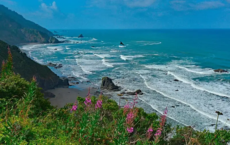
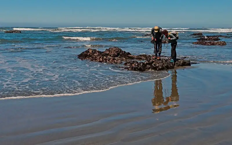
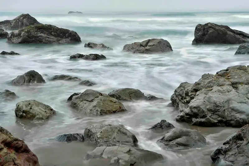
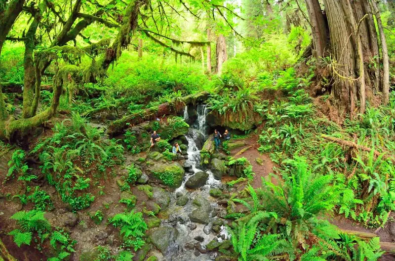
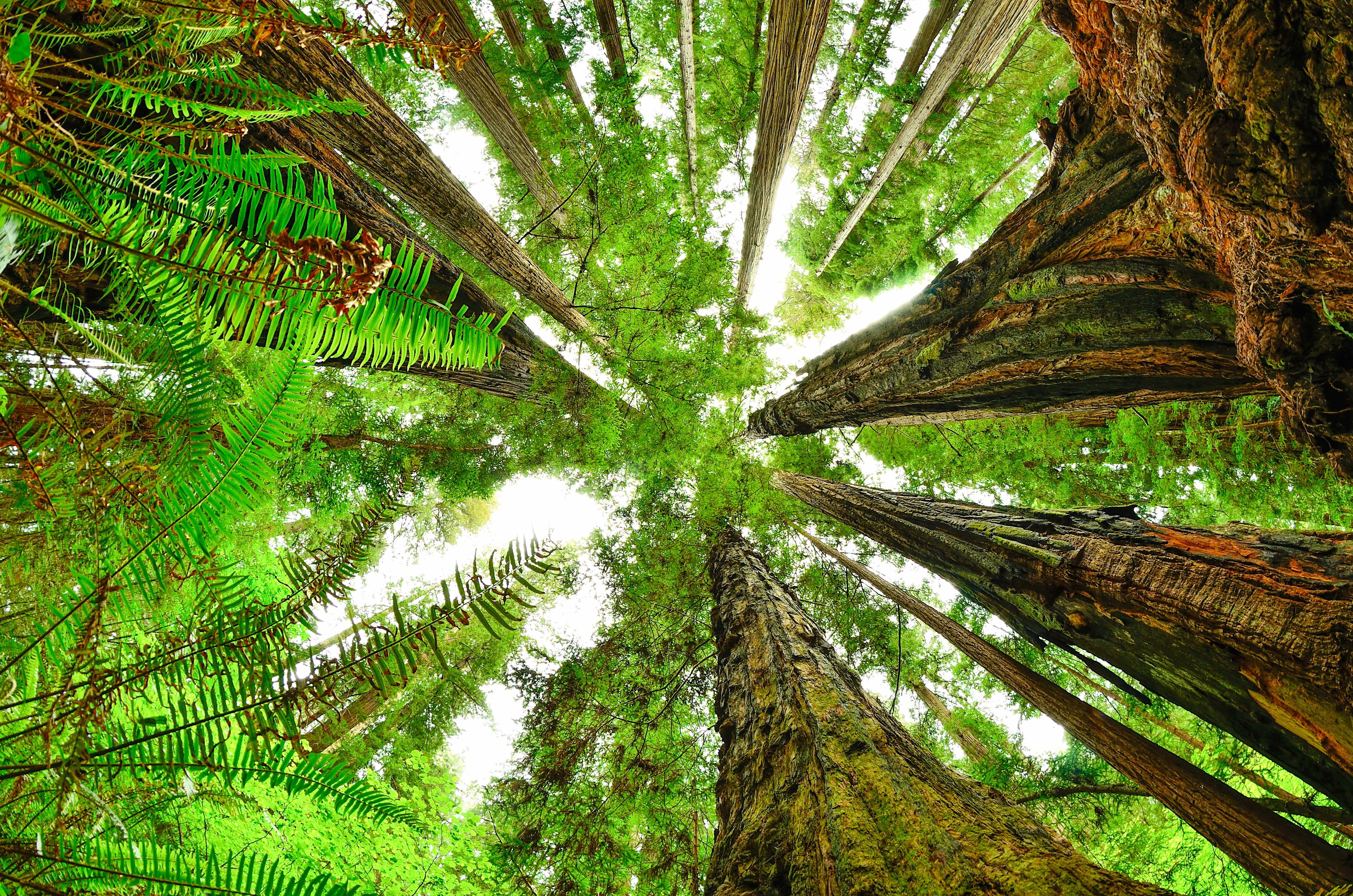
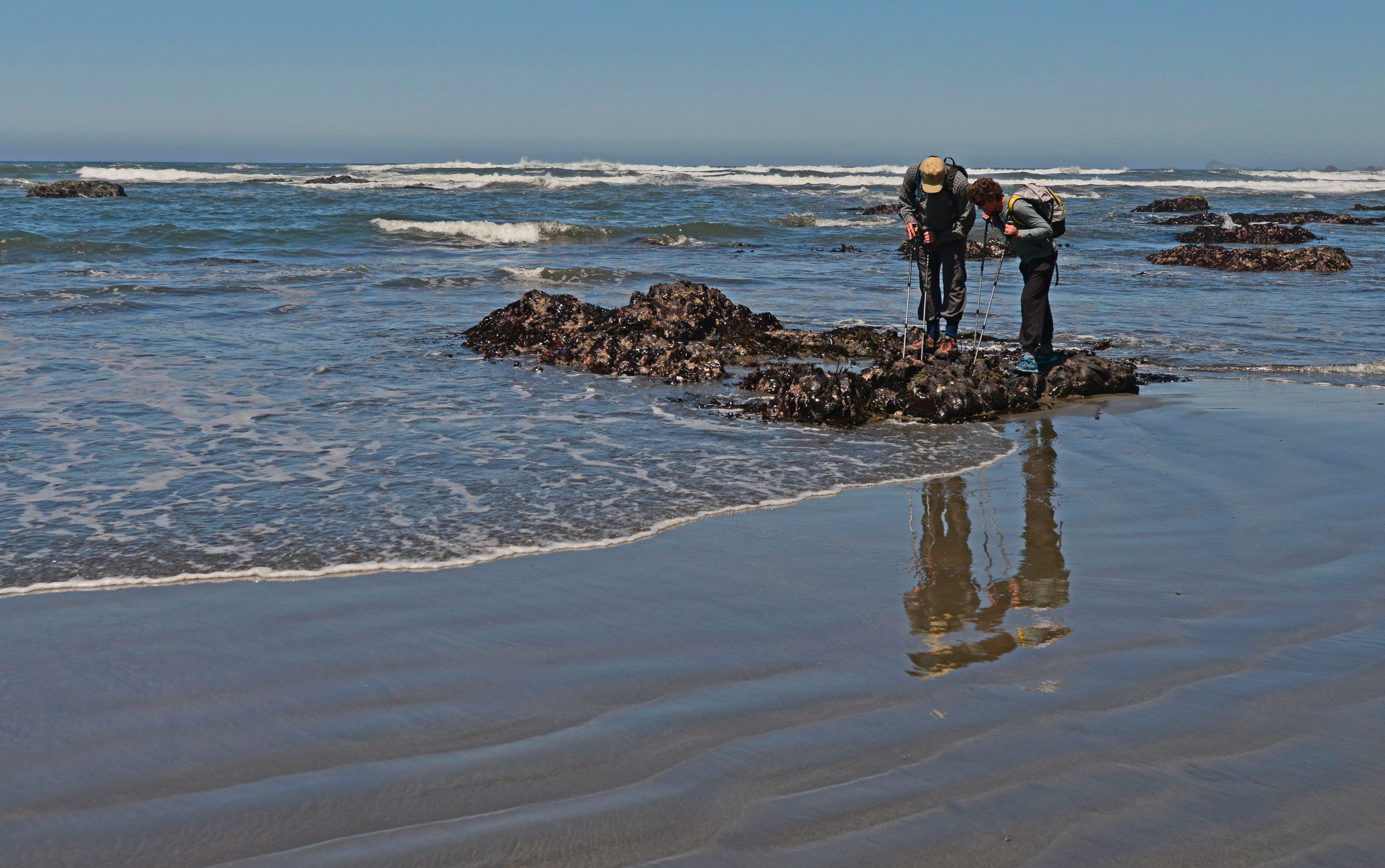
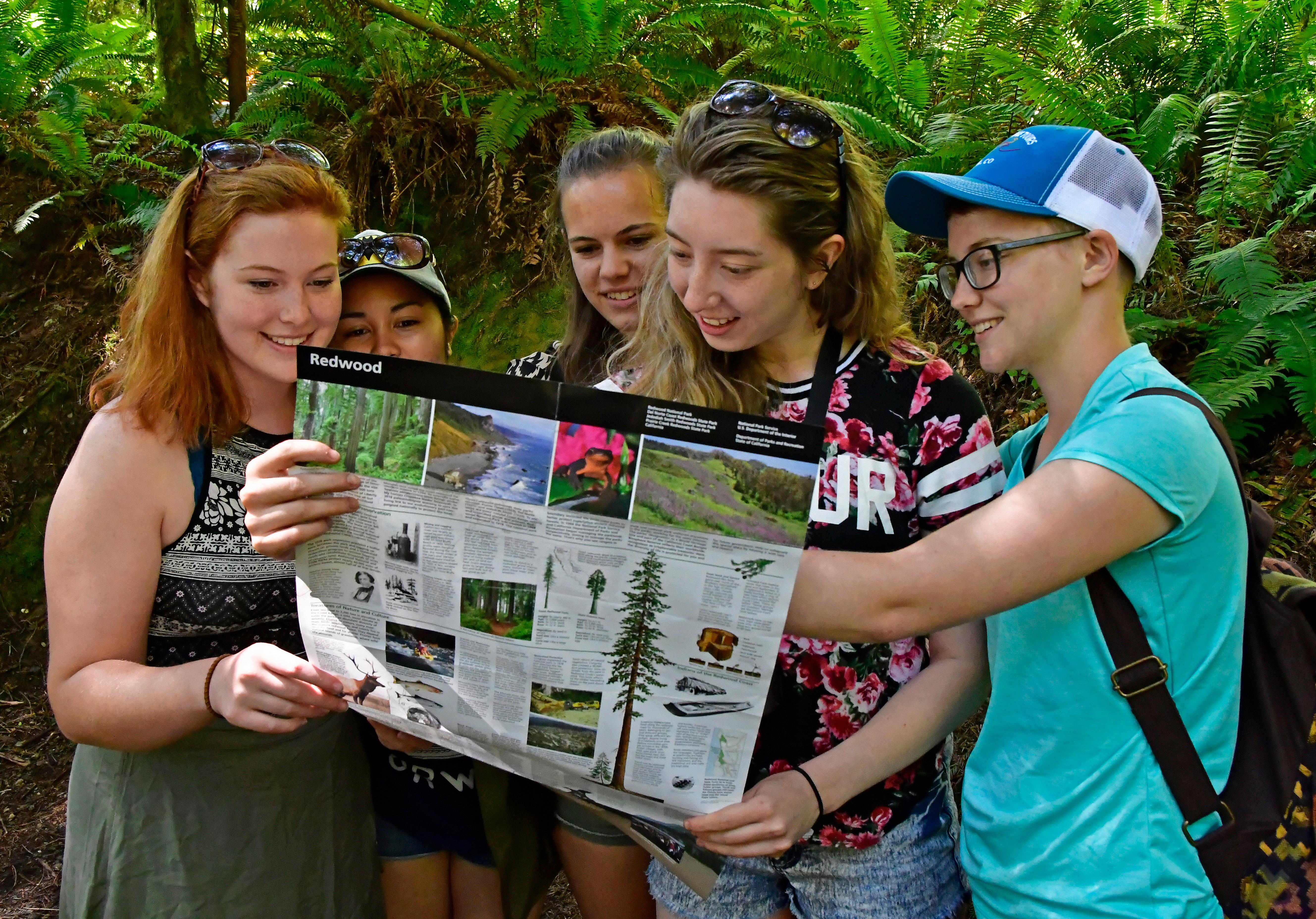
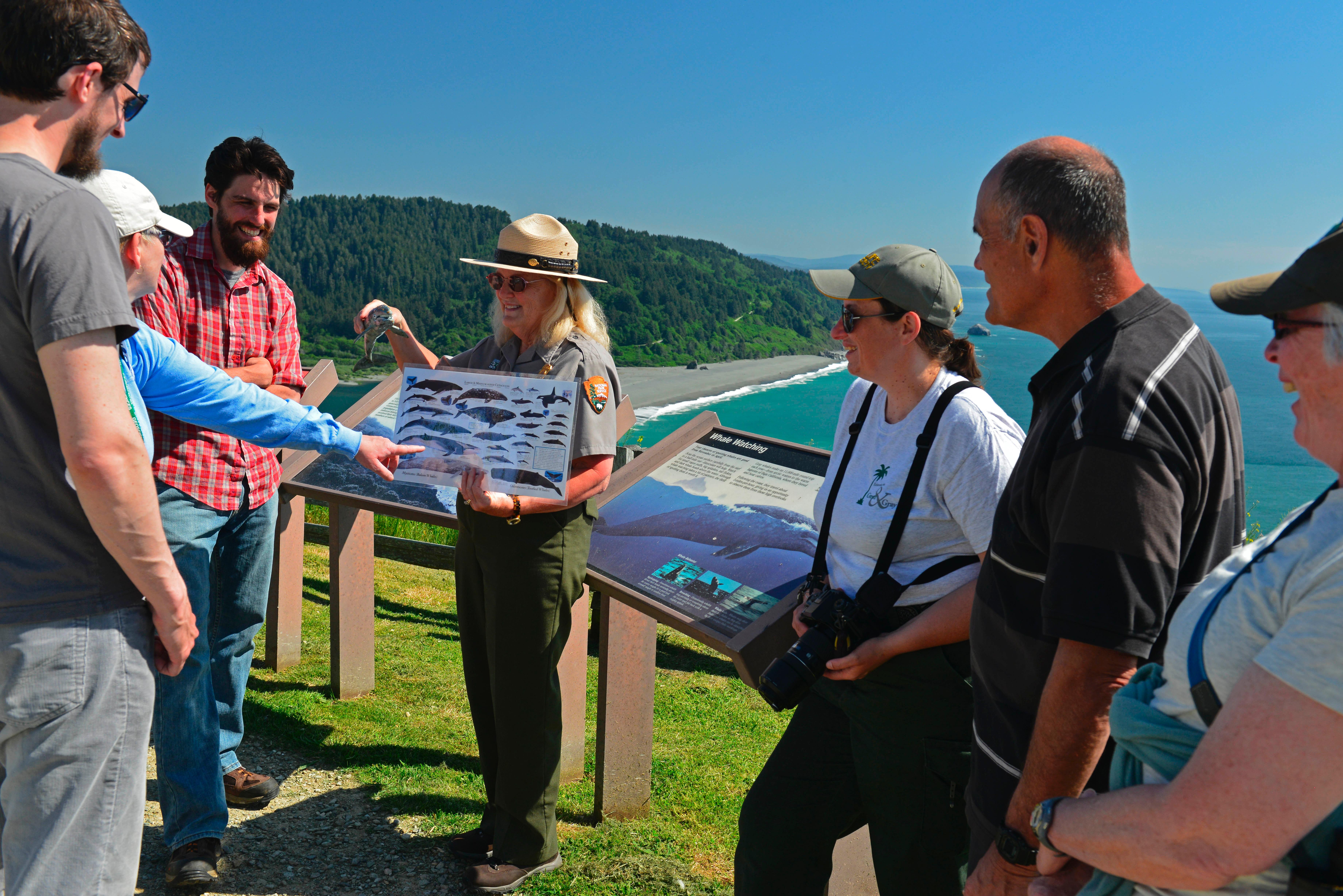


 Volcanic