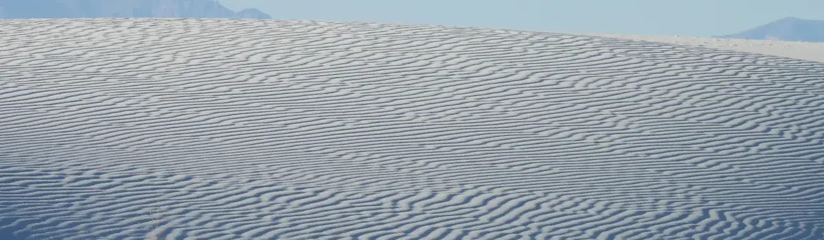
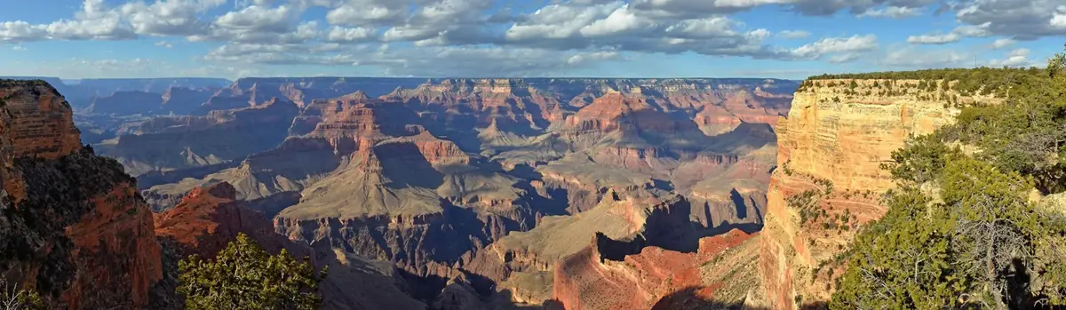
Tucson, Arizona is home to the nation's largest cacti. The giant saguaro is the universal symbol of the American west. These majestic plants, found only in a small portion of the United States, are protected by Saguaro National Park, to the east and west of the modern city of Tucson. Here you have a chance to see these enormous cacti, silhouetted by the beauty of a magnificent desert sunset.
92.9Kacres of parkland
847.7Krecreation visits, 2025
Apr · Oct · Novnearby climate picks
Seasonal access & reservations
No reviewed guidance for this selection. Check the park's official planning pages; missing coverage does not establish access.
Selected guidance only; separate from climate comfort and current conditions.
Official conditions Not checked
The conditions feed has not been connected for this park.
Editorial recommendations, reviewed 2026-10-17. Full park days, excluding travel to and from the region. A first-visit outline for a general traveler; adapt to mobility, fitness, season, reservations, and current conditions. These are suggested days, not reserved activities or guaranteed routes.
Wander down this path to the site of an old homestead foundation, a grove of large saguaros and a cool desert wash. Great Horned Owls can often be seen in the cliff above this wash. Interpretive signs concerning the history and plant life along the way will take you deeper into the meaning of this "home in the desert." These signs also feature special exploration activities for youngsters.
NPS Photo/Ryan Summers
Loma Verde Loop (3.8 miles, 60 feet elevation)
From the trailhead, take the Loma Verde Trail north through a grove of mature mesquite trees. Beyond a seasonally flowing wash (pictured), you'll climb a bluff onto the bajada, the Spanish word for a gravel plain at the base of a mountain. Pass the Loma Verde Mine and take a right on the Pink Hill Trail. A short spur trail leads to a fine overlook of the cactus forest and Tanque Verde Ridge. Take a right on Pink Hill Trail, then turn right on the Squeeze Pen Trail. You will then take a left on the Loma Verde Trail and head back to the trail head.
Hope Camp and Ridgeview Trail (2 miles, 400 feet elevation)
From the Loma Alta trailhead, take the Hope Camp trail for one-tenth of a mile until meeting the Ridge View Trail. This area was an old homesteading road and used to drive cattle to a line camp. Take a left on the Ridge View Trail, which begins to climb shortly after the junction. Views of Rincon Peak (pictured) begin after a brief slope, which only increase as you go up in elevation. Towards the end of the trail, incredible panoramic views and brilliant seasonal wildflowers fill the hillside. The trail ends at the top, which shows an incredible view into Box Canyon, a major drainage in the park. Waterfalls can be seen on the ridge during wetter times.
Garwood Dam and Wildhorse Tank (6.4 miles)
From the Douglas Spring trailhead, continue until you take a right on the Garwood Trail (.2 mile). You'll enter the kind of cactus forest that inspired the creation of this park in 1933. Stay on the Garwood trail until you hit the Carrillo trail and take a left. A steep section will lead to the Garwood Dam, built by Nelson Garwood in the 1950's. Continue on Carrillo trail through a series of switch-backs until you start to get beautiful views on a ridge in the foothills. Beyond the ridge, you will intersect with Wildhorse Trail. Turn right to go on a steep (.3 mile) trail to Little Wildhorse Tank, one of the only perennial areas of water in the park. Continue back (right) onto Carrillo trail until you reach the steel tank. Continue down the wash and take a left out of the wash, still on the Carrillo trail. This section has incredible views of the Santa Catalina Mountains to the north. Finally, turn left and head down the Douglas Spring trail, bringing you back to the trailhead.
Tanque Verde Ridge Trail (Distance and Elevation Varies)
This trail is certainly what we would describe as a strenuous trail. The views and seasonal wildflowers are certainly worth the hike up! From the Javelina Picnic area, start on the trail. At the .75 mile mark, you are up on the ridge and are able to see south, west, and north at multiple other mountain ranges and the Tucson Basin. A crested saguaro (at mile 2.5) is a unique view, as well as "the Dome" (a large exposed surface at mile 3) that offers even more breathtaking views. This trail continues to Juniper Basin Campground (6.9 mile mark, 3000 feet elevation) as well as Tanque Verde Peak (8.7 miles, 4000 feet elevation).
Tucson Mountain District (west)
NPS Photo/Jordan Chadwick-Camp
Wild Dog Trail (1.8 miles)
Take the Valley View trail to the Wild Dog trail. This trail ends at the junction of Golden Gate Rd. and the turnoff to Signal Hill picnic area. If your group has hikers and non-hikers, the hikers could be dropped off at the beginning of the trail while non-hikers drive around the loop and pick them up at the end or at Signal Hill picnic ground. The Signal Hill road adds 0.5 miles to the hike.
King Canyon/ Gould Mine Loop (2.4 miles, 380 feet elevation)
Take the King Canyon Wash trail up the sandy wash bottom between the canyon walls to the junction and return via the King Canyon trail (an old mining road). There are several rocky "stair-step like" sections in the wash bottom. Also due to moisture, there may be bees present.
Sendero Esperanza Trail to the Ridge/ To Wasson Peak (3.4-8 miles, 220-1600 feet elevation)
Take the Sendero Esperanza trail to the Hugh Norris trail junction on the ridgeline. The first mile is relatively flat, but it quickly ascends up switchbacks (220 feet elevation) towards the ridge. Great panoramic scenes of the valley come into view. If you're up for it, take a left on the Hugh Norris Trail towards Wasson Peak. At 4,687 feet, this is the highest point of the west side of the park. Continue for 1.9 miles and take the spur trial on the left .3 miles to Wasson Peak. Enjoy the incredible scenery!
Safety information to help ensure you stay safe while having fun in the park, and what to do in sticky situations.
Rules and regulations for Saguaro National park including topics from general hiking, to drone usage and wedding permits.
Additional information for outdoor activities beyond light day hiking such as longer, wilderness hiking and basic camping information.
From cactus-covered desert to pine-cloaked mountain heights, the Saguaro Wilderness Area in the Rincon Mountains protects the last roadless ‘sky island’ mountain range in Southern Arizona. Designated by Congress in 1976 – along with lands in the Tucson Mountains – this Wilderness Area provides another layer of protection to your Saguaro National Park. Together with the adjacent Rincon Mountain Wilderness on the Coronado National Forest, the protected wild acreage totals nearly 100,000 acres within sight of the sprawling city of Tucson. Solitude awaits you on these cool, forested slopes.
NPS Photo / Vanessa Gonzalez
Know Before You Go
There are no accommodations for any vehicle camping (including RV).
Campfires are prohibited at Douglas Spring and Grass Shack camps. Use only dead and downed wood and be sure fires are cold and dead before leaving.
Carry at least one gallon of water per person per day – more in low country in summer. Treat all surface water. Water is scarce at all times at most campsites. Before you go, contact the Visitor Center to ask about water reports.
Respect the weather in all seasons; it can change without warning. The high country will be far different from the low! Be informed on desert seasons.
Do not cross flooded streams. Wait until the flow subsides.
Be cautious of wildlife. Know what to do if you encounter bees, bears, or mountain lions.
Wear appropriate clothing (in layers) and footwear . Pace yourself according to your physical condition.
Cellular phones work in much of the wilderness; if not, try a high point with a view toward Tucson (west) or Benson (east).
Do not leave valuables in vehicles, lock securely.
Camping is allowed in designated campgrounds only. No spike camping is permitted in the park.
Learn more about exploring Saguaro's backcountry.
Our maps help you plan your trip and keep you safe navigating our wilderness.
Camping is allowed at 6 designated campgrounds within the Saguaro Wilderness Area. These camp sites are not accessible by vehicles and must be hiked to. The fee for this permit is $8 per campsite, per night. The maximum number of people allowed per campsite is 6, with the maximum size of any one group of 18 people.
This campground is a tough day hike up the Tanque Verde Ridge over 6.9 miles and 3000 feet of elevation gain. Exceptional views can be seen throughout the hike, and habitats change quickly from desert scrub to oak savanna and pine / juniper woodlands. Water here is very seasonal, and it is often dry during the summer, spring and fall. When there is water, sources can be found west of site 1 (following a footpath to pools of water) and north of sites 2 and 3. Fires are allowed here only from collecting dead and downed wood.
The closest access point to this campground is from the Douglas Spring trailhead. From there, it is a 6.5 mile hike with approximately 1800 feet of elevation gain. There are plenty of Mesquites and junipers in the area that provide some shade in the hotter months. This is the lowest campground and as such is ideal during winter storms that blanket the higher elevations with snow. The hike up offers beautiful views down toward Tanque Verde Falls and of multiple drainages including Tina Larga tank. There is a drainage about 50 feet east of the campsite, but water is seasonal, so it is smart to check water reports before heading out. Fires are not allowed here due to the lack of firewood and the extremely fire-prone grasslands that occupy the area. Cell service is not guaranteed, and you may have to wander around a bit or head east on the trail (uphill) to get a signal.
NPS Photo / TWiewel
Grass Shack is a great campground that offers shade from large oaks.. The biggest watershed in the Rincon mountains (Chimenea Creek) runs through and by the campground, providing water most of the year. Fires are not allowed here as this campground is in a fragile, riparian ecosystem surrounded by a thick grassland. The easiest access to Grass Shack is from the Camino Loma Alta trailhead, and this 10-mile hike climbs 2200 feet to the campground, which is often not affected by winter storms. Views are exceptional to the south as you climb through and above the saguaros. This is one of the areas in the backcountry that does not have consistent cell service, so please plan accordingly. If you need to make contact, climb 0.5 - 1 mile in either direction of the campsite. This is the first of two campgrounds on the Arizona Trail
NPS Photo / T. Wiewel
Around the back side of the Rincon Mountains is Happy Valley Road and access to the Miller Creek trailhead and Turkey Creek trailhead. Take exit 297 from Interstate-10 (Mescal Road). Be advised this is a rarely maintained dirt road that has multiple stream crossings. During wet winters and the monsoon season, this road may be impassable. This is the shortest hike to a campground, covering 3.9 miles and over 2000 feet of elevation gain. Water at this campsite is variable, only occurring during wet times. This campground offers a resting point to climbing Rincon Peak, and sits at an elevation of 6200 feet. There are many dangerous dead pine trees in the area, and this area is often affected by winter storms. However, during the summer, the trailhead elevation is much higher and offers excellent views to the east.
Spud Rock is the most isolated of our six campgrounds, sitting on the east side of the range at 7200 feet. Access is generally from the east, but Turkey Creek trailhead is very difficult to drive and requires a lifted truck or a jeep. At the very least, you will need a vehicle with four-wheel drive. Also, make sure to check the conditions of the road before heading out as it can become muddy and treacherous after some rain. From the campsite, views to the east are exceptional, and water is available at multiple areas along the trail during wetter months. During the winter, this area is often under feet of snow. Please call before heading out for information on current conditions. However, this area offers exceptional cover under pines and aspens and much lower temperatures to beat the summer heat. Water is available seasonally, but Manning Camp is not far away and offers year-round water (most years).
Built by former Tucson Mayor Levi Manning, this camp was his family's summer home. Now, this camp serves as a high elevation base for many of our fire and natural resource studies. At 8000 feet, Manning Camp exists in a completely different climate from the desert scrub that we experience down at the Visitor Center. There are six campsites here, and the area is mostly shaded by the ponderosa pines, making it a cool escape from the desert sun. This area is a savior from the sweltering heat in the valley below, rarely exceeding 85 degrees. A perennial water source near the cabin has only dried up twice in Saguaro's history, so water is almost always available. A sign leads down to it. Fires are a must at night with fire rings as lows typically are below 40 degrees until late May. Depending on where you start, the hike up to Manning can be anywhere from 9-18 miles and accumulates 5500-6500 feet of elevation. As you hike up, you will pass through multiple different biomes with spectacular changes in flora and fauna composition, passing through riparian zones and dry cliff alike (not to mention the extraordinary views).
Make the most of your visit and join a ranger to experience some of our many guided programs! Ranger programs are available year-round in Saguaro, and they are a great way to learn about the park. January through April is our busy season, and there is a wider variety to choose from during that time of year. During the summer, only a few programs may be offered any given week due to extreme temperatures during the daytime. Please know that schedules and program titles are always subject to change.
Program Schedule
Take a look at our calendar!
Simply click on a date, and under the calendar, you will see a complete list of upcoming programs and special events for both the Rincon Mountain District (east) and the Tucson Mountain District (west).
Our maps help you plan your trip and keep you safe navigating our wilderness.
Information regarding park fees and passes available for purchase.
Calendar of programs for both East and West district visitor centers.
We offer a wide variety of programs throughout the year in both districts of the park. From ranger talks around our gardens to night hikes through the cactus forest, you are sure to find an experience to enjoy! Guided programs are a wonderful way to learn about Saguaro National Park. To see a complete list of programs offered, visit our calendar.
At both the Rincon Mountain District (East) and the Tucson Mountain Distrcit (West), we have cactus gardens just outside our visitor centers. Come learn about the plants of Saguaro National Park through interpretive signs and ranger-led programs. See some of the common plants up close, and get photo opportunities of our iconic saguaro. The saguaro in the cactus garden of the east district is as old as the Park Service itself! In the west district, visitors get breathtaking views of the Tucson Mountains and the dense cactus forest.
Backcountry Adventures
The Saguaro Wilderness Area was officially designated as wilderness in 1976. This large, roadless backcountry consists of 57,930 acres within the Rincon Mountain District of Saguaro National Park. It is bounded on three sides by the 38,590 acre Rincon Mountain Wilderness Area, which lies within the Coronado National Forest. Looking for an adventure? An extended hike into the rugged wilderness brings wonderful opportunities as well as challenges for the adventurous hiker. An overnight trip into Saguaro's wilderness can take you from 3,000' elevation to over 8,000' in about 15 miles. Permits are required for backcountry camping in the park. Permits may be obtained up to 2 months in advance, but no later then 12:00 noon on the day of the trip. There are no accomodations for any vehicle camping (including RV). All campsites must be reached by foot. Check out our camping page for more information. Happy hiking!
Animals in the Backcountry
Rules and Regulations
Saguaro Wilderness Area
In the Tucson Mountain District (West), just north of the Signal Hill picnic area is the largest petroglyph site in the Tucson Mountain District of Saguaro National Park (SNP). The Signal Hill Petroglyph Site occupies a small but very distinct rocky hill that is about 200 feet in diameter at its base and is 40 feet high. The site consists of over 200 prehistoric Native American petroglyphs, many of which can be viewed from the visitor trail that ascends the hill (including the spiral design in the photograph at left). These petroglyphs were created from between about 550 to 1550 years ago. Petroglyphs , which fall under the common, all-inclusive term “rock art," are a global phenomenon. The oldest known rock art are cave paintings found in Europe, Australia, Asia and Africa that date from the Upper Paleolithic period, 35,000 to 40,000 years ago.
NPS photo / TWiewel
Rincon Mountain District (east)
In the east district, the best places to view the sunset are located along the Cactus Forest Loop Drive, but the gates to the road do not close until 8:30 pm, so you will have plenty of time to exit the park after viewing the sunset. One of the best places for sunset viewing is along the Tanque Verde Ridge trail. From the Javelina Picnic Area, the trailhead is on the south side of the parking area. Hike up about .25 miles to a rocky outcropping to get gorgeous views out to the west. If you want to hike a little farther, at .75 miles into the trail, there is another rocky outcropping that sits you a bit higher in elevation than the first overlook. Another great spot for the sunset is at the Javelina Rocks pull-out along the scenic loop drive. At the overlook, you are welcome to follow the footpaths around the area and up atop the rocks themselves to view the sunset.
Tucson Mountain District (west)
In the west district, Gates Pass (the western end of Speedway Blvd.) is the ideal spot for a sunset. This is in Tucson Mountain Park, a few miles southeast of the Tucson Mountain District of Saguaro National Park. There is a parking lot at the top of the road in Tucson Mountain Park, but this closes just after sunset. Keep in mind that vehicles over 25 feet in length are not recommended as it is a steep, winding road to and from the overlook.
Tucson is known as one of the most bicycle-friendly cities in the United States. This is largely due to our climate, particularly in the winter. If you plan on bicycling during the summer, it is best to get an early start and avoid the mid-day heat. Always carry plenty of water regardless of the time of year. Saguaro National Park offers visitors the chance to view native plants and animals while surrounded by the spectacular scenery of the Sonoran Desert. A popular way to enjoy the park is to bike around one of our scenic loop drives. The Cactus Forest Loop Drive in the Rincon Mountain District (east) is an 8-mile paved loop. The Bajada Loop Drive in the Tucson Mountain District (west) is a 6-mile gravel loop. It is important that you know the park's rules and regulations for cyclists and mountain bikers.
Bicycling Information
E-BIKES: E-bikes are permitted only where traditional bicycles are allowed. Except where motor vehicles are allowed, using the electric motor to move an e-bike without pedaling is prohibited. State laws concerning e-bikes apply within Saguaro National Park.
FACILITIES: Restrooms are available at both visitor centers during daylight hours only. Pit toilets are available at all picnic areas. Benches, bicycle racks and water fountains can be found adjacent to both visitor centers. WATER: Carry plenty of water while biking, especially during the summer. Drinking water can be found outside both visitor centers. Drinking water is NOT available on the Cactus Forest Drive, Bajada Loop Drive or at any picnic area. SAFETY: Review our rules and regulations for bicycling safety information. CONTACT: Both visitor centers are open from 9 am to 5 pm daily. The phone number at the Rincon Mountain District (east) is (520) 733-5153. The phone number at the Tucson Mountain District (west) is (520) 733-5158. If the visitor center is closed, call 911. ENTRANCE: A 7-day entrance pass for bicycles can be purchased at the park or online. Children under 16 are free. For frequent riders, annual passes are available at either visitor center or the entrance station. These passes allow unlimited entry for the pass holder plus 3 adults (under 16 free) into the park, and they are valid for one year.
Rincon Mountain District (east)
On the east district, bicycles are permitted on the 8-mile Cactus Forest Loop, the 2.5-mile Cactus Forest Trail, and the 2.8-mile Hope Camp Trail. Cactus Forest Loop is a scenic route through the lower elevations of the Rincon Mountain District (east). It is 8 miles and fully paved, except for the spur gravel road that leads to Mica View Picnic Area. This road is open to all vehicles, bicycles and pedestrians. The Cactus Forest Loop is narrow with multiple tight turns and steep hills. Maintain a safe speed for road conditions and your own riding experience. Be sure to slow down before curves and hills. Cactus Forest Trail is 2.5 miles one-way. You can access this trail from either Cactus Forest North or South trailhead. This is a very thin trail with eroded sections that may make it dangerous for bikers and hikers alike. Please use discretion and safe practices. Hope Camp Trail starts at the Loma Alta trailhead from the end of Camino Loma Alta. This trail travels east through the southwestern portion of the Rincon Mountain District (east) to the park's boundary approximately .2 miles south of Hope Camp. Beyond Hope Camp, the trail connects the Arizona Trail and continues south into the Rincon Valley. Bikes are allowed on the Arizona Trail.
Tucson Mountain District (west)
The Bajada Loop is a scenic route through the lower elevations of the Tucson Mountain District of the park. It is 6 miles in length and is gravel, except for a small section along Kinney and Sandario Roads. These roads are open to all vehicles, pedestrians and bicycles. Biking is only permitted on the roads. Riding on trails around this loop is not permitted. The Golden Gate Multi-use Trail (section of Golden Gate road that is no longer accessible by car) is a wide gravel path that can be biked. Entrance points are at the end of Golden Gate Road on the Bajada Loop or off Picture Rocks Road. Tucson Bike Map
Our maps help you plan your trip and keep you safe navigating our wilderness.
Rules and regulations for Saguaro National park including topics from general hiking, to drone usage and wedding permits.
The saguaro (suh-waa-row), also known as the giant cactus, has been an iconic symbol of the American southwest for ages. These majestic beings are easily recognized by their size and structure, sometimes reaching a height of 50 feet tall.
Where do saguaros grow?
The saguaro cactus, Carnegiea gigantea , only grows in the Sonoran Desert, but not in all parts. Saguaros need a perfect balance of heat and rainfall to thrive. Freezing temperatures can be greatly detrimental to the health of a saguaro, and climate is the main determinate of saguaro range. Thus, they are limited to a specific area within the Sonoran Desert, ranging mostly from central Arizona down into Sonora, Mexico. Because they are not keen on the cold temperatures, saguaros are also limited by elevation. They are generally found growing from sea level to approximately 4,500 feet in elevation. Saguaros growing up to 5,000 feet in elevation are usually found on south-facing slopes where freezing temperatures are less likely to occur or are shorter in duration.
Check out our photo gallery of saguaros!
NPS Photo / T. Wiewel
Saguaros are a very slow growing cactus. In Saguaro National Park, studies indicate that a saguaro grows only a few inches in the first ten years of its life. These tiny, young saguaros are very hard to find since they grow under a “nurse tree,” such as a palo verde, ironwood or mesquite tree. The “nurse” protects the young cactus from summer sun and winter frosts. As the saguaro grows, the older nurse tree may die. As a saguaro begins to age, growth rates vary depending on climate, precipitation and location. At Saguaro National Park, branches normally begin to appear when a saguaro reaches 60 to 75 years of age. In areas of lower precipitation, it may take up to 100 years before arms appear. When a saguaro reaches 35 years of age, it begins to produce flowers. Though normally found at the terminal end of the main trunk and arms, flowers may also occur down the sides of the plant. Flowers will continue to be produced throughout a saguaro’s lifetime. An adult saguaro is generally considered to be about 125 years of age. It may weigh 2 or more tons and be as tall as 50 feet. The average life span of a saguaro is probably 150 - 175 years of age. However, biologists believe that some plants may live over 200 years. Learn more about the life cycle of saguaros!
Why are saguaros pleated?
The roots of a saguaro grow out from the plant in a radial fashion, several inches under the ground. During a heavy rain, a saguaro will absorb as much water as its root system allows. To accomodate this potentially large influx of water, the pleats expand like an accordion. Conversely, when the desert is dry, the saguaro uses its stored water and the pleats contract. Because the majority of a saguaro is made up of water, a large plant may weigh 80 pounds for each foot of its main trunk. This tremendous weight is supported by a circular skeleton of interconnected, woody ribs. The number of ribs inside the plant corresponds to the number of pleats on the outside of the plant. As the saguaro grows, the ribs will occasionally fork, and the corresponding pleat will also fork at the same place.
Crested saguaros
Even when saguaro cacti grow in their normal form, they rarely grow symmetrically. Saguaros sometimes grow in odd or misshapen forms. The growing tip occasionally produces a fan-like form which is referred to as crested or cristate. Though these crested saguaros are somewhat rare, over 50 live within the boundaries of the park. This growth pattern occurs in other plants where it is known as fasciation. Biologists have not pin-pointed a cause for this oddity, though we know that it is not passed on through seeds. Some damage to the growing tip is implied, but not proven! In short, we don’t know. Learn more about the crested saguaro
Wildlife interaction
Saguaro cacti are host to a great variety of animals. The gilded flicker and Gila woodpecker excavate nest cavities inside the saguaro’s pulpy flesh. When a woodpecker abandons a cavity, elf owls, screech owls, purple martins, finches and sparrows may move in. Large birds, like the Harris's and red-tailed hawks, also use the saguaro for nesting and hunting platforms. Their stick nests are constructed among the arms of a large saguaro. In turn, ravens and great-horned owls may take over an abandoned hawk nest. Saguaro cacti also provide a valuable source of food for animals. In mid-summer, ripening fruit provides moisture and an energy-rich food during a time of scarcity. In drier areas of the Sonoran Desert, pack rats, jackrabbits, mule deer and bighorn sheep will also eat the saguaro’s flesh when other food and water sources are not available.
In late April through early June, the tops of the saguaro’s trunk and arms sprout a profusion of large, creamy white flowers. Individual flowers open at night and close the following afternoon. To develop into fruits, they must be pollinated within this time frame. Pollination is carried out by nectar feeding bats, birds and insects. Each fruit contains about 2,000 to 3,500 tiny black seeds. When the fruit and seeds are eaten by a coyote or cactus wren, the seeds pass through their digestive system unharmed and are distributed throughout the desert. However, if the seeds are eaten by a dove or quail, they will be completely consumed in the digestive system. It is estimated that a saguaro can produce some 20-40 million seeds during its lifetime. However, few will survive to become a seedling. Perhaps 1 or 2 will become an adult. The low survival rate of seedlings is due to drought, killing freezes, and animals eating them.
Do humans use the saguaro?
Archeological evidence indicates that the early desert peoples used the saguaro in their daily life. The strong, woody ribs were gathered to construct the framework for the walls of their homes. Additionally, saguaro ribs were used to collect saguaro fruits, which grow high up on the plant. Several ribs were tied together with a cross piece at the end. These long poles (today called kuïpad) were used to knock and pull ripe fruit down from the top of the plants. It would then be gathered to eat. The Tohono O’odham continue to gather saguaro fruit in this manner today. They use the sweet fruits to make ceremonial wine, jelly and candies. They also use the seeds as chicken feed.
Threats to the saguaro
Reports of a saguaro “disease,” popularized almost fifty years ago, persist, but saguaros are not subject to blights. The saguaro is a long-lived cactus, most affected by long-term climate cycles of frost and drought. In actuality, the saguaro is a common plant in the Sonoran Desert, not an endangered species. The biggest threat to the saguaro in the Tucson Basin is rapidly expanding human population resulting in a loss of saguaro habitat. Exotic plants follow development, and these non-native species almost always out-compete saguaros for water and nutrients. They also lead to an increase in wildfires, which harm or kill native vegetation, including the saguaro. As the earth’s climate warms, heat and drought will contribute to these problems, possibly affecting the growth of saguaro forests in the park.
Learn about invasive, non-native species in the park.
Although the Sonoran Desert can seem foreboding, it is home to many animal species. These animals have adapted to the desert’s high temperatures and scarce water supply. Many species simply avoid the hot daytime temperatures by being active only at night or by seeking shelter in shaded nests or burrows. Others have features that allow them to stay cool - the jackrabbit’s large ears allow heat to radiate away from its body, and vultures actually urinate on themselves to dissipate heat!
Saguaro National Park contains a great variety of unusual animals, some of which can only be found in southern Arizona. Roadrunners, horned lizards, Gila monsters, kangaroo rats, and collared peccaries are all seen regularly by visitors. Although Saguaro NP lies on the edge of the Sonoran Desert, Mica Mountain in the Rincon Mountain District reaches more than 8600’ in height. This altitude allows for cooler temperatures and pine trees, as well as mammals such as black bears and white-tailed deer. The park is also home to species more commonly associated with the tropics, such as coati. Precious, often hidden desert waters contain aquatic leopard frogs and mud turtles. Looking for wildlife? Learn about the signs of life.
Information on amphibians and how they manage to survive in the desert.
General information on birds and access to the bird photo gallery.
A variety of mammals can be found in the park, including once thought to be gone carnivores!
Information on snakes and lizards, including the popular gila monster!
Get an entrance pass All visitors must have one of these entrance passes: Pass Price Standard Pass $15.00–$25.00 Annual Pass $45.00 America the Beautiful Pass (includes Senior Passes) FREE–$250.00 Help me choose an entrance pass
Plan to go cashless This park does not accept cash.
Choosing an Entrance Pass
Do you have or qualify for a discounted America the Beautiful Pass?
If you already have an America the Beautiful—the National Parks and Federal Recreational Lands Pass, that's the only entrance pass you need. Seniors, military, visitors with a permanent disability, and families with a 4th grader are eligible for a free or discounted America the Beautiful pass.
America the Beautiful Pass
How often do you plan to visit national parks in the next 12 months?
If you don't qualify for a discounted America the Beautiful pass, we recommend choosing an entrance pass based on your trip plans.
Entrance Passes
America the Beautiful, the National Parks and Federal Recreational Lands Pass Series (Interagency Passes) provides entrance and standard amenity fees (day-use fees) to more than 2,000 federal recreational areas with six cooperating agencies across the United States. Children ages 15 and under are free. The Senior Pass and Access Pass may provide discounts on camping fees.
Standard Entrance Pass
If you enter the park in a motorized vehicle, your entrance pass covers both you and your passengers. Your passengers do not need a separate pass.
Private Vehicle $25.00
In-person Purchase Locations
Red Hills Visitor Center (West) Credit/Debit Only
Fee Kiosk, Rincon Mountain District Credit/Debit Only
Rincon Mountain Visitor Center (East) Credit/Debit Only
Motorcycle $20.00
For Individuals without a Vehicle
If you enter the park on a bicycle or on foot and are at least 16 years old, you need your own entrance pass. Children under the age of 16 don't need an entrance pass.
Per Person $15.00
Annual Entrance - Park
This pass covers up to 4 adults (anyone over the age of 16) or everyone in a single, non-commercial, vehicle. Is accepted in both districts of the park.
US citizens and residents
America the Beautiful—the National Parks and Federal Recreational Lands Pass
Covers entrance fees and standard amenity (day-use) fees at lands managed by
National Park Service
US Fish & Wildlife Service
US Forest Service
Bureau of Land Management
Bureau of Reclamation
US Army of Corps of Engineers
Depending on the type of entrance fee charged at a site, covers One private vehicle fee or Four per person fees
America the Beautiful Passes are non-refundable, non-transferable and cannot be replaced if lost or stolen . Passholders must show valid photo identification (ID) with each pass.
How to Get an America the Beautiful Pass
Physical passes can be purchased or picked up at over 1,000 federal recreation sites.
Purchase and pickup locations
To receive your pass by mail, order online at the USGS Online Store . Online orders are for physical passes, not digital passes, and may take up to three weeks to be processed and delivered. Order receipts may not be used in place of a physical pass. We recommend ordering at least three weeks in advance of your visit, or picking up a pass in person instead.
Skip the wait! Get a Digital America the Beautiful Pass through recreation.gov. Your digital pass can be saved to a mobile device and used immediately.
Get a Digital America the Beautiful Pass
2026 Free Entrance Days in the National Parks
Come experience the national parks! All National Park Service sites that charge an entrance fee will offer free admission to US citizens and residents (other fees, including timed entry or reservation fees, may apply). Mark your calendar for these entrance fee-free dates:
February 16 : Presidents Day (Washington's Birthday)
May 25 : Memorial Day
June 14: Flag Day/President Trump's birthday
July 3–5: Independence Day weekend
August 25: 110th Birthday of the National Park Service
September 17: Constitution Day
October 27 : Theodore Roosevelt's birthday
November 11: Veterans Day
At the Fee Kiosk in the Rincon Mountain District or at the Red Hills Visitor Center in the Tucson Mountain District. ONLY DEBIT/CREDIT CARDS ARE ACCEPTED. NO CASH.
Using the automated fee machines located outside the Fee Kiosk in the Rincon Mountain District, or outside the Red Hills Visitor Center and in the parking lot of the King Canyon trailhead in the Tucson Mountain District. Individual, private vehicle, and motorcycle entrance fees may be purchased here, as well as the Saguaro Annual Pass and the America the Beautiful Pass. Available by credit card only.
Passes that are specific to Saguaro National Park (day passes, camping and Arizona Trail thru-hiking overnight passes) can be obtained on Recreation.gov.
To purchase your Interagency Pass online, visit the USGS website. Please note that Interagency Passes will not be available for immediate download or printing. A physical pass will be shipped to you. Receipts and electronic scanned images of your pass are NOT valid for use. If you need your pass sooner, please visit a site near you that distributes passes.
Educational Fee Waiver
National Park Service policy permits entrance fees to be waived for national and international academic institutions visiting parks for non-commercial educational purposes. However, Educational Fee Waivers are not issued automatically. Educational groups must apply and meet the criteria to receive a fee waiver. Only groups of students 16 years of age or older visiting Saguaro National Park require an Educational Fee Waiver. Learn about the criteria and application process to get a waiver.
All backcountry camping requires a camping permit. If you are wanting to spend time in the backcountry, look into our information about camping in the park.
Although all ranger programs are free, you will still need to purchase an entrance fee to the park. Stay up to date on programs and events on our calendar.
Pass
Price
Standard Pass
$15.00–$25.00
Annual Pass
$45.00
America the Beautiful Pass (includes Senior Passes)
FREE–$250.00
I'm visiting...
We recommend
This park, once
Standard Pass
This park, multiple times
Annual Pass
More than one national park or federal recreation site
America the Beautiful Pass
Type
Available to
Price
Resident Annual Pass
US citizens and residents
$80.00
Non-Resident Annual Pass
Non-US residents
$250.00
Senior Annual Pass
US citizens and residents 62+ years old
$20.00
Senior Lifetime Pass
US citizens and residents 62+ years old
$80.00
Military Annual Pass
Current US military and dependents
Free
Military Lifetime Pass
Gold Star Family members and veterans
Free
Access Pass
US citizens and residents with permanent disability
Free
4th Grade Pass
US 4th graders
Free
Volunteer Pass
Federal recreation site volunteers with 250 service hours
Free
Pass
Price
Standard Pass
$15.00–$25.00
Annual Pass
$45.00
America the Beautiful Pass (includes Senior Passes)
FREE–$250.00
I'm visiting...
We recommend
This park, once
Standard Pass
This park, multiple times
Annual Pass
More than one national park or federal recreation site
America the Beautiful Pass
Type
Available to
Price
Resident Annual Pass
US citizens and residents
$80.00
Non-Resident Annual Pass
Non-US residents
$250.00
Senior Annual Pass
US citizens and residents 62+ years old
$20.00
Senior Lifetime Pass
US citizens and residents 62+ years old
$80.00
Military Annual Pass
Current US military and dependents
Free
Military Lifetime Pass
Gold Star Family members and veterans
Free
Access Pass
US citizens and residents with permanent disability
Free
4th Grade Pass
US 4th graders
Free
Volunteer Pass
Federal recreation site volunteers with 250 service hours
Official NPS features and USGS park boundaries, imported 2026-10-17. An inventory snapshot, not live trail or parking availability.
Loading official park features…
TrailsPoints of interestParkingZoom with buttons or pinch. Toggle layers on the map.
Map coverage varies. Trail names may represent segments, connectors, or shared park units; mapped lines are not a hiking recommendation. Use official conditions and navigation resources before heading out.
Cactus Forest Trail Inventory record · 12 source segments; not a route distance.
Soil
Hiker/Pedestrian|Pack and Saddle
Cactus Wren Trail Inventory record · 4 source segments; not a route distance.
Soil
Hiker/Pedestrian|Pack and Saddle
Cam Boh Trail Inventory record · 5 source segments; not a route distance.
Soil
Hiker/Pedestrian|Pack and Saddle
Carrillo Trail Inventory record · 7 source segments; not a route distance.
Soil
Hiker/Pedestrian|Pack and Saddle
Cholla Trail Inventory record · 2 source segments; not a route distance.
Soil
Hiker/Pedestrian|Pack and Saddle
Converse Trail Inventory record · 1 source segments; not a route distance.
Soil
Hiker/Pedestrian|Pack and Saddle
Page 1 of 7
NPS public GIS inventory, imported 2026-10-17. “Existing” is an inventory classification, not confirmation that a trail is open. Segment counts are not route distances. Parking records do not indicate space availability, fees, or accessibility certification. View government source ↗
Climate for Tanque Verde, 22 km from the park reference point. 1991–2020 normals. Source elevation: 814 m.
Daytime highNighttime lowOctober: 80° / 56°
Daytime high80°
Precipitation19 mm
Daylight11.2 hrs
Wind7.8 km/h
Mountain, rim, valley, and coastal conditions can differ sharply from the source town. Check park forecasts and current conditions before travel.
Monthly climate data 12 months · °F
Month
High
Low
Rain / snow water
Wet days
Daylight
60°
38°
40 mm
4.8
10.1 h
63°
41°
39 mm
5.0
10.8 h
70°
46°
24 mm
3.7
11.8 h
77°
51°
9 mm
1.6
12.8 h
86°
60°
4 mm
1.1
13.6 h
95°
69°
6 mm
1.5
14.1 h
94°
73°
48 mm
9.9
13.9 h
92°
72°
47 mm
10.9
13.2 h
89°
67°
32 mm
5.1
12.2 h
80°
56°
19 mm
3.0
11.2 h
69°
46°
21 mm
3.0
10.3 h
60°
38°
39 mm
4.7
9.9 h
RESEARCH WITH THE SOURCE IN VIEW
The practical field guide.
Official NPS excerpts imported 2026-10-17. Fees, permits, road access, and operations can change; use the source link to confirm the latest information.
From cactus-covered desert to pine-cloaked mountain heights, the Saguaro Wilderness Area in the Rincon Mountains protects the last roadless ‘sky island’ mountain range in Southern Arizona. Designated by Congress in 1976 – along with lands in the Tucson Mountains – this Wilderness Area provides another layer of protection to your Saguaro National Park. Together with the adjacent Rincon Mountain Wilderness on the Coronado National Forest, the protected wild acreage totals nearly 100,000 acres within sight of the sprawling city of Tucson. Solitude awaits you on these cool, forested slopes.
NPS Photo / Vanessa Gonzalez
Know Before You Go
There are no accommodations for any vehicle camping (including RV).
Campfires are prohibited at Douglas Spring and Grass Shack camps. Use only dead and downed wood and be sure fires are cold and dead before leaving.
Carry at least one gallon of water per person per day – more in low country in summer. Treat all surface water. Water is scarce at all times at most campsites. Before you go, contact the Visitor Center to ask about water reports.
Respect the weather in all seasons; it can change without warning. The high country will be far different from the low! Be informed on desert seasons.
Do not cross flooded streams. Wait until the flow subsides.
Be cautious of wildlife. Know what to do if you encounter bees, bears, or mountain lions.
Wear appropriate clothing (in layers) and footwear . Pace yourself according to your physical condition.
Cellular phones work in much of the wilderness; if not, try a high point with a view toward Tucson (west) or Benson (east).
Do not leave valuables in vehicles, lock securely.
Camping is allowed in designated campgrounds only. No spike camping is permitted in the park.
Learn more about exploring Saguaro's backcountry.
Our maps help you plan your trip and keep you safe navigating our wilderness.
Camping is allowed at 6 designated campgrounds within the Saguaro Wilderness Area. These camp sites are not accessible by vehicles and must be hiked to. The fee for this permit is $8 per campsite, per night. The maximum number of people allowed per campsite is 6, with the maximum size of any one group of 18 people.
This campground is a tough day hike up the Tanque Verde Ridge over 6.9 miles and 3000 feet of elevation gain. Exceptional views can be seen throughout the hike, and habitats change quickly from desert scrub to oak savanna and pine / juniper woodlands. Water here is very seasonal, and it is often dry during the summer, spring and fall. When there is water, sources can be found west of site 1 (following a footpath to pools of water) and north of sites 2 and 3. Fires are allowed here only from collecting dead and downed wood.
The closest access point to this campground is from the Douglas Spring trailhead. From there, it is a 6.5 mile hike with approximately 1800 feet of elevation gain. There are plenty of Mesquites and junipers in the area that provide some shade in the hotter months. This is the lowest campground and as such is ideal during winter storms that blanket the higher elevations with snow. The hike up offers beautiful views down toward Tanque Verde Falls and of multiple drainages including Tina Larga tank. There is a drainage about 50 feet east of the campsite, but water is seasonal, so it is smart to check water reports before heading out. Fires are not allowed here due to the lack of firewood and the extremely fire-prone grasslands that occupy the area. Cell service is not guaranteed, and you may have to wander around a bit or head east on the trail (uphill) to get a signal.
NPS Photo / TWiewel
Grass Shack is a great campground that offers shade from large oaks.. The biggest watershed in the Rincon mountains (Chimenea Creek) runs through and by the campground, providing water most of the year. Fires are not allowed here as this campground is in a fragile, riparian ecosystem surrounded by a thick grassland. The easiest access to Grass Shack is from the Camino Loma Alta trailhead, and this 10-mile hike climbs 2200 feet to the campground, which is often not affected by winter storms. Views are exceptional to the south as you climb through and above the saguaros. This is one of the areas in the backcountry that does not have consistent cell service, so please plan accordingly. If you need to make contact, climb 0.5 - 1 mile in either direction of the campsite. This is the first of two campgrounds on the Arizona Trail
NPS Photo / T. Wiewel
Around the back side of the Rincon Mountains is Happy Valley Road and access to the Miller Creek trailhead and Turkey Creek trailhead. Take exit 297 from Interstate-10 (Mescal Road). Be advised this is a rarely maintained dirt road that has multiple stream crossings. During wet winters and the monsoon season, this road may be impassable. This is the shortest hike to a campground, covering 3.9 miles and over 2000 feet of elevation gain. Water at this campsite is variable, only occurring during wet times. This campground offers a resting point to climbing Rincon Peak, and sits at an elevation of 6200 feet. There are many dangerous dead pine trees in the area, and this area is often affected by winter storms. However, during the summer, the trailhead elevation is much higher and offers excellent views to the east.
Spud Rock is the most isolated of our six campgrounds, sitting on the east side of the range at 7200 feet. Access is generally from the east, but Turkey Creek trailhead is very difficult to drive and requires a lifted truck or a jeep. At the very least, you will need a vehicle with four-wheel drive. Also, make sure to check the conditions of the road before heading out as it can become muddy and treacherous after some rain. From the campsite, views to the east are exceptional, and water is available at multiple areas along the trail during wetter months. During the winter, this area is often under feet of snow. Please call before heading out for information on current conditions. However, this area offers exceptional cover under pines and aspens and much lower temperatures to beat the summer heat. Water is available seasonally, but Manning Camp is not far away and offers year-round water (most years).
Built by former Tucson Mayor Levi Manning, this camp was his family's summer home. Now, this camp serves as a high elevation base for many of our fire and natural resource studies. At 8000 feet, Manning Camp exists in a completely different climate from the desert scrub that we experience down at the Visitor Center. There are six campsites here, and the area is mostly shaded by the ponderosa pines, making it a cool escape from the desert sun. This area is a savior from the sweltering heat in the valley below, rarely exceeding 85 degrees. A perennial water source near the cabin has only dried up twice in Saguaro's history, so water is almost always available. A sign leads down to it. Fires are a must at night with fire rings as lows typically are below 40 degrees until late May. Depending on where you start, the hike up to Manning can be anywhere from 9-18 miles and accumulates 5500-6500 feet of elevation. As you hike up, you will pass through multiple different biomes with spectacular changes in flora and fauna composition, passing through riparian zones and dry cliff alike (not to mention the extraordinary views).
The staff at Saguaro National Park invites all visitors to enjoy the sights, sounds and smells of the Sonoran Desert. We are continually working to improve the accessibility of our facilities and interpretive programs, but we need your help. The best ideas for accessibility often come from folks like you. If you have a suggestion for improving your national park, stop by one of the visitor centers and ask for a comment card. We value your input and look forward to hearing from you.
Visitor Centers
Saguaro National Park has two districts: Saguaro West in the Tucson Mountains west of the city of Tucson, and Saguaro East in the Rincon Mountains east of Tucson. Both visitor centers have a fully accessible visitor center with assistive door systems and flat surfaces. Accessible features found at both visitor centers include designated parking spaces, accessible restrooms and drinking fountains, paved cactus garden paths and captioned orientation programs. Saguaro West offers volume assist, audio description, and Neckloop telefoil Couplers for its theater program. You may obtain a Braille version or large text version of the park brochure at the information desk. Touchable objects are included in public exhibit areas. Active listening devices are available at the Rincon Mountain Visitor Center (East District) for those who need them. Please ask staff at the front desk for more information.
Interpretive Programs
Interpretive programs are offered throughout the year, with the most programs offered in the busy winter season from November through April. Many of these programs are held in accessible areas in or near the visitor centers or on paved trails out in the desert. Some programs are auto-caravans where interpretive rangers will speak near your car. Indoor and patio programs are another way to access fascinating programs about the saguaro cactus and the Sonoran Desert.
For more information about guided programs, visit our calendar or call either visitor center. Visitor center summer hours (June 1 - September 30) are 8 am - 4 pm, and winter hours (October 1 - May 31) are 9 am - 5 pm. Hours are Mountain Standard Time, year-round. Rincon Mountain District (east) (520) 733-5153
Tucson Mountain District (west) (520) 733-5158
Saguaro East offers the 8 mile Cactus Forest Drive in the Rincon Mountain foothills. This scenic loop route features spectacular views of the Sonoran Desert. Seven scenic parking areas have accessible parking spaces and colorful interpretive signs explaining park features. Keep in mind RV parking is limited on the driving loop and the Visitor Center does not have RV Spaces (contact entrance station attendant for alternatives). Numerous pullouts also allow beautiful views of the cactus desert. This paved route is open from 5 am to dusk every day of the year.
At Saguaro West, the 5 mile Bajada Loop Drive winds through a thick stand of saguaros and various other desert vegetation. There are pullouts for sightseeing and photography from the car, and there is accessible parking at picnic areas. This unpaved route, passable for all vehicles, is open from dawn to dusk every day of the year. Paved alternative drives are nearby, and more information about these drives can be obtained by asking at the visitor center. Keep in mind the loop does not have RV parking, but the Visitor Center has ample RV parking.
Accessible Trails
Check out trail accessibility information for hiking in the park.
At Rincon Mountain District (east), there is the Desert Ecology Trail. This 1/4-mile paved trail has exhibits along the way about the plants and animals that comprise the Sonoran Desert ecosystem. Resting benches are spaced along the trail. The Mica View Trail traverses 0.7 miles in the east district, containing a hard-packed surface conducive to wheelchairs, walkers, and other accessible means of travel. This trail spans from Mica View Trailhead to Broadway Trailhead. At Tucson Mountain District (west), there is the Desert Discovery Trail. This is a 1/2-mile paved trail with exhibit signs about the life of the Sonoran Desert. Pavement texturing and shade ramadas with resting benches are found along the trail. Trail guides in braille and cassette-tape format may be obtained at the visitor center. This is an excellent trail for sunset views through a forest of saguaro cactus.
Saguaro National Park has six picnic areas that are accessible by vehicle. Mica View and Javelina are located in the Rincon Mountain District (east). Sus, Signal Hill, Cam-Boh, and Ez-Kim-In-Zin are in the Tucson Mountain DIstrict (west).
Each picnic area has at least one picnic table with an overhanging end for wheelchair access. A charcoal grill is located nearby. The restroom (no water) in each picnic area is accessible. Ground surfaces in all picnic areas are compacted soil and gravel. Access to the pit toilets at Javelina and Mica View picnic areas (Rincon Mountain District) is by paved path.
Get an entrance pass All visitors must have one of these entrance passes: Pass Price Standard Pass $15.00–$25.00 Annual Pass $45.00 America the Beautiful Pass (includes Senior Passes) FREE–$250.00 Help me choose an entrance pass
Plan to go cashless This park does not accept cash.
Choosing an Entrance Pass
Do you have or qualify for a discounted America the Beautiful Pass?
If you already have an America the Beautiful—the National Parks and Federal Recreational Lands Pass, that's the only entrance pass you need. Seniors, military, visitors with a permanent disability, and families with a 4th grader are eligible for a free or discounted America the Beautiful pass.
America the Beautiful Pass
How often do you plan to visit national parks in the next 12 months?
If you don't qualify for a discounted America the Beautiful pass, we recommend choosing an entrance pass based on your trip plans.
Entrance Passes
America the Beautiful, the National Parks and Federal Recreational Lands Pass Series (Interagency Passes) provides entrance and standard amenity fees (day-use fees) to more than 2,000 federal recreational areas with six cooperating agencies across the United States. Children ages 15 and under are free. The Senior Pass and Access Pass may provide discounts on camping fees.
Standard Entrance Pass
If you enter the park in a motorized vehicle, your entrance pass covers both you and your passengers. Your passengers do not need a separate pass.
Private Vehicle $25.00
In-person Purchase Locations
Red Hills Visitor Center (West) Credit/Debit Only
Fee Kiosk, Rincon Mountain District Credit/Debit Only
Rincon Mountain Visitor Center (East) Credit/Debit Only
Motorcycle $20.00
For Individuals without a Vehicle
If you enter the park on a bicycle or on foot and are at least 16 years old, you need your own entrance pass. Children under the age of 16 don't need an entrance pass.
Per Person $15.00
Annual Entrance - Park
This pass covers up to 4 adults (anyone over the age of 16) or everyone in a single, non-commercial, vehicle. Is accepted in both districts of the park.
US citizens and residents
America the Beautiful—the National Parks and Federal Recreational Lands Pass
Covers entrance fees and standard amenity (day-use) fees at lands managed by
National Park Service
US Fish & Wildlife Service
US Forest Service
Bureau of Land Management
Bureau of Reclamation
US Army of Corps of Engineers
Depending on the type of entrance fee charged at a site, covers One private vehicle fee or Four per person fees
America the Beautiful Passes are non-refundable, non-transferable and cannot be replaced if lost or stolen . Passholders must show valid photo identification (ID) with each pass.
How to Get an America the Beautiful Pass
Physical passes can be purchased or picked up at over 1,000 federal recreation sites.
Purchase and pickup locations
To receive your pass by mail, order online at the USGS Online Store . Online orders are for physical passes, not digital passes, and may take up to three weeks to be processed and delivered. Order receipts may not be used in place of a physical pass. We recommend ordering at least three weeks in advance of your visit, or picking up a pass in person instead.
Skip the wait! Get a Digital America the Beautiful Pass through recreation.gov. Your digital pass can be saved to a mobile device and used immediately.
Get a Digital America the Beautiful Pass
2026 Free Entrance Days in the National Parks
Come experience the national parks! All National Park Service sites that charge an entrance fee will offer free admission to US citizens and residents (other fees, including timed entry or reservation fees, may apply). Mark your calendar for these entrance fee-free dates:
February 16 : Presidents Day (Washington's Birthday)
May 25 : Memorial Day
June 14: Flag Day/President Trump's birthday
July 3–5: Independence Day weekend
August 25: 110th Birthday of the National Park Service
September 17: Constitution Day
October 27 : Theodore Roosevelt's birthday
November 11: Veterans Day
At the Fee Kiosk in the Rincon Mountain District or at the Red Hills Visitor Center in the Tucson Mountain District. ONLY DEBIT/CREDIT CARDS ARE ACCEPTED. NO CASH.
Using the automated fee machines located outside the Fee Kiosk in the Rincon Mountain District, or outside the Red Hills Visitor Center and in the parking lot of the King Canyon trailhead in the Tucson Mountain District. Individual, private vehicle, and motorcycle entrance fees may be purchased here, as well as the Saguaro Annual Pass and the America the Beautiful Pass. Available by credit card only.
Passes that are specific to Saguaro National Park (day passes, camping and Arizona Trail thru-hiking overnight passes) can be obtained on Recreation.gov.
To purchase your Interagency Pass online, visit the USGS website. Please note that Interagency Passes will not be available for immediate download or printing. A physical pass will be shipped to you. Receipts and electronic scanned images of your pass are NOT valid for use. If you need your pass sooner, please visit a site near you that distributes passes.
Educational Fee Waiver
National Park Service policy permits entrance fees to be waived for national and international academic institutions visiting parks for non-commercial educational purposes. However, Educational Fee Waivers are not issued automatically. Educational groups must apply and meet the criteria to receive a fee waiver. Only groups of students 16 years of age or older visiting Saguaro National Park require an Educational Fee Waiver. Learn about the criteria and application process to get a waiver.
All backcountry camping requires a camping permit. If you are wanting to spend time in the backcountry, look into our information about camping in the park.
Although all ranger programs are free, you will still need to purchase an entrance fee to the park. Stay up to date on programs and events on our calendar.
Pass
Price
Standard Pass
$15.00–$25.00
Annual Pass
$45.00
America the Beautiful Pass (includes Senior Passes)
FREE–$250.00
I'm visiting...
We recommend
This park, once
Standard Pass
This park, multiple times
Annual Pass
More than one national park or federal recreation site
America the Beautiful Pass
Type
Available to
Price
Resident Annual Pass
US citizens and residents
$80.00
Non-Resident Annual Pass
Non-US residents
$250.00
Senior Annual Pass
US citizens and residents 62+ years old
$20.00
Senior Lifetime Pass
US citizens and residents 62+ years old
$80.00
Military Annual Pass
Current US military and dependents
Free
Military Lifetime Pass
Gold Star Family members and veterans
Free
Access Pass
US citizens and residents with permanent disability
Free
4th Grade Pass
US 4th graders
Free
Volunteer Pass
Federal recreation site volunteers with 250 service hours
Free
Pass
Price
Standard Pass
$15.00–$25.00
Annual Pass
$45.00
America the Beautiful Pass (includes Senior Passes)
FREE–$250.00
I'm visiting...
We recommend
This park, once
Standard Pass
This park, multiple times
Annual Pass
More than one national park or federal recreation site
America the Beautiful Pass
Type
Available to
Price
Resident Annual Pass
US citizens and residents
$80.00
Non-Resident Annual Pass
Non-US residents
$250.00
Senior Annual Pass
US citizens and residents 62+ years old
$20.00
Senior Lifetime Pass
US citizens and residents 62+ years old
$80.00
Military Annual Pass
Current US military and dependents
Free
Military Lifetime Pass
Gold Star Family members and veterans
Free
Access Pass
US citizens and residents with permanent disability
Free
4th Grade Pass
US 4th graders
Free
Volunteer Pass
Federal recreation site volunteers with 250 service hours
Wander down this path to the site of an old homestead foundation, a grove of large saguaros and a cool desert wash. Great Horned Owls can often be seen in the cliff above this wash. Interpretive signs concerning the history and plant life along the way will take you deeper into the meaning of this "home in the desert." These signs also feature special exploration activities for youngsters.
NPS Photo/Ryan Summers
Loma Verde Loop (3.8 miles, 60 feet elevation)
From the trailhead, take the Loma Verde Trail north through a grove of mature mesquite trees. Beyond a seasonally flowing wash (pictured), you'll climb a bluff onto the bajada, the Spanish word for a gravel plain at the base of a mountain. Pass the Loma Verde Mine and take a right on the Pink Hill Trail. A short spur trail leads to a fine overlook of the cactus forest and Tanque Verde Ridge. Take a right on Pink Hill Trail, then turn right on the Squeeze Pen Trail. You will then take a left on the Loma Verde Trail and head back to the trail head.
Hope Camp and Ridgeview Trail (2 miles, 400 feet elevation)
From the Loma Alta trailhead, take the Hope Camp trail for one-tenth of a mile until meeting the Ridge View Trail. This area was an old homesteading road and used to drive cattle to a line camp. Take a left on the Ridge View Trail, which begins to climb shortly after the junction. Views of Rincon Peak (pictured) begin after a brief slope, which only increase as you go up in elevation. Towards the end of the trail, incredible panoramic views and brilliant seasonal wildflowers fill the hillside. The trail ends at the top, which shows an incredible view into Box Canyon, a major drainage in the park. Waterfalls can be seen on the ridge during wetter times.
Garwood Dam and Wildhorse Tank (6.4 miles)
From the Douglas Spring trailhead, continue until you take a right on the Garwood Trail (.2 mile). You'll enter the kind of cactus forest that inspired the creation of this park in 1933. Stay on the Garwood trail until you hit the Carrillo trail and take a left. A steep section will lead to the Garwood Dam, built by Nelson Garwood in the 1950's. Continue on Carrillo trail through a series of switch-backs until you start to get beautiful views on a ridge in the foothills. Beyond the ridge, you will intersect with Wildhorse Trail. Turn right to go on a steep (.3 mile) trail to Little Wildhorse Tank, one of the only perennial areas of water in the park. Continue back (right) onto Carrillo trail until you reach the steel tank. Continue down the wash and take a left out of the wash, still on the Carrillo trail. This section has incredible views of the Santa Catalina Mountains to the north. Finally, turn left and head down the Douglas Spring trail, bringing you back to the trailhead.
Tanque Verde Ridge Trail (Distance and Elevation Varies)
This trail is certainly what we would describe as a strenuous trail. The views and seasonal wildflowers are certainly worth the hike up! From the Javelina Picnic area, start on the trail. At the .75 mile mark, you are up on the ridge and are able to see south, west, and north at multiple other mountain ranges and the Tucson Basin. A crested saguaro (at mile 2.5) is a unique view, as well as "the Dome" (a large exposed surface at mile 3) that offers even more breathtaking views. This trail continues to Juniper Basin Campground (6.9 mile mark, 3000 feet elevation) as well as Tanque Verde Peak (8.7 miles, 4000 feet elevation).
Tucson Mountain District (west)
NPS Photo/Jordan Chadwick-Camp
Wild Dog Trail (1.8 miles)
Take the Valley View trail to the Wild Dog trail. This trail ends at the junction of Golden Gate Rd. and the turnoff to Signal Hill picnic area. If your group has hikers and non-hikers, the hikers could be dropped off at the beginning of the trail while non-hikers drive around the loop and pick them up at the end or at Signal Hill picnic ground. The Signal Hill road adds 0.5 miles to the hike.
King Canyon/ Gould Mine Loop (2.4 miles, 380 feet elevation)
Take the King Canyon Wash trail up the sandy wash bottom between the canyon walls to the junction and return via the King Canyon trail (an old mining road). There are several rocky "stair-step like" sections in the wash bottom. Also due to moisture, there may be bees present.
Sendero Esperanza Trail to the Ridge/ To Wasson Peak (3.4-8 miles, 220-1600 feet elevation)
Take the Sendero Esperanza trail to the Hugh Norris trail junction on the ridgeline. The first mile is relatively flat, but it quickly ascends up switchbacks (220 feet elevation) towards the ridge. Great panoramic scenes of the valley come into view. If you're up for it, take a left on the Hugh Norris Trail towards Wasson Peak. At 4,687 feet, this is the highest point of the west side of the park. Continue for 1.9 miles and take the spur trial on the left .3 miles to Wasson Peak. Enjoy the incredible scenery!
Safety information to help ensure you stay safe while having fun in the park, and what to do in sticky situations.
Rules and regulations for Saguaro National park including topics from general hiking, to drone usage and wedding permits.
Additional information for outdoor activities beyond light day hiking such as longer, wilderness hiking and basic camping information.
Below are images of the Hiking Guides available for each district. Save and/or download the images for offline use, or stop by either Visitor Center to pick up a physical copy.
Many threats exist within the park: cactus spines, thorny brush, rattlesnakes, scorpions, and open mine shafts. Heat stroke has lead to death of otherwise healthy animals in the desert. Burned paws from hot desert sands are common injuries, especially to unacclimatized canines. Dogs in unfamiliar surroundings may not drink water even if offered. Pay close attention to paws and noses and ensure they are not exploring in bushes or around rocks at the edges of the roads. This is where they may come in contact with one of the many desert hazards.
Consideration of Other Trail Users
In areas where dogs are allowed on the trail, please be responsible and pack out any waste your pooch may leave behind. Bicyclists are common in Saguaro National Park and may not be prepared for dogs off-leash. So, dogs, please keep your humans on a 6-foot leash at all times.
Impacts on Wildlife
Native animals can be displaced and disturbed by the scent of dogs, and dogs are often perceived as predators. Also, members of the Canidae family, such as coyotes and foxes, can catch common pet diseases such as parvo. This translation of disease is not one-way, though. Just as our wildlife may be affected by your pets, your pets can catch diseases from our animals, too. Diseases pass in both directions, so it is important that you abide by the park's pet rules at all times to ensure the health of all of our beloved animals.
Service Animals
Service Animals are exempt from these rules and may go anywhere their owners are permitted to go. Please note that this does not include comfort animals; rather, only animals serving a vital life function.
Dog Walks In Saguaro National Park
Rincon Mountain District (East)
Mica View Dirt Road is a route that you can start at the picnic area or scenic loop drive turn-off. This round-trip of 1.5 miles provides a trail-like experience through a lush cactus landscape for you and your pet. Mica View Trail is .7 miles from Broadway trailhead to the Mica View Picnic Area. Please note that trail is also designed to be accessible to those who use mobility devices or other tools to assist with a disability. This may be an unfamiliar experience with a family dog who has not been exposed to wheel chairs or other equipment. Keep dogs on a close leash when encountering such situations.
Desert Ecology trail is a paved, 1/4 mile trail, which is also dog-friendly.
Cactus Forest Loop Road is the scenic loop drive around the east district of the park that is paved and dog-friendly. A great area to try is the stretch from North Cactus Forest trailhead to Loma Verde trailhead. This route is less strenuous and has good sight distances for the safety of you and cyclists / motorists.
Tucson Mountain District (West)
Bajada Loop Drive is the unpaved scenic drive around the west district of the park. It is dog-friendly and a beautiful way to experience the cactus forest. Desert Discovery trail is a .5 mile paved, dog-friendly loop. Golden Gate Road, between the Bajada Loop and Picture Rocks Road, has been closed and is accessible only by hikers, bicycles, and equestrians. It is also a good spot for a dog walk in the west district.
Since the paved roads in the west district (along and around Kinney Rd.) are heavily used by commuters, it is not recommended to walk those routes.
Learn more about the park's residents including amphibians, birds, mammals, and reptiles.
Our maps help you plan your trip and keep you safe navigating our wilderness.
Current Weather: Rincon Mountain Visitor Center (East District)
Current Weather: Manning Camp (East District)
7-Day Forecast for Rincon Mountain District (East) 7-Day Forecast for Tucson Mountain District (West) National Weather Service Tucson, AZ Forecast
Saguaro National Park is divided by the city of Tucson, which is the only major city located in the Arizona Upland. It is always interesting to hear new residents and visitors protest about the lack of seasons here in the desert. Interestingly, this part of the Sonoran Desert actually has five seasons. Learn more about the desert seasons .
NPS Photo / T. Wiewel
It's hot out here! Summers can reach extremely high temperatures from early spring into fall. Daytime temperatures regularly reach well over 100 degrees with evening lows averaging 72 degrees. If you're looking to visit in the summer, make sure you are prepared for the elements of the Sonoran Desert. Sunscreen, water, hats and sunglasses are never a bad idea out here. In fact, they are incredibly encouraged ! The month of June is generally the driest as we wait for the summer monsoon to arrive. Tips for hiking in the summer heat:
if the daily high temperature is between 95° and 110°, finish your hike by 10am
if the daily high temperature is above 110°, please do not attempt to hike
turn around BEFORE you have consumed half of your water supply
Monsoon season (June 15 - September 30) brings the desert to life! These rains occur mostly in the afternoons over the mountains, sending gushes of water down the drainages and onto the desert floor. The monsoon season is mating season for many of the animals of Saguaro National Park, and you can expect to get some wildlife sightings during this time. Washes (dry river beds) will fill with water around the park, as well as drainages and canyons, sometimes resulting in a flash flood. Avoid being in canyons when rain is expected. Flash floods are known to sound like wind blowing through trees. If you are caught in a flash flood, go up! Climb as high as you can to avoid the water. Let's learn about some hiking safety. During the late spring and summer months, due to the heat, Saguaro National Park only offers interpretive programs on an intermittent basis. Check out our calendar to get a full list of events.
Winters in the Tucson area are delightful with mildly warm days averaging 65 degrees Farenheit and cool nights averaging 40 degrees Farenheit. However, weather elements are subject to change depending on the year. Throughout the winter, we have a wet season that is not as strong as the summer monsoon, but it is equally important to our ecosystem. Unlike the summer monsoon, these winter rains are more sporadic, occurring about once a week for a couple months. When we get rainfall through the winter, that water seeps into the ground to keep our plants and animals happy until the summer monsoon. Even in the Sonoran Desert, Saguaro National Park can be a snowy place! At higher elevations in the park, snow is actually quite common throughout the winters. Snow drifts in the mountains sometimes make hiking trails impassible, and during wet winters, it can persist for months. There is ample evidence that snow is one of the most important factors for water in the desert. Slow-melting snow does not run off quickly like rain does, but instead seeps gradually into underground aquifers. During the snowiest years, desert streams flow many weeks longer through the spring season into June, and isotopic analysis of springs reveal that most of the water in them originally fell as snow in the mountains. Unfortunately, warming temperatures over the years are leading to less snow falling in the mountains around Tucson and faster snowmelt in the spring. What can we do? Celebrate this amazing form of water while we have it and protect it by doing our part to reduce the impacts of climate change . Many ranger-led programs are offered throughout the winter. Check out our calendar to get a full list of events.
A FEW REASONS TO GO
A closer look.
36 official park photos
The flowering season in Saguaro National Park attracts visitors from all over the world.NPS Photo Images link to the original government source.Wildflower season at Saguaro National Park is at it's peak in the month of MArch. The Pincushion cactus, however, blooms April through August.NPS Photo/ Bolyard Saguaro National Park has a vast variety of wildlife, and with the help of wilderness cameras, can be photographed to help with studies and for visitors to learn about animals only seen by chance.NPS Photo Saguaro deaths are usually attributed to natural weather conditions and other natural phenomena. Specifically, lightning strikes have been known to strike saguaros due to the large amount of water stored within their fleshy tissue.NPS Photo Saguaro National Park summers can be extremely hot with temperatures exceeding 105 degrees F, lows averaging 72 degrees F. Winters are mild warm days averaging 65 degrees F and cool nights averaging 40 degrees F. Snowfall is extremely rare in the area.NPS Photo Regal horned lizards are one of many reptiles in the park, who have adapted to living in the harsh desert environment. Information on how different species survive can be found on the park's website, visitor center, or through our many programs offered.NPS Photo With paved trails at both districts of Saguaro National Park, everyone can enjoy some time off road in the desert.NPS photo A palo verde tree flowering in springNPS Photo Views from the backcountry in Rincon Mountain District of Saguaro National ParkNPS Photo Petroglyph at Signal Hill in the Tucson Mountain District of the parkNPS Photo Sunset views from the Tanque Verde Ridge trail in the Rincon Mountain DistrictNPS photo / TWiewel Join a ranger on one of our guided programs to experience the park in a fun and informative way!NPS photo / T. Wiewel
A landscape where deep time lies fully on display, Petrified Forest National Park blends colorful badlands, vast grasslands, and one of the world’s largest and most vivid collections of petrified wood. Spanning more than 200 million years of geologic history, the park protects ancient fossils, ancestral Puebloan sites, habitat for desert animals, and a sweeping stretch of historic Route 66.
Rising from the heart of the Tularosa Basin is one of the world's great natural wonders - the glistening white sands of New Mexico. Great wave-like dunes of gypsum sand have engulfed 275 square miles of desert, creating the world's largest gypsum dunefield. White Sands National Park preserves a major portion of this unique dunefield, along with the plants and animals that live here.
Entirely within the state of Arizona, the park encompasses 278 miles (447 km) of the Colorado River and adjacent uplands. Located on the ancestral homelands of 11 present day Tribal Communities, Grand Canyon is one of the most spectacular examples of erosion anywhere in the world—a mile deep canyon unmatched in the incomparable vistas it offers visitors from both north and south rims.
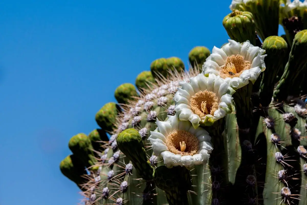
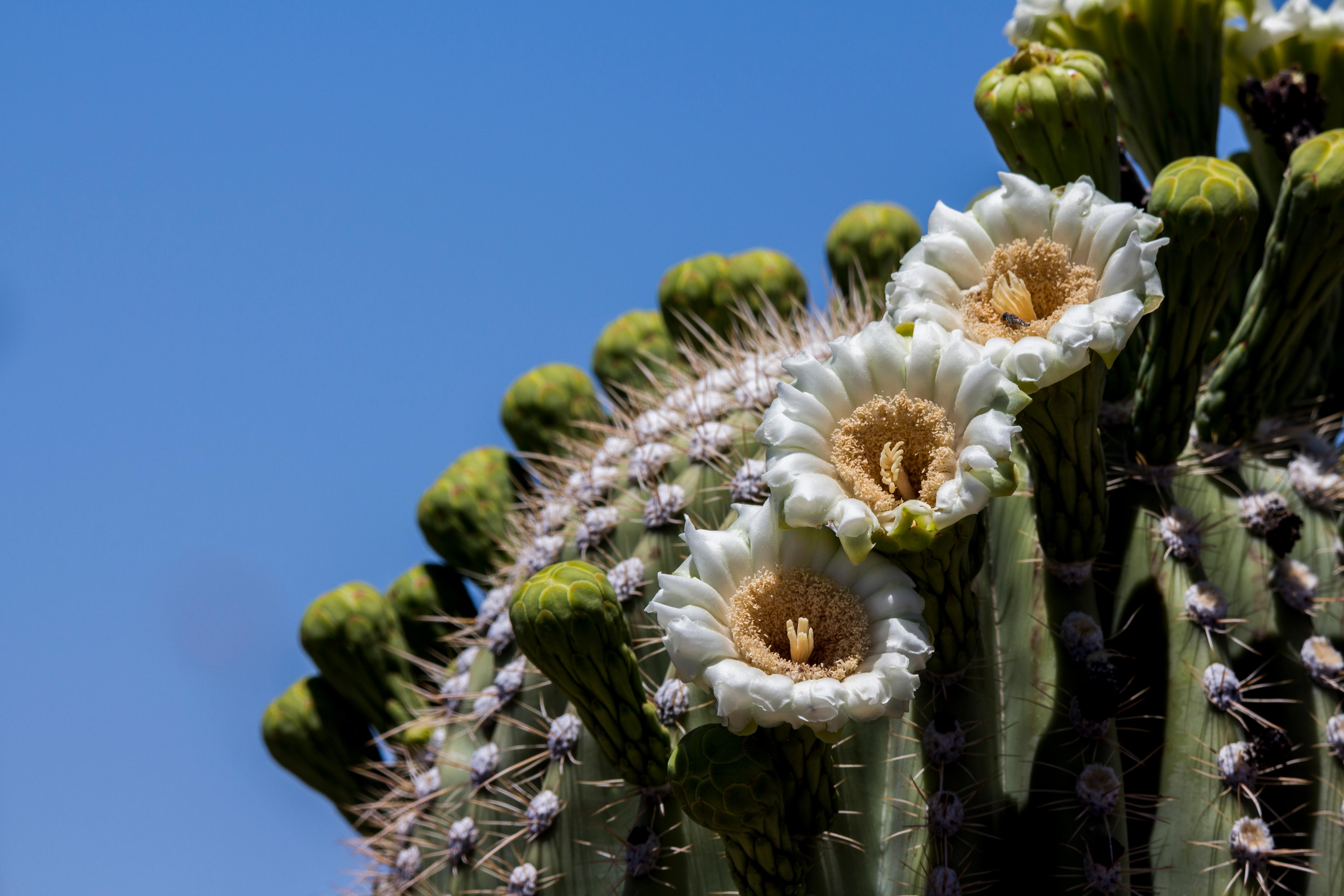


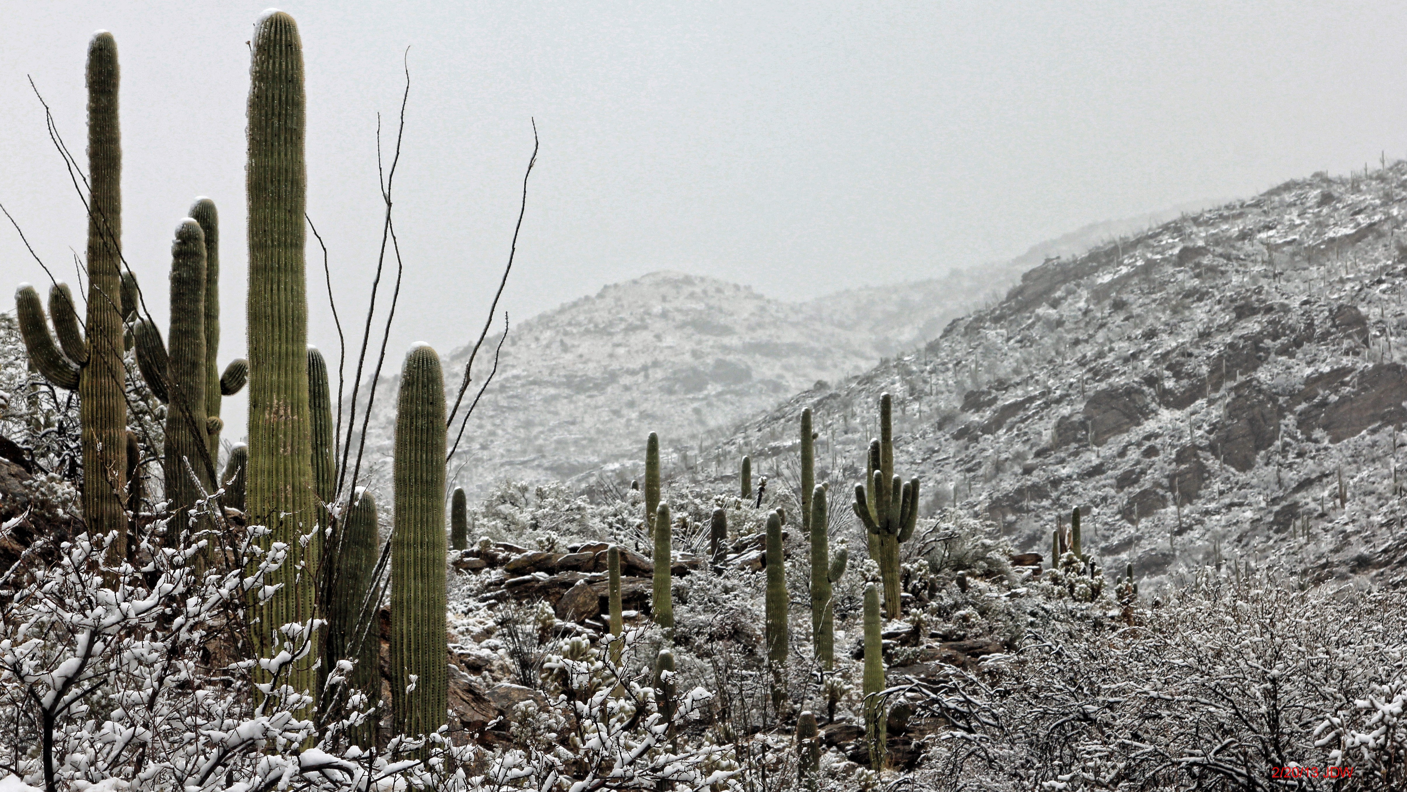


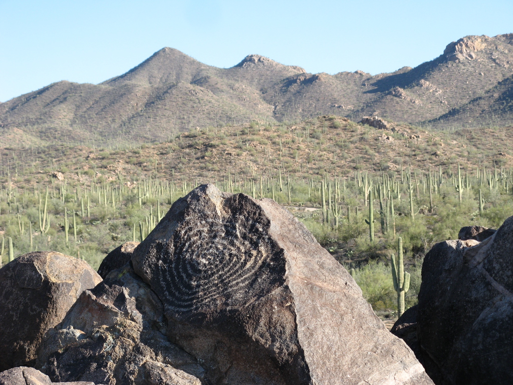


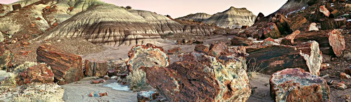 Desert