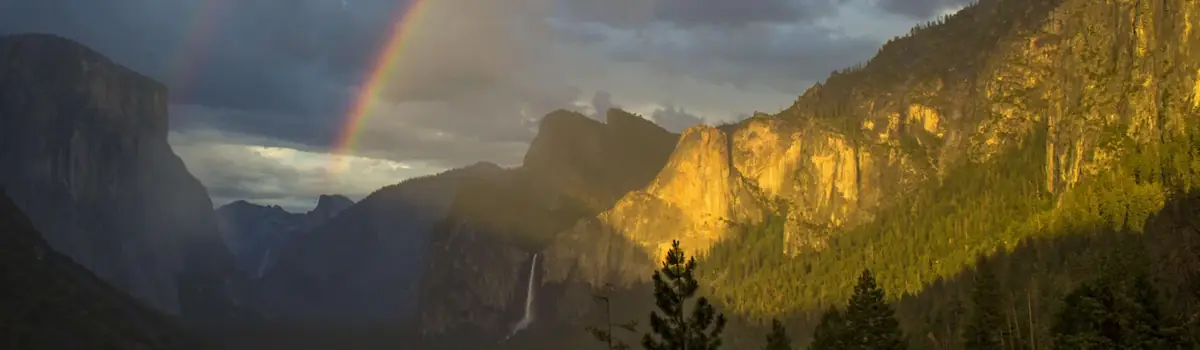
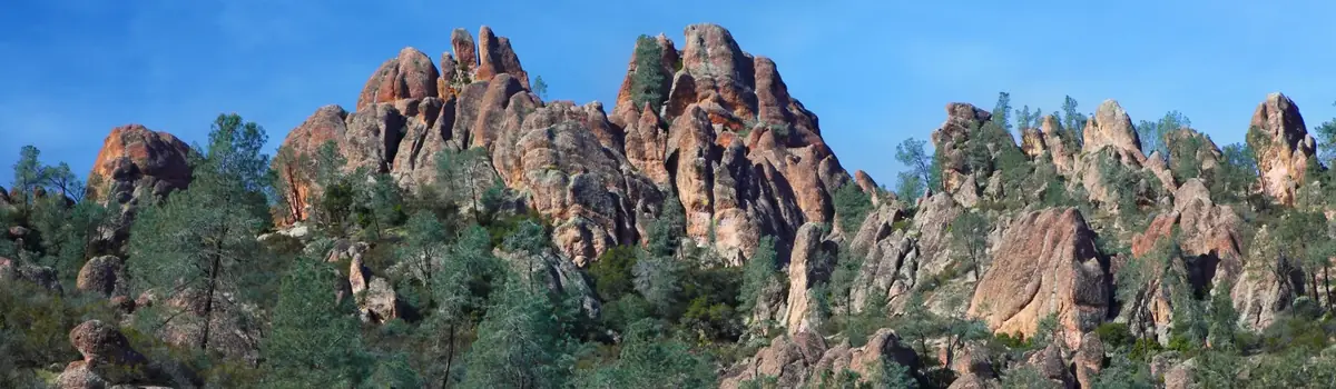
Huge mountains, rugged foothills, deep canyons, vast caverns, and the world’s largest trees exemplify the diversity of landscapes, life, and beauty here. Explore these pages to plan your visit or to learn about the plants and animals here and the threats they face. Ancient giant sequoias may seem invincible, but they, too are vulnerable.
404.1Kacres of parkland
1.4Mrecreation visits, 2025
Apr · May · Octnearby climate picks
Seasonal access & reservations
No reviewed guidance for this selection. Check the park's official planning pages; missing coverage does not establish access.
Selected guidance only; separate from climate comfort and current conditions.
Official conditions Not checked
The conditions feed has not been connected for this park.
Editorial recommendations, reviewed 2026-10-17. Full park days, excluding travel to and from the region. A first-visit outline for a general traveler; adapt to mobility, fitness, season, reservations, and current conditions. These are suggested days, not reserved activities or guaranteed routes.
Natural areas present hazards. Cold temperatures, icy or uneven ground, wild animals, biting insects, and changing weather all pose dangers. Rocks roll, trees topple, and limbs drop without warning. People create other hazards with campfires, traffic, snowplay, and poor decisions.
The National Park Service works to reduce risks, but your safety is in your own hands. Keep alert, read warnings, and ask a ranger for advice.
Información de seguridad en español
The rivers in these parks are powerful and cold, and drowning is our most frequent cause of death. Learn more about river safety.
Learn what level of fire restrictions the parks have enacted and what they entail.
Want to safely visit the parks after a fire? Learn more about the warnings signs of potential dangers in burned areas.
Learn to safely navigate park roads, filled with twists, turns, and steep grades.
Watch for hazards such as lightning, falling trees and pinecones, and bears seeking human foods.
Some of our charismatic creatures, such as bears, can pose a danger to visitors.
Insects, rodents, and poison oak can be sources of illness and disease.
High-elevation hiking involves risks. Get safety information to prepare for your trip.
Learn about important park regulations on drone use, firearms, and other activities.
Giant sequoia groves are portions of Sierra Nevada mixed conifer forest that contain giant sequoias. In most groves, giant sequoias are fewer in number than other tree species, but are the most visually striking and dominant in size. Giant sequoias grow only on the western slopes of the Sierra Nevada in California, between 4,000 and 8,000 feet (1219 and 2438 m) in elevation. Within park boundaries, park staff distinguish approximately 40 different giant sequoia groves, ranging from one to tens of thousands of sequoia trees per grove. Numerous groves can be reached by road, while others are remote and involve an arduous hike to visit. Most groves are noted on the park driving map . In all the groves—from heavily visited to remote—these immense, majestic trees and sunlight filtered through lofty branches bring a sense of peace and wonder.
Roland Rollinger
Giant Forest is a large sequoia grove, set on a rolling plateau between the Marble and Middle Forks of the Kaweah River in Sequoia National Park. It is the largest of the unlogged giant sequoia groves, and it contains more exceptionally large sequoias than any other grove. In this grove, visitors can see the effects of decades of prescribed burning: open forest conditions and clumps of giant sequoia seedlings that establish after fire.It hosts the largest living sequoia, the General Sherman Tree . Giant Forest has an extensive network of hiking trails that range from 1-2 hour hikes to half-day or longer explorations of this grove. From spectacular giant sequoia trees to historic structures leftover from the time cattle grazed in this area, one can learn about both natural and cultural history. Enjoy views from Moro Rock, or wildlife-viewing opportunities amongst the trees and scattered meadows. Visit the Giant Forest Museum for a good introduction, and explore from there by foot, shuttle bus , or car.
Grant Grove is located in Kings Canyon National Park, accessible by a short spur road from Highway 180 and located just 1.5 miles from the Kings Canyon Visitor Center . This grove has numerous exceptionally large sequoias grouped in a 90-acre area. A higher percentage of this grove's mature sequoias reach sizes of ten, fifteen, and twenty feet (3, 4.5, or 6 m) in diameter than in any other grove. For those who are interested in photographing an entire giant sequoia, a visit to Grant Grove provides a great vantage point of the immense and stunning General Grant Tree , celebrated each year as the nation's Christmas tree. The 1/3-mile (.05 km) paved loop trail leads to the General Grant Tree and includes other named trees and features, including the Gamlin Cabin, the Fallen Monarch, and the Centennial Stump. Explore this and other trails to see sequoias, meadows, and wilderness views. Nearby campgrounds facilitate visits to the Grant Grove area.
NPS Photo - Daniel Jeffcoach
Redwood Mountain Grove
This grove burned to near extinction in the 2021 KNP Complex Fire. Forty percent of the grove burned at moderate to high fire severity, and many giant sequoias were killed. At this time, the trails remain closed due to hazardous conditions related to the fire. When it is safe to hike here again, trails provide access to giant sequoias on a ridge trail and along both sides of Redwood Creek and to vistas with views of the grove. The several loop hikes here range from 6.5 to 10 miles in length and involve some climbing. See the Redwood Canyon Trail webpage for more detailed information about hikes in this area. Redwood Mountain Grove is a very large grove noted for its old growth sequoias and diversity of other plants. In the spring, wildflowers are a highlight both along the ridge trail and along Redwood Creek. In the fall, the dogwood shrubs turn a deep red color, and the fall light provides good photo opportunities. Visitors to this grove will see evidence of wildfire in fire-killed trees, more open forests, and we hope, giant sequoia seedling regeneration as well as re-sprouting wildflowers and shrubs. Visit the KNP Complex Fire web page , to learn more about the impacts it had on the parks.
This grove burned during the KNP Complex Fire in the fall of 2021. Firefighters were able to conduct a low intensity back-burn prior to when the KNP Complex fire reached the grove, successfully reducing fuels and thus the severity of the wildfire when it burned into the grove. Hikers who visit this area will see some beneficial fire effects – small to moderate-sized conifers like white fir or sugar pine may be killed in some areas. This is a positive effect as it makes the forest more open so that young sequoia seedlings may establish, and it helps this grove be less vulnerable to future high-severity wildfire. The mid-sized Muir Grove in Sequoia National Park is a two-mile hike from the parks' Generals Highway and is much less-visited than Grant Grove or Giant Forest. The Muir Grove features a high density of mature sequoias as well as a dramatic approach and entrance to the grove, with views across a creek gorge of the impressive giant sequoias on the grove's east side. The trail to this grove continues further into the grove for those who want a longer hike. This is a perfect day hike for visitors traveling between Sequoia and Kings Canyon National Parks, and for those camping at the nearby Dorst Creek Campground .
Big Stump Grove
Beginning in the late 1800s, numerous sequoia groves in an area that would later become the parks, and in the neighboring Sequoia National Forest, were logged. Most of the old growth giant sequoias were logged here between about 1883 and 1891. Tree ring data indicate that many of the logged giants were relatively young for sequoias (approximately 500-600 years old). A combination of fire scar dating and aging of tree-ring samples indicates that prior to logging, most of the grove comprised sequoias that established after a large, severe 14 th -century fire. Big Stump Grove, near the entrance to Kings Canyon National Park, is worth a visit for those interested in exploring the site of the Smith-Comstock Mill and logging camp. Here, you’ll find several remaining old growth stumps and the young sequoia trees that regenerated following historic logging operations.In this grove, scattered old growth sequoias were spared from logging, and many young sequoia stands have established in the openings created by logging. Many of these trees are over a century in age and four to six feet in diameter. This grove is known for the stump of the huge Mark Twain Tree. Sections of this tree are still on display in the American Museum of Natural History in New York City, and dramatic photographs document its cutting in 1891. In addition to a hiking trail, there is also a picnic area. The Kings Canyon Visitor Center and Grant Grove Village is just 3.5 miles (5.6 km) away.
Converse Basin Grove
The Converse Basin Grove, managed by the U.S. Forest Service in the Giant Sequoia National Monument, is one of the largest sequoia groves in total area and provides a window into an era of large-scale logging involving ingenuity and strong will. Imagine cutting a giant sequoia with cross-cut saws and axes, milling the wood on-site, then transporting it down waterways called flumes that floated the timber to towns in the Central Valley. Despite the lack of power saws during the time frame of logging here (1893-1908), the clear-cutting of Converse Basin was extensive. It is likely that more mature and old growth sequoias were cut here than in all other groves combined. Although the logging was destructive, the grove remains a remarkable site with its significant historic forest as well as its existing scattered old-growth sequoias, and the most extensive young sequoia stands of post-logging regeneration found in any grove.
The most noted sequoia spared by the loggers is the 269-foot (82 m) tall Boole Tree. It is the largest tree in America's national forests, and it contends with two other living sequoias as the sixth largest in overall volume. This tree bears the name of the general manager of the Sanger Lumber Company, Frank Boole, thought to have ordered this particular tree spared. Many other mature sequoias are widely scattered throughout the grove, including the largest surviving old growth group (including more than 25 trees), located along Cabin Creek in Kings Canyon.
Three developed recreation sites lie within Converse Basin Grove:
Stump Meadow: You pass this meadow on the drive to the Boole Tree Trail. Stump Meadow is filled with sequoia stumps that allow visitors to visualize the size of the trees that were cut. Thousands of 100-year-old sequoias surround the meadow. The stumps have provided a wealth of information for scientists who use tree rings to study past climate patterns and fire history. The oldest stump in this grove dates to just over 3,200 years old.
The Boole Tree Trail is a family-friendly 2.5 mile (4 km) loop trail with great views of Kings Canyon and the park's high peaks.
The Chicago Stump Trail is a flat trail and short walk (.5 mile or .8 km) that will bring you to the former site of the General Noble Tree, which was cut down in 1895 and sent to the World's Columbian Exposition of the World Fair in Chicago. What remains is a 20-foot-high stump, called the Chicago Stump. In 2015, the Rough Fire burned through the Converse Basin area, and fire fighters were successful in protecting the Chicago Stump by wrapping it in fire-resistant fire shelters.
Visit the Sequoia National Forest Converse Basin Grove web page to learn more, or the Giant Sequoia National Monument page that provides an overview of other national forest groves in the area.
What to Know More?
Learn more about the natural history of giant sequoias, including details about their role in the ecosystem, how they're affected by fire, and why they live so long here .
We are committed to a continuing effort to improve the accessibility of Sequoia and Kings Canyon's trails and facilities so they can be enjoyed by all visitors. If you have questions or suggestions about accessibility, please email us , or call (559) 565-3341. We have published an Accessibility Guide that highlights accessible features by area, and by user group. Information contained in the Accessibility Guide is available on this webpage, or in print in standard and large-print formats. We also recently released a series of films that showcase several of the parks accessible features. The six short films share advice from visitors, in their own words, and includes insider tips for planning a trip to the parks and participating in these activities.
This area features accessible picnic areas, cultural sites, and wildflower viewing.
Here, you'll find several accessible trails and accessible park transportation.
From camping, to trails and scenic overlooks, Grant Grove offers many accessible features.
Travel the paved Roaring River Falls trail, or stay in accessible campsites suitable for family or large groups.
Enjoy amazing views in this remote and historically rich area. Some accessible camping is available here.
NPS App for Mobile Devices
The NPS App is fully accessible and includes alternative text for images, combined with your device’s built-in accessibility features. Download it for free before you arrive.
Free shuttle buses operating in the Giant Forest and Lodgepole areas in summer and during holiday periods are wheelchair accessible. Some buses kneel and others have mechanical lifts. For shuttle schedules, visit our shuttle web page.
A shuttle also runs between Visalia and the Giant Forest in summer; reservations are required. For more information, visit www.sequoiashuttle.com or call 877-BUS-HIKE (877-287-4453). Touring on horseback is offered at Cedar Grove and Grant Grove in summer. Hourly rides, spot trips, and guided trips are available. Check our Horseback Riding webpage for seasonal availability, costs, and contact information.
Accessible Parking Placards
Temporary accessible-parking placards are available for people who have limited mobility but do not have a DMV-issued, accessible-parking placard or driver’s license. Ask at visitor centers for a placard. No documentation is required. If you do not have a placard for accessible parking, in summer, you can ride the fare-free shuttles to popular features and facilities, including the accessible Sherman Tree Trail.
Wheelchair Loan
Borrow a manual wheelchair at Giant Forest Museum, Lodgepole Visitor Center, or Kings Canyon Visitor Center. Wheelchairs are free and available on a first-come, first-served basis. Be prepared to provide your address and phone number. Wheelchairs may be used anywhere in the parks, but must be returned to the visitor center where they were borrowed by closing time on the same day.
Visiting with a service dog? Uncertain if your dog qualifies as a service animal? Learn more about service animals in the parks .
Obtaining an Access Pass
The free Access Pass is available for all U.S. citizens or permanent residents with permanent disabilities. This pass covers admission at more than 2,000 federal recreation sites, including national parks, wildlife refuges, national forests, BLM sites, and more. The Access Pass also provides a discount on some federal facilities and services fees, such as camping. The pass generally does not apply to special recreation permit fees or fees at businesses in the parks, including Crystal Cave tickets. To get your pass, ask at any park entrance station or purchase one online . You’ll be asked to sign a form confirming your eligibility. Medical documentation is not required.
There are fourteen campgrounds in the parks, including two that are open during all four seasons. Campsites hold up to six people. Each has a picnic table, fire ring with grill, and a metal food-storage box. Nearly all campgrounds require advance reservations; sites fill quickly. Make reservations using the links below or at Recreation.gov . Please review the campground regulations and camping safety tips prior to your arrival.
Fire Restrictions
Restrictions on campfires in lower-elevation campgrounds in the Foothills are common, especially during summer months. Please check current fire restrictions before you visit for information and restrictions on wood and charcoal fires, gas or propane stoves, and smoking.
Standard Campsite (up to 6 people)
Mid-sized Group Campsite
Large Group Campsite
$60,$70, or $80
Download the Recreation.gov App
Adventure is at your fingertips with the Recreation.gov mobile app! From booking to planning, the Recreation.gov app helps you find and reserve campsites, review location details for your trip, and quickly access information on past and upcoming reservations. Download it today at Mobile App - Recreation.gov
Store Food to Protect Wildlife
Bears are active day and night. When camping or picnicking, all food, trash, and any item with a scent must be stored in food-storage boxes.
Camping Accessibility Film
Take a tour of accessible campground features with a family as they share insider tips for your visit.
Campfires may be prohibited when fire danger is extreme.
Campgrounds in Sequoia National Park
Foothills Campgrounds
At an elevation of 2,500-3,000 feet (762-914 m), the foothills of Sequoia National Park are hot and dry in summer, and cool and wet in winter with occasional light snow. Nearby trails lead to oak woodlands, river canyons, and spring wildflowers. A 45-minute winding drive leads to the Giant Forest sequoia grove—vehicles over 22 feet (6.7 m) are not advised on this road. In summer, fire restrictions are often in effect in these campgrounds due to high temperatures and dry conditions.
Lodgepole and Giant Forest Campgrounds
The Lodgepole area is centrally located in Sequoia National Park at an elevation of 6,700 feet (2050 m). The area is a 45-minute drive from the Hwy 180 entrance in Kings Canyon National Park, or a one-hour drive from the Hwy 198 entrance in Sequoia National Park. Enter the parks via Highway 180 if your vehicle is over 22 feet (6.7 m) long.
Mineral King Campgrounds
The Mineral King area features the highest elevation campground in the parks. At 7,500 feet (2280 m), it is only open during the summer months. A narrow, winding, largely unpaved road leads to the area and its two campgrounds. RVs and trailers are not recommended on Mineral King Road and are not permitted in campgrounds. Mineral King is not connected to the rest of Sequoia National Park by roads. To get here, turn off of Highway 198 in Three Rivers, California.
Campgrounds in Kings Canyon National Park
Grant Grove Campgrounds
Grant Grove Village serves as the gateway to Kings Canyon National Park. At 6,500 feet (1981 m), this area offers moderate temperatures in the summer, and is usually snow covered in the winter. Trails lead to giant sequoia groves, meadows, waterfalls and vistas of the high Sierra. Numerous services are available a short distance from all three campgrounds.
Cedar Grove Campgrounds
Located at 4,000 feet (1,200 meters) and an hour’s drive from Grant Grove, the Cedar Grove area is a more remote area of Kings Canyon National Park. It is open from early spring to late fall. Campgrounds are next to the South Fork of the Kings River and offer views of the glaciated Kings Canyon. Trails lead to meadows and waterfalls, and also provide some of the best access to the high Sierra wilderness. All campgrounds in this area contain a bicycle trail which connects them to services at Cedar Grove Village.
Additional Campgrounds
South Fork Campground (Closed Indefinitely)
South Fork Campground and its access road were heavily and extensively damaged by floods and landslides from winter storms. The campground is closed until further notice.
Wolverton Stock Campsites
Campsites are $40 per night. Reservations will be available on Recreation.gov . No first-come, first-served sites are available.
U.S. Forest Service Campgrounds
The U.S. Forest Service maintains campgrounds in the Hume Lake District that borders Sequoia and Kings Canyon National Parks. These campgrounds are not managed by the parks. Dispersed Camping Dispersed camping is not allowed within Sequoia and Kings Canyon National Parks except for those who are hiking into the backcountry with backcountry permits. Dispersed camping is allowed only in specific areas within the Sequoia National Forest, restrictions apply. Areas that are closed to dispersed camping include:
Hume Lake Recreation Area
Stony Creek Recreation Area
Along the Kings River Wild and Scenic Byway
Historical and archaeological sites
Call Sequoia National Forest at 559-784-1500 or stop by a National Park Service visitor center for more information.
Whether you choose a short, paved trail or an all-day hike, exploring by foot is a great way to experience these parks! Before you hit the trail, know some facts before you go:
Permits are not required for day hikes, except if hiking Mt. Whitney .
Take a look at The Ten Essentials Checklist and prepare for your trip based on its guidance, regardless of the length of your hike.
Review the parks' General Safety webpage , as well as the in-depth Trail Safety webpage .
Check at a visitor center or on the web for trail conditions updates.
Are you part of a group hike or meet-up? There is a maximum party size limit of 25 people for day hikes in these parks.
We recommend taking a map, especially for longer or unpaved trails. Even short trails can lead to unmarked intersections or unexpected detours, and it is your responsibility to be prepared. With hundreds of miles of trails in these parks, it's difficult to provide detailed trail maps online. Buy trail maps at each park visitor center or through the Sequoia Parks Conservancy's online store. You can also visit our digital map, the Sequoia & Kings Canyon Park Atlas, to create and print custom maps.
Foothills Day Hikes Hot, dry summers shape the foothill landscape
Giant Forest and Lodgepole Day Hikes Sequoias, conifers, meadows, and vistas characterize the Giant Forest and Lodgepole areas.
Grant Grove Day Hikes Sequoias, easy trails, and solitude are all available on trails in the vicinity of Grant Grove
Cedar Grove Day Hikes Looming granite walls, rivers, and vistas hallmarks of Cedar Grove.
Mineral King Day Hikes Cooler temperatures and dramatic mountain scenery draw day hikers here.
Trail Safety High-elevation hiking involves risks. Get safety information to prepare for your trip.
Generals Highway from the Sequoia Park Entrance to Lodgepole
NPS/ Kirke Wrench
The Kaweah River to Hospital Rock
Views extend up and down the Kaweah Canyon as the highway winds up alongside the rapidly descending river. At Hospital Rock, stop to see the Native American pictographs and mortars.
Amphitheater Point
This viewpoint offers an excellent side view of Moro Rock, along with views from the foothills up into alpine peaks.
Eleven Range Overlook
On clear days, views here can extend to California's Coast Range on the opposite side of the San Joaquin Valley.
A short hike from the Giant Forest Museum takes you to Beetle Rock, a flat expanse of granite with wide views.
Crescent Meadow
Consider taking the Moro Rock/Crescent Meadow side road to its end. The road ends at beautiful Crescent Meadow.
NPS / Kirke Wrench
Generals Highway from Lodgepole to Grant Grove
From Lodgepole to Grant Grove, the road meanders along pleasant mountain roads, staying at the same elevation. Allow 45 minutes to an hour for this drive.
Halstead Meadow
A bridge along the highway goes over the top of this large meadow. On the north side, a small picnic area and pit toilet offer a good place to stop. Black bears can sometimes be seen in the meadow in spring. At any time of year, wildflowers are common here.
Redwood Mountain Overlook
This pullout offers a view overlooking the world's largest intact sequoia grove.
Kings Canyon Overlook
From here, look eastward deep into the wilderness of these parks.
NPS/ Alison Taggart-Barone
Grant Grove to the Kings Canyon and Cedar Grove
Allow 45 minutes to an hour for this spectacular drive from the sequoia groves into one of our nation's deepest canyons. Junction View This overlook offers excellent views of both the Middle Fork and the South Fork of Kings Canyon. Yucca Point Look almost straight down into foaming junction of the Middle Fork and the South Fork of the Kings River. Hwy 180 between Yucca Point and Boyden Cave Drive carefully along this section of the road blasted out of the nearly sheer walls of Kings Canyon. Stop frequently to appreciate the grandeur of this water-carved canyon. Boyden Cave A marble cave here is open for tours in summer. Nearby, notice the layers of marble sandwiched between strips of volcanic rock. Tremendous forces tipped these layers to a nearly vertical orientation. Grizzly Falls A 5-minute walk leads to impressive falls and a cool, shady spot on a warm day.
This pullout offers an excellent view of the U-shaped Kings Canyon, showing its glacial past.
Roaring River Falls
Feel the power of this short but mighty waterfall as it rushes through a narrow granite chute. The falls are are a short distance from the road along a paved trail.
An easy trail offers splendid views of high granite walls, a lush meadow, impressive talus, and the meandering Kings River. Once a loop trail, natural flooding in 2019 washed away sections of the trail passing through the meadow and paralleling the river. Today the trail crosses the Kings River via an expansion bridge, then passes through wooded areas and talus slopes to offer views of the meadow.
This area offers excellent views of high granite walls, access to river trails, and Muir Rock.
Many go fishing all their lives without knowing that it is not fish they are after. ~ Henry David Thoreau
What comes to mind when you think about fishing? Patience, relaxation, challenge? These are but a few words often associated with fishing. We want you to have an enjoyable time fishing the waters of these parks and having memories that evoke these thoughts. But first, please take a moment to explore our fishing information and learn your responsibilities before casting a line into the water.
Fishing is permitted in most areas of the parks, and on adjacent national forests. People 16 years of age or older are required to have a California fishing license . Get copies of park-specific regulations at any visitor center. Licenses are not always available in park markets, so bring them with you, buy them in nearby communities before you enter the park, or get one at Hume Lake (north of the Grant Grove area). Tackle is available at most park markets.
Fishing Regulations
The open season for fishing and the daily bag limit and possession limit shall conform to that of the State of California fishing regulations throughout the park, except as otherwise provided below. The following Special Regulation (see Compendium section 2.3 ) applies in addition to Federal and State law: In waters below 9,000 feet in elevation that are not located in a Developed Area*:
rainbow trout, Sacramento sucker, Kern rainbow, riffle sculpin, and California roach fish must be released
only barbless artificial flies or lures are authorized
*A Developed Area is defined as an area within one-quarter (1/4) mile of buildings, campgrounds, picnic areas, or parking lots that accommodate more than five (5) vehicles. The Code of Federal Regulations has more information about fishing in national parks.
Fish Consumption Advisories in National Park Waters
The Environmental Protection Agency, states, territories, and tribes provide advice on fish caught in the waters in their jurisdiction to help people make informed decisions about eating fish. Advisories are recommendations to limit your consumption of, or avoid eating entirely, certain species of fish from specific bodies of water due to chemical or biological contamination. While some aquatic toxins are the result of natural biological processes, others are human-derived. Chemicals that originate outside of park boundaries and are toxic can come into parks and enter aquatic systems. Mercury is an example of a toxin originating outside a park that can find its way into a park. Mercury exists naturally in some rocks, including coal. When power plants burn coal, mercury can travel in the air long distances before falling to the ground, usually in low concentrations. Once on the ground, microorganisms can change this elemental mercury to methyl mercury. This type of mercury can build up in animal tissues, and it can increase in concentration to harmful levels. This high concentration can occur in large predatory fish - those often pursued and eaten by anglers. Studies have shown that fish in some National Park System waters have mercury levels that may be a concern to people who regularly eat a lot of fish. There are no specific fish advisories for Sequoia and Kings Canyon National Parks. However, mercury generally increases in aquatic invertebrates as you decrease in elevation. Mercury also increases in areas that are more biologically productive, like habitats near and within wetlands and riparian areas. Finally, older and larger fish, which also tend to be in the foothills area of the parks, could have higher concentrations of mercury. To learn more about this topic, t
Aquatic Invasive Species
Imagine your favorite fishing spot and the wonderful memories. On the surface, things may look fine, but below the shimmering water there could be a serious threat. Aquatic invasive species are not native to an ecosystem. Their introduction can cause harm to the economy, the environment, or to human health. Aquatic invasive species are a growing risk to parks and their values. In the United States alone, there are more than 250 non-native aquatic species. In Sequoia and Kings Canyon National Parks, we have eight aquatic invasive species, plus one aquatic invasive disease (amphibian chytrid fungus). For many centuries, humans have contributed to spreading non-native species around the globe. You can make a difference. To learn more about Aquatic Invasive Species in the National Park Service, visit the Fish & Fishing website. From 1870 to 1988, nonnative trout were introduced to high-elevation lakes and streams in our parks to make these areas more attractive to anglers. The introduction of fish had some unintended effects, the most dramatic being the resulting decline in mountain yellow-legged frog populations as the fish preyed on them and the insects they feed on. Of the six species of nonnative fish that occur in the parks, the three most common are California golden trout, brook trout, and brown trout. The parks are also home to the nonnative American bullfrog. For more information about the parks' native species, please visit our Amphibians and Fish page .
Fishing Throughout the National Park Service
For more information about fishing throughout the National Park Service, please visit our servicewide Fish and Fishing page.
Guided horseback rides are usually available to the public in summer at two horseback riding stables operated under a concessions permit in Sequoia and Kings Canyon National Parks. Opening and closing dates for each location depend upon weather conditions. Weight limits and age restrictions may apply. Please call the stables for additional information and to make a reservation. Reservations are recommended.
Grant Grove Stables, Kings Canyon National Park
Open typically June through mid-October, weather permitting
Grant Grove Stables are located near the General Grant Tree in the Grant Grove area of Kings Canyon National Park. The stables offer 1-2 hour guided trips. Routes include the General Grant Tree, North Grove, Lion Meadow, and Dead Giant Loop. Currently rides are offered to single family groups of up to 6 people. Group size limits may change as guidance allows. Call for more information or to make a reservation.
Cedar Grove Pack Station, Kings Canyon National Park
Cedar Grove Pack Station is located just outside the Cedar Grove Village. Rides range from one hour to all day, and there are options for all experience levels. Day trips offer rides along the Kings Canyon River in the Cedar Grove area. Wilderness spot/dunnage trips are also available. Currently rides are offered to single family groups of up to 6 people. Group size limits may change as guidance allows. Call to make a reservation. Walk-in reservations may be available for day rides.
Bringing Your Horse to the Park
"Stock use" refers to travel with horses, mules, burros, and llamas in the parks. If you wish to ride your own horse in the parks please read the Stock Use information page . If you're planning an overnight trip, a wilderness permit is required.
Commercial Pack Services
A variety of stock services, including stock-supported wilderness trips, are available through outfitters who hold a current commercial-use permit to operate within the parks. Check our list of commercial pack stations that offer trips in these parks to plan a stock trip. The National Park Service does not endorse any particular business.
With over 800 miles of maintained trails designed to help you experience the more than 800,000 acres of designated Wilderness , Sequoia and Kings Canyon National Parks offer incredible opportunities for wilderness recreation.
The Sierra Nevada mountains, reaching from the impressive heights of Mt. Whitney to the tangled oak woodlands of the foothills, have long been a source of wonder and excitement. Begin your exploration of Sequoia and Kings Canyon Wilderness with the links below.
NPS Photo - Rick Cain
Tools To Begin Planning Your Trip
Park Atlas and Trail Descriptions
Wilderness Film Series
Preparing For Your Trip
Traveling With Stock
Food Storage , Fire in the Park , & Weather
Current Trail Conditions
Before And After
Directions to the park and shuttle services
There are no "backpacker camps" in these parks. Make reservations or other arrangements in advance for any night not spent in wilderness. Check out our campgrounds or find other lodging in the parks.
Do you want to know more about Sequoia and Kings Canyon National Parks' Wilderness? Check out our Wilderness Information page.
Contact the Wilderness Office
Phone (559) 565-3766 Email us
Wilderness permits are required to stay outside of designated campgrounds.
Proper food storage can protect park wildlife--and you.
Watch our series of short films to learn about wilderness best practices, including human waste, hygiene, and food storage.
Use our online mapping tool to create custom maps for trip planning, wilderness travel, and more.
Nearly all of these parks is designated wilderness. This protects the high Sierra while providing outstanding opportunities for recreation.
Picnic Areas of Sequoia & Kings Canyon National Park
There are many picnic areas available in the parks. All picnic areas have restrooms, and some have water and barbecue grills. Barbecue grills may not be available when fire restrictions are in place. Please check current fire restrictions before you visit for information on wood and charcoal fires, gas or propane stoves, and smoking.
Black bears may sometimes approach picnic areas. When eating or preparing food, always keep food within arm's reach. Store food, trash, and any items with an odor in metal food-storage boxes if they are available. Following park food-storage regulations protects park bears and helps prevent aggressive behavior. Picnic areas may be closed because of bear activity or other issues. Picnic areas are not plowed and may be inaccessible when snow is on the ground.
Sequoia National Park
Picnic areas in the foothills are at a lower elevation of 1700 - 2800 feet (500 - 850 m) and are usually impacted by fire restrictions in the summer due to extreme heat. During the milder seasons, it is the perfect place to stop for lunch and take in the green hills and diverse wildlife.
Hospital Rock Picnic Area
Picnic in an oak woodland near the Middle Fork of the Kaweah River. Numerous picnic areas offer both sunny and shady spots to eat and relax. While you're here, browse outdoor exhibits that tell the story of Native Americans who lived and traveled in this area, and continue to visit this area today. Hospital Rock has outdoor exhibits, water, grills, a telephone, and flush toilets.
Foothills Picnic Area
Foothills Picnic Area is across the highway from Foothills Visitor Center. In winter and spring, this is a comfortable place to stop on the way up into the mountains, or on the return trip. In summer, the foothills are hot and dry, and fire restrictions may be in effect. Public restrooms, water, a visitor center, and other services are available across the street from the picnic area.
Lodgepole and Giant Forest
Right in the heart of Sequoia National Park, picnic areas in Lodgepole and the Giant Forest sit at an elevation of 6600 - 7200 feet (2000 - 2200 m). Cool weather and shade from the trees provides a lovely spot to stop and rest. Please be aware of bears in these areas. Do not leave food unattended.
Crescent Meadow Area
The Crescent Meadow Picnic Area is 2.6 miles from the Giant Forest Museum, near Moro Rock and several trailheads. The picnic area rests at the edge of a lush meadow, surrounded by giant sequoias. Crescent Meadow Picnic Area has accessible vault restrooms and designated accessible (but steep) parking stalls. There are no extended picnic tables, water, or grills.
Pinewood Picnic Area
Located between the Giant Forest Museum and Lodgepole Visitor Center, the Pinewood Picnic Area offers regular and long picnic tables for groups of all sizes. The picnic areas also has flush restrooms, a water faucet, and barbecue grills.
Lodgepole Picnic Area
The Lodgepole Picnic Area is adjacent to Lodgepole facilities, including the Village Market, visitor center, campground, restrooms, laundry, and showers. The picnic area itself has water spigots.
Wolverton Picnic Area
Located at the end of Wolverton road, this picnic area is a great place to stop for lunch while taking in gorgeous meadow views. This area has informative bulletin boards, water spigots, flush toilets, and barbecue grills.
Halstead Meadow Picnic Area
Next to a restored meadow, Halstead Meadow Picnic Area is four miles from the Lodgepole Visitor Center. This area has exhibits, vault toilets, and barbecue grills.
At 7,600 feet (2300 m) of elevation, Mineral King has one picnic area close to the Mineral King Ranger Station, where water spigots, vault restrooms, and exhibits can be found. An accessible restroom is located along Mineral King Road at the Lookout Point entrance, 8 miles (13 km) before Atwell Mill Campground and 15 miles (24 km) before Mineral King Ranger Station.
Kings Canyon National Park
At 6,600 feet (2,008 m) in elevation, this area is characterized by warm days and cool nights in summer, with deep snow and cold temperatures in winter.
Big Stump Picnic Area
The first resting spot after the park entrance station on Highway 180, this picnic area makes this a perfect stop to get your bearings after the drive from the San Joaquin Valley. Covered picnic tables offer shelter and parking is usually abundant. It includes extended picnic tables for travelers using wheelchairs, as well as raised barbecues, exhibits, water, and flush restrooms.
Columbine Picnic Area
This picnic spot is located near the Grant Grove campgrounds and Visitor Center. Parking, grills, vault restrooms, and picnic tables are available year-round. This becomes a snow-play area in winter.
Panoramic Point Picnic Area
This spot is close to the Panoramic Point trail, offering great views of the Kings Canyon, Hume Lake, and the mountains beyond. At the parking area are vault toilets, picnic tables, and food-storage boxes. Be aware that the road to the trailhead is narrow; drive it slowly and carefully. Motor homes and trailers are not permitted.
This glaciated valley features towering cliffs, tumbling waterfalls, and the powerful Kings River, whose canyon gave the park its name. Picnic tables can be found throughout the canyon and are available anytime the area is open, usually from April through mid-November. Elevation 4700 - 5000 feet (1400 - 1500m).
Picnic Areas in Sequoia National Forest and Giant Forest National Monument
Close to Sequoia National Park in the Hume Lake area, Powder Can Picnic Area and Sandy Cove and Hume Lake day use areas offer not only picnicking but also fishing and water activities. In between sections of Kings Canyon National Park, picnic areas on Highway 180 between Cedar Grove and Grant Grove include Convict Flat and Grizzly Falls. Both are open seasonally. Check for current restrictions on wood and charcoal barbecue fires, gas and propane stoves, and/or smoking by visiting the USFS Fire Restrictions page, or call Sequoia National Forest and Giant Forest National Monument at 559-784-1500.
Sequoia and Kings Canyon National Parks Ranger-Led Programs
Join a National Park Service ranger and explore sequoia groves, take a moonlight walk, or gaze at distant mountains at Beetle Rock. Learn about bears and other mountain wildlife at visitor center talks. And if you're staying in a campground, stop by the amphitheater for an evening program. Walks, talks, activities, and evening programs are free and open to the public. We invite you to join us!
Most programs are scheduled in summer from Memorial Day (late-May) through Labor Day (early September). Limited programming is offered during other times of the year, depending on availability of staff. Ranger programs will be advertised on our online calendar . However, we recommend checking with a visitor center once you arrive. They will post updated program information, as occasionally programs are added or canceled due to unforeseen circumstances. Be sure to choose programs in the area where you're staying, or allow for travel time to programs in other areas. Learn more about the different places to go in the parks. No reservations are necessary for scheduled ranger programs.
Sequoia Parks Conservancy Naturalist-Led Programs
Join our partner, the Sequoia Parks Conservancy (SPC), for a naturalist program through their SPC Adventures program.
SPC Adventures provide both public and private, guided national park experiences for you and your small group. SPC Adventures programs follow CDC safety guidelines and are led by SPC’s trained naturalists who will guide you through the amazing sights and sounds of the parks. Experiences such as sequoia grove night hikes, secluded meadows tours, exclusive astronomy programs, and overnight backpacking trips are available. Visit SPC Adventures webpage or call (559) 565-4251 to book a trip and learn more. We recommend booking tours two weeks in advance of your visit to the park.
Winter Snowshoe Walks
Our popular ranger-guided snowshoe walks ( not offered in 2025 ) are a great way to explore snowy trails during the winter season. Snowshoe walks are anticipated to begin mid-January and will end as snow conditions deteriorate. Walks are added to our online calendar . Details are also posted at visitor centers .
Sequoia and Kings Canyon National Parks are a great place to climb. The rock here is similar to Yosemite in quality. One can enjoy an endless variety of climbs from easy to extremely challenging-without the crowds and pressure of more famous climbing areas. Most climbs require at least a day's hike in.
NPS / Anna Cirimele
Sequoia National Park Climbs
The easiest site to access in Sequoia is Moro Rock , just off the Generals Highway near Giant Forest. The west face offers 1,000 vertical feet of cracks and knobs. In the summer, many routes on Moro Rock close due to peregrine falcon nesting.
Little Baldy is a granite dome that rises to just over 8,000 feet in Sequoia National Park. Anyone who visits it's summit will enjoy a commanding view of the Great Western Divide to the east and a layer of haze to the west. The easiest way to get the view is the one and a half mile trail from Little Baldy saddle.
For a more remote climb, hike the High Sierra Trail to Angel Wings . At roughly 2,000 feet, this is one of the park's biggest walls. It's an 18-mile hike from Crescent Meadow.
Other Sequoia highlights: Big Baldy and Tokopah Domes.
In nearby Hume Lake District of Sequoia National Forest, Chimney Rock is one climbing destination. Like Moro Rock, it closes during nesting season for peregrine falcons.
NPS / Alison Taggart-Barone
Kings Canyon Climbs
A good place to look for climbs is along Bubbs Creek . On the north side of the Bubbs Creek Trail, just before it crosses Charlotte Creek, are Charlito Dome and Charlotte Dome. The hike in is about 8 miles, but the multi-pitch possibilities are worth the haul.
North Sentinel is best know for its profile when viewed from the Zumwalt Meadow Trail. Climbers historically looked past it towards the more infamous Grand Sentinel. The few routes weaving up the headwall are outstanding crack climbs.
Buena Vista Peak is one of the easiest approaches in the park and the closest place to climb in Grant’s Grove. It is a one-mile trail to the peak with a 360 view of the Kings Canyon high country. There are many bouldering opportunities along the way.
Other Kings Canyon highlights: The Obelisk and Grand Sentinel
Protected Wilderness
Remember that the rock here is an integral part of a larger ecosystem. Like the rest of the parks, it is protected as wilderness for people to enjoy in a natural state that preserves it intact for future generations of climbers. This means no motors (for example, motorized drills). Respect closures. On your approach, stick to trails. Climb clean. The placement or replacement of permanent fixed anchors, eg., bolts, pitons, etc., requires an approved special use permit (SUP). Permission to place or replace permanent fixed anchors may be granted by the superintendent, after a formal written request is submitted and evaluated.
What You Can Do
Climb safely. Rescues endanger rescuers' lives, are expensive, and cause a lot of impact.
Know park rules and the principles of Leave No Trace . Stick to trails. Climb clean. Respect the wilderness character of the parks.
If you see climbers who are not following these principles, talk to them. Explain how they can minimize their impact and why it is important that they do so.
Clean up after others. Leave the rock better than you found it.
Respect closures. For example, Moro Rock (in Sequoia National Park) and Chimney Rock (in Sequoia National Forest) are closed during peregrine falcon nesting season.
While our parks are open 24 hours a day, 365 days a year , not all visitor centers are open year-round. Some close seasonally. Others operating outdoors may close due to inclement weather or poor air quality. Our visitor centers, ranger stations, and a museum offer opportunities to explore the nature and history of these parks, watch park films, and get trip-planning information. Park stores within visitor centers offer books and other products related to the park. All purchases in these stores support park programs through the Sequoia Parks Conservancy. Wilderness Permit Desks Many of our visitor centers also have locations where visitors can pick up wilderness permits . Sequoia Parks Conservancy (SPC) Park Stores SPC Park Store hours may vary from visitor center or wilderness permit desk hours. Please check the park newspaper when you arrive at the park for the latest hours.
While our parks are open 24 hours a day, 365 days a year , not all visitor centers are open year-round. Some close seasonally. Others operating outdoors may close due to inclement weather or poor air quality. Our visitor centers, ranger stations, and a museum offer opportunities to explore the nature and history of these parks, watch park films, and get trip-planning information. Park stores within visitor centers offer books and other products related to the park. All purchases in these stores support park programs through the Sequoia Parks Conservancy.
Wilderness Permit Desks
Many of our visitor centers also have locations where visitors can pick up wilderness permits .
Sequoia Parks Conservancy (SPC) Park Stores
SPC Park Store hours may vary from visitor center or wilderness permit desk hours. Please check the park newspaper when you arrive at the park for the latest hours.
These parks host an incredible diversity of life across a range of elevations. Depending on where you visit and when you travel, you have an excellent chance of seeing at least a few different species of animals during your visit.
Seeing wildlife in a natural setting can be a great experience, as long as you’re careful. When viewing animals in the parks, keep a few things in mind:
Familiarize yourself with the animals that live in these parks.
Learn what time of day different species are active. Dawn or dusk tend to be good times to see a variety of wildlife.
Learn about wildlife habitats. Many animals like to spend time near the edges of a landscape, like where forest trees meet a grassy area.
Learn to look for signs such as tracks and scat.
The best way to view and enjoy a wild animal is from a distance with binoculars. When you come across an animal, sit still, watch from behind cover like a shrub or tree, and enjoy. Never disrupt, approach or attempt to feed wild animals; this is dangerous to you and the animal.
Bring binoculars for viewing from a distance.
Take a hike or walk and tread quietly.
Sit quietly and still. Watch from behind cover (while staying on the trail) or from your car.
How far away should you be?
Observe all wildlife from at least 75 feet (23 meters) away. That's the length of two school buses.
Watch more dangerous animals like black bears from at least 150 feet (46 meters) away. That's the length of four school buses.
NPS/ Alison Taggart-Barone
Protecting Wildlife and Yourself
Remember: All animals in the parks are wild. What are the possible risks of not safely watching wildlife?
Wildlife may injure you physically, ranging from bites and scratches to serious injury and death. They can also carry infectious diseases.
Your vehicle and/or belongings may also be damaged by wildlife.
Risks to wildlife:
Wildlife can catch diseases from humans and get sick from human food.
Animals that become used to spending time around people are often hit by cars.
Interacting with humans can cause some animals to panic, and young wildlife are sometimes abandoned by their panicked mothers.
Wildlife that become habituated to human contact and food can become aggressive, which might mean they need to be euthanized.
Types of Wildlife
All bears in the parks are American black bears (Ursus americanus), but the name “black bear” name can be misleading. They may be black, brown, cinnamon, or even blonde in color. An adult female can even have cubs that are different colors. The best places to find bears are those locations that serve as food sources at that time of year. In spring, bears are often in meadows digging up grasses, forbs, and roots, or in the forest ripping apart logs for the insects inside. As berries ripen in summer, bears can be found near manzanita and bitter-cherry bushes. In the fall, you may see bears high in oak trees, consuming vast quantities of acorns.
When bears and humans get too close, the result can be disastrous -- for you and the bear. Bears change their behavior if they become habituated to humans (get used to our presence). This happens if we crowd them or observe them too closely. For both your safety and the bears’, keep a safe distance away, and never offer bears food. If you see someone else trying to feed a bear, please report it immediately.
If you find yourself near a bear and/or if a bear has obtained human food, try to deter the bear. Wave your arms, make loud noises, and throw small rocks in its direction (but please avoid hitting its face or head). Keep a safe distance but be persistent. If a bear does get human food, never try to take it back. Learn more about bears and how to safely store your food.
One of the rarest sightings here is mountain lions. They are extremely shy, and their solitary behavior means that a single animal will occupy a large territory. Though it’s unlikely that a mountain lion will attack humans, follow these tips to reduce the chances even further:
Keep children close to you
Don’t hike or run alone, especially in the early morning or evening.
If you see a mountain lion, make yourself look big. Don’t crouch or run away.
Uncommon Sightings and Sensitive Species
Minimize your risk of harm and protect wildlife by following these guidelines:
Never feed wild animals : Directly feeding wildlife or leaving food unattended or improperly stored is prohibited in the parks. Feeding animals results in unnatural behavior, dependence on humans for food, and poor nutrition. Keep wild animals wild by keeping your food within arm's reach and properly storing all scented items. Learn more about how to store food properly .
Maintain a safe distance : Getting too close, feeding, and touching are all things that can put you and your furry, feathered, or scaled counterpart in grave danger. As wildlife become used to humans and lose their natural fear, these animals become aggressive.
See the box above for more information on how far you should be from animals.
Wild animals can become agitated when humans get too close. If you are causing an animal to move or react, you are too close. Keep a respectful distance and let animals continue their natural behaviors.
Stay safe and never assume you are the one that can get away with a close encounter .
Even if there are a lot of other people watching an animal, that doesn’t mean you can safely get close to it. In fact, as crowds gather, animals can feel more threatened and become aggressive.
If you have a pet with you : Remember, pets are not permitted on trails outside campgrounds. Wild animals carry diseases that can be harmful or even fatal to dogs. These disease can be transmitted when dogs approach or get near wild animals. In addition, some birds, especially nesting birds, are sensitive to dogs. The presence of a dog near a nest can disrupt nesting patterns and may cause birds to abandon their nests. In campgrounds, be aware: Bears and other animals may attack pets, especially dogs. Even deer have been known to attack dogs.
Be aware of diseases : Diseases such as hantavirus and plague can be transmitted through rodent feces and fleas. Avoid walking, camping, or allowing pets near burrows or other rodent activity. Do not touch any wild animals.
Don’t watch and drive : When viewing wildlife from your vehicle use designated turn outs on the road to avoid congestion and accidents. Don’t stop in the middle of the highway.
Calling, clicking, whistling or making noises of any kind to attract wildlife is illegal. This includes playing noises to attract birds, frogs and other amphibians, and mammals.
If you enjoy watching animals and these special places, be a role model to others. Demonstrate how we can protect and preserve wildlife through our actions.
Review other ways to safely watch wildlife in national parks.
Official NPS features and USGS park boundaries, imported 2026-10-17. An inventory snapshot, not live trail or parking availability.
Loading official park features…
TrailsPoints of interestParkingZoom with buttons or pinch. Toggle layers on the map.
Map coverage varies. Trail names may represent segments, connectors, or shared park units; mapped lines are not a hiking recommendation. Use official conditions and navigation resources before heading out.
NPS public GIS inventory, imported 2026-10-17. “Existing” is an inventory classification, not confirmation that a trail is open. Segment counts are not route distances. Parking records do not indicate space availability, fees, or accessibility certification. View government source ↗
Climate for Porterville, 51 km from the park reference point. 1991–2020 normals. Source elevation: 140 m.
Daytime highNighttime lowOctober: 77° / 55°
Daytime high77°
Precipitation19 mm
Daylight11.1 hrs
Wind5.3 km/h
Mountain, rim, valley, and coastal conditions can differ sharply from the source town. Check park forecasts and current conditions before travel.
Monthly climate data 12 months · °F
Month
High
Low
Rain / snow water
Wet days
Daylight
58°
42°
82 mm
8.8
9.8 h
61°
44°
80 mm
10.0
10.6 h
65°
47°
84 mm
9.7
11.7 h
70°
50°
43 mm
6.2
12.9 h
78°
57°
23 mm
3.5
13.9 h
87°
64°
5 mm
0.8
14.4 h
94°
70°
1 mm
0.3
14.2 h
93°
69°
1 mm
0.2
13.4 h
87°
64°
1 mm
0.4
12.2 h
77°
55°
19 mm
2.8
11.1 h
65°
46°
45 mm
6.0
10.1 h
58°
41°
74 mm
8.2
9.6 h
RESEARCH WITH THE SOURCE IN VIEW
The practical field guide.
Official NPS excerpts imported 2026-10-17. Fees, permits, road access, and operations can change; use the source link to confirm the latest information.
The Sequoia and Kings Canyon Official Map and Guide has been translated into several languages:
Guide en Français Informationen auf Deutsch Guia en Español Guida in Italiano 简体中文指南
NPS / Elijah Nevarez
Plan Ahead and Prepare
Which Park Do I Go To?
Sequoia and Kings Canyon National Parks are two parks run by the National Park Service under one unit, which means visitors get the best of both worlds! Each park has its own areas and features that make it completely unique.
Sequoia National Park includes the Foothills, Giant Forest, Lodgepole, Wuksachi, and Mineral King areas. Some important features in the area are the Hospital Rock, General Sherman Tree, Crescent Meadow, and Moro Rock.
Kings Canyon National Park includes Grant Grove and Cedar Grove areas. Grant Grove features the General Grant Tree and panoramic views of the parks. Cedar Grove offers riverside trails, the iconic Zumwalt Meadow, and acts as a portal to the wilderness of the High Sierra.
For more detailed information on the parks and their area features, please visit the Places to Go page.
NPS / Sage Boerke
Know Before You Go
The parks are open 24 hours a day, 365 days a year . Occasionally, winter storms will close roads leading into the parks until they can be plowed or repaired. No reservation is required to enter Sequoia and Kings Canyon National Parks.
Purchase Entrance Passes Before You Arrive
Entrance passes can be purchased online in advance of your trip. Buy online and save time at the entrance gate!
Current Conditions
Seeing these parks involves going up in elevation. Sequoias grow about one mile higher in elevation than the orchards of the San Joaquin Valley. Weather varies from low to high elevation. Snow may close the Generals Highway between the parks while flowers bloom in the foothills. Check our Current Conditions page, for weather forecasts, road advisories, and other up-to-date information.
The park " Trip Planner " is a good place to start when planning a visit. It includes phone numbers, opening/closing dates, and information on camping, lodging, dining, shopping, showers, activities, attractions, hiking trails, wilderness permits, food storage, safety, road-construction delays, where to find gasoline, vehicle-length advisories, shuttle service, a park map, and more.
Permits & Reservations
Some special activities in these parks require a permit, such as camping in the wilderness, commercial tours, filming, or scientific research. Check the Permits and Reservations page for information about different permit types and instructions on how to apply.
NPS / Holly Brown
Driving in the Parks
Gasoline & Emergency Automobile Services
No gas stations, electric vehicle charging stations, or repair shops are inside park boundaries. Gas and emergency vehicle services are available nearby in national forests.
Shuttle Services
Park and ride! In summer, shuttles operate within Sequoia National Park and can bring you to the park from nearby towns. Shuttles also run during some winter holidays.
Vehicle Length Limits
Roads in the parks are narrow, winding, and steep. Because of this, longer vehicles often cross the double yellow line and pose a danger to other drivers. Advisories are in place on some park roads. Drivers will be held responsible for any hazardous conditions caused by their actions. Follow these recommendations for your safety and the safety of others.
Activities in the parks will include ranger programs , day hikes, wilderness trips, winter activites, and more.
Camping and Lodging
Campgrounds are open in all areas spring through fall; some stay open in winter. Find lodging and other services at Grant Grove, Giant Forest, and Wuksachi year-round, and at Cedar Grove during summer and early fall. Lodging, camping, and other services are also available in the national forests and communities bordering the parks.
Sequoia Parks Conservancy has reopened Crystal Cave for the 2025 season after reparing damage to the road, trail, and visitor facilities during the 2021 KNP Complex wildfire and the extreme winter weather in winter of 2023.
Eating & Sleeping
There are many options for restaurants in these parks.
Free Ranger-led Programs
Join us for a walk, talk, or campfire program! Programs are offered year-round.
Visitor services are concentrated in five different areas : Grant Grove, Giant Forest, and Foothills areas stay open all year. Cedar Grove and Mineral King open from late spring to early fall.
Your safety is your responsibility. Before you visit, learn about hazards you may encounter in natural areas.
Bears & Food Storage
Black bears are found throughout the parks. Bears will grab unattended food and have damaged property in an attempt to get human foods. They can become bold and aggressive in attempts to get more food, which can be a risk to your safety. Follow food-storage rules during your visit. If you camp, be prepared to remove all food and scented items from your vehicle and store in the provided food storage boxes.
Fire & Your Visit
As fire danger increases in summer, restrictions on fire may begin, including limits on campfires, barbeques, smoking, and wilderness campfires.
To learn about how the park manages fire and its role in keeping sequoia groves healthy, visit our prescribed-fire web page.
All rivers in the parks are extremely hazardous, especially during spring and early summer when melting snow makes waters swift and icy cold. Additionally, rocks around rivers are very slippery. Be careful when climbing or walking on said surfaces.
Weapons & Firearms in the Parks
Weapons (including, but not limited to, BB, pellet and paint guns; bow/arrow, slingshots, bear spray, and other compressed-gas irritant devices) are illegal to possess.
No firearms, including concealed-carry, are allowed in any federal building. Discharge of a firearm or weapon is prohibited within Sequoia and Kings Canyon National Parks.
NPS / Kirke Wrench
Additional Info
If you or someone you are traveling with has with mobility or sensory impairments, there are trails, programs, and other options that are right for you. You can also ask for accessibility information at any visitor center.
Get updates on special events, conditions, future road construction, fee-free dates, fire information, public comment opportunities, and more.
Explore Sequoia and Kings Canyon National Parks with the free, NPS app . Download the data for the parks so that even when you are out of your cellular network range, this interactive guide can help you make the most out of your trip.
Pets are limited to few places in the park, and are not permitted on trails. Service dogs (not including emotional support animals) may attend to their handlers accompany them in park facilities. Rules for pets vary between our parks and the neighboring national forest land.
There are fourteen campgrounds in the parks, including two that are open during all four seasons. Campsites hold up to six people. Each has a picnic table, fire ring with grill, and a metal food-storage box. Nearly all campgrounds require advance reservations; sites fill quickly. Make reservations using the links below or at Recreation.gov . Please review the campground regulations and camping safety tips prior to your arrival.
Fire Restrictions
Restrictions on campfires in lower-elevation campgrounds in the Foothills are common, especially during summer months. Please check current fire restrictions before you visit for information and restrictions on wood and charcoal fires, gas or propane stoves, and smoking.
Standard Campsite (up to 6 people)
Mid-sized Group Campsite
Large Group Campsite
$60,$70, or $80
Download the Recreation.gov App
Adventure is at your fingertips with the Recreation.gov mobile app! From booking to planning, the Recreation.gov app helps you find and reserve campsites, review location details for your trip, and quickly access information on past and upcoming reservations. Download it today at Mobile App - Recreation.gov
Store Food to Protect Wildlife
Bears are active day and night. When camping or picnicking, all food, trash, and any item with a scent must be stored in food-storage boxes.
Camping Accessibility Film
Take a tour of accessible campground features with a family as they share insider tips for your visit.
Campfires may be prohibited when fire danger is extreme.
Campgrounds in Sequoia National Park
Foothills Campgrounds
At an elevation of 2,500-3,000 feet (762-914 m), the foothills of Sequoia National Park are hot and dry in summer, and cool and wet in winter with occasional light snow. Nearby trails lead to oak woodlands, river canyons, and spring wildflowers. A 45-minute winding drive leads to the Giant Forest sequoia grove—vehicles over 22 feet (6.7 m) are not advised on this road. In summer, fire restrictions are often in effect in these campgrounds due to high temperatures and dry conditions.
Lodgepole and Giant Forest Campgrounds
The Lodgepole area is centrally located in Sequoia National Park at an elevation of 6,700 feet (2050 m). The area is a 45-minute drive from the Hwy 180 entrance in Kings Canyon National Park, or a one-hour drive from the Hwy 198 entrance in Sequoia National Park. Enter the parks via Highway 180 if your vehicle is over 22 feet (6.7 m) long.
Mineral King Campgrounds
The Mineral King area features the highest elevation campground in the parks. At 7,500 feet (2280 m), it is only open during the summer months. A narrow, winding, largely unpaved road leads to the area and its two campgrounds. RVs and trailers are not recommended on Mineral King Road and are not permitted in campgrounds. Mineral King is not connected to the rest of Sequoia National Park by roads. To get here, turn off of Highway 198 in Three Rivers, California.
Campgrounds in Kings Canyon National Park
Grant Grove Campgrounds
Grant Grove Village serves as the gateway to Kings Canyon National Park. At 6,500 feet (1981 m), this area offers moderate temperatures in the summer, and is usually snow covered in the winter. Trails lead to giant sequoia groves, meadows, waterfalls and vistas of the high Sierra. Numerous services are available a short distance from all three campgrounds.
Cedar Grove Campgrounds
Located at 4,000 feet (1,200 meters) and an hour’s drive from Grant Grove, the Cedar Grove area is a more remote area of Kings Canyon National Park. It is open from early spring to late fall. Campgrounds are next to the South Fork of the Kings River and offer views of the glaciated Kings Canyon. Trails lead to meadows and waterfalls, and also provide some of the best access to the high Sierra wilderness. All campgrounds in this area contain a bicycle trail which connects them to services at Cedar Grove Village.
Additional Campgrounds
South Fork Campground (Closed Indefinitely)
South Fork Campground and its access road were heavily and extensively damaged by floods and landslides from winter storms. The campground is closed until further notice.
Wolverton Stock Campsites
Campsites are $40 per night. Reservations will be available on Recreation.gov . No first-come, first-served sites are available.
U.S. Forest Service Campgrounds
The U.S. Forest Service maintains campgrounds in the Hume Lake District that borders Sequoia and Kings Canyon National Parks. These campgrounds are not managed by the parks. Dispersed Camping Dispersed camping is not allowed within Sequoia and Kings Canyon National Parks except for those who are hiking into the backcountry with backcountry permits. Dispersed camping is allowed only in specific areas within the Sequoia National Forest, restrictions apply. Areas that are closed to dispersed camping include:
Hume Lake Recreation Area
Stony Creek Recreation Area
Along the Kings River Wild and Scenic Byway
Historical and archaeological sites
Call Sequoia National Forest at 559-784-1500 or stop by a National Park Service visitor center for more information.
We are committed to a continuing effort to improve the accessibility of Sequoia and Kings Canyon's trails and facilities so they can be enjoyed by all visitors. If you have questions or suggestions about accessibility, please email us , or call (559) 565-3341. We have published an Accessibility Guide that highlights accessible features by area, and by user group. Information contained in the Accessibility Guide is available on this webpage, or in print in standard and large-print formats. We also recently released a series of films that showcase several of the parks accessible features. The six short films share advice from visitors, in their own words, and includes insider tips for planning a trip to the parks and participating in these activities.
This area features accessible picnic areas, cultural sites, and wildflower viewing.
Here, you'll find several accessible trails and accessible park transportation.
From camping, to trails and scenic overlooks, Grant Grove offers many accessible features.
Travel the paved Roaring River Falls trail, or stay in accessible campsites suitable for family or large groups.
Enjoy amazing views in this remote and historically rich area. Some accessible camping is available here.
NPS App for Mobile Devices
The NPS App is fully accessible and includes alternative text for images, combined with your device’s built-in accessibility features. Download it for free before you arrive.
Free shuttle buses operating in the Giant Forest and Lodgepole areas in summer and during holiday periods are wheelchair accessible. Some buses kneel and others have mechanical lifts. For shuttle schedules, visit our shuttle web page.
A shuttle also runs between Visalia and the Giant Forest in summer; reservations are required. For more information, visit www.sequoiashuttle.com or call 877-BUS-HIKE (877-287-4453). Touring on horseback is offered at Cedar Grove and Grant Grove in summer. Hourly rides, spot trips, and guided trips are available. Check our Horseback Riding webpage for seasonal availability, costs, and contact information.
Accessible Parking Placards
Temporary accessible-parking placards are available for people who have limited mobility but do not have a DMV-issued, accessible-parking placard or driver’s license. Ask at visitor centers for a placard. No documentation is required. If you do not have a placard for accessible parking, in summer, you can ride the fare-free shuttles to popular features and facilities, including the accessible Sherman Tree Trail.
Wheelchair Loan
Borrow a manual wheelchair at Giant Forest Museum, Lodgepole Visitor Center, or Kings Canyon Visitor Center. Wheelchairs are free and available on a first-come, first-served basis. Be prepared to provide your address and phone number. Wheelchairs may be used anywhere in the parks, but must be returned to the visitor center where they were borrowed by closing time on the same day.
Visiting with a service dog? Uncertain if your dog qualifies as a service animal? Learn more about service animals in the parks .
Obtaining an Access Pass
The free Access Pass is available for all U.S. citizens or permanent residents with permanent disabilities. This pass covers admission at more than 2,000 federal recreation sites, including national parks, wildlife refuges, national forests, BLM sites, and more. The Access Pass also provides a discount on some federal facilities and services fees, such as camping. The pass generally does not apply to special recreation permit fees or fees at businesses in the parks, including Crystal Cave tickets. To get your pass, ask at any park entrance station or purchase one online . You’ll be asked to sign a form confirming your eligibility. Medical documentation is not required.
Get an entrance pass You may enter the park with a Standard , Annual , or America the Beautiful Pass . The fee for a Standard entrance pass is $20.00–$35.00. Non-US residents (16 and over) must pay an additional $100 per person fee unless admitted with an Annual or America the Beautiful Pass. Help me choose an entrance pass
You may enter the park with a Standard , Annual , or America the Beautiful Pass .
The fee for a Standard entrance pass is $20.00–$35.00.
Non-US residents (16 and over) must pay an additional $100 per person fee unless admitted with an Annual or America the Beautiful Pass.
Plan to go cashless This park does not accept cash.
Choosing an Entrance Pass
Do you have or qualify for a discounted America the Beautiful Pass?
If you already have an America the Beautiful—the National Parks and Federal Recreational Lands Pass, that's the only entrance pass you need. Seniors, military, visitors with a permanent disability, and families with a 4th grader are eligible for a free or discounted America the Beautiful pass.
America the Beautiful Pass
How often do you plan to visit national parks in the next 12 months?
If you don't qualify for a discounted America the Beautiful pass, we recommend choosing an entrance pass based on your trip plans.
Entrance Passes
Nonresident Fees
Standard Entrance Pass
Non-US residents must pay a $100 per person fee in addition to the standard entrance pass fee. More about nonresident fees
If you enter the park in a motorized vehicle, your entrance pass covers both you and your passengers. Your passengers do not need a separate pass.
Costs for vehicles with more than 15 passengers are listed below under Organizations and Businesses .
Private Vehicle $35.00
In-person Purchase Locations
Ash Mountain Entrance Station Credit/Debit Only
Big Stump Entrance Station Credit/Debit Only
Foothills Visitor Center Cash or Credit/Debit
Kings Canyon Visitor Center Cash or Credit/Debit
Motorcycle $30.00
For Individuals without a Vehicle
If you enter the park on a bicycle or on foot and are at least 16 years old, you need your own entrance pass. Children under the age of 16 don't need an entrance pass.
Per Person $20.00
For Organizations & Businesses
Non-commercial Group (16+ persons) $20.00
Commercial Mini-bus (16-25 seats) $100.00
Commercial Motor Coach (26+ seats) $200.00
Commercial Group (Per Person) $20.00
Annual Entrance - Park
This pass is valid for Sequoia & Kings Canyon National Parks and Hume Lake Ranger District of Sequoia National Forest/Giant Sequoia National Monument for one year from the month of purchase. The pass admits all passengers in a private vehicle and is non-transferable.
US citizens and residents
America the Beautiful—the National Parks and Federal Recreational Lands Pass
Covers entrance fees and standard amenity (day-use) fees at lands managed by
National Park Service
US Fish & Wildlife Service
US Forest Service
Bureau of Land Management
Bureau of Reclamation
US Army of Corps of Engineers
Depending on the type of entrance fee charged at a site, covers One private vehicle fee or Four per person fees
America the Beautiful Passes are non-refundable, non-transferable and cannot be replaced if lost or stolen . Passholders must show valid photo identification (ID) with each pass.
How to Get an America the Beautiful Pass
Physical passes can be purchased or picked up at over 1,000 federal recreation sites.
Purchase and pickup locations
To receive your pass by mail, order online at the USGS Online Store . Online orders are for physical passes, not digital passes, and may take up to three weeks to be processed and delivered. Order receipts may not be used in place of a physical pass. We recommend ordering at least three weeks in advance of your visit, or picking up a pass in person instead.
Skip the wait! Get a Digital America the Beautiful Pass through recreation.gov. Your digital pass can be saved to a mobile device and used immediately.
Get a Digital America the Beautiful Pass
Each non-US resident aged 16 and older visiting Sequoia & Kings Canyon National Parks must pay a $100 nonresident fee (in addition to the standard entrance fee), unless admitted with an Annual or America the Beautiful Pass. This includes nonresidents entering as part of a commercial tour group, commercial use authorization (CUA) group, or concessioner tour group.
More about nonresident fees
2026 Free Entrance Days in the National Parks
Come experience the national parks! All National Park Service sites that charge an entrance fee will offer free admission to US citizens and residents (other fees, including timed entry or reservation fees, may apply). Mark your calendar for these entrance fee-free dates:
February 16 : Presidents Day (Washington's Birthday)
May 25 : Memorial Day
June 14: Flag Day/President Trump's birthday
July 3–5: Independence Day weekend
August 25: 110th Birthday of the National Park Service
September 17: Constitution Day
October 27 : Theodore Roosevelt's birthday
November 11: Veterans Day
Cashless Payment Required For Entrance Fees
Sequoia and Kings Canyon National Parks only accept cashless payments for entrance fees at entrance stations and for walk-in wilderness backcountry permits. Cashless operations save a significant amount of money, help the park be safe, secure, and effective, and allows park staff to spend more time with you. Most credit cards, debit cards, and digital forms of payment are accepted including Discover, Mastercard, Visa, American Express, Apple Pay, Samsung Pay, and Google Pay, among others. The parks are working with external partners who are interested in selling park passes for cash and credit cards. A list of local vendors will be posted when available. Visitors who prefer to use cash can purchase a $35 single-vehicle entrance pass, good for 7 days, at the following locations prior to entering the park . Locations accepting cash near the Sequoia National Park Entrance on Highway 198 near Three Rivers: Sequoia Parks Conservancy Store in the Foothills Visitor Center, 47050 Generals Highway, Three Rivers, CA 93271 Locations accepting cash for entrance passes near the Kings Canyon National Park Entrance on Highway 180 near Grant Grove: Sequoia Parks Conservancy Store at Kings Canyon Visitor Center, 83918 CA Highway 180, Grant Grove Village, CA 93633 For more information, see the Cashless Fee Collection FAQs .
Sequoia and Kings Canyon National Parks only accept cashless payments for entrance fees at entrance stations and for walk-in wilderness backcountry permits.
Cashless operations save a significant amount of money, help the park be safe, secure, and effective, and allows park staff to spend more time with you. Most credit cards, debit cards, and digital forms of payment are accepted including Discover, Mastercard, Visa, American Express, Apple Pay, Samsung Pay, and Google Pay, among others.
The parks are working with external partners who are interested in selling park passes for cash and credit cards. A list of local vendors will be posted when available. Visitors who prefer to use cash can purchase a $35 single-vehicle entrance pass, good for 7 days, at the following locations prior to entering the park .
Locations accepting cash near the Sequoia National Park Entrance on Highway 198 near Three Rivers: Sequoia Parks Conservancy Store in the Foothills Visitor Center, 47050 Generals Highway, Three Rivers, CA 93271
Sequoia Parks Conservancy Store in the Foothills Visitor Center, 47050 Generals Highway, Three Rivers, CA 93271
Locations accepting cash for entrance passes near the Kings Canyon National Park Entrance on Highway 180 near Grant Grove: Sequoia Parks Conservancy Store at Kings Canyon Visitor Center, 83918 CA Highway 180, Grant Grove Village, CA 93633
Sequoia Parks Conservancy Store at Kings Canyon Visitor Center, 83918 CA Highway 180, Grant Grove Village, CA 93633
For more information, see the Cashless Fee Collection FAQs .
80% of your entrance and camping fees directly fund projects that improve your experience here.
Learn more about projects funded by entrance fees . The parks appreciate your support!
Free Entrance Passes Through Every Kid Outdoors Program
Are you a fourth-grade student? If so, you and your family get free access to hundreds of parks, lands, and waters for an entire year, including Sequoia and Kings Canyon National Parks. To obtain a pass, fourth grade students can visit the bilingual Every Kid Outdoors website, participate in a short educational activity, and then download a paper voucher to print and bring with them to visit the parks. With the fourth-grader, the pass admits all children under 16 and all adults in up to one passenger vehicle. Commercial vehicles can't use this pass for entry. The pass does not cover camping and activity fees. Be sure to visit Every Kid Outdoors and print your pass before you arrive.
A cademic Fee Waivers
Schools and other educational groups may qualify for an academic fee waiver . If you'd like to apply, submit your information at least two weeks before your trip.
I'm visiting...
We recommend
This park, once
Standard Pass
This park, multiple times
Annual Pass
More than one national park or federal recreation site
America the Beautiful Pass
Type
Available to
Price
Resident Annual Pass
US citizens and residents
$80.00
Non-Resident Annual Pass
Non-US residents
$250.00
Senior Annual Pass
US citizens and residents 62+ years old
$20.00
Senior Lifetime Pass
US citizens and residents 62+ years old
$80.00
Military Annual Pass
Current US military and dependents
Free
Military Lifetime Pass
Gold Star Family members and veterans
Free
Access Pass
US citizens and residents with permanent disability
Free
4th Grade Pass
US 4th graders
Free
Volunteer Pass
Federal recreation site volunteers with 250 service hours
Free
I'm visiting...
We recommend
This park, once
Standard Pass
This park, multiple times
Annual Pass
More than one national park or federal recreation site
America the Beautiful Pass
Type
Available to
Price
Resident Annual Pass
US citizens and residents
$80.00
Non-Resident Annual Pass
Non-US residents
$250.00
Senior Annual Pass
US citizens and residents 62+ years old
$20.00
Senior Lifetime Pass
US citizens and residents 62+ years old
$80.00
Military Annual Pass
Current US military and dependents
Free
Military Lifetime Pass
Gold Star Family members and veterans
Free
Access Pass
US citizens and residents with permanent disability
Free
4th Grade Pass
US 4th graders
Free
Volunteer Pass
Federal recreation site volunteers with 250 service hours
Some areas in the parks have length limits and advisories. Find information on where oversized vehicles can go in the parks.
Winter Driving & Tire Chains
Be prepared for snowy mountain roads! Chains may be required at any time.
Which Entrance Do I Go To?
Ash Mountain Entrance to Sequoia National Park
Highway 198 enters Sequoia National Park at the town of Three Rivers. Beyond the entrance station, the road is narrow and winding. Vehicles longer than 24 feet (7.3 m) are not advised between the Foothills Visitor Center and Potwisha Campground. Vehicles longer than 22 feet (6.7 m) are not advised between Potwisha Campground and the Giant Forest Museum.
Big Stump Entrance to Kings Canyon National Park
Highway 180 enters Kings Canyon National Park from the west via Fresno. Highway 180 is the preferred route for longer vehicles. It is straighter, less steep, and wider.
Lookout Point Entrance to the Mineral King Area
If you're heading to the remote Mineral King area of Sequoia National Park, look for the junction of Mineral King Road with Highway 198 in the town of Three Rivers, two miles before the Ash Mountain Entrance. This road is extremely narrow and winding and is unpaved in some areas. RVs and trailers are not advised and are not permitted in the campgrounds. Only trails connect Mineral King with the rest of Sequoia National Park. No roads cross the mountains west-to-east through Sequoia and Kings Canyon National Parks.
There are no gas stations or chargers within park boundaries, though there are limited, seasonal stations on nearby national forest lands. Electric vehicle charging stations may be available near the parks.
Problems With Directions From Online Maps and GPS Devices
Online map services and GPS devices may offer routes that avoid park entrance stations but lead you onto remote roads that could leave you stuck with a damaged vehicle. Use Highway 198 to enter Sequoia National Park, and Highway 180 to reach Kings Canyon National Park. Avoid routes that direct you onto unpaved roads, which may be rugged, gated, closed seasonally, or only suitable for 4WD or AWD vehicles. To continue using online map services, turn off the "avoid tolls" feature for the most direct and safe route to Sequoia and Kings Canyon National Parks.
How Do I Get There?
Arriving by Car
View our Driving Directions page for comprehensive information on how to drive to the park.
If you drive to these parks, be prepared for driving mountain roads that are steep, narrow, and winding. Length limits and advisories are in place for RVs, trailers, and any other vehicles over 22 feet (6.8 m) in length. If you drive an RV or a vehicle with a trailer, check advisories before you visit.
No gasoline is sold within the parks, though there are gas stations at nearby national forests. Depending on your vehicle, electric vehicle charging stations may be available at park lodges
Access to park roads varies by season . Tire chains may be required on park roads any time it snows, usually late fall, winter, and through spring. Chains are available for purchase or rent at locations near park entrance stations. Learn more about chains and other winter driving information before you plan your visit.
Due to heavy visitation, be prepared for delays at park entrances. In summer, on Fridays, Saturdays, and on holidays from Memorial Day to Labor Day, long lines of cars have extended from the entrance stations. Learn how to plan for a wait at the entrance station .
There are no roads in these parks that cross the Sierra Nevada mountain range. To help plan your route, check our driving map of the parks and regional maps of the area.
Arriving by Bus
Greyhound Lines stops in the city of Visalia at the Visalia Transit Center, and in the City of Fresno at the Fresno Greyhound Station. Once in Visalia, it's possible to connect with park shuttle routes in summer to take you to Sequoia National Park. In other seasons, renting a vehicle is an option.
The City of Visalia's V-Line bus route provide service between the Visalia Transit Center and Fresno-Yosemite International Airport., with additional stops at Fresno State University and the Visalia Municipal Airport. In summer, this route connects with the Sequoia Shuttle .
Tulare County Area Transit offers service from the Visalia Transit Center to the Memorial Building in the town of Three Rivers. Many companies begin guided sightseeing tours in Three Rivers. There are many private companies offering guided tours of the parks by charter bus.
Arriving by Plane
The closest commercial airports to Sequoia and Kings Canyon National Parks are Fresno Yosemite International Airport and Visalia Municipal Airport. Many other airports, some international, are within a few hours' drive of the parks.
Fresno Yosemite International (FAT) is 1 ¼ hours from the Kings Canyon National Park entrance on Highway 180 and 1¾ hours from the Sequoia National Park entrance on Highway 198. From the airport, you can rent a car to reach the parks.
Visalia Municipal Airport (VIS) is 1 hour from the Sequoia National Park entrance on Highway 198 and 1½ hours from Kings Canyon National Park entrance. From the airport, you can rent a car or, in summer, take a bus to the Visalia Transit Center, where Sequoia Shuttle provides summer shuttle service to Sequoia National Park.
Arriving by Train
The nearest Amtrak stations to the parks are in Hanford and Fresno.
From Hanford, Amtrak has bus connections to Visalia Transit Center, where it is possible to make a connection with the Sequoia Shuttle (summer only). Hanford is about 20 miles west of Visalia, one hour and 45 minutes from the Sequoia National Park Entrance on Highway 198.
The Amtrak station in Fresno is about one hour and 45 minutes from the Kings Canyon National Park entrance on Highway 180.
Car rentals may be available near the Hanford and Fresno Amtrak station. Check with Amtrak for more details.
Natural areas present hazards. Cold temperatures, icy or uneven ground, wild animals, biting insects, and changing weather all pose dangers. Rocks roll, trees topple, and limbs drop without warning. People create other hazards with campfires, traffic, snowplay, and poor decisions.
The National Park Service works to reduce risks, but your safety is in your own hands. Keep alert, read warnings, and ask a ranger for advice.
Información de seguridad en español
The rivers in these parks are powerful and cold, and drowning is our most frequent cause of death. Learn more about river safety.
Learn what level of fire restrictions the parks have enacted and what they entail.
Want to safely visit the parks after a fire? Learn more about the warnings signs of potential dangers in burned areas.
Learn to safely navigate park roads, filled with twists, turns, and steep grades.
Watch for hazards such as lightning, falling trees and pinecones, and bears seeking human foods.
Some of our charismatic creatures, such as bears, can pose a danger to visitors.
Insects, rodents, and poison oak can be sources of illness and disease.
High-elevation hiking involves risks. Get safety information to prepare for your trip.
Learn about important park regulations on drone use, firearms, and other activities.
Whether you choose a short, paved trail or an all-day hike, exploring by foot is a great way to experience these parks! Before you hit the trail, know some facts before you go:
Permits are not required for day hikes, except if hiking Mt. Whitney .
Take a look at The Ten Essentials Checklist and prepare for your trip based on its guidance, regardless of the length of your hike.
Review the parks' General Safety webpage , as well as the in-depth Trail Safety webpage .
Check at a visitor center or on the web for trail conditions updates.
Are you part of a group hike or meet-up? There is a maximum party size limit of 25 people for day hikes in these parks.
We recommend taking a map, especially for longer or unpaved trails. Even short trails can lead to unmarked intersections or unexpected detours, and it is your responsibility to be prepared. With hundreds of miles of trails in these parks, it's difficult to provide detailed trail maps online. Buy trail maps at each park visitor center or through the Sequoia Parks Conservancy's online store. You can also visit our digital map, the Sequoia & Kings Canyon Park Atlas, to create and print custom maps.
Foothills Day Hikes Hot, dry summers shape the foothill landscape
Giant Forest and Lodgepole Day Hikes Sequoias, conifers, meadows, and vistas characterize the Giant Forest and Lodgepole areas.
Grant Grove Day Hikes Sequoias, easy trails, and solitude are all available on trails in the vicinity of Grant Grove
Cedar Grove Day Hikes Looming granite walls, rivers, and vistas hallmarks of Cedar Grove.
Mineral King Day Hikes Cooler temperatures and dramatic mountain scenery draw day hikers here.
Trail Safety High-elevation hiking involves risks. Get safety information to prepare for your trip.
Current Trail and Area Closures at Sequoia and Kings Canyon National Parks
Click on a line or point for the name of the closed location on the maps below.
Trail closures are shown in red . Individual point closures are shown with black pins. Area closures are shown in yellow .
Closures can change at any time and may differ from what is shown on this map. Road closures are indicated with dark red lines on the park map at the top of this page. Road closures are also listed in the Alerts at the top of this page.
Online Mapping Tools
Sequoia & Kings Canyon Park Atlas This interactive atlas allows you to explore the geography of the parks. You can find a wide variety of information, including visitor facilities, wilderness regulations, and natural resources. Use the atlas to create custom maps. Start with the base topography layer; click on layer visibility to choose layers to add to your map (e.g., ranger stations, shuttle stops, overlooks); then save a digital version or print a copy to bring to the park. CalTrans Quick Map Use this interactive California highway map tool to find rest areas, areas of traffic congestion, highway construction zones, and chain control areas outside the parks. For chain control information in the park, please see park alerts or visit our Current Conditions page.
Download the Official Map & Guide
Visit the National Park Service map page for the most recent version of the map of Sequoia and Kings Canyon National Parks , The Official Map and Guide includes a map of the parks, a map of surrounding areas and highways leading to the parks, a driving mileage table, and other useful information. The Official Map and Guide is also available at park entrance stations. Translations are available for the Official Map and Guide.
Guide en Français Informationen auf Deutsch Guia en Español Guida in Italiano 简体中文指南
Area Maps, Hiking Maps, Backcountry Trail Maps
Are you going on a short hike or ski around the Giant Forest or Grant Grove? Will you take a longer day hike? Visit the online store of our cooperating partner, the Sequoia Parks Conservancy (SPC) or purchase a map once you arrive. Some maps are also available for sale at Sequoia Parks Conservancy stores at the Foothills, Lodgepole, and Kings Canyon visitor centers, and the Giant Forest Museum. For more detailed topographic maps for backcountry trips, please check the SPC online store, or visit the US Geological Survey's (USGS) maps website . Here, you can download 7.5 minute quadrangle maps of the parks for free, or you may purchase maps.
U.S. Forest Service Maps
Maps for sequoia groves, recreaton districts, and much more for Giant Sequoia National Monument & Sequoia National Forest can be found here . An interactive map for the Inyo National Forest is also available. The Inyo National Forest is located on the east side of the parks and is a several hour drive from the developed areas on the west side of Sequoia and Kings Canyon National Parks.
Overview Map of California National Parks
Do you want to explore other National Park Service areas on your trip? Visit this page , which contains a map and list of all California National Park Service areas, including parks, monuments, historic trails, and historic sites.
Campground Maps
Please visit our Camping page to learn more about each campground. An interactive map of each campground is available on recreation.gov.
Are you traveling with a pet or thinking of bringing your pet to the parks with you? Please consider the following information before you visit.
Where Are Pets Allowed In The Parks
There are just a few locations where pets are permitted in the parks, outside of your vehicle. They are permitted outside of vehicles in the following locations:
Should I Bring My Pet?
Ultimately, bringing your pet to the park is your choice. But in many cases, there are more risks than rewards to both pets and wildlife. Wildlife have been known to injure dogs. Deer, coyotes, bears, and mountain lions can be protective of young or defensive of territories and may attack pets. Off-leash pets have also injured and killed park wildlife. Disease transmission is also a concern, as some diseases can be passed between dogs and coyotes. Another consideration is whether you hope to see wildlife. Typically, people who camp or walk around without their pets are more likely to see park wildlife such as deer, bears, squirrels, marmots, lizards, and bobcats. If you do decide to bring your pet, please be sure to follow regulations and pick up all pet waste. Pet waste is the primary way parasites and disease can spread between pets and wildlife. For your pet’s safety, do not allow your dog to eat anything they might find in the park. Be sure to keep your pet on a leash that is six feet or shorter at all times.
Bears live all over the parks and are common on all trails, paved or unpaved, as well as in campgrounds, parking lots, and other developed areas. All park bears are wild. Interactions with dogs may lead to an unpredictable outcome, including an injury to the dog, bear, or the owner.
The Regulations
Pets are prohibited on all trails. This includes paved trails, such as the General Sherman Tree Trail, Big Trees Trail, Grant Tree Trail, and others.
Pet backpacks and strollers are permitted, but not on any trails. They are only permitted in areas where pets are allowed on leash, such as parking lots, paved roads, campgrounds, and picnic areas. Whether on foot or in a carrier, pets are limited to these four areas.
You, as the pet owner, must pick up pet waste and properly dispose of it in trash receptacles.
Pets must be restrained on a leash not more than six feet (1.8 m) long. Leashed pets may not be left unattended.
All pet food must be securely stored in a food storage box in picnic areas and campgrounds when not in use. If no food storage container is available as you travel through the park, please place the food out of site (preferably in a vehicle trunk), as bears have been known to break into vehicles to obtain human/pet foods.
For your pet's safety, please don't leave pets in hot cars. Pets cannot be left tied and unattended at any time.
What About Service Dogs?
Service dogs are permitted anywhere their companion goes. For information on what qualifies as a service dog and for safety information, please visit our Service Animals page.
Nearby Areas Where Pets Are Permitted
In the national forest lands that surround these parks, leashed pets are allowed on trails. Leashes must be less than 6 feet (1.8 meters) long. See the map below for locations of national forest areas adjoining Sequoia and Kings Canyon National Parks. Sequoia National Forest and Giant Sequoia National Monument is administered by the U.S. Forest Service.
Weather can be very different between different park areas, and it can change quickly. Temperatures can vary 20 to 30 degrees as you change elevation. There may be spring flowers in the foothills and snow in the Giant Forest at the same time. In addition to the weather forecasts below, check current conditions for information about how weather may impact your trip. If you're planning a future trip, you can review the average temperatures by month of the year for the sequoia groves and the foothills.
Forecasts By Park Area
Giant Forest forecast (including Sherman Tree, Moro Rock, Lodgepole, Wuksachi)
Cedar Grove forecast ( usually only accessible to vehicles late spring to early fall )
Mineral King forecast ( usually only accessible to vehicles late spring to early fall )
Loading weather forecast...
Giant Forest (including Sherman Tree, Moro Rock, Lodgepole, Wuksachi)
Forests of sequoias and other conifers in Sequoia National Park, between about 5,000 and 7,000 feet in elevation. You can also check the Giant Forest webcam .
Hazardous Weather Conditions
Extended Graphical Forecast for This Location
Extended Text Forecast for This Location
Forests of sequoias and other conifers in Kings Canyon National Park, between about 6,000 and 7,000 feet in elevation.
Foothills Area (including Potwisha Campground, Buckeye Flat, Hospital Rock)
The lower elevations of Sequoia National Park, up to about 4,000 feet in elevation.
Cedar Grove area in the Kings Canyon
This area is usually only accessible late spring to early fall. On the floor of the Kings Canyon between about 3,500 and 4,700 feet in elevation. Cedar Grove is typically open from May through early to mid-November. Opening and closing dates may change depending on weather and conditions.
This area is usually only accessible late spring to early fall.
On the floor of the Kings Canyon between about 3,500 and 4,700 feet in elevation. Cedar Grove is typically open from May through early to mid-November. Opening and closing dates may change depending on weather and conditions.
Mineral King Valley
This area is usually only accessible late spring to early fall. The narrow side road to this part of Sequoia National Park ends at about 7,800 feet in elevation, and closes late October through late May.
The narrow side road to this part of Sequoia National Park ends at about 7,800 feet in elevation, and closes late October through late May.
Other Weather Links
Park Road Seasonal Information Many park roads open and close seasonally. If you're planning a trip to the parks from early fall through late spring, learn about winter driving and tire chain requirements .
California Road Conditions Caltrans provides condition reports online or by phone by dialing 511 when you are within 100 miles of the parks.
Snowpack and Water Resources of the Sierra Nevada California's Department of Water Resources posts records of current snowpack conditions online.
Average Temperatures
These lower elevations are characterized by mild, wet winters and hot, dry summers. Precipitation usually occurs from January to mid-May; rain in the summer is rare. Average rainfall is about 26" (66 cm). During the winter, low-hanging clouds often drift in from the west, obscuring the countryside for several days at a time.
The Sequoia Groves
Summer in the Grant Grove, Lodgepole, and Giant Forest areas of the parks offers warm days and cool evenings. These elevations receive an average of 40-45" (102-114 cm) of precipitation annually. Much of this falls during the winter, resulting in a deep blanket of snow from December to May. Sub-zero temperatures are rare. In the summer, occasional afternoon thundershowers may occur.
In fall and winter, Lodgepole Campground is generally 10-15 degrees F (6-9°C) colder than the average middle-elevation temperature shown on the chart.
Summer temperatures in Cedar Grove are generally hotter than the average for the middle elevations, and cooler than the foothills. Mid-summer temperatures may reach the 90°s (35-40°C). Cedar Grove is closed in the winter due to frequent rockfalls on the road.
Important Trail Conditions Information for Summer 2026
Due to previous wildfire activity and damage from 2023 winter storms, some trails and trailhead access roads are closed. Check our trail and road closure map on the Maps page for details.
On this page, you will find the most recent trail conditions that are available to park staff. Recent wildfires throughout the parks have created tree hazards and other safety concerns for hiking in burned areas . Do not rely on trail updates in spring, fall, and winter when there are very few rangers in the field. Consider all possibilities before you head out on your trip and check out the Trail Safety page for more information on the potential hazards of wilderness travel. For the most up to date information on frontcountry trails, check in at the visitor center closest to your trailhead. Wilderness permits are required for overnight trips.
You can help us by sending an email to report trail conditions. For more information please call the Wilderness Office at (559) 565-3766.
For snowpack data, visit the California Department of Water Resources snow survey website.
Trail Conditions by District
Giant Forest, Lodgepole, Wolverton, and Crescent Meadow
Frontcountry Trails
Giant Forest Trails
05/26/2026 - Open and clear.
05/26/2026 - A few downed trees on trail.
05/26/2026 - Open. Hikers may see the impacts of the 2021 KNP Complex Fire in the area, including burned and dead trees. Learn how to stay safe in burned areas .
Dorst - Lost Grove
05/26/2026 Open. Hikers may see the impacts of the 2021 KNP Complex Fire in the area, including burned and dead trees. Learn how to stay safe in burned areas .
Wilderness Trails
High Sierra Trail
09/21/2026 - Water is off at Bearpaw Meadow campground, but available at spigot behind ranger station. Twin Lakes Trail
09/21/2026 - East Clover Creek at JO Pass junction is dry. Many downed trees beginning at Cahoon Meadow. Not stock passable.
06/04/2026 - Almost snow free, one large patch on the east side of the pass.
Alta Peak Trail
09/21/2026 - Mehrten Meadow creek is dfry, but still some water upstream. Alta Meadow creek is dry. Spring on Alta Peak Trail is flowing. Creek below Panther Gap is dry.
Lakes Trail (Wolverton)
07/03/2026 - A few downed trees on trail.
07/03/2026 - Open
08/13/2026 - Marble Fork no longer flowing. Pools closer to Frog and Topaz Lakes, and those near Tablelands Pass still have water.
06/19/2026 - Snow all but mlted out.
07/14/2026 - Snow free.
07/14/2026 - Trail overgrown and brushy. Not stock passable due to downed trees.
09/21/2026 - Water off at cabin, but small stream north of camping area towards the junction with Middle Fork trail is still flowing.
03/27/2026 - Clear and open.
03/27/2026 - A few downed trees on trail.
Potwisha to Hospital Rock
03/27/2026 - Overgrown and difficult to follow.
Middle Fork Trail
03/27/2026 - Buckeye Flat Campground road is closed, park at Hospital Rock. Open to foot traffic only, no stock . Trail overgrown in some spots. Expect brush and downed trees.
Garfield Grove Trail (South Fork)
07/02/2026 - Two major washouts below Garfield grove that make it impassable to stock travel. Trail is clear of brush and logs up to Garfield grove and open for hikers. Between Garfield Grove to Hocket trail has heavy brush and downed trees, and is difficult to follow.
Ladybug Trail (South Fork)
07/02/2026 - Cleared of downed logs from the trailhead to a little over halfway out.
Lower Colony Mill Trail (North Fork)
03/27/2026 - Overgrown and not maintained. Open to Admiration Point.
Colony Mill Trail (Crystal Cave Road)
03/27/2026 - Closed from Admiration Point to Crystal Cave Road due to impacts from the 2021 KNP Complex Fire.
Mineral King and Kern Canyon
Cold Springs Nature Trail
6/1/2026 - Open.
06/23/2026 - Snow free, creek crossings unremarkable. Kern Canyon 07/27/2027 - Washout at Guyot Flat Creek. Passable to hikers, but not stock passable.
Moraine Lake Area
07/23/2026 - Snow free.
Paradise Ridge Trail
06/23/2026 - Snow free.
Tar Gap/Atwell-Hocket Trails
05/26/2026 - Many trees down on Tar Gap trail.
Black Rock Pass
Sawtooth Pass and Monarch Lake
Franklin Lakes and Franklin Pass
06/23/2026 - Patchy snow on eastern side of pass. White Chief
07/23/2026 - Snow free. Eagle Lake 07/23/2026 - Snow free. Mosquito Lakes 09/23/2026 - Drainages between lakes are dry.
Atwell-Hockett Trail
06/1/2026 - Many trees down on trail.
Hockett Meadows Area
Soda Creek Trail
Grant Grove and Jennie Lakes Wilderness Area
Grant Grove Trails
06/18/2026 - Open
Panoramic Point
Big Meadows Road (14S11)
6/18/2026 - Open
Rowell Meadow Road (13S14)
06/26/2026 - Many downed trees, not stock passable.
Seville, Ranger, and Lost Lakes and Belle Canyon
08/26/2026 - A number of downed trees on the trail. Small streams and water sources drying up.
Redwood Canyon (Hart Tree, Sugar Bowl, Big Springs)
06/18/2026 - Maintained trail cleared from trailhead down Redwood Creek. Other routes densely overgrown with areas of extreme fire damage due to impacts from the 2021 KNP Complex Fire .
07/23/2026 - Many downed trees, most between Comanche Meadow and Williams Meadow. Not stock passable.
Sugarloaf Valley and Roaring River
08/26/2026 - Stock passable up to Roaring River. Small streams and water sources drying up.
Cloud Canyon/Colby Pass
08/26/2026 - Open, stock passable. Colby Pass not recommended for stock due to boulders on trail.
08/13/2026 - Snow free.
08/26/2026 - Stock passable to up to Elizabeth Pass.
Weaver Lake: camp at least 100 feet away from lake
06/26/2026 - A few downed trees on trail.
Jennie Lake: camp at least 100 feet away from lake
Cedar Grove and Roads End
Hotel Creek to Cedar Grove Overlook
6/01/2026 - Trail clear and visable. Hikers may see the impacts of the 2024 Happy Fire in the area, including burned and dead trees. Learn how to stay safe in burned areas .
05/26/2026 - Open
Cedar Grove North Side
Lightning Creek
Kanawyer Loop Trail
05/26/2026 - Open. Avalance Creek crossing is insignificant. Bubb's Creel crossing knee deep
06/26/2026 - North side of pass has many downed trees and is not stock passable. Soth side has a few smaller sized down trees and is stock passable to pass.
Lewis Creek and Kennedy Pass
07/31/2026 - The trail is difficult to follow, and the use of navigational aid is critical to stick to trail corridor. Hikers may see the impacts of the 2024 Happy Fire in the area, including burned and dead trees. Learn how to stay safe in burned areas .
Copper Creek and Granite Pass
09/21/2026 - Copper Creek is still running, and water available at Lower and Upper Tent Meadow. East and Middle Fork of Dougherty Creek still running.
Woods Creek / Mist Falls / Paradise Valley (Rae Lakes Loop)
08/26/2026 - South Fork of the Kings River crossing can now be done as a dry crossing via rock hopping. South Fork Kings River Bridge washed out along the Rae Lakes Loop
The South Fork Kings River Bridge above Paradise Valley washed out during the winter of 2016-2017. Construction of a replacement bridge has not begun. These river crossings can be extremely hazardous. Observe conditions carefully and then evaluate the risk of crossing. Be prepared to turn back. If you hike the Rae Lakes Loop beginning from Bubbs Creek, plan for the possibility that you may have to backtrack to safely reach Cedar Grove. Note on Upper Paradise Campground - There are multiple trails in the campground area that tend to confuse hikers : one that leads north and three at the suspension bridge, including one that goes due east from there that is not the correct trail. Hikers doing the Rae Lakes Loop want to follow the trail that goes south (downstream) from the suspension bridge. This trail will soon shift to heading in an east/west direction.
The access road to the following trails has been severely damaged by floods and landslides, and trailheads are not accessible by vehicle. These trails are not recommended until they can be assessed for flood and landslide damage. Anyone that decides to travel these trails should be self-reliant, as any assistance may be hampered by lack of road access and probable trail damage: Lady Bug Trail Garfield Grove Trail Warning: Please travel with caution on other Foothills trails in burned areas. Stay on trail. Do not hike off trail in burned areas. You may encounter falling trees or limbs, loose rocks, and flash flooding or debris flows. Portions of the trails may be blocked. For more information, please check our tips for safety in burned areas .
The access road to the following trails has been severely damaged by floods and landslides, and trailheads are not accessible by vehicle. These trails are not recommended until they can be assessed for flood and landslide damage. Anyone that decides to travel these trails should be self-reliant, as any assistance may be hampered by lack of road access and probable trail damage:
Garfield Grove Trail
Warning: Please travel with caution on other Foothills trails in burned areas.
Stay on trail. Do not hike off trail in burned areas. You may encounter falling trees or limbs, loose rocks, and flash flooding or debris flows. Portions of the trails may be blocked. For more information, please check our tips for safety in burned areas .
Trails in the foothills are are accessible year-round. Fall brings cooler temperatures for hiking in this diverse environment. In winter and spring, the foothills are clothed in a glorious array of wildflowers. Late March through late May are especially colorful. As summer approaches the temperature rises, and so do the rivers. Avoid the dangerous rivers during this time!
Please note that pets are not permitted on any of the trails in Sequoia and Kings Canyon National Parks.
Marble Falls Trail
This trail climbs 3.9 miles (6km) through chaparral to a lovely cascade. Park near site #14 at Potwisha Campground. Follow the dirt road across the concrete ditch. The trail starts along the steep bank to the right.
Middle Fork Trail
Leading through chaparral to highcountry, the first mile offers views of Moro Rock and Castle Rocks. Panther Creek Falls is 3 miles (5 km) from the parking area. To reach the trail, take the Buckeye Flat Campground road and turn left on the dirt road before the campground. Go 1.3 miles (2 km) to a parking area. Park at Hospital Rock if Buckeye Flat is closed.
Hike along the South Fork of the Kaweah in the upper foothills (moderately steep). The trail ends 3 miles (5 km) near one of the lowest-elevation sequoia groves. The trail begins at South Fork Campground. From the campground, cross the river via a footbridge to find the trailhead.
This trail is a relatively steep 5-mile (8.3 km) one-way climb to the Garfield Sequoia Grove. From. South Fork Campground start on the south side of the river in the campground.
North Fork Trail
This trail can be difficult to access. Please check at a visitor center for details.
One Section of Congress Trail Is Closed for Reconstruction During Summer 2026
A section of the Congress Trail in Giant Forest will be closed for trail reconstruction. This reconstruction will not impact visitors ability to make a loop on the Congress Trail but eliminates the 1-mile loop in favor of an out-and-back option. Reconstruction of the trail is necessary for public safety. This must occur during summer when the trail is not obscured by snow and temporary staff is available to conduct the work. Construction is expected to continue through the end of September 2026.
The trail descriptions below are only a small sample of the many trails found in this area. Ask a ranger for more information on trails or purchase a map and/or trail guide at visitor center book stores at Lodgepole, Ash Mountain, Grant Grove, and Cedar Grove.
Please be aware that pets are not allowed on any trails in Sequoia and Kings Canyon National Parks. In developed areas, pets must be kept on a leash at all times.
General Sherman Tree
The Main Parking and Trailhead are just off Wolverton Road, which leaves the Generals Highway just north of the Sherman Tree area (between Lodgepole and the Sherman Tree). From this parking area, the 1/2-mile (.72 km) trail descends and includes some stairs. Rest on the benches along the trail; don't overexert yourself at this elevation (7000'/175m) if you are not accustomed to it. For accessible parking and an accessible trail, stop at the small parking area along the Generals Highway two miles (3.2 km) north of the Giant Forest Museum. When the free park shuttles are running (late May to early September and, some years, Thanksgiving and Christmas/New Years), you can park at the main lot, walk down to the tree, then continue towards the Generals Highway to catch a shuttle back to the main parking.
Hundreds of monarch sequoias grow in the Giant Forest sequoia grove. The Congress Trail, a paved two-mile loop that begins near the Sherman Tree, offers excellent opportunities to see notable trees. For a longer walk, explore the many miles of trails in the area.
The Big Trees Trail
This 0.75 mile (1 km) trail circles Round Meadow. Colorful trailside panels describe sequoia ecology. Start at Giant Forest Museum and follow the paved, accessible trail from there. Parking for people with disability placards is available at the trailhead. Allow 1 hour round trip.
To reach the top of this granite dome, follow a stairway that climbs 300 feet (0.09 km) to the summit. A spectacular view of the Great Western Divide and the western half of the park. The parking area is two miles (3.2 km) from the Generals Highway. In summer, free park shuttles lead to the parking area from Giant Forest Museum. Don't climb if ice or snow are present on the stairs; it is very dangerous.
The trail to Tokopah Falls starts just beyond the Marble Fork Bridge in Lodgepole Campground. It is an easy 1.7 mile (2.7 km) one-way walk along the Marble Fork of the Kaweah River to the impressive granite cliffs and cascading waterfall of Tokopah Canyon. Tokopah Falls is 1,200 feet (365.8 meters) high, and is most impressive in early summer, but be careful around the water!
Many historic trails in Redwood Canyon are unmaintained and difficult to follow due to the KNP Complex Wildfire and subsequent storm impacts. Visitors should expect changed landscapes and altered routes in the area. It is highly recommended to stay on maintained trails. Non-maintained areas have elevated hazards and wayfinding in unmaintained areas can be difficult due to overgrowth and large amounts of tree litter.
Many historic trails in Redwood Canyon are unmaintained and difficult to follow due to the KNP Complex Wildfire and subsequent storm impacts. Visitors should expect changed landscapes and altered routes in the area.
It is highly recommended to stay on maintained trails. Non-maintained areas have elevated hazards and wayfinding in unmaintained areas can be difficult due to overgrowth and large amounts of tree litter.
Check at visitor centers located in Lodgepole, the Foothills (also referred to as Ash Mountain), Grant Grove and Cedar Grove for more details on these and other trails in the area. Maps and trail guides can also be purchased at visitor center bookstores.
Please be aware that pets are not allowed on any trails in Sequoia and Kings Canyon National Parks. Also note that there is no shuttle operating in the Grant Grove area, despite websites that still mention the Big Trees Transit shuttle, which is no longer operational.
General Grant Tree Trail
One of the world's largest living trees. President Coolidge proclaimed it the Nation's Christmas tree in 1926. Visit the historic Gamlin Cabin and the Fallen Monarch along this 1/3 mile (0.5 km) paved trail. Start at the General Grant Tree Parking area, 1 mile (1.6 km) northwest of the Kings Canyon Visitor Center.
North Grove Loop
This lightly traveled, 1.5 mile (2.4 km) trail provides an opportunity for a close look at the big trees. Enjoy a quiet walk past meadows and creeks, through mixed conifer and sequoia forest. The trailhead is at the Grant Tree parking area, 1 mile (1.6 km) northwest of the visitor center.
Big Stump Loop Trail
Located just past the Big Stump Entrance to Kings Canyon National Park, walk through an old-growth giant sequoia grove that was logged in the late nineteenth century. This 2-mile loop trail passes along a meadow, a great place to see wildlife, and gives visitors an up-close look at large sequoia stumps.
Buena Vista Peak
The 2 mile (3.2 km) round-trip hike up this granite peak begins just south of the Kings Canyon Overlook on the Generals Highway. Drive 6 miles (9.7 km) southeast of Grant Grove Village, and park at the indicated area near the trailhead. From the top of Buena Vista Peak, a 360-degree view looks out over the majestic sequoias in Redwood Canyon, Buck Rock Fire Tower, and beyond to a splendid panorama of the high Sierra.
This grove burned in the 2021 KNP Complex Fire. Forty percent of the grove burned at moderate to high fire severity, and many giant sequoias were killed. The trailhead for Redwood Canyon is 2 miles (3.2 km) down a rough dirt road 6 miles (9.7 km) south of Grant Grove Village. This road is closed to vehicle traffic in the winter. Redwood Canyon is one of the largest of all sequoia groves.
Big Baldy Ridge
This trail offers great views out and down into Redwood Canyon. A 2.2 mile (3.4 km) to the summit at 8209 feet (2,502 m). From Grant Grove Village, go 8 miles (13 km) south on Generals Highway to the trailhead. Park at the indicated area near the trailhead. Elevation gain 600 feet (183 m); roundtrip 4.4 miles (7.1 km).
USFS National Forest Area-Converse Basin
This trail is located in Sequoia National Forest/Giant Sequoia National Monument. It was once the world's largest sequoia grove, until virtually every mature tree was cut down early in the 1900s. The Boole Tree was spared, along with a few other less accessible giants. Boole is the world's eighth largest sequoia. Converse Basin is accessible by a graded dirt road off Highway 180, 6 miles north of Grant Grove. A 2-mile (3.2-km) round-trip loop trail leads to the Boole Tree from a parking area at the end of the road.
Throughout the parks, camping is permitted in designated sites only. We offer both reservable and first-come, first-served sites; however, reservations during peak season are recommended. No roadside camping is allowed. Campgrounds are not day-use areas. The parks offers several picnic areas for day use.
Fees and Holding Sites
A use fee is required per night, per site. Sites typically hold a maximum of 6 people; see specific campgrounds for exceptions or group camping site allowances. Sites cannot be saved. Sites must be paid for within 30 minutes of arrival. Sites not occupied for 24 hours will be considered abandoned and property will be impounded.
Check In and Out
Gates open/close at 12 pm on open and close dates. Check-in at 12 pm or later. Check out before 12 pm. If you have not checked in by noon on the second day of your reserved, your reserved site may be considered unoccupied and opened to new campers.
Vehicle length limits vary by area; please check with the individual campground or information posted on recreation.gov . Vehicles must be parked with all four wheels on pavement. Any vehicle that blocks traffic flow must be moved. Check locally for overflow parking options. Your payment stub should be placed on the campsite site post. Please carpool at group sites as parking can be limited.
Please do not trench ground around your tent or otherwise alter the landscape.
Do not drive nails into trees or wrap them with chains or wire.
Soapy water kills plants and pollutes rivers. Please dump dirty dishwater only at the utility sinks attached to the restrooms. Use soap and toothpaste only in restrooms.
Campfires & Firewood
Campfire restrictions may apply in some areas. Campfires are permitted only in established fire rings; construction of new stone fire rings is not permitted. Do not leave fire unattended. Be certain to extinguish fires completely with water before leaving. Have you ever heard that you shouldn't travel with firewood? Learn more about how you protect park resources by getting firewood at or near your campsite. Buy firewood at local markets, including those inside the parks, or gather dead and down wood near your site. Do not cut living or standing trees and leave any remaining firewood after your trip. Chainsaws are prohibited.
Wheeled Vehicles
Bicyclists under the age of 18 years must wear helmets. Roller skates, rollerblades, skateboards, scooters, and similar non-motorized devices are prohibited in the campground, on roads, and in developed areas.
Pets are permitted within the campground but must be on a leash no longer than 6 feet (1.8 m). Pets may not be left unattended, and are not allowed to bark constantly. Pets, including those riding in backpacks, are not allowed on any trails in Sequoia and Kings Canyon National Parks.
Feeding, touching, teasing, frightening, or intentional disturbing of any wildlife is strictly prohibited.
Wastewater from RVs must be properly discharged. Dump stations are available at Potwisha, Lodgepole, and Dorst Creek campgrounds.
Recycle Fuel Canisters
Do not put propane or other fuel canisters in park trash cans or leave them in the parks. Take them with you when you leave. Check with your city or council about cylinder and canister recycling in your area.
Quiet hours are typically from 10 pm to 6 am. Generator hours are between 9 am and 9 pm, except at Lodgepole and Dorst Creek campgrounds where generators can run from 8 am to 11 am and 5 pm to 8 pm. Music and talking should not be audible beyond your immediate area at all times.
Food Storage and Wildlife
You must store all food and scented items in food storage boxes at campgrounds, or in your recreational vehicle. Always remove all food and items from your car or truck. Bears are active day and night, and can easily break into vehicles. • Food and scented items must be stored in the metal boxes provided. • While eating and cooking, keep all food, trash, and scented items within arm’s reach. • Deposit trash immediately in bear-proof trash cans or store it like food. Always close food storage boxes and dumpsters completely. • Rangers will remove any food that is stored improperly. There is a fine for improperly stored food, trash, and scented items. Any scented items can attract bears, including: • Food • Trash, recycling • Beverage containers, full or empty Infant car seats • Coolers, full or empty • Soap • Candles • Lotion, sunscreen • Insect repellent • Cleaning supplies • Toothpaste • Mints or Gum • Cosmetics, lip balm • Candy or food wrappers • Air fresheners • Scented tissue • Tobacco products If a bear approaches in the campground: • Do not abandon your food. • Immediately store all food, scented items, and trash properly. • Gather together and make noise by yelling and banging pots and pans. • Never surround a bear, separate a mother from her cubs, or run from a bear. • Never try to get items back from a bear. • If you are afraid, back away slowly and contact a ranger for help. • You may see rangers using various hazing techniques to chase bears away.
You are required to store food properly in order to protect bears. Each campsite has a large food storage locker (47”W x 33”D x 28”H) that is resistant to bears when properly latched. Learn more about bears and food storage in the parks.
Pets are permitted within the campground, but must be leashed at all times. Learn more about pet regulations .
For more information about local conditions, call 559-565-3341.
These campgrounds are not managed by Sequoia and Kings Canyon National Parks.
The U.S. Forest Service (USFS) maintains campgrounds in the Hume Lake District that borders Sequoia and Kings Canyon National Parks. All USFS campgrounds are open seasonally, and opening dates may vary depending on snowmelt and weather conditions. Please visit the Sequoia National Forest and Giant Sequoia National Monument website for more information about all campgrounds in the area, including opening and closing dates, cost, and reservations.
Campfire Permit Required
A free campfire permit, required for any fire on Forest Service lands, may be obtained at the USFS Hume Lake District Office, Kings Canyon Visitor Center (Grant Grove), or downloaded from the USFS website . Fire Restrictions for campfires, barbecues, and cook stoves may be in place at these campgrounds.
Hume Lake Area Campgrounds
Princess Campground : This campground is within a sequoia grove and near a large meadow. It's at 5900 feet (1800 m), and has vault toilets and potable water. A dump station here serves all of the campgrounds in the area. Reservations are recommended.
Hume Lake Campground : This campground offers easy access to fishing and water recreation at Hume Lake. A village nearby offers a market, gas station, restaurant, and other services. The campground has flush toilets, and water is available. Reservations are recommended.
Tenmile Campground : This small, primitive campground is a ten-minute drive from Hume Lake. There are vault toilets, and no water is available.
Landslide Campground : This small, primitive campground has 9 sites, including 6 sites designated for tents only. The maximum RV length is 16 feet. There are vault toilets or water.
Convict Flat Campground : Unlike other campgrounds in the area, this campground is in the Kings Canyon and is not forested. Its five sites are suitable for small or midsize trailers. Fire restrictions may be in effect here during dry weather. There are vault toilets, and no water is available.
Big Meadows and Stony Creek Areas
These campgrounds are along or near the Generals Highway south of the Highway 180 junction. Stony Creek Campground : This forested campground at 6,400 feet (1950 m) in elevation is near a market, gas station, restaurant, and other services at Stony Creek Resort. It has 49 sites, toilets and potable water. Reservations are recommended. Upper Stony Creek Campground : This campground is just across the highway from Stony Creek Campground (above) and is also close to the services at Stony Creek Resort. It has 23 sites for RVs or single vehicles. Trails for mountain biking begin near the campground. There are vault toilets, and potable water is available. Horse Camp Campground : This small campground can be reached along Big Meadows Road. Geared to horse riders, it offers horse corrals near the 5 campsites. It's open from June - October, depending on snowmelt. There are vault toilets, and no water is available.
Buck Rock Campground : This small campground has five sites near Big Meadows Creek at 7,600 feet (2300 m) in elevation. It is free to camp here. There is a maximum RV length of 16 feet (5 m). There are vault toilets, and no water is available.
Big Meadows Campground : This campground is on Big Meadows Road, south of Grant Grove near the Generals Highway. It closes with snowfall and opens with snow melt. There are vault toilets, and no water is available. No reservations are necessary. Sequoia National Forest also offers group camping and cabin rentals. Group camping is available at the following locations: Aspen Hollow : Limited to a maximum group size of 100 people, and a combination of 25 automobiles or 10 RV'S. Logger Flat : Limited to a maximum of 50 people, and a combination of 20 automobiles or 10 RV'S. Fir : Limited to a maximum group size of 100 people and 31 vehicles. Cove : Limited to a maximum group size of 50 people, and a combination of 20 automobiles or 10 RV'S. For more information on group camping and cabin rental, please call 559-338-2251 for the most up-to-date Sequoia National Forest information.
A FEW REASONS TO GO
A closer look.
38 official park photos
The Glaciers carved the Kings Canyon's steep granite cliffs, leaving a wide U-shaped valley.NPS/Rick Cain Images link to the original government source.Just above Lodgepole Valley, the trail to the Watchtower offers views above the treeline.NPS/Rick Cain A historic stairway leads to the top of Moro Rock, offering views from foothills to peaksNPS/Paul Johnson For those who don't mind icy roads, winter offers stunning views of sequoias in snow.NPS Giant Forest Museum offers exhibits, park information, and a bookstore.NPS/Rick Cain Bears forage in and near meadows. Please keep a distance from all park wildlife.NPS/ Alison Taggart-Barone Black bear in Foothills of Sequoia National ParkNPS/ Alison Taggart-Barone A large granite dome against a blue sky.NPS / Anna Cirimele North Sentinel with Grand Sentinel in the background.NPS / Alison Taggart-Barone Successful and positive trips to the High Sierra are the result of careful planning.NPS Photo - Rick Cain A family sits at a picnic table by the river.NPS Photo / Anna Cirimele Hospital Rock Picnic Area is a wonderful place to stop for lunch in the spring.NPS Photo
Huge mountains, rugged foothills, deep canyons, vast caverns, and the world’s largest trees exemplify the diversity of landscapes, life, and beauty here. Explore these pages to plan your visit or to learn about the plants and animals here and the threats they face. Ancient giant sequoias may seem invincible, but they, too are vulnerable.
Not just a great valley, but a shrine to human foresight, the strength of granite, the power of glaciers, the persistence of life, and the tranquility of the High Sierra.
First protected in 1864, Yosemite National Park is best known for its waterfalls, but within its nearly 1,200 square miles, you can find deep valleys, grand meadows, ancient giant sequoias, a vast wilderness area, and much more.
Around 23 million years ago, a series of volcanic eruptions shaped the landscape that is now Pinnacles National Park. The remnants of these ancient eruptions have formed a striking terrain of rocky spires and deep canyons. Visitors can explore diverse environments, from chaparral and oak woodlands to the cool, shaded depths of canyon floors.
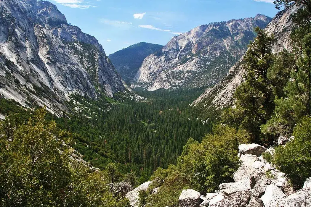
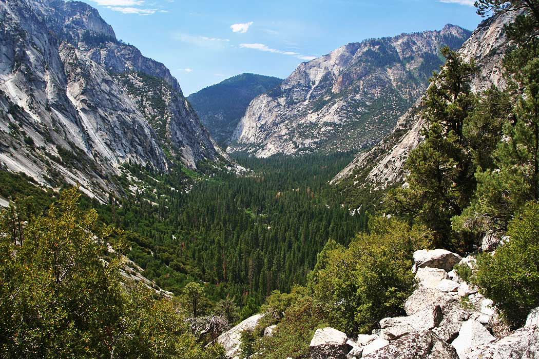
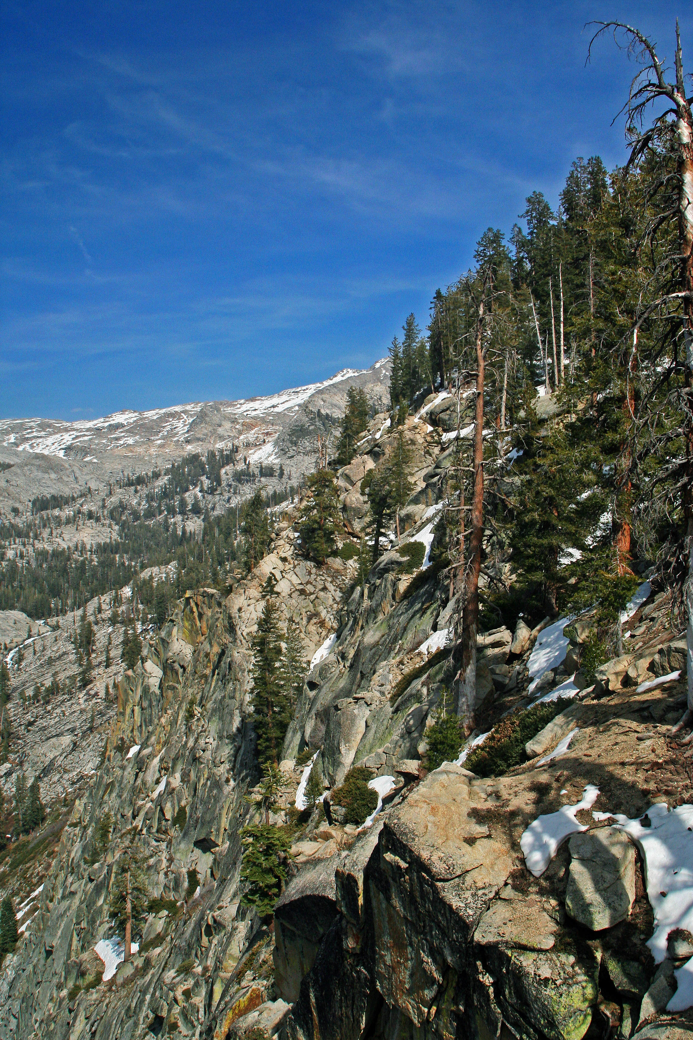
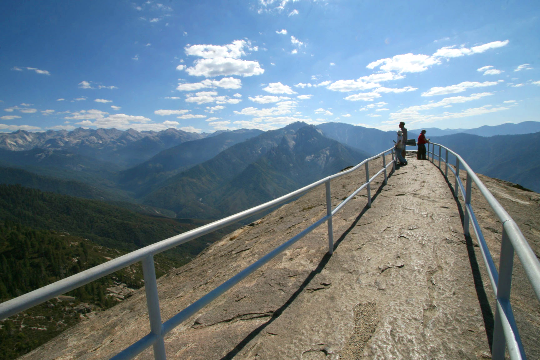
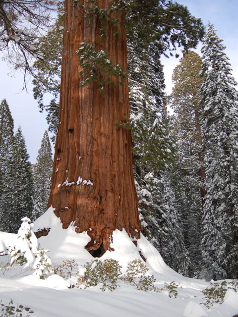
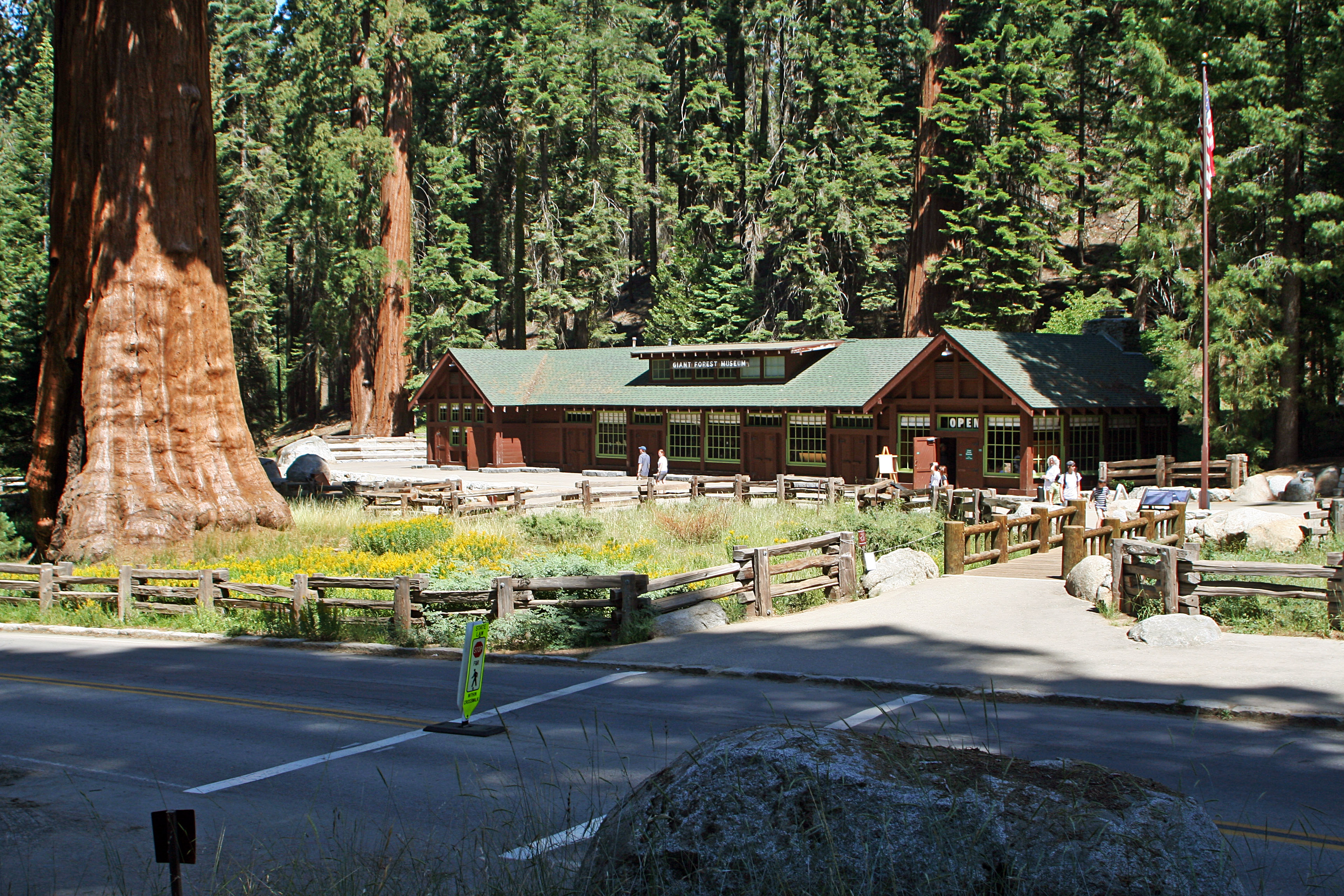
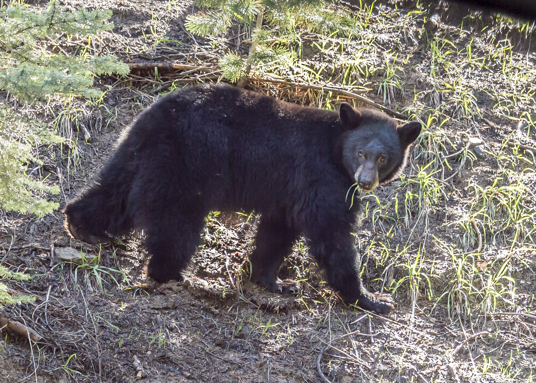

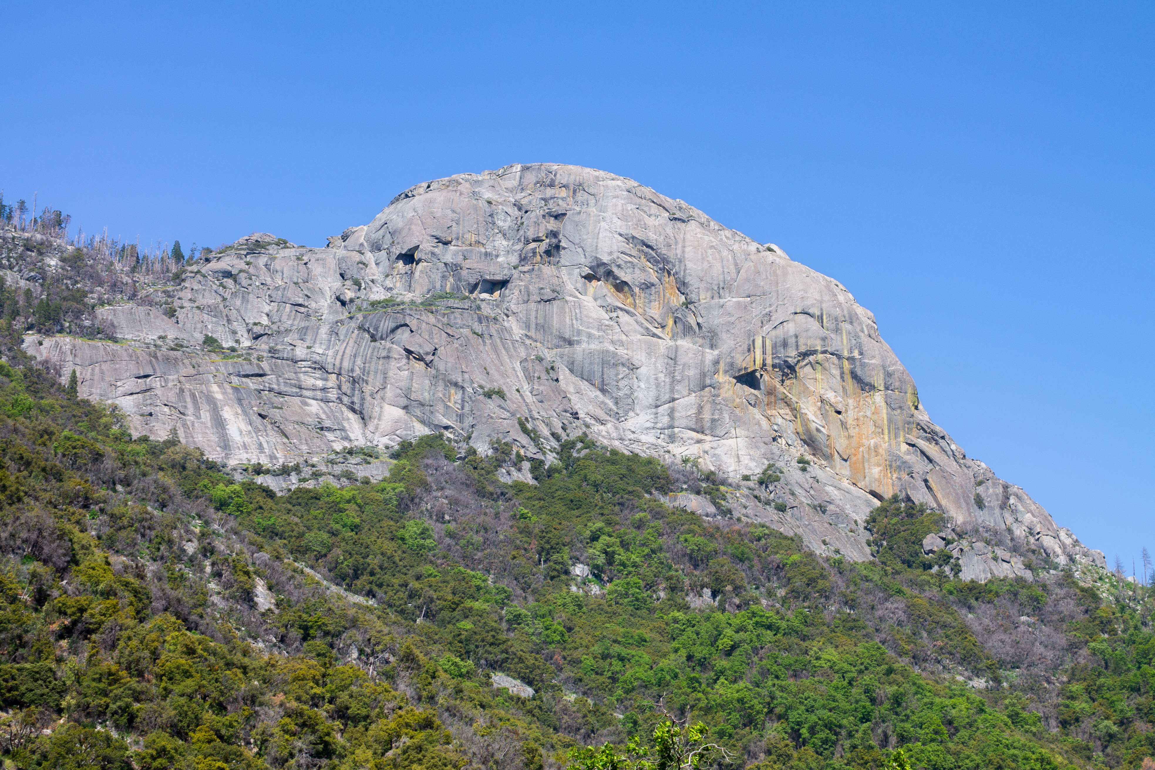
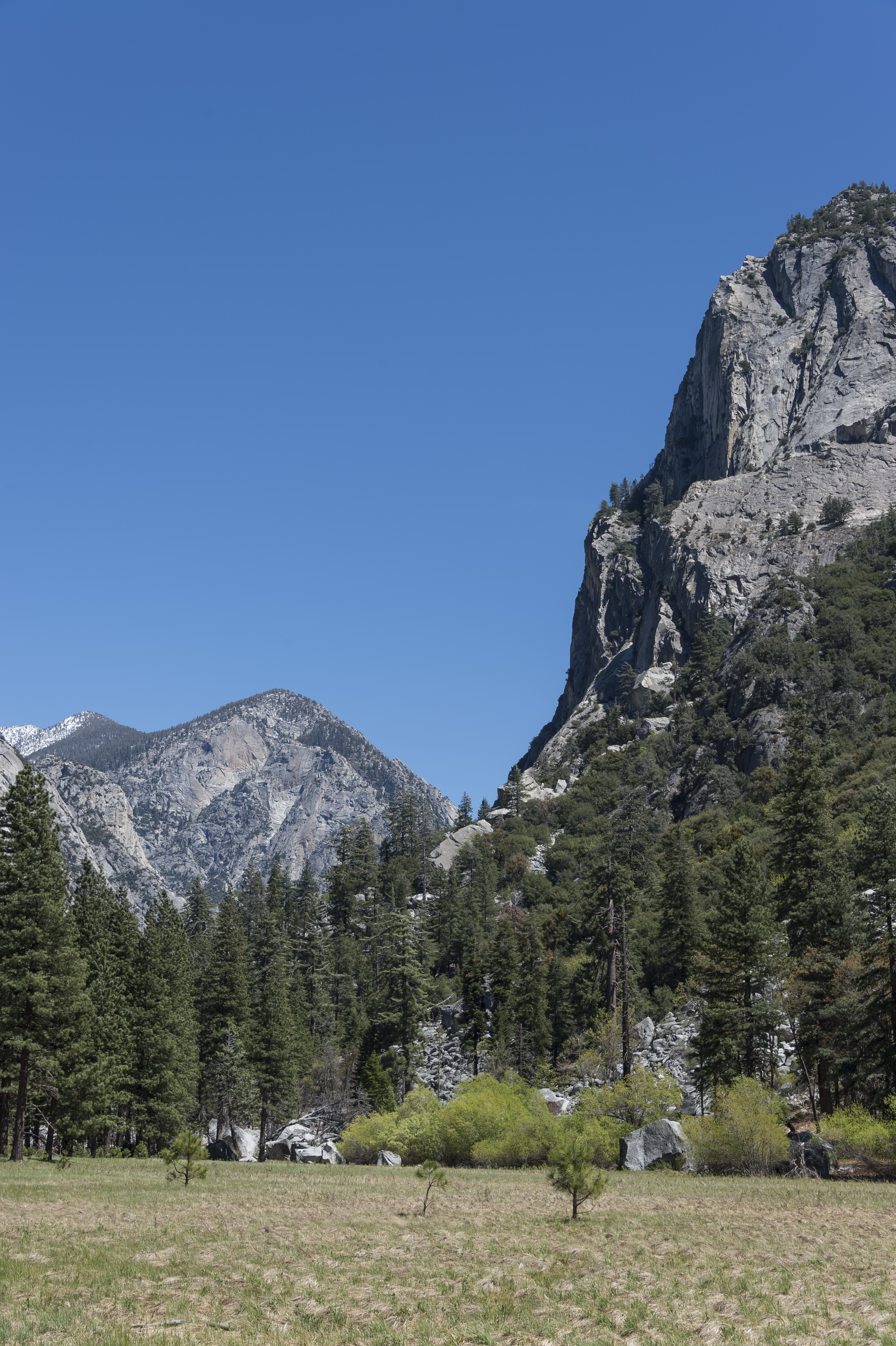

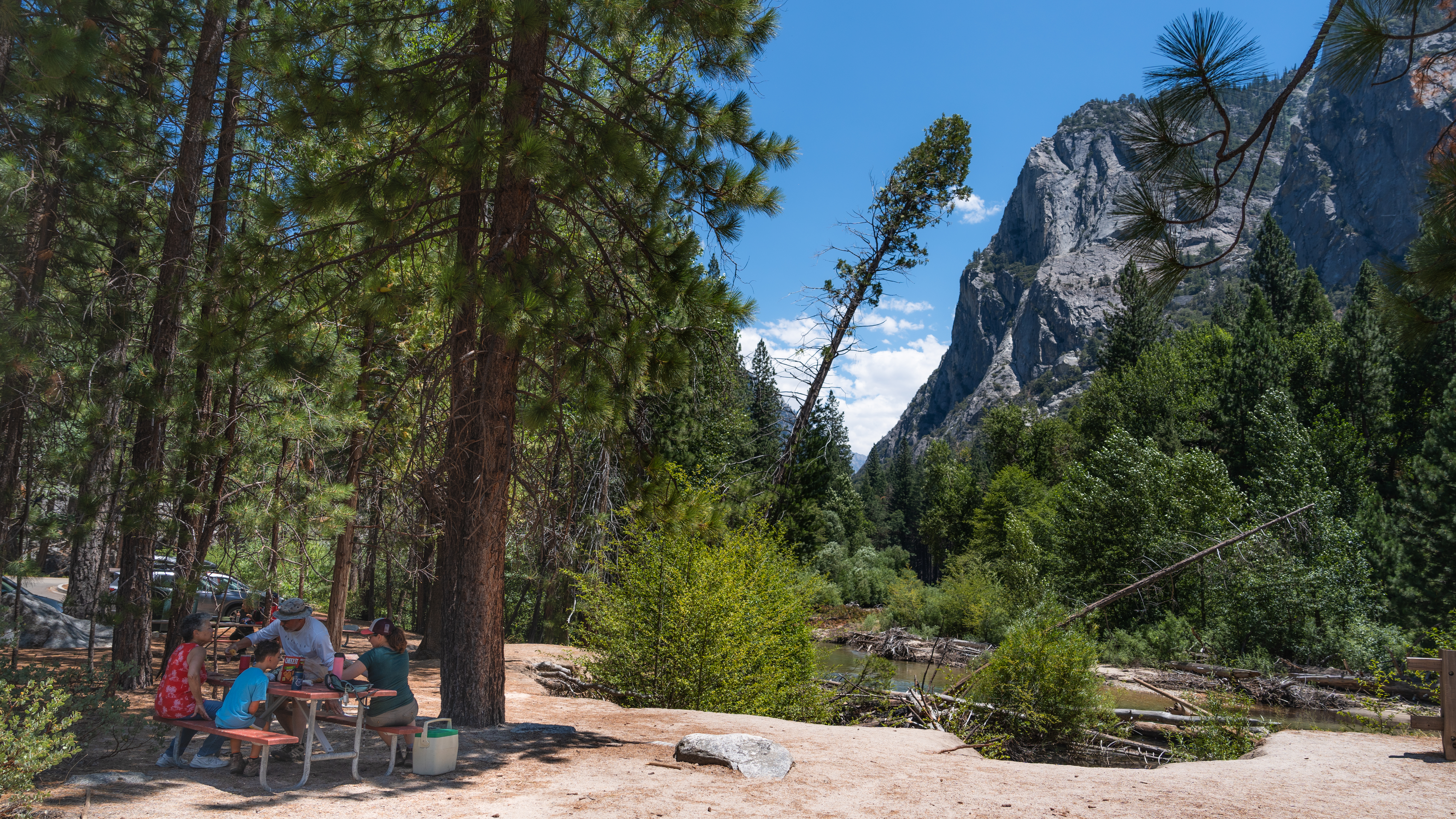

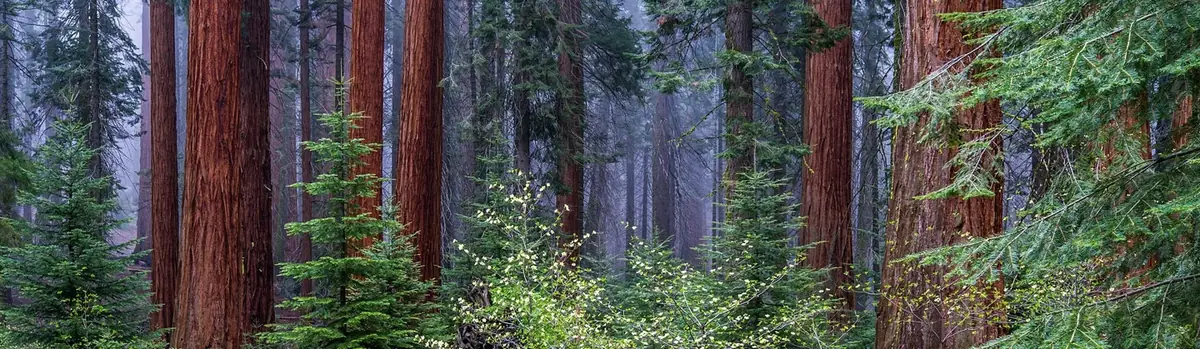 Forests