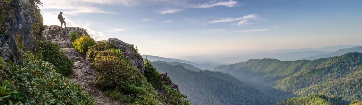
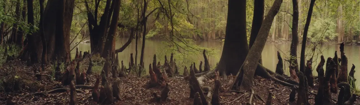
Just 75 miles from the bustle of Washington, DC, Shenandoah National Park is a land bursting with cascading waterfalls, spectacular vistas, fields of wildflowers, and quiet wooded hollows. With over 200,000 acres of protected lands that are haven to deer, songbirds, and black bear, there's so much to explore...and your journey begins right here!
200.4Kacres of parkland
1.7Mrecreation visits, 2025
May · Sep · Octnearby climate picks
Seasonal access & reservations
No reviewed guidance for this selection. Check the park's official planning pages; missing coverage does not establish access.
Selected guidance only; separate from climate comfort and current conditions.
Official conditions Not checked
The conditions feed has not been connected for this park.
Editorial recommendations, reviewed 2026-10-17. Full park days, excluding travel to and from the region. A first-visit outline for a general traveler; adapt to mobility, fitness, season, reservations, and current conditions. These are suggested days, not reserved activities or guaranteed routes.
Inclement weather may necessitate closure of Skyline Drive at any time. The park's phone line will no longer be updated. Subscribe to Shenandoah's alert system by texting SHENALERTS to 888777 to receive updates as they occur. Additionally, please check the park's Alerts & Conditions for information that may affect your visit.
NPS/Shenandoah National Park
FIND OUT MORE...
Directions to Shenandoah
Operating Hours & Seasons
Skyline Drive in the Winter
History of Skyline Drive
The Skyline Drive runs 105 miles north and south along the crest of the Blue Ridge Mountains in Shenandoah National Park and is the only public road through the Park. It takes about three hours to travel the entire length of the Park on a clear day. Skyline Drive is generally open 24 hours a day / 7 days a week. If it's closed due to inclement weather, you may still enter the Park on foot at one of the entrance stations or from one of the boundary access points .
Entering the Park on Skyline Drive
You can enter Shenandoah with your vehicle at only four places along Skyline Drive:
Front Royal Entrance Station (mile 0) by Rt. 66 and 340 in Front Royal, Virginia.
Thornton Gap Entrance Station (mile 31.5) by Rt. 211 near Luray, Virginia.
Swift Run Gap Entrance Station (mile 65.5) by Rt. 33 near Elkton, Virginia.
Rockfish Gap Entrance Station (mile 104.6) by Rt. 64 and Rt. 250 (also the northern entrance to the Blue Ridge Parkway ).
Don't rely on GPS to navigate to Shenandoah National Park, as it can be incorrect. Instead, follow these directions to each entrance station.
As you travel along Skyline Drive you will notice mileposts on the west side of the road (right side if you are traveling south, left if you are heading north). These cement posts help you find your way through the Park and help you locate areas of interest. The miles begin at 0 in Front Royal and continue to 105 at the southern end of the Park. The largest developed area, Big Meadows, is near the center of the Park, at mile 51. All Park maps and information use these mileposts as a reference.
The speed limit is 35 mph in most places, so feel free to roll down your windows, feel the breeze, and experience every curve and turn of this beautiful drive. Deer, black bear, wild turkey, and a host of other woodland animals call Shenandoah home and regularly cross Skyline Drive in their daily travels. Watch carefully for these animals who may dart across your path without warning. If you want a closer look, be sure to pull completely off the road and stay in your vehicle.
Gas and Electric Vehicle Charging Stations
Options are limited for filling up your car, so be sure to plan accordingly. Find out more information about gas and charging stations .
RVs, Campers, and Horse Trailers
Be sure you will clear Marys Rock Tunnel (mile 32.2), with a maximum clearance of 12'8". This is the measured clearance for both lanes of the road. RVs, camping trailers, and horse trailers are welcome, but be prepared to shift into low gear.when going downhill.
Shenandoah offers some of the best hiking in the country, but with over 500 miles of trails to choose from, it can seem a little overwhelming if you don't know where to start. Here you'll find everything you need to know before your adventure begins, whether it's a quick walk through the woods or an extended backcountry camping trip.
Visitors who wish to overnight in Shenandoah’s backcountry must purchase a permit through Recreation.gov. The previous system of obtaining a paper permit through the park’s website or at designated locations in the park is no longer in effect.
Shenandoah National Park has 196,000+ acres of backcountry and wilderness and over 500 miles of trails to explore. Backcountry camping is, by its very nature, a primitive experience that allows you to immerse yourself in the beauty and challenge of Shenandoah's wild side. Before you head out on your trip, however, be sure that you understand all of the information below so that you'll be prepared to safely discover a brand new world beyond the pavement!
In-person ranger programs are typically offered in the spring, summer, and fall. Check visitor centers for a schedule of programs .
Virtual Ranger Programs
Can't make it to Shenandoah? We've got you covered. You can still follow a Park Ranger as they teach you about a variety of topics in our series of virtual ranger programs designed to give you the full ranger program experience from wherever you are in the world.
Rapidan Camp Tours
Rapidan Camp is the former summer retreat of President Herbert and First Lady Lou Henry Hoover. Tours are typically offered in the spring, summer, and fall. If you can't attend in person, check out our virtual tours of the Brown House and the Prime Minister's Cabin . You can also hike to Rapidan Camp following a r ecommended day hike to explore the grounds at this historic landmark. Our app includes a self-guided tour and there are numerous interpretive signs describing the camp and its significance.
Visiting an exhibit is a great way to learn more about why Shenandoah National Park is such a special place. From the history of the Park to the natural history of its ecosystem, there is plenty to discover through a variety of fun, interactive, and informative displays. If you can't visit in person, you can still experience many of our exhibits through virtual tours which allow you to explore them from the comfort of your own home!
Dickey Ridge Visitor Center (mile 4.6)
Dickey Ridge Visitor Center has both a movie and an interactive exhibit designed to introduce you to the Shenandoah experience. There's a large interactive topographic map and lots of information about what you're likely to see in the Park.
Massanutten Lodge (mile 41.7)
Massanutten Lodge was the home of Addie Nairn Pollock, co-owner of Skyland Resort. The lodge's living room has been historically refurnished. The lodge also houses an exhibit, "The Women of Skyland", which documents the lives of several women who frequented the resort in the Roaring 20s. Although from very different backgrounds, they all held in common the need to reach beyond many of the social barriers of the time. Massanutten Lodge is open to visitors during specific hours, as denoted on the ranger program schedule .
Byrd Visitor Center (mile 51)
These exhibits tell the stories of Shenandoah's establishment and development, including the controversial acquisition of privately owned land, the work of the Civilian Conservation Corps, and the little-known story of desegregation in the 1930s and 40s. As each decade has unfolded, Shenandoah's landscape has changed in reflection of Americans' values. This exhibit chronicles those changes and seeks to involve you in the future of Shenandoah.
Rapidan Camp (mile 51)
The Brown House Virtual Tour | Prime Minister's Cabin Virtual Tour
Rapidan Camp is the former summer retreat of President Herbert and First Lady Lou Henry Hoover. The President's House has been historically refurnished and The Prime Minister's cabin houses an exhibit. The exhibit explains the Hoovers' choice of a vacation home and tells the story of their tumultuous presidency. The exhibits are open intermittently. During the summer and fall there are scheduled tours of Rapidan, starting with a shuttle ride from Byrd Visitor Center. You may also choose to hike to Rapidan Camp by following one of our recommended day hikes .
It can be hard to believe that a safe distance is as much about the animal’s welfare as it is about yours, but it’s true. Getting too close, feeding, and touching are all things that can put you and your furry, feathered, or scaled counterpart in grave danger. While Shenandoah National Park is a conscientious partner for visitors, it also remains continuously committed to the protection and preservation of nature and wildlife. The good news: it's easy to keep a safe distance from wildlife while still being able to get a great view of them or capture that perfect shot!
Viewing Wildlife
Stay at least 75 feet (23 meters), or about two bus-lengths away from all wildlife. Keep at least 150 feet (46 meters), or about four bus-lengths away from black bears. If wildlife approaches you, it's your responsibility to back away and maintain that safe distance.
Use binoculars or a spotting scope for a safe, close-up view.
Calling, whistling or making noises of any kind to attract wildlife is illegal. Do not do anything that changes the natural behavior of wildlife.
Pull safely and completely off the road, making sure that all four wheels are off the road on a safe shoulder. Use your car as an enclosure for viewing from a distance.
Finding Wildlife
Wildlife is usually more active at dawn or dusk, so time your outings for a better chance of seeing animals out and about.
Look at the edges of the landscape (e.g. where forest trees meet a grassy area).
Stay quiet and still. Noise and quick movements can scare wildlife away.
Photographing Wildlife
Use your camera's zoom or a telephoto lens to get a close-up while still maintining a proper distance from wildlife.
Watch wildlife with your eyes rather than through your viewfinder/screen as you move. It’s easy to miss things in your surroundings when you’re only focused on what you can see on your screen or viewfinder.
For better photos from a distance, line up the horizon of the landscape along the lower third of your frame and line up the animal(s) to one of the four intersection points.
Mountain bikes, road bikes, and e-bikes (all classifications) are permitted along Skyline Drive and on all paved areas in Shenandoah National Park. Biking is also permitted on Rapidan Fire Road, a gravel road in the Big Meadows area, for approximately one mile, where a sign will indicate the turnaround point.
Where Bikes Are Not Allowed
Biking is not permitted on trails, grassy areas, or unpaved roads, with the exception of Rapidan Fire Road (mentioned above).
Biking Regulations
Bicyclists should review Virginia laws pertaining to bike lights , as well as Virginia laws about bike brakes . These regulations are also applicable in Shenandoah National Park. Skyline Drive is a two-lane road with steep hills, numerous blind curves, and frequent heavy fog. Cyclists are urged to be aware of wildlife and heavy traffic, particularly in the fall. Please use extreme caution and observe the following tips:
Ride single file at all times. Despite recent changes to laws in Virginia, federal regulations require bicyclists to ride single file at all times in Shenandoah National Park.
Move to the right side of the lane as safety permits to allow motorists to pass.
When several vehicles are behind you, pull over to allow them to pass.
When in a group, adjust spacing so passing vehicles have room to return to their lane.
Be visible and ride predictably.
Bike Repair Stations
Several bike repair stations are available for your use throughout the Park.
Shenandoah National Park contains over 90 mountain streams and their minor tributaries that serve as high quality sources for three of Virginia’s ten major drainages: Potomac, Rappahannock, and James. Over 70 of those streams contain fish, and most of those 70 contain native brook trout. Shenandoah’s streams support diverse aquatic resources including 40 fish species and hundreds of species of aquatic insects. Shenandoah National Park relies on natural fish spawning for our populations. No fish are stocked, and all fish are wild. Monitoring and protecting water quality and aquatic life is an essential part of the Park’s stewardship mission. Visitors who enjoy recreational fishing are also an important part of that mission.
Shenandoah’s Fishery Management Plan has two objectives: (1) to preserve and perpetuate native brook trout as a key component of the Park’s aquatic ecosystems; and (2) to allow for recreational fishing on those Park streams that consistently produce adequate numbers of gamefish for maintaining population stability. Park Service Regulations and Shenandoah National Park policies are designed to achieve these objectives. We want you, and those who come after you, to have an enjoyable time fishing in Shenandoah. Please take some time to explore, learn what the park has to offer, and learn your responsibilities before casting a line or flicking a fly into the water. The following regulations provide recreational opportunities and protect Shenandoah’s aquatic resources so that future generations can enjoy the challenge of fishing in Shenandoah National Park.
Anglers 16 years of age and older are required to possess a valid Virginia State fishing license. A state trout license is not needed and there is not a separate park-issued permit required to fish within Shenandoah National Park.
Virginia has “Resident” and “Non-Resident” licenses, as well as five-day or one-year licenses of each. There are several licensing exceptions declared by Virginia Department of Wildlife Resources:
Resident, active-duty members of the armed forces while on official leave. They must have a copy of their Military Orders in their possession.
Legally blind persons.
Any Indian who “habitually” resides on an Indian reservation or a member of the Virginia-recognized tribes who resides in the Commonwealth is not required to have a freshwater license; however, such Indian must have on his person an identification card or paper signed by the chief of his tribe, a valid tribal identification card, written confirmation through a central tribal registry, or certificate from a tribal office.
Any person not fishing but aiding a disabled license holder.
Visit Virginia Department of Wildlife Resources for more information on state fishing regulations and licenses. Fishing licenses can be purchased online .
Shenandoah National Park Fishing Regulations
All Park streams are open to catch and release fishing. Fishing regulations are established by 36 CFR 2.3 and by the Park Superintendent’s Compendium, and all nonconflicting Commonwealth of Virginia regulations apply.
The following activities are prohibited:
Fishing in waters within the Park boundary by means other than an artificial lure having one single point hook. Multiple single hook lures (such as dropper flies) fished in a series are permitted.
Fishing while in possession of organic bait, including but not limited to: corn, cheese, dough compounds, worms, insects, live or dead minnows, amphibians, preserved or non-preserved fish eggs, and chemical compounds (pheromones, liquid scents, power baits, etc.).
Possessing or failing to return immediately and release any fish, unless otherwise noted in this section, caught in the waters within the boundary of Shenandoah National Park except for the following waters and their tributaries where harvesting is permitted :
Piney River, Rappahannock County
Thornton River, South Fork, Rappahannock County
Hughes River, Madison County
Brokenback Run, Madison County
Cedar Run, Madison County
Rose River, Madison County
Whiteoak Canyon Run, Madison County
Jeremys Run, Page County
Hawksbill Creek (East), Page County
Hawksbill Creek (Little), Page County
Naked Creek (East), Page County
Naked Creek (West), Page County
South River, Greene County
Ivy Creek, Greene County
Conway River, Madison/Greene Counties
Big Run, Rockingham County
Doyles River, Albemarle County
Possessing brown trout or rainbow trout less than seven (7) inches in length while fishing within the park boundary.
Releasing any captured brown or rainbow trout back into any park stream. Brown trout or rainbow trout less than the 7-inch minimum or caught in streams closed to harvest must be disposed of in a manner and location as not to be visible from any stream, park road or trail.
Snagging fish by pulling or jerking a hook, lure, or other implement through the water.
Fishing with more than one line per person.
Please be sure to also review the National Park Service regulations before going on your trip.
Fish Consumption Advisories in National Park Waters
The Environmental Protection Agency, states, territories, and tribes provide advice on fish and shellfish caught in the waters in their jurisdiction to help people make informed decisions about eating fish. Advisories are recommendations to limit your consumption of, or avoid eating entirely, certain species of fish or shellfish from specific bodies of water due to chemical or biological contamination. Fish is part of a healthy balanced diet, but eating wild fish and shellfish caught in park waters is not risk free. Parks are “islands”, but the much larger “ocean” that surrounds them affects the natural resources inside a park. Other aquatic toxins are the result of natural biological processes. Also, chemical contaminants that originate outside of park boundaries can come into parks. Mercury is an example of a toxin originating outside a park that can find its way into a park. Mercury exists naturally in some rocks, including coal. When power plants burn coal, mercury can travel in the air long distances before falling to the ground, usually in low concentrations. Once on the ground, microorganisms can change this elementalmercury to methyl mercury. This type of mercury can build up in animal tissues, and it can increase in concentration to harmful levels. This high concentration can occur in large predatory fish - those often pursued and eaten by anglers. Studies have shown that fish in some National Park System waters have mercury levels that may be a concern to people who regularly eat a lot of fish.
Shenandoah National Park Fish Consumption Advisories
No streams in Shenandoah National Park are listed by the state of Virginia for fish consumption advisories. More information on Virginia’s advisories can be found at the Virginia Department of Health . To learn more about this topic, the National Park Service maintains information about Fish Consumption Advisories and mercury and toxins in nature.
Aquatic Invasive Species
Many people are aware of the environmental harm that can occur when invasive exotic plants or animals are introduced into new areas. Invasive organisms can cause widespread damage by outcompeting native species or altering ecosystem processes. Most visitors to the park understand that exotic insects and plants have had negative impacts on forests in Shenandoah. Fewer people recognize the potential impact of aquatic invasives. In aquatic ecosystems, evidence suggests that many invasive organisms have expanded their ranges as people have transported contaminated equipment (e.g. boats, fishing waders and boots, etc.) between water bodies. What would happen to our streams if an invasive algae like Didymosphenia geminate (commonly referred to as Didymo) took over major portions of the stream bed and displaced native algaes, benthic invertebrates and fish that depend on that habitat? What about the introduction of Viral Hemorrhagic Septicemia, an exotic fish virus, that has been blamed for massive fish kills in the Great Lakes? Many exotic aquatic organisms can be found within close proximity to Shenandoah National Park and the park is certainly interested in preventing their introduction into its relatively pristine waters. Within 100 miles of Shenandoah, didymo, an algae that likes cold waters and produces nuisance blooms, has invaded eight trout streams. Asian clams are present in two streams within the park and are found outside the boundary in most watersheds. New Zealand mud snails and Viral Hemorrhagic Septicemia are a short seven hour drive away and are on our watch list as well. Once these organisms arrive, management options are limited. Typically, there is no way to remove them from the aquatic system once they are established. For these reasons, preventative measu
How You Can Help Stop Aquatic Hitchhikers
The most likely vector for invasive organisms entering Shenandoah National Park is by catching a ride from another water body on visitor gear, clothing, or even pets. Felt-soled waders or wading boots are often blamed for transferring these and other invaders, and some states have responded by restricting the use of felt-soled waders. If you use your gear in streams or lakes outside of Shenandoah, please clean or dry it well before entering a park stream. Better yet, clean and dry your equipment between every outing wherever you are! Before coming to the park, clean all gear and equipment by:
REMOVING debris and strands of alga from your gear
CLEANING all gear in 2.5-5.0% solution of household bleach and hot water for 10 minutes. Hard to remove debris should be scrubbed with a biodegradable detergent.
DRYING all gear to touch, and then continue drying time for at least 48 more hours.Please use only clean, thoroughly dried gear and equipment
Fishing Throughout the National Park Service
We invite you to visit the Fish and Fishing website for more information about fish and fishing in the National Park Service. You will learn about conservation, different fish species, aquatic invasive species, and parks that offer fishing.
When you come home at night and flip on the lamp switch, do you ever stop to think about what you might be missing? In 1880, less than 150 years ago, electric light first came to American cities. In 2017, roughly 80% of people in North America cannot see the Milky Way due to electric lights at night. In other words, our dark night skies often really aren’t all that dark. When was the last time you were able to experience the awe of seeing a sky full of stars? It can be easy to feel disconnected from, or simply forget about, the beauty and sheer vastness of the cosmos. The National Park Service recognizes dark night skies as a valuable resource that needs to be protected. While Shenandoah National Park may not get as dark as some of the Parks out in the west or northern United States , its high elevation, combined with its relative remoteness from dense urban areas, make the Park a great place to engage in stargazing on the east coast. On moonless and cloud-free nights it is a wonderful spot to view the Milky Way or some of the 2500 stars visible to the unaided eye that make up one of the 88 official constellations. Finding and observing constellations, phases of the moon, meteor showers, and eclipses can provide a sense of wonder about our place in the universe. Starting in 2016 Shenandoah National Park began a Night Sky Festival , full of ranger programs and activities to help celebrate our disappearing dark skies. Make sure to check back in early summer to find out our schedule for the year’s festival.
Tips for Stargazing
Here in Shenandoah, a good place for stargazing is by the Big Meadows area, near the Rapidan Fire Road. The amphitheater in the Skyland area is also appropriate. Most people are a bit uncomfortable in the dark. Try getting used to it by walking outside in a dark area while keeping your flashlight in your pocket.
Allow your eyes time to adjust; it takes about twenty minutes for your eyes to become accustomed to the nighttime darkness. You may be surprised how well you can see by starlight.
Make a red flashlight or use one with a red LED. To make your own, use red paper or cellophanes to cover the white light of the flashlight. Red light allows your eyes to adapt better to the darkness than white light while still providing visibility for safety.
Enjoying the night skies is for everyone, you don’t need expensive equipment! If you don’t have a telescope, grab your binoculars to get a better look the fuzzy spots in the sky overhead. Also, use the binoculars to gaze upon the Milky Way.
Educate yourself on the constellations overhead with the use of a star chart or a star finding app downloadable for your smartphone or tablet.
When venturing out to stargaze in the park make sure to bring a red flashlight to journey from your car to your destination. Be sure to dress in layers, as summer nights are often cool on the mountain ridge. Bring a blanket or a set of chairs to sit on.
Unnatural Night Light
The proliferation of development and associated installation of lights, without thought to the impact those lights have on the night sky, is ongoing. Lighting associated with advertising, building and street illumination, and grounds security all contribute to what is referred to as light pollution. One estimate indicates that about 30% of all light generated in the United States is wasted; costing billions of dollars. Outdoor lights provide many benefits but improved consideration of night sky concerns in their design and application is highly beneficial in reducing light pollution and the associated wasted energy.
In addition to interfering with our ability to see celestial bodies and astronomical events, light pollution has a detrimental environmental impact. Some believe that declines in moth populations are linked to attraction to lights and subsequent death. Nocturnal wildlife, especially prey, may be more vulnerable to predators at night if there is more artificial light. Many species of wildlife are influenced in their activities by star and moon light including s ome migratory bird species which depend on stars for navigation. Light pollution interferes with their travels, leading to disorientation and even death. The nocturnal creatures here in Shenandoah- owls, bats, and insects to name a few- benefit from the wide swath of forest that remains dark at night.
The National Park Service is concerned about our contribution to light pollution and has set policy that seeks to reduce or eliminate the adverse impacts of light pollution. In October of 2014, Shenandoah National Park, as part of the National Park Service’s Night Skies Program, undertook a study to review how we use outdoor lighting and consequently implemented suggestions to make it more efficient.
In most cases, improving night sky viewing opportunities involves reduction in light pollution so that people can see stars and planets above. Yet here at Shenandoah it’s also important to note that some of what would otherwise be regarded as light pollution is beautiful to people. Many park visitors stand at overlooks along Skyline Drive at night and view with warmth the twinkling lights of the small towns and communities in the Shenandoah Valley or the Virginia Piedmont. Oppositely, a visitor might look up at the Blue Ridge from the Valley and see only the dark strip of the Park, the silhouette of mountains blending into the evening sky, a reminder of a previous time before electricity.
Regardless of how you might experience the night, don’t forget on occasion to look up at the skies!
Northern Virginia Astronomy Club Richmond Astronomical Society Shenandoah Valley Stargazers University of Virginia Department of Astronomy International Dark-Sky Association Moore, C. 2003. Taking stock of night sky visibility. In The IMPROVE Newsletter, 3 rd Quarter, 2003. Air Resource Specialists, Inc., Fort Collins, Colorado. Albers, S. and D. Duriscoe. 2001. Modeling Light Pollution from Population Data and Implications for National Park Service Lands . In George Wright Forum, Vol 18, No. 4 pp. 56-68. Duriscoe, D.. 2001. Preserving Pristine Night Skies in National Parks and the Wilderness Ethic . In George Wright Forum, Vol. 18 No. 4 pp. 30 – 36. Harder, B. 2004. Degraded Darkness . In Conservation in Practice, Vol. 5 No. 2 pp. 21 – 27.
Moore, C. 2003. Taking stock of night sky visibility. In The IMPROVE Newsletter, 3 rd Quarter, 2003. Air Resource Specialists, Inc., Fort Collins, Colorado.
Albers, S. and D. Duriscoe. 2001. Modeling Light Pollution from Population Data and Implications for National Park Service Lands . In George Wright Forum, Vol 18, No. 4 pp. 56-68.
Duriscoe, D.. 2001. Preserving Pristine Night Skies in National Parks and the Wilderness Ethic . In George Wright Forum, Vol. 18 No. 4 pp. 30 – 36.
Harder, B. 2004. Degraded Darkness . In Conservation in Practice, Vol. 5 No. 2 pp. 21 – 27.
February 16 th | Fee Free: President's Day | All National Parks
April 25 th | Junior Ranger Day | Shenandoah National Park
May 2 nd -3 rd | Wildflower Weekend | Shenandoah National Park May 25 th | Fee Free: Memorial Day | All National Parks
June 14 th | Fee Free: Flag Day/President Trump's birthday | All National Parks
July 3 rd | Shenandoah's 90th Anniversary | Shenandoah National Park July 3 rd -5 th | Fee Free: Independence Day Weekend | All National Parks
August 22 nd | Shenandoah Junior Ranger Day | Shenandoah National Park August 22 nd | Youth Wildflower Art Contest Winners' Ceremony | Shenandoah National Park August 22 nd -30 th | National Park Week | All National Parks August 30 th | National Junior Ranger Day | All National Parks August 25 th | Fee Free: 110 th Birthday of the National Park Service | All National Parks
September 17 th | Fee Free: Constitution Day | All National Parks September 25 th -26 th | Art in the Park: Scenes from Shenandoah | Shenandoah National Park
October 27 th | Fee Free: Theodore Roosevelt's birthday | All National Parks
November 11 th | Fee Free: Veterans Day | All National Parks
Shenandoah National Park is one of the coolest places in the world to explore—we have tree-climbing bears, talking birds, pole-vaulting insects, and rock-eating plants! You can discover all of these epic wonders while you're getting sworn in as an official Junior Ranger, hiking one of the many kid-friendly trails, learning from a park ranger during a ranger program, or completing the activity guide at one of our three TRACK Trails. Also, if you're a fourth grader, you and your family can get free access to hundreds of parks, lands, and waters for the entire year by participating in the Every Kid Outdoors program. So, what are you waiting for?!? For a virtual experience try watching our Virtual Jr. Ranger Videos !
Official NPS features and USGS park boundaries, imported 2026-10-17. An inventory snapshot, not live trail or parking availability.
Loading official park features…
TrailsPoints of interestParkingZoom with buttons or pinch. Toggle layers on the map.
Map coverage varies. Trail names may represent segments, connectors, or shared park units; mapped lines are not a hiking recommendation. Use official conditions and navigation resources before heading out.
NPS public GIS inventory, imported 2026-10-17. “Existing” is an inventory classification, not confirmation that a trail is open. Segment counts are not route distances. Parking records do not indicate space availability, fees, or accessibility certification. View government source ↗
Climate for Culpeper, 31 km from the park reference point. 1991–2020 normals. Source elevation: 126 m.
Daytime highNighttime lowOctober: 68° / 48°
Daytime high68°
Precipitation82 mm
Daylight11.0 hrs
Wind9.0 km/h
Mountain, rim, valley, and coastal conditions can differ sharply from the source town. Check park forecasts and current conditions before travel.
Monthly climate data 12 months · °F
Month
High
Low
Rain / snow water
Wet days
Daylight
44°
28°
75 mm
8.2
9.6 h
47°
29°
68 mm
8.1
10.5 h
56°
37°
96 mm
10.0
11.7 h
67°
47°
87 mm
9.9
13.0 h
75°
56°
93 mm
11.3
14.1 h
83°
65°
89 mm
11.4
14.6 h
87°
69°
89 mm
11.3
14.4 h
85°
67°
78 mm
9.8
13.5 h
79°
60°
111 mm
9.2
12.3 h
68°
48°
82 mm
7.6
11.0 h
56°
38°
75 mm
7.4
9.9 h
47°
32°
84 mm
8.5
9.4 h
RESEARCH WITH THE SOURCE IN VIEW
The practical field guide.
Official NPS excerpts imported 2026-10-17. Fees, permits, road access, and operations can change; use the source link to confirm the latest information.
Cell coverage is not reliable in Shenandoah National Park, however, it is generally available at Dickey Ridge Visitor Center and at some west-facing overlooks. Free, public WiFi is available at Byrd Visitor Center, Big Meadows Lodge and Skyland Resort.
Visitors who wish to overnight in Shenandoah’s backcountry must purchase a permit through Recreation.gov. The previous system of obtaining a paper permit through the park’s website or at designated locations in the park is no longer in effect.
Shenandoah National Park has 196,000+ acres of backcountry and wilderness and over 500 miles of trails to explore. Backcountry camping is, by its very nature, a primitive experience that allows you to immerse yourself in the beauty and challenge of Shenandoah's wild side. Before you head out on your trip, however, be sure that you understand all of the information below so that you'll be prepared to safely discover a brand new world beyond the pavement!
Restrooms and Buildings - Most restrooms and buildings are accessible, or accessible with assistance.
Lodging - Accessible overnight lodging is available at Lewis Mountain, Skyland Resort, and Big Meadows Lodge.
Picnic Grounds and Campgrounds - Accessible sites are available at all park picnic grounds and campgrounds . Accessible shower and laundry facilities are available at Big Meadows, Lewis Mountain, and Loft Mountain Campgrounds. Restrooms at all picnic grounds are accessible, or accessible with assistance. Skyline Drive Overlooks - The majority of overlooks along Skyline Drive have an accessible parking area for visitors to take in the spectacular views from their vehicle.
Service Animals
In accordance to National Park Service guidance on service animals , dogs are the only animals that can be classified as service animals, and they must perform a specific task that assists a person with a disability. If the service dog meets this criteria, they are legally permitted anywhere that visitors can go. Owners are strongly encouraged to identify their working service dog in order to help prevent unwarranted complaints from other visitors. If you bag your service dog's waste, be sure to have a bag or canister to put it in until you can find a trash can. Do not leave dog waste bags in trees, on trail posts, or discarded in the woods. If there’s no trash can immediately available, take it with you until you find one.
Visitor Services
Park Brochure - The Park brochure is available in braille at entrance stations and visitor centers. You can also download the brochure in Braille Ready Format (brf).
Ranger Programs - Many of Shenandoah's ranger-led programs are accessible, as indicated on the ranger program schedule .
National Park Service Mobile App - The mobile app offers a fully accessible experience with tools to benefit visitors with accessibility needs, such as audio descriptions of exhibits along trails and roads and in visitor centers.
Assistive Listening Devices - Assistive listening devices are available for loan at both visitor centers for ranger programs and park films. Please visit the information desk for assistance. Audio description is available for exhibits through the National Park Service app.
Virtual Tours - Many of our exhibits and visitor centers are available as virtual tours , which can be viewed from anywhere.
Limberlost Trail - Limberlost Trail is a fully-accessible circuit hike that passes through a beautiful section of forest. Since 1996, several organizations have donated labor, equipment, supplies, and funding to help Shenandoah staff make the trail accessible.
All-terrain Wheelchairs and Accessibility Hiking Carts - All-terrain wheelchairs and accessibility hiking carts are permitted anywhere foot travel is allowed, including trails and wilderness. Any device "designed solely for use by a mobility-impaired person for locomotion, that is suitable for use in an indoor pedestrian area," is permitted.
How can I reserve an accessibility hiking cart? - Please contact Community Gear Library by sending an email to communitygearlibrary@gmail.com for information about reserving an accessibility hiking cart at no cost.
80 percent of the money collected from entrance fees is used for projects that directly benefit visitors . The remaining 20 percent goes to parks that do not charge fees to help them with visitor services. Shenandoah has used fees to rehabilitate historic structures, preserve the health of the forest, and to hire temporary staff who improve trails and lead ranger programs. If you look around the park, you will see your fee dollars hard at work! Thank you for your support.
Key Information
Get an entrance pass All visitors must have one of these entrance passes: Pass Price Standard Pass $15.00–$30.00 Annual Pass $55.00 America the Beautiful Pass (includes Senior Passes) FREE–$250.00 Help me choose an entrance pass
Plan to go cashless This park does not accept cash.
Choosing an Entrance Pass
Do you have or qualify for a discounted America the Beautiful Pass?
If you already have an America the Beautiful—the National Parks and Federal Recreational Lands Pass, that's the only entrance pass you need. Seniors, military, visitors with a permanent disability, and families with a 4th grader are eligible for a free or discounted America the Beautiful pass.
America the Beautiful Pass
How often do you plan to visit national parks in the next 12 months?
If you don't qualify for a discounted America the Beautiful pass, we recommend choosing an entrance pass based on your trip plans.
Entrance Passes
Annual passes are good for one year and cover your entrance fee for Shenandoah.
Standard Entrance Pass
If you enter the park in a motorized vehicle, your entrance pass covers both you and your passengers. Your passengers do not need a separate pass.
Costs for vehicles with more than 15 passengers are listed below under Organizations and Businesses .
Private Vehicle $30.00
In-person Purchase Locations
North Entrance Credit/Debit Only
Swift Run Entrance Credit/Debit Only
Thornton Gap Entrance Credit/Debit Only
Rockfish Gap Entrance Credit/Debit Only
Old Rag Mountain Credit/Debit Only
Whiteoak Canyon Falls Lower Trailhead Credit/Debit Only
Motorcycle $25.00
For Individuals without a Vehicle
If you enter the park on a bicycle or on foot and are at least 16 years old, you need your own entrance pass. Children under the age of 16 don't need an entrance pass.
Per Person $15.00
For Organizations & Businesses
Education/Academic Group $0.00
Commercial Sedan (1-6 seats) $35.00–$75.00
Commercial Van (7-15 seats) $75.00
Commercial Mini-bus (16-25 seats) $100.00
Commercial Motor Coach (26+ seats) $200.00
Non-commercial Group (16+ persons) $15.00
Annual Entrance - Park
Provides unlimited entry for one year to the pass holder and passengers in the same vehicle, not to exceed 4 total adults. Children under 16 are admitted for free and are not included in this total. Purchase online or at any of our entrance stations.
US citizens and residents
Mathews Arm Campground Credit/Debit Only
Loft Mountain Campground Credit/Debit Only
Big Meadows Campground Credit/Debit Only
America the Beautiful—the National Parks and Federal Recreational Lands Pass
Covers entrance fees and standard amenity (day-use) fees at lands managed by
National Park Service
US Fish & Wildlife Service
US Forest Service
Bureau of Land Management
Bureau of Reclamation
US Army of Corps of Engineers
Depending on the type of entrance fee charged at a site, covers One private vehicle fee or Four per person fees
America the Beautiful Passes are non-refundable, non-transferable and cannot be replaced if lost or stolen . Passholders must show valid photo identification (ID) with each pass.
How to Get an America the Beautiful Pass
Physical passes can be purchased or picked up at over 1,000 federal recreation sites.
Purchase and pickup locations
To receive your pass by mail, order online at the USGS Online Store . Online orders are for physical passes, not digital passes, and may take up to three weeks to be processed and delivered. Order receipts may not be used in place of a physical pass. We recommend ordering at least three weeks in advance of your visit, or picking up a pass in person instead.
Skip the wait! Get a Digital America the Beautiful Pass through recreation.gov. Your digital pass can be saved to a mobile device and used immediately.
Get a Digital America the Beautiful Pass
2026 Free Entrance Days in the National Parks
Come experience the national parks! All National Park Service sites that charge an entrance fee will offer free admission to US citizens and residents (other fees, including timed entry or reservation fees, may apply). Mark your calendar for these entrance fee-free dates:
February 16 : Presidents Day (Washington's Birthday)
May 25 : Memorial Day
June 14: Flag Day/President Trump's birthday
July 3–5: Independence Day weekend
August 25: 110th Birthday of the National Park Service
September 17: Constitution Day
October 27 : Theodore Roosevelt's birthday
November 11: Veterans Day
Old Rag Day-Use Ticket
Backcountry Camping Permit
Cashless Payments
Automated Entry Stations
In fall of 2026, Shenandoah National Park will begin installing automated entry stations at all four park entrances. Visitors can purchase standard 7-day entrance passes (vehicle, motorcycle, bicycle, and pedestrian) with a credit or debit card. Visitors who already have a pass or receipt can scan the barcode for gated entry. These stations are intended for use after hours when staff are not present. This simplifies the process of obtaining a pass for every visit to Shenandoah National Park, no matter when you enter. Questions? Visit the Automated Entry Station FAQs page for more information. The automated entry stations are funded by generous donations from the Shenandoah National Park Trust.
Cashless Transition
On July 1, 2025, Shenandoah National Park transitioned to a fully cashless fee system and accepts only mobile or electronic payments for entrance and campground fees. All park bookstores and concession facilities such as gift shops, lodging, waysides and restaurants accept cash. In addition to accepting debit and credit cards payments in-person, visitors can purchase entrance passes in advance on recreation.gov . Visitors who are only able to pay with cash may purchase a park pass from the following third-party vendors:
Bonobos Bakery , 1221 E Main St, Waynesboro, VA 22980
Front Royal/Warren County Visitors Center , 414 E Main St, Front Royal, VA 22630
Greene County Visitor Center , 9157 Seminole Trail, Ruckersville, VA 22968
Appalachian Trail Outfitters , 2 W Main St, Luray, VA 22835
The Corner Store , 3710 Sperryville Pike, Sperryville, VA 22740
The Little Country Store , 5338 S F T Valley Rd, Etlan, VA 22719
To learn more about cashless payments in Shenandoah National Park, please read our news release .
Pass
Price
Standard Pass
$15.00–$30.00
Annual Pass
$55.00
America the Beautiful Pass (includes Senior Passes)
FREE–$250.00
I'm visiting...
We recommend
This park, once
Standard Pass
This park, multiple times
Annual Pass
More than one national park or federal recreation site
America the Beautiful Pass
Type
Available to
Price
Resident Annual Pass
US citizens and residents
$80.00
Non-Resident Annual Pass
Non-US residents
$250.00
Senior Annual Pass
US citizens and residents 62+ years old
$20.00
Senior Lifetime Pass
US citizens and residents 62+ years old
$80.00
Military Annual Pass
Current US military and dependents
Free
Military Lifetime Pass
Gold Star Family members and veterans
Free
Access Pass
US citizens and residents with permanent disability
Free
4th Grade Pass
US 4th graders
Free
Volunteer Pass
Federal recreation site volunteers with 250 service hours
Free
Pass
Price
Standard Pass
$15.00–$30.00
Annual Pass
$55.00
America the Beautiful Pass (includes Senior Passes)
FREE–$250.00
I'm visiting...
We recommend
This park, once
Standard Pass
This park, multiple times
Annual Pass
More than one national park or federal recreation site
America the Beautiful Pass
Type
Available to
Price
Resident Annual Pass
US citizens and residents
$80.00
Non-Resident Annual Pass
Non-US residents
$250.00
Senior Annual Pass
US citizens and residents 62+ years old
$20.00
Senior Lifetime Pass
US citizens and residents 62+ years old
$80.00
Military Annual Pass
Current US military and dependents
Free
Military Lifetime Pass
Gold Star Family members and veterans
Free
Access Pass
US citizens and residents with permanent disability
Free
4th Grade Pass
US 4th graders
Free
Volunteer Pass
Federal recreation site volunteers with 250 service hours
Shenandoah National Park is located in the Blue Ridge Mountains of Virginia, just west of Washington, D.C. The Park stretches 105 miles from its northern entrance at Front Royal to its southern entrance near Waynesboro. There are four entrance stations to Shenandoah National Park, but only one has a physical address. Skyline Drive is the main road that runs the span of Shenandoah. The campgrounds, dining and lodging options, gift shops, and the majority of hiking trailheads are directly off of Skyline Drive. There are a select number of trails that start at the Park boundary, such as Old Rag Mountain and Whiteoak Canyon.
There are numerous gated service roads at the park's boundary. The public cannot enter the park via these routes. If you employ a GPS or internet-based mapping service, make sure that it is directing you to one of the four entrances listed below.
Entrance Stations
Front Royal (North Entrance) Near Front Royal, Virginia, off of Route 340 (also called Stonewall Jackson Highway). 21073 Skyline Drive, Front Royal, Virginia 22630 Thornton Gap East of Luray, Virginia and west of Sperryville, Virginia. Off of Highway 211 (also called Lee Highway). 31339 Skyline Drive, Luray, Virginia 22835 Swift Run Gap East of Elkton, Virginia off of US 33. 22591 Spotswood Trail, Elkton, Virginia 22827 Rockfish Gap (South Entrance) A few miles east of Waynesboro, Virginia off of Highway 250. 282 Skyline Drive, Waynesboro, Virginia 22980
Driving From Washington, D.C. Metro Area
To Front Royal Entrance Station (North Entrance) Travel west on I-66 to Front Royal, Virginia. Exit to Route 340 South, and follow signs for Shenandoah National Park and Skyline Drive. To Thornton Gap Entrance Station Travel west on I-66 to exit 43A. Take US-29 South to Warrenton, Virginia. Take US-211 West to Shenandoah National Park and Skyline Drive.
Driving From Richmond, Virginia
To Rockfish Gap Entrance Station (South Entrance) Travel west on I-64 to exit 99, and follow signs for Shenandoah National Park and Skyline Drive. To Swift Run Gap Entrance Station Travel west on I-64 to Charlottesville, Virginia. Take exit to US-29 North. Take left onto US-33 West, and follow 14 miles to Shenandoah National Park and Skyline Drive.
Driving From Pittsburgh, Pennsylvania
To Front Royal Entrance Station (North Entrance) Travel east on I-76 to exit 161. Take I-70 East to US-522 South. Follow VA-37 south to I-81 South. Follow I-81 South to I-66 East. Take I-66 East to Front Royal, Virginia, and follow signs to Shenandoah National Park and Skyline Drive.
Nearby Airports
Washington Dulles International (IAD) 56 miles east of Front Royal Entrance Station. Reagan National (DCA) 70 miles east of Front Royal Entrance Station. Shenandoah Valley Regional (SHD) 27 miles west of Swift Run Gap Entrance Station. Charlottesville-Albemarle (CHO) 31 miles east of Rockfish Gap Entrance Station.
Slips, trips and falls can happen at any time, but observing the following guidelines can minimize the likelihood of a serious injury while hiking in Shenandoah:
Watch your step and be prepared to turn around in dangerous settings such as a wet and slippery conditions, high-water crossings, or ice on the trail.
Never walk around the top of a waterfall - wet rocks are surprisingly slippery and many people have been injured, some fatally.
Be sure to always stay on Park-maintained trails.
Viewing Wildlife
Getting too close, feeding, and touching are all things that can put you and your furry, feathered, or scaled counterpart in grave danger. Keep these tips in mind for your next animal encounter:
Stay at least 75 feet (23 meters), or about two bus-lengths away from all wildlife. Keep at least 150 feet (46 meters), or about four bus-lengths away from black bears. If wildlife approaches you, it's your responsibility to back away and maintain that safe distance.
Use binoculars or a spotting scope for a safe, close-up view.
Calling, whistling or making noises of any kind to attract wildlife is illegal. Do not do anything that changes the natural behavior of wildlife.
Pull safely and completely off the road, making sure that all four wheels are off the road on a safe shoulder. Use your car as an enclosure for viewing from a distance.
Explore our Viewing & Photographing Wildlife page for tips for finding and photographing wildlife safely.
When visiting the Park, you may spot a bear while hiking, camping, or simply walking between your car and the lodge for dinner. If you do spot one:
Maintain your distance from the bear. Park regulations require at least 150 feet (50 yards) to safely view a bear.
Stay in your group and keep children close by you.
Make noise to make sure the bear knows that you are present. If a bear cannot tell what you are, it may come closer or stand on its hind legs to get a better look or smell. A standing bear is usually curious - not threatening. Jaw popping by the bear is a signal to you that it is uncomfortable.
Take a detour in your route of travel but be sure not surround the animal...give it plenty of room to escape.
If the bear moves closer to you, move away slowly but do not turn your back to the bear. If you have no escape route, stand tall, wave your arms, yell, and clap to deter the bear. Throwing rocks or objects at the bear may be appropriate but only when you are "cornered."
Bears are attracted to food and other scented items. Storing your food properly is one of the most important steps you can take to protect wildlife and help keep yourself safe. Read more about bear safety and how to report an inccident on our Bear Safety page.
Protecting Your Pet
First and formost, your pet must be on a physical leash no longer than 6 feet at all times . This is for their safety and yours during your adventure in Shenandoah. Remember that you are taking your pet into a different environment and that you are responsible for your pet. Do you have enough water for you and your pet? Does your pet have the endurance (and paw pads!) to hike the trail you have chosen? How will your pet react if you encounter a bear, a skunk, or a snake? If your pet becomes disabled on the trail, what will you do? With a little preparation, you and your pet can have an enjoyable trip to Shenandoah National Park. Learn more rules and regulations for your pet in Shenandoah on our pets page.
Hiking During Hunting Season
Lightning Storms
Prevention is the key! Check the weather ahead of time, and avoid high places during anticipated storms. If you find yourself out during a lightning storm, follow these tips:
Stay off of high, exposed places during lightning activity. If caught on a mountain top, descend as quickly/safely as possible.
If caught in a high, exposed place during lightning activity, keep feet together and balance on balls of feet (minimize body part contact with ground). Stand atop a large backpack with little or no metal objects if you have it with you.
Avoid metal objects. Ditch large metal objects and move far away from it.
Turn off electronic devices during lightning activity (cell phones, tablets, walkie-talkies, etc.)
Driving Skyline Drive
The speed limit is 35 mph in most places, and animals like deer, black bear, wild turkey, and a host of other woodland animals regularly cross Skyline Drive in their daily travels. Watch carefully for these animals who may dart across your path without warning. If you want to stop to view wildlife, be sure to pull completely off the road (all 4 wheels) and stay in your vehicle.
Driving Skyline Drive in the Winter
Skyline Drive remains open throughout the winter, unless it is closed due to snowy or icy conditions. Because of cold mountain temperatures, it can take diligent work crews several days to reopen Skyline Drive after winter storms. If the Drive is open, however, here are a few things to keep in mind when driving through the Park in the winter:
Be sure your gas tank is full before entering the Park. Fuel is available through self-pay at Big Meadows, but gas pumps can be unreliable.
Have warm clothing and/or blankets in case your vehicle becomes disabled. You may have to wait for assistance.
Weather conditions may require driving under the speed limit (35 miles per hour). There may be icy patches on shaded curves that otherwise appear dry.
Learn more about driving Skyline Drive on our webpage.
Shenandoah offers some of the best hiking in the country, but with over 500 miles of trails to choose from, it can seem a little overwhelming if you don't know where to start. Here you'll find everything you need to know before your adventure begins, whether it's a quick walk through the woods or an extended backcountry camping trip.
With over 500 miles of trails, choosing your next hike in Shenandoah can be a little daunting. Not to fear! We've put together trail maps with recommended day hikes for different areas of the Park. Print them out, or download the accessible PDFs to take with you on your mobile device. Note that all of these maps are intended for short, day hikes only. If you're planning a longer backcountry hike, we recommend purchasing a topographic map at one of our visitor centers or online from the Shenandoah National Park Association or the Potomac Appalachian Trail Club (PATC).
If you'd rather browse all of our trail maps, you can find the complete list here: Bearfence Area Big Meadows Area Compton Gap Area Dickey Ridge Area Hawksbill Area Keyser Run Area Loft Mountain Area Mathews Arm Area Old Rag Area Rapidan Camp Area Riprap Area Skyland Area South River Area Thornton Gap Area Whiteoak Canyon Area
This is the official guide to Shenandoah National Park. It contains a map of all of the available services and amenities in the Park, as well as an introduction on what this place is all about.
To download official maps in PDF, Illustrator, or Photoshop file formats, visit the National Park Service cartography site . The official Park brochure is also available in the following languages: English Arabic اللغة العربية Chinese 中文 Farsi فارسی French Français German Deutsch Hebrew עִברִית Hindi हिन्दी Italian Italiano Japanese 日本語 Korean 한국어 Russian Русский Spanish Español
Campground Maps
Camping in one of our campgrounds is an amazing experience with the right preparation. These maps show where each numbered site is and provide an overview of the amenities available at each campground. They are listed geographically, going from the northern section of the Park to the southern section.
Mathews Arm Campground The nearest campground for those entering the Park from the north. It is next to a nature trail and the trail to Overall Run Falls, the tallest waterfall in the park. Elkwallow Wayside, with camping supplies and food service, is two miles away. Big Meadows Campground Near many of the major facilities and popular hiking trails in the Park. Three waterfalls are within walking distance; Big Meadows, with its abundant plant growth and wildlife, is close by. Lewis Mountain Campground Located off mile 57.5 of Skyline Drive, Lewis Mountain is the smallest campground in the Park. Loft Mountain Campground The largest campground in the Park. The campground sits atop Big Flat Mountain with outstanding views to east and west. Two waterfalls and the trails into the Big Run Wilderness area are nearby.
Official NPS App
Our mobile app is another great wayfinding option, featuring a map of the hiking trails, overlooks, services, and other points of interest in Shenandoah National Park, as well as all 400+ sites in the National Park Service system. Just remember to download offline content before arriving at the Park, as cell reception is unreliable.
Backcountry Planning Web Map
Planning an overnight backpacking trip? Use this backcountry web map to help choose your starting/ending location, your route, and what backcountry zone you will be camping in each night. Other map layers include areas where camping is prohibited as well as the Shenandoah Wilderness. A well-planned trip is essential to obtaining your backcountry camping permit on Recreation.gov .
Your pet must be on a physical leash no longer than 6 feet at all times.
Pets are not allowed on Ranger Programs.
Bag your pet's waste. Be sure to have a bag or canister to put it in until you can find a trash can. Do not leave pet waste bags in trees, on trail posts, or discarded in the woods. If there’s no trash can immediately available, take it with you until you find one.
Pets are allowed, if leashed, on most trails.
Fox Hollow Trail (mile 4.6)
Stony Man Trail (mile 41.7) NOTE: the begining portion of the route to the summit follows the Appalachian Trail where dogs are allowed, but you cannot make the turn onto the blue-blazed Stony Man Trail to the summit with a pet.
Shenandoah National Park spans roughly 100 miles, which means that weather can vary greatly depending on your location. The mountain is usually 10°F cooler than the valley below. Always check the forecast, dress in layers, and be prepared. For the most accurate weather for the Skyline Drive and areas in Shenandoah National Park above 2,000 feet, view the current weather below or check out the extended forecast .
Loading weather forecast...
Weather Forecast: Dickey Ridge (mile 5)
Although this widget displays Front Royal-Warren County Airport as the nearest weather station, this is the current weather for Dickey Ridge Visitor Center (mile 5) in the park.
Although this widget displays New Market Airport as the nearest weather station, this is the current weather for Big Meadows (mile 51) in the park.
Weather Forecast: Loft Mountain (mile 79.5)
Although this widget displays Staunton/Shenandoah as the nearest weather station, this is the current weather for Loft Mountain (mile 79.5) in the park.
With over 500 miles of trails in Shenandoah National Park, chances are high that you'll be lacing up your hiking boots at some point on your next trip here. As with any outdoor activity, there are a few things to know that will help keep you, your loved ones, and the wildlife that you may encounter safe.
Water . See more about this essential below.
Food . Plan on bringing one snack per person, per hour. Salty snacks can help you to replace lost electrolytes.
Map . Know where you are and where you're going at all times!
Proper footwear . Wear sturdy footwear when hiking on any unpaved trail.
Extra clothing layers (rain jacket, fleece, etc.) . Temperatures can change drastically, so be prepared for anything. Dressing in layers can help keep you comfortable, no matter what the weather brings.
Flashlight . Remember, cell phones don't make reliable flashlights! Don't forget extra batteries.
Emergency whistle . A whistle is a great way to alert someone to your location, if necessary. Check to see if your hiking backpack as one built into the chest strap!
Sun protection . Sunglasses, sunscreen, and a hat are essentials when spending any extended amount of time outdoors.
The average person drinks one quart of water per hour while hiking on a hot day! It's important to plan ahead and bring plenty of water for everyone in your group, including pets !
Maps & Trail Markers
Be sure that you know your hiking route before you get out on the trail, and bring a trail map of the area where you'll be hiking. A compass and a GPS unit can also help to keep you on track.
Shenandoah's trails are well-marked, but it's important to know what to look for. Trail markers are cement posts found at trailheads and trail intersections. The metal bands on them will show you what trail you are on, what other trails converge at that intersection, and the mileages to other points of interest. You will also see trail blazes painted on trees and rocks along the trail. The color of the paint indicates the type of trail that you are on:
Blue - hiking trail White - Appalachian Trail Yellow - hiking trail that is also open to horses
Cell service is unreliable in Shenandoah, so be sure to let a friend or family member know where you plan to hike and when to expect your return.
Hiking With Pets
Shenandoah National Park is one of the few national parks that allow pets on trails, but they must be kept on a physical leash no longer than 6 feet at all times, and there are several trails within the Park where pets are prohibited. Please follow all park regulations regarding pets in order to help ensure your safety, as well as the safety of your pet and the wildlife you may encounter.
Slips, Trips, & Falls
Slips, trips and falls can happen at any time, but observing the following guidelines can minimize the likelihood of a serious injury while hiking in Shenandoah:
Watch your step and be prepared to turn around in dangerous settings such as a wet and slippery conditions, high-water crossings, or ice on the trail.
Never walk around the top of a waterfall - wet rocks are surprisingly slippery and many people have been injured, some fatally.
Be sure to always stay on Park-maintained trails.
Always check the weather forecast and be prepared for changing conditions. Remember, temperatures on the mountain can be 10 to 20 degrees cooler than in the valley!
Hiking During Winter
Even if Skyline Drive is closed due to inclement weather, Shenandoah National Park is still open to hiking during the winter months, and, with all of the leaves off the trees, you'll see views that you can't see in the warmer months. While it can be a great time to explore Shenandoah, hiking during the winter does take a bit more preperation.
Seeing Wildlife
While out hiking, visitors may see white-tailed deer, birds, snakes, and black bears, among other animals. In most cases, these wildlife encounters are events that visitors enjoy and that have no impacts on the animal. There are some instances, however, when the encounter poses risk to both the visitor and the animal. Being informed about the animals you might encounter can help protect Shenandoah's wildlife and greatly increase your chance of a safe and enjoyable experience.
Ticks are small — so small, in fact, that they can be very difficult to see with the naked eye. Therein lies the danger. Several species of ticks are common throughout the Park, and they can transmit diseases to humans through a bite. It's important to take precautions whenever you are out exploring the Park , even if you're just taking a short stroll through nature.
Poison ivy grows plentifully along roadsides, trails, and the edges of parking lots as a vine or a low shrub. Most people are sensitive in varying degrees to the sap of this plant, which makes skin itch, blister, and swell. Because of this, it's important to learn to identify it so that you can avoid it if you see it out in the Park. If it does touch your skin, wash the area with soap and water as soon as possible, as the sap can penetrate your skin in only a few minutes.
Park Boundary Trailhead Access
While most hiking trails within Shenandoah are accessed via Skyline Drive, there are several trailheads located on the Park boundary , allowing access even when Skyline Drive is closed. Park boundary trailhead accesses are generally in remote areas with very limited parking, and some pass through private land. Please respect private landowners by staying on the blazed trail. There have been continued issues on some of these trails with trespassing, littering, illegal fires, camping, fishing, and a general lack of respect for the private property. This kind of behavior puts future trail access at risk. Also note that an entrance fee is still required when accessing the Park via a boundary trailhead. This can be paid at any park entrance station or self-pay fee station. You may also purchase annual passes online prior to your visit. Changes to trailhead access and parking conditions may occur without notice.
Hiking During Hunting Season
No hunting is allowed inside Shenandoah National Park, however several trails and gravel roads connect Shenandoah to the Rapidan Wildlife Management Area and private property where hunting is allowed. Be sure to wear blaze orange if hiking in the surrounding area during hunting season. Visit the Virginia Department of Wildlife Resources to learn more about hunting regulations and seasons.
Keeping Valuable Property Safe
While hiking, take valuables with you or leave them locked in your vehicle, hidden from view.
From March 1 to November 30, visitors to Old Rag Mountain, including hikers on the Saddle, Ridge, and Ridge Access trails, will need to obtain an Old Rag day-use ticket in advance, in addition to a Park entrance pass. Find out more information on our Old Rag day-use ticket FAQ page. Be sure to check the forecast. Effective May 4, 2026, Shenandoah National Park will begin infrastructure enhancements at the Old Rag Trailhead main parking lot. We expect to complete work by November 2026. Until then, the main parking lot is closed to all vehicle and pedestrian traffic. Visitors can access Old Rag Trailhead via existing overflow parking lots. Day-use tickets are still required from March 1 through November 30 in addition to a park entrance fee.
Featuring hikes with adventurous rock scrambles and 360-degree views that make you feel like you're on top of the world, there's no wonder why Old Rag is the most popular destination in Shenandoah National Park. There are several different routes that lead to Old Rag summit, as well as alternative trails in the area for visitors who wish to bring their pets. Old Rag is a place like no other, and there are a few things that you should know before your next trip. Please take the time to review the Old Rag trip basics before your next hike.
Loading results...
A FEW REASONS TO GO
A closer look.
9 official park photos
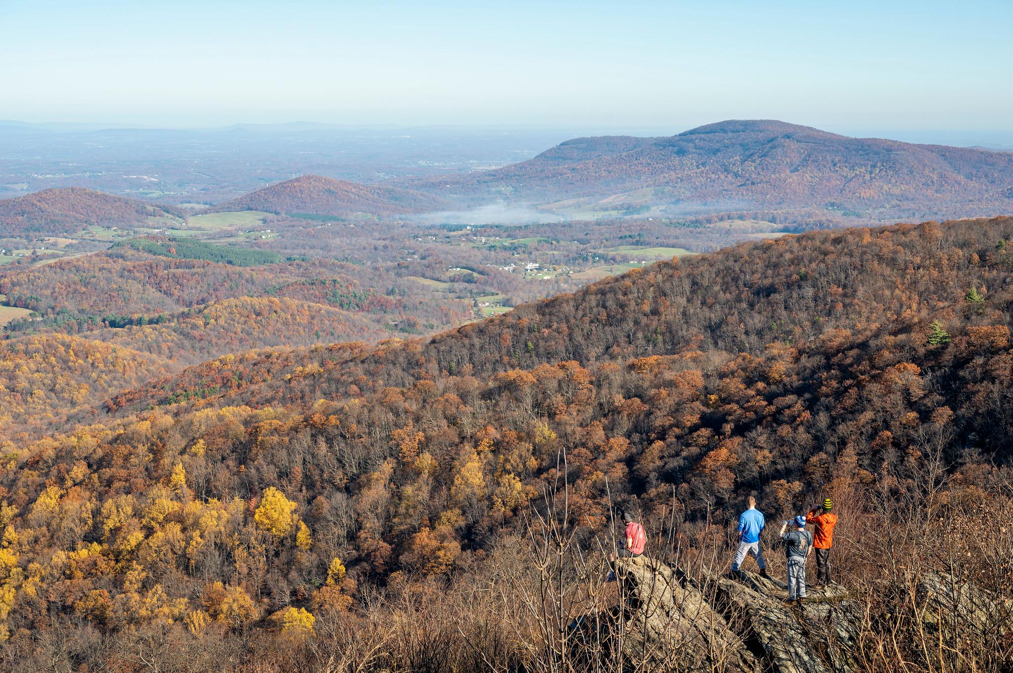
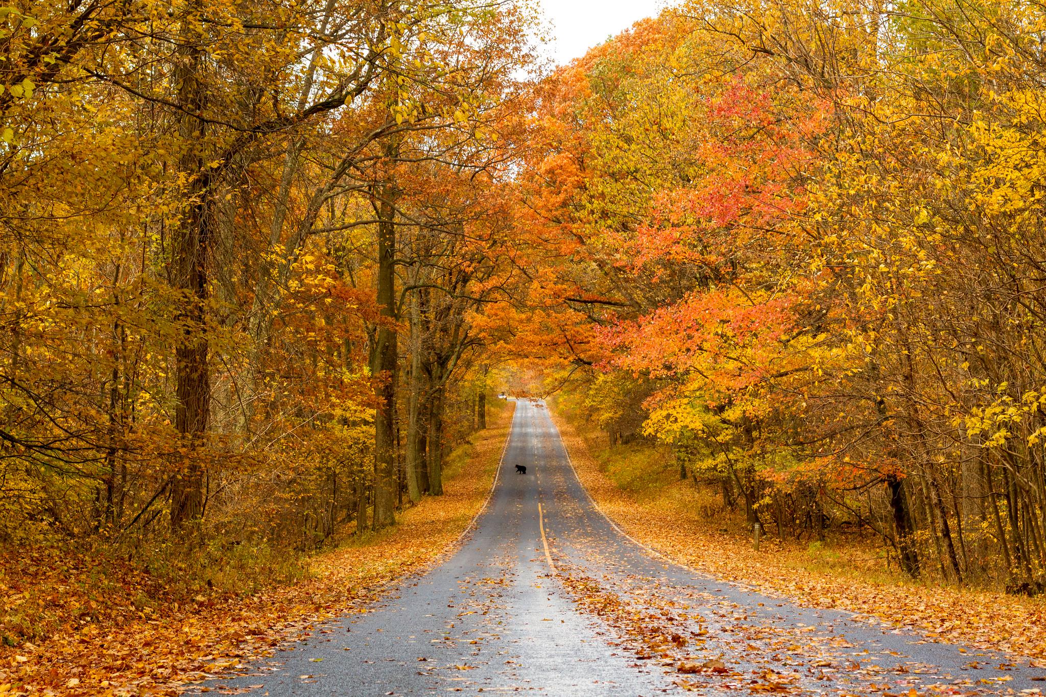
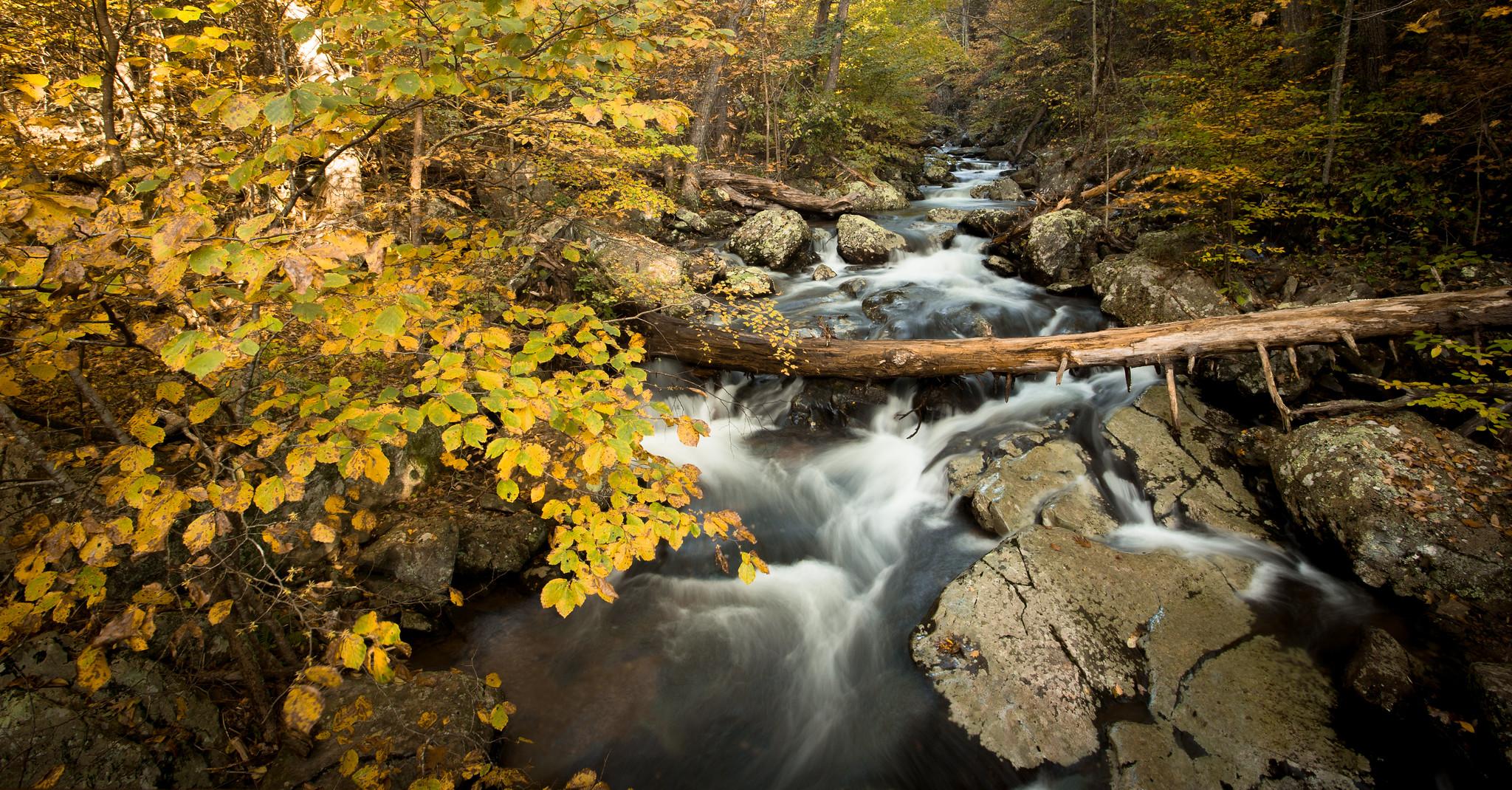
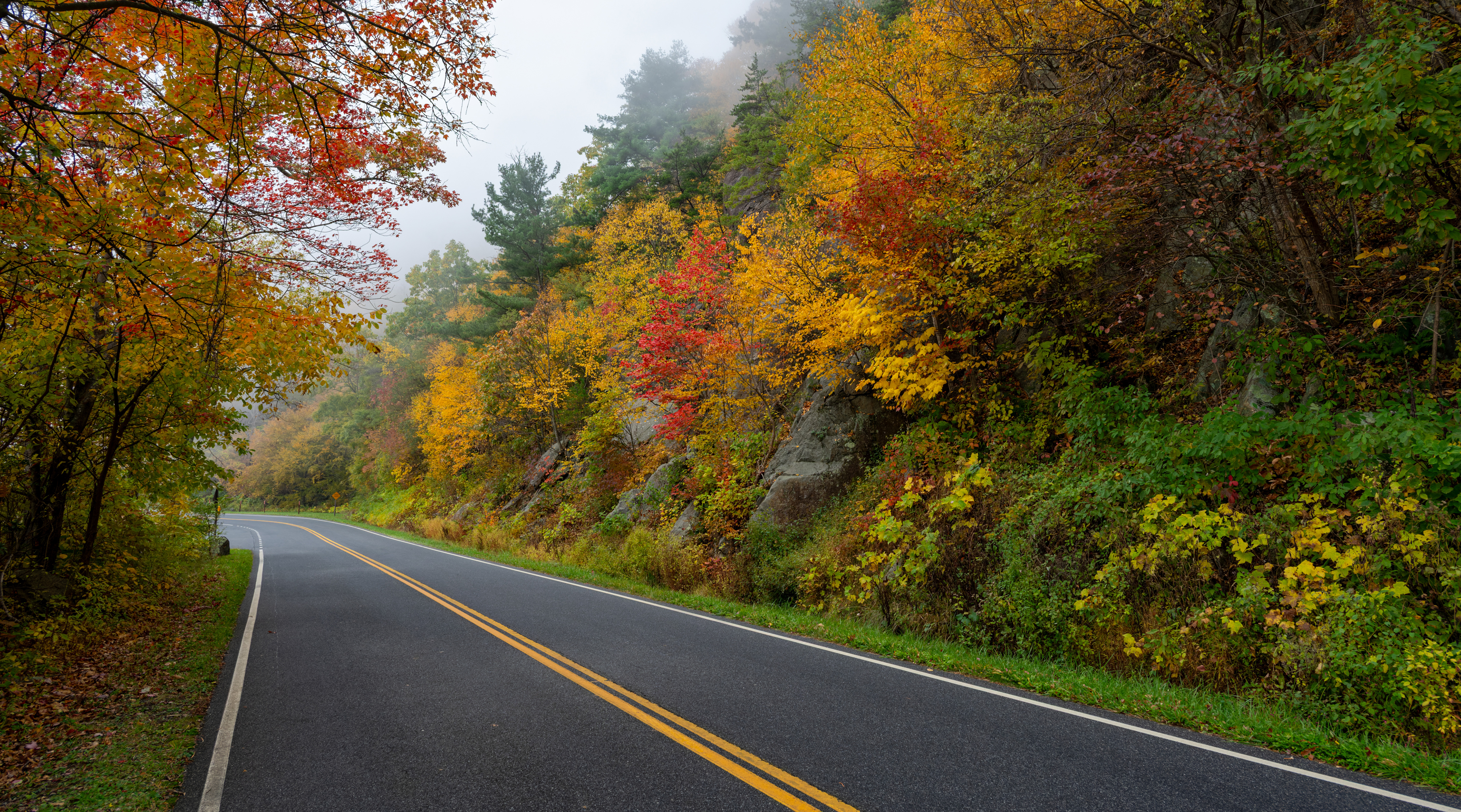
Watch for all types of wildlife crossing Skyline Drive.NPS Photo / Neal Lewis Images link to the original government source.There are over 60 peaks with an elevation over 3,000 feet in Shenandoah.NPS Photo / Neal Lewis Black bears are opportunistic, meaning they'll do anything for a snack! Properly store and dispose all food items, and share the road!NPS Photo | B. Raeburn This poplar stand at mile 8 is a popular stop for visitors entering from the north entrance.NPS Photo / Katy Cain There are 105 miles to explore on Skyline Drive.NPS Photo / Neal Lewis Whiteoak Canyon Falls rewards hikers in every season.NPS Photo / Brett Raeburn Big Meadows is one of the most popular star gazing destinations in Shenandoah.NPS/Mary O'Neill The nighttime lights of Luray, VirginiaNPS Photo A straight stretch of Skyline Drive bordered by trees ablaze in fall colors.NPS/Shenandoah National Park
Look closer at accessibility.
No structured outing assessments have been reviewed for this park yet. Check the official accessibility guide for your requirements.
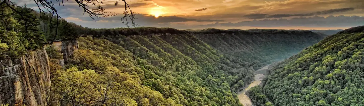
A rugged, whitewater river flowing northward through deep canyons, the New River is among the oldest rivers on the continent. The park encompasses over 70,000 acres of land along the New River, is rich in cultural and natural history, and offers an abundance of scenic and recreational opportunities.
Ridge upon ridge of forest straddles the border between North Carolina and Tennessee in Great Smoky Mountains National Park. World renowned for its diversity of plant and animal life, the beauty of its ancient mountains, and the quality of its remnants of Southern Appalachian mountain culture, this is America's most visited national park. Plan your visit today!
Astonishing biodiversity exists in Congaree National Park, the largest intact expanse of old growth bottomland hardwood forest remaining in the southeastern United States. Waters from the Congaree and Wateree Rivers sweep through the floodplain, carrying nutrients and sediments that nourish and rejuvenate this ecosystem and support the growth of national and state champion trees.


 Canyons