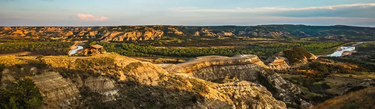
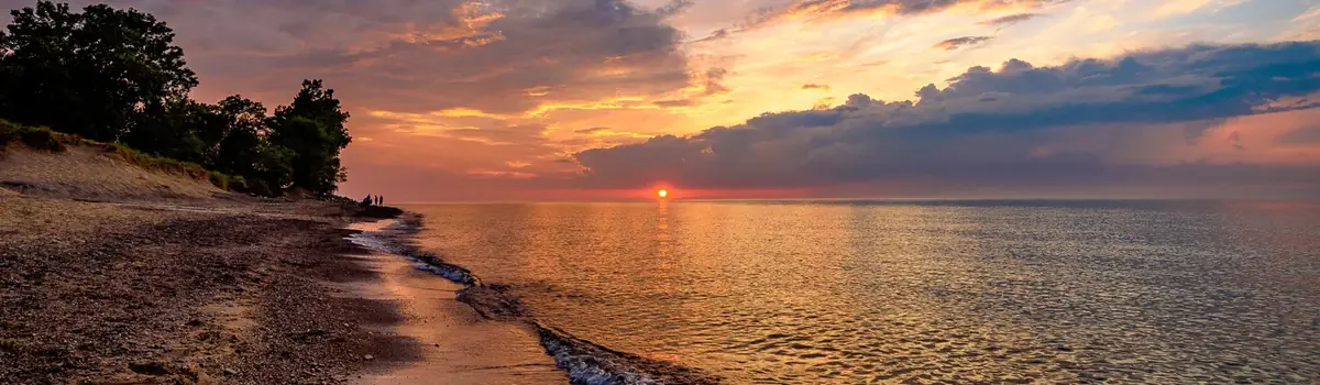
Voyageurs National Park spans 218,000 acres of lakes, forests, and streams in northern Minnesota. Established in 1975, the park is named after the French-Canadian Voyageurs who once navigated these abundant waters. Voyageurs National Park provides exceptional opportunities for recreation and exploration amidst landscapes rich in natural beauty, history, and cultural heritage.
218.2Kacres of parkland
206.3Krecreation visits, 2025
Jun · Jul · Augnearby climate picks
Seasonal access & reservations
No reviewed guidance for this selection. Check the park's official planning pages; missing coverage does not establish access.
Selected guidance only; separate from climate comfort and current conditions.
Official conditions Not checked
The conditions feed has not been connected for this park.
Editorial recommendations, reviewed 2026-10-17. Full park days, excluding travel to and from the region. A first-visit outline for a general traveler; adapt to mobility, fitness, season, reservations, and current conditions. These are suggested days, not reserved activities or guaranteed routes.
Voyageurs National Park offers a wide range of guided boat tours and ranger-led programs during the summer and fall, typically mid-June through the end of September. Programs take place throughout the park, with boat tours departing from the Rainy Lake, Kabetogama Lake, and Ash River Visitor Centers . Stop by a visitor center or check out our events calendar for a schedule of ranger programs. Tour offerings and program schedules vary from year to year, with the final schedule being made available on recreation.gov by April 15th annually.
Boat tour reservations can be made at recreation.gov's VNP Boat Tours page.
Reservations for special programs like the North Canoe Voyage experience can be made on recreation.gov's VNP Special Interpretive Programs page.
Need-to-Know Information
Reservations/tickets are available starting at 9am on April 15th, annually, online at the links above or by telephone at 1-877-444-6777.
All tours are subject to change, please call ahead for schedule changes.
Reservations are strongly encouraged as boat tours and programs do fill up. Walk-in tickets are sometimes available, but sales stop 30 minutes prior to tour departure.
No pets are allowed on tour boats unless they are properly documented service animals that are marked accordingly.
Food may not be eaten on the vessels, but drinking water is allowed. No smoking on the tour boats.
Weather conditions can vary greatly; jackets, sunscreen, and bug spray are recommended.
Rainy Lake Boat Tours on the Voyageur
Grand Tour (2.5 hrs) – Discover the wonders and beauty of Voyageurs. The captain will navigate Rainy Lake in search of abundant wildlife and breathtaking scenery while visitors hear stories about the rich cultural and historic significance of the park.
Life on the Lake Tour (2.5 hrs) – Experience the Rainy Lake known by fishermen, loggers, gold miners, and trappers as you visit historic locations on the lake. You will be able to view gold mines and fish camps ashore, and learn about the diverse history of the area. Expect a short ranger-led hike, and plenty of scenic views.
Kettle Falls Cruise (6.5 hrs) – Voyage to the historic Kettle Falls Hotel. This tour takes you on a cultural and natural history tour of the park. Spend 2.5 hours aboard the Voyageur getting to the hotel, and then spend 2 hours touring the hotel grounds and nearby dam. Finally, enjoy a 2-hour cruise on your return. Visitors can bring their own lunch or purchase a boxed lunch at the hotel.
Boat Tours on the Ne-zho-dain (Kabetogama and Namakan Lakes)
Kettle Falls Tour (5.5 hrs) – Voyage to the historic Kettle Falls Hotel. This tour takes you on a cultural and natural history tour of the park. Spend 2 hours aboard the Ne-Zho-Dain tour boat getting to the hotel. Upon arrival, spend 2 hours on land touring the site and nearby dam. Finally, enjoy a 1.5-hour cruise on your return route. Bring your own lunch or purchase a boxed lunch from the hotel restaurant.
Life on the Lake Tour (2.5 hrs) – Travel into Namakan Lake to learn about the many inhabitants who called this beautiful, rugged, and sometimes harsh environment home year-round, and hear stories about the unique ways in which people have made their living in the wild of the Northwoods. Disembark at I.W. Stevens Island to walk among the old cabins and lodge from one of the earliest resorts, and visit Hoist Bay to explore this location's evolution from the logging days into the recreational era.
Ellsworth Rock Gardens (2.5 hrs) – Cruise through the west end of Kabetogama Lake and past Gold Portage hearing stories of the past while enroute to the Ellsworth Rock Gardens. At the gardens, join a park ranger for a ¼-mile tour of the unique rock sculptures, dry-stacked flower bed terraces, building remnants, and winding paths. The lower portion of the tour is accessible, and the upper portion requires sturdy shoes to traverse an expansive 60-foot granite outcropping.
Land-Based Special Interpretive Programs
The North Canoe Voyage is one of Voyageurs National Park’s longest standing and most unique educational experiences, which immerses visitors in an on-the-water living history lesson with costumed and spirited interpretive rangers. Paddle back in history aboard a 26-ft replica of a north canoe to learn the voyageur paddle salute, sing songs, and explore the adventurous life of a voyageur. The program consists of 1 hour on land and 1/2 hour on the water, but is weather dependent. Minimum age is 8 as paddling is required and can become strenuous in certain conditions. While PDFs are provided, it is recommended that participants know how to swim. There are two location options for this program:
Rainy Lake North Canoe Voyage (1.5 hrs) departing from the Rainy Lake Visitor Center
Ash River North Canoe Voyage (1.5 hrs) departing from the Ash River Visitor Center
Tour & Program FAQs
Must I check in at a visitor center before boarding the boat?
Yes. All visitors MUST check in at the respective visitor center before boarding the tour boat. This allows park staff to make sure all boarded passengers have been entered onto the manifest and to inform you of any necessary information.
Can I walk into a visitor center and make a reservation?
Yes. If space is availble, walk-ons may purchase tour tickets, paying with credit card only. Visitors may do this between the hours of 9:00 a.m. and 5:00 p.m., but ticket sales will stop 30 minutes prior to departure of a tour. If all seats have been paid for with advanced reservations through www.recreation.gov, then no walk-on passengers will be accepted. Note that tickets are best purchased well in advance on recreation.gov as they usually fill up as the tour date nears.
What payment methods can I use?
Credit cards are required to make all reservations. No cash, checks, or travelers checks are accepted.
How do I know what an adult, child, or toddler fee is?
For boat tours, adult fees cover ages 17 and up, child fees cover ages 4-16, and toddler fees are for ages 3 and under.
For the North Canoe Voyage programs, adult fees cover ages 17 and up and child fees are for ages 8-16. Children must be a minimum of 8 years old to participate in the North Canoe programs as paddling can become strenuous in certain conditions.
Go to www.recreation.gov for specific fee information and to purchase tickets.
What is the cancellation policy?
Visitors must cancel a reservation by logging in and doing so from their recreation.gov account or by calling the National Call Center at (877) 444-6777. Please note that a $3.00 service fee applies for all cancellations made by the visitor. Refunds will be issued (minus the cancellation fee) only if reservations are cancelled by midnight of the day prior to their scheduled tour.
What if the park cancels a tour or program?
The park reserves the right to cancel a tour or program for any reason. If a tour or program is cancelled by the park , a full refund (minus the $1 fee for using the reservation system) will be given to the visitor by recreation.gov. Some reasons for cancellations are U.S.C.G. weather restrictions or not enough paying passengers, as all must meet a minumum number to depart. Call the respective visitor center of the tour or program you are attending to find out about potential cancellations, but keep the following in mind: tour boat captains do not make a determination on the weather until 1 hour prior to departure, and the park may not know if a tour meets the minimum number of passengers until 1/2 hour prior to departure.
Kabetogama Lake Visitor Center (218) 875-2111
Ash River Visitor Center (218) 374-3221
Rainy Lake Visitor Center (218) 286-5258
Are the park's tour boats available for rent?
Yes! Both of the park's tour boats, the Voyageur and the Ne-Zho-Dain, can be chartered by private groups for special occassions like weddings, reunions, company outings, etc. Check out our Tour Boat Charters page for application information.
All campsite types (except primitive) require a watercraft in summer
All camping types require a reservation/permit
Lakes can remain ice-covered until mid-May, but ice-out dates vary greatly
Lakes typically begin to freeze up in November
If winter camping or venturing onto the ice, check the most recent trails report
Planning a camping trip at a water-based park comes with extra considerations, but by understanding the options below, you can be sure to find an adventure that best suits you!
Click on a camping type below to learn more about planning your Voyageurs adventure!
Have access to a watercraft? These 137 sites are located on the park's large lakes and are directly accessible from any park boat launch.
Looking for a secluded camping trip that incorporates backpacking? These remote sites require a boat ride to a trailhead followed by hiking.
Want a backcountry experience without leaving the mainland? VNP has two hike-in campsites along the Kab-Ash Trail that don't require a boat!
Prefer a campground you can drive a car or RV to? Click here for nearby campground options outside the boundaries of the park.
Campsites in the park may also be accessed by foot and snowmobile when proper winter conditions and safe ice are present. With the proper precautions and winter safety guidelines in mind, Voyageurs National Park is an ideal winter adventure destination!
Site Types and Amenities Available
Voyageurs National Park has a variery of site types to accommodate visitors, from overnight campsites to day use areas for picnics and swimming. Here's a breakdown of all the site types you can find in Voyageurs National Park.
Leave No Trace Principles
In a water-based National Park with remote campsites, we hope that visitors feel compelled to do their part in keeping this special place pristine for the enjoyment of future visitors. The stewardship mindset is so very important in maintaining the health and beauty of this and all protected places. Please keep these simple yet impactful Leave No Trace principals in mind to help guide you in leaving the places you visit better than you found them.
All frontcountry and backcountry campsites require travel by boat. Primitive sites do not require a boat but require hiking several miles. Click on any site below to see more detailed information and make reservations on recreation.gov. Use the map's measuring tool to find distances between sites or plan paddling routes.
A Junior Ranger is an important person who helps park rangers take care of our national parks.
Do you like exploring the park, taking boat trips, hiking in park forests, or seeing a bald eagle fly overhead? Would you like to have fun and help us take care of the park?
If the answer is yes, then you might be just the person we're looking for to become our newest Junior Ranger!
How do you become a Junior Ranger?
Visit Voyageurs National Park
Stop by a visitor center and ask a park ranger for a Jr. Ranger booklet
After completing the booklet, present it to a park ranger or volunteer who will have you recite the Jr. Ranger pledge and present you with a Jr. Ranger badge.
Learning about Voyageurs from afar?
Become a Voyageurs Virtual Ranger by completing on-line only activities and downloading a digital badge below.
Voyageurs National Park has many options for the aspiring or experienced angler. Fish abound in the 30 named lakes, which consist of four large lakes and 26 smaller interior lakes. Fifty-four fish species have been identified in the park’s aquatic habitats. Some of the better-known fish species include Walleye Sander vitreus , Sauger Sander canadensis , Northern Pike Esox lucius , Smallmouth Bass Micropterus dolomieu , Yellow Perch Perca flavescens , and Black Crappie Pomoxis nigromaculatus . Learn about fish species present in the park.
Visitors fishing within Voyagers National Park must obtain a State of Minnesota Fishing license.
Fishing Regulations
Except as provided below, fishing shall be in accordance with the laws and regulations of the State of Minnesota. For state fishing regulations go to the Minnesota Department of Natural Resources website. Unless otherwise designated, fishing in a manner authorized under applicable State law is allowed ( 36CFR7.33 ).
The fishing regulations apply to all “finfish” found in the park. Other taxa, including amphibians, mollusks and crustaceans (e.g. crayfish) are not considered “fish” for the purpose of NPS fishing regulations and are addressed by National Park Service regulations governing “wild life” ( 36CFR2.2 ).
These fishing regulations apply, regardless of land ownership, on all lands and waters within the park that are under the legislative jurisdiction of the United States.
The following are prohibited:
Introducing wildlife, fish or plants, including their reproductive bodies, into a park area ecosystem. This includes the discarding and/or dumping of bait and bait buckets.
The use or possession of fish, wildlife or plants for ceremonial or religious purposes, except where specifically authorized by Federal statutory law, or treaty rights.
In addition to the above regulations, the following park specific regulations apply:
The following State fishing laws and/or regulations do not apply in the listed areas:
Fish, as defined under Section 1.4, does not include mussels (clams), crayfish, frogs, and turtles (State law permitting the taking of mussels (clams), crayfish, frogs, and turtle species conflicts with federal law and is not assimilated as a permitted activity within the park.)
Possession or use of live or dead minnows or other bait fish, amphibian, non-preserved fish eggs or roe is allowed in the following fresh water areas:
The waters and adjacent shorelines of Rainy, Kabetogama, Namakan, and Sand Point lakes are designated for possessing or using bait for fishing
Bait may also be possessed on the frozen surface of Mukooda Lake for transportation purposes when traveling non-stop on the most direct route
Fishing from shore, picnicking, hiking, and all other legal recreational pursuits is prohibited within 200 yards of an occupied reserved campsite except by members of the permitted camping group.
The following activities within 50' of the centerline of snowmobile trails are prohibited:
Fishing activity or other forms of recreational activity except snowmobiling, skiing, snowshoeing, fat-tire biking, and other strictly human powered forms of travel
Property may be left unattended for periods longer than 24 hours in the following areas and under the following conditions:
Structures used for fishing on frozen lake surfaces during the ice fishing season and in compliance with state laws
Fish Consumption Advisories in National Park Waters
The Environmental Protection Agency, states, territories, and tribes provide advice on fish and shellfish caught in the waters in their jurisdiction to help people make informed decisions about eating fish. Advisories are recommendations to limit your consumption of, or avoid eating entirely, certain species of fish or shellfish from specific bodies of water due to chemical or biological contamination. Fish is part of a healthy balanced diet, but eating wild fish and shellfish caught in park waters is not risk free. Parks are “islands”, but the much larger “ocean” that surrounds them affects the natural resources inside a park. Other aquatic toxins are the result of natural biological processes. Also, chemical contaminants that originate outside of park boundaries can come into parks. Mercury is an example of a toxin originating outside a park that can find its way into a park. Mercury exists naturally in some rocks, including coal. When power plants burn coal, mercury can travel in the air long distances before falling to the ground, usually in low concentrations. Once on the ground, microorganisms can change this elemental mercury to methyl mercury. This type of mercury can build up in animal tissues, and it can increase in concentration to harmful levels. This high concentration can occur in large predatory fish - those often pursued and eaten by anglers. Studies have shown that fish in some National Park System waters, including those of Voyageurs National Park, have mercury levels that may be a concern to people who eat fish.
Voyageurs National Park Fish Consumption Advisories
All advisories below are from the Minnesota Department of Health.
Large Lakes: Kabetogama , Namakan , Rainy , and Sand Point .
Interior Lakes: Agnes , Beast , Brown , Cruiser , Ek , Fishmouth , Jorgens , Little Shoepack , LittleTrout , Locator , Loiten , Lucille , McDevitt , Mukooda , Net , O’Leary , Oslo , Peary , Quarterline , Quill , Ryan , Shoepack , Tooth , War Club , Weir , Wiyapka .
A park map can be helpful for learning the locations of the lakes in the park.
Aquatic Invasive Species
Aquatic invasive species (AIS) are waterborne, non-native organisms that out-compete native organisms, introduce diseases or parasites, or adversely change the aquatic ecosystem. Humans unwittingly assist the spread of these organisms by transferring them from one body of water to another on footwear, waders, nets, watercraft, and other equipment.
Exotic species such as spiny water flea, zebra mussel, and rusty crayfish and fish diseases are threats to the aquatic ecosystems of regional lakes including those in Voyageurs National Park. Spiny water fleas have recently invaded multiple lakes in the region, including Rainy, Kabetogama, Namakan, and Sand Point lakes within Voyageurs National Park. Rusty crayfish have invaded at least one lake in Voyageurs National Park and many lakes in the region. Larval zebra mussels were found in Black Bay of Rainy Lake just outside of park waters in 2021, and zebra mussels have infested many lakes in northern Minnesota.
How You Can Help – Stop Aquatic Hitchhikers
Delaying infestation of water bodies as long as possible provides important time for advances in control and prevention technologies for aquatic invasive species.
Follow all state laws and recommendations for preventing the spread of aquatic invasive species: Clean In Clean Out | Minnesota DNR (state.mn.us)
Follow all Voyageurs National Park aquatic invasive species regulations and Best Management Practices:
Best Management Practices for Preventing the Spread of Aquatic Invasive Species:
Bring a separate set of gear that is likely to contact lake water (including fishing gear) to use on the interior lakes, or before using any gear on an interior lake, make sure that all gear has been thoroughly dried for at least 5 days or washed water at least 140 °F for at least one minute
When leaving any lake, remove aquatic plants and animals, including gelatinous or cotton batting-like material from equipment, including fishing line
Regulations to Protect Interior Lakes from Aquatic Invasive Species and Fish Diseases:
artificial bait only (on all interior lakes only)
no privately-owned watercraft allowed in interior lakes (the park currently provides canoes and row boats for rent through the Boats on Interior Lakes program and Commercial Use Authorizations on Mukooda Lake)
no float plane landings on interior lakes
Inspect your boat, trailer, and equipment and remove visible aquatic plants, animals and mud before leaving the water access
Drain water from your boat, motor, bilge, live wells, and bait containers before leaving the water access
Dispose of unwanted bait and other aquatic plants and animals in the trash
Spray or rinse boats and equipment with water at least 140 °F for at least one minute, or dry boats and equipment for five days before moving them to a different body of water.
When hiking any trail visitors should remember many areas are covered in vegetation and they should be prepared for ticks, mosquitoes, and wet areas. It can be helpful to have a checklist of birds in the area. Maps of Voyageurs National Park can be purchased through the Jefferson National Park Association .
To get to Anderson Bay, visitors will need to travel by boat from the Rainy Lake boat launch 22- miles to the Anderson Bay Trailhead. Navigational maps are highly recommended.
The Anderson Bay Loop Trail traverses an elevated and glacially scoured pink granitic rock outcrop system. The rock is interspersed with a few beaver flowages, lowlands, wetlands, and a scenic drop to Peary Lake.
The trail follows the high and open granitic knobs and ridges where jack, red, and white pines seemingly grow out of solid bare rock. The stands have little understory so one can easily see through them. Mosses and lichens form a shallow cover over the extensive outcrops. The soil is shallow but supports large areas of sweet fern, blueberry, wintergreen, bunchberry, and bearberry.
Along the trail there are extensive vistas over Rainy and Peary Lakes and large, smooth, rounded glacial erratic rocks are strewn throughout the area. A northern portion of the trail follows the Rainy Lake shoreline for almost 1,312 feet.
Twelve species of breeding warblers typical of coniferous boreal forests are heard here. Black-backed woodpeckers nest in cavities of the abundant fire dependent jack pine. Blue-headed vireos, pine warblers, ruby and golden-crowned kinglets, hermit thrushes and red-breasted nuthatches also breed in the conifers.
White-throated sparrows and red-eyed vireos are common in the mixed forest areas. Echoing out of the more heavily forested coniferous areas is the sound of the winter wrens, brown creepers, and gray jays.
Rainy Lake Visitor Center Area
To get to the Rainy Lake Visitor Center area take Highway 11 East 10 miles to the entrance road. Turn right and travel two miles to the Rainy Lake Visitor Center.
Bird monitoring in the Rainy Lake Visitor Center area has occurred long the two-mile entrance road, a portion of the Tilson Bay Connector Ski Trail, Oberholtzer Trail, around the visitor center grounds, at the marina, and at the picnic area along the shoreline.
Northern spruce, fir, hardwood, shrub, herb rock barren, and boreal hardwood forest communities dominate the area. A few jack, red, and white pine areas are found as well.
Black-backed woodpeckers are seen in the jack pine stands around the picnic area. The emphatic “What three beers” song of the olive-sided flycatcher is heard from a wet meadow and beaver pond area along the Tilson Trail. Scarlet tanager, least, and great-crested flycatchers are associated with mature and open hardwood stands.
Bald eagles, osprey, and turkey vultures often soar, hover, and perch nearby. The “gunk-a-gunk, gunk-a-gunk” call of the bittern may lead to a view of the male standing in the midst of marsh cattails and grass near its nest along the Oberholtzer Trail.
Warbler species seen around the visitor center are American redstart, Blackburnian, black and white, black-throated green, chestnut sided, Canada, common yellowthroat, magnolia, morning, Nashville, northern parula, ovenbird, pine, Tennessee, yellow, and yellow-rumped warblers.
To get to the Dryweed Island area, visitors will need to travel by boat from the Rainy Lake boat launch 2.5 miles to the island. Navigational maps are highly recommended.
Dryweed Island area is a 2.75-by-0.6-mile island in Rainy Lake, part of an ancient volcanic island arc system. Ridges up to 100 feet above the lake make up the core of the island. This island is the only island in the park with a forest breeding bird monitoring route. The route runs throughout the eastern part of Dryweed and requires bushwhacking about two miles.
There are no formal park trails on Dryweed. Park users can bushwhack along the ridge tops in search of birds and berries. The high, dry ridges are covered with extensive mixed maturing, and open, jack, red and white pine forest. More dense spruce, fir, and cedar stands fill in more shady and moist areas.
The birds are typical of conifer covered islands. Hermit and Swainson’s thrushes, ruby and golden Crowned kinglets, scarlet tanagers, blue-headed and red-eyed vireos, red-breasted nuthatches, pine, magnolia, morning, black and white, ovenbird, Blackburnian, black-throated green, Nashville and yellow-rumped warblers dwell on the ridges.
Turkey vultures soar in the thermals over the ridges on still hot days. Common ravens can be seen and heard performing their aerial flights and acrobatics and making “kronking” and “kauluping” vocalizations.
Black Bay Ski Trail Area
To get to the Black Bay Ski Trail area, visitors will need to travel by boat from the Rainy Lake Visitor Center boat launch, one mile north to the trailhead.
There are two trails in this area. The Black Bay Beaver Pond Trail and the Black Bay Ski Trail. Both trails extend through four forest communities.
A northern bur oak community is open, high, dry, and south facing. Blueberries, junipers, and bearberry grow amongst the flat rocky outcrops. Chestnut-sided warblers, chipping sparrows, and indigo buntings nest there. Ruffed grouse forage on the many abundant berries.
Veery, red-eyed vireo, white-throated sparrows, yellow-bellied sapsuckers, ovenbirds, and Nashville warblers are most frequently heard in the aspen/birch boreal conifer communities.
Canada warblers are associated with mountain maple and other shrubs near moist areas. They are most common around and near the white-cedar and black ash lowland on the far east end of the trail where steep slopes are densely vegetated with shrubs.
Red and white pine aspen and birch communities support blue-headed vireos, ovenbirds, Blackburnian, black-throated green, Nashville, and yellow-rumped warblers along with red-breasted nuthatches, and hermit and Swainson’s thrushes. Scarlet tanagers and wood pewees sing from the tops of the tall forest canopy there.
Blind Ash Bay Trail
The Blind Ash Bay Trail originates from the upper parking lot and/or the Kabetogama Lake Overlook near the Ash River Visitor Center. The trail leads west 1.2 miles to a 0.7 mile loop around a peninsula surrounded by Kabetogama Lake on the north and Blind Ash Bay on the south. An overlook on the west end of the loop gives hikers a three mile view down the lake.
Forest cover types in the area are mainly red and white pines interspersed with small areas of rocky woodlands and jack pine stands on the ridges. Aspen, birch, and upland spruce, fir, and aspen stands are distributed on lower uplands. Wetter draws are covered by a lowland hardwood forest.
Species like hermit and Swainson’s thrushes, ruby and golden-crowned kinglets, scarlet tanagers, dark-eyed juncos, blue-headed and red-eyed vireos, and red-breasted nuthatches can be clearly visible near the tree tops.
Sixteen warbler species seen on the trail are American redstart, Blackburnian, black and white, black-throated green, chestnut sided, Canada, common yellowthroat, magnolia, morning, Nashville, northern parula, northern water-thrush, ovenbird, pine, Tennessee, and yellow-rumped.
Mature tree stands hold eastern wood pewee, great-crested flycatcher, scarlet tanager, and hairy and pileated woodpeckers. Songs of winter wren and least flycatcher are heard near the ground in wetter areas.
To get to the Kab-Ash Trail visitors enter from four locations along the Ash River Trail road or the visitor center road. Compasses and good topographical maps are a must on this trail system.
The Kab-Ash Trail passes through some of the highest topography of the park. The glacially exposed granitic rock outcrops of the Vermilion Batholith form the backbone of the eastern portion of the trail from Ash River west over a series of long ridge systems south of Sullivan, Blind Ash, Nebraska, and Daley Bays of Kabetogama Lake. There are four loop systems that work the ridge tops.
Much of the east portion of the trail supports jack, red and white pine communities mixed with northern bur oak stands. The trail goes through low areas where ridges sharply end only shortly to rise up on the next ridge. The gaps of lower areas are covered with spruce, fir, cedar stands, beaver ponds, and meadows.
Birding is exciting at this trail because the forest is quite open along much of it. Species like hermit and Swainson’s thrushes, ruby and golden-crowned kinglets, scarlet tanagers, dark-eyed juncos, blue-headed and red-eyed vireos, red-breasted nuthatches, pine, Blackburnian, black-throated green, and yellow-rumped warblers can be clearly visible near the tree tops.
When at the trail section near the Beaver Pond Overlook birders may view or hear tree swallows, eastern kingbirds common yellowthroat, swamp and song sparrows, red-winged blackbirds, pied-billed grebes, mallards, wood duck, blue-winged teal, ring-necked ducks, great blue herons, American bittern, sedge wren and possibly a sora rail.
To get to the Echo Bay Trail follow St. Louis County Road 122 North from U.S. Highway 53 to the Echo Bay trailhead signs.
The Echo Bay Trail is a wide hiking and ski trail that crosses through aspen, birch, mature red and white pine, lowland hard wood, and mixed upland spruce and fir forest types. A large wetland was created by beavers in a live lowland ash stand that now has standing dead snags which support the park’s largest great blue heron rookery and some years an osprey nest. Heron nests can be seen from a high rocky overlook north of the pond and the trails edge northeast of the pond.
A large bridge crosses a stream where one can hear northern water thrushes, brown creepers, Canada warblers, winter wrens and magnolia warblers. Least flycatchers are “chebeking” in the open understory The hammering voice of the swamp sparrow rings from the marsh while the rising raspy song of the northern parula emanates from the tree tops.
A mature pine forest with rock outcrops and shallow soils occurs north of the bridge. Ruby and golden-crowned kinglets, Swainson’s and hermit thrushes, red-breasted nuthatches, yellow-rumped, Blackburnian, black-throated green, ovenbird, and more parula warblers sing here. Pileated woodpeckers frequent the dead snags throughout the area.
A wet lowland hardwood forest skirts the west side of the beaver pond. On the southwest side of the trail the forest changes to upland hardwoods. Great-crested and least flycatchers, Baltimore orioles, scarlet tanagers, eastern wood pewees, American redstarts, red-eyed vireos, veery and chestnut-sided and morning warblers sing here.
Feeding of birds and other wildlife is not allowed, as it may cause dependence on man as well as malnutrition. Nevertheless, some birds are thieves. Gray jays, also known as camp robbers, will do just that. Guard your sandwiches diligently when the Gray Jays are around. Ravens have been known to burglarize backpacks and bags of food left in the backs of trucks that are parked.
Please be thoughtful in your bird watching. Approaching a nest too closely will scare off the parent, exposing the eggs or babies to predators. The use of calls, electronic or whistled by a human, to attract birds in the spring will draw males away from their duties of protecting the female on the nest. In the winter, the use of calls causes birds to expend precious energy unnecessarily as they investigate the source of the sound. Treating birds with respect will help assure that Voyageurs National Park remains a birdwatching paradise.
The serene forest haven of Voyageurs National Park provides might be just what the doctor ordered. People have been coming to the North Woods for decades to escape the hustle of everyday life. Some came only for a visit, but spent a lifetime . Maybe you are here for the day, a week, or longer. No matter the time, a great way to explore this haven is out on the trails . Ranging from easy to strenuous, everyone can find a trail. The Ash River and Rainy Lake areas are home to many of the park's car accessible trails, while those with boat access can venture onto the Kabetogama Peninsula.
Studies show that people who spend time outside are generally happier, concentrate better, and are naturally more active. Participating in outdoor activities promotes cardiovascular fitness, reduces the risk of developing a chronic illness, helps you maintain a healthy weight, and even reduces the risk of anxiety and depression.
Trail Passport Program
Voyageurs National Park's Hike to Health Trail Passport program is a fun way to keep track of hiking in the park. The booklet lists hiking trails in the park by region. Located along each trail is a hike to health raised trailer marker. Using a pencil or other writing utensil, make a rubbing of the marker on the designated page. On the back of each page is space to take notes and keep track of your observations. When you complete 5, 10, and all hiking trails in the book, bring it to a visitor to receive a stamp and sticker.
Stop by a visitor center , and ask for a Hike to Health Trail Passport , and start your journey today!
GPS Scavenger Hunt
Some people enjoy discovering emblems on each trail as they walk by them. Others enjoy a scavenger hunt for emblems using personal GPS devices. For those who enjoy that activity, here is a list of GPS locations for the Hike to Health trail markers .
Get Outside, Get Healthy!
Voyageurs National Park is proud to partner with the Rainy Lake Medical Center , Jefferson National Parks Association , Voyageurs National Park Association , and REI to bring visitors the Hike to Health Program.
Explore Voyageurs National Park's trails, engage in hands-on activities, and get a healthy lifestyle.
The Hike to Health Program is made possible by a generous donation from Coca-Cola, Inc. through the National Park's Foundation's Active Trails Program.
The history of Kettle Falls is as colorful as the red roof on the hotel. Constructed by timber cruiser Ed Rose and reputedly financed by Madame Nellie Bly, the Kettle Falls Hotel has accommodated and entertained travelers since 1913. Robert Williams bought the hotel in 1918 for $1,000 and four barrels of whiskey. From its somewhat scandalous past, grew a long tradition of hearty home cooking and hospitality served by the Williams family. This historic hotel was renovated by the National Park Service in 1987 so you, too, can enjoy a hearty meal, relax on the veranda or spend the night.
Kettle Falls Hotel is the only lodging within Voyageurs and is only accessible by water. For lodging information at the Kettle Falls Hotel, view the hotel web site . For other nearby lodging options, see what our local gateway communities have to offer.
Not a Sneeze on the Border!
Many centuries ago, Kettle Falls was a main artery of the travel route along the wilderness border region. Native peoples gathered, hunted, and speared sturgeon at the falls, voyageurs paddled and portaged through the area carrying their goods and furs, and prospectors traveled to the picturesque stopping place on their way to the Rainy Lake gold mines. Around the time construction of the dams at Kettle Falls began in 1910, the Kettle Falls Hotel was built. The stonecutters and masons who built the dams were early patrons of the hotel, followed by lumberjacks, commercial fisherman, trappers, and traders. When the logging era came to an end and commercial fishing declined, tourism became the major industry and sports fishermen and families came to Kettle Falls. In advertisements from the 1930s, the Kettle Falls Hotel was a "Hay Fever Victims Sanctuary" where sufferers found relief due to the purity of sun-washed pine scented air and there was "not a sneeze on the border". Located on the Minnesota - Canadian boundary at the eastern edge of the Kabetogama Peninsula, the historic hotel is still a destination of fishing enthusiasts and families and the air is still pine scented and pure.
The Ellsworth Rock Gardens have been known as the “Showplace of Lake Kabetogama” since the 1940s. Jack Ellsworth, the garden’s creator and a self-taught artist, used natural elements of the native northern Minnesota landscape as his artistic media, creating an original and distinctive art environment on the north shore of Kabetogama Lake. Over a period of roughly twenty years, Ellsworth, a carpenter from Chicago, used art and engineering to create a complex, terraced garden on a prominent rock outcrop. Ellsworth constructed 62 terraced flower beds on the outcrop, which he filled with more than 13,000 lilies and other flower varieties. He then accented his garden landscape with over 200 abstract rock sculptures that have been compared to the work of modern sculptors like Noguchi and Brancusi. The uniqueness and magnitude of Mr. Ellsworth’s creation and the garden’s importance as a recreational destination since the 1940s establish its significance. The gardens are eligible for the National Register for Historic Places and are the most popular day use destination in Voyageurs National Park.
History of the Gardens
Landscape Description
Contributing Buildings & Structures
Jack Ellsworth first constructed 62 terraced flower beds on the outcrop, which he filled with more than 13,000 lilies of four varieties. He augmented the lilies with twenty-eight other flower varieties incorporating both annuals and perennials. Working with a hierarchy of local stone, Ellsworth crowned the meandering dry-stacked walls that surround the planting beds with a layer of crushed white quartz, creating a distinctive "frosting."
The terraced beds were connected through pathways subtly indicated by stone gateways, stairways, stepping stones, simple bridges, grass paths and the use of a few painted stone signs including an "Up" sign at the east edge of the gardens. By 1961, Ellsworth had accented his garden landscape with statuary that he created out of native rock and concrete as well as carefully selected and placed rocks and boulders.
He skillfully balanced both small rocks and large monoliths—some as a single stone balanced on point, others crafted into figures, multi-tiered tables, and other sophisticated artistic sculptures. He stenciled the Ellsworth signature on a number of rock tablets placed throughout the gardens. At the top of the gardens, he constructed two stylized tepees of wooden poles. One was covered with a painted canvas and had battery-powered lights fixed in the apex to light the interior. The other was uncovered and left unadorned except for a sheltered stone sculpture. Only the canvas covered tepee remains, the other is marked by a circle of stones on the ground.
Beginning in the mid-1960s, photographs indicated that Mr. Ellsworth’s health was making it difficult for him to maintain the gardens. The once-meticulously mowed lawn was overgrown and some sculptural elements were missing. Mr. Ellsworth did not return to the gardens after 1965. He died in July 1974 and Elsie passed away a few years later. By 1976, photographs taken by the Minnesota Historical Society show that small details were missing, some sculptures had tipped, the dock was collapsed, and the house and other buildings were boarded up. Despite this unkempt appearance, the basic form of the gardens was still apparent.
When the National Park Service acquired the property in 1978, the buildings were put up for sale and the main cabin was removed. Photographs of the gardens from 1979 show that sculptures were largely intact but the forest had essentially swallowed the gardens. For almost two decades, the gardens deteriorated. Yet it still received visitors during the summer months. Pressure from the local Kabetogama Lake community to have the gardens maintained resulted in a day-long vegetation removal effort by the National Park Service in 1996. Since 2000, the Park has obtained funding for and organized an annual “Garden Blitz” that brings contractors and volunteers to the site to clear nonhistoric vegetation, replant historic plant varieties, and repair buildings and sculptures. Planning for stabilizing and eventually rehabilitating the site for visitor use has also occurred during the “Blitz.” These efforts have resulted in restoring historic spatial relationships between the forest, gardens, lawn, and lake, revitalizing bulbs and other remnant vegetation, and a complete inventory of sculpture and a record of sculpture repair.
Historically, the gardens had the appearance of being carved out of the forested wilderness. This boundary between the gardens and forest is one of the primary features of the site. The forest provides a distinct, impenetrable wall, creating a dark, dense backdrop for views within the gardens. A few native spruce or pine trees were left within the gardens, but were "limbed-up" approximately 20 feet to create a vertical focal point, rather than a visual barrier. A solitary red pine, approximately 70 feet tall and with branches only at the top, functioned as a distinctive visual landmark at the top and back of the space. This tree was removed in 2004 because of its deteriorated condition. Other tall pines will be allowed to grow in this area to maintain the sense of verticality.
The irregular shape of the rock outcropping inspired the garden's organic form, and influenced its overall spatial organization. The topography of the site creates a series of flat planes: the lake, stepping up to the mown lawn surrounded by grassy meadow, followed by the uneven, steeply sloped rock outcropping, leading to the level summit area. The open meadow at the base of the outcropping provided a sense of arrival for visitors arriving from Ellsworth's dock on Kabetogama Lake, and provided a space for viewing the main features of the gardens. The forest that surrounded the outcropping and the meadow established a distinct vertical edge. This forest "wall" functioned as visual boundary and established a sense of enclosure to create an impression that the gardens had been carved out of nature. The inherent qualities of water, rock and forest remain unchanged.
The area between Kabetogama Lake and the rock outcropping consists of a relatively level open space. The western half was maintained by Ellsworth as lawn. The National Park Service continues mowing this area today. The eastern half of the clearing was fenced off from the cottage almost to the shore. During the Ellsworth's residence, this area was lawn. A path from the cabin crossed the mown meadow; passing through a wooden gate signed "Spring," ending at the southeast corner of the property where Ellsworth had installed a hand pump.
On and around the granite outcropping Ellsworth modified and capitalized on natural depressions in the rock surface to guide rainwater into a system of crevices and basins, creating three small ponds which he filled with cattails, other aquatic plants and sculptures. He also manipulated the native vegetation to direct views, create intimate-scale spaces, and frame small landscape "scenes." The garden's system of meandering paths linked these spaces, providing controlled views both in and out of the gardens. In some places the uneven topography and tall ornamental lilies that filled the terraced planting beds obscured views out of the gardens. This created intimate vignettes, many of which incorporated sculptural pieces as focal points. He enhanced views by controlling natural features, including "limbing" up trees, removing mosses from the rock to expose a highly polished granite surface, and possibly removing trees to open views of Kabetogama Lake.
Ellsworth's incorporation of textural and focal elements followed the same general hierarchical scheme suggested by the garden's spatial organization. He placed more elaborate plantings at the eastern base to define the garden's edge, and sculptural elements near the western base of the rock outcropping to establish an entry point into the main portion of the gardens. Sculptures were sometimes connected by and beds created by a system of dry stacked stone walls that spanned the full width of the outcrop to form terraces. Sculptures placed along the stairs and pathways marked the progression from the base of the rock to the summit, which features the teepees, ponds, and panoramic views of the gardens and lake. The sculptures, mostly composed of uncarved rocks arranged in compositions resembling animal figures, chairs, tables, and altar-like structures, reinforced the rugged character of the outcropping and, along with the meandering pathways, gave the overall landscape composition an organic quality. Garden hoses, stacks of lumber, and piles of stone gave the gardens a sense of intuitive and continual evolution. The gardens seemed to have grown spontaneously and incrementally from its site, rather than from to a predetermined plan.
The summit of the granite outcropping was the most elaborately articulated space. The largest pond, tee-pee, refined walls, large elaborate sculptures and numerous small-scale features established this space as the principal destination within the gardens. The focal point was an upright stone painted pink and decorated with smaller stones arranged in the shape of an arrowhead. This sculpture is almost entirely intact and in good condition.
At the peak of bloom each summer, crowds of people visited the gardens. In 1962, 5200 people came to see the work of Mr. Ellsworth, who was usually seen watering flower beds or mowing the extensive lawns with his reel mower. Approximately 32 herbaceous ornamental plant varieties grew in the gardens, including multiple shades of nicotiana, dahlias, marigolds, cosmos, phlox, nasturtiums, balsam, and bachelor buttons. The dominant plant was an orange Asiatic lily that grew to about 4 feet in height. These lilies filled beds throughout the gardens, creating a uniform color and texture. They also provided a structural element in the middle ground of views within and emphasized the vertical quality of the gardens. The base of the gardens was planted with roses and peonies. A snowball Viburnum hedge in front of the main cabin is another distinctive vegetation feature that remains on site. It was untrimmed, had large white flowers and a naturalistic appearance. The naturalistic use of vegetation was also evident at the ponds, where water-tolerant species were planted to soften the edge between the water and the rock and add vertical contrast to the water's horizontal surface. When in full bloom, the system of beds created striking blocks of color and texture, which accentuated the way in which the abstract forms of the beds intrinsically related to the irregular, uneven surfaces of the granite outcropping. Viewed from the summit, the gardens became a fantastic mosaic of brilliant colors and soft textures that contrasted with the cool, gray tones of the hard, native rock. Elsewhere in the gardens Ellsworth used vegetation to produce diverse aesthetic effects. He planted roses and peonies in beds near the base of the granite outcropping, and used water-tolerant species in an arou
Topography and vegetation are the primary means by which views into, out of, and within the gardens were created and controlled. When the gardens are viewed as a composition from the water and meadow, the forest formed the background, the tree and lily clumps, large sculpture, and rock walls form a middle ground, and the ponds, small sculptures and other site elements provide focus in the foreground. Most of the gardens were visible from the meadow, but once in the gardens, the uneven surface of the rock and the masses of lilies obscured broad views. This quality heightened visitor's expectations and provided a sense of arrival, with the summit as the primary destination once visitors moved through the gardens. The pond, teepee, fire pit and other small-scale features emphasized this space, and created a series of landscape "scenes" that can be viewed from several locations within the gardens. A striking view of Lake Kabetogama and the lower part of the gardens could be seen from the summit of the rock outcropping.
The gardens contain a system of approximately 204 sculptures which vary in size and complexity; some are single rocks featuring an unusual shape or color, others are several large rocks or boulders mortared together. There are a number of chairs, tables, and altar-like arrangements which can be organized into the following typology:
Figures: A series of multiple rocks, usually mortared together, that form abstract shapes that may be interpreted as representational. These sculptures often consist of one large stone with several stones attached.
Tables: There are numerous compositions that feature several horizontally oriented stones stacked with smaller legs to create multi-level tables. They resemble pagoda-like characters.
Monoliths: These vertically oriented sculptures are usually mortared in place as a singular feature. They are found throughout the gardens, but are dominant at the western edge of the summit.
Gateways: Usually found in tandem with stone walls, these sculptures arefixed in place to guide movement through the gardens. They are sometimes single rocks but are also a grouping of rocks graded by size and mortared together.
Spires: Found throughout the gardens, these are smaller elongated shapes mortared in a vertical orientation to larger boulders.
The buildings historically associated with the property were the main cabin and privy, workshop, and the guest cabin and privy. Ellsworth's cabin, privy and workshop, built in 1944, were all frame structures covered with half-log siding. Half-log siding was also used to decorate the doors. The main cabin sat on a poured concrete T-shaped foundation. The primary wing measured 16'x26' (22'x14'), with a 10'x12' (8'x10') kitchen addition at the rear. The cabin was designed and meticulously constructed by Mr. Ellsworth. His skilled craftsmanship was displayed in the expertly joined corners of the half-log siding, uniquely designed windows, the hipped roof featured red roll composition roofing that was hand-cut, giving the building a "thatched roof" appearance. A fieldstone chimney projected at the front, as part of a windowed facade that faced the lake. It was capped with an intricate metal ornament. He accented the cabin by planting a row of snowball Viburnums in front, adding boot scrapers flanking the door, installing gutters that emptied into a rain barrel, and placing a row of flower pots on bright red stools on the east side of the house. Ellsworth carried his penchant for details to the workshop, guest cabin and even the interior of the privy. Near the privy he constructed a clothesline and hung a birdhouse and drinking cup from the decorative support post. A vegetable garden, which was supposedly maintained by Mrs. Ellsworth, was located to the west of the house. The cabin was removed around 1978. The contributing original foundation and chimney now support a picnic shelter constructed in 2001. The non-contributing shelter pays homage to the original cabin's rustic modernist architecture by incorporating the same hipped roof, rolled roofing, and heavy timbers. The sm
The workshop measures approximately 12'x10' and the main privy approximately 4'x6'. Both have poured concrete foundation, hipped roof with curved eaves, log slab siding, and asphalt roll roofing; neither has a chimney. The windows and door were replaced in 2004 and the original shutters are still in place. The building is in good condition. The Ellsworth's privy has a sheet steel venting stack. Two small windows and the door are missing. The workshop and privy sit on concrete foundations.
The guest privy, built in 1950, is a frame building with a fieldstone foundation, faux brick asphalt siding and roofing. It measures approximately 4'x4' and has a hipped roof. It has bracketed window hoods and a gabled hood with decorative brackets over the door. The guest cabin was the only structure remaining from the logging camp that preceded the rock garden. Its construction date is unknown, but it was moved to its final location ca 1944-1950. It was removed in 1999, after it was determined that it was deteriorated beyond repair. It had rock pier supports and a half-log door detail that matched the main house. Measuring approximately 22'x16,' it had a gable roof with a tin chimney at the center front. In 2001, the National Park Service constructed a multi-use building on the cabin footprint. Although its massing, construction materials, architectural detailing, and fenestration evoke the former guest cabin, it is considered non-contributing. The door from the former cabin was used in the contemporary building.
Only one of the two teepees located at the top of the gardens is extant, though the rock circle that formed the base of the second is visible, and the poles remain on site. Both were built around 1961-1965. The remaining teepee measures 8' diameter by 20' high with a painted canvas cover over thirteen 3 to 4" wooden poles. . Wiring for a light within the teepee is still intact. Although very delicate in appearance, the log poles and overall structure of the teepee are in good condition. Much of the wall fabric around the lower sections of the structure has deteriorated or was removed but the material that remains provides evidence of how the it was cut, attached to the poles, and painted.
A heavy timber bridge near the house provided access across a drainage ditch and connected to stepping stones that led to the main privy. The bridge was decorated with hanging orange flower pots. At the point the treatment efforts at the gardens occurred, the bridge had almost completely deteriorated. A replica was built by a local craftsman and the NPS installed the new bridge in 2004. It is considered non-contributing.
Mr. and Mrs. Ellsworth added numerous small features to the gardens that were built in a rustic style similar to the structures or were prefabricated. These included a heavy timber fence and gate, wooden and stone signs, birdbaths and houses, a sundial, and animal figurines. These features added color and character to the gardens. Water hoses, buckets and other gardening implements also figure prominently in historic photographs of the site. The stone signs remain and the sundial has been replaced. All other features have disappeared over time.
Several contemporary buildings, structures and objects are now located at the site to facilitate visitor access and wayfinding. A dock, wayside exhibits, comfort station, and equipment shed have been added by the National Park Service since it acquired the site. Small features that replicate historic items have also been installed, such as a sundial and a wood sign and post. They are all considered noncontributing.
Although the house is gone and other site details are missing, the property remains a coherent expression of Ellsworth's vision and an intact representation of his efforts. The gardens possess high integrity for location and setting, as their boundaries and surrounding natural environment have not changed. Over time, mortar on the sculpture has failed, causing the rocks to loosen. Portions of sculptures have fallen, or been pushed or removed by visitors. Although disarticulated pieces have been found and sculptures reassembled as part of the "Blitz" efforts, some sculptures have been lost forever. The bed patterns are still evident in plan, though some of the three-dimensional qualities that directed visitors have been lost. As a result, the level of design has deteriorated. With the exception of historic plantings, the gardens materials are intact. Through the volunteer and park activities, the quality of workmanship has been retained. Sculptures have been stabilized or repaired using the Ellsworth's mortar mix, and the application of new mortar has been consistent with his approach. Between the time Ellsworth left the site, and the recent maintenance activities, the garden's character changed from a highly maintained and colorful showplace to a more private destination that possessed a feeling of mystery and discovery. With the removal of nonhistoric vegetation, the garden's sense of vibrancy has returned, though the level of detailed care it received during the historic period has not been replicated.
The businesses listed below have commercial use authorizations to provide services within Voyageurs National Park. Each type of commercial service is organized by the lakes located within or immediately upsteam the park (i.e., Rainy Lake, Kabetogama Lake and Ash River, Sand Point Lake, and Crane Lake), as well as businesses that provide services parkwide. Additional businesses may also provide lodging services nearby.
Types of Commercial Services in Voyageurs National Park
Fishing Guides (Summer) Summer fishing guides can transport customers, supply equipment and bait, and more.
Water Taxis Transportation to and from water-based campsites, trailheads, popular historic areas, etc.
Private Tour Boat Services Private tours for small groups or individuals through licensed boat captains.
Motorboat, Kayak, and Canoe Rentals Motorboat, canoe, kayak, and other paddle craft rentals provided by approved local businesses.
Marine Support Services Marine Support Services include barging/hauling, marine repair/towing, and houseboat support services.
Nonmotorized Guided Trips Guided camping, paddling, and hiking trips
Commercial Use Authorizations Learn how to apply for a Commercial Use Authorization (CUA) so you can offer professional business services in Voyageurs.
Dining and Lodging Dining and lodging options are present, both in the park and also in its neighboring communities.
Houseboating is a unique way to get out on the water and explore the solitude of Voyageurs National Park while having the comforts of home at your fingertips. It allows visitors the mobility to discover the farthest reaches of the park for an extended period of time, without having to tent camp. It can be the perfect way for visitors of all ages to experience the beauty of these timeless waterways, rugged shorelines, bountiful wildlife, and rich history. All houseboat rentals are commercially operated by companies located just outside the park's boundaries. For more information on those companies and other accommodation options in our gateway communities, visit our Lodging page.
Houseboat Definition
A houseboat is defined as a registered vessel that contains:
sleeping facilities
cooking and food storage facilities
a no-discharge toilet
Cabin cruisers and sailboats with the listed required amenities fit within the definition of a houseboat and may utilize houseboat sites with a valid houseboat permit.
Houseboat Sites in the Park
Houseboaters are allowed to stay overnight at both designated and undesignated houseboat sites, which are available on a first-come, first-served basis
Designated sites have a symbol sign indicating that they are a designated site, beach or rock access, metal fire rings, and mooring posts or rings to secure vessels
Undesignated sites are any undeveloped shoreline location that is at least 200 yards away from any developed site or structure
There is a limit of two houseboats per designated or undesignated site.
Matthew Dischinger
Permits & Prices
Houseboats are required to have a permit for overnight use
There is no limit to the number of houseboats/permits allowed in the park at one time
Reservations are not site-specific, but rather issued per houseboat for the number of nights stayed in the park
Permits can be purchased starting November 15 annually for all of the next summer season
There is a $15 nightly fee in additional to a $10 reservation service fee per transaction
How do I make a reservation?
Once you have made arrangements with a local houseboat rental company or know the dates you'll be houseboating in the park, make your reservation by:
Going to www.recreation.gov . Follow these step-by-step instructions to help guide you throught the reservation-making process. Calling 1-877-444-6777. The Recreation.Gov National Call Center hours are: March 1- October 31- 9:00 am to 11:00 pm (CST) November 1- February 28- 9:00 am to 9:00 pm (CST)
Calling 1-877-444-6777. The Recreation.Gov National Call Center hours are:
March 1- October 31- 9:00 am to 11:00 pm (CST)
November 1- February 28- 9:00 am to 9:00 pm (CST)
Where do I get my permit?
Once a reservation is made online or by phone, your permit is created in the system. You will receive a confirmation email, but note that this is not your permit.
You must print your permit from your recreation.gov account, which can be done at any time after making your reservation, but it is advised that you wait to do this until you are certain of your plans.
Once a permit is printed, you have confirmed your reservation and your permit is officially "issued" in the system. Modifications, cancellations, and refunds will no longer be available.
Permits must be posted on the rear of the houseboat. If renting a houseboat, please check with the specific houseboat company on the placement of the permit.
If a permit does not accompany you to your site, your reservation is void. No refunds will be given.
Permits are non-transferable.
If you lose or misplace your permit, stop at one of the park's three visitor centers for assistance.
How do I cancel a reservation?
Cancellations can be made online from your recreation.gov account or by calling recreation.gov at 1-877-444-6777.
The reservation system fee of $10 paid it the time of reservation is nonrefundable.
If you cancel a reservation before you print the permit, you will forfeit the reservation fee of $10.00.
If you cancel a reservation after you print your permit, no refund will be given.
Houseboaters Who Want to Tent Camp
Houseboaters cannot pitch a tent at a houseboat site. Tent camping is only allowed at designated tent camping sites that are equipped with tent pads.
Houseboaters wishing to pitch a tent must go to www.recreation.gov and reserve a tent site for those in the party who want to tent camp, however...
Houseboats may not moor at the tent site and must be moored at least 200 yards away from any developed site - this can be at a designated or undesignated location. (any spot along undeveloped shoreline that exceeds 200 yards from any other site or structure).
Use a privately-owned watercraft or the runner boat provided with your houseboat rental for going back and forth from the houseboat to the campsite.
The only campsites that houseboats are allowed to stay overnight at are the two group campsites: R-74 on Rainy Lake K-54 on Kabetogama Lake
R-74 on Rainy Lake
K-54 on Kabetogama Lake
To occupy a group camosite, houseboat groups must have a valid permit obtained through recreation.gov for the group campsite as well as a permit for each houseboat .
The group campsite limit is a minimum 14 and a maximum of 30 people, and this includes visitors staying in both tents and houseboats.
Where can I buy a map of the houseboat sites?
Voyageurs National Park has partnered with National Geographic who now publishes our official park camping map. This map shows the most up-to-date campsites, houseboat sites, and day use sites within the park, and may be purchased at any of the park's three visitor centers or by going to www.jnpa.com.
Below is our interactive park map that you can use to view all park houseboat sites. Use the measuring tool to estimate travel distances between sites and to help you plan an itinerary.
Camping Resources
Camping & Houseboating Maps
Campsite Alerts
General Park Regulations
Assistance for making an online Houseboat permit reservation
Assistance for making an online Tent Campsite reservation
Voyageurs National Park contains 84,000 acres of water, 655-miles of undeveloped shoreline, and more than 500-islands. Water-based travel is the predominant way to experience this national park. Four large lakes: Rainy, Kabetogama, Namakan, and Sand Point Lakes with 26 smaller interior lakes provide access to campsites , visitor destinations , hiking trails , and many recreational activities . Whether in a houseboat, motorboat, canoe, sailboat, or kayak, safely navigating the waterways is crucial for an enjoyable park experience.
Minnesota Waterway Regulations
Voyageurs National Park is subject to all State of Minnesota boating laws. On the Minnesota Department of Natural Resources (MN DNR) website, Water Recreation and Rules , you can find:
A copy of the yearly Minnesota Boating Regulations
Information on Watercraft Registration Fees
Inland Waterway Markers
On the Minnesota Department of Natural Resources website, Child Life Jacket Wear Law Summary , you can find specific information regarding child age requirements for life jackets.
Navigational Routes and Aides
Please review the Lake Navigation Buoy and Marker Reference Guide to familiarize yourself with our lake system.
The U.S. Coast Guard has established and maintains the marked routes within the park. Along these routes, a "safe" channel is marked with Nuns (red conical shaped markers) and Cans (green square shaped markers) and unusual rock hazards (white and orange square shaped markers).
Caution is advised when traveling the waters of Voyageurs National Park. The national park service advises NOT to solely rely on GPS units, carry good navigational charts. Not all rock hazards are marked due to changing water levels.
Navigational maps DO NOT display all rock hazards and not all rock hazards are marked due to changing water levels throughout the season the location of which rocks are a hazard can change.
For an overview of the routes, you can examine the National Geographic Campsite Map on our Maps page . This map is not intended for navigational use rather for identify and locating campsites within the park.
Navigational Management of Voyageurs' Waterways
United States Coast Guard
Buoys can occasionally float off course. Make sure to check your navigational charts and/or GPS units for the correct routes. If a Nun or Can floats off the directed course, usually due to high winds, contact the U.S.C.G. Lamplighters.
USCG: 218-720-5286
Rainy Lake Lamplighter:
Tyson Whitbeck, (218) 324-2840
Kabetogama, Namakan, and Sand Point Lakes Lamplighter:
Tom Dougherty, (218) 286-5751
National Park Service
The National Park Service does not mark the navigational routes. Please contact the U.S.C.G. for questions regarding navigational buoys, see above numbers.
In the case of low water levels the National Park Service may place extra buoys on the waterways for safe navigation. If you have a question regarding the rock markers, please email the Chief of Visitor and Resource Protection or call park headquarters at (218) 283-6600.
Purchasing Lake Navigational Maps
At least one good navigational chart/map of the area in which you will be traveling is essential for a safe and enjoyable park experience. DO NOT rely solely on digital devices such as GPS units or cell phones - connections in the park are unreliable.
To purchase maps:
The park carries some navigational maps onsite in the park stores .
Many local area establishments carry navigational maps.
The use of GPS devices to navigate has become increasingly popular. The park has provided a list of GPS sites in GPX format for assistance in locating specific campsites, houseboat sites, day use sites, and visitor destination sites on the waterways. Always bring a good navigation chart/map and know how to read it when on the water. This GPS information is NOT for waterway navigation.
Boating in Canada
If you plan on crossing the international waterways into Canada, know the regulations before you go. Check-out Canadian boating requirements on the Ontario website .
Dial 9-1-1 in Emergencies - Be prepared to give your location as Voyageurs National Park, and your specific lake location or landmarker. Call to report accidents, fires, or life-threatening emergencies. Be aware cell phone coverage can be spotty. Marine Band Radio - The local sheriff's office, MN DNR, local businesses, and the National Park Service monitor Marine Band Radio Channel 16 in case of emergencies. Keep in mind this channel is monitored by businesses or the NPS during business hours only.
Voyageurs is a boater's paradise, but be sure to review this safety checklist before venturing onto the waters of the park.
Always wear your life jacket: Minnesota state law requires all watercraft (including canoes and kayaks) to have one wearable U.S. Coast Guard approved personal flotation device (PFD) on board and accessible for each person in the watercraft. The Coast Guard requires all children less than 13 years of age to wear a life jacket when in a recreational boat.
Type IV throwable cushion or ring: Minnesota state law requires, on boats 16 feet or longer (excluding canoes and kayaks) to have at least one of these on board and accessible.
Riding on the bow or gunwale is prohibited: All passengers should stay seated within the boat while the boat is moving.
Know where you can re-fuel your boat: Many lakeside resorts offer fueling options from the water.
Don't drink & drive: County Sheriff, U.S. Coast Guard staff and park rangers enforce laws prohibiting boat operations under the influence of drugs or alcohol.
Navigational charts can be purchased from the Jefferson National Parks Association. It is also handy to have a handheld GPS device, or to download a boating navigation app such as Navionics to your smartphone.
Navigation Lights at night: Navigation lights must be on from sunset to sunrise.
Whistle or horn: Ensure you have a whistle or horn capable of producing a continuous sound for two seconds and audible for at least one-half mile.
Anchor, paddles or oars, and lines: Have these available in-case your vessel becomes disabled.
Spare propeller and shear pin: Have spare equipment and needed tools available to do quick fixes.
Flashlight and first aid kit: In-case of emergency have the essentials on board.
Planets shine, shooting stars dart across the sky, satellites float along the horizon, and our own galaxy wraps an arm over our globe. Earth is a very small, singular, unique place within this awe-inspiring cosmos. Step out, look up, and embrace the wonder of a Voyageurs night.
Where to View the Dark Skies
Many places in Voyageurs have open horizons with beautiful views of the park's dark sky. However, there are two designated dark sky areas in the park where you can easily access the views. The Meadwood Road Day Use Area along (Ash River Visitor Center Road) is one designated dark sky location and the upper parking lot at the Rainy Lake Visitor Center is another great dark sky designated area. In addition, many of the park's lakeshores, clearings (on trails or in the backcountry), and campsite docks provide wide, unobstructed views of the stars—especially if there is little or no artificial light nearby.
When to Stargaze
A clear, moonless night can provide the best stargazing opportunities because a bright moon will obscure fainter stars. Checking a moon phase calendar can be helpful in planning, as well as watching the weather forecast to avoid storms and cloudy evenings. Summer nights are generally the best times to view the Milky Way: a spiral of our own galaxy. During summer, the Northern hemisphere is tilted towards the center of the Milky Way, so it is denser and easier to see. In general, everything we can see using just our eyes from our location is within the Milky Way galaxy, with two exceptions: the Triangulum Galaxy and the Andromeda Galaxy.
Useful Items to Bring
Extra layers, long pants, a jacket, and a hat. Even in summer, nights can be cool.
A blanket or chair, if desired
Binoculars or a telescope (7 x 50 binoculars are comparable to entry-level telescopes)
A red flashlight or headlamp, plus extra batteries
Different Cultures and their Constellations
A star chart (also known as a planisphere) can help you find the constellations and the Milky Way. There are also several free smartphone apps (e.g. SkyView Lite, Star Walk 2 Ads+, Star Chart, and NASA App) that can provide assistance in finding constellations throughout the year. Constellations and stars have inspired stories and insights across countless cultures over many centuries. A traditional Ojibwe or Dakota constellation guide , for example, may have different-looking constellations than a Greek-based planisphere . Using multiple star charts can create a unique, meaninful insight into different cultures through the way their ancestors (and they, themselves) view the stars.
What to Look For
Stars and Planets A good rule of thumb: stars twinkle; planets don't. A star chart can help you identify what you're seeing and locate constellations.
Voyageurs National Park Star Parties Join Park Rangers and specialized staff for our annual star parties.
Shooting Stars: Meteors and Meteoroids Meteors "shooting stars" are small debris fragments burning up in Earth's atmosphere. Meteor showers often give spectacular displays.
Aurora Borealis The Aurora Borealis (also known as northern lights) are sporadic, mesmerizing arrays of color that occasionally light up the northern sky.
The Moon Enjoy a relatively stable climate here on Earth? Thank our moon: the only celestial body beyond Earth that has been visited by human beings.
Use NASA's Spot the Station app to receive notifications when the International Space Station is visible.
Get the Spot the Station app
Stargazing Tips and Techniques
Give Yourself Time
It can take 20 to 30 minutes for your eyes to adjust to the dark; spend enough time outside away from bright lights to allow your eyes to adjust.
Use a Red Light
One brief flash of white light from a flashlight, cell phone, or vehicle headlight can set your night vision back and require several minutes for your eyes to readjust once again to darkness. A red light will not impact your night vision nearly as much. Many flashlights and headlamps have a red light feature. If yours does not, you can also cover your white light with red plastic or cellophane.
Bring a Friend; Minimize your Light
Camping and walking in the dark can sometimes make people feel anxious, especially in an wild or unfamiliar place. People often find comfort using bright, white lanterns and other lights in the park after dark. Turning off these lights will strongly improve your stargazing, and it also benefits nocturnal wildlife that live in the park. For those who feel anxious about tripping and/or animals, it can help to be aware that it is very rare for wildlife to directly approach humans in Voyageurs. Animals are far more likely to be attracted to food left out in the open, regardless of the time of day. While camping, you can can help improve your night vision (as well as your safety) by securing your food in a bear locker and relying solely on the natural light created by a campfire instead of white lights. Having friends or family along can also help if you're feeling nervous about the dark, and it also lets you share a meaningful chance to stargaze together.
Dark Skies at Voyageurs
Voyageurs has improved its dark sky preservation in order to become certified as a Dark Sky Park . However, Dark Sky certification does not only have to be for national parks. Learn below what Voyageurs is doing to protect the night, and also what you can do (if you desire) to make the lights around your own home more effective, efficient, and night-sky-friendly.
In this episode, gaze upon the Voyageurs National Park night sky with Ashley Wilson, Dark Sky intern, and the community while learning about light pollution and IDA dark sky certification.
Starting as early as October 5, 2026, Voyageurs National Park staff will begin the seasonal removal of the buoys used as hazard markers and secondary aids to navigation within the park. Work will begin on Rainy Lake before moving to the Namakan Basin, including Kabetogama, Namakan, and Sand Point Lakes.
The exact timing of removal activities will depend on weather conditions and other operational factors. During this same period, United States Coast Guard (USCG) Lamplighters will be removing primary navigational aids throughout the park. Boaters and other lake users should be aware that navigation aids will be removed progressively over the next couple of weeks. Please use caution while traveling on park waters and remain alert to the possibility that navigational buoys and hazard markers may be absent. During the winter months, when snow covers the landscape and lakes freeze, this page also provides current conditions for snowmobile trails, cross-country ski trails, snowshoe trails, and ice roads.
Last Updated: October 1, 2026
Increased Bear Activity and Campsite Closures
Voyageurs National Park is reminding visitors to be bear aware and follow food-storage requirements as bear activity increases in the park. All 17 campsites, houseboat (HB) sites, and day use sites on Dryweed Island and nearby surrounding islands will remain closed through the end of October 2026 due to continued bear activity. The closure impacts the following campsites:
R6 - Breakwater Cove campsite
R11 - Dryweed Island campsite
R44 - Harrison Bay HB site
R53 - Makinen Point campsite
R61 - Harrison Bay campsite
R64 - Mio Beach campsite
R67 - Stones Point campsite
R71 - Loon Cove campsite
R72 - Rock Shelf campsite
R73 - Dryweed Island North campsite
R75 - Harrison Bay SW HB site
R76 - Harrison Bay SE HB site
R82 - Dryweed Island S HB site
R93 - Lyle Mine Island campsite
R101 - Tango Channel campsite
R100 - Channel View campsite
R107 - Harrison Bay E day use
For more information on bear safety and food storage requirements, visit our Bear and Food Storage page. For all current campsite closure information, check our Permits & Reservations page.
Fire Danger and Burning Restrictions
Effective August 24, 2026 the parkwide campfire ban has been lifted. Due to cooler weather and a lower risk of wildfire the National Park Service is lifting the elevated fire restrictions, which reflects the changes made by the U.S. Forest Service in the Superior National Forest and the Minnesota Department of Natural Resources. Visitors to Voyageurs National Park may once again enjoy recreational fires (campfires) in designated metal fire rings. Charcoal-fueled fires in metal fire rings and grills are also permitted.
Despite the lower wildfire risk across the region, fall is typically a dry season in Minnesota, and drought conditions continue throughout much of the state. Visitors should continue to use caution to reduce the risk of wildfire and minimize the impacts of campfires. Campfires should never be left unattended. To extinguish a campfire, drown it thoroughly with water, then stir the ashes and coals until they are cold to the touch. To see the current fire danger and restrictions in effect for the region, check the Minnesota Department of Natural Resources (MN DNR) webpage .
Official NPS features and USGS park boundaries, imported 2026-10-17. An inventory snapshot, not live trail or parking availability.
Loading official park features…
TrailsPoints of interestParkingZoom with buttons or pinch. Toggle layers on the map.
Map coverage varies. Trail names may represent segments, connectors, or shared park units; mapped lines are not a hiking recommendation. Use official conditions and navigation resources before heading out.
NPS public GIS inventory, imported 2026-10-17. “Existing” is an inventory classification, not confirmation that a trail is open. Segment counts are not route distances. Parking records do not indicate space availability, fees, or accessibility certification. View government source ↗
Climate for Hibbing, 119 km from the park reference point. 1991–2020 normals. Source elevation: 455 m.
Daytime highNighttime lowOctober: 51° / 35°
Daytime high51°
Precipitation69 mm
Daylight10.6 hrs
Wind13.6 km/h
Mountain, rim, valley, and coastal conditions can differ sharply from the source town. Check park forecasts and current conditions before travel.
Monthly climate data 12 months · °F
Month
High
Low
Rain / snow water
Wet days
Daylight
17°
0°
22 mm
5.9
8.7 h
22°
3°
20 mm
5.2
9.9 h
35°
16°
35 mm
6.8
11.6 h
51°
31°
61 mm
9.2
13.3 h
64°
43°
84 mm
11.8
14.9 h
72°
53°
104 mm
12.5
15.7 h
76°
57°
113 mm
12.7
15.4 h
74°
55°
90 mm
11.0
14.1 h
66°
47°
88 mm
10.9
12.4 h
51°
35°
69 mm
10.1
10.6 h
34°
21°
42 mm
7.6
9.1 h
22°
7°
30 mm
7.0
8.3 h
RESEARCH WITH THE SOURCE IN VIEW
The practical field guide.
Official NPS excerpts imported 2026-10-17. Fees, permits, road access, and operations can change; use the source link to confirm the latest information.
All campsite types (except primitive) require a watercraft in summer
All camping types require a reservation/permit
Lakes can remain ice-covered until mid-May, but ice-out dates vary greatly
Lakes typically begin to freeze up in November
If winter camping or venturing onto the ice, check the most recent trails report
Planning a camping trip at a water-based park comes with extra considerations, but by understanding the options below, you can be sure to find an adventure that best suits you!
Click on a camping type below to learn more about planning your Voyageurs adventure!
Have access to a watercraft? These 137 sites are located on the park's large lakes and are directly accessible from any park boat launch.
Looking for a secluded camping trip that incorporates backpacking? These remote sites require a boat ride to a trailhead followed by hiking.
Want a backcountry experience without leaving the mainland? VNP has two hike-in campsites along the Kab-Ash Trail that don't require a boat!
Prefer a campground you can drive a car or RV to? Click here for nearby campground options outside the boundaries of the park.
Campsites in the park may also be accessed by foot and snowmobile when proper winter conditions and safe ice are present. With the proper precautions and winter safety guidelines in mind, Voyageurs National Park is an ideal winter adventure destination!
Site Types and Amenities Available
Voyageurs National Park has a variery of site types to accommodate visitors, from overnight campsites to day use areas for picnics and swimming. Here's a breakdown of all the site types you can find in Voyageurs National Park.
Leave No Trace Principles
In a water-based National Park with remote campsites, we hope that visitors feel compelled to do their part in keeping this special place pristine for the enjoyment of future visitors. The stewardship mindset is so very important in maintaining the health and beauty of this and all protected places. Please keep these simple yet impactful Leave No Trace principals in mind to help guide you in leaving the places you visit better than you found them.
All frontcountry and backcountry campsites require travel by boat. Primitive sites do not require a boat but require hiking several miles. Click on any site below to see more detailed information and make reservations on recreation.gov. Use the map's measuring tool to find distances between sites or plan paddling routes.
The National Park Service is committed to all practicable efforts for making its facilities, programs, services, information, employment, and meaningful work opportunities accessible to all people.
Please call the specific visitor center ahead of time for any arrangements or questions you may have.
Physical/Mobility
Visitor Centers
Accessible entrance and restrooms at all three visitor centers .
Oberholtzer Trail located near the Rainy Lake Visitor Center is accessible the first 1/4 mile.
Kabetogama Lake Overlook , the 0.2 miles to the overlook is accessible, located along the Meadwood Road to the Ash River Visitor Center.
Handicapped accessible entrance and restrooms.
NPS vessels are accessible, short walks with the ranger may not be accessible. Please see Recreation.gov for tour descriptions.
Accessible lifts are located at the Rainy Lake, Kabetogama, and Ash River boat launch areas.
Accessible campsites are located on Rainy Lake (R26-Sunrise Point) and Namakan Lake (N41- Voyageur Narrows) as well as the Rainy Lake Group Campsite (R74) and the Kabetogma Lake Group Campsite (K54). Reservations are required through Recreation.gov .
Deaf/Hearing Loss
Closed captioning shown on the park film at all three visitor centers
Service Animals
Service animals are permitted in all park facilities and on all trails. Service animals are not pets. They have been individually trained to perform specific tasks for the benefit of persons with disabilities. A service animal that is allowed in park facilities, trails, etc., must be doing so in the service of a disabled person.
Intellectual/Learning
Please call the specific visitor center at least 2 weeks ahead of your visit for any additional arrangements. We would be happy to accommodate when and where possible.
An entrance pass is not required to access Voyageurs National Park.
Other National Park Service sites may require an entrance pass or fee. Depending on your trip plans, an interagency pass may save you money.
2026 Free Entrance Days in the National Parks
Come experience the national parks! All National Park Service sites that charge an entrance fee will offer free admission to US citizens and residents (other fees, including timed entry or reservation fees, may apply). Mark your calendar for these entrance fee-free dates:
February 16 : Presidents Day (Washington's Birthday)
May 25 : Memorial Day
June 14: Flag Day/President Trump's birthday
July 3–5: Independence Day weekend
August 25: 110th Birthday of the National Park Service
September 17: Constitution Day
October 27 : Theodore Roosevelt's birthday
November 11: Veterans Day
All tent campsites within Voyageurs National Park require a reservation fee and nightly amenity fees.
Learn more about camping at Voyageurs .
Make a camping reservation on Recreation.gov .
Houseboat Permit Fees
All houseboats, sailboats, and cabin cruisers (defined as registered vessels that contain sleeping facilities, cooking and food storage facilities, and a no-discharge toilet) require a permit for overnights in Voyageurs National Park.
Learn more about Houseboating at Voyageurs.
Obtain a houseboat permit on Recreation.gov.
Ranger-led boat tours require a fee at Voyageurs National Park.
Learn more about Boat Tours available at Voyageurs .
Make a reservation for a boat tour on Recreation.gov
Your Fees Benefit the Park
The fees you may pay when visiting Voyageurs National Park make a difference! We participate in the Congressionally-authorized Federal Recreation Lands Enhancement Act (FLREA). In Voyageurs, 96 percent of the fee revenue collected in the park stays here to help fund park projects related to the fee program.
Voyageurs National Park is located in Northern Minnesota, near the Canadian border. The park's visitor centers and some trails can be reached by car, but much of its beauty is best explored by boat. All campsites (except primitive) require a boat to reach. Access to Voyageurs is available from many points along Rainy Lake, Kabetogama Lake, Ash River, Crane Lake, and Orr/Pelican Lake.
Find your way before you go. Download a variety of maps including area maps , camping maps , trail maps , day use maps and winter maps and get where you need to be with ease.
Learn about the different modes of transportion one may use to get around the park.
Download waypoints and coordinates to assist in locating specific locations within the park.
The serene forest haven of Voyageurs National Park provides might be just what the doctor ordered. People have been coming to the North Woods for decades to escape the hustle of everyday life. Some came only for a visit, but spent a lifetime . Maybe you are here for the day, a week, or longer. No matter the time, a great way to explore this haven is out on the trails . Ranging from easy to strenuous, everyone can find a trail. The Ash River and Rainy Lake areas are home to many of the park's car accessible trails, while those with boat access can venture onto the Kabetogama Peninsula.
Studies show that people who spend time outside are generally happier, concentrate better, and are naturally more active. Participating in outdoor activities promotes cardiovascular fitness, reduces the risk of developing a chronic illness, helps you maintain a healthy weight, and even reduces the risk of anxiety and depression.
Trail Passport Program
Voyageurs National Park's Hike to Health Trail Passport program is a fun way to keep track of hiking in the park. The booklet lists hiking trails in the park by region. Located along each trail is a hike to health raised trailer marker. Using a pencil or other writing utensil, make a rubbing of the marker on the designated page. On the back of each page is space to take notes and keep track of your observations. When you complete 5, 10, and all hiking trails in the book, bring it to a visitor to receive a stamp and sticker.
Stop by a visitor center , and ask for a Hike to Health Trail Passport , and start your journey today!
GPS Scavenger Hunt
Some people enjoy discovering emblems on each trail as they walk by them. Others enjoy a scavenger hunt for emblems using personal GPS devices. For those who enjoy that activity, here is a list of GPS locations for the Hike to Health trail markers .
Get Outside, Get Healthy!
Voyageurs National Park is proud to partner with the Rainy Lake Medical Center , Jefferson National Parks Association , Voyageurs National Park Association , and REI to bring visitors the Hike to Health Program.
Explore Voyageurs National Park's trails, engage in hands-on activities, and get a healthy lifestyle.
The Hike to Health Program is made possible by a generous donation from Coca-Cola, Inc. through the National Park's Foundation's Active Trails Program.
The map below displays the following sites which require reservation for camping permits via recreation.gov . Learn more about the different types of camping you can enjoy at Voyageurs National Park here . Use the measuring tool (ruler) on the interactive map to calculate the distance between campsites when planning your trip. Be sure to select “Distance” instead of “Acres” to measure how far apart sites are. Clicking on the campsite photo or the “Learn more about [campsite name]” link will take you directly to that site’s page on recreation.gov.
Frontcountry campsites on Rainy, Kabetogama, Namakan, Sand Point, and Crane Lakes (require travel by private watercraft or water taxi to access).
Backcountry campsites on interior lakes (require travel by private watercraft or water taxi to remote trailhead and then hiking).
Primitive campsites along the Kab-Ash trail on the mainland are accessible from trailhead parking lots located along the Ash River Trail (County Rd 129) and Meadwood Rd (entrance road to Ash River Visitor Center).
Houseboat Site Interactive Map
The map below displays houseboat sites on Rainy, Kabetogama, Namakan, Sand Point, and Crane Lakes. Houseboat permits for overnight stays in Voyageurs National Park are required and can be reserved at recreation.gov . Learn more about houseboating in Voyageurs National Park here . Use the measuring tool (ruler) on the interactive map to calculate the distance between campsites when planning your trip. Be sure to select “Distance” instead of “Acres” to measure how far apart sites are. Clicking on the campsite photo or the “Learn more about [campsite name]” link will take you directly to that site’s page on recreation.gov.
Day Use Site Map
The map below displays day use sites located on Rainy, Kabetogama, Namakan, Sand Point, and Crane Lakes. These sites have picnic areas and an outdoor privy. They do not require reservations and can be used at any time except for overnight; no camping is allowed at these locations. Use the measuring tool (ruler) on the interactive map to calculate the distance between campsites when planning your trip. Be sure to select “Distance” instead of “Acres” to measure how far apart sites are. Clicking on the campsite photo or the “Learn more about [campsite name]” link will take you directly to that site’s page on recreation.gov.
National Geographic Map for Voyageurs National Park
You can purchase the phyisical National Geographic Map that has all the campsites, houseboat, and day-use sites located within Voyageurs National Park from the Jefferson National Parks Association website or at any visitor center .
Snowmobile Trails and Access in Local Communities
Snowmobile Trail Maps are available from the International Falls Chamber of Commerce , various local businesses, the Rainy Lake Visitor Center, and the Voyageurs National Park headquarters building.
Bringing your pet to Voyageurs National Park can be a great way to explore the Northwoods together. To help protect wildlife, keep trails and shorelines clean, and ensure everyone has a safe visit, Voyageurs has specific places where pets are allowed and areas where they are not. Before you head out, check the guidelines below so you and your four‑legged companion can enjoy the park responsibly.
Where Can I Take My Pet?
Service Animals
Service animals are permitted on tour boats, in all park facilities, and on all trails. Service animals are legally permitted anywhere that visitors can go.
NPS policy defines a service animal as a dog that has been individually trained to do work or perform tasks for the benefit of an individual with a disability, including a physical, sensory, psychiatric, intellectual, or other mental disability. The tasks performed by the animal must be directly related to the person’s disability.
Emotional support animals, comfort animals, and therapy animals are not service animals under the ADA and are subject to pet regulations.
Service animals must be under the control of the handler at all times and may be excluded if they are not under control or are not housebroken, consistent with applicable regulations and NPS Management Policies.
Pet Owner Responsibility
Pets must be restrained on a leash not exceeding six feet in length, be under physical control, and be attended at all times.
All pet excrement must be collected and disposed of properly in a trash receptacle.
All pets must be vaccinated and possess a valid vaccination tag as required by Koochiching and St. Louis County.
Service animals are subject to these same requirements.
Pet Safety & Health
Exploring Voyageurs National Park with your pet can be a great experience, but the Northwoods environment comes with natural risks. Being prepared helps keep both you and your pet safe.
Health Watch for Pets
Blastomycosis is a fungal disease found throughout the Great Lakes region, including parts of Minnesota. Northern counties and several counties in the Metro area are known hotspots. There is no evidence that blastomycosis is more common inside Voyageurs National Park than in other areas where the disease already occurs. If you notice symptoms in your pet—such as coughing, fever, eye irritation, or unusual fatigue—contact a veterinarian promptly. For more information, visit the Minnesota Department of Health .
General Outdoor Risks
Pets can encounter parasites, insects, ticks, fungi, and other health hazards in the outdoors. Take steps to protect your pet by:
Keeping them on a leash and under control
Carrying plenty of fresh water
Using tick and parasite prevention recommended by your veterinarian
Checking their fur, ears, and paws after every outing
Hot Weather & Cold Weather Safety
In summer, protect pets from heat exhaustion by offering shade and water frequently. In winter, be mindful of ice conditions and extreme cold. Frozen lakes may appear safe but can change rapidly with weather and snowpack.
Respect Wildlife
Wildlife encounters can be dangerous for pets and local animals. Always keep pets at a safe distance and never allow them to chase or approach wildlife. This protects both the ecosystem and your pet.
Special Use Permits for Dog Sled Teams
Dog teams and dog sleds are permitted on frozen lake surfaces within the park when adequate ice and snow conditions are present. However, a written Special Use Permit is required for dog teams and dog sleds traveling on designated snowmobile portages.
Where Pets Are Allowed
Where Pets Are Not Allowed
✔Frontcountry campsites and day-use sites
Backcountry sites on the Kabetogama Peninsula
✔Outdoor developed public use areas, parking areas, walkways, and boat ramps
Primitive campsites along the Kab‑Ash Trail
✔Lake surfaces (frozen or open water) where motorboats are allowed
Tour boats
✔Outside visitor center areas and parking lots
Inside visitor centers
✔Rainy Lake Visitor Center Recreation Trail
All trails except Rainy Lake VC Recreation Trail
Ethnobotanical Garden
Where Pets Are Allowed
Where Pets Are Not Allowed
✔Frontcountry campsites and day-use sites
Backcountry sites on the Kabetogama Peninsula
✔Outdoor developed public use areas, parking areas, walkways, and boat ramps
Primitive campsites along the Kab‑Ash Trail
✔Lake surfaces (frozen or open water) where motorboats are allowed
The park's 157 Frontcountry campsites are located on the shores and islands of the park's large lakes - Rainy, Kabetogama, Namakan, Sand Point, and Crane. They require traveling by watercraft from any mainland boat launch. 147 of these campsites become available for each peak summer season (the Friday before Minnesota fishing opener through October 15th) on November 15th of the previous fall; the remaining 10 sites have a shorter booking window and become available one week prior to when reservations can be made to accommodate shorter-term trip planners. These campsites are:
• Rainy Lake (west end): Mio Beach R64 and Nuthatch R21
• Rainy Lake (east end): Jack Pine Bench R55 and Hitchcock R105
• Kabetogama Lake: Fox Farm K50 and Round Bear K29
• Namakan Lake: Johnson Bay N13 and Hammer Bay South N59
• Sand Point Lake: South Island S17 and Feldt Channel S5
The park does not rent watercrafts of any kind on the large lakes. If you do not have a watercraft, there are local businesses that offer water taxi service and a variety of boat rentals, from canoes and kayaks to fishing boats and pontoons. Voyageurs National Park has four water access points at the Rainy Lake, Kabetogama Lake, and Ash River Visitor Centers, and the Crane Lake Ranger Station. There are also public and private boat launches outside the park.
The Basics of a Frontcountry Camping Trip in Voyageurs
Do some research to select the right campsite for your trip : View maps of the park to help determine where you want to go during your trip. Voyageurs is an expansive water-based park, so depending on your mode of travel, you may be limited in how far you can venture. Our online campsite map has a measuring tool that allows you to estimate distances. Frontcountry campsites can be as far as 27 miles away from the nearest boat launch, so be sure to select sites that are within a safe distance to travel for your level of navigation experience and type/size of watercraft. Campsites have either a sand or dock access. There are two types of docks throughout the park: a crib dock is permanently in place and a floating dock is only attached during summer months. Floaters are put in place no later than June 1 and left in place at least through September. Outside of those months, if you require a dock, please select a campsite with a crib dock to ensure that amenity will be available to you. Click on any campsite name from the list when viewing campsite availability to view an information box that includes dock type.
View maps of the park to help determine where you want to go during your trip. Voyageurs is an expansive water-based park, so depending on your mode of travel, you may be limited in how far you can venture. Our online campsite map has a measuring tool that allows you to estimate distances.
Frontcountry campsites can be as far as 27 miles away from the nearest boat launch, so be sure to select sites that are within a safe distance to travel for your level of navigation experience and type/size of watercraft.
Campsites have either a sand or dock access. There are two types of docks throughout the park: a crib dock is permanently in place and a floating dock is only attached during summer months. Floaters are put in place no later than June 1 and left in place at least through September. Outside of those months, if you require a dock, please select a campsite with a crib dock to ensure that amenity will be available to you. Click on any campsite name from the list when viewing campsite availability to view an information box that includes dock type.
Make a reservation : Once you're ready to make a reservation, go to the Voyageurs National Park Camping Permits page on recreation.gov. Here you can search for campsite availability and build an itinerary. Clicking on any campsite name from the list will bring up an info box with basic campsite details. Clicking on the "more details" link in this box will bring you to the campsite page where you can view photos and reviews specific to that site. Use these step-by-step instructions to search for a campsite and make your reservation. You can also call Recreation.gov's national call center at 1-877-444-6777.
Print your permit within 5 days of your trip start date by logging into your account at www.recreation.gov account and selecting Reservations from the menu (permits cannot currently be printed via the rec.gov app). Click on the Print Permit button next to the correct trip. This button is disabled until 5 days before your trip. It can also be helpful to have a digital copy/screenshot on your phone to keep with you, but it is required to place your printed permit in the display box at your campsite.
Parking : Camping permit holders can park their vehicles overnight at any park visitor center boat launch parking lot for up to 14 days during the dates of their trip, free of charge. Know which visitor center boat launch is closest to your campsite.
Travel by watercraft to your campsite. Visitors must either use their own boat, rent a vessel, or use a water taxi . The waters of Voyaguers are expansive; be prepared with GPS or navigation charts.
Post your permit inside the display box that you'll find attached to a bear-proof food locker at your campsite.
Enjoy your camping trip in Voyageurs National Park!
Plan ahead and Prepare
Have a basic understanding of camping rules and regulations before you start your trip.
Make sure to secure a watercraft or water taxi to travel to and from your campsite.
Items below are required. Our safety page lists camping supplies that can help make your trip safer and more enjoyable. Camping Permit - Printed and placed in clear display box at campsite. One Personal Floation Device (PFD) for every individual riding in the watercraft(s). Food Storage Plan for Bear Safety . Bear lockers are 52" wide x 36' deep x 21" high, or equal to two 48-quart coolers. Will yours fit? Only properly sealed and locked bear-resistant coolers can be kept outside of bear lockers. Bear-proof food canisters can also be used following the manufacturer's instructions. Trash Plan - Please pack it in, pack it out - everything you brought to your campsite must go with you when you leave. There are trash and recycling receptacles at every visitor center boat launch to use upon your return. DO NOT burn trash in fire rings; don't be the reason that the next visitor unknowingly roasts hotdogs or marshmallows over toxic plastic residue. View the park's policy on campfires and other activities. Fishing Permits if fishing is part of your plans.
Camping Permit - Printed and placed in clear display box at campsite.
One Personal Floation Device (PFD) for every individual riding in the watercraft(s).
Food Storage Plan for Bear Safety . Bear lockers are 52" wide x 36' deep x 21" high, or equal to two 48-quart coolers. Will yours fit? Only properly sealed and locked bear-resistant coolers can be kept outside of bear lockers. Bear-proof food canisters can also be used following the manufacturer's instructions.
Bear lockers are 52" wide x 36' deep x 21" high, or equal to two 48-quart coolers. Will yours fit?
Only properly sealed and locked bear-resistant coolers can be kept outside of bear lockers.
Bear-proof food canisters can also be used following the manufacturer's instructions.
Trash Plan - Please pack it in, pack it out - everything you brought to your campsite must go with you when you leave. There are trash and recycling receptacles at every visitor center boat launch to use upon your return. DO NOT burn trash in fire rings; don't be the reason that the next visitor unknowingly roasts hotdogs or marshmallows over toxic plastic residue. View the park's policy on campfires and other activities.
There are trash and recycling receptacles at every visitor center boat launch to use upon your return.
DO NOT burn trash in fire rings; don't be the reason that the next visitor unknowingly roasts hotdogs or marshmallows over toxic plastic residue. View the park's policy on campfires and other activities.
Fishing Permits if fishing is part of your plans.
Camping Permit Information
When you make a camping reservation, your confirmation email IS NOT your permit.
Permits need to be printed from the Reservations section of your recreation.gov account within 5 days of your trip.
Your printed permit must be placed inside the clear display box you'll find attched to a bear locker at your campsite.
If you forget your permit, stop at a visitor center during business hours to have it printed.
Check-In / Check-Out Times & Procedures
Voyageurs has no entrance booths or check-in stations; simply arrive at a visitor center boat ramp, launch your boat, and head for your campsite with your valid printed permit. Stop at a visitor center if you need to have your permit printed (or to visit with our friendly interpretive rangers and check out the bookstore).
You may arrive at your frontcountry campsite no earlier than 3 pm on your day of arrival.
Visitors have 24 hours from their check-in time to set up at their reserved site. After this time, reservations at reported vacant sites can be voided and made available to the public .
Vacate your campsite no later than 12 noon on your day of departure.
You do not need to stop in at a visitor center to check out. Simply load your watercraft and be on your way.
Between noon and 3 pm, unoccupied campsites may be used temporarily for swimming, picknicing, etc.
Tent campers in Voyageurs can park their vehicles overnight and free of charge at any park visitor center for up to 14 days during the dates of their camping permit. While it is not required to check in or out at visitor centers when you arrive or depart, our friendly interpretive park rangers would be happy to assist you in any way! Stop in for information, maps, helpful resources, to learn about the rich cultural history of Voyageurs National Park, or to browse our bookstores and gift shops.
All of the same campsites in the park that are used in summer are also available for winter camping! This takes place during the park's non-peak season (rates listed in the table below), but reservations/permits are still required and all park regulations still apply. The main difference with winter camping is how to access your campsite. They can be reached on foot (snowshoe or ski) and by snowmobile when proper winter conditions and safe ice are present. Safe ice and ideal temperatures for enjoyable winter camping are most typical in the months of February and March, but ice-out dates can vary widley, determining the length of the season. Before venturing out onto the ice, always check the forecast and the most recent Winter Trails Report which is updated weekly throughout the winter. With the proper precautions and winter safety guidelines in mind, Voyageurs National Park is an ideal winter adventure destination!
Voyageurs National Park Frontcountry Permits and Prices
Reservation Service Fee (per transaction)
Low Use Season Fees
High Use Season Fees
Earliest Dates to Purchase Permit
Small campsite without dock
For High-Use Season (May 15 – Oct 15): Available the previous November 15th
For Low-Use Season (Oct 16 – May 14): Available the previous April 15th
Small campsite with dock
Large campsite without dock
Large campsite with dock
Campground small site
Campground large site
Backcountry campsite (includes canoe)
Day use rental canoe (Chain of Lakes only)
Available the previous November 15th
**Income generated from overnight camping and permits is used to improve and maintain amenities, clean sites, clear and repair backcountry trails, and support the operation of the reservation system**
Camping Permit FAQs
Modifying and Cancelling Permits
Log into your recreation.gov account and select Reservations.
Click on the Modify or Cancel button next to the reservation you need changed
Deselect dates and select new dates or campsite to modify, or click on Cancel Reservation to cancel.
The following cancellation fees apply:
Non-Designated Sites / Dispersed Camping
Walk-Up & Last Minute Camping Reservations
Call the reservation hotline at (877) 444-6777 to inquire about available campsites.
Make a reservation online using a mobile smart device at www.recreation.gov .
Stop in at a park visitor center for assistance.
Consider using camping and lodging opportunities on the mainland, near the boundary of the park for last minute and dispersed camping options.
Printing your Camping Permit
Permits must be printed within 5 days of your trip start date; it is not possible to print your permit before this. Recreation.gov does not email permits to those who have reserved them; you will need to:
Log into your recreation.gov account
Select Reservations from the menu
Select the Print Permit button next to the correct permit
If it is five days or less before your trip and you still cannot print your permit, try the following:
Try using Google Chrome or Microsoft Edge as your browser
Call (877) 444-6777 and request assistance
Stop in at a visitor center during business hours to have your permit looked up and printed
Can I use a campsite for part of the day?
If a campsite is unoccupied, visitors may use the site until 3pm
There are 33 designated Day Use Sites in the frontcountry of the park that are designed for picnicking; please try to use these first.
No day use is allowed at houseboat sites.
Group Size Limits
The Campsite Amenities page describes the size of each site, plus the number of tent pads and amenities the campsites offer. In general, minimum/maximum group size limits are:
Permit holders have 24 hours from the time of check-in (on the date of entry) to get to their site.
If a permit holder fails to arrive within 24 hours of check-in, the permit for any reported vacant site may be voided to allow the site to become available to the public.
If you won't be able to make your trip, please cancel as soon as possible from your recreation.gov account to receive any available refund and to make the site available to others who are searching for a campsite.
Permit Transfers: can I transfer my permit to somebody else?
Maps: Where can I find a map of the campsites?
Permit-free camping: where can I camp without a permit?
Houseboats: Can I use a houseboat permit to moor at a campsite?
RVs: Can I get a permit to camp in the park with an RV?
There are several private campgrounds , public campgrounds , and/or lodges near the park or on the park's shores that can accommodate RVs.
Links to More Camping Resources
Permit Type
Reservation Service Fee (per transaction)
Low Use Season Fees (per night)
High Use Season Fees (per night)
Earliest Dates to Purchase Permit
Small campsite without dock
$10
$10
$22
For High-Use Season (May 15 – Oct 15): Available the previous November 15th For Low-Use Season (Oct 16 – May 14): Available the previous April 15th
Small campsite with dock
$10
$10
$26
Large campsite without dock
$10
$10
$28
Large campsite with dock
$10
$10
$32
Campground small site
$10
$10
$26
Campground large site
$10
$10
$32
Group Campsite
$10
$10
$60
Backcountry campsite (includes canoe)
$10
n/a
$30
For High-Use Season (May 15 – Oct 15): Available the previous November 15th
Day use rental canoe (Chain of Lakes only)
$10
n/a
$14 per day
Houseboat
$10
n/a
$15/night
Available the previous November 15th
Action
Site Type
Permit Type
Reservation Service Fee (per transaction)
Low Use Season Fees (per night)
High Use Season Fees (per night)
Earliest Dates to Purchase Permit
Small campsite without dock
$10
$10
$22
For High-Use Season (May 15 – Oct 15): Available the previous November 15th For Low-Use Season (Oct 16 – May 14): Available the previous April 15th
Small campsite with dock
$10
$10
$26
Large campsite without dock
$10
$10
$28
Large campsite with dock
$10
$10
$32
Campground small site
$10
$10
$26
Campground large site
$10
$10
$32
Group Campsite
$10
$10
$60
Backcountry campsite (includes canoe)
$10
n/a
$30
For High-Use Season (May 15 – Oct 15): Available the previous November 15th
The Park's 14 backcountry campsites are located on the interior lakes of the park's Kabetogama Peninsula , and require travel by water from any mainland boat launch to access the trailheads that lead to them. The backcountry areas of Voyageurs National park are wild, rugged, and breathtakingly beautiful. They offer more remote, secluded, and serene camping, hiking, and canoeing experiences, since they are less traveled than the frontcountry and the lakes here are smaller, protected, inland waters. The park does not rent watercrafts of any kind on the large lakes to take you to the remote trailheads. If you do not have a watercraft, there are local businesses that offer water taxi service to and from the trailheads, as well as a variety of boat rentals, from canoes and kayaks to fishing boats and pontoons. Voyageurs National Park has four water access points at the Rainy Lake, Kabetogama Lake, and Ash River Visitor Centers, and the Crane Lake Ranger Station. There are also public and private boat launches outside the park. Each backcountry campsite has a canoe stationed at it that automatically comes with your overnight backcountry camping permit. Only in the Chain of Lakes area, an additional inventory of day use canoes are available for day use or to add to an overnight camping reservation on a first-come, first-served basis. Read below for more details on canoe locations and access.
The Basics of a Backcountry Camping Trip in Voyageurs
Do some research : Have a basic understanding of parkwide rules and regulations before you start your trip. Our safety page shows camping supplies that can help make your time in the park safer and even more enjoyable. While early-season backcountry trips are great for cool weather and fewer bugs, understand that the average ice-out date for the large lakes is May 6th, so in years of a late ice-out, it could be mid-May until you can navigate to the backcountry trailheads. Be prepared to modify your reservation to a later date should that occur. You will need to arrange water transportation to get to and from the backcountry trailheads. If you don't have a watercraft, check out this list of local businesses to find a boat rental or water taxi service. Know that it may be more difficult to arrange water taxi or boat rental from a local business early and late in the season - call around ahead of time to secure safe transport to a trailhead. View a map of backcountry areas to choose hiking distances that suit your abilities and campsites that suit your needs.
Have a basic understanding of parkwide rules and regulations before you start your trip. Our safety page shows camping supplies that can help make your time in the park safer and even more enjoyable.
While early-season backcountry trips are great for cool weather and fewer bugs, understand that the average ice-out date for the large lakes is May 6th, so in years of a late ice-out, it could be mid-May until you can navigate to the backcountry trailheads. Be prepared to modify your reservation to a later date should that occur.
You will need to arrange water transportation to get to and from the backcountry trailheads. If you don't have a watercraft, check out this list of local businesses to find a boat rental or water taxi service. Know that it may be more difficult to arrange water taxi or boat rental from a local business early and late in the season - call around ahead of time to secure safe transport to a trailhead.
View a map of backcountry areas to choose hiking distances that suit your abilities and campsites that suit your needs.
Plan ahead to prevent the spread of aquatic invasive specias (AIS) to VOYA's sensitive interior lakes : No privately-owned watercrafts are allowed to be portaged into backcountry lakes and float planes can not land on them. Even if you paddle your own canoe or kayak to the trailhead, it must be left there until your return from the backcountry. Only artificial bait may be used when fishing on backcountry lakes. If you will be fishing on the park's large lakes (Rainy, Kabetogama, Namakan, or Sand Point) bring a separate set of gear that is likely to contact lake water (including fishing gear) to use on the interior lakes, or before using any gear on an interior lake, make sure that all gear has been thoroughly dried for at least 5 days or washed with water at least 140 °F for at least one minute. When leaving any lake, remove mud, aquatic plants and animals (including gelatinous or cotton batting-like material) from equipment and fishing line.
No privately-owned watercrafts are allowed to be portaged into backcountry lakes and float planes can not land on them. Even if you paddle your own canoe or kayak to the trailhead, it must be left there until your return from the backcountry.
Only artificial bait may be used when fishing on backcountry lakes.
If you will be fishing on the park's large lakes (Rainy, Kabetogama, Namakan, or Sand Point) bring a separate set of gear that is likely to contact lake water (including fishing gear) to use on the interior lakes, or before using any gear on an interior lake, make sure that all gear has been thoroughly dried for at least 5 days or washed with water at least 140 °F for at least one minute.
When leaving any lake, remove mud, aquatic plants and animals (including gelatinous or cotton batting-like material) from equipment and fishing line.
Make your reservation : Reservations for any given summer season become available the previous Noveber 15th at 9am CST. Go to the Voyageurs National Park Camping Permits page on recreation.gov. Here you can view campsite info and photos, search for campsite availability, and build an itinerary. The use of the canoe stationed at each backcountry campsite automatically comes with all overnight backcountry camping reservations. In the Chain of Lakes area only, an additional inventory of canoes is available from which two additional canoes can be added to a camping reservation on a first-come, first-served basis. Use these step-by-step instructions for a smooth reservation-making experience.
Print your permit within 5 days of your trip start date by logging into your recreation.gov account and selecting Reservations from the menu. Click on the Print Permit button next to the correct trip. This button is disabled until 5 days before your trip. Backcountry sites do not have permit display boxes, so keep it on your person and/or have a digital copy/screenshot as a backup.
Be sure you have the combination code and instructions for the canoe stationed at your backcountry campsite. If this information is not in your confirmation email or has not been emailed to you by one week prior to your trip, call a visitor center for help.
Parking : Campers can park overnight at visitor center parking lots free of charge during their permit dates, up to 14 days. There is also free public parking at the Woodenfrog state forest campground in the Kabetogama community.
Take a boat ride to the applicable backcountry trailhead . Visitors must either use their own boat, rent a vessel, or use a water taxi , as the park does not rent boats or canoes on the large lakes (Rainy, Kabetogama, Namakan, Sand Point, and Crane).
Follow a map and hike the backcountry trails to your backcountry campsite. Getting to any of the Chain of Lakes campsites (Locator, War Club, Quill, or Loiten) requires the use of a canoe (and potentially portaging, depending on which lake you are heading to) after hiking the 2-mile Locator Lake Trail. Take only take the number of canoes from the launch point that you reserved when heading to your campsite, or you may very negatively affect the trip of someone else who has come a long way for their camping experience. Most campsites along the Cruiser Trail (Jorgens, Quarter Line, Ek, Agnes, Cruiser, Brown, and Peary Lakes) can all be hiked to directly from the trailhead at the north end (Rainy Lake) or south end (Kabetogama Lake) of the trail. The Shoepack Lakes require he use of a canoe after hiking. Consult maps to know which trailhead is closest to your campsite and to know the hiking distances between trailheads and campsites. Ryan and Oslo Lakes can be hiked to directly from their respective trailheads on the east end of Rainy Lake - these campsites can not be accessed from the Cruiser Lake trail.
Getting to any of the Chain of Lakes campsites (Locator, War Club, Quill, or Loiten) requires the use of a canoe (and potentially portaging, depending on which lake you are heading to) after hiking the 2-mile Locator Lake Trail. Take only take the number of canoes from the launch point that you reserved when heading to your campsite, or you may very negatively affect the trip of someone else who has come a long way for their camping experience.
Most campsites along the Cruiser Trail (Jorgens, Quarter Line, Ek, Agnes, Cruiser, Brown, and Peary Lakes) can all be hiked to directly from the trailhead at the north end (Rainy Lake) or south end (Kabetogama Lake) of the trail. The Shoepack Lakes require he use of a canoe after hiking. Consult maps to know which trailhead is closest to your campsite and to know the hiking distances between trailheads and campsites.
Ryan and Oslo Lakes can be hiked to directly from their respective trailheads on the east end of Rainy Lake - these campsites can not be accessed from the Cruiser Lake trail.
Backcountry Campsite Distances and Canoe Locations
How to Reserve & Access a Backcountry Canoe
Backcountry canoes remain stationed and locked at the backcountry campsites. Use of the canoe at each backcountry campsite is automatically included with your reservation.
The Chain of Lakes is the only area that has an extra inventory of canoes that can be reserved on a first-come, first-served basis for day use or adding onto your camping reservation so that your group can have more than the one included canoe. During the process of reserving a backcountry camping permit on the Chain of Lakes (Locator, War Club, Quill, or Loiten Lake campsites), the reservation website will ask if you wish to add more canoes. Simply select the number of canoes you need for your group in addition to the one canoe that comes with your camping reservation (maximum is 2 additional canoes for a total of three canoes per reservation/group). To rent a Chain of Lakes canoe for day use only (not in association with a camping permit) click on the Reserve Day Use Rental button on recreation.gov's VNP Camping Permits page and select your dates to view availability. All other backcountry campsites have only one canoe at them, so to reserve the associated canoe for day use, you must reserve one overnight at the site you choose. This gives you use of both the canoe and the campsite amenities. Whether you reserve a canoe with a camping permit or for day use, you should receive a confirmation email with the combination code and instructions to access your canoe. If not, call a visitor center or stop at one during business hours. Do not hike into the backcountry without the codes you need.
Why the Park Provides Backcountry Canoe Rentals
Kabetogama, Sand Point, Namakan, Rainy, and Crane Lakes contain the invasive Spiny Water Flea, and Zebra Mussels have more recently been detected in some of the park's large lakes as well. Using canoes already staged in the backcountry helps prevent these detrimental species from spreading to fish habitats in the sensitive backcountry lakes. Plan ahead and follow these best management practices:
No privately-owned watercrafts of any kind are allowed to be portaged into backcountry lakes, including boats, canoes, kayaks, tubes, floatplanes, etc. Even if you paddle your own canoe or kayak to the trailhead, it must be left there until your return from the backcountry.
Other Important Backcountry Information
Use only the number of canoes you reserved shown on your permit. Taking canoes you did not reserve may severely impair the trip of another visitor.
Print your official camping permit from your recreation.gov account within 5 days of your trip. It is required to have this with you while camping and will contain the combination code and instructions needed to access your backcountry canoe.
Bring 1 life jacket for each person in your backcountry canoe and wear it.
No pets allowed on backcountry trails.
Return the canoe and paddles to the same location you found found them and leave the canoe overturned and locked.
You may check into your backcountry campsite no earlier than 12pm noon on your arrival day, and must depart no later than 11am on your day of departure. Be mindful that the next visitor may be waiting for your canoe to be returned to the launch area.
Maximum group size is 6, and the maximum stay is 7 days per year in the backcountry.
Bring rope to hang your food 10' up and 4' out from a tree in case a bear pole is not present.
Backcountry Camping FAQs
Make a Reservation for the Backcountry
There are two ways to get a permit:
Online at www.recreation.gov (Google Chrome web browser is strongly recommended)
Call 1-877-444-6777
After you get your reservation: 1. You will get a confirmation email. Be aware, though: this email is not your permit.
You can view your permit by logging onto Recreation.gov and clicking "My Permits" in the upper right corner.
2. You can print your permit up to 5 days in advance of your trip.
Refunds are not available once your permit is printed , so be certain that your plans are finalized and your group is prepared before printing.
To print: Log into your recreation.gov account Click on the "down" arrow next to your name in the upper right corner Select "My Reservations" Click the "Print Permit" button next to the correct permit
Log into your recreation.gov account
Click on the "down" arrow next to your name in the upper right corner
Select "My Reservations"
Click the "Print Permit" button next to the correct permit
Google Chrome is the supported browser for accessing permits; if you have trouble printing a permit, try this browser.
When you begin your trip, keep your printed permit with you at all times.
Modifying and Cancelling Permits
You can easily modify or cancel your reservation using your recreation.gov account: Log into your recreation.gov account and click on your name in the upper right Select My Reservations and then click on the “Modify or Cancel” button next to the reservation you need changed Deselect dates and select new dates or campsite to modify, or click on Cancel Reservation to cancel.
Log into your recreation.gov account and click on your name in the upper right
Select My Reservations and then click on the “Modify or Cancel” button next to the reservation you need changed
Deselect dates and select new dates or campsite to modify, or click on Cancel Reservation to cancel.
The following fees apply:
Any change to your reservation
$10 reservation service fee
Cancel reservation more than 1 day prior to scheduled arrival date
$10 reservation service fee; receive full refund of nightly amenity fees
Cancel reservation less than 1 day prior to arrival
$10 reservation service fee; forfeit current night's fee; receive refund for remaining nights
Early departure from site
Once permit is printed
Refunds not available
Can I use a campsite for part of the day?
Both within frontcountry and backcountry sites at Voyageurs, if a campsite is unoccupied, visitors may use the site until 2pm.
There are 33 designated Day Use Sites in the frontcountry of the park that are designed for picnicking; please try to use them first.
No day use is allowed at houseboat sites.
Maps: Where can I find a map of the campsites?
Where do I pitch my tent in the Backcountry?
Permit-free camping: where can I camp without a permit?
Walk-up Permits & Last Minute Camping Reservations
Call the reservation hotline at (877) 444-6777 and print permit at any open visitor center.
Make a reservation online using a mobile smart device at www.recreation.gov and print permit at any open visitor center.
If you need to print your permit, visit any open visitor center for assistance. Remember permits are not available to be printed more than 5 days from the start of your camping reservation.
Consider using camping and lodging opportunities on the mainland, near the boundary of the park for last minute and dispersed camping options.
Printing your Backpacking Permit
Permits can be printed up to 5 days in advance of a trip. Recreation.gov does not email permits to those who have reserved them; you will need to:
Click the "down" arrow next to your name in the upper right corner
Go to "My Reservations"
Select the "Print Permit' button next to the correct permit
If it is five days or less before your trip and you still cannot print your permit, try the following:
Ensure you're using Google Chrome as your browser
If your email address has changed since you made your permit, be sure to change it in your Recreation.gov profile
Call (877) 444-6777 and request assistance.
Backcountry Check-In and Check-Out
Check-in for your first day at a Backcountry campsite begins at noon on the first day printed on your reservation. Visitors have 24 hours from their check-in time to set up at a site. Checkout is at 11am on the departure day. Be mindful that another visitor may be waiting for your canoe to be returned to the launch area.
She will log into her recreation.gov account and print her official permit within 5 days of her trip start date. This will contain the combination code and instructions necessary to access her canoe.
Check-in for her campsite is at noon of July 3. If she cannot get to her campsite that day, she has 24 hours to do so.
Checkout is at 11am on July 5th.
Permit holders have 24 hours from the time of check-in (on the date of entry) to get to their site.
If a permit holder fails to arrive within 24 hours of check-in, the permit is void. The site will become available for others to reserve.
Permit Transfers: Can I transfer my permit to somebody else?
Voyageurs National Park Backcountry Permits and Prices
Reservation Service Fee (per transaction)
Action
Fee
Backcountry Campsite
Distance from Closest Trailhead
Is the canoe needed to reach campsite?
Canoe Location and Information
Locator Lake (B9)
2 mi hike + .75 mi paddle from Locator trailhead (Kabetogama)
Yes
These lakes make up the Chain of Lakes area of Voyageurs National Park. 10 total canoes (1 for each campsite plus 6 additional first-come, first-served canoes) are staged at the end of the Locator Lake trail. These additional canoes can be reserved on a first-come first-served basis for day use or in association with an overnight backcountry camping permit (miximum of three canoes per reservation). Tip: one canoe automatically comes with your backcountry camping reservation; you can add up to two additonal canoes during the reservation-making process.
War Club Lake (B17)
2 mi hike + 1.75 mi paddle / portage from Locator trailhead (Kabetogama)
Yes
Quill Lake (B15)
2 mi hike + 2.75 mi paddle / portage from Locator trailhead (Kabetogama)
Yes
Loiten Lake (B11)
2 mi hike + 3.75 mi paddle from Locator trailhead (Kabetogama)
Yes
Little Shoepack (B8) & Shoepack (B19)
1.7 mi hike + .3 mi paddle from Eks Bay trailhead (Kabetogama)
Yes
1 canoe on east end of Little Shoepack and 1 canoe on the south shore of Shoepack; these two backcountry campsites come reserved together, but canoes must remain stationed on their respective lakes due to the threat of aquatic invasive species . This can result in needing multiple trips to get all campers and gear to the site.
Cruiser Lake (B5)
4 mi hike from Cruiser Lake trailhead (Kabetogama) or Anderson Bay trailhead (Rainy)
No
1 canoe located at campsite
Agnes Lake (B1)
0.4 mi hike from Cruiser Lake trailhead (Kabetogama)
No
1 canoe located at campsite
Quarter Line Lake (B14)
0.5 mi hike from Eks Bay trailhead (Kabetogama)
No
1 canoe located at campsite
Jorgens Lake (B7)
1 mi hike from Eks Bay trailhead (Kabetogama)
No
1 canoe located at campsite
Ek Lake (B6)
.4 mi from Ek Lake trailhead (Kabetogama)
No
1 canoe located on south side of lake along trail
Brown Lake (B3)
2.5 mi hike from Anderson Bay trailhead (Rainy)
No
1 canoe located at campsite
Peary Lake (B13)
1 mi hike from Anderson Bay trailhead (Rainy)
No
1 canoe located at campsite
Oslo Lake (B12)
0.8 mi hike from Oslo Lake trailhead (Rainy)
No
1 canoe located at campsite
Ryan Lake (B18)
0.6 mi hike from Ryan Lake trailhead (Rainy)
No
1 canoe located at campsite
Any change to your reservation
$10 reservation service fee
Cancel reservation more than 1 day prior to scheduled arrival date
$10 reservation service fee; receive full refund of nightly amenity fees
Cancel reservation less than 1 day prior to arrival
$10 reservation service fee; forfeit current night's fee; receive refund for remaining nights
Early departure from site
$10 reservation service fee; forfeit current night's fee; receive refund for remaining nights
Once permit is printed
Refunds not available
Permit Type
Reservation Service Fee (per transaction)
Low Use Season Fees (per night)
High Use Season Fees (per night)
Earliest Dates to Purchase Permit
Small campsite without dock
$10
$10
$22
For High-Use Season (May 15 – Oct 15): Available the previous November 15th For Low-Use Season (Oct 16 – May 14): Available the previous April 15th
Small campsite with dock
$10
$10
$26
Large campsite without dock
$10
$10
$28
Large campsite with dock
$10
$10
$32
Campground small site
$10
$10
$26
Campground large site
$10
$10
$32
Group Campsite
$10
$10
$60
Backcountry campsite (includes one canoe)
$10
n/a
$30
Day use rental canoe (Chain of Lakes area only)
$10
n/a
$14 per day
For High-Use Season (Friday before MN Fishing Opener – Oct 15): Available the previous November 15th
Houseboat
$10
n/a
$15 per night
Available the previous November 15th
Backcountry Campsite
Distance from Closest Trailhead
Is the canoe needed to reach campsite?
Canoe Location and Information
Locator Lake (B9)
2 mi hike + .75 mi paddle from Locator trailhead (Kabetogama)
Yes
These lakes make up the Chain of Lakes area of Voyageurs National Park. 10 total canoes (1 for each campsite plus 6 additional first-come, first-served canoes) are staged at the end of the Locator Lake trail. These additional canoes can be reserved on a first-come first-served basis for day use or in association with an overnight backcountry camping permit (miximum of three canoes per reservation). Tip: one canoe automatically comes with your backcountry camping reservation; you can add up to two additonal canoes during the reservation-making process.
War Club Lake (B17)
2 mi hike + 1.75 mi paddle / portage from Locator trailhead (Kabetogama)
Yes
Quill Lake (B15)
2 mi hike + 2.75 mi paddle / portage from Locator trailhead (Kabetogama)
Yes
Loiten Lake (B11)
2 mi hike + 3.75 mi paddle from Locator trailhead (Kabetogama)
Yes
Little Shoepack (B8) & Shoepack (B19)
1.7 mi hike + .3 mi paddle from Eks Bay trailhead (Kabetogama)
Yes
1 canoe on east end of Little Shoepack and 1 canoe on the south shore of Shoepack; these two backcountry campsites come reserved together, but canoes must remain stationed on their respective lakes due to the threat of aquatic invasive species . This can result in needing multiple trips to get all campers and gear to the site.
Cruiser Lake (B5)
4 mi hike from Cruiser Lake trailhead (Kabetogama) or Anderson Bay trailhead (Rainy)
No
1 canoe located at campsite
Agnes Lake (B1)
0.4 mi hike from Cruiser Lake trailhead (Kabetogama)
No
1 canoe located at campsite
Quarter Line Lake (B14)
0.5 mi hike from Eks Bay trailhead (Kabetogama)
No
1 canoe located at campsite
Jorgens Lake (B7)
1 mi hike from Eks Bay trailhead (Kabetogama)
No
1 canoe located at campsite
Ek Lake (B6)
.4 mi from Ek Lake trailhead (Kabetogama)
No
1 canoe located on south side of lake along trail
Brown Lake (B3)
2.5 mi hike from Anderson Bay trailhead (Rainy)
No
1 canoe located at campsite
Peary Lake (B13)
1 mi hike from Anderson Bay trailhead (Rainy)
No
1 canoe located at campsite
Oslo Lake (B12)
0.8 mi hike from Oslo Lake trailhead (Rainy)
No
1 canoe located at campsite
Ryan Lake (B18)
0.6 mi hike from Ryan Lake trailhead (Rainy)
No
1 canoe located at campsite
Action
Fee
Any change to your reservation
$10 reservation service fee
Cancel reservation more than 1 day prior to scheduled arrival date
$10 reservation service fee; receive full refund of nightly amenity fees
Cancel reservation less than 1 day prior to arrival
$10 reservation service fee; forfeit current night's fee; receive refund for remaining nights
Early departure from site
$10 reservation service fee; forfeit current night's fee; receive refund for remaining nights
Once permit is printed
Refunds not available
Permit Type
Reservation Service Fee (per transaction)
Low Use Season Fees (per night)
High Use Season Fees (per night)
Earliest Dates to Purchase Permit
Small campsite without dock
$10
$10
$22
For High-Use Season (May 15 – Oct 15): Available the previous November 15th For Low-Use Season (Oct 16 – May 14): Available the previous April 15th
Small campsite with dock
$10
$10
$26
Large campsite without dock
$10
$10
$28
Large campsite with dock
$10
$10
$32
Campground small site
$10
$10
$26
Campground large site
$10
$10
$32
Group Campsite
$10
$10
$60
Backcountry campsite (includes one canoe)
$10
n/a
$30
Day use rental canoe (Chain of Lakes area only)
$10
n/a
$14 per day
For High-Use Season (Friday before MN Fishing Opener – Oct 15): Available the previous November 15th
Voyageurs National Park offers two primitive hike-in campsites located remotely along the Kab-Ash hiking trail, which extends between the gateway communities of Kabetogama and Ash River. These campsites are the park's first to be accessible on the mainland of the park, meaning that they do NOT require a boat to access.
Amenities & Need-to-Know Info
Primitive campsites are minimally equipped with fire rings and cleared areas for pitching tents. There are no bear poles or privies, so it is imperative that visitors follow Leave No Trace principles when utilizing these areas.
Hiking Safety : The Kab-Ash Trail is the longest in the park, varying from granite outcroppings to low, densely-vegetated areas that can become overgrown quickly. It is highly recommended to use an app such as AllTrails to download a map to track your location while hiking, to ensure you stay on track. Hiking to your primitive campsite from the trailhead nearest your site is best, as these sections of trail are traveled more frequently.
Bear Safety / Food Storage : Bring rope to hang food and oderous items 10' up and 4' out from a tree, or use a bear canister.
Trash / Waste : Do not burn trash. Pack out all trash and dispose of human waste in a 6-8" deep cathole outside of where visitors would normally walk.
Fire Safety : Use designated metal fire rings only. Burn only wood (no trash) and put fires out completely before leaving.
Firewood : Only dead and downed wood may be collected for fires. No cutting of standing vegetation, living or dead.
Conditions : The KabAsh Trail is considered strenuous due its total length of nearly 28 miles, and its remote, narrow, rocky nature. This trail can quickly become overgown along lush vegetated sections and has rocks and roots throughout. Rock cairns mark the trail along exposed outcrops and ridges.
Seasonal Considerations : In spring and early summer, be prepared for mosquitos, ticks, and rain. As precip drops off in later summer and into fall, conditions dry out and there are fewer bugs, however, head nets and insect repellent are always good to have handy. In winter months, these sites can be reached on snowshoes for winter camping.
Be considerate to other campers and leave the trail and camping areas cleaner than you found them.
Location & Access
Primitive sites can be accessed by hiking in from any of the Kab-Ash trailheads. Vehicles can be left at trailheads for the duration of the camping permit.
Kab-Ash trailhead along the Ash River Trail / County Hwy 129
kab-Ash trailhead along the Meadwood Road (this is a shared trailhead with the Beaver Pond Overlook Trail located along the entrance road to the Ash River Visitor Center)
NOTE: The Salmi Rd trailhead in Kabetogama is currently closed.
Campsite distances from nearest trailheads:
Red Pine (H1): 3.2 mile hike from trailhead along Ash River Trail Road
Blueberry Ridge (H2): 1.7 miles hike from the klabAsh / Beaver Pond Overlook trailhead along the Meadwood Road
NOTE: When camping at primitive campsites, it is recommended that you hike in from the trailhead nearest your site, as these trail sections are more heavily traveled. Be aware that the trail sections in between have sections that can become overgrown quickly throughout the summer - it is best to use an app such as AllTrails to download a map and track your location while hiking.
Permits & Prices
Reservations are required for all camping within Voyageurs National Park, and making your reservation will result in a printable permit for you to have with you on your trip.
In addition to a $10 reservation system fee, primitive campsite permits carry the following costs: During peak season (May 15 - October 15) - $15/night During non-peak season (October 16 - May 14) - $10/night
During peak season (May 15 - October 15) - $15/night
During non-peak season (October 16 - May 14) - $10/night
There are two ways to make a reservation: Online at www.recreation.gov Call recreation.gov's national call center at 1-877-444-6777
Online at www.recreation.gov
Call recreation.gov's national call center at 1-877-444-6777
Use these step-by-step instructions to walk you through making a camping reservation at Voyageurs National park
A FEW REASONS TO GO
A closer look.
37 official park photos
Northern lights over Kabetogama Lake.NPS Photo / Daniel Dendler Images link to the original government source.Forest and lakes of Voyageurs National ParkNPS Photo / Billy Flynn The Ellsworth Rock Gardens have been known as the “Showplace of Lake Kabetogama” since the 1940s.NPS Photo / Billy Flynn The Kettle Falls Hotel has accommodated and entertained travelers since 1913.NPS Photo / Billy Flynn Ellsworth Rock Gardens is a unique surprise to visit in Voyageurs National Park.NPS Stone table made by EllsworthNPS Raised stone chair made by EllsworthNPS A fish is held in one hand over a tub of water.NPS/Joe Amundson The Voyageur tour boat makes her way into the vast expanse of island-studded Rainy Lake.NPS Photo / John Cowman The Voyageur tour boat on Rainy LakeNPS Photo The Ne-Zho-Dain tour boat underwayNPS/M. Miller VOYA_NC_ARVCNPS Photo
Look closer at accessibility.
No structured outing assessments have been reviewed for this park yet. Check the official accessibility guide for your requirements.
Explore a rugged, isolated island far from our connected communities. Isle Royale offers adventures for backpackers, hikers, boaters, paddlers, and divers. Cross Lake Superior and make a commitment: Become a part of this island, and let it become a part of you. Find peace and refuge in island wilderness – because Isle Royale, in turn, finds refuge in us. Help Isle Royale stay wild.
When Theodore Roosevelt came to Dakota Territory to hunt bison in 1883, he was a skinny, young, spectacled dude from New York. He could not have imagined how his adventure in this remote and unfamiliar place would forever alter the course of the nation. The rugged landscape and strenuous life that TR experienced here would help shape a conservation policy that we still benefit from today.
Lake Michigan's might has influenced Indiana Dunes for millennia. Wind and waves have shaped the land, leaving a rich mosaic of habitats along these 15 miles of Indiana coast. Over 50 miles of trails lead through shifting sand dunes, quiet woodlands, sunny prairies and lush wetlands. Known for its striking plant and bird diversity, it's easy to find inspiration throughout the park’s 16,000 acres.
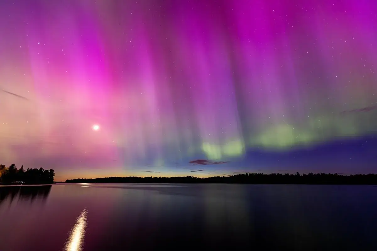
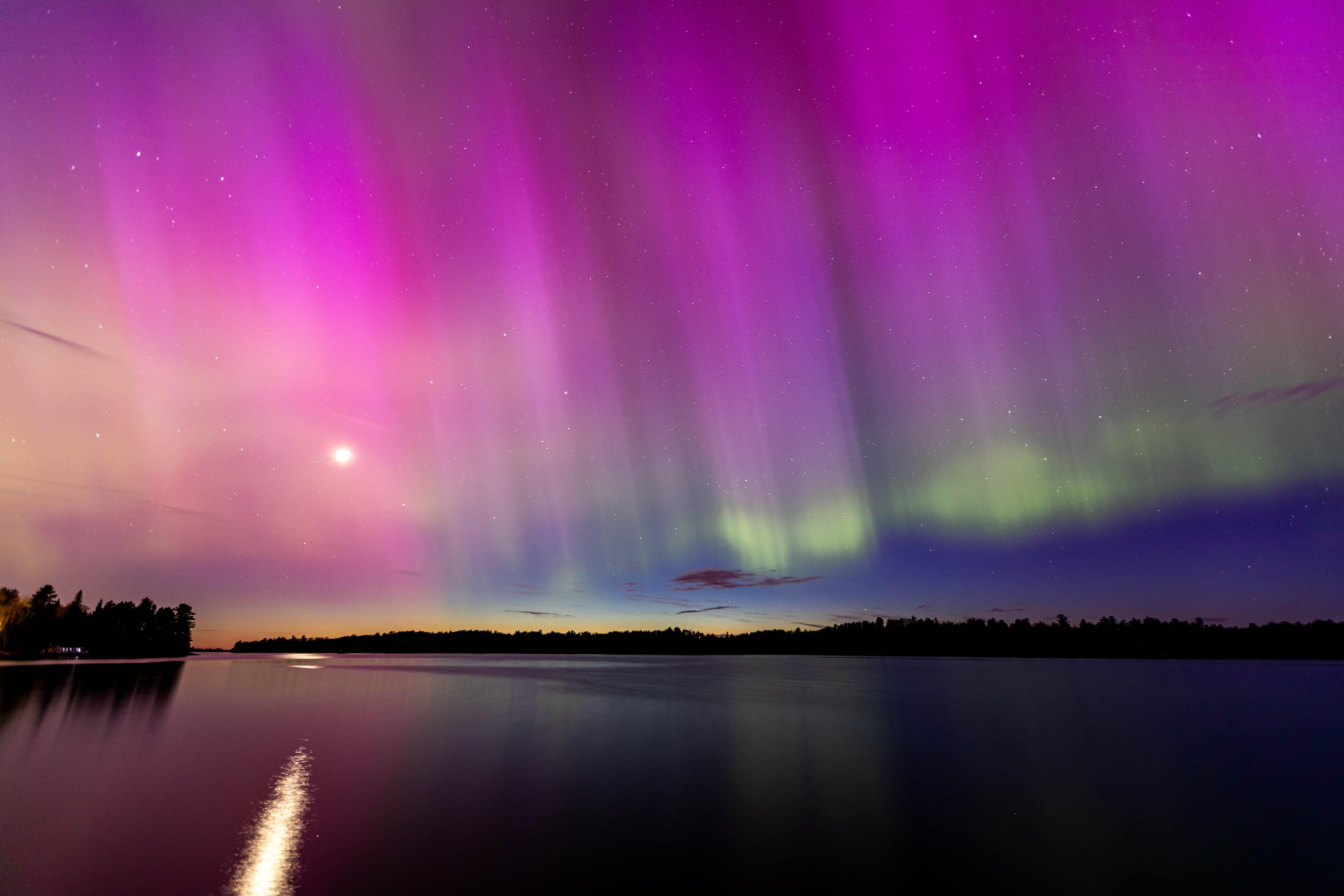
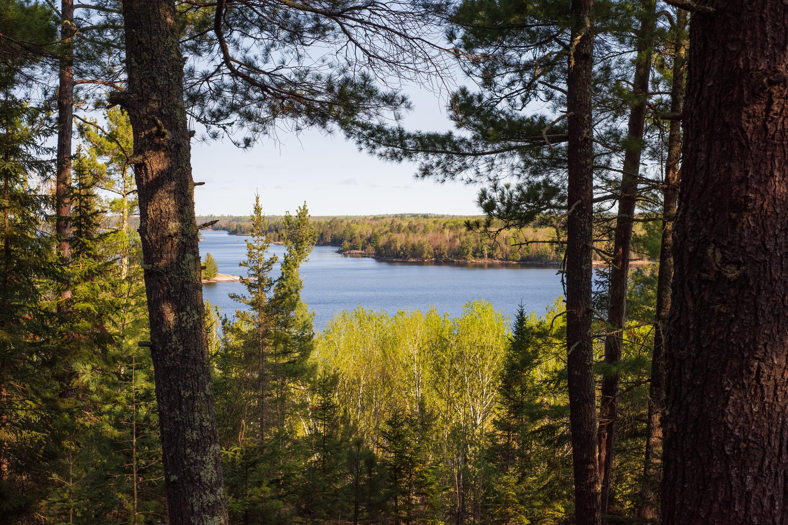
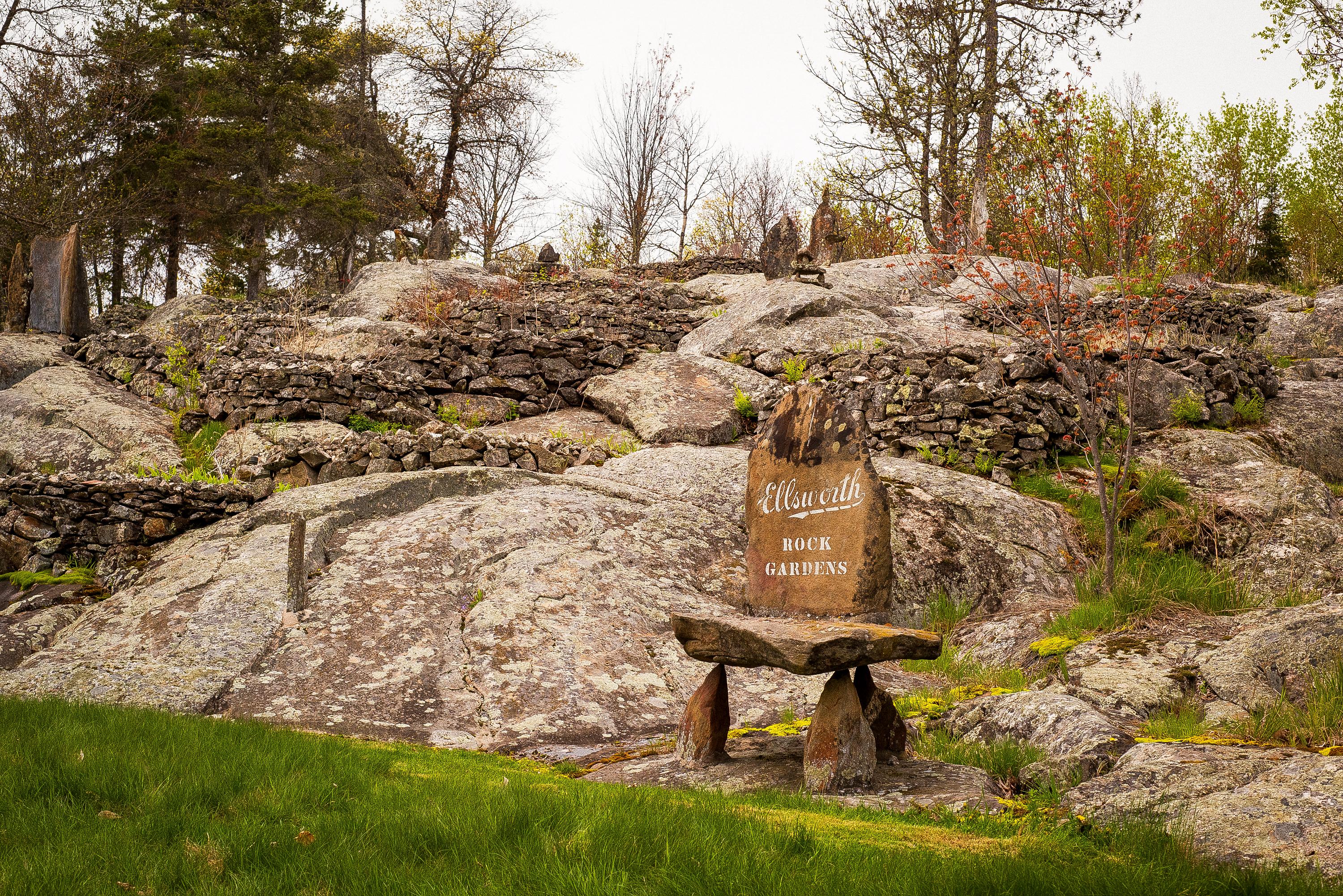
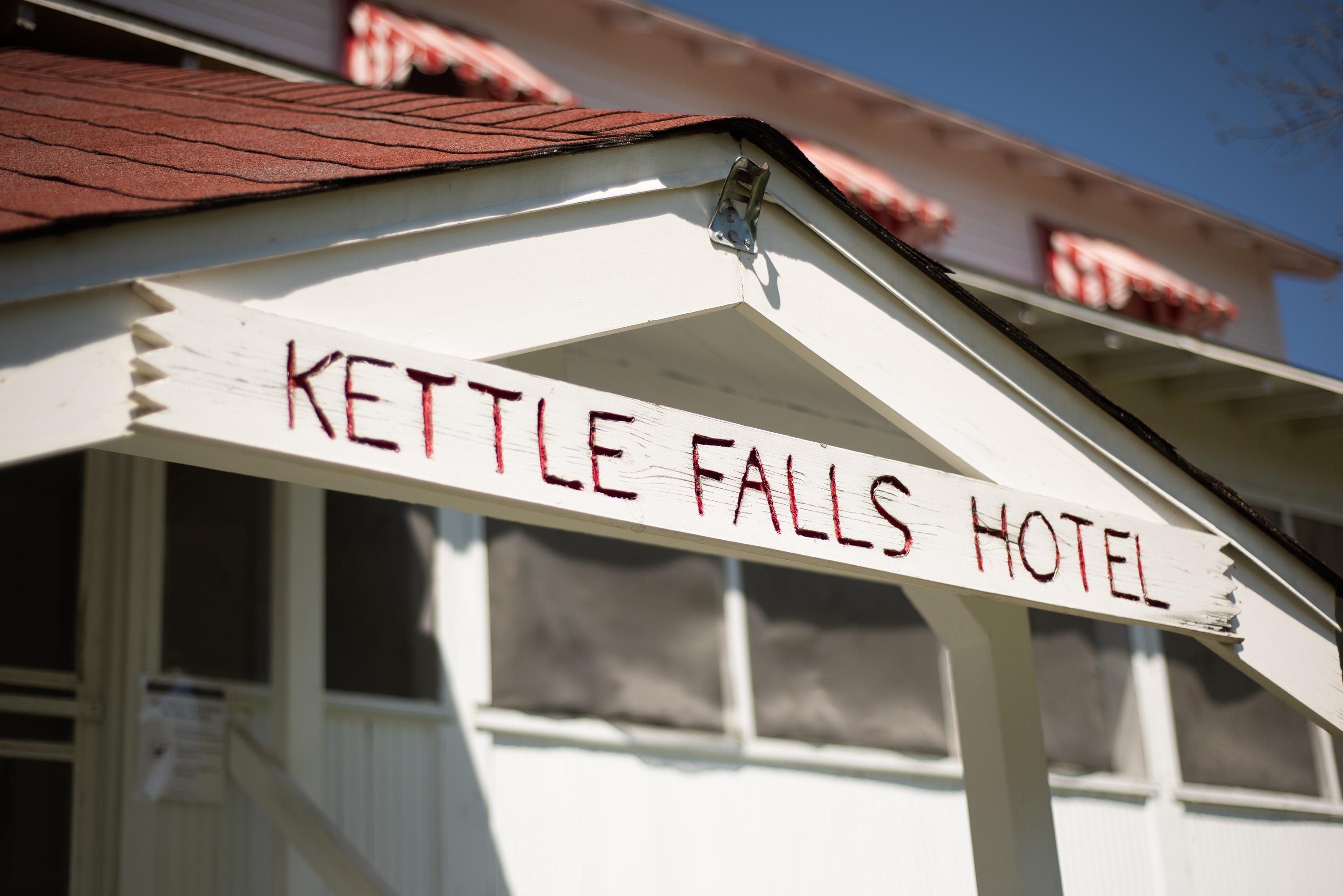


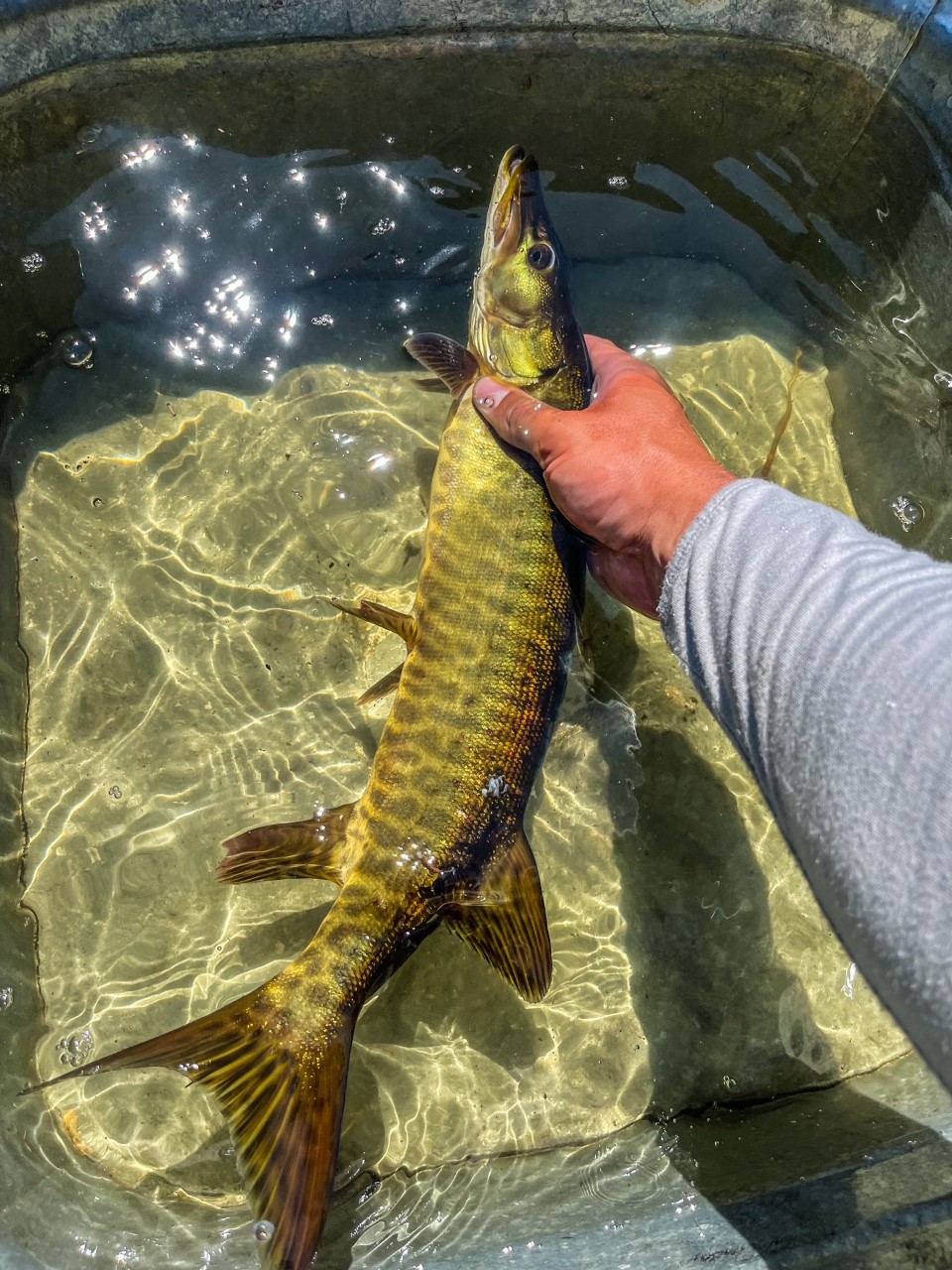


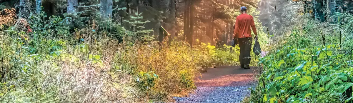 Coast & islands