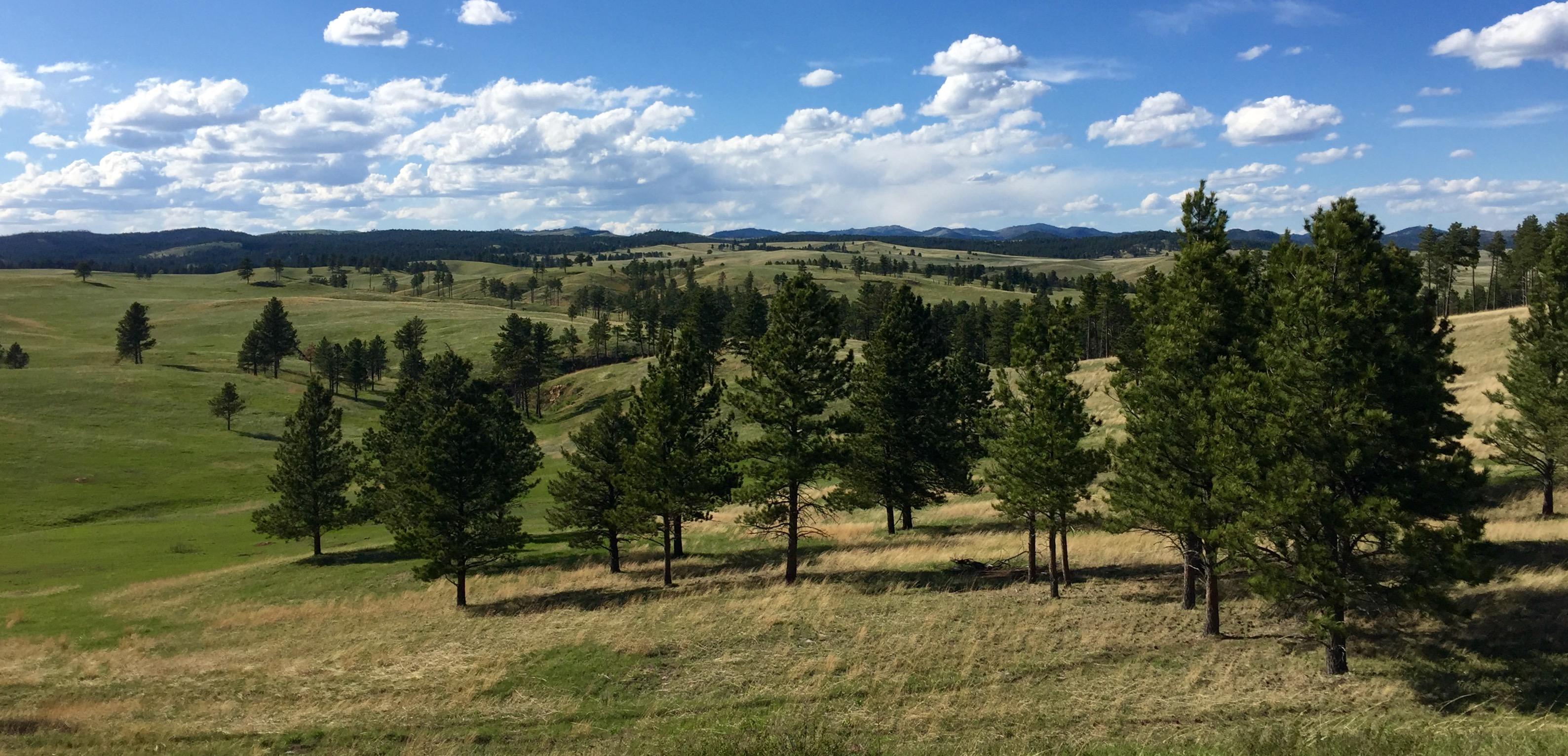
Wind Cave National Park protects two very different worlds - one deep within the earth, the other a sunlit world of many resources. Bison, elk, and other wildlife roam the rolling prairie grasslands and forested hillsides of one of America's oldest national parks. Below the remnant island of intact prairie sits Wind Cave, one of the longest and most complex caves in the world.
34Kacres of parkland
606.3Krecreation visits, 2025
Jun · Aug · Sepnearby climate picks
Seasonal access & reservations
No reviewed guidance for this selection. Check the park's official planning pages; missing coverage does not establish access.
Selected guidance only; separate from climate comfort and current conditions.
Official conditions Not checked
The conditions feed has not been connected for this park.
Allow 1 day for a first look. A useful base: Hot Springs, South Dakota.
Cave-tour and elevator access can change. Surface trails are a useful alternative.
A day-by-day starting point
01
DAY 1
Cave & prairie
Take a reserved cave tour if available and appropriate, then explore the prairie on open roads or suitable short trails. Check current cave operations first.
Editorial recommendations, reviewed 2026-10-17. Full park days, excluding travel to and from the region. A first-visit outline for a general traveler; adapt to mobility, fitness, season, reservations, and current conditions. These are suggested days, not reserved activities or guaranteed routes.
Official NPS features and USGS park boundaries, imported 2026-10-17. An inventory snapshot, not live trail or parking availability.
Loading official park features…
TrailsPoints of interestParkingZoom with buttons or pinch. Toggle layers on the map.
Map coverage varies. Trail names may represent segments, connectors, or shared park units; mapped lines are not a hiking recommendation. Use official conditions and navigation resources before heading out.
NPS public GIS inventory, imported 2026-10-17. “Existing” is an inventory classification, not confirmation that a trail is open. Segment counts are not route distances. Parking records do not indicate space availability, fees, or accessibility certification. View government source ↗
Climate for Rapid City, 60 km from the park reference point. 1991–2020 normals. Source elevation: 988 m.
Daytime highNighttime lowOctober: 58° / 36°
Daytime high58°
Precipitation50 mm
Daylight10.8 hrs
Wind13.1 km/h
Mountain, rim, valley, and coastal conditions can differ sharply from the source town. Check park forecasts and current conditions before travel.
Monthly climate data 12 months · °F
Month
High
Low
Rain / snow water
Wet days
Daylight
36°
17°
13 mm
3.9
9.1 h
38°
18°
19 mm
5.0
10.2 h
46°
25°
40 mm
7.6
11.6 h
54°
32°
80 mm
11.8
13.2 h
64°
42°
112 mm
14.1
14.5 h
74°
52°
97 mm
14.5
15.2 h
82°
58°
78 mm
13.4
15.0 h
81°
56°
60 mm
10.9
13.8 h
72°
47°
42 mm
6.7
12.3 h
58°
36°
50 mm
7.3
10.8 h
46°
25°
20 mm
4.4
9.4 h
37°
18°
15 mm
3.6
8.8 h
RESEARCH WITH THE SOURCE IN VIEW
The practical field guide.
Official NPS excerpts imported 2026-10-17. Fees, permits, road access, and operations can change; use the source link to confirm the latest information.
The Visitor Center is located 11 miles north of Hot Springs off U.S. Highway 385, about 1/2 mile west from the highway. Do not use your GPS to find the visitor center - you will get lost. Many GPS units locate the park visitor center north on South Dakota Highway 87. The coordinates for the Visitor Center are N43 33' 22" W103 28' 38".
From Rapid City direct:
Follow South Dakota Highway 79 south approximately 50 miles to U.S. Highway 385.
Turn right onto U.S. Highway 385 north, then continue through Hot Springs.
Follow U.S. Highway 385 another 6 miles north and into Wind Cave National Park.
Once in the park follow signs to the visitor center for cave tours and general park information.
From Rapid City via the Black Hills:
Follow U.S. Highway 16 south and west to U.S. Highway 385.
Turn left on U.S. Highway 385 south to Hill City and continue south through Custer City. The park is about 20 miles south of Custer, South Dakota, off U.S. Highway 385.
From western Nebraska:
Follow U.S. Highway 385 north through Hot Springs, South Dakota, to the park.
From Custer State Park:
Follow South Dakota Highway 87 south into Wind Cave National Park.
Public Transportation No public transportation serves the park.
Plane Nearest commercial airport is in Rapid City, SD.
Operating Hours & Seasons
Visitor Centers
Internet & Cellular Access
Internet & Cellular Access Details
Wind Cave Weather
The weather at Wind Cave National Park is variable and can be unpredictable, especially in the summer, with temperatures regularly exceeding 80° F (27° C). Severe thunderstorms are common in June and July and can produce large hail and severe lightning. Be sure to check the local forecast before heading out on a hike or other outdoor activity. Winters bring snow and temperatures regularly below freezing. Park roads may be closed during times of heavy snowfall so it is recommended to check current road conditions before driving to the park. Checking the weather page can give you an idea of what your visit to Wind Cave might be like. The cave is 54° F (12° C) year round.
The park has limited food and beverage vending services in the visitor center. Nearest grocery or restaurant services are available in the nearby towns of Custer (20 miles / 32 km) and Hot Springs (12 miles / 19 km). A picnic area 1/4 mile north of the visitor center offers easy access to the visitor center and the start of cave tours.
Access into the cave is through ranger-led tour only. Accessible cave tours and special arrangements are available for those with limited mobility, vision and hearing. See information below regarding special tour accomodations. Please note that all cave tours with the exception of the Accessible Tour include walking, standing, bending, stooping, and climbing up and down stairs. Stairs can be strenuous, with anywhere between two and eight flights of stairs climbed in succession.
Accessibility Cave Tour
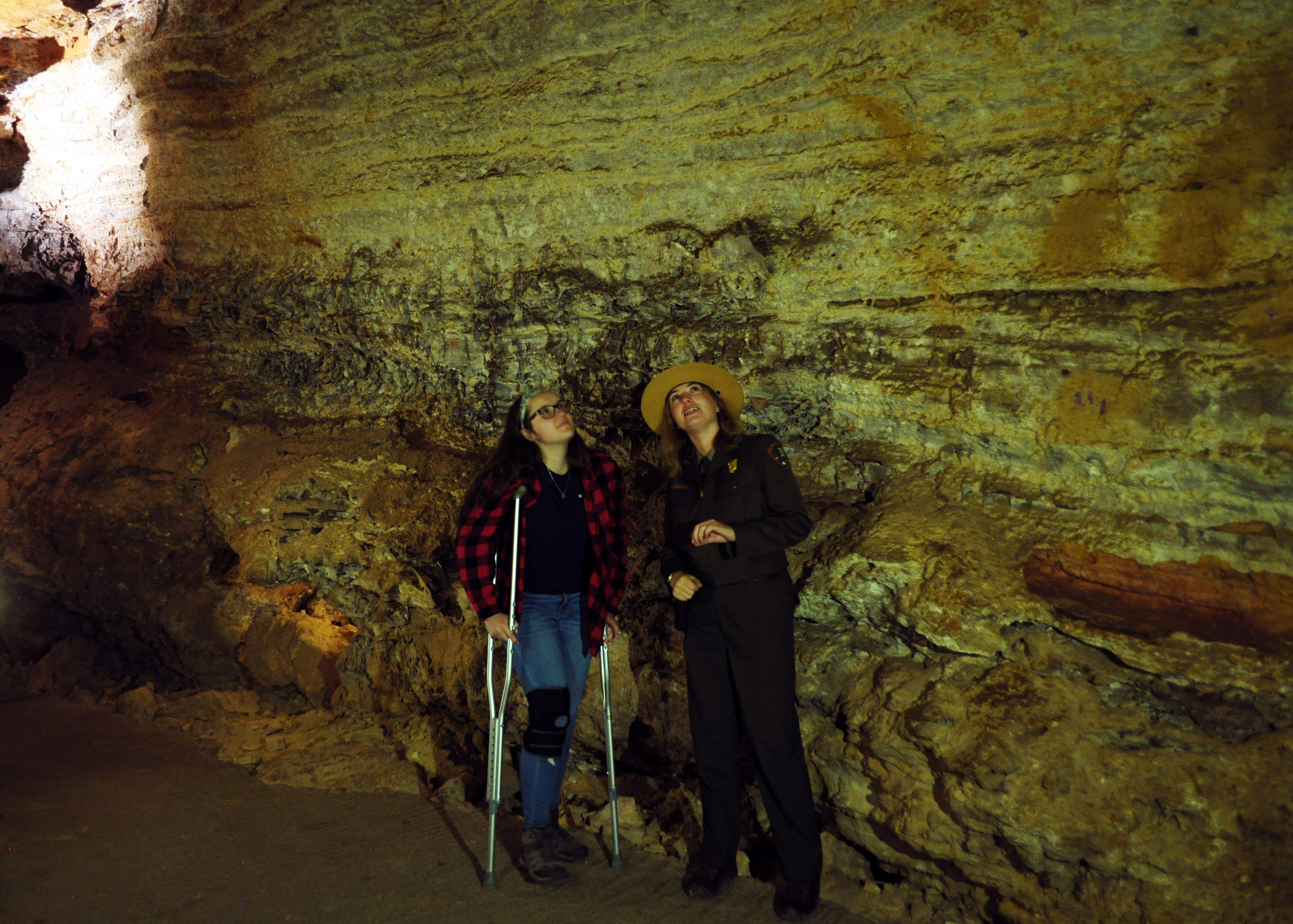
Limited areas of the cave are accessible to wheelchairs and those with limited mobility. These half-hour tours serve as an introduction to the cave and boxwork, the cave's signature feature, is shown. The tour includes riding the elevator into and out of the cave, and the elevator building is located about 200 yards south of the visitor center. Accessible parking is available at the elevator building. Please call the visitor center at (605) 745-4600 to make arrangements or ask at the information desk for an Accessible Tour. The fees for this tour are listed on our Fees & Passes page .
Hearing and Vision Accomodations
Cave trails are dimly lighted, often narrow, and may be wet and slippery in certain areas. There are numerous stairs along all of the tour routes. Persons with vision impairments should be cautious when entering the cave. Bringing an extra flashlight could assist visitors with vision impairments see steps and ceiling areas better. Special arrangements may be made in advance for a special tour for visitors with special concerns. For sign-language programming, please contact the park at least two weeks ahead of time to arrange accommodations. You may find cave tour scripts below.
Garden of Eden Cave Tour
Natural Entrance Cave Tour
Fairgrounds Cave Tour
The visitor center is accessible to wheelchairs and those with limited mobility. An elevator between the upper and lower level of the visitor center is available in the building. Exhibits are widely spaced to allow those using wheelchairs to move around the museum. The park film shown in the auditorium features closed captions.
There are two wheelchair accessible sites, B2 and D3. For more information, visit the campground page .
The picnic area is located about 1/4 mile north of the visitor center and can be accessed via vehicle.
NPS Photo / Lennie Ramacher
Natural Entrance to Wind Cave
Visitors using wheelchairs can visit the natural entrance of the cave . It is accessible via a ramp and sidewalk from the visitor center or from a wide gravel trail with a fairly level grade that starts at the picnic area.
Service Animals
The Department of Justice published revised final regulations implementing the Americans with Disabilities Act (ADA) for title II (State and local government services) and title III (public accommodations and commercial facilities) on September 15, 2010, in the Federal Register. These requirements, or rules, clarify and refine issues that have arisen over the past 20 years and contain new, and updated, requirements, including the 2010 Standards for Accessible Design (2010 Standards).This publication provides guidance on the term "service animal" and the service animal provisions in the Department's new regulations.
Beginning on March 15, 2011, only dogs are recognized as service animals under titles II and III of the ADA.
A service animal is a dog that is individually trained to do work or perform tasks for a person with a disability.
Service animals are defined as dogs that are individually trained to do work or perform tasks for people with disabilities. Examples of such work or tasks include guiding people who are blind, alerting people who are deaf, pulling a wheelchair, alerting and protecting a person who is having a seizure, reminding a person with mental illness to take prescribed medications, calming a person with Post Traumatic Stress Disorder (PTSD) during an anxiety attack, or performing other duties. Service animals are working animals, not pets. The work or task a dog has been trained to provide must be directly related to the person's disability. Dogs whose sole function is to provide comfort or emotional support do not qualify as service animals under the ADA. Wind Cave National Park's Superintendent's Compendium states: 36 CFR 2.15 - Pets: (a)(1) All caves, hiking trails, and backcountry areas are closed to pets. Service dogs are allowed on paved cave trails if medically necessary. All public use buildings are closed to pets except for service dogs.
Steven Koehler, Yellowstone National Park
The Access Pass may be issued to U.S. citizens or residents of any age that have been medically determined to have a permanent disability (does not have to be a 100% disability) that severely limits one or more major life activities.
A permanent disability is a permanent physical, mental, or sensory impairment that severely limits one or more major life activities, such as caring for oneself, performing manual tasks, walking, seeing, hearing, speaking, breathing, learning, and working. Benefits available to holders of the Access Pass include the waiver of entrance fees for most parks, as well as discounts at some federal campgrounds. The benefits of the Access Pass vary from park to park. Learn more about the Access Pass.
An entrance pass is not required to access Wind Cave National Park.
Other National Park Service sites may require an entrance pass or fee. Depending on your trip plans, an interagency pass may save you money.
2026 Free Entrance Days in the National Parks
Come experience the national parks! All National Park Service sites that charge an entrance fee will offer free admission to US citizens and residents (other fees, including timed entry or reservation fees, may apply). Mark your calendar for these entrance fee-free dates:
February 16 : Presidents Day (Washington's Birthday)
May 25 : Memorial Day
June 14: Flag Day/President Trump's birthday
July 3–5: Independence Day weekend
August 25: 110th Birthday of the National Park Service
September 17: Constitution Day
October 27 : Theodore Roosevelt's birthday
November 11: Veterans Day
Approximately half of all cave tour tickets are sold on a first-come, first-served basis. Call 605-745-4600 for large group information .
Only credit/debit cards or digital payments are accepted for all cave tours, campground fees, and Interagency Passes.
Garden of Eden Tour
Natural Entrance Tour
Fairgrounds Tour
Candlelight Tour
Accessibility Tour
Tour Reservations
A portion of tour tickets are available for advanced purchase through www.recreation.gov . Reservations are recommended as tours often sell out March through October and on holiday weekends throughout winter. Tickets can be reserved up to two days in advance. Approximately half of all cave tour tickets remain available for purchase on a first-come, first-served basis at the visitor center the day of the tour. Same-day tickets often sell out one to two hours or more before tour times.
Camp where the prairie meets the forest at the Elk Mountain Campground . The fee is $24.00 per site per night regularly, and $12.00 per site per night when the water is turned off (generally October through May). Visitors holding a Senior or Access Pass, or a Golden Age or Golden Access Pass pay half price a night per site.
Passes and Special Use Fees
America the Beautiful: National Park & Federal Recreational Lands Pass
As of 2007 the Golden Age, Golden Eagle, and Golden Access passes were replaced with a new series of interagency passes call the America the Beautiful - National Parks and Federal Recreational Lands Pass. Passes can be purchased at the Wind Cave visitor center and at any staffed entrance station throughout the national park system. NOTE: Interagency passes do not waive Expanded Amenity Fees such as cave tours. Resident Annual Pass - $80 Available to United States residents and provides access to, and use of, federal recreation sites that charge an entrance fee for a full year from month of purchase. Non-Resident Annual Pass - $250 Available to non-United States residents and provides access to, and use of, federal recreation sites that charge an entrance fee for a full year from month of purchase. Every Kid Outdoors 4th Grade Pass - Free Available to U.S. 4th graders or home school equivalents with a valid Every Kid Outdoors paper voucher. Valid for the duration of the 4th grade school year through the following summer (September - August). Learn more at the Every Kid Outdoors website . Senior Lifetime Pass - $80 A lifetime pass for U.S. citizens and permanent residents age 62 and over. Senior Annual Pass - $20 An annual pass for U.S. citizens and permanent residents age 62 and over. Good for one full year from month of purchase. Access Pass - Free A lifetime pass for U.S. citizens and permanent residents with permanent disabilities. Military Annual Pass - Free Available to active duty military personnel and dependents with proper identification (CAC Card or DD Form 1173) for a full year from month of purchase. Military Lifetime Pass - Free A lifetime pass for U.S. military veterans and Gold Star Family members with proper identification. Find detailed information about
Special Use Fees
There are also fees associated with special park uses including special events and professional photography. These activities need a special use permit .
The visitor center is located 11 miles north of Hot Springs off U.S. Highway 385, about 1/2 mile west from the highway. Do not use your GPS to find the visitor center - you will get lost. Many GPS units locate the park visitor center north on South Dakota Highway 87. The coordinates for the Visitor Center are N43 33' 22" W103 28' 38". Visit our Maps page for more information.
From Rapid City direct:
Follow South Dakota Highway 79 south approximately 50 miles to U.S. Highway 385.
Turn right onto U.S. Highway 385 north, then continue through Hot Springs.
Follow U.S. Highway 385 another 6 miles north and into Wind Cave National Park.
Once in the park follow signs to the visitor center for cave tours and general park information.
From Rapid City via the Black Hills:
Follow U.S. Highway 16 south and west to U.S. Highway 385.
Turn left on U.S. Highway 385 south to Hill City and continue south through Custer City. The park is about 20 miles south of Custer, South Dakota, off U.S. Highway 385.
From western Nebraska:
Follow U.S. Highway 385 north through Hot Springs, South Dakota, to the park.
From Custer State Park:
Follow South Daktoa Highway 87 south into Wind Cave National Park.
Public Transportation No public transportation serves the park.
Plane Nearest commercial airport is in Rapid City, South Dakota.
National parks across the country provide endless opportunities for recreational activities for everyone.
Encountering Wildlife
Animals in the park are wild and unpredictable. Do not feed prairie dogs or other wildlife. Fed animals may become dependent on handouts and fail to survive the winter or become sick from human food. They also become attracted to highways where they can be struck by passing vehicles. Use caution when encountering all wildlife, especially bison or buffalo. Bison are amazingly quick! They can run 35 mph, weigh up to a ton, and have sharp horns. These majestic animals may seem tame but are unpredictable and dangerous. You must stay at least 25 yards (23 meters) from all wildlife, but it is strongly recommended to stay farther away from bison. Bison are more aggressive during the calving and mating season from May through August. Mountain lions visit the park from time to time. Follow these mountain lion safety tips to avoid a confrontation. Pets are permitted in the visitor center area and campground, as well as on the Elk Mountain Campground Trail and Prairie Vista Trail. Pets are not permitted in the backcountry, including all other trails, to protect your pet and park wildlife. Pets may not be left unattended and must be on a leash at all times. Be aware that ticks are common in high grass and along trails and may affect you, your pet, or both.
No matter the season, use caution and expect wildlife on the roads. Obey all speed limits. They are strictly enforced to protect you and park wildlife. Vehicles and bicycles must be on the roadways at all times. Off-road driving or bicycle riding is prohibited. During winter icy roads, poor visibility, and changing wildlife patterns create hazardous driving conditions throughout the park. Bison often crowd along highways and are extremely difficult to see at night. Accidents involving bison or other large wildlife have the potential to cause serious injuries to drivers and their passengers.
NPS Photo / Lauren Reid
Poison ivy is a common native plant that can be found throughout the park and on hiking trails. Though it usually grows low to the ground in moist areas, it can take the form of a "hairy" vine on occasion. It can be identified by it's three shiny, jagged leaves, hence the saying; "leaves of three, let it be." When touched, oils on the plant can cause an itchy, red rash to appear on your skin up to a week after contact. Wear long pants and fully enclosed footwear when hiking. Wash affected skin or clothing with soap and water if you think you have come into contact with poison ivy.
Though most visitors come to see the cave, Wind Cave has many surface activities, including hiking. Over 30 miles of hiking trails meander through pristine mixed-grass prairie and ponderosa pine forest. Mileages listed below are one-way unless otherwise noted. The NPS app is a great tool for any hiking adventure! Click here to find out more and to download it through the App Store (iOS devices) or Google Play (Android devices).
Preparing for Your Hike
Carry and drink plenty of water. There are few water sources and all water in the backcountry must be boiled, filtered, or treated.
Wear fully enclosed footwear and long pants as poison ivy and ticks may be encountered anywhere in the park. It's also recommended to bring a wide brimmed hat, sunscreen, and bug spray.
Bring a park map .
Check the weather forecast before starting and bring extra layers. During the summer, afternoon temperatures regularly exceed 80 ° F (27 ° C) and strong thunderstorms with large hail are common.
There are two pet friendly trails in the park, the Prairie Vista Trail and Elk Mountain Campground Trail. Pets are not permitted on any other trail.
Large wildlife including bison (buffalo) and mountain lions roam throughout the park. Be aware of your surroundings at all times. Visitors must stay at least 25 yards from all wildlife, although it is strongly recommended to stay farther away from bison. Bison may appear tame but are unpredictable and dangerous and may charge without warning.
Topographic maps of the Black Hills can be purchased at the visitor center bookstore. Off-trail hiking is allowed and may be the best way to avoid large wildlife.
Remember that all park resources - rocks, antlers, bones, plants, animals, and artifacts - are to remain as you find them. All visitors are entitled to the same sense of discovery you experience when traveling the park trails, and collecting these items is illegal.
Approximately 1 mile / 1.6 km (round trip) Stroll the prairie grasslands from the visitor center. Waysides provide information along the way. Trailhead: Begin this loop trail at the Visitor Center or at the picnic area, located 1000 feet north of the visitor center.
1 mile / 1.6 km (round trip) The grassland and forest meet on this trail around the campground. During September and October, elk may be heard bugling at dawn and dusk. Trailhead: Located in the Elk Mountain Campground, across from the amphitheater.
1 mile / 1.6 km (round trip) Gain spectacular views from the highest point in the park. This nature trail, like those above, is a loop great for families or those with little time to explore. Though the fire tower is closed to the public, on a clear day, you may be able to see as far as the Badlands from the trail's eastern edge. A short guide for this trail may be purchased from the bookstore. Trailhead: Follow South Dakota Highway 87 toward Custer State Park, and look for signage leading towards Rankin Ridge Nature Trail. RVs and trailers are not permitted at trailhead; hikers may also park at nearby pulloff and walk to trailhead (approx. 1200 feet to trailhead).
Wind Cave Canyon
1.8 miles / 2.9 km This former road follows Wind Cave Canyon to the park boundary. Limestone cliffs provide nesting areas for cliff swallows, canyon wrens, and great horned owls. Look for Red-headed and Lewis' woodpeckers among the snag trees of forested hillsides. Trailhead: Located along US Highway 385 just east of the visitor center. Look for the gravel parking area east of the road.
Moderate Trails
Cold Brook Canyon
1.4 miles / 3.5 km This trail winds through Cold Brook Canyon to the park boundary. Along the way a ponderosa forest gives way to the open prairie and crosses a prairie dog town, a good place to see prairie falcons and other raptors. Trailhead : Located along US Highway 385 approximately 1 mile south of the visitor center.
2.2 miles / 3.5 km Follow the rolling hills of the prairie across Lookout Point to Beaver Creek. A side trip up to Lookout Point offers views of the American Elk Prescribed Fire from 2010. This trail can be combined with part of the Highland Creek and Centennial trails to make a 4.5-mile loop. Trailhead : Located along South Dakota Highway 87 north of the visitor center.
Strenuous Trails
East Bison Flats
3.7 miles / 6 km Hike one-half mile down the Wind Cave Canyon Trail to reach the East Bison Flats Trail where a brief, steep climb leads to the rolling hills of the praririe. Panoramic views of the prairie, Buffalo Gap and the Black Hills await. Trailhead: Located just north of the park's southern boundary along Route 385.
3.6 miles / 5.8 km This trail follows the rolling hills of the prairie, crosses a large prairie dog town, and ends where it meets the Highland Creek Trail. Trailhead: About one mile north of the Rankin Ridge fire tower turnoff.
6 miles / 9.7 km This section is the southernmost part of a 111-mile trail through the Black Hills, ending at Bear Butte State Park. Here it crosses prairies, ponderosa forests, and winds along Beaver Creek. Part of this trail can be combined with part of the Highland Creek and Centennial trails to make a 4.5-mile loop. Reminder: overnight parking without a camping permit is prohibited. Permits are not issued specifically for parking. Shuttles are available in the Black Hills for through-hikers on the Centennial Trail. Trailhead: This trail can be reached by South Dakota Highway 87 or NPS 5.
8.6 miles / 13.8 km This trail is the longest and most diverse trail in the park, crossing mixed-grass prairies, ponderosa pine forests, and riparian habitats of Highland Creek, Beaver Creek, and Wind Cave Canyon. Trailhead: This trail can be reached by a 1-mile hike down the Wind Cave Canyon trail or from the northern trailhead on NPS 5.
2.6 miles / 4.2 km A series of climbs offer panoramic views of the Black Hills, Red Valley, and the plains beyond. Elk are often seen from this trail in the morning and evening. Trailhead: The trail begins at a small parking area on NPS 6, one mile north of the junction with NPS 5.
Open Hike Policy
Wind Cave National Park is an open hike park meaning visitors are welcome to hike off designated trails. If you decide to explore the park and hike away from established trails, please make sure to bring plenty of water, a map, and be aware of your surroundings at all times. Bison and other wildlife roam throughout the park and cell service within the park is very limited.
Pick up a park map or hiking guide at the Visitor Center.
Topographic and other maps of the park are available for purchase through the Black Hills Parks and Forests Association . For interest in a hard copy of the following maps:
Pets are welcome at Wind Cave National Park within the following limits:
At all times pets must be restrained on a leash no longer than six feet in length. Leashes protect dogs from becoming lost and from potential encounters with wildlife as well as protecting park wildlife and plants.
Pets should not be left unattended. Summer sunshine poses a threat to pets left in vehicles. On a sunny day, even in temperatures as low as 60°F, temperatures inside a vehicle can reach dangerous levels. On an 85°F day the temperature inside a car, even with the windows cracked, can reach over 100°F (38°C) within 10 minutes.
Pet owners are responsible for removing pet waste from campgrounds, picnic areas, parking lots, roads, and other developed areas.
Pets are not permitted in the back-country areas of the park. This includes areas near park roadways and most of the trails – see below for exceptions.
Where CAN I go with my pet?
Grassy areas near the visitor center.
The Elk Mountain Campground.
Both the Prairie Vista Trail and Elk Mountain Campground Trail .
Where CAN'T I go with my pet?
Ranger-led programs and cave tours.
Public buildings including the visitor center.
The backcountry or any trails except those listed above.
Pet Boarding in Hot Springs and Custer:
Fall River Veterinary Clinic: (605) 745-3786; Must have proof of vaccinations.
Southern Hills Animal Clinic: (605) 673-4996
More Information
For more information about pet rules and regulations at Wind Cave, read the 36 Code of Federal Regulation (CFR) 2.15 in the Superintendent's Compendium.
The Black Hills are sometimes described as an island rising within a sea of grass. This sudden rise in elevation and the resulting slopes and exposures produce a much different climate than the surrounding plains. Wind Cave National Park lies on the southern tip of the "island" and, like the rest of the southern hills, has weather patterns that are greatly influenced by the Rocky Mountains to the west and the higher peaks of the northern Black Hills. Generally, the climate is semi-arid with mild winters and warm summers. Wind Cave National Park and the rest of the southern Black Hills are much warmer and drier than the northern hills. Some residents call the area South Dakota’s “banana belt.” The banana belt exists because of two weather patterns. The first weather pattern occurs when warm, moist air traveling east from the Pacific Ocean reaches the Rocky Mountains. The mountains force the air to rise, causing it to cool. When the air cools, the water vapor in the clouds condenses and falls as rain or snow. Once the air reaches the other side of the mountains, it is considerably drier. The dry air begins to descend, and becomes warmer again. The warm winds created by the descending air masses are called Chinook winds. This warm, dry air continues east and brings warmer and drier weather to the southern Black Hills. Another weather pattern occurs when arctic air masses move south from Canada. When the frigid air masses encounter the summits of the northern Black Hills, they are deflected around the western and eastern slopes. Because Wind Cave National Park is located on the southern extremity of the hills, much of the cold air is funneled downward and away from the park and the southern hills.
Seasonal Weather
Wind Cave National Park and the southern Black Hills are generally warmer and drier than the northern hills. Winter snowfall averages 30 inches annually. Spring and fall days vary from sunny and warm to cool, rainy, and windy. Summer brings warm daytime temperatures with cool evenings. Severe thunderstorms are common in June and July and can produce large hail and severe lightning. Slow moving storms can dump large amounts of rain over a small area, leading to flash flooding. Be cautious when camping near a creek bed even if it is dry. Move uphill if flooding starts. Be sure to check the local forecast and current road conditions before heading out.
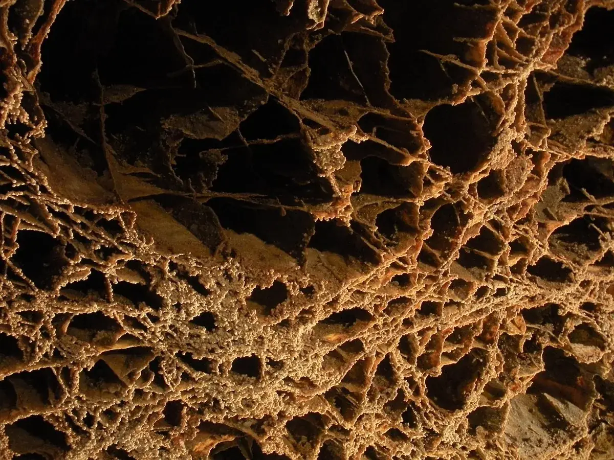
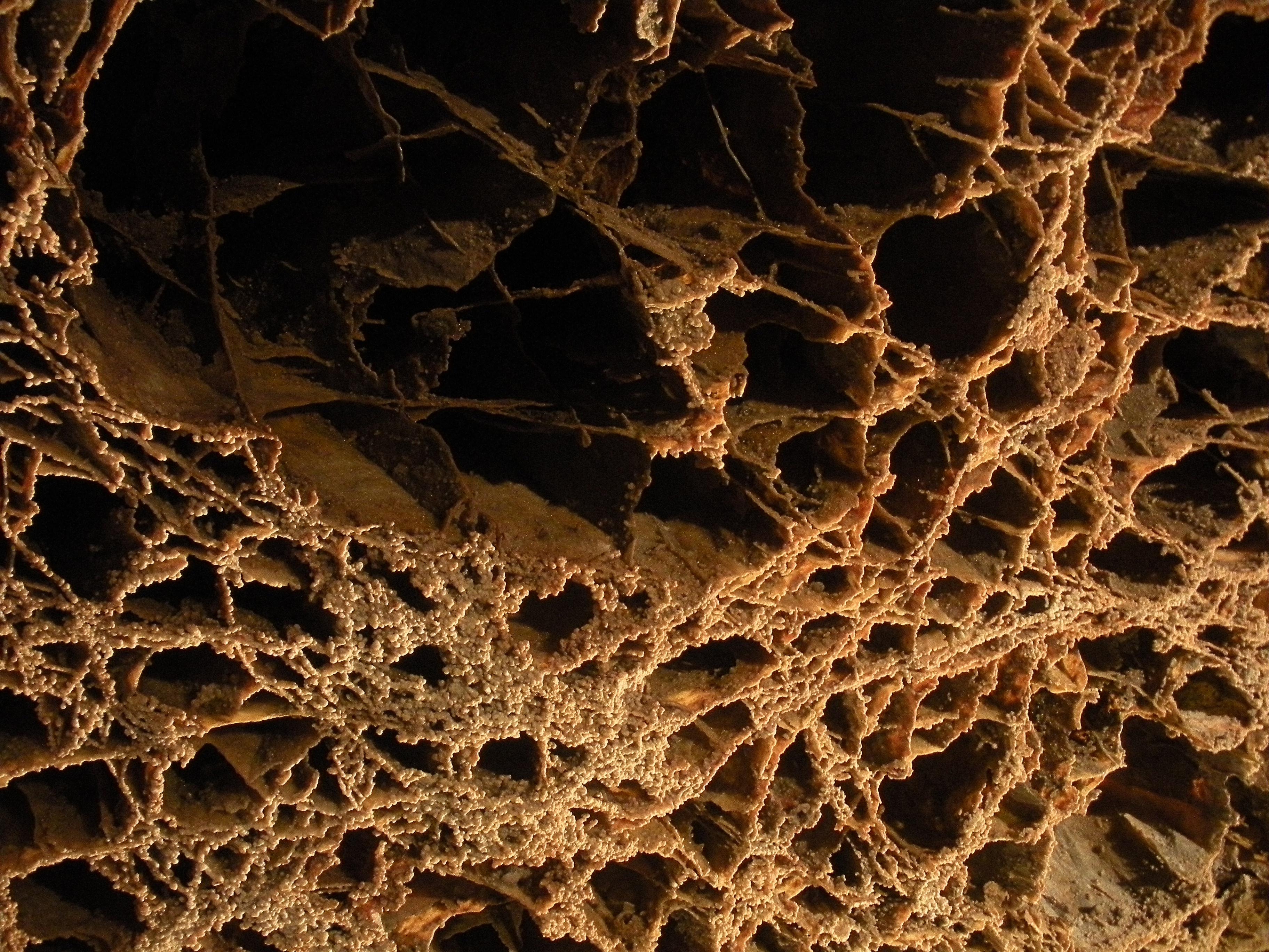
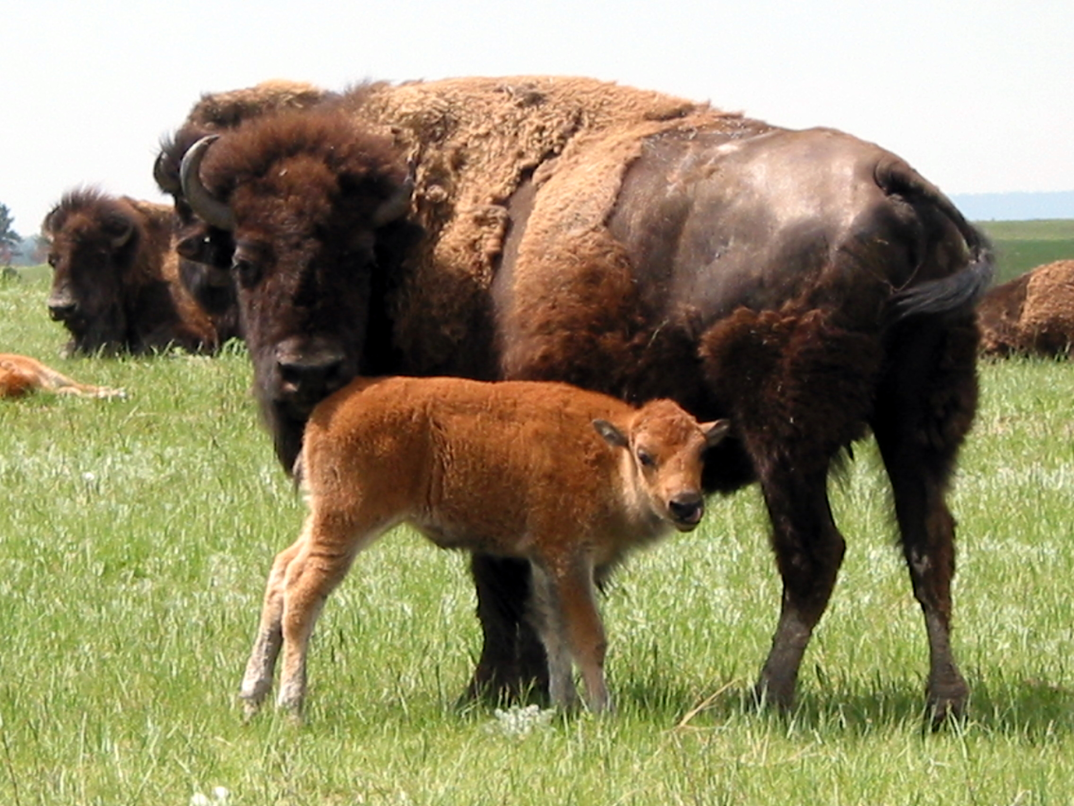
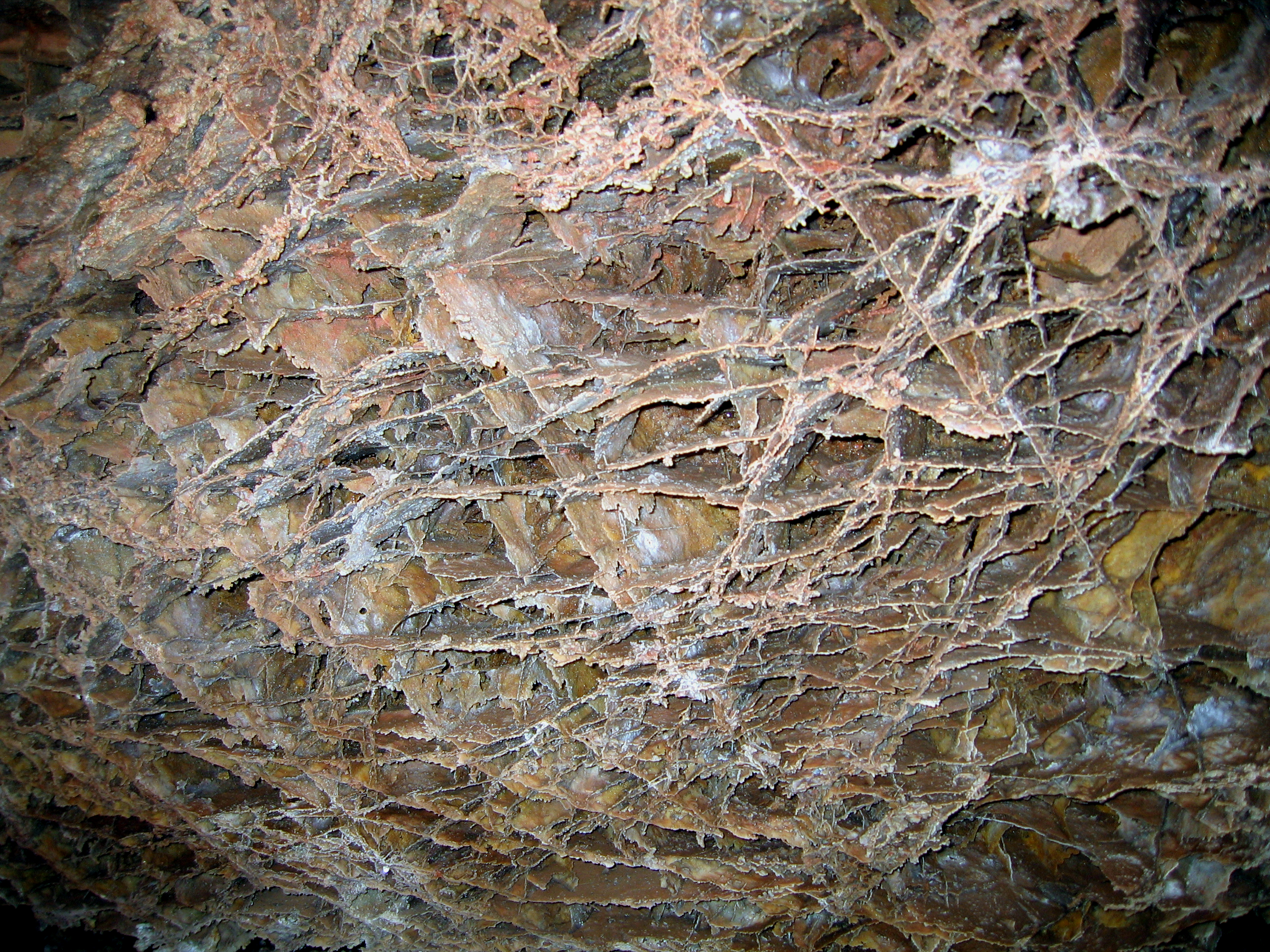
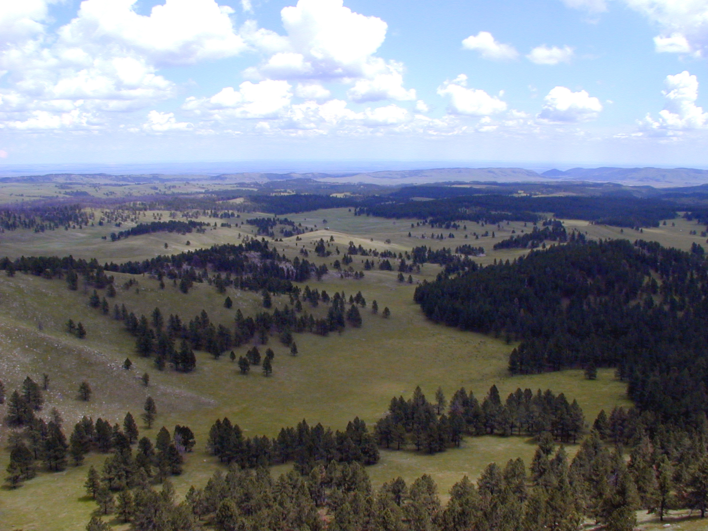
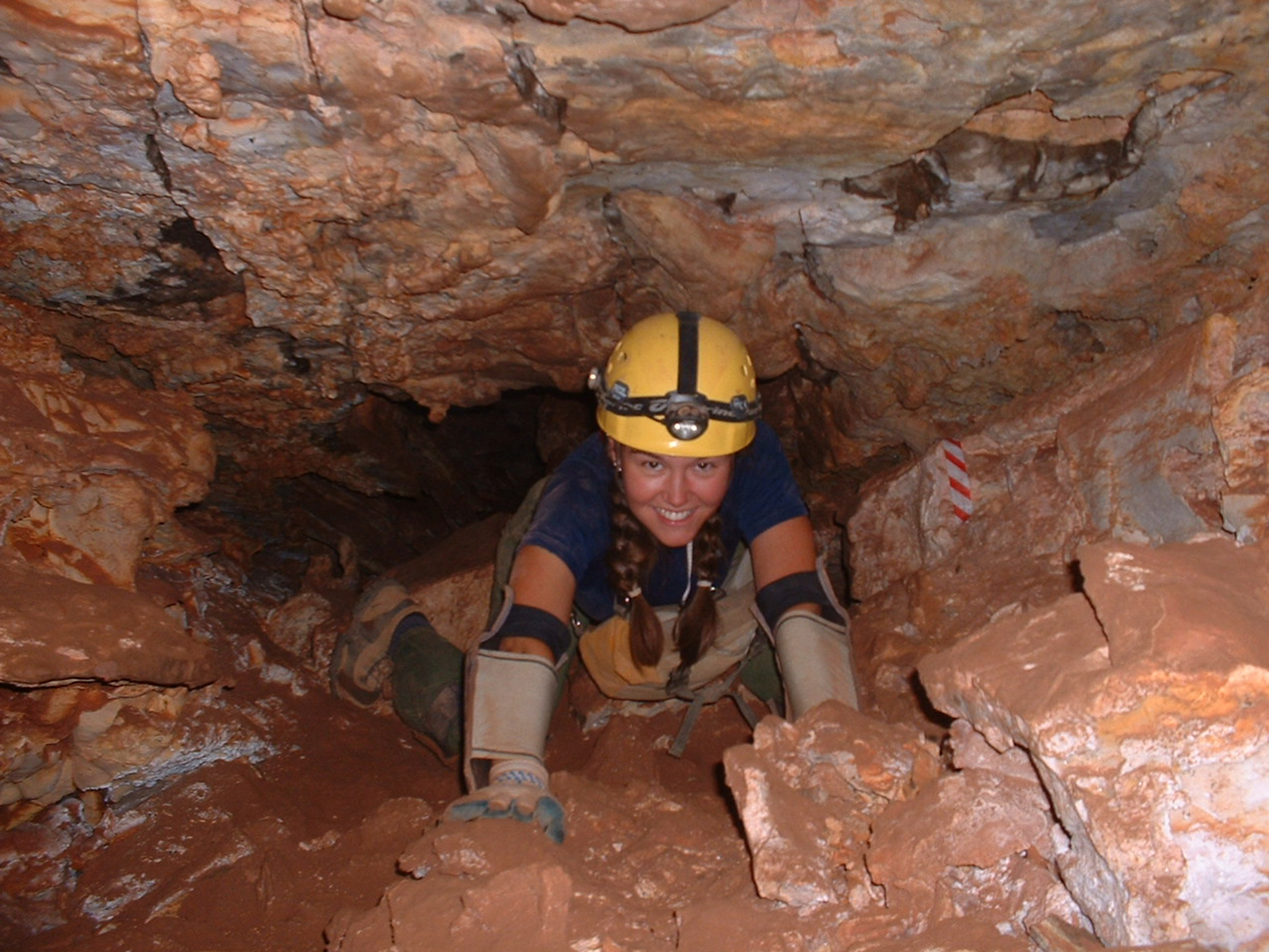
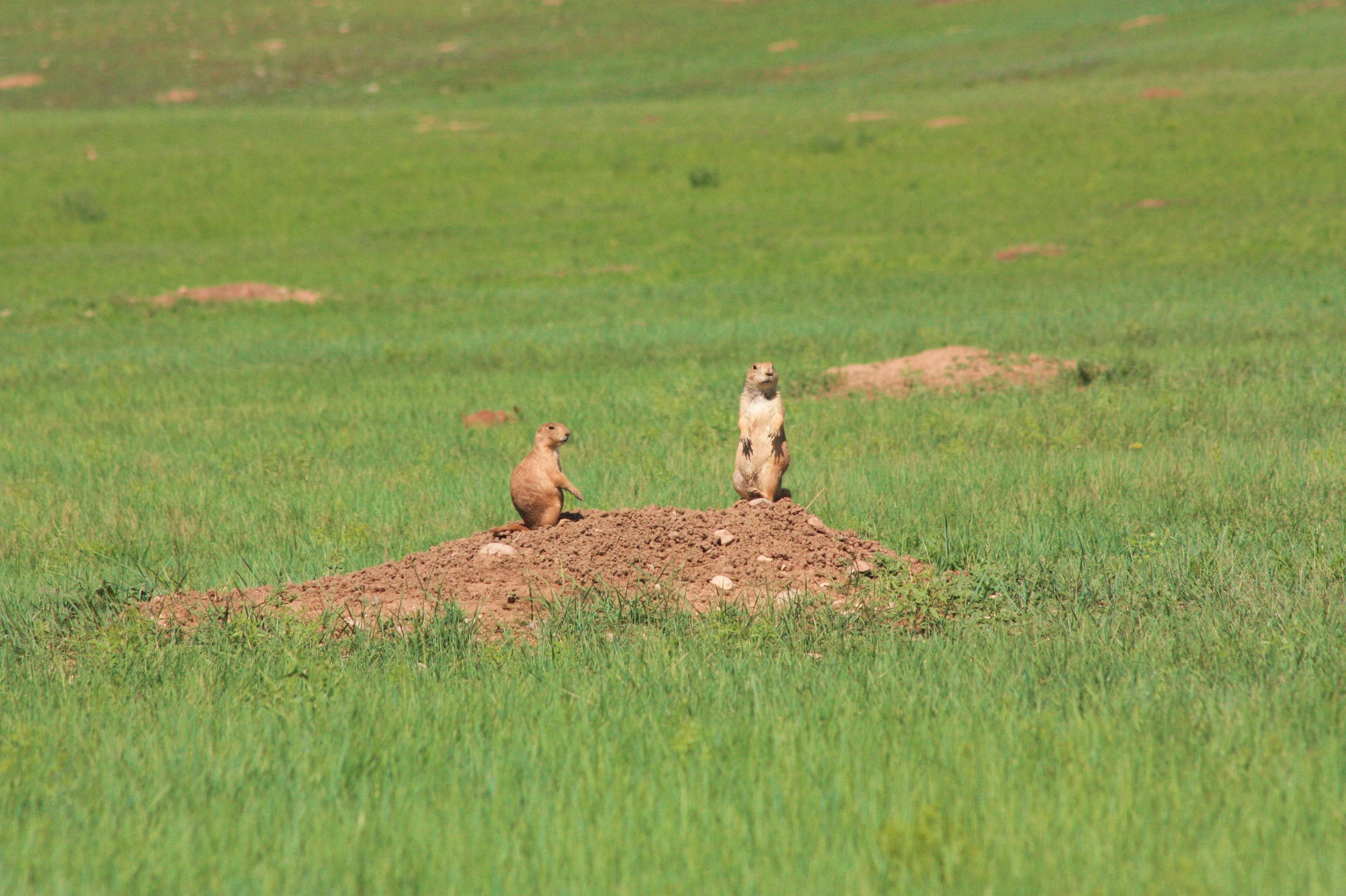
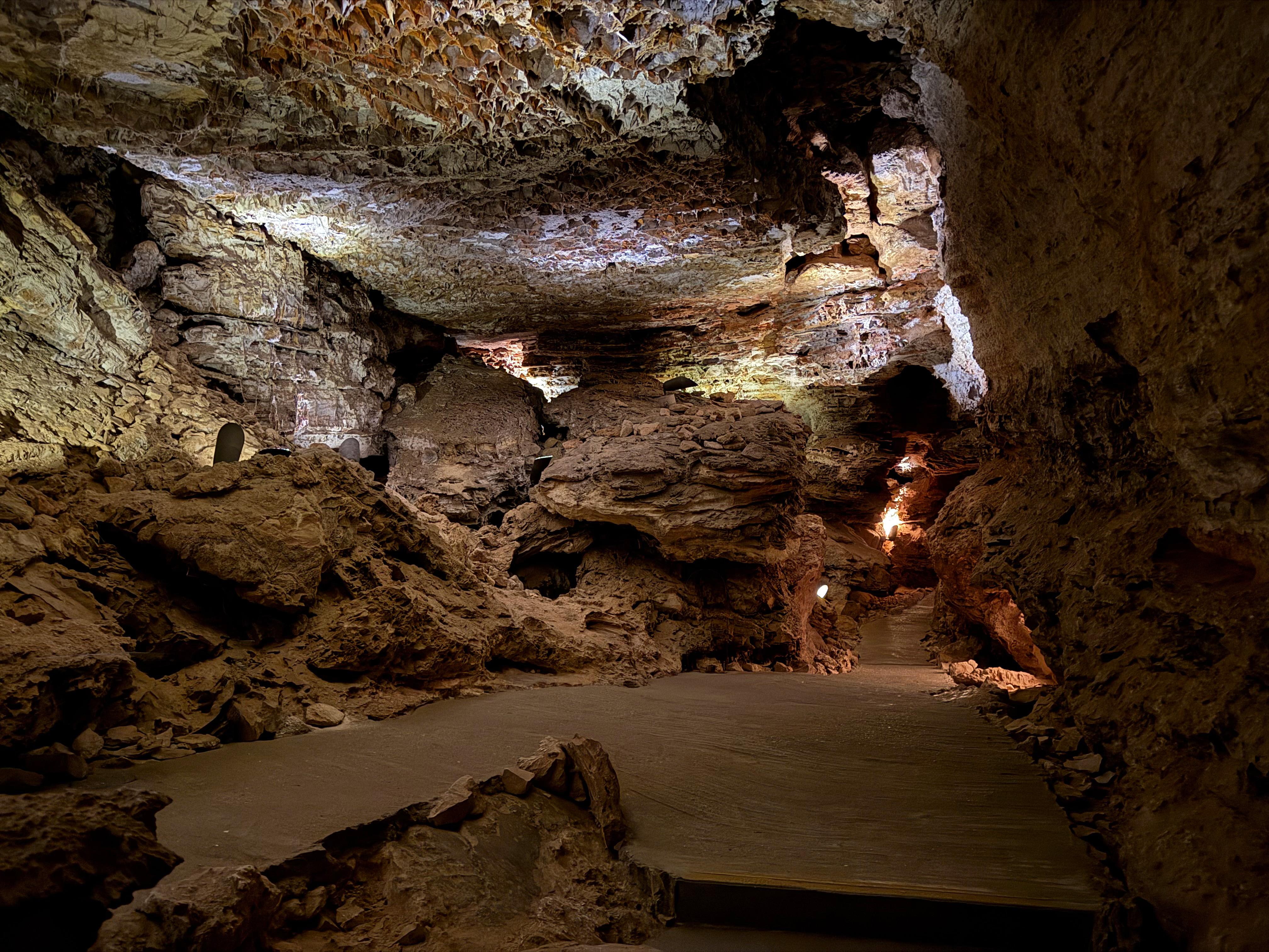
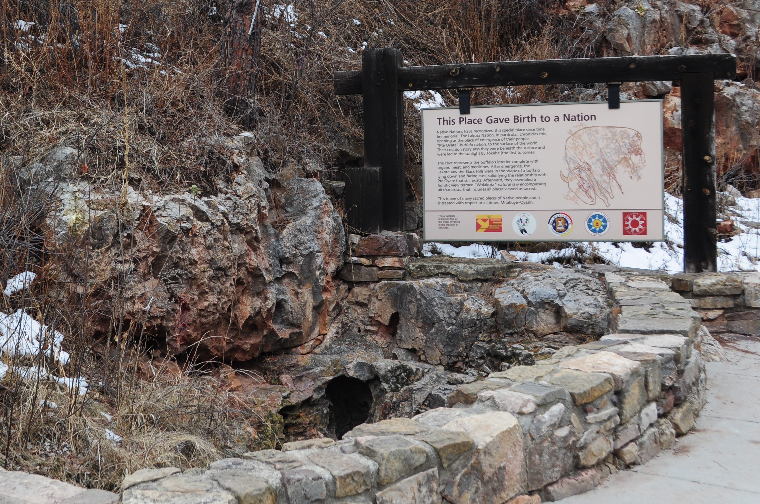
The boxwork on the ceiling of the Elk's Room is a popular photography subject and has been featured on many postcards and other souvenirs.NPS Photo Images link to the original government source.Several hundred bison roam the rolling prairie of Wind Cave National Park.NPS Photo / Dan Roddy Delicate fins of boxwork, a rare cave feature, in Elk's Room, Wind Cave.NPS Photo Wind Cave National Park from Rankin Ridge, the park's highest point.NPS Photo Each summer, the Wild Cave Tour offers the chance to get up close and personal with Wind Cave.NPS Photo View of Wind Cave National Park from near the southern entrance.NPS Photo Two prairie dogs watching for predators from the top of a mound.NPS Photo View of the Post Office room on the Natural Entrance Cave Tour.NPS Photo Visitors with limited mobility are still able to see the cave on a Special Accessibility Tour.NPS Photo A visitor with a ranger on the Accessibility Tour.NPS Photo / Callie Tominsky Wind Cave's natural entrance is a deeply spiritual place to many people.NPS Photo / Lennie Ramacher Bison, elk, and other wildlife roam at will throughout most of the park.NPS Photo
Look closer at accessibility.
No structured outing assessments have been reviewed for this park yet. Check the official accessibility guide for your requirements.
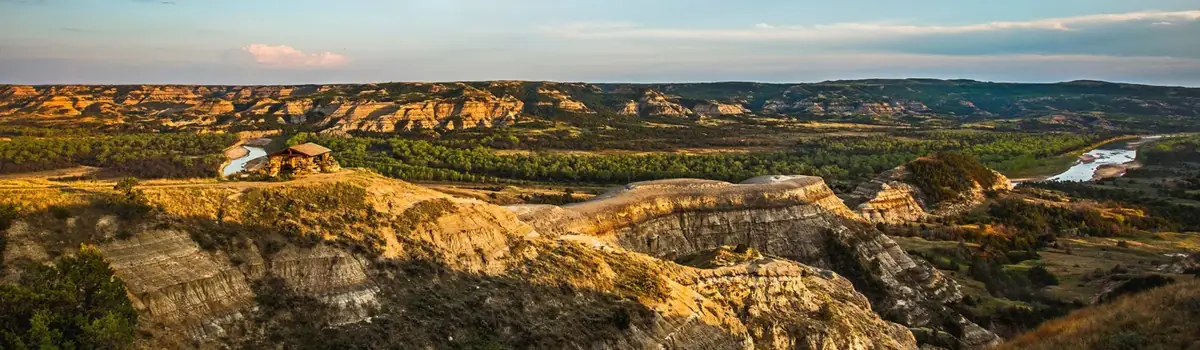
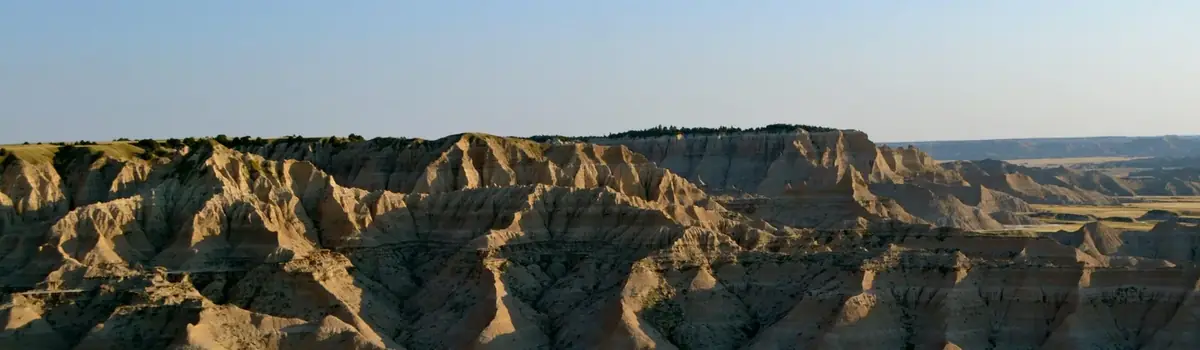
The rugged beauty of the Badlands draws visitors from around the world. These striking geologic deposits contain one of the world’s richest fossil beds. Ancient horses and rhinos once roamed here. The park’s 244,000 acres protect an expanse of mixed-grass prairie where bison, bighorn sheep, prairie dogs, and black-footed ferrets live today.
When Theodore Roosevelt came to Dakota Territory to hunt bison in 1883, he was a skinny, young, spectacled dude from New York. He could not have imagined how his adventure in this remote and unfamiliar place would forever alter the course of the nation. The rugged landscape and strenuous life that TR experienced here would help shape a conservation policy that we still benefit from today.
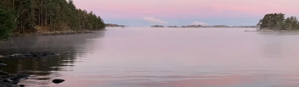
Voyageurs National Park spans 218,000 acres of lakes, forests, and streams in northern Minnesota. Established in 1975, the park is named after the French-Canadian Voyageurs who once navigated these abundant waters. Voyageurs National Park provides exceptional opportunities for recreation and exploration amidst landscapes rich in natural beauty, history, and cultural heritage.


 Desert