Springdale
5–20 min to the visitor center, plus parking or town-shuttle time
Best for the main canyon and walking to services.
Tradeoff: Often costs more; parking and queues still matter.
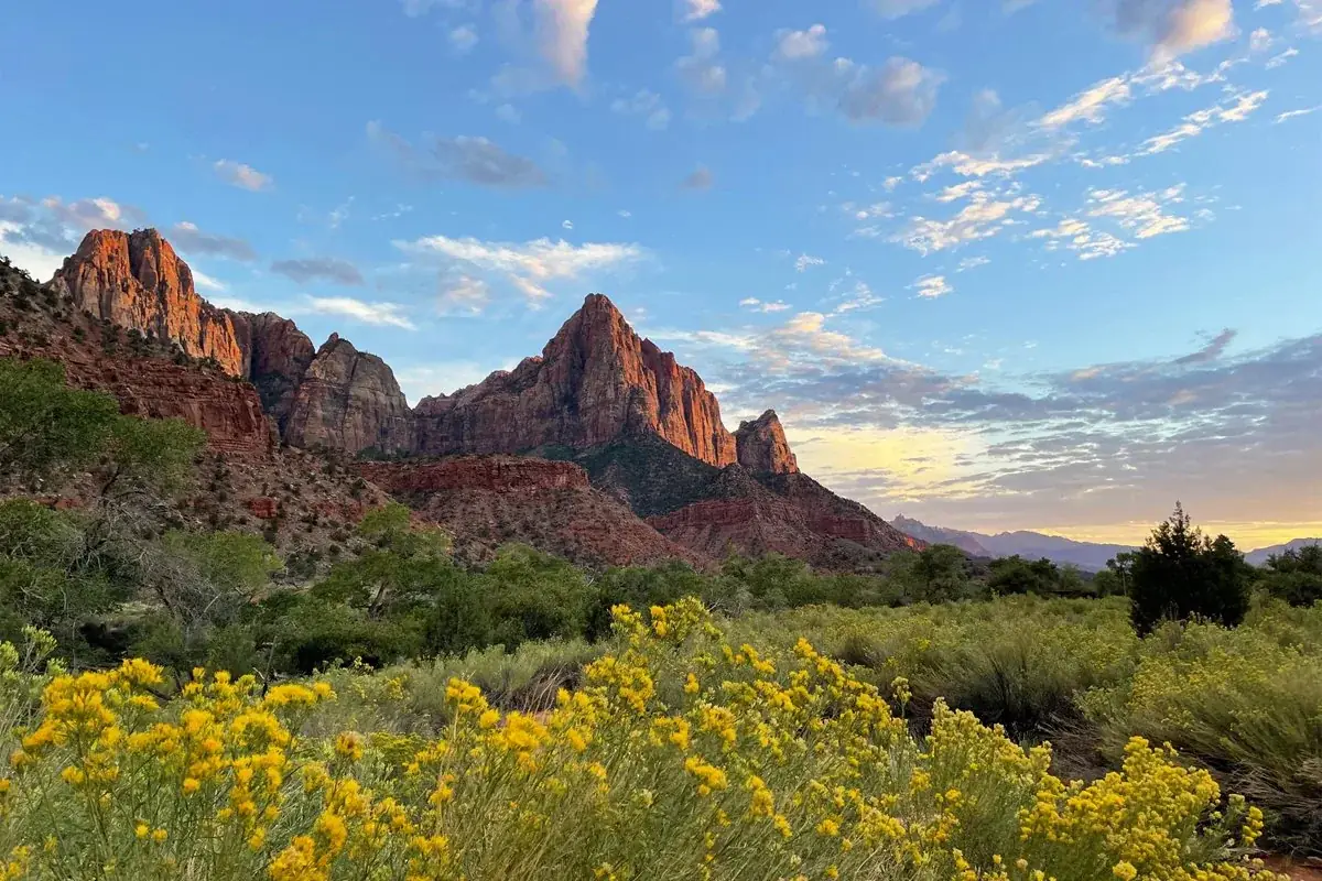
Follow the paths where people have walked for thousands of years. Gaze up at massive sandstone cliffs of cream, pink, and red that soar into a brilliant blue sky. Experience the tall, stretching walls of a narrow slot canyon. Zion’s unique array of plants and animals will enchant you as you absorb the rich history of the past and enjoy the excitement of present-day adventures.
Private vehicle access to Zion Canyon Scenic Drive is restricted while the shuttle operates. Check the published shuttle calendar for your dates; other park roads have different access arrangements.
Before you go: Check shuttle dates and your intended canyon access.
Official guidance ↗ Reviewed 2026-10-18The chains section requires a permit. Check the travel-year lottery, date and time; this permit is separate from entrance admission and canyon transport.
Before you go: Arrange a permit or choose an alternative outing.
Official guidance ↗ Reviewed 2026-10-19Selected guidance only; separate from climate comfort and current conditions.
The conditions feed has not been connected for this park.
Check current conditions at NPS ↗A canyon shuttle day, an east-side day and an optional separate Kolob day. No Angels Landing permit or river hike is assumed.
Check the changing shuttle timetable and shorter daylight. Cold or wet conditions can affect east-side and Kolob walks.
Day 1Riverside Walk → Zion Lodge picnic break → Pa’rus Trail
Day 2Canyon Overlook → Checkerboard Mesa area
Day 3Kolob Canyons scenic drive → Timber Creek Overlook
Editorial planning ranges, not live routing or official trail measurements. Driving excludes lodging commutes unless stated; queues, closures and weather can add substantial time. Walking ranges describe the selected outing, not necessarily the full trail. Arrival and departure travel are additional. Select the season for your dates; this is not a live conditions check.
Walk beside the river, turning around at the end of the maintained path. This plan does not enter the Narrows.
Start: Temple of Sinawava; use the park shuttle when operating.
Getting there: First stop: allow 45–60 minutes each way on the canyon shuttle, plus queues.
Footing: Paved, uneven in places; about 57 ft elevation gain. Ice, sand and closures can affect access.
Use a short Pa’rus out-and-back if Riverside Walk is closed.
Bring lunch and water. A midday break leaves room for shuttle delays.
Start: Zion Lodge shuttle stop.
Getting there: From Temple of Sinawava: allow 15–30 minutes on the shuttle, plus waiting.
Footing: Developed area; use designated paths.
Return to the visitor center for a sheltered break.
Choose a shorter out-and-back for river and Watchman views; stay clear of bicycles.
Start: Start at the Zion Canyon Visitor Center.
Getting there: From the lodge: allow 15–30 minutes on the shuttle, plus waiting.
Footing: Paved shared path; the full trail is 3.5 miles round trip with about 50 ft gain.
Skip this optional walk if the canyon shuttle day runs long.
Start early enough to allow shuttle queues. Driving estimates exclude the trip from your lodging; allow another 60–120 minutes for shuttle travel and 30–60 minutes of contingency.
Park only in a legal space. This trail is unsuitable for visitors who need a level, step-free walk.
Start: Small parking areas east of the Zion–Mount Carmel Tunnel.
Getting there: From Springdale: allow 30–50 minutes driving, plus tunnel and parking delays.
Footing: About 163 ft gain; rock steps, uneven footing and exposed edges.
If parking is full or the trail is icy, continue to legal east-side pullouts; do not circle indefinitely.
Enjoy the sandstone scenery without adding an unplanned cross-country hike.
Start: Use designated pullouts near the east entrance.
Getting there: From Canyon Overlook: allow 15–25 minutes driving.
Footing: Roadside viewpoints; uneven shoulders.
Return to Springdale if pullouts are full or road conditions deteriorate.
Keep this separate from your canyon shuttle day. Large vehicles must check current tunnel restrictions; estimates assume a standard passenger car.
Check road status before leaving; stop only at open designated viewpoints.
Start: Kolob Canyons Visitor Center off I-15, a separate entrance.
Getting there: From Springdale: allow 50–75 minutes driving each way.
Footing: Developed viewpoints with variable surfaces.
If the district is closed, stay near Springdale and revisit the canyon-floor paths.
Take the short overlook walk if footing and heat permit.
Start: Trailhead at the end of Kolob Canyons Road.
Getting there: Allow 15–25 minutes along the scenic road from the visitor center.
Footing: About 100 ft gain; dirt and rocky steps, little shade.
Use a roadside viewpoint rather than the trail.
Take food and water; do not plan around finding a restaurant within this district. Skip Kolob if you would rather have a slower day in the main canyon.
Compare access to Zion Canyon Visitor Center. Drive ranges are editorial estimates before major queues or weather delays.
5–20 min to the visitor center, plus parking or town-shuttle time
Best for the main canyon and walking to services.
Tradeoff: Often costs more; parking and queues still matter.
35–55 min to the visitor center each way
More lodging choice and useful for an I-15 road trip.
Tradeoff: A return commute every canyon day; add it to the daily total.
65–90 min to the visitor center each way
Useful for an east-side regional trip.
Tradeoff: Tunnel traffic and a long canyon commute; usually a poor base for repeated shuttle days.
Use your own quotes to compare room savings with extra time on the road.
Room totals only. Taxes, fuel, parking, vehicle wear and the value of your time are additional. These inputs are examples until you enter your quotes.
Mark your own preparation below. A check means you have handled it; it does not confirm a reservation or availability. Stored on this device.
Entrance · Before arrival
General sightseeing does not require an Angels Landing permit. Check current entrance fees for your party.
If unavailable: Use the fee page to confirm what your pass covers.
Check official rules & booking linksTransport · Before choosing a trail day
Check the dated shuttle schedule and last return bus. An Angels Landing permit does not give shuttle priority.
If unavailable: Choose visitor-center / Pa’rus options if canyon transport is unavailable.
Check official rules & booking linksActivity · Before committing to a specialist hiking day
Angels Landing requires a permit. Bottom-up Narrows day hiking does not, but water, flood and health conditions control whether it is appropriate. Neither is included here.
If unavailable: Follow the canyon-floor itinerary instead.
Check official rules & booking linksLodging · Watchman: up to six months ahead; South / Lava Point: up to two weeks
NPS lists Watchman reservations up to six months ahead, and seasonal South and Lava Point reservations up to two weeks ahead. Confirm each campground’s current dates, release details and closures before booking. A gateway hotel has its own booking and cancellation terms.
If unavailable: Compare Springdale with Hurricane / La Verkin before extending your commute.
Check official rules & booking linksThe PDF and HTML contain the selected days, transport notes, lodging comparisons and booking guidance. Linked maps and websites require a connection.
Official source review: 2026-10-18. Durations, district grouping, gateway drive ranges and recommended pacing are National Parkwise editorial estimates. They are not live routing, current-condition guarantees or accessibility certification.

Zion offers many trails ranging from short walks to strenuous adventures.

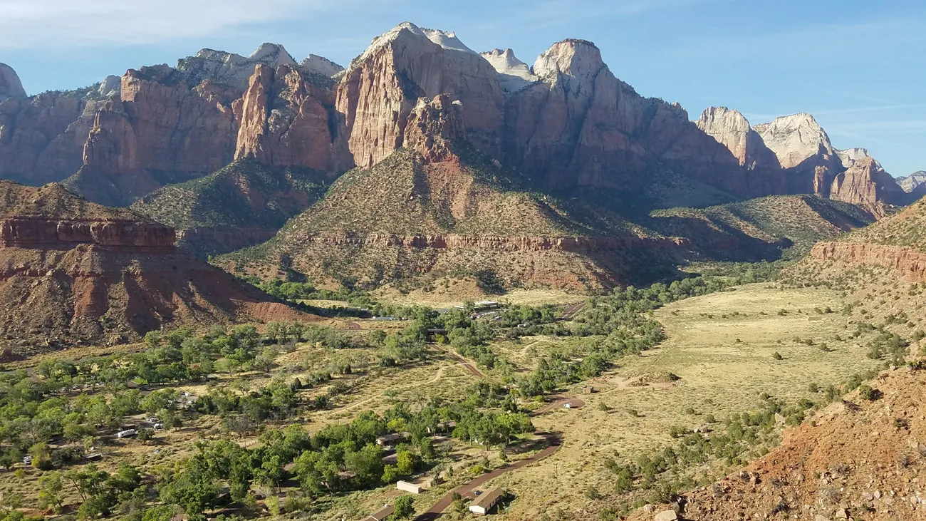

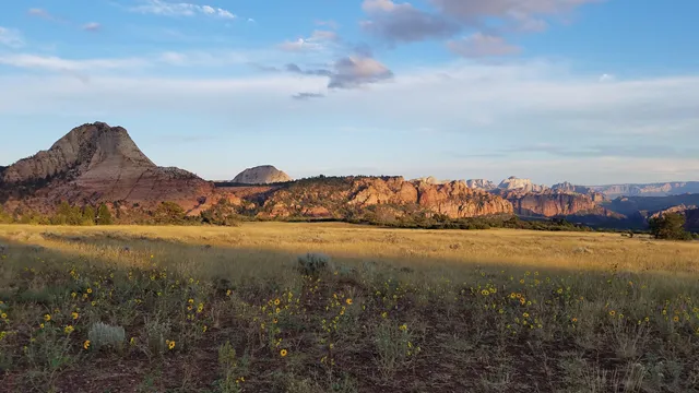
Plan ahead and prepare for your hike in Zion National Park. Review the trail information linked below to choose a trail that is right for your group. Your safety is your responsibility. You can read the most recent trail information on our trail access information page. For updated trail closure information, check the current conditions . Find trailhead location maps on our publications page.
Much longer hikes are located in the Zion Wilderness. These are not loop hikes. Most day hikers will hike out and back the same way. Hikers do not need to travel the full distance, they can turn around at any point and return the way they came. The group size limit for all Zion Wilderness trails, including the Virgin River Narrows beyond the junction with Orderville Canyon, is 12 people.
Several hiking options are located in Kolob Canyons, the northwest corner of Zion National Park.
These trails are at a higher elevation, mostly stretching across a center portion of the park.
This area is located east of Zion Canyon at a much higher elevation.
A beautiful low-elevation area located in the southwest corner of Zion National Park.
NPS information imported 2026-10-17. Confirm current details at NPS

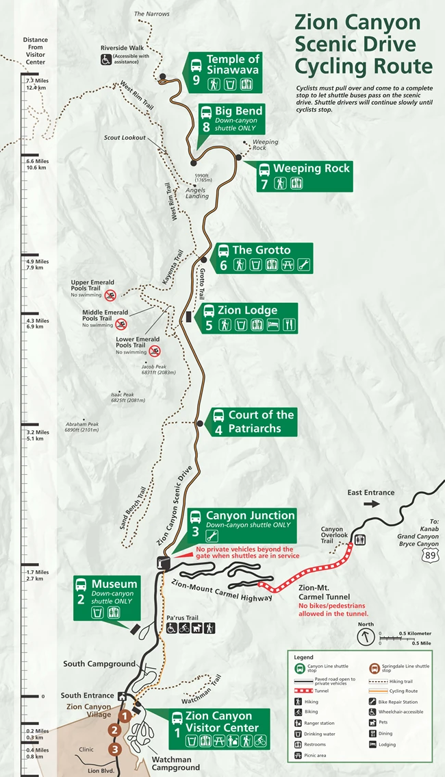
The Pa'rus Trail and Zion Canyon Scenic Drive are accessible to bicycles.
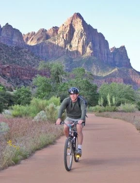
Join Ranger Darcy to learn how to visit Zion National Park with your bike or e-bike! Know where you can go, what to keep in mind, and three tips to get the most out of your visit. Learn more about biking in the park at www.nps.gov/zion/planyourvisit/bicycling.htm
Riding your bike can be a great way to experience Zion National Park. Here are some things to keep in mind if you decide to ride in the park:
Bicycling is only permitted on the Pa'rus Trail and park roadways (with the exception of the Zion-Mt. Carmel Tunnel ). All other trails and off-trail routes are closed to bikes.
The speed limit on the Pa’rus Trail is 15 mph.
When a shuttle bus is behind a cyclist, the cyclist must pull over to the side of the road and come to a complete stop. Allow the bus to safely pass before riding.
Bicycles must ride single file on the right side of park roads and the Pa’rus Trail.
Cyclists are limited to groups of 6 bikes or less. Please split up larger groups.
Cyclists must obey all traffic signs, including stop signs.
Cyclists should wear their helmet at all times. Each year, the park sees serious injuries from bike crashes.
The bicycle entrance to Zion National Park is in Springdale, next to the Zion Outfitter and the Zion Brew Pub. Here, you will cross a small bridge to the Pedestrian Entrance fee station. This path connects to the Pa'rus Trail . Please walk your bike through the Visitor Center Plaza. Regular bicycles are allowed on the park shuttle buses, though you will need to be able to lift the bikes on and off the racks yourself. E-bikes are not allowed on park shuttle buses. The bike repair stations in Zion National Park are located at Canyon Junction (shuttle stop #3) and The Grotto (shuttle stop #6). The repair stations are free and include an air pump, a screwdriver, wrenches, and a hands-free bike mount.
Only Class 1 pedal-assist E-bikes are allowed in Zion National Park. These bikes can visit the same locations as regular bicycles and must follow the same rules. A Class 1 E-bike is defined as an electric bicycle equipped with a motor that provides assistance only when the rider is pedaling and that ceases to provide assistance when the bike reaches the speed of 20 miles per hour. Download our Bicycling Handout (PDF 0.7 MB) to find out more about places to bike in Zion and find a scannable QR code to learn more about our Frequently Asked Questions about Bicycling in Zion.
Bicycles are allowed in specific areas of Zion National Park. Read below to learn more about specific areas where you can cycle and what to expect if you do.
The Pa'rus Trail is a multi-use path with foot and bike traffic, so slow down and please be considerate of other visitors . The Pa'rus Trail begins at the Zion Canyon Visitor Center and can take you to the Zion Canyon Scenic Drive without the need to ride on UT-9 (the Zion-Mt. Carmel Highway).
The speed limit on the Pa’rus trail is 15 mph. This is for the safety of both bikers and pedestrians.
There are lots of turns, bridges, blind corners, and wildlife along the trail. Cyclists must warn pedestrians before passing, either verbally or with a horn or bell.
Pedestrians have the right of way. Bikes must stop if the path is not clear.
Be careful when passing wildlife and pets. The speed and sound of a bicycle can startle animals.
The side trail to the Human History Museum is not open to bicycles.
The Zion Canyon Scenic Drive is a well trafficked road for shuttles, NPS staff, and lodge visitors. Bikes must yield to oncoming traffic.
Cyclists must pull over to the side of the road and come to a complete stop so shuttles can safely pass them. There is not enough room for them to safely pass otherwise.
There are bike racks located at major shuttle stops and trailheads for your convenience.
Bikes on the Zion Canyon Scenic Drive must ride single file on the side of the road. Groups are limited to 6 or less – please split up larger groups.
Use caution when biking through the Canyon Junction and Weeping Rock areas due to limited sight corridors and narrow lanes.
Other park roads (Zion-Mt. Carmel Highway, Kolob Canyons Scenic Drive, and Kolob Terrace Road) all have steep grades, sharp curves, and narrow sections with little-to-no shoulder. Use caution when riding.
Cyclists attempting to travel through the Zion-Mount Carmel Tunnel must obtain a ride on a vehicle, which is often possible by hitchhiking. Bikes cannot ride through the tunnel on their own. Rangers are not allowed to transport cyclists through the tunnel, nor can rangers arrange for transport.
Rangers are not allowed to transport cyclists through the tunnel, nor can rangers arrange for transport.
Riding your bicycle on Zion Canyon Scenic Drive is an enjoyable option that allows you to skip the shuttle and have a more intimate experience with the canyon. However, there are a few things to keep in mind:
When a shuttle bus approaches, find a safe place to pull over and allow the bus to pass . Shuttle buses cannot pass moving bicycles safely.
Never pass a moving bus.
Always ride in single file on the right side of the road. Break up groups of more than 6 bikers.
Always wear your helmet. Children under 18 years of age are required to wear helmets.
Always keep a close eye on children.
Be especially careful when biking through the Canyon Junction and Weeping Rock shuttle stops. Both areas have limited sight and narrow lanes.
Each shuttle has a rack for two bicycles. E-bikes cannot be carried by the bus.
The first 2 miles of the Zion Canyon Scenic Drive are steep, so take your time and pull off the road completely to stop if you need to. After Court of the Patriarchs, the road becomes more level.
Consider riding in early morning or the evening when the shuttles are running less frequently. This will also help you avoid the hottest part of the day.
If you put your bike on the shuttle bike rack and ride the shuttle to the Temple of Sinawava you can ride downhill most of the way back down the canyon. There is a significant southbound uphill grade between Weeping Rock and the Grotto.
Yes, bicycles are allowed on all paved roads where visitors normally have access. Service roads are not open to visitors on bicycles. Otherwise, keep in mind that other roads in the park have more vehicle traffic.
The Zion-Mount Carmel Highway has steep grades, narrow sections of road, and tight turns. The Zion-Mount Carmel highway gains 900 feet of elevation in just under three miles. There is also a one-mile tunnel located on this route that bicycles are not allowed to ride through . Cyclists attempting to travel through the Zion-Mount Carmel Tunnel must obtain a ride through the tunnel, which is often possible by hitchhiking. Rangers are not allowed to transport cyclists or arrange for their transport through the tunnel.
Rangers are not allowed to transport cyclists or arrange for their transport through the tunnel.
The Kolob Terrace Road and the Kolob Canyons Scenic Drive both have steep grades.
The Zion-Mount Carmel Tunnel was completed in 1930 with narrow lanes and no shoulder for cyclists. There are no lights within the historic 1.1-mile-long tunnel, and several areas are completely dark. Numerous accidents and collisions have occurred within the tunnel due to the narrow and dark conditions. For these reasons, bicycles cannot ride through the tunnel. Please plan ahead to have a vehicle transport you and your bicycle through the tunnel.
Bicyclists should slow down and be careful when pulling off the road. Steep, rocky ditches can cause fast-moving cyclists to fall. Likewise, thorny plants can cause flat tires or injuries. If you are riding on roads other than the Zion Canyon Scenic Drive, consider carrying a flat kit with you, consisting of a spare tube, bike lever, and the tools necessary to remove your bicycles wheel. These tools can help you out in a pinch, especially when help may be miles away!
NPS information imported 2026-10-17. Confirm current details at NPS

Learn about camping options in and around Zion National Park.
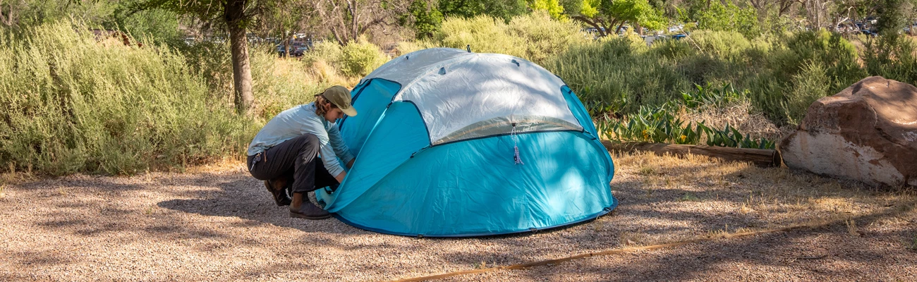

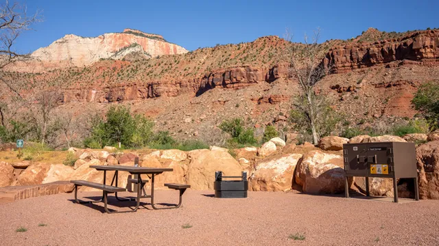

NPS Photo / Abi Farish
Check the Current Conditions page for campground alerts and closures.
Zion National Park has three campgrounds, two of which are located by the park's South Entrance. This area of the park is desert - daytime temperatures often exceed 95°F (35°C) in the summer months. There are also very few trees. Keep these facts in mind when planning your visit. Reservations are required to stay at park campgrounds. From mid-March through late November, the campgrounds are full almost every night. Visit the links below to learn more about each campground and make a reservation:
Watchman Campground is located by the park's South Entrance. The campground is open year-round, offering reservations up to six months in advance.
South Campground is also located next to the South Entrance. This campground closes seasonally and offers reservations up to two weeks in advance.
Lava Point Campground is located high on the Kolob Terrace Road, about 1 hour away from Zion Canyon. This campground closes seasonally and offers reservations up to two weeks in advance.
Check availability and make reservations on recreation.gov. Standard sites can be reserved up to 6 months in advance.
Check availability and make reservations on recreation.gov. Sites can be reserved up to 14 days in advance.
Learn about quiet hours, proper food storage, and other rules for camping.
Overnight trips require a Wilderness permit. Explore your options and reserve permits in advance.
Zion Wilderness offers over 90 miles of trails and dozens of backpacking sites. All overnight backpacking trips require a Wilderness Permit. Visit the park's backpacking page to plan your trip and apply for permits.
Several campgrounds can be found a short drive from the park. Please check the links below for more information:
St. George Area Visitor Bureau
BLM, St. George Field Office
Kane County, Utah (including Kanab)
Learn about the free shuttle service in Zion Canyon and the neighboring town of Springdale.
Planning a trip to Zion National Park can be as much fun as exploring the park. Read park publications to get oriented.
Apply for permits to visit Angels Landing, camp in Zion Wilderness, or carry out other special activities.
NPS information imported 2026-10-17. Confirm current details at NPS
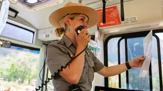
Join a park ranger and learn more about Zion. Stop by a visitor center for times, places, and today's subjects.
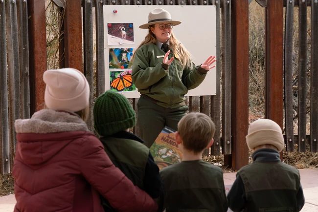
Attend a free ranger program to enhance your understanding of Zion National Park! These ranger-led walks, talks, tours, and activities highlight all the things that make Zion special. Landscapes, plants, animals, and history are all common topics of discussion. Most programs only take place during the summer months. You can check current programs at the bottom of this page or by downloading the NPS App . Each program has a description, time, place, and other details for planning your visit. For information on accessibility, you can speak with a ranger at any visitor center or visit our accessibility page . Make sure to read all program details before attending. "Ride with a Ranger" and Watchman Trail Hike programs require advance registration at the Zion Canyon Visitor Center.
Be sure to check the location of each program before attending. Most programs take place at one of the following locations in Zion Canyon:
The Zion Canyon Visitor Center (Shuttle Stop #1) is located by the park's south entrance, in Springdale, Utah.
Watchman Campground is located next to the Zion Canyon Visitor Center.
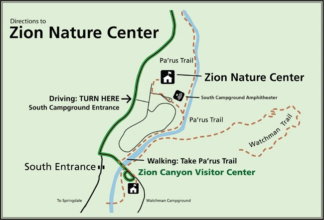
The Zion Nature Center is located north of the Zion Canyon Visitor Center, next to South Campground. The nature center is a 10-20 minute walk from the visitor center.
The Human History Museum (Shuttle Stop #2) is located north of the Zion Nature Center. The museum is also connected to the Pa'rus Trail, about 15-25 minutes from the visitor center. This section of the Pa'rus Trail has stairs and is not accessible to mobility devices — visitors with disabilities should drive or use the shuttle.
Zion Lodge (Shuttle Stop #5) is located in the heart of Zion Canyon, which is accessible by shuttle bus during the summer months.
Some programs take place in Kolob Canyons , located in the northwest corner of the park. Kolob Canyons is about 45-60 minutes away from Zion Canyon.
During the summer, rangers staff the interactive Zion Nature Center from 12 pm - 5 pm daily! This is a perfect place to learn about geology, animals, and the history of Zion. Explore different habitats, enjoy bird songs, listen to canyon tree frog calls, and participate in Junior Ranger programs — all in an air-conditioned building. You can access the Nature Center via the Pa’rus Trail or by parking in the nearby parking lots. Limited spaces are available. If parking is full, the Nature Center is only a 10-20 minute walk from the Zion Canyon Visitor Center. Junior Ranger Activity Booklets are available at the Nature Center as well as the Zion Canyon Visitor Center and Human History Museum. Check the current hours of operations to see when the Nature Center is open.
The calendar below has an up-to-date list of ranger programs and events. Sort by date to see what's happening during your visit!
NPS information imported 2026-10-17. Confirm current details at NPS
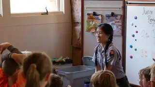
Learn about the incredible plants, animals, science, and history of Zion with these fun activities!

NPS Photo / Danette Perez
This is the motto of the Junior Ranger program. Children and adults are invited to become Junior Rangers and protect their parks, continue to learn, and share their own ranger story with friends and family. Zion offers a guided and self-guided Junior Ranger experience for ages four and older. Self-guided activity booklets are available for free at park visitor centers , the Zion Human History Museum, and the Nature Center. You can also download the booklet ahead of time. Visitors aged four and older can complete pages in the booklet and attend a ranger-led program to earn their Junior Ranger badge for Zion National Park. Becoming a Zion Junior Ranger is a fun, immersive way to explore and enjoy Zion National Park. Please allow several hours to complete this booklet, as activities include traveling throughout Zion Canyon in search of cool things to discover. Please keep in mind that the Junior Ranger booklet was designed to be completed inside Zion National Park. Funding for this program is provided in part by the Zion National Park Forever Project .
Not coming to the park yet? You can also complete activities and become a Virtual Junior Ranger from your home. Become a Virtual Junior Ranger here ! You can also explore other Junior Ranger Programs from around the nation .
Junior Ranger Pledge (English) Have you completed your Zion Junior Ranger booklet? Then you're ready to take the pledge along with Ranger Ashley to become an official Zion Junior Ranger! Duration: 1 minute, 10 seconds
Junior Ranger Pledge (Español) ¿Has completado tu Libreto de Actividades de Guardaparques Juveniles de Zion National Park? Entonces, lo último que queda por hacer es prestar el juramento oficial con guardaparque Emily y obtener tu propia insignia! Duration: 1 minute, 27 seconds
Unfortunately, we cannot mail out large qualities of booklets or badges. The Junior Ranger booklet is designed to be completed while at Zion National Park. If your students would still like to partcipate, please download the digital booklet found on this page. Please email us with questions.
NPS information imported 2026-10-17. Confirm current details at NPS

Kolob Canyons, located in the northwest corner of Zion National Park, offers different scenery from the main canyon.
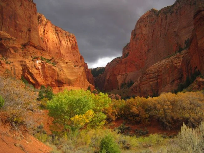

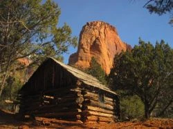
Zion National Park covers nearly 150,000 acres. Kolob Canyons is located in a different area of the park than some of the best known areas like the Narrows and Angels Landing. If you want to visit those trails, head south to Zion Canyon .
Welcome to Kolob Canyons The Kolob Canyons district of Zion National Park is located at Exit 40 on Interstate 15, 40 miles north of Zion Canyon and 17 miles south of Cedar City. A five-mile scenic drive along the Kolob Canyons Road allows visitors to view the crimson canyons and gain access to various trails and scenic viewpoints.
Here in the northwest corner of the park, narrow parallel box canyons are cut into the western edge of the Colorado Plateau, forming majestic peaks and 2,000 foot cliff walls. Whether you come to view the panoramic landscape from the scenic drive, hike into one of the majestic canyons, or begin a multi-day adventure into the Zion Wilderness, the Kolob Canyons of Zion has something special for everyone to experience. Please be aware that the Kolob Canyons Road may be closed during winter months due to snow or ice. Pedestrians are prohibited from walking the road during snow plow operations. Current Conditions.
Kolob Canyons Visitor Center: Hours of Operation All guests are required to stop at the Kolob Canyons Visitor Center to show an Interagency Park Pass or pay the Zion National Park entrance fee. Wilderness permits are not available here - please go to the Zion Canyon Visitor Center for all Wilderness permits.
Zion Wilderness The canyons of Kolob are designated as Wilderness and are protected for their pristine and primitive environments. Hiking in Kolob Canyons allows visitors the opportunity for solitude and tranquility in a scenic desert setting. In order to maintain the wilderness character and natural conditions of the area, please be aware that affiliated groups exceeding 12 in number are only permitted to hike on the Timber Creek Overlook Trail.
The Kolob Canyons truly are a unique area of Zion National Park. With soaring peaks of Navajo sandstone, canyon streams and cascading falls, and over 20 miles of hiking trails , new experiences and stunning scenery await you around every bend.
NPS information imported 2026-10-17. Confirm current details at NPS

Learn how to plan and obtain permits for backpacking, canyoneering, and other Wilderness trips.


The Zion Wilderness is a spectacular network of colorful canyons, forested mesas, and striking deserts. In 2009, over 124,000 acres of Zion National Park was designated as wilderness. This designation ensures that 84% of the park will continue to be a place where nature and its “community of life are untrammeled by man, a place where man himself is a visitor who does not remain.” Wilderness is a rare, wild place where one can retreat from civilization, reconnect with nature, and find healing, meaning and significance. Knowledge, respect, and understanding for these wild and undeveloped places will ensure that they remain spectacular for years to come. To learn more about the importance of Wilderness areas, check out these resources:
Establishment of the Zion Wilderness : Signed into law on March 30, 2009 by President Barack Obama.
National Park Service - Wilderness : From Alaska to Florida, Wilderness protects some of the most diverse and sensitive habitats in our country.
Interagency Wilderness Connect : Connecting federal employees, scientists, educators, and the public with their wilderness heritage
Start planning an overnight backpacking trip, discover which trails are best for your group, and reserve permits in advance.
Technical canyoneering is an adventurous sport that requires ropes, harnesses, and other equipment and skills to safely descend slot canyons
Explore the many trails that access the Zion Wilderness.
The Left Fork of North Creek (The Subway) is a strenuous off-trail hike that requires permits to access a popular destination.
Plan your hike into the Virgin River Narrows. Hiking options include day hikes from the bottom-up and top-down, and overnight from top-down.
Learn about climbing rules and regulations in Zion, and reserve a permit for overnight climbs.
Learn the rules and regulations for float trips down the Virgin River. Find out when the river is floatable.
Horses and other stock animals are allowed on select Wilderness trails. Learn the rules and regulations here.
Help keep Zion's backcountry beautiful. Follow the rules and regulations of wilderness areas.
The wilderness can be an unforgiving place, and your safety is your responsibility. Learn how to prepare for a safe trip.
Learn about options for reaching trailheads in Wilderness areas.
View and download a copy of the most recent Zion Wilderness Guide.
View and download a copy of the most recent Zion Wilderness Map.
View and download copies of current Wilderness Desk handouts, such as campsite maps or erosion information.
Wilderness parameters, including the permit system, are managed according to guidelines established in the Wilderness Stewardship Plan (formerly titled the Backcountry Management Plan, November 2007). From page 33 of the plan: Wilderness Permit and Reservation System Zion's Wilderness Permit System allows the park to maintain levels of wilderness use consistent with a high quality visitor experience, safety, and resource protection by: regulating use through a quota system, providing education concerning resource protection and Leave No Trace techniques, providing education concerning safety issues, providing a means to track visitor use, and identifying a starting point for search and rescue efforts.
regulating use through a quota system,
providing education concerning resource protection and Leave No Trace techniques,
providing education concerning safety issues,
providing a means to track visitor use, and
identifying a starting point for search and rescue efforts.
NPS information imported 2026-10-17. Confirm current details at NPS

Spend a night backpacking in the impressive Zion Wilderness.
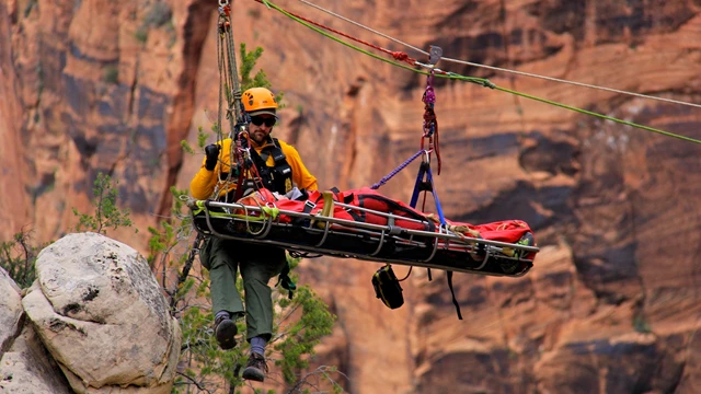
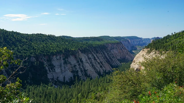

A step-by-step guide for using recreation.gov to apply for the Wilderness Overnight Permit in Zion National Park. This reservation is not a permit. Pick up your permit at the Wilderness Permit Office located within the Visitor Center either the day prior or day of your trip.
The Zion Wilderness is a world-renowned destination that offers opportunities for solitude and adventure. With over 90 miles of trails, dozens of designated backpacking sites, multiple at-large camping areas, and 124,406 acres of designated wilderness, Zion National Park offers a variety of unique backpacking opportunities.
While preparing for your overnight backpacking trip, consider your interests, time, and the ability level of your group. There is no "one best trail." Come up with backup plans in case your first or second choices are not available. Trails and/or campsites may close at any time due to rockfalls, flashfloods, wildfires, etc. An online reservation does not guarantee that a canyon or resource will be open at the time of the trip. Always have a backup plan in mind! Use topographic maps and the webpage links below to plan your Zion Wilderness backpacking experience:
Download the Zion Wilderness Map or full Zion Wilderness Guide to view which campsites are available by online calendar reservation and which campsites are available on a first come, first serve, walk-in basis. Wilderness permits are required for all overnight backpacking trips.
Brush up on wilderness safety information before starting your trip.
Check trail and campsite descriptions to best plan your gear needs.
Read about water sources in Zion , some of which are only available seasonally.
Plan transportation to your trailhead.
Half of the backpacking campsites in Zion Wilderness can be reserved online. Online Calendar Reservations are available during a three-month time frame. If sites are still available, reservations can be made until 5:00 pm mountain time, the day before your trip.
For a Backpacking Trip in...
Online Reservations are available on:
*Please be aware that, for online reservations, most backpacking sites often become fully booked for the next season within minutes of reservations opening on the 5th of the month at 10:00 am Mountain Time.
When available, you may book multi-night trips using the calendar tool. Keep in mind that some sites are not reservable in advance. Changing itineraries to walk-in only sites is sometimes possible at the Wilderness when you pick up your permit, depending on availability.
Multi-night trips are not allowed in the Zion Narrows. Single-night trips or day hikes are the only option.
You may not use a Wilderness campsite as a substitute for Frontcountry Camping to day hike in Zion Canyon.
Make a reservation for each night of your backpacking trip on the Zion National Park Overnight Wilderness Permits page or the Zion National Park Overnight Narrows Permits page on recreation.gov. Wilderness areas subject to natural forces such as: wildfires, rockfalls, flash floods, and other related factors that may cause closures or changes to trip plans. An online reservation does not guarantee that a trail, canyon, or resource will be open at the time of the trip.
Half of the backpacking campsites in the Zion Wilderness are available on a first come, first serve, walk-in basis.
Download the Zion Wilderness Map or full Zion Wilderness Guide to view which campsites are available by online calendar reservation and which campsites are available on a first come, first serve, walk-in basis.
Permits must be obtained in person at the Zion Canyon Visitor Center Wilderness Desk during normal Hours of Operation . Permits can be obtained the day before or the day of the trip.
All Wilderness permits must be obtained in-person at the Zion Canyon Visitor Center Wilderness Desk.
Plan your trip itinerary to allow sufficient time to obtain your permit the day of, or the day before your trip during our Hours of Operation .
Allow for at least 20 minutes to obtain a permit. Come prepared with all vehicle(s) information: make, model, and license plate(s).
If you have made an Advanced Reservation, the individual listed as the reservation holder must be the one to obtain the permit in person. Please plan accordingly.
The same fees are charged for first-come, first-served permits that are issued in person. This fee supports the permit and reservation management system.
Permit Fee: $20 per permit (non-refundable)
Per Person Fee: $7 per person per night (refundable)
Traveling in the Zion Wilderness requires careful planning and preparation. Permit holders assume the responsibility of ensuring that their group is aware of the risks involved, is self-reliant, has developed a back-up plan, and will follow park regulations. Because these are such important aspects of trip planning and resource protection, permits for trips into the Zion Wilderness are non-transferable. If you cannot participate in your trip, please cancel your reservation to provide opportunities for others. If other members of your group still wish to participate in a planned trip, you may coordinate with a new prospective permit holder for them to immediately reserve the available spaces or sites, as soon as your reservation has been cancelled. You may cancel your reservation online by logging in to your recreation.gov account. As soon as your reservation is cancelled, those spaces or sites will immediately be available for someone else to obtain through the Advanced Reservations page. New permit holders will need a recreation.gov Account prior to creating an Advanced Reservation. Plan your trip itinerary to allow sufficient time to obtain your permit the day of, or day before the trip during Zion Wilderness Desk Hours of Operation . The individual listed on the reservation must be the one to obtain the permit, please plan accordingly.
The wilderness can be an unforgiving place, and your safety is your responsibility. Learn how to prepare for a safe trip.
Help keep Zion's backcountry beautiful. Follow the rules and regulations of wilderness areas.
Start planning an overnight backpacking trip, discover which trails are best for your group, and reserve permits in advance.
| For a Backpacking Trip in... | Online Reservations are available on: |
| January | December 5th at 10:00 am MT |
| February | December 5th at 10:00 am MT |
| March | December 5th at 10:00 am MT |
| April | March 5th at 10:00 am MT |
| May | March 5th at 10:00 am MT |
| June | March 5th at 10:00 am MT |
| July | June 5th at 10:00 am MT |
| August | June 5th at 10:00 am MT |
| September | June 5th at 10:00 am MT |
| October | September 5th at 10:00 am MT |
| November | September 5th at 10:00 am MT |
| December | September 5th at 10:00 am MT |
NPS information imported 2026-10-17. Confirm current details at NPS

Zion is home to 291 species of birds. Bird checklists are available at the visitor centers.

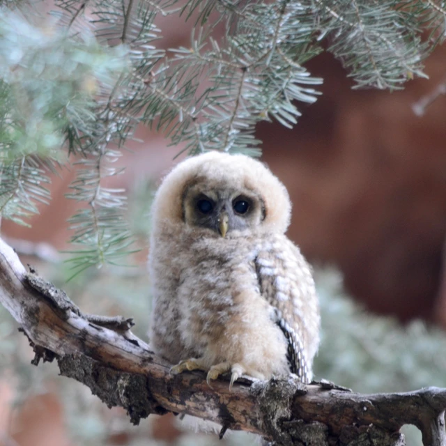
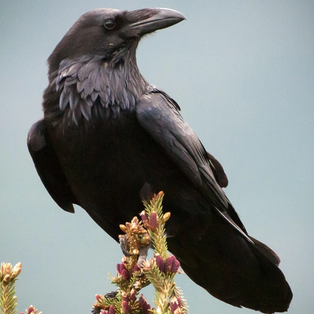
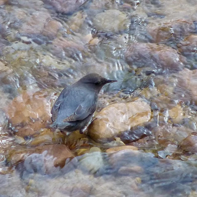
Zion National Park Photo
From the small Black Chinned Hummingbird to the large California Condor, Zion National Park is the perfect home for many birds. 291 bird species can be found in Zion throughout the year. Zion National Park is the perfect place for experienced and novice birders. The varying habitats allow for many different species to be found. Birds like the White Throated Sparrow and the American Coot have been spotted overwintering in the park and will leave when the temperatures rise. Other birds like the reintroduced California Condor and the native Canyon Wren can be seen year round. Zion National Park works with a variety of organizations, like the Peregrine Fund and Bird Life International , in united conservation efforts to protect the health and wellbeing of the park's bird populations and promote biodiversity. Zion has been designated an Important Bird Area by the Bird Life International program, both at the state and global levels. When exploring Zion Canyon, Kolob Canyon, and the Kolob Terrace Road, don't forget to look up and catch a glimpse of a bird in the sky. Learn more about a few of Zion's bird species below. Print out your copy of the Zion Bird List (PDF 2 MB)
Mexican Spotted Owl
American Dipper
Peregrine Falcon
California Condor
Greater Roadrunner
Virtually explore observable characteristics such as bills and talons, plumage, size and shape used to identify birds.
People of all ages can enjoy identifying birds by sight and sound.
A variety of wildlife can be found in Zion.
NPS information imported 2026-10-17. Confirm current details at NPS
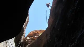
Learn about canyoneering in Zion and how to get a permit.

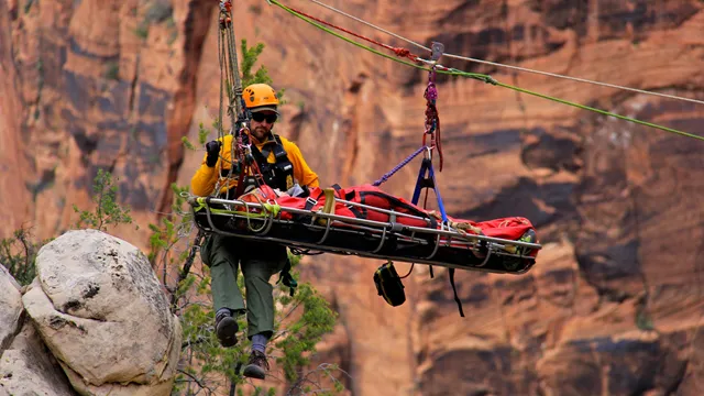


Canyoneering is an outdoor activity that combines route finding, rappelling, problem solving, swimming, and hiking. Zion National Park has become one of the premier places in the country to participate in this exciting activity. With dozens of different canyons to explore, some barely wide enough for a human to squeeze through, the park offers opportunities that range from trips for beginners to experiences requiring advanced technical skills. A Wilderness Permit is required for all technical canyoneering trips. Learn how to apply for permits on the Canyoneering Permits page .
The Subway, the Narrows top-down, and all technical canyoneering trips require permits. Learn about reservations and permits here.
Don't get carried away! Bring proper equipment, clothing, and skills for your route.
Know the flow before you go. Water can be fast, cold, and deep.
Every hiker needs a permit to visit the Left Fork of North Creek (the Subway).
Help keep Zion's backcountry beautiful. Follow the rules and regulations of wilderness areas.
Planning and permits for backpacking, canyoneering, and other Wilderness trips.
Learn about options for reaching trailheads in Wilderness areas.
NPS information imported 2026-10-17. Confirm current details at NPS

Find out about climbing in Zion and how to get a permit for overnight bivouacs.
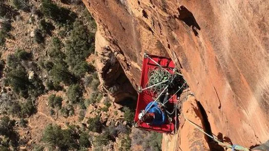
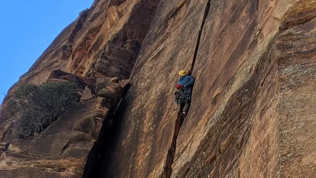

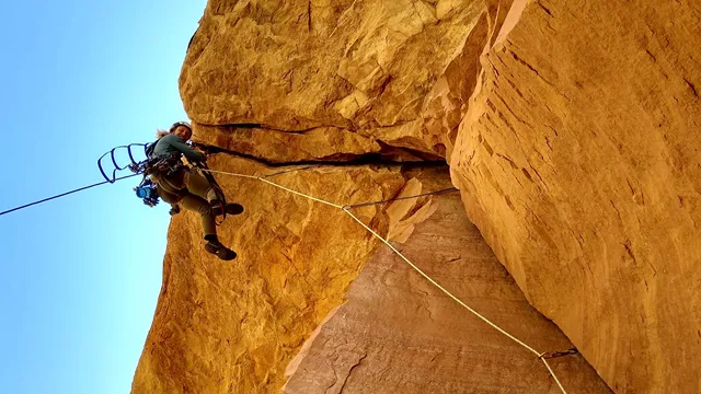
Each year, Zion temporarily closes some climbing routes to protect nesting raptors. Closures typically last from March 1 to mid-to-late summer. Learn about seasonal climbing closures before planning your trip.
Zion National Park's 2,000-foot sandstone cliffs are world-renowned for their big wall climbs and adventurous nature. Most routes in the park are not recommended for inexperienced climbers due to the difficulty and soft nature of the rock . While areas outside of the park offer abundant sport climbing and top roping possibilities, this is rare in the park, with bolted routes often having sparse protection. The best conditions for climbing are typically from March through May and September through early November. Temperatures in the summer can soar over 100 degrees even on shaded walls. Additionally, summer months often bring monsoonal rainstorms . Unlike other rock types, desert sandstone is heavily weakened when wet. Avoid climbing in damp areas or after rainstorms. It often takes two or more days for the rock to be dry enough to climb. This means that critical holds are more likely to break, altering routes for future climbers. Additionally, climbing protection is less likely to hold resulting in greater fall distances and chance of injury. A collection of a climber-submitted topos can be found at the Wilderness Desk at the Zion Canyon Visitor Center. The park suggests submitting topos of all first ascents here upon completion. This helps future generations locate climbs and adds to the historical record of climbing in Zion National Park. Read more about good climbing practices to stay safe and preserve routes for future hikers.
Permits are required for all overnight climbs in Zion National Park. Permits are not required for day climbs.
Check regulations for guiding, bolting, bivying, and establishment of new routes.
Each year, certain routes and walls are seasonally closed to protect native raptors. Check current closures here.
Help keep Zion beautiful by following these best practices while climbing.
Learn about options for reaching trailheads in Wilderness areas.
NPS information imported 2026-10-17. Confirm current details at NPS

Guided trips are available from March through October. Visit the Canyon Trail Rides page for information.
Guided trips are available from March through October. Visit the Canyon Trail Rides page for information.
Explore the practical guides below for park access, safety, and trip planning.
Visit activity provider
Zion Lodge is located in the heart of Zion Canyon. Visit this page to explore features and book your stay.
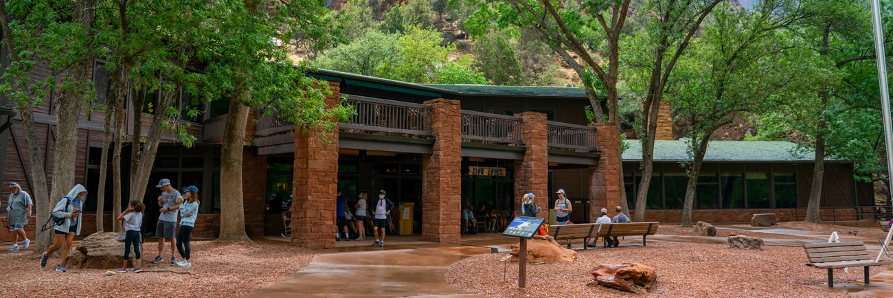


NPS / Ally O'Rullian
Zion Lodge is one of the park's most iconic historic structures. Located in the heart of Zion Canyon, it offers unparalleled views of the towering sandstone cliffs found throughout Zion National Park. Zion Lodge offers 76 hotel rooms, 6 suites, and 40 historic cabins. It is the only place inside the park to purchase food. A gift shop and post office are also available at the Lodge. Visitors can either walk or take the shuttle to nearby trailheads. For more information about eating, visiting, or staying at the lodge, please visit the Zion Lodge website or call 1-833-778-9290.
Visitors can enjoy a variety of food and drink options at the lodge:
Red Rock Grill offers sit-down dining, with a focus on American and Southwestern food. The grill is open year-round.
The grill is open year-round.
Castle Dome Café serves coffee, quick bites, and fast meals. Packaged snacks, picnic foods, and treats are also available. The café is open seasonally from spring to fall.
The café is open seasonally from spring to fall.
The Beer Garden offers cold drinks in a beautiful outdoor patio. The Beer Garden is open seasonally from spring to fall.
The Beer Garden is open seasonally from spring to fall.
From spring through fall, you can take a tram ride through Zion Canyon . These tours start and end at the Zion Lodge. With soaring canyon walls on both sides, and the Virgin River running parallel to the Zion Canyon Scenic Drive, the narrated tram ride will take you to some of the most treasured spots in the park. Private vehicles cannot access the scenic drive during shuttle season, making the tram an excellent way to see the canyon.
Take a load off and learn about the history of lodging in Zion.
Dining in and near Zion National Park
Learn about camping options in and around Zion National Park.
NPS information imported 2026-10-17. Confirm current details at NPS

Plan your hike into the Virgin River Narrows. Hiking options include day hikes from the bottom-up and top-down, and overnight from top-down.


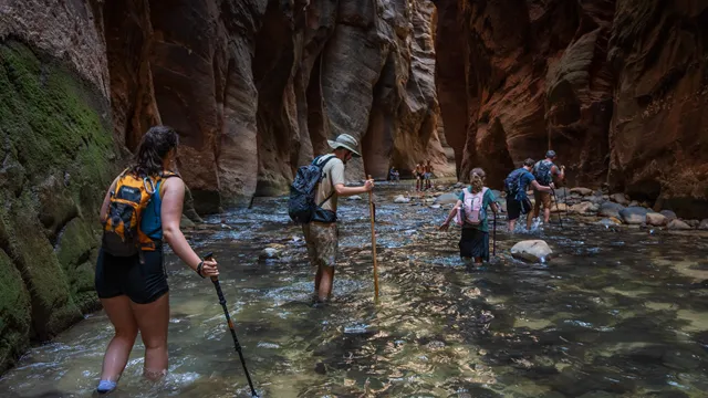
High water, forecasted rainfall, and other factors can affect whether The Narrows are open for hiking. Stop by a visitor center or check our current conditions page for active closures.
Flash floods can happen at any time, and your safety is your responsibility. Learn about flash floods, common injuries, and other risks before entering The Narrows. The National Weather Service (NWS) issues flash flood potential forecasts. Stop by a visitor center or check the NWS website for current forecasts .
What are The Narrows?
Where can I see The Narrows?
How high is the water?
When should I go?
What should I bring?
What are the risks?
As the name implies, The Narrows is the narrowest section of Zion Canyon. This gorge, with walls 1000 feet tall and the river sometimes only 20-30 feet wide, is one of the most popular areas in Zion National Park. Watch the video below to get an overview of The Narrows, or use the Highlights section to jump to routes, seasons, or safety.
Open Transcript
Welcome to Zion National Park, my name is Jonathan. Zion is a popular National Park where visitors come to immerse themselves within the grandeur of the canyon’s cliffs, and to challenge themselves with one of our many scenic and adventurous hikes. One of our more popular hikes visitors come to enjoy is the unique Narrows, a hike in a canyon that in places is only 20-30 feet wide, and 2000 feet deep. However, unlike most hikes, taking on the Narrows means actually traveling upstream through the Virgin River on uneven, slippery, and rocky river boulders. Due to the risks of a hike like this, proper preparation is imperative, both for your safety and your enjoyment. Every hiker in The Narrows should have closed toed shoes, even just your regular hiking boots, and a walking stick. Although weather might be over 100 degrees the day of your hike, this narrow section of the canyon can stay considerably cooler, making non-cotton clothing, like polypropylene or wool, more ideal for its insulating benefits even while wet. When you are planning your trip into The Narrows, you should also be aware of the flash flood potential. Afternoon thundershowers are possible throughout the year and a potential hazard to those hiking in slot canyons like The Narrows. During these events the river can quickly turn into a torrent of powerful rushing water, doubling and tripling in volume. Stop by the visitor center and speak with a ranger to get the most up to date conditions and the flash flood potential. Remember, even when you are prepared and conditions seem optimal, things can change quickly. Being aware of any changes in water clarity and increased river flow can go a long way in protecting your life. Being prepared and aware will help ensure a hike that will undoubtedly create positive m
Find out what to expect and how to prepare for one of Zion’s most popular hikes with Park Ranger Jonathan Fortner.
You can see the start of The Narrows by hiking along the paved Riverside Walk trail for 1 mile from the Temple of Sinawava (Shuttle Stop #9). If you wish to see more, you will be hiking in the Virgin River. This can involve wading upstream for just a few minutes, or it can be an all-day adventure. The two options for hiking The Narrows are listed below.
Hiking in The Narrows upstream as far as Big Spring does not require a permit. Doing the hike this way allows you to see some of the most spectacular and narrowest parts of the canyon. You can hike in the river for an hour and have a great experience, or you can hike as far as Big Spring, a strenuous, ten-mile round trip, all-day adventure.
Permits are required for this 16-mile through-hike of the Virgin River Narrows from Chamberlain's Ranch to the Temple of Sinawava. Those who choose this option must arrange their own transportation to the Chamberlain's Ranch trailhead. When conditions allow, apply for permits online or from a Wilderness Ranger at a visitor center .
Water flow fluctuates greatly from year to year and day to day depending on many factors, such as rainfall and snowmelt. You can check the current river flow on the USGS website. The flow is measured in cubic feet per second (CFS). Here is a general overview of how river levels affect The Narrows:
<70 CFS: When the river is running below 70 CFS , walking is moderately difficult. There are knee-deep crossings on the slippery and uneven river bottom, with frequent pools up to waist-deep.
70-150 CFS: When the current goes above 70 CFS , walking against the current becomes challenging. Thigh-deep crossings are frequent, and pools can be chest-deep.
>150 CFS: If the flow goes over 150 CFS , The Narrows will be closed to all travel.
The Narrows also closes when a Flash Flood Warning is issued by the National Weather Service. The Narrows will remain closed for at least two hours after a warning is lifted.
Most people hike The Narrows in the summer and early fall when the water level drops and tends to be at its warmest. However, keep in mind that life-threatening flash floods are more frequent during the monsoon season. Fall brings more stable weather, but the days get shorter and the water temperature drops. Read more about Zion's Weather and Climate here .
Winter and early spring commonly bring high water levels and cold water. The Narrows will be closed during the spring when snowmelt raises the river over 150 CFS.
Below are dates during which the Virgin River consistently exceeded 150 cubic feet per second (CFS) of flow due to snowmelt.
Hiking in The Narrows is comparable to walking on wet bowling balls. Closed-toed shoes and a sturdy hiking stick are recommended for hiking on the slick, uneven rocks. Sandals, crocs, or bare feet are not appropriate and often result in twisted ankles or crushed toes. High canyon walls and cold water create cooler conditions than anywhere else in Zion Canyon, so bring seasonally appropriate layers. Quick-drying fabrics are best for preventing hypothermia. You should also bring food, water, first aid supplies, and other gear for your safety. Visit our Narrows safety page for a more complete list of equipment and clothing recommendations.
Flash floods, cyanobacteria exposure, slips, falls, hypothermia, and other hazards are always possible. Even on short trips, this hike can be challenging and risky. Ultimately, you are responsible for your own safety. Visit the Narrows Safety page below to learn how to plan ahead and prepare.
Hiking upstream in The Narrows does not require a permit. However, the hike is challenging. Read up on how to have a safe and fun trip here.
Hike 16 miles through The Narrows starting at Chamberlain's Ranch. This is a permitted hike through Zion Wilderness.
Know how to keep yourself safe and keep the Narrows wild and beautiful.
| Year | Close | Open |
|---|---|---|
| 2012 | April 17 | April 28 |
| 2013 | April 30 | May 2 |
| 2014 | Open most of the time | |
| 2015 | Open most of the time | |
| 2016 | April 3 | May 22 |
| 2017 | March 11 | May 21 |
| 2018 | Open most of the time | |
| 2019 | April 6 | June 22 |
| 2020 | April 9 | May 18 |
| 2021 | Open most of the time | |
| 2022 | Open most of the time | |
| 2023 | April 8 | June 19 |
| 2024 | April 11 | May 19 |
| 2025 | Open most of the time | |
| 2026 | Open most of the time |
NPS information imported 2026-10-17. Confirm current details at NPS
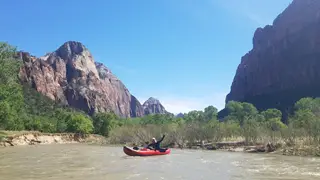
Learn about rules and regulations for float trips in Zion. Find out when the Virgin River in Zion is open for boating.
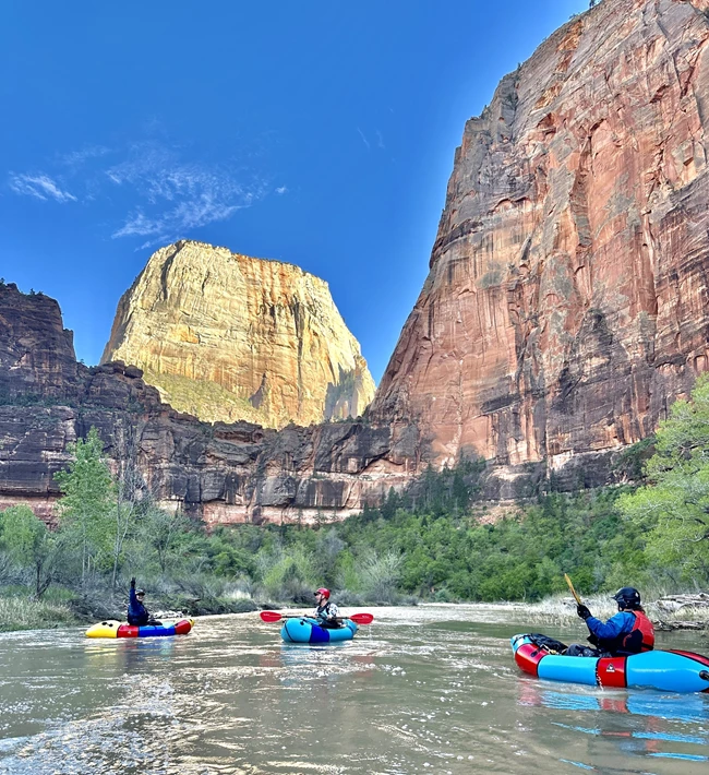


Watercraft permits are only issued when the Virgin River is flowing in excess of 150 cubic feet per second. Check the current Virgin River flow rate here .
All watercraft use in the park requires a wilderness permit . Permits can be obtained in person at the Zion Canyon Visitor Center . To find out when the Wilderness Desk is open, check our hours of operation .
For boating below the Temple of Sinawava , permits are free and can be obtained on the day of your trip.
For boating The Narrows , standard permit fees apply. Permits can only be obtained the day before your trip, as an early start is needed.
Permits to float the Virgin River are only issued when the river is flowing in excess of 150 cubic feet per second (CFS). Permits for The Narrows will only be issued if the flow has stayed above 150 CFS for 24 consecutive hours. Check current Virgin River flow rates on the United States Geological Survey website . Boatable flows do not occur every year. When they do, it is usually only for a brief time when the spring snowmelt is occuring. This is typically sometime between April and June.
Watercraft users must follow all river trip regulations . Failure to follow regulations will result in permits being denied and/or citations being issued.
Kayaking from Temple of Sinawava to Court of the Patriarchs is one common float trip. Rapids for this stretch of the river usually fall in the class II-III range when flows are high enough for boating, though it can be more difficult at higher flows. Expect portages and strainers, and be prepared to swim. Below Court of the Patriarchs, there are multiple low head dams and a stretch of river that is often class V whitewater at boatable flows. It is important to scout the exit at Court of the Patriarchs.
Kayak trips through The Narrows portion of the Virgin River should only be attempted by expert paddlers who are prepared to survive without assistance for multiple days. The Narrows is a remote, wilderness kayak trip. If anything goes wrong, help is a long way away. Emergency overnight gear, extra paddles, helmets, and wetsuits or drysuits are strongly recommended for this trip. While the river is usually class III or IV, flows are inconsistent and paddlers should be prepared for class V whitewater. Expect difficult portages and tricky strainers, and be prepared to swim. In most years, the river above the Deep Creek confluence does not have enough water to float. Paddlers should be prepared to hike with all their gear for about 8 miles before putting into the river at the Deep Creek confluence.
Watercraft users must obtain a permit and follow these regulations.
Permits are used to protect resources and ensure a high-quality wilderness experience. Explore your options and apply here.
Learn how to plan and obtain permits for backpacking, canyoneering, and other Wilderness trips.
NPS information imported 2026-10-17. Confirm current details at NPS
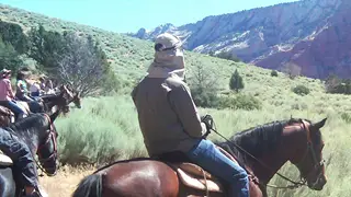
Horses and other stock animals are allowed on select Wilderness trails. Learn the rules and regulations here.
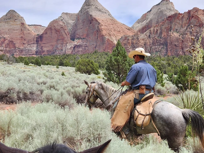
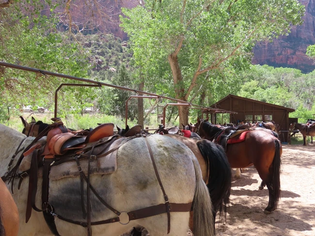


Horses have long been used to explore the incredible landscapes of Zion National Park. Today, there are a couple ways to see the park on horseback:
A park concessioner offers guided trail rides along the Virgin River .
Personal stock use is also allowed on designated trails. Stock animals that are allowed in Zion include horses, mules, and burros.
Courtesy of Robert Houston
If you want to see Zion Canyon from a different perspective, check it out from the back of a horse! Canyon Trail Rides, a park concessioner, offers 1-hour or 3-hour guided horse and mule rides along the Virgin River and Sand Bench Trail.
Guided trail rides typically begin mid-March and run through October 31st, depending on weather.
To schedule a guided ride or get more information, visit the Canyon Trail Rides website or give them a call:
If you are booking within 7 days of your ride, call 435-772-3810.
For general information, call 435-679-8665.
Visitors can use personal stock animals within Zion National Park. Trails where stock use is permitted are listed further below. A number of regulations apply to stock use within Zion National Park. Be sure to read and understand all regulations before planning a trip to the park.
Permits are not required for day trips. However, stock are prohibited during spring thaws, unusually wet periods, or times when their use would cause trail damage. Additional regulations can be found under our Stock Use regulations .
The only overnight stock camp within the park is Hop Valley Site A , and your stay is limited to one night. A Wilderness permit is required to stay overnight in Hop Valley . Stock must be hobbled or tethered to reduce damage to vegetation. To reduce the spread of noxious and exotic weeds, stock must be fed certified weed-free hay two days prior to the trip. Additional regulations can be found under our Stock Use regulations .
The Wilderness Map shows which trails are open to pack animal use.
The following trails are open to horse or pack animal use:
La Verkin Creek Trail west of Beartrap Canyon
Hop Valley Trail
Connector Trail
Northgate Peaks Trail
Wildcat Canyon Trail
West Rim Trail north of Cabin Spring
Sawmill Spring Trail
Telephone Canyon Trail
East Mesa Trail east of the Observation Point Trail junction
East Rim Trail south of Stave Spring
Deer Trap Mountain Trail
Cable Mountain Trail
Sandbench Trail (open to public use from November 1 to March 1 only)
Off-trail use of horses or pack animals is permitted only in the following locations:
Lower Coalpits Wash from the trailhead to the junction with Scoggins Wash
Zion has many wilderness trails and campsites. Read brief descriptions to discover which route is best for your group.
Help keep Zion's backcountry beautiful. Follow the rules and regulations of wilderness areas.
Learn how to plan and obtain permits for backpacking, canyoneering, and other Wilderness trips.
NPS information imported 2026-10-17. Confirm current details at NPS

Every hiker needs a permit to visit the Left Fork of North Creek (the Subway).


NPS Photo / Brian Moe
Left Fork North Creek (Subway) Seasonal Lottery page is where you can apply for the seasonal lottery and see if there are cancellations available for reservation for the Left Fork (Subway) hike.
Canyoneering Daily Lottery page is where you can apply for the Daily Lottery two days before your desired hike.
There are two different ways to explore the Left Fork of North Creek (Subway) by canyoneering and/or hiking. A Wilderness permit is always required for this area.
The Wilderness permit application process is the same for all canyoneers and/or hikers going into Left Fork. The only difference will be the starting and ending trailheads listed on your reservation and permit.
All trips into Left Fork involve extensive route finding. Visitors are encouraged to obtain a detailed route description and/or travel with someone that has successfully completed a trip into this area in the past. Paid guided trips are not permitted.
The Left Fork of North Creek is a day-use area only. Overnight camping is not permitted.
While preparing for your trip, consider your interests, time, and the ability level of your group. Always have a backup plan in mind.
Everyone entering into the Left Fork of North Creek must abide by all Canyoneering Regulations .
Permit holders must arrange their own transportation to the Wildcat and/or Left Fork Trailhead to complete their route.
The maximum group size for The Left Fork (Subway) is 12 people . The maximum group size for Das Boot and Russell Gulch is 6 people.
A group is any number of people sharing the same affiliation (e.g., club, scout troop, colleagues, family, friends, etc.) that enter a canyon or trail on the same day, even if they have multiple permits.
A minimum group size of 2 people is recommended for all technical canyons involving the use of rope, webbing, or other device for descent or ascent.
Group size limits are strictly enforced. Permits will be denied and violators will be cited if limits are exceeded.
Structured and/or formally guided activities facilitated by educational, commercial, or like organizations are authorized to occur only on frontcountry trails.
Such activities are not authorized to take place in park Wilderness areas. (Primitive and Pristine Zones)
This is a very strenuous 9-mile round-trip hike through the Left Fork of North Creek that requires route finding, hiking in ankle to knee deep water, and scrambling over large boulders. This route begins and ends at the Left Fork Trailhead on the Kolob Terrace Road. Click here for additional trip planning information.
This is a very strenuous 9.5-mile through-hike that requires rappelling skills, 60 feet of rope, and extensive route finding experience. The route also requires swimming through several deep pools of very cold debris-filled water. The route begins at the Wildcat Canyon Trailhead and ends at the Left Fork Trailhead. Both trailheads are located on the Kolob Terrace Road.
An online Seasonal Lottery is held for all trips, all year, into the Left Fork of North Creek (Subway) to obtain a reservation for a Wilderness permit.
Online applications must be submitted during the lottery window, up to four months in advance, with up to four choices for dates.
Applications are limited to one request per individual, per canyon, per season.
Choose your four prioritized dates carefully so that you do not need to change your application.
Applicants will be sent a notification email on the 27th day of the month with information about the status of their request.
Successful applicants will need to claim their reservation on rec.gov within two weeks of the results notification email.
Unclaimed reservations become available to reserve on the 15th day of the month following the lottery, at 10am Mountain Time.
There is a $6.00 non-refundable fee for the Seasonal Lottery application. Apply for the Left Fork Seasonal Lottery
An online Daily Lottery for Wilderness permits is an option for canyoneering and/or hiking trips when the Seasonal Lottery or Calendar Reservations are fully booked.
Individuals can apply for the Daily Lottery to obtain any remaining reservations for permits.
The Daily Lottery is limited to one request per individual, per canyon. Applications can be submitted two days prior to a trip date, between 12:00 am MT and 3:00 pm MT.
The daily lottery drawing is held at 3:00 pm MT. Applicants will then be sent a notification email with information about the status of their request by 4:00 pm MT.
Any spaces not taken through the Daily Lottery and Seasonal Lottery will be available as Walk-in Permits the day before or day of a trip date.
There is a $6.00 non-refundable fee for the Daily Lottery. Apply for the Daily Lottery .
Plan your trip itinerary to allow sufficient time to obtain your permit the day of, or the day before your trip during our Hours of Operation .
Allow for at least 20 minutes to obtain a permit. Come prepared with all vehicle(s) information: make, model, and license plate(s).
All Wilderness permits must be obtained in-person at the Zion Canyon Visitor Center Wilderness Desk.
The individual listed as the reservation holder must be the one to obtain the permit, please plan accordingly.
Lottery Application Fee: $6 lottery application fee (non-refundable) Per Person Fee: $10 per person (refundable) The reservation fee (in lieu of the lottery application fee) and per person fee are also charged for first-come, first-served permits that are issued in person. This fee supports the permit and reservation management system.
Traveling in the Zion Wilderness requires careful planning and preparation. Permit holders assume the responsibility of ensuring that their group is aware of the risks involved, is self-reliant, has developed a back-up plan, and will follow park regulations. Because these are such important aspects of trip planning and resource protection, permits for trips into the Zion Wilderness are non-transferable. If you cannot participate in your trip, please cancel your reservation to provide opportunities for others. If other members of your group still wish to participate in a planned trip, you may coordinate with a new prospective permit holder for them to immediately reserve the available spaces or sites, as soon as your reservation has been cancelled. You may cancel your reservation online by logging in to your Recreation.gov account . Plan your trip itinerary to allow sufficient time to obtain your permit the day of, or day before the trip during Zion Wilderness Desk Hours of Operation . The individual listed on reservation must be the one to obtain the permit, please plan accordingly.
Zion Express Membership allows visitors who regularly visit the park, and are familiar with the park resources, to obtain express access to create online reservations and convert them into Wilderness Permits from home.
To become a member, applicants must watch three orientation films at the Zion Canyon Visitor Center Wilderness Desk. (Membership cannot be obtained in the Kolob Canyons.)
After watching the films, applicants will sign a Zion Express Program Agreement form. Their express access will be linked to their recreation.gov account.
There is no cost for enrollment. Membership is valid for three years from the date they signed up. Memberships may be cancelled if any regulations are violated.
| For a trip in: | Seasonal Lottery applications received in: | Unclaimed Lottery spots become reservable at 10am MT on: |
|---|---|---|
| January | November 1 - November 25 | December 15 |
| February | November 1 - November 25 | December 15 |
| March | November 1 - November 25 | December 15 |
| April | February 1 - February 25 | March 15 |
| May | February 1 - February 25 | March 15 |
| June | February 1 - February 25 | March 15 |
| July | May 1 - May 25 | June 15 |
| August | May 1 - May 25 | June 15 |
| September | May 1 - May 25 | June 15 |
| October | August 1 - August 25 | September 15 |
| November | August 1 - August 25 | September 15 |
| December | August 1 - August 25 | September 15 |
NPS information imported 2026-10-17. Confirm current details at NPS

While the red cliffs surrounding Zion are impressive in every light, they are extraordinary in the warm hues of sunrise and sunset.

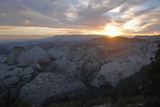
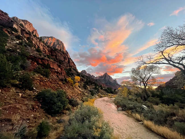
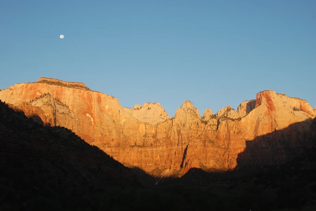
NPS / Jesse Nelson
Human History Museum Patio (ADA accessible): Watch soft morning sunlight slowly creep onto the Temples and Towers. Come a few days after a Full Moon to watch the Moon set behind the cliffs as the Sun rises. Please do not walk on vegetation near the Human History Museum.
Canyon Overlook Trail : This is a moderate, 1 mi (1.6 km) round-trip trail on the East Side of Zion. At the end of the trail, you will have excellent views of sunlight beginning to enter Zion Canyon. Parking is extremely limited, so plan to come back another time if you cannot find a place to leave your car.
Lava Point Overlook : An expansive view overlooking the lower canyons of Zion, this overlook is located along the Kolob Terrace Road. Lava Point Overlook provides excellent views of the rising sun illuminating the plateaus and canyons that define Zion. Closes seasonally when snow falls. Check current conditions before you go.
NPS / Serena Wurmser
Pa’rus Trail : A paved, 3.5 mile round-trip path next to the Virgin River. At sunset, the Pa’rus Trail provides phenomenal views of golden light illuminating the Watchman.
Timber Creek Overlook Parking Lot (ADA accessible): At the end of the Kolob Canyons Scenic Drive, this overlook provides excellent views of sunlight and shadow playing across the finger canyons of Kolob Canyons.
Lava Point Overlook : Not just for sunrise! Lava Point Overlook also provides excellent views of the setting sun illuminating the plateaus and canyons that define Zion. Closes seasonally when snow falls. Check current conditions before you go.
The backcountry of Zion has many beautiful and peaceful places to view sunrise and sunset. Read more about overnight backpacking permits in Zion.
Once you decide on a location to view sunrise and sunset, do not forget these actions:
Pack a flashlight: If you are planning on doing any walk or hike to view the sunset, make sure to pack a headlamp or flashlight for use getting back to your destination.
Check the shuttle schedule: If you are planning on enjoying sunset along the Zion Canyon Scenic Drive, please check the time of the last shuttle of the day.
Stick to maintained tails: Although it is tempting to find different angles from which to view the sunrise and sunset, going off trail is harmful to the park’s vegetation and wildlife. Please stay on official park trails.
Sunset and sunrise times vary throughout the year, so make sure to search “Sun rise and set times in Springdale, UT” online before you arrive in Zion. These times will correspond with the moment that the top of the sun crests the horizon (sunrise) and the moment that the top of the sun dips below the horizon (sunset)... not the moment that the Sun rises/sets behind the cliffs of Zion Canyon. Plan accordingly.
If you are planning a hike on the Pa’rus Trail, Canyon Overlook Trail, or other trail of your choosing, make sure to allot time to hike before the sun rises or after it sets, and plan to begin/return after dark.
Generally, an hour before sunset and an hour after sunrise offers the best lighting of the day.
In the 90 minutes after the Sun sets, the sky slowly bleeds from sunset to a starry night sky. Astronomers divide this time into three categories, each which takes about 30 minutes in Zion:
Civil twilight : This is the first 30 minutes after sunset. There is still enough fading light from the Sun to see your surroundings, and artificial light is not yet necessary. Only the brightest stars and planets (e.g. Jupiter, Venus) can be seen with the unaided eye.
Nautical twilight: Following civil twilight, the horizon is still visible against a deep blue sky. Simultaneously, many of the brightest stars are visible. This in-between when both the horizon and the stars are visible is ideal for navigating using the night sky, hence the name nautical twilight. In Zion, you will not yet be able to see the Milky Way, but a twilight sky studded with stars will be visible against the jagged cliffs of Zion Canyon.
Astronomical twilight : About an hour after the Sun sets, the night sky is almost entirely dark. To most eyes this is the moment when true night begins, but there is still a faint residual glow from the setting Sun along the western horizon. This is the period when fainter features of the night sky, including the Milky Way, appear.
Once the night sky reaches astronomical twilight, thousands of stars are visible from Zion. Take advantage of this incredible night sky by following the park’s stargazing suggestions !
Read about Ranger tips for stargazing in Zion!
See what night sky sites may be close to you!
Suitable for any age!
Explore the work that the NPS is doing to protect and preserve dark skies.
Read about what Zion is doing to protect our dark night skies.
NPS information imported 2026-10-17. Confirm current details at NPS

Tips for where and how to stargaze in Zion!
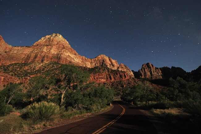
NPS / Serena Wurmser
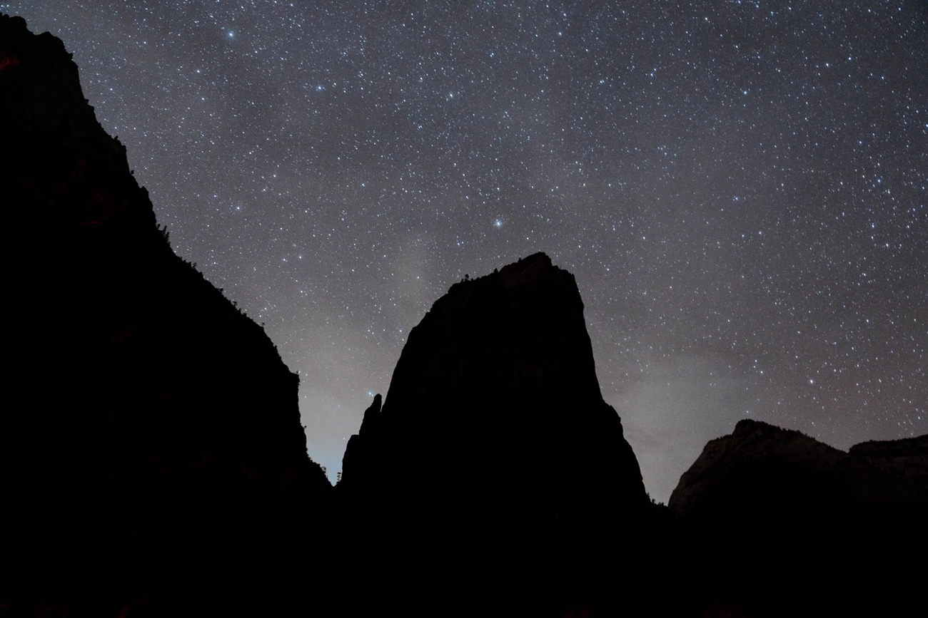
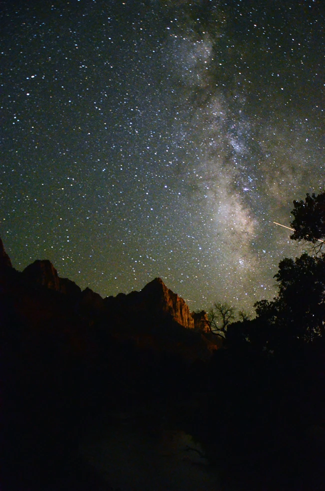
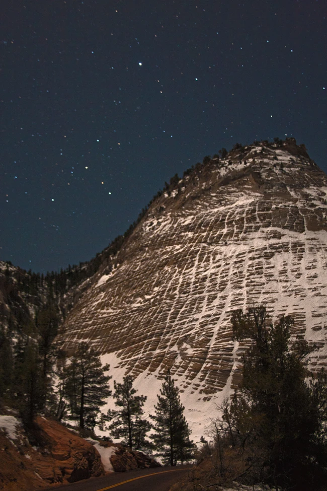
Many Zion visitors like to stay for sunset to take photos of cliffs glowing vivid orange in the late day sun. Then, as the last sunlight fades from the sky, a steady stream of cars file out of the park toward homes, hotels, and other destinations. But for those few who stay later or spend the night nearby, an entirely different and memorable Zion experience awaits: the dark night sky, filled with thousands of stars, above the jagged silhouette of cliffs.
Zion is a great place to connect with the night sky, whether you are an avid astrophotographer or this will be your first view of the Milky Way. As an International Dark Sky Park, Zion protects our incredible dark skies for present and future generations by not degrading the night with artificial light. This means that after sunset, the park is very dark. Be prepared!
Before getting to Zion, prepare for your stargazing experience.
When the Moon is above the horizon, its light will wash out fainter features of the night sky, including the Milky Way. Plan to stargaze before the Moon rises or after the Moon sets. Search "Moon rise and set time in Springdale, Utah" online to get Moon rise and set times during your visit. The darkest nights always occur during the week leading up to a New Moon.
Clothing layers: Although days in Zion can be scorching hot, the desert becomes chilly once the sun goes down. Bring jackets and blankets to stay warm.
Snacks: At night, there is no access to food in Zion. Plan to bring all the food and water you need.
Red light: . White light, including car headlights, cell phones screens, and headlamps, will impair your night vision. It takes your eyes 20-30 minutes to adjust to the dark after seeing white light! Red light has much less impact on your night vision, so use only red light or a white light source covered with red cellophane.
A star map: If you are curious about what you are looking at while stargazing, consider packing a planisphere (a paper star map) or downloading a phone app before arriving at Zion. Do not plan on having cell service in the park.
Binoculars or a telescope: This is optional, but if you have binoculars or a telescope, consider bringing them! Viewing a magnified night sky is a different and wondrous experience.
Camping is only allowed at designated campsites or with some Wilderness permits, so make sure to plan for where you will sleep after enjoying the park’s night sky.
Zion has dark night skies throughout the park. To help with planning, here are some easily accessible night sky viewing areas:
Human History Museum patio (ADA accessible)
Checkerboard Mesa Pull-off
Kolob Terrace Road
Lava Point Overlook. Closes seasonally when snow falls. Check current conditions before you go.
Wildcat Canyon Trailhead
Left Fork Trailhead
Timber Creek Parking Lot
These locations are all outside of Zion Canyon Scenic Drive and are open to drivers year-round. Destinations on Zion Canyon Scenic Drive are only accessible by shuttle for most of the year. Check the shuttle schedule before you make plans to stargaze along Zion Canyon Scenic Drive.
Although you can see the Milky Way from anywhere in Zion, the darkest skies are on the east side of the park and along Kolob Terrace Road. As you travel, please be careful not to hit nocturnal wildlife on roadways. All of these locations have access to restrooms except for Checkerboard Mesa Pullout.
If you are planning on bringing a personal telescope, consider setting it up at Checkerboard Mesa Pullout , Lava Point Overlook , or Timber Creek Parking Lot . These three locations have wide views of the sky and flat ground to set-up a telescope.
The night sky is darkest beginning 1.5 hours after sunset and until 1.5 hours before sunrise. The park is open 24 hours a day, so no need to worry about entering or exiting.
Sit back, relax, and give your eyes at least 20-30 minutes to adjust to the dark. You’ll be amazed how many more stars appear after waiting for 30 minutes!
Do your part to conserve the park. Don’t go off trail, pack out trash, and reduce your noise so you don’t disturb nocturnal wildlife and other visitors.
The park’s night sky and nighttime landscape are constantly changing based on the time of year and the phase of the Moon.
NPS/ Jesse Nelson
The night sky changes gradually over the course of the year, such that there are entirely different stars and constellations visible in the summer and winter night sky. Learn more about the different seasons in Zion .
Summer : You will look toward the center of our galaxy. August and September are the best months to see the Milky Way stretching overhead. Summer is also the warmest time of year to stargaze in Zion, but be prepared to stay out late! In June and July, it’s not fully dark until after 10 pm MT. In mid-August, keep an eye out for meteors as part of the Perseid Meteor Shower.
Fall : Soon after it gets dark, you’ll likely see the Milky Way setting to the west. Directly overhead, the park’s dark skies allow you to observe the Andromeda Galaxy with unaided eyes or with a pair of binoculars.
Winter : Although nights are chilly, the stars of the winter night sky shine vibrantly. In the winter you will look toward the core of our local arm in the Milky Way–this is why there are so many bright stars! You will see popular constellations like Orion and the Pleiades. In mid-December, look up to see the bright meteors of the Geminid Meteor Shower.
Spring : You will see the bright winter stars setting to the west and the summer night sky, including the summer Milky Way, rising to the east.
At any time of year, expect to see satellites, meteors (also known as shooting stars), and thousands of stars when you look up at the night sky. The location of planets changes year by year, so search "planet rise and set time in Springdale, Utah" online to see which will be visible during your trip to Zion.
The night sky changes every night based on the phase of the Moon. To determine what the Moon phase will be during your time in Zion, search “Moon rise and set time in Springdale, UT.”
Before a Full Moon : Come a few days before a Full Moon to see the canyon illuminated by moonlight (but be aware this moonlight will wash out views of the dimmer stars and the Milky Way). This is a great time for night hikes along the Pa’rus Trail.
Before a New Moon : The week leading up to a New Moon offers the best views of a dark night sky. This is the best time to see the park’s dark night sky, the Milky Way, and any deep sky objects (such as nebulae, star clusters, and galaxies) through binoculars or a telescope.
The dark night skies that you see while stargazing in Zion are no coincidence. As an International Dark Sky Park, Zion works hard to protect our night skies in a world where fewer and fewer communities have access to a night sky filled with stars. Light pollution—excess light that scatters in the sky—is growing alarmingly fast, and recent studies have found a 9.6% per year annual increase in sky brightness between 2011– 2022 ( Kyba et al 2023 ). Greater than 80% of Americans can no longer see the Milky Way from their backyard.
Humans are not the only creatures impacted by a brighter night sky. Nocturnal animals and insects rely on darkness to hunt or hide. Circadian rhythms of many plants and animals are negatively affected by light pollution. Amid a nighttime landscape illuminated by light pollution, Zion and other national parks are some of the few places left in the country with dark night skies.
Although light pollution may seem grim, it is hopeful too, because it disappears instantly once lights are turned off. Here in Zion, we reduce our light footprint by turning out lights when not in use, using outdoor lights only where necessary, shielding outdoor lighting so that it points downward, and using warm color light bulbs such as amber or red. These are all actions you can do at home as well. By working to reduce your light footprint and educating your neighbors about responsible outdoor lighting, you can take the park’s night skies home with you.
Zion Canyon El sendero Pa’rus El patio del Human History Museum
El sendero Pa’rus
El patio del Human History Museum
Lado Este Estacionamiento de Checkerboard Mesa
Estacionamiento de Checkerboard Mesa
Inicio del sendero Wildcat Canyon Inicio del sendero Left Fork
Inicio del sendero Wildcat Canyon
Inicio del sendero Left Fork
Kolob Canyon Estacionamiento de Timber Creek
Estacionamiento de Timber Creek
Cuando la Luna está visible, su luz oculta los elementos más tenues del cielo nocturno, incluida la Vía Láctea. Planea observar las estrellas antes de que salga la Luna o después de que se meta.
Lleve ropa de abrigo, comida, agua y linternas de luz roja. No use luz blanca, ya que arruinará su visión nocturna.
El cielo nocturno está más oscuro a partir de 1.5 horas después del atardecer y hasta 1.5 horas antes del amanecer.
Pase 20-30 minutos sin mirar ninguna luz blanca, incluyendo las pantallas de celulares y cámaras. ¡Le sorprenderá cuántas estrellas más se ven!
Suitable for any age!
See what night sky sites may be close to you!
Read about what Zion is doing to protect our dark night skies.
Explore the work that the NPS is doing to protect and preserve dark skies.
NPS information imported 2026-10-17. Confirm current details at NPS

The National Park Service works to ensure everyone has an equal opportunity to enjoy Zion National Park.

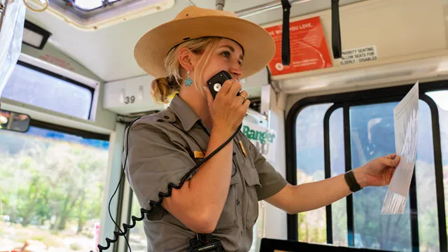
Service Animals
Ranger Programs
Trails & Wheelchairs
Campgrounds & Picnics
Visitor centers, shuttle buses, restrooms, picnic areas, and Zion Lodge are all accessible. Several campsites are also designated for people with accessibility needs, and three trails may offer accessible hiking opportunities. Service dogs on a leash are permitted throughout the park. Keep reading for details on accessible activities and locations. You can also use the "Highlights" section to jump to specific topics.
Service Animals must always be under the control of their handlers while in the park. This includes trails, shuttles, wilderness areas, and buildings. Service animals are the only animals allowed on shuttle busses.
Enhance your understanding and enjoyment of Zion National Park by participating in accessible ranger programs ! Programs are available year-round on a variety of topics.
Due to the park's natural terrain, none of Zion's trails are considered ADA accessible by law. The trails listed below are considered wheelchair-friendly at the visitor's own discretion. Wheelchair users may require assistance in some sections. Visit each page for detailed accessibility information:
The Pa'rus Trail starts at Zion Canyon Visitor Center and follows along the Virgin River.
Lower Emerald Pool Trail starts near Zion Lodge, giving impressive views of the canyon walls.
Riverside Walk starts at the Temple of Sinawava and follows the Virgin River towards the Narrows.
Visit our Trail Access Information page for other trail descriptions and accessibility information. You can also explore Zion National Park through our Virtual Hikes .
While the park does not provide standard wheelchairs, an all-terrain wheelchair is available for loan at the Zion Canyon Visitor Center. The all-terrain wheelchair enables visitors with mobility challenges and disabilities to enjoy more of the park's trails. Be sure to read up on requirements and limitations for using the wheelchair before visiting.
Watch the video below for an overview of wheelchair accessibility in Zion National Park.
Note: Trail descriptions for the Pa'rus Trail and Riverside Walk have been updated since this video's creation. Visit our Trail Access Information page for updated trail conditions and accessibility details.
Learn about wheelchair accessibility and how to plan an accessible visit to Zion National Park.
During the shuttle season, access into Zion Canyon is by shuttle bus only. All buses are wheelchair accessible. Visit the Zion Canyon Shuttle System page for schedules and information. To learn more about Zion Canyon while riding the shuttle, listen to or read the Shuttle Narration here . During the shuttle season, use of personal vehicles on Zion Canyon Scenic Drive is restricted to the following individuals:
Those requiring additional vehicle-supported medical devices
Those unable to ride the shuttle for medical reasons
Those the shuttle bus cannot accommodate due to weight or size restrictions The shuttle ramp has a combined weight limit of 1000 lbs and cannot accommodate chairs larger than 48" long or 32" wide.
The shuttle ramp has a combined weight limit of 1000 lbs and cannot accommodate chairs larger than 48" long or 32" wide.
A special permit for personal vehicle use up-canyon must be obtained from the information desk at Zion Canyon Visitor Center or Zion Human History Museum.
The following locations are accessible and open during normal hours of operation . Click the tabs below for information on each facility.
There are accessible restrooms throughout the park, typically near trailheads and visitor centers. Accessibility varies by location — click the tabs below for a summary of each area.
Zion Canyon is home to many popular destinations, such as Angels Landing and Riverside Walk. This canyon is also where shuttles run during the summer season . Accessible restrooms can be found at the following locations:
Zion Canyon Visitor Center (Shuttle Stop 1) Restrooms are located in the visitor center plaza, just across from the park store.
Restrooms are located in the visitor center plaza, just across from the park store.
Zion Human History Museum (Shuttle Stop 2) Restrooms can be found on the south end of the parking lot, near the shuttle stop.
Restrooms can be found on the south end of the parking lot, near the shuttle stop.
Zion Nature Center Restrooms are available during normal hours of operation .
Restrooms are available during normal hours of operation .
Zion Lodge (Shuttle Stop 5) Restrooms are located next to the shuttle stop and inside the lodge.
Restrooms are located next to the shuttle stop and inside the lodge.
The Grotto (Shuttle Stop 6) Restrooms are located next to the shuttle stop.
Restrooms are located next to the shuttle stop.
Weeping Rock (Shuttle Stop 7) Accessible vault toilets can be found in a small building next to the parking lot.
Accessible vault toilets can be found in a small building next to the parking lot.
Temple of Sinawava (Shuttle Stop 9) An accessible portable toilet (porta-potty) can be found in the parking lot area. Flush toilets are temporarily closed at this location.
An accessible portable toilet (porta-potty) can be found in the parking lot area.
Flush toilets are temporarily closed at this location.
All listed locations have accessible parking and ramps/paths connecting to each restroom. Remember that personal vehicles cannot drive on the Zion Canyon Scenic Drive during the shuttle season . Talk to a ranger at the Zion Canyon Visitor Center if you are unable to ride the park shuttle.
The park's east side offers two vault toilet buildings with accessible stalls. However, due to the natural terrain, there is often no designated accessible parking. For both of these locations, wheelchair access may be possible with assistance :
Canyon Overlook Trailhead has accessible restroom stalls, but accessible parking is only available at the lower parking lot, roughly 100 yards away.
A pullout halfway between the Zion-Mt. Carmel Tunnel and East Entrance (sometimes called the "Many Pools" Trailhead) has accessible restroom stalls, but no designated accessible parking.
Kolob Terrace Road is located roughly 40 minutes from Zion Canyon. This area offers vault toilets with accessible stalls, but due to the natural terrain, there is often no designated accessible parking. For all of these locations, wheelchair access may be possible with assistance :
Left Fork Trailhead has accessible restroom stalls, but there is no designated accessible parking.
Hop Valley Trailhead has accessible restroom stalls, but there is no designated accessible parking.
Wildcat Canyon Trailhead has accessible restroom stalls, but there is no designated accessible parking.
Kolob Canyons is located in the northwest corner of Zion National Park. This area features multiple accessible restrooms. All listed locations have accessible parking and ramps/paths connecting to each restroom:
Kolob Canyons Visitor Center Restrooms are located at the visitor center building.
Restrooms are located at the visitor center building.
Taylor Creek Trailhead Accessible vault toilets can be found next to the accessible parking spaces.
Accessible vault toilets can be found next to the accessible parking spaces.
South Fork Picnic Area Accessible vault toilets are located next to the accessible parking spaces.
Accessible vault toilets are located next to the accessible parking spaces.
Timber Creek Overlook Trailhead Accessible vault toilets can be found next to the accessible parking spaces.
Accessibility varies at each campground and picnic area. Click the tabs below for details on each location/area.
Watchman Campground has seven standard accessible sites and two accessible group sites, all of which have easy access to accessible restrooms. Fire grills are elevated, and picnic tables are extended. An asphalt trail leads to the Watchman Amphitheater, which offers accessible seating on the top row. Six restrooms are wheelchair accessible, though some restrooms have gravel pathways. Pavement in some sites is broken and can make wheelchair use difficult. The road access route to the Visitor Center and Shuttle Stop has grades of up to 5% for 30-foot stretches, but has trench drain covers across sections of road with openings wider than 1 inch in certain locations. An alternate concrete and asphalt-paved pathway adjacent to the amphitheater through the river entrance plaza has slopes of up to 18% for 5-foot stretches and slopes up to 8% for 39-foot stretches. In Loop B, a connector to the Pa'rus Trail can be traversed by wheelchairs with assistance. The Pa'rus Trail is a scenic, paved trail which starts at the Zion Canyon Visitor Center and follows along the Virgin River. For more accessibility information, visit the Watchman Campground page .
South Campground has nine ADA accessible sites. These campsites connect to accessible restrooms via paved pathways. Accessible parking is also available at the entrance building, where visitors can register for camping. The Pa'rus Trail, a paved trail which connects to the campground, can be traversed by wheelchairs with assistance. This trail follows the Virgin River and connects to the Zion Canyon Visitor Center as well. For more accessibility information, visit the South Campground page .
Designated picnic areas are mostly accessible in Zion National Park. There are four designated picnic areas:
Zion Canyon Visitor Center Picnic Area Located on the outer edge of the visitor center parking lot. Picnic sites are level with compacted gravel surfaces. Most tables are extended. An accessible unisex restroom is available in the visitor center plaza.
Located on the outer edge of the visitor center parking lot. Picnic sites are level with compacted gravel surfaces. Most tables are extended. An accessible unisex restroom is available in the visitor center plaza.
South Campground Picnic Area Currently closed for renovation. Accessible surfaces and extended picnic tables are planned.
Currently closed for renovation. Accessible surfaces and extended picnic tables are planned.
Grotto Picnic Area Located at the Grotto, accessible only by shuttle bus during the shuttle season. Outside of the shuttle season, reserved parking spaces are available. Picnic grounds are level with compacted gravel surfacing. An accessible unisex restroom is located next to the shuttle stop.
Located at the Grotto, accessible only by shuttle bus during the shuttle season. Outside of the shuttle season, reserved parking spaces are available. Picnic grounds are level with compacted gravel surfacing. An accessible unisex restroom is located next to the shuttle stop.
South Fork Picnic Area Located 3 miles up the Kolob Canyons Scenic Drive. Accessible parking is available, with an accessible restroom nearby. The picnic area is level with compacted gravel surfacing and extended tables.
Located 3 miles up the Kolob Canyons Scenic Drive. Accessible parking is available, with an accessible restroom nearby. The picnic area is level with compacted gravel surfacing and extended tables.
In Wilderness areas, people with disabilities are allowed to use wheelchairs as defined by the Americans with Disabilities Act: "a device designed solely for use by a mobility-impaired person for locomotion, that is suitable for use in an indoor pedestrian area." Learn more about wilderness accessibility here .
This all-terrain wheelchair allows visitors with mobility challenges and disabilities to enjoy more of the park's trails.
Join a park ranger and learn more about Zion. Stop by a visitor center for times, places, and today's subjects.
An audio version of the official park brochure with each section broken up into separate recordings for ease of listening.
Download the large print Zion National Park brochure , which features enlarged text and images.
Park elevations range between 3,666 to 8,726 feet (or 1,112 to 2,660 meters). Below are approximate elevations for some common locations:
Zion Canyon Visitor Center: 4,000 ft (1,219 m)
Zion Lodge: 4,300 ft (1,311 m)
Temple of Sinawava: 4,500 ft (1,372 m)
East Entrance/Checkerboard Mesa Viewpoint: 5,700 ft (1,737 m)
Kolob Canyons Visitor Center: 5,200 ft (1,585 m)
Kolob Canyons Picnic Area: 6,200 (1,900 m)
NPS information imported 2026-10-17. Confirm current details at NPS

Planning a trip to Zion National Park can be as much fun as exploring the park. Read park publications to get oriented.


This guide includes shuttle information, trail details, and available services. Download a copy to your phone for easy reference!
Download a digital copy of the official park brochure, which offers a map and an overview of the park.
An audio version of the official park brochure with each section broken up into separate recordings for ease of listening.
Download and view a French translation of the park's Information Guide.
Download and view a German translation of the park's Information Guide.
Download and view an Italian translation of the park's Information Guide.
Download and view a Spanish translation of the park's Information Guide.
Download and view a Japanese translation of the park's Information Guide.
Download and view a Korean translation of the park's Information Guide.
Download and view a simplified Chinese translation of the park's Information Guide.
Wilderness Desk Handouts
Reptile and Amphibians List
Zion Canyon Visitor Center fact sheet
2009 Centennial Newspaper (PDF 1.46 MB)
Check out the Zion Forever bookstore to see books about the landscapes, plants, animals, and history that make Zion special.
NPS information imported 2026-10-17. Confirm current details at NPS

Make your ideal visit a reality! Explore fun activities, places to stay, and trip-planning advice.
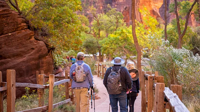

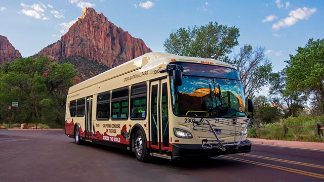
Every good trip starts with good planning! Explore the resources below to learn about camping, lodging, transportation, activities, and more. First time in the park? Check out our Zion Planning Guide !
You do not need a permit or reservation to visit most areas in Zion Canyon. You just need to pay the park fee or have a valid pass . You do not need a permit or reservation to enter the park. You do not need a permit or reservation to ride a park shuttle . You do not need a permit to hike the Narrows from the Temple of Sinawava going upstream in the Virgin River.
You do not need a permit or reservation to visit most areas in Zion Canyon. You just need to pay the park fee or have a valid pass .
You do not need a permit or reservation to enter the park.
You do not need a permit or reservation to ride a park shuttle .
You do not need a permit to hike the Narrows from the Temple of Sinawava going upstream in the Virgin River.
Find out what there is to do in Zion, from hiking to stargazing.
Find places in and around the park where you can eat or sleep.
Learn about the free shuttle service in Zion Canyon and the neighboring town of Springdale.
The National Park Service works to ensure everyone has an equal opportunity to enjoy Zion National Park.
Find out about weather, facilities, and road conditions.
All park visitors are required to purchase a recreational use pass upon entering Zion National Park.
Apply for permits to visit Angels Landing, camp in Zion Wilderness, or carry out other special activities.
Zion National Park is open all year, but visitor center hours change seasonally. Check current schedules here.
Learn how to get to different parts of Zion National Park.
Your safety is your responsibility! Learn about common hazards and how to avoid them.
NPS information imported 2026-10-17. Confirm current details at NPS
Open an activity to read its details here. Source links open in a new tab; check current conditions and permit requirements before travel.
Official NPS features and USGS park boundaries, imported 2026-10-17. An inventory snapshot, not live trail or parking availability.
Map coverage varies. Trail names may represent segments, connectors, or shared park units; mapped lines are not a hiking recommendation. Use official conditions and navigation resources before heading out.
44 matching named trail records
| Trail / mapped route | Surface | Recorded uses |
|---|---|---|
| Access to Grotto Trail Inventory record · 1 source segments; not a route distance. | Unknown | Hiker/Pedestrian |
| Angels Landing Trail Inventory record · 1 source segments; not a route distance. | Native | Hiker/Pedestrian |
| Archeology Trail Inventory record · 1 source segments; not a route distance. | Unknown | Hiker/Pedestrian |
| Barney's Trail Inventory record · 1 source segments; not a route distance. | Native | Hiker/Pedestrian |
| Bridge Inventory record · 1 source segments; not a route distance. | Wood | Hiker/Pedestrian |
| Cable Mountain Inventory record · 1 source segments; not a route distance. | Unknown | Hiker/Pedestrian | Pack and Saddle |
| Campground Trail Inventory record · 1 source segments; not a route distance. | Native | Hiker/Pedestrian |
| Canyon Overlook Trail Inventory record · 1 source segments; not a route distance. | Unknown | Hiker/Pedestrian |
| Chinle Trail Inventory record · 1 source segments; not a route distance. | Native | Hiker/Pedestrian | Pack and Saddle |
| Connector Trail Inventory record · 1 source segments; not a route distance. | Native | Hiker/Pedestrian | Pack and Saddle |
| Court of Patriarchs Overview Trail Inventory record · 1 source segments; not a route distance. | Unknown | Hiker/Pedestrian |
| Deertrap Mountain Trail Inventory record · 1 source segments; not a route distance. | Unknown | Hiker/Pedestrian | Pack and Saddle |
| East Mesa Trail Inventory record · 1 source segments; not a route distance. | Unknown | Hiker/Pedestrian | Pack and Saddle |
| East Rim Trail Inventory record · 1 source segments; not a route distance. | Unknown | Hiker/Pedestrian | Pack and Saddle |
| Footbridge Trail Inventory record · 1 source segments; not a route distance. | Concrete | Hiker/Pedestrian |
NPS public GIS inventory, imported 2026-10-17. “Existing” is an inventory classification, not confirmation that a trail is open. Segment counts are not route distances. Parking records do not indicate space availability, fees, or accessibility certification. View government source ↗
Climate for Hurricane, 25 km from the park reference point. 1991–2020 normals. Source elevation: 990 m.
Mountain, rim, valley, and coastal conditions can differ sharply from the source town. Check park forecasts and current conditions before travel.
| Month | High | Low | Rain / snow water | Wet days | Daylight |
|---|---|---|---|---|---|
| 46° | 25° | 43 mm | 5.5 | 9.7 h | |
| 50° | 28° | 48 mm | 6.5 | 10.6 h | |
| 58° | 34° | 39 mm | 6.2 | 11.7 h | |
| 66° | 40° | 21 mm | 4.2 | 12.9 h | |
| 76° | 49° | 12 mm | 2.6 | 14.0 h | |
| 87° | 58° | 4 mm | 0.8 | 14.5 h | |
| 92° | 66° | 6 mm | 1.9 | 14.3 h | |
| 90° | 65° | 8 mm | 1.7 | 13.4 h | |
| 82° | 56° | 14 mm | 2.3 | 12.3 h | |
| 70° | 43° | 21 mm | 3.4 | 11.0 h | |
| 56° | 32° | 25 mm | 3.5 | 10.0 h | |
| 46° | 24° | 37 mm | 5.1 | 9.5 h |
Official NPS excerpts imported 2026-10-17. Fees, permits, road access, and operations can change; use the source link to confirm the latest information.

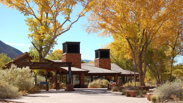

Zion National Park is open all year. Facility operating hours and shuttle schedules change with the seasons .
Get a forecast and read more details on the weather and climate of Zion
More information about park entrance fees and passes .
Internet & Cellular Access Details
Learn about the free shuttle service in Zion Canyon and the neighboring town of Springdale.
Zion National Park is open all year, but visitor center hours change seasonally. Check current schedules here.
All park visitors are required to purchase a recreational use pass upon entering Zion National Park.
Find out about weather, facilities, and road conditions.
Learn about vehicle size limits on the Zion-Mt. Carmel Highway.
Find out typical and current weather conditions in Zion, as well as the flow rate of the Virgin River and flash flood potential forecast.
Follow our guidance if you bring a pet to the park.
Enjoy a variety of educational, interpretive, and informative posts from our social media pages.
NPS Photo / Abi Farish
Check the Current Conditions page for campground alerts and closures.
Zion National Park has three campgrounds, two of which are located by the park's South Entrance. This area of the park is desert - daytime temperatures often exceed 95°F (35°C) in the summer months. There are also very few trees. Keep these facts in mind when planning your visit. Reservations are required to stay at park campgrounds. From mid-March through late November, the campgrounds are full almost every night. Visit the links below to learn more about each campground and make a reservation:
Watchman Campground is located by the park's South Entrance. The campground is open year-round, offering reservations up to six months in advance.
South Campground is also located next to the South Entrance. This campground closes seasonally and offers reservations up to two weeks in advance.
Lava Point Campground is located high on the Kolob Terrace Road, about 1 hour away from Zion Canyon. This campground closes seasonally and offers reservations up to two weeks in advance.
Check availability and make reservations on recreation.gov. Standard sites can be reserved up to 6 months in advance.
Check availability and make reservations on recreation.gov. Sites can be reserved up to 14 days in advance.
Learn about quiet hours, proper food storage, and other rules for camping.
Overnight trips require a Wilderness permit. Explore your options and reserve permits in advance.
Zion Wilderness offers over 90 miles of trails and dozens of backpacking sites. All overnight backpacking trips require a Wilderness Permit. Visit the park's backpacking page to plan your trip and apply for permits.
Several campgrounds can be found a short drive from the park. Please check the links below for more information:
St. George Area Visitor Bureau
BLM, St. George Field Office
Kane County, Utah (including Kanab)
Learn about the free shuttle service in Zion Canyon and the neighboring town of Springdale.
Planning a trip to Zion National Park can be as much fun as exploring the park. Read park publications to get oriented.
Apply for permits to visit Angels Landing, camp in Zion Wilderness, or carry out other special activities.
Service Animals
Ranger Programs
Trails & Wheelchairs
Campgrounds & Picnics
Visitor centers, shuttle buses, restrooms, picnic areas, and Zion Lodge are all accessible. Several campsites are also designated for people with accessibility needs, and three trails may offer accessible hiking opportunities. Service dogs on a leash are permitted throughout the park. Keep reading for details on accessible activities and locations. You can also use the "Highlights" section to jump to specific topics.
Service Animals must always be under the control of their handlers while in the park. This includes trails, shuttles, wilderness areas, and buildings. Service animals are the only animals allowed on shuttle busses.
Enhance your understanding and enjoyment of Zion National Park by participating in accessible ranger programs ! Programs are available year-round on a variety of topics.
Due to the park's natural terrain, none of Zion's trails are considered ADA accessible by law. The trails listed below are considered wheelchair-friendly at the visitor's own discretion. Wheelchair users may require assistance in some sections. Visit each page for detailed accessibility information:
The Pa'rus Trail starts at Zion Canyon Visitor Center and follows along the Virgin River.
Lower Emerald Pool Trail starts near Zion Lodge, giving impressive views of the canyon walls.
Riverside Walk starts at the Temple of Sinawava and follows the Virgin River towards the Narrows.
Visit our Trail Access Information page for other trail descriptions and accessibility information. You can also explore Zion National Park through our Virtual Hikes .
While the park does not provide standard wheelchairs, an all-terrain wheelchair is available for loan at the Zion Canyon Visitor Center. The all-terrain wheelchair enables visitors with mobility challenges and disabilities to enjoy more of the park's trails. Be sure to read up on requirements and limitations for using the wheelchair before visiting.
Watch the video below for an overview of wheelchair accessibility in Zion National Park.
Note: Trail descriptions for the Pa'rus Trail and Riverside Walk have been updated since this video's creation. Visit our Trail Access Information page for updated trail conditions and accessibility details.
Learn about wheelchair accessibility and how to plan an accessible visit to Zion National Park.
During the shuttle season, access into Zion Canyon is by shuttle bus only. All buses are wheelchair accessible. Visit the Zion Canyon Shuttle System page for schedules and information. To learn more about Zion Canyon while riding the shuttle, listen to or read the Shuttle Narration here . During the shuttle season, use of personal vehicles on Zion Canyon Scenic Drive is restricted to the following individuals:
Those requiring additional vehicle-supported medical devices
Those unable to ride the shuttle for medical reasons
Those the shuttle bus cannot accommodate due to weight or size restrictions The shuttle ramp has a combined weight limit of 1000 lbs and cannot accommodate chairs larger than 48" long or 32" wide.
The shuttle ramp has a combined weight limit of 1000 lbs and cannot accommodate chairs larger than 48" long or 32" wide.
A special permit for personal vehicle use up-canyon must be obtained from the information desk at Zion Canyon Visitor Center or Zion Human History Museum.
The following locations are accessible and open during normal hours of operation . Click the tabs below for information on each facility.
There are accessible restrooms throughout the park, typically near trailheads and visitor centers. Accessibility varies by location — click the tabs below for a summary of each area.
Zion Canyon is home to many popular destinations, such as Angels Landing and Riverside Walk. This canyon is also where shuttles run during the summer season . Accessible restrooms can be found at the following locations:
Zion Canyon Visitor Center (Shuttle Stop 1) Restrooms are located in the visitor center plaza, just across from the park store.
Restrooms are located in the visitor center plaza, just across from the park store.
Zion Human History Museum (Shuttle Stop 2) Restrooms can be found on the south end of the parking lot, near the shuttle stop.
Restrooms can be found on the south end of the parking lot, near the shuttle stop.
Zion Nature Center Restrooms are available during normal hours of operation .
Restrooms are available during normal hours of operation .
Zion Lodge (Shuttle Stop 5) Restrooms are located next to the shuttle stop and inside the lodge.
Restrooms are located next to the shuttle stop and inside the lodge.
The Grotto (Shuttle Stop 6) Restrooms are located next to the shuttle stop.
Restrooms are located next to the shuttle stop.
Weeping Rock (Shuttle Stop 7) Accessible vault toilets can be found in a small building next to the parking lot.
Accessible vault toilets can be found in a small building next to the parking lot.
Temple of Sinawava (Shuttle Stop 9) An accessible portable toilet (porta-potty) can be found in the parking lot area. Flush toilets are temporarily closed at this location.
An accessible portable toilet (porta-potty) can be found in the parking lot area.
Flush toilets are temporarily closed at this location.
All listed locations have accessible parking and ramps/paths connecting to each restroom. Remember that personal vehicles cannot drive on the Zion Canyon Scenic Drive during the shuttle season . Talk to a ranger at the Zion Canyon Visitor Center if you are unable to ride the park shuttle.
The park's east side offers two vault toilet buildings with accessible stalls. However, due to the natural terrain, there is often no designated accessible parking. For both of these locations, wheelchair access may be possible with assistance :
Canyon Overlook Trailhead has accessible restroom stalls, but accessible parking is only available at the lower parking lot, roughly 100 yards away.
A pullout halfway between the Zion-Mt. Carmel Tunnel and East Entrance (sometimes called the "Many Pools" Trailhead) has accessible restroom stalls, but no designated accessible parking.
Kolob Terrace Road is located roughly 40 minutes from Zion Canyon. This area offers vault toilets with accessible stalls, but due to the natural terrain, there is often no designated accessible parking. For all of these locations, wheelchair access may be possible with assistance :
Left Fork Trailhead has accessible restroom stalls, but there is no designated accessible parking.
Hop Valley Trailhead has accessible restroom stalls, but there is no designated accessible parking.
Wildcat Canyon Trailhead has accessible restroom stalls, but there is no designated accessible parking.
Kolob Canyons is located in the northwest corner of Zion National Park. This area features multiple accessible restrooms. All listed locations have accessible parking and ramps/paths connecting to each restroom:
Kolob Canyons Visitor Center Restrooms are located at the visitor center building.
Restrooms are located at the visitor center building.
Taylor Creek Trailhead Accessible vault toilets can be found next to the accessible parking spaces.
Accessible vault toilets can be found next to the accessible parking spaces.
South Fork Picnic Area Accessible vault toilets are located next to the accessible parking spaces.
Accessible vault toilets are located next to the accessible parking spaces.
Timber Creek Overlook Trailhead Accessible vault toilets can be found next to the accessible parking spaces.
Accessibility varies at each campground and picnic area. Click the tabs below for details on each location/area.
Watchman Campground has seven standard accessible sites and two accessible group sites, all of which have easy access to accessible restrooms. Fire grills are elevated, and picnic tables are extended. An asphalt trail leads to the Watchman Amphitheater, which offers accessible seating on the top row. Six restrooms are wheelchair accessible, though some restrooms have gravel pathways. Pavement in some sites is broken and can make wheelchair use difficult. The road access route to the Visitor Center and Shuttle Stop has grades of up to 5% for 30-foot stretches, but has trench drain covers across sections of road with openings wider than 1 inch in certain locations. An alternate concrete and asphalt-paved pathway adjacent to the amphitheater through the river entrance plaza has slopes of up to 18% for 5-foot stretches and slopes up to 8% for 39-foot stretches. In Loop B, a connector to the Pa'rus Trail can be traversed by wheelchairs with assistance. The Pa'rus Trail is a scenic, paved trail which starts at the Zion Canyon Visitor Center and follows along the Virgin River. For more accessibility information, visit the Watchman Campground page .
South Campground has nine ADA accessible sites. These campsites connect to accessible restrooms via paved pathways. Accessible parking is also available at the entrance building, where visitors can register for camping. The Pa'rus Trail, a paved trail which connects to the campground, can be traversed by wheelchairs with assistance. This trail follows the Virgin River and connects to the Zion Canyon Visitor Center as well. For more accessibility information, visit the South Campground page .
Designated picnic areas are mostly accessible in Zion National Park. There are four designated picnic areas:
Zion Canyon Visitor Center Picnic Area Located on the outer edge of the visitor center parking lot. Picnic sites are level with compacted gravel surfaces. Most tables are extended. An accessible unisex restroom is available in the visitor center plaza.
Located on the outer edge of the visitor center parking lot. Picnic sites are level with compacted gravel surfaces. Most tables are extended. An accessible unisex restroom is available in the visitor center plaza.
South Campground Picnic Area Currently closed for renovation. Accessible surfaces and extended picnic tables are planned.
Currently closed for renovation. Accessible surfaces and extended picnic tables are planned.
Grotto Picnic Area Located at the Grotto, accessible only by shuttle bus during the shuttle season. Outside of the shuttle season, reserved parking spaces are available. Picnic grounds are level with compacted gravel surfacing. An accessible unisex restroom is located next to the shuttle stop.
Located at the Grotto, accessible only by shuttle bus during the shuttle season. Outside of the shuttle season, reserved parking spaces are available. Picnic grounds are level with compacted gravel surfacing. An accessible unisex restroom is located next to the shuttle stop.
South Fork Picnic Area Located 3 miles up the Kolob Canyons Scenic Drive. Accessible parking is available, with an accessible restroom nearby. The picnic area is level with compacted gravel surfacing and extended tables.
Located 3 miles up the Kolob Canyons Scenic Drive. Accessible parking is available, with an accessible restroom nearby. The picnic area is level with compacted gravel surfacing and extended tables.
In Wilderness areas, people with disabilities are allowed to use wheelchairs as defined by the Americans with Disabilities Act: "a device designed solely for use by a mobility-impaired person for locomotion, that is suitable for use in an indoor pedestrian area." Learn more about wilderness accessibility here .
This all-terrain wheelchair allows visitors with mobility challenges and disabilities to enjoy more of the park's trails.
Join a park ranger and learn more about Zion. Stop by a visitor center for times, places, and today's subjects.
An audio version of the official park brochure with each section broken up into separate recordings for ease of listening.
Download the large print Zion National Park brochure , which features enlarged text and images.
Park elevations range between 3,666 to 8,726 feet (or 1,112 to 2,660 meters). Below are approximate elevations for some common locations:
Zion Canyon Visitor Center: 4,000 ft (1,219 m)
Zion Lodge: 4,300 ft (1,311 m)
Temple of Sinawava: 4,500 ft (1,372 m)
East Entrance/Checkerboard Mesa Viewpoint: 5,700 ft (1,737 m)
Kolob Canyons Visitor Center: 5,200 ft (1,585 m)
Kolob Canyons Picnic Area: 6,200 (1,900 m)

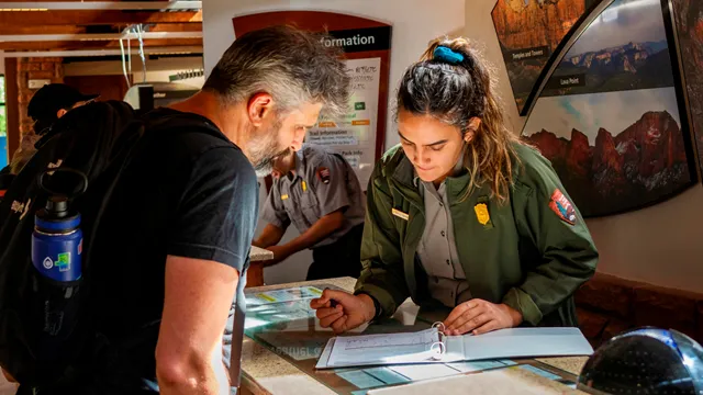

Get an entrance pass You may enter the park with a Standard , Annual , or America the Beautiful Pass . The fee for a Standard entrance pass is $20.00–$35.00. Non-US residents (16 and over) must pay an additional $100 per person fee unless admitted with an Annual or America the Beautiful Pass. Help me choose an entrance pass
You may enter the park with a Standard , Annual , or America the Beautiful Pass .
The fee for a Standard entrance pass is $20.00–$35.00.
Non-US residents (16 and over) must pay an additional $100 per person fee unless admitted with an Annual or America the Beautiful Pass.
If you already have an America the Beautiful—the National Parks and Federal Recreational Lands Pass, that's the only entrance pass you need. Seniors, military, visitors with a permanent disability, and families with a 4th grader are eligible for a free or discounted America the Beautiful pass.
America the Beautiful Pass
If you don't qualify for a discounted America the Beautiful pass, we recommend choosing an entrance pass based on your trip plans.
Nonresident Fees
Non-US residents must pay a $100 per person fee in addition to the standard entrance pass fee. More about nonresident fees
If you enter the park in a motorized vehicle, your entrance pass covers both you and your passengers. Your passengers do not need a separate pass.
Costs for vehicles with more than 15 passengers are listed below under Organizations and Businesses .
Admits private, non-commercial vehicle (15 passenger capacity or less) and all occupants to Zion National Park. Valid for 1-7 days.
Valid for 7 days. Admits up to 2 private, non-commercial motorcycles with up to 4 total passengers.
Admits one individual with no car to Zion National Park. Typically used for bicyclists, hikers and pedestrians. Youth 15 and under are admitted free. Valid for 1-7 days.
If you enter the park on a bicycle or on foot and are at least 16 years old, you need your own entrance pass. Children under the age of 16 don't need an entrance pass.
$20 per person. Non-commercial vehicles with a capacity of 16 or greater. Fees will not exceed the commercial fee for the same-sized vehicle. Youth 15 and under are free. Individuals or families with any valid Annual or Lifetime pass may use their pass for entry at the per person rate. Pass and photo ID must be present upon entry.
A commercial tour is defined as consisting of one or more persons traveling on an itinerary that has been packaged, priced, or sold for leisure or recreational purposes by an organization that realizes financial gain through the provision of the service. The entry fees of commercial tours are based upon the total capacity of vehicles that can carry seven or more passengers regardless of the actual number of passengers.
A commercial tour is defined as one or more persons traveling on an itinerary that has been packaged, priced, or sold for leisure or recreational purposes by an organization that realizes financial gain through the provision of the service. Vehicles with commercial tours of 1-6 people (not including guide) pay $35 per vehicle + $20 per person with a total fee not to exceed $70. Passengers can use valid weekly, annual, lifetime, or appreciation passes.
The Zion Annual Pass is valid only at Zion and may be purchased in person. This pass is valid for 12 months from purchase month. This pass admits the pass holder and passengers in a non-commercial vehicle. You can buy this entrance pass at all entrance stations.
US citizens and residents
Covers entrance fees and standard amenity (day-use) fees at lands managed by
National Park Service
US Fish & Wildlife Service
US Forest Service
Bureau of Land Management
Bureau of Reclamation
US Army of Corps of Engineers
Depending on the type of entrance fee charged at a site, covers One private vehicle fee or Four per person fees
America the Beautiful Passes are non-refundable, non-transferable and cannot be replaced if lost or stolen . Passholders must show valid photo identification (ID) with each pass.
Physical passes can be purchased or picked up at over 1,000 federal recreation sites.
Purchase and pickup locations
To receive your pass by mail, order online at the USGS Online Store . Online orders are for physical passes, not digital passes, and may take up to three weeks to be processed and delivered. Order receipts may not be used in place of a physical pass. We recommend ordering at least three weeks in advance of your visit, or picking up a pass in person instead.
Skip the wait! Get a Digital America the Beautiful Pass through recreation.gov. Your digital pass can be saved to a mobile device and used immediately.
Get a Digital America the Beautiful Pass
Each non-US resident aged 16 and older visiting Zion National Park must pay a $100 nonresident fee (in addition to the standard entrance fee), unless admitted with an Annual or America the Beautiful Pass. This includes nonresidents entering as part of a commercial tour group, commercial use authorization (CUA) group, or concessioner tour group.
More about nonresident fees
Come experience the national parks! All National Park Service sites that charge an entrance fee will offer free admission to US citizens and residents (other fees, including timed entry or reservation fees, may apply). Mark your calendar for these entrance fee-free dates:
February 16 : Presidents Day (Washington's Birthday)
May 25 : Memorial Day
June 14: Flag Day/President Trump's birthday
July 3–5: Independence Day weekend
August 25: 110th Birthday of the National Park Service
September 17: Constitution Day
October 27 : Theodore Roosevelt's birthday
November 11: Veterans Day
The $5 fee allows for a single use of the water fill and sanitary dump station at Watchman Campground. The "Dump Station Fee for Non-campers" recovers utilities and equipment servicing costs for fresh water and sanitary dump stations in Zion National Park. You can pay the fee directly to campground staff when they are present at the Watchman Campground kiosk. Campers already holding a camping reservation do not need to pay a separate fee since access to this amenity is included in the reservation fee. Watchman Dump Station Fee for Non-Campers Pass in Utah - Recreation.gov
A commercial tour is defined as one or more persons traveling on an itinerary that has been packaged, priced, or sold for leisure or recreational purposes by an organization that realizes financial gain through the provision of the service. The entry fees of commercial tours are based upon the total capacity of vehicles that can carry seven or more passengers regardless of the actual number of passengers. Commercial tour passes are valid on the day of purchase and for the next six days for a vehicle carrying the same group of passengers.
$35+: 1-6 Passengers ($35.00 + $20.00 per passenger not to exceed $70.00) $70: 7-15 Passengers $80: 16-25 Passengers $190: 26+ Passengers
More Commercial Tour information
Depending on your plans, you may need to pay a fee for a permit or reservation:
If you plan to hike in certain areas of the park, like Angels Landing , you will need to pay for a permit.
If you plan to participate in certain forms of wilderness recreation (such as canyoneering, overnight backpacking, overnight climbing, or hiking The Narrows or The Subway), you will need to pay a permit fee.
If you plan to stay in a campground , you will need to pay for a reservation.
Learn about vehicle size limits on the Zion-Mt. Carmel Highway.
Apply for permits to visit Angels Landing, camp in Zion Wilderness, or carry out other special activities.
Park entrance fees support essential services that benefit all park visitors. Learn more about the ways your fees help Zion!
| I'm visiting... | We recommend | |
|---|---|---|
| This park, once | Standard Pass | |
| This park, multiple times | Annual Pass | |
| More than one national park or federal recreation site | America the Beautiful Pass | |
| Type | Available to | Price |
| Resident Annual Pass | US citizens and residents | $80.00 |
| Non-Resident Annual Pass | Non-US residents | $250.00 |
| Senior Annual Pass | US citizens and residents 62+ years old | $20.00 |
| Senior Lifetime Pass | US citizens and residents 62+ years old | $80.00 |
| Military Annual Pass | Current US military and dependents | Free |
| Military Lifetime Pass | Gold Star Family members and veterans | Free |
| Access Pass | US citizens and residents with permanent disability | Free |
| 4th Grade Pass | US 4th graders | Free |
| Volunteer Pass | Federal recreation site volunteers with 250 service hours | Free |
| I'm visiting... | We recommend |
|---|---|
| This park, once | Standard Pass |
| This park, multiple times | Annual Pass |
| More than one national park or federal recreation site | America the Beautiful Pass |
| Type | Available to | Price |
|---|---|---|
| Resident Annual Pass | US citizens and residents | $80.00 |
| Non-Resident Annual Pass | Non-US residents | $250.00 |
| Senior Annual Pass | US citizens and residents 62+ years old | $20.00 |
| Senior Lifetime Pass | US citizens and residents 62+ years old | $80.00 |
| Military Annual Pass | Current US military and dependents | Free |
| Military Lifetime Pass | Gold Star Family members and veterans | Free |
| Access Pass | US citizens and residents with permanent disability | Free |
| 4th Grade Pass | US 4th graders | Free |
| Volunteer Pass | Federal recreation site volunteers with 250 service hours | Free |


Vehicles that are too large cannot drive between Canyon Junction and the East Entrance. Visit our large vehicles page to learn about current size limits.
To reach Zion Canyon from the south , travel to Springdale, Utah. The park's South Entrance and Pedestrian Entrance are located on the north end of town.
To reach Zion Canyon from the east , travel to Mt. Carmel Junction, Utah. Then, drive west on State Road 9. The park's East Entrance is located 13 miles west of Mt. Carmel Junction.
If you are travelling to/from the park's east side , make sure your vehicle is not too big to traverse the highway . Vehicles that are too big will have to take an alternate route to the park's South Entrance:
To get to Bryce Canyon , travellers can take Highway 20 (north of Cedar City). In total, this route is roughly 150 miles long, taking 2.5 hours to complete. While this route is 63 miles longer than the Zion-Mt. Carmel Highway route, the detour only adds ~42 minutes. This is because the state highways are much faster than the Zion-Mt. Carmel Highway , which usually has speeds under 30 MPH.
While this route is 63 miles longer than the Zion-Mt. Carmel Highway route, the detour only adds ~42 minutes. This is because the state highways are much faster than the Zion-Mt. Carmel Highway , which usually has speeds under 30 MPH.
To get to Grand Canyon's North Rim , travellers can instead take Highway 59 southeast towards Jacob Lake. This route is roughly 128 miles long, taking just over 3 hours to complete. This route is 23 miles longer, but it only adds 10 minutes to the trip.
This route is 23 miles longer, but it only adds 10 minutes to the trip.
Other alternative routes can be found on your navigation platform / app of choice.
Kolob Canyons Visitor Center and scenic drive is located at Exit 40 on Interstate 15. This is 40 miles from Zion Canyon and 17 miles south of Cedar City.
Kolob Terrace Road begins in the town of Virgin, Utah. The start of this road is located 13.5 miles west from the Zion Canyon Visitor Center.
Harry Reid International Airport (LAS) is located in Las Vegas, Nevada, 170 miles away. Salt Lake City International Airport (SLC) is located in Salt Lake City, Utah, 300 miles away.
St. George Regional Airport (SGU) is located in St. George, Utah, 49 miles away. This airport offers flights from Salt Lake City, Utah and Denver, Colorado. Cedar City Regional Airport (CDC) is located in Cedar City, Utah, 60 miles away. This airport offers flights from Salt Lake City, Utah.
The Nature Center has two parking lots. One parking lot is located directly in front of the Nature Center. The other parking lot is located further behind the Nature Center, next to the South Campground picnic area. Parking is free and available on a first-come, first-served basis. Visitors just have to pay the park entrance fee in order to reach the parking lot.
The front parking area has 16 parking spaces, including 1 accessible parking spot. This parking lot is intended for visitors to the Nature Center and its picnic areas. The shuttle does not stop at this location.
The rear parking area has 38 total spaces, including 3 accessible parking spots. This parking area is located about 250 feet away from the Nature Center. The parking lot also connects to the Pa'rus Trail, meaning Zion Canyon Visitor Center (Shuttle Stop #1) is a short walk away.
Kolob Canyons, Kolob Terrace Road, and the park's east side offer designated parking at trailheads and points of interest. Kolob Canyons and the east side both have paved parking areas. Kolob Terrace Road typically has dirt or gravel lots for its trailheads. Parking is limited - make backup plans and arrive early if possible.
Large vehicles are not permitted to drive the Zion-Mt. Carmel Highway between Canyon Junction and the park’s East Entrance. Vehicles that exceed size limits will have to reroute through Springdale. Visit our large vehicles page to learn more about size limits and alternative routes.
Learn about the free shuttle service in Zion Canyon and the neighboring town of Springdale.
Learn about vehicle size limits on the Zion-Mt. Carmel Highway.
Make the most out of your trip by learning how to avoid crowds and traffic.
Zion National Park 1 Zion Park Blvd. Springdale, UT 84767
37.200190, -112.987139
37.453462, -113.225640
Make your ideal visit a reality! Explore fun activities, places to stay, and trip-planning advice.
The Pa'rus Trail and Zion Canyon Scenic Drive are accessible to bicycles.


Zion Forever Project / Wyatt Larson
Your safety depends on your own good judgment, adequate preparation, and constant awareness. Your safety is your responsibility.
Flash floods are a sudden increase in depth and speed of water in rivers, streams or washes due to heavy rain from thunderstorms. Flood waters carry large debris like tree trunks and boulders. Flash floods can occur at any time in Zion National Park and in the desert southwest. Learn more about the warning signs of flash floods before heading into the park.
Falls from cliffs on trails have resulted in death. Loose sand or pebbles on stone are very slippery. Be careful of edges when using cameras or binoculars. Never throw or roll rocks. There may be hikers below you. Be aware of the hazards to keep you, others, and park resources safe during your visit.
Stay on the trail.
Stay back from cliff edges.
Observe posted warnings.
Please watch children.
The desert is an extreme environment. Carry enough water, at least one gallon per person per day, and drink it. Water is available at visitor centers, campgrounds, Zion Lodge, and some shuttle stops. Do not drink untreated water .
Heat stroke is an advanced stage of heat exhaustion where the body is unable to cool itself. Symptoms include confusion, disorientation, behavioral changes, and seizures. If you believe that a member of your party is suffering from heat stroke, it is imperative to cool them using any available means and obtain immediate medical assistance.
Heat exhaustion occurs when the body loses more fluid than is taken in. Signs of heat exhaustion include nausea, vomiting, fatigue, headaches, pale appearance, stomach cramps, and cool clammy skin. If a member of your party begins to experience any of these symptoms, stop your hike immediately. Find a cool, shady area and have the victim rest with their feet up to distribute fluids throughout the body. It is important to drink fluids, but it is also important to eat . While suffering from heat exhaustion, drinking fluids without eating can lead to a potentially dangerous condition of low blood salt. If heat exhaustion symptoms persist for more than two hours, seek medical help.
Hypothermia occurs when the body is cooled to dangerous levels. Hypothermia is responsible for the greatest number of deaths among people engaging in outdoor activities. Possible even in warm weather, this often occurs without the victim's awareness. Hypothermia is a major hazard in narrow canyons. Immersion in water is the quickest way to lose body heat. To prevent hypothermia, avoid cotton clothing (it provides no insulation when wet) and eat high energy food before you are chilled. Signs of hypothermia include:
Uncontrollable shivering
Stumbling and poor coordination
Confusion or slurred speech
If you recognize any of these signs, stop hiking and immediately replace wet clothing with dry clothing. Warm the victim with your own body and a warm drink, and shelter the individual from breezes. A pre-warmed sleeping bag will prevent further heat loss.
Every year, mule deer and other wildlife are killed by speeding vehicles. Unless otherwise posted, the maximum speed limit is 35 mph (radar enforced).
Safety belts and child safety seats are required for all occupants of a vehicle.
Park in designated spaces only and turn off your engine when you vehicle is stopped.
Beginning on June 7, 2026 , large vehicles will be rerouted from the Zion-Mt. Carmel Highway to improve safety and protect resources. Visit our large vehicles page to learn more about current restrictions. The Zion-Mount Carmel Tunnel has seen multiple major accidents, minor accidents, and close calls involving vehicles, pedestrians, and staff. When approaching the tunnel from either direction, slow down and stay in your vehicle if traffic stops . Watch out for rangers, pedestrians, and other vehicles. Obey all directions from rangers. Do not stop in the tunnel or try to turn around at either tunnel entrance. Pedestrians and bicycles are not allowed in the tunnel.
Canyon Junction Bridge Do not stand on the Canyon Junction Bridge to take pictures. Similar views of the Watchman and the Virgin River may be found on the Pa'rus Trail located nearby.
Federal law allows people who can legally possess firearms under federal, Utah, and local laws to possess firearms in the park . The discharge of firearms and hunting within the park are prohibited. It is the visitor's responsibility to understand and comply with all applicable Utah, local, and federal firearm laws. Federal law prohibits firearms in certain facilities in Zion National Park; those places are posted with signs. If you have questions, contact the park at 435-772-3256.
Close contact with wildlife, or injuries caused by them, can transmit dangerous illnesses to people. There are a variety of animals in Zion that could carry these infections. Animal-transmitted diseases cause a variety of symptoms and can be life-threatening. In Zion, we don't know how prevalent these diseases are, but it is best to be cautious. Always maintain a safe distance from animals and their waste.
Rockfall hazards occur throughout the park and are especially high near any cliff face. If you witness a rockfall, quickly move away from the cliff. If you are near the base of a cliff or talus slope when a rockfall occurs and cannot quickly move away from the base of the cliff, immediately seek shelter behind the largest nearby boulder and pull your backpack over your head. After rocks have stopped falling, move quickly as far away from the base of the cliff as possible. Be aware that rockfalls can occur at any time. Pay attention to your surroundings, stay off of closed trails, and, if unsure, keep away from cliffs.
Plan ahead and prepare for your hike in Zion National Park. Review the trail information linked below to choose a trail that is right for your group. Your safety is your responsibility. You can read the most recent trail information on our trail access information page. For updated trail closure information, check the current conditions . Find trailhead location maps on our publications page.
Much longer hikes are located in the Zion Wilderness. These are not loop hikes. Most day hikers will hike out and back the same way. Hikers do not need to travel the full distance, they can turn around at any point and return the way they came. The group size limit for all Zion Wilderness trails, including the Virgin River Narrows beyond the junction with Orderville Canyon, is 12 people.
Several hiking options are located in Kolob Canyons, the northwest corner of Zion National Park.
These trails are at a higher elevation, mostly stretching across a center portion of the park.
This area is located east of Zion Canyon at a much higher elevation.
A beautiful low-elevation area located in the southwest corner of Zion National Park.


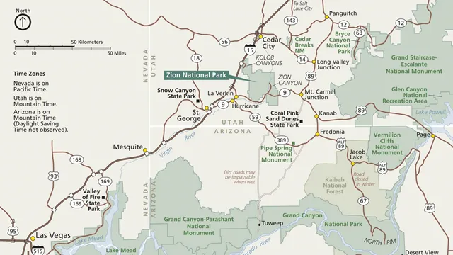
To take a closer look at the park, use this interactive map to move around and zoom in on specific locations. The area highlighted in green is Zion National Park's boundaries. Zion Canyon is found near the bottom, while Kolob Canyons is found to the northwest. For digital copies of maps that can be found at the visitor center, check the links below or visit our park publications page .
This guide includes shuttle information, trail details, and available services. Download a copy to your phone for easy reference!
Download a digital copy of the official park brochure, which offers a map and an overview of the park.
View and download a copy of the most recent Zion Wilderness Map.
Look at this map to see nearby parks, forests, monuments, and other incredible attractions.
Not sure how to reach the pedestrian / bicycle entrance? Check this map for an easy route to follow.
Looking to participate in a Junior Ranger program? Head over to the Nature Center using this map!
Zion offers many trails ranging from short walks to strenuous adventures.
The Pa'rus Trail and Zion Canyon Scenic Drive are accessible to bicycles.
Start planning an overnight backpacking trip, discover which trails are best for your group, and reserve permits in advance.
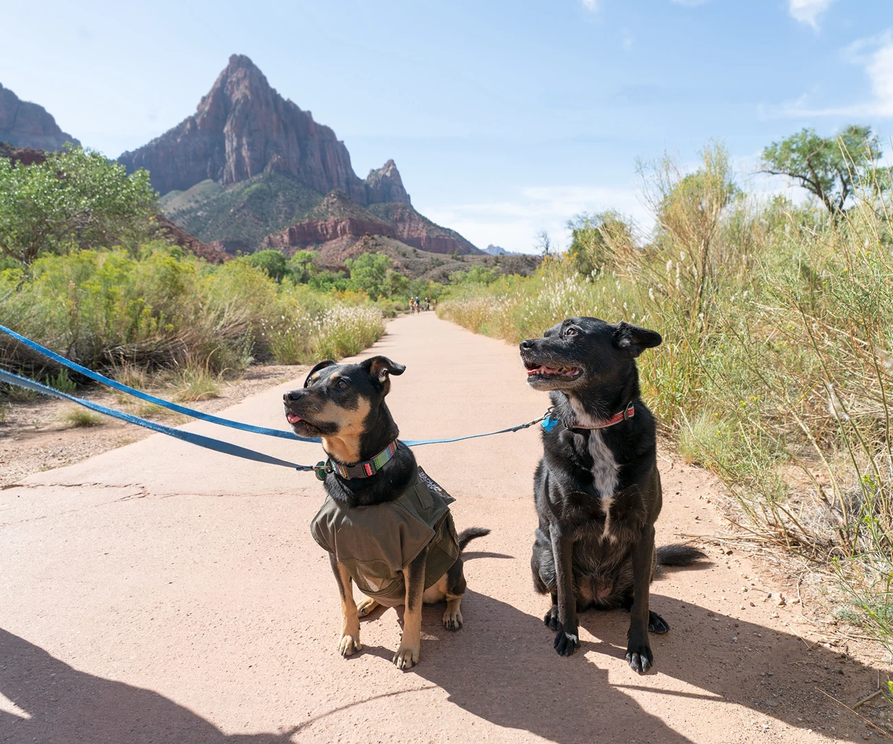
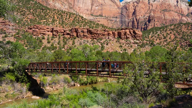

Zion National Park actively monitors for the presence of harmful cyanobacteria and cyanotoxins in the Virgin River. Cyanotoxins may be present at any time of year. Keep dogs out of the water and on a leash while in Zion. Dogs may ingest cyanobacteria or untreated water, exposing them to cyanotoxins. Check our website for current information about toxic cyanobacteria .
NPS Photo/Abi Farish
Pets must be restrained on a leash no longer than 6 feet. Retractable leashes that extend further than 6 feet are not allowed.
Pet owners are responsible for removing pet waste from all areas in the park including campgrounds, picnic areas, parking lots, roads, pet-friendly trails, and other developed areas.
Pets can harass or harm wildlife by making noise or scaring wildlife away. Keep your pet's noise to a reasonable level.
Properly restrained pets are welcome along public roads and parking areas, in developed campgrounds and picnic areas, and on the grounds of the Zion Lodge. The only trail that allows pets is the Pa’rus Trail , which begins at the Zion Canyon Visitor Center. Pets are not permitted on any other trails, wilderness areas, on shuttle buses, or in public buildings in Zion.
Zion is hot! During most of the year, the interior temperature of a vehicle can quickly warm to dangerous levels. Leaving a pet unattended in a vehicle with environmental conditions that pose a health risk to the animal is prohibited. Properly restrained pets may be left unattended in developed campgrounds only when environmental conditions are safe for the animal, and the animal is not making unreasonable noise (such as barking or whining).
Veterinarian services are available in the nearby towns of Hurricane, St. George, Kanab, and Cedar City. Boarding kennels are available in those locations as well as Rockville.
Under the Americans with Disabilities Act (ADA), Service animals are defined as dogs that are individually trained to do work or perform tasks for people with disabilities. Dogs whose sole function is to provide comfort or emotional support do not qualify as service animals under the ADA. Service Animals may accompany their owner to all park locations.
36 CFR 2.15 (Code of Federal Regulations) provides more details concerning pets within National Park Service areas. Pet owners not adhering to regulations may be cited (minimum fine is $100). Read the Superintendent's Compendium section on pets for more details.
For many, pets are an important member of our families. If you are planning to bring a furry family member on your trip to Zion, make sure you are prepared and are following the B.A.R.K. Ranger code. The code helps protect you, your pet, and the park while you are here. If the activities you have planned would be prohibited or too strenuous for your pet, consider leaving them at home or with a local boarding kennel. Demonstrate to other visitors that you know how to explore the park safely, and help protect special places like Zion! Stop in any Zion visitor center to pick up your official B.A.R.K. Ranger pledge card to become an official B.A.R.K. Ranger .
The Pa’rus Trail follows the Virgin River up from the Zion Canyon Visitor Center. This flat, paved trail allows pets and bicycles.
Your safety is your responsibility.
The National Park Service works to ensure everyone has an equal opportunity to enjoy Zion National Park
The official page did not return a usable snapshot. Use the source link or the park website to find the current guide.
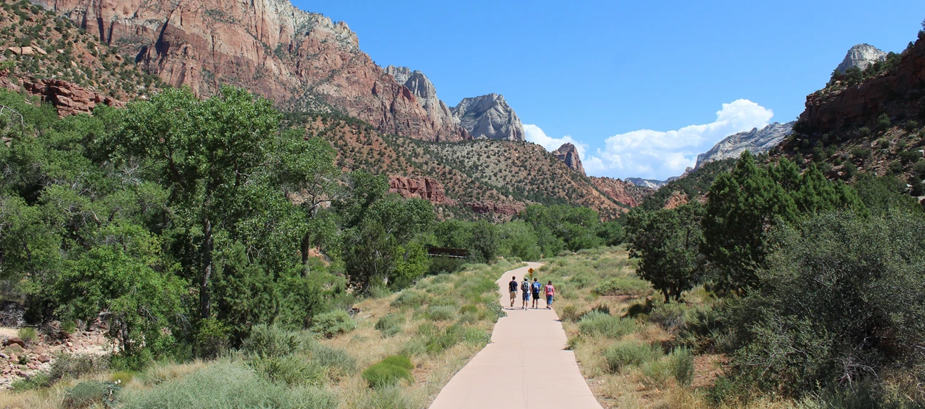


Parus Trail Main Page Last assessed on January 13, 2025. Obstructions less than 0.5 in tall, or outside the tread area of 120 in (304.8 cm) wide by 96 in (243.8 cm), high were not reported.
Length (one way): 1.6 mi (2.5 km)
1.6 mi (2.5 km)
Elevation : Gain: 151.7 ft (46.3 m) Loss: 62.7 ft (19.12 m)
Gain: 151.7 ft (46.3 m)
Loss: 62.7 ft (19.12 m)
Grade : Typical: 2.6% Maximum: 11.4% 1.2% of the trail is at an 8.3% or higher grade. Note: Standard accessible ramp grade is 8.3%
1.2% of the trail is at an 8.3% or higher grade. Note: Standard accessible ramp grade is 8.3%
Note: Standard accessible ramp grade is 8.3%
Cross Slope : Typical: 2.1% Maximum: 8.8% 4.6% of the trail has a cross slope of 6% or higher.
4.6% of the trail has a cross slope of 6% or higher.
Tread Width : Typical: 120 in (304.7 cm) Minimum: 96 in (243.8 cm)
Typical: 120 in (304.7 cm)
Minimum: 96 in (243.8 cm)
Surface : 93.6% of the trail is paved and 6.4% is hard wood decking.
93.6% of the trail is paved and 6.4% is hard wood decking.
Obstructions : Bridges (5) 120 in (304.8 cm) wide 416 - 1744 in (1056.6 - 4429.8 cm) long Post 60 in (152.4 cm) of remaining tread Tripping Hazards (20+) 1 - 2 in (2.5 - 5 cm) tall 0 in of remaining tread
Bridges (5) 120 in (304.8 cm) wide 416 - 1744 in (1056.6 - 4429.8 cm) long
120 in (304.8 cm) wide
416 - 1744 in (1056.6 - 4429.8 cm) long
Post 60 in (152.4 cm) of remaining tread
60 in (152.4 cm) of remaining tread
Tripping Hazards (20+) 1 - 2 in (2.5 - 5 cm) tall 0 in of remaining tread
1 - 2 in (2.5 - 5 cm) tall
0 in of remaining tread
Riverside Walk Main Page Last assessed on February 24, 2025. Obstructions less than 4 in (10.2 cm) tall, or outside the tread area of 36 in (91.4 cm) wide by 96 in (243.8 cm), high were not reported.
Length (one way): 1 mi (1.6 km)
Elevation : Gain: 154.2 ft (47.0 m) Loss: 48.5 ft (14.78 m)
Gain: 154.2 ft (47.0 m)
Loss: 48.5 ft (14.78 m)
Grade : Typical: 4.6% Maximum: 25.9% 17.5% of the trail is at an 8.3% or higher grade.
17.5% of the trail is at an 8.3% or higher grade.
Cross Slope : Typical: 1.7% Maximum: 7.6% 18% of the trail has a cross slope of 3% or higher.
18% of the trail has a cross slope of 3% or higher.
Tread Width : Typical: 77 in (194.9 cm) Minimum: 50 in (127 cm)
Typical: 77 in (194.9 cm)
Minimum: 50 in (127 cm)
Surface : 100% of the trail is concrete. Some sections may be slippery from sand.
100% of the trail is concrete. Some sections may be slippery from sand.
Obstructions : Overhanging rocks Minimum vertical clearance: 4 ft (1.2 m) 7 ft (2.1 m) long 48 in (121.9 cm) of remaining tread
Overhanging rocks Minimum vertical clearance: 4 ft (1.2 m) 7 ft (2.1 m) long 48 in (121.9 cm) of remaining tread
Minimum vertical clearance: 4 ft (1.2 m)
7 ft (2.1 m) long
48 in (121.9 cm) of remaining tread
Grotto Trail Main Page Last assessed on March 5, 2025. Obstructions less than 7 in (17.8 cm) tall, or outside the tread area of 45 in (114.3 cm) wide by 96 in (243.8 cm) high, were not reported.
Length (one way): 0.5 mi (0.8 km)
0.5 mi (0.8 km)
Elevation : Gain: 49.0 ft (14.92 m) Loss: 45.5 ft (13.86 m)
Gain: 49.0 ft (14.92 m)
Loss: 45.5 ft (13.86 m)
Grade : Typical: 3.5% Maximum: 20.1% 9.7% of the trail is at an 8.3% or higher grade.
9.7% of the trail is at an 8.3% or higher grade.
Cross Slope : Typical: 4.1% Maximum: 17.3%
Tread Width : Typical: 116 in (293.7 cm) Minimum: 15 in (38.1 cm)
Typical: 116 in (293.7 cm)
Minimum: 15 in (38.1 cm)
Surface : 93.6% of the trail is firm soil, and 6.4% is paved.
93.6% of the trail is firm soil, and 6.4% is paved.
Obstructions : Steps Rocks up to 21 in (53.3 cm) tall 0 in of remaining tread Boulder in center of trail 10 ft (3 m) long 45 in (114.3 cm) of remaining tread
Steps Rocks up to 21 in (53.3 cm) tall 0 in of remaining tread
Rocks up to 21 in (53.3 cm) tall
Boulder in center of trail 10 ft (3 m) long 45 in (114.3 cm) of remaining tread
10 ft (3 m) long
45 in (114.3 cm) of remaining tread
Lower Emerald Pools Trail Main Page Last assessed on March 20, 2025. Obstructions less than 12 in (30.5 cm) tall, or outside the tread area of 12 in (30.5 cm) wide by 96 in (243.8 cm) high, were not reported.
Length (one way, from Shuttle Stop #5): 0.6 mi (1.0 km)
0.6 mi (1.0 km)
Elevation : Gain: 131.1 ft (40.0 m) Loss: 96.4 ft (29.38 m)
Gain: 131.1 ft (40.0 m)
Loss: 96.4 ft (29.38 m)
Grade : Typical: 7.1% Maximum: 25.3% 34% of the trail is at an 8.3% or higher grade.
34% of the trail is at an 8.3% or higher grade.
Cross slope : Typical: 3.6% Maximum: 17.1% 19% of the trail has a cross slope of 6% or higher.
19% of the trail has a cross slope of 6% or higher.
Tread width : Typical: 62 in (157.8 cm) Minimum: 30 in (76.2 cm) 25 ft (7.6 m) of the trail is this width.
Typical: 62 in (157.8 cm)
Minimum: 30 in (76.2 cm) 25 ft (7.6 m) of the trail is this width.
25 ft (7.6 m) of the trail is this width.
Surface : 96.2% of the trail is hard concrete with 3.8% being covered in firm soil.
96.2% of the trail is hard concrete with 3.8% being covered in firm soil.
Obstructions : Bridge Minimum tread width: 45 in (114.3 cm) Tripping hazards Gaps in concrete up to 2 in (5.1 cm) long 0 in remaining tread
Bridge Minimum tread width: 45 in (114.3 cm)
Minimum tread width: 45 in (114.3 cm)
Tripping hazards Gaps in concrete up to 2 in (5.1 cm) long 0 in remaining tread
Gaps in concrete up to 2 in (5.1 cm) long
0 in remaining tread
Middle Emerald Pools Trail Main Page Last assessed on March 20, 2025. Obstructions less than 12 in (30.5 cm) tall, or outside the tread area of 12 in (30.5 cm) wide by 96 in (243.8 cm) high, were not reported.
Length (one way from Shuttle Stop #5): 0.9 mi (1.4 km)
0.9 mi (1.4 km)
Elevation : Gain: 332.8 ft (101.4 m) Loss: 152.2 ft (46.4 m)
Gain: 332.8 ft (101.4 m)
Loss: 152.2 ft (46.4 m)
Grade : Typical: 10.3% Maximum: 38.1% 44.8% of the trail is at a 10% or higher grade.
44.8% of the trail is at a 10% or higher grade.
Cross slope : Typical: 4.4% Maximum: 20.1%
Tread width : Typical: 57 in (144.2 cm) Minimum: 20 in (50.8 cm)

NPS Photo / Wil Marischen
Current Conditions
Trail Accessibility
These trails range from 0.4 miles to 3.5 miles and gain no more than 100 feet in elevation. A few are wheelchair accessible with assistance and all offer a glimpse of the natural history of Zion National Park. Being shorter in duration, these trails are also great options for those with a limited amount of time.
Loading results...
These trails range from 1 mile to 7.6 miles and have larger elevation gains. They offer magnificent views of Zion Canyon but require additional planning as proper footwear, supply of water, and physical abilities become increasingly important.
These trails range from 2.5 miles to 9.4 miles and have elevation gains of up to 2,148 ft. Strenuous trails are physically challenging, but some can be mentally challenging as well. Several of these trails include walking along steep cliffs and holding onto chains for safety. Visit each trail's page for more details. Your safety is your responsibility. These trails require preparation and planning. While summer months are popular times to travel, they also bring extreme heat, thunderstorms, and rain which can increase your risk if you are unprepared. Always check the current weather conditions and plan accordingly.
Hikers going to Scout Lookout do not need a permit. However, a permit is required to hike Angels Landing. Visit the Angels Landing permit page to learn more or apply.
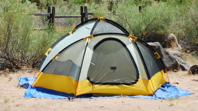


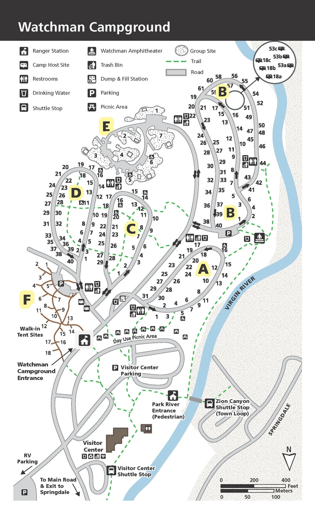
CAUTION: Many campsites in Watchman Campground are located near the North Fork of the Virgin River. Please be aware of toxic cyanobacteria in the river.
Fire/Stove Policy
Phone number (Voice)
Mailing Address
Physical Address
Additional Information
Cell Phone Additional Information
Internet Additional Information
Check availability and make reservations on recreation.gov. Standard sites can be reserved up to 6 months in advance.
Learn about camping options in and around Zion National Park.
Learn about quiet hours, proper food storage, and other rules for camping.

Fire/Stove Policy
Phone number (Voice)
Mailing Address
Physical Address
Additional Information
Cell Phone Additional Information
Internet Additional Information
Learn about camping options in and around Zion National Park.
Learn about quiet hours, proper food storage, and other rules for camping.


Fire/Stove Policy
Phone number (Voice)
Mailing Address
Physical Address
Additional Information
Cell Phone Additional Information
Internet Additional Information
Check availability and make reservations on recreation.gov. Sites can be reserved up to 14 days in advance.
Learn about camping options in and around Zion National Park.
Learn about quiet hours, proper food storage, and other rules for camping.
During spring and fall, weather conditions can change rapidly along Kolob Terrace Road. Plan accordingly and check here for current conditions.
Lava Point Campground cannot be included in the itinerary of any wilderness backpacking trip. Backpackers need to make reservations for each night of their trip only in designated Wilderness campsites and camp areas. Visit the park's backpacking page for more information.
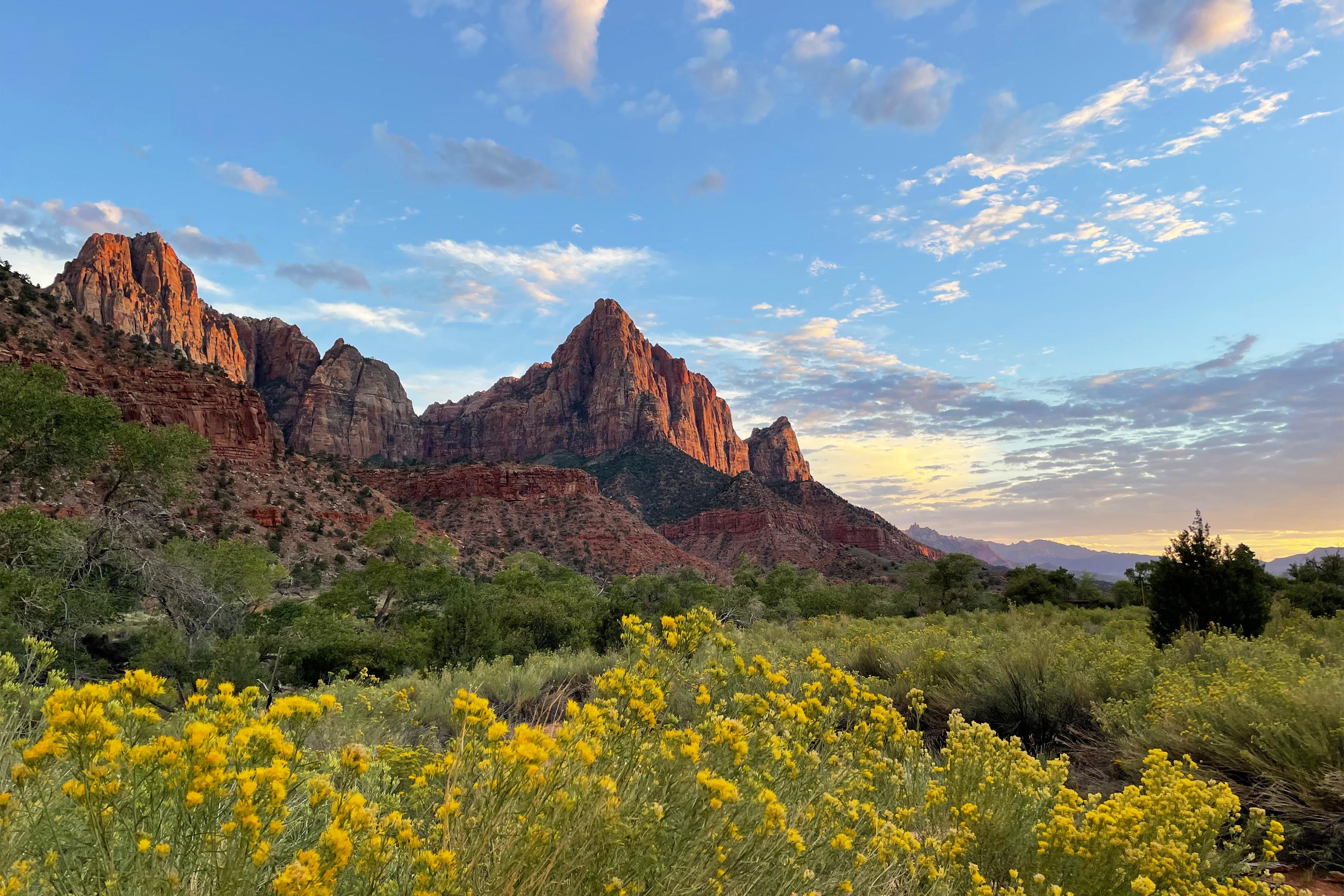
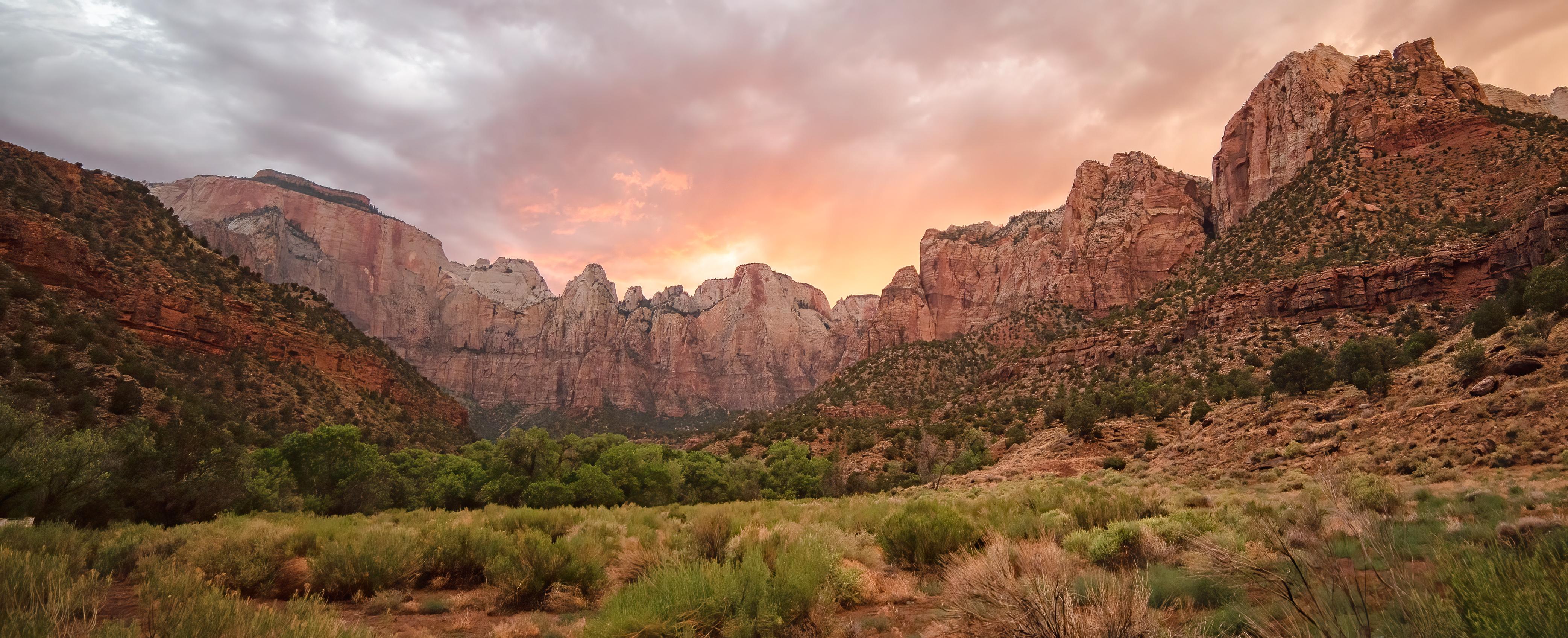
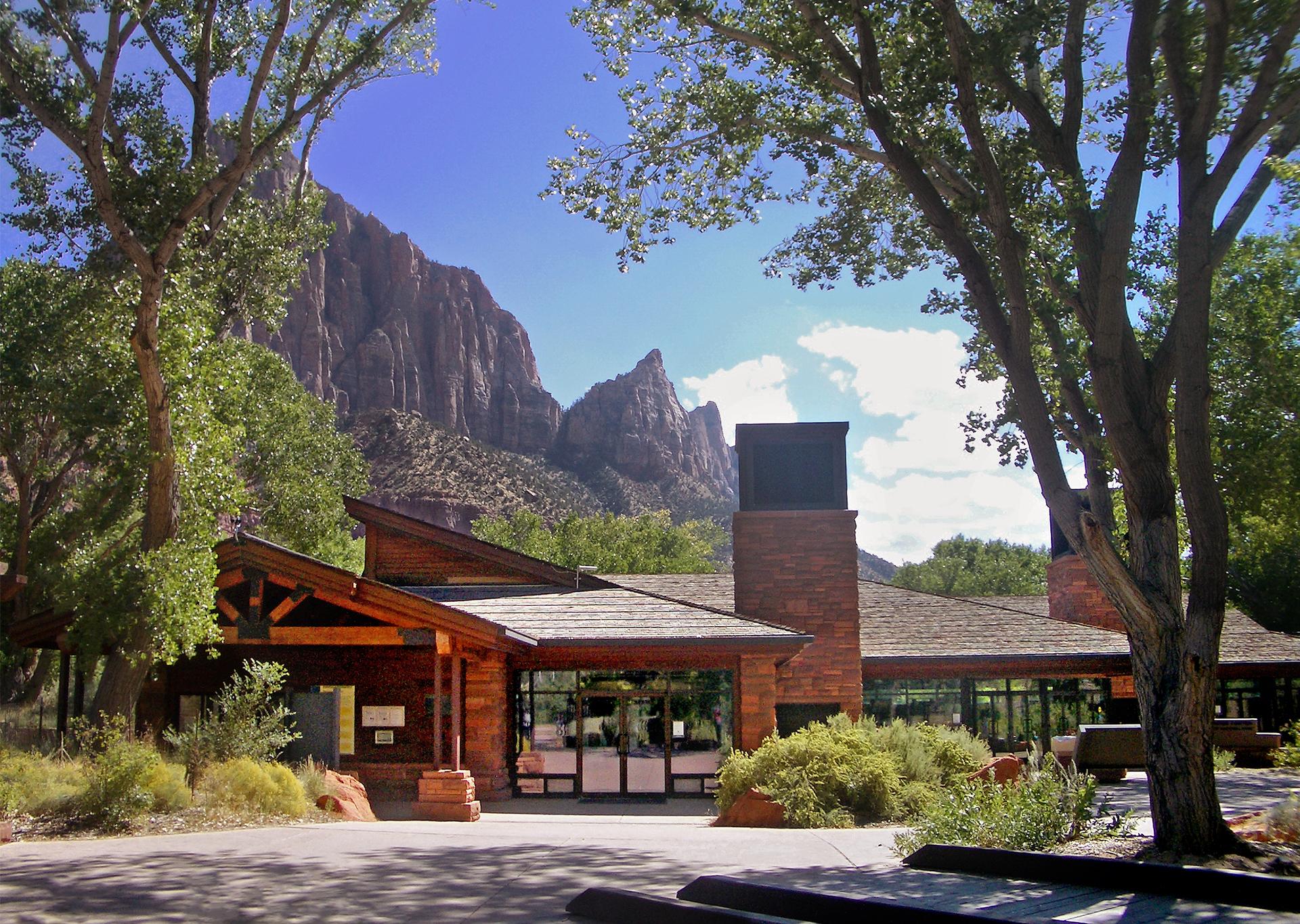
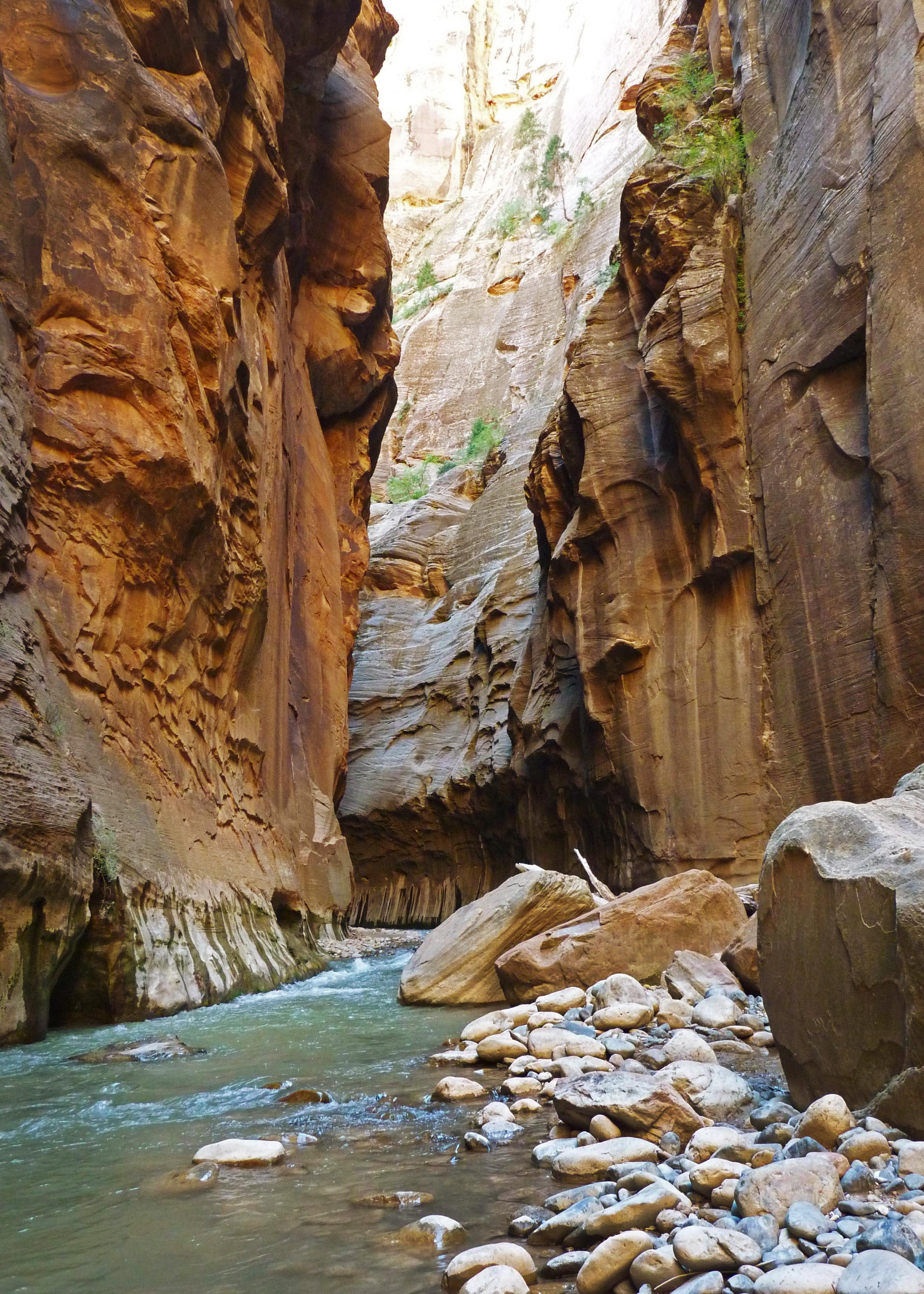
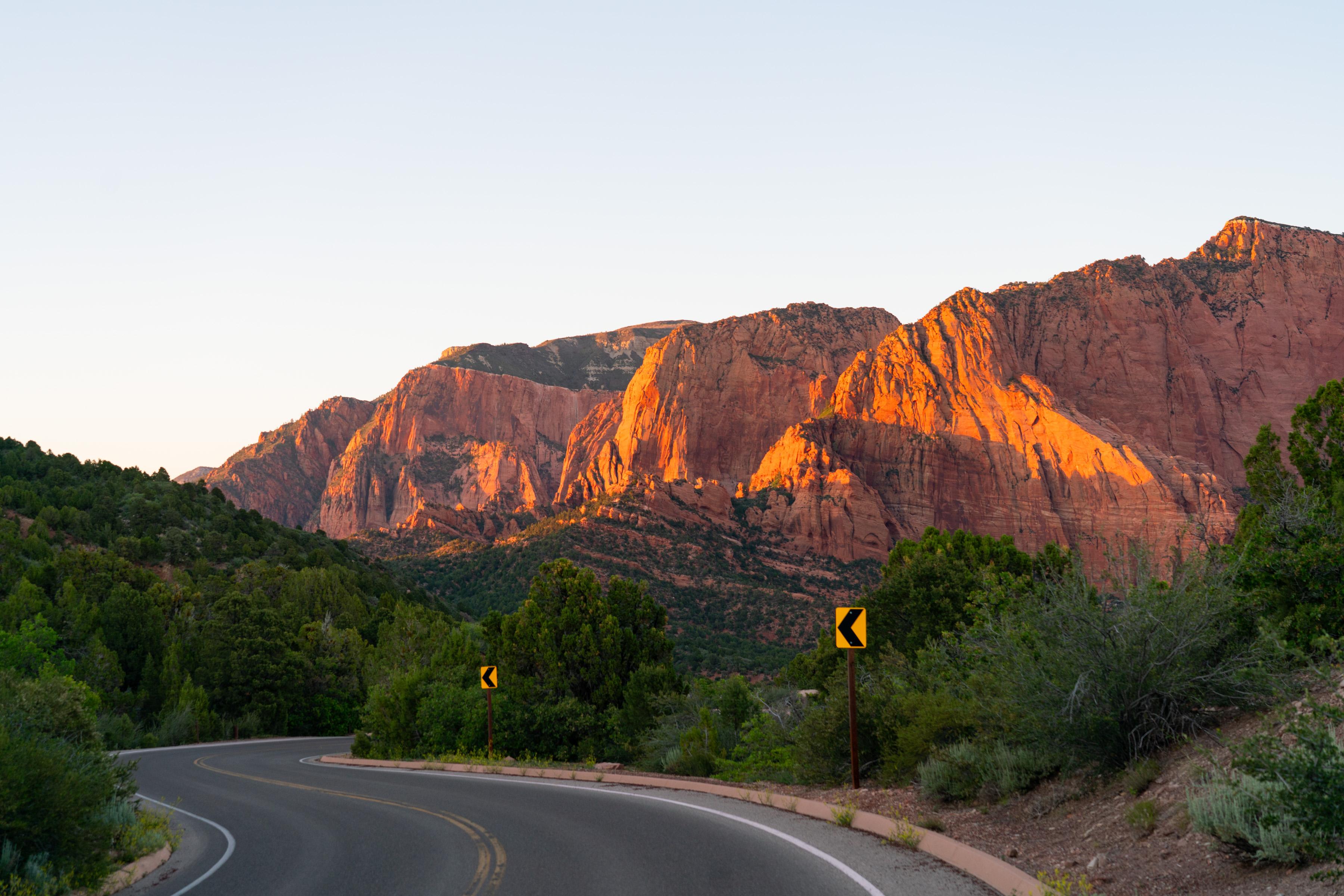
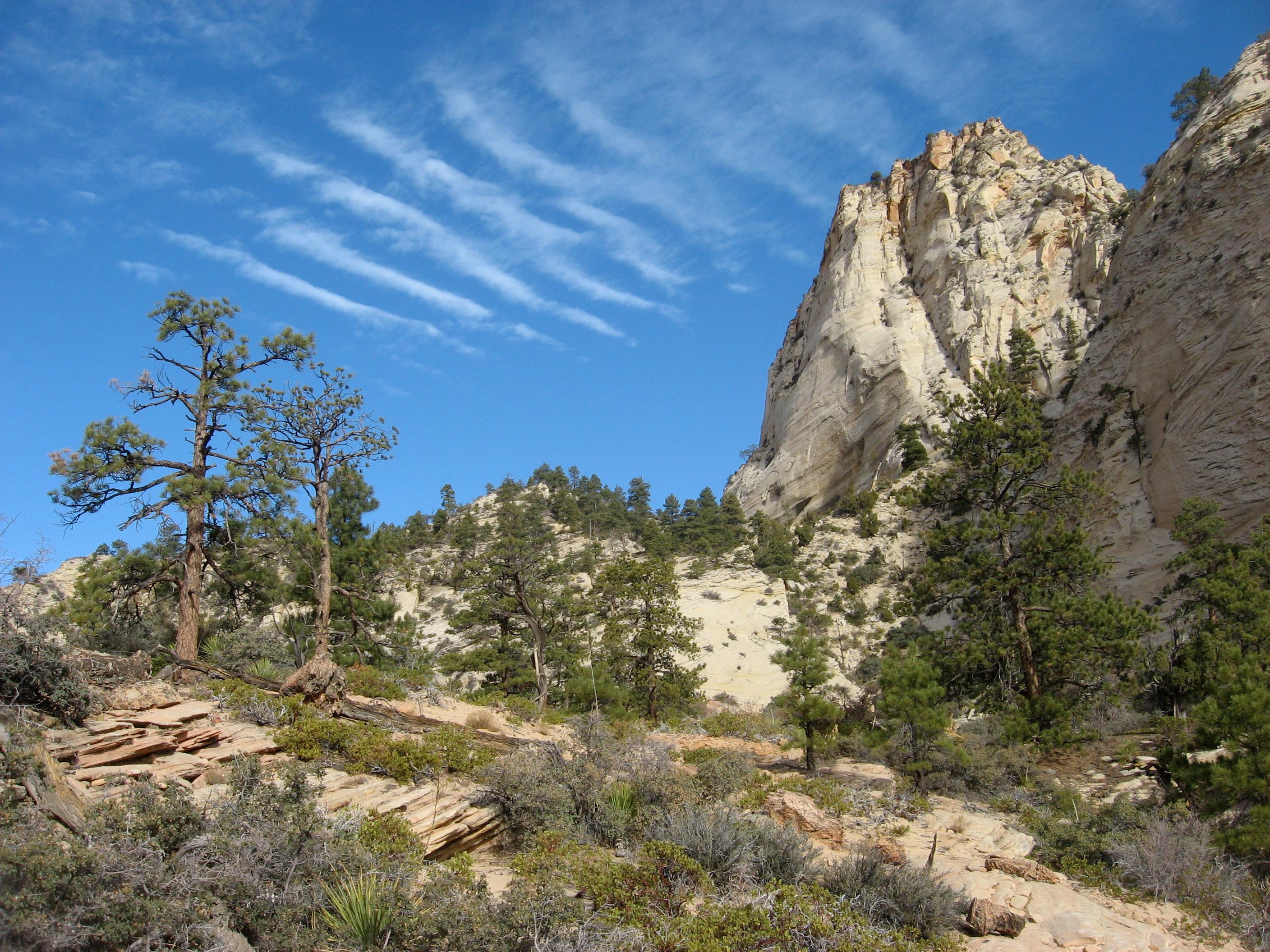
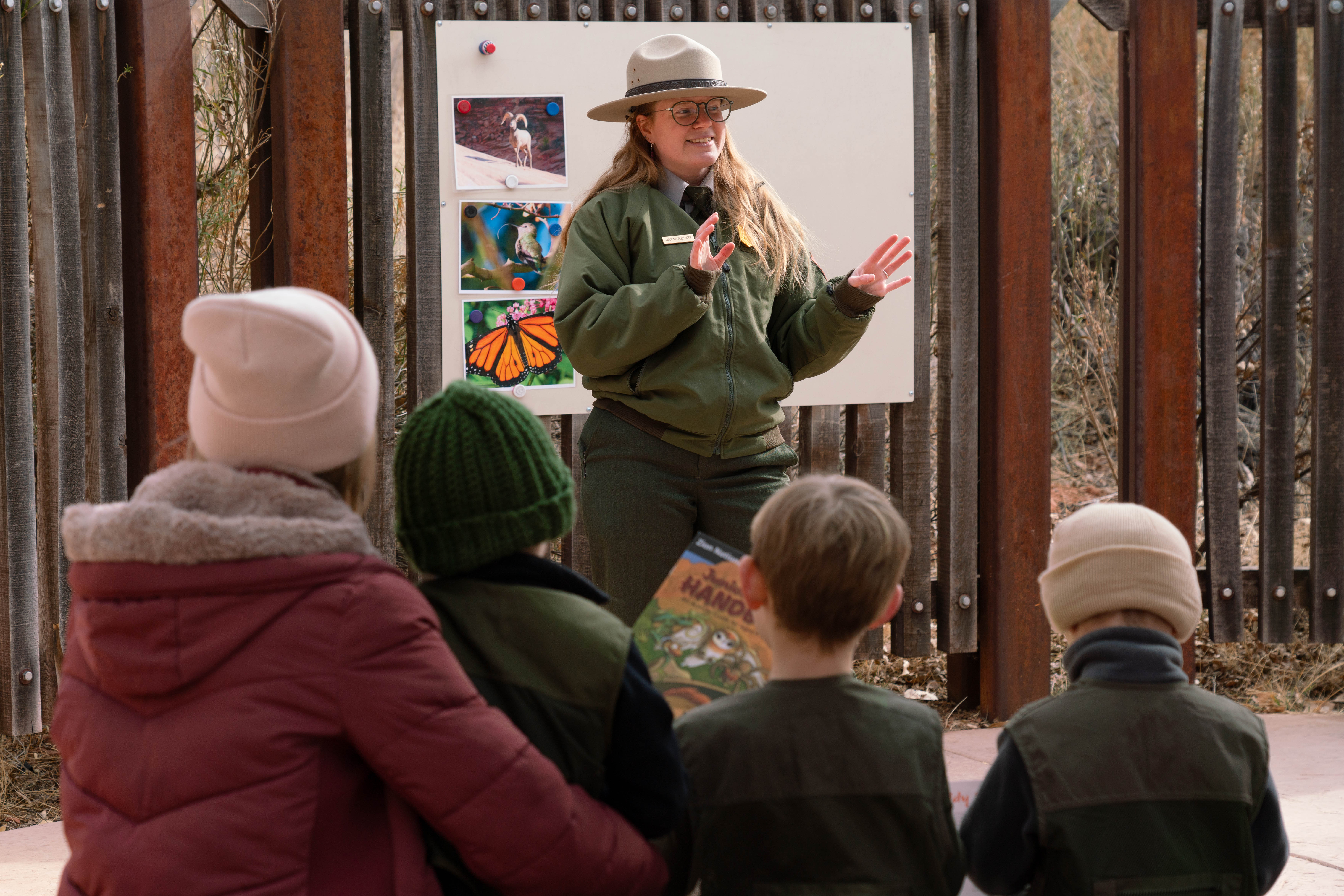

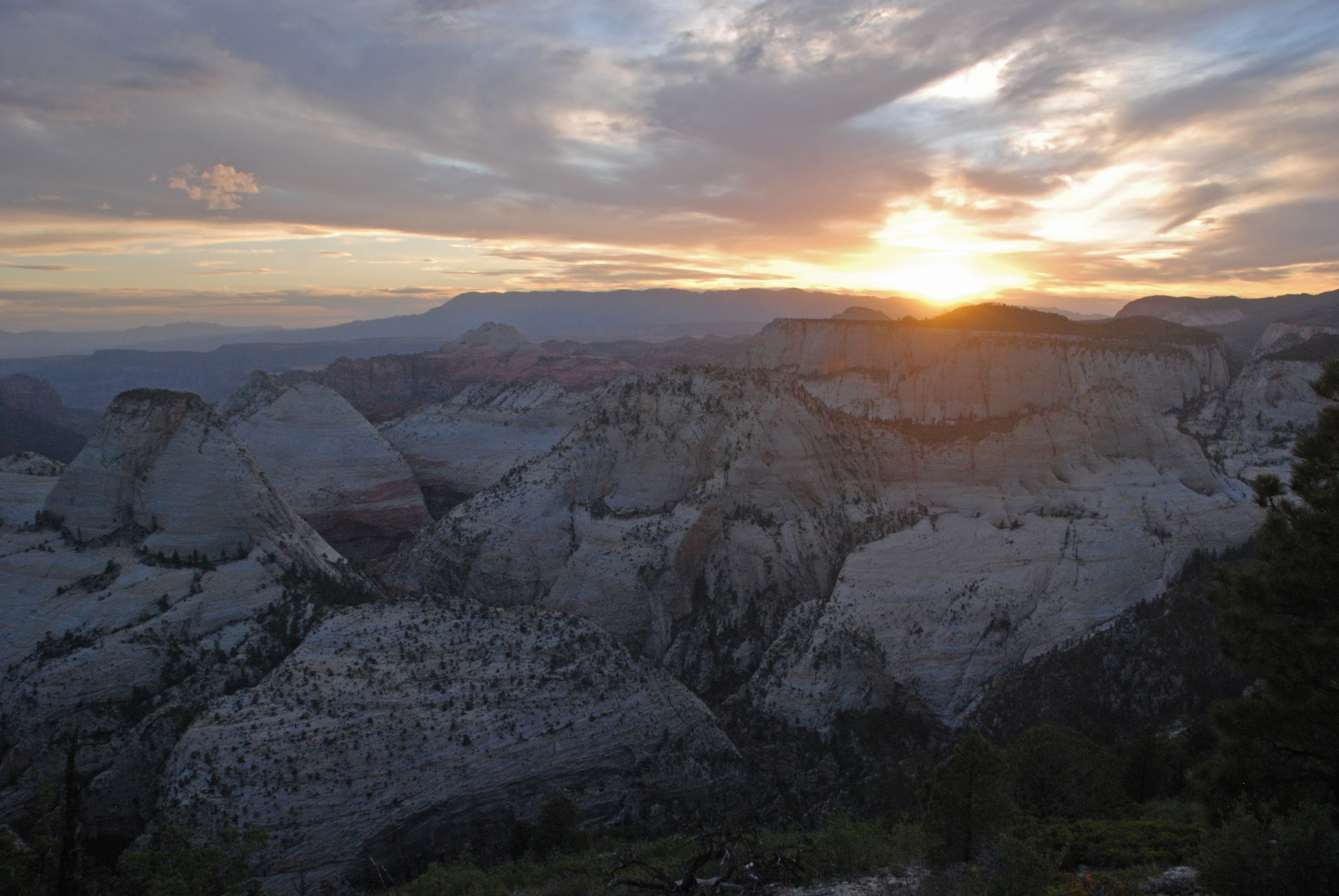


Selected official assessments, with the exact section each describes. Conditions may have changed since assessment.
Trail from the Zion Canyon Visitor Center; campground connectors have different slopes.
NPS directs visitors to its updated trail access assessment; pavement alone does not establish suitability.
Official guidance Reviewed 2026-10-19
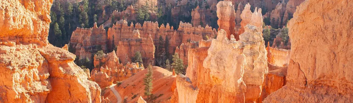 Canyons
Utah
Hoodoos (irregular columns of rock) exist on every continent, but here is the largest concentration found anywhere on Earth. Situated along a high plateau at the top of the Grand Staircase, the park's high elevations include numerous life communities, fantastic dark skies, and geological wonders that defy description.
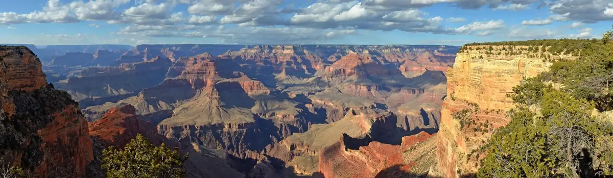 Canyons
Arizona
Entirely within the state of Arizona, the park encompasses 278 miles (447 km) of the Colorado River and adjacent uplands. Located on the ancestral homelands of 11 present day Tribal Communities, Grand Canyon is one of the most spectacular examples of erosion anywhere in the world—a mile deep canyon unmatched in the incomparable vistas it offers visitors from both north and south rims.
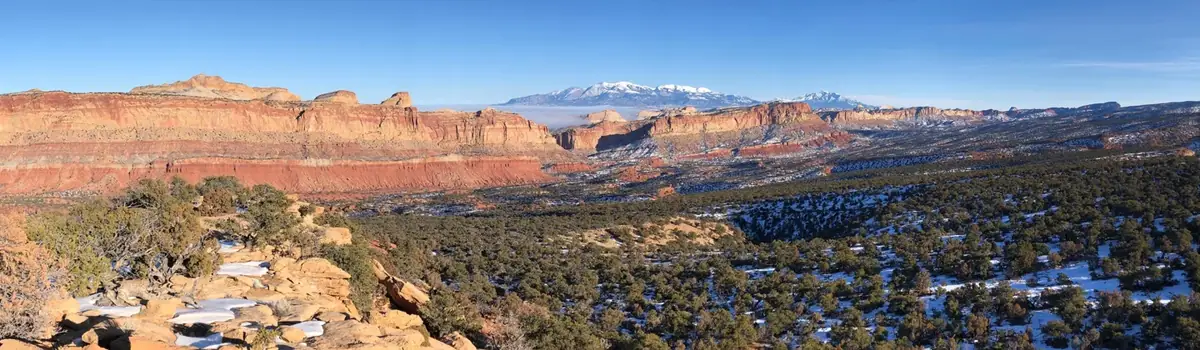 Desert
Utah
Located in south-central Utah in the heart of red rock country, Capitol Reef National Park is a hidden treasure filled with cliffs, canyons, domes, and bridges in the Waterpocket Fold, a geologic monocline (a wrinkle on the earth) extending almost 100 miles.