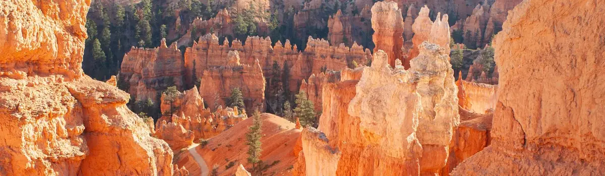
Located in south-central Utah in the heart of red rock country, Capitol Reef National Park is a hidden treasure filled with cliffs, canyons, domes, and bridges in the Waterpocket Fold, a geologic monocline (a wrinkle on the earth) extending almost 100 miles.
241.9Kacres of parkland
1.4Mrecreation visits, 2025
May · Sep · Octnearby climate picks
Seasonal access & reservations
No reviewed guidance for this selection. Check the park's official planning pages; missing coverage does not establish access.
Selected guidance only; separate from climate comfort and current conditions.
Official conditions Not checked
The conditions feed has not been connected for this park.
Editorial recommendations, reviewed 2026-10-17. Full park days, excluding travel to and from the region. A first-visit outline for a general traveler; adapt to mobility, fitness, season, reservations, and current conditions. These are suggested days, not reserved activities or guaranteed routes.
The Scenic Drive offers impressive views and takes about an hour and a half round trip to complete.
Cathedral Valley roads require high clearance vehicles and about a day to explore fully.
Looping the Fold, along the Notom-Bullfrog Road and Burr Trail, offers spectacular views of Capitol Reef's geology.
Road Conditions
For current road conditions (updated as conditions change), please see the alert page , or refer to the recorded message on the park's automated phone system at (435) 425-3791. Press 1 for visitor information; 4 for road conditions.
Road Descriptions
The Scenic Drive starts at the park Visitor Center and provides access to Grand Wash Road, Capitol Gorge Road, Pleasant Creek Road, and South Draw Road. The Scenic Drive is a 7.9 mile (12.7 km) paved road with dirt spur roads into Grand Wash and Capitol Gorge that, weather permitting, are accessible to all passenger vehicles and RV's up to 23 feet in length. The Scenic Drive is not a loop, so you must return on the same road. An entrance fee of $20 per vehicle is charged for the Scenic Drive. The self-pay entrance station is located just south of the campground on the Scenic Drive. There is no entrance fee for holders of the America the Beautiful - National Parks and Federal Recreation Lands passes. A "Guide to the Scenic Drive" brochure is available at the visitor center bookstore or follow this link for a virtual tour of the Geology of the Scenic Drive . There is also a self-guided tour to the Scenic Drive in the NPS app .
Notom-Bullfrog Road
The Notom-Bullfrog Road intersects Utah Hwy 24 nine miles (14.4 km) east of the Capitol Reef Visitor Center and extends south to Bullfrog Visitor Center and Marina and Glen Canyon National Recreation Area . This road is paved for the first 15 miles (24.1 km), and then becomes a maintained dirt road. The road runs along the eastern side of the Waterpocket Fold and offers excellent scenery and hiking opportunities. Access to many of the park's backcountry trails, such as Lower Muley Twist and Halls Creek Narrows can be found off this road. While portions of the road outside the park are paved, the majority of the Notom-Bullfrog road is dirt and subject to changes in weather conditions. Visitors are advised to check with the visitor center before driving any of the dirt roads.
Burr Trail Road
The Burr Trail Road, originally a cattle trail blazed by stockman John Atlantic Burr, extends from the town of Boulder on Utah Hwy 12 to the Notom-Bullfrog Road, and continues to the Bullfrog Marina and Glen Canyon National Recreation Area . Much of the road lies outside the boundary of Capitol Reef and traverses the Circle Cliffs, Long Canyon, and The Gulch. The 8.5 mile (13.7 km) stretch of road inside Capitol Reef includes a breathtaking set of switchbacks rising some 800 feet (244 m) in only one-half mile (0.8 km). These switchbacks are not considered suitable for RVs or vehicles towing trailers. From Boulder to the west boundary of Capitol Reef, the Burr Trail Road is paved. Inside the park it remains a graded dirt road and is subject to change due to weather conditions. Visitors should inquire about road and weather conditions before traveling.
The Hartnet Road, or southern half of the Cathedral Valley Loop, begins 11.7 miles (18.8 km) east of the Visitor Center off Utah Hwy 24. In order to take this route to Cathedral Valley, visitors must ford the Fremont River (map and additional travel information ) soon after leaving the highway, which may require a high-clearance or high-clearance 4WD vehicle. The 27.8 miles (44.7 km) to the junction with Cathedral Road afford expansive view of the Blue Flats and the South Desert. The northern end of the loop nears Thousand Lake Mountain, and the geology and topography change greatly with the subsequent gain in elevation. Conditions on the Hartnet Road vary widely based on recent weather. At best, high clearance vehicles are recommended and visitors should check with the visitor center for the most current road information.
The Cathedral Road, or eastern side of the Cathedral Valley Loop, begins 18.5 miles (29.8 km) east of the Visitor Center. By taking this route into Cathedral Valley, visitors avoid fording the Fremont River on the Hartnet side of the loop; however, those planning on driving the entire loop are encouraged to begin at the River Ford to be certain they are able to make the crossing ( map and additional information ). The Temples of the Sun and Moon are located 17.1 miles (27.5 km) up the road in Lower Cathedral Valley. These massive monoliths rise from the desert floor. Further north in Upper Cathedral Valley, columns of spire-like formations dominate the landscape. Conditions on the Cathedral Road vary widely based on recent weather. Check with the visitor center for current road information.
South Draw Road
The South Draw Road is a non-maintained, high-clearance 4-wheel-drive road that extends from Pleasant Creek to the park boundary near Tantalus Flats. The South Draw Road is rough and rocky, includes several creek crossings, and, in inclement weather, becomes impassable to even 4-wheel-drive vehicles. It is not recommended. The South Draw Road is reached by following the Pleasant Creek Road 2.8 miles (4.5 km) from the end of the Scenic Drive to the crossing at Pleasant Creek. The South Draw Road exits the park 5 miles (8.1 km) from Pleasant Creek, and, after a further 5.7 miles (9.1 km), meets Utah Highway 12. The access to the South Draw Road from Boulder Mountain is at 8,500 feet (2,591 m) and can be closed in winter due to snow.
Most of the park's 243,921 acres is open for exploration. Try hiking, wildlife-viewing, horseback riding, or rock climbing.
Capitol Reef National Park is a great place for recreation and contemplation. Immerse yourself in the park's 243,921 acres (98,711 hectares). Explore nearly 200 miles (320 kilmeters) of marked frontcountry trails and backcountry routes , and discover options for scenic driving tours , canyoneering , rock climbing , horseback riding , and biking .
Hiking in Fruita
Go for a hike off the Scenic Drive or Utah Highway 24.
Hiking in the Waterpocket District
Explore the southern Waterpocket District by foot.
Hiking in Cathedral Valley
Explore Cathedral Valley's hiking trails, in the northern part of the park.
Explore Capitol Reef by vehicle.
Bicycle Touring
Explore the roads of Capitol Reef by bicycle!
Horseback Riding
Horses and pack animals are allowed throughout the park except on designated trails, routes, and certain backcountry areas.
The multiple rock layers found at Capitol Reef offer a diverse canyon environment. Permits are now required.
Rock Climbing & Bouldering
Capitol Reef has experienced minimal use by technical rock climbers, but there's a growing interest in Utah. Permits are now required.
Find out what permits you need for special activities, like canyoneering, rock climbing, commercial tours, and others.
Your safety is your responsibility. Ask about the latest weather conditions at the visitor center.
With one developed campground, two primitive campgrounds, and vast backcountry options, there are many places to stay the night in the park.
Join a ranger to discover more about the natural and cultural wonders of Capitol Reef.
NPS / S. Cotrell
Park staff offer a variety of interpretive programs daily, spring through fall. Program types, times, and locations vary throughout the year and are subject to last-minute changes due to weather or other factors. See the calendar , or check at the Capitol Reef Visitor Center upon arrival for more details.
Year-round Programs
Ranger's Choice Talk Learn more about the natural and cultural resources of Capitol Reef National Park! 30 minutes. Daily. Check the calendar for start time and location.
Junior Ranger Program Request a Junior Ranger activity book at the visitor center, and complete the activities to learn about the park and earn a badge. The Junior Ranger Booklet is also available in thirteen additional languages. Please ask at the visitor center or email the park for one of the following text-only translations: Arabic, Chinese, Dutch, French, German, Hebrew, Hindi, Italian, Japanese, Korean, Portuguese, Russian, or Spanish.
Summer Programs (mid May to mid October)
Check at the visitor center or campground bulletin boards for locations, topics, and times.
Archeology Talk - daily Learn about cultures that call this place home; 30 minutes.
Ranger's Choice Talk - daily Learn more about the natural and cultural resources of Capitol Reef; 30 minutes.
Evening Program - several nights per week, near sunset Topics and start times vary, check at the visitor center or campground bulletin boards for details. Meet at the Fruita Campground amphitheater; 45-60 minutes.
Astronomy Program - several nights per week View the night skies on a constellation tour, or with telescopes. Start times vary, check at the visitor center or campground bulletin boards for details; 30 minutes to 2 hours.
NPS / J. Zylland
Astronomy Special Events
Beginner Astrophotography Workshops
Join nationally known astrophotographer Don Riddle for free beginner workshops on photographing the Milky Way at Capitol Reef National Park, August 13, 14, or 15, 2026 . Each night is a stand-alone workshop with limited space and required registration. Visit the event page to learn more and register.
Heritage StarFest
Heritage StarFest celebrates the incredible night skies of Capitol Reef and Wayne County. This two-day event takes place each fall with activities both in the park and in the neighboring town of Torrey. In 2026, Heritage StarFest will take place on September 11 and 12. Check out the event page for details about 2025's event and stay tuned for updates for 2026!
Whether you have half a day or more, spend your time exploring the Fruita area by car or on foot.
The Fruita Historic District could be considered the heart of Capitol Reef National Park. For thousands of years, people have called this verdant valley home. Now the Fruita Historic District offers visitors opportunities to experience amazing geology , learn about human history , and explore a diverse landscape . What will you do on your visit to Fruita?
Go for a hike off the Scenic Drive or Utah Highway 24.
The 71-site Fruita Campground is the only developed campground in Capitol Reef. Reservations are available March 1- October 31.
Visit Fremont Culture petroglyphs and imagine what it was like to live here about 1000 years ago.
Historic orchards contain about 2,000 trees including cherry, apricot, peach, pear, apple, plum, mulberry, almond, and walnut.
What was it like to attend a one-room school? Discover the stories of teachers and students in Fruita.
Capitol Reef offers activities for people of all ages. Check out these ideas!
Join a ranger to find out more about the wonders of Capitol Reef National Park.
Many people have called the Gifford House home. Learn about these earlier pioneers, and visit the museum and sales outlet, known for pies.
Experience the less-visited, southern part of Capitol Reef, where the dramatic angle of the Waterpocket Fold is on display.
NPS/ Chris Roundtree
Trip Planning and Safety
The spectacular Waterpocket District (or southern section) of Capitol Reef National Park is fairly remote and rugged, and open year-round. Most passenger cars, pickups, and vans can usually negotiate the roads without difficulty. However, road conditions can vary greatly depending on recent weather conditions. Check the weather forecast before your visit. Spring and summer rains and winter snows can sometimes leave roads slick, muddy, washed out, and impassable to the best high-clearance four-wheel drive vehicle. Many of the roads are unpaved, and are often rough, sandy, and corrugated. Check at the visitor center or call 435-425-3791 for current conditions. Press #1 for information, and then #4 for current road conditions. For weather conditions press #3.
Vehicle and foot travel in the southern part of the park can be light to moderate, depending on the time of year, so be prepared for the unexpected. If you have problems, help may not arrive for hours or even days. Carry plenty of water, food, gas, adequate clothing, a shovel, and emergency supplies. Cell phone reception is usually poor to nonexistent. Cool or cold temperatures will accompany sudden summer storms or an unexpected night out in the backcountry. Daytime temperatures in the summer may top 100 °F (37.8°C) and winter highs may stay below freezing, so dress and plan accordingly. Your safety is your responsibility. ATV/UTVs are prohibited in Capitol Reef National Park, including street legal ATV/UTVs.
Explore the southern Waterpocket District by foot.
Capitol Reef offers two free primitive campgrounds in more remote parts of the park.
Your safety is your responsibility. Ask about the latest weather conditions at the visitor center.
Loop-The-Fold Driving Tour
Most visitors to the southern part of the park drive the 124-mile (199 km) loop, or various sections of it. Drive time is generally 4-6 hours.
Start at the visitor center and follow Highway 24 east to the Notom-Bullfrog Road.
Turn right on the Notom-Bullfrog Road and drive south to the Burr Trail Road junction.
Turn right on the Burr Trail Road and drive west to Boulder, UT.
Turn right (north) on Highway 12 to Torrey.
Turn right (east) on Hwy 24 back to the visitor center.
Highways 24 and 12 and the first 15 miles (24.1 km) of the Notom-Bullfrog Road (from the junction with Highway 24) are paved. The Burr Trail Road from the park boundary west to Boulder is also a paved road. There are also opportunities for hiking and backpacking along the drive. The primitive campground, Cedar Mesa , is off the Notom-Bullfrog Road.
Notom-Bullfrog/Burr Trail Road to Lake Powell (at Bullfrog Marina)
The Burr Trail Road south from the Burr Trail Road junction remains unpaved for another 3.3 miles (5.3 km) to the park boundary. From there it continues another 32.5 miles (52.3 km) to Bullfrog Marina at Glen Canyon National Recreation Area (NRA) . The road to Lake Powell is paved from the park boundary south to the boundary of Glen Canyon NRA. The access road to Halls Creek Overlook is located along this section of road and is marked by signs. Halls Creek Overlook Road usually requires high clearance four-wheel drive. Within Glen Canyon NRA, there is a section of unpaved road at Bullfrog Creek Crossing. The road from Capitol Reef to Bullfrog is normally in good condition, with the exception of the Bullfrog Creek Crossing which is occasionally impassable due to deep water, cut banks, and mud.
Loop the Fold Distances - Clockwise
All distances are from the Capitol Reef Visitor Center (VC), traveling in a clockwise direction
VC to Hwy 24/Notom-Bullfrog Road.......................................................................9.0 miles (14.4 km)
VC to Cedar Mesa Campground..........................................................................30.1 miles (48.4 km)
VC to Notom-Bullfrog Road/Burr Trail Road junction...........................................41.4 miles (66.6 km)
VC to Upper Muley Twist Road junction...............................................................44.5 miles (71.6 km)
VC to west park boundary....................................................................................46.6 miles (75.0 km)
VC to Burr Trail Road/Hwy 12 junction (Boulder, UT)........................................76.9 miles (123.8 km)
VC to Hwy 12/24 junction (Torrey, UT)............................................................113.9 miles (183.3 km)
Total distance..................................................................................................123.7 miles (199.0 km)
Loop the Fold Distances - Counterclockwise
VC to Hwy 12/24 junction (Torrey, UT)..................................................................9.8 miles (15.7 km)
VC to Hwy 12/Burr Trail junction (Boulder, UT)....................................................46.8 miles (75.2 km)
VC to west park boundary..................................................................................77.1 miles (124.0 km)
VC to Upper Muley Twist Road junction.............................................................79.2 miles (127.5 km)
VC to Burr Trail Road/Notom-Bullfrog Road junction.........................................82.3 miles (132.5 km)
VC to Cedar Mesa Campground........................................................................93.6 miles (150.6 km)
VC to Notom-Bullfrog Road/Hwy 24 junction....................................................114.7 miles (184.6 km)
NPS/ Ann Huston
Geologic Features of the South District
“Looping the Fold” is one of the best ways to be immersed in the geology of Capitol Reef. The Notom-Bullfrog Road runs parallel to the eastern slope of the Waterpocket Fold, offering great views of the Golden Throne and other “muffin” or “biscuit”-shaped formations in the Navajo and Page sandstones. South of the Cedar Mesa Campground, the Notom-Bullfrog Road cuts through a section of bentonite clay (in the Morrison Formation), which can be treacherous when wet. When it is dry, notice the colorful shades of gray, blue, purple and red in the popcorn-textured slopes. Farther south, the pale Navajo Sandstone contrasts sharply with the dark red chevrons of the Carmel Formation. Eventually, the Notom-Bullfrog Road enters Strike Valley, where dark gray cliffs of Mancos Shale form the eastern side of the valley, and the older sandstone layers are on the western side. At a T-intersection, the Burr Trail offers one of the few routes through the Waterpocket Fold. These steep, narrow switchbacks gain some 800 feet (244 m) in only one-half mile (0.8 km) as they cut through Page and Navajo sandstones, before arriving in the Kayenta Formation at the top. Driving the Burr Trail from Capitol Reef through Grand Staircase-Escalante highlights red Wingate Sandstone. Once the Burr Trail intersects Scenic State Route 12, panoramic overlooks like Larb Hollow offer a bird’s eye view of the rugged terrain and Waterpocket Fold.
Oyster Shell Reef
Along the Notom-Bullfrog Road, a dense oyster shell reef dominated by the oysters Exogyra and Pycnodonte represents another form of life from Capitol Reef’s distant past. These 100-million-year-old oysters reflect a time when a sea inundated this area and created the brackish marine conditions necessary to support this form of life. The shells of these oysters were ultimately concentrated in the beach deposit preserved as the Dakota Sandstone. Fossils are irreplaceable, non-renewable resources. Excavating, removing, damaging, or otherwise defacing fossils or other paleontological resources within the park diminishes our legacy, and is strictly prohibited by federal law and is punishable by fine and/or imprisonment. If you are fortunate enough to find a fossil in the park, leave it untouched, take a photo, and share your exciting discovery with a park ranger. Keeping fossils where they are found will help preserve their scientific, educational, and interpretive value for present and future generations.
NPS/ Jacob Frank
Strike Valley in Capitol Reef is a prime example of the geologic feature for which it is named. Strike Valley is the product of rock layers eroding at different rates, depending on how soft or hard they are. Erosion-resistant rock layers form into ridges, or hogbacks, while the softer layers erode into valleys parallel to the ridges. Strike Valley leads to the erosional edge of the Waterpocket Fold, where the crest is pale Navajo Sandstone, and the younger rock layers appear below. This is an effect of the “fold” and erosion. Below the Navajo, Page Sandstone contrasts with the dark red chevrons of the Carmel Formation. The Entrada Sandstone forms rounded, orange hills near the valley floor. The Curtis and Summerville layers are submerged, but soft, rounded hills of bentonite in the Morrison Formation appear. A ridge of Dakota Sandstone, resistant to erosion, also stands out from the valley floor. On the opposite side of the valley, the dramatic, dark gray Mancos Shale forms tall, velvety slopes, capped by the tan, cliff-forming Mesa Verde Formation. The Strike Valley Overlook Trail (0.9 miles/ 1.4 km roundtrip) offers views of the valley with nearly 150 million years of geologic history visible. This trail is accessed from the Strike Valley Overlook road which is unmaintained and requires a high clearance 4 wheel drive vehicle. It is possible to park just off the Burr Trail road and hike to the Strike Valley Overlook for an easy 7 mile (11.3 km) roundtrip hike.
Definitions provided by Thomas H. Morris, Scott M. Ritter, and Dallin P. Laycock
Bedding plane: A surface or parting between different sedimentary rock layers. A bedding plane indicates some change in the depositional environment. Often seen as a clear contrast (different colors, different textures) between rock layers.
Depositional environment: Sediment accumulations (deposits) in a variety of settings (environments) wherein they can be buried and lithified (turned to stone). These environments are usually places which have space to catch (accommodate) loose sediment. Examples include deltas, lakes, river valleys, continental shelves, etc.
Differential erosion: The erosional rate of different rocks varies due to their variable strengths. Weak and fractured rocks tend to erode faster, forming slopes and valleys. Stronger rocks tend to resist erosion and form cliffs.
Dip: The angle between horizonal and an inclined surface, such as a bedding plane. Dip direction is the compass direction (azimuth) of the maximum dip angle. Dip and dip direction are common field measurements taken by geologists to measure folds and faults.
Fold: A planar structure such as rock strata (rock layers) that has been deformed, bent, or curved. Often a product of compressional stress produced by plate tectonic forces. Fold types include anticlines, monoclines, synclines, etc.
Monocline: A fold in Earth’s crust, usually tectonically induced by compressional stresses, in which relatively horizontal strata are abruptly kinked, creating a steeply inclined flank.
Slopes: An inclined land surface of erosion (e.g. hillside). A slope has less dip than a ledge or cliff and can usually be negotiated by humans without ropes or climbing aids. Slopes are commonly formed by the erosion of relatively less resistant rock and/or loose sediment. Contrast with cliffs, which are formed by the erosion of stronger, more resistant rock units.
Strike: The compass bearing of a horizontal line that does not gain or loose elevation on an included surface such as a dipping bedding plane. Strike is perpendicular to dip direction.
Strike Valley: A valley eroded parallel to the strike of the strata. In an area with tilted strata, erosion will erode some rock units faster than others. These weaker units erode into valets between the layers of more resistant rock.
Waterpockets: Erosional surface depressions (pockets) that form on relatively flat lying rocks. Created commonly on sandstone surfaces as rainwater dissolves the cement between sand grains, allowing them to be blown away.
NPS/Al Hendricks
Additional Capitol Reef Geology
The geologic story of Capitol Reef spans approximately 280 million years of Earth's history. The immense change over geologic time is represented in the nearly complete set of Mesozoic-era sedimentary rocks. The meeting of tectonic plates uplifted and folded the layers, and ongoing erosional forces have sculpted the land ever since. An overview of this story can be found on the geology page .
The remote and rugged northern part of Capitol Reef offers adventurous visitors solitude and spectacular views.
NPS Artist-in-Residence Phil Sisto
Trip Planning and Safety
The Cathedral Valley District of Capitol Reef National Park is a remote, rugged region. Vehicles with high ground clearance, even those without four-wheel drive, can usually negotiate the roads without difficulty. However, road conditions can vary greatly depending on recent weather conditions. Spring and summer rains and winter snows can leave the roads muddy, washed out, and impassable to the best high-clearance four-wheel drive vehicle, so check at the visitor center, or call 435-425-3791. Press #1 for information, and then #4 for current road conditions. For weather conditions press #3.
Foot and vehicle travel in the Cathedral Valley area is light, so be prepared for the unexpected. If you have problems, help may not arrive for hours or even days, depending on the time of year. Carry plenty of water, food, gas, adequate clothing, a shovel, and emergency supplies. No potable water is available in Cathedral Valley, although there is one primitive campground that has a pit toilet. Cell phone reception is usually poor to nonexistent. Cool or cold temperatures will accompany sudden storms or an unexpected night out in the backcountry. Daytime temperatures in the summer may reach the upper 90s°F (30s °C) and winter highs may stay below freezing, so prepare accordingly. Check this weather forecast specifically for Cathedral Valley. You are responsible for your own safety. Please leave no trace of your visit. ATV/UTVs are prohibited in Capitol Reef National Park, including street legal ATV/UTVs.
Explore Cathedral Valley's hiking trails, in the northern part of the park.
Capitol Reef offers two free primitive campgrounds in more remote parts of the park.
Your safety is your responsibility. Ask about the latest weather conditions at the visitor center.
The Cathedral Valley Driving Loop Tour
This driving loop takes about 6-8 hours to complete. Most visitors to Cathedral Valley drive the 57.6 mile (92.7 km) loop clockwise, beginning on the Hartnet Road located 11.7 miles (18.8 km) east of the visitor center on Highway 24 and continuing on that for 27.8 miles (44.7 km) to Hartnet Junction. Turn right (north) onto Cathedral Road and driving 29.9 miles (48.0 km) back to Highway 24 will complete the loop. There are many side trips and hiking opportunities along the way.
The south end of the Hartnet Road near Highway 24 requires fording the Fremont River; there is no bridge over the river. Do not attempt to cross the river during floods or other periods of high water. Ask at the visitor center about river ford conditions or call 435-425-3791. The ford has a hard packed, rocky bottom and water levels are normally a foot or less deep. The access road to the River Ford crosses private land. Please honor the posted no trespassing signs along the road near the ford by not parking off-road or camping in the vicinity.
The River Ford Map can be downloaded and printed.
The drive from Highway 24 to the junction with Cathedral Road affords expansive views of the Blue Flats and the South Desert. The northern end of the loop nears Thousand Lake Mountain, and the geology and topography change greatly with the subsequent gain in elevation.
Distances from Highway 24 starting on the Hartnet Road (traveling clockwise)
Hwy 24 junction to Lower South Desert Overlook................................................15.2 miles (24.5 km)
Hwy 24 junction to Upper South Desert Overlook................................................27.2 miles (43.7 km)
Hwy 24 junction to Cathedral Road Junction........................................................27.8 miles (44.7 km)
Hwy 24 junction to Cathedral Valley Campground................................................28.1 miles (45.2 km)
Hwy 24 junction back to Hwy 24 via Cathedral Rd...............................................57.6 miles (92.7 km)
Massive monoliths, Temple of the Sun and Temple of the Moon, rise from the desert floor along the Cathedral Road. Further north in Upper Cathedral Valley, columns of spire-like formations dominate the landscape.
Distances from Highway 24 starting on the Cathedral Road (traveling counterclockwise)
Hwy 24 junction to Temple of the Moon...............................................................17.1 miles (27.5 km)
Hwy 24 junction to Oil Well Bench Road junction.................................................20.5 miles (33.0 km)
Hwy 24 junction to Gypsum Sinkhole...................................................................25.6 miles (41.1 km)
Hwy 24 junction to Baker Ranch Road junction...................................................24.6 miles (39.6 km)
Hwy 24 junction to Cathedrals trailhead...............................................................27.4 miles (44.1 km)
Hwy 24 junction to Morrell Cabin trailhead...........................................................28.1 miles (45.2 km)
Hwy 24 junction to Hartnet Junction.....................................................................29.9 miles (48.0 km)
Hwy 24 junction back to Hwy 24 via Hartnet Rd..................................................57.6 miles (92.7 miles)
Polk Creek Road
This scenic route through Fishlake National Forest is noted for its panoramic views of the surrounding desert country. The unpaved road climbs steeply through ponderosa and aspen forests, from 6,800 feet (2,073 m) at Hartnet Junction to 9,500 feet (2,896 m) on Thousand Lake Mountain, then drops to 7,000 feet (2,134 m) at Highway 72. The mountain road is normally open from mid-June to late October. The road is closed during the winter and spring due to deep snow and muddy conditions.
Distances from Hartnet Junction:
0.8 mile (1.3 km) to the USFS boundary
7 miles (11.3 km) Polk Creek and Elkhorn junction
12 miles (19.3 km) Hwy 72
19 miles (30.6 km) Fremont
24 miles (38.6 km) Hwy 24 at Loa
Baker Ranch Road to I-70
This graveled, dirt road crosses an extensive expanse of open, level terrain with views of colorful sculpted cliffs and canyons. The road provides access to several remote ranches and is open year-round. The road is usually in good shape, but muddy conditions may exist in low areas following storms or as snow melts in the spring.
Distances from the Baker Ranch Road junction:
2 miles (3.2km) North Park Boundary
4 miles (6.4 km) Junction with Oil Well Bench Road
5 miles (8.0 km) Junction with Baker Ranch Road
19 miles (30.6 km) Junction with Mussentuchit Road
27 miles (43.5 km) I-70 at Fremont Junction
NPS/ Chris Roundtree
Geology of Cathedral Valley
Cathedral Valley presents another chapter in the story of Capitol Reef's geology . The geologic layers and eroded features here are different than those seen in other sections of the Waterpocket Fold. Cathedral Valley was named in 1945 by Frank Beckwith and Charles Kelly , the first superintendent of Capitol Reef. The upward-sweeping, tapering lines, and three dimensional surfaces reminded the men of Gothic and Egyptian architecture.
Bentonite Hills
The Bentonite Hills among the Hartnet Road and the Painted Desert on the Cathedral (also known as the Caineville Wash) Road appear as softly-contoured, banded hills in varying hues of brown, red, purple, gray, and green. The hills are composed of the Brushy Basin shale member of the Morrison Formation. This layer was formed during Jurassic times when mud, silt, fine sand, and volcanic ash were deposited in swamps and lakes. Bentonite clay (altered volcanic ash) absorbs water and becomes very slick and gummy when wet, making vehicle or foot travel difficult or impossible.
South Desert is a long, narrow valley that runs parallel to the strike of the Waterpocket Fold monocline. The valley extends 20 miles (32.2 km) from the Upper South Desert Overlook southeast to Hwy 24. From Lower South Desert Overlook (located midway through the valley) viewers can see rock layers ranging from the gray, ledgy Morrison atop the cliffs to the east to the white Navajo Sandstone slickrock and domes high on top of the Fold. In the near distance, Jailhouse Rock, composed of Entrada Sandstone, rises 500 feet (152 m) from the valley floor.
Upper and Lower Cathedral Valley
Upper and Lower Cathedral Valley offer exquisite views of sculptured monoliths with intriguing names such as the Walls of Jericho and the Temples of the Sun, Moon, and Stars. The monoliths are composed of the earthy, buff-pink Entrada Sandstone. Deposited 160 million years ago in the Jurassic period, this fine- grained sandstone formed by the deposition of sand and silt in tidal flats. It crumbles easily to a fine sand which is rapidly removed by water; therefore, talus (debris) slopes do not form and Entrada cliffs tend to rise sheer from their base. Above the Entrada, the grayish-green sandstone and siltstone of the Curtis Sandstone forms a hard cap rock on some of the monoliths and higher cliffs and buttes, protecting them from erosion. Above the Curtis is the thinly-bedded, reddish-brown siltstone of the Summerville Formation.
Glass Mountain is a large, exposed mound of selenite crystals. Selenite is a variety of gypsum (CaSO4•2H2O) in the form of glassy crystals. Gypsum is a common mineral found in the sedimentary rocks of this area. The crystals of glass mountain are somewhat unusual in size and in the massiveness of the deposit. Glass Mountain formed as a result of groundwater flowing through the Entrada Sandstone. This water carried dissolved gypsum, which started to crystallize, forming what has been called a "gypsum plug." This plug is now being exposed as the soft Entrada Sandstone erodes away. As you visit Glass Mountain, please remember that collecting of any kind is prohibited in all national parks.
NPS/ Landis Ehler
Gypsum Sinkhole
The Gypsum Sinkhole is an occurrence formed by the reverse of the process that created Glass Mountain. Here groundwater is dissolving a buried gypsum plug. The cavity left behind has collapsed under the weight of overlying rock layers. This collapse has created a large sinkhole nearly 50 feet (15 m) in diameter and 200 feet (61 m) deep.
Stay away from the edge of the Gypsum Sinkhole. The rocks here are very soft and unstable, and can collapse at any time.
Volcanic Dikes and Basalt Boulders
The dikes and sills seen in Cathedral Valley formed as recently as 3-6 million years ago. Dikes and sills are the result of molten lava flowing into vertical joints (dikes) or between horizontal layers of sedimentary rocks (sills), then solidifying. More resistant to erosion than the surrounding layers, the lava rock outcrops provide a stark and rugged contrast, forming jagged ridges and pointed outcrops. Black basalt boulders strewn across the landscape are remnants of lava flows that capped Boulder and Thousand Lake Mountains about 20 million years ago. Short glacial periods on these peaks broke up the underlying basalt. Glacial outwash and mudslides, along with the natural process of erosion, helped move the boulders far from their original location.
Capitol Reef offers activities for people of all ages. Check out these ideas!
NPS/Chris Roundtree
Go for a hike (and check out these tips for hiking with kids !)
Become a Junior Ranger
Check out the Fremont Culture Petroglyph Panel on Utah Highway 24
Explore the Fruita Historic District
Attend a ranger program
Left photo: Joe Ceradini. Right photo: NPS
Ripple Rock Nature Center
The nature center is located on the Scenic Drive, just south of the visitor center. While the building is closed, some outdoor activities and programs for kids of all ages may be offered, typically in late May through mid-August. Ripple Rock programs are often presented by Utah Valley University interns , through a park partnership . Check at the visitor center or the calendar for schedules.
Historic orchards contain about 2,000 trees including cherry, apricot, peach, pear, apple, plum, mulberry, almond, and walnut.
NPS/Shauna Cotrell
The orchards that lie within a mile or two of the visitor center are evident remnants of the pioneer community of Fruita, settled in 1880. Many varieties of heirloom fruit are found in Capitol Reef's historic orchards.
Read the regulations and look at an orchard map.
NPS/ Ann Huston
Latter-Day Saints pioneers planted thousands of fruit trees in the fertile Fremont River Valley. From the 1880s to 1960s, these trees provided food and income to the families who called Fruita home. Apples, apricots, cherries, peaches, pears, and plums dotted each family’s orchards. Today, the orchards are preserved and protected as part of the Fruita Rural Historic Landscape listed on the National Register of Historic Places. The orchards contain approximately 1,900 trees.
Orchard Management Today
Park staff maintain the historic character of these extensive orchards using heritage techniques. The same flood irrigation ditches pioneers dug in the 1880s water the trees today. Pioneers sometimes lost trees and entire orchards to floods and droughts. Today, the climate poses challenges for managers. Warmer temperatures may cause trees to bloom early or out of sync with pollinators, which could reduce the harvest. The National Park Service maintains the orchards year-round with historic cultural irrigation practices, pruning, mowing, pest management, planting, mapping, and grafting. Preserving healthy orchards remains a central goal for Capitol Reef National Park. For both regional neighbors and international visitors, Fruita will continue to be the "Eden of Wayne County." Capitol Reef National Park has started an orchard rehabilitation project in the historic Fruita orchards which will continue until 2025. The project initiates much-needed orchard re-planting to maintain the quality and character of the area. The park sought public comment on the project in 2021, and has since completed regrading of the Guy Smith and Cook orchards to improve soil conditions and irrigation. In April 2022, park staff and volunteers planted 260 young peach trees in the Guy Smith orchard. Varieties included early season Red Haven, and late season J.H. Hale and Elberta peaches. The park continued the project in 2023 with 141 cherry trees and 70 apple trees planted in the Cook orchard. Other historic orchards will be planted in the next several years. Most of these orchards were planted by Fruita residents from the turn of the 20th century up to the 1950's. Until the 1990's, other Fruita orchards were planted with modern commercial varieties to support a popular U-pick operation at the pa
Left photo (apricot blooms and black dog): NPS/Ann Huston. Middle photo (apple) & right photo(baskets of peaches): NPS/Jamie Mansfield.
Orchard Regulations
Only harvest ripe fruit from orchards that have “U-Pick Fruit” signs.
Please do not pick unripe fruit. Posted signs will indicate which type of fruit is available for picking. Fruit is ripe if it easily comes off the tree.
Fruit taken from the orchards must be paid for. A self-pay station, scale, and sign listing fruit prices is located near the entrance of orchards open for fruit harvest.
Fenced orchard hours: 9:00 am to 5:00 pm.
Unfenced orchard hours: Dawn to dusk.
Never climb these historic trees. Use provided hand pickers and ladders to reach ripe fruit, and return pickers to weigh station when done.
Never use hammocks or slacklines in the orchards. Never attach anything to the trees. Fruit trees are easily damaged.
Leashed pets are permitted inside the orchards.
Do not touch the objects hanging from branches. Pheromone disruptors and traps for insect control should not be handled.
Your safety is your responsibility.
Range of Flowering and Harvesting Times
Flowering Apricots: early March to mid-April Peaches: late March to late April Pears: late March to early May Apples: early April to early May Harvest Apricots: late June to mid-July Peaches: late July to early September Pears: early August to early September Apples: mid-August to mid-October Depending on how cold (or warm) winters are, blossom and harvest times can vary up to a few weeks earlier or later than the ranges given above . For updated fruit blossom and harvest times, call the park's information line at (435) 425-3791. After the introduction, press #1 for visitor information, and then press #5 for the fruit hotline. Fruit blossom and harvest times will also be updated on the Alerts and Conditions page. A PDF of the Fruita Orchard information can be downloaded and printed, or check out this detailed article on the fruit varieties in the park! Information on the individual fruit and nut varieties can also be downloaded.
Where can you take your pet in Capitol Reef National Park?
Be a B.A.R.K. Ranger !
B ag your pet’s waste (and dispose of properly)
A lways leash your pet (leashes 6 feet / 1.8 meters or shorter)
R espect wildlife
K now where you can go
There are no kennels in the park and pets may not be left unattended in the campground. Consider your plans carefully before bringing your pet with you.
Pets must be on leash at all times (6 feet or 1.8 meters or shorter). Pets are only allowed in the following areas of the park:
on the trail from the visitor center to the Fruita Campground
on the Fremont River Trail from the campground to the south end of Hattie's Field (where there is a gate)
in unfenced and/or unlocked orchards
in the Chesnut and Doc Inglesby picnic areas
within 50 feet of center line of roads (paved and dirt) open to public vehicle travel
parking areas open to public vehicle travel
Pets are not permitted on other hiking trails, in public buildings, or in the backcountry.
Where are pets permitted outside of Capitol Reef?
Fishlake National Forest (US Forest Service guidelines for bringing a pet )
Dixie National Forest (dogs are required to be on a leash in developed areas)
Grand Staircase-Escalante National Monument
Most Utah State Parks
Some Wilderness Areas managed by the US Forest Service or Bureau of Land Management
The desert can be deadly for pets. Car temperatures rise quickly in the sun, even on cool days. Your pet can easily die of heat exhaustion. If you are leaving a pet in a car, crack the windows as much as possible and leave water to drink. It can be dangerous or deadly to leave pets in the car when temperatures are above 68 degrees, even with the windows cracked. Check out these tips on hiking and camping with your pet!
Service Animals
The 2010 revision to Title II of the Americans with Disabilities Act (ADA) defines a "service animal" as a dog that has been individually trained to do work or perform tasks for the benefit of an individual with a disability,including a physical, sensory, psychiatric, intellectual, or other mental disability.
Dogs that are not trained to perform tasks that mitigate the effects of a disability, including dogs that are used purely to provide comfort or emotional support ("therapy animals"), are considered pets.
Service animals in training and pets are subject to the park's pet regulations. Falsely portraying a pet as a service animal is considered fraud and is subject to federal prosecution. In Capitol Reef, service animals are permitted everywhere that visitors are permitted to go. Owners are encouraged to identify their working service animal, such as with a vest. Identification is not required, but helps prevent unwarranted "dog on trail" complaints from other visitors.
The Capitol Reef Natural History Association operates the bookstore in the Capitol Reef Visitor Center.
Capitol Reef Natural History Association
The Capitol Reef Natural History Association (CRNHA) is a non-profit cooperating association founded in 1963 to support historical, cultural, scientific, interpretive, and educational activities at Capitol Reef National Park. They operate the visitor center bookstore, which carries a variety of maps, books, posters, and postcards. The bookstore is open during visitor center open hours . They also operates a sales outlet at the historic Gifford House Store and Museum during the summer season, offering unique handmade pioneer-era items that reflect the park's cultural heritage, as well as locally-baked fruit pies and homemade ice cream. Funding from the CRNHA supports internships, special events, education outreach, volunteer programs, and scientific research.
Find out what permits you need for special activities, like canyoneering, rock climbing, commercial tours, and others.
Special Use Permits Learn about Special Use Permits in Capitol Reef National Park, including weddings, ash scattering, athletic events, and other activities.
Commercial Use Authorizations Learn about providing guided services, activities, or tours in Capitol Reef.
Canyoneering The multiple rock layers found at Capitol Reef offer a diverse canyon environment. Permits are now required.
Rock Climbing & Bouldering Capitol Reef has experienced minimal use by technical rock climbers, but there's a growing interest in Utah. Permits are now required.
Backpacking in Capitol Reef A free backpacking permit is required before starting your overnight adventure.
Group Campsite Have a large group? Reserve the Group Campsite in Fruita Campground.
Research Permit If you would like to perform scientific research in the park, you can submit an application for a research permit through an online system.
Volunteer With Us Learn more about volunteer opportunities at the park
Official NPS features and USGS park boundaries, imported 2026-10-17. An inventory snapshot, not live trail or parking availability.
Loading official park features…
TrailsPoints of interestParkingZoom with buttons or pinch. Toggle layers on the map.
Map coverage varies. Trail names may represent segments, connectors, or shared park units; mapped lines are not a hiking recommendation. Use official conditions and navigation resources before heading out.
NPS public GIS inventory, imported 2026-10-17. “Existing” is an inventory classification, not confirmation that a trail is open. Segment counts are not route distances. Parking records do not indicate space availability, fees, or accessibility certification. View government source ↗
Climate for Moab, 147 km from the park reference point. 1991–2020 normals. Source elevation: 0 m.
Daytime highNighttime lowOctober: 66° / 42°
Daytime high66°
Precipitation25 mm
Daylight11.0 hrs
Wind7.6 km/h
Mountain, rim, valley, and coastal conditions can differ sharply from the source town. Check park forecasts and current conditions before travel.
Monthly climate data 12 months · °F
Month
High
Low
Rain / snow water
Wet days
Daylight
39°
20°
23 mm
5.5
9.6 h
46°
26°
24 mm
6.2
10.5 h
57°
34°
25 mm
5.5
11.7 h
64°
40°
23 mm
5.7
13.0 h
75°
50°
16 mm
3.9
14.1 h
87°
60°
9 mm
1.9
14.6 h
92°
67°
12 mm
3.0
14.4 h
89°
64°
21 mm
4.8
13.5 h
80°
55°
31 mm
5.3
12.3 h
66°
42°
25 mm
4.9
11.0 h
52°
31°
22 mm
4.8
9.9 h
40°
20°
23 mm
5.0
9.4 h
RESEARCH WITH THE SOURCE IN VIEW
The practical field guide.
Official NPS excerpts imported 2026-10-17. Fees, permits, road access, and operations can change; use the source link to confirm the latest information.
Capitol Reef National Park offers experiences for everyone, including those with accessibility needs. Much of the park can be enjoyed from your vehicle by taking the Scenic Drive , Cathedral Valley Loop, Notom-Bullfrog Road, and Burr Trail .
The visitor center is accessible to wheelchair users and provides a ramped entrance, reserved parking, and accessible restrooms. The 18-minute orientation movie is accessible and closed captioned. Narrated descriptions of all exhibits are also available through the NPS Audio Description Tours mobile app. Visitors may download the iPhone version in the App Store . Additionally, several exhibits are tactile.
All-Terrain Wheelchair
Capitol Reef has two Extreme Motus all-terrain wheelchairs available for visitors with mobility challenges and disabilities, opening up more of the park's trails, including routes not reachable by standard wheelchairs. The chairs are free to use and available on a first-come, first-served basis. Learn more about trail options, availability, and how to check one out.
The Fruita Campground has four campsites that are fully accessible by wheelchair and are designated for wheelchair users. These sites may be reserved for camping at www.recreation.gov up to six months in advance. Campsites are often fully booked from March through October.
The Picnic Area along the Scenic Drive has reserved accessible parking and an accessible restroom.
Many scenic overlooks and wayside exhibits are accessible to wheelchair users.
The Fremont Culture petroglyphs along Utah Highway 24 are accessible by boardwalk. The Fruita Schoolhouse and Merin-Smith Implement Shed are also accessible and feature audio guides . A portion of the Fremont River Trail near the Gifford House and Fruita Campground is also wheelchair-accessible.
Ranger Programs
Programs held at the Fruita Campground Amphitheater are accessible by a gravel, lighted path from reserved parking spaces in the parking lot. Evening presentations can be enjoyed from this location.
Talks held at the visitor center, Ripple Rock Nature Center, Petroglyph Panel, or other overlooks, are accessible to wheelchair users. However, ranger-led hikes or walks are generally not accessible due to the rugged terrain.
Check at the visitor center or call (435) 425-3791 for additional information on accessibility.
Service Animals
The 2010 revision to Title II of the Americans with Disabilities Act (ADA) defines a "service animal" as a dog that has been individually trained to do work or perform tasks for the benefit of an individual with a disability, including a physical, sensory, psychiatric, intellectual, or other mental disability.
Dogs that are not trained to perform tasks that mitigate the effects of a disability, including dogs that are used purely to provide comfort or emotional support ("therapy animals"), are considered pets.
Service animals in training and pets are subject to the park's pet regulations. Falsely portraying a pet as a service animal is considered fraud and is subject to federal prosecution. Service animals are permitted everywhere at Capitol Reef. Owners are encouraged to identify their working service animal, such as with a vest. Identification is not required, but helps prevent unwarranted "dog on trail" complaints from other visitors. Visit Service Animals in National Parks for more information.
Get an entrance pass All visitors must have one of these entrance passes: Pass Price Standard Pass $10.00–$20.00 Annual Pass $35.00 America the Beautiful Pass (includes Senior Passes) FREE–$250.00 Help me choose an entrance pass
Choosing an Entrance Pass
Do you have or qualify for a discounted America the Beautiful Pass?
If you already have an America the Beautiful—the National Parks and Federal Recreational Lands Pass, that's the only entrance pass you need. Seniors, military, visitors with a permanent disability, and families with a 4th grader are eligible for a free or discounted America the Beautiful pass.
America the Beautiful Pass
How often do you plan to visit national parks in the next 12 months?
If you don't qualify for a discounted America the Beautiful pass, we recommend choosing an entrance pass based on your trip plans.
Entrance Passes
The Capitol Reef National Park Annual pass costs $35.00. Admits one private, non-commercial vehicle, including motorcycles, and all its occupants.
Standard Entrance Pass
If you enter the park in a motorized vehicle, your entrance pass covers both you and your passengers. Your passengers do not need a separate pass.
Costs for vehicles with more than 15 passengers are listed below under Organizations and Businesses .
Private Vehicle $20.00
An entrance fee is charged per vehicle. More information
Motorcycle $15.00
Valid for 7 days. Admits up to 2 private, non-commercial motorcycles with up to 4 total passengers.
For Individuals without a Vehicle
If you enter the park on a bicycle or on foot and are at least 16 years old, you need your own entrance pass. Children under the age of 16 don't need an entrance pass.
Per Person $10.00
Admits one individual with no car. Typically used for bicyclists and pedestrians.
For Organizations & Businesses
Commercial Group (Per Person) $10.00
Commercial Road-Based Tours are required to obtain a Commercial Use Authorization before visiting Capitol Reef. When visiting the park, the tour must then pay the separate entrance fee at the visitor center (or through pay.gov). Tours with vehicle capacity of 15 or less should apply for a CUA in the "Guided Interpretive Tours" category. Tours of this size fall under the Guided Activities entry fee structure.
Commercial Mini-bus (16-25 seats) $100.00
Commercial Road-Based Tours are required to obtain a Commercial Use Authorization before visiting Capitol Reef National Park. When visiting the park, the tour must then pay the separate entrance fee at the visitor center (or through pay.gov). Vehicle capacity of 16 seats or greater: $100.00 entrance fee
Commercial Motor Coach (26+ seats) $100.00
Guided Activities include all types of guided services, such as bike and motorcycle tours, hiking guides, photography classes, hiking shuttles, and road-based commercial tours with vehicles <16 capacity. Guided activity groups are charged the per person fee of $10.00 per client, excluding the trip leader or guide. If a client has an America the Beautiful Resident pass (annual, senior, access, etc.) it covers 4 people in the group. (Non-resident annual passes cover only the pass owner.)
Annual Entrance - Park
Admits one private, non-commercial vehicle or motorcycle and all its occupants or riders.
US citizens and residents
In-person Purchase Locations
Capitol Reef National Park Visitor Center Cash or Credit/Debit
America the Beautiful—the National Parks and Federal Recreational Lands Pass
Covers entrance fees and standard amenity (day-use) fees at lands managed by
National Park Service
US Fish & Wildlife Service
US Forest Service
Bureau of Land Management
Bureau of Reclamation
US Army of Corps of Engineers
Depending on the type of entrance fee charged at a site, covers One private vehicle fee or Four per person fees
America the Beautiful Passes are non-refundable, non-transferable and cannot be replaced if lost or stolen . Passholders must show valid photo identification (ID) with each pass.
How to Get an America the Beautiful Pass
Physical passes can be purchased or picked up at over 1,000 federal recreation sites.
Purchase and pickup locations
To receive your pass by mail, order online at the USGS Online Store . Online orders are for physical passes, not digital passes, and may take up to three weeks to be processed and delivered. Order receipts may not be used in place of a physical pass. We recommend ordering at least three weeks in advance of your visit, or picking up a pass in person instead.
Skip the wait! Get a Digital America the Beautiful Pass through recreation.gov. Your digital pass can be saved to a mobile device and used immediately.
Get a Digital America the Beautiful Pass
2026 Free Entrance Days in the National Parks
Come experience the national parks! All National Park Service sites that charge an entrance fee will offer free admission to US citizens and residents (other fees, including timed entry or reservation fees, may apply). Mark your calendar for these entrance fee-free dates:
February 16 : Presidents Day (Washington's Birthday)
May 25 : Memorial Day
June 14: Flag Day/President Trump's birthday
July 3–5: Independence Day weekend
August 25: 110th Birthday of the National Park Service
September 17: Constitution Day
October 27 : Theodore Roosevelt's birthday
November 11: Veterans Day
Get your entrance pass before you arrive! Visit recreation.gov to get a digital site pass. You must be able to show your site pass to NPS staff upon request. After purchasing, download the pass to your mobile device (the park has extremely limited connectivity), or print it. The following passes are also available at the Capitol Reef Visitor Center: the America the Beautiful Annual Pass, Senior Pass, Access Pass, Military Annual Pass, Capitol Reef Annual Pass, and the Every Kid Outdoors (4th Grader) Pass. Holders of these passes are provided access into Capitol Reef and other federal fee areas.
Commercial Use Authorizations (Guided Activities and Commercial Road-Based Tours)
All commercial road-based tours (tour bus, etc.) require a Commercial Use Authorization (CUA) to visit the park. Refer to the Commercial Use Authorizations page for more information.
Definition: A commercial group consists of one or more persons traveling on an itinerary that has been packaged, priced, or sold for leisure/recreational purposes by an organization that realizes financial gain, in the form of taxable income, through the provision of the service. **Commercial groups must apply for a CUA in advance through the online system.**
Guided Activities include all types of guided services, such as bike and motorcycle tours, hiking guides, photography classes, hiking shuttles, and road-based commercial tours with vehicles <16 capacity.
Guided activity groups are charged the per person fee of $10.00 per client , excluding the trip leader or guide. If a client has an America the Beautiful Resident pass (annual, senior, access, etc.) it covers 4 people in the group. (Non-resident annual passes cover only the pass owner.) For example: If a guided tour has 10 clients and one guide, the fee is $100. If one person has a senior pass and another has a resident annual pass, the passes cover eight of the people and the fee would be $20.
For example: If a guided tour has 10 clients and one guide, the fee is $100. If one person has a senior pass and another has a resident annual pass, the passes cover eight of the people and the fee would be $20.
Commercial Road-Based Tours are now required to obtain a Commercial Use Authorization before visiting Capitol Reef National Park.
When visiting the park, the tour must then pay the separate entrance fee at the visitor center (or through pay.gov). Vehicle capacity of 16 seats or greater: $100.00 entrance fee
Vehicle capacity of 16 seats or greater: $100.00 entrance fee
Tours with vehicle capacity of 15 or less should apply for a CUA in the "Guided Interpretive Tours" category. Tours of this size fall under the Guided Activities entry fee structure.
Entrance Fee Waivers
Fee waivers are available for groups traveling for educational purposes. Fee waiver requests must be submitted at least two weeks prior to your visit. Qualifications for fee waivers can be found on the Fee Waiver Application . Fill out sections 1, 2, and 5 and e-mail, mail, or fax completed form to Capitol Reef National Park. If you have any questions, please contact the Fee Office during normal business hours at (435) 425-4173 or e-mail the Fee Office .
Sites at the Fruita Campground are $25.00 per night.
Senior and Access pass holders are $12.50 per night.
Campsites at the Fruita Campground are reservable through www.recreation.gov . Reservations are accepted 6 months ahead of time.
Camping Information
Backcountry Permits
A backcountry permit is required for backpacking in Capitol Reef National Park. The permit is free and can be obtained at the visitor center during normal business hours. Visit the Backpacking page for more information.
Canyoneering & Rock Climbing & Bouldering Permits
All canyoneering, rock climbing, and bouldering groups are required to obtain a free day-use permit in person at the visitor center, or online via email. Please review all rules and regulations prior to filling out or requesting a permit. Visit the Canyoneering and Rock Climbing & Bouldering pages for detailed permit information.
Federal Recreation Lands Passes
All Federal Recreation Lands Passes are available and accepted at Capitol Reef.
Pass
Price
Standard Pass
$10.00–$20.00
Annual Pass
$35.00
America the Beautiful Pass (includes Senior Passes)
FREE–$250.00
I'm visiting...
We recommend
This park, once
Standard Pass
This park, multiple times
Annual Pass
More than one national park or federal recreation site
America the Beautiful Pass
Type
Available to
Price
Resident Annual Pass
US citizens and residents
$80.00
Non-Resident Annual Pass
Non-US residents
$250.00
Senior Annual Pass
US citizens and residents 62+ years old
$20.00
Senior Lifetime Pass
US citizens and residents 62+ years old
$80.00
Military Annual Pass
Current US military and dependents
Free
Military Lifetime Pass
Gold Star Family members and veterans
Free
Access Pass
US citizens and residents with permanent disability
Free
4th Grade Pass
US 4th graders
Free
Volunteer Pass
Federal recreation site volunteers with 250 service hours
Free
Pass
Price
Standard Pass
$10.00–$20.00
Annual Pass
$35.00
America the Beautiful Pass (includes Senior Passes)
FREE–$250.00
I'm visiting...
We recommend
This park, once
Standard Pass
This park, multiple times
Annual Pass
More than one national park or federal recreation site
America the Beautiful Pass
Type
Available to
Price
Resident Annual Pass
US citizens and residents
$80.00
Non-Resident Annual Pass
Non-US residents
$250.00
Senior Annual Pass
US citizens and residents 62+ years old
$20.00
Senior Lifetime Pass
US citizens and residents 62+ years old
$80.00
Military Annual Pass
Current US military and dependents
Free
Military Lifetime Pass
Gold Star Family members and veterans
Free
Access Pass
US citizens and residents with permanent disability
Free
4th Grade Pass
US 4th graders
Free
Volunteer Pass
Federal recreation site volunteers with 250 service hours
Do not rely on a GPS unit to guide you into the park. Use a map instead .
Traveling westbound on Interstate 70:
Follow I-70 west to exit 149 Take Utah State Route 24 (SR-24) west toward Hanksville (exit 149) and continue for 43.8 miles (70.5 km) Turn right to continue on SR-24 west and continue for 37.3 miles (60 km) The Capitol Reef Visitor Center will be on the left
Traveling eastbound on Interstate 70:
Follow I-70 east to exit 40 Turn right onto Utah State Route 120 south/ North Main Street and continue for 1.2 miles (1.9 km) Turn left onto Utah State Route 118 north/ E 300 N and continue for 0.8 miles (1.3 km) Make a slight right onto Utah State Route 119 east and continue for 8.8 miles (14.2 km) Turn right onto Utah State Route 24 east and continue for 63.4 miles (102 km) The Capitol Reef Visitor Center will be on the right
NPS/Jamie Mansfield
Traveling northbound on Interstate 15:
Follow I-15 north to exit 95 Take Utah State Route 20 toward US-89/ Panguitch/ Circleville (exit 95) and continue for 20.4 miles (32.8 km) Turn left onto US-89 north and continue for 21.3 miles (34.3 km) Turn right onto Utah State Route 62 and continue for 12.4 miles (20 km) Turn left onto Utah State Route 62 north and continue for 30.6 miles (49.2 km) Turn right onto Utah State Route 24 east and continue for 47.1 miles (75.8 km) The Capitol Reef Visitor Center will be on the right
Traveling southbound on Interstate 15:
Follow I-15 south to exit 188 Take US-50 east toward Scipio (exit 188) and turn left onto Utah State Route 50 and continue for 0.7 miles (1.1 km) Turn right onto US-50 east/ North State Street and continue for 24.4 miles (39.3 km) Turn right onto Utah State Route 260 south and continue for 4.2 miles (6.8 km) Turn right onto Utah State Route 24 (SR-24) east and continue for 2.8 miles (4.5 km) Make a slight left to stay on SR-24 east and continue for 71.3 miles (114.7 km) The Capitol Reef Visitor Center will be on the right
NPS/Chris Roundtree
Utah State Route 12
This 123 mile (198 km) highway connects US-89, just south of Panguitch and Torrey (intersection with Utah State Route 24). It crosses Dixie National Forest , goes by Bryce Canyon National Park , and cuts through much of Grand Staircase-Escalante National Monument before reaching the town of Torrey. The drive to or from Bryce Canyon to Capitol Reef takes about three (3) hours on SR-12. SR-12 has a summit of 9600 feet (2926 meters) on Boulder Mountain, and can be hazardous to drive in the winter. Check the road conditions and Utah Department of Transportation road cameras before your trip. Some GPS or cell phones might direct travelers to take the South Draw Road from Lower Bowns Campground and Reservoir. This is an unmaintained, high-clearance 4WD road, not suitable to passenger cars, RVs, or inexperienced drivers. South Draw Road is not recommended.
Alternative Fuel Vehicles
Do you plan to travel to the park in an alternative fuel vehicle? Your actions help reduce greenhouse gas emissions and reduce petroleum use. Plan your trip with the Alternative Fueling Station Locator from the Department of Energy (search for zip code 84775).
When hiking, climbing, or driving, your safety depends on your good judgment, adequate preparation, and constant awareness. Your safety is your responsibility.
What should I be prepared for when visiting a National Park?
Heat Exhaustion
Canyoneering and Rock Climbing
Steep Cliffs & Slick Conditions
The awesome power of flash floods and how to remain safe
Hiking is a great way to experience Capitol Reef. Keep these things in mind when planning your hike:
The average person hikes about 2 miles an hour. Consider the park’s elevation (5500 ft, 1676 m), and the elevation where you live. If you are coming from a lower elevation, or from sea level, trails that are considered “easy” might be more difficult for you.
As early as May, temperatures can soar to the high 90s, and occasionally break 100 F (38 C). Many trails have little to no shade, and water is not available at any trailheads.
Know your limits, and if you are visiting during the summer, plan your hikes early in the day, or later when it cools down.
NPS/ Chris Roundtree
In the Fruita area, there are fifteen day hiking trails with trailheads located along Utah Highway 24 and the Scenic Drive. These trails offer the hiker a wide variety of options, from easy strolls over level ground to strenuous hikes involving steep climbs over uneven terrain near cliff edges. Hikes may take you deep into a narrow gorge, to the top of high cliffs for a bird's eye view of the surrounding area, under a natural stone arch, to historic inscriptions... and much, much more! Round trip distances vary in length from less than 0.25 miles to 10 miles (0.8-16 km). All trails are well-marked with signs at the trailhead and at trail junctions and by cairns (stacks of rocks) along the way. Some trails have self-guiding brochures which are available, for a nominal fee, at the trailhead or at the visitor center. Hiking with kids? Check out these tips on how to have a great hike!
Backcountry Hiking
Capitol Reef offers many hiking options for serious backpackers and those who enjoy exploring remote areas. Minimally marked hiking routes lead into narrow, twisting gorges, slot canyons, and to spectacular viewpoints high atop the Waterpocket Fold. Popular backcountry hikes in the southern section of the park include Upper and Lower Muley Twist Canyons and Halls Creek. Backcountry hiking opportunities also exist in the Cathedral Valley area and near Fruita...the possibilities are endless! A backcountry permit is required for camping outside of established campgrounds. The permit is free and can be obtained in person at the visitor center during normal business hours. Please review all rules and regulations for backcountry camping.
Day Hikes and Routes
Hiking in Fruita Go for a hike off the Scenic Drive or Utah Highway 24.
Hiking in the Waterpocket District Explore the southern Waterpocket District by foot.
Hiking in Cathedral Valley Explore Cathedral Valley's hiking trails, in the northern part of the park.
Burro, Cottonwood, and Sheets Gulch All three slot canyons are difficult hikes and only experienced canyon-country hikers should attempt these un-maintained routes.
Sulphur Creek This route nearly always requires walking in shallow water, but there could be much deeper water that requires swimming.
Backpacking Routes
Pleasant Creek It is possible to explore the canyon as a day hike. Suitable locations for backcountry campsites can also be found.
Spring Canyon The canyon route is divided into Upper and Lower Spring Canyon sections. Parts of it can be done as a day hike or overnight trip.
Lower Muley Twist Canyon A hike though the Lower Muley Twist Canyon can be done as a long day hike or as an overnight trip, depending on starting locations.
Upper Muley Twist Canyon Upper Muley Twist Canyon is a colorful, meandering canyon. It can be a day hike or overnight.
Halls Creek Narrows This strenuous 22-mile (36 km) round-trip hike is best done as a three- to four-day trip.
Always carry water! Even the shortest stroll will make you thirsty on a 100 ° F (37.8 ° C) summer day. Potable water is available seasonally at the spigots in front of each restroom in the Fruita campground, the Gifford House, and Picnic Area. A minimum of one gallon per person per day is recommended, more for backpackers. Water is scarce in the backcountry, especially during the hot summer months. Waterpockets, seeps, and springs are scattered throughout canyon country but are unreliable. Plan to carry in all your water. If you do use water from backcountry sources, boil or filter the water before drinking.
Hiking in canyon country is not something to be taken lightly. The elevation and high desert climate make this area prone to temperature extremes. Summer months are hot with temperatures near 100 ° F (37.8 ° C) and the sun is intense. Summer evenings cool to 50 or 60 ° F (10-15.6 ° C). At this time of year, rapid dehydration is common and could be fatal to the unprepared hiker. Spring and fall are mild seasons and are the best times for hiking and backpacking. Winter (November-February) is cold with highs from 30 to 45 ° F (-1.1-7.2 ° C) and nighttime temperatures below freezing. Elevations in the park range from approximately 3,800 to 8,200 feet (1,158-2,499 m).
Wear appropriate clothing, footwear, sunscreen, and a hat.
Capitol Reef receives an average of 7.98 inches (20.3 cm) of precipitation each year. Summer thunderstorms can move in quickly, dropping large amounts of rain over a short period of time, causing flash floods. Get up-to-date weather information and watch for changing weather conditions during this time of year. Do not enter a narrow gorge or slot canyon if storms are threatening and never camp in wash bottoms. Infrequent winter snows often fall and melt the same day, but can stay on the ground for days or weeks.
Think First & Bring the 10 Essentials
Don't take unnecessary risks because help may be a long way off. Think before you act. If you do become rimrocked, call for help and wait for assistance rather than attempting to climb down. One misplaced step or handhold could end in tragedy. Do not throw rocks. Climbing on loose talus or steep slickrock is dangerous, and it is always harder to climb down than to climb up. Your safety is your responsibility!
Help protect the fragile desert environment. Stay on established trails, avoid stepping on biological soil crusts , and do not shortcut switchbacks. Do not swim in potholes, tanks, tinajas, or waterpockets. These are important water sources for wild animals, and sunscreen, lotion, and oils on human skin can pollute them. Do not disturb archeological sites. Collecting anything (plant, animal, mineral, artifact) is illegal within the park.
Pets are not permitted on trails or anywhere in the backcountry.
Maps are available from the Capitol Reef Natural History Association Bookstore at the visitor center, or find them online.
Trail Maintenance
See your fee dollars at work , as trail crews work to improve the front country trails around Fruita. Learn about the history of trails throughout the National Park Service, as well as service-wide trail managment .
A lways leash your pet (leashes 6 feet / 1.8 meters or shorter)
R espect wildlife
K now where you can go
There are no kennels in the park and pets may not be left unattended in the campground. Consider your plans carefully before bringing your pet with you.
Pets must be on leash at all times (6 feet or 1.8 meters or shorter). Pets are only allowed in the following areas of the park:
on the trail from the visitor center to the Fruita Campground
on the Fremont River Trail from the campground to the south end of Hattie's Field (where there is a gate)
in unfenced and/or unlocked orchards
in the Chesnut and Doc Inglesby picnic areas
within 50 feet of center line of roads (paved and dirt) open to public vehicle travel
parking areas open to public vehicle travel
Pets are not permitted on other hiking trails, in public buildings, or in the backcountry.
Where are pets permitted outside of Capitol Reef?
Fishlake National Forest (US Forest Service guidelines for bringing a pet )
Dixie National Forest (dogs are required to be on a leash in developed areas)
Grand Staircase-Escalante National Monument
Most Utah State Parks
Some Wilderness Areas managed by the US Forest Service or Bureau of Land Management
The desert can be deadly for pets. Car temperatures rise quickly in the sun, even on cool days. Your pet can easily die of heat exhaustion. If you are leaving a pet in a car, crack the windows as much as possible and leave water to drink. It can be dangerous or deadly to leave pets in the car when temperatures are above 68 degrees, even with the windows cracked. Check out these tips on hiking and camping with your pet!
Service Animals
The 2010 revision to Title II of the Americans with Disabilities Act (ADA) defines a "service animal" as a dog that has been individually trained to do work or perform tasks for the benefit of an individual with a disability,including a physical, sensory, psychiatric, intellectual, or other mental disability.
Dogs that are not trained to perform tasks that mitigate the effects of a disability, including dogs that are used purely to provide comfort or emotional support ("therapy animals"), are considered pets.
Service animals in training and pets are subject to the park's pet regulations. Falsely portraying a pet as a service animal is considered fraud and is subject to federal prosecution. In Capitol Reef, service animals are permitted everywhere that visitors are permitted to go. Owners are encouraged to identify their working service animal, such as with a vest. Identification is not required, but helps prevent unwarranted "dog on trail" complaints from other visitors.
Capitol Reef National Park has an arid climate with precipitation averaging 7.91 inches (20.1 cm) annually at the park visitor center weather station. Much of the precipitation falls during the summer monsoon season , usually from July to September. During monsoon season, summer downpours can create dangerous flash floods , as well as beautiful ephemeral waterfalls. Always check the weather forecast before hiking in canyons during monsoon season. Flash flood watches and warnings for Capitol Reef and surrounding national parks are provided by the National Weather Service. Flash floods can be unpredictable and your safety is your responsibility.
Find a Forecast
Capitol Reef is a long, narrow park encompassing most of the Waterpocket Fold , a monocline. Because of the varied elevations and landscape, weather can vary widely across the park. Check specific forecasts, which include the flash flood potential rating and heat risk:
Fruita , including the Fruita Historic District, Fruita Campground, Scenic Drive, and Utah State Route 24
North District , including Cathedral Valley
South District , including the Burr Trail Road and Halls Creek
Check the forecast, heat risk, and flash flood potential rating for other parts of southern Utah.
Except for July and August, daily high temperatures usually range about 10° F on either side of the average monthly high temperature shown. July and August highs range about 5° F on either side of the average monthly high shown.
Low Temperatures
Low temperatures usually range about 10° F on either side of the average low temperatures shown for the months January through April and November through December. Low temperatures for May through October will range about 5° F on either side of the average monthly low shown. The environment of Capitol Reef presents many weather-related safety concerns--be prepared by learning more about how to protect Your Safety .
Moderate: a mix of steep grades and level sections.
Strenuous: steep grades, uneven terrain and long, steady climbs. Starting elevation for many trails in Capitol Reef is around 5,000 feet (1524 meters), which can make even "easy" trails challenging for people visiting from lower elevations. Parking at many trailheads fills by 9 am and remains crowded until after 4 pm. If you have the time, plan to hike early or late in the day.
One-Way Distance
Elevation Change
Check out the trailhead wayside panels below for elevation profiles and additional hike information.
Bring a map on the trail! Download the Fruita Map and Guide , or pick one up at the visitor center. Hiking route descriptions can be downloaded and printed off as well.
Plan for all types of weather . The summer sun is intense, and some trails rise to 6,900 feet (2,100 m) in elevation. ALWAYS CARRY WATER. The summer can also bring monsoon rains and dangerous flash floods .
For your own and other's safety , stay on established trails; do not shortcut switchbacks or throw rocks.
Check out these tips for hiking with kids !
Know where you can go with your pet .
Follow these tips to have a safe hike !
Camping is not permitted within sight or sound of any trail, road or developed area except at established campgrounds. Before taking overnight trips, contact a park ranger who can suggest backcountry camping areas. A permit is required for backcountry camping and can be obtained at the visitor center free of charge .
Possession, destruction, or removal of any animals, plants, rocks or artifacts is prohibited. Leave no trace of your visit.
Detailed trail descriptions, hiking guides, and maps are available from the Capitol Reef Natural History Association Bookstore .
Trail
One-Way Distance
Elevation Change
Difficulty
Description
Goosenecks
0.1 mi (0.2 km)
<50 ft (<15 m)
Easy
Dramatic canyon views
Grand Wash
2.2 mi (3.6 km)
200 ft (61 m)
Easy
Deep canyon, narrows
Sunset Point
0.4 mi (0.6 km)
<50 ft (<15 m)
Easy
Panorama, good for sunset
Capitol Gorge
1.0 mi (1.6 km)
80 ft (24 m)
Easy
Deep canyon, historic inscriptions, short climb to waterpockets (“tanks”)
Cohab Canyon
1.7 mi (2.7 km)
440 ft (134 m)
Moderate
Hidden canyons, views of Fruita, panoramas at spur trail view points
Fremont River
1.0 mi (1.7 km)
480 ft (146 m)
Moderate
Easy stroll along river, then steep climb to panoramas
Hickman Bridge
0.9 mi (1.4 km)
400 ft (122 m)
Moderate
133-foot natural bridge, canyon views
Cassidy Arch
1.7 mi (2.7 km)
670 ft (204 m)
Strenuous
Deep canyon, natural arch, slickrock
Chimney Rock Loop (round trip)
3.6 mi (5.9 km)
590 ft (180 m)
Strenuous
Panoramas of Waterpocket Fold cliffs, good for sunset
Fremont Gorge Overlook
2.3 mi (3.6 km)
1,090 ft (332 m)
Strenuous
Short climb to open mesa top, ends at high viewpoint on rim of gorge
Frying Pan
2.9 mi (4.6 km)
810 ft (247 m)
Strenuous
Connects Cohab Canyon and Cassidy Arch trails, ridgetop panoramas
Golden Throne
2.0 mi (3.2 km)
730 ft (223 m)
Strenuous
Views of Capitol Gorge and Golden Throne
Old Wagon Trail Loop (round trip)
3.8 mi (6.1 km)
1,080 ft (329 m)
Strenuous
Pinyon-juniper forest, views of cliffs and Henry Mountains
Navajo Knobs
4.7 mi (7.6 km)
1,620 ft (494 m)
Strenuous
Continuation of Rim Overlook Trail, 360-degree mountaintop panorama
Rim Overlook
2.3 mi (3.6 km)
1,110 ft (338 m)
Strenuous
Panoramas of Fruita and Waterpocket Fold from atop dramatic cliff
5.6 miles (9.0 km) round trip 3-4 hours Easy to moderate Starting at Cedar Mesa Campground , the Red Canyon Trail bears southwest across a sagebrush flat before climbing a low ridge that affords views of the Henry Mountains to the east. Here the trail follows an old dugway northwest into Red Canyon. After 1.3 miles (2.0 km), the trail drops into a sandy wash flanked by cottonwood trees. Here the route simply follows the wash bottom for more than a mile into an amphitheater of high, Wingate sandstone walls. The hike ends at a fork in the gray-green and lavender clay of the Chinle formation, beyond which progress is obstructed by a collection of large boulders.
Surprise Canyon Route
2.0 miles (3.2 km) round trip 1-2 hours Easy The short Surprise Canyon route crosses a broad, grassy drainage before entering a deep canyon in the Waterpocket Fold. After crossing the dry wash bed of Halls Creek, bear slightly left to crest a small, grassy hill. From here the cairned trail meanders west among colorful outcrops before dropping steeply into a rocky ravine. From here, follow the wash bottom into the deep, relatively narrow canyon. The route ends at the base of a spiraling pouroff 1.0 mile (1.6 km) from the Burr Trail Road. A bypass on the left offers access to the canyon's upper reaches. However, progress is challenging due to large boulder jams and steep, crumbling slopes.
Headquarters Canyon Route
3.2 miles (5.2 km) round trip 2-3 hours Easy Headquarters Canyon features sheer, vertical walls and slopes of Navajo sandstone streaked with color. Departing from the Burr Trail Road, a signed, sandy track cuts west across a sagebrush flat and crosses the dry drainage of Halls Creek. Within 0.5 mile (0.4 km), the route crosses a couple of dry washes, edges around orange Entrada sandstone outcrops, and descends to a wide, stony gulch. Follow this drainage west into the Waterpocket Fold. Less than one mile (1.6 km) from the start, the deep gorge constricts to a narrow slot usually free of significant obstacles. Beyond the slot, the canyon is flush with vegetation. The hike ends at a sandstone ramp in the ledge-forming Kayenta formation. A 6-foot (1.8 m) dryfall atop the slide is passable to agile climbers, but progress beyond is quickly halted by a much higher dryfall.
Strike Valley Overlook
0.9 mile (1.4 km) round trip 30 minutes-1 hour Moderate From the end of the 2.9-mile (4.7 km) Strike Valley Overlook (Upper Muley Twist) Road, it is a 0.4-mile (0.6 km) hike to Strike Valley Overlook. From the overlook high above the valley, nearly a dozen sedimentary rock layers representing approximately 150 million years of geologic history are on full display. The overlook, marked by a large rock cairn, sits atop a low saddle reached by way of a sandy trail, followed by two moderate-grade slickrock climbs. Driving the sandy and rock-strewn Strike Valley Overlook Road requires a high-clearance vehicle. Overnight camping is not permitted on the Strike Valley Overlook route.
NPS/ Ann Huston
Additional Backcountry Routes
Detailed information on these longer, strenuous routes is available separately.
Burro Wash/ Cottonwood Wash/ Sheets Gulch
Dayhikes into deep sandstone gorges and arduous slot canyons. Accessed from signed roadside parking areas along the Notom-Bullfrog Road.
Upper Muley Twist Canyon
Sandstone narrows, arches, and panoramic views from high slickrock ridges. Accessed from Strike Valley Overlook (Upper Muley Twist) Road via Burr Trail Road. Either a long dayhike or overnight trip.
Lower Muley Twist Canyon
Long, sinuous canyon with narrows and large alcoves; scenic vistas and remote desert wilderness. Accessed either from Burr Trail Road or the Post Corral trailhead. Either a long dayhike or overnight trip, depending on the variation of the route chosen.
Halls Creek Narrows
Long, multi-day hike through dry desert landscapes, leading to a deep, narrow canyon at the park's remote southern tip. Involves wading or possible swimming through sections of narrows. Accessed from Halls Creek Overlook via Burr Trail Road. Check the Halls Creek weather forecast before your trip.
Rules and Regulations
Free permits are required for backcountry camping, and are available in-person at:
Capitol Reef Visitor Center Bullfrog Visitor Center (Glen Canyon NRA) open seasonally Anasazi State Park (Boulder, UT) Escalante Interagency Visitor Center (Escalante, UT)
Capitol Reef Visitor Center
Bullfrog Visitor Center (Glen Canyon NRA) open seasonally
Anasazi State Park (Boulder, UT)
Escalante Interagency Visitor Center (Escalante, UT)
Dispersed/at-large camping is prohibited within the park, including at or near trailheads. Dispersed/at-large camping is allowed on federal lands (USFS, BLM) adjacent to the park.
Pets are not permitted on trails or in off-trail or backcountry areas. Pets are permitted on roads and in designated campgrounds.
Fires are prohibited, except within fire rings provided in designated campgrounds.
Collecting or damaging any park resource (plants, animals, wood, rocks, bones, antlers, artifacts, etc.) is prohibited.
Violation of these regulations may result in a citation.
Additional Information
Spring and fall.
USGS 7.5-minute series: Golden Throne, Notom, Bear Canyon, Sandy Creek Benches, Bitter Creek Divide, Wagon Box Mesa, The Post, Deer Point, Stevens Canyon North, and Halls Mesa.
For more information:
Contact the Capitol Reef Visitor Center at 435-425-4111.
Starting at the Lower South Desert Overlook (15.2 miles [24.5 km] northwest of Highway 24 via the Hartnet Road), an old road leads to a viewpoint that overlooks Jailhouse Rock, a large promontory rising from the valley floor. To continue on to Temple Rock, follow the switchbacking track until it disappears along the valley floor. A faint single track then leads around the north side of Jailhouse Rock across the South Desert and rejoins the road before reaching a low passage between volcanic dikes. Ascending the dike on the left provides a vantage point for viewing Temple Rock, an eroded monolith of Entrada sandstone. It is roughly 2.3 miles (3.7 km) from this point back to the trailhead.
Lower Cathedral Valley Overlooks Route
1.5-2.5 miles (2.5-3.9 km) round trip 1-2 hours Moderate While most visitors look up at the Temples of the Sun and Moon from below, this hike offers a bird's eye view of the two monoliths. Access is from the Hartnet Road, 17.6 miles (28.3 km) from Highway 24. A wooden sign with a diagram of the ridge ahead marks the start of the route. Follow the faint path to the north across a brushy flat, then climb a short, steep pitch to the rim of a saddle that affords views of Lower Cathedral Valley to the north. A second saddle to the east can be accessed by returning to the base of the cliffs and turning east, following a sandy wash to a point level with the low pass to the north. While there is no reliable trail connecting the two saddles, there may be a faint track guiding hikers between the viewpoints. It is roughly 0.9 mile (1.4 km) between the two saddles. From here, traverse cross-country back to the trailhead, completing a 2.5 mile loop.
Upper South Desert Overlook
0.4 mile (0.6 km) round trip <30 minutes Moderate This short path affords views of the upper reaches of South Desert, flanked on the north side by steep cliffs, and the Henry Mountains to the east. A short spur road leaving the Hartnet Road 27.1 miles (43.6 km) from Highway 24 provides access to the trailhead. After a short stretch across relatively level terrain, the footpath climbs steeply to the top of a rocky outcrop with a 360-degree panorama.
Upper Cathedral Valley Overlook
0.2 mile (0.3 km) round trip <30 minutes Easy Approximately 27.4 miles (44.1 km) from Highway 24, a dirt track departs the Hartnet Road, heading north 0.3 mile (0.5 km) to the trailhead. A short, rolling trail leads to an excellent view of Upper Cathedral Valley. The panorama is highlighted by a line of monoliths in the valley below known as the Cathedrals.
Morrell Cabin Trail
0.4 mile (0.6 km) round trip <30 minutes Easy This short hike begins 1.8 miles (2.9 km) north of the junction of the Hartnet and Cathedral Roads, at the base of a series of steep, rocky switchbacks, approximately 28.1 miles (45.2 km) from Highway 24 (via the Cathedral Road). Follow an old road 0.2 mile (0.3 km) to Lesley Morrell's historic cabin, used as a seasonal camp for local cowboys from the 1930s until 1970. The cabin is now listed on the National Register of Historic Places. Visitors may peer through the windows to see the interior. To the south are the remains of a small corral near the edge of a nearby wash.
Cathedrals Trail
2.4 miles (3.9 km) round trip 1-2 hours Easy This 2.4 mile (3.9 km) out-and-back hike follows a low ridgeline that parallels a line of monoliths known as the Cathedrals. The trailhead is on the Cathedral Road, 27.4 miles (44.1 km) from Highway 24, or 2.4 miles (3.9 km) north of the Hartnet Road junction. A small wooden sign marks the start of the trail, which begins with a short, steep ascent, followed by a relatively level walk along the gentle ridge to the west. A small hill at the trail's end provides a broad view of the Cathedrals and Upper Cathedral Valley.
Rules and Regulations
Free permits are required for backcountry camping, and are available in-person at:
Capitol Reef Visitor Center Bullfrog Visitor Center (Glen Canyon NRA; open seasonally) Anasazi State Park (Boulder, UT) Escalante Interagency Visitor Center (Escalante, UT)
Capitol Reef Visitor Center
Bullfrog Visitor Center (Glen Canyon NRA; open seasonally)
Anasazi State Park (Boulder, UT)
Escalante Interagency Visitor Center (Escalante, UT)
Dispersed/at-large camping is prohibited within the park, including at or near trailheads. Dispersed/at-large camping is allowed on federal lands (USFS, BLM) adjacent to the park.
Pets are not permitted on trails or in off-trail or backcountry areas. Pets are permitted on roads and in designated campgrounds.
Fires are prohibited, except within fire rings provided in designated campgrounds.
Collecting or damaging any park resource (plants, animals, wood, rocks, bones, antlers, artifacts, etc.) is prohibited.
Violation of these regulations may result in a citation.
The Fruita Campground is often described as an oasis within the desert. Adjacent to the Fremont River and surrounded by historic orchards , this developed campground has 71 sites. Each site has a picnic table and firepit and/or above ground grill, but no individual water, sewage, or electrical hookups. There is a RV dump and potable water fill station near the entrance to Loops A and B. Restrooms feature running water and flush toilets, but no showers. Accessible sites are located adjacent to restrooms. The fee for the Fruita Campground is $25.00 per night. Golden Age/Senior Pass or Golden Access/Access Pass holders receive a 50% discount. Check-in time is 3:00 pm. Check-out time is 11:00 am. The Fruita Campground is open year-round, and is the only developed campground in Capitol Reef National Park. With only 71 spaces in the Fruita Campground, the park has a 100% reservation system. There is currently much higher demand for the campsites, and the sites are full several months in advance. There are many camping alternatives in the area. The park is surrounded by public lands where dispersed camping is allowed. Please use those areas when Fruita Campground is full. Campsites are reservable year-round; visit www.recreation.gov to make a reservation. Reservations are accepted 6 months ahead of time. The busy season is mid March through October when the campground is typically fully booked. In the winter, there is less demand and it is easy to secure a campsite. Any cancelled reservations will be available for booking, even same day. There is WiFi in the campground and at the visitor center to book available campsites on site. Between March 1 and November 30, the length of stay is limited to 14 days. Between December 1 and February 28, the length of stay is limited to 30 d
Rules and Regulations
Generator use is limited to certain loops and posted generator hours--see the campground regulations page for details. Generators may not be run outside of approved generator hours to power medical devices of other equipment. Campground Hosts are available in sites A1 and A2 from mid-March through the first week of November. Please help preserve your park and provide for a safe and enjoyable visit by becoming familiar with the campground regulations .
The Cathedral Valley Campground is located approximately halfway on the Cathedral Valley Loop Road which traverses Capitol Reef's Cathedral District. The campground is at approximately 7,000 feet (2,133 m) in elevation, in the Pinyon/Juniper-clad foothills of Thousand Lake Mountain. To access this campground, high clearance four-wheel drive is usually necessary. The campground is open year-round, but could be inaccessible due to weather. Visitors should check road conditions with the Capitol Reef Visitor Center (or call the information line) prior to planning an overnight stay. Check current road conditions by calling 435-425-3791. Press #1 for information, and then #4 for road conditions. About 36 miles (57.9 km) from the visitor center, this primitive, no-fee campground has six (6) sites, each with a picnic table and fire grate. There is a pit toilet, but no water available. No reservations; first-come, first-served. Sites are limited to 8 visitors and no more than 2 vehicles per site.
Cedar Mesa Campground
The Cedar Mesa Campground is located approximately 23 miles (37.0 km) south of Utah State Highway 24 on the Notom-Bullfrog Road and is at 5,500 feet (1,676 m) in elevation. Usually two-wheel drive vehicles can access Cedar Mesa Campground, but sometimes the road requires high clearance. Check current road conditions by calling 435-425-3791. Press #1 for information, and then #4 for road conditions. This primitive, no-fee campground has five (5) sites, each with a picnic table and fire grate. There is also a pit toilet, but no water is available. The campground is open year-round, but visitors should check with the Capitol Reef Visitor Center for road conditions prior to planning an overnight stay. The 4.5-mile (7.2 km) round-trip Red Canyon trail leads from the campground through Pinyon and Juniper trees into a large box canyon. No reservations; first-come, first-served. Sites are limited to 8 visitors and no more than 2 vehicles per site.
Capitol Reef's Fruita Campground often fills to capacity during the park's busy season - typically April through October. Alternative locations for camping may be found in areas surrounding the park - on Bureau of Land Management (BLM) lands, national forests (USFS), and private campgrounds. Camping alternatives within an hour drive are described below. Many nearby public and private campgrounds are closed in winter; inquire locally for availability. A PDF copy of this information, including the map, can be downloaded and printed.
Public Lands: Developed Campgrounds
Capitol Reef National Park
Cedar Mesa Campground Elevation 5,600 feet; 5 sites; pit toilets; no water; 30 mi./48 km.
Cathedral Valley Campground Elevation 7,000 feet; 6 sites; pit toilets; no water; 48 mi./77 km (via Cathedral Road).
USFS (Dixie/Fishlake National Forest)
Singletree Campground Elevation 8,200 feet; 33 sites (including 2 group sites); drinking water; flush toilets; 22mi./35 km.
Pleasant Creek Campground Elevation 8,800 feet; 19 sites; drinking water; pit toilets; 28 mi./46 km.
Oak Creek Campground Elevation 8,800 feet; 9 sites; drinking water; pit toilets; 30 mi./ 48 km. Campsites are smaller and appropriate for tent camping.
To the west (via Highway 24)
Sunglow Campground Elevation 7,200 feet; 9 sites; drinking water; flush toilets; 18 mi./ 29 km (just east of Bicknell).
Public Lands: Dispersed Camping
Leave no trace of your visit.
No services are available in these areas.
Please respect our fragile lands by using minimum impact techniques and utilizing existing fire rings.
On BLM and USFS lands, you must camp within 150 feet (45 m) of officially-designated routes, and only on existing spur roads.
Please respect private property and other areas closed to camping.
Be aware of the potential for wildfire due to drought conditions and/or windy weather.
Check current fire restrictions.
Never leave a fire unattended, and extinguish it cold to the touch when you leave.
Windgate sandstone towers above historic Fruita farms and homesNPS Photo Images link to the original government source.Hickman Bridge, a natural sandstone bridge, is a popular hike in the park.NPS Photo The Strike Valley shows colorful layers in the Waterpocket fold.NPS Photo The Capitol Reef Visitor Center sits below cliffs known as "The Castle".NPS Photo The Capitol Reef Orchards, planted in the pioneer era, remain a popular place for visitors today.NPS Photo Two wooden boardwalks provide access to petroglyph panels along Utah Highway 24.NPS Image of person with backpack on and a service dog.NPS Capitol Gorge is a kid-friendly hike in a canyon that was the original road through the park, up until 1962. Look for the Pioneer Register, where pioneers carved their names in the rock. Please "leave no trace" and do not add to the Pioneer Register.NPS/Chris Roundtree Ripple Rock Nature Center interns present programs for all ages during the summer.Left photo: Joe Ceradini. Right photo: NPS Park rangers present daily interpretive talks.NPS / S. Cotrell Capitol Reef boasts incredibly dark night skies.NPS / J. Zylland View of the Henry Mountains in the distance, from the top of the Burr Trail Switchbacks.NPS/ Chris Roundtree
Look closer at accessibility.
No structured outing assessments have been reviewed for this park yet. Check the official accessibility guide for your requirements.
Canyonlands is a wilderness of canyons, buttes, and spires carved by the Colorado River and Green River. The park is divided into four distinct districts; no roads join them together. The districts share similar desert ecosystems, but each one provides unique opportunities for adventure and discovery.
Hoodoos (irregular columns of rock) exist on every continent, but here is the largest concentration found anywhere on Earth. Situated along a high plateau at the top of the Grand Staircase, the park's high elevations include numerous life communities, fantastic dark skies, and geological wonders that defy description.
Discover a landscape of contrasting colors, land forms, and textures unlike any other. The park has over 2,000 natural stone arches, hundreds of soaring pinnacles, massive rock fins, and giant balanced rocks. This red-rock wonderland will amaze you with its formations, refresh you with its trails, and inspire you with its sunsets.
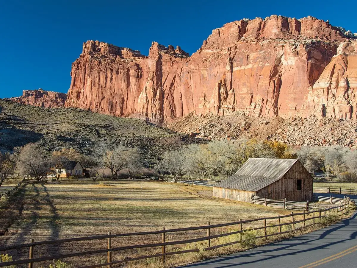


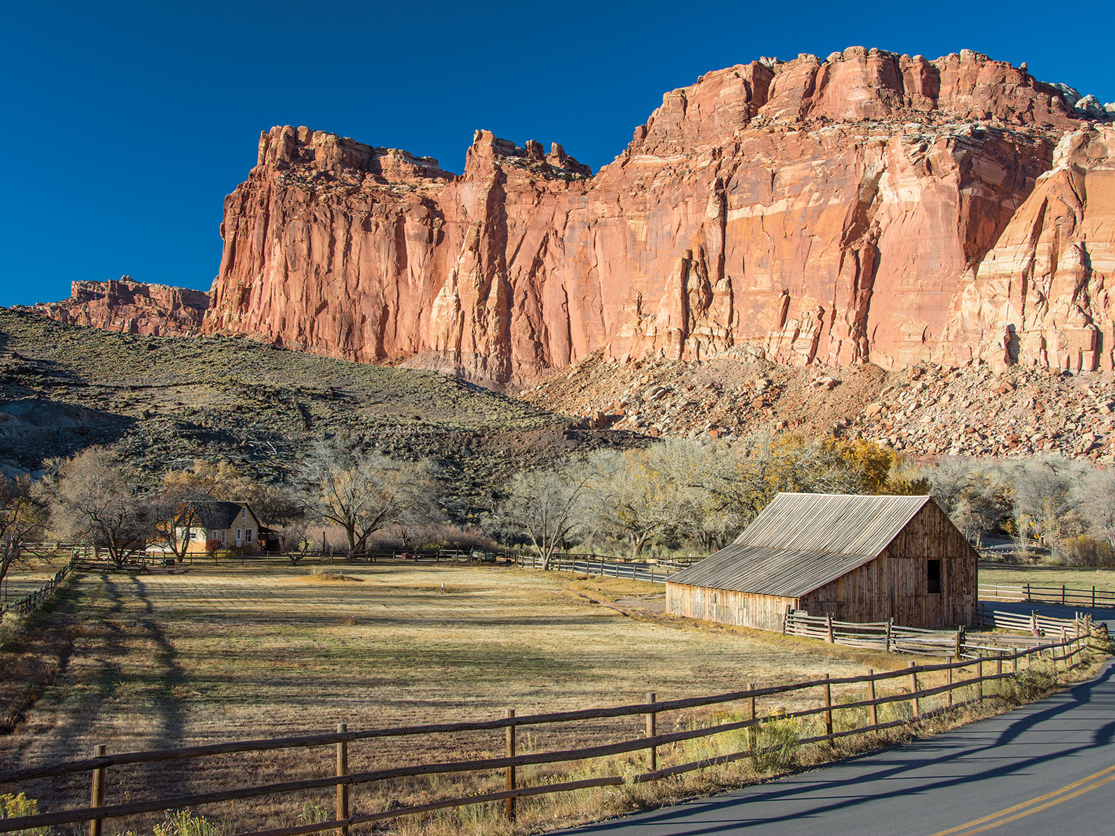
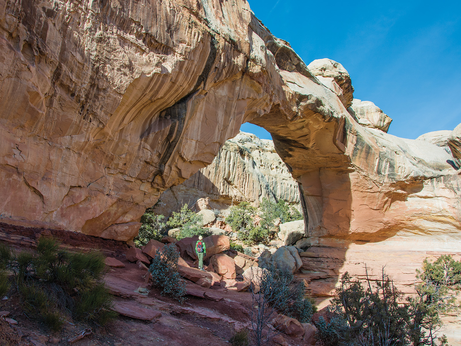
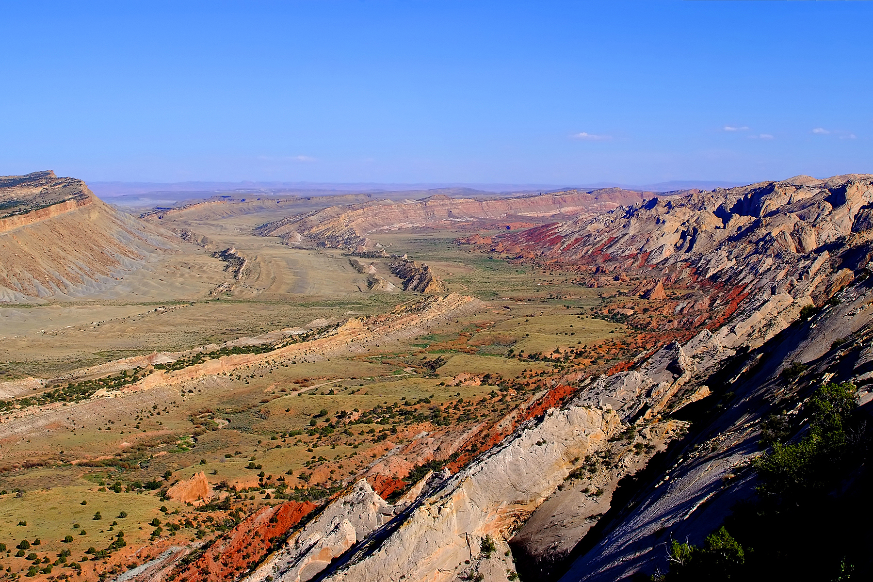
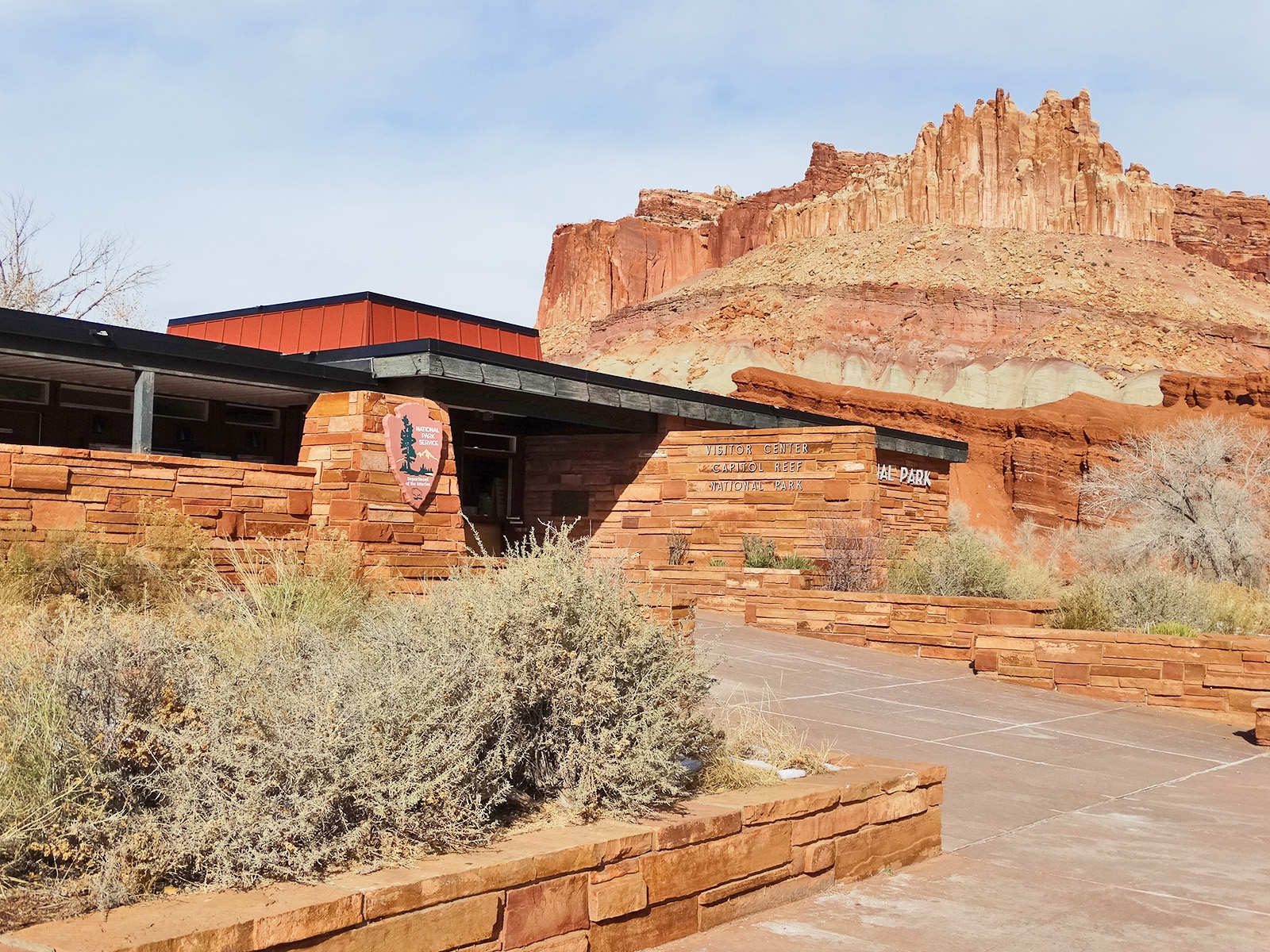
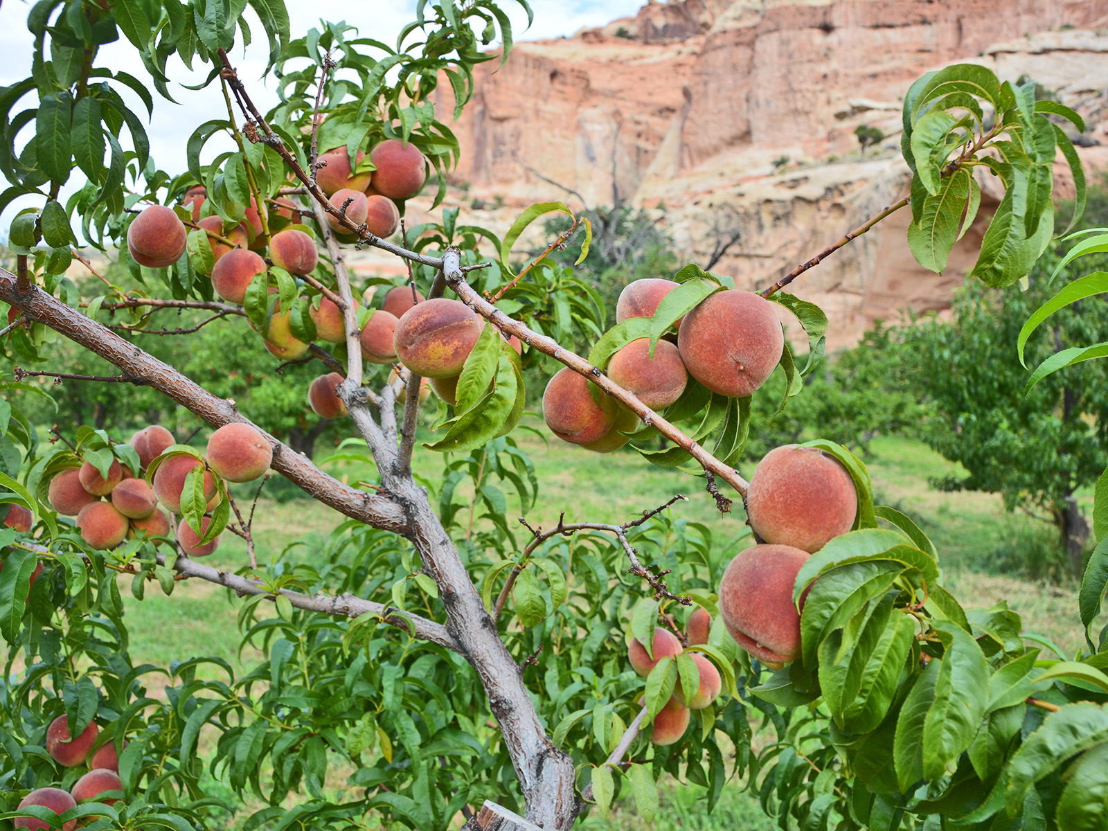
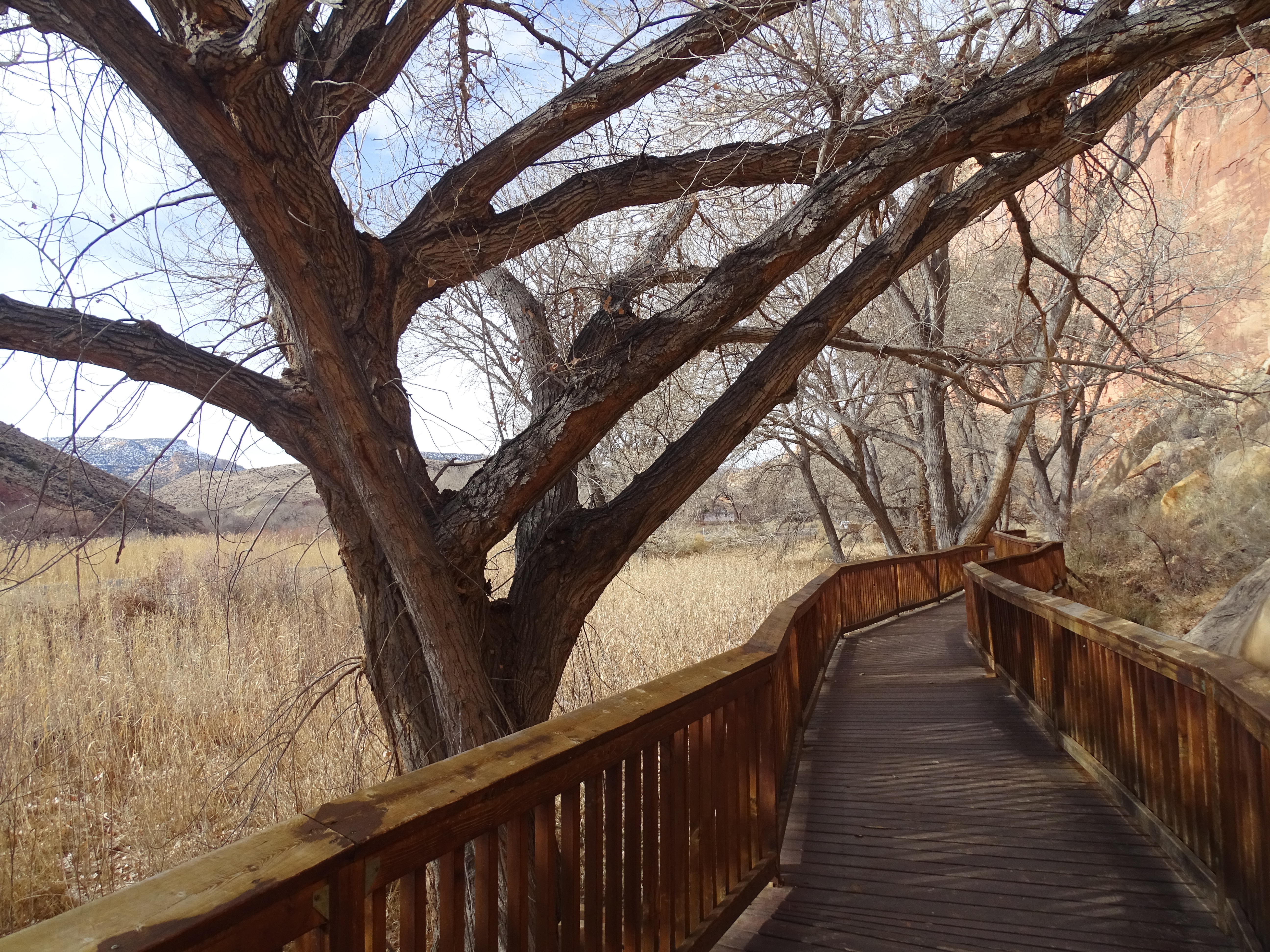

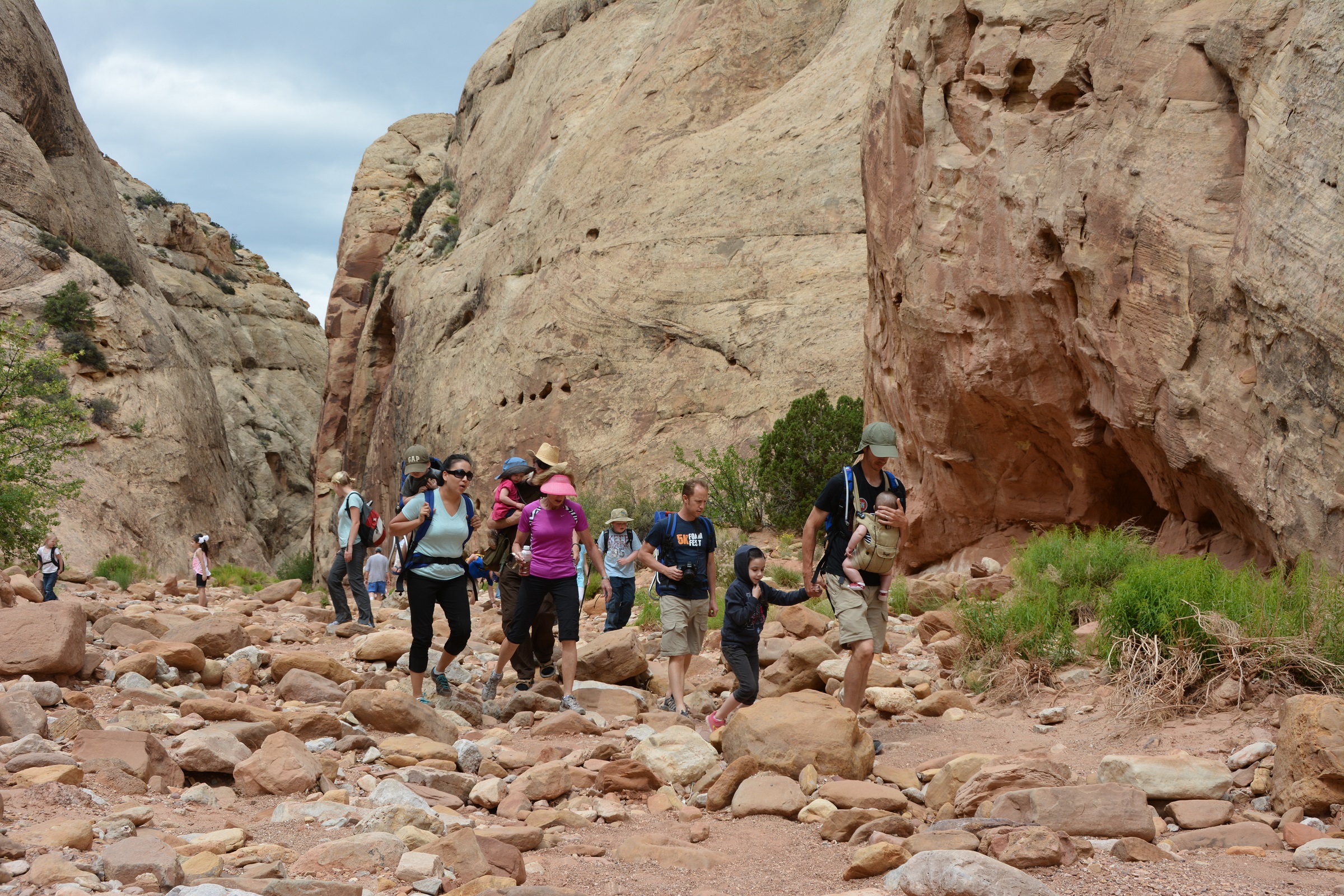
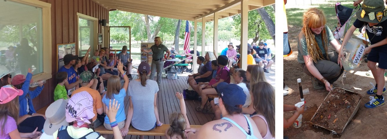
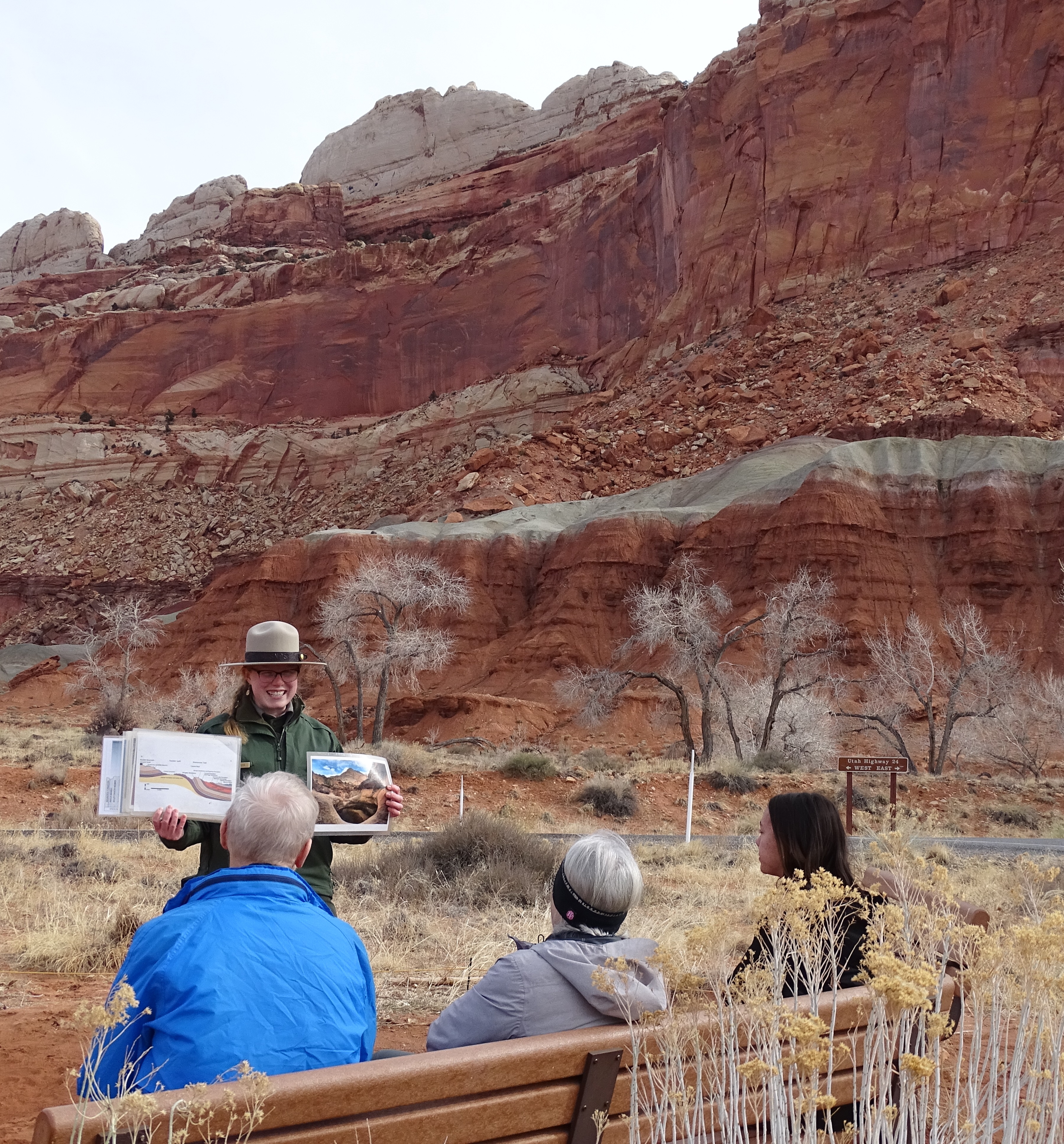
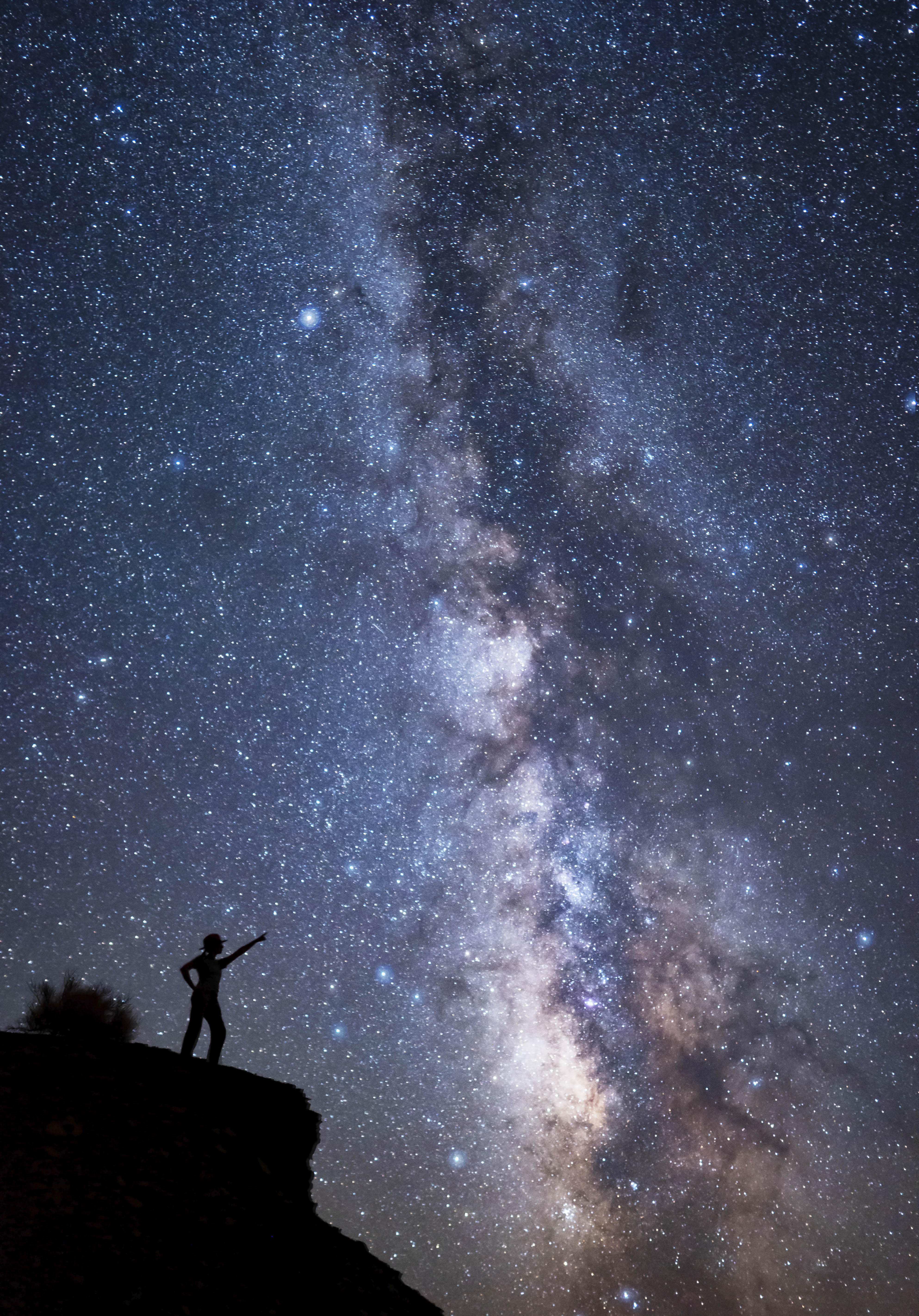

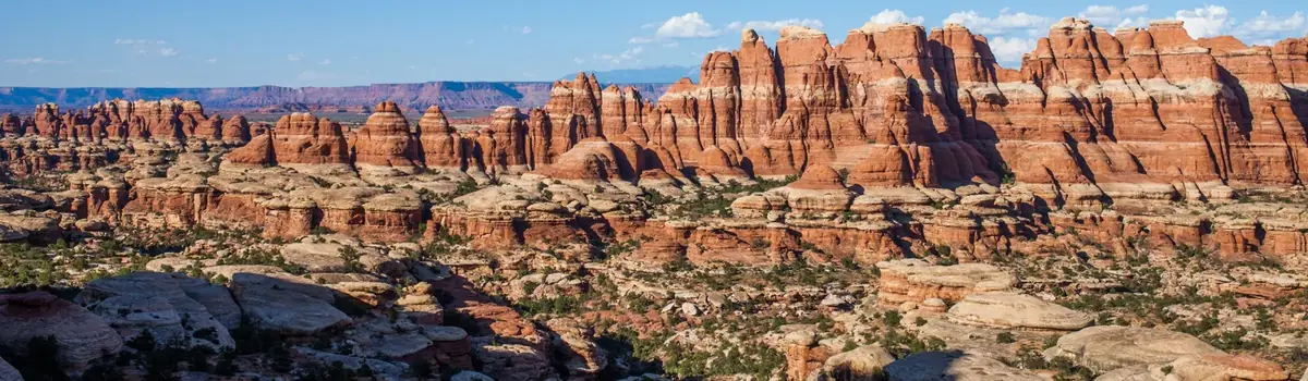 Canyons