Channel Islands National Park encompasses five remarkable islands and their ocean environment, preserving and protecting a wealth of natural and cultural resources. Isolation over thousands of years has created unique animals, plants, and archeological resources found nowhere else on Earth and helped preserve a place where visitors can experience coastal southern California as it once was.
249.6Kacres of parkland
227.2Krecreation visits, 2025
Jul · Aug · Sepnearby climate picks
Seasonal access & reservations
No reviewed guidance for this selection. Check the park's official planning pages; missing coverage does not establish access.
Selected guidance only; separate from climate comfort and current conditions.
Official conditions Not checked
The conditions feed has not been connected for this park.
Editorial recommendations, reviewed 2026-10-17. Full park days, excluding travel to and from the region. A first-visit outline for a general traveler; adapt to mobility, fitness, season, reservations, and current conditions. These are suggested days, not reserved activities or guaranteed routes.
Learn about hiking, camping, water sports, and other activities in the park.
The islands not only offer a delightful break from the congestion and clamor of urban life, but also numerous activities--hiking, camping, snorkeling, kayaking, birdwatching, photography, or just relaxing to the soothing sounds of the natural world.
Please click on the links below to learn about activities within the park.
Visit the park's Visitor Services List for a complete list of authorized concessioners and commercial service operators who can help facilitate your outdoor activities within the park.
Take a virtual visit to the Channel Islands through live broadcasts that highlight the park's natural and cultural resources.
An in-person visit to Channel Islands can be difficult: it requires complex logistics, including travel by boat, and the terrain is rugged. Channel Islands Live brings the park to you through a variety of interactive broadcasts and webcams. You can learn about this unique island chain, the threats confronting it, and how our national park is protecting and restoring this diverse ecosystem.
Interactive broadcasts include Live Dives through towering kelp forests and Live Hikes to the Anacapa Light Station or through the region's largest western gull rookery. During interactive broadcasts participating visitors and students can to talk to rangers and ask questions. Webcams include views of nesting bald eagles, dramatic island vistas, and lively kelp forests.
Watch programs live from the islands.
Watch previously recorded programs.
Schedule your class for a FREE program.
Learn about the live programs.
View our bald eagle, ocean, Anacapa Island, and Mount Diablo webcams.
Learn about the partners that make Channel Islands Live possible.
All you wanted to know, and more, about Channel Islands Live.
Learn about the technology behind the programs.
Download detailed information on Channel Islands Live.
Cool off after a hike with a snorkel, dive, or kayak in the Landing Cove on Anacapa Island or at Scorpion Anchorage on Santa Cruz Island.
Planning Your Trip
Landing Permits and Procedures
Kayaking (excluding personal watercraft-see Laws and Policies for more information) is a unique and rewarding way to experience the pristine marine environment of Channel Islands National Park. You will find solitude and splendor. Here you will also face new challenges and may encounter unexpected dangers. This section is designed to help in planning a safe, enjoyable, and environmentally sound kayaking trip in the park.
Visit Kayaking Eastern Santa Cruz Island for more information on kayaking on Eastern Santa Cruz Island inclucding Scorpion Anchorage.
Planning Your Trip Sea kayaking is a high risk activity that has caused the death of park visitors and annually numerous near fatal incidents with sea kayakers occur in the park. The challenging and quickly changing weather and at times extreme sea conditions and dangerous sea caves greatly add to the risks of sea kayaking in the park. Sea kayaking on your own in any area of the park should not be attempted by novice or first time kayakers or anyone who is not properly experienced, trained, conditioned and equipped.
Visitors may kayak on their own or with a park authorized guide/outiftter. The National Park Service strongly recommends for your safety that sea kayaking be done with one of the park's authorized guide/outfitters. The guided trips are moderate to strenuous in nature, but some do not require previous kayaking experience. For the authorized kayak guide and outfitting concession in the Scorpion Anchorage area on Santa Cruz Island visit: Channel Islands Adventure Company . They operate guided sea kayak tours (there are NO kayak rentals on the island), limited convenience item sales (no food items), snorkel equipment rentals, and guided snorkel tours at Scorpion Anchorage on Santa Cruz Island only. For kayak guide and outfitting services in other areas of the park (excluding Scorpion area), visit the Visitor Services List.
Visitors with their own kayaks who would like to explore the park may contact the park concessioners , who will transport kayaks on their public trips for an extra fee. The concessionaires offer year-round transportation to the islands for day visits and camping trips.
Sea kayaking opportunities are available throughout the park. To help you decide which island to visit, specific island information is available at Places To Go or from the visitor center through publications, exhibits, and the park movie.
The area of the park that is most popular for sea kayaking is centered around Scorpion Beach on East Santa Cruz Island. This location is a world class destination for sea kayaking because of easy beach access, clear ocean waters, nearby camping, readily available concessionaire boat transportation service and a spectacular shoreline with beautiful sea cave and cliffs to explore.
Sea kayaking at San Miguel and Santa Rosa Islands is recommended to only the most highly experienced (expert), skilled, conditioned kayakers with all necessary safety equipment due to the consistently extreme weather and sea conditions that regularly dominate these areas.
Due to the many hazards of crossing the channel from or to the mainland to the park islands the National Park Service does not recommend this be attempted by sea kayakers.
Detailed kayaking information about the channel and islands may be obtained from the U.S. Coast Guard's (USCG) "Local Notice to Mariners" publication by contacting the Coast Guard at (510) 437-2981. Kayaking guides and nautical charts to the Channel Islands are available from local marine stores and online bookstores. Refer to the National Oceanic and Atmospheric Administration's (NOAA) National Ocean Survey charts 18720, 18721, 18725, 18727, 18728, 18729, and 18756.
Weather Conditions in the Santa Barbara Channel and around the islands are variable and the ocean is unforgiving. Only experienced kayakers with vessels capable of withstanding severe weather are advised to make the cross-channel passage.
Kayakers should obtain the latest weather broadcast provided by the NOAA Weather Service by calling (805) 988-6610, visiting Channel Islands National Marine Sanctuary's Internet Weather Kiosk and by monitoring weather radio on VHF-FM 162.475 MHz (weather station 3) for marine forecasts and VHF-FM 162.55 MHz (weather station 1) and VHF-FM 162.40 MHz (weather station 2) for land-based observations.
Weather conditions vary considerably in the channel. Extreme weather conditions may be encountered at any time and the sea conditions may become dangerous without warning. The calmest winds and sea conditions often occur August through October. The other months are subject to a much greater chance for adverse wind and seas with sudden unexpected changes. High winds may occur regardless of the forecast. Forty-knot winds are not unusual for Santa Rosa and San Miguel Islands. Anacapa and Santa Barbara Islands have more moderate winds.
Winds are often calm in the early morning and increase during the afternoon. Generally the wind comes from the northwest, but kayakers must be also be prepared for strong east or Santa Ana winds at anytime, especially from September through April.
Dense fog is common during the summer months, but may occur at any time, making chart and compass navigation mandatory. Ocean currents of considerable strength may be encountered both near and offshore from the islands. Ocean water temperatures range from the lower 50s (°F) in the winter to the upper 60s (°F) in the fall.
Safety Due to challenging weather conditions, kayaking should not be attempted by the novice or anyone who is not properly trained, conditioned, and equipped. Safety requires good planning and common sense. Sea kayaking is potentially hazardous, even for experienced kayakers. Please follow these saftey recommendations:
Use the buddy system. There are no lifeguards on duty. Kayaking is at your own risk. Stay together and paddle within the skills of the least experienced paddler in the group.
Obtain current weather and sea conditions. The conditions around the islands are considered "open ocean." Extreme weather conditions may be encountered at any time and sea conditions may become dangerous without warning.There is no place where visitors will be kayaking in a protected cove. Always observe and evaluate sea conditions before entering the water. Be alert to wind, wave, and currents at all times.
Do not travel down wind (with the wind) as you will have to return into a headwind. Wind and waves typically come out of the northwest or west. Winds tend to increase in the afternoon. Morning hours can be a better time for kayaking, and other watersports. Challengin Santa Ana or east winds may occur at anytime, but are most common from September through April.
Do not exceed your skill level. If you are new to sea kayaking or other watersports, stay close to your launch area and paddle with an experienced kayaker. Ask National Park Service personnel or kayak guides if you have questions concerning weather, safety, etc. Be capable of re-entering your kayak from the water.
Let someone know where you are going and when you expect to return. Kayakers should always file a float plan with family and/or friends and inform them of your departure and return. The float plan should include: 1) the number of boats and boaters on the trip as well as the color, size, and type of craft used; 2) names and addresses for the boaters , as well as emergency phone numbers; 3) any survival and special emergency equipment should be listed (EPIRB, VHF, food rations, flares, etc.); and 4) the place, date, and time of departure and return should be logged as well as destination(s). This information can be invaluable for a search operation if something goes wrong. Remember to be flexible with your plans. Weather should always determine your course of action.
If you are kayaking across the channel, kayakers should also file a formal float plan with the harbormaster before departing and contact island rangers at the beginning and end of the paddle.
Carefully select and equip your paddlecraft. Craft should be of a sea kayak design and kayakers must have the following items:
Lifejackets-all paddlers must have lifejackets.
Helmets-always wear a helmet when paddling below cliffs and in sea caves.
VHF radio, tow line, compass, throw bag, first aid kit, signaling device (airhorn, whistle, or signal mirror). Carry these items with you and know how to use them.
Wetsuits are highly recommended. Water temperatures remain cold throughout the year.
Sea Caves Sea caves can be very dangerous-large waves or swells can fill a cave unexpectedly. Even on calm days, the wake from large ships in the channel can pose a danger to kayakers in caves. Be extremely careful and wear a helmet at all times when exploring sea caves. Always observe and evaluate sea conditions before entering any sea cave.
Shipping Lanes Major shipping lanes lie between the islands and the mainland. Kayakers should be aware of their location and use caution when crossing them. All kayakers should listen to the USCG notice to mariners broadcast on VHF channel 22 since the waters in and surrounding the park are sometimes closed for military operations.
Regulations In addition to the regulations listed below please see Laws and Policies and Limiting Your Impact for additional information.
You may not exit your kayak while in the sea caves.
Do not disturb wildlife within caves. It is illegal to feed, touch, tease, frighten, or intentionally disturb wildlife.
Please avoid use of artificial lights in caves.
Stay off rocks. Scorpion Rock on Santa Cruz Island and all other off shore islets in the park are off limits.
The Santa Cruz Island shoreline between Arch Point (northwest of Scorpion Anchorage) and the east boundary of Potato Harbor is closed to landing to protect nesting seabirds.
Other island shorelines and beaches may be closed to landing to protect pinnipeds and seabirds. Check with island ranger before departure.
Marine Reserves are closed to fishing. Please visit Channel Islands Marine Protected Areas for more information on marine reserves.
Landing Permits and Procedures There are no landing permits required for the islands administered by the National Park Service (NPS). However, a landing permit is required to land on The Nature Conservancy (TNC) property on Santa Cruz Island.
There are closed and restricted areas on each island. Please note that rocks or islets on or near any of the islands are closed year-round to any landing and pets are not allowed in the park. Please refer to Laws and Policies and Limiting Your Impact for more information on regulations and guidelines.
Kayakers may land according to the following procedures: Santa Barbara Island : A permit is not required to land or hike on Santa Barbara Island. Access to the island is permitted only at the landing cove. The landing dock is available for unloading purposes only. No craft, including kayaks and inflatables, should be left moored to the dock.
Anacapa Island: A permit is not required to land or hike on East Anacapa Island or at Frenchys Cove. West Anacapa (except Frenchys Cove) is a protected research natural area and is closed to visitors. Visitors are allowed on Middle Anacapa by permit only and when accompanied by a park ranger. The landing dock is available for unloading purposes only. No craft, including kayaks and inflatables, should be left moored to the dock.
Santa Cruz Island: Boaters may land and hike on the eastern 24% of Santa Cruz Island without a permit. This area is owned by the NPS and is east of the property line between Prisoners Harbor and Valley Anchorage. Due to surf and swell conditions, boaters should use extreme caution when making surf-landings at any beach, especially Smugglers Cove and those beaches facing south and southeast between San Pedro Point and Sandstone Point.
A permit to land on the other 76% of Santa Cruz Island is required from TNC. A fee is charged and no overnight island use is permitted. Contact (805) 642-0345 x510 or www.nature.org/ for a permit; allow 10-12 days for processing.
Santa Rosa Island: Boaters may land along coastline and on beaches without a permit for day-use only. From March 1 to September 15, the back beaches and sand dunes between and including Skunk Point to just north of East Point are closed to hiking to protect the nesting area for the snowy plover, a federally listed, threatened shorebird. Please remain on the wet sand (below mean high tide) or the road throughout this area. The beaches around Sandy Point are closed year-round. A pier is available at Bechers Bay.
San Miguel Island: Kayakers may land only on the beach at Cuyler Harbor. San Miguel Island is owned by the U. S. Navy and open for landing only when National Park Service personnel are on the island. The island was a former bombing range and there are possible unexploded ordnance. If kayakers are not traveling to San Miguel Island with Island Packers, it is the responsibility of the kayakers to contact the park to ensure the island is open before coming ashore. A permit (including liability waiver) is required to visit the island. Kayakers can obtain these forms at a self-registration station at the Nidever Canyon trail head entry on San Miguel Island. If you are traveling to San Miguel Island with Island Packers they will provide the forms to you upon your reservation. Visitors are required to be escorted beyond the ranger station. Visitors may explore Cuyler Harbor beach, Nidever Canyon, the Cabrillo Monument, and the Lester Ranch site unescorted. No off-trail hiking is permitted. If you are traveling to San Miguel Island with Island Packers for the day or to camp, park staff will already be scheduled on the island and usually available to provided escorted hikes. Kayakers traveling on their own are required to e-mail us prior to their mainland departure to arrange for an escorted hike by a ranger. Provide your name, phone number, vessel name, and dates of requested escorted hike. Park staff will then reply with available dates and instructions.
A Cavern Point hike includes great views and a tour of the visitor center in the historic ranch house. Island Packers runs daily trips.
Island Facts Island History & Culture Things To Do Interpretive Guide Restoration
These varied landforms support more than 600 plant species in 10 different plant communities, from marshes and grasslands to chaparral and pine forests. There are 140 landbird and 11 land mammal species; three amphibian and five reptile species; large colonies of nesting seabirds, breeding seals, and sea lions; and other diverse marine animals and plants. Owing to millions of years of isolation, many distinctive plant and animals species have adapted to the island's unique environment, including the island scrub-jay and eight plant species found only on Santa Cruz and nowhere else in the world.
The island is also rich in cultural history with over 10,000 years of American Indian habitation and over 150 years of European exploration and ranching. Santa Cruz Island, known by the Chumash people as Limuw (translates to "in the sea"), was home to a ten villages that housed over 1,200 people. Many of these islanders mined extensive chert deposits for making tools and produced "shell-bead money," used as a major trade item by tribes throughout California. The largest village on the island as well as on the northern Channel Islands, Swaxil, occupied the area of Scorpion Ranch at the time of Spanish contact (1542). Large plank canoes, called tomols, provided transportation between the islands and mainland. Remnants of Chumash civilization can still be seen in thousands of shell middens on the island.
Remnants of the ranching era also can be seen throughout the landscape of the island. Adobe ranch houses, barns, blacksmith and saddle shops, wineries, and a chapel all attest to the many uses of Santa Cruz in the 1800s and 1900s.
The National Park Service, along with The Nature Conservancy, has made great efforts to preserve and protect these island resources, including stabilization of cultural sites, rehabilitation of historic buildings, removal of nonnative plants and animals, the recovery island foxes, reestablishment of bald eagles, and restoration of island wetlands. All of these efforts have made Santa Cruz Island one of the best places to experience the nationally significant natural and cultural heritage of coastal southern California.
Close to the mainland yet worlds apart, Santa Cruz Island is home to plants and animals that are found nowhere else on Earth. The introduction of of non-native, exotic plants and animals have caused the loss of some of these rare species and pushed many others, including the island fox, to the brink of extinction. In order to save these island species, as well as protect sacred Chumash Native American cultural sites, the National Park Service and The Nature Conservancy embarked upon a multi-year program to help restore balance to Santa Cruz Island’s naturally functioning ecosystems. This high-definition video documents the various aspects of this complex restoration program, including the removal of golden eagles, reintroduction of bald eagles, captive breeding island foxes, removal of sheep, and eradication of pigs. The Santa Cruz Island restoration program is part of the National Park Service mission, as mandated by Congress, to preserve unimpaired the natural and cultural resources and values of the national park system for the enjoyment, education, and inspiration of this and future generations.
Scorpion Canyon Campground is the most convenient park campground and provides the most recreational opportunities.
Camping is available year-round on all five islands in Channel Islands National Park. Limited backcountry camping is available on Santa Cruz and Santa Rosa Islands.
Reservations are required for all park campgrounds. Reservations can be made up to six months in advance on recreation.gov .
If you are taking public boat transportation on Island Packers, find dates on which both boat tickets and a campsite are available. Booking early will increase your options.
All campgrounds are located away from the boat landing areas. Visitors must carry all their gear to the campgrounds. No on-island transportation is provided.
Campgrounds are rustic, and users must camp within designated areas. All campgrounds are equipped with picnic tables and toilets. Not all toilets flush. Drinking water is not available on most islands and must be brought with you. Water from natural sources should be purified before drinking or washing with it. Drinking water is available at Scorpion Canyon campground on Santa Cruz Island and on Santa Rosa Island in the historic ranch area and at Water Canyon Campground. No trash collection is available. Campers must pack out their own trash.
Campgrounds on San Miguel and Santa Rosa Islands have wind breaks for each campsite.
Campfires are not allowed. Use only chemical-fuel stoves for cooking.
Island mice have tested positive for hantavirus . Take basic precautions: do not feed any wild animals; keep food and drink in rodent-proof containers; and prevent entry of mice into your tent by keeping it zipped up at all times.
Campers must store all food and trash in animal-proof containers. Food storage boxes are provided at campsites.
Foxes and ravens are capable of opening zippers. Secure zippers on tents and bags with safety pins, twist ties, paper clips, or small carabiners.
Weather Campers should be prepared for a variety of weather conditions, especially on the outer islands. Thirty-knot winds are not uncommon on Santa Rosa and San Miguel Islands. Sturdy, low-profile tents, stakes, and line for securing tents to ground, table, or wind shelters are recommended.
Fog can occur on the islands during any season producing cool, damp conditions.
All of the campgrounds, except eastern Santa Cruz, are located away from trees and shade. Overexposure to the wind and sun can be a serious problem.
Visitors are advised to bring supplies for an extra day in case boats are unable to pick up campers due to sea conditions.
For the most current weather forecast, please visit Channel Islands National Marine Sanctuary's Internet Weather Kiosk .
Suggested Camping Gear Campers must be prepared for the primitive campground facilities and weather conditions. Supplies and gear are not available on the islands. Gear must be transported up ladders at most landing areas, and carried some distance to the campgrounds.
Packing your gear in backpacks, duffle bags, and containers with handles makes transportation easier. The boat concessionaire requires that items weigh no more than 45 pounds each.
On some islands, visitors may get wet during loading and off-loading, so waterproof your gear. An extra pair of shoes packed in waterproof material is recommended.
Campers should plan to layer clothing, as weather conditions tend to change from cool and damp in the mornings to bright, warm, and windy during the afternoons. Clothing that protects against wind is advisable year-round. Hiking boots are recommended for most island trails.
Additional "needed" gear includes:
windbreaker/light jacket
shirts and pants that can be layered
normal clothing needs
campstove/cooking gear
water (1 gallon per person, per day)
"Suggested" gear includes:
poncho/rain jacket
sneakers/light footwear
The following items may not be brought to the park:
Live or Potted Plants
Firewood or any untreated, unfinished wood (including hiking sticks)
Corrugated boxes
Tools or equipment with attached soil
Motorized vehicles
Single-use plastic grocery bags
Island
Campground
Distance from Pier/Wharf
Notes
# Sites
Anacapa
Anacapa Island Campground
½ mile, including 157 stairs
Vault toilets. No drinking water. Gull nesting season is April to August.
7
Santa Cruz
Scorpion Canyon Campground
½ mile
Vault toilets. Drinking water available. Group campsites available.
25, plus 6 group
Santa Cruz
Prisoners Harbor Campground
¼ mile
Vault toilets. No drinking water.
6
Santa Rosa
Water Canyon Campground
1 ½ miles
Flush toilets. Drinking water available. Very windy.
15
San Miguel
San Miguel Island Campground
1 mile on a steep, narrow trail
Vault toilets. No drinking water. Extremely windy.
9
Santa Barbara
Santa Barbara Island Campground
¼ mile on a steep trail
Vault toilets. No drinking water. Extremely windy.
10
Island
Campground
Distance from Pier/Wharf
Notes
# Sites
Anacapa
Anacapa Island Campground
½ mile, including 157 stairs
Vault toilets. No drinking water. Gull nesting season is April to August.
7
Santa Cruz
Scorpion Canyon Campground
½ mile
Vault toilets. Drinking water available. Group campsites available.
25, plus 6 group
Santa Cruz
Prisoners Harbor Campground
¼ mile
Vault toilets. No drinking water.
6
Santa Rosa
Water Canyon Campground
1 ½ miles
Flush toilets. Drinking water available. Very windy.
15
San Miguel
San Miguel Island Campground
1 mile on a steep, narrow trail
Vault toilets. No drinking water. Extremely windy.
9
Santa Barbara
Santa Barbara Island Campground
¼ mile on a steep trail
Vault toilets. No drinking water. Extremely windy.
View one of the rarest trees in the world. Channel Islands Aviation flies year round while Island Packers runs trips spring through fall.
Santa Rosa Island was included as part of Channel Islands National Park upon the park's inception on March 5, 1980. However, it wasn't until December 1986 that the island came under the ownership of the National Park Service.
Located 40 nautical miles from the Channel Islands National Park visitor center in Ventura, Santa Rosa is the second largest island in California at approximately 53,000 acres in size. The island's relatively low profile is broken by a high, central mountain range, rising 1,589 feet at its highest point. Its coastal areas are variable, ranging from broad, sandy beaches gently sloping toward a dynamic ocean to sheer cliffs plunging toward the turmoil of a sea intent on changing the contour of the land.
As on its larger neighbor, Santa Cruz Island, these varied landforms support a diverse array of plant and animal species. About 500 plant species can be found within nine plant communities, including six plant species found only on Santa Rosa and nowhere else in the world. One of these species, the Santa Rosa Island subspecies of Torrey pine, is considered one of the rarest pines in the world-the last enduring members of a once widespread Pleistocene forest. A remnant, mainland subspecies of Torrey pine also can be found near La Jolla, California, at Torrey Pines State Reserve. Santa Rosa Island also hosts over 100 bird and three mammal species (including the island's largest native mammal, the endemic island fox); two amphibian and three reptile species; and colonies of seabirds, seals, and sea lions.
Remains of an ancient endemic species, the pygmy mammoth, have been uncovered on Santa Rosa, along with Santa Cruz and San Miguel Islands. These miniature mammoths, only four to six feet tall, once roamed island grasslands and forests during the Pleistocene. The fossil skeleton discovered on Santa Rosa Island in 1994 is the most complete specimen ever found.
Along with extensive paleontological resources, Santa Rosa Island has rich archeological resources. Home to the Island Chumash until approximately 1820, Wima (as the Chumash refer to the island) contains thousands of significant and federally protected archeological sites. Archeological investigations on the island have enabled scientists to construct a more complete picture of Chumash life on the islands. Radiocarbon dating on some of these sites indicates that humans have been using the island for more than 13,000 years.
Others have come to the island during more recent centuries to exploit its rich resources, sometimes making it their home. In addition to the native Chumash, European explorers, Aleut sea otter hunters, Chinese abalone fishermen, Spanish missionaries, Mexican and American ranchers, and the US military all have left their mark on the Santa Rosa landscape. Visitors can see relics of these occupations in remnants of fishing camps, water troughs and fence lines, the pier where cattle were loaded and unloaded, buildings and equipment of the historic Vail and Vickers ranch at Bechers Bay, and remains of the military installations.
Surrounding the island are cold, nutrient- rich waters that sustain a diverse web of marine life, including pelagic fish, a variety of marine mammals, and extensive kelp forests.
As on the other islands, the National Park Service has made great efforts to preserve and protect these island resources, including enforcement of marine protected areas, stabilization of cultural sites, rehabilitation of historic buildings, removal of nonnative plants and animals, recovery of island foxes, and reestablishment of bald eagles.
Just a 4-hour boat ride (summer through fall) and a 16-mile round-trip hike to view 30,000 pinnipeds and up to five different species.
Island Facts Things To Do Interpretive Hiking Guide
Wind and weather constantly sweep across the North Pacific to batter the shores of the westernmost of all the islands, San Miguel. This extreme weather creates a harsh but profoundly beautiful environment. The 9,500-acre island is primarily a plateau about 500 feet in elevation, but two 800-foot rounded hills emerge from its wild, windswept landscape. Although lush native vegetation covers this landscape today, a century's worth of sheep ranching and overgrazing caused scientists in 1875 to describe the island as "a barren lump of sand." With the grazing animals removed, vegetative recovery is in progress. Giant coreopsis, dudleya, locoweed, lupine, buckwheat, coastal sagebrush, and poppies are all recolonizing the island to their former extent, returning San Miguel to its more natural state.
Also making a comeback, after years of hunting, are the thousands of pinnipeds (seals and sea lions) that breed, pup, and haul out on the island's 27 miles of isolated coastline. Hikers who make the all-day, ranger-guided, 16-mile round-trip hike across the island to Point Bennett will never forget seeing one of the world's most spectacular wildlife displays-over 30,000 pinnipeds and up to five different species hauled out on the point's beaches at certain times of year.
Other wildlife include the island fox and deer mouse. Both of these little creatures are endemics-they are found only on the Channel Islands. The island fox, the size of a house cat, is the largest land animal on the island. In the waters surrounding San Miguel, the marine animals get much larger. Dolphins and porpoises are often spotted along with gray whales, killer whales, and the largest animals of all, blue whales.
In the spring and summer the skies are filled with birds. Boaters entering Cuyler Harbor receive a greeting from western gulls, California brown pelicans, cormorants, and Cassin's auklets that nest on Prince Island. Black oystercatchers, with their bright red bills and pink feet, feed along the beach. Terrestrial residents include the western meadowlark, rock wren, and song sparrow, an endemic subspecies. Peregrine falcons have recently been restored to the island and are nesting successfully once again after years of decimation by the pesticide DDT.
In addition to the variety of natural resources, San Miguel hosts an array of cultural resources as well. The Chumash and their ancestors lived on San Miguel almost continuously for nearly 12,000 years. Today there are over 600 fragile, relatively undisturbed archeological sites. The oldest one dates back to 11,600 years before the present-some of the oldest evidence of human presence in North America. Juan Rodriguez Cabrillo and his men laid eyes on San Miguel Island in 1542. Upon claiming the island for the Spanish crown, Cabrillo named it "La Posesion." Some stories say that Cabrillo wintered and died on San Miguel Island. No one knows where Cabrillo is buried, but there is a memorial commemorating the explorer on a bluff overlooking Cuyler Harbor.
Other outstanding island resources that visitors may experience on San Miguel include the caliche forest (sand-castings of ancient vegetation), fossil bones of the Pleistocene pygmy mammoths that stood four to six feet at the shoulders, 150 years of ranching history, and numerous shipwrecks. Whether you are interested in life of the past or life of the present, San Miguel Island has it in abundance. Visit, explore, and enjoy.
Open Descriptive Transcript
Descriptive Transcript
Video of man raising flag at sunset, waves crashing on sandy beach with rock in background, clouds moving over a mountain at sunset, clouds moving over a flagplole at sunrise, visitors walking on beach with islet in background, sunset over mountains with raven flying by and clouds,
Time-lapse video from various locations around San Miguel Island.
Over 30 different marine mammal species can be found in the park. For best viewing take a trip with Island Packers.
The waters surrounding Channel Islands National Park are home to many diverse and beautiful species of cetaceans (whales, dolphins, and porpoises). About one third of the cetacean species found worldwide can be seen right here in our own backyard, the Santa Barbara Channel. The 27 species sighted in the channel include gray, blue, humpback, minke, sperm, and pilot whales; orcas; Dall's porpoise; and Risso's, Pacific white-sided, common, and bottlenose dolphins.
This diversity of cetacean species offers a great opportunity to whale watch year-round. The most common sightings are of gray whales from mid- to late-December through mid-March, blue and humpback whales during the summer, and common dolphins throughout the entire year. Whales and dolphins can be seen either from shore or from a boat. The best shore viewing is from a high spot on a point that juts out into the ocean. Some examples include Point Dume in Malibu, the Palos Verdes Peninsula near Los Angeles, and Point Loma in San Diego. The park visitor center has a tower with telescopes, which can be used for whale watching as well as island viewing. Watching in the early morning hours, before the wind causes whitecaps on the water's surface, will provide you with the best opportunity to see whales from shore.
Closer viewing of whales is possible from public whale watching boats or private boats. Whales have been known to approach boats quite closely. Under the Marine Mammal Protection Act, boaters must stay at least 100 yards from whales unless the whale chooses to approach the boat.
Many whales are on the endangered species list and should be treated with special care. All whales are protected by the Marine Mammal Protection Act; it is illegal to disturb or harm any marine mammal. Boaters who use private craft to watch whales must remember to stay at least 100 yards away from whales. Boaters who frighten or interrupt the whales' activities by approaching too close could drive the whales away from food or young calves. Please remember that whales are wild animals and can be unpredictable.
We need to continue to explore the world of whales and dolphins. The well-being of the cetacean population is a good indication of the health of the ecosystem. Our ability to bring these species into the next century and beyond is an indication of the future of life on this planet. Every day we learn more about these mysterious and unique creatures that dwell beneath the water, yet rise above it to breathe.
Whale Habits Whether you are watching from shore or in a boat, here are a few distinctive habits to look for.
Spouts Your first indication of a whale will probably be its spout or “blow.” It will be visible for many miles on a calm day, and an explosive “whoosh” of exhalation may be heard up to 1/2 mile away. The spout is mainly condensation created as the whale’s warm, humid breath expands and cools in the sea air.
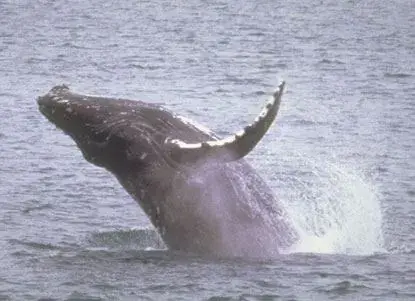
Breaching No one knows why whales perform this most spectacular of their behaviors. It may be part of the courtship display, a signal, an effort to dislodge parasites, an expression of stress, or just for fun. When breaching, threequarters or more of the whale’s body bursts forth from the water, pivots onto its side or back, and falls back with an enormous splash.
Diving Diving is preceded by whales thrusting their tail flukes out of the water. Typically, whales make a series of shallow dives, followed by a deep dive.
Footprints Ripples caused by the vertical thrusts of the tail as the whale dives are called “footprints.”
Spyhopping Whales and dolphins are believed to have reasonable vision in air as well as water. On occasion, a whale will extend its head vertically from the sea. Supported by thrusting flukes, the whale’s head can rise 8-10 feet above the surface, sometimes turning slowly for thirty seconds or more before slipping back underwater.
Official NPS features and USGS park boundaries, imported 2026-10-17. An inventory snapshot, not live trail or parking availability.
Loading official park features…
TrailsPoints of interestParkingZoom with buttons or pinch. Toggle layers on the map.
Map coverage varies. Trail names may represent segments, connectors, or shared park units; mapped lines are not a hiking recommendation. Use official conditions and navigation resources before heading out.
NPS public GIS inventory, imported 2026-10-17. “Existing” is an inventory classification, not confirmation that a trail is open. Segment counts are not route distances. Parking records do not indicate space availability, fees, or accessibility certification. View government source ↗
Climate for Port Hueneme, 26 km from the park reference point. 1991–2020 normals. Source elevation: 4 m.
Daytime highNighttime lowOctober: 71° / 59°
Daytime high71°
Precipitation18 mm
Daylight11.1 hrs
Wind7.0 km/h
Mountain, rim, valley, and coastal conditions can differ sharply from the source town. Check park forecasts and current conditions before travel.
Monthly climate data 12 months · °F
Month
High
Low
Rain / snow water
Wet days
Daylight
61°
49°
93 mm
5.6
10.0 h
61°
49°
95 mm
6.1
10.7 h
62°
51°
67 mm
5.1
11.7 h
65°
52°
22 mm
2.8
12.8 h
67°
56°
10 mm
1.5
13.8 h
70°
59°
1 mm
0.3
14.2 h
74°
63°
2 mm
0.4
14.0 h
75°
64°
0 mm
0.1
13.3 h
74°
63°
3 mm
0.5
12.2 h
71°
59°
18 mm
2.0
11.1 h
66°
54°
23 mm
2.8
10.2 h
61°
49°
59 mm
4.9
9.8 h
RESEARCH WITH THE SOURCE IN VIEW
The practical field guide.
Official NPS excerpts imported 2026-10-17. Fees, permits, road access, and operations can change; use the source link to confirm the latest information.
A visit to the Channel Islands is an exercise in preparation and self-reliance. There are no services such a food stores or gear rental shops on the islands, no remedies for poor planning once you have arrived.
The following list may help you organize your trip to the islands. In addition, click on the various links below for more information.
Decide how long your visit will be.
Read about the Things to Do , including Outdoor Activities that interest you and Places To Go to determine which island appeals to you most. Also check Alerts & Current Conditions to learn about any current restrictions or closures.
Contact the concessionaires for Island Transportation information and make your reservation. If you are a private boater, read Boating for more information.
If you plan to stay overnight on any of the islands, read Camping for more information.
Contact rental shops to reserve any gear required (kayaks, snorkeling gear, etc.).
Shop and pack for the trip. Read Weather , Your Safety , Goods and Services , and Clothing and Gear for more information.
Camping is available year-round on all five islands in Channel Islands National Park. Limited backcountry camping is available on Santa Cruz and Santa Rosa Islands.
Reservations are required for all park campgrounds. Reservations can be made up to six months in advance on recreation.gov .
If you are taking public boat transportation on Island Packers, find dates on which both boat tickets and a campsite are available. Booking early will increase your options.
All campgrounds are located away from the boat landing areas. Visitors must carry all their gear to the campgrounds. No on-island transportation is provided.
Campgrounds are rustic, and users must camp within designated areas. All campgrounds are equipped with picnic tables and toilets. Not all toilets flush. Drinking water is not available on most islands and must be brought with you. Water from natural sources should be purified before drinking or washing with it. Drinking water is available at Scorpion Canyon campground on Santa Cruz Island and on Santa Rosa Island in the historic ranch area and at Water Canyon Campground. No trash collection is available. Campers must pack out their own trash.
Campgrounds on San Miguel and Santa Rosa Islands have wind breaks for each campsite.
Campfires are not allowed. Use only chemical-fuel stoves for cooking.
Island mice have tested positive for hantavirus . Take basic precautions: do not feed any wild animals; keep food and drink in rodent-proof containers; and prevent entry of mice into your tent by keeping it zipped up at all times.
Campers must store all food and trash in animal-proof containers. Food storage boxes are provided at campsites.
Foxes and ravens are capable of opening zippers. Secure zippers on tents and bags with safety pins, twist ties, paper clips, or small carabiners.
Weather Campers should be prepared for a variety of weather conditions, especially on the outer islands. Thirty-knot winds are not uncommon on Santa Rosa and San Miguel Islands. Sturdy, low-profile tents, stakes, and line for securing tents to ground, table, or wind shelters are recommended.
Fog can occur on the islands during any season producing cool, damp conditions.
All of the campgrounds, except eastern Santa Cruz, are located away from trees and shade. Overexposure to the wind and sun can be a serious problem.
Visitors are advised to bring supplies for an extra day in case boats are unable to pick up campers due to sea conditions.
For the most current weather forecast, please visit Channel Islands National Marine Sanctuary's Internet Weather Kiosk .
Suggested Camping Gear Campers must be prepared for the primitive campground facilities and weather conditions. Supplies and gear are not available on the islands. Gear must be transported up ladders at most landing areas, and carried some distance to the campgrounds.
Packing your gear in backpacks, duffle bags, and containers with handles makes transportation easier. The boat concessionaire requires that items weigh no more than 45 pounds each.
On some islands, visitors may get wet during loading and off-loading, so waterproof your gear. An extra pair of shoes packed in waterproof material is recommended.
Campers should plan to layer clothing, as weather conditions tend to change from cool and damp in the mornings to bright, warm, and windy during the afternoons. Clothing that protects against wind is advisable year-round. Hiking boots are recommended for most island trails.
Additional "needed" gear includes:
windbreaker/light jacket
shirts and pants that can be layered
normal clothing needs
campstove/cooking gear
water (1 gallon per person, per day)
"Suggested" gear includes:
poncho/rain jacket
sneakers/light footwear
The following items may not be brought to the park:
Live or Potted Plants
Firewood or any untreated, unfinished wood (including hiking sticks)
Corrugated boxes
Tools or equipment with attached soil
Motorized vehicles
Single-use plastic grocery bags
Island
Campground
Distance from Pier/Wharf
Notes
# Sites
Anacapa
Anacapa Island Campground
½ mile, including 157 stairs
Vault toilets. No drinking water. Gull nesting season is April to August.
7
Santa Cruz
Scorpion Canyon Campground
½ mile
Vault toilets. Drinking water available. Group campsites available.
25, plus 6 group
Santa Cruz
Prisoners Harbor Campground
¼ mile
Vault toilets. No drinking water.
6
Santa Rosa
Water Canyon Campground
1 ½ miles
Flush toilets. Drinking water available. Very windy.
15
San Miguel
San Miguel Island Campground
1 mile on a steep, narrow trail
Vault toilets. No drinking water. Extremely windy.
9
Santa Barbara
Santa Barbara Island Campground
¼ mile on a steep trail
Vault toilets. No drinking water. Extremely windy.
10
Island
Campground
Distance from Pier/Wharf
Notes
# Sites
Anacapa
Anacapa Island Campground
½ mile, including 157 stairs
Vault toilets. No drinking water. Gull nesting season is April to August.
7
Santa Cruz
Scorpion Canyon Campground
½ mile
Vault toilets. Drinking water available. Group campsites available.
25, plus 6 group
Santa Cruz
Prisoners Harbor Campground
¼ mile
Vault toilets. No drinking water.
6
Santa Rosa
Water Canyon Campground
1 ½ miles
Flush toilets. Drinking water available. Very windy.
15
San Miguel
San Miguel Island Campground
1 mile on a steep, narrow trail
Vault toilets. No drinking water. Extremely windy.
9
Santa Barbara
Santa Barbara Island Campground
¼ mile on a steep trail
Vault toilets. No drinking water. Extremely windy.
The National Park Service welcomes people with disabilities and strives to make Channel Islands National Park as universally accessible as possible. However, extra obstacles will be encountered because of the remote nature of this special place. In short, the mainland visitor center in Ventura and the visitor contact station in Santa Barbara are accessible. However, due to their isolation, rugged terrain, and transportation requirements, the islands are not readily accessible for individuals in wheelchairs or those with limited mobility. Please review the Physical / Mobility Accessibility page for more information. Limited access is available on the park concessioner boats and planes. Please call Island Packers (805-642-1393) for more information on safely accessing their vessels and planes. The links within this accessibility section (highlighted to the right) provide information about specific facilities, programs, and services that may help you better plan your visit. If a particular service or issue is not mentioned, please contact the park or call us at 805-658-5730. Please note that there is no lodging in the park so accessibility information is not provided for this category. To learn about the America the Beautiful National Parks and Federal Recreational Lands Access Pass please visit: America the Beautiful Passes This pass provides free, lifetime admission, as well as well as discounts on activities and services, at more than 2,000 federal recreation sites to U.S. citizens or permanent residents with permanent disabilities.
An entrance pass is not required to access Channel Islands National Park.
Other National Park Service sites may require an entrance pass or fee. Depending on your trip plans, an interagency pass may save you money.
2026 Free Entrance Days in the National Parks
Come experience the national parks! All National Park Service sites that charge an entrance fee will offer free admission to US citizens and residents (other fees, including timed entry or reservation fees, may apply). Mark your calendar for these entrance fee-free dates:
February 16 : Presidents Day (Washington's Birthday)
May 25 : Memorial Day
June 14: Flag Day/President Trump's birthday
July 3–5: Independence Day weekend
August 25: 110th Birthday of the National Park Service
September 17: Constitution Day
October 27 : Theodore Roosevelt's birthday
November 11: Veterans Day
Public Notice: Federal Land Passes No Longer Available for Sale at Channel Islands National Park As of July 1, 2015, Channel Islands National Park will no longer sell federal lands passes. The federal lands passes, including versions for seniors, active military, and the disabled, cover entrance fees at national parks and other federal lands. There is no fee to enter Channel Islands National Park. All federal land passes can be obtained or purchased at parks that charge an entrance fee as well as other federal recreation sites. To find a location near you that issues these interagency passes, search the list of all federal recreation sites where the passes are issued, including national parks.. Also, most passes can be purchased either online, by phone or by mail at the USGS Online Store as well as most sporting good stores like REI locations. Military passes must be obtained in person and are available locally at Los Padres National Forest headquarters in Ojai and Santa Barbara or Angeles National Forest headquarters in Arcadia. It is recommended you call ahead before you purchase your pass at these locations. More information is available at https://www.nps.gov/planyourvisit/passes.htm .
Mainland visitor centers in Ventura and Santa Barbara can be reached by car, bicycle, or public transportation.
Islands can only be reached by boat. Advanced planning is highly recommended.
No transportation is available on the islands. All areas must be reached by walking or boating. Bicycles are not allowed on the islands.
Private aircraft are not allowed to land within park boundaries. All aircraft must maintain a minimum 1000-foot altitude above land and sea surfaces within the park. FAA regulations state that pilots are requested to maintain a minimum of 2,000 feet above ground level over national park. Learn more at laws and policies .
Public Boat Transportation
Public boat transportation is available year-round by the park concessionaire Island Packers. Boats depart from Ventura Harbor and Channel Islands Harbor.
Island Packers 1691 Spinnaker Dr. Ventura, CA 93001 (805) 642-1393 islandpackers.com
Island Packers also offers non-landing wildlife watching trips.
Public Ground Transportation
Nearby airports:
Los Angeles International Airport
Burbank (Bob Hope) Airport
Santa Barbara Airport
Nearby train stations served by Amtrak and Metrolink trains:
Plan a safe visit to all National Parks by using the National Park Service Trip Planning Guide . Due to the remote and primitive nature of the islands, a safe visit to the park depends on visitor assuming individual responsibility for planning their trips and visiting safely.
For your safety, please remember:
Emergency services are very limited due to the isolated island environment.
Weather conditions change rapidly; dress in layers.
There are no supplies on the islands. Take water, food, and other necessities.
Watch your step-ladders, railings, and stairs may be wet.
Stay back from cliff edges; they may be crumbly or undercut-a fall could be fatal.
Do not approach marine mammals, such as whales, seals, and seal lions.
Check for ticks and watch out for poison oak and cactus.
Deer mice on the islands may carry diseases, including deadly hantavirus . Avoid all contact with mice and other wild animals. Keep food in rodent-proof containers.
The park is located within a tsunami hazard zone. In case of an earthquake, go to high ground or inland. Visit Tsunami for more information.
In an emergency on the islands, contact a ranger or concession employee. If a phone is available, contact the National Park Dispatch Center at 559-565-4221. This is the Sequoia-Kings Canyon Dispatch Center that handles all emergencies, 24 hours a day, 7 days a week, for Channel Islands National Park. On the water, use a marine radio to contact the US Coast Guard on VHF Channel 16.
For saftey information on a specific topic or activity please click on one of the links below.
Many trails and roads traverse the islands, providing visitors with spectacular hiking opportunities. These trails and roads range from the maintained, relatively flat, signed trails of Anacapa to the unmaintained, rugged, mountainous, unsigned paths of Santa Rosa.
Please click on the links below for maps and descriptions of island trails. In addition, trail maps, guides, and topographic maps are available at park visitor centers and at island bulletin boards.
Anacapa Island Hiking
Santa Cruz Island Hiking
Santa Rosa Island Hiking
San Miguel Island Hiking
Santa Barbara Island Hiking
Hiking Safety Hikers need to assume individual responsibility for planning their trips and hiking safely. To increase your odds of a safe hike, decrease your disturbance to wildlife, and lessen damage to resources, visitors should be in good physical condition and must follow the regulations and guidelines in Laws and Policies and Limiting Your Impact as well as those listed below:
Stay on trails and roads while hiking- avoid animal trails which are narrow, uneven, unstable and dangerous.
Cliff edges should be avoided at all times since they tend to be crumbly and unstable. Stay well back. Children should be supervised at all times by an adult.
Carry plenty of water -one quart for short walks, more for longer hikes.
Hikers should never hike alone-use the buddy system . This allows someone to go for help if you encounter trouble.
Be aware of poison oak, "jumping" cholla cactus, ticks, and scorpions . Poison oak can be identified by its clusters of three shiny leaflets. Some ticks carry disease; check your clothing and exposed skin after hiking. Learn how to prevent tick-borne illness at Ticks .
In order to help prevent wildfires, do not smoke on trails or in brush areas . Smoking is allowed only on beaches or other designated areas.
In departing from the islands, visitors are responsible for meeting the boat concessionaire on time . Be aware of departure time by asking the ranger or concessionaire employees.
Hantavirus is present in island deer mouse populations. This is a potentially fatal disease and some basic precautions should be taken. Visit Hantavirus for more information
During winter and spring, visitors need to be prepared for a wet creek crossing on Santa Cruz and Santa Rosa Islands. After heavy rains, water in creeks can increase dramatically in a short period of time, becoming fast moving and over 2 feet deep. Learn more at Safe Creek Crossings .
A variety of park maps are available for download by clicking on the links below. Most of these maps are PDF files that require Adobe Reader. Please click here to download Adobe Reader for free.
Park Map (link to Harpers Ferry Center, National Park Service)
Anacapa Island Hiking Map and Guide (PDF, 370 kb)
Santa Cruz Island Hiking Map and Guide (PDF, 324 kb)
Santa Rosa Island Hiking Map and Guide (PDF, 361 kb)
San Miguel Island Hiking Map and Guide (PDF, 284 kb)
Santa Barbara Island Hiking Map and Guide (PDF, 249 kb)
Google Trekker Map and Imagery of Anacapa Island
Google Trekker Map and Imagery of Santa Cruz Island
Google Trekker Map and Imagery of Santa Rosa Island
Sea Kayaking Map for Eastern Santa Cruz Island (PDF, 304 kb)
Map to the Robert J. Lagomarsino Visitor Center at Channel Islands National Park (Google Maps)
Map to the Outdoors Santa Barbara Visitor Center (Google Maps)
Map to Island Packers, Ventura Harbor (Google Maps)
Map to Island Packers, Channel Islands Harbor (Google Maps)
In order to protect island wildlife, pets are not allowed in the park. Please leave your pets at home.
Some of the diseases and parasites that now threaten the fox may have been carried to the islands by animals from the mainland. While a domestic dog might have immunity from certain parasites and diseases, it may still carry them. Due to their insular existence, island foxes have no such built-up immunity to many of these ailments and are quite vulnerable to them. So please help protect the island fox and other island animals by leaving pets at home. Service Animals Service animals are welcome in the mainland visitor center. All domestic animals, including service animals, present a risk of introducing pathogens to the islands. Due to the inherent isolation of the islands, species there may not have immunity to diseases and parasites to which domestic animals have resistance. Service animals will be allowed when they have satisfied a protocol of vaccination, parasite prevention, and health exam to ensure they will not compromise the health of island species. For more information, visit Service Animals and call the Chief Ranger at 805-658-5717.
Channel Islands National Marine Sanctuary Internet Weather Kiosk
Land Area Forecasts
Anacapa and Santa Cruz Islands San Miguel and Santa Rosa Islands Santa Barbara Island
Anacapa and Santa Cruz Islands
San Miguel and Santa Rosa Islands
Santa Barbara Island
Spring | Summer | Fall | Winter
Although the park is located in "sunny" southern California, we actually do have seasons here. While the seasonal changes are nothing like one would find in Minnesota, there are differences that visitors should take into consideration when visiting the park. Each season has its own character and casts a unique mood over the islands.
In addition, visitors also should be aware that ocean and weather conditions vary considerably from day-to-day and island-to-island. Although this makes planning your visit a little difficult, we must remember that this unpredictable and, at times, unforgiving weather is one of the main reasons that the islands have been afforded so much isolation and protection from the rapid changes seen on the mainland. It is, in part, what makes the Channel Islands such a unique and wonderful place.
We encourage you to take the opportunity to fully enjoy the islands throughout the entire year. Channel Islands National Park is truly a place for all seasons.
In general, the islands have a Mediterranean climate year-round. Temperatures are relatively stable, with highs averaging in the mid-60s (°F) and lows in the low-50s.
However, visitors to the islands must be prepared for high winds, fog, rough seas, and sea spray at any time. Winds are often calm in the early morning and increase during the afternoon. High winds may occur regardless of the forecast, especially on the outer islands, Santa Rosa and San Miguel (30-knot winds are not unusual). Anacapa, eastern Santa Cruz, and Santa Barbara Islands have more moderate winds. Dense fog is common during the late spring and early summer months, but may occur at any time. Ocean water temperatures range from the lower 50s (°F) in the winter to the upper 60s in the fall.
Due to this weather variation, visitors to the islands should dress in layers, with short and long pants, fleece jacket or sweatshirt, windbreaker, hat, sunscreen, and waterproof outer clothing. In addition, visitors should wear sturdy hiking shoes with non-slip soles.
Spring Although temperatures are becoming warmer, strong winds often occur during this season. Dense fog is common during the late spring. Ocean temperatures range from the mid 50s to low 60s. Back to top
Summer Temperatures average in the low-70s. Afternoon winds are common. Fog diminishes near midsummer. Calm winds and seas become more frequent near the end of summer and continue through October. Ocean temperatures begin to warm, reaching the high 60s by end of summer. Underwater visibility increases. Back to top
Fall The best chance for warm weather, calm winds, and seas continues. However, beginning around October, strong east or Santa Ana winds are possible. Ocean temperatures may reach 70° (F) in early fall and visibility may reach 100 feet. Back to top
Winter Temperatures begin to cool. Winter storms start to appear, with most rain falling between December and March. Nevertheless, beautiful, sunny, clear winter days occur between storms. Back to top
Although Middle and West Anacapa are not open to hiking (they are set aside for the island wildlife except for a small beach on the West islet called Frenchy's Cove that can be reached only by boat), East Anacapa has about 2 miles of trails. Once visitors have scaled the rugged cliffs using the stairway from the landing cove, they will find a figure eight-shaped trail system that meanders over gentle slopes to dramatic overlooks, magnificent coastal views, and the last permanent lighthouse built on the west coast. An interpretive trail guide is available on the island to interpret these and other island resources.
Maps and Guides for Download
These files require Adobe Reader .
Anacapa Island Hiking Map and Guide : Map not for navigation.
Anacapa Island Interpretive Trail Guide : Learn about the natural and cultural history on Anacapa Island.
The Official Channel Islands National Park Mobile App : Enrich your visit to Channel Islands National Park with the official, free app from the National Park Service. Digitally explore the park—by map or by topic of interest. Discover the natural and cultural stories in context with their locations. Find the information you need about visitor centers, events, services, and self-guided tours and trails throughout the park. All data must be downloaded before departing the mainland. There is no reliable cell service or wifi on the islands.
Several trails and roads traverse eastern Santa Cruz Island, providing visitors with spectacular hiking opportunities. These trails and roads range from the maintained, relatively flat, signed trails of Scorpion Valley to the unmaintained, rugged, mountainous paths of the Montañon area.
While visitors may explore the national park property on Santa Cruz Island, no hiking is allowed beyond the national park boundary onto The Nature Conservancy property. The boundary is the property line (marked by a fenceline) between Prisoners Harbor and Valley Anchorage.
For private boat landing information on The Nature Conservancy property, please visit Boating .
Maps and Guides for Download
These files require Adobe Reader .
Santa Cruz Island Hiking Map and Guide : Map not for navigation.
Santa Cruz Island Interpretive Guide : Learn about the natural and cultural history of Santa Cruz Island.
The Official Channel Islands National Park Mobile App : Enrich your visit to Channel Islands National Park with the official, free app from the National Park Service. Digitally explore the park—by map or by topic of interest. Discover the natural and cultural stories in context with their locations. Find the information you need about visitor centers, events, services, and self-guided tours and trails throughout the park. All data must be downloaded before departing the mainland. There is no reliable cell service or wifi on the islands.
Several trails and roads traverse Santa Rosa Island, providing visitors with spectacular hiking opportunities. These trails and roads range from the relatively flat route to Water Canyon Beach to the rugged, mountainous path to Black Mountain.
Maps and Guides for Download
These files require Adobe Reader .
Santa Rosa Island Hiking Map and Guide 8.5" x 14" : Map not for navigation.
Santa Rosa Island Hiking Map and Guide with Shaded Topographic Map 24" x 36" : Includes high resolution shaded topographic map for navigation. Note: This map is not georeferenced and cannot be used with your device's built in GPS.
High Resolution Georeferenced Hiking Map 24" x 36" : High resolution shaded topographic map for GPS navigation. Along with the Avenza Maps app this PDF can be used to locate yourself without the internet or network connection using your device's built-in GPS.
Santa Rosa Island Interpretive Guide : Learn about the natural and cultural history on Santa Rosa Island.
The Official Channel Islands National Park Mobile App : Enrich your visit to Channel Islands National Park with the official, free app from the National Park Service. Digitally explore the park—by map or by topic of interest. Discover the natural and cultural stories in context with their locations. Find the information you need about visitor centers, events, services, and self-guided tours and trails throughout the park. All data must be downloaded before departing the mainland. There is no reliable cell service or wifi on the islands.
Several trails traverse San Miguel Island providing visitors with spectacular hiking opportunities. While many parts of the island are closed to protect wildlife, fragile plants, and geological features, several areas are open for you to explore.
San Miguel Island is owned by the US Navy and is open only when National Park Service personnel are on the island. A permit (including liability waiver) is required to visit the island. Visitors are required to stay on the designated island trail system. No off-trail hiking is permitted. The island was a former bombing range and there are possible unexploded ordnance. Visitors must be accompanied by a ranger beyond the ranger station. When not accompanied by a ranger, visitors may explore Cuyler Harbor beach, Nidever Canyon, the Cabrillo Monument, and the Lester Ranch site. Visiting with Island Packers or Channel Islands Expeditions : A permit (including liability waiver) is required to visit the island. If you are traveling to San Miguel Island with Island Packers or Channel Islands Expeditions, they will provide the forms to you upon your reservation. Visitors are required to stay on the designated island trail system. No off-trail hiking is permitted. The island was a former bombing range and there are possible unexploded ordnance. In addition, visitors must be accompanied by park staff beyond the ranger station. Park staff are usually available to offer guided hikes soon after arrival on the island. A variety of guided hikes are also offered when campers are on the island. However, there is no guarantee that hikes will be offered to all locations. Visitors must coordinate with island staff upon arrival. When not accompanied by a ranger, visitors may explore Cuyler Harbor beach, Nidever Canyon, the Cabrillo Monument, and the Lester Ranch site. Private Boaters: Overnight anchorages are restricted to Cuyler Harbor and Tyler Bight. Visitors may land only on the beach at Cuyler Harbor. San Miguel Island is owned by the U. S. Navy and open for landing only when National P
Maps and Guides for Download
These files require Adobe Reader .
San Miguel Island Hiking Map and Guide : Map not for navigation.
San Miguel Island Interpretive Trail Guide : Learn about the natural and cultural history on San Miguel Island.
The Official Channel Islands National Park Mobile App : Enrich your visit to Channel Islands National Park with the official, free app from the National Park Service. Digitally explore the park—by map or by topic of interest. Discover the natural and cultural stories in context with their locations. Find the information you need about visitor centers, events, services, and self-guided tours and trails throughout the park. All data must be downloaded before departing the mainland. There is no reliable cell service or wifi on the islands.
Backcountry camping is available year-round at the Del Norte campsite near Prisoners Harbor on Santa Cruz Island. Also, during certain times of year, backcountry beach camping is allowed on Santa Rosa Island. The National Park Service opened these islands to limited backcountry camping in recognition of their rare wilderness values. As you explore these wild areas by kayak or on foot, please take the responsibility to help us protect and preserve these delicate natural resources for future generations.
WARNING: While backcountry camping is an incredible experience, it is not for the inexperienced backpacker or kayaker. Due to difficult weather, rugged terrain, and off-trail hiking, backcountry camping is an arduous endeavor and should be undertaken only by experienced, well-conditioned backpackers and kayakers.
Santa Cruz Island Del Norte is currently the only backcountry campground on Santa Cruz Island. It is nestled in a shaded oak grove, about 700 feet above sea level, and provides scenic views of the island's pristine coastline. The hike to the site is 3.5 miles from Prisoners Harbor and 12 miles from Scorpion Anchorage. The campground has four primitive campsites (4 persons per site) and users must camp within these designated sites. A picnic table, animal-proof container, and pit-style toilet are provided (campers must bring their own toilet paper). Water is not available. more...
Santa Rosa Island Backcountry camping on Santa Rosa Island is currently limited to certain beaches between August 15th and December 31st. Hiking is along the beach and rugged, unsigned dirt roads or unmaintained animal paths. The closest beach for camping is 9 miles from the boat drop-off location. Water is available year-round in some of the island's canyons. more...
A FEW REASONS TO GO
A closer look.
2 official park photos
Breaching humpback whale.An NPS Photo Images link to the original government source.Gray whale spyhopping.An NPS Photo
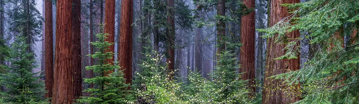
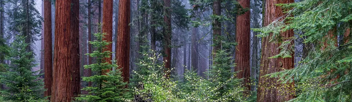
Huge mountains, rugged foothills, deep canyons, vast caverns, and the world’s largest trees exemplify the diversity of landscapes, life, and beauty here. Explore these pages to plan your visit or to learn about the plants and animals here and the threats they face. Ancient giant sequoias may seem invincible, but they, too are vulnerable.
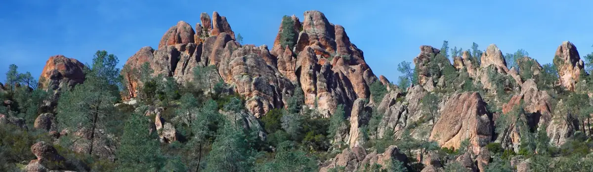
Around 23 million years ago, a series of volcanic eruptions shaped the landscape that is now Pinnacles National Park. The remnants of these ancient eruptions have formed a striking terrain of rocky spires and deep canyons. Visitors can explore diverse environments, from chaparral and oak woodlands to the cool, shaded depths of canyon floors.
Huge mountains, rugged foothills, deep canyons, vast caverns, and the world’s largest trees exemplify the diversity of landscapes, life, and beauty here. Explore these pages to plan your visit or to learn about the plants and animals here and the threats they face. Ancient giant sequoias may seem invincible, but they, too are vulnerable.


 Forests