Crater Lake inspires awe. Native Americans witnessed its formation 7,700 years ago, when a violent eruption triggered the collapse of a tall peak. Scientists marvel at its purity—fed by rain and snow, it’s the deepest lake in the USA and one of the most pristine on Earth. Artists, photographers, and sightseers gaze in wonder at its blue water and stunning setting atop the Cascade Mountain Range.
183.2Kacres of parkland
632.2Krecreation visits, 2025
Jun · Aug · Sepnearby climate picks
Seasonal access & reservations
No reviewed guidance for this selection. Check the park's official planning pages; missing coverage does not establish access.
Selected guidance only; separate from climate comfort and current conditions.
Official conditions Not checked
The conditions feed has not been connected for this park.
Editorial recommendations, reviewed 2026-10-17. Full park days, excluding travel to and from the region. A first-visit outline for a general traveler; adapt to mobility, fitness, season, reservations, and current conditions. These are suggested days, not reserved activities or guaranteed routes.
Pets—dogs, cats, birds or any other animal—are wonderful! They provide comfort and companionship. You and your pets are welcome to visit Crater Lake National Park but there are a few rules and regulations that apply to visiting with your pet.
Where Can I Walk With or Carry My Pet?
(See Superintendent's Compendium 36 CFR §2.15 – Pets) Hikers may only be in possession of one leashed pet per person on trails. Pets must be leashed and in physical control of the hiker at all times. Pets may accompany you in the following areas:
Mazama Campground and all picnic areas
Along established roads and within 50 feet of the paved surfaces
Easy trails (under two miles or brief elevation gain) are noted in a green colo r .
Easy trails are noted in green but other difficulty levels are generally not labeled. Consider your health, the elevation gain, and distance when choosing a trail.
Accessible trails are in italics .
Pet friendly trails are noted in bold in the description.
Description of Hike
Trailhead Location
Round Trip Distance
Trails With Lake Views
Trail
Description of Hike
Trailhead Location
Round Trip Distance
Elevation Gain
Boundary Springs
Moderate hike to a large spring which is the headwaters of the Rogue River. A wildfire in 2015 burned an area which attracts woodpeckers. In season, wildflowers are abundant.
Trail begins outside the park on Hwy 230 at a pullout near milepost 19, 5 miles west of hwy 138
5.0 miles 8.0 km
400 ft 122 m
Plaikni Falls
An easy stroll through a forest to a waterfall fed by snowmelt. Enjoy a plethora of wildflowers. When the trail bends to the right, listen for picas, marmots, and songbirds. Accessible to all-terrain wheelchairs except for the last 1/4.
Turn onto Pinnacles Road from East Rim Drive near the Phantom Ship Overlook. Drive 1.2 miles (1.9 km). Limited parking at trailhead on the left.
2.0 miles 3.2 km
100 ft 30 m
The Pinnacles
Easy forest walk above a canyon filled with volcanic spires (pinnacles), hot ash filled the valley and gases escaped causing surrounding material to harden and resist erosion. Accessible to all-terrain wheelchairs.
Turn onto Pinnacles Road from East Rim Drive near the Phantom Ship Overlook. Drive 6 miles (9.7 km) to the end of the road.
0.8 miles 1.3 km
10 ft 3 m
Crater Peak
Moderate to strenuous hike through forests and waving grasslands to the wildflower summit of a volcano. Surround views of the Klamath Basin, Union Peak and other vistas. Is often snow covered into summer.
3 miles (4.8 km) east of park headquarters, turn into the Vidae Falls Picnic Area. Park in first three parking spaces on the right in front of the trailhead sign.
6.5 miles 10.5 km
765 ft 233 m
Grayback Road
Mostly through forest, with scenic views, creeks and wildflowers. Except for the width, not much remains of this section of the historic Rim Road. Great for birding, photography, solitude. Pet friendly and the only trail for mountain biking.
Park at Vidae Falls Picnic Area. Road begins on the opposite side of the road from Crater Peak Trailhead. A closure bar indicates the start.
8.o miles 12.8 km
Castle Crest
At 6300 feet in elevation and 2,000 feet below Castle Crest Ridge, the trail loops around a spring-fed meadow which hosts over 200 wildflower species, is surrounded by a mixed forest, shrubs, and grasses. Self-guiding brochures available at the trailhead.
The official parking area and trailhead is located on East Rim Drive, 0.25 mile east of park headquarters. A second entrance to the trail is across the road from park headquarters at the three=way stop. This adds another 0.25 miles through the forest.
0.5 miles 0.8 km
100 ft 30
Lady of the Woods
Nature loop with a self-guiding brochure at trailhead behind Steel Visitor Center, Lady of the Woods stone sculpture, historic structures, pet friendly .
Trailhead is behind Steel Visitor Center but while it is under construction, follow the fence to the left and continue to the Ranger Station for trail access.
0.7 miles 1.1 km
120 ft 37 m
Pumice Flat
Shady for the first 1/2 mile, straight though pumice flats, exposure to burned trees, wildflowers and pollinators. A gentle incline with grassy meadows. Great habitats for bird diversity.
Park in the Lodgepole Picnic Area and look for the trail sign. Caution, the trail crosses Hwy 62.
5.5 miles 8.9 km
470 ft 143 m
Pacific Crest Trail
Approximately 33 miles between the north and south access points in the park. Expect patchy snow through June, and extreme changes in elevation. Entire trail stretches 2,650 miles (4,265 km), from Mexico to Canada. Pet friendly .
There are three trailheads: On Hwy 62 about one mile west of the park entrance station, on North Entrance Road, and for southbound entry into the park on Hwy 138.
see description
1226 ft 374 m
Union Peak
It is the longest maintained park trail and one of the most diverse trail terrains, includes forests, pumice meadows, and rocky inclines. Strenuous finale with 360 summit views.
Hwy 62 at the Pacific Crest Trail (PCT) Trailhead, One mile (1.6 km) west from the seven-mile Crater Lake junction and entrance station.
9.8 miles 15.8 km
1600 ft 448 m
Annie Creek
A moderate loop trail with a steep decline and return across switchbacks. The upper stretch behind the campground and the stream side stroll below in the canyon are both flat. Wildflowers, pollinators, look for American Dippers flying above the creek. NO PETS
Park in the Mazama Store parking lot and walk through the campground to the amphitheater located between loops D and E. The trail begins at the back of the amphitheater.
1.7 miles 2.7 km
200 ft 61 m
Godfrey Glen
An old trail with a new accessibility surface. Brochure at trailhead is a guide through an old growth forest above a canyon with pinnacles. Recommended for all terrain wheelchairs with assistance. Pet friendly .
2.4 miles (3.9 km) south of park headquarters or 2 miles (3.2 km) north of Mazama Campground and the entrance station on Munson Valley Road.
1.1 miles 1.8 km
50 ft 15 m
Annie Spring Spur Trail
A pet friendly connector trail between the PCT and Mazama Village and Campground.
Dutton Creek
(to junction with PCT) Trail descends 2.3 miles through the woods, across Dutton Creek to meadows. Turn around at the PCT. Plan ahead for a 12.9 mile loop go right on the PCT to Lightning Springs then return via Rim/Discover Trails.
Trailhead is just below the junction of West Rim Drive and Rim Village. Park in the adjacent pullout, or in Rim Village and walk to the trailhead.
4.6 miles 7.4 km
1,004 ft 306 m
Lightning Spring
(to junction with PCT) Moderately challenging, descends 4.2 miles through the forest to the PCT junction. At 0.8 miles a spring and creek emerge from the dry slope. There are some burned areas. No overnight camping without a permit.
Trailhead is on the left about 2.5 miles on West Rim Drive from Rim Village. Park in the pullout across from the Lightning Spring Picnic Area. .
8.4 miles 13.5 m
1298 ft 396 m
Red Cone
Trail is part of the PCT. It passes north of Red Cone but there is no trail to Red Cone or its summit. This is a very exposed burned area that is relatively flat. Turn back at the Bald Crater Loop Trail.
On North Entrance Road at the PCT parking lot.
7.2 miles 11.6 km
Trail
Description of Hike
Trailhead Location
Round Trip Distance
Elevation Gain
Discovery Point
An easy trail with some steep rises along the west rim of the lake through an old growth wind-shaped forest. The Rim Trail begins where Discovery Point Trail ends.
West end of Rim Village where the paved walk becomes a dirt path or park at Discovery Point Overlook and walk right to Rim Village.
2 miles 3.2 km
100 feet 30 meters
Watchman Peak
An extremely crowded trail especially at sunset. Moderate ascent to a fire lookout. 360 degree views across the lake and surrounding landscape.
Park at Watchman overlook 3.8 miles (6.1 km) northwest of Rim Village on West Rim Drive
1.6 miles 2.6 km
420 feet 128 meters
Rim Trail
An out and back trail paralleling West Rim Drive and the caldera rim to the junction with East Rim Drive. Here it leaves the rim and continues north to the junction with the PCT. Whitebark pines, pumice fields, wildflowers, and changing geology. Often snow covered into early July.
One mile from Rim Village on West Rim Drive is a large pullout where the Discovery Point Trail ends. Facing the lake, Rim Trail begins uphill to the left.
Cleetwood Cove
Cleetwood Cove - Crater Lake National Park (U.S. National Park Service) (nps.gov)
11 miles (17.6 km) clockwise from Rim Village
2.2 miles 3.5 km
700 ft 213 meters
Mount Scott
The park's highest peak at 8,929 ft (2,721 m) and the oldest at 425,000 years old. The only view of the entire lake from within the park. Walk through geologic time. See white bark pines .
On East Rim Drive 14 miles (22.5 km) east of park headquarters.
4.4 miles 7.1 km
1250 feet 381 meters
Sun Notch
Walk uphill around a grassy meadow surrounded by forest and geologic features of Mount Mazama. A view of the lake including a Phantom Ship is seen from the rim.
On East Rim Drive, 4.4 miles (7.1 km) from park headquarters
0.8 miles 1.3 km
150 feet 46 meters
Garfield Peak
Trail begins in the trees but quickly opens to a meadow. Switchbacks weave views of the lake and valleys, craggy peaks and scree slopes. Observe wildflowers, pica, and marmots.
East end of Rim Village, follow the paved promenade behind Crater Lake Lodge to the trailhead sign.
3.6 miles 5.8 km
1010 feet 308 meters
Trail
Description of Hike
Trailhead Location
Round Trip Distance
Elevation Gain
Boundary Springs
Moderate hike to a large spring which is the headwaters of the Rogue River. A wildfire in 2015 burned an area which attracts woodpeckers. In season, wildflowers are abundant.
Trail begins outside the park on Hwy 230 at a pullout near milepost 19, 5 miles west of hwy 138
5.0 miles 8.0 km
400 ft 122 m
Plaikni Falls
An easy stroll through a forest to a waterfall fed by snowmelt. Enjoy a plethora of wildflowers. When the trail bends to the right, listen for picas, marmots, and songbirds. Accessible to all-terrain wheelchairs except for the last 1/4.
Turn onto Pinnacles Road from East Rim Drive near the Phantom Ship Overlook. Drive 1.2 miles (1.9 km). Limited parking at trailhead on the left.
2.0 miles 3.2 km
100 ft 30 m
The Pinnacles
Easy forest walk above a canyon filled with volcanic spires (pinnacles), hot ash filled the valley and gases escaped causing surrounding material to harden and resist erosion. Accessible to all-terrain wheelchairs.
Turn onto Pinnacles Road from East Rim Drive near the Phantom Ship Overlook. Drive 6 miles (9.7 km) to the end of the road.
0.8 miles 1.3 km
10 ft 3 m
Crater Peak
Moderate to strenuous hike through forests and waving grasslands to the wildflower summit of a volcano. Surround views of the Klamath Basin, Union Peak and other vistas. Is often snow covered into summer.
3 miles (4.8 km) east of park headquarters, turn into the Vidae Falls Picnic Area. Park in first three parking spaces on the right in front of the trailhead sign.
6.5 miles 10.5 km
765 ft 233 m
Grayback Road
Mostly through forest, with scenic views, creeks and wildflowers. Except for the width, not much remains of this section of the historic Rim Road. Great for birding, photography, solitude. Pet friendly and the only trail for mountain biking.
Park at Vidae Falls Picnic Area. Road begins on the opposite side of the road from Crater Peak Trailhead. A closure bar indicates the start.
8.o miles 12.8 km
Castle Crest
At 6300 feet in elevation and 2,000 feet below Castle Crest Ridge, the trail loops around a spring-fed meadow which hosts over 200 wildflower species, is surrounded by a mixed forest, shrubs, and grasses. Self-guiding brochures available at the trailhead.
The official parking area and trailhead is located on East Rim Drive, 0.25 mile east of park headquarters. A second entrance to the trail is across the road from park headquarters at the three=way stop. This adds another 0.25 miles through the forest.
0.5 miles 0.8 km
100 ft 30
Lady of the Woods
Nature loop with a self-guiding brochure at trailhead behind Steel Visitor Center, Lady of the Woods stone sculpture, historic structures, pet friendly .
Trailhead is behind Steel Visitor Center but while it is under construction, follow the fence to the left and continue to the Ranger Station for trail access.
0.7 miles 1.1 km
120 ft 37 m
Pumice Flat
Shady for the first 1/2 mile, straight though pumice flats, exposure to burned trees, wildflowers and pollinators. A gentle incline with grassy meadows. Great habitats for bird diversity.
Park in the Lodgepole Picnic Area and look for the trail sign. Caution, the trail crosses Hwy 62.
5.5 miles 8.9 km
470 ft 143 m
Pacific Crest Trail
Approximately 33 miles between the north and south access points in the park. Expect patchy snow through June, and extreme changes in elevation. Entire trail stretches 2,650 miles (4,265 km), from Mexico to Canada. Pet friendly .
There are three trailheads: On Hwy 62 about one mile west of the park entrance station, on North Entrance Road, and for southbound entry into the park on Hwy 138.
see description
1226 ft 374 m
Union Peak
It is the longest maintained park trail and one of the most diverse trail terrains, includes forests, pumice meadows, and rocky inclines. Strenuous finale with 360 summit views.
Hwy 62 at the Pacific Crest Trail (PCT) Trailhead, One mile (1.6 km) west from the seven-mile Crater Lake junction and entrance station.
9.8 miles 15.8 km
1600 ft 448 m
Annie Creek
A moderate loop trail with a steep decline and return across switchbacks. The upper stretch behind the campground and the stream side stroll below in the canyon are both flat. Wildflowers, pollinators, look for American Dippers flying above the creek. NO PETS
Park in the Mazama Store parking lot and walk through the campground to the amphitheater located between loops D and E. The trail begins at the back of the amphitheater.
1.7 miles 2.7 km
200 ft 61 m
Godfrey Glen
An old trail with a new accessibility surface. Brochure at trailhead is a guide through an old growth forest above a canyon with pinnacles. Recommended for all terrain wheelchairs with assistance. Pet friendly .
2.4 miles (3.9 km) south of park headquarters or 2 miles (3.2 km) north of Mazama Campground and the entrance station on Munson Valley Road.
1.1 miles 1.8 km
50 ft 15 m
Annie Spring Spur Trail
A pet friendly connector trail between the PCT and Mazama Village and Campground.
Dutton Creek
(to junction with PCT) Trail descends 2.3 miles through the woods, across Dutton Creek to meadows. Turn around at the PCT. Plan ahead for a 12.9 mile loop go right on the PCT to Lightning Springs then return via Rim/Discover Trails.
Trailhead is just below the junction of West Rim Drive and Rim Village. Park in the adjacent pullout, or in Rim Village and walk to the trailhead.
4.6 miles 7.4 km
1,004 ft 306 m
Lightning Spring
(to junction with PCT) Moderately challenging, descends 4.2 miles through the forest to the PCT junction. At 0.8 miles a spring and creek emerge from the dry slope. There are some burned areas. No overnight camping without a permit.
Trailhead is on the left about 2.5 miles on West Rim Drive from Rim Village. Park in the pullout across from the Lightning Spring Picnic Area. .
8.4 miles 13.5 m
1298 ft 396 m
Red Cone
Trail is part of the PCT. It passes north of Red Cone but there is no trail to Red Cone or its summit. This is a very exposed burned area that is relatively flat. Turn back at the Bald Crater Loop Trail.
On North Entrance Road at the PCT parking lot.
7.2 miles 11.6 km
Trail
Description of Hike
Trailhead Location
Round Trip Distance
Elevation Gain
Discovery Point
An easy trail with some steep rises along the west rim of the lake through an old growth wind-shaped forest. The Rim Trail begins where Discovery Point Trail ends.
West end of Rim Village where the paved walk becomes a dirt path or park at Discovery Point Overlook and walk right to Rim Village.
2 miles 3.2 km
100 feet 30 meters
Watchman Peak
An extremely crowded trail especially at sunset. Moderate ascent to a fire lookout. 360 degree views across the lake and surrounding landscape.
Park at Watchman overlook 3.8 miles (6.1 km) northwest of Rim Village on West Rim Drive
1.6 miles 2.6 km
420 feet 128 meters
Rim Trail
An out and back trail paralleling West Rim Drive and the caldera rim to the junction with East Rim Drive. Here it leaves the rim and continues north to the junction with the PCT. Whitebark pines, pumice fields, wildflowers, and changing geology. Often snow covered into early July.
One mile from Rim Village on West Rim Drive is a large pullout where the Discovery Point Trail ends. Facing the lake, Rim Trail begins uphill to the left.
Cleetwood Cove
Cleetwood Cove - Crater Lake National Park (U.S. National Park Service) (nps.gov)
11 miles (17.6 km) clockwise from Rim Village
2.2 miles 3.5 km
700 ft 213 meters
Mount Scott
The park's highest peak at 8,929 ft (2,721 m) and the oldest at 425,000 years old. The only view of the entire lake from within the park. Walk through geologic time. See white bark pines .
On East Rim Drive 14 miles (22.5 km) east of park headquarters.
4.4 miles 7.1 km
1250 feet 381 meters
Sun Notch
Walk uphill around a grassy meadow surrounded by forest and geologic features of Mount Mazama. A view of the lake including a Phantom Ship is seen from the rim.
On East Rim Drive, 4.4 miles (7.1 km) from park headquarters
0.8 miles 1.3 km
150 feet 46 meters
Garfield Peak
Trail begins in the trees but quickly opens to a meadow. Switchbacks weave views of the lake and valleys, craggy peaks and scree slopes. Observe wildflowers, pica, and marmots.
East end of Rim Village, follow the paved promenade behind Crater Lake Lodge to the trailhead sign.
Most ranger programs begin in late June and continue through mid-September. Check at the visitor center for the latest program schedule.
Rangers offer short talks on a variety of subjects at the Sinnott Memorial Overlook in Rim Village.
Late afternoon talks at Crater Lake Lodge are presented on the patio with lake views or indoors near the fireplace.
Evening programs have an historic role in the national park experience, and often become a tradition for many visitors. Night sky programs are offered throughout the summer.
Ranger-led hikes may be scheduled at various locations.
Special programs are announced via Facebook and at the visitor centers.
Over 95% of the park is managed as wilderness. Although some trails and locations are closed to backcountry camping (for example, there is no camping in the summer with a view of the lake), exploring the park’s old-growth forests and volcanic landscapes can be a rewarding experience.
Backcountry Camping Permits
A backcountry camping permit is required year-round for all overnight trips in the park. Permits are not required for day hiking; however, day hikers must observe all backcountry regulations . Permits must be obtained in person. They are not available over the phone, or more than 1 day in advance. The Ranger Station is located 100 yards southwest of the Steel Visitor Center. There is a self registration station with instructions and information available there. Permits are issued free of charge. They are valid only for the dates, locations, and party size specified. You must have a valid park entrance pass for the entire length of your trip. For more information about backcountry camping permits, visit the permits section of the frequently asked questions page.
Occurrence values are defined below. One or more Occurrence Tags may be associated with each Occurrence value.
Present: Species occurs in park; current, reliable evidence available.
Probably Present: High confidence species occurs in park but current, verified evidence needed.
Unconfirmed: Species is attributed to park but evidence is weak or absent.
Not In Park: Species is not known to occur in park.
Occurrence Tags
Adjacent: Species is known to occur in areas near to or contiguous with park boundaries.
False Report: Species was reported to occur within the park, but current evidence indicates the report was based on misidentification, a taxonomic concept no longer accepted, or other similar problem of error or interpretation.
Historical: Species' historical occurrence in park is documented. Assigned based on judgment as opposed to determination based on age of the most recent evidence.
Animals: May be seen daily, in suitable habitat and season, and counted in relatively large numbers.
Plants: Large number of individuals; wide ecological amplitude or occurring in habitats covering a large portion of the park.
Animals: May be seen daily, in suitable habitat and season, but not in large numbers.
Plants: Large numbers of individuals predictably occurring in commonly encountered habitats but not those covering a large portion of the park.
Animals: Likely to be seen monthly in appropriate habitat and season. May be locally common.
Plants: Few to moderate numbers of individuals; occurring either sporadically in commonly encountered habitats or in uncommon habitats.
Animals: Present, but usually seen only a few times each year.
Plants: Few individuals, usually restricted to small areas of rare habitat.
Animals: Occurs in the park at least once every few years, varying in numbers, but not necessarily every year.
Plants: Abundance variable from year to year (e.g., desert plants).
Unknown: Abundance unknown
Native: Species naturally occurs in park or region.
Non-native: Species occurs on park lands as a result of deliberate or accidental human activities.
Unknown: Nativeness status is unknown or ambiguous.
List Differences
The Checklist contains only those species that are designated as "present" or "probably present" in the park.
The Full List includes all the checklist species in addition to species that are unconfirmed, historically detected, or incorrectly reported as being found in the park. The full list also contains species that are "in review" because their status in the park hasn't been fully determined. Additional details about the status of each species is included in the full list.
The checklist will almost always contain fewer species than the full list.
Select a Species Category (optional):
Species attribute definitions
Visit NPSpecies for more comprehensive information and advanced search capability. Have a suggestion or comment on this list? Let us know .
No fishing license is required within park boundaries.
To prevent the introduction of non-native organisms into the lake and streams, only non-organic artificial lures may be used. Organic bait, live or dead, including worms/night crawlers is prohibited within the park.
There are no size restrictions or catch and possession limits for rainbow trout or kokanee salmon from the lake, or brook trout and brown trout from streams.
Waders, wetsuits, private boats, and other gear (click here for a complete list) are not allowed in Crater Lake.
Sun Creek and Lost Creek are closed to fishing.
Bull trout caught in any stream must be released back into the stream.
Fishing is permitted from Wizard Island boat docks except when a boat is docked, and when a boat approaches the dock.
Fishing is prohibited from motor road bridges, and all public boat docks other than Wizard Island.
Fishing is prohibited in Sun Creek and Lost Creek within the boundaries of Crater Lake National Park.
Annie Creek may be accessed from the Annie Creek Sno-Park just past the south entrance of Crater Lake National Park.
The safest access to most creeks within the park requires entering the park from US Forest Service land. Maps and road conditions are available from USFS District Offices on OR Hwys 62 and 138, and US Hwy 97.
Things to Know Before Booking a Boat Tour or Shuttle
Visitors must be capable of descending and ascending the Cleetwood Cove Trail to reach the dock and participate in boat tours. The trail is 1.1 miles long with an elevation change of 700 feet (213 meters) to the lake shore and back to the parking lot. The trail is steep, dusty, and very challanging for some visitors.
For their safety, children must be at least 3 years of age to participate in any tour or shuttle.
Every visitor must be able to endure sun exposure, wind, occasional rough waters, extreme temperature changes, and engine noise.
Children 12 or under are required to wear a life vest that is provided at the docks.
There is no bathroom on board the boats. There are composting toilets available for use before and after the tour at Cleetwood Cove and on Wizard Island.
Visitors should bring enough supplies for extended time on the water, including food, water, extra layers of clothing, sunscreen and sun protection, etc. Temperatrure changes can be extreme and passengers may get wet during the tour.
It is narrow, winding, and does not have shoulders.
Traveling in an RV or Towing
The safety link to the right offers tips and recommendations regarding road, weather, and personal safety while traveling around the rim. Another provides specific information for anyone driving an RV or towing.
An alternative to navigating Rim Drive traffic on your own is to board a trolley at Rim Village. Details about trolley tours, including fees and reservations, are available on the concessioner's website, Crater Lake Trolley .
With an average snowfall of 41 ft (13.5 m) each year, West and East Rim Drives and North Entrance Road close to automobiles on November 1, or with the first heavy snowfall. The roads reopen in stages beginning in May (depending on snowfall) with West Rim Drive, then North Entrance Road, and finally East Rim Drive. Additionally,
East Rim Drive is closed to motor vehicles on the second and third Saturdays of September for a special event, Ride the Rim .
Partial closures of Rim Drive may occur throughout the summer depending on snow removal, rock fall or other unforeseen circumstances.
Changes in road status are found on the Alerts and Conditions page.
The Junior Ranger program is an activity-based program conducted in national parks across the country. There are currently two ways to become a Junior Ranger at Crater Lake .
Every Kid Outdoors
The Every Kid Outdoors initiative is aimed at providing an opportunity for each fourth grade student across the country to experience federal lands and water in person. Students log on to Every Kid Outdoors to complete an online activity and earn a voucher that can be exchanged for a plastic pass at park entrance stations. The Every Kid Outdoors Pass gives students free access to public lands during their fourth-grade school year and up through August 31.
Have fun while you explore and learn about other national parks by visiting the National Park Service kids page .
Fred Kiser built the Kiser Studio in 1921 and expanded it in 1926. His studio offered visitors hand-colored post cards of photographs that he took of Crater Lake.
The Sinnot Memorial Overlook opened in 1931. It was designed as a “trailside" museum. The Sinnot Memorial offers visitors an opportunity to simultaneously learn about the geology of Crater Lake and experience its beauty. Allow time to explore the exhibits, attend a daily ranger program, and contemplate the words on the Sinnot Memorial dedication plaque.
The Community House, built in1924, served as a venue for evening entertainment and ranger programs as the campground and lodge became increasingly popular.
Rim Campground was the first official campground in the park. Poor design and overuse required two periods of reconstruction before it was re-designated as a picnic area in 1975.
Crater Lake Lodge opened in 1915 with annexes added later. Most of the materials used to re-build the current lodge in 1994 are modern. However, the stone masonry and wood frame construction retain the essence and character of the original structure.
Mather Observation Bay honors Stephen T. Mather, the first Director of the National Park Service, who served from 1917 to 1929. His vision and dedication remain the cornerstone of NPS.
Official NPS features and USGS park boundaries, imported 2026-10-17. An inventory snapshot, not live trail or parking availability.
Loading official park features…
TrailsPoints of interestParkingZoom with buttons or pinch. Toggle layers on the map.
Map coverage varies. Trail names may represent segments, connectors, or shared park units; mapped lines are not a hiking recommendation. Use official conditions and navigation resources before heading out.
Cleetwood Cove Trail Inventory record · 1 source segments; not a route distance.Open Summer
Native
Hiker/Pedestrian
Crater Peak Trail Inventory record · 1 source segments; not a route distance.Open Summer
Native
Hiker/Pedestrian
Discovery Point Trail Inventory record · 1 source segments; not a route distance.Open Summer
Native
Hiker/Pedestrian | Pack and Saddle
Dutton Campsite Trail Inventory record · 1 source segments; not a route distance.Open Summer
Native
Hiker/Pedestrian | Pack and Saddle
Dutton Creek Trail Inventory record · 1 source segments; not a route distance.Open Summer
Native
Hiker/Pedestrian | Pack and Saddle
Fumarole Bay Trail Inventory record · 1 source segments; not a route distance.Open Summer
Native
Hiker/Pedestrian
Garfield Peak Trail Inventory record · 1 source segments; not a route distance.Open Summer
Native
Hiker/Pedestrian
Page 1 of 3
NPS public GIS inventory, imported 2026-10-17. “Existing” is an inventory classification, not confirmation that a trail is open. Segment counts are not route distances. Parking records do not indicate space availability, fees, or accessibility certification. View government source ↗
Climate for Klamath Falls, 84 km from the park reference point. 1991–2020 normals. Source elevation: 1,252 m.
Daytime highNighttime lowOctober: 62° / 40°
Daytime high62°
Precipitation36 mm
Daylight10.8 hrs
Wind7.4 km/h
Mountain, rim, valley, and coastal conditions can differ sharply from the source town. Check park forecasts and current conditions before travel.
Monthly climate data 12 months · °F
Month
High
Low
Rain / snow water
Wet days
Daylight
39°
26°
82 mm
11.8
9.3 h
43°
27°
64 mm
10.0
10.3 h
48°
30°
70 mm
12.1
11.6 h
55°
34°
50 mm
10.1
13.1 h
65°
41°
43 mm
8.3
14.4 h
74°
47°
22 mm
4.7
15.0 h
84°
55°
7 mm
2.1
14.8 h
83°
55°
9 mm
1.8
13.7 h
76°
48°
13 mm
2.6
12.3 h
62°
40°
36 mm
5.7
10.8 h
47°
32°
69 mm
9.7
9.6 h
38°
26°
99 mm
12.4
9.0 h
RESEARCH WITH THE SOURCE IN VIEW
The practical field guide.
Official NPS excerpts imported 2026-10-17. Fees, permits, road access, and operations can change; use the source link to confirm the latest information.
42° 53' 48.91" North 122° 08' 03.08" West Note that the park's North Entrance is closed November 1(or earlier, if there is significant snowfall) to late May (and sometimes into June). GPS and map services may direct visitors to the North Entrance Road when it is closed. Check current conditions for road closures.
Weather Details
Details about Fees and Passes
Visitor Centers
Internet & Cellular Access
Internet & Cellular Access Details
The closest gas west of the park is at the Prospect Service Station on Hwy 62, 29 miles from the south fee booth.
The closest gas to the south is at the Crater Lake Junction Travel Center on Hwy 97, 30 miles from the park’s south fee booth.
From the north, the nearest gas station is at the Diamond Lake Resort Gas Station off Hwy 138.
EV Charging Station
(managed and maintained by the concessioner ExplorCraterLake) A charging station for electric vehicles is located in front of the Annie Creek Gift Shop in Mazama Village. It has one standard connector and one Tesla connector. If there is a heavy snowfall, the EV station may be unavailable until it can be dug out.
Helpful Trip Planning Links
Oregon road conditions
Current Snow Depth (select Crater Lake, Daily Almanac, and Go).
Lodging and Camping hotels and campgrounds within 25 miles of the park boundary
Fire and Smoke Map very handy during the summer for air quality info and fire locations
Visiting the Park With Pets
Important information about visiting the park with your pet(s), ways to keep them safe, and where to take them.
Download the NPS App
The NPS App offers tools to explore more than 400 national parks nationwide. Save Crater Lake for offline use during your in-park visit.
Eating & Sleeping
Find a place to camp or rest for the night either in the park or in a neighboring community. Locate food establishments in the park.
Unmanned Aircraft
Launching, landing, or operating an unmanned aircraft including drones on land or water within the park is prohibited.
In summer and fall air quality can be adversely affected by smoke from local wildfires. Check the Air Quality Index (AQI) in the park.
Lose or find a phone, wallet, glasses, gear, or something treasured, report it to a ranger, go to a visitor center or fill out this form.
Whether day-tripping or spending a week, find a way to explore, discover, and retreat into the natural beauty and history of the park.
Depending on the season in which you visit, you might go to 32 overlooks, two waterfalls, visitor centers and more.
Plan Your Winter Visit
Visiting between November and April? Winter sometimes begins in October and ends in July! Nevertheless here is what you need to know.
Visiting in Fall
Planning a fall trip? Get an idea what to expect of the weather, closures, and things to do.
Arriving in May or June?
Learn how lingering winter snow might affect your experience.
Over 95% of the park is managed as wilderness. Although some trails and locations are closed to backcountry camping (for example, there is no camping in the summer with a view of the lake), exploring the park’s old-growth forests and volcanic landscapes can be a rewarding experience.
Backcountry Camping Permits
A backcountry camping permit is required year-round for all overnight trips in the park. Permits are not required for day hiking; however, day hikers must observe all backcountry regulations . Permits must be obtained in person. They are not available over the phone, or more than 1 day in advance. The Ranger Station is located 100 yards southwest of the Steel Visitor Center. There is a self registration station with instructions and information available there. Permits are issued free of charge. They are valid only for the dates, locations, and party size specified. You must have a valid park entrance pass for the entire length of your trip. For more information about backcountry camping permits, visit the permits section of the frequently asked questions page.
Begin your journey on the NPS App where you can listen to audio descriptions of places to go, things to do, and where to stay. The App also offers photo galleries, directions, and amenities. Open the app to Crater Lake National Park and save the park for offline use. There is limited cellular service in the park but you can access all the information if you have it saved. This will allow you to experience the tours and find all the locations you want to visit.
Photo on the pass by Steven Koehler, Yellowstone National Park
A Lifetime NPS Pass
Available for: US citizens or permanent residents with permanent disabilities. Applicants must provide documentation of permanent disability and residency or citizenship.
How to purchase:
In person, at Crater Lake National Park.
Online: Order this free pass from the USGS Store .
Mail: Purchase a Senior Pass using an application form (558KB PDF) that can be exchanged through mail. The cost of obtaining an Access Pass through the mail is $10 for processing the application (the pass is free)
Audio/Visual Assistance
The park film shown at Steel Visitor Center is captioned.
Videos found on this website are captioned. See Virtual Junior Ranger Activities
Assistive Listening
Currently unavailable
Audio Description
Most sections of the NPS app require audio descriptions. As the content for Crater Lake increases so will the audio descriptions to various tours, trails, and other places.
Large Print & Braille
Large print and braille versions of the official Crater Lake National Park Map & Guide are available at visitor centers, or by contacting the park .
Service Animals
Service dogs are legally permitted anywhere that visitors can go. They must be allowed wherever visitors are allowed. Dogs classified as service animals are individually trained to perform a specific task that assists a person with a disability. Companion dogs that are used to provide comfort or emotional support (“therapy animals”), and other pets are not allowed in buildings, the backcountry, on nature trails, or on boardwalks. Read more about service animals in national parks including Crater Lake.
Experience the Park
Park Headquarters Historic District
Accessible Trails
Godfrey Glen Trail is the park's fully accessible trail. This 1-mile loop has minimal cross-slopes and no grade higher than 9%. Visitors have completed the trail in manual wheelchairs and other mobility devices. The trail begins on Munson Valley Rd. (between Mazama Village and Park Headquarters) and winds through old-growth forest with canyon views. One mile down the Pinnacles Road is the Plaikni Falls Trailhead .The first ¾ of this trail is accessible to wheelchair users with assistance, but the final, short climb to the falls might be too steep.At the end of the Pinnacles Road is the Pinnacles Trail . This flat, wide trail ends at the park's east boundary after 1 mile (not a loop trail) . Enjoy the great views of volcanic spires, but use caution near cliffs. The Sun Notch Trail , located 4.4 miles from park headquarters on East Rim Drive, is a short uphill trail that offers great views of Phantom Ship and is accessible to strong wheelchair users with assistance.
Ranger Programs
Ranger programs are listed on page 3 of the summer/fall park newspaper .
Although an entrance fee or NPS pass is required to enter Crater Lake National Park, vehicle reservations are not needed. You are encouraged to pay the entrance fee or purchase an NPS pass before arriving to save time, but you may also purchase passes at any entrance station upon arrival. Find out more about entrance passes below. Beginning January 1, 2023, cash will not be accepted. You can pay by debit or credit cards, and Apple or Samsung pay/digital wallet. Your fees are put to work improving visitor services and facilities. Thank you for supporting your national parks
Key Information
Get an entrance pass All visitors must have one of these entrance passes: Pass Price Standard Pass $15.00–$30.00 Annual Pass $55.00 America the Beautiful Pass (includes Senior Passes) FREE–$250.00 Help me choose an entrance pass
Plan to go cashless This park does not accept cash.
Choosing an Entrance Pass
Do you have or qualify for a discounted America the Beautiful Pass?
If you already have an America the Beautiful—the National Parks and Federal Recreational Lands Pass, that's the only entrance pass you need. Seniors, military, visitors with a permanent disability, and families with a 4th grader are eligible for a free or discounted America the Beautiful pass.
America the Beautiful Pass
How often do you plan to visit national parks in the next 12 months?
If you don't qualify for a discounted America the Beautiful pass, we recommend choosing an entrance pass based on your trip plans.
Entrance Passes
If you visit twice in 12 months purchasing the park's annual pass will save you money. It is valid at Crater Lake National Park as well as Lava Beds National Monument, Lassen Volcanic National Park, and Whiskeytown National Recreation Area. This annual pass costs $55 and admits the pass owner and all accompanying passengers in a single, private, noncommercial vehicle (or the pass owner plus up to three people when entry is by other means).
Standard Entrance Pass
If you enter the park in a motorized vehicle, your entrance pass covers both you and your passengers. Your passengers do not need a separate pass.
Costs for vehicles with more than 15 passengers are listed below under Organizations and Businesses .
Private Vehicle (May 22-Oct 31) $30.00
This is the summer entrance fee and is charged from mid-May through the end of October. Admits one private, non-commercial vehicle (15-passenger capacity or less) and all occupants. Good for 7 days. More information
Private Vehicle (Nov 1-May 21) $20.00
This is the winter entrance fee. Admits one private, non-commercial vehicle (15-passenger capacity or less) and all occupants. Good for 7 days. More information
Motorcycle (May 22-Oct 31) $25.00
Valid for 7 days. Admits up to 2 private, non-commercial motorcycles with up to 4 total passengers. Summer rate from mid-May to October 31st.
Motorcycle (Nov 1-May 21) $15.00
Valid for 7 days. Admits up to 2 private, non-commercial motorcycles with up to 4 total passengers. Winter rate from 11/1 through mid-May.
Snowmobile (Nov 1-Jun 15) $15.00
Admits one individual on a snowmobile for travel on snow covered North Entrance Road closed to regular vehicle traffic. Youth 15 and under are admitted free of charge. Good for 7 days. More information
For Individuals without a Vehicle
If you enter the park on a bicycle or on foot and are at least 16 years old, you need your own entrance pass. Children under the age of 16 don't need an entrance pass.
Per Person $15.00
Admits one individual with no motor vehicle (bicyclist, hiker, pedestrian). Youth 15 and under are admitted free of charge. Good for 7 days. More information
For Organizations & Businesses
Commercial Sedan (1-6 seats) $25.00
Fees for commercial vehicles are based on the capacity of the vehicle, not the number of passengers on board. In addition to the $25 per vehicle there is also a $15 per passenger charge.
Commercial Van (7-15 seats) $75.00
Fees for commercial vehicles are based on the capacity of the vehicle, not the number of passengers on board.
Commercial Mini-bus (16-25 seats) $100.00
Commercial Motor Coach (26+ seats) $200.00
Annual Entrance - Park
US citizens and residents
America the Beautiful—the National Parks and Federal Recreational Lands Pass
Covers entrance fees and standard amenity (day-use) fees at lands managed by
National Park Service
US Fish & Wildlife Service
US Forest Service
Bureau of Land Management
Bureau of Reclamation
US Army of Corps of Engineers
Depending on the type of entrance fee charged at a site, covers One private vehicle fee or Four per person fees
America the Beautiful Passes are non-refundable, non-transferable and cannot be replaced if lost or stolen . Passholders must show valid photo identification (ID) with each pass.
How to Get an America the Beautiful Pass
Physical passes can be purchased or picked up at over 1,000 federal recreation sites.
Purchase and pickup locations
To receive your pass by mail, order online at the USGS Online Store . Online orders are for physical passes, not digital passes, and may take up to three weeks to be processed and delivered. Order receipts may not be used in place of a physical pass. We recommend ordering at least three weeks in advance of your visit, or picking up a pass in person instead.
Skip the wait! Get a Digital America the Beautiful Pass through recreation.gov. Your digital pass can be saved to a mobile device and used immediately.
Get a Digital America the Beautiful Pass
2026 Free Entrance Days in the National Parks
Come experience the national parks! All National Park Service sites that charge an entrance fee will offer free admission to US citizens and residents (other fees, including timed entry or reservation fees, may apply). Mark your calendar for these entrance fee-free dates:
February 16 : Presidents Day (Washington's Birthday)
May 25 : Memorial Day
June 14: Flag Day/President Trump's birthday
July 3–5: Independence Day weekend
August 25: 110th Birthday of the National Park Service
September 17: Constitution Day
October 27 : Theodore Roosevelt's birthday
November 11: Veterans Day
Academic Fee Waivers
Schools and other academic instituitions can apply for a waiver of park entrance fees, provided that their visit is for educational or scientific purposes. Learn more about academic fee waivers here.
Other Fees and Reservations
Trolley and Boat Tours Choose a trolley or boat tour and enjoy the sights worry-free with an added bonus of a ranger's perspective.
Crater Lake Lodge The lodge is typically open mid-May through early-October and is managed by Explor Crater Lake. Learn how to reserve a room.
Mazama Campground Mazama Campground is open during the summer and operated by Explor Crater Lake. Click for more details
Pass
Price
Standard Pass
$15.00–$30.00
Annual Pass
$55.00
America the Beautiful Pass (includes Senior Passes)
FREE–$250.00
I'm visiting...
We recommend
This park, once
Standard Pass
This park, multiple times
Annual Pass
More than one national park or federal recreation site
America the Beautiful Pass
Type
Available to
Price
Resident Annual Pass
US citizens and residents
$80.00
Non-Resident Annual Pass
Non-US residents
$250.00
Senior Annual Pass
US citizens and residents 62+ years old
$20.00
Senior Lifetime Pass
US citizens and residents 62+ years old
$80.00
Military Annual Pass
Current US military and dependents
Free
Military Lifetime Pass
Gold Star Family members and veterans
Free
Access Pass
US citizens and residents with permanent disability
Free
4th Grade Pass
US 4th graders
Free
Volunteer Pass
Federal recreation site volunteers with 250 service hours
Free
Pass
Price
Standard Pass
$15.00–$30.00
Annual Pass
$55.00
America the Beautiful Pass (includes Senior Passes)
FREE–$250.00
I'm visiting...
We recommend
This park, once
Standard Pass
This park, multiple times
Annual Pass
More than one national park or federal recreation site
America the Beautiful Pass
Type
Available to
Price
Resident Annual Pass
US citizens and residents
$80.00
Non-Resident Annual Pass
Non-US residents
$250.00
Senior Annual Pass
US citizens and residents 62+ years old
$20.00
Senior Lifetime Pass
US citizens and residents 62+ years old
$80.00
Military Annual Pass
Current US military and dependents
Free
Military Lifetime Pass
Gold Star Family members and veterans
Free
Access Pass
US citizens and residents with permanent disability
Free
4th Grade Pass
US 4th graders
Free
Volunteer Pass
Federal recreation site volunteers with 250 service hours
Cell reception in the park and surrounding areas is limited. Be sure to carry a map or GPS.
The park does not have a physical street address, so it can be hard to navigate here using some GPS systems. Try entering "Rim Village" as a town or waypoint, or entering the coordinates for Park Headquarters, which is 3 miles south of Rim Village:
42° 53' 48.91" North 122° 08' 03.08" West
WINTER CLOSURE: The North Entrance is closed for about 7 months each year beginning November 1 (or earlier, if there is significant snowfall) . It opens sometime between mid-May and late June. Check the status on our current conditions page.
The South and West Entrances on Hwy 62 are open year-round. During winter, chains or snow tires may be required. Tripcheck.com has up-to-date info on road conditions throughout Oregon.
Unleaded gas is available seasonally at the Mazama Village Store. Check the current conditions page for operating hours. The rest of the year, the closest gas stations are in the towns of Prospect (33 miles west of Park Headquarters) and Chiloquin (34 miles south of Park Headquarters).
How to Get Here
From the west (Medford) - Follow Highway 62 to the park's West Entrance. Open year-round.
From the south (Klamath Falls) - Take Highway 97 to Highway 62 and the park's South Entrance. Open year-round.
From the north (Eugene, Portland) - Leave Interstate 5 just south of Eugene. Take Highway 58 to Highway 97. If the North Entrance is open, turn west on Highway 138 to the park's North Entrance. When the North Entrance is closed for the winter season ( see above) , continue south on Highway 97 toward the town of Chiloquin. Take Highway 62 to the park's South Entrance.
From the northwest (Roseburg) - Follow Highway 138 east to the park's North Entrance. If the North Entrance is closed, continue on Highway 230 to Highway 62, entering the park through the West Entrance.
Other Ways to Reach the Park
RVs, Trailers, Buses
There are no restrictions on the size of RVs, trailers, or buses allowed in the park. Roads in the park are narrow, however, so drive carefully and watch for wildlife, bicyclists, and pedestrians. Visit Traveling in an RV or Towing for more information about unhitching, winter road closures and camping.
The closest airport with commercial flights is in Medford, Oregon (75 miles from Park Headquarters). The Rogue Valley-Medford Airport is served by Alaska, Allegiant, American, Delta, and United.
Public Transportation
There is no public transportation in the vicinity of the park.
All park roads have speed limits between 35 and 45 with slow traffic areas at 20 mph. In addition to endangering the lives of others, s peeding kills bears, marmots, owls & other wildlife!
Use turnouts to pull completely out of the road to take photos, consult the park map, or enjoy the scenery. It is also the safest way to permit another vehicle to pass.
Parking a motor vehicle off a paved surface unless otherwise designated is prohibited. Same goes for driving onto pumice meadows or grasslands.
See Scenic Rim Drive for information on parking, towing, and unhitching large vehicles before driving around the rim.
Stay alive, don't drink and drive. Laws against alcohol and drug related driving offenses are enforced. Marijuana is legal in Oregon State but not in Crater Lake National Park which is under federal jurisdiction.
Use tire chains or traction tires when posted as being required (during snowy or icy periods).
Park roads can be snow-packed and icy this time of year. Before leaving home, read our tips for safe travel and watch a short safety video.
Unstable ledges of snow extend beyond the rim of Crater Lake. Watch a short video to learn about them and other winter hazards.
There are no lifeguards on duty, ever. You enter the water at your own risk.
Know your water skills before jumping in or swimming even a short distance.
Be aware that the water temperature ranges between 38 and 62 degrees near the surface depending on the time of year and gets colder at at greater depths.
Swimming is allowed within 100 yards of Cleetwood Cove and within 100 yards of Wizard Island, provided that swimmers remain at least 50 feet away from any boat, boat dock or buoy (see exception under §3.16 above).
Swimming or wading within 50 feet of any boat, boat dock or buoy on Crater Lake is prohibited, except that swimming is allowed from the public boat dock on Wizard Island when not in use by park boats. Swimmers must immediately exit the water and clear the dock area whenever a boat is on approach to the dock, moored at the dock or departing from the dock. Swimming is not allowed from the National Park Service boat dock which is open to authorized personnel only.
Swimming within fencing, buoys, lines (approx. 15 feet) of the bulkhead docking material is prohibited at all times.
The shore of Crater Lake is not a beach. It is piled with boulders which have eroded from the caldera. There is no defined path from the trail to the lake without stepping over or onto boulders.
The Superintendent has designated the boat docks at Wizard Island as open to fishing when not in use by park boats. Fishing activities must cease whenever a boat is on approach to the dock, moored at the dock or departing from the dock.
Fishing is prohibited from motor road bridges and all other public boat docks.
Cleetwood Cove Trail is a steep and strenuous hike which drops 700 ft (213 m) of elevation in 1.1 miles (1.7 km). Know more before you go.
No fishing license is required within park boundaries, but here are important rules & regulations for fishing in the lake and park streams.
How did Crater Lake form? How deep is it? What lives below the surface? What (and where) is the Old Man of the Lake?
Personal Safety
Dress in layers and keep dry, warm clothes nearby
Move around when you feel cold so you can increase your body temperature
Eat and drink warm foods and beverages
Wear appropriate clothing outdoors, including hats, mittens, coats and footwear
Take breaks by going inside to warm up
dehydration, dizziness, nausea
muscle cramps, blurred vision, fatigue
increased breathing or heart rate
Avoid strenuous activity
Consume water but also sports drinks to replenish and keep electrolytes stable
Wear lightweight, loose-fitting and light-colored clothing if you’ll be out in the heat.
Before you travel or hike: Check the weather forecast at visitor centers, campgrounds, or the lodge. Arrange activities to minimize your exposure to lightning danger. This often means hiking early in the day.
Listen for thunder, watch for lightning, and observe the direction of storm movement. Leave the lake immediately when lightning is visible or when thunder is heard .
Lightning can reach more than 10 miles (16 km) from a cloud and far beyond where rain falls—you are still in a high danger zone even when it is not raining.
If the sound of thunder follows a lightning flash in 30 seconds or less, seek shelter immediately.
Regardless of the time of year or season that you visit, check the forecast multiple times in advance. Conditions can change quickly.
In summer and fall air quality can be adversely affected by smoke from local wildfires. Check the Air Quality Index (AQI) in the park.
Find out if your upcoming visit might be impacted.
Wildlife (and your) Safety
They are adorable and know how to get what they want: YOUR FOOD. For your safety and their health, don't invite the birds to feed from your hand or encourage the ground squirrels and chipmunks to advance their unhealthy practise of begging. Keep all food securely stored and out of reach from wildlife.
Speeding kills bears, marmots & other wildlife!
Heed the warning signs. When a mountain lion is known to be active in a specific area, signs will be posted, and backcountry campsites and trails may close for personal safety and protection of wildlife habitat.
Mammals, birds, and insects make up the largest portion of animals living throughout the park but there also amphibians, reptiles, and fish.
Diverse habitats support migrating birds with varying layovers, and resident species that mate, nest, and raise young in the park.
Easy trails (under two miles or brief elevation gain) are noted in a green colo r .
Easy trails are noted in green but other difficulty levels are generally not labeled. Consider your health, the elevation gain, and distance when choosing a trail.
Accessible trails are in italics .
Pet friendly trails are noted in bold in the description.
Description of Hike
Trailhead Location
Round Trip Distance
Trails With Lake Views
Trail
Description of Hike
Trailhead Location
Round Trip Distance
Elevation Gain
Boundary Springs
Moderate hike to a large spring which is the headwaters of the Rogue River. A wildfire in 2015 burned an area which attracts woodpeckers. In season, wildflowers are abundant.
Trail begins outside the park on Hwy 230 at a pullout near milepost 19, 5 miles west of hwy 138
5.0 miles 8.0 km
400 ft 122 m
Plaikni Falls
An easy stroll through a forest to a waterfall fed by snowmelt. Enjoy a plethora of wildflowers. When the trail bends to the right, listen for picas, marmots, and songbirds. Accessible to all-terrain wheelchairs except for the last 1/4.
Turn onto Pinnacles Road from East Rim Drive near the Phantom Ship Overlook. Drive 1.2 miles (1.9 km). Limited parking at trailhead on the left.
2.0 miles 3.2 km
100 ft 30 m
The Pinnacles
Easy forest walk above a canyon filled with volcanic spires (pinnacles), hot ash filled the valley and gases escaped causing surrounding material to harden and resist erosion. Accessible to all-terrain wheelchairs.
Turn onto Pinnacles Road from East Rim Drive near the Phantom Ship Overlook. Drive 6 miles (9.7 km) to the end of the road.
0.8 miles 1.3 km
10 ft 3 m
Crater Peak
Moderate to strenuous hike through forests and waving grasslands to the wildflower summit of a volcano. Surround views of the Klamath Basin, Union Peak and other vistas. Is often snow covered into summer.
3 miles (4.8 km) east of park headquarters, turn into the Vidae Falls Picnic Area. Park in first three parking spaces on the right in front of the trailhead sign.
6.5 miles 10.5 km
765 ft 233 m
Grayback Road
Mostly through forest, with scenic views, creeks and wildflowers. Except for the width, not much remains of this section of the historic Rim Road. Great for birding, photography, solitude. Pet friendly and the only trail for mountain biking.
Park at Vidae Falls Picnic Area. Road begins on the opposite side of the road from Crater Peak Trailhead. A closure bar indicates the start.
8.o miles 12.8 km
Castle Crest
At 6300 feet in elevation and 2,000 feet below Castle Crest Ridge, the trail loops around a spring-fed meadow which hosts over 200 wildflower species, is surrounded by a mixed forest, shrubs, and grasses. Self-guiding brochures available at the trailhead.
The official parking area and trailhead is located on East Rim Drive, 0.25 mile east of park headquarters. A second entrance to the trail is across the road from park headquarters at the three=way stop. This adds another 0.25 miles through the forest.
0.5 miles 0.8 km
100 ft 30
Lady of the Woods
Nature loop with a self-guiding brochure at trailhead behind Steel Visitor Center, Lady of the Woods stone sculpture, historic structures, pet friendly .
Trailhead is behind Steel Visitor Center but while it is under construction, follow the fence to the left and continue to the Ranger Station for trail access.
0.7 miles 1.1 km
120 ft 37 m
Pumice Flat
Shady for the first 1/2 mile, straight though pumice flats, exposure to burned trees, wildflowers and pollinators. A gentle incline with grassy meadows. Great habitats for bird diversity.
Park in the Lodgepole Picnic Area and look for the trail sign. Caution, the trail crosses Hwy 62.
5.5 miles 8.9 km
470 ft 143 m
Pacific Crest Trail
Approximately 33 miles between the north and south access points in the park. Expect patchy snow through June, and extreme changes in elevation. Entire trail stretches 2,650 miles (4,265 km), from Mexico to Canada. Pet friendly .
There are three trailheads: On Hwy 62 about one mile west of the park entrance station, on North Entrance Road, and for southbound entry into the park on Hwy 138.
see description
1226 ft 374 m
Union Peak
It is the longest maintained park trail and one of the most diverse trail terrains, includes forests, pumice meadows, and rocky inclines. Strenuous finale with 360 summit views.
Hwy 62 at the Pacific Crest Trail (PCT) Trailhead, One mile (1.6 km) west from the seven-mile Crater Lake junction and entrance station.
9.8 miles 15.8 km
1600 ft 448 m
Annie Creek
A moderate loop trail with a steep decline and return across switchbacks. The upper stretch behind the campground and the stream side stroll below in the canyon are both flat. Wildflowers, pollinators, look for American Dippers flying above the creek. NO PETS
Park in the Mazama Store parking lot and walk through the campground to the amphitheater located between loops D and E. The trail begins at the back of the amphitheater.
1.7 miles 2.7 km
200 ft 61 m
Godfrey Glen
An old trail with a new accessibility surface. Brochure at trailhead is a guide through an old growth forest above a canyon with pinnacles. Recommended for all terrain wheelchairs with assistance. Pet friendly .
2.4 miles (3.9 km) south of park headquarters or 2 miles (3.2 km) north of Mazama Campground and the entrance station on Munson Valley Road.
1.1 miles 1.8 km
50 ft 15 m
Annie Spring Spur Trail
A pet friendly connector trail between the PCT and Mazama Village and Campground.
Dutton Creek
(to junction with PCT) Trail descends 2.3 miles through the woods, across Dutton Creek to meadows. Turn around at the PCT. Plan ahead for a 12.9 mile loop go right on the PCT to Lightning Springs then return via Rim/Discover Trails.
Trailhead is just below the junction of West Rim Drive and Rim Village. Park in the adjacent pullout, or in Rim Village and walk to the trailhead.
4.6 miles 7.4 km
1,004 ft 306 m
Lightning Spring
(to junction with PCT) Moderately challenging, descends 4.2 miles through the forest to the PCT junction. At 0.8 miles a spring and creek emerge from the dry slope. There are some burned areas. No overnight camping without a permit.
Trailhead is on the left about 2.5 miles on West Rim Drive from Rim Village. Park in the pullout across from the Lightning Spring Picnic Area. .
8.4 miles 13.5 m
1298 ft 396 m
Red Cone
Trail is part of the PCT. It passes north of Red Cone but there is no trail to Red Cone or its summit. This is a very exposed burned area that is relatively flat. Turn back at the Bald Crater Loop Trail.
On North Entrance Road at the PCT parking lot.
7.2 miles 11.6 km
Trail
Description of Hike
Trailhead Location
Round Trip Distance
Elevation Gain
Discovery Point
An easy trail with some steep rises along the west rim of the lake through an old growth wind-shaped forest. The Rim Trail begins where Discovery Point Trail ends.
West end of Rim Village where the paved walk becomes a dirt path or park at Discovery Point Overlook and walk right to Rim Village.
2 miles 3.2 km
100 feet 30 meters
Watchman Peak
An extremely crowded trail especially at sunset. Moderate ascent to a fire lookout. 360 degree views across the lake and surrounding landscape.
Park at Watchman overlook 3.8 miles (6.1 km) northwest of Rim Village on West Rim Drive
1.6 miles 2.6 km
420 feet 128 meters
Rim Trail
An out and back trail paralleling West Rim Drive and the caldera rim to the junction with East Rim Drive. Here it leaves the rim and continues north to the junction with the PCT. Whitebark pines, pumice fields, wildflowers, and changing geology. Often snow covered into early July.
One mile from Rim Village on West Rim Drive is a large pullout where the Discovery Point Trail ends. Facing the lake, Rim Trail begins uphill to the left.
Cleetwood Cove
Cleetwood Cove - Crater Lake National Park (U.S. National Park Service) (nps.gov)
11 miles (17.6 km) clockwise from Rim Village
2.2 miles 3.5 km
700 ft 213 meters
Mount Scott
The park's highest peak at 8,929 ft (2,721 m) and the oldest at 425,000 years old. The only view of the entire lake from within the park. Walk through geologic time. See white bark pines .
On East Rim Drive 14 miles (22.5 km) east of park headquarters.
4.4 miles 7.1 km
1250 feet 381 meters
Sun Notch
Walk uphill around a grassy meadow surrounded by forest and geologic features of Mount Mazama. A view of the lake including a Phantom Ship is seen from the rim.
On East Rim Drive, 4.4 miles (7.1 km) from park headquarters
0.8 miles 1.3 km
150 feet 46 meters
Garfield Peak
Trail begins in the trees but quickly opens to a meadow. Switchbacks weave views of the lake and valleys, craggy peaks and scree slopes. Observe wildflowers, pica, and marmots.
East end of Rim Village, follow the paved promenade behind Crater Lake Lodge to the trailhead sign.
3.6 miles 5.8 km
1010 feet 308 meters
Trail
Description of Hike
Trailhead Location
Round Trip Distance
Elevation Gain
Boundary Springs
Moderate hike to a large spring which is the headwaters of the Rogue River. A wildfire in 2015 burned an area which attracts woodpeckers. In season, wildflowers are abundant.
Trail begins outside the park on Hwy 230 at a pullout near milepost 19, 5 miles west of hwy 138
5.0 miles 8.0 km
400 ft 122 m
Plaikni Falls
An easy stroll through a forest to a waterfall fed by snowmelt. Enjoy a plethora of wildflowers. When the trail bends to the right, listen for picas, marmots, and songbirds. Accessible to all-terrain wheelchairs except for the last 1/4.
Turn onto Pinnacles Road from East Rim Drive near the Phantom Ship Overlook. Drive 1.2 miles (1.9 km). Limited parking at trailhead on the left.
2.0 miles 3.2 km
100 ft 30 m
The Pinnacles
Easy forest walk above a canyon filled with volcanic spires (pinnacles), hot ash filled the valley and gases escaped causing surrounding material to harden and resist erosion. Accessible to all-terrain wheelchairs.
Turn onto Pinnacles Road from East Rim Drive near the Phantom Ship Overlook. Drive 6 miles (9.7 km) to the end of the road.
0.8 miles 1.3 km
10 ft 3 m
Crater Peak
Moderate to strenuous hike through forests and waving grasslands to the wildflower summit of a volcano. Surround views of the Klamath Basin, Union Peak and other vistas. Is often snow covered into summer.
3 miles (4.8 km) east of park headquarters, turn into the Vidae Falls Picnic Area. Park in first three parking spaces on the right in front of the trailhead sign.
6.5 miles 10.5 km
765 ft 233 m
Grayback Road
Mostly through forest, with scenic views, creeks and wildflowers. Except for the width, not much remains of this section of the historic Rim Road. Great for birding, photography, solitude. Pet friendly and the only trail for mountain biking.
Park at Vidae Falls Picnic Area. Road begins on the opposite side of the road from Crater Peak Trailhead. A closure bar indicates the start.
8.o miles 12.8 km
Castle Crest
At 6300 feet in elevation and 2,000 feet below Castle Crest Ridge, the trail loops around a spring-fed meadow which hosts over 200 wildflower species, is surrounded by a mixed forest, shrubs, and grasses. Self-guiding brochures available at the trailhead.
The official parking area and trailhead is located on East Rim Drive, 0.25 mile east of park headquarters. A second entrance to the trail is across the road from park headquarters at the three=way stop. This adds another 0.25 miles through the forest.
0.5 miles 0.8 km
100 ft 30
Lady of the Woods
Nature loop with a self-guiding brochure at trailhead behind Steel Visitor Center, Lady of the Woods stone sculpture, historic structures, pet friendly .
Trailhead is behind Steel Visitor Center but while it is under construction, follow the fence to the left and continue to the Ranger Station for trail access.
0.7 miles 1.1 km
120 ft 37 m
Pumice Flat
Shady for the first 1/2 mile, straight though pumice flats, exposure to burned trees, wildflowers and pollinators. A gentle incline with grassy meadows. Great habitats for bird diversity.
Park in the Lodgepole Picnic Area and look for the trail sign. Caution, the trail crosses Hwy 62.
5.5 miles 8.9 km
470 ft 143 m
Pacific Crest Trail
Approximately 33 miles between the north and south access points in the park. Expect patchy snow through June, and extreme changes in elevation. Entire trail stretches 2,650 miles (4,265 km), from Mexico to Canada. Pet friendly .
There are three trailheads: On Hwy 62 about one mile west of the park entrance station, on North Entrance Road, and for southbound entry into the park on Hwy 138.
see description
1226 ft 374 m
Union Peak
It is the longest maintained park trail and one of the most diverse trail terrains, includes forests, pumice meadows, and rocky inclines. Strenuous finale with 360 summit views.
Hwy 62 at the Pacific Crest Trail (PCT) Trailhead, One mile (1.6 km) west from the seven-mile Crater Lake junction and entrance station.
9.8 miles 15.8 km
1600 ft 448 m
Annie Creek
A moderate loop trail with a steep decline and return across switchbacks. The upper stretch behind the campground and the stream side stroll below in the canyon are both flat. Wildflowers, pollinators, look for American Dippers flying above the creek. NO PETS
Park in the Mazama Store parking lot and walk through the campground to the amphitheater located between loops D and E. The trail begins at the back of the amphitheater.
1.7 miles 2.7 km
200 ft 61 m
Godfrey Glen
An old trail with a new accessibility surface. Brochure at trailhead is a guide through an old growth forest above a canyon with pinnacles. Recommended for all terrain wheelchairs with assistance. Pet friendly .
2.4 miles (3.9 km) south of park headquarters or 2 miles (3.2 km) north of Mazama Campground and the entrance station on Munson Valley Road.
1.1 miles 1.8 km
50 ft 15 m
Annie Spring Spur Trail
A pet friendly connector trail between the PCT and Mazama Village and Campground.
Dutton Creek
(to junction with PCT) Trail descends 2.3 miles through the woods, across Dutton Creek to meadows. Turn around at the PCT. Plan ahead for a 12.9 mile loop go right on the PCT to Lightning Springs then return via Rim/Discover Trails.
Trailhead is just below the junction of West Rim Drive and Rim Village. Park in the adjacent pullout, or in Rim Village and walk to the trailhead.
4.6 miles 7.4 km
1,004 ft 306 m
Lightning Spring
(to junction with PCT) Moderately challenging, descends 4.2 miles through the forest to the PCT junction. At 0.8 miles a spring and creek emerge from the dry slope. There are some burned areas. No overnight camping without a permit.
Trailhead is on the left about 2.5 miles on West Rim Drive from Rim Village. Park in the pullout across from the Lightning Spring Picnic Area. .
8.4 miles 13.5 m
1298 ft 396 m
Red Cone
Trail is part of the PCT. It passes north of Red Cone but there is no trail to Red Cone or its summit. This is a very exposed burned area that is relatively flat. Turn back at the Bald Crater Loop Trail.
On North Entrance Road at the PCT parking lot.
7.2 miles 11.6 km
Trail
Description of Hike
Trailhead Location
Round Trip Distance
Elevation Gain
Discovery Point
An easy trail with some steep rises along the west rim of the lake through an old growth wind-shaped forest. The Rim Trail begins where Discovery Point Trail ends.
West end of Rim Village where the paved walk becomes a dirt path or park at Discovery Point Overlook and walk right to Rim Village.
2 miles 3.2 km
100 feet 30 meters
Watchman Peak
An extremely crowded trail especially at sunset. Moderate ascent to a fire lookout. 360 degree views across the lake and surrounding landscape.
Park at Watchman overlook 3.8 miles (6.1 km) northwest of Rim Village on West Rim Drive
1.6 miles 2.6 km
420 feet 128 meters
Rim Trail
An out and back trail paralleling West Rim Drive and the caldera rim to the junction with East Rim Drive. Here it leaves the rim and continues north to the junction with the PCT. Whitebark pines, pumice fields, wildflowers, and changing geology. Often snow covered into early July.
One mile from Rim Village on West Rim Drive is a large pullout where the Discovery Point Trail ends. Facing the lake, Rim Trail begins uphill to the left.
Cleetwood Cove
Cleetwood Cove - Crater Lake National Park (U.S. National Park Service) (nps.gov)
11 miles (17.6 km) clockwise from Rim Village
2.2 miles 3.5 km
700 ft 213 meters
Mount Scott
The park's highest peak at 8,929 ft (2,721 m) and the oldest at 425,000 years old. The only view of the entire lake from within the park. Walk through geologic time. See white bark pines .
On East Rim Drive 14 miles (22.5 km) east of park headquarters.
4.4 miles 7.1 km
1250 feet 381 meters
Sun Notch
Walk uphill around a grassy meadow surrounded by forest and geologic features of Mount Mazama. A view of the lake including a Phantom Ship is seen from the rim.
On East Rim Drive, 4.4 miles (7.1 km) from park headquarters
0.8 miles 1.3 km
150 feet 46 meters
Garfield Peak
Trail begins in the trees but quickly opens to a meadow. Switchbacks weave views of the lake and valleys, craggy peaks and scree slopes. Observe wildflowers, pica, and marmots.
East end of Rim Village, follow the paved promenade behind Crater Lake Lodge to the trailhead sign.
The above map shows current road closures in yellow. The following maps offer a regional perspective and roads throughout the park. Looking for directions to the park ?
Maps for Download
The NPS Harpers Ferry Center has a downloadable version of the map from the official park brochure, as well as several other maps and graphics.
Pets—dogs, cats, birds or any other animal—are wonderful! They provide comfort and companionship. You and your pets are welcome to visit Crater Lake National Park but there are a few rules and regulations that apply to visiting with your pet.
Where Can I Walk With or Carry My Pet?
(See Superintendent's Compendium 36 CFR §2.15 – Pets) Hikers may only be in possession of one leashed pet per person on trails. Pets must be leashed and in physical control of the hiker at all times. Pets may accompany you in the following areas:
Mazama Campground and all picnic areas
Along established roads and within 50 feet of the paved surfaces
Near Steel Information Center at park headquarters ELEVATION: 6370 ft (1942 m)
Crater Lake ELEVATION: 6178 ft (1883) At the lake surface near its deepest location, observe the air and water temperatures, wave and wind data, etc.
The webcams overlook the lake, Steel Information Center and Annie Spring Entrance Station. They offer a snapshot of current conditions in those locations. Note that these webcams sometimes do not transmit an updated image due to power outages. Air quality and the forecast are also helpful in determining visibility.
Current Road and Facility Conditions
See Alerts and Current Conditions for information about road conditons, facilities, and other vital trip planning information.
Loading weather forecast...
Hazardous Weather Conditions
Extended Graphical Forecast for This Location
Winters at Crater Lake are long and snowy. Storms from the Pacific Ocean dump an annual average of 41 ft (12.5 m) of snow at park headquarters. The park's tremendous snowfall is a result of its position at the crest of the Cascade Mountains. Summers at Crater Lake are short but sunny. July, August, and September are your best bets for warm, dry weather. In May, June, and October, sunny days alternate with periods of rain and snow.
The best time to backcountry camp or hike the trails at Crater Lake is mid-July through September. The backpacking season is short due to long, snowy winters. Lower elevation trails become snow-free in late June. Some higher-elevation trails typically remain covered by snow until mid-July. During the summer fire season, trail closures may occur and smoke from area wildfires can impact air quality and visibility.
Backcountry permits
Frequently asked questions and regulations information for planning your summer backcountry camping trip.
Pacific Crest Trail
Designated Backcountry Campsites
There are five designated backcountry campsites within the park. The sites are primitive in nature and provide only a flat area for tents. Sites are assigned with your backcountry permit on a first come, first served basis.
Designated Sites
Number of Campsites
Campfires Allowed
Grouse Hill reserved for PCT hikers
Lightning Springs
Red Cone Springs
Dispersed Camping
Dispersed camping is allowed with a permit under these conditions:
You must be at least 1 mile from any maintained road or developed area.
You must be at least 100 feet from any water source or meadow.
You must be out of sight of all trails, and other campers.
Campfires are prohibited while using dispersed camping areas.
Areas Closed to Camping in Summer
To ensure the enjoyment of all visitors, protect fragile resources, and ensure visitor safety, some areas of the park are closed to camping. Check out our Camping Restriction Map for areas that are closed to camping. Summer camping is prohibited:
Inside the 33-mile Rim Drive that encircles Crater Lake.There is no camping in the summer with a lake view.
Along any of the park's main day-hiking trails.
Within 1 mile of any developed area or park road open to vehicular traffic, except in designated campgrounds.
Within ¼ mile of Boundary Springs, Sphagnum Bog, or Thousand Springs.
Please note that there is no hiking trail that encircles Crater Lake in the summer. Large PCT Loop Distance: 30 miles Hike a segment of the West Rim Trail and Pacific Crest Trail. Route passes by the following designated campsites: Grouse Hill, Red Cone Springs, Bybee Creek, and Dutton Creek (with a possible stop at Lightning Springs). Small PCT Loop Distance: 24.8 miles Hike a segment of the West Rim Trail and Pacific Crest Trail. Route passes by the following designated campsites: Lightning Springs, Grouse Hill, Red Cone Springs, and Bybee Creek. Dutton/Lightning Loop Distance: 12.8 miles Hike a small segment of the West Rim Trail and Pacific Crest Trail. Route passes by Lightning Springs and Dutton Creek campsites. Bald Crater Loop Distance: 20.3 miles Hike a small segment of the Pacific Crest Trail and branch off to loop around Bald Crater, passing by Sphagnum Bog (no camping allowed), and Red Cone Springs campsite. Union Peak/Stuart Falls Distance: 22.4 miles Hike two segments of the Pacific Crest Trail, branch off to climb Union Peak, and then continue on the PCT to Stuart Falls. This hike is out and back, with no loop option. Dispersed Camping Distance: Varies Crater Peak, South of Grayback Drive, East Scotts Bluffs, Anderson Bluffs.
During the summer months, fire danger can increase to extreme levels. Campfires are prohibited in the park's backcountry. Always use caution when using backpacking stoves and do so only by following current rules and regulations . Temporary fire restrictions or area closures may be in place during increased wildland fire activity. Check with the backcountry office, 541-594-3060, for the most up to date fire restrictions and area closures.
Backcountry camping regulations are different in the winter months (November through May) than they are in the summer. When the Rim Drive is closed to automobiles, it becomes a trail for snowshoers and cross-country skiers. Camping along the rim is allowed with a valid permit. Snowshoers and skiers must travel at least 1 mile from the nearest plowed road in order to camp, and must camp at least 100 feet back from the edge of the caldera. Note: Park regulations prohibit the use of bicycles, including fat tire bikes, on winter trails.
Backcountry permits
Frequently asked questions and regulations information for planning your summer backcountry camping trip.
Pacific Crest Trail
Snow Cornices A cornice is an overhanging ledge of snow on the edge of a ridge, cliff, or crest of a mountain. Cornices form by wind blowing snow over the leeward edge in successive layers. They can be very dangerous to those traveling above and below them. A person putting weight on top of a cornice can cause it to break off and collapse, causing a fall. Snow cornices can be deadly. Stay back from the edge of the caldera at all times. Avalanches Most avalanches involving humans are triggered by the victim or a member of the victim’s own party. The best way to avoid getting caught in an avalanche is to avoid avalanche terrain. At Crater Lake, that means using avalanche bypass routes when available.
Weather Weather in the winter can change rapidly. Blue skies can turn to whiteout conditions over the course of a few hours. When whiteouts occur, being able to navigate with a map and compass can be crucial. While useful, GPS devices require batteries and can fail. Always carry a map and compass. Before your visit, please check the latest weather forecast for the park. Have a Backup Not all trips go as planned. If conditions warrant, you might need to take an alternate route, choose a different place to camp, or hunker down for an extra day during a snowstorm. Take extra food, and know when it’s time to turn back. Playing it safe means you’ll be able to come back and enjoy Crater Lake National Park another day. To learn more, visit our winter safety page .
West Rim Drive Distance: Varies This trip is an out-and-back. Most skiers and snowshoers go out for one or two nights and camp somewhere between Discovery Point and North Junction. Camping between Rim Village and Discovery Point is not permitted. Caution must be used when crossing around the avalanche-prone slope on the north face of Watchman Peak. East Rim Drive Distance: Varies This trip is an out-and-back. Most skiers and snowshoers go out for one or two nights and camp somewhere between the summit of the first climb and Sun Notch. Camping with lake views is possible between Garfield and Applegate Peak as well as at Sun Notch. Caution must be used near the Vidae Falls and Sun Notch avalanche areas. A bypass route is available. Around the Lake Distance: 31 miles, 32 miles with avalanche bypass Popular in the springtime, the trip all the way around Crater Lake is both challenging and rewarding. Most groups travel clockwise over the course of three or four days. Caution must be used in avalanche areas. Pacific Crest Trail Distance: Varies The PCT allows groups to access areas of the park's backcountry that are seldom used in the winter. This trail can be challenging at times, often not having any fresh tracks. Caution must be used in avalanche areas. The PCT is the park's only winter trail that is open to pets.
In the winter, backcountry campers are allowed to leave their vehicles only at Park Headquarters. Overnight parking at Rim Village is prohibited. Vehicles must be parked between the Visitor Center and Ranger Station, in the area shown in the photo. If you wish to access the West Rim Ski Route, you will need to ski or snowshoe one mile up the Raven Trail, from Park Headquarters to Rim Village.
Looking at Crater Lake and Wizard Island from Discovery PointNPS Photo Images link to the original government source.A view from Garfield Peak along the rim of Crater LakeNPS Photo A view across Crater Lake from the lakeshoreNPS Photot A view of the caldera from Mt. Scott, the highest point in Crater Lake National ParkNPS Photo Water flowing over Vidae FallsNPS Photo Wildflowers along the Wizard Island Summit TrailNPS Photo A view of Crater Lake in the winterNPS Photo Clouds in the Crater Lake CalderaNPS Photo Visitors on a boat tour looking at Phantom ShipNPS Photo Sinnott Memorial, the park's most popular overlook, was built in 1930, along the caldera wall.NPS Photo Fishing from the Wizard Island research dock was a successful adventure this day.NPS Photo The Rim Village Promenade is a convergence of beauty, science, and history.NPS Photo
Look closer at accessibility.
No structured outing assessments have been reviewed for this park yet. Check the official accessibility guide for your requirements.
Renowned for the world’s tallest trees, Redwood’s landscapes span from open prairies and oak woodlands to pristine rivers and untamed coastline. This ancient home has supported people for thousands of years. The National Park Service and California State Parks now work to safeguard and rejuvenate these lands for everyone’s enjoyment, learning, and inspiration.
Lassen Volcanic National Park is home to steaming fumaroles, meadows freckled with wildflowers, clear mountain lakes, and numerous volcanoes. Jagged peaks tell the story of its eruptive past while hot water continues to shape the land.
Ascending to 14,410 feet above sea level, Mount Rainier stands as an icon in the Washington landscape. An active volcano, Mount Rainier is the most glaciated peak in the contiguous U.S.A., spawning five major rivers. Subalpine wildflower meadows ring the icy volcano while ancient forest cloaks Mount Rainier’s lower slopes. Wildlife abounds in the park’s ecosystems. A lifetime of discovery awaits.
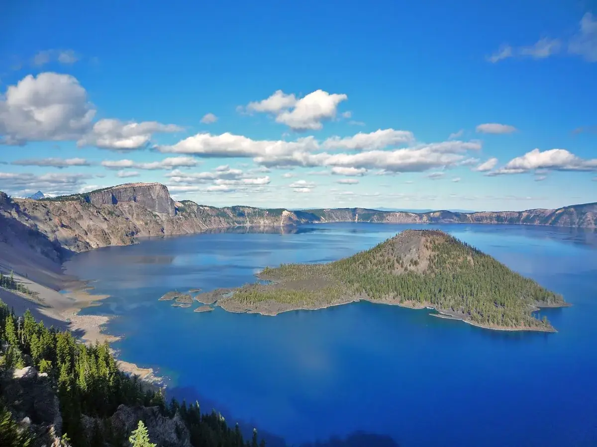
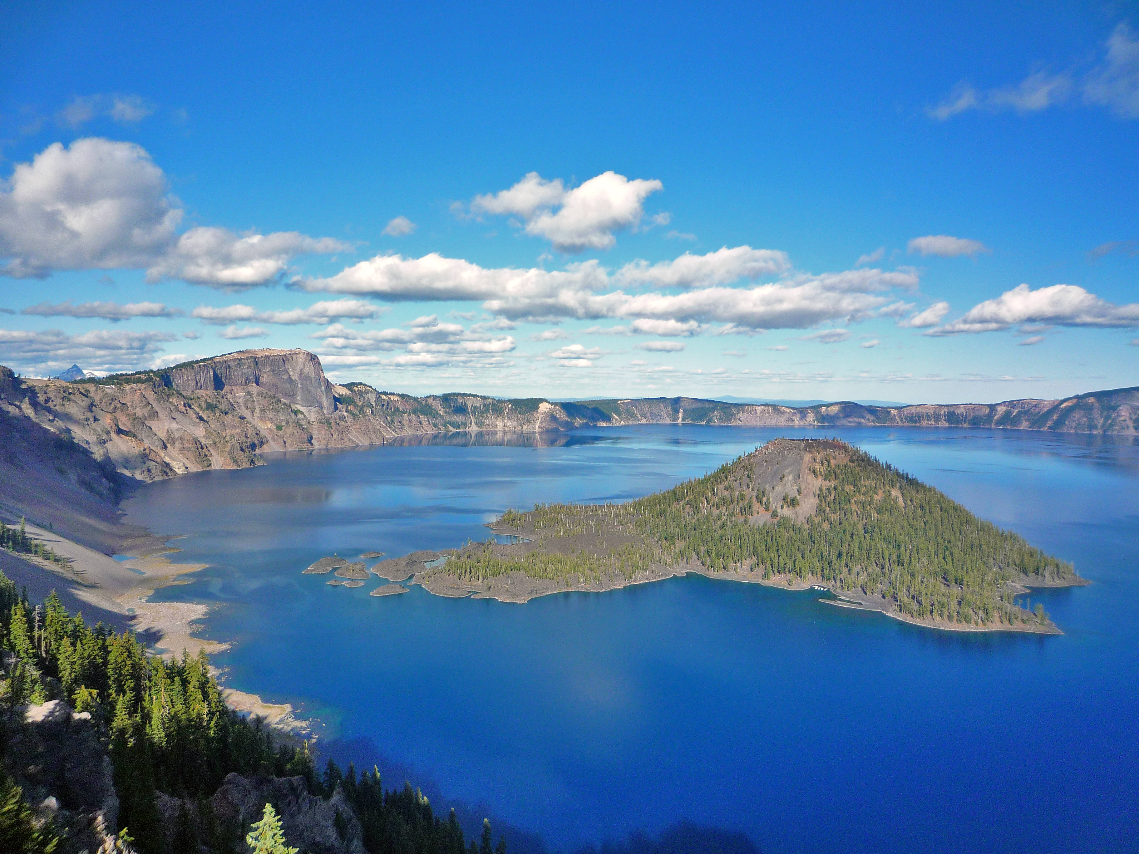
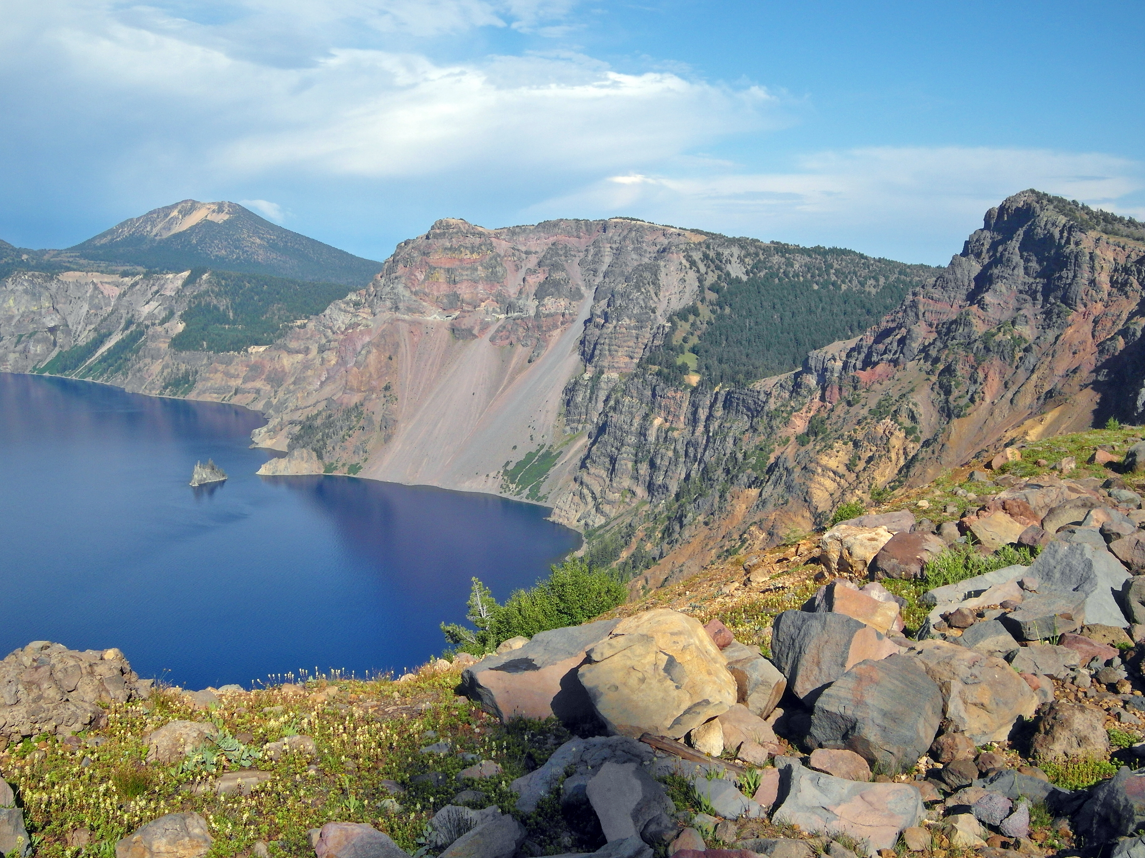
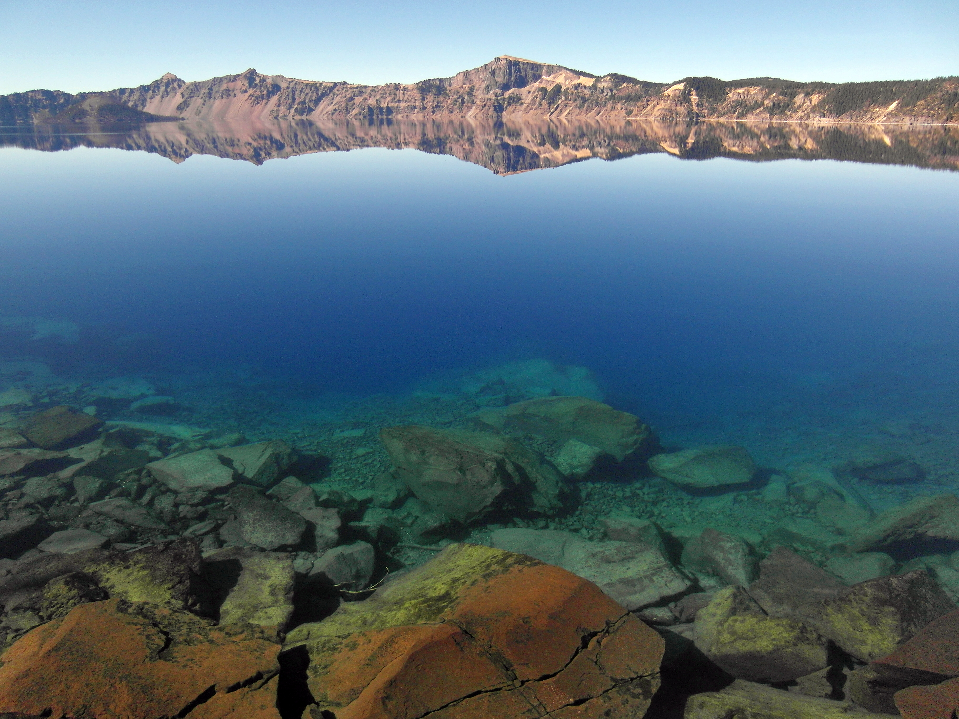
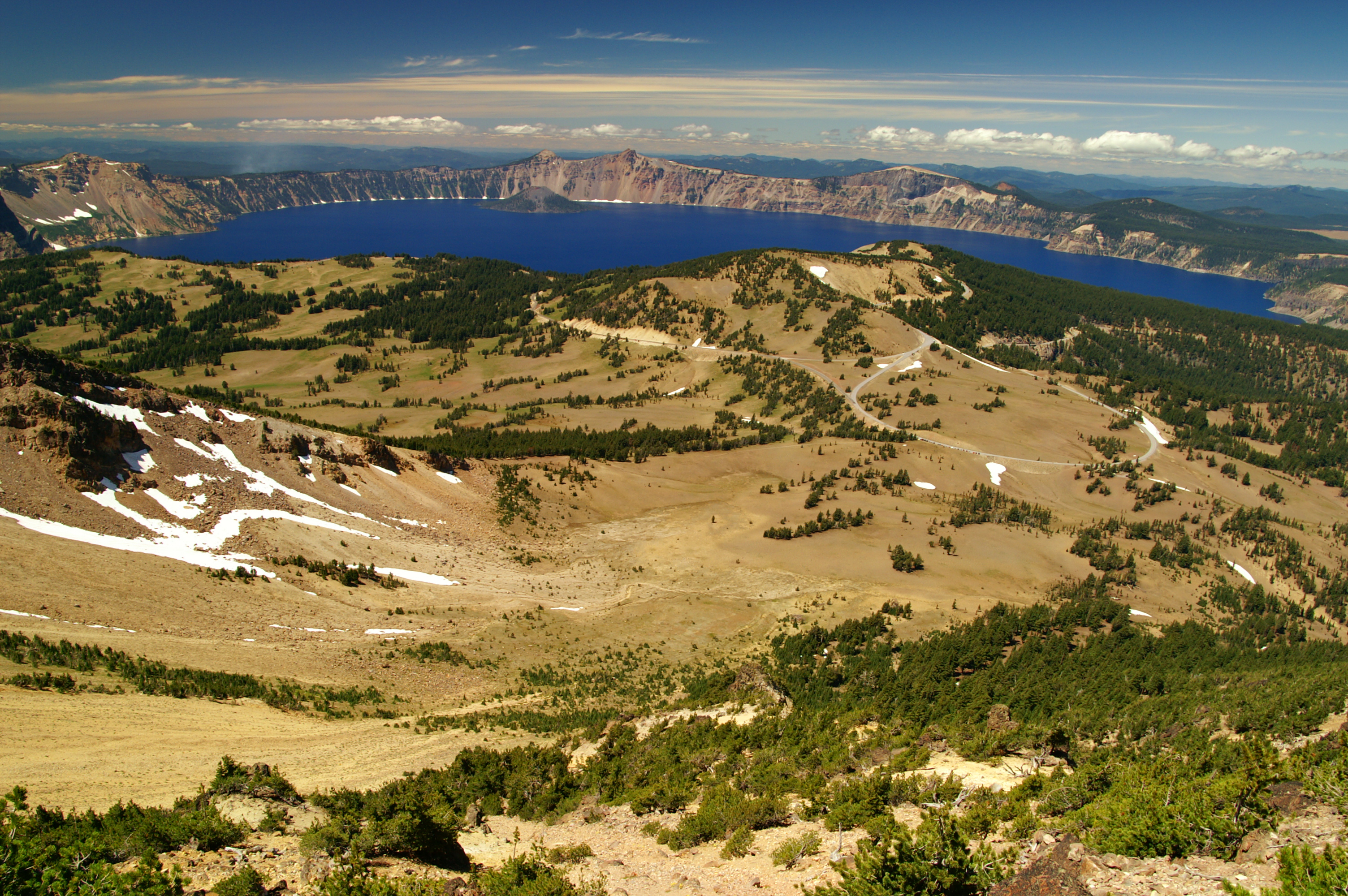
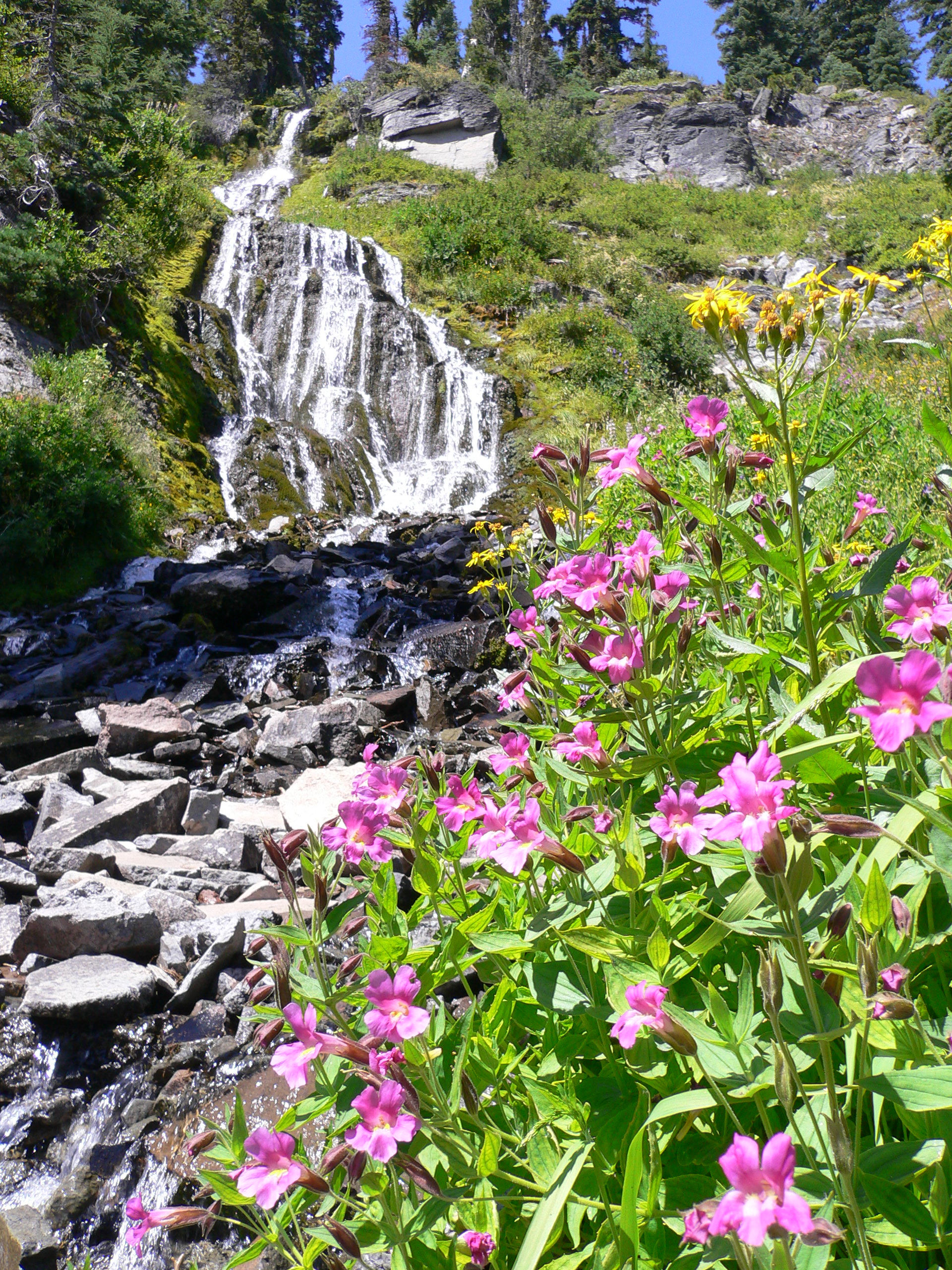
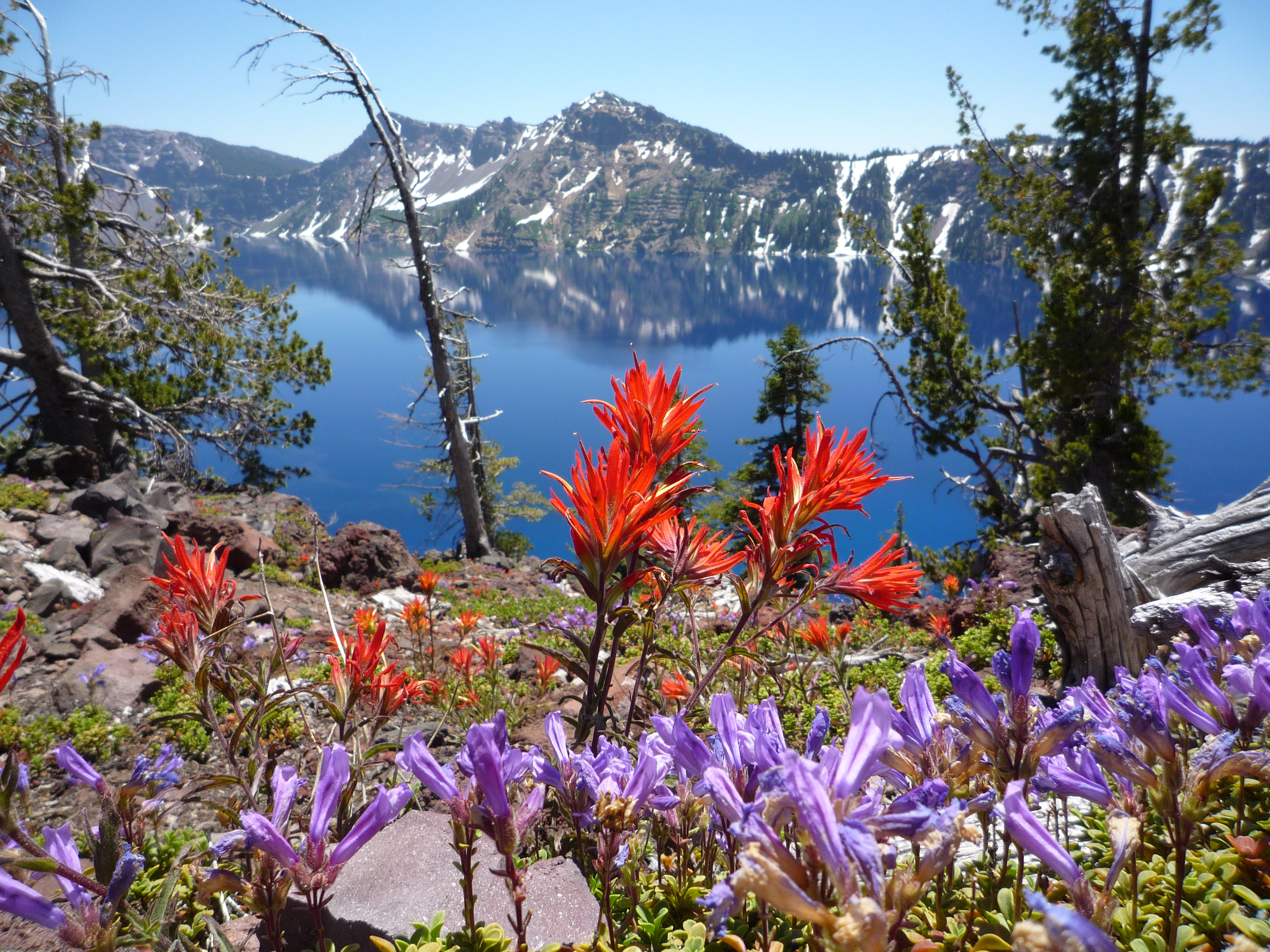


 Forests