Tusayan
15–35 min to the visitor center, plus entry queues
Nearby gateway hotels outside the park.
Tradeoff: A daily entrance trip is still needed.
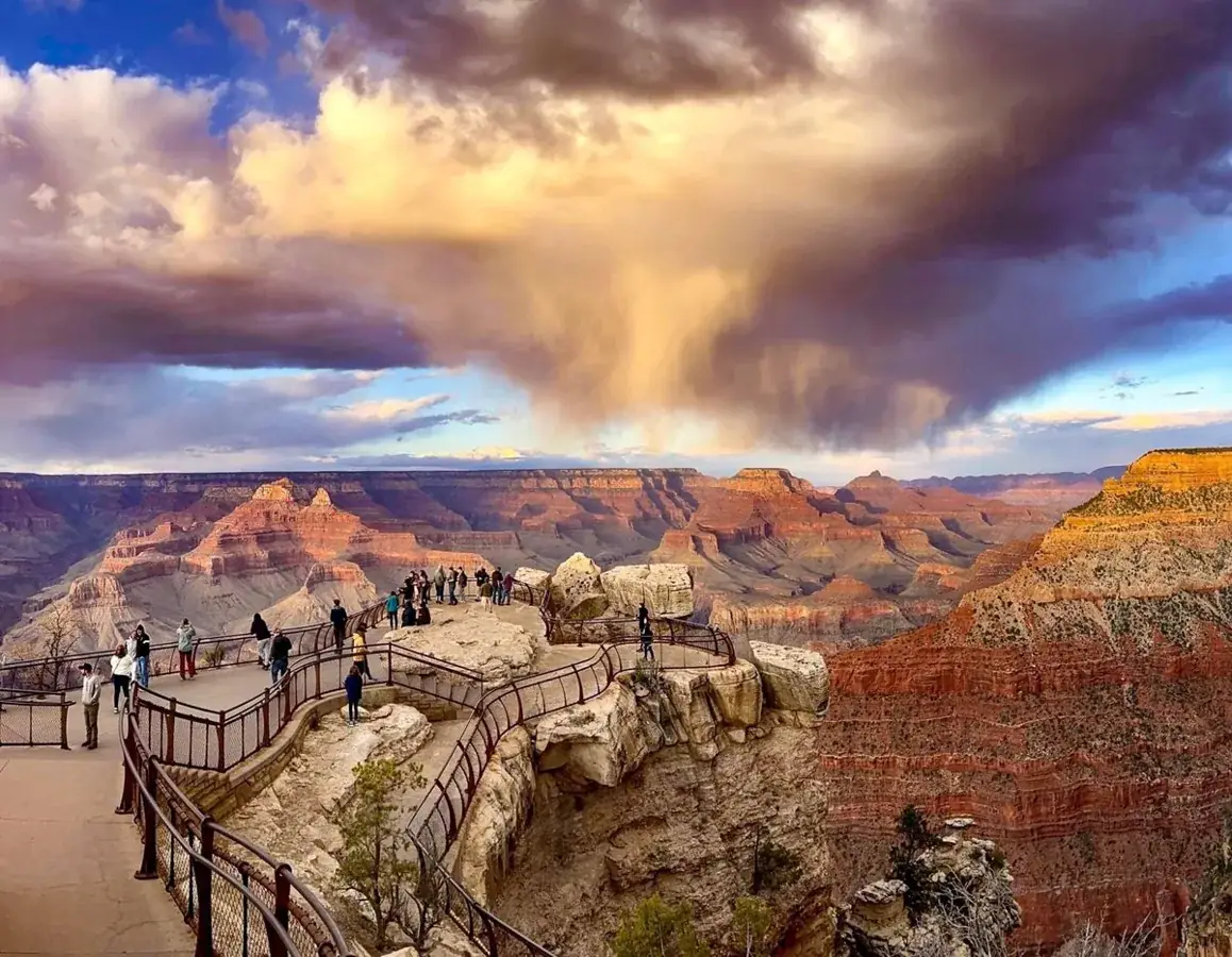
Entirely within the state of Arizona, the park encompasses 278 miles (447 km) of the Colorado River and adjacent uplands. Located on the ancestral homelands of 11 present day Tribal Communities, Grand Canyon is one of the most spectacular examples of erosion anywhere in the world—a mile deep canyon unmatched in the incomparable vistas it offers visitors from both north and south rims.
Hermit Road uses seasonal shuttle access; private-vehicle and winter arrangements differ. Verify the bus timetable and vehicle restrictions before choosing the west-rim day.
Before you go: Confirm your return bus or permitted winter access.
Official guidance ↗ Reviewed 2026-10-18At the October 18, 2026 source review, NPS listed overnight concessions suspended following August waterline damage. Recheck the dated notice for reopening before booking a village stay; this record is not a live closure report.
Official guidance ↗ Reviewed 2026-10-18Selected guidance only; separate from climate comfort and current conditions.
The conditions feed has not been connected for this park.
Check current conditions at NPS ↗Three South Rim districts on separate days. No rim-to-river hike, North Rim visit or canyon overnight permit is assumed.
Walk early and retain shade breaks; no below-rim heat exposure is assumed.
Day 1Mather Point → Yavapai Geology Museum and Rim Trail
Day 2Hopi Point → Pima Point and Hermits Rest
Day 3Grandview Point → Desert View Watchtower area
Editorial planning ranges, not live routing or official trail measurements. Driving excludes lodging commutes unless stated; queues, closures and weather can add substantial time. Walking ranges describe the selected outing, not necessarily the full trail. Arrival and departure travel are additional. Select the season for your dates; this is not a live conditions check.
Take time at the viewpoint before a short rim walk. Stay behind barriers.
Start: Visitor Center parking; follow signs to the rim.
Getting there: First stop; entrance queues are additional.
Footing: Developed paths, steps and exposed rim edges.
Use an open visitor facility if ice prevents walking.
Pair open geology exhibits with a bounded rim out-and-back and a picnic.
Start: Use the operating shuttle or designated Yavapai parking.
Getting there: Allow 10–25 minutes from Mather Point plus shuttle waits.
Footing: Paved rim sections can be icy; steep edges nearby.
Keep the museum visit if open and omit the walk.
South Rim only: no below-rim hike or North Rim transfer. Keep a generous meal break.
Visit the viewpoint without committing to a long point-to-point walk.
Start: Hermit Road transfer station; use the Red Route when operating.
Getting there: Allow 30–60 minutes for bus travel and queues.
Footing: Developed overlook with exposed edges.
Choose an open village viewpoint if bus access is unavailable.
Split the afternoon between overlooks with a picnic; use buses between them.
Start: Use designated bus stops and verify return boarding locations.
Getting there: Allow 30–60 minutes for transfers and waiting.
Footing: Paved and uneven paths; slopes vary.
Return early if the service window is short.
Check the seasonal bus timetable. Winter private-vehicle access follows different rules; no winter shuttle is assumed.
Stay at the rim; do not descend Grandview Trail on this day.
Start: Use signed parking on Desert View Drive.
Getting there: Allow 25–40 minutes east from the village.
Footing: Exposed viewpoint; descending trail is steep and excluded.
Skip if road or parking conditions are unsuitable.
Explore ground-level viewpoints; tower entry depends on posted operations.
Start: Park in the Desert View developed area.
Getting there: Allow 25–40 minutes beyond Grandview and retain the return drive.
Footing: Developed paths; tower stairs are separate.
Use the nearest open overlook and return before weather worsens.
Driving includes the village round trip. The North Rim is a separate journey.
Compare access to Grand Canyon Visitor Center. Drive ranges are editorial estimates before major queues or weather delays.
15–35 min to the visitor center, plus entry queues
Nearby gateway hotels outside the park.
Tradeoff: A daily entrance trip is still needed.
5–20 min to village stops
Close to rim viewpoints.
Tradeoff: NPS listed overnight concessions suspended after August 2026 waterline damage at review. Verify reopening before booking.
65–90 min each way
Useful for a regional overnight.
Tradeoff: Long commute on repeated park days.
Use your own quotes to compare room savings with extra time on the road.
Room totals only. Taxes, fuel, parking, vehicle wear and the value of your time are additional. These inputs are examples until you enter your quotes.
Mark your own preparation below. A check means you have handled it; it does not confirm a reservation or availability. Stored on this device.
Lodging · Before paying for a room
Read the dated NPS lodging notice; waterline disruptions can alter overnight operations.
If unavailable: Compare Tusayan outside the park.
Check official rules & booking linksTransport · Before choosing a district
Confirm Hermit Road restrictions and the last return bus.
If unavailable: Use the village day if west-road access is unavailable.
Check official rules & booking linksAccess · Before departure and each morning
A winter itinerary does not establish that paths are ice-free.
If unavailable: Postpone walking or use open visitor facilities.
Check official rules & booking linksThe PDF and HTML contain the selected days, transport notes, lodging comparisons and booking guidance. Linked maps and websites require a connection.
Official source review: 2026-10-18. Durations, district grouping, gateway drive ranges and recommended pacing are National Parkwise editorial estimates. They are not live routing, current-condition guarantees or accessibility certification.
Official NPS activity guide.
Official NPS activity guide.
Explore the practical guides below for park access, safety, and trip planning.
Check the NPS activity sourceOfficial NPS activity guide.
The National Park Service Mobile App has a collection of tools to explore Grand Canyon , and more than 400 National Park Service sites nationwide. Find interactive maps, tours of park places, on-the-ground accessibility information, and much more to plan your national park adventures before and during your trip.
Download the NPS App on the Apple Store >
Download the NPS App on Google Play >
The NPS App was created by National Park Service staff—people who know national parks—to help you make the most of your visit. The NPS App takes authoritative information from park employees and combines it with a great suite of features. Here’s a quick look at some of those features.
Offline Use: No internet access? No problem! You can download content from entire parks for offline use. It’s especially handy if you’re exploring remote areas in parks or concerned about data limits.
Things to Do: What do you want to do in a park—hike? Take a bus tour or scenic drive? Visit a museum? Join a ranger program? Become a junior ranger? Discover all the fun, entertaining, and educational activities parks have to offer.
Interactive Maps: Each park has a detailed map that includes points of interest, along with roads, trails, and other information to plan your trip.
News, Alerts & Events: What’s happening? Get news and events for all parks—or selected parks of your choosing.
Park Tours: What is there to see? Self-guided tours take you to interesting places in the park. Discover popular destinations as well as places off the beaten track. It’s like having a ranger by your side to guide your trip, giving you suggestions for places to go, directions to get there, and things to do once you arrive.
Amenities: It's the little—and sometimes not so little—things that can make or break a park visit. Learn where you can find and access transportation, food, restrooms, shopping, and more.
Accessibility: The app offers a fully accessible experience with tools to benefit visitors with accessibility needs, such as audio descriptions of exhibits along trails and roads and in visitor centers.
Share Your Visit: Tell your friends and family about the fun things you did by creating and sharing virtual postcards with scenes from the park.
Note: Cellular service and Wi-Fi are limited within Grand Canyon National Park, however, before you arrive, you can download the app, t hen you can use it in the park - when there is no internet connection. Follow these steps before you arrive: .
Download the NPS App.
In the app, select "Grand Canyon National Park, Arizona".
Select: "Save this park for offline use".
By doing this, most of the app content will be available for use in the park (the exceptions being real-time updates). Even without cellular service, the app will be able to share your location on the map and bring up all site content. (However, continued use of GPS running in the background can dramatically decrease battery life).
NPS information imported 2026-10-17. Confirm current details at NPS
Official NPS activity guide.
Check the Park's Digital Calendar for a list of today's scheduled programs and activities.
Signs outdoors and displays at information desks describe the programs and special events being presented during your visit.
Download the NPS Mobile App
South Rim Open all year
North Rim - Current Status and Closures
Grand Canyon Visitor Center (South Rim Village)
Open daily from 9 am to 4 pm. (Fall 2026 hours)
Information, Passport Stamps and Jr. Ranger books and badges are also available at the adjacent Park Store (8 am to 6 pm) .
This week's ranger pograms and special events
From the Visitor Center, ride free shuttle buses around the park
South Rim bookstores and gift shops
We Are Grand Canyon —shows on the hour. (24 minutes long). Grand Canyon's 11 tribal communities extend a heartfelt invitation to all who visit this sacred place – directly from the people who call this land home, who have been here for millennia, and are still here. Grand Canyon: A Journey Of Wonder —shows on the half-hour. (24 minutes long). An orientation film that takes visitors on a rim to river, and dawn to dusk journey through the park, and provides an introduction to the human and natural history of the region.
For a nice introduction to the park, walk part of the well defined, and mostly level Canyon Rim Trail . Start from the Visitor Center/Mather Point, or from any viewpoint in the village. West of the village, the Canyon Rim Trail continues alongside Hermit Road , a 7 mile scenic road with 9 exceptional overlooks.
Day Hiking in and around the canyon.
Today's Key Hiking Messages - weather forecast, heat risk and drinking water locations.
Backpacking Overnight below the rim requires a Backcountry Permit .
Between Yavapai Museum of Geology and Verkamps Visitor Center 1.2 miles (2 km) along the canyon rim. View photos here The path contains information about the canyon's geologic history, as well as samples from each rock layer within Grand Canyon. More Learn about Grand Canyon Geology
Families visiting the park can engage with Grand Canyon's Junior Ranger program
4th graders and their families can see America's natural wonders and historic sites for free this school year, through the Every Kid Outdoors Program
Groups organizing youth field trips to the park can find activities and videos to prepare students prior to the trip and self-guided activities to facilitate during the experience.
Take a Grand Canyon Virtual Tour
(Formerly known as the West Rim Drive)
From March 1, through November 30, Hermit Road is closed to private vehicles. During this time, the free Hermit Road (Red) Route shuttle bus provides the only motorized access. (Along with commercial bus tours).
Hermit Road is open to private vehicles (under 22 feet) during the months of December, January and Februay, when there is no bus service.
The road itself, and it's designated greenway section is also open to travel by foot or bicycle. There are 9 designated overlooks with fantastic views. More about touring Hermit Road
Learn about bicycling on the South Rim
Offering bicycle rentals & guided bicycle tours , weather permitting, Canyon Adventures Bike Tours and Cafe is located by the Visitor Center. Their coffee bar/café has a "grab & go" menu targeted towards bicyclists and pedestrians.
Taking photos is a great way to make your Grand Canyon trip last. Whether you share them on social media or compile them in a scrapbook, having great photos of your adventure is the best souvenir. Visit the links below for some suggestions about the best times of day to shoot and, insider information about popular photo hot spots. Capture Grand Canyon in Photos How to View and Photograph Wildlife
Visitors traveling to Grand Canyon National Park can enter and exit the park through the East Entrance at Desert View. During periods of high visitation, often there are shorter wait times at this entrance station. (State Route 64 - also known as the East Rim Drive ) This 23 mile (37 km) road, leaves Grand Canyon Village, then travels east to Desert View and the East Entrance Station. This is the only scenic road on the South Rim that is open to private vehicles all year. More about touring Desert View Drive in your vehicle. Desert View Visitor Services
Visitors traveling to Grand Canyon National Park can enter/exit the park through the East Entrance at Desert View for wide, expansive views of Grand Canyon and the Colorado River. (Desert View is 23 miles/37 km) from the South Rim Village. The Desert View Watchtower Shop (View Room) is open daily 8 am to 6 pm:
The upper floors of the tower are open, when staffing allows, from 8 am to 6 pm. The last tower access is at 5 pm, with the stairs closed for the day at 5:30 pm. Capacity is 25 people in the tower at one time. A ticket system admits 25 people with a 20 minute time limit. Admission is free. Children must be accompanied by an adult. Learn more
Desert View visitor services include: Market/Deli, Trading Post with coffee/ice cream, seasonal campground, and a pay-at-the-pump gas station. Details
The site is open for the season April 2, through October 31, 2026. Thursdays through Mondays, 8:00 a.m. to 4:00 p.m.
Tusayan Pueblo is the remains of a small Ancestral Puebloan village is located 3 miles (5 km) west of Desert View. The archaeological site has a self-guiding trail that encircles the pueblo. There is also a Native American Artisan Market with authentic and beautiful arts and crafts for sale, sponsored by Native Americans for Community Action, Inc. (NACA). More about visiting Desert View >
Grand Canyon Conservancy's Field Institute
Schedule of Guided Tours and Experiences
The institute provides immersive and educational adventures at Grand Canyon—all officially designed and developed in partnership with Grand Canyon National Park.
A wide selection of Grand Canyon Maps, Trail Guides and Field Guides are available online from the park's non-profit partner, Grand Canyon Conservancy.
Learn about additional Guided Tour options on the South Rim
are offered year round on the South Rim. The Canyon Vistas Ride is a 2 hour trip that travels along the canyon rim. The Havasupai Gardens Ride is a 7 hour trip. Upon arrival at the Gardens, riders dismount and have an hour to enjoy an included sack lunch, soak in the panoramic views of the natural oasis, and visit with their fellow riders and guide. Overnight Rides go to the bottom of the canyon and stay at Phantom Ranch. NOTE: the Phantom Ranch trips are cancelled through February 2027 due to trail damage from flooding.
More about South Rim Mule Trips
Half-day and all-day smooth water trips from Glen Canyon Dam to Lees Ferry may be arranged by any lodge within the park. Transportation from the lodges to the dam is included. Whitewater trips through Grand Canyon last from 3 days to 21 days and require reservations made well in advance, or a noncommercial permit obtained by entering a weighted lottery.
From Williams, Arizona (along Interstate 40) the Grand Canyon Railway carries more than 230,000 people by rail to Grand Canyon National Park each year.
As an alternative, to driving, it is possible to park in Williams, AZ, 60 miles south of the park, (on Interstate 40), take Grand Canyon Railway , and not have to deal with busy summer traffic and finding a parking place. The train’s departs daily at 9:30 a.m. Arizona MST (except during November/December when it leaves at 8:30 a.m.). The train arrives on the South Rim of the Grand Canyon at 11:45 a.m. at the Grand Canyon Depot, built in 1910 (except during November/December arrival is at 10:45 a.m.). The train departs the canyon at 3:30 p.m. and arrives back in Williams at 5:45 p.m (except during November/December when it departs at 2:30 p.m. and arrives at 4:45 p.m.).
The North Rim is open for day use only from October 16, through November 30, 2026, or after the first major snowstorm, whichever comes first
The General Store (adjacent to the campground), is open through October 15, from 9 a.m.-4 p.m. daily
The North Rim Campground is open through October 15, 2026. Reservations are available for booking at recreation.gov.
Gasoline and Diesel Fuel is not available within the park, so visitors should plan ahead and ensure they have sufficient fuel before entering the North Rim area.
Everyone planning a North Rim visit during this time needs to check current conditions, carry adequate food, water, fuel, and emergency supplies, and use extra caution as winter weather arrives.
The North Rim of Grand Canyon National Park is partially open for the 2026 season. Visit North Rim Status and Closures for more detailed information. The following trails are closed.
CLOSED: Bright Angel Point and Trail
CLOSED: Transept and Widfross Trails
CLOSED: Uncle Jim Trail
CLOSED: Ken Patrick Trail west of Cape Royal Road
CLOSED: Arizona Trail between North Kaibab Trailhead and the W1-A (Old Entrance Road)
CLOSED: North Kaibab Trail - closed by damage from the August flash flood.
OPEN: Bridle Path
OPEN: Ken Patrick Trail between Point Imperial and Cape Royal Road
OPEN: Portions of the Arizona Trail through Grand Canyon National Park (except for areas affected by current trail closures)
Cape Royal and Point Imperial Roads
Paved roadways on the North Rim are open through Nov. 30, 2026, or after the first major snowstorm, whichever comes first, including Highway 67, Cape Royal , and Point Imperial Roads . These winding scenic drives can be toured in personal vehicles and provide access to many of the North Rim’s iconic viewpoints, including Point Imperial, Cape Royal, Roosevelt Point, Walhalla Overlook, and Angels Window.
IMPORTANT: The Cape Royal and Point Imperial Roads will be temporarily closed from sunset October 15, through sunrise November 3, for road repair and rehabilitation work.
Driving to both points, with short walks and several stops at pullouts along the way, could take 4 to 5 hours. (View photos)
Note: RVs over 22 feet long, and vehicle-trailer combinations with a total length over 22 feet, are not permitted on the Scenic Drive due to narrow, windy roads with blind corners.
Point Imperial is 11 miles/ 18km - 20 min. one way.
Cape Royal is 23 miles/ 37km - 45 min. one way.
Is a great way to help Grand Canyon and other areas you visit reduce carbon emissions, divert and reduce what goes into the waste stream, and to generally help the environment. Go to the Traveling Green page for helpful tips on planning your next green adventure.
Thanks for doing what you can to help protect our environment!
NPS information imported 2026-10-17. Confirm current details at NPS
Official NPS activity guide.
NPS Photo/M. Forrest
The North Rim Scenics (Cape Royal Road and Point Imperial Road) will be closed from sunset Oct. 15 through sunrise Nov. 3, 2026, to accommodate critical road repair and rehabilitation work. The North Rim Campground has closed for the 2026 season. National Forest Service - Demotte Campground , 7 miles (11 km) north of the park boundary, is open for first-come, first-served camping, September 18, through October 31, 2026. For those seeking overnight accommodations, lodging is available outside the park. The North Rim gas station has closed for the season . Gas is available at Jacob Lake and the North Rim Country Store.
For those seeking overnight accommodations, lodging is available outside the park.
The North Rim gas station has closed for the season . Gas is available at Jacob Lake and the North Rim Country Store.
Bridle Trail from the North Kaibab Trailhead to the former Grand Canyon Lodge parking area
The Arizona Trail north of the W1 (currently closed between the North Kaibab Trailhead and W1-A (Old Entrance Road)
Ken Patrick Trail (east) between Point Imperial and Cape Royal Road
Cape Royal Trail
Cliff Springs Trail
Cape Final Trail
Roosevelt Point Trail
Point Imperial Trail
The North Kaibab Trail from the North Kaibab Trailhead to Phantom Ranch
Cottonwood Campground & Bright Angel Campground
Black Bridge and Silver Bridge spanning the Colorado River.
River Trail between River Resthouse and Black Bridge.
South Kaibab Trail below the Tipoff
Bright Angel Point Trail
Arizona Trail between North Kaibab Trailhead and the W1-A (Old Entrance Road)
Ken Patrick Trail (west) between the North Kaibab Trailhead and Cape Royal Road
Uncle Jim Trail
Arizona Trail thru-hikers: check out the Arizona Trail Association's updates and suggestions for hike modifications due to trail closures in the park.
Dragon Bravo Fire - Grand Canyon National Park - July & August 2025 Dragon Bravo Fire — One Year Later
CLOSED — As of August 29 at 2:30 p.m. due to flash flooding:
The entirety of the North Kaibab Trail . This includes the North Kaibab Trailhead to Phantom Ranch . This closure is a result of significant flash flooding to the Bright Angel Canyon on Friday 8/29.
The entirety of Phantom Ranch , including Bright Angel Campground , the Phantom Ranch Canteen , and Phantom Ranch cabins are also CLOSED .
The Black Bridge and Silver Bridge spanning the Colorado River.
If the trail reopens before Oct. 15, 2026, visitors hiking the upper North Kaibab Trail between Supai Tunnel and the North Kaibab Trailhead should use increased caution while traveling through the Dragon Bravo burn scar. Burned areas are more susceptible to hazards including debris flows, rock falls, flash flooding, and falling trees, particularly during or after rainstorms and periods of high wind. Conditions can change rapidly and without warning. Visitors should remain alert, monitor weather forecasts before hiking, and be prepared to turn around if hazardous conditions develop.
Parking at the North Kaibab Trailhead is limited and restricted to vehicles under 22 feet in length. Overflow parking will be available in the area adjacent to the site of the former Grand Canyon Lodge. The Bridle Path between the former Grand Canyon Lodge and the North Kaibab Trail will be open.
Visitors should be prepared for a remote, limited-services environment. As of Oct. 15, 2026, the General Store and the North Rim Campground have closed. There is no fuel on the North Rim and is available nearby at the North Rim Country Store and Jacob Lake. The North Rim Campground has closed for the 2026 season as of Oct. 15, 2026. Tentative reopening date: May 15, 2027.
The National Park Service is taking a phased approach to restoring services—bringing back what is safe and feasible while prioritizing visitor safety, resource protection, and long-term recovery. Services and facilities are expected to gradually return in future seasons (2027–2028 and beyond) as infrastructure is repaired and conditions allow.
3:30 p.m. : Unpredictable shifting winds caused the fire to breach containment lines and spread rapidly toward critical infrastructure and housing.
North Rim NPS and concessions staff were issued a "SET" and subsequent "GO" evacuation order.
Aerial damage assessment revealed severe damage and loss of structures in the NPS Administration Area, to include 11 residences, multiple office buildings, vehicles, and water treatment facilities.
A chlorine gas leak was reported at the North Rim water treatment plant. Immediate evacuation and closure of Phantom Ranch and the inner canyon corridor was ordered.
Between July 12 and 13, the fire expanded by an additional 500 acres reaching the southern end of developed area.
The Dragon Bravo Fire impacted several key North Rim watersheds that drain into the Colorado River, including House Rock Wash, North and South Canyons, Buck Farm Canyon, Nankoweap Creek, Kwagunt Creek, Malgosa, Awatubi, 60-Mile, Clear Creek, Bright Angel Creek (which flows through Phantom Ranch), Crystal Creek, and Tuna Creek. Some of these drainages are more than 13 miles long, and while rain at the top of the rim can take two to four hours to reach the river, flooding near or within the burn scar can happen in a matter of minutes. Increased risk of flash floods and/or debris flows is expected in these watersheds during monsoons or other storms with heavy precipitation. In steep terrain, runoff can cause flash flooding within minutes of heavy rainfall. It can also trigger debris flows—fast-moving, destructive slides made up of water, ash, mud, rocks, and trees—that are capable of damaging buildings, roads, and other infrastructure, sometimes many miles downstream
Visitors should exercise extreme caution in all affected watersheds during monsoon season, as burned areas are more prone to flash flooding and debris flows. To sign up for Grand Canyon River emergency alerts, please visit our webpage here .
| July 4, 2025 | The Dragon Bravo Fire was ignited by a lightning strike. The fire was managed initially under a confine and contain suppression strategy. |
| July 4-10, 2025 | A Type 3 Incident Management Team (IMT) managed the fire, and 110 personnel were assigned to the incident for approximately a week. The fire showed low to moderate growth while firefighters improved and fortified containment lines around the fire perimeter. |
| July 10, 2025 | Due to the nearby White Sage Fire threatening Hwy. 67 access, 500 visitors were evacuated from the North Rim. North Rim residents were encouraged to shelter in place. |
| July 11, 2025 | 3:30 p.m. : Unpredictable shifting winds caused the fire to breach containment lines and spread rapidly toward critical infrastructure and housing. North Rim NPS and concessions staff were issued a "SET" and subsequent "GO" evacuation order. |
| July 12, 2025 | Aerial damage assessment revealed severe damage and loss of structures in the NPS Administration Area, to include 11 residences, multiple office buildings, vehicles, and water treatment facilities. A chlorine gas leak was reported at the North Rim water treatment plant. Immediate evacuation and closure of Phantom Ranch and the inner canyon corridor was ordered. Between July 12 and 13, the fire expanded by an additional 500 acres reaching the southern end of developed area. |
| July 13, 2025 | Aerial reconnaissance confirmed destruction of the Grand Canyon Lodge, the North Rim Visitor Center, and many historic cabins. Several structures remained intact, including the General Store, Campground, Gas Station, and some cabins and housing. |
| July 14, 2025 | A Complex IMT took over management of the fire response and recovery, remaining in command with ongoing two-week rotations through September 2025. |
| July 17, 2025 | The park requested an immediate assessment of post-fire risks to key values. Initial Burned Area Emergency Response (BAER) findings identified no immediate need for emergency treatments for the Roaring Springs water system or aquifer contamination from fire retardant; however, the North Rim water pipeline and water treatment plant were severely damaged. |
| August 20, 2025 | Reopening of inner canyon corridor trails to include the South Kaibab Trail to Tipoff, Bright Angel Trail below Havasupai Gardens, and the Tonto Trail between the Bright Angel and South Kaibab Trails. Phantom Ranch, the River Trail, and the lower South Kaibab remain closed until Nov. 1, 2025. |
| August 21, 2025 | A multi-agency Department of the Interior (DOI) BAER Team began work to assess the impacts of the Dragon Bravo Fire on National Park Service and Bureau of Land Management lands. |
| August 29, 2025 | Arizona Department of Transportation reopens Hwy. 67 from Jacob Lake to the Kaibab Lodge. The North Rim of Grand Canyon National Park from mile marker 605 south remains closed. |
| September 2, 2025 | Preliminary post-fire BAER assessment completed and recommendations provided to Grand Canyon National Park management for consideration and future planning efforts. The executive summary of the BAER assessment can be found here . |
| Oct. 1-Nov. 14, 2025 | Park staff reopened key areas for visitor access including the Cape Royal Road, Point Imperial, and the Hwy. 67 corridor. Winter weather constraints led to an early seasonal closure. |
NPS information imported 2026-10-17. Confirm current details at NPS
Official NPS activity guide.
Daily, 9 am– 4 pm Trip planning and hiking information is available through permanent exhibits and sidewalk signs outside of the visitor center building. Grand Canyon Conservancy Park Store (across the plaza from the Visitor Center) is open daily 8 am–6 pm, with: Passport To Your National Parks® stamps Junior Ranger badges Ranger Programs and Special Events. View the schedule in the Park's Calendar. Park Films Are Shown Daily in the Visitor Center Theater We Are Grand Canyon, a 24 minute film welcomes visitors to the park, from those who have called it home since time immemorial, Grand Canyon's 11 tribal communities. —at the top of each hour. Details Grand Canyon: A Journey of Wonder , a 24 minute park orientation film is presented in the theater —on the half hour. Details
Daily, 9 am– 4 pm
Trip planning and hiking information is available through permanent exhibits and sidewalk signs outside of the visitor center building.
Grand Canyon Conservancy Park Store (across the plaza from the Visitor Center) is open daily 8 am–6 pm, with: Passport To Your National Parks® stamps Junior Ranger badges
Passport To Your National Parks® stamps
Junior Ranger badges
Ranger Programs and Special Events. View the schedule in the Park's Calendar.
We Are Grand Canyon, a 24 minute film welcomes visitors to the park, from those who have called it home since time immemorial, Grand Canyon's 11 tribal communities. —at the top of each hour. Details
Grand Canyon: A Journey of Wonder , a 24 minute park orientation film is presented in the theater —on the half hour. Details
On the half-hour Grand Canyon: A Journey of Wonder , the park's 24 minute orientation film, takes viewers on a rim to river and dawn to dusk journey through the park, and introduces the natural and human history of this special place — along with efforts to preserve and protect Grand Canyon as a sanctuary for plants, animals, and humans.
Public restrooms are located in separate buildings on either side of the Visitor Center Building.
If you arrive when the Visitor Center building is closed, you will find trip planning, shuttle bus, and hiking information available on signs and exhibits outside of the building — and at other key locations throughout the park.
When entering through the South Entrance Station , make the Visitor Center your first stop. You can park your car in one of four parking areas, then get your first view of Grand Canyon by taking a short walk to nearby Mather Point. NOTE: During busy periods, including spring break, summer, and holiday weekends, the 4 parking lots (Lots 1-4) around the Visitor Center Plaza fill by 10 am. When Visitor Center lots are full, there are other options. Proceed to lots:
A and B at Market Plaza —about 1 mile (1.6 km) General store/Deli, Post Office, Yavapai Lodge.
C and D in the Village Historic District . —about 2.2 miles (3.5 km) Train Depot, Bright Angel Trail, historic lodges, restaurants and shops.
More information about Village Parking Lots >
Loading results...
The free shuttle bus system is a great way to get around the park. Many visitors choose to leave their vehicles in one of the 4 parking lots that surround the Visitor Center Plaza, and use the free shuttles to get around.
Even though use of the shuttle buses is encouraged in order to reduce greenhouse gas emissions as well as frustrations in finding parking, private vehicles are allowed in some areas of the park.
Grand Canyon Village, 2.5 miles (4 km) is open to private vehicles year-round, although parking is limited during busy seasons. This is the most developed area along the South Rim and includes access to lodges, restaurants, gift shops, campgrounds, parking lots, and more.
Desert View Drive , 23 miles (37 km), is open to private vehicles year-round, including access to viewpoints, pull-outs, picnic areas, and the developed Desert View area with a variety of visitor services.
Hermit Road , 7 miles (11 km) is only open to private vehicles during winter months, between December 1 and February 28. The road is closed to personal vehicles between March 1 and November 30. The free Hermits Rest Route (Red), shuttle provides easy access to the viewpoints, Hermits Rest, and the Hermit Trail when road restrictions are in place.
Even though the shuttle bus fleet can accommodate most wheelchairs, accessibility passes are available upon request at park entrance stations and visitor centers. These passes are issued for visitors who would have difficulty using the shuttle system, for example someone confined to a wheelchair, particularly during the busy summer months when shuttles are filled to capacity.
One of the best ways to view the canyon is to take a walk along the rim. The Rim Trail follows the canyon rim for 12 miles (19 km) from Pipe Creek Vista to Hermits Rest. Most of it is paved, with only 3.1 miles (5 km) unpaved between Powell Memorial and Monument Creek Vista along Hermit Road. Use the South Rim Pocket Map to check distances and locations of shuttle stops along the Rim Trail.
Ranger Suggestion : From Canyon View Information Plaza two great options are available for walking short distances along the Canyon Rim Trail.
Walk up to Mather Point and continue east 0.7 miles (1.2 km) to Yavapai Observation Station. The Kaibab (Orange) Route shuttle has a stop here, and it will return you to the Visitor Center, or you can continue walking to the Historic District, an additional 1.3 miles (2.1 km), and pick up the Village (Blue) Route shuttle to return you to the Visitor Center.
Use the Kaibab (Orange) Route shuttle to enjoy the views at Yaki Point and Pipe Creek Vista. Instead of re-boarding the bus at Pipe Creek Vista, walk the 1.3 mile (2.1 km) paved trail to Mather Point and the Visitor Center Plaza.
Photovoltaic cells generate a portion of the Visitor Center’s electricity needs. In May 2009, APS (Arizona Public Services), the largest utility company in Arizona, worked with the park to install 84 photovoltaic cells at Grand Canyon Visitor Center. The 18 kilowatt system offsets 30% of the power used in the building. The energy saved is more than a normal household would consume in a day and reduces greenhouse gas emissions by almost 20 tons per year. Additional photovoltaic cells were installed on the theater that was added to the Visitor Center in 2013.
NPS information imported 2026-10-17. Confirm current details at NPS
Official NPS activity guide.
Audio Description, Automated Entrance, Automated External Defibrillator (AED), Benches/Seating, Bus/Shuttle Stop, Fire Extinguisher, First Aid Kit Available, Gifts/Souvenirs/Books, Information, Information - Maps Available, Information - Ranger/Staff Member Present, Information Kiosk/Bulletin Board, Parking - Auto, Parking - Bus/RV, Picnic Table, Recycling, Restroom, Restroom - Accessible, Restroom - Family, Telephone, Trash/Litter Receptacles, Water - Drinking/Potable, Wheelchair Accessible
Current Hours Open Daily: 8 am to 6 pm
As the park's official nonprofit partner, the Grand Canyon Conservancy (GCC) works with the National Park Service to operate park stores in seven locations throughout the park. The largest store is located on the south side of the Visitor Center Plaza. Parking Lot 4 provides the closest access to the store. The Park Store features a wide variety of books, maps, apparel, souvenirs, and gifts to help you to plan or remember your trip to Grand Canyon, and learn more about Grand Canyon geology, ecology, and history. Purchases help fund new exhibits, scientific research, trail restoration, wildlife monitoring, ecological restoration, support for the arts, Junior Ranger and education programs, and historic building preservation.
GCC operates several stores and sites on the South Rim of the park: Grand Canyon Conservancy Park Store at the South Rim Visitor Center
Yavapai Geology Museum
Verkamp's Visitor Center - in Village Historic District
Kolb Studio - in Village Historic District
Desert View Watchtower
Grand Canyon Conservancy
Grand Canyon National Park
Loading results...
NPS information imported 2026-10-17. Confirm current details at NPS
Official NPS activity guide.
September 12, through November 30, 2026 50 minutes round trip (without getting off the bus) First bus at 7 am — the last bus is at 9 pm. ► Be at a bus stop no later than 8:45 pm.
Every 15 minutes: 7 am to 10 am
Every 12 minutes: 10 am to 7 pm
Every 15 minutes: 7 pm to 9 pm
Village service ends at 9 pm
This loop route connects the Visitor Center Shuttle Bus Terminal with lodges, campgrounds, the Backcountry Information Center, and Market Plaza (general store, and post office). Canyon views are a short walk from some of the stops. ► List of Bus Stops, What to See, and Route Map
September 12, through November 30, 2026 50 minutes round trip (without getting off the bus)
First bus is at 6 am — last bus is one hour after sunset
Every 20 minutes: 6 am to 9 am
Every 15 minutes: 9 am to one hour after sunset
Visit this link for sunset times
EASTBOUND buses start at the Visitor Center Shuttle Bus Terminal, with direct service to South Kaibab Trailhead, continue to Yaki Point and Pipe Creek Overlook , then return to the Visitor Center.
WESTBOUND buses start at the Visitor Center Shuttle Bus Terminal, travel to Mather Point and Yavapai Geology Museum, then return to the Visitor Center. ► List of Bus Stops - W hat to See - and Route Map
Need access to or from South Kaibab Trailhead when the buses are not running? Please contact Xanterra Taxi Service at (928) 638-2631.
September 12, through November 30, 2026 Departs Bright Angel Lodge at 6 am, 7 am, and 8 am. Stops are made at the Backcountry Information Center (parking lot D), the Visitor Center Shuttle Bus Terminal, and the South Kaibab Trailhead.
► Hikers' Express - Detailed Schedule and Information
September 12, through November 30, 2026 80 minutes round trip (without getting off the bus)
First bus is at 8 am — last bus is one hour after sunset
Every 12 minutes: 8 am to sunset Last bus sweeps one hour after sunset
NOTE: Hermit Road is CLOSED to private vehicles from March 1, through November 30, 2026. The Hermit Road Shuttle and commercial tours provide the only motorized access to this area during those months. Foot and bicycle traffic is allowed throughout the year.
► List of Bus Stops and Scenic Overlooks - What to See - and Route Map >
(ONLY IN OPERATION DURING SUMMER MONTHS) 50 minutes round trip (without getting off the bus)
Every 45 minutes: 8 am to 9 pm
During the summer of 2027, the Tusayan Route will provide free shuttle bus service between the NPS South Rim Visitor Center, to the gateway community of Tusayan. After making four stops in Tusayan, the bus returns 6.8 miles/11 km to the Visitor Center inside the park.
► List of Bus Stops - and Route Map >
Visitors should expect lines causing delays to board a bus during busier times of the day.
Most buses are white with a green stripe and display the route name on the front and the side.
No tickets are required; a portion of your entrance fee pays for this important service.
Buses arrive every 15-30 minutes.
Bus stops are clearly marked throughout the park.
The routes interconnect, but do not overlap.
Bus stops are also in proximity to great cycling opportunities. Bicycle the Greenway Trail to South Kaibab Trailhead or ride Hermit Road to Hermits Rest and then get on a shuttle bus to come back.
Service may be suspended during inclement weather.
No eating or open drink containers
No pets allowed on shuttle buses. Service dogs are permitted (as defined by the Americans With Disabilities Act ).
Collapse strollers before entering the shuttle bus. No oversized or jogging strollers. Remove baby-back carriers when seated
Shuttle buses can accommodate two or three bicycles , but not tag alongs, baby trailers, or children's bicycles with wheels less than 16 inches (41 cm). Riders must load and unload their bicycles
Shuttle buses are equipped with ramps and space to carry passengers in wheelchairs. Please note: wheelchairs larger than 30 inches wide by 48 inches long (76 cm x 122 cm) cannot be accommodated on shuttle buses and most motorized scooters will not fit
Shuttle buses only stop at designated bus stops
All shuttle buses are wheelchair accessible, however, the park does offer a Scenic Drive Accessibility Permit, which allows entry for visitors with mobility issues to some areas closed to public traffic. The permit is available at entrance stations and National Park Service visitor centers.
"Service animal means any dog that is individually trained to do work or perform tasks for the benefit of an individual with a disability, including a physical, sensory, psychiatric, intellectual, or other mental disability. Other species of animals, whether wild or domestic, trained or untrained, are not service animals for the purposes of this definition. The work or tasks performed by a service animal must be directly related to the handler's disability. Examples of work or tasks include, but are not limited to, assisting individuals who are blind or have low vision with navigation and other tasks, alerting individuals who are deaf or hard of hearing to the presence of people or sounds, providing non-violent protection or rescue work, pulling a wheelchair, assisting an individual during a seizure, alerting individuals to the presence of allergens, retrieving items such as medicine or the telephone, providing physical support and assistance with balance and stability to individuals with mobility disabilities, and helping persons with psychiatric and neurological disabilities by preventing or interrupting impulsive or destructive behaviors. The crime deterrent effects of an animal's presence and the provision of emotional support, well-being, comfort, or companionship do not constitute work or tasks for the purposes of this definition."
- The Americans with Disabilities Act
Village (Blue) Route In Operation
Kaibab Rim (Orange) Route In Operation
Hikers' Express Shuttle In Operation
Hermit Road (Red) Route In Operation
Tusayan Park & Ride (Purple) Route CLOSED - Summer Only
The National Park Service has provided free shuttle bus service on the South Rim of Grand Canyon National Park for more than 40 years. All of the park's buses are fully accessible and run on compressed natural gas, which means fewer harmful emissions for people and the environment. And the roadways are far less crowded! Grand Canyon's shuttle system provides a hassle free way to access South Rim trails, viewpoints, and other points of interest – some areas are only accessible by bus. The shuttle system is not an experience in and of itself, but a means to access all that the South Rim has to offer: hiking, cycling, scenic views and artistic endeavors; historical structures inspired by the regional landscape, and museums and information centers that highlight the park's unique cultural and natural resources. So, park your car and begin your Grand Canyon explorations! South Rim - Tusayan Multimodal Transportation Action Plan (2.72 MB PDF File - 5/2019) The purpose of this action plan is to enhance the quality, extent,and use of multimodal transportation options between Tusayan and the South Rim of Grand Canyon National Park in a manner that benefits visitors, residents, service providers, community members,and park resources.
NPS information imported 2026-10-17. Confirm current details at NPS
Official NPS activity guide.
Visit this webpage (updated daily) for the current list of what is open and closed, and the hours of operation.
Loading results...
NPS information imported 2026-10-17. Confirm current details at NPS
Official NPS activity guide.
Learn About the Park
This content was published online before January 20, 2025. Please note that this content is NOT UPDATED , and links may not work. For current information, visit https://www.nps.gov/aboutus/news/index.htm .
News Release Date: May 8, 2024 Contact: Grand Canyon Conservancy: Mindy Riesenberg , 602-617-6678 Contact: Grand Canyon National Park: Joelle Baird , 928-606-3154
Grand Canyon National Park announces the release of a new video that invites visitors to experience Grand Canyon through the lens of Indigenous peoples and the 11 Associated Tribes.
“We Are Grand Canyon” stands as a testament to the profound connection between the Grand Canyon and the 11 Associated Tribes that have called it home since time immemorial. This collaborative project, years in the making, is a joint effort of the Intertribal Working Group, Grand Canyon Conservancy, and Grand Canyon National Park. Ryan Christensen of Bristlecone Media filmed and edited this production.
“Grand Canyon Conservancy’s commitment to the preservation and celebration of Indigenous first voice interpretation is unparalleled,” said Superintendent Ed Keable. “Their support has been instrumental in bringing “We Are Grand Canyon” to fruition, and we are deeply grateful for their partnership.”
The film is now available for viewing at the Grand Canyon Visitor Center every hour during operating hours, as well as online via the park's YouTube channel: We Are Grand Canyon - YouTube and the NPS website: Video (U.S. National Park Service) (nps.gov) .
RSS Feed | What is RSS?
NPS information imported 2026-10-17. Confirm current details at NPS
Official NPS activity guide.
Official NPS activity guide.
Explore the practical guides below for park access, safety, and trip planning.
Check the NPS activity sourceOfficial NPS activity guide.
Hermit Road is closed to private vehicles between March 1 and November 30. During this 9 month period, most visitors access the road via the free Hermit Road (Red) Route) shuttle bus > Commercial Bus Tours are also available.
During this 9 month period, most visitors access the road via the free Hermit Road (Red) Route) shuttle bus >
Commercial Bus Tours are also available.
Hermit Road may be accessed throughout the year by hikers, runners and bicyclists . Bicycle Rentals and guided tours are available depending upon weather and road conditions.
Hermit Road is open to private vehicles (under 22 feet) only during the winter months of December, January and February. During the winter, there is no shuttle service on Hermit Road.
Scenic Hermit Road begins on the west side of the Village Historic District. The road follows the canyon rim for 7 miles (11 km) out to Hermits Rest, and the Hermit Trailhead.
Along the canyon rim are 9 designated viewpoints. These viewpoints are described on the page and all have shuttle bus stops. The Canyon Rim Trail also follows the rim of the canyon for 7.8 miles (12.6 km) alongside Hermit Road, and offers the opportunity for short or long walks between viewpoints — on both paved and dirt trails.
0.5 miles, 0.8 km west from here to Powell Point on paved and then dirt trail 0.7 miles, 1.1 km east from here to Trailview Overlook on a paved trail
In addition to stunning vistas, Maricopa Point looks out over the former Orphan Lode Mine, claimed in 1891 by miner Dan Hogan. Originally mining copper, Hogan switched to uranium ore in the 1950s. Mining operations ended in 1967. Grand Canyon National Park acquired the property in 1987 but only began major environmental restoration in 2008
0.3 miles, 0.5 km west from here to Hopi Point on dirt trail 0.5 miles, 0.8 km east from here to Maricopa Point on dirt and then paved trail
The Powell Memorial at this viewpoint commemorates the 1869 and 1871-72 exploratory trips down the Colorado River by Major John Wesley Powell and expedition crews. Stunning vistas can also be enjoyed from Powell Point.
0.8 miles, 1.3 km west from here to Mohave Point on dirt trail 0.3 miles, 0.5 km east from here to Powell Point on dirt trail
Hopi Point is one of the most popular viewpoints for watching the sunset and sunrise because of its wide vistas. The Colorado River comes into view to the west. Restrooms are available here.
1.1 miles, 1.8 km west from here to The Abyss on dirt trail 0.8 miles, 1.3 km east from here to Hopi Point on dirt trail
Another spectacular point for watching sunset and sunrise, Mohave Point also offers views of the Colorado River deep in the canyon below.
0.9 miles, 1.4 km west from here to Monument Creek Vista on dirt trail 1.1 miles, 1.8 km east from here to Mohave Point on dirt trail
This viewpoint provides an almost vertical view down into the canyon, looking down into the Monument Creek drainage area where backpackers often camp next to Monument Creek or on a small beach along the Colorado River at Granite Rapids.
1.7 miles, 2.7 km west from here to Pima Point on paved trail 0.9 miles, 1.4 km east from here to The Abyss on dirt trail
From this viewpoint the Greenway Trail begins, accommodating hikers, bicyclists, and visitors using wheelchairs. The trail meets Accessibility Guidelines for Outdoor Developed Areas. Much of the trail follows the 1912 alignment of Hermit Road. There are six overlooks, including Pima Point, in addition to multiple resting areas along the trail.
1.1 miles, 1.8 km west from here to Hermits Rest on paved trail 1.7 miles, 2.7 km east from here to Monument Creek Vista on paved trail
Pima Point is one of the best places on the rim to see and sometimes hear the river. The splash and grind of Granite Rapids below can be heard echoing up the canyon walls on quiet days. The Greenway Trail continues from here to Hermits Rest, allowing bicyclists and visitors using wheelchairs to share the path with pedestrians.
Rim Trail ends to the west 1.1 miles, 1.8 km east from here to Pima Point on paved trail
Mary Colter, one of Grand Canyon's most famous architects, built Hermits Rest in 1914 to look like an old miner's cabin, complete with a giant fireplace and front porch. Today Hermits Rest has a gift shop and small snack bar. Restrooms are available here. The Hermit Trail, winding steeply down into the canyon, begins about 0.5 miles, 0.8 km west of Hermits Rest.
In November 2008 a major rehabilitation project was completed along Hermit Road that included widening the road to increase visitor safety, widening and improving the rim trail and constructing a new multi-use Greenway Trail, while maintaining the historic rural character of the roadway and protecting the park’s natural and cultural resources. To learn more about the 2008 Hermit Road Rehabilitation Project go to The Scenic and Historic Hermit Road. The project also included one of the largest vegetation restoration and rehabilitation efforts ever undertaken at Grand Canyon National Park. Restoration crews planted 20,000 plants and spread 200 pounds of native grass and shrub seed. The vegetation work stabilized road shoulders, maintained the genetic integrity of plant species along Hermit Road, replanted impacted areas, and continues today with invasive species management and routine maintenance. To learn more about the revegetation project go to Canyon Sketches Vol 06 - October 2008 Hermit Road Native Plant Restoration.
NPS information imported 2026-10-17. Confirm current details at NPS
Official NPS activity guide.
More than 300 people are rescued from the canyon each year. Your safety depends on the decisions you make before and during your hike. Do not attempt to hike from the rim to the river and back in one day, especially between May and September, when extreme heat can quickly become life-threatening.
Many options are available for day hikers. The South Rim offers rim trail hikes with spectacular views of the inner canyon, including some paved trails. Visitors can also choose to day hike into the canyon. Limited options are available for day hiking on the North Rim during the 2026 season. Permits are not required for noncommercial day hikes.
Day hiking can be a safer and more enjoyable choice than an overnight trip into a difficult area that is beyond the capabilities of any single member of your group.
WARNING: There are no easy trails into or out of the Grand Canyon!
Review the Hiking Tips section.
In summer read the Summer Hiking page and in winter read the Winter Hiking page .
Check the Backcountry Updates and Closures page for current information on trail conditions and situations affecting the backcountry.
Watch the HIKE SMART: Your Essential Guide to Hiking in Grand Canyon video .
Listen to the Hike Smart Podcasts (transcripts available).
Hiking the Corridor? Be sure to visit the Key Hiking Messages webpage and the Trail Courtesy Practices That Leave No Trace webpage .
Grand Canyon Conservancy Field Institute
South Rim Day Hikes
North Rim Day Hikes
Extended Day-Hike Permit Requirement
The Grand Canyon Conservancy Field Institute offers single-day educational hiking tours on both the North and South Rims for individuals, families, and small groups. Grand Canyon Conservancy has been the official nonprofit partner of Grand Canyon National Park since 1932.
Be sure to visit the Key Hiking Messages webpage .
Rim Trail (Destinations, distances and services shown in a table) Rim Trail (Hike Smart information and a detailed map) The Rim Trail extends from the village area to Hermits Rest. Begin from any viewpoint in the Village or along Hermit Road. The Rim Trail offers excellent walking for quiet views of the inner canyon and for visitors who desire an easy hike. No water west of Bright Angel Lodge. By using the shuttle buses, you can customize your hike to meet your needs. Part of the trail is paved and accessible.
Bright Angel Trail (Steep) The Bright Angel Trail begins just west of Bright Angel Lodge and offers day hikes that range in distance up to 12 miles (round trip). Some shade. Seasonal water subject to pipeline breaks. Check at the Visitor Center or Backcountry Information Center for water status. Upper portion of the trail may be extremely icy in winter or early spring.
South Kaibab Trail (Steep) The South Kaibab Trail begins south of Yaki Point on Yaki Point Road. Access to the trailhead is by shuttle bus (Kaibab Trail Route). Offers day hikes that range in distance up to 6 miles (round trip). Best views for a relatively short hike. Steep trail, no water, little shade. Water available seasonally at the trailhead. Upper portion of the trail may be extremely icy in winter or early spring.
Hermit Trail (Steep) The Hermit Trail offers hikes to Santa Maria Spring, 5 miles (round trip), and Dripping Springs, 7 miles (round trip). Trail conditions are tougher than the Bright Angel and South Kaibab Trails. Unmaintained steep trail requires caution. Begins 500 feet west of Hermits Rest. Water from springs must be treated before drinking. For experienced desert hikers. Hiking boots recommended.
Grandview Trail (Very Steep) The Grandview Trail offers hikes to Coconino Saddle, 2.2 miles (round trip), and Horseshoe Mesa, 6.4 miles (round trip). Trail conditions are tougher than the Bright Angel and South Kaibab Trails. Unmaintained steep trail requires caution. Begins on canyon side of retaining wall at Grandview Point on Desert View Drive (12 miles east of village). For experienced desert hikers. Hiking boots recommended.
Bright Angel Point Trail - CLOSED in 2026 due to impacts from the Dragon Bravo Fire 0.5 mi. / 0.8 km round-trip; 30 minutes approximate round-trip hiking time. A short walk on a paved trail to a spectacular view of the canyon. The trail begins at the log shelter in the parking area by the visitor center or at the corner of the back porch behind the lodge.
Transept Trail - CLOSED in 2026 due to impacts from the Dragon Bravo Fire 3.0 mi. / 4.8 km round-trip; 1.5 hours approximate round-trip hiking time. Follows the canyon rim from Grand Canyon Lodge to the North Rim Campground.
Bridle Trail This trail follows the road as it connects the Grand Canyon Lodge with the North Kaibab Trailhead, a distance of 1.2 miles / 2 km one-way. Pets on leash and bicycles are permitted on this hard-packed trail.
North Kaibab Trail Distance and hiking times vary. This is the only maintained trail into the canyon from the North Rim. Even a short hike to Coconino Overlook (1.5 miles / 2.4 km round-trip) or Supai Tunnel (4 miles / 6.5 km round-trip) can give you an appreciation for the canyon's rich natural beauty and immense size. A hike to Roaring Springs and back is extremely strenuous and takes a full day (7-8 hours) - begin your hike before 7 a.m. Roaring Springs lies 3,050 feet / 930 m below the canyon rim and is 9.4 miles / 15 km round-trip. A day hike beyond Roaring Springs is not recommended. Many years of experience have shown that hikers who proceed beyond this point during the hottest parts of the day have a much greater probability of suffering from heat-related illness, injury, or death. This trail is also used by mules. NOTE: Round trip to the Colorado River is 28 miles / 45 km and trail descends almost 6,000 ft. / 1,800 m. Do not attempt to hike from the rim to the river and back in one day!
Ken Patrick Trail - Ken Patrick (west) between North Kaibab Trailhead and Cape Royal Rd. CLOSED in 2026 due to impacts from the Dragon Bravo Fire. Ken Patrick (east) between Cape Royal Road and Point Imperial is OPEN. 10 mi. / 16 km one-way; 6 hours approximate one-way hiking time. Winds through the forest and along the rim from Point Imperial to the North Kaibab Trail parking area.
Uncle Jim Trail - CLOSED in 2026 due to impacts from the Dragon Bravo Fire 5.0 mi. / 8.0 km round-trip; 3 hours approximate round-trip hiking time. Winds through the forest to a point overlooking the canyon and the North Kaibab Trail switchbacks. Begins at the North Kaibab Trail parking lot. This trail is also used by mules.
Widforss Trail - CLOSED in 2026 due to impacts from the Dragon Bravo Fire 10 mi. / 16 km round-trip; 6 hours approximate round-trip hiking time. Blends forest and canyon scenery. Even a short walk can be very satisfying. Take the dirt road 1/4 mile/0.4 km south of Cape Royal Road for 1 mile / 1.6 km to the Widforss Trail parking area. Self-guiding trail brochure available at trailhead.
Arizona Trail The Arizona Trail is an ambitious project that traverses the length of Arizona from the Utah border to Mexico. A section of this trail enters the park near the North Entrance and roughly parallels the highway until it connects with the North Kaibab Trail, a distance of approximately 10 miles / 16 km.
Cape Royal Trail 0.6 mi. / 1.0 km round-trip; 30 minutes approximate round-trip hiking time. An easy walk on a flat, paved trail providing views of the canyon, Angels Window, and the Colorado River. Markers along the trail interpret the area's natural history. Trail begins at the southeast side of the Cape Royal parking area.
Cliff Springs Trail 1.0 mi. / 1.6 km round-trip; 1 hour approximate round-trip hiking time. Meanders down a forested ravine and ends where a chest-high boulder rests under a large overhang. The spring is on the cliff side of the boulder. Please do not drink the water as it may be contaminated. Trail begins directly across the road from a small pullout on a curve 0.3 miles / 0.5 km down the road from Cape Royal.
Cape Final Trail 4.0 mi. / 6.4 km round-trip; 2 hours approximate round-trip hiking time. A 2-mile walk from dirt parking area to Cape Final. This trail offers a view of the canyon.
Roosevelt Point Trail 0.2 mi. / 0.3 km round-trip; 20 minutes approximate round-trip hiking time. This trail is a short, secluded woodland loop with spectacular views. Offers benches for relaxed enjoyment of the canyon.
Point Imperial Trail 4.0 mi. / 6.4 km round-trip; 2 hours approximate round-trip hiking time. This easy trail passes through areas burned by the 2000 Outlet Fire and ends at the north park boundary. From there connections are possible to the Nankoweap Trail and U.S. Forest Service roads.
Any organized, non-commercial group of 12-30 participants, or not-for-profit group conducting rim-to-rim, rim-to-rim-to-rim, rim-to-river-to-rim, and/or extended day hikes in the inner canyon must obtain a Special Use Permit (SUP). The inner canyon is defined as the area below the Tonto Platform from the South Rim and below Manzanita Resthouse from the North Rim. Groups may not break into smaller groups on different permits to accommodate group size. Commercial operations are not authorized under this SUP. For more information visit www.nps.gov/grca/parkmgmt/sup.htm
Hike Smart Podcast 02 (07m:09s) The Ten Essentials Whenever I hike the trails, even if I’m only intending to go a short distance, I always bring the ten essentials. At the Grand Canyon plans can change quickly due to the weather, illness, injury or fatigue. Listen
Video: HIKE SMART: Your Essential Guide to Hiking in Grand Canyon video . Explore how to have a safe and unforgettable adventure here in Grand Canyon, including tips from our experts on preparedness, hydration, and hiking in the heat.
| Backcountry Permit Regulations Hiking Tips Hiking FAQs Trail Courtesy | Day Hiking Guided Hikes Summer Hiking Winter Hiking Weather Dangers | Trails / Use Areas Distances Private Stock Food Storage Safe Water Updates / Closures |
| Backcountry Permit Regulations Hiking Tips Hiking FAQs Trail Courtesy | Day Hiking Guided Hikes Summer Hiking Winter Hiking Weather Dangers | Trails / Use Areas Distances Private Stock Food Storage Safe Water Updates / Closures |
NPS information imported 2026-10-17. Confirm current details at NPS
Official NPS activity guide.
Bright Angel Trail from the Bright Angel Trailhead to Mile-and-a-Half Resthouse
Plateau Point Trail to Plateau Point
South Kaibab Trail from the South Kaibab Trailhead to the Tip-Off
Tonto Trail between the Tip-Off to Havasupai Gardens
Bright Angel Trail between Mile-and-a-Half Resthouse and Havasupai Gardens. This closure will remain in effect through Thursday, Oct. 22.
South Kaibab Trail below Tip-Off Point.
The River Trail east of the River Resthouse to the South Kaibab Trail junction.
Black Bridge and Silver Bridge spanning the Colorado River.
The entirety of Phantom Ranch, including Bright Angel Campground, the Phantom Ranch Canteen, and Phantom Ranch cabins.
The entirety of the North Kaibab Trail. From the North Kaibab Trailhead to Phantom Ranch, including Cottonwood Campgroud. This closure is a result of significant flash flooding to the Bright Angel Canyon on 8/29.
Boat Beach is closed to all activities except emergencies and brief scouting of the new rapid formed at the mouth of Bright Angel Creek.
Water Availability: Trailheads and Inner Canyon Weather Forecast — Phantom Ranch Weather Forecast — Grand Canyon Village Current Trail Hazards Taking Care of Yourself
These water statuses for the park's Corridor Trails are current, but can change suddenly due to breaks in the waterline. Day and overnight hikers should always carry water treatment options. Information on how to treat water at www.nps.gov/grca/planyourvisit/safe-water.htm . With all inner-canyon water turned off, hikers should carry sufficient water for their trip or be prepared to collect and properly treat water from natural sources. All hikers should carry a reliable water treatment method.
North Rim: All water is OFF. Water (single bottles and gallon-sized) can be purchased at the General Store 9 am – 4 pm, daily.
North Kaibab Trailhead: water OFF
Supai Tunnel: water OFF (inaccessible due to closure of North Kaibab Trail)
Manzanita Day Use Area: water OFF (inaccessible due to closure of North Kaibab Trail)
Cottonwood Campground and Day Use Area: water OFF (inaccessible due to closure of North Kaibab Trail)
Phantom Ranch Canteen: water OFF (inaccessible due to closure of Phantom Ranch)
Bright Angel Campground: water OFF (inaccessible due to closure of Phantom Ranch)
Phantom Delta Restroom: water OFF (inaccessible due to closure of Phantom Ranch)
Phantom Boat Beach: water OFF (inaccessible due to closure of Phantom Ranch)
Havasupai Gardens (formerly known as Indian Garden): water OFF (to conserve water)
Bright Angel Trail, Three-Mile Resthouse: water OFF (to conserve water)
Bright Angel Trail, Mile-and-a-Half Resthouse: water OFF (to conserve water)
Bright Angel Trailhead: P otable drinking water is available in a large black tank adjacent to the restrooms
South Kaibab Trailhead: water P otable drinking water is available in a large black tank adjacent to the restrooms
In the inner canyon, the temperature increases 5.5°F with each 1,000 feet loss in elevation. Summer highs at Phantom Ranch can average around 30° F (17° C) warmer than on the canyon rims. In the display below, the current temperature ranges between Phantom Ranch and Grand Canyon Village are shown.
Loading weather forecast...
(If hazardous conditions are present, an alert will appear below "Hazardous Weather Conditions")
River Trips Passing by Phantom Ranch
Flash flooding can occur along the lower North Kaibab Trail and in the Phantom Ranch area with little to no warning, even when storms are not visible overhead.
Check out the current Dragon Bravo Fire Scar Flash Flood Risk from the National Weather Service.
Horses/stock on Inner Canyon Corridor Trails — Check with the Backcountry Information Center prior to entering the inner canyon with stock. Rockslides and trail washouts, have at times, made trails impassible to stock.
Do not hike between 10 am and 4 pm.
Do not force fluids. Drink water when thirsty, and stop when you are quenched. Over-hydration may lead to a life-threatening salt-balance disorder called hyponatremia.
Eat double your normal intake of carbohydrates and salty foods. Calories play an important role in regulating body temperature, and hiking suppresses your appetite.
Take plenty of breaks and enjoy the view while resting. Resting allows time for proper digestion. If you are hot, cool off by getting wet in creeks and water stations. If you are cold, put on layers and eat food. If you start to feel nauseated, dizzy, or exhausted, stop and rest. Slowly begin to drink and eat until you feel better. This can take an hour or longer.
Rock falls are common during or after rain, or during freeze/thaw events. Falls can occur without warning. If you hear or observe rock fall, move quickly away from the area. Do not stop if loose rocks are on the trail.
Flash floods can occur without warning. Know the weather upstream. If you hear a roaring noise move to higher ground immediately. Face upstream when in or near a creek and have a fast exit plan.
High winds, storms, and ice can knock down branches. Listen for cracking sounds and move away from the tree. Be aware of trees in campsites. Sudden limb drops can occur even on windless days.
If you are cold, put on layers and eat food. Hypothermia can set in at relatively high temperatures. Make sure to wear weather appropriate clothing at all times of year.
NPS information imported 2026-10-17. Confirm current details at NPS
Official NPS activity guide.
==========================================================
Park operation updates can be found on the Grand Canyon National Park Operations Update webpage .
First time Grand Canyon hikers tend to react to the experience in one of two ways: either they can't wait to get back, or they swear they'll never do it again.
Going on a hike is wonderful way to experience some of the canyon’s rich natural beauty and immense size. However, even if you are an avid hiker, hiking the Grand Canyon is very different from most other hiking experiences.
Mental attitude and adequate water and food consumption are absolutely essential to the success of any Grand Canyon hike, particularly in summer. The day hiker and the overnight backpacker must be equally prepared for the lack of water, extreme heat and cold, and isolation characteristic of the Grand Canyon.
Hiking in the Grand Canyon is so demanding that even people in excellent condition often emerge sore and fatigued. Yet small children, senior citizens, and people with physical disabilities have successfully hiked the canyon.
A hike into the Grand Canyon will test your physical and mental endurance. Know and respect your limitations. Moderation is the key to an enjoyable hike.
Additional backcountry info can be found on the following webpages.
| Backcountry Permit Regulations Hiking Tips Hiking FAQs Trail Courtesy | Day Hiking Guided Hikes Summer Hiking Winter Hiking Weather Dangers | Trails / Use Areas Distances Private Stock Food Storage Safe Water Updates / Closures |
| Backcountry Permit Regulations Hiking Tips Hiking FAQs Trail Courtesy | Day Hiking Guided Hikes Summer Hiking Winter Hiking Weather Dangers | Trails / Use Areas Distances Private Stock Food Storage Safe Water Updates / Closures |
| Backcountry Permit Regulations Hiking Tips Hiking FAQs Trail Courtesy | Day Hiking Guided Hikes Summer Hiking Winter Hiking Weather Dangers | Trails / Use Areas Distances Private Stock Food Storage Safe Water Updates / Closures |
| Backcountry Permit Regulations Hiking Tips Hiking FAQs Trail Courtesy | Day Hiking Guided Hikes Summer Hiking Winter Hiking Weather Dangers | Trails / Use Areas Distances Private Stock Food Storage Safe Water Updates / Closures |
NPS information imported 2026-10-17. Confirm current details at NPS
Official NPS activity guide.
If you wish to camp anywhere in the park, other than in developed campgrounds on the North Rim or the South Rim, you must obtain a permit from the Backcountry Information Center.
A backcountry permit is required for:
overnight camping outside of Mather Campground, Desert View Campground, and North Rim Campground
overnight camping in all sites at Tuweep Campground
overnight camping anywhere on the North Rim of Grand Canyon National Park between Oct 16 - May 14 (includes ski-camping)
off-river camping by river trip participants
overnight camping with private stock outside of Mather Campground
overnight camping with private stock on the North Rim
packrafting, other than that which occurs under a river permit
A backcountry permit is NOT required for:
day hikes (this includes nighttime "day" hikes)
day stock rides
overnight camping at Mather Campground and Desert View Campground (campground reservations at www.recreation.gov )
overnight camping at North Rim Campground between May 15 - Oct 15 (campground reservations at www.recreation.gov )
overnight camping with private stock at Mather Campground (campground reservations at www.recreation.gov March 1 - Nov 30, private stock allowed in sites HA and HB only)
overnight stays at the dormitories or cabins at Phantom Ranch (advanced reservations with Grand Canyon National Park Lodges required)
Backcountry travelers must have their printed permit in their possession while in the backcountry. Once a camp is established, the permit must be attached to a pack, tent, or other equipment in plain view so it can be easily checked by rangers.
Permits are valid only for the trip leader, itinerary, number of people, and dates specified on the permit. Permits for all overnight backcountry use must be obtained prior to starting a hike.
Reservations for overnight tent or RV camping in developed use areas on the canyon rims (Mather, Desert View, North Rim) are not obtained through the Backcountry Information Center. The Backcountry Information Center does not make reservations for river trips, mule trips, Phantom Ranch lodging, or trips into the canyon on the Havasupai Reservation.
To obtain additional information on how to enter the Phantom Ranch lodging lottery, or to check general availability, please contact Xanterra Parks and Resorts at 303-297-2757 or 888-297-2757 ( https://www.grandcanyonlodges.com/lodging/phantom-ranch/ ). For hikes into Havasu Canyon contact Havasupai Tourism Enterprise at (928) 448-2180 or (928) 448-2237 or (928) 448-2141 or (928) 448-2121
Review the Hiking Tips section.
In summer read the Summer Hiking page and in winter read the Winter Hiking page .
Check the Backcountry Updates and Closures page for current information on trail conditions and situations affecting the backcountry.
Watch the HIKE SMART: Your Essential Guide to Hiking in Grand Canyon video .
Watch the Hiking Grand Canyon, Prepare for Backpacking video .
Listen to the Hike Smart Podcasts (transcripts available).
Hiking the Corridor? Be sure to visit the Trail Courtesy Practices That Leave No Trace page .
Visit the Backcountry Rules and Regulations webpage to review the regulations you are expected to follow if issued a Grand Canyon backcountry permit.
Grand Canyon National Park has moved its overnight backcountry reservation system to Recreation.gov ( https://www.recreation.gov/permits/4675337 ). For information on the backcountry reservation lottery and when to apply, read the information below. For Grand Canyon backcountry permits and Recreation.gov FAQs visit www.nps.gov/grca/planyourvisit/backcountry-permit-questions.htm
Permit holders will be responsible for paying park entrance fees upon arrival.
$10 per permit or lottery application plus a nightly charge of $15 per person for all below rim areas and $4 per person for all above rim areas. The lottery/basic permit charge is non-refundable. The per person or stock animal nightly charge is refundable until 30 days before permit start date.
South Bass Trail and Pasture Wash Trail visitors may be charged an additional fee by the tribe for crossing the Havasupai Indian Reservation.
Backcountry reservations are initially offered via an early access lottery on Recreation.gov. Applicants can apply for the early access lottery online over a two-week period that ends on the 1st of the month and matches the current deadline (e.g., Jan 1 for all May start dates; Feb 1 for all June start dates; March 1 for all July start dates, etc.). Through this lottery, up to 750 applicants will be awarded a date and time when they will be eligible to log in to their Recreation.gov account, check availability, and have an opportunity to reserve an itinerary and pay for their reservation. On the 1st of the subsequent month (e.g., Feb 1 for May start dates) everyone will have immediate access to check availability and reserve any remaining camp space.
Grand Canyon Backcountry Early Access Lottery Schedule
To create a lottery application, go to recreation.gov/permits/4675337 . Find the "Early Access Lottery" section, and (if a lottery is currently open) select the "Register for Open Lottery" button. You will login to your recreation.gov account. You will need to check a box that says you understand the regulations. Next you click on "Proceed to Cart" to enter your credit card information and pay.
The deadline for early access lottery applications matches the application deadlines. Lottery applications can be submitted through Recreation.gov over a 2-week period that begins on the 16 th of the month and ends at 5pm MST on the first of the month, 4-months prior to the desired start month:
Lottery Winners during Timeslot
Lottery winners can view availability and create a reservation for the lottery month by starting at www.recreation.gov/permits/4675337 , find the "Early Access Period" section, then select the "View Early Access Availability" button. Early access timeslots expire at the end of the month. Availability for all other months is accessed through "Check Availability" (in the "Available Permits" section). See additional instructions at: www.nps.gov/grca/planyourvisit/detailed_availability.htm
Applying within 3 Months
Go to www.recreation.gov/permits/4675337 , find the "Available Permits" section, and select the "Check Availability" button. If space is available, create a reservation for start dates within 3 months of the present. See additional instructions at: www.nps.gov/grca/planyourvisit/detailed_availability.htm
A limited number of last-minute permits are available exclusively for in-person visitors to Grand Canyon National Park who wish to camp at the Havasupai Gardens* Campground. These permits are for one night only and cannot be purchased more than one day prior to the start of a hike. These permits are only available between March 1 and November 30 and, due to impacts from the August 2026 flash flood, availability is not guaranteed.
The South Rim Backcountry Information Center is open daily, year-round. The office is open on holidays and keep the same daily hours, from 8am-12pm and 1-5pm Mountain Standard Time.
Visitors can also check online at Recreation.gov for cancellations that can be booked up to five days in advance, https://www.recreation.gov/permits/4675337 .
*Havasupai Gardens is the NPS Campground formerly known as Indian Garden, accessed from Grand Canyon Village via the Bright Angel Trail. (more info about the name change can be found at www.nps.gov/grca/learn/news/indian-garden-officially-renamed-to-havasupai-gardens.htm )
Visitors who arrive to the park more than one day prior to the day they wish to hike can stop by the Backcountry Information Center and request to be added to the waitlist for last-minute Havasupai Gardens Campground permits. Visitors must return to the office each morning at 8am to retain their spot on the waitlist.
The backcountry is divided into "use areas". Each use area has an overnight capacity based upon the size of the area, the number of suitable and available campsites, its ecological sensitivity, its management zoning, and its use history. Use areas range in size from several hundred acres to several thousand acres. Trail and use area information can be found at www.nps.gov/grca/planyourvisit/campsite-information.htm
Camping in designated campsites or campgrounds is limited to two nights (consecutive or non-consecutive) per campsite or campground per hike. Designated campsites include the Corridor (Havasupai Gardens*, Bright Angel, Cottonwood), Hermit, Hermit Rapids, Monument, Granite Rapids, Cedar Spring, Salt, Horn, Horseshoe Mesa, South Bass Trailhead areas (SE1, SE2, SE3), Cape Final, Point Sublime, Swamp Point, Fire Point, Tapeats, and Deer Creek Use Areas. One exception is made to this rule, during the off-season (November 15 through February 28), and within the Corridor Use Area only, overnight stays up to a total of four nights per campground per trip are allowed.
Outside the use areas named above, "at-large" camping is permitted, meaning that camps are not limited to designated sites.
Trips are limited to a maximum of seven nights per use area; however, overall trip lengths are not limited.
More permits are available for small groups (1-6 people) than for large groups (7-11 people). Because there are only a few large group sites, limiting the size of your group will increase your chances of obtaining a permit.
Larger groups tend to cause a disproportionately higher amount of damage to the canyon, largely due to the effects of "social" trailing. For this reason, the park's Backcountry Management Plan does not allow groups larger than eleven people to camp in the same campground or use area.
Regulations stipulate that all permits are void when a group obtains multiple permits for the same campground or use area for the same night . The alternative for these larger groups is to obtain permits for smaller groups and ensure the itineraries for these permits never bring more than one of the permits into the same campground or use area on the same night. No more than four large groups or eight small groups that are affiliated with each other may camp within the backcountry on the same night.
In addition to following all normal backcountry permit requirements, commercial organizations must obtain a Commercial Use Authorization. Contact the park's Concession Management Office at (928) 638-7707 for further information or visit www.nps.gov/grca/getinvolved/cua.htm .
Winter use guidelines come into effect after the North Rim receives adequate snowfall to close Highway 67 or on Dec 1st, whichever comes first. Once in effect, winter use guidelines apply until mid-May, when the North Rim reopens for the season.
During the winter season a backcountry permit is required for overnight use of the North Rim from the park's northern boundary to Bright Angel Point on the canyon rim. Winter access is by hiking, snowshoeing, or cross-country skiing only. A permit can be obtained in advance at the Backcountry Information Center.
Permittees are allowed to camp at-large between the park's north boundary and the North Kaibab trailhead but not at the trailhead itself. Between the North Kaibab trailhead and the Bright Angel Point area, camping is permitted only at the North Rim Campground group campsite.
Human waste may not be buried in the snow in areas that will be in view of summer users.
Any organized, non-commercial group of 12-30 participants, or not-for-profit group conducting rim-to-rim, rim-to-rim-to-rim, rim-to-river-to-rim, and/or extended day hikes in the inner canyon must obtain a Special Use Permit (SUP). The inner canyon is defined as the area below the Tonto Platform from the South Rim and below Manzanita Resthouse from the North Rim. Groups may not break into smaller groups on different permits to accommodate group size. Commercial operations are not authorized under this SUP. For more information visit www.nps.gov/grca/learn/management/sup.htm
Backcountry use statistics (from overnight backcountry permits). The statistics include:
yearly statistics
permittee breakdown by country and US state
use trends, corridor and non-corridor
use area details
The South Rim Backcountry Information Center is open daily from 8 am to noon and 1-5 pm Mountain Standard Time. Backcountry Information Center staff answer information telephone inquiries at 928-638-7875 between 8 am and 5 pm Monday through Friday, except on federal holidays. During the 2026 season, the North Rim Backcountry office is located in the campground office and is open from 8:00 am to 12 pm.
Email the Backcountry Information Center.
Mailing address is: Grand Canyon National Park Permits Office 1824 S. Thompson St., Suite 201 Flagstaff AZ, 86001
Trip Planner (2mb PDF file): The information in this newspaper can assist you in obtaining a backcountry use permit.
Video: HIKE SMART: Your Essential Guide to Hiking in Grand Canyon video . Explore how to have a safe and unforgettable adventure here in Grand Canyon, including tips from our experts on preparedness, hydration, and hiking in the heat.
Video: Hiking Grand Canyon, Prepare for Backpacking . This video is designed to help you plan for and enjoy your hike into the canyon's harsh, yet fragile, environment.
Video: Leave No Trace. All Grand Canyon backcountry users are asked to follow Leave No Trace principles. The goal is to have minimum human impact on the canyon as a result of your trip.
Hike Smart: Be sure and listen to the Hike Smart Podcasts ! (transcripts available)
The Grand Canyon Conservancy sells maps and guides on hiking in Grand Canyon National Park.
Additional backcountry info can be found on the following webpages.
| Jan | Feb | Mar | Apr | May | Jun | Jul | Aug | Sep | Oct | Nov | Dec | |
|---|---|---|---|---|---|---|---|---|---|---|---|---|
| Lottery Opens | Aug 16 | Sep 16 | Oct 16 | Nov 16 | Dec 16 | Jan 16 | Feb 16 | Mar 16 | Apr 16 | May 16 | Jun 16 | Jul 16 |
| Lottery Closes at 5pm MST | Sep 01 | Oct 01 | Nov 01 | Dec 01 | Jan 01 | Feb 01 | Mar 01 | Apr 01 | May 01 | Jun 01 | Jul 01 | Aug 01 |
| Lottery Applicants notified of Results | Sep 02 | Oct 02 | Nov 02 | Dec 02 | Jan 02 | Feb 02 | Mar 02 | Apr 02 | May 02 | Jun 02 | Jul 02 | Aug 02 |
| First Lottery Winner time slot at 8am MST | Sep 04 | Oct 04 | Nov 04 | Dec 04 | Jan 05 | Feb 04 | Mar 04 | Apr 04 | May 05 | Jun 04 | Jul 04 | Aug 04 |
| General Access for all Lottery Applicants 8am MST | Sep 18 | Oct 20 | Nov 18 | Dec 18 | Jan 20 | Feb 18 | Mar 18 | Apr 18 | May 19 | Jun 18 | Jul 18 | Aug 18 |
| After Lottery Reservations open to public 8am MST | Oct 01 | Nov 01 | Dec 01 | Jan 01 | Feb 01 | Mar 01 | Apr 01 | May 01 | Jun 01 | Jul 01 | Aug 01 | Sep 01 |
| For Permit Start Dates in | Lottery Opens (mid-month, 5 months before start month) | Lottery Closes at 5pm MST (4 months before start month) | ||||||||||
| January | August 16 | September 1 | ||||||||||
| February | September 16 | October 1 | ||||||||||
| March | October 16 | November 1 | ||||||||||
| April | November 16 | December 1 | ||||||||||
| May | December 16 | January 1 | ||||||||||
| June | January 16 | February 1 | ||||||||||
| July | February 16 | March 1 | ||||||||||
| August | March 16 | April 1 | ||||||||||
| September | April 16 | May 1 | ||||||||||
| October | May 16 | June 1 | ||||||||||
| November | June 16 | July 1 | ||||||||||
| December | July 16 | August 1 | ||||||||||
| Backcountry Permit Regulations Hiking Tips Hiking FAQs Trail Courtesy | Day Hiking Guided Hikes Summer Hiking Winter Hiking Weather Dangers | Trails / Use Areas Distances Private Stock Food Storage Safe Water Updates / Closures |
| Jan | Feb | Mar | Apr | May | Jun | Jul | Aug | Sep | Oct | Nov | Dec | |
|---|---|---|---|---|---|---|---|---|---|---|---|---|
| Lottery Opens | Aug 16 | Sep 16 | Oct 16 | Nov 16 | Dec 16 | Jan 16 | Feb 16 | Mar 16 | Apr 16 | May 16 | Jun 16 | Jul 16 |
| Lottery Closes at 5pm MST | Sep 01 | Oct 01 | Nov 01 | Dec 01 | Jan 01 | Feb 01 | Mar 01 | Apr 01 | May 01 | Jun 01 | Jul 01 | Aug 01 |
| Lottery Applicants notified of Results | Sep 02 | Oct 02 | Nov 02 | Dec 02 | Jan 02 | Feb 02 | Mar 02 | Apr 02 | May 02 | Jun 02 | Jul 02 | Aug 02 |
| First Lottery Winner time slot at 8am MST | Sep 04 | Oct 04 | Nov 04 | Dec 04 | Jan 05 | Feb 04 | Mar 04 | Apr 04 | May 05 | Jun 04 | Jul 04 | Aug 04 |
| General Access for all Lottery Applicants 8am MST | Sep 18 | Oct 20 | Nov 18 | Dec 18 | Jan 20 | Feb 18 | Mar 18 | Apr 18 | May 19 | Jun 18 | Jul 18 | Aug 18 |
| After Lottery Reservations open to public 8am MST | Oct 01 | Nov 01 | Dec 01 | Jan 01 | Feb 01 | Mar 01 | Apr 01 | May 01 | Jun 01 | Jul 01 | Aug 01 | Sep 01 |
| For Permit Start Dates in | Lottery Opens (mid-month, 5 months before start month) | Lottery Closes at 5pm MST (4 months before start month) |
|---|---|---|
| January | August 16 | September 1 |
| February | September 16 | October 1 |
| March | October 16 | November 1 |
| April | November 16 | December 1 |
| May | December 16 | January 1 |
| June | January 16 | February 1 |
| July | February 16 | March 1 |
| August | March 16 | April 1 |
| September | April 16 | May 1 |
| October | May 16 | June 1 |
| November | June 16 | July 1 |
| December | July 16 | August 1 |
| Backcountry Permit Regulations Hiking Tips Hiking FAQs Trail Courtesy | Day Hiking Guided Hikes Summer Hiking Winter Hiking Weather Dangers | Trails / Use Areas Distances Private Stock Food Storage Safe Water Updates / Closures |
NPS information imported 2026-10-17. Confirm current details at NPS
Official NPS activity guide.
Michael Quinn/NPS
The Trail of Time is a relatively flat 4.56 km (2.83 mile) long paved walk. It is designed to be a geologic timeline. Each meter walked on the timeline trail signifies one million years of Grand Canyon's geologic history. Walking the trail gives you a visceral appreciation for the magnitude of geologic time. Bronze markers mark your location in time; every tenth marker is labeled in millions of year! Along the timeline trail are a series of rocks and exhibits that explain how Grand Canyon and its rock formed.
Open Transcript
The Trail of Time is an interpretive walking trail that focuses on Grand Canyon's vistas and rocks, encouraging visitors to ponder, explore, and understand the magnitude of geologic time and the stories told by canyon rock layers and landscapes.
The start of the Trail of Time is at Yavapai Geology Museum, a half hour walk from Mather Point and the Canyon View Visitor Center. The trail continues to Grand Canyon Village and beyond. One can stop in the Village or keep walking out towards Hermits Rest.
Walk into the past, walking backwards in time: Between Yavapai Geology Museum and Grand Canyon Village (2.1 km or 1.3 miles), walk (west), backwards in time and experience Grand Canyon's entire geologic history. You will start by walking the "Million Year Trail", which transitions from human time scales to geologic ones. The "Million Year Trail" is immediately followed by the main Trail of Time where each meter equals one million years of Grand Canyon's geologic history. This fully accessible one hour walking trip provides breath taking vistas of Grand Canyon and allows you to ponder and understand the depths of geologic space and time. Walk from the past to the present, forwards in time: Walking east from Grand Canyon Village takes you through the same experience, but forward in time, from Grand Canyon's oldest rocks to canyon carving and Grand Canyon's human history.
Grand Canyon National Park has about six million visitors every year. A majority of those visitors are unable to hike down into the Grand Canyon. The Trail of Time exhibit is designed to be an accessible way to view the Grand Canyon and "catch people at a moment when they are inspired with the grandeur of the canyon, and want to understand more about how the landscape was shaped by geologic events," says Karl Karlstrom, a geologist at the University of New Mexico who helped design the exhibit.
This new guide to The Trail of Time Exhibit was written by the creators of the exhibit; it will enhance your family/group walk along the beautiful and fully accessible Rim Trail from Grand Canyon Village to Yavapai Geology Museum. The book provides up-to-date geology essentials for all levels, from the "stories of the rocks" for the kids —to the "looking deeper" section for geologists.
Available through Grand Canyon Conservancy's Online Store , the official nonprofit partner of Grand Canyon National Park.
The Trail of Time project included research to improve public geoscience education. It was designed and installed by the Trail of Time team led by Geology Professors Karl Karlstrom and Laura Crossey of the University of New Mexico, with over 2 million dollars of funding from the Informal Science Education Program of the National Science Foundation.
Dr. Karl Karlstrom, project manager, University of New Mexico, Earth and Planetary Sciences Department, structural geology researcher and expert in Grand Canyon geology Dr. Laura Crossey, University of New Mexico, Earth and Planetary Sciences Department, geochemistry researcher and geoscience education specialist Dr. Steven Semken, Arizona State University, School of Earth and Space Exploration, ethnogeologist and geoscience education researcher Ryan Crow, Doctoral student, University of New Mexico Dr. Michael Williams, University of Massachusetts, Department of Geosciences, structural geology researcher
Judy Hellmich-Bryan, Chief of the Division of Interpretation and Resource Education Carl Bowman, Branch Chief for Exhibits and Media
Selinda Research Associates - Deborah Perry, expert on exhibit evaluation employing naturalistic inquiry, focus groups, and literature research Dr. Keven Dunbar, Dartmouth College, expert in the use of analogy in informal science learning Dr. Jeff Dodick, Hebrew University of Jerusalem, expert on cognition of geologic time and change
Jim Sell Design Rock & Company On October 13, 2010, the Trail of Time was officially dedicated with a ribbon-cutting ceremony. This was the highlight of the annual Earth Week celebration at Grand Canyon National Park.
NPS information imported 2026-10-17. Confirm current details at NPS
Official NPS activity guide.
Village Loop Road between the Visitor Center and Market Plaza 8 am-6 pm daily The Museum Features:
Bookstore and Museum Shop
Large Picture Window canyon views
Exhibits (about the geology of Grand Canyon)
Geology Talks by Park Rangers
Perched right on the very edge of the canyon rim at Yavapai Point, Yavapai Geology Museum offers one of the best vantage points for an overview of Grand Canyon geology. Annotated displays at the base of the panoramic windows show you where to look to see each group of rocks. You can walk between rock column models of the North and South Rims, learn the names of the various rock layers, discover information about the geologic history recorded in the rocks, and visualize the carving of the modern landscape.
On May 24, 2007, the National Park Service re-dedicated the historic Yavapai Observation Station — originally called the Yavapai Point Trailside Museum — on the South Rim of the Grand Canyon. New geology exhibits, consistent with the vision of the building’s designers to “make the out-of-doors intelligible,” were also unveiled.
Explain the deposition of the rock layers, the uplift of the Colorado Plateau, and the carving of the Grand Canyon. Displays include:
Beautifully crafted artwork,
Three-dimensional models,
Powerful photographs,
and interpretive panels which allow visitors to see and understand the complicated geologic story of the area.
in the front room of the Yavapai Observation Station mimics the canyon view in remarkable detail. The map is a dimensional, tactile model that has true color and labeling directly applied. Visitors can quickly gain an eye-opening vantage to the three-dimensional nature and scale of the Grand Canyon.
which was first dedicated in July 1928, was designed by architect Herbert C. Maier. The building was erected on a site selected by a team of geologists for the express purpose of observing and understanding Grand Canyon geology. Maier designed the Yavapai Point Trailside Museum to blend into its setting, and used indigenous Kaibab limestone and ponderosa pine in its construction.
West Facing Exposure of Yavapai Museum. Shows talus and cliff below. Canyon beyond. June 17, 1929.
Naturalist Edwin McKee shows the Canyon to visitors from the parapet of Yavapai Observation Station. Circa 1930.
Ranger naturalist Ralph Reburn shows Yavapai Museum visitors the geological column. September 1932.
Grand Canyon (South Rim) Visitor Center
Verkamps Visitor Center
Desert View - Watchtower
NPS information imported 2026-10-17. Confirm current details at NPS
Official NPS activity guide.
8 am to 6 pm daily .
A curio shop and family home for more than a century
Closest Visitor Center for visitors arriving on the train
A short walk just east of El Tovar Hotel and Hopi House
Information desk with staff to answer your questions
Bookstore and museum shop inside the building
Exhibits about Grand Canyon Community and local history
Parking in the nearby lot may be limited during busy periods, which include spring break, summer and fall months. If you are walking from the shuttle bus stop across from the Railroad Depot, climb the stairway to the top of the hill. Here you will find El Tovar Hotel, Hopi House, and Verkamps Visitor Center.
Village (Blue) Route Shuttle Bus Information
Exhibits focus on the Grand Canyon Community ; what it was like to live and work here on the brink of one of the seven natural wonders of the world.
A walking history timeline on the floor leads visitors through the exhibits on a tour of the important moments in local, national and international history.
John Verkamp headed to the developing South Rim in 1898. He set up a tent and sold souvenirs to the few people who made the long stagecoach trip to the rim. Not happy with the volume of business, at the end of the summer he sold his inventory to one of the hotel operators and went back to Flagstaff. Development of the South Rim boomed with the completion of the railroad spur in 1901. Verkamp returned to the South Rim in 1905 and constructed the current building with supplies shipped in from Los Angeles. He opened his business early in 1906.
So recorded John Verkamp in the ledger for his first day of business in the new store on the South Rim of Grand Canyon. After such a promising start, Verkamp's Curios would continue operations for more than a century.
The Verkamps built their business on service to their guests, service to their employees, and service to their community.
For just over 100 years, the Verkamp family operated Verkamp's Curio Shop as a concession permitted by the National Park Service. When their contract last came up for renewal, the Verkamps chose not to compete for a new one. The National Park Service purchased the building and opened it in November 2008 as a visitor center with community history exhibits and a Grand Canyon Conservancy Park Store. Return to the Visitor and Information Centers page.
Open Descriptive Transcript
Two Verkamp girls in dresses pose and smile in front of Grand Canyon. A girl rides on the back of a burro. Offscreen, a man leads the burro away. A group of several children spin around on playground equipment. A young child in a cowboy hat rides a toy horse across a parking lot. A girl dives into a pool at Grand Canyon's rim. A small boy trecks through knee-deep snow. A man shovels snow. A couple of boys throw snowballs from a snow fort. Football players in jersey pass the ball while playing on a dirt field. The football player is tackled as a refaree approaches. A marching band in red uniforms moves forward. The Verkamp children, two girls in dresses and three boys walk in front of Grand Canyon posing for the camera.
A few scenes from the Verkamp family's home movies featuring the Verkamp children as they were living and growing up during the 1950's and 1960's. A longer version of this film plays continuously in the Grand Canyon Community Exhibit in Verkamps' Visitor Center. Note: There is no audio, because it was not recorded when the original footage was taken.
Grand Canyon (South Rim) Visitor Center
Yavapai Museum of Geology
Desert View - Watchtower
NPS information imported 2026-10-17. Confirm current details at NPS
Official NPS activity guide.
Have you ever wondered how the Grand Canyon was formed and why it is found here in Northern Arizona? To understand the formation of the canyon, there is a simple way to remember how it was shaped over time. All you have to remember are the letters D U D E or dude. The letters stand for: Deposition, Uplift, Down cutting and Erosion.
Grand Canyon Geologic Formations Grand Canon Geologic Activity The legacy Geology Training Manual (2006) by former Geologist-in-Park Stacy Timmons is available on npshistory.com.
NPS information imported 2026-10-17. Confirm current details at NPS
Official NPS activity guide.
Come to one of the park's visitor centers, backcountry ranger stations, or Grand Canyon Conservancy bookstore to pick up a Grand Canyon Junior Ranger Activity book. Specialized books are available for the South Rim and Canyon Explorers. The Grand Canyon Junior Ranger books are designed with place-based activities to be completed on a visit to the park. If you are visiting the South Rim and need a screen reader accessible or fillable PDF version of the South Rim Junior Ranger book, please download that here .
If you are not able to visit Grand Canyon National Park, you can become a Virtual Junior Ranger at home! After completeing the activities for your age group, download your own Grand Canyon Junior Ranger Badge.
Become a Virtual Junior Ranger! Children ages 4-7 can find engaging activities and earn their Virtual Junior Ranger Badge.
Become a Virtual Junior Ranger! Ages 8 and up can learn more about Grand Canyon while working to earn a Virtual Junior Ranger Badge.
South Rim Program and Activity Calendar Today's programs and events being presented at Desert View and Grand Canyon Village
Programs and Special Events Here's the calendar of this week's ranger and astronomy programs, cultural demonstrations and special events.
Junior Ranger Family Programs Join for a family-friendly program highlighting Junior Rangers. Park Rangers will emphasize youth education on these programs.
There are a number of Junior Ranger activity books available online on a variety of topics related to national parks across the country. Whatever your interests, check out these cool Junior Ranger programs that you can do at home or in your local area. You can find Junior Night Sky Explorer, Junior Ranger Paleontologist, and more in these online activity bookets - There are 10 different booklets to choose from!
NPS information imported 2026-10-17. Confirm current details at NPS
Open an activity to read its details here. Source links open in a new tab; check current conditions and permit requirements before travel.
Official NPS features and USGS park boundaries, imported 2026-10-17. An inventory snapshot, not live trail or parking availability.
Map coverage varies. Trail names may represent segments, connectors, or shared park units; mapped lines are not a hiking recommendation. Use official conditions and navigation resources before heading out.
106 matching named trail records
| Trail / mapped route | Surface | Recorded uses |
|---|---|---|
| Angels Window Inventory record · 1 source segments; not a route distance. | Native | Hiker/Pedestrian |
| Ariel Point Inventory record · 1 source segments; not a route distance. | Native | Hiker/Pedestrian |
| Arizona Inventory record · 1 source segments; not a route distance. | Native | Hiker/Pedestrian |
| Beamer Inventory record · 1 source segments; not a route distance. | Native | Hiker/Pedestrian |
| Bill Hall Inventory record · 1 source segments; not a route distance. | Native | Hiker/Pedestrian |
| Boucher Inventory record · 1 source segments; not a route distance. | Unknown | Hiker/Pedestrian |
| Boundary Road Inventory record · 1 source segments; not a route distance. | Unknown | Unknown |
| Brady Hollow Inventory record · 1 source segments; not a route distance. | Unknown | Hiker/Pedestrian |
| Bridal Path Inventory record · 1 source segments; not a route distance. | Asphalt | Hiker/Pedestrian |
| Bright Angel Inventory record · 1 source segments; not a route distance. | Native | Hiker/Pedestrian |
| Bright Angel Point Inventory record · 1 source segments; not a route distance. | Asphalt | Hiker/Pedestrian |
| Cape Final Inventory record · 1 source segments; not a route distance. | Native | Hiker/Pedestrian |
| Cape Royal Inventory record · 1 source segments; not a route distance. | Native | Hiker/Pedestrian |
| Cape Solitude Inventory record · 1 source segments; not a route distance. | Native | Hiker/Pedestrian |
| Clear Creek Inventory record · 1 source segments; not a route distance. | Native | Hiker/Pedestrian |
NPS public GIS inventory, imported 2026-10-17. “Existing” is an inventory classification, not confirmation that a trail is open. Segment counts are not route distances. Parking records do not indicate space availability, fees, or accessibility certification. View government source ↗
Climate for Grand Canyon, 1 km from the park reference point. 1991–2020 normals. Source elevation: 0 m.
Mountain, rim, valley, and coastal conditions can differ sharply from the source town. Check park forecasts and current conditions before travel.
| Month | High | Low | Rain / snow water | Wet days | Daylight |
|---|---|---|---|---|---|
| 46° | 25° | 35 mm | 5.3 | 9.8 h | |
| 50° | 29° | 38 mm | 6.5 | 10.6 h | |
| 58° | 34° | 29 mm | 5.2 | 11.7 h | |
| 65° | 40° | 20 mm | 4.1 | 12.9 h | |
| 76° | 49° | 11 mm | 2.2 | 13.9 h | |
| 87° | 58° | 3 mm | 0.9 | 14.4 h | |
| 90° | 65° | 19 mm | 5.5 | 14.2 h | |
| 88° | 63° | 21 mm | 5.1 | 13.4 h | |
| 81° | 56° | 21 mm | 3.9 | 12.2 h | |
| 69° | 44° | 21 mm | 3.5 | 11.1 h | |
| 57° | 33° | 21 mm | 3.6 | 10.1 h | |
| 46° | 26° | 30 mm | 5.3 | 9.6 h |
Official NPS excerpts imported 2026-10-17. Fees, permits, road access, and operations can change; use the source link to confirm the latest information.
The National Park Service Mobile App is a great tool for planning your trip, then it can be used as a guide during your visit. You can download the maps and content from Grand Canyon National Park for offline use. It’s especially handy if you’re exploring remote areas or concerned about data limits. Free and available now. Visit this webpage (updated daily) for the current list of what is open and closed, and the hours of operation.
Internet & Cellular Access Details
The Grand Canyon of the Colorado River is a mile-deep canyon (1.6 km) that bisects the park. Even though the average distance across the canyon is only 10 miles/ 16 km, it takes 5 hours to drive the 215 miles / 346 km between the park's South Rim Village and the North Rim Village.
More about the South Rim
North Rim - Current Status and Closures
There is only one way to cross the Colorado River by automobile , and that is 137 miles / 231 km from the South Rim Village (at Marble Canyon, AZ) via the Navajo Bridge , a few miles downstream from Lees Ferry , where the Canyon is only 400 feet/ 122 m wide.
It takes 4 to 5 hours to drive the 215 miles / 346 km between the park's South Rim Village and the North Rim Village.
If you are hiking across the canyon , it is a 21 mile/ 34 km hike to go "Rim To Rim," with a vertical descent - followed by a climb - of 1 mile/ 1.6 km .
This is an overnight hiking trip for 95% of individuals, and most people really shouldn't attempt it during the hot summer months, when high temperatures often average over 105 F. (40 C)
Hikers cross the Colorado River on a narrow foot bridge 70 feet/ 21 m above the water. Grand Canyon National Park Area Map (83kb PDF File)
Learn about entrance fee costs and passes >
The South Rim is open 24 hours a day, 365 days a year . All visitor services: camping , lodging , and food are available year round.
Reservations are strongly recommended during spring, summer and fall. Make South Rim Lodging Reservation information here > -- Make South Rim Campground Reservations here >
Because the South Rim is easier to get to, day-use visitors should expect traffic congestion and parking problems , especially during spring break and during summer months .
The least crowded time is November through February . However, winter weather is a major consideration when planning a trip during these months.
A free shuttle bus system operates on the South Rim, in the Grand Canyon Village area. Save gas and frustration; park your vehicle and ride the free shuttles around the park.
The South Rim of Grand Canyon averages 7000 feet/ 2134 m above sea level. Walking at this elevation can be strenuous. Visitors with respiratory or heart problems may experience difficulties.
South Rim locations include (from west to east) Scenic Hermit Road — Grand Canyon Village — Scenic Desert View Drive — Desert View
The North Rim is open for the season, May 15, through October 15, 2026. The North Rim Campground, all paved roads - including Highway 67, Cape Royal, and Point Imperial Roads are open. The entire North Kaibab trail remains closed from extensive damage from a flash flood that took place on August 29, 2026. Visit the link below for updates:
Current North Rim Updates, Status and Closures
Includes everything below the rim and is seen mainly by hikers, backpackers, mule riders, or river runners.
Today's Key Hiking Messages : includes the weather forecast, drinking water availability, amd trail closures due to damage from the flash flood that took place on August 29, 2026.
The inner canyon is a harsh desert environment with little shade and summer temperatures over 100°F. (over 38°C).
Introduction to Backcountry Hiking Brochure (download)
How to Prepare for an Inner Canyon Trip . (webpage)
There are many opportunities here for adventurous and hardy persons to backpack , camp , take a mule trip to Phantom Ranch , or take a river trip through Grand Canyon on the Colorado River. River Trips can last anywhere from several days to three weeks. There are no one-day river trips through the length of Grand Canyon. Trail Courtesy Practices that Leave No Trace With so many of us participating in a wide range of trail activities, it really helps when we are considerate of each other. Trail Courtesy Guidelines help protect Grand Canyon's plants, animals and history, and enhance everyone's experience.
Bring an extra set of car keys; it could be a long wait for a locksmith.
The closest camera repair shop is in Phoenix, Arizona.
There is an automobile mechanic on the South Rim, but only for minor repairs. Most likely the car will have to be towed to Flagstaff or Williams, AZ .
Distances are deceiving in this part of the country. It may look like you can visit three parks in one day, but reality is often different.
Keep your gas tank full. The next gas station may be quite a distance down the road.
Carry several gallons of water in your car, particularly during summer months.
Summer thunderstorms (July through September) provide beauty, excitement, and much needed water to Grand Canyon, but they also bring risk. Dangerous, potentially deadly, lightning accompanies thunderstorms. Lightning has killed and injured visitors to the park. Learn more
In "More Than A View," Park Ranger Stephanie Sutton invites us to go beyond the rim and explore all that Grand Canyon National Park has to offer; diverse life zones, landforms, and cultural history.
Quick links to information about:
What's open and whats closed? View daily updates and current hours of operation >
| Lodging | Maps |
| Campgrounds | Food |
| Visitor Centers | Permits |
| Sunrise/ Sunset | Things To Do |
| Ranger Programs | Shuttle Buses |
| Guided Tours | |
| Park Newspapers | River Trips |
| Backcountry Hiking | Mule Trips |
| Lodging | Maps |
| Campgrounds | Food |
| Visitor Centers | Permits |
| Sunrise/ Sunset | Things To Do |
| Ranger Programs | Shuttle Buses |
| Guided Tours | |
| Park Newspapers | River Trips |
| Backcountry Hiking | Mule Trips |
If you would like to backpack and camp inside Grand Canyon, you will need a backcountry permit. Details >
All campgrounds within the park are booked well in advance.
Campground reservations can be made up to 6 months in advance.
Make reservations online through recreation.gov
or call Recreation.gov at ( 877) 444-6777.
Large campground without hookups. Open all year. Free shuttle bus service.
CLOSED due to water shortage. RV Campground with full hookups. Open All Year. Centrally located.
Open April 11 through October 18, 2026. No hookups. 23 miles (37 km) east of Grand Canyon Village. Reservations are Required.
National Forest Campground. Open May 15, through Oct. 10, 2026. No hookups. 9 miles (14 km) south of Village. Reservations Recommended.
North Rim - Current Status and Closures
North Rim Campground is open through October 15. Water and RV hookups are not available.
Nat. Forest Campground. - No Hookups. 7 miles (11 km) north of park boundary. Reservations May 15 - Sep 17. Walk‑ins only: Sept 18 - Oct 31.
A 277 mile long (446 km) canyon separates the park into South and North Rims. The Grand Canyon of the Colorado River is a mile-deep, (1.6 km) and creates a barrier that bisects the park. Even though the average distance across the canyon is only 10 miles/ 16 km, be aware that it is a five-hour drive of 215 miles/ 346 km between the park's South Rim Village and the North Rim Village. Scenery, climate and vegetation are noticably different between north and south rims because of differences in elevation. It is almost like having two parks in one and it takes time, planning and effort to be able to visit both sides of the Canyon in one trip.
The South Rim of the Grand Canyon is open all year and is located on the "Arizona" side of the Canyon. The South Rim is close to Interstate 40 and the transportation centers of Williams, Flagstaff and Phoenix, Arizona. The South Rim also has a local airport and rail service. 90% of travelers visit the South Rim. Since it is easier to get to, the South Rim is very busy, and during the summer season, campgrounds hustle and bustle and are often filled to capacity. Reservations are strongly recommended. Detailed information about camping on the South Rim (including Desert View) Along with the closest campgrounds that are outside of the park.
North Rim - Current Status and Closures -
Limited fall day-use operations will be in place on the North Rim, between October 15, and November 30, 2026 - unless the North Rim is closed by a major snow storm before November 30. Visit the link above for more detailed information on North Rim status and conditions - along with trail and location closures due to the Dragon Bravo fire and recent flash flooding.
Because of its 8,000 ft/ 2,438 m elevation and likelihood of early snowfall, most visitor services on the North Rim were only available during a short season. Before the Dragon Bravo fire, the lodge and the campground had been open for the season May 15 through October 15. Only 10% of park visitors experience the North Rim. The North Rim is located on the "Utah" side of the Canyon. The nearest towns to the park's North Rim village are Fredonia, Arizona, and Kanab, Utah. There is no airport or rail service to the park; it may only be reached by road.
| Lodging | Maps |
| Campgrounds | Food |
| Visitor Centers | Permits |
| Sunrise/ Sunset | Things To Do |
| Ranger Programs | Shuttle Buses |
| Guided Tours | |
| Park Newspapers | River Trips |
| Backcountry Hiking | Mule Trips |
| Lodging | Maps |
| Campgrounds | Food |
| Visitor Centers | Permits |
| Sunrise/ Sunset | Things To Do |
| Ranger Programs | Shuttle Buses |
| Guided Tours | |
| Park Newspapers | River Trips |
| Backcountry Hiking | Mule Trips |
Shuttle buses are equipped with ramps and space to carry passengers in wheelchairs .
Please note: wheelchairs larger than 30 inches wide by 48 inches long (76 by 122 cm) cannot be accommodated on shuttle buses.
Most motorized scooters will not fit on the buses.
A Scenic Drive Accessibility Permit allows entry for visitors with mobility issues access to some areas closed to public traffic. The permit is available at entrance gates and National Park Service visitor centers. The Accessibility Permit does not allow parking in designated handicap parking spaces; a state-issued parking pass is required.
Many Interpretive Ranger Programs are wheelchair accessible.
Find paper copies of the Accessibility Guide upon request at the Grand Canyon Visitor Center, Yavapai Museum of Geology, Kolb Studio, Verkamps Visitor Center, Tusayan Museum, Desert View Visitor Center, or the North Rim Visitor Center. A digital copy of the Grand Canyon National Park Accessibility Guide Newspaper may be downloaded below: Accessibility Guide , updated 2018, (5.8 MB PDF file)
This document will print on 8.5 x 11" or 11 x 17" paper
More questions about accessibility? Message the park .
Grand Canyon National Park is a remarkable destination that draws in excess of 5 million visitors annually from around the globe. Accessible through three distinct entrances, to enhance your experience and minimize wait times, consider the following tips:
Visit during less busy times of year. Visitation to Grand Canyon is highest during Spring Break (March-April), Memorial Day to Labor Day (late May to early September), and during all major holiday weeks.
Plan to enter the park on a weekday as weekends can be busier (especially from Memorial Day to Labor Day).
If visiting during high visitation, arrive at an entrance station either before 10 a.m. or after 2 p.m. This will minimize your chances of long wait times to enter the park.
Get an entrance pass You may enter the park with a Standard , Annual , or America the Beautiful Pass . The fee for a Standard entrance pass is $20.00–$35.00. Non-US residents (16 and over) must pay an additional $100 per person fee unless admitted with an Annual or America the Beautiful Pass. Help me choose an entrance pass
You may enter the park with a Standard , Annual , or America the Beautiful Pass .
The fee for a Standard entrance pass is $20.00–$35.00.
Non-US residents (16 and over) must pay an additional $100 per person fee unless admitted with an Annual or America the Beautiful Pass.
Plan to go cashless This park does not accept cash.
If you already have an America the Beautiful—the National Parks and Federal Recreational Lands Pass, that's the only entrance pass you need. Seniors, military, visitors with a permanent disability, and families with a 4th grader are eligible for a free or discounted America the Beautiful pass.
America the Beautiful Pass
If you don't qualify for a discounted America the Beautiful pass, we recommend choosing an entrance pass based on your trip plans.
Nonresident Fees
Non-US residents must pay a $100 per person fee in addition to the standard entrance pass fee. More about nonresident fees
If you enter the park in a motorized vehicle, your entrance pass covers both you and your passengers. Your passengers do not need a separate pass.
Grand Canyon South Entrance Station Credit/Debit Only
Desert View Entrance Station Credit/Debit Only
North Rim Entrance Station Credit/Debit Only
If you enter the park on a bicycle or on foot and are at least 16 years old, you need your own entrance pass. Children under the age of 16 don't need an entrance pass.
Available to the general public for purchase for unlimited visits to Grand Canyon National Park only. This is an annual pass, valid one year from month of purchase; it is non-transferable. It admits the pass holder and any accompanying persons in a single, private, non-commercial vehicle, or the pass holder and accompanying immediate family (spouse, children, parents) when entry is by other means (train, shuttle, bicycle, or foot).
US citizens and residents
Covers entrance fees and standard amenity (day-use) fees at lands managed by
National Park Service
US Fish & Wildlife Service
US Forest Service
Bureau of Land Management
Bureau of Reclamation
US Army of Corps of Engineers
Depending on the type of entrance fee charged at a site, covers One private vehicle fee or Four per person fees
America the Beautiful Passes are non-refundable, non-transferable and cannot be replaced if lost or stolen . Passholders must show valid photo identification (ID) with each pass.
Physical passes can be purchased or picked up at over 1,000 federal recreation sites.
Purchase and pickup locations
To receive your pass by mail, order online at the USGS Online Store . Online orders are for physical passes, not digital passes, and may take up to three weeks to be processed and delivered. Order receipts may not be used in place of a physical pass. We recommend ordering at least three weeks in advance of your visit, or picking up a pass in person instead.
Skip the wait! Get a Digital America the Beautiful Pass through recreation.gov. Your digital pass can be saved to a mobile device and used immediately.
Get a Digital America the Beautiful Pass
Each non-US resident aged 16 and older visiting Grand Canyon National Park must pay a $100 nonresident fee (in addition to the standard entrance fee), unless admitted with an Annual or America the Beautiful Pass. This includes nonresidents entering as part of a commercial tour group, commercial use authorization (CUA) group, or concessioner tour group.
More about nonresident fees
Come experience the national parks! All National Park Service sites that charge an entrance fee will offer free admission to US citizens and residents (other fees, including timed entry or reservation fees, may apply). Mark your calendar for these entrance fee-free dates:
February 16 : Presidents Day (Washington's Birthday)
May 25 : Memorial Day
June 14: Flag Day/President Trump's birthday
July 3–5: Independence Day weekend
August 25: 110th Birthday of the National Park Service
September 17: Constitution Day
October 27 : Theodore Roosevelt's birthday
November 11: Veterans Day
National Park Service policy permits entrance fees to be waived for national and international academic institutions visiting parks for non-commercial educational purposes. However, Educational Fee Waivers are not issued automatically. Educational groups must apply and meet the criteria to receive a fee waiver. How to qualify for and apply for an Educational Fee Waiver
Organized Non-commercial Groups include:
College/school clubs and organizations
Large Girl Scout, Boy Scout and other youth groups
Service organizations, etc.
Organized Non-commercial Groups in vehicles with a manufacture's designed capacity of 16 or less are charged the $35.00 vehicle permit or a fee of $8.00 per person in vehicles with a manufacture's designed capacity of 16 or greater. Age and pass exemptions apply. Find the best option for your group
A Commercial Use Authorization (CUA) is required for any commercial tour company, regional shuttle service company, or local transit company that enters the park. Commercial Vehicles must show their CUA upon every entry to Grand Canyon National Park. Grand Canyon National Park only accepts credit or debit cards for all entrance fees, including commercial tour fees. No Golden Eagle, Golden Age, Golden Access, Grand Canyon Park Passes, or America the Beautiful – National Parks and Federal Recreational Lands Passes, will be accepted and there are no exemptions for age.
Vehicles with capacity of 1-25: will be charged a Flat Fee of $8.00 per person. Those age 15 and under will be exempt from payment of fees.
Vehicles with capacity of 26 or greater: will be charged a flat fee of $300.00.
Clients entering in their own vehicle in vehicle caravan or meet guide in the park: In any instance where the clients enter the park in their own vehicle, each vehicle will be charged the regular, single-vehicle fee ($30 Motorcycles, $35 Vehicle). If one or more group members own an America The Beautiful: Federal Lands Pass, each pass will be accepted for entry of one vehicle.
Learn more about Commercial Tour Fees, CUA Exceptions, and re-entering the park
You do not need a reservation at this time.
There is no timed entry at this time.
While we do have a few first-come, first-served sites, and some cancellations at Mather Campground at Grand Canyon Village on the South Rim, having a reservation for camping there is highly encouraged.
Reservations are required for the Desert View Campground (April 12 through October 12, 2025).
Reservations are required for the North Rim Campground (May 15 through October 15, 2025).
You can find more information at Camping - Grand Canyon National Park
Mather Campground - South Rim (Open all year)
Desert View Campground - South Rim (May 15 through October 15)
North Rim Campground (May 15 through October 15)
Grand Canyon National Park does not require reservations for entry at this time
Park Entrance Stations Do Not Accept Cash.
IMAX Visitor Center
Canyon Plaza Resort
| I'm visiting... | We recommend | |
|---|---|---|
| This park, once | Standard Pass | |
| This park, multiple times | Annual Pass | |
| More than one national park or federal recreation site | America the Beautiful Pass | |
| Type | Available to | Price |
| Resident Annual Pass | US citizens and residents | $80.00 |
| Non-Resident Annual Pass | Non-US residents | $250.00 |
| Senior Annual Pass | US citizens and residents 62+ years old | $20.00 |
| Senior Lifetime Pass | US citizens and residents 62+ years old | $80.00 |
| Military Annual Pass | Current US military and dependents | Free |
| Military Lifetime Pass | Gold Star Family members and veterans | Free |
| Access Pass | US citizens and residents with permanent disability | Free |
| 4th Grade Pass | US 4th graders | Free |
| Volunteer Pass | Federal recreation site volunteers with 250 service hours | Free |
| I'm visiting... | We recommend |
|---|---|
| This park, once | Standard Pass |
| This park, multiple times | Annual Pass |
| More than one national park or federal recreation site | America the Beautiful Pass |
| Type | Available to | Price |
|---|---|---|
| Resident Annual Pass | US citizens and residents | $80.00 |
| Non-Resident Annual Pass | Non-US residents | $250.00 |
| Senior Annual Pass | US citizens and residents 62+ years old | $20.00 |
| Senior Lifetime Pass | US citizens and residents 62+ years old | $80.00 |
| Military Annual Pass | Current US military and dependents | Free |
| Military Lifetime Pass | Gold Star Family members and veterans | Free |
| Access Pass | US citizens and residents with permanent disability | Free |
| 4th Grade Pass | US 4th graders | Free |
| Volunteer Pass | Federal recreation site volunteers with 250 service hours | Free |
The National Park Service Mobile App is a great tool for planning your trip, then it can be used as a guide during your visit. You can download the maps and content from Grand Canyon National Park for offline use. It’s especially handy if you’re exploring remote areas or concerned about data limits. Visit this webpage (updated daily) for the current list of what is open and closed, and the hours of operation.
Grand Canyon National Park is in the northwest corner of Arizona. The Colorado River flows through the canyon, comprised from water from seven states, yet the feature we know as Grand Canyon is entirely in Arizona. A large part of Grand Canyon lies within Grand Canyon National Park and is managed by the National Park Service. However, the Grand Canyon Skywalk and the Waterfalls of Havasupai are located on tribal lands outside of the National Park. A portion of Grand Canyon is located in the North Kaibab District of the Kaibab National Forest . Jump to a Larger Map - to : South Rim ------ to: North Rim
A 277-mile (446 km) canyon separates the park into North and South Rims. The South Rim of the Grand Canyon is open all year, receives about 90% of the park visitation, and has two visitor entrances: the South Visitor entrance and the East Visitor entrance at Desert View. The North Rim of the park has a smaller developed area, receives about 10% of park visitation, and is open seasonally, May 15 through October 15. There is one visitor entrance to the North Rim. Further west of the North Rim entrance is the remote and semi-primitive Tuweep area of the park, which has one visitor entrance and requires a permit reservation in advance of visiting. The average distance across the canyon is only 10 miles, however, the drive between the park's South Rim Village and the North Rim Village is about 212 miles and takes about 4 1/2 hours to drive. It takes time, planning, and effort to visit both rims in one trip.
Essential Information: The South Entrance to Grand Canyon National Park is 6 miles north of the town of Tusayan, Arizona. There's an airport in Tusayan and the South Rim has rail service . It takes approximately 60 minutes to drive from Interstate 40 and the town of Williams , Arizona - and 90 minutes from Flagstaff , Arizona, also on Interstate 40 to the South Entrance. A larger city with a major airport, Phoenix, Arizona , is also south of Grand Canyon, and is approximately a four-hour drive. More The East Entrance to the Desert View area of Grand Canyon National Park is 25 miles west of the Navajo Nation town of Cameron, Arizona. The East Entrance at Desert View is open. Details
South Rim Visitor Center Location: 36°03'32"N --- 112°06'33"W
Driving Directions to the South Rim
Getting Around Inside the Park - Public Transportation
Grand Canyon Village has a visitor center, historic district, lodges, campground, RV campground with full hook-ups, a bank, U.S, post office, general store, and a variety of shops and museums. Learn more about the South Rim: Grand Canyon Village
South Rim hours of operation
How to make reservations for lodging and camping .
Between December 1, and May, 14, the North Rim, and State Route 67, are always closed to all vehicle traffic for the winter.
The North Rim Entrance Station is locaterd 30 miles south of Jacob Lake, Arizona, on State Route 67. The actual rim of Grand Canyon, with visitor services, is an additional 14 miles south beyond the entrance station. There is no airport or rail service to the park, which means that the North Rim developed area may only be reached by road.
By Bus between the Rims
A list of companies issued Commercial Use Authorizations by the National Park Service to conduct tours at Grand Canyon National Park can be found on a sortable table at www.nps.gov/grca/getinvolved/cua-list.htm . (Search Rim to Rim). Taxi services are allowed to operate in Grand Canyon National Park without a CUA, and this service is not listed on that link.
By Car between the Rims
From the Grand Canyon South Rim (212 miles), drive east and depart out the East entrance on State Route 64 to Cameron, drive north on Highway 89 to Bitter Springs, drive west on Highway 89Alt to Jacob Lake, and drive south on Highway 67 to the North Rim Entrance.
Driving directions to the North Rim North Rim Entrance Station : 36°20'05"N --- 112°06'59"W
In "More Than A View," Park Ranger Stephanie Sutton invites us to go beyond the rim and explore all that Grand Canyon National Park has to offer; diverse life zones, landforms, and cultural history.
is a great way to help Grand Canyon and other areas you visit reduce carbon emissions, divert and reduce what goes into the waste stream, and to generally help the environment. Go to the Traveling Green page for helpful tips on planning your next green adventure.
Thanks for doing what you can to help protect our environment!
| Lodging | Maps |
| Campgrounds | Food |
| Visitor Centers | Permits |
| Sunrise/ Sunset | Things To Do |
| Ranger Programs | Shuttle Buses |
| Guided Tours | |
| Park Newspapers | River Trips |
| Backcountry Hiking | Mule Trips |
| Lodging | Maps |
| Campgrounds | Food |
| Visitor Centers | Permits |
| Sunrise/ Sunset | Things To Do |
| Ranger Programs | Shuttle Buses |
| Guided Tours | |
| Park Newspapers | River Trips |
| Backcountry Hiking | Mule Trips |
Elevations are 7,000 feet (2,135 m) on the South Rim and 8,000 feet (2,438 m) on the North Rim. Arizona's dry climate may affect you differently than your home environment. To reduce risk of sunburn, dehydration, naseua, shortness of breath, and exhaustion:
Use sunblock and reapply throughout the day
Stay hydrated by drinking water or electrolyte drinks
Take your time while visiting overlooks and hiking
During the summer, rest often in the shade
Leah Miller Photography
Grand Canyon National Park rangers are encouraging visitors to have a safe and memorable vacation to one of the Seven Wonders of the World. A trip to Grand Canyon can be both fun and safe by keeping these few tips in mind.
Stay on designated trails and walkways and always keep a safe distance of at least six feet (2 m) from the edge.
In areas where there is a railing or fence, do not climb over the barrier.
Keep an eye on all of the people in your group, especially small children. Make sure that your travel companions have both feet firmly planted on pavement or developed trails at all times.
Know where the edge is. Watch foot placement and look for trip hazards.
Do not run, jump, or perform physical stunts when near the rim.
Do not back up without first looking where you are going
Never throw rocks, coins, trash, or anything else over the edge.
Objects tossed over the edge or dislodged by walking off trail can injure hikers and wildlife below, or start landslides.
A visitor, tempted tempted to throw a rock into Grand Canyon, meets his "Inner Ranger" and realizes that this small action could cause a landslide, hurt wildlife or visitors down below.
Winter weather varies greatly and can change suddenly.
Be prepared with layered clothing for cold, rain, wind, and snow.
Trails and walkways may be icy. Learn more about Winter hiking safety
Over-the-shoe traction devices and hiking poles are recommended for your safety when walking on icy trails and pathways.
Learn more about Winter visits to Grand Canyon
Snow and ice present potentially hazardous driving conditions and can temporarily close park roads.
Call 928-628-7496, before driving to the park, for road condition updates.
Please slow down and drive carefully while exploring Grand Canyon in winter.
Bring an extra set of car keys;it could be a long wait for a locksmith.
Never leave your pets in your vehicle, especially during the summer months. Learn more about how to visit Grand Canyon National Park with pets
Automobile mechanic available on the South Rim, but only for minor repairs. Towing to the nearest cities, Flagstaff or Williams AZ, for major repairs is likely.
Distances are deceiving in this part of the country. It may look like you can visit three parks in one day, but reality is often different.
Keep your gas tank full. The next gas station may be quite a distance down the road.
Carry water in your car, particularly during summer months.
Summer temperatures on the South Rim, at 7000 feet (2135 m), are relatively pleasant with high temperatures generally in the 80s (27-32°C)
Summer temperatures within Grand Canyon typically warm to over 100 degrees ( > 38°C ) at the river near Phantom Ranch (2400 feet/762m). Learn more about Summer Hiking Safety
Summer thunderstorms (July through September) provide beauty, excitement, and much needed water to Grand Canyon, but they also bring risk. Dangerous, potentially deadly, lightning accompanies thunderstorms. Lightning has killed and injured visitors to the park. Learn more about lightning danger
North Rim summer high temperatures are typically cooler than the South Rim due to increased elevation (8000 feet/ 2440 m), with highs typically ranging in the 70s (21-26°C).
While it may seem like a national park is like wildlife sanctuary, we’re a whole different animal! Keep a long distance from wildlife to maintain the safety of you, your family, your pets, and the wildlife you have come to appreciate.
Stay at least 100 feet (30 meters) or about two bus lengths away from elk, deer, bighorn sheep, California Condors, and mountain lions.
Keep at least 50 feet (15 meters) or about one bus-length away from other smaller wildlife like squirrels, birds, and reptiles.
Stay safe and never assume you are the one that can get away with a close encounter.
Wildlife may not know better, but YOU do. Although it may feel flattering, if any kind of wildlife approaches you, back away and maintain that safe distance.
It’s your responsibility and your safety —help us keep wildlife wild.
Feeding animals is prohibited. This is for their safety as well as yours.
Wildlife will quickly become persistent pests to you when fed.
Make sure to dispose of your trash properly, even the scent left over in an empty cooler can attract a wild animal.
A visitor, tempted to feed a squirrel for a photo, meets her "Inner Ranger" and realizes that small actions have big impacts to wildlife and other visitors.
Grand Canyon National Park—a World Heritage Site—belongs to everyone. Please leave everything where you find it; including rocks, plants, firewood, and artifacts.
More than 300 people are rescued from the canyon each year. Your safety depends on the decisions you make before and during your hike. Do not attempt to hike from the rim to the river and back in one day, especially between May and September, when extreme heat can quickly become life-threatening.
Many options are available for day hikers. The South Rim offers rim trail hikes with spectacular views of the inner canyon, including some paved trails. Visitors can also choose to day hike into the canyon. Limited options are available for day hiking on the North Rim during the 2026 season. Permits are not required for noncommercial day hikes.
Day hiking can be a safer and more enjoyable choice than an overnight trip into a difficult area that is beyond the capabilities of any single member of your group.
WARNING: There are no easy trails into or out of the Grand Canyon!
Review the Hiking Tips section.
In summer read the Summer Hiking page and in winter read the Winter Hiking page .
Check the Backcountry Updates and Closures page for current information on trail conditions and situations affecting the backcountry.
Watch the HIKE SMART: Your Essential Guide to Hiking in Grand Canyon video .
Listen to the Hike Smart Podcasts (transcripts available).
Hiking the Corridor? Be sure to visit the Key Hiking Messages webpage and the Trail Courtesy Practices That Leave No Trace webpage .
Grand Canyon Conservancy Field Institute
South Rim Day Hikes
North Rim Day Hikes
Extended Day-Hike Permit Requirement
The Grand Canyon Conservancy Field Institute offers single-day educational hiking tours on both the North and South Rims for individuals, families, and small groups. Grand Canyon Conservancy has been the official nonprofit partner of Grand Canyon National Park since 1932.
Be sure to visit the Key Hiking Messages webpage .
Rim Trail (Destinations, distances and services shown in a table) Rim Trail (Hike Smart information and a detailed map) The Rim Trail extends from the village area to Hermits Rest. Begin from any viewpoint in the Village or along Hermit Road. The Rim Trail offers excellent walking for quiet views of the inner canyon and for visitors who desire an easy hike. No water west of Bright Angel Lodge. By using the shuttle buses, you can customize your hike to meet your needs. Part of the trail is paved and accessible.
Bright Angel Trail (Steep) The Bright Angel Trail begins just west of Bright Angel Lodge and offers day hikes that range in distance up to 12 miles (round trip). Some shade. Seasonal water subject to pipeline breaks. Check at the Visitor Center or Backcountry Information Center for water status. Upper portion of the trail may be extremely icy in winter or early spring.
South Kaibab Trail (Steep) The South Kaibab Trail begins south of Yaki Point on Yaki Point Road. Access to the trailhead is by shuttle bus (Kaibab Trail Route). Offers day hikes that range in distance up to 6 miles (round trip). Best views for a relatively short hike. Steep trail, no water, little shade. Water available seasonally at the trailhead. Upper portion of the trail may be extremely icy in winter or early spring.
Hermit Trail (Steep) The Hermit Trail offers hikes to Santa Maria Spring, 5 miles (round trip), and Dripping Springs, 7 miles (round trip). Trail conditions are tougher than the Bright Angel and South Kaibab Trails. Unmaintained steep trail requires caution. Begins 500 feet west of Hermits Rest. Water from springs must be treated before drinking. For experienced desert hikers. Hiking boots recommended.
Grandview Trail (Very Steep) The Grandview Trail offers hikes to Coconino Saddle, 2.2 miles (round trip), and Horseshoe Mesa, 6.4 miles (round trip). Trail conditions are tougher than the Bright Angel and South Kaibab Trails. Unmaintained steep trail requires caution. Begins on canyon side of retaining wall at Grandview Point on Desert View Drive (12 miles east of village). For experienced desert hikers. Hiking boots recommended.
Bright Angel Point Trail - CLOSED in 2026 due to impacts from the Dragon Bravo Fire 0.5 mi. / 0.8 km round-trip; 30 minutes approximate round-trip hiking time. A short walk on a paved trail to a spectacular view of the canyon. The trail begins at the log shelter in the parking area by the visitor center or at the corner of the back porch behind the lodge.
Transept Trail - CLOSED in 2026 due to impacts from the Dragon Bravo Fire 3.0 mi. / 4.8 km round-trip; 1.5 hours approximate round-trip hiking time. Follows the canyon rim from Grand Canyon Lodge to the North Rim Campground.
Bridle Trail This trail follows the road as it connects the Grand Canyon Lodge with the North Kaibab Trailhead, a distance of 1.2 miles / 2 km one-way. Pets on leash and bicycles are permitted on this hard-packed trail.
North Kaibab Trail Distance and hiking times vary. This is the only maintained trail into the canyon from the North Rim. Even a short hike to Coconino Overlook (1.5 miles / 2.4 km round-trip) or Supai Tunnel (4 miles / 6.5 km round-trip) can give you an appreciation for the canyon's rich natural beauty and immense size. A hike to Roaring Springs and back is extremely strenuous and takes a full day (7-8 hours) - begin your hike before 7 a.m. Roaring Springs lies 3,050 feet / 930 m below the canyon rim and is 9.4 miles / 15 km round-trip. A day hike beyond Roaring Springs is not recommended. Many years of experience have shown that hikers who proceed beyond this point during the hottest parts of the day have a much greater probability of suffering from heat-related illness, injury, or death. This trail is also used by mules. NOTE: Round trip to the Colorado River is 28 miles / 45 km and trail descends almost 6,000 ft. / 1,800 m. Do not attempt to hike from the rim to the river and back in one day!
Ken Patrick Trail - Ken Patrick (west) between North Kaibab Trailhead and Cape Royal Rd. CLOSED in 2026 due to impacts from the Dragon Bravo Fire. Ken Patrick (east) between Cape Royal Road and Point Imperial is OPEN. 10 mi. / 16 km one-way; 6 hours approximate one-way hiking time. Winds through the forest and along the rim from Point Imperial to the North Kaibab Trail parking area.
Uncle Jim Trail - CLOSED in 2026 due to impacts from the Dragon Bravo Fire 5.0 mi. / 8.0 km round-trip; 3 hours approximate round-trip hiking time. Winds through the forest to a point overlooking the canyon and the North Kaibab Trail switchbacks. Begins at the North Kaibab Trail parking lot. This trail is also used by mules.
Widforss Trail - CLOSED in 2026 due to impacts from the Dragon Bravo Fire 10 mi. / 16 km round-trip; 6 hours approximate round-trip hiking time. Blends forest and canyon scenery. Even a short walk can be very satisfying. Take the dirt road 1/4 mile/0.4 km south of Cape Royal Road for 1 mile / 1.6 km to the Widforss Trail parking area. Self-guiding trail brochure available at trailhead.
Arizona Trail The Arizona Trail is an ambitious project that traverses the length of Arizona from the Utah border to Mexico. A section of this trail enters the park near the North Entrance and roughly parallels the highway until it connects with the North Kaibab Trail, a distance of approximately 10 miles / 16 km.
Cape Royal Trail 0.6 mi. / 1.0 km round-trip; 30 minutes approximate round-trip hiking time. An easy walk on a flat, paved trail providing views of the canyon, Angels Window, and the Colorado River. Markers along the trail interpret the area's natural history. Trail begins at the southeast side of the Cape Royal parking area.
Cliff Springs Trail 1.0 mi. / 1.6 km round-trip; 1 hour approximate round-trip hiking time. Meanders down a forested ravine and ends where a chest-high boulder rests under a large overhang. The spring is on the cliff side of the boulder. Please do not drink the water as it may be contaminated. Trail begins directly across the road from a small pullout on a curve 0.3 miles / 0.5 km down the road from Cape Royal.
Cape Final Trail 4.0 mi. / 6.4 km round-trip; 2 hours approximate round-trip hiking time. A 2-mile walk from dirt parking area to Cape Final. This trail offers a view of the canyon.
Roosevelt Point Trail 0.2 mi. / 0.3 km round-trip; 20 minutes approximate round-trip hiking time. This trail is a short, secluded woodland loop with spectacular views. Offers benches for relaxed enjoyment of the canyon.
Point Imperial Trail 4.0 mi. / 6.4 km round-trip; 2 hours approximate round-trip hiking time. This easy trail passes through areas burned by the 2000 Outlet Fire and ends at the north park boundary. From there connections are possible to the Nankoweap Trail and U.S. Forest Service roads.
Any organized, non-commercial group of 12-30 participants, or not-for-profit group conducting rim-to-rim, rim-to-rim-to-rim, rim-to-river-to-rim, and/or extended day hikes in the inner canyon must obtain a Special Use Permit (SUP). The inner canyon is defined as the area below the Tonto Platform from the South Rim and below Manzanita Resthouse from the North Rim. Groups may not break into smaller groups on different permits to accommodate group size. Commercial operations are not authorized under this SUP. For more information visit www.nps.gov/grca/parkmgmt/sup.htm
Hike Smart Podcast 02 (07m:09s) The Ten Essentials Whenever I hike the trails, even if I’m only intending to go a short distance, I always bring the ten essentials. At the Grand Canyon plans can change quickly due to the weather, illness, injury or fatigue. Listen
Video: HIKE SMART: Your Essential Guide to Hiking in Grand Canyon video . Explore how to have a safe and unforgettable adventure here in Grand Canyon, including tips from our experts on preparedness, hydration, and hiking in the heat.
| Backcountry Permit Regulations Hiking Tips Hiking FAQs Trail Courtesy | Day Hiking Guided Hikes Summer Hiking Winter Hiking Weather Dangers | Trails / Use Areas Distances Private Stock Food Storage Safe Water Updates / Closures |
| Backcountry Permit Regulations Hiking Tips Hiking FAQs Trail Courtesy | Day Hiking Guided Hikes Summer Hiking Winter Hiking Weather Dangers | Trails / Use Areas Distances Private Stock Food Storage Safe Water Updates / Closures |
A wide variety of Grand Canyon Maps, Trail Guides and Field Guides are available online from our non-profit partner Grand Canyon Conservancy. Your purchase goes towards protecting and enhancing Grand Canyon National Park for present and future generations. These products complement the interpretive themes you experience when visiting the park. Grand Canyon Conservancy operates eight retail locations in and around Grand Canyon National Park including a Visitor Center location and two park stores in the historic village area.
(2.5 MB PDF File) revised 2/2015 Shows Grand Canyon National Park in relation to Las Vegas, NV, Flagstaff, AZ, National Forests, Indian Lands, and major area highways.
The National Park Service Mobile App is a great tool for planning your trip, then it can be used as a guide during your visit. You can download the maps and content from Grand Canyon National Park for offline use. It’s especially handy if you’re exploring remote areas or concerned about data limits. Free and available now. Visit this webpage (updated daily) for the current list of what is open and closed, and the hours of operation.
Links to a higher resolution version of this map (3.2 MB jpg file) This map shows the South and North Rims with everything in between. This is the "big picture," generalized overview. Distant features on the North Rim are shown at a smaller scale than foreground South Rim areas.
The Desert View Drive portion of SR 64 is a scenic road that begins near Grand Canyon Village on the South Rim of the park. Private vehicles can drive east along the canyon rim for 23 miles (37 km) to the Desert View Services Area and the East Entrance of Grand Canyon National Park. Details > .
This foldable brochure was designed for day and overnight inner canyon hikers. It gives information about hiking the Bright Angel, South Kaibab, and North Kaibab trails, as well as how to get a permit, trip planning, Leave No Trace, and Hike Smart information. It is distributed at park visitor centers, Grand Canyon Conservancy shops, and backcountry information centers. The web version of this publication is formatted to print on standard 8.5 x 11 letter-sized paper. Download Introduction to Backcountry Hiking (680kb PDF file)
The North Rim of Grand Canyon National Park including Highway 67, Cape Royal Road, Point Imperial Road, and the North Kaibab Trail reopened for the season on May 15, 2026.
The latest updates are posted here: North Rim - Current Status and Closures
Click on the image to download as an accessible PDF file (3.8 MB)
By Arizona Geological Society and United States Geologic Survey (USGS)
NPS Photo/Bryan Maul
We love dogs here at Grand Canyon! Big ones, small ones, fluffy ones, sleek ones—all of them are welcome visitors. However, we do have some regulations and general “petiquette” to keep in mind as you visit.
Please keep your pet leashed (up to 6 feet) at all times.
Do not leave pets tied or unattended outside or in your vehicle.
When temperatures are hot, do not leave your pet in a closed vehicle.
During the summer, high temperatures and elevation can affect your pet. Ensure that your pet has enough water, snacks, and paw protection from the hot rim pavement.
Clean up after your pet by collecting and disposing of waste in nearest trash can.
Pets are not allowed on park shuttle buses.
NPS Photo/Joelle Baird
Inner canyon trails are narrow, include steep sections, and are well-traveled by humans, mules, and wildlife.
Pets can be unpredictable on the trail. Hikers, runners or mules can spook pets and cause an accident.
Pets can harass or harm wild animals by making noise, chasing them or catching them.
Pets can attract predators such as cougars or coyotes looking for easy meals.
*Special note: While pets are never allowed below the rim of Grand Canyon, service animals are permitted if they are assisting their humans who have disabilities. It is highly recommended for the safety of your service dog that you check in with the Backcountry Information Center to learn how you can mitigate specific hazards posed by hiking on the park's Corridor Trails. (Bright Angel, South Kaibab and North Kaibab Trails).
To help everyone enjoy the park and for the safety of you, your pet, and park wildlife, the following regulations apply in Grand Canyon National Park. Rules differ on neighboring national forest, state, and tribal lands.
NPS Photo/Vanessa Ceja
Below the rim (on inner canyon trails).
On park shuttle buses.
In park lodging, with the exception of those staying with their owners in a pet friendly room.
Leashed pets are allowed on trails above the rim, Mather Campground, Desert View Campground, Trailer Village, and throughout developed areas.
Yavapai Lodge is the only in-park lodge that has pet friendly rooms.
Pets may also be boarded at the Grand Canyon Kennel >
The Grand Canyon Kennel can provide a safe place for your furry friend to stay while you explore all Grand Canyon has to offer. Located on the South Rim near Maswik Lodge , the Grand Canyon Kennel accepts dogs and cats only . Pets will be accepted for day or overnight boarding, but must have proof of up-to-date vaccinations. Reservations for Grand Canyon Kennel are highly recommended, especially during summer months and holidays.
Proof of vaccinations must be provided upon entering the kennel. Dogs need proof of current inoculation for rabies, DHLP, bordetella, and parvo. Cats need proof of current inoculation for rabies, feline leukemia, and distemper combo (FDVR). Feline leukemia vaccination proof is not required for indoor cats, with a doctor's note.
Available Services:
Overnight boarding is available.
The Kennel is open daily, 7:30 am — 5 pm.
Contact Information During business hours: 928-638-0534
Grand Canyon Kennel Webpage >
Owners picking up or dropping off outside of business hours must go in person to Maswik Lodge to make arrangements. For retrieval after 5 pm, contact Xanterra Fire & Safety at 928-638-2631 .
North Rim - Current Status and Closures (Due to the Dragon Bravo fire)
Leashed pets are only allowed on the bridle trail (greenway) that connects the North Kaibab Trail, and the portion of the Arizona Trail north to the park entrance station. There is no Kennel on the North Rim. The North Rim Season is between May 15 and October 15. Details
Leashed pets are only allowed on established roads and in the campground. Learn about visiting remote Tuweep
At this time Grand Canyon National Park does not have a B.A.R.K program - or B.A.R.K tags.
B – Bag Your Poop A – Always Wear a Leash R – Respect Wildlife K – Know Where You Can Go
"Service animal means any dog that is individually trained to do work or perform tasks for the benefit of an individual with a disability, including a physical, sensory, psychiatric, intellectual, or other mental disability. Other species of animals, whether wild or domestic, trained or untrained, are not service animals for the purposes of this definition. The work or tasks performed by a service animal must be directly related to the handler's disability. Examples of work or tasks include, but are not limited to, assisting individuals who are blind or have low vision with navigation and other tasks, alerting individuals who are deaf or hard of hearing to the presence of people or sounds, providing non-violent protection or rescue work, pulling a wheelchair, assisting an individual during a seizure, alerting individuals to the presence of allergens, retrieving items such as medicine or the telephone, providing physical support and assistance with balance and stability to individuals with mobility disabilities, and helping persons with psychiatric and neurological disabilities by preventing or interrupting impulsive or destructive behaviors. The crime deterrent effects of an animal's presence and the provision of emotional support, well-being, comfort, or companionship do not constitute work or tasks for the purposes of this definition."
- The Americans with Disabilities Act
The official page did not return a usable snapshot. Use the source link or the park website to find the current guide.
Review the hiking tips below.
In summer read the Summer Hiking page and in winter read the Winter Hiking page .
Check the Backcountry Updates and Closures page for current information on trail conditions and situations affecting the backcountry.
Watch the HIKE SMART: Your Essential Guide to Hiking in Grand Canyon video .
Watch the Hiking Grand Canyon, Prepare for Backpacking video .
Listen to the Hike Smart Podcasts (transcripts available).
Hiking the Corridor? Be sure to visit the Trail Courtesy Practices That Leave No Trace webpage .
THE DIFFERENCE BETWEEN A GREAT HIKE OR A TRIP TO THE HOSPITAL IS UP TO YOU!
Your descent marks your entry into a world in which planning and preparation, self-reliance, and good choices are crucial. Don't hike alone. Know what your destination will be and how to get there. Know where water is available. Get the weather forecast. Don't overestimate your capabilities. Hike intelligently. You are responsible for your own safety as well as that of everyone in your party. Stay on the trail and never shortcut switchbacks.
Average Temperatures in the Inner Canyon
Average temperatures, weather information, and road conditions can be found on the Weather Conditions page.
WARNING! Summer thunderstorms bring lightning. Learn more at the Lightning Danger webpage.
Grand Canyon Sunrise and Sunset Times (all times in Mountain Standard Time)
KNOW YOUR ABILITIES; CHOOSE AN APPROPRIATE HIKE.
You will be hiking at high elevation in hot, dry desert conditions with a steep climb out at the end of the day. Everyone who hikes in the canyon for the first time reports that it was more difficult than they expected. Be conservative in planning your hike!
If you have asthma, diabetes, a heart condition, knee or back problems, or any other health or medical issue, limit both your exertion and your exposure to the heat. The altitude, strenuous climbing, dehydration, and intense inner canyon heat will combine to make any medical problem worse. Stay within your training, physical limitations, and abilities.
THE LESS YOU CARRY, THE MORE ENJOYABLE THE HIKE.
Travel as light as possible. The heaviest items in your pack should be food and water. Use hiking sticks to take stress off your legs. Wear well-fitting and broken-in hiking boots. Bring a small lightweight flashlight and a change of batteries and bulb. Wear sunscreen, sunglasses, and a hat. Bring a map, compass, signal mirror or whistle, first aid kit, and water purification tablets. Keep in mind that all trash (including biodegradable) needs to be carried out of the canyon.
IF YOU CAN TALK WHILE YOU ARE WALKING, YOU ARE WALKING THE PERFECT SPEED.
When you huff and puff your body is not getting enough oxygen. Walking at a pace that allows you to be able to walk and talk means that your legs and your body are getting the oxygen needed to function efficiently.
When your body generates fewer metabolic waste products, you enjoy your hike more and you feel better at the end. At times it may seem like you are walking too slow, but at an aerobic pace (sometimes even baby-sized steps when the trail is steep) your energy reserves will last longer. You will also feel much better that night and the next day.
TAKE A TEN MINUTE BREAK AT LEAST ONCE EVERY HOUR.
A break of ten minutes helps remove the metabolic waste products that build up in your legs while hiking. Take a break at least every hour. Sit down and prop your legs up. Eat some food, drink some fluids, and take this time to enjoy and appreciate the view. These efficient breaks can recharge your batteries. In the long run, breaks will not slow you down.
EAT OFTEN AND DON'T FORCE FLUIDS.
Eat more than you normally do, ensuring you eat before, during, and after your hike. No matter what the temperature, you need water and energy to keep going. Every hour hiking in the canyon can be likened to the physiological equivalent of shoveling wet sand. Plan accordingly when determining how much food and water you should consume during your hike.
Keeping yourself cool while hiking in the canyon takes a large amount of energy (food). Food is your body's primary source of fuel while hiking in the canyon. You need to eat about twice as much as you normally would to meet your energy needs while hiking in the Grand Canyon. Salty snacks and water or sports drink should be consumed on any hike lasting longer than 30 minutes.
Your best defense against illness and exhaustion is to eat a healthy breakfast, and eat regularly throughout your hike.
COMING BACK UP IS HARD!
Plan on taking twice as long to hike up as it took to hike down. Allow 1/3 of your time to descend and 2/3 of your time to ascend. As a courtesy, give uphill hikers the right of way. Bring a small, lightweight flashlight in case you end up hiking in the dark.
MULES HAVE THE RIGHT OF WAY.
To ensure safety for yourself, other trail users, and mule riders, when encountering mules on the trails:
Step off the trail on the uphill side away from the edge.
Follow the direction of the wrangler. Remain completely quiet and stand perfectly still.
Do not return to the trail until the last mule is 50 feet (15 meters) past your position.
Hike Smart Podcast 04 (04m:42s) Self Rescue Tips In this podcast we’re going to discuss some self-rescue tips and common problems encountered by hikers on the trail. One of the great things about Grand Canyon hikers is that they tend to look out for each other. Listen
Additional backcountry info can be found on the following webpages.
| Sunrise | Sunset | |||||||||||
|---|---|---|---|---|---|---|---|---|---|---|---|---|
| JAN | FEB | MAR | APR | MAY | JUN | JUL | AUG | SEP | OCT | NOV | DEC | |
| High (F) | 56 | 62 | 71 | 82 | 92 | 101 | 106 | 103 | 97 | 84 | 68 | 57 |
| Low (F) | 36 | 42 | 48 | 56 | 63 | 72 | 78 | 75 | 69 | 58 | 46 | 37 |
| High (C) | 13 | 17 | 22 | 28 | 33 | 38 | 41 | 39 | 36 | 29 | 20 | 14 |
| Low (C) | 2 | 6 | 9 | 13 | 17 | 22 | 26 | 24 | 21 | 14 | 8 | 2 |
| Jan 15 | 7:38 am | 5:37 pm | ||||||||||
| Feb 15 | 7:15 am | 6:09 pm | ||||||||||
| Mar 15 | 6:39 am | 6:35 pm | ||||||||||
| Apr 15 | 5:55 am | 7:01 pm | ||||||||||
| May 15 | 5:22 am | 7:27 pm | ||||||||||
| Jun 15 | 5:11 am | 7:46 pm | ||||||||||
| Jul 15 | 5:23 am | 7:45 pm | ||||||||||
| Aug 15 | 5:46 am | 7:18 pm | ||||||||||
| Sep 15 | 6:11 am | 6:36 pm | ||||||||||
| Oct 15 | 6:35 am | 5:53 pm | ||||||||||
| Nov 15 | 7:05 am | 5:21 pm | ||||||||||
| Dec 15 | 7:32 am | 5:15 pm | ||||||||||
| Backcountry Permit Regulations Hiking Tips Hiking FAQs Trail Courtesy | Day Hiking Guided Hikes Summer Hiking Winter Hiking Weather Dangers | Trails / Use Areas Distances Private Stock Food Storage Safe Water Updates / Closures |
| JAN | FEB | MAR | APR | MAY | JUN | JUL | AUG | SEP | OCT | NOV | DEC | |
| High (F) | 56 | 62 | 71 | 82 | 92 | 101 | 106 | 103 | 97 | 84 | 68 | 57 |
| Low (F) | 36 | 42 | 48 | 56 | 63 | 72 | 78 | 75 | 69 | 58 | 46 | 37 |
| High (C) | 13 | 17 | 22 | 28 | 33 | 38 | 41 | 39 | 36 | 29 | 20 | 14 |
| Low (C) | 2 | 6 | 9 | 13 | 17 | 22 | 26 | 24 | 21 | 14 | 8 | 2 |
| Sunrise | Sunset | |
|---|---|---|
| Jan 15 | 7:38 am | 5:37 pm |
| Feb 15 | 7:15 am | 6:09 pm |
| Mar 15 | 6:39 am | 6:35 pm |
| Apr 15 | 5:55 am | 7:01 pm |
| May 15 | 5:22 am | 7:27 pm |
| Jun 15 | 5:11 am | 7:46 pm |
| Jul 15 | 5:23 am | 7:45 pm |
| Aug 15 | 5:46 am | 7:18 pm |
| Sep 15 | 6:11 am | 6:36 pm |
| Oct 15 | 6:35 am | 5:53 pm |
| Nov 15 | 7:05 am | 5:21 pm |
| Dec 15 | 7:32 am | 5:15 pm |
| Backcountry Permit Regulations Hiking Tips Hiking FAQs Trail Courtesy | Day Hiking Guided Hikes Summer Hiking Winter Hiking Weather Dangers | Trails / Use Areas Distances Private Stock Food Storage Safe Water Updates / Closures |
Every year, scores of unprepared hikers, lured by initially easy downhill hiking, experience severe illness, injury, or death from hiking in the canyon. Travel in Grand Canyon National Park’s backcountry has inherent risks and involves unavoidable hazards. Your safety depends upon your judgment, your experience, and a realistic assessment of your abilities.
Read the Hiking Tips page and check the Backcountry Updates and Closures page for current information on trail conditions and situations affecting the backcountry.
A successful and safe winter hike depends on weather and routes, but realize that any hike can be affected by unforeseen natural occurrences. Routes and trails are susceptible to deterioration from rockslides. Weather, at any time of the year, can compromise an individual’s ability to cope with the psychological challenges of backcountry travel. Always be sure you have adequate food, water, and equipment to deal with the unexpected.
If you have doubts as to your ability to hike safely in the Grand Canyon, do not attempt to do so! All visitors should be aware that efforts to assist them may be delayed and limited due to weather, rescuer safety, and incident urgency.
Do not rely on physical strength alone, hiking smart will take you much farther. Use this information to hike smart.
Food – especially salty foods. Eat twice as much as normal.
First Aid Kit – bandaids, ace wrap, antiseptic, moleskin, etc.
Map – while many trails are well-marked, maps are helpful tools.
Water – plain and some with electrolyte replacement.
Pack – to carry the essentials.
Flashlight/Spare Batteries – allows you to hike out at night.
Appropriate Footwear - waterproof boots, gaiters to keep snow and mud out of your boots.
Over-the-shoe traction devices - it will only take a short and unexpected stretch of ice to make you glad you have extra traction.
Hiking Poles – to help with footing on icy trails.
Whistle and/or Signal Mirror – for emergency use, know how to use your equipment.
Waterproof/Warm Clothing – parka, hat, gloves for the snow and rain, plus an extra set of dry clothing – in case you get wet.
WATCH OUT FOR THIS HEALTH HAZARD!
HYPOTHERMIA - A life-threatening emergency where the body cannot keep itself warm, due to exhaustion and exposure to cold, wet, windy weather.
Symptoms: uncontrolled shivering, poor muscle control, careless attitude, confusion, exhaustion (even after rest). Look for signs of the "umbles" - stumbling, mumbling, fumbling, grumbling.
Treatment: remove wet clothing and put on dry clothing, drink warm sugary liquids, warm victim by body contact with another person, protect from wind, rain, and cold. If re-warming is unsuccessful - seek help.
Avoid hypothermia by checking at the Visitor Center or the Backcountry Information Center for the latest weather and trail conditions, taking layered clothing for protection against cold and wet weather, eating frequently, replacing fluids and electrolytes by drinking before feeling thirsty, and avoiding exposure to wet weather.
KNOW TRAIL CONDITIONS BEFORE YOU START!
Some trails are more difficult than others to navigate in the winter. Stop by the Backcountry Information Center prior to your hike for a trail update. Pay close attention to the weather forecast. Winter travelers are reminded that precipitation patterns in Northern Arizona are quite variable. Just because it is the winter season doesn't mean it looks or feels like winter on the ground. The following descriptions assume that winter has set in and that a snowpack exists on the North Kaibab Plateau. This is most likely to be the case January through March.
The following narrative is meant as an introduction ONLY to winter trail conditions on the South Rim (west to east). Further research, including talking with the Backcountry Information Center, is highly recommended prior to your first winter hike in the canyon.
The South Bass Trail can be difficult to access in winter due to the necessity to travel on 30 miles of remote roads. During wet years snow is the main hindrance with mud being the biggest concern in late winter and early spring. The primary access road is FR 328 which is administered by the U.S. Forest Service. The Boucher Trail as it parallels the west side of Hermit Canyon is known for developing a serious stretch of ice after big storms and during the spring melt. This is due to the trail's west-facing exposure which allows for significant daytime heating. When this daytime thaw combines with the cold nighttime temperatures of the upper canyon you have a perfect recipe for trail-ice. The Hermit Trail has less snow and ice than any other trail on the South Rim. This is due in part to the trailhead being at less than 7000ft. In addition, at about 0.5 miles the trail turns from north-facing to southwest-facing as it descends through the Coconino Sandstone. So expect some snow and ice at first, but with quickly improving conditions as you descend. The Bright Angel Trail is a fault line trail that is primarily north-facing. Packed snow and ice tends to be consistently encountered for the initial three miles. The South Kaibab Trail is a ridgeline trail that receives considerable daytime heating. The initial 1/4 mile, known as the Chimney, is north-facing and holds ice all winter long. Below the Chimney, ice is intermittent. The Grandview Trail is north-facing and at a higher elevation and thus receives considerable snow at the trailhead. This trail, more than any other, tends to turn around unprepared hikers due to the combination of narrow sections of trail, exposure, and ice. The New Hance Trail and the South Bass Trail are the least used South Rim trails in the winter.
Foot travel across the Kaibab Plateau (North Rim) in winter shares many of the pleasures, and dangers, of a journey through a high mountain environment. Deep snow brings peace and a unique kind of beauty to the Kaibab forest, but quiet may be harder to come by when the winds of winter hum across the meadows and howl through the trees. With the exception of avalanche and crevasse, the Kaibab Plateau in winter offers all the potential pitfalls of lofty peaks: high elevation, extreme cold, violent storms bringing remarkable snow fall, and great distances, all encountered in one of the most isolated locations in the lower 48. It’s possible to cover the entire 45 miles between Jacob Lake and the North Rim and not see another soul so self-sufficiency becomes the primary requirement imposed by the landscape. Tested and reliable winter tents and sleeping bags, insulation that will work when wet, shell layers that provide effective protection from wind and the wetness of the snow, spare parts for stoves, tents, ski bindings or snowshoes, an efficient snow shovel, plenty of high calorie food, fuel for melting snow, and, most importantly, the personal expertise required to use it all effectively and safely are key components in a successful passage. The tranquility of a quiet evening with a winter sunset flaring overhead represents one face of the Kaibab Plateau, but it is well to remember the sunset obscuring other face, wind-dominated and arctic, which can quickly turn hands to ice and paralyze one’s ability to make a rational decision.
The equipment and gear necessary for a North Rim winter trip are not standard lightweight items. Your destination is at 8,000 feet and winter can be severe at this elevation. Come prepared for severe trail ice and deep snow. Cotton clothing and jeans are not appropriate because they hold moisture against your skin hastening hypothermia.
Backpack (if hiking in canyon) or sled (if skiing from Jacob Lake), sleeping bag, sleeping pad.
Base layer and socks (merino wool blend or synthetic), polar fleece or down jacket, exterior waterproof layer, gloves, hat and hiking boots rated to 0 degree or lower.
Sunglasses, sunscreen, sunscreen lip block, map and knife.
Personal medications, toilet paper, headlamp, cook stove and fuel.
Matches or a lighter (fire starting kit), first aid kit.
Additional backcountry info can be found on the following webpages.
| Backcountry Permit Regulations Hiking Tips Hiking FAQs Trail Courtesy | Day Hiking Guided Hikes Summer Hiking Winter Hiking Weather Dangers | Trails / Use Areas Distances Private Stock Food Storage Safe Water Updates / Closures |
| Backcountry Permit Regulations Hiking Tips Hiking FAQs Trail Courtesy | Day Hiking Guided Hikes Summer Hiking Winter Hiking Weather Dangers | Trails / Use Areas Distances Private Stock Food Storage Safe Water Updates / Closures |
Bright Angel Trail from the Bright Angel Trailhead to Mile-and-a-Half Resthouse
Plateau Point Trail to Plateau Point
South Kaibab Trail from the South Kaibab Trailhead to the Tip-Off
Tonto Trail between the Tip-Off to Havasupai Gardens
Bright Angel Trail between Mile-and-a-Half Resthouse and Havasupai Gardens. This closure will remain in effect through Thursday, Oct. 22.
South Kaibab Trail below Tip-Off Point.
The River Trail east of the River Resthouse to the South Kaibab Trail junction.
Black Bridge and Silver Bridge spanning the Colorado River.
The entirety of Phantom Ranch, including Bright Angel Campground, the Phantom Ranch Canteen, and Phantom Ranch cabins.
The entirety of the North Kaibab Trail. From the North Kaibab Trailhead to Phantom Ranch, including Cottonwood Campgroud. This closure is a result of significant flash flooding to the Bright Angel Canyon on 8/29.
Boat Beach is closed to all activities except emergencies and brief scouting of the new rapid formed at the mouth of Bright Angel Creek.
Water Availability: Trailheads and Inner Canyon Weather Forecast — Phantom Ranch Weather Forecast — Grand Canyon Village Current Trail Hazards Taking Care of Yourself
These water statuses for the park's Corridor Trails are current, but can change suddenly due to breaks in the waterline. Day and overnight hikers should always carry water treatment options. Information on how to treat water at www.nps.gov/grca/planyourvisit/safe-water.htm . With all inner-canyon water turned off, hikers should carry sufficient water for their trip or be prepared to collect and properly treat water from natural sources. All hikers should carry a reliable water treatment method.
North Rim: All water is OFF. Water (single bottles and gallon-sized) can be purchased at the General Store 9 am – 4 pm, daily.
North Kaibab Trailhead: water OFF
Supai Tunnel: water OFF (inaccessible due to closure of North Kaibab Trail)
Manzanita Day Use Area: water OFF (inaccessible due to closure of North Kaibab Trail)
Cottonwood Campground and Day Use Area: water OFF (inaccessible due to closure of North Kaibab Trail)
Phantom Ranch Canteen: water OFF (inaccessible due to closure of Phantom Ranch)
Bright Angel Campground: water OFF (inaccessible due to closure of Phantom Ranch)
Phantom Delta Restroom: water OFF (inaccessible due to closure of Phantom Ranch)
Phantom Boat Beach: water OFF (inaccessible due to closure of Phantom Ranch)
Havasupai Gardens (formerly known as Indian Garden): water OFF (to conserve water)
Bright Angel Trail, Three-Mile Resthouse: water OFF (to conserve water)
Bright Angel Trail, Mile-and-a-Half Resthouse: water OFF (to conserve water)
Bright Angel Trailhead: P otable drinking water is available in a large black tank adjacent to the restrooms
South Kaibab Trailhead: water P otable drinking water is available in a large black tank adjacent to the restrooms
In the inner canyon, the temperature increases 5.5°F with each 1,000 feet loss in elevation. Summer highs at Phantom Ranch can average around 30° F (17° C) warmer than on the canyon rims. In the display below, the current temperature ranges between Phantom Ranch and Grand Canyon Village are shown.
Loading weather forecast...
(If hazardous conditions are present, an alert will appear below "Hazardous Weather Conditions")
River Trips Passing by Phantom Ranch
Flash flooding can occur along the lower North Kaibab Trail and in the Phantom Ranch area with little to no warning, even when storms are not visible overhead.
Check out the current Dragon Bravo Fire Scar Flash Flood Risk from the National Weather Service.
Horses/stock on Inner Canyon Corridor Trails — Check with the Backcountry Information Center prior to entering the inner canyon with stock. Rockslides and trail washouts, have at times, made trails impassible to stock.
Do not hike between 10 am and 4 pm.
Do not force fluids. Drink water when thirsty, and stop when you are quenched. Over-hydration may lead to a life-threatening salt-balance disorder called hyponatremia.
Eat double your normal intake of carbohydrates and salty foods. Calories play an important role in regulating body temperature, and hiking suppresses your appetite.
Take plenty of breaks and enjoy the view while resting. Resting allows time for proper digestion. If you are hot, cool off by getting wet in creeks and water stations. If you are cold, put on layers and eat food. If you start to feel nauseated, dizzy, or exhausted, stop and rest. Slowly begin to drink and eat until you feel better. This can take an hour or longer.
Rock falls are common during or after rain, or during freeze/thaw events. Falls can occur without warning. If you hear or observe rock fall, move quickly away from the area. Do not stop if loose rocks are on the trail.
Flash floods can occur without warning. Know the weather upstream. If you hear a roaring noise move to higher ground immediately. Face upstream when in or near a creek and have a fast exit plan.
High winds, storms, and ice can knock down branches. Listen for cracking sounds and move away from the tree. Be aware of trees in campsites. Sudden limb drops can occur even on windless days.
If you are cold, put on layers and eat food. Hypothermia can set in at relatively high temperatures. Make sure to wear weather appropriate clothing at all times of year.
When traveling in a group, stay together or partner up.
When traveling alone have a support plan with check-in times.
Plan ahead, locate the restrooms on the Corridor Trails Map (page 6) of "Intro to Grand Canyon Hiking" before you start down a trail.
Or, deposit human waste in catholes. Go 200 feet (61m) from water, trail, and campsite.
Dig a 6-inch (15 cm) deep hole, 4-6 inches (10-15 cm) in diameter. Bury your waste.
Use resealable plastic bags to carry out your toilet paper and tampons.
When you encounter mules, follow the directions of the mule wrangler.
Otherwise, step to the side of the trail that is away from the edge and remain quiet and still.
If you're descending, slow down and yield to uphill travelers.
Some uphill travelers may see you and decide to stop or step off the trail — it's their call.
Communicate in a clear quiet tone. Do not yell.
Do not expect slower travelers to move out of your way.
Keep in mind, some hikers may not speak English and may not understand you.
Gear includes extra clothes, equipment, food, and trash.
Bring a small pack or stuff sack in which to carry your extras.
Place your trash in resealable plastic bags that you can carry in your pack.
Pack out everything you pack into Grand Canyon.
Enjoy Grand Canyon's natural sounds , they are a key part of the experience.
This foldable brochure is for day and overnight inner canyon hikers. It gives information about hiking the Bright Angel, South Kaibab, and North Kaibab trails, as well as permit, planning, Leave No Trace, and Hike Smart information. It is distributed at park visitor centers and backcountry information centers. The web version of this publication is formatted to print on standard 8.5 x 11 letter-sized paper. You may download it here: Introduction to Backcountry Hiking. (4.5 MB PDF file)
Additional backcountry info can be found on the following webpages.
| Backcountry Permit Regulations Hiking Tips Hiking FAQs Trail Courtesy | Day Hiking Overnight Hiking Guided Hikes Summer Hiking Winter Hiking Weather Dangers | Trails / Use Areas Distances Private Stock Food Storage Safe Water Updates / Closures |
| Backcountry Permit Regulations Hiking Tips Hiking FAQs Trail Courtesy | Day Hiking Overnight Hiking Guided Hikes Summer Hiking Winter Hiking Weather Dangers | Trails / Use Areas Distances Private Stock Food Storage Safe Water Updates / Closures |
Fire/Stove Policy
Phone number (Voice)
Mailing Address
Physical Address
Additional Information
Cell Phone Additional Information
Internet Additional Information
Mather Campground Site Bulletin and Map : (March 1 - November 30) 231 kb PDF 11/2016 Winter Season Information/ Map : ( December 1 - February 28) 210 kb PDF 12/2015
Campground Reservations throughout the year are made by calling 1-877-444-6777 or online: https://www.recreation.gov/
Mather Campground Horse Camp may now be reserved online through recreation.gov. Campers with horses should make reservations in advance because Horse Camp may be booked by other users.
10-15 first-come first-serve campsites were added during 2022.
A major road repaving project took place during 2022 in Mather Campground, and was completed during the month of November.
View Photos of Mather Campground on Flickr >
For information about backpacking and camping within Grand Canyon: visit this link >
The U.S. Forest Service operates Tusayan - Montane Campground 2 miles/3 km south of Tusayan. Ten-X Campground is open May 14th through September 30th. No hook-ups or showers; pit toilets and cold water faucets are located throughout the campground. Group sites and 15 of their 70 family sites may be reserved through Recreation.gov, and the fee is $10 per night for one vehicle. (extra charge for any additional vehicles.)
https://www.recreation.gov/camping/campgrounds/234488
The remaining family sites are available on a first-come, first-served basis. A group site is available for groups of up to 100 people, reservations are required for the group site. Call (928) 638-2443. Details > :
Camping "at-large" is permitted in the national forest outside the park. Camping must be at least 0.25mile/ 0.4 km away from Highway 64. Other restrictions may apply. Details Contact the Tusayan Ranger District, Kaibab National Forest, P.O. Box 3088, Grand Canyon, AZ 86023 or call (928) 638-2443 for additional information.
Is a commercial campground located 7 miles south of Grand Canyon Village in the town of Tusayan. Open seasonally. Hook-ups and coin-operated showers are available. Call (928) 638-2887. Grand Canyon Camper Village website
The Havasupai Tribal Lands are located in a large tributary canyon on the south side of the Colorado River. This land lies outside the boundary and jurisdiction of the National Park Service and is administered by the Havasupai Indian Tribe. "The campground and lodge will remain closed through September 30, 2024 while the Tribe recovers from the recent major flood event. Those tourists whose campground or lodge reservation(s) are between August 22 and September 30, 2024, that were impacted by the closure as a result of the flash flood, will have a one-time opportunity to reschedule their reservations to another available date for the remainder of the 2024 tourism season or to an available date during the 2025 tourism season. Reservations beginning October 1 through the end of the 2024 tourism season remain valid and unchanged and tourists may return to Havasupai on their scheduled reservation dates." Source: the Official Havasupai Tribe website
https://www.havasupaireservations.com/ The village of Supai is accessible only by foot or horseback (it is an 8-mile hike each way) Hiking/camping is by tribal permit only. View 2018 information and fees on their website: http://theofficialhavasupaitribe.com/Havasupai-Camping/havasupai-camping.html
Grand Canyon West (located on the south side of the Colorado River) is managed by the Hualapai Tribe . On the north side of the river (river right) is Grand Canyon National Park, on the south side of the river (river left) above the historic high water mark is Hualapai Tribal Land. Groups desiring to hike or camp on river left above the historic high water mark must request a permit from the Hualapai Tribe in adavance of their launch date. River users are asked by the NPS and required by law to treat the sensitive cultural sites wih care and respect. The official Website for the west rim of the Grand Canyon, known as Grand Canyon West, home of the Skywalk, which is owned and operated by the Hualapai Nation is: http://grandcanyonwest.com/ All tour information is listed on this website. The reservation numbers are 1-888-255-9550 and 1-928-769-2219. These numbers are also listed on this website. Inquiries such as visiting the west rim, tour packages, prices, directions and general information, should be directed to the website and the reservation lines. For reservations at Hualapai Lodge in Peach Springs: 1-928-769-2230 Fax: 1-928-769-2372
Land east of Grand Canyon National Park lies outside the boundary and jurisdiction of the National Park Service and is administered by the Navajo Tribe.
For more information about Navajo Tribal Parks , call: 928-871-6647 or visit our website: www.navajonationparks.org , or on Facebook: "Navajo Parks & Recreation."
Information and permits can be obtained for camping and for the trails along the east-side of the Colorado River, Marble Canyon, Jackass Canyon, Salt Trail Canyon, Totahatso Point, Rainbow Bridge trails, Cove Mesa, Coal Mine Canyon and areas in the western portion of the Navajo Nation - at the tribal visitor center in the town of Cameron. (57 miles/ 92km east of Grand Canyon Village)
The visitor center is located at the junction of Highway 89 and Highway 64 in Cameron, Arizona. Inquiries should be directed to the Cameron Visitor Center, P.O. Box 459, Cameron, AZ 86020 , (928) 679-2303 voice (928) 679-2330 fax. http://www.navajonationparks.org/
Learn about Developed Campgrounds on the North Rim
Learn about Grand Canyon Backcountry Camping Permits
| Lodging | Maps |
| Campgrounds | Food |
| Visitor Centers | Permits |
| Sunrise/ Sunset | Things To Do |
| Ranger Programs | Shuttle Buses |
| Guided Tours | |
| Park Newspapers | River Trips |
| Backcountry Hiking | Mule Trips |
| Lodging | Maps |
| Campgrounds | Food |
| Visitor Centers | Permits |
| Sunrise/ Sunset | Things To Do |
| Ranger Programs | Shuttle Buses |
| Guided Tours | |
| Park Newspapers | River Trips |
| Backcountry Hiking | Mule Trips |
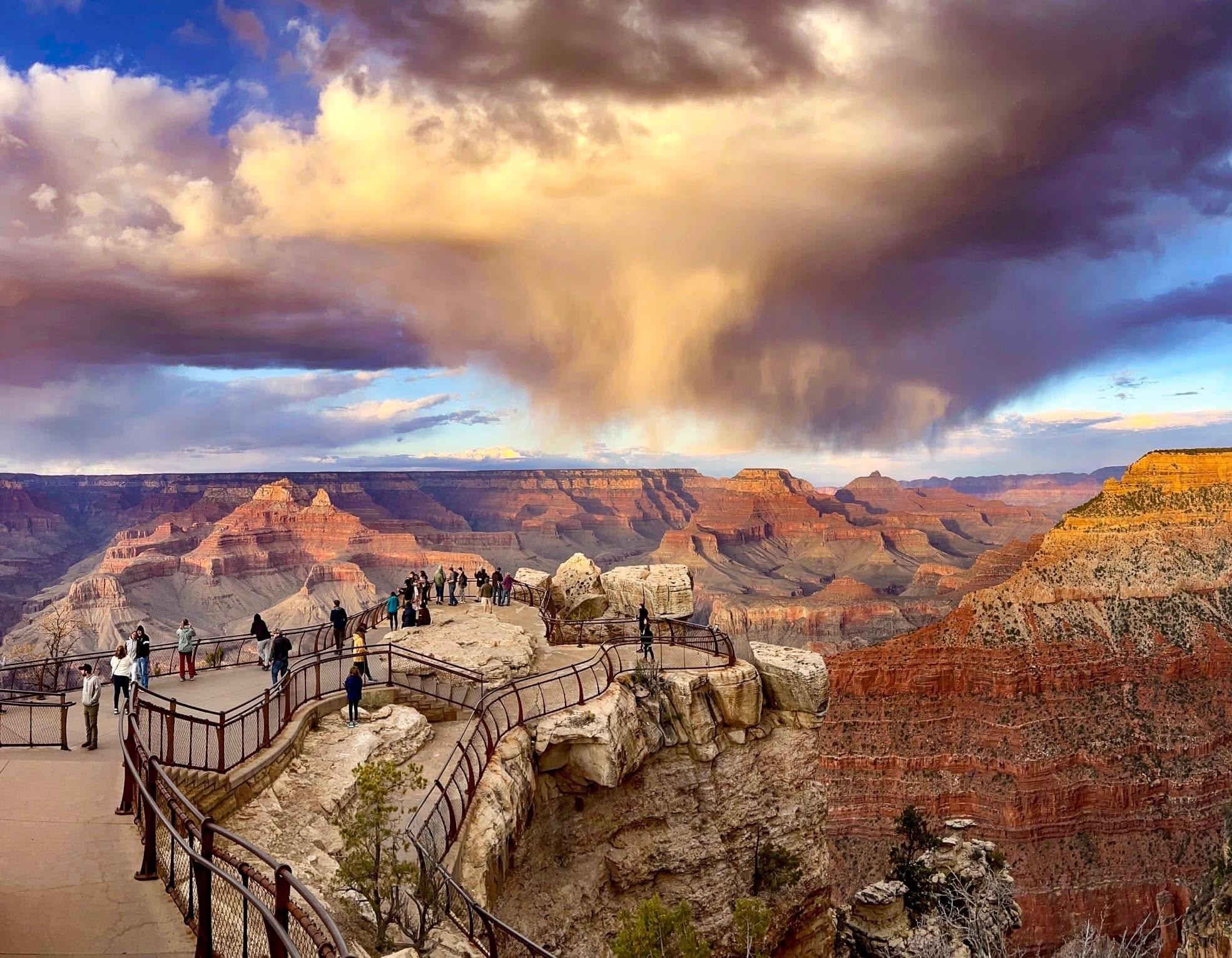


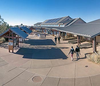


No structured outing assessments have been reviewed for this park yet. Check the official accessibility guide for your requirements.
Compare accessibility details → Canyons
Utah
Follow the paths where people have walked for thousands of years. Gaze up at massive sandstone cliffs of cream, pink, and red that soar into a brilliant blue sky. Experience the tall, stretching walls of a narrow slot canyon. Zion’s unique array of plants and animals will enchant you as you absorb the rich history of the past and enjoy the excitement of present-day adventures.
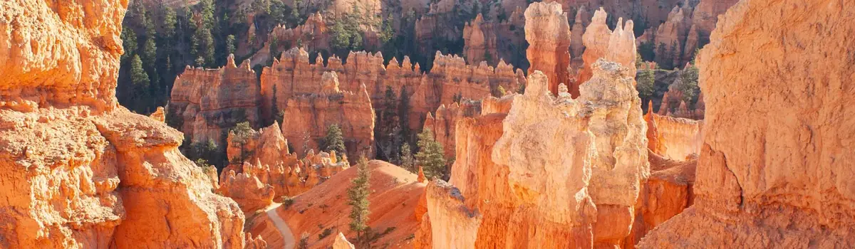 Canyons
Utah
Hoodoos (irregular columns of rock) exist on every continent, but here is the largest concentration found anywhere on Earth. Situated along a high plateau at the top of the Grand Staircase, the park's high elevations include numerous life communities, fantastic dark skies, and geological wonders that defy description.
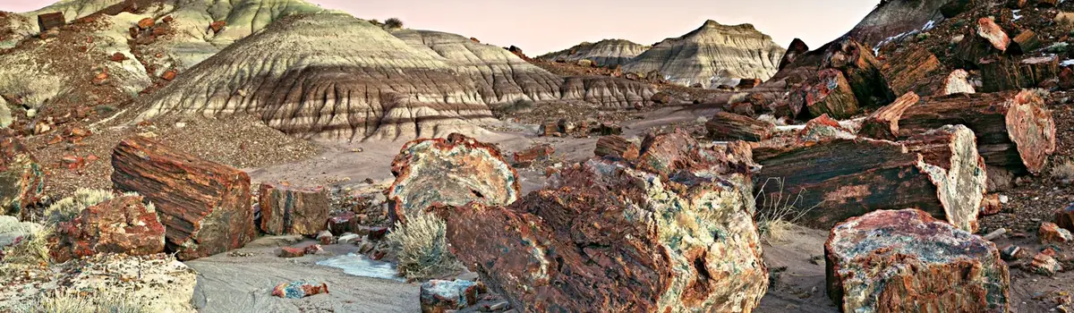 Desert
Arizona
A landscape where deep time lies fully on display, Petrified Forest National Park blends colorful badlands, vast grasslands, and one of the world’s largest and most vivid collections of petrified wood. Spanning more than 200 million years of geologic history, the park protects ancient fossils, ancestral Puebloan sites, habitat for desert animals, and a sweeping stretch of historic Route 66.