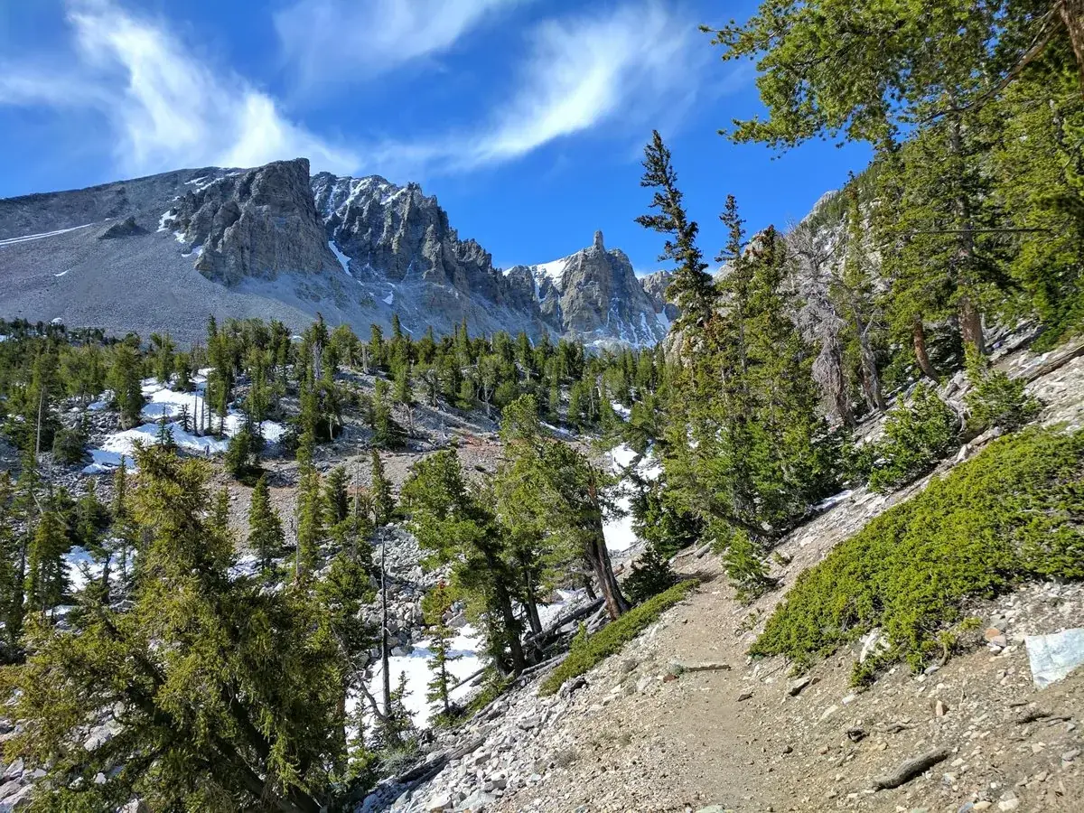
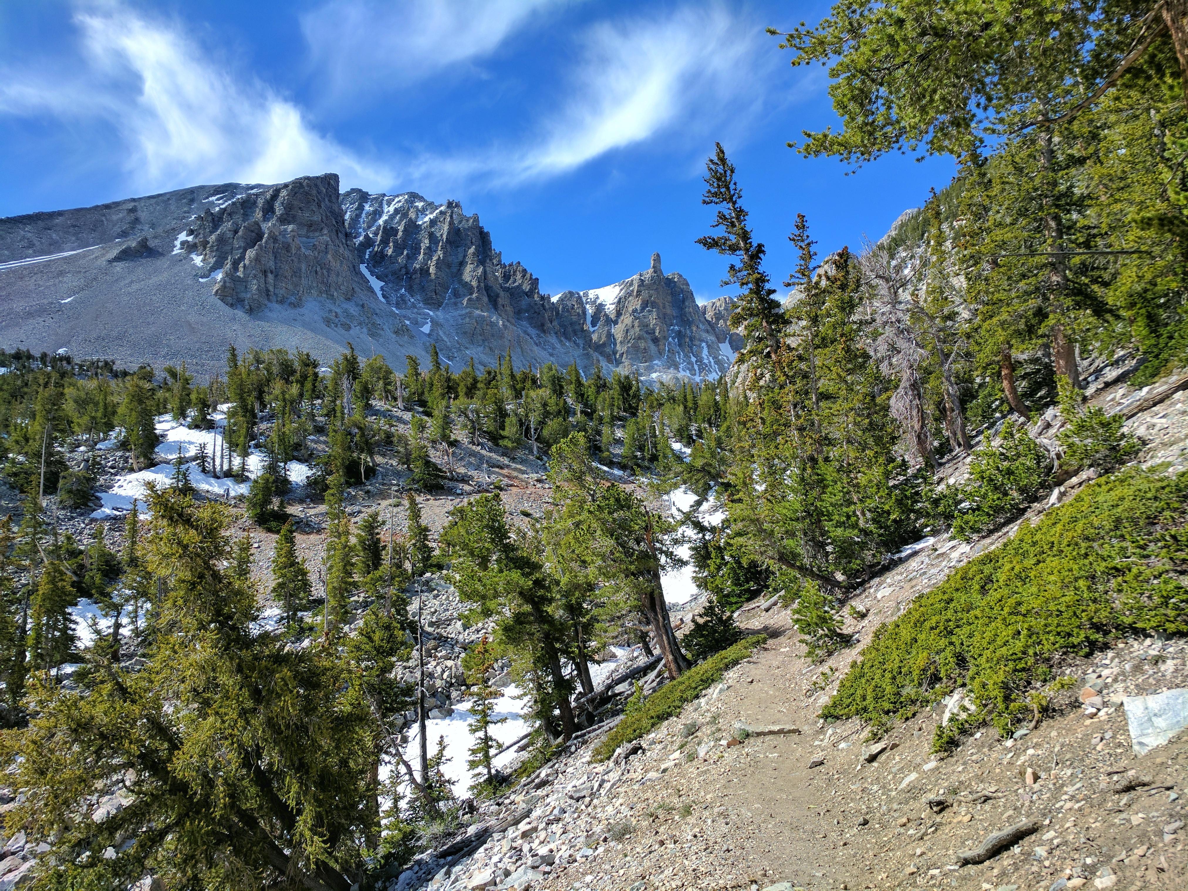
From the 13,063-foot summit of Wheeler Peak to the sagebrush-covered foothills, Great Basin National Park hosts a sample of the incredible diversity of the larger Great Basin region. Come and partake of the solitude of the wilderness, walk among ancient bristlecone pines, bask in the darkest of night skies, and explore mysterious subterranean passages. There's a lot more than just desert here.
77.2Kacres of parkland
161.2Krecreation visits, 2025
Regional datanearby climate picks
Seasonal access & reservations
No reviewed guidance for this selection. Check the park's official planning pages; missing coverage does not establish access.
Selected guidance only; separate from climate comfort and current conditions.
Official conditions Not checked
The conditions feed has not been connected for this park.
Editorial recommendations, reviewed 2026-10-17. Full park days, excluding travel to and from the region. A first-visit outline for a general traveler; adapt to mobility, fitness, season, reservations, and current conditions. These are suggested days, not reserved activities or guaranteed routes.
Left: NPS / J. Reynolds Middle: NPS / Tim Russon Right: NPS / Michael Kelzenberg
Whether visiting for a day, or week, endless opportunities abound for recreation and relaxation in Great Basin National Park! Be sure to check the following pages for important information before your visit: Pets , Goods & Services , and Current Conditions .
Stop at a visitor center and ask a ranger for recommendations on activities to fit your schedule and your group. Though your plans may change with the weather and the seasons, below are a few ideas to get you started.
How long is your trip?
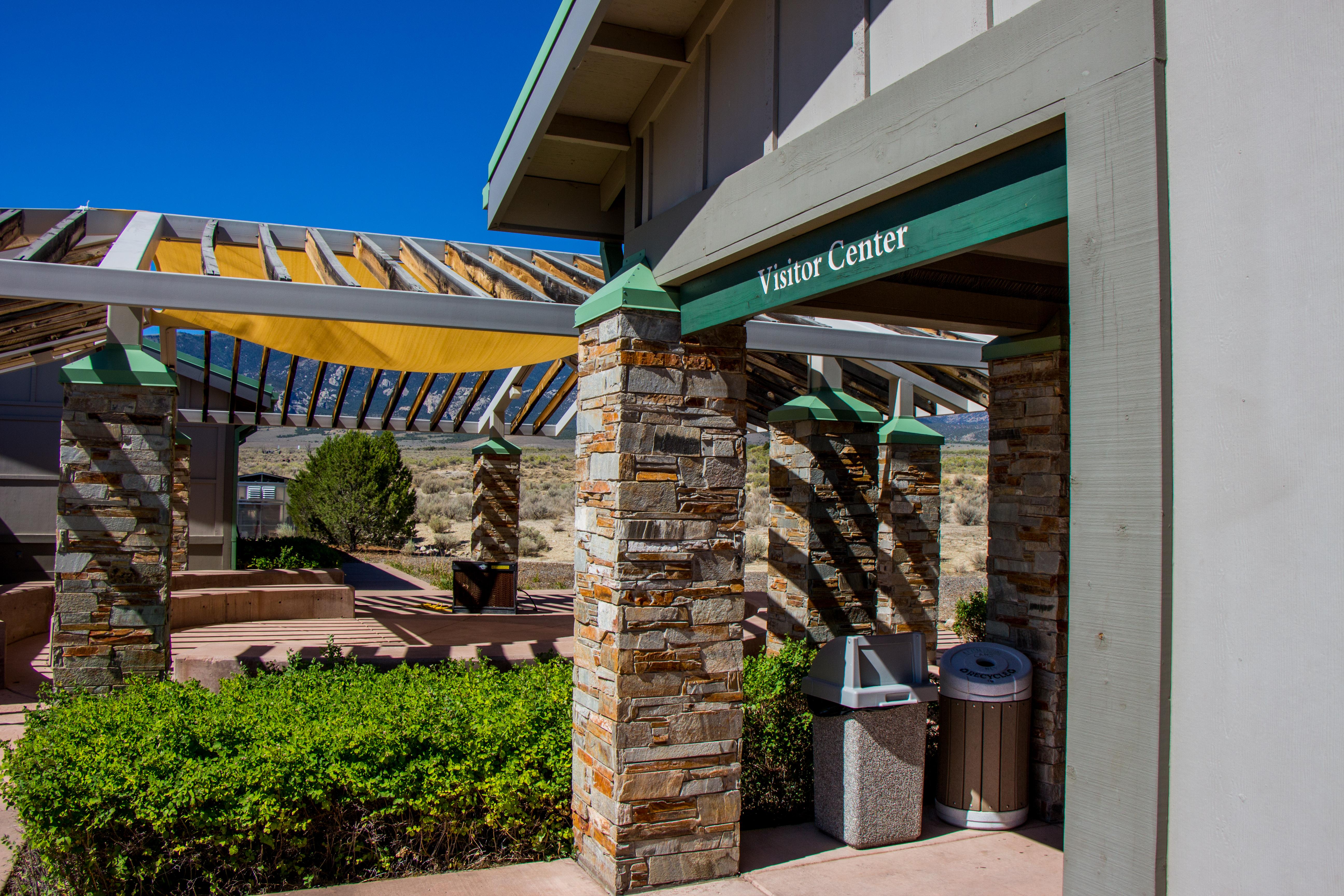
Explore the exhibits within the Lehman Caves Visitor Center (open year round) or the Great Basin Visitor Center (summers only). Lehman Caves Visitor Center exhibits focus on the history, ecology, and geology of Lehman Caves and our night skies, while the Great Basin Visitor Center showcases a width swath of the Great Basin's human and cultural history, plant and animal life, and our bristlecone pines.
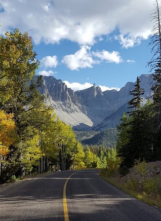
Drive the Wheeler Peak Scenic Drive and listen to the self-guided "Great Basin Life Zones" tour though the National Park Service app .
Join a ranger led tour of Lehman Caves . Tours explore a cave system that has been open to the public since 1885 and is full of unique cave formations, history, and nature. Typically, reserve your ticket through recreation.gov and know that tickets are rarely available in person.
Hike along the short Mountain View Nature Trail near the Lehman Caves Visitor Center, or take a brief walk along the Sky Island Forest Trail at the end of the Wheeler Peak Scenic Drive. The Mountain View Nature Trail has an accompanying self-guided tour, available via a booklet from the front desk of the visitor center or the NPS app . The Sky Island Forest Trail is an introduction to Great Basin’s irreplaceable riparian ecosystem – and a great way to beat the summer heat. You'll find it is also fully accessible and can be reached during the summer months.
Sign up and complete a Junior Ranger book – learn about the Great Basin and complete enough activities to earn your Junior Ranger badge! Badges are available at both visitor centers during the summer months. Stay up a bit later to complete the Junior Ranger Night Explorer book and earn a Great Basin specific patch.
From the end of the Scenic Drive, hike the Bristlecone Pine Trail to see the oldest living organisms in the world (2.8 miles round trip). Continue further up the trail to see Nevada's only remaining glacier at the base of Wheeler Peak.
Attend a variety of ranger programs offered at visitor centers and/or along one of the park’s scenic trails. Call or check in with a ranger at the Lehman Caves Visitor Center for a daily schedule.
Enjoy lunch with the whole family at one of our many picnic areas , such as secluded Pole Canyon off the Baker Creek Road, or the Mather Overlook with incredible views of Doso Doyabi and Wheeler Peak.
Find a comfortable spot after sunset for some personal stargazing like at Mather Overlook or the Baker Archaeological Site. Here on a summer weekend? Catch a ranger-led astronomy program under one of the darkest night skies in the country.
Two or More Days
For an even more quiet adventure, hike into the backcountry via the Baker/Johnson Lake Loop Trail . Backcountry camping in these areas requires a permit, so check in first with a ranger at the visitor center to fill one out and learn current conditions. This is a great beginning backpacking loop with ample scenery, camping locations, and fresh water.
Explore down Snake Creek Road and camp at one of the primitive campsites without a reservation or fee. Explore the mountains and trails around the Snake Creek Trailhead at the end of the road for seclusion and beauty away from the crowds of the Alpine Lakes or Bristlecones.
Explore the many creeks of the Snake Range for fishing opportunities , or go beyond the park boundary towards Utah's Pruess Lake or Cummin's Lake by Ely, NV. Learn about fishing regulations to ensure continued access to fishing for all.
Hike to Lexington Arch , one of the world's largest limestone arches, on the south end of the park. This is the park's only trail that allows pets, so take your furry friend to enjoy the warmth of this sunny trail.
Visit the burn scar of the 2016 Strawberry Fire up in the park's north end. Strawberry Creek Road offers opportunities for exploring along the creek, finding elk, changing aspens, and a mixture of easy to strenuous trails .
Summit Wheeler Peak (13,063ft), Nevada's tallest peak entirely within the state. Be prepared for the trail to be 20-30 degrees F colder than at the Lehman Caves Visitor Center and for summer's afternoon thunderstorms.
Visit the Baker Archeological Site to see the site of an excavated Fremont Indian Village. Visit on the summer solstice for a spectacular line up of the geometry of the site and the rising sun.
Visiting at different times of year
Emerging from Winter's Slumber Visiting Great Basin in Spring Spring is a transitional time leaving an uncertainty to current conditions. Come ready for cold and snow or the start of a warm summer.
Open and Exciting Visiting Great Basin in Summer Summer at Great Basin is a wonderful season to visit with reliably comfortable conditions.
Colorful and Serene Visiting Great Basin in Fall Fall usually means great access to the park but without the crowds of summer. Fall colors abound & find night skies stretched above
Calm and quiet Visiting Great Basin in Winter Winter is the quietest season of the year and offers unique experiences in the park not seen during the summer.
Operating Hours & Seasons Check here for visitor center hours and seasonal recommendations for activities on the park.
Weather Know before you go by checking weather for your visit.
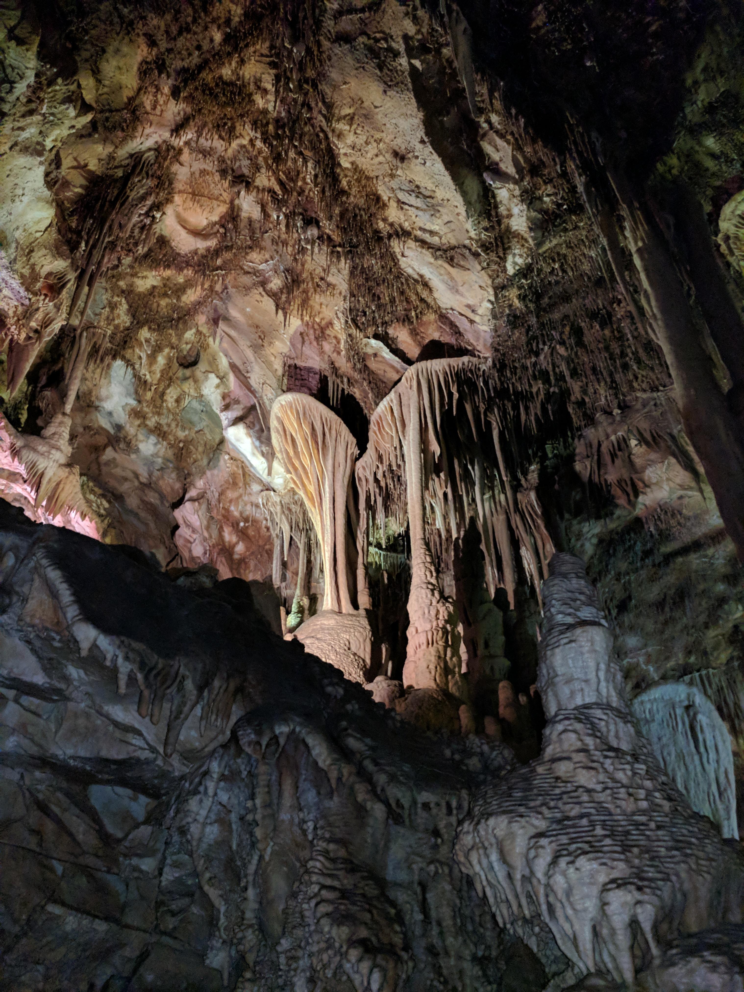
Enter the remarkable Lehman Caves and explore a unique marble cave full of stalactites, stalagmites, popcorn, cave shields, and mystery.
Check out our free ranger-led Astronomy Programs.
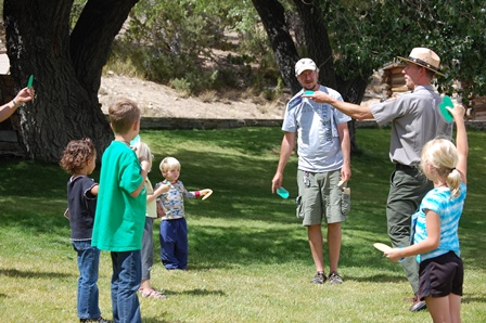
Rangers provide evening programs in the park between Memorial Day and Labor Day on a number of topics. Come join us!
Learn all about the night sky, cave formations, wildlife, and ecosystems while earning a Jr Ranger badge or Dark Jr Ranger patch!
Other Ranger Programs
We periodically offer other programs. During the summer months, rangers present programs for all ages at the Lehman Caves Visitor Center almost daily. Check at the Lehman Caves Visitor Center for times and topics.
Find a hike in the park based on where you plan on visiting. Important to note that only trails on the Wheeler Peak Scenic Drive are accessible via a paved road. All others are gravel or require four wheel drive.
Wheeler Peak Scenic Drive Hiking Trails
Most visits primarily stay on the paved Scenic Drive. Many trails leave along the road and even short treks enhance the casual visit.
Baker Creek Hiking Trails
Trails off the gravel baker creek road are excellent any time of year, and offers fantastic backpacking opportunities.
Snake Creek Hiking Trails
Snake Creek offers a variety of trails and sights. Find the best trail for you!
Strawberry Creek Trails
Find excellent opportunities for spotting wildlife or spectacular displays of wildflowers in this lesser-travelled area.
Lexington Creek Hiking Trails
Lexington Creek offers unique vistas and opportunities for exploration not found everywhere
Select a Hike by Difficulty
Find hikes sorted by difficulty. Easy hikes include those that are ADA accessible.
Hikes within the park considered easy. These tend to have little elevation gain and short distance travelling.
Moderate Trails
Moderate trails abound for the hiker who wants to get out of the car and experience more of the park.
Strenuous and Overnight Hikes
Carrying your life on your back? Click here for overnight hikes, or the strenuous ones to test your abilities.
How to pick a trail:
Pick a trail within your ability level. Don't push yourself too hard especially when not acclimated or under-prepared.
Consider starting altitude, many trails go beyond 10,000ft and altitude sickness can be a very real danger while hiking.
Keep in mind all of Great Basin's backcountry regulations and follow them carefully. Pets are not allowed on park trails with the sole exception of the Lexington Arch Trail.
Consider timing. Most people hike about 2 miles/hour, or about 3 kilometers/hour, so leave plenty of time in the day for your hike, or take a good source of light for night hiking. Additionally, many trails and areas of the park will see afternoon thunderstorms during the summer months.
Coming in Winter? Check out the Visiting in Winter page.
Look for road conditions updates on the Alerts page . Many roads close in the winter even if trails technically remain open, limiting access or significantly increasing the length of a hike.
All trails remain open in winter time, but are generally covered in several feet of snow. Snowshoeing and backcountry/crosscountry skiing are the top activities for being on trails in winter. Check the Winter Touring page for popular winter routes.
Navigation can be extremely difficult in winter for the uninitiated. Check with park rangers for the most up-to-date conditions and which hikes/routes are well marked.
Official NPS features and USGS park boundaries, imported 2026-10-17. An inventory snapshot, not live trail or parking availability.
Loading official park features…
TrailsPoints of interestParkingZoom with buttons or pinch. Toggle layers on the map.
Map coverage varies. Trail names may represent segments, connectors, or shared park units; mapped lines are not a hiking recommendation. Use official conditions and navigation resources before heading out.
NPS public GIS inventory, imported 2026-10-17. “Existing” is an inventory classification, not confirmation that a trail is open. Segment counts are not route distances. Parking records do not indicate space availability, fees, or accessibility certification. View government source ↗
Climate for Cedar City, 181 km from the park reference point. 1991–2020 normals. Source elevation: 1,782 m.
This climate location is distant from the park. Use these values as regional context only. Do not use its climate ranking to choose park travel dates.
Daytime highNighttime lowOctober: 61° / 35°
Daytime high61°
Precipitation36 mm
Daylight11.0 hrs
Wind8.4 km/h
Mountain, rim, valley, and coastal conditions can differ sharply from the source town. Check park forecasts and current conditions before travel.
Monthly climate data 12 months · °F
Month
High
Low
Rain / snow water
Wet days
Daylight
37°
15°
41 mm
6.7
9.7 h
40°
18°
51 mm
7.5
10.5 h
47°
24°
52 mm
7.6
11.7 h
55°
30°
40 mm
7.0
12.9 h
66°
39°
29 mm
6.2
14.0 h
79°
49°
11 mm
2.3
14.6 h
84°
56°
25 mm
5.3
14.3 h
82°
55°
27 mm
5.5
13.5 h
74°
46°
26 mm
4.5
12.3 h
61°
35°
36 mm
5.2
11.0 h
47°
23°
32 mm
4.8
10.0 h
37°
15°
38 mm
5.9
9.4 h
RESEARCH WITH THE SOURCE IN VIEW
The practical field guide.
Official NPS excerpts imported 2026-10-17. Fees, permits, road access, and operations can change; use the source link to confirm the latest information.
Great Basin National Park offers a variety of opportunities for visitors with disabilities. Much can be learned about Great Basin National Park from your vehicle and from accessible facilities and programs. This wild landscape, rich in natural and cultural history, is a wonderful place to spend the day, a week, or more! Great Basin National Park is constantly striving to improve accessibility for all visitors. If you have any questions or comments about accessibility at Great Basin, e-mail us or call 775-234-7331.
Access Pass holders receive a 50% discount on camping and cave tour fees. While Great Basin does not charge an entrance fee, it will also cover the cost of entrance at all National Park Sites across the United States. Inquire at the Lehman Caves Visitor Center about this lifetime pass, which is available at no cost for U.S. citizens and permanent residents with permanent disabilities. This free, lifetime pass is valid at National Park Service, Bureau of Land Management, US Fish and Wildlife Service, US Forest Service, US Army Corps of Engineers, and Bureau of Reclamation sites.
Lehman Cave Tours
Brief tours of the first room of the cave, the Gothic Palace, are available for those unable to negotiate the stairs and narrow passageways of the tour route. Participants join the tour into the first room of the tour route, and are escorted out of the cave by a ranger. Another friend or family member must be available to assist visitors in non-motorized wheelchairs.
Please be advised that wheelchairs are not available at the park. First room tours may not be available on every tour, depending on staffing levels.
Service Animals
Medical Facilities
Call 911 for emergency medical or police assistance or to report accidents or injuries. William Bee Ririe Rural Health Clinic 1500 Avenue H, Ely, NV 89301 775-289-3612 https://www.wbrhely.org/william-bee-ririe-rural-health-clinic Delta Community Hospital 126 S White Sage Ave Delta, UT 84624 435-864-5591 https://intermountainhealthcare.org/locations/delta-community-hospital/ Cedar City Hospital 1303 N Main St Cedar City, UT 84721 435-868-5000 https://intermountainhealthcare.org/locations/cedar-city-hospital/
Telephone Relay Services
Learn about bringing your service animal to the park
Discover options for those with limited mobility or in wheelchairs
Find out what options are available for those with difficulty hearing or deafness.
Learn options and alternatives for those with vision impairment
An entrance pass is not required to access Great Basin National Park.
Other National Park Service sites may require an entrance pass or fee. Depending on your trip plans, an interagency pass may save you money.
2026 Free Entrance Days in the National Parks
Come experience the national parks! All National Park Service sites that charge an entrance fee will offer free admission to US citizens and residents (other fees, including timed entry or reservation fees, may apply). Mark your calendar for these entrance fee-free dates:
February 16 : Presidents Day (Washington's Birthday)
May 25 : Memorial Day
June 14: Flag Day/President Trump's birthday
July 3–5: Independence Day weekend
August 25: 110th Birthday of the National Park Service
September 17: Constitution Day
October 27 : Theodore Roosevelt's birthday
November 11: Veterans Day
Lehman Caves Tours
Gothic Palace Tour - 30 minutes
Fees: Adults (16 years and older): $8.00 Youth (5 to 15 years old): $4.00 Infants & Toddlers (under 5 years old): Free Access Pass and Senior Pass holders are entitled to a 50% discount on cave tour tickets for the cardholder only . The discount will not apply to the entire group . Children under five (5) years old are permitted on the Gothic Palace Tour. Often, children can become upset in a new, foreign feeling cave environment. If children become too disruptive during a tour, a ranger may remove an adult and child to preserve the experience of the rest of the tour group at their discretion. Refunds are available if this occurs. Tours are limited to 20 without exception. All adults, children, and toddlers need tickets . If you do not have enough tickets, you will not be allowed on the tour.
Parachute Shield Tour - 60 minutes
Lodge Room Tour - 60 minutes
Fees: Adults (16 years and older): $12.00 Youth (5 to 15 years old): $6.00 Infants & Toddlers (under 5 years old): Free Access Pass and Senior Pass holders are entitled to a 50% discount on cave tour tickets for the cardholder only . The discount will not apply to the entire group . Children under five (5) years old are permitted on the Lodge Room Tour. Often, children can become upset in a new, foreign feeling cave environment. If children become too disruptive during a tour, a ranger may remove an adult and child to preserve the experience of the rest of the tour group at their discretion. Refunds are available if this occurs. Tours are limited to 20 without exception. All adults, children, and toddlers need tickets . If you do not have enough tickets, you will not be allowed on the tour.
Grand Palace Tour - 90 minutes
Fees: Adults (16 years and older): $15.00 Youth (5 to 15 years old): $8.00 Infants & Toddlers (under 5 years old): Not Allowed Access Pass and Senior Pass holders are entitled to a 50% discount on cave tour tickets for the cardholder only . The discount will not apply to the entire group . Children under five (5) years old are not allowed on Grand Palace Tours. Lodge Room Tours are the alternative to the Grand Palace Tours which allow children of all ages. Tours are limited to 20 without exception. All adults and children need tickets . If you do not have enough tickets, you will not be allowed on the tour.
Introduction to Wild Caving Tour - 3 hours
First Room Accessible Tour
Fees: Adults (16 years and older): $5.00 Youth (5 to 15 years old): $2.00 Infants & Toddlers (under 5 years old): Free Access Pass and Senior Pass holders are entitled to a 50% discount on cave tour tickets for the cardholder only . The discount will not apply to the entire group . For those in wheelchairs, there is no guarantee you will be able to visit the cave. The entrance tunnel is historic and not ADA-approved. A friend or family member must be available to assist those in non-motorized wheelchairs, and be comfortable navigating the wheelchair down a steep grade. Rangers are not able to assist with propelling wheelchairs. Wheelchairs are not available at the park. First room tours may not be available on every tour, depending on staffing levels.
Please check in at the Lehman Caves Visitor Center at least 15 minutes in advance of your tour's scheduled start time. If you have not checked in with the front desk to claim your reserved tickets within five minutes of the scheduled start time of your tour, your tickets will be considered forfeit. Refunds will not be provided for late arrivals or missed tours. Give yourself plenty of travel time. Wide loads and weather are some of a number of items which can slow your journey. Refunds will not be provided for late arrivals or missed tours. Refunds for Lehman Caves Tours will not be provided the day of the tour. Refunds requested at least a day prior to the tour will be honored minus the $1 per ticket charged by Recreation.gov.
Visit Recreation.gov to
NPS / A. Dimmick
All developed campgrounds in the park have a $20 per night fee. America the Beautiful Senior Passholders and Access Passholders are eligible for a 50% discount for the entirety of their stay. Campground fees can only be paid through reservation on Recreation.gov . Group Camping is available during the summer months at Grey Cliffs Campground sites A5, C1 and C2. All group sites are limited to 16 campers and are $30 per night. RVs and trailers are not allowed at Grey Cliffs Campgound due to narrow, one-way dirt roads.
RV Sanitary Station/Dump Station
The park dump station is open seasonally, located by the Lehman Caves Visitor Center. The $10 dump fee can be paid at the Lehman Caves Visitor Center when it is open. Water is available seasonally and at no charge . Dump stations are also available to the public in the town of Baker at several businesses. Prices vary.
Great Basin National Park is located in extremely remote, east-central Nevada, five miles west of the town of Baker. This is a remote area with limited services, little to no cell coverage, and large stretches between gas and grocery services. Plan ahead and pack diligently in case of breakdowns, unexpected snow/dust/lightning storms, and no quick access to many conveniences. Goods & Services around the park including convenience stores, gas stations, and more. Current conditions at Great Basin National Park.
Phone navigation apps may be untrustworthy
Do not rely on navigation apps to guide to correct locations. Many will route you incorrectly to extremely remote locations within the park.
Cars, trucks, and RVs
Do not rely on navigation apps to guide to correct locations. Many will route you incorrectly to extremely remote locations. For best results, route to the "Lehman Caves Visitor Center," the "Great Basin Visitor Center," or to the town of Baker, Nevada.
From the east or west: From U.S. Highway 6 & 50, turn south on Nevada State Highway 487 and travel five miles to Baker, NV. In Baker, turn west on Highway 488 and travel five miles to reach the park.
From the south (Utah): Travel north on Utah State Highway 21 through Milford, UT and Garrison, UT, which will become Nevada State Highway 487 as you cross the border. Turn west on Highway 488 in Baker and travel five miles to reach the park. Keep in mind, you will be crossing into the Pacific Time zone when you cross the Nevada border.
From the south (Nevada): Travel north on U.S. Highway 93 (Great Basin Highway). At the junction of U.S. Highway 6 & 50, drive east to Nevada State Highway 487 and turn south. Travel five miles to Baker, NV. In Baker, turn west on Highway 488 and travel five miles to reach the park.
The nearest commercial airports are Cedar City Regional Airport, Utah, (142 miles) and St. George Regional Airport, Utah (207 miles). Both offer limited regional flights and no rental cars. The nearest full-service airports are found in Salt Lake City, Utah (234 miles) and Las Vegas, Nevada (286 miles). Both offer rental cars, international flights, and the amenities that come with being in a major metropolitan area.
Public Transportation
No public transportation is available to, in, or around Great Basin National Park.
Call 911 for emergency medical or police assistance or to report accidents or injuries. William Bee Ririe Rural Health Clinic (About 70 miles away) 1500 Avenue H, Ely, NV 89301 775-289-3612 https://www.wbrhely.org/william-bee-ririe-rural-health-clinic Delta Community Hospital (About 100 miles away) 126 S White Sage Ave Delta, UT 84624 435-864-5591 https://intermountainhealthcare.org/locations/delta-community-hospital/ Cedar City Hospital (About 140 miles away) 1303 N Main St Cedar City, UT 84721 435-868-5000 https://intermountainhealthcare.org/locations/cedar-city-hospital/
NPS Photo/Stephanie Campbell
Cell phone reception is not reliable in the park and surrounding areas. Do not rely on them! In case of emergency, call 911 from a landline or contact a park ranger or campground host.
It is easy to become dehydrated when hiking in the dry desert air. Carry plenty of water and drink it!
Note: All surface water should be chemically treated, boiled, or passed through a filter capable of eliminating harmful microbes and parasites, such as giardia, before drinking.
Driving conditions in the park can be hazardous. Please obey all posted speed limits, and use lower gears on long downhill sections to prevent overheated brakes. Seatbelts are required in both Nevada and the park. Please stop only at pullouts. Watch for wildlife - especially deer on the Scenic Drive and marmots on the Baker Creek Road - and pedestrians. Congestion in the visitor center parking areas can lead to accidents. The Wheeler Peak Scenic Drive beyond Upper Lehman Campground is closed to large vehicles and trailers longer than 24 feet.
Altitude Sickness
Altitude sickness is a condition brought on by high elevations often in conjunction with strenuous activity. Symptoms include difficulty breathing, nausea, incoherent speech, and headache. The cure is to descend immediately. Altitude sickness can be life threatening. To avoid altitude sickness, ascend slowly, eat lightly and frequently, and drink plenty of water.
Lightning injures more people every year than wildlife. Be on the lookout for fast moving dark clouds and the sound of thunder. Electrical storms are common in the summer months, with frequent quick changes in the weather. Move away from exposed ridges and summits, and immediately descend to lower elevations if threatening clouds begin to build. During storms, winds at ridgelines above 10,000 feet are often 30-60 miles per hour. Do not take cover under trees when lightning is imminent. In open areas, crouch low to the ground. Avoid being the tallest object and don’t be around other tall objects (i.e. lone trees) when lightning is imminent.
Sunburn is a common problem when hiking at high elevations. The atmosphere is thin and does not filter the sun's rays, so people burn quickly. Wear a hat and sunscreen. Excessive sun exposure, combined with high temperatures, can cause heat stroke.
Talus slopes are common in the park above tree-line. Use caution when hiking in areas such as the Wheeler Peak, Bristlecone Pine, and Glacier Cirque trails. Wear proper footgear that provides ankle support and protects against sharp rocks. Don't be deceived by rocks that appear stable.
Hypothermia is a serious condition where a person's body temperature becomes dangerously low. It can occur at temperatures well above freezing. Avoid hypothermia by wearing appropriate, layered clothing. Do not wear cotton clothing, which becomes very cold when wet. Carry extra clothes, drink plenty of fluids, and stay dry. Signs of hypothermia include: uncontrolled shivering and slurred speech, followed by drowsiness, lack of interest, and incoherent speech. If someone shows signs of hypothermia, warm the individual slowly, replace wet clothes with dry ones, and give the person warm liquids without caffeine or alcohol.
Avalanche Danger
Hikers should recognize and avoid areas threatened by avalanches. Ridgelines are generally much safer to travel on than open faces or valleys. Areas with large, healthy trees are less likely to avalanche than barren slopes.
Backcountry Hiking, Camping, and Skiiing
Planning to spend one or more nights in the backcountry? Please register at a visitor center as a safety precaution. In all cases, you should tell a friend or family member where you are going and when you plan to return.
Abandoned Mines
Abandoned mines are common in the park and the surrounding region. They can be extremely dangerous . Shafts and tunnels are unstable - do not enter them. Great Basin National Park is currently working to make abandoned mines in this area safer.
In established campgrounds, campfires are permitted in fire rings and barbecue grills only. In the backcountry, fires are allowed below 10,000 feet in elevation and groups may not construct their own fire rings. No open fires are allowed anywhere in the park above 10,000 feet. Campfires must be attended at all times, and must be completely out before leaving the area. Exercise caution when using gas stoves, charcoal grills, and cigarettes.
Dead and down wood can be gathered and used for firewood, with the exception of Bristlecone pine wood or any type of wood found above 10,000 feet. Chain saws are not permitted anywhere in the park.
Wildlife are not tame! Do not feed any animals - including chipmunks or squirrels. Observe wildlife at a safe distance and never approach them.
Rattlesnakes are rather timid, and stay camouflaged in sagebrush and rocky ledges. The greatest potential risk occurs when gathering wood, reaching into brush, or on rocky ledges. Stepping on a snake is a potential hazard, and is one reason you should stay on maintained trails, where snakes are easiest to see. Mountain lions live in Great Basin National Park. However, sighting this secretive animal is rare. Mountain lions try to avoid confrontation. If you do meet one - stay calm, do not run, and give it a way to escape. Hold your ground, face the lion, and back away slowly, raising your arms to make yourself appear larger. If the lion acts aggressively, wave your arms, make loud noises, and throw objects at it. If attacked, fight back! If you see or encounter a mountain lion, please report it to a ranger at one of the visitor centers.
Find a hike in the park based on where you plan on visiting. Important to note that only trails on the Wheeler Peak Scenic Drive are accessible via a paved road. All others are gravel or require four wheel drive.
Wheeler Peak Scenic Drive Hiking Trails
Most visits primarily stay on the paved Scenic Drive. Many trails leave along the road and even short treks enhance the casual visit.
Baker Creek Hiking Trails
Trails off the gravel baker creek road are excellent any time of year, and offers fantastic backpacking opportunities.
Snake Creek Hiking Trails
Snake Creek offers a variety of trails and sights. Find the best trail for you!
Strawberry Creek Trails
Find excellent opportunities for spotting wildlife or spectacular displays of wildflowers in this lesser-travelled area.
Lexington Creek Hiking Trails
Lexington Creek offers unique vistas and opportunities for exploration not found everywhere
Select a Hike by Difficulty
Find hikes sorted by difficulty. Easy hikes include those that are ADA accessible.
Hikes within the park considered easy. These tend to have little elevation gain and short distance travelling.
Moderate Trails
Moderate trails abound for the hiker who wants to get out of the car and experience more of the park.
Strenuous and Overnight Hikes
Carrying your life on your back? Click here for overnight hikes, or the strenuous ones to test your abilities.
How to pick a trail:
Pick a trail within your ability level. Don't push yourself too hard especially when not acclimated or under-prepared.
Consider starting altitude, many trails go beyond 10,000ft and altitude sickness can be a very real danger while hiking.
Keep in mind all of Great Basin's backcountry regulations and follow them carefully. Pets are not allowed on park trails with the sole exception of the Lexington Arch Trail.
Consider timing. Most people hike about 2 miles/hour, or about 3 kilometers/hour, so leave plenty of time in the day for your hike, or take a good source of light for night hiking. Additionally, many trails and areas of the park will see afternoon thunderstorms during the summer months.
Coming in Winter? Check out the Visiting in Winter page.
Look for road conditions updates on the Alerts page . Many roads close in the winter even if trails technically remain open, limiting access or significantly increasing the length of a hike.
All trails remain open in winter time, but are generally covered in several feet of snow. Snowshoeing and backcountry/crosscountry skiing are the top activities for being on trails in winter. Check the Winter Touring page for popular winter routes.
Navigation can be extremely difficult in winter for the uninitiated. Check with park rangers for the most up-to-date conditions and which hikes/routes are well marked.
Before your visit, download the National Park Service App (instructions there) and save Great Basin National Park offline to see locations within the park and your own location as you move through.
Download a printable, official park map [4MB JPG] , find a PDF version here [87MB PDF] , or use the interactive version above.
Use a free app like Avenza Maps and download the free park map , showing your location and allowing tracking and pin dropping.
Pick up a copy of the paper brochure at either Visitor Center in the park.
Download maps of the park's five developed campgrounds [Wheeler Peak] [Lower Lehman] [Upper Lehman] [Grey Cliffs] [Baker Creek]
Use the USGS interactive topographic map here or download free images of relevant quadrangles below.
Beware using your phone's navigation apps
Unofficial navigation apps may sometimes dangerously route visitors to extremely remote park areas. Pay attention to park signs, as you may be going somewhere unintended when navigating only using phone apps.
Topographic Maps
Great Basin National Park is covered by six topographic maps in the U.S. 7.5 minute series. The Wheeler Peak and Kious Springs maps cover much of the high-elevation backcountry. The Windy Peak map covers a number of the most popular trails and well-developed trails. The Lehman Caves map covers mostly low-elevation areas outside the park. The most remote, least-used backcountry areas are covered by the Minerva Canyon and Arch Canyon maps.
Download free images of the USGS Quadrangles below:
Windy Peak [7MB]
Lehman Caves [4MB]
Wheeler Peak [9MB]
Kious Springs [7MB]
Minerva Canyon [8MB]
Arch Canyon [7MB]
Other Public Lands
Great Basin National Park is surrounded by lands managed by the US Forest Service and the Bureau of Land Management, which are free to recreate and camp on with their own rules and regulations distinct from the National Park Service. Find a free, digital, interactive map of these public lands by clicking this link.
Start here for information regarding hours, weather, road conditions, and more. Come by a Visitor Center for more info during your visit.
Great Basin has five campgrounds available for visitors. Some campgrounds are closed seasonally due to weather.
Check out the dozens of miles of trails available in the park, taking you to gorgeous lakes, bristlecone pines, and solitude.
Please be aware that having a pet with you will limit your activities in Great Basin National Park. Kennel services are not currently available in the neigboring town of Baker, NV. The nearest kennel services are found in Ely, NV about 60 miles from the park.
Park Pet Regulations
Any animal that is not a trained service animal is considered a pet and must abide by all of the following rules.
Pets must be kept on a leash 6 feet in length or shorter at all times. This is for the protection of the pet, wildlife, and other visitors.
Pets are not permitted in Lehman Caves or at evening programs.
Pets are not permitted on trails or in the backcountry of the park, except leashed pets on the Lexington Arch Trail or the trail between Baker and the Great Basin Visitor Center.
Leashed pets can only be exercised in the campgrounds, in front of the visitor centers, and along roads.
Pet owners are required to immediately remove and properly dispose of fecal matter deposited by their pets. Deposit bags of fecal matter in a dumpster.
Pets may not be left unattended at campsites or tied to trees or other fixtures.
Why are there restrictions on pets in National Parks?
A national park is a refuge for native wildlife. Restrictions are intended to prevent stress and molestation of wildilfe, to protect pets from wildlife that may attack or harm them, and to provide an enjoyable experience for those visitors without pets. Domestic animals can also spread diseases to other wildlife through feces and other bodily fluids.
Horses and other pack animals (mules, burros, and llamas) are welcome in the backcountry of Great Basin. Please follow regulations.
Learn about bringing your service animal to the park
There is almost an 8,000 ft (2,400 m) difference in elevation between Wheeler Peak and the valley floor. Weather conditions in the park vary with elevation. In late spring and early summer, days in the valley may be hot, yet the snow pack may not have melted in the higher elevations. The Great Basin is a desert, with low relative humidity and sharp drops in temperature at night. In the summer, fierce afternoon thunderstorms are common. It can snow any time of the year at high elevations.
National Weather Service Forecasts
Great Basin Visitor Center (Elevation 5,317 ft) - In the town of Baker, NV
Lehman Caves Visitor Center (Elevation 6,825 ft) - At the terminus of Highway 488
Wheeler Peak Campground & Trailhead (Elevation 9,886 ft) - At the top of the Wheeler Peak Scenic Drive
You can also check our Current Conditions page for campground, hiking trail, and road status.
Real-Time Weather Stations in Great Basin National Park
Wheeler Peak SnoTel Station
Weather Station Webcam at 10,049 ft (3,063 m)
Average Temperatures
Temperatures recorded at Lehman Caves Visitor Center: 6,825 feet.
The magnificent Wheeler Peak Scenic Drive dominates many visits at Great Basin National Park. Twelve miles of mountain road leads to an elevation of 10,000 feet, trails to alpine lakes, a grove of the famed Ancient Bristlecone Pines, and the second highest point in Nevada. Difficulties vary from some of the easiest park trails to the hardest, and altitude sickness is an ever-present danger, even for those from higher elevation homes. Beware trailhead traffic jams, as on busy & holiday weekends the parking lot may fill, meaning alternative hikes will be your best bet for finding the solitude parks can provide. Come with your patience and with alternatives in mind! Alpine and sub-alpine environments are some of the most sensitive ecological zones in the park and damage can come easily in the form of an errant step on a sensitive plant, a startling rockfall, or avalanches in the winter. Please take care to remain on trail and beware the dangers that come with the solitude found in these mountains. Find information on trails below, and click on a specific trail for more in depth information, a trail map, and helpful tips.
Directions to the Wheeler Peak Scenic Drive
The Wheeler Peak Scenic Drive is accessed via Highway 488, within the national park boundary. The road is a paved, 12 mile mountain road up from about 6,700 feet to over 10,000 feet. As you pass through the park entrance and see the "Great Basin National Park" sign, the Scenic Drive is just after on the right hand side. Travel up the road tends to take about 30 minutes if visitors do not stop. The road ends at the Bristlecone Trailhead and Wheeler Peak Campground when fully open. Trailheads are located at several locations along the road. Lehman Creek Trailhead is located within the Upper Lehman Creek Campground about 3 miles up the road. Osceola Ditch Trailhead about 5 miles, the Summit Trailhead about 11 miles, and the Bristlecone Trailhead at mile 12.
The Baker Creek area is an oft-underutilized area of Great Basin National Park, and contains multitudes of opportunities to travel easily and shortly, or take the leap into the backcountry with the independence of camping by pristine alpine lakes. Baker Creek is also one of the areas accessible latest into the year, though the road may close due to inclement weather throughout the winter. Baker Creek campground is the only perrenially first-come, first-served campground in the park, perfect for the unprepared or spontaneous traveller. Grey Cliffs campground is best for large groups and those without trailers, hosting the only group campgrounds in the park. Find information on trails below, and click on a specific trail for more in depth information, a trail map, and helpful tips.
Directions to Baker Creek Road
Baker Creek Road is accessed via Highway 488, within the national park boundary. The road is dirt and gravel and 3.5 miles long in total. The Pole Canyon Trailhead is about 1.5 miles down the road and off a side section towards Grey Cliffs Campground with ample signage. The main Baker Creek Trailhead is found at the end of the 3.5 miles, at the top of a small loop.
Rushing water. Creaking pines. Dazzling wildflowers. Winds cresting over ridges. Bristlecones dating to the bronze age. Homes from the 19th century. Snake Creek allows the mind to wander, bridging the senses and connecting us to the natural world. Any trip down the dirt road will remind visitors to this landscape of the relentless power of time and introduce the solitude so many crave. Trails in the Snake Creek area are some of the least tread in the park, and yet some of the most spectacular vistas span the views found on the many mountaintops and ridges accessible from this trailhead. Try the easier Snake Creek Overlook, or commit to the trip up the Snake Divide Trail to the Magic Grove. This road will close in the winter, as snow and ice prevail. Travel to the main entrance up from Baker, NV for more accessible trails during the snowy months. Find information on trails below, and click on a specific trail for more in depth information, a trail map, and helpful tips.
Directions to Snake Creek Road
Snake Creek Road is accessed via Highway 487, either through the town of Garrison, UT or in between the town of Baker, NV and Garrison, UT. Both legs converge a few miles in, then lead to the park boundary and eventually the trailheads. The road is entirely gravel and dirt, so travel with caution after heavy rain.
A landscape shaped by fire stretches up through this meadow filled basin. Strawberry Creek abounds as the hillsides recover from the 2016 Strawberry Fire, allowing an incredible insight to the resilience of this place, along with the recovery efforts of both nature and humans. Trails are found in smaller numbers, but the chance to spot large herbivores like Elk are high, especially during the Rut in the fall. Climb higher up to find spring-fed creeks, a gradient of fall colors in autumn, and fields of wildflowers in spring. Strawberry is not to be missed by the committed traveller, and hiking here will remind all these sacred places are capable of immense change. Find information on trails below, and click on a specific trail for more in depth information, a trail map, and helpful tips.
Directions to Strawberry Creek Road
Strawberry Creek Road is accessed via Highway 50, north of the town of Baker. The first section of the road is paved, before going onto dirt and gravel. A few windy roads are present, so follow the posted signs to find the trailhead. The road is almost entirely gravel and dirt, so travel with caution after heavy rain.
Great Basin National Park has five developed campgrounds : Upper Lehman Creek, Lower Lehman Creek, Baker Creek, Grey Cliffs, and Wheeler Peak. Each developed campground has vault toilets, picnic tables, tent space/pads, and campfire grills. There are no hookups at any park campground. Each campsite is limited to eight people, three tents, and two vehicles. There are three campgrounds with accessible sites. Primitive campgrounds can be found along Snake Creek Road. Lower Lehman Creek is the only campground open in winter . Other campgrounds are generally open May through October, weather permitting. Water is not currently available in campgrounds. Since exact opening and closing dates are dependent on weather conditions, contact a ranger at (775) 234-7331 or check our current conditions online before arrival.
Park campgrounds can be reserved on Recreation.gov in varying windows. Upper Lehman Creek and Grey Cliffs campgrounds may be reserved six months in advance from Memorial Day to Labor Day.
Large groups can be accommodated at Grey Cliffs Campground. Three designated group sites provide privacy and ensure that groups do not disturb campers staying at the individual sites. Go to the Group Camping page for more information. Reservations are required for group camping and can be made at recreation.gov or by calling (877) 444-6777.
What to Do When Great Basin's Campgrounds are Full
Look here for alternative options for camping.
$20.00 for individual sites at developed campgrounds per night/per site. $10.00 for Senior/Access Pass holders. $30.00 per night for group sites at Grey Cliffs Campground , no discount for Senior/Access Pass holders. Reservation only. Primitive sites along Snake Creek require no fee and offer no potable water. During peak season (roughly from Memorial Day through Labor Day) all sites at Upper Lehman, Grey Cliffs, and Wheeler Peak campgrounds are reservable through Recreation.gov or by calling 877-444-6777 no more than 30 days in advance of your visit. For cancellations made at least 24 hours before the reservation date, fees will be refunded, minus a $10 non-refundable deposit per site. No refunds are available for cancellations made less than 24 hours prior to reservation date or no shows. Snake Creek primitive campsites are first-come, first serve.
RV Sanitary Station
There is a dump station, potable water, and trash receptacles located 1/2 mile inside the park on the main entrance road (NV Hwy 488). The dump station is usually open late May to October, weather permitting. There is a $10 fee for use of the dump station. No discounts for Senior or Access passholders.
There are no shower facilities in the park. Pay showers are available outside the park at the Whispering Elms Motel, Campground & RV Park, the Baker Gas Station, and the Border Inn.
Firewood is not available for purchase in the park, but wood may be collected provided that it's already dead and down on the ground. Ferg's Firewood provides bundled wood at two 24-hour, self-pay stations located in Baker. Firewood can also be purchased from the Whispering Elms and Bristlecone General Store.
Campground regulations are posted on the campground bulletin boards. Visitors are responsible for knowing and following all regulations.
Group camping is aimed at larger groups visiting the park, generally in an organization. For example, scout troops, church groups, and community groups often frequent Great Basin's group sites. For now, only Grey Cliffs Campground has these larger group sites for accommodating large groups in a single site. There are additional restrictions however in order to keep the campground in good condition for those who follow and to reduce impact to the local ecology.
Grey Cliffs Campground
Large groups can be accomodated at the A and C Loop of Grey Cliffs Campground, located on the maintained, gravel Baker Creek Road at an elevation of 7,115 feet (2,160 meters). There are three group sites in Loops A & C (A5, C1, and C2) reservable at Recreation.gov .
Groups utilizing the group campsites cannot exceed a maximum group size of 16 persons per site, or 30 persons per loop.
Grey Cliffs Campground does have vault toilets but no potable water. Water is available at the RV Sanitary/Dump Station from late spring through early fall, or the Lehman Caves Visitor Center. Campfires are only allowed in campfire rings. RVs and trailers are prohibited in Grey Cliffs Campground due to the tight turns and campsite space constraints.
Reservations are required, and can be made by calling (877) 444-6777 or by going online to Recreation.gov . Reservations are available in summer 30 days prior to visiting. The fee is $30 per night, for up to 16 people. Full payment is due at the time of reservation. Unlike other campsites, group sites do not allow for Senior/Access passholder discounts.
A FEW REASONS TO GO
A closer look.
16 official park photos
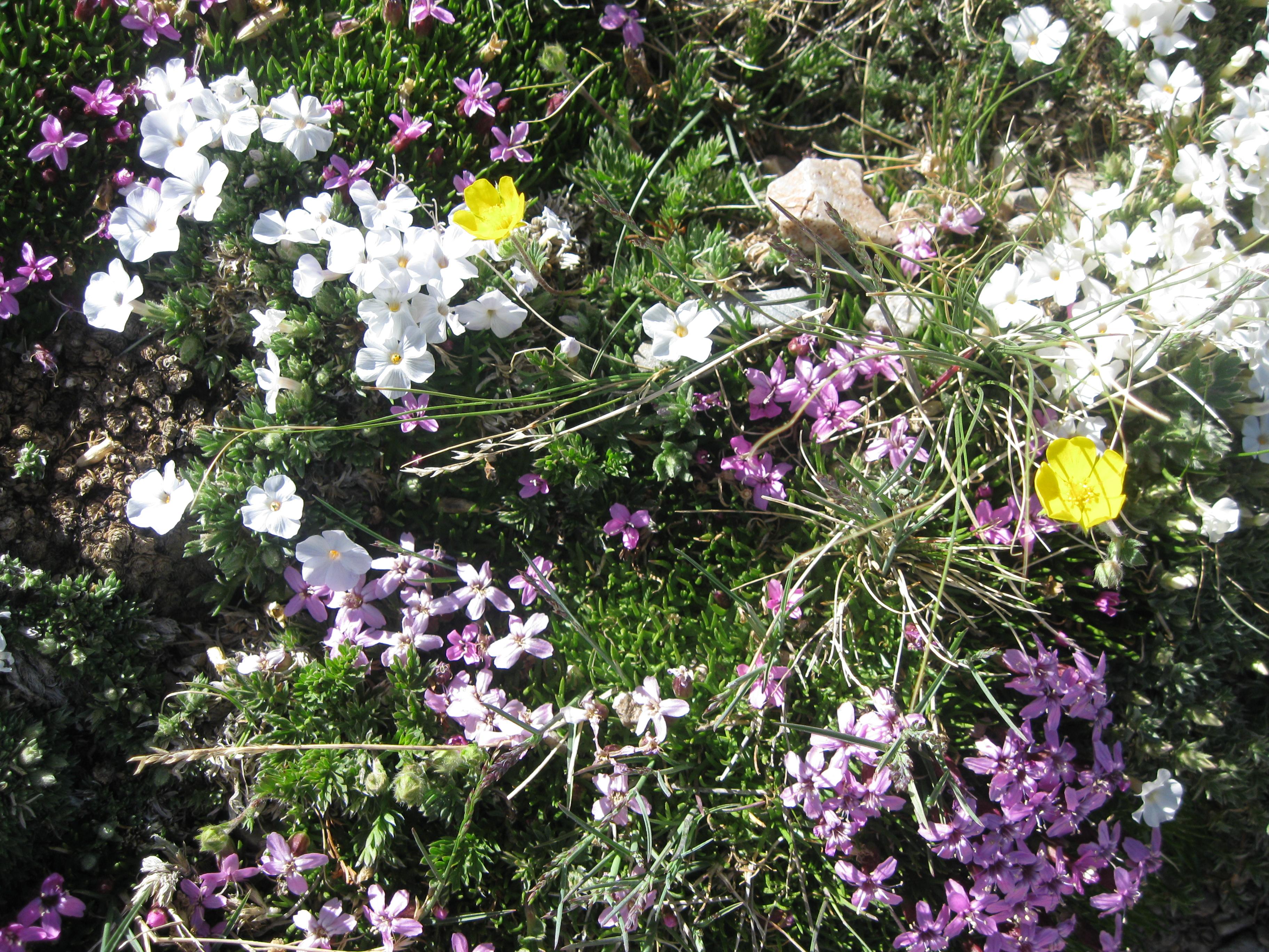
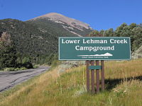
Trail to ancient bristlecone pine trees.NPS Photo Images link to the original government source.Lehman Caves of Great Basin National Park offers incredible views of a rare subterranean world.NPS Photo Great Basin Visitor Center just six miles from the park entranceNPS Photo Flowers grow even at the high altitudes of the Great Basin National ParkNPS Photo Wildlife is abundant at Great Basin National Park including birds, deer, fish, and mountain lion.NPS Photo Snow can come early, even in the fall at Great Basin.NPS Photo Activities abound in Great Basin National Park.Left: NPS / J. Reynolds Middle: NPS / Tim Russon Right: NPS / Michael Kelzenberg Rangers will give programs on all kinds of topics for all ages during the summer.NPS Photo Great Basin has many beautiful campgrounds to choose from.NPS Photo Lower Lehman Creek Campground is a good choice for visitors with RVs and trailers.NPS / A. Dimmick Wheeler Peak Scenic Drive is steep and there are sharp turns - please drive carefully.NPS Photo/Stephanie Campbell Storms can move quickly at high elevations - keep an eye on the weather when hiking.NPS Photo
Follow the paths where people have walked for thousands of years. Gaze up at massive sandstone cliffs of cream, pink, and red that soar into a brilliant blue sky. Experience the tall, stretching walls of a narrow slot canyon. Zion’s unique array of plants and animals will enchant you as you absorb the rich history of the past and enjoy the excitement of present-day adventures.
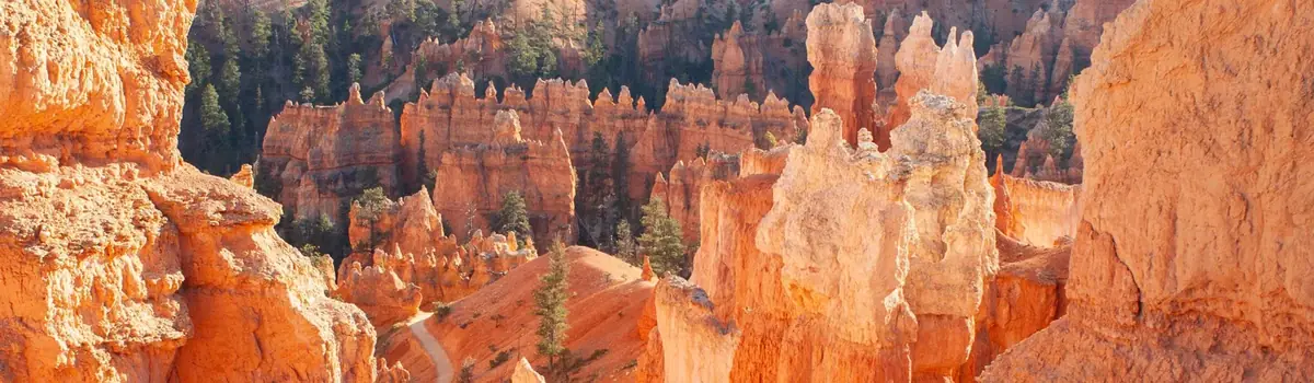
Hoodoos (irregular columns of rock) exist on every continent, but here is the largest concentration found anywhere on Earth. Situated along a high plateau at the top of the Grand Staircase, the park's high elevations include numerous life communities, fantastic dark skies, and geological wonders that defy description.
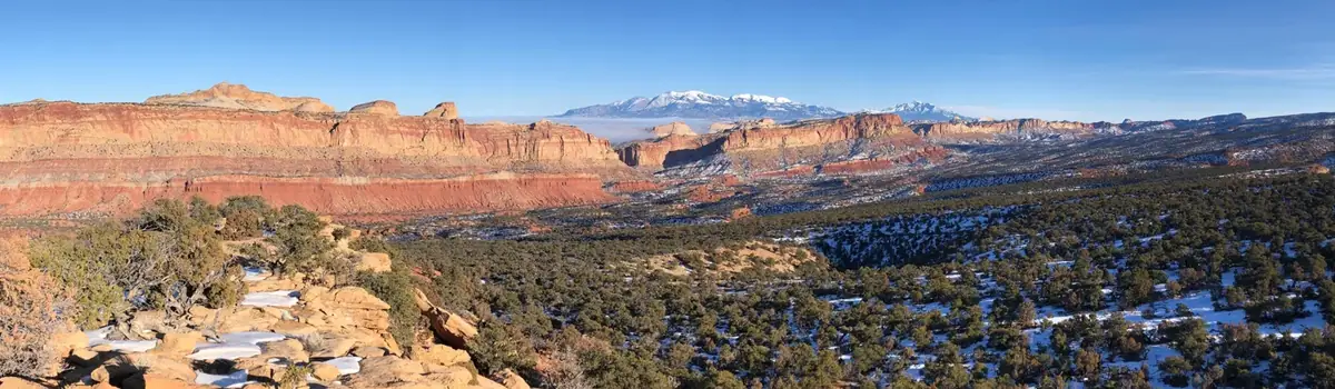
Located in south-central Utah in the heart of red rock country, Capitol Reef National Park is a hidden treasure filled with cliffs, canyons, domes, and bridges in the Waterpocket Fold, a geologic monocline (a wrinkle on the earth) extending almost 100 miles.




 Canyons