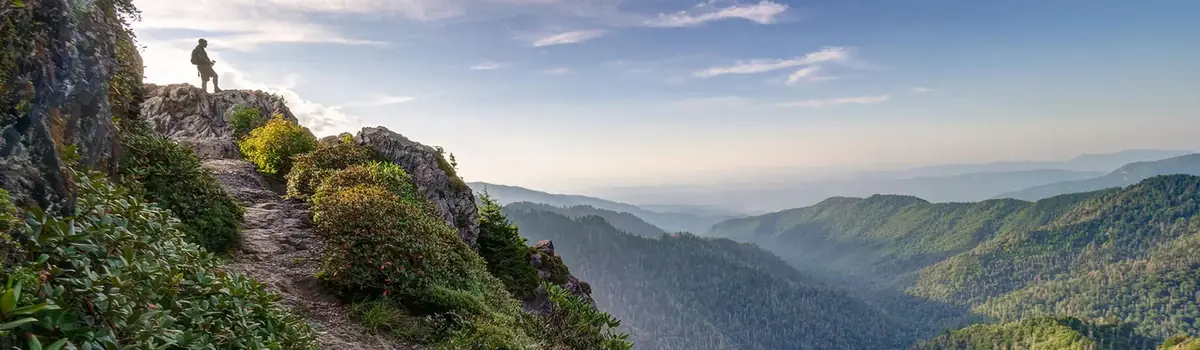
Hot Springs National Park has a rich cultural past. The grand architecture of our historic bathhouses is equally matched by the natural curiosities that have been drawing people here for hundreds of years. Ancient thermal springs, mountain views, incredible geology, forested hikes, and abundant creeks – all in the middle of town – make Hot Springs National Park a unique and beautiful destination.
5.6Kacres of parkland
2.5Mrecreation visits, 2025
Apr · May · Octnearby climate picks
Seasonal access & reservations
No reviewed guidance for this selection. Check the park's official planning pages; missing coverage does not establish access.
Selected guidance only; separate from climate comfort and current conditions.
Official conditions Loading saved check
Loading the latest saved conditions. You can also check the official report below.
Allow 1 day for a first look. A useful base: Hot Springs.
Bathhouse experiences have their own hours, costs, and access arrangements.
A day-by-day starting point
01
DAY 1
Bathhouse Row & the forest
Explore Bathhouse Row and visitor exhibits, then choose an appropriate park trail or mountain viewpoint. Book a bathhouse experience separately if desired.
Editorial recommendations, reviewed 2026-10-17. Full park days, excluding travel to and from the region. A first-visit outline for a general traveler; adapt to mobility, fitness, season, reservations, and current conditions. These are suggested days, not reserved activities or guaranteed routes.
With 26 miles of hiking trails in the Park, you can find great views, beautiful forest scenery, and feel like you're not in the City.
NPS Photo/Mitch Smith
Walking paths have long been a part of Hot Springs National Park and the preceding Hot Springs Reservation. Today those walking paths form the base of the park’s trail system. There are two concentrated areas of hiking trails within the park, the Hot Springs and North Mountain Trails and the West Mountain Trails . Both of these areas are composed of relatively short, interconnected trails. The Sunset Trail is a longer trail that travels through more remote areas of the park.
Paper trail maps can be found at the Fordyce Bathhouse and Visitor Center. Digital maps with real-time GPS location are available by downloading the service-wide NPS App .
Hot Springs and North Mountain Trails
The Hot Springs and North Mountain trails are popular since they are easy to reach and provide scenic views. You can get to these trails via Stephen’s Balustrade (grand staircase) behind the Fordyce Bathhouse, Hot Springs Mountain Drive, and the Gulpha Gorge Campground. See the Hot Springs and North Mountain trail map for more information. *Note: Oertel Trail is still labeled as Dead Chief Trail on the park's brochure.
West Mountain Trails
The West Mountain trails are less traveled, providing greater opportunities for wildlife sightings. You can get to these trails via Whittington Park and the Canyon Trailhead. See the West Mountain trail map for more information.
The Sunset Trail is the longest trail in Hot Springs National Park, covering approximately 10 miles one way or complete the 15-17 mile loop. It completes a circuit near the inner edge of the park boundary. Crossing all types of terrain, the trail makes its way through the most remote areas of the park. Due to the length of this trail, it is frequently broken up into three separate sections: West Mountain (2.8 miles), Sugarloaf Mountain (2.6 miles), and Stonebridge Road (3.8 miles). The Sunset Trail can be combined with Hot Springs Mountain trails, North Mountain trails, and West Mountain trails to complete a strenuous 15-17-mile loop hike. See the Sunset Trail map for more information.
The trails on Hot Springs Mountain offer a great variety of opportunities to experience a lot of the Park.
Explore the Western half of the Park via the Canyon Trail, Mountain Top Trail, Oak Trail, Whittington Trail, or West Mountain Trail.
Get off the beaten path and take on the longest trail in the Park, the Sunset Trail!
Iron Ranger Challenge
Hike, bike, swim, paddle, or walk 100 miles on Arkansas Public Lands for a chance to claim your Iron Ranger title!
Biking in the Park
Learn about the opportunities and rules for biking in the Park!
Experience the Water
Learn about the various ways that you can experience the thermal springs in the Park.
Bathhouse Row is home to the Park's historic bathhouses. Learn about what is available in each of the bathhouses today.
NPS photo/Mitch Smith
The Bathhouse Row you see today consists of eight bathhouse buildings that were constructed between the years of 1892 and 1923. This is the largest collection of early 20th century bathhouses remaining in the United States. This area, along with the Grand Promenade, was designated as a National Historic Landmark District in 1987.
Choose one of the bathhouse names below to read more about that structure. The buildings are listed from south to north along the Row.
Lamar Bathhouse
Built in 1923, the Lamar offered marbled bathtubs of different lengths for greater comfort. Today it is home to the Bathhouse Emporium.
Buckstaff Bathhouse
Built in 1912, it is the only bathhouse on the row to operate continuously for over a century. Learn more about their spa services.
Ozark Bathhouse
Built in 1922, sculpted mythical creatures hold urns of water, encouraging passersby to sample the healing waters. Learn more.
Quapaw Bathhouse
Built in 1922, a tiled dome crowns a decorative scheme with an American Indian motif. Learn more about their spa services and offerings.
Fordyce Bathhouse
The elegant Fordyce houses the park visitor center. Many of the rooms have been restored to their original state. Learn more.
Maurice Bathhouse
Built in 1912, a 3rd floor lounge has a stone fireplace, painted mural, stained glass skylight, and an expansive view. Learn more.
Built in 1892, it the oldest surviving bathhouse. The Hale has a sauna in a thermal cave carved from the mountainside. Learn more.
Superior Bathhouse
Built in 1916, it was smallest bathhouse on the row, it offered affordable hydrotherapy and massages. Today it is a Brewery. Learn more.
Learn More about the "American Spa"
Learn about the historical places in the Park.
Learn more about the People of Hot Springs National Park.
Soak in the Springs
Fully submerge yourself in the thermal water and let your worries melt away.
With 26 miles of hiking trails in the Park, you can find great views, beautiful forest scenery, and feel like you're not in the City.
Whittington Park
Built in the 1890s, Whittington Park has undergone quite the change. Learn more about the park's history and transformation.
Birding in the Park is a popular activity year-round. Learn more about the birds in the Park and our annual bird count.
NPS Photo/Nolen Taricco
Hot Springs National Park supports a variety of song birds, wild turkey, raptors and other birds. Birding is possible all year long, as the species often change with the spring and fall migrations. The Grand Promenade is great place to see many types of birds as it hosts both deciduous and evergreen trees and shrubs. The trails on West Mountain in the early morning are another wonderful place to see and hear a variety of birds. For all the birds that can be found in the park, please see the list below.
Christmas Bird Count
Each year, citizen scientists make an enormous contribution to conservation by braving the cold weather to take part in the Christmas Bird Count. Hot Springs National Park, along with the local chapters of the National Audubon Society and the City of Hot Springs, collects this data to assess the bird populations and to help guide conservation actions. Last year's count included over 9,000 birds from 113 separate species. In prior years, the Hot Springs National Park Bird Count has tied for the highest species diversity in the state! Having that sort of information for thousands of circles across the nation gives citizen science the spotlight in studies about bird populations, mirgration patterns, and even climate change impacts. From December 14 through January 5, all around the country families, students, birders and scientists - armed with binoculars, bird guides, and checklists - go out on an annual mission, often before dawn. For over one hundred years, the desire to both make a difference and to experience the beauty of nature has driven dedicated people to leave the comfort of a warm house during the Holiday season.
Learn about the many opportunities to take great pictures in the Park.
Pictures in the Park
While you’re in the park, protect the things you come to enjoy, as well as yourself and other photographers, by following these simple rules:
Zoom with your lens.
Never approach or pursue animals to take their picture. Wild animals can become aggressive without warning or carry infectous diseases.
Park in roadside pullouts.
Don't block traffic to take pictures. Keep roads clear and stay with your vehicle if you encounter heavy traffic. Don’t drive or park on roadside vegetation.
Leave the drone at home.
The launching, landing, or operation of unmanned aircraft is prohibited in Hot Springs National Park.
Hot Springs National Park has many places that are perfect for taking photos. These are a few of our favorites:
Bathhouse Row - The grand architecture of our historic bathhouses is one of a kind!
Goat Rock - Located on North Mountain , it is a local favorite.
Balanced Rock - Located off the Sunset Trail , it is worth the hike.
The Grand Promenade - Iconic bathhouses, thermal springs, lush forests; this area has it all.
The scenic overlooks
Share Your Pictures!
Commercial Photography and Filming
Learn more about the permitting process and fees associated with commercial photography and filming within the Park.
Walk or drive to the Park's most popular places and hiking trails.
Need a permit for a special event? Or a research permit? Learn more here.
Take a drive up West and North Mountains for some scenic views of the Park.
View Hot Springs from atop the Mountain Tower. Learn more about the history of this Hot Springs icon.
Learn about the opportunities and rules for biking in the Park!
NPS Photo/Mitch Smith
Bicycles in the Park
Cyclists are allowed and welcome to ride on any of the paved roads in the park. The roads up to North Mountain and West Mountain maintain a progressive incline with moderate traffic, so please use caution and plan accordingly. Bicycles are not allowed on the Grand Promenade or on the sidewalk in front of Bathhouse Row.
NPS Photo/Tom Hill
The following trails have been authorized for bicycle and e-bike use:
Directions to the trailhead:
From the Visitor Center head north on Central Ave toward the Arlington Hotel. Stay on Central Ave following the curve to the right onto Park Ave. Stay on Park Ave for 1.3 miles. When you will see a Shell Gas Station on your right, turn left onto Pullman Ave. Stay left at the fork to stay on Pullman Ave. The Bike park is at the end of Pullman Ave.
E-Bikes in the Park
E-bikes are allowed in Hot Springs National Park where traditional bicycles are allowed. E-bikes are prohibited where traditional bicycles are prohibited. Except where use of motor vehicles by the public is allowed, using the electric motor to move an e-bike without pedaling is prohibited.
A person operating an e-bike is subject to the following sections of 36 CFR Part 4 that apply to the use of traditional bicycles: sections 4.12, 4.13, 4.20, 4.21, 4.22, 4.23, and 4.30(h)(2)-(5).
Determination: Implementation of the action defined in DOI Policy Memo 19-01. Should future unanticipated impacts regarding public health and safety, natural and cultural resource protection, and / or other management activities and objectives be witnessed as a result of this action, management will reevaluate use and / or activity restrictions.
Biking in Hot Springs
The City of Hot Springs provides ample opportunities for bikers of all levels. Visit Bike Hot Springs for more detailed information including maps, trail lengths, and other tips.
Explore, Learn, and Relax! Learn all about the things to do in our Park.
With 26 miles of hiking trails in the Park, you can find great views, beautiful forest scenery, and feel like you're not in the City.
Take a drive up West and North Mountains for some scenic views of the Park.
Learn about the various ways that you can experience the thermal springs in the Park.
View Hot Springs from atop the Mountain Tower. Learn more about the history of this Hot Springs icon.
Join a park ranger for a guided hike, a water talk, or an evening campground program!
NPS Photo/N. Allen
Ranger-led Programs
Spring Programs: March - May
Outdoor Walks - Daily 10:30 AM. Join a ranger for a 45-minute program in the historic Bathhouse Row and Grand Promenade area. Themes and topics vary from ranger to ranger. Reservations are not required. Tours begin at the Fordyce Bathhouse and may be modified for weather. Tours may be cancelled due to staffing limits.
Fordyce Tours - Daily 2:00 PM . Join a ranger for a 20-30-minute program inside of the Fordyce Bathhouse Visitor Center. Themes and topics vary from ranger to ranger. Reservations are not required. Tours may be cancelled due to staffing limits.
Pop-up Programs - Meet with a ranger for a quick hands-on activity. Activities and themes vary from ranger to ranger. See Fordyce front desk for pop-up locations.
Please note: All programs are subject to staff availability and weather. Summers in Hot Springs are hot and humid. Outdoor programs will be cancelled if the heat index is 100 or greater at the start of the program.
Check out our calendar for an up-to-date program schedule.
Summer Programs: June - August
Outdoor Walks - Daily 10:00 AM & 11:30 AM. Join a ranger for a 45-minute program in the historic Bathhouse Row and Grand Promenade area. Themes and topics vary from ranger to ranger. Reservations are not required. Tours begin at the Fordyce Bathhouse and may be modified for weather.
Fordyce Tours - Daily 10:30 AM, 1:00 PM & 3:00 PM. Join a ranger for a 20-30-minute program inside of the Fordyce Bathhouse Visitor Center. Themes and topics vary from ranger to ranger. Reservations are not required. Tours may be cancelled due to staffing limits.
Junior Ranger Programs - Saturdays 2:00 PM. Join a ranger for a 30-minute hands-on activity! Activities and themes vary from ranger to ranger. Programs begin in the Fordyce Bathhouse.
Winter Tours: November-March
Fordyce Tours - Daily 10:30 AM + Saturday 1:00 PM . Join a ranger for a 20-30-minute program inside of the Fordyce Bathhouse Visitor Center. Please check at the visitor center for times. Themes and topics vary from ranger to ranger. Reservations are not required. Tours may be cancelled due to staffing limits.
Outdoor Walks - Daily 2:00 PM . Join a ranger for a 45-minute program in the historic Bathhouse Row and Grand Promenade area. Please check at the visitor center for times.. Themes and topics vary from ranger to ranger. Reservations are not required. Tours begin at the Fordyce Bathhouse and may be modified for weather. Tours may be cancelled due to staffing limits.
Pop-up Programs - Meet with a ranger for a quick hands-on activity. Activities and themes vary from ranger to ranger. See Fordyce front desk for pop-up locations and times.
Education Programs - Explore our Hot Springs Education website for more information.
NPS Photo/M. Smith
Self-guided Tours
Fordyce Bathhouse
In 1915, reviews proclaimed the Fordyce Bathhouse as "the best in Hot Springs." Now you can tour the Fordyce at your own pace and see the splendor of the most luxurious bathhouse on the row. Reservations for individual visitors are not needed.
Take a self-guided tour of Hot Springs National Park using the official NPS App (available for Apple and Google Play )! There are two, free tours available with more planned in the coming year:
Explore Hot Springs National Park - This tour provides an overview and brief history of the national park. There are eleven (11) stops that explore Bathhouse Row, Hot Springs Mountain, West Mountain, and Gulpha Gorge.
Hidden Hot Springs - Dozens of springs cover the lower slopes of Hot Springs Mountain. However, most are hidden after two centures of development and efforts to keep the water clean for consumption. This 1-mile loop along Bathhouse Row to Happy Hollow Spring and back along the Grand Promenade reveals and stories and images of some of the hottest, most famed springs from the 19th century. Along the way, you'll learn about the hydrology and the cultural significance of the springs that help explain the park you see today.
Cell Phone Tour
No ranger? No problem! With the self-guided cell phone tour throughout the park, your phone can become your private tour guide. Locations 1-7 are on Bathhouse Row, 8 on the North Mountain Loop, 9 at Gulpha Gorge Campground, and 10-11 on West Mountain.
Explore, Learn, and Relax! Learn all about the things to do in our Park.
Fully submerge yourself in the thermal water and let your worries melt away.
With 26 miles of hiking trails in the Park, you can find great views, beautiful forest scenery, and feel like you're not in the City.
Learn more about Hot Spring National Park's unique cultural and natural history.
Learn more about Hot Spring National Park's unique cultural and natural history.
National Park Service image from HOSP archives
Hot Springs National Park has a long and colorful history, beginning long before its designation as Hot Springs Reservation in 1832. American Indians came here for thousands of years to quarry novaculite for their tools and weapons. The Dunbar-Hunter Expedition came here in 1804, sent by President Thomas Jefferson to explore the southern reaches of the Louisiana Purchase. Soon a bustling town grew up around the hot springs to provide services for health seekers. The resultant bathing industry led to Hot Springs becoming known as the "Great American Spa."
Image from the Hot Springs National Park archives
A Brief History of Hot Springs National Park
The area now known as "Hot Springs National Park" first became United States territory in 1803 as part of the Louisiana Purchase. The first permanent settlers to reach the Hot Springs area in 1807 were quick to realize the springs' potential as a health resort. By the 1830s, log cabins and a store had been built to meet the needs (albeit in a rudimentary way) of visitors to the springs.
National Park Service image from the HOSP archive
Hot Springs Reservation
To protect this unique national resource and preserve it for the use of the public, the Arkansas Territorial Legislature had requested in 1820 that the springs and adjoining mountains be set aside as a federal reservation (not to be confused with the Indian reservations being established around the same time). On April 20, 1832, President Andrew Jackson signed legislation to set aside "...four sections of land including said (hot) springs, reserved for the future disposal of the United States (which) shall not be entered, located, or appropriated, for any other purpose whatsoever." This makes Hot Springs National Park the oldest national park among current National Park units, predating Yellowstone National Park by forty years.
Unfortunately, Congress failed to pass any legislation for administering the site. As a result, no controls were exerted in the area, and people continued to settle there, building businesses around and over the springs.
National Park Service image from the HOSP archives
Just as Hot Springs Reservation was reestablished as government property, a devastating fire swept up the valley, destroying most of the south and central downtown area but leaving the Arlington and Grand Central Hotels, the Hale, Rector, and Big Iron Bathhouses, and the buildings to their north. The structures were in general rough, utilitarian, and in poor repair. Many townspeople considered the great fire of 1878 to be more a blessing than a tragedy, since it cleared the way for new construction that was more substantial and attractive. In the short period after the fire, the government established stringent standards for bathhouse construction, and the area rapidly changed from a rough frontier town to an elegant spa city. Building, landscaping, and engineering projects proceeded apace.
National Parks Service image from HOSP archives
Hot Springs Creek & Early Bathhouses
In 1882-83 the government enclosed Hot Springs creek in an underground arch for flood and sewerage control. The area above the arch was landscaped and bounded with Lombardy poplars. The new Victorian bathhouses built between 1880 and 1888 were larger and more luxurious than could have been dreamed of ten years earlier. The wooden troughs carrying the thermal water down the mountainside were replaced with underground pipes. Government-operated facilities on the slopes of Hot Springs Mountain expanded access to the thermal waters. The Army-Navy General Hospital offered medical care to active duty, and occassionally veteran, soldiers. The government bathhouse, sometimes called the government free bathhouse, provided free bathing facilities to health seekers who could not afford the cost of the pay bathhouses. The Secretary of the Interior appointed U.S. Army Captain John R. Stevens to oversee a number of ambitious landscaping and building projects in the 1890s. The resulting improvements included a formal entrance, mountain drives, a lake park on Whittington Avenue, fountains, and a brick bathhouse for the indigent. By 1901 all of the springs had been walled up and covered to protect them. Between 1912 and 1923 the wooden Victorian bathhouses built in the 1880s were gradually replaced with fire-resistant brick and stucco bathhouses, several of which featured marble walls, billiard rooms, gymnasiums, and stained glass windows. The final metamorphosis of Bathhouse Row was completed when the Lamar Bathhouse opened its doors for business in 1923. The bathhouses, all of which are still standing today, ushered in a new age of spa luxury.
National Park Service photo from HOSP archives
Hot Springs National Park
On August 25, 1916, Congress established the National Park Service (39 Stat. 535), and Hot Springs Reservation came under its administration. Stephen T. Mather, head of the new organization, took a serious interest in the development of the site. His enthusiasm for Hot Springs apparently led to its designation as the eighteenth national park on March 4, 1921 (41 Stat. 1407).At the same time, the townspeople decided to call their city Hot Springs National Park as well. The designation of the reservation as a national park ushered in the final phase of construction culminating in the Bathhouse Row of today. In 1922 the old government bathhouse was demolished, and a new state-of-the-art bathhouse opened on Reserve and Spring Streets. In 1933 a central thermal water collection and distribution system was completed, and grading began on the Grand Promenade behind Bathhouse Row. In 1936 the new administration building on the corner of Reserve and Central opened, replacing the park headquarters earlier converted from the reservation’s pump house. The Imperial Bathhouse next to the administration building was razed in 1937 to make way for the Grand Promenade entrance on Reserve, although it was to be 1958 before this ambitious project was completely finished. In the final phase of construction, the Fountain Street superintendent’s residence was razed, and the promenade was extended to Fountain Street.
The Decline of Bathing
By the 1960s the bathing industry in the park and in the city had declined considerably. On Bathhouse Row, the eight grand bathhouses that had been thriving since their construction in the first three decades of the century suffered from the decline. The elegant Fordyce Bathhouse was the first to close, in 1962, followed by the Maurice, the Ozark, and the Hale in the 1970s. In 1984 the Quapaw (briefly reincarnated as Health Services, Inc.) and the Superior closed. When the Lamar closed in 1985, it left only the Buckstaff still operating on Bathhouse Row. Bathhouse Row and its environs were placed on the National Register of Historic Places on November 13, 1974. The desire to revitalize Bathhouse Row also led citizens to campaign for adaptive uses of the vacant buildings. The strongest concern was to save the most elegant bathhouse, the Fordyce, which was consequently adapted for use as a visitor center and museum. Today, nearly all the bathhouses have been renovated and adapted for modern use.
Learn more about the People of Hot Springs National Park.
Learn more about the stories of Hot Springs National Park.
Learn about the historical places in the Park.
Learn more about the various museum collections and archives at the Park.
Hot Springs NP has a dense, rich archeological record with 92 sites and counting. Learn more about our history's mysteries.
Bathhouse Row is home to the Park's historic bathhouses. Learn about what is available in each of the bathhouses today.
Learn more about the educational opportunities at the park - planning a field trip, curriculum resources, and suggested reading.
The Hot Springs National Park Education Team is pleased to offer a variety of free education opportunities for K-12 classes, college courses, and adult education groups. These programs explore health and healing in the stories of Bathhouse Row, the ecosystems found in this corner of the Ouachita Mountains, and the origins of the 143 degree spring waters. These specialized programs are available through in-park field trips, classroom visits, and on virtual platforms. Explore the options below to bring the oldest unit on the National Park Service into your educational goals!
There are many ways your students can interact with Hot Springs National Park - both in-person and virtually!
From podcasts to lesson plans, we have helpful tools to bring Hot Springs National Park into your classroom.
Read more stories and learn more about the wonderful history of Hot Springs National Park.
Learn about the pet-friendly activities for you and your furry companions in the park!
Hot Springs National Park Is Pet Friendly
Know Before You Go
Pets are an important part of our lives, providing companionship, love, and joy to their caretakers.
Hot Springs National Park has a BARK Ranger program that your canine companion can complete! See below for more info. You can also stop by the Fordyce Visitor Center or call for more information.
Dogs are welcome on all 26 miles of the Hot Springs National Park trails. There are Pet Waste Stations located on both ends of Bathhouse Row and in the campground.
Pets are not permitted inside of Federal Buildings but must wait outside the visitor center and other park buildings. Pets are allowed in the Superior Bathhouse Restaurant and Brewery.
Pets should not be left unattended. Summer heat poses a threat to pets left in vehicles.
Plan ahead and prepare . Check out our safety page before you go. Take enough water for you and your dog. Be sure the sun has not made the pavement too hot for your pets paws.
Service animals and Certified Guide animals are allowed in all federal buildings . For the definition of a service animal, please see the Americans with Disibilities Act (ADA) definition .
Follow the B.A.R.K. Ranger Principles
By following the principles below, you can ensure that your pet, your family, and fellow guests will have a positive and memorable experience while visiting Hot Springs National Park.
B ag your pets waste. Help keep your national park clean by collecting and disposing of all dog waste. Public garbage cans are located throughout the park, including at the visitor center.
A lways keep your pet on a leash. For the safety and comfort of all the park’s visitors, dogs must be restrained on a leash no longer than 6 feet. We know that sometimes Fido likes to run free, but keeping dogs on leashes will also protect them from ticks, snakes and other wildlife, and other dogs.
R espect wildlife . The park is also home to snakes, birds, rabbits, deer, and other wildlife. Pets can harass or harm wildlife by making noise or scaring wildlife away. Please keep your dog at a respectful distance from any animals you may encounter.
K now where you can go . Pets are not allowed inside park facilities, including the visitor center. However, the national park is home to 26 miles of trails that dogs (and their humans) love!
Become a B.A.R.K. Ranger!
Loading results...
With 26 miles of hiking trails in the Park, you can find great views, beautiful forest scenery, and feel like you're not in the City.
Learn the basics before you visit!
Delve into the history, economics, and environmental considerations that led to the creation of Bathhouse Row.
View Hot Springs from atop the Mountain Tower. Learn more about the history of this Hot Springs icon.
Know where to soak, where to park, and what to expect when you arrive.
Fully submerge yourself in the thermal water and let your worries melt away.
NPS Photo/Julie Denasha
Soak in the Springs
Even though there are no soaking opportunities outdoors, Bathhouse Row does have 2 available facilities that offer visitors the chance to fully submerge and relax in the thermal water. The thermal springs are piped directly into both of these bathhouses, offering users a true and authentic experience of the water.
The Buckstaff Bathhouse - Orginally opened in 1912, the Buckstaff is the only facility on the Row that has never fully closed since it first started offering baths. For information about services, rates, and reservations, please visit their website or call them directly at (501) 623-2308. Address: 509 Central Avenue.
The Quapaw Bathhouse - The Quapaw Bathhouse offers modern day spa services with amenities like thermal pools, private baths, and a steam cave. For information about services, rates, and reservations, please visit their website or call them directly at (501) 609-9822. Address: 413 Central Avenue.
Built in 1922, a tiled dome crowns a decorative scheme with an American Indian motif. Learn more about their spa services and offerings.
Built in 1912, it is the only bathhouse on the row to operate continuously for over a century. Learn more about their spa services.
View Hot Springs from atop the Mountain Tower. Learn more about the history of this Hot Springs icon.
From the official park store to downtown Hot Springs, there are plenty of opportunities to find the perfect gift or souvenir.
View Hot Springs from atop the Mountain Tower. Learn more about the history of this Hot Springs icon.
NPS Photo/Mitch Smith
History of the Tower
In 1877 local mill owner Enoch Woolman built a wooden observation tower at the summit of Hot Springs Mountain to allow visitors to enjoy the view of the surrounding region. In 1906 a new steel tower opened on Hot Springs Mountain on land leased by Charles N. Rix, president of Arkansas National Bank, and the old Woolman Observatory was removed. Rix Tower included an elevator to carry visitors to the top, where they could view an area estimated by Superintendent Scott Smith to cover a radius of 30 to 40 miles. Rix Tower was taken down on July 13, 1971 and in March 1982 a contract was signed for the construction of a new observation tower. The 216-foot tall structure opened to the public in June 1983 as part of the 13th Annual Arkansas Fun Festival.
The Hot Springs Mountain Tower is operated as a concession for the park. The tower's upper observation deck is open-air and at an elevation of 1,256 feet above sea level. From there, visitors may overlook 140 square miles of surrounding countryside, including the entire park and a portion of the Ouachita Mountains. The lower observation deck, enclosed and air conditioned, contains exhibits highlighting park and local history. A gift shop is located at the base of the tower. Visit the Mountain Tower's offical website for operating hours, fees, and other information.
Hot Springs National Park recognizes that there's nothing better than enjoying a family picnic under the awning of the trees with a gentle breeze blowing the leaves. We have picnic tables located throughout the Park at the following locations:
On the South end of the Grand Promenade, located off of Reserve St.
At the Mountain Tower off Hot Springs Mountain Drive
At the West Mountain Pavillion on West Mountain Drive
The Gulpha Gorge Campground Day Use Area
You may also bring a blanket and have a picnic at Arlington Lawn.
Please note that picnicking is not allowed in the following areas:
On the lawns of the historic buildings on Bathhouse Row
At the park’s official entrance, between the Maurice and Fordyce Bathhouses
On the grounds around the Park Administration Building
Take a drive up West and North Mountains for some scenic views of the Park.
You can experience the beauty of Hot Springs National Park by driving to one of our six scenic overlooks. Enjoy the sunrise, the sunset, fall colors, a moment of peace, and everything in between at any one of these locations.
North Mountain Scenic Drive & Overlooks:
Hot Springs Mountain Scenic Drive
Hot Springs Mountain Drive begins at the end of Fountain Street off Central Avenue downtown. Built as a carriage road in the 1880s, it has switchbacks that will take you to the top to a picnic area, the Pagoda overlook, and the Hot Springs Mountain Tower. You can continue on to North Mountain Loop and then back down to Fountain Street.
Hot Springs Mountain Lookout Point
Located on this overlook is the historic Hot Springs Mountain Pagoda, designed by architect J.G. Horn in 1911 and dedicated to superintendent Harry H. Myers. Looking out from the pagoda is the city of Hot Springs with the Ouachita Mountains out in the distance.
NPS Photo/Mitch Smith
Goat Rock Overlook
This overlook is located on top of North Mountain overlooking the Zigzag Mountains with a view of Indian Mountain to the right, also know as Silver Mountain. Although there is no silver found on the mountain, Indian Mountain is rich in Novaculite which was highly valued by the Native Americans for making tools. Since this stone breaks with a predictable cone-shaped fracture, they could easily carve tools into whatever shape and thickness they desired, commonly carving the rock into arrowheads, blades, drills, and other various tool. All Arkansas Novaculite is found within a 50-mile radius of Hot Springs, drawing Native Americans from all over to this location. Additionally, the Zigzag Mountains is the area known as the recharge zone for the thermal springs. The thermal water we have today originated as rain water that fell over 4,000 years ago, soaking into these mountains and funneling back up at high speeds and hot temperatures.
West Mountain Scenic Drive & Overlooks:
West Mountain Scenic Drive
West Mountain Drive has entrances on Prospect Avenue and Whittington Avenue. It is a two way road that leads to the Summit Loop where you will find three overlooks. The first overlook affords a good view of Bathhouse Row and the former Army-Navy Hospital. The second overlook has a historic trail shelter and picnic tables and the summit has a view south to the Trap Mountains and Lake Hamilton. You'll find an outcrop of Arkansas Novaculite at the top as well; this rock was used by the Caddo Indians for making tools and weapons and later by European settlers for whetstones.
West Mountain Lower Overlook
From this overlook is a great aerial view of Bathhouse row and downtown Hot Springs. Additionally, Hot Springs Mountain Tower can be seen standing tall on top of Hot Springs Mountain along with the Army-Navy Hospital standing tall below.
West Mountain Picnic Overlook
One of the best places to picnic in Hot Springs, this overlook hangs higher up on West Mountain overlooking the city of Hot Springs. In addition to picnic tables is a historic mountain shelter located on the left side of the overlook. Shelter houses like the one found here were built to provide visitors with a place to relax and enjoy the view. This shelter was built in 1924 making it one of the oldest mountain shelters still in use today at Hot Springs National Park.
West Mountain Loop Overlook
At the summit of West Mountain is an overlook south to the Trap Mountains with Lake Hamilton visible far in the distance. You'll also find an outcrop of Arkansas Novaculite at the top which was used by the Caddo Indians for making tools and weapons and later by European settlers for whetstones.
Sugarloaf Mountain Overlooks
Balanced Rock Overlook (from Sunset Trail)
Located along the ridge of Sugarloaf Mountain is an outcrop of novaculite, now known as Balanced Rock Overlook. Being part of Sunset Trail, Hot Spring's longest and most remote hiking trail, you can expect to see a variety of wildlife hidden from other parts of the park like wild turkey, white-tailed deer, and vultures.
Hot Springs Mountain Tower
Hot Springs Mountain Tower Overlook
216 feet above Hot Springs Mountain and 1,256 feet above Sea level is the breathtaking panoramic view of the park and its surrounding countryside. Originally being made of wood in 1877, the tower was rebuilt with steel and an elevator in 1982 with both open and enclosed observation decks.
Explore, Learn, & Relax
With 26 miles of hiking trails in the Park, you can find great views, beautiful forest scenery, and feel like you're not in the City.
Fully submerge yourself in the thermal water and let your worries melt away.
With 40 sites right by Gulpha Creek, the Gulpha Gorge Campground is the perfect place to relax and enjoy the beauty of the Park.
Patience, relaxation, challenge, and memories are a few words often associated with fishing. Explore and learn what the park has to offer.
NPS Photo/ Mitch Smith
What comes to mind when you think about fishing? Patience, relaxation, challenge, and memories are a few words often associated with fishing. You will find all that and a sense of stewardship, conservation, and preservation on this page. We want you to have an enjoyable time during your visit, and for those who come after you to fish. Take some time to explore, learn what the park has to offer and learn your responsibilities before casting a line or flicking a fly into the water.
Fishing in Hot Springs National Park
Hot Springs National Park allows fishing as a means of providing for public enjoyment, and customary and traditional use, and regulates fishing to ensure that it is managed in a manner that avoids unacceptable impacts to park resources.
For more information on how fishing regulations work in national parks, go to the NPS Fish and Fishing website.
Visitors fishing within Hot Springs National Park must follow the fishing license requirements in accordance with the laws and regulations of the State of Arkansas.
Fishing Regulations
Except as provided below, fishing shall be in accordance with the laws and regulations of the State of Arkansas ( 36CFR2.3 ). For state fishing regulations go to the Arkansas Game and Fish Commission website. The fishing regulations apply to all “finfish” found in the park. Other taxa, including amphibians, mollusks and crustaceans (e.g. waterdogs, crayfish) are not considered “fish” for the purpose of NPS fishing regulations and addressed by NPS regulations governing “wild life” ( 36CFR2.2 ). These fishing regulations apply, regardless of land ownership, on all lands and waters within the park that are under the legislative jurisdiction of the United States.
The following are prohibited :
Fishing in fresh waters in any manner other than by hook and line, with the rod or line being closely attended.
Possessing or using as bait for fishing in freshwaters, live or dead minnows or other bait fish, amphibians, non-preserved fish eggs or fish roe, except in designated waters.
Chumming or placing preserved or fresh fish eggs, fish roe, food, fish parts, chemicals, or other foreign substances in fresh waters for the purpose of feeding or attracting fish in order that they may be taken.
Commercial fishing, except where specifically authorized by Federal statutory law.
Fishing by the use of drugs, poisons, explosives, or electricity.
Digging for bait, except in privately owned lands.
Failing to return carefully and immediately to the water from which it was taken a fish that does not meet size or species restrictions or that the person chooses not to keep. Fish so released shall not be included in the catch or possession limit: Provided, that at the time of catching the person did not possess the legal limit of fish.
Fishing from motor road bridges, from or within 200 feet of a public raft or float designated for water sports, or within the limits of locations designated as swimming beaches, surfing areas, or public boat docks, except in designated areas.
Introducing wildlife, fish or plants, including their reproductive bodies, into a park area ecosystem. This includes the discarding and/or dumping of bait and bait buckets.
The use or possession of fish, wildlife or plants for ceremonial or religious purposes, except where specifically authorized by Federal statutory law, or treaty rights.
Fish Consumption Advisories in National Park Waters
The Environmental Protection Agency, states, territories, and tribes provide advice on fish and shellfish caught in the waters in their jurisdiction to help people make informed decisions about eating fish. Advisories are recommendations to limit your consumption of, or avoid eating entirely, certain species of fish or shellfish from specific bodies of water due to chemical or biological contamination. Fish is part of a healthy balanced diet, but eating wild fish and shellfish caught in park waters is not risk free. Parks are “islands”, but the much larger “ocean” that surrounds them affects the natural resources inside a park. Other aquatic toxins are the result of natural biological processes. Also, chemical contaminants that originate outside of park boundaries can come into parks. Mercury is an example of a toxin originating outside a park that can find its way into a park. Mercury exists naturally in some rocks, including coal. When power plants burn coal, mercury can travel in the air long distances before falling to the ground, usually in low concentrations. Once on the ground, microorganisms can change this elemental mercury to methyl mercury. This type of mercury can build up in animal tissues, and it can increase in concentration to harmful levels. This high concentration can occur in large predatory fish - those often pursued and eaten by anglers. Studies have shown that fish in some National Park System waters have mercury levels that may be a concern to people who regularly eat a lot of fish. To learn more about this topic, the National Park Service maintains information about Fish Consumption Advisories and Mercury and Toxins in Nature .
Aquatic Invasive Species
Imagine your favorite fishing spot and the wonderful memories. Things may look fine but underneath the surface there is a serious threat. Everything you remembered is now cemented together in a sharp, smelly mess. Invaders have wiped out the fish species you used to catch. Aquatic invasive species are not native to an ecosystem. Their introduction causes, or is likely to cause, harm to the economy, the environment, or to human health. Aquatic invasive species are a growing risk to parks and their values. In the United States alone, there are more than 250 non-native aquatic species. For many centuries, humans have contributed to spreading non-native species around the globe. You can make a difference. To learn more about Aquatic Invasive Species in the National Park Service, visit the Fish & Fishing website.
Fishing Throughout the National Park Service
We invite you to visit the Fish and Fishing website for more information about fish and fishing in the National Park Service. You will learn about conservation, different fish species, and parks that offer fishing.
Explore, Learn, and Relax! Learn all about the things to do in our Park.
Learn about the various ways that you can experience the thermal springs in the Park.
Learn about the natural resources at Hot Springs National Park. This includes information about our thermal water, wildlife, and plants.
Know where to soak, where to park, and what to expect when you arrive.
With 26 miles of hiking trails in the Park, you can find great views, beautiful forest scenery, and feel like you're not in the City.
Within the Park, Superior Bathhouse Brewery, Hotel Hale, and the Quapaw Bathhouse Cafe all offer opportunities for dining. There are many other places to eat close to the park and around town, visit the City of Hot Springs Dining Guide for more information.
The only brewery in a National Park
Immerse & Indulge
Eateries Outside the Park
Hot Springs National Park is in an urban area, surrounding the north end of the city of Hot Springs. Within the park, Gulpha Gorge Campground and the Hotel Hale offer accommodations for the night. The Hot Springs Convention and Visitors Bureau has information about lodging and other attractions in the area.
Official NPS features and USGS park boundaries, imported 2026-10-17. An inventory snapshot, not live trail or parking availability.
Loading official park features…
TrailsPoints of interestParkingZoom with buttons or pinch. Toggle layers on the map.
Map coverage varies. Trail names may represent segments, connectors, or shared park units; mapped lines are not a hiking recommendation. Use official conditions and navigation resources before heading out.
Description: The West Mountain trails can be reached from downtown via Canyon Trail. The trailhead is behind the Mountain Valley Water building. The section between West Mountain Drive and West Mountain Trail is very steep.
Description: Floral Trail connects Lower Dogwood Trail and Honeysuckle Trail. From either trailhead you will descend into a valley and climb the other side.
Description: This short trail begins on Fountain Street below the entrance to Hot Springs Mountain Drive. Use it to reach Honeysuckle Trail by crossing the road.
Description: This National Recreation Trail is the entry point for many of the Hot Springs and North Mountain trails from downtown. Oertel, Peak, and Tufa Terrace trails all branch off from the Grand Promenade and lead to other trails. The Grand Promenade has four entry points: Reserve Street (stairs), Fountain Street (ramp), Stephen’s Balustrade (grand staircase), and an access ramp behind the Fordyce Bathhouse.
NPS public GIS inventory, imported 2026-10-17. “Existing” is an inventory classification, not confirmation that a trail is open. Segment counts are not route distances. Parking records do not indicate space availability, fees, or accessibility certification. View government source ↗
Climate for Hot Springs, 1 km from the park reference point. 1991–2020 normals. Source elevation: 182 m.
Daytime highNighttime lowOctober: 73° / 53°
Daytime high73°
Precipitation101 mm
Daylight11.1 hrs
Wind9.5 km/h
Mountain, rim, valley, and coastal conditions can differ sharply from the source town. Check park forecasts and current conditions before travel.
Monthly climate data 12 months · °F
Month
High
Low
Rain / snow water
Wet days
Daylight
51°
34°
90 mm
9.1
10.0 h
55°
37°
98 mm
9.4
10.7 h
64°
44°
134 mm
11.5
11.7 h
72°
52°
133 mm
10.5
12.8 h
80°
61°
143 mm
13.0
13.8 h
87°
69°
83 mm
10.2
14.3 h
91°
73°
88 mm
10.9
14.1 h
90°
71°
69 mm
8.6
13.3 h
84°
64°
85 mm
7.2
12.2 h
73°
53°
101 mm
7.7
11.1 h
62°
43°
114 mm
8.8
10.2 h
53°
36°
114 mm
9.1
9.7 h
RESEARCH WITH THE SOURCE IN VIEW
The practical field guide.
Official NPS excerpts imported 2026-10-17. Fees, permits, road access, and operations can change; use the source link to confirm the latest information.
Hot Springs National Park is the only national park that protects a unique combination of lithology, geologic structure, and water sources that produce the only nonvolcanic geothermal springs of such high quality (temperature, taste, color, odorless) in the United States.
Physical Address
Fordyce Bathhouse Visitor Center
Operating Hours & Seasons
View the Current Forecast
Visitor Centers
369 Central Avenue
Hot Springs, AR 71901
Internet & Cellular Access
Internet & Cellular Access Details
Things to Know before you Visit
Know where to soak, where to park, and what to expect when you arrive.
Permits & Reservations
Need a permit for a special event? Or a research permit? Learn more here.
Laws & Policies
Know the laws and policies before coming to the Park.
Learn more about pets in the Park.
Current Conditions
Learn about any park closures, alerts, or safety measures in place.
Frequently Asked Questions
Still have questions? Take a look at our FAQ's for more answers.
Campsites at Gulpha Gorge Campground vary in size and can accommodate both tents and recreational vehicles (RV's).
All sites have full hookups: 30 and 50 amp electric, water and sewer connections. Sites are not pull-through. Each campsite has a picnic table, pedestal grill, and water. There are modern restrooms. Onsite showers are accessible to campers using the door code provided in their reservation information. Maximum occupancy is limited to eight people/two vehicles (one RV and one tent OR two tents) per site. Check in time is at 2:00 pm, and check out time is 12:00 pm.
Fees & Reservations
All 40 campsites at Gulpha Gorge Campground will require prior reservation on www.Recreation.gov , and will cost $34 per night. Accessible campsites are made available a week in advance. To reserve beyond that timeframe, call the Fordyce Visitor Center (501-620-6715) for assistance.
Camping in Gulpha Gorge Campground is limited to a total of 14 consecutive days and a cumulative total of 30 days in any calendar year. Each 14-day consecutive stay must be followed by a minimum of a 7-day break.
Campground Features
Fire/Stove Policy
Operating Hours & Seasons
Contact Information & Directions
Phone number (Voice)
Mailing Address
Physical Address
Additional Information & Regulations
Additional Information
Cell Phone Additional Information
Internet Additional Information
Learn about the various ways that you can experience the thermal springs in the Park.
With 26 miles of hiking trails in the Park, you can find great views, beautiful forest scenery, and feel like you're not in the City.
Explore, Learn, and Relax! Learn all about the things to do in our Park.
Learn about the natural resources at Hot Springs National Park. This includes information about our thermal water, wildlife, and plants.
Bathhouse Row is home to the Park's historic bathhouses. Learn about what is available in each of the bathhouses today.
The park brochure is available in a variety of formats including braille, audio description, and text-only.
NPS Photo/M. Smith
The Fordyce Visitor Center, Gulpha Gorge Campground, other park buildings, and all park bathrooms have functional ramps and are accessible to all persons. Bathhouse Row has a maintained, paved four to five foot wide walkway that creates a circular loop around the block. There are benches with backs on Bathhouse Row and the Grand Promenade. Grand Promenade ramp access is available directly behind the Fordyce Bathhouse and on the northern end of the block adjacent to Fountain Street. There is no ramp access on the southern end of the block near Reserve Street.
NPS Photo/K. Barat
Fordyce Visitor Center
The entrance to the Fordyce Visitor Center is approximately a quarter of a mile from the nearest parking garage at 128 Exchange Street. Visitors will need to cross Central Ave., which can be heavily trafficked. There are multiple ramped crosswalks, one of which offers immediate crossing privileges directly in front of the parking garage and in front of the Buckstaff Bathhouse. Once across the street, visitors will need to make their way north for a tenth of a mile before arriving at the Visitor Center. The entrance door has an automatic opening function, the button is located on the left hand side of the set of double doors.
Elevator & Hallways
The Fordyce has an operational elevator which allows access to all floors. Hallways in the Fordyce can accommodate most wheelchair sizes with widths ranging from 31 to 38 inches.
Restrooms are located on the Basement floor of the Fordyce Visitor Center. There is a men's restroom with multiple stalls with manual doors, a women's restrooms with multiple stalls with manual doors and a changing table, and a single family restroom with a manual door.
Borrow a Wheelchair
The park has two wheelchairs available to loan free of charge for use in the Fordyce Bathhouse Visitor Center and Museum.
Tactile Exhibits
The Fordyce Bathhouse Visitor Center and Museum has numerous tactile exhibits such as a touchable model of Bathhouse Row near the theater on the first floor. Additionally, interactive features in the first and second floors include levers to initiate demonstrations of water collection, rock displays, and a wrist exerciser inspired by historic Zander machines.
Braille Available
At the Fordyce Visitor Center, there are self-guided tour books in braille that visitors are free to borrow. You may request a copy from the ranger at the front desk.
Audio Descriptions
Audio description is also available for all exhibits in the first and second floor exhibit halls in the Fordyce Bathhouse Museum. Ask a ranger at the front desk for an iPhone, pre-loaded with the AD Tours application. You can check out an iPhone free of charge for the duration of your exploration in museum. Audio description is also available for the park's film, which shows every 30 minutes in the theater on the first floor. Please ask for a receiver at the front desk.
Closed Captioning
Closed captioning is available on both the park's film and the short film, "Taking the Baths," shown on the 2nd floor.
ASL Availability
ASL interpreters are available for guided tours, please submit a request two weeks in advance.
NPS Photo/Ashley Waymouth
Accessible Trails
Whittington Park Trail
The Whittington Trail is a 1.2 mile flat, unpaved gravel loop that goes around Whittington Park. Parking is available on Whittington Avenue. There are multiple benches with backs throughout Whittington Park. Water is available across the street, below the Maintenance Building, at the Whittington Spring Jug Station. There are no restrooms available at Whittington Park. Distance (one way): 1.2mi (1.9km) Elevation: 647-685ft (197-209m) Typical Grade: 0.6%
The Grand Promenade
The Grand Promenade is a fully paved trail with ramp access off Fountain Street and another behind the Fordyce Bathhouse. There are multiple benches with backs and waysides along the Promenade. Water is not easily available on this trail. Restrooms are available on Bathhouse Row, between the Fordyce Visitor Center and the Quapaw Bathhouse. Distance (one way): 0.5mi (0.8km) Elevation: 619-717ft (188-218m) Typical Grade: 3.7%
NPS Photo/J. Kesler
Service Animals
In October 2018, the National Park Service (NPS) issued a policy memorandum regarding the use of service animals by persons with disabilities in national parks. The revised policy aligns the NPS policy with the standards established by the Department of Justice and the Americans with Disabilities Act. Only dogs are classified as service animals, and they must perform a specific task that assists a person with a disability. Emotional support or comfort animals are not service animals. Service animals must follow these guidelines:
The service animal is under control of the handler. If the dog is out of control and the handler is unable to gain control of the dog, the handler will be asked to remove the service animal. This may include repeated barking not associated with their service work.
The service animal is harnessed or leashed. There are two exceptions: if this interferes with the dog’s service work or if the person’s disability prevents the use of a harness or leash. If a leash or harness is not used, the handler should be able to control the service animal using verbal commands, gestures, or other effective means.
The service animal is housebroken.
When hiking with your service animal, please note whether water and a trash can are available at the trailhead. Also pay attention to the weather, the trail description, and any wildlife active in the area.
Learn more about NPS & Service Animals.
The Access Pass
The America the Beautiful - The National Parks and Federal Recreational Lands Pass Series includes the Access Pass: a free, lifetime admission and discount pass for U.S. citizens or permanent residents with permanent disabilities. Access Passes are available online and at the Fordyce Bathhouse Visitor Center and Museum.
An entrance pass is not required to access Hot Springs National Park.
Other National Park Service sites may require an entrance pass or fee. Depending on your trip plans, an interagency pass may save you money.
2026 Free Entrance Days in the National Parks
Come experience the national parks! All National Park Service sites that charge an entrance fee will offer free admission to US citizens and residents (other fees, including timed entry or reservation fees, may apply). Mark your calendar for these entrance fee-free dates:
February 16 : Presidents Day (Washington's Birthday)
May 25 : Memorial Day
June 14: Flag Day/President Trump's birthday
July 3–5: Independence Day weekend
August 25: 110th Birthday of the National Park Service
September 17: Constitution Day
October 27 : Theodore Roosevelt's birthday
November 11: Veterans Day
NPS Photo/M. Smith
Hot Springs National Park is a fee-free park! There is no entrance fee nor are there any additional charges for the park's brochure, junior ranger program, or ranger-led tours. The park does have certain America the Beautiful Passes available at the Fordyce Bathhouse. There is a fee for camping at Gulpha Gorge campground. Learn more about both of these below. Information about weddings, special use permits, and first ammendment activities can be found at the bottom of the page.
America the Beautiful Passes
Please note: Only the Access, 4th Grade, Military (Annual), and Military Veterans and Gold Star Families Lifetime* passes are available in the Fordyce Bathhouse. All other passes must be purchased online or at another site that sells the passes in-person. *Beginning Nov. 11, 2022, veterans of the U.S. Armed Services and Gold Star Families can obtain a free lifetime pass to more than 2,000 federal recreation sites spread out across more than 400 million acres of public lands, including national parks, wildlife refuges, and forests.
Gulpha Gorge Campground
Campground Features
Fire/Stove Policy
Operating Hours & Seasons
Contact Information & Directions
Phone number (Voice)
Mailing Address
Physical Address
Additional Information & Regulations
Additional Information
Cell Phone Additional Information
Internet Additional Information
Special events are activities, such as organized group events, rallies, walks, runs, and other events. Learn more here.
You may need a permit for filming and for still photography. Learn more about the guidelines here.
Know where to soak, where to park, and what to expect when you arrive.
Need a permit for a special event? Or a research permit? Learn more here.
Fully submerge yourself in the thermal water and let your worries melt away.
Turn left onto Arkansas Scenic 7 Byway/S Scenic 7 Dr/AR-7. Continue to follow AR-7. (44.06 miles)
Turn slight right onto Fox Pass Cutoff. (3.30 miles)
Turn right onto Park Ave/Arkansas Scenic 7 Byway/AR-128/AR-7. Continue to follow Arkansas Scenic 7 Byway/AR-128/AR-7. (3.26 miles)
Other Transportation Options:
Hot Springs is serviced by a local airport, Hot Springs Memorial Field , or Little Rock National Airport (with shuttle service and rental cars) approximately 60 miles away.
Greyhound Bus Lines service Hot Springs with a station located at 1001 Central Ave, Suite D. For fare and scheduling information, call 1-800-231-2222.
Passenger Train
Amtrak's Texas Eagle route serves Little Rock, Arkansas.
Explore Bathhouse Row, scenic drives, trails, and camping in the park.
Parking, public transportation, biking, and walking are all ways to get around the Park.
We want your trip to Hot Springs National Park to be safe and enjoyable. This page includes important information that you should know before you come to the park. Please keep this information in mind and prepare well for your trip. Ultimately, your safety is your responsibility.
If it's an emergency, call 911 no matter where you are.
If you're at a park site and need help for situations like suspicious activity, lost visitors, illegal dumping, poaching, etc., look for uniformed park staff. If none are in sight, call 911.
Wildlife and You
Never feed wildlife, even birds and squirrels. Animals that become dependent on human food may become aggressive toward people and have to be killed. Animals also carry diseases that can be transmitted to people. Keep all food, garbage, or other smelly items packed away when not in use.
Ticks & Mosquitoes
Ticks and Mosquitoes are a nuisance most of the year in Arkansas, but especially in the hot, humid, summer months. Try to avoid tall grass and dense vegetation. Wear repellent even on shoes, socks, cuffs, and pant legs. Tuck your pant legs into your socks and your shirt into your pants, and wear light colored clothing to make it easier to find crawling ticks. Check your clothes and your body often. Repellents and wearing clothing with long pants and sleeves are the best options for enduring insects in Arkansas. Bathe or shower within two hours after being were ticks live to find and wash off ticks that may be crawling on you.
Hazardous Wildlife
We may not have grizzlies and bison in Hot Springs National Park, but hazardous wildlife does exist within our boundaries. The Texas red-headed centipede is venomous and has a sharp, painful sting similar to a bee sting: usually mild, but occasionally resulting in acute reactions. In rarer cases, bites cause minor skin necrosis, dizziness, nausea, and headaches. Other insect hazards include black widow and brown recluse spiders. Both are commonly found under rocks, logs, or in loose bark, and have a painful bite that can cause nausea, muscle cramping and in rare cases death. If you are bitten by a spider seek medical attention immediately.
Venemous Snakes
Venomous snakes can live in the park as well, including the Southern Copperhead, Western Diamondback Rattlesnake, Timber Rattlesnake, Western Pygmy Rattlesnake, Texas Coral Snake, and the Cottonmouth/Water Moccasin. Be cautious of where you place your hands and feet. Rattlesnakes, centipedes, or spiders may be sheltering under rocks or downed trees.
Rarely, you might spot a black bear at the park. What should you do if you meet a black bear? Never approach a bear. If a bear approaches you, stand up tall, and make loud noises- shout, and clap hands. Slowly back up (do not run) and leave the area. Report all incidents to a park ranger or call 911 immediately.
Last, but not least are chiggers. From the family of Trombiculidae, these small mites cause an irritating rash and severe itching. It is during the larval stage that they seek out hosts to feed on. They inhabit grass, weeds, and vegetation in early summer. These microscopic relatives of ticks’ crawl onto their hosts and inject an enzyme into the skin to feed on the effected cells. Once the larvae detach and fall off, severe itching, skin rash, or hives occur. Immediately wash with soap and water if you suspect you have chigger bites and apply an antiseptic to any welts.
When hiking stay in the middle of the trail away from vegetation. Wear long sleeves and long pants tucked into socks or shoes. Use insect repellent along the tops of shoes, pants waistband, shirt collar, and cuffs. Shower once you end your hike and wash your clothes in hot water.
Hot Springs National Park can experience severe weather any time of year. Calm, sunny mornings can abruptly turn into fierce, stormy days. Heavy rain and lightning are common during the spring and summer. Springtime also has the highest potential for tornadoes. Check weather conditions before you go into the field. No outdoor place is safe when lightning strikes. Watch for building storm clouds. Plan activities so you can quickly return to your car if a storm begins. Return to the trailhead immediately if you hear thunder. If you’re hiking when storms approach, get off the ridges, and open places. Thick forests of equal height offer better protection from lightning than meadows. Summer daytime temperatures are usually in the 80s and 90s, and highs can reach the triple digits with stifling humidity of 70% to 90% in July and August. Take plenty of drinking water with you on hot days. Winter months will see temperatures in the 20s to the 40s with some ice or snow fall.
When traveling through the park pay attention to forest conditions. Falling trees are an ever-present hazard when traveling or camping in the forest. Be aware of your surroundings as trees can fall without warning on a windy day. Much of the park has steep, uneven terrain. Burned out stump holes, unstable, rocky slopes and rolling material such as logs and rocks make hiking hazardous. Wear sturdy shoes or boots that provide traction, are waterproof, and support your feet and ankles over any terrain.
Driving Conditions
Driving conditions can be extremely variable. Wildlife in roadways, changing weather conditions, and visitors who are not paying close attention to their driving are common hazards. Please remember to be patient and drive defensively.
General Public Message Regarding Thermal Water
The thermal water at Hot Springs National Park is nearly 4,400-year-old spring water in its natural state. The water's high temperature kills most harmful bacteria, and it is monitored to U.S. standards for safe drinking water. Bacteria may still be present and could affect those with compromised immune systems or other medical conditions if water is inhaled. Please see https://www.cdc.gov/legionella/index.html for additional information and/or consult with your physician before use. When collecting the water to drink, the water's high temperatures could cause harmful chemicals to be released from some containers. Food grade storage containers that can handle hot water are recommended.
Find information on accessibility in the park.
Learn about any park closures, alerts, or safety measures in place.
Learn the basics before you visit!
Stay up-to-date with the latest park news.
Know the laws and policies before coming to the Park.
Walking paths have long been a part of Hot Springs National Park and the preceding Hot Springs Reservation. Today those walking paths form the base of the park’s trail system. There are two concentrated areas of hiking trails within the park, the Hot Springs and North Mountain Trails and the West Mountain Trails . Both of these areas are composed of relatively short, interconnected trails. The Sunset Trail is a longer trail that travels through more remote areas of the park.
Paper trail maps can be found at the Fordyce Bathhouse and Visitor Center. Digital maps with real-time GPS location are available by downloading the service-wide NPS App .
Hot Springs and North Mountain Trails
The Hot Springs and North Mountain trails are popular since they are easy to reach and provide scenic views. You can get to these trails via Stephen’s Balustrade (grand staircase) behind the Fordyce Bathhouse, Hot Springs Mountain Drive, and the Gulpha Gorge Campground. See the Hot Springs and North Mountain trail map for more information. *Note: Oertel Trail is still labeled as Dead Chief Trail on the park's brochure.
West Mountain Trails
The West Mountain trails are less traveled, providing greater opportunities for wildlife sightings. You can get to these trails via Whittington Park and the Canyon Trailhead. See the West Mountain trail map for more information.
The Sunset Trail is the longest trail in Hot Springs National Park, covering approximately 10 miles one way or complete the 15-17 mile loop. It completes a circuit near the inner edge of the park boundary. Crossing all types of terrain, the trail makes its way through the most remote areas of the park. Due to the length of this trail, it is frequently broken up into three separate sections: West Mountain (2.8 miles), Sugarloaf Mountain (2.6 miles), and Stonebridge Road (3.8 miles). The Sunset Trail can be combined with Hot Springs Mountain trails, North Mountain trails, and West Mountain trails to complete a strenuous 15-17-mile loop hike. See the Sunset Trail map for more information.
The trails on Hot Springs Mountain offer a great variety of opportunities to experience a lot of the Park.
Explore the Western half of the Park via the Canyon Trail, Mountain Top Trail, Oak Trail, Whittington Trail, or West Mountain Trail.
Get off the beaten path and take on the longest trail in the Park, the Sunset Trail!
Iron Ranger Challenge
Hike, bike, swim, paddle, or walk 100 miles on Arkansas Public Lands for a chance to claim your Iron Ranger title!
Biking in the Park
Learn about the opportunities and rules for biking in the Park!
Experience the Water
Learn about the various ways that you can experience the thermal springs in the Park.
Pets are an important part of our lives, providing companionship, love, and joy to their caretakers.
Hot Springs National Park has a BARK Ranger program that your canine companion can complete! See below for more info. You can also stop by the Fordyce Visitor Center or call for more information.
Dogs are welcome on all 26 miles of the Hot Springs National Park trails. There are Pet Waste Stations located on both ends of Bathhouse Row and in the campground.
Pets are not permitted inside of Federal Buildings but must wait outside the visitor center and other park buildings. Pets are allowed in the Superior Bathhouse Restaurant and Brewery.
Pets should not be left unattended. Summer heat poses a threat to pets left in vehicles.
Plan ahead and prepare . Check out our safety page before you go. Take enough water for you and your dog. Be sure the sun has not made the pavement too hot for your pets paws.
Service animals and Certified Guide animals are allowed in all federal buildings . For the definition of a service animal, please see the Americans with Disibilities Act (ADA) definition .
Follow the B.A.R.K. Ranger Principles
By following the principles below, you can ensure that your pet, your family, and fellow guests will have a positive and memorable experience while visiting Hot Springs National Park.
B ag your pets waste. Help keep your national park clean by collecting and disposing of all dog waste. Public garbage cans are located throughout the park, including at the visitor center.
A lways keep your pet on a leash. For the safety and comfort of all the park’s visitors, dogs must be restrained on a leash no longer than 6 feet. We know that sometimes Fido likes to run free, but keeping dogs on leashes will also protect them from ticks, snakes and other wildlife, and other dogs.
R espect wildlife . The park is also home to snakes, birds, rabbits, deer, and other wildlife. Pets can harass or harm wildlife by making noise or scaring wildlife away. Please keep your dog at a respectful distance from any animals you may encounter.
K now where you can go . Pets are not allowed inside park facilities, including the visitor center. However, the national park is home to 26 miles of trails that dogs (and their humans) love!
Become a B.A.R.K. Ranger!
Loading results...
With 26 miles of hiking trails in the Park, you can find great views, beautiful forest scenery, and feel like you're not in the City.
Learn the basics before you visit!
Delve into the history, economics, and environmental considerations that led to the creation of Bathhouse Row.
View Hot Springs from atop the Mountain Tower. Learn more about the history of this Hot Springs icon.
Know where to soak, where to park, and what to expect when you arrive.
The weather in Hot Springs National Park is generally fairly mild throughout the year. Average temperatures in Hot Springs can range from about 90°F (32°C) to less than 27°F (-2.7°C). Summer is known to be very hot and humid and sudden weather changes can happen at any moment. Your visit can be more enjoyable by checking the forecast and coming prepared for hiking within the park or shopping along Bathhouse Row.
Current Weather Forecast
Check the Local Forecast: National Weather Service Forecast for Hot Springs, AR
Check the Local Road Conditions: Arkansas Department of Transportation Road Conditions
Spring & Fall Weather Averages
In March, April, and May the temperature ranges from lows of 43ºF to 61ºF with highs on average between 65ºF and 82ºF. In September, October, and November the temperature ranges from lows of 42ºF to 64ºF with highs of 63ºF to 86ºF. Spring and Fall typically yield the most rainfall for the park.
Summer Weather Averages
Summer daytime temperatures are usually in the 80s and 90s, and highs can reach the triple digits with stifling humidity of 70% to 90% in July and August. Take plenty of drinking water with you on hot days. Average temperatures in June, July, and August range from lows of 69ºF to 72ºF with highs of 90ºF to 93ºF. Summer days can be hot and humid, with heat index values over 110ºF (43ºC).
Winter Weather Averages
Winter wind chills in December, January, and February can make temperatures feel much colder, as low as 15ºF (-9.4ºC). The temperature ranges from lows of 32ºF to highs of 35ºF with highs from 52ºF to 56ºF with some ice or snow fall.
Hot Springs National Park can experience severe weather any time of year. Calm, sunny mornings can abruptly turn into fierce, stormy days. Heavy rain and lightning are common during the spring and summer. Springtime also has the highest potential for tornadoes. Always check weather conditions before you go into the field.
No outdoor place is safe when lightning strikes. Watch for building storm clouds. Plan activities so you can quickly return to your car if a storm begins. Return to the trailhead immediately if you hear thunder. If you’re hiking when storms approach, get off the ridges, and open places. Thick forests of equal height offer better protection from lightning than meadows.
Learn the basics before you visit!
Explore, Learn, and Relax! Learn all about the things to do in our Park.
Learn about the various ways that you can experience the thermal springs in the Park.
With 26 miles of hiking trails in the Park, you can find great views, beautiful forest scenery, and feel like you're not in the City.
This National Recreation Trail is the entry point for many of the Hot Springs and North Mountain trails from downtown. Oertel, Peak, and Tufa Terrace trails all branch off from the Grand Promenade and lead to other trails. The Grand Promenade has four entry points: Reserve Street (stairs), Fountain Street (ramp), Stephen’s Balustrade (grand staircase), and an access ramp behind the Fordyce Bathhouse.
This paved trail can be reached from the Grand Promenade or Arlington Lawn. The lower portion of the Tufa Terrace Trail is near the Hot Water Cascade.
This short trail begins on Fountain Street below the entrance to Hot Springs Mountain Drive. Use it to reach Honeysuckle Trail by crossing the road.
Hiking Etiquette and Safety
Take plenty of drinking water and wear appropriate clothing and shoes. Stay on the established trails. Leaving the trail can be hazardous. Respect wildlife; observe only from a distance. Horses are allowed only on non-paved trails. Keep pets on a six foot leash at all times. Properly dispose of waste, including pet waste. Pack it in, pack it out. Remember everything is protected in a national park. Please leave objects as you find them. Leave rocks, plants, and flowers for others to enjoy. Historic structures and artifacts help tell the story of the past. Please report vandalism or graffiti to a law enforcement ranger. For National Park Service law enforcement dispatch call 888-692-1162. For emergency assistance, call 911.
Explore the Western half of the Park via the Canyon Trail, Mountain Top Trail, Oak Trail, Whittington Trail, or West Mountain Trail.
Get off the beaten path and take on the longest trail in the Park, the Sunset Trail!
Get travel directions and view a park map.
Fully submerge yourself in the thermal water and let your worries melt away.
Learn about the opportunities and rules for biking in the Park!
Trail
Description
Distance (one way)
Elevation
Typical Grade
Grand Promenade
This National Recreation Trail is the entry point for many of the Hot Springs and North Mountain trails from downtown. Oertel, Peak, and Tufa Terrace trails all branch off from the Grand Promenade and lead to other trails. The Grand Promenade has four entry points: Reserve Street (stairs), Fountain Street (ramp), Stephen’s Balustrade (grand staircase), and an access ramp behind the Fordyce Bathhouse.
0.5mi (0.8km)
619-717ft (188-218m)
3.7%
Oertel Trail (formerly Dead Chief Trail)
From downtown, ascend the Stephen's Balustrade (grand staircase) behind the Fordyce Visitor Center to the Grand Promenade and climb the next two sets of steps until you reach the gravel road. Take the road right until you reach an iron gate; the trailhead begins here. Oertel Trail ranges from moderate to very steep grade.
1.4mi (2.3km)
670-863ft (204-263m)
2.6%
Tufa Terrace Trail
This paved trail can be reached from the Grand Promenade or Arlington Lawn. The lower portion of the Tufa Terrace Trail is near the Hot Water Cascade.
0.3mi (0.5km)
650-745ft (198-227m)
6%
Peak Trail
The beginning of Peak Trail is paved then turns to gravel. Peak Trail leads to the Hot Springs Mountain Tower.
0.6mi (1.0km)
644-1044ft (196-318m)
12.6%
Short Cut Trail
Short Cut Trail connects Oertel Trail with Hot Springs Mountain Trail near a picnic area.
0.2mi (0.3km)
813-1036ft (247-316m)
21.1%
Reserve Trail
Reserve Trail connects Oertel Trail with Spring Street and Reserve Street at a "Y" intersection.
0.3mi (0.5km)
622-713ft (190-217m)
5.7%
Hot Springs Mountain Trail
Hot Springs Mountain Trail is an easy stroll around the top of the mountain with several scenic overlooks.
1.7mi (2.7km)
952-994ft (290-303m)
0.5%
Honeysuckle Trail
Honeysuckle Trail connects Peak Trail with Hot Springs Mountain Trail.
0.5mi (0.8km)
727-870ft (222-265m)
5.4%
Fountain Trail
This short trail begins on Fountain Street below the entrance to Hot Springs Mountain Drive. Use it to reach Honeysuckle Trail by crossing the road.
0.2mi (0.3km)
657-760ft (200-232m)
9.8%
Grand Avenue Trail
Grand Avenue Trail connects Oertel Trail with Grand Avenue. A local motel lies just south of the trailhead.
0.2mi (0.3km)
581-631ft (177-192m)
4.7%
Goat Rock Trail
Limited parking is available at the overlook on North Mountain. The trailhead starts south of the parking area.
1.1mi (1.8km)
886-1067ft (270-325m)
3.2%
Gulpha Gorge Trail
Gulpha Gorge Trail connects the Gulpha Gorge Campground to many of the park's trails. The trail going west from the campground is steep.
0.6mi (1.0km)
530-968ft (162-295m)
13.8%
Floral Trail
Floral Trail connects Lower Dogwood Trail and Honeysuckle Trail. From either trailhead you will descend into a valley and climb the other side.
0.7mi (1.1km)
690-840ft (210-256m)
4.1%
Arlington Trail
Ask for directions to the trailhead from staff at the Arlington Hotel lobby. Arlington Trail will connect with Lower Dogwood Trail.
0.1mi (0.2km)
718-731ft (219-223m)
2.5%
Lower Dogwood Trail
Lower Dogwood Trail climbs North Mountain. Near the top, boulders mark the westernmost tip of the trail. From there, the trail drops downhill.
0.7mi (1.1km)
784-953ft (239-290m)
4.6%
Upper Dogwood Trail
Upper Dogwood trail has short rises and long stretches of flat trail.
1.0mi (1.6km)
880-1131ft (268-345m)
4.8%
Trail
Description
Distance (one way)
Elevation
Typical Grade
Grand Promenade
This National Recreation Trail is the entry point for many of the Hot Springs and North Mountain trails from downtown. Oertel, Peak, and Tufa Terrace trails all branch off from the Grand Promenade and lead to other trails. The Grand Promenade has four entry points: Reserve Street (stairs), Fountain Street (ramp), Stephen’s Balustrade (grand staircase), and an access ramp behind the Fordyce Bathhouse.
0.5mi (0.8km)
619-717ft (188-218m)
3.7%
Oertel Trail (formerly Dead Chief Trail)
From downtown, ascend the Stephen's Balustrade (grand staircase) behind the Fordyce Visitor Center to the Grand Promenade and climb the next two sets of steps until you reach the gravel road. Take the road right until you reach an iron gate; the trailhead begins here. Oertel Trail ranges from moderate to very steep grade.
1.4mi (2.3km)
670-863ft (204-263m)
2.6%
Tufa Terrace Trail
This paved trail can be reached from the Grand Promenade or Arlington Lawn. The lower portion of the Tufa Terrace Trail is near the Hot Water Cascade.
0.3mi (0.5km)
650-745ft (198-227m)
6%
Peak Trail
The beginning of Peak Trail is paved then turns to gravel. Peak Trail leads to the Hot Springs Mountain Tower.
0.6mi (1.0km)
644-1044ft (196-318m)
12.6%
Short Cut Trail
Short Cut Trail connects Oertel Trail with Hot Springs Mountain Trail near a picnic area.
0.2mi (0.3km)
813-1036ft (247-316m)
21.1%
Reserve Trail
Reserve Trail connects Oertel Trail with Spring Street and Reserve Street at a "Y" intersection.
0.3mi (0.5km)
622-713ft (190-217m)
5.7%
Hot Springs Mountain Trail
Hot Springs Mountain Trail is an easy stroll around the top of the mountain with several scenic overlooks.
1.7mi (2.7km)
952-994ft (290-303m)
0.5%
Honeysuckle Trail
Honeysuckle Trail connects Peak Trail with Hot Springs Mountain Trail.
0.5mi (0.8km)
727-870ft (222-265m)
5.4%
Fountain Trail
This short trail begins on Fountain Street below the entrance to Hot Springs Mountain Drive. Use it to reach Honeysuckle Trail by crossing the road.
0.2mi (0.3km)
657-760ft (200-232m)
9.8%
Grand Avenue Trail
Grand Avenue Trail connects Oertel Trail with Grand Avenue. A local motel lies just south of the trailhead.
0.2mi (0.3km)
581-631ft (177-192m)
4.7%
Goat Rock Trail
Limited parking is available at the overlook on North Mountain. The trailhead starts south of the parking area.
1.1mi (1.8km)
886-1067ft (270-325m)
3.2%
Gulpha Gorge Trail
Gulpha Gorge Trail connects the Gulpha Gorge Campground to many of the park's trails. The trail going west from the campground is steep.
0.6mi (1.0km)
530-968ft (162-295m)
13.8%
Floral Trail
Floral Trail connects Lower Dogwood Trail and Honeysuckle Trail. From either trailhead you will descend into a valley and climb the other side.
0.7mi (1.1km)
690-840ft (210-256m)
4.1%
Arlington Trail
Ask for directions to the trailhead from staff at the Arlington Hotel lobby. Arlington Trail will connect with Lower Dogwood Trail.
0.1mi (0.2km)
718-731ft (219-223m)
2.5%
Lower Dogwood Trail
Lower Dogwood Trail climbs North Mountain. Near the top, boulders mark the westernmost tip of the trail. From there, the trail drops downhill.
0.7mi (1.1km)
784-953ft (239-290m)
4.6%
Upper Dogwood Trail
Upper Dogwood trail has short rises and long stretches of flat trail.
The West Mountain trails can be reached from downtown via Canyon Trail. The trailhead is behind the Mountain Valley Water building. The section between West Mountain Drive and West Mountain Trail is very steep.
If hiking southward, the trail is strenous, as it gains elevation quickly. If hiking northward, there is a steady rise in elevation until you cross Sunset Trail; the trail descends steeply to the trailhead at Whittington Park.
The flat, gravel trail is popular with joggers and walkers. Whittington Trail loops around Whittington Park.
Both sections of West Mountain Trail have gradual change in elevation. Note: West Mountain Trail can be made into a loop by using Mountian Top Trail (elevation change: 400 feet in this section).
The northeastern end of Oak Trail is mostly flat. The trail is fairly steep for a short distance between West Mountain Trail and West Mountain Drive.
Hiking Etiquette and Safety
Take plenty of drinking water and wear appropriate clothing and shoes. Stay on the established trails. Leaving the trail can be hazardous. Respect wildlife; observe only from a distance. Horses are allowed only on non-paved trails. Keep pets on a six foot leash at all times. Properly dispose of waste, including pet waste. Pack it in, pack it out. Remember everything is protected in a national park. Please leave objects as you find them. Leave rocks, plants, and flowers for others to enjoy. Historic structures and artifacts help tell the story of the past. Please report vandalism or graffiti to a law enforcement ranger. For National Park Service law enforcement dispatch call 888-692-1162. For emergency assistance, call 911.
The trails on Hot Springs Mountain offer a great variety of opportunities to experience a lot of the Park.
Get off the beaten path and take on the longest trail in the Park, the Sunset Trail!
Learn about the opportunities and rules for biking in the Park!
With 40 sites right by Gulpha Creek, the Gulpha Gorge Campground is the perfect place to relax and enjoy the beauty of the Park.
Learn about the various ways that you can experience the thermal springs in the Park.
Trail
Description
Distance (one way)
Elevation
Typical Grade
Canyon Trail
The West Mountain trails can be reached from downtown via Canyon Trail. The trailhead is behind the Mountain Valley Water building. The section between West Mountain Drive and West Mountain Trail is very steep.
0.7mi (1.1km)
626-933ft (191-303m)
10%
Mountain Top Trail
If hiking southward, the trail is strenous, as it gains elevation quickly. If hiking northward, there is a steady rise in elevation until you cross Sunset Trail; the trail descends steeply to the trailhead at Whittington Park.
1.5mi (2.4km)
675-1100ft (206-335m)
5.4%
Whittington Trail
The flat, gravel trail is popular with joggers and walkers. Whittington Trail loops around Whittington Park.
1.2mi (1.9km)
647-685ft (197-209m)
0.6%
West Mountain Trail
Both sections of West Mountain Trail have gradual change in elevation. Note: West Mountain Trail can be made into a loop by using Mountian Top Trail (elevation change: 400 feet in this section).
1.2mi (1.9km)
926-992ft (282-302m)
1.1%
Oak Trail
The northeastern end of Oak Trail is mostly flat. The trail is fairly steep for a short distance between West Mountain Trail and West Mountain Drive.
1.0mi (1.6km)
698-922ft (213-281m)
4.2%
Trail
Description
Distance (one way)
Elevation
Typical Grade
Canyon Trail
The West Mountain trails can be reached from downtown via Canyon Trail. The trailhead is behind the Mountain Valley Water building. The section between West Mountain Drive and West Mountain Trail is very steep.
0.7mi (1.1km)
626-933ft (191-303m)
10%
Mountain Top Trail
If hiking southward, the trail is strenous, as it gains elevation quickly. If hiking northward, there is a steady rise in elevation until you cross Sunset Trail; the trail descends steeply to the trailhead at Whittington Park.
1.5mi (2.4km)
675-1100ft (206-335m)
5.4%
Whittington Trail
The flat, gravel trail is popular with joggers and walkers. Whittington Trail loops around Whittington Park.
1.2mi (1.9km)
647-685ft (197-209m)
0.6%
West Mountain Trail
Both sections of West Mountain Trail have gradual change in elevation. Note: West Mountain Trail can be made into a loop by using Mountian Top Trail (elevation change: 400 feet in this section).
1.2mi (1.9km)
926-992ft (282-302m)
1.1%
Oak Trail
The northeastern end of Oak Trail is mostly flat. The trail is fairly steep for a short distance between West Mountain Trail and West Mountain Drive.
Sunset Trail is the longest trail in Hot Springs National Park, covering approximately 10 miles one-way. Crossing all types of terrain, the trail makes its way through the most remote areas of the park. This trail is divided into three sections: West Mountain (2.8 miles), Sugarloaf Mountain (2.6 miles), and Stonebridge Road (3.8 miles). Sunset Trail can be combined with Hot Springs and North Mountain trails and West Mountain trails to complete a strenuous 15-17-mile loop hike. There are many false trails, or trail spurs, that diverge from Sunset Trail and lead outside of the park boundary, onto private property. Stay on the maintained Sunset Trail at all times. Pay attention to signage and follow the orange blazes. Please be respectful of our neighbors and avoid trespassing on private property.
West Mountain Section
The West Mountain section of Sunset Trail runs 2.8 miles between the West Mountain Summit and Blacksnake Road. Parking is available at both ends of the trail. Views of the southern portion of Hot Springs National Park and Lake Hamilton are available along this section of the trail. The highest point in the park, Music Mountain (1405 feet), is located within the West Mountain section at the westernmost point of Sunset Trail. *Remain north of the communication towers on West Mountain at all times (keep right if hiking from West Mountain Summit to Blacksnake Road, and keep left if hiking from Blacksnake Road to West Mountain Summit).
Sugarloaf Mountain Section
The Sugarloaf Mountain section of Sunset Trail runs 2.6 miles between Blacksnake Road and Cedar Glades Road, traversing the ridge of Sugarloaf Mountain. Parking is available at both ends of the trail. Balanced Rock, an outcrop of Arkansas Novaculite, offers one of the most scenic vistas within the park. The 0.2-mile Balanced Rock trail spur branches off of Sunset Trail within a curve roughly one mile from Cedar Glades Road. The trail is very steep and rocky for a short distance near Cedar Glades Road.
Stonebridge Road Section
The Stonebridge Road section of Sunset Trail runs 3.8 miles between Cedar Glades Road and Gulpha Gorge Campground. Parking is available at both ends of the trail. This section of Sunset Trail passes through land on Stonebridge Road that was once part of the Fordyce family estate. Ricks Pond, an ideal area for aquatic wildlife viewing, is found here. Please be careful around Ricks Pond, and do not climb on or around stone structures. Although bridges lead across Ricks Pond, the land and trails on the other side of Ricks Pond are private property. Please be respectful of our neighbors and do not trespass on their land. The trail crosses Hwy 7 between Stonebridge Road and the Gulpha Gorge Campground. Near the Hwy 7 crossing, the trail runs parallel to Stonebridge Road and to Gorge Road. The 1.2-mile Fordyce Peaks Trail spur branches off of the northeastern corner of Sunset Trail, providing views of Fordyce Peaks. The trail is unmaintained beyond the national park boundary. *An old roadbed and power line near Cedar Glades Road can confuse hikers. Remain north of the water tank here (keep left if hiking from Cedar Glades Road to Gulpha Gorge Campground, and keep right if hiking from Gulpha Gorge Campground to Cedar Glades Road).
NPS Photo/Mitch Smith
The trails on Hot Springs Mountain offer a great variety of opportunities to experience a lot of the Park.
Explore the Western half of the Park via the Canyon Trail, Mountain Top Trail, Oak Trail, Whittington Trail, or West Mountain Trail.
Learn about the various ways that you can experience the thermal springs in the Park.
Learn about the opportunities and rules for biking in the Park!
With 40 sites right by Gulpha Creek, the Gulpha Gorge Campground is the perfect place to relax and enjoy the beauty of the Park.
Rolling hills, deep river valleys, and the world's longest known cave system. Mammoth Cave National Park is home to thousands of years of human history and a rich diversity of plant and animal life, earning it the title of UNESCO World Heritage Site and International Biosphere Region.
Ridge upon ridge of forest straddles the border between North Carolina and Tennessee in Great Smoky Mountains National Park. World renowned for its diversity of plant and animal life, the beauty of its ancient mountains, and the quality of its remnants of Southern Appalachian mountain culture, this is America's most visited national park. Plan your visit today!
Astonishing biodiversity exists in Congaree National Park, the largest intact expanse of old growth bottomland hardwood forest remaining in the southeastern United States. Waters from the Congaree and Wateree Rivers sweep through the floodplain, carrying nutrients and sediments that nourish and rejuvenate this ecosystem and support the growth of national and state champion trees.
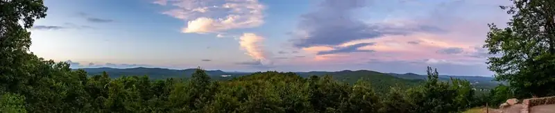
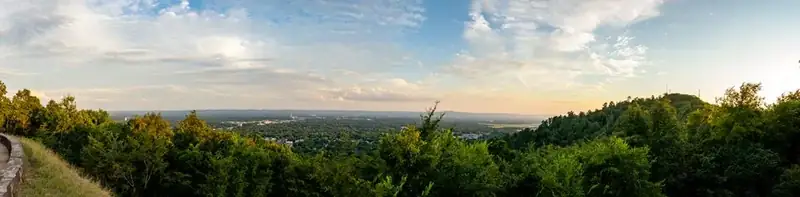
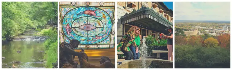
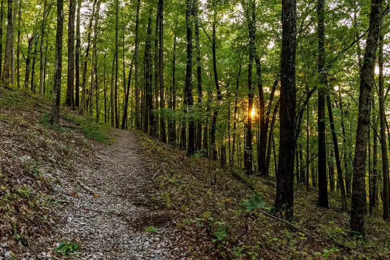
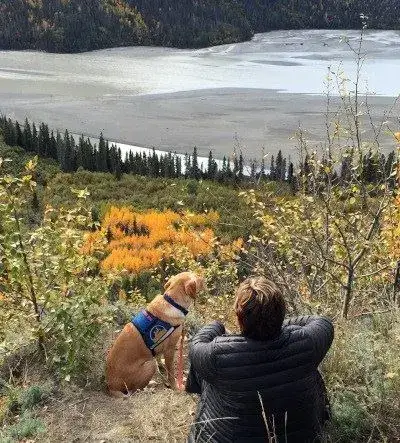



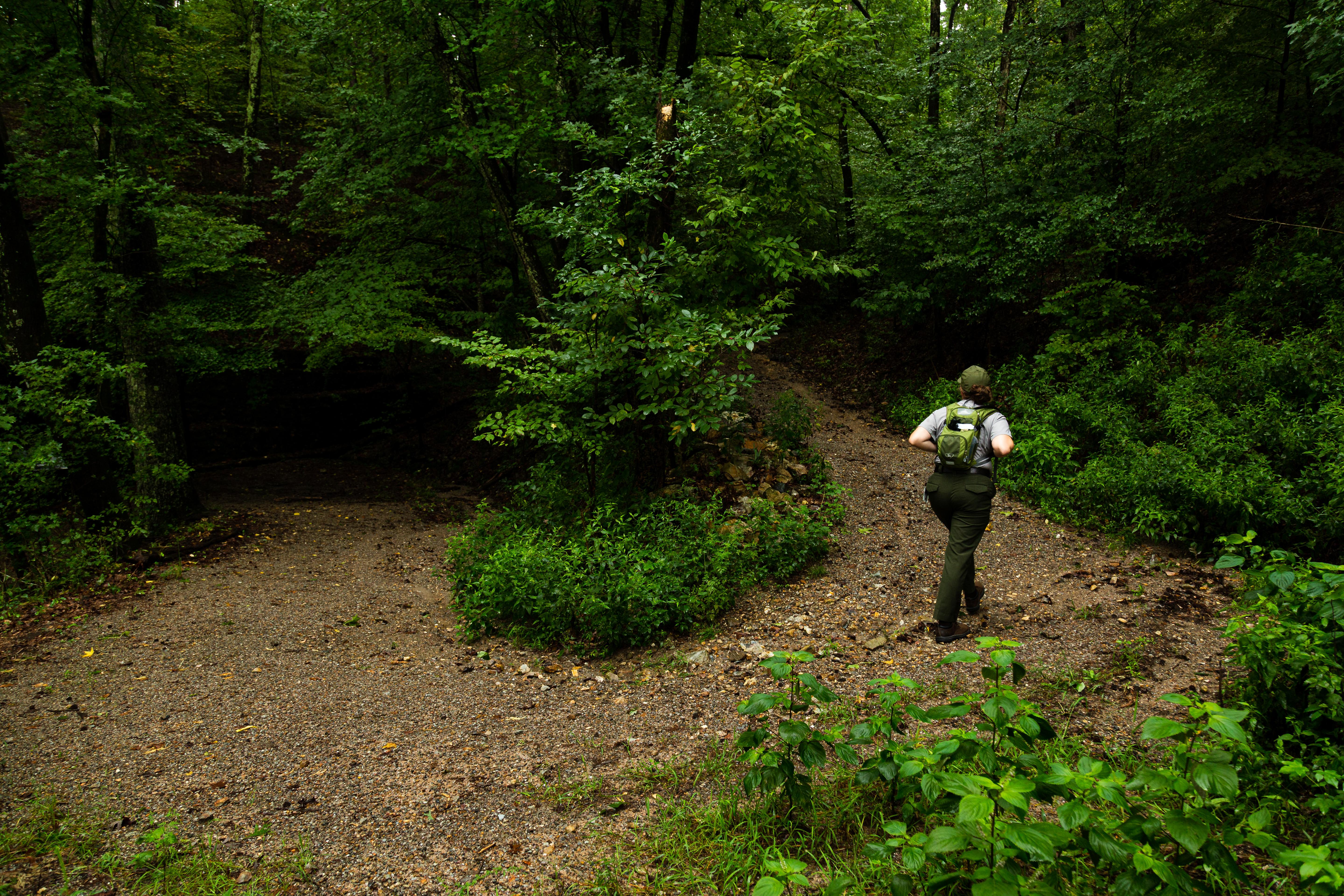
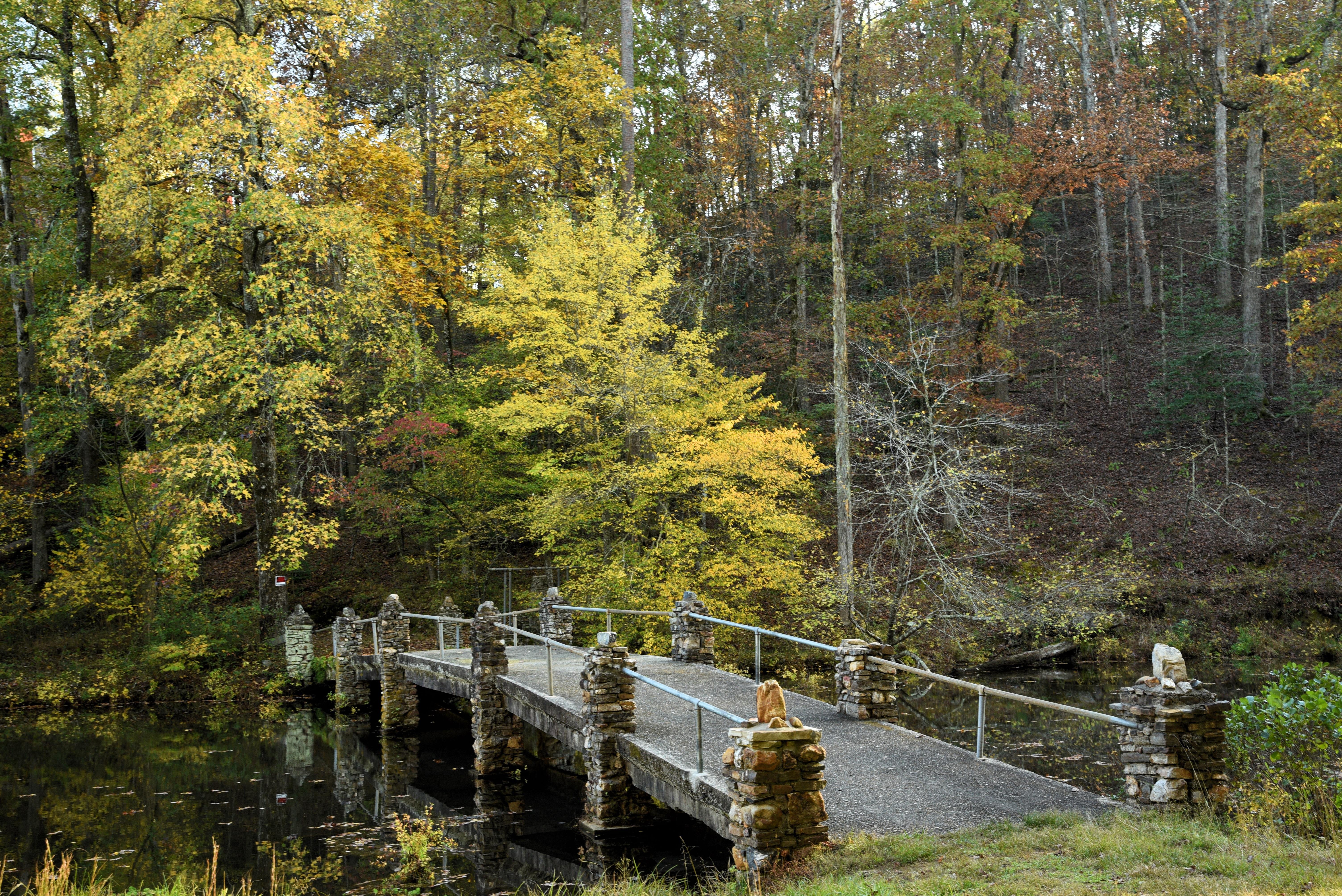

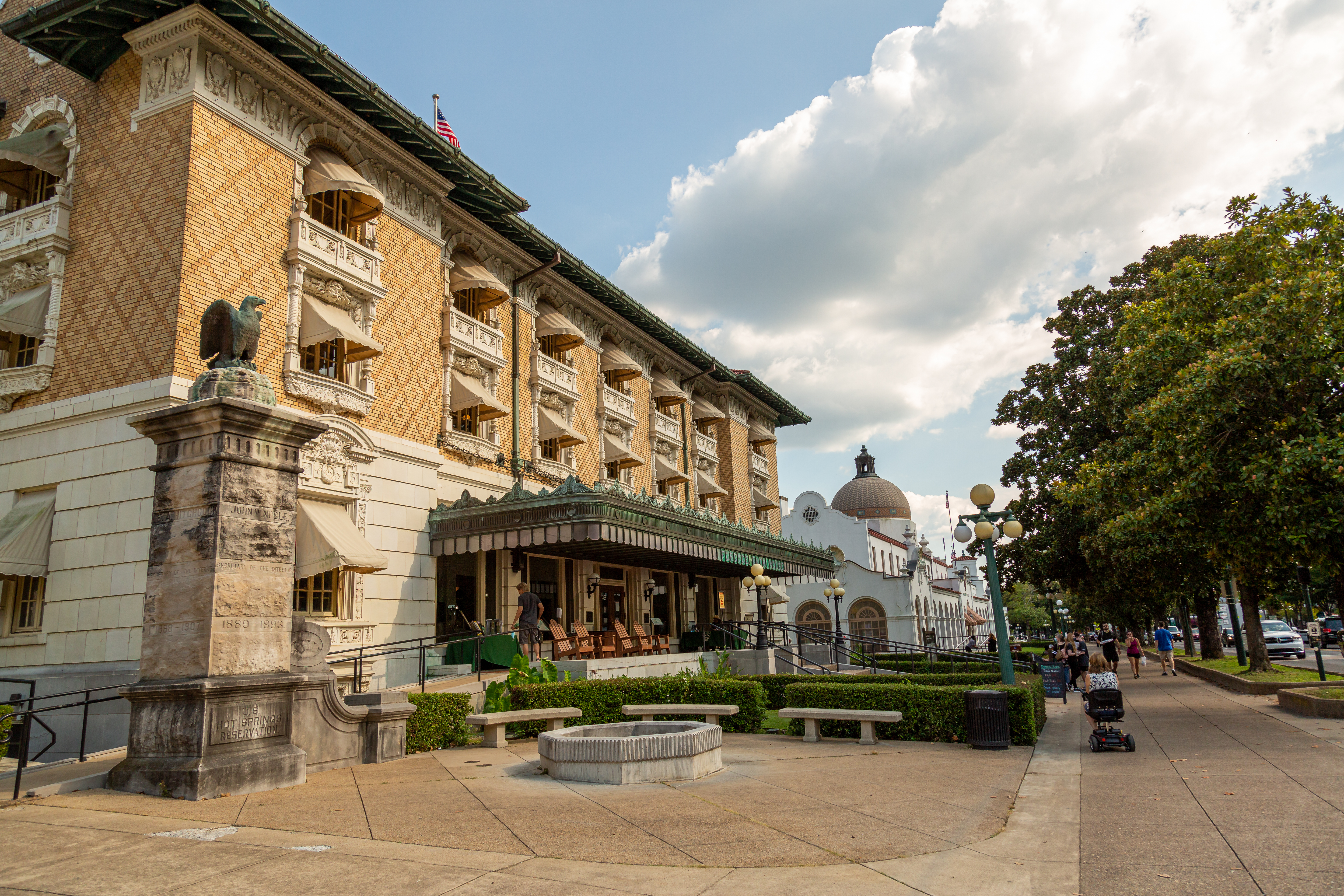


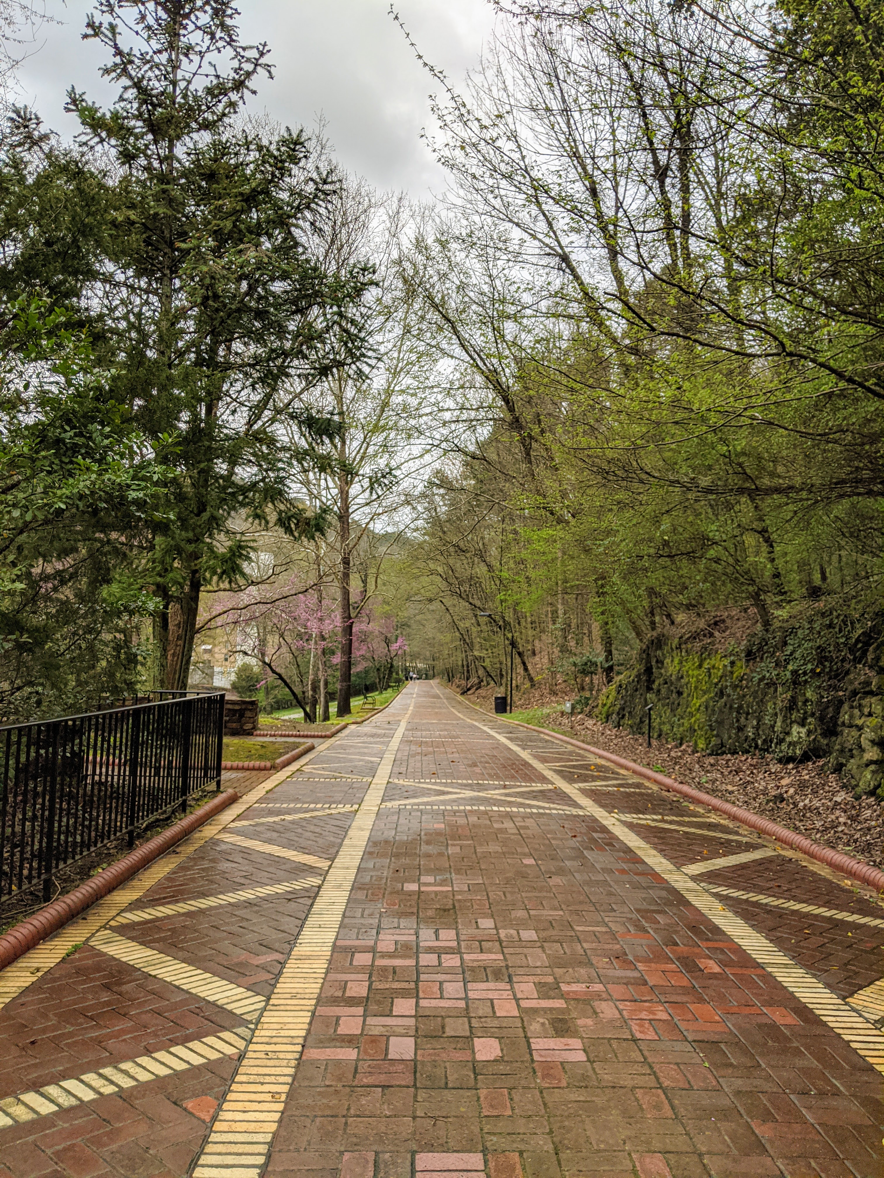
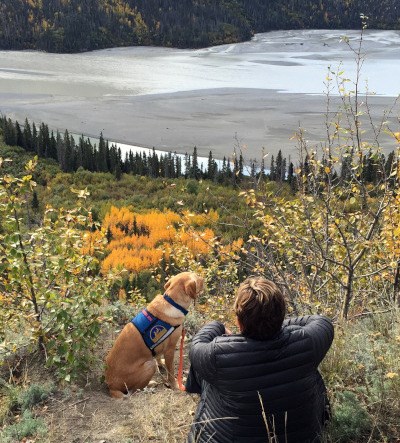


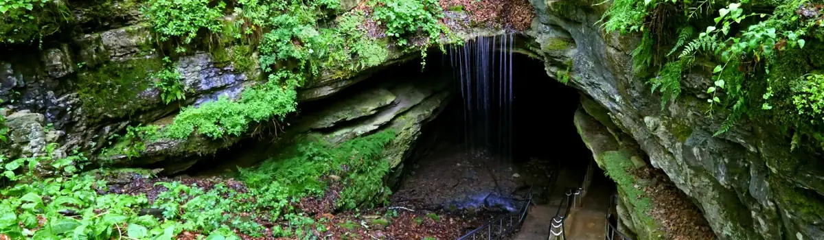 Caves