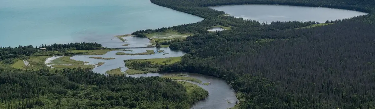
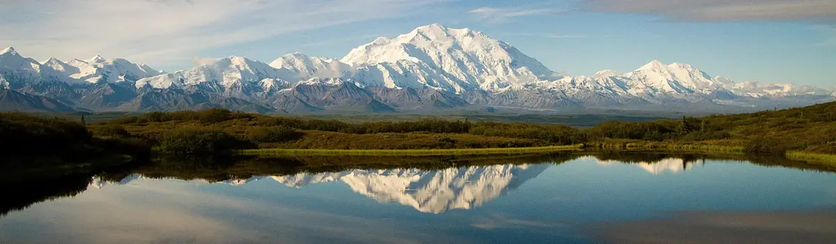
Lake Clark National Park and Preserve is a land of stunning beauty. Volcanoes steam, salmon run, bears forage, and craggy mountains reflect in shimmering turquoise lakes. Here, too, local people and culture still depend on the land and water. Venture into the park to become part of the wilderness.
2.6Macres of parkland
19.8Krecreation visits, 2025
Regional datanearby climate picks
Seasonal access & reservations
No reviewed guidance for this selection. Check the park's official planning pages; missing coverage does not establish access.
Selected guidance only; separate from climate comfort and current conditions.
Official conditions Loading saved check
Loading the latest saved conditions. You can also check the official report below.
Editorial recommendations, reviewed 2026-10-17. Full park days, excluding travel to and from the region. A first-visit outline for a general traveler; adapt to mobility, fitness, season, reservations, and current conditions. These are suggested days, not reserved activities or guaranteed routes.
On the Shore of Lake Clark Things to Do in Port Alsworth
Official NPS activity guide.
NPS / K. Lewandowski
Getting to Port Alsworth
Flying to Port Alsworth Landing gear: Wheels or Floats* Most visitors arrive in a small plane operating on wheels that lands on one of the two airstrips. Be aware that while any floatplane can land on the state waters in Hardenburg Bay at Port Alsworth, there may be issues with parking planes on privately owned sections of the shoreline. For this reason, some floatplane air taxis based out of other communities may choose not to fly to Port Alsworth. The flight from Homer, Kenai, or Anchorage depends on the aircraft but generally last from about an hour to 1.5 hours.
Click the link above to see a list of all the air taxis that are permitted to operate in the park. Prices depend on group size, type of airplane, length of flight, and where the flight originates. Contact each air taxi operator directly to determine availability and the cost for your trip. The linked air taxi operators are permitted to operate within the national park under FAA Part 135 air taxi regulations which require three miles visibility and glide distance to shorelines while crossing open water such as Cook Inlet. There are also guide services permitted to guide in the park who fly aircraft, land outside the park and walk into the park for guiding purposes. Those guides operate under FAA part 91 regulations which have lower safety visibility and glide distance requirements.
The infrastructure of Port Alsworth is centered around two active gravel aircraft runways that terminate at Hardenburg Bay. Locals utilize feet, fat-tire bicycles, ORVs, and vehicles to get around. Unless other arrangements are made with an air taxi, lodge, or another service in town, expect to walk where you need to go. You may have to cross one or both of the aircraft runways on foot. If so, go to the very end of the runway to avoid intersecting an active and sometimes busy airstrip. Always look left, right, and UP before you cross. Small aircraft can be surprisingly quiet when landing or taking off and you may not hear an aircraft until its wheels hit the ground. Open in the summer only, the visitor center is located midway up the easternmost runway and has maps of Port Alsworth and the Tanalian Trails that originate from town. Winter visitors may contact park staff in the Headquarters building next to the visitor center.
Accessibility Note
The visitor center has a wheelchair accessible ramp. A fat tire wheelchair that works well on gravel is available from the Park HQ. It may be reserved in advance and delivered to your airplane or picked up at the visitor center. To reserve, call (907) 644-3626 or email us
Loading results...
More to Explore
Eating and Sleeping
There are a wide variety of lodging options within the park from rustic camping opportunities, to all inclusive lodges offering guided tours
Port Alsworth Day Hikes
Explore the Tanalian Trails
Directions and Air Transport
Lake Clark is not on the road system; therefore, access is primarily by small aircraft. Learn how to get to this isolated park in Alaska.
Backpacking in Alaska
Get acquainted with what makes backpacking in Alaska unique and familiarize yourself with these backcountry tips before you plan your trip.
Have a Plane? Private Aircraft Info
Useful information for private pilots including aviation weather stations, airstrips, and fuel.
Tanalian Point was the first settlement south of Port Alsworth on Lake Clark's southeastern shore.
While day hiking opportunities are endless in places that can be reached by plane or boat, there are only two maintained trail system in the park and preserve. The Tanalian Trails originate in Port Alsworth in the heart of the park. The trailhead is located near southern-most airstrip in town. Stop by the park visitor center in Port Alsworth for current trail conditions and a trail map.
NPS Map/HFC, LACL
Photo Courtesy Of T. Tessier
Length: about 4 miles round trip
Meander through birch groves and up spruce studded hillsides to a stunning view of Lake Clark. Then round the bend and head down the gentle hill. On a summer day dwarf dogwood lines the trail, the sunlight dapples the forest floor, and the roar of the falls in your ears is deafening. Cold glacial waters fall over a 30 foot cliff of ancient lava. The mist falls coolly on your face and the view takes your breath away. Kontrashibuna Lake Length: about 5.5 miles round trip Beyond Tanalian Falls, the trail enters Lake Clark’s designated wilderness on its way to the serenity of Kontrashibuna Lake , a spectacular mountain gem.
NPS Photo/ T. Vaughn
Beaver Pond Trail
Length: 3.2 miles round trip
Any hike in the Tanalian Trail system can be made into a loop by returning on the Beaver Pond Trail. This trail meanders through quiet birch groves and past an old beaver pond where shorebirds nest in the early summer. Benches overlook the beaver pond offering a quiet place for reflection. The trek to the Tanalian Falls can also be started on this trail. The Beaver Pond Trail offers a more gradual incline up to the falls.
NPS photo/K Martin
A Whole Day Hike
Tanalian Mountain
Length: 8.6 miles round trip
The trail up Tanalian Mountain is steep and rigorous with stunning panoramic views of Lake Clark and the surrounding mountains. Plan for at least eight hours to complete this trail. The trail begins along the Tanalian Falls Trail and offers views through a birch and spruce forest before starting the ascent up the rocky mountain. Alder and willow line the trail before elevation gives way to tundra. Keep an eye out for sheep at the summit as well as a USGS benchmark before reaching the very top.
Other Day Hikes on Lake Clark
The Portage Creek Trail is the only other maintained trail in Lake clark. The trail originates at the Joe Thompson Public Use Cabin (not visible from the lake), approximately 13 miles north-northwest of Port Alsworth. Visitors can access the beach in front of the cabin via boat or float plane and water taxis may be available from Port Alsworth. While there are no mooring buoys or boat docks at this location, watercraft can land on the beach. To the west of the cabin, and around the point (see reverse for map) is private property. Please avoid disturbing our neighbors. The Portage Creek Trail begins near the shore of Lake Clark and continues over three miles through a thick spruce and birch forest, past alders and up to alpine tundra. The first mile is generally flat until you reach Portage Creek. Foliage on the trail can change drastically from season to season so be aware of where the trail is to avoid creating social trails or tresspassing on private property. After crossing the creek, the trail starts to ascend in a series of switchbacks. Stay to the left after crossing the creek to stay on the public trail. Please do not shortcut the switchbacks as this will erode the trail. The maintained trail ends in the tundra.
Other Day Hikes Not On Lake Clark
A boat or plane ride can provide access to endless opportunities for trailless day hiking where the adventurous traveler can enjoy a climb up to alpine lakes or tundra meadows, a stroll across river gravel bars, or a challenging bushwhack up to a seldom-visited waterfall. Coastal beaches, high tundra, and lakeshores offer excellent hiking for the traveler seeking solitude and the challenge of finding their own route. Walking up to Teetering Rock on an unmaintained trail that begins behind Dick Proenneke's cabin is a popular hike for people visiting Upper Twin Lake.
When flying or boating to remote locations for day trips make sure you are prepared to spend the night if unexpected weather makes that necessary.
Lake Clark National Park and Preserve offers world class bear viewing opportunities on the coast where brown bears congregate in high numbers to feed. Information on this page will help you plan your bear viewing adventure. Learn and when to go to see bears, become familiar with bear viewing best practices. Then watch the park's beautiful new 11 minute-long film, A Day on the Lake Clark National Park Coastline to get a feel for experience of being on the coast with bears.
Where Can I See Bears?
Chinitna Bay Located at the southern end the park's Cook Inlet coast, Chinitna Bay offers world class bear viewing. Visitors may be able to see as many as twenty coastal brown bears from a single location.
Crescent Lake Located in the heart of the Chigmit Mountains, Crescent Lake is a sport fisherman's dream. During the salmon run, brown and black bears also frequent the shorelines in search of the plentiful fish.
Silver Salmon Creek Located midway down the park's Cook Inlet coast, Silver Salmon creek offers outstanding sport fishing in addition to world class brown bear viewing.
Shelter Creek and Tuxedni Bay Also located along the park's Cook Inlet coast, these two areas provide rich bear habitat, though they are more difficult to reach and thus less frequently visited by people. Bears that are not accustomed to the presence of people are less likely to tolerate close encounters. Exercise extreme caution if you visit these locations.
This page provides the information you need to plan your trip to Crescent Lake, which is nestled in the heart of the Chigmit Mountains.
At times, visitors are able to see twenty or more brown bears in the salt marsh and on the tidal flats east of Middle Glacier Creek.
Located midway up the park's Cook Inlet coast, this is the place to be if you are interested in bear viewing or fishing.
Bear Viewing Best Practices
Consistently Use the Same Viewing Sites
Access Viewing Sites in a Consistent Manner that Minimizes Disturbances
If people travel to the same places in the same way day after day, year after year, our behavior becomes predictable to bears, and they are more likely to view us as an unobtrusive part of their environment. If trails exists to designated viewing sites, such as those at Chinitna Bay, please use them.
When accessing viewing sites, people should strive to minimize disturbance to bears, bear habitat, and other people. When going to a viewing area on foot, it is usually best to be visible while approaching rather than sneaking into the area and possibly surprising bears. Bears don't like to be surprised, and can be dangerous if they are.
Promote Predictable Human Behavior
Each encounter is a learning experience for both bears and people. Appropriate and consistent human responses to bears minimize the chances of dangerous surprise encounters and can provide safer and better bear viewing experiences.
In most cases it is best to stay in the open where bears can see people and avoid them if they wish. Hiding from bears increases the likelihood that people will have a surprise encounter that could result in a dangerous situation for the bear and/or the person. Minimizing noise and movement while viewing bears will help limit disturbance to bears using the area.
Respect a Bear's "Personal Space"
Respect a Bear's Food Sources
Avoid Displacing Bears When Camping and Fishing
Ensure Bears Don't Obtain Food From People
Stay Together in Bear Country
Read a Bear's Body Language
Although brown bears are inherently solitary animals, they have developed distinct social cues and practices that allow them to live and eat near other bears. This is especially true around seasonally abundant food sources such as sedge meadows and salmon spawning streams.
If people learn to adhere to the rules bears observe for themselves, bears will more likely accept our presence as an unobtrusive part of their environment, and will continue to feed and carry on their natural behavior while being watched. Understanding bear behavior also reduces dangerous encounters and benefits both bears and people.
If a bear that has been feeding calmly moves away at your approach, you have probably come too close. Do not pursue the bear at this point.
Bears standing on their hind legs are trying to gain a better vantage to see or smell something in the distance.
Boars walking in a bow legged, "cowboy" stance are expressing dominance. You will see this during the mating season in June as they try win dominance over other boars and thus the right to mate. It is also used to move others out of prime feeding or resting spots.
A bear may open its jaws wide in close proximity to another bear's face that it is trying to impress. This often leads to play.
Yawning can indicate that a bear is mildly irritated. Out of respect, avoid crowding a bear expressing this behavior.
Huffing, sometimes accompanied by deeper throaty sounds indicates that a bear is nervous. If the bear is directing the huffing at you, it is time to give the bear more space.
Jaw popping/ teeth clacking is a sign that a bear is very agitated and perhaps a little afraid. If you are close enough to hear it, you are too close.
A bear that is very agitated may have its ears flattened against its head.
A bear that lunges towards you or slaps the ground or surrounding vegetation is feeling threatened and telling you to "move away." Take this message very seriously.
Discourage Curious or Aggressive Bears from Approaching
Thinking about visiting the park's Cook Inlet coastline? This short film offers a spectacular introduction to what your day may include and how to stay safe and protect the park's bear populations.
Find a Bear Viewing Guide Contact information for all authorized bear viewing guides
Staying Safe in Bear Country Bears and people use the same areas in Lake Clark. Become familiar with these tips for staying safe in bear country prior to your trip.
Lake Clark's Brown Bears Discover how different the lives of Lake Clark's coastal & interior brown bears really are and see what this means for you.
A camping trip into Lake Clark's trail-less wilderness can be a spectacular and rewarding experience. Thorough preparation and careful trip planning will help ensure you have a safe and meaningful trip. Here you will experience undeveloped wilderness, self-reliance, and solitude to an extent seldom found elsewhere.
Base camping, backpacking, and hiking options are abound in the park and preserve. While the only developed and maintained trails in the park are part of the Tanalian Trails network near park headquarters in Port Alsworth, hiking is allowed anywhere not otherwise closed to public use. Lake shores, coastal beaches, and high tundra are excellent areas for that activity. Adventurers in Lake Clark will need to rely upon their way-finding and hiking skills, or hire a guide who can help them.
Thorough research and preparation will be important in creating your own safe adventure in Lake Clark National Park and Preserve.
Backcountry Pro-Tips
Wilderness Travel
Lake Clark National Park and Preserve is a trail-less wilderness, and you are free to travel where you like. Off-trail hiking employs the senses, heightens awareness and actively requires your constant participation in making decisions. You'll hike cross country, using a map and the lay of the land to get where you want to go. There are rivers to ford, bogs to avoid, and bad weather to sit out. Vegetation and terrain usually dictate the difficulty of the hiking. Plan on covering one mile per hour (allowing for errors in navigation, route selection and tough going). If you're not familiar with Alaskan terrain, be prepared to turn back and try a different route, and give yourself plenty of time to get where you're going. Keep in mind that all streams and rivers must be forded , and during high water levels, this may be impossible.
All camping is primitive, no facilities or designated campsites exist. You should use Leave No Trace guidelines to minimize your impacts. Backcountry permits for camping and hiking are not required, however there are rules and regulations governing one's behavior in all national park areas. Please do not take, shape or alter the wilderness around you.
The cultural value of tinitun (trails) have deep, multilayered meanings and uses in inland Dena’ina tradition.
Campers should be extra vigilant with food storage and plan for safe camping in bear country.
Backpackers willing to navigate extremely dense brush at lower elevations will reach secluded alpine tundra with endless ridgelines.
Explore some of Dick Proenneke's stomping grounds by hiking into the valley above his cabin at Upper Twin Lake.
Backpackers on this route will explore more of Dick Proenneke's stomping grounds in the high country above Upper Twin Lake.
This popular backpacking journey follows a ancestral Dena'ina Athabascan route between Kijik Village on Lake Clark and Telaquana Lake.
Explore some of Dick Proenneke's favorite spots by walking the shoreline between Upper and Lower Twin Lakes.
Most visitors travel to Lake Clark via small plane. Safety in this remote place depends on more than just a pilot's skill.
Both black and brown bears live in Lake Clark. It is critical to educate yourself about safe practices in bear country and be prepared to handle a potential bear encounter. Read up on bear safety before starting your trip.
Lake Clark is exceptionally remote and isolated. Caution, good judgment and thorough preparation will help ensure you have a fun, safe trip. Please always tell someone where you are going and when you will return. While it is not required, it is a good idea to also leave your trip itinerary with us at our visitor center in Port Alsworth before departing into the backcountry. If we get a call indicating you are overdue it makes it easier to help you.
Lake Clark National Park and Preserve is primarily a trail free wilderness where travelers may camp where they like. There is a camping area near Hope Creek on Upper Twin Lake just west of the Proenneke Historic Site. Tulchina Adventures offers rustic camping in Port Alsworth.
Want a guide? Need access to equipment? Find providers here.
Know how to properly store your food, toiletries, and fish prior to arriving in Lake Clark.
Bears and people use the same areas in Lake Clark. Become familiar with these tips for staying safe in bear country prior to your trip.
Visiting Lake Clark can be challenging. You cannot drive because the park is not on the road system. Instead, you must fly or take a boat.
How to obtain Lake Clark maps from the park, USGS, or our partners.
Located on the south shore of Upper Twin Lake, the remote Alaskan wilderness where the Richard Proenneke Cabin is situated provides prepared travelers opportunities to discover firsthand why countless individuals have connected to this place. This page provides the information you need to plan your trip.
Dena'ina Place Name
Twin Lakes is known as Niłqidlen Vena in Dena'ina, translated into English meaning ' lakes that flow into one another .'
NPS Photo / Kent Miller
NPS/K. Lewandowski
Getting to Upper Twin
Flying to the Proenneke Cabin Landing gear: Floats Dick Proenneke's cabin is located in a roadless wilderness, so unless they are backpacking from other locations in the park, visitors arrive by small planes that land on Upper Twin Lake. There are no suitable beaches or runways for wheeled planes, so visitors traveling in the summer will need a plane that operates on floats. Winter landings can take place on wheels, skis, or wheeled-skis depending on the snow and ice conditions. The flight from Anchorage is just over an hour. The flight from Port Alsworth is typically 30 minutes. Site staff have air to ground radios on the local area frequency 122.9.
Air taxi prices depend on group size, type of airplane, length of flight, and where the flight originates. Contact each air taxi operator directly to determine availability and the cost for your trip. Air taxi operators are permitted to operate within the national park under FAA Part 135 air taxi regulations which require three miles visibility and glide distance to shorelines while crossing open water such as Cook Inlet. There are also guide services permitted to guide in the park who fly aircraft, land outside the park and walk into the park for guiding purposes. Those guides operate under FAA part 91 regulations which have lower safety visibility and glide distance requirements.
Latitude and Longitude
Approximately 60° 38' 54.64"N 153° 48' 47.195''W Located on Upper Twin's south shore immediately up-lake of the Hope Creek delta, the Proenneke cabin is easy to spot from the air, as it is the only cabin on the lake flying an American flag
Proenneke Cabin Hours, Seasons and Considerations
Open: Late May (tentative) through late September The spring opening date of the historic cabin is tentative due to ice melt. For the 2026 Summer Season , the Proenneke Cabin is open daily from 10:00AM to 4:00PM. Closed: Late September through late May The Proenneke Cabin is locked during the winter months. You may explore the area year round, but may only enter the cabin in the summer months. There are a few amenities and regulations at the Proenneke site designed for your safety.
Attend your food . If you have any food with you, you must keep it packed out of site and in your possession at all times or stored in an approved bear-resistant food container. Bear-proof food lockers are located near the Proenneke cabin and at the Hope Creek Campsite for your convenience.
Secure your fish in an approved bear-resistant container as soon as you catch it.
A pit toilet is available down a trail behind the Proenneke cabin. Follow the fork to the left. In addition, there is an "outcan" located at the Hope Creek campsite across Hope Creek. To avoid public health hazards, please utilize these facilities when visiting the National Historic Site instead of digging cat holes.
Rangers and Volunteers are housed nearby late May to late September. Staff have air to ground radios on the local area frequency 122.9.
State of Alaska Fishing Regulations apply to all anglers in Lake Clark National Park and Preserve.
Camping and Backpacking
Camping is prohibited within the National Historic Register boundaries and sleeping in or occupying the cabin, cache, or woodshed is prohibited by law.
Bear resistant food containers (BRCs) are required when camping within half a mile of the shoreline along Upper and Lower Twin Lake or in any location where food cannot be hung at least ten feet above the ground and four feet horizontally from a post, tree trunk, or other object on a line or branch that will not support a bear’s weight. Trees large enough to properly hang food are rare in this area; therefore, we highly recommend that all campers not staying at Hope Creek campsite bring enough BRCs to store all food, garbage, harvested fish, and other scented items. BRCs may be borrowed from the visitor center in Port Alsworth or rented from a variety of outdoor gear shops in Anchorage. For campers utilizing the Hope Creek Campsite, all food, garbage, harvested fish, and other scented items must be stored in the bear-proof food lockers provided on site.
Camping at Hope Creek Campsite is limited to a total of 14 days. There are no time restrictions October 1 - April 14. A few hardened tent sites are available for overnight camping on a first come, first served basis across Hope Creek from the Proenneke cabin. The area is intended for sharing with other groups.
To prevent public health hazards, campers should utilize the "outcan" provided at the site instead of digging cat holes nearby.
Be prepared for a creek crossing to access the Proenneke cabin from the camping area. As with any river, Hope Creek may not be passable if flooding due to heavy rainfall or at the peak of spring breakup.
Alaska's Different
Lodging and Guided Camping Trips
Windsong Wilderness Retreat rents a private cabin on the opposite shore of Upper Twin Lake. Several licensed commercial outfitters rent backpacking, kayaking, and other outdoor equipment and/or specialize in guiding day-long and overnight trips to the Twin Lakes area.
Click the link above to see a list of all the companies that are permitted to operate in the park. Contact each company directly to determine the cost for your trip.
Protecting a Treasure
Help us protect Dick Proenneke's cabin so that generations of visitors will be able to experience what it has to offer.
You may encounter either brown or black bears during your trip to Twin Lakes. Learn how to stay safe.
Become familiar with the responsibilities that come with fishing in bear country prior to your trip to Twin Lakes.
The source of Sam Keith's book "One Man's Wilderness: An Alaskan Odyssey," Proenneke embodies humanity's fascination with wilderness.
Explore details of how Proenneke built his cabin.
From hunter to conservationist - explore the evolution of Richard L. Proenneke's wilderness ethos.
Proenneke was a tireless writer, documenting his observations in a series of journals that span nearly 30 years.
Explore a few of Richard Proenneke's belongings now in the park's museum collections.
View Lake Clark's entire online museum collections which includes some of Richard Proenneke's belongings.
Comprised of 4 million acres on the Alaska Peninsula in southwest Alaska, Lake Clark is one of the nation's most remote national park units. Established by the Alaska National Interest Lands Conservation Act (ANILCA) on December 2, 1980, the park and preserve support an ongoing tradition of subsistence culture in a volcanic and partly glaciated landscape containing habitat for wilderness dependent species of fish and wildlife.
Lake Clark offers excellent opportunities for adventure, exploration, learning, and just plain having fun! Start planning your visit by using the links below to learn about the park.
Physical Address
Lake Clark National Park and Preserve is located on the Alaska Peninsula southwest of Anchorage and west of Homer. We are not on the road system. The address provided below is for the park's field office in Port Alsworth, AK. GPS coordinates are provided for some locations listed on the Places to Go page.
Operating Hours & Seasons
Operating Hours & Seasons Details
Permits & Reservations Details
Visitor Centers
Internet & Cellular Access
Internet & Cellular Access Details
Plan Your Visit
Accessibility Lake Clark's goal is to provide the highest possible level of accessibility to our visitors. See about the services and facilities available
Where to go? Places To Go As a vast and largely undeveloped wilderness, there are countless places to explore; however, there are a few areas of particular interest.
How to Get There Directions and Air Transport Lake Clark is not on the road system; therefore, access is primarily by small aircraft. Learn how to get to this isolated park in Alaska.
Come Prepared Eating and Sleeping There are a wide variety of lodging options within the park from rustic camping opportunities, to all inclusive lodges offering guided tours
Choose Your Own Adventure Things to Do Wilderness adventure is easy to find in Lake Clark. These suggestions may help you figure out what you want your adventure to be.
How Do I Stay Safe? Park Safety A rugged wilderness requires special care from visitors. The weather, terrain, and wildlife can all present challenges.
Learn About the Park
Wild, Rugged, Remote Nature Explore the natural world in Lake Clark, including wildlife, plants, volcanoes, glaciers, and environmental issues that can impact the park.
Into the Vault Explore the Museum Collections We've opened up the vault! Explore the items within Lake Clark's museum collections and learn the stories behind the objects.
Cultural Connections Connected to the Land: Dena'ina Culture Qizhjeh Vena/Lake Clark is the ancestral homelands for the Dena'ina Athabascan people. Discover more about people that call this area home.
Unearthing History Dig Into the Past: Archeology Unearth how archeologists help preserve Lake Clark's history.
Preserving Culture Into the Future Sharing a Living Culture: Ethnography Cultural anthropologists and historians identify, document, and interpret ethnographic resources and so much more.
Science! Research and Monitoring Learn about the comprehensive suite of scientific research, inventory, and monitoring that scientists conduct in Lake Clark.
Stay in a rustic cabin to experience remote Alaska living for yourself. Split some wood and head inside to light a fire in the stove. Enjoy the warmth while your gear dries out from a day on the water.
A Wild Paradise
Experience Lake Clark's History
NPS/K. Lewandowski
Know Before You Go
Cabin Rules and Other Considerations
Dogs are allowed at the cabin.
Please use wood sparingly for heating purposes only.
You are responsible for bringing your own cook stove, lighter, utensils, sleeping pads, bedding, toilet paper, drinking water, and/or means of treating drinking water.
Park regulations require all food, garbage, and other scented items be secured inside the cabin at all times because bears frequent this area. Food storage violations could result in immediate termination of the cabin reservation in addition to a fine.
Trash needs to be removed from the park. Pack out all trash and remaining food with you. There is no public trash collection in Port Alsworth.
No smoking in the cabin. All cigarette butts must be packed out with garbage.
Fishing and hunting activities are allowed while based at the cabin in accordance with all state and federal regulations.
Please respect private property. Many local residents live a subsistence way of life. Their land, camps, fishnets, traps, and equipment are private property. Native Corporation lands and private property exist in the area, they are not open to the public.
Spend the Night
Discover the Joe Thompson Cabin
Joe Thompson was essential in the development of Port Alsworth. This cabin is one of many he built in the Lake Clark region.
Things to Do in Port Alsworth
Port Alsworth is home to Lake Clark's Field Headquarters and the park's only established trail system.
Please use wood sparingly for heating purposes only.
You are responsible for bringing your own cook stove, lighter, utensils, sleeping pads, bedding, toilet paper, drinking water, and/or means of treating drinking water.
Park regulations require all food, garbage, and other scented items be secured inside the cabin or the bear resistent container provided on site at all times because bears frequent this area. Food storage violations could result in immediate termination of the cabin reservation in addition to a fine.
Trash needs to be removed from the park. Pack out all trash and remaining food with you. There is no public trash collection in Port Alsworth.
No smoking in the cabin. All cigarette butts must be removed with garbage.
Fishing and hunting activities are allowed while based at the cabin in accordance with all state and federal regulations.
Please respect private property. Many local residents live a subsistence way of life. Their land, camps, fishnets, traps, and equipment are private property. Native Corporation lands and private property exist in the area, they are not open to the public.
Spend the Night
More Nearby Things to Do
Reserve an overnight stay in the Priest Rock Public Use Cabin.
Port Alsworth is home to Lake Clark's Field Headquarters and the park's only established trail system.
Sport hunting and trapping are permitted in Lake Clark National Preserve, but not within the national park. The information on this page will help you begin planning your your trip. Be advised that thorough hunt planning takes time. You may need to begin as much as 18 months in advance of your hunt to reserve your preferred dates, call references, and finalize any contracts you may need.
Hunt Guiding Services
Stony River Guide Area
Mulchatna Guide Area and Lake Clark Guide Area
Things to Know When Planning Your Trip
The National Park Service and the State of Alaska cooperatively manage the wildlife resources in Lake Clark; therefore, you must possess all required Alaska state hunting licenses, tags, and permits and you must comply with NPS and State of Alaska sport hunting and trapping regulations. Potential hunting violations include: sport hunting within the national park boundaries, failing to salvage the meat, taking undersized game, and taking wolves or coyotes during the restricted period of May 1 through August 9.
Be aware that Alaska hunting regulations, set by the Alaska Board of Game, require non-resident sport hunters to either use the services of a licensed hunting guide or to hunt with an Alaska resident who is a close relative when hunting brown bear, dall sheep, or mountain goat. Non-resident aliens who have not established residency in the state of Alaska must be accompanied by a state licensed guide.
Hunting trip arrangements can be made through lodges, air taxis, licensed big game transporters who are licensed by the State of Alaska, or incidental big game transporters (licensed air taxi operators that provide transport services for hunters). The list of companies authorized to operate within the park and preserve is a critical component for your trip planning.
For more information or clarification about hunting regulations, please contact the chief ranger. Phone: (907) 644-3647 Email us
Please keep in mind that many areas within the preserve are privately owned. Do not enter private land without the land-owners permission.
Keep your safety in mind at all times. Each person in the boat must have a Personal Flotation Device (PFD) on board the vessel, and we strongly recommend that PFDs be worn at all times. Alaskan waters are icy cold, even when air temperatures are warm. Wind and weather can quickly work the lake's surface into a stormy sea unsuitable for small boats. Alaska has the highest rate of recreational boat fatalities in the nation. For more boating safety tips, check the State of Alaska Office of Boating Safety .
NPS/K. Lewandowski
Most access to the park is by plane, which creates packing challenges for kayakers and canoers. A full-size boat, people, and gear won't fit in a smaller plane. Ask the air taxi service you plan to use whether they can accommodate your trip. Inflatable canoes and kayaks or foldable kayaks are good choices for small aircraft. If your personal gear can't be flown into the park, you may want to consider hiring a guided kayak adventure or renting equipment from local gear shops who specialize in gear that fits small planes.
The rivers in Lake Clark are more suitable for use with a kayak or raft than a canoe. See the river rafting page to get further details on the class of whitewater for some rivers.
Cold Water Safety
Please keep your safety in mind. A calm lake can quickly become rough. Keep an eye on the weather. Small waves in the morning and early afternoon came become large waves and white caps in just an hour or two. The frigid water and windy, wet weather are unforgiving. Alaska has the highest rate of recreational boating deaths in the nation. ALWAYS wear a Personal Flotation Device (PFD), even when the air temperature is warm. For more information, check with the state Office of Boating Safety .
Please keep your safety in mind.
A calm lake can quickly become rough. Keep an eye on the weather.
Small waves in the morning and early afternoon came become large waves and white caps in just an hour or two.
The frigid water and windy, wet weather are unforgiving.
Alaska has the highest rate of recreational boating deaths in the nation. ALWAYS wear a Personal Flotation Device (PFD), even when the air temperature is warm. For more information, check with the state Office of Boating Safety .
Lake Clark provides excellent fishing opportunities for adventurous anglers. The park and preserve includes some of the most pristine fishery habitats in the National Park system. In fact, one of the original purposes in the founding legislation is preservation of the watershed for the perpetuation of the sockeye salmon fishery.
This fishing season runs primarily from May through October, with the peak season in July and August during the salmon runs. Lakes may not be ice free until June. Ice fishing is also a popular activity in winters when the lakes freeze.
The National Park Service and the State of Alaska cooperatively manage the fish in Lake Clark; therefore, you must possess all required Alaska state fishing licenses and tags, and you must comply with State of Alaska fishing regulations .
Mountain lakes and streams nestled among the jagged spires of the Alaska Range contain a combination of arctic char, arctic grayling, Dolly Varden, lake trout, rainbow trout, northern pike, and all five species of pacific salmon. Listed below are just a few places you can try your luck.
Crescent Lake Located in the heart of the spectacular Chigmit Mountains, it's no wonder Crescent Lake is the park's most popular fishing destination.
Silver Salmon Creek Anglers at Silver Salmon Creek will find themselves in the company of brown bears.
● = Present = Uncommon ○ = Probable
NPS Photo / K. Jalone
Fishing in Bear Country
It is important that we don't teach bears that anglers can provide an easy meal!
Bears Have Rights to the Prime Fishing Sites
Fish are a critical food source for bears; give them plenty of time and room to fish.
If a bear approaches while you are fishing, ensure you are not blocking its path. Back away from the shore and allow the bear to pass or fish.
Find a new fishing site if yours is claimed by a bear.
Splashing Fish Attracts Bears
If a bear is near enough to notice a fish splashing---STOP FISHING!
If a bear approaches while you have a fish on the line, give it slack or cut the line to eliminate splashing and prevent the bear from taking the fish away from you.
If a bear attempts to take fish from you, surrender your catch to the fast moving current.
Secure Your Catch
Fish remains attract bears. Clean your fish at the beach or shore and cast all remains into the ocean, lake, or river.
If there are bears on the beach, it may be best to wait until you leave the area to clean your fish.
Immediately store your fish in a bear-resistant container (available from your guide or from the ranger station at Silver Salmon Creek or the Visitor Center in Port Alsworth).
Fish and Travel in the Open
Avoid places where geographic factors, such as heavy cover, prevent you from seeing what's ahead.
Be alert and noisy in areas where the sound of running water may prevent you from hearing bears, and vise versa.
Bears, Boats, Float planes A Trip to Crescent Lake
Official NPS activity guide.
Crescent Lake, in the heart of the Chigmit Mountains, offers outstanding fishing and bear viewing opportunities for visitors. Sockeye and silver salmon run up the Crescent River each summer. Brown and black bears travel the shoreline of the lake and river in search of their next meal. Crescent Lake is a spectacular and wild place. It is also the park's most visited destination and visitors should expect to see other people here. This page provides the information you need to plan your trip.
The park's most visited destination is deep in the wild. Watch this introduction to learn how to stay safe while visiting this stunning place.
Getting to Crescent Lake
Flying to Crescent Lake Landing Gear: Floats Crescent Lake is located in a roadless wilderness, so visitors arrive in small planes that land on the lake. There are no suitable beaches or runways for wheeled planes, so if visitors traveling in the summer will need a plane that operates on floats. Winter landings can take place on wheels, skis, or wheeled-skis depending on the snow and ice conditions. The fight from Anchorage, Kenai, or Homer is less than an hour.
Click the link above to see information for private pilots and to obtain a list of all the air taxis that are permitted to operate in the park. Prices depend on group size, type of airplane, length of flight, and where the flight originates. Contact each air taxi operator directly to determine availability and the cost for your trip. The linked air taxi operators are permitted to operate within the national park under FAA Part 135 air taxi regulations which require three miles visibility and glide distance to shorelines while crossing open water such as Cook Inlet. There are also guide services permitted to guide in the park who fly aircraft, land outside the park and walk into the park for guiding purposes. Those guides operate under FAA part 91 regulations which have lower safety visibility and glide distance requirements.
Latitude/Longitude The Ranger Station is located at approximately: 60°21'33.71"N 152°51'33.74"W
A Passenger's Role in Aviation
NPS/A. Vornholt
There are no developed trails or roads at Crescent Lake. Most visitors explore the lake by motor boats or kayaks that are provided by their guide or lodge. While it is possible to walk at Crescent Lake, it is not recommended. Dense brush extends from steep mountain slopes to the lake's shoreline. Thus, the few brush-free areas along the shore that exist are travel corridors for bears. It can be very easy to startle a bear in this environment, which is a dangerous situation that should be avoided.
Sport Fishing Crescent Lake is the most popular destination in the park for anglers. Sockeye / red salmon arrive during the month of July, while coho/silver salmon come in mid August through early September. Dolly varden, lake trout, and small numbers of Chinook/king salmon are also present providing ample excitement for adventurous anglers. Anglers must abide by all State of Alaska fishing regulations.
Brown Bear Viewing Brown bears frequent the shoreline in search of fish during the salmon runs giving photographers in boats ample opportunity to capture the perfect photo. Due to the dense vegetation that makes walking on shore challenging and a bit dangerous, most bear viewing at Crescent Lake takes place from boats.
Lodging and Guided Trips Several licensed commercial outfitters specialize in day-long and overnight sport fishing and bear viewing trips to Crescent Lake for travelers who prefer to visit bear country with a knowledgeable guide. Camping is not recommended at Crescent Lake due to the high number of bears in the area and the dense brush that extends to the lake's shoreline.
Click the link above to see a list of all the companies that are permitted to operate in the park. Contact each company directly to determine the cost for your trip.
Fishing In Bear Country While fishing can be exciting at Crescent Lake, it offers a unique set of challenges and opportunities. You are responsible for your own safety and for keeping the bears wild. Become familiar with the responsibilities that come with fishing in bear country prior to your trip to Crescent Lake.
Staying Safe in Bear Country It is likely that you will encounter bears during your visit to Crescent Lake. Visibility is low along the shoreline due to dense brush and the few areas that are clear are bear corridors. Learn how to stay safe in this setting.
In Addition to All Other Park Rules and Regulations There are a few amenities and regulations at Crescent Lake designed for your safety.
Attend your food. If you have any food with you, you must keep it packed out of site and in your possession at all times or stored in an approved bear resistant food container.
Secure your fish in an approved bear-resistant container as soon as you catch it. They are available from your guide.
State of Alaska Fishing Regulations Anglers are required to abide by all state of Alaska fishing regulations.
Know Before You Go
Fishing in Bear Country Become familiar with the responsibilities that come with fishing in bear country prior to your trip.
Staying Safe in Bear Country Bears and people use the same areas in Lake Clark. Become familiar with these tips for staying safe in bear country prior to your trip.
Lake Clark's Food Storage Requirements Know how to properly store your food, toiletries, and fish prior to arriving in Lake Clark.
Lake Clark National Park and Preserve contains three National Wild Rivers, popular for float trips. Rafting these rivers is a wonderful way to experience wilderness. Looking for miles of continuous whitewater? Not likely to be found here. Most rivers in the park are swiftly paced waters requiring oarsmanship with occasional whitewater segments.
Safety is a top priority. Alaskan waters are extremely cold, even when air temperatures are warm. The state has the highest rate of recreational boating fatalities in the nation. ALWAYS wear a Personal Flotation Device (PFD). More information on staying safe in Alaskan waters is available from the State of Alaska Office of Boating Safety .
Logistics can be planned with the lodge, air taxi, or guide service you're using. See the directions page for details about getting to and around the park, and for links to air taxi and guide services.
NPS Photo / Kevyn Jalone
NPS Photo/ Kevyn Jalone
Tlikakila National Wild and Scenic River
Maps : USGS 1:63 360 series topographic Kenai D8; Lake Clark C1, C2, B2, B3.
Located about 110 air miles west of Anchorage, the Tlikakila River is a large braided glacial river found entirely within Lake Clark National Park. The Tlikakila River originates in the Chigmit Mountains, near Summit Lake, and flows southwest approximately 50 miles into Lake Clark. Accessing the river at Summit Lake requires a two mile portage to the river. Pick-up at Lake Clark can be by plane or boat.
This small but fast glacier-fed river follows the deep narrow valley of a major earth fault, surrounded by rugged snow-capped peaks, glaciers, waterfalls, and sheer rock cliffs. The river drops through a densely forested valley with thick underbrush then braids out across an expanse river valley. Visitors generally access the corridor via small planes, landing on Summit Lake and portaging to the first boatable reaches. For most its length, the river is a braided fast-flowing Class I river boatable in canoes, kayaks, rafts, or pack rafts. Although there is a short Class II/III reach downstream of the confluence with the North Fork, the trip generally requires little to moderate whitewater skill. Most floaters take two to four days to float the entire river. Throughout the corridor there are plentiful large gravel bars, providing superb places to camp for floaters. These bars tend to be easily accessed from boats (there are often good eddies), and offer scenic views and short hikes. On clear days, there may be up to 50 small planes passing overhead (Lake Clark Pass is the airway route between Anchorage and southwest Alaska). Anticipate moderate to heavy air traffic especially during weekends and the fall.
NPS Photo / Adrienna Lindholm
Mulchatna National Wild and Scenic River
Maps : USGS 1:63 360 series topographic Lake Clark D3, D4, D5
The Mulchatna River originates in the Chigmit Mountains (a sub-range of the Alaska-Aleutian Range) at Turquoise Lake and flows west through its foothills approximately 22 miles to the border of Lake Clark National Park and Preserve. The river continues an additional 49 miles through state land before joining the Chilikadrotna, then continues 113 miles before joining the Nushagak River, which flows an additional 104 miles into Bristol Bay near Dillingham. The river corridor provides exceptional opportunities for solitude as only a few groups float the river each year. The first 50 or 60 miles of the upper Mulchatna River can be shallow and rocky. Below the canyon there may be numerous log jams.
The river often flows swiftly through the forest constantly cutting new channels and making for many short but difficult portages. Although access via float plane to the outlet of Turquoise Lake is straightforward, weather can be harsh, and the terrain is rugged and remote. During periods of low flows, the upper reaches of the river can also be challenging to negotiate because the shallow channel exposes boulders. Most visitors float the river for up to a week. Longer trips are possible, including a conceivable several-weeks long trip to Dillingham on Bristol Bay via the Nushagak. For most its length in the park, the river is fast-flowing Class I-II river boatable in canoes, kayaks, rafts, or pack rafts.
The Mulchatna generally offers a less dramatic, but more demanding floating experience than the Chilikadrotna. In periods of low water the upper Mulchatna River has a lot of exposed rocks for several miles below Turquoise Lake, and the canyon is swift with lots of rocks and a Class III ledge drop. Below the canyon there are numerous log jams and swift water flowing through the forest that may require numerous short portages. Except during periods of high water, the Mulchatna has many large sand or gravel bars offering plentiful places to fish and camp.
Chilikadrotna National Wild and Scenic River
Maps : USGS 1:63 360 series topographic Lake Clark C3, C4, C5, C6, C7
The Chilikadrotna River originates from Chigmit Mountains (a sub-range of the Alaska-Aleutian ranges) at Twin Lakes and flows west through its foothills approximately 9 miles to the border of Lake Clark National Park and Preserve then re-enters the Preserve for 2.6 miles. The river continues an additional 35 miles through state land before joining the Mulchatna River.
Although access via float plane to the outlet of Lower Twin Lake is straightforward, weather can be harsh, and the terrain is rugged and remote. Since there are no pick up spots near the confluence of the Chilikadrotna and Mulchatna Rivers, floaters must travel 20 miles downstream on the Mulchatna River to Dummy Creek for pick up by float plane. Or they can travel an additional 20 miles to Marabou Landing for a pick-up by float or wheel plane. Most float the river for five to seven days, well past the confluence with the Mulchatna, and longer trips are possible (including a conceivable several-weeks long trip to Dillingham on Bristol Bay via the Mulchatna and Nushagak). For most of the first 12 miles that are inside the park, the river is a fast-flowing Class I-II single-thread channel boatable in canoes, kayaks, rafts, or pack rafts.
A few riffles may offer Class II/III challenge, and boaters must possess sufficient skill to avoid occasional sweepers or tight turns, but the river is generally free of major log jams or portages. There is also a 3.5 mile reach with slower water. Large sand or gravel bars are frequent throughout the corridor, offering plentiful places to fish and camp. This provides considerable schedule flexibility, as most bars have flat places for tents and abundant firewood (particularly as one travels downstream).
Qizhjeh Vena (now known as Lake Clark) is the largest lake located in Lake Clark National Park and Preserve in southwest Alaska. The most populuated town on Lake Clark today is Port Alsworth (60°11.842N, 154°19.357W).
Natural History
Lake Clark was formed by glaciers more than ten thousand (10,000) years ago during the close of the last ice age. During this period of warming, glaciers and ice fields rapidly melted, carving away at the bedrock underneath. This left deep crevasses in the earth creating mountains and valleys. Some of these valleys have filled with water and are now lakes. Glacial lakes are characterized by their length and width, typically being long, narrow, deep and surrounded by mountains. As glaciers melt and receed they leave behind lakes and rivers. Many glaciers that were left behind in the last ice age still exist today in the mountains surrounding Lake Clark. Their water drains into rivers and into surrounding lakes, giving the water a turquoise color. The color comes from glacial "flour," the fine silt that stays suspended in the water.
NPS/ E. Audette
Cultural History
A Place Where People Gather
A Place People Still Gather
Qizhjeh Vena (Lake Clark) today
Today, there are still people inhabiting the area around Lake Clark. Villages like Nondalton, Port Alsworth, and privately owned cabins around the lake boast a population of around 300 (according to the 2010 census). The lake and its resources are still used by Dena'ina people today as well as non-Dena'ina people living and subsisting around the lake. In addition to a number of people living in the area year round, Lake Clark sees an influx of visitors throughout the summer months. People from around the world come to Qizhjeh Vena to recreate in the remote intact wilderness and soak in the natural wonders.
Lake Clark Quick Facts
Elevation: 254 ft
Maximum Depth: 870 ft
Length: 41 miles
Width: range from 1-4 miles
Fish species: king salmon, pink salmon, sockeye salmon, arctic char, arctic grayling, lake trout, rainbow trout, burbot, dolly varden, northern pike
Mammals: moose, brown bear, black bear, showshoe hare, lynx, gray wolf, coyote, wolverine, arctic ground squirrel, beaver, muskrat, Dall's sheep
Some birds: willow ptarmigan, tundra swan, black-capped chickadee, house sparrow, common merganser, bufflehead, mallard
Amphibian: wood frog
Some Insects and arachnids: mosquitoes, woolly bear caterpillar, wolf spider, arctic bumblebee
Find information about fees, passes, permits, reservations, operating hours and seasons, current conditions, weather, and pet policies.
Port Alsworth offers visitor services such as lodging, air taxis, guide services, gear rentals, post office, and park visitor center.
Wilderness adventure is easy to find in Lake Clark. These suggestions may help you figure out what you want your adventure to be.
The wide variety of habitats found in the park allows for an abundance of bird species. In total 187 species of raptors, waterfowl, seabirds, shorebirds, and songbirds have been documented in the park and preserve, and six other species have unconfirmed sightings.
A pair of “bird-worthy” binoculars
A field guide to North American birds
Patience and enthusiasm
NPS Photo/ Jeanette Mills
Birding Responsibly
Where to View Birds
The once endangered Peregrine falcon nests along the Tuxedni Bay coastline. Along coastlines, rich estuaries that provide birding opportunities year-round. During spring migration, watch shorebirds whirl about along the mud and sand flats, searching for prime feeding and roosting locations. Take a walk near shore and survey the intertidal and subtidal zones for sea ducks. Watch your step in the salt marshes and forest for nesting songbirds. When most birds have migrated south, look out for common eiders diving for aquatic invertebrates.
The foothill/lakes region to the west of the Chigmit Range, and the Chulitna Flats adjacent to Lake Clark are important feeding and nesting grounds which host a varied array of migratory and native birds. Among the types of birds a visitor might see are waterfowl, shorebirds, raptors, falcons, owls, songbirds, grouse, and ptarmigan.
Dena'ina Translation
In Dena'ina, migrating birds is ndałi.
Birding Seasons and Residents
Winter Residents
Spring Arrivals
View a bird species list below
Species Attribute Definitions
Occurrence values are defined below. One or more Occurrence Tags may be associated with each Occurrence value.
Present: Species occurs in park; current, reliable evidence available.
Probably Present: High confidence species occurs in park but current, verified evidence needed.
Unconfirmed: Species is attributed to park but evidence is weak or absent.
Not In Park: Species is not known to occur in park.
Occurrence Tags
Adjacent: Species is known to occur in areas near to or contiguous with park boundaries.
False Report: Species was reported to occur within the park, but current evidence indicates the report was based on misidentification, a taxonomic concept no longer accepted, or other similar problem of error or interpretation.
Historical: Species' historical occurrence in park is documented. Assigned based on judgment as opposed to determination based on age of the most recent evidence.
Animals: May be seen daily, in suitable habitat and season, and counted in relatively large numbers.
Plants: Large number of individuals; wide ecological amplitude or occurring in habitats covering a large portion of the park.
Animals: May be seen daily, in suitable habitat and season, but not in large numbers.
Plants: Large numbers of individuals predictably occurring in commonly encountered habitats but not those covering a large portion of the park.
Animals: Likely to be seen monthly in appropriate habitat and season. May be locally common.
Plants: Few to moderate numbers of individuals; occurring either sporadically in commonly encountered habitats or in uncommon habitats.
Animals: Present, but usually seen only a few times each year.
Plants: Few individuals, usually restricted to small areas of rare habitat.
Animals: Occurs in the park at least once every few years, varying in numbers, but not necessarily every year.
Plants: Abundance variable from year to year (e.g., desert plants).
Unknown: Abundance unknown
Native: Species naturally occurs in park or region.
Non-native: Species occurs on park lands as a result of deliberate or accidental human activities.
Unknown: Nativeness status is unknown or ambiguous.
List Differences
The Checklist contains only those species that are designated as "present" or "probably present" in the park.
The Full List includes all the checklist species in addition to species that are unconfirmed, historically detected, or incorrectly reported as being found in the park. The full list also contains species that are "in review" because their status in the park hasn't been fully determined. Additional details about the status of each species is included in the full list.
The checklist will almost always contain fewer species than the full list.
Select a Species Category (optional):
Species attribute definitions
Visit NPSpecies for more comprehensive information and advanced search capability. Have a suggestion or comment on this list? Let us know .
More Bird Topics
Birds Learn about the species of birds that call the Lake Clark area home.
Traditional Uses Dena'ina Animal Snares Dena'ina girls were taught how to set snares for birds and ground squirrels among other chores.
Need to Know Info Have a Plane? Private Aircraft Info
Official NPS activity guide.
NPS Photo / K. Lewandowski
Lake Clark National Park and Preserve lands and waters are open to fixed-wing aircraft.
Fuel is available in Port Alsworth from Lake Clark Air (wheels and floats) and Lake and Peninsula Airlines (wheels). Fuel with both float and wheel access is also available south of the park in Iliamna.
Airstrips in Port Alsworth are private and a ramp fee may be charged. Contact Lake Clark Air or Lake and Peninsula Airlines (Wilder/Natwick) regarding use of their airstrips and tie down options. Pilots should confirm up to date information with private businesses. The Wilder/Natwick runway (05R- 23L) is in the Alaska Supplement.
Live-feed aviation weather webcams operated by the Federal Aviation Administration are an important tool that can help pilots maintain a continuous weather watch. Cameras located in the Lake Clark area include: Nondalton, Lake Clark Pass East, Lake Clark Pass West, Lake Clark Pass RCO, Merrill Pass High, and Merrill Pass Low. To see current images, look for the name of the desired camera on the FAA webcam site list. For exact locations, please visit the FAA Aviation Weather Cameras map or download a PDF of webcam stations within the park
Weather stations are another tool that can help pilots obtain current weather conditions. They record and archive hourly weather observations including wind speed and direction, snow depth, and air temperature. Stations located within Lake Clark National Park and Preserve include: Chigmit Mountains , Port Alsworth , Hickerson Lake, Silver Salmon Lakes , Snipe Lake , and Stoney .
In addition to supporting real-time needs, the four weather stations operated by the National Park Service's Southwest Alaska Inventory and Monitoring Network (SWAN) are intended to also provide reliable climate data that can help researchers understand ecosystem changes, identify natural variability in weather, and identify long-term climate trends. Learn more about weather and climate science being conducted in the park on the SWAN website.
Official NPS features and USGS park boundaries, imported 2026-10-17. An inventory snapshot, not live trail or parking availability.
Loading official park features…
TrailsPoints of interestParkingZoom with buttons or pinch. Toggle layers on the map.
Map coverage varies. Trail names may represent segments, connectors, or shared park units; mapped lines are not a hiking recommendation. Use official conditions and navigation resources before heading out.
Tanalian Mountain Trail Inventory record · 1 source segments; not a route distance.Winter seasonal closure
Native
Hiker/Pedestrian
Teetering Rock Trail Inventory record · 1 source segments; not a route distance.Winter seasonal closure
Native
Hiker/Pedestrian
Upper Falls Trail Inventory record · 1 source segments; not a route distance.
Native
Hiker/Pedestrian
NPS public GIS inventory, imported 2026-10-17. “Existing” is an inventory classification, not confirmation that a trail is open. Segment counts are not route distances. Parking records do not indicate space availability, fees, or accessibility certification. View government source ↗
Climate for Anchorage, 191 km from the park reference point. 1991–2020 normals. Source elevation: 31 m.
This climate location is distant from the park. Use these values as regional context only. Do not use its climate ranking to choose park travel dates.
Daytime highNighttime lowOctober: 41° / 33°
Daytime high41°
Precipitation90 mm
Daylight9.6 hrs
Wind7.8 km/h
Mountain, rim, valley, and coastal conditions can differ sharply from the source town. Check park forecasts and current conditions before travel.
Monthly climate data 12 months · °F
Month
High
Low
Rain / snow water
Wet days
Daylight
21°
14°
50 mm
10.4
6.0 h
26°
18°
49 mm
9.6
8.5 h
32°
21°
38 mm
8.5
11.3 h
42°
30°
29 mm
7.3
14.3 h
51°
39°
31 mm
7.1
17.0 h
59°
49°
40 mm
9.0
18.8 h
62°
54°
73 mm
12.5
18.1 h
61°
53°
107 mm
14.8
15.5 h
54°
46°
117 mm
15.3
12.6 h
41°
33°
90 mm
13.2
9.6 h
29°
22°
66 mm
11.7
6.9 h
23°
16°
73 mm
12.8
5.2 h
RESEARCH WITH THE SOURCE IN VIEW
The practical field guide.
Official NPS excerpts imported 2026-10-17. Fees, permits, road access, and operations can change; use the source link to confirm the latest information.
Comprised of 4 million acres on the Alaska Peninsula in southwest Alaska, Lake Clark is one of the nation's most remote national park units. Established by the Alaska National Interest Lands Conservation Act (ANILCA) on December 2, 1980, the park and preserve support an ongoing tradition of subsistence culture in a volcanic and partly glaciated landscape containing habitat for wilderness dependent species of fish and wildlife.
Lake Clark offers excellent opportunities for adventure, exploration, learning, and just plain having fun! Start planning your visit by using the links below to learn about the park.
Physical Address
Lake Clark National Park and Preserve is located on the Alaska Peninsula southwest of Anchorage and west of Homer. We are not on the road system. The address provided below is for the park's field office in Port Alsworth, AK. GPS coordinates are provided for some locations listed on the Places to Go page.
Operating Hours & Seasons
Operating Hours & Seasons Details
Permits & Reservations Details
Visitor Centers
Internet & Cellular Access
Internet & Cellular Access Details
Plan Your Visit
Accessibility Lake Clark's goal is to provide the highest possible level of accessibility to our visitors. See about the services and facilities available
Where to go? Places To Go As a vast and largely undeveloped wilderness, there are countless places to explore; however, there are a few areas of particular interest.
How to Get There Directions and Air Transport Lake Clark is not on the road system; therefore, access is primarily by small aircraft. Learn how to get to this isolated park in Alaska.
Come Prepared Eating and Sleeping There are a wide variety of lodging options within the park from rustic camping opportunities, to all inclusive lodges offering guided tours
Choose Your Own Adventure Things to Do Wilderness adventure is easy to find in Lake Clark. These suggestions may help you figure out what you want your adventure to be.
How Do I Stay Safe? Park Safety A rugged wilderness requires special care from visitors. The weather, terrain, and wildlife can all present challenges.
Learn About the Park
Wild, Rugged, Remote Nature Explore the natural world in Lake Clark, including wildlife, plants, volcanoes, glaciers, and environmental issues that can impact the park.
Into the Vault Explore the Museum Collections We've opened up the vault! Explore the items within Lake Clark's museum collections and learn the stories behind the objects.
Cultural Connections Connected to the Land: Dena'ina Culture Qizhjeh Vena/Lake Clark is the ancestral homelands for the Dena'ina Athabascan people. Discover more about people that call this area home.
Unearthing History Dig Into the Past: Archeology Unearth how archeologists help preserve Lake Clark's history.
Preserving Culture Into the Future Sharing a Living Culture: Ethnography Cultural anthropologists and historians identify, document, and interpret ethnographic resources and so much more.
Science! Research and Monitoring Learn about the comprehensive suite of scientific research, inventory, and monitoring that scientists conduct in Lake Clark.
A camping trip into Lake Clark's trail-less wilderness can be a spectacular and rewarding experience. Thorough preparation and careful trip planning will help ensure you have a safe and meaningful trip. Here you will experience undeveloped wilderness, self-reliance, and solitude to an extent seldom found elsewhere.
Base camping, backpacking, and hiking options are abound in the park and preserve. While the only developed and maintained trails in the park are part of the Tanalian Trails network near park headquarters in Port Alsworth, hiking is allowed anywhere not otherwise closed to public use. Lake shores, coastal beaches, and high tundra are excellent areas for that activity. Adventurers in Lake Clark will need to rely upon their way-finding and hiking skills, or hire a guide who can help them.
Thorough research and preparation will be important in creating your own safe adventure in Lake Clark National Park and Preserve.
Backcountry Pro-Tips
Wilderness Travel
Lake Clark National Park and Preserve is a trail-less wilderness, and you are free to travel where you like. Off-trail hiking employs the senses, heightens awareness and actively requires your constant participation in making decisions. You'll hike cross country, using a map and the lay of the land to get where you want to go. There are rivers to ford, bogs to avoid, and bad weather to sit out. Vegetation and terrain usually dictate the difficulty of the hiking. Plan on covering one mile per hour (allowing for errors in navigation, route selection and tough going). If you're not familiar with Alaskan terrain, be prepared to turn back and try a different route, and give yourself plenty of time to get where you're going. Keep in mind that all streams and rivers must be forded , and during high water levels, this may be impossible.
All camping is primitive, no facilities or designated campsites exist. You should use Leave No Trace guidelines to minimize your impacts. Backcountry permits for camping and hiking are not required, however there are rules and regulations governing one's behavior in all national park areas. Please do not take, shape or alter the wilderness around you.
The cultural value of tinitun (trails) have deep, multilayered meanings and uses in inland Dena’ina tradition.
Campers should be extra vigilant with food storage and plan for safe camping in bear country.
Backpackers willing to navigate extremely dense brush at lower elevations will reach secluded alpine tundra with endless ridgelines.
Explore some of Dick Proenneke's stomping grounds by hiking into the valley above his cabin at Upper Twin Lake.
Backpackers on this route will explore more of Dick Proenneke's stomping grounds in the high country above Upper Twin Lake.
This popular backpacking journey follows a ancestral Dena'ina Athabascan route between Kijik Village on Lake Clark and Telaquana Lake.
Explore some of Dick Proenneke's favorite spots by walking the shoreline between Upper and Lower Twin Lakes.
Most visitors travel to Lake Clark via small plane. Safety in this remote place depends on more than just a pilot's skill.
Both black and brown bears live in Lake Clark. It is critical to educate yourself about safe practices in bear country and be prepared to handle a potential bear encounter. Read up on bear safety before starting your trip.
Lake Clark is exceptionally remote and isolated. Caution, good judgment and thorough preparation will help ensure you have a fun, safe trip. Please always tell someone where you are going and when you will return. While it is not required, it is a good idea to also leave your trip itinerary with us at our visitor center in Port Alsworth before departing into the backcountry. If we get a call indicating you are overdue it makes it easier to help you.
Lake Clark National Park and Preserve is primarily a trail free wilderness where travelers may camp where they like. There is a camping area near Hope Creek on Upper Twin Lake just west of the Proenneke Historic Site. Tulchina Adventures offers rustic camping in Port Alsworth.
Want a guide? Need access to equipment? Find providers here.
Know how to properly store your food, toiletries, and fish prior to arriving in Lake Clark.
Bears and people use the same areas in Lake Clark. Become familiar with these tips for staying safe in bear country prior to your trip.
Visiting Lake Clark can be challenging. You cannot drive because the park is not on the road system. Instead, you must fly or take a boat.
How to obtain Lake Clark maps from the park, USGS, or our partners.
Lake Clark National Park and Preserve is a remote, rugged, wilderness park. The park's visitor center is located in Port Alsworth, Alaska, a small community on the shores of Lake Clark. Access to the park is via small plane. The Port Alsworth Visitor Center has a wheelchair accessible ramp. There are park brochures available in Braille at the visitor center or they can be requested by phone or email. A beach wheelchair is available for loan at Port Alsworth, Silver Salmon Creek and Chinitna Bay ranger stations. These may be reserved in advance by calling the park or via email correspondence. Please email us or call our office in Port Alsworth to discuss your individual needs at (907) 644-3626.
An entrance pass is not required to access Lake Clark National Park & Preserve.
Other National Park Service sites may require an entrance pass or fee. Depending on your trip plans, an interagency pass may save you money.
2026 Free Entrance Days in the National Parks
Come experience the national parks! All National Park Service sites that charge an entrance fee will offer free admission to US citizens and residents (other fees, including timed entry or reservation fees, may apply). Mark your calendar for these entrance fee-free dates:
February 16 : Presidents Day (Washington's Birthday)
May 25 : Memorial Day
June 14: Flag Day/President Trump's birthday
July 3–5: Independence Day weekend
August 25: 110th Birthday of the National Park Service
September 17: Constitution Day
October 27 : Theodore Roosevelt's birthday
November 11: Veterans Day
NPS/A. Vornholt
You do not need to pay entrance fees or obtain permits from the National Park Service for any recreational activities in the park including backpacking, camping, river running, bear viewing, or visiting Dick Proenneke's cabin. There are fees associated with staying at the park's public use cabins . Reservations are required. If you're interested in acquiring an Annual, Senior, Access, Military, or 4th Grade pass accepted at other parks and federal recreation sites, you can learn more about pass availability and costs on the NPS Park Passes page.
Purchase a Park Pass
Passes are available for purchase in person at the Alaska Public Lands Information Centers in Anchorage and Fairbanks. Passes can be purchased online from the USGS.
More Park Information
Come prepared Eating and Sleeping Food, Lodging, Camping
Do I need a permit for that? Permits and Reservations Learn about reservations and permits required for filming, researching, or doing business in the park.
Know Before You Go Park Weather Weather conditions can change rapidly in the park. Brush up on all things weather-related.
Lake Clark National Park and Preserve is located north of Katmai National Park, 65 air miles northwest of Homer, and about 120 air miles southwest of Anchorage.
Like many areas in Alaska, Lake Clark is not on the road system and travel takes place primarily by small plane. Fixed-wing aircraft are allowed to land on all suitable lakes, rivers, beaches, gravel bars, and open ground in both the park and preserve unless the area is closed or otherwise restricted. The type of plane used will depend on what you want to do and where they want to go. The first step is usually deciding where you want to go within the park and preserve and then finding a plane or air taxi that has the appropriate equipment to take you there. For summer travel, choosing an itinerary that utilizes either a plane with wheels or a plane with floats for water landings is important. Plan a trip that is conducive to one or the other as switching between the two types of landing gear can be time intensive and expensive. For instance, it would be unrealistic to go to both Crescent Lake and Silver Salmon in the same trip, even though on the map they look in close proximity. At Silver Salmon you must land on a beach and at Crescent you would need floats. There is no place to switch planes or landing gear in between these two locations.
Lake Clark is rugged and remote. Planning ahead for flexibility and inclement weather is vital to a sucessful trip. Give yourself a few extra days on each side of your travel in the likely event of weather delays. In Alaska, we talk about the "circle of safety" where the passenger is a partner in ensuring a safe flight. Passengers should take an active role to ensure everyone's safety by getting familiar with the details of their trip. As a passenger, you should be willing to ask questions in a polite way if you feel uncomfortable about something or have additional questions. This idea can be intimidating, but if you are uncomfortable about something there is probably a reason. It is important to act on those feelings and voice any concerns. The pilot may have a simple answer that restores your comfort level. Asking a question may be all it takes to refocus on safety and avoid a mishap with the flight.
A Passenger's Role in Aviation
Air Taxi Services
Below are alphabetized lists of authorized air taxis that travel to and from the park and preserve. Please contact each provider individually for pricing and availability. These lists are not endorsements by the National Park Service but are intended to provide information. The following linked air taxi operators are permitted to operate within the national park under FAA Part 135 air taxi regulations which require three miles visibility and glide distance to shorelines while crossing open water such as Cook Inlet. There are also guide services permitted to guide in the park who fly aircraft, land outside the park and walk into the park for guiding purposes. Those guides operate under FAA part 91 regulations which have lower safety visibility and glide distance requirements. The beaches below mean high tide along Cook Inlet are outside Lake Clark National Park.
Air Taxis Operating on Wheels
May travel to locations like: Port Alsworth, Chinitna Bay, Silver Salmon Creek, and other suitable beaches, runways, or frozen lakes if conditions are right.
Be aware that the two airstrips in Port Alsworth are privately owned by Lake Clark Air and Lake and Peninsula Airlines, who charge a ramp fee to other airplanes; therefore, other air taxis may decline traveling to Port Alsworth.
From Kenai or Soldotna
From King Salmon
From Port Alsworth
Air Taxis Operating on Floats
May travel to locations like: Twin Lakes and Richard Proenneke's Cabin, Turquoise Lake, Crescent Lake, Taziminia Lakes, Port Alsworth, Lake Clark, and other inland lakes.
Be aware that while any floatplane can land on the state waters in Hardenburg Bay at Port Alsworth, there may be issues with parking planes on privately owned sections of the shoreline. For this reason, some floatplane air taxis based out of other communities may choose not to fly to Port Alsworth.
Air Taxis Operating on Skis or Wheeled-Skis
Primarily in winter, these businesses are capable of landing on frozen lakes or any snow packed area if the conditions are right.
Boating to the Park
When weather and tides permit, the east side of the park on the Cook Inlet coast may be accessed by boat via an open-ocean crossing. While Cook Inlet can be potentially rough on days with high winds, open water crossings allow visitors a unique opportunity for travel to Lake Clark’s coastline that is an adventure all on its own. Traveling by way of boat, visitors have the chance to explore some of the incredible marine life found off the park's coast that you typically cannot see from the air. Some charter boat services on the Kenai Peninsula offer tours that include portions of the Lake Clark coastline, drop-off and pick-up services, or custom charters. In general, these charters are not regularly scheduled and are arranged individually.
Directory of Commercial Visitor Service Providers
View a full list of services and contact information for authorized CUA Holders and Concessioners in Lake Clark National Park and Preserve by visiting services-lake-clark - Alaska (U.S. National Park Service) (nps.gov)
A visit to Lake Clark National Park and Preserve carries some inherent risk. Adventures in this remote and isolated area demand self-sufficiency. Preparation can make the difference between the adventure of a lifetime and tragedy. Remember, help may be days away.
Self Sufficiency and Preparation
Have a Trip Plan Always leave a trip itinerary with a friend or family member who can notify the National Park Service if you are overdue. We also encourage you to leave your itinerary at our field headquarters at Port Alsworth before departing. Park staff will not track your trip; however, this information is extremely valuable to rangers in case of an emergency. Knowing the color of your tent fly, pack, and rain coat can be especially useful during searches.
There is no cell phone service in the park, and amenities are few and far between. Consider carrying a satellite phone or satellite based text messaging device with you.
Prepare for Inclement Weather Be prepared for the possibility of inclement weather delaying scheduled pick-up, often by several days. Give yourself extra days in your schedule and always bring extra food and fuel with you.
Snow is possible at any time but most likely to occur from September to June. Bring warm clothing, a sturdy tent, and an appropriate sleeping bag.
Park Safety Topics
Weather conditions can change rapidly in the park. Brush up on all things weather-related.
Safe River Crossings
There are no bridges in Lake Clark. Although fording wild rivers presents many challenges, it is also part of true wilderness hiking.
Aviation Safety
Most visitors travel to Lake Clark via small plane. Safety in this remote place depends on more than just a pilot's skill.
Backpacking in Alaska
Get acquainted with what makes backpacking in Alaska unique and familiarize yourself with these backcountry tips before you plan your trip.
Bear Country Basics
Staying Safe in Bear Country
Bears and people use the same areas in Lake Clark. Become familiar with these tips for staying safe in bear country prior to your trip.
Lake Clark's Food Storage Requirements
Know how to properly store your food, toiletries, and fish prior to arriving in Lake Clark.
Fishing in Bear Country
Familiarize yourself with the responsibilities that come with fishing in bear country prior to your trip to Lake Clark.
Brown Bear Viewing in Lake Clark
Watch "A Day on the Lake Clark National Park Coastline," learn where to go see bears, & become familiar with bear viewing best practices.
While day hiking opportunities are endless in places that can be reached by plane or boat, there are only two maintained trail system in the park and preserve. The Tanalian Trails originate in Port Alsworth in the heart of the park. The trailhead is located near southern-most airstrip in town. Stop by the park visitor center in Port Alsworth for current trail conditions and a trail map.
NPS Map/HFC, LACL
Photo Courtesy Of T. Tessier
Length: about 4 miles round trip
Meander through birch groves and up spruce studded hillsides to a stunning view of Lake Clark. Then round the bend and head down the gentle hill. On a summer day dwarf dogwood lines the trail, the sunlight dapples the forest floor, and the roar of the falls in your ears is deafening. Cold glacial waters fall over a 30 foot cliff of ancient lava. The mist falls coolly on your face and the view takes your breath away. Kontrashibuna Lake Length: about 5.5 miles round trip Beyond Tanalian Falls, the trail enters Lake Clark’s designated wilderness on its way to the serenity of Kontrashibuna Lake , a spectacular mountain gem.
NPS Photo/ T. Vaughn
Beaver Pond Trail
Length: 3.2 miles round trip
Any hike in the Tanalian Trail system can be made into a loop by returning on the Beaver Pond Trail. This trail meanders through quiet birch groves and past an old beaver pond where shorebirds nest in the early summer. Benches overlook the beaver pond offering a quiet place for reflection. The trek to the Tanalian Falls can also be started on this trail. The Beaver Pond Trail offers a more gradual incline up to the falls.
NPS photo/K Martin
A Whole Day Hike
Tanalian Mountain
Length: 8.6 miles round trip
The trail up Tanalian Mountain is steep and rigorous with stunning panoramic views of Lake Clark and the surrounding mountains. Plan for at least eight hours to complete this trail. The trail begins along the Tanalian Falls Trail and offers views through a birch and spruce forest before starting the ascent up the rocky mountain. Alder and willow line the trail before elevation gives way to tundra. Keep an eye out for sheep at the summit as well as a USGS benchmark before reaching the very top.
Other Day Hikes on Lake Clark
The Portage Creek Trail is the only other maintained trail in Lake clark. The trail originates at the Joe Thompson Public Use Cabin (not visible from the lake), approximately 13 miles north-northwest of Port Alsworth. Visitors can access the beach in front of the cabin via boat or float plane and water taxis may be available from Port Alsworth. While there are no mooring buoys or boat docks at this location, watercraft can land on the beach. To the west of the cabin, and around the point (see reverse for map) is private property. Please avoid disturbing our neighbors. The Portage Creek Trail begins near the shore of Lake Clark and continues over three miles through a thick spruce and birch forest, past alders and up to alpine tundra. The first mile is generally flat until you reach Portage Creek. Foliage on the trail can change drastically from season to season so be aware of where the trail is to avoid creating social trails or tresspassing on private property. After crossing the creek, the trail starts to ascend in a series of switchbacks. Stay to the left after crossing the creek to stay on the public trail. Please do not shortcut the switchbacks as this will erode the trail. The maintained trail ends in the tundra.
Other Day Hikes Not On Lake Clark
A boat or plane ride can provide access to endless opportunities for trailless day hiking where the adventurous traveler can enjoy a climb up to alpine lakes or tundra meadows, a stroll across river gravel bars, or a challenging bushwhack up to a seldom-visited waterfall. Coastal beaches, high tundra, and lakeshores offer excellent hiking for the traveler seeking solitude and the challenge of finding their own route. Walking up to Teetering Rock on an unmaintained trail that begins behind Dick Proenneke's cabin is a popular hike for people visiting Upper Twin Lake.
When flying or boating to remote locations for day trips make sure you are prepared to spend the night if unexpected weather makes that necessary.
Park brochure maps are used for general reference and should not be used for navigation. If you're interested in obtaining a brochure map, email us for a paper copy or download an electronic version.
Topographic Maps
Physical copies of USGS topographic maps of the Lake Clark region are available at the Alaska Geographic Bookstore's Ship Creek location at 241 North C. St, Anchorage AK 99501. Their phone number is 907-274-8440. You can also download USGS topo maps online at USGS Map Locator .
You can purchase or download free USGS topo maps online using their Map Locator. Search for Lake Clark National Park.
Park Brochure Map
Park brochure maps are used for general reference and should not be used for navigation.
Lake Clark encompasses a wide range of biodiversity because it lies at the intersection of four different Alaskan bio-geographic regions.
Leashed pets are permitted in the park and preserve. However, we strongly encourage you to leave your pets at home , for your safety, their safety, and the health of the ecosystem. If your dog is already in Alaska with you, a quick Google search will give you a list of kennels that can board it for you during your trip to Lake Clark. Common park gateway communities with pet boarding facilities include Anchorage, Soldotna, Kenai, Kasilof, Homer, and Anchor Point.
Dogs running loose can bring enraged bears or moose back to their owners. They can also harass or kill local wildlife. While it's pretty obvious when a dog is chasing a moose or a squirrel, a loose dog can eat ground nesting bird eggs and chicks so quickly the owner never realizes it happened. They may also either contract a disease from wild canine populations, or introduce disease to fox, coyote, or wolf through their scat. Be aware that these wild canines are highly territorial, especially during summer denning season, and will kill loose dogs they encounter in their territory.
If you must bring your pet, remember that it must be leashed at ALL times, and that you must properly dispose of its scat by either burying it in a 6 inch cathole like you would your own waste, or by packing it out.
"Collision of marine air masses from the Bering Sea and the Gulf of Alaska with continental air masses from Alaska's interior gives the Lake Clark / Iliamna Lake area extremely variable weather patterns." ~Alaska Geographic, Volume 13, Number 4.
Average Weather Conditions
Lake Clark National Park and Preserve has two distinct climate areas: the coast and the interior. The coast is often foggy and wet, with an average annual rainfall of 40 to 80 inches. The interior averages only 17 to 26 inches. The same weather systems that bring precipitation to the coast also bring milder winters; the interior often suffers temperatures as low as -40 degrees Fahrenheit.
Visitors to Lake Clark National Park and Preserve might bask in warm, gentle sunshine, be pummeled by fierce storms, or get soaked by rain. Weather conditions can change rapidly, and the mountainous terrain channels fierce winds. Gusts in the 30-50 mph range are not uncommon.
Frost and snow can occur any time, but are most common from September to early June. Lake Clark typically begins freezing in November and melts in April. Ice conditions dictate whether planes on floats or skis can land.
In general, visitors should be prepared to experience a number of different weather conditions during their stay in Lake Clark. Sturdy rain gear and waterproof footwear are a must, and smart travelers make sure to layer clothing.
Port Alsworth Weather Quick Facts
Average Summer Temperatures: 50° to 65° Fahrenheit
Mean Annual Temperature: 33.1° Fahrenheit
Average Annual Precipitation: 17-26 inches
Current Weather
Current weather information in the park can be obtained in a number of ways.
National Park Service Weather Stations
Weather stations are a useful tool for obtaining current weather conditions. They record and archive hourly weather observations including wind speed and direction, snow depth, and air temperature among other data. Stations are located strategically throughout Lake Clark National Park & Preserve.
The interior of the park: Port Alsworth weather station , Snipe Lake weather station , and Stony weather station .
The coast: Silver Salmon Lakes weather station.
High in the mountains: Chigmit Mountains weather station
In addition to supporting real-time needs, four of these weather stations are operated and by the Southwest Alaska Inventory and Monitoring Network (SWAN) who monitors weather and climate trends in several of Alaska's national parks . The weather stations are intended to provide reliable climate data that can help researchers understand ecosystem changes, identify natural variability in weather, and identify long-term climate trends.
FAA Live-Feed Aviation Webcams
Operated by the Federal Aviation Administration, these webcams provide a visual of current weather conditions. Cameras located in the Lake Clark area include: Nondalton, Lake Clark Pass East, Lake Clark Pass West, Lake Clark Pass RCO, Merrill Pass High, and Merrill Pass Low. To see current images, look for the name of the desired camera on the FAA webcam site list.
For exact locations, explore a PDF of the weather stations in the park or the FAA Aviation Weather Cameras map .
NOAA Weather Forecasts
Coastal area forecast , including Chinitna Bay, Silver Salmon Creek, Tuxedni Bay, and Crescent Lake.
Inland area forecast , including Port Alsworth, Twin Lakes and the Proenneke Cabin, Turquoise Lake, Telaquana Lake, Two Lakes, Snipe Lake, and the Mulchatna River.
In addition to obtaining weather information for areas located in the park, it can be critical to be aware of the weather in the communities where air taxi and guide services are located, including Anchorage, Kenai, and Homer.
Western Kenai Peninsula forecast, including the gateway communities of Kenai and Homer.
The nutrient-rich vegetation, salmon-packed streams, and clamming potential of the park's Cook Inlet coast make it prime habitat for a dense concentration of brown bears. The high bear population is what attracts many visitors to places like Silver Salmon Creek and Chinitna Bay. If you plan to camp along these sedge meadows or beaches, come prepared for likely up-close bear encounters. Campers should be extra vigilant with food storage and plan for safe camping in bear country.
NPS / Megan Richotte
Cook Inlet Camping Essentials
Proper food and trash storage is required. Bring enough bear resistant containers (BRC) for all of your food and trash. Learn about the park's food storage requirements.
Be aware of eating restrictions and meadow closures at Chinitna Bay and the meadow closure at Silver Salmon Creek .
Carrying and knowing how to use bear spray is strongly encouraged. Be sure to check in with your local air taxi about transporting it. You must declare bear spray before you board your flight.
Camp with other people. Make a plan for what you'll do when a bear comes to your camp or approaches while you're inside your tent.
Backpacking electric bear fences are required to surround tents and deter bears from your camp. Ensure that you have enough batteries and test the system before you leave for your trip. Electric fences may be available for rent or purchase by outdoor retailers in Anchorage or Homer.
NPS / Ken Ilgunas
Place your campsite in an area of good visibility for both you and the bears to see each other and avoid surprises. Avoid camping near known bear trails or salmon streams.
Stay safe around brown bears. Sleep, eat, and store your BRC in different locations.
Avoid cooking and eating overly odorous food or fish. If you plan to fish and keep your catch at Silver Salmon, you must bring a fish box which are available to borrow from the Ranger Station. All caught fish within 1/2 mile of the Cook Inlet coast needs to be immediately stored in a BRC.
Other Considerations
The Cook Inlet coast is known for extended periods of hard rainfall. Bring sturdy rain gear.
Have a plan with your air taxi including pickup time, location, and communication in the event you or your scheduled flight are delayed due to high water crossings or poor weather.
There are no restroom or power facilities available to campers along most of the coast. You are responsible for proper waste management: Deposit solid human waste in catholes dug 6 to 8 inches deep, at least 200 feet from water, camp and trails. Cover and disguise the cathole when finished. Pack out your TP as bears and other animals often dig up catholes.
Practice Leave No Trace principles .
Know Before You Go
Staying Safe in Bear Country You may encounter either brown or black bears during your trip to Twin Lakes. Learn how to stay safe.
A Day on the Lake Clark Coastline Watch the park's coastal orientation film. Learn more about bear viewing.
Lake Clark's Food Storage Requirements Know how to properly store your food, toiletries, and fish prior to arriving in Lake Clark.
Backcountry Pro-Tips
A FEW REASONS TO GO
A closer look.
54 official park photos
The park's namesake lake is the largest lake by volume in the National Park Service.NPS Photo / James Kramer Images link to the original government source.The park protects thousands of waterfalls including Tanalian Falls, which is a popular day hike destination from the town of Port Alsworth.NPS Photo / Karen Smigielski Lake Clark is a land of fire and ice. Active volcanism and retreating glaciers created and continue to shape the peaks, moraines, and river systems in the Chigmit and Neacola Mountains.NPS Photo / Paige Spencer Perenial snow and glacial ice covers ~1,250 square miles, or 20% of Lake Clark National Park and Preserve.NPS Photo / Chuck Lindsay Bear viewing is a popular activity along the Cook Inlet Coast.NPS Photo / Kara Lewandowski Boreal forests encircle the earth's northern latitudes like an emerald necklace. Lake Clark's forest, which covers more than 440 thousand acres or 11% of the park, is dominated by white spruce mixed with black spruce and birch.NPS Photo/ J.Mills A number of glacier fed lakes pepper the western boundary of the Chigmit and Neacola mountains like a string of spectacular turquoise gems.NPS Photo / J.Mills The park protects and interprets the Richard L. Proenneke National Historic Site and trail complex as a symbol of the national wilderness movement and a source of inspiration and solace sought out by visitors from throughout the world.NPS Photo / Kent Miller A wheelchair accessible ramp leads to the Visitor Center in Port Alsworth, Alaska.NPS Photo. Wheelchair available for loan.NPS/A. Jones Lake Clark National Preserve is divided into three sport hunt guiding areas. Please be aware these areas may contain private land.NPS Photo Rustic accommodations await a traveler looking to step back into history.NPS
Look closer at accessibility.
No structured outing assessments have been reviewed for this park yet. Check the official accessibility guide for your requirements.
At the edge of the Kenai Peninsula lies a land where the ice age lingers. Nearly 40 glaciers flow from the Harding Icefield, Kenai Fjords' crowning feature. Wildlife thrives in icy waters and lush forests along the fjords once carved by the vast expanse of ice. Today, shrinking glaciers bear witness to the effects of our changing climate.
A landscape is alive underneath our feet, filled with creatures that remind us what it is to be wild.
Katmai was established in 1918 to protect the volcanically devastated region surrounding Novarupta and the Valley of Ten Thousand Smokes. Today, Katmai National Park and Preserve also protects 9,000 years of human history and important habitat for salmon and thousands of brown bears.
Denali is six million acres of wild land, bisected by one ribbon of road. Travelers along it see the relatively low-elevation taiga forest give way to high alpine tundra and snowy mountains, culminating in North America's tallest peak, 20,310' Mount McKinley. Wild animals large and small roam un-fenced lands, living as they have for ages. Solitude, tranquility and wilderness await.
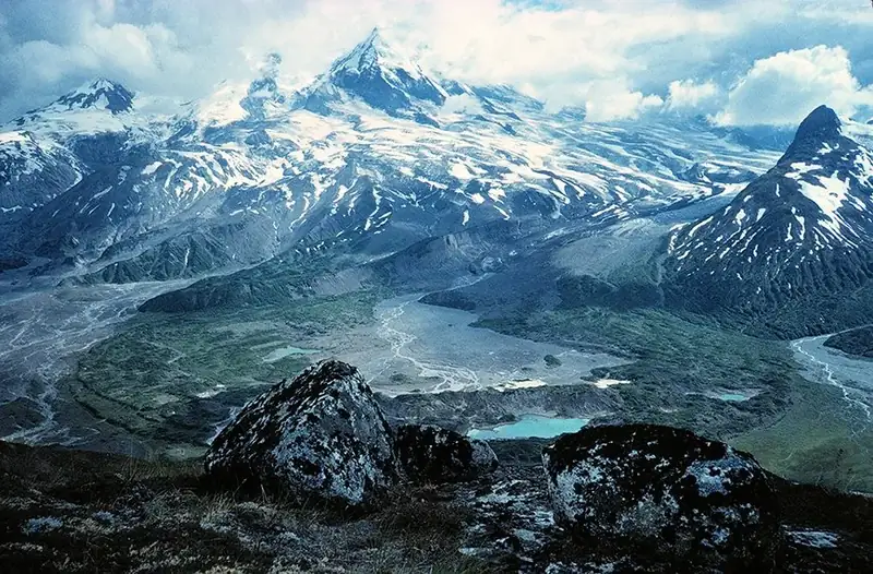
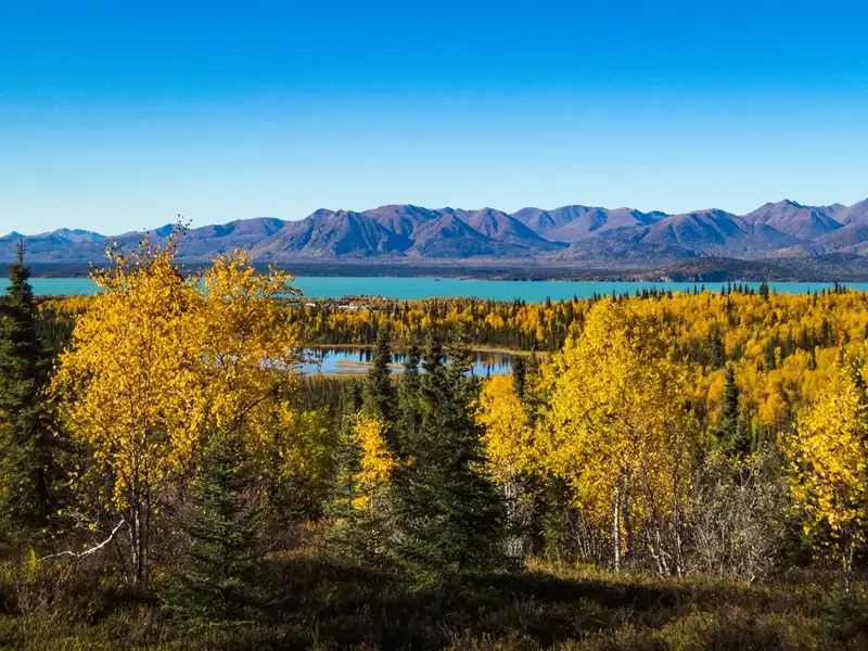
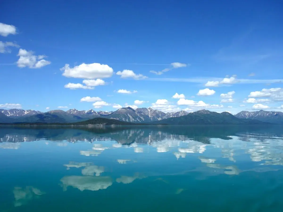
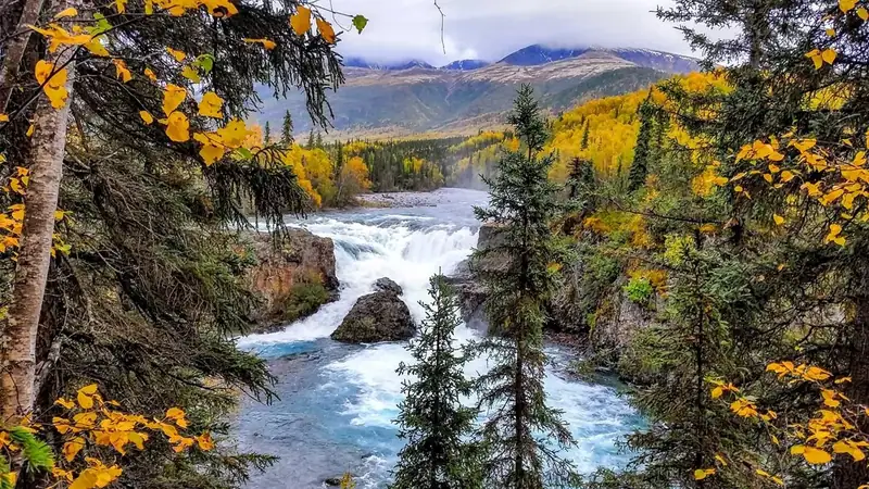
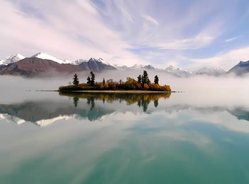
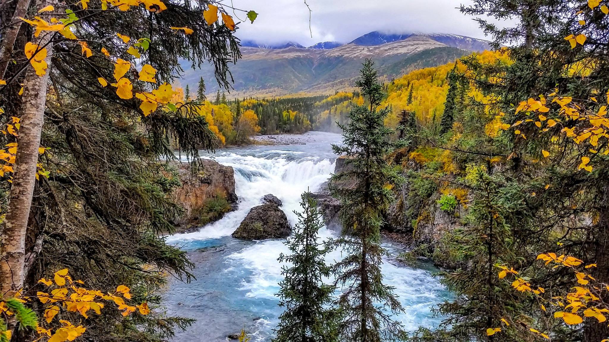
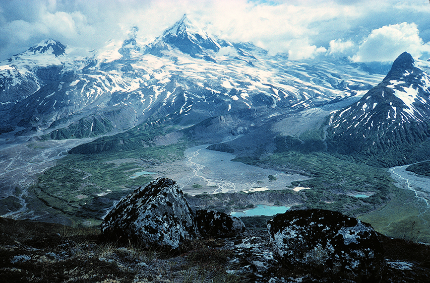
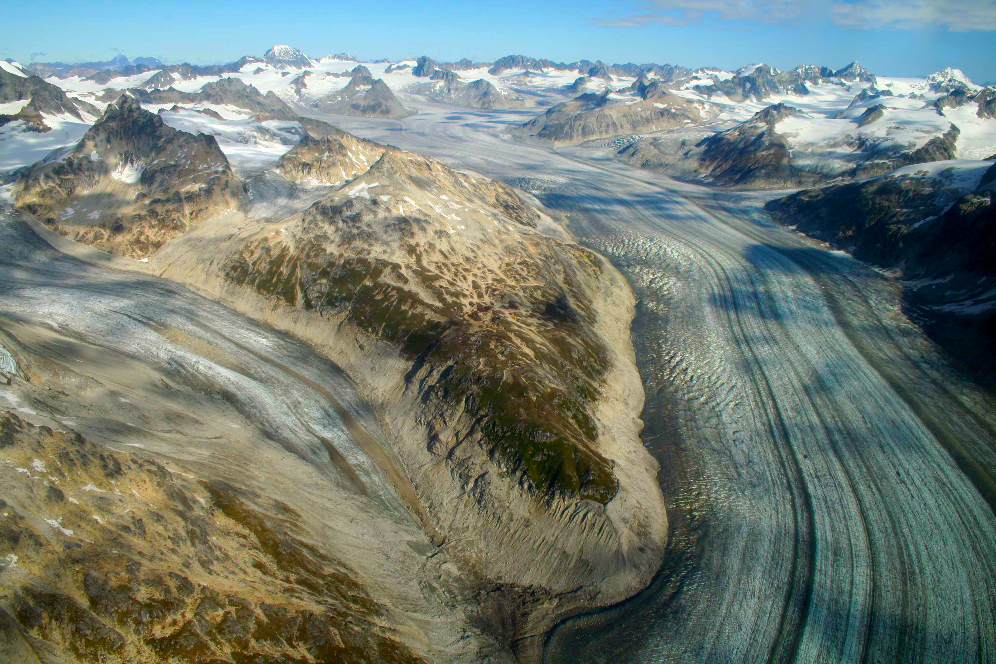
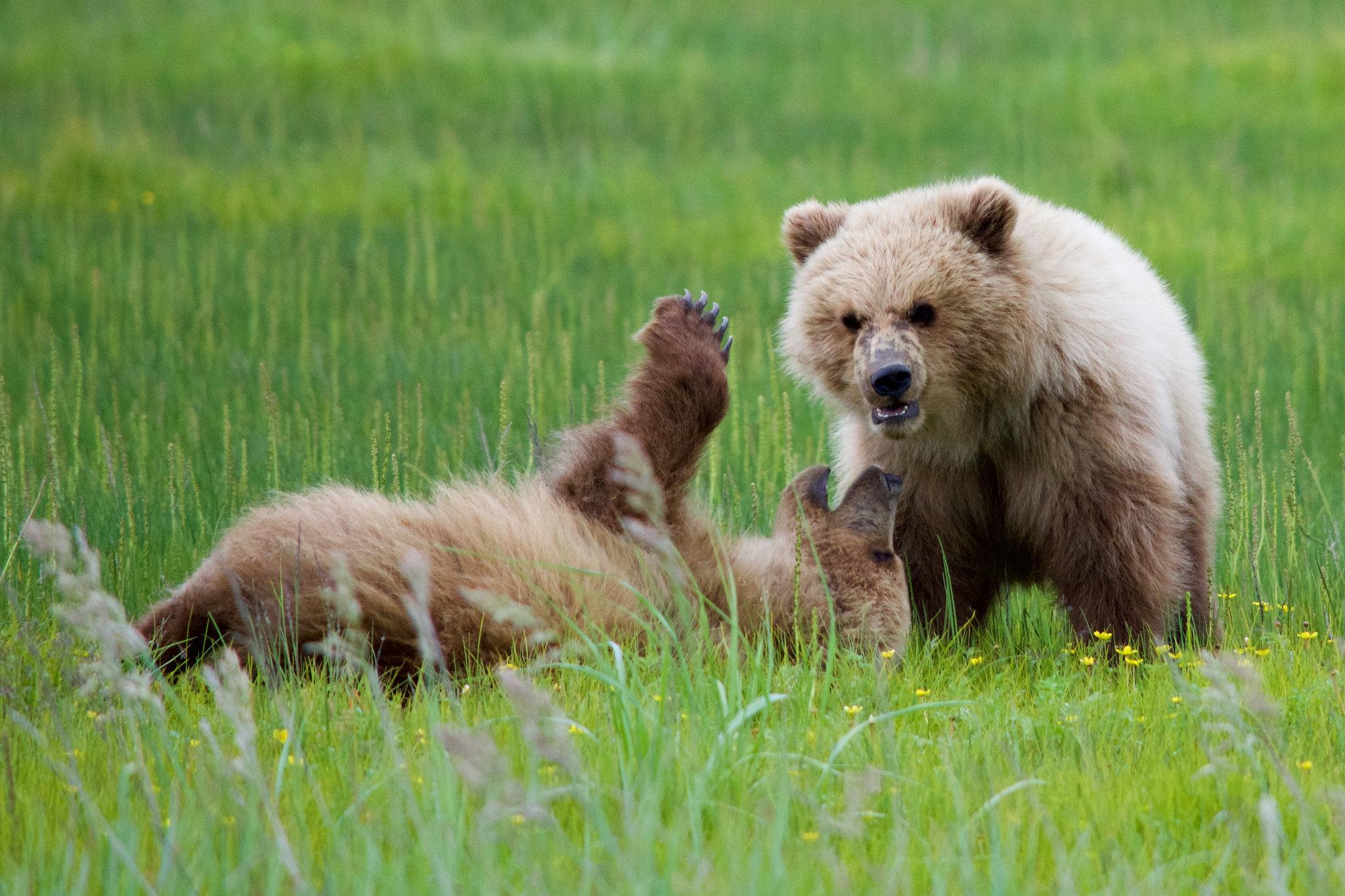
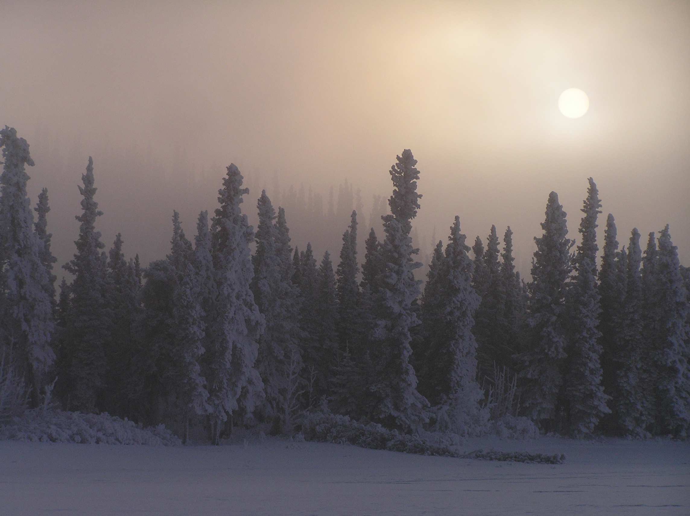


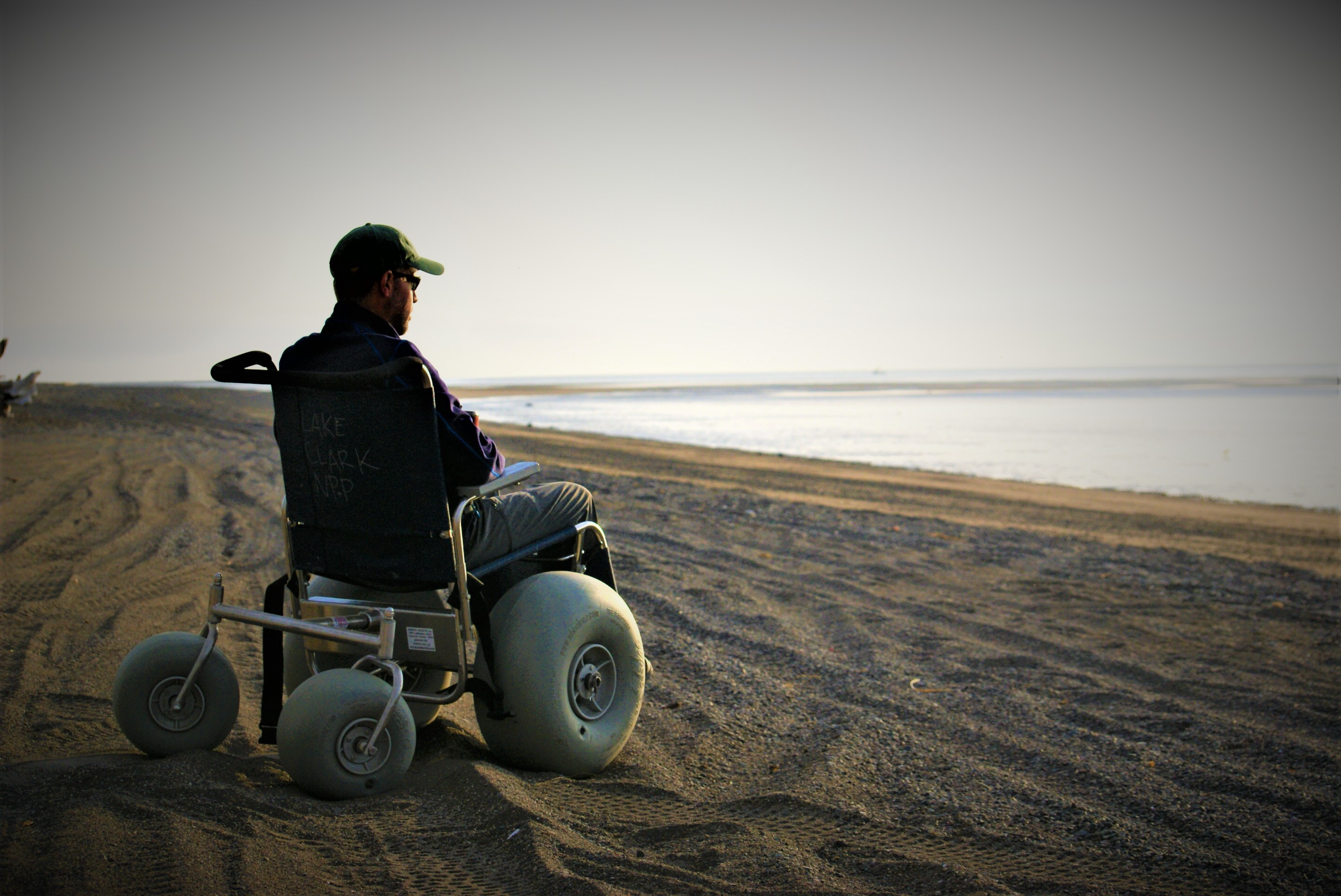
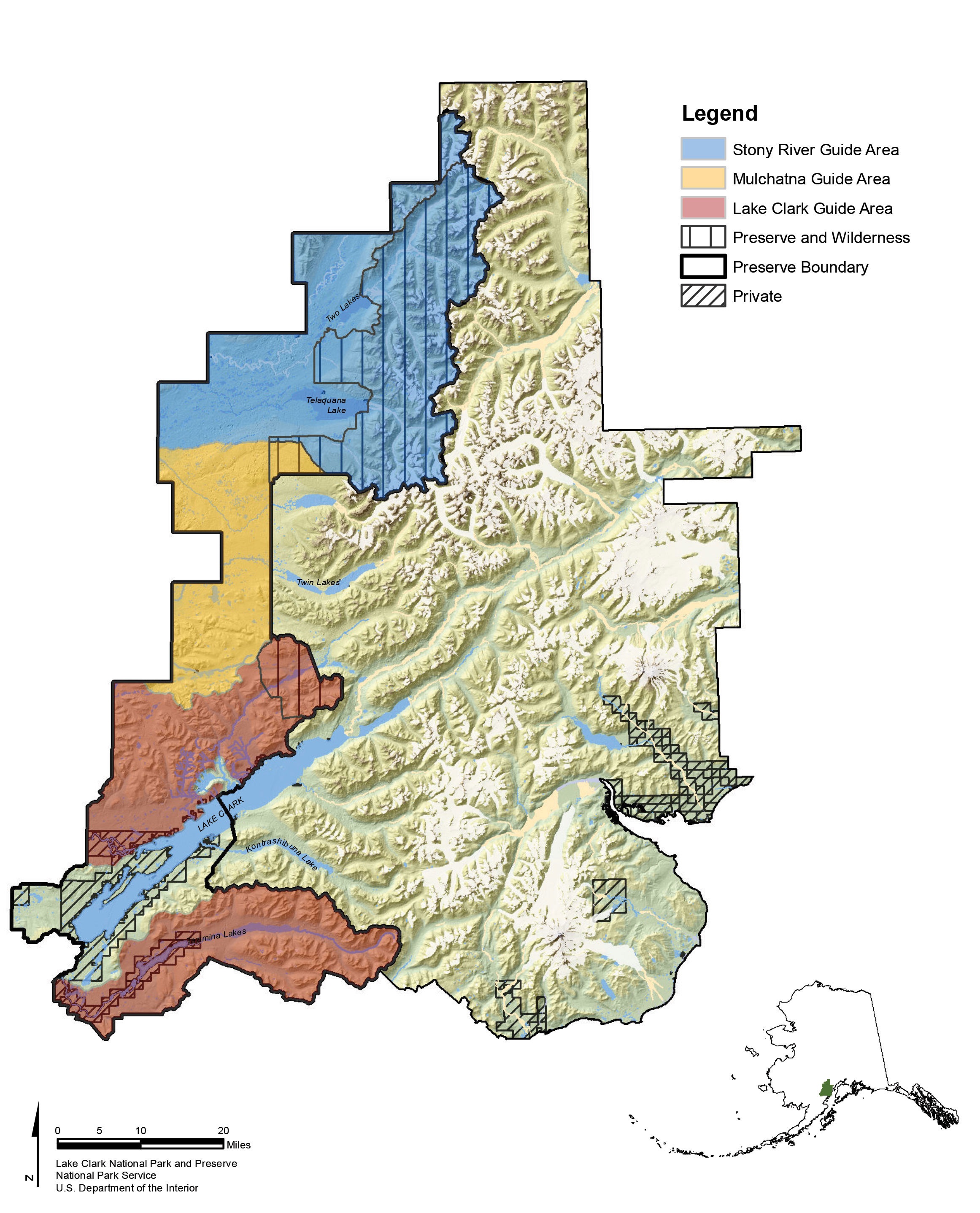

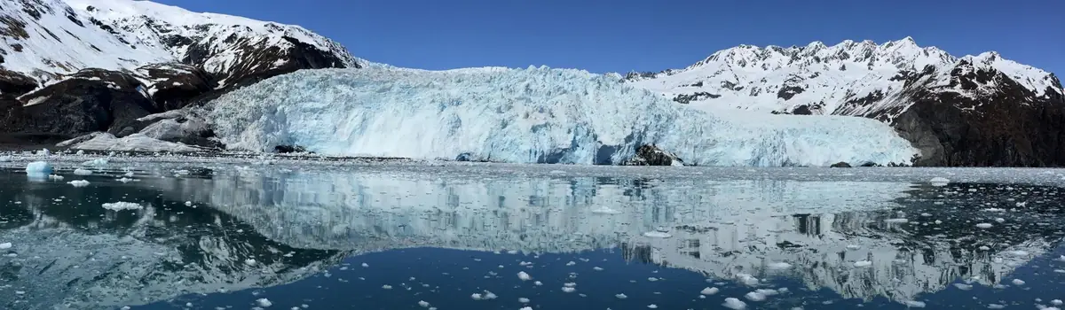 Coast & islands