Yosemite Valley
0–20 min to Valley activities, then walking or shuttle
Most time in the Valley and easiest midday breaks.
Tradeoff: Limited lodging; book early and confirm parking arrangements.
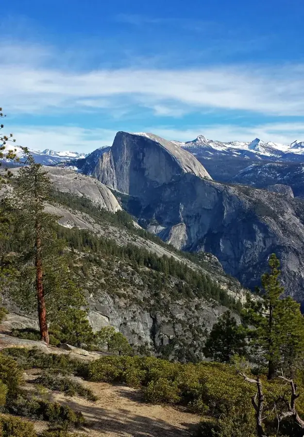
Not just a great valley, but a shrine to human foresight, the strength of granite, the power of glaciers, the persistence of life, and the tranquility of the High Sierra. First protected in 1864, Yosemite National Park is best known for its waterfalls, but within its nearly 1,200 square miles, you can find deep valleys, grand meadows, ancient giant sequoias, a vast wilderness area, and much more.
Tioga Road usually closes for winter. Opening depends on snow and plowing; historical dates are not a forecast. Verify the crossing before booking an east-side base.
Before you go: Verify Tioga Road for your actual travel dates.
Official guidance ↗ Reviewed 2026-10-19Selected guidance only; separate from climate comfort and current conditions.
The conditions feed has not been connected for this park.
Check current conditions at NPS ↗Make the Valley your first priority. Longer plans add a second Valley day and a road-dependent Glacier Point excursion.
Glacier Point is included only if the road is open. Expect parking pressure, heat and possible smoke; Tioga is not needed for this plan.
Day 1Tunnel View → Lower Yosemite Fall → Cook’s Meadow and picnic
Day 2Mirror Lake out-and-back → Happy Isles area
Day 3Glacier Point viewpoints → Washburn Point
Editorial planning ranges, not live routing or official trail measurements. Driving excludes lodging commutes unless stated; queues, closures and weather can add substantial time. Walking ranges describe the selected outing, not necessarily the full trail. Arrival and departure travel are additional. Select the season for your dates; this is not a live conditions check.
Take in the valley overview before parking in the Valley for the day.
Start: Tunnel View parking on Wawona Road.
Getting there: First stop on arrival via Wawona Road; other approaches may involve a detour.
Footing: Paved viewing area; parking and crossing the road require care.
Omit this stop if it adds backtracking or parking is full.
The full loop gives views of the falls when flowing. Late-season flow can be low or absent.
Start: Use Valley parking and the current shuttle / walking route to the trailhead.
Getting there: From Tunnel View: allow 15–30 minutes driving, then 15–40 minutes walking or shuttle time.
Footing: Full loop: about 50 ft gain; paved, with seasonal ice and spray.
Stay on open paved Valley paths if the loop is icy.
Pack lunch and take a meadow walk with room to stop and look up.
Start: Start from the Valley visitor facilities / Sentinel Bridge area.
Getting there: Allow 10–20 minutes walking from the falls area.
Footing: Mostly level paths and boardwalk; stay on designated surfaces.
Use open visitor exhibits in poor weather.
Allow 30–60 minutes beyond these activity times for Valley transport and at least 60 minutes of contingency. Gateway commuting is additional.
Walk to the seasonal lake and return. This is a landscape walk even when the lake is dry.
Start: Use the current Valley shuttle to the Mirror Lake trailhead.
Getting there: Allow 20–45 minutes for shuttle travel and waiting from central Valley parking.
Footing: About 100 ft gain to the lake; paved road, some incline. The longer loop is excluded.
Use a shorter out-and-back on open Valley paths.
Leave time for the river setting; seasonal exhibits may be closed. This plan does not climb the Mist Trail.
Start: Happy Isles shuttle area.
Getting there: Allow 15–30 minutes by shuttle or on the connecting paths.
Footing: Developed paths; verify open facilities and surfaces.
Return to open Valley exhibits and take a longer lunch.
Park once and use Valley transport. Do not add a major waterfall ascent to this deliberately lighter day.
Use the developed overlooks. Road access is seasonal; check the dated conditions page first.
Start: Glacier Point parking area.
Getting there: From Yosemite Valley: allow 60–90 minutes driving each way before stops.
Footing: Paved and developed paths with slopes; exposed drop-offs nearby.
Replace the entire excursion with the Valley day below when the road is closed.
Stop on the return only if legal parking is available.
Start: Signed viewpoint on Glacier Point Road.
Getting there: Allow 5–10 minutes driving from Glacier Point.
Footing: Short viewpoint approach with steps; no step-free promise.
Skip the optional stop if parking or weather is poor.
This day is an alternative to a long hike, not a promise of year-round access. Take food and water and allow 30–60 minutes of road / parking contingency.
Compare access to Yosemite Valley day parking. Drive ranges are editorial estimates before major queues or weather delays.
0–20 min to Valley activities, then walking or shuttle
Most time in the Valley and easiest midday breaks.
Tradeoff: Limited lodging; book early and confirm parking arrangements.
25–45 min to Valley parking each way
A practical west-side base for Valley-focused visits.
Tradeoff: Entrance, roadwork and parking queues add time.
40–75 min to Valley parking each way, depending on property
Useful for Wawona and Glacier Point approaches.
Tradeoff: A Valley commute remains; Yosemite West is not in Yosemite Valley.
60–100 min to Valley parking each way
Broader accommodation choices.
Tradeoff: A cheaper room can cost several hours of the trip in return driving.
Use your own quotes to compare room savings with extra time on the road.
Room totals only. Taxes, fuel, parking, vehicle wear and the value of your time are additional. These inputs are examples until you enter your quotes.
Mark your own preparation below. A check means you have handled it; it does not confirm a reservation or availability. Stored on this device.
Entrance · Before booking, then shortly before departure
NPS states no entry reservation is needed in 2026. That does not establish the rule for a later year; entrance fees still apply.
If unavailable: Read the dated official FAQ rather than relying on an old itinerary.
Check official rules & booking linksLodging · As soon as dates are firm
Check the specific operator or campsite release calendar; use official links from NPS.
If unavailable: Compare El Portal and other gateways, accounting for the return commute.
Check official rules & booking linksActivity · Before planning a permit-dependent hike
This itinerary includes neither Half Dome nor overnight wilderness travel. Those have separate permit systems.
If unavailable: Keep the Valley highlights and short walks.
Check official rules & booking linksTransport · Before each travel day
Check Glacier Point and Tioga road status. Do not use a winter routing suggestion through a closed pass.
If unavailable: Use the Valley alternative when Glacier Point Road is closed.
Check official rules & booking linksThe PDF and HTML contain the selected days, transport notes, lodging comparisons and booking guidance. Linked maps and websites require a connection.
Official source review: 2026-10-18. Durations, district grouping, gateway drive ranges and recommended pacing are National Parkwise editorial estimates. They are not live routing, current-condition guarantees or accessibility certification.
Official NPS activity guide.
Making a Reservation
Campground Reservation FAQ
Camping Without a Reservation
Camping Regulations
Reservations are required for all campgrounds from approximately April through October. Reservations are extremely difficult to get : you should make a reservation as early as possible. Read answers to frequently asked questions and tips for making reservations .
There are three first-come, first-served campgrounds available in in late fall, winter, and early spring. These often fill, especially on weekends and holidays. First-come, first-served camping is not available from late May through October. However, some campgrounds listed below have reservations available two weeks in advance from around July to mid-October.
Campfires are allowed (in a fire ring and when attended), except they are only allowed from 5 pm to 10 pm in Yosemite Valley campgrounds and Hodgdon Meadow Campground. However, consider minimizing fire usage or not having a fire! Emissions from campfires can degrade air quality in and near campgrounds. This is especially true at night and in early morning, when inversions trap and concentrate fine particles from those campfires near the ground, creating local conditions that are potentially unhealthy for sensitive individuals.
Yosemite has 10 campgrounds that can accommodate RVs and trailers (including fifth wheels) of varying lengths. If you plan to spend the night in your RV, you must be in a designated standard or RV campsite—you can't park in a parking lot, along the side of the road, or in a tent-only campsite.
Reservations: campgrounds requiring reservations are usually full from around April through September. You should make a reservation as early as possible. If you don't have reservations, find out more about camping without reservations .
Electrical, water, and sewer hookups are not available in Yosemite, although dump stations (with fresh water) are available at Upper Pines Campground (all year), near Wawona Campground (summer only), and near Tuolumne Meadows Campground (summer only). The Tuolumne Meadows dump station is closed until further notice due to work on the wastewater treatment plant. In addition to Upper Pines in Yosemite Valley, you can find other dump stations outside of the park in Lee Vining (for a fee). Generator use is allowed, but only between 7 am and 9 am, noon and 2 pm, and 5 pm to 7 pm. Generator use is not allowed at other times.
Maximum RV/trailer lengths: In Yosemite Valley, the maximum RV length is 40 feet and maximum trailer length is 35 feet, however, only a total of 8 sites of this size are available (six sites in Lower Pines and two in North Pines, which are open spring through fall). Many more sites exist in Yosemite Valley and elsewhere in Yosemite that can take RVs up to 35 feet or trailers up to 24 feet.
RV length and trailer length are not the same! Please note that many campsites have different maximum lengths for RVs and trailers. This is because many of the campsites are back-in sites with limited turning radius. We do not enforce the length limits as long as the RV or trailer can fit on the parking pad in the site. However, if you reserve a site for equipment other than what you bring, and the site can't accommodate your RV or trailer, we will not be able to find a different campsite for you.
Food storage : You may store food in hard-sided RVs and trailers, as long the food is out of sight, and windows, doors, and vents are closed when you're not in your campsite. Food may not be stored in pop-up or tent trailers, or other soft-sided campers.
Group campsites are normally available all year at Wawona Campground , and during summer at Hodgdon Meadow , Bridalveil Creek , and Tuolumne Meadows Campgrounds. Sites are designated for groups of 13 to 30 people. Group camps have tent sites only. Up to five vehicles can be parked near a group camp. Reservations are required.
Horse campsites are available during summer at Wawona , Bridalveil Creek , and Tuolumne Meadows Campgrounds. Reservations are required.
Campground opening and closing dates in the "Open approx." column are tentative and can vary from year to year. View historical campground opening and closing dates .
Tap water and creek water: Campgrounds listed as having creek water have vault toilets (not regular restrooms). Campgrounds listed as having tap water have regular restrooms.
Showers are available at the Curry Village pool showerhouse for a fee. Showers are not available elsewhere in the park.
Dump stations are available at Upper Pines Campground (all year), near Wawona Campground (summer only), and near Tuolumne Meadows Campground (summer only). The Tuolumne Meadows dump station is closed until further notice due to work on the wastewater treatment plant. In addition to Upper Pines in Yosemite Valley, you can find other dump stations outside of the park in Lee Vining (for a fee). No campsites in Yosemite have hook-ups of any kind.
Read Yosemite's campground regulations .
Camp 4 Campground extended its reservation period and will require reservation until November 29 (last night for reservation is November 28).
Bridalveil Creek Campground will close for the season on Friday, August 14, 2026 due to a lighting strike that impacted critical intrastructure (potable water and restroooms).
Wawona Campground extended its reservation period and will require reservations for Loop A until November 29 (last night for reservations is November 28). Sites will be released for these extended dates on Friday, August 14 between 7 and 7:30 am PDT. Loops B and C will close for the season as planned on October 26.
Once Tioga Road opens , crews begin working in campgrounds and other facilities to prepare them for opening. Before campgrounds can open, crews assess the condition of the campgrounds, remove trees that may fall or have fallen, make emergency road repairs, de-winterize restrooms, pump vault toilets, and turn on and test water systems. Additionally, sewer and utility systems often need repair each spring.
All this work also has to happen at visitor centers, offices, residences, and other facilities, as well. Opening offices and residences for staff are a high priority because campgrounds and other facilities need staff in order to operate.
As a result, campgrounds usually don't begin opening until at least four weeks after the Tioga Road opens. The table below reflects the best available estimate for when campgrounds will open and is revised as soon as we have updates.
tentatively in 2026
5 months ahead on 15th
Lottery or 5 months ahead on 15th
Walk-in/tents only (no RVs/ trailers)
1 week ahead for Apr 15–Nov 29
Pets not allowed
5 months ahead on 15th for Apr 15–Oct 26 (Loops B and C) and Apr 15–Nov 29 (Loop A)
Bridalveil Creek
5 months ahead on 15th for Apr 15–Oct 26
No RVs/trailers
No water (2026)
RVs/trailers not recommended
24 ft RV (only 4 sites)
Tuolumne Meadows
2 months ahead on 15th and 14 days ahead
(Closing dates refer to the day the campground closes; the night before that is the last night to camp.)
*2026 - Bridalveil Creek Campground closed unexpectedly due to a lightning strike impacting critical infrastructure (potable water and restrooms); originally scheduled to close on September 7, 2026.
Backcountry campgrounds at Little Yosemite Valley and near the High Sierra camps (Glen Aulin, May Lake, Sunrise, Merced Lake, and Vogelsang) are not part of the campground reservation system. A wilderness permit is required to stay at these campgrounds.
High Sierra Camps themselves and Housekeeping Camp are lodging facilities managed by Yosemite Hospitality.
| Campground | Open tentatively in 2026 | Elevation | Maximum RV Length/ Trailer Length | Reserve? | Daily Fee | Sites | Accessible Sites for people with disabilities | Water | Notes |
|---|---|---|---|---|---|---|---|---|---|
| Upper Pines | All year | 4000 ft/1200 m | 35 ft/24 ft | 5 months ahead on 15th | $36 | 236 | 10 | Tap | |
| Lower Pines | Apr 21–Oct 19 | 4000 ft/1200 m | 40 ft/35 ft | 5 months ahead on 15th | $36 | 74 | 5 | Tap | |
| North Pines | Apr 21–Oct 26 | 4000 ft/1200 m | 40 ft/35 ft | Lottery or 5 months ahead on 15th | $36 | 81 | 5 | Tap | |
| Camp 4 | All year | 4000 ft/1200 m | Walk-in/tents only (no RVs/ trailers) | 1 week ahead for Apr 15–Nov 29 | $10/ pers. | 61 | 2 | Tap | Pets not allowed |
| Wawona | All year | 4000 ft/1200 m | 35 ft/35 ft | 5 months ahead on 15th for Apr 15–Oct 26 (Loops B and C) and Apr 15–Nov 29 (Loop A) | $36 | 95 | 4 | Tap | |
| Bridalveil Creek | Jul 3–Aug 14* | 7200 ft/2200 m | 35 ft/24 ft | 2 weeks ahead | $36 | 110 | 0 | Tap | |
| Hodgdon Meadow | All year | 4900 ft/1500 m | 35 ft/30 ft | 5 months ahead on 15th for Apr 15–Oct 26 | $36 | 100 | 0 | Tap | |
| Crane Flat | May 21–Oct 12 | 6200 ft/1900 m | 35 ft/35 ft | 2 weeks ahead | $36 | 148 | 7 | Tap | |
| Tamarack Flat | Jun 22–Oct 12 | 6300 ft/1900 m | No RVs/trailers | 2 weeks ahead | $24 | 52 | 4 | Creek (boil) | |
| White Wolf | Jul 2–Sep 14 | 8000 ft/2400 m | 27 ft/24 ft | 2 weeks ahead | $28 | 68 | 2 | No water (2026) | |
| Yosemite Creek | Jul 1–Sep 7 | 7700 ft/2300 m | RVs/trailers not recommended | 2 weeks ahead | $24 | 74 | 2 | Creek (boil) | |
| Porcupine Flat | Jun 23– Oct 11 | 8100 ft/2500 m | 24 ft RV (only 4 sites) | 2 weeks ahead | $24 | 55 | 4 | Creek (boil) | |
| Tuolumne Meadows | Jul 1–Sep 27 | 8600 ft/2600 m | 35 ft/24 ft | 2 months ahead on 15th and 14 days ahead | $36 | 289 | 13 | Tap |
NPS information imported 2026-10-17. Confirm current details at NPS
Official NPS activity guide.
One of the best ways to experience Yosemite is by taking a hike. Here are some of hikes available in different areas of Yosemite:
Yosemite Valley
Glacier Point Road
Wawona and Mariposa Grove of Giant Sequoias
Crane Flat and White Wolf
Tuolumne Meadows Also available:
A list of mileages for numerous trails in Yosemite .
Suggestions for where to see wildflowers
Snowshoe and cross-country trails for Glacier Point/Badger Pass, Mariposa Grove, and Crane Flat area (these areas are usually snowy from mid December through March).
Stay on trails: taking shortcuts causes trail erosion--and is both dangerous and illegal.
Carry (and drink) plenty of water: a leading cause of injuries on the trail is dehydration. Be sure to treat river, stream, lake, or spring water.
Pets and bicycles are only permitted on bike paths.
Horses and mules have the right of way on trails.
Pack out what you pack in.
Trails are not maintained nor are they regularly patrolled: travel carefully and at your own risk.
Smoking while traveling on trails is prohibited, though you may smoke while stopped except when fire restrictions are in effect . (Crush out and dispose of cigarette butts in a trash receptacle.)
NPS information imported 2026-10-17. Confirm current details at NPS
Official NPS activity guide.
Yosemite Hospitality offers bus tours year-round. All tours begin in Yosemite Valley.
Valley Floor Tour is a two-hour tour of Yosemite Valley that operates all year. From approximately April through October, this is an open-air tram tour (weather permitting). From around October through March, this is a bus tour.
Glacier Point Tour is a four-hour round-trip tour to Glacier Point and back. (One-way tickets are available.) This tour operates when the Glacier Point Road is open (typically, late May until sometime in November, conditions permitting).
Grand Tour is a full-day tour (~ 8 hours) that visits Yosemite Valley, Glacier Point and the Mariposa Grove of Giant Sequoias. This tour operates during the late spring through summer (May - September, conditions permitting).
Tuolumne Meadows Hikers Bus is an all-day tour to Tuolumne Meadows and back. (One-way tickets are available.) This tour operates from July through early September, conditions permitting.
In addition, interpretive programs (nature & history walks) are offered year-round by National Park Service rangers, concessioner staff, and other park partners.
All regularly scheduled programs are listed in Yosemite Guide .
The Yosemite Conservancy offers custom adventures such as birding quests, challenging hikes, and more.
NPS information imported 2026-10-17. Confirm current details at NPS
Official NPS activity guide.
Yosemite offers a range of informative and inspiring walks or talks to learn about Yosemite. All regularly scheduled programs are listed on our calendar . In addition, more information is available about:
Nature & history programs and bus tours by Yosemite Hospitality
Photography walks by The Ansel Adams Gallery
Outdoor Adventures by Yosemite Conservancy
Yosemite Art Classes by Yosemite Conservancy
NPS information imported 2026-10-17. Confirm current details at NPS
Official NPS activity guide.
The Yosemite Guide contains information about trip planning, activities, and visitor services. You will receive a copy of the Yosemite Guide when you enter the park.
Visit the park calendar online or on the National Park Service app for regular daily programming, including walks, talks, tours, and classes. Information about special events is also available.
A new issue of the Yosemite Guide appears online a few days before the end date of the current issue.
Volume 51 (Issue 8) September 23 – November 24, 2026 [PDF, 4 MB] Volume 51 (Issue 7) August 19 – September 22, 2026 [PDF, 4 MB] Volume 51 (Issue 6) July 15 – August 18, 2026 [PDF, 6 MB] Volume 51 (Issue 5) June 10 – July 14, 2026 [PDF, 4 MB] Volume 51 (Issue 4) May 6 – June 9, 2026 [PDF, 4 MB] Volume 51 (Issue 3) March 18 – May 5, 2026 [PDF, 4 MB] Volume 51 (Issue 2) January 28 – March 17, 2026 [PDF, 5 MB] Volume 51 (Issue 1) November 26, 2025 – January 27, 2026 [PDF, 5 MB]
Volume 50 (Issue 8) September 24 – November 25, 2025 [PDF, 5 MB] Volume 50 (Issue 7) August 20 – September 23, 2025 [PDF, 5MB] Volume 50 (Issue 6) July 16 – August 19, 2025 [PDF, 5 MB] Volume 50 (Issue 5) June 11 – July 15, 2025 [PDF, 5 MB] Volume 50 (Issue 4) May 7 – June 10, 2025 [PDF, 5 MB] Volume 50 (Issue 3) March 19 – May 6, 2025 [PDF, 4 MB] Volume 50 (Issue 2) January 29 – March 18, 2025 [PDF, 6 MB] Volume 50 (Issue 1) November 27, 2024 – January 28, 2025 [PDF, 5 MB]
Volume 49 (Issue 8) Sep 25 – Nov 26, 2024 [PDF, 5 MB] Volume 49 (Issue 7) Aug 21 – Sep 24, 2024 [PDF, 5 MB] Volume 49 (Issue 6) Jul 17 – Aug 20, 2024 [PDF, 5 MB] Volume 49 (Issue 5) Jun 12 – Jul 16, 2024 [PDF, 5 MB] Volume 49 (Issue 4) May 8 – Jun 11, 2024 [PDF, 2 MB] Volume 49 (Issue 3) Mar 20 – May 7, 2024 [PDF, 2 MB] Volume 49 (Issue 2) Feb 7 – Mar 19, 2024 [PDF, 2 MB]
NPS information imported 2026-10-17. Confirm current details at NPS
Official NPS activity guide.
Yosemite Valley is world famous for its impressive waterfalls, meadows, cliffs, and unusual rock formations; accessible by car year-round.
Hidden in Yosemite National Park’s peaceful northwest corner, Hetch Hetchy Valley is a treasure worth visiting in all seasons.
Glacier Point is an overlook with a commanding view of Yosemite Valley, Half Dome, Yosemite Falls, and Yosemite’s high country.
Wawona is the home to the historic Wawona Hotel and the Yosemite History Center.
The Mariposa Grove of Giant Sequoias is the largest sequoia grove in Yosemite and is home to over 500 mature sequoias.
Tuolumne Meadows is a large, open sub-alpine meadow graced by the winding Tuolumne River and surrounded by majestic peaks and domes.
Crane Flat is a pleasant forest and meadow area located 16 miles (30 minutes) from Yosemite Valley.
Yosemite is home to countless waterfalls. The best time to see waterfalls is during spring, when most of the snowmelt occurs.
Over eons, rivers and glaciers somehow carved 3,000 feet into solid granite to create Yosemite Valley forming spectacular rock formations.
There are many different viewpoints in Yosemite; Tunnel View, Olmsted Point, Glacier Point, just to name a few!
Very few lakes are easily accessible in Yosemite National Park. Rivers flow through Wawona, Yosemite Valley, and Tuolumne Meadows.
What's so special about meadows and wetlands? Nowhere else in Yosemite will you find a greater diversity of plants and animals.
Find activities that fit into your Yosemite adventure!
Yosemite's goal is to provide the highest possible level of accessibility to our visitors.
Yosemite is filled with history and there are numerous places in the park where you can visit a museum, historic building, or cemetery.
NPS information imported 2026-10-17. Confirm current details at NPS
Official NPS activity guide.
Yosemite's epic scenery freely lends itself to the artist's eye like only a few places can. For many, Yosemite is a natural source of never-ending inspiration. The bouncing of light, graceful effervescence of water, and stoic mountain lines have provoked artists of all backgrounds and mediums to create works of art. Not surprisingly, many artists have played a role- directly or indirectly- in the promotion and protection of Yosemite National Park. Recognizing this meaningful influence in Yosemite's history, various opportunities to explore art in its many forms are available to visitors.
Daily art classes ($20–$40 per person) are offered spring through fall in Yosemite Valley for ages 12 and up. These art classes are led by volunteer art instructors who are experts in their medium. For registration and other information, please visit Yosemite Conservancy's art page .
The Yosemite Museum Gallery displays exhibits of Yosemite art during spring and summer.
The Ansel Adams Gallery offers work of Ansel Adams, contemporary photographers, and other fine artists. In addition, a wide selection of handcrafts, books, gifts, and photography supplies is available. The gallery also offers a range of photography walks, classes, and workshops throughout the year (check Yosemite Guide for listings).
Yosemite Conservancy's Outdoor Adventures program offers art and photography seminars throughout the park.
Yosemite Renaissance offers an artist-in-residence program .
NPS information imported 2026-10-17. Confirm current details at NPS
Official NPS activity guide.
All of the roads in Yosemite National Park are scenic, but the most famous scenic drive is along the Tioga Road, a 46-mile (62 km) drive from Crane Flat to Tioga Pass. The road is typically open from late May or early June through sometime in November. ( Check current road conditions .)
The Yosemite Road Guide , available at visitor center bookstores , contains descriptions of each road inside the park and includes suggestions of where to stop along the way.
Some typical driving times from Yosemite Valley:
Wawona/Mariposa Grove: about an hour
Glacier Point: about an hour
Crane Flat: 30 minutes
Hodgdon Meadow/Big Oak Flat Entrance: 45 minutes
Hetch Hetchy: 1.5 hours
Tuolumne Meadows: 1.5 hours
Tioga Pass: 1.75 hours
NPS information imported 2026-10-17. Confirm current details at NPS
Official NPS activity guide.
Looking to explore Yosemite with a bicycle? There are over 12 miles of paved bike paths available in Yosemite Valley (speed limit is 15 mph). In addition, bicyclists can ride on regular roads (if they obey traffic laws). You can rent a bike, bring your own, or borrow one through the bike share program (two-hour limit).
Bicycling on Yosemite's roads means sharing them with both recreational and passenger vehicles of all size.
Helmets are required by law for children under 18 years of age.
E-bikes with two or three wheels, fully operable pedals, and electric motors less than 750 watts (1 horsepower) are allowed everywhere bicycles are allowed. Speed limit on bike paths is 15 mph.
Electric scooters are allowed on the bike paths but not on park roads. Speed limit on bike paths is 15 mph.
Off-trail riding and mountain biking, and use of motorized scooters on bike paths are not permitted in Yosemite National Park.
Bicycles are available for rent in Yosemite Valley at Curry Village, Yosemite Village, and Yosemite Valley Lodge. Electric scooters, wheelchairs, strollers, helmets, and tag-a-long bikes are also available for rent. All rental bikes are available on a first-come, first-served basis. Reservations are only available for ADA bicycles (hand-crank bicycles, and tandem bicycles for visually impaired guests).
The free Yosemite Bike Share opens for the season in late spring, depending on weather and road safety. When it opens, you can use the bike share for short trips (up to two hours) in Yosemite Valley.
Get connected: Download the free Yosemite Bike Share app for Apple/iOS (via the App Store) or Android (via Google Play).
Get a bike: Use the app to unlock a bike at one of the Yosemite Bike Share stations, located at the Yosemite Village Parking Area and in Yosemite Village (between the Valley Wilderness Center and the Valley Visitor Center).
Get pedaling: Ride safely! Use the helmet provided with the bike (or wear your own) and stay on roads and paved bike paths.
When you’re done riding, return the bike to the station where you picked it up. Be sure to leave the bike in the “Used Bike Corral” area. To end your ride and lock the bike, manually close the lock on the rear wheel and press STOP on the app. Double-check that the app has registered the end of the ride before you leave!
Learn more about the bike share program , see a map of bike paths, and plan your routes.
NPS information imported 2026-10-17. Confirm current details at NPS
Official NPS activity guide.
Birds in Yosemite
Birding Tips and Ethics
Visual Guide to Common Birds
Yosemite National Park provides essential habitat for over 165 species of migrating, wintering, and breeding birds, in addition to nearly 100 species recorded as transient or vagrant. Designated a World Heritage Site and an Important Bird Area, the park harbors diverse avian assemblages and habitats, numerous bird species of special concern, and prized habitat ranging from gently sloping foothill grasslands, through chaparral/oak woodland and giant conifer forests, up to windswept alpine meadows and peaks.
The most regularly seen resident birds include Steller's jay, American robin, acorn woodpecker, common raven, and mountain chickadee. In spring, look for the bright red wing patches on the red-winged blackbird (most often seen in wet meadows) or the tropical looking western tanager foraging in the conifers. Near rivers and streams, watch the american dipper dart in and out of rapids and listen for their beautiful melodious song.
Some of the more sought-after birds to see in Yosemite include the great gray owl, spotted owl, peregrine falcon, pileated woodpecker, and northern goshawk.
In general, quiet forests and meadows away from developed areas (particularly in the mornings) are the best places to see some of the less common birds. Keep in mind basic birding etiquette; tread lightly and quietly and please follow park rules by refraining from using broadcast bird calls to elicit responses.
Bird checklist [343 kb PDF]
To add to the park's scientific study of birds, email the park ornithologist of any unusual sightings or observed behaviors (include location details).
Join a Yosemite Conservancy guide for a birding excursion! In addition to several custom birding outings each year they also offer multiple programs on birds.
Check the Yosemite Guide for current program offerings.
Wildlife biologist Sarah Stock, who is an ornithologist specializing in owls, has worked in the Wildlife Management branch of the Resource Management & Science division in Yosemite National Park since 2006.
NPS information imported 2026-10-17. Confirm current details at NPS
Official NPS activity guide.
What comes to mind when you think about fishing? Patience, relaxation, challenge, and memories are a few words often associated with fishing. We want you to have an enjoyable time fishing during your visit, along with future visitors; learn your responsibilities before casting a line or flicking a fly into the water.
Visitors to Yosemite 16 or older must have a valid California fishing license. Fishing licenses are available online .The California Department of Fish and Wildlife website lists current sport fishing license fees and regulations .
Except as noted below, California fishing regulations apply in Yosemite National Park, including the requirement that people 16 or older have a valid California fishing license .
All waters are open to fishing all year, except as noted below .
Some special regulations apply within Yosemite National Park and the El Portal Administrative Site (outlined below). These can also be found in the Superintendent's Compendium .
Except as noted below, all waters are open all year.
Live, dead, or scented bait is prohibited. This includes (but is not limited to): Any other natural or manufactured product or device that is used to alert and attract fish by sense of taste or smell, including any product or device to which scents or attraction agents have been added or externally applied Worms, grubs, crickets, leeches, stink baits, insects, crayfish, human food, pet food, fish, fish parts, and fish eggs Scented natural or artificially manufactured fish eggs Scented or flavored liquid gel or paste
Any other natural or manufactured product or device that is used to alert and attract fish by sense of taste or smell, including any product or device to which scents or attraction agents have been added or externally applied
Worms, grubs, crickets, leeches, stink baits, insects, crayfish, human food, pet food, fish, fish parts, and fish eggs
Scented natural or artificially manufactured fish eggs
Scented or flavored liquid gel or paste
Bag and possession limits Five per day (all trout species) Ten at one time (all trout species), except as noted below
Five per day (all trout species)
Ten at one time (all trout species), except as noted below
Fishing from any piers or bridges (vehicle, pedestrian, or stock) and from the top of O'Shaughnessy Dam in Hetch Hetchy is prohibited.
Fishing from horseback in any lake or stream is prohibited.
Lead weights used on fishing lines must be 0.25 ounces or less
Transporting live fish any distance is prohibited.
These regulations apply to the Merced River, South Fork Merced River, Tuolumne River and All Tributaries (inland streams).
Only artificial lures or flies with barbless hooks may be used
Season: Year-Round (new in 2026)
Bag and possession limits: Rainbow trout: catch and release only (zero bag and possession limit). All Rainbow trout must be released unharmed and should not be removed from the water. Brown and brook trout: 5 per day and 10 in possession Brown and brook trout: It is optional to retain or to catch and release (new in 2026)
Rainbow trout: catch and release only (zero bag and possession limit). All Rainbow trout must be released unharmed and should not be removed from the water.
Brown and brook trout: 5 per day and 10 in possession
Brown and brook trout: It is optional to retain or to catch and release (new in 2026)
Fishing from the top of O’Shaughnessy Dam is prohibited.
Visitors engaged in fishing at Hetch Hetchy Reservoir must limit bodily contact with water. Wading, swimming, or other bodily contact with the water (other than using one’s hands to retrieve or release fish) is prohibited.
Only artificial lures with barbless hooks may be used
Bag and possession limits: All trout species: zero per day and zero in possession (catch and release only).
All trout species: zero per day and zero in possession (catch and release only).
These area specific rules – limits on types of lures; prohibition of live bait; bag limits; requirements for catch and release of native species; and prohibition on the transportation of live fish – are necessary to help sustain native fish populations, including controlling the spread of non-native fish.
Prior to your trip review the statewide advisory for eating fish from California’s lakes and reservoirs. The chemical of concern for the statewide advisory is Mercury — specifically methylmercury — found in fish tissue. At sufficient doses methylmercury can pose a risk.
Please help keep Yosemite free of aquatic invasive species! Anglers, kayakers, and boaters please inspect, clean, drain and dry all of your equipment prior to your visit. Clean and dry all personal belongings, clothing, and footwear that have come in contact with the water. Boaters and Kayakers, keep your watercraft dry for at least five days in warm, dry weather and up to 30 days in cool, moist weather before you visit Yosemite.
For more information:
Learn about Yosemite's aquatic resources and what we are doing to protect them.
California Department of Fish and Wildlife - Quagga and Zebra Mussel Information
Learn more about fish and fishing throughout the National Park Service. You can learn about conservation, different fish species, and parks that offer fishing.
NPS information imported 2026-10-17. Confirm current details at NPS
Official NPS activity guide.
Guided mule rides and pack and saddle trips are available through Yosemite Hospitality from spring through fall.
Learn about Leave No Trace principles for stock .
Except where otherwise posted or listed below, all designated trails in the park are open to stock use. Trails open to stock on the floor of Yosemite Valley are signed as bridle paths.
Bicycle paths, tram roads, and shuttle bus routes
The Mist Trail from Happy Isles to Nevada Fall
Snow Creek Trail from Mirror Lake
Mirror Lake Road
In addition, the Yosemite Falls Trail from Yosemite Valley to the top of Upper Yosemite Fall is not recommended for, but is open to, stock use
Lower Chilnualna Falls foot trail from the parking area in Wawona at the junction with the horse trail
Mariposa Grove, except the Perimeter Trail (no grazing within Mariposa Grove)
The Gaylor Lakes trail from Tioga Pass Entrance Station to Gaylor Lakes
Gaylor Lakes Basin above Lower Gaylor Lake
The Muir Gorge Trail segment from Return Creek to Pate Valley in the Grand Canyon of the Tuolumne
Check wilderness permit stations for current trail conditions and any temporary closures. Stock use in any part of the park may be limited or prohibited when such action is necessary to protect park values or safety of park visitors. Any such closure will be published and posted.
Maximum of 25 head of pack and saddle stock per party.
Cross-country or off-trail travel with stock is prohibited.
Stock users are prohibited from establishing new trails and from the short cutting of trails and switchbacks.
Only well broken, properly shod, gentle stock in good healthy condition should be used in the park.
Llamas are not allowed on the High Sierra Camp Loop, the Vernal/Nevada Falls corridor, or the river trail from Nevada Fall to Merced Lake. Exceptions may be made for Pacific Crest Trail and John Muir Trail users with written permission of the Superintendent (PO Box 577, Yosemite, CA 95389).
Wilderness stock users must carry and use a shovel and rake to naturalize camps and scatter manure.
Pets are prohibited in the Yosemite Wilderness.
Stock parties must travel in single file whenever possible.
Wilderness overnight stock parties using authorized non-maintained stock routes are limited to 12 head of stock and 8 people.
Grazing is permitted except within four miles of trailheads and paved roads or immediately surrounding any of the High Sierra Camps.
Tying to trees for periods longer than is needed to load and unload is prohibited.
When picketed on a line, stock must be tied so they cannot chew on tree bark or eat the leaves of woody vegetation.
Stock must be picketed at least 100 feet from any stream, lake, or spring.
Stock may be tied within a campsite only when unloading and loading.
Much of Yosemite's Wilderness is over 8,000 feet in elevation. Acclimatization of stock is advisable.
Stock and riders with little or no mountain experience may have problems with glacial polished slick rock, rapid stream crossings, slide areas, and other unfamiliar conditions.
Stock should be trained to picket, stand tied, or use hobbles before going overnight in the mountains.
Overnight boarding facilities, spot packing, and day rides are available from Yosemite Hospitality whose liveries are located within Yosemite National Park. Horse owners are responsible for making advance arrangements for overnight use and reservations are suggested for all services. Information may be obtained by calling Yosemite Hospitality at 209/372-4386, or by visiting Yosemite Hospitality 's website.
Several commercial pack stations are authorized to provide certain services in Yosemite. If using trailheads within Yosemite, please use Yosemite Hospitality. If you are starting outside the park at a US Forest Service trailhead, contact the pack station in the appropriate area.
In the front country, privately owned stock may be kept overnight only in campgrounds with designated stock sites.
Stock sites are available seasonally at Wawona Campground , Bridalveil Creek Campground , and Tuolumne Meadows Campground . Reservations are required. There is no stock camp in Yosemite Valley.
Wawona Campground has two stock sites, Bridalveil Creek Campground has three stock sites, and Tuolumne Meadows Campground has four stock sites. Each site can accommodate up to six people and six head of stock. There is a limit of two vehicles and two stock trailers per parking area.
Feed must be provided. Grazing is prohibited. The use of weed-free stock feed is required.
Hitch lines or portable corrals must be used. Trees should be wrapped beneath ropes to prevent damage to bark. Stock must be tied so they cannot chew/eat tree bark or leaves of woody vegetation.
Campsites must be cleaned on a daily basis.
Manure and uneaten fodder must be raked, bagged, and deposited in dumpsters.
All other trash must be placed in bearproof dumpsters provided at or near campgrounds.
Grain must be stored in food lockers provided on site.
Check out time is noon on the day of departure.
Stock is not permitted in the main campground.
Stock can be unloaded and loaded at any stock camp, designated stock area, or any concession stable.
Additional information pertaining to those with pack stock commercial use authorizations:
The Superintendent's Compendium [3 MB PDF] is a compilation of designations, closures, permit requirements, and other restrictions made by the superintendent, in addition to what is contained in Title 36 of the Code of Federal Regulations (Chapter 1, Parts 1 through 7 and 34), and other applicable federal statutes and regulations. Additional closures may also apply at times.
Management Tools and Framework for Pack Stock Use and Meadow Monitoring in Yosemite Wilderness [5 MB PDF]
Meadow Opening Dates and Grazing Capacities
Wilderness Pack Stock Use Biological Opinion [1 MB PDF]
Yosemite (North) Stock-Use Grazing Map [9 MB PDF] and Yosemite (South) Stock-Use Grazing Map [9 MB PDF].
Please follow Leave No Trace camping guidelines while camping with stock.
Each map is a PDF of about 3 MB
Avonelle Lake - 126
Babcock Lake-North - 54
Babcock Lake-South - 106
Benson Lake - 67 (closure in effect)
Benson Lake Trail Camp - 95 (closure in effect)
Buena Vista Lake-West - 117
Cathedral Lake - 153
Chilnualna Lakes - 29
Cold Canyon - Smokey Jack - 147
Crescent Lake - 27 (closures in effect)
Doc Moyle's - 130
Dorothy Lake Trail Camp - 64
Dorothy Lake-West - 100
Dorothy Lake-Southwest - 101
Dorothy Lake-East - 134
Dorothy Lake-Peninsula Camp - 144
Echo Valley Trail Camp - 83
Emeric Lake-North - 34
Emeric Lake-West - 55
Emeric Lake-Northeast - 143
Empire Meadows - 150
Glen Aulin - 32
Givens Lake - 127
Grace Meadow - 47
Gravelly Ford Trail Camp - 25
Half Moon Meadow - 103
Harden Lake-East - 70
Harden Lake-West - 71
Hook Lake-North - 97 (closures in effect)
Horsethief Canyon - 120
Illilouette Creek-West - 30
Illilouette Creek-East - 119
Isberg Lake-West - 13 (closures in effect)
Isberg Lake-East - 142 (closures in effect)
Johnson Lake - 26
Kerrick Canyon-PCT/Bear Valley Trail Junction - 87
Kerrick Canyon-Upper Kerrick Meadow-South - 138 (closures in effect)
Kerrick Canyon-Jose's Camp - 88
Kerrick Canyon-Lower Kerrick Meadow- 41
NPS information imported 2026-10-17. Confirm current details at NPS
Official NPS activity guide.
Picnic areas are available throughout Yosemite on a first-come, first-served basis (reservations are not available) from dawn to dusk.Unless otherwise noted, all picnic areas in Yosemite have picnic tables, vault toilets, and trash and recycling receptacles.
Grills: All picnic areas have grills except Lower Yosemite Fall, Yosemite Creek, and Lembert Dome.
Potable water: Picnic areas do not have potable water, except Lower Yosemite Fall and Church Bowl (which have both potable water and flush toilets). Accessibility: Except when otherwise noted, picnic areas have some picnic tables with extended tops, accessible restrooms or vault toilets, and (if grills are available) accessible grills.
Mariposa Grove Road (limited to vehicles displaying a disability placard; not wheelchair accessible)
Yosemite History Center (across from the Wawona Store)
South of Wawona Campground
Cathedral Beach (not wheelchair accessible)
Swinging Bridge
Church Bowl (potable water)
Lower Yosemite Fall (potable water; no grills)
Yosemite Creek (no grills; not wheelchair accessible)
Lembert Dome (no grills)
Yosemite is home to black bears, mule deer, mountain lions, and hundreds of other species. Bears are quick learners, have a powerful sense of smell, and seek out food where it can easily be found. If a bear obtains human food, it may learn to return for more. For your safety and that of wildlife:
Keep your distance from animals, even if they approach you.
Never feed wild animals.
Dispose of trash in bear-proof trash cans or dumpsters.
While enjoying your picnic, keep your food, trash, and other scented items within arm’s reach.
If a bear approaches, yell as loudly as possible to scare the bear away.
NPS information imported 2026-10-17. Confirm current details at NPS
Official NPS activity guide.
All climbers staying overnight on big wall climbs in Yosemite are required to have a wilderness climbing permit . Wilderness climbing permits are available by self-registration, are free, and there are no quotas or limits on the number of permits available. The permit system helps climbing rangers better understand use patterns on big walls. It will also increase compliance with existing regulations (e.g., proper disposal of waste) and minimize impacts to wilderness character through improved education.
Overview of Rock Climbing
Climbing Permits
Climbing Regulations
Big Wall Stewardship
Climbing Closures
Climbing Safety
Climbing and Food Storage
Yosemite is one of the world's greatest climbing areas. Climbers here can enjoy an endless variety of challenges--from the sustained crack climbs of the Merced River Canyon to pinching crystals on sun-drenched Tuolumne Meadows domes to multi-day aid climbs on the big walls of the Valley. Yosemite is not just a climber's playground, however: its walls and crags are an integral part of a larger ecosystem, protected as Wilderness, which was set aside for people to enjoy in a natural state for generations to come.
As the number of climbers visiting the park has increased through the years, the impacts of climbing have become much more obvious. Some of those impacts include: soil compaction, erosion, and vegetation loss in parking areas, at the base of climbs, and on approach and descent trails, destruction of cliffside vegetation and lichen, disturbance of cliff-dwelling animals, litter, water pollution from improper human waste disposal, and the visual blight of chalk marks, pin scars, bolts, rappel slings, and fixed ropes. Many of these impacts can be eliminated or greatly reduced by following the minimum impact practices outlined in the conservation guidelines offered on this page. The impacts of your actions may seem insignificant, but when multiplied by the thousands of people who climb here every year they can have a significant, long lasting effect.
Your help is needed to ensure that Yosemite remains a beautiful and healthy place for the future.
Read and follow the guidelines and regulations .
Embrace the Yosemite Climber's Credo community values.
If you see climbers who are not following these guidelines, talk to them. Explain how they can minimize their impact, and why it is important that they do so.
If you're doing an overnight big wall climb, get a wilderness climbing permit .
Clean up after others. Pick up trash when you see it, or return with friends on a rest day and do a thorough clean-up. Take part in organized clean-ups and other projects.
Climb safely ! Rescues endanger rescuers' lives, are expensive, and cause a lot of impact.
Keep informed about closed areas , and respect these closures.
More than 100 climbing accidents occur in Yosemite each year; of these, 15-25 parties require a rescue. Climbing in Yosemite has inherent risks and climbers assume complete responsibility for their own safety. The National Park Service does not maintain routes; loose rock and other hazards can exist on any route. Rescue is not a certainty. If you get into difficulties, be prepared to get yourself out of them. Know what to do in any emergency, including injuries, evacuations, unplanned bivouacs, or rapid changes in weather. Safety depends on having the right gear and the right attitude. Practice self-rescue techniques before you need them! Courtesy is an element of safety. Falling rock or gear is a serious hazard. Be careful when climbing above others. Do not create a dangerous situation by passing another party without their consent.
The Yosemite Medical Clinic, located between Yosemite Village and The Ahwahnee, is equipped to handle climbing injuries. If you cannot get to the clinic on your own, call or text 911 for assistance.
If you are injured or stranded while on a climb and cannot self-rescue, yell for help to obtain assistance. If you require a helicopter evacuation, do only and exactly what you are told by rescue personnel.
Wilderness climbing permits are required for overnight big wall climbs.
It is illegal to camp at the base of any wall in Yosemite Valley. If you must bivouac on the summit, you are required to follow all regulations:
Do not litter, toss, or cache anything. If you hauled it up, you can carry it down.
Fires are not allowed at the base or summits of any Yosemite Valley formation.
Do not build windbreaks, platforms, or other "improvements."
Half Dome: Camping at the base of Half Dome is legal, but a wilderness permit is required. Camping on the summit of Half Dome is prohibited.
Fight litter! Don't toss anything off a wall, even if you intend to pick it up later. Don't leave food or water at the top or on ledges for future parties. Set a good example by picking up any litter you see, including tape wads and cigarette butts.
Don't leave fixed ropes as permanent fixtures on approaches and descents. These are considered abandoned property and will be removed.
Minimize erosion on your approach and descent. If an obvious main trail has been created, use it. Go slow on the way down to avoid pushing soil down the hill. Avoid walking on vegetation whenever possible.
If you need to build a fire for survival during an unplanned bivouac on the summit, use an existing fire ring. Building a new fire ring or windbreak is prohibited. Make sure your fire is completely out before you leave.
Clean extra, rotting slings off anchors when you descend. Bring earth-toned slings to leave on anchors.
Check the Camp 4 kiosk, the permit kiosk at El Capitan Bridge, or the Mountain Shop for the current peregrine falcon closures.
On first ascents: Please think about the impacts that will be caused by your new climb- Is the approach susceptible to erosion? Is there a lot of vegetation on the rock? "Gardening" (i.e., killing plants), is illegal in Yosemite. Can the climb be done with a minimum of bolts? Motorized drills are prohibited.
Serves as a grassroots voluntary consensus agreement amongst Yosemite climbers.
Establishes values for community care of our public lands.
Demonstrates that climbers can steward and protect Yosemite's vertical wilderness.
Contact Yosemite Mountaineering School and Guide Service at 209/372-8344 for information on rates and schedules.
NPS information imported 2026-10-17. Confirm current details at NPS
Official NPS activity guide.
Photo by S Wurmser
Yosemite has dark night skies throughout the park! To help with planning, here are some easily reachable night sky viewing areas. Yosemite is open 24 hours per day, but some areas may not be reachable by car from spring through fall.
Yosemite Valley offers views of the night sky silhouetted by iconic valley walls, and in climbing season, headlamps glow from many of the cliffs. However, you may be interrupted by car lights and/or haze from campfires.
El Capitan Meadow
Swinging Bridge
Open approximately late May to November, Glacier Point provides access to high elevation stargazing with views overlooking Half Dome and Yosemite Valley.
Glacier Point Overlook
Open approximately late May or June to November, drive up Tioga Road to experience stargazing at higher elevations of Yosemite .
Located in the southern part of the park, Wawona allows for peaceful stargazing at a similar elevation to Yosemite Valley.
While you are stargazing, please reduce your noise, keep any food you have with you within arm’s reach, and pack out your trash. After you are done stargazing, make sure you have planned for somewhere else to sleep. In Yosemite, sleeping or camping is only allowed in designated campsites you have a reservation for or with a valid wilderness permit.
Just like any other activity in Yosemite, you should always plan ahead and come prepared. While stargazing in Yosemite, we recommend that you:
Check the moon phase: The light of the moon makes it difficult to see some features of the night sky, like the Milky Way. Plan to stargaze before the moon rises or after the moon sets.
Pack stargazing essentials : Bring lots of layers, snacks, and water. Do not use white light flashlights—plan to use red light only.
Wait for full dark : The night sky is darkest about 1.5 hours after sunset through 1.5 hours before sunrise.
Give your eyes time to adjust : Spend 20 to 30 minutes without looking at any white light, including cell phone and camera screens. Red light does not reset your night vision, and is OK to use. You’ll be amazed how many more stars are visible!
Once you’ve given your eyes time to adjust, sit back, relax, and enjoy Yosemite’s spectacular night sky.
In part, Yosemite’s night skies are special because the park works hard to maintain minimal light pollution in the park. As a result, several thousand stars are visible every night when the moon is not overhead. As in all other naturally dark night skies, the core of the Milky Way is easily visible from Yosemite on moonless nights from July through October. Aside from having very dark skies, there are several night sky views that are specific to Yosemite. In particular:
Climber’s headlamps : During climbing season in spring and fall, many climbers spend the night on Yosemite Valley’s cliffs. As the first stars come out, you can see the headlamps begin to turn on throughout the valley.
Moonbows : On full moon nights during our peak waterfall season (April to June), the light of the full moon is enough to create rainbows in the mist of Upper and Lower Yosemite Falls. These “moonbows'' look gray to the unaided eye, but will pop with color in pictures. Episode 15 of Yosemite’s Nature Notes is all about this special occurrence.
All said, you never know what unique nighttime sights you will see in Yosemite until you go out to stargaze!
Hoping to experience the night sky through the eyes of a ranger or naturalist? Yosemite has a host of different night sky programs throughout the park in the summer season, run through the NPS, Yosemite Conservancy, and Yosemite Hospitality. For a full schedule of programs, reference the park calendar or the current issue of the Yosemite Guide . Be aware that some programs may require a reservation.
NPS information imported 2026-10-17. Confirm current details at NPS
Official NPS activity guide.
Volunteer Overview
Individual Volunteering and Internships
Group Volunteering
Drop-in Volunteering and Special Events
International Volunteering
Volunteering with Partners
Yosemite has a large and vibrant volunteer program, welcoming people from all over the world into positions ranging from visitor information assistants in our visitor centers, to studying rare birds of prey, to picking up litter and building trails. In 2018 we topped over 13,000 volunteers who donated over 128,000 hours of service to the park. This is equivalent to $3.2 million in donated labor! Without volunteers, work that is critical to Yosemite could not be completed.
Volunteers at Yosemite National Park gain work experience and learn new skills, expand their knowledge about the natural environment and cultural history of the park, and preserve one of America’s greatest natural and cultural legacies for today’s visitors and future generations.
Volunteers at the park play a vital role in many aspects of park operations. They bring wonderful enthusiasm, energy, knowledge, and a diverse perspective to everything.
The Yosemite Volunteer Program is organized into three basic types of volunteering-- individual , groups , and events or drop-in projects . The types of volunteer work vary for each of these, as does the way positions are posted and potential volunteers apply. International Volunteers (those who are not U.S. citizens or permanent residents) must follow some special application procedures. The National Park Service also works with several partners to facilitate volunteering in the park.
Yosemite offers a wide variety of volunteer opportunities. There are projects that are designed for groups of volunteers to take part in and projects for individuals to take on. No matter the project or the number of people, Yosemite hosts a wide array of opportunities to fit anyone’s interest! Work with the park's wildlife populations—whether it is with bears, peregrine falcons, bullfrogs, or butterflies, there’s something for everyone!
Aid in the battle against non-native plant species and help restore native plant habitats.
Assist with park beautification projects such as litter pick-ups and campground maintenance.
Take part in one of our many annual volunteer projects!
Yosemite National Park is one of America’s iconic national parks with its majestic granite walls, high peaks, and diverse wildlife and plant species. It is home to important cultural sites, historical buildings, and natural habitats. With close to 5,000,000 visitors annually in the park, Yosemite volunteers play an important role in protecting these amazing places.
After reading through the volunteer webpages, if you still have questions, please contact the Yosemite Volunteer Program Office at 209/379-1850 or email the volunteer office .
NPS information imported 2026-10-17. Confirm current details at NPS
Official NPS activity guide.
Besides the outdoor pools available to the public during summer at Curry Village and Yosemite Valley Lodge , swimming is generally permitted in all bodies of water in the park. There are some exceptions. Swimming is prohibited in:
Hetch Hetchy Reservoir, and within one mile upstream along any tributary (e.g., Rancheria Falls).
Dana Fork of the Tuolumne River
Emerald Pool and Silver Apron (above Vernal Fall)
Lake Eleanor Reservoir (when posted)
Wawona Domestic Water Intake (and 100 yards upstream)
Swimming in the Merced River is a popular way to cool off--but help protect the river by entering and exiting only on sandy beaches. Swimming in rivers is not without hazards, including swift currents, cold water, and hazards within the river (e.g., trees). See Water Safety for more information.
Rafting along the Merced River is popular during summer. You can rent a raft (typically in June and July, but it varies from year to year depending on water level) or bring your own. (Other nonmotorized vessels, such as kayaks, are also permitted.)
Most people put in along the Merced River at Stoneman Bridge (near Curry Village) and take out at Sentinel Beach Picnic Area, under the following conditions:
When is the river is open to boating? This section of river is open to boating and rafting each day when the gage height at Pohono Bridge is below 7 feet at 8 am.
Are personal flotation devices required? Every occupant of a boat, raft, or inflatable must wear a personal flotation device each day when the gage height at Pohono Bridge is above 4 feet at 8 am. When the river is 4 feet or lower, every person must have a personal flotation device immediately available for each occupant of the raft/boat (and children under age 13 must be wearing one).
Where can I put in and take out? You may put in and take out your boat/raft at Stoneman Bridge and Sentinel Beach, but not anywhere between.
Rafting is also allowed on the South Fork of the Merced River below Swinging Bridge (in Wawona). Every person must have a personal flotation device immediately available for each occupant of the raft/boat (and children under age 13 must be wearing one).
Kayaking is a popular way to enjoy the calm waters of Tenaya Lake. Every person must have a personal flotation device immediately available for each occupant of the raft/boat (and children under age 13 must be wearing one).
More experienced boaters with appropriate equipment have additional opportunities along the Merced and Tuolumne Rivers.
Fishing regulations for Yosemite National Park follow those set by the state of California, including the requirement that people 16 or older have a valid California fishing license. There are additional more specific National Park Service regulations.
The season for stream and river fishing begins on the last Saturday in April and continues through November 15. All lakes and reservoirs are open to fishing year-round.
NPS information imported 2026-10-17. Confirm current details at NPS
Official NPS activity guide.
With a protective layer of snow shielding fragile plants from the impact of human travel, cross-country skiing and snowshoeing provide an eco-friendly and fun way to explore Yosemite’s vast landscape.
Although conditions vary from year to year, marked winter routes generally have enough snow from mid-to-late-December through mid-March.
With trails and trail signs often covered by snow, route-finding can become complicated. Winter routes are marked with metal signs and markers attached to trees, which can sometime fall down and become obscured by snow, and pre-existing ski or snowshoe tracks aren't necessarily going where you want to go. Be sure to keep winter wilderness travel tips and safety top of mind as you explore some of the marked winter routes listed below.
Badger Pass Ski Area is the center of the largest network of marked winter routes. Some trails have limited grooming, including the Glacier Point Road and the short semi-loop up to Old Badger summit. Longer ungroomed routes lead to the scenic overlook at Dewey Point for a view down into Yosemite Valley. This is also a popular starting point for trips to overnight ski huts at Glacier Point and Ostrander Lake . ( Wilderness Permits and/or ski hut reservations are required for overnight stays).
National Park Service rangers may lead free snowshoe walks starting from Badger Pass from mid-December through March (conditions and staffing permitting). The Yosemite Conservancy and the Yosemite Mountaineering School also both lead guided snowshoe walks. See the calendar for a schedule of current programs.
Badger Pass Ski Area is located on the Glacier Point Road (also known as the Badger Pass Road in winter) five miles (8 km) east of the junction with the Wawona Road (continuation of Highway 41). The base of the ski area is at 7,200 feet (2,200 m). Tire chains are often required on the roads leading to Badger Pass when it is open (not earlier than mid-December to not later than late March or very early April). Beyond Badger Pass, the Glacier Point Road is closed to car traffic and is groomed for skiing and snowshoeing.
Restroom facilities are available at Badger Pass Ski Area, and there is a pit toilet at Summit Meadow, approximately one mile (2.2 km) from Badger Pass along the groomed Glacier Point Road.
Along the groomed portion of Glacier Point Road, snowshoers should stay to the edges of the groomed road – outside the parallel ski tracks for classic cross-country skiers. The wide center lane is for skate skiing (a style of cross -ountry skiing that uses a side to side motion like ice skating) and beginner skiers who need the extra space for stopping and turning. The tread of snowshoes (or boots) can create divots and ruin carefully laid ski tracks, creating hazards for skiers.
Cross-country skis and snowshoes are available from at the Badger Pass Ski Area Nordic Center . You can also get lessons on classic cross-country skiing, skate skiing, and telemark through the Nordic Center.
The Crane Flat area is another popular spot for cross-country skiing and snowshoeing with marked winter routes that range from short scenic out-and-back trips to Crane Flat Lookout (1.5 miles, 2.4 km one way) to a longer tour on the Gin Flat Loop Trail (6.25 mi, 10.1 km, roundtrip). These winter routes are not groomed for skiing.
Crane Flat ski and snowshoe routes start in the Crane Flat area, including from the parking areas for the Tuolumne and Merced Groves of giant sequoias. The trails begin at roughly 6,200 feet (1,900 m). Be sure to check for chain requirements during the winter season.
Vault toilets are available at the Tuolumne Grove and Merced Grove trailheads.
The Mariposa Grove of Giant Sequoias is another popular area for cross-country skiers or snowshoers in good snow years. The Washburn Trail winds from the Mariposa Grove Welcome Plaza through the forest up to the Mariposa Grove Arrival Area. While ideal for snowshoers, it could be challenging for inexperienced skiers, especially once the snowshoe track has been established. Fortunately, you can also ski or snowshoe up (and down) the road where there is more space for both skiers and snowshoers.
Access to the parking area for the Mariposa Grove Welcome Plaza is just north South Entrance. At only about 5,100 feet in elevation (1,500 m), snow is less reliable here than at higher elevations, but will grow deeper as you continue up toward the grove itself.
Restroom facilities are available at the parking area, and a vault toilet is located mid-way along the trail to the Arrival Area.
Badger Pass is home to the oldest downhill skiing area in California. Following a surge in interest in winter sports, the west’s first ski lift, called an Upski, was built in 1933. The lift looked more like a large multi-person sled pulled by cables, but people were delighted. The historic lodge opened a few years later in 1935.
Today, the Badger Pass Ski Area offers downhill skiing and snowboarding from mid-December through March (conditions permitting). The Upski has been replaced with chair lifts, but people still love to relax on the deck of the historic lodge to watch people carving the slopes.
Lift tickets, as well as downhill ski and snowboard lessons and equipment rentals are available through Yosemite Hospitality .
Ice skating is also part of a long history of winter sports in Yosemite. In 1929 with the prospect of hosting the 1932 Winter Olympics on the horizon, Yosemite’s concessioners built the first ice rink in Curry Village. The original 60,000 square-foot rink occupied what is now the Curry Village parking lot. The bid for the Olympics was ultimately unsuccessful, and the outdoor ice skating rink at Curry Village has shifted locations and sizes over the years. However, the experience of gliding across the ice in the shadow of Glacier Point and below Half Dome remains a beloved Yosemite tradition.
The Curry Village Ice Rink is open from mid-November to mid-March, conditions permitting.
Sledding is not allowed at Badger Pass. However, Yosemite Hospitality operates a snow tubing hill , with inner tubes available to rent for snow sliding so that you don’t need to bring your own sled.
There is also a snow play area at Crane Flat , close to the cross-country ski trails, that is open in winter for sledding and other fun snow play when conditions allow.
Please be sure to clean up after yourselves when sledding, including taking any broken sleds with you when you go.
Yosemite has a long tradition of skiing, from California's oldest ski resort to remote backcountry ski huts. Cross-country, Telemark, skate and alpine skiers all come to experience Yosemite in winter.
NPS information imported 2026-10-17. Confirm current details at NPS
Open an activity to read its details here. Source links open in a new tab; check current conditions and permit requirements before travel.
Official NPS features and USGS park boundaries, imported 2026-10-17. An inventory snapshot, not live trail or parking availability.
Map coverage varies. Trail names may represent segments, connectors, or shared park units; mapped lines are not a hiking recommendation. Use official conditions and navigation resources before heading out.
126 matching named trail records
| Trail / mapped route | Surface | Recorded uses |
|---|---|---|
| Alder Creek Trail Inventory record · 1 source segments; not a route distance. | Unknown | Hiker/Pedestrian |
| Anne Lake Trail Inventory record · 1 source segments; not a route distance. | Native | Hiker/Pedestrian|Pack and Saddle |
| Babcock Lake Trail Inventory record · 1 source segments; not a route distance. | Native | Hiker/Pedestrian|Pack and Saddle |
| Base Line Camp Road Inventory record · 1 source segments; not a route distance. | Native | Hiker/Pedestrian |
| Bernice Lake Trail Inventory record · 1 source segments; not a route distance. | Native | Hiker/Pedestrian|Pack and Saddle |
| Big Trees Loop Trail Inventory record · 4 source segments; not a route distance. | Asphalt | Hiker/Pedestrian |
| Bike Path Inventory record · 111 source segments; not a route distance. | Asphalt | Hiker/Pedestrian|Bicycle |
| Bishop Creek Trail Inventory record · 1 source segments; not a route distance. | Unknown | Hiker/Pedestrian |
| Bloody Canyon Trail Inventory record · 1 source segments; not a route distance. | Native | Hiker/Pedestrian |
| Booth Lake Trail Inventory record · 1 source segments; not a route distance. | Native | Hiker/Pedestrian|Pack and Saddle |
| Boundary Lake Spur Inventory record · 2 source segments; not a route distance. | Native | Hiker/Pedestrian |
Bridalveil Fall Trail Inventory record · 15 source segments; not a route distance.Official trail detailsField 1: Bridalveil Fall Trail Field 2: Easy Field 3: 0.5 mi / 0.8 km (round trip) Field 4: 80 ft / 24 m Read trail source | Wood | Hiker/Pedestrian |
| Buckeye Pass Inventory record · 1 source segments; not a route distance. | Native | Hiker/Pedestrian|Pack and Saddle |
| Camp 4 East Inventory record · 3 source segments; not a route distance. | Asphalt | Hiker/Pedestrian|Pack and Saddle |
| Camp 4 West Inventory record · 1 source segments; not a route distance. | Sand | Hiker/Pedestrian |
NPS public GIS inventory, imported 2026-10-17. “Existing” is an inventory classification, not confirmation that a trail is open. Segment counts are not route distances. Parking records do not indicate space availability, fees, or accessibility certification. View government source ↗
Climate for Chowchilla, 103 km from the park reference point. 1991–2020 normals. Source elevation: 73 m.
Mountain, rim, valley, and coastal conditions can differ sharply from the source town. Check park forecasts and current conditions before travel.
| Month | High | Low | Rain / snow water | Wet days | Daylight |
|---|---|---|---|---|---|
| 59° | 41° | 85 mm | 7.7 | 9.7 h | |
| 63° | 44° | 70 mm | 7.9 | 10.6 h | |
| 68° | 48° | 67 mm | 7.1 | 11.7 h | |
| 75° | 52° | 29 mm | 4.3 | 12.9 h | |
| 83° | 58° | 15 mm | 2.5 | 14.0 h | |
| 91° | 64° | 3 mm | 0.5 | 14.5 h | |
| 96° | 68° | 1 mm | 0.1 | 14.3 h | |
| 95° | 68° | 0 mm | 0.1 | 13.4 h | |
| 89° | 63° | 2 mm | 0.5 | 12.3 h | |
| 79° | 55° | 19 mm | 2.1 | 11.0 h | |
| 67° | 46° | 33 mm | 4.4 | 10.0 h | |
| 58° | 40° | 68 mm | 6.9 | 9.5 h |
Official NPS excerpts imported 2026-10-17. Fees, permits, road access, and operations can change; use the source link to confirm the latest information.
Internet & Cellular Access Details
Yosemite National Park includes nearly 1,200 square miles of mountainous scenery, including high cliffs, deep valleys, tall waterfalls, ancient giant sequoias, and a large wilderness . Millions of people visit Yosemite each year to experience its beauty and its many opportunities for enjoyment .
Learn some tips for a fun visit to Yosemite.
Check out Yosemite's current conditions and weather forecast .
Learn about what Yosemite is like in the different seasons (we're always open).
Permits and Reservations
How to get around Yosemite, including information about public transportation and tire chain use (if you're visiting October through April)
Safety, public health , and park regulations
Accessibility for people with disabilities
Bears and food storage and what to do if you see a bear
Internet access and cell service
Making a Reservation
Campground Reservation FAQ
Camping Without a Reservation
Camping Regulations
Reservations are required for all campgrounds from approximately April through October. Reservations are extremely difficult to get : you should make a reservation as early as possible. Read answers to frequently asked questions and tips for making reservations .
There are three first-come, first-served campgrounds available in in late fall, winter, and early spring. These often fill, especially on weekends and holidays. First-come, first-served camping is not available from late May through October. However, some campgrounds listed below have reservations available two weeks in advance from around July to mid-October.
Campfires are allowed (in a fire ring and when attended), except they are only allowed from 5 pm to 10 pm in Yosemite Valley campgrounds and Hodgdon Meadow Campground. However, consider minimizing fire usage or not having a fire! Emissions from campfires can degrade air quality in and near campgrounds. This is especially true at night and in early morning, when inversions trap and concentrate fine particles from those campfires near the ground, creating local conditions that are potentially unhealthy for sensitive individuals.
Yosemite has 10 campgrounds that can accommodate RVs and trailers (including fifth wheels) of varying lengths. If you plan to spend the night in your RV, you must be in a designated standard or RV campsite—you can't park in a parking lot, along the side of the road, or in a tent-only campsite.
Reservations: campgrounds requiring reservations are usually full from around April through September. You should make a reservation as early as possible. If you don't have reservations, find out more about camping without reservations .
Electrical, water, and sewer hookups are not available in Yosemite, although dump stations (with fresh water) are available at Upper Pines Campground (all year), near Wawona Campground (summer only), and near Tuolumne Meadows Campground (summer only). The Tuolumne Meadows dump station is closed until further notice due to work on the wastewater treatment plant. In addition to Upper Pines in Yosemite Valley, you can find other dump stations outside of the park in Lee Vining (for a fee). Generator use is allowed, but only between 7 am and 9 am, noon and 2 pm, and 5 pm to 7 pm. Generator use is not allowed at other times.
Maximum RV/trailer lengths: In Yosemite Valley, the maximum RV length is 40 feet and maximum trailer length is 35 feet, however, only a total of 8 sites of this size are available (six sites in Lower Pines and two in North Pines, which are open spring through fall). Many more sites exist in Yosemite Valley and elsewhere in Yosemite that can take RVs up to 35 feet or trailers up to 24 feet.
RV length and trailer length are not the same! Please note that many campsites have different maximum lengths for RVs and trailers. This is because many of the campsites are back-in sites with limited turning radius. We do not enforce the length limits as long as the RV or trailer can fit on the parking pad in the site. However, if you reserve a site for equipment other than what you bring, and the site can't accommodate your RV or trailer, we will not be able to find a different campsite for you.
Food storage : You may store food in hard-sided RVs and trailers, as long the food is out of sight, and windows, doors, and vents are closed when you're not in your campsite. Food may not be stored in pop-up or tent trailers, or other soft-sided campers.
Group campsites are normally available all year at Wawona Campground , and during summer at Hodgdon Meadow , Bridalveil Creek , and Tuolumne Meadows Campgrounds. Sites are designated for groups of 13 to 30 people. Group camps have tent sites only. Up to five vehicles can be parked near a group camp. Reservations are required.
Horse campsites are available during summer at Wawona , Bridalveil Creek , and Tuolumne Meadows Campgrounds. Reservations are required.
Campground opening and closing dates in the "Open approx." column are tentative and can vary from year to year. View historical campground opening and closing dates .
Tap water and creek water: Campgrounds listed as having creek water have vault toilets (not regular restrooms). Campgrounds listed as having tap water have regular restrooms.
Showers are available at the Curry Village pool showerhouse for a fee. Showers are not available elsewhere in the park.
Dump stations are available at Upper Pines Campground (all year), near Wawona Campground (summer only), and near Tuolumne Meadows Campground (summer only). The Tuolumne Meadows dump station is closed until further notice due to work on the wastewater treatment plant. In addition to Upper Pines in Yosemite Valley, you can find other dump stations outside of the park in Lee Vining (for a fee). No campsites in Yosemite have hook-ups of any kind.
Read Yosemite's campground regulations .
Camp 4 Campground extended its reservation period and will require reservation until November 29 (last night for reservation is November 28).
Bridalveil Creek Campground will close for the season on Friday, August 14, 2026 due to a lighting strike that impacted critical intrastructure (potable water and restroooms).
Wawona Campground extended its reservation period and will require reservations for Loop A until November 29 (last night for reservations is November 28). Sites will be released for these extended dates on Friday, August 14 between 7 and 7:30 am PDT. Loops B and C will close for the season as planned on October 26.
Once Tioga Road opens , crews begin working in campgrounds and other facilities to prepare them for opening. Before campgrounds can open, crews assess the condition of the campgrounds, remove trees that may fall or have fallen, make emergency road repairs, de-winterize restrooms, pump vault toilets, and turn on and test water systems. Additionally, sewer and utility systems often need repair each spring.
All this work also has to happen at visitor centers, offices, residences, and other facilities, as well. Opening offices and residences for staff are a high priority because campgrounds and other facilities need staff in order to operate.
As a result, campgrounds usually don't begin opening until at least four weeks after the Tioga Road opens. The table below reflects the best available estimate for when campgrounds will open and is revised as soon as we have updates.
tentatively in 2026
5 months ahead on 15th
Lottery or 5 months ahead on 15th
Walk-in/tents only (no RVs/ trailers)
1 week ahead for Apr 15–Nov 29
Pets not allowed
5 months ahead on 15th for Apr 15–Oct 26 (Loops B and C) and Apr 15–Nov 29 (Loop A)
Bridalveil Creek
5 months ahead on 15th for Apr 15–Oct 26
No RVs/trailers
No water (2026)
RVs/trailers not recommended
24 ft RV (only 4 sites)
Tuolumne Meadows
2 months ahead on 15th and 14 days ahead
(Closing dates refer to the day the campground closes; the night before that is the last night to camp.)
*2026 - Bridalveil Creek Campground closed unexpectedly due to a lightning strike impacting critical infrastructure (potable water and restrooms); originally scheduled to close on September 7, 2026.
Backcountry campgrounds at Little Yosemite Valley and near the High Sierra camps (Glen Aulin, May Lake, Sunrise, Merced Lake, and Vogelsang) are not part of the campground reservation system. A wilderness permit is required to stay at these campgrounds.
High Sierra Camps themselves and Housekeeping Camp are lodging facilities managed by Yosemite Hospitality.
| Campground | Open tentatively in 2026 | Elevation | Maximum RV Length/ Trailer Length | Reserve? | Daily Fee | Sites | Accessible Sites for people with disabilities | Water | Notes |
|---|---|---|---|---|---|---|---|---|---|
| Upper Pines | All year | 4000 ft/1200 m | 35 ft/24 ft | 5 months ahead on 15th | $36 | 236 | 10 | Tap | |
| Lower Pines | Apr 21–Oct 19 | 4000 ft/1200 m | 40 ft/35 ft | 5 months ahead on 15th | $36 | 74 | 5 | Tap | |
| North Pines | Apr 21–Oct 26 | 4000 ft/1200 m | 40 ft/35 ft | Lottery or 5 months ahead on 15th | $36 | 81 | 5 | Tap | |
| Camp 4 | All year | 4000 ft/1200 m | Walk-in/tents only (no RVs/ trailers) | 1 week ahead for Apr 15–Nov 29 | $10/ pers. | 61 | 2 | Tap | Pets not allowed |
| Wawona | All year | 4000 ft/1200 m | 35 ft/35 ft | 5 months ahead on 15th for Apr 15–Oct 26 (Loops B and C) and Apr 15–Nov 29 (Loop A) | $36 | 95 | 4 | Tap | |
| Bridalveil Creek | Jul 3–Aug 14* | 7200 ft/2200 m | 35 ft/24 ft | 2 weeks ahead | $36 | 110 | 0 | Tap | |
| Hodgdon Meadow | All year | 4900 ft/1500 m | 35 ft/30 ft | 5 months ahead on 15th for Apr 15–Oct 26 | $36 | 100 | 0 | Tap | |
| Crane Flat | May 21–Oct 12 | 6200 ft/1900 m | 35 ft/35 ft | 2 weeks ahead | $36 | 148 | 7 | Tap | |
| Tamarack Flat | Jun 22–Oct 12 | 6300 ft/1900 m | No RVs/trailers | 2 weeks ahead | $24 | 52 | 4 | Creek (boil) | |
| White Wolf | Jul 2–Sep 14 | 8000 ft/2400 m | 27 ft/24 ft | 2 weeks ahead | $28 | 68 | 2 | No water (2026) | |
| Yosemite Creek | Jul 1–Sep 7 | 7700 ft/2300 m | RVs/trailers not recommended | 2 weeks ahead | $24 | 74 | 2 | Creek (boil) | |
| Porcupine Flat | Jun 23– Oct 11 | 8100 ft/2500 m | 24 ft RV (only 4 sites) | 2 weeks ahead | $24 | 55 | 4 | Creek (boil) | |
| Tuolumne Meadows | Jul 1–Sep 27 | 8600 ft/2600 m | 35 ft/24 ft | 2 months ahead on 15th and 14 days ahead | $36 | 289 | 13 | Tap |
| Campground | Open tentatively in 2026 | Elevation | Maximum RV Length/ Trailer Length | Reserve? | Daily Fee | Sites | Accessible Sites for people with disabilities | Water | Notes |
|---|---|---|---|---|---|---|---|---|---|
| Upper Pines | All year | 4000 ft/1200 m | 35 ft/24 ft | 5 months ahead on 15th | $36 | 236 | 10 | Tap | |
| Lower Pines | Apr 21–Oct 19 | 4000 ft/1200 m | 40 ft/35 ft | 5 months ahead on 15th | $36 | 74 | 5 | Tap | |
| North Pines | Apr 21–Oct 26 | 4000 ft/1200 m | 40 ft/35 ft | Lottery or 5 months ahead on 15th | $36 | 81 | 5 | Tap | |
| Camp 4 | All year | 4000 ft/1200 m | Walk-in/tents only (no RVs/ trailers) | 1 week ahead for Apr 15–Nov 29 | $10/ pers. | 61 | 2 | Tap | Pets not allowed |
| Wawona | All year | 4000 ft/1200 m | 35 ft/35 ft | 5 months ahead on 15th for Apr 15–Oct 26 (Loops B and C) and Apr 15–Nov 29 (Loop A) | $36 | 95 | 4 | Tap | |
| Bridalveil Creek | Jul 3–Aug 14* | 7200 ft/2200 m | 35 ft/24 ft | 2 weeks ahead | $36 | 110 | 0 | Tap | |
| Hodgdon Meadow | All year | 4900 ft/1500 m | 35 ft/30 ft | 5 months ahead on 15th for Apr 15–Oct 26 | $36 | 100 | 0 | Tap | |
| Crane Flat | May 21–Oct 12 | 6200 ft/1900 m | 35 ft/35 ft | 2 weeks ahead | $36 | 148 | 7 | Tap | |
| Tamarack Flat | Jun 22–Oct 12 | 6300 ft/1900 m | No RVs/trailers | 2 weeks ahead | $24 | 52 | 4 | Creek (boil) | |
| White Wolf | Jul 2–Sep 14 | 8000 ft/2400 m | 27 ft/24 ft | 2 weeks ahead | $28 | 68 | 2 | No water (2026) | |
| Yosemite Creek | Jul 1–Sep 7 | 7700 ft/2300 m | RVs/trailers not recommended | 2 weeks ahead | $24 | 74 | 2 | Creek (boil) | |
| Porcupine Flat | Jun 23– Oct 11 | 8100 ft/2500 m | 24 ft RV (only 4 sites) | 2 weeks ahead | $24 | 55 | 4 | Creek (boil) | |
| Tuolumne Meadows | Jul 1–Sep 27 | 8600 ft/2600 m | 35 ft/24 ft | 2 months ahead on 15th and 14 days ahead | $36 | 289 | 13 | Tap |
Yosemite National Park is a wonderful and beautiful place with towering trees, thundering waterfalls and massive granite formations. Set aside as a national park in 1890, Yosemite is a place visited by almost four million visitors each year. Yosemite's goal is to provide the highest level of accessibility to our visitors as possible. Each year has shown marked improvements in both physical and programmatic accessibility at Yosemite.
The staff at Yosemite is working hard to correct and resolve accessibility deficiencies throughout the park. By using principles of universal design, Yosemite is committed to providing physical access to the greatest number of individuals. From designing and building new facilities to the rehabilitation of older buildings, accessibility has become a key component of all projects. The park also offers a free fully accessible shuttle bus service in Yosemite Valley to all park visitors.
Accessibility Guide [3 MB PDF] (updated May 2022) Describes access to areas, facilities, and services for people with disabilities. Also available in a Braille file [BRF]
Deaf Services Program This program connects the Deaf community to everything Yosemite has to offer.
Park Brochure [25 kb BRF] The park brochure is available as a Braille file.
Junior Ranger Handbook - Adapted Activities [1.5 MB PDF] This version includes Junior Ranger activities have been adapted for children with diverse communication, learning, motor and/or sensory needs, who have difficulty using speech or writing implements.
Visual Guide to Visiting Yosemite Valley for People with Aphasia [1.5 MB PDF].
Audio description for the park brochure is available using the UniDescription app, available for iOS and Android devices.
Get an entrance pass You may enter the park with a Standard , Annual , or America the Beautiful Pass . The fee for a Standard entrance pass is $20.00–$35.00. Non-US residents (16 and over) must pay an additional $100 per person fee unless admitted with an Annual or America the Beautiful Pass. Help me choose an entrance pass
You may enter the park with a Standard , Annual , or America the Beautiful Pass .
The fee for a Standard entrance pass is $20.00–$35.00.
Non-US residents (16 and over) must pay an additional $100 per person fee unless admitted with an Annual or America the Beautiful Pass.
Plan to go cashless This park does not accept cash.
If you already have an America the Beautiful—the National Parks and Federal Recreational Lands Pass, that's the only entrance pass you need. Seniors, military, visitors with a permanent disability, and families with a 4th grader are eligible for a free or discounted America the Beautiful pass.
America the Beautiful Pass
If you don't qualify for a discounted America the Beautiful pass, we recommend choosing an entrance pass based on your trip plans.
The Yosemite Annual Pass provides free entrance to Yosemite for 12 months from the date of purchase for US citizens and residents.
Nonresident Fees
Non-US residents must pay a $100 per person fee in addition to the standard entrance pass fee. More about nonresident fees
If you enter the park in a motorized vehicle, your entrance pass covers both you and your passengers. Your passengers do not need a separate pass.
Costs for vehicles with more than 15 passengers are listed below under Organizations and Businesses .
South Entrance Credit/Debit Only
Arch Rock Entrance Credit/Debit Only
Big Oak Flat Entrance Credit/Debit Only
Hetch Hetchy Entrance Credit/Debit Only
Tioga Pass Entrance Credit/Debit Only
If you enter the park on a bicycle or on foot and are at least 16 years old, you need your own entrance pass. Children under the age of 16 don't need an entrance pass.
An educational fee waiver is available for educational and scientific groups that are accredited or tax-exempt for educational purposes planning a trip for educational or scientific purposes related to Yosemite that is not primarily recreational. More information
Annual pass providing free entrance to Yosemite for 12 months from the date of purchase for US citizens and permanent residents.
US citizens and residents
Covers entrance fees and standard amenity (day-use) fees at lands managed by
National Park Service
US Fish & Wildlife Service
US Forest Service
Bureau of Land Management
Bureau of Reclamation
US Army of Corps of Engineers
Depending on the type of entrance fee charged at a site, covers One private vehicle fee or Four per person fees
America the Beautiful Passes are non-refundable, non-transferable and cannot be replaced if lost or stolen . Passholders must show valid photo identification (ID) with each pass.
Physical passes can be purchased or picked up at over 1,000 federal recreation sites.
Purchase and pickup locations
To receive your pass by mail, order online at the USGS Online Store . Online orders are for physical passes, not digital passes, and may take up to three weeks to be processed and delivered. Order receipts may not be used in place of a physical pass. We recommend ordering at least three weeks in advance of your visit, or picking up a pass in person instead.
Skip the wait! Get a Digital America the Beautiful Pass through recreation.gov. Your digital pass can be saved to a mobile device and used immediately.
Get a Digital America the Beautiful Pass
Each non-US resident aged 16 and older visiting Yosemite National Park must pay a $100 nonresident fee (in addition to the standard entrance fee), unless admitted with an Annual or America the Beautiful Pass. This includes nonresidents entering as part of a commercial tour group, commercial use authorization (CUA) group, or concessioner tour group.
More about nonresident fees
Come experience the national parks! All National Park Service sites that charge an entrance fee will offer free admission to US citizens and residents (other fees, including timed entry or reservation fees, may apply). Mark your calendar for these entrance fee-free dates:
February 16 : Presidents Day (Washington's Birthday)
May 25 : Memorial Day
June 14: Flag Day/President Trump's birthday
July 3–5: Independence Day weekend
August 25: 110th Birthday of the National Park Service
September 17: Constitution Day
October 27 : Theodore Roosevelt's birthday
November 11: Veterans Day
| I'm visiting... | We recommend | |
|---|---|---|
| This park, once | Standard Pass | |
| This park, multiple times | Annual Pass | |
| More than one national park or federal recreation site | America the Beautiful Pass | |
| Type | Available to | Price |
| Resident Annual Pass | US citizens and residents | $80.00 |
| Non-Resident Annual Pass | Non-US residents | $250.00 |
| Senior Annual Pass | US citizens and residents 62+ years old | $20.00 |
| Senior Lifetime Pass | US citizens and residents 62+ years old | $80.00 |
| Military Annual Pass | Current US military and dependents | Free |
| Military Lifetime Pass | Gold Star Family members and veterans | Free |
| Access Pass | US citizens and residents with permanent disability | Free |
| 4th Grade Pass | US 4th graders | Free |
| Volunteer Pass | Federal recreation site volunteers with 250 service hours | Free |
| I'm visiting... | We recommend |
|---|---|
| This park, once | Standard Pass |
| This park, multiple times | Annual Pass |
| More than one national park or federal recreation site | America the Beautiful Pass |
| Type | Available to | Price |
|---|---|---|
| Resident Annual Pass | US citizens and residents | $80.00 |
| Non-Resident Annual Pass | Non-US residents | $250.00 |
| Senior Annual Pass | US citizens and residents 62+ years old | $20.00 |
| Senior Lifetime Pass | US citizens and residents 62+ years old | $80.00 |
| Military Annual Pass | Current US military and dependents | Free |
| Military Lifetime Pass | Gold Star Family members and veterans | Free |
| Access Pass | US citizens and residents with permanent disability | Free |
| 4th Grade Pass | US 4th graders | Free |
| Volunteer Pass | Federal recreation site volunteers with 250 service hours | Free |
Yosemite National Park covers nearly 1,200 square miles of mountainous terrain in the Sierra Nevada of California. Yosemite is open all year, though some areas of the park are inaccessible by car from approximately November through May due to snow.
Learn more about making a reservation for camping or lodging if you plan to spend the night.
Yosemite covers 1,200 square miles and does not have a single address. We don't recommend using GPS for directions in and around the park.
Know where you're going! View and download a variety of Yosemite maps.
Yosemite is a busy place! You may find yourself stuck in traffic, waiting at the entrance, or unable to find parking. Plan accordingly.
Bus service is available to Yosemite Valley from many cities in CA and beyond. Shuttle buses also operate within the park.
Visiting Yosemite with an RV or a trailer? Learn more about getting around, parking, and other safety tips.
Visitors with RVs, trailers, and other large vehicles should check to see if there are any restrictions on park roads you plan to use.
There are multiple airports within driving distance to Yosemite.
Tioga Road, Glacier Point Road, and Mariposa Grove Road close for winter each year. Find directions for when Tioga Road is closed.
When the Tioga Road is closed, alternate routes are available to get to various destinations.
Come prepared! When snowy or icy conditions exist on park roads, chains can be required.
Visitors to Yosemite National Park are the park's most important guardians. With Yosemite's nearly four million people watching over its special plants, animals, historic, and archeological sites, imagine how well-protected these park resources could be!
During your visit to Yosemite, be aware that there are people who either intentionally or unknowingly harm park resources. Please contact a park official if you see any of the following illegal acts:
feeding or approaching wildlife
hunting animals
collecting reptiles and butterflies
collecting plants (including pine cones)
picking up archeological or historic items such as arrowheads
possession of metal detectors or using them to locate and collect historic objects
driving vehicles into sensitive meadows and off roadways
camping outside of designated campgrounds
possessing or using marijuana, including medical marijuana
If you see activities that could harm people or park resources, jot down any descriptions or a vehicle license plate number, and call or text 911. See below for more park regulations .
Respect animals at a distance: never feed or approach them.
Keep your distance from animals, even if they approach you
Dispose of trash in animal-proof trash cans or dumpsters
Keep your food and trash from wildlife by storing it properly, day and night. More information about proper food storage is available.
Failure to obey regulations may result in a fine of up to $5,000 and/or impoundment of your property.
Some visitors choose to bring pets along on their vacations. In Yosemite, pets have a few rules to follow .
Each season, plants are crushed from bicycle travel in meadows, campgrounds, and picnic areas. Please respect park resources and keep bicycles and e-bikes on paved roads and paved trails .They are not allowed to travel off-trail, on unpaved trails, paved trails signed as disallowing bicycles, or in wilderness areas. Mountain biking opportunities are available in designated areas outside of Yosemite. Bicyclists under 18 years of age must wear a properly fitted bicycle helmet. Speed limit on paved bike paths is 15 mph for all transportation devices.
E-bikes with two or three wheels, fully operable pedals, and electric motors less than 750 watts (1 horsepower) are allowed everywhere bicycles are allowed.
If you will be hiking or climbing, please read our hiking safety and climbing safety pages.
Traveling through Yosemite by car, bus, or bicycle provides a wonderful opportunity to slow down and enjoy the park 's incredible scenery. When traveling on park roads you can protect yourself, other visitors, and park wildlife by observing the following simple rules:
Yosemite's roads are used by both visitors and park wildlife. Please obey posted speed limits. Speeding kills bears & other wildlife!
Use turnouts to pull completely out of the road to take photos, consult the park map, or simply enjoy the park's scenery and wildlife.
Parking a motor vehicle off a paved surface unless otherwise designated is prohibited.
Wear seatbelts and use child safety seats required for children under six years of age or under 60 pounds in weight.
All motorcyclists must wear helmets.
Stay alive, don't drink and drive. For your safety, park rangers enforce laws against alcohol and drug related driving offenses.
Use tire chains when posted as being required (during snowy or icy periods).
Success! Many areas along the Merced River used to show signs of human trampling.The soil was bare and heavily eroded. Now, because of the careful actions of visitors and park staff, many of these areas have been restored to more natural conditions.The plants, birds, insects, and animals that depend on living in or near the water have been able to return to these once barren areas.
You can help continue this progress by entering and exiting the river at designated launch and removal points, and by taking breaks on rocky, sandy beaches or point bars. Packing out what you pack in will also help keep the river free from trash and prevent animals from swallowing harmful plastic or aluminum. Please observe the following safety tips to protect Yosemite's river and lakeshore habitats and to safely enjoy water activities throughout the park.
Swimming Always supervise children closely. Choose swimming areas carefully and swim only during low water conditions. Avoid areas of "whitewater" where streams flow over rocky obstructions. Never swim or wade upstream from the brink of a waterfall, even if the water appears shallow and calm. Each year unsuspecting visitors are swept over waterfalls to their deaths when swimming in these areas.
Always supervise children closely.
Choose swimming areas carefully and swim only during low water conditions.
Avoid areas of "whitewater" where streams flow over rocky obstructions.
Never swim or wade upstream from the brink of a waterfall, even if the water appears shallow and calm. Each year unsuspecting visitors are swept over waterfalls to their deaths when swimming in these areas.
River crossings
In summer, rivers and creeks swollen by runoff from snowmelt are dangerous. Powerful current, icy water, and river obstructions can trap or kill the unwary. Stay away from river and creek banks during high water conditions and avoid rock hopping. Stream polished rocks along the water's edge may be slippery when wet or dry. If you choose to cross a stream without a bridge, avoid deep and/or swift water. If crossing on a natural bridge of rocks or logs, consider where you will land if you fall. Never cross above rapids or falls. To prevent being pulled under by its weight, unbuckle your pack's waist strap so you can shed it if you fall in. Do not tie yourself into safety ropes--they can drown you.
In summer, rivers and creeks swollen by runoff from snowmelt are dangerous. Powerful current, icy water, and river obstructions can trap or kill the unwary.
Stay away from river and creek banks during high water conditions and avoid rock hopping. Stream polished rocks along the water's edge may be slippery when wet or dry.
If you choose to cross a stream without a bridge, avoid deep and/or swift water. If crossing on a natural bridge of rocks or logs, consider where you will land if you fall. Never cross above rapids or falls. To prevent being pulled under by its weight, unbuckle your pack's waist strap so you can shed it if you fall in. Do not tie yourself into safety ropes--they can drown you.
Rafting is allowed on lakes (except Hetch Hetchy Reservoir and Mirror Lake) and some stretches of river. More information is available on our water activities page .
Special fishing regulations apply in Yosemite. More information is available on our fishing page .
Rockfalls are the most powerful geologic force shaping Yosemite Valley today. Although rockfalls are relatively uncommon, several rockfalls occur in Yosemite Valley each year; they are dangerous and can cause injury or death. While the National Park Service actively studies rockfall hazards, it is impossible to monitor every potential rockfall area. In Yosemite, and in any natural area, it is up to you to be aware of your surroundings. Use caution when entering any area where rockfall activity may occur, such as on or immediately below cliffs.
Diseases, insects, soil moisture, wind, fire, and snow combine with human activities to create hazardous trees (any tree, which, due to visible defects, could fall down and strike a person or property within a developed area). While the National Park service seeks to identify and remove threats due to hazard trees, trees without apparent defects also fail and tree hazards cannot always be immediately identified and mitigated; several catastrophic tree failures have left visitors seriously or fatally injured in Yosemite, in addition to property damage totaling nearly $1,000,000. Be aware of your surroundings, especially away from developed areas, and keep in mind that some trees may fail at any time.
Lightning is a common occurrence in Yosemite, particularly on summer afternoons. Be aware of changing conditions and have a plan in case a thunderstorm approaches.
Wood smoke: Emissions from campfires can degrade air quality in and near campgrounds. This is especially true at night and in early morning, when inversions trap and concentrate fine particles from those campfires near the ground, creating local conditions that are potentially unhealthy for sensitive individuals. Conditions may be smoky anytime from spring through fall due to both planned and unplanned fires in or near Yosemite.
BASE jumping is prohibited. Hang gliding is allowed with a permit .
Launching, landing, or operating an unmanned aircraft from or on lands and waters administered by the National Park Service within the boundaries of Yosemite National Park is prohibited. Unmanned aircraft includes (but is not limited to) model airplanes, quadcopters, and drones. The park will not issue permits for Unmanned Aircraft System (UAS), or drones, use in Yosemite National Park. This restriction is to protect the public from hazards and preserve the park’s natural, aesthetic, and scenic values. The use of machine airborne or controlled devices, such as unmanned aircraft systems (UAS) or drones, has the potential to interfere with public safety by posing an in-flight hazard to emergency helicopter use in the park. The use of these devices also has the potential to disrupt wildlife by interrupting migration, nesting, mating, and hunting activities to include, but not limited to, protected species such as the peregrine Falcon. This restriction is in accordance with NPS Management Policy 8.2 , which prohibits recreational uses that conflict with the scenic values and view sheds that the park was designated to protect and the associated activities in which individuals seek solitude and tranquility with an expectation of privacy. Furthermore, the use in designated Wilderness areas violates the Wilderness Act, which prohibits motorized equipment. An interim measure may be put into place at a later date after the park administration evaluates the appropriateness of this new use on a long-term basis.
If you have an emergency, call or text 911. Ambulance service is available 24 hours per day.
The Yosemite Medical Clinic , established in 1929, accepts new patients for urgent care, primary care, and employee health. The clinic is located in Yosemite Valley between Yosemite Village and The Ahwahnee. You can reach the clinic by calling 209/372-4637.
Like all national parks, we are closely monitoring the news of the spread of the Coronavirus (COVID-19) . Comprehensive, accurate, and up-to-date information about the virus can be found on the CDC's website . The park is taking steps to prevent illness and mitigate any impacts.
While visiting Yosemite, it's possible (though unlikely) that you could be exposed to a variety of vector-borne diseases , such as hantavirus or Lyme disease. Other public health issues in Yosemite relate to air and water quality.
Learn more about park regulations .
One of the best ways to experience Yosemite is by taking a hike. Here are some of hikes available in different areas of Yosemite:
Yosemite Valley
Glacier Point Road
Wawona and Mariposa Grove of Giant Sequoias
Crane Flat and White Wolf
Tuolumne Meadows Also available:
A list of mileages for numerous trails in Yosemite .
Suggestions for where to see wildflowers
Snowshoe and cross-country trails for Glacier Point/Badger Pass, Mariposa Grove, and Crane Flat area (these areas are usually snowy from mid December through March).
Stay on trails: taking shortcuts causes trail erosion--and is both dangerous and illegal.
Carry (and drink) plenty of water: a leading cause of injuries on the trail is dehydration. Be sure to treat river, stream, lake, or spring water.
Pets and bicycles are only permitted on bike paths.
Horses and mules have the right of way on trails.
Pack out what you pack in.
Trails are not maintained nor are they regularly patrolled: travel carefully and at your own risk.
Smoking while traveling on trails is prohibited, though you may smoke while stopped except when fire restrictions are in effect . (Crush out and dispose of cigarette butts in a trash receptacle.)
Download a simple park map (highlighting campgrounds) [ 2 MB PDF ] [ 100 kb JPG ]
Download the official park maps
View topographic maps for the entire park
A variety of digital map files is available via the NPS Data Store.
Some brochures also have maps (including hiking maps for some areas of the park).
If you bring your pet to Yosemite, please protect your pet, other people, and park wildlife by abiding by these regulations:
In developed areas
On fully paved roads, sidewalks, and bicycle paths (except when signed as not allowing pets), including Bridalveil Fall trail, Lower Yosemite Fall trail, paved trail through Cook's Meadow (including boardwalks), and the paved road to Mirror Lake (but not the unpaved trail around Mirror Lake).
In all campgrounds except walk-in campgrounds (e.g., Camp 4) and in group campsites
pets must be restrained on a leash not more than six feet long or otherwise physically restrained
leashed pets may not be left unattended
for the courtesy of other visitors, human companions are responsible for cleaning up and depositing pet feces in trash receptacles
remember that pet food is also bear food: store pet food as if it were human food .
during the summer, high temperatures and elevation can affect your pet. Ensure that your pet has enough water, snacks, and paw protection from pavement.
On trails, including the trail to Vernal Fall, even if carried (however, pets are allowed on the Wawona Meadow Loop)
On unplowed roads covered in snow
In wilderness and all other undeveloped areas
On all meadows, beaches, and waterways
In public buildings
On shuttle buses
In lodging areas (including Housekeeping Camp)
In all walk-in and group campgrounds/campsites, including Camp 4
In any other areas, as signed
There are no exceptions to these pet regulations for carried pets (in arms, carriers, strollers, backpacks, etc.) in the areas of the park where pets are not allowed.
These regulations protect both pets and wildlife from disease and each other. The National Park Service has prohibited pets on trails for many years. In particular, some pets chase wildlife, pollute water sources, and can become defensive and dangerous in unfamiliar surroundings. Wildlife can become aggressive in the presence of pets. Where pets are allowed, please give wildlife extra space if you have your pet with you. Remember the smaller creatures too! Keep your pets out of meadows. Nesting birds and rodents are hidden in meadow grasses. Pet owners have the burden to ensure their pet does not damage the park values for others in those areas where pets are allowed.
Wildlife can pose a threat to pets in Yosemite, both directly and indirectly. Keeping your pet attended and on a six-foot leash as well as fully vaccinated will reduce the chances of injury or disease. Rabies and distemper have been detected in park wildlife.
Dogs classified as service animals are individually trained to perform a specific task that assists a person with a disability. Service dogs are legally permitted anywhere that visitors can go. Learn more about requirements for service animals . Emotional support, therapy, and companion animals, as well as service animals in training, are not service animals and must abide by all pet regulations.
For many, pets are an important member of our families. If you are planning to bring a furry family member on your trip to Yosemite, make sure you are prepared and are following the B.A.R.K. Ranger code. The code helps protect you, your pet, and the park while you are here. If the activities you have planned for your visit do not allow for pets or are unsafe, consider leaving them at home.
B ag your pet’s waste
A lways leash your pet
R espect wildlife
K now where you can go
Demonstrate to other visitors that you know how to explore the park safely and help protect special places like Yosemite! Stop in any Yosemite visitor center to pick up your official B.A.R.K. Ranger pledge card to become an official B.A.R.K. Ranger .
Planning on visiting Yosemite with your dog? Ranger Nicole explains how to become a Yosemite B.A.R.K. Ranger and visit the park safely with your pet.
Harmful algal blooms (HABs) are blooms of algae or cyanobacteria that produce toxic compounds that threaten public health and the ecosystem. Threats from HABs may be more pronounced during periods with low or stagnant water flow, high-intensity sunlight, and elevated temperatures—conditions experienced during drought and which may be increasingly common in the future under climate change.
According to the CDC , people can become sick when exposed via skin contact through activities like swimming, breathing in tiny airborne droplets or mist that contain toxins, swallowing water that contains toxins, or eating food or supplements containing toxins. Symptoms depend on the cyanotoxin involved but include stomach pain, headache, vomiting, diarrhea, liver damage, and neurological symptoms such as muscle weakness or dizziness. Animals can become sick when they drink water containing algal or cyanobacterial toxins, swim or play in water containing algal or cyanobacterial toxins, eat or lick toxic algae or cyanobacteria that is in the water, on the shore, or on their fur. Animals can also become exposed through eating fish or other dead animals that contain algal or cyanobacterial toxins, and may experience illness symptoms such as excessive salivation, vomiting, fatigue, staggered walking, difficulty breathing, convulsions, liver failure, or death within hours or days of exposure.
The HAB Incidents Reports Map shows blooms in Yosemite and elsewhere in California.
Please report any large algae blooms . Include where the bloom was occurring, the date you saw it, and a general description.
There are a few additional (very obscure and unsigned) places where pets are allowed:
Wawona: Wawona Meadow Loop, Chowchilla Mountain Road, and Four Mile and Eleven Mile fire roads (but not the Four Mile Trail in Yosemite Valley).
Hodgdon Meadow: Carlon Road from the trailhead to Hodgdon Meadow (but not to Carlon Falls) and on the Old Big Oak Flat Road from Hodgdon Meadow to Tuolumne Grove parking lot (but not on the Old Big Oak Flat Road trail). Dogs are allowed on the road within Tuolumne Grove, but not on the nature trail..
Yosemite National Park covers nearly 1,200 square miles (3,100 square km) in the Sierra Nevada, with elevations ranging from about 2,000 feet (600 m) to 13,000 ft (4,000 m). Yosemite receives 95% of its precipitation between October and May (and over 75% between November and March). Most of Yosemite is blanketed in snow from about November through May. (Yosemite Valley can be rainy or snowy in any given winter storm.)
Check current weather forecasts in the park by location.
(based on averages from 1991–2020)
| Month | Maximum | Minimum | Precipitation |
|---|---|---|---|
| (°F/°C) | (°F/°C) | (inches/mm) | |
| January | 48/9 | 29/-2 | 7.0/177 |
| February | 51/11 | 30/-1 | 6.5/165 |
| March | 57/14 | 34/1 | 5.5/139 |
| April | 63/17 | 38/3 | 3.2/81 |
| May | 71/21 | 45/7 | 1.9/49 |
| June | 81/27 | 51/11 | 0.5/12 |
| July | 89/32 | 57/14 | 0.3/7 |
| August | 89/32 | 57/14 | 0.2/4 |
| September | 83/28 | 51/11 | 0.4/10 |
| October | 71/22 | 41/5 | 1.6//40 |
| November | 56/13 | 33/0 | 4.1/103 |
| December | 46/8 | 28/-2 | 5.6/142 |
| Month | Maximum | Minimum | Precipitation |
| (°F/°C) | (°F/°C) | (inches/mm) | |
| January | 41/5 | 13/-11 | 6.2/157 |
| February | 39/4 | 12/-11 | 4.0/101 |
| March | 42/6 | 15/-10 | 4.2/107 |
| April | 45/7 | 22/-6 | 2.0/52 |
| May | 54/12 | 27/-3 | 1.7/43 |
| June | 65/18 | 33/0 | 0.6/16 |
| July | 72/22 | 39/4 | .5/14 |
| August | 70/21 | 37/3 | 0.5/13 |
| September | 65/18 | 32/0 | 0.5/13 |
| October | 57/14 | 26/-3 | 1.8/46 |
| November | 47/8 | 20/-7 | 3.1/79 |
| December | 40/4 | 12/-11 | 4.6/117 |
| Month | Maximum | Minimum | Precipitation |
|---|---|---|---|
| (°F/°C) | (°F/°C) | (inches/mm) | |
| January | 48/9 | 29/-2 | 7.0/177 |
| February | 51/11 | 30/-1 | 6.5/165 |
| March | 57/14 | 34/1 | 5.5/139 |
| April | 63/17 | 38/3 | 3.2/81 |
| May | 71/21 | 45/7 | 1.9/49 |
| June | 81/27 | 51/11 | 0.5/12 |
| July | 89/32 | 57/14 | 0.3/7 |
| August | 89/32 | 57/14 | 0.2/4 |
| September | 83/28 | 51/11 | 0.4/10 |
| October | 71/22 | 41/5 | 1.6//40 |
| November | 56/13 | 33/0 | 4.1/103 |
| December | 46/8 | 28/-2 | 5.6/142 |
| Month | Maximum | Minimum | Precipitation |
|---|---|---|---|
| (°F/°C) | (°F/°C) | (inches/mm) | |
| January | 41/5 | 13/-11 | 6.2/157 |
| February | 39/4 | 12/-11 | 4.0/101 |
| March | 42/6 | 15/-10 | 4.2/107 |
| April | 45/7 | 22/-6 | 2.0/52 |
| May | 54/12 | 27/-3 | 1.7/43 |
| June | 65/18 | 33/0 | 0.6/16 |
| July | 72/22 | 39/4 | .5/14 |
| August | 70/21 | 37/3 | 0.5/13 |
| September | 65/18 | 32/0 | 0.5/13 |
| October | 57/14 | 26/-3 | 1.8/46 |
| November | 47/8 | 20/-7 | 3.1/79 |
| December | 40/4 | 12/-11 | 4.6/117 |
Bridalveil Fall Trail
0.5 mi / 0.8 km (round trip)
Lower Yosemite Fall Trail
1 mi / 1.6 km (entire loop)
Cook's Meadow Loop
Mirror Lake Loop
Easy to Moderate
2 mi / 3.2 km (lake & back) 5 mi / 8 km (entire loop)
100 ft (to lake) 200 ft (loop)
Valley Loop Trail
6.5 mi / 10.5 km (half loop) 13 mi / 20.9 km (full loop)
Vernal Fall and Nevada Fall Trails
Moderate to Strenuous
1.6 mi-8 mi / 2.5 km-13 km (round trip)
400 ft to 2000 ft 120 m to 600 m
Yosemite Falls Trail
2.0 mi / 3.2 km (round trip) 7.2 mi / 11.6 km (round trip)
1000 ft / 328 m 2700 ft / 825 m
Snow Creek Trail
9.4 mi / 15.1 km (round trip)
2700 ft / 825 m
Four Mile Trail
4.8 mi / 7.7 km (one way)
3200 ft / 975 m
Half Dome Trail
14 mi-16.4 mi / 22.4 km-26.2 km (round trip)
4800 ft / 1475 m
All Things Current Current Park Conditions Learn more about current conditions in Yosemite such as roads, trails, campgrounds, fire, rivers and waterfalls, snowpack, etc.
Valley Shuttles The free Yosemite Valley shuttle operates year round and accesses trailheads throughout Yosemite Valley.
Safety Whether you're sightseeing by vehicle or trekking into the wilderness, read our tips on staying safe in Yosemite.
Strenuous Yosemite Valley Day Hikes In this video, a ranger describes strenuous hikes in Yosemite Valley, including the Yosemite Falls Trail, Mist Trail to the top of Nevada Fall, and Panorama Trail. Duration: 7 minutes, 42 seconds
Moderate Yosemite Valley Day Hikes In this video, a ranger describes moderate hikes in Yosemite Valley, including, the Valley Loop Trail, the trail to the Vernal Fall Footbridge, and Columbia Rock. Duration: 6 minutes, 25 seconds
Easy Yosemite Valley Day Hikes In this video, a ranger describes easy hikes in Yosemite Valley to Bridalveil Fall, Mirror Lake, and Lower Yosemite Fall. Duration: 4 minutes, 35 seconds
Hiking Half Dome View this description of the Half Dome hike and how you can be best prepared to complete it (9:42). Duration: 9 minutes, 42 seconds
| Trail | Difficulty | Distance | Elevation Gain |
| Bridalveil Fall Trail | Easy | 0.5 mi / 0.8 km (round trip) | 80 ft / 24 m |
| Lower Yosemite Fall Trail | Easy | 1 mi / 1.6 km (entire loop) | 50 ft / 15 m |
| Cook's Meadow Loop | Easy | 1 mi / 1.6 km (entire loop) | Flat |
| Mirror Lake Loop | Easy to Moderate | 2 mi / 3.2 km (lake & back) 5 mi / 8 km (entire loop) | 100 ft (to lake) 200 ft (loop) |
| Valley Loop Trail | Moderate | 6.5 mi / 10.5 km (half loop) 13 mi / 20.9 km (full loop) | Mostly flat |
| Vernal Fall and Nevada Fall Trails | Moderate to Strenuous | 1.6 mi-8 mi / 2.5 km-13 km (round trip) | 400 ft to 2000 ft 120 m to 600 m |
| Yosemite Falls Trail | Moderate to Strenuous | 2.0 mi / 3.2 km (round trip) 7.2 mi / 11.6 km (round trip) | 1000 ft / 328 m 2700 ft / 825 m |
| Snow Creek Trail | Strenuous | 9.4 mi / 15.1 km (round trip) | 2700 ft / 825 m |
| Four Mile Trail | Strenuous | 4.8 mi / 7.7 km (one way) | 3200 ft / 975 m |
| Half Dome Trail | Strenuous | 14 mi-16.4 mi / 22.4 km-26.2 km (round trip) | 4800 ft / 1475 m |
Glacier Point Road is usually open from May to November , depending on conditions. Check historical opening and closing dates for Glacier Point Road, or check the current road status .
Expect trails to be snowy or wet in early spring.
Services in this area of the park are extremely limited. Water is typically available at Glacier Point from late spring to early fall; pack enough water for your entire hike, especially in the shoulder seasons.
Shuttle service is not available between Yosemite Valley and Glacier Point. Limited bus service (via the Glacier Point Tour ) is available in summer; reservations are required. Do not hike to or from Glacier Point expecting to take a bus back to your car.
Wawona and the Mariposa Grove are located near Yosemite's South Entrance, about a one-hour drive from Yosemite Valley.
Time 2–3 hours Distance 3.5 miles (5.6 km) loop Elevation gain mostly flat; uneven terrain Starting point Wawona Hotel
Walk across the Wawona golf course on the paved road. Once across the golf course, take the first left onto the unpaved fire road that loops around the meadow. Enjoy wildflowers in spring and early summer. This is the only hiking trail in Yosemite where bicycles and leashed pets are allowed.
Time 30 min Distance 0.6 mi (1 km) round-trip Elevation gain mostly flat Starting point Swinging Bridge Trailhead (end of Forest Dr.)
Starting at the end of Forest Drive, hike 0.3-mi to a suspended footbridge and popular swimming hole on the South Fork Merced River.
Time 5–7 hours Distance 8.2 mi (13 km) round-trip Elevation gain 2,400 ft (732 m) Starting point Chilnualna Falls Trailhead (near the end of Chilnualna Falls Rd.)
This very challenging trail follows cascading Chilnualna Creek, then climbs up a series of switchbacks with great views of the Wawona area. Enjoy waterfall views 0.25-mi from the trailhead. The falls are fullest in spring and early summer.
Time 7–9 hours Distance 12 mi (19 km) round-trip Elevation gain 2,500 ft (760 m) Starting point Alder Creek Trailhead (on Chilnualna Falls Rd.)
Follow this very challenging trail uphill through an open pine forest to the infrequently-visited 100-foot cascade. For a shorter hike (7.4 mi round-trip), begin at the Mosquito Creek Trailhead on Wawona Road.
Trails begin at the Arrival Area & Trailhead. Free shuttle service from the parking area to the trailhead is available from late April to November, if conditions allow. Learn more about getting to the Mariposa Grove and check the shuttle schedule. Drinking water is available ONLY at the parking area (year-round) and trailhead (summer only.)
Time 30–45 minutes Distance 0.3 mi (0.5 m) round-trip Elevation gain flat pavement, packed dirt, & boardwalk Starting point Mariposa Grove Arrival Area & Trailhead Winding through a forest with many giant sequoias, this trail features the Fallen Monarch and interpretive panels on the life and ecology of giant sequoias. This trail is wheelchair accessible.
Time 1.5–2 hours Distance 2 mi (3.2 km) round-trip Elevation gain 300 ft (90 m) Starting point Mariposa Grove Arrival Area & Trailhead Hike past notable trees such as the Bachelor and Three Graces, the Grizzly Giant, and California Tunnel Tree. Visitors with a valid disability placard can drive as far as the Grizzly Giant parking area and enjoy this area of the grove via a section of trail that is wheelchair-accessible.
Time 4–6 hours Distance 6.5 mi (10.5 km) round-trip Elevation gain 1,000 ft (300 m) Starting point Mariposa Grove Arrival Area & Trailhead Begin at Mariposa Grove Arrival Area & Trailhead. After hiking beyond the Grizzly Giant to the tranquil upper portion of the grove, a 1.5-mile (2.4 km) loop takes hikers past famous features such as the fallen Wawona Tunnel Tree, the Telescope Tree, and the Mariposa Grove Cabin.
Time 4–6 hours Distance 7.75 mi (12.4 km) round-trip Elevation gain 1,200 ft (360 m) Starting point Mariposa Grove Arrival Area & Trailhead This wide and relatively smooth trail follows a route that people have used to access the grove for generations. On your way to the top of the grove, encounter famous sequoias such as the Bachelor and Three Graces, the Faithful Couple, and the Clothespin Tree. Continue to Wawona Point, an overlook with panoramic views.
Tuolumne Meadows can only be accessed by car when Tioga Road is open. Tioga Road is typically open from May/June to November, depending on conditions. Check historical road opening and closing dates , or find the current road status .
In spring, trails may still be snowy or wet.
Services in this area of the park are extremely limited; pack all the water and food you need for your hike. The nearest gas is located inside the park at Crane Flat or outside the park at Lee Vining.
Trips that take about an hour or less.
Distance 1 mi (1.6 km) round-trip Elevation gain 200 ft (60 m) Starting point Pothole Dome Parking Take a short walk from the parking area along Tioga Road, then scramble up the dome for stunning meadow views.
Distance 1.4 mi (2.3 km) round-trip Elevation gain mostly flat, unpaved Starting point Lembert Dome Parking or Tuolumne Meadows Visitor Center Enjoy a scenic stroll through Tuolumne Meadows to cold, bubbling Soda Springs and the historic lodge.
Distance 3 mi (4.8 km) round-trip Elevation gain mostly flat, uneven terrain Starting point Dog Lake Parking Follow the John Muir Trail to a scenic spot on the Lyell Fork of the Tuolumne River. Continue further up Lyell Canyon for a longer walk (turn around at any point.)
Time 2–3 hours Distance 2.6 mi (4.2 km) round-trip Elevation gain Short but steep; 500 ft (152 m) gain Starting point Tioga Pass Entrance Climb steadily to a ridge with spactacular views of Dana Meadows and the high Sierra. The trail then drops 200 feet to Middle Gaylor Lake.
Time 3–4 hours Distance 3.8 mi (6.1 km) round-trip Elevation gain steep; 850 ft (260 m) gain Starting point Dog Lake parking area Hike out-and-back to Dog Lake, with a side-trip to the top of Lembert Dome. Optional: return via Lembert Dome parking area for a 5-mile loop. Stay off domes during thunderstorms.
Time 6–7 hours Distance 6.8 mi (11 km) round-trip Elevation gain 1,000 ft (305 m) Starting point Tuolumne Meadows Visitor Center Hike to a glacier-carved lake at the base of Unicorn Peak. The trail climbs steadily over 2 miles to the lake. A one-mile trail circles the lake.
Time 6–7 hours Distance 7.6 mi (12 km) round-trip Elevation gain 1,000 ft (305 m) gain Starting point Tuolumne Meadows Visitor Center The area’s most popular trail climbs steadily to Upper Cathedral Lake. Near the top of the climb, it passes a 0.7-mile spur trail to Lower Cathedral Lake.
Time 5–7 hours Distance 8 mi (12.9 km) round-trip Elevation gain 1000 ft (300 m) gain Starting point Tioga Road at Dana Meadows Climb steadily to Mono Pass for views of Mono Lake and the eastern Sierra.
Time 6–8 hours Distance 11 mi (17.7 km) round-trip Elevation gain 800 ft (240 m) on return Starting point Lembert Dome parking area Follow the Tuolumne River 5.5 miles as it drops to Glen Aulin. Hike 4 miles further to Waterwheel Falls, for a 19-mile total roundtrip.
Time 8–10 hours Distance 13.6 mi (22 km) round-trip Elevation gain 1,300 ft (400 m) Starting point Lembert Dome parking area A long but rewarding dayhike. The lakes can be reached via the Glen Aulin or Dog Lake trails. Hike out and back via the same route, or make a loop.
Making a Reservation
Campground Reservation FAQ
Camping Without a Reservation
Camping Regulations
While it may be hard to believe, it's difficult to get a reservation simply because the demand is extremely high. Reservation availability decreases rapidly once reservations become available because the website has a virtually unlimited capacity to accept reservation requests from the thousands of people submitting them. (In contrast, when the system was run primarily by telephone, there were a limited number of phone lines available.) There have been very limited cases of people misusing the reservation system, and we've taken steps to eliminate this (and actively continue to monitor and eliminate this misuse). However, even at its peak, misuse of the online reservation system accounted for a very small fraction of reservation transactions.
RV and trailer length listed for each campsite indicate the maximum length of an RV and/or trailer the campsite can easily accommodate. In many cases, the maximum lengths for RVs and trailers are different because the campsites are not pull-through sites. Factors limiting RV/trailer length include access roads into some campgrounds and the turning radius required to maneuver into the site. In any case, if you reserve a campsite for an RV or trailer that is longer than specified for the campsite and can park all of your RV's or trailer's wheels onto the parking pad without obstructing traffic, you can use the campsite. However, we do not recommend taking this risk. If you're unable to get your RV or trailer into the campsite, we won't be able to find another campsite for you. You can call the campground office at the phone number listed in your reservation if you have questions about a specific campsite. Please read the site alerts carefully, and realize that the lengths allowable are almost always different depending on if you are in a RV or a trailer (trailer maneuverability limits trailer length).
Some campsites are listed on recreation.gov as "RV nonelectric." This means the campsite is best suited for RVs and trailers. While you aren't required to use an RV in one of these campsites, they are listed as RV only because they generally do not have adequate or level space to pitch a tent. If you arrive and find that the campsite doesn't work for you and/or your tent, we will not be able to move you to a different campsite. You should always read the site alerts and book a site that is appropriate for the equipment you will be camping in. If you have questions about a specific campsite, you can call the campground office at the phone number listed in your reservation.
RVs are not allowed in tent-only campsites. These sites only have space for tents and, in many cases, the parking is a short distance away from the campsite (and you're required to camp in the campsite). You should always read the site alerts and book a site that is appropriate for the equipment you will be camping in. If you arrive with different equipment than allowed in the site you reserved, we will not be able to accommodate you.
Most reservable campsites in Yosemite are listed on recreation.gov as "standard nonelectric." These campsites are suitable for both tents and RVs (or a combination of both). But be sure to read the site alerts and book a site that will accommodate your specific equipment. Many large RVs and trailers will not fit into many standard campsites.
Spring floods are common in Yosemite Valley in May and June, with portions of Lower Pines, and, especially, North Pines Campgrounds becoming inundated. As a result, we don't make the affected campsites available for reservation until we are sure the river will be at a safe level. Depending on conditions, these campsites may be available for reservation a few weeks (less likely) or just a few days (more likely) in advance via recreation.gov. If water levels are high, these sites may only be available in the park on a first-come, first-served, daily basis.
A maximum of two motor vehicles are allowed per campsite. All vehicles must be parked on a parking pad. Trailers don't count against the vehicle limit as long as they fit on the parking pad. Additional parking is available near each campground for no additional charge; for some campgrounds additional parking is very limited.
Checkin (and checkout) time is noon on your arrival date. If you arrive after the ranger has left the campground, proceed directly to the campsite indicated on your reservation. (At Tuolumne Meadows Campground, check the kiosk to find out which campsite you're assigned to.) You must check in at the campground kiosk or the reservation office the next morning to ensure we know you're here. If you plan to arrive later than the arrival date on your reservation, please call the campground office number listed on your reservation paperwork. If we don't hear from you by noon after the first night on your reservation, and you have not checked in, you will forfeit your entire reservation. The person whose name is on the reservation must check in with valid photo identification.
Call 877/444-6777 to change or cancel your reservation. You can also log in to recreation.gov to cancel your reservation.
Making a Reservation
Campground Reservation FAQ
Camping Without a Reservation
Camping Regulations
If you don't have a campground reservation in fall, winter, or early spring, you can try to camp in a first-come, first-served campground. These can fill up early, especially during holidays and weekends. Check current campground status by calling 209/372-0266. Campground opening and closing dates are updated whenever we have new information.
Within Yosemite National Park, you may not sleep in your car or RV unless you are in a campsite that you're registered to stay in (except at Camp 4, where sleeping in cars is not allowed because it's a walk-in campground). Sleeping in your car along the side of the road is also not allowed.
There are no first-come, first-served campgrounds open. The only option to camp in Yosemite is to search Recreation.gov frequently; you might find a cancellation in a campground that accepts reservations in or near Yosemite. Do not arrive at Yosemite without a reservation—you'll probably have to leave the park to sleep.
If your visit is more than two weeks from now and you're visiting from approximately July through October, reservations may be available a week or two in advance at the following campgrounds:
Camp 4 (mid-April through mid-November)
Crane Flat , White Wolf , and Yosemite Creek Campgrounds (approximately July to early September)
Tamarack Flat and Porcupine Flat Campgrounds (approximately July to October 15).
If you want to camp in or near Yosemite and you don't already have a reservation, here are some options to try:
Camp 4 is open on a first-come, first-served basis from mid-November through mid-April. This very popular campground in Yosemite Valley is only for tents; sleeping in a vehicle (including RVs and trailers) is not allowed. In spring this campground is extremely popular; it's very difficult to get a spot. From mid-April through mid-November, space at Camp 4 is available only by reservation one week in advance.
Hodgdon Meadow is open on a first-come, first-served basis from late October through early April. The rest of the year, a reservation is required.
Wawona is open on a first-come, first-served basis from late October through early April. The rest of the year, a reservation is required.
Search Recreation.gov frequently; you might find a cancellation in a campground that accepts reservations in or near Yosemite.
Within Yosemite National Park, you may not sleep in your car or RV except in a campsite that you're registered to stay in (except at Camp 4, where sleeping in cars is not allowed because it's a walk-in campground). Sleeping in your car along the side of the road is not allowed.
Making a Reservation
Campground Reservation FAQ
Camping Without a Reservation
Camping Regulations
These are some of the camping regulations that apply throughout the park. Additional regulations may apply at each campground. Violation of these regulations may result in a fine and/or revocation of your camping permit.
You must keep your food properly stored 24 hours per day. Read more about bears and food storage .
Campfires are generally allowed in all open campgrounds when fire restrictions are not in effect. However, from May through September, wood fires in Yosemite Valley and Hodgdon Meadow are only allowed between 5 pm and 10 pm (fires must be completely extinguished by 10 pm). Fires are allowed at any time from October through April.
Fires must always be attended and put out completely with water when not attended (do not let them smolder).
Firewood collection is not permitted in Yosemite Valley, except within campground boundaries. Firewood collection is allowed outside Yosemite Valley below 9,600 feet. Collection is limited to dead and downed wood less than six inches in diameter. Do not collect pine cones, needles, or sequoia wood. Please don't bring firewood from more than 50 miles away to prevent spread of forest pests . You can purchase firewood at stores near most campgrounds.
Stove and charcoal fires are allowed in campgrounds 24 hours per day.
Camping or sleeping in vehicles is permitted only in designated campsites. Sleeping in vehicles is not permitted anywhere else in Yosemite.
A maximum of six people (including children) are allowed per campsite.
A maximum of two motor vehicles are allowed per campsite. Most campsites can accommodate two motor vehicles, however, pay attention to the site details on Recreation.gov, as some sites can only accommodate one. All vehicles must be parked on a parking pad. Trailers don't count against the vehicle limit as long as they fit on the parking pad. RVs and trailers are not allowed at group campsites. Additional parking is available near each campground for no additional charge; for some campgrounds additional parking is very limited.
There is a 30-night camping limit within Yosemite National Park in a calendar year; however, May 1 to September 15, the camping limit in Yosemite is 14 nights, and only seven of those nights can be in Yosemite Valley or Wawona.
Pets are permitted in all campgrounds except Camp 4 and all group campsites. Pets must be on a leash, and must not be left unattended while tied to an object. Read more about pet regulations .
Quiet hours are from 10 pm to 6 am. Generator use is allowed only from 7 am to 9 am, noon to 2 pm, and 5 pm to 7 pm. Generator use is not allowed at other times.
You may attached hammocks, clotheslines, and other tensioned lines in campgrounds as long as they do not create a hazardous condition. Please pad the trees to prevent damage. Slacklines may not be attached to oak trees.
Slacklines are allowed within 200 feet of Camp 4, consistent with the regulations above, as long as the owner is registered to stay at Camp 4. Slacklines are not allowed in other campgrounds.
Camp wastewater must be disposed of in designated utility drains. Sewage must be disposed of at designated dump stations (Yosemite Valley, Wawona, and Tuolumne Meadows).
Connecting to any utility system (e.g., water spigots, electrical outlets) in the campgrounds is prohibited. No hookups are available in Yosemite.
Check-in and checkout time is noon. If you have a reservation, you can arrive any time after noon on your arrival date, but must check in prior to 10 am the morning after the first night of your reservation or your reservation will be cancelled.
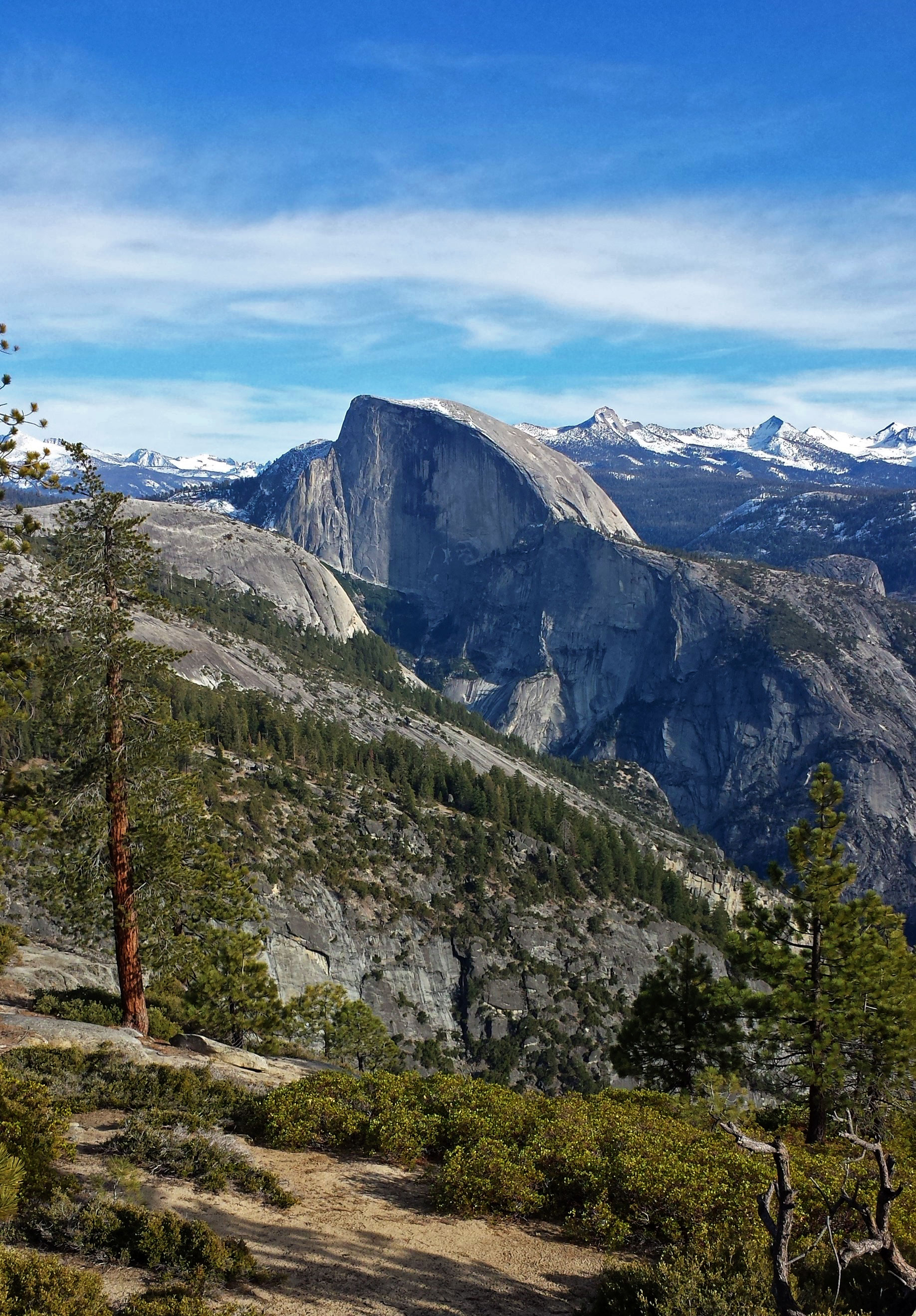
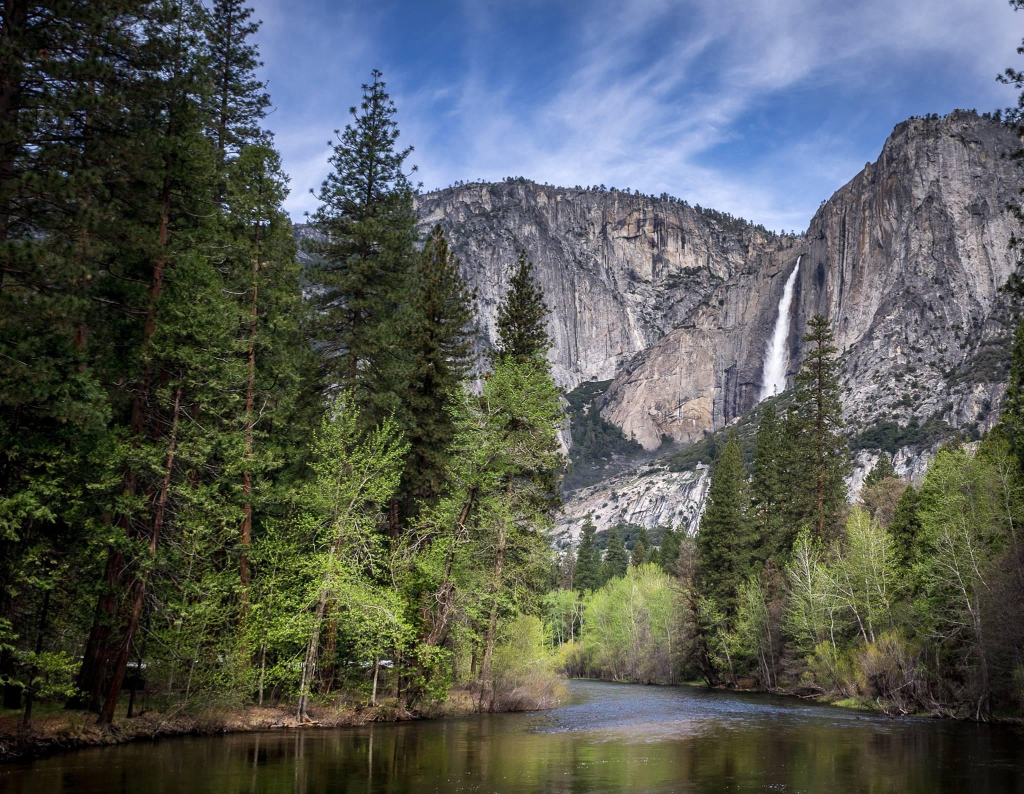
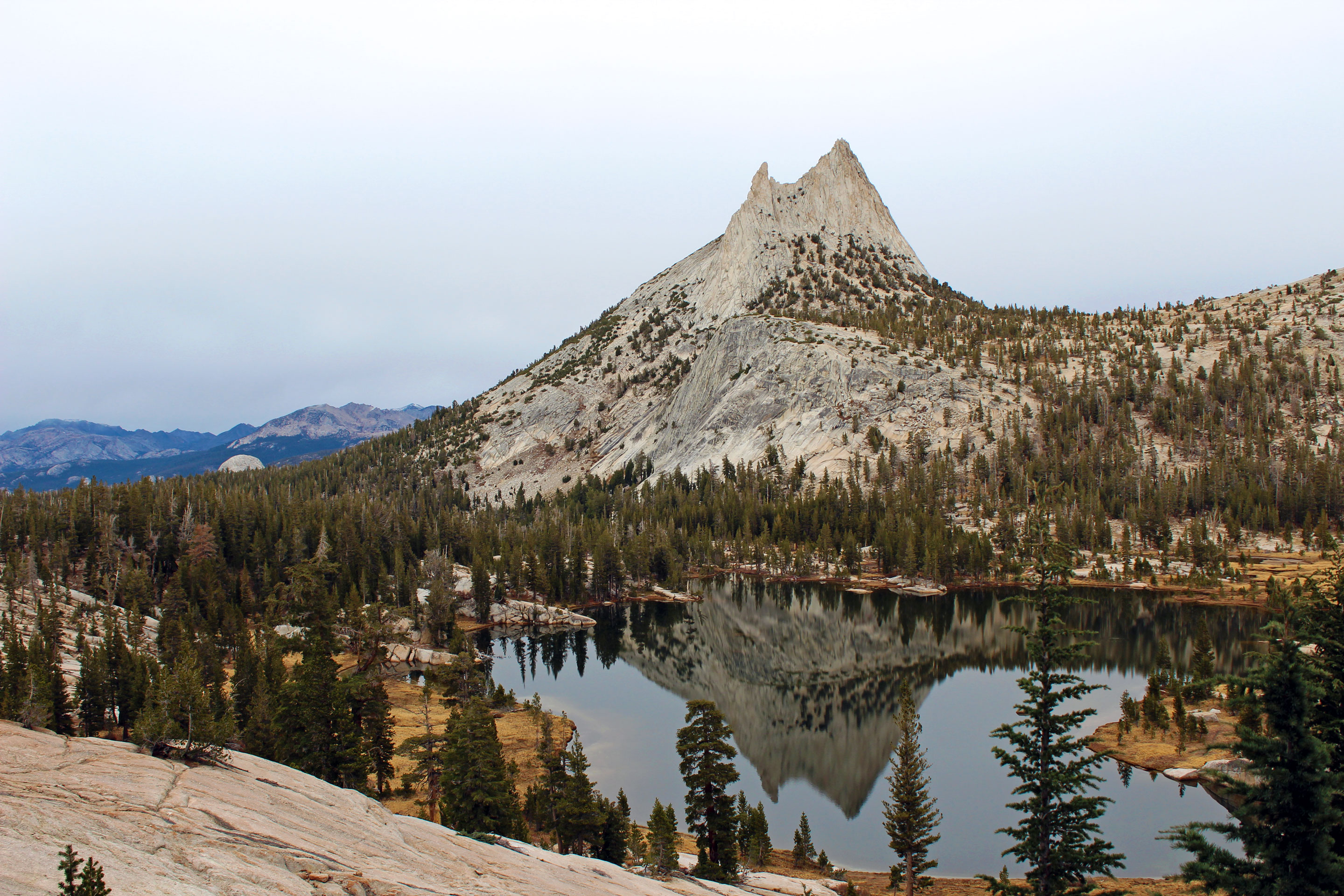
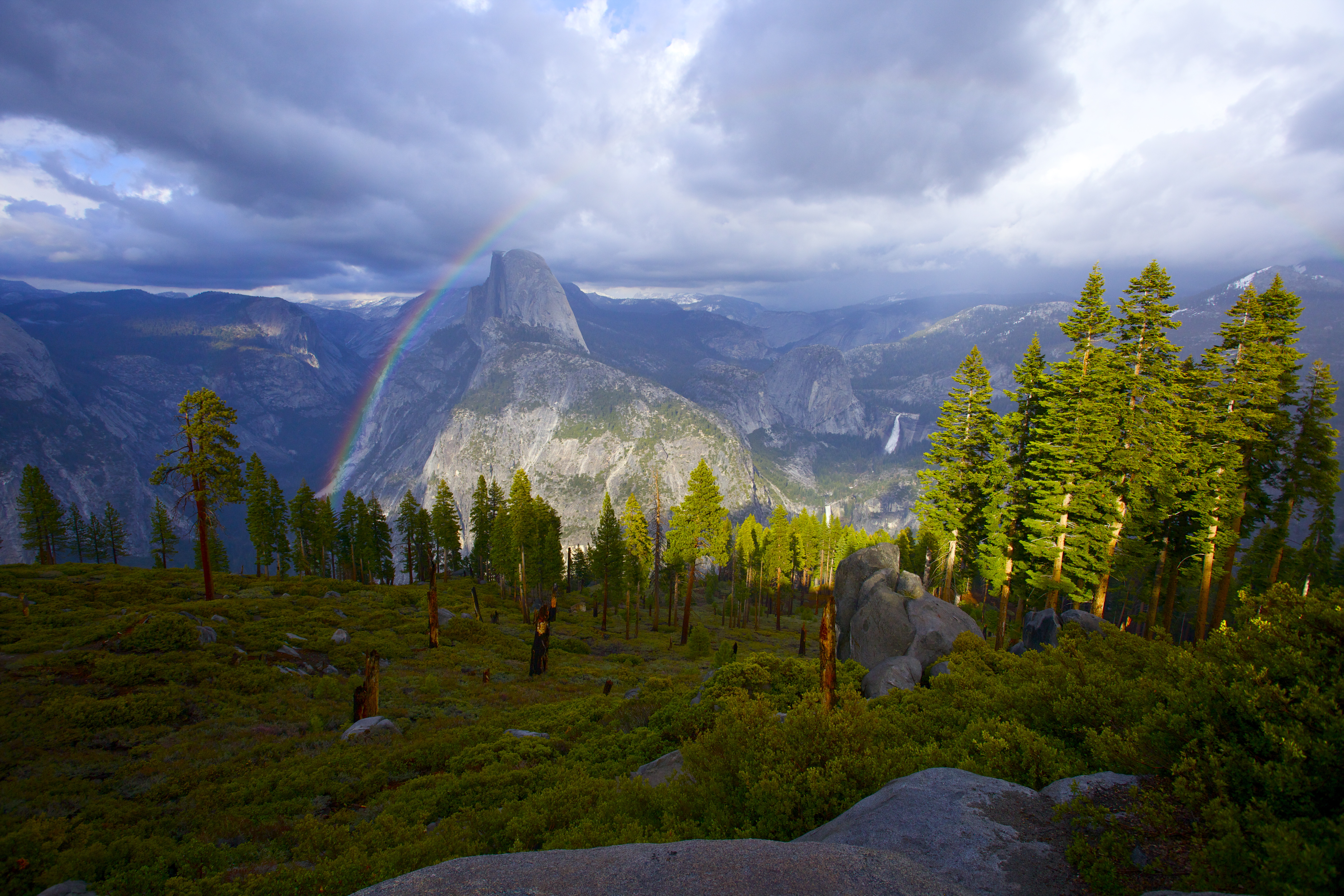
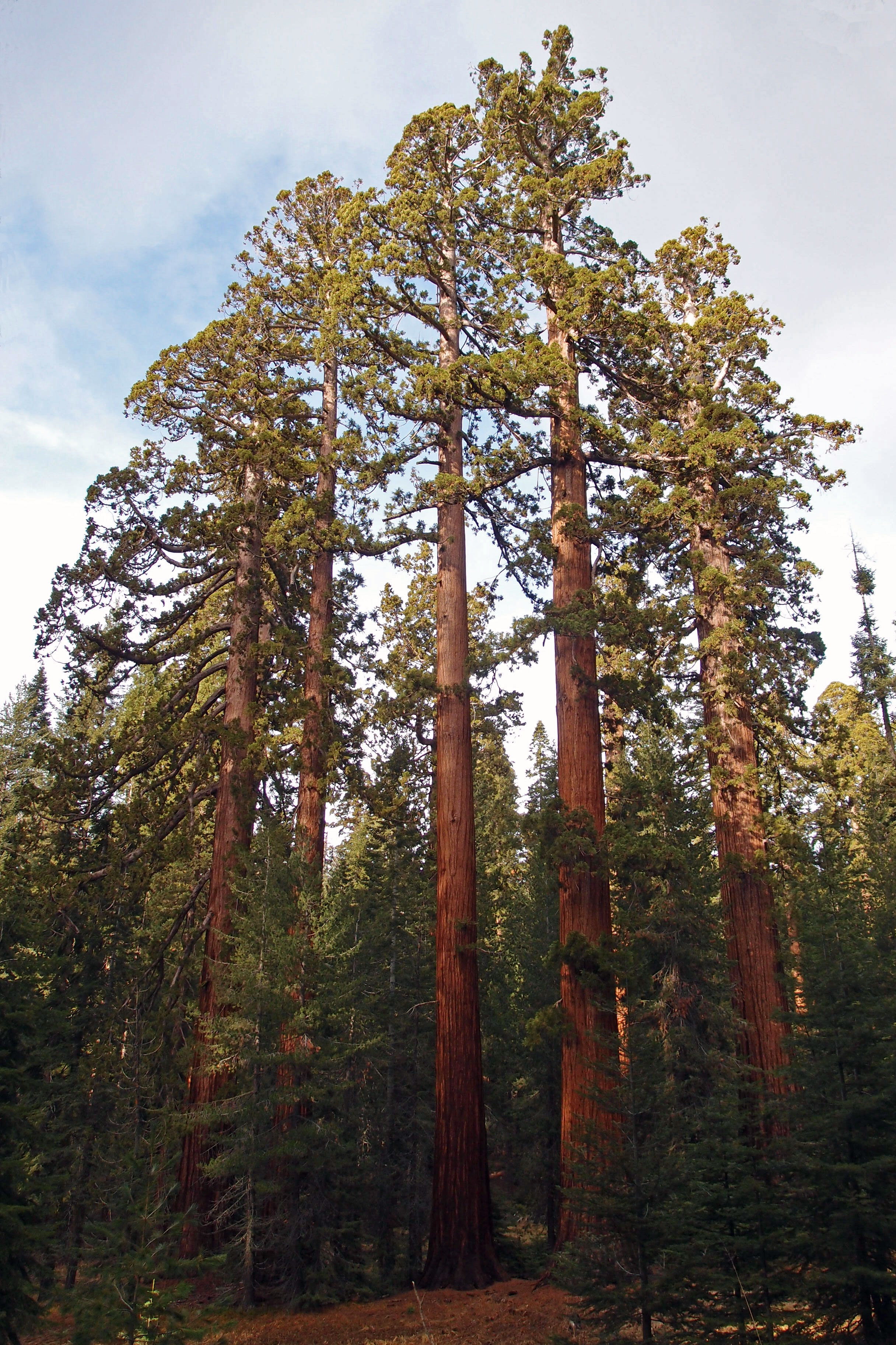
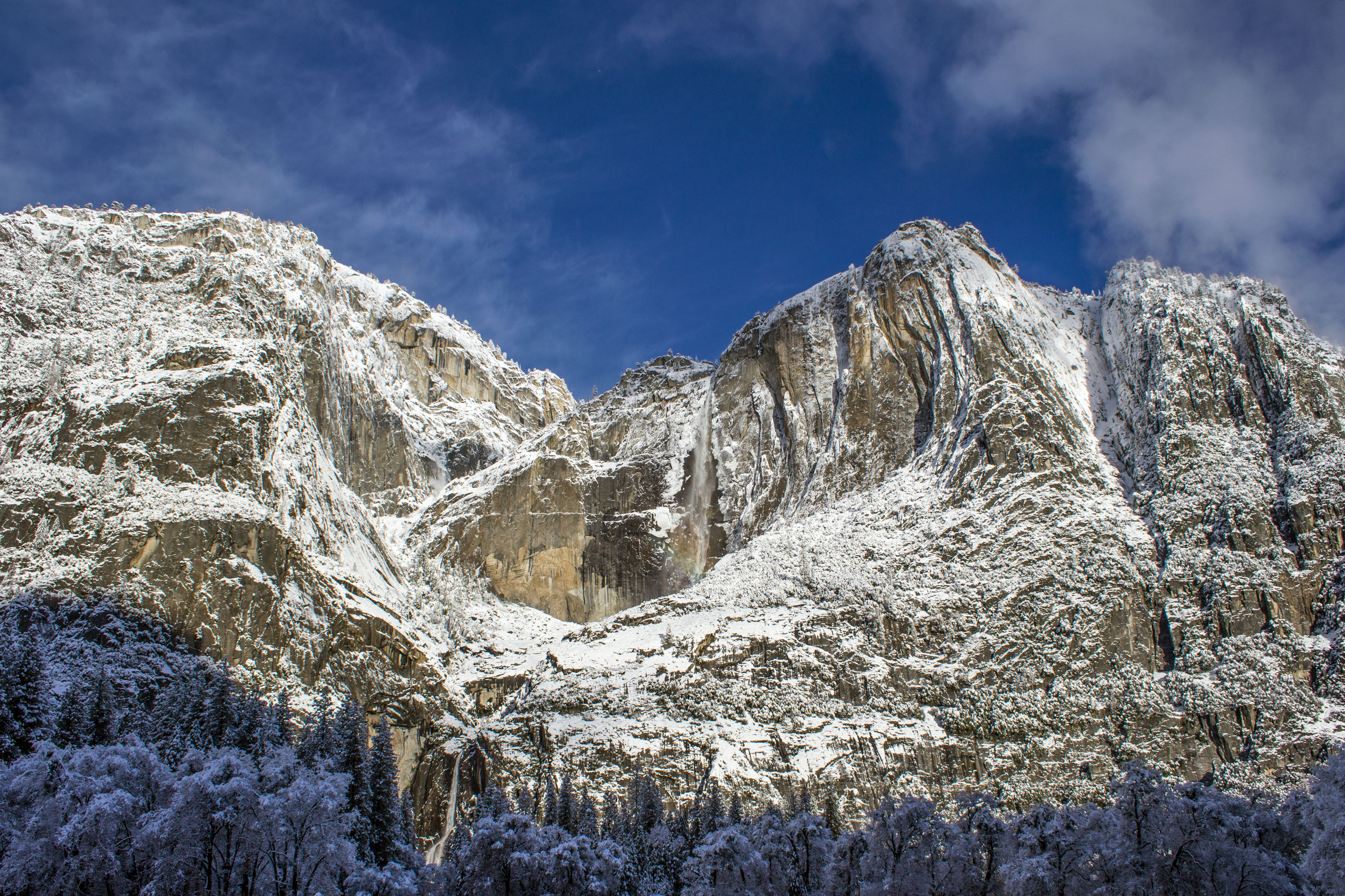
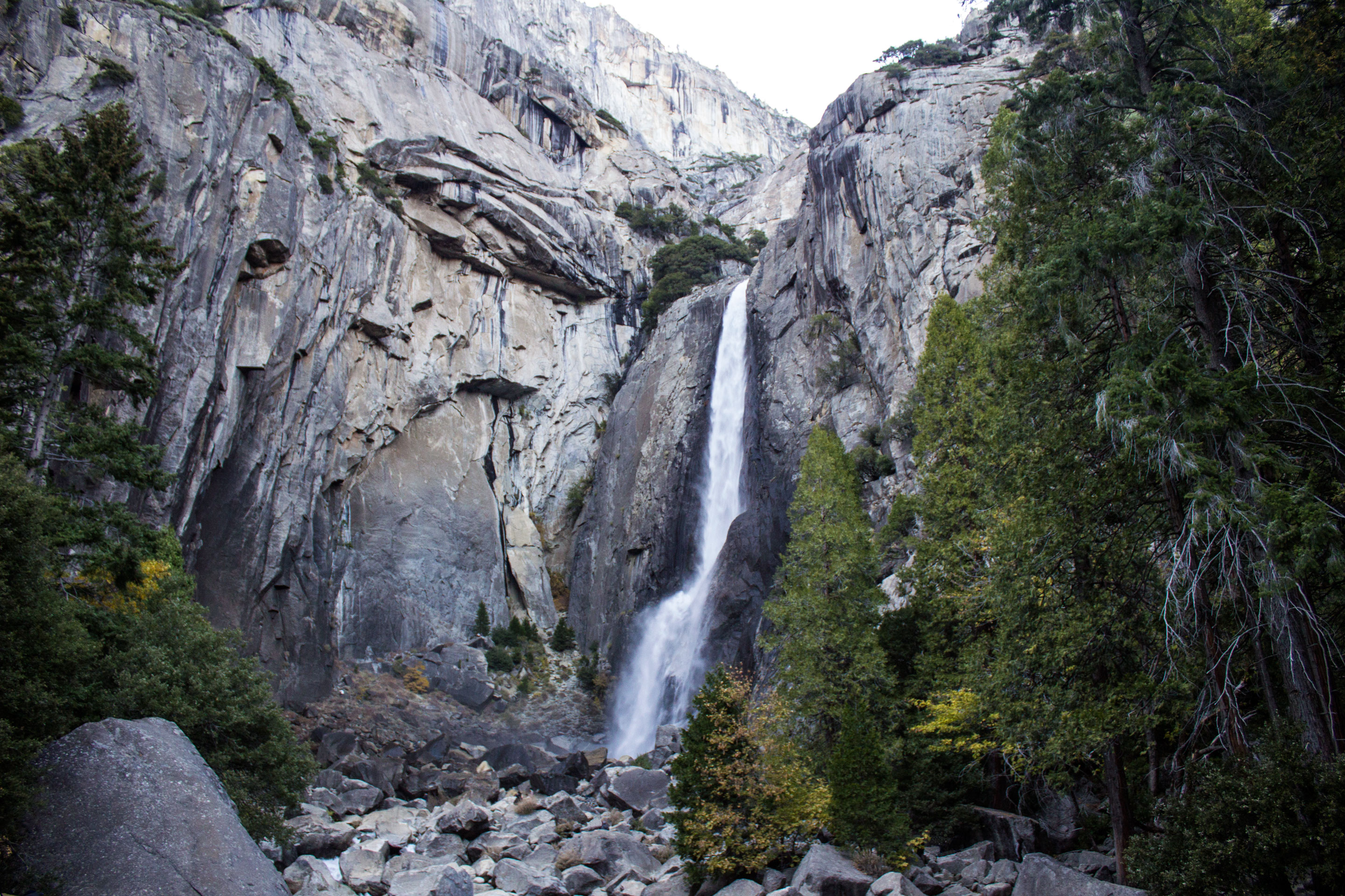
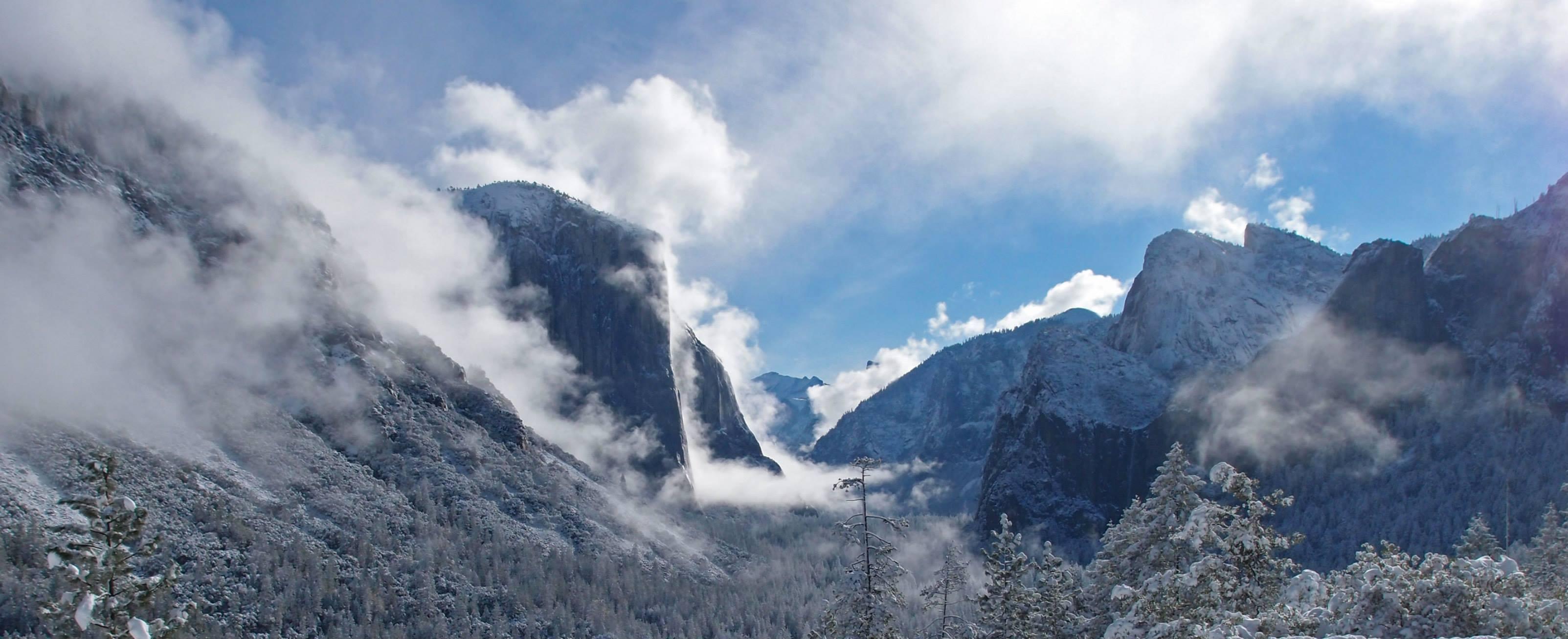
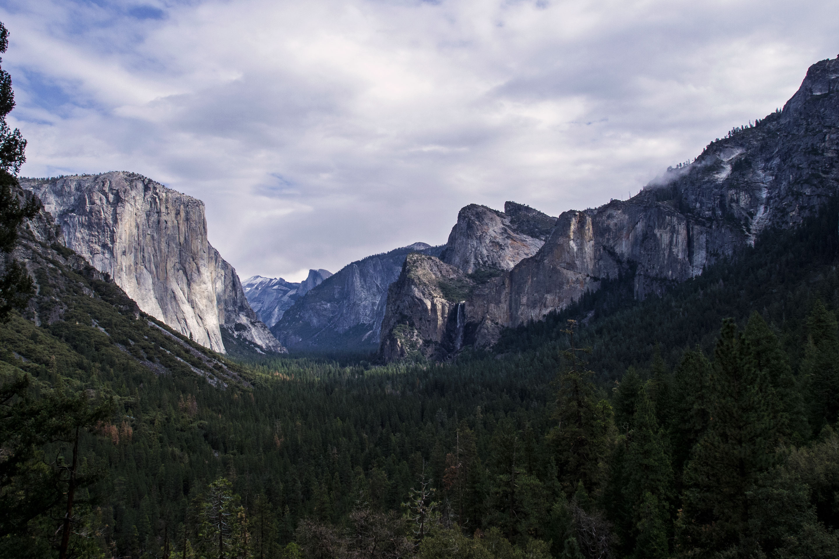
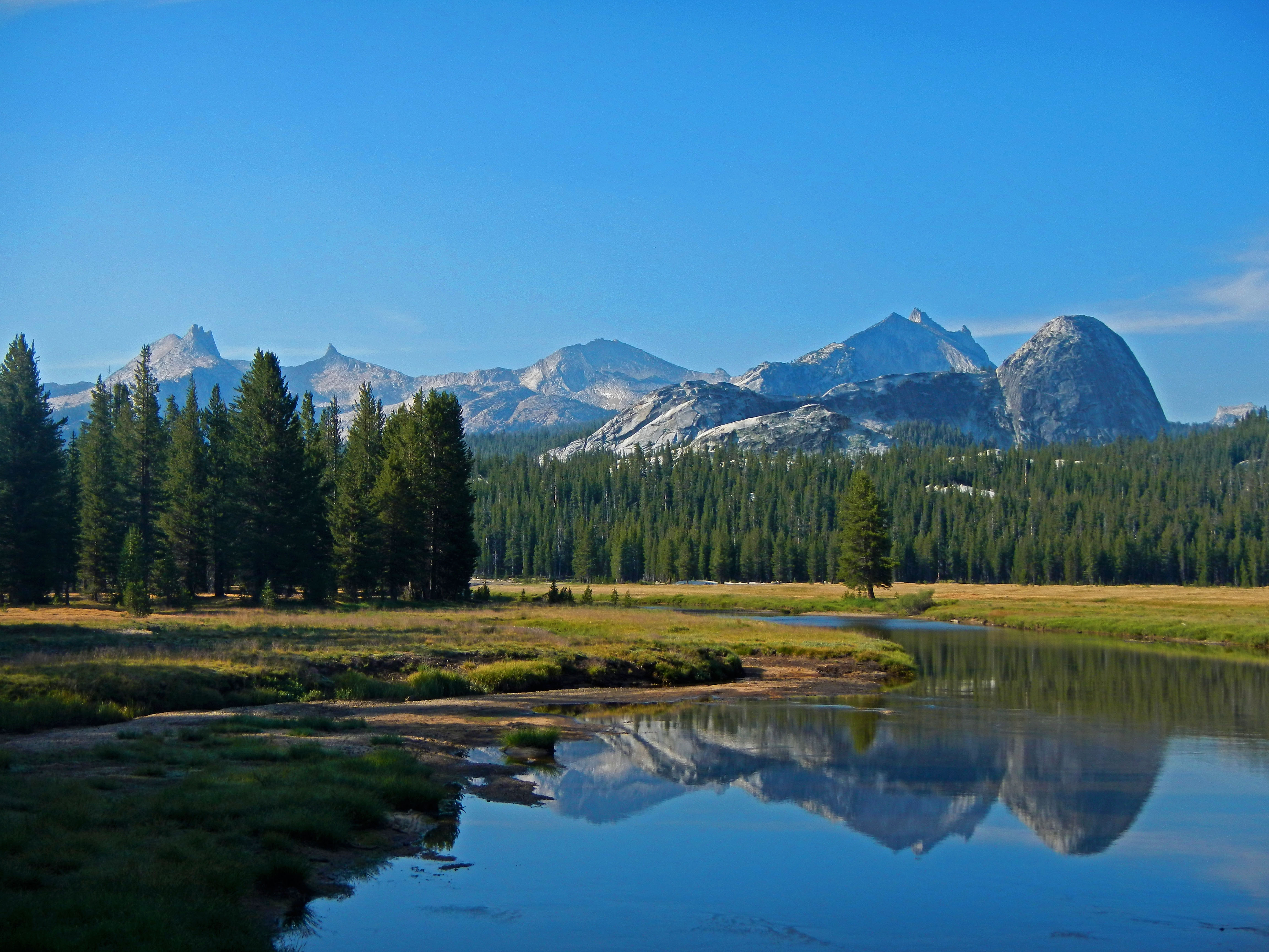
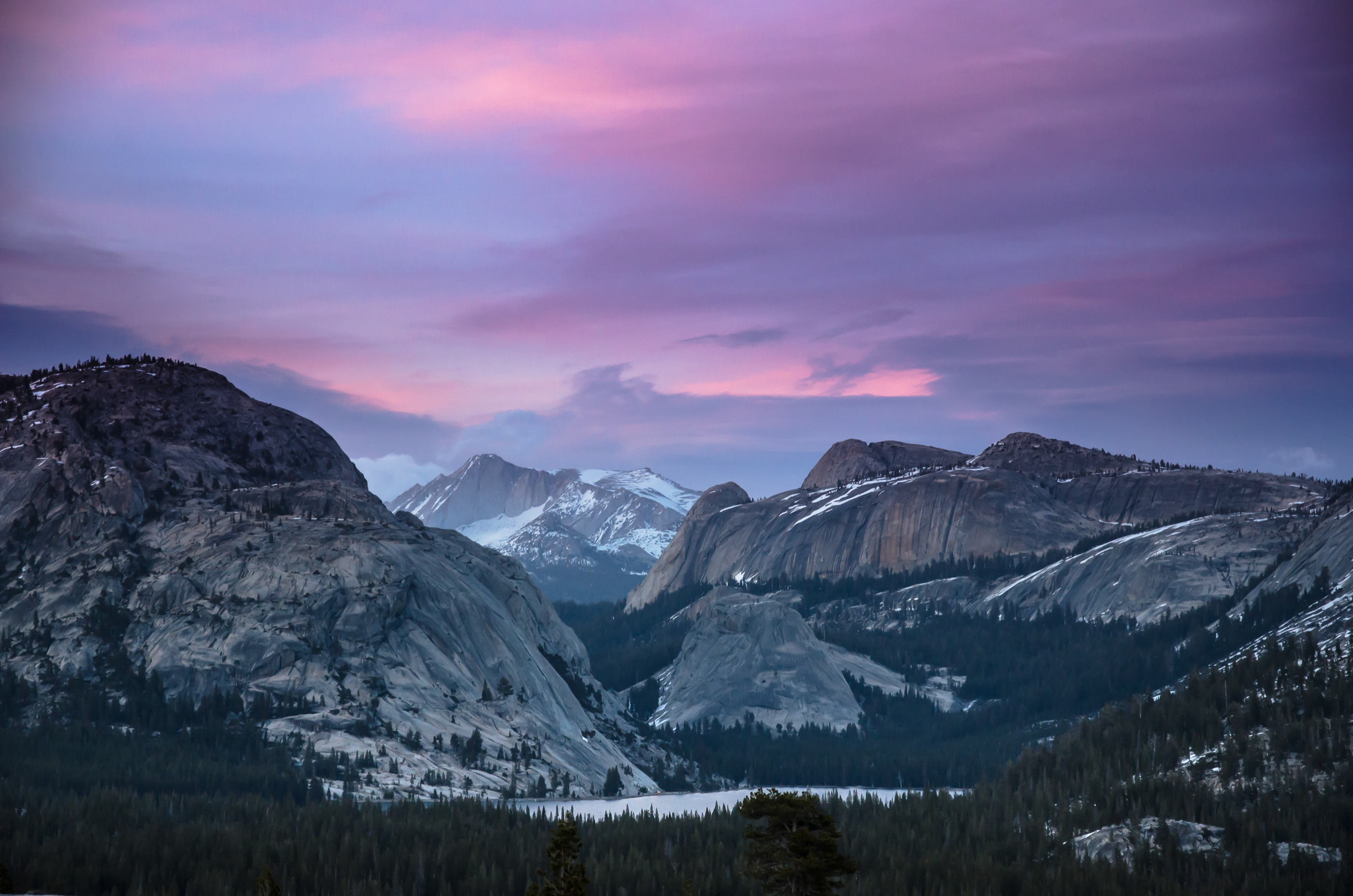
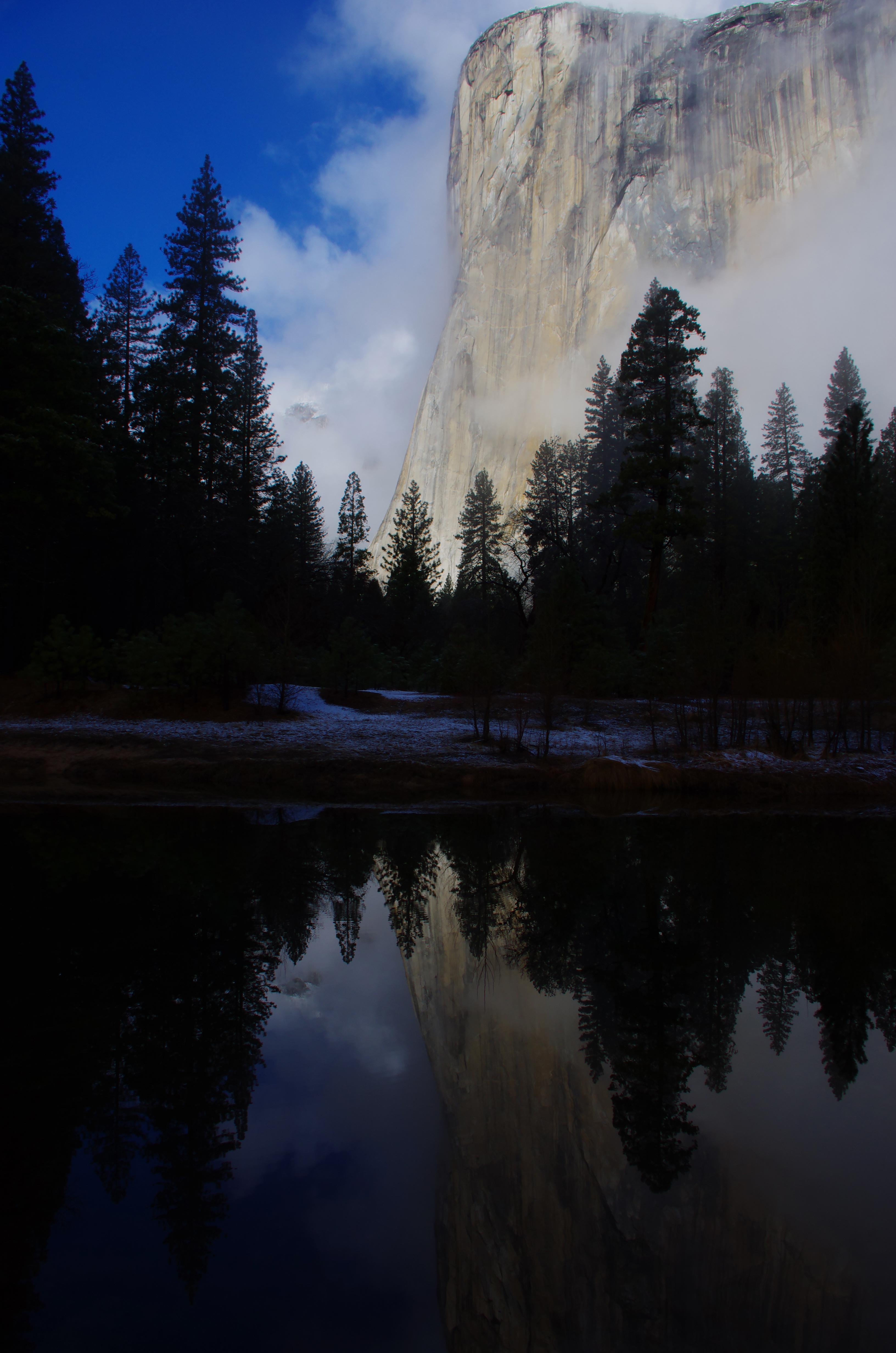
Selected official assessments, with the exact section each describes. Conditions may have changed since assessment.
Eastern approach from the Yosemite Falls shuttle stop to the viewing area; excludes the western loop.
NPS identifies this approach as wheelchair accessible, with transfer-height seating at the viewing area. Check current conditions.
Official guidance Reviewed 2026-10-19
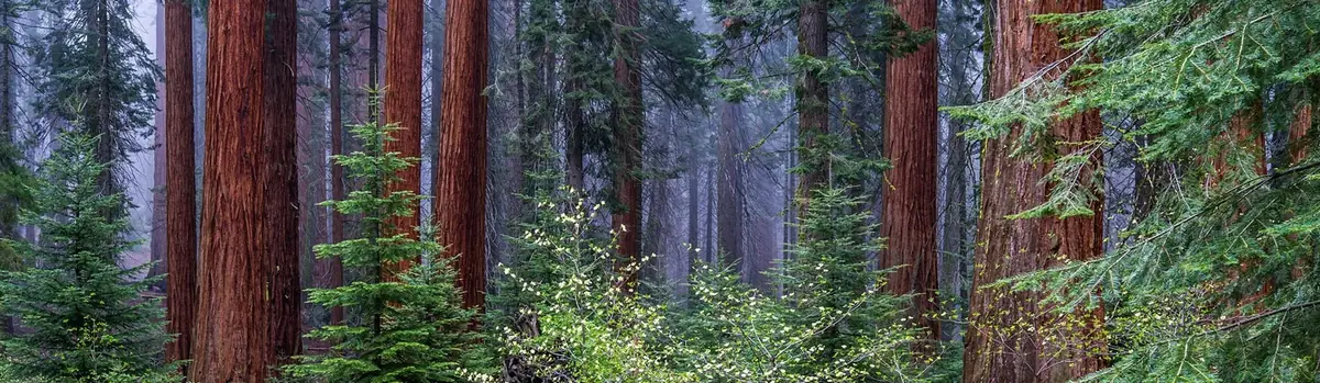 Forests
California
Huge mountains, rugged foothills, deep canyons, vast caverns, and the world’s largest trees exemplify the diversity of landscapes, life, and beauty here. Explore these pages to plan your visit or to learn about the plants and animals here and the threats they face. Ancient giant sequoias may seem invincible, but they, too are vulnerable.
 Forests
California
Huge mountains, rugged foothills, deep canyons, vast caverns, and the world’s largest trees exemplify the diversity of landscapes, life, and beauty here. Explore these pages to plan your visit or to learn about the plants and animals here and the threats they face. Ancient giant sequoias may seem invincible, but they, too are vulnerable.
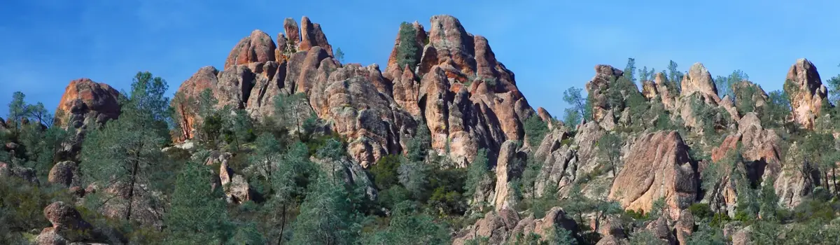 Caves
California
Around 23 million years ago, a series of volcanic eruptions shaped the landscape that is now Pinnacles National Park. The remnants of these ancient eruptions have formed a striking terrain of rocky spires and deep canyons. Visitors can explore diverse environments, from chaparral and oak woodlands to the cool, shaded depths of canyon floors.