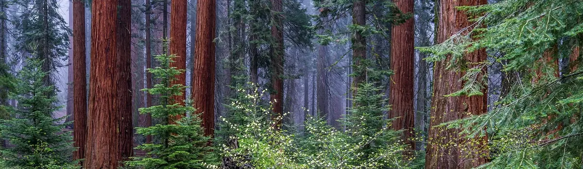
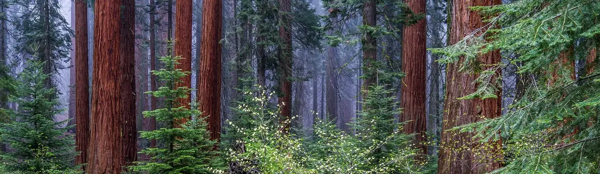
Two distinct desert ecosystems, the Mojave and the Colorado, come together in Joshua Tree National Park. A fascinating variety of plants and animals make their homes in a land sculpted by strong winds and occasional torrents of rain. Dark night skies, a rich cultural history, and surreal geologic features add to the wonder of this vast wilderness in southern California. Come explore for yourself!
795.2Kacres of parkland
2.9Mrecreation visits, 2025
Mar · Apr · Novnearby climate picks
Seasonal access & reservations
No reviewed guidance for this selection. Check the park's official planning pages; missing coverage does not establish access.
Selected guidance only; separate from climate comfort and current conditions.
Official conditions Not checked
The conditions feed has not been connected for this park.
Explore another open district and selected viewpoints. Consider night-sky viewing with a safe parking and return plan; do not improvise off-trail scrambling.
Editorial recommendations, reviewed 2026-10-17. Full park days, excluding travel to and from the region. A first-visit outline for a general traveler; adapt to mobility, fitness, season, reservations, and current conditions. These are suggested days, not reserved activities or guaranteed routes.
Please remember, pets are not permitted on any trails in the park , except for the paved Oasis of Mara Trail. For more information, visit Pets . Many visitors use hiking apps with crowd-generated information. Please know that apps and blogs can give misleading or false information. They can incorrectly label the difficulty level or present user-generated routes as "trails." These routes are often not designated trails, can involve rock scrambling in remote areas, and require advanced route-finding and off-trail navigation skills. This has led to search and rescue calls involving lost or injured hikers. Please view the hiking trail information on this page as your most accurate source of information. For free offline maps and and additional information on our designated trails, download the NPS app . Leave information about your planned route and expected return time with a friend or family member before hiking. Check in with this person when you return. In an emergency, call 909-383-5651 or 911.
The Paul Miller Story
Paul Miller, from Ontario, Canada, planned to hike the 49 Palms Oasis Trail and return to his wife, Stephanie, at their hotel on July 13, 2018. He never returned.
The park launched a large search and rescue effort, but found no clues. As an avid hiker and photographer, Paul prepared well for this 3-mile roundtrip hike. Search and Rescue teams found Paul’s remains near boulders off trail December 20, 2019. Even the most prepared hikers can run into trouble and not make it back.
Honor Paul’s memory by following the below safety tips.
Tell someone where you are going and when you plan to be back
Bring plenty of food and water—even on short hikes
Don’t force fluids—drink when you are thirsty
Eat often—salty snacks are key for salt loss from sweating
Rest in the shade
Plan ahead and avoid hiking between 10am and 5pm during the summer
Read more safety tips here before visiting Joshua Tree
10 Summer Hiking Essentials
Water - plain and some with electrolyte replacement.
Food - especially salty foods. Eat twice as much as normal.
First Aid Kit - band aids, ace wrap, antiseptic, moleskin, etc.
Map - while many trails are well-marked, maps are helpful tools.
Pack - to carry the essentials.
Flashlight/Spare Batteries - allows you to hike out during the cool of the evening.
Spray Bottle - fill with water for your own personal air conditioning system.
Sun Protection - hat and sunscreen to keep the sun off you and protect your skin.
Whistle and/or Signal Mirror - for emergency use.
Waterproof Clothing - poncho or jacket; especially useful during monsoon season (mid-July to early September).
February 1, 2023 Backpacking Permits Experience the beauty of backcountry.
Scrambling Scrambling combines elements of hiking and climbing, allowing adventurers to traverse rugged terrain.
How to Hike in the Desert Trail Tips A must watch before hiking a desert trail.
Short Walks and Nature Trails
Strenuous Hikes - Do Not Attempt in the Heat
Trail
Trailhead Location
Distance Elevation
Estimated Time
Description
Arch Rock
Twin Tanks Parking lot aka the Arch Rock Trailhead
1.4 miles (2.1 km) 100 feet
1 hour
A lollipop trail through sandy and rocky terrain. A .6-mile trail leads to a .2-mile loop. The arch is located halfway along the loop.
Bajada
South of Cottonwood Visitor Center; 0.5 mile (0.8 km) north of the South Entrance
0.25 mile (0.4 km) 20 feet (6.1 m)
15–20 minutes
Loop. Walk on a bajada and discover plants of the Colorado Desert on this easy path.
Barker Dam
Barker Dam parking area
1.1 miles (1.8 km) 50 feet (15.2 m)
1 hour
Loop. Explore cultural history and view a water tank built by early cattle ranchers. Watch for bighorn sheep.
Cap Rock
Cap Rock parking area, at the junction of Park Boulevard and Keys View Road
0.4 mile (0.6 km) 20 feet (6.1 m)
30–45 minutes
Loop. View boulder piles, Joshua trees, and other desert plants on this easy path.
Cholla Cactus Garden
20 miles (32 km) north of Cottonwood Visitor Center
0.25 mile (0.4 km) 10 feet (3 m)
15–30 minutes
Closed December 2024-March 2025 for maintenance. Loop. View thousands of densely concentrated, naturally growing cholla cactus. Stay on the trail, wear closed-toe shoes, and be aware of prickly cactus.
Cottonwood Spring
1 mile (1.5 km) east of Cottonwood Visitor Center
0.1 mile (0.2 km) 25 feet (7.6 m)
10 minutes
Short walk to fan palm oasis with cottonwood trees. Fantastic birding location with plentiful shade.
Discovery Trail
Skull Rock parking area just east of Jumbo Rocks Campground
0.7 mile (1.1 km) 70 feet (21.3 m)
30–45 minutes
Loop. Connects Skull Rock and Split Rock Loop trails at Face Rock. Easy hike through boulder piles and desert washes.
Hidden Valley
Hidden Valley picnic area
1 mile (1.6 km) 100 feet (30.5 m)
1 hour
Loop. Discover a rock-enclosed valley that was once rumored to have been used by cattle rustlers.
Indian Cove
West end of Indian Cove Campground
0.6 miles (1 km) 50 feet (15.2 m)
30–45 minutes
Loop. Walk on a gently rolling path with a few steps. Take a closer look at desert plants and learn about their traditional uses by Native Americans.
Keys View
Keys View
0.25 miles (0.4 km) 25 feet (7.6 m)
30 minutes
Short, paved loop path is steep. Breathtaking views of the San Andreas Fault, Mount San Jacinto, Mount San Gorgonio, and the Salton Sea.
Oasis of Mara
Oasis Visitor Center, Twentynine Palms
0.5 mile (0.8 km) minimal elevation
30–45 minutes
Loop. Explore a desert oasis on this easy walk. See how the Oasis of Mara has been used by wildlife and people throughout time. Pets on leash allowed.
Ryan Ranch
Ryan Ranch trailhead, about 0.5 mile (0.8 km) east of Ryan Campground
1 mile (1.6 km) 135 feet (41.1 m)
1 hour
Out and back. Enjoy an easy hike along an old ranch road and see a historic adobe structure.
Skull Rock
Skull Rock parking area just east of Jumbo Rocks Campground; also accessible from within Jumbo Rocks Campground
1.7 miles (2.7 km) 160 feet (48.8 m)
1–2 hours
Loop. Take an easy hike and explore boulder piles, desert washes, and of course the namesake Skull Rock.
Trail
Trailhead Location
Distance
Estimated Time
Description
Hi-View
Northwest of Black Rock Campground
1.4 miles (2.3 km) from parking area 2.1 miles (3.3 km) from visitor center 400 feet (121.9 m)
45 minutes –1.5 hours
Loop. Hike a steep ridge on the western side of the park and take in panoramic views. View Joshua trees! There are some steep sections, as well as a several benches to take a break and enjoy the view.
Lost Horse Mine
Lost Horse Mine trailhead off Keys View Road
4 miles (6.4 km) 550 feet (168 m)
2–3 hours
Out and back. Explore around one of the most successful gold mines in the park. Stay outside the fenced area to protect the millsite and mine. For a longer option, see Lost Horse Loop, under Challenging Hikes. Elevation change is 550 feet.
Mastodon Peak
Cottonwood Spring parking area
3 miles (4.8 km) 375 feet (115 m)
1.5–2.5 hours
Loop. An optional rock scramble takes you to the top of a craggy granite peak. The trail then loops around past an old gold mine. Elevation change is about 375 feet.
Pine City
Pine City trailhead at end of Desert Queen Mine Road
4 miles (6.4 km)
2–3 hours
Out and back. The highlight of this fairly flat trail is a dense stand of junipers and pinyon. The trail also goes to an old mining site.
Split Rock Loop
Split Rock picnic area
2.5 miles (4 km) 150 feet (45.7 m)
1.5–2.5 hours
Loop. Distance includes safe trip to Face Rock.
West Side Loop
Black Rock
4.7 miles (7.6 km) 785 feet (239 m)
2.5–4 hours
Loop. Hike ridges and washes with views of Joshua trees and mountains.
Trail
Trailhead Location
Distance Elevation
Estimated Time
Description
Boy Scout Trail
North end: Indian Cove backcountry board. South end: Boy Scout Trailhead.
8 miles (12.9 km) 1190 feet (362.7 m)
6 hours
One way. Go deep into the Wonderland of Rocks. Stay on trail to avoid getting lost among the boulders. Most hikers prefer to start at the south trailhead, inside the West Entrance, and finish at Indian Cove. Vehicle shuttle strongly recommended for hikers interested in doing the full length the trail.
California Riding and Hiking Trail
Several
36.6 miles (58.9 km)
2–3 days to hike entire length
One way. Shorter hikes possible on sections of this long trail. Travel from Black Rock Canyon to the North Entrance of the park, passing through a variety of Mojave Desert landscapes.
Fortynine Palms Oasis
Fortynine Palms parking area, accessed off Highway 62.
3 miles (4.8 km) 300 feet (91 m)
2–3 hours
Out and back. There is a 300 foot (91 m) elevation gain in both directions, as you hike up and over a ridge dotted with barrel cactus. Beyond the ridge, descend to a fan palm oasis in a rocky canyon. Avoid this trail when it's hot out.
Lost Horse Loop
Lost Horse Mine trailhead off Keys View Road
6.5 miles (10.5 km) 550 feet (167.64 m)
3–4 hours
Loop. For a shorter option, see Lost Horse Mine, under Moderate Hikes.
Lost Palms Oasis
Cottonwood Spring parking area
7.5 miles (12 km) 500 feet (152 m)
5–6 hours
Out and back. Enjoy sandy washes and rolling terrain, then hike down into a canyon to explore a remote fan palm oasis. Climbing back out the canyon is strenuous.
Panorama Loop/ Morongo View
Black Rock
6.6 miles (10.6 km) 1,100 feet (336 m)
3–5 hours
Loop. Hike up a sandy wash, then follow the ridgeline of the Little San Bernardino Mountains. Enjoy scenic views, dense Joshua tree forest, and pinyon-juniper woodland.
Ryan Mountain
Parking area between Sheep Pass and Ryan Campground
3 miles (4.8 km) 1,050 feet (320 m)
1.5–2.5 hours
Out and back. Hike to the summit of Ryan Mountain. This is one of the most popular hikes in the park.
Warren Peak
Black Rock
6.3 miles (10.1 km) 1,110 feet (338 m)
3–5 hours
Out and back. Hike to the summit of Warren Peak to enjoy panoramic views of the quiet western part of Joshua Tree National Park.
Willow Hole
Boy Scout Trailhead - south end inside the park
7.2 miles (11.5 km)
4 hours
Out and back. Mostly flat trail along the edge of the Wonderland of Rocks. Travel through Joshua tree forests, boulder landscape, and sandy washes. Trail ends at willow trees.
Trail
Trailhead Location
Distance Elevation
Estimated Time
Description
Arch Rock
Twin Tanks Parking lot aka the Arch Rock Trailhead
1.4 miles (2.1 km) 100 feet
1 hour
A lollipop trail through sandy and rocky terrain. A .6-mile trail leads to a .2-mile loop. The arch is located halfway along the loop.
Bajada
South of Cottonwood Visitor Center; 0.5 mile (0.8 km) north of the South Entrance
0.25 mile (0.4 km) 20 feet (6.1 m)
15–20 minutes
Loop. Walk on a bajada and discover plants of the Colorado Desert on this easy path.
Barker Dam
Barker Dam parking area
1.1 miles (1.8 km) 50 feet (15.2 m)
1 hour
Loop. Explore cultural history and view a water tank built by early cattle ranchers. Watch for bighorn sheep.
Cap Rock
Cap Rock parking area, at the junction of Park Boulevard and Keys View Road
0.4 mile (0.6 km) 20 feet (6.1 m)
30–45 minutes
Loop. View boulder piles, Joshua trees, and other desert plants on this easy path.
Cholla Cactus Garden
20 miles (32 km) north of Cottonwood Visitor Center
0.25 mile (0.4 km) 10 feet (3 m)
15–30 minutes
Closed December 2024-March 2025 for maintenance. Loop. View thousands of densely concentrated, naturally growing cholla cactus. Stay on the trail, wear closed-toe shoes, and be aware of prickly cactus.
Cottonwood Spring
1 mile (1.5 km) east of Cottonwood Visitor Center
0.1 mile (0.2 km) 25 feet (7.6 m)
10 minutes
Short walk to fan palm oasis with cottonwood trees. Fantastic birding location with plentiful shade.
Discovery Trail
Skull Rock parking area just east of Jumbo Rocks Campground
0.7 mile (1.1 km) 70 feet (21.3 m)
30–45 minutes
Loop. Connects Skull Rock and Split Rock Loop trails at Face Rock. Easy hike through boulder piles and desert washes.
Hidden Valley
Hidden Valley picnic area
1 mile (1.6 km) 100 feet (30.5 m)
1 hour
Loop. Discover a rock-enclosed valley that was once rumored to have been used by cattle rustlers.
Indian Cove
West end of Indian Cove Campground
0.6 miles (1 km) 50 feet (15.2 m)
30–45 minutes
Loop. Walk on a gently rolling path with a few steps. Take a closer look at desert plants and learn about their traditional uses by Native Americans.
Keys View
Keys View
0.25 miles (0.4 km) 25 feet (7.6 m)
30 minutes
Short, paved loop path is steep. Breathtaking views of the San Andreas Fault, Mount San Jacinto, Mount San Gorgonio, and the Salton Sea.
Oasis of Mara
Oasis Visitor Center, Twentynine Palms
0.5 mile (0.8 km) minimal elevation
30–45 minutes
Loop. Explore a desert oasis on this easy walk. See how the Oasis of Mara has been used by wildlife and people throughout time. Pets on leash allowed.
Ryan Ranch
Ryan Ranch trailhead, about 0.5 mile (0.8 km) east of Ryan Campground
1 mile (1.6 km) 135 feet (41.1 m)
1 hour
Out and back. Enjoy an easy hike along an old ranch road and see a historic adobe structure.
Skull Rock
Skull Rock parking area just east of Jumbo Rocks Campground; also accessible from within Jumbo Rocks Campground
1.7 miles (2.7 km) 160 feet (48.8 m)
1–2 hours
Loop. Take an easy hike and explore boulder piles, desert washes, and of course the namesake Skull Rock.
Trail
Trailhead Location
Distance
Estimated Time
Description
Hi-View
Northwest of Black Rock Campground
1.4 miles (2.3 km) from parking area 2.1 miles (3.3 km) from visitor center 400 feet (121.9 m)
45 minutes –1.5 hours
Loop. Hike a steep ridge on the western side of the park and take in panoramic views. View Joshua trees! There are some steep sections, as well as a several benches to take a break and enjoy the view.
Lost Horse Mine
Lost Horse Mine trailhead off Keys View Road
4 miles (6.4 km) 550 feet (168 m)
2–3 hours
Out and back. Explore around one of the most successful gold mines in the park. Stay outside the fenced area to protect the millsite and mine. For a longer option, see Lost Horse Loop, under Challenging Hikes. Elevation change is 550 feet.
Mastodon Peak
Cottonwood Spring parking area
3 miles (4.8 km) 375 feet (115 m)
1.5–2.5 hours
Loop. An optional rock scramble takes you to the top of a craggy granite peak. The trail then loops around past an old gold mine. Elevation change is about 375 feet.
Pine City
Pine City trailhead at end of Desert Queen Mine Road
4 miles (6.4 km)
2–3 hours
Out and back. The highlight of this fairly flat trail is a dense stand of junipers and pinyon. The trail also goes to an old mining site.
Split Rock Loop
Split Rock picnic area
2.5 miles (4 km) 150 feet (45.7 m)
1.5–2.5 hours
Loop. Distance includes safe trip to Face Rock.
West Side Loop
Black Rock
4.7 miles (7.6 km) 785 feet (239 m)
2.5–4 hours
Loop. Hike ridges and washes with views of Joshua trees and mountains.
Trail
Trailhead Location
Distance Elevation
Estimated Time
Description
Boy Scout Trail
North end: Indian Cove backcountry board. South end: Boy Scout Trailhead.
8 miles (12.9 km) 1190 feet (362.7 m)
6 hours
One way. Go deep into the Wonderland of Rocks. Stay on trail to avoid getting lost among the boulders. Most hikers prefer to start at the south trailhead, inside the West Entrance, and finish at Indian Cove. Vehicle shuttle strongly recommended for hikers interested in doing the full length the trail.
California Riding and Hiking Trail
Several
36.6 miles (58.9 km)
2–3 days to hike entire length
One way. Shorter hikes possible on sections of this long trail. Travel from Black Rock Canyon to the North Entrance of the park, passing through a variety of Mojave Desert landscapes.
Fortynine Palms Oasis
Fortynine Palms parking area, accessed off Highway 62.
3 miles (4.8 km) 300 feet (91 m)
2–3 hours
Out and back. There is a 300 foot (91 m) elevation gain in both directions, as you hike up and over a ridge dotted with barrel cactus. Beyond the ridge, descend to a fan palm oasis in a rocky canyon. Avoid this trail when it's hot out.
Lost Horse Loop
Lost Horse Mine trailhead off Keys View Road
6.5 miles (10.5 km) 550 feet (167.64 m)
3–4 hours
Loop. For a shorter option, see Lost Horse Mine, under Moderate Hikes.
Lost Palms Oasis
Cottonwood Spring parking area
7.5 miles (12 km) 500 feet (152 m)
5–6 hours
Out and back. Enjoy sandy washes and rolling terrain, then hike down into a canyon to explore a remote fan palm oasis. Climbing back out the canyon is strenuous.
Panorama Loop/ Morongo View
Black Rock
6.6 miles (10.6 km) 1,100 feet (336 m)
3–5 hours
Loop. Hike up a sandy wash, then follow the ridgeline of the Little San Bernardino Mountains. Enjoy scenic views, dense Joshua tree forest, and pinyon-juniper woodland.
Ryan Mountain
Parking area between Sheep Pass and Ryan Campground
3 miles (4.8 km) 1,050 feet (320 m)
1.5–2.5 hours
Out and back. Hike to the summit of Ryan Mountain. This is one of the most popular hikes in the park.
Warren Peak
Black Rock
6.3 miles (10.1 km) 1,110 feet (338 m)
3–5 hours
Out and back. Hike to the summit of Warren Peak to enjoy panoramic views of the quiet western part of Joshua Tree National Park.
Willow Hole
Boy Scout Trailhead - south end inside the park
7.2 miles (11.5 km)
4 hours
Out and back. Mostly flat trail along the edge of the Wonderland of Rocks. Travel through Joshua tree forests, boulder landscape, and sandy washes. Trail ends at willow trees.
99 sites. $35 per night. 4,000 feet in elevation. Water, flush toilets, tables, fire grates, and a dump station.
62 sites. $35 per night. 3,000 feet in elevation. Water, flush toilets, tables, fire grates, and a dump station.
101 sites. $35 per night. 3,200 feet in elevation. Pit toilets, tables, and fire grates. No water.
124 sites. $30 per night. 4,400 feet in elevation. Pit toilets, tables, and fire grates. No water.
31 sites. $30 per night. 4,000 feet in elevation. Pit toilets, tables, and fire grates. No water.
6 group campsites. Starting at $55 per night. 4,500 feet in elevation. Pit toilets, a table, and fire grates included. No water.
First-Come, First-Served Camping
Hidden Valley, White Tank, and Belle Campgrounds are first-come, first-served. To secure a campsite, 1. Locate an empty campsite. 2. Occupy the site (set up a tent or leave personal items to show site occupancy). 3. Proceed immediately to an entrance station to complete registration and pay. You must pay for the site within one hour of set up. The fee is $25 per night. If arriving after entrance stations close, payment may be delayed until the following morning. Fee collection rangers may be available in the campgrounds as a convenience to visitors in the morning, but should not be relied upon as a primary means for site registration. First-come, first-serve campsites are highly competitive on holidays, most weekends, and the springtime. They are full nearly every weekend from Sept-May and most weeknights during our busy spring season from mid-February to mid-May. On the weekends, they are typically full by Friday afternoon. The earlier you arrive in a week, the better chance you will have to secure a site. To avoid disappointment, reserve a site at recreation.gov . Can't find a campsite inside the park? Learn more about Camping Outside of the Park . Summer Status: White Tank Campground and Belle Campground temporarily close during the summer. Hidden Valley Campground is open year-round.
First-come; First-served
18 sites. $25 per night. 3,800 feet in elevation. Pit toilets, tables, and fire grates. No water.
44 sites. $25 per night. 4,200 feet. Pit toilets, tables, and fire grates. No water.
15 sites. $25 per night. 3,800 feet in elevation. Pit toilets, tables, and fire grates. No water.
Can't Find A Campsite?
The park has become an extremely popular destination in recent years. Due to this popularity, all park campgrounds are usually full on weekends from September through May.
If you arrive too late to get a site in a designated campground, you have the following options:
Camp on Bureau of Land Management land outside the park.
Go to a private campground or stay in lodging in gateway communities. Please contact area chambers of commerce for information.
Sleeping in your vehicle overnight along the roadside or at a roadside pull off is not allowed, and violators may be subject to a citation.
For more information, visit our Camping Outside of the Park page.
Group sites can accommodate 10-60 people.
Reservations may be made up to 6 months in advance for Cottonwood, Indian Cove, and Sheep Pass.
Cottonwood and Sheep Pass Group Campgrounds are for tents only. Indian Cove Group Campground can accommodate small RVs or trailers, with a maximum combined length of 25 feet.
Equestrian Camping
Black Rock and Ryan Campgrounds have designated horse camps. You must have a horse to book an equestrian site. Ryan is closed in the summer months. See the horseback riding page for more information.
Frequently Asked Questions
How do I get campsite reservations?
Reservations are required at the following campgrounds: Indian Cove, Black Rock, Jumbo Rocks, Ryan, Cottonwood, Sheep Pass Group Campground, Cottonwood Group Campground, and Indian Cove Group Campground. Campsite reservations can only made on recreation.gov or by calling 1-877-444-6777. Reservations be made up to six months in advance (subject to availability).
How do I get a first-come, first-served campsite?
When you arrive at a first-come, first-served campground (Hidden Valley, Belle, or White Tank), look for an open site. If you find a vacated site without equipment, move into the site and set up camp.
How do I pay for a first-come, first-served campsite?
After occupying an open campsite, proceed immediately to an entrance station to complete registration and pay. You must pay for the site within one hour of set up. The fee is $25 per night. We only accept debit and credit card payments for campsites. If arriving after entrance stations close, payment may be delayed until the following morning. Fee collection rangers may be available in the campgrounds as a convenience to visitors in the morning, but should not be relied upon as a primary means for site registration.
What are my chances of getting a first-come, first-serve site on the weekend?
First-come, first-serve campsites are highly competitive on holidays, most weekends, and the springtime. They are full nearly every weekend from Sept-May and most weeknights during our busy spring season from mid-February to April. On the weekends, they are typically full by Friday afternoon. The earlier you arrive in a week, the better your chance of securing a site. To avoid disappointment, reserve a site at recreation.gov .
How many tents will fit in my site?
For reservation-only campsites, please check the campsite information on recreation.gov before you book. Not all campsites can accommodate the maximum number of people and tents. For first-come, first-served campgrounds, up to six people and three tents (if they fit) are allowed. If site capacity is exceeded, extra guests will be asked to leave or the site may be forfeited.
Can I sleep in my vehicle?
You are welcome to sleep in your vehicle at a lawfully occupied, designated campsite. It is illegal to sleep in your vehicle outside of campgrounds e.g., trailheads, dirt roads, parking lots, roadsides, etcetera.
If my campsite only allows 1 or 2 vehicles, can I bring an extra and squeeze it in?
No. You are only allowed to bring the stated number of allowed vehicles listed in the campsite information on recreation.gov. It’s typically two and sometimes one. For first-come, first-serve sites, it’s a two-vehicle limit if they fit . The stated vehicle limit is based on available parking space. If exceeding this limit, it typically leads to illegal parking, obstructing the roadway, and vegetation damage. If you bring an extra vehicle, you will be asked to move it. This applies to group sites too; do not exceed the vehicle limit.
If I have more vehicles than my campsite allows, where can I park the extra vehicle(s)?
There is no overflow parking in the national park. For extra vehicles, seek parking outside of the park and carpool in.
Does a trailer or camper count as a vehicle?
Yes, a vehicle towing a trailer, popup, tent trailer, or fifth wheel—or a motorhome towing a vehicle—is considered two vehicles.
What if I have more people than my campsite allows?
Then you will need to book an additional site. Exceeding the maximum number of allowed guests commonly leads to out-of-bounds camping, vegetation damage, and noise complaints. If site capacity is exceeded, extra guests will be asked to leave or the site may be forfeited.
How do I check-in if I’m arriving late?
You don't need to. There is no formal check-in process at the campgrounds. Once you arrive, simply move into your reserved site. A campground host or ranger may or may not greet you and go over campground rules. Campground rules are also posted at the entrance to each campground.
If I’m not going to make it to the first night of my reservation, will my reservation be canceled?
To avoid cancellation, please call 760-367-3001 and leave a message for the park if you are arriving one or more nights late. If you do not plan on using your reserved nights, please cancel them on recreation.gov to give others the opportunity to use the campsite.
Do the gates to the campgrounds close at a certain time?
No, we never close the gates. You are free to enter and exit the campgrounds 24 hours a day.
Can I have a campfire?
Campfires are allowed in the provided campfire ring within designated campsites. We have an annual campfire ban during the summer months from June 15 until October 1. If there is a fire ban, check our alerts and conditions webpage to read more about it. If there are no alerts on this webpage about a campfire ban, then you are allowed to have a campfire at your site. Campfires are not allowed in the backcountry or outside of designated campsites in the campgrounds. Charcoal grills are okay to use. When you are done with the fire, dump excess amounts of water on it, stir it up, and check for any remaining heat. Do not leave a smoldering fire unattended.
Where can I buy firewood?
It can be purchased in town from gas stations, grocery stores, and roadside vendors. It is not sold in the park or at visitor centers. You may not gather park vegetation, whether living or dead, to fuel your campfire. Do not burn combustible objects other than firewood.
Can I leave my food and trash bags out during the day?
No, please protect these from the wildlife in a secure container or your vehicle. If you leave your food and trash out, rodents and ravens will likely get into it. This creates behaviors that are detrimental to the wildlife, to you, and to future visitors.
Do I need a horse to book an equestrian site?
Yes, they are reserved for equestrians. If you show up without a horse, you will forfeit the site.
Do any of the campgrounds in the park have showers?
No, none of the park campgrounds have showers. However, campers can pay to shower in the local communities. Some private campgrounds outside of the park have shower options for their campers.
Where can I shower near Joshua Tree National Park?
There are a few shower options in the local community, and most require a payment between $5-$30. If you are looking for a place to shower, we recommend contacting private campgrounds, gyms, motels, and travel centers.
RV-related questions
Are there dump stations?
Yes, they are located at Black Rock Campground (near campsite 6) and at Cottonwood (between the visitor center and the campground). They cost $5 to use. Payment can be made before or after use at any entrance station.
Are there water fill stations?
Yes, there are water fill stations at Black Rock campground (near campsite 6) and at Cottonwood (between the visitor center and the campground).
What size of RV's can you accommodate?
White Tank and Hidden Valley campgrounds have a length limit of 25 feet combined. Belle campground can accommodate up to 35 feet but most only accommodate 25-30 feet RV's. For reservation-only campgrounds, check the individual campsite information for the maximum vehicle length allowed. If you're searching for a campsite to accommodate a specific RV length on recreation.gov, click on the "filter" button and adjust the vehicle length to the length of your RV.
What if my RV is slightly longer than the campsite parking length?
Then it will not fit, and you should choose a different campsite to book. If your RV extends out into the road, it is prone to being hit or causing an accident. Campsite information on recreation.gov has details about parking limitations for each site. If you book a site and discover your equipment does not fit, reservation changes depend on the availability of suitable sites. Modifications are subject to a fee and can be completed on the recreation.gov app or website.
When can I run my generator?
Generator use is only permitted 7–9 am, noon–2 pm, and 5–7 pm.
All Campgrounds: 760-367-5554 Black Rock Campground: 760-367-3001
Joshua Tree welcomes climbers, boulderers and highliners from around the world. This high desert monzogranite climbing mecca is famous for its traditional-style crack, slab, and steep face climbing. Joshua Tree offers challenges for all ability levels with more than 8,000 climbing routes, 2,000 boulder problems, and hundreds of natural gaps to choose from. It is truly a world-class climbing destination.
If you are learning to climb or are looking to expand your climbing skills, a guided day or class could be of interest to you. When hiring a climbing guide, make sure that they are permitted to work in Joshua Tree National Park. Before getting a permit each guide is required to have the highest levels of rock guiding certifications through the PCGI, AMGA, or similar organizations. They are also required to be certified in Wilderness First Aid and CPR; and they must carry insurance. These requirements protect both the guide and the climber making your day safer.
You may wish to purchase a climbing guide or hiking map if you are unfamiliar with the park. They are available at park visitor centers and at outdoor shops in the surrounding communities.
Fifty years ago, the impact of rock climbers at Joshua Tree was minimal, but today the park hosts hundreds of climbers and boulderers on a busy weekend. Learning about and practicing Leave No Trace principles is an important way all visitors can help protect this fragile desert environment, lest it cease to be a viable habitat for plants and animals, a valuable research area for scientists, and a welcoming place for climbers to enjoy.
The National Park Service does not inspect, maintain, or repair bolts and other climbing equipment anywhere in the park. The placement, replacement, and removal of fixed anchors requires a permit in all circumstances. The park retains the right to remove bolts in prohibited zones without further notice. The park is actively working on a Climbing Management Plan that could impact bolting regulations. Please contact Bernadette Regan, Joshua Tree National Park Climbing Ranger, if you have questions about fixed anchor permits.
The night sky is a glittering dome peppered with stars, planets, and passing meteors—but most people no longer get to see it. In urban and suburban settings, artificial lighting and atmospheric pollutants wash out the light of the stars. This is a serious loss. For millennia, our ancestors experienced a dark night sky. Cultures around the world told stories about the constellations and used the stars as a calendar. Only for the past few generations have humans been denied the chance to stand in awe of the heavens. Boasting some of the darkest nights in Southern California, Joshua Tree National Park offers many visitors the chance to admire the Milky Way for the first time in their lives. Joshua Tree is a designated International Dark Sky Park by DarkSky International . The park also hosts the annual Joshua Tree National Park Night Sky Festival .
Tips for Stargazing
Use Red Lights Only
Do not use bright white flashlights, headlamps, or cell phones. It takes 20-30 minutes for the human eye to fully adjust to very low light conditions. Bright lights delay this process. You can turn a regular flashlight into a red light by covering it with red cellophane, tape, fabric, paper, or similar materials.
Bring Food and Water
Plan ahead. There is no running water in most areas of the park.
Temperatures drop quickly in the evening. Bring extra layers of warm clothing.
You may be on your feet and looking up for long periods of time. A lightweight folding chair will help keep each person in your group comfortable and reduce strain. Do no trample vegetation and be aware of cacti in your area.
Watch Your Step
Cacti, nocturnal animals, and uneven surfaces may be difficult to see at night. Use a red light to check your viewing are for hazards.
Bright moonlight reduces the number of stars you'll see. Check the moon's phase and rise and set times to find the best time to stargaze.
Where to View the Stars and Milky Way
On a clear night and moonless, you should have no problem viewing the stars from anywhere in the park. However, light pollution from surrounding communities does impact Joshua Tree's night skies, so some areas of the park are darker than others.
Designated Stargazing Areas
There are four designated stargazing areas. They are the parking lots of Quail Springs, Hidden Valley, Cap Rock, and Ryan Mountain. Stay awake and within 20 feet (6 meters) of your vehicle, and enjoy the show.
Pitch a tent, roast some marshmallows, and spend the night under the stars in one of Joshua Tree's nine campgrounds (additional camping fees apply). Cottonwood Campground has the darkest skies.
Wilderness Backpacking
Get away from roads, cars, and people, and camp out under the stars in Joshua Tree's vast wilderness. Backpacking should only be done by those with the skills and knowledge for an overnight backcountry trip. For more information, check out our backpacking webpage.
Roadside Pullouts
Park at any of the roadside pullouts and set up chairs to watch the stars overhead. Stay awake and alert within 20 feet (6 meters) of your vehicle. The Pinto Basin Road between Cholla Cactus Garden and Cottonwood has the least traffic and darkest skies.
Things to Remember
Overnight camping is not allowed along roadsides or in parking lots.
Day Use Only areas are closed from dusk to dawn in order to protect wildlife.
Pets must be leashed at all times and are not allowed on trails or in the backcountry.
Watch your step in the darkness (use a red light flashlight or headlamp; wear closed-toed shoes).
Joshua Tree National Park never closes. If entrance fee stations are closed when you arrive, proceed and enjoy your visit. You can pay upon exiting if the fee stations are open.
Photography Tips
There are many different ways to photograph the stars and Milky Way. These are just a few tips for beginners that will help you get started.
A sturdy tripod will help you create sharp photos with no vibration or shaking.
Use Manual Settings
Aperture (or f-stop) - use the largest aperture your lens is capable of (f/2.8 is ideal).
ISO - use the highest setting you can without the image becoming too grainy (ISO 1600 or higher; results will vary by camera model).
Shutter Speed - adjust your shutter speed as needed (try starting at 25 seconds.
Experiment to Find the Best Results
Be creative and try different settings. Change only one setting (f-stop, ISO, or shutter speed) at a time to achieve different effects.
Paint with Light
Is not permitted.
Night Sky Programs
Rangers regularly offer programs about the wonders of the night sky and our ongoing relationship with it. Check our Calendar or at any visitor center for information about upcoming programs or events. Additional programs may be available through our partner:
Sky's the Limit Observatory 9697 Utah Trail Twentynine Palms, CA 92277 760-490-9561 contact@skysthelimit29.org
You can also learn more about the park's dark night skies and watch a series of short films and about why the National Park Service cares about protecting dark night skies .
The Night Sky by Season
The winter solstice is the shortest day of the year—and the longest night. In Joshua Tree, sunset in December can be as early as 4:30 pm, with full dark falling by 5 pm. Campers in the national park at this time of year have plenty of opportunity to stargaze before going to bed for the night.
Winter's most famous constellation is almost certainly Orion , the Hunter. The three stars that make up Orion's belt are easily seen in the southern sky. Below Orion's belt, three faint stars make up the great hunter's sword. Use binoculars or a telescope to look at the Orion Nebula, a vast stellar cloud of dust and gas that appears in the sword.
If you follow the line of Orion's belt down and to the left, you'll come to Sirius , the brightest star in the night sky. Sirius is also known as the Dog Star and lies in the constellation Canis Major, the Great Dog.
Other prominent winter constellations include Gemini and Taurus . Gemini, the Twins, features the bright stars Castor and Pollux marking the heads of the two brothers, who stand in the heavens with their arms about each other's shoulders. From the eye of V-shaped Taurus (the Bull) winks the red giant Aldebaran.
On the vernal equinox, or the first day of spring, day and night are of equal length. At this time of year, the brilliant star Arcturus appears in the eastern sky at dusk. You can find Arcturus by following the arc of the handle of the Big Dipper (remember: "Arc to Arcturus").
Looking high in the sky to the south, you may find the sickle-shaped head of Leo , the Lion. Bright Regulus is Leo's front paw.
Summer starts on the solstice in late June, when we have the longest day and the shortest night of the year.
The Milky Way is at its best on a moonless summer night. At this time of year, we are looking inward toward the center of our galaxy when we gaze upward into the night sky. The galactic center, where the band of the Milky Way appears brightest in the sky, is located in the constellation Sagittarius.
The Milky Way runs through the center of the Summer Triangle, which is not a constellation but an asterism. Its three bright and easily observed stars are in the east at dusk and wheel overhead through the night. Each of these three stars is the brightest star in its constellation: brilliant Vega in Lyra (the Lyre), Altair in Aquila (the Eagle), and Deneb in Cygnus (the Swan).
The Perseid Meteor Shower in mid-August is one of the most consistently reliable meteor showers each year.
At the autumnal equinox, day and night are again of equal length. Around this time—the beginning of autumn—the Great Square of Pegasus rises in the northeastern sky at dusk. Four stars of roughly equal brightness make up the Great Square. If you don't see it right away, find Polaris, the North Star. Draw a line from Polaris past the W shape of Cassiopeia, and it will bring your eye to the Great Square.
The Great Square is oriented more like a diamond, and you can use it to find the Andromeda Galaxy. Home plate is the star at the bottom of the Great Square, with first base to the right, second base at the top, and third base to the left. On moonless nights, the Andromeda Galaxy is visible to the naked eye as a fuzzy patch off in the stands on the third base side of the field, about as far back from third base as between first and third. Use binoculars or a telescope to get a better view of this spiral galaxy.
Discover Joshua Tree with free guided walks, talks, and evening programs given by park rangers and volunteers. Learn how humans, wildlife, and vegetation have adapted to survive in the desert, and how geologic forces have shaped this arid land. Arrive a few minutes early to allow time for parking. Children under age 16 must be accompanied by an adult. Programs take place outdoors, but may be canceled or moved inside during inclement weather or in there is a danger of lightning. Please bring a hat, wear sunscreen, and carry plenty of water with you. For evening programs, bring warm layers and a flashlight.
With stunning landscapes, scenic vistas, and hundreds of square miles of designated wilderness, Joshua Tree National Park offers outstanding backpacking opportunities. It gives visitors the chance to find solitude, view seldomly seen areas, and experience nature on its own terms. By observing the guidelines below, you can help protect the national park and have a safer experience. Backpacking is only recommended for those with the proper backcountry skills and gear. It not recommended for unprepared campers who could not find a site at a campground. Camping is only permitted in specified backcountry areas and designated campgrounds. Camping is not allowed at trailheads, along roadsides, and in day-use areas. If you have questions, ask a ranger or call the permit office at 760-367-5554. It is your responsibility to know and abide by park regulations.
A permit is required for all overnight stays in the backcountry. A permit costs $6 and allows for a group size of 1 to 12 people to stay up to 14 nights. Permittees are allowed to stay up to three consecutive nights in an individual zone. Permits may be booked up to 6 months in advance. They can be acquired in one of three ways: 1. Visit Recreation.gov and book a permit online. 2. Call 1-877-444-6777 and book a permit through a Recreation.gov agent. 3. Visit the permit office at our headquarters located at 74485 National Park Dr, Twentynine Palms, CA. It is located in office building 100 near the flag pole. The permit office is open every day from 8 am – 4 pm. In person same day permits will be available up until 4 pm at the permit office. Permit office hours may be subject to change based on demand and staff availability. The use of yellow, self-registration permits is prohibited.
When booking a permit, you are required to camp within one of fifteen zones. For most zones, there is no limit to the number of permits available. To camp in the high-use Boy Scout zone, backpackers must camp in one of the 14 designated sites. If you do not have a permit for a zone, you are welcome to backpack through the zone, but may not camp in the zone. For all other zones, campsites must be
at least 1 mile from any backcountry trailhead
at least ½ mile from any road
and at least 200 feet from any trail
Camping is not allowed in day-use areas. To view where camping is allowed, check out the maps on the zone webpages.
Overnight backpackers may only leave their vehicles at backcountry trailheads or outside of the park. When filling out a permit, you will choose your entry and exit points from a drop-down menu of the 13 backcountry trailheads. If vehicles are left in day-use parking or left along side of the road, they will be subject to a fine and/or towing. If parking outside of the national park, you are responsible for knowing where to legally park. To avoid trailhead parking congestion, please carpool into the park.
For more information and individual zone maps, please visit the zone webpages:
Boy Scout Trail
Pleasant Valley
Pinto Mountains
Hexie Mountains
Eagle Mountains
Learn about the rules, regulations, and best practices for backpacking in Joshua Tree National Park.
Since the filming of this video, human‑waste regulations have changed. Burying human waste is no longer permitted. All visitors must pack out their waste using a human‑waste bag (wag bag) or another safe, approved waste‑removal system.
Rules and Regulations
NPS / Robert Zuniga
Bring all your own water. We recommend at least one gallon per person per day; more if you're hiking on hot days or strenuous trails. Natural water sources are rare and delicate biological resources and should not be taken from. You are welcome to cache water. If caching food, use a wildlife locker provided at each backcountry board. Wildlife food lockers are intended for backpackers to store cached water during their multi-day backpacking trip. Caches are located at the following backcountry trailheads: Upper Convington Flats, Juniper Flats, Ryan Campground, Geology Tour Road and Twin Tanks parking area.
Use water caches/bins when possible! Don’t hide water caches in plants and remove all trash from caches.
Water jugs should be in hard-sided containers that include dates of use and name of responsible party for pick up and drop off written or taped on the container.
Once the backpacking trip is complete, any unused water jugs or water containers need to be picked up by the responsible party.
Do not store or leave valuables in the wildlife food lockers.
Water caching is optional for backpackers and not required for their trip.
Secure your food at night. If you leave it out in the open, rodents, ravens, and coyotes are likely to get into it.
Campfires are illegal in the backcountry. Joshua Tree is susceptible to destructive wildfires. Most Joshua trees do not survive fires and have a hard time repopulating in burned areas. You are welcome to use backpacking camp stoves.
Travel and Camp on Durable Surfaces
Good campsites are found, not made. Do not set up your tent on vegetation. Look for previously established campsites or durable surfaces like rock slabs, hardened soils, and sandy washes. Washes (dry sandy stream beds) are great leave-no-trace spots and tend to have fewer spiky things. However, if it's summer monsoon season or there is a chance of significant rain, do not camp in washes, because they can flow with water. For more information, view our Flash Flooding webpage. Camping in historic sites, rock shelters, and alcoves is prohibited. Do not camp near water sources (seeps, springs, or oases). Avoid camping near animal burrows or nesting sites. Do not tie tents or hammocks to vegetation or Joshua trees. If hiking off-trail, it is best to hike in washes, on game trails, and on rock slabs. Avoid stepping on plants, animal burrows, and cryptobiotic soil crusts. Cryptobiotic soil is a living soil composed of algae, fungi, and bacteria. It may appear bumpy and dark-colored. It helps prevent soil erosion and promotes nutrient rich soil and plant growth. A misplaced footstep can take years to heal.
Do Not Camp in Rock Shelters
Rock shelters may contain sensitive archaeological resources that help researchers understand the history of people who lived in this region for thousands of years. Camping in these areas can unintentionally damage or disturb these sites.
Many rock shelters may also be culturally significant to Indigenous tribes connected to this landscape. Avoiding these areas helps respect and protect places that may hold cultural importance.
Rock shelters are also commonly used by wildlife. Small mammals may leave droppings that can carry diseases, which can pose health risks to visitors. To protect cultural resources, wildlife, and your own safety, camp only in designated campgrounds, specific backcountry campsites, or durable surfaces within your reserved camping zone.
Dispose of Waste Properly
Pack out all trash and left-over food. Burying human waste is no longer permitted . To protect fragile desert ecosystems and prevent waste from being dug up by animals, all visitors must pack out their human waste using a wag bag or another approved human-waste disposal system. Pack out all toilet paper as well. Do not leave it buried, under rocks, or covered with sand. Toilet paper decomposes very slowly in the desert and can easily be scattered by wildlife.
Human Waste Bags
Visitors are required to pack out their human waste. A human‑waste bag (wag bag) is the easiest and most effective option, but any secure and sanitary waste‑removal system is acceptable.
Leave What You Find
Collecting natural and cultural objects is strictly prohibited. All plants, rocks, wildlife, and historic and prehistoric materials are protected in the park including wildflowers. Leave everything just as you find it. This helps scientists and archeologist better understand the park's ecosystems and history and allows other visitors to share in the experience of discovery. Let photos, drawings, and memories be your souvenirs.
Group Size and Camping Limit
The maximum group size is limited to 12 people. If groups larger than this are separated into multiple, smaller groups, then groups must hike at least 10 minutes apart and camp at least 1 mile apart. The designated campsites in the Boy Scout zone have different capacity limits: 1-4 people, 5-8 people, and 9-12 people. You are allowed to backpack up to 14 consecutive nights in one trip.
Proof of Permit
You must carry your permit with you. It may be a printed copy or an electronic copy on your phone.
Dogs and pets are not allowed in the backcountry. This is for the protection of our animals and yours. The presence of carnivores, such as domestic dogs, impairs the feeding, travel, and reproductive cycles of animals struggling to survive in the wild. Even leashed dogs cause extra stress on wild animals and are only allowed in campgrounds and within 100 feet of designated roads.
Be Considerate of Others
Because we share park lands with people who have different recreational pursuits, a cooperative spirit is required. Loud music, excessive noise, and bright lights disturb those recreationists who wish to enjoy the dark night sky and listen to nature’s sounds. Please minimize their use in the backcountry. Please maintain a low profile when hiking and camping in groups. Taking rest breaks a short distance from the trail and breaking up into smaller camping groups will minimize the impact of your group. Moving off-trail when you encounter horse riders (they have the right-of-way) and talking quietly will reduce the likelihood that the horses will be frightened by your presence. Look for campsites that are out of view of trails and roads. To learn more about low-impact backcountry travel, check out the Leave No Trace guide to deserts and canyons .
Your Safety is Your Responsibility
Arrive Prepared
Joshua Tree weather can range from blistering hot to freezing cold and can include gale-force winds, heavy rain, and snow. On hot days, avoid hiking during the hottest part of the day, take shade breaks, and carry plenty of water. In the summertime, extreme heat poses a very serious safety risk. The sun and its ultraviolet radiation can be very intense in Joshua Tree. Pack sun protection: hat, sunglasses, sunscreen, lip balm, and light, loose-fitting clothing that covers the skin.
Many visitors use hiking apps with crowd-generated information. Please know that apps and blogs can give misleading or false information. They can incorrectly label the difficulty level or present user-generated routes as "trails." These routes are often not designated trails, can involve rock scrambling in remote areas, and require advanced route-finding and off-trail navigation skills. This has led to search and rescue calls involving lost or injured hikers. They can also instruct visitors to camp in illegal day-use areas. You are responsible for knowing where you can legally camp.
We recommend carrying a first aid kit, map, compass, and satellite communication device with you and know how to use them. Check out our maps webpage for links to USGS topographical maps. Also, download the official NPS app . On the app, you can download detailed "offline" maps to use in the park when there's no cell phone signal.
Tell someone your plan before heading out into the backcountry. There is very little cell phone service if there’s an emergency. When you register for a permit, please provide a detailed itinerary. This will help us located you in the event of an emergency.
A Rescue is Not Guaranteed
A search and rescue team may take hours or days to reach you. Plan ahead and prepare, make sound decisions, and know what to do in case of an emergency.
Email us at jotr_backpacking_permits@nps.gov or call 760-367-5554 .
Look low : Many wildflowers in the desert are extremely low growing, which conserves valuable energy and minimizes exposure to harsh conditions like strong wind and harsh sun. Move slow : Watch your step and avoid stepping on vegetation and flowers. If you aren’t careful, you may accidentally crush or trample wildflowers or plant vegetation before they have bloomed. Stay on the trail, let the wildflowers prevail : Off trail travel, whether on foot or in a vehicle, can cause soils to compress, limiting the availability of air, water, and nutrients to the roots and can lead to the decline and death of vegetation. Staying on trail minimizes your impact on fragile plants making their home in desert. Take photos, not flowers : For each flower removed, the potential for future flowers decreases. Take a photo of them instead of picking the flowers, so they can live on to be pollinated and disperse seeds. Picking vegetation in the park is prohibited.
Will there be flowers on your visit?
Maybe! We can’t ever be completely sure whether there will be flowers blooming at particular times of year, or in particular places. But we can say that some amount of wildflowers bloom in the park every year. We hope you're able to see them!
What can we predict?
Each spring, there are some flowers blooming—and some even in the fall!
Flowers will bloom first in lower elevations in the park, like in the Cottonwood area. They bloom later in mid-elevations, like in the Joshua tree forests on Park Boulevard. They'll bloom last in the highest elevations, like by Black Rock.
We usually start seeing wildflowers in January and February. Plants continue to flower through the spring and into the summer.
What can't we predict?
We can't predict how widespread the bloom will be. Even in years where conditions seem great for flowers, unexpected weather can change the outcome.
We don’t know exactly which flowers will bloom where.
We can’t say exactly when flowers will be blooming in different parts of the park. The specific time of blooming is up to the flower itself, not us!
Where and when can you see flowers?
The places in the park to go for flowers depend on when you’re looking! Flowers bloom first in lower elevations and then move to higher ones. Before visiting, make sure you're prepared. Look at our safety recommendations and current conditions so you can show up ready to go.
January to Mid-April
Where : Lower elevations on alluvial fans and foothills. These areas include the Park’s Southern Entrance, Cottonwood, and the Pinto Basin areas.
Wildflowers (shown below left to right): Arizona Lupine, Desert Gold (Geraea canescens), Desert Canterbury Bells (Phacelia campanularia), and Poppies (Eschscholzia spp.)
Early March to Early May
Where : 3000 to 5000 feet elevations, upper desert slopes, canyons, and higher valleys. These areas include Hidden Valley, Indian Cove, Jumbo Rocks, and Twin Tanks areas. Wildflowers (shown below left to right): Desert Dandelion (Malacothrix glabrata), Desert Globemallow (Sphaeralcea ambigua), Brittlebush (Encelia farinosa), Indian Paintbrush (Castilleja chromosa), and Pincushions (Chaenactis spp.)
April through June
Where : 5000 + feet elevation on mountain slopes and pinyon pine/juniper woodlands. These areas include Juniper Flats, Black Rock Canyon, and the Covington Flat areas. Wildflowers (shown below left to right): Desert Mariposa (Calochortus kennedyi), Blackbush (Coleogyne ramosissima), Beavertail Cactus (Opuntia basilaris var. basilaris), and Desert Fiddleneck (Amsinckia tessellata)
The Mojave and Sonoran Deserts experience periods of heavy rainfall during the summer months from monsoons . These storms often cause flash floods in the desert southwest. With this rainfall comes more potential for plant growth and flowering. Perennial and late blooming plants will take advantage of this moisture. Many of the infamous spring desert wildflowers will not begin blooming again. Some species found in these deserts are exclusively dependent on summer storms. Their blooms from late summer through fall are important components of the park’s flora. Where : Throughout the park Wildflowers : Chinchweed ( Pectis pappos a), Fringed amaranth ( Amaranthus fimbriatus )
NPS Photos/Hannah Schwalbe
What makes for a great bloom year?
Joshua Tree is known as a destination for spectacular spring wildflower displays, but those are the exception, not the rule. Only under perfect conditions does the desert fill with a sea of flowers. This phenomenon tends to happen once every 5 to 10 years when significantly above-average winter rainfall occurs. They are impossible to predict and may become fewer and farther between, especially with a changing climate . Although there are years where the flowers are few, they are never totally absent. Take it from the experts: “The reality is people are observing a very real phenomenon, which is that spring desert wildflower blooms are extraordinarily beautiful and that due to extreme drought and anthropogenic climate change they are increasingly infrequent” - Nick Graver (Botany and Vegetation Monitoring Program Lead) “The really big wildflower blooms are generally happening under much higher precipitation regimes. For example, in 2019 we had 229% of our average fall/winter precipitation (this equated to 8.25 inches of rain between October-March)...” - Tasha La Doux (Joshua Tree National Park Botanist)
What factors do flowers respond to?
Deserts are resilient environments where the contrast between rugged landscapes, harsh conditions, and delicate beauty captivates us. Wildflower viewing is one of the ways we can observe this dynamic, if the conditions are right. Wildflower blooms vary from year to year. To best predict whether plants will bloom in abundance in the spring, there are a few important factors to consider:
Gentle rain that soaks deeply into the soil is essential for a desert floral display. Wildflower seeds need a half inch or more of rain during a single event to wash their protective coating off and allow them to sprout. For plants to continue growing, rainstorms must come at evenly-spaced intervals throughout the winter and spring. Early rainstorms in September or October trigger large blooms. Annual wildflower seeds will continue to thrive if an El Niño weather pattern brings above-average rainfall to the desert southwest in the late fall and winter.
The park resides in the rain shadow of two of the tallest mountains in Southern California, San Gorgonio (11,503 ft or 3506 m in elevation) and San Jacinto (10,834 ft or 3302 m in elevation). This makes it more difficult for typical winter rain events, such as atmospheric rivers , to reach us. The park is a desert after all, which means it receives vastly less rain than other environments. Precipitation gauges collect rainfall data throughout the park. In the Lost Horse Valley, the average amount of rain for fall and winter is 3.61 inches. In the spring of 2019, widespread blooms occurred after the area saw 8.25 inches of fall and winter precipitation (229% of the average).
Sprouting wildflowers often remain small and low to the ground until the sun starts to warm the soil. They may not look like they are growing, but a strong root system is often developing below the surface. As temperatures get warmer, well-established plants will exert more energy into growing and displaying flowers.
This time in a plant’s life is vital to their future. They depend on their flowers and pollinators to reproduce. A variety of insects, birds, and other wildlife visit flowers to eat nectar. While doing so, these pollinators distribute pollen to other blooms. Inadvertently, they participate in the reproduction cycle of flowering plants. The seeds from a spring bloom can remain viable for many years in the soil but require healthy growing conditions to sprout.
Learn more about flowers!
Plant Species of Joshua Tree Learn about the many plant species that call Joshua Tree home.
Rare Plants Learn about Joshua Tree's 54 rare plants. These fragile, endemic species need extra care.
Share Your Observations Upload your wildflower sightings to the Joshua Tree National Park Wildflower Watch Project on iNaturalist.
Joshua Tree offers many miles of backcountry dirt roads for four-wheel drive vehicles and mountain bikers to explore. With over 1,000 square miles (2590 km) of designated wilderness, these roads provide a glimpse into undeveloped and seldomly viewed parts of the park. They give visitors opportunities for exploration, solitude, and adventure. However, before you travel on these roads, plan ahead and prepare. It could save your life.
Safety and Responsibility
Pre-trip Planning
Leave a detailed trip plan with a reliable friend or family member.
Backcountry roads in the park can vary in difficulty. Before traveling, gather information about the route and identify if recent weather events have altered the typical road conditions.
Carrying the Right Supplies
Carry plenty of extra food, water, clothing, headlamp, sleeping bag, and necessary medications in case a rescue is delayed. Vehicles should be stocked with a fully-inflated spare tire and equipment to allow for a self-rescue including (but not limited to) a jack, lug wrench, shovel, tow strap, traction board, and basic tools. Ensure your vehicle has plenty of gas in the tank before starting on a backcountry road. Vehicles often use gas faster when traveling in challenging offroad conditions. You may need to rely on your vehicle's climate control in a rescue scenario.
Along with GPS, we recommend carrying detailed maps. Topographical maps are available on our Maps webpage . Printed detailed maps are available for purchase at park visitor centers. Cell phone reception is very limited in the national park. Carrying a satellite communication device is recommended.
Travel in groups of two or more 4WD vehicles in remote areas and on rough roads. Exercise caution when approaching terrain you're uncomfortable with, and be prepared to turn around when necessary. If your vehicle breaks down, be aware that a rescue will likely be delayed and can take many hours or sometimes days. It is typically best to stay with your vehicle for shelter, air-conditioning, and to be easily spotted by rescue services. If wandering from your vehicle, high visibility clothing is recommended and can be more easily spotted by a rescue team. If you spot a driver needing assistance, report them to the nearest visitor center or park employee, or if you are comfortable, help the driver. Traveling on backcountry roads in the summer adds additional risk. Daytime high temperatures are typically near or above 100 °F (38 °C). Carry extra ice and water to cool yourself off in case the air conditioning becomes inoperable.
NPS/Emily Hassell
Rules and Regulations
All vehicles must remain on designated roads. Driving off designated roads is illegal and can destroy vegetation, fragile soil crusts, and animal burrows (including the federally-threatened desert tortoise). Vehicle tracks left behind last for years and can spoil the wilderness experience for others.
ATVs, UTVs, OHVs, and dirt/motocross bikes are prohibited. All vehicles and dual-sport motorbikes must be registered and street-legal according to California state laws.
Car camping, dispersed camping, fires, vegetation collection, drone use, or shooting are prohibited on backcountry roads.
Pets are permitted on backcountry roads but may not travel beyond 100 feet (30.5 meters) of the road and must remain on a leash.
Park roads are open 24/7. However, camping along the backcountry roads is prohibited. For a list of designated campgrounds, check out our Campgrounds webpage.
Seasonal Restrictions & Closures
Backcountry dirt roads can be affected by rain storms. After significant rain events, it is common for roads to be temporarily closed due to flood damage. When this happens, we will work to reopen the roads as soon as possible.
When roads are closed, do not drive around the locked gate. Driving on wet, flood-damaged roads can further damage the roadway. Violators will be ticketed.
Road closures are listed on our Alerts and Conditions webpage .
Backcountry Roads
Some roads require high clearance, 4-wheel-drive vehicles. Some roads only require 2-wheel drive and are accessible for most vehicles. Know which type of road you are getting into before heading out.
Queen Valley Roads
This network of roads totals 13.4 miles (21.7 km) and includes Queen Valley Road, Big Horn Pass Road, and O'Dell Road. These roads cross through Queen Valley and offer great views of boulder piles, Joshua trees, and Queen Mountain. A bike trip can begin at Barker Dam or Big Horn Pass, opposite Geology Tour Road. The nearest bike racks are located at the Echo T and the Wall Street Mill trailhead. Queen Valley roads are suitable for most 2-wheel-drive vehicles.
Geology Tour Road
High Clearance and 4-Wheel-Drive Required
The road turns south from the paved road two miles (3.2 km) west of Jumbo Rocks Campground. The distance from the junction to Paac Kü̱vü̱hü̱’k (pronounced paach kurv-er-hurk) is 5.4 miles (8.8 km). This section is mostly downhill but bumpy and sandy. Starting at Paac Kü̱vü̱hü̱’k, a 6-mile (9.7-km) loop route explores Pleasant Valley and offers views of the surrounding mountains.
Berdoo Canyon Road
This 11.5 mile (18.4 km) road travels through Berdoo Canyon and connects the south end of Geology Tour Road with Dillon Road. The walls of the canyon rise steeply and provide a beautiful backdrop to a unique backcountry experience - especially in the morning or evening light. The route contains deep sand, sharp bedrock, and rough boulders. There is a rugged ‘pinch’ created by bedrock in the northern canyon, and another created by large boulders mid-canyon that may deny passage to full-size trucks.
The last 3.9 miles (6.24 km) to Dillon Road winds past the ruins of the Berdoo Camp, which was established in the 1930s by builders of the California Aquaduct. Remnant segments of the historic paved road are scattered throughout the lower canyon area. Drivers should not travel on this road without a high clearance, 4-wheel-drive vehicle and emergency supplies.
Covington Flat Roads
The dirt roads in Covington Flat offer access to some of the park’s largest Joshua trees, junipers, and pinyon pines. From the Lower Covington Flat picnic area to Eureka Peak is 3.8 miles (6.2 km) one way. The dirt road is steep near the end, but the top offers views of Palm Springs, the surrounding mountains, and the Morongo Basin. You can add 6.5 miles (10.5 km) to your trip if you ride or drive over to the backcountry trailhead at Upper Covington Flat. This a great stopping point to get out and hike the Covington Crest Trail, a 1.5 mile (2.4 km) trek to a vista point overlooking the Palm Springs area.
Black Eagle Mine Road
Beginning 6.5 miles (10.5 km) north of Cottonwood Visitor Center, this dead-end dirt road runs along the edge of Pinto Basin, crosses several dry washes, and winds through canyons in the Eagle Mountains. The first 9 miles (14.5 km) are within the park boundary. The middle segment contains some of the deepest sand in the park and may require drivers to air down their tires. There is a steep and loose wash-crossing about three-quarters of the way to the park boundary. Beyond the park boundary is Bureau of Land Management land and several side roads. Old mines near these roads may be too dangerous to approach. The route contains passages that may deny larger vehicles. Drivers should not travel on this road without a high clearance, 4-wheel-drive vehicle and emergency supplies.
This 23-mile (37.3 km) road starts at the same point as Black Eagle Mine Road. The first 11 miles (17.8 km) across Pinto Basin, a flat, sandy, dry lakebed containing sections of deep sand. The road then climbs a steep hill and exits the national park. The hill and the next several miles afterward are some of the most technical and rough 4x4 segments in the greater area. Larger vehicles may be denied passage. The road is eroded and composed of large, loose, and sometimes sharp rock with steep drop-offs. A washout on the last climb out of the park boundary may be impassible to vehicles without a short wheelbase. Several side roads veer off toward old mines and residences. The main road leads to HWY 62, 15 miles (24.3 km) east of Twentynine Palms. Drivers should not travel on this road without a high clearance, 4-wheel-drive vehicle and emergency supplies.
Pinkham Canyon & Thermal Canyon Roads
This challenging ~20-mile (32.4 km) road network offers several route options and great views of a unique area of the park. Heading west from the Cottonwood Visitor Center, Pinkham Canyon Road leaves behind the iconic monzogranite rock formations of the park on a well-compacted, brushy route crossed by frequent washes and sharp road cuts. As the road turns south into Pinkham Canyon, it transitions to stone cobble and sandy wash. This section contains rough boulders and deep sand. A pinch point of boulders may be impassable to larger vehicles in the upper canyon. Alternatively, instead of heading south into Pinkham Canyon at the junction, drivers can turn west onto Thermal Canyon Road. The first few miles of this road pass through a winding wash, and there is a short, steep section with significant erosion. The route contains loose, deep sand and passages that may deny larger vehicles. The south ends of Pinkham and Thermal Canyons can be accessed directly via frontage roads from I-10 West to create a shorter loop, or an out-and-back route in either canyon. Drivers should not travel on these roads without a high clearance, 4-wheel-drive vehicle and emergency supplies.
Rounded blocks of coarse-grained monzogranite. A plump chuckwalla basks in the sun. The bizarre branches of Joshua trees. Wide-open desert skies. The fluttering flight of a bird into the sheltering arms of a catclaw acacia. Helmeted rock climbers gracefully working their way up a rock face. Whatever the subject, Joshua Tree National Park is a photographer's delight.
Carry plenty of water, at least one gallon per person per day—two for extended or uphill trips.
Ride with caution and watch for bumps, obstacles, wildlife, and potholes.
Watch for RVs and trucks with extended side-view mirrors.
Wear reflective clothing after dark.
Parking your Bike
There are two bike racks available in the park. They are located at the Wall Street Mill trailhead, just past the beginning of the trail, and at Echo T, in the space between the parking lot and the road.
Joshua Tree is home to some southwestern desert specialties that are sure to delight the traveling birder. At any time of year, you may see year-round resident bird species such as the greater roadrunner, phainopepla, mockingbird, verdin, cactus wren, rock wren, mourning dove, Le Conte’s thrasher, and Gambel’s quail. Resident birds of prey include the red-tailed hawk, American kestrel, Cooper’s hawk, and prairie falcon.
In winter, you may see the white-crowned sparrow, dark-eyed junco, sage sparrow, cedar waxwing, American robin, and hermit thrush. These birds will remain in the park into March. At about the time the wintering species leave, other species will begin to arrive for the spring and summer nesting season. This group includes species such as Bendire’s thrasher, ash-throated flycatcher, western kingbird, Scott’s oriole, northern oriole, and western bluebird.
Brightly colored warblers pass through Joshua Tree on migration. Wilson’s, black-throated gray, Nashville, MacGillivray’s, yellow, yellow-rumped (a species also here in winter), and orange-crowned are among the species that migrate through the park. Other transients are black-headed grosbeaks, western tanagers, indigo buntings, and lazuli buntings.
In addition to songbirds, the park hosts a migration of birds of prey: sharp-shinned hawks, rough-legged hawks, northern harriers, osprey, and Swainson’s hawks have all been reported here.
Where to Look for Birds
Fan palm oases, and water impoundments are good places to search for birds. Even “lakes” that are dry, such as Barker Dam, offer forage vegetation for birds. The Oasis of Mara, including the 29 Palms Inn at the west end, is a good bird viewing area. Cottonwood Spring has both cottonwood trees and fan palms to provide vegetation and shelter for a number of birds. Lost Palms Oasis, 49 Palms Oasis, and the riparian habitat associated with Smith Water Canyon require more extensive hiking but provide good birding as well. When in the high desert areas of the park take a walk or two in the Queen and Lost Horse valleys and look for ladder-backed woodpecker, red-tailed hawk, oak titmouse, bushtit, black-tailed and blue-gray gnatcatchers, black-throated sparrow, and sage sparrow.
Unusual Sightings
Occasionally groups of 200 or more turkey vultures will spend the night in the trees at the Oasis of Mara during their spring migration. They present quite a sight especially with their wings slightly spread, warming in the early morning sun.
An occasional shore bird also finds its way into Joshua Tree during spring. Do not be too surprised if you see a black-necked stilt or an eared grebe standing on a park road. Grebes have their feet placed so far to the back of their bodies they cannot make a running takeoff on land—once grounded, they are stranded. Please report any sightings to park personnel so the stranded bird can be transported safely to a water site.
If you see a rare bird or have an interesting sighting, please report it to us !
Ryan and Black Rock campgrounds have designated areas for horses and stock animals. Reservations are not required for day use. Reservations may be made for camping at Black Rock horse camp by calling 1-877-444-6777. A $20 per night fee is charged. Contact Jeannie Wilson at Jeannie_Wilson@nps.gov, Monday through Friday, 8 am to 4 pm for reservations to camp at Ryan horse camp. Water is not available at Ryan and the camping fee is $15 per night. Grazing is not permitted in the park. Horses and pack animals are restricted to certified weed-free hay or pellet feed only. Manure must be removed from campgrounds and trailheads. Large fires, fueled in part by exotic grasses and weeds, have recently destroyed portions of the park’s watersheds. Please do your part to discourage the introduction of non-native grasses and weeds.
NPS / Tammy Freeman
Travel Restrictions
Park staff are in the process of stabilizing and rehabilitating the trails and installing improved signage. New trails are being constructed. In areas where trail construction has been completed, riders must stay on established trails.
In areas where trail construction has not yet occurred, riders should follow the existing footprints of trails defined in the BWMP and avoid trails that have not been designated.
Desert soils and vegetation are easily eroded. Most park trails are designed for single file travel. Travel abreast only in trail corridors. Be aware of riders traveling in the opposite direction and locate areas where you can pass safely.
Riders are not permitted to tether or rest their animals within 200 feet of any natural or manmade water source.
Access and Staging
Horse trailers may be parked at the following locations:
Boy Scout trailhead in Indian Cove
Lower Covington Flats picnic area
Geology Tour Road
Black Rock and Ryan horse camps
other pullouts along park roads near horse-accessible trails, so long as the trailers do not obstruct traffic
Near the West Entrance, mounted riders may come into the park at:
Official NPS features and USGS park boundaries, imported 2026-10-17. An inventory snapshot, not live trail or parking availability.
Loading official park features…
TrailsPoints of interestParkingZoom with buttons or pinch. Toggle layers on the map.
Map coverage varies. Trail names may represent segments, connectors, or shared park units; mapped lines are not a hiking recommendation. Use official conditions and navigation resources before heading out.
NPS public GIS inventory, imported 2026-10-17. “Existing” is an inventory classification, not confirmation that a trail is open. Segment counts are not route distances. Parking records do not indicate space availability, fees, or accessibility certification. View government source ↗
Climate for Coachella, 28 km from the park reference point. 1991–2020 normals. Source elevation: -21 m.
Daytime highNighttime lowOctober: 82° / 59°
Daytime high82°
Precipitation8 mm
Daylight11.2 hrs
Wind5.9 km/h
Mountain, rim, valley, and coastal conditions can differ sharply from the source town. Check park forecasts and current conditions before travel.
Monthly climate data 12 months · °F
Month
High
Low
Rain / snow water
Wet days
Daylight
62°
43°
28 mm
3.6
10.0 h
65°
45°
34 mm
4.1
10.7 h
71°
49°
17 mm
2.9
11.7 h
77°
54°
7 mm
1.5
12.8 h
85°
60°
3 mm
0.9
13.7 h
94°
68°
1 mm
0.2
14.2 h
99°
75°
7 mm
1.9
14.0 h
98°
75°
9 mm
2.2
13.3 h
92°
69°
7 mm
1.8
12.2 h
82°
59°
8 mm
1.2
11.2 h
70°
48°
9 mm
1.5
10.3 h
61°
42°
24 mm
2.9
9.8 h
RESEARCH WITH THE SOURCE IN VIEW
The practical field guide.
Official NPS excerpts imported 2026-10-17. Fees, permits, road access, and operations can change; use the source link to confirm the latest information.
Joshua Tree is home to world-famous rock formations, funky Joshua trees, and a rich diversity of plants, animals, and human history. With stunning desert vistas and seemingly endless days of sunshine, the park attracts over three million visitors per year. There are a variety of activities and sights to experience. We welcome all people and backgrounds to enjoy this magical place.
Physical Address
Operating Hours & Seasons
Visitor Centers
Internet & Cellular Access
Internet & Cellular Access Details
Though beautiful, the desert environment can be harsh and unforgiving. Preparedness is critical for your safety. Please remember the following when planning your trip.
There are no gas stations, restaurants, grocery stores, or hotels. Bring all your own food, water, and supplies.
There is no water available in the interior of the park.
Cell phone reception is very limited.
The park is open 24 hours a day, 7 days a week, 365 days a year. You are welcome to drive in and out at any time.
Springtime and holidays are the busiest times of the year and the park can be very crowded.
On hot days, avoid hiking during the hottest part of the day, take shade breaks, and carry plenty of water. In the summertime, extreme heat poses a very serious safety risk.
Help Protect the Park
While the rangers help take care of the park, we rely on visitors to be good stewards and help take care of the place for future generations.
While visiting, leave only footprints and take only pictures. Do not take any plants, rocks, or cultural artifacts with you.
Give the wildlife space, and don’t feed them. Secure your food and trash from animals, and don't leave any garbage or food scraps behind.
Be considerate of others. Share the trail and be conscious of your noise level. Flying drones is prohibited.
To protect your pet and the native wildlife, pets are not allowed on the trail.
Campfires are allowed only in designated fire rings in campgrounds. Do not use park vegetation, living or dead, for fuel. When finished, completely extinguish your fire.
Please respect the speed limits. They are lower in National Parks to help protect wildlife, like the federally-threatened desert tortoise.
Graffiti is illegal. Please e-mail us to report incidents of graffiti.
Vehicles, street-legal motorbikes, and bicycles must remain on designated roads. They are not allowed on trails or off designated roads. ATVs, UTVs, OHVs, and dirt/motocross bikes are prohibited.
Firearms may be possessed in accordance with California state and federal laws. However, they may not be discharged in the park. Fireworks, traps, bows, BB guns, paintball guns, smoke bombs, and slingshots are not allowed.
Current Conditions
Check out our current conditions webpage for information on closures, alerts, air quality, and the weather forecast. You can also see a live view of the park from the summit of Belle Mountain. Joshua Tree weather can range from blistering hot to freezing cold and can include gale-force winds, heavy rain, and snow. Knowing the forecast is an important part of preparing for your visit. The weather can change swiftly and dramatically, and can vary greatly depending on your exact location within the park. Remember, your safety is your responsibility.
A safe visit is a fun visit. Extremely hot in the summer. Surprisingly chilly in the winter. Prickly plants. Venomous animals.
Frequently Asked Questions
Find out the answers to the most common questions about visiting the park.
National Park App
Download the NPS App! Install the app and save Joshua Tree for offline use prior to arrival so you can use it without cell coverage.
99 sites. $35 per night. 4,000 feet in elevation. Water, flush toilets, tables, fire grates, and a dump station.
62 sites. $35 per night. 3,000 feet in elevation. Water, flush toilets, tables, fire grates, and a dump station.
101 sites. $35 per night. 3,200 feet in elevation. Pit toilets, tables, and fire grates. No water.
124 sites. $30 per night. 4,400 feet in elevation. Pit toilets, tables, and fire grates. No water.
31 sites. $30 per night. 4,000 feet in elevation. Pit toilets, tables, and fire grates. No water.
6 group campsites. Starting at $55 per night. 4,500 feet in elevation. Pit toilets, a table, and fire grates included. No water.
First-Come, First-Served Camping
Hidden Valley, White Tank, and Belle Campgrounds are first-come, first-served. To secure a campsite, 1. Locate an empty campsite. 2. Occupy the site (set up a tent or leave personal items to show site occupancy). 3. Proceed immediately to an entrance station to complete registration and pay. You must pay for the site within one hour of set up. The fee is $25 per night. If arriving after entrance stations close, payment may be delayed until the following morning. Fee collection rangers may be available in the campgrounds as a convenience to visitors in the morning, but should not be relied upon as a primary means for site registration. First-come, first-serve campsites are highly competitive on holidays, most weekends, and the springtime. They are full nearly every weekend from Sept-May and most weeknights during our busy spring season from mid-February to mid-May. On the weekends, they are typically full by Friday afternoon. The earlier you arrive in a week, the better chance you will have to secure a site. To avoid disappointment, reserve a site at recreation.gov . Can't find a campsite inside the park? Learn more about Camping Outside of the Park . Summer Status: White Tank Campground and Belle Campground temporarily close during the summer. Hidden Valley Campground is open year-round.
First-come; First-served
18 sites. $25 per night. 3,800 feet in elevation. Pit toilets, tables, and fire grates. No water.
44 sites. $25 per night. 4,200 feet. Pit toilets, tables, and fire grates. No water.
15 sites. $25 per night. 3,800 feet in elevation. Pit toilets, tables, and fire grates. No water.
Can't Find A Campsite?
The park has become an extremely popular destination in recent years. Due to this popularity, all park campgrounds are usually full on weekends from September through May.
If you arrive too late to get a site in a designated campground, you have the following options:
Camp on Bureau of Land Management land outside the park.
Go to a private campground or stay in lodging in gateway communities. Please contact area chambers of commerce for information.
Sleeping in your vehicle overnight along the roadside or at a roadside pull off is not allowed, and violators may be subject to a citation.
For more information, visit our Camping Outside of the Park page.
Group sites can accommodate 10-60 people.
Reservations may be made up to 6 months in advance for Cottonwood, Indian Cove, and Sheep Pass.
Cottonwood and Sheep Pass Group Campgrounds are for tents only. Indian Cove Group Campground can accommodate small RVs or trailers, with a maximum combined length of 25 feet.
Equestrian Camping
Black Rock and Ryan Campgrounds have designated horse camps. You must have a horse to book an equestrian site. Ryan is closed in the summer months. See the horseback riding page for more information.
Frequently Asked Questions
How do I get campsite reservations?
Reservations are required at the following campgrounds: Indian Cove, Black Rock, Jumbo Rocks, Ryan, Cottonwood, Sheep Pass Group Campground, Cottonwood Group Campground, and Indian Cove Group Campground. Campsite reservations can only made on recreation.gov or by calling 1-877-444-6777. Reservations be made up to six months in advance (subject to availability).
How do I get a first-come, first-served campsite?
When you arrive at a first-come, first-served campground (Hidden Valley, Belle, or White Tank), look for an open site. If you find a vacated site without equipment, move into the site and set up camp.
How do I pay for a first-come, first-served campsite?
After occupying an open campsite, proceed immediately to an entrance station to complete registration and pay. You must pay for the site within one hour of set up. The fee is $25 per night. We only accept debit and credit card payments for campsites. If arriving after entrance stations close, payment may be delayed until the following morning. Fee collection rangers may be available in the campgrounds as a convenience to visitors in the morning, but should not be relied upon as a primary means for site registration.
What are my chances of getting a first-come, first-serve site on the weekend?
First-come, first-serve campsites are highly competitive on holidays, most weekends, and the springtime. They are full nearly every weekend from Sept-May and most weeknights during our busy spring season from mid-February to April. On the weekends, they are typically full by Friday afternoon. The earlier you arrive in a week, the better your chance of securing a site. To avoid disappointment, reserve a site at recreation.gov .
How many tents will fit in my site?
For reservation-only campsites, please check the campsite information on recreation.gov before you book. Not all campsites can accommodate the maximum number of people and tents. For first-come, first-served campgrounds, up to six people and three tents (if they fit) are allowed. If site capacity is exceeded, extra guests will be asked to leave or the site may be forfeited.
Can I sleep in my vehicle?
You are welcome to sleep in your vehicle at a lawfully occupied, designated campsite. It is illegal to sleep in your vehicle outside of campgrounds e.g., trailheads, dirt roads, parking lots, roadsides, etcetera.
If my campsite only allows 1 or 2 vehicles, can I bring an extra and squeeze it in?
No. You are only allowed to bring the stated number of allowed vehicles listed in the campsite information on recreation.gov. It’s typically two and sometimes one. For first-come, first-serve sites, it’s a two-vehicle limit if they fit . The stated vehicle limit is based on available parking space. If exceeding this limit, it typically leads to illegal parking, obstructing the roadway, and vegetation damage. If you bring an extra vehicle, you will be asked to move it. This applies to group sites too; do not exceed the vehicle limit.
If I have more vehicles than my campsite allows, where can I park the extra vehicle(s)?
There is no overflow parking in the national park. For extra vehicles, seek parking outside of the park and carpool in.
Does a trailer or camper count as a vehicle?
Yes, a vehicle towing a trailer, popup, tent trailer, or fifth wheel—or a motorhome towing a vehicle—is considered two vehicles.
What if I have more people than my campsite allows?
Then you will need to book an additional site. Exceeding the maximum number of allowed guests commonly leads to out-of-bounds camping, vegetation damage, and noise complaints. If site capacity is exceeded, extra guests will be asked to leave or the site may be forfeited.
How do I check-in if I’m arriving late?
You don't need to. There is no formal check-in process at the campgrounds. Once you arrive, simply move into your reserved site. A campground host or ranger may or may not greet you and go over campground rules. Campground rules are also posted at the entrance to each campground.
If I’m not going to make it to the first night of my reservation, will my reservation be canceled?
To avoid cancellation, please call 760-367-3001 and leave a message for the park if you are arriving one or more nights late. If you do not plan on using your reserved nights, please cancel them on recreation.gov to give others the opportunity to use the campsite.
Do the gates to the campgrounds close at a certain time?
No, we never close the gates. You are free to enter and exit the campgrounds 24 hours a day.
Can I have a campfire?
Campfires are allowed in the provided campfire ring within designated campsites. We have an annual campfire ban during the summer months from June 15 until October 1. If there is a fire ban, check our alerts and conditions webpage to read more about it. If there are no alerts on this webpage about a campfire ban, then you are allowed to have a campfire at your site. Campfires are not allowed in the backcountry or outside of designated campsites in the campgrounds. Charcoal grills are okay to use. When you are done with the fire, dump excess amounts of water on it, stir it up, and check for any remaining heat. Do not leave a smoldering fire unattended.
Where can I buy firewood?
It can be purchased in town from gas stations, grocery stores, and roadside vendors. It is not sold in the park or at visitor centers. You may not gather park vegetation, whether living or dead, to fuel your campfire. Do not burn combustible objects other than firewood.
Can I leave my food and trash bags out during the day?
No, please protect these from the wildlife in a secure container or your vehicle. If you leave your food and trash out, rodents and ravens will likely get into it. This creates behaviors that are detrimental to the wildlife, to you, and to future visitors.
Do I need a horse to book an equestrian site?
Yes, they are reserved for equestrians. If you show up without a horse, you will forfeit the site.
Do any of the campgrounds in the park have showers?
No, none of the park campgrounds have showers. However, campers can pay to shower in the local communities. Some private campgrounds outside of the park have shower options for their campers.
Where can I shower near Joshua Tree National Park?
There are a few shower options in the local community, and most require a payment between $5-$30. If you are looking for a place to shower, we recommend contacting private campgrounds, gyms, motels, and travel centers.
RV-related questions
Are there dump stations?
Yes, they are located at Black Rock Campground (near campsite 6) and at Cottonwood (between the visitor center and the campground). They cost $5 to use. Payment can be made before or after use at any entrance station.
Are there water fill stations?
Yes, there are water fill stations at Black Rock campground (near campsite 6) and at Cottonwood (between the visitor center and the campground).
What size of RV's can you accommodate?
White Tank and Hidden Valley campgrounds have a length limit of 25 feet combined. Belle campground can accommodate up to 35 feet but most only accommodate 25-30 feet RV's. For reservation-only campgrounds, check the individual campsite information for the maximum vehicle length allowed. If you're searching for a campsite to accommodate a specific RV length on recreation.gov, click on the "filter" button and adjust the vehicle length to the length of your RV.
What if my RV is slightly longer than the campsite parking length?
Then it will not fit, and you should choose a different campsite to book. If your RV extends out into the road, it is prone to being hit or causing an accident. Campsite information on recreation.gov has details about parking limitations for each site. If you book a site and discover your equipment does not fit, reservation changes depend on the availability of suitable sites. Modifications are subject to a fee and can be completed on the recreation.gov app or website.
When can I run my generator?
Generator use is only permitted 7–9 am, noon–2 pm, and 5–7 pm.
All Campgrounds: 760-367-5554 Black Rock Campground: 760-367-3001
Joshua Tree welcomes people of all abilities! We strive to make the park accessible by removing barriers and providing inclusive programming. Explore the accessibility pages for relevant information categorized by disability type. Please contact us with any questions or for help with planning your visit.
Cell Service is generally unavailable throughout the park.
Free, public Wifi is available to visitors in park visitor centers.
Hospitals/Medical
Nearest Hospital: Hi Desert Medical Center 6601 White Feather Road Joshua Tree, CA 92252 760-366-3711
If it is an emergency, call 911. If cell service is unavailable, find a park ranger.
Emergency phones are available at Intersection Rock Parking Area near Hidden Valley Campground Cottonwood Visitor Center Indian Cove Ranger Station
Intersection Rock Parking Area near Hidden Valley Campground
Cottonwood Visitor Center
Indian Cove Ranger Station
Bees, snakes, and scorpions are present along trails in the warmer months.
Drinking water is not available anywhere in the interior of the park. You will need to carry at least 1 gallon of water per person per day during the warmer months. Water is available at the visitor centers.
For more safety information please visit our Safety page .
Learn about areas with supports and barriers to mobility in Joshua Tree.
Learn about features including tactile exhibits and audio descriptions.
Learn about features including ASL interpreters, listening devices, and captioning.
Learn about bringing a service animal to Joshua Tree.
Get an entrance pass All visitors must have one of these entrance passes: Pass Price Standard Pass $15.00–$30.00 Annual Pass $55.00 America the Beautiful Pass (includes Senior Passes) FREE–$250.00 Help me choose an entrance pass
Choosing an Entrance Pass
Do you have or qualify for a discounted America the Beautiful Pass?
If you already have an America the Beautiful—the National Parks and Federal Recreational Lands Pass, that's the only entrance pass you need. Seniors, military, visitors with a permanent disability, and families with a 4th grader are eligible for a free or discounted America the Beautiful pass.
America the Beautiful Pass
How often do you plan to visit national parks in the next 12 months?
If you don't qualify for a discounted America the Beautiful pass, we recommend choosing an entrance pass based on your trip plans.
Entrance Passes
Standard Entrance Pass
If you enter the park in a motorized vehicle, your entrance pass covers both you and your passengers. Your passengers do not need a separate pass.
Private Vehicle $30.00
In-person Purchase Locations
Joshua Tree Visitor Center Cash or Credit/Debit
Joshua Tree National Park Visitor Center Cash or Credit/Debit
Cottonwood Visitor Center Cash or Credit/Debit
North Entrance Station Credit/Debit Only
West Entrance Station Credit/Debit Only
Motorcycle $25.00
For Individuals without a Vehicle
If you enter the park on a bicycle or on foot and are at least 16 years old, you need your own entrance pass. Children under the age of 16 don't need an entrance pass.
Per Person $15.00
Annual Entrance - Park
This pass is valid for 12 months from the month of purchase. It covers the entrance fee to Joshua Tree National Park for the pass signee and accompanying passengers entering in a single, non-commercial vehicle. Joshua Tree Annual Passes are available at park entrance stations and visitor centers.
US citizens and residents
America the Beautiful—the National Parks and Federal Recreational Lands Pass
Covers entrance fees and standard amenity (day-use) fees at lands managed by
National Park Service
US Fish & Wildlife Service
US Forest Service
Bureau of Land Management
Bureau of Reclamation
US Army of Corps of Engineers
Depending on the type of entrance fee charged at a site, covers One private vehicle fee or Four per person fees
America the Beautiful Passes are non-refundable, non-transferable and cannot be replaced if lost or stolen . Passholders must show valid photo identification (ID) with each pass.
How to Get an America the Beautiful Pass
Physical passes can be purchased or picked up at over 1,000 federal recreation sites.
Purchase and pickup locations
To receive your pass by mail, order online at the USGS Online Store . Online orders are for physical passes, not digital passes, and may take up to three weeks to be processed and delivered. Order receipts may not be used in place of a physical pass. We recommend ordering at least three weeks in advance of your visit, or picking up a pass in person instead.
Skip the wait! Get a Digital America the Beautiful Pass through recreation.gov. Your digital pass can be saved to a mobile device and used immediately.
Get a Digital America the Beautiful Pass
2026 Free Entrance Days in the National Parks
Come experience the national parks! All National Park Service sites that charge an entrance fee will offer free admission to US citizens and residents (other fees, including timed entry or reservation fees, may apply). Mark your calendar for these entrance fee-free dates:
February 16 : Presidents Day (Washington's Birthday)
May 25 : Memorial Day
June 14: Flag Day/President Trump's birthday
July 3–5: Independence Day weekend
August 25: 110th Birthday of the National Park Service
September 17: Constitution Day
October 27 : Theodore Roosevelt's birthday
November 11: Veterans Day
Electronic Passes
Purchase digital park entrance passes above or on recreation.gov at no additional cost. Buying your pass ahead of time may help expedite your trip into the park. Once purchased, passes for Joshua Tree National Park must be printed or saved on your mobile device prior to use . Connectivity is limited or non-existent in the park, therefore printing the permit or saving it on your phone (so you can access it even if there is no wi-fi or cell service) is highly recommended.
The America the Beautiful, National Parks & Federal Recreational Lands Passes , such as the Annual, Access, Military, or Senior pass, can be obtained online or at a park entrance station or visitor center upon arrival.
Buying a Pass in Person
In addition to recreation.gov , you can buy a park pass at:
Joshua Tree National Park Visitor Center (6533 Freedom Way, Twentynine Palms, CA) - cash or card
Joshua Tree Visitor Center (6554 Park Boulevard, Joshua Tree, CA) - cash or card
North Entrance Station (near the town of Twentynine Palms) - debit or credit cards only
West Entrance Station (near the town of Joshua Tree) - debit or credit cards only
Cottonwood Visitor Center (near the South Entrance) - cash or card
California Welcome Center (56711 Twentynine Palms Hwy, Yucca Valley, CA) - cash or card
Black Rock Nature Center (9800 Black Rock Canyon Rd, Yucca Valley, CA 92284) - cash or card
JTNPA West Park Store (55922 Twentynine Palms Hwy, Yucca Valley, CA92284) - cash or card
Your Fees Benefit the Park
Eighty percent of entrance fee dollars collected in Joshua Tree National Park stay in the park, funding important maintenance projects and visitor services. Learn more about how recreation fees support the operation of your national park .
Commercial Tour Group Fees
16-25 Passenger Capacity $60.00
26 + Passenger Capacity $150.00
Non-Commercial Groups
Groups entering in a vehicle with a capacity of 16 passengers or more will pay an entrance fee of $15 per person on board, with the following exceptions:
Anyone who is 15 years old or younger is exempt from paying any entrance fee.
Passes may be used for entry as defined on the back of the pass.
In many cases the driver will have been hired for transportation only and is exempt from paying the entrance fee.
The total fee charged will not exceed the equivalent commercial fee for that type of vehicle.
Camping fees vary by campground.
Ranger-led Keys Ranch Tours require advance reservations and cost $10-20 per visitor.
For filming, photography, weddings, or other special event activities, please check out the Permits and Reservations page, fees vary depending on the special use activity.
Pass
Price
Standard Pass
$15.00–$30.00
Annual Pass
$55.00
America the Beautiful Pass (includes Senior Passes)
FREE–$250.00
I'm visiting...
We recommend
This park, once
Standard Pass
This park, multiple times
Annual Pass
More than one national park or federal recreation site
America the Beautiful Pass
Type
Available to
Price
Resident Annual Pass
US citizens and residents
$80.00
Non-Resident Annual Pass
Non-US residents
$250.00
Senior Annual Pass
US citizens and residents 62+ years old
$20.00
Senior Lifetime Pass
US citizens and residents 62+ years old
$80.00
Military Annual Pass
Current US military and dependents
Free
Military Lifetime Pass
Gold Star Family members and veterans
Free
Access Pass
US citizens and residents with permanent disability
Free
4th Grade Pass
US 4th graders
Free
Volunteer Pass
Federal recreation site volunteers with 250 service hours
Free
Pass
Price
Standard Pass
$15.00–$30.00
Annual Pass
$55.00
America the Beautiful Pass (includes Senior Passes)
FREE–$250.00
I'm visiting...
We recommend
This park, once
Standard Pass
This park, multiple times
Annual Pass
More than one national park or federal recreation site
America the Beautiful Pass
Type
Available to
Price
Resident Annual Pass
US citizens and residents
$80.00
Non-Resident Annual Pass
Non-US residents
$250.00
Senior Annual Pass
US citizens and residents 62+ years old
$20.00
Senior Lifetime Pass
US citizens and residents 62+ years old
$80.00
Military Annual Pass
Current US military and dependents
Free
Military Lifetime Pass
Gold Star Family members and veterans
Free
Access Pass
US citizens and residents with permanent disability
Free
4th Grade Pass
US 4th graders
Free
Volunteer Pass
Federal recreation site volunteers with 250 service hours
Please remember, pets are not permitted on any trails in the park , except for the paved Oasis of Mara Trail. For more information, visit Pets . Many visitors use hiking apps with crowd-generated information. Please know that apps and blogs can give misleading or false information. They can incorrectly label the difficulty level or present user-generated routes as "trails." These routes are often not designated trails, can involve rock scrambling in remote areas, and require advanced route-finding and off-trail navigation skills. This has led to search and rescue calls involving lost or injured hikers. Please view the hiking trail information on this page as your most accurate source of information. For free offline maps and and additional information on our designated trails, download the NPS app . Leave information about your planned route and expected return time with a friend or family member before hiking. Check in with this person when you return. In an emergency, call 909-383-5651 or 911.
The Paul Miller Story
Paul Miller, from Ontario, Canada, planned to hike the 49 Palms Oasis Trail and return to his wife, Stephanie, at their hotel on July 13, 2018. He never returned.
The park launched a large search and rescue effort, but found no clues. As an avid hiker and photographer, Paul prepared well for this 3-mile roundtrip hike. Search and Rescue teams found Paul’s remains near boulders off trail December 20, 2019. Even the most prepared hikers can run into trouble and not make it back.
Honor Paul’s memory by following the below safety tips.
Tell someone where you are going and when you plan to be back
Bring plenty of food and water—even on short hikes
Don’t force fluids—drink when you are thirsty
Eat often—salty snacks are key for salt loss from sweating
Rest in the shade
Plan ahead and avoid hiking between 10am and 5pm during the summer
Read more safety tips here before visiting Joshua Tree
10 Summer Hiking Essentials
Water - plain and some with electrolyte replacement.
Food - especially salty foods. Eat twice as much as normal.
First Aid Kit - band aids, ace wrap, antiseptic, moleskin, etc.
Map - while many trails are well-marked, maps are helpful tools.
Pack - to carry the essentials.
Flashlight/Spare Batteries - allows you to hike out during the cool of the evening.
Spray Bottle - fill with water for your own personal air conditioning system.
Sun Protection - hat and sunscreen to keep the sun off you and protect your skin.
Whistle and/or Signal Mirror - for emergency use.
Waterproof Clothing - poncho or jacket; especially useful during monsoon season (mid-July to early September).
February 1, 2023 Backpacking Permits Experience the beauty of backcountry.
Scrambling Scrambling combines elements of hiking and climbing, allowing adventurers to traverse rugged terrain.
How to Hike in the Desert Trail Tips A must watch before hiking a desert trail.
Short Walks and Nature Trails
Strenuous Hikes - Do Not Attempt in the Heat
Trail
Trailhead Location
Distance Elevation
Estimated Time
Description
Arch Rock
Twin Tanks Parking lot aka the Arch Rock Trailhead
1.4 miles (2.1 km) 100 feet
1 hour
A lollipop trail through sandy and rocky terrain. A .6-mile trail leads to a .2-mile loop. The arch is located halfway along the loop.
Bajada
South of Cottonwood Visitor Center; 0.5 mile (0.8 km) north of the South Entrance
0.25 mile (0.4 km) 20 feet (6.1 m)
15–20 minutes
Loop. Walk on a bajada and discover plants of the Colorado Desert on this easy path.
Barker Dam
Barker Dam parking area
1.1 miles (1.8 km) 50 feet (15.2 m)
1 hour
Loop. Explore cultural history and view a water tank built by early cattle ranchers. Watch for bighorn sheep.
Cap Rock
Cap Rock parking area, at the junction of Park Boulevard and Keys View Road
0.4 mile (0.6 km) 20 feet (6.1 m)
30–45 minutes
Loop. View boulder piles, Joshua trees, and other desert plants on this easy path.
Cholla Cactus Garden
20 miles (32 km) north of Cottonwood Visitor Center
0.25 mile (0.4 km) 10 feet (3 m)
15–30 minutes
Closed December 2024-March 2025 for maintenance. Loop. View thousands of densely concentrated, naturally growing cholla cactus. Stay on the trail, wear closed-toe shoes, and be aware of prickly cactus.
Cottonwood Spring
1 mile (1.5 km) east of Cottonwood Visitor Center
0.1 mile (0.2 km) 25 feet (7.6 m)
10 minutes
Short walk to fan palm oasis with cottonwood trees. Fantastic birding location with plentiful shade.
Discovery Trail
Skull Rock parking area just east of Jumbo Rocks Campground
0.7 mile (1.1 km) 70 feet (21.3 m)
30–45 minutes
Loop. Connects Skull Rock and Split Rock Loop trails at Face Rock. Easy hike through boulder piles and desert washes.
Hidden Valley
Hidden Valley picnic area
1 mile (1.6 km) 100 feet (30.5 m)
1 hour
Loop. Discover a rock-enclosed valley that was once rumored to have been used by cattle rustlers.
Indian Cove
West end of Indian Cove Campground
0.6 miles (1 km) 50 feet (15.2 m)
30–45 minutes
Loop. Walk on a gently rolling path with a few steps. Take a closer look at desert plants and learn about their traditional uses by Native Americans.
Keys View
Keys View
0.25 miles (0.4 km) 25 feet (7.6 m)
30 minutes
Short, paved loop path is steep. Breathtaking views of the San Andreas Fault, Mount San Jacinto, Mount San Gorgonio, and the Salton Sea.
Oasis of Mara
Oasis Visitor Center, Twentynine Palms
0.5 mile (0.8 km) minimal elevation
30–45 minutes
Loop. Explore a desert oasis on this easy walk. See how the Oasis of Mara has been used by wildlife and people throughout time. Pets on leash allowed.
Ryan Ranch
Ryan Ranch trailhead, about 0.5 mile (0.8 km) east of Ryan Campground
1 mile (1.6 km) 135 feet (41.1 m)
1 hour
Out and back. Enjoy an easy hike along an old ranch road and see a historic adobe structure.
Skull Rock
Skull Rock parking area just east of Jumbo Rocks Campground; also accessible from within Jumbo Rocks Campground
1.7 miles (2.7 km) 160 feet (48.8 m)
1–2 hours
Loop. Take an easy hike and explore boulder piles, desert washes, and of course the namesake Skull Rock.
Trail
Trailhead Location
Distance
Estimated Time
Description
Hi-View
Northwest of Black Rock Campground
1.4 miles (2.3 km) from parking area 2.1 miles (3.3 km) from visitor center 400 feet (121.9 m)
45 minutes –1.5 hours
Loop. Hike a steep ridge on the western side of the park and take in panoramic views. View Joshua trees! There are some steep sections, as well as a several benches to take a break and enjoy the view.
Lost Horse Mine
Lost Horse Mine trailhead off Keys View Road
4 miles (6.4 km) 550 feet (168 m)
2–3 hours
Out and back. Explore around one of the most successful gold mines in the park. Stay outside the fenced area to protect the millsite and mine. For a longer option, see Lost Horse Loop, under Challenging Hikes. Elevation change is 550 feet.
Mastodon Peak
Cottonwood Spring parking area
3 miles (4.8 km) 375 feet (115 m)
1.5–2.5 hours
Loop. An optional rock scramble takes you to the top of a craggy granite peak. The trail then loops around past an old gold mine. Elevation change is about 375 feet.
Pine City
Pine City trailhead at end of Desert Queen Mine Road
4 miles (6.4 km)
2–3 hours
Out and back. The highlight of this fairly flat trail is a dense stand of junipers and pinyon. The trail also goes to an old mining site.
Split Rock Loop
Split Rock picnic area
2.5 miles (4 km) 150 feet (45.7 m)
1.5–2.5 hours
Loop. Distance includes safe trip to Face Rock.
West Side Loop
Black Rock
4.7 miles (7.6 km) 785 feet (239 m)
2.5–4 hours
Loop. Hike ridges and washes with views of Joshua trees and mountains.
Trail
Trailhead Location
Distance Elevation
Estimated Time
Description
Boy Scout Trail
North end: Indian Cove backcountry board. South end: Boy Scout Trailhead.
8 miles (12.9 km) 1190 feet (362.7 m)
6 hours
One way. Go deep into the Wonderland of Rocks. Stay on trail to avoid getting lost among the boulders. Most hikers prefer to start at the south trailhead, inside the West Entrance, and finish at Indian Cove. Vehicle shuttle strongly recommended for hikers interested in doing the full length the trail.
California Riding and Hiking Trail
Several
36.6 miles (58.9 km)
2–3 days to hike entire length
One way. Shorter hikes possible on sections of this long trail. Travel from Black Rock Canyon to the North Entrance of the park, passing through a variety of Mojave Desert landscapes.
Fortynine Palms Oasis
Fortynine Palms parking area, accessed off Highway 62.
3 miles (4.8 km) 300 feet (91 m)
2–3 hours
Out and back. There is a 300 foot (91 m) elevation gain in both directions, as you hike up and over a ridge dotted with barrel cactus. Beyond the ridge, descend to a fan palm oasis in a rocky canyon. Avoid this trail when it's hot out.
Lost Horse Loop
Lost Horse Mine trailhead off Keys View Road
6.5 miles (10.5 km) 550 feet (167.64 m)
3–4 hours
Loop. For a shorter option, see Lost Horse Mine, under Moderate Hikes.
Lost Palms Oasis
Cottonwood Spring parking area
7.5 miles (12 km) 500 feet (152 m)
5–6 hours
Out and back. Enjoy sandy washes and rolling terrain, then hike down into a canyon to explore a remote fan palm oasis. Climbing back out the canyon is strenuous.
Panorama Loop/ Morongo View
Black Rock
6.6 miles (10.6 km) 1,100 feet (336 m)
3–5 hours
Loop. Hike up a sandy wash, then follow the ridgeline of the Little San Bernardino Mountains. Enjoy scenic views, dense Joshua tree forest, and pinyon-juniper woodland.
Ryan Mountain
Parking area between Sheep Pass and Ryan Campground
3 miles (4.8 km) 1,050 feet (320 m)
1.5–2.5 hours
Out and back. Hike to the summit of Ryan Mountain. This is one of the most popular hikes in the park.
Warren Peak
Black Rock
6.3 miles (10.1 km) 1,110 feet (338 m)
3–5 hours
Out and back. Hike to the summit of Warren Peak to enjoy panoramic views of the quiet western part of Joshua Tree National Park.
Willow Hole
Boy Scout Trailhead - south end inside the park
7.2 miles (11.5 km)
4 hours
Out and back. Mostly flat trail along the edge of the Wonderland of Rocks. Travel through Joshua tree forests, boulder landscape, and sandy washes. Trail ends at willow trees.
Trail
Trailhead Location
Distance Elevation
Estimated Time
Description
Arch Rock
Twin Tanks Parking lot aka the Arch Rock Trailhead
1.4 miles (2.1 km) 100 feet
1 hour
A lollipop trail through sandy and rocky terrain. A .6-mile trail leads to a .2-mile loop. The arch is located halfway along the loop.
Bajada
South of Cottonwood Visitor Center; 0.5 mile (0.8 km) north of the South Entrance
0.25 mile (0.4 km) 20 feet (6.1 m)
15–20 minutes
Loop. Walk on a bajada and discover plants of the Colorado Desert on this easy path.
Barker Dam
Barker Dam parking area
1.1 miles (1.8 km) 50 feet (15.2 m)
1 hour
Loop. Explore cultural history and view a water tank built by early cattle ranchers. Watch for bighorn sheep.
Cap Rock
Cap Rock parking area, at the junction of Park Boulevard and Keys View Road
0.4 mile (0.6 km) 20 feet (6.1 m)
30–45 minutes
Loop. View boulder piles, Joshua trees, and other desert plants on this easy path.
Cholla Cactus Garden
20 miles (32 km) north of Cottonwood Visitor Center
0.25 mile (0.4 km) 10 feet (3 m)
15–30 minutes
Closed December 2024-March 2025 for maintenance. Loop. View thousands of densely concentrated, naturally growing cholla cactus. Stay on the trail, wear closed-toe shoes, and be aware of prickly cactus.
Cottonwood Spring
1 mile (1.5 km) east of Cottonwood Visitor Center
0.1 mile (0.2 km) 25 feet (7.6 m)
10 minutes
Short walk to fan palm oasis with cottonwood trees. Fantastic birding location with plentiful shade.
Discovery Trail
Skull Rock parking area just east of Jumbo Rocks Campground
0.7 mile (1.1 km) 70 feet (21.3 m)
30–45 minutes
Loop. Connects Skull Rock and Split Rock Loop trails at Face Rock. Easy hike through boulder piles and desert washes.
Hidden Valley
Hidden Valley picnic area
1 mile (1.6 km) 100 feet (30.5 m)
1 hour
Loop. Discover a rock-enclosed valley that was once rumored to have been used by cattle rustlers.
Indian Cove
West end of Indian Cove Campground
0.6 miles (1 km) 50 feet (15.2 m)
30–45 minutes
Loop. Walk on a gently rolling path with a few steps. Take a closer look at desert plants and learn about their traditional uses by Native Americans.
Keys View
Keys View
0.25 miles (0.4 km) 25 feet (7.6 m)
30 minutes
Short, paved loop path is steep. Breathtaking views of the San Andreas Fault, Mount San Jacinto, Mount San Gorgonio, and the Salton Sea.
Oasis of Mara
Oasis Visitor Center, Twentynine Palms
0.5 mile (0.8 km) minimal elevation
30–45 minutes
Loop. Explore a desert oasis on this easy walk. See how the Oasis of Mara has been used by wildlife and people throughout time. Pets on leash allowed.
Ryan Ranch
Ryan Ranch trailhead, about 0.5 mile (0.8 km) east of Ryan Campground
1 mile (1.6 km) 135 feet (41.1 m)
1 hour
Out and back. Enjoy an easy hike along an old ranch road and see a historic adobe structure.
Skull Rock
Skull Rock parking area just east of Jumbo Rocks Campground; also accessible from within Jumbo Rocks Campground
1.7 miles (2.7 km) 160 feet (48.8 m)
1–2 hours
Loop. Take an easy hike and explore boulder piles, desert washes, and of course the namesake Skull Rock.
Trail
Trailhead Location
Distance
Estimated Time
Description
Hi-View
Northwest of Black Rock Campground
1.4 miles (2.3 km) from parking area 2.1 miles (3.3 km) from visitor center 400 feet (121.9 m)
45 minutes –1.5 hours
Loop. Hike a steep ridge on the western side of the park and take in panoramic views. View Joshua trees! There are some steep sections, as well as a several benches to take a break and enjoy the view.
Lost Horse Mine
Lost Horse Mine trailhead off Keys View Road
4 miles (6.4 km) 550 feet (168 m)
2–3 hours
Out and back. Explore around one of the most successful gold mines in the park. Stay outside the fenced area to protect the millsite and mine. For a longer option, see Lost Horse Loop, under Challenging Hikes. Elevation change is 550 feet.
Mastodon Peak
Cottonwood Spring parking area
3 miles (4.8 km) 375 feet (115 m)
1.5–2.5 hours
Loop. An optional rock scramble takes you to the top of a craggy granite peak. The trail then loops around past an old gold mine. Elevation change is about 375 feet.
Pine City
Pine City trailhead at end of Desert Queen Mine Road
4 miles (6.4 km)
2–3 hours
Out and back. The highlight of this fairly flat trail is a dense stand of junipers and pinyon. The trail also goes to an old mining site.
Split Rock Loop
Split Rock picnic area
2.5 miles (4 km) 150 feet (45.7 m)
1.5–2.5 hours
Loop. Distance includes safe trip to Face Rock.
West Side Loop
Black Rock
4.7 miles (7.6 km) 785 feet (239 m)
2.5–4 hours
Loop. Hike ridges and washes with views of Joshua trees and mountains.
Trail
Trailhead Location
Distance Elevation
Estimated Time
Description
Boy Scout Trail
North end: Indian Cove backcountry board. South end: Boy Scout Trailhead.
8 miles (12.9 km) 1190 feet (362.7 m)
6 hours
One way. Go deep into the Wonderland of Rocks. Stay on trail to avoid getting lost among the boulders. Most hikers prefer to start at the south trailhead, inside the West Entrance, and finish at Indian Cove. Vehicle shuttle strongly recommended for hikers interested in doing the full length the trail.
California Riding and Hiking Trail
Several
36.6 miles (58.9 km)
2–3 days to hike entire length
One way. Shorter hikes possible on sections of this long trail. Travel from Black Rock Canyon to the North Entrance of the park, passing through a variety of Mojave Desert landscapes.
Fortynine Palms Oasis
Fortynine Palms parking area, accessed off Highway 62.
3 miles (4.8 km) 300 feet (91 m)
2–3 hours
Out and back. There is a 300 foot (91 m) elevation gain in both directions, as you hike up and over a ridge dotted with barrel cactus. Beyond the ridge, descend to a fan palm oasis in a rocky canyon. Avoid this trail when it's hot out.
Lost Horse Loop
Lost Horse Mine trailhead off Keys View Road
6.5 miles (10.5 km) 550 feet (167.64 m)
3–4 hours
Loop. For a shorter option, see Lost Horse Mine, under Moderate Hikes.
Lost Palms Oasis
Cottonwood Spring parking area
7.5 miles (12 km) 500 feet (152 m)
5–6 hours
Out and back. Enjoy sandy washes and rolling terrain, then hike down into a canyon to explore a remote fan palm oasis. Climbing back out the canyon is strenuous.
Panorama Loop/ Morongo View
Black Rock
6.6 miles (10.6 km) 1,100 feet (336 m)
3–5 hours
Loop. Hike up a sandy wash, then follow the ridgeline of the Little San Bernardino Mountains. Enjoy scenic views, dense Joshua tree forest, and pinyon-juniper woodland.
Ryan Mountain
Parking area between Sheep Pass and Ryan Campground
3 miles (4.8 km) 1,050 feet (320 m)
1.5–2.5 hours
Out and back. Hike to the summit of Ryan Mountain. This is one of the most popular hikes in the park.
Warren Peak
Black Rock
6.3 miles (10.1 km) 1,110 feet (338 m)
3–5 hours
Out and back. Hike to the summit of Warren Peak to enjoy panoramic views of the quiet western part of Joshua Tree National Park.
Willow Hole
Boy Scout Trailhead - south end inside the park
7.2 miles (11.5 km)
4 hours
Out and back. Mostly flat trail along the edge of the Wonderland of Rocks. Travel through Joshua tree forests, boulder landscape, and sandy washes. Trail ends at willow trees.
To view the brochure version of the map above, click on the drop-down menu in the upper left corner of the map. You can also view or download our audio-described park brochure .
Downloadable Map
Download and print the map of Joshua Tree National Park before you arrive!
Campground Maps
Black Rock Campground
Indian Cove Campground
Jumbo Rocks Campground
Cottonwood Campground
Hidden Valley Campground
Ryan Campground
Belle Campground
White Tank Campground
Sheep Pass Group Campground
Camping Outside of the Park
Topographical Maps
Backcountry Roads
These roads vary greatly in condition and level of technical driving skill required. See the backcountry roads page for more information. Always ask a ranger for current information about road conditions before venturing out.
Wilderness Backpacking
Download a detailed topo map above or purchase one at a park visitor center. Learn more about wilderness backpacking .
See the climbing pages for more information about the park's legendary rock climbing and bouldering opportunities.
Equestrian Maps
These maps show the trails open to horse use in the two most popular areas of the park for horseback riders. These maps have no topographic detail and should not be relied upon for navigation. Maps are available on our horseback riding page.
1 00:00:00,474 --> 00:00:02,874 (upbeat music plays) 2 00:00:02,874 --> 00:00:05,283 Hi friend, welcome to Joshua Tree National Park. 3 00:00:06,043 --> 00:00:08,043 My name is Bark Ranger Winston. 4 00:00:09,541 --> 00:00:10,744 You're probably wondering, 5 00:00:10,998 --> 00:00:12,998 how can I be a good B.A.R.K. Ranger? 6 00:00:13,254 --> 00:00:17,351 B.A.R.K. is a simple way to remember the rules of bringing pets to Joshua Tree. 7 00:00:17,509 --> 00:00:21,701 By following these rules, you and your human can stay safe during your visit. 8 00:00:21,972 --> 00:00:24,947 The B is B.A.R.K. stands for Bag your poop. 9 00:00:26,468 --> 00:00:31,373 About three million visitors come to Joshua Tree every year, and many of them bring their pets. 10 00:00:31,952 --> 00:00:35,105 Help keep public lands natural by cleaning up after them. 11 00:00:36,508 --> 00:00:38,508 A is for Always wear a leash. 12 00:00:39,001 --> 00:00:42,899 There are many reasons why I never let my human walk me without one. 13 00:00:43,461 --> 00:00:45,461 Even if your pet is well behaved off leash 14 00:00:45,461 --> 00:00:50,565 My human doesn't know that, and they might become uneasy if an unleashed animal approaches us. 15 00:00:51,117 --> 00:00:55,340 Additionally, there are hazards in the park such as predators and cacti. 16 00:00:55,917 --> 00:01:00,350 For your safety, pets must be leashed at all times, and leashes may be no longer than six feet. 17 00:01:00,422 --> 00:01:02,422 This leads us to the R in B.A.R.K.! 18 00:01:02,688 --> 00:01:04,688 R is for Respect wildlife. 19 00:01:04,848 --> 00:01:08,798 For many visitors, seeing wildlife is a highlight of visiting National Parks. 20 00:01:09,448 --> 00:01:15,000 However, the scent of your pet negatively effects the natural behavior of wildli
Visiting with pets? Make sure to follow the B.A.R.K. ranger principles. Please note we no longer sell B.A.R.K. ranger tags in our visitor centers. Video: NPS / Kelsey Graczyk, Shay Spatz
We recognize pets play an important part of many people's lives and provide companionship, love, and joy. However, due to park regulations, pets are not allowed on hiking trails, in the backcountry, or in park buildings. Alternatively, the park offers many great areas to explore on a pet-friendly visit to Joshua Tree National Park. Leashed pets are allowed as long as they remain within 100 feet (30.5 m) of roads, picnic areas, and campgrounds. Check the park map for acceptable locations described below. Do not rely on pet trackers. Pet trackers may advertise that they function without wifi or cell service. Unfortunately, in practice these trackers have not worked in crucial moments in the park, which has resulted in lost pets. Always keep your pet on a leash, including cats, rabbits, or any other furry, scaly, or feathered friend. By following the park’s simple regulations and respecting fellow visitors, you and your pet can have a happy and safe park outing. Or consider leaving your pet at safely at home.
"Why not take my pet with me?"
Wildlife sightings highlight national park visits for many visitors. Unfortunately, the mere presence of pets in the park alters their natural behavior. In national parks, the native wildlife has priority. Odors, especially urine and feces, left behind by dogs prevent wildlife from returning to important habitats such as fan palm oases. Sensitive archeological sites are hard to see and may be inadvertently disturbed by inquisitive four-legged visitors. Pet Safety: Abundant cactus spines, rattlesnakes, and sharp rocks will harm your pet. Dogs are natural hunters but can easily become the hunted. Predators, such as coyotes and mountain lions, can kill pets, even during daylight hours. Even if your pet follows instructions and is well behaved, others do not know your pet and may feel uneasy when encountering you.
Pet Regulations
Pets are not allowed on hiking trails, in the backcountry, or in park buildings. Even if they are in a backpack or carried, they are still not allowed in these areas.
Pets must remain within 100 feet (30.5 m) of roads, parking areas, and campgrounds.
Pets must remain on a leash at all times.
Leashes must be 6 feet (1.8 m) long or less.
Owners must pick up any droppings and put them in the trash.
Regulation violators are subject to fine.
Bring plenty of water for your pet.
Leaving pets unattended or tied to an object is prohibited under 2.15 of 36 CFR. It can be lethal to leave your pet in your vehicle.
Service Animals
The 2010 revision to Title II of the Americans with Disabilities Act (ADA) defines a “service animal” as an animal that has been individually trained to do work or perform tasks for the benefit of an individual with a disability, including a physical, sensory, psychiatric, intellectual, or other mental disability. Animals that are not trained to perform tasks that mitigate the effects of a disability, including animals that provide comfort or emotional support (e.g. therapy animals), are considered pets and not service animals. Service animals in training and pets are subject to the park’s pet regulations and are not allowed on trails or more than 100 feet (30.5m) from any road, picnic area, or campground. Falsely portraying a pet as a service animal is considered fraud and is subject to federal prosecution under 2.32(a)(3)(ii) of 36 CFR.
Areas to Walk Your Pet
Picnic Areas and Campgrounds
These areas offer many opportunities to experience the park’s diverse scenery with your pet. Pets are also permitted on the paved Oasis of Mara and Keys View trails. Be aware of hot sidewalks and pavement that will burn your pet’s feet—walk during the cooler parts of the day.
Unpaved roads offer spectacular scenery and a chance to immerse yourself in the desert landscape with your pet while following park regulations and protecting the park. Anywhere you can drive your vehicle, you can go with your leashed pet. Some unpaved roads require 4-wheel drive and/or high-clearance. Be prepared with food and plenty of water before beginning your trip. Most roads have pullouts or nearby parking areas where you may park and begin hiking. Keep alert for traffic and move out of the way of vehicles.
One-Way Distances: All Vehicles
Queen Valley Road—one-way traffic 2.9 miles (4.7 km)
Stirrup Tank Road 1.5 miles (2.4 km)
Odell Road 1.5 miles (2.4 km)
Geology Tour Road to mile 5.4 (km 8.7) 5.4 miles (8.7 km)
Desert Queen Mine Road 1.2 miles (1.9 km)
Bighorn Pass Road 3.2 miles (5.1 km)
One-Way Distances: 4-wheel Drive Roads
Covington-area Roads 9.9 miles (15.9 km)
Pinkham Canyon Road 19.2 miles (30.9 km)
Old Dale Road 12.6 miles (20.2 km)
Geology Tour Road past mile 5.4 (km 8.7) 18 miles (29 km)
Black Eagle Mine Road 9.6 miles (15.4 km)
Berdoo Canyon Road 11.5 miles (18.5 km)
For more information, visit our Backcountry Roads page .
Climbing Areas Accessible with a Dog
The following areas are within 100 feet of a road, parking area, or campground.
Belle Campground: Castle Rock
Hidden Valley Campground: Many (but not all) of the climbs are within 100 feet of a road, parking area, or campsite.
Indian Cove Area: Billboard Buttress, King Otto's Castle, Pixie Rock, and Short Wall
Quail Springs Area: Trash Can
For Bouldering, check out the Hidden Valley picnic area and Hidden Valley Campground, where you can find many bouldering problems within 100 feet of a road, parking area, or campsite. A couple other options include trashcan boulders at Quail Springs and pixie boulder at Indian Cove.
Boarding Your Pet
Boarding your pet will give you the freedom to explore the park freely and more thoroughly. Boarding information can be found online by searching in the local communities: Twentynine Palms, Joshua Tree, and Yucca Valley. Boarding options may also be available in Palm Springs, Palm Desert, and the surrounding area.
Are there any available campsites in the park right now?
Campgrounds are usually full on weekends October through May. From mid-February to mid-May (and during holidays) campgrounds usually fill throughout the week. To improve your chances of getting a campsite and avoid disappointment, visit during the off-season (June-September), reserve a site, and/or have alternate overnight plans ready.
Reservations are required at all campgrounds except Belle, White Tank, and Hidden Valley.
Camping and Lodging Outside the Park
There are a variety of private campgrounds, RV parks, and lodging options outside the park. For more information, check out the following sources:
29 Palms Chamber of Commerce Yucca Valley Chamber of Commerce Visit Greater Palm Springs
Private Campgrounds and RV Parking
The following list of area campgrounds is for informational purposes only and is not an endorsement or recomemendation.
North of the Park
Joshua Tree Lake RV & Campground
2601 Sunfair Road Joshua Tree, CA 760-366-1213 www.joshuatreelake.com
Joshua Tree RV & Campground
6225 Sunburst Avenue Joshua Tree, CA 760-974-9132 https://jtrvcamp.com
Desert Drifter RV Resort
55408 Twentynine Palms Highway Yucca Valley, CA (760) 362-2163 www.desertdrifterrv.com
Pioneertown Corrals
53626 Mane Street Pioneertown CA 92268 (760) 365-7580 http://www.pioneertowncorrals.biz/CampCorrals.html
Twentynine Palms RV Resort
4949 Desert Knoll Avenue Twentynine Palms, CA 760-367-3320 www.twentyninepalmsresort.com
Tortoise Rock Casino *
73829 Baseline Rd Twentynine Palms, CA 760-367-9759 https://www.tortoiserockcasino.com *Self-contained RV parking. No hook ups.
California Welcome Center*
56711 Twentynine Palms Highway Yucca Valley, CA 92284 760-365-5464 https://californiawelcomecenter.com/ *Self-contained RV parking. No hook ups.
South of the Park
Chiriaco Summit
62450 Chiriaco Road Chiriaco Summit, CA 760-227-3227
Palm Springs/Joshua Tree KOA
70405 Dillon Road Desert Hot Springs, CA 92241 koa.com/campgrounds/palm-springs/
Emerald Desert RV Resort
76000 Frank Sinatra Drive Palm Desert, CA 92211 www.sunlandrvresorts.com/california/emerald-desert-rv-resort
Dispersed Camping
A FEW REASONS TO GO
A closer look.
39 official park photos
Quail Springs area at sunsetNPS / Emily Hassell Images link to the original government source.Jumbo Rocks Campground is a fun place to explore the park's bouldered landscape.NPS/Brad Sutton Kids of all ages can take part in Joshua Tree National Park's Junior Ranger program.NPS/Kurt Moses Scrambling to the top of boulders in Joshua Tree can get you a great view.NPS/Hannah Schwalbe The historic Keys Ranch can be visited only on a ranger-guided tour.NPS/Kurt Moses Take in views of the park's iconic Joshua trees and rock outcrops in Lost Horse Valley.NPS/Brad Sutton The wide-open desert of Joshua Tree National Park makes for stunning sunsets.NPS/Brad Sutton Enjoy some of the darkest night skies in Southern California.NPS/Lian Law Backcountry roads require advanced planning, ample supplies, and the ability to self-rescue.NPS/Brad Sutton A driver explores Berdoo Canyon Road.NPS/Emily Hassell A park ranger vehicle is parked in front of orange and white striped folding barriers that form a line across a dirt road and read "Gate Closed".NPS/Emily Hassell Stop off at Pine City to enjoy a short hike.NPS/Brad Sutton
Look closer at accessibility.
No structured outing assessments have been reviewed for this park yet. Check the official accessibility guide for your requirements.
Channel Islands National Park encompasses five remarkable islands and their ocean environment, preserving and protecting a wealth of natural and cultural resources. Isolation over thousands of years has created unique animals, plants, and archeological resources found nowhere else on Earth and helped preserve a place where visitors can experience coastal southern California as it once was.
Huge mountains, rugged foothills, deep canyons, vast caverns, and the world’s largest trees exemplify the diversity of landscapes, life, and beauty here. Explore these pages to plan your visit or to learn about the plants and animals here and the threats they face. Ancient giant sequoias may seem invincible, but they, too are vulnerable.
Huge mountains, rugged foothills, deep canyons, vast caverns, and the world’s largest trees exemplify the diversity of landscapes, life, and beauty here. Explore these pages to plan your visit or to learn about the plants and animals here and the threats they face. Ancient giant sequoias may seem invincible, but they, too are vulnerable.
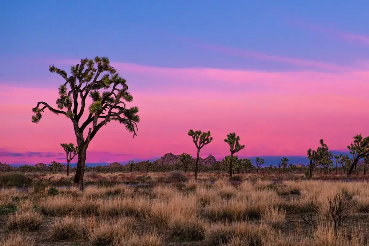
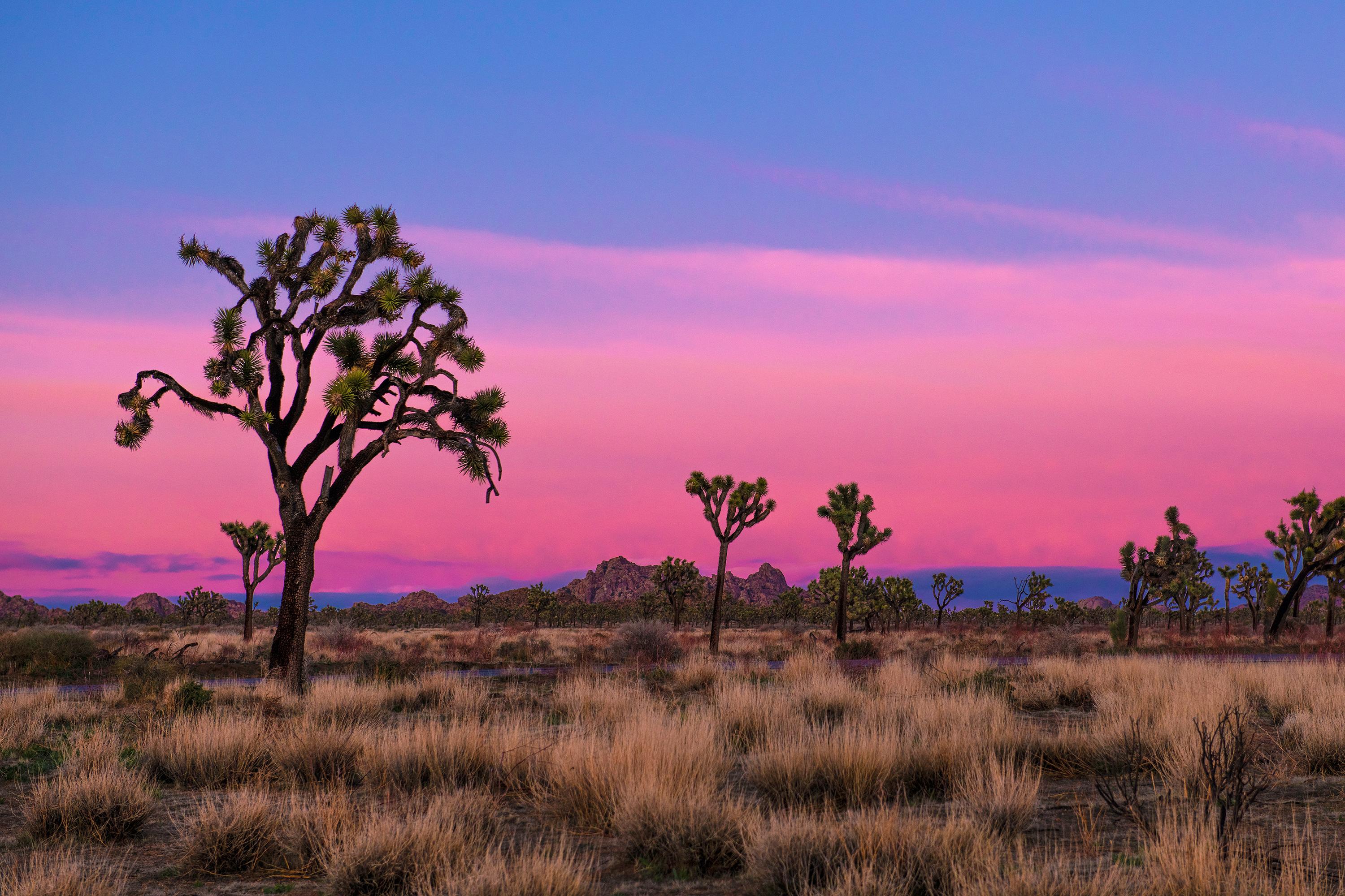
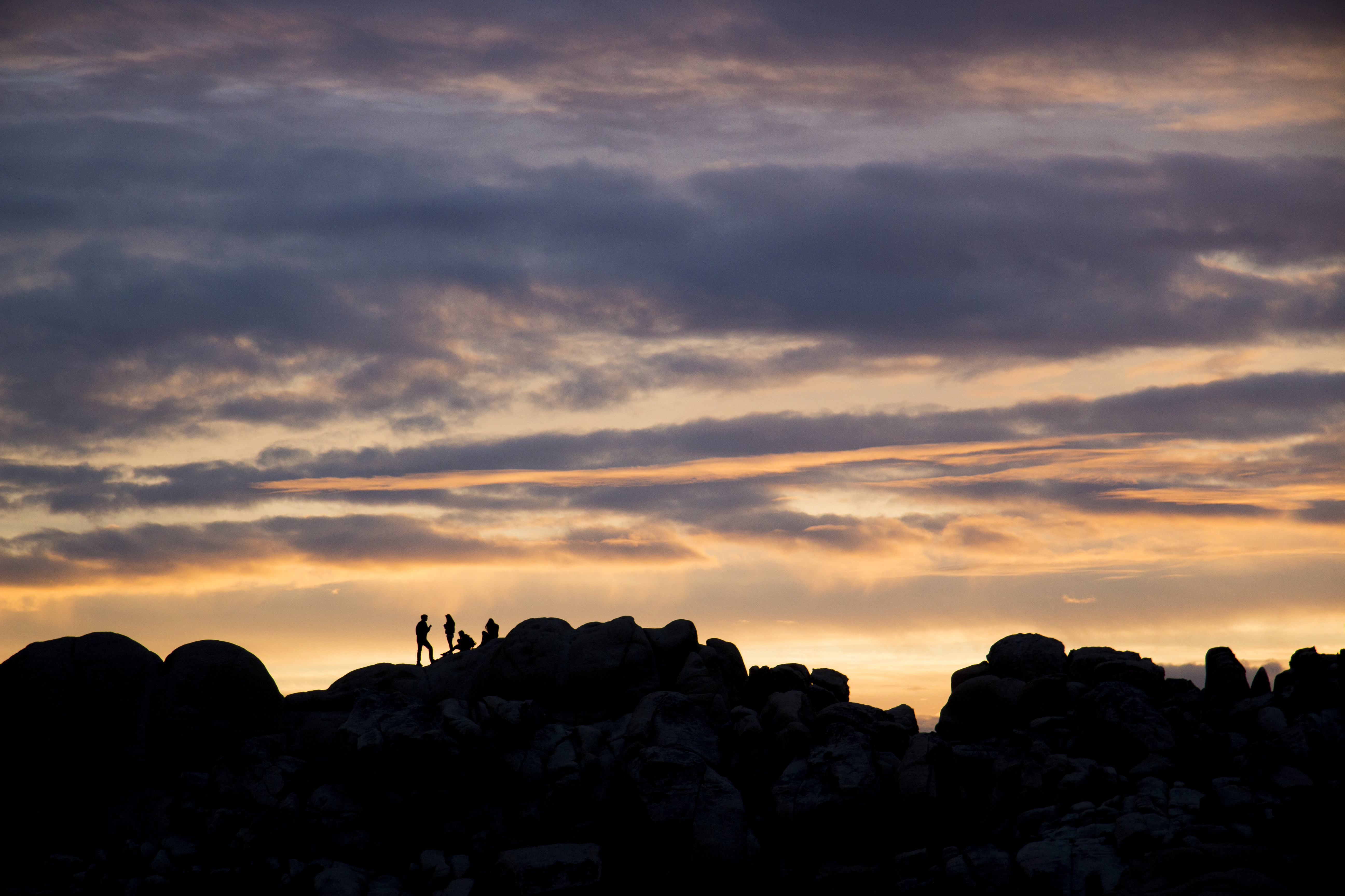
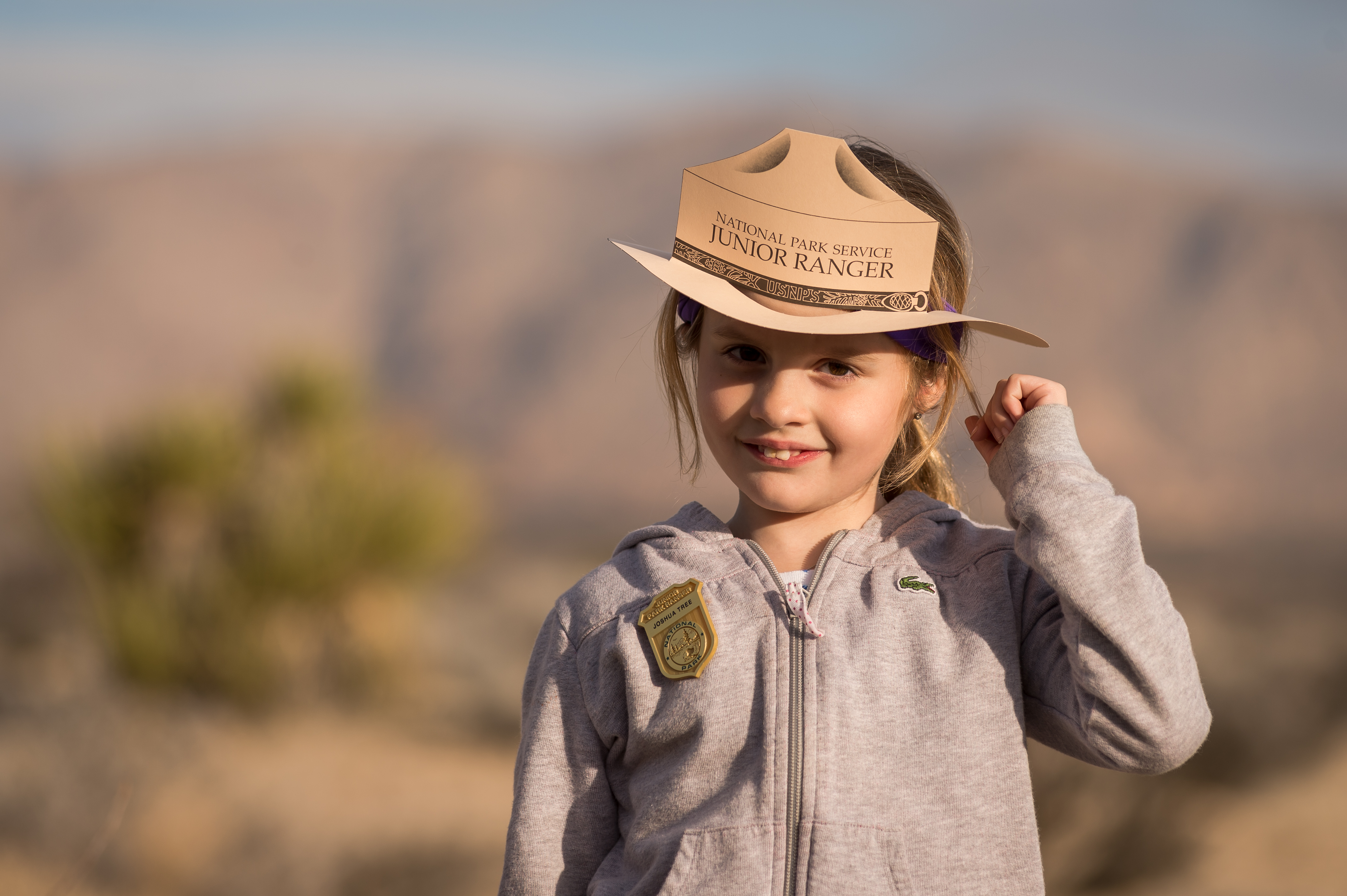
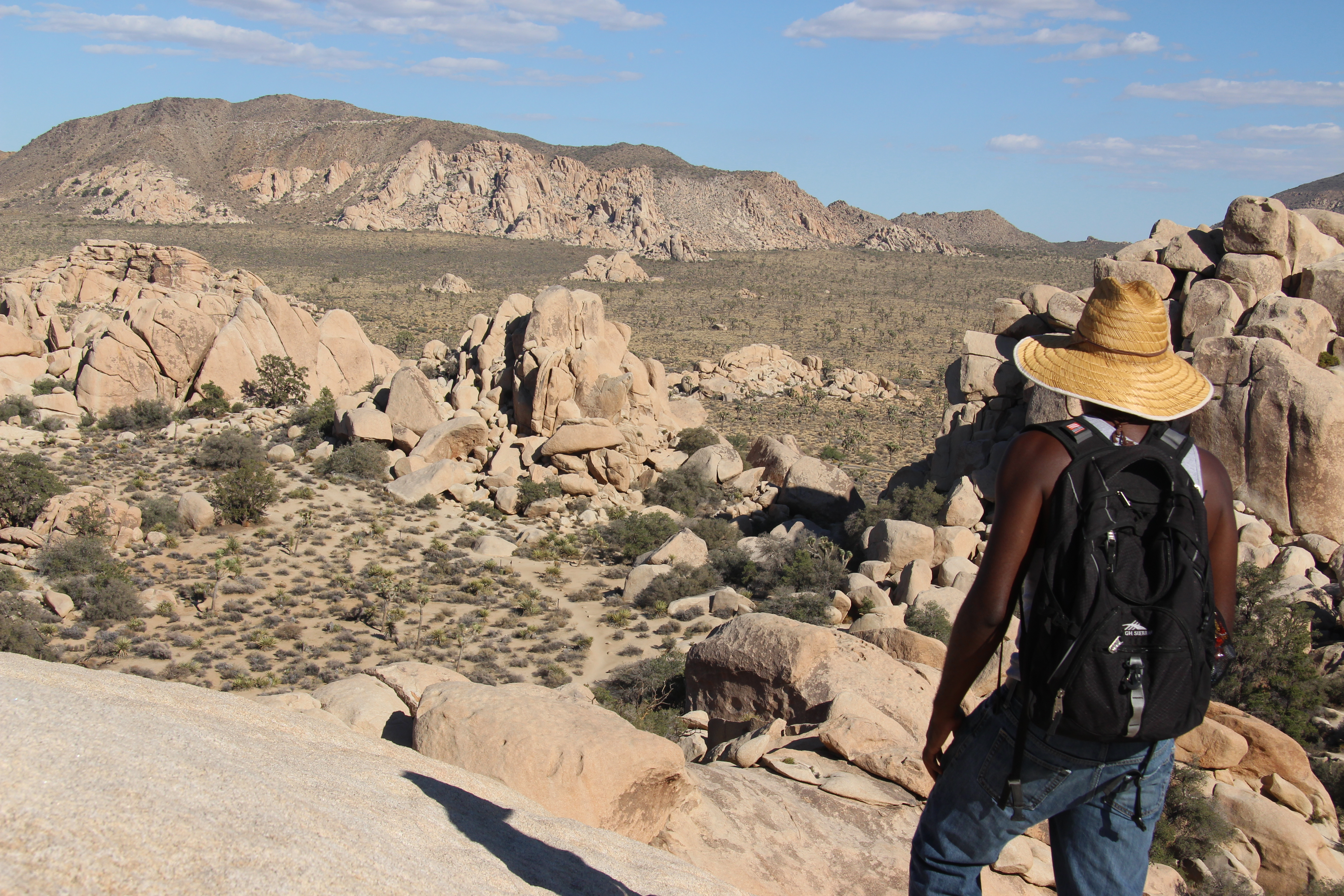
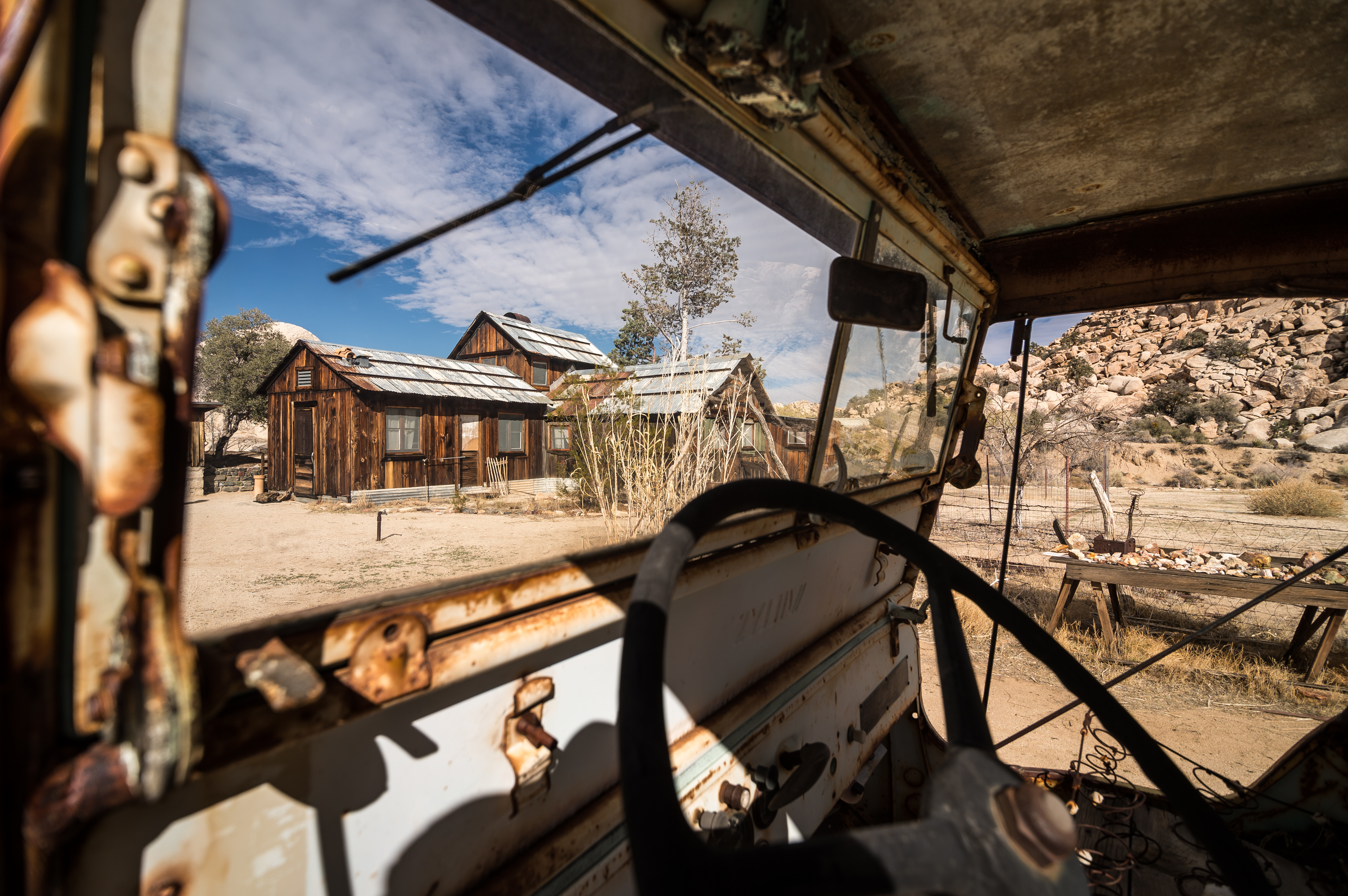
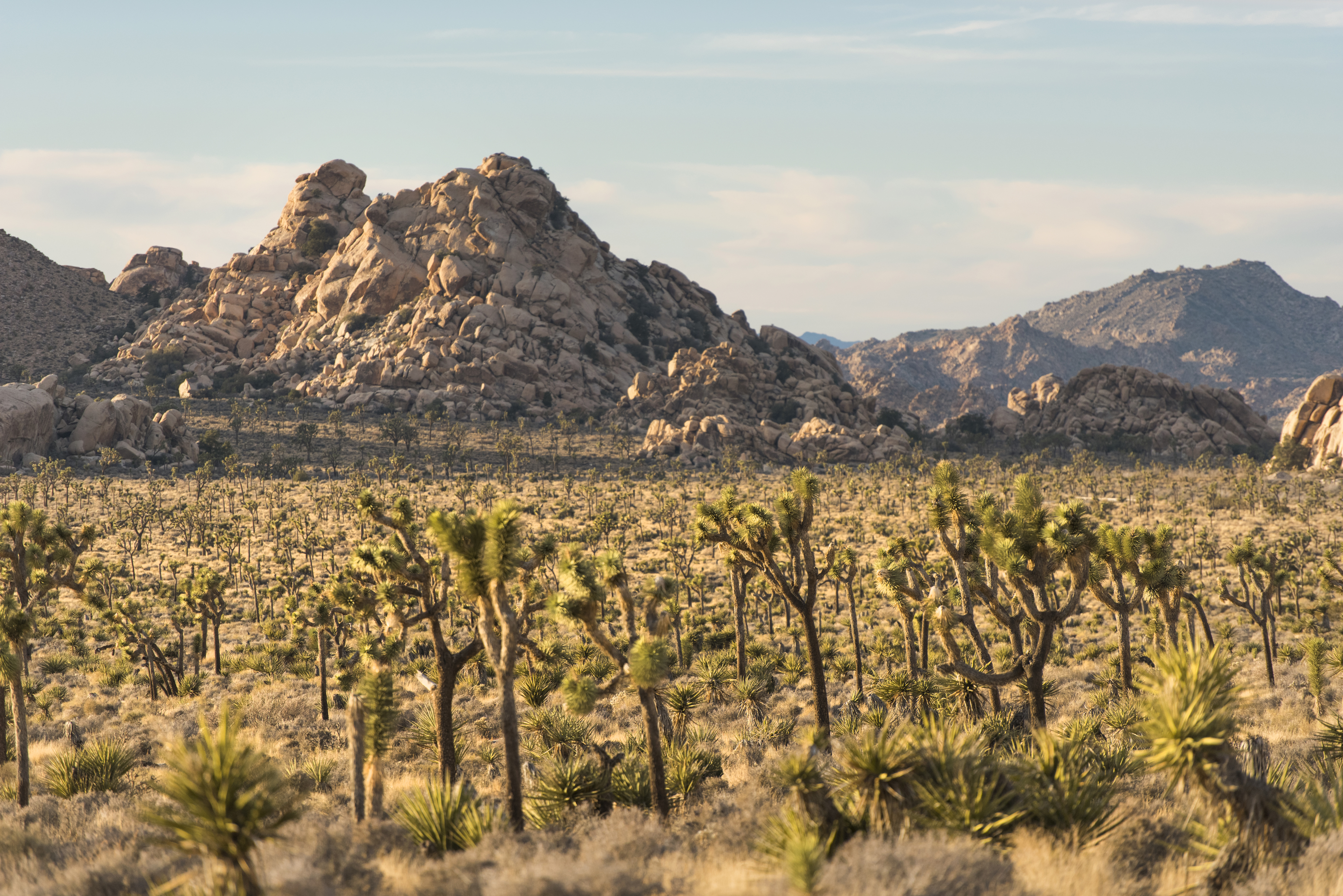


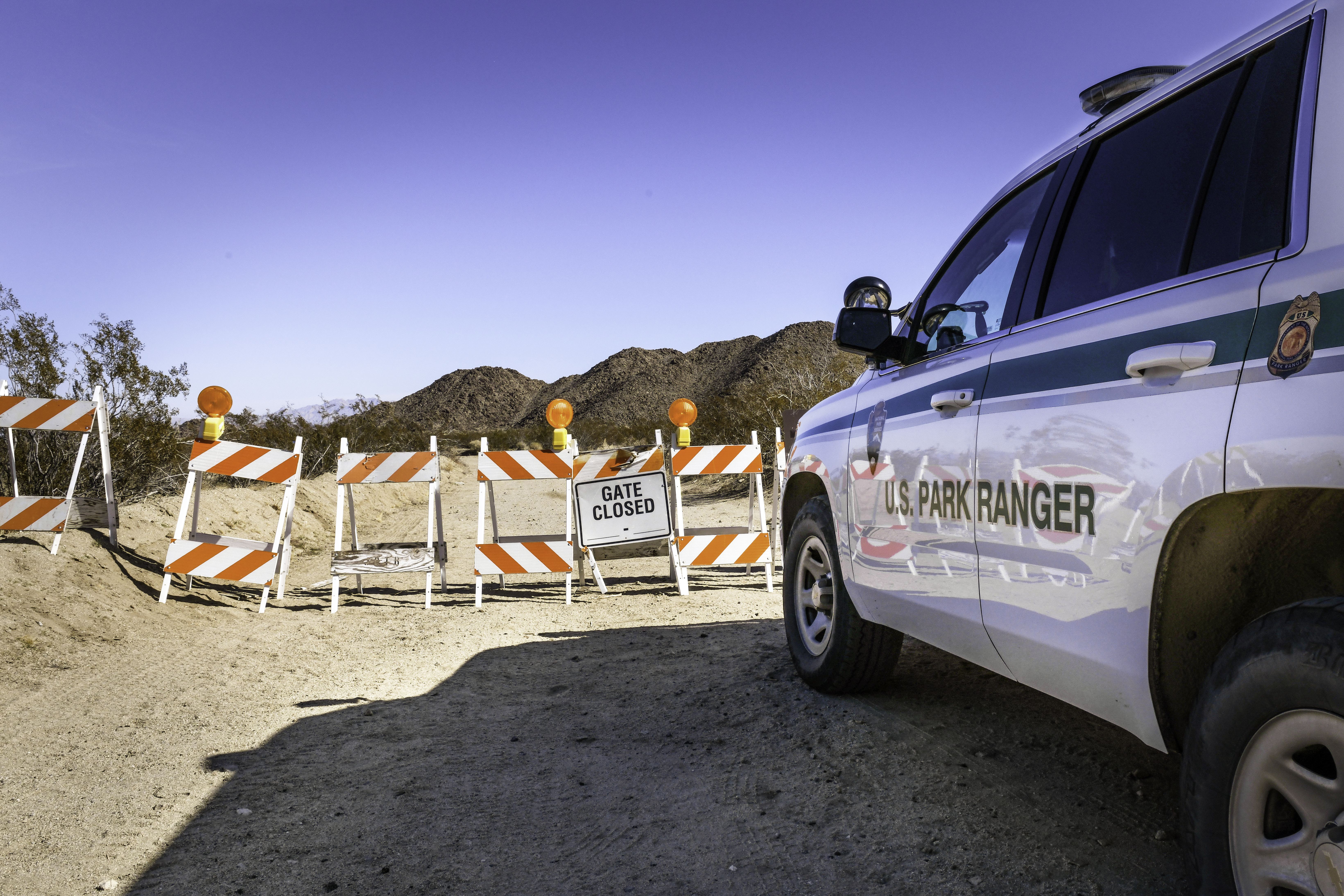
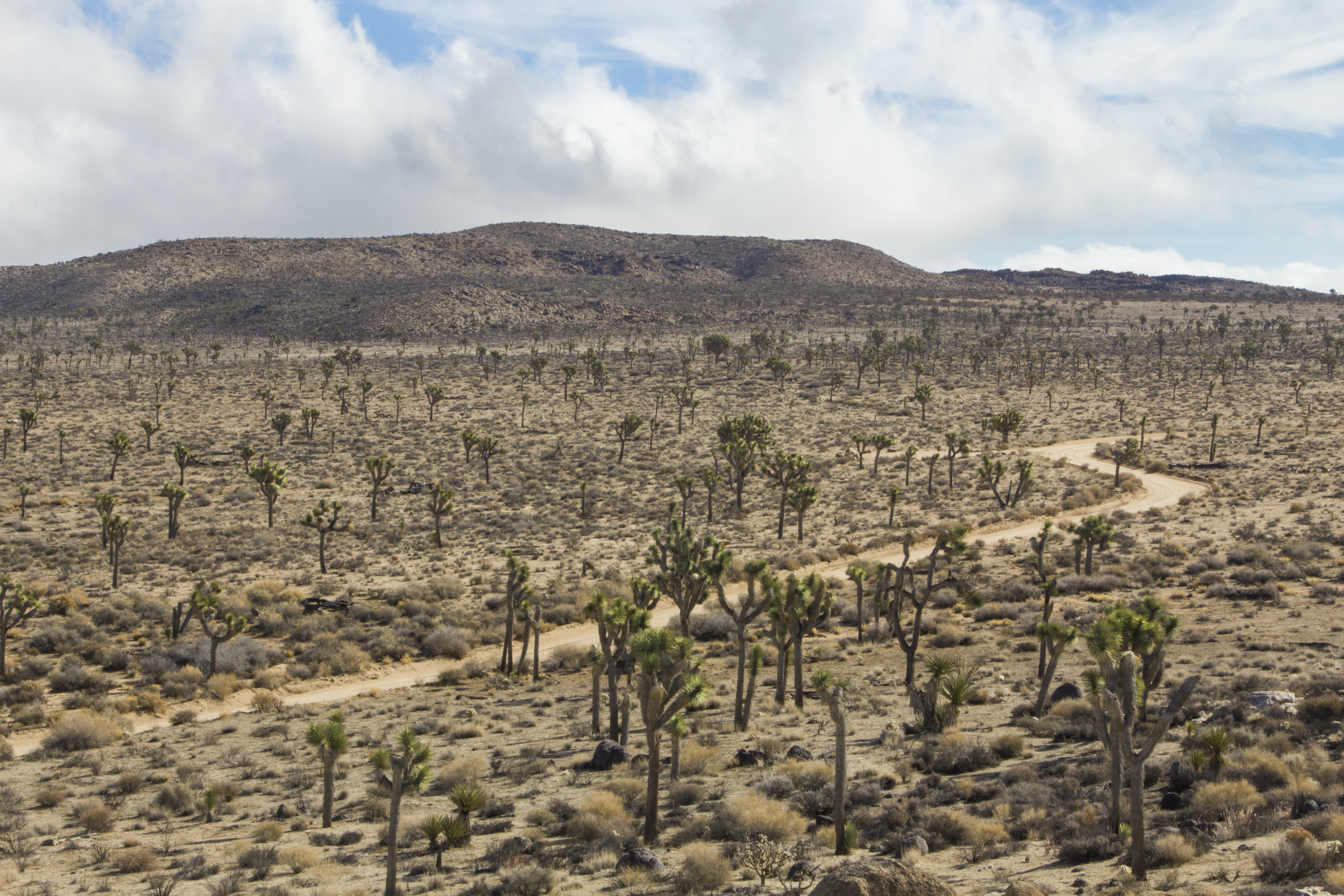
 Coast & islands