Ranked by Weatherchirp’s nearby-town climate comfort score. Includes locations within 150 km. Scores do not measure park access, trail conditions, crowds, or safety.
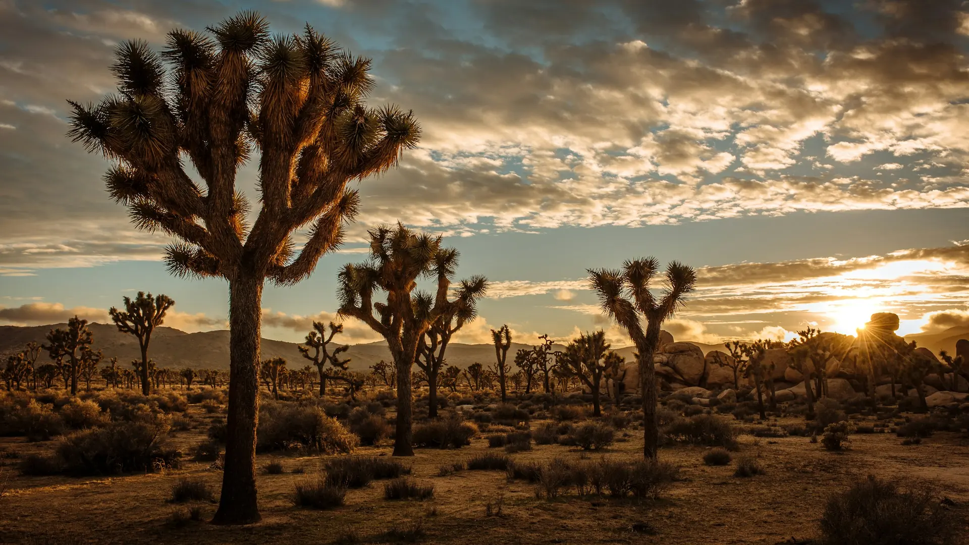
Two distinct desert ecosystems, the Mojave and the Colorado, come together in Joshua Tree National Park. A fascinating variety of plants and animals make their homes in a land sculpted by strong winds and occasional torrents of rain. Dark night skies, a rich cultural history, and surreal geologic features add to the wonder of this vast wilderness in southern California. Come explore for yourself!
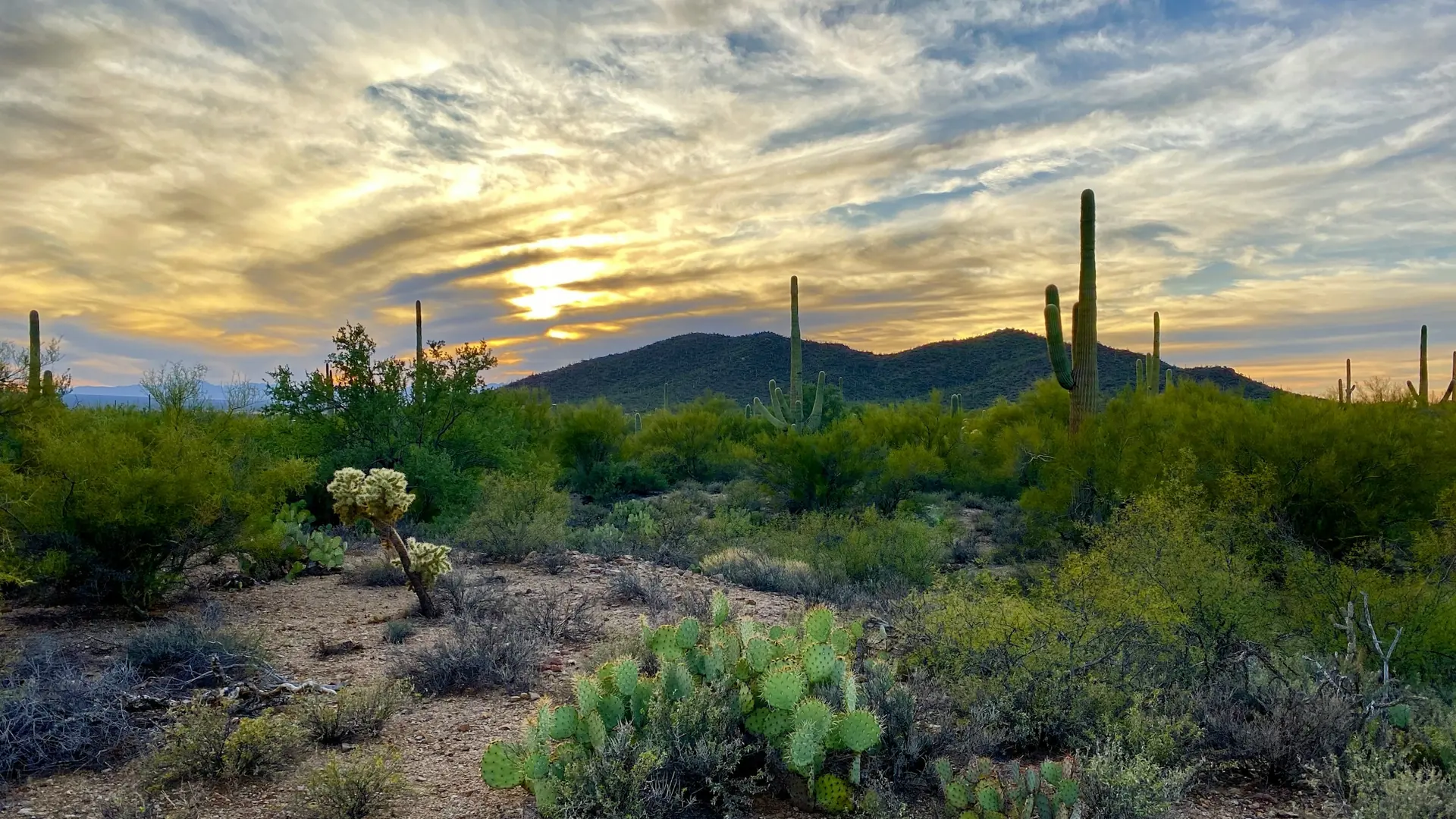
Tucson, Arizona is home to the nation's largest cacti. The giant saguaro is the universal symbol of the American west. These majestic plants, found only in a small portion of the United States, are protected by Saguaro National Park, to the east and west of the modern city of Tucson. Here you have a chance to see these enormous cacti, silhouetted by the beauty of a magnificent desert sunset.
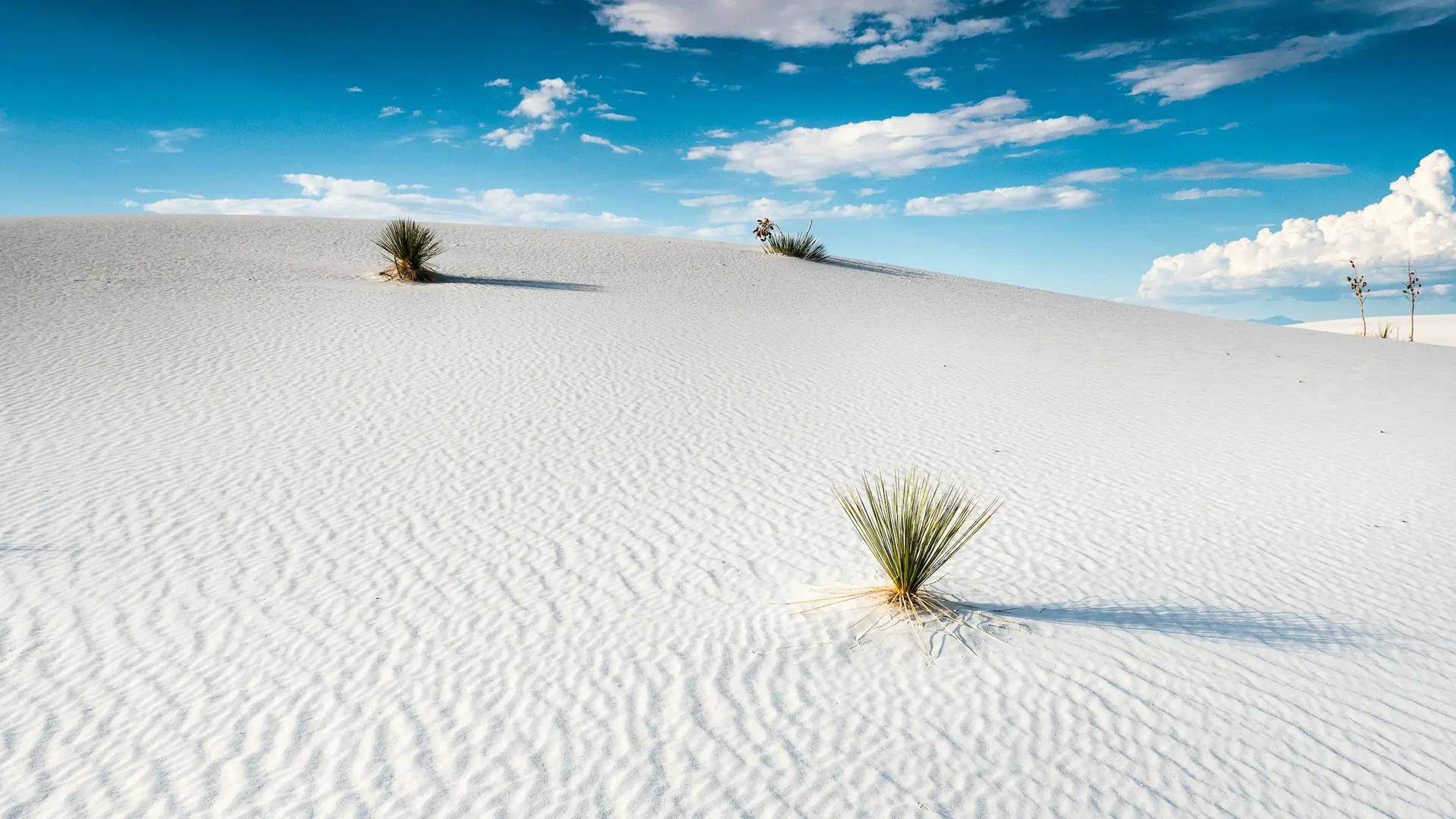
Rising from the heart of the Tularosa Basin is one of the world's great natural wonders - the glistening white sands of New Mexico. Great wave-like dunes of gypsum sand have engulfed 275 square miles of desert, creating the world's largest gypsum dunefield. White Sands National Park preserves a major portion of this unique dunefield, along with the plants and animals that live here.
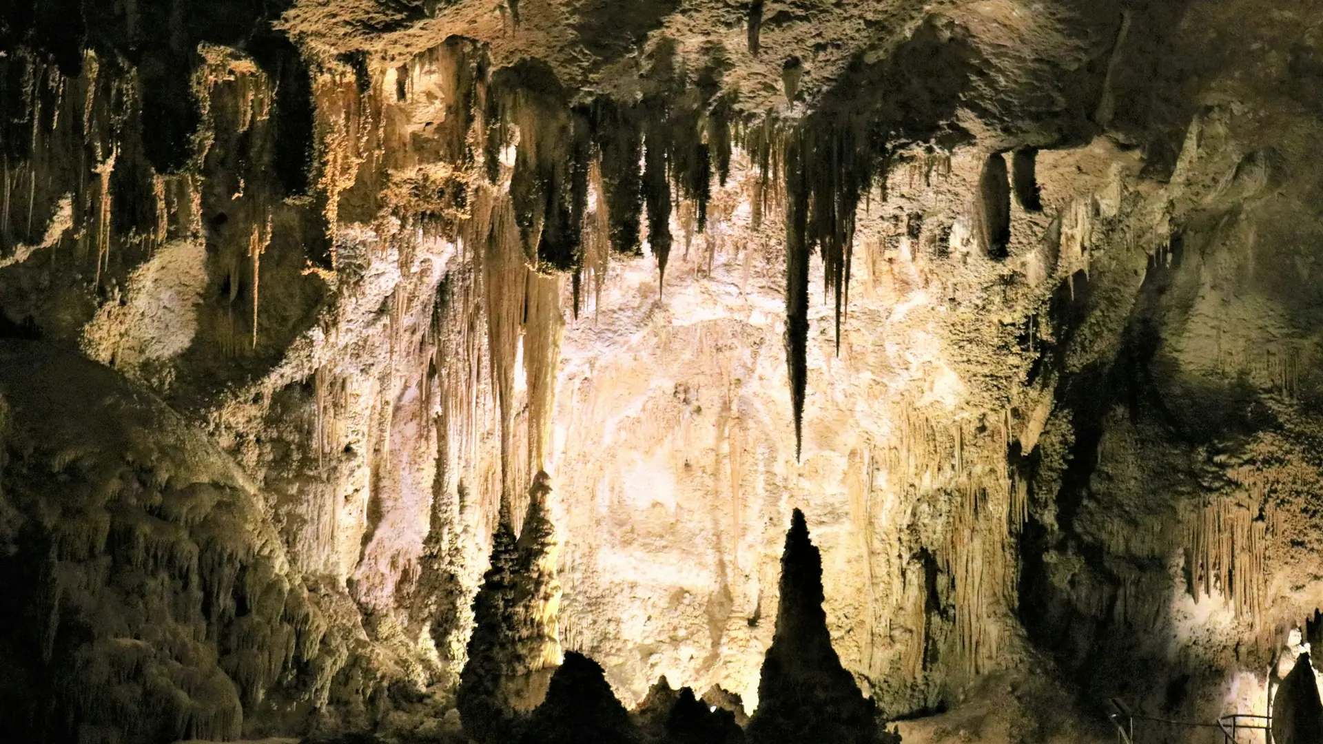
High ancient sea ledges, deep rocky canyons, flowering cactus, and desert wildlife—treasures above the ground in the Chihuahuan Desert. Hidden beneath the surface are more than 119 caves—formed when sulfuric acid dissolved limestone leaving behind caverns of all sizes.
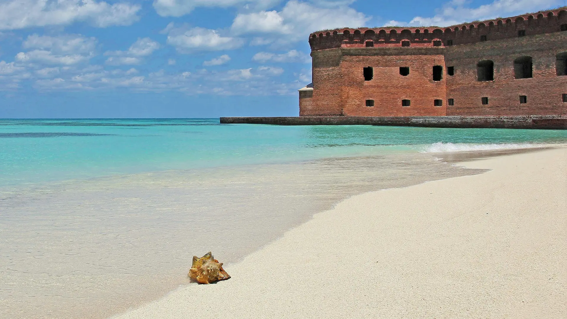
Almost 70 miles (113 km) west of Key West lies the remote Dry Tortugas National Park. This 100-square mile park is mostly open water with seven small islands. Accessible only by boat or seaplane, the park is known the world over as the home of magnificent Fort Jefferson, picturesque blue waters, superlative coral reefs and marine life, and the vast assortment of bird life that frequents the area.
Come experience mountains and canyons, desert and dunes, night skies and spectacular vistas within a place unlike any other. Guadalupe Mountains National Park protects the world's most extensive Permian fossil reef, the four highest peaks in Texas, an environmentally diverse collection of flora and fauna, and the stories of lives shaped through conflict, cooperation and survival.
Selected official access guidance for April. Reviewed coverage currently includes 15 parks; no guidance here means coverage is missing, not that access is clear.
Private vehicle access to Zion Canyon Scenic Drive is restricted while the shuttle operates. Check the published shuttle calendar for your dates; other park roads have different access arrangements.
Before you go: Check shuttle dates and your intended canyon access.
Official guidance ↗ Reviewed 2026-10-18Angels Landing activity permit Dates vary
The chains section requires a permit. Check the travel-year lottery, date and time; this permit is separate from entrance admission and canyon transport.
Before you go: Arrange a permit or choose an alternative outing.
Advance timed-entry reservations are not required for park entry in 2026. Other activity permits and camping arrangements are separate. This announcement does not establish the policy for later years.
Before you go: Review entry policy and activity-specific permits for your travel year.
Winter snow closes the Fairyland Point and Paria View spur roads. Some trails close seasonally, and storms can temporarily close the southern scenic drive. Exact dates depend on conditions.
Before you go: Check winter road and trail status.
Rain and snow can change unpaved-road access quickly. Some roads require permits and suitable four-wheel-drive vehicles. Review the district-specific official road report before a backcountry transfer.
Before you go: Check district, vehicle requirements, and road permits.
Most park roads typically close to regular vehicles from early November until late April. The northern Gardiner–Cooke City route generally remains open; check each intended entrance and road.
Before you go: Check every intended entrance and connecting road.
Teton Park Road winter closure Typical seasonal pattern
The section from Taggart Lake Trailhead to Signal Mountain Lodge closes to vehicles November 1 through April 30. Main highways have different arrangements, and weather still affects travel.
Before you go: Check Teton Park Road and the Yellowstone connection separately.
Official guidance ↗ Reviewed 2026-10-18Taggart Lake construction changes Dates vary
NPS describes changing trail and trailhead access during the 2026–2027 construction project. Do not use the standard Taggart approach without reading the dated project notice. The field guide uses Colter Bay as an alternative.
Hermit Road uses seasonal shuttle access; private-vehicle and winter arrangements differ. Verify the bus timetable and vehicle restrictions before choosing the west-rim day.
Before you go: Confirm your return bus or permitted winter access.
Official guidance ↗ Reviewed 2026-10-18Check dated lodging and waterline notices Dates vary
At the October 18, 2026 source review, NPS listed overnight concessions suspended following August waterline damage. Recheck the dated notice for reopening before booking a village stay; this record is not a live closure report.
Travel-year timed-entry rules distinguish general park access from Bear Lake Road access. Confirm the reservation type, date and entry window for your selected stops.
Do not assume a full alpine road crossing in snow season. Upper and lower sections can have different closures; check the official road report before the alpine day.
Hurricane Ridge, the Hoh and Lake Crescent have separate road and facility conditions. A north-side opening does not establish access to the rainforest or mountain district.
Before you go: Check each district road before committing to the drive.
Tioga Road usually closes for winter. Opening depends on snow and plowing; historical dates are not a forecast. Verify the crossing before booking an east-side base.
Before you go: Verify Tioga Road for your actual travel dates.
Official guidance ↗ Reviewed 2026-10-19Glacier Point Road seasonal access Typical seasonal pattern
Vehicle access is seasonal and depends on snow and road work. Check the official update before including a drive to Glacier Point.
Check the road’s current open sections and construction separately from vehicle reservation policy. A reservation announcement does not establish that the alpine crossing is open.
Before you go: Check the complete crossing and your vehicle restrictions.
Official guidance ↗ Reviewed 2026-10-192026 vehicle reservations Announced · 2026
NPS states vehicle reservations are not required in 2026. Check later-year policy separately; road restrictions and activity permits still apply.
Review each road segment and the dated chain restrictions before choosing an entrance or lodging base. Open lower roads do not establish access to higher districts.
Before you go: Check road access and vehicle chain requirements.
Review each road segment and the dated chain restrictions before choosing an entrance or lodging base. Open lower roads do not establish access to higher districts.
Before you go: Check road access and vehicle chain requirements.
Parking tags are separate from entrance passes Dates vary
Entrance is free, but parking requirements are separate. Check the official tag rules, duration and exceptions; an interagency pass does not replace a parking tag.
Before you go: Check whether your parking needs a tag.
 Desert