FOLLOW THE SEASONS

The right place.
The right time.

Snowy peaks or warm desert mornings? Let the season lead.
Explore nearby climate patterns across all 63 national parks.

Mild-weather picks for July

How we rank

Ranked by Weatherchirp’s nearby-town climate comfort score. Includes locations within 150 km. Scores do not measure park access, trail conditions, crowds, or safety.

Sunset above coastal fog on Santa Cruz Island in Channel Islands National Park.Coast & islands
Photo: Dylan Taylor / Unsplash

California

Channel Islands

Channel Islands National Park encompasses five remarkable islands and their ocean environment, preserving and protecting a wealth of natural and cultural resources. Isolation over thousands of years has created unique animals, plants, and archeological resources found nowhere else on Earth and helped preserve a place where visitors can experience coastal southern California as it once was.

74°daytimeMild-weather months Jul · Aug · Sep
2 days suggested69 trail records
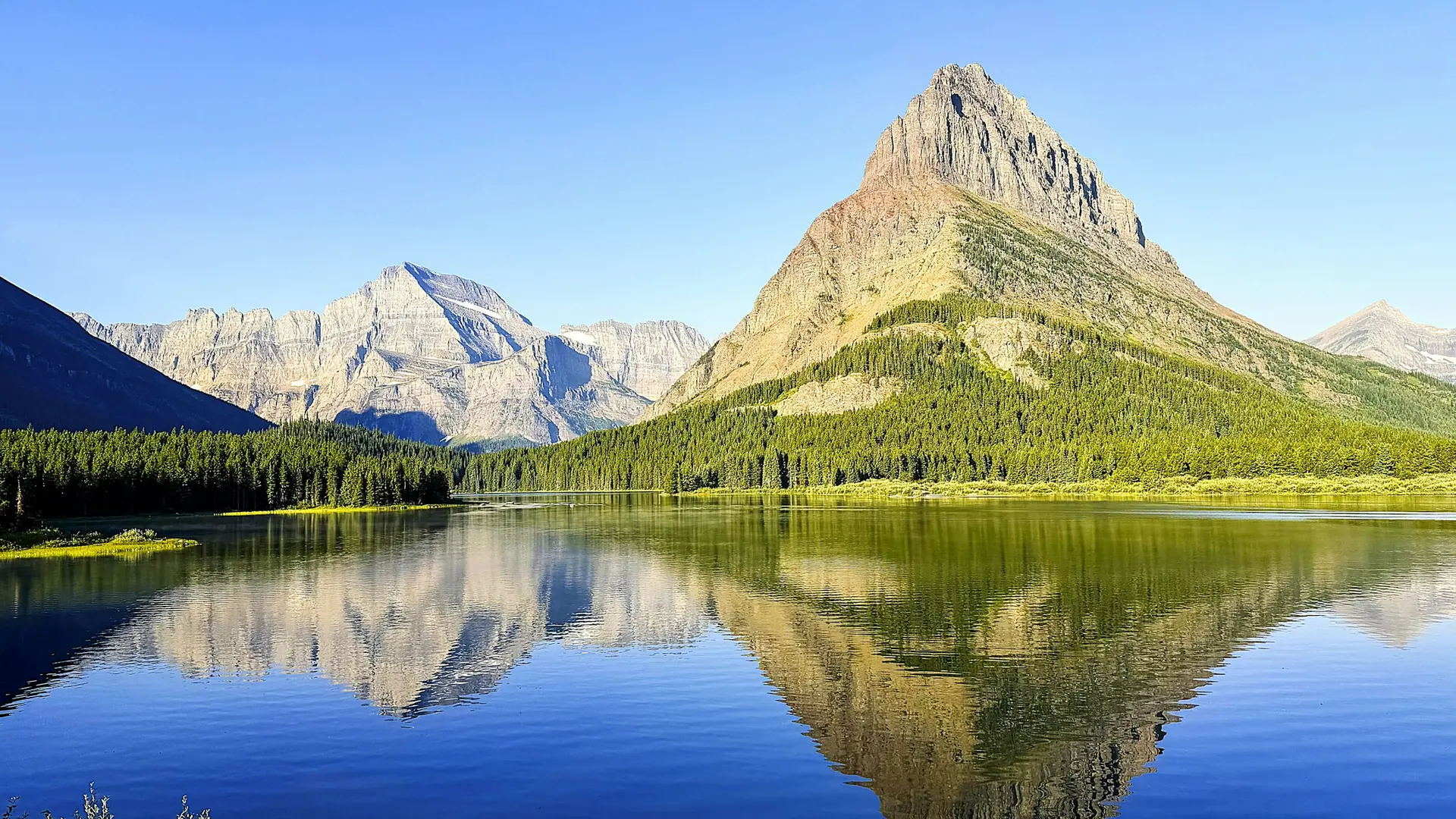
A mountain reflecting in a calm lake with a dense pine forestMountains
Photo: Rich Martello / Unsplash

Montana

Glacier

A showcase of melting glaciers, alpine meadows, carved valleys, and spectacular lakes. With over 700 miles of trails, Glacier is a paradise for adventurous visitors seeking a landscape steeped in human culture. Relive the days of old through historic chalets, lodges, and the famous Going-to-the-Sun Road.

76°daytimeMild-weather months Jul · Aug · Sep
4 days suggested148 trail records
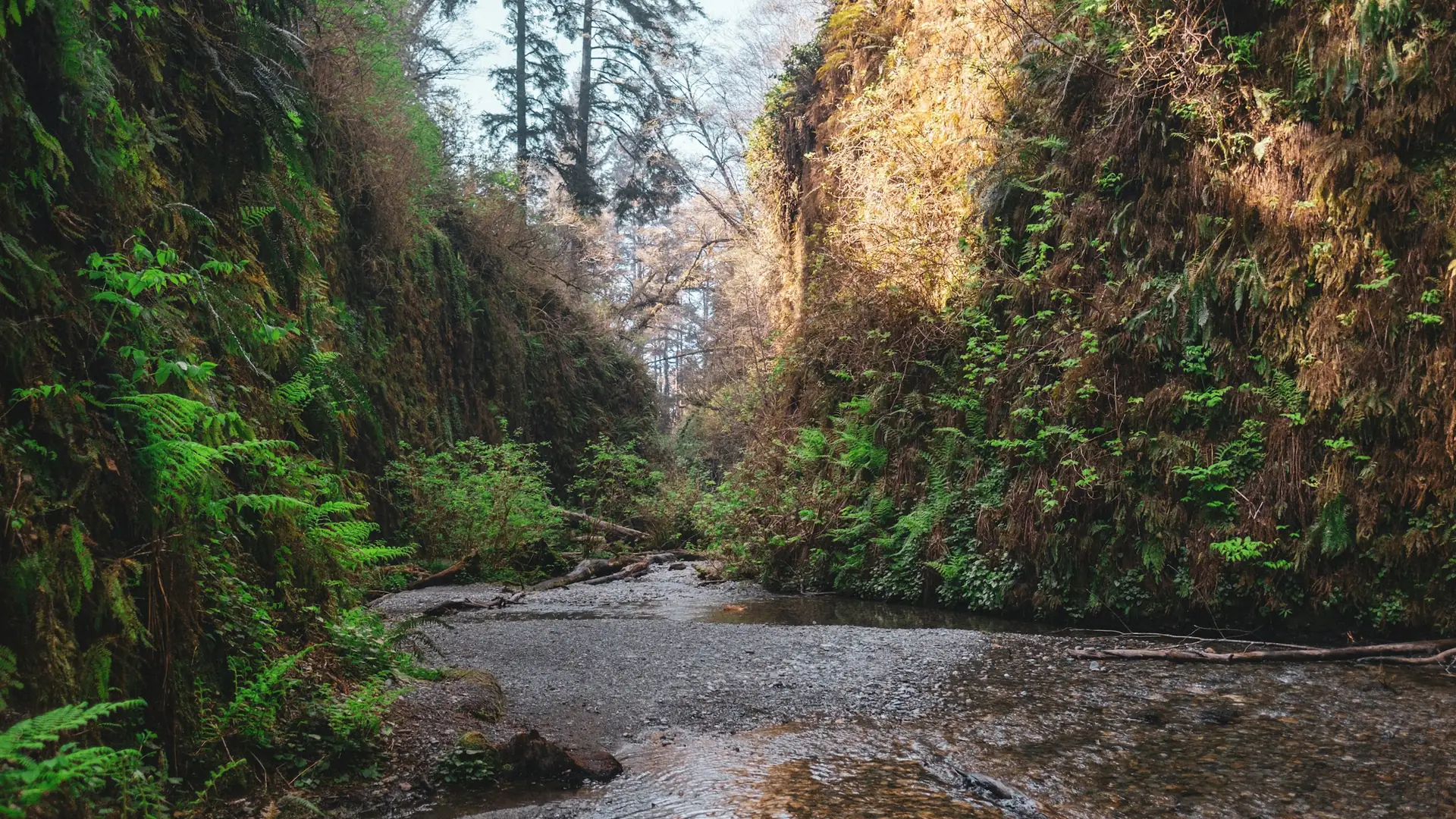
River between green trees during daytimeForests
Photo: Cyrus Crossan / Unsplash

California

Redwood

Renowned for the world’s tallest trees, Redwood’s landscapes span from open prairies and oak woodlands to pristine rivers and untamed coastline. This ancient home has supported people for thousands of years. The National Park Service and California State Parks now work to safeguard and rejuvenate these lands for everyone’s enjoyment, learning, and inspiration.

66°daytimeMild-weather months Jul · Aug · Sep
3 days suggested171 trail records
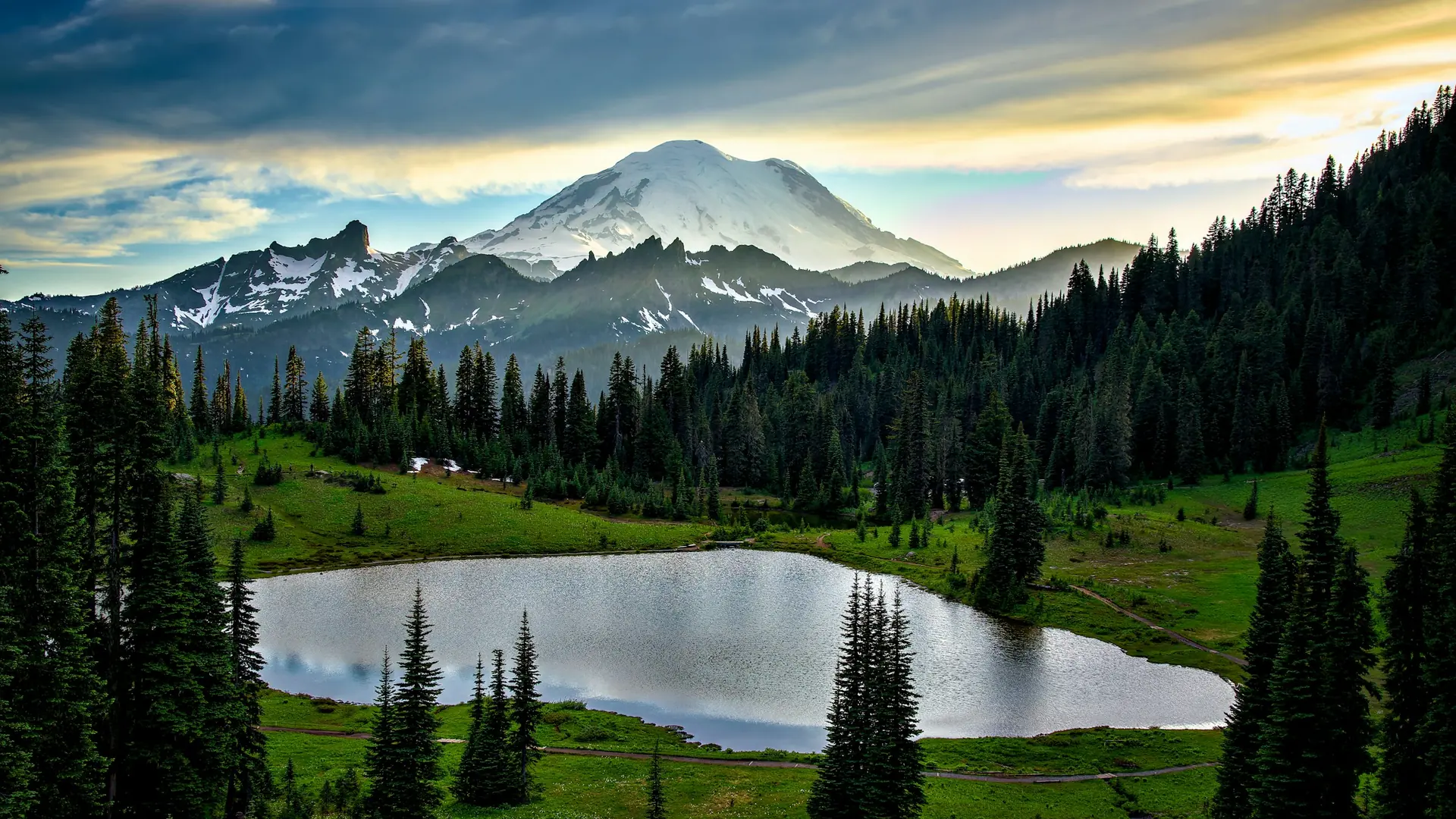
A small lake surrounded by evergreen trees below a snow-capped mountain peakMountains
Photo: Deepak Thapa / Unsplash

Washington

Mount Rainier

Ascending to 14,410 feet above sea level, Mount Rainier stands as an icon in the Washington landscape. An active volcano, Mount Rainier is the most glaciated peak in the contiguous U.S.A., spawning five major rivers. Subalpine wildflower meadows ring the icy volcano while ancient forest cloaks Mount Rainier’s lower slopes. Wildlife abounds in the park’s ecosystems. A lifetime of discovery awaits.

72°daytimeMild-weather months Jul · Aug · Sep
3 days suggested88 trail records
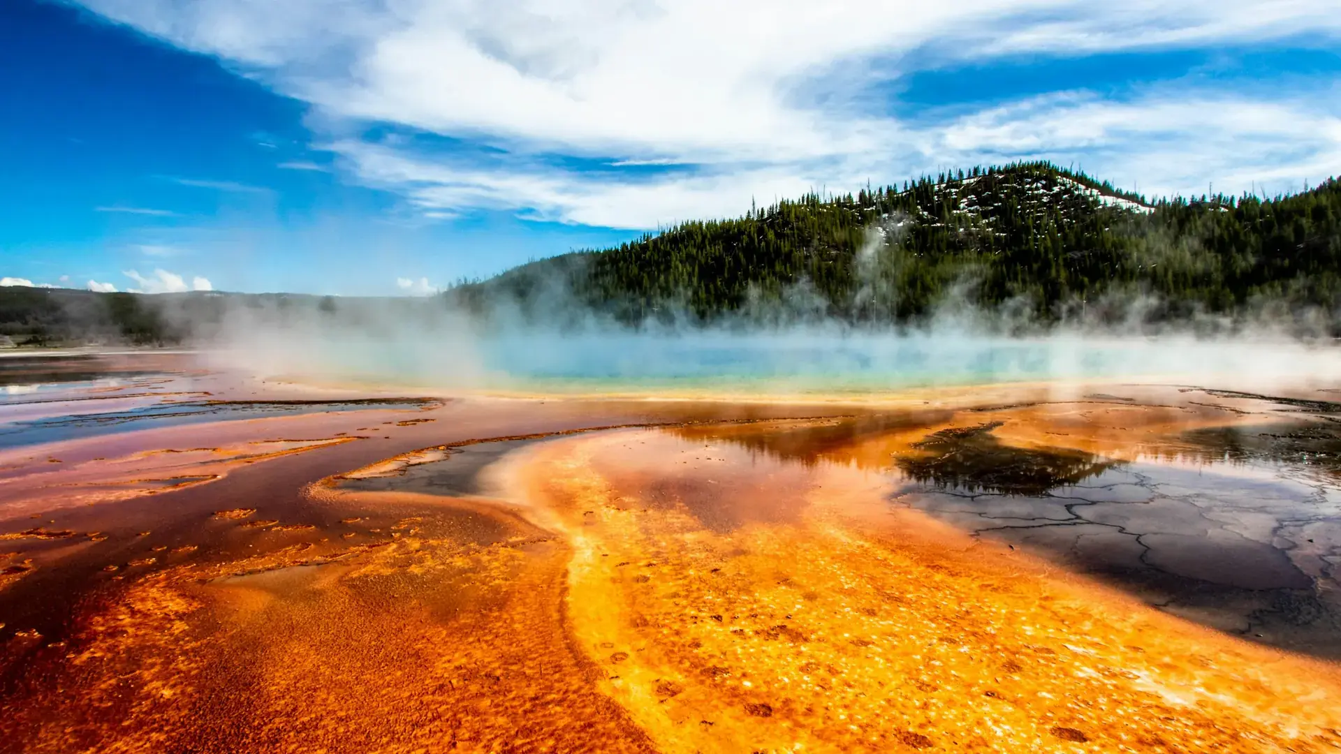
Geyser within mountain range during daytimeVolcanic
Photo: Nicolasintravel / Unsplash

Wyoming · Montana · Idaho

Yellowstone

On March 1, 1872, Yellowstone became the first national park for all to enjoy the unique hydrothermal wonders. Today, millions of people come here each year to camp, hike, and enjoy the majesty of the park.

78°daytimeMild-weather months Jul · Aug · Sep
4 days suggested474 trail records
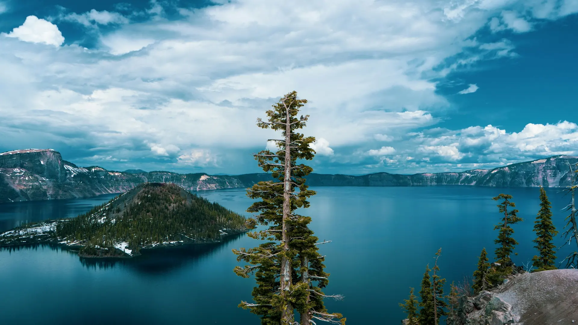
A view of a large body of water from a hillVolcanic
Photo: Dan Meyers / Unsplash

Oregon

Crater Lake

Crater Lake inspires awe. Native Americans witnessed its formation 7,700 years ago, when a violent eruption triggered the collapse of a tall peak. Scientists marvel at its purity—fed by rain and snow, it’s the deepest lake in the USA and one of the most pristine on Earth. Artists, photographers, and sightseers gaze in wonder at its blue water and stunning setting atop the Cascade Mountain Range.

84°daytimeMild-weather months Jun · Aug · Sep
2 days suggested39 trail records

Climate is one part of the plan.

Selected official access guidance for July. Reviewed coverage currently includes 15 parks; no guidance here means coverage is missing, not that access is clear.

Zion →

Seasonal access & reservations

Zion Canyon shuttle access Dates vary

Private vehicle access to Zion Canyon Scenic Drive is restricted while the shuttle operates. Check the published shuttle calendar for your dates; other park roads have different access arrangements.

Before you go: Check shuttle dates and your intended canyon access.

Official guidance ↗ Reviewed 2026-10-18
Angels Landing activity permit Dates vary

The chains section requires a permit. Check the travel-year lottery, date and time; this permit is separate from entrance admission and canyon transport.

Before you go: Arrange a permit or choose an alternative outing.

Official guidance ↗ Reviewed 2026-10-19

Selected guidance only; separate from climate comfort and current conditions.

Arches →

Seasonal access & reservations

2026 entrance reservations Announced · 2026

Advance timed-entry reservations are not required for park entry in 2026. Other activity permits and camping arrangements are separate. This announcement does not establish the policy for later years.

Before you go: Review entry policy and activity-specific permits for your travel year.

Official guidance ↗ Reviewed 2026-10-18

Selected guidance only; separate from climate comfort and current conditions.

Canyonlands →

Seasonal access & reservations

Backcountry road access Dates vary

Rain and snow can change unpaved-road access quickly. Some roads require permits and suitable four-wheel-drive vehicles. Review the district-specific official road report before a backcountry transfer.

Before you go: Check district, vehicle requirements, and road permits.

Official guidance ↗ Reviewed 2026-10-18

Selected guidance only; separate from climate comfort and current conditions.

Yellowstone →

Seasonal access & reservations

2026 South Entrance projection Announced · 2026

NPS projects regular vehicle access from the South Entrance to West Thumb for May 8 through October 31, 2026. Weather can change these dates; this is an announced schedule, not current road status.

Official guidance ↗ Reviewed 2026-10-18

Selected guidance only; separate from climate comfort and current conditions.

Grand Teton →

Seasonal access & reservations

Taggart Lake construction changes Dates vary

NPS describes changing trail and trailhead access during the 2026–2027 construction project. Do not use the standard Taggart approach without reading the dated project notice. The field guide uses Colter Bay as an alternative.

Official guidance ↗ Reviewed 2026-10-18

Selected guidance only; separate from climate comfort and current conditions.

Grand Canyon →

Seasonal access & reservations

Hermit Road seasonal transport Dates vary

Hermit Road uses seasonal shuttle access; private-vehicle and winter arrangements differ. Verify the bus timetable and vehicle restrictions before choosing the west-rim day.

Before you go: Confirm your return bus or permitted winter access.

Official guidance ↗ Reviewed 2026-10-18
Check dated lodging and waterline notices Dates vary

At the October 18, 2026 source review, NPS listed overnight concessions suspended following August waterline damage. Recheck the dated notice for reopening before booking a village stay; this record is not a live closure report.

Official guidance ↗ Reviewed 2026-10-18

Selected guidance only; separate from climate comfort and current conditions.

Rocky Mountain →

Seasonal access & reservations

Bear Lake and timed-entry reservations Dates vary

Travel-year timed-entry rules distinguish general park access from Bear Lake Road access. Confirm the reservation type, date and entry window for your selected stops.

Official guidance ↗ Reviewed 2026-10-18
Trail Ridge Road seasonal access Dates vary

Do not assume a full alpine road crossing in snow season. Upper and lower sections can have different closures; check the official road report before the alpine day.

Official guidance ↗ Reviewed 2026-10-18

Selected guidance only; separate from climate comfort and current conditions.

Olympic →

Seasonal access & reservations

Separate district road checks Dates vary

Hurricane Ridge, the Hoh and Lake Crescent have separate road and facility conditions. A north-side opening does not establish access to the rainforest or mountain district.

Before you go: Check each district road before committing to the drive.

Official guidance ↗ Reviewed 2026-10-18

Selected guidance only; separate from climate comfort and current conditions.

Yosemite →

Seasonal access & reservations

Tioga Road and east-side access Dates vary

Tioga Road usually closes for winter. Opening depends on snow and plowing; historical dates are not a forecast. Verify the crossing before booking an east-side base.

Before you go: Verify Tioga Road for your actual travel dates.

Official guidance ↗ Reviewed 2026-10-19

Selected guidance only; separate from climate comfort and current conditions.

Glacier →

Seasonal access & reservations

Going-to-the-Sun Road access Dates vary

Check the road’s current open sections and construction separately from vehicle reservation policy. A reservation announcement does not establish that the alpine crossing is open.

Before you go: Check the complete crossing and your vehicle restrictions.

Official guidance ↗ Reviewed 2026-10-19
2026 vehicle reservations Announced · 2026

NPS states vehicle reservations are not required in 2026. Check later-year policy separately; road restrictions and activity permits still apply.

Official guidance ↗ Reviewed 2026-10-19

Selected guidance only; separate from climate comfort and current conditions.

Acadia →

Seasonal access & reservations

Cadillac Summit Road reservation Announced · 2026

A separate vehicle reservation is required May 20–October 25, 2026. Release windows are 90 days and two days ahead at 10 am Eastern; check the official schedule.

Before you go: Confirm Cadillac reservation date, entry window and release time.

Official guidance ↗ Reviewed 2026-10-19
Check your travel-year Cadillac rules Dates vary

Cadillac vehicle reservations and park admission are separate. Published 2026 dates do not establish the policy for another year.

Official guidance ↗ Reviewed 2026-10-19

Selected guidance only; separate from climate comfort and current conditions.

Sequoia →

Seasonal access & reservations

Mountain road and chain requirements Dates vary

Review each road segment and the dated chain restrictions before choosing an entrance or lodging base. Open lower roads do not establish access to higher districts.

Before you go: Check road access and vehicle chain requirements.

Official guidance ↗ Reviewed 2026-10-19

Selected guidance only; separate from climate comfort and current conditions.

Kings Canyon →

Seasonal access & reservations

Mountain road and chain requirements Dates vary

Review each road segment and the dated chain restrictions before choosing an entrance or lodging base. Open lower roads do not establish access to higher districts.

Before you go: Check road access and vehicle chain requirements.

Official guidance ↗ Reviewed 2026-10-19

Selected guidance only; separate from climate comfort and current conditions.

Great Smoky Mountains →

Seasonal access & reservations

Parking tags are separate from entrance passes Dates vary

Entrance is free, but parking requirements are separate. Check the official tag rules, duration and exceptions; an interagency pass does not replace a parking tag.

Before you go: Check whether your parking needs a tag.
Official guidance ↗ Reviewed 2026-10-19

Selected guidance only; separate from climate comfort and current conditions.

THE BIG PICTURE

Your year of possibilities.

Typical daytime highs · °F
National park
Acadia30°31°38°48°57°66°72°72°66°56°45°35°
American Samoa82°82°82°82°82°81°80°80°80°81°82°82°
Arches39°46°57°64°75°87°92°89°80°66°52°40°
Badlands36°38°46°54°64°74°82°81°72°58°46°37°
Big Bend65°71°79°87°94°98°96°95°90°84°73°65°
Biscayne74°75°77°80°82°84°86°86°85°82°78°75°
Black Canyon of the Gunnison37°41°50°58°70°82°86°83°75°63°48°38°
Bryce Canyon37°40°47°55°66°79°84°82°74°61°47°37°
Canyonlands39°46°57°64°75°87°92°89°80°66°52°40°
Capitol Reef39°46°57°64°75°87°92°89°80°66°52°40°
Carlsbad Caverns58°63°71°79°88°95°95°93°87°77°66°58°
Channel Islands61°61°62°65°67°70°74°75°74°71°66°61°
Congaree56°59°67°75°82°88°90°89°84°75°65°58°
Crater Lake39°43°48°55°65°74°84°83°76°62°47°38°
Cuyahoga Valley34°37°46°59°69°78°81°79°73°61°49°38°
Death Valley53°56°63°70°79°89°94°93°86°74°61°52°
Denali *3°12°25°44°60°70°71°65°54°33°14°6°
Dry Tortugas73°73°74°77°80°83°84°84°83°81°77°75°
Everglades75°77°80°83°85°87°88°89°87°85°80°77°
Gates of the Arctic *3°12°25°44°60°70°71°65°54°33°14°6°
Gateway Arch39°44°55°66°75°84°87°86°79°67°54°43°
Glacier28°31°38°48°58°66°76°76°65°49°36°27°
Glacier Bay *27°29°33°41°50°58°60°59°53°43°33°29°
Grand Canyon46°50°58°65°76°87°90°88°81°69°57°46°
Grand Teton30°35°45°55°65°75°85°84°73°58°42°31°
Great Basin *37°40°47°55°66°79°84°82°74°61°47°37°
Great Sand Dunes37°40°48°54°64°75°80°77°71°60°46°37°
Great Smoky Mountains46°50°58°67°73°80°82°82°77°67°57°49°
Guadalupe Mountains58°63°71°79°88°95°95°93°87°77°66°58°
Haleakalā77°76°77°79°80°82°83°84°84°83°80°78°
Hawaiʻi Volcanoes73°72°72°73°74°75°76°77°77°77°75°73°
Hot Springs51°55°64°72°80°87°91°90°84°73°62°53°
Indiana Dunes32°35°45°57°68°78°82°80°74°62°48°37°
Isle Royale15°19°30°43°55°65°72°71°62°48°34°22°
Joshua Tree62°65°71°77°85°94°99°98°92°82°70°61°
Katmai *21°26°32°42°51°59°62°61°54°41°29°23°
Kenai Fjords21°26°32°42°51°59°62°61°54°41°29°23°
Kings Canyon59°62°67°73°82°91°96°96°90°79°66°58°
Kobuk Valley *3°12°25°44°60°70°71°65°54°33°14°6°
Lake Clark *21°26°32°42°51°59°62°61°54°41°29°23°
Lassen Volcanic38°41°46°53°64°75°85°84°75°62°47°37°
Mammoth Cave45°49°59°69°77°85°88°87°82°70°57°48°
Mesa Verde35°38°46°54°65°77°81°78°71°59°46°35°
Mount Rainier44°46°50°55°61°65°72°73°67°57°48°43°
New River Gorge40°44°52°63°69°76°79°78°73°63°53°44°
North Cascades37°40°45°51°58°62°69°69°64°53°42°36°
Olympic39°40°42°46°53°58°64°64°60°51°43°38°
Petrified Forest41°46°55°63°72°83°85°82°76°65°53°42°
Pinnacles58°59°63°67°73°80°86°86°82°75°64°57°
Redwood51°52°53°55°58°62°66°67°65°61°54°51°
Rocky Mountain31°32°39°44°54°66°72°70°63°51°39°31°
Saguaro60°63°70°77°86°95°94°92°89°80°69°60°
Sequoia58°61°65°70°78°87°94°93°87°77°65°58°
Shenandoah44°47°56°67°75°83°87°85°79°68°56°47°
Theodore Roosevelt25°28°40°52°64°74°81°81°70°55°39°28°
Virgin Islands78°77°78°78°80°82°82°82°83°82°81°79°
Voyageurs17°22°35°51°64°72°76°74°66°51°34°22°
White Sands50°55°63°70°79°87°87°85°80°71°59°50°
Wind Cave36°38°46°54°64°74°82°81°72°58°46°37°
Wrangell–St. Elias *-7°4°21°41°57°66°68°63°51°30°6°-3°
Yellowstone28°31°39°47°58°67°78°77°66°51°37°28°
Yosemite59°63°68°75°83°91°96°95°89°79°67°58°
Zion46°50°58°66°76°87°92°90°82°70°56°46°

* Source town more than 150 km away; regional context only. Each park page identifies the climate source location and distance.